
PORTFOLIO JINYU ZHANG
UNIVERSITY OF NEW SOUTH WALES
MASTER OF LANDSCAPE ARCHITECTURE

JINYU (JANE) ZHANG
Jinyu is interested in urban landscape design and the well-being of the community. She worked with Vital Stone Landscaping as an intern, and had experience in garden design and construction. During this period, Jinyu developed the skill of softwares, including AdobeSuite for design and layout, AutoCAD for documentation, and 3D modelling ability with SketchUp and Enscape. She also developed the ability of communication and collaboration with clients and the construction team. Jinyu also has experience with research, she is now working with the Chinese Academy of Sciences as research assistance, doing literature reviews, case analysis, and data organisation.
During the study in university, Jinyu got good grades and got the university award from the Dean's List, and the master graduating project award the Harry Howard Postgraduate Prize. Besides that, Jinyu also joined various volunteer programs. She became a teaching assistan for year 1 studio course, shared the knowledge about site analysis, graphic making, and the use of programs. Jinyu is enthusiastic about the local community and environment. She joined the bushcare volunteer to rehabitat the endangered ecological community with Randwick City Council.
EDUCATION & AWARD
University of New South Wales, Australia
Bachelor of Landscape Architecture(Hons)
Master of Landscape Architecture
Award: The Faculty of Arts, Design & Architecture Dean's List 2021
Harry Howard Postgraduate Prize
WORK EXPERIENCE
Research Assistance
04/2024 to now, with Chinese Academy of Sciences
Collecting and organising data, reviewing literature, conducting case analysis, and assisting in national project application
Bushcare Volunteer
01/2023-10/2023, with Randwick City Council, Sydney
Cleaning weeds and planting new plants, protecting the native endangered ecological community.
Landscape Design Intenrship
05/2022 to 12/2022, with Vital Stone Landscaping, Sydney
Site visit and analysis, CAD drawing, 3D rendering, meeting with client
Teaching assistant
06/2022 to 08/2022, with University of New South Wales
Teaching assistant of Year 1 Studio, share the knowledge about site analysis, drawing skill, and Indesign layout.
SKILL
AdobeSuite
CAD
Rhino & Sketchup
Enscape
QGIS
Grasshopper
PLAY REVOLUTION
MASTER GRADUATING PROJECT
LIVERPOOL URBAN
SYDNEY BIRD CENTER LANDSCAPE SYSTEM AND PERFORMANCE 01 02 05
COFFS HARBOUR COMMUNITY DESIGN
LANDSCAPE OUTREACH STUDIO
URBAN LANDSCAPE DESIGN 03

LANDSCAPE DESIGN
LOCAL MINING BACHELOR GRADUATING PROJECT
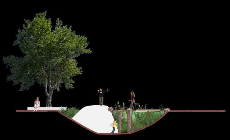
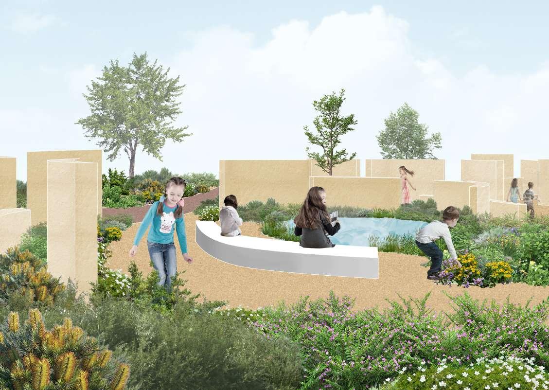
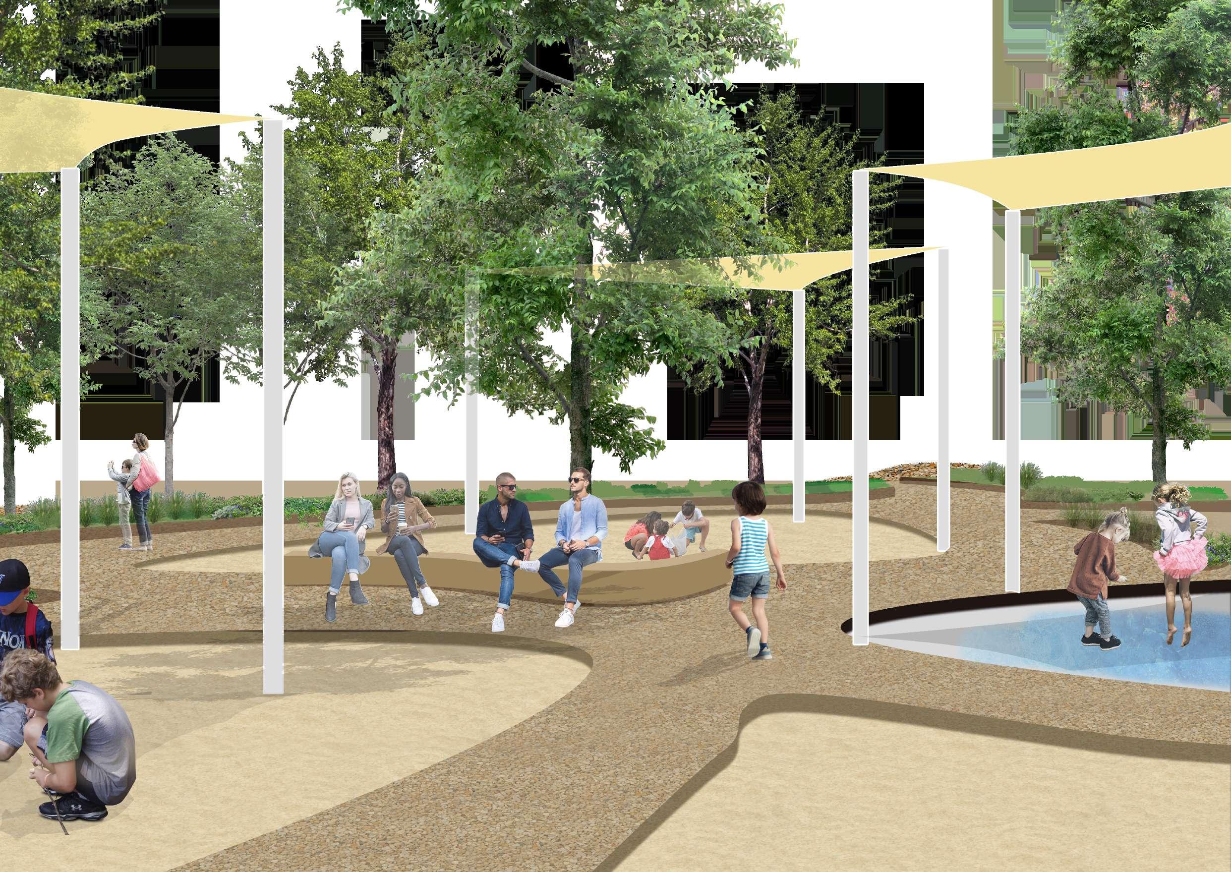
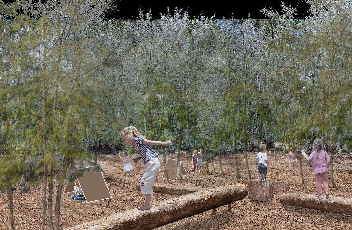
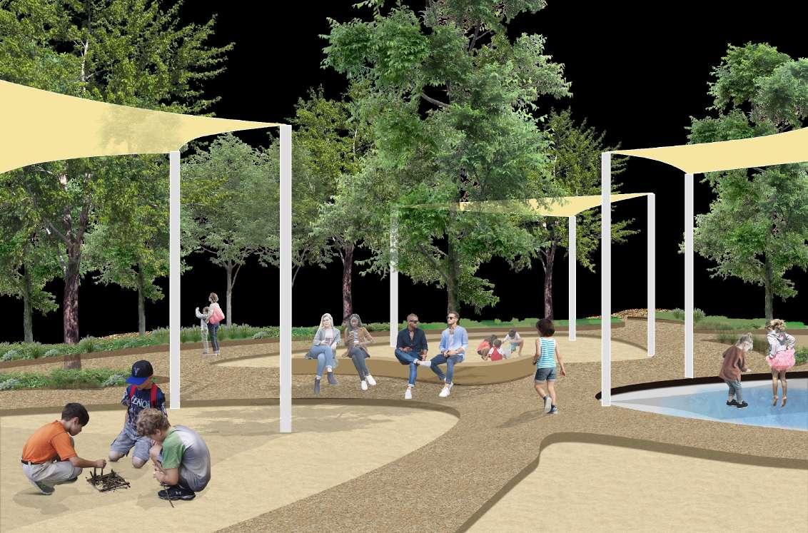
PLAY REVOLUTION


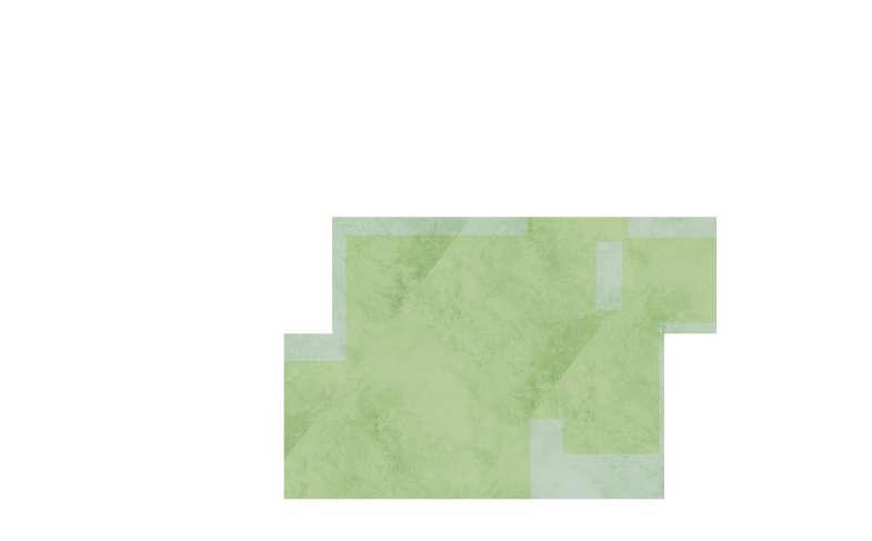
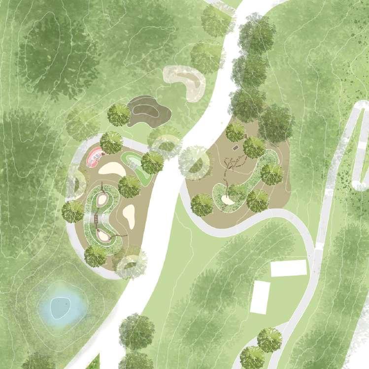
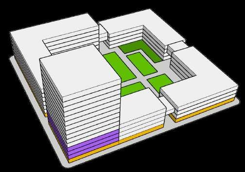
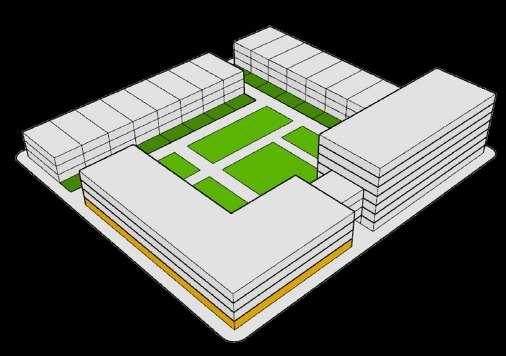
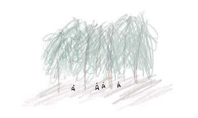
With the process of urban renewal, the building density becomes higher, and the area of green space is declining. In the eastern suburb and inner west, much of the green space is owned privately for golf courses, sport clubs, and racecourse.
As a green space among high density residential areas, Moore Park is accessible for residents from city council, Randwick council , and inner west. It plays an important role in outdoor activities for the public. However, play space in the community is limited, and playgrounds are mainly built with artificial facilities. Thus, it is important to meet the demand of playscape for children who live in the community around moore park, consider the interaction with nature while playing.


OPPORTUNITY 1:


Increase accessibility to Moore Park and the connection between residential area, Moore Park, and public transport
OPPORTUNITY 2:
ACCESS AND CONNECTION


Increase connectivity with centennial park habitat (wetland and vegetation).

OPPORTUNITY 1:
Use the existing linear vegetation as the edge between proposed park and the remaining golf course.
OPPORTUNITY 2:
Use the existing golf holes shape and structure as play elements.


OPPORTUNITY 1:


Active Mt Steele as the view point and with potential for adventure play
OPPORTUNITY 2:
Active the hidden water body and have potential value in stormwater management


GOLF COURSE
SANDHILL HERITAGE
LAWN
Garden located among
Habitat with opportunity to experience color, texture,
smell of plants
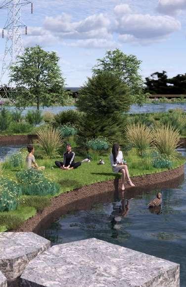
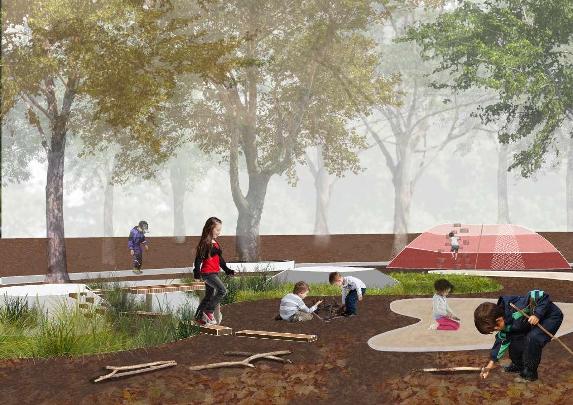
open forest will be kept. There are two wetlands to collect stormwater and as a water resource for water play and urban farm irrigation. Sandhill Play located at the Mt Steele. The steep slope provides opportunities for climbing and sliding.


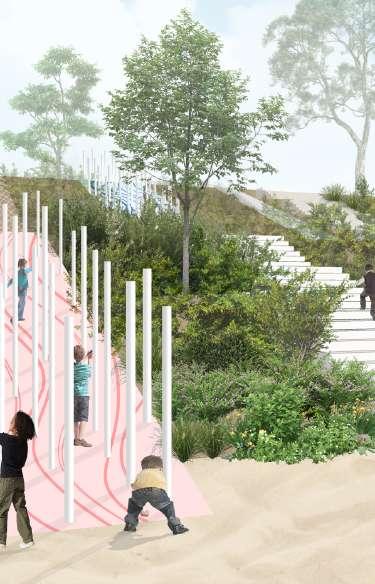
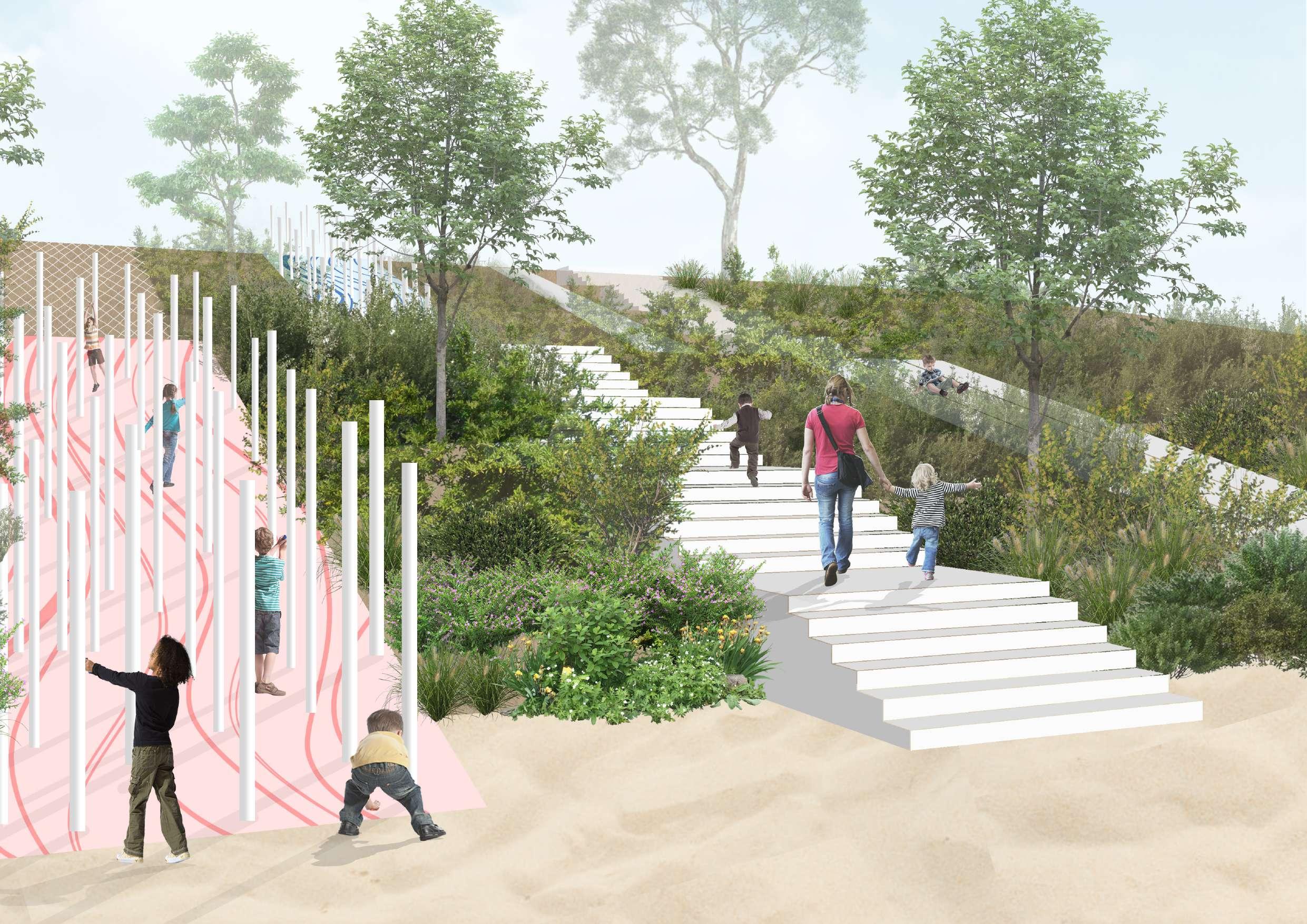
DETAIL DESIGN 1: SANDHILL PLAY
CLIMBING STRUCTURE

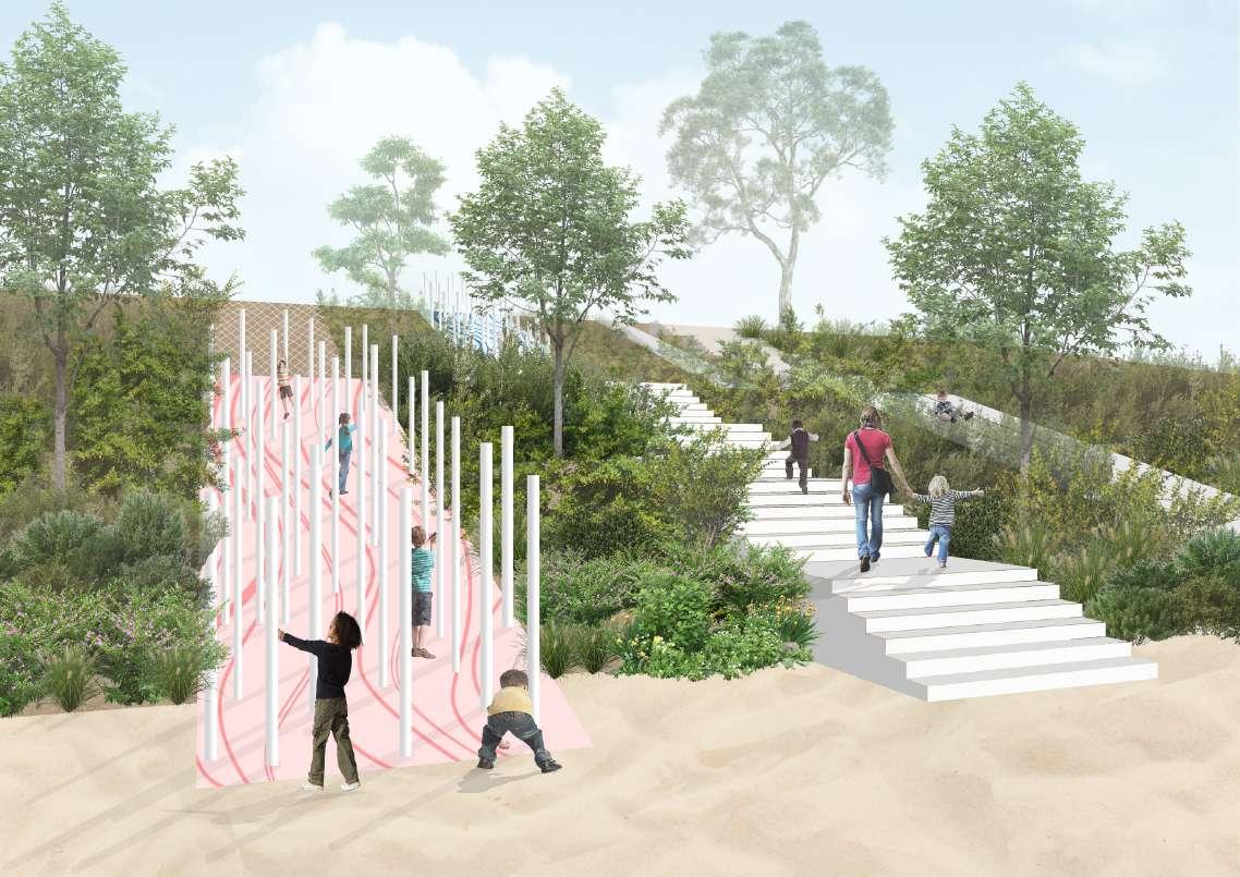

VIEW TO SYDNEY CBD
CLIMBING STRUCTURE WITH COLUMNS
TOP OF MT STEELE
SANDHILL PLAY
DETAIL DESIGN 2: SUNKEN AND DUNE
BIO-DETENTION BASIN BASED ON GOLF HOLE
LOGS AS PLAY FACILITIES


PIT BASED ON GOLF HOLE
RUBBER DUNE WITH CLIMBING AND SLIDE
SEASONAL WETLAND
UNSTRUCTURED PLAY ZONE

BIO-DETENTION BASIN WITH GRASS AND PLAY SPACE BASED ON GOLF HOLE
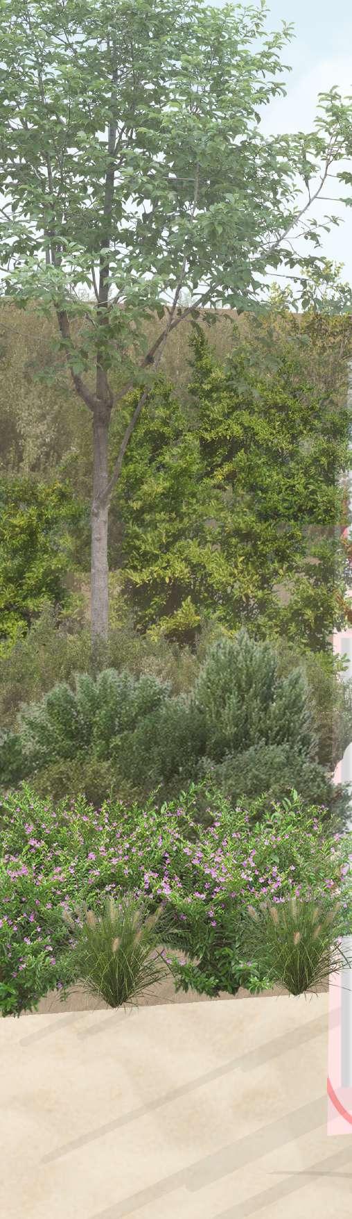
EVERGREEN TREES PROVIDE SHADE IN ALL SEASONS 5-10M DECIDUOUS TREES WITH SEASONAL FALLEN LEAVES AND WOOD STICKS

DECIDUOUS TREES WITH SEASONAL FALLEN LEAVES AND WOOD STICKS

DETAIL DESIGN 3: SENSORY GARDEN
BIO-DETENTION BASIN BASED ON GOLF HOLE
BRIDGE
SECTION AA' SANDSTONE MAZE POLLINATOR GARDEN
SEATING AREA WITH SAND & GRAVEL GROUND
SANDSTONE MAZE WITH POND
BUSHFOOD PLANTS FOR FORAGING

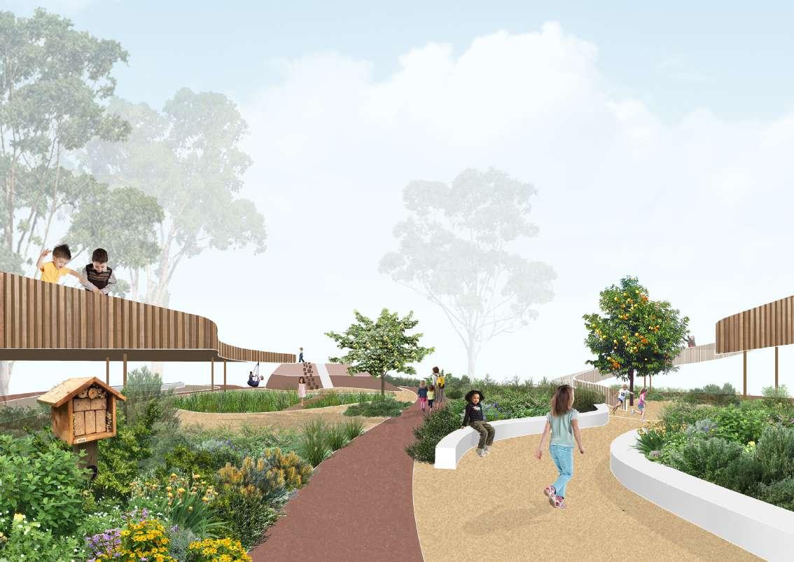
MAZE
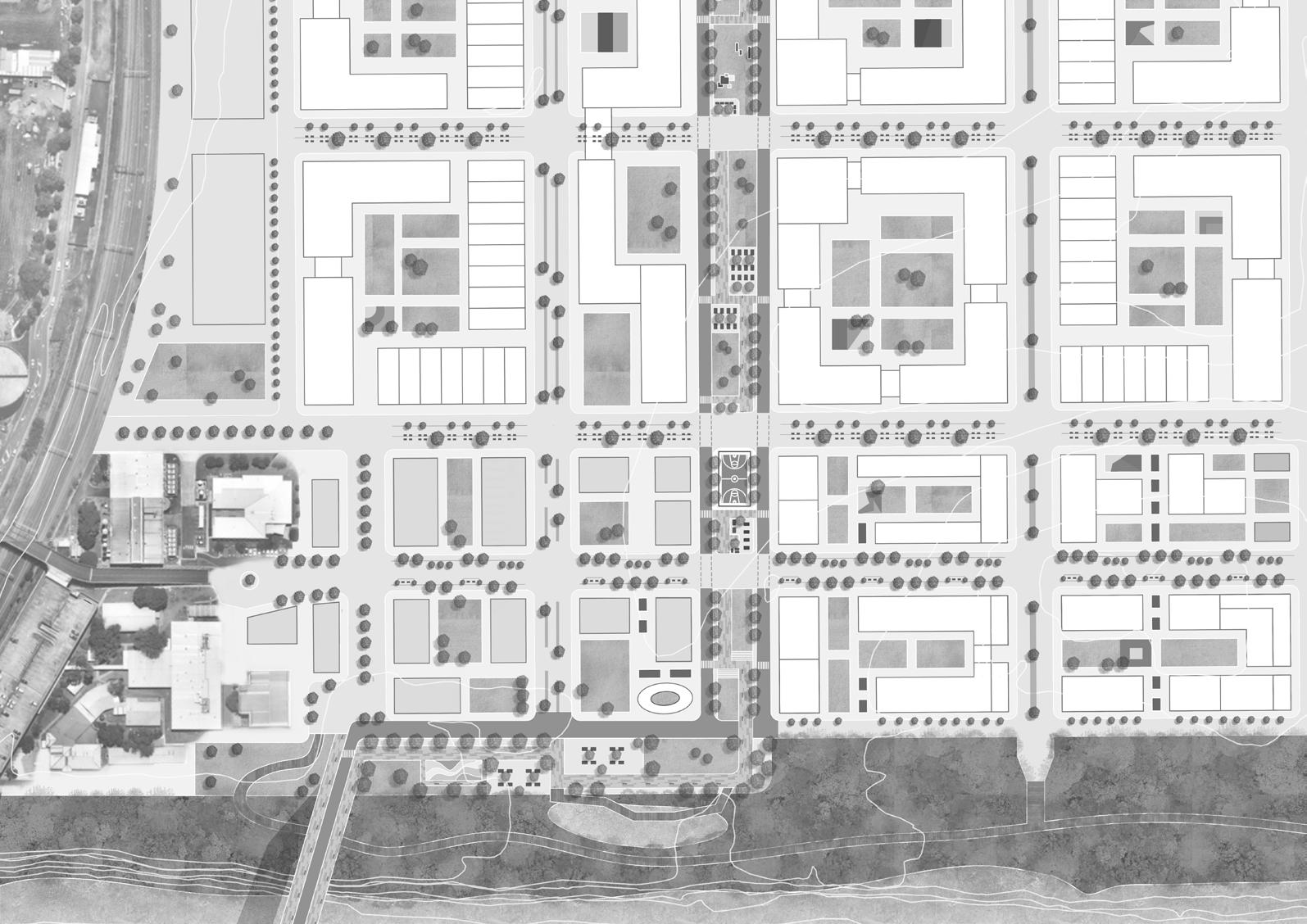
COFFS HARBOUR COMMUNITY DESIGN
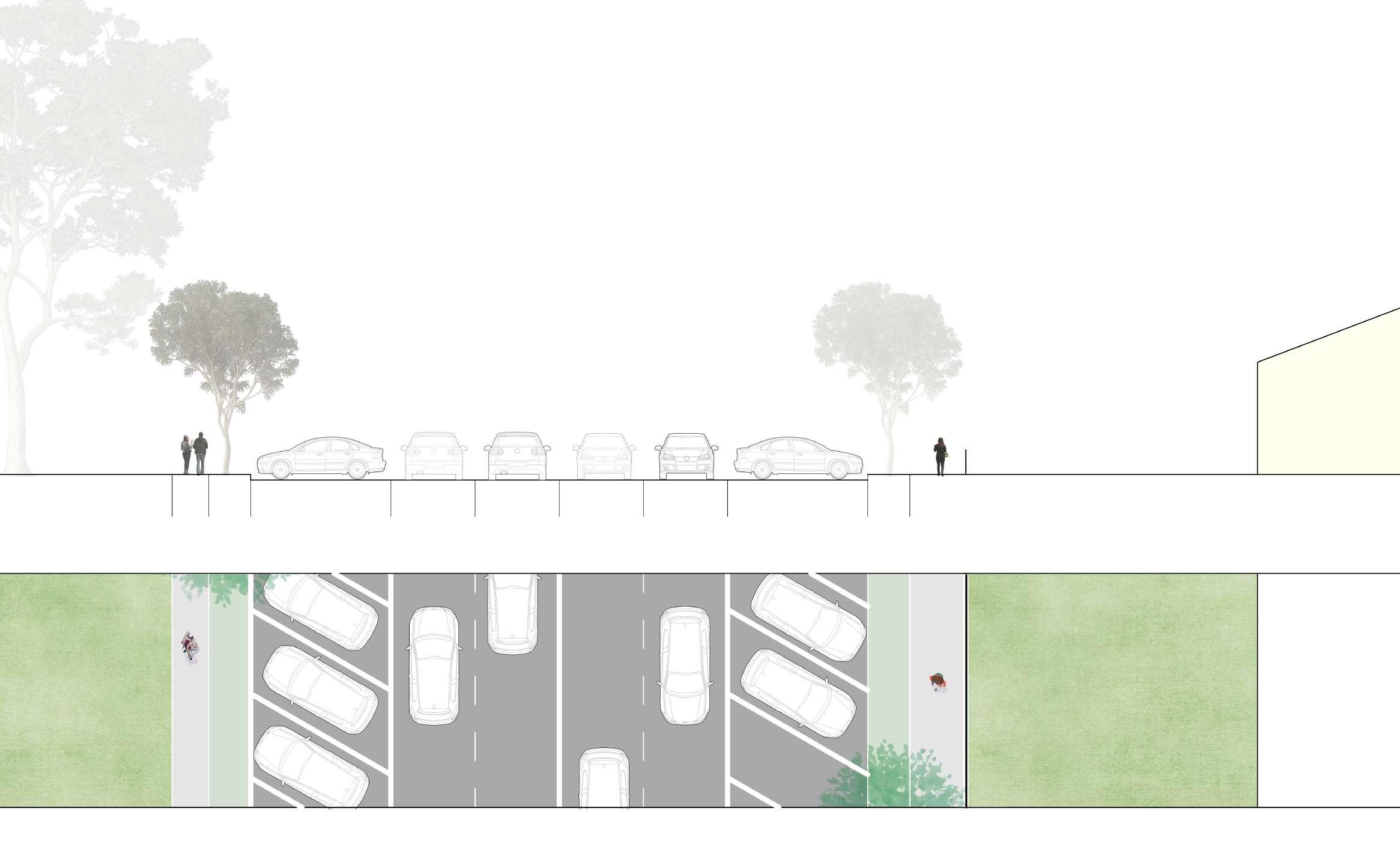
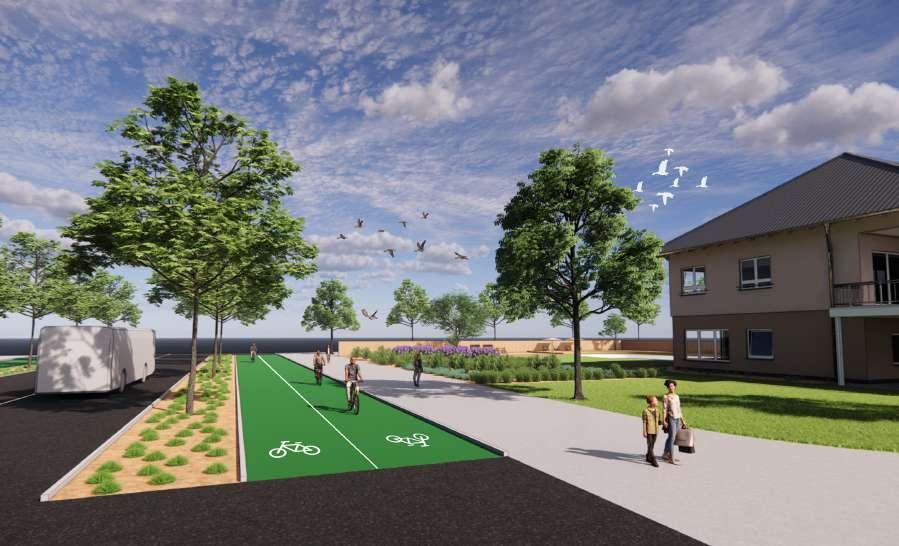
Coffs Harbour is a rural area in NSW, which is an important transportation corridor from NSW to Queensland. With the increasing trend of population and challenge of climate change, the local council is working on a more accessible, livable, and sustainable city.
The existing condition of the site has commercial function, but the street is domained by vehicles with limited space for pedestrians and cyclists. The building is now separate houses with community services, with a creek and stormwater headwall. Based on the existing policies and the Movement and Place Strategy, this project will focus on the street upgrade, densification of existing building, and water sensitive urban design.


Flood Risk:
The site ls at the bottom of topology and near to the creek with flood risk.

Safety for Cyclist:
As a main road, Harbour Dr has a high volume and speed of traffic, which is unsafe for cycling.
Lack Street Furniture:
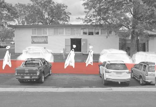
Footpath at Harbour Dr is 1.3m without place to stop and rest, which is poor as a pedestrian way along main road.
Room of Street: On-Street parking domain the main road which compress the space for pedestrian and cyclist.

Accessibility:
Curacoa St lack footpath the side of the road, people can only walk on lawn or parking area, which is inconvenient for people with wheelchair or pram.
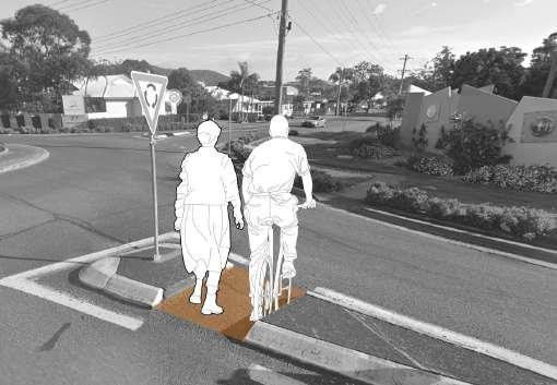
Unsafe Crossing:
The existing crossings at Earl st. and Albany st. Dr are narrow which is unsafe for cycling and pedestrian to cross.


WSUD:
The site is near the commercial zone with many hard surface, and near the creek with a stormwater headwall. There is an opportunity to manage stormwater.
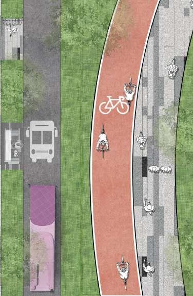
Wider Footpath:
Road can be upgraded with less space for onstreet parking and more for active transport.
Street Vitality:
Based on existing commercial function, there is an opportunity to become more vibrant with outdoor dining, street furniture, or urban plaza
Slow Down Traffic:
There is an opportunity to slow down traffic, create a safer environment for pedestrian and cyclist for Harbour Dr.
Accessibility:
There is an opportunity to have new footpath at Curacoa st.
Safer Crossing:
It is an opportunity to upgrade the existing crossing, become wider and safer.
Carralls Gully
Harbour Dr
Albany St
Curacoa St
Carralls Gully
Harbour Dr
Albany St
Curacoa St
DESIGN PRINCIPLES


Accessible Neighbourhood
As a node between residential and commercial core, it is important to Increase accessibility, comfortability, and safety for pedestrian and cyclist, especially for kid and elderly


People and Place
As a destination for gathering, the project will increase density for the growing population, create vibrant street life with diverse streetscape and safe living environment.


As a node between residential and commercial core, it is important to Increase accessibility, comfortability, and safety for pedestrian and cyclist, especially for kid and elderly
Existing Tree:
The upgrade of street and space is based on the location of existing trees. Most of the existing trees are kept.
Proposed Tree:
New trees are proposed in the middle of Harbour Dr, plaza edge of footpath, and with onstreet parking space. Increase green canopy can reduce traffic speed and mitigate urban heat.
Removed Tree:
Only three trees at Curacoa St have been removed due to the construction of pedestrian and cycle way.

and Rain Garden
Plaza with Pervious Paving
Outdoor dining space near community center and the pedestrian footpath with street furnitures, and shaded by existing tree. The plaza is designed with amenity for community daily life. Pavement of the plaza is constructed by water permeability material, which is more resilience as a hard surface.
Bioswale collect the surface runoff, and transport stormwater to rain garden for sedimentation, and finally to the creek
Raised Zebra Crossing Bike Rack
The raised zebra crossing is designed for the safety of pedestrian. It is able to reduce the car speed with the raised structure.
With the construction of cycle way, there are more space for bicycle parking.
4 Story Car Park 6
Due to the road upgrade, the number of on-street parking space at Harbour Dr will decrease. Multi-story parking is proposed to meet the increasing demand of car parking in CBD
Bioswale


Narrow Footpath
Narrow Footpath
Wide Car Lane
Private Garden with Fence
The road is designed with gradient, aiming to organise surface runoff to the area with planting
Large tree in the middle of the road as a green belt, to slow down the traffic and increase comfortability.

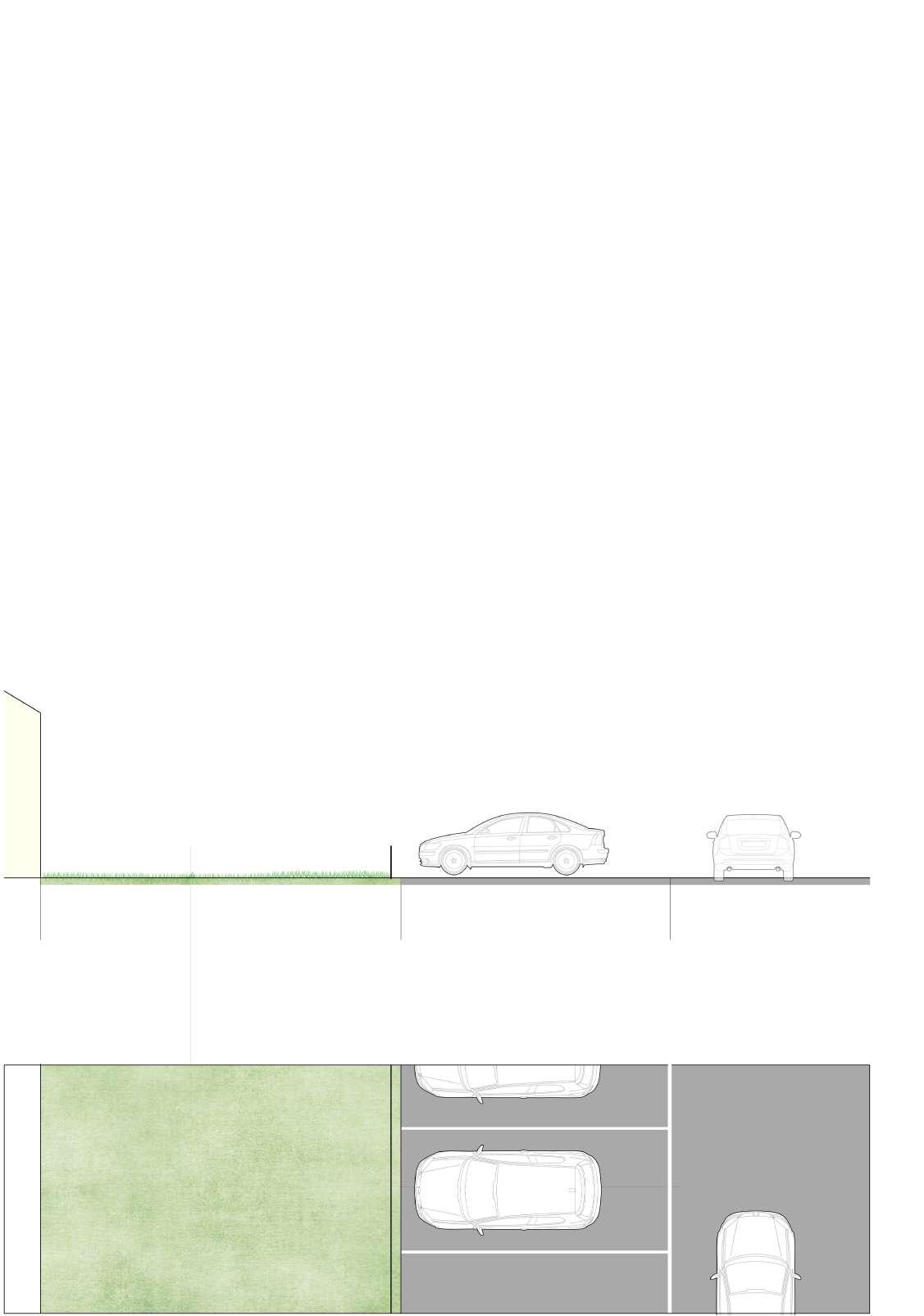
60 degree parking is changed to parallel parking, with more space to widen the footpath and planting plants.
Have street furniture and wide footpath for universal access which fit to the trend of aging population in Coffs Harbour.
Have more space for public activities such as urban plaza through densification.
Brelsford


Increase accessibility for pedestrian and cyclist.
Have large tree in the

Bricks as the pavement material, butt jointed with sand filled joints over sand bed.

Stormwater Runoff
Gravel
Soil
Gravel
Stormwater Pipe
6.5m
Impervious surface with street furniture
bioswale
bioswale
Coles
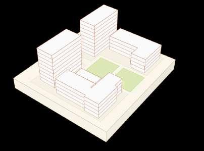
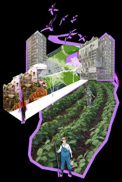
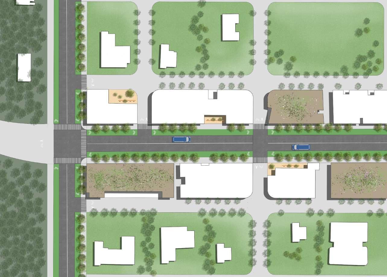
LIVERPOOL URBAN LANDSCAPE DESIGN
Liverpool will be transformed from industrial area to a vibrant, sustainable, and inclusive urban oasis, fostering community and connection to nature. Compact streets will encourage walking and social interaction, creating vibrant and compact street life through linear park and car-free street. The green infrastructure like WSUD and street trees will manage stormwater and boost ecological benefits. Community farm and urban agriculture will improve livability and support local food systems. Active transport like walking and cycling will be prioritized, creating a green, connected transportation network that promotes healthy lifestyles.


CONNECTION OF PATTERNS
DESIGN PRINCIPLES


DIVERSE SHARED NEIGHBOURHOOD AGRIHOOD REHABILITATE ECOLOGICAL COMMUNITY
Building diverse block, decentralize commercial space and open space, and creating walkable community with public transport, minimise car use.
EXISTING LANDUSE
Importing urban farm into community, improve social communication and physical health, and providing habitat for pollinator and local frog.
PROPOSED FRAMEWORK PLAN

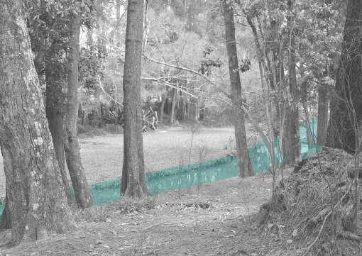
Protecting and expand frog habitat, protecting endangered frogs, and improving Georges River quality through WSUD


20M STREET WITH URBAN FARM
-- CAR FREE
1:100@A3
20M STREET WITH URBAN FARM -- CAR ACCESS
1:100@A3


20M STREET WITH WSUD -- CAR FREE
1:100@A3

20M STREET WITH WSUD -- CAR ACCESS 1:100@A3
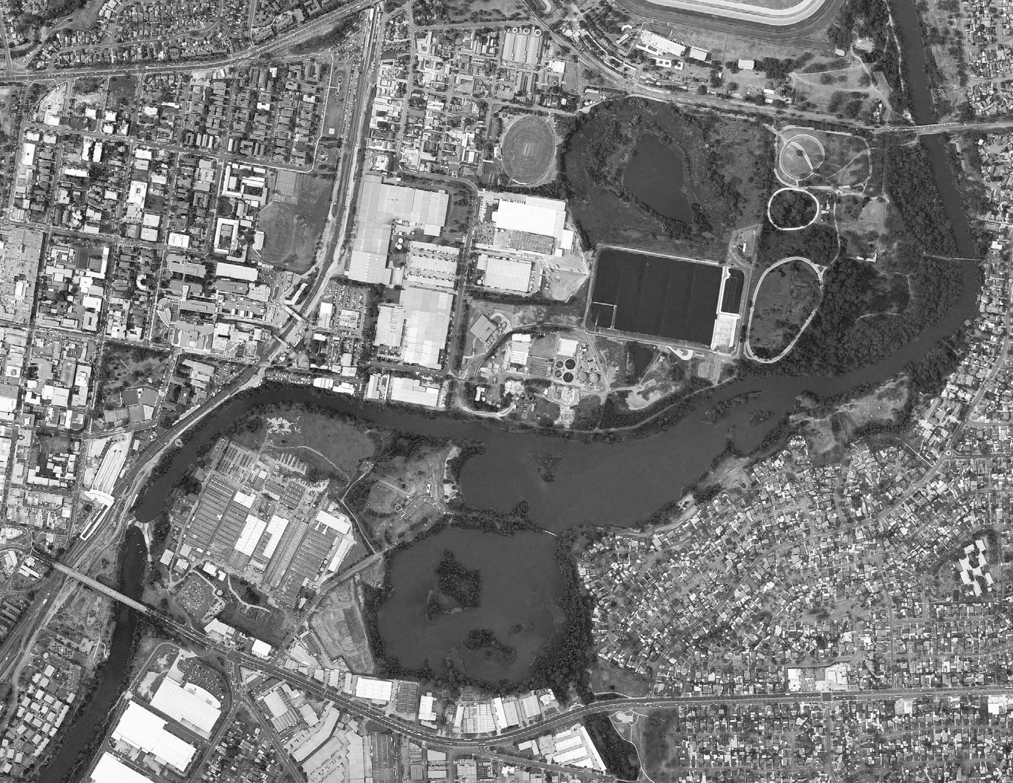
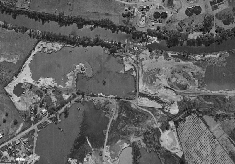
LOCAL MINING
In 2021, 34% of people in Liverpool LGA were born overseas. As a multicultural city, local identity plays an important role in promoting social cohesion and social sustainability. While people feel as a part of the development process and believe that they and their descendants will benefit from it, social sustainability will increase.
Through social media mining and site analysis, the local characters of Liverpool include the sand mining history, Geogres River waterfront spaces, and frequent events to celebrate different cultures. This project will transform the Haigh Park at Liverpool to a new district park destination with natural, social, and historical identity.
Firstly, educating and encouraging stewardship through experience of key habitat and tide changing of Geogres river. Secondly, generating attachment through upgrading existing informal and small-scale community activities. Thirdly, highlight the sand mining past through walk experience and materiality.


MASTERPLAN
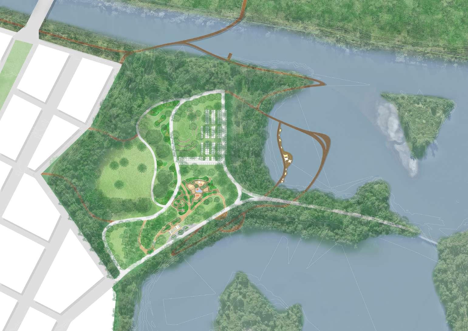
PRINCIPLE 1:
EDUCATING AND ENCOURAGING STEWARDSHIP THROUGH EXPERIENCES KEY HABITAT
PRINCIPLE 2:
GENERATE ATTACHMENT AT HAIGH PARK
PRINCIPLE 3:
INVESTIGATE WAYS TO HIGHLIGHT THE SAND MINING PAST
DESIGN METHODS:


OPEN WOODLAND
1:300@A3
SEASONAL MARKET
1:300@A3
SIMMING PLATFORM---LOW TIDE
1:100@A3


SANDY PLAY
DENSE VEGETATION
DENSE CAUSERINA PLAY
SAND MINING PROCESS
REMOVE TREES MINING SAND PIT
PLAYGROUND PROGRAM

VEGETATION & GRAVEL GROUND MATERIAL
PLAY ZONE 2 -- MINING MAZE

VEGETATION DISAPPEAR
LOSE VEGETATION & SAND PIT PLAY

PLAY ZONE 1 -- CAUSERINA PLAY
PLAY ZONE 3 -- SAND AND WATER PLAY
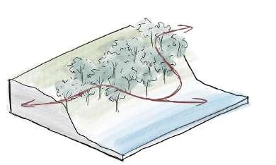
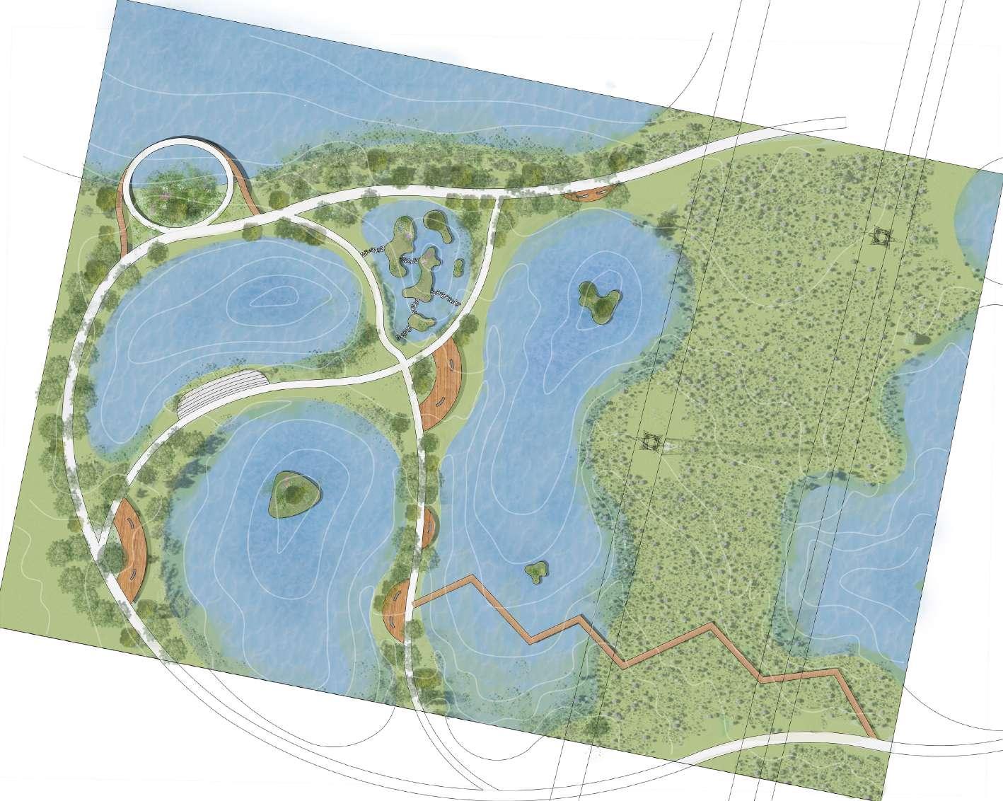
SYDNEY BIRD CENTER --- ANGUS 2050


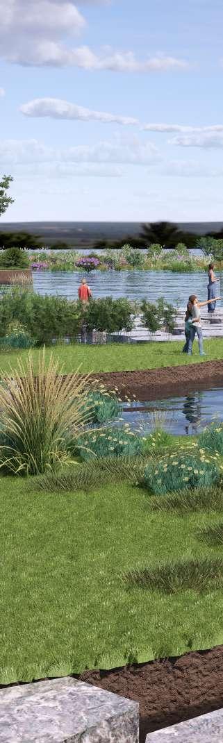
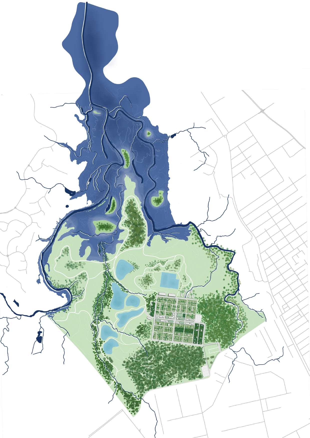
Angus is located in the north west of Sydney, it is a rural area with high biodiversity value and serious flood issues. This project aims to transform Angus into a nature reserve, use the seasonal wetland (created by flood) and constructed wetland for(water sensitive urban design) to create bird habitat and achieve flood resilience. Besides that, this area will have the value of tourism, scientific research, and education to support the development of society and local economy.

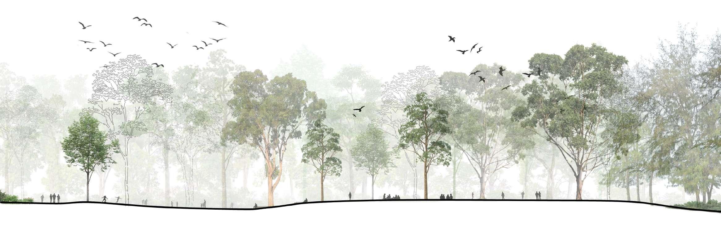
FOREST

Forests at Angus have high ecological value. Rich native species, multiple vegetation layers, and abundance of leaf little provide habitats for fauna.
WETLAND

Freshwater wetlands ecological community provides habitats and foraging grounds for birds and amphibians.
Eastern Creek

South Creek


Grassland Shale/Gravel Transition Forest Shale Plains Woodland Alluvial Woodland Castlereagh Scribbly Gum Woodland Cooks River Castlereagh Ironbark Forest
Wianamatta Group Wianamatta Group Wianamatta Group Wianamatta Group
Wianamatta Group Wianamatta Group
1 2 Angus Town:
Mainly used as accommodation for tourists, with low density house and mid density apartment hotel.
Riverstone Cemetery:
The cemetery will be kept as a heritage.
Nature Reserve:
The existing vegetation community will be protected as a habitat for flora and fauna.
Constructed Wetland:
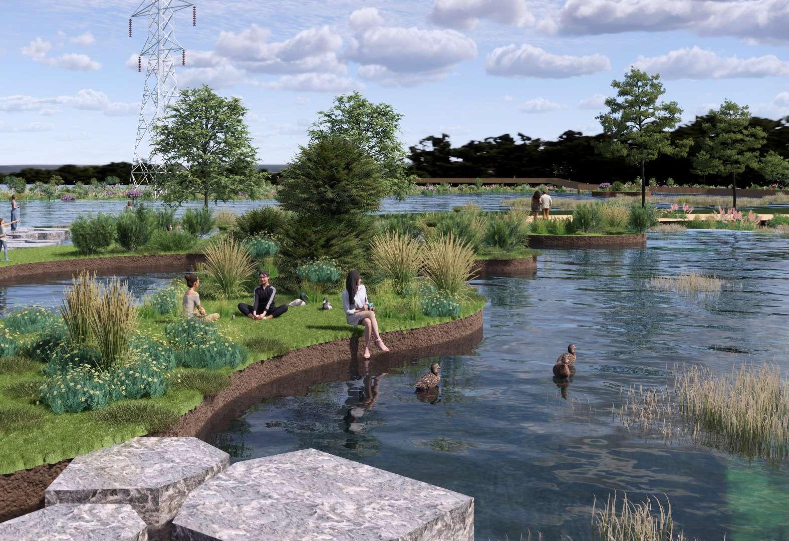
A series of constructed wetlands become a parkland, manage the stormwater, create habitat, and valuable in touriam.
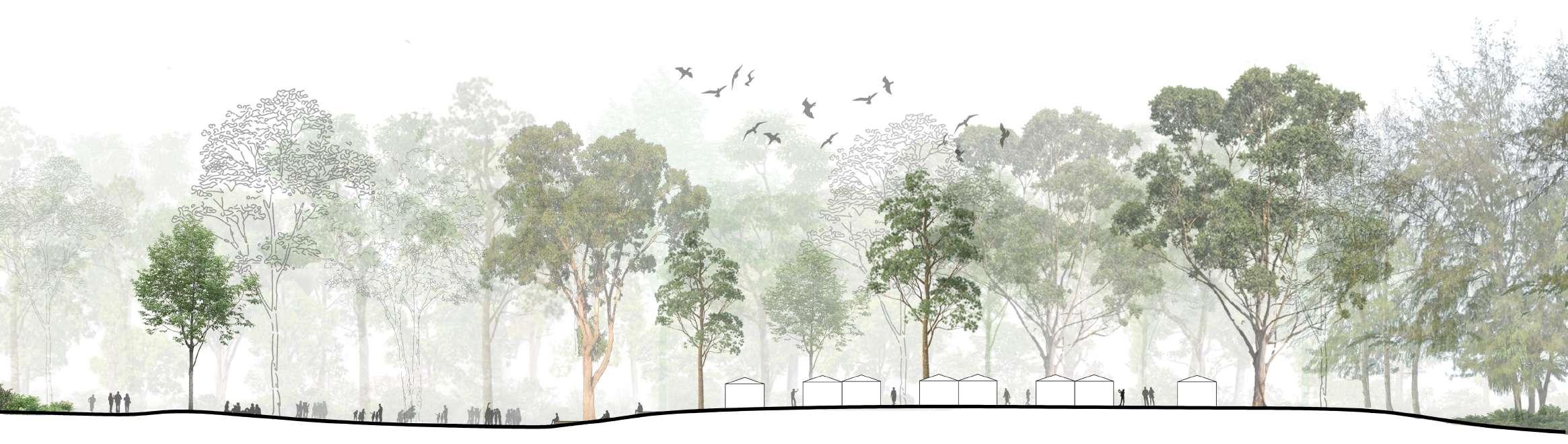
5 Bird research center:
A breeding and protection base is proposed around meatpond wetland, with bird museum, scientific research building, bird treatment and breeding, and various habitat. Most of the area is open to public with tourism and educational value
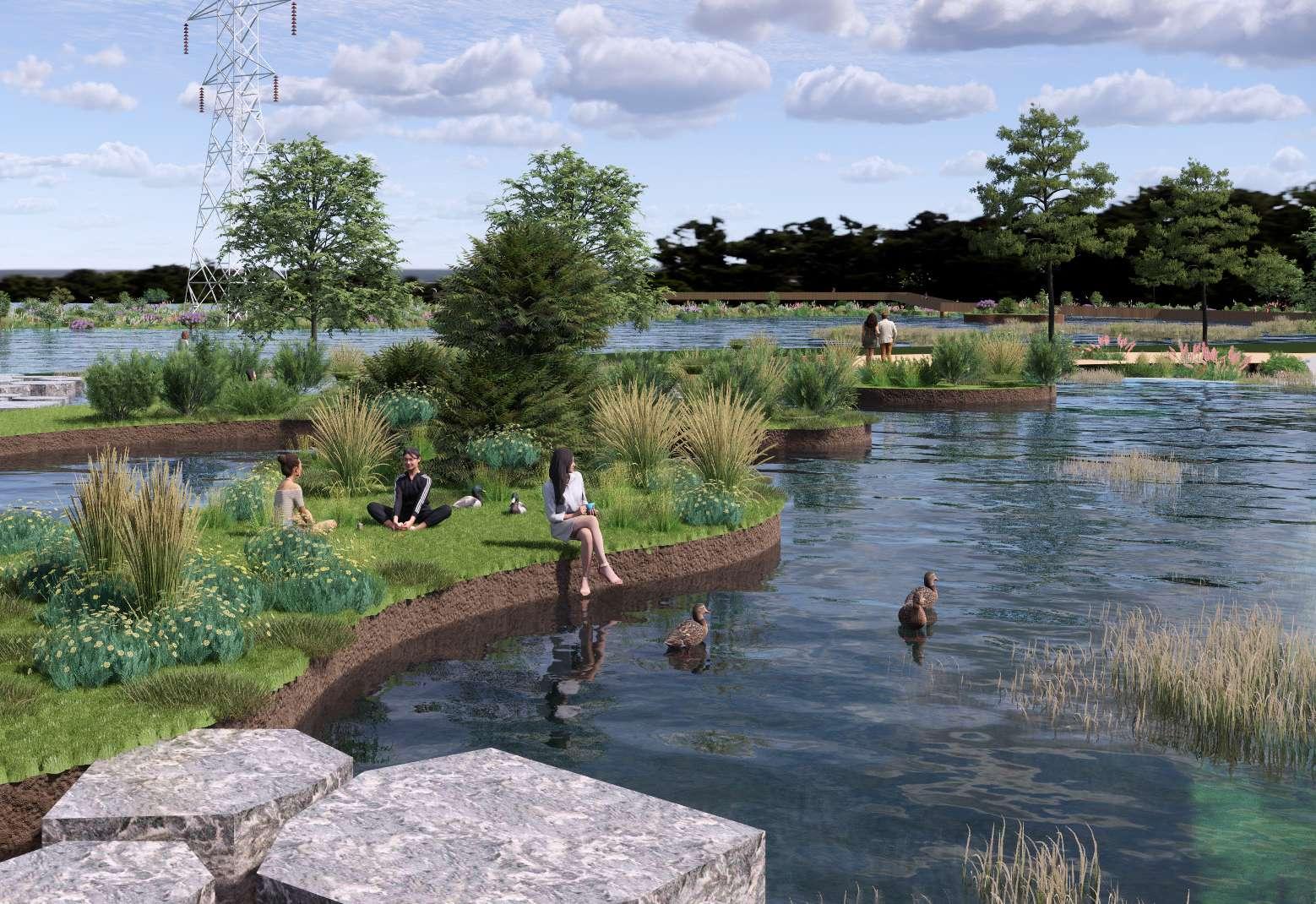
Riverstone Wetland:
The riverstone wetland is an important habitat for local and international migratory bird. Islands and floating islands are proposed to help birds have a landing place in rain season.
Angus is a rural area with high biodiversity value and serious flood issue. This project aims to transform Angus into a nature reserve, use the seasonal wetland (create by flood) and constructed wetland (water sensitive urban design) to create bird habitat. Besides that, this area will have the value of tourist, scientific research, and education.
PRINCIPLES


Main street with bus line, cycle way, walkway, and street trees.
Sub street with a shared path for pedestrains and bicycle.
Street furnitures (bike rack, seats).
Accomodation type 1: Mid rise hotel, with stores and restaurants along the street.
Extensive green roof to reduce urban heat and manage stormwater.
Accomodation type 2: Low density house with well-designed backyard.
Accomodation type 3: Low density, natural living house surrounded by existing forest.
Example of accomodation type 2: Low density house


power line corridor with shrub and groundcover
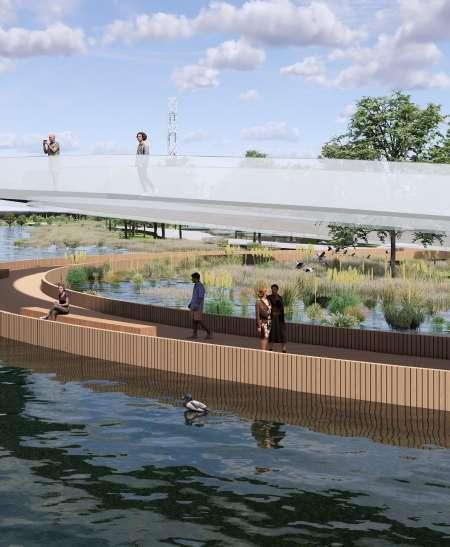
pathway for pedestrian and bicycle
seating area
vegetated island
waterfront platform
Stepping Stone
Bird Observation Platform
Walkway Bridge


Parkland Detail Plan Scale: 1:1000@ A3
PHONE: 0412194617 EMAIL: zjinyu316@gmail.com