PORTFOLIO Landscape JIAXIN LI
PERSONAL STATEMENT
I am an experienced landscape and architectural designer with a Bachelor of Landscape Architecture from Beijing University of Technology and a Master of Architecture from the Southern California Institute of Architecture (SCI-Arc). My career has been driven by a passion for creating innovative, sustainable, and aesthetically pleasing spaces. My work has been showcased in multiple exhibitions, and I have received several accolades, including a merit award for my thesis on Amphibious Architecture.
Professionally, I have honed my skills at Turenscape, where I was honored with the Outstanding New Employee Award. I contributed to the design and development of Quzhou Luming Park, which was awarded the 2016 ASLA Honor Award. Additionally, my contributions to the International Culture and Health area of the Xixian Airport project earned it the recognition of Outstanding Project of the Year.
I also have nearly one year of architectural design work experience with Griffin Enright Architects, where I managed the MA Residence project through various architectural phases. My expertise ranges from landscape and architectural design to project management, with proficiency in Revit, Adobe Suite, Rhino, SketchUp, and V-Ray. I excel in managing project timelines, collaborating with interdisciplinary teams, and delivering high-quality design solutions.
I look forward to contributing my skills and experience to your firm, continuing the tradition of enhancing lives through the power of design.
CONTENT
AMPHIBIOUS ARCHITECTURE 01 GRADUATE THESIS 2022
CONTENT PORTFOLIO JIAXIN LI
P.G O1 FIGURED
P.G 13 NOT
P.G 35
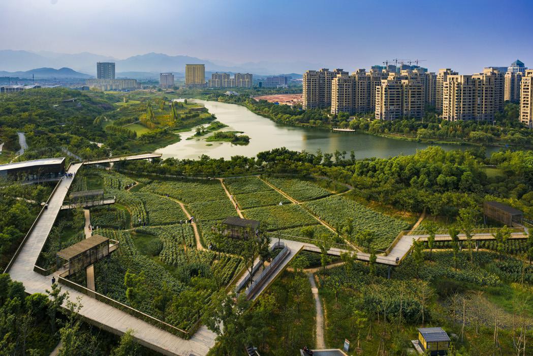
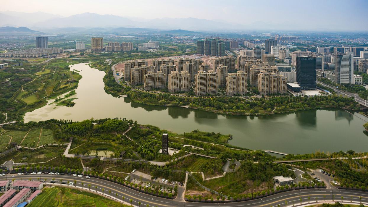
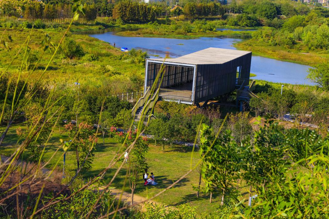
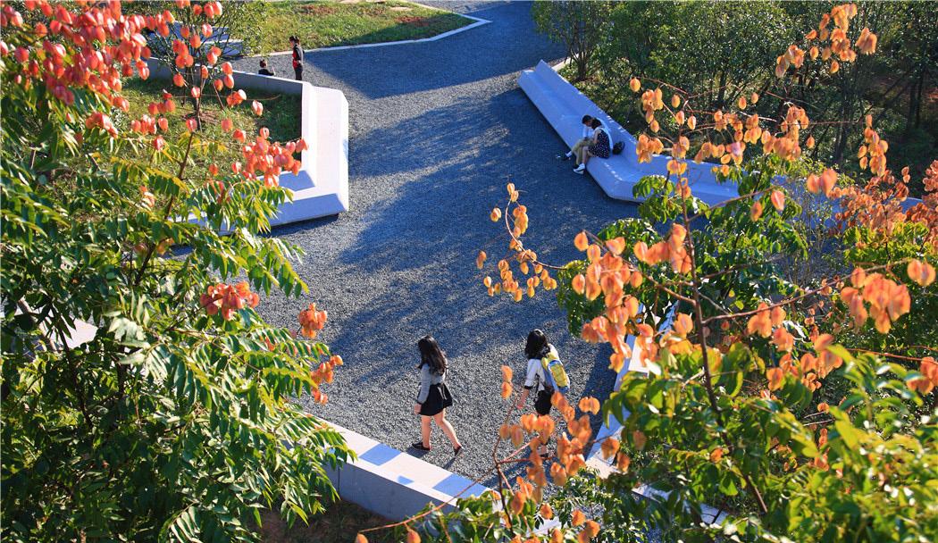
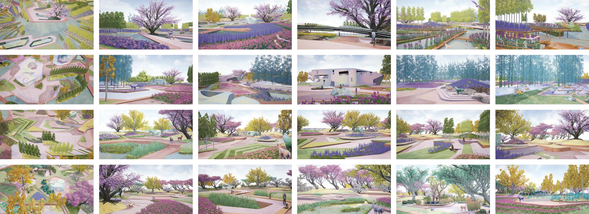
P.G 43 QUZHOU
PARK
TURENSCAPE
P.G 51
GROUNDS AND GROUNDED FIGURES 02 3GA Fall 2021
A MOUNTAIN 03 3GB Spring 2022
SHIBEI RIVER AND NANPAI RIVER LANDSCAPE DESIGN OF HUANGHUA COUNTY 04 TURENSCAPE 2013
LUMING
05
2016
RESUME PORTFOLIO JIAXIN LI
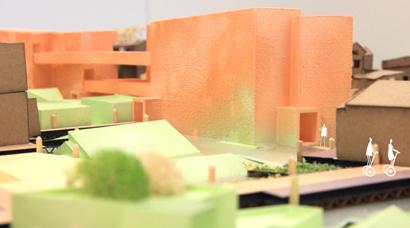
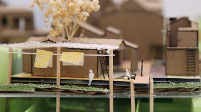
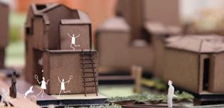
AMPHIBIOUS ARCHITECTURE
Graduate Thesis 2022 Design Advisor Mira Henry
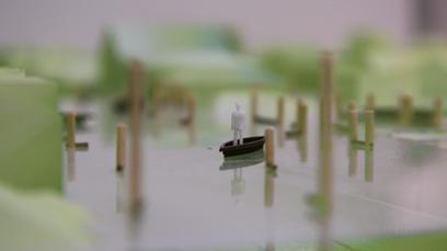
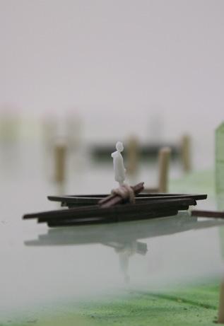
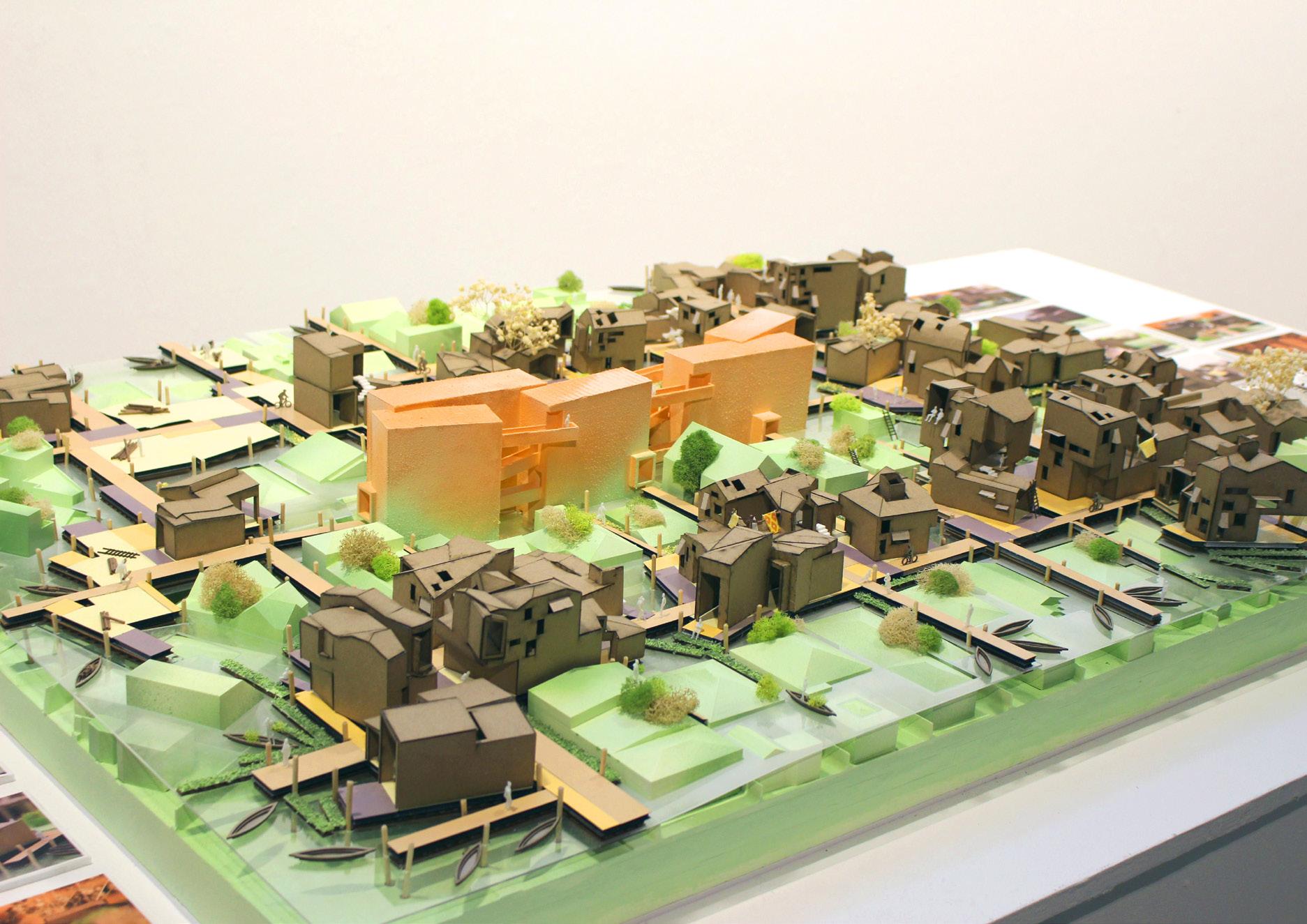
Sea level rise due to climate change will reshape coastal cities, wrecking damage and putting some communities underwater. This project explores the development of an amphibious community over 100 years in a submerged neighborhood in Venice, Los Angeles.
The neighborhood’s history, spatial and social relations are considered while layering a climate change outcome onto it to advance a solution specific to the area.
Rising waters presents an opportunity to release us from the constraints of privatized, single family homes as the dominant way in which contractive elements exist in present day Los Angeles.
Using the dissolving hard boundaries and property lines as a device, the space is reclaimed through the evolution of an infrastructure that connects people to the submerged properties.
This thesis presents infrastructure as a space more expressed as connecting rather than being hidden.
PAGE O2
O1
AMPHIBIOUS ARCHITECTURE PORTFOLIO JIAXIN LI
Glacial melting is raising the sea level and it’s projected that parts of coastal cities around the world will be underwater in the future. We’ll be looking at Venice, Los Angeles as the site for this project.
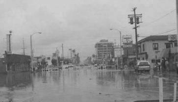
This area is prone to natural hazards such as large wave events, erosion, storms, and flooding. There have been two notable storms in the Venice area in the 1940s and 1980s.
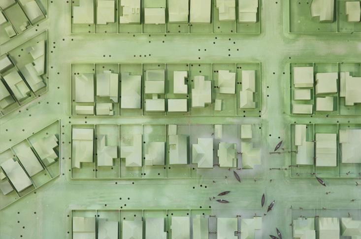
VENICE Vulnerability Assessment Results
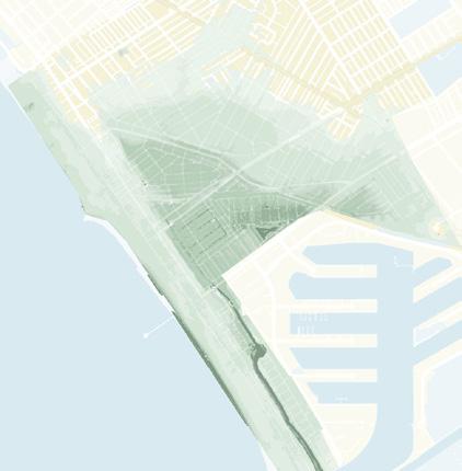
This map of low-lying areas shows Southeast Venice to be the lowest area, shown in darker coloring. Next is a progression of inland flood potential from sea level rise over the next 100 years. I used this timeline for the planned construction of my site.
Inland flood potential in Venice Canals and low-lying areas(Southeast Venice)
Inland flood potential expands across Abbot Kinney Blvd&Oxford Triangele Coastal erosion &flooding threaten lifeguard HQ and Venice Rec. Center
Inland flood potential expands north across Venice Blvd into North Venice.
Inland flood extends into Oakwood and Milwood communities Coastal flooding expands to inland area(for any storm).

AMPHIBIOUS ARCHITECTURE PORTFOLIO JIAXIN LI PAGE O3
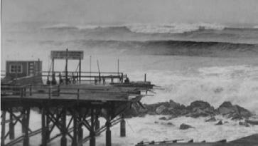
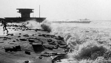
Venice Pier 1939
El Nino 1983
Venice Flooding 1941
Flooding in Venice Beach(Fred Barthel) 1983
VENICE HISTORIC HAZARDS - 1940S
AMPHIBIOUS ARCHITECTURE PORTFOLIO JIAXIN LI PAGE O4
VENICE HISTORIC HAZARDS - 1940S
CURRENT SEA LEVEL +0.0 FT +1.6 FT(20402080) +6.6 FT(20902150+) +4.9 FT(20802150+) Assets: ≤ 25 ≤20 ≤15 ≤10 ≤9 ≤8 ≤7 ≤6 ≤5 ≤4 ≤3 ≤2 Southeast Venice Non-storm tidal flooding potential 100-year storm coastal flooding(0cm) Canals Assets: Non-storm tidal flooding potential 100-year storm coastal flooding(0cm) Canals Assets: Non-storm tidal flooding potential 100-year storm coastal flooding(0cm) Canals Assets: Non-storm tidal flooding potential 100-year storm coastal flooding(0cm) Canals Assets:
100 YEARS AGO
AMPHIBIOUS ARCHITECTURE PORTFOLIO JIAXIN LI PAGE O5 AMPHIBIOUS ARCHITECTURE
JIAXIN LI PAGE O6
PORTFOLIO
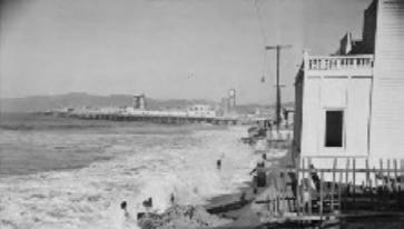
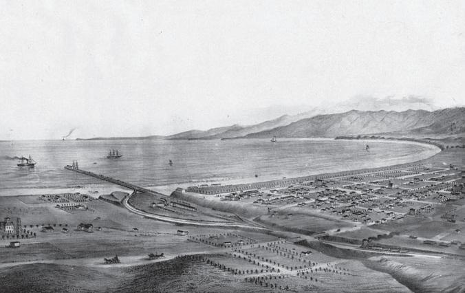
View of Santa Monica and bay showing the road and wharf of the Los Angeles & Independence Railroad, about 1875. The wharf was completed in 1875 and sold in June 1877 to the Southern Pacific Railway Company, This print was photographed from an old lithograph.
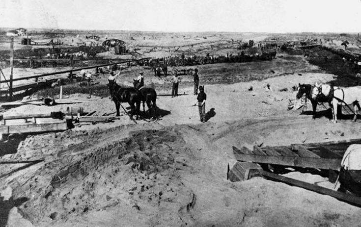
PRESENT DAY
AMPHIBIOUS ARCHITECTURE PORTFOLIO JIAXIN LI PAGE O8
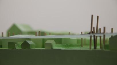
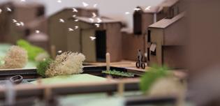
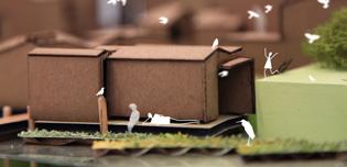
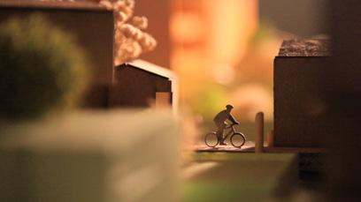
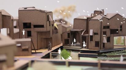
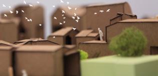
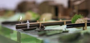
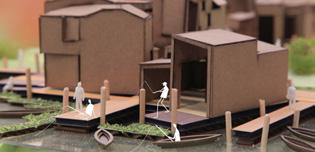
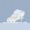
Poles Structures AMPHIBIOUS ARCHITECTURE PORTFOLIO JIAXIN LI PAGE O7 Floating Garden Amphibious Homes Core Infrastructure Floating Boardwalk
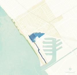
25 YEARS FROM NOW Sea Level +1.6ft
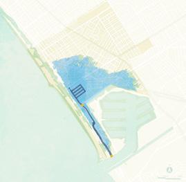
50 YEARS FROM NOW Sea Level +3.3ft

PAGE 10
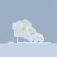
Amphibious Homes Floating Garden Roof Garden Floating Boardwalk Core Infrastructure PAGE O9 AMPHIBIOUS ARCHITECTURE PORTFOLIO JIAXIN LI AMPHIBIOUS ARCHITECTURE PORTFOLIO JIAXIN LI
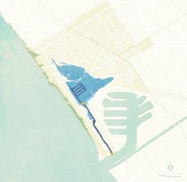
75 YEARS FROM NOW Sea Level +1.6ft
100 YEARS FROM NOW Sea Level +3.3ft
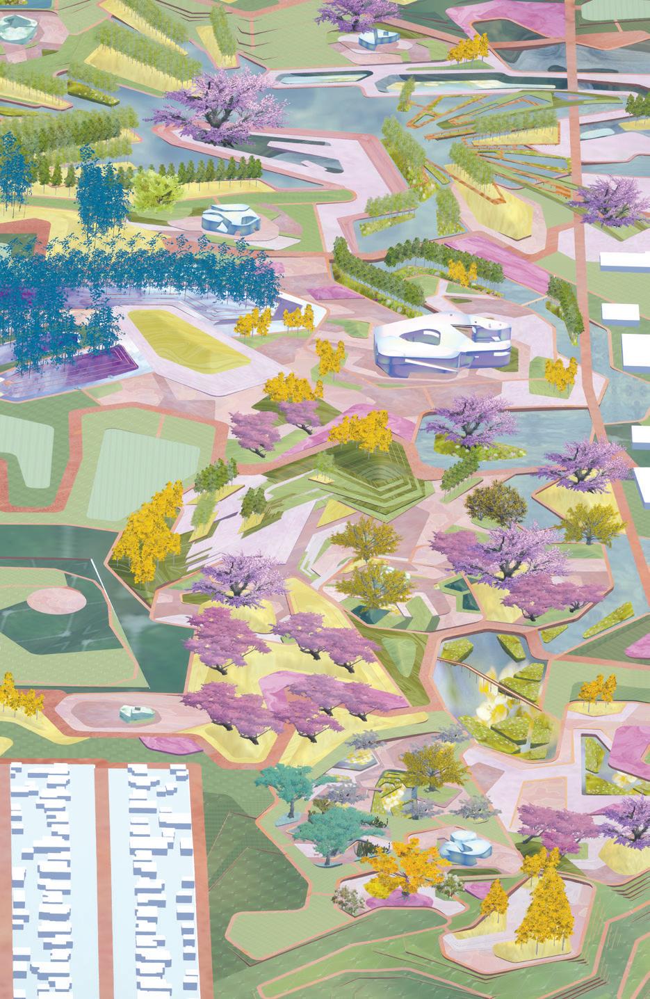
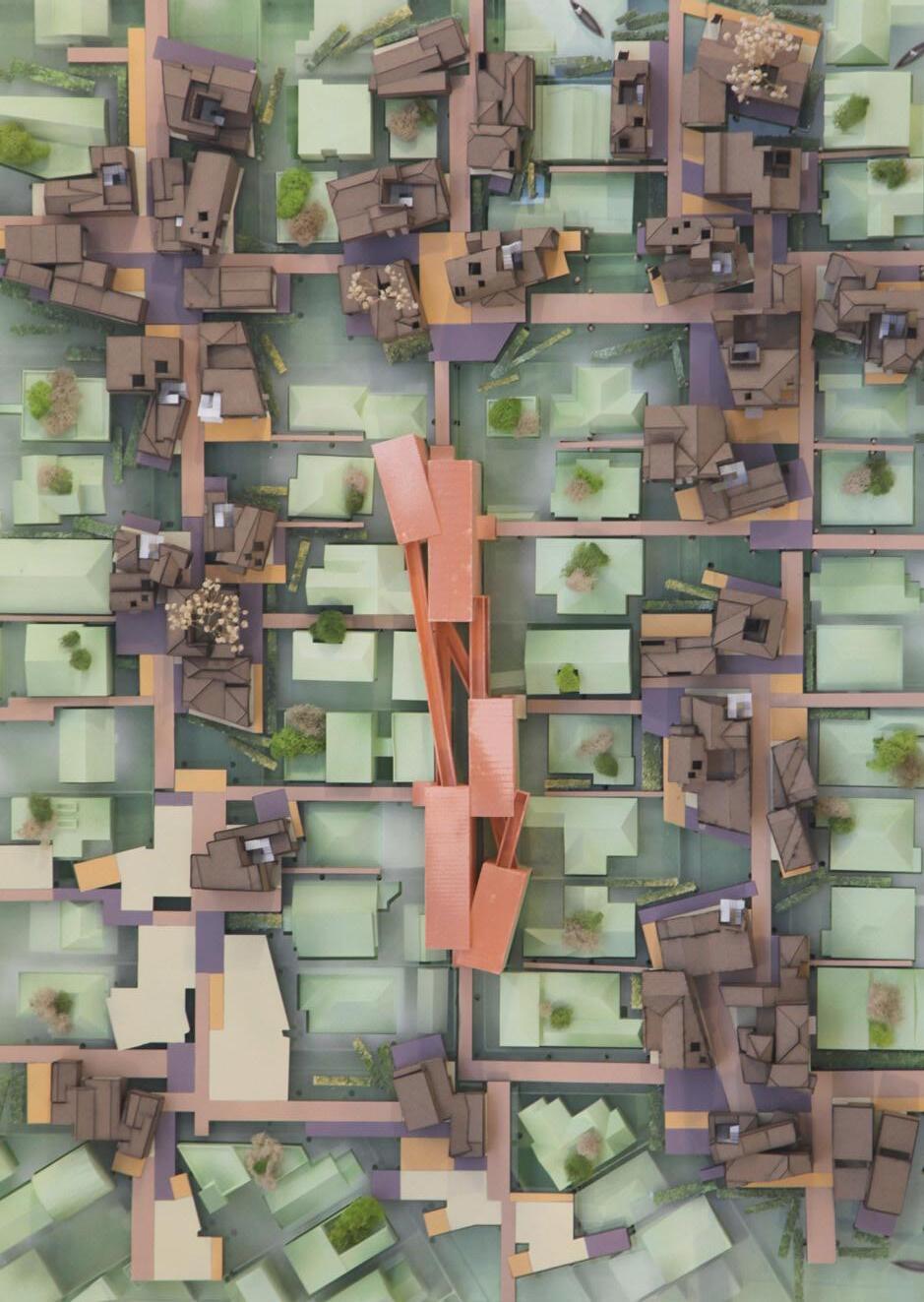
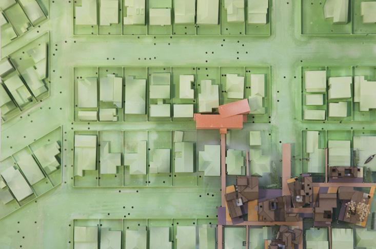
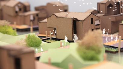
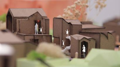
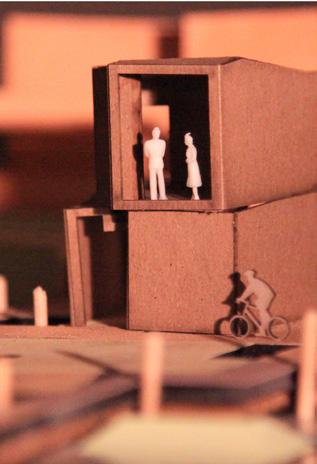
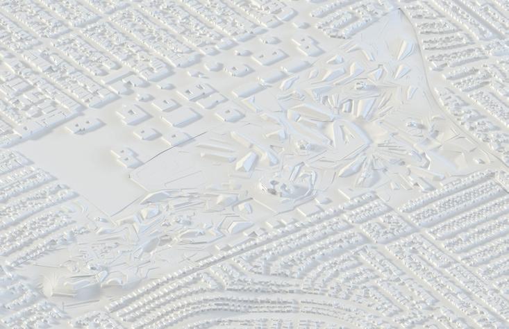
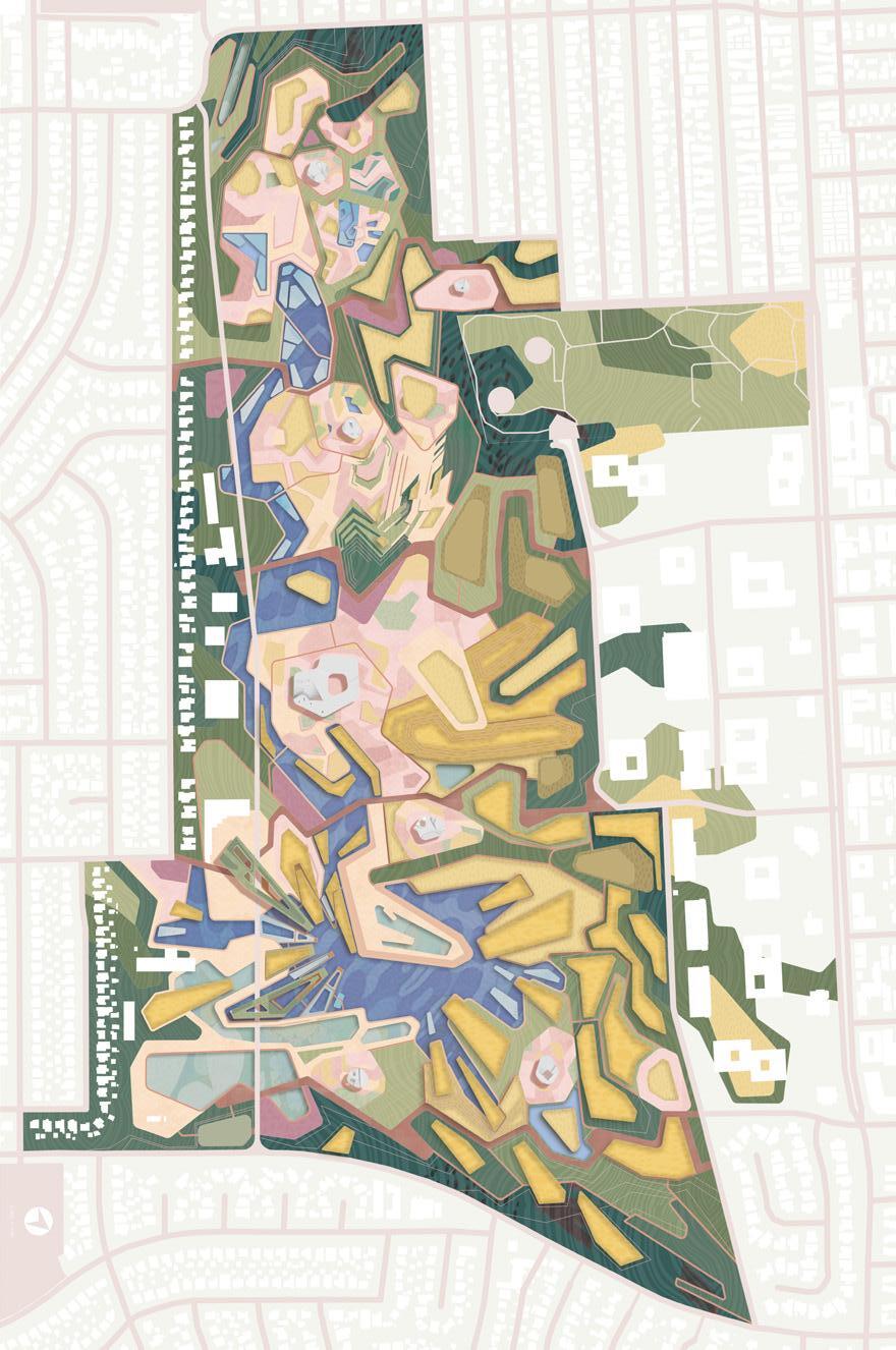
FIGURED GROUNDS AND GROUNDED FIGURES
3GA Fall 2021
Margaret Griffin
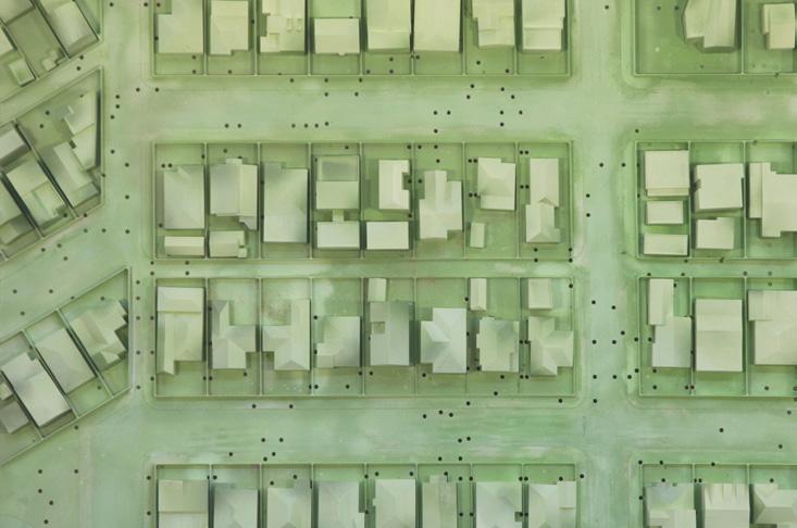
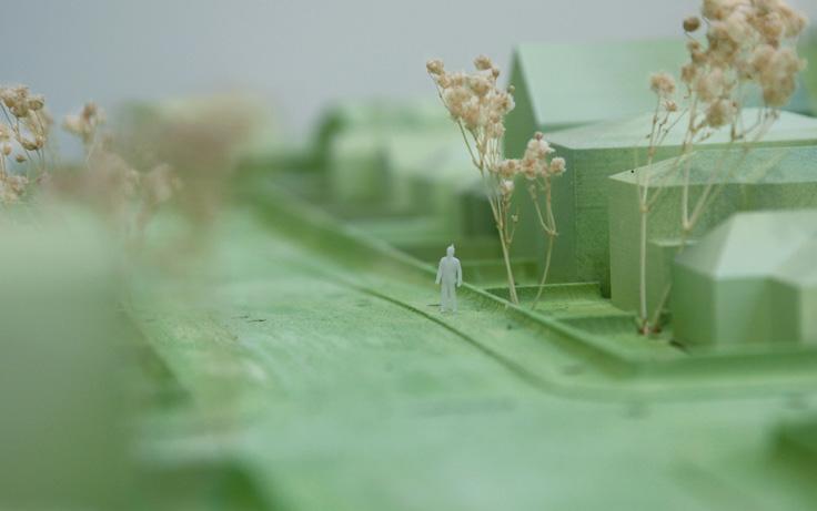
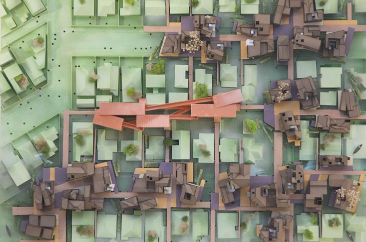
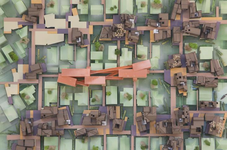
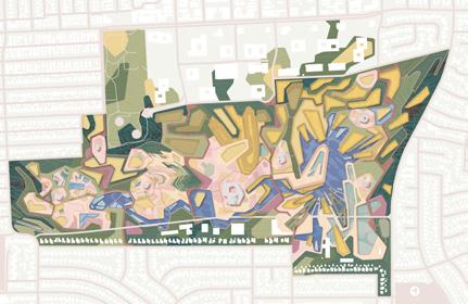
The Santa Monica Airport is on the top of an elongated hillside ridge and acts as a belvedere over the whole westside of LA, with views to the ocean, the mountains, Lax and beyond. Situated at the edge of Santa Monica this site has the capacity to reconnect currently dissociated areas of the West side of Los Angeles, uniting Santa Monica, West LA and Mar Vista. Formerly an edge condition of Santa Monica this site will become a new center of West Los Angeles. I used figure ground as a theoretical and geometric device to create a new Architecture of the City (Park), combining geometry, nature and fantasy to create a new urban paradigm that has the capacity to transform (the ecology of) our daily life.
PAGE 14 O2 FIGURED GROUNDS AND GROUNDED FIGURES PORTFOLIO JIAXIN LI
Professor
A NEW
URBAN PARK FOR WEST LA
FIGURED GROUNDS AND GROUNDED FIGURES
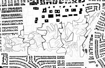
FIGURE-GROUND DIAGRAM PATHS
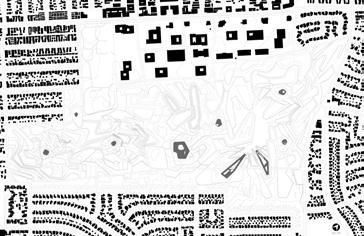
FIGURE-GROUND DIAGRAM I BUILDINGS & STUCTURES
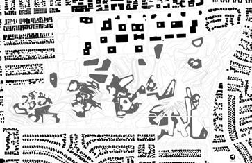
FIGURE-GROUND DIAGRAM HARD LANDSCAPE
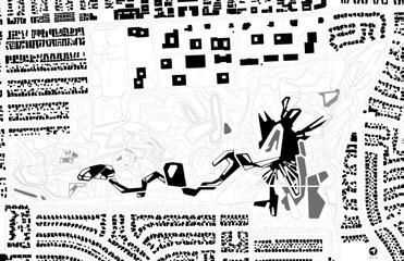
FIGURE-GROUND DIAGRAM WATER FEATURE
PAGE 15 PORTFOLIO JIAXIN LI
AXON
FIGURED GROUNDS AND GROUNDED FIGURES
FIGURED GROUNDS AND GROUNDED FIGURES
PAGE 18 PAGE 17
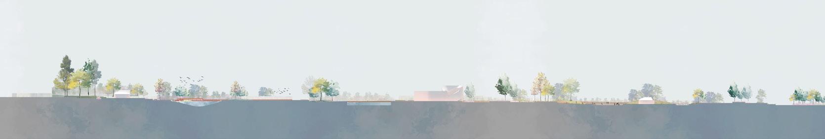
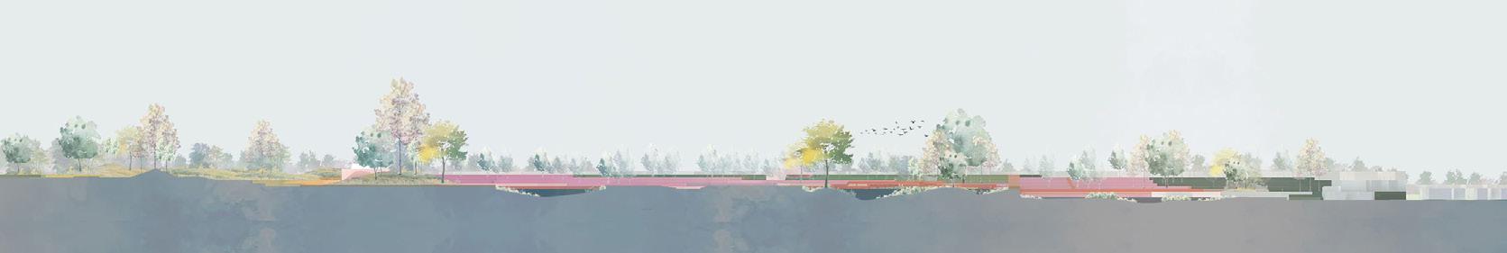
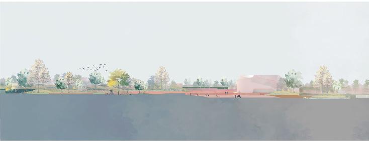
SECTION A-A'
SECTION B-B'
A A' B' B C C'
JIAXIN LI
JIAXIN LI
SECTION C-C'
PORTFOLIO
PORTFOLIO
FIGURED GROUNDS AND GROUNDED FIGURES
FIGURED GROUNDS AND GROUNDED FIGURES
PERSPECTIVE VIEWS
PORTFOLIO JIAXIN LI
JIAXIN LI
PORTFOLIO
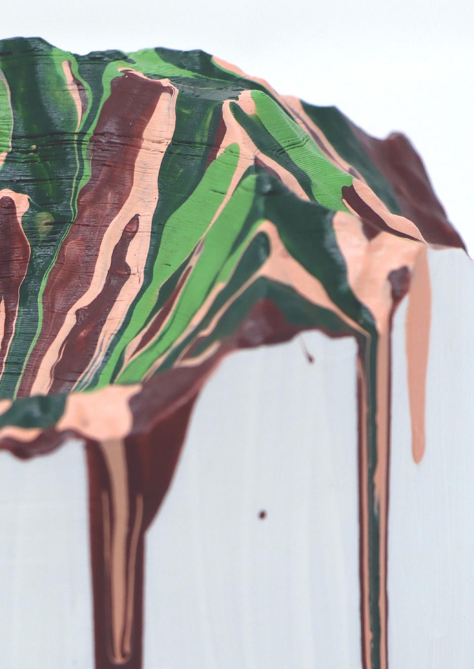
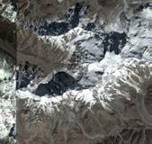
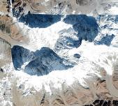
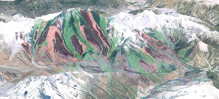
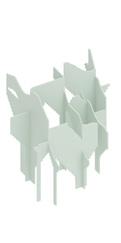
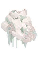
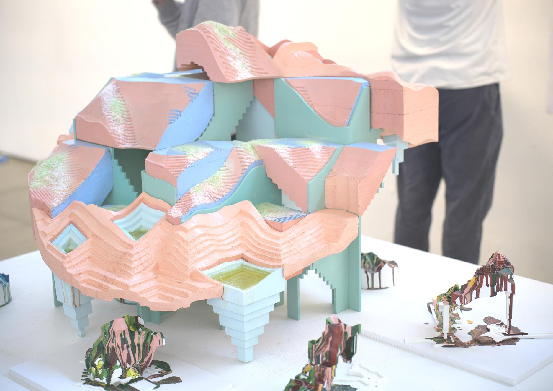
NOT A MOUNTAIN
In this spirit the studio will survey and re-model iconic mountain peaks and re-insert them back into theworld through imagery. Of particular interest is the production of physical models that engage a range ofdigital and analog techniques. Through a strategy of extraction, from image to surface to substance, theaim is to raise awareness of and swerve our assumptions about nature and tectonic performances in searchof an aesthetic that exchanges the wonderful / auratic / superiority of the sublime for the wonderful /horrific / ulteriority of something adjacent.
NOT A MOUNTAIN PORTFOLIO JIAXIN LI PAGE 36 O3
3GB Spring 2022
Professor Ramiro Diaz-Granados

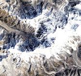

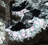
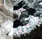
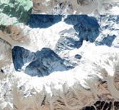

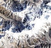
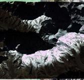
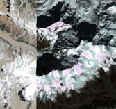
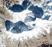
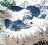
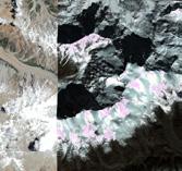
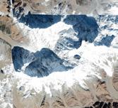
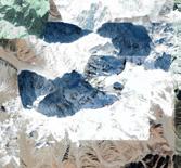
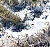
Gilgit-Baltistan, Pakistan
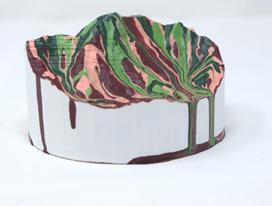
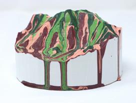
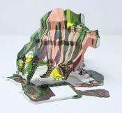
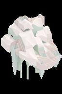
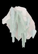
The project is a model. selected a mountain peak and convert its image data to a pair of models: miniature and dog-sized. From there worked through techniques of substantiating the surface through problems of thickness, performance, and structure then proceed to drawing-based techniques of hatching that will function as vector paths for scratching, gouging, and digging in the form of a cnc flip-milled model. This will serve as an armature for a sludge tectonics: using gravity to paint the model by systematically dripping liquids (paint, resin, latex, etc) into layers of accumulated mass and structure.


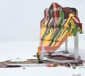
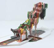
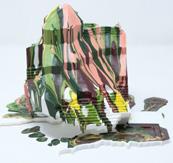
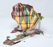
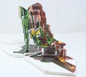
NOT A MOUNTAIN PORTFOLIO JIAXIN LI PAGE 38
NOT A MOUNTAIN PORTFOLIO JIAXIN LI PAGE 37
201811 201609 201310 201812 201610 201311 201910 201611 201407 201012 200311 201002 200307 200609 198512
TIMELINE AERIALS FROM GOOGLE EARTH PRO
Nanga Parbat Location:
Elevation: 8,126m(26,660ft) Prominence: 4,608m(15,118ft) Isolation: 189km(117mi) Age of Rock: 47 million years Mountain Type: Folded mountaions 202009 202105 201709 201409 201106
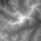
Heightmap from Atlas lugin for Photoshop
Satellite
Aerial from Goggle Map Customizer Perspective Views from Google
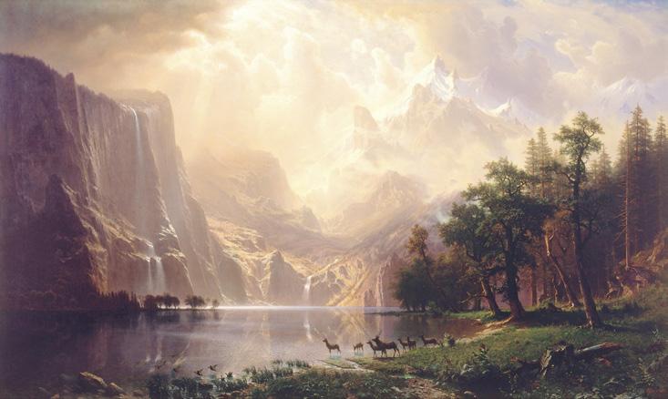
Prior to photography, painting was the primary means of depicting landscape (real and imagined) and capturing the majestic and atmospheric qualities of mountains,seas,forests,sky,flora, and fauna. In Landscape painting that include structures, buildings are often of the vernacular sort or monuments in ruin. I inserted drip model photographs into a selected landscape painting. Decisions about scale, location, orientation and simulated brushstroke techniques combine to produce an object that seems both alien and integral to the scene as mountain and structure.


PAGE 40 PAGE 39
Prior to photography, painting was the primary means of Among the Sierra Nevada Mountains, California,1868, Albert Bierstadt
NOT A MOUNTAIN PORTFOLIO JIAXIN LI NOT A MOUNTAIN PORTFOLIO JIAXIN LI
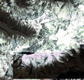
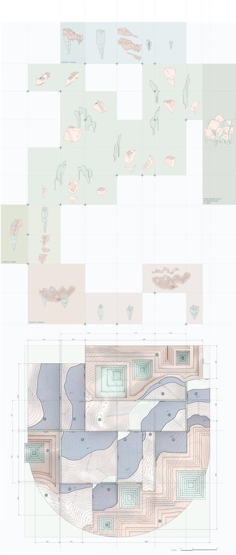
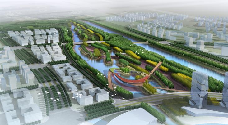
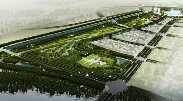
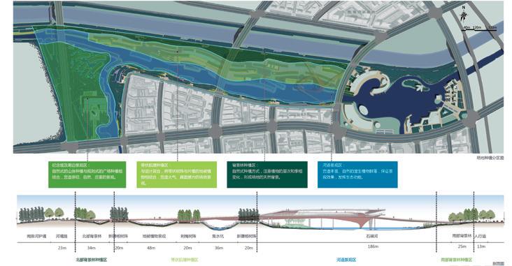
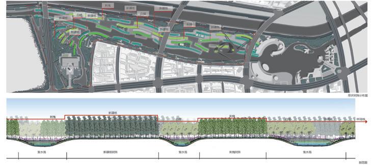
SHIBEI RIVER AND NANPAI RIVER LANDSCAPE DESIGN OF HUANGHUA COUNTY
2013
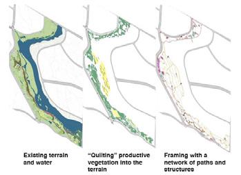
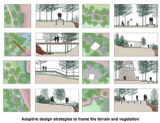
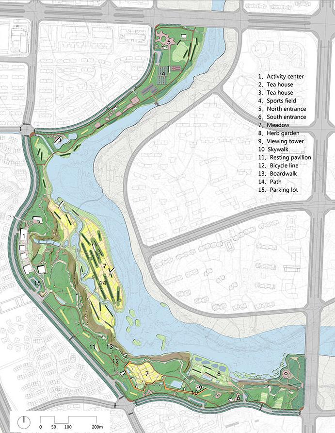
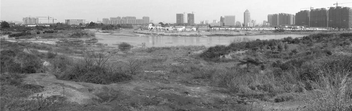
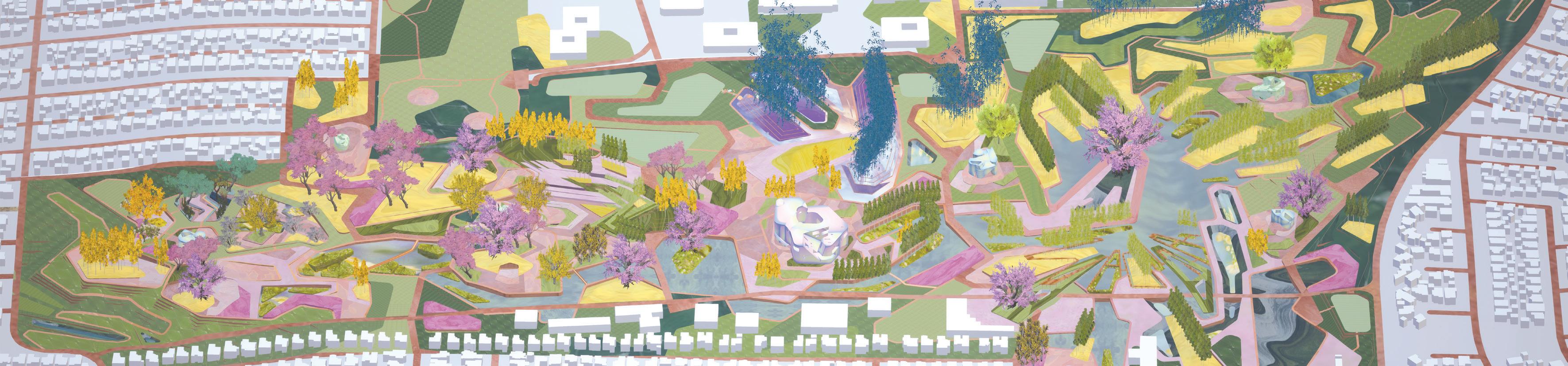
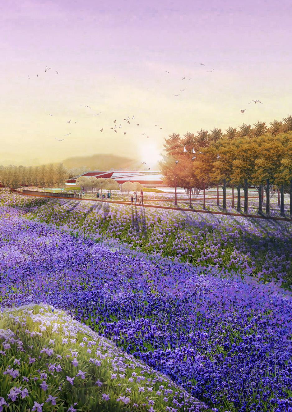
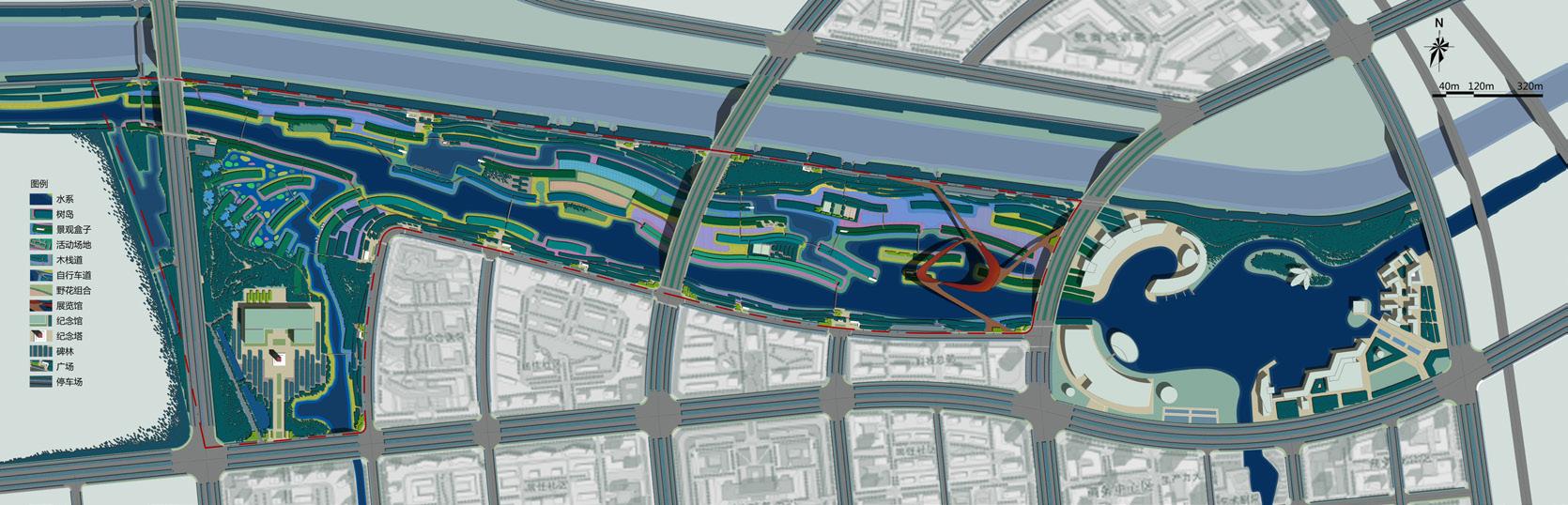
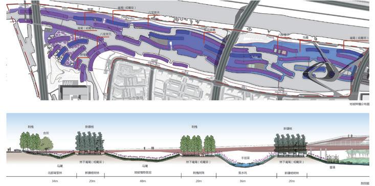
Creating a unique landscape tailor-designed for the local area that features perfect blending of waters, islands and green spaces;Tapping fully into the potentials of the site as the lung of the city by minimizing waste of natural resources and maximizing the aesthetic values of the landscape;Developing the Shibeihe Belt into a simple, dynamic and impressive waterfront belt notable for its ecological, cultural and recreational values. Priorities will be given to the following 3 aspects:Restoring and remodeling a healthy, viable river course that serves as the lung of the urban place;Creating a local-styled cultural corridor for exhibiting and promoting indigenous folk customs and local culture;Shaping a recreational venue that both preserves the past and at the same time heralds the future.
O4 SHIBEI RIVER AND NANPAI RIVER LANDSCAPE DESIGN OF HUANGHUA COUNTY PORTFOLIO JIAXIN LI PAGE 44
Turenscape HEBEI HUANGHUA,CHINA
SITE PLAN
PORTFOLIO JIAXIN LI PAGE 46 PORTFOLIO JIAXIN LI PAGE 45
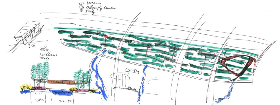
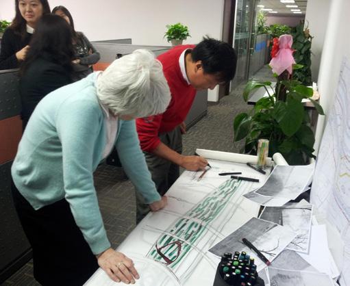
DR. KONGJIAN YU'S SKETCH
RIVER AND NANPAI RIVER LANDSCAPE DESIGN OF HUANGHUA COUNTY SHIBEI RIVER AND NANPAI RIVER LANDSCAPE DESIGN OF HUANGHUA COUNTY
SHIBEI
PAGE 48 PAGE 47
JIAXIN LI PORTFOLIO JIAXIN LI SHIBEI RIVER AND NANPAI RIVER LANDSCAPE DESIGN OF HUANGHUA COUNTY SHIBEI RIVER AND NANPAI RIVER LANDSCAPE DESIGN OF HUANGHUA COUNTY
PORTFOLIO
PAGE 50 PAGE 49 北京土人城市规划设计有限公司 C区 A区 B标段 D标段 E区 第一分区 第二分区 第三分区 北京土人城市规划设计有限公司 字 号 名: 子项名称: 委托单位: 专业负责人 设计阶段 号 名: 工程项目名称: 发行日期 (FAX):86-010-62745656 TUREN DESIGN INSTITUTE BEIJING 景观 黄骅市住房和城乡建设局 B标段施工图设计 字 子项名称: 工程项目名称: 黄骅市住房和城乡建设局 号 名: 委托单位: 联系电话 (TEL):86-010-62745678 (WEB): WWW.TURENSCAPE.COM 施工图 河北黄骅市石碑河、南排河景观设计 名 期 子项名称: 工程项目名称: (FAX):86-010-62745656 黄骅市住房和城乡建设局 字 子项名称: 工程项目名称: 委托单位: 专业负责人 项目负责人 黄骅市住房和城乡建设局 字 子项名称: 工程项目名称: 黄骅市住房和城乡建设局 号 名: 委托单位: 联系电话 (TEL):86-010-62745678 (WEB): WWW.TURENSCAPE.COM 施工图 河北黄骅市石碑河、南排河景观设计 号 名: 工程项目名称: 发行日期 (FAX):86-010-62745656 TUREN DESIGN INSTITUTE BEIJING 景观 黄骅市住房和城乡建设局 B标段施工图设计 字 号 名: 子项名称: 委托单位: 专业负责人 设计阶段 字 子项名称: 工程项目名称: (FAX):86-010-62745656 黄骅市住房和城乡建设局 期 名: 子项名称: 委托单位: 专业负责人 设计阶段 委托单位: 河北黄骅市石碑河、南排河景观设计 号 名: 委托单位: 河北黄骅市石碑河、南排河景观设计 TECHNICAL DRAWING
JIAXIN LI PORTFOLIO JIAXIN LI SHIBEI RIVER AND NANPAI RIVER LANDSCAPE DESIGN OF HUANGHUA COUNTY SHIBEI RIVER AND NANPAI RIVER LANDSCAPE DESIGN OF HUANGHUA COUNTY
PORTFOLIO