

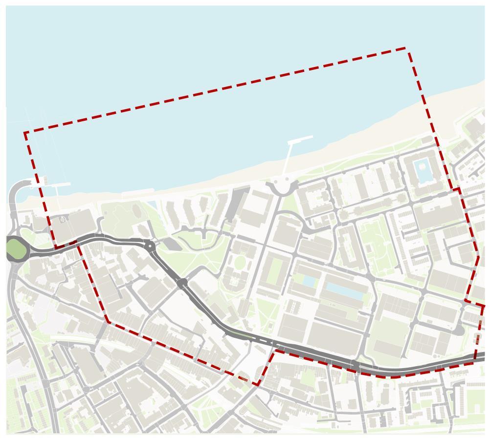
Interrogating the Dimensions of Urban Design
Woolwich Royal Arsenal and Town Centre
Group F1: Gemma Drake, Jhanvi Patel, Wesley Wong, Matthew Madden, Lydia Mihailovic


SITE HISTORY
Our site has seen significant change over the past 500 years: the Royal Arsenal has been a major influence on the town's built environment and its economy.

Royal Arsenal History (1717), Wikimedia Commons (1877), Royal Arsenal History (1931).
The Royal laboratory is one of the oldest buildings on the Royal Arsenal site.

Laboratory Square in 1750. (Gamaliel, M. 1750).
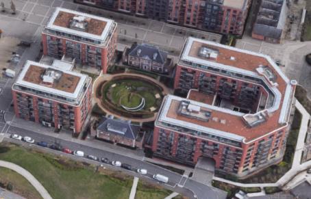
Information in Alan Baxter (2018). Laboratory Square in 2022. (Google Earth, 2022).


SITE OVERVIEW
The site includes a range of different land uses, but residential dominates the regenerated area


• The regeneration of the Royal Arsenal originally intended a greater mix of uses.
• The eventual scheme, including an additional 25 acres to the west led by Berkeley Homes, has over 2,500 more residential units (Guillery, 2012: 184-7).
• More recently, there have been renewed efforts to establish a Creative/Cultural District within the Historic Royal Arsenal.
LEGEND:
Residential
Commercial (Office & Retail)
Commercial-industrial (office cum warehouses, etc.)
Residential-commercial
Community (performance spaces, sports centre, etc.)
Transportation (tube and bus stations)
Vacant
Historic Royal Arsenal
Royal Arsenal Riverside Development
Woolwich Town Centre


URBAN MORPHOLOGY: CHANGE OVER TIME
Comparison of historical figure ground maps shows how the urban fabric of our site has changed over the last 100 years

The Royal Arsenal was blanked out in most local historical maps to maintain its security


=
1890
• Fine grain and significant permeability.
=
• Narrow, rectangular terrace plots, reflecting typical terraced and back-to-back housing of the pre-war era.
• Semi-partial saturation along Hare Street.

=
1950
=
• Slum clearance of bomb-damaged housing post-WW2 (Ezitis, 2020; Layers of London, 2021).
• Development of larger commercial blocks and plot amalgamation has coarsened the grain of the neighbourhood; e.g., Granada Cinema built in 1937.
• Decline of Woolwich Docks including closure of second pier.
Woolwich in 1950
Legend = Hare Street;
Royal Arsenal Site;
Granada Cinema;
Terraced Housing morphology;
Woolwich Docks
Woolwich in 1890
ROYAL ARSENAL: CONSERVATION
Buildings in the Historic Royal Arsenal have seen various degrees of alteration, enabling them to accommodate new uses and avoid functional obsolescence.
Effective revitalisation demands appreciation of historic context
Brass Foundry(1716-17)

• Original use: gun workshop
• Restored in large part to its original form (Guillery, 2012). Now a National Maritime archive.

Grand Store (1805-1813)

• Original use: military warehouse.
• Major work to address subsidence described as a “conservation triumph” (Guillery, 2012: 186)
The Armouries (1803-1805)

• Original use: gun manufacturing
• Seven-storey residential towers added by Berkeley Group in 2007-10. Preservation "reduced to a gesture" (Guillery, 2012: 188).
Map showing the Conservation Area designated in 1981
Grade I Listed
Grade II* Listed
Grade II Listed


TOWN CENTRE:
CONSERVATION – ‘heritage at risk’
The Town Centre is on Historic England's 'at risk' register. It highlights the challenges of protecting a historic environment's 'sense of place'.

Map showing the Conservation Area designated in 2019
Grade II* Listed

A range of challenges are identified in the Conservation Area Appraisal (RBG, 2022b):
Grade II Listed Vacant commercial units
Leisure Centre obstructs historic view of the Thames from Hare Street


Threat to ‘fine grain urbanism’

Inappropriate plastic fascias

Poor maintenance of upper stories and public realm

LEGIBILITY: MENTAL MAP
This map combines group members’ observations with analysis of social media posts to incorporate perceptions of Woolwich resi dents.

Both the River Thames and the A206 create two major edges.


Legibility deteriorates towards the west as landmarks become more homogenous and the grid becomes less regular – paths are less coherent.
Paths | Edges | Districts |Nodes | Landmarks
Five elements proposed by Kevin Lynch (1960).


A public art installation stands adjacent to the Thames Clipper providing a node for visitors and commuters.

Historic buildings such as the Shell Foundry and Brass Foundry (see slide 7) create distinctive landmarks in the Royal Arsenal. The Crossrail station is strategic locus for entering/exiting the area.
Beresford Gate is a primary reference point and the Square forms a junction and convergence of activity (see slide 15).
2. Riverside Development
1. Historic Royal Arsenal
3. Town Centre
PLACE MARKETING/BRANDING
Berkeley's marketing strategy is designed to attract new residents and investors to the area.
• This map is overlaid with descriptions from advertising and marketing materials from the Developer, Berkeley Group (2022a; 2022b).
• ‘Imagineering’ (Carmona, 2021: 175) is used to present the Royal Arsenal as a luxurious, vibrant and enticing place to live.
• Berkeley Group's advertising did not always align our perceptions.
• The 'private' and 'exclusive' branding of the development creates a sense of separation between the Royal Arsenal and Riverside Development and the old Town Centre.


POPULARITY
Locations within the new development are uploaded onto social media more than the old Town Centre, highlighting trendiness.


Data to create this map has been extrapolated from Instagram (2022)
Lovene et al. (2019) equate popularity with beauty, but this idea has been critiqued (Carmona, 2019). Carlino and Saiz (2019) and Seresinhe et al. (2007) have used geotagging to highlight popular scenic places and have correlated this data with positive socio-economic outcomes. We used geotagging data from Instagram to highlight the use of the area by people, particularly visitors.

PUBLIC/ PRIVATE SPACE

Enclosed undefined spaces provide opportunities to be opened up for temporary public spaces.
This map assesses types of open spaces within the site. Presence of gated communities hinders integration to the surrounding public realm and community. While the Royal Arsenal and Riverside Development adds new public spaces to Woolwich, access points of several residential developments are gated.


LEGEND:
Public spaces – streets: open and accessible to the public
Public spaces – squares, parks, pavements
Semi-public spaces: open and accessible to the public under conditions (e.g. public spaces with limited opening hours)
Semi-private spaces: restricted access to a certain group of members (e.g. communal green spaces)
Private spaces: access controlled by individual owners (e.g. private gardens, company areas)
Enclosed spaces under construction/ awaiting development: closed to the public


STREETS: ROYAL ARSENAL – ‘latent’ space
Streets in the Royal Arsenal have a low pedestrian footfall – they do not attract a wide cross-section of the community.
NO.1 STREET, ROYAL ARSENAL
No.1 Street is the main pedestrian connection through the Arsenal to the River Front, but it is dormant for most of the day.
Use: Primarily residential. The Royal Artillery Museum, for example, closed in 2016.


Visual character: Older buildings have a strong aesthetic character with balanced symmetrical design.

Inclusivity: Signage discourages non-residents from lingering in the street.


H:W = 1.15:1

Spatial enclosure: Contrasting degree of spatial enclosure along the street enhances the kinaesthetic experience of pedestrians.
Straight road without “visual termination” (Carmona, 2021: 276).

Visual character: Tenancy rules restrict personalisation of balconies and limit the visual dynamics along the street.

STREETS: TOWN CENTRE – ‘influential’ space
Despite facing considerable challenges (see slide 8), the Town Centre is a vibrant and dynamic public space which encourages a range of uses.
POWIS STREET (HIGH STREET)
Situated at central Woolwich, Powis Street has a high pedestrian footfall for much of the day.
Facilitiesand inclusivity: A range of permanent and temporary street furniture –benches, digital signage and telephone kiosks. These encourage people to use the street.


Use: a range of uses including residential, commercial and community spaces.
E.g. the ‘Woolwich Front Room’ (Google Maps, 2022)


Visual character: Consistent plot widths and unifying architectural features – Victorian and early 20th c. upper stories – create visual complexity and rhyme.


Spatial enclosure: Towards an optimal height-to-width ratio with a balance between the sky view and the sense of enclosure.


GREEN INFRASTRUCTURE – ‘space left over after planning’ (SLOAP)
As shown on slide 18, our site contains two public parks. Maribor Park is an example of SLOAP, whilst Wellington Park encourages a greater range of activity.
MariborPark

Features that increase use / functionality
Duke of Wellington Statue provides interesting central feature
Children’s play equipment
Areas with benches
Clear edges/boundary
Features that impede use / functionality
Lack of protection from environmental stimuli
(wind from the river and the sound of cars from the A206)
Signage restricting ball games
Applying Gehl’s (2011) typology of outdoor activity:
Created when Warren Road was effaced for Crossrail tunnel

(Google Earth, 2022)
WellingtonPark
Created on roof of semi-sunken car park

CYCLING INFRASTRUCTURE
Cycle paths are infrequent and disjointed, with too few bike stands for a high-density development.

Woolwich section of Thames path cycle lane has been improved with Riverside Development but is still severed from rest of pathway by Woolwich Pier.
Little connectivity of cycling infrastructure with greater Woolwich.
Only one section of east-bound A206 has a cycle lane. Half the route shares road-space with cars and buses which is not ideal for safety.


Only 42 publicly accessible bike stands within development boundary. Many bikes parked in non-authorised spots due to lack of bike parking, particularly by the Crossrail Station.
Council threatens to remove bikes at non-authorised stands despite no intention to increase bike stand supply.

'Bicycles are not to be stored in an unauthorised area.'
'this bike will be removed'.
- Royal Arsenal Riverside Estate Management Team
CAR PARKING INFRASTRUCTURE
A range of parking strategies impacts upon the experience of being within the site.
Underground parking increases the space available for green infrastructure (see slide 19).
Entrance to underground parking for highrise apartments.
Royal Arsenal Development centre is devoid of parking, creating a pedestrainised core. Bollards aid this.


This area used to contain parking, but it has now been demolished in preparation for new development.


Parking concealed within square residential blocks reduces the ability for "eyes on the street" and could lead to an increase in crime (Jacobs, 2000).
Public-sector owned parking.

Residential parking in front of houses reduces front garden space.
A greater frequency, concentration and area of car parks towards the edges of our site, particularly around the industrial areas.
A206: SEVERANCE AND POOR PEDESTRIAN QUALITY
The A206 is a major ‘edge' in our mental map (slide 10). It was widened in the 1980s as part of the construction of Thamesmead (Guillery, 2012: 163).
Tower blocks

Tall buildings (several still under construction) have a ”deadening” impact at the street level (Carmona, 2021: 432).
Blank frontages

Buildings such as Riverside House – currently being used for artist studios – appear to lack human presence.
Vacant land / buildings


Large inactive spaces and long-term empty units are lacunae in the street fabric.

Big boxes

Large, passive units have a similarly detrimental impact on street life (Gehl, 2011: 93).
Perimeter wall

The wall around the Royal Arsenal segregates cars from people (Google Maps, 2022). It is a symbolic as well as physical barrier (Berkeley Group, 2014: 11).
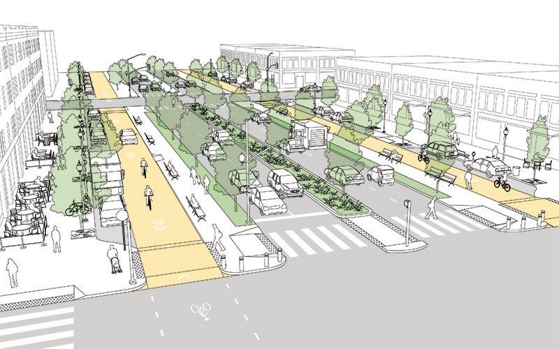
A206: STRATEGIES TO ENABLE RECONNECTION
A range of strategies have been employed to address severance, making the street a “habitable space rather than a conduit for moving cars” (Talen, 2008: 161).
Improving crossings and permeability


New road surfacing using bricks instead of asphalt. Reduced curb levels and removal of pedestrian pens enhance accessibility across the street. Widened pedestrian crossings
An improved and expanded pedestrian crossing – 3 on slide 22located at Beresford Gate, which was severed from the Royal Arsenal when the road was widened and re-routed in the 1980s (Guillery, 2012).

Improving walkability and pedestrian experience
Clear ‘build to’ line helps define the public realm (Talen, 2008: 163).
Generous pavements with tree buffers, public seating and active mixed uses at ground floor level.


DEPRIVATION
There is a socio-economic divide between the new Royal Arsenal & Riverside Development and the Town Centre.

Data from Open Data Communities (2019)
The IMD comprises seven ‘domains’ of deprivation. The Town Centre is more deprived than the Royal Arsenal and Riverside Development. Between 2015-2019, the whole site improved relative to other LSOAs in the UK. However, the Royal Arsenal and Riverside Development have improved to a greater extent than the Town Centre.


LSOAs within site boundary (2019)
LSOAs within site boundary (2015)
AFFORDABILITY
There is a stark contrast in affordability between the Royal Arsenal & Riverside developments and the Town Centre.

(Silver J., 2021)

• The disparity between the Woolwich Town Centre and Riverside Development highlight the widened wealth gap resulting at least partly from the redevelopments.
• There seems to be a correlation between house price and deprivation, causing future issues in social cohesion for the community.
• 26% of housing built so far being affordable housing.
• Most of the affordable housing are either starter homes (20% less than market value) or shared ownership.
• It is unclear how many are truly social housing.
(Essex-TV, 2022)


(Foxtons, 2022; Land Registry 2021).

CRIME
Instances of crime are prevalent across the site and higher than the Greenwich and London averages.


Data from Open Data Communities (2019)
Only two neighbourhoods within the site have experienced reduced crime relative to the rest of the UK. The other two neighbourhoods have seen worsening crime between 2015 and 2019. Greenwich 004H has the most drastic change in worsening crime.

Data from Met Police (2022)


LSOAs within site boundary (2015)
LSOAs within site boundary (2019)
CONCLUSIONS
Woolwich demonstrates how “[u]rban environments are continuously and inexorably changing” (Carmona, 2021: 109). Our analysis highlights the challenge of maintaining a shared identity with the past – of conserving historic buildings within their settings – whilst encouraging new forms of development, facilitating change and adaptation. We have shown how this can result in fragmentation and loss of coherence between different 'parts' of a city, which can also play out socially and economically.
Strengths Weaknesses
• Strong ‘sense of place’ created by distinctive historic architecture and topography (situated on the Thames).
• Regeneration of the Royal Arsenal has brought a large area of derelict land into use. Former military buildings have shown resilience and robustness and successfully accommodate new uses.
• Woolwich has a lively Town Centre with dynamic streetscape.
• The area has high connectivity to major business areas and strong public transport links.
• There is a weak synergy between the Royal Arsenal and Riverside Development and Town Centre, resulting from a combination of factors including:
> Major severance created by the A206
> Development of high-rise residential towers
> History of the Arsenal as a military enclave
• Public spaces (streets and squares) in the Royal Arsenal fail to attract a diverse range of people and activities, whilst several spaces have been gated off for private residential use.
• There are spatial inequalities between the north and south of the site and crime is a pervasive issue.
Opportunities Threats
• Cultural events in the Royal Arsenal to bring people into ‘latent’ public spaces, and interventions encourage more spontaneous/informal use.
• Improve cycling connectivity and continue to increase permeability – addressing severance caused by the A206.
• Investment in the Town Centre through the Future High Streets Fund and Heritage Action Zone to support area management and conservation.
• Over-intensification of development could undermine place identity.
• Growing disparity between ‘deprived’ and ‘affluent’.
• Gentrification and displacement of existing residents (as a result of house prices).
• Dominance of residential buildings as opposed to genuinely mixed-use.
REFERENCES
• All maps, graphics and photographs have been produced by group members, unless otherwise stated.
• All bird-eye view3D images and satellite images from Google earth Google Earth (2022)
• 3D of the site was made available from https://cadmapper.com/pro/extracts/7583d83b-25bf-46f2-b346-201f5cb32433
• Anderson, S. (ed.) (1978). On Streets. Cambridge MA: MIT Press.
• Alan Baxter (2018). Woolwich Town Centre Heritage Study. Available at: https://853blog.files.wordpress.com/2019/01/woolwich-heritage-study-december-2018.pdf (Accessed: 23 November 2022).
• Berkley Group (2022a). Royal Arsenal Riverside. Available at: https://www.berkeleygroup.co.uk/developments/london/woolwich/royal-arsenal-riverside (Accessed: 23 November 2022).
• Berkley Group (2022b). Seafarers Wharf. Available at: https://www.berkeleygroup.co.uk/-/media/migration/berkeley-group/developments/royal-arsenal-riverside/seafarers-wharf/royal-arsenal-riverside_seafarerswharf_brochure_04102022.ashx?rev=5698b34f13ce4e39bfcfc33f12c7ef1c&hash=9BC19E7258AFEFCD99B114F083425910 (Accessed: 23 November 2022).
• Berkeley Group (2014). Living at the Royal Arsenal: A Social Sustainability Report Commissioned by the Berkeley Group. London: Berkeley Homes. Available at: https://www.berkeleygroup.co.uk//media/migration/berkeley-group/about-us/sustainability/communities-and-sustainable-living/berkeley-living-at-the-royalarsenal.ashx?rev=3e28fa6bd47142ca9365fef5cae51c54&hash=4F7744CEDCD5C9D6CDB603D7B63DF162 (Accessed: 23 November 2023).
• Carlino, G. & Saiz, A. (2019). 'Beautiful city: leisure amenities and urban growth', Journal of regional science, 59(3), pp.369-408.
• Carmona, M. (2021). Public Places Urban Spaces: The Dimensions of Urban Design. Third Edition. London: Routledge.
• Carmona, M. (2019). '67. Aesthetics, beauty, popular design, and professional education', Matthew Carmona, 13 November. Available at: https://matthew-carmona.com/2019/11/13/67-aesthetics-beauty-popular-designand-professional-education/ (Accessed: 23 November 2022).
• Essex TV (2022). Royal arsenal riverside crowned best regeneration project at evening standard new homes awards. Available at: https://essex-tv.Co.Uk/royal-arsenal-riverside-crowned-best-regeneration-project-atevening-standard-new-homes-awards/ (Accessed: 23 November 2022).
• Ezitis (2020). Woolwich Parochial Almshouses. Available at http://ezitis.myzen.co.uk/woolwichparochialfirst.html (Accessed: 18 November 2022).
• Foxtons (2022). Woolwich. Available at: https://www.foxtons.co.uk/living-in/woolwich (Accessed 18 November 2022).
• Gamaliel, M. (1750). Woolwich Arsenal. [Drawing]. National Maritime Museum, London. Available at: https://www.rmg.co.uk/collections/objects/rmgc-object-150686 (Accessed: 22 November 2022).
• Gehl, J. (2011). Life Between Buildings: Using Public Space. Third Edition. Translated by Jo Koch. London: Island Press.
• Guillery, P. (ed.) (2012). Woolwich. Survey of London. Vol 48. Available at: https://www.ucl.ac.uk/bartlett/architecture/research/survey-london/Woolwich (Accessed 23 November 2022).
• Instagram (2022). Available at: https://www.instagram.com/ (Accessed: 23 November 2022).
• Jacobs, J. (2000) The death and life of great American cities. London: Pimlico.
• Land Registry (2021). UK House Price Index. Available at: https://landregistry.data.gov.uk/app/ukhpi/compare?in=avg&location[]=E12000007&location[]=E09000011&location[]=E92000001&st=all&lang=en (Accessed 23 November 2022).
• Layers of London (2021). Bomb Damage (1945). Available at: https://www.layersoflondon.org/map/overlays/bomb-damage-1945?overlayGroups=eyJlbmFibGVkIjpbImJvbWItZGFtYWdlLTE5NDUiXX0%3D (Accessed 18 November 2022). Mapped: London property prices in your (very) local area. Available at: https://www.cityam.com/mapped-london-property-prices-in-your-very-local-area/ (Accessed 23 November 2022).
• Lovene, M., Boys Smith, N. & Seresinhe, C.L. (2019) On streets and squares. London: Create Streets
• Lynch, K. (1960). The Image of the City. Cambridge MA: MIT Press.
• Metropolitan Police (2022) Woolwich Riverside. Available at: https://www.met.police.uk/a/your-area/met/greenwich/woolwich-riverside/ (Accessed: 7 October 2022).
• Noun Project (no date). Home. Available at: https://thenounproject.com/ (Accessed: 22 October 2022).
• ONS (Office for National Statistics). (2022). Population Estimates. Available at: https://www.ons.gov.uk/peoplepopulationandcommunity/populationandmigration/populationestimates (Accessed: 22 November 2022).
• Open Data Communities (2019) Indices of Deprivation: 2019 and 2015. Available at: http://dclgapps.communities.gov.uk/imd/iod_index.html# (Accessed: 23 November 2022).
• RBG (Royal Borough of Greenwich). (2022a). Woolwich Regeneration. Available at: https://www.royalgreenwich.gov.uk/info/200200/regeneration/142/woolwich_regeneration (Accessed: 01 November 2022).
• RBG (Royal Borough of Greenwich). (2022b). Woolwich Conservation Character Appraisal SPD. Available at: https://www.royalgreenwich.gov.uk/downloads/file/5578/woolwich_conservation_area_appraisal_march_2022 (Accessed: 18 November 2022).
• RBG (Royal Borough of Greenwich). (2014). Core Strategy with Detailed Policies. Available at: https://www.royalgreenwich.gov.uk/downloads/download/718/core_strategy_with_detailed_policies (Accessed: 18 November 2022).
• Royal Arsenal History (1717). Plan of the Warren. Available at: https://www.royal-arsenal-history.com/1700s-maps.html (Accessed 07 October 2022).
• Royal Arsenal History (1931). 1931 Royal Arsenal West. Available at https://www.royal-arsenal-history.com/1900s-maps.html (Accessed 07 October 2022).
• Seresinhe, C., Preis, T. & Moat, H.S. (2007) 'Quantifying the impact of scenic environments on health', Scientific reports, 5(16899), pp.1-9.
• Silver. J., (2021). Mapped: London property prices in your (very) local area. Available at: https://www.cityam.com/mapped-london-property-prices-in-your-very-local-area/ (Accessed 23 November 2022).
• Talen, E. (2008). Design for Diversity: Exploring Socially Mixed Neighbourhoods. Oxford: Architectural Press.
• Wikimedia Commons (1877). Royal Arsenal Map. Available at: https://commons.wikimedia.org/wiki/File:Royal_Arsenal_Map,_1877.jpeg (Accessed 07 October 2022).
CONTRIBUTIONS AND TEAMWORKING
"Urban design is, by its nature, collaborative and interdisciplinary, involving an integrated approach, and the skills and expertise of a wide range of actors" (Carmona, 2021: 11).
We each made an equal contribution to the project in both time and effort. We worked flexibly and collaboratively throughout and enjoyed learning from one another. A broad breakdown of responsibilities is below:
Wesley
Primary contributions: Site overview, Urban Space Types, Streets (Royal Arsenal and Town Centre), A206 (Strategies to enable re-connection).
Secondary contributions: Conservation (Royal Arsenal and Town Centre), scaling of maps and sections, photographs.
Jhanvi
Primary contributions: Introduction slide, Base map, Integrating tall buildings, Beresford square, Artillery and Major Draper square, Community facilities,
Secondary contributions: Preparing the template, Formatting of slides, sketches, figure ground map (Royal Arsenal), graphics in different slides
Gemma
Primary contributions: Urban Morphology Comparison, Place branding, Popularity, Deprivation, Crime, Car Parking Infrastructure.
Secondary contributions: Affordability, sketches, photographs.
Lydia
Primary contributions: Introduction, Conservation (Royal Arsenal and Town Centre), Legibility, Green Infrastructure, A206, SWOT.
Secondary contributions: Project narrative, research and theory, history, public square and streetscape analysis.
Matt
Primary contributions: Site History, Urban Morphology: Change Over Time, House Prices and Affordability, Cycling Infrastructure.
Secondary contributions: Conservation (Royal Arsenal and Town Centre), Temporal Popularity, Place Branding, A206 (Severance and poor pedestrian quality), photographs and images.

Map depicting abstract conceptual frameworks


STRENGTHS AND OPPORTUNITIES

Connectivity
- Prime transport connectivity by both rail and water.

Legend:
DLR – used by 122m people per year
Elizabeth Line – has capacity of 200m passengers per year
Woolwich Ferry & Pedestrian Tunnel – used by 2m people per year
Thames Clipper – used by 40m people per year


Local Identity & Character
- High cultural diversity enriches Woolwich.
- Variety of historic and listed buildings.
Legend:
Royal Arsenal Character Area
Centre Character Area
Environment
- Key walking routes and greenspace are in the greater Woolwich area.
Legend:
Ring
Path
Green Way Green Chain Walk
Thames Barrier
Royal Arsenal & Woolwich Town Centre
Retail reflecting cultural diversity – usually in smaller, lower rent lots
Capital
Thames
Jubilee
Town
THREATS AND CONSTRAINTS

Connectivity
- Weak synergy between Royal Arsenal and Town Centre (reinforced by historic boundary).
- Poor accessibility to the Thames.
Legend:
Physical severance by A206
Gated communities and abandoned closed spaces
Large impermeable blocks
Infrequent and disjointed cycle paths


Local Identity & Character
- North-south socio-economic divide.
- Ongoing gentrification may further widen the gap.
Socio-economic divide marked by A206
Legend: Level of multiple deprivation

Average housing price

Deprivation and housing affordability gap running from north to south
Environment
High flood risk.
Significant air pollution.

Crime hotspot (size reflecting crime intensity)
Legend:
Royal Arsenal & Woolwich Town Centre
Flood Zone 1
Flood Zone 3
Area with NO2 and PM2.5 concentration exceeding guidance limits
A legible design which strengthens the relationship between the Town Centre and the River Thames

Providing inclusive education, employment and training opportunities

Creating safe and vibrant public spaces
Improving connectivity and movement


Encouraging active travel by improving routes for cyclists and pedestrians
Enabling a diverse range of uses to bring communities together


Ensuring that new development is sensitive to the historic setting

DESIGN PRINCIPLES:
open for everyone

Promoting sustainability and biodiversity
High-quality green infrastructure which connects public spaces
Celebrating Woolwich’s unique history


Exploring innovative solutions to climate change
Protecting and enhancing historic buildings and street patterns
IMPROVING CONNECTIVITY AND MOVEMENT


- A206 transformed into a boulevard with fully segregated cycle lanes and pedestrian priority to end severance.

- Renovating Woolwich tunnel to connect cycle lanes north and south of the river.

- Creation of ‘active transport corridors’ to link Town Centre with the riverfront.
- Use of permeable paving to reduce flood risk.

- Linking up cycling and public transport infrastructure by installing high-density, well-lit bike storage under key transport hubs.
(NACTO, 2013)
(Cities Today, 2017) Belam, 2018)
PROMOTING SUSTAINABILITY AND BIODIVERSITY

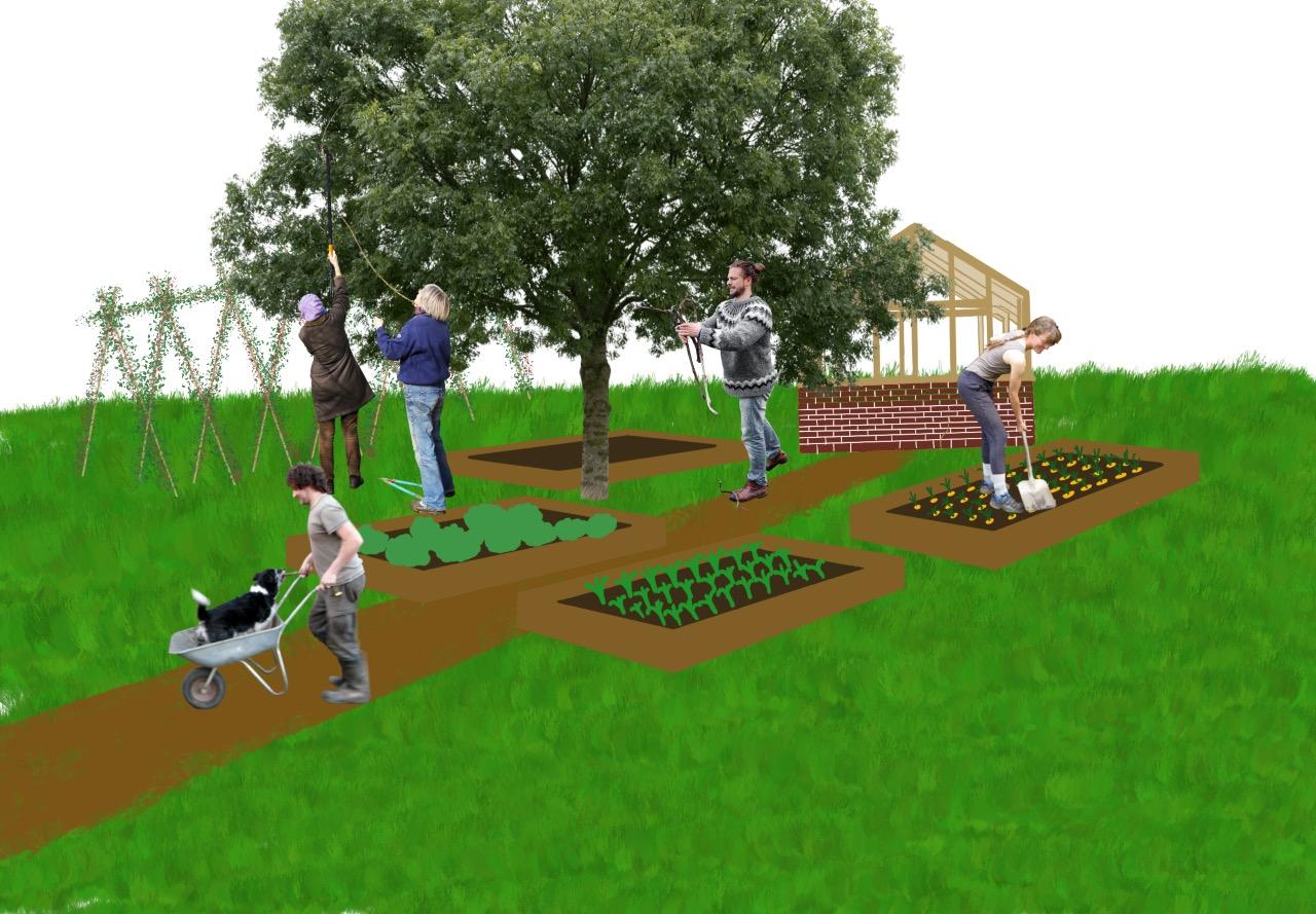


- Maribor Park and Wellington Park are the lungs of the development, encouraging community activity (e.g. gardening, sports and recreation)
- Parks connected through green corridors to the Town Centre and the Thames.
- Tree-lined streets, green roofs and walls, and SuDS reduce the urban heat island effect, pollution, and flooding.
- New wetland along Thames to prevent flooding.
- Planters doubling as seating to provide a better ‘third place’ (Oldenburg, 1997) for people to linger.

CREATING SAFE AND VIBRANT PUBLIC SPACES


REFERENCES
References include those drawn upon in the verbal presentation delivered on 15 December 2022.
• Alan Baxter. (2018). Woolwich Town Centre Heritage Study. Prepared for the Royal Borough of Greenwich. Available at: https://853blog.files.wordpress.com/2019/01/woolwich-heritage-study-december-2018.pdf (Accessed 12 December 2022).
• Belam, M. (2018). The time anomaly of the Woolwich foot tunnel and other portals of London. Available at: https://www.theguardian.com/uk-news/2018/jan/08/woolwich-foot-tunnel-portals-of-London (Accessed: 06 December 2022).
• Blogspot (no date). DESIGN + CONTAINER + RESTAURANT. Available at: https://4.bp.blogspot.com/SkZN0DRe73o/V8jMrQk9plI/AAAAAAAAMxw/ZogQUeLJnicPjHtzB6nKJ0XgXrsJyKnAQCLcB/s1600/DESIGN%2BCONTAINER%2BRESTAURANT.jpg (Accessed: 12 December 2022).
• Brighton Analytics Limited. (2022). Greater London Crime Statistics. Available at: https://crimerate.co.uk/london (Accessed: 12 December 2022).
• Carmona, M. (2021). Public Places Urban Spaces: The Dimensions of Urban Design. Third Edition. London: Routledge.
• Environment Agency. (2012). Thames Estuary 2100. London: Environment Agency. Available at: https://www.gov.uk/government/publications/thames-estuary-2100-te2100 (Accessed 12 December 2022).
• Imperial College London. (2018). Air Pollution Maps. Available at: https://www.londonair.org.uk/london/asp/annualmaps.asp (Accessed: 12 December 2022).
• Living Spaces (2016). Available at: http://livinspaces.net/wp-content/uploads/2016/04/ReStart-14.jpg (Accessed: 12 December 2022).
• Meye (2020). Prunus avium 'plena'. Available at: https://meye.dk/project/prunus-avium-plena-e7276/ (Accessed: 12 December 2022).
• Meye (2020). Prunus Padus Available at: https://meye.dk/project/prunus-padus/ (Accessed: 12 December 2022).
• Michell, N. (2017). ‘Utrecht opens world’s largest bicycle parking facility’. Cities Today, 06 September. Available at: https://cities-today.com/utrecht-opens-worlds-largest-bicycle-parking-facility/. Accessed: 08 December 2022.
• NACTO (2013). Boulevard. Available at: https://nacto.org/publication/urban-street-design-guide/streets/boulevard/ (Accessed: 05 December 2022).
• Oldenburg, R. (1997). 'Our vanishing third places', Planning commissioners journal, 25(4), pp.6-10.
• Parallel (2021). Risk of Flooding From Rivers and Sea. Available at: https://parallel.co.uk/rofrs/#15.3/51.493217/0.068002 (Accessed: 12 December 2022).
• PNG ALL (2020). Flying bird PNG transparent. Available at: https://www.pngall.com/flying-bird-png (Accessed: 12 December 2022).
• Purcell Architecture. (2021). Design in the Historic Environment: Promoting a Contextual Approach to New Housing in Historic Places. Oxford: Purcell. Available at: https://historicengland.org.uk/content/docs/planning/design-in-the-historicenvironment-report/ (Accessed 12 December 2022).
• Royal Borough of Greenwich. (2020). Woolwich Works. Available at: https://www.royalgreenwich.gov.uk/info/200224/arts_and_culture/1912/woolwich_works (Accessed 12 December 2022).
• Sarah Gordon Home. (no date). Royal Arsenal, London. Available at: https://www.sarahgordonhome.co.uk/portfolio/royal-arsenal-riverside-london-2/ (Accessed 12 December 2022).
• Shipped (2015). Available at: https://shipped.com/blog/wp-content/uploads/2015/05/cv2-1024x666.jpg (Accessed: 12 December 2022).
• Shipping Containers Direct (2020). Available at: https://shippingcontainersdirect.com.au/wp-content/uploads/2020/10/shipping-container-cafe-03.jpg (Accessed: 12 December 2022).
CONTRIBUTIONS AND TEAMWORK
We worked collaboratively to develop our initial SWOT analysis. This involved debating which strengths/opportunities were most compelling and which weaknesses/threats most detrimental. After reaching consensus, we allocated roles and responsibilities to align with our individual skills and interests. We provided constructive challenge and feedback to one another throughout the process.
Our primary contributions are:
• Wesley – Threats and constraints (S3), Public space text and rendering of the new public space in an existing gated community (S8)
• Jhanvi – Heritage and built environment slide (S7), Year-round activities graphic in creating safe and vibrant public space strategy (S8), Cover sheet composition and map depicting abstract conceptual frameworks graphic (S1)
• Lydia – Vision statement and principles (S4), data inputs into environmental opportunities/constraints (S2/3), locational inputs for heritage (S7) and public spaces (S8).
• Gemma – Promoting Sustainability and Biodiversity (S6), Public space map and affordable working space collage (S8)
• Matt – Strengths and opportunities slide (S2), Improving Connectivity and movement slide (S5), nightscape graphic in Creating safe and vibrant public space (S8), QR code on Celebrating Woolwich’s unique history (S7).