


Use Cases: Best Practices
Table of Contents
• Smart City

• Mobility
• Social Care
2

3 Smart City Best 9 use cases 01 02 03

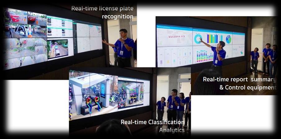
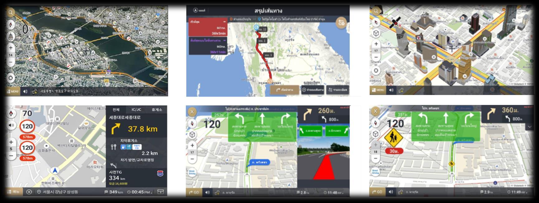
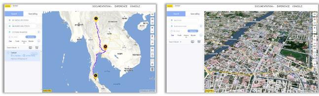
SurveillanceMap: CCTV-basedreal-timemonitoringandsearchingpredictiveescaperoute
• 3D Map Platform for Real-Time Monitoring based on CCTV
• Prediction of the escape route of a crime vehicle and extraction of CCTV within the predicted radius
• PoC in progress at the RPCA(Royal Police Cadet Academy) and will be applied sequentially to the Public Safety Zone in Thailand
• Applicable for various real-time CCTV monitoring for Smart City projects


01
Partnering with
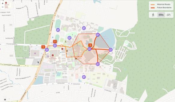
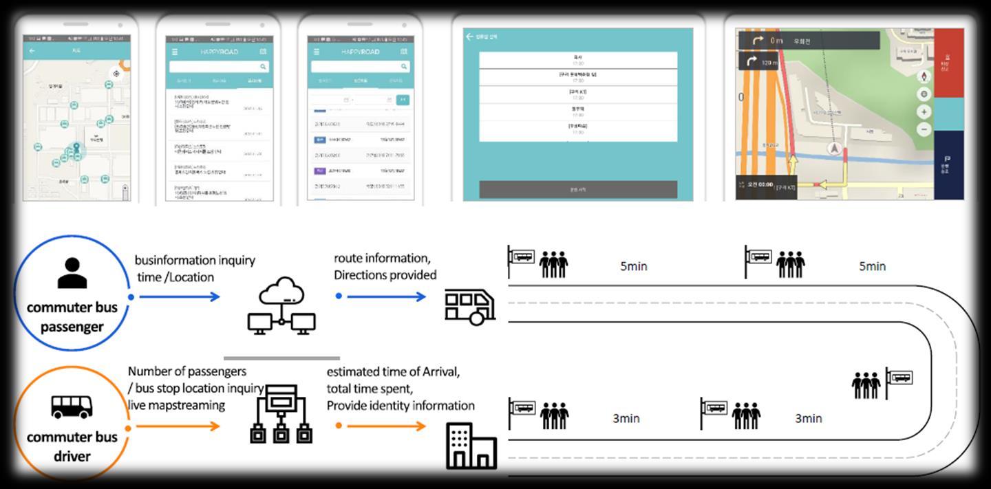
TransportationplanandRoutingplan: Commutingbusschedulemanagementandrouteguidance
• Plan the optimal shuttle bus route by grouping the locations of employees who applied for shuttle bus service
• It provides convenience for employees to commute to and from work, and the company reduces costs by operating buses efficiently
Partnering with

02
Overview
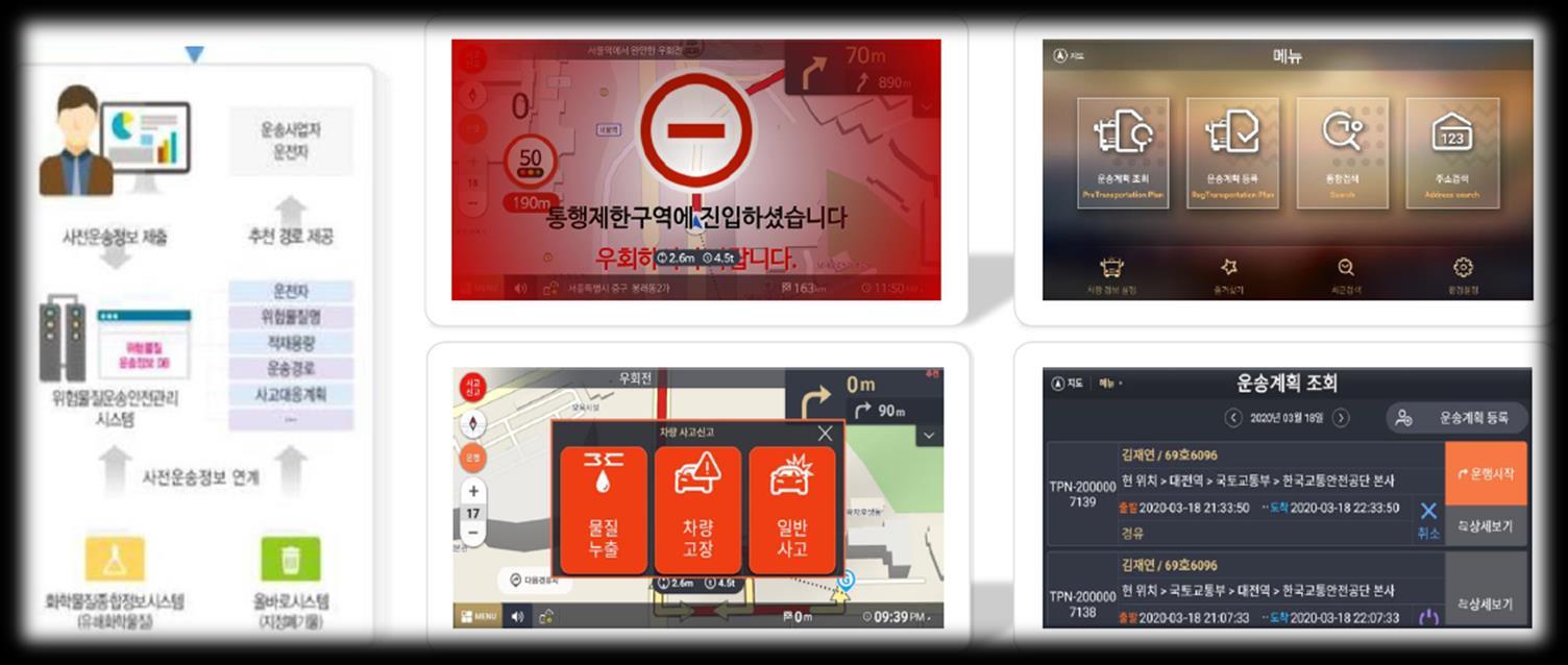
FleetManagement: Drivingschedulingandmanagementforvehiclescarryinghazardoussubstances
• Planning optimal order of collecting hazardous material
• Searching routes bypassing roads where vehicles carrying hazardous substances are restricted
• Real-time monitoring of driving speed
• Real-time monitoring of driving trajectory
Partnering with

03
FleetManagement:
MonitoringandTrackingfirefightersandfiretrucks
• Search and guide the fastest route for fire or emergency vehicles to reach the accident point
• Monitoring the location of the vehicle and the situation at the site by CCTV in real time
• Finds and guides the empty beds in the emergency center in real time


• Monitoring the location and condition of firefighters in real time
04
Partnering with
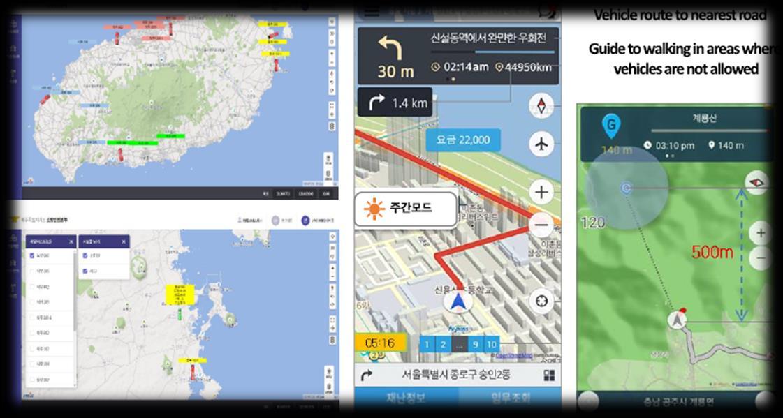
FleetManagement:
MonitoringandTrackingvehicleforcitygaspipestatusinspection
• Monitoring vehicle location for city gas pipe status inspection in real time
• Learning movement route of the vehicles for the city gas pipe status inspection, and guide the route automatically for the inspection route from next time
• Display inspection status of the city gas pipe by tracking the vehicle movement path in real time
• Transmission the status of the city gas pipeline inspection to the server on mobile device in real time

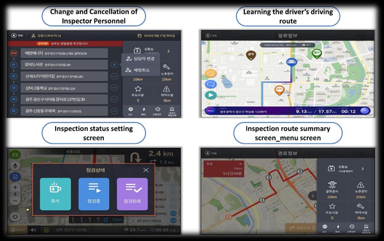
05
Partnering
with
FleetManagement:
MonitoringandTrackingvehicleofC-ITSbasedon5G-V2X
• Display real-time information on terminal of vehicle about traffic and accident risk including sudden stops, falls, traffic accidents, pot holes, etc and transmit it to the monitoring center
• Transmitted traffic status information to the monitoring center is delivered over to following vehicles and detour route is guided as necessary

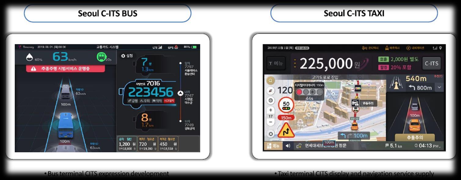
• C-ITS : Cooperative-Intelligent Transport Systems • V2X : Vehicle to Everything 06
Partnering with
Dynamicand
RichMap: DigitalTwin3DMapPlatformofOutdoorandIndoor
• 3D based Virtual Map Platform (Outdoor)
• 3D based Indoor Map Platform to navigate route inside the building
• Extend and enrich users’ map experience by dynamic and rich map
• Provide APIs for diverse Metaverse Platforms (Education, Commerce, Medical Service, Earn,...)


07 Partnering with
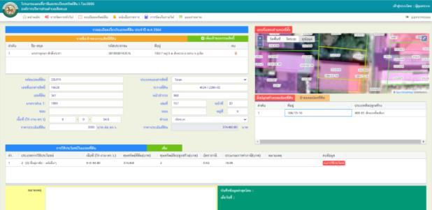
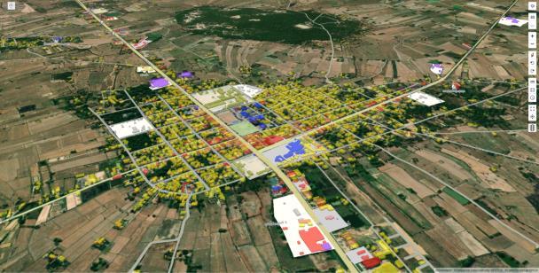
UrbanPlanningMap: MapplatformforLanduseandTaxationofthelocalgovernmentalprovince
• Visualization of Landuse maps owned by local governments
• A quick look at the current state of land use and buildings through visualization
• The area, owner, and utilization status of land and buildings are checked and used as basic data for tax imposition


08
Partnering with
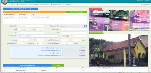
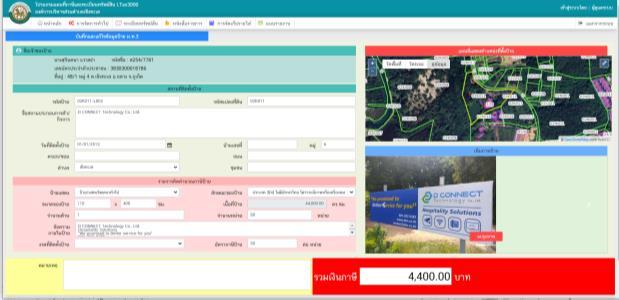
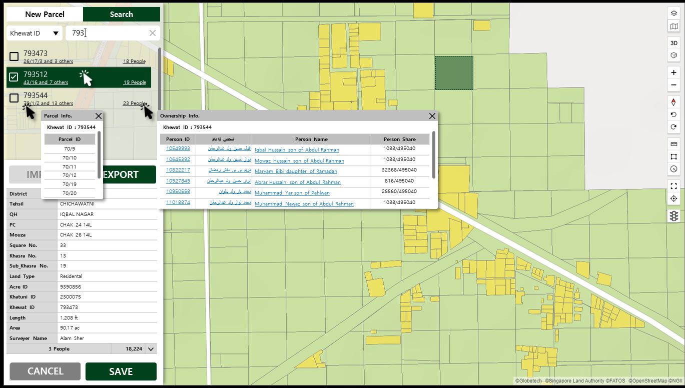
UrbanPlanningMap: MapplatformforDigitalCadasterofthelocalgovernmentalprovince
• Cadaster data mashup on the MOGOS Map platform
• Localization deliverables including tailored geospatial survey App and visual Web tool
• Hands down digitized data collection and visualization of land parcel, ownership, tenancy to assist property registration and proof of ownership
Partnering with


09
13
Mobility 01 02 03 Best 9 use cases
Table of Contents
On-DemandMobilityService: Shuttlebushailing
• A shuttle bus ride-hailing service where mass transit is rare such as new city or outskirt of city
• When the user calls the shuttle bus, the nearest shuttle bus changes course to pick them up

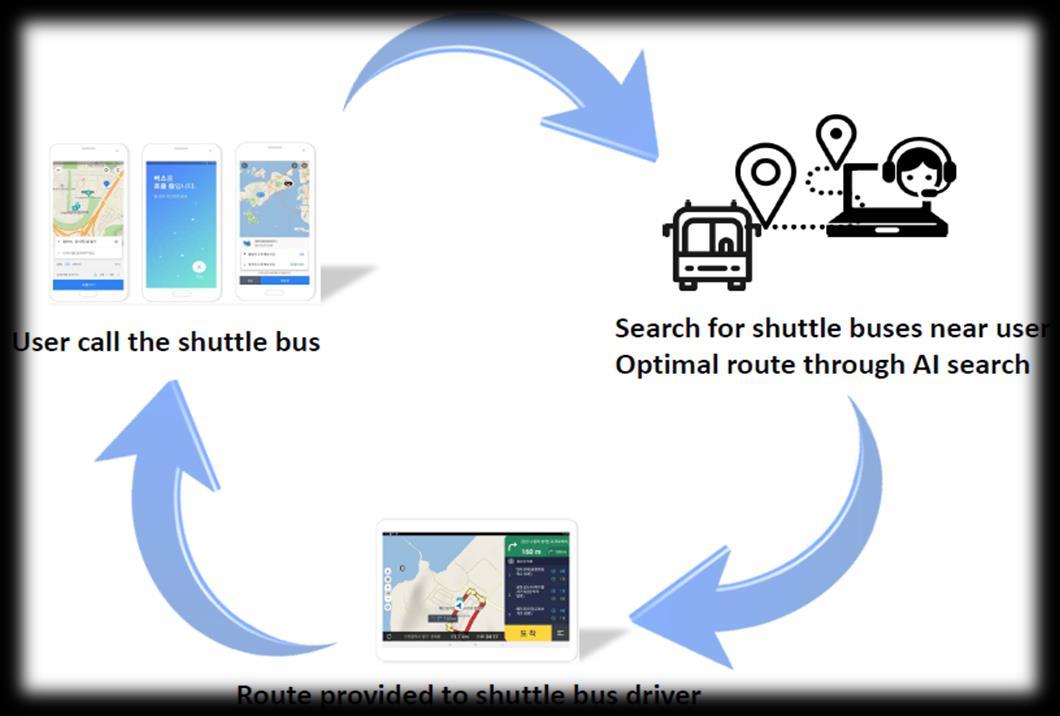
with 01 Overview
Partnering
On-DemandMobilityService: Taxihailing
• A taxi ride-hailing service to search and dispatch the fastest-coming taxis based on user location
• Call taxi service for the disabled

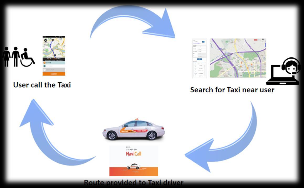
Partnering
02 Overview Overview
with
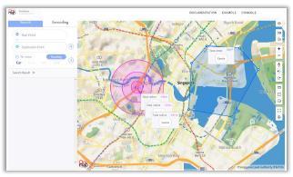
MapandRouteGuideforLogistics
: TrackingandIndoorrouteguideforlogisticsdeliveryvehicle
• Real-time monitoring on status and location of vehicle
• Safe route guide to the in-factory road
• Route guide by connecting map to beacon at the underground cargo loading and unloading station Partnering with

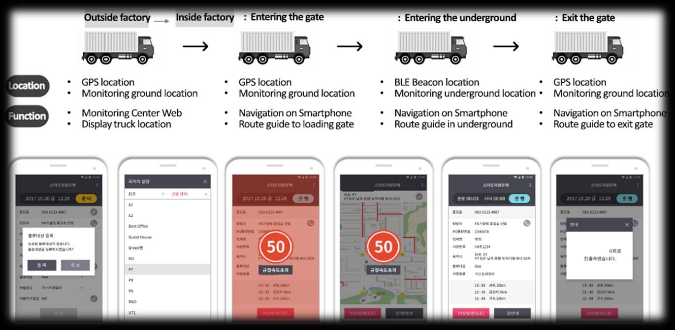
03 Overview Overview
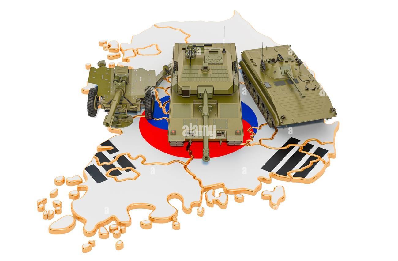
MapandRouteGuideforSpecialVehicles:
Trackingandrouteguidancefortransportationvehiclesofamilitary
• Search and guide special route for defense & military transportation vehicle
• Real-time monitoring on geo-location of the special equipped vehicles


Partnering with

04 Overview Overview
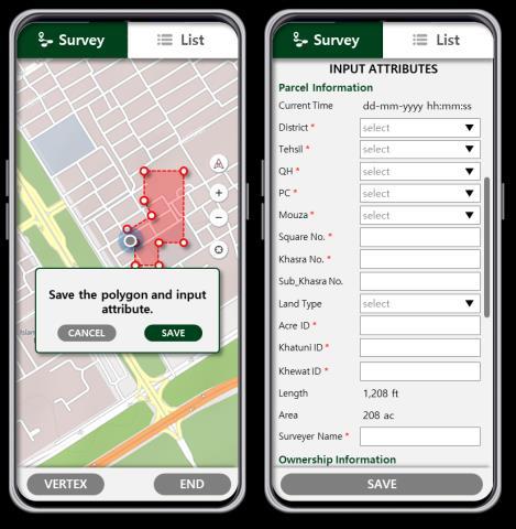
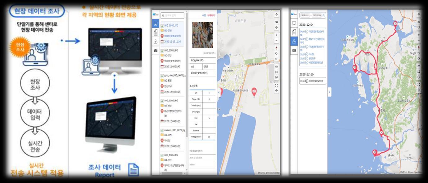
Map,Geo-tagging,Geo-tracking,DatatransitforFieldSurvey: Collectingandmanagingfieldsurveydataset
• Field survey tool for survey points management, planning order of field surveys along the points of survey
• Save photos with location information by geotagging technique
• Real-time transmission of field survey data to servers enabling the data to be viewed and utilized by various research institutes
Partnering with

05 Overview Overview
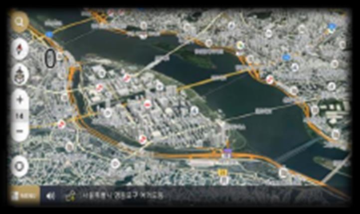
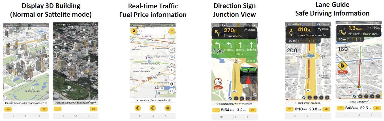
MapandNavigation: DedicatedNavigationSoftwareforheavytrucks
• Navigation App for heavy trucks
• Searching routes bypassing roads where certain height/weight of vehicles are restricted or heavy trucks are unable to enter
• Searching resting places, logistics warehouses, etc. for truck drivers


06 Overview Overview
Partnering with
• MOGOS Mobile App


• All-round map experience; Outdoor/Indoor, search and pin the points of interest, traffic info, navigation, routing plan
• Data analysis service; driving pattern, routing pattern, eco driving score, driving history
MOGOS
MobileApp
07 Overview Overview
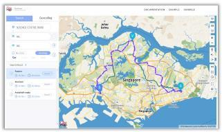
• All-in-one service platform to connect multimodal
• Multimodal Routing Plan with multi-way path
• Search Optimal Routing


Multimodal
PersonalMobility 08 Partnering
RoutingPlanfor
with Multimodal Information Multimodal Routing Ride Hailing and Payment MaaS (MobilityasaService)Platform
Overview DataServer Sha e PublicMultimodalservices PrivateMultimodalservices
MultimodalConnectivityforPersonalMobility
• Connect transit spots and parking lots
• Multimodal Information (charging status, booking, return)
• NFC (Near Field Communication) membership card tagging alarm and history


08 Partnering with
Overview
(MobilityasaService)Platform IoT
BoardIoTModule MaaS
Module
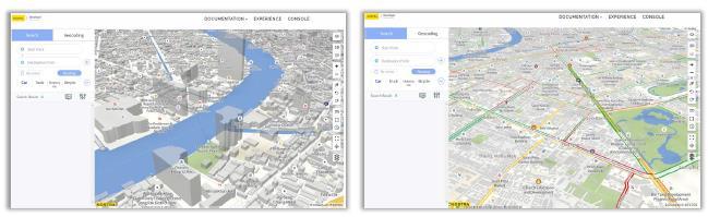
MOGOSMaps
• MOGOS Maps displays various types of maps throughout Mash-up technology
• MOGOS's map-based visualization empowers intuitive insights from the data


09 Overview Overview
Partnering with
24
Social Care 01 02 03 Best 2 use cases
Table of Contents
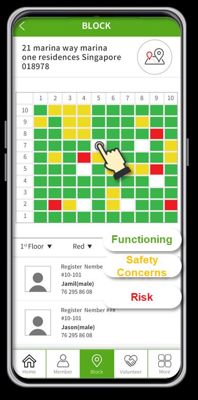
InteractiveCommunityMapforSocialWorkers
• A solution to digitize social care program
• An app for social workers who take care of the socially disadvantaged people
• Mobile application that enhances member care, survey, information logging on the go during outreach
• Real-time data logging, sharing and interact with center during outreach
• Volunteers match to assist socially disadvantaged people
• Visualize statistical data on the Map
Partnering with


01 Overview Overview
InteractiveCommunityMapforYouthWorkers
• A solution to digitize the Street Outreach Program
• An app for youth workers who take care of the youth that helps children and youth in need to become socially integrated, responsible and contributing members of society
• Real-time data logging, sharing and interact with center during outreach
• Logging the places where case workers met youths along with text, photos
• Visualize statistical data on the Map
Partnering with


02 Overview Overview

Thank you
