International Research Journal of Engineering and Technology (IRJET)
e-ISSN: 2395-0056
Volume: 09 Issue: 03 | Mar 2022
p-ISSN: 2395-0072
www.irjet.net
Chilli Crop Acreage Estimation with Sentinel-2 Temporal Satellite Imagery in Nagpur District, Maharashtra Poonam Jayhind Pardeshi1, Dr. Indal Ramteke2, Dr. Sudhakar Shukla3 1M.Tech
Scholar, School of Geo-informatics, Remote Sensing Applications Centre, Uttar Pradesh, India Associate, Agriculture Resource Division, Maharashtra Remote Sensing Applications Centre, Maharashtra, India 3Scientist-SE and Head of School of Geo-informatics, Remote Sensing Applications Centre, Uttar Pradesh, India ---------------------------------------------------------------------***---------------------------------------------------------------------2Scientific
Abstract - Optical Remote Sensing technology made it easier to separate multiple crop types of the specific area. Study area with multiple crops and having the same sowing and harvesting time is difficult to classify using single date data. But multiple crops can be easily separable using time-series optical data. Hence, for the present study time-series, temporal satellite data is used for crop mapping and crop acreage estimation. Sentinel-2 B is the most used optical satellite data for vegetation mapping. It provides high-resolution free satellite data with spatial resolution of 10m and five days revisit time in various applications of agriculture study. This study aims to separate and acreage estimation of chilli crops in Nagpur district using multi-date Sentinel-2 imagery for Rabi season. Unsupervised classification method is adopted to separate chilli and verified with ground truth data.
Here, Time series sentinel data of Rabi season is taken for analysis of the study area. To perform unsupervised classification with good accuracy, classification procedure is carried out with ground truth points. 2. STUDY AREA
Key Words: chilli; crop; classification; time-series; separation; k-means; sentinel-2; unsupervised 1. INTRODUCTION Agriculture is the largest sector available for livelihood in India. Most of the population of the country is based on agriculture and its allied sectors; the sector is occupied by both small and marginal farmers. Agriculture is an important sector of the Indian economy as it contributes about 17% to the total GDP and provides employment to around 58% of the population. Indian agriculture has registered impressive growth over the last few decades. India is the biggest exporter of Cotton in the world which is mostly grown in the Maharashtra region.
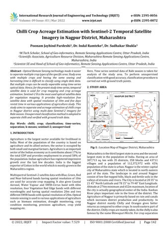
Fig-1 : Location Map of Nagpur District, Maharashtra Maharashtra is the third largest state in area and the secondlargest state in the population of India. Having an area of 307,713 sq. km with 35 districts, 358 blocks and 43711 villages and a population of 112,372,972 with 45% population of the state is urban. Nagpur is the winter capital city of Maharashtra state which is located in north eastern part of the state. The landscape in and around Nagpur consist of low flat-topped hills, black and fertile soils in the valleys of streams and rivers. The City is located at 20 35‟ to 21 45‟ North Latitude and 78 15‟ to 79 40‟ East Longitude. Altitude at 274m minimum and 652m maximum, location of the city is actually geographical center of the India. Kanhan River plays important role in the lives of the district. The Agriculture of Nagpur is primarily based on rain and canals which increases district production and productivity. In Nagpur district mainly Chilly and Oranges gives better returns as compared to other crops. In south eastern part of the district, Chilly crops are mainly taken. As the chilly is also famous by the name Bhiwapuri Mirchi. For crop separation
Multispectral Sentinel-2 satellite data with Blue, Green, Red and Near-Infrared bands having spatial resolution of 10m are used for accurate crop mapping. It also gives Coastal Aerosol, Water Vapour and SWIR-Cirrus band with 60m resolution, four Vegetation Red Edge bands with different wavelengths and having spatial resolution 20m and two different SWIR bands with spatial resolution of 20m. Optical remote sensing is used in various applications of agriculture such as biomass estimation, drought monitoring, crop condition monitoring, precision agriculture, crop yield mapping etc.
© 2022, IRJET
|
Impact Factor value: 7.529
|
ISO 9001:2008 Certified Journal
|
Page 142