International Research Journal of Engineering and Technology (IRJET)
e-ISSN: 2395-0056
Volume: 09 Issue: 03 | Mar 2022
p-ISSN: 2395-0072
www.irjet.net
Crop Separation with Sentinel-2 Temporal Satellite Imagery in Hingoli District, Maharashtra Poonam Jayhind Pardeshi1, Dr. Indal Ramteke2, Dr. Sudhakar Shukla3 1M.Tech
Scholar, School of Geo-Informatics, Remote Sensing Applications Centre, Uttar Pradesh, India Associate, Agriculture Resource Division, Maharashtra Remote Sensing Applications Centre, Maharashtra, India 3Scientist-SE and Head of School of Geo-Informatics, Remote Sensing Applications Centre, Uttar Pradesh, India ---------------------------------------------------------------------***---------------------------------------------------------------------2Scientific
Abstract - Separation of multiple crop types is difficult to classify using Optical Remote Sensing and having similar harvesting and sowing time may create complexities in classification. Sentinel-2 satellite provides free data available to use for analysis, which is the most suitable choice for crop mapping. This study aims to classify and acreage estimation of different crops taken in the Hingoli district using multi-date Sentinel-2 imagery for Kharif season. Classification is achieved using the Unsupervised classification method with this overall accuracy is tested using Crop statistics data of the Department of Agriculture, Maharashtra.
2.STUDY AREA
Key Words: crop; separation; k-means; sentinel-2; layer stacking; unsupervised classification 1.INTRODUCTION Agriculture, with its allied sectors, is the largest source of livelihood in India. Around 70% of its rural household still depend primarily on agriculture for their livelihood, with 82% of farmers being small and marginal. Therefore, planning and management of agriculture are also important for the economic development of the country. In this paper time-series, satellite imagery of sentinel-2 is used to get data of 10m of spatial resolution with 5 days of revisit time for data procurement.
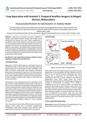
Fig -1: Location map of Hingoli district Maharashtra is the third largest state in area and the secondlargest state in the population of India. Having an area of 307,713 sq. km with 35 districts, 358 blocks and 43711 villages and a population of 112,372,972 with 45% population of the state is urban. Hingoli is the district of Maharashtra state which comes under the Central Maharashtra plateau & Central Vidarbha Agro-climatic zone. Located at 19.43”12.00” N Latitude 77.11” 00.00” E Longitude and at 547 m above sea level. For South West monsoon (June-Sept) normal rainfall is about 829.5 mm, Northeast monsoon (Oct-Dec) rainfall is 75.4mm, winter (Jan-Feb) monsoon rainfall is 10.2mm and for summer (MarMay) monsoon rainfall is 31.5mm. Hingoli has a Net sown area of 345644.00 ha for Kharif crops only. For crop separation and acreage estimation, multi-temporal Sentinel2 data is acquired for the Kharif season of 2021, from USGS Earth Explorer.
As Sentinel-2 is the multispectral sensor with Blue, Green, Red and Near-Infrared bands having spatial resolution of 10m are most used bands for agriculture monitoring. Optical remote sensing provides required spectral bands for crop information which may be at local to global scales. Spectral indices, which are combinations of spectral measurements at different wavelengths, have been used to extract vegetation phenology or quantify biophysical parameters, such as leaf area index, NDVI (Normalized Difference Vegetation Index) calculation for estimating biomass and drought forecasting, VCI ( Vegetation Condition Index) for crop condition assessment.
3.DATA AND SOFTWARE USED
Here, Time series sentinel data of Kharif season is taken for analysis of the study area. To perform unsupervised classification with good accuracy crop statistics data acquired by the Department of Agriculture is compared.
© 2022, IRJET
|
Impact Factor value: 7.529
Data used: Sentinel-2b, Shape files of Hingoli district, Crop Statistics data from Depart of Agriculture
|
ISO 9001:2008 Certified Journal
|
Page 138