International Research Journal of Engineering and Technology (IRJET)
e-ISSN: 2395-0056
Volume: 09 Issue: 03 | Mar 2022
p-ISSN: 2395-0072
www.irjet.net
ACREAGE ESTIMATION OF TOMATO IN GHORAWAL BLOCK OF SONBHADRA DISTRICT USING REMOTE SENSING AND GIS TECHNOLOGY Manish Kumar 1, Shri. Narendra Kumar 2, Dr. Sudhakar Shukla3 1M.Tech
Scholar, School of Geo-informatics, Remote Sensing Applications Centre, Uttar Pradesh, India 2Scientist-SE, Remote Sensing Applications Centre, Uttar Pradesh, India 3Scientist-SE and Head of School of Geo-informatics, Remote Sensing Applications Centre, Uttar Pradesh, India ---------------------------------------------------------------------***---------------------------------------------------------------------Abstract - Tomato is an important crop in Uttar Pradesh. The crop is grown in around 12.10 Thousand hectares. The area under Tomato cultivation in Ghorawal block of Sonbhadra district is calculated using Remote sensing techniques which provide a methodology to map the area of tomato field with the help of Sentinel 2b satellite data and Geographical Information System database. ArcGIS 10.4 and Erdas Imagine software is used to calculate the acreage. Data of the month October, November and December, 2021 have been used. The total area calculated under tomato cultivation in Ghorawal block is 3637.7 acre.
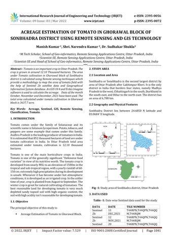
2. STUDY AREA 2.1 Location and Area Sonbhadra or Sonebhadra is the second largest district by area of Uttar Pradesh after Lakhimpur Kheri. It is the only district in India that borders four states, namely Madhya Pradesh to the west, Chhattisgarh to the south, Jharkhand in the south-east, and Bihar to the north-east. The district has an area of 6,788 km. 2.2 Geography and Physical Features
Key Words: Acreage, Sentinel, GIS, Remote Sensing, Classification, Tomato.
Sonbhadra District lies between 24.6850 N latitude and 83.0684’ E longitude.
1. INTRODUCTION Tomato comes under the family of Solanaceae and its scientific name is Solanum lycopersium. Potato, tobacco, and peppers are some example that comes under this family. Andhra Pradesh is the leading producer of tomatoes in India. It is estimated that 852 thousand hectares of land are under tomato cultivation in India. In Uttar Pradesh total area estimated under tomato, cultivation is 12.10 thousand hectares. Tomato is one of the main horticulture crops in India. Tomato is one of the generally significant "Defensive food varieties" in view of its nutritive worth. The tomato crop is developed from nearly MSL to an elevation of 1500m in the tropical and sub-tropical region, with a yearly rainfall of 60150 cm. extremely high precipitation during its development is unsafe. Whenever it has become under hot atmospheric conditions, it is developed as an irrigated crop. In the colder time of year, crop is planted from August to September. The winter crop is great for natural cultivating of tomatoes. The best reasonable land for developing tomato is very much depleted sandy topsoil soil with high organic content, the soil with high acidity isn't reasonable for developing tomato.
Fig -1: Study area of Sonbhadra district, Uttar Pradesh 3. DATA USED Table -1: Date wise Sentinel data used for the study
1.1. Objective
DATA Sentinel 2b Sentinel 2b Sentinel
The principal objective of this study is
Acreage Estimation of Tomato in Ghorawal Block.
© 2022, IRJET
|
Impact Factor value: 7.529
|
DATE 11 DEC,2021 12 NOV,2021 20
TILE NUMBER T44RPN,T44QPN,T44QQ M,T44RQM T44RPN,T44QPN,T44QQ M,T44RQM T44RPN,T44QPN,T44QQ
ISO 9001:2008 Certified Journal
|
Page 1041