International Research Journal of Engineering and Technology (IRJET)
e-ISSN: 2395-0056
Volume: 08 Issue: 08 | Aug 2021
p-ISSN: 2395-0072
www.irjet.net
Analysis of Interrelation between Spatial Planning and Greenfield Development Ar. Jaspreet Walia1, Dr. Anjali S Patil2 1PG
Student (MUP) Department of Architecture & Planning, MITS, Gwalior Professor& HOD, Department of Architecture & Planning, MITS, Gwalior ---------------------------------------------------------------------***---------------------------------------------------------------------2Associate
Abstract – This paper is about the interrelation between
The major aim of spatial planning is to evolve a functionally coherent hierarchical spatial strategy to locate places and people where they can be used or act most effectively to achieve certain objectives.
spatial planning and Greenfield development which has been illustrated through case study of Bangalore and Raipur .In which analysis of both spatial planning and Greenfield development has been done. The case studies have conclusion of case specific and also have stated the impact of the implemented strategies. The paper has been concluded with the positive and negative factor of both type of development as obtained through the case studies, and also stated the cons & pros by adopting these strategies.
1.1 Spatial Planning in India
Key Words: Spatial Planning, Spatial Integration, Greenfield Development, Urban Fringe, Town Development Scheme (TDS)
Spatial planning was introduced in India in the late 19 century. It came through the similar process when sanitary commissions were appointed. Spatial planning as such, as a state subject by now, every state has Town and Country Planning Departments (TCPD’S) with exception of few, most of the states have legislative support for preparing plans primarily for urban areas.
1. SPATIAL PLANNING
1.2 Objective of Spatial Planning
“Spatial planning gives geographical expression to the economic, social, cultural and ecological policies of society. It is at the same time a scientific discipline, an administrative technique and a policy developed as an interdisciplinary and comprehensive approach directed towards a balanced regional development and the physical organisation of space according to an overall strategy."(Definition by European Regional/Spatial Planning Charter)
The main objective of Spatial Planning is to achieve a process of development which: Helps in optimizing utilization of resources, Reduces regional, spatial and economic imbalances, Strengthens urban and rural relationships, Sustainable and maintains an ecological balance.
1.3 Spatial Integration & its need The integration of multiple entities linked to planning, such as land uses, planning institutions, and stakeholders, is referred to as spatial integration. It may represent the desire to collaborate by indicating the opportunities for and amount of engagement within and between areas. Because of the fragmentation and diversity of governmental structures and institutions, it is critical to address the issue of policy and development plan integration, as well as the integration of institutions operating at the local level. The following are some of the reasons why spatial integration is necessary: Development plans at all levels, including national, state, region, sub-region, district, block, village, and urban regions, must be integrated. Any development plan must be prepared and implemented in a certain order, starting with the description of objectives and ending with monitoring and feedback. Integration of one stage into the next is required.
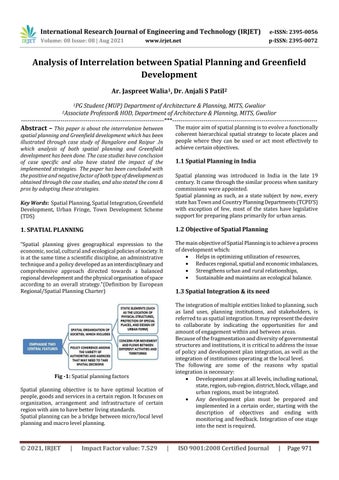
Fig -1: Spatial planning factors Spatial planning objective is to have optimal location of people, goods and services in a certain region. It focuses on organization, arrangement and infrastructure of certain region with aim to have better living standards. Spatial planning can be a bridge between micro/local level planning and macro level planning.
© 2021, IRJET
|
Impact Factor value: 7.529
|
ISO 9001:2008 Certified Journal
|
Page 971