International Research Journal of Engineering and Technology (IRJET)
e-ISSN: 2395-0056
Volume: 08 Issue: 05 | May 2021
p-ISSN: 2395-0072
www.irjet.net
3D Surface Generation for Riverbed for Recce Operations Prof. U. C. Patkar1, Shankar Gore2, Shruti Kashyap3, Sourav Gupta4, Yashasvi Ayane5 1Head
of Department, Dept. of Computer Engineering, Bharati Vidyapeeth’s College of Engineering, MH, India Dept. of Computer Engineering, Bharati Vidyapeeth’s College of Engineering, MH, India 3Student, Dept. of Computer Engineering, Bharati Vidyapeeth’s College of Engineering, MH, India 4Student, Dept. of Computer Engineering, Bharati Vidyapeeth’s College of Engineering, MH, India 5Student, Dept. of Computer Engineering, Bharati Vidyapeeth’s College of Engineering, MH, India ---------------------------------------------------------------------***--------------------------------------------------------------------2Student,
Abstract - The system provides a detailed real-time three-
offer safe and helpful options. Echo sounder collects underwater acoustic data into point clouds for imaging twoand three-dimensional models of conditions [1].
dimensional view of the underwater beds using the data collected by the echo sounder, a Dual Global Positioning System, and a heading sensor on a remote-controlled boat. It plots a graph as per the coordinates collected across a wide range of depths. It aims at mapping most of the underwater bed profile generation to aid the surveying for military bridging. This system uses the technology of Multi-Beam Sonar, making it far more efficient and accurate compared to the primitive method of knotted ropes. A Human Machine Interface will generate an interactive three-dimensional surface of the surveyed area.
2. SURVEYING Hydrographic Surveying delivers a detailed underwater inspection, visually and numerically describing shapes of the seafloor or river beds. Typically surveying boat uses singlebeam units for shallower water surveys combined with land survey data that can be collected by drone. Bathymetric surveys can be utilized for dredging, coastal process, the environment, ports, reservoirs, harbors, rivers, lakes. This information can be used to generate charts & maps, contours, volumes, cross-sections, long sections, 3D surfaces, and fly-throughs.
Key Words: Echo Sounder, Human Machine Interface, Military Bridging, Three-Dimensional Surface
1. INTRODUCTION The system typically can be used for hydrographic surveys to determine the depth of water and the nature of the seabed. The coordinates generated can be transformed into river bed depth to create a depth map. The software utilizes the collected data set for plotting and three-dimensional visualization of the underwater bed profile. These visuals of the river bed can enable us to explore the wide ranges of altitudes and depths for better navigation.
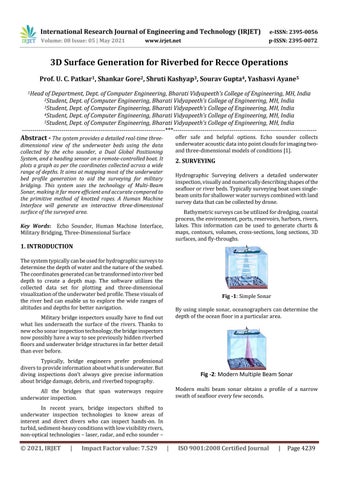
Fig -1: Simple Sonar By using simple sonar, oceanographers can determine the depth of the ocean floor in a particular area.
Military bridge inspectors usually have to find out what lies underneath the surface of the rivers. Thanks to new echo sonar inspection technology, the bridge inspectors now possibly have a way to see previously hidden riverbed floors and underwater bridge structures in far better detail than ever before. Typically, bridge engineers prefer professional divers to provide information about what is underwater. But diving inspections don’t always give precise information about bridge damage, debris, and riverbed topography.
Fig -2: Modern Multiple Beam Sonar Modern multi beam sonar obtains a profile of a narrow swath of seafloor every few seconds.
All the bridges that span waterways require underwater inspection. In recent years, bridge inspectors shifted to underwater inspection technologies to know areas of interest and direct divers who can inspect hands-on. In turbid, sediment-heavy conditions with low visibility rivers, non-optical technologies – laser, radar, and echo sounder –
© 2021, IRJET
|
Impact Factor value: 7.529
|
ISO 9001:2008 Certified Journal
|
Page 4239