International Research Journal of Engineering and Technology (IRJET)
e-ISSN: 2395-0056
Volume: 07 Issue: 09 | Sep 2020
p-ISSN: 2395-0072
www.irjet.net
INTEGRATED LOCAL WEATHER FORECASTING WITH SURFACE SOIL MOISTURE USING REMOTE SENSING TECHNIQUES Muthu Archana M1, Devi G2 1II
M Tech Remote Sensing, Department of Civil Engineering, Anna University Regional Campus, Tirunelveli, Tamil Nadu, India 2Assistant Professor, Department of Civil Engineering, Anna University Regional Campus, Tirunelveli, Tamil Nadu, India ---------------------------------------------------------------------***----------------------------------------------------------------------
Abstract - A land surface dryness index (Temperature–
pattern recognition skills, teleconnections, knowledge of model performance, and knowledge of model biases. The inaccuracy of forecasting is due to the confused nature of the atmosphere, the massive computational power required to solve the equations that describe the atmosphere, the error occur happens by measuring the initial conditions, and an incomplete understanding of atmospheric processes. Hence, forecasts become less accurate as the time difference between current and forecast time increases. The use of grouping and model concord help narrow the error and pick the most likely outcome.
Vegetation Dryness Index, TVDI) based on the relationship between surface temperature (LST) and Normal Difference Vegetation index (NDVI) is done. The index is related to soil moisture and, in comparison to existing interpretations of the LST/NDVI space, the index is conceptually and computationally straightforward. It is based on satellite derived information only. The spatial pattern and temporal evolution in TVDI will be analyzed using Landsat 8 images for the year 2018. The spatial pattern in TVDI will be compared with simulations of surface soil moisture and these spatial variation in TVDI may reflect the variation in moisture on a finer scale. With this spatio-temporal variation in surface soil moisture Numerical weather predication model is generated for Local weather variables influencing the weather of the Tuticorin district. The results from the model will be validated with data obtained from the Indian Meteorological Department.
2. STUDY AREA Thoothukudi is a port city and an industrial city in the Indian state of Tamilnadu. The city located in the Coromandel Coast of Bay of Bengal. Thoothukudi is known as "Pearl City" because pearl fishing takes place in the town. It is a commercial seaport which serves the non-coastal cities of Southern India and is one of the sea gateways of Tamil Nadu. It is also one of the major seaports in India with a history from the 6th century AD. The major harbour of Thoothukudi is famous for pearl diving and fishing.
Key Words: Weather forecasting, Surface soil moisture, ECMWF, Landsat 8, ArcGIS 10.4, NDVI, LST, TVDI, NWP, ANN.
1. INTRODUCTION
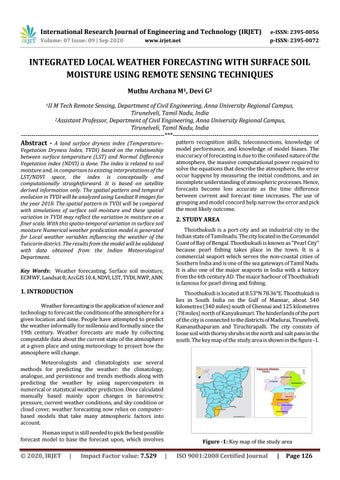
Thoothukudi is located at 8.53°N 78.36°E. Thoothukudi is lies in South India on the Gulf of Mannar, about 540 kilometres (340 miles) south of Chennai and 125 kilometres (78 miles) north of Kanyakumari. The hinderlands of the port of the city is connected to the districts of Madurai, Tirunelveli, Ramanathapuram and Tiruchirapalli. The city consists of loose soil with thorny shrubs in the north and salt pans in the south. The key map of the study area is shown in the figure -1.
Weather forecasting is the application of science and technology to forecast the conditions of the atmosphere for a given location and time. People have attempted to predict the weather informally for millennia and formally since the 19th century. Weather forecasts are made by collecting computable data about the current state of the atmosphere at a given place and using meteorology to project how the atmosphere will change. Meteorologists and climatologists use several methods for predicting the weather: the climatology, analogue, and persistence and trends methods along with predicting the weather by using supercomputers in numerical or statistical weather prediction. Once calculated manually based mainly upon changes in barometric pressure, current weather conditions, and sky condition or cloud cover, weather forecasting now relies on computerbased models that take many atmospheric factors into account. Human input is still needed to pick the best possible forecast model to base the forecast upon, which involves
© 2020, IRJET
|
Impact Factor value: 7.529
Figure -1: Key map of the study area
|
ISO 9001:2008 Certified Journal
|
Page 126