International Research Journal of Engineering and Technology (IRJET)
e-ISSN: 2395-0056
Volume: 07 Issue: 08 | Aug 2020
p-ISSN: 2395-0072
www.irjet.net
Case Study: Comparative Analysis of Population Forecasting Methods for Mumbai Suburban District Sahil Yogesh Rohira1 1Final
Year B.Tech. Student, Department of Civil and Environmental Engineering, Veermata Jijabai Technological Institute, Matunga, Mumbai, Maharashtra, India ---------------------------------------------------------------------***----------------------------------------------------------------------
Abstract – Determination of population is one of the most
located in Mumbai District which is hardly 15 km from this District.
important factors in planning of a project, if the project has to serve the community for a certain design period. Design of water supply and sanitation scheme is based on the projected population of a particular city, estimated for the design period. Normally, a design period of 2 to 4 decades is selected. What will be the population at the end of the design period is the basic question. This can be achieved by using various methods for population forecast. Any underestimated value will make the system inadequate for the purpose intended; similarly, overestimated value will make it costly. Change in the population of the city over the year occurs and the system should be designed taking into account of the population at the end of the design period. Population forecasting is an important factor and must be considered for the determination of the sustainability of the environment to the then population at the end of the design period for a particular environmental structure. Forecasting of the population helps in the determination of labor at various places in a particular area, determination of the sex ratio of the present population, the diversity in the population and the literacy rate of a particular area. Key Words: Population Forecasting, Environmental Engineering, Sustainability, Water Supply.
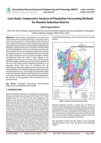
1. INTRODUCTION Mumbai Suburban District is a coastal District, located on the West coast of India. It lies between 18º 58' and 19º 17' North latitudes and 72º 46' and 72º 60' East longitudes. The District is surrounded by Arabian Sea at the West, Thane District at the East and North and Mumbai District at the South. The District is Northern part of Greater Mumbai Municipal Corporation which, spreads over an area of 446.0 sq. km as per Surveyor General of India and has a population of 93,56,962 as per 2011 Census. The District shares 0.14 per cent of area of the State and 8.33 per cent of the total population of the State. This District alone accounts for 18.41 per cent of the total urban population of Maharashtra, which has a total of 534 urban centers. The density of population is 20,980 persons per sq.km. Amongst the 35 Districts of the State, this District ranks 34th in terms of area, 3rd in terms of population and 1st in terms of density. The District is well connected by roads, railways and airways from the other parts of the Country. It has an International airport at Sahara. A well-developed International Sea port is also
© 2020, IRJET
|
Impact Factor value: 7.529
Fig -1: Mumbai Suburban District Map Mumbai Suburban District is spread over 15 Wards of Greater Mumbai Municipal Corporation. District recorded a total population of 93,56,962 comprising of 50,31,323 males and 43,25,639 females. Population of this District increased by 7,16,543 persons during the last decade with the growth rate of 8.3 percent. Mumbai Suburban District has 18.41 percent of the urban population of the State. The population growth for the District and percentage decadal variation since 1901 are given in the following Table-1.
|
ISO 9001:2008 Certified Journal
|
Page 3582