International Research Journal of Engineering and Technology (IRJET)
e-ISSN: 2395-0056
Volume: 06 Issue: 4 | Apr 2019
p-ISSN: 2395-0072
www.irjet.net
Optimum Band Selection in Sentinel-2A Satellite for Crop Classification Using Machine Learning Technique Pooja P. Jadhav1, Prof. V.B. Deshmukh2 Student, Dept. of Electronics & Communication, KLSGIT college Belgaum, Karnataka, India Assistant Professor, Dept. of Electronics & Communication, KLSGIT college Belgaum, Karnataka, India ---------------------------------------------------------------------***--------------------------------------------------------------------1
2
Abstract - Mapping and identification of crops are vital for agricultural field management furthermore as for estimating potential harvest. Having the similar spectral properties with different yields in the district and because of its complexities inside field is a difficult undertaking for mapping of the harvest utilizing satellite images. In the course of recent decades, in timberland checking, catastrophe the executives and agrarian applications satellite remote detecting has been playing a vital role. For surveying vegetation and soil properties some indices, for example, standardized contrast vegetation index (NDVI) and standardized distinction water index (NDWI) are utilized in satellite remote detecting applications that are prepared to do basically separating yield imperativeness and water pressure. These days to dissect grouping issues in horticulture, remote detecting capacities with high spectral, spacial and temporal resolution are accessible. As of late propelled Sentinel-2 satellite has thirteen spectral bands, quick return to time and goals at three diverse dimension (10m, 20m, 60m), just as the free accessibility of information, settles on it a decent decision for vegetation mapping. The fundamental target of this review is to investigate the capability of Sentinel-2 satellite symbolism by executing AI calculations for yield characterization .
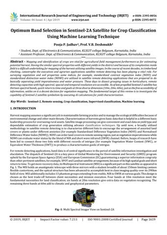
Key Words: Sentinel-2, Remote sensing, Crop classification, Supervised classification, Machine learning. 1. INTRODUCTION Harvest mapping assumes a significant job in maintainable farming practice and to manage the ecological difficulties because of environmental change and other main thrusts. Characterization of harvests gives basic data that is helpful in a different basic leadership process for overseeing rural assets. Satellite image processing can give convenient and exact data on yield type and dependable estimation of crop generation utilizing advance classification techniques. Up until now, a broadly utilized methodology in satellite remote detecting is to characterize different lists to encourage the arrangement of assorted land covers or plants under different anxieties (for example Standardized Difference Vegetation Index (NDVI) and Normalized Difference Water Index (NDWI)). NDVI can order land covers in remote sensing region, just as vegetation imperativeness while NDWI can evaluate water status by the blend of NIR and short wave infrared (SWIR) channel. Before, heaps of research have been led to connect these two lists with different records of intrigue (for example Vegetation Water Content (VWC), or Equivalent Water Thickness (EWT)) to produce a characterization guide of intrigue. For remote detecting applications, band data is of central significance in the period of satellite information investigation and elucidation. The dispatch of Sentinel-2A is a key piece of Global Monitoring for Environment and Security (GMES) program upheld by the European Space Agency (ESA) and European Commission (EC) guaranteeing a superior information congruity than other pertinent satellites, for example, SPOT and Landsat satellite arrangement, because of its high spatial goals and short return to time. To get more recovery data, its Multispectral Instrument (MSI) is a significant part on this satellite as appeared in Fig. 1. The MSI holds an anastigmatic telescope with three mirrors with a student breadth of about 150mm limiting canteen flexible contortions, and the optical structure has been advanced to accomplish best in class imaging quality over its 290km field of view. MSI additionally includes 13 phantom groups extending from visible, NIR to SWIR at various goals. This design is chosen as the best trade-off between client necessities and mission execution. Four bands at 10m resolution meet the fundamental necessities for land classification; six bands at 20m resolution give extra data on vegetation recognizing. The remaining three bands at 60m add to climatic and geophysical parameters.
Fig -1: Multi Spectral Imager View on Sentinel-2A
Š 2019, IRJET
|
Impact Factor value: 7.211
|
ISO 9001:2008 Certified Journal
|
Page 1619