International Research Journal of Engineering and Technology (IRJET) Volume: 03 Issue: 10 | Oct-2016
e-ISSN: 2395 -0056
www.irjet.net
p-ISSN: 2395-0072
River Boundaries Extraction With Edge Detection Using SAR Images Ms.Ujwala Bari1, Ms.Suvarna Doiphode2, Ms.Apurva Kulkarni3, Ms.Sabrina Shaikh4, Prof.Sayali Kokane5 1Ms.
Ujwala Bari ,APCOER, Department of IT ,ujwalabari18@gmail.com Suvarna Doiphode ,APCOER, Department of IT ,icchamane@gmail.com 3 Ms. Apurva Kulkarni ,APCOER, Department of IT ,apu13kul@yahoo.com 4 Ms. Sabrina Shaikh ,APCOER, Department of IT,sabrinashaikh82994@gmail.com 5Professor,Sayali Kokane, APCOER, Department of IT ,sayalikokane@gmail.com 2 Ms.
---------------------------------------------------------------------***---------------------------------------------------------------------
Abstract - Analysis edge of river the extraction of River
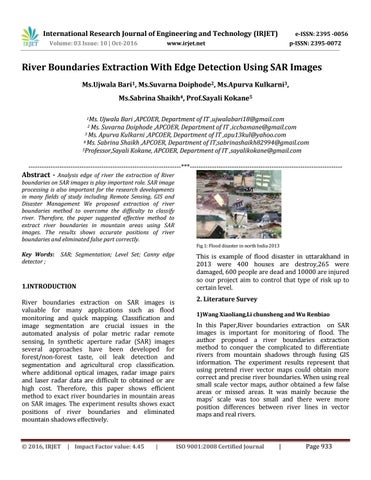
boundaries on SAR images is play important role. SAR image processing is also important for the research developments in many fields of study including Remote Sensing, GIS and Disaster Management We proposed extraction of river boundaries method to overcome the difficulty to classify river. Therefore, the paper suggested effective method to extract river boundaries in mountain areas using SAR images. The results shows accurate positions of river boundaries and eliminated false part correctly. Fig 1: Flood disaster in north India 2013
Key Words: detector ;
SAR; Segmentation; Level Set; Canny edge
1.INTRODUCTION River boundaries extraction on SAR images is valuable for many applications such as flood monitoring and quick mapping. Classification and image segmentation are crucial issues in the automated analysis of polar metric radar remote sensing, In synthetic aperture radar (SAR) images several approaches have been developed for forest/non-forest taste, oil leak detection and segmentation and agricultural crop classification. where additional optical images, radar image pairs and laser radar data are difficult to obtained or are high cost. Therefore, this paper shows efficient method to exact river boundaries in mountain areas on SAR images. The experiment results shows exact positions of river boundaries and eliminated mountain shadows effectively.
Š 2016, IRJET
| Impact Factor value: 4.45
|
This is example of flood disaster in uttarakhand in 2013 were 400 houses are destroy,265 were damaged, 600 people are dead and 10000 are injured so our project aim to control that type of risk up to certain level. 2. Literature Survey 1)Wang Xiaoliang,Li chunsheng and Wu Renbiao
In this Paper,River boundaries extraction on SAR images is important for monitoring of flood. The author proposed a river boundaries extraction method to conquer the complicated to differentiate rivers from mountain shadows through fusing GIS information. The experiment results represent that using pretend river vector maps could obtain more correct and precise river boundaries. When using real small scale vector maps, author obtained a few false areas or missed areas. It was mainly because the maps’ scale was too small and there were more position differences between river lines in vector maps and real rivers.
ISO 9001:2008 Certified Journal
|
Page 933