
International Research Journal of Engineering and Technology (IRJET) e-ISSN:2395-0056
Volume: 11 Issue: 03 | Mar 2024 www.irjet.net p-ISSN:2395-0072
International Research Journal of Engineering and Technology (IRJET) e-ISSN:2395-0056
Volume: 11 Issue: 03 | Mar 2024 www.irjet.net p-ISSN:2395-0072
Pondhe G. M* and Dhere A. M**.
*Department of Environmental Science, P.V.P. College, Pravaranagar-Loni, Dist Ahmednagar (MS) India, (Affiliated to Savitribai Phule Pune University, Pune).
**S.N.D.T. College of Home Science, Pune (MS) India.
Abstract: Present article deals with A Review of Indian Major Rivers along with Maharashtra State. Rivers in India are divided into four groups- i.e. Rivers originated from Himalaya, River passes from Deccan Plateau, Rivers of coastal area and inland Rivers. About 12 major Rivers, 48 medium Rivers and more than 100 minor Rivers are found in India. The Maharashtra State having 17 main Rivers, out of which 11 are western flowing Rivers. The River networks are widely spread across every direction. However, due to interrupting the flow of River by building huge dams and reservoirs resultedinmodificationofnaturaldimensionsofRiveraswellasalteringtheircharacteristics
Key words- Review,Major,River,Network,Minor.
1. Introduction: India receives 4000 BCM water from rainfall during monsoon months (June to September). Out of which 700 BCM is directly gone to the atmosphere while 2150 BCM dissipated to ground whereas nearly 1869 BCM poured through River towards the ocean. There are extremely huge temporal and spatial variations of rainfall during monsoonperiodandwhichhaveaverageannualrainfallofthecountryisabout1170mm.(CWC,2014).
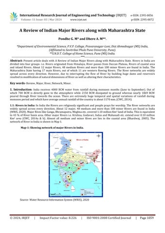
1.1: Rivers in India: InIndiatheRiversarereligiouslysignificantand peoplepraysforworship.TheRivernetworksare widely spread across every direction. About 12 major, 48 medium and more than 100 minor Rivers are found in India (WRIS,2020).MajorRiveslikeGanga,Bhramaputra,Meghnaetc.covered1.10millionKm2 landofIndia.Thisisequivalent to 43 % of River basin area. Other major Rivers i.e. Krishna, Godavari, Indus and Mahanadi etc. extend over 0.10 million Km2 area (CWC, 2014a & b). Almost all medium and minor Rives are lies in the coastal area (Bhardwaj, 2005). The networkofRiverinIndiaisshowninMap1.
Map-1: Showing network of major Rivers in India.
Source-WaterResourceInformationSystem(WRIS),2020
International Research Journal of Engineering and Technology (IRJET)
Volume: 11 Issue: 03 | Mar 2024 www.irjet.net
2395-0072
RiversinIndiaaredividedintofourgroups-i.e.1)RiversoriginatedfromHimalaya,2)RiverpassesfromDeccan Plateau, 3) Rivers of coastal area and 4) inland Rivers. Himalayan Rivers are perennial because they receive water from melting of ice caps. Rivers originating from the Deccan plateau receive water from monsoon rainfall however during summerseasonwaterflowisreduced.RiverslikeGodavari,Narmada,Tapi,KrishnaarethelargestRiversoriginatingfrom the Deccan plateau. Coastal Rivers originated into Western Ghats and merged into Arabian Sea Following are the major RiversinIndiadiscussedindetail.(Table1)
Table No.1: Showing major Rivers in India. S.N
WRIS,2020(http://ecoursesonline.iasri.res.in/mod/page/view.php?id=41142)
1) Indus River: Thisislargeststreamflowsinfourcountriesi.e.Afghanistan,Pakistan,IndiaandChina.IndusRiverbasin covered various States i.e. Jammu & Kashmir, Punjab, Himachal Pradesh, Haryana and Rajasthan in India. Total drainage area of Indus River basin is 11, 65,000 Km2, while in India it extends over 3, 21,289 Km2 land. River Indus originates in MansaSarovarinTibetfrom5,182meter.LengthofIndusRiverinIndiais1100Km.Sutlej,Beas,Ravi, ChenabandJhelum aremaintributariesoftheIndusRiver.
2) Bhramaputra River: BharamputranamecamefromLordBhramai.e.lordofcreator.ThisRiveroriginatedinTibetian plateau at Tsangpo. This River emerges from Sang and Dihang foothills in Arunachal Pradesh in and known and
International Research Journal of Engineering and Technology (IRJET) e-ISSN:2395-0056
Volume: 11 Issue: 03 | Mar 2024 www.irjet.net p-ISSN:2395-0072
Bhramaputra.InAssamvalleyLohittributaryjoinsthisRiver.TotallengthofBhramaputraRiveris2880Kmflowsinthree countries India, China and Bangladesh before joining in Bay of Bangal. This River joins the Ganga River at Goalundo in Bangladesh.
3) Ganga River: Ganga is one of the sacred Rivers in India. This River originates in Gangotri glacier at Himalaya at elevation4000 meter.Ganga Riverpassing fromthefournationsi.e.India,Nepal, ChinaandBangladeshhave a lengthof 2525Km.MostoftheGangaRiverliesinIndia.RiverGangaformedbythemergingoftwoHimlayanRiversMandakiniand Alaknanda.InIndiatotalcatchmentareaofGangaRiveris862769Km2 coversalmost26.2%ofthecountry'sarea.Ganga River receives water from the tributary Rivers like Yamuna, Gomati, Ghaghara, Sone, Gandak, Burhi Gandak, Bhagirathi, Kosi and Mahananda, Betwa, Chambal, Damodar. Ganga River is famous for its mangrove ecosystem at Sunderban. River Ganga is a socially and economically important stream in India. Ganga River sustains almost 400 million people in India. Theself-purificationisthemostsignificantcharacterofthisRiverevenmillionsofpeopletakedailydipasritualandtaboo in this River. This River carries thousands of dead bodies as part of funerals by Hindu culture (CWC, 2014 a & b and Priyadarshini,2011).
4) Barak River: This River lies in India, Bangladesh and Burma. Catchment area of this River in India is 41723 Km2 i.e. 1.38%oftotal geographical area.ThisRiveroriginatesinManipurandfurtherpassesfromMeghalaya,Mizoram,Assam, NagalandandTripura.InBangladeshthisRiveriscalledasMeghnaandmergesintheBrahmputra.Tributariesofthisare Jiri,Dhaleswari,Singla,Longai,SonaiandKatakhal.
5) Narmada River: ThisriveroriginintheDeccanbasalttrapatAmarkantakliesinSatpuramountainranges.ThisRiver flows into the Maharashtra and Gujrat States. Catchment area of this River is 98,796 Km2 and has length 1312 Km. NarmadaRiveristhelifelineofMadhyaPradeshStateandcoversalmost87%area.RiverNarmadamergesinArabianSea near Bharuch in the Gujrat State. Barna, Burhner, Banjar, Hiran,Karjan, Sher, Shakkar, Dudhi,Tawa, Ganjal, Chhota Tawa, Tendoni,UriandOrsangaretributariesofNarmadaRiver.
6) Tapi River: TapiRiveroriginatesatMultaiinMadhyaPradeshStateandflowsfromtheMadhyaPradesh,Maharashtra andGujratStates.TotalcatchmentareaofthisRiveris65145Km2 andithasalengthof724Km.ThisRiveriscoveredwith hilly regions of Satpura, Satmala, Mahadeo, Ajanta and Gawilgarh. This River merges in Arabian sea near Surat in Gujrat State.TributariesofTapiRiverareAner,Purna,Waghur,Girna,Bori,PanjhraandBurdy.
7) Godavari River: DrainageareaofthisRiverbasinis312812Km2 covering9.5%ofthetotallandofIndia.Godavariand its tributaries flow in the Orissa, Maharashtra, Karnataka and Andhra Pradesh States. Godavari River originates at an elevation of 1067 meter near Trambyakeshwar town at Nashik district of Maharashtra State. Godavari River rises from Sahayadrihillrangesandthenflowstoplainlandwithundulatingstructures.ThisRiverirrigated18.93millionhectaresof landofthiscountrywhichcomprises9.7%areaofIndia.GodavariRiverfinallymergesintheBayofBengal.Tributeriesof thisRiverarePravara,Manjira,ManerPurna,Pranhita,IndravathiandSabari.
8) Krishna River: Krishna River originates at an elevation of 1337 meter near Mahabaleshwar in Maharashtra State. KrishnaRiverflowsfromMaharashtra,KarnatakaandAndhraPradeshStates.KrishnaRiverdrainagebasinareacovered on 258948 Km2 covers geographical area. Most of the River basin comprises with black soil, latrite soil and red soil. Krishna Riverirrigates2.59 millionhectaresofaera i.e.10.4%ofcultivablelandofIndia. Total lengthofKrishna Riveris 1400KmandfinallymixedintheBayofBangal.MajortributeriesofKrishnaRiver areGhataprabha,Malaprabha,Bhima, Tungabhadra,MusiandMunneru.
9) Cauvery River: Cauvery is 4th largest east flowing River of India. This River supplies water for irrigation, industries andcitiesofKarnatakaandTamilNaduStateandbelievedthat,potentialiscompletelyutilized.CatchmentareaofCauvery River is 87900 Km2. This River originates in Brahmagiri mountain ranges near Talakaveri of Karnataka State at an elevation1841meter.TotallengthofCauveryRiveris800KmbeforemergeinBayofBengal.MajortributariesofCauvery areHarangi,Hemavathi,Arkavathi,Lakshmantirtha,KabiniandBhavani.
10) Mahanadi River: This is the interstate peninsular River of India. Drainage area of this River extends over 141600 Km2. This River rises at village Pharsiya in Raipur district of Madhya Pradesh. This River flows in Madhya Pradesh, Maharashtra, Orissa and Bihar. Majority part of this River lies in Madhya Pradesh and Orissa States while a very small portioninMaharashtraandBiharStates.TotallengthofthisRiveris851KmbeforeitfallsintoBayofBengal.
11) Mahi River: This River rises at Sardarpur village in Dhar district of Madhya Pradesh State at an elevation of 500 meters. This River passes from Madhya Pradesh, Rajasthan and Gujrat States. Catchment area of this River extends over
International Research Journal of Engineering and Technology (IRJET) e-ISSN:2395-0056
Volume: 11 Issue: 03 | Mar 2024 www.irjet.net p-ISSN:2395-0072
34842Km2 andthetotallengthofthisRiveris583KmbeforemergetoGulfofKhmbatinArabianSea.Majortributariesof thisRiverareSom,AnasandPanam.
12) Sabarmati: Sabarmati River originates at Aravali hills of Rajasthan State and passes though Ahmedabad, Kheda districts of Gujarat State. Catchemnt area of this River is about 21674 Km2. Total length of this River is 300 Km before discharges into Gulf of Khambat into Arabain Sea. Major tributaries of this River are Wakal River, Sei Nadi, which rise in theAravalihillranges.
1.2. Rivers in Maharashtra State: - TheMaharashtraisleadingStateinIndiaandoccupies308lakhhectaresofland.Out ofwhich225lakhhectaresarecultivablearea.InMaharashtraStatefourmajorRivers Basin(Krishna,Godavari,Tapiand Narmada)have60%populationandaround92%cultivablearea.IntheMaharashtraStatetotal17mainRivers(Table2), outofwhich11arewesternflowingRivers.
International Research Journal of Engineering and Technology (IRJET) e-ISSN:2395-0056
Volume: 11 Issue: 03 | Mar 2024 www.irjet.net p-ISSN:2395-0072
1) Godavari River: TheGodavariRiverissecondlargestRiverinIndiaanditsbasincoveredon312812SquareKilometer i.e.it occupiesnearlyonetenthregioninIndia. TheRiverGodavari originatedonTrimbakeshwara religioustowninthe Western Ghats at Nashik district. This River flows from Western to Eastern directions merely 80 Km from Arabian sea towardstheBayofBengal.TheRiverGodavaripassingfromtheMadhyaPradesh,Karnataka,OrissaandAndhraPradesh States.Therefore,thisRiveriscalledasSouthernGangaandVriddhaGanga.
2) Krishna River: The Krishna River Krishna is second largest River in Maharashtra State and originated at Mahabaleshwar hill station in Satara district. This River flows from Western Ghat region and 64 Km away from the ArabianseatowardseasternpartofBayofBengal.
3) Tapi River: TapiRiveroriginatesatMultaiinMadhyaPradeshStateandflowsfrom theMadhyaPradesh,Maharashtra andGujratStates.TotalcatchmentareaofthisRiveris65145Km2 andithasalengthof724Km.ThisRiveriscoveredwith hilly regions of Satpura, Satmala, Mahadeo, Ajanta and Gawilgarh. This River merges in Arabian sea near Surat in Gujrat State.TributariesofTapiRiverareAner,Purna,Waghur,Girna,Bori,PanjhraandBurdy.
4) Bhima River: The Bhima River rises from the Bhimashankar hills near Karjat in Western Ghats (Sahyadri Hills) at Bhimashankaratanaltitudeofabout945meter abovethesealevel.TheBhimaRiverflowsinthesoutheastdirection.In thecourseofthejourneyit meetsmany small Rivers.Themajortributariesofthis Riveraround Pune are KundaliRiver, GhodRiver,BhamaRiver,IndrayaniRiver,MulaRiver,MuthaRiverandPawanaRiver.TotallengthofBhimaRiverbefore outfalltoKrishaRiveris861Km(CWC,2014).ThisRiverisdiscusseddetailedinstudyarea.
5) Darna River: TheRiverDaranrisesfromtheWesternGhatregionofSahydarihillsnearIgatpuriinNashikdistrict.The damDaranbuiltoverthisRivernearNandgaonvillage.TheRiverDanaraistributaryoftheGodavariRiverhaving14789 Km2catchmentareas.ThisRiverisnon-perennialandtotalstretchis35Km.
6) Dudhganga River: ItisrightbanktributaryofKrishnaRiverrisesatSidhudurgdistrict.ItflowsfromKolhapurdistrict andBelgaumdistrictbeforeitmergetoKrishnaRiverinKarnatakaState.TheKammawadi damwasconstructedoverthis River.
7) Indrayani River: ItoriginatedfromthehighlyrainfedareaofLonavalainPunedistrict.Thisflowsfromthepilgrimage places like Dehu and Alandi. Metropolitan cities like Pimpri-Chinchwad and industrial premises are located within this Riverbasin.Anthropogenicactivitiesalterswaterquality.
8) Koyana River: ThisistributaryofRiverKrishnaanditoriginatedfromtheMahabaleshwar.Koyanadambuiltoverthis River and famous for hydroelectric projects. This is a big and wide River that flows slowly towards the East-West direction.
9) Kukadi River: ThisRiveroriginated fromthe highrainfall area.Yedgaondam was builtoverthisRiver. Thiseasterly flowing River originates near Nandeghat. Dhimbhe, Manikdoh, Wadaj, Pimplegaon Jog and Yedgaon are the tributary RiversofKukdaiRiver.
10) Mithi River: ThisisalsocalledMahimRiver. Powaiand Vihartail waterdischarge flowsintoMithi River.Lengthof the River before outfall to Arabian Sea through Mahim Creek was 12 Km. Human induced development in Mumbai city aroundthebanksofMithiRiverleadstoenvironmentaldegradation.
11) Mula-Mutha River: Confluence of Mula-Mutha River in Pune City originates this River. Both Mula River and Mutha RiveroriginatedinhillyareaMavaltehsilwererainfallishigh.DrainagefromPuneandPimpri-Chainchwadcitiesflowing throughthisRivertowardtheconfluencewiththeBhimaRivernearPargaonvillageinPunedistrict.
12) Nag River: NagRiveroriginatedfromfamousAmbazarilake inNagpurcity.DrainageofNagpurcityflowsfromthis River.ThisRivermergesintothePiliRiverbeforeenteringtheKanhanRiver.
13) Nira River: This River originates near Shirwal tehsil of Satara district flows eastward. Karha River is only one tributaryRiverofNiraRiver.DeodharandVeerdambuiltoverNiraRiver.ThisRiverwasconfluencewiththeBhimaRiver nearNiraNarshingpur.
14) Panchganga River: It was a major tributary of Krishna River. It was formed due to four streams of Rivers namely Kumbhi River, Kasari River, Tulsi River and Kasari River. Panchganga River flows through the Kolhapur city and carries drainstowardtheKrishnaRiver.ThisRiverhasmergedintoKrishnaRivernearNarsobachiwadi.
International Research Journal of Engineering and Technology (IRJET) e-ISSN:2395-0056
Volume: 11 Issue: 03 | Mar 2024 www.irjet.net p-ISSN:2395-0072
15) Pravara River: ItismajortributaryofGodavariRiverandhas208Kmlength.DuringthecourseofjourneyAurther lake formed due to construction of Bhandardara dam. This River flows eastward and outfalls towards Godavari River. Mahalungi,MulaandAdhulaaretributariesofPravaraRiver.
16) Sina River: SinaistheshortesttributaryRiverofBhimaRiverand55Kmlength. ItisontheleftbankofBhimaRiver origin at Ahmednagar district and flows towards Solapur district. Through the 21 Km tunnel water of Ujjani reservoir liftedintotheSinaRiver.
17) Tanasa River: ItisthesmallestRiveri.e.55KmandsupplieswatertoMumbai citythroughtheTanasaLakebuiltin 1892.TheTanasaRiverisawestflowingRiverjoiningtotheVaitaranaRiver.
However,sincemanycenturies;humanbeinginterruptedtheflowofRiverbybuildinghugedamsandreservoirs. ThishasresultedtomodifynaturaldimensionsofRiveraswellasalteringtheir watercharacteristics(DeRooet.al.2000; BandyopadhyayandPerveen,2003and2004).
Conclusion: In review it is observed that twelve Indian major river has 4486.91 Km3 water carrying capacity from 3802244 Km2 catchment area. In comparison, by discounting Godavari, Tapi and Krishna river from Maharashtra State remaining14majorriverinthestatehas149605Km2 catchmentareathroughwhichtheseriverhasonly8.48Km3water carrying capacity. However, human being interrupted the flow of River and modified natural dimensions as we as water carryingcapacity.
References
Bandyopadhyay, J., and Perveen, S. (2003). The interlinking of Indian rivers: some questions on the scientific, economic andenvironmentaldimensionsoftheproposal.In Seminar on Interlinking Indian Rivers: Bane or Boon
Bandyopadhyay, J., and Perveen, S. (2004). Interlinking of rivers in India: Assessing the justifications. Economic and Political Weekly,5307-5316.
Bhardwaj,(2005). Water Monitoring In India Achievements and Constraints. https:// unstats. un.org/unsd/environment/envpdf/pap_wasess5a2india.pdf
Central Ground Water Board (1995) Ground Water Resource of India. Ministry of Water Resources , Govt. of India, Faridabad.
CWC(2014)b.AnnualReport2014-2015.http://cwc.gov.in/sites/default/files/annual-report-cwc-2014-15.pdf
CWC, (2014)a.Waterandrelatedstatistics.http://nwm.gov.in/sites/default/files/waterwiki/6.pdf
DeRoo,A. P. J., Wesseling,C.G.,& Van Deursen, W. P. A. (2000). Physicallybased river basin modelling within a GIS:the LISFLOODmodel. Hydrological Processes, 14 (11‐12),1981-1992.
Priyadarshini N., (2011). Rivers inIndia.https://nitishpriyadarshi.blogspot.com /search?q=river+pollution
WRIS,(2020).WaterResourceInformationSystem.http://cwc.gov.in/water-info
WRIS,2020(http://ecoursesonline.iasri.res.in/mod/page/view.php?id=41142)