7 minute read
Abbreviations and Acronyms


concerning rural land plots in each rural borough, with special attention given to those areas considered to be at high risk of natural phenomena; this would make available real and up-to-date information on the physical and tenure characteristics of land plots; it would also serve as a valid instrument to support municipal decisionmaking in the planning and use of natural resources, and the territory, as well as in the establishment of a municipal land cadastre. In this sense the PRAT14 Project executed by MAGAP has developed an information system on rural land property (SIG–TIERRAS), implemented in eight boroughs as a national pilot project; the same project would serve as a basis for widening coverage at the national level, with emphasis placed on the boroughs situated in areas threatened by natural phenomena.
TRAININGANDINFORMATION Develop dissemination and training campaigns for vulnerable populations in areas of risk, and for local and national authorities, with respect to risk management and access to and legalisation for land tenure in natural disaster situations. The purpose is to individuate mutual commitments and count on the local information, to which everyone should have access, to facilitate concrete responses to the needs of poor rural people.
Advertisement
LEGISLATIONFORTHEPROTECTIONOFLANDTENURE In agreement with the new 2008 Constitution, update the legislation with respect to land tenure in natural disaster situations, in order to guarantee access to, legalisation of and registration of land rights. Current technological advances that facilitate data collection for and maintenance of land rights records should be taken into consideration, ensuring special and priority treatment for women who are heads of household, young children, and disabled people.
PROGRAMMESFORTHELEGALISATIONOFLANDTENURE Implement a programme of land legalisation in areas of risk, with priority given to the most vulnerable
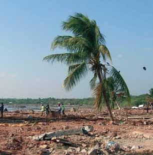
©FAO/G. Bizzarri

©FAO/G. Bizzarri
members of the population, such as women, children, widows, orphans and indigenous communities. Promote the individual land titling processes, maintaining the communal land tenure on those lands exploited at community level.
ESTABLISHMENTOFSECUREZONES FORTHERESETTLEMENTOFPOPULATIONS Based on adequate territorial planning move forward identification processes of secure zones for the temporary or definitive resettlement of populations affected by floods and volcanic eruptions, in territorial spaces that combine geographical and environmental characteristics similar to the original areas of risk. The aim is to achieve conditions favourable to the easy adaptation of the affected population.
PROTECTIONOFTHELANDTENUREREGISTER INDA15, the Property Notaries and Registrars at local level, are charged by law with the responsibility and custody of registers for the legalisation and transfer of land property rights. These registers are at risk of damage from the effects of natural phenomena. For this reason they should be in digital format and accepted as support for the technical file that legalises land tenure, and for the processes involved in asserting land property rights.
PROGRAMMESFORLANDPURCHASE Establishment of mechanisms that facilitate and favour the purchase of land by the State in areas of risk, so that this can be used as an asset or a natural reserve, with the aim of supporting future sustainability and access to assets in the new areas where the population will settle. These mechanisms should be backed by economic incentives for those who are either buying or selling their land to the State; additionally, technical assistance and training should be offered to support the reactivation of agricultural production of affected families.
DISASTERMANAGEMENTCOMMITTEESATLOCALLEVEL This involves the appointment of local risk management committees established by legal regulations that reinforce institutional structures at the territorial level, and include the participation of the beneficiary groups and communities; mechanisms of social control are used to ensure that the planning and execution processes for action taken before and after natural disasters are carried out transparently and efficiently, involving those

©FAO/F. Mattioli
entities whose work is dedicated to administering land property via local experience and presence.
GENUINEASSESSMENTOFLANDVALUE This defines clear and transparent mechanisms for valuing land at real prices, in order to control speculation and excessive increases in the value of land in times of crises caused by natural disasters. It is also designed to facilitate and motivate the sale and expropriation of land by the State, that is, land that can be used as a place or site for definitive resettlement of affected peoples.
SINGLESTATISTICSANDREGISTERSDATABASES OFTHOSEAFFECTED This establishes a single database registering the victims and those affected, which facilitates the focusing and establishment of a coordinated response by the public and private sectors so as not to duplicate efforts and resources in the development of actions intended to mitigate the effects of natural disasters.
LANDLEGALISATIONVOUCHER This prioritises access to MIDUVI’s land legalisation voucher for poor families affected by the volcanic eruptions and floods, with the aim of financing the cost of land tenure registration in those plots destroyed by the effects of natural disasters. In this way families are given access to support programmes for the reactivation of agricultural production, and sources of credit for this production; the voucher also provides the legal tenure security that affected peoples require in order to reinitiate their productive activities.
FINANCINGFORLANDACQUISITION This establishes a Land Fund whose aim is the acquisition of land property identified for the definitive resettlement of victims after a natural disaster; this should be administered by local governments in conjunction with the affected community and local actors (especially NGOs, which have the accumulated experience in other acquisition and land conflicts resolution processes) which should act as social controllers during the planning and implementation resettlement processes of the affected population.
The programmes developed by public and private entities to facilitate the purchase of land – such as the FEPP’s Land Purchase Credit Fund, the BNF’s Programme for Land Purchase, and the MAGAP-FEPP agreement – constitute important reference points for the development of the mechanism that facilitates land acquisition.
Bibliography
CAF – PREANDINO. 2006. Initiative orientated towards the reduction of disaster risks as applied to development processes. COSUDE Proyecto PDDL. 2007. The explosive eruptions of the Tungurahua volcano in July and August 2006. DEFENSA CIVIL. 2005. National strategy for prevention of and attention to disasters. CAF. 2003. The Lessons of El Niño, Ecuador: Memories of the El Niño Phenomenon 1997–1998, Challenges and Proposals for the Andean Region. MAG–SICA. 2003. The Agricultural/Fisheries Producer and his Surroundings. National Polytechnic School. No Place for Hope: Report on the Josefina Disaster – Ecuador 1993. FEPP–FIDA. International Land Coalition – (2003) The Cost of the Land. Can funds for land acquisition be useful to the poor? Civil Defence. 1999. Report on the El Niño Phenomenon 1997–98. MAGAP – PRAT. 2007. Regulating land priorities in Ecuador, with modern approaches. SENPLADES. 2007. Strategic Plan for the Reduction of Risk in Ecuadorian Territory.
Web sites
National Planning and Development Secretariat (SENPLADES) ? www.senplades.gov.ec Coastal Ministry – www.minlitoral.gov.ec Ministry of Housing and Urban Development – www.miduvi.gov.ec National Development Bank – www.bnf.fin.ec Chimborazo Provincial Council – www.cpch.gov.ec Project SICA – www.sica.gov.ec
Abbreviations and Acronyms
CAF Corporación Andina de Fomento (ADC) (Andean Development Corporation) CEPAL Comisión Económica para América Latina y el Caribe (ECLAC) (Economic Commission for Latin American and the Caribbean) CEBYCAM – CES Centro de Desarrollo Humano en Cultura y Economía Solidaria (Centre for Human Development in Culture and Economic Solidarity) COPEFEN Unidad Coordinadora del Programa de Emergencia para afrontar Fenómenos Naturales (Coordinating Unit of the Emergency Programme for Natural Phenomena) CORPECUADOR Corporación Ejecutiva para la Reconstrucción de las Zonas Afectadas por el Fenómeno “El Niño” (Executive Corporation for the Reconstruction of Areas Affected by the El Niño Phenomenon) CONSEP Consejo Nacional De Control De Sustancias Estupefacientes Y Psicotropicas (National Council for the Control of Drugs and Psychotropic Substances) CPOE Consejo de Programación de Obras de Emergencia (Emergency Works Programming Council) DIPECHO Programa de Preparación para los Desastres ECHO de la Oficina de Ayuda Humanitaria de la Comunidad Europea (Programme for Disaster Preparedness (ECHO) of the European Union’s Office for Humanitarian Aid) FEPP Fondo Ecuatoriano Populorum Progresso (Ecuadorian Popular Progressive Fund) INDA Instituto Nacional de Desarrollo Agrario (National Institute of Agricultural Development) INEC Instituto Nacional de Estadística y Censos (National Institute of Census and Statistics) MAE Ministerio del Ambiente (Ministry of the Environment) MAGAP Ministerio de Agricultura, Ganadería, Acuacultura y Pesca antes Ministerio de Agricultura y Ganadería (Ministry of Agriculture, Livestock, Aquaculture and Fishing) MIDUVI Ministerio de Desarrollo Urbano y Vivienda (Ministry of Housing and Urban Development) ONG Organismo No Gubernamental (Non-Governmental Organisation (NGO)) PRAT Programa de Regularización y Administración de Tierras Rurales (Rural Land Regularisation and Administration Programme) SENPLADES National Planning and Development Secretariat (Secretaría Nacional de Planificación y Desarrollo) SICA Proyecto Servicio de Información y Censo Agropecuario (Service Project for Agricultural Information and Census)