8 minute read
3. Land tenure and land administration issues related to natural disasters


The agriculture, fisheries and forestry sectors suffered the biggest losses from disasters, averaging PhP 5.5 billion or about 60 percent of total damage per year over the period 1990–2006. These losses were equivalent to an annual average of at least 0.7 percent of GDP originating from this sector. Public infrastructure losses amounted to PhP 3.1 billion or 34 percent of total damage per year, which included damages to agricultural support systems such as dams, and irrigation and drainage facilities. Losses to private property accounted for about PhP 0.6 billion, or 6 percent of total damage per year. The relatively low value of private property losses partly reflects the qualities of the housing and other structures owned or in the possession of affected households.
Advertisement
Agriculture, including fisheries and forestry, plays a major role in the Philippines’ economy for two main reasons: (i) two-thirds of the total population depend on farming for their livelihood, and about half of the total labour force is employed or engaged in agricultural activities (ii) some 13.0 million hectares or 43 percent of the country’s total land area is devoted to agricultural crops (Jose et al., no date). In more recent years (2003–2006), the agriculture sector contributed an average of 15 percent to GDP per year, and registered 3.85 percent growth in 2006 (DA, 2007). The output gains throughout the years, however, have not significantly benefited and improved the lives of farmers, particularly small landowners, landless tenants and farm workers. This could be attributed to the existing farm structure in the country, where a majority of the farms are small (averaging about 2.0 hectares), and about 21 percent of the agricultural farms covering some 8.0 million hectares have yet to be titled, according to the 2002 Census of Agriculture (DA, 2007). Many poor farmers with small farm areas lack the capital to invest in improved production technologies and more drought-
TABLE 2 – Estimated Total Damage from Natural Disasters (at Current Prices), 1990–20065
YEAR GEOPHYSICAL DISASTERS CLIMATE/WEATHER RELATED DISASTERS
VOLCANIC EARTHQUAKE LANDSLIDES TROPICAL FLOODS TORNADO ERUPTION CYCLONES Estimated Damage (Millions of Pesos)
TOTAL
1990 12 380.04 11 176.00 62.00 23 618.04 1991 3516.00 1044.81 4560.81 1992 5183.00 5183.00 1993 0.01 20 076.00 20 076.01 1994 513.02 3200.00 3713.02 1995 16 255.00 720.00 16 975 1996 0.01 699.00 699.01 1997 1010.00 1,010.00 1998 17 017.00 17 017.00 1999 333.19 0.03 2578.00 2991.22 2000 10.79 7470.00 841.38 15.00 8337.17 2001 6968.00 402.27 7370.27 2002 132.99 829.00 912.84 3.29 1878.12 2003 40.66 41.69 4171.00 449.89 3.38 4706.62 2004 25.72 13 262.46 212.84 97.01 13 598.03 2005 10.32 2552.66 317.46 2880.44 2006 10.12 20 227.03 1224.05 9.94 21 471.14 1990–2006 2.80 2235.10 12.60 8001.20 618.75 25.70 9181.45
average percentage share by disaster type 0.01 8.60 0.06 87.25 4.00 0.08 100
Source: Data obtained from National Disaster Coordinating Council, Office of Civil Defens.
resistant crop varieties. Unlike rich landowners with large farms, poor farmers are unable to undertake risk-reducing measures, such as contour farming, tree planting along paddy field borders in hilly areas, and the construction of protective dikes.
Past records show that ‘Dramatic increases or decreases in agricultural output have been, in most cases, associated with the occurrence of severe weather events and changes in the climate system’ (Jose et al., no date). Between 1991 and 2000, World Bank and NDCC (no date) found that annual ‘rice crop losses equivalent to 2.6 percent of actual production (in volume terms) were experienced as a consequence of typhoons and flooding’. Drought caused an annual loss of another 1.5 percent of the actual rice production for the same period. The worst impact of the combined typhoons, floods and drought on agriculture was experienced in 1998 with the highest agricultural losses recorded at about 18 percent of actual rice production (in volume terms). During this year, poverty incidence in the country soared to 28 percent, following a gradual improvement of this measure from a high of 34 percent in 1990 to 25 percent in 1997. As a consequence, agricultural output in 1998 shrunk to about 8.6 million tons, or 24 percent lower than that produced in 1997. Agricultural employment also dropped to about 10.1 million people or 11 percent lower than in the previous year (DA, no date). Freeman, Keen and Mani (2003) estimated that ‘about 50 percent of the increase in headcount poverty in the Philippines during the 1998 crisis has been attributed to El Niño’. This 1998 crisis demonstrated how the living conditions of the rural poor in general, and the farmers in particular, could easily worsen in the face of natural disasters. Such disasters not only destroy their houses and other properties, but also severely impact their primary sources of livelihood by destroying crops, killing livestock, etc, resulting in reduced production and income. In extreme events, such as the 1991 Mount Pinatubo eruption, the 2006 Guinsaugon landslide and the 2006 Typhoon Reming, the impact had been a permanent loss of cultivated farmlands for thousands of farmers.
2.4 Consequences on Land Tenure and Property of Affected Households
In the Philippines, there has been no study to examine the direct impacts of natural disasters on land tenure and property. Existing literature only refers to land tenure in relation to poverty in the context of the poverty–disaster nexus (World Bank and NDCC, no date; Vicente et al., 2006). This section therefore draws on the views of government and non-government
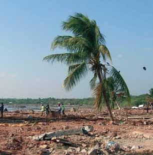
©FAO/J. Villamora
officers who have been involved in disaster relief and mitigation activities, and the experiences of some disaster–affected people from the Province of Albay in Bicol Region.
Disasters cause undue displacement of affected households, thereby resulting in either temporary or permanent changes in land tenure and property. The severity of impact differs in terms of: (i) whether the affected people have secure or insecure tenure on their property (ii) whether the disaster caused lasting damage on the property (iii) the capacity of the affected people to recover their lost property, or to restore and improve their tenure security, which is mainly defined by their socio-economic status.
People with secure tenure are more confident about reclaiming their property if the damage is not permanent. In the case of households that were affected by mudflows from Mount Mayon resulting from Typhoon Reming in Albay, those with titles returned immediately to their properties, given their awareness that the title records kept at the Register of Deeds would confirm legally the location of their boundaries. Moreover, because houses on titled properties are often built of stronger construction materials, finding the exact locations of the properties is not so difficult, because of the high likelihood that parts of the structures may still be intact after the disaster. This was the case for many residential property owners affected by the Mount Pinatubo eruption. In circumstances where the landmarks could not be easily reestablished after the eruption, owners have sought the services of geodetic engineers to relocate their boundary markers, based on the approved survey plans (Gerochi, personal communication, 2007).
In contrast, those affected households with no secure tenure are likely to have greater difficulty in relocating or reclaiming their original occupied properties following a disaster. This is more pronounced in the case of farmlands, especially when trying to locate the original position of farm dwellings. In the absence of boundary marks and permanent structures, returning to the property is made easier by community recognition of each others’ rights to occupancy, because neighbours help each other in reestablishing the original boundaries of their formerly-occupied properties, based on trust. This sense of cooperation is strong among affected community members immediately after a disaster, since they share a common experience and a willingness to help each other in coping with its after effects. However, the possibility of boundary disputes may arise once the parcel boundaries are delineated once more via surveys (Oyardo, personal communication, 2007).
Where the damage to land is permanent, affected people, regardless of their tenure, often find themselves eased out of their original communities and relocated in government-designated resettlement sites. This is particularly true for informal settlers, who have no choice but to accept moving to the resettlement sites so as to establish new dwellings and engage in other livelihood activities. However, in many cases, the relocation sites do not provide better alternatives to their former way of life. For instance, affected families in Aurora, Quezon, after the 2004 landslides that were triggered by four consecutive typhoons, were advised that their original community was no longer suitable for habitation because of the dangers it posed to people and property. Nevertheless, affected people thought that the relocation site was too far away from their original area, and would force them to alter their source of livelihood from fishing to farming (Gerochi, personal communication, 2007). In the same vein, the affected families in Barangay Padang, Legazpi city, found themselves landless after Typhoon Reming hit Albay in November 2006; houses were damaged and farms were covered by rocks and mudflows unloaded by flashfloods from the gullies of Mount Mayon, making the farms unsuitable for agriculture (Echaluci, personal communication, 2007). However, many families still chose to stay in the area: the large boulders that piled up in settlement areas and farmlands meant that quarrying emerged as a new industrial activity, although the types of equipment found operating in the area suggest that the operator was not among the affected people. In another affected barangay, in Guinobatan, Albay, former farmers found themselves employed as labourers in quarrying companies. Work in this sand and gravel mining was made possible by the ease of accessibility to the quarries – located in the former barangay – from the new Mabugos Resettlement Site, given that the a distance between them is only about one kilometre. For some farmers who accepted resettlement on the new site, renting farmland has been another option, allowing them to continue their agricultural production activities and eke out a living (Oyardo, personal communication, 2007). The situation is different for the Aeta people – a hunting and gathering indigenous group hit by the Mount Pinatubo eruption. Documented case studies (Seitz, 2004) reveal that the disaster affected the Aeta people in three ways: (i) some faced up to the inevitability of life in the lowlands (ii) others abandoned the resettlement site and went back to their original habitats (iii) others opted to stay in offsite settlements which the Aetas have established. In each of these