
6 minute read
Bibliography

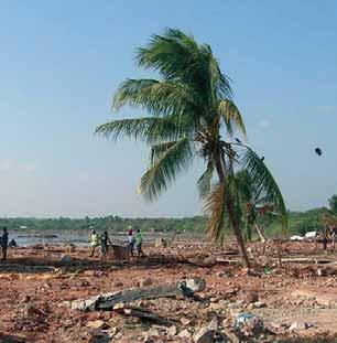
©FAO/J. Villamora
secure rights to land prior to disasters are at risk of being permanently displaced through the relocation sites offered by the government. In many cases, the sites are unattractive and do not match their pre-disaster situations. This was true for many affected people in major disasters such as the 1991 Pinatubo eruption, the 1991 Ormoc City flashflood, the 2005 Aurora–Quezon flooding and landslide, the 2006 Typhoon Reming, and the 2006 Guinsaugon / St Bernard landslide in Southern Leyte. Most of the resettlement sites do not provide enough space, are far from the resettled people’s original sources of livelihood, lack basic facilities and services, and offer entirely different socio-economic environments that require the resettled people to adapt their well-established traditions, livelihoods and lifestyles. As a result, these people are forced to return to their former lands despite the fact that these have become unproductive due to the damage caused by the disaster.Alternatively, they must find other suitable areas where they can start a new life and sustain their culture, as in the case of the Aeta, who established their own offsite resettlement sites in the aftermath of the Mount Pinatubo eruption in Zambales. All of these circumstances make the resettled people highly vulnerable to another disaster, which exacerbates their poor socio-economic conditions. ■ 3. LAND TENURE AND LAND ADMINISTRATION ISSUES RELATED TO NATURAL DISASTERS ■
Advertisement
3.1 Current Land Use and Tenure Risks after Natural Disasters
Alienable and disposable (A & D) lands, which are private property, account for about half of the total land area of the Philippines. Between 2002 and 2004, LAMP funded a series of studies on land laws, land markets, tenancy and land tenure. Their key findings give a clear picture of the country’s current land use and land tenure issues. LAMP (2004) summed up these findings as follows: ‘… some 60 percent of the real property of the country is informal. Considering that some 46 percent of the A & D lands are untitled, and much of the forest domain is occupied and used by people without secure rights, it can be seen that this figure of 60 percent, although extremely high, is not unreasonable. Any country with so much wealth remaining informal, can expect that the economy would have a limited contribution from the property sector. In addition to securing ownership for the remaining 46 percent of A & D land parcels, LAMP has proposed in the land laws and the tenancy study reports that secondary rights be registered, such as long-term leases. The land tenancy study showed that there are about 2 million hectares of farms (estimated 1 million parcels of farm lands) for which agrarian reform beneficiaries are yet to receive formal longterm leases. In the urban sector, the number of informal settlers in Manila is some 4 million, and the LAMP land laws study of 2002 suggested that long-term leases could provide immediate tenure security in the absence of or while awaiting the protracted process of transferring full ownership. Further, this land tenure study shows that the forest domain accounts for some 50 percent of the surface area of the country. Unfortunately, estimates of number of land parcels in the forest land could not be obtained from this study. This should be followed up so that cost andimpact/benefit analysis to support policy formulation on increasing land tenure security in forest land could be achieved.’
When the Land Tenure Maps produced by the LAMP study (2004) were overlaid with GMB’s Geohazard Maps and cross-referenced with Manila Observatory’s Risk
Maps, there are clear indications that most of the untenured people, and often the poor ones, are found in highly vulnerable areas, both in urban and rural settings.
LANDTENUREEMERGENCYWORKDESIGNED FORPREVENTIONANDMITIGATION In land tenure emergency work designed for prevention and mitigation,the major issues facing the Philippines include: (i) the formalization of land rights or the issuance of titles in areas considered highly vulnerable to disasters (ii) the lack of an appropriate land use and development policy (iii) the existence of dense human settlements in vulnerable areas (iv) uncontrolled development in high risk zones.
The absence of comprehensive spatial information prior to land titling results in the issuance of titles to properties located in vulnerable areas. In the case of the residents of Albay, several titles were issued along the flanks of Mount Mayon; some of these were even located within the six kilometers declared as a permanent danger zone by the Philippine Institute of Volcanology and Seismology (PHIVOLCS) (Noble, personal communication, 2007). This was also the case after the Ginsaugon landslide tragedy: an entire barangay was almost completely wiped out when the slopes of a hill collapsed after hours of continuous heavy rains. In this case, the land was declared alienable and disposable and hence subject to private property. The absence of comprehensive hazard maps for all types of hazards results in a misguided land classification system as well as a misguided land use and development policy.
The Philippines has yet to establish a comprehensive national land-use code. The code is supposed to provide the framework for the allocation of lands for various usesin the light of the country’s requirements for industrialization, urban and human settlements, agricultural and fisheries modernization, environmental protection, and other uses. At best, land-use planning that directly impacts on land tenure systems is localized, and normally prepared by LGUs following the guidelines of the Housing and Land Use Regulatory Board (HLURB)7. The key problem is that localized planning does not consider the broader requirements of the Philippines’ growing population and long-term socio-economic development. In addition, the importance of hazard information has only recently been considered in land-use and disaster management planning processes, as a major response to Ormoc City’s tragic flashflood in 1991. The preparation of geohazard maps for the entire Philippines to inform land-use planning remains to be completed, aside from the fact that different national government agencies (NAMRIA, MGS, PHIVOLCS, PAGASA) have been involved in this exercise. The production of such maps is hindered by two problems, which Delfin (2006) identified as (i) the use of different scales and geographic information systems (GIS) by government agencies, making data integration more difficult (ii) the lack of accurate political boundaries in many of the country’s maps.
The presence of dense settlements in vulnerable areas is partly a function of the weak enforcement of land-use policies, partly a result of uncontrolled urban growth, and partly due to a lack of access by rural landholders to land resources. Uneven investments which favour the highly-developed regions, burgeoning population growth, and a lack of livelihood opportunities in rural areas, only attract additional people out of the provinces. These conditions bring about an artificial scarcity of land and the densification of human settlements in urban areas, which force many people to inhabit drainage systems, easements, areas under bridges, and even coastal areas which are highly vulnerable to and contribute to hazards, because they prevent the free flow of water and present the occupants with higher levels of risk. The Payatas tragedy (see page 7) provides an illustrative case of a disaster waiting to happen, due to the high concentration of poor squatters in the biggest open dumpsite in Metro Manila. In rural areas, uneven distribution of land encourages informal occupation of public lands and an upsurge in seasonal farm labour on large privately-owned lands8. Meanwhile the absence of widespread land tenure instruments over open-access areas leads to unsustainable land uses and degradation in critical watersheds, danger zones, protected areas and marginal lands susceptible to high degrees of erosion. Several efforts have been made to estimate the population in the uplands to complete the process, but these have not quite been successful.
Properties located in high-risk zones have only recently been identified due to the late development of hazard
7 Fernandez, et al., (no date) found that the Comprehensive Land Use Plans required by HLURB for each city and municipality in Metro Manila have not been compiled. 8 As observed in the Ormoc City landslide tragedy, according to the DENR records, ‘nearly 100 percent of the immediate water-shed of Ormoc, an area of 4500 hectares, is owned by six sugar-planting families …’ (Severino, 1992; Danguilan-Vitug, 1993) and most of the affected families were farm workers and tenants on these plantations.


