3 minute read
Bibliography


©FAO/Knight (Contrasto) null
within communities40. However, the guidelines developed for the community risk assessment do not include issues surrounding land tenure and disasters.
Advertisement
The Union and Pourashava Disaster Management Committees should be responsible for monitoring and maintaining primary contact with landless families during pre- and post-disaster periods, but because of a lack of resources and also policy guidelines, this is not happening. They only certify landless families in response to any specific khas land resettlement programmes. Their duties and responsibilities in relation to land tenure issues could be strengthened as follows: •During participatory community risk assessments: include information on landownership distribution and the reasons for landlessness; identify landless families and those vulnerable to losing land in future disasters. •Capacity building and preparedness measures should include identification of available land for rehabilitation at the union/ward level. •People living in areas identified as risk spots should submit copies of their land titles to the Upazila and district administration as proof of their ownership.
In the event of loss of property, they could claim for rehabilitation. •During reconstruction of shelters, agencies will make sure that beneficiaries have safe and secure places in their homes to store their valuables, including land deeds, maps and other documents related to land titles.
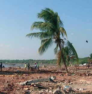
3.6 Reducing vulnerability to disasters
While it is impossible to prevent natural events such as the Sidr cyclone and major floods, it is possible to reduce vulnerability to disasters for people living in disaster-prone areas. Initiatives such as early warning systems have shown their merits: during the Sidr cyclone of 2007 the death toll of around 4000 was far less than the previous major cyclone in 1991, which caused 120 000 deaths. Disaster preparedness programmes make communities aware of their needs and teach them how to cope with disasters such as cyclones, floods and river erosion, not only in terms of saving their own lives but also in terms of
40 The Union Parishad is the lowest administrative unit of Bangladesh. There is a Disaster Management Committee at the Union level (UDMC), chaired by the elected chairman of the respective Union Parishad. Other UDMC members include all government department heads at the union level, members of the Union Parishad and NGO representatives. The committee is required to meet bimonthly during normal periods, and as and when necessary during emergency situations.
©FAO/G. Napolitano
identifying ways of protecting their livelihoods (for example, by moving livestock to higher areas). They must be directly engaged in the design and management of early warning systems (including choice of message dissemination), and also in the construction of locallyappropriate infrastructures, such as multi-purpose cyclone shelters and well-maintained embankments.
Both the SOD and the Comprehensive Disaster Management Programme need to be well aligned and committed to activate and strengthen Disaster Management Committees (DMC) at district, upazila, and village or ‘union’ levels. These committees should take the lead in planning and implementing community-based disaster preparedness plans for disasters that are likely to affect their areas. The DMCs should have a broad membership that includes community representatives such as fishermen and farmers. In addition, the government must accelerate its efforts to tackle chronic vulnerability, by guaranteeing access to essential services (e.g. health, education, water, and sanitation) during any type of disasters, giving priority to the vulnerable and poor41 .
Participatory disaster mapping is a valid tool for supporting and planning community-based disaster preparedness programmes. Such maps are drawn by the communities, highlighting important information such as major forms of land use, landownership patterns, physical structures (e.g. schools, clinics, water wells, markets, important roads), disaster-prone areas (e.g. steep slopes, flood prone areas, ground water conditions), and environmental issues. These maps should be widely shared and easily accessible by the communities, and can serve as a first step in the planning process for disaster preparedness programmes. These programmes will be able to address issues such as projected population growth, infrastructure development needs, and people’s main sources of income; they may also include environmental components such as conservation areas. The maps and plans can also be used as an important and effective awareness-raising tool, to make communities more conscious of the major potential disaster areas in their locality, the implications of such disasters, and possible plans to mitigate their occurrence and impact. There are several development programmes that try to reduce people’s vulnerability to disasters such as floods. One of these is the DFID-funded Chars Livelihood Programme (CLP), whose work includes physically trying to raise the homestead lands of selected beneficiaries.