40 minute read
3. Disaster management, land tenure and responses


Natural disasters will also destroy quality farm lands and existing irrigation and drainage schemes, disrupt mangroves, fisheries and bird habitats, accelerate coastal and river erosion, increase salt water intrusion into ground water, rivers, agricultural, and coastal forestlands, and affect cyclone and storm surge protection measures in coastal areas14 .
■ 2. LAND TENURE IN BANGLADESH ■
Advertisement
Following the overview in Part 1 on the different types of disasters and their impact on people’s livelihoods, Part 2 will provide more detailed background on land tenure in Bangladesh. It aims to show the links between disasters and land tenure, how land tenure arrangements have been affected by disasters, and how the government of Bangladesh has attempted to adapt land policies and implement land reform programmes in response to the impact of disasters.
2.1 A short history of formal land rights in Bangladesh
Bangladesh’s current pattern of landownership has its origins in the British colonial period, during which most of the laws, rules and regulations were promulgated. Feudalism in its most extreme form was deep rooted under British colonial rule. A series of struggles by peasants, spread over a whole century, gave them stable rights to tenancy through the Bengal Tenancy Act, 1885. In 1947, Bangladesh (then called East Pakistan) became a province of Pakistan15 and certain laws as regards land management and administration were adopted. For example, The East Bengal State Acquisition and Tenancy Act 1950, passed by the provincial legislative assembly, was a landmark in the history of land tenure legislation, and a first legal step towards the abolition of feudalism. This Act provided for the abolition of ‘Permanent Settlement’, created by the then British rulers, whereby collection of revenue was in the power of the Zaminders (land lords) or their intermediate collecting agents. Since the introduction of this Act all land is ultimately owned by the Government of Bangladesh. All ground tenants have come directly under the control of the Government, but have the right to buy, to sell or to mortgage their land. The Act also prohibited acquisition of new agricultural land by any family owning more than 60 bighas (about 20 acres)16 . The ‘surplus’ land was earmarked for the settlement of landless and marginal farmers ‘in accordance with the rules or the policy of the government’.
Following the Bangladesh Liberation War of 1971, Bangladesh achieved independence but continued to uphold the laws passed and applied during the British regime. Since then, gradual changes and amendments have been introduced.
2.2 Land administration and management mechanisms
Bangladesh has a long history of land administration that dates back to systems developed by the Hindu rulers of ancient India. The country also still lives under the shadow of the elaborated system of land surveys and registration for revenue collection introduced by the British. Presently the administration of land is divided between two Ministries, the Ministry of Land, and the Ministry of Law, Justice and Parliamentary Affairs. The Ministry of Land is formally responsible for conducting cadastral surveys and maintaining land records, the implementation of land reform legislation, and safeguarding tenants’ rights. The Department of Land Registration under the Ministry of Law, Justice and Parliamentary Affairs records land mutations arising from sales, inheritance or other forms of transfer. It also reports changes to the Ministry of Land, and collects the Immovable Property Transfer Tax. Other agencies that play a more minor role in the administration of land include the Ministry of Forests, the Fisheries Department, the Directorate of Housing and Settlement, and the Department of Roads and Railways17 .
Land administration as regards legal and fiscal cadastre is managed via Bangladesh’s administrative units; the administrative head representing central government is responsible for land-related matters. The country is divided into six divisions headed by Divisional Commissioners who act as the appellate authority with
14 Ministry of Environment and Forests. 2008. Bangladesh Climate Change Strategy and Action Plan 2008. Government of Bangladesh. 15 Pakistan inherited land laws introduced by the British rulers. 16 According to the Land Reforms Ordinance, 1984, although a family already owning 33.33 acres of land is allowed to retain the same, the prohibition applies to persons owning less than 33.33 acres of agricultural lands, by purchase, inheritance or otherwise. A family who acquires more than the ceiling limit by inheritance is entitled to compensation for surrender of such excess land to the Government. 17 CARE Bangladesh. 2003. Land Policy and Administration in Bangladesh: a literature review. http://www.carebd.org/Land percent20Policy percent20and percent20Administration.pdf
respect to decisions taken at the district level on matters of land administration. The Commissioner is also the appointing authority for lower level staff engaged in land revenue administration.
The six divisions are divided into 64 districts, headed by a collector who is also the District Magistrate and Deputy Commissioner. The collector is entirely responsible for land revenue administration in his or her district, and approves settlement on government land, changes in the classification of land according to its usage, and the acquisition of land for development. The districts are further divided into 465 sub-districts, the upazila, which are the basic administrative unit. The central government at this level is represented by the Upazila Nirbahi Officer (UNO). Among other tasks, this officer supervises revenue administration in his or her area. There are several Tahsiloffices in each Upazila, which are local field units for collecting land revenue. Sections 2.5 and 2.6 will explain in more detail how government programmes aiming to provide land title deeds to households that have become landless after natural disasters are implemented.
2.3 Land reform legislation after independence
Two major land reform laws were passed in 1972 and 1984. One revolutionary change introduced by the new independent Government of Bangladesh was the introduction of a land settlement policy in favour of the landless and marginal farmers. Before liberation in 1971, land revenues were the largest single source of income for the provincial government.
As a result, land settlement policy was guided by considerations of income revenues rather than equity and social justice. Surplus or khaslands were settled on payment of salami (deposits) which were approximately equal to the market price of the land. Only well off and influential people with financial power were able to obtain such land settlements in their own names or in the names of their henchmen. Today, khas land is supposed to be settled free of salamito the benefit of landless people as defined in the land settlement policy.
Another important provision aiming to improve land tenure security is the prohibition of eviction of agricultural tenants from their homestead lands. Previously, tenants could be evicted from their homestead lands after losing a court auction designed to recover outstanding debts. Other major changes were exemption from land taxes for families owning less than 25 bighas, legal recognition of sharecroppers, and the introduction of minimum wages for agricultural labourers.
Unfortunately, most of these reforms have remained merely paper legislation. A survey in 1991 showed that nearly 90 percent of the rural population was unaware of the tenancy reforms of 1984, and thus could not derive any positive results from them18 . Because of a lack of effective enforcement of land legislation, and a lack of awareness among the population, policies such as the legal bar on homestead land eviction and the introduction of minimum wages have not had any practical significance so far.
©FAO/G. Napolitano
2.4 Land ownership and the landless in Bangladesh
About 28.7 million households are located in rural areas, which is about 88.4 percent of all households in Bangladesh19. For most Bangladeshi people, therefore, livelihoods based on land and agriculture continue to
be highly important20. Ownership of land determines the status of an individual in the rural society of Bangladesh. Land-rich individuals enjoy political power and yield considerable social influence. The urban elites in many cases are also land-rich people, but they have very little relationship with the production processes of the agricultural land they own. Today, there are essentially four classes of agricultural landowners in Bangladesh: •people who own homestead land only, but have no land for cultivation; •people who own homestead and agricultural land and take lease land to increase their farm area; •people who own agricultural land but lease out part of it because they cannot manage all the land; •people who own agricultural land but lease all of it to others for cultivation (sharecropping or money arrangements).
There are no up-to-date figures on land distribution and average farm size, but approximately 80 percent of farm households are classified as small (between 0.02 and 1.0 hectares, with an average farm size of 0.35 hectares), and these account for about 40 percent of the agricultural land area21 .
The measurement of landless households in Bangladesh varies according to differing definitions, as found in distinct statistical sources. The Land Occupancy Survey (LOS) of 1977 and 1978, and the national level survey on Land Occupancy carried out by the BBS in collaboration with USAID, developed and distinguished three categories of landless households, including: •Landless I – Households with no land whatsoever •Landless II – Those who own only a homestead but no other land •Landless III – Those who own a homestead and 0.5 acres (0.2 hectares) of ‘other’ land.
To indicate the degree of landlessness, Januzi and Peach (1980) qualified the above definitions by describing landless I households as ‘absolute’ and landless II and III as ‘near’ or ‘functional’ landless (ownership of no more than 0.5 acres/0.2 hectares of land excluding homestead land). Accordingly, the 1978 Land Occupancy Survey found that 29 percent of people owned no cultivatable land22. In 1983–1984 the Agricultural Census reported a total of 1.1 million rural landless households (8.7 percent of all rural households)23 . More recently the preliminary report on the 2008 Agricultural Census24 found that 3.26 million rural households were landless (12.84 percent of the total rural households), and that there were 7.9 million rural tenant households (27.8 percent of all rural households). The 4.1 percent increase in rural landless households between 1983 and 2008 means an increase of 2.1 million landless households in absolute numbers.
Although the absolute number of farm households has increased, the percentage of farm households as a percentage of total households is gradually decreasing25 . In 1983–84, the percentage of farm households in rural areas was 72.7 percent. This decreased to 66.18 percent and 56.74 percent in the years 1996 and 2008 respectively. The causes of this gradual decrease in percentage of farm households are likely to be rapid urbanization throughout the country, and the fact that many labourers are switching to the non-agriculture sector from the agriculture sector.
As explained in section 1.3 above, erosion, and especially river erosion, is causing an increasing number of households to become landless, forcing people to migrate to urban areas or settle on other marginal and disaster-prone land.
2.5 Distribution of khasland
As outlined in Part 1, many rural households have become landless after cyclones, floods and river erosion. Floods sometimes make land unsuitable for cultivation and uninhabitable. Cyclones are often accompanied by floods and result in land being washed away or destroyed, as well as causing severe damage to agricultural infrastructure such as dams, irrigation canals, and also housing. People living along
20 About 1 percent of the total population belongs to an ethnic minority, the tribal group adivasis, who live both in the plains and the hill areas of Bangladesh. The land tenure arrangements for this group are slightly different, and not covered in this case study. The land tenure of this group is increasingly under pressure due to the high population density in Bangladesh in general. Increasing land pressure and economic interests in forest areas put this group’s land tenure security at risk. 21 See information regarding the National Agricultural Technology Project at http://www.worldbank.org.bd/. 22 Chaturverdi, M and Greeley, M. 2005. Assets and Access: A Livelihoods Study in South East Bangladesh. CARE Bangladesh. 23 The agricultural census of 2008 defined a landless household as one with no land whatsoever. Households with up to 0.04 acres were considered to be non-farm households. The agricultural censuses of 1983, 1984 and 1996 used the same definition of landlessness. Differences exist, however, as regards how urban and rural areas have been defined during the three censuses. For example, in 1983–84, there were only 79 municipalities. These numbers increased to 147 in 1996. In the 2008 Agriculture Census, 6 metropolitan cities of the divisional headquarters and 58 municipalities located at 58 other district headquarters, were included in the definition of ‘urban area’. The rest of the country, which included municipalities at the Upazila headquarters, was defined as a ‘rural area’. 24 Preliminary Report on Agricultural Census 2008. Available at http://www.bbs.gov.bd/dataindex/Pre-report-Agri-census-2008-Final.pdf. 25 The agricultural census defined a farm household as a holding whose net cultivated area is 0.05 acre or more.
BOX 1 – CHAR DEVELOPMENT AND SETTLEMENT PROJECT (CDSP)
CDSP is a joint programme run by the GoB, WFP (World Food Programme) and the Dutch Government (1994–2009). The population of chars consists to a large extent of migrants, originating from other places that were eroded or that could no longer sustain their livelihoods for other reasons. As a result, there is no kinship network. In an environment where vulnerability is the most visible feature, additional investments on the part of the settlers could only be expected if they were provided with some sense of security. Much of the CDSP intervention was geared towards that purpose. Infrastructure brought protection against floods and cyclones, while land settlement enhanced security by providing access to land through legal ownership. Project activities aimed at reducing insecurity and at the same time attempted to realize the development potential that the chars offer. Currently CDSP III is settling 70 000 landless households in ‘Boyer Char’, a new char in the Noakhali coastal area. (Koen, 2000 and http://www.cdsp.org.bd).
river embankments experience rivers changing their course over time, with land being washed away, but also new pieces of land developing over time due to sand deposition. After losing their farm and homestead land, people need to find new land for living and farming. They often settle on so-called khas land, which is officially state-owned, and which is regularly found in marginal areas along the coasts and rivers. Settlement on and allocation of khas land is often highly disputed and highly insecure from the perspective of legal tenure.
Since its independence, the Government of Bangladesh (GoB) has enacted many laws and policies regarding the distribution of khasland. However, these laws and their supporting regulations and policies are complicated, and their implementation is not always enforced. In 1972, after a catastrophic cyclone in the coastal areas, the Land Administration and Land Reforms Division began rehabilitating landless people by creating seven cluster villages in the chars26 of Noakhali, Lakshmipur and Feni districts. In 1987, the Ministry of Land launched the Land Reforms Action programme, an initiative to strengthen and enforce previous resettlement programmes for distribution of khasand unoccupied state-owned land to landless families.
Several resettlement programmes such as Adarsha Gram (AG)27, Asrayan and Abashan28 have been implemented, some of which are still in place to this day. The beneficiary families are selected by the local administration and then settled in communities ranging in size from 30 to 300 families. The families are provided with government khas land for homesteads, and agricultural and community purposes; they also receive resources for income generation, production and community development. Khasland is legally reserved for distribution to landless households as defined above. However, some groups of landless households are excluded, such as female-headed households headed by unmarried women, or widows who only have daughters or no children at all. In addition, the GoB has imposed ceilings (60 bighas)29 on landownership, so as to redistribute land from holdings above the ceiling to the landless, or to those with holdings below the size required for a farm to be efficient.
The estimated amount of total identified khasland in Bangladesh is 3.3 million acres30; however, experts contest these official figures and think they are an underestimation. In 2001, official sources claimed that about 44 percent of 803 308 acres of agricultural khas land had already been distributed among landless families, but experts question these official claims31 . Furthermore, official estimates showed great inaccuracies when checked at the local level. For example, figures for Noakhali district put official estimates at 67 percent of available land redistributed; while direct enquiry at the local level showed a target fulfilment of only 17 percent
26 Chars are highly unstable temporary lands within and adjoining the major rivers, formed by accretion of sediments. 27 AG has projects in 369 upazilas in Bangladesh and has provided shelter to 45 647 families during Phase 1, and 25 385 families in Phase 2. Each family receives a homestead with a minimum size of 0.08–0.10 acres in the char areas and 0.04–0.06 acres on the mainland. These include a house, a usable kitchen, and a single water-sealed latrine. There is also a tube-well to be shared by 10 families and a community centre for the whole village; wherever possible, agricultural land and/or ponds are provided for the beneficiaries. 28 The overall objective is poverty alleviation of the landless through shelter provision and human resource development activities (basic education, health care, and skills development for income-generating activities). 29 The State Acquisition and Tenancy Act 1950 fixed the land ceiling per family at 33.3 acres (100 bighas), which was revised and raised to 125 acres (375 bighas) in 1959. After the independence of Bangladesh the new government quickly adopted land legislation in 1972 under which the land ceiling was brought down again from 125 acres to 33.3 acres, and also exempted families owning less than 4 acres from paying land taxes. The Land Reform Ordinance 1984 saw a further reduction to 60 bighas (20 acres) maximum. 30 0.8 million acres of agricultural land, 0.8 million acres of water bodies and 1.7 million acres of non-agricultural land. 31 According to the economist Abul Barakat, at most 26 percent of available khas land has been distributed, and the rest is illegally occupied by the rich and powerful in society. See also Barakat, A, Zaman, S and Raihan, S. 2001. Political Economy of Khas Land in Bangladesh. Dhaka, Association for Land Reform and Development.
by mid 199032. In several other cases, while distribution was shown to have been completed on paper, in reality no actual transfers had taken place.33
Table 2 gives an overview of the process of khasland distribution and illustrates the number of obstacles and challenges that landless households face when trying to secure this land. It highlights the challenges of putting government policies related to khasland into practice.
To date, progress made in redistribution of khasland has generally been mixed, because of the vested interests of the landowning class, lack of political will, inefficiencies in the way the local and national administration are organized, and the absence of an updated, systematic and universally accepted source of information on land resource availability and land rights. Given the legal and administrative complexities and associated transaction costs, it is very difficult for poor, often illiterate people to go to court and file land litigation cases. Many landless families cannot afford these delays and lengthy processes, and are forced to migrate to other rural or urban areas in search of viable livelihood options. Meanwhile, continuing river erosion affects resettlement programmes because some of the rehabilitated villages have disappeared due to river erosion. It is not only the complexities of legal policies, weak administration, national and local politics, and corruption that make the redistribution of khasland
TABLE 2 – Gaps and obstacles to accessing khas land in rural areas 34
STEPS PROCEDURES OBSTACLES / GAPS
Identification • If land is under ordinary or diarasettlement the amin • A large portion of land is not surveyed and/or not recorded records the area as part of the cadastral survey and • Land is illegally occupied by influential people notifies the assistant settlement officer for registration • In non-settlement areas the tehsildaris responsible for identifying and recording any new khasland (e.g. arising through accretion) Notification • Microphone announcement by District Information • Allegations are very common that such notifications Officer at big market places are only passed on to contacts, friends and relations, with • Beating of drums at all markets and notices displayed some interested parties not finding out at all, or not until on all public notice boards in Upazilaand unions it is too late • Publicity programme included in the agenda of Upazilameetings for two consecutive months Application • Interested parties fill out an application form stating • Illiterate people cannot fill in the form and cannot apply what type of landless household they are and themselves; they depend on others for help, creating providing other details obligations toward their ‘helpers’ • Two members of the local elite (typically a UP chairman • Tehsildaroften demands a fee for providing, completing or member, or school teacher) must sign or accepting the form • False applications from large-scale landowners List names • Qualifications of applicant checked by tehsildar • Tehsildaror UP chairman sometimes requires a bribe • Preparation of a list of all qualified people • Applications are (often falsely) screened out for being filled out incorrectly Selection • The most qualified candidates are selected using • Bribes are paid to pass the selection stage, both by the established criteria by the tehsildar, UP chairman legitimate and illegitimate applicants and AC (Land). • Details are posted on Upazilanotice board Recording • Kanungosurveys the land for registration with AC • Bribes must be paid at each stage • The holding number of the khasland is placed on the application by AC (Land) and UNO. • The file is sent to the DC for approval Distribution • Deeds (kabuliyat) are issued granting title to the land • The number of applications exceeds the available plots for 99 years by AC (Land) and many are unsuccessful • Certificates are only handed out after payment of a bribe • Land is given to ineligible people Utilization • The recipient cultivates the land • Powerful people already own the land and block access and/or file a competing claim (often supported by false documentation)
• Rich and powerful people, tehsildar, or UP members demand a share of the produce Follow Up • If obstacles are encountered, the case goes back to the • Powerful people threaten recipients and/or bribe shalish, land office or court for resolution officials to swing outcomes in their favour • Recipients can not afford to proceed with the case because of high expenses and give up
32 Ibid. 33 Evidence on Rangunia and Mirsarai, Chittagong in Dainik Ekota, August 24, 1990. 34 Source: Reports of CARE Bangladesh and Political Economy of khasLand in Bangladesh by Abul Barakat.
to the landless a challenge, but also the highly disasterprone agro-ecological environment in which these programmes have to operate.
Besides the challenges of land tenures issues, other weaknesses in these resettlement programmes include35: •The settlement projects often lack an understanding of people’s living patterns and livelihoods; this is reflected in the sometimes inappropriate structural designs and spatial arrangements of shelters and homesteads. •The location of resettlement villages is often far away from local markets, commercial hubs and access to services such as health centres, government offices and credit facilities. This remoteness limits the scope of livelihood options and income-generating opportunities. •Settlements are at times not well planned and often use up grazing grounds in nearby villages, leading to conflicts over resources and scarcity of locallyavailable livestock fodder.
2.6 Land tenure provision in case of natural disasters
Although the Land Reform Ordinance of 1984 included provisions to protect people from being evicted from their homesteads, and also recognized the rights of sharecroppers36, there are no proper and effective policies in place for people who lost land due to river erosions or floods.
A Rin Salishi Ain was passed in 1989 to support poor tenants who were compelled to sell their smallholdings because of floods, drought and cyclones. This law provides for the establishment of debt settlement boards in each Upazila, composed of officials and representatives both of the seller and the buyer. The boards are authorized to declare certain types of sale void, and certain other types as mortgages redeemable after seven years have expired. Advance purchase of crops and deposits of blank stamp papers with signatures or thumb impressions are declared void under this legislation.
The Sikosti-Poisti Act (Dilluvion-Alluvion Act), initially formulated during British rule, was adopted with some amendments in 1972, soon after independence. The act stated that any land lost to river erosion and on which accretion occurs after some time37 would be owned by the government and declared as khasland for redistribution to poor and landless families. The spirit of the Act was to rehabilitate poor landless people as well as to check land grabbing and associated violence, which was often seen in flood plains and coastal areas. However, the act could not be enforced as the land was taken away from landless people by politically-influential local elites and large-scale farmers. Often, lengthy litigation discouraged many displaced landless farmers from filing a case, and they lost their claims to their legitimate rights. Consequently, the Sikosti–PoistiAct was amended in 1994 to state that the accreted land should be returned to the previous owner, provided that it was developed within the last 30 years. Although this amendment appeared to be a way forward, challenges remained in identifying the actual location or site, as well as the issue of measuring land areas. It was difficult to meet all the claims made by erosion victims, some of whom were often not the real victims. Further, the 30year clause is too long for poor farmers to wait. Often they prefer to sell the river’s submerged land to largescale landowners at below market prices. This amendment of the Act has led to many conflicts, lengthy litigations, and often armed violence centred on old and newly-accreted areas of land.
2.7 Major challenges for an effective land tenure system in Bangladesh
There are several reasons for the lack of progress in the formulation of a realistic land policy and its effective implementation, including: •Both policy makers and political circles have in general shown an insufficient appreciation of the overall land constraints facing the country. Per capita availability of cultivable land stands at a miniscule 0.24 acres, indicating a very limited scope for any comprehensive redistribution of land. Failure to appreciate the overall land constraint has led to exaggerated and largely ineffectual attention being given to redistributive land
35 Chowdhury R.A and Nurullah, A.S. 2004. Coping with Displacement. Riverbank Erosion in North-West Bangladesh. RDRS, Bangladesh. 36 The new law provides that a sharecropping contract between the landowner and the sharecropper (bargadar) should be valid for five years, including a right of inheritance for the able heir. The bargadarwill also have a prior right to purchase land at the market price. The produce will be divided into three shares. One-third will go to the landowner, one-third to the bargadarand the remaining one-third to the party that provides seeds, fertilizer and irrigation. In practice, the value and distribution of shares is determined by local practices and competition. Currently, sharecropping arrangements are mainly applied to non-irrigated traditional cropland, and lease arrangements in lieu of case payments have become very common in the production of high-yielding varieties of rice crops. For many of the rural poor, agricultural wage labour has become a more lucrative and viable option. 37 Land may be eroded as a result of river erosion, but given changes in the course of a river and deposition of new material (accretion), the land may also be reestablished after many years.
reform, while the more practical issue of optimum utilization of public or state land resources, including urban land, has been relatively neglected. It is obvious that in addition to existing landless households, opportunities for the resettlement of households affected by natural disasters are limited. •There has been a general lack of awareness of regional variations in the country with respect to land resources and land issues. An important example is the availability of khasland for redistribution to the rural poor. Bulk distribution of khasland is concentrated in relatively few hands. A successful implementation of khasland redistribution would require concentrated efforts as regards these identifiable bulks, rather than a routine administrative approach for the whole country. Failure to consider regional variations when designing implementation strategies has proved to be important in the persistent history of little or no positive benefits coming from land reform programmes. Land reform programmes should also consider the specific challenges of disaster-prone areas, and adapt implementation strategies according to the opportunities and constraints of specific regions, in view of the most common disasters experienced there and their effects on land tenure arrangements. •There are major flaws in the perception of elite as regards the major bottlenecks to successful land reform.
The failed history of land reform implementation has
been so widespread and so persistent that the implementation process itself demands to be treated as a priority concern. Vague arguments suggesting a lack of political will are an insufficient explanation for such routine failures of implementation. The system of land administration and associated court processes, the preponderance of ex-officio authorities involved in key decision-making processes as regards land reform programmes, and the subsequent ineffectual attention given to such programmes, appear to be much more likely explanations for the gap between promise and reality. Flaws in the land administration system also contribute significantly to yet another underappreciated source of rural misery: pervasive land violence. Land violence is already very much a part of everyday life; tension and violence is further aggravated when additional households have lost land due to floods and river erosion. Both of these issues – implementation failures and land violence – suggest that a third party item should appear on the land reform agenda (besides redistributive and tenure reforms), namely land administration reforms. Land administration reform should also consider issues related to disasters and land tenure and be linked to current disaster management, and disaster response frameworks and policies (see also Chapter 3). •The absence of any centralized system of information on land resources and land rights. While a great deal

©FAO/G. Napolitano
of information exists, this is scattered and duplicated in various land-related offices, leading to confusion and conflict. One crucial source of such confusion is in the fragmentation between the Upazila Land
Office/Tahsil office and the registration office. The registration office records all land property transfers, while information on ownership is maintained separately in the Upazila land office/Tahsil office.
Sometimes, land records documentation at Upazila and Tahsil offices is also damaged and destroyed as a result of floods and cyclones. Because of this fragmentation in information keeping, no routine scrutiny of ownership information takes place at the time of registration. This allows for the registration of numerous false land transfers; as a consequence, court action follows almost routinely. It is true to say that the bulk of civil and criminal litigation in the country arise from such conflicting claims of ownership.
The absence of an up-to-date, systematic and universally accepted source of information on land resource availability and land rights is probably one of the principal barriers to the successful implementation of land reform programmes, as well as the effective handling of land disputes. Technologies such as GIS and satellite mapping could be used to collect and maintain information on land resources and land tenure issues, and could also be made available at local levels of administration. More efforts should be made to map newly accreted and reclaimed land to avoid illegal land grabbing. An interesting example is the Bhoomi project, run by the Karnataka State Government and the World Bank, in India. The project focused on how information technology could be used as a tool for scaling up empowerment of the poor, increasing both their access to and the transparency of information. Under the Bhoomi project all land records in Karnataka have been digitalized, and access to these records is available through information kiosks and fingerprint authentication systems. More than 20 million records of landownership across Karnataka state, covering almostseven million farmers, have been digitalized. Although the advantages are recognized, critics also point out that ICT technologies may also increase inequalities further, because they are partly dependent on socio-economic status and literacy. It has also been suggested that the government missed the opportunities to verify critically the information that was entered into the digital database38. However, the existence of digital databases will also reduce the problems rural households face after loss of their land title documents when floods and cyclones occur.
■ 3. DISASTER MANAGEMENT, LAND TENURE AND RESPONSES ■
3.1 Natural disasters and their impact on land tenure issues
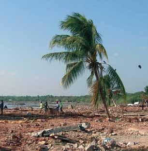
The first two parts have highlighted the complexities of land tenure issues and Bangladesh’s extreme vulnerability to disasters such as cyclones and floods. Landless people are disproportionately affected by disasters because of highly-skewed patterns of landownership which force them to live in high-risk areas. Disasters also have a negative impact on the wider economy and people’s livelihoods, including land tenure arrangements. Floods usually result in high levels of temporary displacements, and the loss of crops, livestock and other assets. As a result some people may then be forced to sell their land; others may not be able to meet their sharecropping or other lease arrangements; both of these situations have a negative knock-on effect on land tenure arrangements. River erosion especially is taking its toll and has already made many people landless; it then becomes a source of conflicts when land re-emerges via accretion at a later stage. Around 45 districts face the risk of river erosion and need to deal with its effects, which include severe loss of infrastructure, economic losses and landless households. Nearly 10 million people have been made homeless in the northern district of Bangladesh over the past 20 years. It is estimated that about one quarter of the total cultivable land will be lost by 2020 if no measures are taken.
Seasonal drought, which usually coincides with monga (a seasonal famine caused by lack of wage labour opportunities in the period just before harvesting), puts considerable stress on poor rural households. They are forced to sell their assets, sometimes in the form of land, and need to take out advance consumption loans against providing labour in kind during the harvest season. Many poor families are then trapped in a vicious cycle of debts involving high interest rates and/or providing labour in kind, which reduces their opportunities to take up more favourably-waged labour elsewhere. Table 3 gives an overview of the impact of disasters and their link to land tenure, specifically for Bangladesh.
TABLE 3 – Types of disasters, impact on livelihoods and land tenure issues
TYPE AREAS AFFECTED OF DISASTER IMPACT ON LIVELIHOODS AND WIDER ECONOMY ISSUES RELATED TO LAND TENURE AND REHABILITATION
Floods Floodplains of the •Loss of agricultural production, damage to •Prolonged floods may make the land unsuitable for Brahmaputra-Jamuna, the standing crops and loss of livestock previous land use; changes in land use patterns Ganges-Padma and the •Temporary displacement •Illegal land grabbing Meghna river system •Disruption of communication and livelihood •Temporary displacement systems •People become landless Haor Basins of the •Injury, evacuation, suffering and loss of •Rise in land tenure conflicts northeast region and human life, and loss of biodiversity •Large-scale migration southeastern hilly areas •Damage and destruction to infrastructure •Relocation should be on land relatively safe for future and property floods, raised homesteads and issuing of land titles •Disruption to essential services •Urban areas more likely to receive timely support •National economic losses and assistance •Applies to both urban and rural areas
Cyclones Coastal areas and offshore •Loss of agricultural production (crops and •Possible changes in land use islands (Patuakhali, Bhola, livestock) due to storms and surge floods •Temporary displacement Barisal, Barguna, •Temporary displacement •People become landless Chittagong and Cox’s •Disruption of communication and livelihood •Rise in land tenure conflicts bazaar district) systems •Large-scale migration •Damage and destruction of infrastructure •Relocation to new land outside the high risk and property areas and issuing of land titles •Injury and loss of human life, and loss of biodiversity •Need for evacuation and temporary shelter •National economic losses •Relevant to both urban and rural areas in the coastal belt
Drought Throughout Bangladesh •Loss of agricultural production •Pose considerable threat to land tenure by forcing Monga but especially the •Reduced farm-based income earning migration to urban areas northwestern region opportunities •Recent government budgets include allocation for •Increases in food prices drought affected areas •Stress on the national economy •Seasonal to permanent labour migration •Applies mostly to rural areas
River erosion Banks of the Brahmaputra- • Loss of land and homesteads •Permanent displacement Jamuna, the Ganges- •Displacement of people and livestock •People become landless and lose their homes Padma and the Meghna, •Disruption/loss of agricultural production •Resettlement in new areas combined with challenges Brahmaputra and Teesta •Loss of productive assets and property finding new homestead land and agricultural land •Evacuation •Fear of eviction when people have no registration •Relevant to both rural and riverside papers or land titles in new settlement areas urban areas •River protection to prevent further erosion where possible •Requires total rehabilitation in terms of shelter, homestead land, legal protection and viable livelihood opportunities
Landslide Chittagong and •Loss of land and homesteads •Permanent displacement Chittagong Hill Tracts •Loss of life •People become landless, loss of homes •Displacement of people and livestock •Need for enforcement of laws to stop hill •Damage to and loss of productive assets, cutting and deforestation agricultural production and infrastructure •Resettlement in new areas; challenges finding •Evacuation new homestead land/shelter and agricultural land •Relevant to both urban areas (often hilly •Fear of eviction if people have no registration slum areas) and rural areas papers or land titles in new settlement areas
Earthquake Northern and central •Damage and destruction of property, loss •Drastic damage to land and shelter parts of the country of life and changes in geomorphology •Requires improvement in mapping of risk zones •Displacement may occur after major and enforcement of building codes earthquakes •Lack of general awareness and government’s •Particularly relevant to urban areas, but commitment to put it on the agenda also to densely populated rural areas. •Protection of land tenure of the poor in case of displacement from high risk zones •Need for awareness and disaster mitigation policies and specific preparedness for earthquakes
Source: Salma A. Shafi, based on various sources (2008).
3.2 Institutional arrangements related to disaster management and land tenure
The Ministry of Food and Disaster Management (MoFDM) is responsible for coordinating national disaster management efforts across all agencies such as the Disaster Management Bureau, and the Directorate of Relief and Rehabilitation. The MoFDM is responsible for coordinating early warning management systems, immediate relief operations, and recovery and rehabilitation programmes. The Ministry is supported by donors and several UN agencies that provide technical support and funding assistance, and also a number of national and international NGOs. Technical support is provided in several ways, i.e. support for the formulation of disaster mitigation and rehabilitation policies, and the implementation of actual relief operations on the ground. In January 1997, the Ministry issued the Standing Orders on Disasters (SOD) to guide and monitor disaster management activities in Bangladesh. A series of inter-related institutions, at both national and sub-national levels, have been created to ensure effective planning and coordination of disaster risk reduction and emergency response management. Field level disaster management and response activities are the responsibility of Deputy Commissioners at the district level and UNO offices at the Upazila level. Activities at the village level are planned and carried out by union offices through the chairperson and its ward members (see Table 4 for more details).
Not listed above are other ministries such as the Ministry of Agriculture and the Ministry of Public Works
TABLE 4 – National and field level committees on disaster management, and their responsibilities
LEVEL COMMITTEES HEADED BY ACTIVITIES
NATIONAL National Disaster Management Council Prime Minister To formulate and review disaster management LEVEL (NDMC) policies and issue directives to all concerned
Inter-Ministerial Disaster Management Minister in charge of the To implement disaster management policies and Coordination Committee (IMDMCC) Ministry of Food and decisions of NDMC/Government Disaster Management
National Disaster Management Advisory An experienced person To carry out advisory activities Committee (NDMAC) having been nominated by the Prime Minister
Cyclone Preparedness Programme Secretary, Ministry of Food To review preparedness activities in the face of the Implementation Board (CPPIB) and Disaster Management initial stages of an impending cyclone
Disaster Management Training and Public Director General of Disaster To coordinate disaster-related training and public Awareness Building Task Force (DMTATF) Management Bureau (DMB) awareness activities of the Government, NGOs and other organizations
Focal Point Operation Coordination Director General of DMB To review and coordinate activities of various Group of Disaster Management (FPOCG) departments/agencies related to disaster management. Also to review the Contingency Plan prepared by concerned departments
NGO Coordination Committee on Director General of DMB To review and coordinate activities of concerned Disaster Management (NGOCC) NGOs in the country
Committee for Speedy Dissemination Director General of DMB To examine, ensure and discover the ways and of Disaster Related Warnings/ Signals means for speedy dissemination of warning signals (CSDDWS) among the population
SUB- District Disaster Management Committee Deputy Commissioner (DC) To coordinate and review disaster management NATIONAL (DDMC) activities at the district level LEVELS (Field Level) Upazila Disaster Management Committee Upazila Nirbahi Officer (UNO) To coordinate and review disaster management (UZDMC) activities at the Upazila level
Union Disaster Management Chairman of the Union To coordinate, review and implement disaster Committee (UDMC) Parishad management activities of concerned unions
Pourashava Disaster Management Chairman of Pourashava To coordinate, review and implement disaster Committee (PDMC) (municipality) management activities within its area of jurisdiction
City Corporation Disaster Management Mayor of City Corporations To coordinate, review and implement disaster Committee (CCDMC) management activities within its area of jurisdiction

©FAO/G. Napolitano
and Housing, which are also called upon for certain disaster responses. The Ministry of Public Works and Housing may intervene in relation to earthquakes, i.e. to coordinate reconstruction efforts and ensure a proper implementation of the building code. The Ministry of Agriculture is responsible for research and extension activities to support farmers during droughts. However, the SOD does not include any major institutions and line agencies responsible for land tenure issues, even though land tenure issues are crucial issues in many natural disasters.
In 2003, the Comprehensive Disaster Management Programme (CDMP) was approved by the Bangladeshi Government as a key strategy to advance and coordinate risk reduction efforts by the government, NGOs, the private sector and communities themselves. It aims to reduce long-term risk and to strengthen operational capacities for responding to emergencies and disaster situations, including actions to improve recovery from these events. The National Plan on Disaster Management sets out a series of key strategic objectives such as community empowerment, strengthening and improving emergency response, and partnership building among the different agencies and line ministries. Many ministries are involved in different ways but it is striking to notice that the Ministry of Land is neither included in the SOD nor referred to in the National Plan on Disaster Management39 .
The provision of shelter for landless people is an activity to be carried out by the central authority as and when desired, and is dependent on a political decision being taken. In any land settlement programme, the process is begun at the local administrative level with registration of landless people, selection of beneficiaries, and preparation of proposals for settlement on khas lands. However, resettlement on khas land is a regular and routine administrative process, and not yet aligned with responses to natural disasters and rehabilitation procedures. For example, the case of Sidr landless victims showed that large numbers of landless families awaiting rehabilitation have not yet been resettled (see section 3.7). Also, river erosion can cause a sudden increase in new landless households, which cannot easily be addressed within regular land resettlement programmes. By river erosion alone, an estimated 250 000 people are made homeless every year.
3.3 Disaster management policy within the Poverty Reduction Strategy framework
The Poverty Reduction Strategy Paper (PRSP) includes a policy matrix (number 07) on Comprehensive Disaster Management with respect to poverty reduction and growth. In addition, disaster management is included in three policy matrices: food security, promotion of
the use of ICT in disaster management, and ensuring social protection for women against vulnerability and risk. The policy matrix 07 on disaster management envisages: •Mainstreaming disaster management and risk reduction into national policies, institutions and development processes (introduction of Disaster
Impact and Risk Assessment (DIRA) •Strengthening disaster management and risk reduction capacity •Ensuring knowledge management on disaster risk reduction •Enhancing community level capacity for disaster risk reduction (community level preparedness, response, recovery and rehabilitation) •Ensuring social protection of women, children, elderly, people with disabilities and other vulnerable groups, against vulnerability and risk.
But once again, the policy matrix on disaster management within the PRSP does not refer to or highlight the importance of land tenure issues. 3.4 Present mechanism for addressing the causes of natural disasters
Over the years the government of Bangladesh, with support from donors and international agencies, has developed several mechanisms to respond to disasters in terms of their effects, but even more so in terms of their causes. Table 5 gives an overview of disasters, their causes, and responses aimed at addressing some of the underlying causes of these, as far as it is possible to do so.
3.5 Disaster management at the union level
The National Disaster Management Plan 2008–2015 outlines guidelines and procedures for Union Disaster Management Plans (UDMP) for each Union, outlining both disaster risk reduction strategies and emergency response. Union Disaster Management Committees have to conduct participatory community risk assessments, giving particular attention to specific vulnerable groups
TABLE 5 – Type of disasters, their causes and present response mechanisms
DISASTERS CAUSE OF DISASTERS RESPONSES (POLICY AND IMPLEMENTATION) AGENCY RESPONSIBLE
Floods •Excess water flow during the monsoon •FAP (Flood Action Plan) •CDMP (Comprehensive •Unplanned infrastructure development •National Water Policy Disaster Management •92 percent of total catchment area is •Flood forecast and inundation modelling Programme) along river border areas •Dredging of river beds •Disaster Management Bureau •Drainage congestion due to river bed •Construction of embankments with •Ministry of Food and siltation sluice gates Disaster Management •Deforestation in upper catchment area River erosion •Floods •River training •Bangladesh Water •Flash floods •Embankment Development Board •Heavy rainfall •Farakkha (Overflow of rivers controlled in India) Droughts •Less and uneven rainfall in the dry •Agricultural research and extension works •Ministry of Food and season and wet season •Intensive afforestation programmes Disaster Management •Non-availability of surface water in •Re-excavation of channels and ponds in rural •Ministry of Agriculture the dry season areas •Fluctuation of ground water table •Augmentation of surface water flow •Construction of water reservoirs Cyclones and •Geographic location of Bangladesh •Strengthening of CPP (Cyclone Preparedness •CDMP (Comprehensive Disaster storm surges •Coastal configurations and bathymetry Programme) Management Programme) of the Bay of Bengal •Awareness-building programmes •Disaster Management Bureau •Location of ITCZ near the Equator and for the target group •Local Disaster Action Plans its shifting with the apparent movement •Reliable and timely warnings and effective for grass roots levels of the Sun across the Bay warning dissemination systems along the coastal belt •Ministry of Food and Disaster Management Tornadoes •Intense ground heating and low level •Proper radar network •Local Administrative Body moisture incursion from the Bay of •Reliable and timely forecast capability •Disaster Management Bureau Bengal, pre- and post-monsoon •Awareness-building programmes •Ministry of Food and Disaster •Conjugation of western disturbance •Quick search and rescue system Management with locally developed low pressure areas Earthquakes •Geographical location of Bangladesh •Proper implementation of building code •National Housing Authority along major and moderate faults (1993) •Ministry of Public Works and •Inventory of equipment for rescue operation Housing