46 minute read
5. Tools and local service provision capacity


land-use plan for the area, they are more likely to (i) accommodate victims of natural disasters (ii) be more actively involved in encountering local and acceptable solutions for managing the resettlement and (iii) benefit from recovery efforts. An enabling environment of local land management accountability is more likely to prevent disputes between hosts and newcomers than an imposed intervention from state authorities.
3.5 The loss of formal records
Advertisement
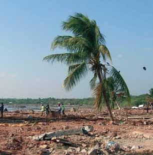
The loss of formal land and property records was a major land-related issue highlighted in the early assessment missions in 2000. This is not surprising considering that most administration buildings in Xai–Xai and Chokwe were flooded for weeks, offices were abandoned for some two months, and upon return the documentation was buried under a layer of mud. Records that were destroyed included: •Cadastral records of the SPGC–Gaza, located at the
Provincial Directorate of Agriculture in Xai–Xai; of some 1322 records, two thirds were unique documents without copies available at the central level. •Property records of the municipality of Chokwe (Tombo geral da propriedade), located at the municipal administration; an estimated 70 percent were damaged. •Provincial registry information of the Gaza province (Conservatório do Registo), located in the Ministry of Justice in Xai–Xai; 22 volumes of the register were destroyed or partially destroyed.
Notary documentation was also lost. ORAM, a leading national NGO on land issues, lost a number of processes relating to the registration of farmers’ associations, which are time-consuming and costly processes; the registration process of the associations had to be restarted from scratch.
There is a strong belief that most of the damages done to land, property, civil data and registers could have been avoided. The arbitrary response to the alerts given through the public early-warning system is considered a major reason for the loss of documentation. The floods were well predicted, but in fact the dimension of the third flood, beginning at the end of February, took Chokwe by surprise. Notwithstanding the timely alerts, there was widespread disbelief that the height of the flood would exceed 1977 levels. The Xai–Xai population, however, including the civil services, were alerted at least two days in advance that the flood levels would reach the town, but very little precautionary action was taken. The SPGC staff removed their computers from the ground floor offices to the first floor, but all hard-copy documentation remained in the filing cabinets on the ground floor, as well as all the surveying equipment.
Within the context of the existing land administration environment of Mozambique, the most pertinent questions concern whether the destruction and damage to official land and property records has had any significant negative impact on the daily life of land and property holders, and whether, as a consequence, it has created any land and property-related disputes. The answer to both questions is probably ‘no’, at least in respect of rural land rights.
Firstly, an overwhelming part of the existing land rights in rural areas have not yet been subject to any cadastral surveying, and these rights are thus not documented as official cadastral records. Of a population of 1 116 000 for the Gaza province (with some 100 000 urban-based people registered in Xai–Xai town – Census, 1997) only around 1300 rural land parcels were issued, or in the process of being issued, at the time of the floods. The loss of these records, in the grand scheme of things, was therefore not catastrophic.
Secondly, all documented DUATs that were approved after 1998 have, in principle, been subject to a process of consultation with local leaders and authorities, as part of the legally-approved procedures to acquire a DUAT7. This local consultation process always leaves traces that can be tracked down when needed. When documents are destroyed, there is always a local reference able to confirm whether a person or entity has been through a process of acquiring a DUAT.
Recording property rights in urban areas has been more widespread. The inclusion of a property right in the municipal Tombo de Propriedade(the register of the infrastructure on the land, not the land itself) is written proof that a person has erected a construction on a plot according to the legal procedures. Again, there are strong social-control measures as regards land occupation within urban areas, exercised by local authorities such as chefes de quarteirão and chefes de bairo. This is a remnant of the social-control system instigated by the socialist regime in the 1970s, and comes in handy when there is a need for oral testimony to confirm land and property rights.
The loss of formal records has had little impact on people’s lives in the aftermath of the disaster. This does not, however, imply that lost documentation does not need to be restored, or land rights do not require documentation. When community land rights are not made visible through delimitation and recording, it is difficult for community structures and members to exercise their rights. Undocumented community land rights are easily encroached upon by outsiders who may acquire incompatible overlapping rights in bad faith. Documented individual DUATs are needed for a number of situations, such as accessing credit, securing investment, and avoiding overlapping land rights.
The response of the government in addressing the recuperation of lost documentation, and preventing similar situations from occurring in the future, has been tentative. No special campaign was set up to rapidly retrieve or restore lost documentation. Each service or department was responsible for handling its own business, according to procedures that were not well defined. Efforts on recovery and restoration of documentation were normally part of the regular programme of the service. There was no recruitment of extra staff, although there was some occasional help from headquarters-based staff. There is no sign that specific measures were taken, or specific procedures approved.
It must also be noted that the recovery and restoration efforts have not directly induced a systemic change. The lost or damaged records were restored as best they could be, but the recording system itself was not improved. The data of the Property Register (Registo Predial) is transcribed, once again by hand, in new books, a process that is still ongoing a full eight years after the events. According to the registrar in Xai–Xai, the introduction of a digitised Property Register is one of the lowest priorities among the ongoing modernisation efforts in the Ministry of Justice.
A number of simple measures to prevent a similar impact on formal records were identified by national staff of different departments, including: •A better and more organized response to early warnings is essential. Flood alerts need to be taken seriously and decision-making on safeguarding public goods and documentation should not depend on personal interpretations of such alerts. Although earlywarning systems are better and more reliable than they were in 2000, people need to acquire more confidence in the early-warning institutions. These also need to become more legitimate for the ordinary citizen. The way alerts are given is not always accessible: clear messages need to be conveyed, such
as a description of the present colour coding system, rather than abstract information on expected water levels delivered in meteorological language. •Keeping official records in safer places is an obvious response to avoid future ‘paper disasters’. The cadastral records at the SPGC are now kept on the first floor – although the peak water levels of 2000 floods easily reached this height. The Xai–Xai municipality is gradually locating new administrative infrastructure in the higher flood-free parts of town.
This is part of a new town plan that appears to consider flood risk as an important planning parameter. •The information flux between the different cadastre levels, provincial and national, has improved.
Processed data at the provincial level are transferred to the national level on a monthly basis. Efforts to digitise the cadastral records at the provincial level are ongoing. The new information system is not fully functional, and still has major flaws. There is no online connection with the central system, and the system itself is susceptible to virus attacks. In principle, regular backups are made, but it is not clear whether standard procedures exist to do this, nor that the backups are held off-site in safer areas.
The existence of a fully-operational digitised system would be a significant improvement. •A number of logistical weaknesses have been identified, but not all are addressed in a coordinated fashion, according to adopted standard procedures.
These include: proper filing systems in closed filing cabinets (existing filing cabinets are not waterproof); the use of waterproof ink for handwritten documentation and registers; keeping multiple copies of cadastral maps and other documentation; barred windows and doors in offices (the SPGC offices in Xai–Xai had bars, preventing records being washed outside the building by the flood waters).
The recovery and restoration of cadastral data has left a number of pertinent questions that still need to be addressed. One set of legal uncertainties refers to the legality of reconstructed data. Most of the damaged documents with original signatures have been copied, and there is a doubt as to whether copied signatures have the same legal value as the originals. There is no knowledge about any legal measures that eventually dealt with this issue.
There remains a lack of clarity on how to proceed with DUAT and community land delimitation processes that were not finalised at the moment of destruction or damage. The processing and approval of a DUAT is subject to a number of local authorisations, a local consultation
process, and further authorisations at provincial or national level, depending on the size of the requested area. Doubts arise as to whether processes that were in the pipeline for approval should restart all the legal procedures, or whether these processes can be finalised by adding the missing additional information and authorisations. Of course, this is only the case when some existing but damaged documentation was retrieved. This is often difficult, because DUAT requests that were still being processed were not filed, but simply kept in piles on staff desks. These files suffered most from the floodwaters. There also remains a question regarding the additional costs and whether these should be charged to the client (for example, if it is necessary to repeat some steps of the process).
■ 4. LESSONS LEARNED FOR ADDRESSING LAND ISSUES ■
4.1 The enduring role of ‘traditional’ institutions
One of the clearest lessons from the post-flood experiences in Mozambique is that the ‘traditional’ institutions of land management in rural areas of the country remain the most important, enduring and flexible mechanisms for the majority of people in securing access to land and resolving conflicts. Given the lasting weaknesses of the formal land administration system, especially at district level and below, the vast majority of the population rely on traditional authority structures and their overseeing role in respect of land access. In matters related to resettlement in residential areas, accessing new land for cultivation in the higher areas, and in the event of conflict when people return to their areas of origin, it is these institutions that play the most important role by far. The hierarchy of traditional chiefs in the rural areas represent a repository of information regarding land allocations, boundaries and entitlements; in effect they are a ‘living cadastre’, the point of reference to which everybody turns.
The GoM has adopted formal policies in the land and natural resource sectors that recognize this important role, and has enacted laws to provide mechanisms for their integration. Despite this favourable policy environment, the day-to-day state administration of land access, land allocation and conflict resolution still exhibits many past characteristics and has yet to make full use of the tools available. This is also evident in the planning and implementation of disaster response activities, as we have shown in this paper. 4.2 The need for better pre-emptive planning
RESETTLEMENTASADISASTERMITIGATIONPOLICY There is no doubt that resettlement is at the core of the GoM’s flood disaster mitigation strategy. Resettlement, though, has a long history, and has developed astrong negative connotation among rural communities in Mozambique. During the colonial period, these communities were pushed away from productive land, ironically often flood-prone valley lands in Zambézia and Gaza. They were settled in villages on marginal land, and used as a work force in the estates (see O'Laughlin, 2001). The post-independence FRELIMO leadership turned these private estates into national enterprises, where rural communities were again considered as merely one of a number of production factors. The ‘communal villages’ arose partly as a response to flood disasters, at least in Gaza, but more so in order to implement a collective form of agriculture, whereby the ruling party and government were able to exercise a strong degree of social control. The villages were not accepted by local people: they were detested and the strong living memory of hardship clearly remains present today.
Recently, the main opposition party has been using these old realities to rhetorically disagree with and contest the present disaster mitigation policies, centring on the provision of housing materials and the encouragement given to the displaced to settle in established upland village areas. In late 2007, between two major floods events in the Zambezi valley, several RENAMO deputies claimed the government was trying to recreate the communal villages (Panapress, 16 November 2007). This accusation was repeated by the leader of RENAMO, Afonso Dhlakama, after the latest flood events of 2008, when he stated that the resettlement programme was just a plot by the ruling FRELIMO Party ‘to recover ground lost to RENAMO during the war of destabilisation’. According to Dhlakama, ‘The FRELIMO government has understood that every year the people return to their original homes after critical flood periods or after receiving food … so it has found a way of keeping them in these new places. To stop them from returning, the government shares in house-building by providing zinc sheeting and cement, and thus obliges people to stay there.’ (AIM, 5 March 2008).
In 2000 and 2001, resettlement was implemented as a reactive emergency planning response to the floods. Resettlement villages were erected rapidly, on the spot, often in locations where victims happened to be dropped off after being rescued. There was simply no time to plan.
Decisions were made quickly; any obstacles that may have been encountered when implementing these decisions were ignored, massaged with promises, or coercively removed. In times of crises, state interference may be overly-inflated and decision-making may take on illegal forms. There is evidence to suggest that the response in 2007 was much improved, and that considerably more and more genuine consultation was undertaken with the local leadership of affected host and displaced communities.
It is clear that the quick remedial approach to resettlement was the major cause of land and property uncertainties, where these exist. This applies to the flood victims who were resettled, but even more so to the communities on whose land this occurs. Sometimes this problem does not arise, i.e. when people are resettled on land belonging to their own community, as has happened in most of the Zambezi valley areas.
Resettlement on community land is probably the only solution for future flood victims. Land registered in the name of the government is becoming scarce after the privatization efforts. Remaining government land, such as parts of the Chokwe irrigation system, is mainly situated in flood-prone areas. The more marginal community lands now become the preferred safe havens for flood victims. The challenge is to turn resettlement, initially a first-response mitigation strategy for natural disasters, into something that responds to the needs of the potential victims. It is a voluntary process; to make it attractive and successful an enabling environment needs to be created.
Where people continue to live in vulnerable floodprone areas, coping strategies must be discussed with them and their rehabilitation needs must be understood. The concerns of both men and women need to be incorporated into rehabilitation and resettlement strategies. Settlement plans need to be made in discussion and negotiation with local communities. There is a need to understand how land use and land tenure systems affect settlement patterns, and whether changes in these could be used to encourage people to move to safer areas.
PRE-EMPTIVEACTION There are a number of reasons to propagate a preemptive approach to the planning of resettlement, rather than maintaining an emergency reactive approach. It appears that most of the tools for resettlement planning are available, such as the long-awaited territorial planning policy and law, the existing land policy and law, and the housing policy, among others. These tools all adhere to the same set of basic principles, which include participation and inclusiveness in decision-making, local consultation, seeking consensus, possibilities for appeal, and giving public notice before finalising decisions. However, it is just not possible to adhere to all of these principles in an emergency response mode. And by failing to do so, the outcomes are often neither legal nor legitimate, as shown throughout this study, and become a source of conflict later.
On the other hand, there are no reasons to believe that resettlement planning and voluntary resettlement itself cannot be considered a pre-emptive exercise. The recurrent character of floods is a reality, especially in the lower Zambezi watershed. Early-warning systems in Mozambique are now well-developed; national and international institutions have established tools that make it easy to identify districts that are susceptible to recurrent flooding (CENACARTA, University of Eduardo Mondlane, INGC, INIA, MICOA, FEWS NET). Most of the steps that need to be taken in such a pre-emptive planning exercise are part of the overall government programme. It is a question of prioritizing, and making pre-emptive action even more a part of the government programme.
SUSTAINABLERESETTLEMENT – ANACTIONPACKAGE Sustainable resettlement does not amount simply to addressing the basic needs and services in resettlement sites, but must also encompass action in the areas of origin that are subject to flooding. Providing tenure security in these areas is even more important than in the victims’ new homes. The permanent occupation of the latter provides reasonably strong forms of tenure security; in the areas of origin, where land occupation is not necessarily permanent any longer, the risk of losing access to land and natural resources is more pronounced. This may result in people staying for prolonged periods in these areas, even when flood risks are high, merely because their permanent and visible occupancy is a good measure against the potential loss of access to the land, on which their livelihoods depend.
Sustainable resettlement therefore encompasses actions that are taken simultaneously both in the area of resettlement and the area of origin. There are a cluster of activities that need to be considered, as part of a holistic package, in order to promote sustainable resettlement efforts.
Securing land and property tenure for host communities Resettlement brings stress to those who play host to the displaced. In Mozambique this situation is still
reasonably under control, mainly because of a number of favourable social factors which have been identified in this paper. In most areas of Zambézia, as attested to by the traditional leaders who were interviewed, there is also still plenty of land available in areas that can be accessed by those with the energy and means to put it into production. However, in other areas, a significant part of the 1097 resettled households, amounting to some 6000 people, need to share the same resource base with a host community that has a considerably lower population. Inevitably, this results in pressure on the natural resource base (data from Xai–Xai 2000 village).
The disastrous environmental impact of resettlement camps on host communities throughout the world has been documented and televised. This paper also demonstrates the fact that the present resettlement approaches on communal land can result in the permanent alienation of host community land. Why should a rural community host a significant number of people, if they know that this will result in a loss of assets? In this context, it is essential that tenure security is established over the land and natural resources of the host community, and that access to it is then negotiated through formal and legal processes. It corresponds with establishing a safety net for the host community, to ensure that they do not lose access to land and natural resources through the unilateral decision-making of others.
Land use planning on host community’s territory In line with international standards and best practices, Mozambique supports participatory methods of territorial and land planning, and these constitute an integral part of the policy and legal framework. Decisions on future development and land use within a community should to a large extent be made by the community itself. This is not necessarily the case in emergency planning, where the state, together with some notable or local political figures, makes quick decisions. A community planning exercise is the only legal and legitimate approach to decide on a number of issues. These include the location of resettlement villages, compensation for the customary landowners, conditions for the flood victims to access other land and natural resources, and the need and possibility for development of the resource base (e.g. new small irrigation schemes, development of new machongo areas). In fact, a major outcome of a community plan would be a development or recovery portfolio, which would include development actions for the host community, but also recovery and development actions for the newcomers. This is an excellent instrument to create synergies between hosts and newcomers8 .
Securing individual tenure for newcomers in resettlement villages Field evidence presented in this paper makes it clear that many resettled people, particularly in peri-urban areas, want to acquire strong forms of tenure security over their allocated plot, and over the infrastructure that is built on it. There is a fear that the state may reclaim what it has given to flood victims, sometime in the future. Local community members who lost their lands to flood victims also continue to reclaim their lost access and productive assets (mainly fruit trees), albeit in a peaceful and low-key way.
Individual security appears to be essential for a number of reasons: (i) the populations of resettlement villages are not necessarily socially coherent and homogeneous, and a strong organizational structure to manage common property well may be absent (ii) collective ownership in resettlement villages has a legacy of failure and nonacceptance (iii) it weighs heavily on a number of fundamental principles such as inheritance and the transferability of land and property (iv) common property models in peri-urban resettlement situations, such as in Macia, do not necessarily provide tenure security for individual families.
Provision of basic services in resettlement villages If basic services are not made available within the shortest possible time, flood victims tend to return to their areas of origin. This fact is supported not only by historical evidence, but also by more recent events. The promotion of self-help programmes for construction and the provision of other services appears to constitute a good tool for (i) providing newcomers with some new skills and the possibility of developing a new livelihood, and (ii) the hosts to have access to new markets.
8 As a practical example of a synergy, one can cite the machongodevelopment of the Fidel Castro community, which hosts the 6000 flood victims from Xai–Xai 2000 village. Until recently, this community did not have access to a developed machongo. The wetlands close to the village were covered with reeds. This area has now been cleared of natural vegetation, a drainage system has been put into place, and the area has been parcelled into small plots. The investment was costed by an outsider. The condition for development was that the number of parcels made available for production would be divided among members of the host community and the resettlement village. This win–win situation is the result of a holistic vision on development and resettlement planning, fully integrated in the government programme.
Securing tenure in flood prone areas for resettled people Securing tenure over land and natural resources in the regularly-flooded areas of origin is essential, as evidenced throughout this paper. A failure to do so puts the livelihoods of the flood victims or the people themselves at a high risk. Tenure insecurity in the areas of origin is a push factor away from resettlement areas. Securing these lands as community land appears to be the way forward. These displaced communities have strong structures, with functional local management institutions which are capable of regulating land use and land management in these areas.
Provision of minimum physical protection against floods The protection of regularly-flooded areas seems to remain a challenge. Destroyed protection dykes are not always rehabilitated, while the construction of additional dykes does not appear to be high on the agenda of the GoM and its partners. These lowlands are among the most productive in the country, and require more protection. There is probably a need to search for viable partnerships with the private sector, which of course has an interest in reducing damage by floods to its infrastructure and agricultural production capacity.
LINKINGSUSTAINABLERESETTLEMENT ANDDISTRICTPLANNING The planning of sustainable resettlement clearly needs to take place at the community level. Here, decisions can be made on the location of resettlement villages. Similarly, the mechanisms and conditions of access to land can be decided upon by people who have a direct stake in the challenges ahead. The ‘local community’ has been formerly recognized in the Land Law as a unit of land management and decision-making on land allocation and land use.
Community land-use plans could propose negotiated development or recovery portfolios, to meet the needs of host communities and resettlement villages. Some good examples of this kind of planning exist, such as the reports produced by HR Wallingford with DFID support after the 2000 floods. These portfolios need to be marketed, however. The necessary financial resources to implement the proposed actions must be found and service providers need to be identified9 .
There are a number of obstacles that make community planning inefficient when it comes to the implementation phase. The distance between the communities and most of the budget-holders, who often remain at the provincial or even the national level, can be vast. The capacity of most communities to develop and market a portfolio remains weak. The community is not recognized as a planning unit in the newly-approved territorial planning policy and law, and the Local Government Bodies Law has not really delivered on community planning. A Ministerial Decree (MAE, 2003) recognizes the importance of community participation in planning (it proposes local and community development committees), but does not institutionalize community planning.
Territorial planning under MICOA, decentralised development planning under MPD and local governance under MAE, all recognize the district as the lowest level of formal planning. It is the clear link between the rural populations and the provincial and national government. Reconstruction, recovery and development portfolios, negotiated at the community level, can however be
©FAO/M.T. Palazzolo
9 In the present policy environment, recovery and development actions are financed by a number of actors. Several donors have joined the GoM to promote a budget support development model, while other donors continue to provide direct support via projects, as well as through INGOs and NGOs. Other funding modalities exist, such as the multi-donor ITC, which is specifically conceived to respond to needs for securing tenure, land-use planning and management.
integrated into the district development plans. This makes the activities identified by those communities eligible, in a structured way, for the disbursement of public funds from provincial and national budgets. Districts, as well as municipalities, are better armed to promote the portfolios and generate interest from the private sector and from NGOs, to respond to and invest in disaster mitigation needs.
STREAMLINETHE GOM PROGRAMMEWITHDISASTER MITIGATIONACTIVITIES The major financial contributor to resettlement activities is likely to remain public funds, even more so because of the budget-supported aid from several donors. If disaster mitigation activities are seriously part of the GoM agenda, its programme should target specifically those areas that need support. This will probably occur on the basis of identifying ‘priority districts’. There exist rough estimates that some 30–35 districts, out of a total of 128, should be targeted as priority districts for flood mitigation activities. A more correct picture can be drawn on the basis of existing early warning tools.
Mechanisms through which the GoM can streamline its programme to meet the urgent needs of disaster mitigation include: • The Five-Year Government Programme, which sets out broad strategic and longer-term goals, and which places particular emphasis on poverty alleviation. • The Three-Year Public Investment Plan (PTIP), a 3-year rolling investment programme, executed both by line ministries and provincial administrations, and one of the main instruments for implementing the strategic priorities of the Government Programme. The
PTIP has recently been renamed the PIP (Programme of Public Investment) as part of its insertion into the new Medium Term Expenditure Framework (MTEF). • The Economic and Social Plan (PES), which at the national level defines the principal annual social and economic objectives of government, and the operational plans and resources required to meet them. The PES provides the justification for securing parliamentary approval of the annual state budget.
In practice, the streamlining of the GoM programme with the priorities of disaster mitigation imply that the identified districts are considered as priorities for public investment by the different line ministries: education, health, water sanitation, housing, public works, agriculture.
It is worth noting that the Disaster Management Policy10 includes the following general objectives: •the incorporation of disaster prevention in the global process of national development; •the guaranteeing of effective coordination with, and participation of, the public and private sectors in the management of disasters.
It also has a specific objective related to the harmonisation of development and emergency initiatives and the following strategies: •the involvement of civil society in the design of programmes and plans of action related to prevention, assistance and rehabilitation; •the integration of preventative actions sectorially, and within development programmes.
CREATEINCENTIVESFORDISTRICTPLANNING It is not clear how provincial and national budget allocations are decided for districts, but it appears that population numbers, size and location are the probable parameters. The securing of budget allocations exclusively on the basis of static parameters does not create initiative. Best practice experience indicates that the provision of incentives to districts that pro-actively engage in planning and plan implementation is a far better strategy for getting things done. Under such a scenario, all districts would have access to a minimum budget, but increments to this would be ‘gained’ on the basis of initiative. Further incentives could include the provision of a district planning budget, available on the basis of progress already made in developing plans. It may be argued that this could create local imbalances, but this is not necessarily the case if all the priority districts are given the same line-up: a minimum threshold of capacity-building to enable them to engage in planning exercises. After that, progress mainly depends on action and creativity.
In practice, priority districts would be eligible to access complementary funds to finance actions that directly respond to a disaster mitigation plan. The existence of such a plan could well constitute the minimum threshold to access the fund. This proposed approach is actually in contrast to the current thinking of some policy-makers, who have adopted a ‘pelo negativo’ approach that would see the withholding of any funds from districts that make no progress in planning.
Potential synergies between a district planning land fund and the already existing Community Land Initiative (ICT) fund are clear. Activities that directly support
challenges of land tenure formalisation, community planning and management (in resettlement villages and the areas of origin), and which are identified locally but integrated in a district plan, could be financed by the ICT.
4.3 The need for actions that strengthen local institutions
We have seen throughout this report that there is a strong imperative for the proper involvement of locallevel institutions in mitigating the impact of the floods generally, and particularly so in the area of land access and management. The Land Policy, the Land Law and the accompanying Regulations and Technical Annex provide the rationale, the legal basis and the necessary tools for achieving this involvement, but it is still more common to find central or provincial state-driven approaches that tend to marginalize both the affected communities and the host communities..
An argument often advanced to explain this state of affairs is the lack of capacity at a local level. This therefore seems good evidence of the need for a concentrated and sustained effort to build this capacity (within local government generally, and particularly within land administration institutions, both at district level and within communities), rather than the adoption of processes which serve merely to perpetuate the situation.
Some steps in this direction have been taken. MICOA’s approach, which involves the formation of groups from within affected communities to assist in the demarcation and allocation of residential plots, is one example. However, these have tended to be ad hoc and limited. Evidence from 2008 fieldwork points to a breakdown in this system, largely because the MICOA has not put in place a longer-term institutional strategy for sustaining these approaches. There is no evidence that the state has made any moves to encourage a more central and high-level involvement of the regulos, for example, in which they are brought together to form consultative fora with a mandate to discuss land-related issues in a post-flood context. As the central institution in local-level land conflict management, both in fact and de jure, the absence of a coordinating mechanism, supported by the state, among the traditional structures is notable. It is these institutions that constitute the ‘living cadastre’ of land rights and allocations in the rural areas.
In some areas, the emergence of local-level solutions, that have a greater level of legitimacy compared with other state initiatives, has also been noted. This includes the ‘invention’ in Xai–Xai 2000 of a district cadastre, where residential land rights are recorded, despite the fact that it has no legal basis. The advent of such a system is the result, as much as anything else, of the failure of the provincial land administration services to offer an affordable and accessible system. It is even seen in the commercial sector, where bank loans for agricultural purposes are beginning to appear on the basis of local declarations, rather than the existence of any formal collateral. Mozambique has been moving along the path of greater participation and consultation, at least at the level of policy intentions. What remains is for this kind of approach to become more broadly and deeply embedded across the range of state interventions in the post-disaster context. It is particularly important when addressing land issues and should, if necessary, involve sustained and ongoing initiatives to build sufficient capacity at this level.
One notable issue is that the state does not seem to have captured existing capacities through the involvement of local NGOs with specialist knowledge of land and natural resource management issues. NGOs, such as the CCM, are used for relief initiatives, but there was very little evidence, for example, of any cooperation between the state and ORAM, despite the long years of experience that this NGO possesses in implementation of the land law and dealing with community-level land management and land planning processes. The same can be said of the ITC, which, despite the fact that it represents a flexible mechanism for funding some of the local land-use planning processes, does not appear to have been asked to play a role here.
One obvious area that would have a strengthening impact would be to provide more information to local institutions, both state and non-state. Despite the fact that the Land Law has now been on the statute books for over 10 years, it is notable that there is still a relative dearth of information, regarding both the conceptual approach that it adopts to land rights, and the concrete possibilities it offers for dealing with some of the problems arising in the post-flood context. This is true mostly within the rural community groups, but also affects local government administrations and even, at times, the provincial authorities. These sometimes remain rather stuck in the rhetoric and concepts of the old socialist era Land Law, such as the reference by MICOA in Zambézia to ‘land reserved for the state’, a category of land holding which was abolished by the ‘new’ Land Law of 1997. Much could be achieved through a strengthening of state support for the broad dissemination of information about the law; this has generally been weak over the last few years. NGOs that have been involved in communicating the contents of the law, using separate donor funding, would be well-placed to deliver such services.
4.4 Adopt better and more efficient systems
THECADASTRE One of the harshest lessons learned from the Limpopo floods in Xai–Xai was the need to improve both the organization and the protection of the cadastre. A generalized lack of capacity throughout the system, and an uneven understanding of how the administration of the cadastre fits within broader land administration systems, left it vulnerable to the loss of valuable information, and led to ambiguous situations such as the demarcations completed in Zambézi.
Much effort and state and donor funding has been expended over the last few years in attempts to place the cadastral system on a firmer technical footing and make it more efficient and transparent. Unfortunately, the implementation of these initiatives has had little positive impact to date. Three areas have not received sufficient attention in the planning of these interventions: the accuracy of the system, the affordability of the system to its users, and its sustainability. Perhaps the greatest constraint to sustainable development of the land administration system, though, is the fact that there is no overall development strategy. The development of the cadastre, as a result, has been sporadic.
Once there is a more appropriate conceptual basis for the cadastral system, within a broader strategy for land administration, the issues that have arisen in the post-flood context can be better addressed. The technical development of the system will only be sustainable once these foundations are in place. The focus would then need to move towards the systematic building of capacity within the land administration system. The failures to date – such as the lack of backups, the failure to copy information to a central level, the absence of a proper tracking system, and the irregular maintenance of systems –are all fundamentally related to the extremely thin capacity within the relevant services. These are as much management capacity failings as technical ones, and need to be addressed as such.
SYSTEMSFORLANDREGISTRATIONANDSYSTEMATIC LANDTITLINGINDISASTERHOTSPOTS /RESETTLEMENT AREAS
The permanent resettlement of people in peri-urban areas requires a more comprehensive land tenure approach than at present. As noted in the Xai–Xai 2000 settlement, and in other areas such as Macia, people are increasingly searching for ways to formalise their access to new residential plots through the awarding of secure and formal tenures. It is in the peri-urban context that the traditional institutions, which provide security in rural areas, have less influence, and where residential land, acquired through a state-sponsored process of resettlement, needs to be accompanied by the state’s recognition of formal tenure in respect of that land.
As we have noted in this report, a process of awarding formal land rights has started in Xai–Xai 2000. But this is driven by the revenue-raising imperatives of the local district administration, and has an ambiguous legal status as a result of not being integrated formally into the national cadastre. Completing this through an ad hoc demand-driven process also offers no economies of scale. It would seem appropriate in these situations to adopt a simplified and systematic titling process that would compensate, if necessary, any interest- or rightsholders from the area, and award secure tenure to the resettled population as part of a single campaign. It would also be possible to offer free or subsidised land registration for vulnerable groups.
■ 5. TOOLS AND LOCAL SERVICE PROVISION CAPACITY ■
This section gives a succinct overview of a number of tools that can be used to address underlying land tenure challenges in a natural disaster context. Most of these tools are available in Mozambique; some of these have even been developed in the country itself. There is no doubt that the present policy and legal framework for addressing land tenure and land use, which we might simply call territorial planning, is by far the strongest tool. The land and territorial planning tools were developed over a period of ten years, in an inclusive and participatory fashion.
The section also provides some insight into the national capacity available to use the tools. In general this capacity remains weak, despite serious efforts on training and institution building over the last years. The de-concentration of efficient public services, such as the cadastre and also district planning, continues to cause problems. CSOs and NGOs tend to focus more on providing emergency assistance after natural disasters than on efforts to mitigate their outcomes. The NGOs’ capacity to delimit community land, for instance, has probably not increased over the last five years. Hence building the capacity of all actors remains essential.
Categorizing tools and service provision according to the different phases of post-disaster situations is rather artificial. Most if not all of the measures that require specific attention can be considered as part of a preparedness phase, which coincides with the normal path of development. The advantage in Mozambique is that all the actions can indeed be implemented before natural disasters strike. All action can be turned into reality within an existing legal framework and the development vision of the country.
5.1 Identification of natural disaster hotspots
The identification of disaster-prone hotspots is a core element of any disaster mitigation strategy. The mapping and zoning of fragile areas, mainly lands that are susceptible to frequent flooding, is important. If district planning is to be used as a framework to plan and programme disaster mitigation measures, the identification of these districts is essential for the GoM and its partners in streamlining their interventions.
Of course, reliable and effective early-warning tools remain essential. There is no doubt that considerable progress has been made on the latter since the floods of 2000. The Mozambican institutions have developed, over time, a series of information tools to identify with some degree of confidence the areas that are susceptible to natural disasters (including flooding and drought) and to forecast upcoming events. These include:
THE FAMINE EARLY WARNING SYSTEMS NETWORK –FEWS11 The Famine Early Warning Systems Network (FEWS NET) is a USAID-funded initiative that collaborates with international, regional and national partners to provide timely and rigorous early-warning and vulnerability information on emerging and evolving food security issues. In Mozambique, FEWS NET works closely together with the INGC, the University of Eduardo Mondlane and INIA. They monitor and analyse relevant data and information to identify potential threats to food security. The parameters of this monitoring include disaster alerts, assessment of the impact of weather hazards, assessment of the progress of the rainy seasons, and drought predictions (using a number of specific tools such as rainfall estimates, vegetation indices, and water requirement satisfaction indices). The impacts of these factors on livelihoods and markets are assessed. FEWS NET also focuses its efforts on strengthening early warning and food security networks. Activities in this area include developing capacity, building and strengthening networks, developing policy-useful information, and building consensus around food security problems and solutions.
CENACARTA12 The National Center of Mapping and Teledetection (CENACARTA) is an institution subordinate to the Ministry of the Agriculture, created by decree nº 38/90, of 27 December. CENACARTA coordinates and executes geo-cartographic tele-detection activities, and disseminates information to public and private users, including images and geo-cartographic data.
As part of a partnership with IUCN and Gartner Lee Ltd (under the project ‘Application of Teledetection and the GIS in the Integrated Management of Watersheds – Vulnerability Evaluation and the Formulation of Adaptation Strategies in the Limpopo River Basin’), it has developed a cartographic decision-making tool to identify, mitigate and handle natural disasters.
DTA – IIAM Since the mid 1980s, the Land and Water Department (DTA) of IIAM has developed a comprehensive database on land and water information within the national territory. This database includes a national agro-ecological zoning map, a national soil database, and various detailed soil survey data sets (especially in areas of high agricultural potential such as the Limpopo and Zambezi valleys), a climatic database, a landscapes database (SOTER – Global Soil and Terrain database), and specific drought-related information. DTA has also developed several land-use plans at different scales (provincial, district, local), as well as specific studies looking into aspects of disaster mitigation and relief.
The DTA data probably deserve much wider use than they actually enjoy at the moment. Provincial and more detailed soil maps, in combination with physiographic information, can be used as a tool to identify regularlyflooded areas (hydromorphic soils). The DTA has also developed approaches to zoning land for different purposes, including drought hazards. The DTA information, in combination with similar datasets available in neighbouring countries, has been used to compile the study ‘ Drought impact mitigation and prevention in the Limpopo river Basin’ prepared by the FAO Sub-Regional Office for Southern and East Africa (FAO, 2004).
5.2 Community rights mapping and registration: the Technical Annex as a legal tool
Securing land rights for communities that are exposed to frequent natural disasters, as well as for those that can be identified as safe havens where displaced communities can resettle on a temporary or permanent basis, is considered a central element of the disaster mitigation strategy. Mozambique has a strong tool to implement this strategy: the Land Law (1997), the accompanying Regulations (1998) and the Technical Annex on Community Land Delimitation (2000).
The Technical Annex provides the legallyprescribed tool for undertaking delimitation. It involves a participatory approach, and when applied in different places and cultural contexts, results in a ‘local community’ that reflects the specific livelihood strategies, ecology and socio-cultural conditions of the community in question. Thus a ‘local community’ in the south might look very different to one in the north, but both are ‘local communities’ in terms of the law.
It is extremely important to follow the prescribed methodology correctly – if not, the validity of a delimitation, and therefore of the rights it proves and protects, could be called into question. Article 5 of the Technical Annex identifies the different steps involved: •awareness raising; •Participatory Rural Appraisal (PRA); •topographic sketch map (esboço) and descriptive memory, including geo-referencing; •devolution of information; •registration in the national cadastre.
The adopted methodology clearly identifies the need for specific services: •sensibilisation and dissemination of information; •participatory facilitation services; •surveying and mapping; •registration and information management.
Community land delimitation is generally implemented by a partnership of service providers: a civil society group leading the process (information dissemination and PRA work) and the SPGC supporting the surveying work. The SPGC is then responsible for registering the data in an information management system and issuing the certificate.
No single state agency is adequately trained or equipped to carry out the procedure on its own. With the exception of the 21 trial cases implemented by the Land Commission to test and develop the methodology, virtually all delimitations done so far have been carried out with NGO technical and material support. As far as can be determined, there are presently no private sector providers or others operating in this market.
An assessment on service provision (CTC, 2003), has identified the following NGOs as potential service providers (see table 3).
There is no doubt that further training of present and potential service providers is essential. Between 1998 and 2000, as part of the process of developing the methodology and drafting the Technical Annex, a comprehensive training manual for technicians was produced by the Land Commission with FAO/ Netherlands support. Over a period of 4 years, some 124 field staff (52 public sector staff and 72 NGO staff) were trained in the methodology of community land delimitation. Evaluation reports, mid-term reviews and other appraisal reports all conclude, however, that even experienced NGOs such as ORAM still need to improve the quality of their service provision13 .
TABLE 3 – Potential Service Providers (CTC, 2003) Experienced and potential service providers by province
PROVINCE EXPERIENCED SERVICE PROVIDER
POTENTIAL SERVICE PROVIDER Niassa Accord UCA, OPORTUN Cabo Delgado Helvetas, Omukazi UACC, Un Catolica, PROSA, Com. ACILAMICA Nampula ORAM, Diocese, Kulima PAN, ADCIC Zambezia ORAM World Vision Tete LWF, World Vision Manica ORAM, Kwaedza Simukai, Caritas, SPFFB UCAMA, CIES Sofala ORAM UPCES, LWF, Amai Apa Bana Inhambane ORAM Gaza ORAM, Helvetas UNAC Maputo Helvetas, ORAM UNAC, APOJ

©FAO/J. Spaul
Problems that have been observed include: •preconceived ideas about the community concept – the community is often not really allowed the space to auto-identify itself, resulting in a number of conflicts; •PRA methods are used in a mechanistic and extractive way, with blueprint approaches being more common than creativity. As stated on one occasion ‘the PRA is perceived as a necessary bureaucratic step in the process of delimitation’; •limited knowledge on survey techniques and limited use of remote imagery even when this is available.
5.3 Community land use planning: Participatory Negotiated Territorial Development
Community land-use planning is part of a holistic mitigation strategy to arrive at negotiated agreements between host and resettled communities after a natural disaster. The resettlement of the victims of the natural disaster may take place in several distinct ways. In Gaza province, flood victims and hosts often belong to different communities, whereas in Zambézia victims are mostly resettled within their own community territory. In both cases it is essential to: •identify, on a consensual basis, the resettlement or possible accommodation areas; •determine the conditions for providing access to this land and its natural resources; •come to an agreement on compensation for the hosts, among other things.
In the Mozambican context, community land-use planning is organically interwoven with community land delimitation. The National Land Policy is very clear on this when it states that the overall objective is: ‘To secure the rights of the Mozambican people over land and other natural resources, as well as promoting investment and the sustainable and equitable use of these resources.’
The land policy statement clearly identifies that the major objective of securing land rights for the Mozambican people is to use these to promote sustainable and equitable development. It requires, however, that outsiders are permitted to arrive and use community land in some way, on the basis of agreements and contracts, with the state ultimately taking a facilitating and monitoring role. This approach is summed up in the ‘open border development model’ that can be described as integrationist, in which the community and other land users exist side by side, in an extensive area managed by the community in collaboration with recognized state institutions. The community can approve or disapprove requests for the allocation of land
and natural resources to outsiders on the grounds that the land is required for future community needs, or that it has some communal or socially-important use attached to it. Alternatively, the community can approve requests for access to land and natural resources for others: provided that this agreement is achieved by consensus, with benefits for the development of the community.
Practical implementation and use of the methodology is not yet widely established. A number of initial pilot schemes have been implemented in Zambézia and Manica provinces14, with the participation of NGOs (ORAM, Kwaedza Simukai, Caritas), public services (SPGC, SPFFB, DPADR). The different steps of the tool can be identified as follows: •preparation of a good inventory to analyse the potential of the area; •identification of land that is available for allocation through negotiation; •identification of current and potential partnerships between the community and the outsiders (in particular, existing new land-rights holders); •identifying the need for and possibilities of self-help action, to better manage land; •identification of public investment needs: road rehabilitation, agrarian extension, marketing infrastructures; •alternatives for the use and management of abandoned association and co-operative land with infrastructure; •re-evaluation of some land concessions, leading to an eventual re-dimensioning and new agreements with local people; •resolution of existing land conflicts between the community and new land-rights holders.
The use of this approach to community land-use planning is not without its problems. An important remaining obstacle is the present capacity of the communities themselves to engage fully in such a participatory process. Rural communities are heterogeneous and membership rules are fluid and diverse. Local power structures tend to be autocratic, ambiguous as to the reach of different authorities, and heavily patriarchal in most of the country. Few rural communities can lay claim to a local institution that represents diverse local interests. Rural women in particular are often marginalized from control over community land or even household land. It is difficult to see how they would be represented or how they would benefit directly when deals are made with outsiders who want to access and use local resources. This situation requires serious efforts to strengthen local community structures.
Community land-use planning approaches are implemented without solid and institutionalised forms of participation and representation. Community Land Committees, or ‘G9s’, may be selected during a delimitation, but then may fail to maintain a role for themselves once delimitation is complete, and they could soon disappear. The legal underpinning of community land-use planning is also doubtful. The new territorial planning law does not include specific provisions for community land-use planning, given that the lowest planning level is restricted to the district and municipality levels.
Experiences in Mozambique, Angola and Sudan (among others) in the use of this approach have resulted in the development of a consolidated methodology that is being promoted by FAO as the ‘Participatory Negotiated Territorial Development’ approach. At the 2006 International Conference on Agrarian Reform and Rural Development in Porto Alegre, the approach was identified as a way forward in addressing land and natural resource management in an integrated and territorial way, through negotiation, dialogue and participation. A set of documents exists that can be used as a reference15 . A specific two-week training manual was also developed16 , as well as a distance-learning course (available on CDROM – ‘Institutions for Rural Development: Digital Media No.4’ – through NRLA–FAO, Rome).
The local service provision capacity for using the community land-use planning tool in Mozambique remains weak. In the first instance, it is essential that the targeted communities are organized, requiring support to local land management institutions.
Different elements of community land-use planning are being implemented by various service providers from the public and private sectors. Under its support project to the former Inter-Ministerial Land Commission, FAO has taken a lead in the early 21st century, together with the NGO ORAM and SPGC in Zambézia. A number of field training exercises were organized in Nicoadala district (Zambézia province); meanwhile other on-thejob training schemes targeted two other NGOs (Kwaedza Simukai and Caritas), together with DPADR staff in Manica province (Manica district).
14 Under the ‘International Technical Assistance for the Implementation of the National Land Programme’ project (UTF/MOZ/070/MOZ), FAO and partners tested the development and use of local land-use planning as part of a strategy to devise options for the implementation of the National Land Policy. 15 http://www.icarrd.org/en/icard_doc_down/TD1.pdf. 16 ‘Territorial Facilitation: a two-week training course’, FAO 2007; available on CD Rom.