THE CUrE
HEALING THE LANDSCAPE TO HEAL THE PEOPLE
H.M.R.K.HERATH | 142117T | DESIGN THESIS| 2021 | B.ARCH (HONS)
0
ABSTRACT
There exists a ‘rift’ between man and nature; a riftin the form of Cities. Concrete buildings and asphaltpavings have become barriers, rendering him incognitive to the land he inhabits.He no longer empathizes with the living systems thatsupported him. He no longer knows nor cares about the health of the presences just underneathhim.
For the longest time, nature and cities have beenconsidered as opposing concepts. However, the timehas come to reconcile and combine the two in harmonious coexistence. The tension betweenhuman needs, economic drivers and natural systemsnews to be reduced and the rift between man and nature must be healed withinthe city itself.
Can we a�ord to make space for natural systems, asour cities keep getting more and more crowded eachday? Or can we a�ord not to?
Keywords: Urban wetland | Ecological infrastructure
1
POSITION
Architecture can be used as a transformative tool in building a resilient urban fabric.
As for our way of dwelling, with the exception ofcertain good urban plans, no one is worried aboutwho stands above and who stands below.
A study was carried out on the world’s countries’likelihood to survive changes, based on factors suchas food supply, healthcare, and government stability, which showed that the most likely to su�erare the planet’s poorest and least developed nations.
One of the major impacts associated with unplannedrapid urban growth is the decrease of urban vegetation,which is often replaced with impervious surfaces such as buildings, parking lots, roads, andpavements. The Urban Heat Island (UHI) phenomenonis a major negative impact of this sort of urbanization, and it brings forth many unfavourablee�ects on the planet. A study done on the UrbanHeat Island E�ect of the CMC area shows indications of intensifying SUHI e�ects, especiallyduring the 2007–2017 period when the urbanizationwas more rapid.
It is imminent we have to look forward to resilientcity developments rather than to face the challengesthe future holds for us.
3
BACKGROUND STUDY | METABOLIC RIFT
Humanityinthetwenty-firstcenturyisfacingwhatmightbe describedasitsultimateenvironmentalcatastrophe:the destructionoftheclimatethathasnurturedhumancivilization andwithitthebasisoflifeonearthasweknowit.Allecosystems on the planet are now in decline.
Thesourceofthisecologicalcrisisliesintheparadoxofwealthin capitalistsocieties,whichexpandsindividualrichesatthe expenseofpublicwealth,includingthewealthofnature.Inthe process,ahugeecological‘rift’isdrivenbetweenhumanbeings andnature,underminingtheconditionsofsustainableexistence: ariftinthemetabolicrelationbetweenhumanityandnaturethat isirreparablewithincapitalistsociety,sinceintegraltoitsvery laws of motion.
Althoughtheriftexists,thereisanopportunityforcitiesto reconnectwithlocallandscapesandthisstudyisaninvestigation into how one can reconnect with the natural world.
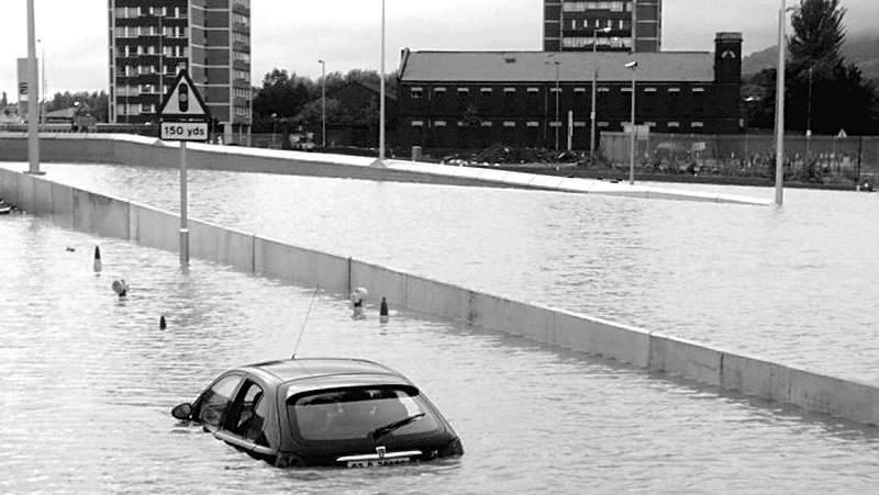
Metabolic Rift is a term derived from Marx’s descriptionof the fundamental shift in the relationship between our (human) species and the restof nature which developed along with class society, especially capitalism.
“Metabolism” for Marx, signified the whole of natureand its interdependent processes, of which humans were necessarily a part(Marx MemorialLibrary, 2020).
Rather than cities being an icon of the rift, cancities become the beginning of mediation of the rift?
A car abandoned on the Westlink Road is seen at thejunction with the M1 motorway in Belfast in 2008(McNeilly, 2014)
4
BACKGROUND STUDY | PATH TO URBANITY
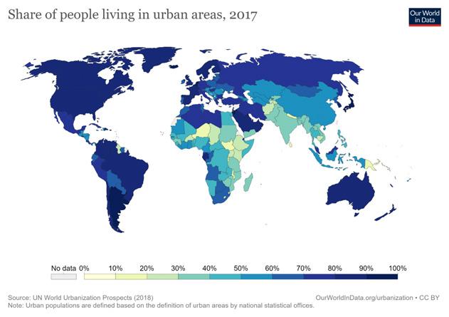
Today,overhalfoftheworld’spopulation—55%(4.2billion people)-livesinurbanareas,aproportionthatisexpectedto increaseto68%by2050.Projectionsshowthaturbanization,the gradualshiftinresidenceofthehumanpopulationfromruralto urbanareas,combinedwiththeoverallgrowthoftheworld’s populationcouldaddanother2.5billionpeopletourbanareas by2050,withcloseto90%ofthisincreasetakingplaceinAsia andAfrica,accordingtoanewUnitedNationsdatasetlaunched today(Mechelli,2020;UnitedNations,2018)(Mechelli,2020; United Nations, 2018).
Thisindicatesthaturbanlandscapesarebecomingmore importantintheseregions.Havingmorepeopletogetherincities isbringingandwillbringfurtherchallengessuchaswaste management,transportation(suchastheriseofelectriccars andchargingstations),environmentaldegradation,economic shocks,migrationanddemographicshocks,violence,crimeor discrimination, among others(Gonçalves, 2018).

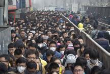
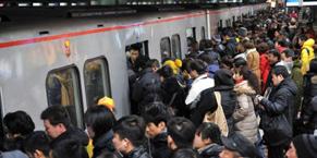
A city’s soul is its organism of people. Without them,a city is nothing but a hollow shell of asphalt and concrete. Yet the city can also be exhaustingon the physical, mental and spiritual wellbeing of its people, and a city dweller constantly findshimself in search of ways to naturally inhibit these demands.
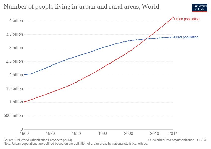
Number of people living in urban and rural areas inthe World from 1960 to 2017 (UN World Urbanization Prospects, 2018)
Share of people living in urban areas, 2017
5
THE NEED FOR RESILIENCE IN CITIES | A STUDY
“Resilient cities are cities that have the abilityto absorb, recover and prepare for future shocks (economic, environmental, social & institutional).Resilient cities promote sustainable development, well-being and inclusivegrowth.”
(OECD, 2019)
“Resilient cities are cities that can better handlenatural and human-made disasters, protect human life, absorb the impact of economic,environmental and social hazards and promote well-being and inclusive and sustainable growth.”
(Gonçalves, 2018)
Aresilientcityismore humane.There’llbeabalancebetween sustainability, social justice and quality of life.
Thiswillnecessitateredundantandcollaborativesystems. Mutualism,orthecapacitytoexchange,whichbenefitsboth sides,iswhatdrivescollaborationbetweenindividualsinnature. Itisvitaltounderstandthecapabilitiesofcertainoccupations andhowtheycanexchangesurplusesinorderforthistoexistin a neighbourhood.
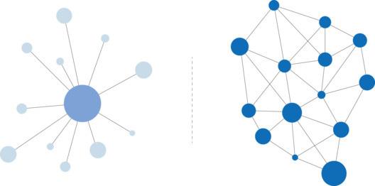

A matrix in which everything is distributed througha single point as opposed to a network in which distribution is carried out through all points.
Resilience is about how this second networking option is operated because if one end su�ers a disturbance, there is a redundancy of several other connections to support it and to maintain the functioning of the whole system
NdGainCountryIndex measuresacountry’svulnerabilityto climatechangeandotherglobalchallengesincombinationwith its readiness to improve resilience.
ND-GAINmeasuresoverall vulnerability byconsideringsixlife-supportingsectors–food, water,health,ecosystemservice,humanhabitat,andinfrastructure,andmeasuresoverall readiness byconsideringthreecomponents–economicreadiness,governancereadiness and social readiness.
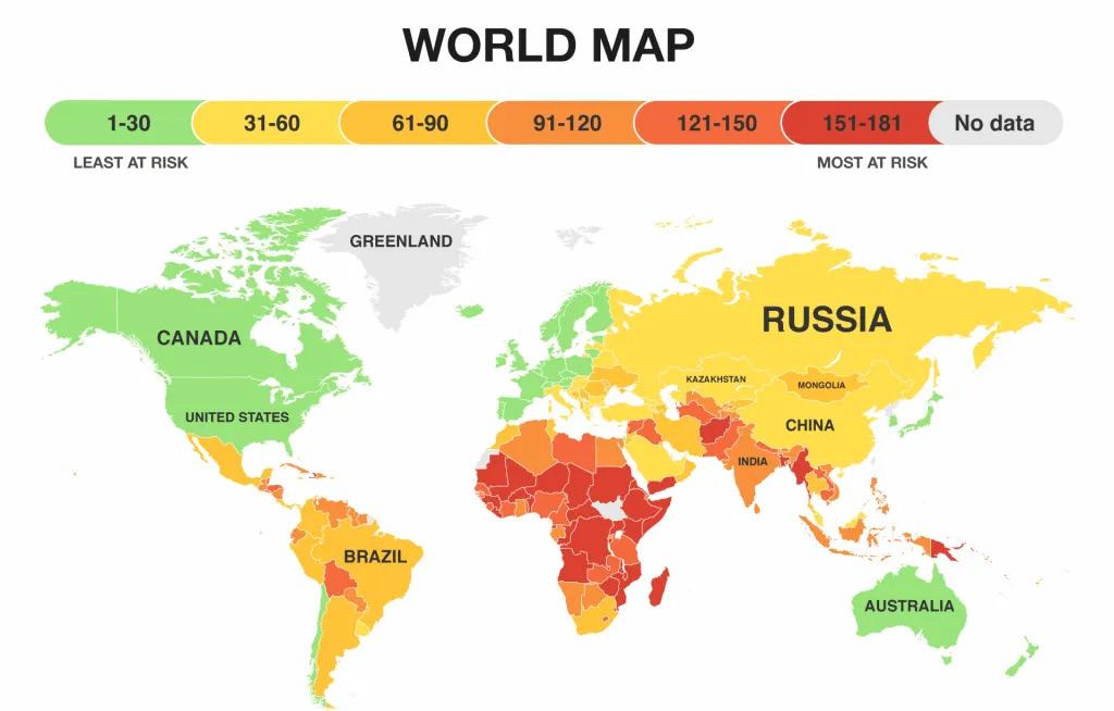
Norway would be the country most likely to surviveclimate change thanks to its low vulnerability score and high readiness score. Thecountries most likely to su�er and lose the battle against climate change are (not surprisingly)the planet’s poorest and least developed nations.
Sri Lanka, with a score of 46.1, is in 103rd place,which is the lower middle category.
(University of Notre Dame, 2021)
Vs
6
THE NEED FOR RESILIENCE IN CITIES | A STUDY OF COLOMBO
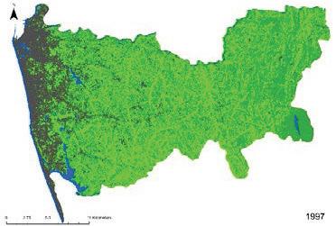
Astudy(Ranagalageetal.,2017)doneontheUrbanHeatIsland (UHI)E�ectoftheColomboMunicipalArea(CMA)shows indicationsofintensifyingSurfaceUrbanHeatIsland(SUHI) e�ects,especiallyduringthe2007–2017periodwhenthe urbanizationwasmorerapid.Therearesignificant,strong positivecorrelationsbetweenLandSurfaceTemperatures(LST) andNormalizedDi�erenceBuilt-upIndex(NDBI)acrossallthree timepoints.Whiletherehavebeenindicationsofvegetationloss, from1997to2007,there’salsoindicationsofvegetation improvementintheouterpartsoftheCMA,especiallyfrom2007 to 2017.


The population and the occupied housing units of the western province of Sri Lanka has been continuously increasing. These increasing trends are expected to continue in the future.The challenge will be to facilitate these predicted urban growth developments.
Thestudyrecognizesthee�ortsofthelocalgovernmentin initiatingurbandevelopmentprogramsthatcouldimprovethe statusofurbangreenspacesinthearea.Infact,theresultsshow thatintheCMA,theareaoflandwith‘veryhigh’Environmental CriticalityIndex(ECI)valueshasdecreased(2007–2017)despite the increase in LST, and this has been due to the increase in the NDVI values.
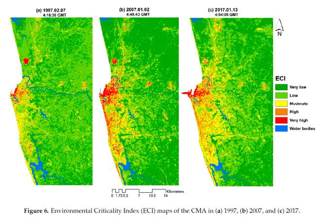
Thatbeingsaid,theareaoflandswith‘high’and‘moderate’ECI valueshavebeencontinuouslyincreasingandexpanding outwardofthecitycentre.Thus,itisrecommendedthatsuch e�ortsonurbangreeningbecontinuedinordertodisruptthis trend and mitigate the warming e�ects of UHI in theCMA.
Normalized Di�erence Built-up Index (NDBI) Vegetation Index (NDVI)
7
PRE-DESIGN ANALYSIS | HEALING THE LANDSCAPE TO HEALTHE PEOPLE
CHEONGGYECHEON RESTORATION PROJECT
Seoul, South Korea | 2002-2005
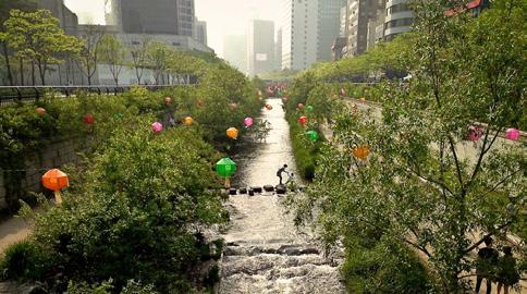
Thereintroductionofthis3.6-mileHangangRiverwaterwayis oftenheraldedasoneofthemostsuccessfulandrecognizable examplesofmodernurbanrenewalandstrollingalongthis strikinggreenspacetoday,it’sdi�culttoimaginethatlessthan 20 years ago the stream did not exist.
TheCityofSeoulvaluesthequalityoflifeofitspeopleandthe importanceoffunctioningecosystems.Bydemolishingan elevatedfreewayanduncoveringasectionofthehistoric CheonggyecheonStream,theCheonggyecheonRestoration Projectcreatedbothecologicalandrecreationalopportunities alonga3.6-milecorridorinthecentreofSeoul.Theprojecthas provencatalytic,spurringeconomicgrowthanddevelopmentin anareaofSeoulthathadlanguishedoverthelastseveral decades.
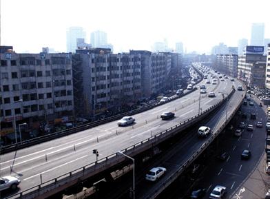
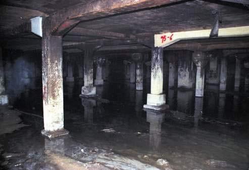
 Before: The river was culverted and buried underneatha 12 lane highway
8
After the urban renewal and revitalisation
DESIGN DEVELOPMENT
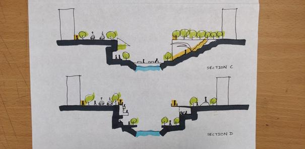
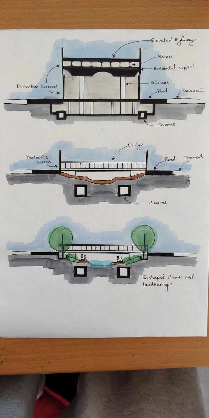
Step 1: Tra�c flow management and installation ofsome safety facilities, including sca�olding for temporary workto get rid of the elevated highway and protective screens
Step 2: Removal of the upper plate, horizontal support,concrete in the central section, beams that were cut into pieces,including transporting them to a suitable storage place.
Step 3: Cut the elevated highway pier into piecesand transportation.
Step 4: Fix intercepting sewers. Build two-lane roadson both sides of the stream.
Step 5: Work for re-shaping the stream, landscaping.And installation of lights.

9
The restoration created a 3.6-mile continuous east-westgreen corridor for pedestrians, bicyclists, and wildlife.
WASIT NATURAL RESERVE
Sharjah, UAE | 2005-2016
Originallyawaste-waterandrubbishdump,asurveyrevealed thatduetosomestagnantpoolsofwater,thesiteattracted significantbirdpopulations.Therefore,therehabilitationprocess startedin2005andthesitewasgrantedprotectedstatusin 2007.
40,000m2ofrubbishwereremoved,35,000treeswerere-planted and the land was healed from toxic chemicals.
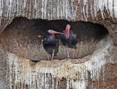

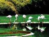

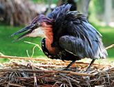
Today,itisahometo350speciesofbirds,alandingzonefor33,000migratorybirdsand abreathinglungtoSharjahcity.TheWetlandVisitorCenterwasestablishedtocontinue protectingthenaturalenvironment,toeducatepeopleontherichnessofthewetland ecosystem,toprovideinformationaboutthebirdsthatfrequenttheareaandforbird watchers and researchers.
ThenortheasterncorneroftheWaistNatureReserveisonapieceoflandthatwas previously used for playing fields.
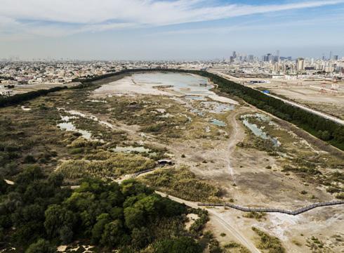
 Sharjah’s Wasit Wetland Centre is a protected areaunder the Ramsar Convention on Wetlands
Before
10
After
Indesigningthe VisitorCentre,thearchitectstookadvantageofthe site’snaturaltopographytominimiseitsvisualimpactbymakingit appearsubmergedintotheground.Visitorsdescendaramptoarrive atanangledintersectionbetweentwolinearelementsofthebuilding: one,tothesides,containingservicesandadministrativeo� other,ahead,alongviewinggallery flankedbyaviarieswherebirdscan beseenintheirnaturalhabitat.Atthefarendoftheviewinggallery,a thirdlinearelement,runningperpendicular,housesacaféand multipurpose space with views out over the open wetlands
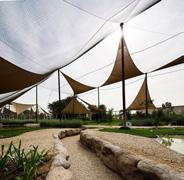

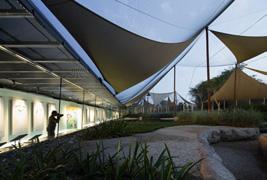

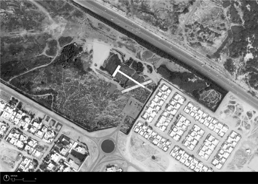
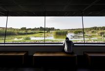
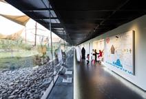
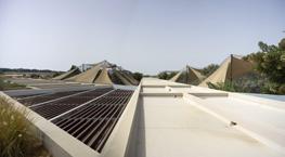
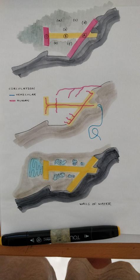
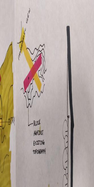
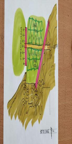
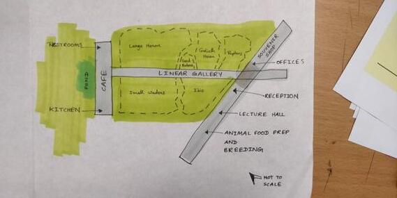 Minimized architectural intervention.
11
Architecture as a catalyst to regenerate nature ratherthan to impose the built form on top of nature. As time passes nature started to takeover the site and created its own architecture
DESIGN INTENT | ARCHITECTURAL POSITION
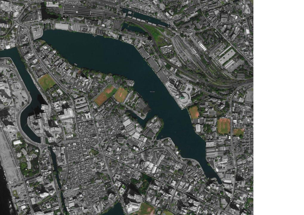
ThecityColombowasoriginallybuiltonawetlandandtoday,remnantsofitremainintheformoffragmentsoflakes,waterbodiesand canals,creatingabluenetworkthroughoutthecity.Withtherapidurbanizationanddevelopmentscameconventionalgreysolutionsand single-mindedengineeringthatstarteddestroyingtheecologicalinfrastructure.Atthesametime,thearchitecturallanguageofthecity’s skyline amid all the concrete and glass, is only addingto the problem.
TheintentionofthisDesignThesisistoexplorehowarchitecturecouldberedefinedtotransformthecityscapeofColombointoamore resilientandmorehumaneplacetolive,byrejuvenatingitsgreen-bluenetwork,whichwill,inturn,becomeane�ectiveshieldagainst challengesofclimatechangeandurbanheatislande�ects.Atthesametime,itaimstoexplorethetypologyofarchitecturethatcould become a welcoming addition to the city’s new vernacular.



12
DESIGN INTENT | NEGATIVE APPROACH TO PLANNING
Theconventionalapproachtourbandevelopmentplanning, whichisbasedonpopulationprojectionandthenbuilt infrastructure,isunabletomeetthechallengesandneedsofthe ecologicalandsustainableurbandevelopment,andcertainly unabletomeetthegoalofecologicalcivilization.Itisinthis situation that the Negative Approach was proposed.
ECOLOGICAL INFRASTRUCTURE | A STUDY OF COLOMBO
EI

The NegativeApproach inurbanplanningdefinesanurban growthpatternandurbanformthroughtheidentificationand planning of Ecological Infrastructure (EI)(Yu etal., 2008).
THE REGIONAL SCALE: Hundreds to thousands of squarekilometres
THE INTERMEDIATE SCALE: Tens of square kilometres
THE SMALL SCALE: Less than ten square kilometres
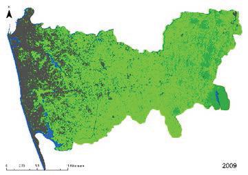
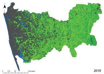
TheCMAhasexperienced pronouncedurbansprawl alongthemainroadsof Colombodistrictconsuming rurallandsatafasterpace aspopulationshiftsfrom urban areas.
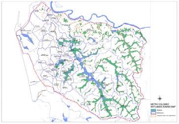
Towardsthecenterofthe city,theexistingblue-green coverconsistsofparks, playgrounds,cemeteries,and thecanalsystem.These fragmentsareproposedto beaconnectednetwork, possiblybycreatingeco corridorsthroughthecanal system and road network.

ecological corridors
REGIONAL SCALE
The increasing trend of built-up areas from 1997 to2018 of Colombo District.(Antalyn & Weerasinghe, 2020).
INTERMEDIATE SCALE
Wetland Zoning Map of Colombo Metropolitan Region(MCUDP, 2016)
is fragmented in the heart of Colombo
13
Proposed
DESIGN INTENT | A NEGLECTED RESOURCE
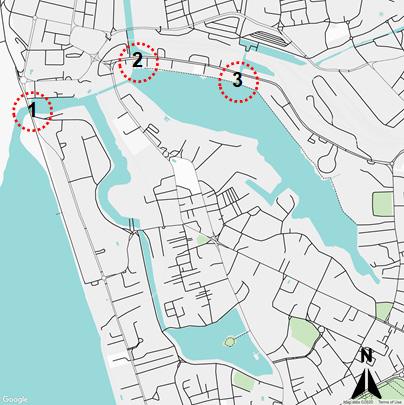
TheBeiraLakeisaneglected,deteriorating,butpotentially magnificentresourcethatisrightintheheartofColombo.Itisa highlyurbanizedcatchmentthatisdenselypopulatedwithhotels, industriesandcoloniesfromwherewastewaterisdischargedinto thelakedirectlyorindirectly.Infact,itisoneofthemain wastewaterreceivingwaterbodiesintheColombomunicipal council area(Weerasinghe & Handapangoda, 2019).
Overview
● Catchment area: 448ha
● Maximum elevation within a catchment: 9.8m MSL
● The 4 basins of the lake: East Lake, Galle Face Lake,West Lake, South West Lake
● The total area covered by the lake is 65.4ha (162acres)
● The average depth of the lake: 2m
● East Lake is the largest and deepest (43.2ha, maximumdepth of 5.6m)
● The water level of the lake is maintained at 1.8mabove MSL by a semi-circular spillway at Galle Face Lake

2 – Mc.
1 –
3 – St. Sebastian Canal
Colombo Skyline today
Beira Lake today
Spillway (Outlet) at Galle face Lake
Callum Lockgates (Outlet) at East Beira Lake
14
(Inlet)
DESIGN INTENT | BEIRA LAKE RESTORATION PLANS
Currently,thevalueoftheBeiraLakeasanurbanwaterbody hasbeenrecognized,anditisvisiblethroughallthepremiumand high-end land-use proposals dedicated along the shore.
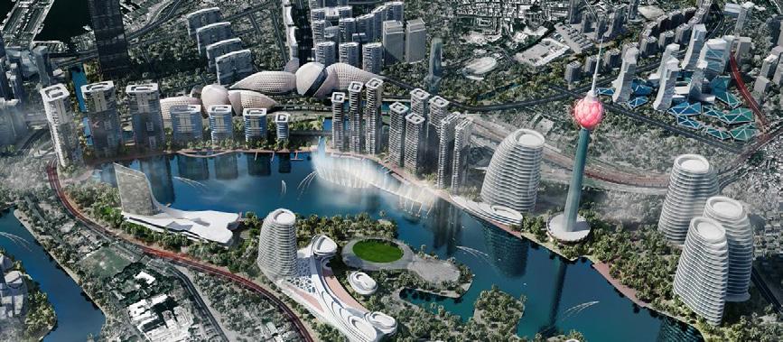
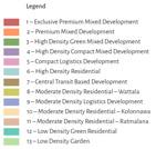
Forthepurposeofthestudy,BeiraLakeBusinessStudyPlanfrom1996,BeiraLake InterventionAreaDevelopmentPlanfrom2018andColomboCommercialCity DevelopmentPlan2030“Aquarina”werereferred.Comparedto1996and2018,thelatest gazettedAquarinaplanhasmorefocusoncreatingpublicspacesalongtheshoreline, whichislargelyevidentthroughitslinearparkproposal,despitealsozoningtheareaas exclusive premium mixed development.
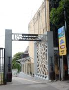


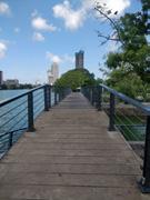


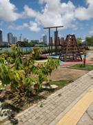
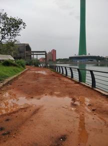
Currently, they are at stage 1 of this proposal, andthe walking path is being built. However, it appears that this place still lacks publicparticipation.
ThisDesignThesisaimstousethesestudiesasasteppingstone fortheprocessofreclaimingthevanishingecosystemsof Colombo.Furthermore,afterastudyofthechangingfaceof architecturallanguageinthecity(Annexure1pg.34)thisisan attempttocreateanadditiontothecitythatmayinspireto redefine the urban fabric.
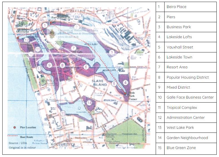
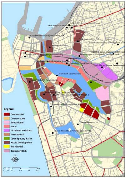
 Beira Lake Business Study Plan (1996) /Beira LakeIntervention Area Development Plan (2018)
15
Colombo Commercial City Development Plan 2030 (Aquarina)
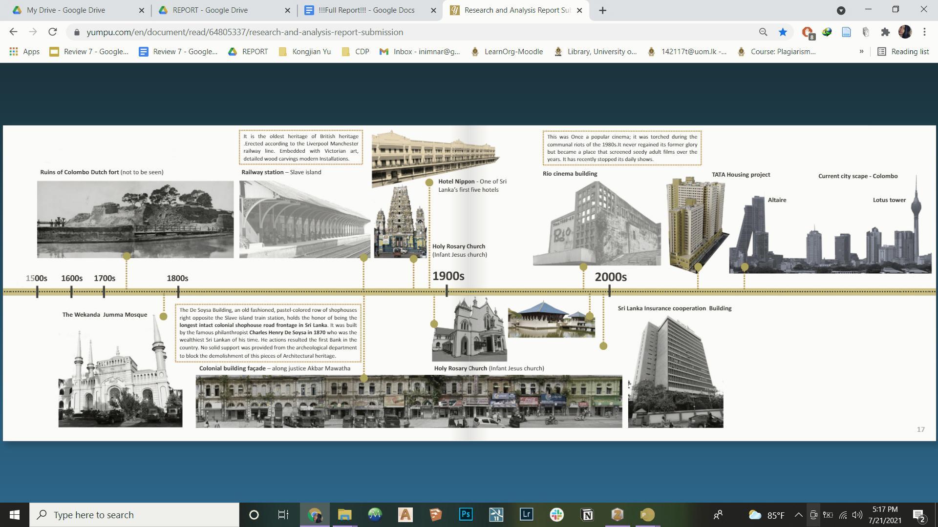
CONTEXTUAL STUDIES | HISTORICAL BACKGROUND
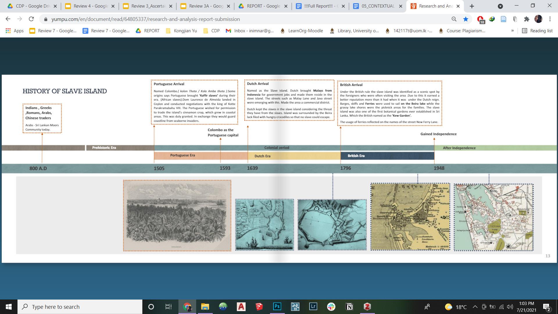
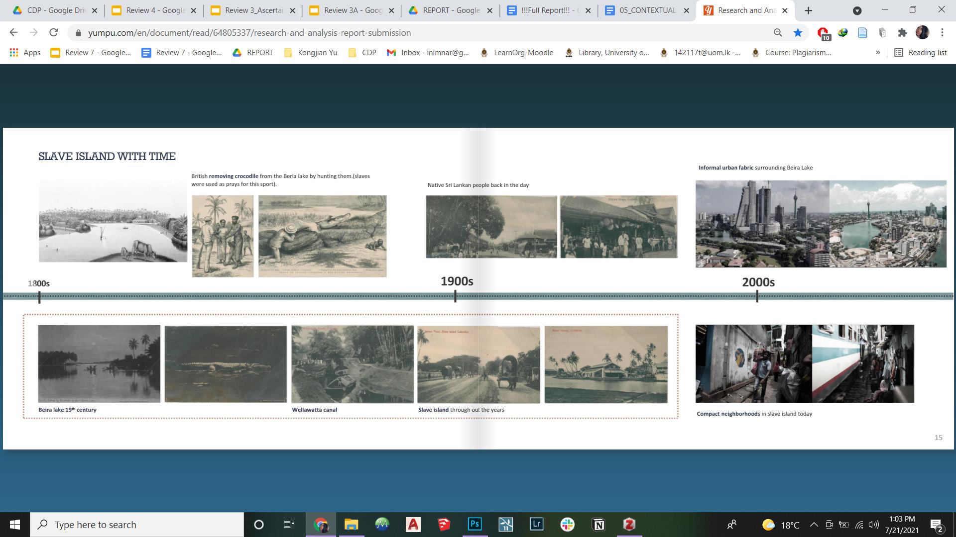
Beiralakewasformedin1521whenthePortugueseFortwas underattackbyalocalruler(RajasingheI),andtorepulsethe attacks,thislakewasformedonastretchofswampylandwhich wasa floodoutletofKelaniRiver,simplybymakingadamona brookpassingthroughthearea.Thelocalpopulace,intheir unsuccessfulattemptstocapturetheFort,drainedthelakedry, twice, through canals.
In1655,theDutchbesiegedtheFort,andthelakewasusedto launchvesselstotransportsoldierstobreachPortuguese defences.Later,thelakewasenlargedandconnectedwithKelani RivertothenorthandPanaduraRivertothesouthbyasystem of canals. OncetheBritishovertooktheentirecountryin1815,andColombo becameitscapital,BeiraLakebecameanornamentofthecity, whereearlyBritishaccountscallit“thebluelakeofColombo”. TheBritishusedtheLakeforrecreation,withmanysocial gatheringsandsportingeventsheldonitsbanks.Residentswho livedonitsshorestookboatstotheirworkplacesinsidetheFort. Basically,BeiraLakewasbothacentreofcommercialactivity and a notable resort in the city.
For further information on the Historical Background,refer Annexure 2 pg 35. For further information on the Physical Context, referAnnexure 3 pg 36.
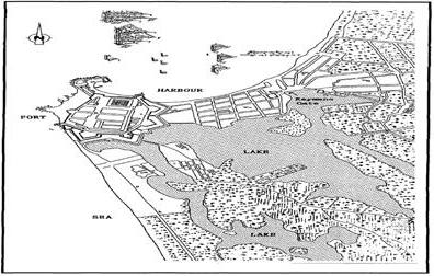
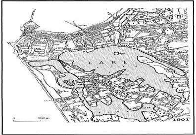
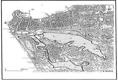


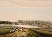
The term “vernacular” refers to the authentic relationshipbetween the land and people (Yu & Padua, 2006). This can be physical, biological,functional, cultural, or spiritual.
1750 1901 1920
Transformation of Beira Lake over the years(Dissanayake& Pereira, 1996)
A series of paintings of Beira Lake by John Deschamps(1845 ) depicts the ‘Old Vernacular’ of Beira Lake(Archive,2012)
16


CONTEXTUAL STUDIES | BIOLOGICAL CONTEXT
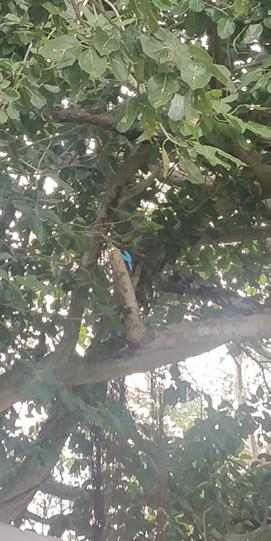

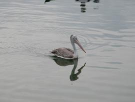

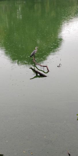
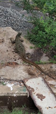
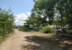

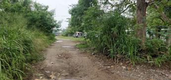
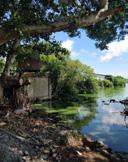

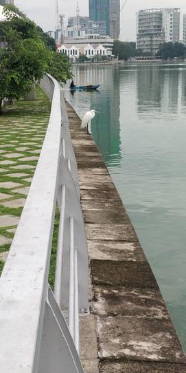
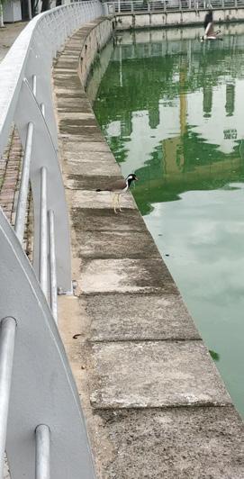
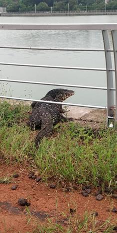
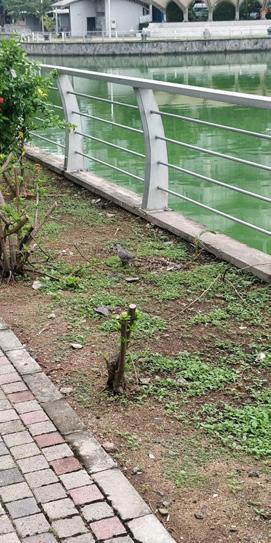


Current Status of Contextual Vegetation
The existing biological context is rather rich, despitethe deteriorating conditions surrounding the overallcontext, thus, providing an opportunity to improveupon that. The above information was recorded by the author.For further information on the Biological Context,refer Annexure 4 pg 39.
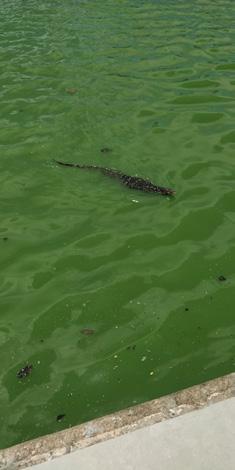
17
CONTEXTUAL STUDIES | CULTURAL CONTEXT


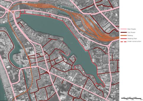

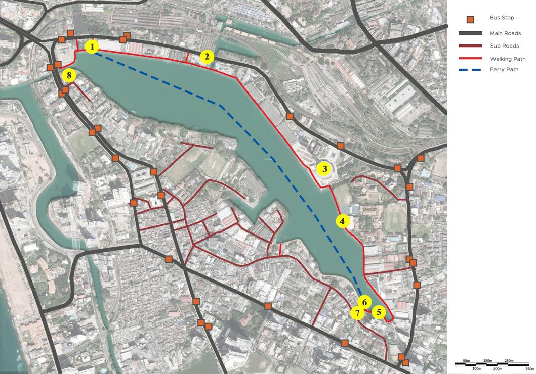


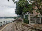
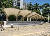
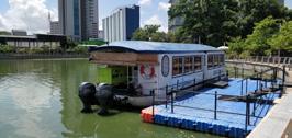
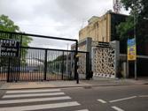
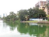
The above information was recorded by the author.For further information on the Cultural Context, referAnnexure 5 pg 41.
 Land Use Map
Accessway Map
Landmarks and Activities
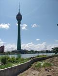
1-Main Entrance 2 -Public Restrooms 3 - Lotus Tower
4
-St. Joseph’s College Pier
5-Viewing
Platform
6-Ferry
Port
7-Secondary
Entrance
8-Colombo
Rowing Club
18
CONTEXTUAL STUDIES | SITE ANALYSIS
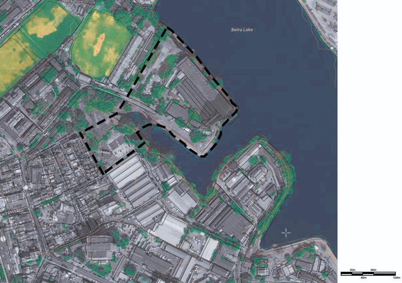
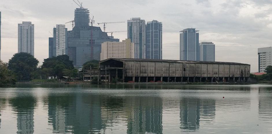
SriLankaPortsAuthority(SLPA)BeiraNewYardismainlyresponsible formaintenanceandrepairstothesteelcargolightersusedbythe SLPAOperationsDivisionandalsohandlesotherstructuralrepairsand blastingworkthatcannotbecarriedoutattheInnerHarbourof Colombo.TheyardisintheprocessofbeingshiftedtotheInner Harbour(AnnualReport , 2016).



19
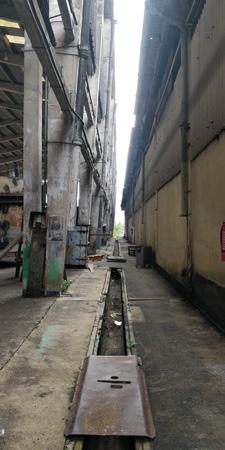
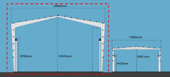
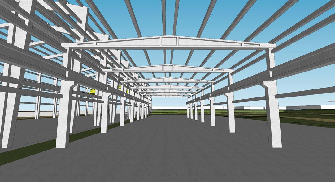
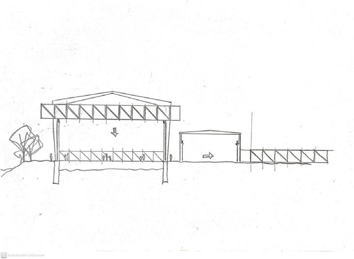
The imposing structure of the SLPA Beira Yard Workshopspace is evident, even from across the lake, and that was taken as an opportunity to repurposethis structure.
STRUCTURE ONE | BARGE REPAIR WORKSHOP
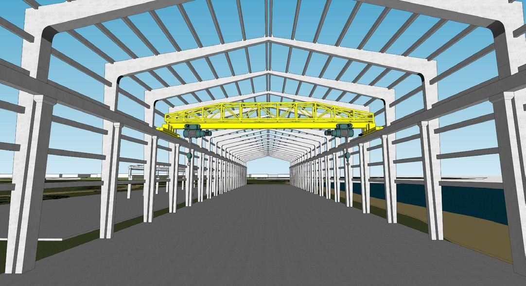
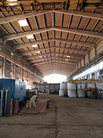
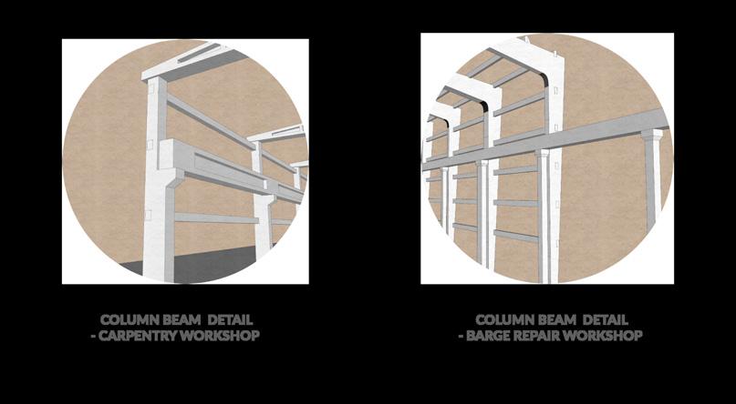
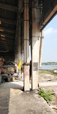
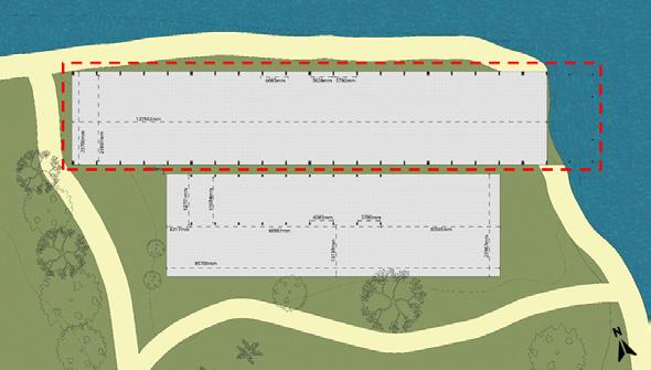
There is a series of 21 Concrete Portal Frames, and a separate column and beam series supports the Gantry Crane.
The Gantry crane is designed to carry weight up to 45 tons and also considering the movement of the gantry crane when transporting barges, these structures are also able to withhold dynamic loads as well. Therefore, a structure can easily be placed on top, even a structure that has live loads.

20
STRUCTURE TWO | CARPENTRY WORKSHOP



21
PROJECT BACKGROUND | THE CUrE
The Center for Urban Ecology, or CUrE, is expectedto act as the first of its kind, an institute governingthe process of reversing the ecology of the Beira Lake area, from the reconstructionof habitats to maintaining.
State of Urban Ecology Risk Management Monitoring and Control Public Engagement
Mission
Taking actions to mitigate the e�ects of global challengessuch as climate change, through research, education and publicengagement
Vision
Promoting resilient, livable urban fabrics throughecological interventions.
Working With




Theprojecthas3maincomponents,theResearchCenter,whichwillbeactingasthe mainknowledgehub,andtheVisitorCenterasthemainpubliczone,withtheNaturetrail connectingthesetwocomponentsthroughinteractiveresearchlabsandnaturalexhibits. as
Urban Development Authority
Metro Colombo Urban Development Project
Municipal Council of Colombo
World Bank and Development Corporation
University of Moratuwa
22
OBJECTIVES
Research Center
To protect and maintain the recreated wetland habitats and wildlife
To promote wetland related research
To become a resource for the delivery of formal education for local schools and universities
Interactive Research Labs and Exhibits Visitor Center
To allow interaction between people and nature through CEPA (Communication, Education, Participation and Awareness) activities
To become a resource for the delivery of non-formal education for public
To improve access and reconnect people with nature
To impact public outlook on Urban ecology
To create a viable tourist attraction in the city centre
PROGRAMMES
Research Center
Centralizing knowledge pertaining to Ecological Research
Lecture series conducted by external and internal experts Training programmes for the Maintenance Crew of the Park
USERS
Research Center Interactive
Primary Researchers Administrators Supporting Sta�
Secondary Students and Academics
Tertiary Scientific Tourists
Researchers Students and Academics Nature Enthusiasts
General Public
Interactive Research Labs and Exhibits Visitor Center
Conducting onsite research on Urban Ecology (Biological, Chemical, Physical, Social, … )
Guided Tours
Guided Tours
Short FIlms on ecological themes
Featured Artwork / Sculptures
Researchers Students and Academics General Public
Research
Center
Labs and Exhibits Visitor
23
PROJECT BRIEF | ENVIRONMENTAL BRIEF
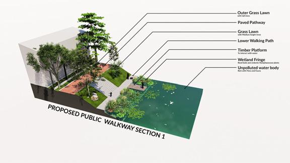
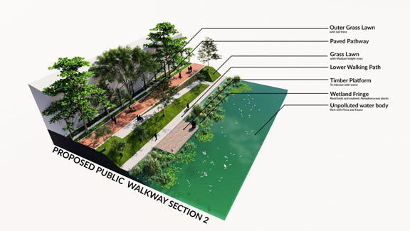
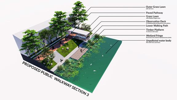
TheEnvironmentalBriefwillbedealingwiththeprocessof reversingtheecosystemaroundthelake.Thelandmasswillbe softened,habitatswillbeintroduced,andtrailsintroducedat upperandlowerlevelstobringpeopleclosertotheedge, allowingthemtointeractwiththesenewhabitats(Annexure6pg 43).
Destinationswillbeproposedalongthetrails,forvarious purposes,rangingfromrestingandsimplyenjoyingnature,to spacesforprofessionalinteractionssuchas fieldresearchand photography.

The firststepisimprovingtheconditionofthewater.Thesecondstepisphysically reconstructingtheecosystem,inthesensewhereyoustudytheexistingecology,and improvethatandmoveontointroducemorekindsofspeciestothesite.Thethirdstepis tostartdevelopingthelandscapeforhumanuse,suchasintroducingcirculationsystems, wayfindingelementsandrecreationalnodes,wheretheuserswillbeengagingwiththe architectural interventions.
24
PROJECT BRIEF | SPATIAL BRIEF

Please refer Annexure 7 pg 44 for the Detailed SpatialBrief.
25
PROJECT FEASIBILITY
SOCIO-CULTURAL
● The programme is a re-design of the proposed linearpark project, of which, the socio-cultural benefitsare already recognized
● The intervention shall change the apparent backyardof the city into the front yard of the city
● Provides a space for social interactions and convergenceof many cultures and walks of life
● Knowledge transfer through Citizen Science programmesand links between school curriculums and CUrE research collections.
● Enhances the heritage value of the area, which wouldbenefit the tourism, trade and travel industries
● Creates desirable real estate in the heart of thecity.
● Adopting Ecological Infrastructure instead of conventionalgrey solutions will help restore and enhance thenatural biological and ecological conditions
ENVIRONMENTAL
ECONOMIC
● All interventions shall be carried out by studyingthe existing natural conditions and implementingnative solutions, thus reducing the risk of failure
● The intervention area to become a natural breathingspace in the heart of the city
● The use of natural light and ventilation will minimizethe energy consumption of the building
● Introduction of programmes that will help change attitudesof the public on Urban Ecological Matters
● As part of the Metro Colombo Urban Development Project,the funding shall be provided by the World Bank
● Due to the socio-cultural and environmental benefits,there shall be a higher demand for the surroundinglands, thus increasing land value.
● Beneficial to tourism, trade and travel industries
● Revenue from the cultural activities (Photographicdestinations, Art exhibitions, Rentable virtual exhibits)
● Revenue from the research activities (Research Grants)
● The state and the local authorities represent thecitizens and are not profit-based institutions
● The socio-cultural and environmental benefits canbe enjoyed over a long period of time and will contributeto the financial resilience of the city in the long run.
26
DESIGN | MASTERPLAN
Mix
Embrace density, diversity, and mix of uses, users, building types, and public spaces
Preserve Ecology
The most prominent ecological resource, the water body, needs to be reanimated from its current lifeless state
Connectivity
Spaces need to be introduced that will connect people of di�erent communities and cultures
Walkability
Increase walkability of streets and design neighbourhoods to human scale. Lakefront trail to integrate ecological and historical components
Leisure
Introduce leisure activities around the lake, including cycling, bird watching, picnicking
Transit supportive
Transit should be encouraged as the most sustainable mode of transportation, by shifting from car-oriented urban patterns
Complete Communities
Provide the needs of daily living, within walking distance (a 500 m radius) for residential zones
Engagement
Introduce programmes that enlighten and engage the community
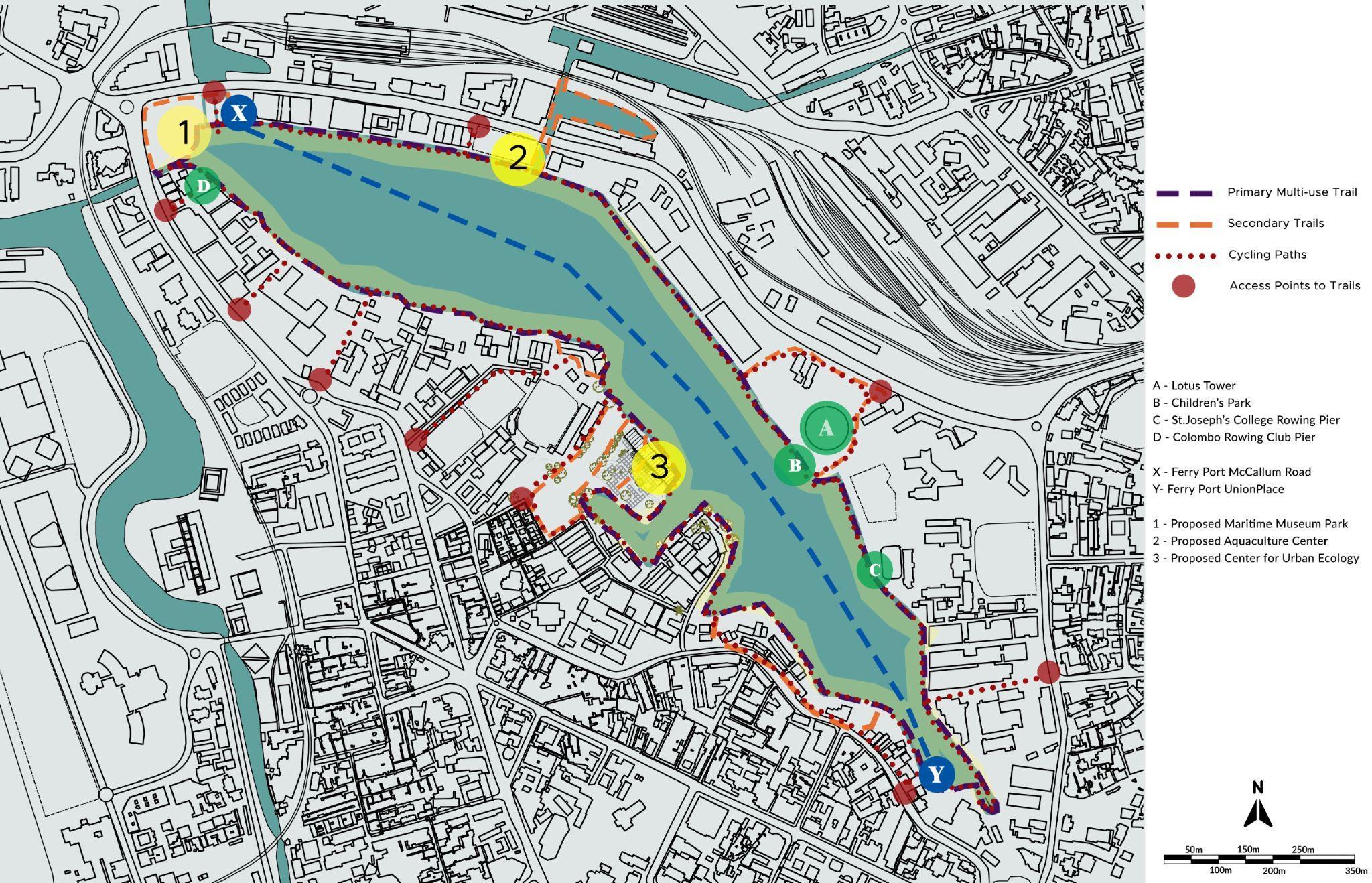
Masterplan of Intervention Area
27
DESIGN | RESTORATIVE ARCHITECTURE
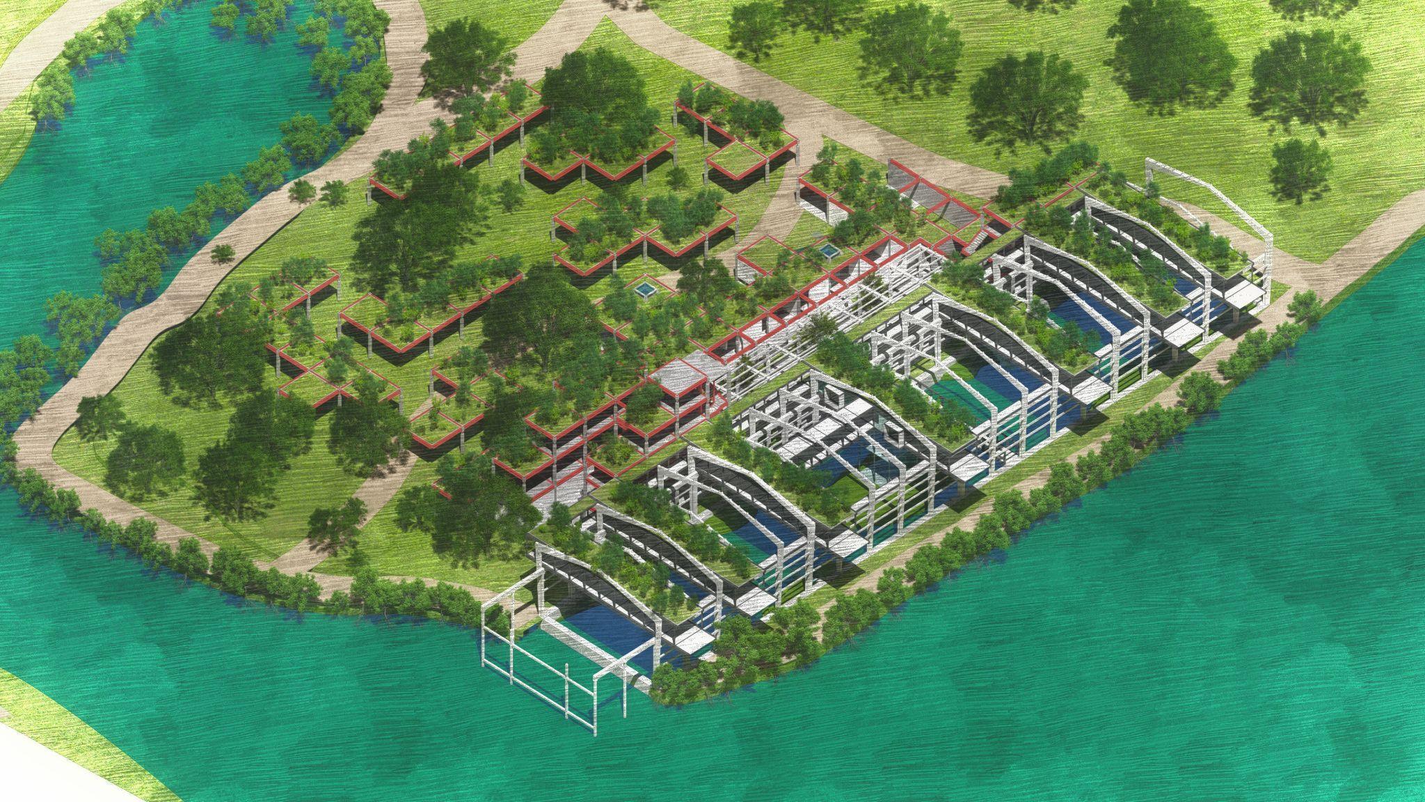
RestorativeDesign isthetypeofarchitecturethatwillrestoreyou,mind,bodyandspirit.ThisDesignThesisexploresthetypeof architecture that will restore its users by connectingthem to their senses through connecting with nature.
SITE
MATERIALS
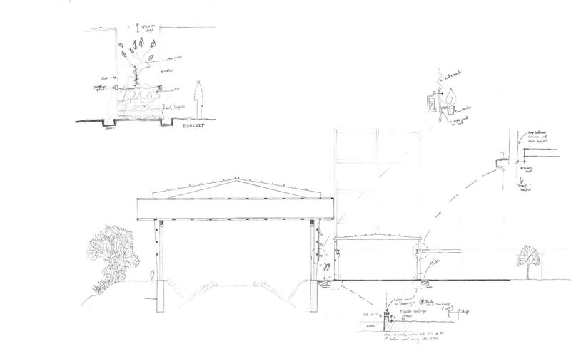
● Gently touching the existing structure
● Celebrating the joint
● Design the facility to be an exhibit that serves asa public educational model
● Experience the building as an extension of the landscape
● Using resources e�ectively and e footprint
● Design a facility for low maintenance and prioritizematerials selected for durability
● When feasible, use materials that are made of renewablematerials of recycled content, durable, and with a low life-cycle cost.
● Orient spaces to optimize the use of passive solarenergy, natural daylighting, and natural breezes and ventilation, and allow views tothe outdoors from all occupied spaces.
LAND, AIR & WATER
ECOSYSTEMS
● Conserve water through rainwater collection, reclamationof gray water, and low-flow fixtures.
● Use and sculpt the site creatively to protect thefacilities from wind and rain
● Limit the use of impervious surfaces to optimize groundwaterrecharge.
● Create vibrant, low-maintenance landscaping with nativeplants
● Protect and restore the biodiversity of the naturalfeatures of the site and surrounding open space.
● Educate about the interconnected relationship betweena healthy and restored environment and improved quality of life for residents.
● Use design to evoke the natural environment, connectingus to the lake
● Reduce night-time light pollution by avoiding over-illuminationof the site
28
DESIGN
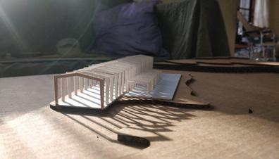

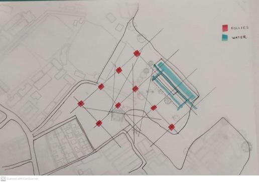
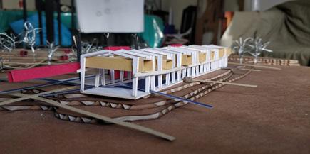


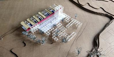
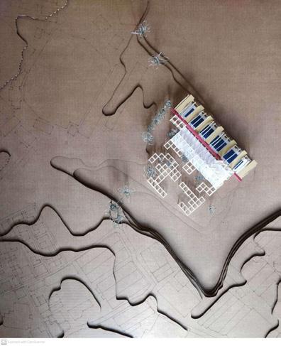
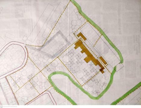
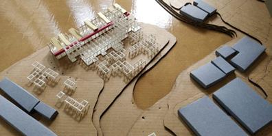
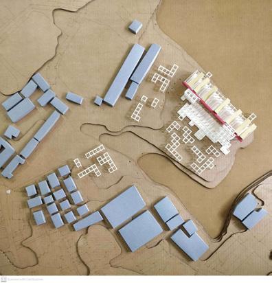
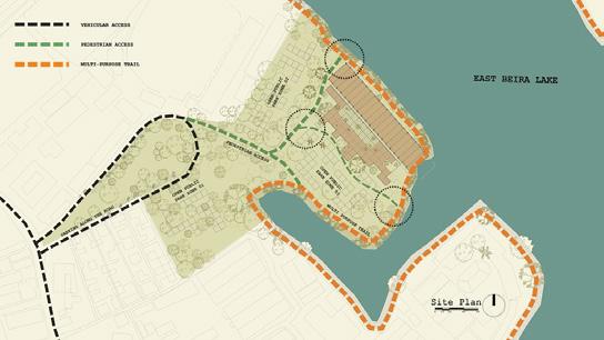
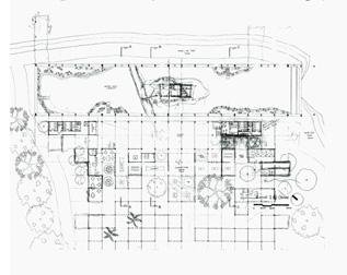
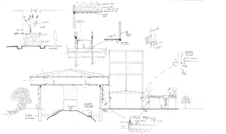
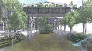
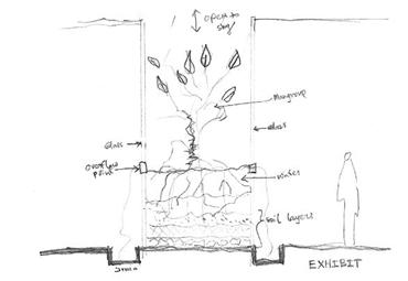
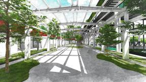
EXPLORATIONS 29
| SITE
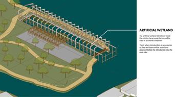
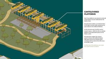
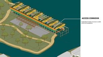




30
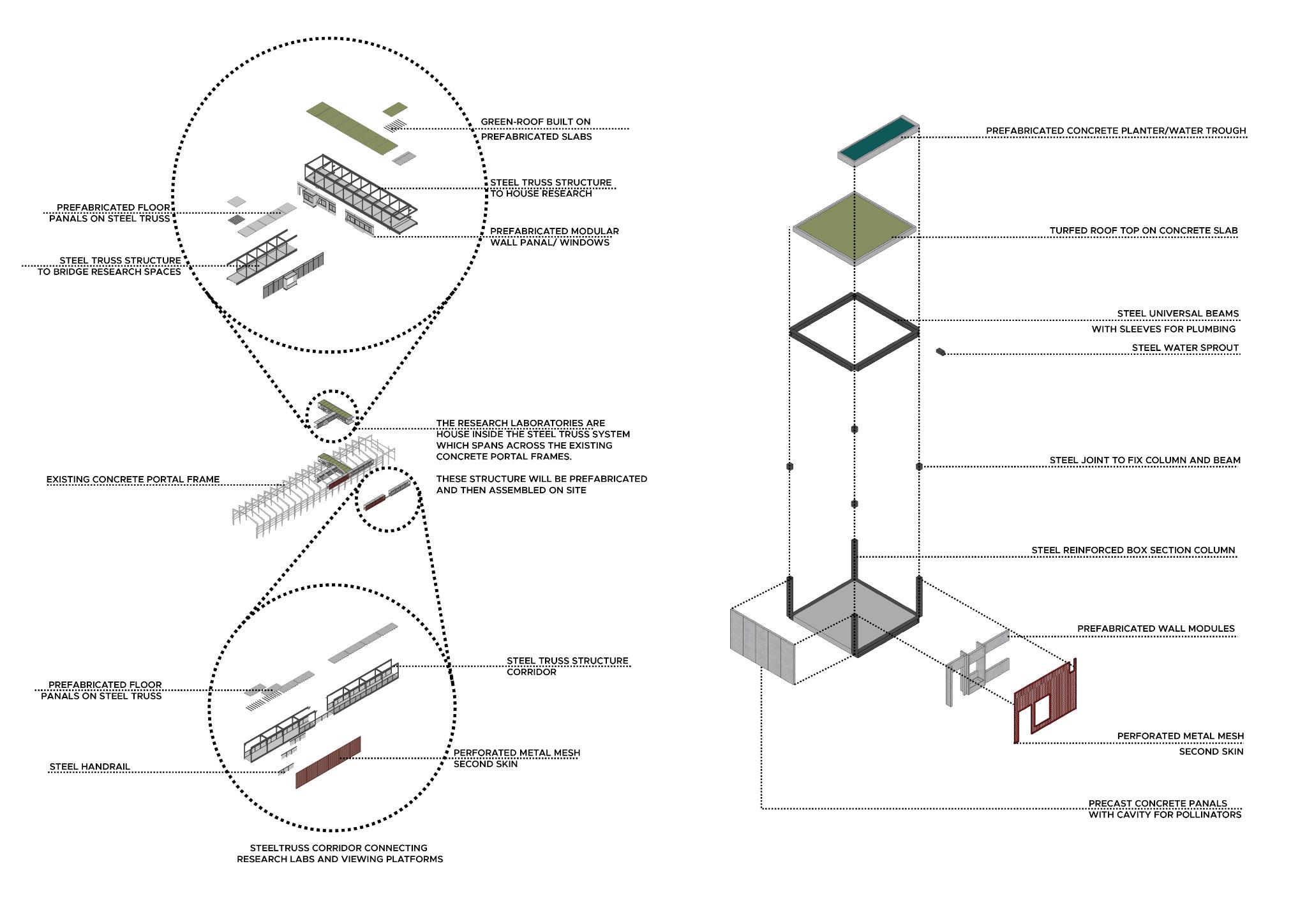
DESIGN | DESIGN DEVELOPMENT

| MATERIALITY 31
DESIGN
DESIGN
| 32
REFERENCES
AnnualReport . (2016). Sri Lanka Ports Authority.
Antalyn, B., & Weerasinghe, V. P. A. (2020). Assessmentof Urban Sprawl and Its Impacts on Rural Landmasses of Colombo District: A Study Based on RemoteSensing and GIS Techniques. Asia-PacificJournalofRuralDevelopment 30(1–2),139–154. https://doi.org/10.1177/1018529120946245
Archive, H. (2012). Colpitty,fromtheCinnamon-Gardens.History Archive. https://historyarchive.org/works/images/scenery-and-reminiscences-of-ceylon-1845/09-c olpitty-from-the-cinnamon-gardens
De Silva, L. B. M. (2003). Utilizingurbanwaterbodytoenhancethecityimage
Dissanayake, L., & Pereira, R. (1996). RestoringBeiraLake—Anintegratedurbanenvironmental planningexperienceinColombo,SriLanka
Gonçalves, A. (2018, October 31). World Cities Day—WhyDo We Need Resilient Cities? Youmatter https://youmatter.world/en/world-cities-day-2018-why-do-we-need-resilient-cities/
Greentech. (2011). EnvironmentalManagementFrameworkFinalReportVolume1
Hussain, A. (2017). TheSlaveIslandThatWeHaveForgotten https://roar.media/english/life/srilanka-life/the-slave-island-that-we-have-forgotten
Jayawardene, S. P. M. (2011). StudyofroostingandbreedingbehaviorofPelecanusphilippensis(family pelecanidae;spotbilledpelican)atoneofthemajorroostingsitesinColombo
Katupotha, J. (2015). SEDIMENTOLOGICALSTUDYOFTHECITYOFCOLOMBOANDITSENVIRONS https://doi.org/10.13140/RG.2.1.2445.1047
Marx Memorial Library. (2020, April 2). Whatisthe‘metabolicrift’?MR Online. https://mronline.org/2020/04/02/what-is-the-metabolic-rift/
McNeilly, C. (2014). Warning: 46,000 homes in NorthernIreland are at high risk from flooding. Belfasttelegraph
https://www.belfasttelegraph.co.uk/news/northern-ireland/warning-46000-homes-in-north ern-ireland-are-at-high-risk-from-flooding-30320661.html
MCUDP. (2016). ColomboWetlandManagementStrategy(Metro Colombo Urban Development Project) [MCUDP/PHRD/03]. Government of Sri Lanka.
Mechelli, A. (2020). Howcitylivingcouldbemakingyouanxious—Andhowtodealwithit . World Economic Forum.
https://www.weforum.org/agenda/2020/02/cities-urban-life-mental-health/
Metro Colombo Urban Development Project. (2011). EnvironmentalScreeningReportforConstruction ofbankprotectionwalls(Metro Colombo Urban DevelopmentProject) [Final Report]. University of Moratuwa.
NARA. (1985). ReportofaPreliminaryStudyoftheBeiraLake National Aquatic Resources Agency.
OECD. (2019). ResilientCities . https://www.oecd.org/regional/resilient-cities.htm
Ranagalage, M., Estoque, R. C., & Murayama, Y. (2017).An Urban Heat Island Study of the Colombo Metropolitan Area, Sri Lanka, Based on Landsat Data(1997–2017). ISPRSInternational JournalofGeo-Information 6(7), 189. https://doi.org/10.3390/ijgi6070189
Ratnayake, G. (2013). Sundayobserver.lk: Spectrum| A fascinating tale of the garden of monarchs. SundayObserver . http://archives.sundayobserver.lk/2013/03/03/spe10.asp
TechnicalReport . (2016).
Thiranagama, S., Durda, B., & Hettiarachchige, R.(2020). ResearchandAnalysisReportSubmission Yumpu.Com. https://www.yumpu.com/en/document/read/64805337/research-and-analysis-report-sub mission
UN World Urbanization Prospects. (2018). Shareofpeoplelivinginurbanareas—OurWorldinData https://ourworldindata.org/grapher/share-of-population-urban
United Nations. (2018, May 16). 68%oftheworldpopulationprojectedtoliveinurbanareasby2050, saysUN|UNDESA|UnitedNationsDepartmentofEconomicandSocialA�airs https://www.un.org/development/desa/en/news/population/2018-revision-of-world-urban ization-prospects.html
University of Notre Dame. (2021). Rankings . NotreDame Global Adaptation Initiative. https://gain.nd.edu/our-work/country-index/rankings/
Weerasinghe, V. P. A., & Handapangoda, K. (2019).Surface water quality analysis of an urban lake; East Beira, Colombo, Sri Lanka. EnvironmentalNanotechnology,Monitoring&Management , 12 100249. https://doi.org/10.1016/j.enmm.2019.100249
Wijesundara, D. S. A. (2007). Botanic Gardens in SriLanka; past, present and future. 3rdGlobalBotanic GardensCongress 6.
Yu, K., Li, H., & Li, D. (2008). Ecological Infrastructureas a Tool for Smart Preservation and Smart Growth:The Negative Approach. 44thISOCARPCongress,14.
Yu, K., & Padua, M. G. (2006). TheArtofSurvival:RedicoveringLandscape . The Images Publishing Group Pvt Lt.
33
34
NNEXURE
| 35
A
2
ANNEXURE 3 | PHYSICAL CONTEXT
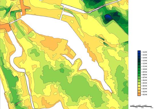
Elevationfromsealevelvariesfrom2.5m meansealevel(MSL)and12mMSL.The generaltopographyoftheprojectarea largelyconsistsof flatorverymildly sloping(<1.2%)low-lyingterrainwith slopesinseawarddirectionwhilethe contourlinesarealignedapproximately paralleltotheshoreline(MetroColombo Urban Development Project, 2011).
Thesedimentologyofthecityof Colomboisthatofawetlandsystem thathasbeendevelopedaroundBeira Lakeanditscanalsystemoveralong periodoftime.Dataonboreholes gatheredalongVauxhallStreetwith di�erentlayersofsoilindicatethis periodicdepositionpatternofthe wetland system(Katupotha, 2015).



The surface: filled dark brown laterite stratum, 0.4m thickness

Poorly graded fine to medium whitish sand layers from 0.4m to 6.0m deep

Di�erent layers of clay, medium sand and clay fine sand extend up to 17.0m
Thelocalgeologyinthesiteis characterizedbyalluviumandorganic clays,whilethesoiltypesincludepeat and peaty clay(Greentech, 2011).
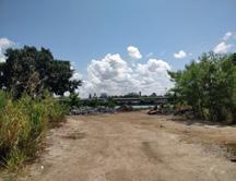
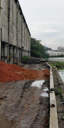

Weathered rock was located from 17.0m to deep
Contour Map
36
Whenconsideringthewatercondition, themainsourceofpollutionofBeira Lakeisthedirectconnectionsof stormwaterandwastewaterinletstothe lake(MetroColomboUrban Development Project, 2011).
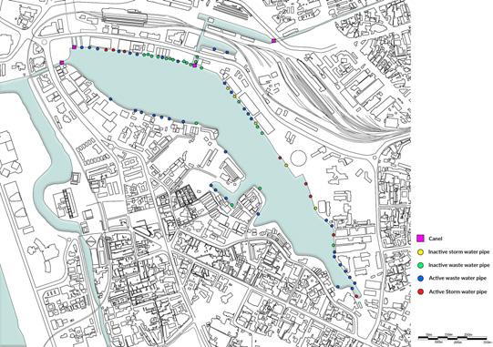
Beira Lake Inlet Map

Duetoitslow flushingrate,nutrients remained,leadingtoeutrophy,whichisa conditionofwaterwhereitisrichin mineralandorganicnutrientsthat promotethegrowthofalgaeand aquaticplants,resultinginareductionof dissolved oxygen(Greentech, 2011).

ThelatestdataonBeiraLakewater indicatesgenerallyfavourableconditions for aquatic life.
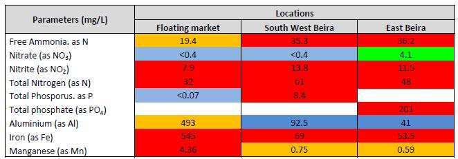
ThedegradationofBeiraLakestarted backintheearly1900’sbecauseof increasing waste discharged into it.


Physico Chemical Parameters of Beira Lake(Technical Report , 2016)
ThelakeshowsaveryalkalinepHoverthewholewater column.However,thepHbecomesmoreneutralfrom thetoptothebottomofthewatercolumn,from10to8, whichprovidessuitableconditionsforaquaticlife.The waterincanalsismostlyacidic,however,thepHofthe lakeneverbecomeslessthan7.Conductivityremains stablebetween250and300㎲/cm,avaluethatallows aquaticlife.Temperaturerangesbetween29.3to35.4℃ whereAugustisthewarmestmonth(TechnicalReport , 2016)
37
BeiraLakeisartificiallykeptat+1.8m aboveMSLbymeansofpumpsinstalled atBeiraLocksthatareoperatedbythe SLPA,andaspillwayatGalleFaceLake. Asaconsequence,BeiraLake’s flood dischargefunctionisonlyoperationalat waterlevelsexceeding+1.8mMSL. However,thankstotheadequatecanal anddrainagesystemsatpresent,and alsobecausetheterrainis flatinmost areas,withmildslopes,thereareno historicalrecordsofpast flooding availableforthestudyarea(Metro ColomboUrbanDevelopmentProject, 2011).

depth Map of May 2016 ( Flood Hazard Assessment & Hydraulic Modelling; deltares, adpc & cecb, 2017)

The temperature in Colombo varies so little throughout the year, maintaining a hot humid climate significant in tropical countries.

On the cloudiest day of the year, the sky is overcast at 88% cloud cover, and on clear days, at 12%. The predominant average wind direction is from South -west direction, but that varies throughout the year.

The average water temperature experiences some seasonal variation over the course of the year, with August being the warmest at 31 degrees celsius.

When considering precipitation, a wet day is one with at least 0.04 inches of liquid or liquid-equivalent precipitation. The chance of wet days in Colombo varies very significantly throughout the year. The wetter season is from April to December.
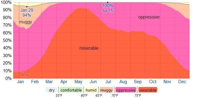
The perceived humidity level in the area does not vary significantly over the course of the year, staying within 93% of 97% throughout.
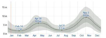
This area experiences extreme seasonal variation in monthly rainfall. Rain falls throughout the year in Colombo, with most rain falls around November and the least rain falls around February.
Flood
38
ANNEXURE 4 | BIOLOGICAL CONTEXT
BIRDS
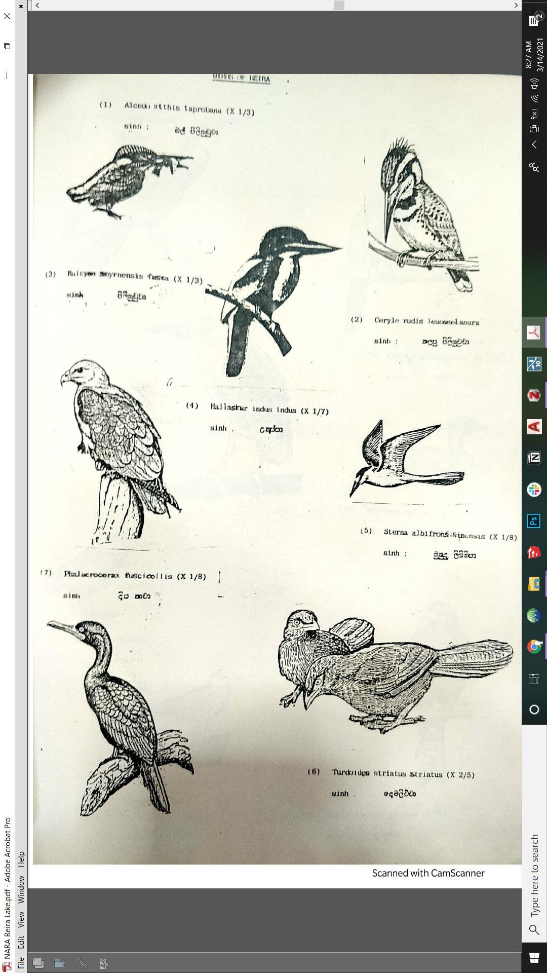
Bird Populations observed around Beira Lake(NARA,1985)
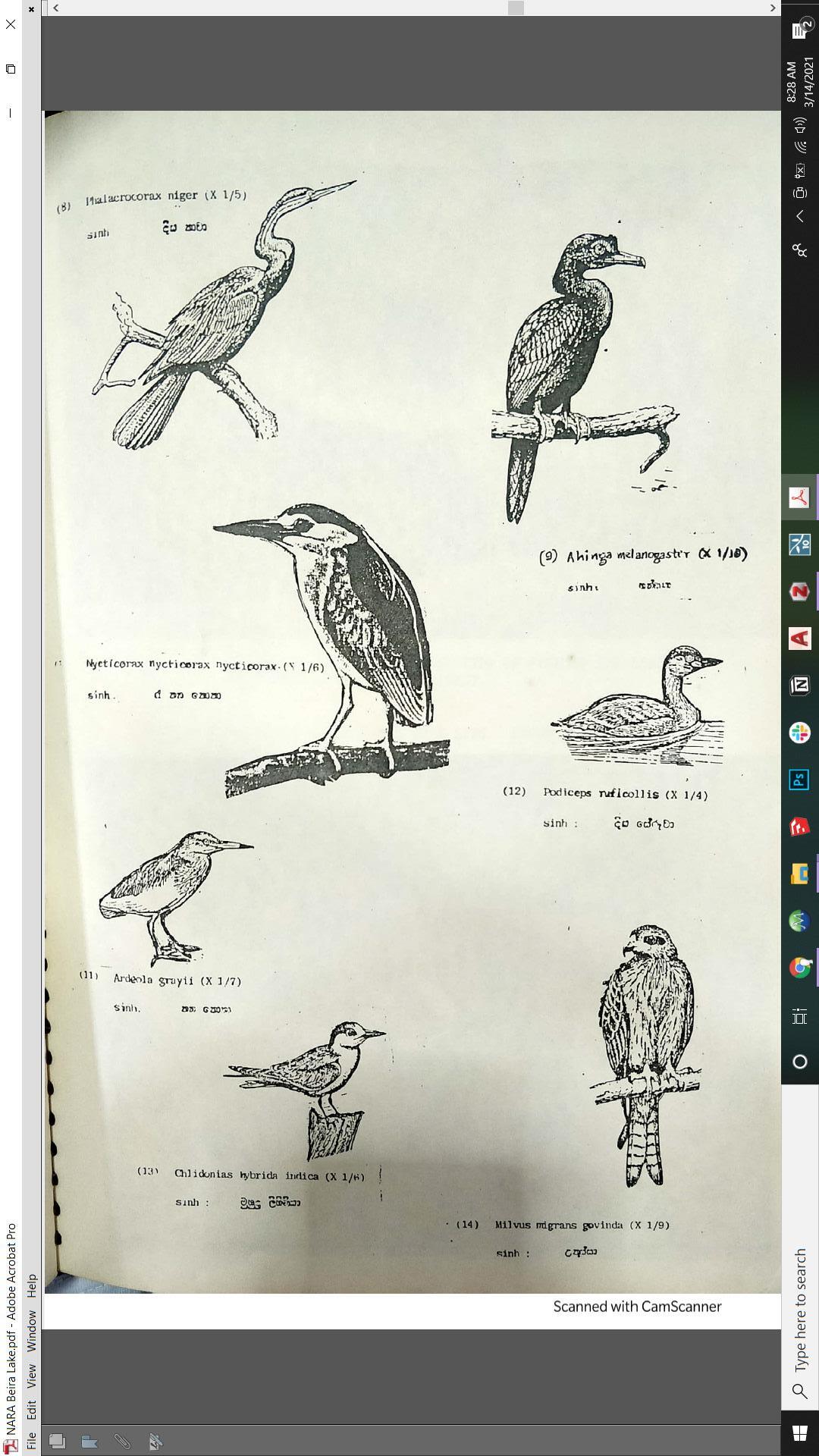
Occasional Visitors
● Pelican
● Egrets
● Common Kingfisher
● Pied Kingfisher
● White Breasted Kingfisher
● Brahminy Kite
● Little Tern
● Common Babbler
Permanent Bird Populations
● Indian Shag
● Darter
● Little Cormorant
● Night Heron
● Pond Heron
● Little Grebe
● Pigeon
Migratory Birds
● Whiskered Tern
● Brown Headed Gull
● Pariah Kite
(NARA, 1985)
List of Species recorded from Beira Lake and shoreline in 1985
● House Crow
● Pond Heron
● Domestic Pigeon
● Little Cormorant
● White Breasted Kingfisher
● Whiskered Tern
● Brahminy Kite
● Spotted Billed Pelican
● Night Heron
● Common Kingfisher
● Egrets
● Pied Kingfisher
● Little Tern
● Common Babbler
● Indian Shag
● Darter
● Little Grebe
● Brown headed Gull
● Pariah Kite
(De Silva, 2003)
39
FISH TREES
In 1954, twelve species of fish were reported from Beira Lake. However, by 1993, only seven species remained, of which the dominant one was “Nile Tilapia”. Occasional severe reductions of oxygen levels and/or increase of ammonia concentration may partly be the cause of the periodic fish kills observed in Beira Lake(De Silva, 2003).
● Tilapia (introduced in 1952)
● Koraliya (Seasonal)
● Lula (seasonal)
(NARA, 1985)

Onlyonsomepartsofthelakebankcanvegetationandtreecoverbefound,asmostof thelakebankiscoveredwithcommercialestablishments,humansettlementsand institutions.Eventhoughastudy(Jayawardene,2011)mentionsthatthemostabundant treespeciesaroundBeiraLakeincludesFicusreligiosa(Bo)andFicusbenghalensis (Banyan),atpresenttherearerarelyanybunyantreestobeseen,astheyhavebeencut o� duetothedangerstheypresenttothebuildings.EventhoughBotreespresentsimilar dangers, due to religious reasons, all of them havebeen preserved.
● Coconut (Pol)
● Umbrella tree (Kottamba/ Kottan)
● Gliricidia (Weta Mara)
● River Tamarind (Ipil Ipil)
● Neem (Kohomba)
● Fern Leaf tree (Pihimbiya)
● Frangipani tree (Araliya)
● Banana tree
● Papaya tree
● Bo tree
● Hibiscus tree
● Siris tree (Mai Mara)
● White Gigantic swallow wort (Wara)
● Lantana (Gandapana)
(Metro Colombo Urban Development Project, 2011)
40
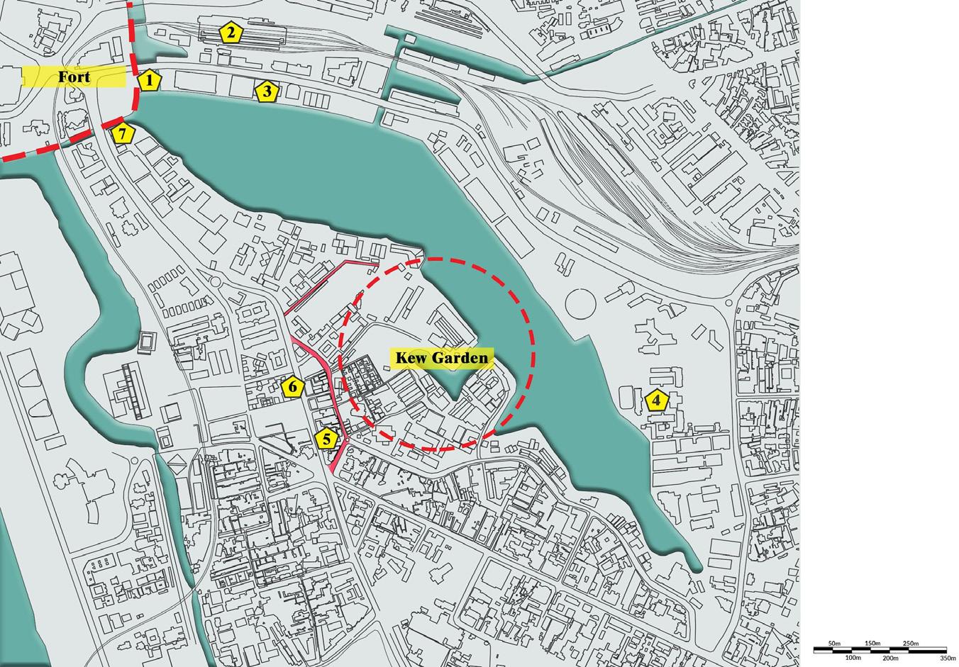



ANNEXURE 5 | CULTURAL CONTEXT
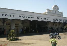
Historical Locations around Beira Lake
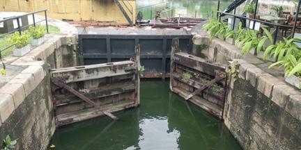
1 - McCallum Lock Gates
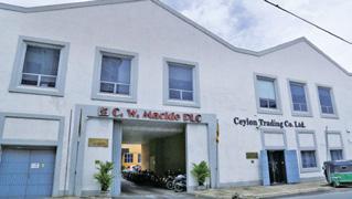
2 - Fort Railway Station 3 - C. W. Mackie Building
41
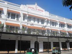
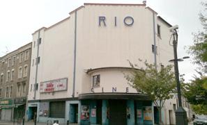
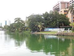
4 - St. Joseph’s College 5 - Hotel Nippon 6 - Rio Cinema 7 - Colombo Rowing Club
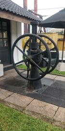
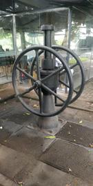
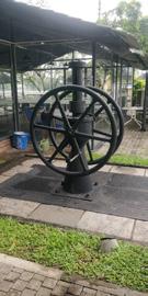
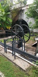
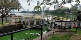
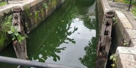
MCCALLUM LOCK GATES
TheMcCallumLockGatecomprisesabridgeoverasetoflock gatesconnectingEastBeiraLakeandtheColomboharbour.It wasbuiltaroundtheyear1951bytheColomboPublicWorks Departmenttofacilitatebargetra�cbetweenshipsdockedin theharbourandportsontheKelaniRiver(MetroColomboUrban Development Project, 2011).



KEW GARDENS
SlaveIslandwasoncethesiteoftheRoyalBotanicalGardens, a.k.a.“KewGardens”,whichwasestablishedin1810,notverylong aftertheBritishhadtakenoverColombo.Itwasestablished undertheguidanceofSirJosephBanks-theDirectorofKew Gardens,London.However,thespacewasn'tenoughto fittheir demands,thusthegardenwasmovedtoUggalboda,anarea nearKalutarain1813.Astimepassedtheyrealisedtheyrequired amildandcoolclimatetogrowexoticplantsimportedfrom othercolonialcountries,andnotlongafter,in1821,thegarden moved to Peradeniya(Ratnayake, 2013; Wijesundara,2007).
 The operations system is still preserved today
The status of the original Lock Gates
42
Prince Soltyko� the Russian traveler, describedColombo as one vast botanic garden (Hussain, 2017)
1.0
Water
Quality Improvements
1.1 Inlet Management
Regulating the existing inlets into Beira lake
1.2 Constructed/ floating wetlands
Purification of contaminated water coming from inlets
1.3 Sediment Dredging
Dredging the lakebed to remove inorganic impurities
1.1.1 Identification and removal of illegal inletsand wastewater inlets.
1.1.2 Application of geotextiles to filter stormwater
1.1.3 Introduction of Trash Traps at the end of Stormwater inlets to remove Urban Litter
1.2.1 Having constructed wetlands and/or floating wetlands at upper parts of inlets to treat the water
1.2.2 Inclusion of Bioremediation plants to absorb heavy metals
1.3.1 Reclamation
1.3.2 Excavation
1.3.3 Increasing the water depth
1.3.4 Wildlife Preservation and ecosystem maintenance
1.3.5 Shore Replenishment
1.4 Chemical Water Treatment
Treatment of contaminated water to stabilize the PH level and remove algae
1.5 Aeration of lake water
To increase the Oxygen content of the water
Chemical water treatment will be only necessary if all the passive methods prove not to work or in case of sudden algae bloom that threatens the ecosystem.
1.5.1 Water-Fall aerators
1.5.2 Air di�usion aerators
2.0 Eco System Reconstruction
2.1 Remodeling of the Lake shoreline
2.2 Living Edge Design
Creating favourable conditions for habitats to grow
2.1.1 Excavation and backfilling of the lake’s hard edges as required to reduce the compactness of the soil
2.1.2 Repairing of failing slopes
2.1.3 Creation of wetland fringe along the edge
2.1.4 Creation of lakeside park spaces
2.2.1 Introducing plant species to create comfortable microclimates
2.2.2 Introducing suitable plant species to attract fauna
2.3 Introduction of Species-Specific Features
Building habitat-specific for species
3.0 Landscape Development
3.1 Circulation systems
Creating a hierarchy of circulation
Creating Habitats for Pollinators
3.2 Wayfinding elements and Recreational Nodes
3.1.1 Continuous pedestrian trail along the lake edge
3.1.2 Multiple Jogging trails with entrances and exits
3.1.3 Cycling Paths with entrances and exits
3.1.4 Designated accessways to the lake
3.2.1 Provide destinations along the trail
3.2.2 Provide safe lighting where needed
ANNEXURE 6 | ENVIRONMENTAL BRIEF
43
ANNEXURE 7 | SPATIAL BRIEF
Programme Sub-Programme Spatial Requirement (Sqm) Spatial Quality Public Realm Visitor Center Wetland Natural Exhibit Moving crowds 3000 Connected to Beira Lake Flexible Gallery Space 2000 Breathing space Lobby 30 Allow visitors to stumble upon the space Information Counter Exhibition Labyrinth Exhibits 50 - 100 users 800 Visitors to be absorbed into this space Maze-like experience Virtual Exhibits Live Exhibits Outdoor Exhibits Souvenir Shop 10 users 75 Visitors to stumble upon the space Administration Private O�ce 12 users 75 Ample privacy Accessible to public Workspaces Meeting Room Restrooms Cafe Kitchen 25 - 30 users 40 Dainty, casual, allow discovery of nature Storage Serving Counters Seating 100 Garbage Collection Area 25 Hand Washing Station Visitors' Restrooms Male 100 users 45 Female Accessible 44
Programme Sub-Programme Spatial Requirement (Sqm) Spatial Quality Public Realm Experiential Walkways Observation Walkways Platform 01 Moving Crowds 150 Open, bridge-like platforms with nature creeping in Platform 02 150 Platform 03 150 Visitors' Restrooms Male 100 users 45 Female Accessible
45
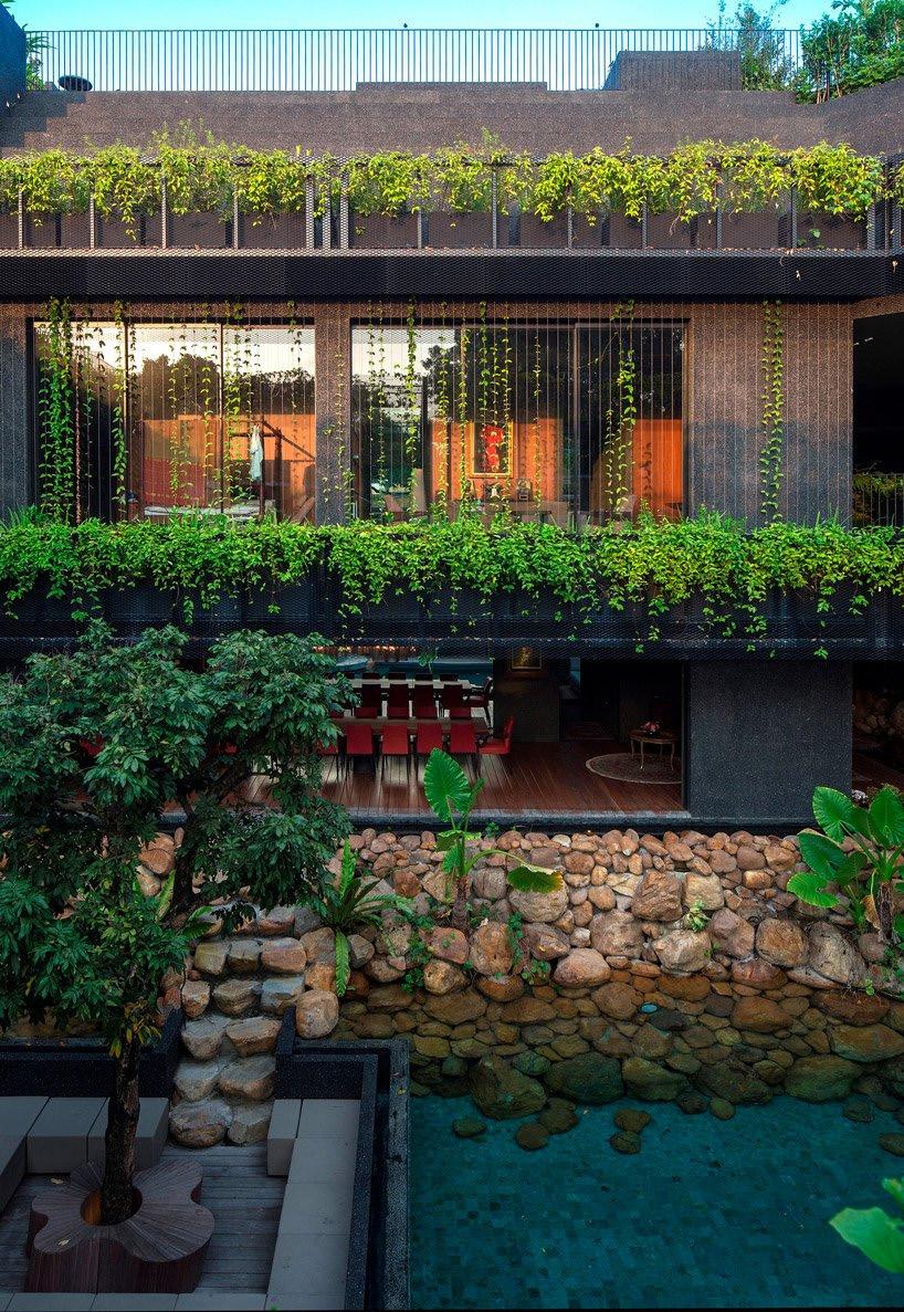
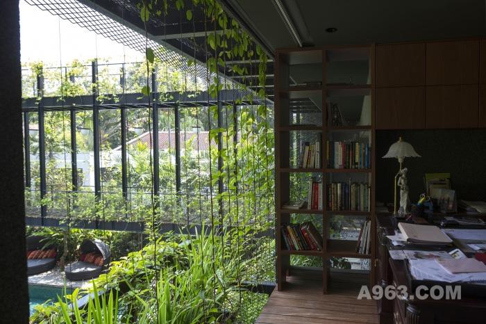
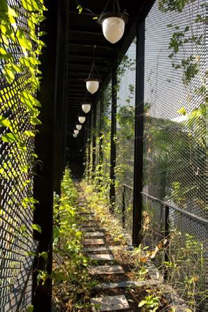
A bridge covered with passion fruits, providing shadefrom the sun and privacy.
Programme Sub-Programme Spatial Requirement (Sqm) Spatial Quality CUrE CUrE Main Entrypoint Checkpoint Moving Crowds 20 Filtering of crowds Telecommunications Room 2 users 30 Mud Room Outdoor washing up area 2-5 users 40 First contact point after Field Study activities Drying Rack Storage Washrooms Lockers MEP Room 40 CUrE Citizen Science Unit CUrE Lobby Information desk Moving Crowds 30 Seating Discussion Room Indoor Discussion Area 8 users 20 Privacy and separation Outdoor Discussion Area 4 users 20 Teaching Lab Lockers 24 users 80 For focused work Artificially ventilated Lab Tables Sinks Storage Rooftop Garden 20 users 700 Open, natural Idea Incubator Room Multimedia Area 20 - 30 users 100 Flexible Spaces Discussion Area Washrooms Male 100 users 45 Female Accessible 46

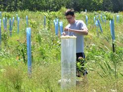
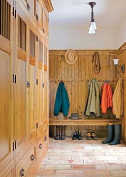
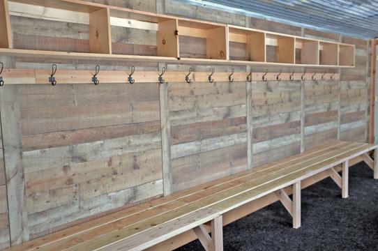
Programme Sub-Programme Spatial Requirement (Sqm) Spatial Quality CUrE Research Labs Field Study Unit Outdoor MudRoom 10 Users 60 Naturally Ventilated Preliminary set-up
Field
Wet Lab Work Station Sink Wet/ Dry Storage Dry Lab Work Stations
nature of
Mud rooms to be functionals, as opposed
aesthetical 47
for
Studies
Field Study Unit should be designed to accommodatethe
its activities
to
Storage
animals under semi

transfer and study of culture
grow and maintain microbiological or cell cultures
stock solutions/isolates/
store chemicals
Programme
Spatial Requirement (Sqm) Spatial Quality Specifications
Life
Lab Sample Room Registry 5 users 50 Incubator
(L
mm
Sub-Programme
CUrE Research Labs
Research
Dimensions
x W x H) 565 x 530 x 720
Sample Stores
Chemical
Area Incubators 3 users 20 To
Vivarium Terrarium structures 3 users 20 To keep
natural
Workstations Rest Area Kitchenette 10 users 20 Seating Unisex Washroom 2 Culture Lab Culture Rooms Workstations 8 users 80
Incubators Sinks
Coolers
Discussion Room 8 users 15 Outdoor Plant Nursery 40 For transplanting, to use as stock Rest Area Kitchenette 10 users 20 Seating Unisex Washroom 2 48
Storage Utility Storage Incubator
maintain optimal environmental conditions Workstation
conditions for observation
For
To
Optical Tables
Storage
To store
Chemical Storage To
General Storage To store instruments/glassware
Sub-Programme
Storage Soil Racks
To store the soil samples
Chemical Storage To store chemicals
General Storage To store instruments/glassware
Drying Oven
Grinder
To remove moisture from the soil and dry the samples as quickly as possible
To get an even distribution of soil particles
Worktops
CUrE Research
maintain high temperatures Magnetic Stirrer with Hotplate To stir while heating
Worktops
Drying Oven To dry the samples
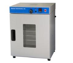
Drying Oven
Dimensions (L x W x H)
720 x 620 x 1030 mm
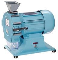
Dimension(L x
Programme
Spatial Requirement (Sqm) Spatial Quality Specifications
Soil Lab Registry 5 users 60
Labs
Grinder
W x H) 345 x 230 x 290 mm
Work Space Sink Computer Water Testing Lab
5 users 75
Mu�e Furnace
To
Work
Sink Computer Common Area Rest Area Kitchenette 20 Seating Unisex Washroom 10 users 2 49
Space
Programme Sub-Programme Spatial Requirement (Sqm) Spatial Quality Researcher Workspaces Main O�ce Work Spaces 15 users 70 Meeting Room 6 users 10 Server Room 10 To save research data Common Area Kitchenette 10 users 20 Seating Unisex Washroom Reading Room Lockers 25 users 120 Checkout Counter Issue Desk Display Area Browsing Areas Reading Spaces Carrels Common work stations Common Washrooms Male 100 users 45 Common to the entire level Female Accessible 50


 Before: The river was culverted and buried underneatha 12 lane highway


 Sharjah’s Wasit Wetland Centre is a protected areaunder the Ramsar Convention on Wetlands
Before


 Minimized architectural intervention.


 Beira Lake Business Study Plan (1996) /Beira LakeIntervention Area Development Plan (2018)


 Land Use Map
Accessway Map
Landmarks and Activities
1-Main Entrance 2 -Public Restrooms 3 - Lotus Tower


 The operations system is still preserved today
The status of the original Lock Gates


