Market Profile
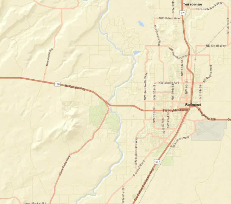
191 SW 67th St, Redmond, Oregon, 97756
Data Note: Households with children include any households with people under age 18, related or not. Multigenerational households are families with 3 or more parent-child relationships. Unmarried partner households are usually classified as nonfamily households unless there is another member of the household related to the householder. Multigenerational and unmarried partner households are reported only to the tract level. Esri estimated block group data, which is used to estimate polygons or non-standard geography.
Source: Esri forecasts for 2023 and 2028. U.S. Census Bureau 2000 and 2010 decennial Census data converted by Esri into 2020 geography. May 14, 2024
Prepared by Esri Rings:
Latitude: 44.27552 Longitude: -121.25198 1 mile 3 miles 5 miles 2020 Households
Mortgage Status Total 423 6,789 15,869 Owner Occupied 90.5% 72.8% 67.9% Owned with a Mortgage/Loan 57.9% 54.5% 50.3% Owned Free and Clear 32.6% 18.3% 17.7% Renter Occupied 9.5% 27.2% 32.1% 2023 Affordability, Mortgage and Wealth Housing Affordability Index 60 64 64 Percent of Income for Mortgage 41.4% 39.0% 38.5% Wealth Index 192 93 80 2020 Housing Units By Urban/ Rural Status Total 506 7,804 17,496 Urban Housing Units 0.0% 65.4% 74.8% Rural Housing Units 100.0% 34.6% 25.2% 2020 Population By Urban/ Rural Status Total 905 18,220 40,750 Urban Population 0.1% 75.3% 80.3% Rural Population 99.9% 24.7% 19.7%
1, 3, 5 mile radii
by Tenure and
©2024 Esri Page 7 of 8

Data Note: Consumer spending shows the amount spent on a variety of goods and services by households that reside in the area. Expenditures are shown by broad budget categories that are not mutually exclusive Consumer spending does not equal business revenue. Total and Average Amount Spent Per Household represent annual figures. The Spending Potential Index represents the amount spent in the area relative to a national average of 100
Source: Consumer Spending data are derived from the 2019 and 2020 Consumer Expenditure Surveys, Bureau of Labor Statistics. Esri.
Source: Esri forecasts for 2023 and 2028. U.S. Census Bureau 2000 and 2010 decennial Census data converted by Esri into 2020 geography. May 14, 2024
191
Prepared by Esri
mile
Latitude: 44.27552 Longitude: -121.25198 1 mile 3 miles 5 miles Top 3 Tapestry Segments 1. Silver & Gold (9A) Middleburg (4C) Middleburg (4C) 2. The Great Outdoors (6C) Urban Edge Families (7C) Urban Edge Families (7C) 3. Silver & Gold (9A) Front Porches (8E) 2023 Consumer Spending Apparel & Services: Total $ $1,124,617 $15,279,247 $33,097,867 Average Spent $2,597.27 $2,044.32 $1,905.79 Spending Potential Index 118 93 87 Education: Total $ $943,776 $11,687,882 $25,517,713 Average Spent $2,179.62 $1,563.81 $1,469.32 Spending Potential Index 122 87 82 Entertainment/Recreation: Total $ $2,242,725 $27,141,840 $58,132,398 Average Spent $5,179.50 $3,631.50 $3,347.29 Spending Potential Index 137 96 89 Food at Home: Total $ $3,863,744 $48,305,231 $103,937,337 Average Spent $8,923.20 $6,463.10 $5,984.76 Spending Potential Index 131 95 88 Food Away from Home: Total $ $2,026,158 $26,569,457 $56,967,388 Average Spent $4,679.35 $3,554.92 $3,280.21 Spending Potential Index 126 95 88 Health Care: Total $ $4,609,730 $54,261,164 $115,589,810 Average Spent $10,646.03 $7,259.99 $6,655.72 Spending Potential Index 145 99 90 HH Furnishings & Equipment: Total $ $1,719,865 $21,332,139 $45,531,681 Average Spent $3,971.97 $2,854.18 $2,621.74 Spending Potential Index 134 97 89 Personal Care Products & Services: Total $ $553,659 $6,872,023 $14,717,455 Average Spent $1,278.66 $919.46 $847.44 Spending Potential Index 134 96 89 Shelter: Total $ $14,245,263 $177,053,570 $378,804,478 Average Spent $32,898.99 $23,689.27 $21,811.74 Spending Potential Index 133 96 88 Support Payments/Cash Contributions/Gifts in Kind: Total $ $2,131,390 $23,509,871 $49,508,757 Average Spent $4,922.38 $3,145.55 $2,850.74 Spending Potential Index 157 101 91 Travel: Total $ $1,344,799 $16,334,615 $34,722,182 Average Spent $3,105.77 $2,185.53 $1,999.32 Spending Potential Index 138 97 89 Vehicle Maintenance & Repairs: Total $ $770,003 $9,620,501 $20,620,451 Average Spent $1,778.30 $1,287.20 $1,187.34 Spending Potential Index 136 98 91
Market Profile
SW 67th St, Redmond, Oregon, 97756
Rings: 1, 3, 5
radii
©2024 Esri Page 8 of 8

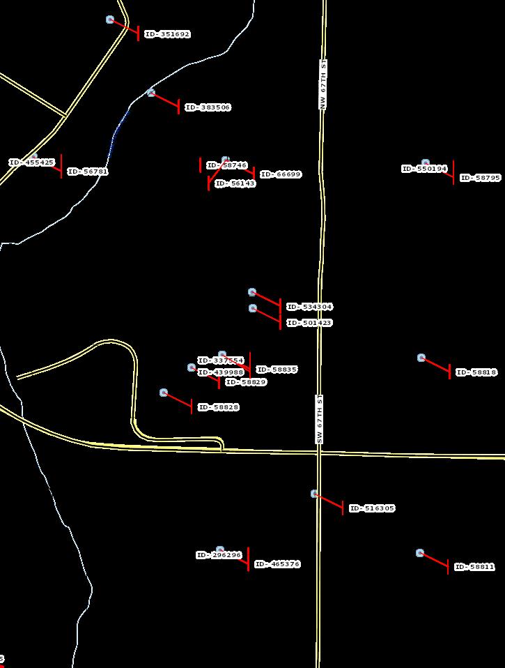
Traffic Count Map
191 SW 67th St, Redmond, Oregon, 97756
Rings: 1, 3, 5 mile radii
by
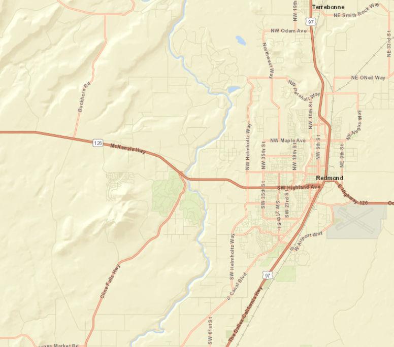
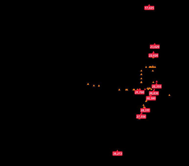


Source: ©2023 Kalibrate Technologies (Q4 2023). May 14, 2024
0 mi
Latitude:
Prepared
Esri
44.27552 Longitude: -121.25198
©2024 Esri Page 1 of 1
CHAPTER 18.16 EXCLUSIVE FARM USE ZONES
18.16.010 Purpose
18.16.020 Uses Permitted Outright
18.16.023 Lawfully Established Dwelling Replacement
18.16.025 Uses Permitted Subject To The Special Provisions Under DCC Section 18.16.038 Or DCC Section
18.16.042 And A Review Under DCC Chapter 18.124 Where Applicable
18.16.030 Conditional Uses Permitted; High Value And Non-High Value Farmland
18.16.031 Conditional Uses On Non-High Value Farmland Only
18.16.033 Conditional Uses On High Value Farmland Only
18.16.035 Destination Resorts
18.16.037 Guest Ranch
18.16.038 Special Conditions For Certain Uses Listed Under DCC 18.16.025
18.16.040 Limitations On Conditional Uses
18.16.042 Agri-Tourism And Other Commercial Events Or Activities Limited Use Permit
18.16.043 Single Permit
18.16.050 Standards For Dwellings In The EFU Zones
18.16.055 Land Divisions
18.16.060 Dimensional Standards
18.16.065 Subzones
18.16.067 Farm Management Plans
18.16.070 Yards
18.16.080 Stream Setbacks
18.16.090 Rimrock Setback
18.16.010 Purpose
1. The purpose of the Exclusive Farm Use zones is to preserve and maintain agricultural lands and to serve as a sanctuary for farm uses.
2. The purposes of this zone are served by the land use restrictions set forth in the Comprehensive Plan and in DCC 18.16 and by the restrictions on private civil actions and enforcement actions set forth in ORS 30.930 through 30.947.
HISTORY
Adopted by Ord. PL-15 §4.010(1) on 11/1/1979
Amended by Ord. 91-038 §§1 and 2 on 9/30/1991
Amended by Ord. 92-065 §3 on 11/25/1992
Amended by Ord. 95-007 §9 on 3/1/1995
18.16.020 Uses Permitted Outright
The following uses and their accessory uses are permitted outright:
1. Farm use as defined in DCC Title 18.
2. Propagation or harvesting of a forest product.
3. Operations for the exploration for minerals as defined by ORS 517.750. Any activities or construction relating to such operations shall not be a basis for an exception under ORS 197.732(2)(a) or (b).
4. Accessory buildings customarily provided in conjunction with farm use.
5. Climbing and passing lanes within the right of way existing as of July 1, 1987.
6. Reconstruction or modification of public roads and highways, including the placement of utility facilities overhead and in the subsurface of public roads and highways along the public right of way, but not including the addition of travel lanes, where no removal or displacement of buildings would occur, or no new land parcels result.
7. Temporary public road and highway detours that will be abandoned and restored to original condition or use when no longer needed.
8. Minor betterment of existing public road and highway-related facilities such as maintenance yards, weigh stations and rest areas, within a right of way existing as of July 1, 1987, and contiguous public owned property utilized to support the operation and maintenance of public roads and highways.
9. Creation, restoration or enhancement of wetlands.
10. A lawfully established dwelling may be altered, restored or replaced, subject to DCC 18.16.023.
1. The replacement dwelling is subject to OAR 660-033-0130(30) and the County shall require as a condition of approval of a single-family replacement dwelling that the landowner for the dwelling sign and record in the deed records for the county a document binding the landowner, and the landowner’s successors in interest, prohibiting them from pursuing a claim for relief or cause of action alleging injury from farming or forest practices for which no action or claim is allowed under ORS 30.936 to 30.937.
11. A replacement dwelling to be used in conjunction with farm use if the existing dwelling is listed on the National Register of Historic Places and on the County inventory as a historic property as defined in ORS 358.480, and subject to 18.16.020(J)(1)above.
12. Operation, maintenance, and piping of existing irrigation systems operated by an Irrigation District except as provided in DCC 18.120.050.
13. Utility facility service lines. Utility facility service lines are utility lines and accessory facilities or structures that end at the point where the utility service is received by the customer and that are located on one or more of the following:
1. A public right of way;
2. Land immediately adjacent to a public right of way, provided the written consent of all adjacent property owners has been obtained; or
3. The property to be served by the utility.
14. The land application of reclaimed water, agricultural process or industrial process water or biosolids, or the onsite treatment of septage prior to the land application of biosolids, for agricultural, horticultural or silvicultural production, or for irrigation in connection with a use allowed in an exclusive farm use zone, subject to the issuance of a license, permit or other approval by the Department of Environmental Quality under ORS 454.695, 459.205, 468B.053 or 468B.055, or in compliance with rules adopted under ORS 468B.095, and with the requirements of ORS 215.246 to 215.251. For the purposes of this section, onsite treatment of septage prior to the land application of biosolids is limited to treatment using treatment facilities that are portable, temporary and transportable by truck trailer, as defined in ORS 801.580, during a period of time within which land application of biosolids is authorized under the license, permit or other approval.
15. Fire service facilities providing rural fire protection services.
16. Operations for the exploration for and production of geothermal resources as defined by ORS 522.005 and oil and gas as defined by ORS 520.005, including the placement and operation of compressors, separators and other customary production equipment for an individual well adjacent to the wellhead. Any activities or construction relating to such operations shall not be a basis for an exception under ORS 197.732(2)(a) or (b).
17. Outdoor mass gathering described in ORS 197.015(10)(d), and subject to DCC Chapter 8.16.
18. Composting operations that are accepted farming practices in conjunction with and auxiliary to farm use on the subject tract as allowed under OAR 660-033-0130(29).
HISTORY
Adopted by Ord. PL-15 on 11/1/1979
Amended by Ord. 81-001 §1 on 3/5/1981
Amended by Ord. 81-025 §1 on 7/15/1981
Amended by Ord. 86-007 §1 on 1/29/1986
Amended by Ord. 91-002 §3 on 2/6/1991
Amended by Ord. 91-005 §4 on 3/4/1991
Amended by Ord. 91-020 §1 on 5/29/1991
Amended by Ord. 91-024 §1 on 6/26/1991
Amended by Ord. 91-038 §§1 and 2 on 9/30/1991
Amended by Ord. 92-065 §3 on 11/25/1992
Amended by Ord. 95-007 §10 on 3/1/1995
Amended by Ord. 98-030 §1 on 5/13/1998
Amended by Ord. 2001-016 §2 on 3/28/2001
Amended by Ord. 2001-039 §1 on 12/12/2001
Amended by Ord. 2004-001 §2 on 7/14/2004
Amended by Ord. 2008-001 §2 on 5/6/2008
Amended by Ord. 2009-014 §1 on 6/22/2009
Amended by Ord. 2010-022 §2 on 7/19/2010
Amended by Ord. 2012-007 §2 on 5/2/2012
Amended by Ord. 2014-010 §1 on 4/28/2014
Amended by Ord. 2016-015 §2 on 7/1/2016
Amended by Ord. 2018-006 §5 on 11/20/2018
Amended by Ord. 2021-004 §1 on 5/27/2021
18.16.023 Lawfully Established Dwelling Replacement
A lawfully established dwelling may be altered, restored or replaced under DCC 18.16.020(J) above if, when an application for a permit is submitted, the County finds to its satisfaction, based on substantial evidence that:
1. The dwelling to be altered, restored or replaced met the following when an application for a permit is submitted:
1. The dwelling has, or formerly had:
1. Intact exterior walls and roof structure;
2. Indoor plumbing consisting of a kitchen sink, toilet and bathing facilities connected to a sanitary waste disposal system;
3. Interior wiring for interior lights;
4. A heating system; The dwelling to be altered, restored or replaced met the following when an application for a permit is submitted:
2. In addition to the provisions of subsection (A)(1). the dwelling to be replaced meets one of the following conditions:
1. If the dwelling was removed, destroyed or demolished:
1. The dwelling's tax lot does not have a lien for delinquent ad valorem taxes; and
2. Any removal, destruction or demolition occurred on or after January 1, 1973:
2. If the dwelling is currently in such a state of disrepair that the dwelling is unsafe for occupancy or constitutes an attractive nuisance, the dwelling's tax lot does not have a lien for delinquent ad valorem taxes; or
3. A dwelling not described in subparagraph (a) or (b) of this paragraph was assessed as a dwelling for purposes of ad valorem taxation:
1. For the previous five property tax years: or
2. From the time when the dwelling was erected upon or affixed to the land and became subject to assessment as described in ORS 307.010 (Definitions of "land" and "real property" for state property tax laws).
2. For replacement of a lawfully established dwelling under DCC 18.16.020(J):
1. The dwelling to be replaced must be removed, demolished or converted to an allowable nonresidential use:
1. Within one year after the date the replacement dwelling is certified for occupancy pursuant to ORS 455.055 and DCC Chapter 15.04; or
2. If the dwelling to be replaced is, in the discretion of the County, in such a state of disrepair that the structure is unsafe for occupancy or constitutes an attractive nuisance, on or before a date set by the County that is not less than 90 days after the replacement permit is issued; and
3. If a dwelling is removed by moving it off the subject parcel to another location, the applicant must first obtain approval from the County for the new location.
2. The applicant must cause to be recorded in the deed records of the County a statement that the dwelling to be replaced has been removed, demolished or converted.
3. Deed Restrictions.
1. As a condition of approval, if the dwelling to be replaced is located on a portion of the lot or parcel that is not zoned for exclusive farm use, the applicant shall execute and cause to be recorded in the deed records of the County a deed restriction prohibiting the siting of another dwelling on that portion of the lot or parcel.
2. The restriction imposed is irrevocable unless the County Planning Director, or the Director’s designee, places a statement of release in the deed records of the County to the effect that the provisions of 2019 Oregon Laws, chapter 440, section 1 and ORS 215.283 regarding replacement dwellings have changed to allow the lawful siting of another dwelling.
4. The replacement dwelling:
1. Must comply with applicable siting standards such as minimum setbacks. However, the standards may not be applied in a manner that prohibits the siting of the replacement dwelling.
2. Must comply with applicable building codes, plumbing codes, sanitation codes and other requirements related to health and safety or to siting at the time of construction. However, the standards may not be applied in a manner that prohibits the siting of the replacement dwelling.
5. The replacement dwelling must be sited on the same lot or parcel:
1. Using all or part of the footprint of the replaced dwelling or near a road, ditch, river, property line, forest boundary or another natural boundary of the lot or parcel; and
2. If possible, for the purpose of minimizing the adverse impacts on resource use of land in the area, within a concentration or cluster of structures or within 500 yards of another structure.
6. A replacement dwelling permit that is issued under DCC 18.16.020(J):
1. Is a land use decision as defined in ORS 197.015 where the dwelling to be replaced:
1. Formerly had the features described in DCC 18.16.023(A)(1)(a) through(d); or
2. Is eligible for replacement under DCC 18.16.023(A)(2)(b).
2. Is not subject to the time to act limits of ORS 215.417.
7. A temporary residence approved under DCC 18.116.080 or 18.116.090 is not eligible for replacement under this section.
HISTORY
Adopted by Ord. 2014-010 §1 on 4/28/2014
Amended by Ord. 2021-013 §4 on 4/5/2022
18.16.025 Uses Permitted Subject To The Special Provisions Under DCC Section 18.16.038 Or DCC Section 18.16.042 And A Review Under DCC Chapter 18.124 Where Applicable
1. Dwellings customarily provided in conjunction with farm use (farm-related dwellings), subject to DCC 18.16.050.
2. A relative farm assistance dwelling, subject to DCC 18.16.050.
3. Religious institutions or assemblies and cemeteries in conjunction with religious institutions or assemblies consistent with ORS 215.441 and OAR 660-033-0130(2) on non-high value farmland.
4. Expansion of an existing church or cemetery in conjunction with a church on the same tract as the existing use, subject to Oregon Administrative Rules 660-033-0130.
5. Utility facilities necessary for public service, including wetland waste treatment systems, but not including commercial facilities for the purpose of generating electrical power for public use by sale and transmission towers over 200 feet in height. A utility facility necessary for public service may be established as provided in:
1. DCC 18.16.038(A); or
2. DCC 18.16.038(E) if the utility facility is an associated transmission line, as defined in ORS 469.300.
6. Winery, as described in ORS 215.452.
7. Farm stands, subject to DCC 18.16.038.
8. A site for the takeoff and landing of model aircraft, including such buildings or facilities as may be reasonably necessary.
9. A facility for the processing of farm crops, subject to the following standards:
1. The facility:
1. Uses less than 10,000 square feet for its processing area and complies with all applicable siting standards. Siting standards shall not be applied in a manner that prohibits the siting of a facility for the processing of farm products; or
2. Exception: A facility which uses less than 2,500 square feet for its processing area is exempt from any applicable siting standards. However, applicable standards and criteria pertaining to floodplains, geologic hazards, beach and dune hazards, airport safety, tsunami hazards and fire siting standards shall apply.
2. The County shall not approve any division of a lot or parcel that separates a facility for the processing of farm products from the farm operation on which it is located.
10. Agri-tourism and other commercial events and activities subject to DCC 18.16.042.
11. Dog training classes or testing trials conducted outdoors or in farm buildings that existed on January 1, 2019, when:
1. The number of dogs participating in training does not exceed 10 per training class and the number of training classes to be held on-site does not exceed six per day; and
2. The number of dogs participating in a testing trial does not exceed 60 and the number of testing trials to be conducted on-site does not exceed four per calendar year.
HISTORY
Adopted by Ord. 2004-001 §2 on 7/14/2004
Amended by Ord. 2008-001 §2 on 5/6/2008
Amended by Ord. 2009-014 §1 on 6/22/2009
Amended by Ord. 2010-022 §2 on 7/19/2010
Amended by Ord. 2012-004 §2 on 4/16/2012
Amended by Ord. 2012-007 §2 on 5/2/2012
Amended by Ord. 2014-010 §1 on 4/28/2014
Amended by Ord. 2016-015 §2 on 7/1/2016
Amended by Ord. 2020-001 §3 on 4/21/2020
Amended by Ord. 2021-004 §1 on 5/27/2021
Amended by Ord. 2021-013 §4 on 4/5/2022
18.16.030 Conditional Uses Permitted; High Value And Non-High Value Farmland
The following uses may be allowed in the Exclusive Farm Use zones on either high value farmland or nonhigh value farmland subject to applicable provisions of the Comprehensive Plan, DCC 18.16.040 and 18.16.050, and other applicable sections of DCC Title 18.
1. Nonfarm dwelling.
2. Lot of record dwelling.
3. Residential home or facility, as defined in DCC 18.04.030, in existing dwellings.
4. A hardship dwelling, as described in DCC 18.16.050(H).
5. Commercial activities that are in conjunction with farm use, but not including the processing of farm crops as described in DCC 18.16.025.
6. Operations conducted for: Mining and processing of geothermal resources as defined by ORS 522.005, and Mining and processing of natural gas or oil as defined by ORS 520.005, not otherwise permitted under DCC 18.16.020.
7. Expansion of an existing private park, playground, hunting and fishing preserve and campground on the same tract as the existing use.
8. Public park and playground consistent with the provisions of ORS 195.120, and including only the uses specified under OAR 660-034-0035 or 660-034-0040, whichever is applicable.
9. Community centers owned by a governmental agency or a nonprofit organization and operated primarily by and for residents of the local rural community.
1. A community center authorized under this section may provide services to veterans, including but not limited to emergency and transitional shelter, preparation and service of meals, vocational and educational counseling and referral to local, state or federal agencies providing medical, mental health, disability income replacement and substance abuse services, only in a facility that is in existence on January 1, 2006.
2. The services may not include direct delivery of medical, mental health, disability income replacement or substance abuse services.
10. Transmission towers over 200 feet in height.
11. Commercial utility facility, including a hydroelectric facility (in accordance with DCC 18.116.130 and 18.128.260, and OAR 660-033-0130), for the purpose of generating power for public use by sale, not including wind power generation facilities.
12. Personal use airport for airplanes and helicopter pads, including associated hangar, maintenance and service facilities. A personal use airport as used in DCC 18.16.030 means an airstrip restricted, except for aircraft emergencies, to use by the owner, and, on an infrequent and occasional basis, by invited guests, and by commercial aviation activities in connection with agricultural operations.
13. Home Occupation, subject to DCC 18.116.280.
1. The home occupation shall:
1. be operated substantially in the dwelling or other buildings normally associated with uses permitted in the EFU zone;
2. be operated by a resident or employee of a resident of the property on which the business is located; and
3. employ on the site no more than five full-time or part-time persons.
2. The home occupation shall not unreasonably interfere with other uses permitted in the EFU zone.
14. A facility for the primary processing of forest products, provided that such facility is found to not seriously interfere with accepted farming practices and is compatible with farm uses described in ORS 213.203(2).
1. The primary processing of a forest product, as used in DCC 18.16.030, means the use of a portable chipper or stud mill or other similar methods of initial treatment of a forest product in order to enable its shipment to market.
2. Forest products, as used in DCC 18.16.030, means timber grown upon a parcel of land or contiguous land where the primary processing facility is located.
15. Construction of additional passing and travel lanes requiring the acquisition of right of way, but not resulting in the creation of new land parcels.
16. Reconstruction or modification of public roads and highways involving the removal or displacement of buildings, but not resulting in the creation of new land parcels.
17. Improvement of public road and highway-related facilities such as maintenance yards, weigh stations and rest areas, where additional property or right of way is required, but not resulting in the creation of new land parcels.
18. The propagation, cultivation, maintenance and harvesting of aquatic species that are not under the jurisdiction of the State Fish and Wildlife Commission or insect species.
1. Insect species shall not include any species under quarantine by the State Department of Agriculture or the United States Department of Agriculture.
2. The county shall provide notice of all applications under this section to the State Department of Agriculture.
3. Notice shall be provided in accordance with DCC Title 22, but shall be mailed at least 20 calendar days prior to any administrative decision or initial public hearing on the application.
19. Room and board arrangements for a maximum of five unrelated persons in an existing residence. If approved, this use is subject to the recording of the statement listed in DCC 18.16.020(J)(1).
20. Excavation, grading and fill and removal within the bed and banks of a stream or river or in a wetland.
21. Roads, highways and other transportation facilities, and improvements not otherwise allowed under DCC 18.16, if an exception to Goal 3, Agricultural Lands, and to any other applicable goal is first granted under state law. Transportation uses and improvements may be authorized under conditions and standards as set forth in OAR 660-012-0035 and 660-012-0065.
22. Surface mining of mineral and aggregate resources in conjunction with the operation and maintenance of irrigation systems operated by an Irrigation District, including the excavation and mining for facilities, ponds, reservoirs, and the off-site use, storage, and sale of excavated material.
23. A living history museum.
24. Operations for the extraction and bottling of water.
25. Transportation improvements on rural lands allowed by OAR 660-012-0065.
26. Expansion of existing county fairgrounds and activities relating to county fairgrounds governed by county fair boards established pursuant to ORS 565.210.
27. Extended outdoor mass gatherings, subject to DCC 8.16.
28. A landscape contracting business, as defined in ORS 671.520, or a business providing landscape architecture services, as described in ORS 671.318, if the business is pursued in conjunction with the growing and marketing of nursery stock on the land that constitutes farm use.
29. Wind power generation facilities as commercial utility facilities for the purpose of generating power for public use by sale, subject to OAR 660-033-0130.
30. Photovoltaic solar power generation facilities as commercial utility facilities for the purpose of generating power for public use by sale, subject to OAR 660-033-0130. On high-value farmland only, photovoltaic solar power generation facilities are subject to the provisions in ORS 215.447.
31. Commercial dog boarding kennel, or dog training classes or testing trials that exceed the standards under DCC 18.16.025(K), subject to DCC 18.16.040(A)(1 and 2).
32. Equine and equine-affiliated therapeutic and counseling activities, provided:
1. The activities are conducted in existing buildings that were lawfully constructed on the property before the effective date of January 1, 2019 or in new buildings that are accessory, incidental and subordinate to the farm use on the tract; and
2. All individuals conducting therapeutic or counseling activities are acting within the proper scope of any licenses required by the state.
HISTORY
Adopted by Ord. PL-15 on 11/1/1979
Amended by Ord. 83-028 §1 on 6/1/1983
Amended by Ord. 86-018 §3 on 6/30/1986
Amended by Ord. 87-013 §1 on 6/10/1987
Amended by Ord. 90-018 §1 on 5/16/1990
Amended by Ord. 90-014 §§23 and 31 on 7/12/1990
Amended by Ord. 91-005 §5 on 3/4/1991
Amended by Ord. 91-014 §1 on 3/13/1991
Amended by Ord. 91-020 §1 on 5/29/1991
Amended by Ord. 91-038 §2 on 9/30/1991
Amended by Ord. 92-065 §3 on 11/25/1992
Amended by Ord. 94-008 §9 on 6/8/1994
Amended by Ord. 95-007 §11 on 3/1/1995
Amended by Ord. 95-025 §1 on 3/3/1995
Amended by Ord. 98-030 §1 on 5/13/1998
Amended by Ord. 2001-016 §2 on 3/28/2001
Amended by Ord. 2001-039 §1 on 12/12/2001
Amended by Ord. 2004-001 §2 on 7/14/2004
Amended by Ord. 2008-001 §2 on 5/6/2008
Amended by Ord. 2009-014 §1 on 6/22/2009
Amended by Ord. 2012-007 §2 on 5/2/2012
Amended by Ord. 2014-010 §1 on 4/28/2014
Amended by Ord. 2018-006 §5 on 11/20/2018
Amended by Ord. 2021-013 §4 on 4/5/2022
18.16.031 Conditional Uses On Non-High Value Farmland Only
The following uses may be allowed only on tracts in the Exclusive Farm Use Zones that constitute nonhigh value farmland subject to applicable provisions of the Comprehensive Plan and DCC 18.16.040 and other applicable sections of DCC Title 18.
1. A disposal site which includes a land disposal site approved by the governing body of a city or County or both and for which a permit has been granted under ORS 459.245 by the Department of Environmental Quality together with equipment, facilities or buildings necessary for its operation.
2. Golf course and accessory golf course uses as defined in DCC Title 18 on land determined not to be high value farmland, as defined in ORS 195.300.
3. Except for those composting facilities that are a farm use as allowed under DCC 18.16.020, composting operations and facilities for which a permit has been granted by the Oregon Department of Environmental Quality under OAR 340-093-0050 and 340-096-0060.
1. Buildings and facilities used in conjunction with the composting operation shall only be those required for the operation of the subject facility.
2. On-site sales shall be limited to bulk loads of at least one unit (7.5 cubic yards) in size that are transported in one vehicle.
3. A composting facility use shall be subject to DCC 18.16.040(N).
4. Private parks, playgrounds, hunting and fishing preserves and campgrounds.
5. Public or private schools for kindergarten through grade 12, including all buildings essential to the operation of a school, primarily for residents of the rural area in which the school is located, subject to the applicable Oregon Administrative Rules.
HISTORY
Adopted by Ord. 95-007 §12 on 3/1/1995
Amended by Ord. 2004-001 §2 on 7/14/2004
Amended by Ord. 2009-014 §1 on 6/22/2009
Amended by Ord. 2010-022 §2 on 7/19/2010
Amended by Ord. 2012-007 §2 on 5/2/2012
Amended by Ord. 2014-010 §1 on 4/28/2014
Amended by Ord. 2020-007 §9 on 10/27/2020
18.16.033 Conditional Uses On High Value Farmland Only
In addition to those uses listed in DCC 18.16.030 above, the following uses may be allowed on tracts in the Exclusive Farm Use Zones that constitute high value farmland subject to applicable provisions of the Comprehensive Plan and DCC 18.16.040 and other applicable sections of DCC Title 18.
1. Maintenance, enhancement or expansion of a site for the disposal of solid waste approved by the County for which a permit has been granted under ORS 459.245 by the Oregon Department of Environmental Quality together with equipment, facilities or buildings necessary for its operation, subject to other requirements of law. New such sites are prohibited.
2. Maintenance, enhancement or expansion of golf course and accessory golf course uses as defined in DCC Title 18 existing as of March 1, 1994, subject to other requirements of law. New such uses are prohibited. Expanded courses may not exceed 36 holes total.
3. Additions or expansions to existing public or private schools on high value farmland, for kindergarten through grade 12, including all buildings essential to the operation of a school, subject to the applicable Oregon Administrative Rules.
HISTORY
Adopted by Ord. 95-007 §13 on 3/1/1995
Amended by Ord. 2004-001 §2 on 7/14/2004
Amended by Ord. 2009-014 §1 on 6/22/2009
Amended by Ord. 2010-022 §2 on 7/19/2010
Amended by Ord. 2014-010 §1 on 4/28/2014
18.16.035 Destination Resorts
Destination resorts may be allowed, where mapped, as a conditional use, subject to all applicable standards of the Destination Resort Zone.
HISTORY
Adopted by Ord. 92-004 §3 on 2/7/1992
Amended by Ord. 92-065 §3 on 11/25/1992
Amended by Ord. 2008-001 §2 on 5/6/2008
Amended by Ord. 2009-014 §1 on 6/22/2009
18.16.037 Guest Ranch
1. A guest ranch may be established in conjunction with an existing and continuing livestock operation, using accepted livestock practices that qualifies as a farm use under DCC 18.04.030, subject to the applicable provisions set forth in DCC 18.16.040(A)(1), (2) and (3), the applicable provisions of DCC 18.128, and the provisions of the applicable Oregon Revised Statutes. A guest ranch shall not be located within the boundaries of or surrounded by:
1. A federally designated wilderness area or a wilderness study area:
2. A federally designated wildlife refuge;
3. A federally designated area of critical environmental concern; or
4. An area established by an Act of Congress for the protection of scenic or ecological resources.
2. “Guest ranch” means a facility for overnight guest lodging units, including passive recreational activities and food services, as set forth in ORS 215 that are incidental and accessory to an existing livestock operation that qualifies as a farm use under DCC 18.04.030.
3. A guest lodging unit means a guest room in a lodge, bunkhouse, cottage or cabin used only for transient overnight lodging and not for permanent residence accommodations.
4. For the purposes of DCC 18.16.037, “livestock” means cattle, sheep, horses, and bison.
5. A proposed division of land in an exclusive farm use zone for a guest ranch or a division of a lot or parcel that separates a guest ranch from the dwelling of the person conducting the livestock operation shall not be allowed.
6. Notwithstanding DCC 18.16.055, a proposed division of land in an exclusive farm use zone for a guest ranch shall not be allowed.
HISTORY
Adopted by Ord. 98-056 §1 on 9/23/1998
Amended by Ord. 2001-043 §1 on 12/5/2001
Amended by Ord. 2009-014 §1 on 6/22/2009
Repealed & Reenacted by Ord. 2010-022 §2 on 7/19/2010
Repealed & Reenacted by Ord. 2012-007 §2 on 5/2/2012
Repealed & Reenacted by Ord. 2018-006 §5 on 11/20/2018
Repealed & Reenacted by Ord. 2021-007 §2 on 7/9/2021
18.16.038
Special Conditions For Certain Uses Listed Under
DCC 18.16.025
1. A utility facility necessary for public use allowed under DCC 18.16.025 shall be one that must be sited in an agricultural zone in order for service to be provided. To demonstrate that a utility facility is necessary, an applicant must show that reasonable alternatives have been considered and that the facility must be sited in an exclusive farm use zone due to one or more of the following factors:
1. Technical and engineering feasibility;
2. The proposed facility is locationally dependent. A utility facility is locationally dependent if it must cross land in one or more areas zoned for exclusive farm use in order to achieve a reasonably direct route or to meet unique geographical needs that cannot be satisfied on other lands;
3. Lack of available urban and nonresource lands;
4. Availability of existing rights of way;
5. Public health and safety; and
6. Other requirements of state and federal agencies.
7. Costs associated with any of the factors listed in 1-6 above may be considered, but cost alone may not be the only consideration in determining that a utility facility is necessary for public service. Land costs shall not be included when considering alternative locations for substantially similar utility facilities that are not substantially similar.
8. The owner of a utility facility approved under this section shall be responsible for restoring, as nearly as possible, to its former condition any agricultural land and associated improvements that are damaged or otherwise disturbed by the siting, maintenance, repair or reconstruction of the facility. Nothing in this subsection shall prevent the owner of the utility facility from requiring a bond or other security from a contractor or otherwise imposing on a contractor the responsibility for restoration.
9. In addition to the provisions of 1-6 above, the establishment or extension of a sewer system as defined by OAR 660-011-0060(1)(f) in an exclusive farm use zone shall be subject to the provisions of OAR 660-011-0060.
10. The provisions above do not apply to interstate gas pipelines and associated facilities authorized by and subject to regulation by the Federal Energy Regulatory Commission.
11. The County shall impose clear and objective conditions on an application for utility facility siting to mitigate and minimize the impacts of the proposed facility, if any, on surrounding lands devoted to farm use, in order to prevent a significant change in accepted farm practices or a significant increase in the cost of farm practices on surrounding farmlands.
12. Utility facilities necessary for public service may include on-site and off-site facilities for temporary workforce housing for workers constructing a utility facility. Such facilities must be removed or converted to an allowed use under OAR 660-033-0130(19) or other statute or rule when project construction is complete. Off-site facilities allowed under this provision are subject to OAR 660-033-0130(5). Temporary workforce housing facilities not included in the initial approval may be considered through a minor amendment request. A minor amendment request shall have no effect on the original approval.
2. Wineries are subject to the following:
1. A winery, authorized under DCC 18.16.025 is a facility that produces wine with a maximum annual production of:
1. Less than 50,000 gallons and:
1. Owns an on-site vineyard of at least 15 acres;
2. Owns a contiguous vineyard of at least 15 acres;
3. Has a long-term contract for the purchase of all of the grapes from at least 15 acres of a vineyard contiguous to the winery; or
4. Obtains grapes from any combination of i, ii, or iii of this subsection; or
2. At least 50,000 gallons and the winery:
1. Owns an on-site vineyard of at least 40 acres;
2. Owns a contiguous vineyard of at least 40 acres;
3. Has a long-term contract for the purchase of all of the grapes from at least 40 acres of a vineyard contiguous to the winery;
4. Owns an on-site vineyard of at least 15 acres on a tract of at least 40 acres and owns at least 40 additional acres of vineyards in Oregon that are located within 15 miles of the winery site; or
5. Obtains grapes from any combination of i, ii, iii, or iv of this subsection.
2. In addition to producing and distributing wine, a winery established under this section may:
1. Market and sell wine produced in conjunction with the winery.
2. Conduct operations that are directly related to the sale or marketing of wine produced in conjunction with the winery, including:
1. Wine tastings in a tasting room or other location on the premises occupied by the winery;
2. Wine club activities;
3. Winemaker luncheons and dinners;
4. Winery and vineyard tours;
5. Meetings or business activities with winery suppliers, distributors, wholesale customers and wine-industry members;
6. Winery staff activities;
7. Open house promotions of wine produced in conjunction with the winery; and
8. Similar activities conducted for the primary purpose of promoting wine produced in conjunction with the winery.
3. Market and sell items directly related to the sale or promotion of wine produced in conjunction with the winery, the marketing and sale of which is incidental to on-site retail sale of wine, including food and beverages:
1. Required to be made available in conjunction with the consumption of wine on the premises by the Liquor Control Act or rules adopted under the Liquor Control Act; or
2. Served in conjunction with an activity authorized by paragraph (b), (d) or (e) of this subsection.
4. Carry out agri-tourism or other commercial events on the tract occupied by the winery subject to subsections of this section.
5. Host charitable activities for which the winery does not charge a facility rental fee.
3. On-site kitchen.
1. A winery may include on-site kitchen facilities licensed by the Oregon Health Authority under ORS 624.010 to 624.121 for the preparation of food and beverages described in subsection (2)(c) of this section.
2. Food and beverage services authorized under subsection (2)(c) of this section may not utilize menu options or meal services that cause the kitchen facilities to function as a café or other dining establishment open to the public.
4. The gross income of the winery from the sale of incidental items or services provided pursuant to subsection (2)(c) to (e) of this section may not exceed 25 percent of the gross income from the on-site retail sale of wine produced in conjunction with the winery.
1. The gross income of the winery does not include income received by third parties unaffiliated with the winery.
2. At the request of the County, who has land use jurisdiction over the site of a winery, the winery shall submit to the County a written statement that is prepared by a certified public accountant and certifies the compliance of the winery with this subsection for the previous tax year.
5. A winery may carry out up to 18 days of agri-tourism or other commercial events annually on the tract occupied by the winery.
6. If a winery approved under DCC 18.16.038(B)(5) conducts agri-tourism or other commercial events, the winery may not conduct agri-tourism or other commercial events or activities authorized under Deschutes County Code 18.16.042.
7. Gross Income.
1. The gross income of the winery from any activity other than the production or sale of wine may not exceed 25 percent of the gross income from the on-site retail of wine produced in conjunction with the winery.
2. The gross income of the winery does not include income received by third parties unaffiliated with the winery.
3. The winery shall submit to the Deschutes County Community Development Department a written statement, prepared by a certified public accountant that certifies compliance with this section for the previous tax year by April 15 of each year in which private events are held.
8. A winery operating under this section shall provide parking for all activities or uses on the lot, parcel or tract on which the winery is established.
9. Prior to the issuance of a permit to establish a winery under this section, the applicant shall show that vineyards described in subsections (B)(1) of this section have been planted or that the contract for the purchase of grapes has been executed, as applicable.
10. The siting of a winery shall be subject to the following standards:
1. Establishment of a setback of at least 100 feet from all property lines for the winery and all public gathering places, unless the County grants an adjustment or variance allowing a setback of less than 100 feet.
2. Shall comply with DCC Chapter 18.80, Airport Safety Combining Zone, and DCC 18.116.180, Building Setbacks for the Protection of Solar Access.
11. As used in this section, “private events” includes, but is not limited to, facility rentals and celebratory gatherings.
12. The winery shall have direct road access and internal circulation.
13. A winery is subject to the following public health and safety standards:
1. Sanitation facilities shall include, at a minimum, portable restroom facilities and stand-alone hand washing stations.
2. No event, gathering or activity may begin before 7:00 a.m. or end after 10:00 p.m., including set-up and take-down of temporary structures.
3. Noise control.
1. All noise, including the use of a sound producing device such as, but not limited to, loud speakers and public address systems, musical instruments that are amplified or unamplified, shall be in compliance with applicable state regulations.
2. A standard sound level meter or equivalent, in good condition, that provides a weighted sound pressure level measured by use of a metering characteristic with an "A" frequency weighting network and reported as dBA shall be available on-site at all times during private events.
4. Adequate traffic control must be provided by the property owner to address the following:
1. There shall be one traffic control person for each 250 persons expected or reasonably expected to be in attendance at any time.
2. All traffic control personnel shall be certified by the State of Oregon and shall comply with the current edition of the Manual of Uniform Traffic Control Devices.
5. Structures.
1. All permanent and temporary structures and facilities are subject to fire, health and life safety requirements, and shall comply with all requirements of the Deschutes County Building Safety Division and the Environmental Soils Division and any other applicable federal, state and local laws.
2. Compliance with the requirements of the Deschutes County Building Safety Division shall include meeting all building occupancy classification requirements of the State of Oregon adopted building code.
6. Inspection of event premises authorization. The applicant shall provide in writing a consent to allow law enforcement, public health, and fire control officers to come upon the premises for which the Limited Use Permit has been granted for the purposes of inspection and enforcement of the terms and conditions of the permit and DCC Chapter 18.16 Exclusive Farm Use Zone and DCC Chapter 8.08 Noise Control, and any other applicable laws or ordinances.
3. Farm stands are subject to the following:
1. The structures are designed and used for the sale of farm crops or livestock grown on the farm operation, or grown on the farm operation and other farm operations in the local agricultural area, including the sale of retail incidental items and fee-based activity to promote the sale of farm crops or livestock sold at the farm stand, if the annual sales of the incidental items and fees from promotional activity do not make up more than 25 percent of the total annual sales of the farm stand; and
2. The farm stand does not include structures designed for occupancy as a residence or for activities other than the sale of farm crops or livestock, and does not include structures for banquets, public gatherings or public entertainment.
3. As used in this section, “farm crops or livestock” includes both fresh and processed farm crops and livestock grown on the farm operation, or grown on the farm operation and other farm operations in the local agricultural area.
4. As used in this subsection, “processed crops and livestock” includes jams, syrups, apple cider, animal products and other similar farm crops and livestock that have been processed and converted into another product but not prepared food items.
5. As used in this section, “local agricultural area” includes Oregon or an adjacent county in Washington, Idaho, Nevada or California that borders the Oregon county in which the farm stand is located.
4. A site for the takeoff and landing of model aircraft is subject to the following:
1. Buildings or facilities shall not be more than 500 square feet in floor area or placed on a permanent foundation unless the building of facility preexisted the use approved under this section.
1. The site shall not include an aggregate surface or hard surface area, unless the surface preexisted the use approved under this section.
2. An owner of property used for the purpose authorized in this section may charge a person operating the use on the property rent for the property.
3. An operator may charge users of the property a fee that does not exceed the operator’s cost to maintain the property, buildings and facilities.
4. As used in this section, “model aircraft” means a small-scale version of an airplane, glider, helicopter, dirigible or balloon that is used or intended to be used for flight and is controlled by radio, lines or design by a person on the ground.
5. An associated transmission line is necessary for public service if an applicant for approval under DCC 18.16.025 demonstrates that the line meets either the requirements of 1 or 2 below.
1. The entire route of the associated transmission line meets at least one of the following requirements:
1. The associated transmission line is not located on high-value farmland, as defined in ORS 195.300, or on arable land;
2. The associated transmission line is co-located with an existing transmission line;
3. The associated transmission line parallels an existing transmission line corridor with the minimum separation necessary for safety; or
4. The associated transmission line is located within an existing right of way for a linear facility, such as a transmission line, road or railroad, that is located above the surface of the ground.
2. After an evaluation of reasonable alternatives, the entire route of the associated transmission line meets, subject to DCC 18.16.038(E)(3) and (4) below, two or more of the following factors:
1. Technical and engineering feasibility;
2. The associated transmission line is locationally-dependent because the associated transmission line must cross high-value farmland, as defined in ORS 195.300, or arable land to achieve a reasonably direct route or to meet unique geographical needs that cannot be satisfied on other lands;
3. Lack of an available existing right of way for a linear facility, such as a transmission line, road or railroad, that is located above the surface of the ground;
4. Public health and safety, or
5. Other requirements of state or federal agencies.
3. As pertains to DCC 18.16.038(E)(2), the applicant shall present findings to the County on how the applicant will mitigate and minimize the impacts, if any, of the associated transmission line on surrounding lands devoted to farm use in order to prevent a significant change in accepted farm practices or a significant increase in the cost of farm practices on the surrounding farmland.
4. The County may consider costs associated with any of the factors listed in DCC 18.16.038(E)(2) above, but consideration of cost may not be the only consideration in determining whether the associated transmission line is necessary for public service.
HISTORY
Adopted by Ord. 2004-001 §2 on 7/14/2004
Amended by Ord. 2008-001 §2 on 5/6/2008
Amended by Ord. 2009-014 §1 on 6/22/2009
Amended by Ord. 2010-022 §2 on 7/19/2010
Amended by Ord. 2012-004 §2 on 4/16/2012
Amended by Ord. 2012-007 §2 on 5/2/2012
Amended by Ord. 2014-010 §1 on 4/28/2014
18.16.040 Limitations On Conditional Uses
1. Conditional uses permitted by DCC 18.16.030, 18.16.031, and 18.16.033 may be established subject to ORS 215.296, applicable provisions in DCC 18.128, and upon a finding by the Planning Director or Hearings Body that the proposed use:
1. Will not force a significant change in accepted farm or forest practices as defined in ORS 215.203(2)(c) on surrounding lands devoted to farm or forest uses; and
2. Will not significantly increase the cost of accepted farm or forest practices on surrounding lands devoted to farm or forest use; and
3. That the actual site on which the use is to be located is the least suitable for the production of farm crops or livestock.
2. A commercial activity allowed under DCC 18.16.030(E) shall be associated with a farm use occurring on the parcel where the commercial use is proposed. The commercial activity may use, process, store or market farm products produced outside of Deschutes County.
3. A power generation facility that is part of a commercial utility facility for the purpose of generating power for public use by sale identified in DCC 18.16.030(K) and:
1. That is located on high-value farmland, the permanent features of which shall not preclude more than 12 acres from use as a commercial agricultural enterprise unless an exception is taken pursuant to ORS 197.732 and Oregon Administrative Rules 660, Division 004.
2. That is located on non-high-value farmland, the permanent features of which shall not preclude more than 20 acres from use as a commercial agricultural enterprise unless an
exception is taken pursuant to ORS 197.732 and Oregon Administrative Rules 660, Division 4.
3. A power generation facility may include on-site and off-site facilities for temporary workforce housing as allowed under OAR 660-033-0130(17) and (22)
4. A wind power generation facility includes, but is not limited to, the following system components: all wind turbine towers and concrete pads, permanent meteorological towers and wind measurement devices, electrical cable collection systems connecting wind turbine towers with the relevant power substation, new or expanded private roads (whether temporary or permanent) constructed to serve the wind power generation facility, office and operation and maintenance buildings, temporary lay-down areas and all other necessary appurtenances, including but not limited to on-site and off-site facilities for temporary workforce housing for workers constructing a wind power generation facility. Such facilities must be removed or converted to an allowed use under OAR 660-033-0130(19) or other statute or rule when project construction is complete. Temporary workforce housing facilities not included in the initial approval may be considered through a minor amendment request filed after a decision to approve a power generation facility. A minor amendment request shall be subject to OAR 660033-0130(5) and shall have no effect on the original approval. A proposal for a wind power generation facility shall be subject to the following provisions:
1. For high value farmland soils described in ORS 195.300(10), that all of the following are satisfied:
1. Reasonable alternatives have been considered to show that siting the wind power generation facility or component thereof on high-value farmland soils is necessary for the facility or component to function properly or if a road system or turbine string must be placed on such soils to achieve a reasonably direct route considering the following factors:
1. Technical and engineering feasibility;
2. Availability of existing rights of way; and
3. The long term environmental, economic, social and energy consequences of siting the facility or component on alternative sites, as determined under OAR 660-033-0130(37)(a)(B);
2. The long-term environmental, economic, social and energy consequences resulting from the wind power generation facility or any component thereof at the proposed site with measures designed to reduce adverse impacts are not significantly more adverse than would typically result from the same proposal being located on other agricultural lands that do not include high-value farmland soils;
3. Costs associated with any of the factors listed in OAR 660-033-0130(37)(a)(A) may be considered, but costs alone may not be the only consideration in
determining that siting any component of a wind power generation facility on high-value farmland soils is necessary;
4. The owner of a wind power generation facility approved under OAR 660-0330130(37)(a) shall be responsible for restoring, as nearly as possible, to its former condition any agricultural land and associated improvements that are damaged or otherwise disturbed by the siting, maintenance, repair or reconstruction of the facility. Nothing in this section shall prevent the owner of the facility from requiring a bond or other security from a contractor or otherwise imposing on a contractor the responsibility for restoration; and
5. The criteria of OAR 660-033-0130(37)(b) are satisfied.
2. For arable lands, meaning lands that are cultivated or suitable for cultivation, including high-value farmland soils described at ORS 195.300(10), the governing body or its designated must find that:
1. The proposed wind power facility will not create unnecessary negative impacts on agricultural operations conducted on the subject property. Negative impacts could include, but are not limited to, the unnecessary construction of roads, dividing a field or multiple fields in such a way that creates small or isolated pieces of property that are more difficult to farm, and placing wind farm components such as meteorological towers on lands in a manner that could disrupt common and accepted farming practices;
2. The presence of a proposed wind power facility will not result in unnecessary soil erosion or loss that could limit agricultural productivity on the subject property. This provision may be satisfied by the submittal and county approval of a soil and erosion control plan prepared by an adequately qualified individual, showing how unnecessary soil erosion will be avoided or remedied and how topsoil will be stripped, stockpiled and clearly marked. The approved plan shall be attached to the decision as a condition of approval;
3. Construction or maintenance activities will not result in unnecessary soil compaction that reduces the productivity of soil for crop production. This provision may be satisfied by the submittal and county approval of a plan prepared by an adequately qualified individual, show unnecessary soil compaction will be avoided or remedied in a timely manner through deep soil decompaction or other appropriate practices. The approved plan shall be attached to the decision as a condition of approval;
4. Construction or maintenance activities will not result in the unabated introduction or spread of noxious weeds and other undesirable weeds species. This provision may be satisfied by the submittal and county approval of a weed control plan prepared by an adequately qualified individual that includes a longterm maintenance agreement. The approved plan shall be attached to the decision as a condition of approval.
3. For nonarable lands, meaning lands that are not suitable for cultivation, the governing body or its designate must find that the requirements of OAR 660-033-0130(37)(b)(D) are satisfied.
4. In the event that a wind power generation facility is proposed on a combination of arable and nonarable lands as described in OAR 660-033-0130(37)(b) and (c) the approval criteria of OAR 660-033-0130(37)(b) shall apply to the entire project.
5. No aircraft may be based on a personal-use airport identified in DCC 18.16.030(L) other than those owned or controlled by the owner of the airstrip. Exceptions to the activities permitted under this definition may be granted through waiver action by the Oregon Department of Aviation in specific instances. A personal use airport lawfully existing as of September 13, 1975, shall continue to be permitted subject to any applicable rules of the Oregon Department of Aviation.
6. The facility for the primary processing of forest products identified in DCC 18.16.030 is intended to be portable or temporary in nature. Such a facility may be approved for a one-year period which is renewable.
7. Batching and blending mineral and aggregate into asphaltic cement may not be authorized within two miles of a planted vineyard. Planted vineyard means one or more vineyards totaling 40 acres or more that are planted as of the date of the application for bat
8. Accessory uses for golf courses shall be limited in size and orientation on the site to serve the needs of persons and their guests who patronize the golf course to golf. An accessory use that provides commercial services (e.g., pro shop, etc.) shall be located in the clubhouse rather than in separate buildings. Accessory uses may include one or more food and beverage service facilities in addition to food and beverage service facilities located in a clubhouse. Food and beverage service facilities must be part of and incidental to the operation of the golf course and must be limited in size and orientation on the site to service only the needs of persons who patronize the golf course and their guests. Accessory food and beverage service facilities shall not be designed for or include structures for banquets, public gatherings or public entertainment.
9. An expansion of an existing golf course as allowed under DCC 18.16.033(C) shall comply with the definition of "golf course" set forth in DCC Title 18 and the provisions of DCC 18.16.040(A).
10. An applicant for a nonfarm conditional use may demonstrate that the standards for approval will be satisfied through the imposition of conditions. Any conditions so imposed shall be clear and objective.
11. For purposes of approving a conditional use permit for a lot of record dwelling under DCC 18.16.030, the soil class, soil rating or other soil designation of a specific lot or parcel may be changed if the property owner:
1. Submits a statement of agreement from the Natural Resources Conservation Service of the United States Department of Agriculture that the soil class, soil rating or other soil designation should be adjusted based on new information; or
2. Submits a report from a soils scientist whose credentials are acceptable to the Oregon Department of Agriculture that the soil class, soil rating or other soil designation should be changed; and
3. Submits a statement from the Oregon Department of Agriculture that the Director of Agriculture or the director’s designee has reviewed the report described in 2 above and finds the analysis in the report to be soundly and scientifically based.
4. The soil classes, soil ratings or other soil designations used in or made pursuant to this definition are those of the NRCS in its most recent publication for that class, rating or designation before November 4, 1993, except for changes made pursuant to subsections 1-3 above.
5. For the purposes of approving a land use application under OAR 660-033-0090, 660-0330120, 660-033-0130 and 660-033-0135, soil classes, soil ratings or other soil designations used in or made pursuant to this definition are those of the NRCS in its most recent publication for that class, rating or designation.
12. Except on a lot or parcel contiguous to a lake or reservoir, a private campground shall not be allowed within three miles of an urban growth boundary unless an exception is approved pursuant to ORS 197.732 and OAR chapter 660, division 004.
1. A private campground may provide yurts for overnight camping. No more than one-third or a maximum of 10 campsites, whichever is smaller, may include a yurt.
2. The yurt shall be located on the ground or on a wood floor with no permanent foundation.
3. As used in this paragraph, “yurt” means a round, domed shelter of cloth or canvas on a collapsible frame with no plumbing, sewage disposal hook-up or internal cooking appliance.
4. A campground shall be designed and integrated into the rural agricultural and forest environment in a manner that protects the natural amenities of the site and provides buffers of existing native trees and vegetation or other natural features between campsites.
13. A living history museum shall be related to resource based activities and be owned and operated by a governmental agency or a local historical society.
1. A living history museum may include limited commercial activities and facilities that are directly related to the use and enjoyment of the museum and located within authentic buildings of the depicted historic period or the museum administration building, if areas other than an exclusive farm use zone cannot accommodate the museum and related activities, or if the museum administration buildings and parking lot are located within one-quarter mile of an urban growth boundary.
2. As used in this paragraph, a “living history museum” means a facility designed to depict and interpret everyday life and culture of some specific historic period using authentic
buildings, tools, equipment and people to simulate past activities and events; and “local historical society” means the local historic society recognized by the County and organized under ORS Chapter 65.
14. Pre-Application Conference
1. Before an applicant may submit an application under DCC Chapter 22.08 and DCC 18.16.031(C), for land use approval to establish or modify a disposal site for composting that requires a permit issued by the Oregon Department of Environmental Quality, the applicant shall:
1. Request and attend a pre-application conference described in DCC 18.16.040(N)(3);
2. Hold a pre-application community meeting described in DCC 18.16.040(N)(6).
2. DCC 18.16.040(N)(1)(a) and (b) apply to an application to:
1. Establish a disposal site for composting that sells, or offers for sale, resulting product; or
2. Allow an existing disposal site for composting that sells, or offers for sale, resulting product to:
1. Accept as feedstock non-vegetative materials, including dead animals, meat, dairy products and mixed food waste; or
2. Increase the permitted annual tonnage of feedstock used by the disposal site by an amount that requires a new land use approval.
3. During the pre-application conference:
1. The applicant shall provide information about the proposed disposal site for composting and proposed operations for composting and respond to questions about the site and operations;
2. The County and other representatives described in DCC 18.16.040(N)(5) shall inform the applicant of permitting requirements to establish and operate the proposed disposal site for composting and provide all application materials to the applicant.
4. The applicant shall submit a written request to the County to request a pre-application conference.
5. A representative of the Planning Division and a representative of the Oregon Department of Environmental Quality shall attend the conference along with representatives, as determined necessary by the County, of the following entities:
1. Any other state agency or local government that has authority to approve or deny a permit, license or other certification required to establish or operate the proposed disposal site for composting;
2. A state agency, a local government or a private entity that provides or would provide one or more of the following to the proposed disposal site for composting:
1. Water systems;
2. Wastewater collection and treatment systems, including storm drainage systems.
3. Transportation systems or transit services;
3. A city or county with territory within its boundaries that may be affected by the proposed disposal site for composting;
4. The Department of Land Conservation and Development;
5. The State Department of Agriculture;
6. The County shall:
1. Provide notice of the pre-application conference to entities described in DCC 18.16.040(N)(5) by mail and, as appropriate, in any other manner that ensures adequate notice and opportunity to participate;
2. Hold the pre-application conference at least 20 days and not more than 40 days after receipt of the applicant’s written request; and
3. Provide pre-application notes to each attendee of the conference and other entities described above for which a representative does not attend the preapplication conference.
7. After the pre-application conference and before submitting the application for land use approval, the applicant shall:
1. Hold a community meeting within 60 days after the pre-application conference:
1. In a public location in the county with land use jurisdiction; and
2. On a business day, or Saturday, that is not a holiday, with a start time between the hours of 6:00 p.m. and 8 p.m.
2. Provide notice of the community meeting to:
1. The owners of record, on the most recent property tax assessment roll, of real property located within one-half mile of the real property on which the proposed disposal site for composting would be located;
2. The resident or occupant that receives mail at the mailing address of the real property described above, if the mailing address of the owner of record is not the mailing address of the real property;
3. Neighborhood and community organizations recognized by the governing body of the County if a boundary of the organization is within one-half mile of the proposed disposal site for composting;
4. A newspaper that meets the requirements of ORS 193.020 for publication;
5. Local media in a press release; and
6. The entities described in 18.16.040(N)(5) above.
8. During the community meeting, the applicant shall provide information about the proposed disposal site for composting and proposed operations for composting and respond to questions about the site and operations.
9. The applicant’s notice provided under DCC 18.16.040(N)(6)(b) above must include:
1. A brief description of the proposed disposal site for composting;
2. The address and the location of the community meeting; and
3. The date and time of the community meeting.
(Ord. 91-011 §1, 1991)
HISTORY
Adopted by Ord. PL-15 on 11/1/1979
Repealed & Reenacted by Ord. 91-020 §1 on 5/29/1991
Amended by Ord. 91-038 §§1 and 2 on 9/30/1991
Amended by Ord. 92-065 §3 on 11/25/1992
Amended by Ord. 95-007 §14 on 3/1/1995
Amended by Ord. 95-075 §1 on 11/29/1995
Amended by Ord. 98-030 §1 on 5/13/1998
Amended by Ord. 2004-001 §2 on 7/14/2004
Amended by Ord. 2006-008 §3 on 8/29/2006
Amended by Ord. 2008-001 §2 on 5/6/2008
Amended by Ord. 2009-014 §1 on 6/22/2009
Amended by Ord. 2012-007 §2 on 5/2/2012
Amended by Ord. 2014-010 §1 on 4/28/2014
Amended by Ord. 2015-016 §2 on 3/28/2016
Amended by Ord. 2018-006 §5 on 11/20/2018
Amended by Ord. 2020-007 §9 on 10/27/2020
18.16.042 Agri-Tourism And Other Commercial Events Or Activities Limited Use Permit
1. Agri-tourism and other commercial events or activities related to and supportive of agriculture may be approved in an area zoned for exclusive farm use only if the standards and criteria in this section are met.
2. Application. The application shall include the following.
1. The General Provisions information required in DCC 22.08.010.
2. A written description of:
1. The proposal.
2. The types of agri-tourism and other commercial events or activities that are proposed to be conducted, including the number and duration of the agritourism and other commercial events and activities, the anticipated maximum daily attendance and the hours of operation, and how the agri-tourism and other commercial events or activities will be related to and supportive of agriculture and incidental and subordinate to the existing farm use of the tract.
3. The types and locations of all permanent and temporary structures, access and egress, parking facilities, and sanitation and solid waste to be used in connection with the agri-tourism or other commercial events or activities.
3. A traffic management plan that:
1. Identifies the projected number of vehicles and any anticipated use of public roads;
2. Provides an assurance that one traffic control person shall be provided for each 250 persons expected or reasonably expected to be in attendance at any time during the agri-tourism and other commercial event or activity. The traffic control personnel shall be certified by the State of Oregon and shall comply with the current edition of the Manual of Uniform Traffic Control Devices.
3. Demonstrates that the parcel, lot or tract has direct access such that the lot, parcel or tract on which commercial events will occur:
1. Fronts on a public road; or
2. Is accessed by an access easement or private road, and all underlying property owners and property owners taking access between the subject property and the public road consent in writing to the use of the road for agri-tourism and other commercial events or activities at the time of initial application.
4. Inspection of Event Premises Authorization. The applicant shall provide in writing a consent to allow law enforcement, public health, and fire control officers and code enforcement staff to come upon the premises for which the Limited Use Permit has been granted for the purposes of inspection and enforcement of the terms and conditions of the permit and DCC Chapter 18.16 Exclusive Farm Use Zone and DCC Chapter 8.08 Noise Control, and any other applicable laws or ordinances.
3. Approval Criteria.
1. Type 1. Up to six (6) agri-tourism events in a calendar year on a tract may be approved by a limited use permit that is personal to the applicant and is not transferred by, or transferred with, a conveyance of the tract, if in compliance with:
1. Criteria set forth in 18.16.042(C)(2)(d-j).
2. May not, individually, exceed one calendar day.
3. Commercial events or activities are not permitted.
4. Minimum lot or parcel size: 5 acres.
5. Comply with DCC Chapter 8.08 Noise Control at all times. Sound amplification and sound producing devices are prohibited.
6. The maximum attendance is 30 at any one time for all non-residents of the tract.
7. Where there is a conflict between this section and DCC 18.16.042(C)(4-12), the more restrictive criteria shall apply.
2. Type 2. Up to six (6) agri-tourism and other commercial events or activities in a calendar year on a tract may be approved by a limited use permit that is personal to the applicant and is not transferred by, or transferred with, a conveyance of the tract, if in compliance with:
1. Minimum lot or parcel size: 10 acres.
2. Agri-tourism events may not, individually, exceed a duration of 72 consecutive hours, excluding set-up and take down of all temporary structures and facilities. The limitation on the hours of operations is included within the duration of 72 consecutive hours.
3. Commercial events or activities may not, individually, exceed a duration of 30 consecutive hours, excluding set-up and take down of all temporary structures and facilities. The limitation on the hours of operations is included within the duration of 30 consecutive hours.
4. Must be incidental and subordinate to existing farm use of the tract, and shall be related to and supportive of agriculture.
5. Set-up and take down of all temporary structures and facilities shall occur up to one business day prior to the agri-tourism and other commercial events or activities and one business day after the agri-tourism and other commercial events or activities between 7:00 a.m. and 10:00 p.m.
6. May not require that a new permanent structure be built, used or occupied in connection with the agri-tourism or other commercial events or activities.
7. May not, in combination with other agri-tourism or other commercial events or activities authorized in the area, materially alter the stability of the land use pattern in the area.
8. Must comply with ORS 215.296.
9. Limited Use Permits approved under this section expire two years from the date of approval.
10. Limited Permits may be renewed for an additional two years subject to:
1. An application for renewal; and
2. Demonstration of compliance with conditions that apply to the limited use permit and applicable provisions in this section, DCC Chapter 18.16.042.
3. Type 3. Agri-tourism or other commercial events or activities may be approved by a limited use permit that is personal to the applicant and is not transferred by, or transferred with, a conveyance of the tract, more frequently or for a longer period than allowed under 18.16.042(C)(1) and (2) if the agri-tourism or other commercial events or activities is in compliance with:
1. Criteria set forth in 18.16.042(C)(2)(d)(e)(f)(g) and (h).
2. Must be incidental and subordinate to existing commercial farm use of the tract and are necessary to support the commercial farm uses or the commercial agricultural enterprises in the area.
3. Minimum lot or parcel size: 160 acres.
4. Do not exceed 18 commercial events or activities in a calendar year.
5. Commercial events or activities may not, individually, exceed a duration of 24 consecutive hours, excluding set-up and take down of all temporary structures and facilities. The limitation on the hours of operations is included within the duration of 24 consecutive hours.
6. Agri-tourism events may not, individually, exceed a duration of 72 consecutive hours, excluding set-up and take down of all temporary structures and facilities. The limitation on the hours of operations is included within the duration of 72 consecutive hours.
7. No more than two commercial events or activities may occur in one month.
8. Limited Use Permits approved under this section expire four years from the date of approval.
9. Limited Use Permits may be renewed at four year intervals subject to:
1. An application for renewal;
2. Public notice and public comment as part of the review process.
3. Demonstration of compliance with conditions that apply to the limited use permit and applicable provisions in this section, DCC Chapter 18.16.042.
4. The area in which the agri-tourism or other commercial events or activities are located shall be setback at least 100 feet from the property line.
5. Notification of agri-tourism and other commercial events or activities.
1. The property owner shall submit in writing the list of calendar days scheduled for all agri-tourism and other commercial events or activities by April 1 of the subject calendar year or within 30 days of new or renewed limited use permits, if after April 1, to Deschutes County’s Community Development Department and Sheriff’s Office, and all property owners within 500 feet of the subject property.
2. The list of calendar dates for all agri-tourism, commercial events and activities may be amended by submitting the amended list to the same entities at least 72 hours prior to any date change.
3. If such notice is not provided, the property owner shall provide notice by Registered Mail to the same list above at least 10 days prior to each agri-tourism and other commercial event or activity.
4. The notification shall include a contact person or persons for each agri-tourism and other commercial event or activity who shall be easily accessible and who shall remain on site at all times, including the person(s) contact information.
6. Sanitation facilities shall include, at a minimum, portable restroom facilities and standalone hand washing stations.
7. Hours of Operation. No agri-tourism and other commercial event or activity may begin before 7:00 a.m. or end after 10:00 p.m.
8. Overnight camping is not allowed.
9. Noise Control
1. All noise, including the use of a sound producing device such as, but not limited to, loud speakers and public address systems, musical instruments that are amplified or unamplified, shall be in compliance with applicable state regulations.
2. A standard sound level meter or equivalent, in good condition, that provides a weighted sound pressure level measured by use of a metering characteristic with an "A" frequency weighting network and reported as dBA shall be available on-site at all times during agri-tourism and other commercial events or activities.
10. Transportation Management.
1. Roadways, driveway aprons, driveways and parking surfaces shall be surfaces that prevent dust, and may include paving, gravel, cinders, or bark/wood chips.
2. Driveways extending from paved roads shall have a paved apron, requiring review and approval by the County Road Department.
3. The parcel, lot or tract has direct access as defined in DCC Chapter 18.16.042(B)(3)(c).
4. Adequate traffic control must be provided by the property owner to address the following:
1. There shall be one traffic control person for each 250 persons expected or reasonably expected to be in attendance at any time.
2. All traffic control personnel shall be certified by the State of Oregon and shall comply with the current edition of the Manual of Uniform Traffic Control Devices.
11. Health and Safety Compliance
1. All permanent and temporary structures and facilities are subject to fire, health and life safety requirements, and shall comply with all requirements of the Deschutes County Building Safety Division and the Environmental Soils Division and any other applicable federal, state and local laws.
2. Compliance with the requirements of the Deschutes County Building Safety Division shall include meeting all building occupancy classification requirements of the State of Oregon adopted building code.
12. The maximum number of people shall not exceed 500 per calendar day.
13. Agri-Tourism and other Commercial Events or Activities shall not be allowed:
1. Within the County adopted big game winter ranges during the months of December through March.
2. Within the County adopted big game migration corridors during the month of April and during the months of October and November.
3. Within the County adopted sensitive bird and mammal habitat areas as defined in DCC 18.90.020, unless a site has had no nesting attempt or the nest has failed, as determined by a professional wildlife biologist in May of the calendar year in which the application is approved unless a site has had no nesting attempt or the nest has failed which could be determined in May by a professional wildlife biologist.
HISTORY
Adopted by Ord. 2012-004 §2 on 4/16/2012
18.16.043 Single Permit
1. The maximum number of agri-tourism and other commercial events or activities on a lot, parcel or tract may not exceed the total number of commercial events allowed by any individual land use approval, including a winery authorized under DCC 18.16.038(B), and events, outdoor mass gatherings or extended outdoor mass gatherings authorized under DCC Chapter 8.16.
2. The following permits may not be combined:
1. Agri-tourism and other commercial events or activities under DCC 18.16.042,
2. Winery under DCC 18.16.038(B),
3. Events, outdoor mass gatherings, extended outdoor mass gatherings, parades or funeral processions authorized under DCC Chapter 8.16,
4. Home occupation for commercial events or activities.
HISTORY
Adopted by Ord. 2012-004 §2 on 4/16/2012
18.16.050 Standards For Dwellings In The EFU Zones
Dwellings listed in DCC 18.16.025 and 18.16.030 may be allowed under the conditions set forth below for each kind of dwelling, and all dwellings are subject to the landowner for the property upon which the dwelling is placed, signing and recording in the deed records for the County, a document binding the landowner, and the landowner’s successors in interest, prohibiting them from pursuing a claim for relief or cause of action alleging injury from farming or forest practices for which no action or claim is allowed under ORS 30.936 or 30.937.
1. Farm-related dwellings on non-high value farmland. A dwelling customarily provided in conjunction with farm use, as listed in DCC 18.16.025(A), may be approved if it satisfies any of the alternative tests set forth below:
1. Acreage test.
1. On land not identified as high-value farmland, a dwelling, including a manufactured home in accordance with DCC 18.116.070, may be considered customarily provided in conjunction with farm use if:
1. The parcel on which the dwelling will be located is at least:
1. One hundred sixty acres and not in the Horse Ridge East subzone; or
2. Three hundred twenty acres in the Horse Ridge East subzone;
2. The subject tract is currently employed for farm use, as defined in DCC 18.04.030, and which is evidenced by a farm management plan;
3. The dwelling will be occupied by a person or persons who will be principally engaged in the farm use of the land, such as planting, harvesting, marketing or caring for livestock, at a commercial scale;
4. There is no other dwelling on the subject tract, except as allowed under DCC 18.16.020(K) and except for seasonal farmworker housing approved prior to 2001;
2. Median acreage/gross sales test.
1. On land not identified as high-value farmland, a dwelling, including a manufactured home in accordance with DCC 18.116.070, may be considered customarily provided in conjunction with farm use if:
1. The subject tract is at least as large as the median size of those commercial farm or ranch tracts capable of generating at least $10,000 in annual gross sales that are located within a study area that includes all tracts wholly or partially within one mile of the perimeter of the subject tract;
2. The subject tract is capable of producing at least the median level of annual gross sales of County indicator crops as the same commercial farm or ranch tracts used to calculate the tract size in DCC 18.16.050(A)(2)(a)(1);
3. The subject tract is currently employed for farm use, as defined in DCC 18.04.030, and which is evidenced by a farm management plan, at a level capable of producing the annual gross sales required in DCC 18.16.050(A)(2)(a)(2). If no farm use has been established at the time of application, land use approval shall be subject to a condition that no building permit may be issued prior to establishment of the farm use capable of meeting the median income test.
4. The subject lot or parcel on which the dwelling is proposed is at least 20 acres in size;
5. There is no other dwelling on the subject tract(1), except as allowed under DCC 18.16.020(K) and except for seasonal farmworker housing approved prior to 2001; and
6. The dwelling will be occupied by a person or persons who will be principally engaged in the farm use of the land, such as planting, harvesting, marketing or caring for livestock, at a commercial scale.
2. For the purpose of calculating appropriate tract sizes and gross incomes to satisfy DCC 18.16.050(A)(2)(a)(1) and (2), the County will utilize the methodology contained in Oregon Administrative Rules 660 33 135(3) using data on gross sales per acre tabulated by LCDC pursuant to Oregon Administrative Rules 660 33 135(4).
3. Gross annual income test.
1. On land not identified as high-value farmland, a dwelling, including a manufactured home in accordance with DCC 18.116.070, may be considered customarily provided in conjunction with farm use if:
1. The subject tract is currently employed for a farm use, and that the farm operator earned $40,000 in gross annual revenue in the last two years, three of the last five years, or based on the average farm revenue earned on the tract in the highest three of the last five years.
2. There is no other dwelling on the subject tract, except as allowed under 18.16.020(K) and except for seasonal farmworker housing approved prior to 2001;
3. The dwelling will be occupied by a person or persons who produced the commodities which grossed the income in DCC 18.16.050(A)(3)(a)(1); and
2. In determining gross revenue, the cost of purchased livestock shall be deducted from the total gross revenue attributed to the tract.
3. Noncontiguous lots or parcels zoned for farm use in the same county or contiguous counties may be used to meet the gross revenue requirements.
4. Only gross revenue from land owned, not leased or rented, shall be counted; and gross farm revenue earned from a lot or parcel which has been used previously to qualify another lot or parcel for the construction or siting of a primary farm dwelling may not be used.
5. Prior to a dwelling being approved under this section that requires one or more contiguous or noncontiguous lots or parcels of a farm or ranch operation to comply with the gross farm revenue requirements, the applicant shall provide evidence that the covenants, conditions and restrictions form attached to Chapter 18.16, has been recorded with the county clerk or counties where the property subject to the covenants, conditions and restrictions is located.
1. The covenants, conditions and restrictions shall be recorded for each lot or parcel subject to the application for primary farm dwelling and shall preclude:
1. All future rights to construct a dwelling except for accessory farm dwellings, relative farm assistance dwellings, temporary hardship dwellings or replacement dwellings allowed under ORS Chapter 215; and
2. The use of any gross farm revenue earned on the lots or parcels to qualify another lot or parcel for a primary farm dwelling;
3. The covenants, conditions and restrictions are irrevocable, unless a statement of release is signed by an authorized
representative of the county or counties where the property subject to the covenants, conditions and restrictions is located;
4. The failure to follow the requirements of this section shall not affect the validity of the transfer of property or the legal remedies available to the buyers of property which is subject to the covenants, conditions and restrictions required by this section.
2. Farm related dwellings on high value farmland. On land identified as high-value farmland, a dwelling, including a manufactured home in accordance with DCC 18.116.070, may be considered customarily provided in conjunction with farm use if:
1. The subject lot or parcel is currently employed for the farm use as defined in DCC 18.04.030, and that the farm operator earned at least $80,000 in gross annual revenue from the sale of farm products in the last two years, three of the last five years, or based on the average farm revenue earned by the farm operator in the best three of the last five years. In determining gross revenue, the cost of purchased livestock shall be deducted from the total gross revenue attributed to the tract;
2. There is no other dwelling on the subject tract, except as allowed under 18.16.020(K) and except for seasonal farmworker housing approved prior to 2001;
3. The dwelling will be occupied by a person or persons who produced the commodities which grossed the revenue under DCC 18.16.050(B)(1);
4. Noncontiguous lots or parcels zoned for farm use in the same county or contiguous counties may be used to meet the gross revenue requirements.
5. When a farm or ranch operation has lots or parcels in both “western” and “eastern” Oregon as defined in OAR 660-033-0020, lots or parcels in eastern or western Oregon may not be used to qualify a dwelling in the other part of the state.
6. Only gross revenue from land owned, not leased or rented, shall be counted; and gross farm revenue earned from a lot or parcel which has been used previously to qualify another lot or parcel for the construction or siting of a primary farm dwelling may not be used.
7. Prior to a dwelling being approved under this section that requires one or more contiguous or noncontiguous lots or parcels of a farm or ranch operation to comply with the gross farm revenue requirements, the applicant shall provide evidence that the covenants, conditions and restrictions form attached to Chapter 18.16 has been recorded with the county clerk. The covenants, conditions and restrictions shall be recorded for each lot or parcel subject to the application for primary farm dwelling and shall preclude:
1. All future rights to construct a dwelling except for accessory farm dwellings, relative farm assistance dwellings, temporary hardship dwellings or replacement dwellings allowed by ORS Chapter 215; and
2. The use of any gross farm revenue earned on the lots or parcels to qualify another lot or parcel for a primary farm dwelling.
3. Accessory dwelling. A dwelling, including a manufactured home in accordance with DCC 18.116.070, is considered to be an accessory farm dwelling customarily provided in conjunction with farm use when:
1. The accessory dwelling meets the following criteria:
1. The accessory farm dwelling will be occupied by a person or persons who will be principally engaged in the farm use of the land and whose seasonal or yearround assistance in the management of the farm use, such as planting, harvesting, marketing or caring for livestock, is or will be required by the farm operator; and
2. The accessory farm dwelling will be located:
1. On the same lot or parcel as the primary farm dwelling; or
2. On the same tract as the primary farm dwelling when the lot or parcel on which the accessory farm dwelling will be sited is consolidated into a single parcel with all other contiguous lots and parcels in the tract; or
3. On a lot or parcel on which the primary farm dwelling is not located, when the accessory farm dwelling is limited to only a manufactured home and a deed restriction substantially in compliance with the form set forth in Exhibit A to DCC 18.16 is filed with the County Clerk. The deed restriction shall require the manufactured dwelling to be removed when the lot or parcel is conveyed to another party. The manufactured home may remain if it is reapproved under DCC 18.16.050; or
4. On a lot or parcel on which the primary farm dwelling is not located, when the accessory farm dwelling is located on a lot or parcel at least the size of the applicable minimum lot size under DCC 18.16.065 and the lot or parcel complies with the gross farm income requirements in DCC 18.16.050(A)(3) or (B)(1), whichever is applicable; and
3. There is no other dwelling on land zoned EFU owned by the farm operator that is vacant or currently occupied by persons not working on the subject farm or ranch and that could reasonably be used as an accessory farm dwelling; and
2. The primary farm dwelling to which the proposed dwelling would be accessory meets one of the following:
1. On land not identified as high-value farmland, the primary farm dwelling is located on a farm or ranch operation that is currently employed in farm use and produced $40,000 in gross annual sales in the last two years, three of the last five years, or based on the average farm revenue earned on the tract in the highest three of the last five years. In determining gross revenue, the cost of
purchased livestock shall be deducted from the total gross revenue attributed to the tract; or
2. On land identified as high-value farmland, the primary farm dwelling is located on a farm or ranch operation that is currently employed for farm use, and produced at least $80,000 in gross annual revenue from the sale of farm products in the last two years, three of the last five years, or based on the average farm revenue earned on the tract in the highest three of the last five years. Gross revenue shall be calculated by deducting the cost of purchased livestock from the total gross revenue attributed to the tract; and
3. A lot or parcel approved for an accessory farm dwelling under DCC 18.16.050 shall not be approved for a division of land except as provided for in DCC 18.16.055(B).
4. An accessory farm dwelling approved pursuant to this section cannot later be used to satisfy the requirements for a nonfarm dwelling pursuant to DCC 18.16.050(G).
4. Relative farm help dwelling.
1. A dwelling listed in DCC 18.16.025(B) is allowed when:
1. The subject tract is a commercial farming operation.
2. The dwelling is a manufactured home and is sited in accordance with DCC 18.116.070, or is a site-built home;
3. The dwelling is located on the same lot or parcel as the dwelling of the farm operator, and is occupied by a relative of the farm operator or farm operator’s spouse, including a grandparent, step-grandparent, grandchild, parent, stepparent, child, sibling, step-sibling, niece, nephew, or first cousin of either, if the farm operator does, or will, require the assistance of the relative in the management of the farm use.
1. Notwithstanding ORS 92.010 to 92.190 or the minimum lot or parcel size requirements under ORS 215.780, if the owner of a dwelling described in this subsection obtains construction financing or other financing secured by the dwelling and the secured party forecloses on the dwelling, the secured party may also foreclose on the homesite, as defined in ORS 308A.250, and the foreclosure shall operate as a partition of the homesite to create a new parcel.
2. Prior conditions of approval for the subject land and dwelling remain in effect.
3. For purposes of this subsection, “Foreclosure” means only those foreclosures that are exempt from partition under ORS 92.010(9)(a).
4. The farm operator plays the predominant role in the management and farm use of the farm and will continue to do so after the relative farm help dwelling is approved.
5. Any approval granted under DCC 18.16.050 shall be conditioned with a requirement that the farm operator annually submit a report to the Planning Division identifying the resident(s) of the dwelling, their relationship to the farm operator, the assistance the resident provides to the farm operator, and verifying the farm operator’s continued residence on the property and the predominant role the farm operator continues to play in the management and farm use of the farm.
2. A manufactured home permitted under DCC 18.16.050 shall be considered to be a temporary installation, and permits for such home shall be renewable and renewed on an annual basis. The manufactured home shall be removed from the property if it no longer meets the criteria of DCC 18.16.050 and the approval shall be so conditioned.
3. A dwelling approved under DCC 18.16.050 shall be removed or converted to an allowable use within one year of the date the relative farm help dwelling no longer meets the criteria of DCC 18.16.050 and the approval shall be so conditioned.
4. Upon approval of a dwelling under DCC 18.16.050, a Conditions of Approval Agreement shall be recorded with the Deschutes County Clerk prior to issuance of any building or placement permit for the new dwelling on the property.
5. For the purposes of DCC 18.16.050(D), a farm operator is a person who operates a farm, doing the work and making the day-to-day decisions about such things as planting, harvesting, feeding and marketing.
5. Lot of record dwelling on non-high value farmland.
1. A lot of record dwelling may be approved on a pre-existing lot or parcel on non-high value farmland when all of the following requirements are met:
1. The lot or parcel on which the dwelling will be sited was lawfully created and was acquired and owned continuously by the present owner:
1. Prior to January 1, 1985; or
2. By devise or by intestate succession from a person who acquired and owned continuously the lot or parcel prior to January 1, 1985.
2. The tract on which the dwelling will be sited does not include a dwelling.
3. For lots or parcels located within a wildlife area (WA) combining zone, siting of the proposed dwelling would be consistent with the limitations on density as applied under the applicable density restrictions of DCC 18.88.
4. If the lot or parcel on which the dwelling will be sited is part of a tract, the remaining portions of the tract shall be consolidated into a single lot or parcel when the dwelling is allowed.
5. The County Assessor shall be notified of any approval of a dwelling under DCC 18.16.050.
6. If the lot or parcel on which the dwelling will be sited was part of a tract on November 4, 1993, no dwelling exists on another lot or parcel that was part of the tract;
2. For purposes of DCC 18.16.050(E), "owner" includes the wife, husband, son, daughter, mother, father, brother, brother-in-law, sister, sister-in-law, son-in-law, daughter-in-law, mother-in-law, father-in-law, aunt, uncle, niece, nephew, step-parent, step-child, grandparent or grandchild of the owner or a business entity owned by any one or a combination of these family members.
3. For purposes of DCC 18.16.050(E), the date of creation and existence means that, when a lot, parcel or tract is reconfigured pursuant to applicable law after November 4, 1993, the effect of which is to qualify a lot, parcel or tract for the siting of a lot of record dwelling, the date of the reconfiguration is the date of creation and existence. Reconfigured means any change in the boundary of the lot, parcel or tract.
6. Lot of record dwelling on high-value farmland.
1. A lot of record dwelling on a pre-existing lot or parcel will be approved on high value farmland when all of the following requirements are met:
1. The requirements set forth in DCC 18.16.050(E)(1)(a) through (f), as determined by the County; and
2. The requirements of Oregon Administrative Rules 660-33-130(3)(c)(C), as determined by the County hearings officer.
2. Applicants under DCC 18.16.050(F) shall make their application to the County. The County shall notify the State Department of Agriculture at least 20 calendar days prior to the public hearing under DCC 18.16.050(F)(1)(b).
3. Applicants under DCC 18.16.050(F) shall be subject to such other procedural requirements as are imposed by the Oregon Department of Agriculture.
4. For purposes of DCC 18.16.050(F), the date of creation and existence means that, when a lot, parcel or tract is reconfigured pursuant to applicable law after November 4, 1993, the effect of which is to qualify a lot, parcel or tract for the siting of a lot of record dwelling, the date of the reconfiguration is the date of creation and existence. Reconfigured means any change in the boundary of the lot, parcel or tract.
7. Nonfarm dwelling.
1. One single-family dwelling, including a manufactured home in accordance with DCC 18.116.070, not provided in conjunction with farm use, may be permitted on an existing lot or parcel subject to the following criteria:
1. The Planning Director or Hearings Body shall make findings that:
1. The dwelling or activities associated with the dwelling will not force a significant change in or significantly increase the cost of accepted
farming practices, as defined in ORS 215.203(2)(c), or accepted forest practices on nearby lands devoted to farm or forest use.
2. The proposed nonfarm dwelling will not materially alter the stability of the overall land use pattern of the area. In determining whether a proposed nonfarm dwelling will alter the stability of the land use pattern in the area, the County shall consider the cumulative impact of nonfarm dwellings on other lots or parcels in the area similarly situated, by applying the standards under OAR 660-033-0130(4)(a)(D), and whether creation of the parcel will lead to creation of other nonfarm parcels, to the detriment of agriculture in the area.
3. The proposed nonfarm dwelling is situated on an existing lot or parcel, or a portion of a lot or parcel that is generally unsuitable for the production of farm crops and livestock or merchantable tree species, considering the terrain, adverse soil or land conditions, drainage and flooding, vegetation, location and size of the tract.
4. The proposed nonfarm dwelling is not within one-quarter mile of a dairy farm, feed lot or sales yard, unless adequate provisions are made and approved by the Planning Director or Hearings Body for a buffer between such uses. The establishment of a buffer shall be designed based upon consideration of such factors as prevailing winds, drainage, expansion potential of affected agricultural uses, open space and any other factor that may affect the livability of the nonfarm-dwelling or the agriculture of the area.
5. Road access, fire and police services and utility systems (i.e., electrical and telephone) are adequate for the use.
6. The nonfarm dwelling shall be located on a lot or parcel created prior to January 1, 1993, or was created or is being created as a nonfarm parcel under the land division standards in DCC 18.16.055(B) or (C).
2. For the purposes of DCC 18.16.050(G) only, "unsuitability" shall be determined with reference to the following:
1. A lot or parcel or a portion of a lot or parcel shall not be considered unsuitable solely because of size or location if it can reasonably be put to farm or forest use in conjunction with other land. If the parcel is under forest assessment, the dwelling shall be situated upon generally unsuitable land for the production of merchantable tree species recognized by the Forest Practices Rules, considering the terrain, adverse soil or land conditions, drainage and flooding, vegetation, location and size of the parcel.
2. A lot or parcel or portion of a lot or parcel is not "generally unsuitable" simply because it is too small to be farmed profitably by itself. If a lot or parcel or portion of a lot or parcel can be sold, leased, rented or otherwise managed as
part of a commercial farm or ranch, it is not "generally unsuitable." A lot or parcel or portion of a lot or parcel is presumed to be suitable if it is composed predominantly of Class I-VI soils. Just because a lot or parcel or portion of a lot or parcel is unsuitable for one farm use does not mean it is not suitable for another farm use. If the parcel is under forest assessment, the area is not "generally unsuitable" simply because it is too small to be managed for forest production profitably by itself.
3. If a lot or parcel under forest assessment can be sold, leased, rented or otherwise managed as a part of a forestry operation, it is not "generally unsuitable." If a lot or parcel is under forest assessment, it is presumed suitable if it is composed predominantly of soil capable of producing 20 cubic feet of wood fiber per acre per year. If a lot or parcel is under forest assessment, to be found compatible and not seriously interfere with forest uses on surrounding land it must not force a significant change in forest practices or significantly increase the cost of those practices on the surrounding land.
3. Loss of tax deferral. Pursuant to ORS 215.236, a nonfarm dwelling on a lot or parcel in an Exclusive Farm Use zone that is or has been receiving special assessment may be approved only on the condition that before a building permit is issued the applicant must produce evidence from the County Assessor's office that the parcel upon which the dwelling is proposed has been disqualified under ORS 308A.050 to 308A.128 or other special assessment under ORS 308A.315, 321.257 to 321.390, 321.700 to 321.754 or 321.805 to 321.855 and that any additional tax or penalty imposed by the County Assessor as a result of disqualification has been paid.
8. Temporary hardship dwelling.
1. A temporary hardship dwelling listed in DCC 18.16.030 is allowed under the following conditions:
1. The dwelling is an existing building, or is a manufactured home or recreational vehicle that is used in conjunction with an existing dwelling on the lot or parcel. For the purposes of this section, “existing” means the building was in existence on or before March 29, 2017;
2. The manufactured home or recreational vehicle would be temporarily sited on the lot or parcel only for the term of a hardship suffered by the existing resident or relative of the resident. The manufactured dwelling shall be removed or demolished within three months of the date the hardship no longer exists. The recreational vehicle shall not be occupied once the term of the medical hardship is completed, except as allowed under DCC 18.116.095. A temporary residence approved under this section is not eligible for replacement under DCC 18.16.020(J);
3. The existence of a medical hardship is verified by a written doctor's statement, which shall accompany the permit application; and
4. The temporary manufactured home uses the same subsurface sewage disposal system used by the existing dwelling, provided that the existing disposal system is adequate to accommodate the additional dwelling. If the manufactured home will use a public sanitary sewer system, such condition will not be required.
5. If a recreational vehicle is used as a medical hardship dwelling, it shall be required to have a bathroom, and shall meet the minimum setbacks established under DCC 18.16.070.
2. Permits granted under DCC 18.16.050(H) shall be subject to the provisions of DCC 18.116.090 and shall be required to meet any applicable DEQ review and removal requirements as a condition of approval.
3. As used in DCC 18.16.050(H), the term "hardship" means a medical hardship or hardship for the care of an aged or infirm person or persons.
4. As used in DCC 18.16.050(H), the term "relative" means grandparent, step-grandparent, grandchild, parent, step-parent, child, step-child, brother, sister, sibling, step-sibling, niece, nephew, uncle, aunt, or first cousin of the existing resident.
5. The proposed hardship dwelling or recreational vehicle shall meet the criteria under DCC 18.16.040(A)(1-2) and DCC 18.16.020(J)(1).
HISTORY
Adopted by Ord. PL-15 on 11/1/1979
Repealed & Reenacted by Ord. 91-020 §1 on 5/29/1991
Amended by Ord. 91-038 §§1 and 2 on 9/30/1991
Amended by Ord. 92-065 §3 on 11/25/1992
Amended by Ord. 94-026 §1 on 5/11/1994
Amended by Ord. 95-007 §15 on 3/1/1995
Amended by Ord. 98-030 §1 on 5/13/1998
Amended by Ord. 98-033 §1 on 12/2/1998
Amended by Ord. 2004-001 §2 on 7/14/2004
Amended by Ord. 2004-013 §2 on 9/21/2004
Amended by Ord. 2004-020 §1 on 10/13/2004
Amended by Ord. 2008-001 §2 on 5/6/2008
Amended by Ord. 2009-014 §1 on 6/22/2009
Amended by Ord. 2012-007 §2 on 5/2/2012
Amended by Ord. 2014-010 §1 on 4/28/2014
Amended by Ord. 2018-006 §5 on 11/20/2018
Amended by Ord. 2021-013 §4 on 4/5/2022
18.16.055 Land Divisions
1. General. A division of land in the exclusive farm use zone shall be identified on the land division application as either an irrigated land division, nonirrigated land division, or a division of land for a use permitted by Oregon Revised Statutes 215.263 other than a dwelling. An irrigated land division is subject to subsection B below; a nonirrigated land division is subject to subsection C
below; and a land division for a use other than a dwelling is subject to subsection E below, as well as ORS 215.263.
2. Irrigated land division.
1. An irrigated land division shall be subject to the minimum lot or parcel size requirements of DCC 18.16.065, Subzones, and all applicable requirements of DCC Title 17.
2. Partitions establishing parcels less than the EFU minimum parcel size established under DCC 18.16.065, may be permitted to create new parcels for nonfarm dwellings as follows:
1. If the parent parcel is equal to or greater than the minimum parcel size established under 18.16.065, and is less than 80 acres in size, one new nonfarm parcel may be created subject to the following:
1. Parent parcel was lawfully created prior to July 1, 2001;
2. Remainder parcel shall meet the minimum lot size established under 18.16.065;
3. All standards established under 18.16.050(G) for the dwelling shall be met;
4. No minimum lot size shall be required for the nonfarm parcel.
5. The parcel for the nonfarm dwelling is generally unsuitable for the production of farm crops and livestock or merchantable tree species considering the terrain, adverse soil or land conditions, drainage and flooding, vegetation, location and size of the tract. A parcel may not be considered unsuitable based solely on size or location if the parcel can reasonably be put to farm or forest use in conjunction with other land.
2. If the parent parcel is equal to or greater than the minimum lot size established under 18.16.065, and is greater than or equal to 80 acres in size, two new nonfarm parcels may be created subject to the following:
1. Parent parcel was lawfully created prior to July 1, 2001;
2. Remainder parcel shall meet the minimum lot size established under 18.16.065;
3. All standards established under 18.16.050(G) for the dwellings shall be met;
4. No minimum parcel size shall be required for the nonfarm parcel.
5. The parcels for the nonfarm dwellings are generally unsuitable for the production of farm crops and livestock or merchantable tree species considering the terrain, adverse soil or land conditions, drainage or flooding, vegetation, location and size of the tract. A parcel may not be
considered unsuitable based solely on size or location if the parcel can reasonably be put to farm or forest use in conjunction with other land.
3. The minimum size for new parcels does not mean that farm dwellings may be approved on the new parcels.
4. New dwellings in conjunction with farm use must satisfy the criteria in DCC 18.16.050.
3. Nonirrigated land division.
1. The minimum lot or parcel size for a nonirrigated land division is 80 acres.
2. Notwithstanding 1 above, land divisions creating nonfarm parcels less than the minimum lot size may be allowed as follows:
1. If the parent parcel is greater than 80 acres in size, up to two new nonfarm parcels may be allowed subject to the following:
1. Parent parcel was lawfully created prior to July 1, 2001;
2. Remainder parcel shall be at least 80 acres in size;
3. All standards established under 18.16.050(G) for the dwellings shall be met;
4. The minimum size for the nonfarm parcels is 5 acres.
5. The parcels for the nonfarm dwellings are generally unsuitable for the production of farm crops and livestock or merchantable tree species considering the terrain, adverse soil or land conditions, drainage or flooding, vegetation, location and size of the tract. A parcel may not be considered unsuitable based solely on size or location if the parcel can reasonably be put to farm or forest use in conjunction with other land.
6. Be located outside of the Horse Ridge East subzone.
2. If the parent parcel is greater than or equal to 40 acres and less than or equal to 80 acres, one new nonfarm parcel is allowed subject to the following:
1. Parent parcel was lawfully created prior to July 1, 2001;
2. Parcels are not capable of producing more than 20 cubic feet per acre per year of wood fiber;
3. Parcels are composed of at least 90 percent Class VII and VIII soils, or are composed of at least 90 percent Class VI through VIII soils and are not capable of producing adequate herbaceous forage for grazing livestock;
4. Parcels shall not have established water rights for irrigation;
5. All standards established under 18.16.050(G) for the dwellings shall be met;
6. The parcels for the nonfarm dwellings are generally unsuitable for the production of farm crops and livestock or merchantable tree species considering the terrain, adverse soil or land conditions, drainage or flooding, vegetation, location and size of the tract. A parcel may not be considered unsuitable based solely on size or location if the parcel can reasonably be put to farm or forest use in conjunction with other land
7. The minimum parcel size is 5 acres;
8. Be located outside of the Horse Ridge East subzone.
4. Partitions in the Wildlife Area Combining Zones must meet the minimum parcel sizes established under DCC 18.88.050.
5. A division of land for a use listed under ORS 215.263 other than a dwelling. Such divisions shall be subject to the minimum parcel size requirements of DCC 18.16.060(C), ORS 215.263, and the applicable partitioning standards, including the general partition standards set forth in DCC 17.22, the Subdivision and Partition Ordinance.
HISTORY
Adopted by Ord. 92-065 §3 on 11/25/1992
Amended by Ord. 94-026 §2 on 5/11/1994
Amended by Ord. 95-007 §16 on 3/1/1995
Amended by Ord. 2001-016 §2 on 3/28/2001
Amended by Ord. 2002-016 §1 on 4/24/2002
Amended by Ord. 2004-001 §2 on 7/14/2004
Amended by Ord. 2006-008 §3 on 8/29/2006
Amended by Ord. 2008-001 §2 on 5/6/2008
Amended by Ord. 2009-014 §1 on 6/22/2009
Amended by Ord. 2012-007 §2 on 5/2/2012
18.16.060 Dimensional Standards
1. The minimum parcel size for irrigated land divisions created subject to DCC Title 17 shall be as specified under DCC 18.16.065, "Subzones."
2. The minimum parcel size for nonirrigated land divisions created subject to DCC Title 17 is as specified under DCC 18.16.055(C).
3. The minimum parcel size for all other uses permitted by Oregon Revised Statutes 215.263 shall be no greater than the minimum size necessary for the use.
4. Each parcel shall have a minimum street frontage of 50 feet.
5. Building height. No building or structure shall be erected or enlarged to exceed 30 feet in height, except as allowed under DCC 18.120.040.
HISTORY
Adopted by Ord. PL-15 on 11/1/1979
Repealed & Reenacted by Ord. 91-020 §1 on 5/29/1991
Amended by Ord. 91-038 §§1 and 2 on 9/30/1991
Amended by Ord. 92-055 §1 on 8/17/1992
Amended by Ord. 92-065 §3 on 11/25/1992
Amended by Ord. 93-004 §1 on 3/31/1993
Amended by Ord. 93-043 §3 on 8/25/1993
Amended by Ord. 95-007 §17 on 3/1/1995
Amended by Ord. 2001-016 §2 on 3/28/2001
Amended by Ord. 2002-016 §1 on 4/24/2002
Amended by Ord. 2008-001 §2 on 5/6/2008
Amended by Ord. 2009-014 §1 on 6/22/2009
Amended by Ord. 2012-007 §2 on 5/2/2012
18.16.065 Subzones
1. Lower Bridge. A proposed irrigated land division must result in parcels that demonstrate the following characteristics or capabilities: One hundred thirty acres of irrigated land.
2. Sisters/Cloverdale. A proposed irrigated land division must result in parcels that demonstrate the following characteristics or capabilities: Sixty-three acres of irrigated land.
3. Terrebonne. A proposed irrigated land division must result in parcels that demonstrate the following characteristics or capabilities: Thirty-five acres of irrigated land.
4. Tumalo/Redmond/Bend. A proposed irrigated land division must result in parcels that demonstrate the following characteristics or capabilities: Twenty-three acres of irrigated land.
5. Alfalfa. A proposed irrigated land division must result in parcels that demonstrate the following characteristics or capabilities: Thirty-six irrigated acres.
6. La Pine. A proposed irrigated land division must result in parcels that demonstrate the following characteristics or capabilities: Thirty-seven acres of irrigated land.
7. Horse Ridge East. Minimum parcel size for a land division is 320 acres.
HISTORY
Adopted by Ord. 92-065 §3 on 11/25/1992
Amended by Ord. 95-007 §18 on 3/1/1995
Amended by Ord. 2001-016 §2 on 3/28/2001
Amended by Ord. 2002-016 §1 on 4/24/2002
Amended by Ord. 2008-001 §2 on 5/6/2008
Amended by Ord. 2009-014 §1 on 6/22/2009
18.16.067 Farm Management Plans
1. Contents. A farm management plan shall consist of the following components:
1. A written description of existing and/or proposed farm uses, including type of crops or livestock, size and location of areas for each use, and land or soil preparation required.
2. An assessment of the soils, climate and irrigation on the parcel demonstrating that the parcel is suitable for the current or proposed use outlined in DCC 18.16.067(A)(1).
3. A business plan, including a demonstration that markets exist for the product; estimates of gross sales or actual gross sales figures; estimated or actual figures concerning necessary expenditures; and a list of capital expenditures incurred or projected to be incurred in establishing the farm use on the parcel.
4. A written description of the farm uses in the area, including acreage, size and type of crop or livestock raised showing that the proposed plan is representative of similar farm uses, if any, in the area and will not conflict with the existing agriculture types.
5. For farm uses not currently practiced in the area, an analysis showing that the plan is representative of the type of agriculture proposed.
2. Conditional approvals.
1. For purposes of land use approval, in instances where at the time of application the subject land is not currently in farm use, a farm management plan will be deemed to demonstrate current employment of the land for farm use if:
1. The farm management plan establishes a level of farming that constitutes a farm use;
2. The farm management plan sets forth specific timelines for the completion of capital improvements (barns, fencing, irrigation, etc.) and for the establishment of the proposed farm use on the parcel; and
3. Land use approval is subject to a condition that no building permit for the farm dwelling can be issued prior to a determination that pursuant to the farm management plan a farm use has been established on the subject land.
2. For purposes of determining under DCC 18.16.067 that a farm use has been established on the land, the County shall determine that the farm management plan has been implemented to the extent that the farm use has achieved the gross farm sales figure required under DCC 18.16.050.
HISTORY
Adopted by Ord. 92-065 §3 on 11/25/1992
Amended by Ord. 93-004 §2 on 3/31/1993
Amended by Ord. 95-007 §19 on 3/1/1995
18.16.070 Yards
1. The front yard shall be a minimum of: 40 feet from a property line fronting on a local street, 60 feet from a property line fronting on a collector street, and 100 feet from a property line fronting on an arterial street.
2. Each side yard shall be a minimum of 25 feet, except that for a nonfarm dwelling proposed on property with side yards adjacent to property currently employed in farm use, and receiving special assessment for farm use, the side yard shall be a minimum of 100 feet.
3. Rear yards shall be a minimum of 25 feet, except that for a nonfarm dwelling proposed on property with a rear yard adjacent to property currently employed in farm use, and receiving special assessment for farm use, the rear yard shall be a minimum of 100 feet.
4. The setback from the north lot line shall meet the solar setback requirements in Section 18.116.180.
5. In addition to the setbacks set forth herein, any greater setbacks required by applicable building or structural codes adopted by the State of Oregon and/or the County under DCC 15.04 shall be met.
HISTORY
Adopted by Ord. PL-15 on 11/1/1979
Amended by Ord. 83-037 §8 on 6/1/1983
Amended by Ord. 91-038 §§1 and 2 on 9/30/1991
Amended by Ord. 92-065 §3 on 11/25/1992
Amended by Ord. 93-004 §3 on 3/31/1993
Amended by Ord. 94-008 §16 on 6/8/1994
Amended by Ord. 2009-014 §1 on 6/22/2009
Amended by Ord. 2023-001 §3 on 5/30/2023
18.16.080 Stream Setbacks
To permit better light, air, vision, stream pollution control, protection of fish and wildlife areas and preservation of natural scenic amenities and vistas along streams and lakes, the following setbacks shall apply:
1. All sewage disposal installations, such as septic tanks and septic drainfields, shall be set back from the ordinary high water mark along all streams or lakes a minimum of 100 feet, measured at right angles to the ordinary high water mark. In those cases where practical difficulties preclude the location of the facilities at a distance of 100 feet and the County Sanitarian finds that a closer location will not endanger health, the Planning Director or Hearings Body may permit the location of these facilities closer to the stream or lake, but in no case closer than 25 feet.
2. All structures, buildings or similar permanent fixtures shall be set back from the ordinary high water mark along all streams or lakes a minimum of 100 feet measured at right angles to the ordinary high water mark.
HISTORY
Adopted by Ord. PL-15 on 11/1/1979
Repealed & Reenacted by Ord. 91-020 §1 on 5/29/1991
Amended by Ord. 91-038 §§1 and 2 on 9/30/1991
18.16.090 Rimrock Setback
Notwithstanding the provisions of DCC 18.16.070, setbacks from rimrock shall be as provided in DCC 18.116.160 or 18.84.090, whichever is applicable.
HISTORY
Adopted by Ord. PL-15 on 11/1/1979
Amended by Ord. 86-053 §5 on 6/30/1986
Amended by Ord. 91-038 §§1 and 2 on 9/30/1991
Amended by Ord. 92-065 §3 on 11/25/1992
Amended by Ord. 2008-001 §2 on 5/6/2008
Amended by Ord. 2009-014 §1 on 6/22/2009


