Complete Streets


As transportation systems across the country integrate a variety of modes of transportation, complete streets offer spaces that are built to be safe, comfortable and accessible for pedestrians, cyclists, motorists and public transit users alike.
At HNTB, we are reimagining roadways and turning them into safe, accessible and vibrant spaces that enhance mobility for everyone. We are committed to developing tailored solutions that meet the unique needs of the community while supporting economic growth and environmental sustainability.
From initial planning and design to implementation, our team of experts brings a holistic approach to strengthening community connections through complete streets, including:
• Stakeholder and Public Engagement
• Multimodal Planning and Design
• Traffic Capacity and Analysis
• Cost Estimating
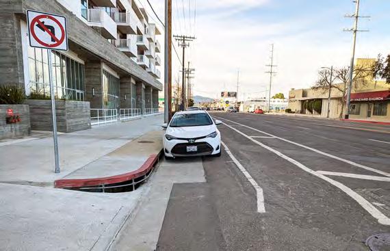
• Curb Ramp Design
• Alternatives Development
• Equity and Safety Analysis
• ADA Compliance Assessment
• Grant Funding
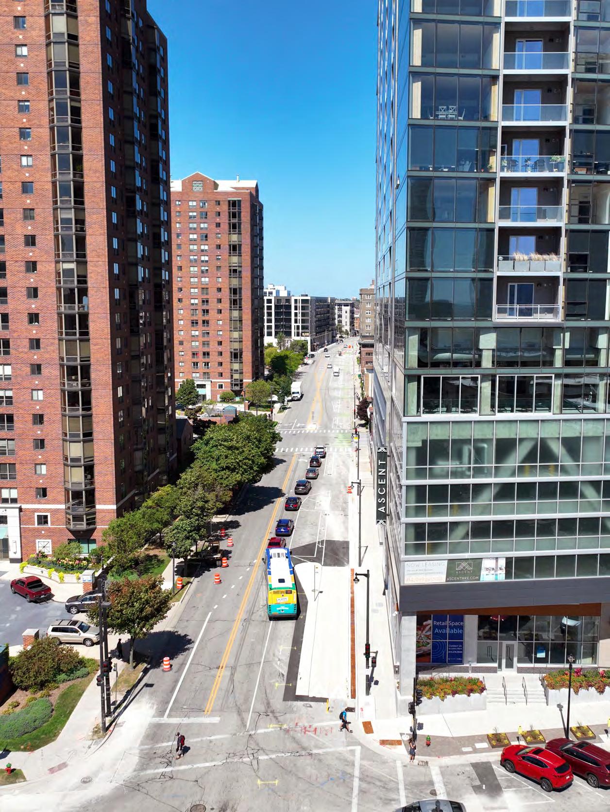
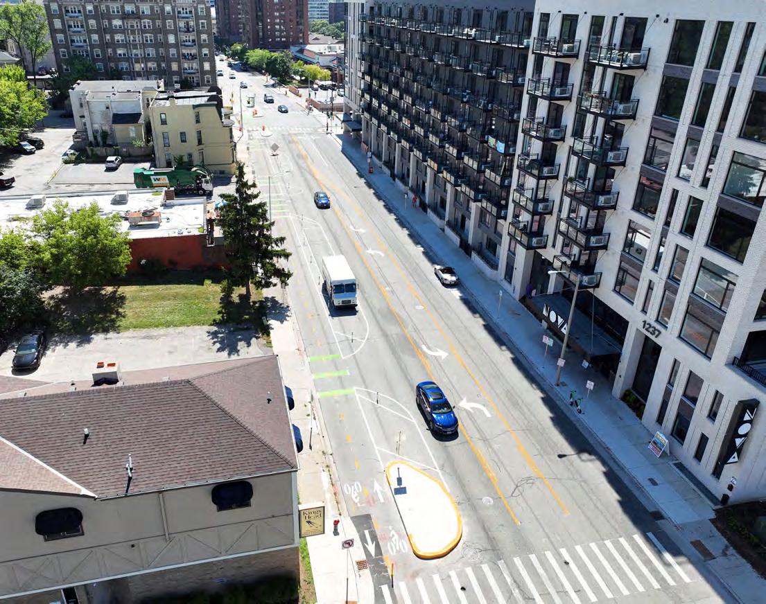
Milwaukee, WI
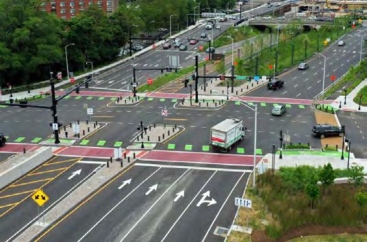
Van Buren Street crosses four Milwaukee neighborhoods and provides access to major employers, high-density multifamily residences and numerous public transportation routes. A quarter-mile urban stretch of the street is a critical north-south connection in downtown and on the city’s high-injury network.
As prime consultant and lead designer, HNTB is helping to redesign the street to create a safe, welcoming and vibrant corridor that supports existing land uses and economic development. Key elements of the project include:
• Improved walking, biking and transit accommodations
• Reduced motor vehicle speeds
• An all-ages and all-abilities bikeway
• Enhanced streetscape elements
• Green stormwater infrastructure best management practices and other landscaping
The project will create a unique bicycle experience in Milwaukee by providing a two-way cycle track and some of Milwaukee’s first floating bus islands. The design uses “pinned-on” protected bicycle infrastructure to maintain curb lines and reduce drainage impacts. And ultimately, the project will result in reduced crashes for all roadway users.
Haven, Connecticut
The Downtown Crossing New Haven initiative is transforming East New Haven’s Route 34, an urban renewal-era highway into a system of urban boulevards that will reconnect the downtown New Haven and the Hill neighborhoods.
The project will create welcoming streets designed for shared use by pedestrians, bicyclists and slowerspeed motor vehicle traffic. It also will include the first protected bike and pedestrian intersection in Connecticut.
HNTB was engaged to lead the design-build plan by the city of New Haven after the city was awarded competitive federal Transportation Investment
Generating Economic Recovery II (TIGER) grants from the U.S. Department of Transportation.
Key elements of the crossing include:
• Streetscape improvements
• Advanced signalization
• Traffic-calming measures to bolster walking and biking opportunities
A reconnection of Orange and Temple Streets to the network allowed over 10 acres of land to be redeveloped and strengthened the land use and economic growth in the downtown area.
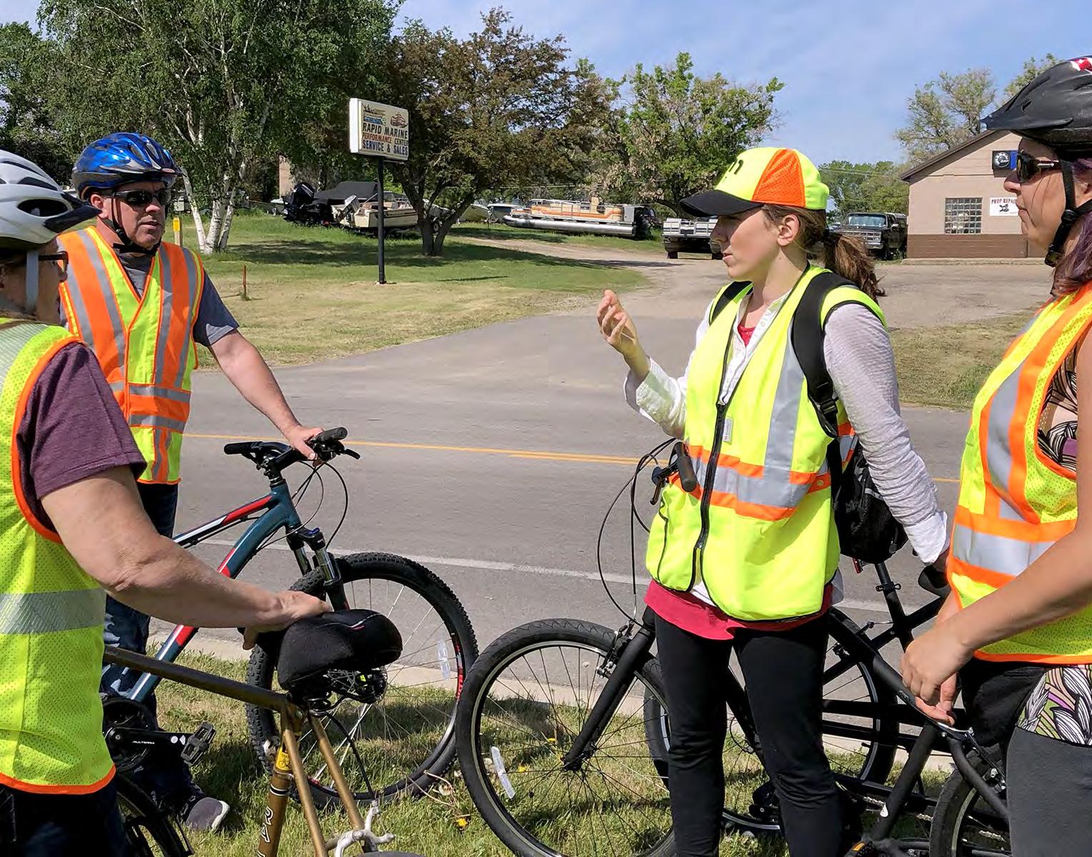
Minnesota
The Minnesota Department of Transportation has set out to plan, build, operate and maintain a safe, efficient and reliable multimodal transportation system statewide.
HNTB, in partnership with MnDOT, is conducting field scoping walks and rides to identify recommendations for the inclusion meaningful bicycle and pedestrian engineering solutions in MnDOT projects.
Utilizing a GIS-based spatial analysis tool, estimates of the demand for pedestrian and bicycle infrastructure in proximity to bus stops, schools, and communities with
limited access to automobiles can be projected and used in the selection and prioritization of projects. This then prompts a field walk to confirm the project need.
The long-term goal is to better position bicycle and pedestrian improvements for consideration in the development of projects, particularly those with additional costs. These improvements promote walking and biking and include improvements such as safety countermeasures, safer crossings, network completion and innovative treatments.
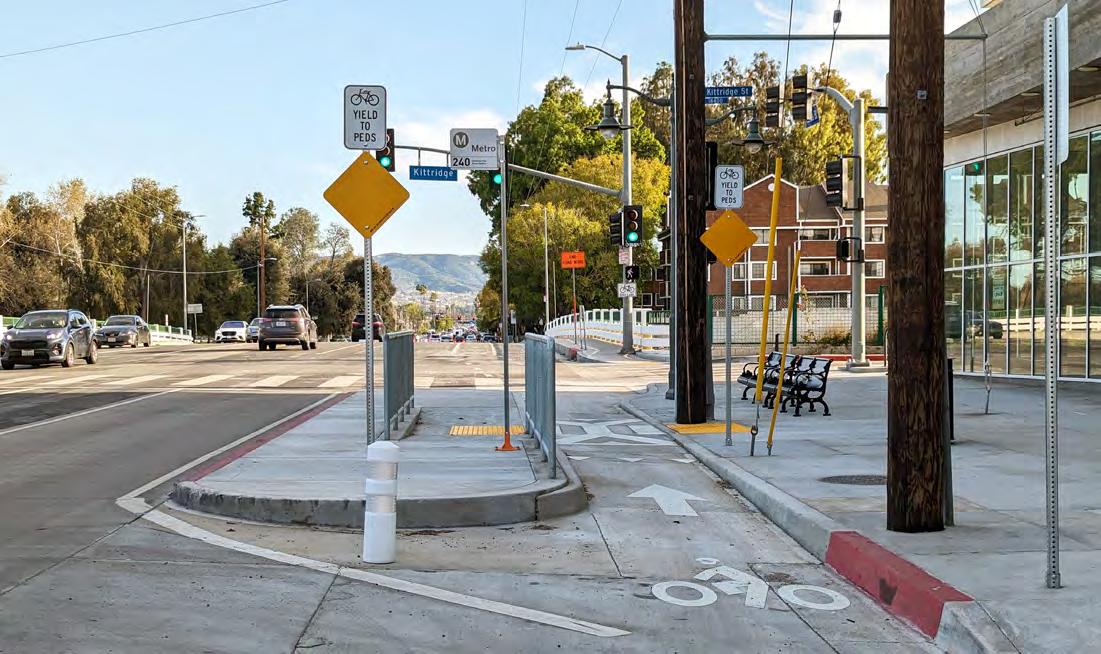
Angeles, California
Los Angeles’ Complete Streets Program is focused on a new holistic approach to street improvements. HNTB, alongside the city, is working to increase safety and accessibility for pedestrians and cyclists throughout major corridors.
The program combines several strategies to extend the service life of streets and sidewalks and enhance pedestrian and traffic safety, including:
• Pavement resurfacing
• Sidewalk repairs
• Curb ramp replacements for ADA compliance
• Concrete bus pads
• Street trees
• Vision Zero safety improvements
• Bus boarding islands
• Curb extensions
• Green street infrastructure
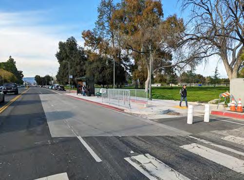
Leandro and Hayward, California
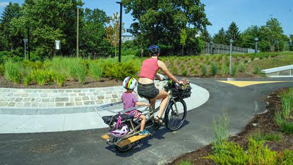
The East Bay Greenway Project is a major trail in the region’s bicycle and pedestrian plans that is ultimately envisioned to traverse north, central and south Alameda County from Contra Costa County to Santa Clara County, providing a critical walking and bicycling facility for transportation and recreation.
This 16-mile segment of the East Bay Greenway will ultimately replace an existing community barrier with a new multimodal corridor that improves quality of life while aiding regional connectivity and access to the BART commuter transit system. It also will help reduce traffic congestion while supporting community health and safe access to schools.
Phase 1 focuses on implementing near-term safety and multimodal access improvements in the project corridor in a three- to five-year horizon. A longer-term East Bay Greenway Urban Trail (Phase 2) project would implement a rail-to-trail facility and has a more than 10-year horizon.
Following the Union Pacific Railroad/BART right-ofway, the project requires close coordination with both agencies, in addition to the cities of Oakland, San Leandro and Hayward. HNTB is providing project management, transportation planning and urban design in support of alternatives development and evaluation, preliminary engineering and environmental documentation under CEQA and NEPA, preparation of grant applications, and preparation of 35% design plans. Under a separate contract, HNTB is performing final design of the Oakland segment.
The project seeks to:
• Improve cyclist and pedestrian network connectivity in communities along the BART line, including Equity Priority Communities.
• Improve access to regional transit, schools, affordable housing, commercial districts and other destinations.
• Create a facility that is accessible and comfortable for bicyclists and pedestrians of all ages and abilities.
• Improve safety for bicyclists and pedestrians.
• Support promotion of a multimodal transportation system and improved air quality.
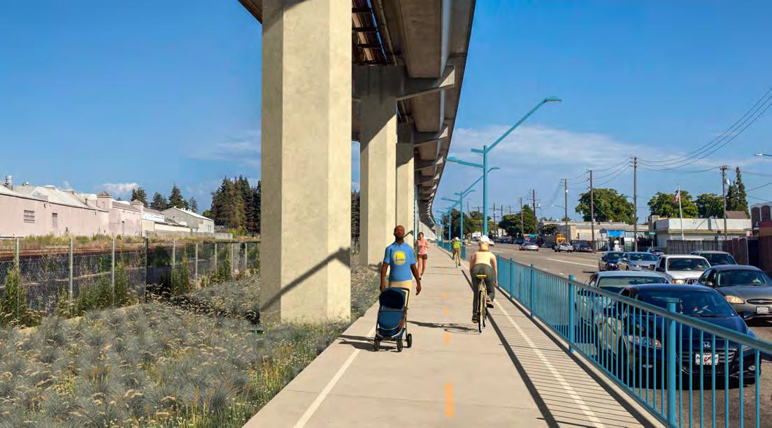
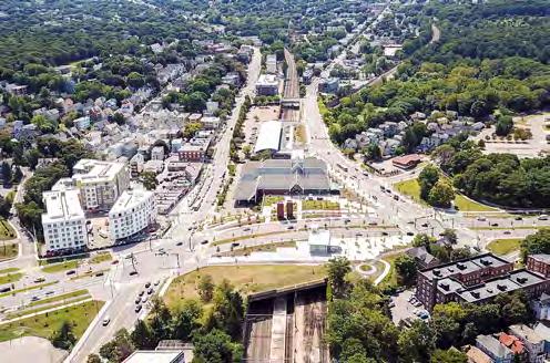
Boston, Massachusetts
This project designed by HNTB demolished the nearly 70-year-old William J. Casey overpass and in its place created an at-grade solution that dramatically transformed the Forest Hills neighborhood in Jamaica Plain. Multiple transit hubs were expanded and improved, above ground and below. A subway platform was extended and updated and a new headhouse built, creating safer access points and space for other uses, and intersections were redesigned to facilitate more efficient traffic flow.
Nearly seven miles of new bicycle and pedestrian paths, including one of the first bike-abouts in the country, provide an accessible, continuous path for commuters from neighborhoods south of Forest Hills to downtown Boston. A busway was relocated and expanded, and
route locations, pickup and drop-off points were consolidated, eliminating traffic backups in surrounding neighborhoods. A tunnel that served multiple rail lines received new drainage and emergency ventilation systems. Over 500 trees were also planted, investing long-term in the Arborway.
The project also reconnected a link in the Frederick Law Olmsted-designed Emerald Necklace, a series of six parks connected by greenways and waterways. As a result, Casey Arborway:
• Reconnected Boston’s historic Emerald Necklace
• Improved and expanded multiple transit modes
• Created new and safer pedestrian and bicycle pathways
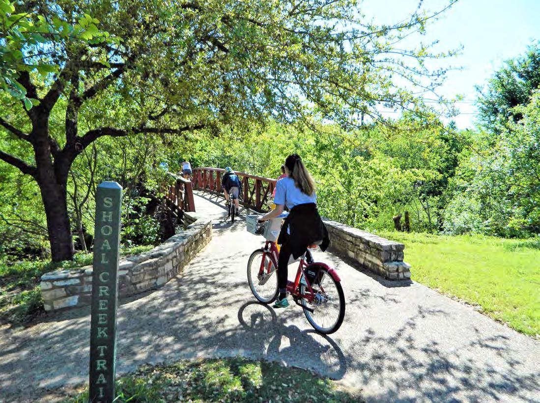
Austin, Texas
The existing Shoal Creek Trail is four miles long and runs along Shoal Creek between Lady Bird Lake to 38th Street. The trail links parks, municipal facilities and medical centers including the Austin Central Library, Pease Park, House Park and Seton Medical Center.
HNTB provided design and construction administration services for the reconstruction of approximately 800 feet of trail along Shoal Creek to fill a gap that existed in the system for over 30 years, between West 4th and 5th Streets.
The multidisciplinary team performed analyses of environmental impacts and floodplain, prepared vertical and horizontal alignment of the trail, designed soil stabilization and retaining walls, designed and located a
pedestrian bridge that spans the creek ensuring compliance with all permitting and other environmental requirements.
The landscape architecture staff created visioning renderings to communicate design concepts and applied context-sensitive design solutions to blend the new trail, lighting and pedestrian bridges into the natural landscape.
Design challenges that were overcome included large grade differentials within the bank of the creek and designing the trail to protect both sensitive environmental features within the floodplain and adjacent private property while stabilizing the bank and spatially locating the trail.