4 The Trail in Detail
This section details the proposed route of the Wimmera River Discovery Trail between Dimboola Common and Four Mile Beach. The route is broken into seven parts to aid the description of works and facilitate the identification of works packages.
4.1 DIMBOOLA TO LOCHIEL REST AREA
4.1.1 Route
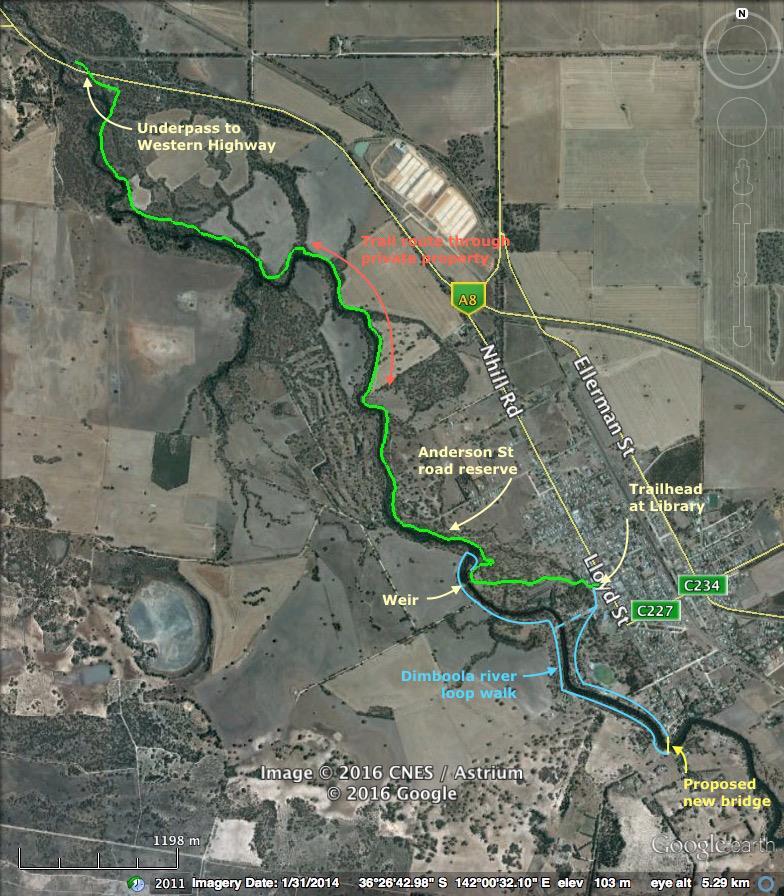
This section of the trail commences a trail head located near the Dimboola Library. This allows for parking and there are public toilets in this location.
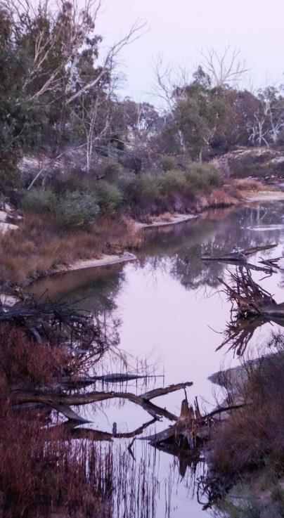
This section is proposed to be integrated with the river loop walks adjacent to Dimboola town These walks will be enhanced by the construction of a new pedestrian bridge over the river on the southern end of the town. The loop walks utilise the existing tracks in Dimboola common and through the caravan park. They will also use the boardwalk and river crossing below the weir.
From near the Dimboola Weir, there is the option of the main trail using part of the existing boardwalk, with a branch crossing the side billabong and connecting with the existing tracks on the Anderson St road reserve. Alternatively the main trail could follow one of the existing tracks in the area.
The main trail then follows a series of vehicle tracks on the eastern side of the Wimmera River to an underpass beneath the Western Highway and then a road into the Lochiel Rest Area.
Existing trails and roads are continuous and often multiple for much of this sector, with one important gap where private tenure crosses the river (ie. no river reserve) about 2km north of Dimboola (Wimmera St).
4.1.2 Length
Approx. 3.2 km
4.1.3 Environment & terrain
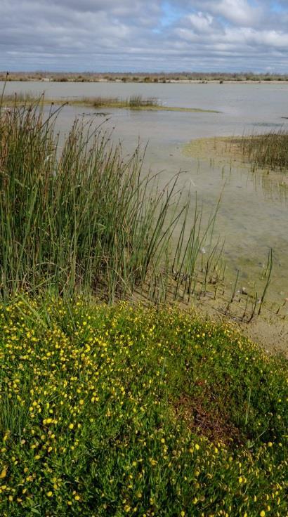
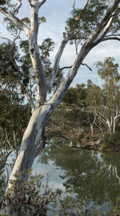
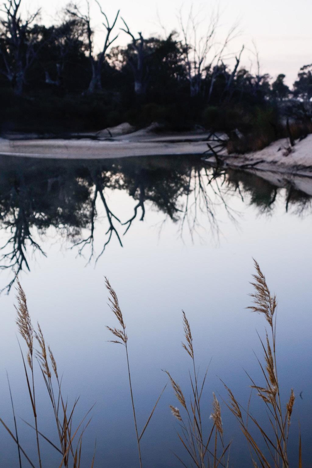
The terrain is flat, on the Wimmera River floodplain. Vegetation is alluvial floodplain woodland dominated by Black Box and River Red Gum close to the river, with some Murray Pine. It is partially disturbed. The vegetation/reserve corridor on the eastern side of the river varies from effectively nil (riverside trees only) to c.300m in width.
Substrate is mostly firm alluvial clay, with short sections of sand and clay prone to becoming boggy.
The river is in discontinuous pools, with mostly only short dry gaps.
4.1.4 Tenure
The initial section (Dimboola Common through to Faith St) passes through a combination of Wimmera River HAP and road reserves. This section of the Wimmera River HAP appears to be managed by DELWP in conjunction with Council.
Most of the remainder of this section traverses Wimmera River HAP managed by Parks Victoria.
There is a section of private land about 2km north of Dimboola (owned by a Mr Brad Miles (03) 53891196). The owner has apparently indicated a willingness to discuss a proposal to establish the trail along the riverbank across his land.
The Western Highway and Lochiel Rest Area lands are managed by Vic Roads and establishing the trail through this area will require their approval.
4.1.5 Public access
Public access to the river corridor is available on a number of public roads, here listed south to north:
Old Weir Lane (Dimboola)
Normanby St (Dimboola)
Anderson St (Dimboola)
Faith St
Swallows Lane
Howland St
Western Highway
4.1.6 Accommodation
There are various accommodation options in Dimboola, including cabins/camping at Dimboola Caravan Park adjacent to the trail route, motels and hotels.
Toilets are available in Dimboola and at Lochiel Rest Area.
There is no need for any camping or other trail facilities along this section of the route.
4.1.7 Existing facilities
Dimboola caravan park (Hindmarsh Shire Council): camping, cabins, associated facilities
Dimboola Common/Nine Creeks Reserve (HSC): parking, walking/cycling tracks, picnic shelters, electric BBQs, picnic tables, interpretation signs, information signs (no toilets), wetlands boardwalk
Dimboola township: various accommodation, shopping, laundromat, post office, etc
Lochiel Rest Area: large sealed area, parking, toilet block, picnic shelter, picnic tables, monument, Dimboola info sign
4.1.8 Features of interest
Dimboola Common, interpretive signs and canoe tree
Dimboola Weir
4.1.9 Cultural heritage sites
There is a shell midden recorded along this section of the route. Its location will need to be identified on the ground and the trail routed to avoid any disturbance. It is unlikely this type of site could be readily presented as an interpretive feature however this would be subject to discussions with the Barengi Gadjin Land Council.
4.1.10 Route issues and recreational experience
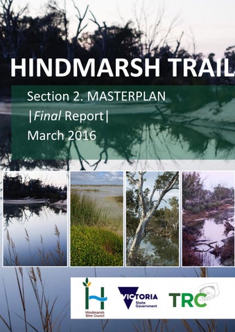
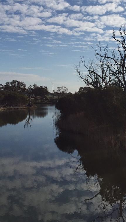
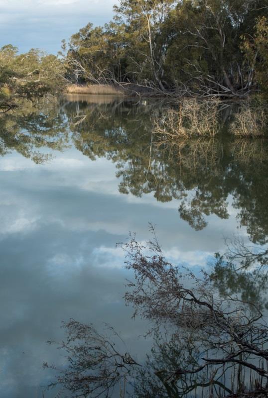
The walking/cycling experience is potentially quite pleasant, with almost continuous water in the Wimmera River being part of the attraction.
The whole length of this sector is impacted by off-road vehicles and trail proliferation, including the Dimboola Common track system. There is also evidence of shooting, firewood collection and informal camping. Trails follow paddock boundary fence lines and the experience would be enhanced by relocating the trail closer to the river where possible.
It is not possible to cross the river to avoid the private land as the private tenure also extends for some distance west of the river. Further, a potential riverside trail route through the private land would involve a section where the bushland corridor is very narrow, restricted in part to a line of trees on the river bank. (Note that the private land was not traversed or directly assessed on the ground for this assessment.)
The Dimboola Common track system is complex and poorly signposted in places, and hence quite confusing for visitors unfamiliar with it.
There is an opportunity to integrate the trail with sections of the existing Dimboola boardwalk and this should be considered in the detailed design process.
It will be necessary to construct a track under the highway underpass.
Riverside vehicle tracks are often multiple and these will need to be rationalised to optimise for experience and durability.
The trail will be subject to periodic flooding and repairs will be required following these events.
4.1.11 Trail establishment works
This section summarises the required works along the route from south to north, and should be read in conjunction with the trail design and construction prescriptions and interpretive and information signage sections of this Masterplan.
Trailhead signage should be located either on the wall of the Dimboola Library building or in the carpark at the rear of the Library. A directional sign should also be located in Lloyd St to direct people to the trailhead.
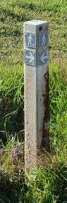
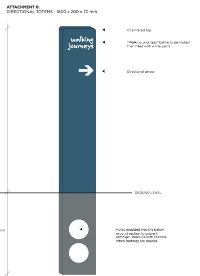
The route generally should be marked with totem style signs every 300m or wherever there is a change of direction if the trail route is unclear.
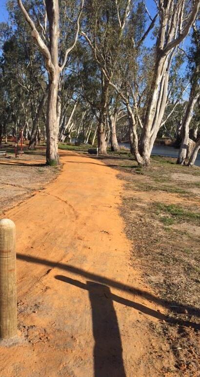
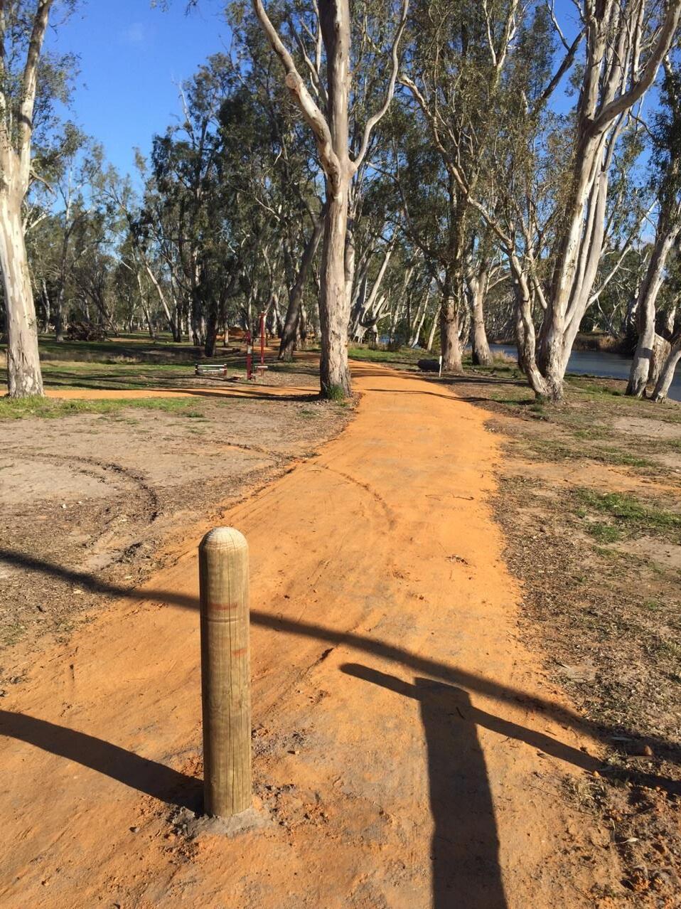
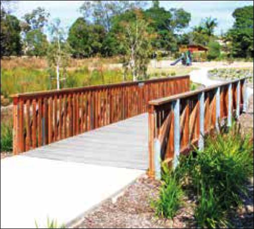
Within Dimboola Common the existing constructed trail is to be extended to form a continuous path from the Lochiel St to the Weir. These should be constructed to the same standard as existing trails in the Common using the local compacted gravel base, to a minimum of 2 metres wide. Vehicle barriers are required to prevent vehicles driving on this section of the trail.
From the weir the trail route follows an existing informal vehicle track and this will generally need little construction work apart from filling and drainage of some areas prone to becoming wet and boggy. This will largely be handwork with some machine work required.
Detailed survey of the route should consider the option of using the wetlands boardwalk for the trail and bridging the billabong to connect with the existing tracks on the Anderson St road reserve. This would involve an additional prefabricated bridge.
Trail markers will need to be installed in the area approximately 500m north of the weir where the trail is adjacent to the road reserve (extension of Anderson St) where there are multiple tracks and vehicle barriers should be installed to separate vehicles and trail users in this area.
A new section of trail will need to be constructed through the private property approximately 2 kms north of the weir and extending for approximately 1.2 km. This will need to be carefully located in consultation with the landowner as there is little space between the ploughed paddock and the riverbank. It may be appropriate to construct this section with a gravel roadbase to ensure stability and correct drainage to minimise risk liability for the landowner.
Part way through this section is a side creek and this may need to be bridged.
The underpass on the Western Highway should be stabilised with a concrete or similar sealed path on the eastern side of the underpass and this seal continued for approximately 20m either side of the road. This will ensure this area remains passable in most conditions and will minimise maintenance adjacent to the road. This path should be a minimum of 1m wide and preferably 2 metres wide. The detailed design will need to be agreed with Vic Roads.
A trailhead information sign should be established in the Lochiel Rest Area.
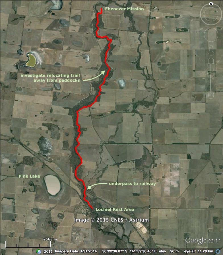
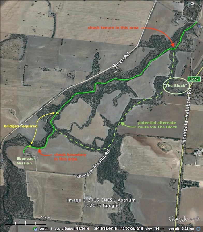
TO EBENEZER MISSION ROAD
4.2 LOCHIEL REST AREA
4.2.1 Route
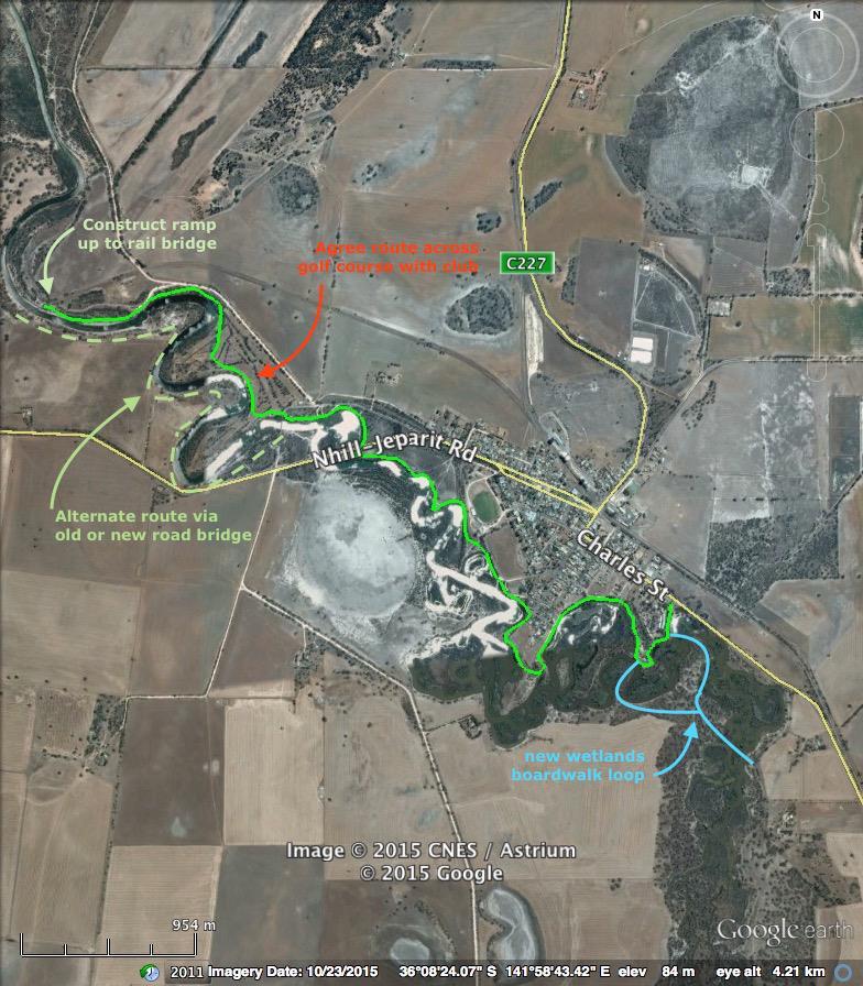
From the northern end of the sealed Lochiel Rest Area, the route follows an old road to pass under the railway, then existing vehicle tracks along the eastern side of the river to join Five Chain Road and follow it to Wundersitz Crossing on the Wimmera River (low level concrete ford).
From Wundersitz Crossing the route could again follow existing vehicle tracks along the eastern side of the river to Spears Crossing Road (low level gravel ford over river) and then on to a track running up to Ebenezer Mission Road and along the last section of that road to the Mission.
4.2.2 Length
Approx. 15 km
4.2.3 Environment & terrain
Terrain is flat, on the Wimmera River floodplain. Vegetation is alluvial floodplain woodland dominated by Black Box and River Red Gum close to the river, partially disturbed. The woodland corridor on the eastern side of the river varies from 600m in width to effectively nil (riverside trees only). Some of this woodland lies outside the boundary of the Wimmera River HAP.
Substrate is mostly firm alluvial clay, with short sections of sand and clay prone to becoming boggy.
The river is in discontinuous pools, with mostly only short dry gaps up to c.200m in length.
There are a number of side creeks and these form steep gullies that require cyclists to dismount in order to cross them safely.
4.2.4 Tenure
The route lies almost entirely within the Wimmera River HAP, with the exception of the area at Lochiel Rest Area and the crossing under the rail line and the proposed use and construction within these areas will require relevant approvals from Vic Roads and Vic Track.
There are also two small segments at Collard Road and Spears Crossing Road, as well as a short section of Ebenezer Mission Road all of which are road reserves under the management of Council.
4.2.5 Public access
Public access to the river corridor is available on a number of public roads, here listed south to north:
Lochiel Rest Area
Five Chain Road
Collard Road
Spears Crossing Road
Ebenezer Mission Road
4.2.6 Accommodation
There are many possible locations for en route campsites but these are unlikely to be needed in this section.
Accommodation is available in Dimboola and potentially at The Block north of Ebenezer.
4.2.7 Existing facilities
Lochiel Rest Area: large sealed area, parking, toilet block, picnic shelter, picnic tables, monument, Dimboola info sign
4.2.8 Features of interest
Pink Lake (Lake Reserve) is less than 2 km west of the railway underpass on the proposed route. This major scenic feature has a rest area and lookout off the Western Highway and a walking track to the lakeshore. It can be reached from the proposed trail but requires crossing the Western Highway and travelling along it for approximately 2.2km from Lochiel Rest Area, although some of that distance could be covered along River Road
4.2.9 Cultural heritage sites
There are numerous scar trees along this section of the route, as well as some artefact scatters and a shell midden. These should be managed consistent with the mitigation measures identified in Table 1 and consideration given to on-trail interpretation in close consultation with the Barengi Gadjin Land Council.
Ebenezer Mission is listed on the Register of the National Estate as well as State and local Government heritage registers and trail works near the Mission will need to consider the potential presence of artefacts, and burials, beyond the boundary of the current site. The Mission should be interpreted in conjunction with the Barengi Gadjin Land Council.
4.2.10 Route issues and recreational experience
The walking/cycling experience is potentially quite pleasant, with frequent water in the Wimmera River and the continuous and fairly wide reserve corridor giving a feeling of relative remoteness when in the wider sections out of sight of cleared land.
The whole length of this sector is impacted by off-road vehicles and trail proliferation, including evidence of shooting, firewood collection and informal camping.
There is one section where the trail follows the paddock boundary fence lines and there is potential to relocate it closer to the river in a more attractive setting to enhance the trail experience. A detailed assessment of the benefits and costs of this will be required as part of detailed project planning.
Consideration should be given to vehicle barriers to prevent 4WD and trail bike access to at least some sections of the route, subject to community consultation and acceptance of this separation. This is important for improving the walking and cycling experience to a standard expected by users of these trails.
It will be necessary to construct a track under the rail underpass.
The trail will be subject to periodic flooding and repairs will be required following these events.
4.2.11 Trail establishment works
This section summarises the required works along the route from south to north, and should be read in conjunction with the trail design and construction prescriptions and interpretive and information signage sections of this Masterplan.
A trailhead information sign should be established in the Lochiel Rest Area.
The route generally should be marked with totem style signs every 300m or wherever there is a change of direction if the trail route is unclear.
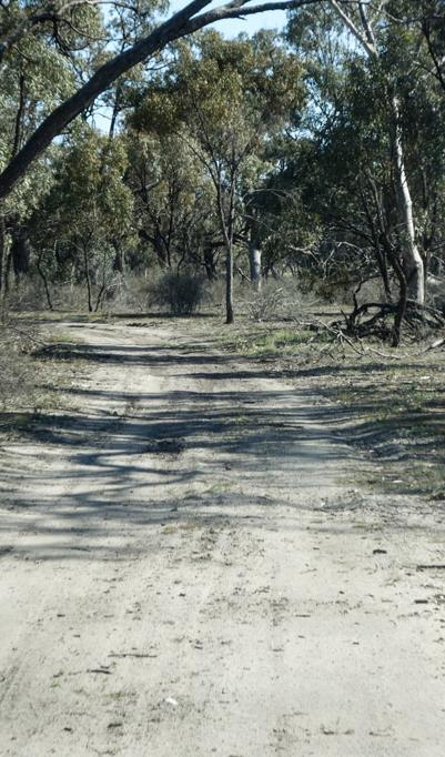
The trail route follows an existing informal vehicle track and this will generally need little construction work apart from filling and drainage of some areas prone to becoming wet and boggy. This will largely be handwork with some machine work required.
There are some sandy sections that will either need to be avoided by rerouting the trail or will need stabilising by introducing a compacted local gravel surface similar to that used in Dimboola Common. Where constructed these tracks should be 2 metres in width.
The underpass on the rail line should be stabilised with a concrete or similar sealed path and this seal continued for approximately 20m either side of the rail line. This will ensure this area remains passable in most conditions and will minimise maintenance adjacent to the railway. This path should be a minimum of 1m wide and preferably 2 metres wide. The detailed design will need to be agreed with Vic Track.
Trail markers will need to be installed where the trail enters and departs Collard and Spears Crossing Roads and at Ebenezer Road to ensure trail users follow the correct route.
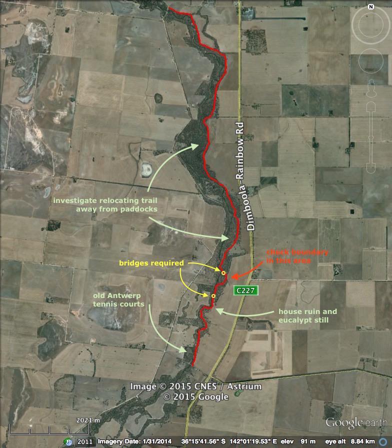
A section of the trail in the area between Collard Road and Spears Crossing Road about 8kms north of the Lochiel Rest Area could be improved by relocating the trail closer to the river and away from houses and farmland. This may require the installation of bridges to cross anabranches of the river.
Vehicle barriers to prevent 4WD and trail bike access will need to be installed but this is subject to community consultation and acceptance of this separation.
Information about the trail should be incorporated into information and interpretive signs at Ebenezer Mission.
4.3 EBENEZER MISSION ROAD TO ANTWERP-WOORAK ROAD
4.3.1 Route
The route will commence at Ebenezer Mission and travel direct to the river via the closed and revegetated road reserve to the north of the Mission.
The route then follows the eastern side of the Wimmera River. The first section of approximately 3 kms has no existing tracks. Beyond that point the trail follows existing vehicle tracks.
Land owned by the Barengi Gadjin Land Council adjacent to the Antwerp Cemetery (The Block) is being considered as a potential site for tourist accommodation. If this were to occur, the trail, or a separate linking trail, could be constructed linking to this land from the main river corridor. This could occur either following an anabranch within the Wimmera River HAP, or by crossing private land along existing vehicle tracks, subject to the agreement of the landowner.
4.3.2 Length
Approx. 5.1 km
4.3.3 Environment & terrain
The terrain is flat, on the Wimmera River floodplain. Vegetation is alluvial floodplain woodland dominated by Black Box and River Red Gum close to the river, partially disturbed. The woodland corridor on the eastern side of the river varies from 250m in width to effectively nil (riverside trees only).
Parts of the Wimmera River HAP, especially near Ebenezer Mission, appear to have been encroached upon with ploughed paddocks.
Substrate is mostly firm alluvial clay, with short sections of sand and clay prone to becoming boggy.
The river holds almost continuous water, with several dry gaps up to c.150m in length.
There are a number of side creeks and these form steep gullies that require cyclists to dismount in order to cross them safely.
4.3.4 Tenure
The route lies almost entirely on the Wimmera River HAP, with the exception of one small segment c.500m south-west of the Antwerp-Woorak Road. This appears to be a road reserve however this needs to be confirmed through survey.
A section of the route about 300m in length north of Ebenezer Mission Church has been cleared and ploughed to the river bank, and thus appears to be private land. Tenure data available online indicates a more extensive river corridor and this should be confirmed through survey.
4.3.5 Public access
Public access to the river corridor is available only at either end of this section:
Ebenezer Mission Road
Antwerp-Woorak Road
4.3.6 Accommodation
There are many possible locations for en route campsites but these are unlikely to be needed in this section. There is potential for tourist accommodation to be developed by the Barengi Gadjin Land Council on the land adjacent to the Antwerp Cemetery (The Block) and this should be the focus for any overnight stay along this section of the trail.
Accommodation is also available in Dimboola and Jeparit.
4.3.7 Existing facilities
There are no existing facilities along this section of the trail.
4.3.8 Features of interest
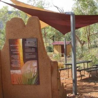
Ebenezer Church and old Mission site is an outstanding heritage site and important for both Aboriginal and European history. There is potential for a major interpretive and guided experience at this location with associated services including toilets.
4.3.9 Cultural heritage sites
There are numerous scar trees along this section of the route, as well as a number of artefact scatters along the potential alternate route following the anabranch to the ‘The Block’ at Antwerp. These should be managed consistent with the mitigation measures identified in Table 1 and consideration given to ontrail interpretation in close consultation with the Barengi Gadjin Land Council.
There is a restricted Indigenous Place listed on the Australian Heritage Database in Antwerp. Advice should be sought from Barengi Gadjin Land Council to ensure this place is appropriately managed through the design and construction of the trail.
Antwerp Reserve (‘The Block’) adjacent to Antwerp Cemetery is listed on the Victorian Heritage inventory and trail works near the site will need to consider the potential presence of artefacts.
4.3.10 Route issues and recreational experience
The walking/cycling experience is potentially quite pleasant in this section as there is limited vehicle access and therefore the area is less impacted by off-road vehicles, trail proliferation, shooting, firewood collection and informal camping.
There is semi-continuous water in the Wimmera River and an anabranch system to the east of the main river corridor adds interest. Despite this there are many areas where the trail is close to the cleared paddocks, particularly just north of Ebenezer where there may be an encroachment into the Wimmera River HAP. Subject to the results of the survey this area may be able to be revegetated to improve the trail experience.
The section immediately north of Ebenezer lacks any existing trails, but the grassy surface is easily traversed either on foot or mountain bike. This trail-less section ends at a steep gully cutting across the floodplain to the river, where the Wimmera River HAP bifurcates to follow both the river and an anabranch. The anabranch gully north-east of the Ebenezer Mission Church can be crossed easily on foot (carrying a bike if necessary) however a bridge (about 10 metres long) is required to maintain a rideable standard along the whole route
There is potential to route the trail along the anabranch, or provide linking trails to the potential future tourism development at The Block adjacent to Antwerp Cemetery. The likelihood of this development occurring should be considered before detailed design of this section of the route is finalised to ensure these links can be readily added or incorporated as appropriate. At least two bridges will be required to cross the anabranch however their exact location will be dependent on the detailed route selection.
Where the Wimmera River HAP bifurcates at the downstream (northern) end of the anabranch, there is a 40m wide gap in the HAP. This is presumed to be a road reserve.
Consideration should be given to vehicle barriers to prevent 4WD and trail bike access to the northern sections of the route, subject to community consultation and acceptance of this separation. This is important for improving the walking and cycling experience to a standard expected by users of these trails.
The trail will be subject to periodic flooding and repairs will be required following these events.
4.3.11 Trail establishment works
This section summarises the required works along the route from south to north, and should be read in conjunction with the trail design and construction prescriptions and interpretive and information signage sections of this Masterplan.
Information about the trail should be incorporated into information and interpretive signs at Ebenezer Mission.
The route generally should be marked with totem style signs every 300m or wherever there is a change of direction if the trail route is unclear.
The first part of the trail does not follow any existing track and subject to careful alignment most of this should be able to be established using hand tools. The exact location of the first section will be subject to the outcome of the boundary survey in this area.
There are two gullies that should be bridged to improve the riding experience, one just north of Ebenezer and another about 1.8km south of the Antwerp Bridge. These gullies appear to be quite active and the design of headwalls for these bridges should take this into account.
The trail route then follows an existing informal vehicle track and this will generally need little construction work apart from filling and drainage of some areas prone to becoming wet and boggy. This will largely be handwork with some machine work required.
There are some sandy sections that will either need to be avoided by rerouting the trail or will need stabilising by introducing a compacted local gravel surface similar to that used in Dimboola Common. Where constructed these tracks should be 2 metres in width.
Vehicle barriers to prevent 4WD and trail bike access will need to be installed but this is subject to community consultation and acceptance of this separation.
4.4
ANTWERP-WOORAK ROAD TO TARRANYURK WEST ROAD
4.4.1 Route
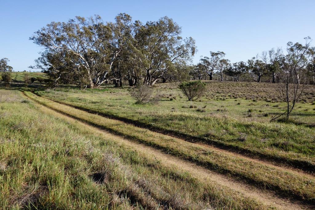
The route again follows the eastern side of the Wimmera River, mostly along existing tracks with one gap with washed-out gullies.
4.4.2 Length
Approx. 11.8 km
4.4.3 Environment & terrain
Terrain is flat, on the Wimmera River floodplain. Vegetation is alluvial floodplain woodland dominated by Black Box and River Red Gum close to the river, partially disturbed. The woodland corridor on the eastern side of the river varies from nil (riverside trees only) to about 600m in width. Most of this woodland is within the Wimmera River HAP.
Substrate is mostly firm alluvial clay, with short sections of sand and clay prone to becoming boggy. The river holds intermittent water, with many dry gaps up to c.300m in length.
4.4.4 Tenure
The route lies almost entirely on the Wimmera River HAP, except for a section of trail west of Stony Crossing Road near the old Antwerp Weir that passes out of the HAP but remains within the remnant woodland and west of the bounding fenceline. Tenure of this area should be checked and the trail route adjusted to remain within the Wimmera River HAP.
4.4.5 Public vehicle access
Public vehicle access to the river corridor is available at either end of this section:
Antwerp-Woorak Road
Tarranyurk West Road
There also appears to be a road reserve that reaches the river reserve from the east, about two river kilometres south of the Tarranyurk West Road. This road reserve leaves the Dimboola-Rainbow Road 1.2 km south of its junction with the Tarranyurk West Road. The apparent road reserve has an informal vehicle track, tree plantings and a temporary fence across it where it joins the river reserve.
4.4.6 Accommodation
There are several possible options for en route campsites, including the old Antwerp tennis courts on the western side of the river at the Antwerp – Woorak Road crossing. This area has mains power, tank water and a disused septic toilet block. This site is approximately half way along this section of the trail between Dimboola and Lake Hindmarsh and would provide an opportunity to break the trip into two c. 30 km parts.
Establishing a campsite at this location should only be considered if the potential development at The Block is not proceeding.
Accommodation is also available in Dimboola and Jeparit.
4.4.7 Existing facilities
Apart from the old Antwerp tennis courts there are no existing facilities along this section of the trail.
4.4.8 Features of interest
Old Antwerp Road bridge: heritage item, partially collapsed beside new bridge
Old Antwerp tennis courts: possible site for campsite facility
Historic eucalypt still and building: c.2.2 km north of Antwerp-Wakook Road, building is on private land over fence
Antwerp Weir: heritage item, disused timber structure
4.4.9
Cultural heritage sites
There are a number of scar trees and artefact scatters along this section of the route. These should be managed consistent with the mitigation measures identified in Table 1 and consideration given to on-trail interpretation in close consultation with the Barengi Gadjin Land Council.
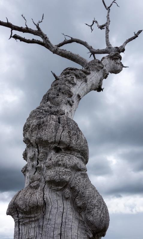
The Eucalypt still is listed on the Victorian Heritage inventory and should be interpreted on site.
4.4.10
Route issues and recreational experience
The walking/cycling experience along this section is potentially quite pleasant, with frequent water in the Wimmera River and some short sections with a feeling of relative remoteness (when in alluvial woodland out of sight of cleared land/paddocks). This section also has several items of cultural heritage interest.
Some parts of the route have limited vehicle access and therefore are less impacted by off-road vehicles, trail proliferation, shooting, firewood collection and informal camping. Consideration should be given to vehicle barriers to prevent 4WD and trail bike access to at least some sections of the route, subject to community consultation and acceptance of this separation. This is important for improving the walking and cycling experience to a standard expected by users of these trails.
There are some sections where the trail follows the paddock boundary fence lines and relocating the trail closer to the river in a more attractive setting to enhance the experience A detailed assessment of the benefits and costs of this will be required as part of detailed project planning.
There are two washed out gullies that will need to be bridged (approx 10 metre) to provide a consistent cycling experience.
The trail will be subject to periodic flooding and repairs will be required following these events.
4.4.11 Trail establishment works
This section summarises the required works along the route from south to north, and should be read in conjunction with the trail design and construction prescriptions and interpretive and information signage sections of this Masterplan.
The route generally should be marked with totem style signs every 300m or wherever there is a change of direction if the trail route is unclear.
Information about the trail should be incorporated into information and interpretive signs at the historic eucalypt still and the old Antwerp Weir. If a campsite is developed at the old Antwerp tennis courts then trail information and interpretive signs should also be established at this site.
The trail route generally follows an existing informal vehicle track and this will generally need little construction work apart from filling and drainage of some areas prone to becoming wet and boggy. This will largely be handwork with some machine work required.
There are some sandy sections that will either need to be avoided by rerouting the trail or will need stabilising by introducing a compacted local gravel surface similar to that used in Dimboola Common. Where constructed these tracks should be 2 metres in width.
Detailed survey of the route should consider re-routing of the trail in two locations approximately 3kms and 4.5kms north of the Antwerp Bridge. In these locations there is potential to improve the experience by relocating the trail closer to the river and away from houses and farmland. This may require the installation of bridges to cross anabranches or gullies.
Vehicle barriers to prevent 4WD and trail bike access will need to be installed but this is subject to community consultation and acceptance of this separation.
Two larger bridges will be required to cross major gullies.
4.5 TARRANYURK WEST ROAD TO JEPARIT PIONEER MUSEUM
4.5.1 Route
The route follows the eastern side of the Wimmera River and runs mostly along existing tracks
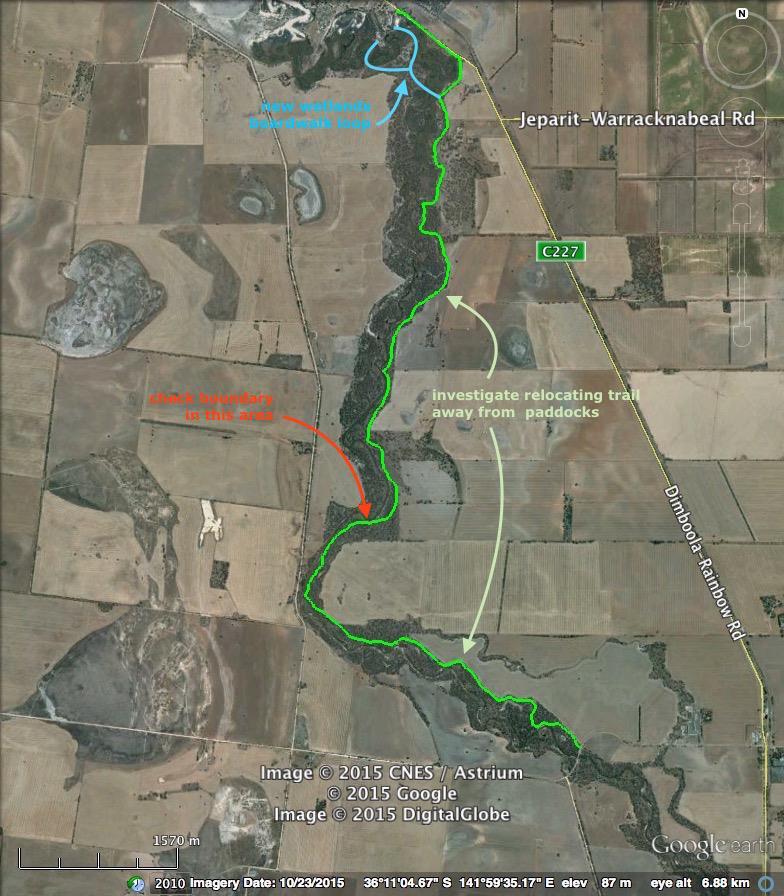
There is a short final section that follows the sealed Dimboola-Rainbow Road however this will be avoided when the proposed Jeparit Wetland Boardwalk is constructed.
This boardwalk could be integrated with both the existing Edward John Eyre Heritage River Walk and the Wimmera River Discovery Trail. This would provide both a short loop walk through this fairly undisturbed and interesting section of the river as well as a shorter and more attractive route for the long distance trail.
4.5.2 Length
Approx. 11.4 km
4.5.3 Environment & terrain
The terrain is flat, on the Wimmera River floodplain. Vegetation is alluvial floodplain woodland, partially disturbed and dominated by Black Box and River Red Gum (scarce in this section) close to the river. The woodland corridor on the eastern side of the river varies from nil (riverside trees only) to about 600m in width. Most of this woodland is within the Wimmera River HAP.
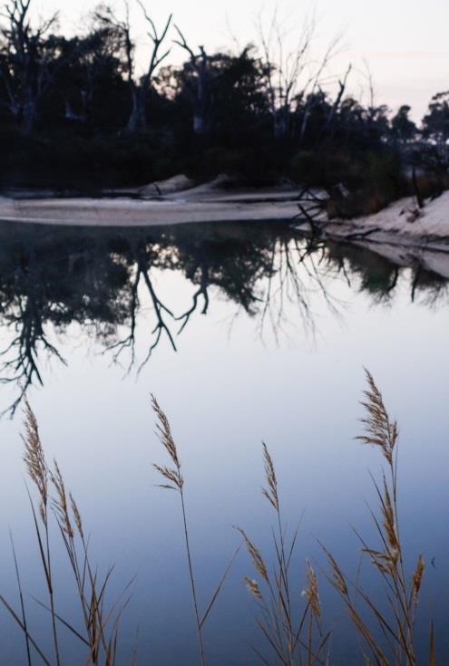
A number of billabongs and anabranches occur on the floodplain.
Substrate is mostly firm alluvial clay, with short sections of sand and clay prone to becoming boggy.
The river is almost continuous water, with occasional dry gaps in the southern part up to c.200m in length. For much of its length, the river lies within a deep channel with steep earth banks and is difficult to access. Towards the northern end of the sector the river breaks into several water-filled channels and billabongs – the Jeparit wetlands.
4.5.4 Tenure
The route lies almost entirely on the Wimmera River HAP, except for a c.500m long section c.4 kms north of the Tarranyurk West Road. Here the WRHAP is narrow and very close to the river, while the woodland corridor (containing the main trail) extends to the east into what is apparently private land. Tenure of this area should be checked and the trail route adjusted to remain within the Wimmera River HAP.
If the trail joins the Dimboola-Rainbow Road for the final 600m before the Pioneer Museum, an appropriate consent will be required from the responsible authority (either Vic Roads or Council).
4.5.5 Public vehicle access
Public vehicle access to the river corridor is available at either end of this section:
Tarranyurk West Road
Dimboola-Rainbow Road
There also appears to be a road reserve that reaches the river reserve from the east off the DimboolaRainbow Road approximately 1.2 km south of the Jeparit-Warracknabeal Road.
4.5.6 Accommodation
There are many possible locations for enroute campsites but these are unlikely to be needed in this section.
Accommodation is available in Jeparit.
4.5.7 Existing facilities
Jeparit Pioneer Museum: museum, outdoor display, shop, water, information signs, toilets, picnic facilities.
4.5.8 Features of interest
Old Tarranyurk West Road bridge: heritage item, partially collapsed beside new bridge.
Jeparit wetlands
Jeparit Pioneer Museum and associated facilities.
4.5.9 Cultural heritage sites
There are a number of scar trees and artefact scatters and a shell midden along this section of the route. These should be managed consistent with the mitigation measures identified in Table 1 and consideration given to on-trail interpretation in close consultation with the Barengi Gadjin Land Council.
The old timber bridge at Tarranyurk is listed in the Victorian Heritage Inventory and should be interpreted on site.
The Jeparit Pioneer Museum is listed on the Australian Heritage Database as well as local heritage listings. It should be promoted as a major attraction as part of the trail experience.
4.5.10 Route issues and recreational experience
This section is highly impacted by off-road vehicles and trail proliferation, with evidence of shooting, firewood collection, informal camping, a water gauging station and dumped cars. Consideration should be given to vehicle barriers to prevent 4WD and trail bike access to at least some sections of the route, subject to community consultation and acceptance of this separation. This is important for improving the walking and cycling experience to a standard expected by users of these trails.
While there is almost continuous water in the Wimmera River it is difficult to access because the river is within a deep channel for much of this section.
There are some sections where the trail follows the paddock boundary fence lines and relocating the trail closer to the river in a more attractive setting to enhance the experience. A detailed assessment of the benefits and costs of this will be required as part of detailed project planning.
The experience will also be enhanced by integration of the route into the Jeparit Wetlands Boardwalk. This boardwalk should be constructed to provide a loop incorporating the Jeparit Pioneer Museum, sections of the existing Edward John Eyre Heritage River Walk, as well as connecting to the eastern bank of the river to meet the Wimmera River Discovery Trail.
The trail will be subject to periodic flooding and repairs will be required following these events.
4.5.11
Trail establishment works
This section summarises the required works along the route from south to north, and should be read in conjunction with the trail design and construction prescriptions and interpretive and information signage sections of this Masterplan.
The route generally should be marked with totem style signs every 300m or wherever there is a change of direction if the trail route is unclear.
Information about the trail should be incorporated into information and interpretive signs at the Jeparit Pioneer Museum.
The trail route generally follows an existing informal vehicle track and this will generally need little construction work apart from filling and drainage of some areas prone to becoming wet and boggy. This will largely be handwork with some machine work required.
There are some sandy sections that will either need to be avoided by rerouting the trail or will need stabilising by introducing a compacted local gravel surface similar to that used in Dimboola Common. Where constructed these tracks should be 2 metres in width.
Detailed survey of the route should consider re-routing of the trail in two locations approximately 1km north of Tarranyurk West Road and other about 1.5kms south of the Pioneer Museum. In these locations there is potential to improve the experience by relocating the trail closer to the river and away from houses and farmland. This may require the installation of bridges to cross anabranches or gullies.
Vehicle barriers to prevent 4WD and trail bike access will need to be installed but this is subject to community consultation and acceptance of this separation.
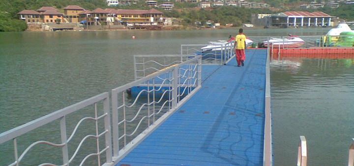
The Jeparit Wetlands Boardwalk will be a boardwalk loop of about 1 kilometre in length and will involve crossing the river as well as a number of anabranches. These crossings could be constructed using floating pontoon type structures that can adapt to varying water levels and can be designed to be reinstated after floods.
The boardwalk would include interpretation as well as trail information where it connects with the long distance trail. The boardwalk will need to be suitable for cycling. It will need to be sensitively designed and located to both protect sensitive features and enhance the visitor experience.
4.6 JEPARIT PIONEER MUSEUM TO OLD RAIL BRIDGE
4.6.1 Route
This is a complex, highly modified section of the trail which skirts the western edge of the Jeparit township. A trail route can basically follow existing paths, vehicle trails and roads along the Edward John Eyre Heritage River Walk The segments, south to north, are:
1. Museum to Jeparit Caravan Park: along paths of the EJEH River Walk, bordering the Wimmera River wetlands. This section will be adapted to incorporate the proposed Jeparit Wetland Boardwalk. This boardwalk will be integrated with both the existing Edward John Eyre Heritage River Walk and the Wimmera River Discovery Trail. This would provide a short loop walk through this fairly undisturbed and interesting section of the river as well as being a part of the long distance trail.
2. Jeparit Caravan Park to Jeparit Showground: EJEH River Walk appears to follow the road, but create new alignment through the narrow bush verge between road and river and then behind levee bank to where EJEH River Walk leaves road and turns west behind the showground.
3. Showground to Jeparit Golf Course/historic bridge: along paths of the EJEH River Walk, with a short part following/crossing the Nhill-Jeparit Road (this could be shortened to a direct crossing of the road), to a sealed road terminus adjacent to historic bridge over the Wimmera River (and golf course).
4. Golf Course to Lake Road: enter golf course at the historic bridge and follow western edge of golf course (EJEH River Walk, faint vehicle track in part) to exit golf course at north-west corner onto Lake Road.
5. Lake Road to old rail bridge: follow vehicle track along woodland verge between Lake Road and river to Jeparit Weir, then ongoing vehicle track (EJEH River Walk) close to river to the former rail bridge.
At present much of the Edward John Eyre Heritage River Walk is poorly defined and subsumed by vehicular activity and this will need to be more actively managed to improve the attractiveness of this part of the trail.
4.6.2 Length
Approx. 6.4 km
4.6.3 Environment & terrain
The terrain is flat, on the Wimmera River floodplain. Much of the vegetation has been cleared in this sector, with many disturbances, modifications and developments on the river verge and adjacent floodplain.
The substrate varies and much of it is constructed paths and gravel roads. Unmodified surfaces are mostly firm alluvial clay.
The river is continuous water (behind Jeparit Weir) with a complex of channels and billabongs in the southern part of this sector, and a single channel north of Jeparit Showground.
4.6.4 Tenure
Most of the route in this sector lies within the Wimmera River HAP. Some parts of this tenure appear to have other uses such as roads and part of the golf course. The trail route also crosses some short sections of other Crown tenures, listed south to north:
Jeparit Caravan Park and tennis courts (Recreation Reserve): route does not need to actually enter this block, but the facilities would be very useful for any trail.
Robert Menzies Park (Recreation Reserve): several short sections of the route impinge marginally on this block.
Crossing the Nhill – Jeparit Road: presumably this is a road reserve.
Roadway near historic bridge: trail crosses this area for c.100m immediately south of the golf course.
Jeparit Golf Course (Wimmera River HAP and Recreation Reserve): up to 400m of the route would cross parts of the golf course that are Recreation Reserve.
Rail corridor and bridge – managed by VicTrack
Assuming most of these lands are managed by Council then consent for the trail route should be possible. Discussions will need to occur with the Golf Course Management Committee to seek agreement on arrangements for crossing the course. If this were not possible an alternate (although less desirable) route would be along Lake Road.
4.6.5 Public vehicle access
Public vehicle access is effectively available (and in use) to almost the entire length of the route in this sector, even though much of this access is not via public roads.
4.6.6 Accommodation
The Jeparit Caravan Park, with cabin, caravan and camping options, lies on the route and would be a good location for a trailhead
Accommodation is also available elsewhere in Jeparit.
4.6.7 Existing facilities
Jeparit Pioneer Museum: museum, outdoor display, shop, information signs, toilets, water, picnic facilities.
Jeparit Caravan Park: picnic facilities, toilets (residents only, by code), water, play equipment, information signs, camping, caravan and cabin accommodation.
Edward John Eyre Heritage River Walk: an extended walking/cycling track along the river on the western edge of Jeparit, with associated benches and signs. It has fallen into some disrepair (track surface, signage) and is largely overrun with vehicle use.
Jeparit Boat Ramp.
4.6.8 Features of interest
Jeparit Pioneer Museum and associated facilities.
Jeparit wetlands and future boardwalk
Edward John Eyre Heritage River Walk
Jeparit Caravan Park
Jeparit Showground
Historic bridge
Jeparit Golf Course
Jeparit Weir
former rail bridge
4.6.9 Cultural heritage sites
While there are no records of Aboriginal heritage items on this section of the route detailed trail design and construction should consider the potential for these to exist in this area. Any sites found during the project should be managed consistent with the mitigation measures identified in Table 1 and consideration given to on-trail interpretation in close consultation with the Barengi Gadjin Land Council.
There is a restricted Indigenous Place listed on the Australian Heritage Database in Jeparit. Advice should be sought from Barengi Gadjin Land Council to ensure this place is appropriately managed through the design and construction of the trail.
The old rail bridge is listed on local heritage registers and should be interpreted on site.
4.6.10 Route issues and recreational experience
This section is very highly impacted as it traverses the edge of Jeparit township through and beside a range of developments. The experience is semi-urban. However the wetlands are a key natural attraction with a diversity and abundance of visible bird life.
The experience will also be enhanced by integration of the route into the Jeparit Wetlands Boardwalk. This boardwalk should be constructed to provide a loop incorporating the Jeparit Pioneer Museum, sections of the existing Edward John Eyre Heritage River Walk, as well as connecting to the eastern bank of the river to meet the Wimmera River Discovery Trail.
The Edward John Eyre Heritage River Walk which follows the edge of the wetlands and river, and which any long distance trail would also follow, is potentially a major asset. However much of its length is degraded by vehicle activity and poor maintenance. Together with en route and adjacent developments, these impacts mean the track currently lacks integrity and can offer only a mediocre experience.
From Jeparit Caravan Park towards the showground, an alternate track should be constructed between the road and the river.
The crossing of Nhill-Jeparit Road will require careful design including safety measures.
Management of this section of the track through Jeparit Township will require active and ongoing intervention to maintain the visitor experience. This will be justified by the combination of long distance trail users and short walk visitor numbers.
Vehicle barriers will be required to prevent 4WD and trail bike access to much of the route, subject to community consultation and acceptance of this separation. This is important for improving the walking and cycling experience to a standard expected by users of these trails.
Entry, exit and traverse of Jeparit Golf Course will need resolution in consultation with the Golf Course Management Committee.
A ramped track will need to be constructed up onto the rail corridor east of the old rail bridge at a suitable grade for cycling. A survey of this area will be required to ensure the trail is located on public land.
The trail will be subject to periodic flooding and repairs will be required following these events.
4.6.11 Trail establishment works
This section summarises the required works along the route from south to north, and should be read in conjunction with the trail design and construction prescriptions and interpretive and information signage sections of this Masterplan.
The route generally should be marked with totem style signs at least every 300m or wherever there is a change of direction if the trail route is unclear.
Information about the trail should be incorporated into information and interpretive signs at the Jeparit Pioneer Museum and Jeparit Caravan Park.
Interpretive and trail information signs should be used at all points of interest and vantage points overlooking the river throughout this section of the trail.
The trail route should be fully constructed with a sealed surface at least 2 metres wide throughout this section.
Vehicle barriers to prevent 4WD and trail bike access will need to be installed but this is subject to community consultation and acceptance of this separation.
The Jeparit Wetlands Boardwalk will be a boardwalk loop of about 1 kilometre in length and will involve crossing the river as well as a number of anabranches. These crossings could be constructed using floating pontoon type structures that can adapt to varying water levels and can be designed to be reinstated after floods. The boardwalk would include interpretation as well as trail information where it connects with the long distance trail. The walkway will need to be suitable for cycling.
A ramp suitable for cycling will need to be constructed up onto the rail corridor to provide for access onto the old rail bridge. Detailed design will be required for the stabilisation of the old rail bridge and the new decking and handrails for this crossing. The bridge should be as wide as possible, but at least 2 metres in width.
Should engineering assessment determine the old rail bridge cannot be adapted for pedestrian use, the trail route will need to be relocated to cross the river on the old Nhill – Jeparit road bridge, or failing that on the current Nhill – Jeparit road bridge.
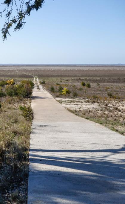
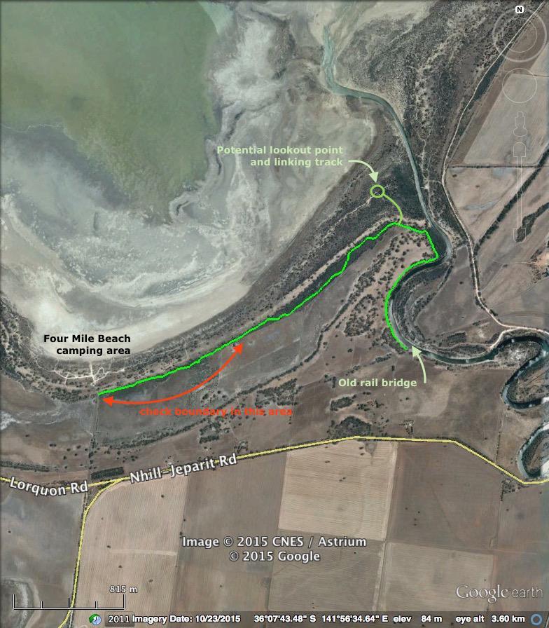
4.7 OLD RAIL BRIDGE TO FOUR MILE BEACH
4.7.1
Route
The route crosses the Wimmera River via the old rail bridge to the western side of the river. This is subject to an engineering assessment determining the bridge can be repaired and maintained suitable for foot and cycling traffic. Using the old bridge would create an iconic experience for the Wimmera River Discovery Trail and also be an attraction in its own right as part of a short walk from Jeparit. Alternate routes will need to be investigated if using the old rail bridge is not possible or prohibitively expensive.
There are a number of alternate routes possible from the western end of the old rail bridge to Four Mile Beach, however the most practical and readily achieved is to follow the western edge of Wimmera River (fenced paddocks, but actually Wimmera River HAP), then existing an vehicle track which follows the lowlying swale behind the southernmost dune This track appears to have a stable clay base and is therefore preferred over the sandy alternatives that are not suitable for either walking or cycling.
There is also a potential route via the old railway corridor which extends as far as the Four Mile Beach access road.
4.7.2
Length
Approx. 4.2 km
4.7.3 Environment & terrain
The terrain is mostly flat, on the Wimmera River and Lake Hindmarsh floodplains, with some very low relief over the lake dune system. The western river bank northwards from the former rail bridge is initially a cleared paddock. The route then follows the edge of reasonably intact alluvial floodplain/dune woodland of Black Box and River Red Gum and lakebed heath with cleared paddocks to the south.
Substrate varies from firm alluvial clay to wet clay and soft sand.
The river is continuous water, with some water in the ‘estuary’ where it disgorges into Lake Hindmarsh. The lake in this vicinity is mostly dry, and fills only rarely.
4.7.4 Tenure
The river verge on the western side of the former rail bridge is fenced and cleared, but mapping shows it as Wimmera River HAP. Tenure of this area should be checked and fencing adjusted to match the tenure boundary and the trail route adjusted as necessary to remain within the Wimmera River HAP.
A length of c.800m of trail along the dune swale appears to pass out of the Lake Hindmarsh Lake Reserve into what appears to be private land, but remains on the Reserve side of a boundary fence. Tenure of this area should be checked and the trail route adjusted as necessary to remain within the Reserve.
4.7.5 Public vehicle access
Public vehicle access to the river corridor is available at either end of this section:
vehicle track off Lake Road to old rail bridge
public road to Four Mile Beach off Nhill-Jeparit Road
4.7.6 Accommodation
Local town of Jeparit.
Four Mile Beach Camping Area, which includes powered sites.
4.7.7 Existing facilities
Four Mile Beach Camping Area (HSC): picnic and camping facilities, powered sites, water, amenities blocks and tanks, fireplaces, bins, signs, bollards, information signs, sealed lake access.
4.7.8 Features of interest
old rail bridge
Lake Hindmarsh
Wimmera River ‘estuary’
4.7.9 Cultural heritage sites
There are a few scar trees and shell middens along this section of the route. These should be managed consistent with the mitigation measures identified in Table 1 and consideration given to on-trail interpretation in close consultation with the Barengi Gadjin Land Council.
4.7.10 Route issues and recreational experience
Much this section is relatively undisturbed by impacts except the trails themselves and the Wimmera River is attractive with continuous water. The riverbank would benefit from revegetation to improve the visitor experience and environmental values.
The trail experience in this section will be significantly enhanced if the old rail bridge can be utilised.
While the trail behind the dune along the Hindmarsh Lake shore offers a better walking and riding surface, the lake is not visible and it runs adjacent to cleared farmland. This area is also subject to flooding and so will require some stabilisation.
Locating a lookout point on the dune close to where the Wimmera River enters the lake could enhance the experience in this section. This lookout could be a platform raised sufficiently to provide a panorama over the Wimmera River estuary.
Relocating the trail away from the boundary fence is probably not possible as this would move it into sandy areas which are more difficult to traverse or more expensive to construct.
The trail will be subject to periodic but infrequent flooding and repairs will be required following these events.
4.7.11 Trail establishment works
This section summarises the required works along the route from south to north, and should be read in conjunction with the trail design and construction prescriptions and interpretive and information signage sections of this Masterplan.
The route generally should be marked with totem style signs every 300m or wherever there is a change of direction if the trail route is unclear.
Information about the trail should be incorporated into information and interpretive signs at the old rail bridge, proposed lookout point and at Four Mile Creek.
The trail route will generally need little construction work apart from filling and drainage of some areas prone to becoming wet and boggy. This will largely be handwork with some machine work required.
There are some sandy sections that will either need to be avoided by rerouting the trail or will need stabilising by introducing a compacted local gravel surface similar to that used in Dimboola Common. Where constructed these tracks should be 2 metres in width.
Construct a lookout platform on the top of the dune near the Wimmera River estuary and a short linking track from the main trail.
Given its proximity to Jeparit, its relatively short distance and potentially interesting features, consideration should be given to fully sealing this section to a similar standard to the section within Jeparit to provide a short walking and cycling link to Lake Hindmarsh from the town.
5 Presentation and Interpretation
5.1 WHY INTERPRET THE TRAIL?
Development of the trail is aimed at achieving “a rich nature and heritage experience”. Appropriate interpretation is widely regarded as best practice in lifting a recreational facility into an experience, by enhancing the enjoyment of participants. A key ecotourism principle is that interpretation should be used to assist people to understand and appreciate the values of the places they visit. Thus interpretation will be integral to realising the trail’s recreational and economic potential.
Section 2 of the Wimmera River Discovery Trail will provide opportunities for a range of trail users and is intimately linked to the local community through the townships of Dimboola and Jeparit as well many rural neighbours. The trail also connects and passes through country with significant cultural and environmental values associated with major regional themes. Trail interpretation should be directed towards four main objectives:
increasing the appeal of the trail to potential users
enhancing the experience and enjoyment of people using the trail
encouraging greater understanding of the natural and cultural values associated with the trail’s setting
assisting the local community to value the trail.
It should be noted that for the purposes of this plan, distinction between ‘information’ and ‘interpretation’ is not useful as inevitably the two objectives will be interwoven.
5.2 PARTNERS
An effective interpretation program for the Wimmera River Discovery Trail can only be achieved through a cooperative and coordinated effort involving many partners. Interpretive partners and their roles might include (but will not be limited to):
trail managers – production and delivery of interpretive program and content
associated land managers/agencies – delivery of some interpretive components
community (inc. Aboriginal community) – input to interpretive content, delivery of some interpretive components
tourism groups - delivery of some interpretive components
commercial operators/guides - delivery of some interpretive components
other local experts - input to interpretive content.
5.3 AUDIENCES
Interpretation needs to be directed towards a range of potential recipients. (NB: the terms ‘recipient’ and ‘audience’ are not meant to imply passivity, as effective interpretation involves active engagement). These audiences encompass the full range of people using, managing and associated with the trail.
A non-exhaustive list of ‘trail interest groups’ would include:
trail users – walkers, cyclists, birdwatchers, campers, visitors, locals
trail managers and promoters – Hindmarsh Shire Council, Parks Victoria, tourism bodies, tourism operators
visitors to nearby national parks, other potential trail users
local communities.
These groups do not necessarily all need to be separately targeted, as a range of interpretive materials will ensure accessibility for a number of audiences. However audiences will need to be prioritised for efficiency of interpretive effort. Highest priority should be given to trail users, followed by potential users. Well planned materials will ensure ready access for other audiences.
5.4 EXISTING INTERPRETATION
The Wimmera River Discovery Trail from Dimboola to Lake Hindmarsh does not yet exist, however the developed tracks at Dimboola Common include a number of detailed interpretive signs, mainly about the history of the common and Dimboola. The Edward John Eyre Heritage River Walk at Jeparit currently has no interpretation.
Other more general information and interpretation signs are located in Little Desert National Park and Lake Hindmarsh Lake Reserve, at/near each end of the proposed Section 2 Wimmera River Discovery Trail. Off-site information of a general nature (not really interpretive), is available online through tourism and national park websites and in brochures.
5.5 THEMES AND MESSAGES
The Wimmera River Discovery Trail will traverse a landscape that is rich in stories and themes, providing ample scope for diverse interpretation of natural and cultural heritage. The scope of interpretive content should, in the main, be limited to the Wimmera region, but linked to a broader context when appropriate.
All interpretation on Aboriginal themes should be generated and approved by appropriate Aboriginal communities and representatives. The area includes the country of several Aboriginal language groups who thrived on the rich local resources of riverine, lacustrine and mallee environments. The Wimmera River reportedly has more scarred trees than anywhere else in Victoria. There are creation stories relating to the river and these could provide a compelling rationale for the trail.
European exploration and settlement brought a complex and at times violent relationship with the traditional occupants. The Ebenezer Mission (on the route of the trail) is a key site associated with the later ‘contact’ period. It remains an important place to the contemporary Aboriginal community, who maintain traditional lore and strong links with country. The Wimmera Aboriginal community won the first legal recognition of native title in south-east Australia.
Detailed information and stories are available covering the sweep of European occupation and development from the earliest days to present. Key aspects include the ‘pioneering’ period, agricultural development, village growth, tourism, water use and environmental change.
The trail environment offers a number of interesting themes based around its special features and reduced extent. A diversity of wildlife can be seen, including rich birdlife and a number of rare and threatened plants and animals. Most of the proposed trail will traverse alluvial woodland, surrounded by mallee. Much of the mallee has been cleared for agriculture and the alluvial woodlands are threatened by reduced flooding and climate change. Other local environments include lakes and dunes with their special ecologies.
As a unifying motif of the trail, the Wimmera River and its environmental and human history should feature strongly in interpretation. The geomorphological development of this uncommon landscape is equally compelling.
Ideally, themes and ‘messages’ will not be treated in isolation, but delivered in an integrated way through the medium of stories, each of which may connect a number of themes.
5.5.1 Interpretive themes
Aboriginal history and contemporary culture
Aboriginal land use, lore and stories
European occupation and agricultural development
Landscape, ecology, wildlife, environmental change, conservation
Recreational opportunities provided by the Wimmera River Discovery Trail
Use and protection of the Wimmera River Discovery Trail
What trail users will experience along the way
5.5.2 Key content (‘messages’)
Good interpretation allows people to develop their own thoughts and to reach their own conclusions about material presented, so the idea of ‘delivering messages’ can be seen as inappropriate.
Nevertheless, identifying the sorts of ideas that a program might try to convey, in general and nondidactic terms, is a useful tool for planning interpretation. Identified ‘messages’ can help to focus interpretive content from a bewildering palette of options.
Interpretation for the Wimmera River Discovery Trail Section 2 could seek to communicate the following broad ‘messages’ (noting that Aboriginal themes and content are tentative only, requiring community oversight):
Human history, events and cultures (both Aboriginal and European) are intimately connected to the environment
Aboriginal culture is living and continuous
Aboriginal lore teaches the origin of the landscape and how people should relate to it
Traditional Aboriginal use of the Wimmera involved the utilisation and management of a wide variety of resources on a seasonal basis
The histories of Aboriginal and European peoples in the Wimmera are interwoven, rich and complex, with both positive and negative aspects
The economic and social history of Europeans in the Wimmera is characterised by agricultural development and environmental change
Trail users can encounter a variety of surviving features that speak of human histories
The Wimmera landforms have developed through a changing climate acting on the geological base over eons
Recent history of the Wimmera landscape is dominated by human-induced changes to vegetation and water
Surviving remnants of the old Wimmera environment are important, precious and threatened, even though many areas are now protected in conservation reserves
A number of rare and threatened species and ecological communities survive in the Wimmera, but the long-term prospects are of concern
Many programs are underway to protect the special values of the Wimmera
The Wimmera River Discovery Trail provides a variety of enjoyable opportunities to experience the unique Wimmera environment
Trail users should follow the guidelines for appropriate use
The Wimmera townships and communities are interesting, historic and welcoming
5.6 MEDIA AND PRODUCTS
Ways to deliver information and interpretation are more diverse now than ever before. Traditional media such as signs and publications remain useful, while a growing variety of digital deliveries can expand the reach and impact of interpretive programs. Some new digital media can offer other advantages, including relatively low cost, ease of revision and interactive capacity. These features can allow for delivery of more complex and extended material, where the user can choose which parts to explore.
The most powerful means of effective communication remains the most traditional of all: face-to-face story-telling. Personal delivery can be costly to achieve, and will often be in the context of paid services such as guided activities. This is a particularly relevant medium for Aboriginal groups and themes and every effort should be made to build the capacity of community members to deliver interpretive experiences at Ebenezer and elsewhere along the trail.
It is important for any interpretive program to utilise a variety of media and products to maximise the number and type of people who can easily access content.
‘Information’ and ‘interpretation’ cannot readily be separated because they are usually overlapping and delivered together, which is appropriate. However when planning programs and media it is useful to consciously aim at what is to be achieved. In this section, suggested media and products will often combine informative and interpretive functions, ideally in a creative way.
5.6.1 Trail ‘handbook’
A well-illustrated document with introductory, general and place-specific information on the trail and its environment including maps and wayfinding information is required to provide the base information for all other media about the trail
This would be a ‘keystone’ product, available in hard copy and online as a PDF and an app. With improved mobile access, there is potential to include GPS-activated interpretation at specific sites.
5.6.2 Trail map
A map of Section 2, A4 or larger, also available in hard copy, PDF and app, with critical information on the reverse about how to access and use the trail. This would be mainly an information product.
5.6.3 Website
Web based information about the Wimmera River Discovery Trail should be made available on an existing organisational website with links from other sites including Hindmarsh Shire Council, Parks Victoria and regional tourism sites.
A stand-alone website for the Wimmera River Discovery Trail is not considered feasible because of the considerable cost and maintenance required.
The web presence could present a wide range of information and interpretation at a number of levels to suit various interests and enthusiasms. An example is the Visit Mungo website: http://www.visitmungo.com.au/
5.6.4 Interpretive signs
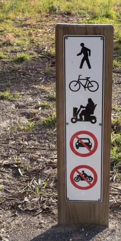
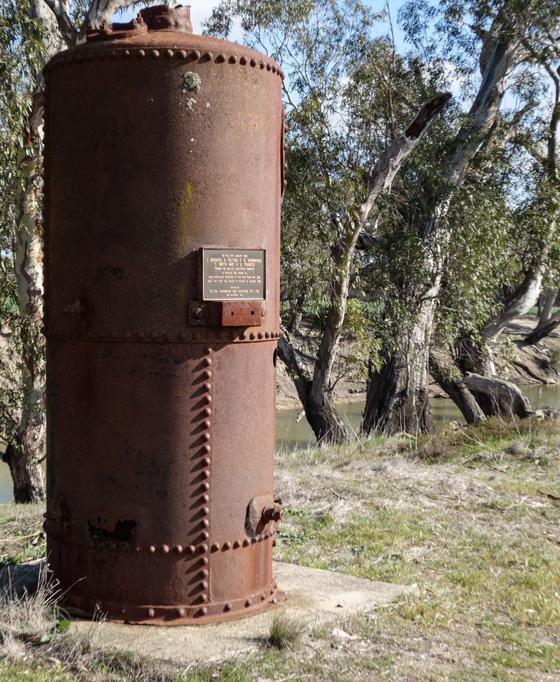
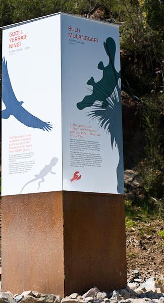
In-ground signs are expensive and difficult to maintain and are best limited to key visitor precincts (eg. existing Dimboola Common, Ebenezer Mission, Jeparit wetlands, Lake Hindmarsh) plus a small number of single signs at specific points of interest along the trail (eg. scarred tree, historic boiler, old bridge).
5.6.5 Information signs
The main trackheads and access points should be equipped with trail information signs (plus minimal interpretation) at least at Dimboola Common, Lochiel Rest Stop, Ebenezer Mission, Jeparit Pioneer Museum and Lake Hindmarsh. Orientation and wayfinding should be facilitated through use of simple totem style signs along the route.
5.6.6 Guided activities and events
Whether Indigenous or otherwise, well-informed and capable guides could be key to a powerful interpretation program. This will be dependent on the development of suitable commercial products, or perhaps volunteer-led activities.
The promotion and inclusion of the Wimmera River Discovery Trail into existing local events such as the Jeparit Pioneer Museum open weekend should be encourage to raise awareness of the trail.
5.6.7 Special interest products
A lower priority would be a range of potential ‘guides’ on specific topics such as Aboriginal culture, history, birds and plants. These would best be delivered digitally (PDF/app) due to relatively limited demand. Some, especially Aboriginal stories and local history, could be most effective as spoken recordings.
6 Trail implementation
6.1 MANAGEMENT AND GOVERNANCE
6.1.1 Negotiate with Parks Victoria and Department of Environment, Land, Water and Planning to establish a Trail Development and Management Committee as a committee of Council.
6.1.2 Establish an agreement covering the funding, construction, maintenance and promotion of the trail which clearly defines the role of the Committee and each of the agencies that have tenure over the trail route including day to day management of the trail, law enforcement and compliance matters.
6.2 LAND TENURE
6.2.1 Negotiate with the land owner just north of Dimboola to seek a formal licence agreement for access along the riverbank through their property. These discussions should include agreements about trail construction and maintenance, fencing, free public access, access for maintenance as well as insurances and public liability.
6.2.2 Negotiate with Vic Roads regarding consent for works under the Roads Management Act 2004 for the proposed works in the underpass of the Western Highway near the Wimmera River bridge.
6.2.3 Negotiate with Vic Track regarding consent for works under third party access and licencing arrangements for the proposed works crossing under the main western line near Lochiel.
6.2.4 Negotiate with the Jeparit Golf Course Management Committee to seek agreement on arrangements for the trail crossing the golf course.
6.2.5 Negotiate with Vic Track regarding consent for works to the Wimmera River Rail Bridge and sections of the Jeparit to Yanac rail corridor for the trail.
6.3 SURVEY AND APPROVALS
6.3.1 Undertake a flora survey for threatened plants and habitat of threatened fauna and re-route sections of the track if necessary to avoid disturbance of these plants.
6.3.2 Undertake a survey for aboriginal sites in conjunction with the Barengi Gadjin Land Council and implement mitigation measures as detailed in Table 1 below including rerouting sections of the track if necessary to avoid disturbance of identified sites and sensitive areas.
Table 1. Aboriginal heritage conservation measures (From Table 7 of the Ecological Australia Hindmarsh Trail Draft Heritage Desktop Oct 2015)
Site Type
Impacting Activities
Scarred trees Vegetation clearing, thinning and management associated with development
Wildfire or prescribed burning activities
Traffic /equipment contact
Mitigation Measures
Identification of scarred trees in proximity of trail and associated infrastructure development
Requirement for pre-clearing survey for scarred trees prior to any vegetation clearing or management activities involving removal
Establishment of appropriate bushfire management plan in association with development of the trail
Scarred trees to be identified and marked/fenced prior to any construction activities in the vicinity
Artefact scatters, low density artefact distributions and isolated artefacts
Shell midden
Earth feature
Track and road building involving ground disturbance
Vehicular and pedestrian traffic
Vegetation clearing involving grubbing &/or removal of the ground layer
Wind and water erosion resulting from disturbance due to development
Identify Aboriginal places along the trail corridor and locate infrastructure to avoid impact
Conduct preclearing and construction surveys for registered and unregistered or unrecorded Aboriginal places
Mark/fence sites in proximity to trafficable areas
Stabilise any areas of wind and water erosion which may be exacerbated by development
Limit vehicle and pedestrian traffic access to areas which have not been surveyed for sites
Bora/Ceremonial
Natural
Mythological sites
Burial
Inappropriate visitation
Inappropriate/insufficient vegetation management of sites
Inappropriate location/construction of tracks and roads
Inappropriate location/construction of infrastructure such as camp sites, water, electricity and lighting and involving major land forming ground disturbance
Vehicular and pedestrian traffic
Vegetation clearing involving grubbing &/or removal of the ground layer
Identify sites in the vicinity and document according to Traditional Owner Knowledge protocols and consistent with the Management Plan for the area
Determine appropriate visitation for Aboriginal places in consultation with local Traditional Owners and incorporate management measures in Management Plan for the area
Determine vegetation management practices required to maintain sites and incorporate these measures in the Management Plan for the area
Identify Aboriginal places along the trail corridor and locate infrastructure to avoid interaction
Conduct preclearing and construction
Site Type
Impacting Activities
Wind and water erosion resulting from disturbance due to development
Mitigation Measures
surveys for registered and unregistered or unrecorded Aboriginal places
Mark and fence Aboriginal places in proximity to trafficable areas – in accordance with Traditional Owner Knowledge protocols and the Management Plan
Stabilise any areas of wind and water erosion which may be exacerbated by development
Limit vehicle and pedestrian traffic access to areas which have not been surveyed for Aboriginal places
Contact/Historical Sites
Inappropriate visitation
Inappropriate/insufficient maintenance and management of sites including vegetation and built infrastructure
Inappropriate location/construction of tracks and roads
Inappropriate location/construction of infrastructure such as camp sites, water, electricity and lighting and involving major land forming ground disturbance
Vehicular and pedestrian traffic
Identify Aboriginal places in the vicinity and document according to Traditional Owner Knowledge protocols and consistent with the Management Plan for the area
Determine appropriate visitation for Aboriginal places in consultation with local Traditional Owners and incorporate management measures in Management Plan for the area
Determine vegetation and built infrastructure management practices required to maintain Aboriginal places and incorporate these measures in the Management Plan for the area
Identify sites along the trail corridor and locate infrastructure to avoid inappropriate impact or interaction
Manage vehicular and pedestrian traffic in accordance with the visitation protocols established in the Management Plan
6.3.3 Prepare a Cultural Heritage Management Plan under the Aboriginal Heritage Regulations 2007 in consultation with the Barengi Gadjin Land Council.
6.3.4 Undertake land survey to determine the exact location of the reserve boundary in the following areas where initial desktop analysis indicates potential discrepancies:
the area just north east of Ebenezer Mission for a distance of approximately 500m where there appears to be an encroachment into the Wimmera River HAP
the area c.500m south-west of the Antwerp-Woorak Road which is not included in the Wimmera River HAP
the area c. 2 km north of the Antwerp – Woorak Road and west of Stony Crossing Road where existing tracks appear to be outside the Wimmera River HAP
the area c.4 kms north of the Tarranyurk West Road to determine whether the existing trails cross private land
clarify tenure and boundary locations either side of the old rail bridge north of Jeparit
clarify tenure of proposed trail route for approximately 1 km to the east of the Four Mile Beach access road
in addition permanently mark boundaries adjacent to the private land north of Dimboola to confirm exact extent of trail encroachment.
6.3.5 Work with the Barengi Gadjin Land Council to determine their interest in developing the land adjacent to the Antwerp Cemetery (The Block) for tourist accommodation and if necessary undertake a detailed survey of alternate route options to pass adjacent to this development. Subject to that detailed assessment, negotiate with the relevant landowner if necessary to seek a formal licence agreement on access across their property.
6.3.6 Undertake consultation with local communities and Parks Victoria to agree an approach on vehicle access (including 4WD and trail bikes) to the proposed route. Matters for consideration include:
Full closure of the route to vehicles (unlikely to be acceptable to some community members)
Partial closure of the proposed trail route to vehicles (this is similar to the existing situation, although more extensive closures would be required to enhance and protect the visitor experience
Limited access arrangements for local people via keys held by relevant clubs or other local community organisations
The appropriate design and location of barriers, fencing and gates along the route.
6.3.7 Seek consent for the development of the trail from Parks Victoria using the process set out in the Victorian Public Land Mountain Bike Guidelines including:
Negotiation with Parks Victoria and DEWLP regarding the responsibility for ongoing management, monitoring and maintenance of the trail
Negotiation with the Wimmera CMC regarding the development of the Jeparit wetlands boardwalk and bridging of anabranches of the river
Preparing a Strategic Assessment under the Guidelines
Preparing a Detailed Planning Assessment under the Guidelines
Other environmental assessment as required by the consent authority.
6.4 TRAIL DESIGN AND CONSTRUCTION
6.4.1 Undertake a detailed assessment of the route to determine whether there is a suitable alternative to avoid sandy or wet areas, or to relocate the trail away from unattractive and unsuitable areas including:
fence lines
areas heavily disturbed by vehicles
steep, erodible and unstable areas
areas containing threatened plants
areas containing artefact scatters or other culturally sensitive sites
6.4.2 Adjust the proposed route as appropriate.
6.4.3 Undertake a detailed project survey of the route and identify the differing foundation conditions including:
existing vehicle track with solid clay base
existing vehicle track with unstable clay base
existing vehicle track with sand base
new route with solid clay base
new route with sand base
gully requiring bridging
6.4.4 Select the appropriate construction technique for each section of the trail based on the differing foundation conditions.
existing vehicle track, solid clay base
existing vehicle track, unstable clay base
existing vehicle track, sand base
new route, clay base
minimise future vehicle access
minimise future vehicle use, either reroute trail or
reroute trail, avoid any future vehicle use
route trail to minimise drainage issues, minimise future vehicle use
new route, sand base reroute trail, avoid any future vehicle use
gully
reroute trail
minimal work required, monitor and maintain
install drainage and fill holes with gravel,
construct new gravel trail if rerouting is not possible, monitor and maintain
hand clear route, monitor and maintain
construct new gravel trail if rerouting is not possible, monitor and maintain
install prefabricated bridge if rerouting is not possible, monitor and maintain, cyclical engineering inspections
Table 2 Trail construction