1 minute read
Eglinton Transferia


Integrated Urbanism Studio Project in the University of Toronto Instructor: Christo Marcopoulos Fall 2021
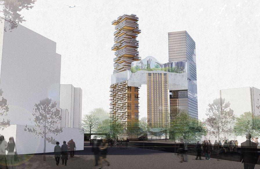
Most of the political discussion in Toronto has focused on how to bring more density while addressing spatial and environmental inequality. It is only in the last few years, with the city climbing the international ranking as one of the least affordable metropolitan cities, that affordability, climate change, and social resilience have become objects of political debate. In the wake of the completion of the upcoming Light Rail line along the Eglinton corridor, this project intends to establish a spatially just, socially resilient and environmentally friendly model of urbanism.
Advertisement
By envisioning networks of buildings, infrastructure, and landscapes in response to politics. This design project negotiates issues of climate resilience, spatial and social equity, postcarbon economies, and housing affordability all the while recognizing the limits of our disciplinary tools.
Population Density Study in The City of Toronto

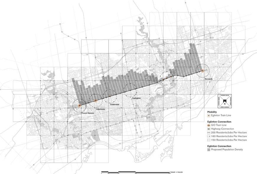
The population of the Toronto area will hit 8 million in the next 10 years. In development, can we find other ways to reduce colonization and not take land for granted? In an extreme highway loop, population can be condensed on unused urban space, resulting in high density on a small plot of land, and people can give back land to nature.

Site Analysis
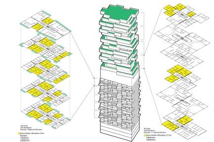
Massing Diagram
Three towers 60 degree facing away each other
Wider view wider internal space between towers
Adjusting floor plate according to program
View direction adjustment Broader view for residence
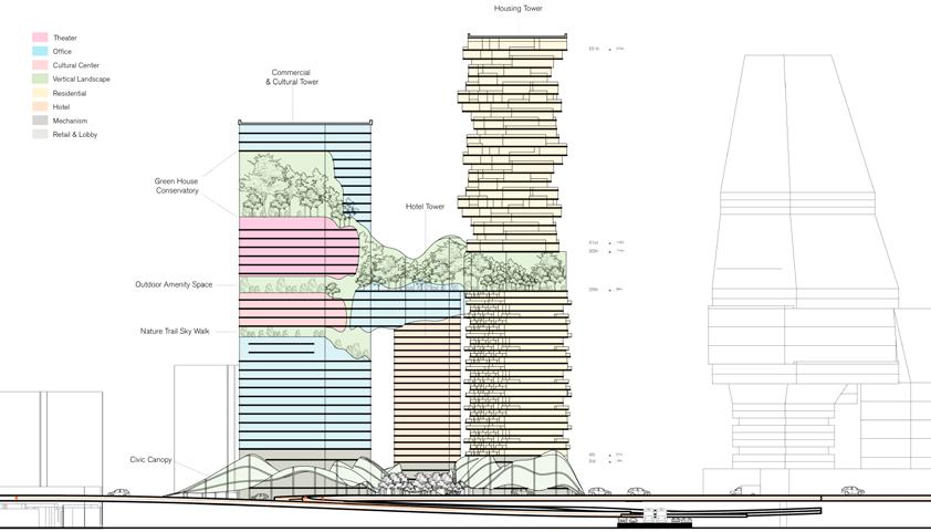
Office Tower Residence Tower
Office Area
Extrusion to various height according to the programs

A green belt connecting all towers with surrounding green area
Center
Planted Terrace
Theater Culture Center
Green House Conservatory
Nature Trial Sky Walk


