
Trails and Greenspace MASTER PLAN
Prepared for: Town of Hay River
Suite 100-62 Woodland Drive
Hay River, NT X0E 1G1
JUNE 2024
PREPARED BY
Judith Goucher Consulting
ACKNOWLEDGEMENTS
The Town of Hay River is in the traditional territories of Kátł’odeeche First Nation (KFN) and West Point First Nation (WPFN). The land was also historically used by the Métis, represented today by the Hay River Métis Government Council (HRMGC) of the Northwest Territory Métis Nation (NWTMN).
The planning team thanks all members of the community who contributed to this plan that will help to improve the quality of life in Hay River.
This report is prepared for the sole use of the Town of Hay River. Copyright © 2024
Executive Summary
Described as “the Hub of the North”, Hay River is one of the largest communities in the Northwest Territories (NT) with a population of approximately 3,800 people and is located along the Hay River on the south side of Great Slave lake, just over 100 km north of the NT/Alberta border. Hay River is in the traditional territories of Kátł’odeeche First Nation (KFN) and West Point First Nation (WPFN). The land was also historically used by the Métis, represented today by the Hay River Métis Government Council (HRMGC) of the Northwest Territory Métis Nation (NWTMN).
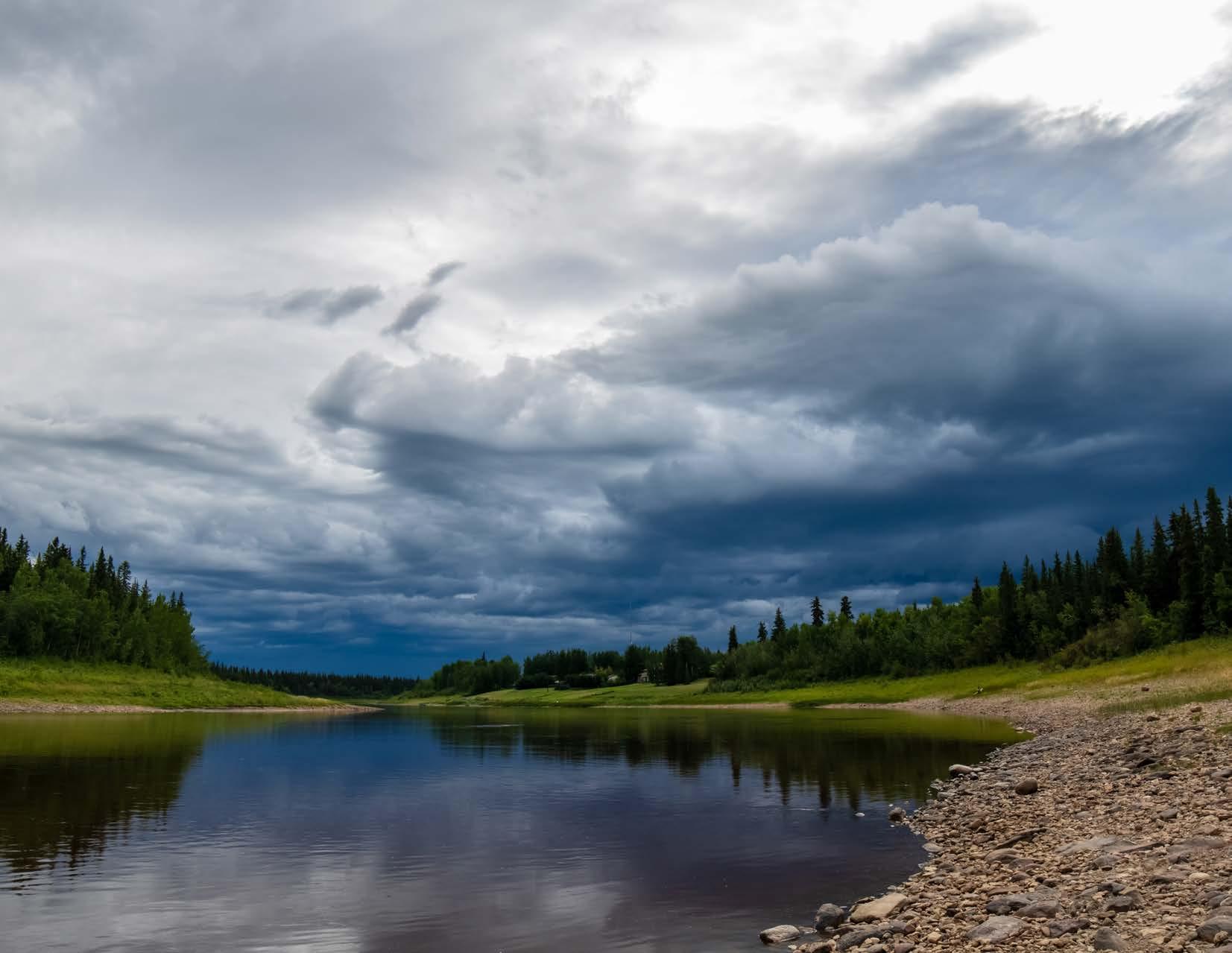
Rivers, lakes, and boreal forest surround Hay River and define its character. These defining geographic features offer recreation opportunities to residents and visitors. Hay River’s subarctic climate, with summer lasting about three months, creates opportunities to experience the outdoors in multiple ways with winter ski trails converting to summer hiking trails and flowing rivers converting to ice hockey venues with the change of season.
The purpose of the Trails and Greenspace Master Plan (TGMP) is to guide the planning, land acquisition, capital development and operation of trails and greenspaces in Hay River. It provides a vision for trails and greenspaces, goals for achieving the vision, and a series of short, medium and longterm actions for acquiring and improving trails and greenspaces in Hay River. The TGMP was prepared in conjunction with the Hay River 2023-2027 Trail Improvements Project and within the context of current strategic documents.
Hay River residents, key community stakeholders, Town staff, and Council were involved in the TGMP process at several stages to ensure the plan addresses current trail and greenspace challenges and reflects community values and interests. The TGMP is based on a comprehensive review of existing conditions, land uses, demographic data, and relevant municipal plans and policies.
The Town’s vision statement sets the overall direction of the TGMP.
Hay River is a culturally diverse hub that celebrates its history, social and recreational well-being, and its opportunities for growth…
IMPLEMENTING THE TGMP IS IMPORTANT FOR SEVERAL REASONS:
• To inform and support staff and Council’s decisions on trails and greenspace for existing areas and new developments
• To document and address flood impacts to trail and greenspace infrastructure and to identify mitigating measures
• To promote a healthy and active community
1 Population Estimates by Community, NWT Bureau of Stats, 2022
The TGMP originated from a need to identify impacts of flooding events on the Town’s trails and greenspaces. An inventory of trails and greenspaces was prepared and assessed for risk of flooding and related flood damage. The Town developed a list of mitigating actions aimed at reducing recurring costs from flood damage and those actions are a critical aspect of the TGMP.
The TGMP is a broader planning document to support the Town’s Vision to promote recreational well-being. The primary topics addressed in the TGMP include trails, greenspace, greenspace
• To promote eco-tourism opportunities
• To help the Town work in partnership with stakeholders, local businesses, and government partners on trails and greenspace opportunities
• To help the Town with preparing annual budgets and developing capital plans
amenities, waterfront, and environment. Climate change impacts are highlighted and assessed for risk to inform the go forward approach to trails and greenspaces through elimination, mitigation, or acceptance of climate change risks to infrastructure. For each topic, existing conditions are described, and the strengths and challenges are analyzed. Actions for each topic are provided for Planning and Design, Land Acquisition, and Capital Development.
The implementation section shows the phasing of actions, responsibilities, and relative costs. Shortterm project priorities are listed. Funding and partnership opportunities are shown along with next steps towards implementation. The TGMP will be implemented in phases based on community needs, the pace of development, funding opportunities, and Council’s priorities as all of these evolve over time. The TGMP is a guiding document for the provision of facilities and services; it does not commit the Town to any project nor limit future opportunities.
THE
GOALS IDENTIFY THE HIGH-LEVEL NEEDS:
QUALITY AND INCLUSIVITY
High quality trails, greenspaces and amenities for all ages, abilities, and cultures.
CONNECTIVITY
Connected trail system linking to greenspaces, destinations, and other recreational infrastructure.
GREEN PLANNING
Desirable trails and greenspaces in new developments.
WATERFRONT
Public access to and along the waterfront.
ENVIRONMENT
Addressing climate change impacts on existing trails and greenspaces and incorporating strategies to minimize impact on existing and future infrastructure.
EFFICIENCY
Streamline implementation of trails and greenspace planning, development and operations.
A
Process and Setting
Overview
1.1 A Coordinated Approach
The Town of Hay River recognizes the value in aligning major plans that will guide the evolution of the Town’s physical form. The Trails and Greenspace Master Plan (TGMP) will support the Town’s 2022– 2025 Strategic Plan, The Tourism Development Plan and Marketing Plan, and the 2023 Strategic Housing Plan. The TGMP will be a living plan. The Town is preparing a Healthy Community Strategy that will be reflected in future updates of the TGMP. Healthy Community Strategy recommendations for safe places for the vulnerable and homeless sector will be added to the TGMP in future updates. The TGMP will also inform future updates of the Town of Hay River’s Community Plan.
VISION PER 2022 – 2025 STRATEGIC PLAN
Hay River is a culturally diverse hub that celebrates its history, social and recreational well-being, and its opportunities for growth.
Figure 1.1: Trails and Greenspace Master Plan influences
Hay River Strategic Housing Plan (2023)
Trails and Greenspace Master Plan
Hay River Strategic Plan (2022-2025)
Tourism Development Plan and Tourism Marketing Plan
The Town of Hay River’s core values as set out in the 2022-2025 Council Strategic Plan are as follows:
The Town’s goals are to update infrastructure within Hay River as required, ensure that current best practices guide infrastructure development, institute approved flood recovery and mitigation plans to repair and rebuild town infrastructure while reducing the impact of future spring flooding, work towards supporting the mental and physical health of Hay River residents, consider the use of incentives and the removal of barriers to the provision of diverse housing options for Hay River, identify how to use urban space more effectively for housing and ensure that the Town of Hay River is a place people want to work. These foundational goals are the guide for the TGMP.
1.2 Why a Trails and Greenspace Master Plan?
The Town of Hay River currently has a 5-year Trail Improvement Project that includes a condition assessment of existing trails and shows task-based activity for trail improvements. A Master Plan will provide a broader perspective through inclusion of recommendations for capital development of trails and greenspaces, land acquisition, and operations projects.
Given the significant climate-related events of the past few years, including flooding, drought and forest fires, the TGMP will also incorporate a climate risk assessment of existing infrastructure and make recommendations regarding the elimination, mitigation, or acceptance of climate risks. The emphasis
on addressing climate risks will aim to reduce climate-related impacts on infrastructure and associated maintenance costs to allow scarce resources to be targeted to supporting trail and greenspace infrastructure.
1.3 Plan Process
Figure 1.2: Project Phases and Timeline
Launch
Winter 2023/2024
Trails and Greenspace Master Plan
Phase 2
Summer 2024
Create and share Draft Plan
Phase 1
Winter 2023/2024
Background Review and Data Gathering
Phase 3
Summer 2024
Refine and Finalize the Plan
Adopt
Summer/Fall 2024 Final Trails and Greenspace Master Plan
Key Directions from Initial Conversations
The following are key findings based on preliminary conversations with Town of Hay River residents. These key directions will be updated following the next Phases of consultation.
GREATEST STRENGTHS
• Natural setting
• Established trails
• Extensive shoreline
• Multiple outdoor recreation opportunities
• Underutilized parks that could be repurposed for off-leash dog areas
• High participation in activities and events
KEY CHALLENGES
• Connectivity and accessibility of trails
• Not enough off-leash dog areas
• Amenities lacking in some parks
• Lack of information on trails and greenspaces on social media, printed materials, signs, map kiosks
• Improvements needed at developed waterfront access points
• Low satisfaction rating for maintenance of existing infrastructure
VISION FOR THE FUTURE
• Improved accessibility and connectivity of trails
• Protect Hay River’s natural setting including forests, rivers and lakes
• Recreation opportunities for all ages and abilities
• Trails and greenspaces in new developments
FOCUS INVESTMENT
• Building out existing trails to improve connections
• Off-leash dog areas
• Improvements to existing waterfront access
• Multimedia wayfinding information for trails and greenspaces
1.4 The Trails and Greenspace Master Plan
The TGMP will guide the planning, land acquisition, capital development, and operations of trails and greenspaces in Hay River. It provides a vision for trails and greenspaces, goals for achieving the vision, and a series of short, medium, and long-term actions for getting and improving the trails and greenspace network in Hay River.
Actions for each topic are provided under the following subheadings in relation to how they will be implemented:
• Planning and Design
• Land Acquisition
• Capital Development
The Recreation Department oversees Recreation Policy, standards, and procedures. These combined guide service levels for recreation programming and operation and maintenance of core community recreation facilities.
Our Community
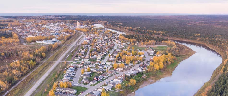
2.1 Local Character
The Town of Hay River is found within the traditional territory of the Kátł’odeeche First Nation, West Point First Nation and the land has traditionally been used by the Hay River Métis. The Town’s history dates back to the 19th century, when Hay River was identified as an ideal location for fishing. In the late 1800’s Chief Chiatlo of the Slavey Dene chose the north-east bank of the Hay River for his people to set up homes. Shortly thereafter, the Anglican Mission set up a trading post and mission station in Hay River2.
As the town began to grow a road was needed to access resources in the surrounding area all year round. A cat train, which could only be used during the winter, cleared a trail through the bush. This road followed the path that had traditionally been used the by the Dene for generations and now was also used by missionaries, miners, free traders, adventurers, and surveyors.
In 1945 an agreement was signed between the Federal and Alberta Governments to build an all-weather highway from Grimshaw, Alberta to Hay River, Northwest Territories. This highway was completed in 1948 and would be known as the Mackenzie Highway, the main road to ship goods
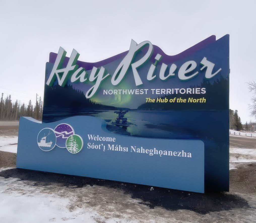
further north. Thus, Hay River became the “Hub of the North” (Figure 2.1).
The West Channel found on Vale Island became the centre of the fishing industry and in 1949 it underwent a rapid growth period as fishers and their families built their homes and settled in the area. During this time the East Channel of Vale Island was also experiencing growth as houses were built, restaurants were open, the Federal Day School was constructed, and the Hudson’s Bay Company moved from the Dene Village (across from Vale Island) onto Vale Island.
The great flood of 1963 led to the town moving upriver to higher ground. Today the Town of Hay River is a combination of “New Town” and “Vale Island”.
Many of the trails and parks in Hay River were originally developed and managed by volunteer-run
service clubs. For the most part, this infrastructure is now maintained by the Town, except for the Hay River Golf and Ski Clubs. Volunteer groups are still active in the development of trails and greenspaces such as construction of a skate park, the Tri-Service park, the Rotary Nature trail, and twinning of the Keith Broadhead ballpark. Partnering with volunteer groups creates opportunity for development of trail and greenspace infrastructure beyond the ability of the Town and continues to be a valuable approach to expanding the trail and greenspace footprint within the community.
A little-known natural feature of Hay River is the expanse of beachfront on the shores of Great Slave Lake. The territorial government has developed a section of beach property and continues to work to improve accessibility and amenities to create a “destination” for tourists as well as an attractive playground for residents.
2 Canadian Register of Historic Places (CRHP)
2.2 Demographic Profile + Trends
In 2022, Hay River was home to approximately 3,800 residents which is in line with the ten-year average population from 2013 to 2022 (Figure 2.2). Several economic opportunities are on the horizon which could lead to significant population growth. These include, the Pine Point Mine, with a projected startup date of before 2030, a new 24 bed long term care facility, expanded agricultural business opportunities, cultural tourism opportunities, a re-invigorated marine transportation industry and other opportunities in the service and resource sectors. Hay River’s population is estimated to increase to between 5,000 and 6,000 if these opportunities come to fruition. The median age of Hay River residents is 25-44 years old, which is consistent with the territorial average.
Hay River Historic Population
Figure 2.1: Hub of the North, Town of Hay River
Steen River
Figure 2.2: Historic Population
2.3 Land Use and Development
The Town of Hay River is dispersed over a large land area, occupying just over 120 square kilometres. The municipal boundary extends just south of Paradise Valley, about 28 kilometres south on Highway 2, while the west and north boundaries are formed by the south shore of Great Slave Lake and the west side of the mouth of the Hay River (Map 1). Most of the residential areas are single family housing. The Town’s 2023 Strategic Housing Plan emphasizes multi-family housing development with a commitment to trails and greenspaces in new subdivision developments.
Generally, greenspaces in Hay River are focused on the provision of recreation and sports facilities (community parks), and the provision of small greenspaces within residential areas (neighbourhood parks). There is a significant amount of undeveloped Commissioner’s land that provides natural greenspace, and the territorial government has developed and supports a campground and beachfront park areas that can be accessed by locals and visitors. There are currently no parks within the Town Centre.
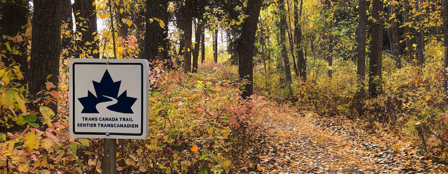
Hay River has the Trans Canada Trail system that runs from the edge of town to the edge of Great Slave Lake. This almost continuous trail system runs along the Mackenzie Highway, through New Town, along the Hay River, through Vale Island, and out to the sandy beaches where the highway ends and the lake and sky begin.
One of the five pillars in the Town of Hay River’s 2022-2025 Strategic Plan is to “promote Hay River as the most desirable Community in which to live and visit within the NWT.” The TGMP supports this pillar by setting up a framework for the Community to develop and support trails and greenspaces that appeal to both residents and visitors and promote healthy lifestyles. There are many studies linking greenspace to improved mental health. A Community with aspirations of being the most desired place to live in the NWT, will be well-positioned to meet the goals of this pillar if they have a well-developed system of trails and greenspaces to support the mental health of existing and future residents.

HAYRIVERCORRIDOR
TOWN
2.4 Participation in Outdoor Recreation
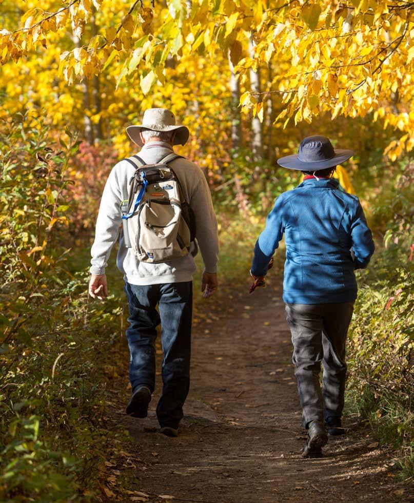
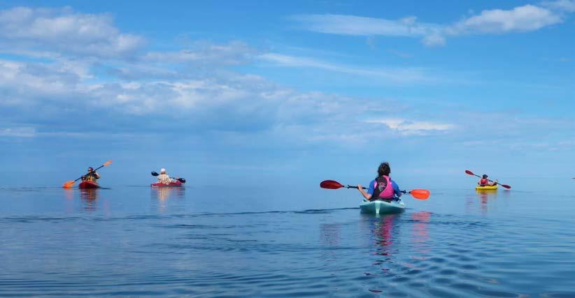
It is important to understand existing resident participation as a starting point for the TGMP. Hay River residents are extremely active in outdoor recreation activities. The Town of Hay River surveyed residents to get their input into existing and future outdoor recreational facilities (Figure 2.3) with the community survey showing that 81% of respondents walk or hike. All informal uses of greenspaces have high participation, with more than half of survey respondents reporting that they use Hay River’s trails and greenspaces daily or weekly.
Dog ownership is popular in Hay River. Creation of safe spaces for dogs has been identified as a priority and will be addressed in the go forward plan for outdoor activities.
Participation in Outdoor Recreation
Canoeing, kayaking or paddleboarding
Cross-country skiing or snowshoeing
Field sports (ex - soccer) Cycling
Gardening Fishing
Jogging/running
Skateboarding or scootering
Walking/hiking
Other (please specify)
Camping
Ball diamond sports
ATV or snowmobile use
Figure 2.3: Participation in Outdoor Recreation per Community Survey
2.5 Jurisdiction and Responsibilities
Several organizations provide trails and greenspace infrastructure and services, and collaboration is key to finding strategies for the Town and opportunities for partnerships in implementation. The following is a summary of the key organizations with influence over trails and greenspaces in Hay River, and their respective responsibilities:
Town of Hay River
Hay River Recreation Committee
Volunteer Groups
• Planning, design, capital development, operations, and maintenance of Town-owned trails and greenspaces
• Support public, private, civic, and social recreation organizations and services within the community;
• Help ensure that the maximum and most efficient, economic use is made of all available recreational facilities within Hay River;
• Advise and make recommendations concerning making of rules and regulations regarding the use, conduct, and behavior in any recreation facility owned and operated by the Municipal Corporation
• Provide input on the development, disposal, and maintenance of parks, greenspaces and facilities;
• Hear and consider requests from any delegation of citizens with respect to recreation, and act on such recommendations arising
• Hay River Ski Club
• Hay River Golf Club
• Hay River Skate Park
Territorial Government
Local Schools
• Hay River Snowmobile Club
• Hay River Dog Mushers
• Hay River Rotary Club
• Various Organized Sports Groups
• Ownership, planning, design, capital development, operations, and maintenance of Territorial trails and greenspaces (includes campgrounds and beachfront developments)
• Territorial trails and greenspaces within the municipal boundaries of the Town of Hay River
• Ownership, planning, design, capital development, operations, and maintenance of school sites, including playgrounds and sports fields
• Formal and informal agreements for Town and School owned recreational facilities including trails, fields, parks and greenspaces
The following is a summary of the strengths and challenges related to jurisdiction and responsibilities over parks and trails.
Strengths
ALIGNED MANDATES – TGMP is aligned with the Town of Hay River’s Strategic Plan, Tourism Development Plan and Tourism Marketing Plan, Strategic Housing Plan and future updates with align with the new Healthy Community Strategy.
PARTNERSHIPS – Hay River has many partners who support the trails and greenspaces within the community
COLLABORATION – Schools and sports leagues collaborate to improve the usage of trails and greenspaces.
ECONOMIC SUPPORT – Federal and territorial governments have programs that support Community efforts to develop and support trails and greenspaces.
ESSENTIAL SERVICE – Hay River owns and runs the cemetery.
Challenges
INSECURE SOURCES OF FUNDING – beyond the core funding in the Town budget for maintenance of trails and greenspaces, there is uncertainty year-toyear whether third party funding will be secured to complete larger scale projects such as expansion of the trail system.
INEFFICIENCY – Having more than one organization responsible for trails and greenspaces can create overlap and duplication of assets and services.
VOLUNTEER SHORTAGES – a small community has limited volunteer resources and the combination of aging population, population turnover and commuting workers with families makes it more difficult to enlist volunteers.
MISSED OPPORTUNITIES – the Town does not always know about grant opportunities and does not have the benefit of a guiding master plan to help in funding applications.
PUBLIC CONFUSION – The public does not always know who manages trails and greenspaces.
2.6 Key Challenges
Input from residents, local stakeholders, Town Council, and staff revealed several trail and greenspace challenges. These challenges affect both residents and visitors to the community. Focusing on these challenges in planning for the future will help the Town to meet its goals and improve the trail and greenspace infrastructure within the community.
VULNERABILITY
TO FLOODING EVENTS
– The Town’s location on the shores of the Hay River and Great Slave Lake offers many benefits in terms of outdoor recreation activities but it also presents challenges and exposure to flooding events that can occur at spring breakup. Flooding events can damage infrastructure and create recurring maintenance.
ACCESSIBILITY – Trails in nature are difficult to construct to accessible standards. While complete accessibility may not be a possibility, accessibility can be improved by ensuring that accessible trails (paved trails) are supported and that trails that have potential to be changed to improve accessibility are prioritized.
LIMITED WATERFRONT INFRASTRUCTURE
– the waterfront in Hay River is an asset that is underutilized as public access is limited. Private land occupies most of the waterfront and even though there are setbacks from the high-water mark, those rights-of-way are not all identified and accessible. Planning for increased waterfront access for trails and greenspaces will require significant consultation to create the accesses needed for that infrastructure and the risk of spring flooding limits the infrastructure that can be constructed in those areas.
CONNECTIVITY – a connected trail system increases the convenience of the trail system and can lead to increased usage. The Town has been working to improve the connectivity of its trail system and to upgrade sections of the trail to improve accessibility. Continuation of this work will create a connected trail system.
RESOURCES – Accessing the financial resources needed to construct and support trails and greenspaces is key to preserving existing infrastructure and to any future expansion. Human resources are needed to support the trails and greenspaces and must be factored into expansion plans. Partnerships and volunteer groups help to offset some of the human resource pressures on Town resources, but certainty of resources is critical to prevent trails and greenspaces from declining condition and causing safety issues.
GAPS IN INFRASTRUCTURE
– The community survey showed some infrastructure gaps that should be considered in the future planning of trails and greenspaces. Repurposing low usage greenspace areas into off leash dog parks is one example of how infrastructure gaps can be addressed.
BALANCING ENVIRONMENTAL PRESERVATION WITH TRAILS AND
GREENSPACE – the natural environment is important to Hay River and area residents, and it is an attraction for people travelling to the area. The existing and future trail and greenspace development needs to balance preservation and respect for nature and wildlife. Construction standards and application of traditional knowledge in the choice of new development can help offset this challenge.
AGING INFRASTRUCTURE – Aging infrastructure presents financial and safety issues. Scaling infrastructure development to align with financial resources and dedicating time to finding third party funding sources will help the Town to keep its trail and greenspace infrastructure in good condition and safe for users.
Planning for the Future
The Trail and Greenspace Master Plan adopts the Vision statement from the Town of Hay River’s Strategic Plan This approach is consistent with the desire to have alignment between the major planning documents that the Town uses as a roadmap to achieve its goals and vision
3.1 Vision
The Vision statement set the overall direction of the TGMP.
Hay River is a culturally diverse hub that celebrates its history, social and recreational well-being, and its opportunities for growth.
3.2 Goals
Quality and Inclusivity High quality trails, greenspaces and amenities for all ages, abilities, and cultures
Connectivity Connected trail system linking to greenspaces, destinations, and other recreational infrastructure.
Green Planning Desirable trails and greenspaces in new developments
Waterfront Public access to and along the waterfront
Environment Addressing climate change impacts on existing trails and greenspaces and incorporating strategies to minimize impact on existing and future infrastructure.
Efficiency Streamline implementation of trails and greenspace planning, development and operations.
3.3 Key Trends
Outdoor recreation is constantly shifting based on demographic characteristics and societal changes. An understanding of trends can help the Town focus on directions that will be proper in the future. The following are some of the broad trends that are relevant to Hay River based on observations and community input:
UNSTRUCTURED ACTIVITIES
There is a trend towards greater participation in activities that are unstructured and spontaneous rather than pursuits that require registration, attendance at specific times, and payment of fees. This is one of the reasons why trail uses are so popular. People can take part at their own level, with a flexible schedule, and at no cost for use.
FOCUS ON HEALTH
As physical activity decreases in the population, with accompanying health issues, many people have a renewed interest in supporting a healthy lifestyle through exercise. Long daylight hours in the summer provide more flexibility for incorporating healthy lifestyles and increased usage of outdoor infrastructure, especially trails and greenspaces.
WELCOMING ALL AGES AND ABILITIES
Municipalities are striving to create parks and public spaces that are welcoming for all residents to address the public focus on healthy lifestyles. This includes creative play environments for children, places for youth that involve skateboards, bikes and multi-use sport courts, accessible paths, and amenities like pickleball for older adults. Park amenities that welcome all ages and abilities, such as community gardens, are also popular.
EMBRACING DOGS
Dog ownership is high in Hay River, and areas within the Town boundaries are being planned to recognize the social and physical benefits to people that come from embracing responsible uses by humans and their dogs. Communities are planning destination and neighbourhood-level off-leash dog areas and appointing trails and water access points that welcome dogs.
INTEGRATING NATURE
In places like Hay River where the natural environment is a key draw, communities are taking steps to integrate development with nature and to provide places where people can experience a natural setting. This may take the form of greenway corridors that serve wildlife and people. It also includes improving access to waterfront for the public.
BAnalysis and Actions

Key Findings Trail use is a popular form of recreation in Hay River.
Key Direction Improve interconnectivity of trail system and, where possible, increase trail accessibility, particularly in the downtown core.
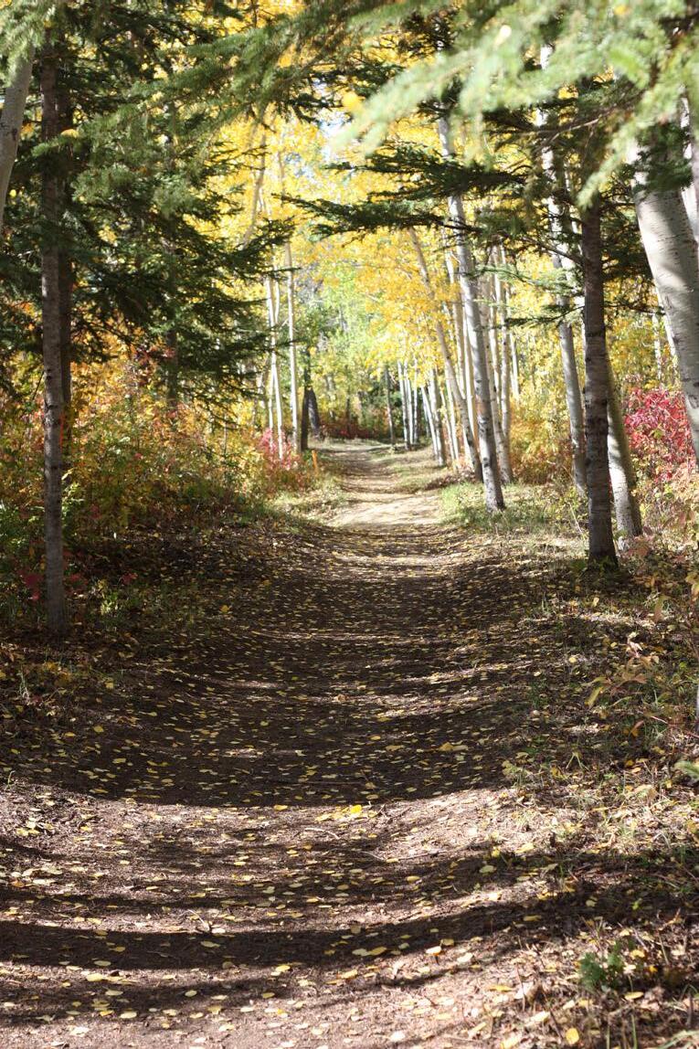
4.1 Existing Trails
The Town of Hay River has four (4) types of trails:
1. Roadside Multi-Use Pathways
a. High accessibility paved trails and routes (Urban Pathways)
b. Unpaved trails
2. Off-Road Multi-Use Pathways
3. Specific Purpose Pathways
4. ATV Pathways (i.e. backcountry trails)
OFF-ROAD MULTI-USE PATHWAY
Examples: Oxbow Trail, Porcupine Trail
MINIMUM 7.5m NATURAL SURROUNDINGS
Clear zone from 0.3 to 2.0m above grade
ROADSIDE MULTI-USE PATHWAY
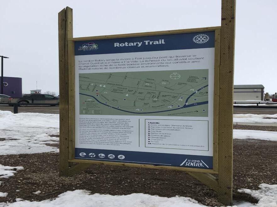
Examples: Rotary Trails and Vale Island Connector
zone from 0.3 to 2.0m above grade MINIMUM 6.0m
0.5 0.5 2-3m paved or compacted soil Forest Forest
NOTES: Drainage as needed, and Clear Zone from 0.3m to 2m above grade
URBAN PATHWAY
Examples: Irma Miron Trail, Tri-Service Trail, Airport Trails, TCT Downtown
NOTES: Drainage as needed
NATURE TRAIL
Examples: Fraser Place Trails, Ravine Loop, Beach Walks
VARIES
Map 2
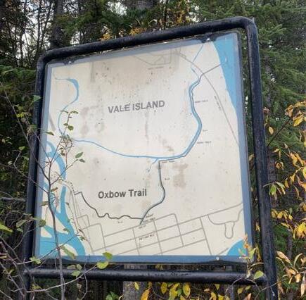
VALE ISLAND & SOUTH SHORE EXISTING TCT TRAILS Oxbow Trail
Trail Management varies:
• TCT trail sections (town managed)
• Non-TCT trails (town managed)
• Non-TCT trails managed by other groups
• Unmanaged “nature” trails
VALE ISLAND & SOUTH SHORE EXISTING TRAILS
Porcupine Trail
Pumphouse Beach Walk
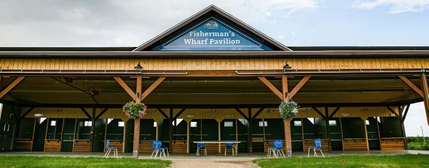
Fisherman’s Wharf Pavilion
Hay River Merlyn Carter Airport
Old Town (Proposed) Connector Vale Island
Oxbow Trail
Dog Teams Trail
Porcupine Trail
Lagoon Beach Trail West Channel Shoreline
Pumphouse Beach Walk
Hay River Territorial Park
Hay River Public Beach
Old Town (Existing) Connector
Porritt Landing Boat Launch and Marina
Fisherman’s Wharf Pavilion
Old Town Connector
Map 2
NEW TOWN TCT EXISTING TRAILS
Vale Island Connector
Trans Canada Trail Forks to Bridge
Trans Canada Trail (Firehall to Schools)
Trans Canada Trail
Downtown
Miron to Tri-Service ATV Trail
Trans Canada Trail
Trail Management varies:
• TCT trail sections (town managed)
• Non-TCT trails (town managed)
• Non-TCT trails managed by other groups
• Unmanaged “nature” trails
New Town
South Trailhead NEW TOWN EXISTING TRAILS
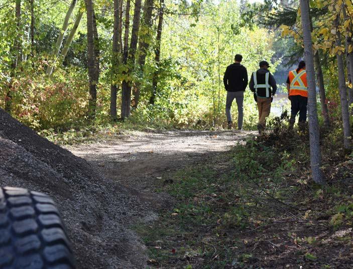
Map 2 illustrates the existing trails. Figure 4.1 shows the lengths of the various trail types. Not all the trails illustrated in Map 2 are supported by the Town. Various interest groups have developed some trail systems that are “informal” and do not have land rights attached to those systems. There is no permanent infrastructure on “informal” trails and changes in land use or ownership may require the relocation or abandonment of those trail systems.
The terrain in Hay River is uneven in forested areas, and the ability to make trailsin-nature accessible is cost prohibitive. The Town emphasizes accessibility in the downtown centre and has existing or planned trails that are paved or well-packed to promote accessibility.
Figure 4.1: Existing Trail Lengths
AMENITIES
Amenities along trails help to improve the attractiveness, interest, and comfort for the trail user. These amenities are typically placed outside of the travelled part of the trail. The following are the amenities that need to be considered when developing amenities for trails.
TRAIL HEADS
Trail heads, or staging areas, are major access points to trails, typically found near roads or existing parking lots:
• Major staging areas typically include a parking lot, information signage, waste facility (see below), and should include washroom options where possible.
• Minor staging areas typically include a wayfinding sign and waste facility.
Major staging areas are typically used for primary access points to off-road multiuse trails. They are found where there is space available at convenient locations for trail access.
Minor staging areas are usually found where trails crossroads or start at parking areas. Trail heads help with wayfinding and promoting awareness of the trail system, and provide opportunities to convey regulatory, interpretive, and emergency information.
BARRIERS
Barriers are found at staging areas to prohibit access by prohibited modes, usually motorized vehicles. Barriers can include bollards (wood or lockable and removable metal posts), baffles, or gates. Fences or railings on either side of the trail can be used to restrict users. Barriers need to be designed to allow all permitted use and to accommodate service and emergency access.
SIGNAGE
There are four types of signs that are needed along trail systems, as follows:
• Way-finding, or directional, signs show routes and facilities, e.g. trail name, trail uses, distance to specific destinations, map of trail system indicating current location.
• Regulatory signs show traffic regulations, e.g., stop, yield to pedestrians, and codes of conduct, e.g., use waste receptacles, pick up after animals, etc.
• Warning signs inform users of potential hazards, e.g. road crossing ahead, and may include notices about risk and liability for trails with specific hazards.
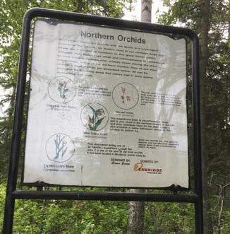
• Educational, or interpretive, signs provide information about the surroundings, e.g., description of natural history, vegetation, fish and wildlife, landmarks. Signs can be placed on kiosks, posts, or bollards.
WASHROOMS
Trail users can comfortably spend more time enjoying trails when they have access to washrooms. The first strategy is usually to name existing washrooms that can be made available for use, particularly washrooms in parks. The next strategic location for washrooms is major staging areas. Washrooms should be based on universal design. The Town currently has only one all-season public washroom at the recreation centre and otherwise relies on porta potties for parks and greenspaces. Transitioning away from porta potties to more trailered washrooms or permanent washroom structures will depend on available funding. Refer to Section 6 for more information on washrooms.
SITE FURNITURE
The following are the likely types of site furniture for Hay River’s trails:
• Benches – benches are most important on the higher use multi-use trails. Benches are typically found to take advantage of any views or interesting features and to provide rest areas for trail users. Hay River has several memory benches that were installed in partnership with the Downtown Beautification Committee. These benches were sponsored by members of the community.
• Waste facilities – depending on emerging standards this could be one waste receptacle or separate receptacles for recycling and waste. Waste facilities are most important at staging areas where visitors are beginning or ending their trips, and where they can be serviced.
• Lighting – lighting is currently restricted to streetlighting in urban areas and for trails that are next to the highway. There are no current plans to increase lighting on the trails. Where possible, the Town takes advantage of full moon events to promote nighttime trail usage. Long daylight hours in the summer support summer trail usage at night and offset the requirement for lighting during the summer season.
TRAIL DESIGN GUIDELINES
Many organizations have standards for trail design and construction. The following are some of the most important design guidelines that are relevant to Hay River:
ROUTING
• Link trail networks with major parks and recreation facilities, the Town Centre, schools, and other destinations in the community.
• Link trails within the community to existing and future trails in surrounding jurisdictions.
• Route trails through natural areas where possible, striving to realign and reconnect key trail links that currently pass through new development areas to adjacent natural areas when development occurs.
• Site trails to follow contours, to take advantage of views and interesting features, and to pass around large trees and major landforms to minimize regrading and vegetation removal.
• Avoid long straight segments, providing enough meander to make the trail interesting, but avoid excessive weaving, especially along a narrow corridor.
• Site and design the trail system with attention to the experience of the trail user, ensuring that the trail is easy to find, marked prominently and that wayfinding is as straightforward as possible, e.g., avoid complicated routes with many sharp turns.
• Avoid slopes over 30 percent on all trails.
ACCESSIBILITY
• Paved trails where possible or hard compacted trails to improve accessibility.
• Construct access and egress ramps to improve accessibility for mobility constrained users.
VEGETATION
• Minimize disturbance to vegetation near trails to the highest degree possible
• Protect existing trees and their roots wherever possible in the planning, design, construction, and maintenance of the trail system.
• In areas with opportunities for enhancement of the vegetation, plant trees and shrubs, selecting native plants.
• Address potential hazards related to kept trees, considering clear zones and windthrow.
• Use low impact and environmentally conscious materials and construction methods to the degree possible
• As part of trail construction projects, remove invasive species from natural areas and replace them with native varieties where possible.
• During trail construction, minimize disturbance to the soil surface and existing vegetation next to trails.
• Where trails are close to residential property avoid tall dense thickets to address safety and security
• Reduce the visual impact of hard edges such as fences, retaining walls or extensive paved areas with tree and shrub planting.
• In new developments, encourage placement of multi-family housing and trails next to each other.
ENVIRONMENTAL CONSIDERATIONS
• Design trails with consideration for protection and enhancement of environmental resources and include flood mitigation where possible.
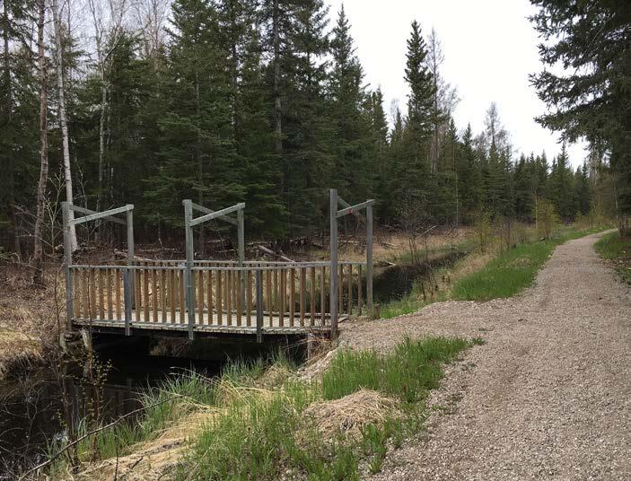
• Minimize impacts on environmentally sensitive areas, using bridges and boardwalks as needed.
• Consider boardwalks in very specialized locations where a nature viewing opportunity can be provided without undue damage to environmental resources, and where there are no suitable alternatives.
OTHER DESIGN CONSIDERATIONS
• Find locations for staging areas, and provide infrastructure to suit the location, e.g., kiosk, sign, waste facility, parking.
• Recognize biking as trail use and incorporate it into trail planning and management.
• Incorporate drainage in design of new trails
OTHER
• Include relevant information from the guidelines above in the Municipal Standards document.
4.2 Analysis
The Hay River section of The Trans Canada Trail links the historic water route (Great Slave Lake) with the ‘Hub of the North’, or downtown core of Hay River. The Oxbow section starts at the fishing village of West Channel and runs south through the Boreal Forest of Vale Island, across a bridge and through the downtown area via the Mackenzie Highway, or Kiwanis Nature Trail. It continues along the Mackenzie Highway and ends at the south entrance to town, or Bob McMeekin Park. While most of this trail is more natural (dirt, or gravel), there are several sections of pavement which are good for running, roller blading, or strollers.
COMMUNITY SURVEY INPUT
Forty-seven percent of the survey respondents were satisfied with the trails within the community. Twenty-six percent were dissatisfied, and the rest were neutral in terms of trail satisfaction.
PROPOSED TRAILS
Map 2 and Figure 4.2 show the trails proposed to complete key gaps in trail connections as identified through community input and analysis.
The Town completed a risk assessment of the existing trails and proposed mitigating actions to address areas of risk. The risk ratings used were “Good, Fair and Poor”. Although there is some overlap, the risk ratings were assigned independent of the accessibility ratings. Improved accessibility was identified as a priority and analyzed separately. APPENDIX A shows the risk rating and recommended mitigating actions for the trail system. Some of this work has already commenced and work is ongoing to address the flood damage from the unprecedented flood of 2022.
Accessibility rating of trails is based on the study completed through the Trans Canada Trail in association with AccessNow. The accessibility ratings used were “Accessible, Partially Accessible and Not Accessible”.
Figure 4.2: Existing and Proposed Trails
The following is a quote from the AccessNow3 assessor Bryson Asels:
“The trail was primarily partially to not accessible, with a few areas that were accessible for a wheelchair. It was very muddy, bumpy and uneven ground, with holes and divots in the path. There were swampy areas flooding over, where the path was looted with roots, fallen trees and brush litter, which was not accessible at all. Several moderate to steep inclines and declines. Some segments of paved
Strengths
LOCAL ACCESS – Access to many great trails in neighbourhoods and small trail connections in and around town centre, e.g., TCT Downtown Trail.
MARINE ACCESS – Both the Hay River and Great Slave Lake waterways are accessible to the public from a variety of formal and informal access points.
SCHOOL ACCESS – Trail / pedestrian access to most schools is good.
RECREATIONAL ACCESS – Hiking and biking.
POTENTIAL ROUTES – Fire Smarting corridors are existing linear routes that could serve as trails.
surface and some light gravel which were the accessible parts of the trail. There were several information signs about the animals and plant life in the area. There are lots of benches and picnic tables which are mostly partially accessible due to uneven ground. There was one small parking place situated at an entrance to the trail that was accessible but did not have designated accessible parking spots.”
The following is a summary of the strengths and challenges related to trails.
Challenges
CONNECTIVITY – Lack of trail connectivity, many gaps exist.
UNIVERSAL DESIGN CHALLENGES FOR ACCESSIBILITY – Some trails have rough surfaces that make them difficult to use for some people.
AMENITIES – Need for more amenities along trails, e.g., wayfinding, and updated interpretive signs.
MAINTENANCE ISSUES – Concerns about maintenance of trails.
RIVER ACCESS – Public access along the Hay River is limited by private ownership and limited right of way access to Commissioner’s land adjacent to the riverbank.
TRESPASS – Some trails are on property that is not owned by the Town. Most of these non-Town owned trails are on Commissioner’s land and there is no MOU in place for the use of that land.
3 14 February 2022 - Trans Canada Trail’s Accessibility Mapping Program, in partnership with AccessNow
4.3 Actions
Actions related to trails along the waterfront are in Section 7. High priority trails are included in Section 9.
PLANNING AND DESIGN
4.1 Coordinate among territorial government departments to plan for the connectivity of trails as opportunities arise.
• Focus on making the Town Centre more walkable
• Complete the flood mitigation measures included in the risk assessment matrix
4.2 Work with other organizations in Hay River on planning major trail networks to achieve broader active transportation, recreation, and tourism opportunities, with the following as examples:
• Collaborate with user groups, Hay River Métis Government Council, West Point First Nation, Kátł’odeeche First Nation and territorial government on a trail network and green commuting strategy.
• Collaborate with the territorial government, Hay River Métis Government Council, West Point First Nation, and Fishermen’s Federation on a walking loop, including shoreline access
• Work with the School District on providing safer routes to schools
• Work with landowners and developers on better pedestrian connections to, and within, the Town Centre
• Encourage snowmobile club, ski club partnerships
• Rotary Club, Hay River Museum Society and other similar groups via trail sponsorship agreements
4.3 Identify needs for trails through major new development projects.
• Where a proposed trail passes through a development site, work with the developer to identify a route for the trail, ideally through greenspace separate from the road system; second choice would be a roadside multi-use trail
4.4 Implement and guide the planning and design of trails based on the guidelines in this section.
4.5 Update the signage plan for trails, including all types of signs as outlined above.
• Include maps, online resources, and a potential app in the future
4.6 Update the Municipal Standards, to include standards for trails as described in this section, including trail types, location, provision of amenities and signage, and design standards.
LAND ACQUISITION
4.7 Confirm land ownership for proposed realignments, per the proposed trails on Map 2.
CAPITAL DEVELOPMENT
4.8 Upgrade existing trails and construct new ones as opportunities arise on Town projects and new developments, per the proposed trails on Map 2 and the priorities in Section 9.
4.9 Develop trailheads and amenities along trails as part of trail development projects and as needed to meet needs on existing trails.
Greenspaces
Key Findings
The Town of Hay River has a good amount of developed greenspace. According to the survey, people would like to see increased maintenance of existing spaces and repurposing of some greenspace for off-leash dog areas.
Key Direction Repurpose existing greenspace to accommodate offleash dog areas. Improve maintenance performance using updated checklist systems. Develop comprehensive Plans for Community Parks to guide development and asset replacement.
5.1 Existing Greenspaces
The Town of Hay River has a significant amount of undeveloped land (open space) within its municipal boundaries, most of which is owned by the territorial government and is designated Commissioner’s Land. Land claim negotiations with local indigenous groups are in progress but not complete. While these negotiations are ongoing, transfers of land to the Town are affected, which places greater emphasis on developments within existing landholdings. As well, the geotechnical characteristics of the open space lands present challenges for development in the future due to soil and drainage conditions. Some of the metrics used to assess whether the Town has sufficient greenspace within its current inventory and whether future planning can accommodate added greenspace are affected by these considerations.
GREENSPACE CLASSIFICATION
The classification of parks and open spaces can help to provide an understanding of the various roles of greenspaces, which can be a useful planning and management tool (Map 3). The following is the proposed classification system for greenspace in the Town of Hay River. Some greenspaces are difficult to classify because they fit into more than one definition. In those cases, the most proper category is selected based on use.
Community Park
Neighbourhood Park
7.3
Nature Park
4.5
• Destination parks that serve residents and visitors
• Help to form the visual, physical, and social focus of the community
• Offer natural features and/or built facilities, cultural features, and other opportunities
• Include amenities such as sports fields, playgrounds, courts, signs (wayfinding and regulatory), washrooms, trails, and parking lots
• Diverse activities – picnics, special events, sports, play areas, recreation
• Generally, serve the catchment area of or similar to that of an elementary school
• Form the visual, physical, and social focus of a neighbourhood
• Typically include signs (park name and regulatory), play equipment, pathways, open grass, and seating; may also include other recreation amenities
3.2
• Dominated by natural features such as forests and watercourses, often including environmentally sensitive areas
• Recreation usually includes trail uses and nature appreciation
• Amenities may include parking lots, signs (wayfinding, regulatory, and interpretive), trails, gathering areas, and washrooms that support public access and use
• Territorial parks and preserves are included
Visitor Information Centre, Bob McMeekin Park, Keith Broadhead Park (Glenn Smith Field and Pine Point Field), Tri-Service Park, Don Wright Ball Diamond, Vale Island Recreation Area
Gord Thompson Park, Inukshuk Park (Ray Benoit Rink), Lioness Park, Vale Island Rink, Mackie Place Greenspace, Camsell Crescent Park, Malcom Crescent Park, McMeekin Crescent Greenspace, Lowes Greenspace, Cranberry Crescent Greenspace, West Channel Playground, West Channel Historical Society Greenspace
Hay River Public Beach
Greenspace
Shoreline Access Park
3.0
Linear Park
Special Purpose Park
0.4
• Sites that provide access from upland areas to the shoreline
• Include trails and boat launches
• Corridors for the purpose of supporting a trail
• May have some amenities such as benches, staging areas, signs and planting
168.1
School Sites variable
Porritt Landing Boat Launch and Marina, Fisherman’s Wharf Pavilion, The Forks Crossing, Paradise Gardens
Green Bridge Easement
• Destination areas with specific and unique roles Hay River Ski Club, Hay River Golf Course, Hay River Skatepark
• Greenspace part of public-school sites (school buildings and parking lots are excluded)
• Included because the land usually has park values
• Land size is tabulated separately from the parks because school sites are subject to change by the School
Diamond Jenness Secondary School, École Boréale, Harry Camsell School, Princess Alexandra School
Hay River Merlyn Carter Airport
Don Wright Ball Diamond
Cranberry Crescent Greenspace
Crossing
McMeekin Crescent Greenspace
Old Town Rink Vale Island Recreation Area
West Channel Playground
Fisherman’s Wharf Pavilion
Porritt Landing Boat Launch and Marina
Hay River Public Beach
Island
New Town
Greenspaces managed by the territorial government add to the attraction of Hay River as a destination. The Hay River Public Beach and the Territorial Park provide beachfront amenities and campground services for residents and visitors to the community. The amenities at these sites continue to develop, adding to the variety of activities that can be enjoyed and promoting extended stays in the area.
The active community cemetery in Hay River is called the Riverside Cemetery. It is not currently mapped as greenspace, but it is an important open space in the Town. The Town of Hay River owns and runs the cemetery, and it is supported by Town staff. There are some challenges facing the cemetery. It is reported to be almost full, and it is in close proximity to the Hay River which creates the risk of erosion of the riverbank from violent spring breakup events. When cemeteries are facing these types of challenges, the typical practice is to prepare a cemetery master plan including the following tasks:
• Assess community cemetery interests and project needs
• Review cemetery space considering the existing and potential market share, multiple interment options, and the potential for infill or relocation
• Review cemetery finances and compare fees with those of similar communities
• Provide recommendations including a business plan, concept design, and operations practices
5.2 Analysis
COMMUNITY SURVEY INPUT
Forty-five percent of respondents were satisfied or better with Town owned and supported parks and greenspaces.
GREENSPACE SUPPLY ANALYSIS
Hay River has 25 greenspaces covering 183.3 hectares (ha). With the addition of school sites and territorial greenspaces, Hay River is fortunate to have approximately 190 hectares of greenspace available for public use.
Greenspace supply is analyzed using three different methods. Many municipalities use population-based standards to calculate and plan their supply of greenspace. Other analyses of area-based supply and spatial distribution can increase the understanding of greenspace supply and needs for future parks.
In many jurisdictions, greenspace supply standards are used as a guideline, rather than a definitive requirement. Park supply standards can be applied in a flexible manner to ensure that a full range of park types is available to all residents. They also enable a community to measure their supply over time, and to compare themselves with other communities. The two main bylaws that apply for Park standards are Bylaw 2444-22b Zoning and Building Bylaw and Bylaw 1811-18 Community Plan. Developers are referred to these two bylaws for specific requirements as it relates to the provision of recreational space in new developments.
Figure 5.1: Greenspace Supply in Hay River
Section 4.6 of Bylaw 1811-18 Town of Hay River Community Plan outlines the planning approach for future greenspace as follows:
SECTION 4.6 PARKS AND OPEN SPACE
1. Land use and development decisions shall promote, whenever possible, the preservation of public parks and open spaces supported by the municipality and help landscape and trail connections including access to the waterfront.
2. The shores of the Hay River (both channels) and Great Slave Lake shall be designated for environmental protection and recreation use, except where specifically required for transportation, utility, community or tourism uses as shown on the Land Use Concept (Figure 2).
3. The Town shall continue to explore and develop the potential for outdoor recreation opportunities on municipal lands in order to enhance the local quality of life and to promote natural resource-based tourism development. All future residential areas shall provide sufficient local parks and recreation space for future residents that are easily accessible and visible from the street.
4. A minimum of ten per cent of land in or adjacent to new residential area will be designated for use as parks and open space and this land may be considered for future school sites where joint use of recreation space is provided.
POPULATION-BASED ANALYSIS
Population-based greenspace supply is typically calculated on the more active types of greenspaces such as community and neighbourhood parks, excluding natural parks and greenspace, within urban areas. Linear parks are added into the active greenspace supply where they support high levels of use. Figure 5.2 illustrates the existing supply of active greenspace in relation to population within the community based on 2022 population and projected population for 20354.
Supply (ha/1,000 pop)
4 NWT Bureau of Statistics population estimates for 2022, Town of Hay River and population estimates for 2018 to 2035, Town of Hay River AccessNow
Figure 5.2: Population-Based Active Greenspace Supply in Hay River
Type
The current supply of active greenspace, including linear parks and not including school grounds, is 3.2 ha/1,000 population (based on a current population of 3,800). If the Town were not to develop any added greenspace until 2035, the active greenspace supply would drop to about 3.0 ha/1,000 population using the NWT Statistics Bureau Estimates for 2035 Hay River Projected Population based on 2018 population by community. With school sites added, these numbers are higher, however the Town does not have control over these sites, and most are unavailable for community use during school hours. The Town also has limited control over the Territorial Public Beach, but this park is available for public access and use at all times.
For many years the Canadian standard for supply of active greenspace (usually community and neighbourhood parks) was 4 ha/1,000 population. With trends towards increasing density, especially within downtown cores, supply standards have been decreasing. Municipalities with smaller land areas, which are mostly built out, cannot meet the traditional supply standards due to the high land values and lack of available undeveloped land. Areas where land claim negotiations are not completed may not be able to get new lands or transfer lands from other levels of government until claim negotiations are completed. There is not a lot of data available for greenspace to 1,000 population for communities of a similar size to Hay River. The number varies widely across Canada however, the 2005 provincial average in BC was 2.51 ha/1,000 population, and compared to this number, Hay River has a higher ratio of greenspace per 1,000 population and is projected to continue this result through to 3035 based on NWT Statistics Bureau population growth estimates.
AREA-BASED GREENSPACE SUPPLY
Another way of measuring greenspace supply is in relation to land area. This measure typically includes open space, natural areas, and parks managed by all jurisdictions. The benchmark for this measure is typically around 10% and may be tied to territorial benchmarks if they exist. Figure 5.3 illustrates the greenspace supply by area for the Town. The Town’s percentage of lands covered by greenspaces is low, but that statistic is skewed by the amount of Commissioner’s land.
Figure 5.3: Area-Based Greenspace Supply
GREENSPACE DISTRIBUTION ANALYSIS
The third way to analyze greenspace supply is by spatial distribution, or the distance residents must walk to access a park. The analysis is based on ideal walking access – a 20-minute walk to a community park and/or a 5-minute walk (400 m) to a neighbourhood park or school site. These benchmarks are consistent with the “15-minute City5” concept that amenities and services should be accessible to residents by either a 15-minute walk or bike ride.
The distribution of community and neighbourhood parks, and school sites, is variable for different parts of the Town. The pattern of distribution is as follows:
• COMMUNITY PARKS – Hay River’s community parks are well distributed within the developed part of the Town, where many residential areas are within a 20-minute walk of a community park.
• NEIGHBOURHOOD PARKS – There is a lack of neighbourhood parks in the Town Centre.
• SCHOOL SITES – Some of the school sites help to meet neighbourhood park needs, but they are not accessible to the public during school hours.
GREENSPACE ACQUISITION AND NAMING
New parks and trails are gotten primarily through development as part of the required ten percent greenspace dedication goals within the Community Plan. The Town does not currently have specific policies or guidelines for greenspace acquisition, nor is there a policy for cash in lieu of greenspace.
Generally, community and neighbourhood parks are required for residential areas that are deficient in greenspace and for new residential developments. Parks need to be of a sufficient size to provide recreational values and to be cost effective to support. For subdivisions in locations without neighbourhood plans and small developments, such as those with fewer than 15 lots, it may be preferable to take cash in lieu of greenspace. This master plan provides guidance on greenspace acquisition in Section 5.3.
The Town of Hay River has a Policy for Town Property Street Naming that includes the naming of greenspaces. This document sets out the process and information needed to name greenspaces and instructions for the public to present suggested names for Council consideration. This Policy provides consistency in naming conventions and is an important tool for the Town to ensure alignment with its Branding and Marketing Strategy.
GREENSPACE EVALUATION
Following the extreme flood event of 2022, the Town of Hay River completed a risk assessment of the existing greenspaces. The condition assessment uses a risk rating of Good, Fair and Poor. The extraordinary flood event in 2022 caused damage to some greenspaces that is outside of the normal expectation for planning purposes. The Town has started to repair flood damage and in doing so, will assess whether high value assets should be moved or whether the unprecedented flood of 2022 will be ignored for the purposes of future planning for these areas. APPENDIX A includes a risk assessment with risk rating for all greenspaces and recommended mitigating measures.
5 2016, Carlos Moreno, Professor, The Sorbonne in Paris
SUMMARY
The following is a summary of the overall challenges and strengths of the Town of Hay River’s greenspaces:
Strengths Challenges
EXTENSIVE GREENSPACE – for the Town’s population it has a significant amount of greenspace and potential to repurpose some of the lessor used spaces for off-leash dog areas.
MAINTAINING EXISTING AND FUTURE GREENSPACES
– accounting for maintenance requirements when adding new greenspaces is critical as operational funding typically comes from the Town’s annual budget. The Town supplements its seasonal workforce with summer students and funding for the added resources is not always available. The community survey showed a need to improve maintenance at existing greenspaces which will be challenging based on current resources.
SUPPORTIVE RESIDENTS – residents are generally happy with the amount of greenspace in the community.
LACK OF DOWNTOWN GREENSPACES
– most of the Downtown greenspace is owned by the Schools and is not available during school hours. The Town is currently renting space for Town Administration and there is no associated greenspace. Incorporating greenspace/plaza features if a new Town Hall is built will add to the inventory of greenspace in the Downtown area.
PARTNERSHIPS – local interest groups, Indigenous organizations and volunteers continue to contribute to the ongoing improvement of greenspaces within the community.
LONG LEAD TIMES FOR DEVELOPMENTS
– Many subdivisions found in the Community Plan have been in the planning stages for several years. These developments often require community infrastructure to support the development. The lead times to plan, fund and construct new infrastructure to support development is significant due in part to the short construction season in the North. New greenspaces have been shown in the planning for new developments but the timing for new greenspaces is also affected by the long lead times.
NATURAL SETTING AND PROXIMITY TO WATERFRONT –
the Town’s location on the bank of the Hay River and the shore of Great Slave Lake with extensive boreal forest presents unique opportunities to improve on existing greenspaces and develop new spaces that are “in nature” which has appeal for residents and is a marketing draw for visitors.\
MITIGATING FLOOD RISKS –
the 2022 flood is considered an extreme flood event and not likely to be repeated but the Town is still taking measures to protect high risk assets from flood damage. Some greenspace areas are on the river side of the mitigation construction which leaves them vulnerable to future flooding. Strategies to protect assets through mobile systems that can be removed and stored or through relocation are part of the measures in this Master Plan.
5.3 Actions
PLANNING AND DESIGN
5.1 Use the following guidelines for new developments and redevelopment within the Town Centre:
• Site community and neighbourhood parks so that one type or the other will be within a 10 minute walk of most residents, with community parks ideally located within a 20 minute walk of most residents
• Locate community and neighbourhood parks next to natural areas where synergies will benefit users
• Locate community and neighbourhood parks with significant street frontage or well-marked trail access if street frontage is not available
• Include and protect existing trees within parks where possible
• Plant trees within parks for shade and habitat values
• Incorporate areas with heritage values
• Consider inclusion of some or all these guidelines in the Municipal Standards document
5.2 Prepare Park Plans, with full community engagement for the parks with the highest needs and potential, as follows:
• Bob McMeekin Park
• Vale Island Recreation Area (Vale Island)
• New Town Hall Plaza
5.3 Advertise the policy for greenspace naming.
• Review greenspace names and revise to take advantage of opportunities to highlight community contributions or historical/cultural significance
5.4 Prepare a Master Plan for the cemetery, considering the lifespan of the existing cemetery and potential need for a new cemetery site.
5.5 Complete a Signage Plan for greenspaces, including park name, regulatory, wayfinding, and interpretive signs.
• Include maps, online resources, and a potential app in the future
• Integrate heritage and cultural information into wayfinding and interpretive signs
5.6 Update the Community Plan and Zoning Bylaw to mitigate greenspace investments from flood damage.
• Incorporate results from flood zone mapping
LAND ACQUISITION AND DISPOSITION
5.7 Acquire new parks in existing neighbourhoods where parks are lacking.
• New greenspace in Town Centre should maximize available space
• Other neighbourhood parks should be a minimum of 0.2 hectares
5.8 Acquire community and neighbourhood parks in new developments within a 10-minute walk of neighbourhood residents
• Target minimum size of 1.0 hectares for community park
• Target minimum size of 0.2 hectares for neighbourhood parks
5.9 Consider disposition, decommissioning or repurposing of existing parks that do not have high value as greenspace, per the list in this section, and use any funds received to purchase higher value greenspace elsewhere or repurpose the intended usage to fill gaps in desired infrastructure such as off-leash dog parks.
CAPITAL DEVELOPMENT
5.10 Guide the capital development of new community greenspaces (by the Town and/or developers).
• Include parking and major recreation facilities within community parks based on amenity distribution and needs (section 6), including amenities such as sports fields, ball diamonds, sports courts, picnic areas, dog off- leash areas, larger playgrounds, and spray parks (pending review of ability to support a park with existing municipal infrastructure and resources required to support larger playgrounds).
5.11 Guide the capital development of new neighbourhood parks (by the Town and/or developers).
• Include the following amenities as a minimum:
Neighbourhood parks:
• Mowed grass area
• Playground equipment, with sand fall zone
• At least 1 bench and table
• Waste bin
• Shade trees
• Fencing along primary roads or separating from residential properties
• Parking for maintenance vehicles on secondary road
Neighbourhood greenspaces:
• Mowed grass area
• 1 bench and/or table
• Shade trees
• Parking for maintenance vehicles on secondary road
• Waste bin
5.12 Guide the capital development of all other types of parks (by the Town, developers, and/or other potential partners such as Indigenous or special interest groups).
5.13 Include amenities as appropriate to each park (Section 9).
5.14 When new parks are developed, allocate funds for Town maintenance and asset replacement.
• Maintenance costs are typically five percent of capital construction costs annually for developed parks (significantly less for parks with fewer amenities)
Greenspace Amenities
Key Findings Hay River has most amenities expected in a community of its size however awareness of existing facilities is lacking.
Key Direction Focus on educating what facilities are available and service levels, providing more off-leash dog areas, playground maintenance and asset replacement planning.
6.1 Existing Park Amenities and Analysis PLAYGROUNDS
The Town of Hay River has playground areas in three of the six community parks. Where playgrounds are set up, there should be an ongoing inventory and an overall plan to conform to current safety standards and construction materials that are designed for the safety of the users. Where possible, consideration should be given to introducing playground designated areas in the remaining community parks.
In Hay River, other playground facilities are at schools and the public beach. This infrastructure is constructed and managed by the Schools or the territorial government.
For many reasons, a spray park is not a practical amenity for the Town currently. Hay River has an extended winter season which creates a high ratio of maintenance cost to hours of operation of an outdoor spray park. The Town has a spray pad within the aquatic centre that is available year-round except for maintenance periods. The territorial beach offers options to residents for cooling off on hot days. If the Town experiences a population boon with increased economic activity, or if a partner for capital and operating expenses is found, the feasibility of a spray park could be revisited in the future.
PICNIC AREAS AND AMENITIES IN PARKS
Most community and neighbourhood parks have seating such as picnic tables or benches. Similarly, waterfront greenspaces typically have tables or benches for seating to offer picnic opportunities within the community. An inventory of the location and condition of picnic tables and benches and a plan for orderly replacement or relocation will ensure that picnic areas are available and in good condition to be used by residents and visitors.
WASHROOMS
Hay River has a shortage of public washrooms in the downtown core. Most ballparks have porta-potty washrooms that are primarily for seasonal use. An overall plan for greenspace areas would improve by considering washroom facilities that are easy to support, and accessible twenty-four hours a day. A washroom inventory should include non-Town owned washroom facilities. The Town’s Healthy Community Strategy may have additional recommendations in terms of washroom amenities for the vulnerable sector.
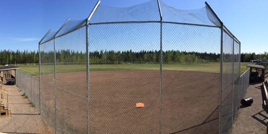
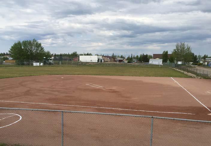
BALL AND SOCCER FIELDS
The Town of Hay River has three active ball fields (not on school property), one of which is geared to youth ball players. A fourth ball field has not been used for league play in several years and has been identified as a possible space to repurpose as an off-leash dog park. The soccer fields within the Town are found on School property and typically they are not accessible to the public during school hours. The two active ball fields are in a community park and have added amenities such as a concession for use during tournaments, bleacher seating, considerable parking, a designated playground area and temporary washroom facilities. The Town supports these ball fields, and they are supported by volunteers within the community.
COURTS
The Town of Hay River’s only outdoor tennis court was closed due to safety concerns several years ago. Court facilities are available within the Recreation Centre when the ice surfaces are removed during summer. Outdoor rinks with a board system could be repurposed in summer months to support tennis or pickleball use. The off-season use would require planning and acquisition of more infrastructure such as nets. Seasonal use of the rink surfaces for racquet sport would increase maintenance which should be factored into any planning for alternate use.
There is one outdoor basketball court on school property, but it is not regulation size and is primarily used for hoop shooting practice. Two additional small basketball pads are located at Malcom Crescent Park and Lionness Park.
GOLF
The Hay River Golf Course is a nine-hole course in nature which is run by a volunteer committee. Open on a seasonal basis, it is popular for tournaments and play among a wide range of ages and abilities. There is a putting green, driving range, and campground. Golf club and cart rentals are available. The golf course has a large log club house with kitchen, bar, washrooms and conference-type seating for dining. The property is popular for weddings and other private events. Due to the short season, the greens are artificial and are at the age where a replacement program is starting to upgrade all the greens’ infrastructure.
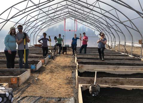
COMMUNITY GARDENS
The Town of Hay River has a community garden that is run by volunteers. Outdoor framed beds and greenhouse beds are available for rent by community members who want to grow their own vegetables. The Town has a short growing season but long daylight hours in the summer months support the growth cycle of most vegetables. The Community Garden is a great choice for people who don’t have outdoor space to plant a vegetable garden.
DOG AREAS
The Town of Hay River has an Animal Control Bylaw that governs the owner’s authority to allow their dog to run at large. Except for appointed off-leash areas, owners are not allowed to let their dogs run at large within the community.
There is a growing trend within communities to provide a designated off-leash area that supports the responsible interaction of dogs in a secure environment.
Communities are planning destination and neighbourhood- level off-leash dog areas, and appointing trails and water access points that welcome dogs.
Residents provided many comments about dogs, the key input being the following:
• Off leash dog areas should be fenced to prevent unexpected wildlife encounters
• There should be more designated off-leash dog areas.
• Need more bylaw control of dogs who are off leash in non-designated areas.
• Need signage for trails that are not off-leash.
• Off-leash areas need to be supported, with lots of access to waste management to keep them safe and attractive for all users.
Strengths
BENEFITS – Dog walking in Hay River offers multiple benefits to people and dogs.
Challenges
BYLAW – There is an Animal Control Bylaw, but enforcement is challenging.
DOG AREAS – The appointed offleash areas are not fenced and could result in interaction with wildlife. They are also in areas that are not well lit and present safety issues.
COMMUNITY SURVEY INPUT
Satisfaction with Locations for Dogs (Suitable Locations for On-Leash and OffLeash Dogs)
The community survey showed the following level of satisfaction with Off-Leash Dog areas:
Various Hay River service groups also host events such as wine and beer tasting.
The annual community cleanup event includes curbside pickup of springcleaning items such as brush and household items that are no longer usable. Also, the business community has traditionally sponsored a spring cleanup event where special interest groups can select an area to pick up garbage to raise funds for their organization.
WINTER USE OPPORTUNITIES
With its location north of the sixtieth parallel, Hay River has a long winter. In the winter months the Town of Hay River has many outdoor activities including cross country skiing, dog sledding, outdoor ice rinks, and snowmobiling. Outdoor facilities are fewer in number in the winter months however they still need maintenance support when the Town is the owner/operator of those facilities.
FESTIVALS AND EVENTS
The Town of Hay River hosts a weekly summer market at Fisherman’s Wharf Pavilion. Vendors of cooked food, vegetables, flowers, crafts, clothing, artwork and other items can rent booths at the Pavilion either weekly or seasonally. The Town has a portable stage which is used for live music at most of the weekend markets.
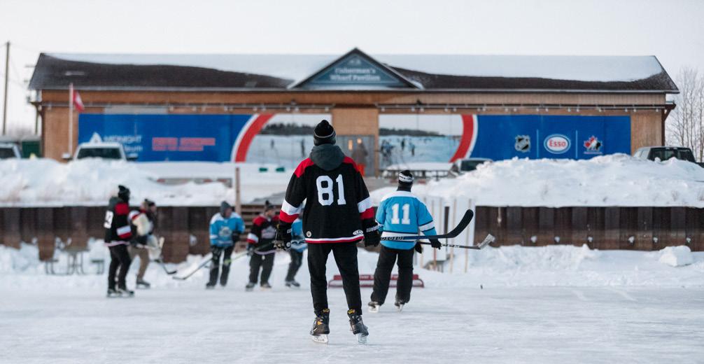
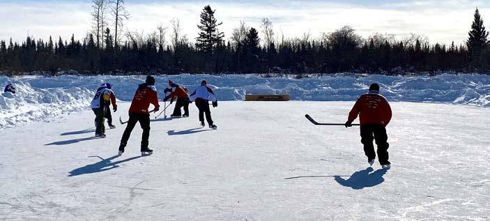
Other historic events that take place in Hay River include Hay Days, the Wally Schumann Show and Shine (car show), Polar Pond Hockey, Canada Day parade, blessing of the fleet, and sporting events including NWT track and field, hockey tournaments, golf tournaments, curling bonspiels, cross country skiing and biathlon events, baseball tournaments, super soccer, volleyball, jet boat races and other sporting events.
The Town’s strategic plan identifies Sports Tourism as a potential growth area for the community. There are several existing events that showcase the winter sport tourism opportunities in Hay River including Polar Pond Hockey, Dog Sled Races, Biathlon and Cross-Country Ski Races, Hockey Tournaments and Curling Bonspiels. This is an area for further development and incorporation of other winter events such as ice fishing and snowmobile events.
6.2 Actions
PLANNING AND DESIGN
6.1 Communicate the Public Behaviour Bylaw and how it applies to trails and greenspaces.
6.2 Update the Animal Control Bylaw to indicate where dogs must be on-leash and where they can be off-leash once additional off-leash areas have been added in the community.
• Continue to require dogs to be on leash everywhere in the Town except designated off-leash dog areas
• Increase number of Town-recognized unfenced off leash dog areas.
• Incorporate safety considerations for new fenced off-leash dog areas.
• Increase signage and public awareness for new off-leash dog areas.
6.3 Establish a plan for adding and replacing playgrounds and improving accessibility, including replacement cycles as part of asset management (NEXGEN Asset Management System).
• Consider typical replacement cycles of 10 - 15 years for playground equipment
• Encourage neighbourhood associations to partner and assist in fundraising for playground replacement
6.4 Include standards (CSA) for the quality and design of playgrounds in a Municipal Standards document.
6.5 Include information on park amenities in the signage and communications plans for greenspaces.
• Include maps, online resources, and a potential app in the future
6.6 Partner with local Indigenous groups, local artists, the Hay River Museum Society and youth to explore opportunities for celebrating arts and culture in Town of Hay River parks.
6.7 Support community groups and the agriculture industry in increasing food security.
6.8 Work with partners to identify washrooms that could be accessible to park and trail users, and identify locations for washrooms to fill gaps, e.g., downtown core.
6.9 Improve practices related to the acquisition and maintenance of public art and interpretive signage.
• Add public art and interpretive signage to the asset management plan and allocate budgets for their renewal
• Consider implementation of a Municipal Arts Program Policy in terms of evaluating the longevity and maintenance needs of public art
6.10 Improve practices related to waste management in parks.
• Work on solid waste management planning related to dog waste disposal
6.11 Consider incorporating seasonal racquet sports in outdoor rink facilities.
CAPITAL DEVELOPMENT
6.12 Improve parks per comprehensive Plans:
• Bob McMeekin Park
• Vale Island Recreational Area
• New Town Centre Plaza
6.13 A ssess playgrounds in existing parks.
• Design creative play environments that integrate nature
• Consider accessibility for all children
• Consider new or improved playgrounds in the following existing parks –Bob McMeekin Park, Fisherman’s Wharf, Vale Island Recreational Area
6.14 Continue to assess and install more picnic tables, benches, washrooms, and waste receptacles in parks per community needs.
• Include picnic areas in all community parks and in some neighbourhood and nature parks in locations where people are likely to eat
• Add washrooms per needs as identified above
6.15 Establish fenced off-leash dog areas, ideally within a 15-minute walk of all residents.
• Establish two larger off-leash dog areas, one at Don Wright Ball Diamond, and one at the Lioness Park
• Incorporate smaller off-leash dog areas within existing and proposed community and neighbourhood parks per the spacing above (e.g. Vale Island Recreation Area and Keith Broadhead Park)
• Designate trails and nature areas where dogs are allowed off-leash and update signage to clarify when trails are on-leash or off-leash accessible.
• Incorporate safety considerations and signage/education for all off-leash dog areas.
6.16 Replace playgrounds following the asset management system (NEXGEN).
Waterfront
Key Findings Hay River residents value the waterfront and appreciate opportunities to access waterfront for a variety of activities.
Key Direction Make the most of current waterfront access by supporting existing infrastructure, creating a plan for thoughtful expansion of infrastructure, including improved signage to encourage usage of existing amenities.
7.1 Existing Waterfront Conditions
One of Hay River’s defining characteristics is its extensive waterfront. The community is bordered by the Hay River and Great Slave Lake and these waterways are an important part of the community’s identity and heritage. Hay River is still a working harbour that integrates marine transportation, tourism and recreational and commercial fishing activities.
There are four major and highly popular locations for enjoying the shoreline environment – Porritt Landing, Fisherman’s Wharf, Bob McMeekin Park and Hay River Public Beach. There are many informal waterfront access points and trails that follow the shoreline allowing for hiking and ATV use. These sites are highly variable; some have dedicated greenspace and others are road ends. There are three main types of waterfront access points – small park spaces near the water, access trails to the waterfront, and viewpoints with no access to the water’s edge.
There are challenges with some of the waterfront access points. In several locations, there is nothing to show a waterfront access point and neighbouring properties have in some cases placed their own landscaping on these sites.
Hay River has two motorized boat launches, one of which is owned by the Town and the second is dedicated to commercial fishers and is owned by the
Department of Fisheries and Oceans. There have been requests to add boat launch facilities at Bob McMeekin park however the grade is steep, and the park is catering to family activities which could cause safety issues with loading and offloading boats at this location.
People launch non-motorized watercraft such as kayaks, canoes, and standup paddleboards at multiple sites along the river and lakeshore including Bob McMeekin Park and Scout’s Trail. Some launch areas pose challenges in terms of available parking and access to the water is challenging.
7.2 Analysis
COMMUNITY SURVEY INPUT
According to the Customer Survey, 54% of residents were satisfied or better with waterfront and water accessible spaces.
The three town-owned and operated waterfront and water accessible facilities are Porritt Landing Marina and Boat Launch, Fisherman’s Wharf and Bob McMeekin Park. The community was surveyed on its satisfaction with each of these facilities and the results were as follows:
All three facilities had a Satisfaction rating of 50% or higher. Fisherman’s Wharf had the highest Satisfaction rating with close to 75% of respondents satisfied or better with that facility. Bob McMeekin Park had the second highest rating with 57% of respondents satisfied or better. Porritt Landing Marina and Boat Launch had a Satisfaction rating of 51% however that rating may have been influenced by recent environmental events such as the flood of 2022 and current low water conditions in 2024.
Landing Marina
McMeekin Park
Strengths
MAJOR FEATURES – Porritt Landing Marina and Boat Launch, Fisherman’s Wharf Pavilion, Bob McMeekin Park, Hay River Public Beach (territorial government).
Challenges
ACCESS – Limited access to and along waterfront in residential areas as private owners have developed landscaping to the shoreline and it is cost prohibitive to put up screens to provide private owner privacy if trails were set up between shoreline and private property.
7.3 Actions
PLANNING AND DESIGN
7.1 Manage access points to the water to maximize public access and use.
WATER ACCESS – Many informal water access points along Hay River and Great Slave Lake shorelines.
BOAT LAUNCH – Existing boat launch needs continued work to keep it functional and safe for motorized boaters. Signage and education for places to launch non-motorized watercraft and where possible, improved water access would increase opportunities to access water with nonmotorized watercraft.
WATERFRONT TRAILS – Trails exist along some shoreline areas, e.g. Lagoon Beach Trail, Scout’s Trail, West Channel Shoreline, Porcupine
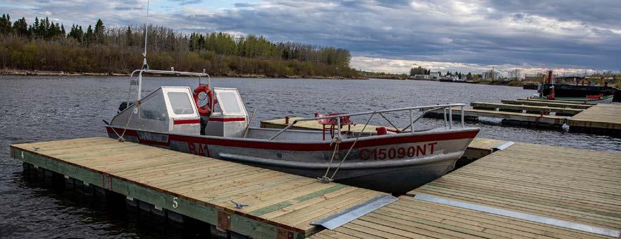
7.2
• Develop a plan for the existing waterfront access points, starting with a general description and maintenance plan and include a plan for orderly replacement of assets as they age. Include plans for development and identify possible sources of funding for expanded infrastructure at existing waterfront access points.
• Develop a strategy for placement of identification, regulatory and warning signs
• Place and retain signs at access points to the water
• Land Acquisition
Identify properties along the waterfront that are targets for acquisition and work with territorial government to acquire these as opportunities arise.
CAPITAL DEVELOPMENT
7.3 Establish new infrastructure and improve existing waterfront access infrastructure per the lists provided in this section.
7.4 Provide signs at all existing waterfront access points and road ends.
Environment
Key Findings Hay River residents place high value on the environment.
Key Direction Protect environmental values during land development and preserve and enhance the urban forest. Take steps to mitigate negative impacts from flooding events.
8.1 Existing Environment
This section addresses protection of environmental resources on trails and in greenspaces. It also includes integration and enhancement of natural resources within the urban area through measures such as the urban forest and flood mitigation measures.
The Hay River Basin is a transboundary watershed, with its headwaters in British Columbia (BC) and Alberta (AB), and its terminus at Great Slave Lake, in the Northwest Territories (NWT). The basin area (51,700 km2) is divided among AB (77% of the area), BC (17%) and the NWT (6%). While each jurisdiction individually has policies and processes to protect the aquatic environment, management of a transboundary river like the Hay requires cooperation and an integrated approach among the three
jurisdictions. The Mackenzie River Basin Transboundary Waters Master Agreement and associated Bilateral Water Management Agreements between the jurisdictions provide the framework for integrated management of the basin. The Hay River is 1,114 km long and flows generally northeast from the foothills of the Rocky Mountains to Great Slave Lake in the NWT. The Chinchaga and Kotcho rivers are major tributaries. There are three sub-basins: the Upper Hay, Chinchaga, and Lower Hay. The basin is situated within the boreal forest and is home to many terrestrial and aquatic wildlife species. The Hay River Basin is situated within the traditional territories of the Dene Tha’ First Nation, in AB and BC, the Fort Nelson First Nation in BC, and the Dehcho First Nations, Kátł‘odeeche First Nation, and Northwest Territory Métis Nation in the NWT. Aboriginal peoples have carried out traditional, cultural, and subsistence activities within the Hay River Basin for many generations. These watersheds have many sensitive ecosystems and species at risk and are habitat to bears, moose, lynx, beaver and deer, among many other species6
Some of the primary tools for protecting and enhancing environmental resources include the following:
• Application of territorial and federal regulations for riparian area developments. Riparian areas next to water bodies are important for fish and wildlife habitat. Erosion beside a water body can lead to sedimentation into the water, affecting both water quality and fish habitat. According to the Fisheries Act, no harmful substances, including sediment resulting from erosion, are to be introduced into the aquatic environment.
• Setback of 30 metres from the Hay River.
• Community beautification initiatives.
• Preservation of greenspaces in new developments.
• Flood mitigation measures to prevent loss of high value assets and to reduce maintenance associated with flood events.
6 State of Aquatic Knowledge for the Hay River Basin – Stantec – Prepared for the Government of the Northwest Territories, March 31, 2016
8.2 Analysis
One of the Town of Hay River’s greatest assets is its natural setting. Hay River is well-positioned to showcase this setting by featuring nature trails and incorporating natural elements in its greenspaces and by developing waterfront facilities that encourage access by the public and visitors to the community. In the past few years, Hay River has faced challenges to its landscape in the form of unprecedented flooding (2022) and drought and wildfires (2023-24). It is clear from the level of engagement in spring cleanup activities that the Town residents value the environment and express this through good stewardship. The community survey did not specifically gauge community satisfaction with the environment, however other areas of the survey did draw attention to a desire for improved maintenance of parks and greenspace. This emphasis throughout the survey spotlights a challenge in terms of sufficient and properly trained resources to meet the demands of existing trails and greenspaces.
Some of the Environmental Strengths and Challenges are as follows:
Strengths
NATURAL AREA – Forested areas, river and riverbank, lake and lake shoreline are major natural assets.
COMMUNITY SUPPORT – Citizens help with stewardship including community cleanup initiatives and the annual bird count.
EDUCATION – Schools can use trails and greenspaces for outdoor education.
Challenges
THREATS – Climate change and unprecedented flooding, drought and wildfire conditions as well as climate change impacts on non-continuous permafrost.
INFORMATION – there is no current mapping of environmentally sensitive areas.
8.3 Actions
PLANNING AND DESIGN
8.1. Incorporate the results of the flood mapping project into future developments of trails and greenspaces and where possible for existing infrastructure, propose alternative routes or modify greenspace boundaries to minimize impacts from future flooding events.
8.2. Encourage and support stewardship efforts, including community cleanup and adopt a trail or greenspace.
8.3. Partner with local schools on environmental education initiatives.
8.4. Identify areas that are lacking trees and prepare a greening plan to add in trees
ENVIRONMENTAL EDUCATION – Interpretive signs provide educational information on local species.
LAND PROTECTION –Commissioner’s lands are under treaty negotiations and have restrictions for transfer to public or private ownership until those negotiations are concluded.
RESOURCES – ability to meet user expectations for trail and greenspace cleanliness within current resources.
8.5. Include tress for shade and plants that are indigenous to the area in the planning for the Town Hall Plaza to promote education of native species
8.6. Fire smart greenspaces and trail heads to safeguard assets in conjunction with the Community Wildfire Protection Plan.
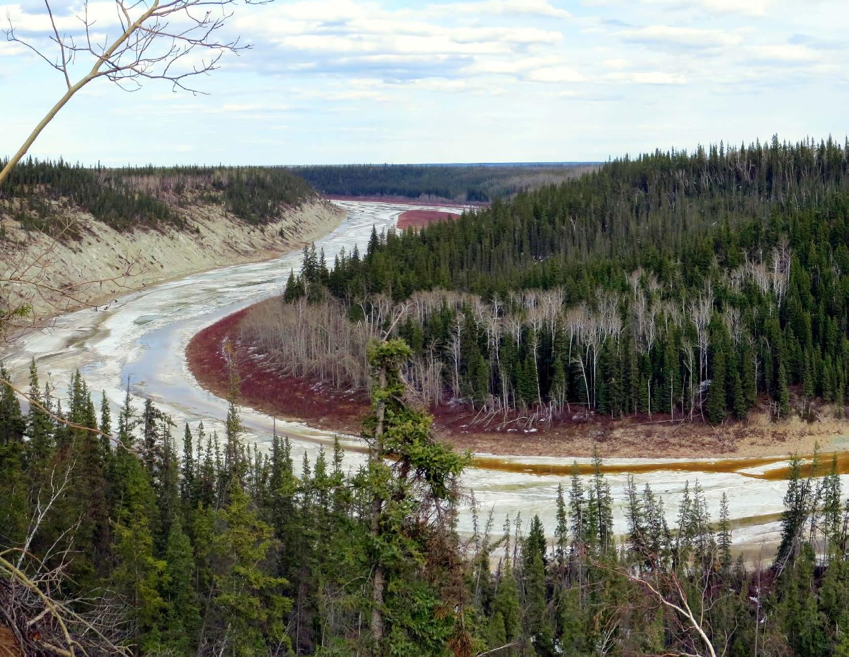
The Plan C
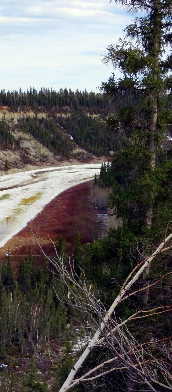
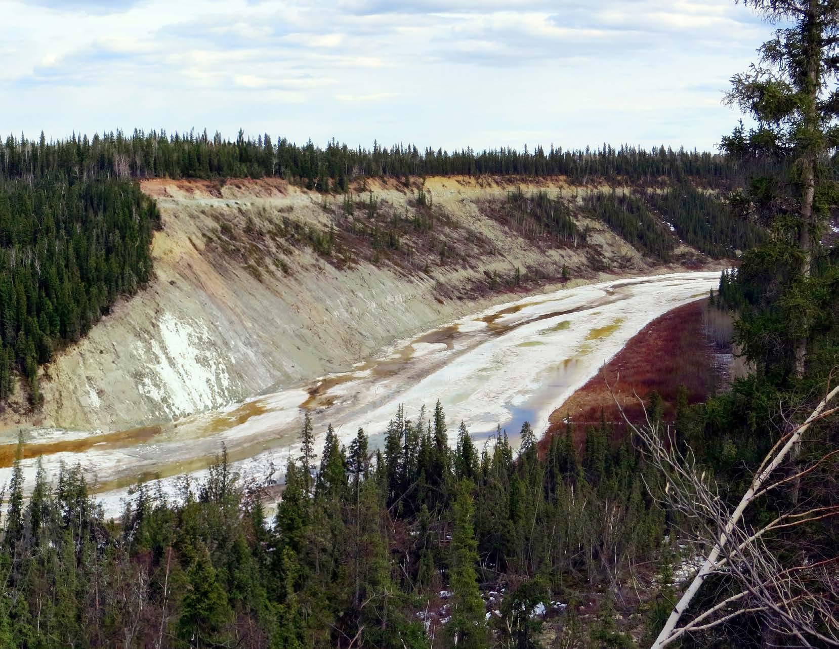
Achieving Our Vision
9.1 Achieving Our Vision Timeline
The Town of Hay River TGMP, with input from the community, is a long-term plan that sets out priorities for trail and greenspace planning and design, land acquisition, and capital development. This is a living document that will improve with regular guidance and participation from stakeholders and partners. The Town plans, develops and funds trails and greenspaces through various revenue streams.
The timelines are generally defined as follows: ONGOING
Tasks that are implemented over time as needed based on planning and development activities, community input, grant opportunities, Council priorities, and other factors.
Investments that can reasonably be made within the first five years of the TGMP, which generally include projects that are of highest priority as well as those that are lower cost and relatively easy to implement.

Investments intended for the five-to-ten-year timeframe, which generally include significant projects that may not be reasonably achieved within the first five years as well as those that are lower cost and relatively easy to implement but of a lower priority than those identified for the first five years.

Investments that are intended for the ten- to twenty-year timeframe and, while likely beyond the life of the TGMP, they are identified for future and proactive planning and budgeting.


Projects that are not intended to be pursued within the timeframe of the TGMP, but which the Town and partner agencies should maintain the ability to implement if/when conditions change and these projects are warranted.
The following tables summarize the actions, timelines and responsibilities identified in each of the Sections of the TGMP:
TRAILS
PLANNING AND DESIGN
4.10 Coordinate among territorial government departments to plan for the connectivity of trails as opportunities arise.
• Focus on making the Town Centre more walkable.
• Complete the flood mitigation measures included in the risk assessment matrix.
4.11 Work with other organizations in Hay River on planning major trail networks to achieve broader active transportation, recreation, and tourism opportunities, with the following as examples:
• Collaborate with user groups, Hay River Métis Government Council, West Point First Nation Kátł’odeeche First Nation and territorial government on a trail network and green commuting strategy.
• Collaborate with the territorial government, Hay River Métis Government Council, West Point First Nation, and Fishermen’s Federation on a walking loop, including shoreline access.
• Work with the School District on providing safer routes to schools.
• Work with landowners and developers on better pedestrian connections to, and within, the Town Centre.
• Encourage snowmobile club, ski club partnerships.
• Partner Rotary Club, Hay River Museum Society and other similar groups via trail sponsorship agreements.
Timeline: Ongoing, Short (0-5yr), Med (5-10yr), Long (+10yr)
Partners
Ongoing Town, Territorial, Government
Partners
Ongoing
Town,
TRAILS
PLANNING AND DESIGN
4.12 Identify needs for trails through major new development projects.
• Where a proposed trail passes through a development site, work with the developer to identify a route for the trail, ideally through greenspace separate from the road system; second choice would be a roadside multi-use trail.
4.13 Implement and guide the planning and design of trails based on the guidelines in this section.
4.14 Update the signage plan for trails, including all types of signs as outlined above.
• Include maps, online resources, and a potential app in the future.
4.15 Update the Municipal Standards, to include standards for trails as described in this section, including trail types, location, provision of amenities and signage, and design standards.
LAND ACQUISITION
4.16 Confirm land ownership for proposed realignments, per the proposed trails on Map 2.
CAPITAL DEVELOPMENT
4.17 Upgrade existing trails and construct new ones as opportunities arise on Town projects and new developments, per the proposed trails on Map 2 and the priorities in Section 9.
4.18 Develop trailheads and amenities along trails as part of trail development projects and as needed to meet needs on existing trails.
Timeline: Ongoing, Short (0-5yr), Med (5-10yr), Long (+10yr) Responsibility:
Short Town
GREENSPACE
PLANNING AND DESIGN
5.1 Use the following guidelines for new developments and redevelopment within the Town Centre:
• Site community and neighbourhood parks so that one type or the other will be within 10 minutes of most residents, with community parks ideally located within 20 minutes of most residents.
• Locate community and neighbourhood parks next to natural areas where synergies will benefit users.
• Locate community and neighbourhood parks with significant street frontage or well-marked trail access if street frontage is not available.
• Include and protect existing trees within parks where possible.
• Plant trees within parks for shade and habitat values.
• Incorporate areas with heritage values.
• Consider inclusion of some or all of these guidelines in the Municipal Standards document.
5.2 Prepare comprehensive park Plans, with full community engagement for the parks with the highest needs and potential, as follows:
• Bob McMeekin Park
• Vale Island Recreation Area (Vale Island)
• New Town Hall Plaza
Timeline: Ongoing, Short (0-5yr), Med (5-10yr), Long (+10yr)
Responsibility: Town, Developers, Partners
Ongoing
Town
Medium
Town, Partners
GREENSPACE
PLANNING AND DESIGN
5.3 Advertise the policy for greenspace naming.
• Review greenspace names and revise to take advantage of opportunities to highlight community contributions or historical/cultural significance.
5.4 Prepare a Master Plan for the cemetery, considering the lifespan of the existing cemetery and potential need for a new cemetery site.
5.5 Complete a Signage Plan for greenspaces, including park name, regulatory, wayfinding, and interpretive signs.
• Include maps, online resources, and a potential app in the future.
• Integrate heritage and cultural information into wayfinding and interpretive signs
5.6 Update the Community Plan and Zoning Bylaw to mitigate greenspace investments from flood damage.
• Incorporate results from flood zone mapping.
LAND ACQUISITION AND DISPOSITION
5.7 Acquire new parks in existing neighbourhoods where parks are lacking.
• New greenspace in Town Centre should maximize available space.
• Other neighbourhood parks should be a minimum of 0.2 hectares.
Timeline: Ongoing, Short (0-5yr), Med (5-10yr), Long (+10yr)
Responsibility: Town, Developers, Partners
GREENSPACE
LAND ACQUISITION AND DISPOSITION
5.8 Acquire community and neighbourhood parks in new developments within a 10-20 minute walk of neighbourhood residents .
• Minimum size of 1.0 hectares for community park.
Timeline: Ongoing, Short (0-5yr), Med (5-10yr), Long (+10yr)
• Minimum size of 0.2 hectares for neighbourhood parks. Ongoing
5.9 Consider disposition, decommissioning or repurposing of existing parks that do not have high value as greenspace, per the list in this section, and use any funds received to purchase higher value greenspace elsewhere or repurpose the intended usage to fill gaps in desired infrastructure such as off-leash dog parks.
CAPITAL DEVELOPMENT
5.10 Guide the capital development of new community greenspaces (by the Town and/or developers). Include parking and major recreation facilities within community parks based on amenity distribution and needs (section 6), including amenities such as sports fields, ball diamonds, sports courts, picnic areas, dog off- leash areas, larger playgrounds, and spray parks (pending review of ability to support a park with existing municipal infrastructure and resources required to support larger playgrounds).
Ongoing Town
GREENSPACE
CAPITAL DEVELOPMENT
5.11 Guide the capital development of new neighbourhood parks (by the Town and/or developers).
• Include the following amenities as a minimum:
Neighbourhood parks: Mowed grass area, Playground equipment, with sand fall zone, at least 1 bench and table, Waste bin, Shade trees, Fencing along primary roads or separating from residential properties, Parking for maintenance vehicles on secondary road.
Neighbourhood greenspaces: Mowed grass area, 1 bench and/or table, Shade trees, Parking for maintenance vehicles on secondary road, Waste bin.
5.12 Guide the capital development of all other types of parks (by the Town, developers, and/or other potential partners such as Indigenous or special interest groups).
5.13 Include amenities as appropriate to each park (Section 9).
5.14 When new parks are developed, allocate funds for Town maintenance and asset replacement.
• Maintenance costs are typically five percent of capital construction costs annually for developed parks (significantly less for parks with few amenities).
Timeline: Ongoing, Short (0-5yr), Med (5-10yr), Long (+10yr)
Responsibility: Town, Developers, Partners
Developers, Partners
GREENSPACE AMENITIES
PLANNING AND DESIGN
6.1 Communicate the Public Behaviour Bylaw and how it applies to trails and greenspaces.
6.2 Update the Animal Control Bylaw to indicate where dogs must be on-leash and where they can be off-leash once additional off-leash areas have been added in the community.
• Continue to require dogs to be on leash everywhere in the Town except designated off-leash dog areas.
• Increase number of Town-recognized unfenced off leash dog areas.
• Incorporate safety considerations for new fenced off-leash dog areas.
• Increase signage and public awareness for new off-leash dog areas.
6.3 Establish a plan for adding and replacing playgrounds and improving accessibility, including replacement cycles as part of asset management (NEXGEN Asset Management System).
• Consider typical replacement cycles of 10 - 15 years for playground equipment.
• Encourage neighbourhood associations to partner and assist in fund-raising for playground replacement.
6.4 Include standards (CSA) for the quality and design of playgrounds in a Municipal Standards document.
Timeline: Ongoing, Short (0-5yr), Med (5-10yr), Long (+10yr)
Responsibility: Town, Developers, Partners
Ongoing Town
Short Town
Short Town
Short Town
GREENSPACE AMENITIES
PLANNING AND DESIGN
6.5 Include information on park amenities in the signage and communications plans for greenspaces.
• Include maps, online resources, and a potential app in the future.
6.6 Partner with local Indigenous groups, local artists, the Hay River Museum Society and youth to explore opportunities for celebrating arts and culture in Town of Hay River parks.
6.7 Support community groups and the agriculture industry in increasing food security.
6.8 Work with partners to identify washrooms that could be accessible to park and trail users, and identify locations for washrooms to fill gaps, e.g., downtown core.
6.9 Improve practices related to the acquisition and maintenance of public art and interpretive signage.
• Add public art and interpretive signage to the asset management plan and allocate budgets for their renewal.
• Consider implementation of a Municipal Arts Program Policy in terms of evaluating the longevity and maintenance needs of public art.
6.10 Improve practices related to waste management in parks.
• Work on solid waste management planning related to dog waste disposal
6.11 Consider incorporating seasonal racquet sports in outdoor rink facilities.
Timeline: Ongoing, Short (0-5yr), Med (5-10yr), Long (+10yr)
Short
Town
Medium
Town
Short
Town,
Town
GREENSPACE AMENITIES
CAPITAL DEVELOPMENT
6.12 Improve parks per comprehensive Plans:
• Bob McMeekin Park
• Vale Island Recreational Area
• New Town Centre Plaza
6.13 A ssess playgrounds in existing parks.
• Design creative play environments that integrate nature.
• Consider accessibility for all children.
• Consider new or improved playgrounds in the following existing parks – Bob McMeekin Park, Fisherman’s Wharf, Vale Island Recreational Area.
6.14 Continue to assess and install more picnic tables, benches, and waste receptacles in parks per community needs.
• Include picnic areas in all community parks and in some neighbourhood and nature parks in locations where people are likely to eat
• Add washrooms per needs as identified above
Timeline: Ongoing, Short (0-5yr), Med (5-10yr), Long (+10yr)
Responsibility: Town, Developers, Partners
GREENSPACE AMENITIES
CAPITAL DEVELOPMENT
6.15 Establish fenced off-leash dog areas, ideally within a 15-minute walk of all residents.
• Establish two larger off-leash dog areas, one at Don Wright Ball Diamond, and one at the Lioness Park
• Incorporate smaller off-leash dog areas within existing and proposed community and neighbourhood parks per the spacing above (e.g. Vale Island Recreation Area and Keith Broadhead Park)
• Designate trails and nature areas where dogs are allowed off-leash and update signage to clarify when trails are onleash or off-leash accessible.
• Incorporate safety considerations and signage/education for all off-leash dog areas.
Timeline: Ongoing, Short (0-5yr), Med (5-10yr), Long (+10yr)
Responsibility: Town, Developers, Partners
6.16 Replace playgrounds over time as part of asset management. Ongoing
Town, Partners
Short Town
WATERFRONT
PLANNING AND DESIGN
7.5 Manage access points to the water to maximize public access and use.
• Develop a plan for the existing waterfront access points, starting with a general description and maintenance plan and include a plan for orderly replacement of assets as they age. Include plans for development and identify possible sources of funding for expanded infrastructure at existing waterfront access points.
• Develop a strategy for placement of identification, regulatory and warning signs.
• Place and retain signs at access points to the water.
LAND ACQUISITION
7.6 Identify properties along the waterfront that are targets for acquisition and work with territorial government to acquire these as opportunities arise.
CAPITAL DEVELOPMENT
7.7 Establish new infrastructure and improve existing waterfront access infrastructure per the lists provided in this section.
7.8 Provide signs at all existing waterfront access points and road ends.
Timeline: Ongoing, Short (0-5yr), Med (5-10yr), Long (+10yr)
Responsibility: Town, Developers, Partners
Short Town
Ongoing Town, Territorial Government
Ongoing
Town, Partners
Medium
Town
ENVIRONMENT
PLANNING AND DESIGN
Timeline: Ongoing, Short (0-5yr), Med (5-10yr), Long (+10yr)
8.1. Incorporate the results of the flood mapping project into future developments of trails and greenspaces and where possible for existing infrastructure, propose alternative routes or modify greenspace boundaries to minimize impacts from future flooding events. Ongoing
8.2. Encourage and support stewardship efforts, including community cleanup. Ongoing
8.3. Partner with local schools on environmental education initiatives.
Responsibility: Town, Developers, Partners
Town, Partners
8.4. Identify areas that are lacking trees and prepare a greening plan to add in trees. Ongoing Town
8.5. Include tress for shade and plants that are indigenous to the area in the planning for the Town Hall Plaza to promote education of native species.
8.6. Fire smart greenspaces and trail heads to safeguard assets in conjunction with the Community Wildfire Protection Plan.
Ongoing
Town, Partners
Town
Short Town, Schools
9.2 Action Plan
The implementation of long-term land acquisition and capital improvements for trails and greenspace infrastructure will take many years. The Town will need to use a combination of municipal funding, development cost charges, and local, provincial, and federal partnerships and grants.
This section of the TGMP identifies the projects and relative costs that are priorities within the next ten years. The phasing strategy reflects an assessment of existing conditions and community needs, alignment with the goals and objectives of the plan, affordability, and community input. The costs offer a general comparative scale for implementation decisions and capital planning.
Community engagement should occur with each significant capital improvement, with the scale relative to the scope of the project, e.g., community parks and major trail projects should involve all residents, and neighbourhood parks and trail connections should be targeted to those affected.
Beyond the Town’s budgets, the specific timing for recommended projects will be influenced by the pace of growth and development - slower rates of growth will mean deferred needs and resources for spending on trails and greenspace infrastructure. Conversely, accelerated rates of growth in Hay River may advance certain projects that have not otherwise been prioritized. Adapting to these opportunities is necessary to ensure the new parks and trails are built in an opportunistic manner when possible. For some infrastructure, partnerships with other governments and organizations will be required to support significant investments.
The proposed planning projects, capital improvements, and phasing strategy over the next 10 years do not imply a financial commitment. Pending available resources, financial commitments will be confirmed through the Town’s annual budget and capital plans.
PLANNING AND CAPITAL PROJECTS PHASING PLAN
This phasing and implementation section of the TGMP provides guidance on priority trails and greenspace planning and capital projects to be implemented within the next 10 years. The priorities are identified based on the guiding principles outlined below:
• Flood mitigation measures will be a high priority in the short term.
• Trails improvements will enhance connectivity and accessibility where the needs are greatest and costs are manageable.
• Park improvements will fill gaps, meet the greatest needs, and replace aging infrastructure.
The cost estimates are order-of-magnitude figures to be used for high-level budgeting only. All costs will need confirmation during preliminary and detailed design processes.
Projected Budget
TRAIL UPGRADES AND AMENITIES
4.8, 4.9 Upgrade existing trails to improve accessibility and connectivity. $
Complete flood mitigation measures for trails. $ 250,000
Improve signage for trails based on Plan.
Subtotal
GREENSPACE
5.2 Prepare comprehensive park Plans, with full community engagement for the parks with the highest needs and potential as follows:
• Bob McMeekin Park $ 25,000
• Vale Island Recreation Area $ 25,000
• New Town Hall Plaza $ 25,000
5.3 Advertise the policy for greenspace naming. $ 1,000
5.4 Prepare a master plan for the cemetery, considering the lifespan of the existing cemetery and potential need for a new cemetery site. $ 50,000
5.5 Complete a Signage Plan for greenspaces, including park name, regulatory, wayfinding, and interpretive signs. $ 5,000
5.6 Update the Community Plan and Zoning Bylaw to mitigate greenspace investments from flood damage. $ 300,000
5.9 Repurpose greenspace to create additional fenced and unfenced off-leash dog spaces. $ 125,000
Subtotal $ 556,000 –
PARK AMENITIES
6.12 Prepare comprehensive park Plans, with full community engagement for the parks with the highest needs and potential as follows:
• Bob McMeekin Park $ 100,000
• Vale Island Recreation Area $ 525,000
• New Town Hall Plaza Include in Town Hall replacement budget
6.13 Assess playground equipment in existing parks and replace/improve as required
6.14 Prepare a master plan for the cemetery, considering the lifespan of the existing cemetery and potential need for a new cemetery site.
6.15 Establish off-leash dog areas
• Don Wright Ball Field $ 50,000 • Lioness Park $ 50,000 • Keith Broadhead Park $ 20,000
• Vale Island Recreation Area $ 20,000
• Designate off-leash dog trails
6.16 Replace playgrounds over time as part of asset management, (NEXGEN)
WATERFRONT
7.3 Establish new infrastructure and improve existing waterfront access infrastructure per the lists provided in this section.
7.4 Provide signs at all existing waterfront access points and road ends.
ENVIRONMENT
8.4 Identify areas that are lacking trees and prepare a greening plan to add in trees.
8.5 Include tress for shade and plants that are indigenous to the area in the planning for the Town Hall Plaza to promote education of native species.
8.6 Fire smart greenspaces and trail heads to safeguard assets in conjunction with the Community Wildfire Protection Plan.
Policy Revisions
The following are the Policies that need to be revised:
4.6, 5.1,
6.5
Include in the Municipal Standards design parameters for trails.
• standards and design guidelines for trails including trail types, cross- sections, dimensions, materials, etc.
• standards for the location, size, and design of parks, including amenities to be included and guidelines for playgrounds, sports courts, site furniture (benches, picnic tables, waste receptacles, lighting, removable bollards), washrooms, dog bag dispensers, fences, and other features
• standards for types and design of signage including wayfinding, regulatory and interpretive signs
• standards for tree planting and maintenance
5.6 Update Community Plan Bylaw to improve protection of the environment.
6.2 Update Animal Control Bylaw to indicate where dogs must be on-leash where they can be off-leash after the establishment of new off-leash dog parks.
8.2 For any new developments and redevelopment along riparian areas or in other environmentally sensitive areas, require the protection of sufficient land needed to maintain the environmental resources and an adjacent public trail.
Timeline: Ongoing, Short (0-5yr), Med (5-10yr), Long (+10yr)
Responsibility: Town, Developers, Partners
Short
Town
Town
Short
Town
Ongoing
Town
9.2 Funding and Partnerships
The following table describes approaches to be used for funding the implementation of the TGMP. All available sources of funding should be pursued and, as funding opportunities change regularly, the information in this section is subject to change. The Town will regularly seek funding opportunities.
Capital Budgets - The TGMP actions are to be integrated into Town capital planning based on the priority of various projects. These are projects that cannot be funded through the measures listed below. This may require adjustments to capital funding levels to achieve the time frame identified in the TGMP. Opportunities to achieve trail and greenspace improvements through utility, transportation, and other capital projects are also to be explored.
COMMUNITY PLANNING AND ZONING BYLAWS - These bylaws outline the standards to be met by developers and can be updated, as noted in various action items, to show new standards for park and trail development.
GRANTS - Federal and territorial programs (Trans Canada Trail, GNWT Community Access Program, etc.), as well as non-profit organizations sometimes have grant programs that are consistent with the goals and actions of the TGMP. These could include tree planting, memory benches, beautification initiatives and community art projects. The Town will continue to pursue these types of funding opportunities.
GREEN
MUNICIPAL FUND - The Federation of Canadian Municipalities with a total allocation of $550 million. This fund is intended to support municipal government efforts to reduce pollution, reduce greenhouse gas emissions, and improve quality of life. The expectation is that knowledge and experience gained in best practices and innovative environmental projects will be applied to national infrastructure projects, which could include trails, tree planting and environmental enhancement.
PARTNERSHIPS - Hay River has achieved success through partnering with the Rotary Club, HR Ski Club, HR Métis Government Council, Skatepark Committee, Tucho Fisheries, WPFN, KFN and many more organizations and community groups to obtain funding and jointly develop parks and trails projects. This work should continue, along with opportunities to allow in-kind donations to be accepted and researched.
VOLUNTEERS - Volunteerism in Hay River is experiencing challenges related to new volunteer recruitment. Efforts to build the volunteer base in the community should continue.
DONATIONS - Residents and corporations often want to provide donations to park and trail projects. This requires the Town to provide mechanisms that encourage and support this. Opportunities include the memorial program for parks infrastructure and trees, donations to projects or programs, and bequests.
USER FEES
- The Town could consider expanding the user fees for park rentals, e.g., for events and proper commercial uses within parks. These funds could be used to support maintenance and operating expenses.
ANNUAL MAINTENANCE AND OPERATIONS BUDGETS
- The Town struggles to provide adequate maintenance when new parks or park amenities are developed without a corresponding increase in operations resources. Funding needed for maintenance should be found and secured prior to undertaking new capital park and trail improvements through rezoning and subdivision or Town initiatives.
9.3 Monitoring Strategy
A monitoring strategy is essential to ensure the TGMP is being implemented as intended and to determine whether the plan is achieving its goals. Monitoring provides a means of identifying changing conditions that would require changes to the TGMP and actions.
The following considerations for monitoring are focused on trails and greenspaces:
• Measurable – The monitoring program needs to establish criteria that are readily measurable and for which data or information can be easily obtained
• Manageable – The monitoring program needs to consider the resource limitations of the Town and limit the number of measures
• Meaningful – The monitoring strategy should yield meaningful results and highlight the success in achieving the actions of the TGMP
Monitoring efforts are to focus on implementation of the TGMP. The Town is to conduct monitoring every one to two years, based on data availability and Town resources. This could be part of the annual reporting or a separate document. The following are the items that are to be included in monitoring efforts:
• Number and length of trail projects completed (by Town and developers)
• Number of park projects completed (by Town and developers)
• Population-based supply of community and neighbourhood parks
• Annual investments in park and trail projects
• Maintenance and operations budget as a percent of the amount of greenspace maintained
9.4 Closing and Next Steps
The TGMP will be implemented in phases based on community needs, the pace of development, funding opportunities, and Council’s priorities as all of these evolve over time. The TGMP is a guiding document for the provision of facilities and services; it does not commit the Town to any project nor limit future opportunities.
The focus is on the next 10 years, while not losing sight of the long-term buildout that may be required to support future growth within Hay River and area. This is a living document, and the actions recommended within this TGMP will need to be reaffirmed through funding, Council resolutions, and effective partnerships on an ongoing basis.
Implementation will require work at multiple levels by Town staff and partners. The following are potential strategies for implementation within the various categories of recommendations:
PLANNING AND DESIGN
• Coordinated work among Town departments
• Establish a Parks and Trails Advisory Sub-Committee of the Recreation Committee
• Support for efforts by community groups
• Inform other Town documents such as the Community Plan revision, Zoning Bylaw, Animal Control Bylaw, Municipal Standards and future park Plans
LAND ACQUISITION
• Coordinated work among Town departments
• Negotiations through the development process
• Development Cost Charges
CAPITAL DEVELOPMENT
• Identification of projects that can be covered by Development Cost Charges and those that may be amenity contributions by developers
• Partnerships with other jurisdictions, including Schools, Indigenous groups, other levels of government and non- profit groups
• Preparation of annual budgets
• Tracking of opportunities and preparing applications for grants
The Town of Hay River has volunteer providers for some of its trails and greenspaces. Adopt a trail or adopt a greenspace is an efficient way to share the responsibility for maintaining trails and greenspaces. Third party support is not assured in the future, especially if the volunteer-run organizations are not able to adequately maintain their assets, as that is a significant demand on a community group. This is something to consider in terms of future planning and the pace of growth of trails and greenspaces within the community. As demands increase with population growth, there may be benefits to coordinating service delivery and consolidating functions. This is something for the Town and its partners to assess on an ongoing basis.
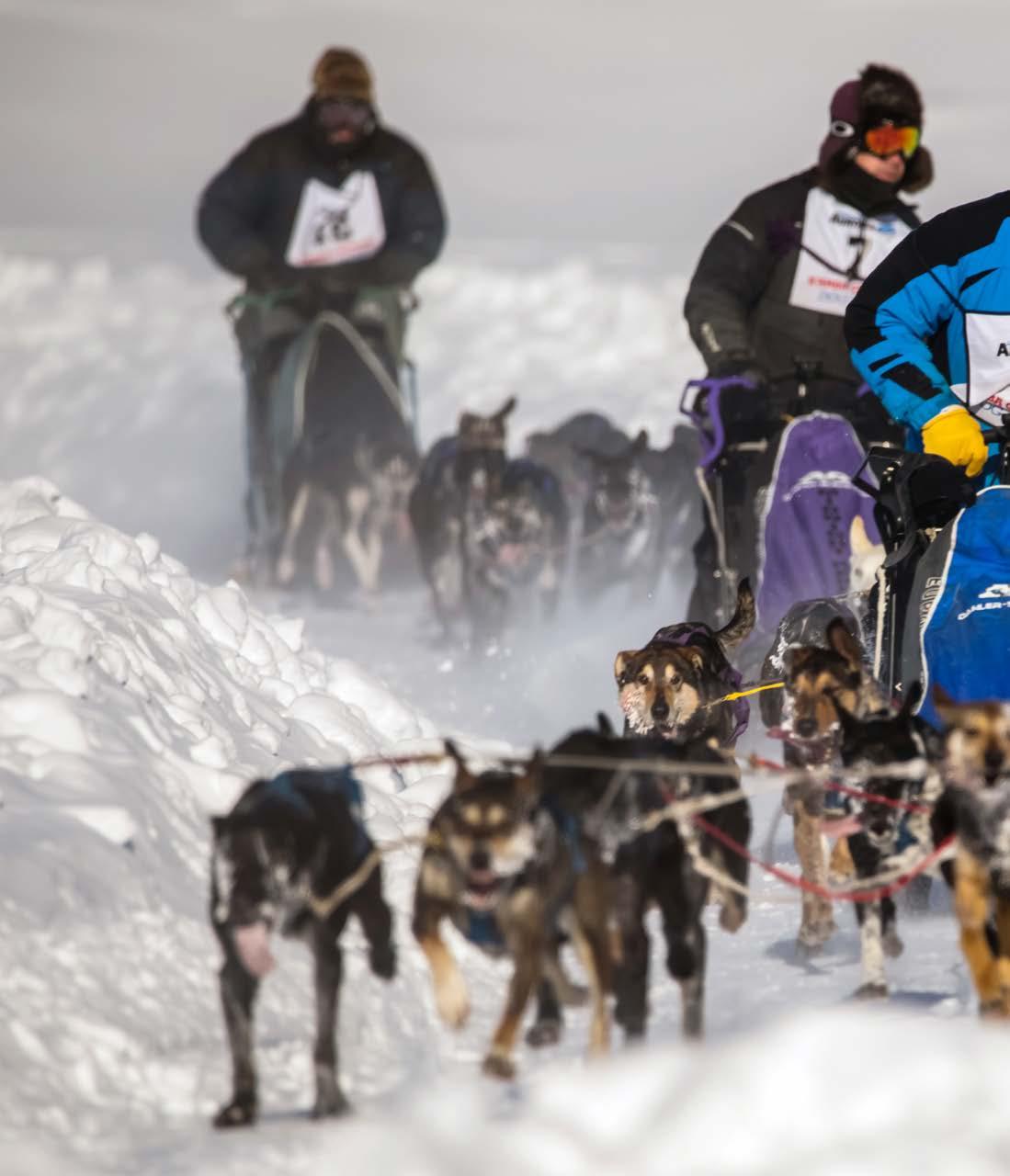
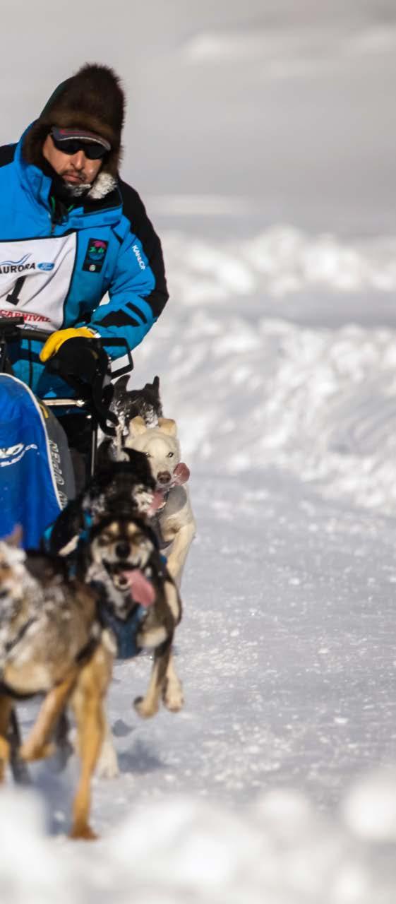
DAppendix
Trail and Greenspace Risk Ratings and Recommended Mitigating Measures
TCT South Trailhead
Canada Trails (existing)
TCT Miron to Tri-Service Park Trans Canada Trails (existing)
TCT Super A Service Road Trans Canada Trails (existing)
TCT Tri-Service Trail Trans Canada Trails (existing)
TCT Downtown Trans Canada Trails (existing)
TCT Firehall to Schools Trans Canada Trails (existing)
TCT Schools to Rotary Trails
Rotary Trail 1 (DJSS to Lift Station)
Rotary Trail 2 (Lift Station to Caribou Crescent)
(existing)
Canada Trails (existing)
Canada Trails (existing)
Rotary Trail 3 (Caribou to Gaetz Drive) Trans Canada Trails (existing)
Rotary Trail 4 (Gaetz to Lowes Greenspace) Trans Canada Trails (existing)
Rotary Trail 5 (Lowes Greenspace to Forks) Trans Canada Trails (existing)
to TCT proposed #1 (away from highway and ATV risks)
to TCT proposed #2 (away from highway and ATV risks)
Repaving needed to maintain good accessibility + improve drainage (2 options)
**Unpaved from Visitors Information Centre to Woodland Drive – road delineators or precast barriers
Realignment to TCT proposed #3 (away from highway and vulnerable sector) + repave
in 2022 - lower lying section of trail but potential for flooding only during extreme flood events
flood risk - raise grade + realignment to TCT proposed #4
TRAIL RISK MATRIX
TCT Forks to Bridge
Vale Island Connector
Airport Trail 1
Trans Canada Trails (existing)
Trans Canada Trails (existing)
Trans Canada Trails (existing)
Airport Trail 2
Trans Canada Trails (existing)
Buffalo Airways Trail
Old Town Connector (existing)
Oxbow South Connector
Oxbow Trail 1
Oxbow Trail 2
Oxbow Trail 3
Oxbow Trail 4
Oxbow Trail 5
Oxbow Trail 6
Trans Canada Trails (existing)
Trans Canada Trails (existing)
Trans Canada Trails (existing)
Trans Canada Trails (existing)
Trans Canada Trails (existing)
Trans Canada Trails (existing)
Trans Canada Trails (existing)
Trans Canada Trails (existing)
Trans Canada Trails (existing)
Frequent flood risk - raise grade + possible minor realignment
Delineators could help - GNWT highways involvement + short section unpaved
Repaved in 2022 - extreme flooding in 2022 was unprecedented and is highly unlikely (1963 is only other precedent)
Repaved in 2022 - extreme flooding in 2022 was unprecedented and is highly unlikely (1963 is only other precedent)
Frequent flood risk - realignment to TCT proposed #5
Proposing realignment to TCT proposed #5
Recent work to improve accessibility but drainage issues annually - raise grade or boardwalk needed
Difficult to maintain treeline - raise grade or realignment of some sections + wildlife management necessary
Difficult to maintain treeline - beaver problems for flooding
Severe flooding in 2022, unprecedented and unlikely to recur.
Realignment to higher ground within the treeline
Monitor for beaver activity posing risk to trail.
Frequent flood risk - unavoidable risk that has to be accepted because at lakeshore and part of natural drainage system
TRAIL RISK MATRIX
Trail Name
Pumphouse Beach Walk
West Channel Shoreline
Hay River Ski Club
Trans Canada Trails (existing)
Trans Canada Trails (existing)
Other Trail Systems
Irma Miron Trail (THR)
Rotary Trail 4 (Gaetz to Lowes Greenspace)
Rotary Trail 5 (Lowes Greenspace to Forks)
TCT Forks to Bridge
Vale Island Connector
Ravine Trail (THR)
Scout’s Trail
Lagoon Beach Trail (walk or ATV)
Dog Teams Trails
Other Trail Systems
Minimal maintenance by THR and other partners
Minimal maintenance by THR and other partners
Good Severe flooding in 2022, unprecedented and unlikely to recur. River bank erosion is inevitable and requires annual maintenance. Relocation of one trail due to riverbank erosion
Good Severe flooding in 2022, unprecedented and unlikely to recur. Riverview roadworks raised grade… protect Irma Miron Trail
Trans Canada Trails (existing) Good Unpaved therefore fair accessibility - treeline encroachment annually
Trans Canada Trails (existing)
Trans Canada Trails (existing)
Trans Canada Trails (existing)
Poor
Poor
Good
Other Trail Systems Good
Other Trail Systems Poor
Frequent flood risk - raise grade + realignment to TCT proposed #4
Frequent flood risk - raise grade + possible minor realignment
Delineators could help - GNWT highways involvement + short section unpaved
Severe flooding in 2022, unprecedented and unlikely to recur. Riverview roadworks raised grade… protect Irma Miron Trail
Have to accept the risk - increase signage and indicate as seasonal risk in maps/brochures
Other Trail Systems Good Have to accept the risk - increase signage and indicate as seasonal risk in maps/brochures
Other Trail Systems
Public education and signage needed to support dog team owners
Greenspace Name
Bob McMeekin Park
Keith Broadhead Park (incl. Glenn Smith and Pine Point diamonds)
Tri-Service Park
Community Park Good Park assets are installed primarily at higher elevations to prevent damage from flood events. Only low value assets below 2022 flood grade. No Master Plan for development or asset replacement.
Community Park
Community Park
Vale Island Recreation Area
Community Park
Visitor Information Centre
Don Wright Ball Diamond
Green Bridge Easement
Gord Thompson Park
Park
Good Sections closest to the river were impacted during 2022 flood. These are being repaired and no significant modifications will be made because of the unprecedented flooding.
Good Potential for flooding only during extreme flood events. Low areas can experience water collection during spring thaw. Prevention through maintenance of Town sewer drainage system.
Poor Risk of flooding due to proximity to river. Recommend any assets installed at this location be removable so that they can be safely stored and reinstalled after risk of spring flooding is passed. This is an all-seasons recreation area. Recommend a module system for rink boards to allow removal before spring break up. Projects are planned for 2024 construction season - flood mitigation measures included (raise grade, improve drainage, removable board systems).
of flood zone.
Possible future site of cemetery, if not consider for future dog park
out of flood zone.
Park
GREENSPACE RISK MATRIX
GREENSPACE RISK MATRIX
Greenspace Name
Fraser Place Greenspace (proposed)
Mackie Place Greenspace
Camsell Crescent Park
Malcom Crescent Park
McMeekin Crescent Greenspace
Lowes Greenspace
Neighbourhood Park
Potential for flooding only during extreme flood events.
Neighbourhood Park Good Potential for flooding only during extreme flood events.
Neighbourhood Park
Good
Neighbourhood Park Good
Neighbourhood Park Good
Neighbourhood Park
Poor
Inukshuk Park and Ray Benoit Rink
Lioness Park
Cranberry Crescent Greenspace
Neighbourhood Park
Poor
Neighbourhood Park Fair
Neighbourhood Park Fair
West Channel Playground
Neighbourhood Park
Poor
due to location out of flood zone.
due to location out of flood zone.
Severe flooding in 2022. Properties across the road had mitigation completed in 2022-23 when Riverview Drive grade was raised. Area to immediate north is lower lying and at higher risk of flooding. Area may benefit from additional fill but will remain vulnerable to flooding due to proximity to river.
Rink to be demob in 2024 - next greenspace revitalization priority - will remain outdoor rink.
Low risk due to location out of flood zone. Potential to be repurposed as off-leash dog park.
Severe flooding in 2022. Properties across the road will have risk of flooding mitigated by raising the grade of beach road. Due to proximity to river flood risk is difficult to mitigate. Recommend any assets installed at this location be removable so that they can be safely stored during winter and reinstalled after risk of spring flooding is passed.
Risk of flooding due to proximity to river. Removed damaged perimeter fence after 2022 flood. Level ground and improve grade toward drainage ditches and build perimeter berm on river side.
GREENSPACE RISK MATRIX
Greenspace Name Designation
West Channel Heritage Society
The Forks Crossing
Porritt Landing Boat Launch and Marina
Risk Rating Recommended Mitigating Measures
Neighbourhood Park Fair
Shoreline Access Park Fair
Shoreline Access Park Fair
Risk of flooding but limited infrastructure and amenities. Gathering space for special events.
This area will remain vulnerable to flooding. No high value assets are planned for this area.
A multi-year improvement project is ongoing for this space. Some infrastructure upgrades are needed to improve functionality of the space. Low water events impact the ability of watercraft to access this area.
Fisherman’s Wharf Pavilion
Shoreline Access Park Fair
Paradise Gardens
Hay River Ski Club
Shoreline Access Park Poor
Special Purpose Park Good
Hay River Skatepark Special Purpose Park Fair
Hay River Golf Club
Special Purpose Park Fair
A multi-year project for this space is in its final years. There is potential to improve high value asset protection through landscaping choices such as oversize boulders. The proximity to the river was identified as a risk during construction of the pavilion and construction techniques incorporated potential for flooding during spring breakup. Removable concrete barriers are positioned seasonally to prevent large ice chunks damaging high value assets.
Replacing memory benches lost in flood.
Severe flooding in 2022, unprecedented and unlikely to recur. Riverbank erosion is inevitable and requires annual maintenance. Relocation of one trail due to riverbank erosion.
Possible need for relocation if biomass district heating project goes forward.
Asset replacement plans include a greens replacement project. This is a high-cost project that will require third party funding and fundraising before proceeding.