Fraser Place Planning Report
January 20, 2021
Prepared for: Town of Hay River
Prepared by: Stantec

This document entitled Fraser Place Planning Report was prepared by Stantec Architecture Ltd. (“Stantec”) for the account of Town of Hay River (the “Client”). Any reliance on this document by any third party is strictly prohibited. The material in it reflects Stantec’s professional judgment in light of the scope, schedule and other limitations stated in the document and in the contract between Stantec and the Client. The opinions in the document are based on conditions and information existing at the time the document was published and do not take into account any subsequent changes. In preparing the document, Stantec did not verify information supplied to it by others. Any use which a third party makes of this document is the responsibility of such third party. Such third party agrees that Stantec shall not be responsible for costs or damages of any kind, if any, suffered by it or any other third party as a result of decisions made or actions taken based on this document.

Prepared by (signature)
Zoë Morrison, RPP MCIP
Reviewed by (signature)
Lesley Cabott, RPP MCIP
Figure
1.0 INTRODUCTION
1.1 PURPOSE
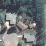
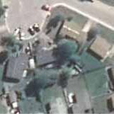
The purpose of this Planning Report is to support the rezoning amendment prepared by the Town of Hay River to allow for residential and park development on Fraser Place. The area in question is Town owned land and is made up of portions of Lot 1021 Plan 803 and Lot 2131 Plan 4393. The area is designated Residential and Open Space in the Town’s Community Plan and is currently undeveloped with the exception of informal trails. There are single family homes to the north, west and south of the site. The Hay River is to the west of the site and runs north to Great Slave Lake.
This area has been identified for future residential development by the Town of Hay River since at least 2005. The community’s population has been stable at 3,500 over the last 30 years. When the Community Plan was updated in 2018, a future population of 5,000 to 6,000 was considered To accommodate this growth, new residential lots were identified in three main locations: Evergreen, Aspen Heights, and Fraser Place.
The Town has invested planning and preliminary design work into Fraser Place. The rezoning is the next step in preparing the land for subdivision, detailed design, legal survey and sale.
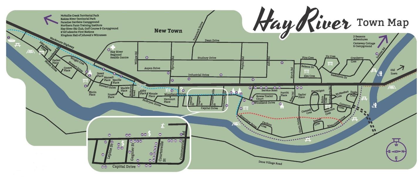
Figure 1 - Fraser Place Area Location
Fraser Place Plan Area Location
Fraser Place was selected by the Town for the following attributes:
• It is small, relatively simple to develop and requires limited new infrastructure.
• This location provides lots within in a popular neighbourhood near schools, parks, Hay River and other amenities.
• Access to the lots can be easily provided through McBryan Drive.
• Running underground water and sewer services to this site is cost efficient as existing infrastructure is located nearby.
• This area is identified for residential in the current Official Community Plan.
1.2 RELEVANT LEGISLATION
In the Town of Hay River Community Plan Bylaw 1811/18, the Fraser Place Plan Area is identified as a location for future infill, in policy 3.6.1, and is shown on the maps as a residential area. The Community Plan also supports infill development in general. Infill can be used to encourage more compact development, take advantage of existing infrastructure and preserve the surrounding open spaces (policy 4.2). The Plan specifies, in policy 5.3.1, that the character of the established neighbourhoods in New Town will be respected whenever future development is considered. This policy also states that public consultation and design guidelines should be used to ensure that the existing character of the area is maintained.
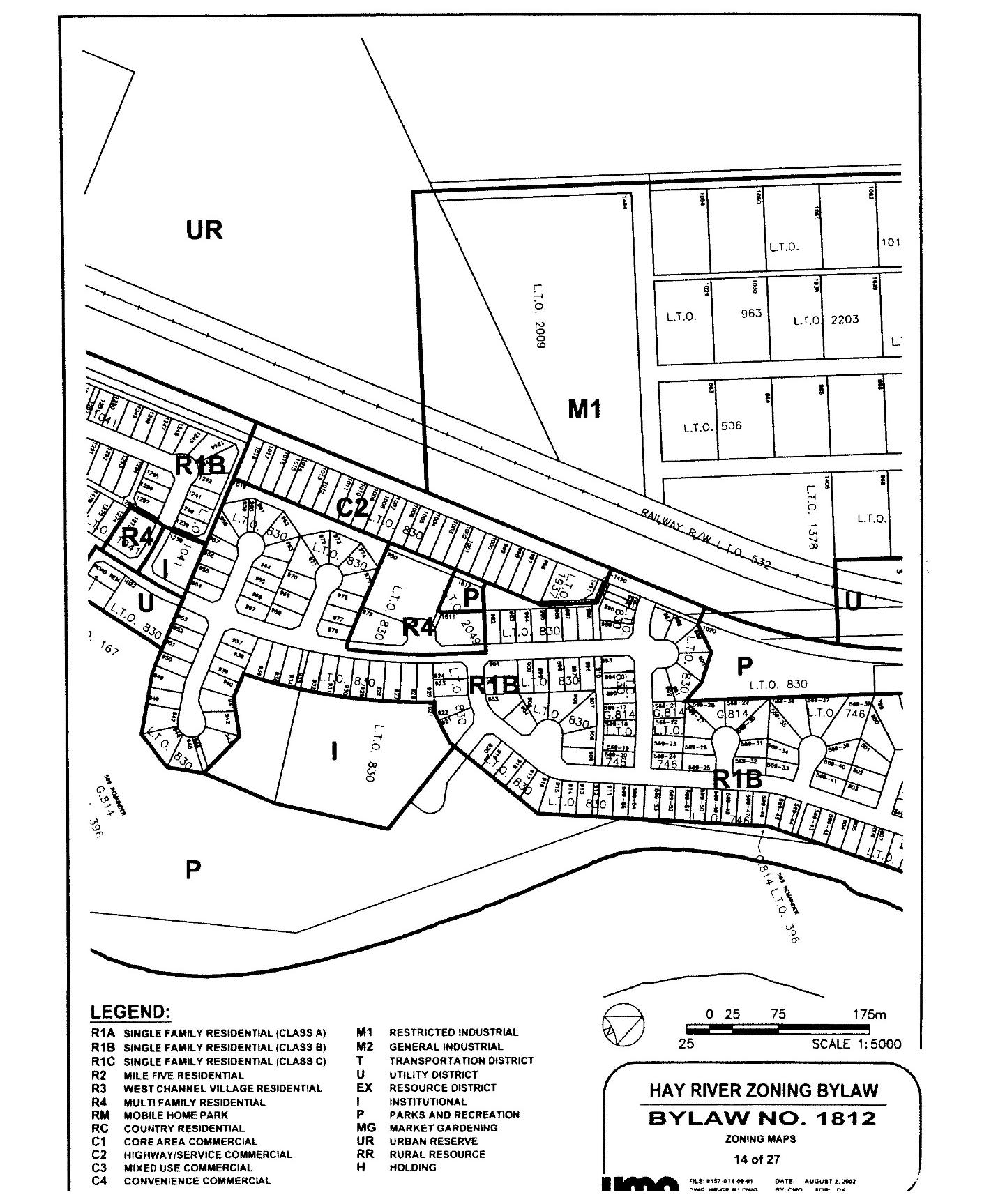
In the Town of Hay River Zoning and Building Bylaw 1812, most of this area is designated as I –Institutional, with a small portion of the area to the east designated P – Parks and Recreation. The current Zoning is shown in Figure 2. This zoning will need to be amended to R1B – Single Family Residential to allow for this development to take place.
As per Section 12. (1) of the NWT Community Plan and Development Act, ‘The purpose of a zoning bylaw is to regulate and control the use and development of land and buildings in a municipality in a manner that conforms with a community plan…’
Figure 2 - Existing Zoning for Fraser Place
2.0 SITE CONTEXT AND DEVELOPMENT CONSIDERATIONS
2.1 SITE HISTORY
When New Town was developed, this lot was identified as the location for a new school, hence the Institutional Zoning. In 1993, the Soaring Eagle Friendship Centre applied to build a community centre on this site. This application was met with resistance from residents, and for various reasons, this development did not go ahead. A subsequent proposal for a senior’s centre also raised community concerns.
This site has been identified as a potential future location for residential development for over 20 years. In 2001, the town commissioned a study, Lot 1021 Planning Report, to investigate the feasibility of various types of development on this lot. This study reviewed the site conditions, developability and surrounding uses and found that churches, buildings for seniors, residential and parks and playgrounds would all be acceptable uses here. Development concepts for each of these uses were also presented in this plan. The residential development concept shows 22 new single family lots along an extension of Fraser Place.
In 2020, the Town of Hay River hired Stantec to update the concept plan. The new plan shows 29 lots, new trails and a site for a future playground.
2.2 TOPOGRAPHY VEGETATION AND SOILS
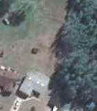
The Plan Area is primarily dense spruce forest, with trees up to 15m tall. This forested area is part of a larger area of old growth forest that runs to the north and south along the banks of the Hay River. The soils found here are a mix of topsoil, clay and clay till, with some silt and sand. Soil conditions will not be limiting to the development of this site
The topography of the Plan Area reflects an old river terrace system, with an upper and lower terrace running along north to south through the area. The topography is gently undulating; the western half of the site is nearly flat, and the eastern half of the site is a combination of steep and gentle hills that slope down to the east and to the river. For residential development, consideration will need to be given to appropriate drainage where the lots will be very flat.
The Hay River runs along the eastern boundary of the site. According to the 2001 study, the riverbank is stable in this area and the proposed development is outside of the flood zone.
2.3 EXISTING UTILITIES
Water and sewer lines from McBryan Drive are stubbed approximately 10 metres into Fraser Place As the lines have been brought into Fraser Place there will be minimal disturbance to McBryan Dr. during the extension of services. Underground power and communication utilities will also need to be extended and will be coordinated with utility companies at the time of construction
2.4 EXISTING LAND USE
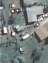
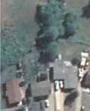
Currently, the site is an undeveloped treed area. The lands to the north, west, and south of the Plan Area are single family homes. There are two lots on McBryan Drive, eleven lots on Stewart Drive and 5 lots on Morin Place that back directly on to the Plan Area There is a 6m drainage right-of-way and walkway that connects into the Plan Area from Morin Place and a walkway that connects from Stewart Drive. Trails connect from pedestrian access points along Morin Place, Steward Drive and McBryan Crescent to informal trails, the river and other destinations to the north and south.
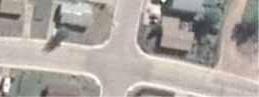
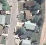
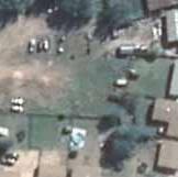
Property owners can drive vehicles to the back of their properties from the exiting Fraser Place access. Imagery shows that there have been some property owners along Morin Place and Stewart Drive who, over time, have been using vacant lands behind their properties for small sheds, landscaping, parking and storage. There is also a garden and a tree house that have been built by residents within the Plan Area. See Figure 3 - Site Map.
3.0 FRASER PLACE CONCEPT PLAN
3.1 RESIDENTIAL LOTS
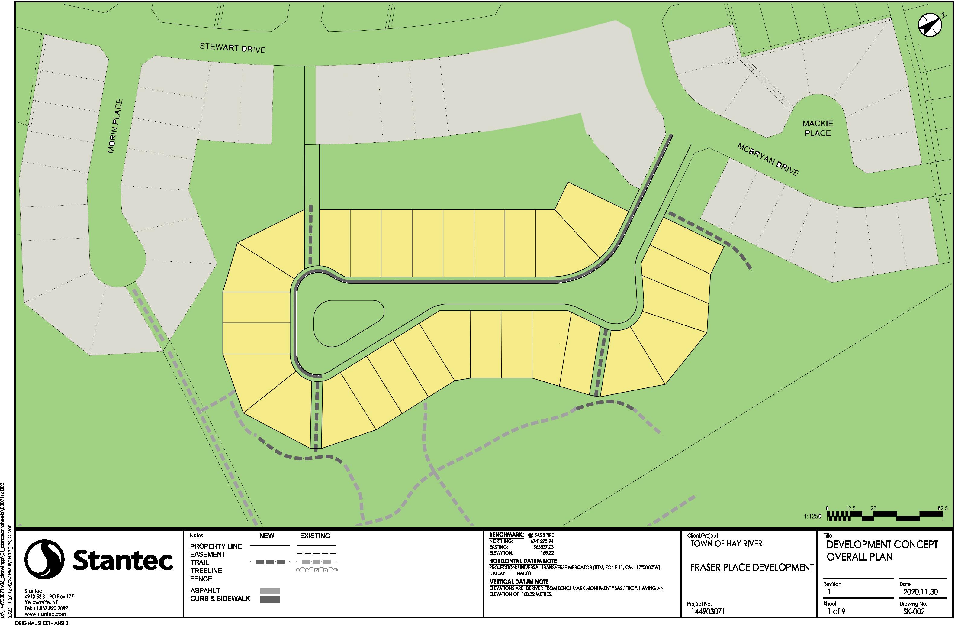
The proposed layout for the new residential development along Fraser Place is shown on Figure 4 The development will result in 29 new single-family lots. These lots will be very similar in size and shape to the existing lots on adjacent streets. A typical lot on Fraser Place will be 17.75m x 36.5m (55ft x 120ft). At the closest point, the lots will be approximately 70m from the Hay River.
3.2 TRAILS AND PEDESTRIAN ACCESS
The development has been designed with walkways running through the area and between lots to provide connections from nearby streets to the existing informal trails that run to the north and south along the river. These new trail connections will replace the access provided by the existing trail systems. These walkway connections are shown in Figure 4 - Development Concept Plan.
3.3 PROPOSED PLAYGROUND
As part of this development, a new playground will be developed in the greenspace between the lots on Fraser Place and the lots on Stewart Drive. The exact location and design of this playground will be finalized after discussions with parents and youth who live in this area. A tentative location is shown on Figure 4. The Town of Hay River will be seeking grants or other funding opportunities to develop this playground.
3.4 SERVICES AND ACCESS
Preliminary engineering has been completed by Stantec in 2020. The new lots will be accessed by Fraser Place off McBryan Drive. The new road will have a paved surface, 11m wide and the road right-ofway will be 18.28m, which is similar to the design of surrounding roads. There will be a landscaped bulb at the end of the cul-de-sac and a sidewalk with curb and gutter on the east side of the street.
These new lots will have buried water and sewer services. Some of the houses on the river side will require internal sewage lift pumps. The detailed design of the lift pumps and the number of lots affected will depend on the final grading of the lot and the design of the home.
According to the current plans, a buried propane line will be provided by the local utility provider and electoral and communication services will also be buried. As Hay River is part of the initial Fiber to Home program, the utility provider may provide fibre optic communication cables for all the lots.
3.5 DEVELOPMENT SCHEDULE
The next step in the development process is the amendment to the Zoning and Building Bylaw to allow for this development. At this point, it is anticipated that construction of these lots could begin in spring 2021, with lots being available for sale in in late 2021 or early 2022.
3.6 LOT SALES
The 29 new lots will be sold by the Town of Hay River in accordance with the Land Administration Bylaw. Prices will be based on consideration of development costs, off-site levies and market value. Lots will be available for sale later in 2021.
4.0 RECOMMENDED NEXT STEPS
The development of 29 new lots and a playground at this location is a cost-effective infill project that will provide the community with new lots to support future growth. There are several tasks that need to be completed before construction of the infrastructure and development of the lots can get underway.
Zoning Amendment – A zoning amendment is required to allow for residential and park development on this site. Figure 5 shows the proposed new zoning.
Public Engagement – The Community Plan states that future development should follow the character of existing neighbourhoods, and that public consultation and design guidelines may be required. A community meeting should be held to present this proposed concept plan and understand and mitigate concerns that existing residents may have.
Trail Development – The trail connections should be formalized at the same time that the lots are put in. It is important that existing residents have ongoing access to greenspace and that those who buy the new lots adjacent to the walkways are aware of the location of public accesses. This would also be a good time to consider formalizing the riverfront trail and the other trails in the area that connect to local parks, community destinations and existing formalized trails
Playground Funding – Once the zoning amendment has been adopted, it will be good to work on securing funding to build the new playground. This will improve livability for existing and future residents. Parents and young people who live in the area should be invited to participate in the design of the new playground.
STEWART DRIVE
EXISTING PROPOSED LEGEND OLD
PROPERTY LINE EASEMENT
Imagery Date: 06/19/2020 Image © 2021 CNES Airbus
MORIN PLACE
MCBRYANDRIVE
MACKIE PLACE
HAY RIVER
Figure 4 - Development Concept Plan
STEWART DRIVE
EXISTING PROPOSED
ZONE BOUNDRY
LEGEND SUBJECT AREA OLD
PROPERTY LINE EASEMENT
R1B - SINGLE FAMILY RESIDENTIAL (CLASS B)
P - PARKS AND RECREATION
MCBRYANDRIVE
MACKIE PLACE