

pg. 6–8


pg. 6–8

pg. 14–15
pg. 10–12
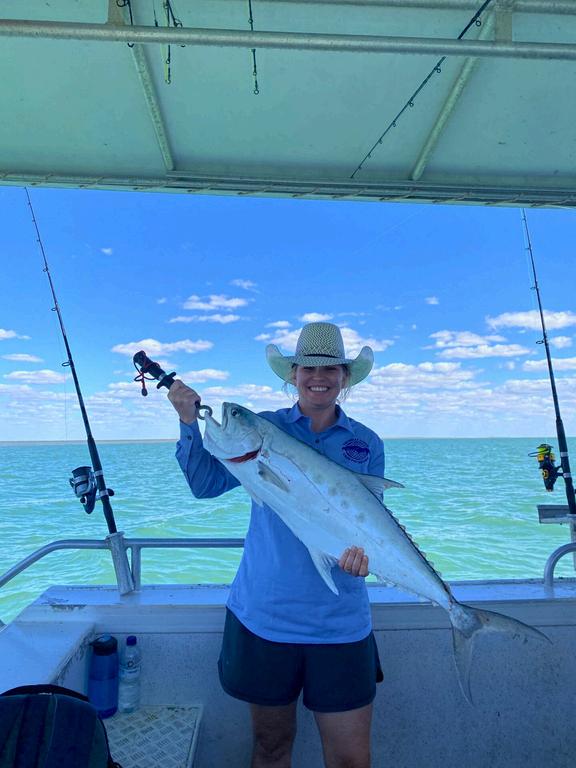
Nice catch Taylor!
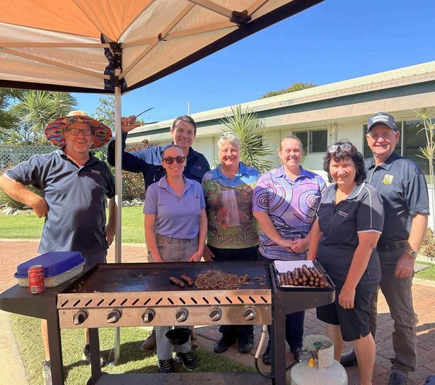
Team Leader Marcus cooked up a storm for the Georgetown Primary Healthcare Centre team
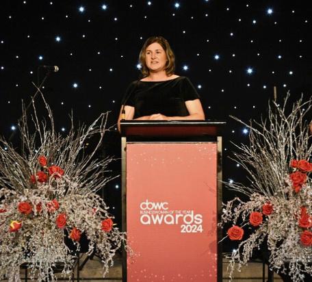
Congrats to CEO Zoe for winning the Cairns Business Women's Club Manager in Business Award.

Julie and the team had a 4WD refresher
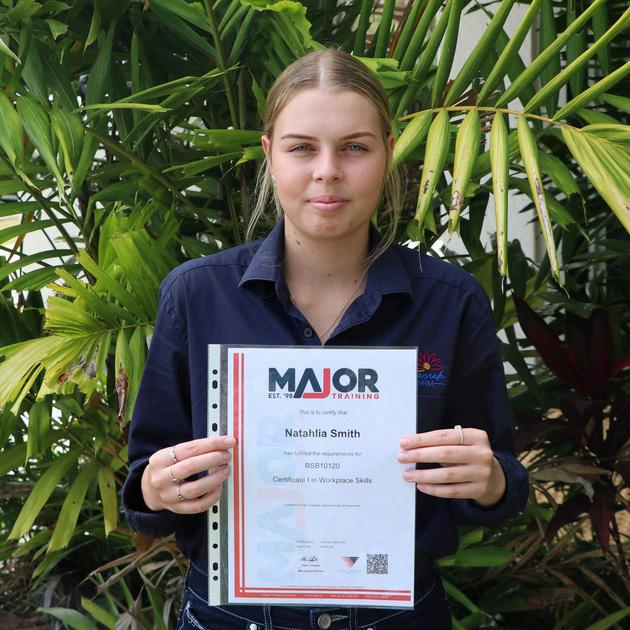
Well done to Nat for passing her traineeship!
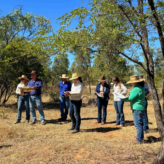
We were at Greenhills Station, near Georgetown, for forage budgeting training
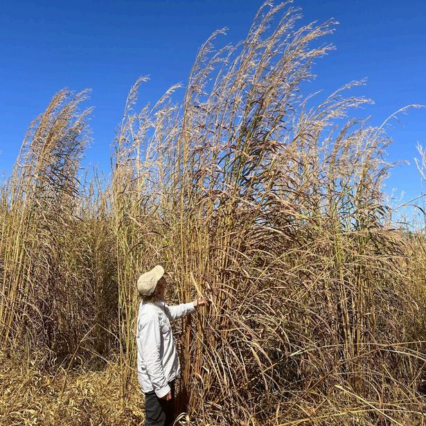
Biodiversity Officer Ed inspecting some 4m-high gamba grass at a recent workshop
Thank you to everyone who has joined Gulf Savannah NRM for events, workshops and field days in the last few months here are a few of our favourite highlights!
In our spring edition of the Gulf Croaker we're focusing on supporting our threatened and endangered species and their habitat
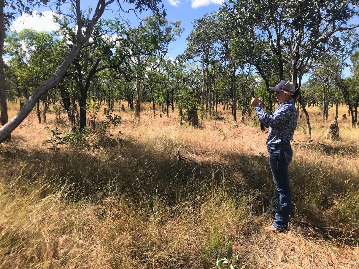
From establishing new nature refuges and carrying out clean-ups to reducing key threats to wildlife, there are lots of projects taking place across the Northern Gulf region dedicated to protecting our iconic ecosystems We hope you enjoy this edition and that you'll consider supporting our campaign to revegetate Forty Mile Scrub National Park (more on page 10) Our next edition will be out in early 2025

ZoeWilliams CEO Gulf Savannah NRM
We're a not-for-profit organisation working to promote healthy landscapes while supporting local people and enterprise Come say hi at our offices in Georgetown, Croydon and Mareeba
gulfsavannahnrm.org 40921088
admin@gulfsavannahnrm.org
Frontcoverphoto: Chillagoe-Mungana Caves National Park.
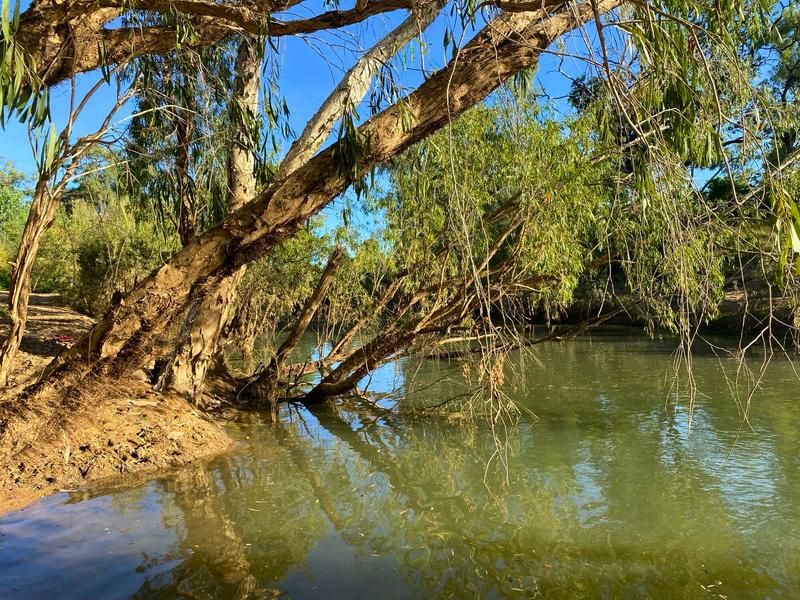
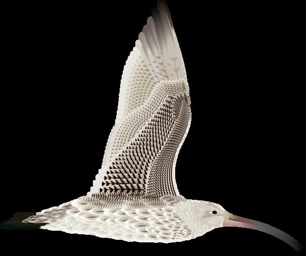

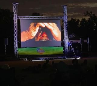


Nearly 300 people attended the inaugural Ocean & Outback Film Festival in Karumba. Gulf Savannah NRM was proud to sponsor the Emerging Filmmaker Award, won by Carla from Normanton Christian College for her film 'My Life in Normanton'. Readmoreonpage16.
One of Australia’s leading tungsten producers has been granted a permit to begin extensive on-ground exploration over a 480 square kilometre area in Far North Queensland. The permit approval allows EQ Resources to begin drilling, geological mapping, and soil and rock sampling aimed at unlocking tungsten resources at the site, which includes the former Wolfram Camp and Bamford Hill mines Source:Queensland Government.


G'DAY GULF: ABOUT OUR REGION


9,660 people live in the Northern Gulf
BUSHTOURISMBOOST
Thirteen projects in Tropical North Queensland have received more than $2million between them to support new bush tourism infrastructure. Projects included nature-based glamping at Mareeba Bush Stays and lookout point bird hides in Normanton
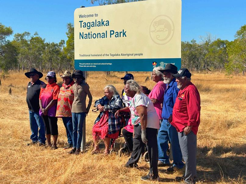


Littleton National Park near Croydon has been officially renamed Tagalaka National Park. The name change followed community consultation and acknowledges the strong connection between the Traditional Owners, the Tagalaka People, and the protected area, which features many culturally significant sites
Source:QueenslandGovernment.
The Karumba Artificial Reef has been named Carpentaria Shire Council held a competition to come up with a unique name for each reef site and at their June Council meeting they selected Sunset Reef and Savannah Reef
The area is 196,100 square kilometres
Over 196 reptile, 455 bird and 118 mammal species live here 88% land use is grazing on native pasture
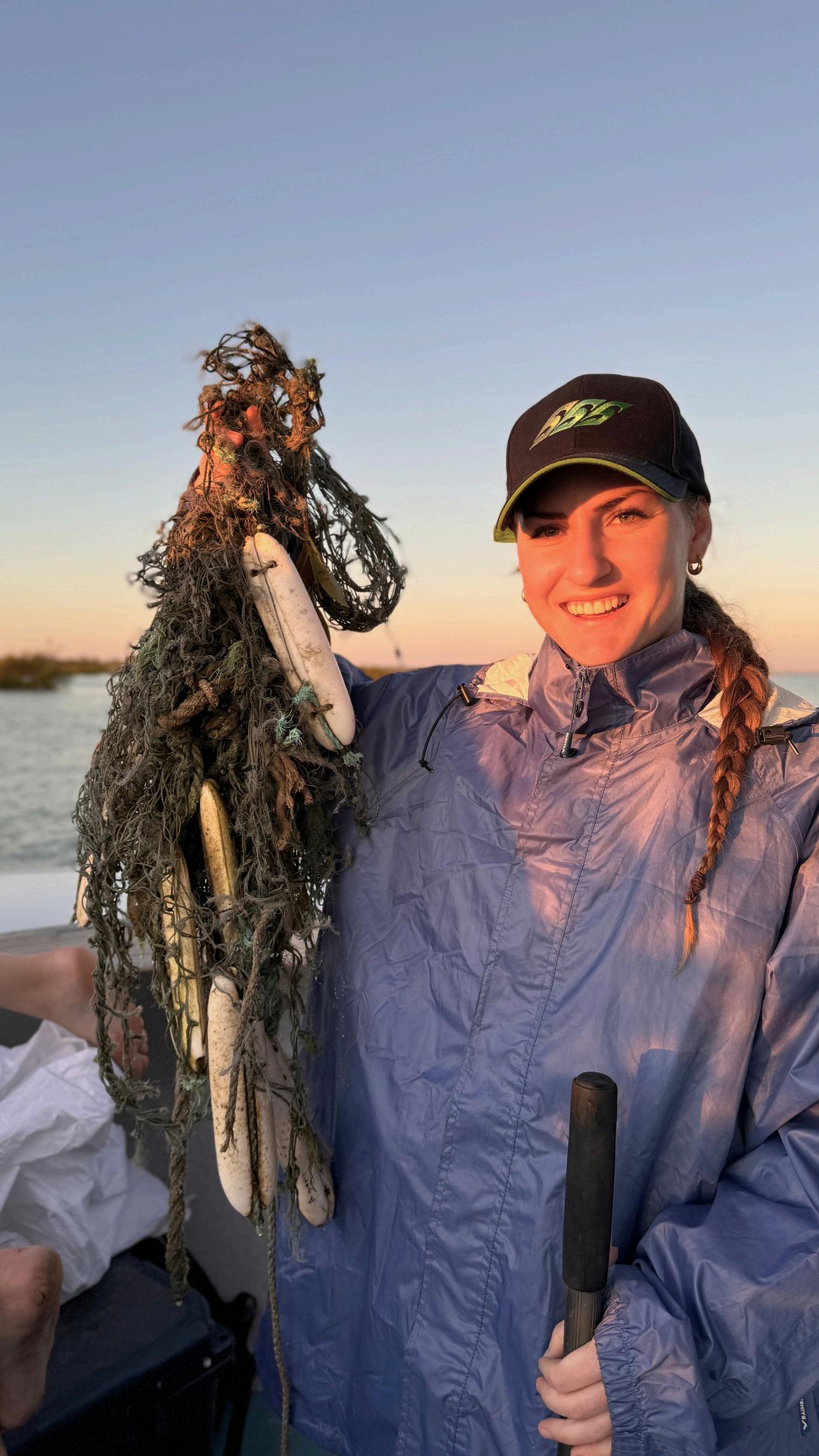

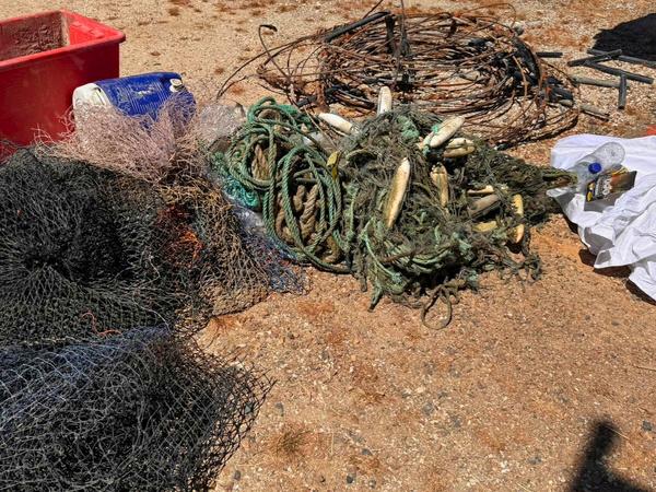
Bleary-eyed and determined not to hit the snooze button again, eleven dedicated conservationists began the first of two days on an assignment to clean up discarded crab pots and other abandoned fishing gear from sections of the Norman River and out into the Gulf.
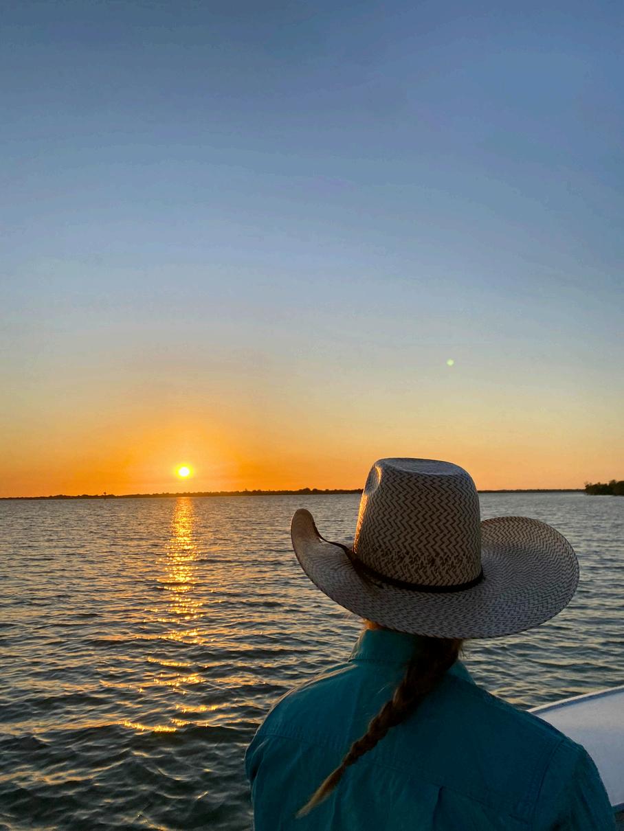
The clean-up team were rewarded with a beautiful sunrise before the hard work of dragging nets and other rubbish on board began.
‘It was a great group to be part of, with representatives from OceanEarth Foundation and OzFish members and volunteers,’ said Taylor, who also caught a beautiful queen fish during some well-earned down time
‘As well as the impact ghost gear is having on marine life, it’s also dangerous for boats if it gets caught in a motor,’ said Sarah
The clean-up days were part of OzFish’s Great Aussie Crab Pot Recovery initiative, run in partnership with OceanEarth Foundation’s GhostNets Australia program This specific project aims to remove recreational fishing gear from the southern Gulf of Carpentaria – and although some of the crab pots may be lost locally, most of the marine debris accumulating here has been on a much longer journey
The Gulf’s ecosystem, a haven for endangered marine species, including six of the world’s seven marine turtle species, dugongs and sawfish, is also a global hotspot for ghost nets.
These nets drift on currents and continue to entangle marine life year after year. Turtles appear to be the most at risk, with a study showing they account for 80% of marine life caught, and often killed, by ghost nets.
Indigenous Ranger groups across northern Australia clear hundreds of lost nets every year and play a pivotal role in clean-up efforts on our vast and remote coastline.
‘We recovered crab pots, nets, rope, buckets and even an Esky.’

Research by the ranger groups and OceanEarth Foundation over the past decade has found that about 90% of ghost nets washing up on northern Australian shores originate from overseas with the most common type of net coming from trawl fisheries, followed by gillnets.
Further studies by the Foundation and CSIRO have highlighted that most of the nets originate from the Arafura Sea – an important fishing area for Indonesia
So,whatdoesthefuturehold?Work is taking place in Indonesia to engage with fishers and other stakeholders to develop a management plan for the Arafura Sea – building on fishing net recovery projects that have already taken place in Indonesia OceanEarth Foundation is now working with partners to scale this program, building on ways to recycle the nets, with the goal of no ghost nets coming to northern Australia by 2030
To find out more about the GhostNets program, visit oceanearthfoundation org au To take part in OzFish’s Great Aussie Crab Pot Review survey, visit ozfish.org.au.
References
OceanEarth Foundation. Ghost nets: the silent killer haunting our oceans Oceanearthfoundation org au/ ghostnets-australia
C. Wilcox, G. Heathcote, J. Goldberg, R. Gunn, D. Peel, B.D. Hardesty (2015) Understanding the sources and effects of abandoned, lost, and discarded fishing gear on marine turtles in northern Australia Conservation Biology
Wilcox, C , Hardesty, B D , Sharples, R , Griffin, D A ,Lawson, T J and Gunn, R (2013) Ghostnet impacts on globally threatened turtles, a spatial risk analysis for northern Australia. Conservation Letters.

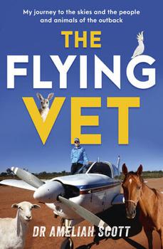
DR. AMELIAH SCOTT
Dr Ameliah Scott isn't your average vet flying solo over a territory of 200,000 square kilometres to tend to animals of all shapes and sizes, she's a rare combination of female flying vet and fifth generation farmer in remote Australia From treating animals in distress, wrangling hot-blooded goats to gelding biting horses and treating pregnant and calving cattle - all while raising her own young family on her 120,000-acre cattle and sheep farm
R E A D
GULF SAVANNAH NRM | FIND IT ON YOUTUBE
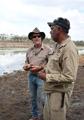
Concerns have been raised that feral pigs are behind a decline in the freshwater turtle population of the Gulf To find out more, we headed to Talaroo Station and Tagalaka National Park to talk with Ewamian People and Tagalaka People
This film was screened at the Ocean & Outback Film Festival in Karumba in September
odcast RWAYS
underpin the vibrant lifestyle, onment of the Wet Tropics Region in nd They also underpin the health and alia's iconic Great Barrier Reef Wet talk to people from around the region our waterways, the critters that call people and projects working to h.
W A T C H L I S T E N

An initiative to return the national park to its former glory

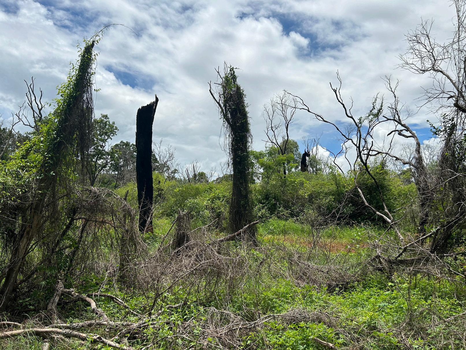
Bottle, white cedar, fig and white bean trees grow in the semi-evergreen vine thicket at F Mile Scrub National Park, one of the few inla dry rainforest remnants in North Queensland
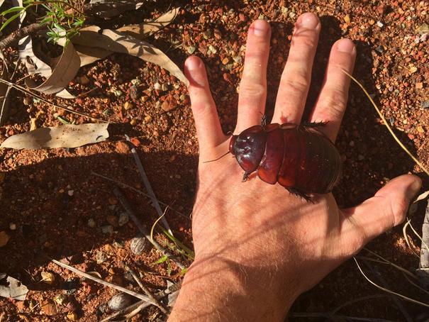
This iconic ecosystem serves as a refuge an food source to range of animals, some passi through such as the koala, and permanent residents including red-legged pademelons, rainbow skinks, the ground-dwelling scarletsided pobblebonk frog and the threatened common death adder Underground the wor largest cockroach Macropanesthia rhinoc is busy burrowing away
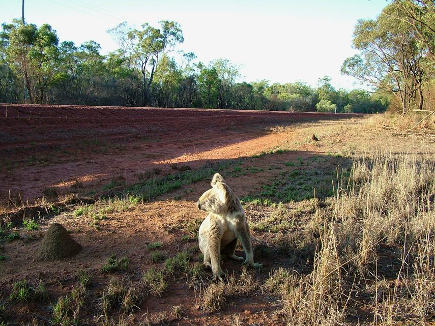
Located on the edge of the McBride Plateau and part of the extensive Einasleigh Uplands Bioregion, the national park straddles the Great Dividing Range that separates the Lynd and Herbert river catchments. Around 60km southwest of Mount Garnet, the area lies within the traditional homelands of, and holds great cultural significance to, both the Ewamian people and Wakaman people.
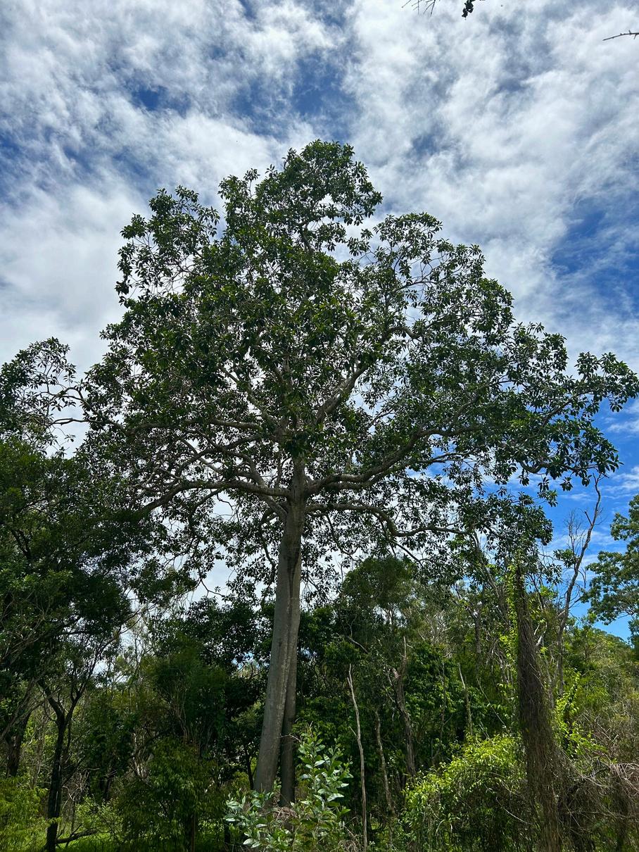
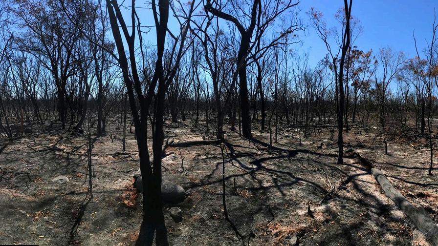
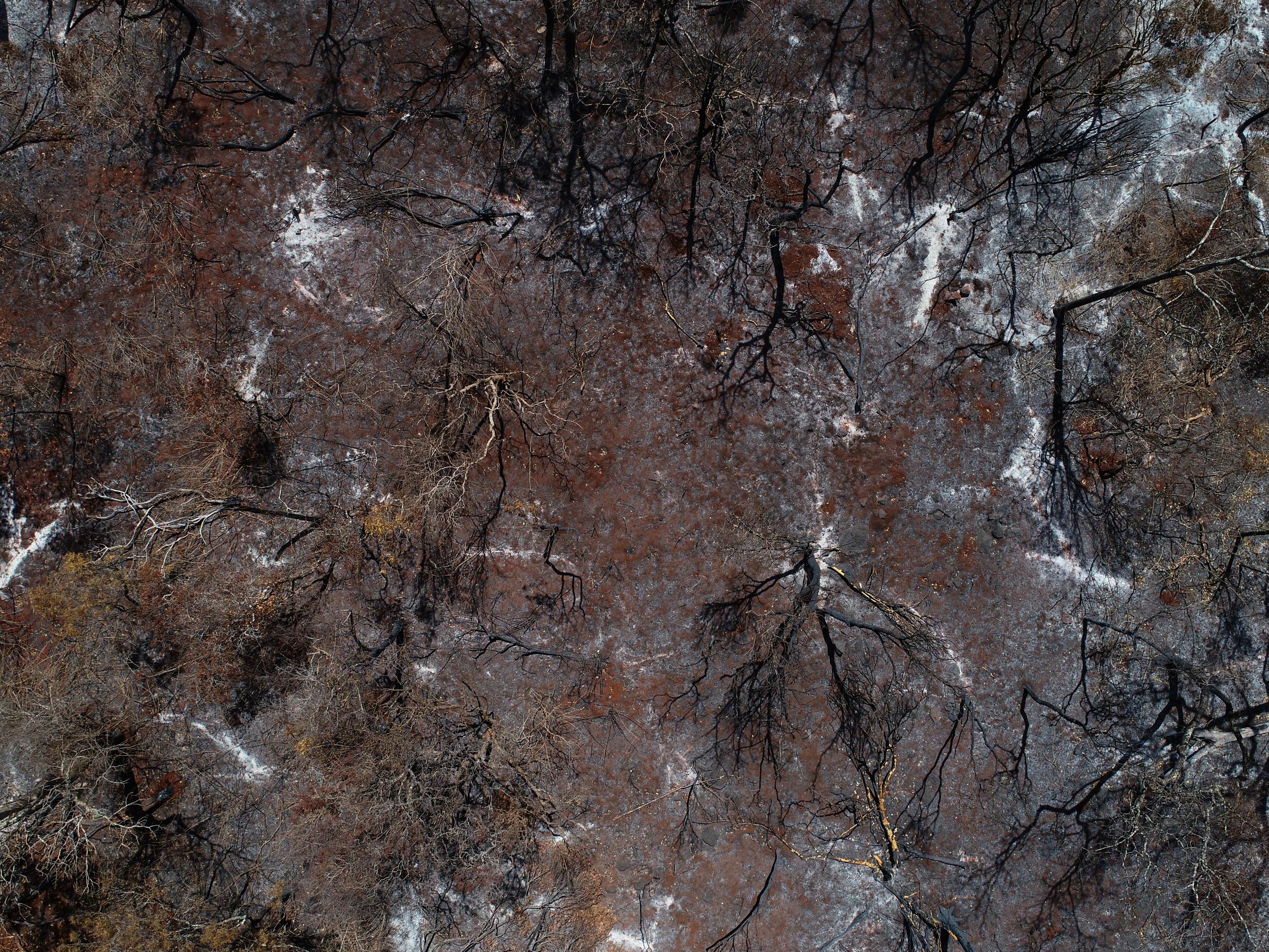
Dry rainforest can be badly damaged by severe fires, and so in 2019 when high intensity bushfires swept through the park, they devastated this nationally significant vegetation.
The remaining native vegetation is now listed as an endangered regional ecosystem, and the situation has progressed from bad to worse with key vegetation species being damaged by feral pig incursions, and significant areas being colonised by lantana and other invasive weeds due to increased light penetration.
Gulf Savannah NRM is seeking your support to restore the ecological value of the remnant patches of threatened semi-evergreen vine thicket through strategic revegetation and weed and pest control.
The goal is to raise $175,000 to undertake the first stage of a multi-year restoration project at Forty Mile Scrub National Park The project would be delivered in partnership with Queensland Parks and Wildlife Service and Traditional Custodians, Ewamian People Aboriginal Corporation and Wakaman Native Title Aboriginal Corporation
If you can support this nationally significant project, please donate to help transform this important ecosystem You can make a donation by visiting gulfsavannahnrm org/supporters
donation will support this project for people and communities across the Northern Gulf region
Gulf Savannah NRM is a registered charity and a not-for-profit company Your tax-deductible
For more information contact 4092 1088 or publicity@gulfsavannahnrm org
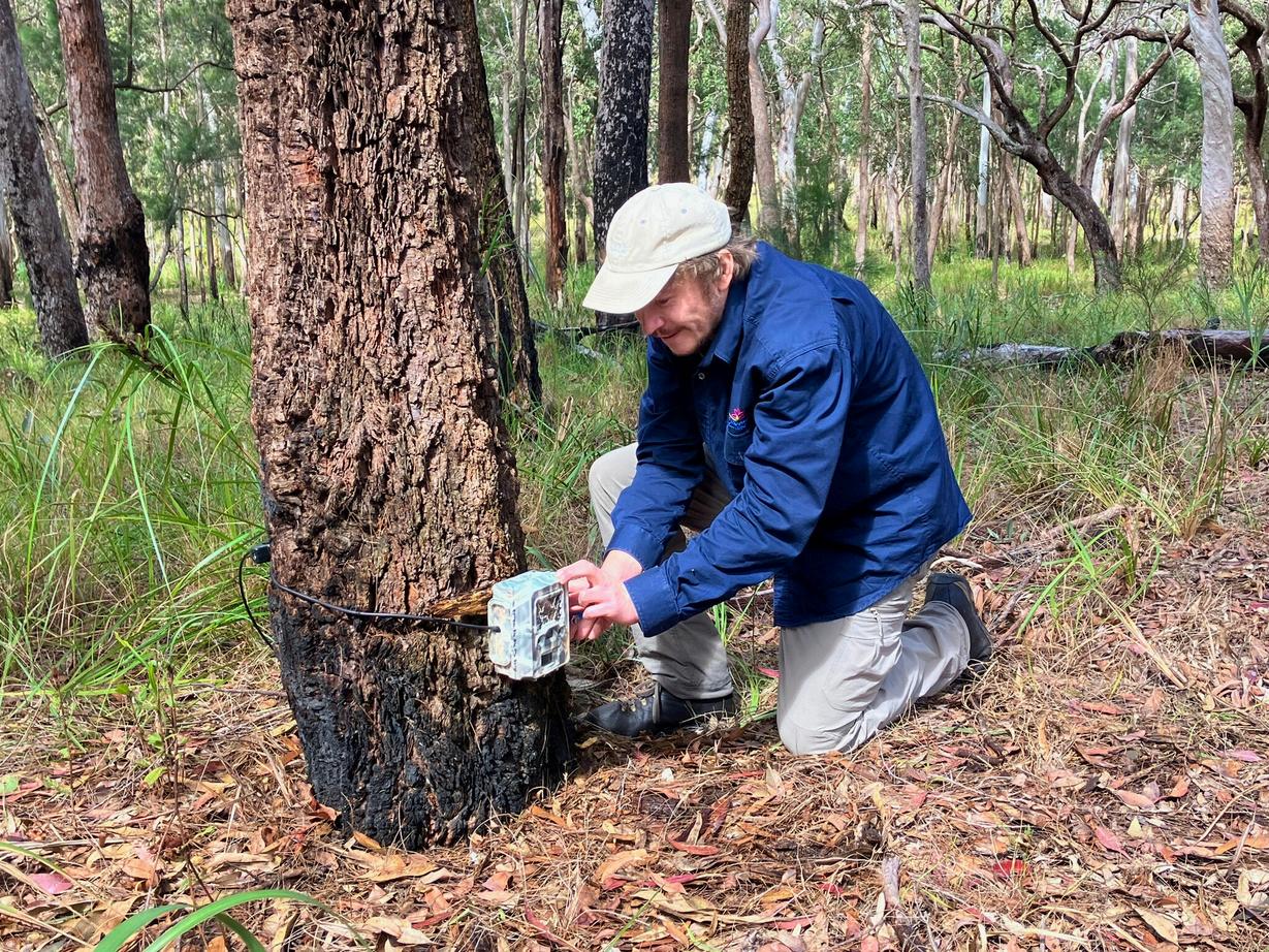

Ed
Tellusabitaboutwhereyoucomefrom.
I’m originally from the UK and moved to Cairns in 2018 to undertake my PhD research at James Cook University on the chemistry and ecology of Australian scorpions Being a naturalist at heart and lover of the outdoors, I fell in love with the Cairns region (and Australia more widely) and would find it hard to move back to the UK now!
Wherehaveyoubeenrecentlyaspartofyour roleforGulfSavannahNRM?
I have been undertaking fieldwork with Australian Wildlife Conservancy and Western Yalanji Aboriginal Corporation to monitor northern bettongs
We have received funding to continue this monitoring work and will be working closely with Queensland Parks and Wildlife Service to improve the condition of the habitat for bettongs and other threatened species (such as yellow-bellied gliders). Readmoreonpage24.
WhatmadeyouwanttoworkwithGulf SavannahNRM?
I have a broad interest in ecology and conservation of threatened species, and postPhD I was ready to try a more field-based and applied position to gain new skills and knowledge and have a meaningful impact for the conservation of Australia’s diverse and unique fauna and flora.
Whatareyourhobbies?
I’m an obsessive wildlife observer and keen photographer, so I am forever spending my free time going on trips to target specific species to see and photograph I’ve lost count as of earlier this year, but I have so far photographed at least 400 species of Australian reptiles and amphibians as well as many rarely encountered mammals –the list is always growing!
Where’syourhappyplace?
Out in the bush It doesn’t matter where, but preferably somewhere with an interesting ecosystem and some cool animals to find (no phone reception is a bonus!)
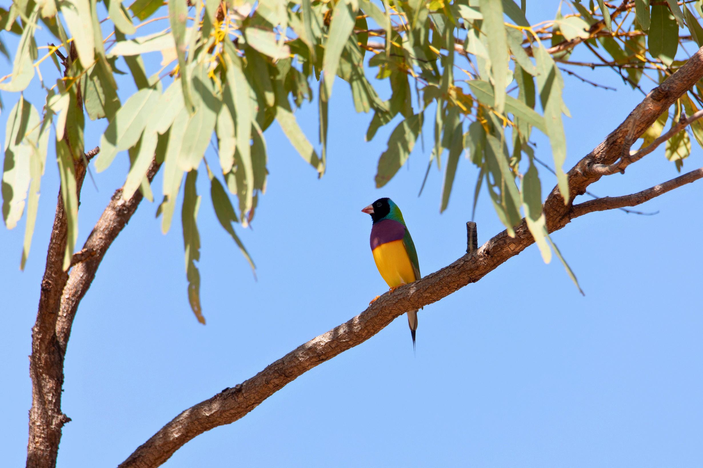
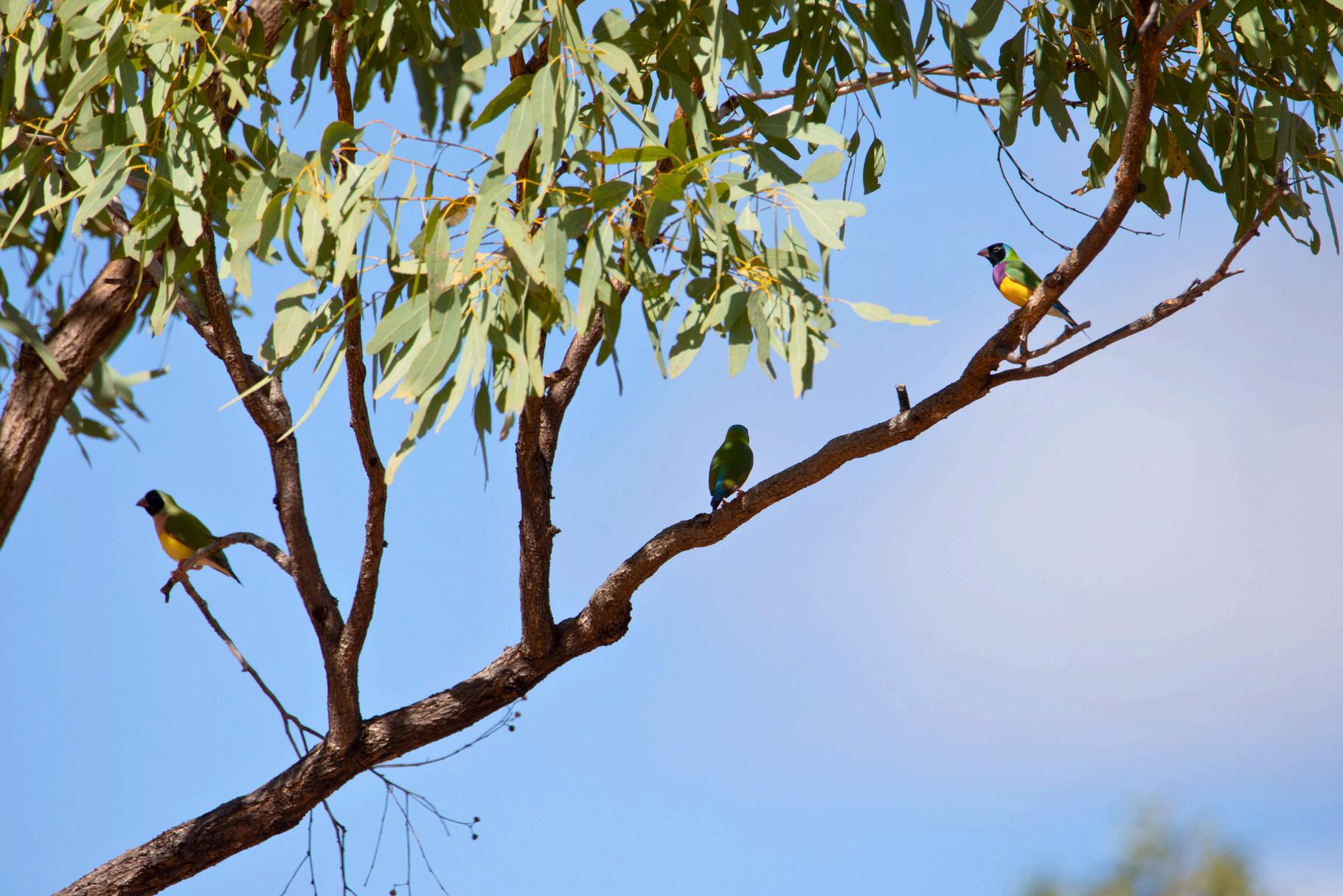
Once common across northern Australia, in recent decades the Gouldian finch population has declined dramatically to an estimated 2,500 mature individuals in the wild¹.
The species now predominately occurs in small flocks in several locations in the Kimberley and the Northern Territory, but a few sub-populations are also known from Queensland
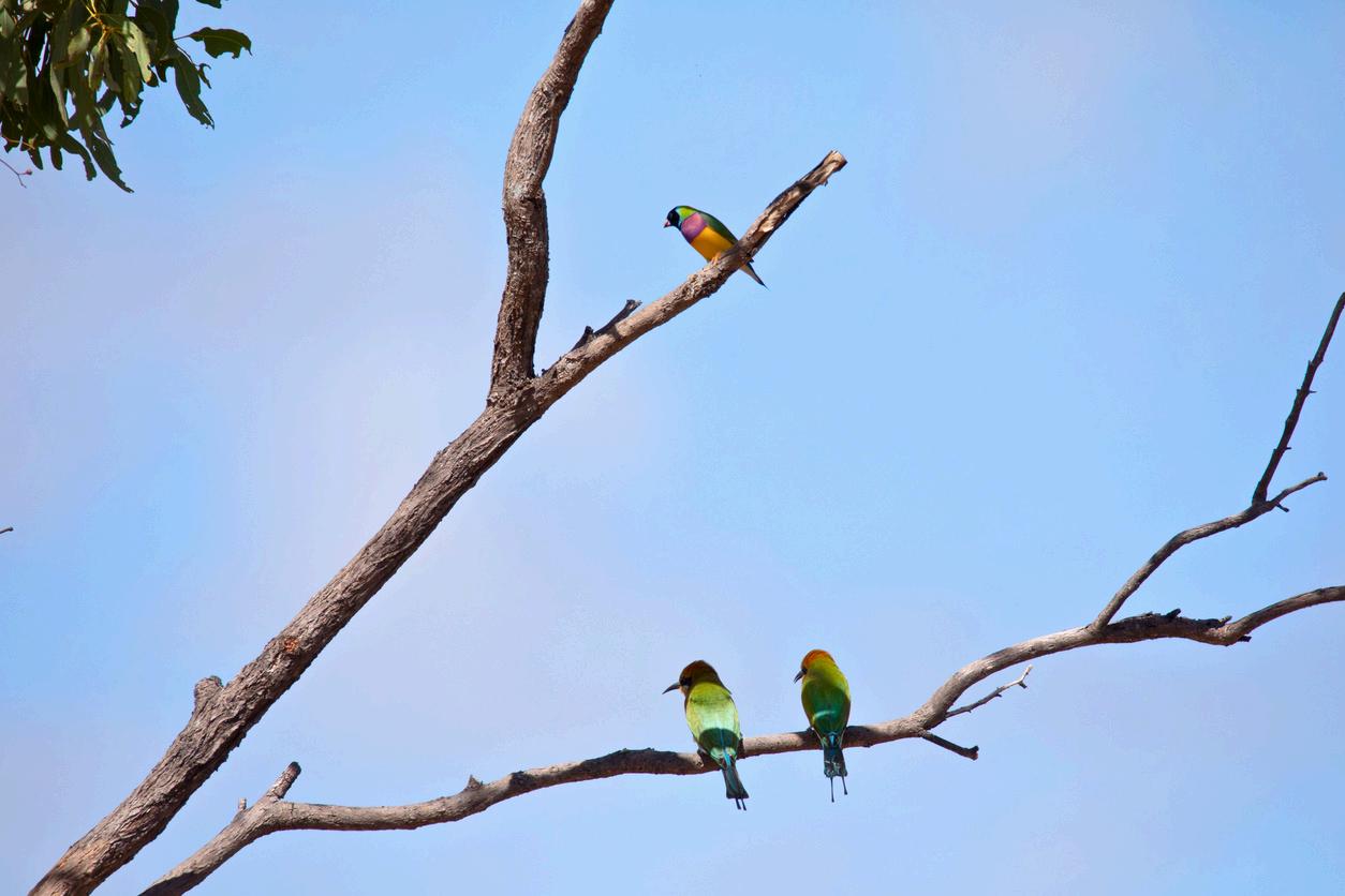
Gulf Savannah NRM’s Biodiversity Officer Ed Evans took part in a recent survey in the Northern Gulf region and spotted a range of finch species Gouldian, double-barred, black-throated and masked.
The survey took place in the Einasleigh Uplands Bioregion supporting conservation scientist Ray Pierce as part of the ongoing Queensland Gouldian Finch Study. The study was established after a significant Gouldian finch population was found in Far North Queensland in 2018.
The project is designed to increase the understanding of Gouldian finch ecology and threats in northern Queensland and is a partnership with Birdlife and the North Queensland Natural History Group. Find out more and get the latest Gouldian update by visiting nqnhg.org/queenslandgouldianfinchstudy.
Scientificname:Erythruragouldiae
Length:12–15cm
Weight:14–15g
Status:Endangered(underEPBCAct1999)
AdultGouldianfinchesareoneofthree differentcolourvarieties:jet-blackfaces (70–80%);scarletfaces(20–30%);while gold-facedGouldiansareincrediblyrare.
References Department of Climate Change, Energy, the Environment and Water Gouldian Finch: National Threatened Species Fact Sheet 1.


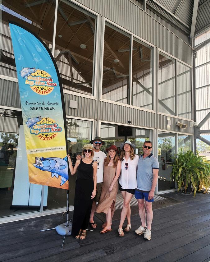


The Ocean & Outback Film Festival marked the official start of the Outback by the Sea Festival, which is a week-long celebration in the Gulf of Carpentaria This annual event honours the region's rich heritage, celebrating the legendary barramundi, local seafood, live music, Indigenous culture, and arts and crafts
Nearly 300 attendees gathered for the film festival in Karumba, under the stunning Carpentaria sky on Saturday 14 September for an unforgettable evening of film, dance, food, music, and celebrity judges.
Film Festivals Australia directors Steve Bastoni and Meg Pascoe led the event, supported by actors Marcus Graham and Totti Goldsmith, who served as judges.
The night began with local markets and a captivating performance by the Rambullum dance group Guests arrived with picnic rugs and camp chairs to enjoy this year’s top 10 Australian short films in a picturesque outdoor setting
In addition to the main short film competition, an Emerging Filmmaker category spotlighted locally produced short films, giving new talent a chance to shine With the success of this year’s event, plans are underway to make next year's Ocean & Outback Film Festival even bigger and better!


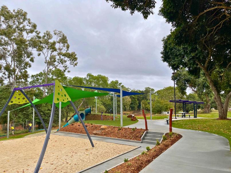
Spring is here, making it a great time to explore the parks in Mareeba Shire The Southern Bicentennial Lakes playground on Mason Street is now open, featuring a flying fox, swings, slides, picnic areas, bike racks, and a new toilet block Kids can also enjoy the new pump track with exciting jumps
In early October, Mareeba Shire Council, in partnership with Get Ready Queensland, hosted the Get Ready Tablelands event at the Mareeba Drive-In Thank you to those who attended! The event



hosted local emergency services and featured the “Stories of Jasper” documentary, which highlights experiences from the Cyclone Jasper flood event in December 2023. To view the documentary, visit the Mareeba Shire Council website. Now is the time to prepare for the bushfire and wet season. Stay informed by visiting your local Council’s website for their emergency dashboard and sign up for their Early Warning Network for alerts.
Finally, Council supports Mareeba Shire Tourism, the local tourism organisation that promotes the visitor experience in Mareeba Shire. To keep up to date with opportunities and networking events, join the Mareeba Shire Tourism Facebook group and use #LoveMareebaShire while exploring the Shire!
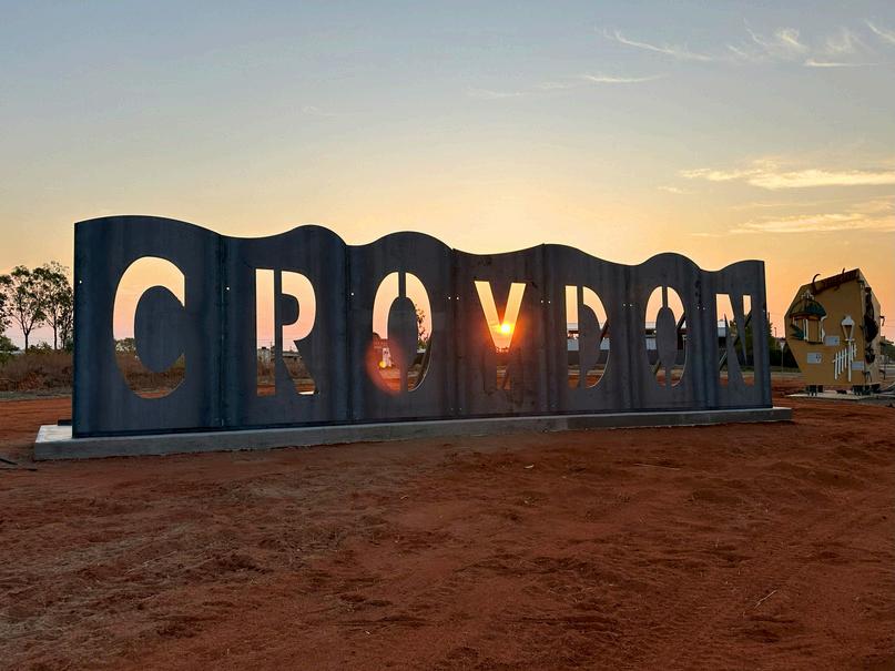
A new sign is greeting drivers arriving in Croydon from Georgetown A rustic, weathered-looking sign spelling out CROYDON is the start to a warmer welcoming statement for visitors In time, landscaping and lighting will be added to catch the eye of new arrivals
This is just one project in what’s been a busy season in Croydon. Council has secured a Showcasing Queensland Heritage grant to support our 2025 Heritage Festival which will celebrate the grand re-opening of our Chinese Temple Archaeological site and the contribution of Chinese settlers of Croydon The refurbishment of the site is well underway, as is the planning for the festival which will kick off on Saturday 21 June 2025
Meanwhile, the long awaited and just-in-time for summer Croydon Splash Park has enjoyed a soft opening Meaning kids of all ages are getting to play in the water while finishing touches are finalised The park is located on Alldridge Street, just south of Samwell Street next to the pump track Both areas are alcohol-free zones
A heritage themed mini-golf course may soon join Croydon’s array of family-fun activities as Council has secured a North West Queensland Economic Diversification Strategy related grant to support course planning The same grant is also securing a new grandstand for our rodeo ground Croydon:alwayssomuchmorethanyouexpect!

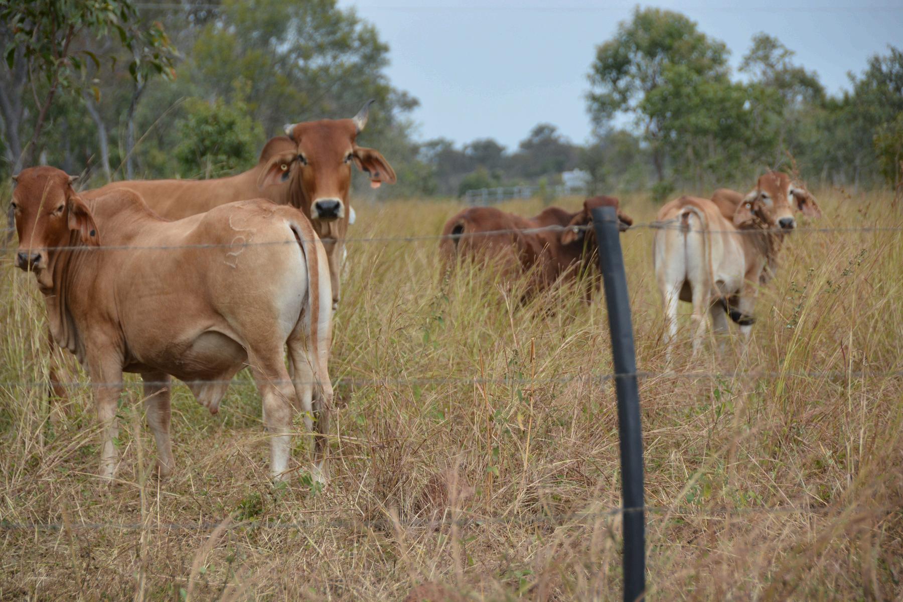

The results are in. Regional land condition is generally poor, which is significantly reducing the land’s capacity to respond to rain and produce useful forage, and subsequently impacting the long-term carrying capacity (LTCC) of the Northern Gulf region
With nine out of every ten sites assessed showing degradation, the region’s LTCC is reducing by approximately 6,500 head of cattle every year
By 2046, if this rate of declining land condition continues, then potential stock numbers could drop to 650,000 a LTCC of 50%.
When monitoring was first carried out in 2004, the LTCC was at 72%, falling to around 66% by 2016 Land condition assessments carried out at 289 sites during 2023 show that the region’s LTCC has now declined to 60% (approx 780,000 head) This means the trend is an annual reduction in LTCC of 0 5%
Environment Team Leader at Gulf Savannah NRM, Marcus Mulholland, said sites had previously been monitored for land condition in 2004, 2012 and 2016.
‘The main project objective was to establish a sustainable monitoring system to understand the state of our region’s natural assets. We revisited and reassessed previously monitored sites using a Land Condition Assessment Tool (LCAT) to produce a comprehensive Northern Gulf region assessment and baseline data for future studies ’
The LCAT is a science-based framework developed by the Queensland Government that determines the current state of the land, by evaluating key indicators of long-term land condition
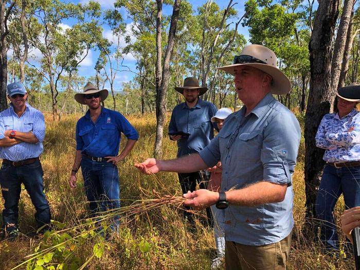
‘We also worked with 15 graziers to provide training in land condition assessment and monitoring, including the LCAT app, alongside the construction of wet season spelling demonstration sites at some of their properties,’ said Marcus
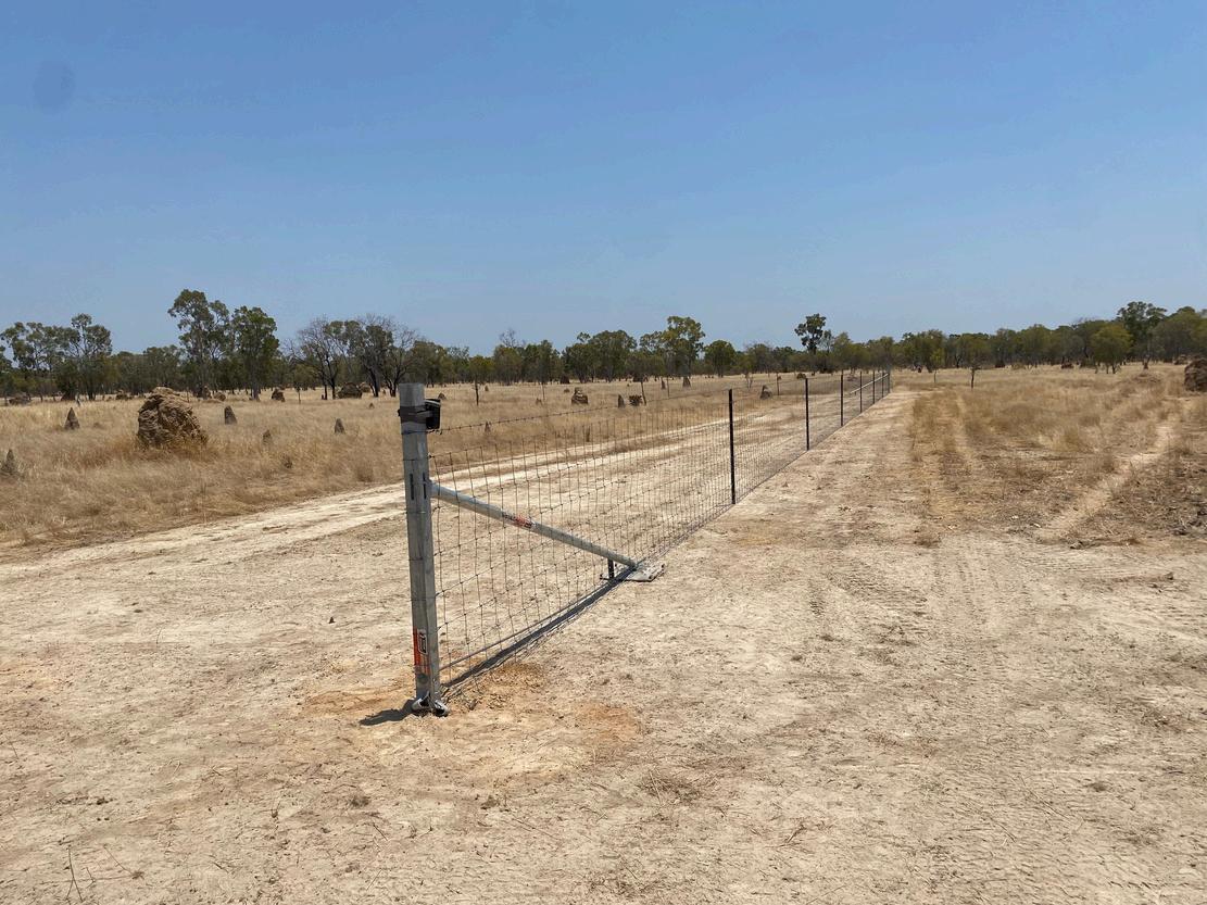
The demonstration sites were constructed to show the importance of regularly spelling paddocks and how land condition improves as a result. Training in traditional burning skills was also provided focusing on Indigenous fire management techniques to restore land condition, enhance ecological health, and control invasive species.

‘Measuring the influence grazing management strategies have on land condition enables a producer to evaluate the sustainability of their practices. This is more important than ever with global interest in the sustainability of agricultural supply chains, and this should encourage grazing producers to monitor and manage land condition for improved productivity and for market access and advantage,’ said Marcus
This project is funded by the Queensland Government’s Natural Resources Recovery Program

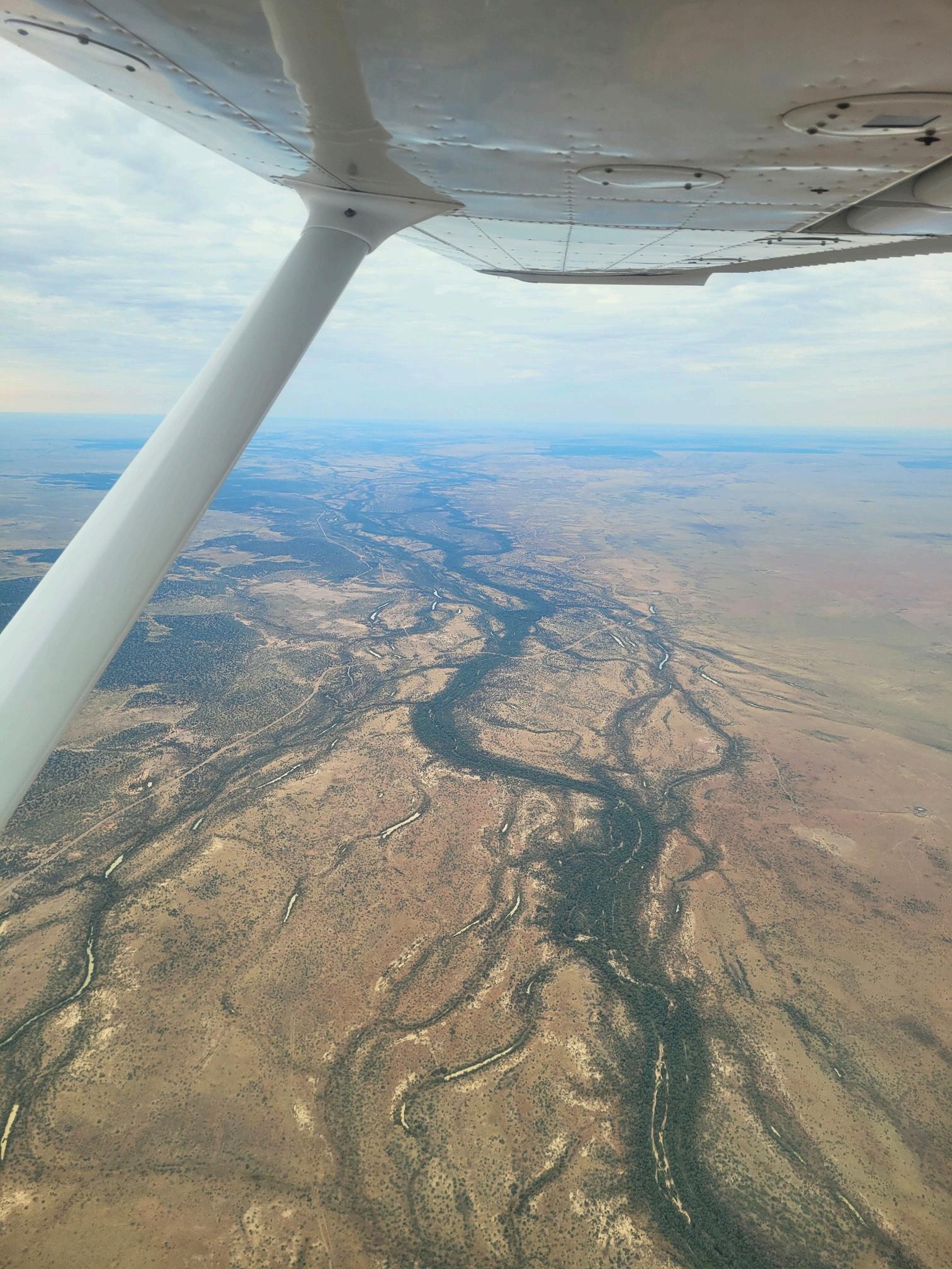

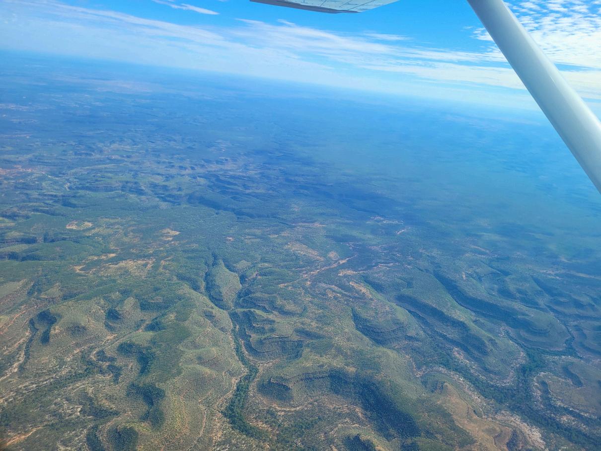
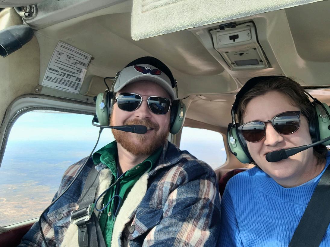
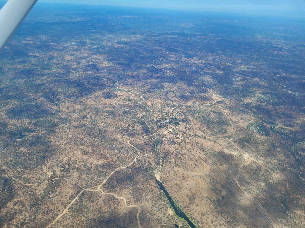
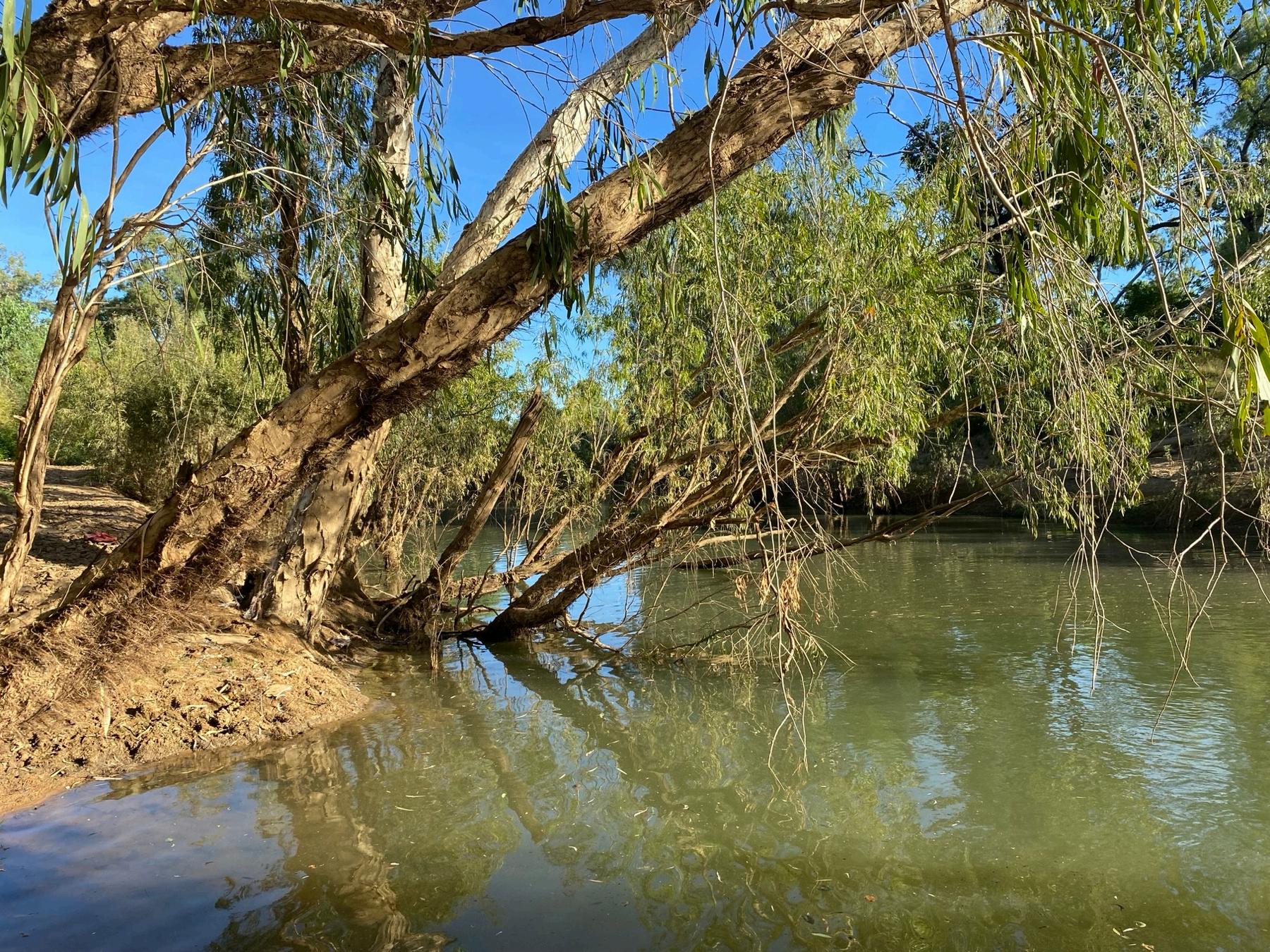
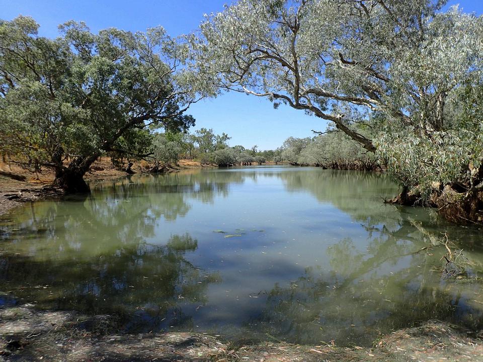
When her brother offered to fly her back to Atherton, Gulf Savannah NRM’s Kasmin Brotherton jumped at the chance, cancelling her commercial flight from Mount Isa for a better view of our region. Enjoy the photos!
On the 3.5-hour flight, travelling over Forsayth, Mount Surprise and Irvinebank, she was treated to a new perspective of the landscapes that Gulf Savannah NRM helps to look after.
'It was fascinating to see the Southern Gulf transition into the Northern Gulf river systems,' Kasmin said. ‘The views were breathtaking!’



A new nature refuge has been declared in the Northern Gulf region to support our unique biodiversity.

In July, the 244,000ha Abingdon Downs North Nature Refuge was established spanning dry eucalypt woodlands and wet eucalypt forests, including parts of the Red and Einasleigh River catchments, and providing critical habitat for threatened and iconic species including the red goshawk, black-throated finch, Gouldian finch and freshwater sawfish
Nature refuges are a class of private protected area under the state’s Nature Conservation Act 1992 and are administered by a legally binding conservation agreement between a landholder and the Queensland Government
Combined with other protected areas like National Parks, close to 15 million hectares, or 8.6%, of land in Queensland is now protected.
This project is being supported at a state and federal level, working in partnership with Gunn Agri Partners and the operating entity, Cunningham Cattle Company.
‘We’re proud to make this significant long-term commitment’
‘It provides an enormous opportunity to combine the skills and learnings of all stakeholders to provide positive environmental, ecological, economic, social, and cultural outcomes,’ said Ray Thieme, General Manager of Cunningham Cattle Company
The new refuge will support sustainable livestock grazing while preserving conservation values, with Gulf Savannah NRM (GSNRM) undertaking biodiversity surveys within the protected area
Land managers at Abingdon Downs were also participants in GSNRM’s Gulf Riparian Improvement project that increased native vegetation to improve groundcover
The initiative established additional water points and fencing to utilise grazing away from the Einasleigh River resulting in decreased erosion and sediment runoff.
Visit the Queensland Government website to find out more about nature refuges and Queensland’s Private Protected Area Program.

Gulf Savannah NRM is delivering a range of projects in regenerative agriculture, biodiversity, fire and drought management, community resilience, and more. Stay up to date with our monthly online newsletter: bit.ly/gsnrm-news
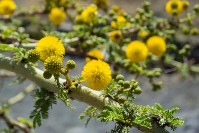
Owners and managers of extensive grazing properties are needed to help map the spread of priority weeds in the Northern Gulf region.
The initiative aims to produce the area’s most upto-date and accurate weed distribution analysis to support coordinated control activities.
Participants are provided with maps to score the distribution and density of weeds on their property. The project is primarily focused on extensive grazing properties in Etheridge, Croydon and Carpentaria Shire, but properties in the Mitchell and Staaten river catchments are also encouraged to take part
Contact Taylor to participate on 0477 415 031 or taylor taylor@gulfsavannahnrm org
Funded by the Queensland and Australian governments as part of the Queensland Feral Pest Initiative
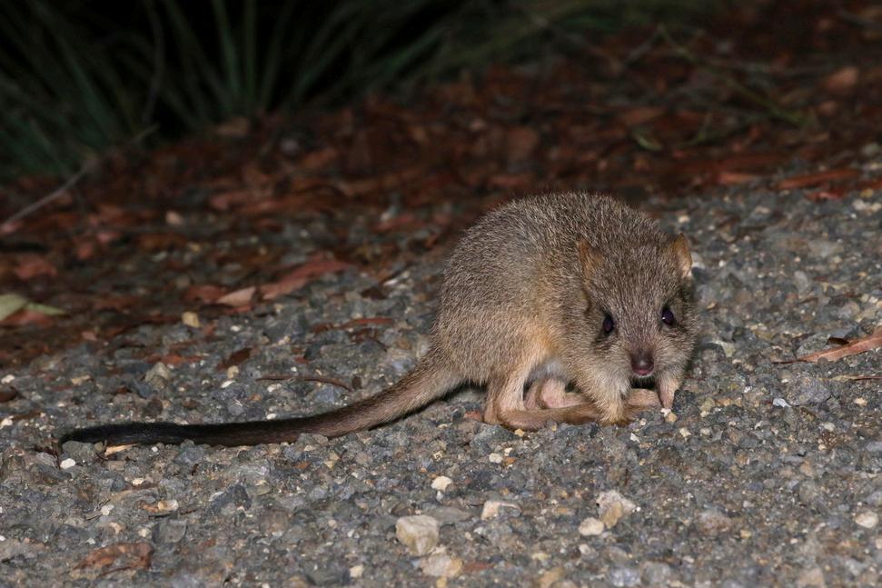
We’ve started a new project to improve habitat condition for threatened species in the Eastern Forests of Far North Queensland. The project will work with Western Yalanji Aboriginal Corporation, Queensland Parks and Wildlife Service and Australian Wildlife Conservancy to reduce key threats, including feral cats, pigs and invasive weeds such as lantana
Project activities will be focused on the narrow wet sclerophyll zone between dry open woodland and the western edge of World Heritage Wet Tropics rainforest on the Mount Carbine Tableland, which is home to multiple threatened species including northern bettong, yellow-bellied glider and northern greater glider
Locations will include Mount Lewis National Park, Mount Spurgeon National Park and the eastern extent of Brooklyn Wildlife Sanctuary
This project is funded by the Australian Government Natural Heritage Trust and the Saving Native Species program delivered by Gulf Savannah NRM, a member of the Commonwealth Regional Delivery Partners panel.

NATIONALNRMMEET-UP
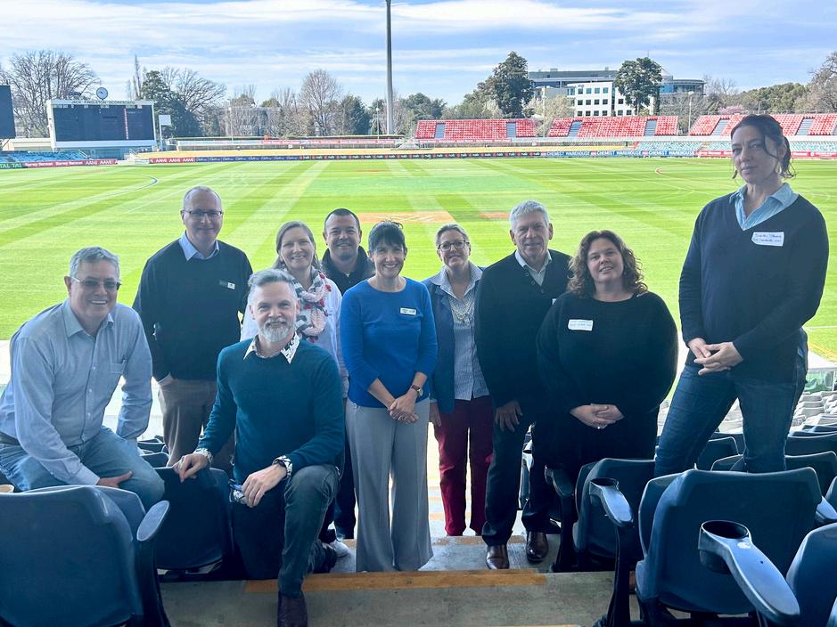
Acting CEO Sarah Stevens was in Canberra during September to meet with CEOs from the 54 regional NRM organisations across Australia.
The conference, hosted by NRM Regions Australia, was a chance to have conservations on topics including renewable energy, carbon investment and bolstering funding for NRM. Pictured are the Queensland regional NRM CEOs at the Manuka Oval in Canberra.
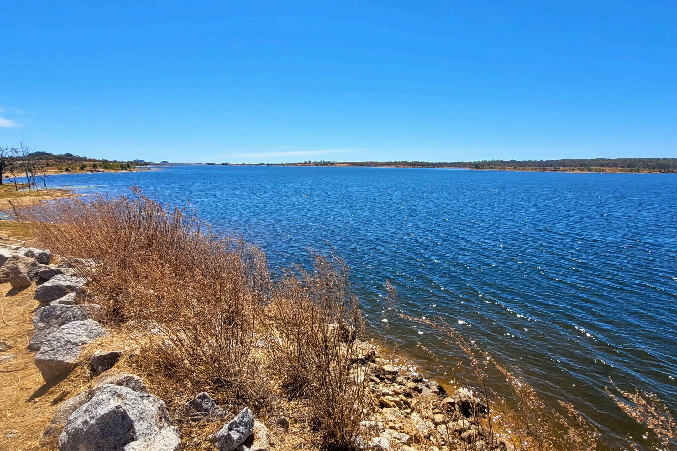
We had a great time at our kids fishing day at Charleston Dam, near Forsayth, during the September school holidays.
There were giveaways of rods, tackle kits and crab pots, and a prize for the biggest catch! The event was a chance to talk to current and future anglers about recreational fishing rules, as well as workshops being held on sizing and identification, and water quality testing.
Thanks to project partners OzFish, Ewamian People Aboriginal Corporation and Etheridge Shire Council.
This project is supported by Queensland Government’s Department of Agriculture and Fisheries, through the Queensland Community Fishing Grants Program.
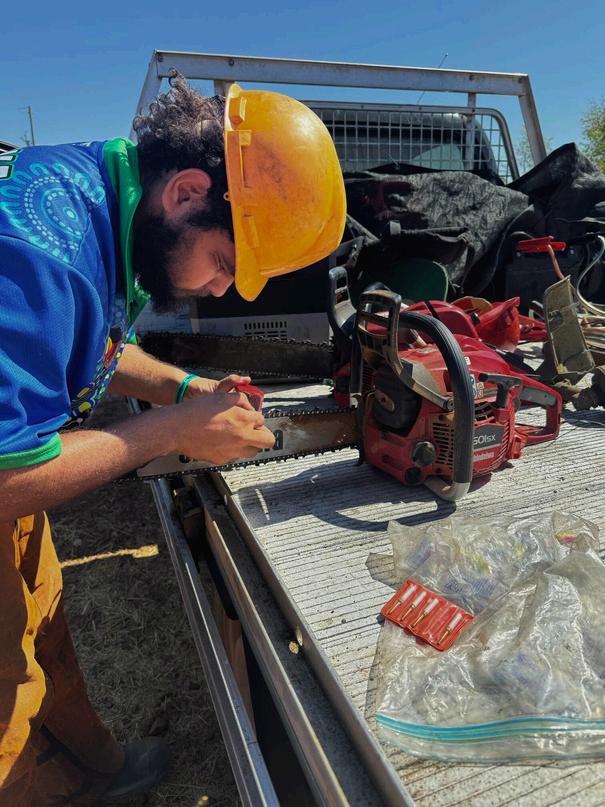
Gulf Savannah NRM has been working with Tagalaka Aboriginal Corporation to help get the new Tagalaka Ranger Team up and running.
The team, made up of three Rangers and a Ranger Coordinator, are enjoying their new roles as they work to preserve the environmental and cultural values on Tagalaka traditional lands, including Tagalaka National Park (previously Littleton NP) They've also been busy with four-wheel drive and chainsaw training!
This project is proudly funded through the Queensland Government’s Indigenous Land and Sea Ranger program

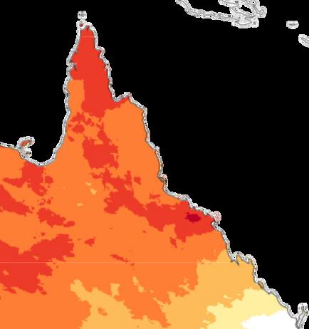
There is an increased chance of unusually high maximum and minimum temperatures across north Australia between October and December.

The Bureau of Meteorology has issued its final forecast for the 2024–25 Northern Rainfall Onset (NRO). The NRO predicts the likelihood of an early or late start to the onset of the wet season. Across Queensland and the NT's Top End, there is a 60-75% chance the NRO may be earlier than average. The timing of the wet season impacts everything from livestock movements to water and staff management. An early start can impact second round mustering and trucking.
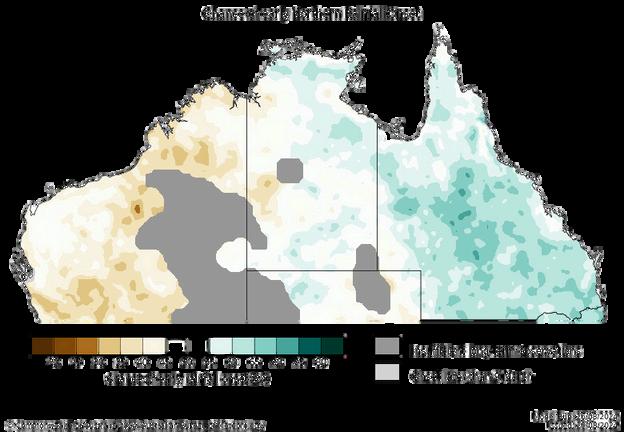

Want to stay up to date with weather and climate forecasts? Sign up for updates from the Northern Australia Climate Program and you'll get a monthly climate information update delivered straight to your inbox! Visitbit.ly/gulf-savannahli t

The Bureau's ENSO (El Niño–Southern Oscillation) Outlook is at La Niña Watch, meaning there are some signs a La Niña might form later in 2024 A La Niña Watch does not guarantee that a La Niña will develop Atmospheric and oceanic indicators are currently within ENSO-neutral thresholds. ENSO is likely to remain neutral until at least early spring.
Gulf Savannah NRM is proud to be collaborating on this project with the University of Southern Queensland, the Bureau of Meteorology, the UK Met Office, state governments in QLD, NT and WA, and other NRM groups

Haveyoucheckedtheweatherforecastatyourlocation?
Haveyouidentifiedandanalysedthepotentialrisksinyourlocation(floodandcyclone)?
Haveyoucontactedyourlocalcouncilaboutfloodorcycloneriskinyourarea?
Checkwithyourlocalcouncilandtheirdisasterdashboardtoaccess: floodplansorrecordsinyourareaandlocaldisasterupdates localgovernmentandcommunitydisasterplans localfloodarrangements informationaboutroadclosures,riverheights,evacuationcentres.
Makeanemergencyplanandidentifywheretoshelterduringextremeweather.Completeyour emergencyplanatgetready.qld.gov.au/plan
Checkyourinsurancecoversfloodandcyclone/stormdamage.
Clearlooseequipmentandvegetationaroundbuildingsandaccesspoints Clearguttersanddownpipes Prepareaninventoryoflivestock,infrastructure,andequipment
Ensureyouhavesufficientfodder,medication,andwatersuppliesforanimals. Havematerialsreadytosecuredoorsandwindows.
Makeaplantomoveelectricalequipment,chemicalsandhazardousmaterialsabovegroundlevel Locateandpackyourcriticaldocumentssuchasfinancial,insurance,legalandidentificationdetails, andimportantplansinaportablewaterproofcontainer
Back-upyourcriticaldatatoaportablestoragedeviceandstoreitinasecureoff-sitelocation. Packanemergencykitandkeepitwhereyoucanquicklyretrieveit.
Includeessentialitems,includingkeys,radio,torches,batteries,powerbank,mobilephoneand charger,essentialmedicationandfirstaidkit.
For a full NorthernWetSeasonChecklist and links to other useful resources, scan the QR code
Emergencyservices(police,fireandambulance)
Triple Zero (000)
One Zero Six (106) through your telephone typewriter (TTY)
Otherservices
Flood and storm emergency assistance: SES 132 500


Alerts and evacuation centres: ABC local radio and council disaster dashboard
Road conditions and closures: qldtraffic.qld.gov.au
State-wide road conditions: 13 19 40
Animal emergencies: RSPCA Queensland 1300 264 625
Georgetown106.1FM
