Empowers divers to protect underwater environments
INSTRUCTOR SELECTION
Find the mentor who transforms good courses into great ones
PHOTOGRAPHER PORTFOLIO: ANASTASIA SCHMUCK
GUE NEXTGEN SCHOLAR
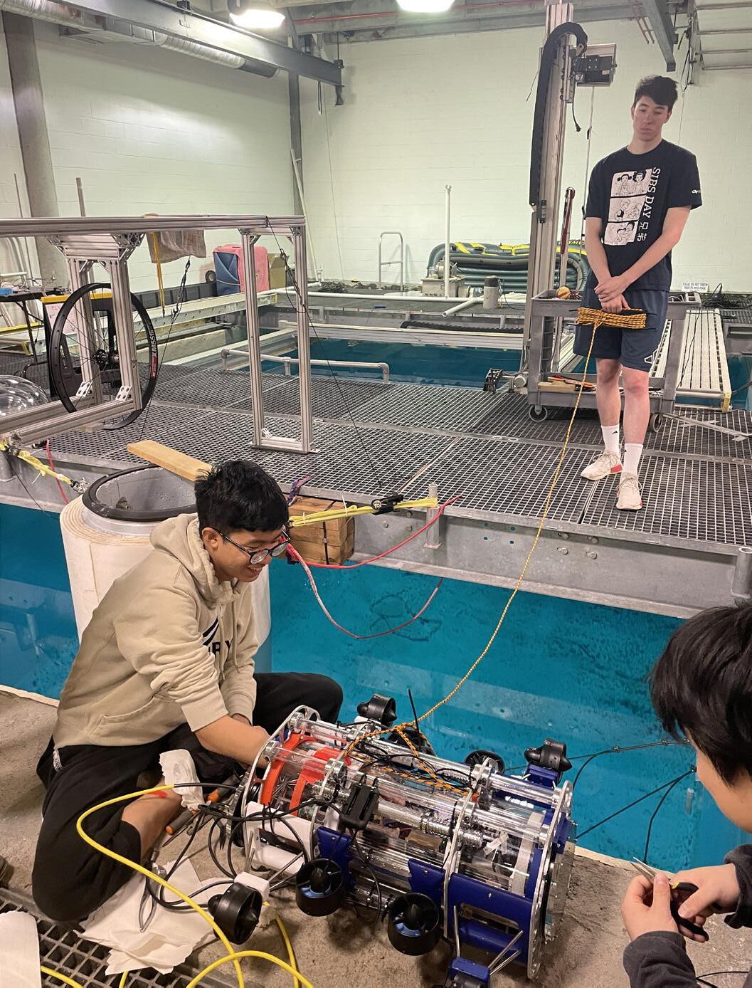
From space to sea—Thanapol’s journey of discovery and teamwork
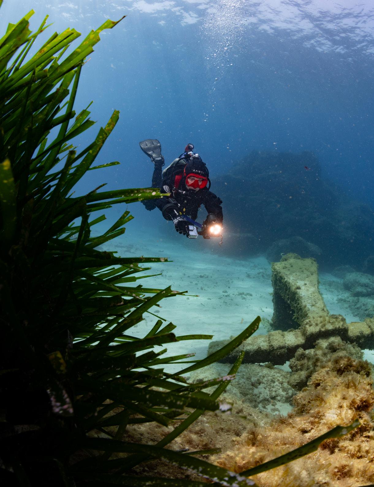
RAMS AND RELICS
Investigating the Roman battlefields of the Egadi Islands
EDITOR’S LETTER
BENEATH THE SURFACE OF CURIOSITY
Every time I descend beneath the surface, I’m reminded why I fell in love with diving in the first place. It’s not just the silence or the sense of weightlessness—it’s curiosity. That simple urge to know what lies beyond the next turn, to understand how things connect, to notice the details others might overlook. And to discover if my skills, my equimnent, and my mindset is ready for the task ahead.
Curiosity is what unites our entire community. It’s there when a diver picks up a camera to tell a story through images, or when someone carefully maps a cave passage, line by line. It’s in the volunteer who logs water quality data or the instructor helping a student master buoyancy for the first time. Every act of attention, every dive with purpose adds another piece to the bigger picture of who we are and what we care about.
Diving isn’t just exploration—it’s collaboration. No one achieves much underwater alone. We rely on one another, on training, on trust, and on the willingness to share what we learn. That sense of community has always been at the heart of GUE’s mission and remains one of its greatest strengths.
This issue of Quest celebrates that connection—the link between knowledge and imagination, between experience and curiosity. It reminds us that excellence isn’t a fixed destination but a process, a conversation that unfolds every time we enter the water.
As you move through these pages, I hope you’ll see reflections of your own journey: the questions that drive you, the challenges that shaped you, and the moments that made you stop and simply marvel. Diving has a way of slowing us down just enough to really see—and in that stillness, we rediscover our sense of wonder.
Here’s to the explorers, the storytellers, the meticulous and the dreamers—to everyone who keeps asking questions beneath the surface. Curiosity brought us here. It’s what will take us further.
Dive safe and have fun!
Jesper Kjøller Editor-in-Chief jk@gue.com
Quest
Editor-in-chief
// Jesper Kjøller
Design and layout
// Jesper Kjøller
Copy editing
// Pat Jablonski
// Kady Smith
Writers
// Thanapol Tantagunninat
// Cory Bell
// Kirill Egorov
// Jenn Thomson
// Marcus Rose
// Jesper Kjøller
// Josh Maxwell
// Fred Devos
// Todd Kincaid
// Chris Le Maillot
// Daniel Riordan
// Jarrod Jablonski
Photographers
// Kirill Egorov
// Anastasia Schmuck
//Jesper Kjøller
// Bori Bennett
// Jason Brown
// JP Bresser
// Imad Farhat
// Kyle Cooper
// Stretch Altenhein
// Robert Kilburn
// SJ Alice Bennett
// Austin Barber
IN THIS ISSUE
6
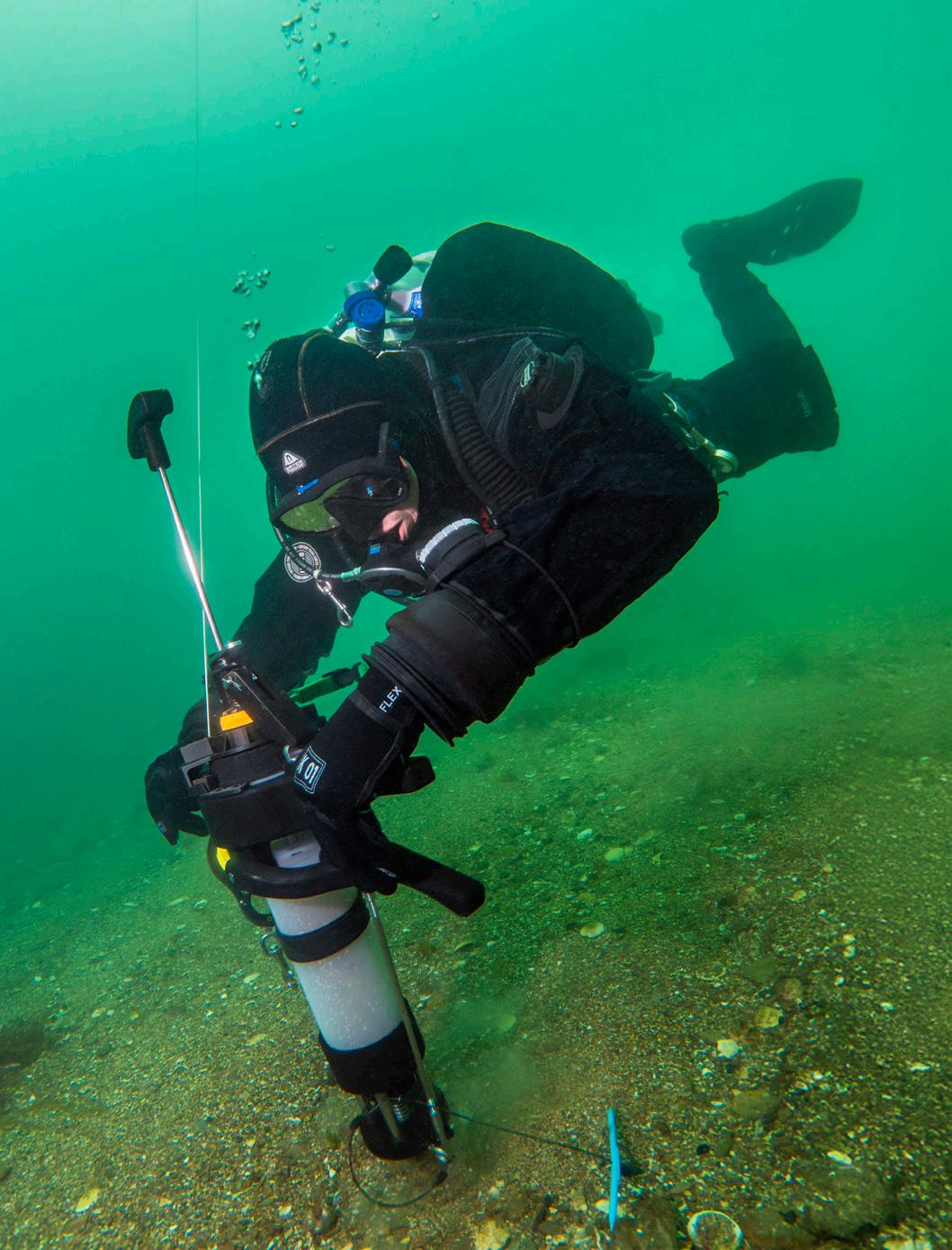
HQ CORNER // PROJECT BASELINE 2.0
Project Baseline enlists citizen-divers to track aquatic changes, supporting ecosystem and heritage protection. This year has been about showcasing successes, nonprofit growth, and renewed collaboration with GUE for future conservation projects.
16 30 38 44
2024-2025 GUE NEXTGEN SCHOLAR
Thanapol Tantagunninat’s journey from space fascination to underwater exploration reflects curiosity, precision, and teamwork, showing how imagination and community drive excellence in both technology and diving.
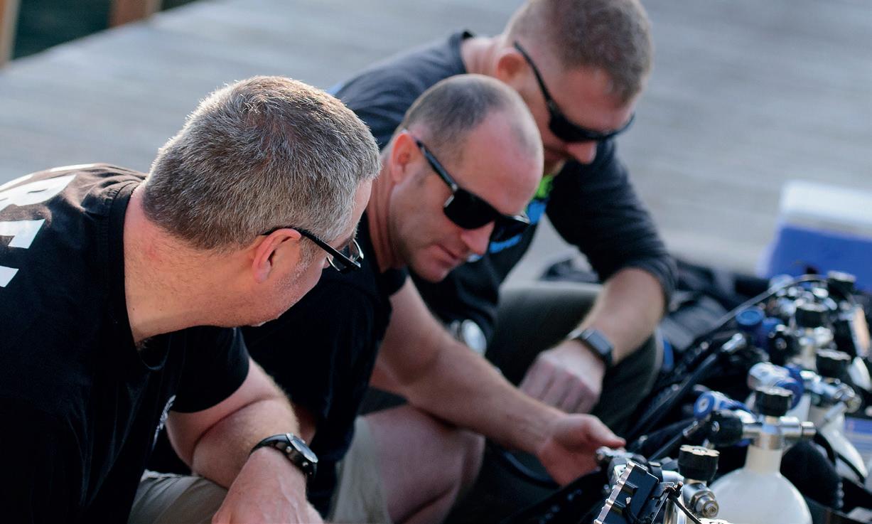
SELECTING YOUR INSTRUCTOR
From buoyancy to teamwork, mastering GUE diving depends on selecting the right instructor. The 5Ws framework guides divers to mentors who foster excellence, precision, and confidence underwater.
PORTFOLIO // ANASTASIA SCHMUCK
Anastasia escapes the office for the sea, capturing wrecks and divers through underwater photography. Her work reveals stories of transformation, emotion, and exploration, blending creativity with the silent, powerful beauty of the underwater world.
RAMS & RELICS // THE BATTLE OF EGADI
The Egadi Islands battlefield, resting beneath the sea since 241 BC, holds warships and relics of the First Punic War. GUE divers meticulously explore the site, blending archaeology, science, and underwater expertise.
60
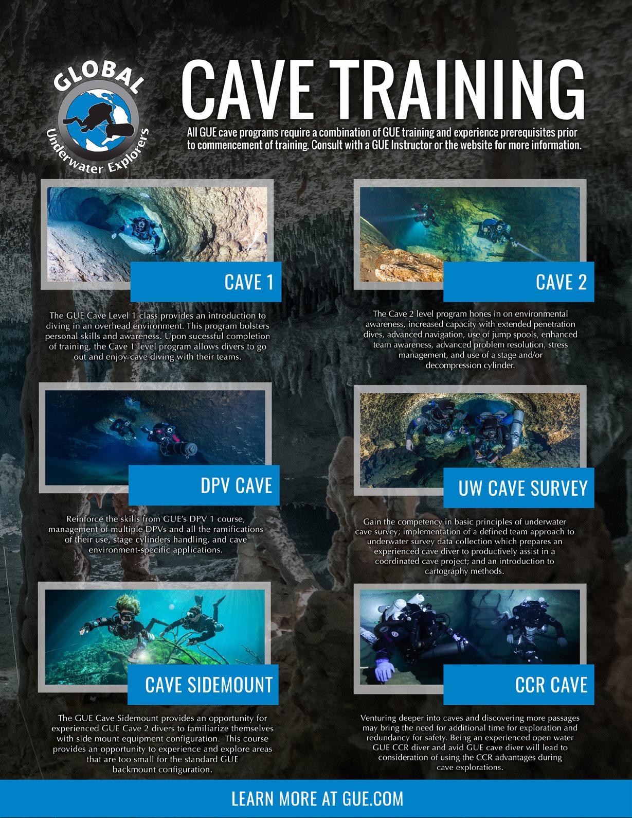
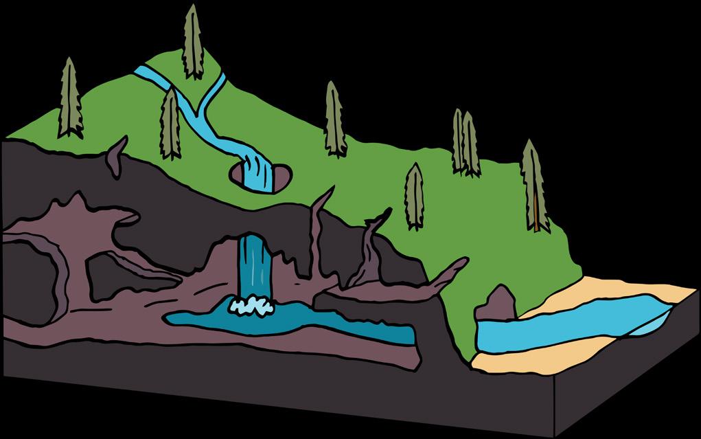
CAVE DIVING // SURVEY & MODELING
Early cave diving focuses on logistics and safety, but with experience, divers develop awareness of cave systems and water flow, letting exploration be guided by knowledge, intuition, and the pursuit of deeper understanding.
PROJECTBASELINE 2.0
– Re-Connection: GUE & PB
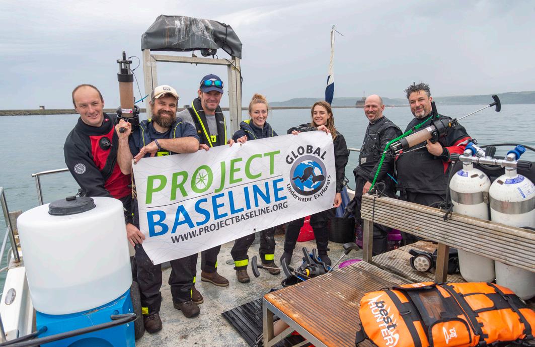
Project Baseline mobilizes citizen-divers to document and monitor changes in aquatic environments. Through strategic engagement with scientific, conservation, and governmental partners, it aims to contribute meaningful data that informs restoration and protection efforts for both natural ecosystems and cultural heritage sites. As a part 2 of the previous Quest article “The GUE Project Portal,” we will now touch upon all things Project Baseline: its mission, success stories, separation into a separate nonprofit, and the benefits of renewed synergy between GUE and PB with regards to the next generation of projects and conservation divers.
Project Baseline (PB) was initially started in 2009 to fulfill GUE’s commitment to underwater conservation. The idea for PB came about when GUE’s leaders realized that they were lamenting the degradation and loss of once stunningly beautiful underwater places due to the seemingly inevitable decline associated with progress and development. PB was, quite simply, their refusal to give into that notion of inevitability.
The baselines needed to define pristine, natural, or even acceptable environmental quality in the underwater world simply don’t exist. For the most part, the only baselines are the ones preserved in our memories, and those are shift-
ing progressively downward as every generation accepts some decline as inevitable. Unlike most terrestrial environments, underwater ecosystems lack the public visibility (the voice) needed to act on the alarming rates at which they’re becoming degraded and destroyed. PB was created to be that voice.
Project Baseline asks the people most connected to underwater environments to increase the volume of data needed by decision makers to restore and protect the type of world we all want to live in.
Meaningful contributions
Any diver—any snorkeler even—can make meaningful contributions to PB. The beauty of the initiative is that projects can be as simple as
Any diver can contribute to PB—from simple photo documentation to collecting scientific measurements.
November 2025 · Quest
TEXT MARCUS ROSE, TODD KINCAID, JENN THOMSON & JOSH MAXWELL
PHOTOS JASON BROWN & JP BRESSER
PHOTO JASON BROWN
taking a photo, or as complex as collecting data and/or detailed measurements for collaborating scientists, or anything in between. Regardless of the complexity, the highest aim of PB is to foster collaborations between divers and scientists to accelerate meaningful conservation efforts.
There are four loosely defined project definitions with PB:
COMMUNITY PROJECTS Typically volunteer divers working independently or as a team in their local areas or diving destinations.
COLLABORATIVE PROJECTS PB divers operating with academic or scientific organizations to advance scientific and/or conservation efforts. PUBLIC Ad hoc data submissions from the diving public.
MISSIONS Focused and aggressive survey efforts at the direction of one or more scientific or conservation collaborators that often involve more challenging diving and data collection techniques.
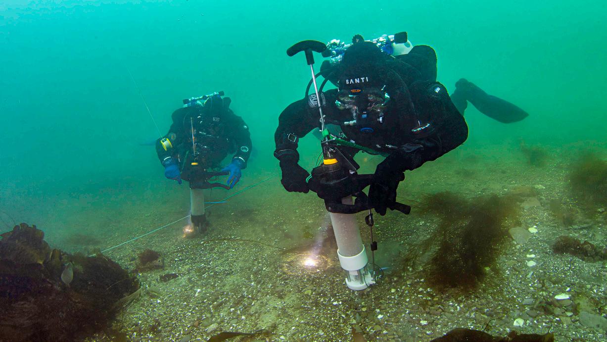
To date, 423 divers have contributed data to PB that they’ve collected from more than 10,000 dives conducted in 46 countries. They’ve documented more than 500 sites with nearly 5,000 photographs or videos and more than 125,000 data measurements. They’ve engaged in 33 collaborative projects and conducted 8 missions. There are currently 8 active collaboration projects, 20 active community projects, and 3 open public documentation projects.
More than just photos
Perhaps PB’s greatest weakness has been an inability to build on the good work of its members across the world to grow the number of participating divers. A persistent criticism of PB has been its emphasis on pictures. While it can be fairly said that simply photographing an environment falls far short of protecting it, that sentiment fails to recognize that lack of public awareness is the most pressing challenge facing underwater conservation.
Consider that people don’t tend to care about things or places they can’t see. Then consider that what divers take for granted will typically
never be seen by 99.9% or more of the population. Think then of the fraction of scuba divers who will take pictures of what they see and then the fraction of those pictures likely to depict how conditions may be impaired. Finally, think of the tiny number of that already tiny number that will ultimately be seen by anyone who might be in a position to act on the observation of conditions in a way that might lead to environmental improvement.
When viewed in that light, the perceived value of pictures that depict change in underwater environmental conditions through time hopefully increases. PB has not, however, been able to successfully make that case with the vast majority of the diving community. Consider what PB has been able to accomplish with the 423 participating divers. Then, imagine what PB could accomplish if 10%, or even 1%, of the roughly 8.6 million active divers in the world were participating.
Greatest challenge
Another major obstacle to PB’s success is the slow rate at which PB’s community projects make the jump to collaborations. Given that most of PB’s participants are not themselves scientists, perhaps not even well versed in the sciences describing the environments in which they dive, the reluctance to engage with professors, universities, research or government scientists, etc. is no surprise. Neither PB teams nor the scientists or conservationists they may hope to collaborate with will likely be very anxious to reach out to the other to get something started. The onus unfortunately will likely always fall to the PB team to make first contact.
Being able to point to their local PB efforts, regardless of how simple, and that their work is part of a global effort of organized and well-documented conservation work must and has made that first contact easier. It undoubtedly makes a positive outcome more likely. Once successfully engaged, PB’s history demonstrates that collaborative efforts will reap benefits often thought impossible by both the divers and the scientists with whom they work. The classic cliché is apropos: the whole truly is, or can be, greater than the sum of its parts.
Overcoming these obstacles, convincing divers of the value of pictures, leveraging the pictures and collected data to grow PB participation, and fostering effective and lasting PB conservation projects are our greatest challenges.
Models for collaboration
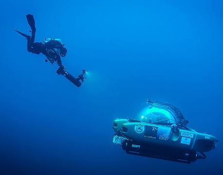
Between 2014 and 2017, GUE and PB worked with Global Subdive to develop and carry out a series of highly impactful scientific collaborations as part of several Baseline Explorer expeditions. The collaborative missions paired volunteer GUE technical dive teams with scientists from numerous universities, non-governmental organizations, and government agencies to document various types and localities of coral reefs between the near-surface and 100 m/330 ft depth.
The divers worked under the direction of the scientists, sometimes working alongside them in submersibles, to collect data and measurements that would advance scientific understanding of the coral reefs and, in turn, the politics of coral reef conservation. All of the collaborative
PB United Kingdom (PBUK) grew from local projects into a registered charity, creating a lasting, nationwide movement for conservation and community action.
missions were carried out aboard ships, mostly the r/v Baseline Explorer, enabling a nearly 24/7 focus on the mission objectives.
The overarching goal of the Baseline Explorer expeditions was to demonstrate the enormous value divers can bring to underwater scientific and conservation efforts. GUE and PB conducted several collaborative projects over the course of those four years, a few of which are summarized below.
One of the first missions aimed to document the distribution of black corals in the mesophotic zone along the slopes of several islands and seamounts comprising the Azores archipelago with a team of marine biologists from the University of the Azores in 2014. GUE divers collected video and coral specimens that were analyzed aboard the ship and subsequently used to support efforts to expand the designations of marine protected areas.
Working with the University of the Algarve, divers conducted video surveys and collected coral specimens to document the distribution of red coral (Corallium rubrum) in water depths
PHOTO JASON BROWN
GUE divers joined the Baseline Explorer team, exploring deep reefs with the vessel’s submersible to support groundbreaking marine research and conservation efforts.
of between 60 and 100 m/200 and 330 ft off the south coast of Portugal. Their work extended knowledge of the distribution of Corallium rubrum in the Atlantic, led to the discovery of a rich deep-dwelling type of those corals, and verified the urgent need for protection from direct and indirect fishing activities.
Working with the Harbor Branch Oceanographic Institute in 2014 and 2015, divers documented mesophotic coral (Oculina varicosa) reefs between 60 and 100 m/200 and 330 ft water depth along Florida’s east coast between Fort Pierce and Port St. Lucie, and algae growth associated with wastewater pollution on shallower coral reefs between West Palm Beach and Looe Key. Results of their work revealed substantial loss of Oculina varicosa, likely due to dredge and trawl fishing practices, and helped to verify the loss of 90% or more of Florida’s living coral cover.
100 new species
A short but high-profile mission was conducted in 2016 with Miami Waterkeeper to document
coral reef conditions near Port Everglades in advance of a proposed port expansion project that threatens to further degrade Florida’s coral reefs. The GUE/PB team hosted CNN and Philippe Cousteau aboard the r/v Baseline Explorer to bring public attention to the condition of Florida’s coral reefs and the causes of their decline.
The largest of the collaborative missions occurred in 2016 with a UK-based NGO, Nekton. The mission focused on the state of the ocean around Bermuda, the Sargasso Sea, and the Northwest Atlantic and was supported by 40 partners, including the Governments of Bermuda and Canada, UNESCO, 12 marine institutes, five media outlets, and six technology companies. Thirty-two technical scuba dives and 77 submersible dives were conducted over a 32-day period. GUE divers collected video, still images, coral, algae, and water samples along 73 transects at depths between 15 and 90 m/ 50 and 300 ft depth and assisted researchers with the deployment and retrieval of specialized sampling equipment. Scientists worked within
PHOTO JP BRESSER
The PBUK team testing mechanical seeding devices designed to plant seagrass deeper into the substrate.
the submersibles along 65 transects in depths between 120 and 300 m/400 and 1,000 ft depth. Outcomes included the discovery of over 100 new species of marine life, 20+ scientific papers published, and curation of all specimens and samples into collections at the Bermuda Aquarium, Museum & Zoo. Most importantly, the mission led to the Bermuda government committing to protect at least 20% of their ocean territory.
High-quality data
The collaborative nature of the PB missions also extended into the realm of shipwrecks, beginning in 2014 with the Italian Soprintendenza del Mare (Superintendency of the Sea) to document the wreck of the Hellenistic-era Panarea III off the coast of Sicily and ending with NOAA (National Oceanographic and Atmospheric Administration) to document shipwrecks from the Battle of the Atlantic off the coast of North Carolina as well as protected shipwrecks with the Great Lakes National Marine Sanctuaries.
All of the collaborative missions were made possible by the efforts of volunteer divers pulled
from the global GUE community, working together to advance the ideals of PB. In each case, a small group of motivated and capable divers facilitated the collection of the high-quality data needed to support scientific documentation and reporting. Their efforts advanced the scientific and conservation goals of the collaborating entities much farther than those entities could have gone working within standard scientific diving programs.
Major team successes
Project Baseline is presently focused on helping teams across the world start and sustain collaborations of their own. Two of PB’s most successful projects in this regard are described below.
MARCUS ROSE (PROJECT BASELINE UK)
One of the success stories of PB has been the establishment of PB United Kingdom (PBUK) as its own registered charity. After several years of local community efforts popping up and then
PHOTO JASON BROWN
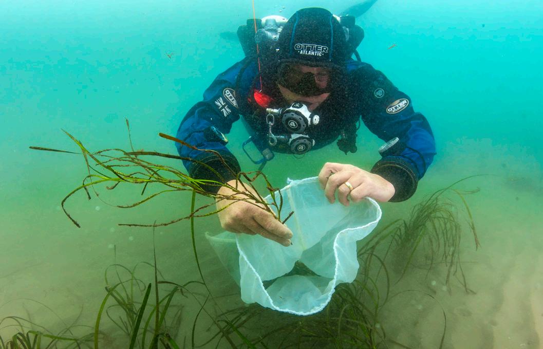
PBUK supported seagrass restoration through a variety of diving activities, including seabed surveys, seed collection, and planting.
tailing off in the UK, a small team decided to take a different approach in an attempt to establish a more enduring conservation effort. Rather than focusing all efforts on one small regional project, the team decided to take a national approach.
By setting up PBUK, the team created the flexibility to work with UK conservation groups or scientific initiatives wherever collaborators needed the divers to go. This approach in no way aims to undermine local efforts such as those of PB Midland Pools and PB Loch Alsh; however, an overarching nationwide approach has led to more collaborations, more variety for volunteer divers, and also provides an element of mentorship and support to the local community projects.
The decision to register PBUK as a charity was made to facilitate fundraising in the UK, as getting UK grants to pay into a US 501(c)(3) organization was extremely challenging. PBUK remains intrinsically linked to PB more broadly, but setting up as a charity in its own region made it easier to form collaborations. While the
local community projects are in no way subordinate to PBUK, the team has found real value in sharing resources and providing mentoring in both directions to further collective conservation efforts.
Since it was established in 2022, PBUK has completed several collaborative projects. The most notable of these has been the collaboration with the Blue Marine Foundation in the North Sea and work with the Ocean Conservation Trust on seagrass restoration on the south coast of the UK. The Blue Marine Foundation collaboration involved teams that conducted surveys for key species such as horse mussels and kelp as well as collected sediment samples for microplastics research. The most high profile of the efforts was benthic (seabed) surveys to support research into shipwrecks and their protection of marine species. This work ultimately resulted in the publication of an academic paper and educational materials for children.
PBUK’s support to seagrass restoration involved a range of diving activities, from simple seabed surveys to seed harvesting and planting.
PHOTO JASON BROWN
“The overall aim of the project is to restore seagrass ecosystems around the UK coast. Seagrass is an important habitat, as it provides both a carbon sink and a nursery for juvenile fish. Overall, the national approach taken by PBUK has led to more variety in the projects it supports and has created many more opportunities for collaboration by covering the whole of the UK. While this approach is certainly not for everyone, it shows the versatility of PB. Any project that is centered around exploration, documentation, or conservation has a place in PB. Provided the data associated with the project can be stored as a baseline for further projects, divers really do have the flexibility to take a PB effort in any direction they see fit.
of baseline data viewed by local scientific data collection agencies.
The overall aim of the project is to restore seagrass ecosystems around the UK coast. Seagrass is an important habitat, as it provides both a carbon sink and a nursery for juvenile fish.
The Monterey Bay site features four sites with a total of twelve stations. The baseline sites span a variety of dive areas to from which to collect data: Metridium fields, an old WWI-era sardine factory pipe, a sunken tugboat titled “Barge,” and a now-defunct scientific experiment to test kelp restoration protocols named the “Restoration site” that was set up in collaboration with local county agencies. The data collection from the Restoration site was particularly impactful because, after a two-year period, it helped demonstrate that culling endemic species of purple and red urchins was not the most optimal restoration solution.
JOSH MAXWELL (SITE MANAGER FOR POINT LOBOS, MONTEREY BAY SITES)
The PB sites at Point Lobos and Monterey Bay are managed by a group of dedicated GUEtrained divers that are also core members of Bay Area Underwater Explorers. The baseline site’s success can be attributed to consistent data collection efforts and being inclusive to all divers from all agencies. The Point Lobos site has been very active since 2015, and the Monterey Bay site has been active for 5 years, since its inception in 2020 during the pandemic.
Point Lobos State Park, which is considered one of the best California diving marine parks, features three new stations added just this past year and a total of twelve stations covering all the recreational diving range from 6 m to 30 m (20 ft to 100 ft) depth. The stations have shown giant kelp forests go from being completely depleted by hungry, grazing urchins during the seastar wasting disease period that spanned the eight years since 2015, to being fully restored with its lush algae kelp growth in the last two years. Site data features a rich photo mosaic
Both the Point Lobos and Monterey Bay PB sites are dive community success stories due to their consistent involvement in monitoring our local dive habitats and providing a database of rich photo mosaics.
Future synergy between PB and GUE (resources and classification)
In 2019, PB separated from GUE to become a standalone 501(c)(3) nonprofit, underscoring its commitment to collaboration with all divers and conservation stakeholders, regardless of affiliation. Despite this separation, the relationship between GUE and PB remains strong. GUE divers around the world continue to form the backbone of many PB efforts. The community-based nature of GUE, which is typically lacking in the broader diving community, has also proven to be a strong vehicle for the development of collaborative projects.
With the recent establishment of GUE’s NextGen program and project initiatives, and PB’s forthcoming database upgrade and reinvigoration of annual missions, it has become clear that the relationship between the two organizations needs to be, once again, re-envisioned such that their respective strengths can be best leveraged
PB allow divers to gain a unique connection to the ocean, turning every dive into a meaningful contribution to protecting marine ecosystems.
to achieve their shared conservation goals. A new and more formal framework of collaboration currently envisions: shared human resources and tools aimed at improving team coordination, public outreach and marketing, shared membership benefits and cross-promotion, and the integration of PB into the GUE NextGen program.
PB-DB 2.0 and PB Missions
The initial priority is the release of PB’s new and improved database. PB-DB 2.0 will be a major leap forward, accepting and displaying any form of numerical data, images, video, and 3D models. PB-DB 2.0 will also provide an upload interface, allowing Project Managers and select users the ability to better manage their data. Perhaps the biggest change will be the ability to accept survey data and generate line maps (e.g., cave maps) on the fly.
Moving forward from 2025, PB and GUE will once again work together to organize at least one mission opportunity per year. The overarching goal will be to conduct missions that are at least one week long in areas of the world that feature different forms of marine life. Each mission will aim to establish and document multiple
sites while following a systematic documentation plan. Divers will consist of volunteers from the GUE community who possess the level of training commensurate with the documentation objectives , whenever possible all divers at or above the Tech 1 level.
Another goal will be to collaborate with one or more scientific or conservation entities, which will likely require the assembled team to learn about and develop documentation/sampling plans with guidance from the collaborator(s). All collected data will be shared with the collaborators and uploaded to the PB-DB 2.0.
Between dives, participating divers will be able to attend lectures and presentations covering all aspects of PB, as well as topics related to understanding the specific forms of life and the ecosystem at the mission locations. The divers will also be asked to participate in or even organize outreach efforts, including social media posts and videos, and potentially a presentation for the local community.
It is hoped that these missions will inspire more divers to engage in PB and inspire scientists and conservation organizations to seek out PB collaborations.
PHOTO JASON BROWN
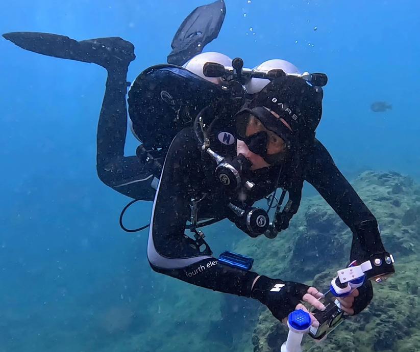
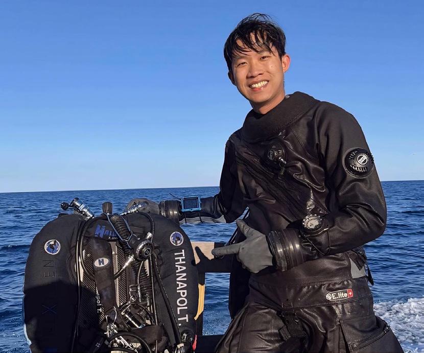
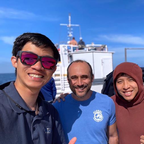
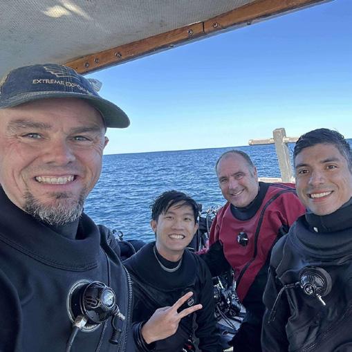
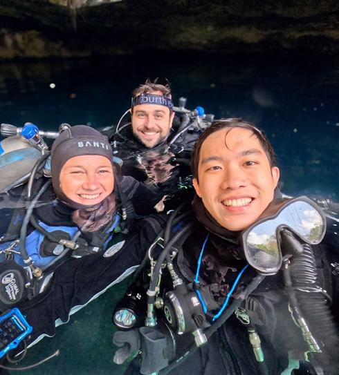
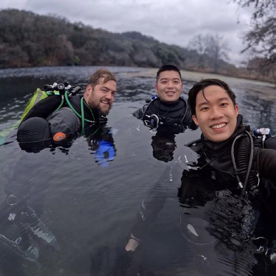
Before he ever dreamed of diving into the ocean, Thanapol Tantagunninat dreamed of floating among the stars. A fascination with machines and exploration led him from Thailand to the U.S. Space & Rocket Center, where a simulated “neutral buoyancy” session revealed something profound: the same sense of wonder he’d imagined in space existed beneath the water’s surface. That moment set the course for a life defined by curiosity, precision, and purpose. As the GUE NextGen Scholar for 2024-25, Thanapol’s journey has taken him from robotics labs at Georgia Tech to the underwater classrooms of High Springs, Mexico, and Cyprus. Along the way, he’s discovered that both technology and diving share the same core values: teamwork, responsibility, and the pursuit of excellence. “From Space to Sea” is his story—a reflection on how exploration, in any medium, begins with imagination and grows through community.
SCHOLAR
Growing up, I was the kind of kid who took apart remote-control cars just to see how the gears worked. I was fascinated by machines and the invisible logic of technology shaping the world around us. My biggest dream was to become an astronaut—an explorer of unknown worlds.
Years later, that dream took me to the U.S. Space & Rocket Center, where I attended the week-long Advanced Space Academy. One afternoon, we were told we’d experience “neutral buoyancy” in the Underwater Astronaut Trainer, providing a way to simulate the feeling of weightlessness in space.
The moment I descended into the pool, something clicked. I remember the hiss of the regulator, the stillness of the water, and the strange comfort of being suspended in three-dimensional space. For the first time, I felt the freedom and curiosity I’d always associated with space—only this time, it was underwater. It was humbling to realize that human ingenuity had allowed us to breathe in the place where we were never meant to. That experience never left me.
When I returned home to Thailand years later, I carried that memory like a compass. During college, I saved every baht I could until I could finally afford my Open Water course in the eastern sea of Thailand. Then finally, I did it. My instructor was technical-minded. While most students were content to “just dive,” he emphasized awareness, control, and problem-solving. He shared knowledge, stories, and pathways into technical diving that deeply inspired me.
For the first time, I understood that diving wasn’t just about science—it was about art and craft as well. Watching my instructor move calmly underwater, I felt admiration. I wanted to reach that level—not for recognition, but because of the pursuit of excellence itself.
To me, diving is a privilege. The more we expand our capabilities to dive, the more we realize how fortunate we are to witness a world that fewer and fewer people will ever see. And that privilege carries a responsibility to dive thoughtfully, to learn from the inner space of our planet, and to protect it for the future.
Engineering the depths
That same pursuit of excellence guided me to Georgia Tech, where I pursued a master’s degree in robotics.
My research focused on bio-inspired underwater soft robotics—machines that mimic the flexibility and undulating motion of marine life. I loved the idea of designing robots that could move gently, efficiently, and harmoniously through the water, extending exploration into places that require delicate, environmentally friendly interaction.
As the Mechanical Lead for the Georgia Tech Marine Robotics Group’s RoboSub team, I led the hardware design of autonomous underwater vehicles capable of completing complex navigation and manipulation missions. Long nights tuning tolerances for 3D prints and balancing buoyancy taught me that exploration is never a solo act—it’s a harmony of design, collaboration, and trust in your team.
Through both robotics and diving, I’ve come to see technology not as a replacement for humans but as a partner in exploration. Robots can survey hazardous environments, map caves, or provide live data to scientific divers. But the human element—intuition, emotion, problem-solving, and storytelling—remains irreplaceable.
The path to the NextGen Scholarship
Fast forward to 2023. At the GUE conference, I stumbled across a silent auction listing: “GUE Fundamentals Course.” My heart raced. I’d been dreaming of taking Fundamentals to start my journey toward technical diving, but during grad school, it felt out of reach. Without thinking twice, I placed a bid—and a few days later, I won!
That’s how I met GUE Instructor Arthur Nguyen-Kim, who had donated a spot in his class to the auction. Arthur didn’t just teach me to dive better; he introduced me to GUE’s world, where mentorship means believing in someone’s potential before they see it themselves. His support during that first class cemented my commitment to this path.
I didn’t just want to be a better diver; I wanted to live by the same standards of excellence GUE represents. So, I applied for the GUE NextGen Scholarship and was selected.
Tan working on autonomous underwater vehicles at Georgia Tech Marine Robotics Group’s RoboSub team.
After earning his Recreational pass, Tan trained to improve his cold tolerance until he finally decided to get a drysuit.
Just like 2022 NextGen Scholar Jenn Thomson’s experience, Jarrod surprised me during an initially camera-off call, with only one question asked during my so-called “interview”: Was I ready to be a GUE NextGen Scholar? And of course, Jenn was his accomplice! I was still shocked a few days after that.
Getting started
During my scholarship year, I aimed to learn as much as possible from GUE’s world-class instructors—explorers, conservationists, scientists, and educators who embody the highest standards of diving and exploration. I wanted to connect with GUE communities across the globe, experience diverse diving environments, and gain a deeper understanding of these unique environments while identifying opportunities for improvement in diving and conservation projects. I approached this year as an opportunity to lay the foundation for a stronger path forward, both for my own growth and for contributing to the future of exploration and the diving community.
Training in Florida with Stretch Altenhein in pursuit of a Fundamentals Technical pass.
My GUE NextGen journey officially began in High Springs, Florida, under the instruction of GUE Instructor Jon Kieren. Jon’s experience spans the world’s hidden frontiers, from the legendary KUR projects in Florida to deep cave systems in Mexico’s Rio Uluapán and Huautla Resurgences, Texas’s Phantom Cave, and Sardinia’s Su Gologone. He teaches with a significant emphasis on what he learned from thousands of hours down there, where mistakes aren’t a viable option.
Every drill he taught carried the weight of necessity. Maintaining trim, perfecting propulsion, and maintaining awareness weren’t just checking skills boxes; they were a language of precision. I learned to rush less, think more, and move with intention.
Jon’s mentorship went beyond skills. “It’s easy to get caught up in trying to pass,” he said. “But don’t forget why you started this—because it’s fun.” That hits hard. Whenever I find myself stressed about performance or results, I return to that reminder: I started all of this because diving is fun!
PHOTO KYLE COOPER
Refining the foundations
As part of the NextGen Scholarship, each scholar receives a personalized Halcyon wing.
After earning my Recreational pass, I kept practicing, determined to refine every weakness— especially my cold tolerance. Winter diving in Florida meant 20°C/68°F water and 4°C/40°F air at Morrison Springs. After one freezing dive, I decided: that’s it, I’m getting a drysuit. Thanks to our generous sponsor Halcyon, who is also the Santi distributor in the US, I used a big chunk of my scholarship equipment budget towards a beautiful Santi Elite+ drysuit to continue my journey.
A few months later, I trained with Kelly Colwell in Panama City Beach for a Drysuit Primer. Drysuit diving completely changed my experience. No more cold, no more shivering—just stability and comfort. Kelly’s patience and deep knowledge helped me learn proper care and control (and how not to end up like a turtle on the surface).
Next, I trained with Stretch Altenhein in pursuit of my Fundamentals Technical pass. Stretch had a gift for turning jam-packed, intense days into enjoyable learning experiences with his patience and kindness. Under his men-
torship, I earned my Tech pass and discovered the beauty of constructive and compassionate teaching. He also shares his love for nature—especially the beautiful duckweed pond of Manatee Springs State Park.
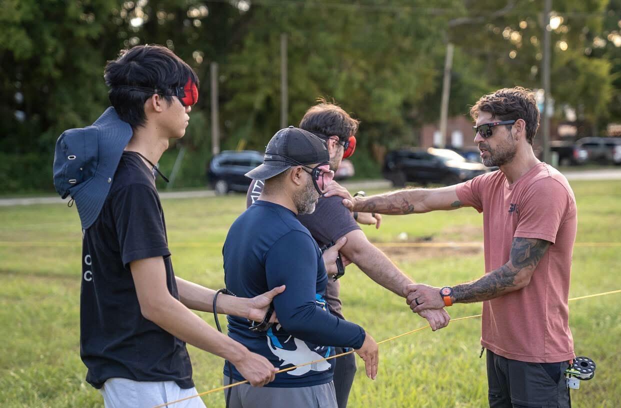
With the goal of being a resource to the team in mind, I embarked on my journey to refine my rescue skills in multiple scenarios. My Rescue Primer journey took me to the heart of Mexico’s cenotes under the guidance of Annika Persson. We practiced everything from compass-based searches and lost diver scenarios to full Basic 5 surface rescues and unconscious diver rescue scenarios. Even routine procedures revealed their complexity underwater: small mistakes could cascade quickly, and every action demanded thoughtfulness. Navigating challenging scenarios and learning from Annika’s decades of experience highlighted the heart of GUE training: awareness and prevention over reaction. We're not just training to dive—we're training to be reliable and competent teammates. The kind of divers who are assets, not liabilities, to their team.
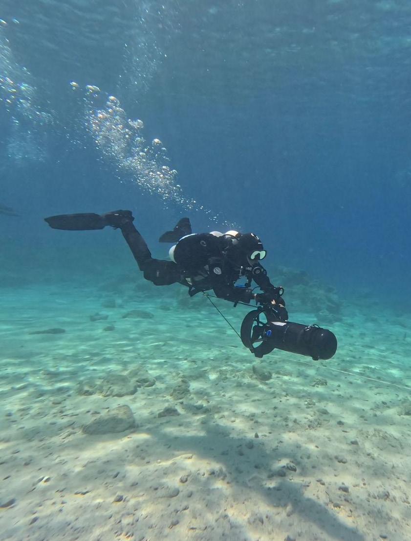
Scooter diving in Cyprus after completing the GUE DPV 1 course in the clear blue Mediterranean.
PHOTO IMAD FARHAT
Before GUE, I thought competence meant independence. After GUE, I realized it means interdependence—knowing your role, mastering it, and trusting others to do the same.
Expanding horizons
By May, I found myself on the rocky shores of Protaras, Cyprus, standing beside my DPV like a kid with a rocket ship. The water shimmered in the most beautiful shade of blue from my childhood sketchbook.
At the very start of my NextGen year, Imad was very kind to offer me a spot in his GUE DPV 1 class. Thanks to Jenn, who connected me with Imad for this amazing opportunity.
For the first few days of my trip, I joined as a teammate in Imad’s GUE Fundamentals class, training alongside Marcel from Germany in the turquoise waters of Green Bay, a place that quickly became our outdoor classroom for the week. It was my fourth Fundamentals class, yet each one feels new; the further I go into GUE training, the more I realize that there are endless learning opportunities for those who seek them.
his spirit—that exploration isn’t only about doing serious stuff to hit goals, but it’s also about joy, spirit, and passion for the underwater world.
Sharing the passion
As I packed up my gear on the last day, I realized how much this experience had given me: new skills, deeper confidence, and friendships that made the journey even more meaningful. Cyprus was more than a course; it easily turned into an unforgettable week for me.
“Before GUE, I thought competence meant independence. After GUE, I realized it means interdependence—knowing your role, mastering it, and trusting others to do the same.
Once DPV 1 began, everything changed. Controlling the scooter, balancing thrust, maintaining awareness while task-loaded, and executing drills was both technical and exhilarating. Imad’s engineering mind on efficiency was evident in every detail, from the way he structured each day of training and organized the logistics to how he handled problems under stress.
The highlight of this GUE DPV 1 course was planning and executing a DPV dive to the Ottoman-era wreck Nissia, part of Cyprus’s archaeological project. We planned a 20-minute scooter ride out into the blue, and wandering through history with a scooter felt like time travel—a blend of technology, curiosity, and wonder. Imad’s mantra stuck with me: “There’s no DPV dive that isn’t a great dive.” It perfectly captured
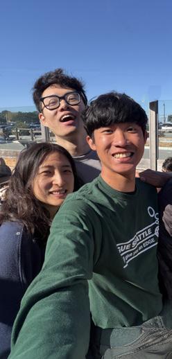
After Cyprus, I joined the first-ever GUE Young Divers Program in Sardinia, which was a completely different kind of adventure. Instead of focusing on training programs, this time it was about sharing—passing on the excitement of diving and sharing passion with divers of a similar age from around the world. We also had the opportunity to learn from the group of great GUE instructors who were supporting the next generation of young divers through the project diving, documentation, and cave geology workshop, led by GUE Instructors JP Bresser, Dorota Czerny, and Jenn Thomson. We worked together on capturing and documenting the experience. Between dives, we experimented with cameras, lights, project planning, and storytelling—figuring out how to make simple footage come alive. We learned how much good narration, composition, or even a well-placed light could change how people feel about what they see.
To make things even more interesting, we also had a “Psychologically Wise Leadership” workshop with Dr. Sean Talamas, which focused on growth through storytelling and failure, the power of advice giving, and reflecting on individual values and identity. This is where we got the opportunity to learn more about our inner selves and our teammates on a deeper level, and grow together to be the future leaders. It wasn’t the most technical week, but it was one of the most rewarding. The program reminded me that creativity, perseverance, and diving go hand in hand.
PHOTOS COURTESY OF THANAPOL TANTAGUNNINAT
PHOTO ALBUM – A YEAR
YEAR AROUND THE WORLD
Sardinia’s clear blue waters, stunning underwater topography, and beautiful caves are incredible. I only wished I had the skills and knowledge to perform a cave dive so I could explore this island on the inside!
Into the darkness
Caves are among Earth’s last frontiers—vast, dark, and still largely unexplored. Despite our advanced robotics technology, these environments still demand human explorers.
“Under Jon’s guidance, I learned what true awareness means. Everything he emphasized in my first Fundamentals class—trim, light communication, team positioning, and procedures—suddenly made perfect sense in the cave environment. What once felt like a nitty-gritty detail now felt like an essential trait we need to perfect for survival.
The Global GUE Community
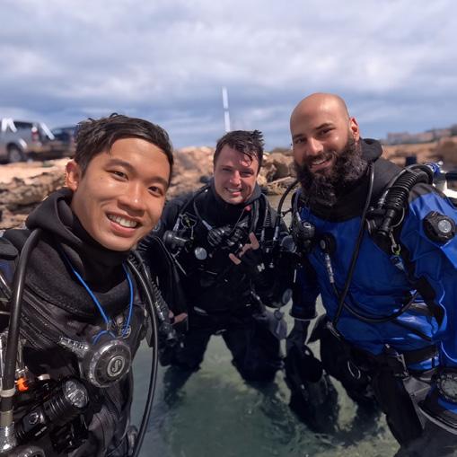
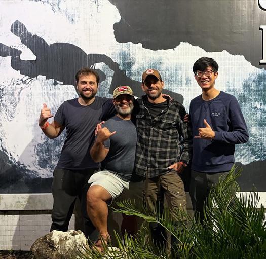
Throughout the year, I joined GUE communities across continents: SEUE, PCUE, GUE Thai, GUE Austin, GUE Cyprus, GUE Mexico, OCUE, MWUE, and BAUE. Each was unique in setting with different locations and different environments, but all were united in spirit.
When I finished the course, I felt an overwhelming sense of gratitude. Gratitude for the instructors who believed in me, for the training that prepared me, and for the privilege of seeing places even a smaller fraction of humans ever will.
The GUE community is the closest thing I’ve ever seen to a global family—a network of people bound by shared standards, values, and curiosity. Everywhere I went, I was welcomed as “one of us” and offered continuous support. It was never about proving yourself to be “good enough” to join; instead, the question was always, “When can we dive together, what do you need, and how can we help?”
This is uniform amongst all GUE communities I’ve met, and I believe that community is one of the pillars that gives GUE its strength today.
During a zero-visibility drill, I shared gas with my teammate, maintaining physical contact as we slowly followed the guideline out. During every kick and every signal, awareness mattered the most. The training from Fundamentals came back instinctively. That’s when I understood: any diver can go into a cave, but only the well-trained cave divers can make it back home safely.
Hearing how his excited student wanted to be an explorer, he smiled and said, “Those caves will always be there—it’s just a matter of when you’ll get to them.” That line stuck with me. Exploration isn’t a race; it’s a journey earned through patience, perseverance, and trust in yourself.
When I finished the course, I felt an overwhelming sense of gratitude. Gratitude for the instructors who believed in me, for the training that prepared me, and for the privilege of seeing places even a smaller fraction of humans ever will. Because that’s what cave diving truly is—a privilege.
Closing notes
Looking back, I see a mosaic of role models, mentors, teammates, and lessons that shaped me into the diver I am today—proud to be a GUE diver and to be a part of the GUE community. This scholarship gave me more than opportunities; it gave me perspective, experience, and lessons that extend far beyond diving.
I want to express my deepest gratitude to GUE for supporting the NextGen Scholarship program and making this transformative year possible. To every instructor who shared their time, knowledge, and passion—Arthur Nguyen-Kim, John Kendall, Jon Kieren, Kelly Colwell, Annika Persson, Stretch Altenhein, Imad Farhat, JP Bresser, Dorota Czerny, and Jenn Thomson— thank you. Your selfless dedication, patience, and belief in my potential have left a lasting mark on me. Every lesson, every piece of guidance, and every moment of mentorship meant far more than a certification. Your wisdom, philosophy, and passion for exploration are truly
Caves remain one of Earth’s final frontiers. Even with advanced robotics, these environments still rely on human exploration. Everything from his first Fundamentals class suddenly made sense in the cave, revealing these details as essential for survival.
PHOTO AUSTIN BARBER
PHOTO SJ ALICE BENNETT
“To every GUE diver I met across the globe: thank you for showing me that wherever we dive, we truly share the same purpose. The sense of community, support, and shared purpose is unlike anything I’ve experienced elsewhere.
Thanapol “Tan” Tantagunninat is a Thai mechanical engineer, roboticist, and passionate diver whose work connects exploration and technology. His fascination with the ocean began at the U.S. Advanced Space Academy, where a first breath underwater in the Underwater Astronaut Trainer inspired a lifelong curiosity about the links between space and the sea. Tan earned his
Master’s in Robotics from Georgia Tech, leading the design of an Autonomous Underwater Vehicle and developing a bioinspired soft robot for delicate marine environments. As GUE’s 2024–2025 NextGen Scholar, he hopes to advance as a capable, resourceful diver while integrating technology and diving to support innovation, exploration, and conservation.
Thanapol Tantagunninat
contagious, and I hope to carry that spirit forward, sharing it with others around the world.
I also want to thank Halcyon and Santi for their generous support with top-quality equipment. The tools they provided allowed me to fully engage with each experience and focus on learning, exploration, and growth in style, without having to worry about their reliability.
To every GUE diver I met across the globe: thank you for showing me that wherever we dive, we truly share the same purpose. The sense of community, support, and shared purpose is unlike anything I’ve experienced elsewhere.
Looking forward, I hope to continue growing as a capable, reliable, and resourceful diver,
ready to contribute to exploration, conservation, documentation, and scientific projects. I dream of using my engineering skills to bridge gaps in these efforts, creating a future where technology extends our reach, while human intuition ensures our humanity remains at the heart of exploration. Beyond my own growth, I aim to share my work, my story, and my passion with the broader public and the next generation of divers, inspiring others to pursue curiosity, responsibility, and excellence—all beneath the one flag of GUE, a global community united by shared values and a love for exploration.
And sometimes, late at night, I find myself back in that Space Camp pool, remembering the dive where it all began.
During the DPV course in Cyprus, Tan also had the opportunity to explore the iconic Zenobia wreck.
MORE
www.gue.com/nextgen-scholarship
SELECTING GUE INSTRUCTOR
– A 5Ws framework for success
PHOTO BORI BENNETT
YOUR INSTRUCTOR
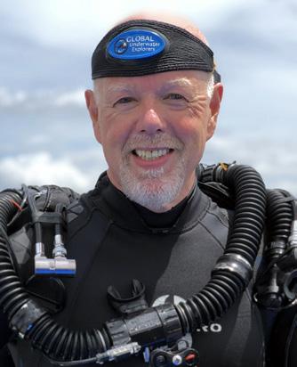
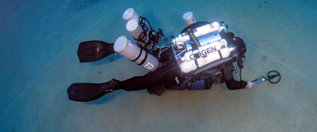
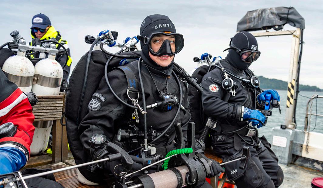
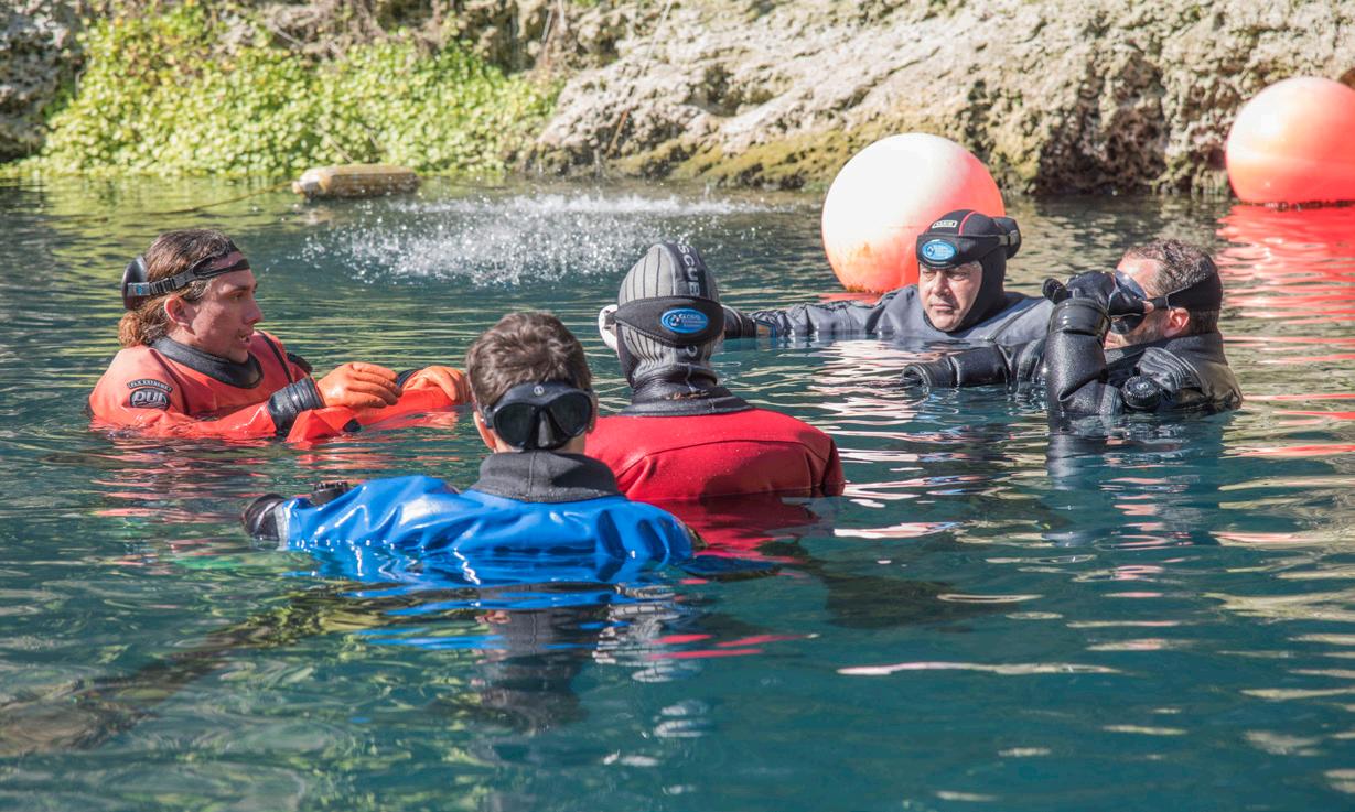
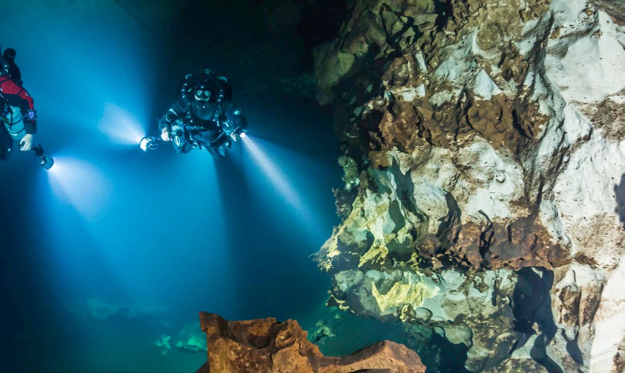
Imagine this: You’re gliding through the ocean or springs, buoyancy and trim on point, you and your dive buddies are in perfect sync, looking like underwater rockstars. That’s the GUE dream, but here’s the catch—your ticket to that dream starts with picking the right instructor, and let’s be honest, it’s a bigger deal than choosing your drysuit color. As someone with over 20 years of experience as a GUE diver, I’ve advised divers from newbies to hardcore explorers on how to better their skills, and I know the right mentor can make or break your journey. To help you nail this choice, I’m breaking it down with the 5Ws—Who, What, Where, When, and Why—a trusty framework from my military career that has been helpful in my diving days. Let’s dive in and find the instructor who’ll turn you into a GUE legend.
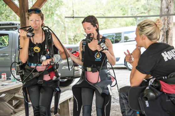
Working through challenges helps everyone grow and appreciate each other’s strengths and learning styles.
WThe “Who” is the foundation of your GUE journey. As a long time GUE diver, I urge you to explore your potential mentor’s background, expertise, and teaching philosophy. Are you passionate about casual open water recreational reef diving, technical wreck exploration, or the precision of cave diving? Your instructor’s experience should align with your goals. For instance, I took Tech 1 under Dean Marshall for his wreck diving mastery, and I took Cave 2 with David Rhea for his groundbreaking cave exploration. Their expertise shaped my approach to diving and will influence my teaching one day.
Reflect on what you need in a learning environment. Do you excel with a structured, disciplined instructor, or do you prefer a collaborative style? Connect with other GUE divers to learn about an instructor’s reputation. While diving at Thurmond Lake during my time at Fort Eisenhower, a diver approached me, curious about my GUE gear. He was preparing for his Fundamentals technical pass and needed a
dive partner. Our discussions helped him build confidence and connect with the GUE community. Your instructor should foster this sense of camaraderie while pushing you to grow. Consider your aspirations—whether mastering foundational skills or contributing to projects like the Woodville Karst Plain Project (WKPP)—and select an instructor whose experience supports your path.
Selecting the right instructor ensures you maximize this experience. They are not just educators; they are mentors who embody GUE’s mission. Whether your goal is recreational diving or leading water quality scientific projects in a cave, your instructor will ensure your training is both challenging and rewarding.
As with everything, folks grow, change, and move on to other things in life, but I still dive with some incredible legends that have been with GUE since the early days. Mark Messersmith has been a great friend, mentor, and constant and consistent dive partner when
PHOTO BORI BENNETT
PHOTO JESPER KJØLLER
The right instructor embodies GUE’s mission and ensures your training is both challenging and rewarding.
the Army allows me the freedom to enjoy my passions. Mark understands the challenges that I have with my current occupation; military service takes more than it gives, and he has made himself available to me and my chaotic schedule for deep technical cave dives. Meeting individuals that have like mindsets, in life and diving, truly creates long-lasting experience that can serve your diving passions and goals. Sometimes, you will not click with your instructor or dive partners—that’s okay—but you need to work through those challenges together and, in turn, everyone will benefit from learning about each other’s unique abilities and learning styles.
WWHAT course meets your needs?
The “What” centers on the course itself. Since GUE’s inception in 1998, the curriculum has expanded to serve divers at every level, from beginners to those pursuing technical or cave training. Whether you’re starting in GUE’s Dis-
cover Diving program or advancing to CCR Fundamentals, each course builds competence and adaptability. Therefore, as your skills develop, comfort grows and desires change, and GUE can grow with you. I’ve witnessed Fundamentals transform divers, refining their buoyancy and teamwork for any underwater environment. When choosing a course, take some time to define your objectives clearly and thoughtfully. Are you enhancing your recreational diving or preparing for complex project diving? During spring break, I took my Fundamentals course with skilled wreck divers whose low-visibility expertise challenged me to adapt. Some divers train with the same instructor for continuity, while others, like me, seek diverse perspectives to broaden their skills. Both approaches are valid, but the key is selecting a course that matches your current abilities and future goals. GUE’s standardized curriculum ensures your skills translate globally, no matter where in the world your diving takes you.
“Your diving career can be a rewarding long-term commitment, depending on how deep you plan to go into your diving journey, so plan for the required dives between courses.
WWHERE should you train?
The “Where” is a crucial consideration. Choosing a training location involves balancing logistics with opportunity. GUE partners with world-class facilities like Area 9 in Bonaire, Zero Gravity in Mexico, and Extreme Exposure next to GUE HQ in High Springs, Florida. These centers provide standardized equipment and expert staff to support your training. As a student, I’ve enjoyed learning in varied environments, from local springs, lakes, and the ocean to international dive sites, and I’ve witnessed first-hand how location influences the experience.
you’ll uphold GUE’s reputation for excellence, so choose a location that supports your goals and allows time to explore the local dive culture.
WWHEN is the right time?
Decide whether a local dive site meets your course requirements or if an international destination would offer a more unique opportunity. For example, Mexico’s cenotes are ideal for cave diving practice, while Bonaire’s reefs are more suited for recreational courses. Contact the dive center early to arrange equipment rentals and logistics. When I dove Lake Murray, I heard comments from non-GUE divers about GUE divers always being “picture perfect,” reflecting our consistent training quality. Wherever you train,
The “When” demands strategic planning. As a long-time GUE diver and Army officer, I understand how work, travel restrictions, and personal commitments complicate scheduling. Coordinate with your instructor early to find dates that work for you and any dive partners. If traveling internationally, account for jet lag, off-gassing, and travel regulations, such as lithium battery restrictions for dive equipment such as lights and scooters. Reserve rental gear in advance to avoid last-minute hurdles and ensure availability at your dive center.
Your diving career can be a rewarding longterm commitment, depending on how deep you plan to go into your diving journey, so plan for the required dives between courses. For example, you’ll need a minimum number of lifetime dives before starting Fundamentals, Cave 1, and Tech 1, and before advancing to Level 2 techni-
PHOTO COURTESY OF CORY BELL
The author on an opencircuit cave dive.
cal or cave courses you’ll need additional Level 1 diving experience. I’ve seen divers balance demanding careers with training by prioritizing diving over other things in their life. Time is precious—plan carefully if you want to make your dive training a priority.
WWHY choose GUE?
I believe the “Why” can be boiled down to your commitment to excellence. Physical standards that are enforced are not only for the students but also the instructors. A strive for personal excellence and mental agility and resilience to face any challenge that may arise in your quest as an explorer or a casual recreational diver. Whatever dreams, desires, passions, and goals you have in mind, this global organization will push you to your limits and show you your full potential. GUE is filled with world-class educators, mentors, and coaches; it’s truly a unique organization that will help you through the process, regardless of your experience level. Not only has GUE stood the test of time, it has also adapted to the changing environment. GUE continues to
define the industry standards for highly-quality training and its global impact. I believe that the CCR Fundamentals course will reinforce the concepts, theory, and application of CCRs within the GUE approach and gradually introduce people into CCRs that may not have experience or completely understand them. Luckily, my IANTD instructor allowed me to take the JJ Advanced Recreational Trimix course in the GUE configuration, something that I have complete faith in and built muscle memory with and in. My instructor commented, “Wow, I can actually teach you how to dive the unit instead of teaching you how to dive.” On the first dive, he asked what I wanted to do, and I responded, “I just want to sit at 10m/30 ft and figure out how to control the unit while maintaining proper trim and buoyancy.” I felt completely uncomfortable diving the unit when trying to maintain my buoyancy, and I truly felt defeated. However, my instructor said that I looked stable and controlled. I believe this is one of the things that separates GUE divers from non-GUE divers—commitment to excellence and striving for perfection. Everyone that completes
a GUE course leaves with a better understanding of the philosophy, approach, mindset, and community that GUE continues to build today. Although some may not continue training with GUE past Fundamentals, we will never compromise our standards.
The “Why” unifies your decision. GUE’s mission is to produce competent, confident divers who contribute to exploration, education, and conservation. GUE’s standardized approach— unified equipment, gas management, and team protocols—sets it apart. Many of today’s diving education organizations mimic GUEs approach to courses for technical and cave diving, which during the formation of GUE, was viewed negatively throughout the diving community. When I presented my GUE gear to a dive rescue team, the fire chief was so impressed that he advocated adopting our system. This reflects GUE’s reputation for excellence, which we all carry as a GUE diver. My current assignment with the U.S. Army has been interacting with public media, state and local governments, and non-governmental organizations, usually in public meetings. People ask me, why do you take this Everglades Restoration stuff so seriously? My reply is that I represent the organization of 1100 civilians, composed of engineers, scientists, and biologists, who have been working on restoration efforts for decades before me and will remain long after I move to my next assignment. I not alone represent them, but the work that they have devoted themselves to. Maybe
it is my nature to take personal pride in everything I do, display, and carry with me, but this is why I’m passionate about diving and GUE.
Final thoughts
We all have a responsibility to represent GUE in our own way, and each will be different. Whatever your passions, goals, and desires, we must remember education, conservation, and exploration. Ever since I was introduced to GUE and the WKPP, I’ve wanted to be a cave explorer, pushing the limits and breaking through them for discovery. Not everyone wants to be an explorer or educator, but we all should want to protect the environment in which we enjoy this sport.
We all make an impact within our environment, and by promoting safe, healthy dive practices, we can make a lasting, positive impact so future generation scan view and enjoy them as we do.
Choosing your GUE instructor is like picking the perfect dive partner for your next underwater adventure. Reflect on your goals, do your homework, and pick a course and location that lights up your dive log. Use the 5Ws—Who, What, Where, When, and Why—to find the mentor who’ll help you reach your diving goals. With the right instructor, you’ll not only master GUE’s world-class skills but also join a community dedicated to exploring and conserving the world’s aquatic environments. So, stay positive, gear up, and dive safely.
Cory Bell, certified by NAUI in 2001, discovered GUE in 2006 and completed the Fundamentals course in 2007. His passion for the underwater world knows no bounds, but he particularly enjoys deep technical cave diving. As a JJ-CCR Hypoxic Trimix-rated cave diver, Cory balances time between opencircuit and closed-circuit diving from West Palm Beach to North
Central Florida and beyond. In addition to his diving activities, Cory serves on active duty for the United States Army, where he is the Deputy Commander for South Florida for the Corps of Engineers. This role allows him to join the WKPP as a support diver. Cory’s long-term goal is to become a cave explorer, updating cave maps for future divers to use for planning safe dives.
Cory Bell
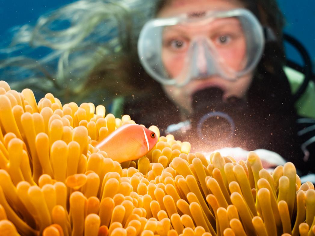
ANASTASIA SCHMUCK
From model to storyteller
The sea is her contrast to the office—a place where silence replaces deadlines and wrecks tell stories more powerful than any project plan. Between structure and creativity, Anastasia found herself drawn to the lens, capturing what words could not.
Her underwater photography journey began in 2020, when she first appeared in front of the camera as an underwater model. What started as curiosity soon turned into passion: she wanted to create images herself, to capture the emotions and stories hidden beneath the surface. She began simply, with a phone, and slowly progressed toward a full-frame setup that allows her to translate the atmosphere of a dive into photography. Today, she focuses on two themes that inspire her most: wrecks and divers. Shipwrecks are powerful and poetic—they are silent witnesses of
TITLE Portrait
LOCATION Cyprus
CAMERA Sony RX100VII
LENS WWL-1
HOUSING Nauticam
EXPOSURE 1/80 sec, f/5.6, ISO 500
STROBE/LIGHT 2 x Sea&Sea YS-D3
COMMENTS A photo I always wanted to make.
history, reshaped by the sea into living museums. Photographing them is not only about documenting structures but also about telling the story of transformation, decay, and renewal. At the same time, she loves to capture divers in their element. They bring scale, humanity, and emotion into the images, reminding us that exploration is both deeply personal and universally shared.
Anastasia still considers herself to be at the beginning of this artistic journey, always searching for new ways to refine her skills and vision. CCR 2 training lies ahead of her, promising access to deeper waters and wrecks that are less known, or still waiting to be discovered—and with them, a whole new world of creative expression.
Even as wrecks and depth remain her focus, she still treasures the quiet beauty of single-tank dives in the shallows, where light and color reveal that simplicity can be just as powerful as exploration.
www.anastasiaschmuck.com
TITLE The anchor
LOCATION Anchor Bay, Malta
CAMERA Sony A7CII
LENS Canon 8-15mm
HOUSING Nauticam
EXPOSURE 1/125 sec, f/14, ISO 400
STROBE/LIGHT 2 x Sea&Sea YS-D3
COMMENTS Perfect location for a relaxed single-tank dive on a sunny morning.
TITLE The prop LOCATION Um El Faroud, Malta
CAMERA Sony A7CII
LENS Canon 8-15mm
HOUSING Nauticam
EXPOSURE 1/60 sec, f/7.1, ISO 1600
STROBE/LIGHT None
Quest· November 2025
TITLE Hello, my little friend!
LOCATION Komodo, Indonesia
CAMERA Sony A7CII
LENS Sony 20-70mm HOUSING Nauticam
EXPOSURE 1/125 sec, f/13, ISO 400
STROBE/LIGHT 2 x Sea&Sea YS-D3
COMMENTS First underwater modelling experience for a young diver—turns out it is quite exciting!
TITLE Right after the ascent
LOCATION Malta
CAMERA Sony A7CII
LENS CANON 8-15mm
HOUSING Nauticam
EXPOSURE 1/160 sec, f/13, ISO 100
STROBE/LIGHT None
COMMENTS Shot after a first in my diving career: a 50 m+ dive on my CCR
TITLE Salem Express
LOCATION Red Sea, Egypt
CAMERA Sony RX100VII
LENS WWL-1
HOUSING Nauticam
EXPOSURE 1/80 sec, f/9, ISO 1000
STROBE/LIGHT None
COMMENTS The wreck is considered a grave, and many locals lost relatives and friends in the tragedy. Out of respect, many divers refrain from penetrating this wreck.
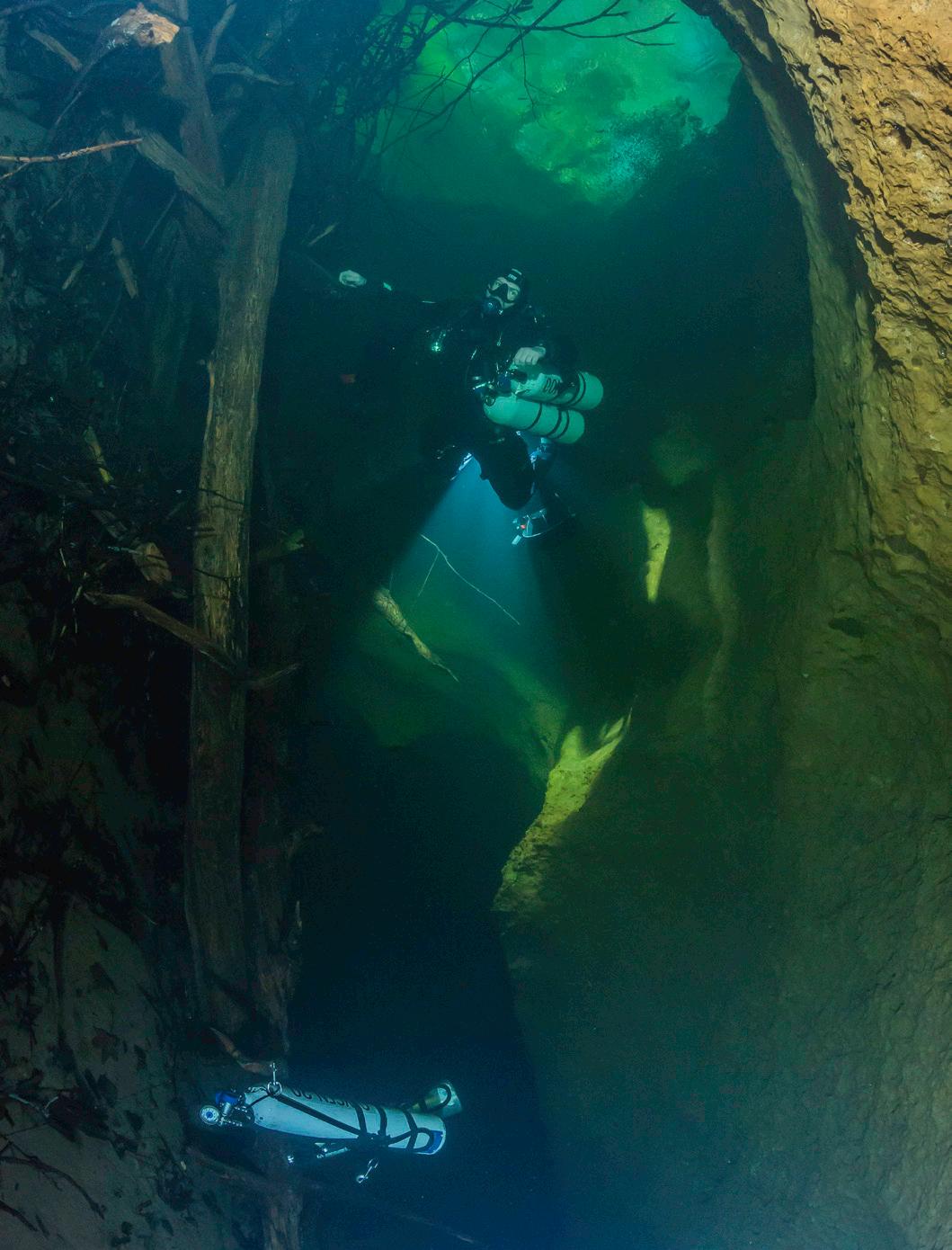
RAMS & RELICS
TEXT JESPER KJØLLER
PHOTOS JESPER KJØLLER
RELICS –
TRACING THE LAST BATTLE OF THE FIRST PUNIC WAR
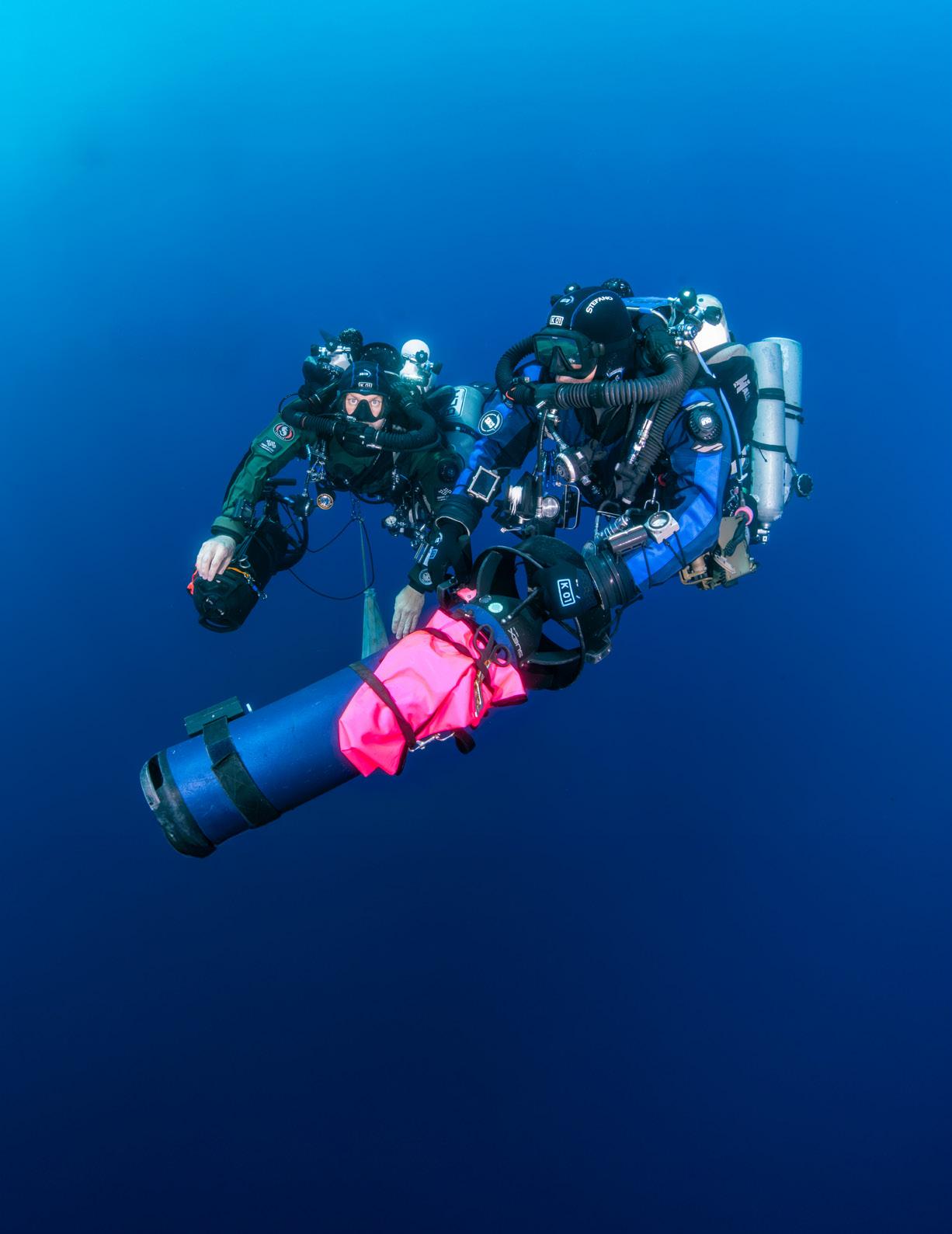
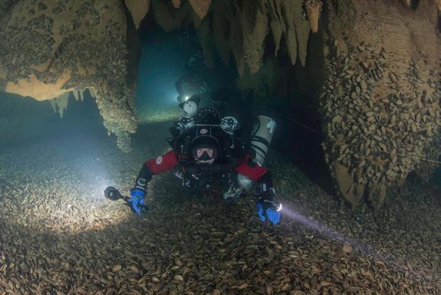
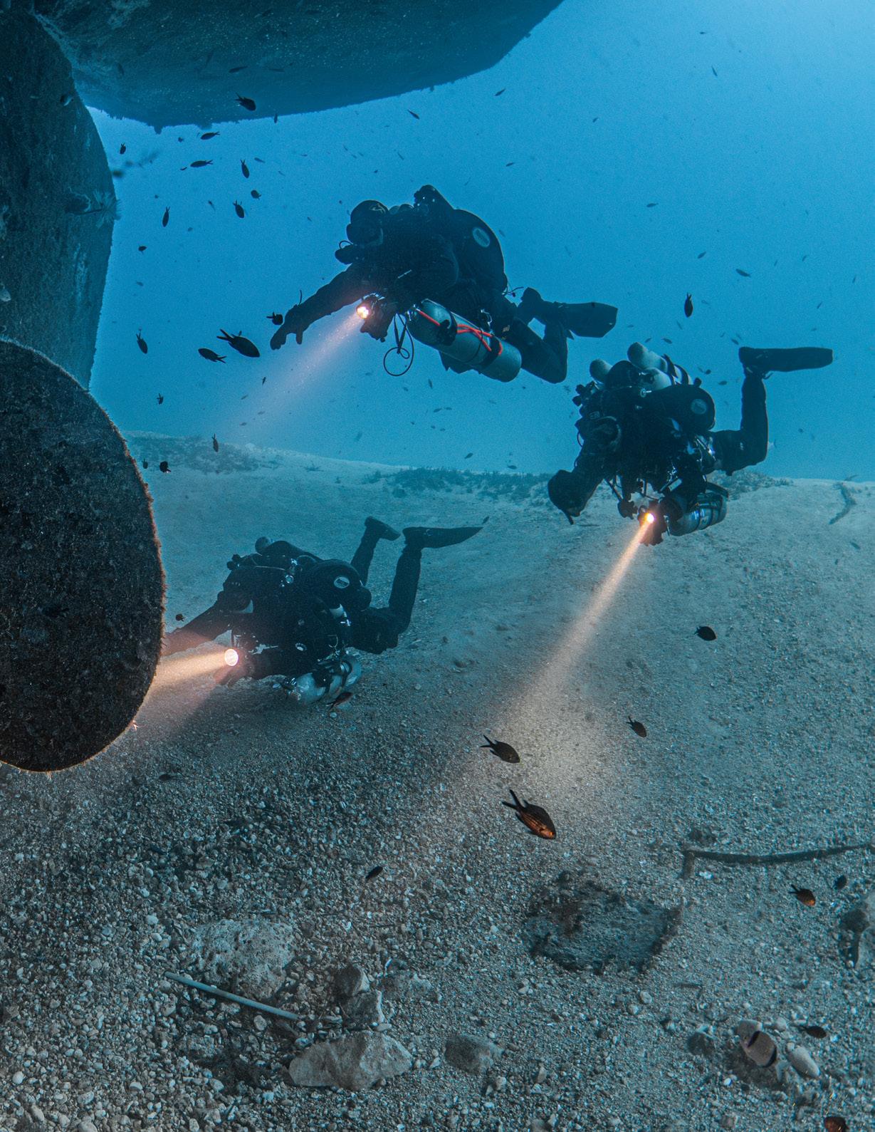
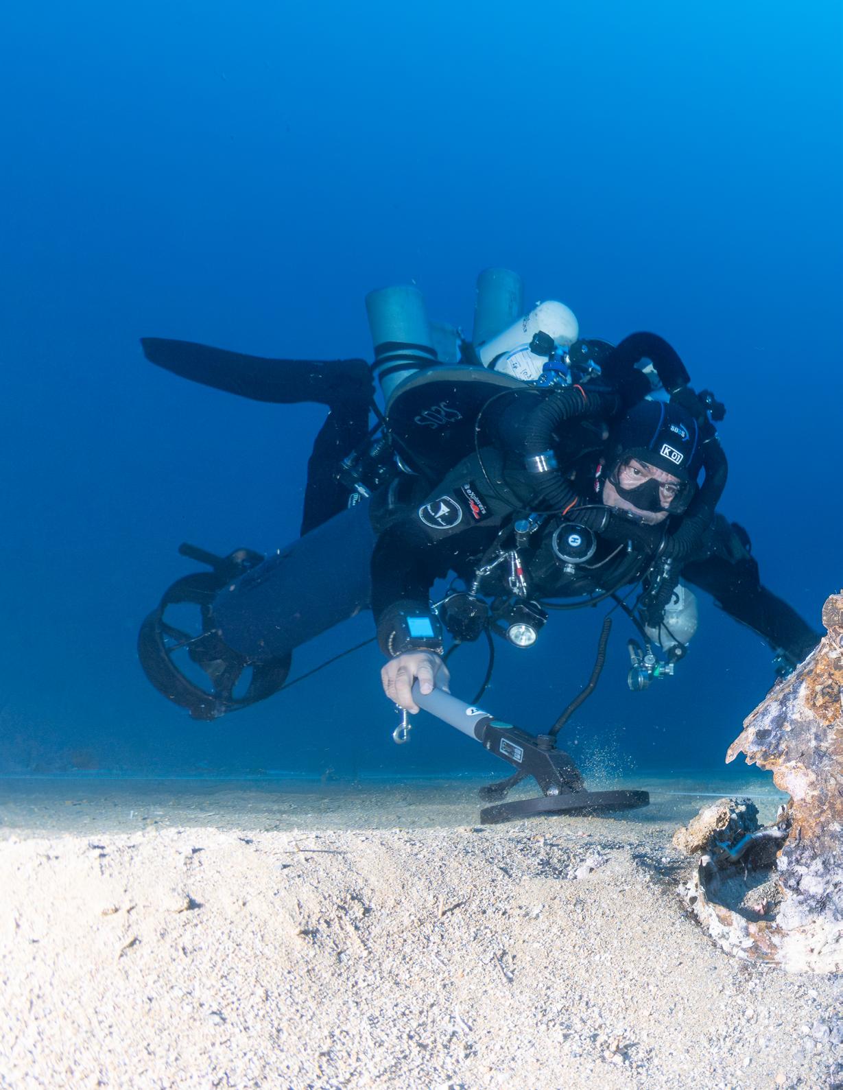
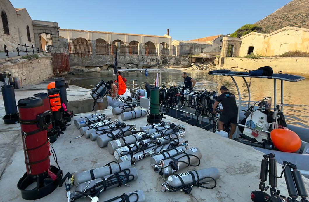
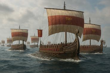
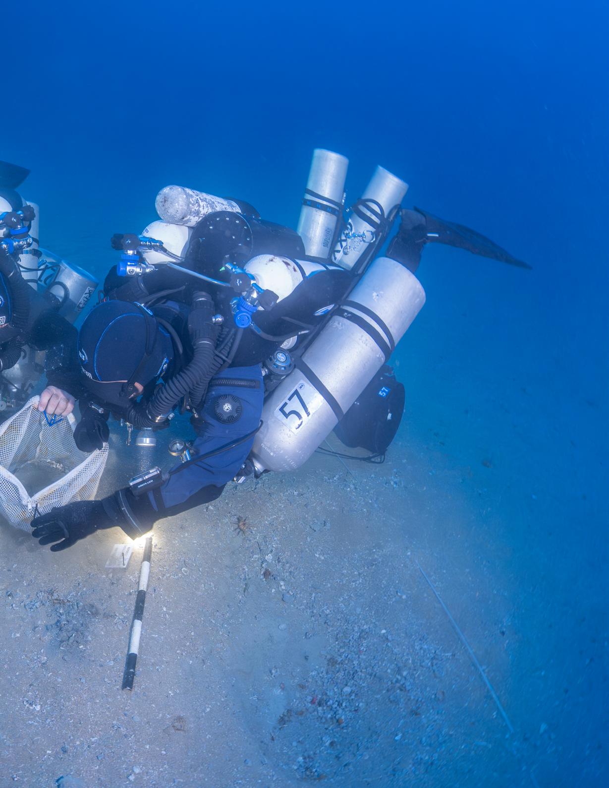
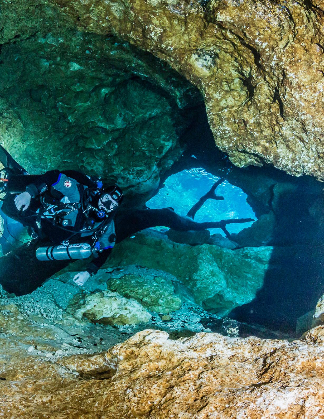
MORE THAN TWO MILLENNIA BEFORE STEEL HULLS AND TORPEDOES, NAVAL BATTLES WERE FOUGHT WITH MUSCLE, TIMBER, AND BRONZE. THE BATTLE OF THE EGADI ISLANDS IN 241 BC MARKED THE VIOLENT END OF THE FIRST PUNIC WAR AS ROME AND CARTHAGE CLASHED FOR CONTROL OF THE MEDITERRANEAN. ON A STORMY DAY, HUNDREDS OF WARSHIPS COLLIDED, THEIR BRONZE RAMS SPLINTERING HULLS AND SENDING MEN AND TIMBER TO THE DEPTHS. TODAY, THE BATTLEFIELD RESTS BENEATH SICILIAN WATERS, SCATTERED WITH AMPHORAE, HELMETS, AND THE DEADLY RAMS THEMSELVES. EXPLORING THIS VAST UNDERWATER SITE REQUIRES THE DELICATE TOUCH OF FORENSIC EXPERTS AT A CRIME SCENE, A ROLE SDSS PROJECT DIVERS—MOST OF WHOM ARE GUE DIVERS AND INSTRUCTORS—FULFILL IN THE ONGOING SCIENTIFIC INVESTIGATION.
“Over the years, Mario and his dive teams have peeled back the layers of history piece by piece, uncovering the scattered remnants of a battle that raged so long ago.
Sebastiano Tusa was a leading figure in underwater archaeology with the Sicilian authorities. He was obsessed with discovering an ancient battlefield that history had placed west of Sicily. The big break came from an unusual coincidence. In 2004, Tusa heard a rumor about a local doctor with a huge collection of marine artifacts such as compasses, portholes, and marine telegraphs in his office. The star of his collection was a bronze ram. The ram was allegedly pulled up by a fisherman and given to the doctor—most likely as a barter for a medical consultation.
Except for one ram found in 1980 off the coast of Israel and not related to any known battles, not a single specimen was known to have been found, which made the doctor’s ram an important discovery. This was the first tangible clue from the battle area that Tusa had made his mission in life to find and explore.
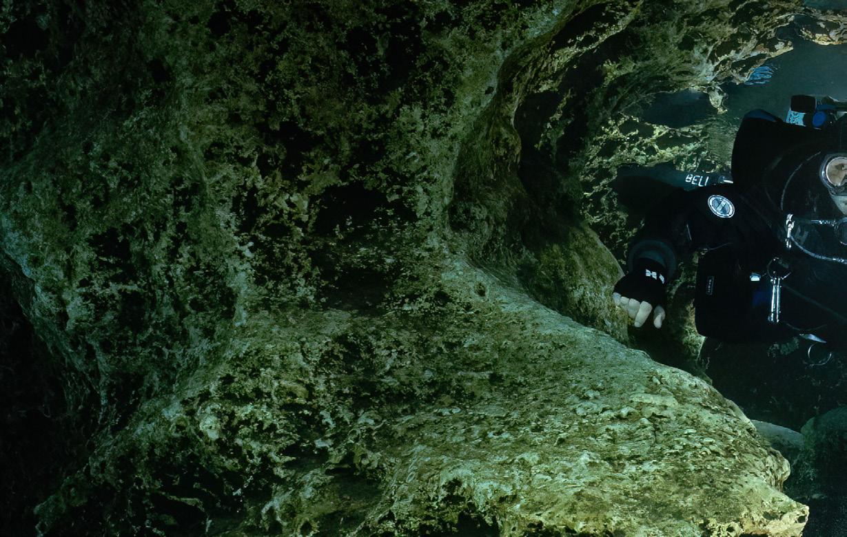
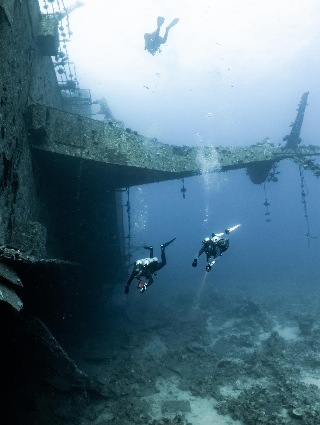
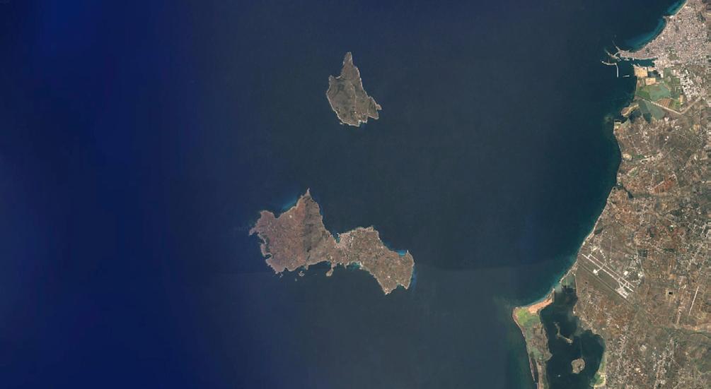
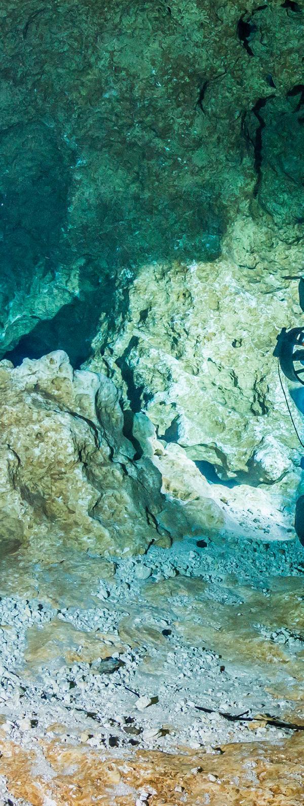
After five years of research at sea, the battlefield of the Egadi Islands, where the First Punic War came to its bloody conclusion, was finally discovered in 2010 thanks to the efforts of Sicily’s Soprintendenza del Mare and the RPM Nautical Foundation with its Hercules, a 37-meter research vessel equipped with instruments for underwater exploration. Just off the coast of the island of Levanzo, some 8 km/5 mi from shore, a vast underwater debris field stretches across more than 10 km2/4 mi2 at depths averaging 85 m/280 ft. What at first appears to be nothing more than a sandy desert dotted with rocky outcrops has proven to be one of the richest underwater archaeological sites ever explored.
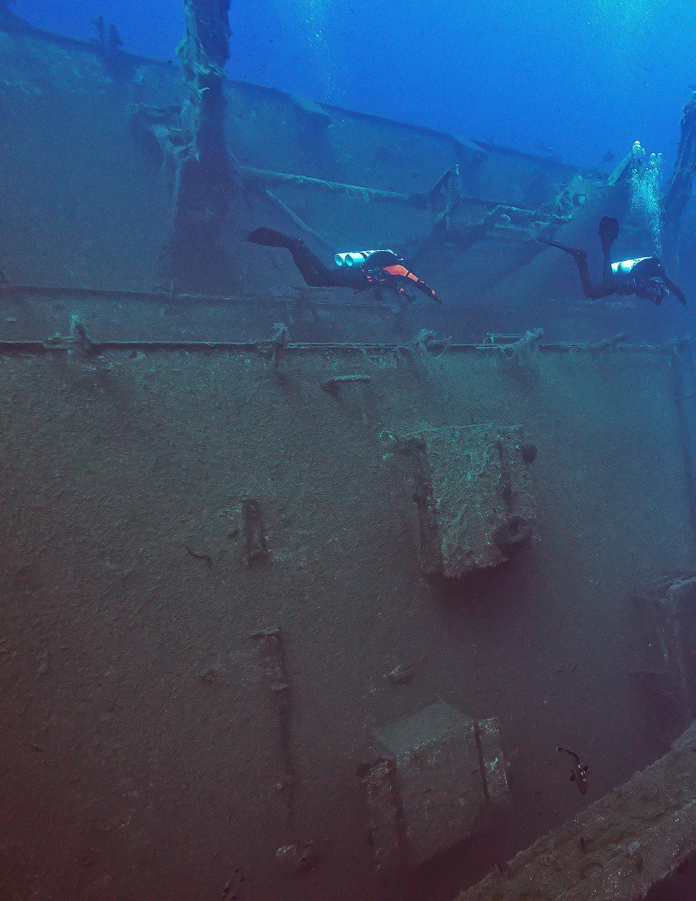
Since 2017, the Society for the Documentation of Submerged Sites (SDSS), spearheaded by Italian GUE instructor and wreck explorer extraordinaire, Mario Arena has joined the hunt, adding technical divers to a project that was first explored by sonars and remote vehicles. Over the years, Mario and his dive teams have peeled back the layers of history piece by piece, uncovering the scattered remnants of a battle that raged so long ago.
Chaos
The disorder of the vast debris field—the remains of a battle in which more than five hundred ships clashed—was likely worsened by trawling over the past few decades. Since fishing vessels have powerful engines and winches capable of dragging heavy nets, it is plausible that some artifacts were caught, more or less accidentally, erasing important evidence and making an accurate reconstruction of the events even more difficult.
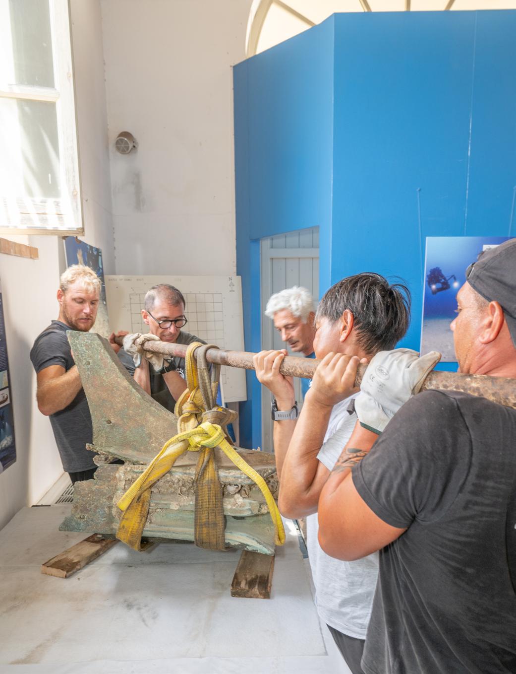
Still, the finds are nothing short of spectacular. Twenty-seven bronze rams—once fixed to the bows of Roman and Carthaginian warships—have been recovered, each one a masterpiece of ancient naval engineering and a silent witness to the violence of ramming warfare. Around thirty Montefortino helmets tell the story of the soldiers who fought and died in the clash, while amphorae by the hundreds—both Greco-Italic and Punic—testify to the logistics of fleets on campaign. Weapons, coins, fragments of armor, and even everyday tableware round out the picture, offering a hauntingly human glimpse into the battle that sealed Rome’s rise as the new master of the Mediterranean.
We create a grid, labeling each square with a unique number to track our findings and facilitate documentation.
PHOTO JESPER KJØLLER
PHOTO JESPER KJØLLER
Did the Romans eat houmous?
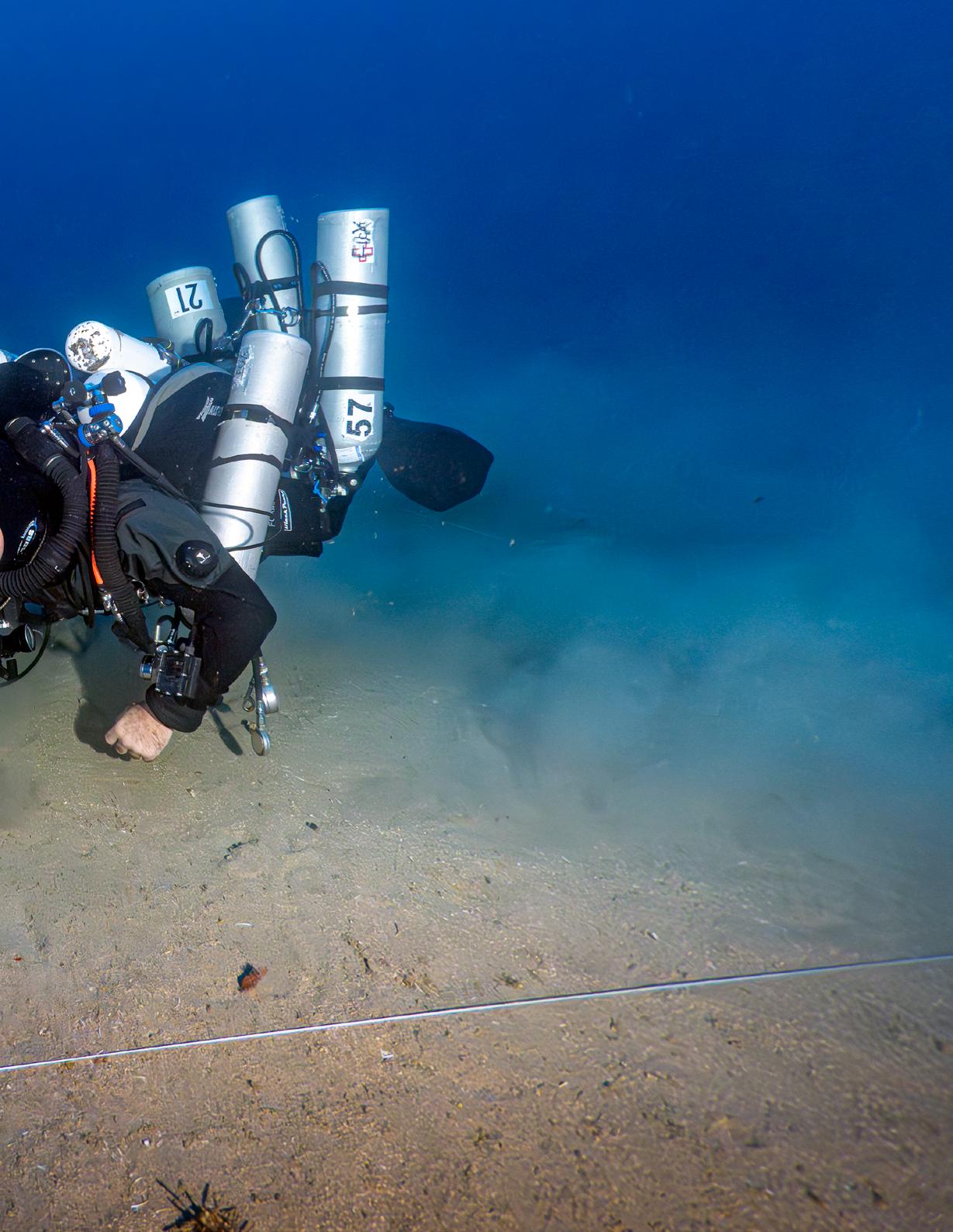
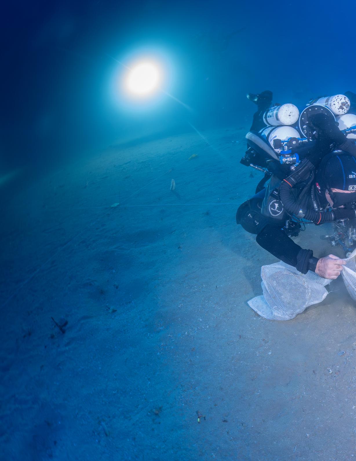
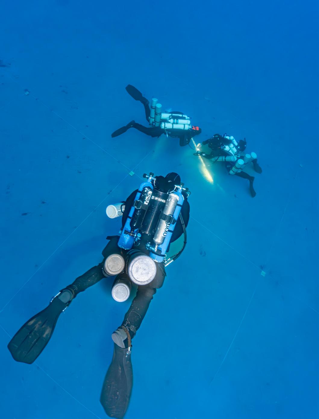
I back-roll from the tall pontoons of our expedition RIB, a SUEX scooter resting in my lap and my JJ-CCR already attached to the sideslung S40 cylinder with 12/65 trimix. I’ve double-checked it’s plugged in, and the switch block is correctly set. Our skipper, Niccolo, hands me my leash with the three bailout tanks clipped on; I swing them into place, securing them to my left hip D-ring and wedging them between my legs.
We scooter to the down-line and begin our descent at full throttle as soon as we see it. The water is blue and clear, but surprisingly cold for November, and halfway down I start regretting leaving my gloves behind. Federico and Gideon wear theirs—needed for their dexterous tasks— but I’m here primarily to take photos and will have to survive with stiff fingers.
We’re heading to an area flagged during an earlier expedition. About 60 m/200 ft from here, two rams were found, and a survey transect revealed three helmets nearby.
During the briefing, Mario—in his characteristic Italian accent—mentions finding “chickpeas” in the area, which leaves me puzzled. How could legumes survive in the ocean for so long? And were the Romans really eating houmous? Then it hit me—he was talking about cheekpieces—the hinged flaps on a Roman helmet that protect the sides of the face, swinging shut under the chin while leaving the eyes, nose, and mouth clear.
I am a rookie on the Egadi project, and all the other divers have a few years under their belt, so I keep my embarrassing misunderstanding to myself.
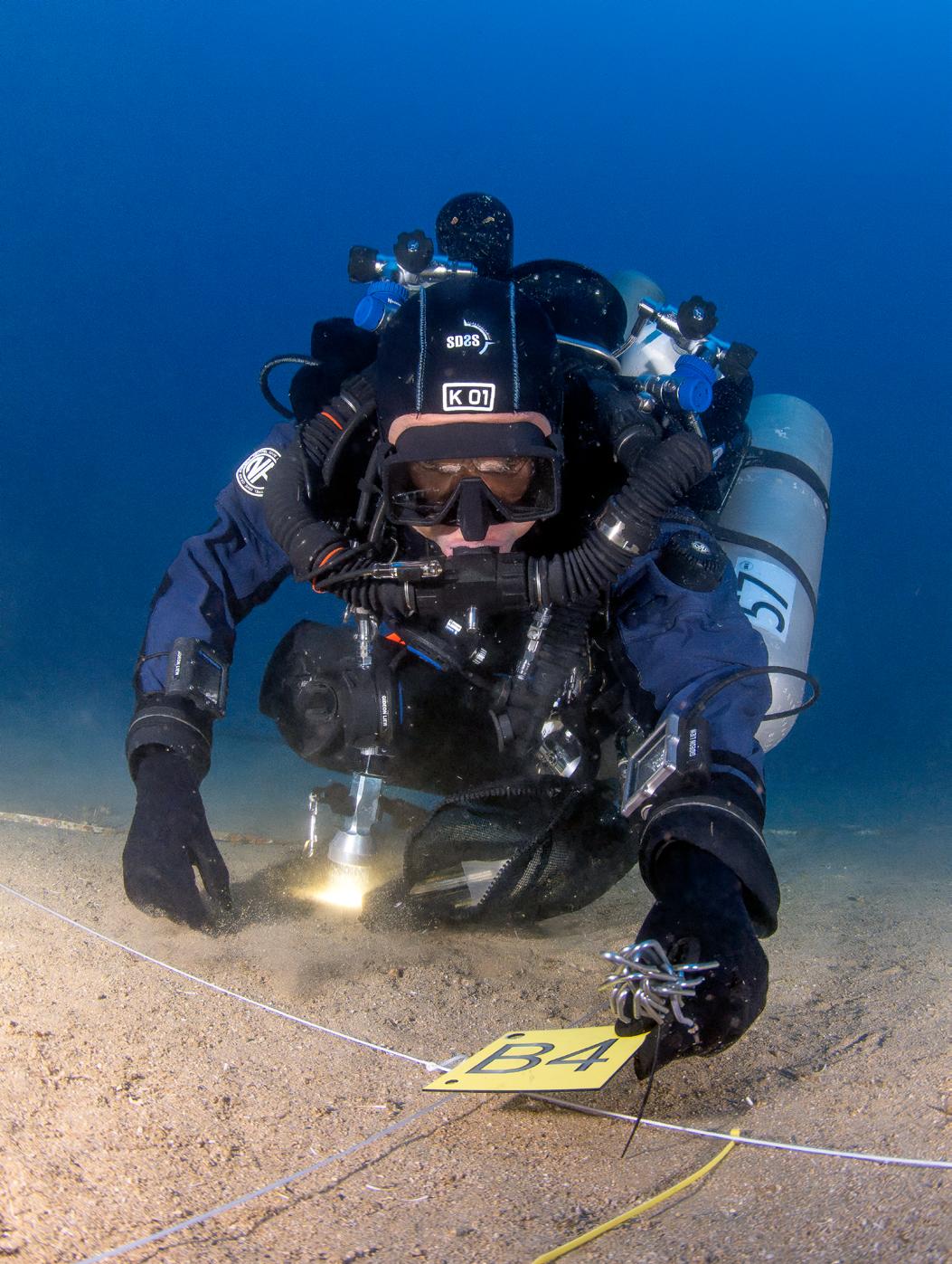
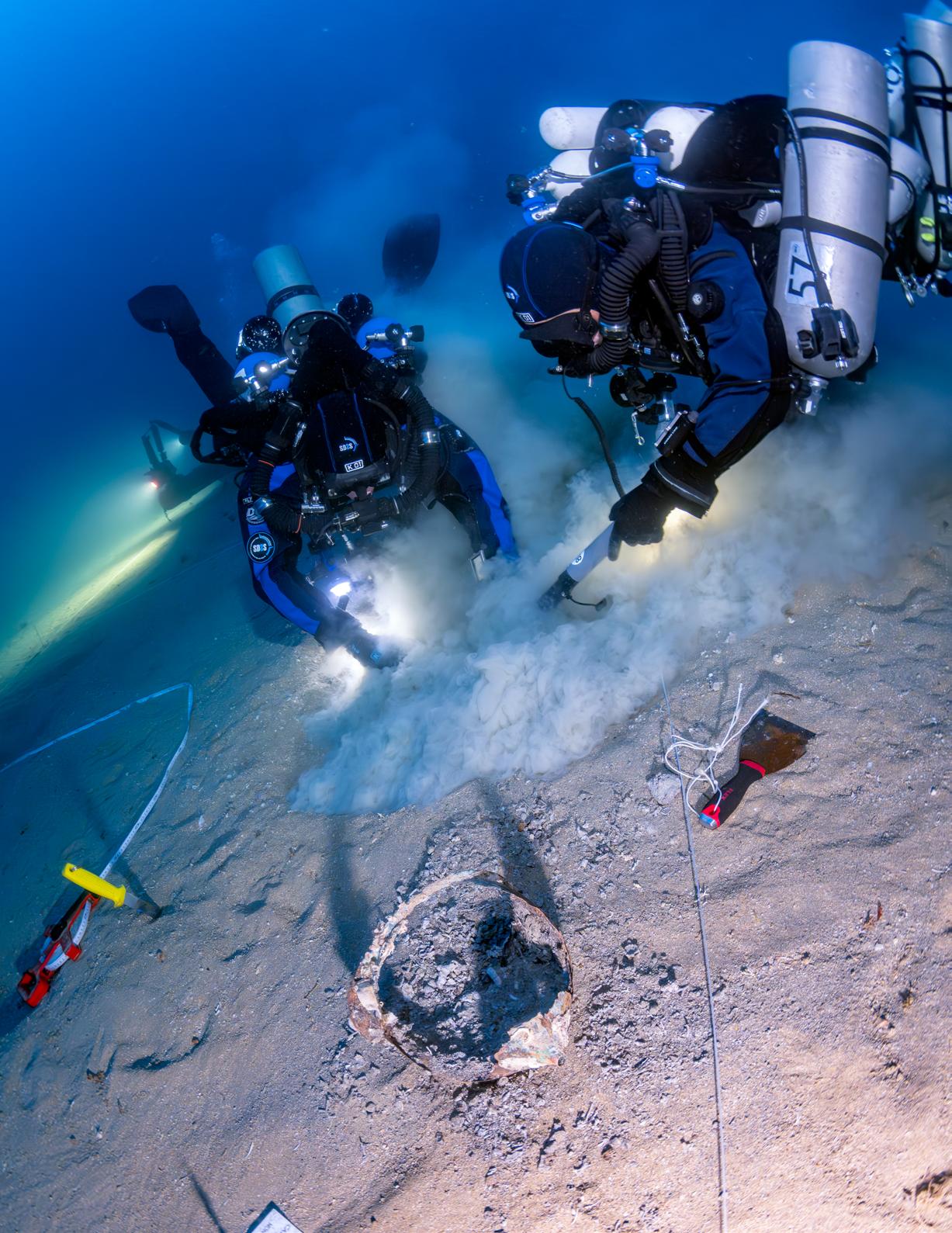
Fede and Gid and the other dive teams begin laying out a 20 x 20 m/66 x 66 ft grid across the site, neatly dividing it into 4 m/13 ft squares using cave line and large metal tent pegs at each intersection.
Each quadrant gets its own identification tag, from A1 to E5, turning the seabed into something that looks almost like a giant chessboard.
The following day, we moved systematically through the squares, sweeping each with a metal detector and carefully excavating any signals or
Using metal detectors to thoroughly examine each square in the grid is efficient, but the equipment is fragile and prone to failure.
objects we uncover. Each team works in their assigned squares. We already know that two helmets and an amphora lie somewhere within this grid, waiting to be brought back into the light after centuries of silence.
DNA and ’80s playlists
When we excavate the artifacts, we leave them in place on the sand, but we mark each with a unique numbered tag fixed to a tent peg. After Faisal uncovers the helmet in one of our squares, we carefully scoop out a sample of the gravel inside and place it in a small vial, giving the archaeologists the opportunity to search for DNA. If the helmet, when it sank to the seabed over 2,200 years ago, was still on the warrior’s head, there’s a chance traces of him remain. More likely, though, are the teeth—nature’s stubborn time capsules. Teeth can survive centuries and even millennia of decay, and from just one, experts can reconstruct remarkable details, including the warrior’s age and even the region where he grew up. The technique resembles dendrochronology—the scientific method of dating events and environmental changes by analyzing growth patterns in tree rings.
After several days of work in the grid, we have documented the entire area using photogrammetry and a 360° camera. Only then do we collect the helmets and other artifacts, preserving them for further study.
During the two project weeks, Niccolo makes sure his Bluetooth ghetto blaster is always running at full throttle with his favorite Spotify playlist. When packing scrubbers and preparing the rebreathers, loading the boat, sailing to and from the dive site, unloading the boat, or just hanging out at the dive camp, the music is constantly on. It does not bother me at all, but by the end of the project, I’ve heard more ’80s pop-rock than I managed to survive in the actual ’80s. I’m still not sure how appropriate it is to blast tracks such as ”Highway to Hell,” ”Knockin’ on Heaven’s Door,” or ”Another One Bites the Dust” right before a challenging three hour deco dive—but I guess it sharpens our awareness and we do also hear ”Stayin’ Alive” quite a few times to strike a more positive vibe.
The small cove next to the museum once launched tuna fleets and now serves as a convenient base for our dive operations.
Beyond the grid
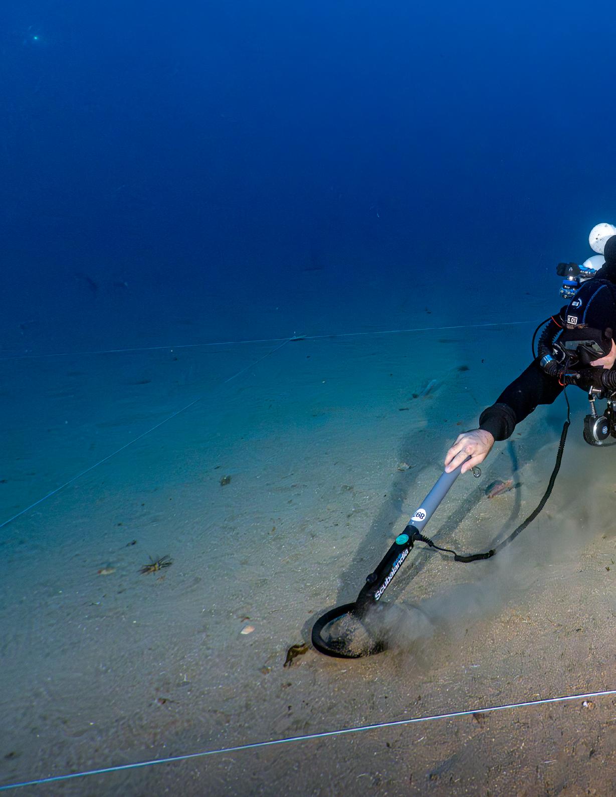
After several days working in the grid, we move on to a few days of open-area exploration. The goal is to locate additional objects that have so far eluded the sonar surveys in this region. Who knows—maybe we will find a ram. Several hundred ships were lost in the battles, and only 27 rams have been found so far, so there must be more around.
Divers, with their eyes and intuition, can often detect patterns and shapes that escape high-tech search methods—a corner of a ram protruding from the sediment, or the subtle difference between an amphora and a rock.
One reason for changing our methodology is the recurring failure of our metal detectors. They tend to flood easily, and without them, detailed searching and fine combing within a confined grid become far less effective. Instead of metal detectors, we just use our eyes.
We divide into four teams, all starting from the same point but moving out in different directions according to our planned search pattern. I’m paired with Andrea; he manages the line that will
guide us back to the upline, while I keep track of our compass heading. We scan the seabed with slow, sweeping motions of our lights, keeping our scooters at a moderate speed.
I spot a small clay pot resembling a pitcher— complete with a perfectly fitting lid. We decide to bring the artifact up. We make sure an octopus hasn’t moved in and fix a numbered tag to a tent peg to mark the find site.
When we turn the dive, we’re reminded how much longer it takes to retrieve the line and wind it back onto the reel. On the way out, you can deploy it with the scooter on the throttle, stopping only occasionally to make a tie-off. On the way back, you have to swim while reeling in like a madman. After 40 minutes of bottom time, we begin the two hours of decompression that await, and in the medium current, we are constantly running the scooters to stay close to the upline.
The value of leaving things behind
Every evening before dinner, we hold a debriefing at our camp inside the museum. The SDSS and SopMare archaeologists, after spending
FACT FILE // THE BATTLE
The Battle of the Egadi Islands was fought on March 10, 241 BC, and marked the conclusion of the First Punic War. After two decades of struggle at sea and on land, Rome had rebuilt a fleet with funds borrowed from wealthy citizens. Carthage, meanwhile, was desperate to resupply its forces in Sicily and dispatched a convoy of transports, escorted by warships, across the waters near the Egadi Islands.
The fleets met under very different conditions. The Carthaginian ships were heavily laden with provisions and equipment, making them sluggish and difficult to handle. The Roman commander, Gaius Lutatius Catulus, had deliberately lightened his ships, stripping away anything that might slow them down. This gave his fleet a sharp edge in speed and maneuverability, crucial in the type of naval combat about to unfold.
When the Romans fell upon the Carthaginian fleet, they no longer relied on boarding tactics or the heavy corvus bridges that had characterized their early naval encounters. Instead, they had embraced the
art of ship-handling and ramming, tactics long practiced by their adversaries. Each Roman vessel carried a bronze ram at the bow, a reinforced extension of the keel designed to smash through planking and punch holes beneath the waterline. With their lighter ships, the Romans could dart in, strike a Carthaginian vessel amidships or from the stern, and sheer away before the enemy could respond.
The Carthaginians, weighed down and unable to maneuver effectively, were easy prey. Many of their ships were holed and sank with their crews, while others, crippled by damage, were captured. The resupply mission failed, and Carthage saw around fifty ships destroyed and seventy more taken. The survivors fled, leaving their stranded army in Sicily without support.
The victory at the Egadi Islands was decisive. By mastering speed and the deadly use of the ram, Rome secured its first true naval supremacy. Carthage, unable to continue the war, was forced to sue for peace, ending the First Punic War in Rome’s favor.
SICILY
Trapani
Favigana
Levanzo
EGADI TARGET AREA
TYRRHENIAN SEA
“Divers, with their eyes and intuition, can often detect patterns and shapes that escape high-tech search methods—a corner of a ram protruding from the sediment, or the subtle difference between an amphora and a rock.
After documenting each artifact’s position with photogrammetry in the grid, the team carefully places them in a net and lifts them to the surface.
PHOTO JESPER KJØLLER
FACT FILE // THE MUSEUM
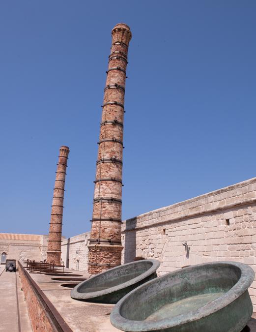
Ex Stabilimento Florio delle Tonnare di Favignana e Formica
Perched on the edge of Favignana’s harbor, the Ex Stabilimento Florio is a striking reminder of Sicily’s layered maritime history. Built in the mid-19th century by the Florio family, its vast stone halls once echoed with the rhythm of the mattanza, the traditional tuna harvest, but today the site serves as a gateway to a far older story: the seas that surround it have been witness to naval battles for over two millennia.
From these shores, the waters of the Egadi Islands stretch outward, hiding the wrecks of the historic 241 BC battle. Visitors walking through the restored factory can sense the link between past and present: the same waters that once carried tuna now cradle warships, amphorae, helmets, and more than two dozen bronze rams, relics of a conflict frozen in time.
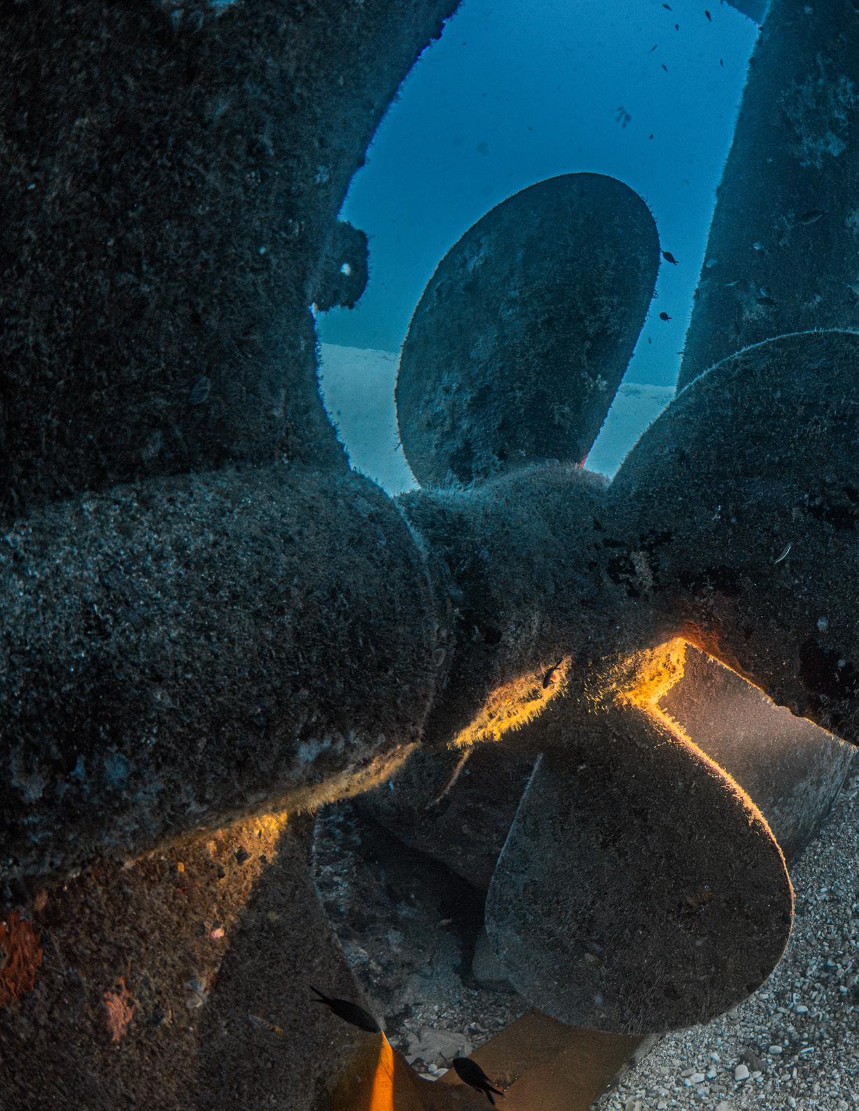
The rams
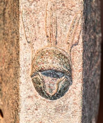
The ram, a massive bronze spike on the prow, was the primary offensive weapon of ancient warships. The Egadi site has yielded the world's largest collection, with 27 examples discovered to date. These artifacts are invaluable historical sources. Many bear inscriptions or decorations that identify their origin.
Some bronze rams from the Battle of the Egadi Islands carry Latin inscriptions naming a quaestor, the Roman magistrate responsible for finance and supplies. This stamp of approval certified the ram’s quality and tied it directly to the Roman state. Because quaestors held office for just a year, these inscriptions also provide archaeologists with precise dating, turning a weapon of war into a signed, time-stamped artifact of history.
After being landed, the tuna were cooked in these kettles and packed into tins.
PHOTOS JESPER KJØLLER
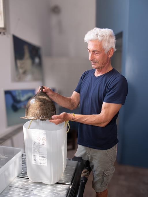
Mario Arena with a fully intact Montefortino helmet in the museum’s archaeology lab.
The 200 kg/440 lb bronze rams are being preserved in the lab before exhibition in the museum.
Insert: Many of the rams bear inscriptions or decorations. This one depicts a helmeted warrior with cheek pieces.
“their day documenting artifacts in the field conservation laboratory set up inside the museum, expect a detailed report from each team, including depth, bottom time, decompression profile, and other dive-related data. And more to the point, they are interested in our findings, observations and documentations. Everything is meticulously recorded for posterity.After Andrea and I present our actions and discoveries, Mario’s comments are quite blunt: “What you have done is totally meaningless.” Ouch! That stings. But Mario goes on to explain that removing an object without documenting its exact position in relation to other known finds renders it scientifically worthless. The jug—beautiful and intact as it is—has little value once brought to the surface. Left in place, it still tells a story. Removed, it loses its context and becomes just a piece of fired clay. Mario’s criticism makes perfect sense, and we realize our mistake. Lesson learned.
CSI
must instead depend on highly trained technical divers to serve as their eyes and hands.
Underwater archaeology shares a striking parallel with forensic work: in both fields, context is everything. Just as a forensic investigator studies the arrangement of evidence at a crime scene to reconstruct the chain of events, the underwater archaeologist relies on the placement of artifacts to tell the story of the site.
As in so many other branches of science, underwater archaeology continues to evolve as technology expands the realm of what is possible. Looking back at the methods used 50 or 100 years ago, we can only shake our heads in disbelief at the crude techniques that often clouded or even erased the conclusions we might otherwise have drawn with the resources we have now. That perspective is a reminder of our responsibility today: to create records and documentation robust enough to endure, so that future generations of scientists— equipped with tools and insights we cannot yet imagine—may be able to extract meaning from patterns still invisible to us.
Meaningful experience
Underwater archaeology shares a striking parallel with forensic work: in both fields, context is everything. Just as a forensic investigator studies the arrangement of evidence at a crime scene to reconstruct the chain of events, the underwater archaeologist relies on the placement of artifacts to tell the story of the site. Every object—whether a helmet, amphora, coin or weapon—derives much of its meaning from its position relative to others. If items are moved without careful recording, that silent testimony is erased, leaving only scattered relics without context.
This challenge is even greater on deep sites such as the Battle of the Egadi Islands where archaeologists cannot themselves descend but
Beyond the technical challenges of the project, what stays with me most is the personal learning. Each dive is a lesson in execution, precision, and teamwork—a reminder of how much there is to absorb from even the smallest tasks underwater. Bringing artifacts to the surface and carefully documenting them isn’t just about the objects themselves; it’s about contributing to science, preserving history, and adding a small piece to the bigger puzzle.
Being part of such a highly skilled, accomplished team of divers makes the experience even more meaningful. Their expertise, professionalism, and passion are contagious, and I feel privileged to share in their knowledge and dedication. In the end, it’s not just about what we recover from the depths, but what we gain personally—a deeper understanding of our craft, of the underwater world, and of the value of collaboration in pursuit of something greater than ourselves.
The GUE-configured JJ-CCR rebreather once again proves to be a solid and reliable platform for expedition-style dive missions.
PHOTO JESPER KJØLLER
Digging in the dirt — the tools of underwater archaeology: metal detector, measuring tape, knife, and a spatula.
PHOTO JESPER KJØLLER
FACT FILE // TEAM
Left to right:
Gideon Liew, Singapore
Federico De Gado, Italy
Stefano Gualtieri, Italy
Faisal Khalaf, Lebanon/Egypt
Mario Arena, Italy
Andrea Scaccianoce, Italy
Ben Oortwijn, Holland
Caterina De Seta, Switzerland
Niccolò Crespi, Italy
Jesper Kjoller, Denmark/UAE
Jesper Kjøller
Jesper began his professional life as a musician but discovered his passion for diving over 30 years ago. He changed careers, becoming a diving instructor in 1994 and a PADI Course Director in 1999—the same year he took on the role of editor for the Scandinavian diving magazine DYK. He became a GUE instructor in 2011, and in 2015, relocated to Dubai to bring his talent for underwater storytelling and imagery to Deep Dive
RESOURCES
Dubai as the facility’s Marketing Manager. From his base in Dubai, Jesper travels the globe to teach, contribute to international dive publications, and take part in exploration projects such as the Mars field studies in the Baltic Sea, deep wreck exploration in the UAE and Egypt, or the Battle of the Convoys project in the Southern Mediterranean. In 2021, he became Editor-in-Chief of Quest, GUE’s member journal.
CAVE DIVING CAVE FORMATION AND DEVELOPMENT
JARROD JABLONSKI, DANIEL RIORDAN, FRED DEVOS, TODD KINCAID & CHRIS LE MAILLOT
In the early stages of a cave diver’s career, most attention goes to dive logistics— equipment, propulsion, breathing, and gas management—along with assessing hazards like flow, silt, and line snags. As a result, little focus is initially given to observing cave features that enrich the experience. With growing experience, especially across varied environments, divers develop sharper awareness of cave systems and groundwater flow. Exploration then becomes guided by knowledge, intuition, and an understanding of how water shapes caves—the pursuit of deeper insight often becoming the key motivation to keep diving.
FORMATION DEVELOPMENT PART ONE
PHOTOS KIRILL EGOROV
The purpose of this article is to present an overview of the mechanisms that lead to cave development in various geologic settings and provide a foundation from which cave divers can engage in knowledgeable discourse about personal observations of cave environments. Beyond that, it should be recognized that the present understanding of cave development has largely evolved out of observations that were recorded and published by cave explorers over the past 150+ years. Because underwater caves have only become accessible to any appreciable degree in the past 25 years, the observations collected by cave divers promise to enhance and possibly even redefine our understanding of cave environments and the cave development process. All divers are encouraged to make and record their own observations so that our collective understanding of the cave environment might benefit from their efforts.
Dissolution caves
Sometimes called secondary caves, dissolution caves are void spaces created by the dissolution of soluble rocks in water flowing beneath the ground surface. Void spaces that are too small for a human to enter are described as cavities, while those large enough to allow human exploration are called caves and conduits. Conduits are long, typically cylindrical passages within a cave that convey water to springs.
Dissolution caves are by far the largest and most extensive of all cave types. They constitute the most commonly visited and explored type of both dry and underwater caves, and they captivate the majority of scientific research focused on cave environments. Of all the various types of caves, the disproportionate amount of attention focused on dissolution caves by explorers, researchers, and the general public is largely due to how these caves are formed. Explorers are compelled by long passages and complicated cave patterns that reflect the characteristics of the aquifers in which they form, such as the mode of recharge and the overall distance between recharge and discharge areas. Scientific interest in dissolution caves often stems from
their critical hydraulic role in karst aquifers as preferential groundwater flow pathways that significantly complicate groundwater resource and contaminant transport investigations.
Developmental cycle
Cavities and caves form in all soluble rocks such as limestone (CaCO3), halite (NaCl), dolomite (CaMg(CO3), gypsum (CaSO4·2H2O), and even quartzite (SiO2 + various inclusions). The more extensive caves are most commonly formed in limestone and dolomite, which together are referred to as carbonate rocks. Limestone and dolomite are originally formed on the sea floor, where the shells of dead organisms such as tiny foraminifera and larger conch, bivalve, and nautiloid shells, as well as the bodies of corals, accumulate and solidify into rock. Often, the shells of the rock-forming organisms—for example, crab shells and whale bones, as well as other fossils—are indicative of the undersea environment in which the rocks were formed.
Cavities and caves develop in carbonate rocks after they become situated above sea level due to tectonic uplift or sea level declines. There, the rocks are incorporated into the hydrologic cycle as aquifers, where dissolution is initiated by rainwater that infiltrates into the ground and circulates to springs. Cavities and caves are dissolved out of the host rock by the circulating groundwater on its path between the locality of its introduction to the ground water system, known as the recharge area, and the locality of its re-emergence to the land surface, known as the discharge area. The hydraulic gradient is the slope of the water table between recharge and discharge areas. Offshore caves, such as Red Snapper Sink off the east coast of Florida or many of the blue holes in the Bahamas, developed either during a period of lower sea level or as a consequence of groundwater circulation between onshore recharge areas and offshore springs.
Passage development
Once developed, cavities and caves provide preferential pathways for water to flow through the rock. As dissolution continues, small cavities become enlarged, increasing the rate at
Scalloping on the walls of Peacock Springs cave system in Florida, USA.
PHOTO KIRILL EGOROV
View from Kitty Sink, Lafayette Blue Spring in Florida, USA.
PHOTO KIRILL EGOROV
which water is transmitted through the rock, which in turn causes further cavity enlargement. Several different conduits can develop over time, thereby creating multiple ground water flow routes through the rock. The orientation of caves and conduits is always such that they facilitate groundwater flow down-gradient toward spring discharges. However, geologic features such as faults, joint fractures, and bedding planes can facilitate the preferential enlargement of a particular flow path and contribute to passage morphology. Water that follows existing joint patterns tends to create deep narrow canyons, while dissolution along bedding planes gives rise to broad shallow passages.
“Geologic processes that contribute to changes in base levels include tectonic uplift, river incision, and sea level fluctuations. Lowering the base level causes the water table to be depressed, which in turn causes established conduits to become inactive and promotes the development of new and deeper flow paths.
In addition to continued dissolution, mechanical abrasion works to enlarge cave passages. Tiny sediment particles, often quartz or other hard minerals, are carried into a cave by surface runoff into sinkholes in the recharge. Abrasion of the hard minerals against the softer carbonate rock erodes cave walls, leaving behind distinctive asymmetric features called scallop marks that look like spoons carved out of the rock. The shape of a scallop mark is indicative of the groundwater flow direction through the cave at the time it was created. Scallop marks typically have a narrow “pointy” end that is oriented in the upstream direction, and a gentler, flared end that merges downstream into the surface of the cave wall. In all cases, the steeper side of the scallop marks the upstream side of the feature.
Sediment
Eventually, the influx of sediments into a cave will accumulate into deposits on the floor of various sections of a cave and obscure the profile of the dissolved passage or chamber. The distribution of various sediments will be controlled by the velocity of the through-flowing groundwater.
Clay and silt-sized particles tend to accumulate in low-flow regions of a cave, such as very large chambers or small isolated passages. Sand, pebbles, and larger debris typically gather in the main passages where groundwater velocities are sufficient to push those particles along the cave floor and keep smaller particles in suspension. These areas are often marked by prominent sand dunes and ripple marks. In regions susceptible to seasonal floods, and particularly in caves that are not perennially underwater, large sediment pulses can block flow paths, thereby forcing groundwater flow to exploit and enlarge smaller pathways. If the rate of sediment influx to a cave exceeds the rate of cave growth, the cave will eventually become nearly or completely filled, in which case recharge water will either be diverted to surface flow paths or exploit new pathways for groundwater flow through the rock.
The evolution of a cave also responds to geological processes that cause the base level, which is the elevation at which a cave discharges water to the land surface, to change relative to the land surface, and thus the elevation of the cave. Geologic processes that contribute to changes in base levels include tectonic uplift, river incision, and sea level fluctuations. Lowering the base level causes the water table to be depressed, which in turn causes established conduits to become inactive and promotes the development of new and deeper flow paths. A rise in base level, such as is generated in coastal areas by an increase in sea level, can drown passages that had once been dry—such as vertical shafts that had led from the land surface to the water table—and can change the distribution and function of cave entrances, such as sinkholes and springs.
Mammoth Cave, Kentucky, is an example of cave development responding to continued depression in a local base level. Mammoth
Cave is currently the largest known cave in the world, having over 500 km/310 mi of mapped passages. It is a dry cave wherein all of the mapped passages converge on the underground flow path of the Green River, which is the local base level in that area. The majority of the passages are distributed in three distinct levels, where each successively deeper level formed at a different stage in the history of the Green River’s incision into the valley through which it flows.
The three major cave levels consist of large elliptical and canyon passages (10-25 m/33-82 ft in diameter) that slope very gently toward the Green River. Passages at other elevations are smaller shafts, narrow canyons, and tubes that tend to have significantly steeper slopes. The elevations of the three major cave levels correspond to terrace elevations in the Green River valley and are indicative of slow downward river incision that allowed enough time for the passages to develop. Other levels in the cave that contain fewer and steeper passages are indicative of more rapid river incision that largely outpaced cave development.
Sediment dynamics
Wakulla Cave in Tallahassee, Florida, is an example of cave development that has responded to sea level fluctuations over the past one or more glacial periods that, in concert with the erosion of an overlying geologic formation, changed the groundwater flow directions to and through the cave and the distribution and function of cave entrances. Wakulla Cave is one of the largest known underwater caves both in average passage size (~5-30 m/16-100 ft) and mapped areal extent (~11 km/7 mi). The cave is comprised of seven prominent conduits with two characteristic sizes. The largest conduits (~15-30 m/50-100 ft in diameter) trend south, away from the cave entrance and spring discharge point at Wakulla Spring. Most of the smaller conduits (~3-6 m/10-20 ft in diameter) converge on the spring from the north. Groundwater flow in the smaller conduits is to Wakulla Spring, while flow in the larger conduits is primarily away from the spring, toward the Gulf of Mexico.
The fact that the largest and longest conduits in Wakulla Cave trend down-gradient and away
Rafinesque Hall in Mammoth Cave.
PHOTO KIRILL EGOROV PHOTO COURTESY OF NATIONAL PARRK SERVICE
from the spring discharge has been an enigma to researchers for some time. When viewed in the context of fluctuating sea levels over the Florida Platform, however, the conduit configuration indicates that rather than documenting a unique form of cave development, the largest conduits in Wakulla Cave formed during a period of lower sea level than at present and under different hydraulic conditions. During the cave’s initial development, Wakulla Spring was a point of recharge to the aquifer rather than a spring, and the conduits conveyed groundwater south to spring discharges nearer to the present-day Gulf of Mexico shoreline. This theory is supported by the presence of large mastodon fossils located inside the cave near the entrance, which allows for the theory that Wakulla Spring had once been a large sinkhole where prehistoric animals came for water and sometimes died there, leaving their bones to be discovered once the sea level had risen and the sinkhole became a spring.
The rise in sea level to its present elevation, in conjunction with continued erosion of clayey rocks that had capped the cave-forming lime-
stone, raised the local base level so that hydraulic conditions favored discharge at Wakulla Spring while new recharge areas (Leon Sinks) became established further up-gradient. The smaller conduits in Wakulla Cave have since developed as a consequence of dissolution along flow paths that connect the newer up-gradient recharge areas with Wakulla Spring, while the original conduits still convey groundwater flow to down-gradient springs that were likely drowned by the rise in sea level. A groundwater divide has developed across the cave where flow converging on the conduit from the northern part of the region discharges at Wakulla Spring, while flow from the southern part of the region enters the conduits and flows farther down gradient to the Gulf of Mexico.
Stable environments
Though caves are dynamic environments from a geologic perspective, they are for the most part very stable environments from a human perspective. The important distinction is the timescale over which the cave environment is evaluated. Caves form, fill in, drain, and collapse
Downstream passage at Emerald Sink, Wakulla-Leon Sinks cave system in Florida, USA.
Limestone forms on the sea floor, where living organisms accumulate over time and solidy into rock.
over periods of tens of thousands to millions of years, depending on the environmental (precipitation rates, dissolutional capacity of the water, etc.) and geologic (initial permeability of the host rock, distribution of recharge, sediment availability, etc.) factors that are operative during the time period and in the region where the cave forms.
At human timescales (years to hundreds of years), caves—particularly underwater caves— are one of the most stable natural environments. Though dissolution caves can reach more than 152 m/500 ft in diameter, collapses are rare in water-filled caves because water, being essentially incompressible, supports overlying material. When caves and cavities become drained due to water table declines or base level reductions, they become more susceptible to collapse (e.g., sinkhole formation). Even then, the cave environment is typically stable over human timescales. Though periodic collapses can change passage configurations and be hazardous to cavers who happen to be in the vicinity at the time of collapse, few accidents in
the dry caving community have been attributable to collapse. On the contrary, most cavers describe caves as unchanging environments, those where passage geometries, temperature, and humidity remain unchanged throughout the seasons and across generational records.
Dissolution process
Dissolution is the process by which the chemical compounds composing rocks and minerals are broken into their constituent ions in a fluid solution. Carbonic acid (H2CO3) is usually the principal acid responsible for the dissolution of carbonate rocks. It is formed when CO2, emitted by organic material, reacts with rainwater filtering vertically down through layers of soil or rock above the water table, known as the vadose zone. The overall chemical reaction describing the dissolution of carbonate rocks by carbonic acid is:
carbon dioxide + water + carbonate = calcium + bicarbonate.
PHOTO KIRILL
Water path through karst aquifer.
Note that while carbonic acid is capable of dissolving soluble rocks such as limestone and dolomite, it presents no risk to the diver.
Once the slightly acidic water reaches the water table, below which is described as the phreatic zone, the water flows in a more horizontal direction down the hydraulic gradient to spring discharge points, creating preferential pathways dissolved out of the host rock. Equilibrium, with respect to the amount of dissolved Ca++ (ionized calcium) in the water and the maximum amount of Ca++ that the water can hold (Ca++ solubility), is approached as calcium carbonate (CaCO3) becomes dissolved in groundwater. At equilibrium, no further dissolution of CaCO3 can take place; however, in natural systems, equilibrium is never reached but rather asymptotically approached. As equilibrium is approached, dissolution rates become dramatically reduced, and cave formation or growth is appreciably slowed but not halted. Typically, water becomes increasingly saturated with Ca++ as it travels further into an aquifer from a recharge area; however, certain factors can increase Ca++
solubility of the water and therefore rejuvenate more rapid dissolution. These factors include the addition of CO2 by organic matter carried into a cave from a recharge area, decreased temperature (more Ca++ will dissolve in colder water than in warmer water), and mixing corrosion, which is an increase in Ca++ solubility due to the mixing of waters that can themselves be nearly saturated with re spect to Ca++. Regardless of the mechanism, in aquifers where cave systems are actively forming, groundwater velocities are sufficiently rapid to circulate water that is undersaturated with respect to Ca++ throughout the cave.
Speleothem development
Speleothems are secondary mineral deposits in caves that predominantly form by the re-precipitation of calcite but can also be formed from precipitates of gypsum, halite, goethite, and other minerals. Most speleothems form in dry caves as a result of the downward infiltration of groundwater through a cave to the water table. When groundwater containing dissolved calcite
and carbon dioxide drains into a dry cave environment, the pressure on the water decreases, allowing some of the carbon dioxide to escape into the cave atmosphere as a gas. The loss of carbon dioxide causes the acidity of the water to decrease which, in turn, causes some of the dissolved calcite to precipitate on rock surfaces.
Speleothems have a wide variety of forms that are dependent on the mechanism that delivers cave water to the site of precipitation. Stalactites are icicle-like formations that hang from cave ceilings. Stalactites form as a result of dripping water where calcite precipitates at the point from which the water drips. Stalagmites are similar features that project upward from a cave floor. Stalagmites tend to form in conjunction with stalactites due to the precipitation of calcite at the point where dripping water lands on the cave floor. Flowstone (curtains, draperies, etc.) is another type of speleothem that forms as a result of calcite precipitation from flowing water in a cave environment. One of the strangest forms of speleothems are helictites, which are small groups of twisted and contorted straw-like formations that form as a result of calcite precipitation on the capillary fringe of a water drop.
Karst aquifer
The term “karst,” so focal to any discussion of caves, is quite often poorly used and has resulted in considerable confusion in both the scientific community and the general public. The word “karst” is actually the German form of the word “kras,” which has been translated as “bare stony ground” or “a bleak waterless place.” As a term, “karst” was originally used to describe the predominance of subsurface drainage through caves in the landscape near Trieste, Italy, and adjacent Slovenia (formerly Yugoslavia). Subsequently, numerous authors have adapted the word for their specific purposes. Some definitions require that specific topographic features be present, such as closed depressions, sinkholes, caves, and subsurface drainage. Other definitions describe karst as any of the characteristic landforms and subsurface features produced by processes that include the dissolution, re-precipitation, and collapse of soluble rocks.
“When stalactites and stalagmites are encountered in underwater caves such as in the Yucatan Peninsula, they indicate that the cave had previously been dry and that the local base level has fluctuated over recent geologic time.
When stalactites and stalagmites are encountered in underwater caves such as in the Yucatan Peninsula, they indicate that the cave had previously been dry and that the local base level has fluctuated over recent geologic time. A notable exception is the occurrence of mammillary calcite formations in Devil’s Hole, Nevada, which form underwater as a result of calcite precipitation driven by increasing water temperatures with depth. Goethite (accumulations also form underwater and are sometimes considered to be a form of speleothem. Speleothems of all types are often used by scientists to date various periods of cave development and as indicators of climate change in the recent geologic record.
The consequence of the various adaptations is that the term “karst” can be a descriptor for terrain, rock, and the actual solution cavities, which can create confusion when its usage is not made clear to an intended audience. Furthermore, the lack of some distinguishing features in a particular area can lead to the misconception that a particular region is not karst when in fact fundamental karstic processes are indeed operative. For these reasons, a process-oriented definition is emphasized here that focuses on the common characteristic that distinguishes karst from other environments or natural features. In all cases, karst is a geologic environment in which the permeability structure of the rocks is created by dissolved cavities and conduits that are organized to facilitate the down-gradient circulation of groundwater and are created by the circulation system rather than the inherent porosity in the rock fabric. The pres-
ence of closed depressions, sinkholes, caves, speleothems, or any other karstic feature is a consequence of that permeability structure. Though the nuances of the definition are of little importance to the diver, a fundamental understanding of the word “karst” is crucial when exchanging ideas between the cave diving and scientific communities. Truly unique and valuable observations can be obtained by diving into submerged caves, but because of the difficulty associated with underwater cave exploration, they are rarely noted by investigators focused on cave and karst science and even more rarely considered by water resource and land use managers. Fortunately, as the popularity of cave and cavern diving increases, knowledge and appreciation of these interesting and unique environments will spread. However, in order to protect underwater caves and karst water resources, the observers must become conversant with the concepts denoted by the terms “karst,” “aquifer,” and “ground water” in order to communicate effectively with scientific and regulatory communities.
A graphic representation of a karst landscape.
Sinkholes and springs
The rocks that contain underwater cave systems are described as karst aquifers, where an aquifer is any group of rocks that are capable of storing and transmitting significant quantities of groundwater. Karst aquifers are those aquifers in which the predominant groundwater flow paths follow conduits that are dissolved out of the host rock and are organized to facilitate down-gradient flow to springs.
Several karstic features are indicative of the formation and function of caves in a karst aquifer. The most significant features include sinkholes, karst windows, springs, and, to a lesser extent, dolines. The development of each of these features is, at least in part, related to whether or not the aquifer is covered by less permeable material. When it is, the aquifer is classified as confined or partially confined, depending on the degree of permeability in the overlying material. The material itself is described as a confining layer. When the aquifer material is exposed to the land surface or no confining layer is present, it is classified as unconfined.
Sinkholes are topographic depressions formed by catastrophic collapses that typically penetrate a confining layer into the underlying aquifer material. They begin as submerged caves or more often as large cavities dissolved out of the host rock. Either by natural reductions in the water table, for instance as a result of prolonged drought, or by excessive ground water pumping, part or all of the underground cavity becomes drained. If the rock is not capable of supporting the weight of the overlying material, it will collapse into the void space. Afterward, either because the original cavity was partly filled with water or the water table rises, the sinkhole will at least partially fill with water, creating a lake with a characteristic circular perimeter. Sinkholes are important to cave formation because they create discrete recharge points where surface water can enter the aquifer, dissolving rock material along its new path toward a spring discharge point.
Dolines are topographic depressions caused by collapse and subsidence features similar to sinkholes but do not connect the surface with the underlying aquifer. They are formed in the same manner as sinkholes when a decline in the local water table allows subsurface cavities to collapse, creating a depression in the land surface. Dolines and larger depressions caused by land subsidence are ubiquitous in karst regions because continued dissolution slowly removes tremendous amounts of bedrock. After it is dissolved, water carries the dissolved rock material to springs, where it is discharged to rivers and is eventually dumped back into the oceans from which the rocks originated. Some springs, such as Silver Springs near Ocala, Florida, discharge as much as 200 tons of dissolved rock per day.
NEXT TIME: CAVE FORMATION AND DEVELOPMENT – PART TWO
PHOTO KIRILL EGOROV
Little River Spring in Florida, USA.
GUE PREMIUM DIVE CENTERS
Area 9 Mastery Diving – Kralendijk, Bonaire
www.masterydiving.com
Base1 – Sardinia, Italy
www.baseone.it
Deep Dive Dubai – Dubai, UAE
www.deepdivedubai.com
Dive Centre Bondi – Bondi, NSW, Australia
www.divebondi.com.au
Duikcentrum de Aalscholvers – Tilburg, Netherlands