Globalaction 12MONTH LICENCE DIGITAL PROJECT INCLUDED sample
PRIMARY 6 Social Science
What are we going to learn?
1 Progress or natural resources? Both?
8
2 Water scarcity: a real issue? 26
Learning situation: Economic and social progress have gone hand in hand with environmental degradation that puts our future at risk.
Target in action: Analyse the importance of responsible consumption and call our community to action by spreading these ideas on social media.

3 Come visit us! 46
Learning situation: Water scarcity is a problem that affects millions of people and the cause of serious health problems.
Target in action: Write a letter to the European Commission and collect signatures for the development of policies to solve water scarcity. Agua
Learning situation: Tourism stimulates great economic growth but it can also cause inequality and serious environmental deterioration.
Target in action: Think of a tourism business model that is sustainable from the economic, social and environmental point of view. Decent work and economic growth 4 Spain in

Learning situation: The distribution of domestic and care work is very unequal but has advanced considerably since the 19th century.
Target in action: Create a survey to find out how household chores are distributed in the family setting and draw conclusions from the results. Gender equality

Learning situation: Breakthroughs in medicine have increased our life expectancy, creating healthier societies with a higher quality of life.
Target in action: Discuss medical advances and how we can show our gratitude to all the collectives and professionals who look after and protect our health. Good health and well-being 6 Economy,

Learning situation: Our current model of life requires intensive use of energy, which is why we must consider a new sustainable model and encourage energy saving.
Target in action: Create a guide with ideas to save energy and make responsible use of it.

and clean energy

PAGE LEARNING SITUATION TARGET IN ACTION SDG Sustainable consumption and production
limpia y saneamiento
the 19th century 66
5 Spain in the 20th and 21st centuries 86
society and culture 102
Affordable
INTERDISCIPLINARY TERM 1 REVIEW TERM 3 REVIEW TERM 2 REVIEW
KNOWLEDGE TO LEARN, APPLY AND INVESTIGATE
• The relief and its modification
• Spain: Location and characteristics of the relief
• The relief of the Iberian Peninsula
• The coastal relief
• The planet’s water: the hydrosphere
• Rivers and other inland waters
• The hydrography of Spain
• The hydrography of Europe
• Responsible water consumption
• Europe: Location and characteristics of the relief
Competence-based activities
• Modification of the landscape
• Our natural environments
Competence-based activities
• The distribution of water on the planet
• Freshwater bodies on the Earth
• Groundwater in Spain
• European water resources
• How we manage the planet's drinking water
INTERDISCIPLINARY PROJECT · Taking care of the magic box: The feelings box
• Economic activity
• We are consumers
• Types of companies
• Economic sectors: The primary sector
• The secondary sector
• The tertiary sector
• Economic sectors in Europe
• The Contemporary Age begins
• The reign of Ferdinand VII: The last absolutist king
• Isabella II and the Glorious Revolution
• The Bourbon Restoration
• Historical figures and events from the 19th century
Competence-based activities
• How does my business form part of economic activity?
• What type of company is it?
• How is the primary sector connected to tourism?
• What jobs in the tertiary sector are related to tourism?
Competence-based activities
• How housework has changed!
• The survey: a useful research tool
• A day of housework
INTERDISCIPLINARY PROJECT · Now or never: I act, you act, we all act together
• The reign of Alfonso XIII and the Second Spanish Republic
• The Spanish Civil War and the Francoist dictatorship
• The arrival of democracy
• Spain in the European Union
• Historical figures and events from the 20th and 21st centuries
• Economic and social changes of the 19th century
• Culture and art in the 19th century
• The economy and society in the 20th and 21st centuries
• Culture and art in the 20th and 21st centuries
• Historical figures and events from this period
Competence-based activities
• There are amazing people! Do they get the recognition they deserve?
• Social Security: The great protector of our health
• Recognising our professionals!
Competence-based activities
• Energy sources: What are they used for?
• Where does energy come from?
• Energy efficiency labelling
• Environmentalism
INTERDISCIPLINARY PROJECT · Green lung: Prevention is better than extinction
1 Progress or natural resources? Or both?
The latest research confirms our long-held suspicions: if the population continues to consume resources at the current rate, our planet will not be able to support our current lifestyle. As inhabitants of Earth, what can we do? Are you familiar with sustainable consumption and production? In short, it is about ensuring that economic growth does not necessarily imply environmental deterioration; it also means increasing resource efficiency and promoting sustainable lifestyles that are more respectful to our natural surroundings.

Take some time to consider the importance of changing the current model of production and consumption. Not long from now, you and your classmates will be working adults responsible for producing and consuming. The future is in your hands.

What do you think?
Have you ever wondered if your lifestyle could be harming the planet? Do you know of any natural spaces in your area that have been deteriorated by our lifestyle?
Do you think that European organisations are doing enough to solve this problem?
The context
In this unit...
Target in action
Use social media to raise awareness in your community about the importance of spreading responsible production and consumption measures.
Follow the thread!
If the world population reaches 9.6 billion people by 2050, we will need the equivalent of almost three planets to provide the natural resources needed to maintain our current lifestyle.
The relief and its modification
1
How does the topographical relief become modified?

Spain: Location and characteristics of the relief
2
Why is the relief of Spain the way it is?
8
The relief of the Iberian Peninsula
3
What relief forms do we find on the Iberian Peninsula?
The relief of the coast
4
Is the coast the same throughout all of Spain?

Europe: Location and characteristics of the relief

5
What is the relief of Europe like?
9 12
How does the topographical relief become modified?

Are we humans the main reason behind the modification of the relief surrounding us?
The relief is the variety of forms (mountains, plains, valleys, etc.) on the Earth's surface. It undergoes modification due to internal and external causes.

Internal causes lead to the lifting, sinking and displacement of terrain. They sometimes take place violently.
The most prominent internal causes
Earthquakes
The sudden movement of the Earth, causing tremors, cracks and displacements of the terrain and which can have a devastating impact (death, destruction of buildings, etc.). Their intensity is measured with the Richter scale.
Earthquakes that originate in the seabed. The wave increases in size as it reaches the coast. Tsunamis can cause gigantic, destructive waves that cause extensive damage to coastal towns.

1 Can the modification of the relief stemming from natural causes be compared to that provoked by human beings? Think of supporting arguments for your answer.
2 Let’s check Search for information on relief modifications due to internal causes that have occurred in Spain and Europe in recent years and create a chart for each one. Include at least the following points: type of internal cause that modified the relief, location (city/town and country), year, impact on people and nature. You can add any extra information you deem interesting.
‘Let me tell you’, you will find a summary of the unit on anayaeducacion.es


Cracks in the Earth's surface through which lava— or extremely hot molten rock—and gases from Earth’s interior are expulsed. When these eruptions occur in the seabed, lava rises to the surface and islands may be formed.

Modification of the relief due to internal causes
Type of cause
Where did it happen?
When did it happen?
Impact it had
?
10
1
Volcanoes
Tsunamis
Modification of the landscape
With your classmates, discuss the pros and cons of this news headline with regards to a sustainable lifestyle:
‘More than €23 billion will be invested in works to expand the high-speed network in Spain’.
External causes erode or wear away the relief, transport materials and transform it by depositing these materials or sediments in certain areas. Generally speaking, they result in slower and smoother modification of the relief.

Most prominent external causes
Atmospheric phenomena
Changes in temperature cause rocks to break due to the contraction and expansion resulting from the cold and heat, respectively.
Precipitation erodes the relief over the years and can cause more rapid change if it occurs violently. The wind wears away the rocks, giving rise to different relief forms.

Water
Water from rivers, seas and oceans erode the relief. On beaches, for example, the waves wear away the cliffs and modify the shape of the beach. Rivers erode rocks, and then transport and deposit the small fragments over and over.

Living organisms
Animals and plants slowly transform the relief by breaking the rocks with their movements and roots. Humans modify the relief more quickly and permanently. These transformations are caused by construction, mining, agriculture, etc.

Arguments in favour Arguments against ? ?
3 Make a diagram or concept map of all the internal and external causes of modification of the relief.
Language Bank


Speaking. Tell a partner about the future of your school building and its surroundings.

Writing. Write a short prediction for your school and its surroundings in 500 years’ time.
Take note!
Water is found in nature, but the infrastructure required to manage it is expensive and can contribute to modification of the relief.
U1 11
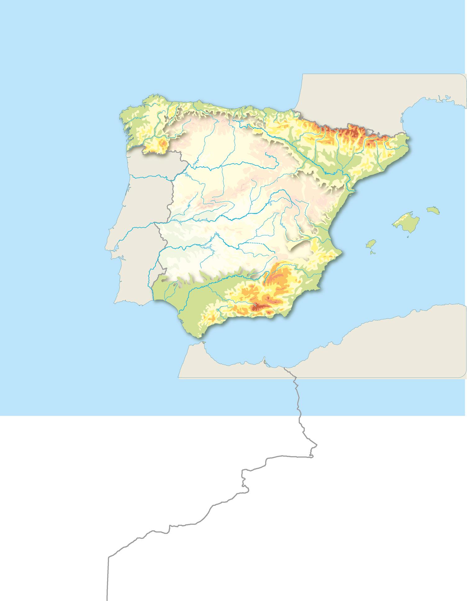
Why is the relief of Spain the way it is?
What geographical characteristics lead Spain to have such a wide variety of natural resources?
the Mediterranean Sea, the Canary Islands in the Atlantic Ocean, and the autonomous cities of Ceuta and Melilla in North Africa.

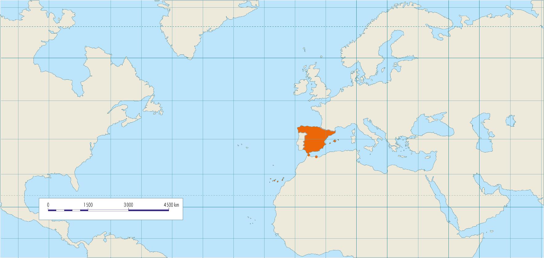
To the north, the Cantabrian Sea, Andorra and France.
To the south, the Atlantic Ocean and the Mediterranean Sea.
To the east, the Mediterranean Sea.
• To the west, Portugal—which also forms part of the Iberian Peninsula—, and the Atlantic Ocean.

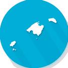
The five Balearic Islands form an archipelago located in the Mediterranean Sea, to the east of the Iberian Peninsula.
The seven Canary Islands form an archipelago washed by the Atlantic Ocean, quite far south of the mainland and close to Africa.
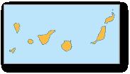
Balearic Islands
This archipelago is made up of the islands of Majorca, Minorca, Ibiza, Formentera and Cabrera and other smaller islands, such as Sa Dragonera, Illa Conillera, etc.
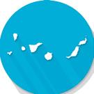
Canary Islands
This archipelago is made up of seven islands with their own administration: La Palma, El Hierro, La Gomera, Tenerife, Gran Canaria, Lanzarote, Fuerteventura, as well as the island of La Graciosa and the islets
Alegranza, Lobos, Montaña
Clara, Roque del Este and Roque del Oeste.
12 2
Strait of Gibraltar ATLANTIC Mediterranean Sea EUROPE AFRICA SPAIN ASIA Tropic of Cancer 10°W 0° 10°E 20°E 10°W 0° 10°E 20°E 30°E 40°E 30°N 40°N 50°N ANDORRA MOROCCO ALGERIA PORTUGAL FRANCE Melilla Ceuta Islas Canarias Islas Baleares Península ibérica Cantabrian Sea ATLANTIC OCEAN M e d i t e r r a n e a n S e a ATLANTIC OCEAN EUROPE AFRICA ASIA Equator Southern
Northern
hemisphere
hemisphere
What are the characteristics of the relief of Spain?

The relief of Spain is widely varied, and the average elevation is 650 m. It is the country with the second highest average altitude in Europe, following Switzerland.
The peninsular relief features large mountain ranges, a large central plateau—which occupies much of the territory—, and valleys.
The relief of the Canary Islands is volcanic in origin, and, therefore, different from the Iberian Peninsula.


The relief of the Balearic Islands is an extension of the Baetic Cordillera of the Iberian Peninsula.
Maritime accidents involving large vessels transporting merchandise can have disastrous consequences for marine resources if there are fuel spills.
1 Decide which of these statements are true and correct the false ones.
a) Spain is located in the Southern Hemisphere.
b) The Spanish territory is made up of part of the Iberian Peninsula, two archipelagos and two cities in North Africa.
c) Spain is the fourth highest country in Europe.
d) The Spanish coasts are only washed by the Mediterranean Sea.
2 Draw a map of Europe in your notebook and highlight Spain. In which part of Europe is Spain located?
the necessary infrastructure for air, sea and land transport, among other things. They want to set up a highway communication channel to transport medicine in high mountain areas.
Look at the legend of the map of Spain and mark the three highest points where their intervention would be necessary.
U1 13
AFRICA EUROPE ASIA Scandinavian Mountains A L P S M e d i t e r r a n e a n S e a Black Sea ARCTIC OCEAN ATLANTIC OCEAN North Sea CaspianSea Norwegian Sea G r e a t E u r o p e a n P l ai n Altitude (m) 4 000 3 000 2 000 1 000 500 200 0 Under sea level
Take note! Depresión del Guadalquivir DepresióndelEbro CORDILLERA CANTÁBRICA P I R I N E O S SISTEMA IBÉRI C O S I S T E MA CENTRAL S I E R R A M O R E N A SUBMESETA NORTE SUBMESETA SUR CORDILLERAS BÉTICAS Melilla Ceuta I S LAS BALEARES ISLAS CANARIA S Cantabrian Sea ATLANTIC OCEAN M e d i t e r r a n e a n S e a A T L A N T I C O C E A N Altitude (m) 3 500 2 000 1 500 1 000 700 400 0
What relief forms do we find on the Iberian Peninsula?
What parts of the relief must we bear in mind to conduct business on the Iberian Peninsula responsibly?
Spain has a large inner plateau known as the Meseta Central that constitutes approximately 45% of the peninsular territory. The remaining landforms are organised into two large groups around it: on the one hand, landforms inside and bordering the Meseta, and on the other, landforms outside the Meseta.
Meseta and interior landforms
Location: This group includes Castilla y León, Castilla-La Mancha, Madrid and Extremadura.
Characteristics: A high plain with an average elevation of 650 meters.
The mountain systems in the interior of the Meseta are: the Central Sierra and the mountains of Toledo.
Landforms bordering the Meseta
The landforms that border the Meseta are: the mountains of León, the Cantabrian Mountains, the Iberian Cordillera and the Sierra Morena.
Central Sierra
Location: Centre of the Meseta.
Characteristics: This mountain chain is approximately 600 km long. It splits the Meseta in two parts: the Northern Sub-meseta, occupied by the Duero valley, and Southern Sub-meseta, which includes the Tagus and Guadiana valleys.
Major mountain ranges: Somosierra, Guadarrama, Gata and Gredos, where the highest peak, Almanzor, is located.


Mountains of Toledo
Location: Southern Sub-meseta.
Characteristics: These mountains have a lower altitude than the Central Sierra and they separate the Tagus (to the north) and the Guadiana (to the south) valleys.
Major mountain ranges: San Pedro and Guadalupe, where the highest peak, Villuercas (1,601 m) is located.
14 GUADIANA Almanzor 2 592 Las Villuercas 1 601 CORDILLERA SISTEMA R R A M O Montesde León S. del Teleno S. Segundera Picos de S. de Gredos SGata . de S. de Guadalupe S. de San Pedro . de Aracena S. de Hornachuelos V a lle del V alle del T a j o Valle del Guadiana PORTUGAL River Peak Reservoir Altitude (m) 3 500 2 000 1 500 1 000 700 400 0 Landforms bordering the Meseta 3
CENTRAL
1 What are the main characteristics of the Meseta?
2 What differences can you observe between the Central Sierra and the mountains of Toledo?
3 What is the highest peak of the landforms inside the Meseta? And of those bordering it? What is the difference in altitude between these two peaks?
Mountains of León
Location: Bordering the Meseta to the northwest.
Characteristics: A high mountain chain.
Major mountain ranges: Sierra de Segundera, with the highest peak being Teleno (2,188 m).
Cantabrian Mountains
Location: In the north of the Iberian Peninsula, separating the Meseta from the Cantabrian coast.
Characteristics: It is approximately 480 km long and is the westernmost mountain range in Europe.
Major mountain ranges: The highest peak is Torrecerredo (2,648 m), located in the Europa Peaks.
Iberian Cordillera
Location: Bordering the Meseta to the east, separating it from the Ebro valley.
Major mountain ranges: The Picos de Urbión, Sierra de Albarracín and Sierra del Moncayo, where the highest peak, Moncayo (2,313 m) is located.

Location: The South of the Iberian Peninsula, separating the Meseta from the Guadalquivir valley.
Major mountain ranges: Hornachuelos, Aracena and Sierra Madrona, where the highest peak, Bañuela (1,323 m) is located.
4 Make a chart for the landforms studied here.
Name of the mountain system ?
Location ?
Featured range(s) ?
Highest peak ?
U1 DUERO TAJO Torrecerredo 2 648 Moncayo 2 313 Bañuela 1 323 CANTÁBRICA
SISTEMA IBÉ RI C O
R E N A SUBMESETA NORTE SUBMESETA SUR Montes de Toledo Europa Guadarrama Somosierra Picos de Urbión Albarracín S . de S. Madrona D u er o 0 100 200 km
Sierra Morena
Landforms outside the Meseta
Location: The northwestern corner of the Iberian Peninsula.

Characteristics: A relatively smooth relief, with rounded peaks and low elevation.
Major mountain ranges: Peña Trevinca (2,127 m) is the highest point of the massif.

The Basque mountains The Pyrenees
Location: In the north of the Iberian Peninsula, between the Cantabrian Mountains and the Pyrenees.
Characteristics: A non-linear mountain chain with an irregular relief.
Major mountain ranges: Aizkorri peak (1,528 m) stands out for its height.
Location: In the northeast of the Iberian Peninsula, extending from the Bay of Biscay to Cape Creus. A natural border between Spain, Andorra and France.
Characteristics: Young mountains with a high elevation.
Major mountain ranges: The highest peak is Aneto (3,404 m).
The Catalan Coastal Range Baetic Cordillera
Location: Between the Pyrenees and the mouth of the Ebro River. It runs along the Catalan coast.
Characteristics: Low-lying mountains.
Major mountain ranges: The highest peak is Turo de l'Home (1,712 m).
Location: In the southeast of the Iberian Peninsula, running from the Strait of Gibraltar to Cape Nau.
Characteristics: Mountain system formed by two mountain ranges that run almost in parallel: the Penibaetic range and Sub-Baetic range.
• Penibaetic range: Closest to the coast and the highest. The highest peak of this system—and the Iberian Peninsula—is in the Sierra Nevada: Mulhacén (3,479 m).
• Sub-Baetic mountain range: In the interior, closer to the Sierra Morena and the southern edge of the Meseta.
1 What landforms are found outside the Meseta?
2 Working with a partner, gather clues to help identify the landforms that have been presented thus far. When you are done, take turns choosing a relief unit and telling your partner the clues one by one. If you guess the landform correctly with just one clue, you earn three points; if you need two clues, you win
two points; if you need three or more clues, you earn one point.
3 What similarities can you identify between the Ebro and Guadalquivir valleys?
4 Have you ever visited any of the landforms in the interior of Spain? Give a brief presentation about your to trip your classmates; be sure to include photos!
16 3
Landforms outside the Meseta
The Galician massif
What relief forms do we find on the Iberian Peninsula?
To learn how to draw the physical map of Spain, watch the video available on anayaeducacion.es

Take note!
A plastic bag is used for 12 minutes on average. But it takes more than five decades to degrade. Have you encountered this kind of rubbish while out in nature?
Depresión del Guadalquivir DepresióndelEbro Mulhacén 3 479 Veleta 3 396 Aneto 3 404 Cabeza de Manzaneda 1 778 Aizkorri 1 528 Turó de l’Home 1 712 P I R I N E O S CORDILLERA SUBBÉTICA CO R D I L L E R A P E N IBÉTICA CordilleraCostero-Catalana MacizoGalaico Montes Vascos S. de Baza S. de La Sagra Sierra Nevada S. de Cazorla S.de Segura da Cantabrian Sea Cabo de Ajo Estaca de Bares Cabo de Gata Cabo de Palos Cabo de la Nao Cabo de Creus Delta del Ebro G o l f o de Valencia Cabo de Peñas GolfodeBizkaia Estrecho de Gibraltar deGolfo Cádiz Cabo Fisterra Marismas del M e d i t e r r a n ea n Se a ATLANTIC OCEAN FRANCE PORTUGAL ANDORRA MOROCCO ALGERIA 0 100 200 300 km Mountains and valleys outside the Meseta River Peak Reservoir Altitude (m) 3 500 2 000 1 500 1 000 700 400 0
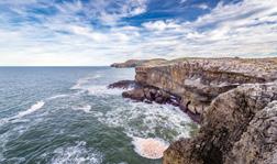
Is the coast the same throughout all of Spain?
What must we consider when conducting business activities along the coasts of Spain?
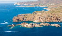
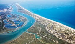
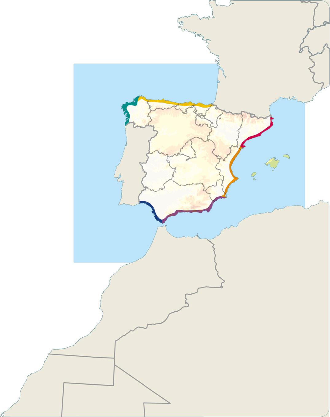
Spain has approximately 5,970 km of coastline, split between the peninsula, the Balearic and Canary Islands, and the cities of Ceuta and Melilla. There are differences between the Atlantic coast and the Mediterranean coast.
Coastal group
Language Bank
Speaking. Ask your partner what they are going to see around Spain.
Writing. Write a text for tourists about the type of relief they are going to see when they visit the area.
Location Characteristics Major features
Cantabrian coast Extends from the mouth of the Bidasoa River to Cape Ortegal.
This coast is high, steep, rocky and straight.
The capes Matxitxaco, Ajo and Peñas. Bay of Biscay.
Galician Atlantic Extends from Cape Ortegal to the mouth of the Miño River.
Andalusian Atlantic Extends from the mouth of the Guadiana River to the Strait of Gibraltar.
The northern part of the Galician Atlantic coast is known as Rías Altas, , and the southern part, as Rías Baixas. This coast is broken up by the rias and is high and rocky.
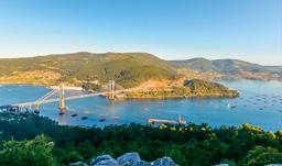
Rias: Arousa, Vigo and Pontevedra. Cape Finisterre.
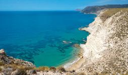
It is straight, low and sandy and has wide beaches. There are marshes and dunes.
Bay of Cádiz. Cape Trafalgar.
Southern Mediterranean Runs from the Strait of Gibraltar to the border between the communities of Murcia and Valencia.
It is a high, steep, rocky and straight coast.
Cape Gata and Cape Palos. Gulf of Almería.
Eastern Mediterranean Valencian coast: Extends from Vega Baja del Segura to the Ebro River delta.
Catalan coast: Extends from the Ebro River delta to the border with France.
It is a low and sandy coast, with long beaches, in general.
It is high, jagged, steep and rocky.
Cape Nau
Cape Creus. Gulf of Roses.
18 4
Atlantic coast
Mediterranean Coast
The relief of the Canary Islands
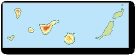
Location: These islands are located in the Atlantic Ocean, off the coast of North Africa.
Characteristics:
This is a mountainous archipelago of volcanic origin and, therefore, it has a particular landscape. The Teide volcano (3,718 m)—the highest peak in Spain—is on the island of Tenerife.
Coasts: In general, they are high, steep and slightly jagged, although there are beaches in the south of the islands. In the western islands, there are pebble beaches and in the eastern islands, sandy beaches.
The relief of the Balearic Islands
Location: This archipelago is located in the Mediterranean Sea, off the Valencian coast.
Characteristics:
They are mountainous in general and connected to the relief of the Iberian Peninsula. The relief of Majorca, Ibiza and Formentera is a continuation of the Penibaetic range, while that of Minorca correspond to the Catalan Coastal Range. The highest peak of the islands, Puig Major (1,445 m), is located in the Serra de la Tramuntana (Majorca).
Coasts: They are high and jagged and form coves, especially in the north of Majorca and Minorca. decry the state of our natural environments more and more frequently. Here are some examples

of posts that reflect this problem. Can you tell which coast each photo is of?

U1 19
Teide 3 718
ISLAS BALEARES Puig Major 1 445 PORTUGAL FRANCE ANDORRA
ATLANTIC OCEAN M editerranean
de Sant Jordi Golfo de Roses
de Valencia Golfo de Bizkaia Mar
Golfo
Estrecho
Matxitxako Cabo
Cabo
ATLANTIC OCEAN ISLAS CANARIA S
Cantabrian Sea
Sea Ceuta Melilla de Gibraltar Golfo de Almería Golfo
Golfo
Menor
de Cádiz
Cabo de Peñas Cabo Ortegal Cabo
de Creus
Fisterra Cabo de Ajo Cabo de Gata Cabo de Palos Cabo de la Nao Delta del Ebro Cabo de Trafalgar
Azahara_flor ●●●
Azahara_flor Strolling through southern Spain and found this. Is this how we spend our holidays? All this rubbish will end up in the Atlantic Ocean.
#sustainablelife #notthisway
#stopplastic #sustainablelife Head_JL ●●●
Head_JL This is what we’re doing to our Rías Baixas. It breaks my heart.
Princess_cons19 ●●● Cantabrian coast Galician Atlantic coast Andalusian Atlantic coast
coast
Mediterranean coast
Mediterranean coast
Valencia
Mediterranean coast
Cataluña
coast
Princess_cons19 Solutions to save the Mar Menor NOW! The coast of Murcia doesn’t deserve this. #sustainablelife #SOSmarMenor
Atlantic
Andalusian
Eastern
in
Eastern
in
Mediterranean
What is the relief of Europe like?
Are there any major differences between the relief of Spain and Europe?
Europe
Location: Continent located in the Northern Hemisphere.
Area: It is the second smallest continent, after Oceania, in terms of area (10,530,751 km2). Together, Europe and Asia form the area or supercontinent known as Eurasia.

Borders: To the north, the Arctic Ocean; to the south, the Mediterranean Sea; to the east, the Ural Mountains, the Caspian Sea, the Caucasus and the Black Sea; to the west, the Atlantic Ocean.

Interior relief
• Massifs and older mountains: Low-lying, rounded mountains located in the north and middle of the continent. Noteworthy examples include the Massif Central in France, the Scandes and the Urals, which act as a natural border with Asia.
• Young mountains: High altitude mountains located in the south of the continent. Noteworthy examples include the Pyrenees, the Alps, the Apennines, the Carpathians and the Caucasus, where the highest peak in Europe, Mount Elbrus (5,642 m), is located.

• Plains: Large flat tracts of land located in the middle of the continent. The Great European Plain is a noteworthy example.
Coastal relief
The coasts of Europe are quite jagged since there are many peninsulas—such as the Iberian Peninsula, Italy and the Balkans—, capes—such as North Cape and Finisterre— and gulfs—such as the Gulf of Genoa and the Bay of Biscay.
There are also many islands:
• In the Atlantic Ocean: Iceland, Great Britain, Ireland, Azores, Madeira, the Canary Islands, etc.
• In the Mediterranean Sea: Corsica, Sardinia, Sicily, Malta, Crete, Cyprus, the Balearic Islands, etc.
20 5
Mulhacén 3 478 Pyrenees A Massif Central Iberian peninsula Cape Fisterra Cape Saint Vincent Balearic Islands Madeira Islands Canary Islands Azores Iceland Greenland Ireland Great Britain Gulfof Lion GulfofValencia Strait of Gibraltar GulfofBizkaia ARCTIC ATLANTIC OCEAN North Sea Cantabrian Sea Norwegian River Lake Peak Altitude (m) 4 000 3 000 2 000 1 000 500 200 0 –500 0 200 400 600 800 1 000 km EUROPE AFRICA ASIA Equator Massif Central in France
Language Bank
Speaking. In small groups, organise a trip around Europe.
Writing. Write sentences to say where you want to go and why.
1 Write down three characteristics of the European continent.
2 Trace a map of Europe. Use the following legend to circle or highlight the map:
• Yellow: Atlantic Ocean islands
• Blue: Mediterranean Sea islands
• Green: Massifs and older mountains

• Orange: Young mountains
• Purple: Peninsulas
• Red: Four capes
• Pink: Four gulfs
3 What are the borders of Europe?
4 What separates Europe from Asia and Africa? Use the map to help you.
5 Rachel, Samuel and Adrián are a group of scientists interested in measuring the consequences of production and consumption in Europe’s mountainous areas. If they start their work in the Scandes, what route do you think they should take to the Baetic Cordillera? On a map, mark where they should set up camp in each mountain range in order.
Take note!
Europe’s ecological footprint is one of the world’s largest. If the rest of the continents lived like we do in Europe, we would need the resources from more than two planets like ours to support us.

U1 21 G r e a t E u r o p e a n P l a i n Mont Blanc 4 810 Elbrus 5 642 A L P S U R A L M O U N T A I N S C A U C A S U S MCarpathian ountains S c a n d e s Apennines Scandinavian Peninsula Italian Peninsula Balkan Peninsula Peloponnese Jutland Peninsula Kola Peninsula North Cape Sicily Sardinia Malta Corsica Crete Cyprus GulfofBothnia Gulf of Genoa Baltic S e a M e d i t e r r a n e a n S e a B l a c k S e a Caspian Sea ARCTIC OCEAN Norwegian Sea
Alps
Great European Plain
W hat have I learned?
1 Write down in your notebook how internal and external causes modify the relief. Provide an example of each.
2 Draw a map of Spain and highlight the borders to the north, south, east and west.
3 Add the following landforms to the map you drew in the previous activity: Pyrenees, Iberian Cordillera, Cantabrian Mountains, Galician massif, mountains of León, Cape Finisterre, Cape Creus, Bay of Biscay, Meseta Central, Central Sierra, mountains of Toledo, Baetic Cordillera, Sierra Morena, Bay of Cádiz, Cape Gata, Catalan Coastal Range, Serra de la Tramuntana, Guadalquivir valley, Ebro valley.
4 List the four highest peaks in Spain in order from highest to lowest and identify the mountain range where each one is located.
5 Choose the correct response:
• The Meseta Central is split into two parts by:
a) the Iberian Cordillera
b) the Central Sierra
c) the Sierra Morena
• Between the mountains of León and the Iberian Cordillera is:
a) the Galician massif
b) the mountains of Toledo
c) the Cantabrian Mountains
• The mountain range that extends from the south of the interior of the Iberian Peninsula to the island of Majorca is:
a) the Penibaetic range
b) the Pyrenees
c) the Catalan Coastal Range
• The valley between the Pyrenees and the Iberian Cordillera is:
a) the Guadalquivir valley
b) the Ebro valley
6 Match each coast with its main characteristics.
7 Compare the Canary and Balearic Islands. You can include information such as the number of islands (and their names), the sea or ocean in which they are located, characteristics of the relief, coasts, etc.
Cantabrian coast
Galician Atlantic coast
Andalusian Atlantic coast
Southern Mediterranean coast Eastern Mediterranean coast
High, rocky and jagged due to the rias
Straight, low and sandy
Straight, high, sheer, and rocky
Depending on the area, it can be low and sandy or high, jagged, steep and rocky
Straight, high and sheer, but with flat areas as well
8 For each category, determine which item doesn’t belong in Europe and specify its correct location.
• Peninsulas: Italic, Iberian, Ireland, Kola, Scandinavian and Balkan.
• Young mountains: Pyrenees, Apennines, Carpathians and Ural mountains.
• Massifs and older mountains: French Massif Central, Caucasus, and the Scandinavian Mountains.
• Islands: Great Britain, Jutland, Iceland, Malta and Sicily.
9 What do you believe is the most environmentally harmful way people act on the relief? Explain why. Then, discuss your view with the rest of the class.
Traffic lights: Next to each activity, colour in your notebook like this:
if you knew the answer if you needed help or if you did not know the answer
22 PORTFOLIO
TARGET IN ACTION
Spread the word about the importance of taking responsible production and consumption measures
1 To analyse the importance of responsible production and consumption measures, you can use the Compass or cardinal points thinking technique: E-O-N-S. Use the graphic organiser to consider each of the proposed ideas from different points of view. First, work on your own and then join the class for a group discussion about the final questions.
Need
Suggestions stance
E = Excitement/encouragement: What excites you about this idea or situation?
What positive aspects do you identify? What about it do you find encouraging?
O = Obstacle/cOncern: What obstacles or difficulties do you see in this idea or situation? What concerns do you have about it? What negative aspects do you identify?


N = Needs: What else do you need to know? What information do you need to better understand this topic?
S = Suggestions/stance: What is your stance or opinion on this idea or situation? What suggestions or actions would you take to improve the situation?
All the ideas that come up—both individually and as a group—will help you make a call on social media. You can use different tools to reach out to your community, such as posts with photos, videos, text, tweets, etc.
Think about this!
H ow did I learn?
1 Have you learned anything new? What images do you remember? What did you like most about what you learned? How is what you have learned useful? How will it help you in your everyday life?
2 Reflect on what you can improve in the future and expand your reflection to what your classmates can improve.
Do you think the world population is aware of the problem our current lifestyle poses and how it harms the environment?
Do you think that social media has the capacity to communicate to and educate a greater number of people? Do you think there is a better method to communicate your ideas?
Is it possible that we do not take the impact of our actions on the natural environment seriously enough and that we need to experience more drastic consequences to raise our awareness?

U1 23
Excitement
Obstacle cOncern
encouragement
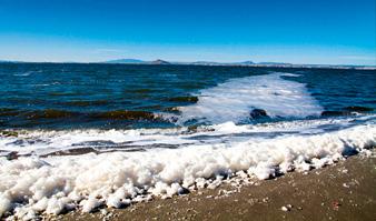
2 Water scarcity: a real issue?
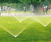
From a very young age, we learn that water is an essential element of life, so much so that it is even known as lifeblood. In recent decades, the growing world population and the mismanagement of natural resources have led to an unexpected issue: water scarcity, or when the demand for water is so high that it affects the quality and supply, and is impossible to satisfy.
According to the United Nations Educational, Scientific and Cultural Organization (UNESCO), 5 billion people may be affected by water scarcity by 2050. The main causes of this problem are climate change, increased demand, and contamination of the supply, among others.
What do you think?
Have you ever wondered if we might run out of water for human consumption? What problems do you think people who are currently affected by this situation deal with? Could we be affected by this problem?
The context
In this unit...
Target in action
Write a letter to the European Commission describing your concerns about water scarcity. Include a list of signatures collected to support the development of policies aimed at solving this issue.

Follow the thread!
Water scarcity affects more than 40% of the world’s population. Today, more than 1.7 billion people live in drainage basins where water consumption is too high and there is not enough river water.
The planet’s water: the hydrosphere
1
How much of our planet is water?
Rivers and other inland waters
2
What are the characteristics of freshwater bodies?

24
The hydrography of Spain
3
What are the characteristics of the water in your community?
The hydrography of Europe
4
What are the characteristics of the water in Europe?
Responsible water consumption
5
What must we consider when using water?

25 6
How much of our planet is water?
Is all the water on Earth fit for human consumption? What percentage is water that we can use?
The hydrosphere
The hydrosphere comprises all the bodies of water on Earth, including surface waters (seas, oceans, rivers, lakes, etc.), groundwater (found below the surface), and atmospheric water vapour. It covers approximately 70% of the Earth's surface . It is estimated that there is a total of 1,400 trillion litres of water on the planet.
Main characteristics
• Water is essential for all living things on the planet.
• It undergoes constant physical and chemical transformation, passing through the states of water and the water cycle.

• It constitutes a fundamental part of both marine and terrestrial ecosystems.
• It interacts with the Earth's crust and alters its structure through erosion.
• Only a small percentage (approximately 1%) is fit for human consumption and that of other species.
Classifying water
Surface water
Bodies of water that are visible on the Earth's surface. Two main categories can be distinguished:
• Inland: Rivers, lakes, streams, lagoons, snow, polar ice caps, etc. These are usually freshwater and represent 2.5% of the planet's total water.

• Marine: Seas and oceans. These are large bodies of saltwater and represent 97.5% of the water on Earth.
Groundwater
Rainwater and surface water seep through the ground and accumulate beneath the earth, forming deposits called aquifers. They circulate underground, forming caves or galleries, which can rise to the surface and create fountains and springs. It is also possible to access them by building wells.
"Let me tell you", you will find a summary of the unit on anayaeducacion.es
26 1
water on the planet Total freshwater Saltwater 97.5 % Freshwater 2.5 % Surface freshwater 1 % Ice 79 % Groundwater 20 % Surface water
Total
Groundwater
The importance of the hydrosphere
• The hydrosphere helps regulate the Earth's temperature by absorbing heat from the sun since water heats up and cools down much more slowly than air.

• Water is part of living cells. Without it, they would not be able to conduct their normal functions and life would not exist.
• Water is an essential element for plants to perform photosynthesis, a process through which the oxygen we breathe is produced.
• It hosts an enormous number of aquatic ecosystems, which are home to species belonging to the various kingdoms of living things.

• People use water daily for cleaning, leisure, industry, transport, etc.
Dewdrops on plants

The distribution of water on the planet
Look at the graph of the distribution of water on the planet:
• What percentage of freshwater is in a liquid state?
• What percentage of surface water is freshwater?
• What are your reflections after looking at this data?
Aquatic ecosystem
1 How is the water that makes up the hydrosphere classified?
2 Search for information and respond: Why is sea and ocean water salty? Are the icebergs floating in the oceans made of saltwater or freshwater?
Take note!
Most of the freshwater on Earth is frozen. This limits the amount of liquid water suitable for human consumption to 1%.
U2 27
What are the characteristics of freshwater bodies?
Do we take water scarcity into account when managing water resources?
Rivers
Rivers are freshwater streams that originate in mountainous areas and flow into a sea, ocean, lake, or another river. Rivers that flow into other rivers are called tributaries.


Elements of a river
• Source. The place where a river begins. It may be the result of an accumulation of rainwater or snowmelt or due to groundwater that has risen to the surface.
• Course. The path of the river from its source to its mouth.
– Upper course: The part closest to the source. This section is usually quite steep and, therefore, the water flows at high speed.
– Middle course. Section located between the upper and lower courses. Areas with a lot of erosion alternate with areas of sedimentary deposits due to changes in slope.
– Lower course: This is the section closest to the river mouth. Here, there is practically no slope, so the water flows slowly, forming meanders.
• Mouth. The place where the river meets the sea or ocean. Deltas or estuaries may form due to sediment deposits.

• Riverbed. The entire ground which the river flows over.
• Basin: Set of lands whose rivers flow into the same sea or ocean.
Characteristics of a river
• Length. Total distance from the source to the mouth of the river.
• Flow. The amount of water carried by the river at a given time and place.
• Regime. Variation of the flow throughout the year. A river has a regular regime when it carries the same amount of water throughout the year. It has an irregular regime when there are times of the year when it almost dries up and others when its discharge increases a lot.
28 2
Upper course
Middle course
Lower course
Freshwater bodies on the Earth
Research: What percentage of the planet's freshwater corresponds to each of these bodies of water:
• Rivers.
• Lakes.
• Groundwater or aquifers.
• Glaciers.
Factors that affect a river
• The relief: It influences the length of the river and the speed of the water. The further the mountains of the river’s source are from its mouth, the longer the river.
• The climate. It influences the discharge and regime of the river. In areas where the climate includes abundant and constant rainfall, the rivers regimes are regular. Areas with drier climates have irregular river regimes.
Other inland waters
• Lakes: A lake is a large body of water located in a basin in the ground. It can collect rainwater, groundwater or water from one or more rivers. Small lakes are known as lagoons. These are usually freshwater, although there are some saltwater lagoons.
• Aquifers: Accumulations of groundwater that occur when surface water seepage forms considerable freshwater deposits.
• Glaciers: Large bodies of frozen freshwater. They can be found at the poles and at the top of high-altitude mountains. Almost 10% of the total land surface is currently covered by glaciers.

1 What are the features of a river?
2 What is the difference between a river with a regular regime and one with an irregular regime?
3 What factors affect a river? How so?
4 In groups, do some research and discover how deltas and estuaries are formed.
Take note!
The contamination of rivers, streams, lakes and pools due to the dumping of toxic waste is one cause of water scarcity since it makes the water unfit for human consumption.

U2 29
What are the major rivers and lakes in Spain?


Are there measures in Spain aimed at making adequate use of water resources?
Rivers of Spain
In general, the rivers of Spain are irregular and relatively short. Only five are over 500 km long. They can be categorised into three watersheds, depending on the ocean or sea into which they flow.
Language Bank
Speaking. Play “Finish the sentence” with a classmate. Writing. Write a postcard to your friend telling them about your holidays.
1 Let’s check Put these rivers in order from longest to shortest and locate them on the map: Guadiana: 818 km; Douro: 897 km; Guadalquivir: 657 km; Tagus: 1,007 km; Ebro: 930 km.
Watersheds of Spain
The Cantabrian watershed These rivers all flow into the Cantabrian Sea. They are short rivers due to how close the mountains are to the sea. They are abundant and regular since the climate of this area is characterised by abundant rainfall throughout the year. From east to west, the most significant rivers in this watershed are the Bidasoa, Deva, Nervión, Pas, Saja, Besaya, Sella, Nalón, with its tributary Narcea, Navia and Eo.
The Atlantic watershed
The rivers of this watershed flow into the Atlantic Ocean. Two groups can be distinguished:
• Rivers of Galicia: These are short, abundant and regular rivers, due to the area’s weather and relief. Some worth noting are the Eume, Tambre, Ulla and Miño, with its tributary Sil.
• Rivers of the Meseta and the Guadalquivir valley: These are long rivers since the source is located in mountain ranges far from the mouth. They are mighty and have an irregular regime since they only get rain in autumn and spring. From north to south, the major rivers are the Duero, Tagus, Guadiana and Guadalquivir with their tributaries.
The Mediterranean watershed These rivers flow into the Mediterranean Sea.
• Southern rivers. Short rivers originating in the Penibaetic range, with low discharge and an irregular regime due to low rainfall. From east to west: Guadiaro, Guadalhorce, Guadalfeo, Andarax and Almanzora.
• Eastern rivers: These rivers have low discharge, an irregular regime and vary in length, except the Ebro and the Ter. From north to south, the most significant are the Ebro, Ter, Llobregat, Júcar and Segura. The Ebro River is the mightiest in Spain and also the longest, since all 930 km of it are located entirely within Spanish territory.
30
3
Nervión River
Douro River
Ebro River
in Spain
Take note!
It is estimated that by the year 2030, 65% of the Spanish population will suffer the consequences of water scarcity.
Lakes and lagoons
In Spain, there are lakes and lagoons, many of glacial origin. They are home to a natural diversity that deserves to be cared for and admired.
The most prominent are:
• Sanabria Lake (Zamora), the largest glacial lake in Spain and Europe. It is surrounded by sandy and stone beaches.
• Lakes of Covadonga (Europa Peaks, Asturias), also of glacial origin, at more than 1,000 m high.
• Gallocanta lagoon (Zaragoza), the largest saltwater lagoon in Spain. It is a very important refuge for migratory birds.
• Black lagoon (Picos de Urbión, Soria), a glacial lake surrounded by pine forests and granite walls that give the water a dark colour.
• Ruidera lagoons (Albacete and Ciudad Real), a series of lagoons connected to each other by waterfalls and underground channels.
Groundwater in Spain

In 2022, the Ministry for the Ecological Transition and the Demographic Challenge (Miteco) started preparing a strategy manage the water crisis. A report by the Ministry reveals that 48% of groundwater bodies are in poor condition and that the quality of river water has also declined. Based on this information, do some research online and write down and describe the main national measures that have been proposed to deal with this issue.
2 What are the main characteristics of the rivers of Spain?
3 Which is the largest lake in Spain? Where is it located?
U2 31
Tambre MIÑO E s l a DUERO DUERO Tormes TAJO J a r a m a Henares GUADIANA GUADIANA Cigüela Zújar Genil Pisuerga Alagón Alberche GUADALQUIVIR Adaja Tiétar Záncara Sil TAJO Jabalón Tinto Odiel Nalón Bidasoa ENavia o Saj a Nervión SEGURA Ter L l o b r e gat Segre G á l l e g o Aragón Cinca Cabriel JÚCAR EBRO TURIA Jalón EBRO Guadalfeo Guadalhorce Almanzora Melilla Ceuta Narcea Ría de Navia A Guarda Oporto Ayamonte Cullera Sanlúcar de Barrameda Guardamar del Segura Lisboa Ría de Bilbao Delta del Ebro Cantabrian Sea M e d i t e r r a n e a n S e a ATLANTIC OCEAN ATLANTIC OCEAN ISLAS CANARIAS ISLAS BALEARES FRANCE ALGERIA MOROCCO ANDORRA PORTUGAL CORDILLERA CANTÁBRICA SISTEMA IBÉRI C O CORDILLERAS BÉ T I C A S P Y R E N E E S S I S T EMA CENTRAL Lagunas de Ruidera Lago de Sanabria Laguna de Gallocanta Lagos de Covadonga Laguna Negra River River that ows into the Cantabrian Sea Rivers
River below surface Country boundaries Major river source Torrents and ravines River that ows into the Atlantic Ocean River that ows into the Mediterranean Sea Archipelagos Major river mouth 0 100 200 300 km
What are the characteristics of the water in Europe?

Is Europe one of the continents most likely to suffer from water scarcity in the coming years?
Oceans and seas
Europe is almost entirely surrounded by oceans and seas. The Arctic Ocean borders the continent to the north, while the Atlantic Ocean is to the west.
Some of the European seas are the Norwegian, Baltic, Cantabrian, Mediterranean, Adriatic, Tyrrhenian and Aegean. There are also two inland seas: the Black Sea and the Caspian Sea.
Lakes
There are many lakes in Europe. In the north are the two largest lakes in Europe: Lake Ladoga and Onega, both in Russia. Central European lakes such as Geneva (between France and Switzerland) and Constance (between Germany, Austria and Switzerland) are located along the Alps. Smaller lakes are found in the Mediterranean region, such as the Venetian Lagoon (Italy) and Lake Prespa (Greece).
Rivers
The characteristics of the rivers of Europe vary according to the local relief and climate.
Rivers in the Arctic and Atlantic watershed
These are usually long rivers with fairly extensive basins.
• Rivers in the Arctic watershed: The rivers that flow into the Arctic Ocean are usually abundant and have an irregular regime. Examples are the Northern Dvina and the Pechora.
• Rivers in the Atlantic watershed: These are generally mighty rivers with a regular regime. The Vistula, Oder, Elba, Rhine, Seine, Loire, Duero, Tagus and Guadalquivir all stand out.
Rivers in the Mediterranean watershed
Due to the climate and relief, these rivers are shorter, have low discharge and an irregular regime. Some examples include the Ebro, Rhone, Tiber and Po.
• Rivers that flow into inland seas: These are long, abundant and navigable rivers.

• Rivers that flow into the Black Sea: The Danube, the Dnieper, the Dniester and the Don.
• Rivers that flow into the Caspian Sea: The Ural and the Volga, which is the largest and longest river in Europe at 3,530 km long.
Language Bank
Speaking. Work with a classmate and correct their mistakes.
Writing. Write sentences about your mistakes and say where you were.
32 4
Lake Geneva
Pechora River
European water resources


Draw a map of Europe and highlight the seas and oceans that surround our continent.
What is the longest river in Europe? Search online for the countries it crosses, all the way from its source to its mouth.
How are European lakes classified?
Choose the European river that grabs your attention the most and make a poster with basic information and images. You can include the source, length, discharge, country (or countries) it flows through, interesting facts, state of conservation, etc.
U2 33 Rhine Dnieper Vistula Dniester Danube Danube Seine Ebro Tajo Duero Thames Po Tib er Elba Óder R hone Loire Garonne DWestern vina Maritsa Vardar Northern Pechora ODvina nega Volga Volga Ural Volga Don Don Lake Vänern Lake Ladoga Lake Léman Lake Constance Lake Onega Guadalquivir Sicily Balearic Islands Madeira Islands Canary Islands Azores Iceland Greenland Sardinia Ireland Great Britain Corsica Crete Cyprus Baltic S e a Me diterranean Sea B l a c k S e a Caspian Sea ARCTIC OCEAN ATLANTIC OCEAN North Sea Norwegian Sea Sea of Azov English Channel Cantabrian Sea AdriaticSea AegeanSea Tyrrhenian Sea Ionian Sea River Lake Peak N E W S Altitude (m) 4 000 3 000 2 000 1 000 500 200 0 – 500 0 200 400 600 800 1 000 km
Percentage of water consumed each year Over 40%: serious situation From 21 to 40%: problematic situation From 11 to 20%: low problems From 0 to 10%: no problem 0 250 750 1000 km
Although Europe is not an arid continent, the water supply is currently a concern for almost half of the population of the European Union.
Take note!
What must we consider when using water?
Is water scarcity in our hands? Are there measures we can take to prevent it?
Water is life
As mentioned, water is an essential resource for life, since no living being can survive without it.
Here are some facts that prove why it is important to use water responsibly:
• More than 2 billion people do not have access to safe drinking water. This poses a serious health risk.
• 97.5% of the water on Earth is saltwater, meaning only 2.5% is freshwater. Of the total freshwater, only 1% is located in surface waters such as rivers and lakes.
• Every 20 seconds a child dies in the world due to the consumption of non-potable water and malnutrition.
• Many families in least-developed countries have to walk approximately five hours every day to access water.
• World Water Day has been celebrated since 1993 to call attention to the importance of making proper use of water.
Uses of water
Humans use water every day. We can categorise its use as follows:
Household use: This is how we use water for our personal well-being. It includes house cleaning, food, laundry, and personal hygiene and grooming.

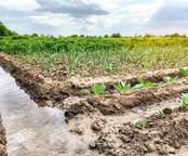
Use in the primary sector: Agriculture and livestock are economic activities that require the use of water, either to irrigate fields or to water animals.
Language Bank
Speaking. Make a survey and ask your classmates how they use water.
Writing. Write the conclusions of your survey.
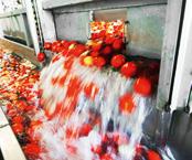
Use in industry: Most factories need water to manufacture products.
Public use: In our area, water is also used for the benefit of citizens, such as in fountains, to clean streets and public buildings, to irrigate parks, etc.
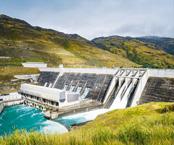
Water as an energy source: People also use water to generate electrical energy or kinetic energy, which enables us to move heavy machinery.
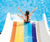
Responsible water use: Water used in swimming pools, water parks, to play sports and enjoy our free time.
34 5
How we manage the planet's drinking water
Take a look at this map. It shows the percentage of water consumed by industry, agriculture and household use on each continent.

• What does the situation look like for the majority of the continent?
• What are the percentages for Europe?
• Which use has the lowest percentage for each continent?
• Which continent allocates the most water to agriculture? What about industry?
• What conclusions can you draw from this information?
Measures for water conservation and responsible use
We must use water responsibly, place value on its importance and take efficient and responsible measures to ensure that we have drinking water now and in the future.
• Periodically review household water taps. Leaks can sometimes occur, so it's important to be aware of them.
• Take a shower, not a bath. If a family member can only take baths, use the water for other household tasks.
• Collect rainwater. You can use it to water plants and clean the house.
• Install low-flow toilets. The double button that you often see on toilet tanks lets you choose whether you want to use more or less water.
• Do not use the toilet as a rubbish bin. When you toss rubbish such as paper or wipes down the toilet, it travels through the pipes and causes blockages and water contamination.
• Cover pools when not in use to prevent water evaporation and reuse the water in the next season.
• Use sprinklers and drip systems to irrigate.
• Turn off the tap while washing your hands, brushing your teeth, showering and washing the dishes.
• Only run the washing machine and dishwasher when they are completely full.
• Do not toss rubbish that might contaminate the water down the drain, including oil, solvents, cleaning products, etc.
1 It all adds up What water conservation measures do you think are the most important? Which ones can we take at home and at school?
Take note!
can not be renewed.
U2 35
Household 13.3 % Household 19.0 % Household 15.2 % Household 8.6 % Household 6.9 % Household 7.3 % Industrial 48.0 % Industrial 10.3 % Industrial 52.4 % Industrial 7.3 % Industrial 5.5 % Industrial 11.4 % Agriculture 38.7 % Agriculture 70.7 % Agriculture 32.4 % Agriculture 84.1 % Agriculture 87.6 % Agriculture 81.3 %
One of the main causes of water scarcity is consumption patterns, which generate enormous imbalances since the water available
W hat have I learned?
1 What is the hydrosphere? What are its main characteristics?
2 Classify the waters of the hydrosphere. You can make an outline, a concept map, or use the visual thinking strategy.
3 List and define the features of a river. Then, give examples of Spanish rivers that do or do not fulfil these characteristics. Example: the Tagus river is the longest in the Iberian Peninsula.
4 Copy a blank map of the rivers of Spain and draw the following: Bidasoa, Nalón, Miño, Tambre, Ulla, Duero, Tajo, Guadiana, Guadalquivir, Segura, Guadalhorce, Andarax, Ter and Ebro.
5 Match each river to its tributary.
8 Write a list of recommendations for responsible water use in your school.


9 Add two more examples to each list.
• European seas: Cantabrian, Mediterranean, Tyrrhenian, Aegean…
• European lakes: Ladoga, Geneva, Prespa…
• European rivers in the Atlantic watershed: Oder, Elba, Tagus, Seine…
10 Look at the images and determine how the water is being used in each one.


6 Write down the most important lakes and lagoons in Spain, as well as an important characteristic of each one.

7 Read the clues and determine what European river each person is talking about.
• Marina: ‘It is the longest and mightiest river in Europe and flows into the Caspian Sea’.
• Adolf: ‘It is located in the north of France and empties into the Atlantic Ocean, in the English Channel’.
• Luis: ‘It is an abundant and navigable river that flows into the western Black Sea’.
• Cristina: ‘It is the northernmost river in Europe and flows into the Arctic Ocean’.
Traffic lights. Next to each activity, colour in your notebook like this:
if you knew the answer if you needed help or if you did not know the answer
36 PORTFOLIO
A C E B D F
Douro Tiétar
Ebro Genil Guadiana Segre Tagus Jabalón
Guadalquivir Guadalentín Segura Pisuerga
TARGET IN ACTION
Write a letter to the European Commission

1 Using the Relate-Expand-Ask thinking strategy, students will consider the key points of their letter addressed to the European Commission. This strategy aims to facilitate an active relationship between the new information that students receive (by reading, listening and observing) with what they already know, by identifying new ideas that broaden their thinking and questioning their previous ideas in light of this new information. In other words, it helps students to actively process information.
The activity is designed to be carried out individually, although there can be an exchange of ideas to share different perspectives.
While dealing with an environmental problem, students will be working on linguistic skills such as oral and written expression.
RELATE
What relationships have you established between this new information or experience and what you already knew?
EXPAND
What ideas or thoughts have been expanded or deepened as a result of the new experience or information?
ASK
What questions or challenges come to mind about this topic after receiving the new information or experience?
How did I learn?
1 Have you learned anything new? What images do you remember? What did you like most about what you learned? How useful is what you have learned? How will it help you in your everyday life?
2 Reflect on what you can improve in the future and extend your reflection to what your classmates can improve.
Think about this!
Do you think that national and international institutions are doing everything in their power to handle the issue of water scarcity?
Do you think that citizens understand that this problem is real and that it will get worse over the years?
What do you think the first changes should be with regard to the relationship we have with water?
U2 37
? ? ?
All rights reserved. No part of this publication may be reproduced, stored in a retrieval system, or transmitted, in any form or by any means, electronic, mechanical, photocopying, recording, or otherwise, without the prior permission of the publishers.
© GRUPO ANAYA, S.A., 2023 - C/ Valentín Beato, 21 - 28037 Madrid.