
lorittsO noitamrofnI fni• o @ o s t t irol.com•T +43 50 212 212 Over 400 km of trails in a unique natural landscape Cross country skiing in Osttirol www.osttirol.com Life as it should be.

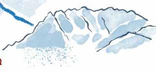
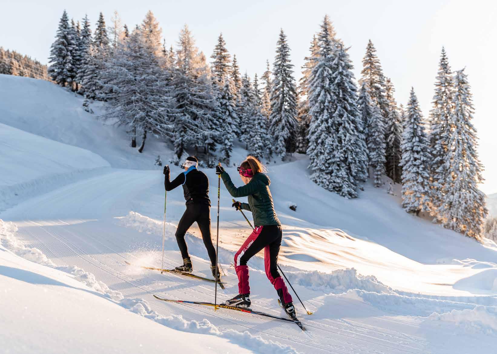
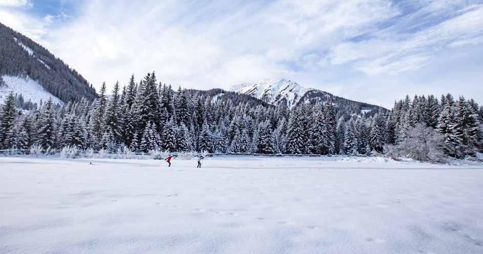
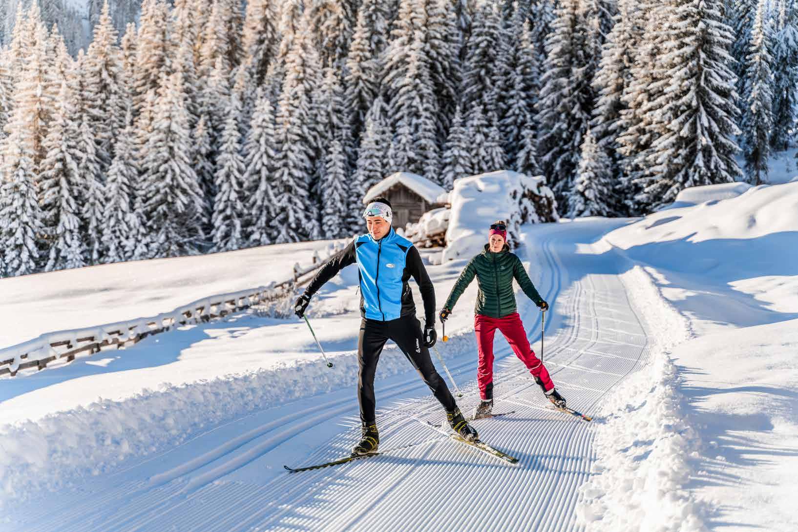
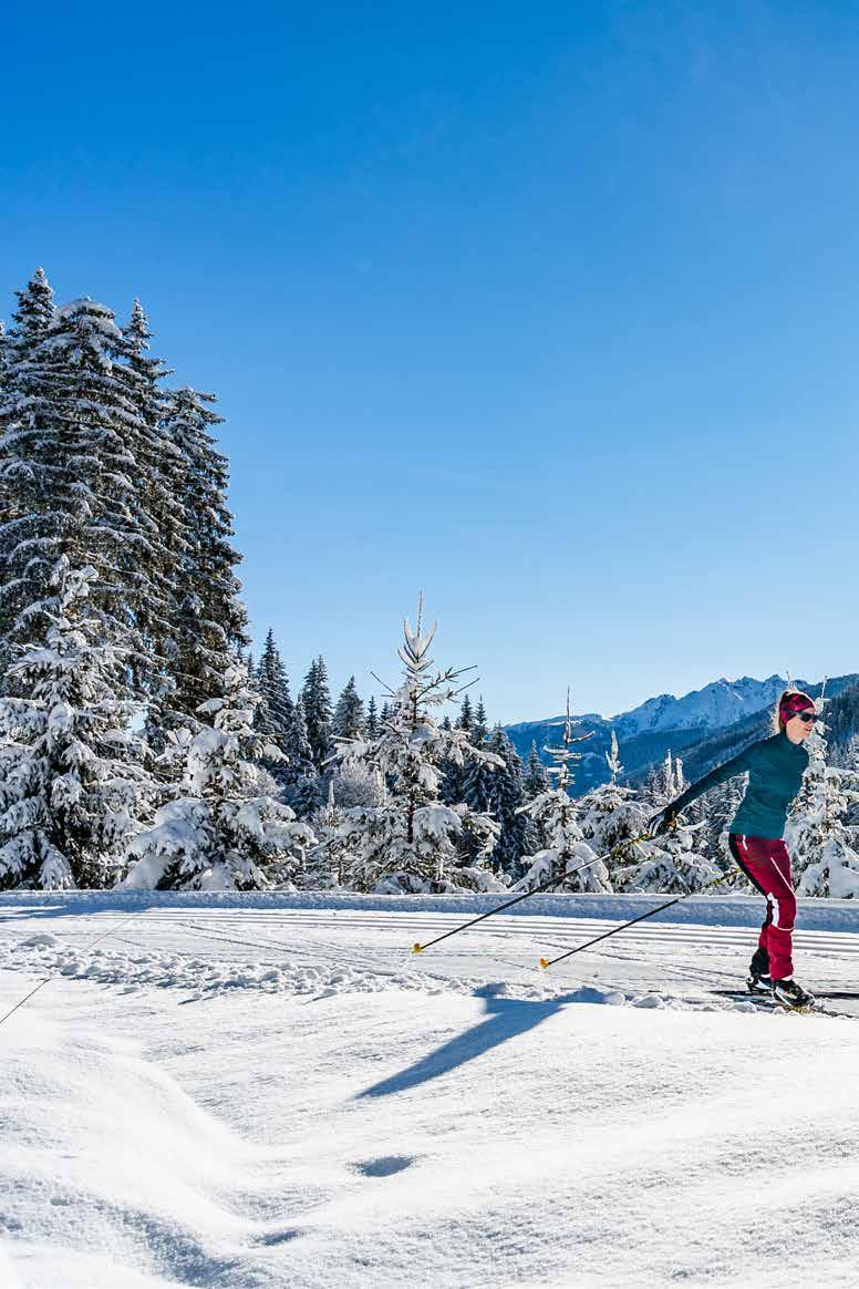
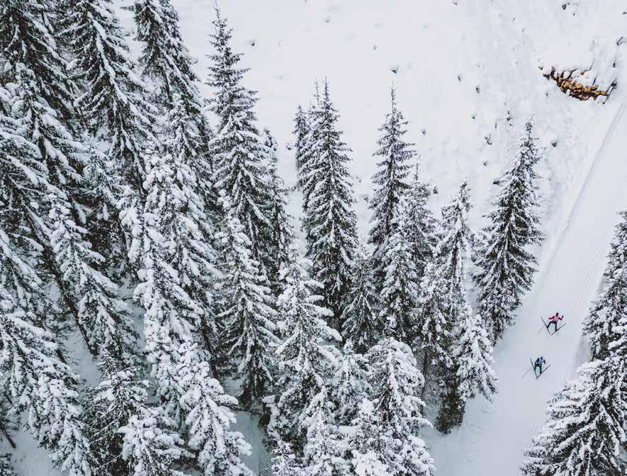
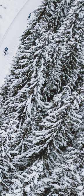
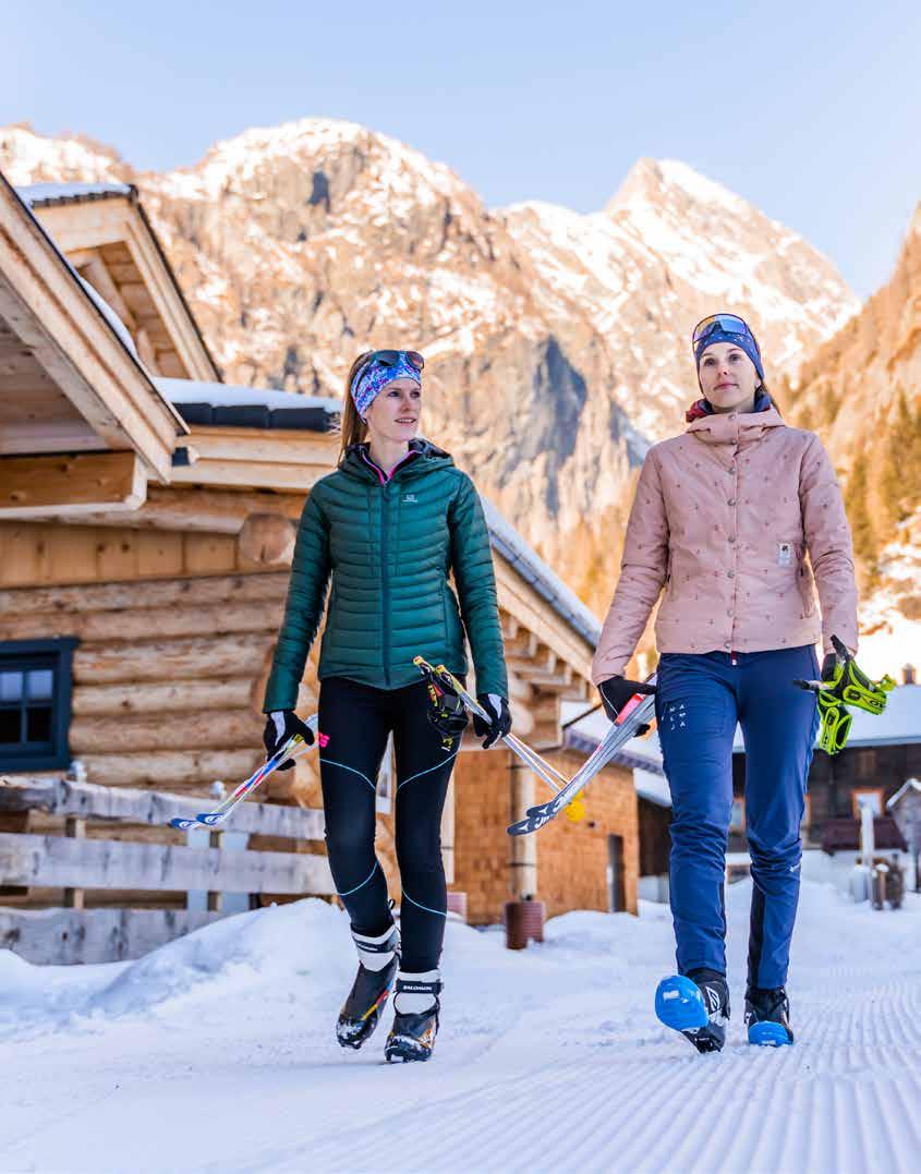
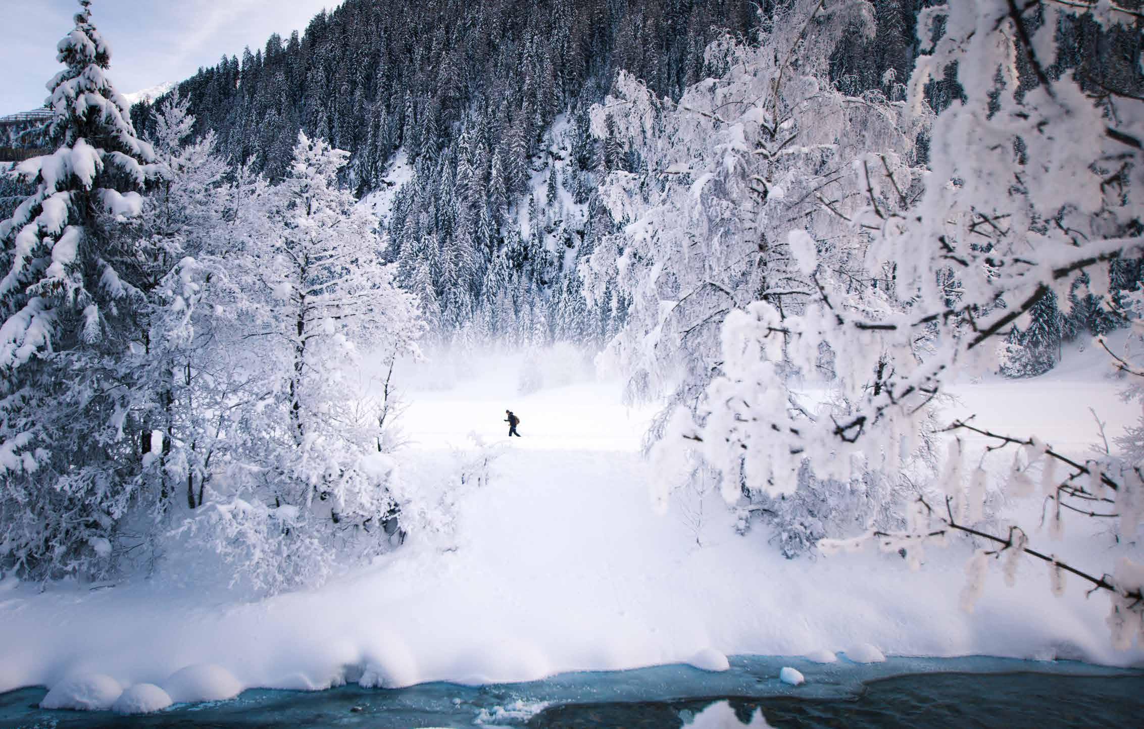
The idyllic valleys of Osttirol, like Defereggental here, invite cross-country skiers to enjoy extensive exploratory tours.
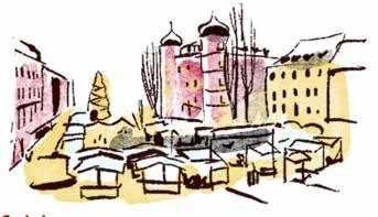
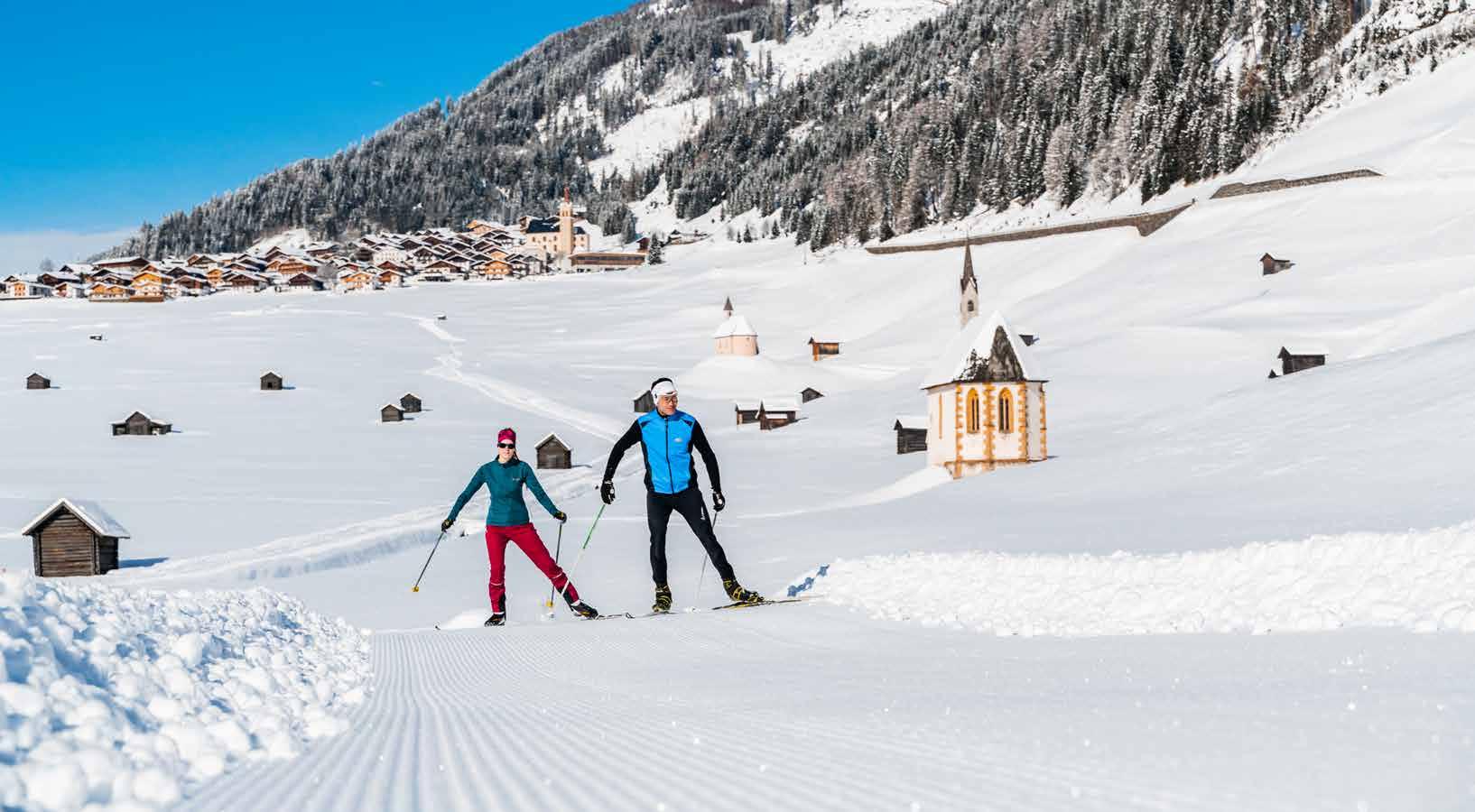
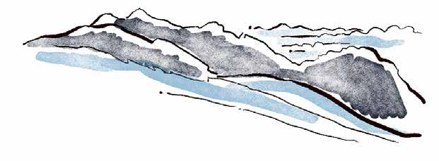
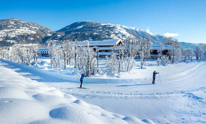
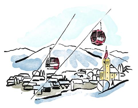
Nature meets cross-country trail
Nature experience with full-body training in Osttirol's winter
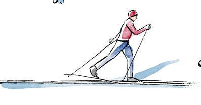
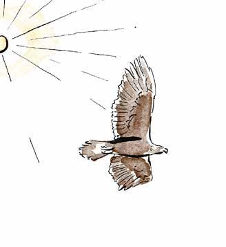
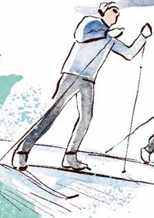
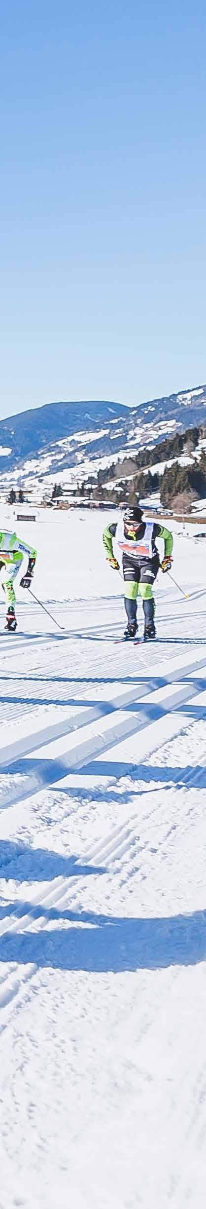
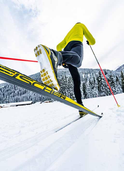
There is a sheer unlimited range of sports activities with which you can keep yourself fit in winter in the nature of Osttirol. Cross-country skiing has a longstanding tradition in Osttirol and is increasingly enjoyed by winter sports enthusiasts. The Nordic sport strengthens the cardiovascular and immune system, metabolism and breathing. So head out for some cross-country skiing in Osttirol, which reveals the charm of the region from its multifaceted side. Captivating views of 266 peaks of up to three thousand metres. Glide through a pristine natural and cultivated area.
Discover a variety of regions on cross-country skis: the valleys Defereggental and Lesachtal, Villgratental and Virgental, as well as the Lienz Dolomites region, which await you with over 400 kilometres of trails. What do all the cross-country skiing possibilities in all the valleys and elevations in Osttirol have in common? High-quality trail maintenance thanks to daily preparation, assured snow due to the altitude or artificial snowmaking, well-priced trail tickets and numerous trail quality seals.
A particularly practical feature for longer routes: public transport in Osttirol is free for guests with the guest card. Regio busses run hourly to the valleys, while "regio" taxis also make more remote destinations accessible. Most of the trails are therefore within easy access by public transport.
You can find further information and tips on the topic of crosscountry skiing here: langlaufen.osttirol.com
3 18 16
6
Info and service Hotels and restaurants
14
12
Your athletic challenge Top Spots High altitude trails in Osttirol Good to know Vacation in a class of its own Dolomitenlauf Go on discovery Higher, further, healthier
One region countless possibilities

You can find an overview of all cross-country trails and an interactive map with information about trail lengths, elevation gains and difficulty levels at: maps.osttirol.com
Innervillgraten
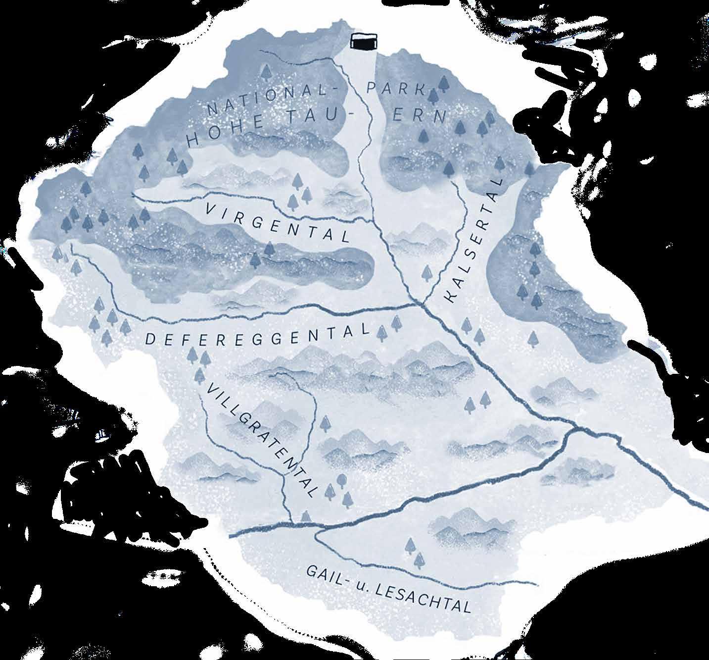
Thal-Assling
Obertilliach
NationalparkRegion Hohe Tauern Osttirol
Exercise in healthy mountain air, forested areas with deep snow, perfectly prepared trails – the region in the national park Hohe Tauern offers a total of over 65 km of trails, both for sporty skaters and dynamic classic skiers. Some of them also have dou-
ble tracks and skating tracks.
Kals am Großglockner, Virgen and Prägraten am Großvenediger all boast the "Tyrolean" track quality seal, while the touristic trail quality seal “Cross-country skiing and Nordic fitness” was awarded
to the whole national park Hohe Tauern.
Tip: The nighttime trail “Unterfeld” in Prägraten am Großenvenediger – a 3.3km stretch, which is illuminated throughout for all cross-country skiing fanatics!
Sillian
Lavant LIENZ
Abfaltersbach Kartitsch
Kals Matrei i.O.
Prägraten St. Jakob
Virgen
Lienzer Dolomiten
On the Lienz valley floor, guests can exercise on slightly undulating trails, accompanied by a view of the Dolomites panorama.
The Lavant circuit is especially
popular – a trail loop – right by the golf course at the foot of the Lienz Dolomites, which has snowmaking facilities.

The trails Pustertalloipe and Grenz landloipe run through the valley Pustertall – together around 50km. The other half of the Grenzlandloipe leads to Innichen (Italy). Short but excellent is how the 8-km-long Villgratental trail and the 3-kmlong Sonnseitenloipe in Innervillgraten could be described. You can experience the originality of this valley along this route.
The Grenzlandloipe in the Gailtal and Lesachtal valley in Tirol is referred to as perhaps the most be-
autiful trail in the alpine region. Between the villages Kartitsch, Obertilliach, Untertilliach and Maria Luggau, more than 60km of perfectly prepared trails await cross-country skiing enthusiasts. Owing to the altitude of between 1200 and 1500 metres, this trail is among those in Tirol with the highest likelihood of assured snow.
Tip: The cross-country skiing and biathlon centre in Obertilliach of a World Cup standard provides summer training opportunities.
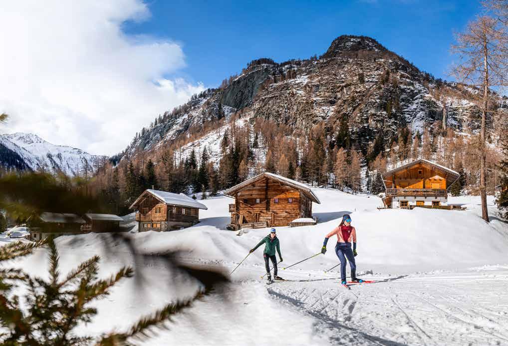
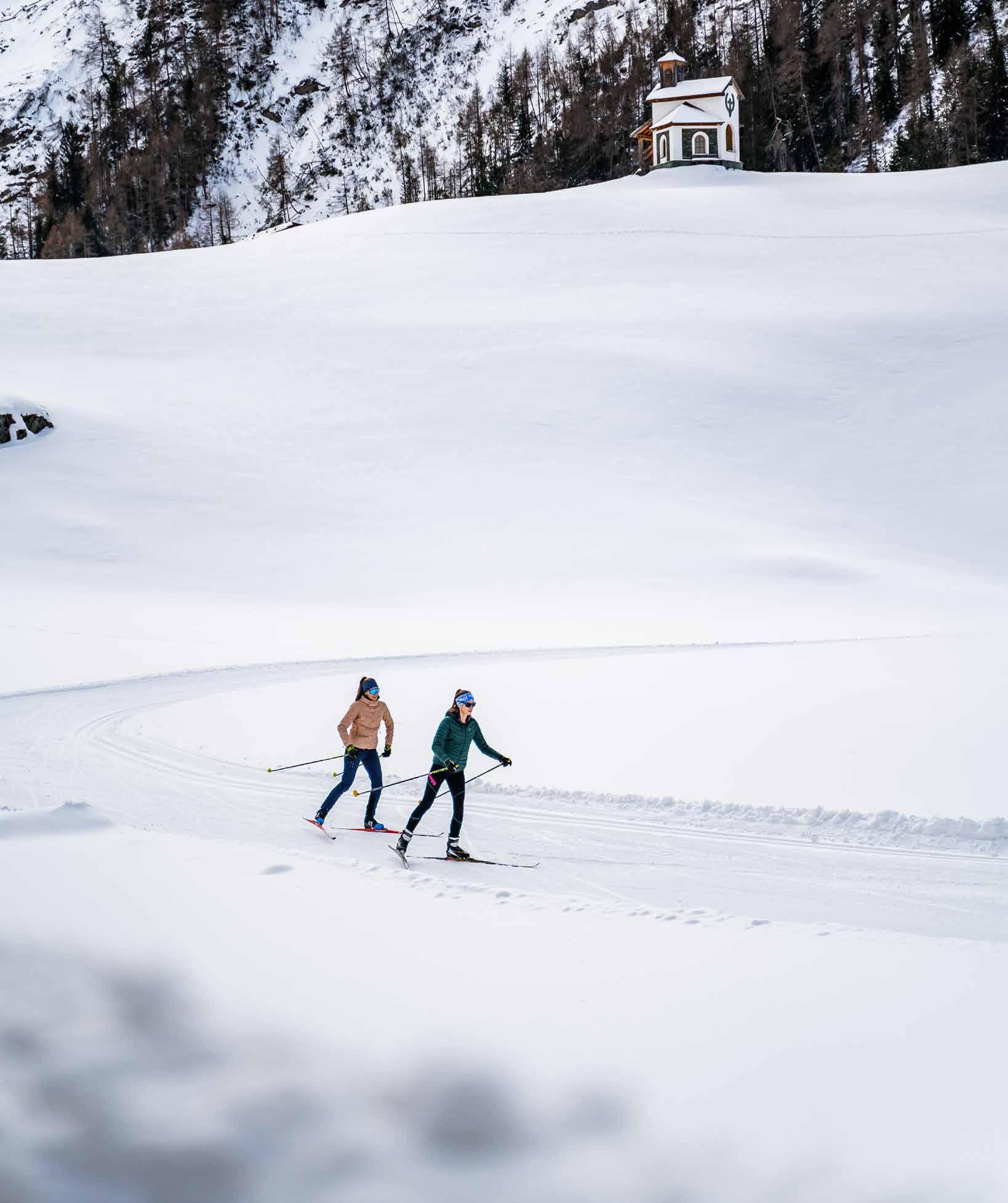
Defereggental
For Nordic fans, there are around 60km of various types of trail in the valley Defereggental: those who are seeking challenges and want to put their fitness to the test will find what they are looking for on the Feistritz trail.
Sun worshippers will be delighted

with the “Sonnenloipe” in Defereggental.
For those, who cant't get enough can hone their technique during the evening hours on the three-kilometre-long illuminated trail at St. Jakob i. Def. towards Maria Hilf.
5
Go out and explore
Fast-paced, romantic or challenging –the varied trails offer the perfect tour for any cross-country skiing enthusiast. Here is a selection of the top spots.

Route length Snow making Uphill altitude meters Loipe = cross-country ski trail 0 1 3 4 5 8 km 1300 1400 1500 1600 1700 1900 0 1.7 5 6.6 km 1500 1750 2000 2250 2500 2750 0 4 9 11 km km 1750 2000 2250 2500 2750 3000 0 5 9 12 15 1600 1800 2000 2200 2400 2800 0 2.4 3.8 6.2 2250 2400 2550 2700 2850 0 4 7 10 14 km km 1800 1950 2100 2250 2400 2700 Etappe 6 Etappe 2 Etappe 3 Icons / Symbole Etappe 1 Etappe 5 Etappe 4 0 1 3 4 5 8 km 1300 1400 1500 1600 1700 1900 0 1.7 5 6.6 km 1500 1750 2000 2250 2500 0 4 9 11 km km 1750 2000 2250 2500 2750 3000 0 5 9 12 15 1600 1800 2000 2200 2400 2800 0 2.4 3.8 6.2 2250 2400 2550 2700 0 4 7 10 14 km km 1800 1950 2100 2250 2400 2700 Etappe 6 Etappe 2 Etappe 3 Icons / Symbole Etappe 5 0 1 3 4 5 8 km 1300 1400 1500 1600 1700 1900 1.7 5 6.6 km 4 9 11 km km 5 9 12 15 0 2.4 3.8 6.2 2250 2400 2550 2700 0 4 7 10 14 km km 1800 1950 2100 2250 2400 2700 Etappe 6 Etappe 2 Etappe 3 Icons / Symbole Etappe 5 0 1 3 4 5 8 km 1300 1400 1500 1600 1700 1900 0 1.7 5 6.6 km 1500 1750 2000 2250 2500 0 4 9 11 km km 1750 2000 2250 2500 2750 3000 0 5 9 12 15 1600 1800 2000 2200 2400 2800 0 2.4 3.8 6.2 2250 2400 2550 2700 0 4 7 10 14 km km 1800 1950 2100 2250 2400 2700 Etappe 6 Etappe 2 Etappe 3 Icons / Symbole Etappe 5 Difficulty
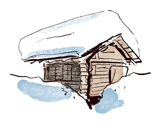
Historical wooden sheds and a world-class biathlon centre
The tyrolean valley Lesachtal is one of the most beautiful high-altitude valleys in Europe, with an authentic and unique natural and cultivated landscape. In the mountaineering village Obertilliach, the crosscountry skiing and biathlon centre is often the venue for competitions.
The “Dolomitenlauf” has been held here in January for many years, one of the most well-known popular cross-country skiing races in the German-speaking region and part of the Worldloppet series. The
Grenzlandloipe trail
The Grenzlandloipe trail connects the valleys Gailtal and Lesachtal (Osttirol) with Carithia and is considered to be one of the most beautiful and varied trails in Osttirol. An extensive cross-country tour that can be shortened as required.
cross-country skiing season starts early here at 1450 metres above sea level. If temperatures allow it, the spreading of snow reserves from the previous winter already starts at the beginning/middle of November.
Up to 50km of different trails are available for crosscountry skiing fans. The Grenzlandloipe trail from Kartitsch via Obertilliach and Untertiliach to neighbouring Maria Luggau in Carinthia is among the most beautiful trails in the Alpine region with a high probability of assured snow.
7
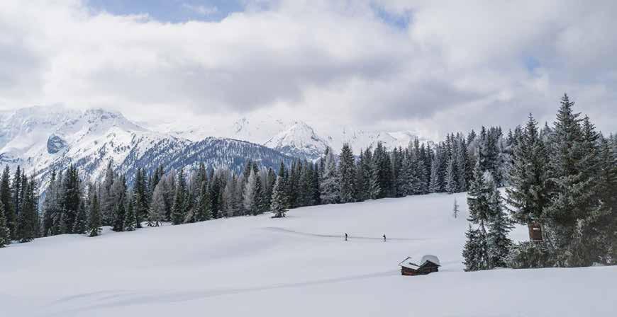
Along the Grenzlandloipe below the magical village Obertilliach in the valley Lesachtal.
60 km partially 239 hm 0 1 3 4 5 8 km 1300 1400 1500 1600 1700 1900 0 1.7 5 6.6 km 1500 1750 2000 2250 2500 2750 0 4 9 11 km km 1750 2000 2250 2500 2750 3000 0 5 9 12 15 1600 1800 2000 2200 2400 2800 0 2.4 3.8 6.2 2250 2400 2550 2700 2850 0 4 7 10 14 km km 1800 1950 2100 2250 2400 2700 Etappe 6 Etappe 2 Etappe 3 Icons / Symbole Etappe 1 Etappe 5 Etappe 4 0 1 3 4 5 8 km 1300 1400 1500 1600 1700 1900 0 1.7 5 6.6 km 1500 1750 2000 2250 2500 2750 0 4 9 11 km km 1750 2000 2250 2500 2750 3000 0 5 9 12 15 1600 1800 2000 2200 2400 2800 0 2.4 3.8 6.2 2250 2400 2550 2700 2850 0 4 7 10 14 km km 1800 1950 2100 2250 2400 2700 Etappe 6 Etappe 2 Etappe 3 Icons
Etappe 1 Etappe 5 Etappe 4
Start: Kartitsch
/ Symbole
difficult
0 1 3 4 5 8 km 1300 1400 1500 1600 1700 1900 0 1.7 5 6.6 km 1500 1750 2000 2250 2500 2750 0 4 9 11 km km 1750 2000 2250 2500 2750 3000 0 5 9 12 15 1600 1800 2000 2200 2400 2800 0 2.4 3.8 6.2 2250 2400 2550 2700 2850 0 4 7 10 14 km km 1800 1950 2100 2250 2400 2700 Etappe 6 Etappe 2 Etappe 3 Icons / Symbole Etappe 1 Etappe 5 Etappe 4 0 1 3 4 5 8 km 1300 1400 1500 1600 1700 1900 1.7 5 6.6 km 4 9 11 km km 5 9 12 15 0 2.4 3.8 6.2 2250 2400 2550 2700 2850 0 4 7 10 14 km km 1800 1950 2100 2250 2400 2700 Etappe 6 Etappe 2 Etappe 3 Icons / Symbole Etappe 1 Etappe 5 Etappe 4
Cross-country skiing at the foot of the wildly romantic Dolomites
Cross-country skiers can have run all around Lienz on almost 60 kilometres of trails with a breathtaking panorama of the Dolomites.

The trail Dolomitenloipe was the original cradle of the Dolomitenlauf competition and connects Lienz with Nikolsdorf, where a further two circuits on the sunny side entice you. In Lavant, not far from Lienz, there is an 8-kilometre-long circuit trail with snowmaking facilities – situated right by the Dolomites Golf Resort. Where golfers tee off in summer, there is a fabulous winter landscape that invites you to enjoy various tranquil cross-country skiing circuits very close to the Lienz Dolomites.
Lavant circuit trail
The trail is situated 8 km from Lienz on the site of the Dolomites golf course. The trail can potentially be extended into the village.
Start: Dolomitengolf course, Lavant
The idyllic trails along the Lienz valley floor, with the Lienz Dolomites as a backdrop.
8 km yes 60 hm 0 1.7 5 6.6 km 1500 1750 2000 2250 2500 2750 0 4 9 11 km km 1750 2000 2250 2500 2750 3000 0 5 9 12 15 1600 1800 2000 2200 2400 2800 Etappe 2 Etappe 3 Icons / Symbole Etappe 1 0 1.7 5 6.6 km 1500 1750 2000 2250 2500 2750 0 4 9 11 km km 1750 2000 2250 2500 2750 3000 0 5 9 12 15 1600 1800 2000 2200 2400 2800 Etappe 2 Etappe 3 Icons / Symbole Etappe 1 easy 0 1300 1400 1500 1600 1700 1900 0 1.7 5 6.6 km 1500 1750 2000 2250 2500 2750 0 4 9 11 km km 1750 2000 2250 2500 2750 3000 0 5 9 12 15 1600 1800 2000 2200 2400 2800 0 2250 2400 2550 2700 2850 0 1800 1950 2100 2250 2400 2700 Etappe Etappe 2 Etappe 3 Icons / Symbole Etappe 1 Etappe Etappe 1300 1400 1500 1600 1700 1900 0 1.7 5 6.6 km 1500 1750 2000 2250 2500 2750 0 4 9 11 km km 1750 2000 2250 2500 2750 3000 0 5 9 12 15 1600 1800 2000 2200 2400 2800 2250 2400 2550 2700 2850 1800 1950 2100 2250 2400 2700 Etappe 2 Etappe 3 Icons / Symbole Etappe 1
Villgratental trail
After a slight ascent, the trail runs with easy to medium difficulty descents and ascents across open fields towards Pranausiedlung. After the turnaround at Graferhöfe, it runs through a romantic forest and open territory back to the village centre.
On cross-country skis through a pristine natural and cultivated landscape
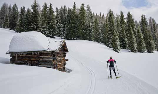
Aromantic winter landscape and plenty of space to set your own pace. In the valley Defereggental with a wealth of snow, winter sports enthusiasts will find a true winter wonderland. There are 10 different trails in the Defereggental – the valley of water and myths. 7 of them are situated around St. Jakob: 3 short and sharp circuits and 4 generous trails between 5 and 13 kilometres.
Those who would like to explore the most original archetypal high valleys of the Alps on cross-country skis will find what they are looking for in Villgratental. A valley without any ascent aids, brimming with character, pride and history. The 8-kilometre-long trail runs directly from Innervillgraten to Kalkstein, partly along the Villgraten stream. The unique natural and cultivated landscape makes the skiing circuit fly by. A new feature in the forthcoming winter is the 3-kilometre-long trail on the sunny side of the valley, which runs directly from the town centre along the valley floor and enjoys a wealth of sunshine.
9
Start: Innervillgraten 8 km no 250 hm 0 1 3 4 5 8 km 1300 1400 1500 1600 1700 1900 0 1.7 5 6.6 km 1500 1750 2000 2250 2500 2750 0 4 9 11 km km 1750 2000 2250 2500 2750 3000 0 5 9 12 15 1600 1800 2000 2200 2400 2800 0 2.4 3.8 6.2 2250 2400 2550 2700 2850 0 4 7 10 14 km km 1800 1950 2100 2250 2400 2700 Etappe 6 Etappe 2 Etappe 3 Icons / Symbole Etappe 1 Etappe 5 Etappe 4 0 1 3 4 5 8 km 1300 1400 1500 1600 1700 1900 0 1.7 5 6.6 km 1500 1750 2000 2250 2500 2750 0 4 9 11 km km 1750 2000 2250 2500 2750 3000 0 5 9 12 15 1600 1800 2000 2200 2400 2800 0 2.4 3.8 6.2 2250 2400 2550 2700 2850 0 4 7 10 14 km km 1800 1950 2100 2250 2400 2700 Etappe 6 Etappe 2 Etappe 3 Icons / Symbole Etappe 1 Etappe 5 Etappe 4 moderate 0 1 3 4 5 8 km 1300 1400 1500 1600 1700 1900 0 1.7 5 6.6 km 1500 1750 2000 2250 2500 2750 0 4 9 11 km km 1750 2000 2250 2500 2750 3000 0 5 9 12 15 1600 1800 2000 2200 2400 2800 0 2.4 3.8 6.2 2250 2400 2550 2700 2850 0 4 7 10 14 km km 1800 1950 2100 2250 2400 2700 Etappe 6 Etappe 2 Etappe 3 Icons / Symbole Etappe 1 Etappe 5 Etappe 4 0 1 3 4 5 8 km 1300 1400 1500 1600 1700 1900 0 1.7 5 6.6 km 1500 1750 2000 2250 2500 2750 0 4 9 11 km km 1750 2000 2250 2500 2750 3000 0 5 9 12 15 1600 1800 2000 2200 2400 2800 0 2.4 3.8 6.2 2250 2400 2550 2700 2850 0 4 7 10 14 km km 1800 1950 2100 2250 2400 2700 Etappe 6 Etappe 2 Etappe 3 Icons / Symbole Etappe 1 Etappe 5 Etappe 4
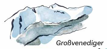
An insider tip in Osttirol –cross-country skiing at the foot of Großvenediger
5trails with a total of over 20 kilometres and the "Tyrolean trail quality seal" will delight beginners as well as professional cross-country skiers in Prägraten in the valley Virgental. The cross-country skiing experience has a high probability of assured snow due to the altitude and snowmaking facilities. Furthermore, the region is still a hidden gem!
The trail along the Isel runs through a picturesque hoar frost
forest. Those who want to avoid the freshness along the glacier river can enjoy the winter sun on the panoramic trail in Ströden.
The view of the icy giants of Maurertal is unique and invites you to enjoy various circuits on the extensive fields at the end of the valley. It is even possible to go cross-country skiing in the evenings in Prägraten – on the illuminated circuit Blusenrunde from 4 to 9 pm.
Bobojach trail
The Bobojach trail in Prägraten am Großvenediger offers varied ascents and descents and is a physical challenge for every ambitious cross-country skier, past rustic chalets along the stretch in the quiet valley Virgental.
11
Passing rustic huts along the route in the quiet Virgental
Start: Recreation center Bobojach 5.1 km no 80 hm 0 1 3 4 5 8 km 1300 1400 1500 1600 1700 1900 0 4 9 11 km km 1750 2000 2250 2500 0 5 9 12 15 1600 1800 2000 2200 2400 2800 0 4 7 10 14 km 1800 1950 2100 2250 Etappe 6 Etappe 3 Icons / Symbole 0 1 3 4 5 8 km 1300 1400 1500 1600 1700 1900 km 0 5 9 12 15 1600 1800 2000 2200 2400 2800 Etappe 6 Etappe 3 Icons / Symbole difficult 0 1 3 4 5 8 km 1300 1400 1500 1600 1700 1900 0 4 9 11 km km 1750 0 5 9 12 15 1600 1800 2000 2200 2400 2800 0 4 7 10 14 km 1800 Etappe 6 Etappe 3 Icons / Symbole 0 1 3 4 5 8 km 1300 1400 1500 1600 1700 1900 4 9 11 km km 5 9 12 15 0 4 7 10 14 km 1800 Etappe 6 Etappe 3 Icons / Symbole
Higher, further, healthier
While cross-country skiing in the valley is already optimal for the heart and circulation, the training effect increases at altitude. The air at altitude supports the formation of red blood cells, raises the oxygen content of the blood. This effect is like natural doping and is often used by top sportspeople for training. In addition, the sun at altitude has a positive effect on the body: more infrared light boosts the circulation, the air is free from allergens, the colour spectrum is more magnificent and the views therefore more intense.
In the mountaineer and winter hiker village Kartitsch, this effect unfolds along a 10-kilometre-long, optimally prepared trail on the sunny plateau of the mountain. At 1820 to 1950 metres above sea level, classical crosscountry skiers and skaters will find optimally prepared conditions. You can access the trail by lift or with a transfer. Winter sports enthusiasts can get to the
Staller Sattel altitude trail in Defereggental (2000m) by ski bus. No matter whether classical or skating style, cross-country skiers can enjoy the 6-kilometre-long circuit with an impressive view of the Defereggental in Osttirol or the Antholztal in the immediately adjoining South Tyrol.
The altitude trail at Golzentipp in Obertilliach is 5 kilometres long and is conveniently accessible by cable car. The trail has sporty ascents and descents and is primarily suitable for skaters. The view from below the Golzentipp peak is magnificent, in any case: Großglockner and Hohe Tauern in the north, the Lienz Dolomites and Lesachtal in the east, the Carnic Alps in the south and west, along with the Sextner Dolomites and Villgrater mountains. It is simply full-body training with a nature experience.
The unique trails at altitude in Osttirol
Dorfberg altitude trail
The Dorfberg altitude trail is situated at 1820 to 1950 metres and is a great option for pursuing cross-country skiing. This trail can also be called a panoramic trail. Payable transfer to the trail available at T. +43 4848 20 054.
Start: Dorfberg lift
Golzentipp altitude trail
This trail runs through treeless terrain along the agricultural path from the peak station of the cable car to the mountain meadows below the Golzentipp peak. Wonderful view in all directions! Due to the triple crossing of the piste, it is only recommended for skaters!
Start: Golzentipp cable car
Not just taking care of your health but also great fun.
Obersee trail
The circular cropped Obersee trail starts at the turnaround area of the ski bus and runs towards Staller Sattel. The trail runs along the shores of Obersee to Oberseehütte and back to the panorama panel by the car park.
Start: Staller Sattel car park
13
10 km 5 km 5.9 km no no no 250 hm 160 hm 170 hm 0 4 9 11 km km 1750 2000 2250 0 5 9 12 15 1600 1800 2000 2200 2400 2800 Etappe 3 Icons / Symbole 0 1.7 5 6.6 km 1500 1750 2000 2250 2500 2750 0 4 9 11 km km 1750 2000 2250 2500 2750 3000 0 5 9 12 15 1600 1800 2000 2200 2400 2800 Etappe 2 Etappe 3 Icons / Symbole Etappe 1 0 1.7 5 6.6 km 1500 1750 2250 2500 2750 0 4 9 11 km km 1750 2000 2250 2500 2750 3000 0 5 9 12 15 1600 1800 2000 2200 2400 2800 Etappe 2 Etappe 3 Icons / Symbole Etappe 1 km 0 5 9 12 15 1600 1800 2000 2200 2400 2800 Etappe 3 Icons / Symbole 0 1.7 5 6.6 km 1500 1750 2000 2250 0 4 9 11 km km 1750 2000 2250 2500 2750 3000 0 5 9 12 15 1600 1800 2000 2200 2400 2800 Etappe 2 Etappe 3 Icons / Symbole 0 1.7 5 6.6 km 1500 1750 2000 2250 2500 2750 0 4 9 11 km km 1750 2000 2250 2500 2750 3000 0 5 9 12 15 1600 1800 2000 2200 2400 2800 Etappe 2 Etappe 3 Icons / Symbole Etappe 1 moderate moderate moderate 0 1300 1400 1500 1600 1700 1900 km 0 5 9 12 15 1600 1800 2000 2200 2400 2800 Etappe 3 Icons / Symbole 0 1300 1400 1500 1600 1700 1900 0 1.7 5 6.6 km 1500 1750 2000 2250 2500 0 4 9 11 km km 1750 2000 2250 2500 2750 3000 0 5 9 12 15 1600 1800 2000 2200 2400 2800 0 2250 2400 2550 2700 0 1800 1950 2100 2250 2400 2700 Etappe 2 Etappe 3 Icons / Symbole 0 1300 1400 1500 1600 1700 1900 0 1.7 5 6.6 km 1500 1750 2000 2250 2500 2750 0 4 9 11 km km 1750 2000 2250 2500 2750 3000 0 5 9 12 15 1600 1800 2000 2200 2400 2800 0 2250 2400 2550 2700 2850 0 1800 1950 2100 2250 2400 2700 Etappe 2 Etappe 3 Icons / Symbole Etappe 1 0 1300 1400 1500 1600 1700 1900 0 4 9 11 km km 0 5 9 12 15 1600 1800 2000 2200 2400 2800 0 Etappe 3 Icons / Symbole 0 1300 1400 1500 1600 1700 1900 0 1.7 5 6.6 km 1500 1750 2000 2250 2500 2750 0 4 9 11 km km 1750 2000 2250 2500 2750 3000 0 5 9 12 15 1600 1800 2000 2200 2400 2800 0 2250 2400 2550 2700 2850 0 1800 1950 2100 2250 2400 2700 Etappe 2 Etappe 3 Icons / Symbole 0 1300 1400 1500 1600 1700 1900 0 1.7 5 6.6 km 1500 1750 2250 2500 2750 0 4 9 11 km km 1750 2000 2250 2500 2750 3000 0 5 9 12 15 1600 1800 2000 2200 2400 2800 0 2250 2400 2550 2700 2850 0 1800 1950 2100 2250 2400 2700 Etappe 2 Etappe 3 Icons / Symbole Etappe 1 highest point: 1.950 m highest point: 2.239 m highest point: 2.034 m 0 1 1300 1400 1500 1600 1700 1900 0 4 9 11 km km 1750 2000 2250 2500 0 5 9 12 15 1600 1800 2000 2200 2400 2800 0 4 1800 1950 2100 2250 Etappe 6 Etappe 3 Icons / Symbole 0 1 1300 1400 1500 1600 1700 1900 0 1.7 5 6.6 km 1500 1750 2000 2250 2500 2750 0 4 9 11 km km 1750 2000 2250 2500 2750 3000 0 5 9 12 15 1600 1800 2000 2200 2400 2800 0 2.4 2250 2400 2550 2700 2850 0 4 1800 1950 2100 2250 2400 2700 Etappe 6 Etappe 2 Etappe 3 Icons / Symbole Etappe 1 Etappe 5 Etappe 4 0 1 1300 1400 1500 1600 1700 1900 0 1.7 5 6.6 km 1500 1750 2000 2250 2500 2750 0 4 9 11 km km 1750 2000 2250 2500 2750 3000 0 5 9 12 15 1600 1800 2000 2200 2400 2800 0 2.4 2250 2400 2550 2700 2850 0 4 1800 1950 2100 2250 2400 2700 Etappe 6 Etappe 2 Etappe 3 Icons / Symbole Etappe 1 Etappe 5 Etappe 4
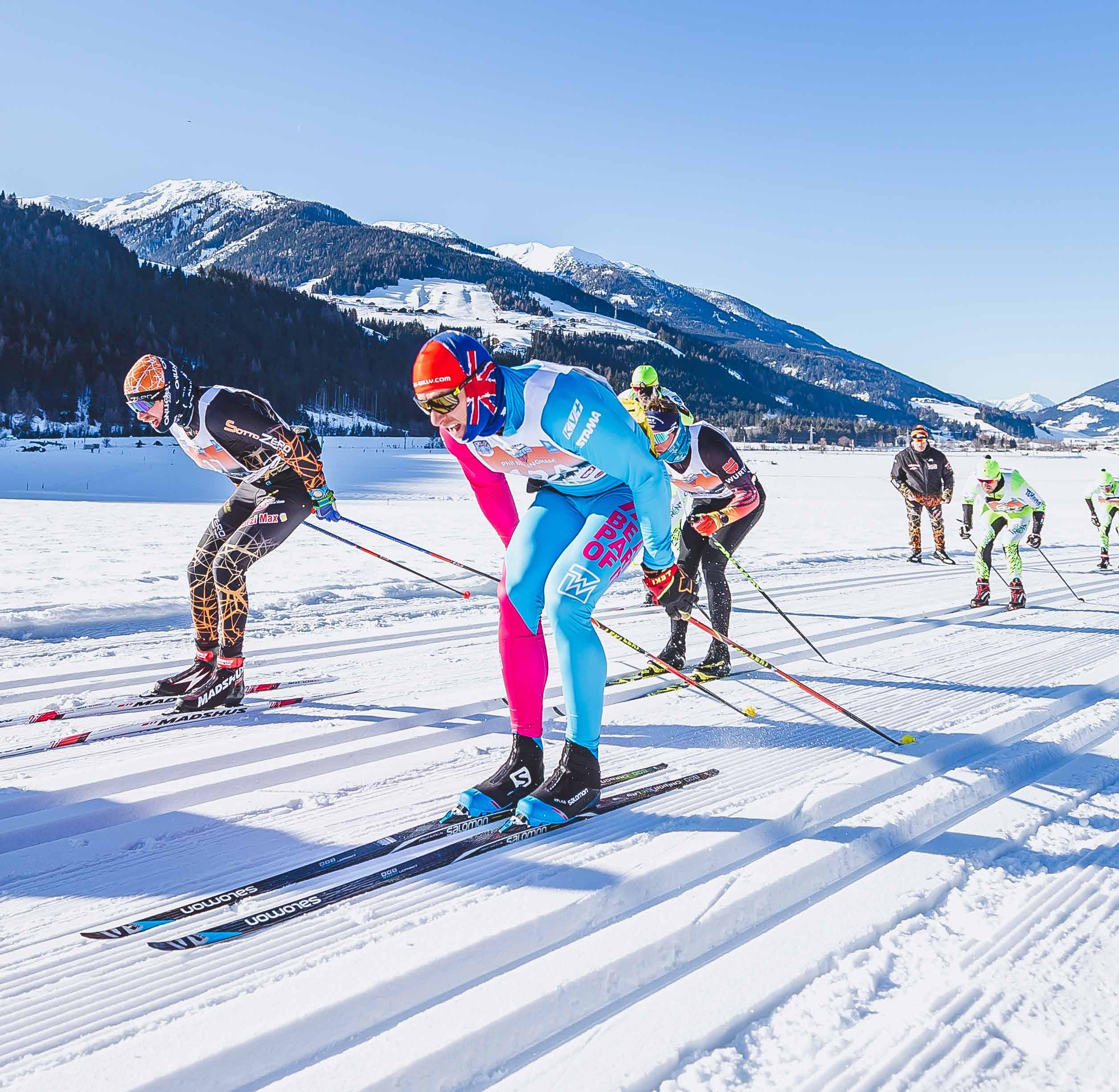
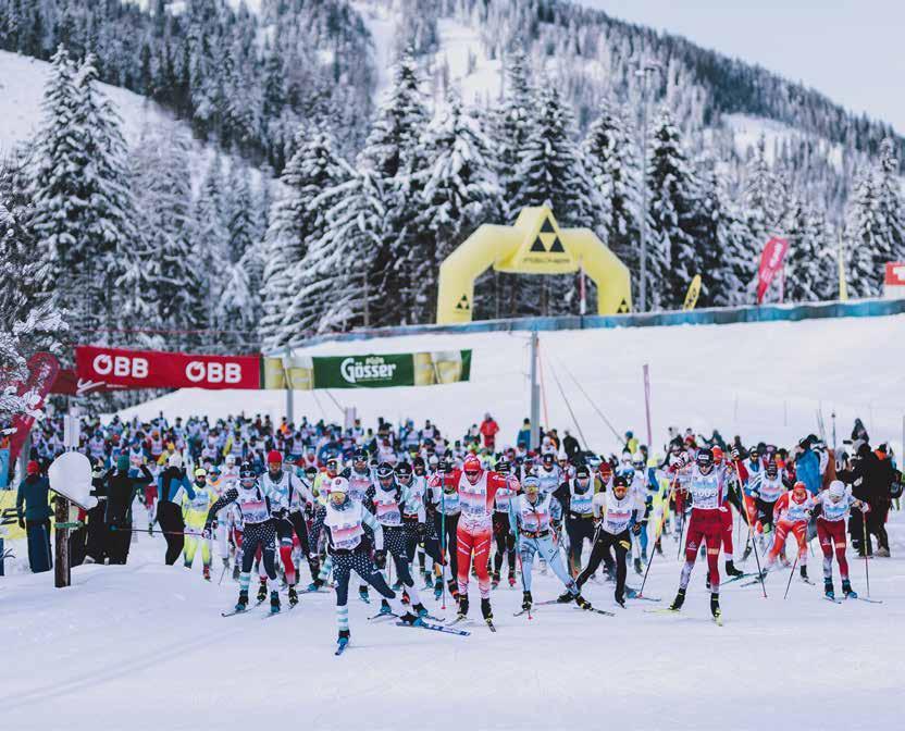
19 – 21 January 2024
The unique cult event
Since 1970, cross-country enthusiasts from all around the world have pilgrimaged to Lienz in mid-January, because of the international Dolomitenlauf. As part of the worldwide Worldloppet series, it is on a par with classics such as the Vasaloppet in Sweden or Birkebeinerrennet in Norway.
This legendary cross-country skiing marathon with 2500 participants is the largest cross-country skiing event in Austria and is also a spectacle for spectators – with numerous side events for an enthusiastic public.
No matter whether you are a professional, amateur or leisurely sportsperson
– there is the right and suitably challenging competition here for every ability, taste and age. And all of this in an impressive natural setting!
Over the course of the three-day event, a total of six different races with varying distances and degrees of difficulty are held.
15
Find out more and register now at:
Every participant in this cult sports event is already a winner.
www.dolomitensport.at
Get trail plan or current weather forecast from the information desk, or chat with the hosts about the best routes in the region. Then you can head straight out onto the trail – the quality-tested cross-country skiing enterprises are very close to the nearest access to a trail (max 3 km).
And when you return in the evening after a great day of cross-country skiing, a laundry and drying service is of course available for your skiing clothing.
Recharge your batteries
During your cross-country skiing holiday, you can focus on the essentials: cross-country skiing. Your hosts will take care of everything else. In Osttirol, there are hotels and accommodation set up especially for cross-country skiers, where the friendly staff will be happy to help you with information about trails and equipment.
Dolomiti Nordic Ski partner enterprises
The hosts of the Dolomiti Nordic Ski Hotels are mostly enthusiastic cross-country skiers themselves. They therefore know not only what cross-country skiers want and need but also where the most beautiful trails are in the Dolomites and valuable insider information. You are in good hands here!
You can find information about all the cross-country skiing accommodation and services here.
The »carefree« package
Inclusive services 3 nights:
3 nights
3 days cross-country skiing pass for Osttirol
Price examples:
Hotel ***** with half board from € 450,00
Hotel **** with half board from € 270,00
Hotel *** with half board from € 225,00
Guesthouse without stars / ** / ***
with breakfast from € 183,00
Private room with breakfast from € 150,00
Apartment without board from € 175,00
Inclusive services 7 nights:
7 nights
7 days cross-country skiing pass for Osttirol
Price examples:
Hotel ***** with half board from € 1025,00
Hotel **** with half board from € 605,00
Hotel *** with half board from € 500,00
Guesthouse with half board from € 430,00
Guesthouse without stars / ** / *** with breakfast from € 402,00
Private room with breakfast from € 325,00
Apartment without board from € 350,00
17
Cross-Country Skiing Safari Osttirol - 3 days
out more and book right away!
Cross-Country Skiing Safari Osttirol - 7 days
Find
Good to know
Dolomiti NordicSki
Dolomiti NordicSki, Europe’s largest cross-country skiing carousel with 1300 kilometres of trails in ten regions, presents itself as attractive and varied with magnificent tours amidst the Dolomites. Cross-country skiers can download the GPS data for all the trails before the start of winter.
www.dolomitinordicski.com
Free Bus
Ski busses in Ostttirol can be used free of charge with a valid crosscountry ski pass or a guest card.
gratisbus.osttirol.com
Fees
Information about the current cross-country skiing fees and cross-country skiing ticket sales points can be found here:

Rental & Service
Hochpustertal
Sport Sunny 2000
T. +43 4842 6919
www.sunny-2000.com
Nordic Racing Center Sport Auer
T. +43 664 32564522
www.sport-auer.com
Albert‘s Sportartikelverleih
T. +43 664 8712434
Sport Schett
T. +43 660 4909245
NationalparkRegion
Sport 2000 Matrei
T. +43 4875 6581121
www.sport2000.at/wibmer
Sport Steiner
T. +43 4875 6711
www.sportsteiner.at
Sport Michl
T. +43 4876 8434
www.sportmichl.at
Alpinsport Gratz
T. +43 4876 22114 500
www.sport-gratz.com
Skiverleih Hannes
T. +43 699 17 19 56 22
www.ski-verleih-hannes.at
Defereggental
Sport2000 Passler
T. +43 4873 520333
www.sport-passler.at
Intersport Troger
T. +43 4873 5290
www.intersport-troger.at
Intersport Skihütte
T. +43 664 3555800 www.intersport-troger.at
Lienzer Dolomiten
Joachim‘s Skishop
T. +43 4852 68541 www.joachims-skishop.at
Cross country ski schools
Hochpustertal
Wintersportschule
Hochpustertal
T. +43 664 5732189
www.wintersportschule.at
White Element
T. +43 664 4668798
www.white-element.at
Skischule Obertilliach
T. +43 664 1523608 schischuleobertilliach.com
NationalparkRegion
Skischule Kals am Großglockner
T. +43 664 129 40 47 www.skischulekals.com
Skischule Matrei/Goldried
T. +43 4875 6080 www.schischulematrei.at
Defereggental
Langlaufschule Defereggental
T. +43 650 321 56 36 langlaufschule-defereggental.at
Schneesportschule
Defereggental St. Jakob KG
T. +43 4873 200 31 schneesportschule-stjakob.at
Ski- & Snowboardschule
Martin Gasser
T. +43 664 5055464 www.skischule-stjakob.at
Lienzer Dolomiten
Skischule Lienzer Dolomiten
T. +43 676 9769 255 www.skischule-lienz.at
Imprint:
Responsible for the content: TVB Osttirol
Photos: Peter Maier, Elias Bachmann, Martin
Lugger, EXPA PICTURES, Roman Wagner
Illustrations: Andreas Posselt
Subject to changes and errors.
19
langlaufen.osttirol.com Osttirol Information T. +43 50 212 212 info@osttirol.com www.osttirol.com
