N M B W Architecture Studio Point Grey Redevelopment
Architecture Associates GLAS Landscape Architecture
N M B W, Architecture Associates, GLAS, and our extended collaborators pay respect to the Eastern Maar, Wadawurrung, Gadubanud and Giraiwurung Peoples, who are the Traditional Custodians of the Great Ocean Road region. We pay our respect to Elders of these Peoples, past, present and emerging. We also acknowledge and pay respect to all past, present and future Traditional Custodians and Elders of this Land and the continuation of cultural, spiritual and educational practices of Aboriginal and Torres Strait Islander Peoples. We recognise that sovereignty of Aboriginal and Torres Strait Islander Nations was never ceded.
Kooweeya-wanoong takoort meerreeng-ee ba watanoo Meerreng-ngeeye, yana-thalap-ee ba wanga-kee Meerreeng laka
We invite all that choose to live on or visit our Country to slow down. To tread softly and listen to Country speak.
Introduction (p.4)
Existing Site Analysis (p.8)
Opportunities & Constraints (p.16)
Site Significance (p.17)
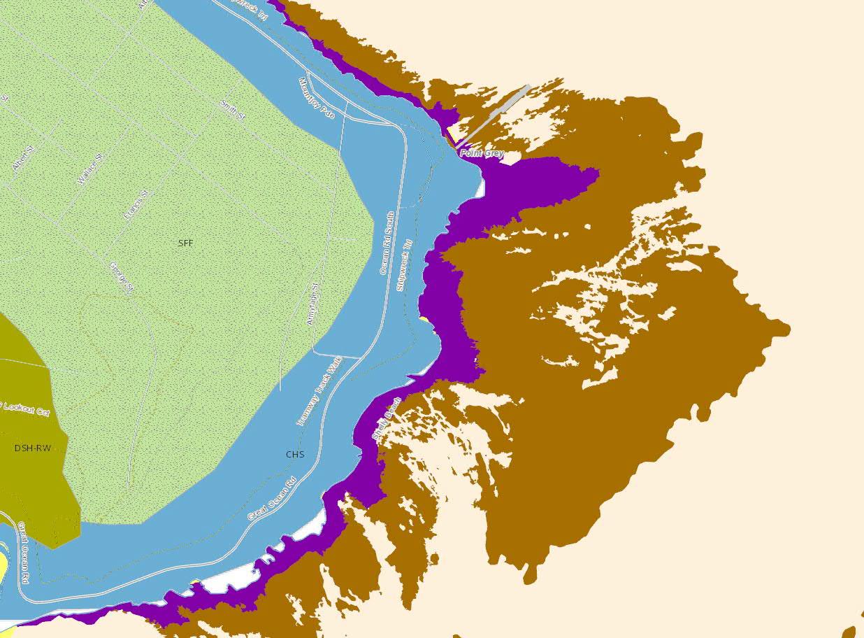
Natural Environment (p.28)
Access & Movement (p.40)
Public Realm & Open Space (p.49)
Development & Building Footprint (p.54)
Conclusion (p.60)
Feasibility Criteria (p.61)
Appendices (p.64)
A.1 Authority & Stakeholder
A.2 Existing Site Analysis
A.3 Site Significance
A.4 Natural Environment
A.5 Access & Movement
A.6 Public Realm & Open Space
A.7 Development & Building Footprint
Note: Refer to p.64 for full list of appendices
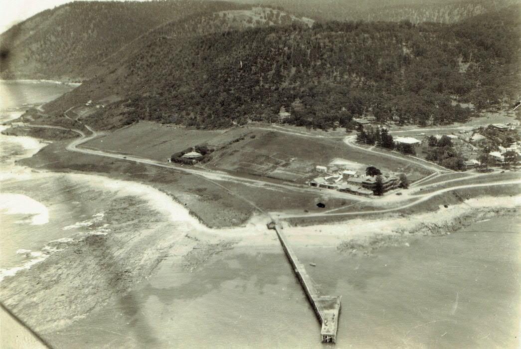
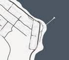
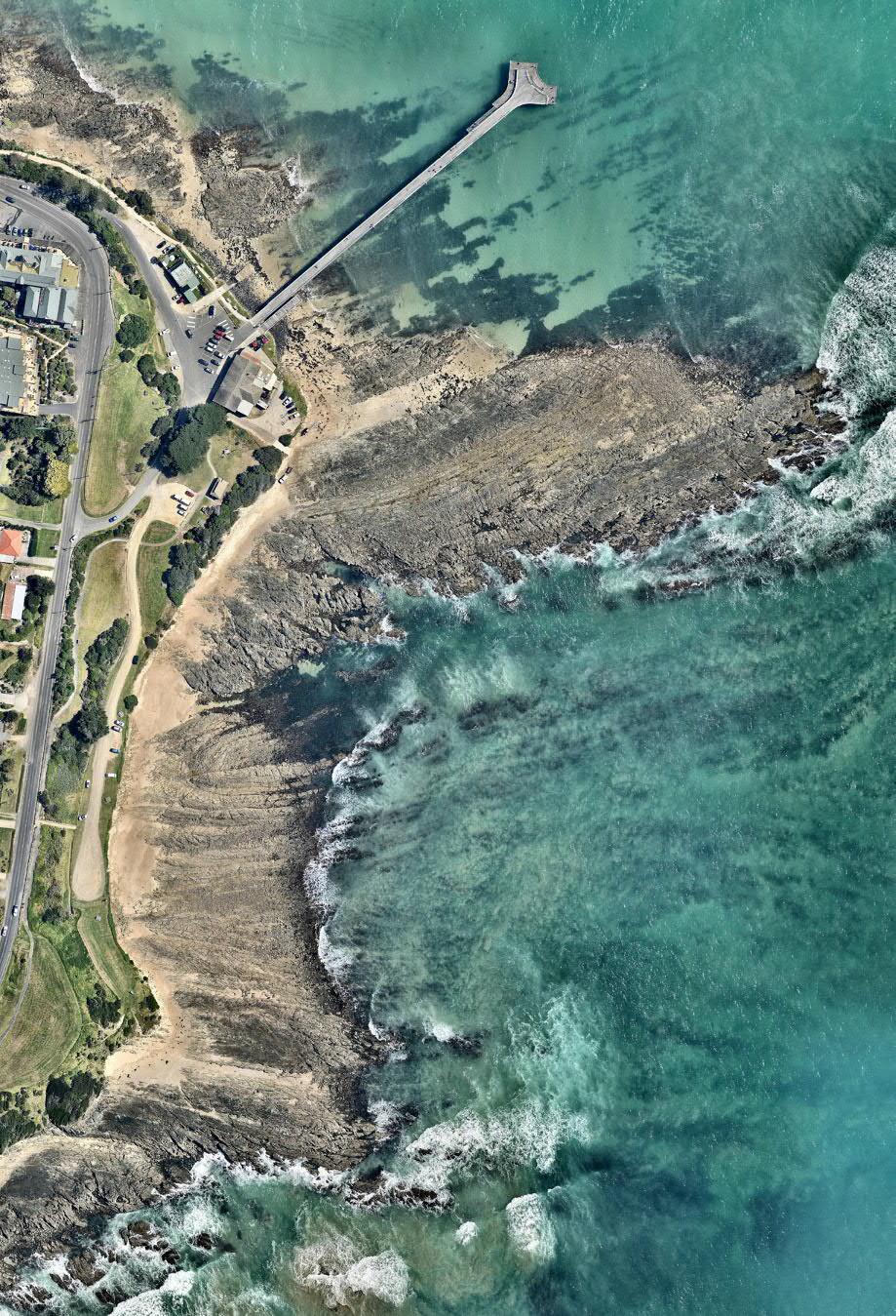
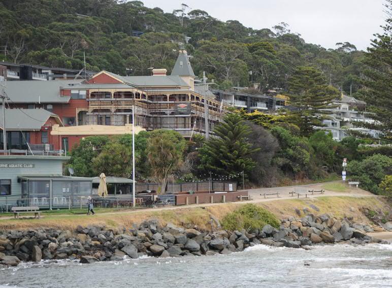
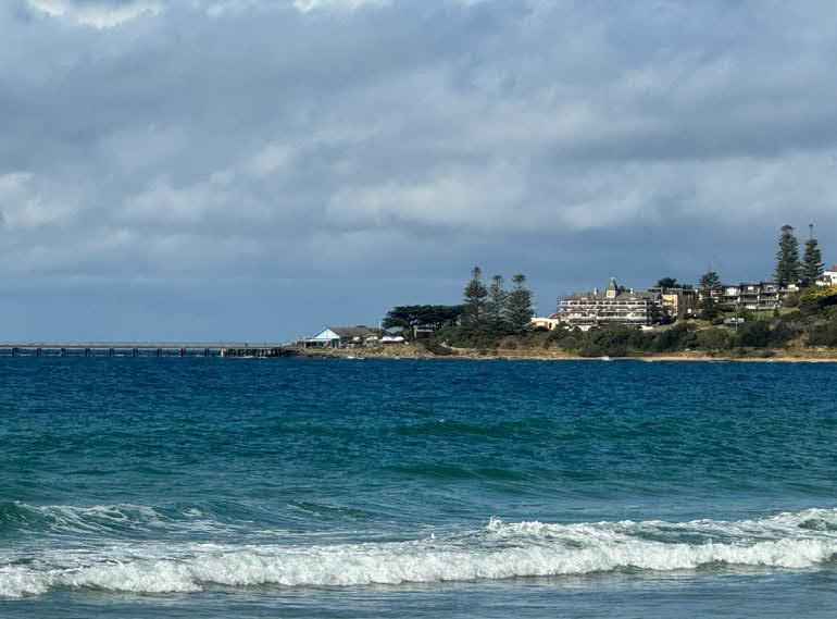
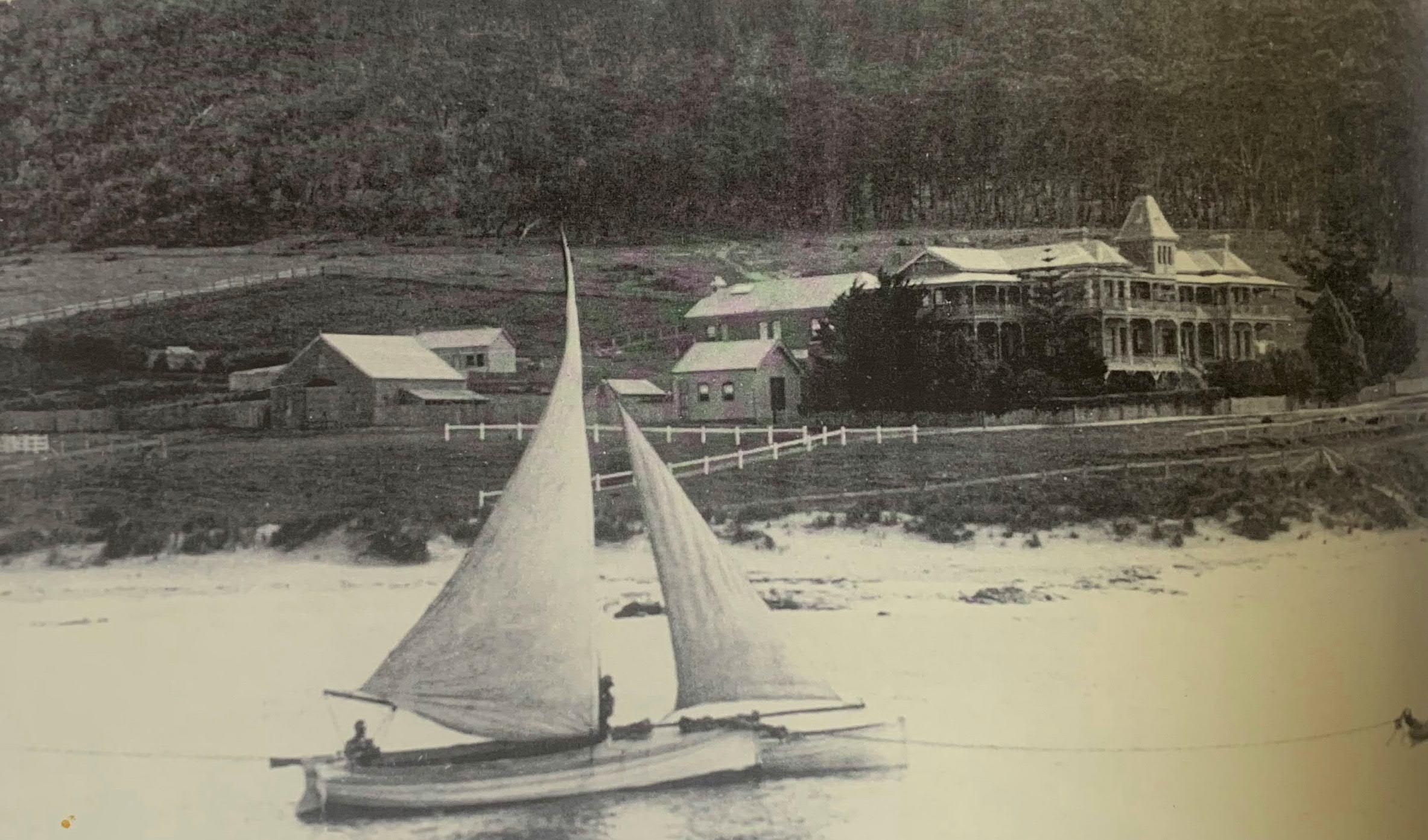
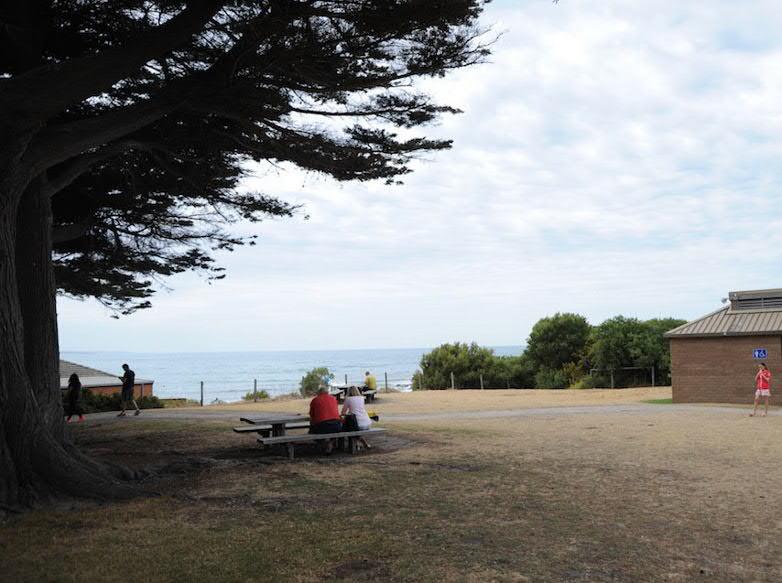
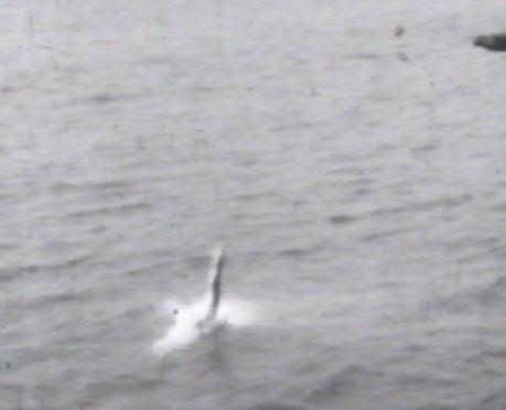
× Above Point Grey from a biplane, date unknown.
Photo: Jeff Gaylard/ Noel Murphy
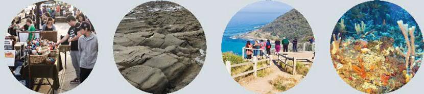
The Point Grey Redevelopment Project is borne from deep and ongoing human engagement with a remarkable coastal environment. The Great Ocean Road Coast and Parks Authority (The Authority) has committed to a rigorous design process to deliver a quality outcome which integrates the many diverse factors at play across this unique marine meeting place. The project represents a commitment made by the Authority through the Geelong City Deal to cater for the growing tourism and visitor economy (both local and regional) to provide:
× A new Lorne Aquatic & Angling Club (LAAC)
× Recognition of cultural heritage
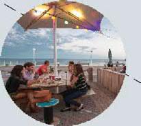
× Provision for ‘casual dining’ offerings, including options for takeaway and al fresco seating areas
× Improved public realm spaces, and increased accessibility and connectivity
This report is a summary of opportunities and constraints for this project, representing a moment in time within the larger project. Information has been gathered from a careful review of Government Legislation, taking time to listen to stakeholders, analysing the spatial and activity potential of influencing factors, and working with specialist consultants. The conclusion establishes criteria for assessment, and begins developing an Urban Design Framework and feasibility design options. The ongoing identification of site-specific opportunities and constraints will be augmented in the next project phase, where guiding principles will be confirmed and the findings of this report will be re-organised in direct relation to the Marine and Coastal Policy and Planning requirements.
The site has been subject to many prior studies at specific and strategic levels. Due to the significance of Point Grey’s coastal location, natural ecology, local connection, and cultural and social histories, these prior versions of the project have attracted sustained interest from a wide range of user groups who care deeply about the site’s future. This iteration of the project is informed by re-considering complex parameters with a new eye but is also inherently connected to the ongoing sense of place which is highly valued by community members. Furthermore, the site’s salience for all Victorians is given primacy by the Marine and Coastal Act and Policy. Over the past five years there have been several significant changes to the project’s background conditions:
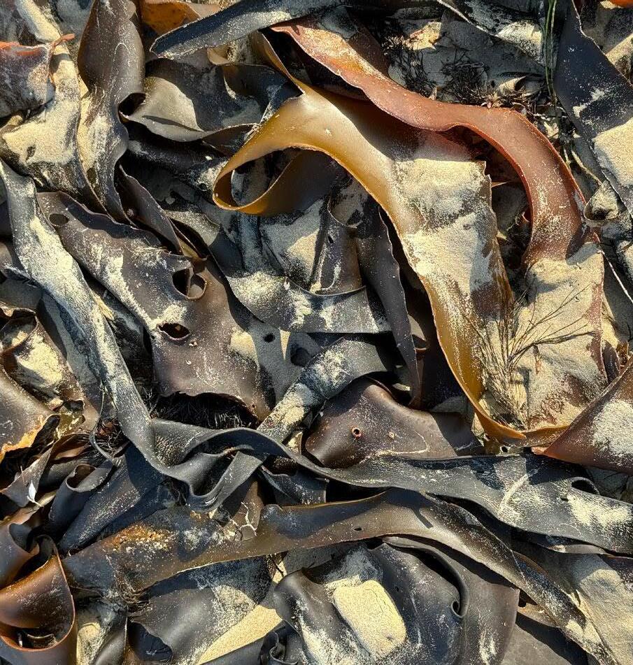
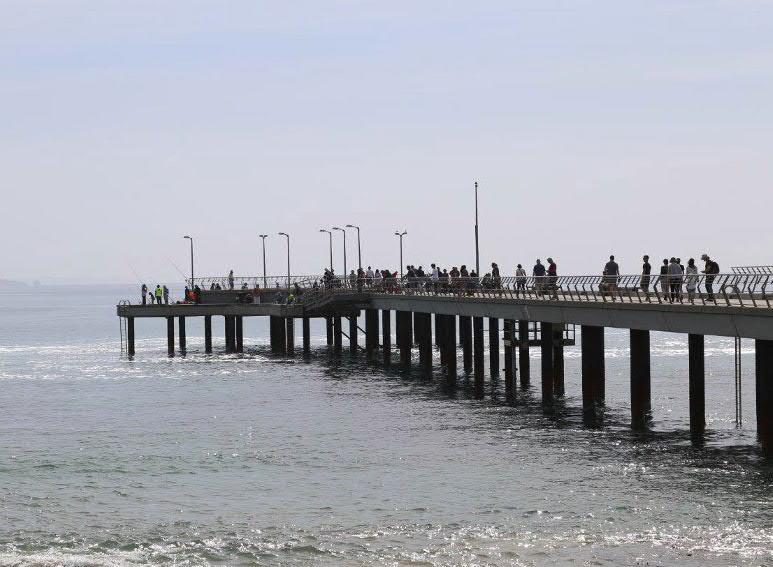
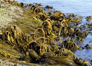
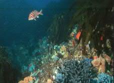
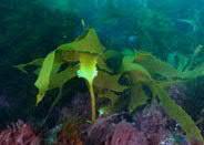
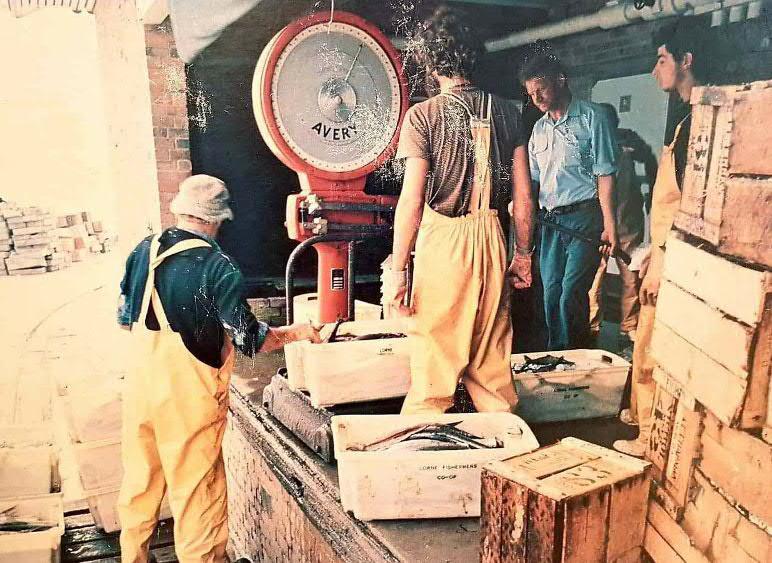
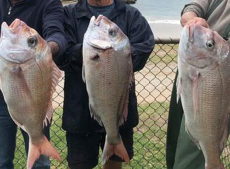
× From top Fish on the pier, kelp at Vera Lynn Photos: NMBW
× 2023: Eastern Maar received formal recognition of Native Title by Victorian State Government
× 2023: Victoria’s Resilient Coast, Adapting for 2100+
× 2022: VCAT 257 (Baker v Surf Coast, 10th March 2022)
× 2020: Great Ocean Road and Environs Protection Act (GOREPA)
× 2020: Siting and design guidelines for structures on Victorian Coast
× 2020: Marine & Coastal Policy
× 2018: Marine and Coastal Act (MACA)
Each of these legal requirements and guidelines play a crucial role in clarifying the project conditions, whilst ongoing local concerns are intimately related to the marine and coastal culture which the regulatory controls seek to protect. The general approach of the Marine and Coastal Act, 2020, posits protection of coastal crown land through minimising and consolidating built form, whilst always noting the importance of cultural history and collaboration with all relevant stakeholders.
We look forward to the chance for authentic engagement with Eastern Maar. This partnership will be underpinned by the strong understanding and work done to focus on supporting achievement of the Eastern Maar Country Plan objectives as self-determined by EMAC and the Eastern Maar, throughout project design and delivery, as well as the alignment of the project delivery against the agreed Project Principles identified during engagement during the creation of an Urban Design Framework for the precinct in the next project phase.
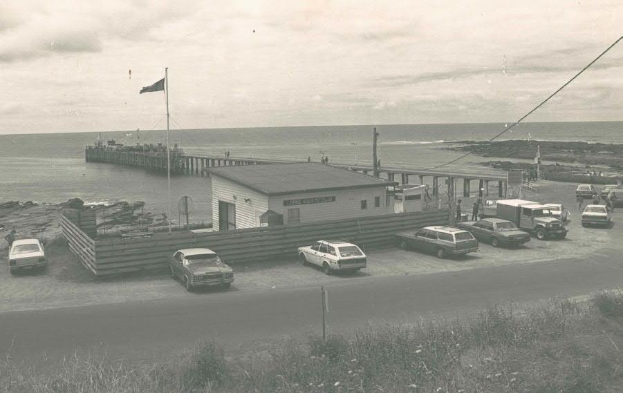
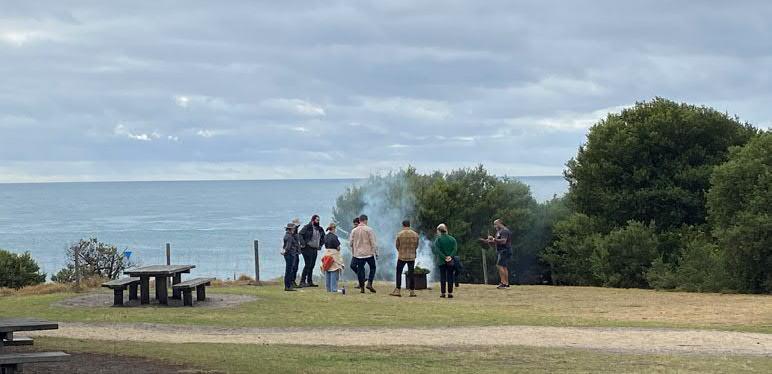
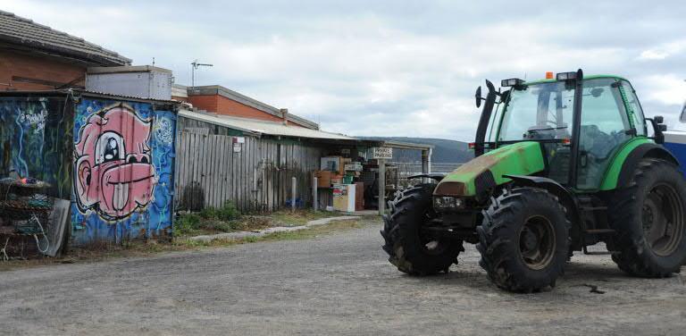
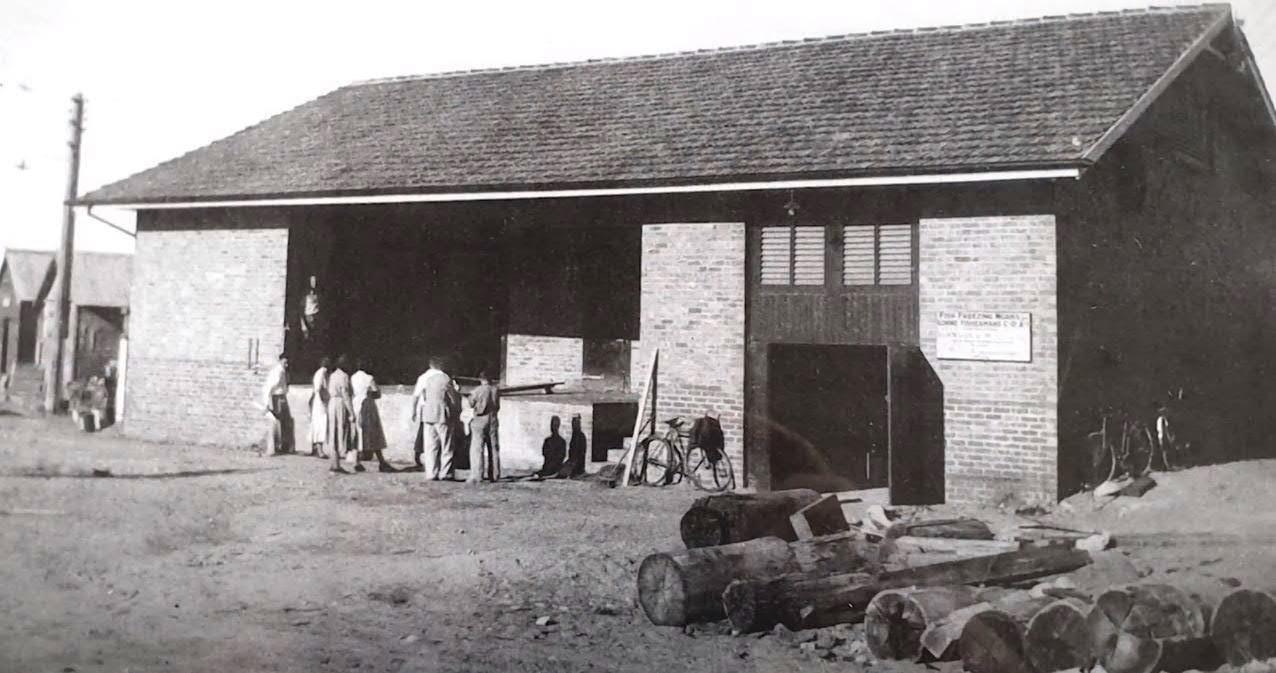
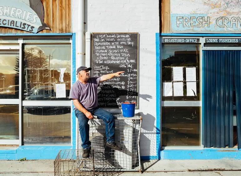
The site was once able to sustain commercial fishing, as evidenced by the gradual extension of the Fishing Co-Operative building between 1949 and 2003. In parallel with this activity, the Lorne Aquatic & Angling Club (LAAC) grew in popularity. Sadly, the intrinsically coastal nature of commercial fishing has declined over recent decades, and the Co-Op building now lies in disrepair. However, recreational fishing and the LAAC membership are seeing increasing support. The existing energy and genuine marine culture of the site has strong connection to LAAC’s identity and presence. Community surveys and discussion consistently suggest that a separate building for the LAAC is the preferred future for the site. The design team will investigate a thorough testing of options during the next project phase. Feasibility studies will need to take on board spatial limitations and regulatory requirements as well as research methods for retaining the existing culture and identity of the place.
× Above Lorne Angling & Aquatic Club, c.1986.
Photo: Lorne Historical Society
[Refer Appendix A.1: Planning and Stakeholder Documents]
In terms of public use of the site, there are many aspects that need to be considered. Practical issues around the safe and efficient movement of boat trailers, tourist bus drop off and pick up points, as well as appropriate car parking, bicycle use, and pedestrian accessibility must be incorporated into any design option. In addition, the rich local history, along with Lorne's position as a key destination along the Great Ocean Road, requires the project to carefully balance strategies both specific to local conditions, culture and community with those of the broader region including seasonal variation and visitors. The seasonal aspect of the project’s viability is important to recognise, particularly influencing strategic thinking around the food & drinks premises.
Several aspects of specialist consultant advice are seemingly in conflict with each other, such as bushfire protection zones relative to intentions of ecological regeneration. Concurrently, the site itself presents many opportunities to our team, requiring further elaboration. Its unique natural setting and geographical position with layers of rich scientific and cultural narrative are immediately engaging. This report takes into account as much as possible of all advice received and research undertaken, to show the types of possibilities that can inform further design development in the next stage, where we will be developing an Urban Design Framework [Refer Section 3: Opportunities and Constraints, and Appendix A.2-A.7]
We anticipate careful and diligent work will be required in future stages of the design process, and believe that we can genuinely improve, celebrate and secure Point Grey as a strategic and well-loved destination, well into the future.
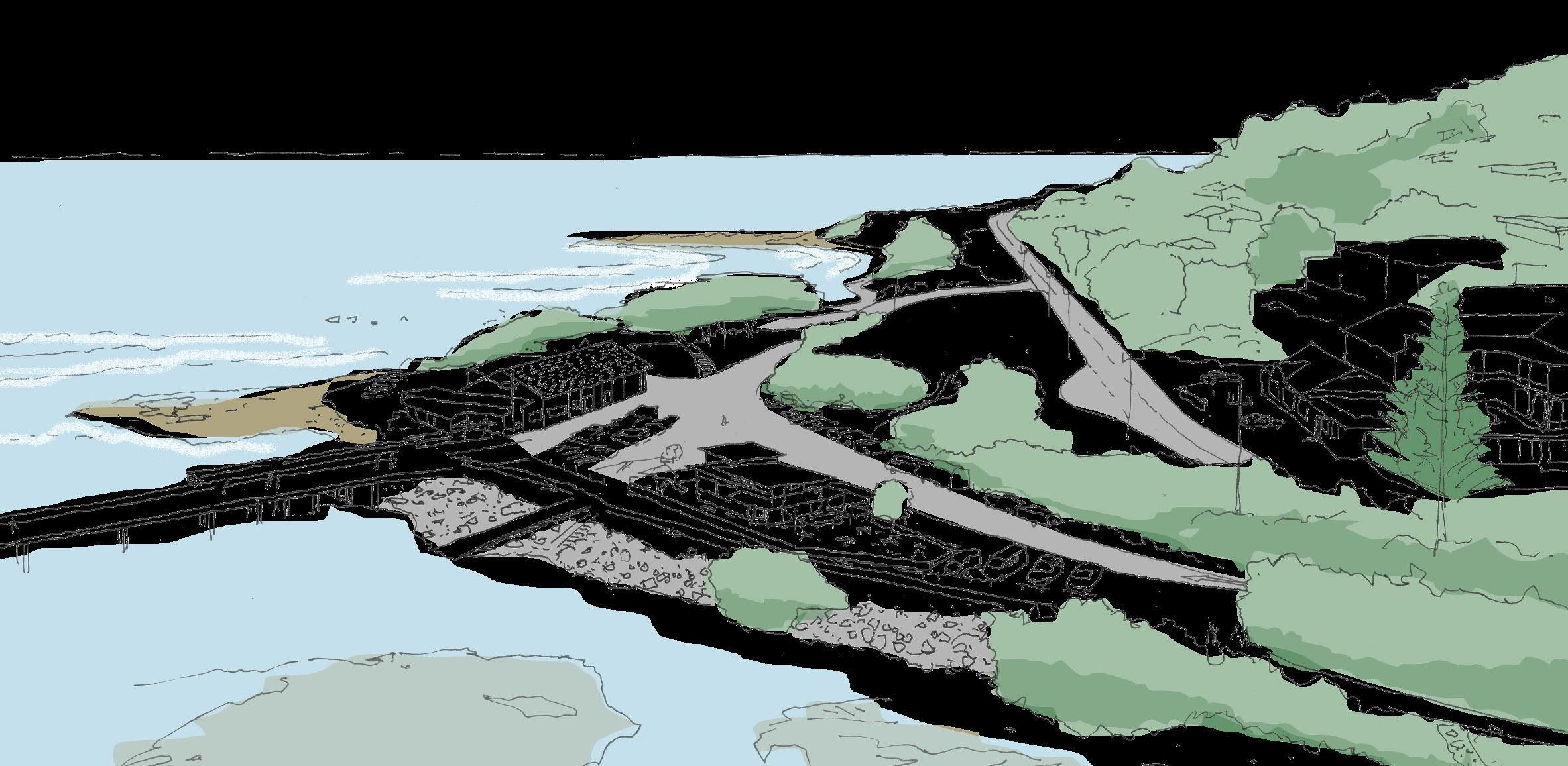
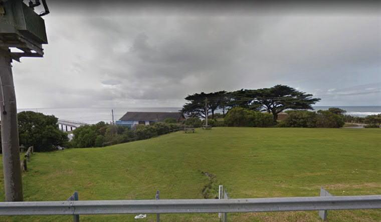
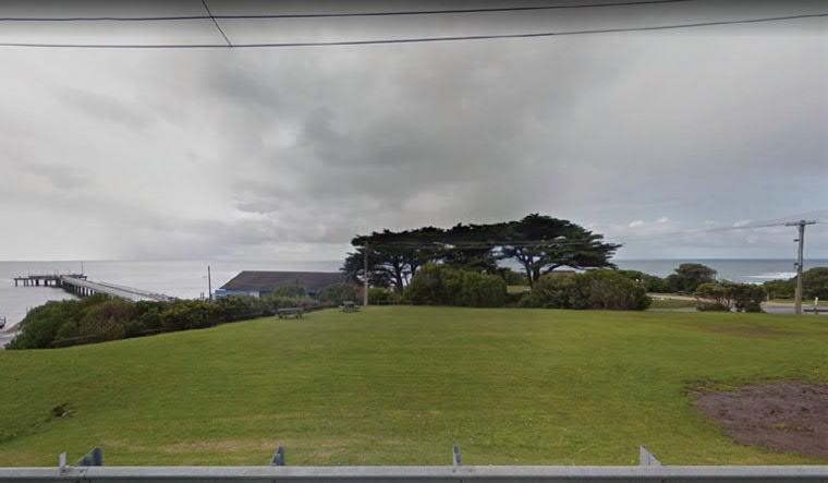
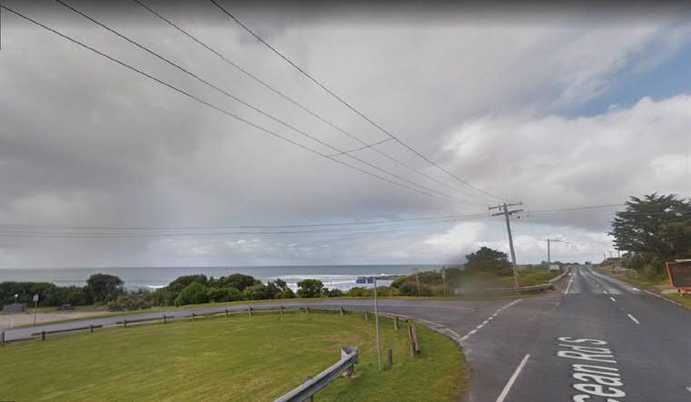
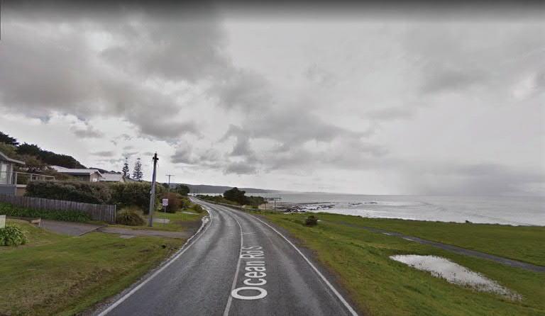
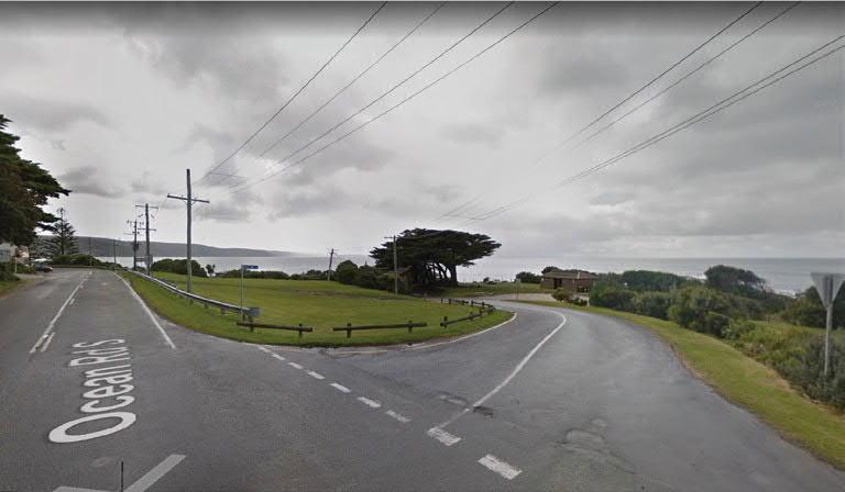
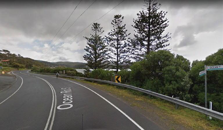
This Opportunities & Constraints Report brings the recording of overall and context scale existing conditions to this Section 2.0: Existing Site Analysis, whilst detailed existing condition issues will be analysed in the following Section 3.0: Opportunities & Constraints. The bigger picture plans and site sections of 2.1 indicate the importance of surrounding community; both human and ecological, whilst the ancient rock formations are a constant backdrop to the issues which condition the project site. 2.2 details natural and cultural aspects of the existing condition directly affecting the Point Grey Redevelopment project itself, whist 2.3 assesses viewlines of importance for this project, in order to prepare for testing impact of design proposals in the next phase of the project: Urban Design Framework.
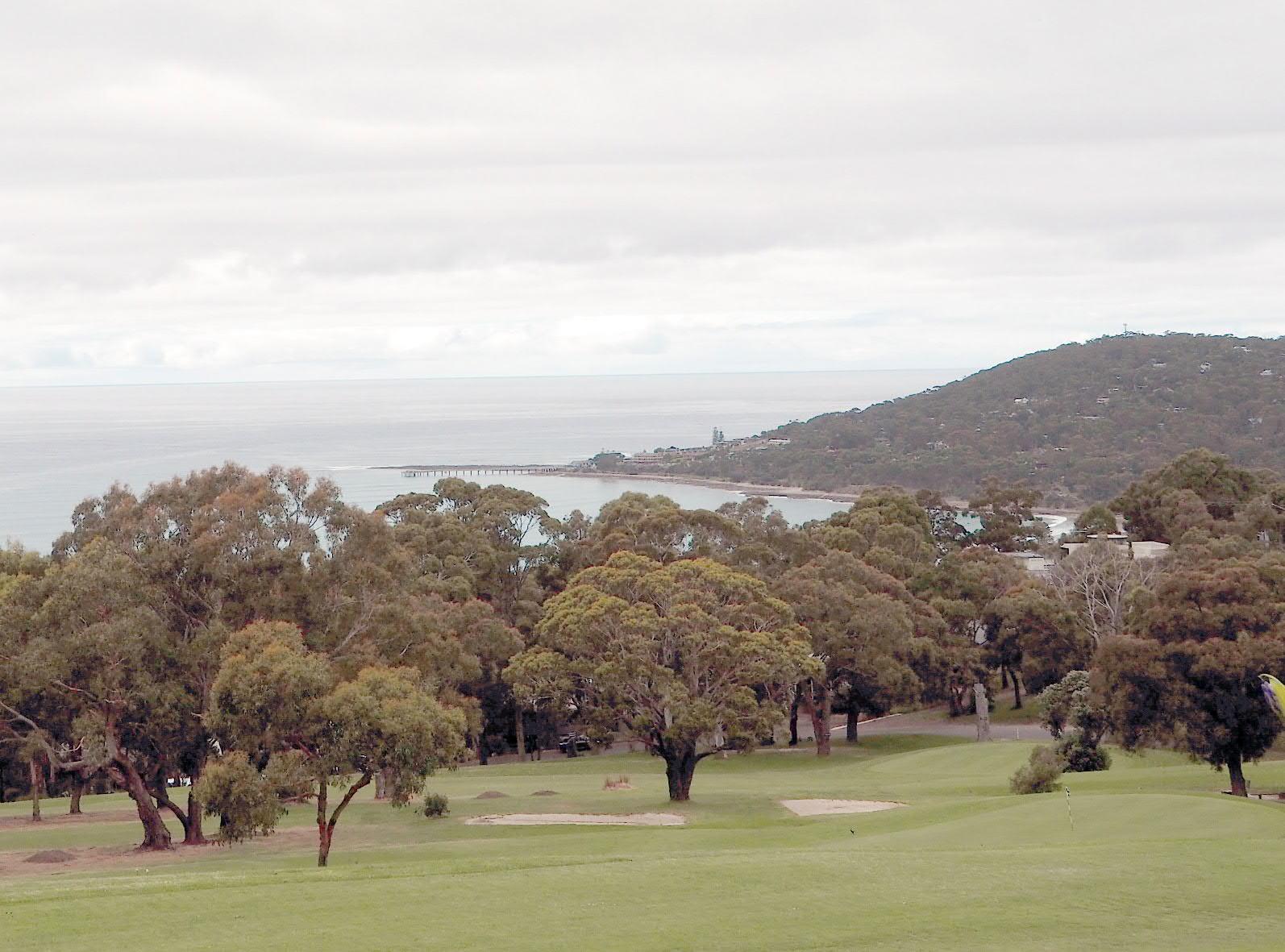
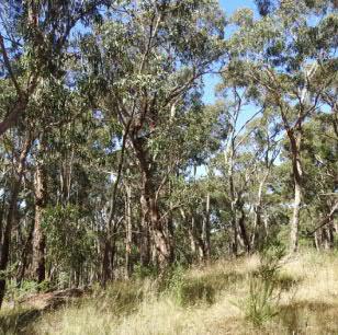
the Lorne Golf Course. Photo: Danielle Peck, Architecture Associates, 2017
×
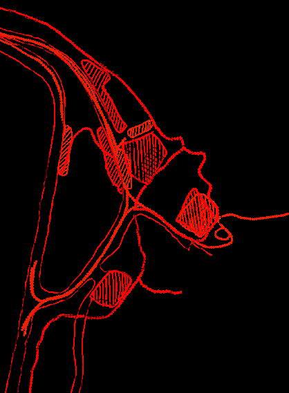
× Coastal Headland scrub (EVC
Foothill
Coastal Headland scrub
Grassy Dry Forest Shrubby Foothill Forest
Riparian Forest
Coastal Grassland
Rock Platform Kelp bed Sponge garden
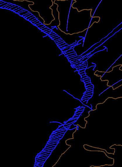
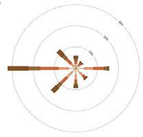
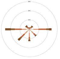
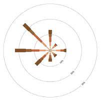
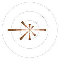
Winter Solstice Sunset June 21, 17:10pm, 300°
Summer Solstice Sunset
21, 20:48pm, 239°
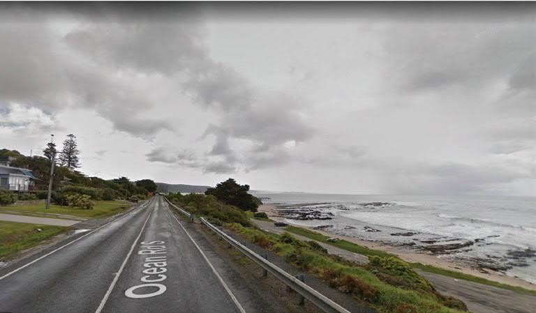
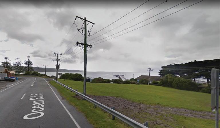
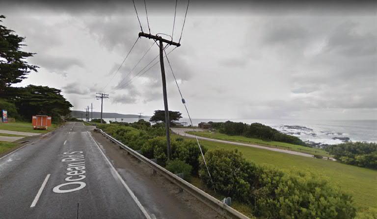
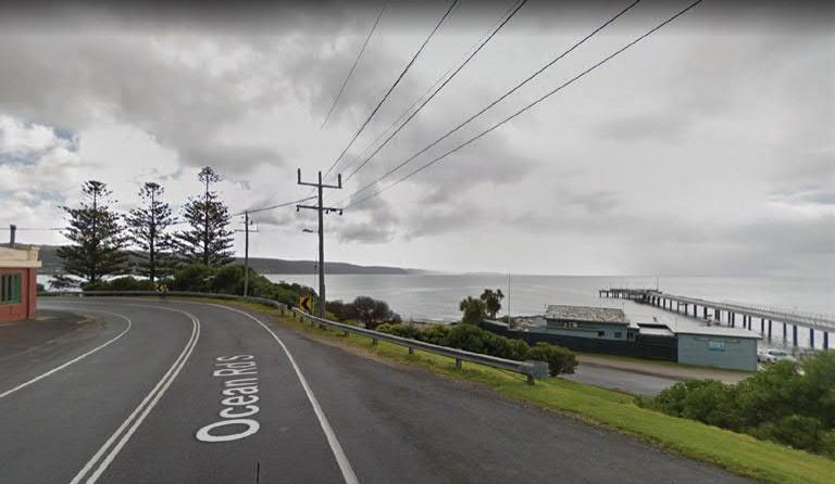
SitevisiblefromGOR
Existing viewlines at Point Grey will inform the approvals process for the Marine and Coastal Act and the Planning Scheme in future project phases. In preparation, Hansen Partnership has prepared a Visual Analysis of important viewpoints developed in collaboration with the design team. Refer A.2.2: Visual Analysis, Hansen Partnership.
The design team has prepared preliminary visual approach diagrams, shown on the following pages. As feasibility options progress during the Urban Design Framework phase, these important viewlines will inform the design team in preparing threedimensional drawings and modelling.
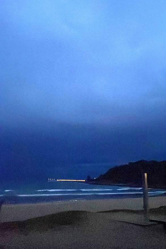
× Clockwise from right Lorne Beach, looking towards Point Grey at night, 2024. Photo: Conor Reddan, GORCAPA.
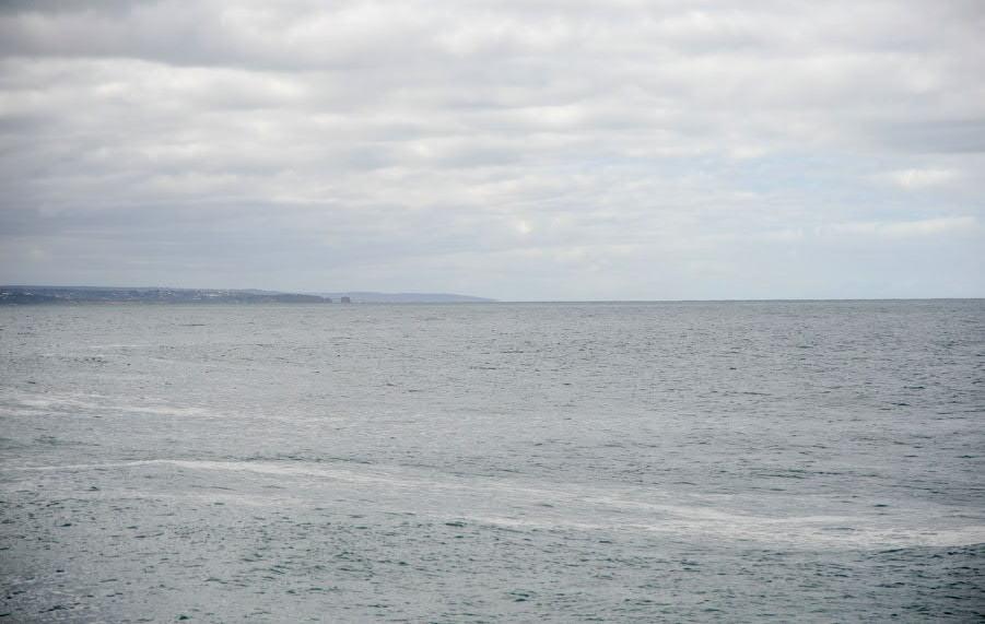
Photos taken from the end of the Lorne Pier, looking back towards the site, and out to the ocean. Photos: Vera Moeller, 2024.
Unattractive
The opportunities and constraints for the Point Grey Redevelopment project have been assembled on the following pages. Research has been conducted from first principles, and Section 3.0 of the report has been organised under subheadings raised in specific relation to the findings. The intention is to re-organise this information in the next phase to be able to understand how the same values that have been recognised can be correlated with the specific items outlined by the Marine and Coastal Act , State Planning policies and attendant needs. [Refer
A.1.2: Planning
Memo, Hansen Partnership] These documents are amenable to the importance of pre-existing deep and local cultures as well as the detailed character of site-specific natural environments. The Urban Design Framework phase will clarify the translation between the following opportunities & constraints and legislative requirements.
3.1, Site Significance
× Indigenous History
× Coastal Edge & Use
× Geology
× Marine Landscape
× Fishing & Boating
× Below Eumerella Foundation
Photo: Danielle Peck, Architecture Associates
3.1, Site Significance: Aboriginal Cultural Heritage
The design team acknowledges the Eastern Marr Peoples and the Eastern Marr Aboriginal Corporation (EMAC) as the registered Aboriginal Party for the area, who manage their Native Title Rights for the site.
Point Grey has been a gathering place for First Nations People for thousands of years, and shellfish were collected from the rock platforms and reef. Shell middens have been discovered on site including the shell midden (Victorian Aboriginal Heritage Register (VAHR) reference number 7620-0215) which includes a large variety of shellfish, mainly gastropods and two coastal flint artefacts. Analysis of the midden shows it included 65% limpets, twenty five percent turbos, five percent abalone and five percent mussels. Dark charcoal rich soils in the midden suggests that fires were used to cook food and provide warmth.
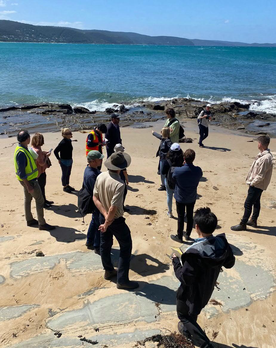
At the start of the project in April 2024 a Smoking Ceremony, Welcome to Country and Cultural Walk was hosted by the Eastern Maar Aboriginal Corporation to welcome the project team to site.
unnecessary circulation north of the midden site and provide protection from boat and trailer traffic
Midden site to be protected. Opportunity to implement protective planted edge subject to discussions with EMAC
Public amenities to be removed off the midden site and replaced with upgraded facilities elsewhere within the precinct
Possibility to relocate gravel car park from this location and work with EMAC to revegetate the midden/picnic area
Opportunities:
× Acknowledge and protect Aboriginal heritage places and values in a culturally appropriate manner
× Protection of middens and implementation of a Cultural Heritage Management Plan (CHMP)
× Support achievement of Eastern Marr Country Plan objectives, as self determined by EMAC and the Eastern Marr
× Strengthen existing relationships with EMAC to establish opportunities for Caring for Country together
× Provide opportunities for understanding Traditional Owners knowledge of Caring for Country
× Explore opportunities for Co-design with EMAC throughout the precinct
× Provide interpretation and opportunities to learn about People and Country
× Work towards opportunities for self-determination throughout the project
Constraints:
× Complex Native Title legislation
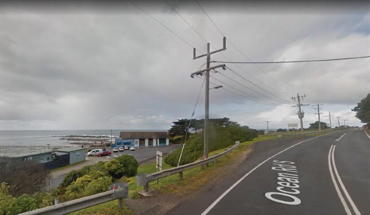
3.1, Site Significance: Coastal Edge & Use
A significant opportunity for this project is to increase accessibly and equitable access along the coastal edge at Point Grey, enabling safe and enjoyable movement of diverse users throughout the site. The coastal edge provides an opportunity to engage with a unique and dynamic marine environment, and the preservation of Point Grey's beauty and existing character will be a key focus for this project.
Point Grey also contains state significant infrastructure, as follows:
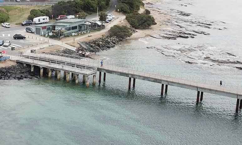
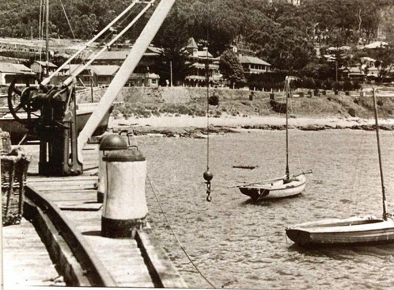
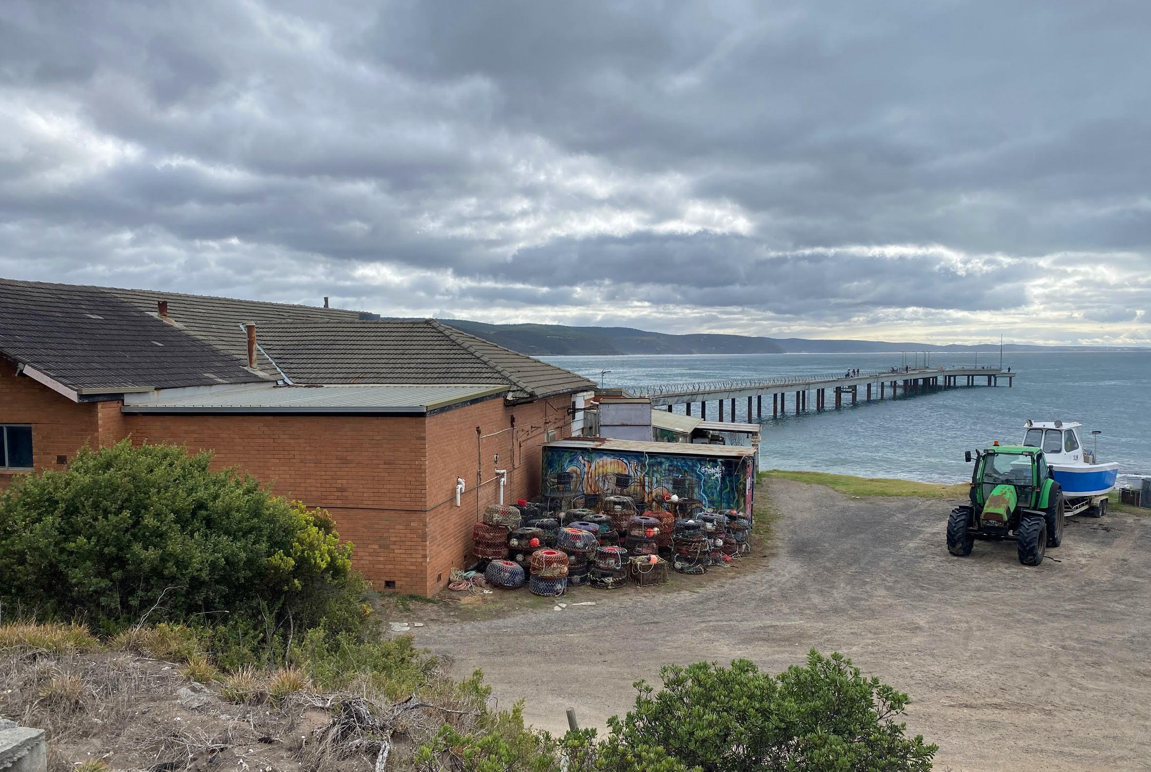
As a registered local port, the Port of Lorne and the Point Grey precinct performs a significant role for the community, supporting local fishing, marine businesses, recreation and tourism. The Port of Lorne currently encompasses the Lorne Pier & the remnant original pier (and the surrounding 50m of water), as well as the old boat ramp and the adjoining land, currently occupied by the Lorne Aquatic & Angling Club (LAAC). GORCAPA are the local port managers responsible for it's operation and maintenance.
The precinct also contains the state owned Lorne Boat Ramp, which has been identifed for renewal under the Victorian Recreational Boating Strategy 2021-2030 . It is the only access point for boats between Anglesea and Lorne, and infrastructure upgrades will imporve the amenity and safety for boating users.
Opportunity for informal LAAC parking to be located away from the Doug Stirling walking track and the coastal edge Opportunity to combine existing stair and ramp into a multi-purpose asset
Opportunity to improve informal seating & picnic areas with views across Louttit Bay
Opportunity to remove car park from central public precinct between the LAAC and the Fishing Co-Op to improve pedestrian access and safety to the pier, boat ramp & stair
Existing gravel car park for boats and trailers prevents pedestrian connection to the Eumeralla reef formation
Any future proposals for Point Grey must consider the intertidal zone and the dynamic nature of coastal/ marine environments
Current clash between Doug Stirling walking track and the gravel road to Shelley Beach
Opportunity to formalise pedestrian access from the Great Ocean Road & existing overflow car park Existing coastal edge access
path
Opportunities:
× Improve the condition of the boat and beach access ramp to increase safety and efficiency, as highlighted under the Victorian Recreational Boating Strategy 2021-2030
× Opportunity to create a multi-purpose asset combining ramp and stair to improve access to the shoreline for events such as the Pier to Pub
× Opportunity for informal LAAC parking to be located away from the Doug Stirling walking track and the coastal edge
× Opportunity to improve informal seating & picnic areas with views across Louttit Bay
× Opportunity to relocate the car park from the central public precinct between the LAAC and the Fishing Co-Op to improve pedestrian access and safety to the pier, boat ramp & stair
× Opportunity to formalise pedestrian access from the Great Ocean Road & existing overflow car park, and establish connections between the Lorne Historic Tramway Track and Queens Park
× Remove large expanses of concrete & asphalt to improve permeability of the ground and include water-sensitive urban design strategies where appropriate
× Implement smart tracking throughout the site to futher inform site capacity and monitoring
Constraints:
× Coastal hazards: s ea level rise , erosion, storm tides
× Findings within the Coastal Adaptation Plan
× Limited space and competing uses on the coastal edge for the most desirable location for both views and vicinity to the shoreline
× Existing boat and beach access ramp creates a conflict of use with vehicles, boats and pedestrians
× Ability to achieve Universal accessibility due to topgraphy, level changes and the nature of the coastal edge
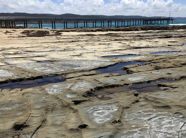
× Left Eumerella Formation. Photo: NMBW
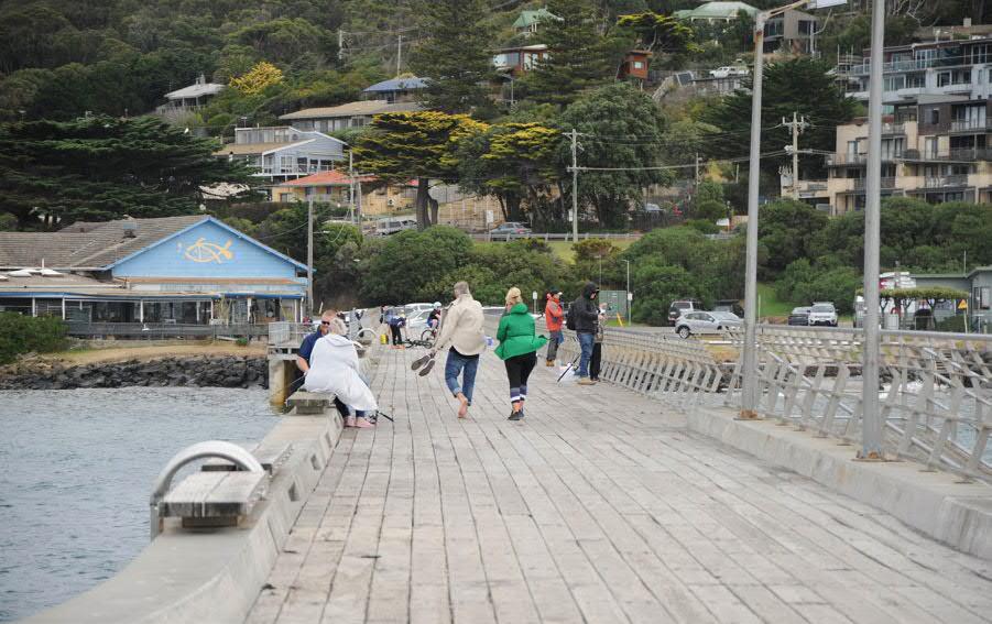
Lorne Pier Photo: NMBW
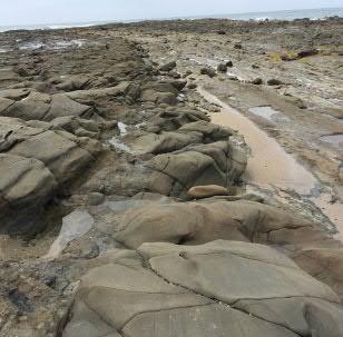
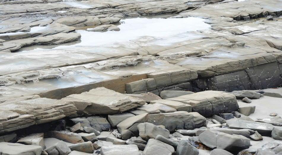
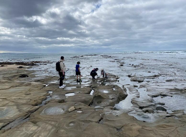
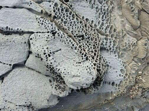
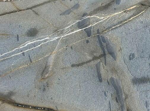
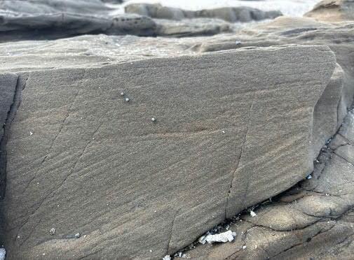
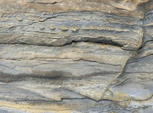
Point Grey is made up of the Eumeralla Formation sediments. These were the final sediments that were deposited in the Gondwana Rift Valley. Over millions and millions of years (135-115 million years ago), these once-volcanic sediments were transported through river systems, buried, compacted, and heated through the process of lithification. They are sometimes referred to as arkose because of the high feldspar content.
Not only does the Eumeralla Formation buffer Point Grey from south-westerly ocean swells that wrap around the headland, but it also offers the opportunity to explore rock pools, provides a platform from which to fish, and offers hints about the geological history of Lorne and the broader landscape in which the town is situated.
× Right
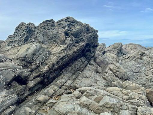
1: Steeply dipping beds at Point Grey
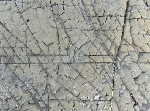
2: Calcite veins crisscross sandstone with mudstone clasts from Gondwanan flooding event
3:Orthogonal systematic joints defining a grid-lock pattern with preferential weathering
4: Cross bedding in Gondwanan sandstone. 5: Tafoni weathering in Gondwanan sandstone. Note blue-green colour comes from chlorite
6: Interbedded mudstone and sandstone. The finer
× Left Aerial of Point Grey showing extent
mudstone is eroded faster than the more resistant sandstone.
Photos: Terrasoma
of Eumeralla Formation sediments
× Right Geological process of Rifting, 190-35 Ma. Source: Written in Stone, Philomena Manifold
× Below Fisherfolk inspecting the catch on the Eumeralla Formation. Photo: NMBW
Opportunities:
× Geological mapping of the site into the design of the buildings or public realm. For example, fault and fold lines that can be traced from the rock platform across the site
× Use of rocks as mass elements for public realm furniture, sculpture and bollards (if required)
× Geological education and activities throughout the precinct such as providing a location to include earth monitoring devices, and increase the visibility & understanding of the erosion markers on the Eumerella Formation
Constraints:
× The extents and depth of the Eumeralla Formation must be taken into consideration before any footing design and/or earthworks proceed
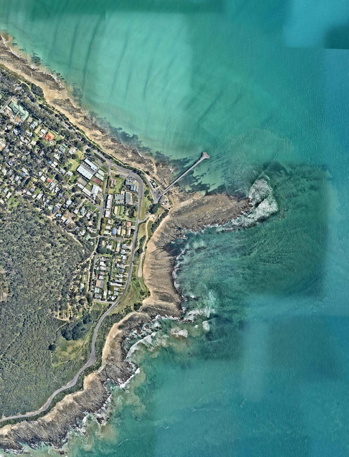
× Aerial of Point Grey showing extent of Eumeralla Formation sediments. Photo: Nearmaps
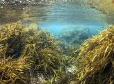
3.1, Site Significance: Marine Landscape
Point Grey and Louttit Bay are located in the cool temperate waters of the South-East Marine Region and part of the Great Southern Reef.
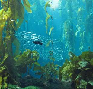
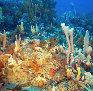
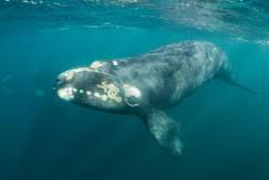
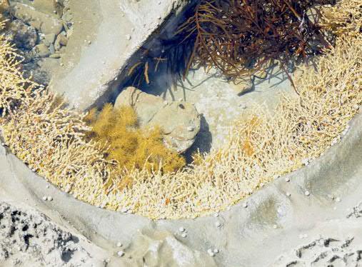
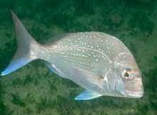
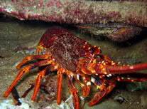
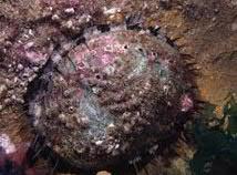
Point Grey’s larger subtidal reef system is an extension of intertidal rocky reefs and seafloor and extends to a depth of approximately 50 metres. Like other rocky reefs of southern Australia this system supports endemic marine flora and fauna. It supports the most commercially valuable marine species, Southern Rock Lobster (Jasus edwardsii) and Black Lip Abalone (Haliotris rubra), and provides habitat for many species of fish, amongst them wrasse, perch, leatherjackets and snapper. It is home to a diverse range of species of sponges, sea anemones, lace coral, tube worms and sea squirts.
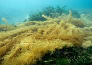
× (2-15 m) The shallow reef near the shore is dominated by kelp and other seaweeds. Bull Kelp (Durvillea potatorum) is found on the shallowest, most exposed reef, while Golden Kelp (Ecklonia radiata) and Crayweed (Phyllospora comosa) are abundant on less exposed parts. Under their canopy, foliose macroalgae and sessile invertebrates such as sponges, bryozoans, hydroids and ascidians form an understory. The lower parts can include soft corals such as sea whips and gorgonians. Crustose coralline algae exist here with gastropods, crustaceans, echinoderms and fish.
× (15-30) The intermediate reef looks similar to the shallow reef with changing assemblages adapted to the decrease in the amount of light and exposure to swell. Kelps begin to be replaced by thallose red algae as the dominant algal cover and there are more sessile invertebrates such as sponges, bryozoans and ascidians. The number of gastropods is decreasing at greater depths, but a variety of molluscs, echinoderms, crustaceans, are present, as are reef fish like morwong and snapper. Below the low tide mark rocky reefs can support extensive communities of marine algae that can form kelp forests.
× Deep reefs and sponge gardens contain a great diversity of species, many of which are endemic (found nowhere else in the world). In many groups, for example ascidians and bryozoans, 80 to 90% of the species are endemic. Victoria’s sponge gardens are richer in species and have a greater proportion of endemic species than comparable habitats around the world. These habitats are of great ecological significance and scientific value, and are favoured sites for divers and underwater photographers.
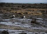
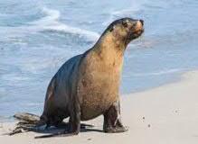
× Right
1: Southern Right Whale (protected)
2: Pacific Gulls
3: Neptunes Necklace & Crayweed
4: Australian Fur Seal (protected)
5: Australian Snapper
6: Southern Rock Lobster
7: Blacklip Abalone
8: Crayweed
Note: Further information on Point Grey's unique marine environment can be found in Appendix A.3.2 titled 'The Marine Environment of Louttit Bay and Point Grey'. Vera Moeller.
× Left
1: Brown Seaweed, Cystophera Moniliformis
2: Sponge Garden with Ecklonia Radiata CA. 1 km east of Point Grey
3: Bull Kelp, Durvillea Potatorum
4: Golden Kelp, Ecklonia Radiata
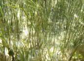
5: Sea Nymph, Amphibolis Antarctica
6: Long Leaf Seagrass, Zostera Nigricaulis
7: Existing pier pylons often provide a key habitat and foraging space for a range of species
Opportunities:
× Respect the rich and unique marine life, and explore the possibilities to implement these stories into the design
× Use an ecosystem-based approach to manage the marine and coastal environment in a way that sustains marine ecosystems (Marine and Coastal Policy)
× Maintain and enhance the overall extent and condition of native habitats throughout the Point Grey precinct
× Maintain ecological corridors and promote linkages (such as migration pathways) and habitat adaptation to climate change (for example, through landward movement of habitats in response to sea level rise)
× Provide spaces for art & sculpture to enhance community and visitor understanding of the marine environment
× Investigate potential for kelp use and integration of intertidal understanding to the unique environment
Constraints:
× The siting and waste management of public facilities related to marine and coastal activities must not have an adverse impact on marine life and ocean water quality
3.1, Site Significance: Maritime History & Use
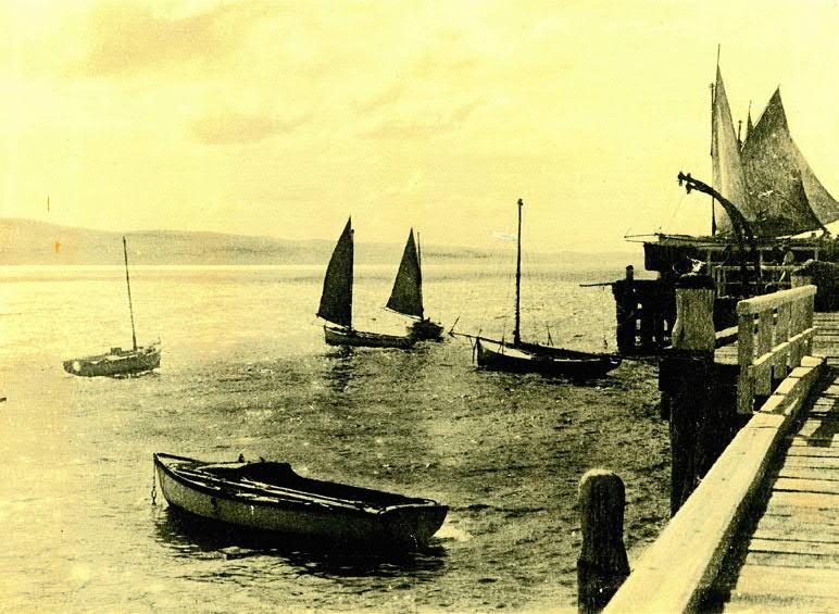
Fishing has undoubtedly played a key part in the development of Point Grey's history. As aforementioned within Aboriginal Cultural Heritage (p.18), the collection and consumption of fish and shellfish by First Nations People at Point Grey is well documented. After European colonisation, the 1930's saw the beginnings of the fishing industry in Lorne, and in 1948, the Fisherman's Co-Op was formed. Although no longer in operation, there are still various remnants of the fishing industry throughout the precinct. In addition, the site is the home to the Lorne Aquatic & Angling Club, and is regularly used and loved by amateur anglers across the state. There is significant opportunity to celebrate the site's maritime past, but also enable amateur angling to continue well into the future. Managing the various confluences between boat & trailer traffic and pedestrian access will be a key part of the project.
Historic Lorne Pier, approximate footprint
Lorne Pier is used yearround by visitors, amateur anglers, and for LAAC fishing competitions
The old boat ramp is no longer safe to use for launching, and is now primarily used for pedestrian access to the ocean & the Pier to Pub
Original Angler's building footprint, relocated from the
Approximate location of the former outbuilding servicing the old pier
Remnant tracks of the timber tram cart used for fish & timber
Original Fishing Co-Op building footprint, c.1949
Existing beach access ramp Informal parking area for 4WD's and trailers (tide dependent)
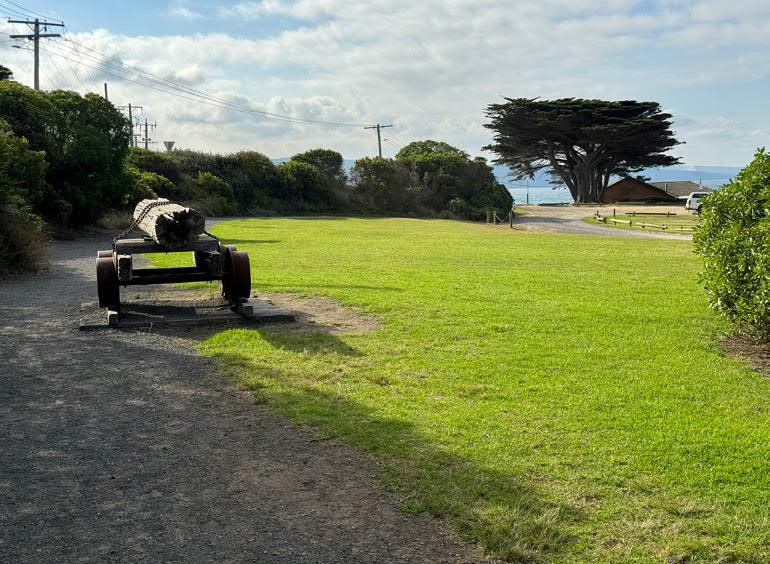
Historic timber tram cart preserved in the precinct
Weighing Barracouta.
Photo: Lorne Historical Society
Gracedale Guesthouse, c.1961
Zone of LAAC boat wash
Opportunities:
× Sculpture, artwork and/or signage to celebrate the significance of Point Grey for both First Nations Peoples and Europeans as a place to gather, collect and consume fish and seafood
× Improve efficiency & safety of circulation for both anglers & boating users
× Celebrate the site's maritime past but also enable amateur angling to continue well into the future by increasing facilities such as fish cleaning stations & benches
× Improve parking for boats and trailers (currently located on the coastal edge/ coastal crown land behind the Fishing Co-Op)
× Use reclaimed materials and cultural artefacts from the fishing industry throughout the design of the precinct
Constraints:
× Confluences between boat & trailers & pedestrian access
× Distance between the beach access ramp and the LAAC and existing boat wash
3.2, Natural Environment
× Climate Change & Coastal Adaptation
× Wind & Weather
× Topography
× Bushfire
× Existing Trees & Vegetation
× Ecological History
× Above View from Point Grey Pier of Eumeralla Formation at the southern end of Vera Lynn, also showing existing condition of coastal erosion edge. Photo: Vera Moeller, 2024
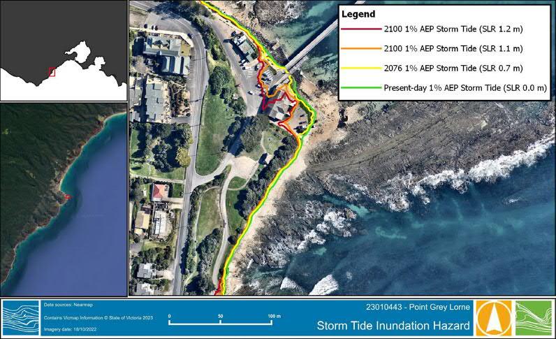
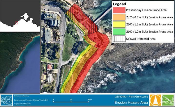
The development of a balanced and rigorous Coastal Adaptation Plan is of prime importance for this site to ensure all factors are considered in a proper process. The project team is currently coordinating with coastal engineers BMT to work through the coastal adaptation framework. Three workshop discussions with coastal engineers BMT have already taken place, including an on-site walk around with the Authority and representatives of the Project Working Group. A coastal values table has been returned, including interaction with EMAC.
A Coastal Hazard Vulnerability Assessment (CHVA) conducted by Water Technology provides essential information about the coastal hazards the site faces, such as sea level rise and erosion. The design team are using the CHVA to to engage with BMT in discussion about possible built futures for the site.
× Below
seawall
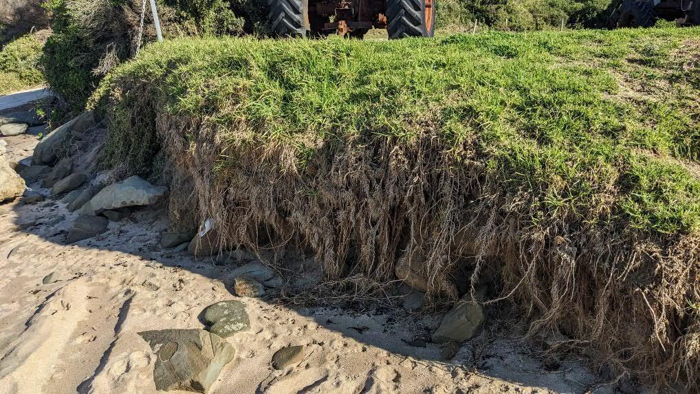
Shoreline to the north of the rock revetment is in poor condition, with evidence of erosion undercutting the existing vegetation
Existing rock revetment
Eumerella Formation rock shelf currently protecting the site from storm surge
The existing rock revetment is a state asset managed by DEECA and has been assessed as degraded and in need of rectification works by a certified engineer
Eumerella formation currently provides some protection from coastal erosion. As sea levels rise, there is possibility that waves and storm surge may penetrate further up the shoreface, as they are no longer dissipated by the reef
Erosion undercutting the vegetation on the shoreline scarp around the headline
Further information on erosion prone areas can be found in the Coastal Hazard Vulnerability Assessment (CHVA) undertaken by Water Technology
Existing
revetment at high tide.
Photo: Vera Moeller
× From top Inundation hazard extents identifed by Water Technology in the CHVA (Fig. 3-1).
Erosion hazard area identifed by Water Technology in the CHVA (Fig. 3-2).
Erosion undercutting vegetation on the scarp adjacent to the beach
Opportunities:
× Victoria's Resilient Coast - Adapting for 2100+
× Marine and Coastal Act: Siting and Design Guidelines for structures on Victorian Coast
× Coastal Adaptation Plan (CAP)
× Identify and confirm critical site values, coastal hazards, vulnerability & risk, and develop a clear coastal adaptation pathway
× Facilitate the resilience and equitable access to state significant maritime infrastructure through appropriate coastal adaptation design strategies
× Opportunity to repair and maintain the existing rock revetment
Constraints:
× Complicated use and development approval processes on coastal crown land
× Potential objections to adaptation measures from various stakeholders and interest groups
The site is located on a headland stretching out into the southern ocean and as a consequence it is exposed to high winds from the ocean to the south and east. The predominant wind is south westerly but winds from the south and east are common and bring cold conditions in winter. The Bureau of Meterology keeps records at the Cape Otway lighthouse where the windspeeds are recorded as calm for only 1% of the time. The LAAC have located the beer garden to the north of the current building with fencing to ensure this space is adequately protected from the wind.
A design for the site that provides improved wind protection would increase thermal comfort for social activities and result in a place that will be inviting in a wider range of weather conditions. Whilst not all external seating areas require wind protection, provision of sheltered, accessible and non-exclusive spaces will enable increased use.
Low and medium height shrub planting using native species can provide effective wind protection and shelter. Currently the site has minimal tree cover and is exposed to summer sun. Increased shade through trees and canopies will reduce sun exposure in the summer and increase the useability of the space.
The LAAC 'Lazarus Lounge' beer garden is located north of the building, sheltered from the prevailing southerly, however the fencing of this area currently limits equitable access to public land
The existing embankment provides some shelter from westerly winds
The form and height of the Fisherman's Co-Op building currently provides the carpark with some shelter from prevailing winds. To determine exact effects, wind flow modelling can be undertaken
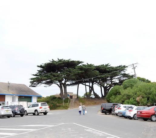
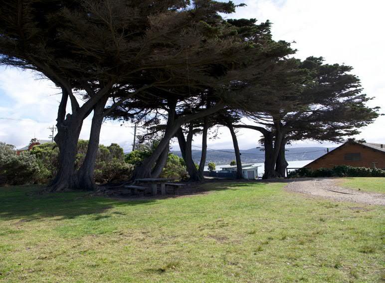
One of the few places to seek shelter from the afternoon sun is underneath the Monterey Cypress Pines in the picnic area
Southerly winds wrap around the headland increasing the exposure to wind around the pier
Shelley Beach is exposed to southerly and easterly winds & moderately sheltered from northerly & westerly winds
Opportunities:
× Work alongside EMAC to explore natural protection measures such as Indigenous tree planting
× Integrate art & sculpture opportunities within any weather shelter infrastructure
× Explore possibilties for weather shelter infrastructure to capture and store rainwater & solar energy
× Improve wind & weather protection across the site
× Increase opportunities to seek shelter from the sun
× Raise consciousness of wind, weather and wave patterns throughout the project
Constraints:
× Prevailing ocean winds from the south & south-west
× Providing wind protection to outdoor areas that will not limit equitable access to public land
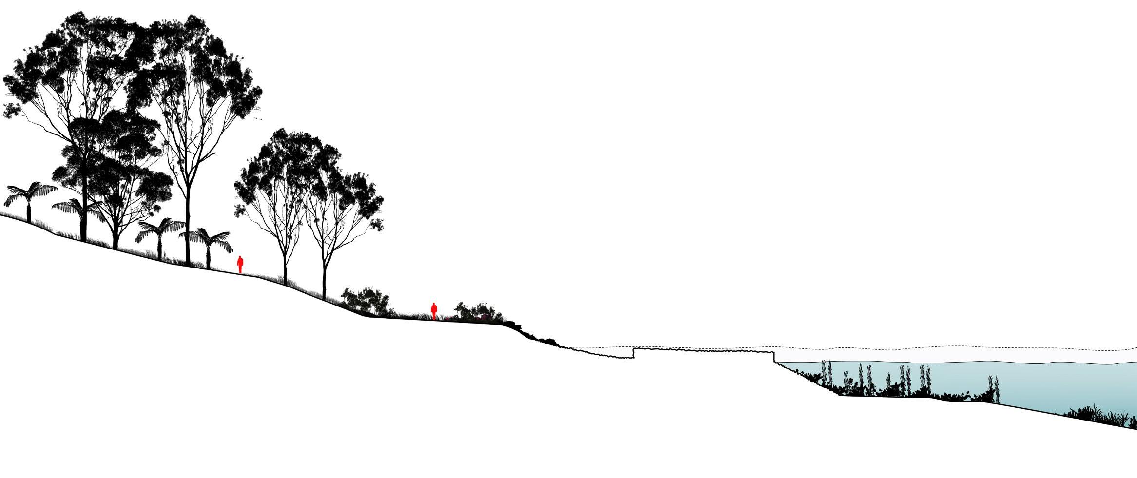
Point Grey's prominent location as a coastal headland makes it an ideal vantage point for expansive views across Bass Strait, over Louttit Bay, and back to Lorne. Point Grey's natural topography is highly distinguished from that of its surrounds, and like all significant landmarks, this quality makes it visibly legible from key points along the Great Ocean Road.
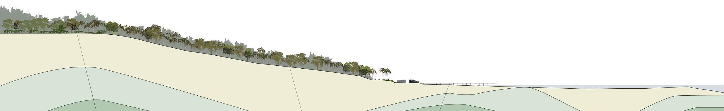
The existing topography of the Point Grey headland is steeply sloping from the Great Ocean Road to the upper side on the west of the site up at a level of + 13.0m, sloping down to the car park level at around + 4.30m and further down to the beach level at +0.0. This level change of 13m occurs over a maximum distance of 90m (1:7 average slope) and a mimimum distance of 37m (1:3 average slope). The steepness of the slope presents significant challenges for Universal Access.
Within the site, the topography presents five distinct levels:
× The upper level is the Great Ocean Road at +13m,
× A secondary terrace is present in the area of the overflow car park at +10m
× A mid-terrace around the toilet block at +8.20m
× A lower terrace including the car park, LAAC and Fishermans Co-op and Pier at +4.30m
× The beach/rock platform level at +0m
A steep embankment divides the Great Ocean Road from the lower precinct
Opportunities:
× Utilise the level changes to maximise views and sight lines
× Integrate vantage points and lookouts which include seating and/or art & sculpture opportunities
× Utilise the topography to advantage in order to 'hide' built form across the site
× Use the level changes across the site to allow for both connection and compartmentalisation between a network of spaces & areas
× Consider opportunities to provide equitable access to different levels by providing car parking spaces for mobility impaired users as an alternative to long ramped access
Constraints:
× The 13m level change requires major regrading to achieve Universal Access
× Significant excavation, earthworks and/or retaining structures to modify the existing topography may be cost-prohibitive
Bushfire consultants TerraMatrix have advised that any proposed vegetation in the landscape design will need to be low threat according to Section 2.2.3.2 exclusion criteria, or it will comprise classified vegetation. Additionally, if planting is in the defendable space of the proposed buildings, it will need to comply with further management conditions.
The existing siting of buildings is considered an acceptable response to the bushfire risk, subject to minimum defendable space setbacks from classified vegetation being achieved.
All buildings should be designed and constructed to a minimum BAL-29 construction standard, which will likely not pose appreciable design/cost challenges. Additionally, consideration should be given to ensuring no combustible materials are used for the external building fabric and associated decks and steps, as another favourable additional protective measure if possible.
A minimum 13m, 27m or 35m of defendable space should be provided around the buildings, depending on the BAL rating and chosen approved/alternative measure pathway. The defendable space must meet the specifications for vegetation management in Table 6 to Clause 53.02-5. A landscape plan should be prepared to illustrate the plantings and landscaping to achieve these specifications.
Exotic Vegetation Cover:
Dominant Weedy/exotic species: Numerous woody weeds including Sweet Hakea, Mirror Bush, Sweet Pittosporum, Briar Rose and young Cypress. Grassy/herbaceous weeds include scattered (5 -10% cover) of Bucks-horn Plantain, Wild Oats and Kikuya.
Southern end of Patch 9
Looking south along lower edge of patch 9
Comments Numerous woody weeds including Sweet Hakea - which may have been planted?
Looking east a long lower edge of patch 9
Southern end of Patch 7
Northern end of patch 7
Explore opportunities for robust but creative fire-resistant design that complies with the Bushfire Management Overlay (BMO)
As an identified Neighbourhood Safer Place, the project has the potential to build awareness of bushfire within the community
Particular locations for building siting may necessitate the removal of existing vegetation under the Bushfire Management Overlay (BMO)
The default vegetation management standards that will need to be achieved for BMO compliant defendable space are:
Grass must be short cropped and maintained during the declared fire danger period
Northern end of patch 7
× All leaves and vegetation debris must be removed at regular intervals during the declared fire danger period
Looking north along upper side of Patch 7
× Within 10 metres of a building, flammable objects must not be located close to the vulnerable parts of the building
× Plants greater than 10 centimetres in height must not be placed within 3 metres of a window or glass feature of the building
14
× Shrubs must not be located under the canopy of trees
× Individual and clumps of shrubs must not exceed 5 sq. metres in area and must be separated by at least 5 metres
× Trees must not overhang or touch any elements of the building
× The canopy of trees must be separated by at least 5 metres
× There must be a clearance of at least 2 metres between the lowest tree branches and ground level’ (Victoria Planning Provisions, Clause 53.02).
Looking south along lower side of the patch
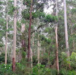
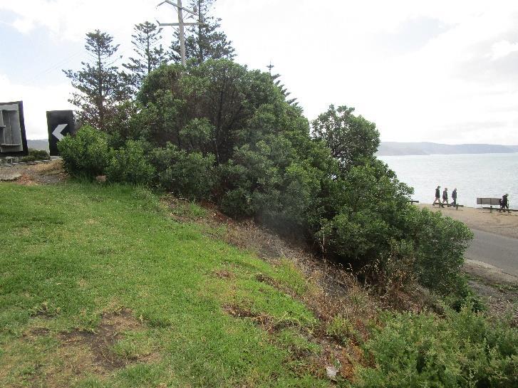
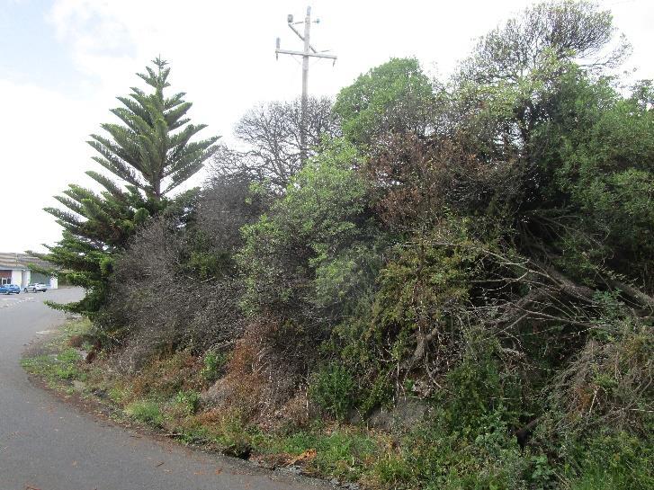
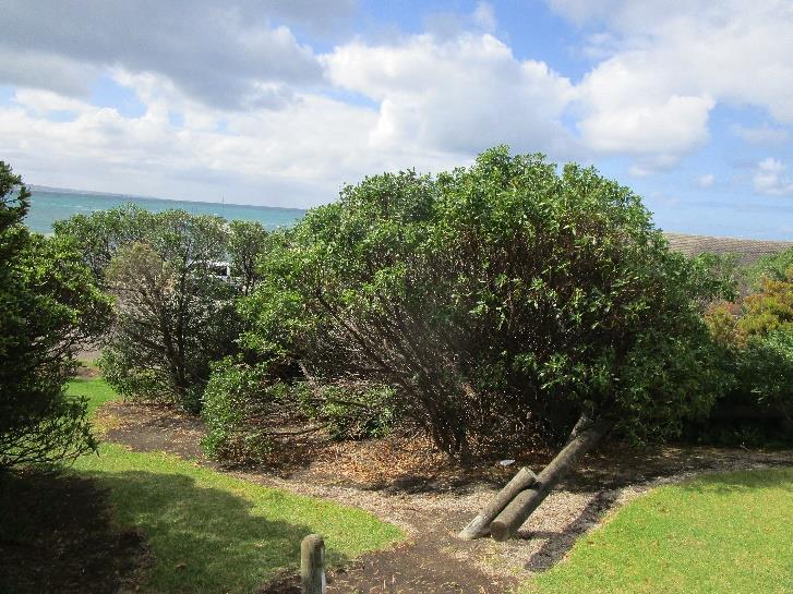
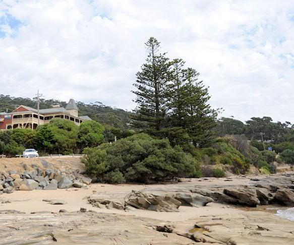
The existing site includes roads and car park, large areas of exotic lawn with native vegetation (Coastal Headland Scrub) present on the steep coast edge embankments at the back of the beach along the foredunes of Shelley beach and Lorne Beach, with more modified patches that have colonised the embankment between the car park and Great Ocean Road. Native Norfolk Island Pine trees have been planted to the north of the site and mature exotic Monterey Cypress trees are established adjacent to the exisiting toilet block.
The 2024 Ecological survey by Sundew Ecological Services found that the Coastal Headland Scrub includes Coastal Tea-tree Leptospermum laevigatum , Coast Beard-heath Leucopogon parviflorus and Common Boobialla Myoporum insulare . The ground layer consisted of Seaberry Saltbush Chenopodium candolleanum , Bower Spinach Tetragonia implexicoma , Coast Tussockgrass Poa poiformis , Australian Salt-grass Distichlis distichophylla , Knobby Club-sedge Ficinia nodosa and Bidgee-widgee Aceana novae-zelandiae . Exotic species included Kikuyu Pennisetum clandestinum , Perennial Veldt-grass Ehrharta calycina , Buffalo Grass Stenotaphrum secundatum , Couch Grass Cynodon dactylon , Hare’s-tail Grass Lagurus ovatus , Large Quakinggrass Briza major and Rough Sow-thistle Sonchus asper .
Refer Appendix A.4.3: Ecological Assessment
Monterey Cypress Cupresssus macrocarpa
Norfolk Island Pine Araucaria heterophylla
Coastal Headland Scrub
Kikuyu Lawn
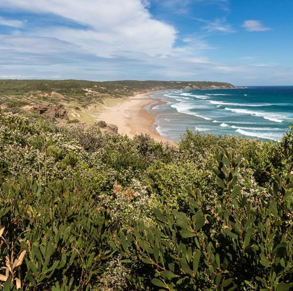
Coastal Headland scrub (EVC 161)
Shrubby Foothill Forest (EVC 45)
High Energy
Littoral Rock High Energy
Infralittoral Rock
Littoral sand
Sub Littoral sand
Opportunities:
× Include Eastern Marr biocultural values and work alongside Traditional Owners on planting selection and design
× Establish a strategy for enhancing the site vegetation to improve the amenity and biodiversity of the site
× Enhance vegetation cover to provide shelter, protection and reduce coastal erosion
× Enhance and amplify the natural character of the site to help connect with the stories of the place and the cultural heritage
× Tree planting should be located to frame and enhance key views
× Protect the indigenous trees and vegetation and remove the exotic species to enhance sustainability and biodiversity
× Ensure ongoing funding for the effective maintenance and establishment of vegetation on the site
× Consider the longevity and appropriateness of all trees on site and develop a longer term replacement strategy
× Explore opportunities to increase the canopy cover of the site, revegetating different areas with additional tree planting
× Consider revegetation activities that involve the local community to build a sense of connection with natural areas at Point Grey
Constraints:
× Alignment with the Authority's Coastal Vegetation Strategy (CVS)
× Coastal site exposure requires a strategic revegetation strategy with appropriate & safe species
× Establish the budget for ongoing landscape maintenance to inform design strategies
× Vegetation management standards in the Bushfire Management Overlay (BMO)
× Useful Life Expectancy (ULE) of large trees
× The existing soil and slopes are highly modified, increased exposure and weeds in the seedbank may hinder revegetation
3.3, Access & Movement
× Pedestrian Connections
× Car Access
× Boats & Trailers
× Buses
× Above Historic image shows difficulty for pedestrian access posed by site level difference between Great Ocean Road and beach / rock shelf, as well as indicating potential for a strong relationship between the historic Grand Pacific Hotel and the Point Grey pier and boating activities.
Photo: Lorne Historical Society
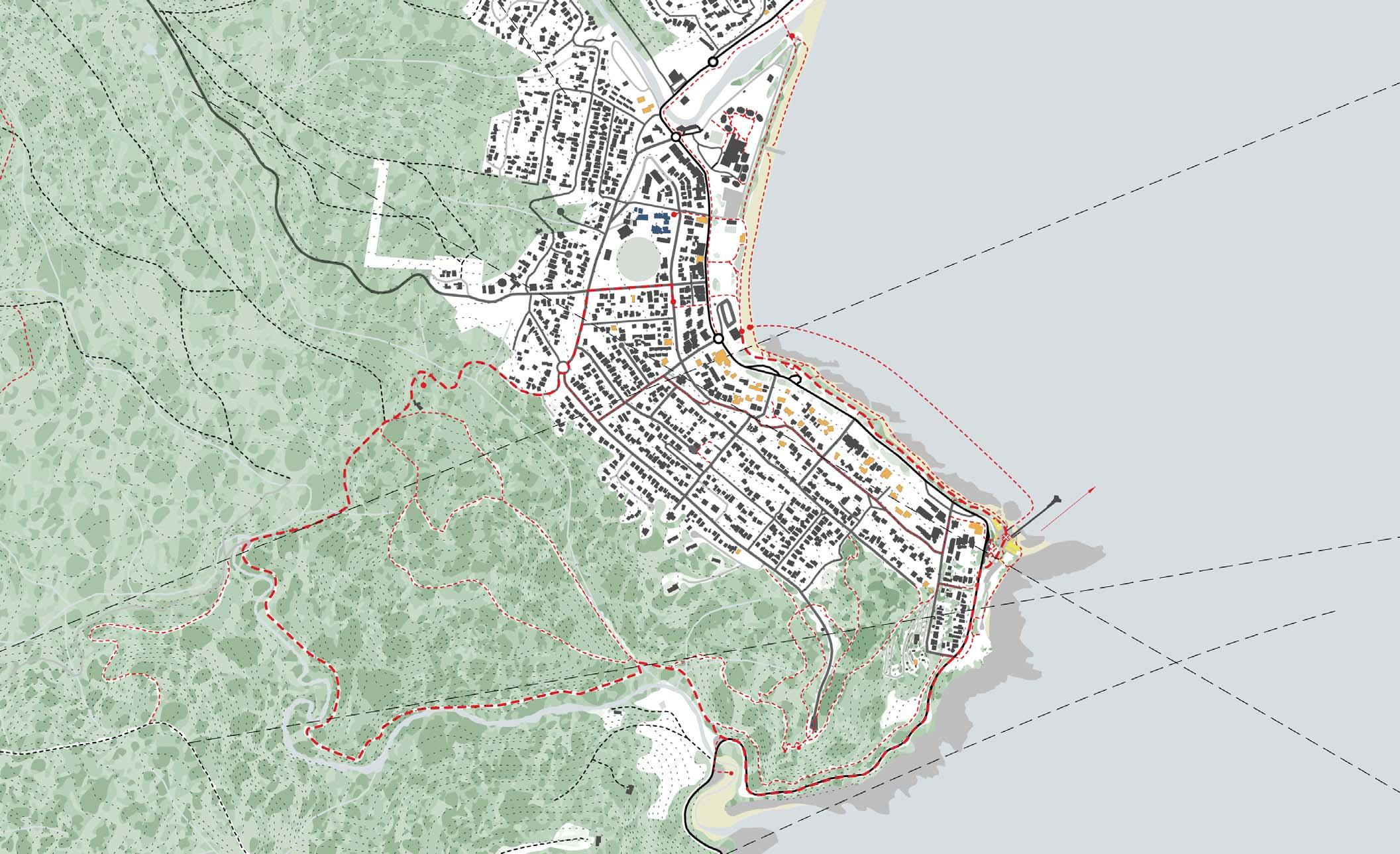
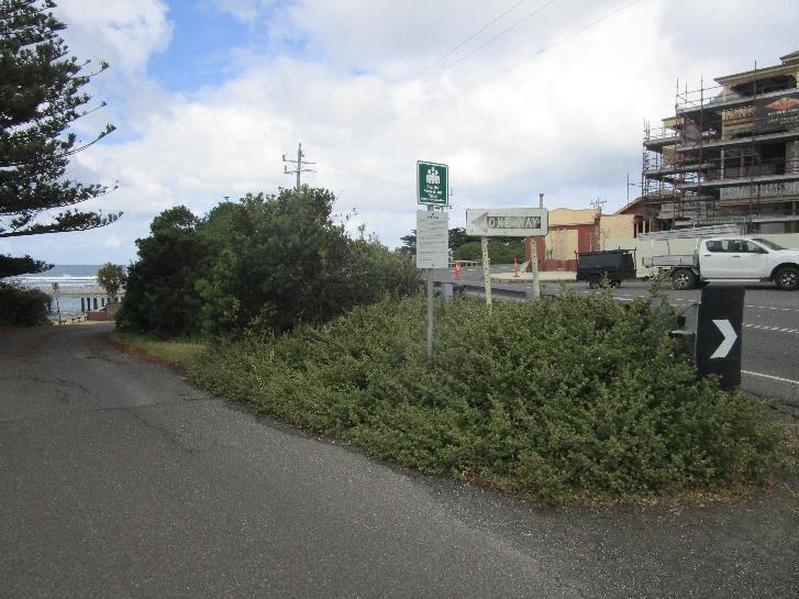
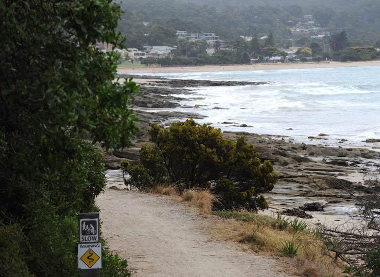
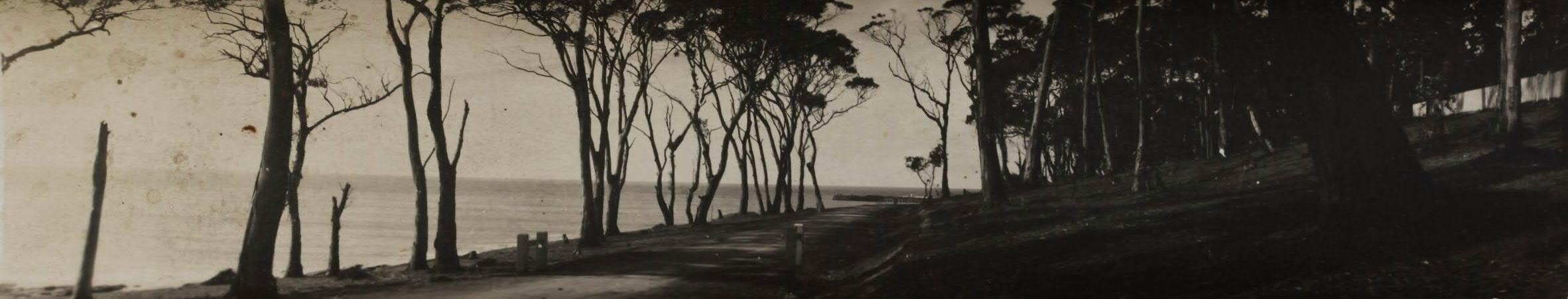
The Doug Stirling Walking Track (DSWT) is an established and well-loved pedestrian route that traces the coastline, connecting Lorne Beach and Point Grey. It is used regularly by pedestrians, cyclists, beach-goers and visitors, and offers scenic views across Louttit Bay. The DSWT is also the only safe pedestrian path to reach Point Grey from Lorne, as there is no pedestrian footpath along the Great Ocean Road.
Given the DSWT appears to end at the Lorne Pier, there is significant opportunity to extend the track around the headland towards Shelley Beach & Very Lynn, in addition to improving the safety and signage of pedestrian circulation throughout the site.
There is also evidence of 'desire line' walking tracks between the Great Ocean Road and the lower precinct which could inform future site design.
of desire line from the road into the precinct
Possible pedestrian connection into the Point Grey precinct from the Great Ocean Road
Opportunity to establish visible extension of the Doug Stirling track to the picnic area & beyond Opportunity to establish furniture and viewiing opportunities along the Doug Stirling Walking Track
× Below
Lorne Historic Tramway Track. Photo: NMBW Possibility to extend the Doug Stirling Walking Track along the headland
to Lorne Historic Tramway Track
Doug Stirling Walking Track appears to end at the Lorne Pier
Opportunities:
× Improve public seating offerings and places to pause & enjoy the scenic views
× Immerse walkers & visitors in the coastal environment through integration of lookouts and opportunities for bird watching
× Implement safe pedestrian access throughout any new car parks, as well as areas with competing uses
× Improve the current conflict between pedestrians, boats and trailers
× Implement Universal Accessibility throughout the precinct wherever possible
× Improve connectivity of the Doug Stirling Walking Track from the Lorne Pier, around the Point Grey headland to the paths south of the precinct, in particular the Lorne Historic Tramway Track
× Implement nature-based and/or extensive indigenous planting strategies to mitigate the effects of coastal erosion on the Doug Stirling Walking Track, pending engagement with EMAC and delivery of the Coastal Adaptation Plan
× Consider the use of existing 'desire lines' within future site design
× Improve pedestrian access to public amenities by relocating them closer to the central lower precinct
Constraints:
× Existing site levels & topography
× Coastal hazards: s ea level rise , erosion, storm tides
× Boat and trailer circulation
× Universal Accessibility to the coastal edge
× Permeability of paving and accessibility
3.3, Access & Movement: Car Access & Parking
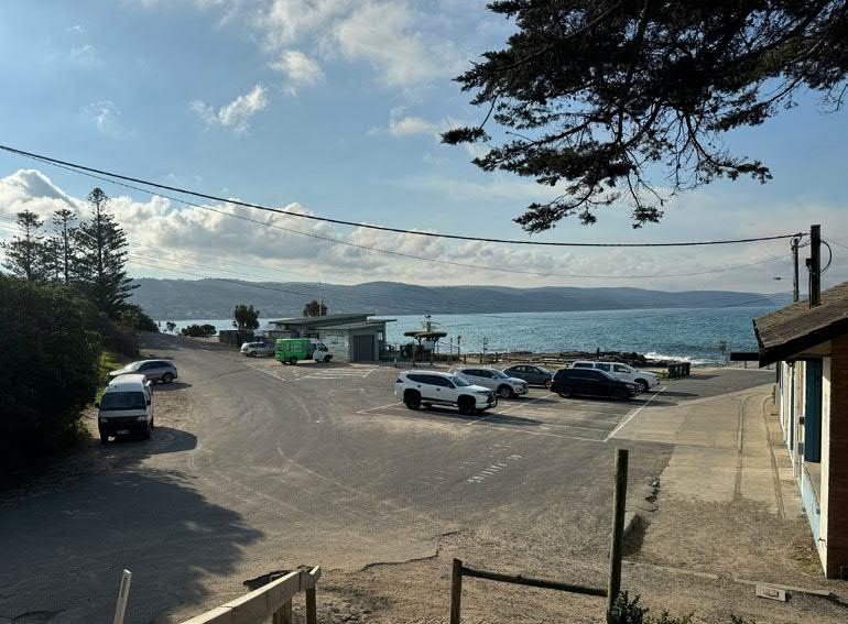
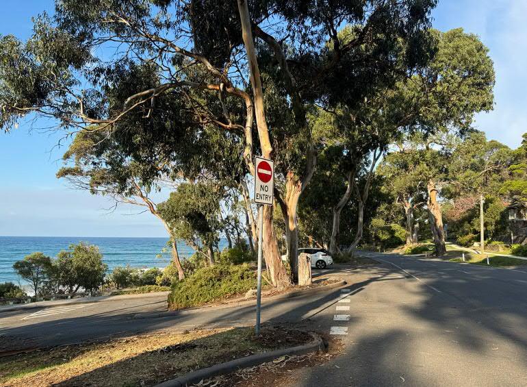
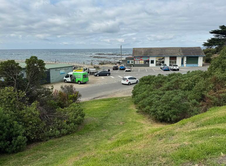
As it stands, car movement across the site at Point Grey is controlled by an 'entry only' point from the north which is an easy manoeuvre from the Great Ocean Road for those coming from Lorne and an ideal way to arrive to the site. Exiting from the south only, means cars perform a straight forward 'loop' around the site and are encouraged to circulate in a singular direction which limits confusion between other vehicles and pedestrians. For those cars arriving from the south, the location to turnaround is down in the lower carpark adjacent to the pier. Current access to overflow parking and parking along Shelley Beach is simple to navigate to and from.
Existing one-way entry into precinct. Easy to negotiate coming from the north. Not an ideal exit location nor an entry point coming from the south.
A range of gravel carparks located close to the LAAC / commonly occupied by members of and visitors to the LAAC.
Main tranche of carparking at the lower level of the precinct. Occasionally used for CTU's. Traffic and pedestrian management constraint due to 'shared' nature of the lower level.
Overflow carparking for boat and trailer use, as well as larger events and festivals on lawn. Need to preserve certain vistas and the natural setting of Point Grey.
Limited carparking on gravel apron adjacent to public toilets Road widening for two-way access will be required at the southern entry/exit
Occasional overflow carparking. Need to preserve certain vistas and the natural setting of Point Grey. Access down gravel driveway to Shelley Beach carpark.
the Lorne Pier.
Opportunities:
× Minimise car movement and parking at the lower level of the site in preference of public open space at the coastal edge
× Minimise boat and trailer parking on coastal crown land adjacent to the Fishing Co-Op
× Increase unsealed surfaces (gravel, porous paving, grass) across the site and reduce the amount of asphalt roads & curbs to increase permeability and reduce stormwater runoff
× Increase efficiency of the existing overflow carparking at the upper level adjacent to the Great Ocean Road in order to alleviate space in the natural setting on the eastern bank adjacent to the midden and public toilet
× Widen southern entry road to accommodate turning circles for larger vehicles (CTU's) as well as easing two-way passing
× Reduce parking on western embankment behind the LAAC to allow planting and reinstatement of original topography
× Water Sensitive Urban Design strategies for any new car parking
× Provide parking for Universal Access and all abilities
× Planning Scheme Planning Practice Note 22: Car Parking Provisions (PPN22)
× Widening of the southern entry to accommodate turning circles for larger vehicles
× Compliance with Australian Standards for accessible car parking requirements (AS1428.1-2009)
Constraints:
× Limited space for additional car access routes and parking facilities, leading to difficulty meeting regulatory access and parking requirements
× Potential conflicts with pedestrian pathways and other transport modes
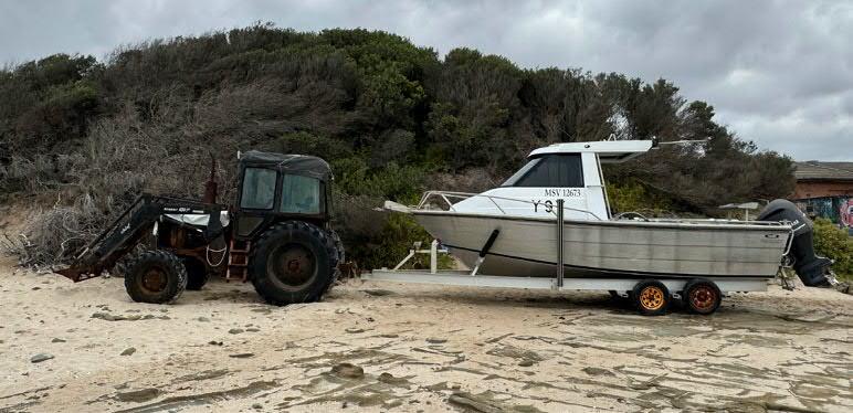
Vehicles towing boats and trailers are also referred to as CTU's (Car Trailer Unit). These units arrive to Point Grey coming either from the north and use the single lane 'entry only' driveway, or conversely, the southern 'entry and/ or exit' driveway for vehicles coming from the south. It is an extremely difficult and dangerous manoeuvre for CTU's coming from the south to perform a right hand turn across traffic to use the northern entry driveway.
When exiting, CTU's use the southern driveway to either turn left and head further south towards Apollo Bay or turn right and return north towards Lorne. In the instance of the latter, the CTU's need to cross traffic coming around the Grand Pacific Hotel corner.
On site, CTU's circulate towards the lower level behind the existing Fishing Co-Op building to use the existing boat launch ramp. Once on the beach, CTU's perform a three-point turn to unload and launch the boats into the channel. From there, boats and trailers are either left on the beach if the tide is low or are parked back up in the precinct, often in the existing overflow car park. After fishing, boats are retrieved and commonly driven across the precinct to the boat wash adjacent to the LAAC. Here they are washed and parked to dry and finally, exit back across the precinct towards the southern driveway.
Existing one-way entry into precinct. Easy to negotiate coming from the north for larger vehicles including CTU's.
Boat wash function associated with LAAC. Traffic management constraint of CTU's double crossing the Precinct.
3 bays of parking for CTU's while fish cleaning activities are taking place and boat is drying post wash.
Gravel area commonly used for CTU and Tractor parking, loading and unloading prior to and post boat launch. Ideal location for CTU's adjacent to boat ramp, yet is currently located on land that could be public open space
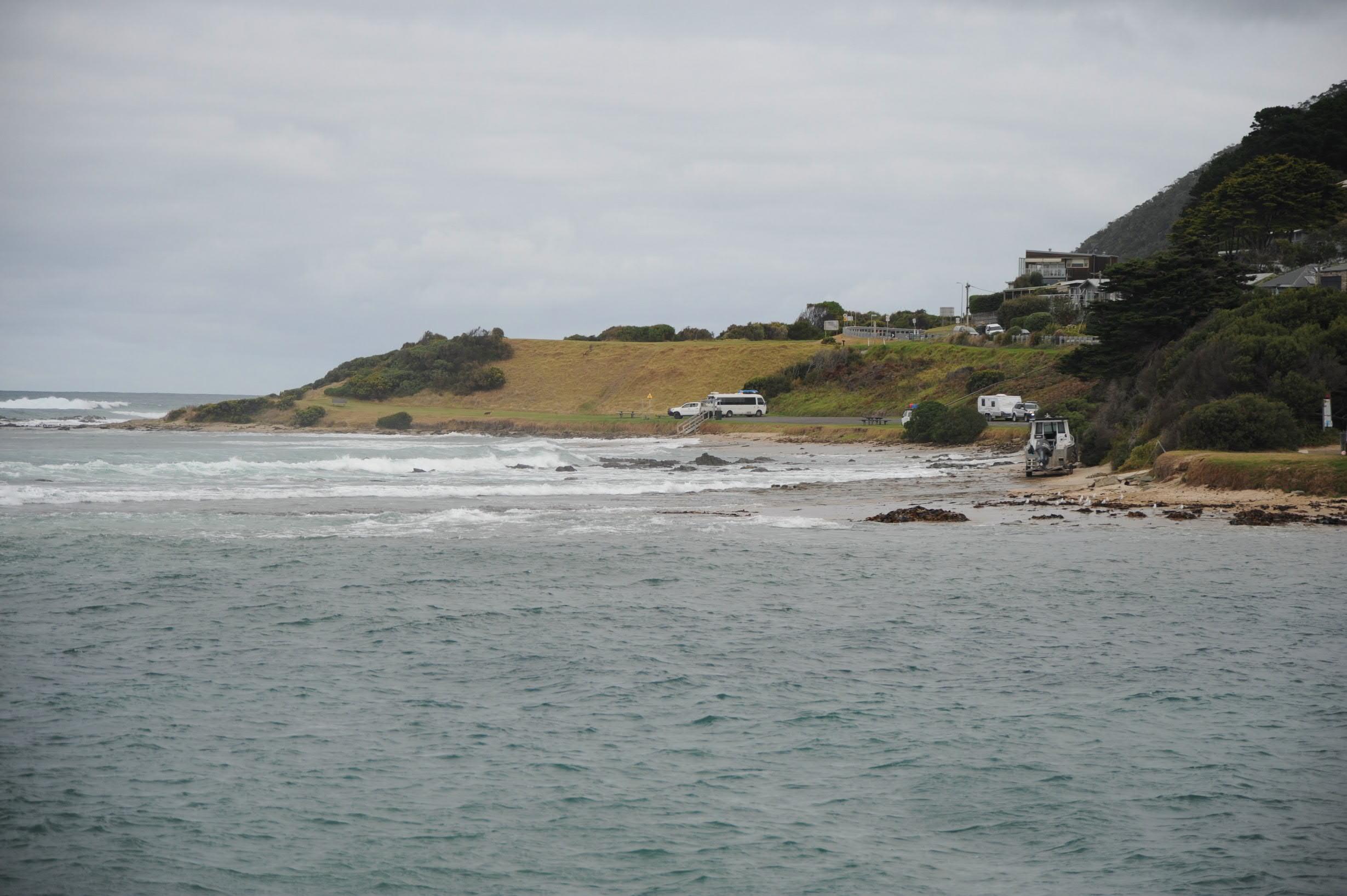
Existing boat ramp and beach parking / turning to launch boat within channel. Commonly, tractors, 4WD's and trailers parked on the sand during low-tide. There is limited space to conduct a 3-point turn at high tide
Opportunities:
× Improve the safety and efficiency of the state owned Lorne Boat Ramp, which has been identified for renewal under the Victorian Recreational Boating Strategy 2021-2030
× Include opportunities for efficient parking, queueing, boat washing and fish cleaning immediately adjacent to the boat ramp/beach access ramp
× Identify alternative and/or additional locations for boat washing, fish cleaning and boat and trailer parking
× Identify alternative locations for boat and trailer parking to increase equitable access to the coastal edge around the Point Grey headland
× Limit and/or control movement of large vehicles across the precinct
Constraints:
× Existing location of the boat wash & fish cleaning station adjacent to the LAAC
× CTU turning circles & vehicular movement require careful integration with real usage scenarios, such as boats queueing to be washed
× Space required to widen southern entry to accommodate turning circles for boats and trailers
× Alternative boat and trailer parking locations may be located too far from the boat launch channel
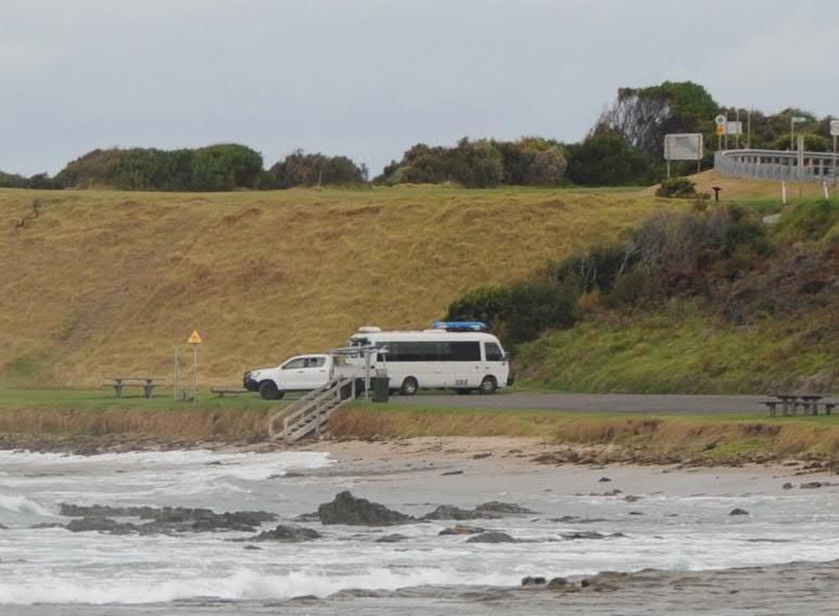
Access & Movement: Buses & Large Vehicles
In this instance, the term 'bus' refers to any coach, mini-bus, van or motor home. Commonly, these vehicles arrive to Point Grey from the north and exit towards the south. Point Grey is a common pit-stop for long vehicles due to its relatively open and easy to negotiate parking conditions. A study of long vehicles across the greater Surf Coast Shire was undertaken by AECOM in 2014 and found that long vehicle parking facilities were poor throughout Lorne. It noted that the only designated long vehicle parking bay was provided at the information centre and had a capacity for approximately three vehicles. It was further acknowledged that many tour buses proceeded through the township and stopped further along the Great Ocean Road at Point Grey due to the lack of parking facilities. The study suggested there is possibility for long vehicle parking to be incorporated into the future redevelopment of Point Grey to appease the shortfall back in town.
Single lane entry from the north appears to be a straightforward manoeuvre for long vehicles including buses
Pull-off zones adjacent to Point Grey off the Great Ocean Road are commonly used for long vehicles delivery or waiting for passengers Long vehicles use the lower level to drop-off passengers visiting Point Grey Precinct. Presumably these buses then move on towards the Shelley Beach carpark or back up to the Great Ocean Road where they use larger pulloff zones to wait for their passengers
Gravel carpark appears to be able to support longer vehicles including buses. Also good adjacent to public toilet and waste disposal
Small buses appear to access the Shelley Beach carpark down the gravel driveway as it is easier to manoeuvre on flatter terrain
× Below Passenger bus parked at Vera Lynn.
Photo: Vera Moeller, 2024
Opportunities:
× Assess the viability of acommodating large buses within the Point Grey precinct
× If deemed viable, manage any long vehicle movement safely throughout the site, particularly at the lower level as to not impact public space and pedestrian circulation
× Improve signage throughout the precinct to assist in traffic management
× Opportunity to improve relationship between potential bus drop-off and public site amenities/facilities
Constraints:
× Existing road widths, gravel surfaces & boat trailer movement may render bus access into the precinct unsafe
× Limited space within the precinct for safe drop-off of visitors
× Limited space within the precinct for safe bus parking
× Existing tour bus schedules may not include regular stops at Point Grey
× Tour buses may place increased demands on circulation and pedestrian safety
× Public Realm
× Events
× Food & Drink Premises
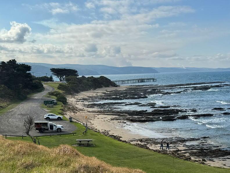
× Above View from the overflow car park looking out over the Lorne Pier.
The Airies Inlet lighthouse is visible in the distance.
Photo: Vera Moeller, 2024
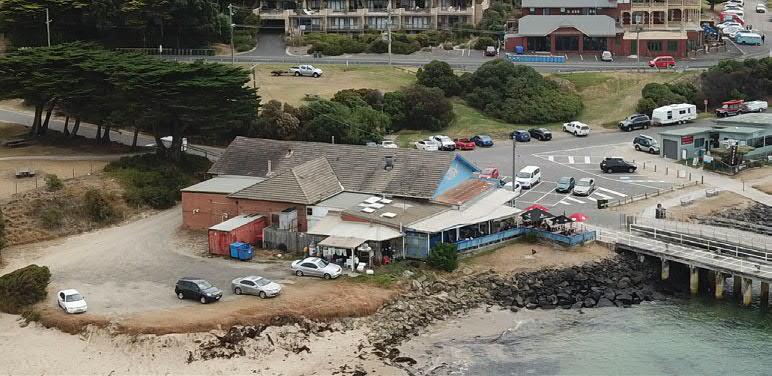
Point Grey is a maritime place with a unique character, most which is created by the two existing buildings on the site that have historically framed a central space at the end of the pier. The open, public nature of this space should be preserved for public maritime use. A significant opportunity exists for the lower car park to be re-imagined as a 'shared zone' public plaza to better facilitate coastal use, enable equitable access to the coastal edge and the Lorne Pier, and allow the 'theatre of fishing' to unfold unimpeded by excessive vehicular movement and parking.
A major opportunity also exists in extending and finishing the Doug Stirling Walking Track at the true head of Point Grey - currently hidden and relatively inaccessible behind the Fishing Co-Op building - enabling public access to the unique Eumeralla Formation reef.
× Below
Key viewpoints
Opportunity to develop seating opportunities to sit, pause and take in the scenic views across the bay
Views across Louttit Bay and the Lorne Pier from the existing LAAC 'Lazarus Lounge'. The current siting also has a strong relationship with the existing Doug Stirling Walking Track
The public realm or 'plaza' is delineated by the existing piers and boat ramps and the space between the two existing buildings at Point Grey
Opportunity to create a public lookout with seating & beach access stair at the Point Grey headland, by extending the Doug Stirling Walking Track. A beach access lookout and/or stair in this location would also avoid the use conflict of pedestrians having to access Vera Lynn from the beach access ramp
Opportunity for the existing concrete slab to contain a pergola with seating or an artwork/interpretation
Picnic tables and BBQ's south of the public amenities block do not maximise views toward the ocean
Amenities block obscures sight lines of the beach access stair from the existing picnic area
View from the pier towards the Point Grey headland, with the midden visible beyond the boat ramp.
Photo: Vera Moeller 2024
Opportunities:
× Build upon the sense of place that currently exists at Point Grey and heighten the sense of connection to this unique marine environment
× Protect and enhance key views throughout the site (Lorne, Louttit Bay, Vera Lynn/Shelley Beach)
× Opportunity to heighten the sense of landscape throughout the precinct and include water-sensitive urban design strategies wherever possible
× Public open areas may provide opportunities for sculpture, art & historical representation of Point Grey's history throughout the precinct
× Improve access to the point/headland at Point Grey by extending the Doug Stirling Walking Track and provide seating, outlooks, and a beach access stair
× Implement experiences that provide locals and visitors with opportunities to learn and build a connection with the coast and surrounding Country
× Implement recognition of cultural heritage wherever appropriate throughout the precinct
× Fre e and unimpeded pedestrian movement across the site
× Safe opportunities to sit, pause and enjoy the views
× Opportunities to increase protection from the sun and wind
× Provide open space & associated amenities to safely conduct the range of events that occur at Point Grey
Constraints:
× Limited locations for car parking
× Public open space must be coordinated with existing marine and coastal infrastructure & historical/cultural elements
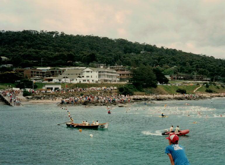
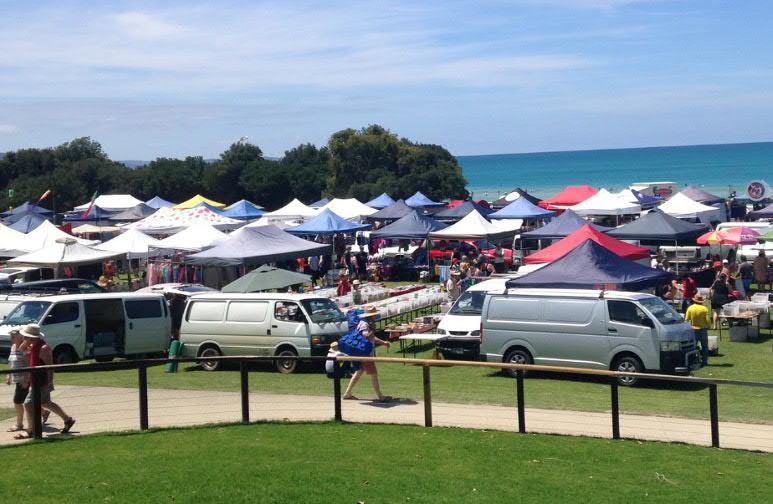
Point Grey hosts a wide variety of events during the year varying from small scale gatherings to large events including:
× Lorne Aquatic & Angling Club: BBQ's and music events
× The Pier to Pub
× Lorne Sculpture Biennale
× Lorne Mountain to Surf
Given Point Grey has always been a significant meeting place, any future proposal should carefully consider how the infrastructure and amenity throughout the precinct can be upgraded to better facilitate a range of events and public gatherings.
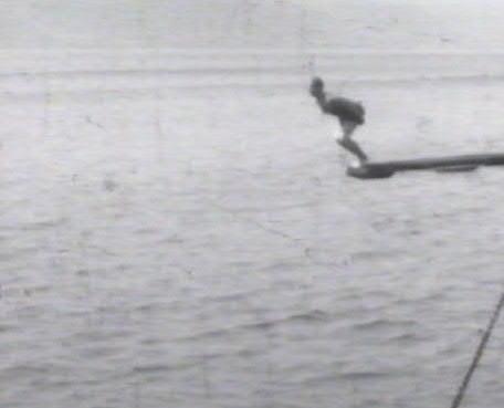
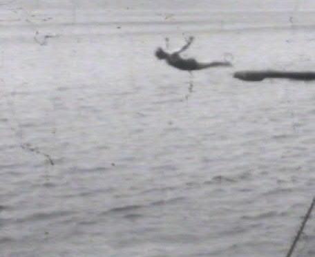
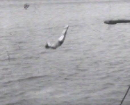
× Clockwise from right Lorne Scultpure Bienalle, artworks by Robert Hague (left) and Geoffrey Ricardo (right). Photo: Lorne Sculpture Bienalle LAAC Fishing Competition.
Photo: LAAC Facebook.
Lillian Beaurepaire diving off the Lorne Pier. Photos: stills from 'Lorne & The Great Ocean Road, The Halcyon Days, 1928-35.
Opportunities:
× Integrate suitable infrastructure and amenities to enable Point Grey to facilitate a range of events, such as farmers' markets & community gatherings. This may include increased shade & shelter, specific services upgrades and power provision, and more appropriately located public amenites such as toilets and wash facilities
× Ensure sustainability and waste management is included in all permits for events at the site
× Explore opportunities for the site to accomodate public educational events
× Consider developing existing relationships with current cultural events that exist throughout the precinct
Constraints:
× Seasonal variation of visitation and tourism
× The exposed marine environment may not be suitable for some events
historic photograph shows the co - operative building nearing completion . The building had a gable
× Built Form
× Food and Drink Premises
× Existing Areas
solid brick walls, and a darker band to the lower section. There was an open processing area with a raised floor/platform along the west elevation and a lower, adjacent area to the south (possibly cool rooms).
3.5, Development & Building Footprint: Built Form
There are 3 buildings currently on the site: The Fishing Co-Op, Lorne Aquatic & Angling Club (LAAC) and the public toilet block.
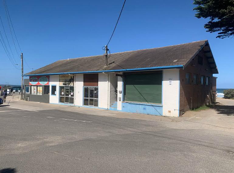
× The Fishing Co-Op
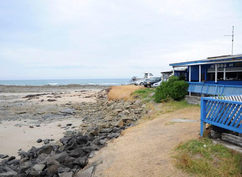
The Fishing Co-Op has undergone multiple extensions since its origins in 1949, with cool rooms, storage, hoists and office space added to support commercial fishing operations. Although many commercial fishing operations were active at Point Grey, the 21st century saw the decline of fish numbers and the subsequent decline of commercial viability. At the time of writing, there 2 commercial fishermen operating from the site. A Greek restaurant conducted business from the ocean facing portion of the building for some time but closed in 2017 and the building has seen limited use since. The Lorne Historical Society holds photographs and artefacts from the collection inside the Fishing Co-Op, and this display is open to the public on weekends. Although the existing building includes material that can be reinterpreted and re-used, there are large portions which are structurally unsound. It is sited in the portion of the site most prone to coastal hazard, and despite strong community support for this structure, its future needs to be carefully considered.
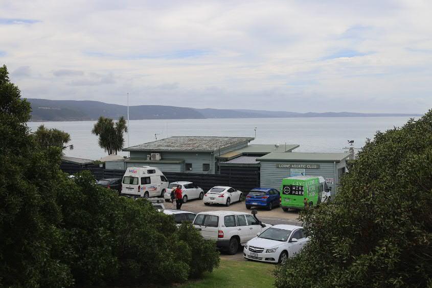
× The LAAC
The existing LAAC building has an interesting history of being the transported café and kitchen wing of historic homestead ‘Gracedale’ [John Agar, ‘The Lorne Aquatic and Angling Club’ The Committee for Lorne, Friday 16th February 2024, p.18] This structure has been adapted with highly functional areas for fish cleaning and boat washing, as well as a limited license for external wind protected areas to the north. The membership is strong and the LAAC is a casual social hub for the community that differs to the commercial offerings along Mountjoy Parade. The VCAT 257 decision (10 March 2022) clearly states that the LAAC is regarded as coastal dependent and therefore its operations are appropriate to continue on the site.
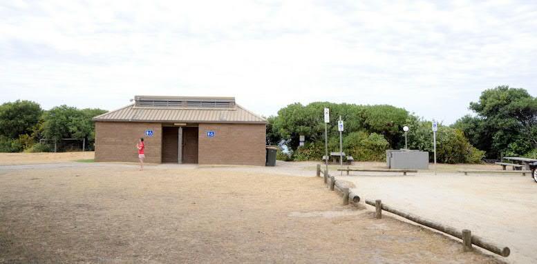
× Public Toilets
Above the old Fishing Co-Op is a small public toilet block associated with a picnic area and small gravel car park. This location is inappropriate, given it sits atop of a cultural heritage site, and this is supported by the recent (2023) Native Title determination for the Eastern Maar. It would be desirable to demolish this structure and rebuild more suitable public toilets on the lower precinct.
Plumbing, water supply, power, communications and fire services have been investigated as part of Phase 01 of this project. Although existing connections exist and are proposed to be re-used, further work is required to understand capacity loads and maintenance needs. For example, the project assumes that gas connection will be changed over to electricity, in line with contemporary sustainability stipulations. Information regarding these and other aspects of services infrastructure will be further elaborated in Phase 02.
Transported cafe and kitchen wing from historic 'Gracedale' homestead
Current canopy and fencing facing the pier is inaccessible and prevents pedestrian access around the headland
Original 1949 Fisherman's Co-Op building, shown red
Opportunity to retain or re-imagine original crate winch
Opportunity to increase permeability and access to all sides of any future building in this location
1:500
Opportunities:
× Reduce the size and impact of building footprints across the site to increase permeability, access and amenity
× Consolidate buildings uses where appropriate
× Reduce the height and scale of buildings to enhance important views, and consider the opportunity for accessible rooftop spaces, where appropriate
× Include appropriate building setbacks in line with the Marine & Coastal Act 2018
× Implement Environmentally Sustainable Design (ESD) wherever possible
× Consider the reuse of construction materials in any future works if demolition is deemed necessary
× The design of any Food and Drinks premises should provide publicly accessible spaces and amenity for a range of users, e.g. outdoor shade, seating and tables for community events & meetings
× Marine & Coastal Policy
× Marine and Coastal Act (MACA)
× Victoria’s Resilient Coast, Adapting for 2100+
× Siting and Design Guidelines for structures on Victorian Coast:
× Only structures that functionally need to be located near or in the water, or that significantly contribute to social values, should be on marine and coastal land
× Only the elements of the proposed structure that need to be located on marine and coastal Crown land should be included in the design
× Planning for new structures or the redevelopment of structures must consider how it will avoid vulnerable areas and adapt to increased coastal hazards
× The design must ensure that the structure can adapt to the anticipated increase in coastal hazards including sea level rise over the sructure’s intended lifespan
× Options to avoid (for new structures), remove, retreat or relocate (for existing structures being updated/additional works) must be satisfied before proceeding
× Most elements of the redesign of existing structures should be located within the existing structural footprint
× The design of new structures should minimise the footprint (area and height)
Constraints:
× Structural advice from both Yttrup and RMG has suggested that significant cost and engineering intervention will be required to upgrade the Fishing Co-Op building to current design and regulatory standards
× Retrofitting existing building fabric for ESD may be cost-prohibitive
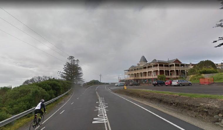
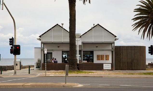
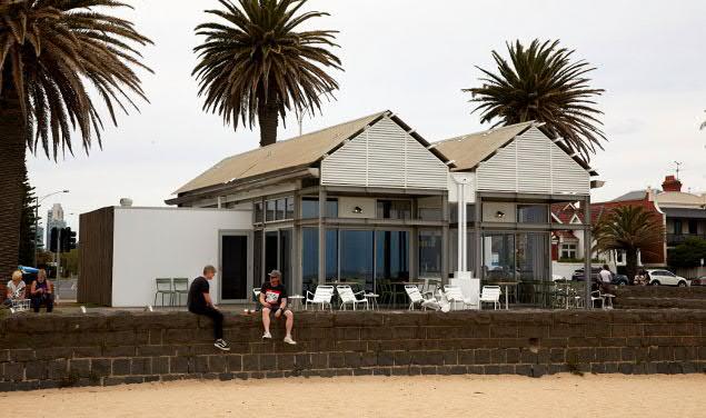
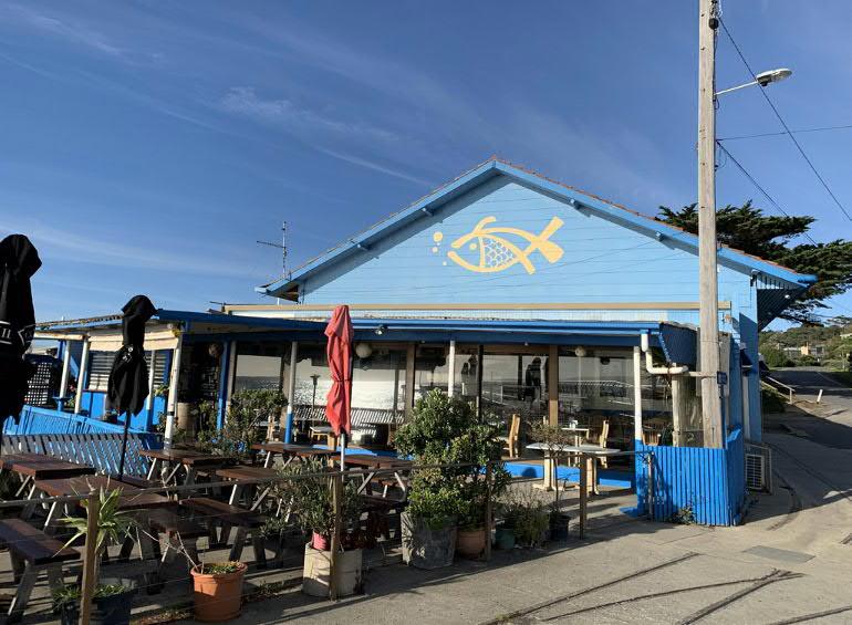
Point Grey is a spectacular site that for years has offered relaxed food and drink options for locals and visitors. Currently it does not offer any public food or drink although the LAAC has a café, bar and BBQ for members which is staffed by volunteers and accepts visitors outside peak times. The Pier Seafood Restaurant operated on the site out of the Co-Op building for 25 years but closed in 2018. The Grand Pacific hotel was built in the 1870's but closed in 2017, however it is currently being refurbished and is scheduled to open later in 2024.
The redevelopment of Point Grey provides the opportunity to enhance the site and provide food and drink options for visitors by both linking to surrounding sites such as the Grand Pacific hotel and offering low key food and drink options appropriate to the marine environment setting and reflecting the specific cultural history of the area. In order to make an appropriately active public space, the viability of the tenant within a difficult seasonal climate needs to be tested, but at the same time the exact balance of social priority provided by the tenant is important for the character it provides to the overall precinct. A commercial feasibility report has been commissioned from Future Foods consultancy, with the request to include a broader remit than the standard types of offering. The intention is to interrogate the type of tenant that can best suit the needs of the site and to respond to the specific coastal condition.
Refer Appendix A.1.3: Food and Drinks Premises Memo, GORCAPA
× Right Pipi's Kiosk, Kerferd Road Pier.
Architect: Mills Gorman Architects Photos: Ben Moynihan
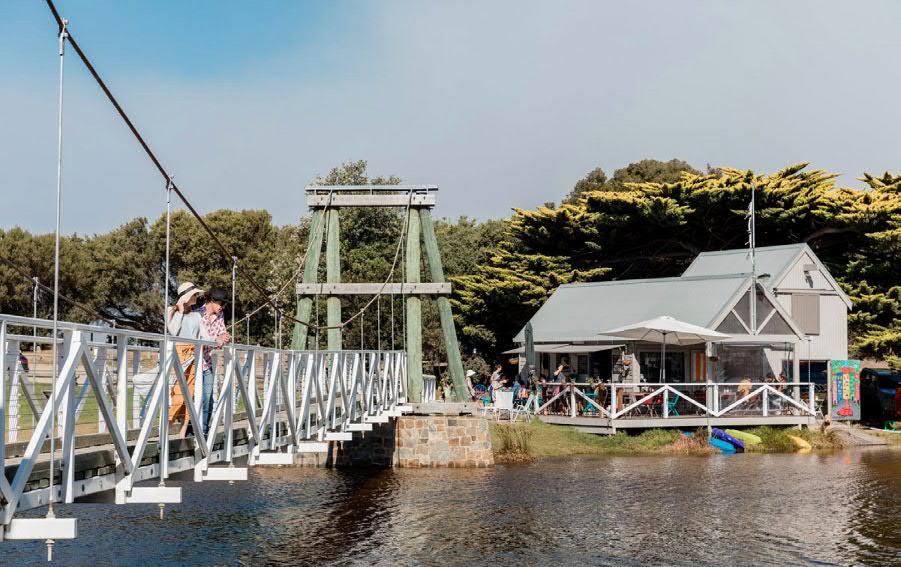
× Right Swing Bridge Cafe in Lorne Photo: 2024 Great Ocean Road Regional Tourism
Opportunities:
× A food and drink premise with a relaxed atmosphere that is appropriate in scale, respects the natural setting and the cultural history of the precinct, provides amenity for access to the coastal edge, and is in accordance with the Marine and Coastal Act 2018
× Enhance the user experience at Point Grey to provide food and drink for primary users of the site (fishing & boating)
× Food and Drinks premises design should provide publicly accessible spaces and amenity for a range of users, e.g. outdoor shade, seating and tables for community events & meetings, BBQ's and benches
× Explore flexibility of design to enable varied use & management type throughout quieter times of the year
× Food and Drink premises should offer both seated dining and takeaway options
× Implement Environmentally Sustainable Design wherever possible
Constraints:
× The inability to provide a food and drinks premises as a destination venue in its own right
× Seasonal variation of visitation and tourism may affect the financial viability of any food and drink premises
× Grand Pacific Hotel is reopening in late 2024 and any future food and drinks premises should not create competition in offering
× Competitive commercial offerings exist in Lorne along Mountjoy Parade
× Licensed outdoor offering that does not discourage public use
× Above
The Fishing Co-Op building obstructs views from the picnic area towards the start of Lorne Pier.
Photo: Daniel Bisetto, NMBW
Existing conditions, opportunities and constraints presented in Sections 1.0, 2.0 and 3.0 of this report generate a complex set of requirements and considerations for the project that relate to community-cultural values, common sense environmental design and relevant regulatory stipulations, as outlined in the introduction.
Required regulatory compliance includes adherence to the Marine and Coastal Act (2018), Victoria’s Resilient Coast, Adapting for 2100+, and the four Sustainability Pillars fundamental to the Great Ocean Road Environs Protection Act (GOREPA), 2020: ‘Decision-making should be based on the effective integration of environmental, cultural, social and economic considerations.’
To commence potential design direction studies at the beginning of the next phase (Urban Design Framework) issues from the body of the report above have been summarised within the following diagrams. This set of work will be further developed to form ‘Guiding Principles’ but is put forward here to start understanding criteria for preliminary assessment of directions that any future Urban Design Framework may take. At this stage, the following overall existing and potential base aims/ objectives have been identified in relation to legislation enforced by the VCAT determination (2022) and the Marine & Coastal Policy (2020):
× Traditional Owners: protect middens & limit ground disturbance wherever possible
× Marine and Coastal Use: retain recreational & cultural values of infrastructure such as piers & boat ramps
× Marine and Coastal Use: retain recreational & cultural values of buildings such as the Fishing Co-Op and the LAAC
× Ecosystems & Features: provide appropriate wind protection and improve ecology & vegetation
× Marine and Coastal Use: retain cultural values of ‘robust’ support spaces such as logging heritage related tram tracks
× Public Accessibility: pedestrian & vehicular & view lines
× Coastal Hazard Risk: coastal adaptation pathways to be fully investigated
The Marine and Coastal Act (MACA) 2018, followed by the Marine & Coastal Policy 2020 and Great Ocean Road Environs and Protection Act (GOREPA) 2020 stipulates requirements that need to be considered for any redevelopment of coastal land. Proposals must be inherently linked to marine and coastal activity, offer public access, respect ecosystems, and importantly, respect Traditional Owners’ rights, aspirations and knowledge. Eastern Maar have been custodians of Traditional Midden sites within the project environs, offering a wealth of potential for engaging with First Nations cultural traditions specific to this site, including but also further to understanding the shell fishing and viewing activities inherent to the middens themselves. Protection of the middens is paramount, together with retention of the built culture of fishing and water activity indicated by the old and new piers and boat ramps. Views towards the ocean from the upper portion of land currently used as a picnic and amenities area should be retained.
Additionally, we acknowledg the important opportunity for the Point Grey Redevelopment project to allow public access along the coastal edge in front of the Fishing Co-Op building towards
the current boat ramp. This area is largely difficult for public to easily arrive at due to the abrupt end of the Doug Stirling Walking Track at the end of the pier, and it should be a priority to allow the public to ambulate safely in front of the Fishing Co-Op to experience the geology of this unique marine place. This area is currently used for boat & trailer vehicle parking, which does not achieve equitable, public access to the coastal edge, and could be revived with wind protective vegetation and public seating and lookout opportunities. Such a gesture may reconnect locals and visitors with the true Point Grey headland and also enable pedestrian links to Vera Lynn and Shelley Beach.
In addition, the two existing buildings sited on the lower precinct (the Fishing Co-Op and the LAAC) clearly communicate the history of the site and should influence future design work for the redevelopment proposal. The siting of these existing buildings also creates edges to the public space which forms naturally between the existing piers and the old boat ramp. Any future development should maintain this open space not only to support the community, local fishing, marine businesses, recreation and tourism, but to acknowledge the site’s maritime and infrastructural history. The old tramway track also contains a history to be told, and its pedestrian link towards the south should be retained.
The opportunities and constraints identified in this report will inform the establishment of an appropriate, site responsive Urban Design Framework and Master Plan for the precinct, which will balance community sentiment, best practice coastal planning, relevant legislation, and funding parameters.
Authority & Stakeholder Appendices
A.1.2: Planning Memo, Hansen Partnership
A.1.4: Community Values Survey
A.1.5: Lorne Pier foot tracker data, GORCAPA
Existing Site Analysis Appendices
A.2.1: Visual Analysis, Hansen Partnership
Site Significance Appendices
A.3.1: Country Plan, Eastern Marr Aboriginal Corporation