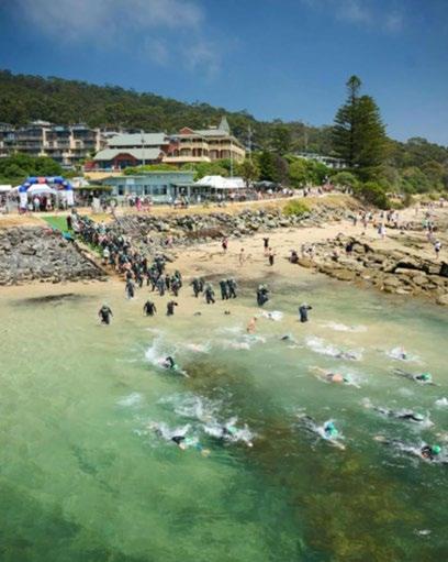
Point Grey Redevelopment:
Planning & Design

–
28 FEBRUARY 2024
Guidelines & Principles
1. Our Objectives
2. VCAT Determination
3. Marine & Coastal Policy - First Principles
4. Marine & Coastal Policy


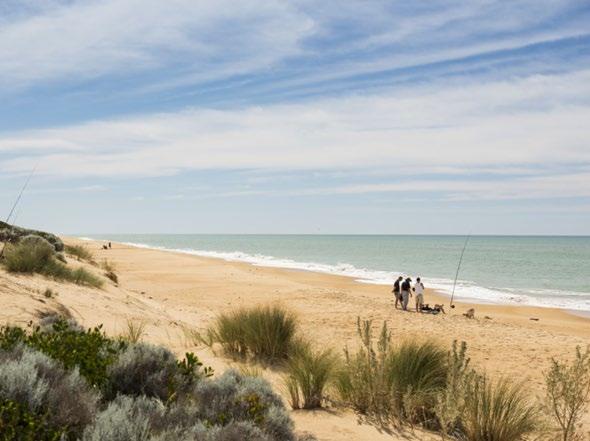
Why are we here?
The City Deal Commitment
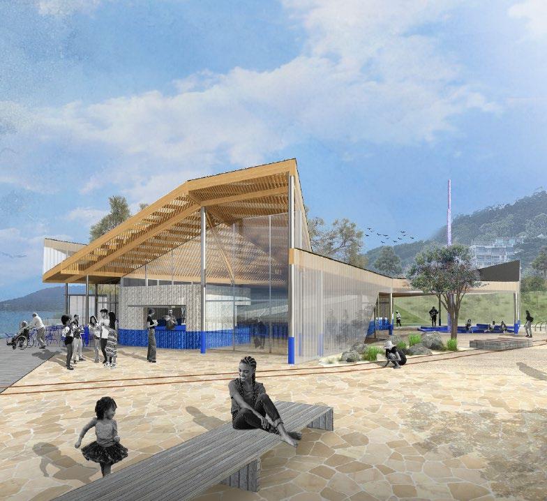
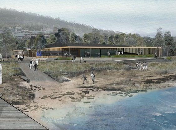
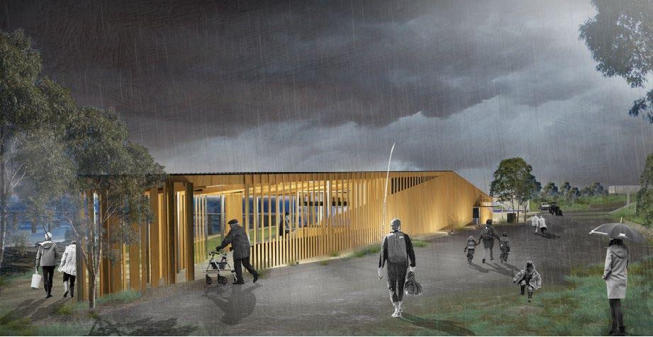
1. A new Lorne Aquatic and Angling Club building
2. Provision for ‘casual dining’ offerings, including options for coffee, takeaway and al fresco seating
3. Improved public realm spaces
4. Recognition of cultural heritage
5. Improved connectivity
Underlying Objectives
1. The purpose for which the land is reserved under the Crown Land Reserves Act 1978
PERMANENTLY RESERVED FOR THE PROTECTION OF THE COASTLINE
Protection the 'break'/'green space' between the beach/ocean and the road/urban development of Lorne, for use by all Victorian's (equitable access).
2. Great Ocean Road and Environs Protection Act 2020
The Great Ocean Road Coast and Parks Protection Principles:
1. General & Economic
2. Aboriginal Inclusion
3. Environmental
4. Social
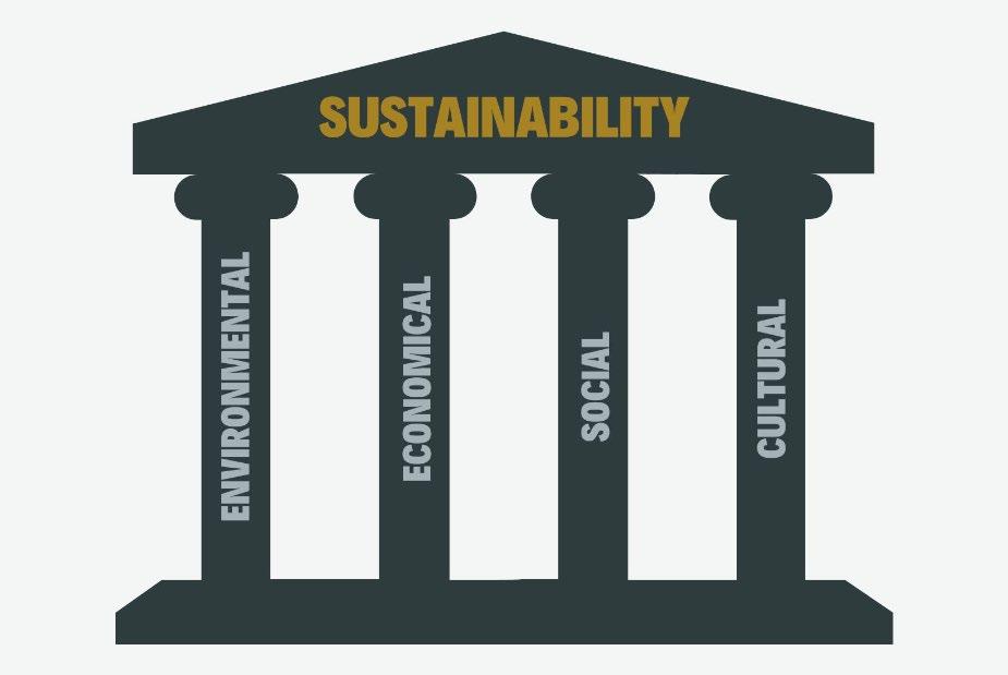
Sustainable Development
GREAT OCEAN ROAD AND ENVIRONS PROTECTION ACT 2020
Sect 13 Part 3
Decision-making should be based on the effective integration of environmental, cultural, social and economic considerations.
Aboriginal Inclusion Principles
(1) Aboriginal cultural values, practices, heritage and knowledge should be acknowledged, respected, protected and promoted.
(2) The intrinsic connection of the traditional owners to Country should be acknowledged through partnership and involvement in policy development, planning, and decision-making for public land management.
(3) Traditional owners should be involved in the integration of their ecological knowledge and land management practices into the management of the Great Ocean Road coast and parks.
Overarching Objectives
1. The Planning Policy Framework
Clause 12.02-1S: To protect and enhance the marine and coastal environment.
Clause 12.02-2S: To ensure the use and development of marine and coastal Crown land is ecologically sustainable, minimises impacts on cultural and environmental values, and improves public benefit for current and future generations.
Clause 13.01-1S: To plan for and manage coastal hazard risk and climate change impacts.
Clause 15.01-S: To create urban environments that are safe, healthy, functional, and enjoyable and that contribute to a sense of place and cultural identity.
Clause 15.03-2S: To ensure the protection and conservation of places of Aboriginal cultural heritage significance.
Clause 17.04-2S: To encourage a diverse range of strategically located and well-designed coastal and maritime tourism and recreational opportunities that strengthen people’s connection with the marine and coastal environment.
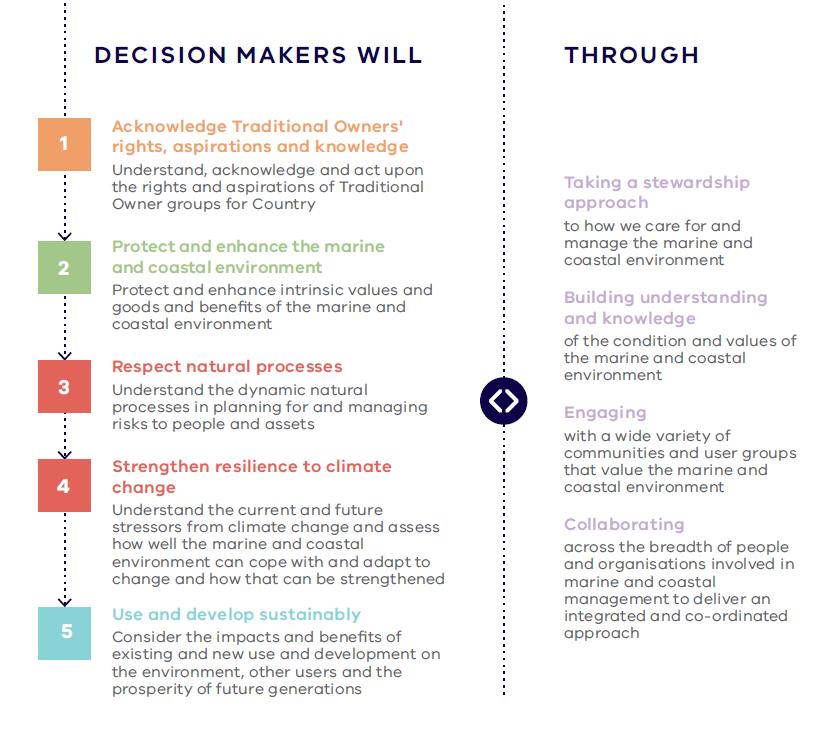
2. Marine & Coastal Act 2018
a. Protect and enhance the marine and coastal environment.
b. Promote the resilience of marine and coastal ecosystems, communities and assets to climate change.
c. Respect natural processes in planning for and managing current and future risks to people and assets from coastal hazards and climate change.
d. Acknowledge Traditional Owner groups’ knowledge, rights and aspirations for Land and Sea Country.
e. Promote a diversity of experience in the marine and coastal environment.
f. Promote the ecologically sustainable use and development of the marine and coastal environment and its resources in appropriate areas.
g. Improve community, user group and industry stewardship and understanding of the marine and coastal environment.
h. Engage with specified Aboriginal parties, the community, user groups and industry in marine and coastal planning, management and protection.
i. Build scientific understanding of the marine and coastal environment
Marine & Coastal Policy
Questions?
1. Our Objectives
2. VCAT Determination
3. Marine & Coastal Policy - First Principles
4. Marine & Coastal Policy
Site Specific Design Considerations
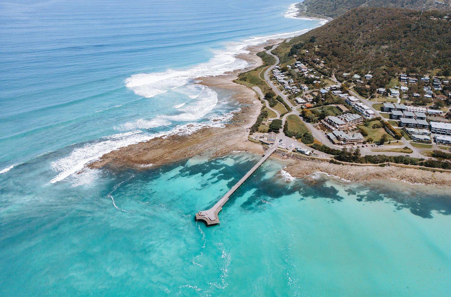
VCAT Determination
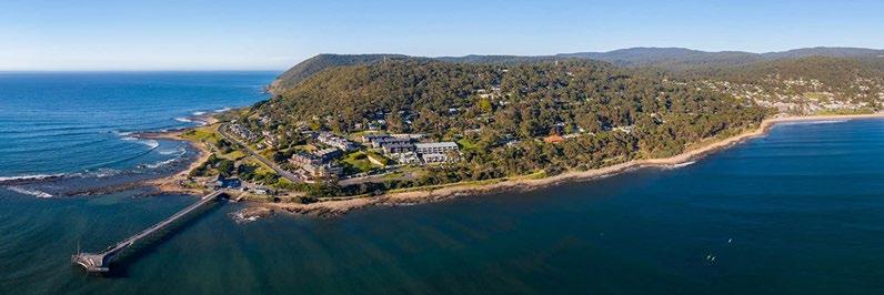
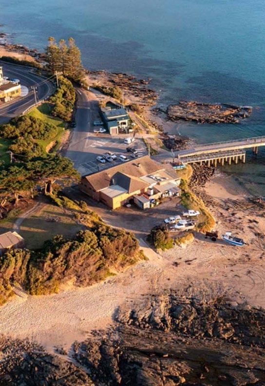
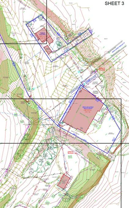
Determination Plan & Existing Conditions
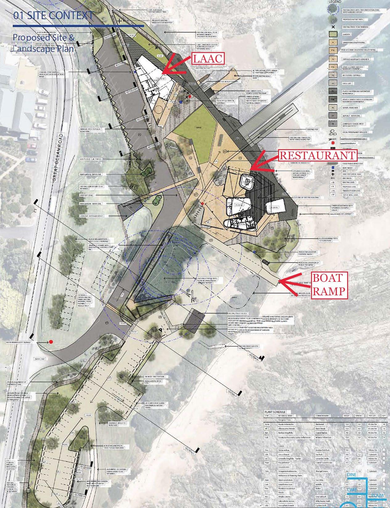
1. Restaurant (Use & Building)
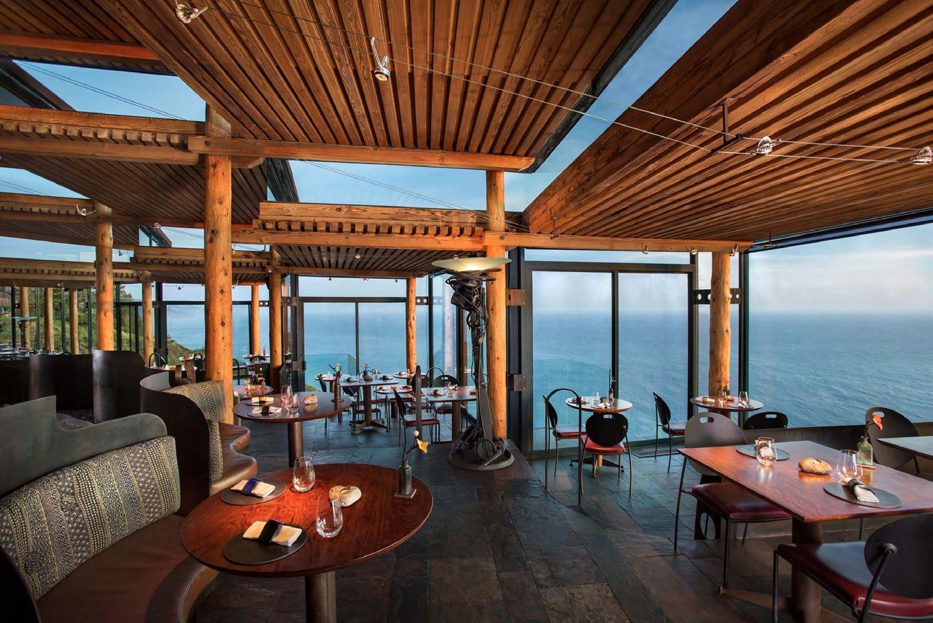
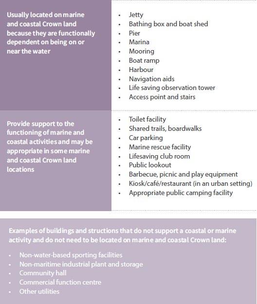
• This proposal is essentially for a Restaurant in this location to attract tourism revenue, as opposed to providing support to the marine and coastal location and anticipated activities within it.
• The Restaurant is not dependent on the coastal location and Point Grey does not require a Restaurant, nor is this use naturally aligned with the purposes of the PPRZ or the purposes for which the land is reserved.
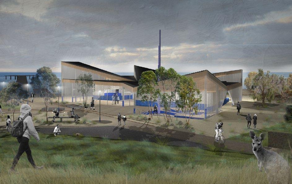
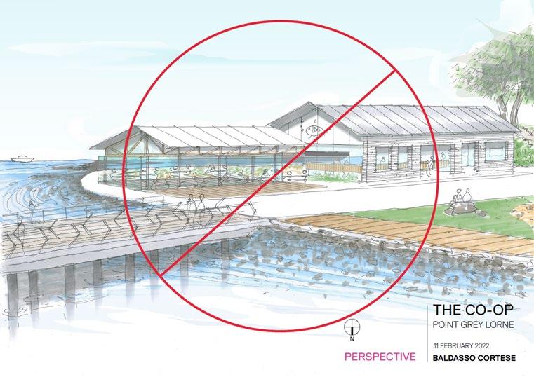
• The design of the Restaurant, while not before the Tribunal in terms of permission, affects the way in which it will be used. It has been designed to form the dominant use of the site as a destination venue, to cater for 160 patrons from 7am to 11pm at night. It is a commercial use that could be located anywhere.
• The Marine & Coastal Policy discusses uses and development that are functionally dependent on being on or near the water and discourages those that are not. Not only is this use not dependent on being within Point Grey, the use, by virtue of its location, scale and design, does not support the other uses of the land that are functionally dependent on being on or near the water and are consistent with the purposes of the PPRZ.
• With respect to equitable access to marine and coastal Crown land, the restaurant will be exclusively used by paying customers. This is limiting access to land located in a public park and recreation area on land identified within the Scheme as public open space and reserved for public purposes.
• The proposed use does not improve public benefit for the site and has not arisen from a demonstrated need that is relevant to the marine and coastal Crown land. It does not have a coastal dependency and is identified in the Marine & Coastal Policy as a use not anticipated to be provided on or near the water.
• The scale of the proposed restaurant use requires a building of commensurate size that results in loss of what would otherwise be public open space, as well as affecting the amount of car parking required to be provided on land meant for public open space, and vegetation removal that is a consequence of providing such car parking.
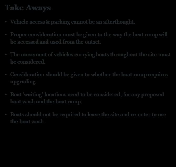
Take Aways
1. A destination restaurant will not be permitted.
2. Any food and drink offering should:
• Be provided to service the users of Point Grey.
• Be provided to support the marine and coastal location and anticipated activities within it (i.e., it may provide food & drink for people otherwise utilizing the public areas).
• Improve public benefit of the site for current and future generations.
• Not unduly limit equitable access.
• Minimise loss of public open space.
• Not ‘dominate’ the precinct in terms of building bulk, user number, or space requirement, including car parking.
• Support the other uses of the land that are functionally dependent on being on or near the water and are consistent with the purposes of the PPRZ.
• Not be positioned to cause a physical separation between the LAAC and the boat ramp.
• Clause 17.04-2S includes the new strategy of supporting “a sustainable network of facilities for recreational boating and water –based activities”. This is subject to those facilities responding to:
a) Identified demand.
b) Use and safety considerations.
c) The carrying capacity of the location.
d) Coastal processes.
e) Environmental values.
• The submissions and evidence provided on behalf of the LAAC served to illustrate the current and future demand for this boating club and boating facilities.
• The proposed new use is of a similar scale and location to the current use.
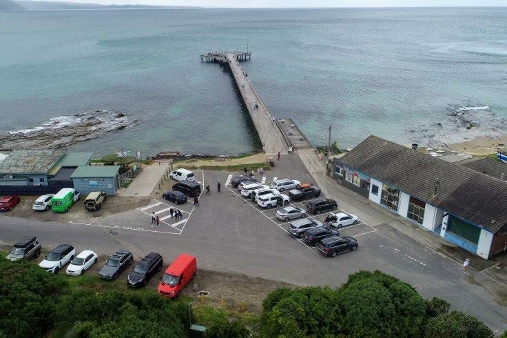
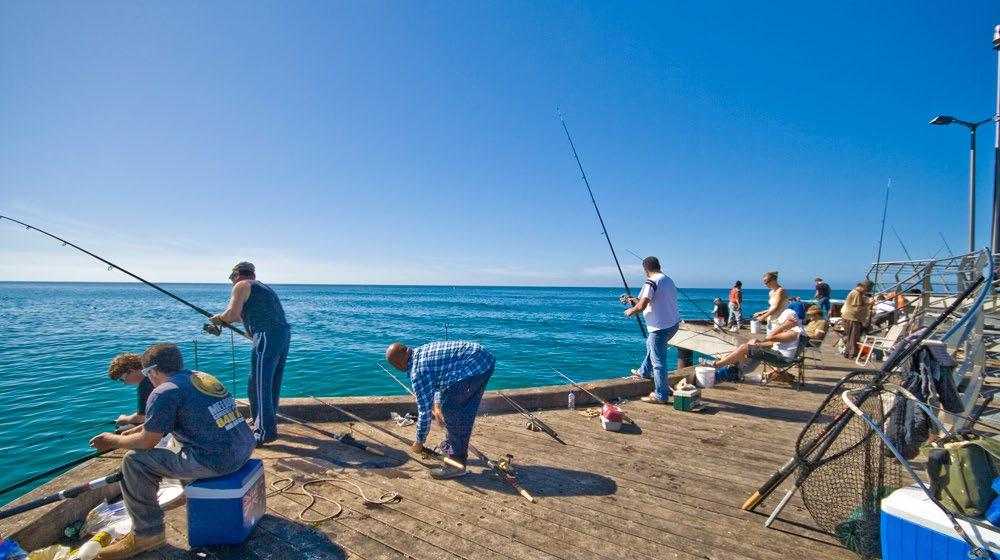
• As Point Grey houses the only boat ramp and pier in Lorne, this is the natural location for a boating and fishing club.

Take Aways
1. The reduced scale of any food & drinks “use”, as well as a reduced building footprint for any associated structure, will reduce the required number of car parks, and should therefore avoid any vegetation removal.
Car Parking, Access, Boat Ramp & Boat Wash
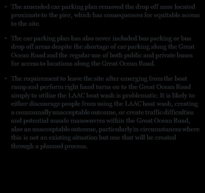
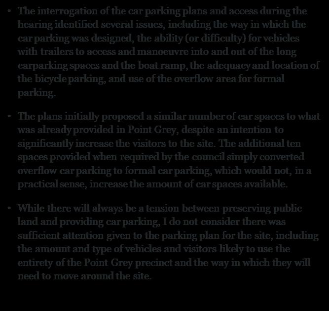
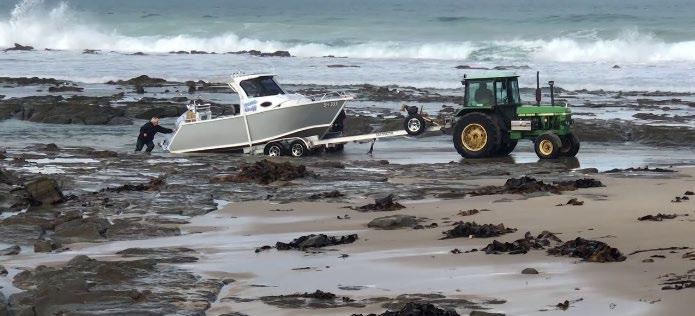
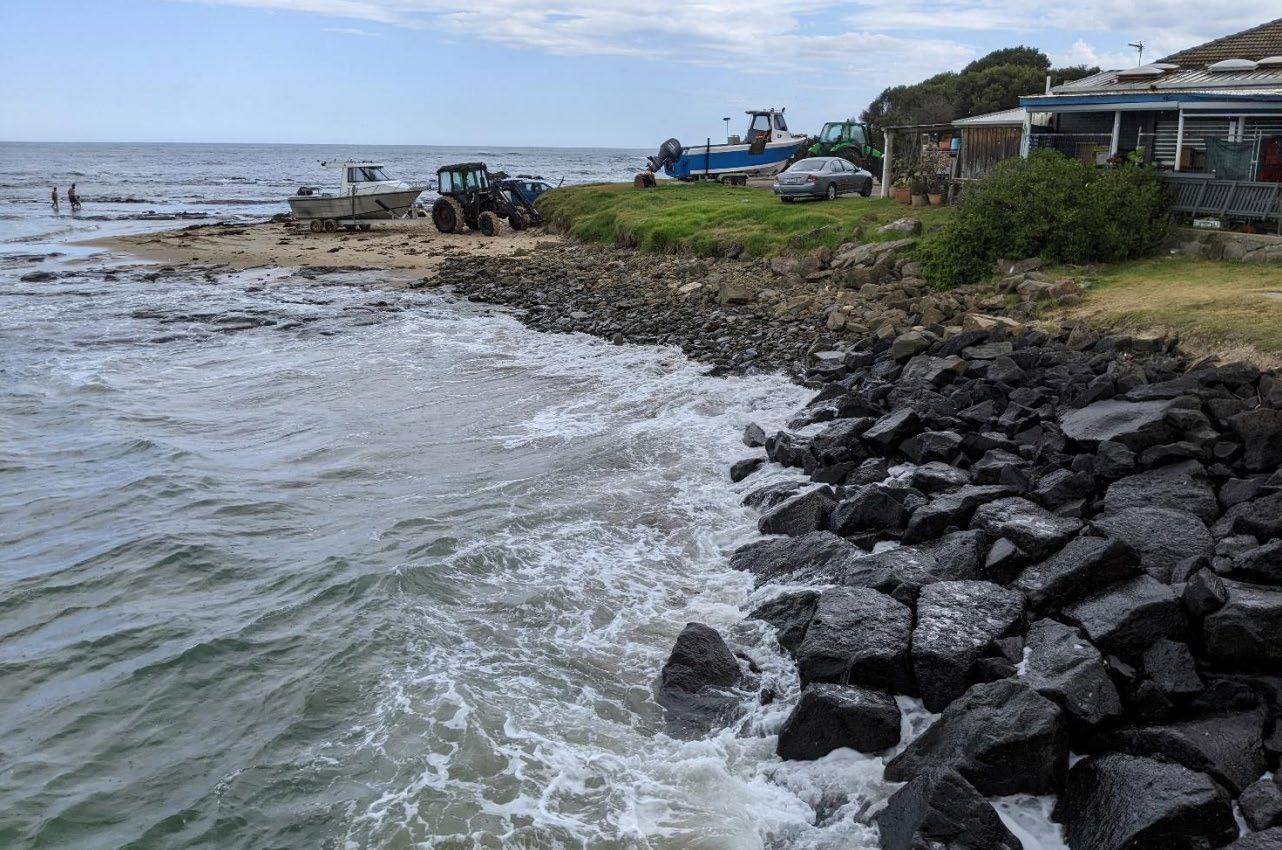
• The proposal did not include any change or upgrade to the boat ramp itself, despite upgrading the facilities which will make the use of the boat ramp more attractive, and an intention for it to be used more heavily in future.
• Consideration did not appear to be given to the way the boat ramp is, or will be used, by members of the public or of the LAAC, including the way in which boats are towed to and from the boat ramp and around the site, tractors which are currently kept permanently on site, and how and where vehicles with trailers can prop or manoeuvre around the site when the boat ramp or boat wash are in use.
Questions?
1. Our Objectives
2. VCAT Determination
3. Marine & Coastal Policy - First Principles
4. Marine & Coastal Policy
Marine & Coastal Policy
+ Siting and Design Guidelines for Structures on Victorian Coast
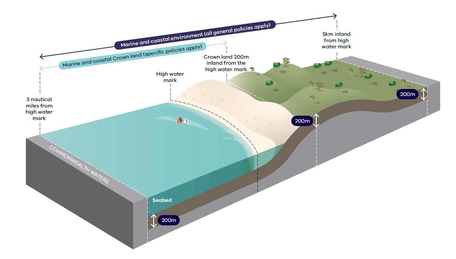
Where the Marine & Coastal Policy Applies
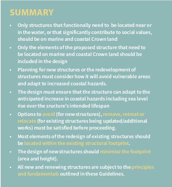
First Principles – 1. Purpose & Need
What does this mean for Pt Grey?
First Principles – 2. Footprint
• New structures should minimise their footprint, including their height.
• The height and scale of any structure should be designed to be appropriate to its context. This will relate back to ‘purpose and need’ in terms of what is essential for that structure to function efficiently and effectively.
• Replacing or modifying an existing structure should consolidate, or minimize, the footprint and impact as far as possible.
• Consideration of the footprint should use marine and coastal Crown land efficiently and sparingly.
What does this mean for Pt Grey?
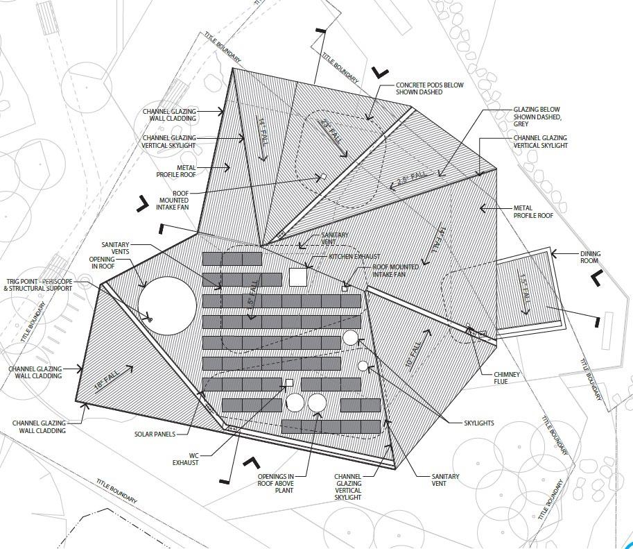
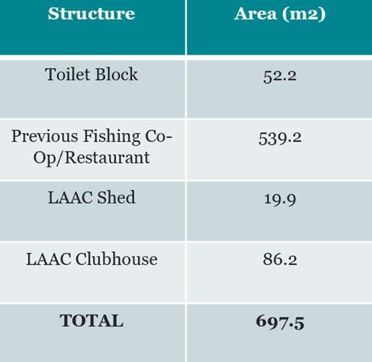
• The proposed shared building footprint at the site should not exceed approximately 700m2, unless there is exceptional justification to do so.
• The separate proposed uses may need to be consolidated, unless there is significant justification to demonstrate separate buildings are more appropriate, such as (among other things):
• Site accessibility, movement and functionality requirements.
• Significant social or cultural values that demonstrate separate buildings are essential.
• Economic impact
• Environmental or cultural constraints
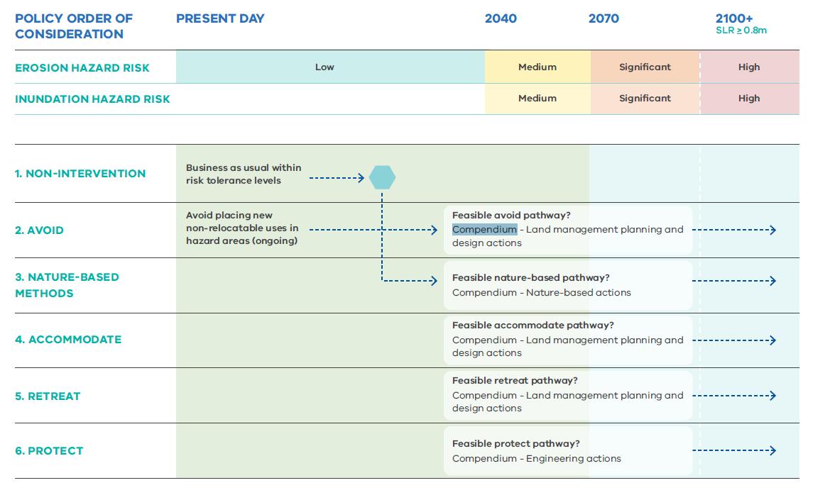
First Principles – 3. Climate Change & Adaptation
What does this mean for Pt Grey?
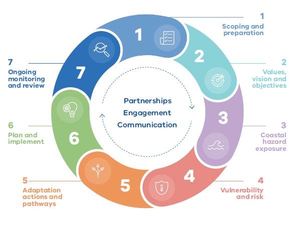
The pathway approach asks:
1. What are the first impacts that we will face as a result of climate change?
2. Under what conditions will current arrangements be ineffective?
3. What are the alternatives?
4. What are the different pathways that can be taken to achieve the same objectives?
5. How robust are the options over a range of future climate scenarios?
6. Are the options flexible enough to enable change of path in the future with minimum disruption and cost?
What does this mean for Pt Grey?
First Principles
Summary
–
Questions?
1. Our Objectives
2. VCAT Determination
3. Marine & Coastal Policy - First Principles
4. Marine & Coastal Policy
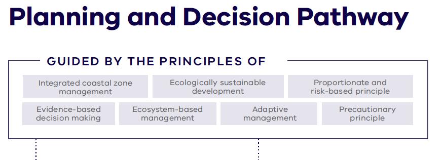
How are Decisions Made?
Marine & Coastal Policy - Chapters
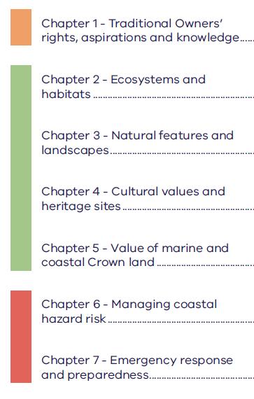
Chapter 1 - Traditional Owners’ Rights, Aspirations and Knowledge
Chapter 4 – Cultural Values & Heritage Sites
Applicable Policies
1.3 Embed Traditional Owner aspirations into decision making, planning and management.
1.5 Partner with Traditional Owners to integrate caring for Country knowledge and practices into strategy, planning and management.
4.3 Sites of cultural or heritage significance to Traditional Owners must be managed in a culturally appropriate manner.
4.4 Encourage adaptive re-use of heritage places that are no longer required for their original purpose in a way that maintains their values and character and enhances their contribution to community activities, coastal tourism and sense of place.
4.5 The capacity of heritage sites to cope sustainably with visitors and manage the direct and cumulative impacts of use and visitation numbers, must be assessed.
4.6 New memorials in the marine and coastal environment must be relevant to the surrounding environment.
How can we implement this policy at Point Grey?
• Through recognising, referencing and giving effect to the priorities, aims and aspirations of the Eastern Maar Country plan.
• Engage early with Eastern Maar on tangible and intangible cultural heritage values relevant to place.
• Acknowledge and protect Aboriginal heritage places and values in a culturally appropriate manner, through the redevelopment.
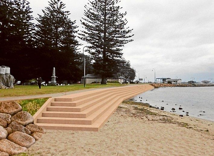
Chapter 3 - Natural Features and Landscapes
Applicable Policies
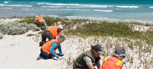
3.1 Protect and seek to enhance the values and characteristics that contribute to natural features and landscapes (including seascapes) in the marine and coastal environment, including by managing cumulative effects.
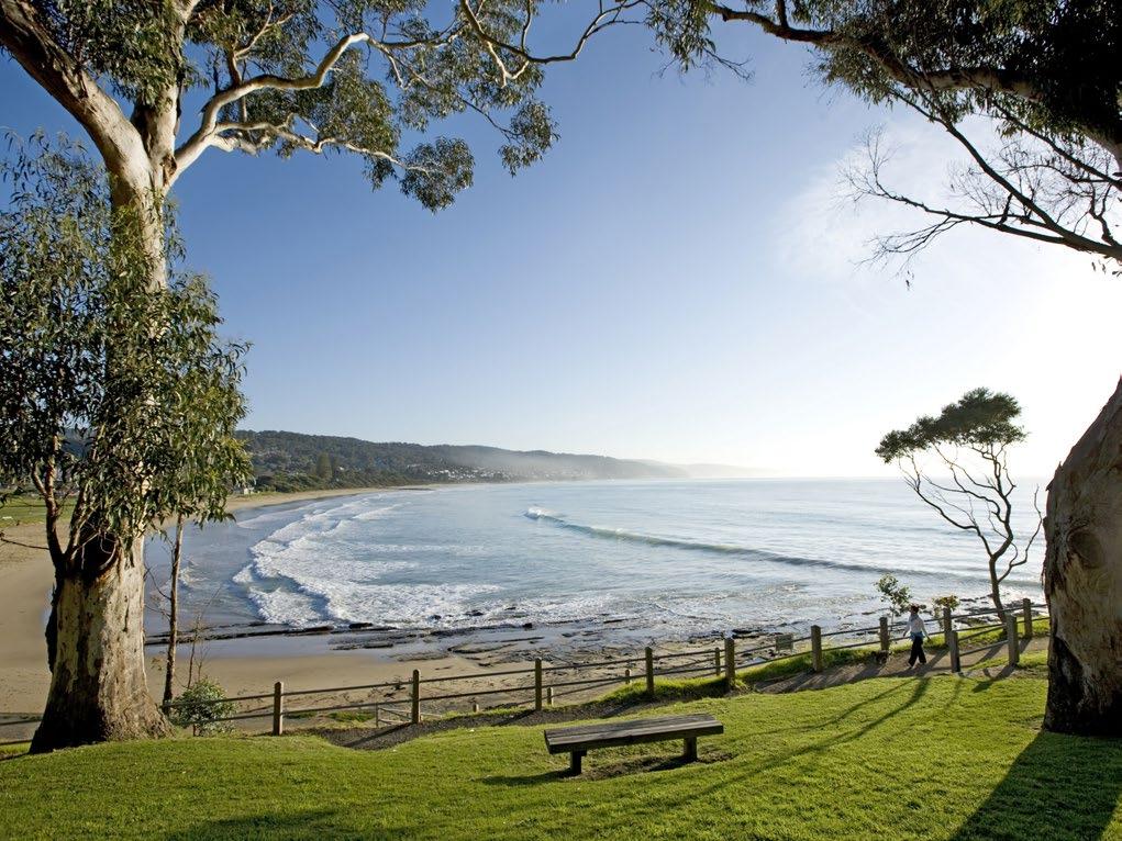
3.2 Maintain important public visual corridors on public land associated with significant landscapes (including seascapes) in the marine and coastal environment (including views from within the landscapes and views of the landscapes).
Chapter 3 - Natural Features and Landscapes
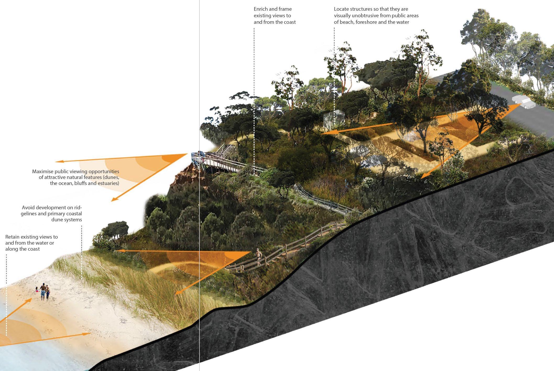
How do we implement this policy at Point Grey?
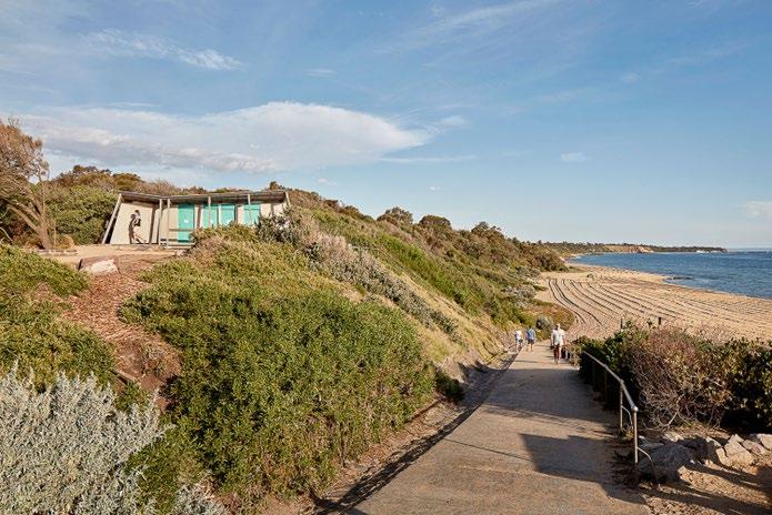
• Minimise intrusions into public views of the natural environment.
• Retain important public views to and from the water or along the coast.
• Enrich and frame existing public views to and from the coast.
• Locate structures so that they are visually unobtrusive from public areas of beach, foreshore and the water.
• Minimise and group vertical elements (poles, signs, communications towers).
Chapter 6 – Managing Coastal Hazard Risk
Applicable Policies
6.1 Plan for sea level rise of not less than 0.8 metres by 2100, and allow for the combined effects of tides, storm surges, flooding, coastal processes and local conditions such as topography and geology, when assessing risks and coastal impacts associated with climate change.
6.2 Consider available local coastal hazard assessments and localised projections when planning for coastal hazard risks.
6.3 Avoid development in identified areas that are vulnerable to coastal hazard risk from impacts such as erosion and flooding (both estuarine and coastal), inundation, landslips and landslides, and geotechnical risk.
6.4 Consider and plan for how coastal hazard risks will change over time including from gradual increases in the sea level.
Chapter 6 – Managing Coastal Hazard Risk
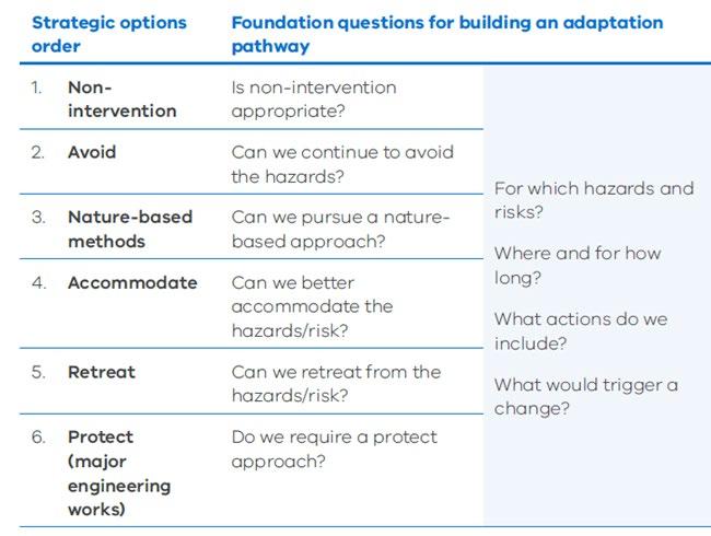
6.7 Take a pathway approach to planning that:
a. assesses the full range of available adaptation actions in order of: non-intervention; avoid; nature-based methods; accommodate; retreat; protect.
b. assesses costs, effectiveness, benefits, impacts (direct, cumulative and synergistic) and path-dependency of adaptation actions.
Chapter 6 – Managing Coastal Hazard Risk
6.8 Marine and coastal adaptation planning should:
a. be conducted and implemented in consultation and collaboration with Traditional Owners, the various levels of government, communities, and authorities affected by each situation
b. take a flexible, responsive and pathways approach supported by ongoing monitoring
c. identify threshold or trigger points at which decisions or actions need to be taken, or further analysis is needed
d. be implemented across different land types, including public and private land
e. be compatible with climate change mitigation efforts
f. inform all affected parties of the risks, opportunities and potential changes to the marine and coastal environment
g. identify roles and responsibilities for those involved in adaptation planning
h. ensure risks are addressed by those who are best placed to manage them, and that those most impacted by decisions have an opportunity to be involved in decision making processes.
6.10 Development or protective works (including for estuaries and coastal wetlands) that seek to respond to coastal hazards risk must avoid detrimental impacts on coastal processes.
How do we implement this policy at Point Grey?
• The proposal will only include new structures or infrastructure that:
• functionally needs to be located near or in the water, or
• contributes significantly to social values, or
• is needed to support functionally dependent uses.
• New/redeveloped structures may not be located in the same location as they currently are, depending upon:
• hazard areas & risk exposure
• risk consequences & risk timing
• the adaptation strategy (response method to hazards & at what point in time it is triggered)
• the necessary location of other site infrastructure/competing uses.
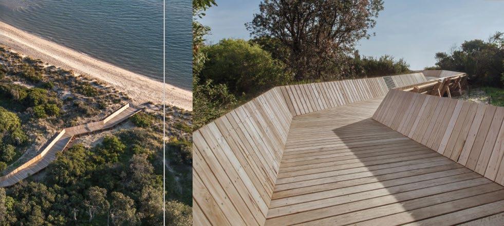
• Avoid the development of buildings structures and facilities in sand dunes, low-lying areas and areas susceptible to coastal hazard risk, including future coastal hazard risk.
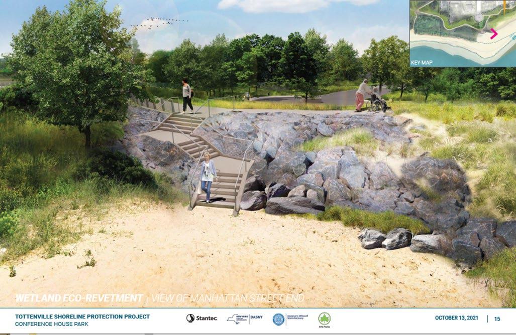
• Consider environmentally friendly construction principles and alternative solutions to hard engineering options in locations where it is necessary to control erosion, e.g. mixed rock sizing for habitat, vegetation planting for soil stability, beach re-nourishment, and the incorporation of wetlands, marshes and mangroves.
• Avoid development where a protective structure is required to support a use or development on the coast or in the marine environment.
• Consider options to use nature-based adaptation methods or the removal, retreat or relocation of structures.
• Promote the grouping of structures, clustering of activities and shared use of facilities.
• Facilitate the rationalisation of existing buildings and car parks.
• Incorporate innovative construction techniques and materials to maximise flexibility of the structure.
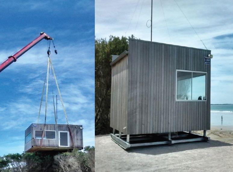
• Consider relocatable or temporary structures that accommodate seasonal and peak use periods.
Chapter 10 – Recreation and Tourism
Applicable Policies
10.1 Enable a diversity of sustainable recreational uses and activities that strengthen peoples’ connection with the marine and coastal environment (such as fishing, boating, surfing, swimming, bushwalking, camping, caravanning, cultural tourism).
10.2 Support community-based clubs to provide access and use for the broader community to the marine and coastal environment in ways that minimise environmental impacts.
10.3 Use strategic and spatial planning to locate opportunities for safe and sustainable recreation and tourism developments that:
a. respond to identified demand
b. minimise impacts on environmental and cultural values
c. minimise impacts on other users
d. maintain public safety
e. respond to the carrying capacity of the site
f. minimise exposure to coastal hazard risks and risk posed by climate change.
Chapter 10 – Recreation and Tourism
10.4 Use strategic and spatial planning to identify recreation and activity nodes, to create efficient and compatible relationships between buildings and infrastructure and minimise impacts on the marine and coastal environment.
10.5 Support a sustainable network of facilities for recreational boating and water-based activities in line with strategic plans, and be responsive to:
a. identified demand
b. use and safety considerations
c. the carrying capacity of the location
d. coastal processes
e. environmental values.
10.6 The design and location of marine-based structures and access points (including boat ramps, ports and marinas) should:
a. consider and minimise safety risks
b. consider sediment movement processes
c. minimise the need for capital and maintenance dredging
d. minimise sedimentation through catchment-based management activities (such as revegetation and erosion control).
Chapter 10 – Recreation and Tourism
How do we implement this policy at Point Grey?
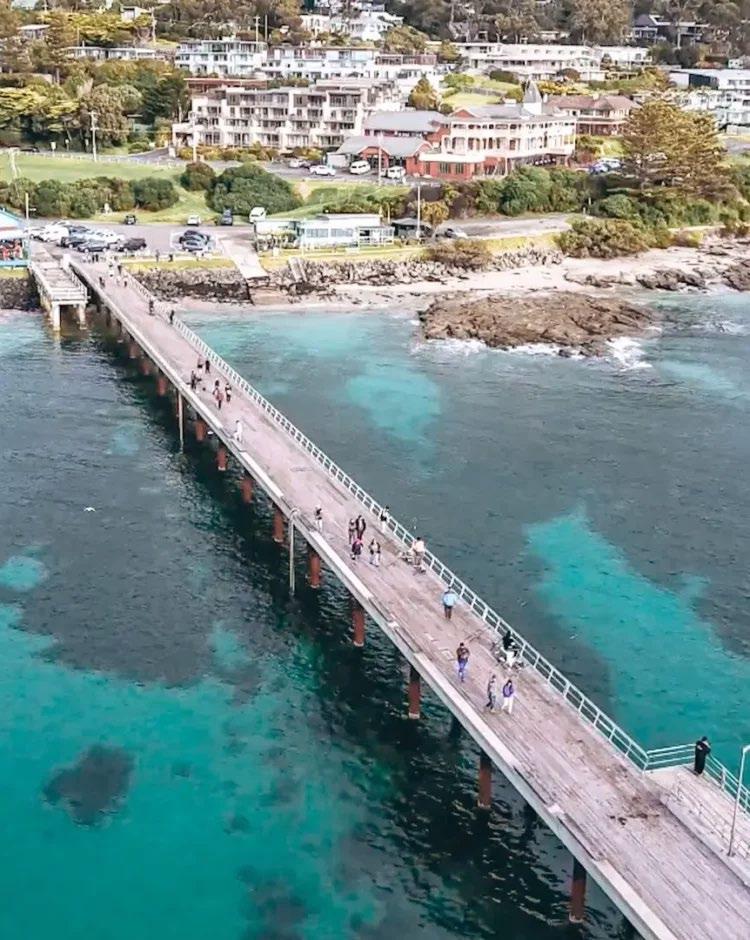
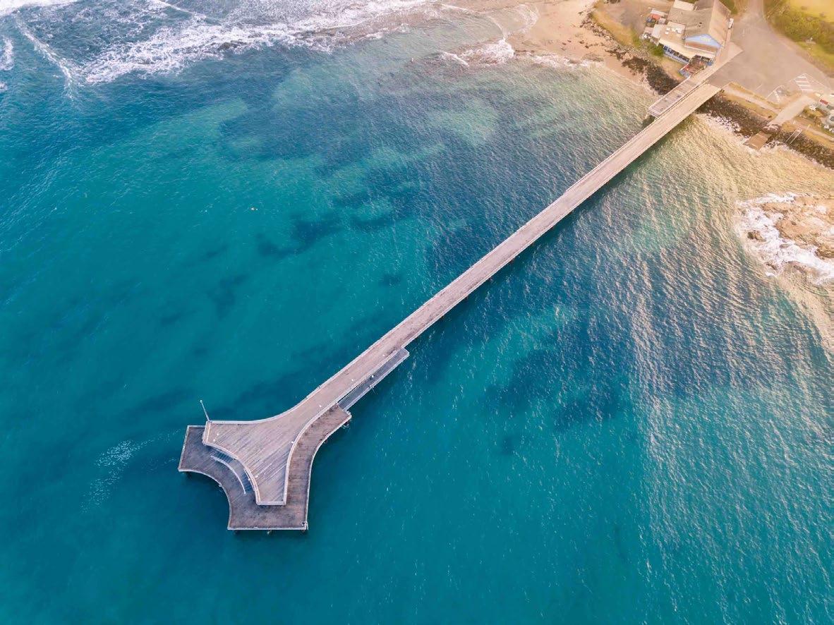
• Provide access and infrastructure for recreation and water-related activities, including access to boats utilizing the Lorne boat ramp.
• Boating and fishing access points will be maintained and may be enhanced, including the ramp and pier.
• Consider boat maneuverability from the outset of planning & design.
• Support the LAAC to provide access and use for the broader community to the marine and coastal environment, in ways that minimise environmental impacts. This may include boat wash facilities.
• ‘Open up’ access and visibility of the boat ramp.
• Consider tourist bus parking
• Consider waiting bays for boats accessing the water and waiting to use boat wash facilities
Applicable Policies
11.1 Design, locate and maintain buildings and structures to effectively manage:
a. any increase in exposure to coastal hazard risk including increased rates of sea level rise, erosion, accretion or inundation
b. exposure to public health and safety risks
c. any detrimental impacts (in particular increased hazard risk) on neighbouring Crown or private land
d. adverse effects on the environment and associated uses and values
e. impacts on marine and coastal functions and processes.
11.2 Design, locate and maintain buildings and structures to:
a. minimise impacts on marine and coastal flora and fauna
b. avoid impacts on cultural values and heritage sites
c. avoid impacts on sites of geomorphological significance and fossils
d. accommodate and sustain the natural drainage patterns and hydrology of the area
e. use materials that respond to the geology and substrate of the site and surrounding area
f. avoid dominant structures that are not sympathetic to the local heritage or character
g. complement and enhance the surrounding landscape and coastal character, with the line and form of the structure sympathetic to the surrounding landscape and context
h. retain public views to and from the water and/or along the coast
i. avoid generating ongoing noise that intrudes on the local community
Chapter 11 - Buildings, structures and access
11.3 Investment in new and existing structures should follow a life cycle planning approach that:
a. identifies future operation and maintenance accountabilities and costs, including the effects of climate change
b. identifies and considers the structure’s ongoing ability to function in light of changed conditions from the impacts of climate change
c. plans the structure’s decommissioning and removal or repurposing as part of the initial design and installation, or alteration.
11.4 Provision or improvement of buildings and structures on marine and coastal Crown land is confined to those providing significant net community benefit and whose function depends on being on or near the water.
Chapter 11 - Buildings, structures and access
11.5 Require construction, extension or alteration of buildings and structures on marine and coastal Crown land to:
a. make efficient use of the site
b. facilitate multiple use and sharing of sites and infrastructure
c. provide increased public functions and adaptability
d. not impede access to marine and coastal Crown land except where access control is the main purpose
e. use materials and finishes that are sympathetic to the coastal environment and durable in the longterm
f. minimise the structure’s environmental footprint.
11.6 When a building is being replaced or modified, its footprint or impact should be consolidated or minimised as far as possible to ensure marine and coastal Crown land is being used efficiently and sparingly.
11.7 Use and development of marine and coastal Crown land must not unreasonably affect the amenity of other users or restrict or prevent access for other users.
Chapter 11 - Buildings, structures and access
11.9 Manage risk to public safety from unsafe or poorly maintained buildings and structures on marine and coastal Crown land and consider removal if necessary and appropriate.
11.11 New development must not impede existing access to marine and coastal Crown land and must minimise loss of public open space.
11.12 Provide well designed and safe access to marine and coastal Crown land (e.g. through paths/fencing) to:
a. minimise risk to public safety
b. protect cultural values
c. protect natural values and habitats at critical life stages (such as for migratory and nesting shorebirds)
d. avoid exacerbating erosion and landslip risk.
11.15 Access to marine and coastal Crown land that meets the needs of people with varied levels of physical ability or capability should be provided, where practicable.
Chapter 11 - Buildings, structures and access
How do we implement this policy at Point Grey?
• Identify and provide for user groups in interrelated spaces.
• Optimise compatible activities and inter-activity relationships.
• Locate furniture, signage and other landscape elements so they complement circulation and interconnectivity patterns.
• Consider the distinctive environmental, social and cultural features contributing to the character of place (geology, ecology and architecture).
• Design structures to fit and blend with the surrounding character and landscape.
• Avoid extreme contrasts in design, scale and shape.
• Avoid visual prominence in highly visible locations.
• Reflect local histories and narrative.
• Consider appropriate, adaptive re-uses where heritage places are no longer required for their original purpose.
• Avoid dominate structures that are not sympathetic to local heritage or character.
• Do not impede public access to and along the shoreline, except where access control is the main purpose.
• Direct paths away from environmentally sensitive areas and avoid areas of coastal hazard.
Chapter 11 - Buildings, structures and access
• Ensure access protects cultural and heritage values.
• Where possible, single access points to the shoreline should serve groups of structures and infrastructure (car parks, etc).
• Ensure vehicular, bicycle and pedestrian pathways avoid obstruction and conflict and encourage smooth movement to, from and through the site.
• Where possible, incorporate the needs of people with varied levels of ability or physical capacity.
• Create a clear sense of arrival, and pedestrian routes that provide a sequence of visual and spatial experiences.
• Set carparking back as far as possible from the shoreline.
• Encourage off-site carparking with minimal on-site arrangements for service, emergency and drop-off access.
What will we get at the end of this phase?
Urban Design Framework & Master Plan
Final Urban Design Framework (Report & Plan), may include, but is not limited to:
2. Strategic Action Area Plans with maps, diagrams, elevations, sections and sketches, that illustrate:
1. A coordinating framework plan with diagrams and maps, indicating:
• total concept
• components of concept (use & activities, movement, built form, environment, etc.)
• Major opportunities & linkages between them.
• Areas for strategic action
• Design concepts for strategic areas identified in the Coordinating Framework Plan, including enough detail to enable further economic, social, visual and technical analysis.
3. An Implementation Strategy identifying planning, project and management actions, including:
• Immediate, medium-term and long-term actions.
• Key beneficiaries, management authorities and stakeholders.
Following Steps
