The Economic Development Potential of the Red Line
The Case for East-West Transit Investment in Baltimore


The Case for East-West Transit Investment in Baltimore
The proposed Red Line would provide a long sought-after East-West rapid transit option in the Baltimore region,significantly improving connectivity for Baltimore residents and spurring region-wide social and economic benefits.

In 2022, the Greater Washington Partnership (the Partnership) and the Greater Baltimore Committee (GBC) launched a joint initiative called “Baltimore’s Transit Future” to rally the region’s business and institutional community around a vision for a world-class public transit system in Baltimore that creates shared economic prosperity and catalyzes inclusive growth.
The Red Line represents an important step toward realizing this vision and the creation of a connected transportation system that can support the Baltimore region’s growth and its ability to attract residents to live, work, play, and build a business.
This study identifies the potential for up to $19 billion in new economic activity associated with the construction and operation of the Red Line and $12.4 billion in additional economic growth that could occur from Transit-Oriented Development (TOD) along the route.
This is a significant economic opportunity in the near-term and policymakers should consider how to maximize longterm inclusive economic growth round the Red Line. This includes policies to protect current residents and businesses along the route, and the identification of opportunities to add additional affordable housing and commercial space. We provide three recommendations for policymakers to maximize these opportunities.
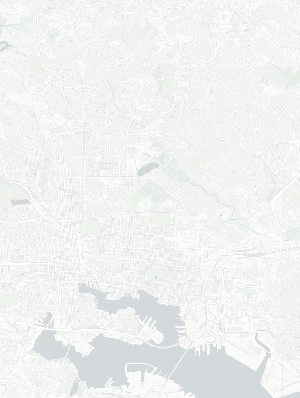
The Red Line would provide a needed East-West light rail transit (LRT) line to connect communities and assets across the Greater Baltimore region from Bayview to Woodlawn. These connections will support economic growth and regional mobility. There is tremendous economic potential along the routes currently under consideration. This study demonstrates that the Red Line could drive additional development along the corridor and provide increased access to opportunity, including to the more than 16,000 residents of the station catchment areas without cars.
This report estimates the economic impacts of:
1. constructing and operating the Red Line; and
2. new TOD in the Red Line Corridor.
Analysis suggests that construction of the Red Line would create $10 billion to $19 billion in new economic activity including labor, materials, and professional services.
Long term, the Baltimore region would benefit from the creation of thousands of new jobs and billions in additional economic output. We estimate as many as 16,000 temporary, full-time jobs and as many as 1,650 permanent, full-time jobs will be created in the construction and ongoing operation of the Red Line.
Many of the proposed stations lie in densely populated areas where TOD could add additional commercial and housing spaces. This study identifies $12.4 billion in additional economic activity associated with currently planned TOD and 4,600 permanent new jobs.
A well-planned, inclusive, and equitable transit connection, in conjunction with new TOD, will enable more residents to benefit from increased access to jobs, health care, education, and other opportunities.
This study highlights opportunities to implement policies to maximize the ongoing benefits of the Red Line by planning for transit-supportive land uses, ensuring an enhanced rider experience, and preserving and growing affordable housing and commercial space.
We provide three recommendations for policymakers in Baltimore City, Baltimore County, the State of Maryland, Maryland Department of Transportation (MDOT) Maryland Transit Administration (MTA), and local communities to maximize the project’s benefits to communities along the corridor.
Completion of the Red Line would bring ongoing economic and social benefits to Baltimore that our analysis indicates could far exceed the initial investment.

12,000+
temporary full-time jobs for Red Line Construction
1,400+ $12.4B $940M
permanent jobs for Red Line Operations
The Partnership and the GBC, through the Baltimore’s Transit Future initiative, will continue to work with Baltimore, state, and federal leaders to advance the planning and maximize the benefits of the Red Line. $10-19B $6-11B
4,600 in economic output from Red Line Construction* in labor income from Red Line Construction*
83,200
job-years for construction of all planned TOD developments***
in economic output from 45 development projects currently planned along the corridor
permanent jobs related to planned TOD developments
in annual economic output from 14 category 1 TOD developments**

An East-West Light Rail Transit (LRT) line would connect communities and assets across the Baltimore region and help support inclusive economic growth.

The current lack of a reliable and accessible transit system along Baltimore’s East-West corridor impedes economic growth. The Red Line has long been seen as a tool to enhance regional mobility, build healthier and safer environments, and create access to opportunity for diverse communities along its route.
Key Destinations Along the Red Line from West-East (Left-Right) CMMS I-70 Park & Ride
CMMS: Center for Medicaid & Medicare Services
Retail: Security Square Mall
Transfer: 1-70 Park & Ride
Transfer: West Baltimore MARC Station
UMMS & UMB: University of Maryland Medical Center & University of Maryland, Baltimore
Downtown, Inner Harbor: M&T Bank Stadium, Camden Yards, CFG Bank Arena, Baltimore Convention Center, National Aquarium, Light Rail, Metro Subway, and Bus Transfers
BCCC: Baltimore City Community College
Retail: Harbor East & Harbor Point
Retail: Canton Crossing
Bayview: Johns Hopkins Bayview Medical Center
The Red Line is projected to support
28,500 to 35,500 daily trips depending on route alignment and the use of tunnels or various surface options
The Red Line was first formally identified as a priority for transit investment in Baltimore City and Baltimore County in the 2001 Maryland Comprehensive Transit Plan and the 2002 Baltimore Regional Rail Systems Plan. The proposed Red Line would provide a rapid transit option from the Centers for Medicaid and Medicare Services and Social Security Administration (CMS/SSA) in the west to Johns Hopkins Bayview Medical Center in the east, connecting several high-density and underserved neighborhoods throughout Baltimore and expanding mobility for its residents.1
After more than 10 years of study, engineering, environmental analysis, and community participation, the state canceled the project in 2015. Governor Wes Moore revived the Red Line project in 2023 and announced that light rail would be the recommended mode for the project in June 2024. As of November 2024, the MTA is working with local partners to define the route alignment, including the extent to which the project includes tunneled segments, with a final decision expected by 2025.
Following the re-launch of the Red Line, MTA released six preliminary route alternatives, including three bus rapid transit (BRT) routes and three light rail transit (LRT) routes. With the selection of LRT as the mode, three route alternatives remain: Alternatives 1 (LRT-Tunnel), 2A (LRT-Surface North), and 2B (LRT-Surface South) (see Figure 2). Through a series of community open houses and engagement with key stakeholders, MTA is working to select a preferred alignment. MTA is also working in partnership with the Federal Transit Administration (FTA) to prepare a Supplemental Environmental Impact Statement (SEIS) as part of the required National Environmental Protection Agency (NEPA) process to advance to final design.
Funding the Red Line will require investments from the state and federal governments. The Red Line is projected to cost between $4.7 to $9.0 billion depending on route alignment and the use of tunnels or various surface options. To maximize the state’s investments and help finance the construction of the project, funding from the FTA’s Capital Investments Grant (CIG) program will be needed. MTA will need to re-apply to the CIG program and also explore complementary federal funding opportunities.
In 2021, U.S. Senators Ben Cardin and Chris Van Hollen secured language in the Bipartisan Infrastructure Law (BIL) that prioritizes consideration of projects previously considered for funding under the CIG program, potentially expediting federal review.2
Federal grant application review will consider the proposed project as well as Baltimore’s existing transit system. As part of the evaluation for the CIG program, the FTA looks at various factors, including the state of the existing system. In the near term, the region can ensure its competitiveness for Red Line funding by addressing and prioritizing key state-of-good-repair projects on existing assets. In addition, developing robust, equitable TOD plans and plans to maintain or increase affordable housing along the corridor will demonstrate that the project represents a transformational investment.
Communities closest to the proposed stations stand to benefit most from investment in the Red Line Corridor.3 These “catchment” areas are a half-mile radius around each proposed rapid transit station. This distance corresponds to approximately a 15-minute walk from a residence or workplace to a station,

For the analysis, catchment areas were estimated using the Red Line stations proposed in Alternatives 1, 2A, and 2B announced by MDOT in September 2023.5 Details of the three alternatives are mapped in Figure 2.

Buildout of the Red Line would support significant economic benefits through the construction and operation of both the transit line itself and associated transit-oriented development along the corridor.

The potential economic benefits directly attributable to both the Red Line construction and operations are significant, as are the indirect and induced impacts of this economic activity on local jobs, labor income, and economic output.6
Our analysis also examined the direct, indirect, and induced impacts from the existing pipeline of transit-oriented development projects along the corridor.
The construction and ongoing operations of the Red Line will yield both short- and long-term economic benefits for the region. Our analysis takes into consideration the range of initial capital costs for the proposed surface ($4.7 to $5.3 billion) and tunneled ($8.2 to $9.0 billion) LRT route alignments.7
If final route alignment requires tunneling, which would incur a higher capital spend, the economic impact of the Red Line’s construction could support as many as 16,000 temporary full-time jobs and up to $19 billion in economic output, which includes up to $11 billion in labor income to workers.
Construction Impact: The initial capital investment will create construction jobs and stimulate local economic growth with increased spending at local businesses and suppliers, distributors, and manufacturers throughout the supply chain.8 Even at the lower end of capital expenditure, the project will produce at least $10 billion in economic output, including $6 billion in worker income.
Operational Impact: The continuous expenditures required for the operation and maintenance of the Red Line, estimated at up to $60 million per year, could support as many as 1,650 long-term jobs and $160 million in annual economic output.9
Construction Impact of the Red Line
$10-19 Billion
$6-11 Billion in labor income* in economic output*
12,000 to 16,000
1,400 to 1,650 temporary jobs for Red Line Construction
Downtown Baltimore, along with the Inner Harbor, Harbor East, and Fells Point, has seen a considerable increase in multifamily unit construction in recent years. However, recent data suggests that downtown Baltimore’s multifamily market has reached an inflection point. Following record demand in 2020 and 2021, the supply of new apartments slipped to its lowest level in more than a decade, with the delivery of only 1,400 units in 2022. The multifamily market rebounded slightly in 2023 with the delivery of approximately 3,000 units.10 The office market in Baltimore is also in a state of post-pandemic change – vacancy rates reached a nine-year high of 20.1% in 2023.11
The Red Line could help drive additional residential and commercial development along the corridor. Proximity to highcapacity transit stops has been shown to drive residential and commercial demand and increase property values.12 High-quality transit also significantly enhances residential and commercial real estate values, helping residents build wealth while also supporting local revenues. According to the American Public Transportation Association (APTA), property values near highfrequency public transportation perform 42% better than those for other properties.13
Adding to the real estate benefits of transit, businesses near transit stations no longer need to provide off-street parking as a result of legislation enacted in 2024, reducing the costs associated with building and maintaining parking.14
The Red Line corridor, particularly the portion that intersects downtown Baltimore, is already seeing an influx of dense, mixeduse construction. Implementation of the Red Line is likely to foster even more development downtown and spur new TOD opportunities in sub-markets outside of the central business district, especially in West Baltimore, Canton, Bayview, and in Baltimore County around Security Square Mall. The current development pipeline offers a preview of the impact that future TOD could have along the Red Line Corridor.
TOD investments generate economic benefits – not only in the short term from construction activity – but also in the long term from operations and agglomeration.15 Agglomeration is valuable because the relative proximity of workers and households can result in positive economic spillover effects that lead to better job opportunities, more effective sharing of information or ideas, and more efficient use of public resources, like transportation, health care, and schools.
As of June 2024, there are more than 45 residential and commercial developments proposed or under construction within half a mile of the planned Red Line stations (see Appendix A for a summary table of all the projects included in the analysis).
16 Of the new developments identified, 14 are supported by CoStar data, the largest source of verified real estate activity (referred to here as Category 1 developments), while 31 have been confirmed via conversations with developers and local business organizations but are not yet supported in CoStar data (referred to as Category 2 developments).
The economic impact analysis of all Category 1 developments considered the type of development, effective rent based on square footage, unit numbers, and regional vacancy rates.17 The rental and vacancy rates used to estimate ongoing operational impacts were specific to each Baltimore development category and sub-market.18


1.
2.
3.
4.
5.
6.
7.
8.
9.
10.
11.
12.


The existing pipeline of Category 1 & 2 developments along the Red Line Corridor is estimated to generate significant economic activity from construction, ongoing operations, and new commercial activities.
Construction Impact: Construction of these developments would support 83,200 job-years (the equivalent of a worker holding a full-time job for one year) with $5.5 billion in labor income to workers involved in the construction of the developments.
These developments would also support total economic output of $12.4 billion, including output directly arising from construction plus the indirect effects stemming from business-to-business purchases in the supply chain and induced effects that arise from the increase in household spending resulting from new labor income.
Operational Impact:19 Operations of Category 1 developments would also support up to $680 million in recurring annual economic output from maintenance and operations of the completed projects, supporting 4,600 ongoing jobs (the vast majority from the new commercial developments) and providing $140 million in annual labor income to workers. Operational impacts related to Category 2 developments could not be estimated due to limited data availability.
83,200
job-years for Category 1 & 2 Developments

Our analysis focuses on economic impacts knowable today – but additional economic and community benefits are likely to accrue through careful cross-sector planning and collaboration.

The MTA currently estimates 28,500 to 35,500 average daily trips on the Red Line, depending on the route selection.20 Accelerating dense TOD along the corridor can increase these demand figures. Transit is most successful in areas with a highpotential user base, dense land uses, and significant transitdependent populations, such as zero-car households.21 The Red Line is primed for high ridership based on its:
High-Potential User Base: Each day, the Red Line Corridor sees hundreds of thousands of residents and
are more jobs and people per acre along its route. Several neighborhoods along the Red Line host well over 30 residents and jobs per acre – a level that would support high-capacity, frequent transit. These areas include some of the Baltimore region’s most job- and populationdense communities.23,24
Transit Propensity: Households of color and those without cars are more likely to rely on transit.25 More than half of the residents along the Red Line corridor are people of color, and 49% of corridor residents identify as


The Red Line will dramatically improve access to opportunity for thousands of households. While nearly all jobs in the Baltimore region can be reached within one hour by car, only 9% can be reached within one hour by transit.27 The Red Line would provide better access for the more than 16,000 zerocar households in its catchment area who would have a new mode of transportation near their homes, better connecting them to jobs, healthcare, and education. It would also allow for easier access to the larger regional transit network, including Metro Subway, Light Rail, CityLink Bus Routes, and MARC and Amtrak services to Washington, D.C., and the entire Northeast Corridor.28
Efficient rapid transit options can influence transportation behaviors even among residents with access to a vehicle by providing time savings and the opportunity to work or relax
during transit.29 In 2022, the average Baltimore driver lost 44 hours in traffic, costing the city an estimated $905 million in lost productivity.30 In addition to time savings, choosing transit over a personal vehicle can save a family more than $12,000 per year on gas, maintenance, and wear-and-tear.31 Fewer cars on the road also means less congestion and lower roadway maintenance costs.32
Transit-supportive land uses – land uses that economically and socially support the effective use of transit – will play a key role in ensuring that the Red Line achieves its full potential to improve regional mobility. TOD, which prioritizes dense, walkable, mixed-use development near transit stations, will be critical to maximize access to the Red Line, grow ridership, and reduce car dependency along the corridor.
Baltimore City, Baltimore County, and the State can enhance mobility and access by encouraging more transit-supportive land uses along the corridor, formalizing TOD plans for each station that support increased development density, streamlining development processes, and cutting bureaucratic red tape around Red Line stations. See full recommendations on p. 14.
Transportation-related air pollutants from motor vehicles are one of the largest contributors to unhealthy air quality, and prolonged exposure to emissions from traffic has been linked to many adverse health effects. Childhood asthma diagnoses in Baltimore, for example, are more than double the national rate, and four out of the five Baltimore ZIP codes with the highest asthma hospitalization rates included smaller areas with high exposure to toxic air pollution coming from roadway vehicles.33,34
The average transit system emits about half the emissions per passenger mile when compared to a single occupancy vehicle.35 With at least 17,000 of the average daily total
projected trips coming from households with at least one car based on analysis from MTA, the Red Line can help improve air quality as well as respiratory and cardiovascular health outcomes of Baltimore residents by taking cars off the road and reducing environmental pollution.36,37
In addition to improved air quality, transit riders are more likely to be physically active, and traveling via transit has been shown to be 10 times safer than by car.38 Additionally, recent research suggests that when a new rapid transit line like the Red Line opens, the number of “no-show” appointments at local clinics decreases, particularly for patients receiving Medicaid.39
Baltimore City, Baltimore County, and the State can maximize the environmental, health, and safety benefits of the Red Line by enhancing the transit experience around the Red Line stations. That should include short-term transit enhancements along the corridor, first-class station experiences, including safe sidewalk and trail access to and from stations, and ensuring reliability across the entire network. See full recommendations on p. 14.
The Red Line presents the opportunity to reconnect disadvantaged communities and address historic inequities created by mid-century transportation planning practices. When fully constructed, the Red Line is expected to significantly improve transit efficiency across the system, expand access to opportunity and activity centers, and support inclusive economic development and community revitalization across Baltimore neighborhoods and the region.
Communities of color have disproportionately borne the adverse effects of discriminatory planning practices that positioned highways and industrial facilities near Black neighborhoods.40 These infrastructure and land use choices have had generationally damaging effects in Baltimore, resulting in isolation from vital services and job opportunities, decreased air quality from industrial and transportation emissions, and increased commute times.41,42
People of color are also most at risk of displacement due to transit-induced gentrification.43 Intentional planning will be required to prevent the Red Line from displacing low-income residents and locally owned small businesses along the corridor. To prevent displacement due to increased property values, efforts will be needed to preserve non-subsidized or “naturally occurring” affordable housing (NOAH) and protect current residents and businesses along the corridor.44 For homeowners and renters, a possible strategy could include well-crafted, targeted property tax benefits to allow residents to stay in their homes.45 For businesses, targeted grants and technical assistance could help ensure small businesses are able to thrive before, during, and after construction of the Red Line.
RECOMMENDATION 3
Equitable TOD (eTOD) can help mitigate displacement and improve inclusivity and affordability around the new Red Line. eTOD is a development strategy that aims to create and preserve inclusive and affordable communities around transit stations with an emphasis on affordability, mixed land uses, adequate density, and tenant protections.46 The Red Line presents a generational opportunity to fuel and supercharge eTOD by addressing past planning mistakes, delivering increased economic opportunity to historically disadvantaged communities, and correcting longstanding patterns of disinvestment.
Baltimore City, Baltimore County, and the State should collaborate on strategies to preserve affordable housing and commercial business space along the corridor by employing a suite of policy tools to prevent displacement, support existing small businesses, and maximize local and diverse construction spending, while encouraging investment and growth in historically disinvested communities along the corridor. See full recommendations on p. 14.

1
Improves transit reliability & shifts users to transit to alleviate congestions.

3
Enhances air quality, reduces emissions, and expands access to healthcare.

2
Connects communities to regional transit and job-rich destinations.

4
Stimulates regional employment and TOD.

The Greater Washington Partnership and Greater Baltimore Committee recommend that Baltimore City (the City) and Baltimore County (the County), in partnership with the State of Maryland (the State), MDOT MTA, and local communities, consider the following strategies to maximize the Red Line’s impact and position the project for federal investment.
a. Formalize a TOD plan for the corridor. The City, the County, and MDOT MTA should create and adopt a development plan that prioritizes the concentration of density and land use diversity along the Red Line corridor.
a. Continue to enhance transit services along the EastWest corridor. MDOT MTA should develop a plan to increase bus frequencies throughout the planning and construction of the Red Line to enhance access for existing residents, build transit ridership, and grow demand along the future rapid transit corridor.
b. Cut red tape for development around Red Line stations. The State, City, and County should continue to target incentives and streamline development processes in station catchment areas to accelerate inclusive economic growth around Red Line stations.
c. Ensure quality service across the entire system. MDOT MTA should plan to ensure high-quality reliable service from day one of transit operations, not just along the Red Line, but across the system. Ensure an Enhanced Transit Experience
Preserve and Grow Affordable Housing and Commercial Space
a. Prioritize equitable outcomes along the corridor. The State, City and the County should identify specific goals for affordability and mobility expansion, specific target populations for policy interventions, and metrics to track success.
b. Utilize and develop a full suite of policy tools to prevent displacement. The City and the County, working with the State, should target rental and property tax relief and other supportive policies to limit displacement for long-time and low-income homeowners and renters living in the corridor.
b. Build a first-class Red Line station experience. MDOT MTA should plan for an exceptional customer experience, including, where possible, station amenities, robust integration with other transit and micro-mobility services, and safe sidewalk and trail connections.
c. Support the Red Line corridor’s existing small businesses. The City, County, and State should work together to provide grant and technical assistance to help ensure small businesses can thrive before, during, and after construction of the Red Line.
d. Maximize local and diverse construction spending. MDOT MTA should work with the State, City, County, and private sector partners to support the growth and development of local and minority-owned businesses through targeted and intentional supplier diversifications efforts to maximize the regional spending and related economic impacts.
Development of the Red Line can bring significant economic benefits to the Baltimore region that would far exceed the initial and ongoing costs of the Red Line’s $4.7 to $9 billion construction and $53 to $58 million annual operation costs.47

Transportation-related benefits include improved job access, reduced roadway congestion, and lower environmental emissions. Construction alone will drive at least $10 billion in economic activity and $6 billion in income for workers. Broader economic benefits include new economic activity associated with construction and operation of new residential and commercial TOD as well as increased property values, economic development, and community development opportunities along the corridor.
The Partnership and GBC recognize the value of public transportation and will continue to advocate for robust transit networks in Baltimore. Greater access to high-quality transit improves access to opportunity and economic competitiveness.
The Red Line represents an important regional step to build a more inclusive and interconnected transportation system that better supports the Baltimore region’s growth and its ability to attract and retain residents who want to live, work, play, and build a business in the region. The Partnership and GBC look forward to working with public officials and civic and business leaders across the region to advance the planning and construction of the Red Line and help ensure Baltimore’s Transit Future.
The Greater Baltimore Committee and Greater Washington Partnership launched the Baltimore’s Transit Future campaign to call attention to the urgent business imperative for the Greater Baltimore region to create a world-class public transit system that helps create shared economic prosperity and catalyzes inclusive growth. Since June 2022, more than 70 business, civic, and non-profit organizations, including many of the largest employers in the State, have joined the campaign encouraging regional focus on six priorities:
1. Address the transit system’s repair backlog and operator shortage.
2. Establish frequent, reliable transit service to regional job centers.
3. Support regional coordination, decision-making, and funding.
4. Implement a 10-year rapid transit expansion program.
5. Prioritize regional rail investment.
6. Catalyze equitable development at transit and rail stations.
The Greater Washington Partnership is a nonprofit alliance of influential and leading employers across industry sectors in Maryland, Virginia and Washington, D.C. – all committed to championing the region’s economic growth and vibrancy. Together, we leverage our collective experiences, resources and assets to identify shared challenges and offer solutions to the region’s most critical issues in the areas of skills and talent, regional mobility, infrastructure, and inclusive growth. Our goal is to ensure the entire region, from Baltimore to Richmond, remains a vibrant, economically competitive, and inclusive place to live, work, and build a business.
The Greater Baltimore Committee (GBC) is the leading voice for the private sector in the Baltimore region, providing insightful economic and civic leadership to drive collective impact. Composed of more than 400 organizations, including large, mid-size, and small companies, nonprofits, foundations, and educational and healthcare institutions, the GBC is dedicated to fostering the prosperity of the Greater Baltimore region.
1 MDOT MTA, “East-West Corridor Feasibility Study Final Report,” December 2022.
2 U.S. Senator Ben Cardin, “[Press Release] Cardin, Van Hollen Revive Federal Support for Baltimore’s Red Line Transit Project,” August 2, 2021.
3 Hao, Zhesong and Ying Peng, “Comparing Nonlinear and Threshold Effects of Bus Stop Proximity on Transit Use and Carbon Emissions in Developing Cities,” Land 12, no. 1, December 2022.
4 Duany, Andres and Robert Steuteville. “Defining the 15-minute city,” Congress for New Urbanism, February 8, 2021.
5 MDOT MTA, “Maryland Transit Administration Announces Next Phase of Red Line Public Engagement, Releases Maps of Proposed Alternatives,” September 28, 2023.
6 The Regional Input-Output Modeling System (RIMS II) multipliers published by the U.S. Bureau of Economic Analysis (BEA) provide a framework for quantifying the potential economic impacts of various projects. These multipliers measure how changes in economic activity in one sector can influence other sectors, and they are often used to estimate the indirect and induced effects of a project on the local economy. When considering the impact of a project like the Red Line, the RIMS II multipliers can be applied to estimate the number of jobs supported, labor income generated, and gross economic output resulting from the project. This includes both the direct impacts (e.g., jobs created during construction) and the indirect impacts (e.g., jobs supported in supplier industries). The results can provide a comprehensive picture of the potential economic benefits of the project.
7 MDOT MTA, “Baltimore Red Line Open House,” Fall 2024, p. 22.
8 EY analysis based on Costar data and RIMS II multipliers, RIMS II User Guide
9 Bureau of Economic Analysis, U.S. Department of Commerce, RIMS II User Guide
10 CoStar data was pulled by EY Corporate Real Estate Consulting & Technology Services (CRE) team based on GIS mapping.
11 CBRE, “Baltimore Office Figures Q3 2024,” October 1, 2024.
12 American Public Transportation Association, “The Real Estate Mantra – Locate Near Public Transportation.”
13 American Public Transportation Association, “Where Public Transportation Goes Community Grows,” p, 2.
14 See HB 38 (2024).
15 USDOT EIA Guidelines, “Benefit Cost Analysis Guidance 2022 (Revised).”
16 CoStar data was pulled by EY CRE team based on GIS mapping.
17 RIMS II multipliers for real estate are based on building rents, which are estimated from square feet, unit numbers, and vacancy rates.
18 Moody’s Real Estate data pulled by EY CRE team.
19 Due to limited data for the Category 2 developments, operations-related impacts have not been estimated.
20 See 7 re: Fall 2024 Red Line Open House
21 Tomer, Adie, “Transit Access and Zero-Vehicle Households,” Brookings, August 2011.
22 MDOT MTA, “Appendix A: Existing and Future Conditions Technical Report,” December 2022, pg. A-26.
23 Federal Transit Administration. “Planning for Transit-Supportive Development: A Practitioner’s Guide,” June 2014.
24 See 1 re: MDOT MTA, East-West Corridor Feasibility Study Final Report.
25 Anderson, Monica. “Who relies on public transit in the U.S.” Pew Research Center, April 7, 2016.
26 Baltimore Metropolitan Council, “American Community Survey,” 2015-2019.
27 Johns Hopkins University and Baltimore Transit Equity Coalition, “Transit Equity & Environmental Health in Baltimore City,” September 2021.
28 See 1 re: MDOT MTA, East-West Corridor Feasibility Study Final Report.
29 USDOT EIA Guidelines, “Benefit Cost Analysis Guidance 2022 (Revised).”
30 INRIX, “INRIX 2023 Global Traffic Scorecard,” August 2024.
31 Moye, Brittany, “Annual New Car Ownership Costs Boil Over $12K,” AAA Newsroom, August 30, 2023.
32 USDOT EIA Guidelines, “Benefit Cost Analysis Guidance 2022 (Revised).”
33 Baltimore City Health Department, “Asthma in Baltimore,” 2021.
34 Kelly, Leah & Kira Burkhart, “Asthma and Air Pollution in Baltimore City,” Environmental Integrity Project, December 2017.
35 American Public Transit Association, “Quantifying Greenhouse Gas Emissions from Transit,” Sep. 10, 2018.
36 MDOT MTA, “Red Line Open House Meeting,” November 2023.
37 Jensen, Gary. “Air Quality and Transportation,” Public Roads – U.S. Federal Highway Administration, Vol. 67, No. 1, July/August 2003.
38 Saelens, Brian E., et al. “Relation Between Higher Physical Activity and Public Transit Use,” American Journal of Public Health, Vol. 104, No. 5, May 1, 2024. Pp. 854-859.
39 Smith, Laura Barrie, et al, “The effect of public transportation expansion on no-show appointments,” Health Services Research, Vol. 57, Issue 3, November 1, 2021. Pp. 472-481.
40 Smart Growth America, “Divided by Design,” July 2023.
41 Pietila, Antero. Not in My Neighborhood: How Bigotry Shaped a Great American City. Ivan R. Dee, 2010.
42 See 26 re: Johns Hopkins and Baltimore Transit Equity Coalition.
43 Qi, Yunlei, “Transit-Induced Gentrification in U.S. Metropolitan Areas” (PhD diss., University of Minnesota), October 2020.
44 According to the National League of Cities, naturally occurring affordable housing (NOAH) refers to residential properties that are “affordable” but are not subsidized by any federal programs; the rents are naturally relatively low compared to the regional housing market. These units represent the most common form of affordable housing in the U.S., but they are at the greatest risk of being lost due to market speculation and demolition. Across the country, NOAH units are being converted to higher-market rents or are falling into disrepair due to poor management.
45 Wilding, Jennifer. “To slow displacement, one neighborhood tests a new idea: Property tax rates based on income,” Federal Reserve Bank of Kansas City, March 5, 2024.
46 Greater Washington Partnership, “Connecting the Richmond Region: From East-West to North-South,” January 2022, p. 12.
47 See 7 re: Fall 2024 Red Line Open House
48 CoStar data was pulled by EY CRE team based on GIS mapping.
