GIM International Trail
Guiding you through INTERGEO’s essentials


Guiding you through INTERGEO’s essentials
Intergeo has firmly established itself as one of the annual highlights for everyone working in the geospatial sector. It is a place where knowledge, networking and market insights come together. This event also demonstrates the indispensable role of the geospatial sector in today’s society, and displays everything the industry has to offer – and that’s a lot!
The exhibition floor buzzes with ideas; it’s where innovation and application truly converge. Two stages within the Expo area provide insights into the latest developments. The main stage showcases major trends: from geoAI, smart sensors and laser scanning, to Lidar, GNSS, photogrammetry and Scan2BIM. Live demos of reality capture, digital twins and AI integration demonstrate how data is becoming more quickly accessible, more accurate and more sharable. Panel discussions featuring international experts highlight pioneering work on data strategies and innovative projects. The second stage focuses on practical applications of geospatial technology: in urban development, construction, infrastructure, mobility, energy and telecoms. From smart city concepts and efficient construction logistics to climate-resilient solutions and the digitalization of utility networks – here you can see how our industry is making a real difference to people’s lives.
In this edition of the GIM International Intergeo Trail, we zoom in on some groundbreaking practical applications that reaffirm the versatility of our field. The articles include a Q&A providing insights into how Deutsche Bahn collects reliable geodetic
data in complex railway environments such as stations, tunnels or busy corridors, and how utilizing the full potential of geodata will greatly benefit the planned modernization of the German railway network over the coming decade. Meanwhile, the only long read in this compact magazine is an interview with Thomas Zurbuchen from ETH Zurich, the man who previously led NASA’s James Webb Space Telescope programme to launch and into scientific operation. I believe this is a captivating read for everyone in our industry. After all, the geospatial field has many interfaces and cross-connections with the way the universe and ever-wider extraterrestrial horizons are being mapped in the context of astronomy and space travel.
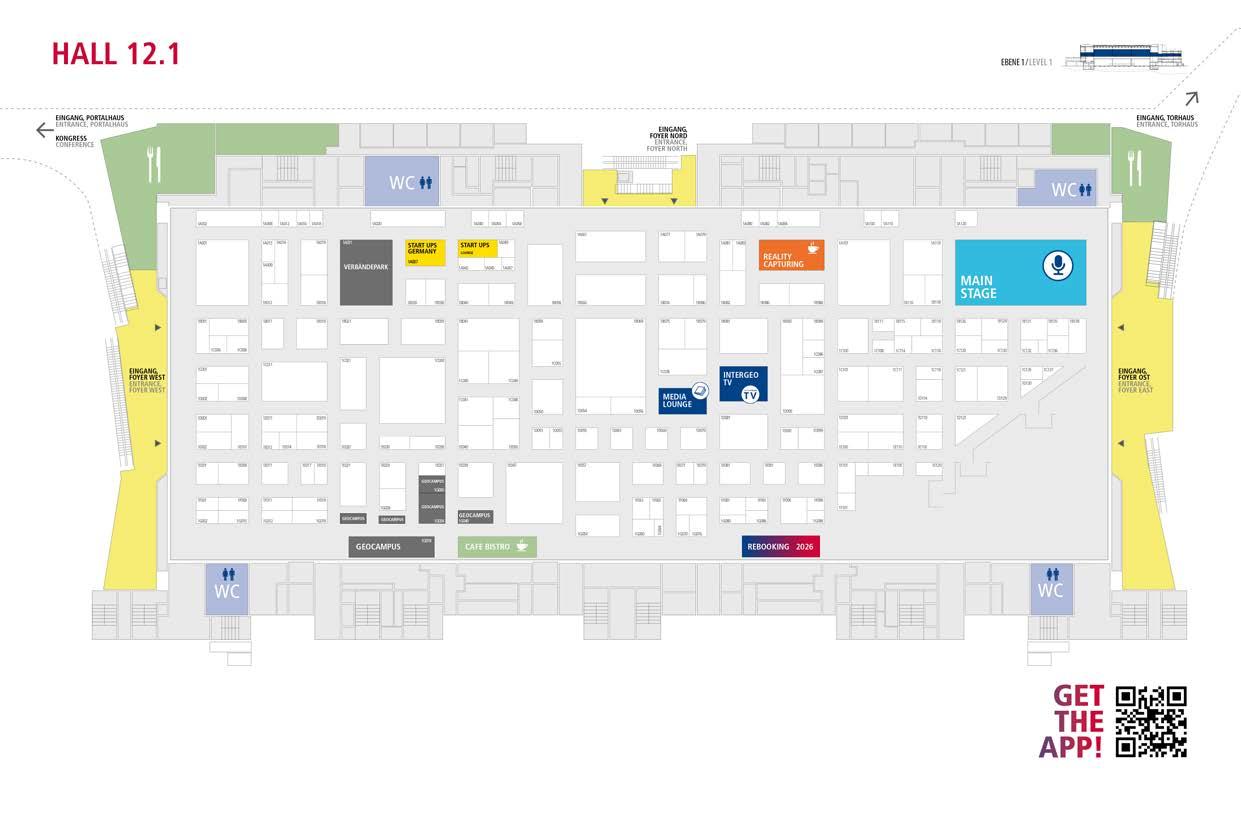
With more than 600 exhibitors presenting their current and future solutions at this year’s Intergeo, there is inspiration all around – but this can also make it tricky to find your way around. That’s why this Intergeo Trail also includes details of the exhibitors, a floorplan plus a number of recommendations from the team at GIM International, which has a long history as the leading global magazine and media brand in the field of mapping, surveying and geospatial data applications. These are all companies whose booths we believe are definitely worth a visit, as they make a significant contribution to the industry within the wide range of solutions you’ll find here in Frankfurt. One thing I personally love about Intergeo is the energy and enthusiasm of the professionals at the numerous booths – which truly come in all shapes and sizes – as they explain their solutions in a way that everyone can understand. So I encourage you to seek out these companies on the exhibition floor and enjoy the experience of seeing and hearing how the future of geospatial technology is taking shape!
Wim van Wegen Head of content, GIM International
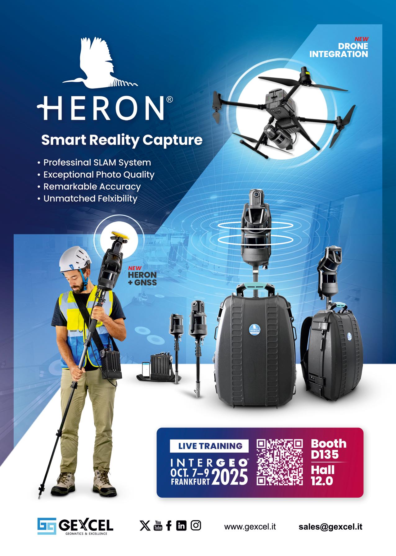
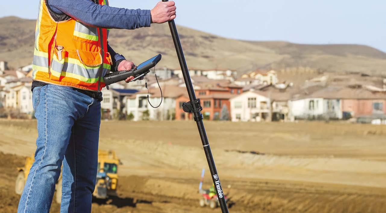
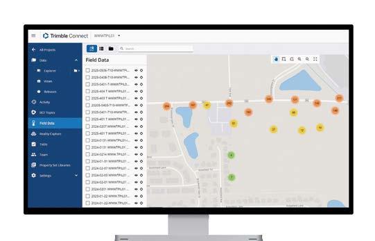
Trimble® cloud-enabled workflows help you turn complexity into confidence by providing a real-time exchange of accurate, traceable geospatial data between the field and the office. Keep your data safe and make key information instantly available to every stakeholder, so that projects can move faster.
Cloudbasierte Workflows von Trimble® helfen Ihnen dabei, Komplexität in Vertrauen zu verwandeln, indem sie einen Echtzeitaustausch präziser, nachverfolgbarer Geodaten zwischen Feld und Büro ermöglichen. So schützen Sie Ihre Daten und stellen wichtige Informationen jedem Projektbeteiligten sofort zur Verfügung, damit Projekte schneller vorankommen.
Visit us in Hall 12.0
By Timothy W. Burch, FIG
As our world continues to evolve during the Fourth Industrial Revolution, professional surveyors and geodesists find themselves at the centre of the movement. Much of our world has become geospatially driven, so staying in front of the technology involved has become more important than ever. The International Federation of Surveyors (FIG) and its members from around the world gather on an annual basis to encourage attendees to expand their knowledge of their beloved profession. It is this thirst for knowledge and curiosity about new technology that drives the profession to be a leader in geospatial data. But where does one go to see where the future of geospatial information lies? Welcome to Intergeo!
Throughout history, milestone events and exhibitions have captivated audiences with announcements and demonstrations highlighting innovative ideas, technologies, and inventions that revolutionize our world. The Great Exhibition, held in London in 1851 and considered the first ‘world’s fair’, introduced the steam engine and the telegraph to the masses. Subsequent gatherings allowed the introduction of the Ferris wheel, X-ray machine and the telephone.
In modern times, various industries and professions utilize large exhibitions to introduce the latest technologies for their practitioners and users. The more commonly known events include:
• Consumer Electronics Show (CES), the gold standard in introducing the latest technology
Art Basel, a series of events for promoting the latest in modern and contemporary art
• Chicago Auto Show, known for the introduction of the latest cars, trucks and vehicle technology.
Surveying and geomatics practitioners have been fortunate to have the same opportunity for over 150 years, nearly the same amount of time FIG has been in existence. The first German Geodesy Day, Deutscher Geodätentag, was held in Eisenach, Germany, in 1872. This commemorative event remained a one-day celebration until

Timothy (Tim) W. Burch PLS is executive director of the National Society of Professional Surveyors (NSPS) in the USA. He also serves as chair of the International Federation of Surveyors (FIG) Commission 1 on Professional Standards (2023-2026) and represents the Advisory Committee of Commission Chairs on the FIG Council.
1925, when it was expanded to the first Deutsche Geodätische Woche (German Geodetic Week). This event was held in Cologne, Germany, from 4-8 August and featured a variety of topics centred on the surveyor and geodesist.
In 1995, DVW – Gesellschaft für Geodäsie, Geoinformation und Landmanagement (the German Association for Geodesy, Geoinformation and Land Management) rebranded the German Geodetic Week to Intergeo. Since then, this event has become a central attraction to geodesists and surveyors not just within FIG, but from around the world. What started simply as an expanded educational conference with an attached trade fair has turned into the place to be for introducing and unveiling the latest in geospatial technology.
The two organizations – FIG and DVW – converged in 2006 when FIG’s XXIII Congress was held in conjunction with Intergeo at the International Congress Center Munich (ICM). This collaboration resulted in the largest attendance for a FIG Congress to date, as it attracted over 3,000 members. The overall attendance for Intergeo that year was approximately 19,500, and both organizations deemed it a success.
In the years that followed that successful venture, FIG and its members have continued to flock to Germany every autumn to visit the unique geospatial exposition. Intergeo continues to provide our beloved profession with opportunities to see the latest in innovation from established vendors as well as up-and-coming entrepreneurs. We anticipate Intergeo 2025 in Frankfurt will not disappoint.


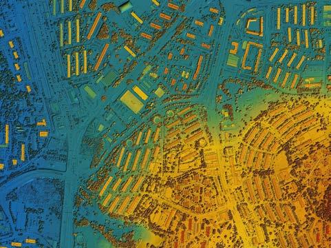
The aerial survey for the Digital Twin Germany is now 50% complete, marking a key milestone for the Federal Agency for Cartography and Geodesy (BKG) and one of Germany’s most ambitious geospatial projects. Having started in August 2022, the goal of the project is to have full nationwide coverage by December 2026. Remaining flights are already planned, but success still depends on one unpredictable factor: clear skies.
The digital twin of Germany will form the backbone for simulations in areas such as environmental protection, public safety, transportation planning and urban development. At its core, the digital twin is built on an ultra-detailed 3D model generated through advanced airborne laser scanning. This technology makes it possible to capture objects across the landscape with exceptional point density. The aim for this project is a dataset with a minimum of 40 measurement points per square metre nationwide. Particularly in flood prevention, these detailed geoinformation layers can play a vital role in protecting lives and infrastructure.
The Digital Twin Germany will be an intelligent, spatially accurate virtual representation of the country, containing detailed geospatial objects from high-rise buildings to traffic lights and tree cover. Its design draws inspiration from the concept of digital twins in Industry 4.0, where processes and developments can be tested virtually before being implemented in the real world. Once operational, the 3D model will be updated every three years, providing not only a continuously refreshed basis of data, but also valuable insights into long-term trends such as changes in forest cover, land use or topography.
The potential applications are wide-ranging. Policymakers and administrators could use the platform to assess which valleys are
most at risk during extreme rainfall, identify areas where heatwaves may endanger residents, or evaluate suitable sites for renewable energy expansion. It could also support disaster management by modelling evacuation routes in flood or wildfire scenarios, or analyse hospital accessibility to promote equal living conditions.
By uniting various analytical and simulation tools from different disciplines under one digital roof, the Digital Twin Germany aims to foster cross-sector collaboration and eliminate costly data duplication across federal agencies. The integration of AI, cloud computing and big data technologies will make it possible to tackle complex scenarios efficiently, without each authority having to develop its own specialized infrastructure. When completed, the Digital Twin Germany will not only make decision-making more sustainable and transparent but will also provide an immersive, 3D view of how policies and projects could shape the future.
In 2022, at the beginning stage of this gigantic project, Anja Hopfstock, Michael Hovenbitzer, Florian Lindl and Patrick Knöfel contributed an article in GIM International on how, at the forefront of applying the newest Lidar advances, BKG is playing a crucial role in supporting Germany on its path to become a smart country aimed at making better decisions faster.
By Jens Brauneck, Frankfurt University of Applied Sciences, Germany
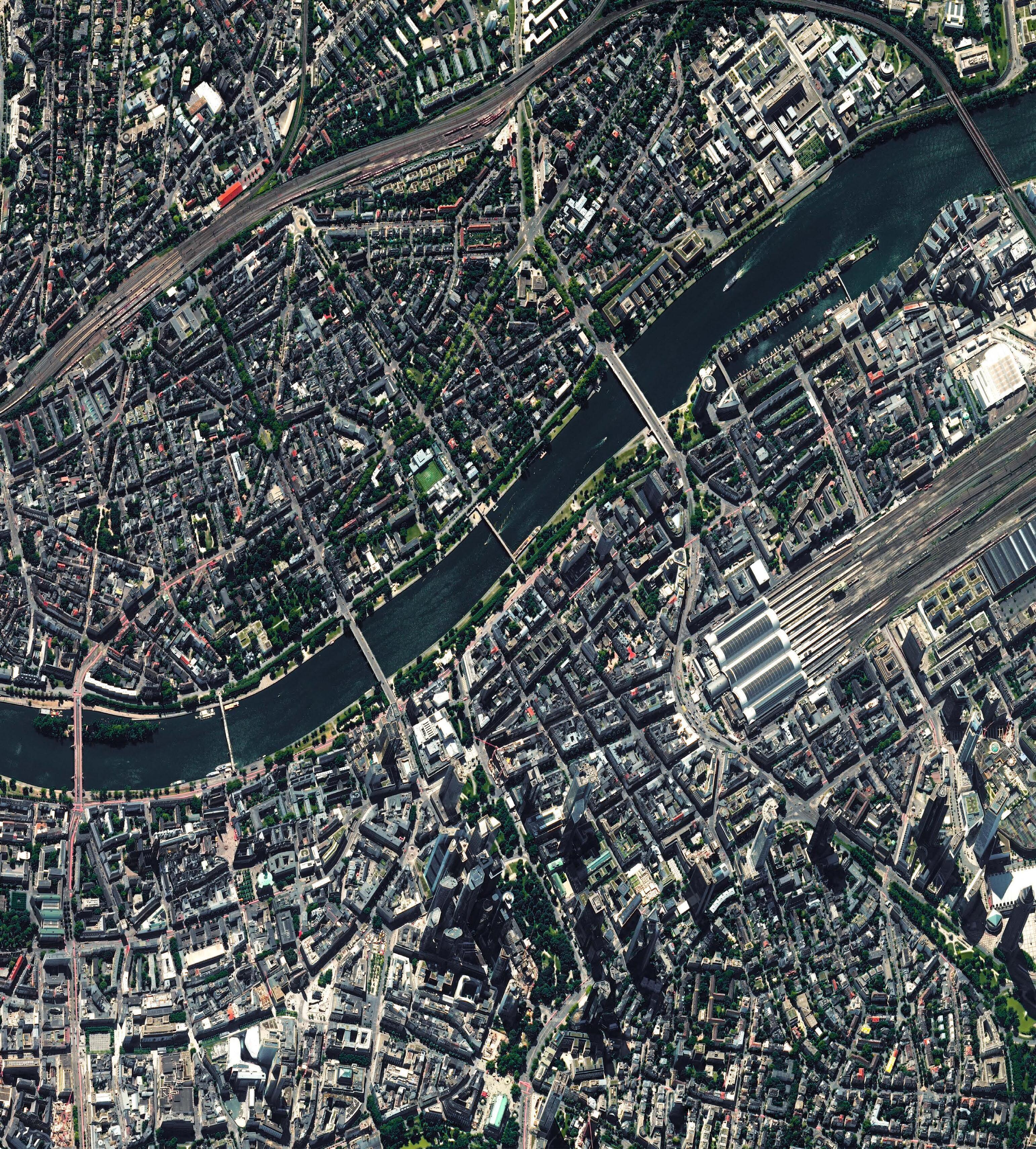
Intergeo, the world’s most important exhibition for geodesy and geoinformation, is a fixed date in the calendar for industry professionals and anyone involved in geodesy education and applied research. This year, and then regularly from 2027 onwards, it is taking place in Frankfurt am Main.
As the people living and working there know, Frankfurt is of course more than just an easily accessible conference location. The city is a prime example of the exchange between disciplines, people and technologies.
As a transport hub, financial centre and location for numerous digital projects, it is ideally suited for bringing together developments from industry, science and administration. In other words, Intergeo is being held in a region that is perfect for the exchange between science, business and public authorities. Topics such as urban development, mobility, climate protection and infrastructure are not mere theory here. This is where actual planning, construction and discussion take place.
The Frankfurt Geoportal and also the Frankfurt Urban Data Platform demonstrate how geodata supports public transparency, administrative decision-making and urban planning to enhance overall livability. The surrounding metropolitan area – the RhineMain region – is equally well positioned, with universities, research institutions, engineering firms, startups and public agencies. This diversity is reflected at the Intergeo trade fair, which brings together experts from various fields and offers students an opportunity to engage with potential employers at an early stage.
For those of us in higher education, Intergeo is not merely a mandatory event, but a real place of learning. It shows the dynamism with which geodesy is developing, and how closely education and professional practice are linked. When former students return

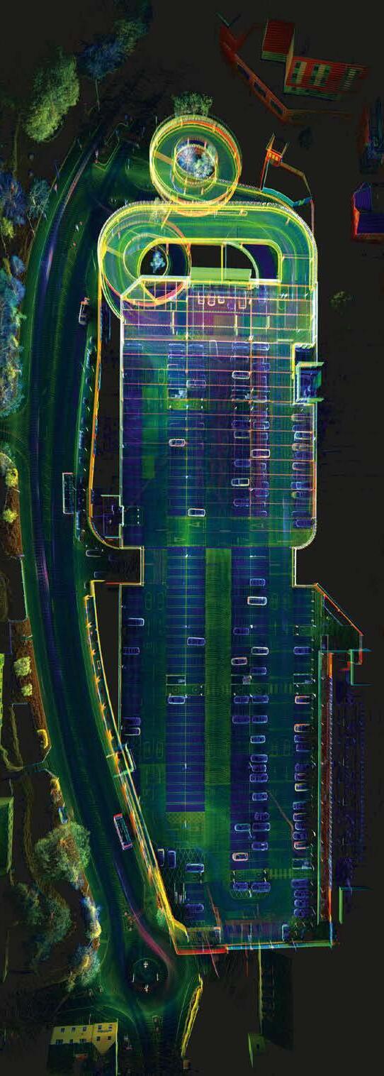
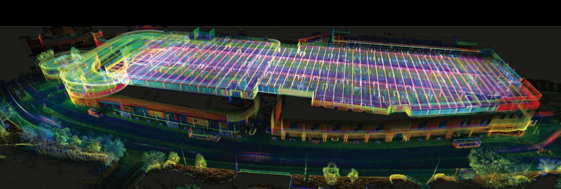
Scan-to-BIM project in Frankfurt’s Festhalle. Surveying and analysis of the beam girder construction, and acoustic modelling as part of student projects in the Geodata Management study programme. (Image courtesy: Jens Brauneck)
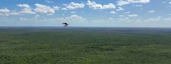
UAV-Lidar mapping in Brazil’s Caatinga dry forest. High-resolution 3D data reveals vegetation structure, disturbance and recovery dynamics to support sustainable management. (Image courtesy: Jens Brauneck)
as young professionals and exchange ideas with their former lecturers, it becomes clear how valuable good education and personal networks are. What makes the
trade exhibition special is that you can see how things really work. Technologies such as UAVs, Lidar, GNSS, AI-supported GIS systems and digital twins are not only exhibited, but
also actively explained and demonstrated. Students experience how their knowledge proves itself in practice, and where it needs to be further developed.For us teachers, Intergeo is also a place to stay up to date with the latest technology. In discussions with developers, manufacturers, authorities and colleagues from other universities, we get ideas. What works well in practice? What technology will be needed in the future? Which content might be missing from the curriculum? This feedback helps us keep our courses up to date, both technically and methodologically. And last but not least, Intergeo opens doors for many students. It is a place where ideas for internships and theses are born – and often where initial job offers are made. It is rare for academic life to offer such direct access to real-world innovation, employers and opportunities.
Developing solutions to real-world problems
What we experience there is also reflected at Frankfurt University of Applied Sciences. Our Department 1 brings together architecture, civil engineering, geodata and facility management in terms of both organization and content. The social challenges facing our region and our country – climate adaptation, energy infrastructure, mobility, digitalization and housing – can only be solved through an interdisciplinary approach. The common goal is not only to educate students in technology, but also to give them the proper tools to develop solutions to real-world problems themselves. Our study programmes in the field of geodata management are practiceoriented, wide-ranging and socially relevant. Especially in the dual work-study formats, theory is directly linked to everyday professional life. Cooperation with authorities and companies creates networks that not only provide training, but also contribute specifically to the region’s further development.
Research plays an important role in this. We work on projects that are directly related to practical applications, such as the monitoring of dry forest areas using UAV-based Lidar in Brazil, climate adaptation strategies in urban planning in Frankfurt, or the surveying of radio telescopes for global reference systems. This work is incorporated into our teaching. From real interdisciplinary cases, our students learn what geodesy can achieve, and where it is necessary to think for oneself instead of just applying knowledge.
The topics of geodesy and geoinformation are often still underestimated in politics and administration, yet much depends on them. Geodesy, as a broad discipline, provides the fundamental data and spatial precision that is essential for informed political, social and urban planning decisions. Geodesy makes a decisive contribution to key issues of the future, such as climate monitoring, spatial planning and global infrastructure. Without good data, there can be no well-functioning urban planning, no reliable infrastructure and no targeted climate protection. In many places, geodesy is considered a technical specialty. It is not just a question of measurement accuracy and software skills, however, but also of how to handle spatial data responsibly. This requires people who can combine technological precision with an understanding of social and ecological contexts. That’s why global climate change, energy transition, competition for land and pressure on land use, social inequality and spatial disparities are not marginal topics in our curricula. They are at the heart of our education.
About the author

Dr Jens Brauneck is Professor of Multisensory Geodata Acquisition in the Geodata Management study programme at Frankfurt University of Applied Sciences. His work focuses on digitally capturing natural and urban environments using photogrammetry and laser scanning, building on an academic background in applied physical geography and geoinformation.
The need for political will
Training interdisciplinary professionals is the task of universities, but this can only be achieved with long-term funding and reliable support. However, universities in many countries (including Germany!) are under increasing pressure to fulfil their tasks with limited resources. Areas such as geodesy, where innovation, research and education are closely linked, are particularly affected. In order for geodesy to realize its potential, technical expertise must be accompanied by the political will to promote this work in a sustainable manner. Intergeo embodies this principle by fostering dialogue between education, technology and social responsibility, and creating an opportunity to help shape the future. Geodesy in particular provides the necessary tools for this: precise measurement methods, a deep understanding of spatial relationships and the ability to make complex changes visible and assessable. Whether for climate adaptation, sustainable infrastructure or digital transformation, geodetic expertise is indispensable. To ensure that this expertise remains available in the future, strong partnerships between science, business, administration and politics are needed – as well as places like Intergeo, where these partnerships can thrive.
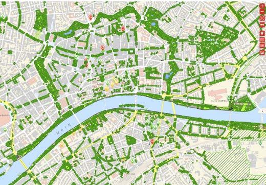
Cool places, green infrastructure and tree register in the Geoportal of Frankfurt am Main. The ‘cool places’ are part of Frankfurt’s climate change action plan. They include parks, forests, museums, churches, swimming pools, water playgrounds and other places in the city where people can cool off outdoors on hot days. It also lists drinking fountains.
What factors matter most when choosing a handheld 3D scanner ?

How do I set up an accurate survey in a GNSS-denied environment ?
Which sensor-drone combination is the best fit for coastal mapping ?
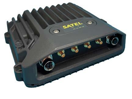
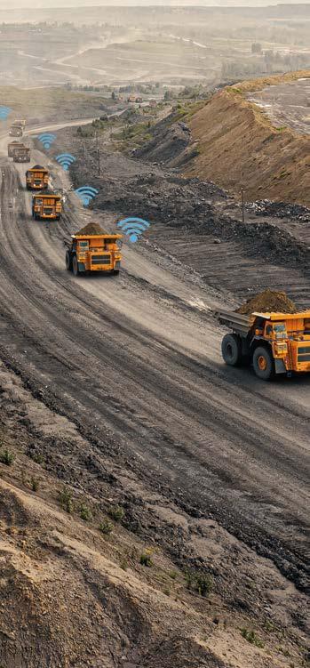
The need for seamless and multifunctional connectivity for off-highway machinery is growing. SATEL MCCU-30 is a robust multiband vehicle router solution, specially designed for machine control and off-highway vehicle applications in harsh environments.
• LTE, Wi-Fi, UHF, BT – all within a single unit and all can be used simultaneously
• Based on field proven mechanics for reliable performance
• IP67 / IP69K classified casing
• Withstands vibration, shock, and extreme temperatures
• Connections with surge and ESD (Electrostatic Discharge) protection
VISIT US: 12.1/1E100
Scan to read more or visit satel.com
Intergeo 2025 is underway, bringing together the global geospatial community at the industry’s leading conference and trade fair. We asked Olaf Freier from Hinte Expo & Conference to share his insights into what people can expect at this year’s edition of Intergeo. He highlights the new Application Stage, where the focus will be on demonstrating how geospatial technology drives real-world solutions in areas such as urban planning, mobility and energy. With a stronger emphasis on practical applications of geospatial data, this year’s event promises to be more inspiring and relevant than ever.
How do you determine the programme, activities and central themes for each edition of Intergeo?
We always say: ‘After Intergeo is before Intergeo’. Right after the show, we sit down with DVW – the official organizer of Intergeo – to look at what went well, what we can improve on, and what’s next for the industry. As DVW’s partner in concept and execution, we convert these insights into a dynamic and futureoriented programme – always with a focus on what’s relevant, forward-looking and valuable for the community. It’s a team effort, and the input from our exhibitors, visitors and partners is crucial in shaping each year’s event.
Intergeo is a recurring annual event with many familiar highlights. What will be different this year compared to last year?
We’re putting a stronger spotlight on the real-world applications of geospatial tech and data. The new Application Stage will showcase practical, industry-specific use cases, while the Main Stage will highlight key trends, innovations and vision. So, it’s a more structured setup – one stage for deep tech and one for practical impact. We believe that mix makes the experience even more valuable.
Olaf Freier is chief strategy officer at Hinte Expo & Conference and has been a dedicated geospatial industry expert since the early 1990s. He plays a pivotal role in supporting Intergeo’s development, with Hinte serving as operational partner to the DVW e.V., the official host for more than three
decades. His previous senior positions at Reed Exhibitions and Mack Brooks underline his strategic vision for innovation and international growth.

Are you also responding to the increasing demand for new skilled geospatial professionals?
Absolutely – and this is one of our key focal points. With the GeoCampus Area, we’ve created a space where students, young professionals and companies can connect. It features universities, a speakers’ corner and guided ‘Walk & Talk’ tours across the expo. The idea is simple: to create access, open conversations and help young talents find their place in the industry.
Networking is at the heart of Intergeo. How do you ensure that the knowledge exchange aspect is as valuable and rewarding as possible?
Networking truly is at the heart of Intergeo. Whether it’s through the conference, the two content stages, the Start-up Area, the GeoCampus or informal meetups, there are plenty of touchpoints. And don’t forget our Wednesday evening Intergeo Party – because sometimes the
best conversations happen ‘after hours’. In other words, if you want to network, there’s a perfect format waiting for you.
Finally, is there anything else you would like to highlight?
Indeed, there are two notable highlights. First, I’m really excited about the new Application Stage. It’s where we’ll show how geospatial technology drives realworld solutions in urban planning, mobility, energy and beyond. Second, Intergeo in Frankfurt will send a clear signal: this industry is not only highly relevant, but it’s also future-oriented, full of purpose and incredibly exciting to work in. With formats like the Real Estate Lab, we’re opening new doors – connecting geodata, real estate data and artificial intelligence (AI) in an exclusive setting for insightful expert exchanges. It’s a great example of how geospatial innovations are actively shaping tomorrow, making this the perfect time to be part of it and get involved.
By Wim van Wegen, GIM International
With ten years of experience in digital data acquisition, Maximilian Reitzel bridges innovation and practice in rail infrastructure as head of construction management at DB Engineering & Consulting, part of Germany’s national railway company Deutsche Bahn. In this Q&A, he provides insight into capturing reliable geodetic data in complex environments like stations, tunnels or busy corridors. He also discusses the challenges of unlocking the full potential of geodata to create lasting added value – not only to support individual largescale infrastructure projects, but also to accelerate transformation across the entire rail network.
Geospatial data is becoming a cornerstone of modern railway planning, construction and maintenance. How central is it to DB Engineering & Consulting’s work today, and where do you see its biggest impact?
Geodata is essential to the work of DB Engineering & Consulting (DB E&C), playing a key role across the entire rail infrastructure lifecycle. Accurate planning and efficient project execution depend on geodetic data, which form the foundation for digital twins and building information models (BIM). These models integrate relevant information and enhance collaboration across specialist departments. Geodata also enables predictive maintenance by providing precise, up-to-date data. To maximize value, a central and open database is crucial.
Which strategies do you use to capture reliable geospatial data in complex or constrained environments?
We apply innovative digital methods to capture reliable geodetic data, even in complex environments like stations, tunnels or busy corridors. By combining different measurement techniques, we create near-complete digital as-built models of
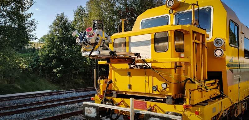
infrastructure. Mobile mapping systems and 360° imagery generate large-scale 3D point clouds and panoramas, supporting project planning and communication. Georadar adds valuable insights through detailed subsoil investigations. This integrated approach ensures efficient, precise and comprehensive data acquisition, and also reduces the impact on rail operations and thus on passengers.
How do you ensure that geospatial data is accessible across disciplines so that planners, engineers and project managers can all work from a common source of truth?
Geodata must be easily and continuously accessible to employees while complying with legal requirements. High data quality is the foundation of effective geodata management.
Our goal is a unified approach to recording, providing and using geodata. Geographic information systems (GIS) integrated into existing processes and data management structures support this. A robust, future-ready IT infrastructure ensures availability, security and scalability in storage and performance. Open, standardized interfaces enable seamless cross-system data exchange.
How do you align geospatial data with BIM and digital twin workflows, and what challenges do you face in ensuring interoperability and consistency across projects?
Our project organization is aligned with the full data value chain, from acquisition and processing to visualization and planning. With in-house tools like our X2BIM platform, we meet client requirements and drive innovation, ensuring efficient, quality-assured workflows from data capture to model delivery. By combining internal and external geodata services, we create robust, consistent base models.
The greatest challenge lies in integrating diverse data sources and formats. Continuous validation and adaptation to project needs guarantee uniform, reliable models, keeping all departments supplied with consistent, up-to-date information and maintaining lasting model quality.
Germany’s railway network is facing well-documented challenges and requires significant investment in the coming decade. From your perspective, how can geospatial data be leveraged not just to support individual projects, but also to accelerate transformation across the entire network? Effective geodata management is key to accelerating the modernization and digitalization of Germany’s rail network. A precise infrastructure inventory creates digital models that support strategic planning and efficient project delivery. But the real value lies in bundling and enriching this data throughout the asset lifecycle. We integrate master data, sensor outputs and monitoring information into digital twins that reflect the current plant status and drive transformation. Consistent openness and availability of data are essential to break down silos and unlock the full potential of geodata, creating lasting added value.
Intergeo is the leading international event for geospatial innovation. What can visitors expect when they come to your stand this year?

Maximilian Reitzel, head of construction management at DB Engineering & Consulting (DB E&C), bridges innovation and practice in rail infrastructure with ten years of experience in digital data acquisition.
As part of Deutsche Bahn, DB E&C delivers customized, sustainable infrastructure and mobility solutions worldwide, drawing on decades of expertise, thousands of projects and a diverse team of over 6,100 employees from 89 nations.
At our stand, the DB E.C.O. Group is presenting innovations that combine hardware and digital solutions spanning engineering, consulting and operations. Experts will showcase data acquisition and visualization results, including the 360° multi-sensor platform which delivers detailed above-ground and underground track bed images when paired with georadar for high-resolution, nondestructive subsoil analysis. Additionally, visitors can see our cloud platform X2BIM, which processes and visualizes data from drones, mobile mapping, laser scanning and 360° videos, enriched with GIS data for a smart, location-independent view of infrastructure. X2BIM also supports services such as geovisualization, geotechnical monitoring, engineering and structural inspections. Together, these solutions cover the full scope of infrastructure projects, from initial planning to the final HOAI phase.
Looking ahead, which emerging technologies or approaches in geospatial data do you regard as most promising for the future of railway infrastructure management?
The combination of hardware and software technologies offers huge potential for modernizing rail infrastructure. Advanced sensors provide precise, large-scale data with minimal impact on operations, while cloud platforms like X2BIM enable efficient, location-independent data access. AI-supported object recognition allows automatic processing of growing datasets, improving speed and accuracy in planning, construction and maintenance. High automation – such as transferring GIS data to BIM systems – ensures fast, consistent delivery of information where it’s needed.
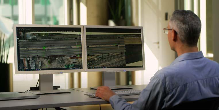
X2BIM platform: infrastructure from X perspectives. (Image courtesy: infraView / DB Engineering & Consulting)

From versatile GNSS/INS hardware to tailored solutions - we make our technology work for you

Centimetre-level GNSS/INS positioning technology

Seamless sensor integrationincluding LiDAR

Multiple SWaP configurations to suit your platform

Global support network
Visit us in Hall 1, Stand
Learn more about what’s on show here


Because Intergeo visitors come from far and wide – literally from all four corners of the world – we’ve got a particularly fitting competition prize up for grabs: the latest edition of the Collins World Atlas. To be in with a chance of winning, send the answers to the three questions by email to quizmaster Wim van Wegen: wim.van.wegen@geomares.nl. All correct entries will be entered into a draw, and the atlas will be sent to the home address of the randomly selected winner. As an extra bonus, all competition entrants will receive a free subscription to our weekly GIM International newsletter!
Question 1: Which of the following cities is the farthest from Frankfurt am Main (measured in a straight line)?
A) Copenhagen
B) Rome
C) Dublin
D) Berlin
Question 2: The Commerzbank Tower is the tallest skyscraper in Frankfurt. However, there is another structure in the city that is even higher. Which one is it?
A) Messeturm
B) Europaturm
C) Main Tower
D) Henninger Turm


The Collins World Atlas brings the world into focus with dynamic maps, powerful imagery and engaging insights that capture its diversity.
Question 3: Frankfurt is surrounded by several low mountain ranges, but most peaks nearby are below 1,000m. Which is the nearest mountain range where summits exceed 1,000m in elevation?
A) Harz
B) Sauerland
C) Black Forest (Schwarzwald)
D) Alps


a glimpse of
Showcasing five years of technological transformation and organizational maturity
By Ada Perello, EAASI
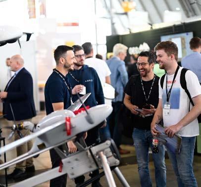
For the European Association of Aerial Surveying Industries (EAASI), the annual pilgrimage to Intergeo – Europe’s most significant geospatial gathering, where cutting-edge technologies meet industry veterans and emerging professionals alike – represents far more than a showcase of capabilities. It embodies the transformation of an industry into a technological powerhouse driving Europe’s digital future. As delegates examine the latest sensor fusion platforms, AIdriven processing systems and miniaturized equipment, they bear witness to an industry that has shattered preconceptions about traditional aerial surveying. The innovations on display – from simultaneous multi-sensor capture to real-time cloud integration – position crewed aerial surveying at the forefront of geospatial innovation.
The past five years have witnessed a remarkable technological renaissance in crewed aerial surveying that has redefined the industry’s capabilities and market position. Multi-sensor fusion now allows crews to simultaneously deploy advanced Lidar, high-resolution optical, multispectral and thermal cameras on single flights, creating unprecedented data richness for applications ranging from digital twins to urban heat mapping and infrastructure inspection. Artificial intelligence has revolutionized data processing, with
deep learning algorithms automatically extracting features, quantifying change and classifying objects at scale. This automation dramatically accelerates workflows from flight to deliverable while reducing reliance on manual review – transforming what was once a labour-intensive process into streamlined, efficient operations.
Sensor miniaturization represents another breakthrough, with lightweight, highperformance equipment enabling longer missions and greater mounting flexibility. Modular multi-sensor pods can now be swapped faster, maximizing aircraft performance while delivering mappinggrade quality that supports centimetrelevel precision across large-scale surveys. These advances culminate in the industry’s growing role in digital twin development, where high-precision, repeatable data from crewed platforms provides the foundation for detailed, dynamic 3D models of cities and infrastructure. The consistent highresolution coverage of vast areas, combined with unmatched capacity for simultaneous multi-sensor capture, positions crewed aerial surveying as indispensable for digital transformation initiatives across Europe.
University students gained a first-hand look at the crewed aerial mapping industry as they visited the booths of EAASI companies, where specialists demonstrated the latest technologies in action.
This technological revolution has been paralleled by remarkable organizational development through EAASI, which has unified what was historically a fragmented landscape. Founded in 2019 by seven founding member companies (OPEGIEKA, COWI, Bluesky International, CGR SPA, Vermessung AVT, Eurosense and GeoFly) following a crucial industry gathering in Denmark, EAASI elected Simon Musäus as
its inaugural president to lead the newly established association. Under the current president, Florian Romanowski, who assumed leadership in June 2023, the association has grown significantly: from 48 member companies in 2023 to 56 by 2024, representing over 20 countries with more than 80 aircraft and accounting for approximately 80% of European survey capacity.
EAASI has evolved from an advocacy organization to a strategic industry platform, focusing on economic stability and consolidation of communication activities. The association established four Industry Challenges Committees as proactive working groups where industry professionals collaborate to discuss and address their own challenges and opportunities. These committees tackle university engagement, technical standards, air traffic control and new business models. Meanwhile, EAASI has formalized partnerships with international organizations like the Management Association for Private Photogrammetric Surveyors (MAPPS) to bridge transatlantic expertise.
Addressing industry challenges through collaborative action
Among these proactive working groups, EAASI’s University and Students Engagement Committee has emerged as a response to one of the industry’s most pressing challenges: the chronic deficit of skilled professionals affecting both the broader geospatial sector and the highly specialized aerial surveying industry. This committee exemplifies how industry professionals are taking direct action to secure their sector’s future by cultivating the multidisciplinary talent essential for continued innovation. The committee’s ‘Spatial Business Bridge’ Outstanding Thesis Award, which has received 17 applications for its second edition, challenges students to demonstrate how aerial survey technology creates business value –an essential skill as the industry focuses on smart city applications and data-driven decision-making.
The Young Ambassador Programme empowers early-career professionals from member companies to serve as industry advocates, showcasing diverse career paths in aerial surveying through their experiences. Complementing this youth-focused initiative, the newly launched Mentoring Programme connects aspiring professionals with experienced industry leaders, providing seasoned professionals with opportunities to share their expertise while guiding the next generation. These initiatives complement EAASI’s enhanced presence at universities and job fairs across Europe, creating direct pathways between academic institutions and industry opportunities.
Recognizing that many students attend Intergeo as part of their academic programmes, EAASI identified an excellent opportunity to demonstrate directly how aerial surveying technology works in practice. Building on last year’s successful debut, this year’s Student Tour promises an immersive, hands-on experience. Scheduled for Wednesday, 8 October at 10:30h, the tour will be led by Patrik Meixner, chair of the EAASI Students Committee, alongside Secretary-General Marcos Martínez-Fernández.
Rather than theoretical presentations, the tour offers practical demonstrations of sensors, processing workflows and real-
About the author

Ada Perello is the communications manager at the European Association of Aerial Surveying industries (EAASI), which was established in 2019 to unite companies generating geographic data from crewed aerial platforms and has experienced rapid growth ever since. Prior to joining EAASI, Perello worked in external communications for organizations like IMO, FAO and the private sector. She holds a master’s degree in Journalism and International Business Administration.
world applications. Students can register online to experience cutting-edge aerial surveying technologies first-hand through direct interactions with industry professionals and live equipment demonstrations that showcase the sophistication and innovation driving modern aerial surveying operations.
Building networks, strengthening bonds
The technical tours and educational initiatives set the stage for EAASI’s signature Intergeo tradition: the annual networking session, which is scheduled for Wednesday, 8 October at 15:30h. This informal gathering across the Geofly and OPEGIEKA booths brings together members, partners and industry peers, creating momentum for the association’s flagship Partner Summit in Dubrovnik from 18-21 November.
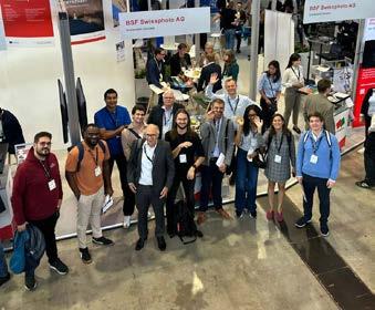
This year’s Intergeo showcases the breadth of EAASI’s membership through an impressive array of participating companies across the entire aerial surveying value chain. Aerial survey operators, including BSF Swissphoto, Geofly, MILAN Geoservice, OPEGIEKA, Woolpert and Bluesky, demonstrate the operational capabilities that deliver high-precision geodata across Europe. Sensor manufacturers –Hexagon, Phase One, Vexcel, IGI, ITRES, RIEGL, SOMAG and Teledyne –showcase the cutting-edge hardware innovations driving technological advancement. The ecosystem extends to specialized service providers. Diamond Aircraft represents aircraft manufacturing, while software and data processing companies – including Esri, Flai, Pointly, Xeos and Sim Active – illustrate the digital infrastructure supporting modern workflows. Aerial services operator Zeusch and data processing specialist Dielmo 3D complete this comprehensive representation of Europe’s aerial surveying capabilities.
As Intergeo 2025 unfolds, these organizations collectively demonstrate that European aerial surveying has evolved far beyond its traditional image. The innovations on display and the collaborative spirit fostered through EAASI’s initiatives position the industry not as practitioners of outdated methods, but as pioneers of precision geospatial technology essential for Europe’s digital transformation.
Held annually in Germany, with Frankfurt as the host city this year from 7 to 9 October, Intergeo is an important meeting place for geoinformation professionals from all over the world. With its large exhibition and broad programme of content, this international event attracts more than 17,000 attendees. This year, Geo-Informatie Nederland (GIN) has organized a trip to Intergeo for Dutch geospatial professionals. This article explores the personal reasons for visiting Intergeo as part of a group for two participants on the GIN trip: Remco Logtenberg and Peter Kaspers.
The main theme of this year’s Intergeo Conference is ‘Inspiration for a smarter world’. Keynotes on topics including Earth observation and artificial intelligence, and cartography for the future are sure to provide inspiration, while panel discussions will dive deeper into issues relating to the future of geospatial technology, such as the digital transformation.
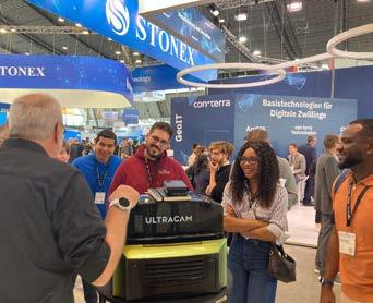
Intergeo Expo – the trade fair part of the event – attracts over 500 companies and organizations from all over the world, allowing them to showcase their latest developments to the public.
The exhibition floor features all major domains of the geospatial industry: geoinformation, surveying, GIS, remote

sensing, drone technology, smart cities, climate protection and sustainable urban development. There are plenty of opportunities for visitors to approach and engage with experts and suppliers from all these areas, largely in an informal atmosphere.
Ideal place to meet international partners
It had been Remco Logtenberg’s long-held wish to meet international partners during a trade fair – and Intergeo in Frankfurt is the ideal place to do so, because there is no doubt that it forms the epicentre of the global geospatial sector from 7 to 9 October.
As an FME and GIS expert at Tensing, Remco is interested in international


developments and their relevance for his work. Besides that, he also wants to consciously step out of the Dutch GIS ‘bubble’. At Intergeo, he especially wants to talk to people he wouldn’t normally encounter. He hopes to find out whether his country really is leading the way in geoinformation, or does it just seem that way?
And which blind spots are Dutch professionals themselves unaware of?
For Remco, who is also a committee member of JongGeo (JongGeo is the Dutch platform created by and for students and young professionals in the geospatial sector, Ed.), the GIN group’s visit to Intergeo starts not when they arrive at the exhibition, but as soon as they board the coach in Arnhem, because he sees the trip as also being a great opportunity to get to know the other GIN members better. What are their reasons for participating in the group? What are the main challenges in their daily work, and which new developments are they facing?
Last year, Peter Kaspers – together with his colleague, Jan Willem van Eck – attended his first Intergeo, which was held in Stuttgart in 2024. The whole experience convinced him that it is a not-to-bemissed event. He also learned that some degree of preparation is advisable due to the sheer size of the trade fair. From an academic perspective as a GIS lecturer at Aeres University of Applied Sciences in Almere, Peter is seeking exchange opportunities and collaborative partnerships with other educational institutions. Which
curriculum choices are they making in their long-term planning? Where do they see opportunities and possibilities for students of the future? As a GIN board member, he is particularly interested in how an industry association can contribute to harmonizing and further strengthening collaborations within geomatics-related education.
GIN programme at Intergeo
This is the first year that GIN has hosted a trip to Intergeo and it’s fully booked, so for the organizers it was a success before the event even started! The arrangements for the participants include coach transport to Frankfurt, a two-night stay in a hotel and – courtesy of Basetime, Leica Geosystems and Geometius – free entry to the trade fair. As an extra bonus, especially in the context of the high demand for talented new entrants, there are six places on the trip for young professionals and students, thanks to support from Ormeling Fonds.
GIN, the proud organizer of this trip, has put together a content programme and meeting schedule for the participants. Besides having the opportunity to explore the trade fair individually on both days, they will attend joint activities such as drinks at the Basetime stand together with the Dutch companies present at the fair. Furthermore, the group will dine together every evening. On the return journey, they will stop off in Düsseldorf to visit the Dutch Consulate, in cooperation with Earth Valley and GeoBusiness


By Wim van Wegen, GIM International
Leveraging satellite imagery, Earth observation is a prime example of where the geospatial field intersects with the space exploration industry. This point of intersection is currently where the greatest potential lies, thanks for instance to advances in data, artificial intelligence and sensor systems built by the geospatial sector to train the data, according to Thomas Zurbuchen – the man who led NASA’s James Webb Space Telescope programme to launch and into scientific operation. In an exclusive interview with GIM International earlier this year, he shared inspiring insights that placed both our planet and our industry in a cosmic perspective.
What does your current role entail, and which mission, vision and ambitions guide you in your work?
After joining ETH in August 2023, I started a programme focused on three activities. The first one is to build the – so far – only master’s space educational programme in Switzerland, because if you want to build an industry, you need talent. The second goal is to expand an existing activity focused on startups as part of the ESA BIC (Business Incubation Centre, Ed.) programme. We have one of the nodes here at ETH, and we’re in contact with around 75 startups at any time. The third aspect is to enhance the research impact of space, and building the infrastructure to do so. Underlying those three focus areas is the belief that space creates opportunities in a large domain: not just in engineering, but also in science, and especially – of course – in Earth observation and everything that relates to living on the best, most beautiful planet we’ve ever seen in the universe, which is ours.
As associate administrator for the Science Mission Directorate at NASA, you led the world’s foremost programme for conducting science in and from space, which included launching the James Webb Space Telescope. When it comes to mapping the Earth’s environment, what can surveyors and other geospatial
professionals learn from the space industry?
Whether exploring space or looking at the Earth, what matters is to make observations that provide context. In astrophysics, for example, that means having the right wavelength-range coverage and the right resolution to look at the universe’s firstgeneration galaxies, which was one of the James Webb’s Space Telescope’s prime objectives. In Earth science, I would say space gives the right context for looking at our own planet, including with respect to local impacts. Here in Switzerland, we recently had ‘coloured’ rain caused by desert sand from the Sahara being carried to us. It’s not unusual. But to understand the air over Switzerland, or anywhere, you need to understand the planet, and the best place to do that is from is space. The same is true for air pollution. In the US, for example, close to a quarter of all air pollution over California is actually Asian air pollution blown in from the Pacific. And a similar thing happens elsewhere, of course. The Earth is a complex interconnected system of systems, and the best place to observe it is in and from space. This also goes for mapping the Earth for other purposes.
How does geospatial data influence space exploration and astronomy?
Let’s take weather satellites as an example, because as part of the programme I ran at
NASA, we also built weather satellites for the civil agencies in the USA. You can only launch if it’s the right weather – and not just on the ground, but also at all gradients all the way up through the atmosphere. I always found it slightly amusing that when we were trying to launch a weather satellite, the most important input to ensure the safety of that launch was data from a weather satellite that was already up there! Another thing is that all the aeronautics in space contribute to pollution on Earth – albeit accounting for less than 2% of all CO2 produced by humanity, but nonetheless it’s a contributor. I think such imperatives help us think not only how we act today, but how we act in the future with respect to our environment. So whether locally or strategically, the Earth sets important boundary conditions – which can be expressed as geospatial data – that are absolutely crucial when making spaceexploration decisions.
The purpose of ETH Zurich Space is to create synergies between all the space activities at ETH Zurich. How does this look in practice, and what are some standout initiatives or partnerships? One of the things I’m most excited about is our partnership with multiple ETH professors in the area of earth observation. It’s focused on taking space data gathered using all kinds of technologies, from Lidar to gravity measurements and multispectral or even
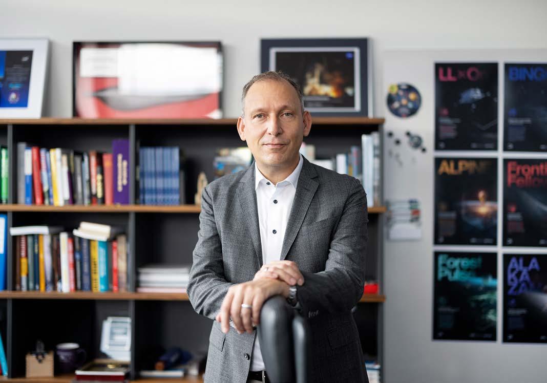
Thomas Zurbuchen has been leading ETH Zurich Space since August 2023, following his tenure as the longest-serving associate administrator for NASA’s Science Mission Directorate.
hyperspectral images. Switzerland’s small size and topographic diversity is an advantage: we have a very diverse dataset, thanks to the high mountains and the permafrost of the Alps. The question is, how do we take all this data and structure it to allow us to use modern techniques such as artificial intelligence and sensor systems we build here to train the data? By combining the space data with distributed sensors and drones, in which we already have a strong leadership component in Switzerland, as well as advanced analysis techniques, this will be a good example of integrating space data for the benefit of humanity – whether in precision farming, environmental monitoring, prediction and prevention of landslides and other natural dangers, or whatever.
Looking back, which key lessons from your NASA period continue to influence your work in your current role?
I had the enormous honour to work on 130-plus missions, of which 37 launched into space during my time as head of NASA, and a significant fraction of the missions consisted of Earth observation systems. I learned two critical lessons. First of all, it is the importance of the team for success. In fact, I’m much more optimistic than I used to be, because even though the missions were very hard and we struggled with many issues, I’ve seen what teams can do! Almost like magic, they can achieve missions that are full of miracles. The second lesson, whether by looking closely and thinking carefully about our own planet or looking in the deep universe or looking at
samples from Bennu (a relatively small asteroid that passes close to Earth approximately every six years and was the target of the USA’s first asteroid-sampling mission: NASA’s successful OSIRIS-Rex mission, Ed.), is that nature is full of surprises and full of absolute beauty.
NASA’s slogan is ‘failure is not an option’. How does this align with the development of new space technologies, and especially ones that no one has ever dared to try before? That’s really interesting. The phrase ‘failure is not an option’ is a quote by Gene Kranz who was flight director on the ground during the Apollo 13 mission, when astronauts were brought back to Earth after a life-threatening engine failure. To a certain extent, that phrase has been the agency’s biggest blessing. When you’re working with astronauts, for example, or on the James Webb Space Telescope –which was a multi-continent investment of close to USD10 billion – you know that failure is an ever-present possibility. But the slogan focuses your mind on performing to the very best of your ability to reduce the risk of death, or the likelihood that a failure will dominate the mission. However, ‘failure is not an option’ has also been a curse, because ‘one-size-fits-all’ thinking about risk artificially increases the price of missions, thus slowing progress in understanding our planet and our universe. Without a failure-averse mindset, it would be possible to do many more missions and many more observations using technologies that are much faster and more advanced, even though we might fail from time to time. We should take more risks
when it comes to new technologies for looking at our own planet and beyond.
That sounds like a relevant lesson for the geospatial industry as well. What else could geospatial professionals learn from the space industry’s principles?
One critical principle is that innovation and iteration always go together. Innovation means doing something for the first time to achieve a purpose, while iteration is actually a polite word for failure. If somebody attempts something difficult, we want to encourage them, not to say ‘Hey, it could fail’. Of course it could fail; that is absolutely clear. It’s innovation. But whether what we thought would work doesn’t initially work the way we expected, or whether there is room for further improvement, it always requires iteration. If we stop iterating, we are not trying hard enough and that holds back innovation. Europe is currently one of the world leaders in the geospatial industry, but if we want to maintain that leadership role in the future, we need to innovate! That means supporting startups with the same energy and investment that they’re boosted elsewhere: not just in the US, but also China, Japan, India – there’s a whole burgeoning sector. I’m excited about the activities that are happening in Europe, but I just think there’s more to do there.
Still on the topic of innovation, how does academic research lead to the development of real-world solutions in the space industry, and how could that approach be translated to the geospatial and Earth observation sector?
I think it’s important to recognize that the whole process of doing research is ultimately about not just learning something new, but also sharing that information. So, while the research is an important part, scaling the results and making them useful is what really matters – especially in view of the opportunities but also the challenges we have we have on Earth. Think, for example, of making data about climate change of natural hazards available in the same way as we have access to weather data on our phones. Experience shows that the bestscaled solutions often get scaled by private industry, whether it’s a startup or an existing company that decides to invest in the idea. The geospatial industry is a good example of where the scalability of such solutions is in startups that come out of universities.
Thomas Zurbuchen: “We should take more risks when it comes to new technologies for looking at our own planet and beyond.“
But it’s critical that universities understand the commercial mechanisms and continue to support their students in scaling up their research findings for the benefit of humanity.
Both Switzerland and the USA, where you have spent a large part of your career, have been very fertile ground for startups, including geospatial startups. Which key factors create a climate of innovation?
A good environment for innovation has three ingredients: really good people with great ideas, the ability for those ideas to be built out, and the ability for those ideas to be scaled with funding. Looking at Europe, we have some amazingly talented people, and some of the systems for developing their ideas – whether at ETH, in the Netherlands or in many other European regions – are among the best in the world. There are preseed and seed opportunities, angel investors or other investment programmes. That’s very good.
But I think there are two challenges. Firstly, even though Europe is unified in many ways – through the European Union or the Schengen Area – in practice, companies still often have to expand country by country, facing different regulations, languages and market dynamics in each one. That fragmentation reduces the effective market size, making it harder for a company to become profitable at scale. The USA has
built an ecosystem around a truly unified single market, which makes it much easier to raise funding at various stages. In contrast, Europe is still lagging behind in this respect, especially in space-related industries. Secondly, we need an environment that’s encouraging for people who are trying, even though their likelihood of big financial success is less than 50% or perhaps less than 10% even. And if somebody fails, do they have to hide for the rest of their life or can they try again? I spend a lot of time trying to convince people that we need to actively build an ecosystem that supports entrepreneurs – one that encourages them instead of criticizing them or treating failure as something shameful.
How could the geospatial industry and the space sector combine their unique strengths to create synergies that drive innovation and unlock new opportunities for addressing our planet’s global challenges?
In my opinion, there’s no place in the entire space sector with more opportunity right now than the intersection of the space industry and the geospatial industry. We already have a rich set of data – e.g. the Copernicus programme, NASA’s missions –as well as dozens of sensors and spacecraft collecting data as we speak, and much of it is publicly available. So, lots of data and sensors are there, but there’s still room for innovation – and not just in new sensors. We have seen a new spectral type of measurements, for example, from space that can be combined with the data technologies that are now coming to the forefront. Artificial intelligence and machine learning have been with us for a long time, of course, and are already being used in the geospatial industry, but the scale of the ability of such solutions is incredibly promising right now. I really think it’s the right time to build a startup at that intersection, and I would like to encourage a whole set of entrepreneurs to do so. In our observations here in Zurich, more than a third – and perhaps even half – of all startups are ‘downstream’ ones looking at how space data can be utilized on Earth as opposed to a new gadget or a new spacecraft.
Returning to orbit, how could closer collaboration between the space, astronomy and geospatial sectors further enhance our understanding of
Unknown: Cosmic Time Machine
This Netflix documentary, featuring Thomas Zurbuchen, chronicles the efforts of engineers and scientists behind the launch of the James Webb Space Telescope and its role in advancing our understanding of the universe. https://www.imdb.com/title/tt27837488/

DIAMOND AIRCRAFT INDUSTRIES 0C050
DIE AUTOBAHN DES BUNDES 1E017
DIELMO 3D 0A020
DIGITAL REALITIES SAS / TOPOTRADE 1D002
DIVERSIFIED COMMUNICATIONS US 1C135
DJI 0G010
DMT 1C011
DROMII 1A110
DRONEDEPLOY 1A045
DRONELIFE 1D078
DRONIVO 0E081
DTMAPPING 1D079
DVW - GESELLSCHAFT FÜR GEODÄSIE 1B018
DVW - GESELLSCHAFT FÜR GEODÄSIE 1A021
E-CASSINI 1D008
ECHO BLUE 1D078
EFTAS FERNERKUNDUNG TECHNOLOGIETRANSFER 0C029
EKOM21 - KGRZ HESSEN 1C121
EMESENT 1E057
EMLID 0E040
ENQT 1A037
EOS POSITIONING SYSTEMS 0D001
EPIC LIDAR TECH 0C061 EPS WORKS 1E038
ESN ENERGIESYSTEMENORD 0E110
ESRI 0C007
EUROPEAN SPACE AGENCY 1C049
EUROPEAN SPACE IMAGING
F. W. BREITHAUPT & SOHN
FEIMA ROBOTICS
FIG - INTERNATIONAL FEDERATION OF SURVEYORS
FJ DYNAMICS INTERNATIONAL 0E128 FLAI
FLYPIX AI
FMI - FEYMAN TECHNOLOGY 1A047
FÖRDERKREIS VERMESSUNGSTECHNISCHES
GUANGZHOU ALPHA SURVEYING TECHNOLOGY 0E015
GUANGZHOU MERIDIAN GNSS 1B012
GUANGZHOU SPHEREFIX NAVIGATION TECHNOLOGY 0C120
GUANGZHOU STAR INFORMATION TECHNOLOGY 0E061
GUIDELINE GEO 1B126
HAPPY SURVEY 1D090
HASSO-PLATTNER-INSTITUT 0E031
HEBEI ZHUFENG APPARATUS & METER 0H013
HESAI 1C118
HEGAXON 1B060
HHK DATENTECHNIK 0F021
HIGH POWER MEDIA 1D078
HI-TARGET SURVEYING INSTRUMENT 0F069
HOCHSCHULE ANHALT/ FB AFG 1G019
HOCHSCHULE BOCHUM 1G040
HOCHSCHULE MAINZ - UNIVERSITY OF APPLIED SCIENCE 1G019
HOCHSCHULE NEUBRANDENBURG 1C108
HONEYWELL 1E095
HORUS VIEW AND EXPLORE 0A054
HP PRINTING AND SOLUTIONS 1B040
HPRC CASES - PLABER 0E108
HUNAN BYNAV TECHNOLOGY 0D101
HYDROGRAPHISCHE NACHRICHTEN 1D078
HYSPEX - NORSK ELEKTRO OPTIKK
IB&T SOFTWARE 1C101
IDS GEORADAR
IGS INGENIEURE
ILV - FERNERKUNDUNG 1A083
INFREST - INFRASTRUKTUR ESTRASSE
MOVE SOLUTIONS
MPMSOFT
MTS SCHRODE
NANCHANG RUIJI TRADING
NHAZCA
NOKIA SOLUTIONS AND NETWORKS
NORDALP
STAHL PRÄZISIONSLIBELLEN 1A016
STITCH3D 0H095
STONEX 0F081
SUPERMAP SOFTWARE 1D081
SURVEYING GROUP 1D078
SURVEYORS EXPRESS 0F124
SUZHOU FOIF 0G071
SUZHOU GEOLENI IMPORT AND EXPORT 0A098
SVGEO 1D069
SWECO 1B088
TECHNET GRÜNDIG + PARTNER 0A061
TECHNISCHE UNIVERSITÄT DARMSTADT 1A011
TELEDYNE 0C067
TERRADATA 1F065
TERRASOLID 1B058
TERSUS GNSS 1C021
THE GEOHOLICS 1B080 THECROSSPRODUCT 1D008 THEIS FEINWERKTECHNIK 1B139
THETA ENGINEERING 0H097 TIANJIN SETL SURVEY EQUIPMENT 1B111
TIANJIN XINYING PHOTOELECTRIC INSTRUMENT 1C137
TIKI TECHNOLOGIES INTERNATIONAL 0F091
TINYMOBILEROBOTS 0A048
TKI 1B129
TOKSURVEY INFORMATION TECHNOLOGY 1E081
TOPCON EUROPE POSITIONING 1A001
TOPODOT 0E041
TOPOFLIGHT SYSTEMS
TOPOGEOS
TOYSER 1C001
TRANSCAD DIGITAL SOLUTIONS
ALTAMIRA 1E120
TRIMBLE GERMANY 0F021
TUALCOM ELEKTRONIK
TUPAIA - POSITIONING SOLUTIONS
TYKER CONSTRUCTION
U-BLOX
UMGIS INFORMATIK
UNIVERSITÄT BONN, INSTITUT FÜR GEODÄSIE
UNIVERSITÄT POTSDAM
UNIVERSITÄT SALZBURG