P O R T F O L I O
ARCHITECTURE
GABRIELLE KNAUF
Selected works by:
Gabrielle Knauf
I 4th yr l B.Arch Student @ Syracuse University

P O R T F O L I O
ARCHITECTURE
GABRIELLE KNAUF
Gabrielle Knauf
I 4th yr l B.Arch Student @ Syracuse University
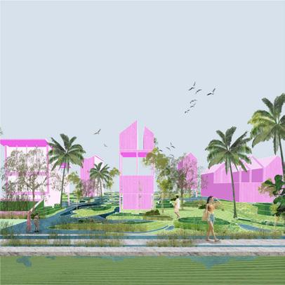
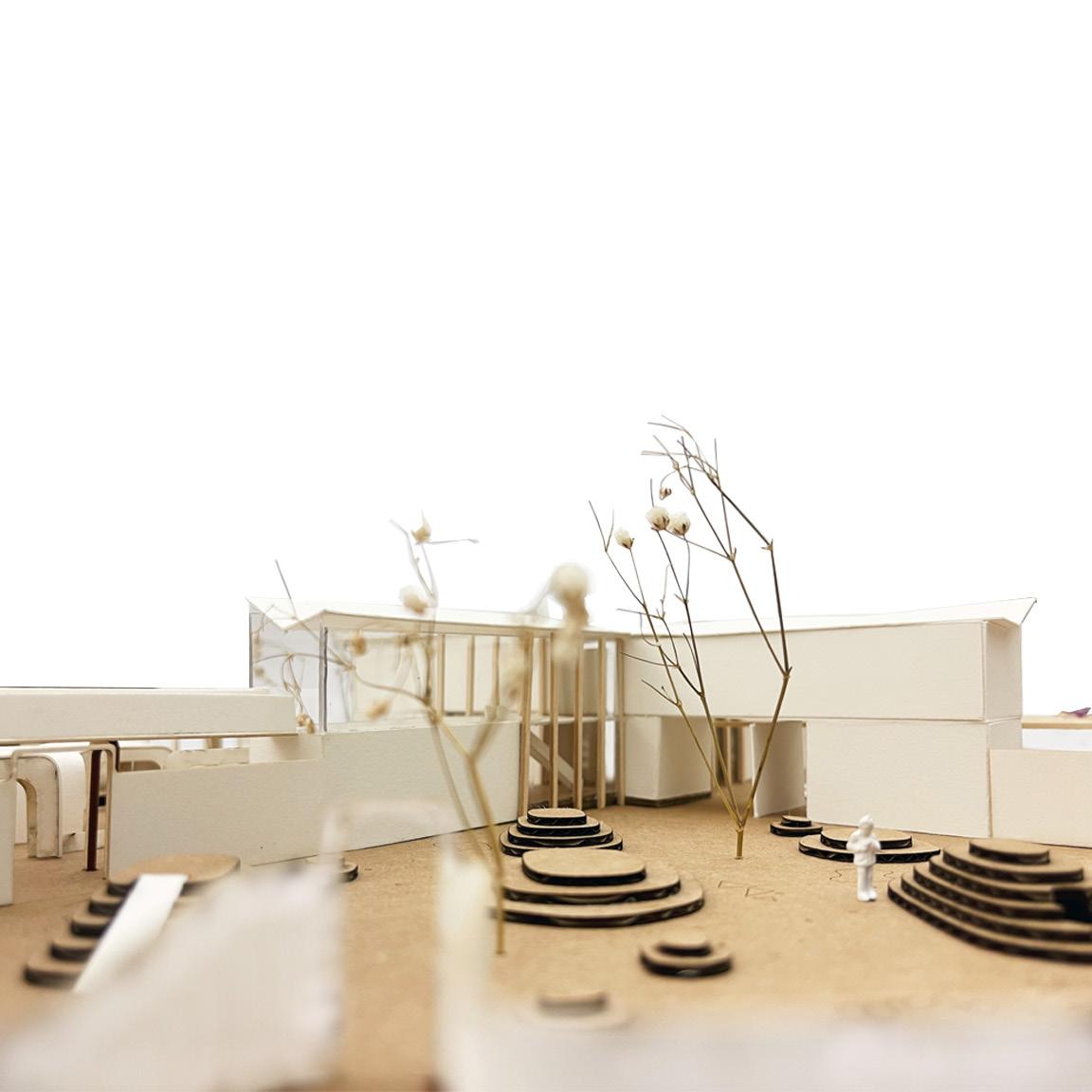
ARC408/608 DESIGN STUDIO led by PABLO SEQUERO RESEARCH SPONSERED by ROY RASKIN IN COLABORATION with SARAH CRAWFORD COSTAL RESILENCY EXHIBITION - SURFSIDE, FLORDIA
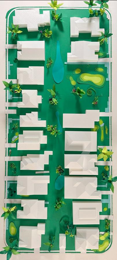
In response to rising sea levels of costal regiions such as Miami- Dade County, the current zoning framework must be reconsidered. This architectural proposal considers alternative zoning conditions that repsonded to Surfside, Flordia’s climate crisis, proposing adaptation and flood mitigation strategies for the existing residential block typologies. The proposal was developed in communication with current Surfside residents, former mayors, planning and zoning commitee, amoungst other town officals.
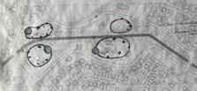
With Miami’s increasing threat of sea level rise in combination with more frequent flooding, it becomes imperative to question the current zoning framework. These regulations were created for a climate that no longer exists today, and with so little land remaining undeveloped, it’s clear that zoning needs to change.
Drawing attention to the native species and ecotypes that have proven to mitigate flooding around south Florida. By setting up a new zoning framework and proposing significant reduction to lot coverage, we allow for the regrowth of native landscapes.
Incentivizing residents and developers to work within these new regulations, lot coverage is redistributed vertically. Furthermore, introducing new domestic typologies that reflect on the changing climate of Surfside.
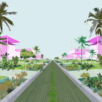
These typologies push for the reconnect of the built environment to the natural landscape creating a flood adaptive architecture that is willing to respond to constant change.
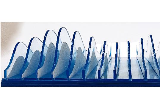
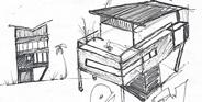
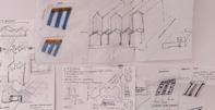
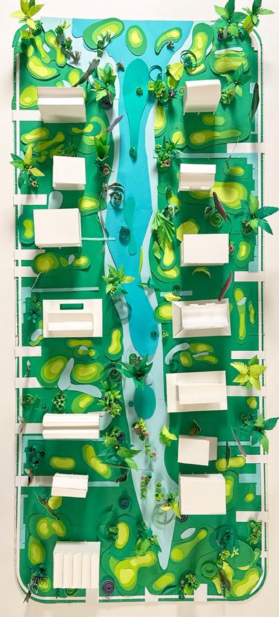
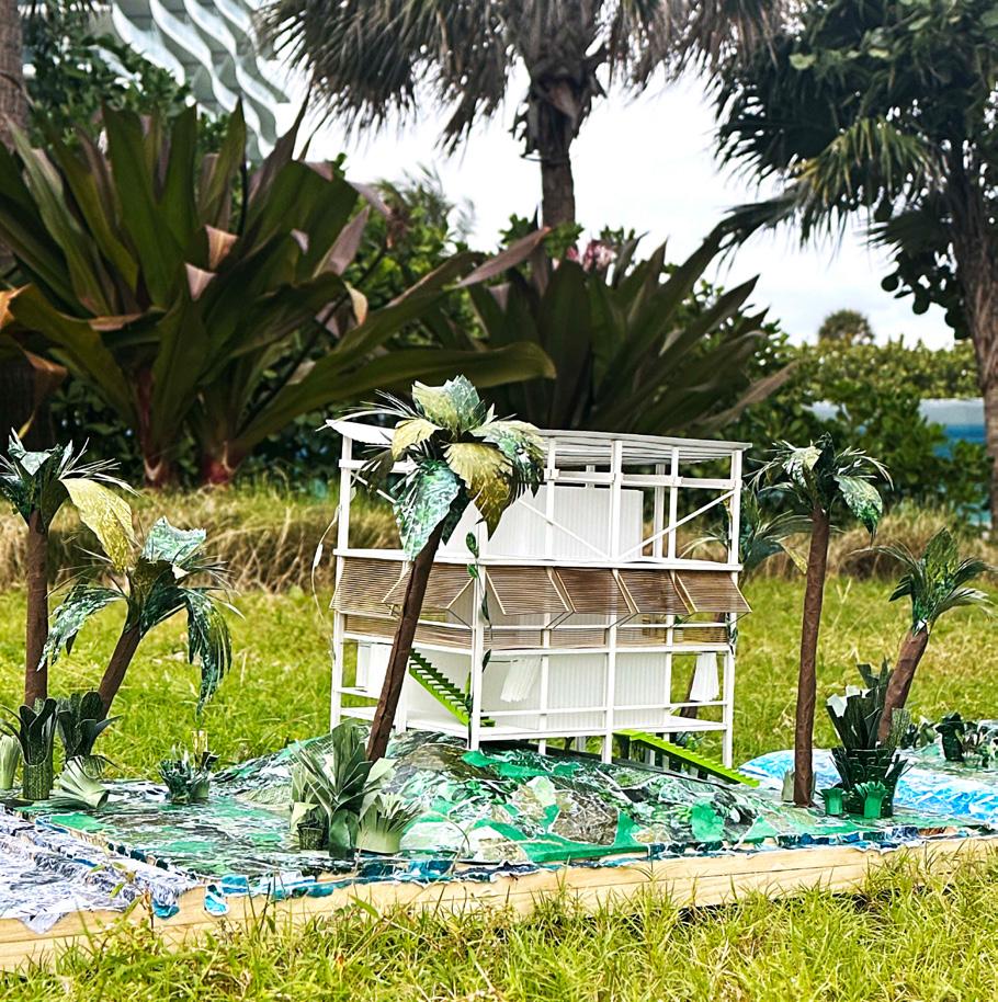
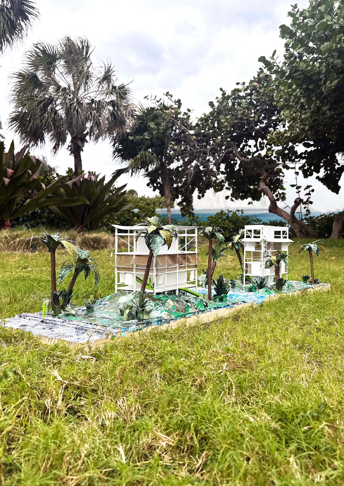
This kit-of-parts approach explores the full range of proposed zoning conditions along the Y-axis, while applying architectural solutions along the X-axis that support adaptation. The matrix presents a gradation of architectural typologies that could be implemented in Surfside, Florida. It provides a catalog representing the various scales of control and restoration returned to the land, while also experimenting with a variety of material elements. These materials offer a new approach to both foundational and temporary interventions that can be retracted and deployed. Ultimately, these solutions become adaptive, suggesting and supporting transformations that align with Miami’s climate.
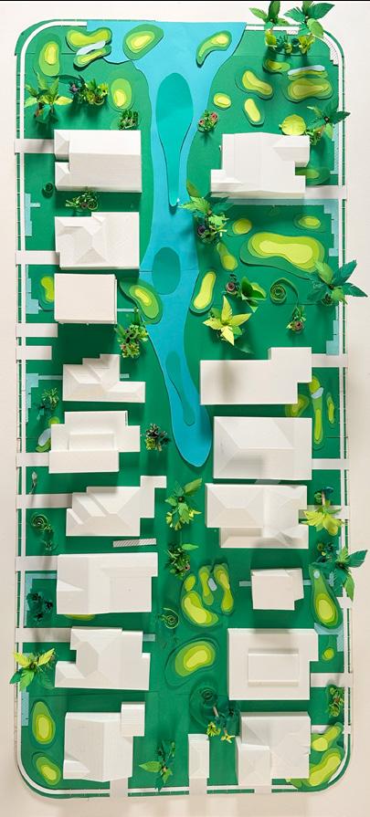
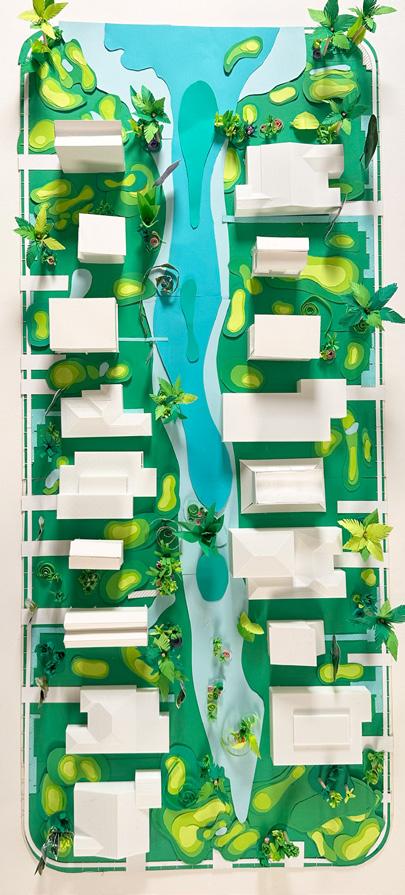
Here we investigate architectural solutions to apply water resilience strategies as researched in Jeffery Huber’s book, Salty Urbanism.
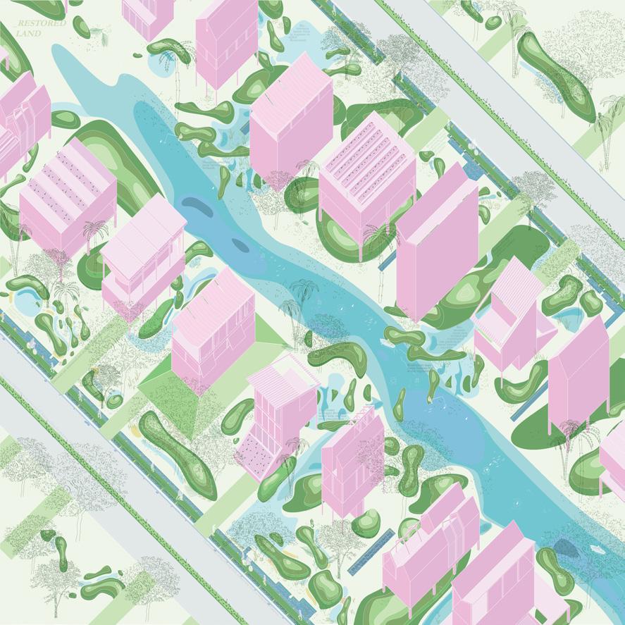
Using areas of public property to implement quick infrastructural interventions, we add water retention planters to the sides of new pervious sidewalks on the perimeter of each block. As well as, reducing allotted driveway coverage and implementing a field strip to the center of the road to slow down drainage to existing storm water systems.

Using a series of bio mounds to add surface area of permeable surface, provide water collection, and to redirect water away from residential areas to retention basin’s located at the rear of each housing plot.
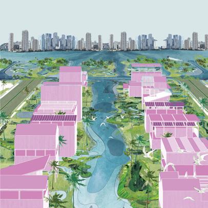
This prepares Surfside for a new framework for years to come. Altering the direction of the front of the house, where the back porch becomes a space of public interaction and collectiveness as they prepare for a climate-responsive city.
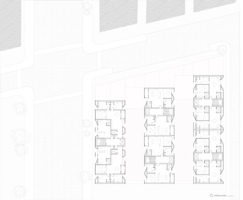
between two cities
ARC308 DESIGN STUDIO led by TIM STENSON INDIVIDUAL
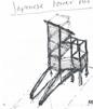
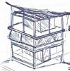
Located in Buffalo, New York, I was tasked to design a multi family housing complex, serving minimum 40-60 unit spaces. Located on the corner of Delaware and Allen St, this particular corner represents the intersection between the inner city scape, Delaware arraying from the radial city plan, in comparison to Allen St.; a main street of AllenTown, located just beyond downtown.
My design takes into consideration 4 key concepts from the city’s context. First analyzing the typical dimensions of the narrow city townhouse block. Secondly, like most city plans, the exterior buildings are coded for public space, creating a boundary between the city and the residential space behind. Next highlighting the importance and shift between Allen and Delaware. Lastly, considering the close proximity between the site and medical campus.
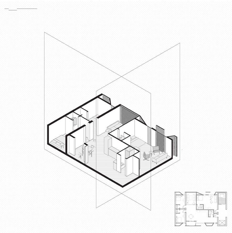
When designing the floor plan, I chose a point circulation system, to maximize the amount of viable space on each floor and to allow cross circulation between units. The L shaped units allow for flexibility between units, possibly adding a singular wall to orient a 3 person unit to 2 person. This catering to the diverse population the close medical campus attracts with both its students and staff.
On the ground floor, I continue to occupy and redefine this inbetween space. At each access point from allen point, the front facade is offset to allow for a continuation of street life into the commercial space of each gable. This acts as a threshold at the street scale. Additionally, structural elements, such as 2 foot columns, and a repetition of the angled entrances to individual point circulation systems, mediate the interior to exterior interactions.
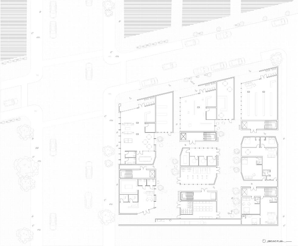
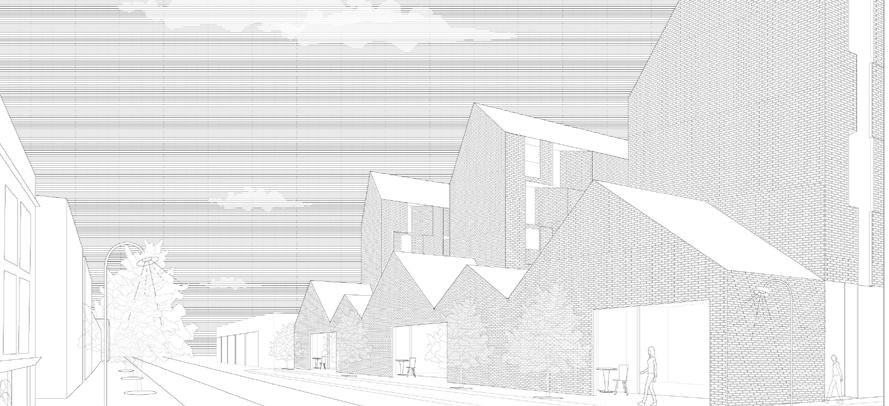
The perforated brick facade continues the idea of mediation between the interior and exterior space. Angling itself, alternating between each floor, this second skin condition, allows for maximum privacy for users.
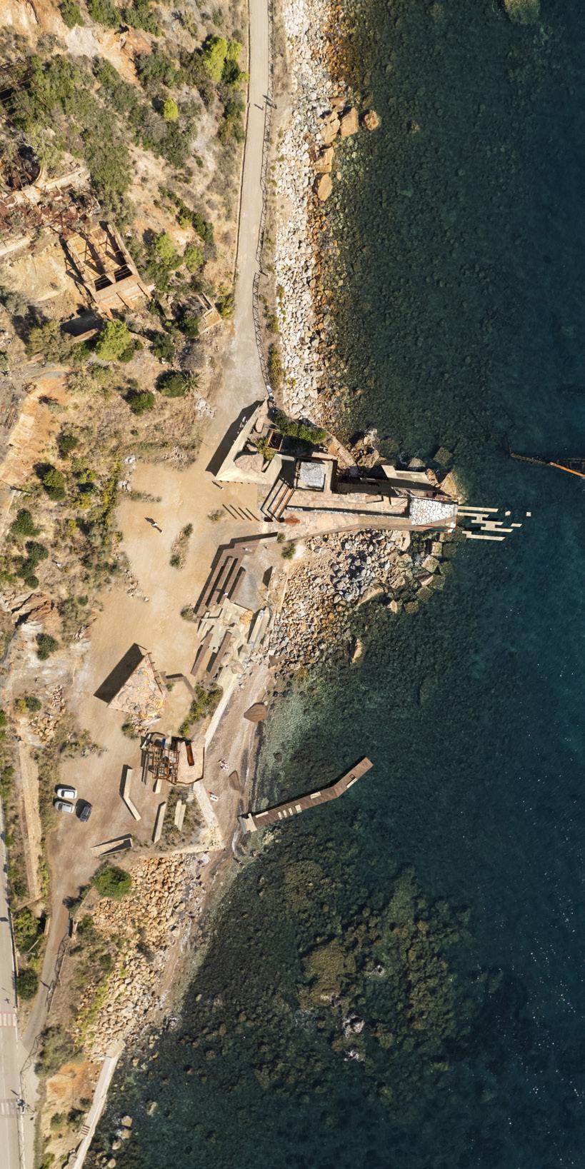
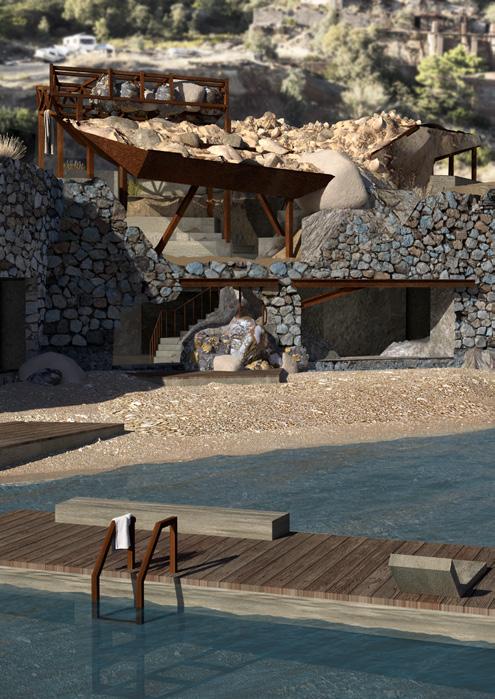
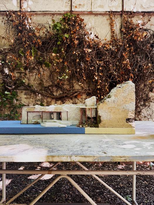
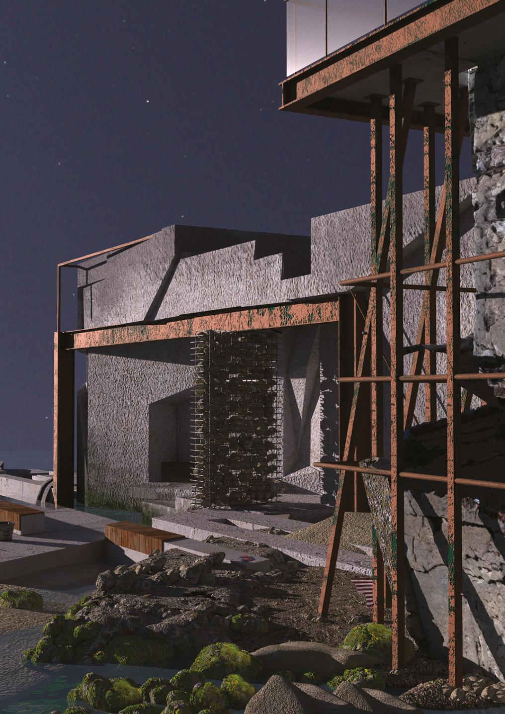
Our site located off the western coast of Italy, the Isla de Elba is known for its rich mining history. Settled in Rio Marina, our site is positioned upon an abandoned extraction site. What remains are displaced, man made platforms from discarded material extracted from the earth. We were tasked with creating a public park at the base of these industrial ruins.
Embedded within the rocks and ruins, our park is a place for rest. It reflects on the charged and exhausting history of mining in Rio Marina while providing both the site and its visitors a space to rest. Although resting may have a different meaning to each individual, the project defines rest as a state of protection, recovery and emergence, freeing itself from never ending processes of work, extraction and decay in a serene way. At the park, one is protected to recover and later emerge from the density of life that before affected them. Similarly, through light, un-invasive architectural interventions such as framing, filling and stepping, these three definitions of rest are expressed. By framing the landscape, the individuals are protected, at ease. By filling, elements are added to support. And by stepping, boundaries between spaces of work and rest are defined.
With included programs such as shading, sitting, swimming, fishing, and playing, visitors can explore the site while floating through the different stages of rest. The programs are not intended to occur all at the same time, some only being active at certain times of the year. This temporality allows the site to rest as well.
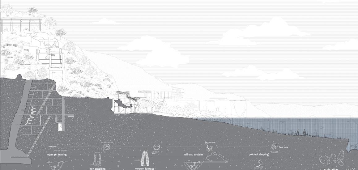
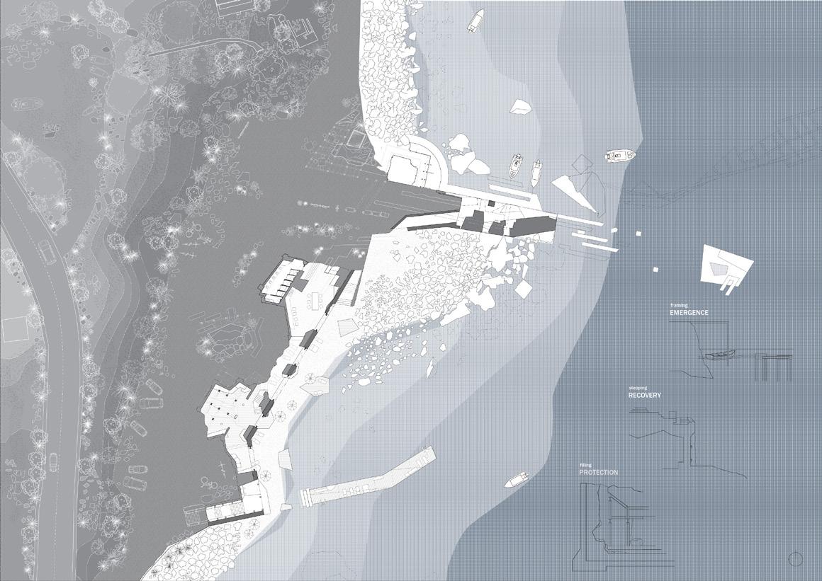
Walking into the space, the user is immediately brought down through a narrow entrance that frames out to Rio Marina. Throughout the plan, programs are situated nested within the platform to create different experiences of rest. Shading and small gathering spaces located at different depths of the carved platform. The material that is excavated is then repurposed above, creating new mounds that frame views back out to the old ruins.
At the pier, while maintaining a monolithic wall on one side, the opposite is used to create narrowing spaces framing back out to Rio Marina for users to explore and occupy for different fishing activities. Located on this side there are a multitude of level changes, allowing the ocean to over occupy and submerge programs and create small baths in the pier when the water levels are high enough. This allows both program and land to be at rest during moments of high tide.
Additionally, wrapped around the existing tower, framing elements are used both to call attention and allow recovery for the existing ruins.
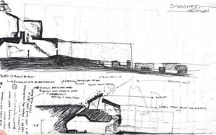
SECTION ABSTRACTIONS
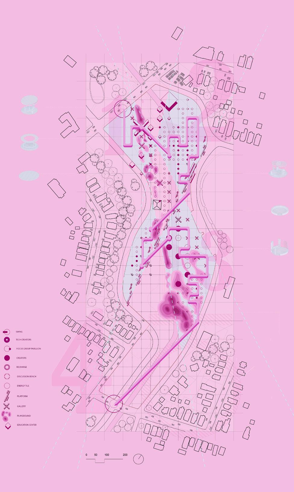
Our site located at a park in downtown syracuse, we were tasked to analyizea social media apps and abstractly apply the apps charateristics into our very own public space.
My app was snapchat and I was particularly interested in the Snap Map feature of the program. The map is a heat map, measuring the concentration of snapchats taken across the world. Through this the app generates Spotlight features allowing you to jump from one movement to another.
These intersections allow the user to move from one location or event to the next at the tap of their finger. This is the idea that I brought forth through both my masterplan and final agora.
I looked at women’s rights / feminist organizations as my digital community. Throughout my master plan, I broke down main programs specifying each one to a correlating “wave” of feminism. Each intersecting one another throughout the plan.
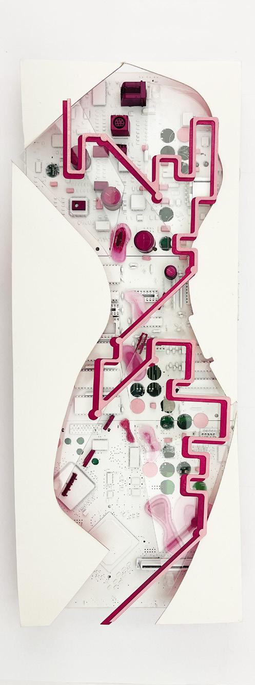
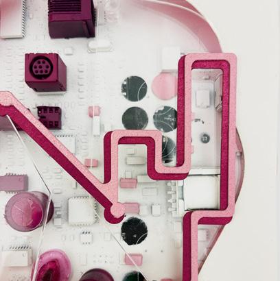
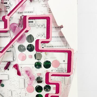
MasterPlan Model - Media : Old circuit board, Museum Board
ARC208 LANDSCAPE STUDIO led by MARTIN FRENANDEZ INDIVIDUAL
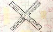
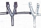
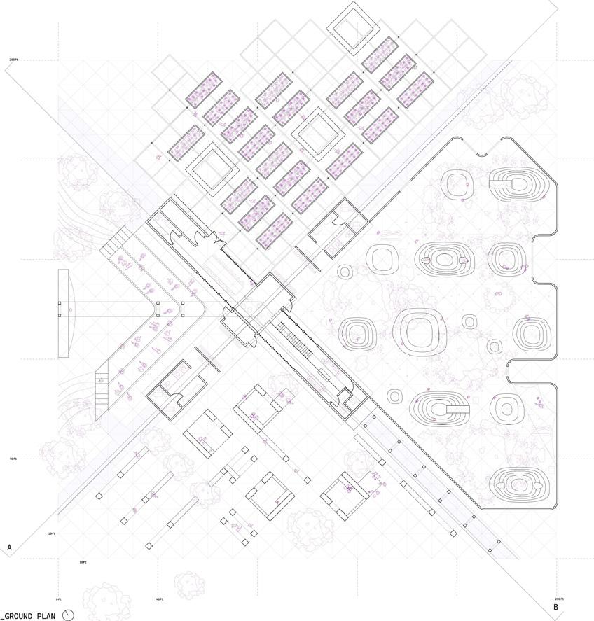
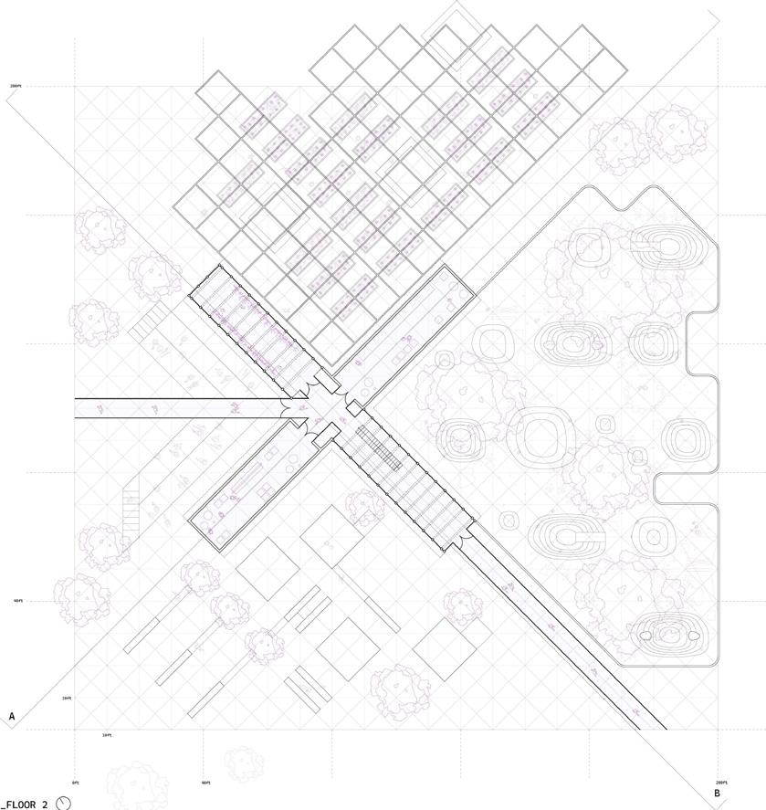
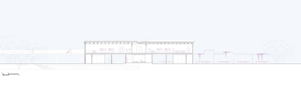
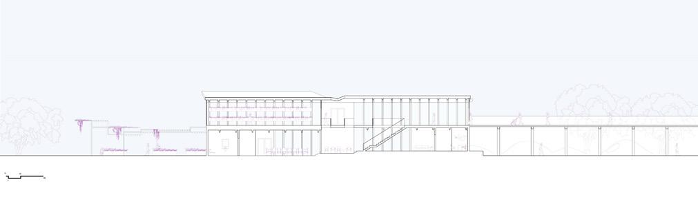
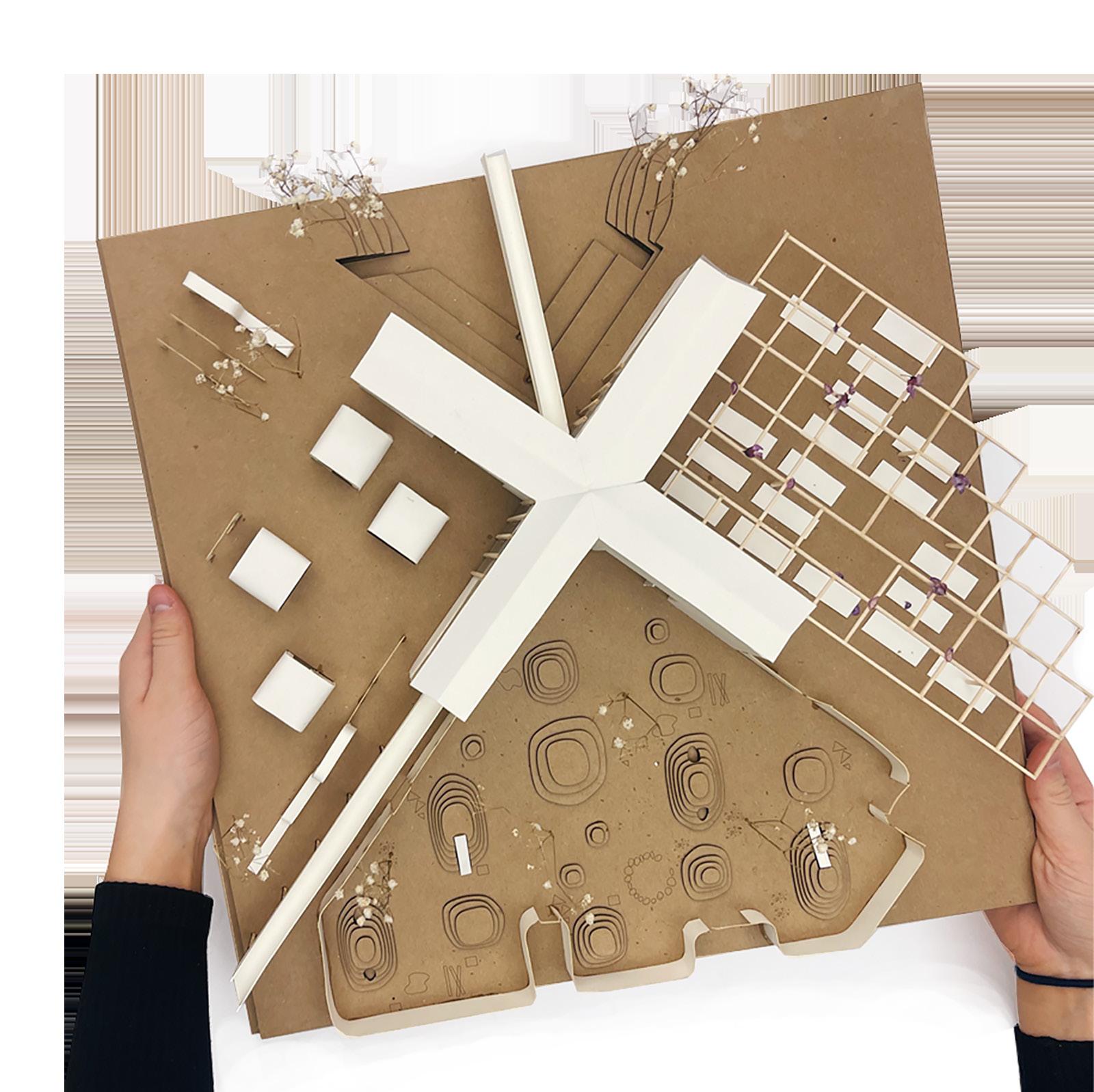
As a continuation of the larger Digital MasterPlan project, we were tasked to zoom into one area of our park. Zooming into the top left area of my master plan, I pulled diagramatic shapes from my masterplan and applied them directly to my design. The X defines the central axis, splitting the site among 4 quadrants acting independently in service to the center x building.
At the center of the X rest is the main program, an Educational Non-Profit women’s center. Like many other resource centers the program is broken down into 2 parts. On the bottom floor rests an educational center, acting as an open forum for debate and discourse. Rather the addendums to the upper levels act as warehouses for women to collect resources.
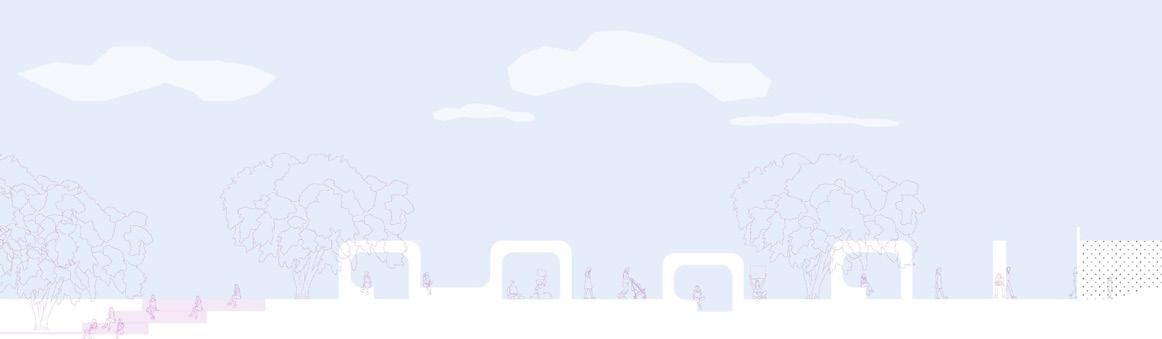
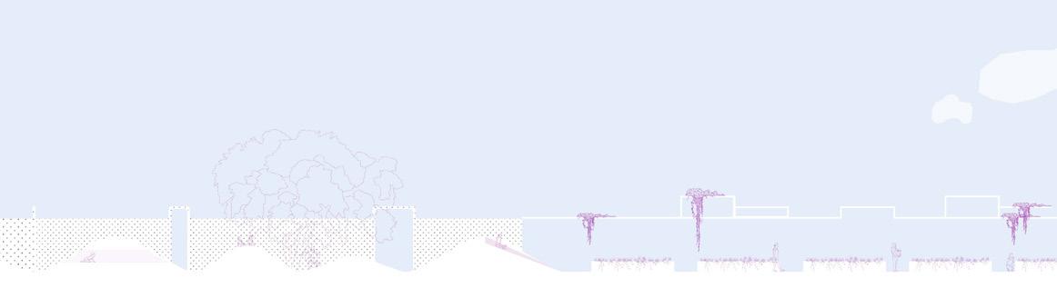
ROLLOUT SECTION
Throughout the rest of the park the remaining 4 programs break the park down into four different landscape systems. An amphitheater design for larger forums. A community garden shown as a source of empowerment and ownership. A playground enclosed by a barrier wall for children to roam through artificial dunes and play spaces while mothers are involved in debate. Align with a creative space for technology creatives and activist creative spaces to inhabit. Created with Rhino and Adobe Illustrator
Knauf
I 4th yr l B.Arch Student @ Syracuse University
Architecture
Portfolio
loading...