


Frankston City Council acknowledges the Bunurong people of the Kulin Nation as the Traditional Custodians of the lands and waters in and around Frankston City, and value and recognise local Aboriginal and Torres Strait Islander cultures, heritage and connection to land as a proud part of a shared identity for Frankston City.
Council pays respect to Elders past and present and recognises their importance in maintaining knowledge, traditions and culture in our community.
Council also respectfully acknowledges the Bunurong Land Council as the Registered Aboriginal Party responsible for managing the Aboriginal cultural heritage of the land and waters where Frankston City Council is situated.

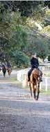
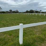
Use of the Langwarrin Equestrian Reserve and Baxter Park for equestrian activities has been established for over 40 years with activities taking place within both open grassy areas and bushland trails. There is currently no endorsed Master Plan or management plan for either site and both are co-managed by the relevant Equestrian user groups and Council. The need for a Master Plan at each site has been identified and is greatly anticipated by the user groups involved to provide clear direction on the future use and development of each site in relation to equestrian activities, passive recreation, and conservation considerations.
Critical to both Frankston City Council and the Equestrian clubs is that the outcome of this Master Plan provide a clear framework for the future maintenance of the site, which has largely been undertaken only by the clubs until recent years.
The Frankston Open Space Strategy (OSS) identifies the need to improve connectivity and trails, access to recreational activities, and open space planning across the subject sites in Langwarrin and Baxter. The OSS also identifies individual actions associated with the sites.
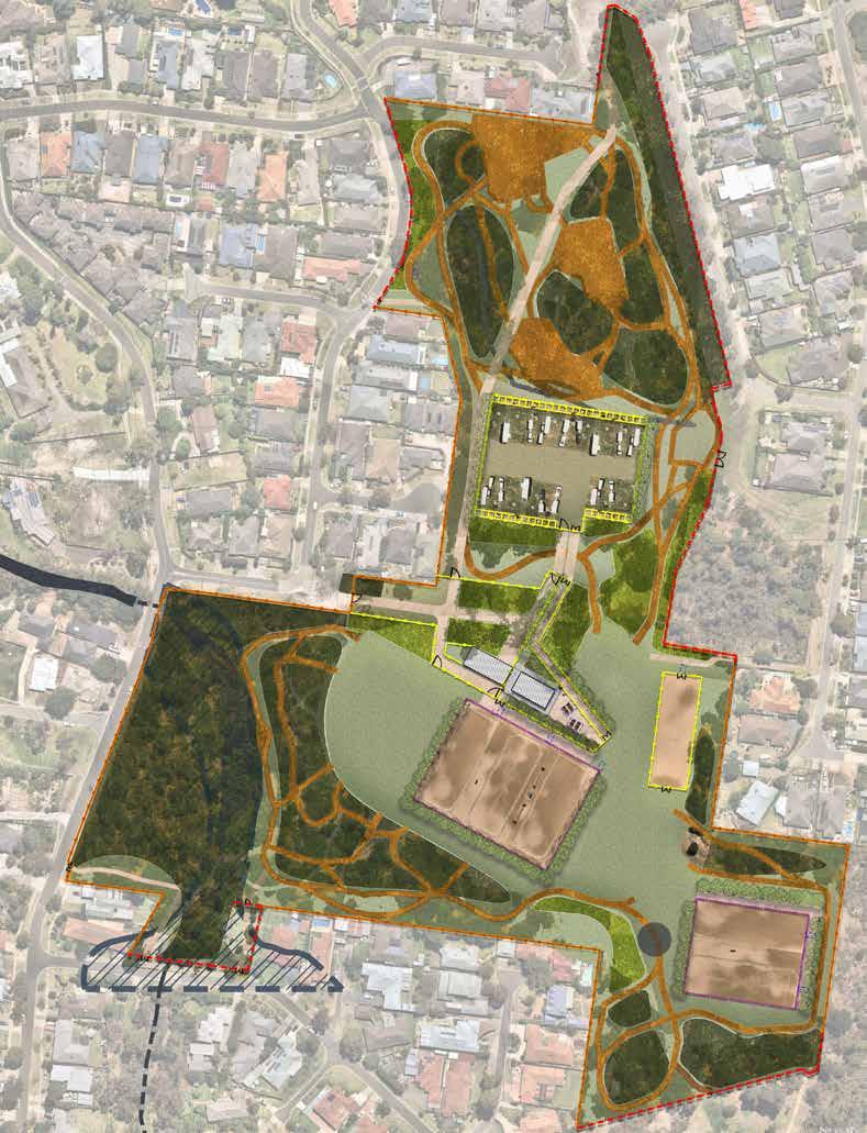
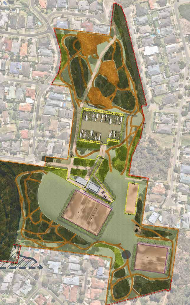
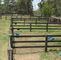
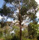
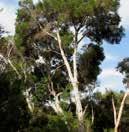
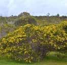
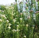
Baxter Park and Langwarrin Equestrian Reserves both exist to provide a combination of active sporting facilities and associated infrastructure, passive recreation, natural parkland, biodiversity, and connectivity.
Council needs updated management plans for both sites. The Equestrian Master Plan enables Council to strategically progress future planning and development across both sites to deliver integrated outcomes that meet community and environmental needs.
There are various site complexities impacting the ongoing management of the Baxter and Langwarrin Equestrian Reserves including (but not limited to) environmental values, unresolved planning issues, fire management overlays, equestrian activities and increased formal and informal recreation demand that have meant that development and management plans across the sites have not been finalised and outstanding issues remain.
The Equestrian Master Plan considers all equestrian activities and the potential for future growth at the following locations:
• Langwarrin Equestrian Reserve
• Baxter Park Equestrian Reserve
The Equestrian Master Plan aims to conserve each sites high ecological and cultural value, allows for equestrian activities, recreation usage and considers both sites’ fire management context.
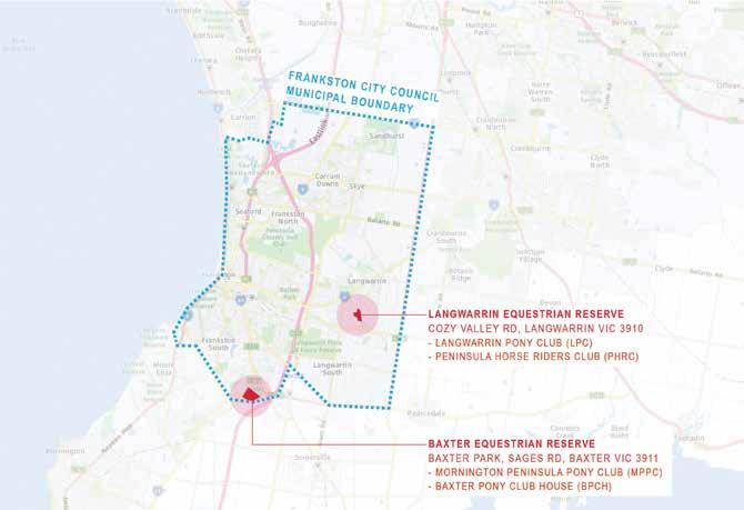
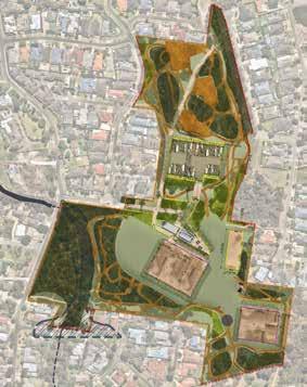
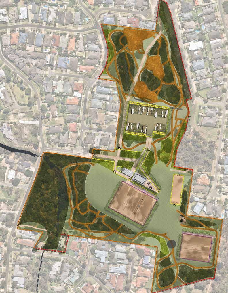
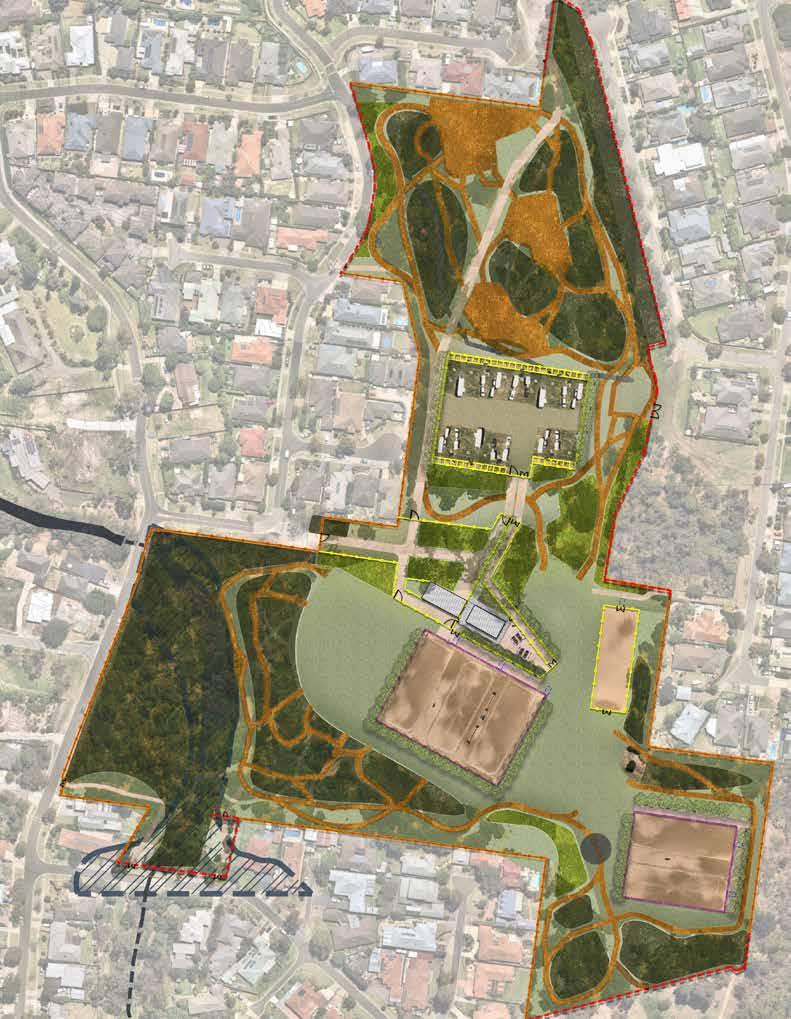
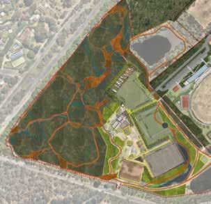
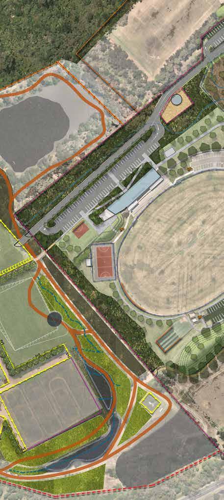
Project Site Locations Within Frankston City Council Municipality
The Master Plan addresses all the complexities and opportunities of the sites and provides an action plan to guide staged implementation of priority projects over time.
The Master Plan identifies where various responsibilities for certain areas, such as vegetation, lie. This will then flow to new occupancy agreements for users which are being put in place as part of the Property Strategy.
To achieve this in a practical sense the extent of the equestrian infrastructure across both sites has been mapped in a format which can now be geo-linked into Council’s GIS system. The inclusion of equestrian facilities into Council’s GIS system, will enable the clubs to clearly communicate maintenance and safety concerns on the site by referencing up to 40 Jump sites at Baxter and an extensive network of over 120 jumps across the breadth of the Langwarrin site.
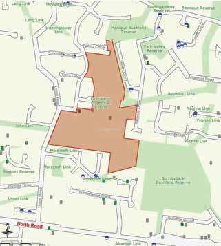

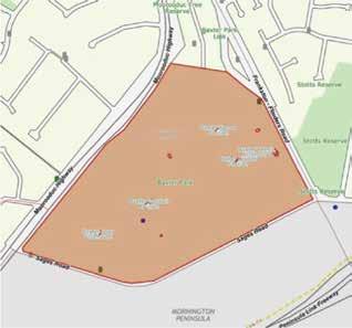
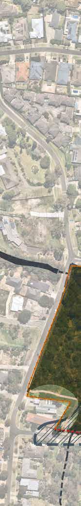
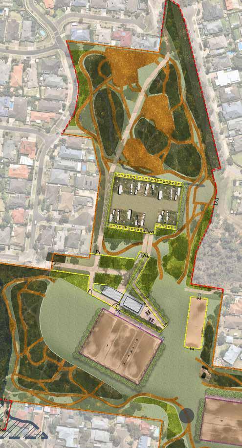
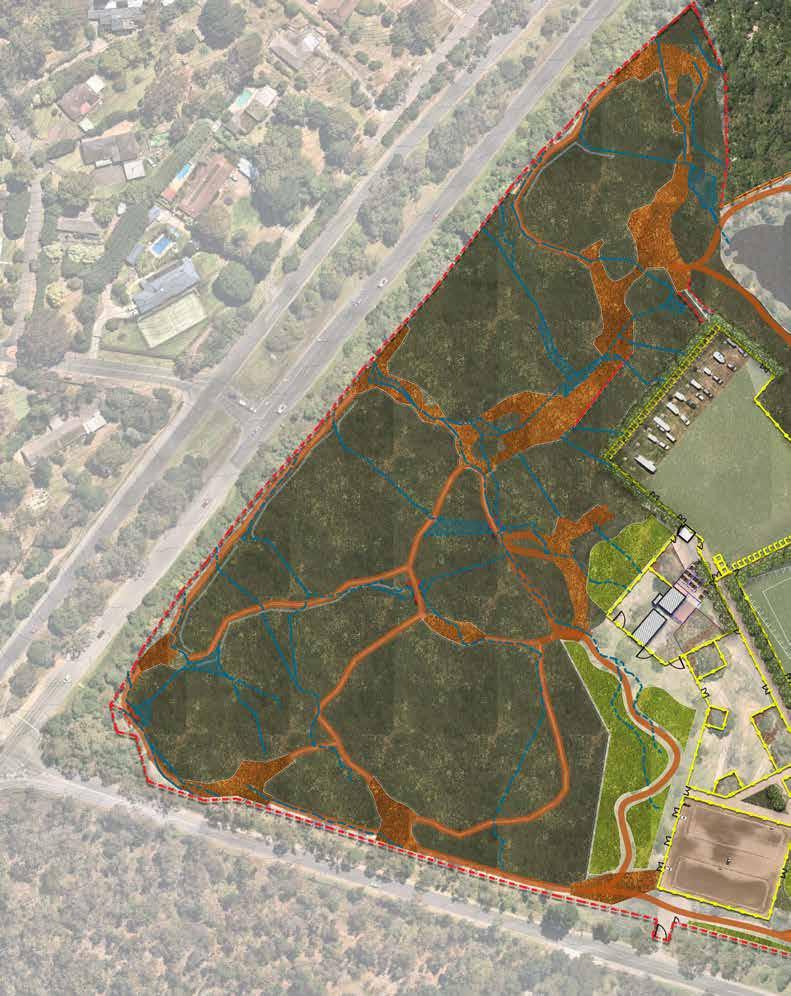
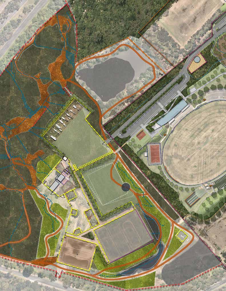
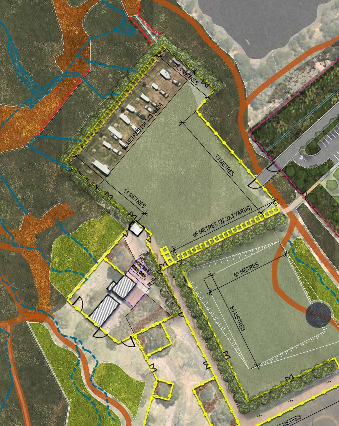
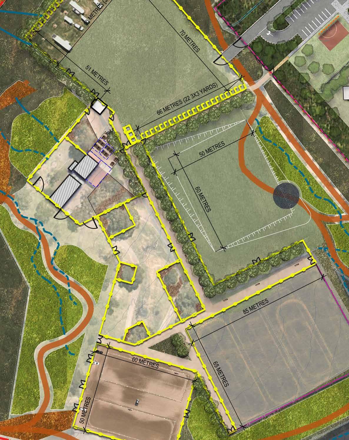
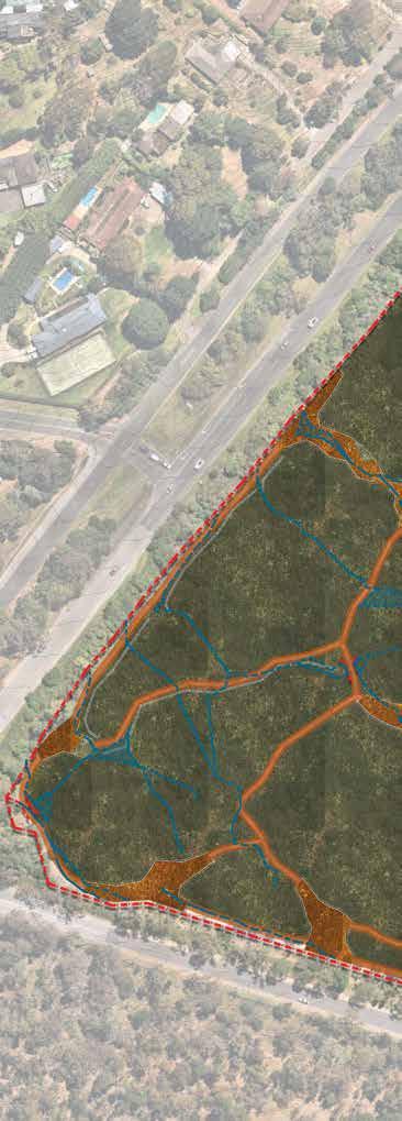
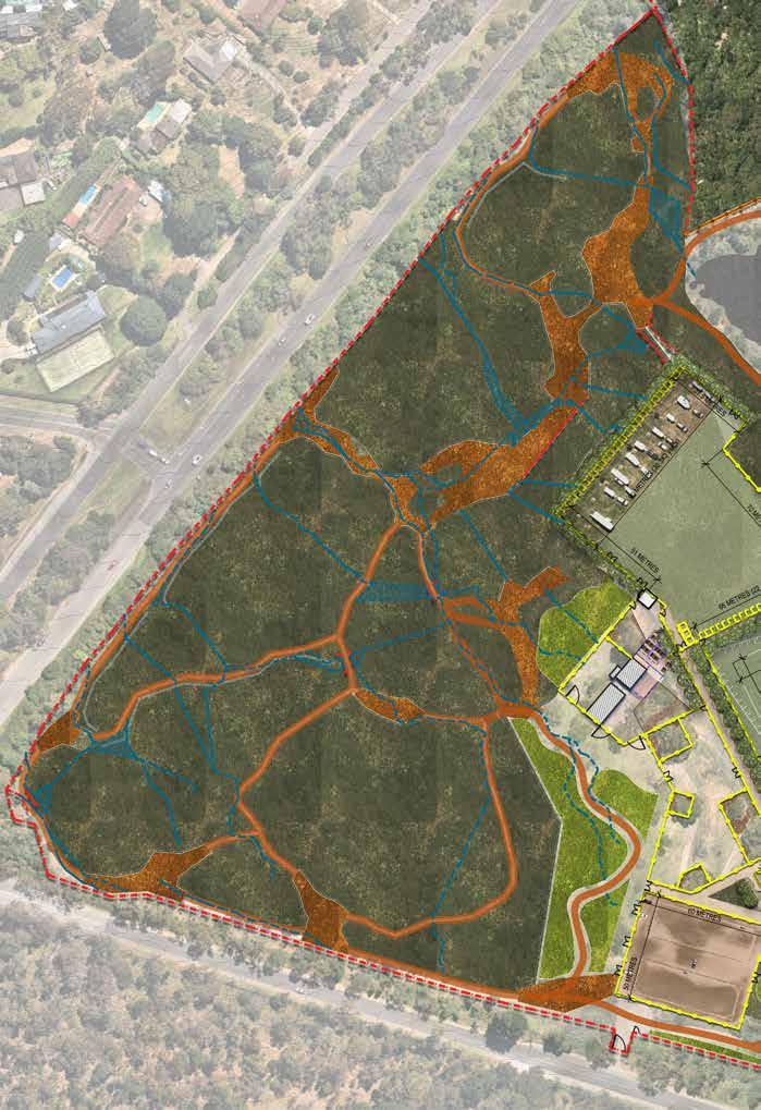
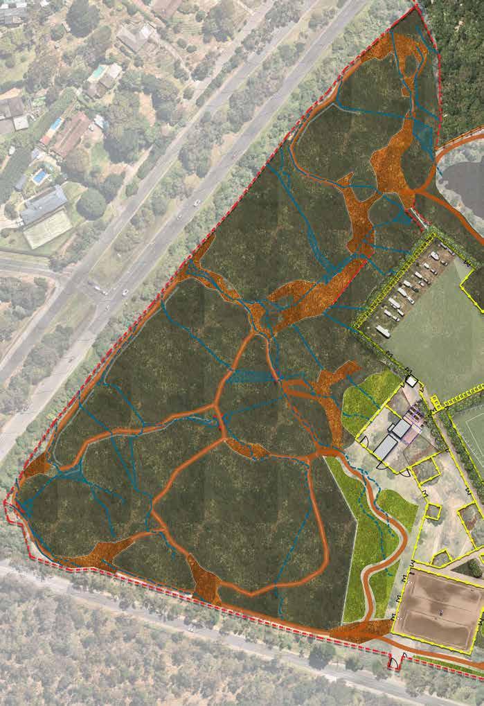
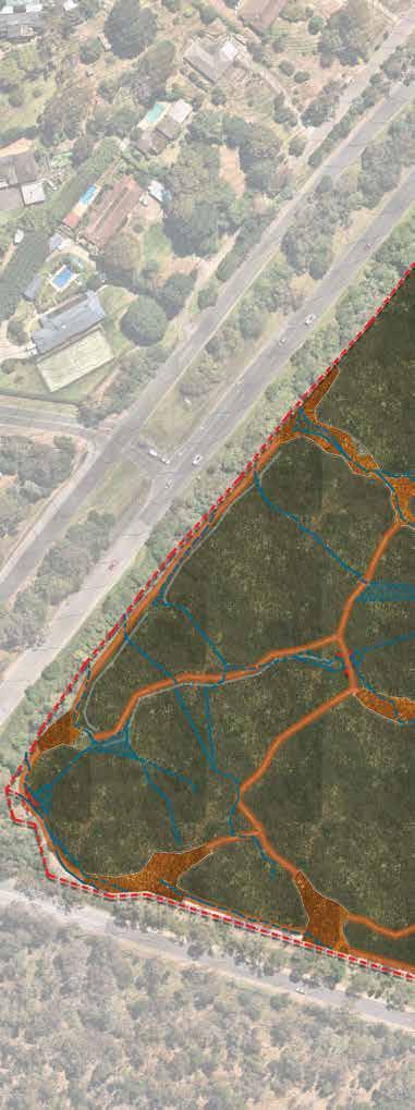
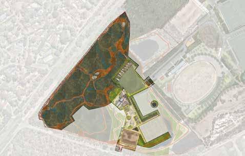
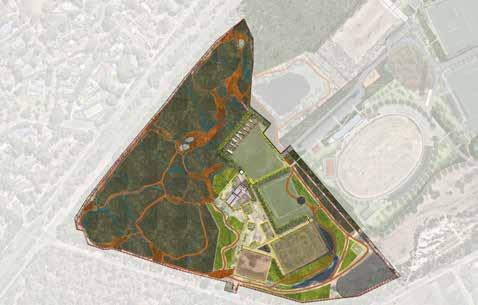
Land known as Langwarrin Equestrian Reserve is address 75R Huntingtower Crescent Langwarrin 3910. The land consists of the multiple (6) parcels of land some which are reserves and other are not.
Images: The site associated land parcels that present as public open space. Source MapShare.
• There is a registered Aboriginal place (a single stone artefact) close to the activity area.
• According to the AV sensitivity mapping, the activity area is an area of Aboriginal cultural heritage sensitivity.
• All of the activity area has not been subject to significant ground disturbance.
• The proposed activity may be a high impact activity under r46 of the Aboriginal Heritage Regulations, however subr(3) states that works on land are not a high impact activity if for, or associated with a purpose for which the land was lawfully used prior to 28 May 2007.
• Therefore, a Cultural Heritage Management Plan is not required in the event that high impact activities that are identified in the Aboriginal Heritage Regulations are carried out within the area that is currently in use for the Equestrian Reserve.
However, if high impact activities are undertaken within the western remnant habitat area (Western extent of site), then a CHMP will be mandatory.
• The activity area has potential for significant Aboriginal cultural heritage, likely in the form of isolated or low-density stone artefact occurrences.
• In the event that a CHMP is not mandatory, a Voluntary CHMP should be considered to ensure compliance with the Aboriginal heritage legislation.
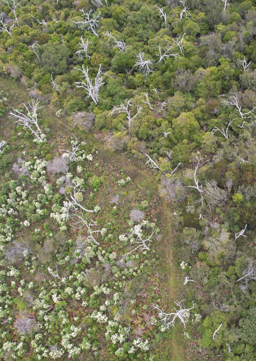
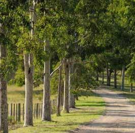
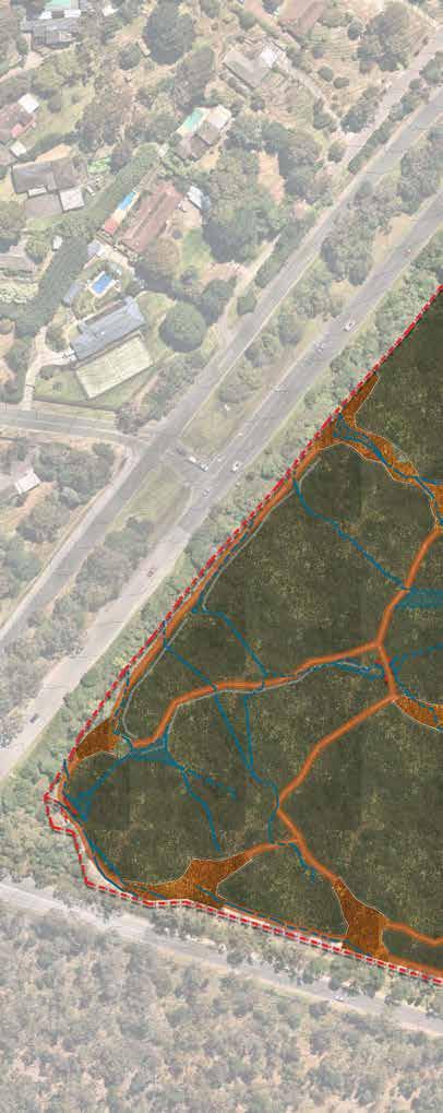
Langwarrin is a neighbourhood located on the western edge of the municipality, characterised by a mix of residential, low density residential, service authority, quarry, conservation, and rural land. The Urban Growth Boundary (UGB) limits future residential expansion. A number of open spaces have a conservation or natural parkland character, contributing to the overall mature bushland setting of the neighbourhood.
The provision of sporting open space for “active recreation” is expected to fall to 1.94 hectares per thousand residents by 2031, with Langwarrin/ Langwarrin South (1.06 ha/person) falling below Frankston’s standard of 1.5 hectares per 1000 persons.
Langwarrin has had recent growth in the younger age groups, and it has the lowest per capita supply of open space for active recreation and organised sport. There are several schools within 1-2kms walking/ driving distance that have sporting facilities, likely accessible to the community.
As Langwarrin was initially settled for farming and grazing purposes, there are some rural conservation zones and remaining rural areas located outside of the UGB. The residential area is primarily concentrated to the centre west of the neighbourhood, with low density residential zone allocated to the south and eastern side of the neighbourhood within the boundary. Two substantial housing change areas have been identified along the Cranbourne-Frankston Road encompassing key neighbourhood activity centres in Langwarrin.
Baxter Park is located at 294N FrankstonFlinders Road in Frankston South 3199. Baxter Park is located at 294N Frankston-Flinders Road Frankston South 3199. It is located outside the urban growth area, between the Moorooduc Highway and the Peninsula Link Freeway.
The park is located on the northern boundary of the Mornington Peninsula Shire.
The Vic Plan image (left) shows the zones of the land adjacent. The area zoned Public Uses Zone to the east appears to have been subdivided. There are several significant outfall drains running to the southwest of the park.
The majority of the reserve is subject to a Bush Fire Management Overlay.
Whilst surrounded by roads, the reserve doesn’t not have good pedestrian (or equestrian) accessibility, unlike the Langwarrin Equestrian Reserve. The verges are mostly screened by vegetation and fenced.
There are no pedestrian road crossings to the site, and adjacent to the residential area to the south, entries are relatively informal.
There is a disused railway line to the south however this is separated from the Reserve by the freeway. There are also several open spaces that adjoin Sages Road with corridors that connect to the Peninsula Link Trail. Connection to the reserve via these areas should be investigated and any equestrian trail in neighbouring areas.
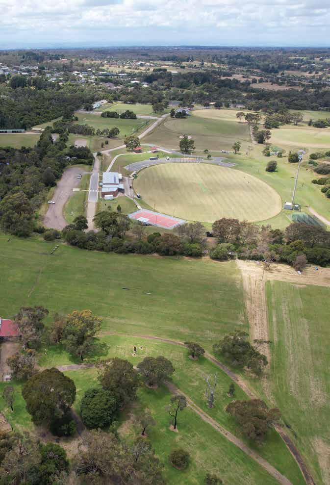
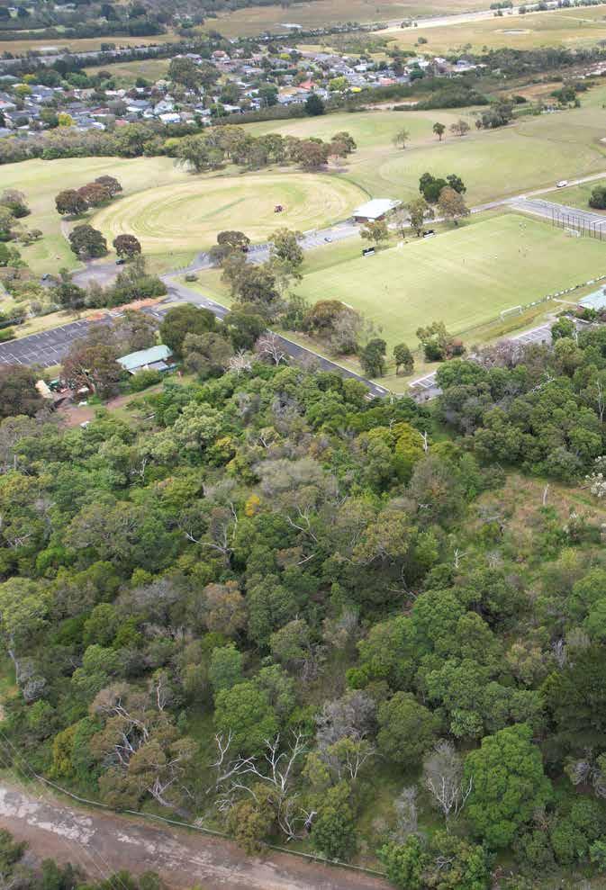
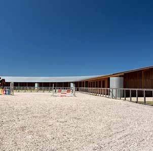
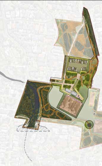
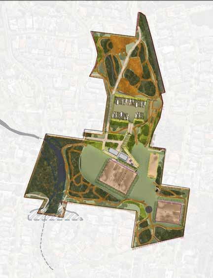
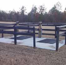
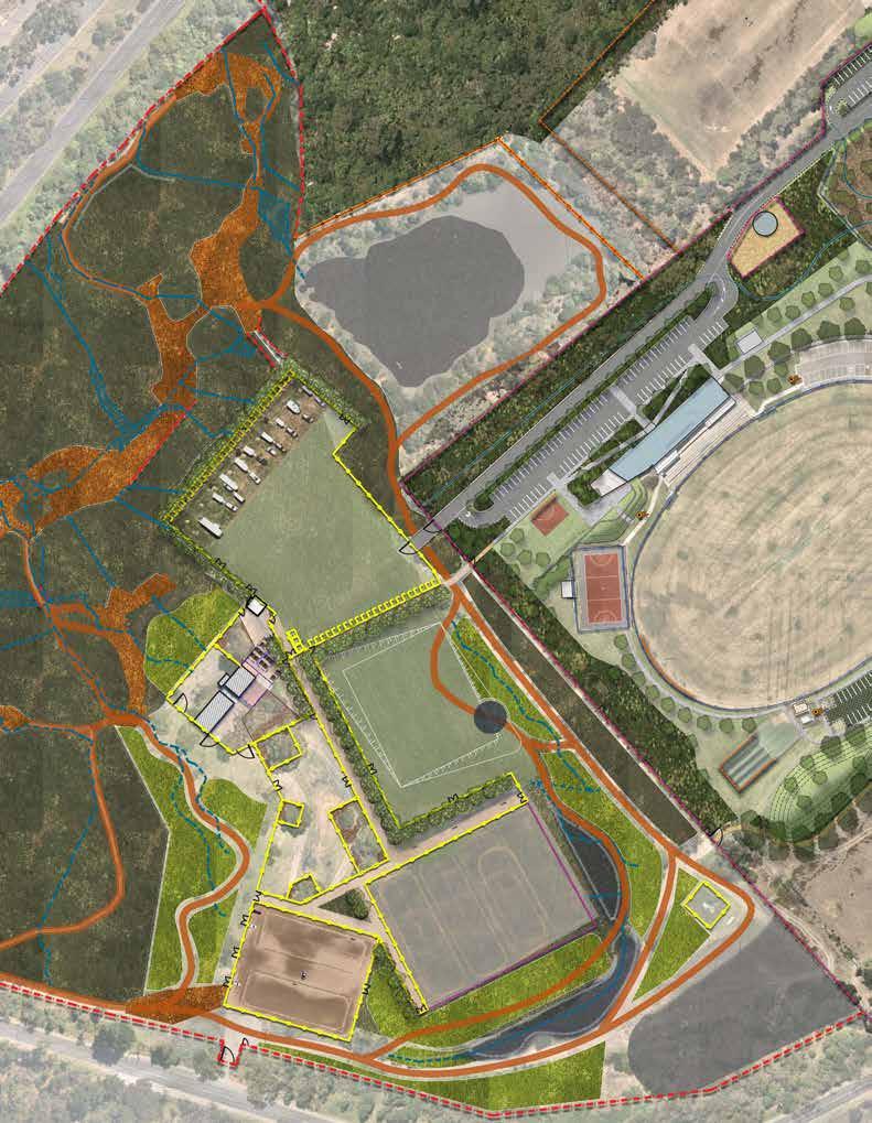
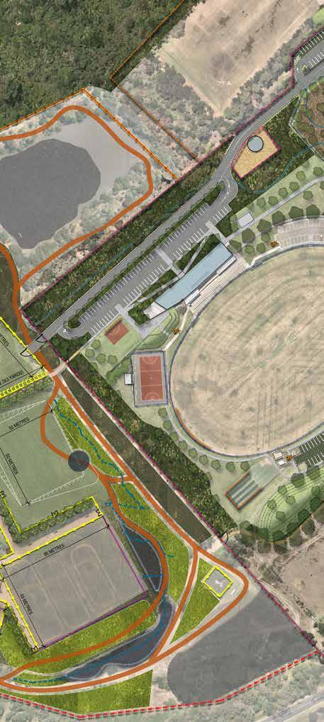
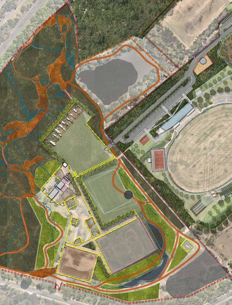
The Baxter Park Equestrian Reserve is situated in the southwest area of the park. This Reserve is crown land. This is a significant local and regional facility that also includes sport facilities for soccer, football (AFL), cricket, tennis, archery in addition to equestrian facilities, as well as a small children’s playground and dog off-lead area. There is a dam in the forest area, northeast of the equestrian area.
The property is some 60 hectares and is in two parcels. Most of the park provides a sporting function. A small triangle in the northern corner is zoned conservation and resource zone. The northern and western area of the reserve however is forested.
Baxter Park Reserve Aboriginal Cultural Heritage
• There is a registered Aboriginal place (a single stone artefact) adjacent to the activity area.
• According to the AV sensitivity mapping, the activity area is not an area of Aboriginal cultural heritage sensitivity.
The activity area has low potential for significant Aboriginal cultural heritage, however it is possible that such heritage could occur, in the form of isolated or low density stone artefact occurrences.
• All of the activity area has not been subject to significant ground disturbance.
• A Cultural Heritage Management Plan is not required in the event that high impact activities that are identified in the Aboriginal Heritage Regulations are carried out.
• A Voluntary Cultural Heritage Management Plan may be undertaken at the discretion of Council.
The site is surrounded by residential uses on the northwest, although separated by the Moorooduc Highway, and the southeast. The forested area in in significant contrast to other open space in Baxter, which is largely open grassed areas, of relatively low quality.
The Frankston Open Strategy indicates that Frankston South has two walking gaps within the residential area west of the Moorooduc Highway, and there are opportunities to improve trails and crossing points to Baxter Park and Overport Park.
• There is limited and minimal change expected regarding the provision and distribution of open space in Frankston South. Partnerships with schools, upgraded open space and improved street connections in gap areas are required to improve access to existing open space.
• There is a need to protect and enhance conservation and biodiversity values in Baxter Park and improve connectivity to surrounding pockets of remnant flora and fauna.
Poor local wayfinding exists, with a need to improve signage and safe crossing points to open space along and across roads. Busy roads restrict pedestrian and cycle access to Baxter Park and other district level sporting spaces.
• Undertake planting programs and improve landscape visual amenity, shade, urban heat island effects and biodiversity values in open space and surrounding streets. Target open space in Baxter Park and the key ecological precinct surrounding the Frankston Nature Conservation Reserve. Develop and implement bushfire and water management programs.
• Implement the Baxter Park Masterplan to improve recreation and ecological values within the park. Advocate for improved pedestrian access along and across Moorooduc Highway and Frankston Flinders Road to Baxter Park.
• Implement the Baxter Park Master Plan and Sports Development Plan in Baxter Park to support a diversity of sporting, vegetation management, WSUD, play, dog walking and unstructured recreation for existing residents.
Review opportunities to reduce conflict and improve safe off leash dog walking areas
Frankston City is a predominantly residential municipality in Melbourne’s outer southern suburbs. The City features well established residential areas, recent growth areas such as Carrum Downs, Skye, Sandhurst and Langwarrin, rural residential areas such as Langwarrin South and rural and extractive industry uses.
This section of the paper looks specifically at the Municipality in terms of impact on demand for Equestrian facility.
Frankston City is a predominantly residential municipality in Melbourne’s outer southern suburbs. The City features well established residential areas, recent growth areas such as Carrum Downs, Skye, Sandhurst and Langwarrin, rural residential areas such as Langwarrin South and rural and extractive industry uses. The two equestrian reserves in the City of Frankston are located in the South and southeast periphery of the municipality. The Langwarrin Equestrian Reserve is located in the suburb of Langwarrin and the Baxter Park equestrian facility is located in Frankston South, but adjacent to Baxter which is in the Mornington Peninsula Shire.
Between 2016 and 2041, the population for Frankston City is forecast to increase by 24,114 persons (17.29% growth), at an average annual change of 0.64%.) Frankston South has limited growth projected (1,400) to 2041, and Langwarrin slightly more than Frankston South, (3,300 people).
Langwarrin was largely developed in the 1980’sthrough to the present. This era of subdivision along with the physical conditions of the area are a key influence on the availability and functionality of public open space. See chapter site and supply analysis.
The current estimated population for Langwarrin is 23,336 (2021) and projected to grow to 26,717 by 2041
Compared to Frankston as a whole, Langwarrin has a higher percentage of people under 20 years followed by the number in the 45–59-year age group. Langwarrin has a very small proportion of people over 60 years of age. (See the Age- Sex Pyramid following). Some increases are projected largely in the nought to 16 years and then 16 to 34 age groups, with little or no growth in the population over 35 years.
Langwarrin has a small proportion of persons older than 65 years compared to the City as a whole and Frankston South.
The largest projected growth is in the ages of fifty 40 to 50 years. The population is largely Australian born unlike other areas of the city.
Baxter Park is located in Frankston South. The 2022 estimated resident population for Frankston South is 19,584, with a population density of 1,324 persons per square km.
The population is expected to grow to 20,962 , or 7% from 2022 .
Frankston South shows a high proportion of older adults (over 85 years) compared to the City as a whole and Langwarrin.
The largest number of people are in the 45–49-year-old age group, accounting for 7.6% of the total persons. Frankston South has a higher proportion of people in all the age groups 50 years and over, than Frankston as a whole. Frankston south has a slighter higher proportion of school aged children than the City as a whole and less pre-schoolers.
In Frankston South the largest increase in persons between 2016 and 2026 is forecast to be in ages 75 to 79, which is expected to increase by 246 and account for 4.6% of the total persons.
The largest 5 years age group in 2026 is 10 to 14 years, with a total of 1,361 persons.
Between 2016 and 2026, the age structure forecasts for Frankston South Local Area indicate a 5.0% increase in population under working age, a 17.2% increase in population of retirement age, and a reduction in the population of working age.
While Baxter Park is in Frankston South, it is adjacent to Baxter, a small township adjacent to the park in southeast (located in the Mornington Peninsular Shire). Baxter comprises 245.17 hectares and had a population of approximately 2,162 permanent residents (2016 Census).
The Baxter population has remained relatively stable with only minor growth projected in and around township (forecast to be 2,360 people in the Baxter study area by 2033). The age profile is significantly younger than the rest of the Mornington Peninsula Shire, with the median age being 39 years compared to 46 years for the remainder of the Shire, and 38 for the City of Frankston.
Equestrian participation spans a wide age group with many riders still riding in the 70s. For people over 15 yrs. the highest participation rates are in the age groups 55 to 64 yrs. (1.4%), 45 to 54 yrs. (1.2%) and 34 to 44 yrs. (1.1%). (AusPlay 2021)
For children under 15 years, the highest participation rate in equestrian activities is in the 5 to 8-year-old age group with 1.9%, followed by the 12 to 14-year-old age group at 1.8% and then 9 to 11 1.4% and 0-4 yrs at 0.4%. Some 79% of riders are female.
Projected number of residents likely to participate in equestrian activities
Based on participation rates for organised equestrian activities from AusPlay 2021 and using the Frankston City i.d population estimate for 2021 (145,985) and forecast of (163,610) by 2041 and there could be in order of 915 people likely to participate in equestrian activities in the City of Frankston, rising only very slightly, with a population increase to 1,008 by 2041
In general terms this means at least two sites are likely to be warranted in the City for district level equestrian facilities, allowing for at least the community level equestrian disciplines clubs and assuming that the need for the wide range of disciplines, recreational riding as well as equestrian sports is likely to be met in a range of private and other regional facilities in the neighbouring Council areas (Mornington Peninsula Shire) to the south and the City of Casey to the east.
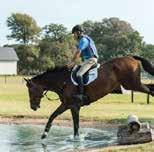
Equestrian activities provide a high degree of personal health and well-being, as well as community benefits. They encourage people (especially females) to be outdoors, be physically active and interact with animals and other people.
Riding a horse requires the use of a wide range of muscle groups and builds strength, stamina as well as coordination and promotes the development of resilience and strategic decision making.
The bond that develops between the horse and the rider has been shown to provide considerable psychological and stress release benefits and horse riding is commonly used as a therapeutic tool to promote these benefits.
Like many other sport and recreation activities the development of horse-riding skills and competition can enhance self-confidence, social skills, the sense of belonging and responsibility that comes with owing and caring for a pet. These benefits including discipline, compassion and empathy are amplified for equestrian activities due the size of a horse and opportunities to compete with a horse in events.
The ability to keep and ride a horse in Melbourne is becoming more difficult and being able to retain equestrian reserves close to where people live is a great strength of living in the City of Frankston.
What also supports residents of Frankston participating equestrian activities is the proximity to green wedge land where horses can be agisted and where a strong equine industry is present. The peak bodies say that the Mornington Peninsula is the strongest region in Victoria for equestrian sports participation. There is a significant industry present that supports recreational as well as commercial equestrian activities on the peninsula.
The implications of demand for the two equestrian reserves in Frankston are as follows:
• Equestrian activities and clubs are important to support in conjunction with a range of other competition sports and outdoor recreation. Equestrian clubs provide support and encouragement to people to own, ride and enjoy horses.
• Residents in Frankston are dependent on these two reserves for:
• providing the suite of community equestrian activities
• for the growth and development of basic equine skills and opportunities
• enabling clubs to provide a supportive and enjoyable environment so people of all ages can share their interests and continue to benefit from riding a horse.
Participation in pony and riding clubs should be supported by Council as the grass roots level of equestrian sport, as there are facilities suitable to accommodate these activities.
• Pony clubs provide the opportunities for young people to learn and develop equine skills and enter a pathway to equestrian sports if desired, whereas riding clubs provide support and encouragement for a people from a wide range of age and ability groups, who own a horse.
• Council can influence the participation in these activities by ensuring facilities: are fit for purpose, target a wide range of ages and abilities, and clubs are encouraged to include programs focused on the development of foundation skills through local clubs and schools.
• When assessing the range of activities evident on the equestrian reserves, especially Langwarrin, it is important to emphasise that organised equestrian participation is dependent on these facilities, where- as other activities presently occurring such as recreational walking and dog walking are not, as they have other opportunities close by. These other opportunities for walking can be enhanced in Langwarrin, by creating path circuits through and connecting the multiple easements that again the equestrian reserve.
Another consideration for Council is that horse riding is the second most expensive organized sport or physical activity behind motor sport, with the average annual expenditure per person of approximately $1400. (ABS 2016). This is likely to be partly because of the high cost of participation through private services and facilities, capped club numbers that reflect volunteer resources and capacity of facilities, as well as cost of looking after and transporting a horse.
• Retaining local community level facilities close by to residences and schools is likely to increase the chances of local residents participating in equestrian activities, as compared to the idea of moving these facilities further out of the City where there may be more space.
The main peak bodies in for horse riding in Victoria are:
– Equestrian Victoria
– Pony Clubs Victoria
– Horse Riding Clubs of Victoria
– RDA Riding Develops Abilities, and
– The various breed and equestrian activity associations
Project recreation planning sub-consultants @leisure interviewed staff members from Equestrian Victoria, Pony Clubs Victoria, Horse Riding Clubs of Victoria, and RDA Riding Develops Abilities. Key points from these interviews follow.
Equestrian Victoria
Equestrian Victoria is responsible for a number of sports competitions and pathways:
Dressage
Eventing
Jumping and
Para
Equestrian (EA)
Interschool
Vaulting (EA)
Reigning (EA)
Dressage Victoria squads – Eventing Victoria Squads and – Jumping Victoria Squads
High Performance Pathways – Equestrian Victoria Young Ambassador Program – Young Rider Dressage Squads and Development Programme
The primary objectives of Equestrian Victoria are to:
– Encourage, develop, promote, and control horse sports throughout the State of Victoria
– Establish and maintain, throughout Victoria, a uniform code of rules and regulations to govern horse sports under its jurisdiction
– Provide services and support to members, clubs, coaches, judges, and administrators, which is second to none
Membership of Equestrian Victoria now exceeds 200 affiliated clubs, and 5000 registered athletes. The Association provides a broad range of services and benefits to its membership and has a major focus on servicing member clubs, to ensure they are well equipped to professionally deliver quality horse sport programs to the community.
The equestrian facilities in the City of Frankston do not currently offer any Equestrian Victorian (EV) activities and the existing clubs are not members of EV. Woodleigh school of example (with campuses in Frankton South and Langwarrin) participates in EV interschools program.
Activities provided at the community level are an important conduit for riders that may wish to learn the sports and ultimately compete in Equestrian Victoria Sports disciplines, at other locations. Most of Equestrian Victoria’s competitions are held at Werribee Park, or private facilities in the region such as at Boneo Park.
Equestrian Victoria provides a few facility guidelines related to facilities in line with national and international equestrian sports.
Pony Clubs Victoria typically provide for younger riders, typically up to 16 years of age, learning basic skills. Langwarrin Pony Club and Mornington Peninsula Pony Club are members of Pony Clubs Victoria.
Horse Riding Clubs of Victoria cater for adults who own a horse, are riding for the first time or most commonly, or are an entry point for those returning to the activity after having a family. Some adult riding clubs also cater for riders who don’t have horses. Members need to be able to ride independently. HRCAV provide a community of likeminded people to support and encourage people own or ride a horse. These clubs are unique to Victoria. Most clubs have their own grounds - but they might hire other facilities.
Peninsula Horse Riding Club is a founding member of HRCAV. In 2020 the club was the HRCAV Horseland Top Club (Award).
RDA -Riding Develops Abilities specialise in providing support and coaching for people with a disability (particularly physical disabilities) who want to ride a horse or ride for therapy purposes. In most cases riders don’t have their own horses and they are provided on site.
There are a wide range of equestrian breed associations, for example Arabian, Miniature Horse, Clydesdale, Show Horse etc., However there are no known such groups active in Frankston.
All bodies indicate a high demand for horse riding an equestrian activity in Frankston and extending south and east into Mornington Peninsula, largely because of the space available to own a horse.
Pony Club Victoria believe that there could be demand in excess of two sites to serve the Frankston population in the long term.
Club numbers in urban areas are commonly capped in line with facility capacity and the number of volunteers available.
RDA believes there is significant and growing demand for people with a disability to ride a horse including an increasing proportion of people with on the autism spectrum, however there are difficulties in finding volunteers who are suitably trained to run the program and locations where horses can be stabled. These factors mean that there is a declining number of RDAs in Victoria even though demand is increasing. The closest RDAs to Frankston are Dingley, Doveton, and Peninsula (present at the Mornington Racecourse for carriage driving and on a private property in Moorooduc).
All the peak bodies identified the need for community level equestrian facilities in Frankston that can enable participation and the development of basic skills. In addition, there are considerable opportunities for those who can travel further afield to use private facilities nearby and other equestrian sporting groups including disciplines such as polo, particularly on the Mornington Peninsula and east in Casey or Cardinia.
Pony Club Victoria suggest that Frankston should consider another greenfield site for equestrian use in the green wedge or lowdensity residential areas in the long term that might enable future demand to be accommodated and should the proximity to residences around the Langwarrin site become an insurmountable challenge.
The viability of clubs is often dependent on the carrying capacity of facilities to enable rallies, competitions and events or a reasonable size so a large number of participants on the same day. Apart from good quality support facilities the availability of canteens is important for clubs to raise money. Also, for events many clubs require space for camping to facilitate events over two days, and access to canteen and showers facilitates events over more than one day.
The major issue affecting equestrian clubs is the enormous amount of work by volunteers required to sustain the club and the limited number of people that can be accommodated on a site for events.
Access and car parking typically restricts the size of rallies for pony club to about 100 or 120 participants and for adult riding clubs typically 40 riders.
Dust from arenas and car park areas can create considerable conflict with other users, and residents. Arenas now typically use a surface with additives such as wax to suppress dust as well as create a soft riding surface.
Equestrian sport is a very strong school sport in the region, especially further south on the Peninsula. At least one Frankston school currently participates in a school equestrian programme. A number of schools on the Peninsula provide opportunities for equestrian sport including Toorak College that offers boarding with a horse.
There are several schools in close proximity to Langwarrin Equestrian Reserve and there is a utility easement along the south of the school property which could provide direct off-road access into Langwarrin Equestrian Reserve. Pony Club Victoria agree that there would be opportunities to develop a sporting schools programme between the clubs at Langwarrin and a school and recommend that this should be investigated.
The size of facilities is the main factor limiting participation. To be sustainable, typically a pony club would need arena space equivalent to six dressage arenas.
An arena would typically be surfaced with a wax additive to sand, the border would be basic timber. Adequate buffer space needs to be provided outside the arena, 10m on the short side and 5 m on the long.
During events it’s common for plastic rails to delineate the horse-riding arena and the extent of the whole arenas. In future most arenas would desirably be lit, to increase carrying capacity and return on investment and whilst equestrian sports do not appear to have Australia Standards for lighting, those suitable similar to football training are considered likely to be adequate. One hundred lux lights for casual activities and 200 lux for club organised activities is suitable.
Where possible the provision for a covered arena should be anticipated in future. Such a facility would be would simply increase capacity and usage as well as provide for activities such as RDA that may need more specific facilities, and the surety of riding in an arena protected from hot and wet weather. The Baxter Park Master Plans in 2004 recommended an all-weather arena be constructed. It is not clear whether this was intended to be covered or sand. In addition, it is desirable to provide a cross country course.
Typically, clubs would need a pavilion which has a small social area good kitchen and canteen, desirable and office, storage, and facilities so that they can accommodate up to 300 people on a rally day for pony club and 100 or more commonly 70 for adult riding clubs. Rallies of 100 are the most desirable, given the effort. Typically gender equitable change and support facilities and equipment sheds are required which would include space for a minimum of 1 and preferably 2 trailers which would contain portable jumps and rails etc., These facilitate rallies and can be driven in and driven out in the same direction. In addition, many clubs have as some sort of small tractor for maintaining arenas which need to be housed.
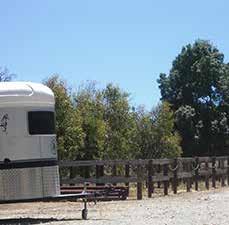
Access to parking (not on soft ground) is a key issue for facilities in urban areas and detailed consideration needs to be given to providing safe car parking on site with floats, in addition to parking arrangements for rallies. Parallel parkingdrive in and out, and room to tie horses with 5 m between floats is desirable. For a rally with 70 people, some 50 floats could be expected.
Most adult riding and pony club facilities would include space for two wash-down bays with a concrete base, close to yards and away from people.
Clubs handle manure in different ways. Typically, there will be one central manure storage at a facility- pits and users will be required to collect their own. Some have a take home policy and other clubs sell the manure for fund raising etc., others let the community come and take it.
During the preliminary public consultation phase of the project, Council received queries with regards to the existing Equestrian Trails within the Municipality, and the potential for connectivity to be provided between the reserves.
The consultant team have recognised this as a valuable insight with potential to maximise opportunities for use of the site by local horse riders within the community. A proposed Regional Equestrian trail network; however, would need to be considered across a number of Council stakeholders and other agencies to ensure its viability, and as such this master plan recommends that a Regional Equestrian Trail Network might be a future project for consideration by Council.
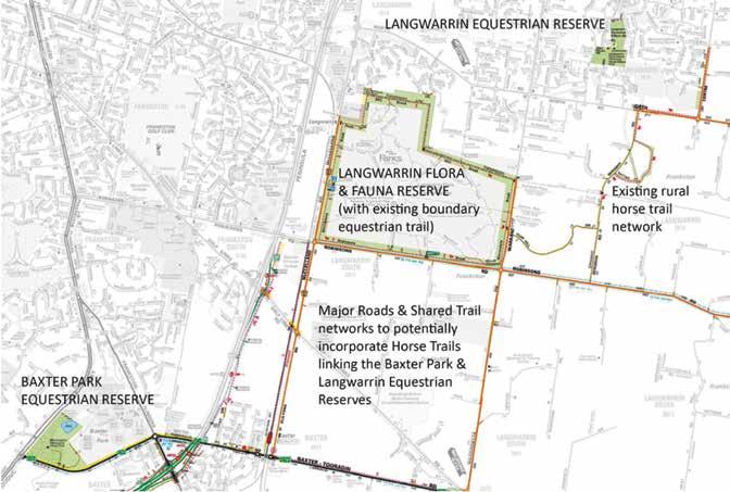
The above diagrammatic map represents the potential opportunity to create a Horse Trail Network linking the Equestrian Reserves.
Ecological and Bushfire Management consultants; Practical Ecology have provided preliminary bushfire advice for the proposed Masterplans at Langwarrin Equestrian Centre and Baxter Park.
Bushfire Prone Areas
Both of the sites will require an assessment and review under Clause 13.02-1S Bushfire Planning. While this clause does not list strict requirements and decision guidelines, it contains multiple strategies which need to be considered when determining bushfire risk in planning. One of these strategies, ‘Use and development control in a Bushfire Prone Area’, dictates which developments within Bushfire Prone Areas need to consider bushfire risk as part of their planning permission:
– Subdivisions of more than 10 lots
– Accommodation
– Child care centre
– Education centre
– Emergency services facility
– Hospital
– Indoor recreation facility
– Major sports and recreation facility
– Place of assembly
– Any application for development that will result in people congregating in large numbers.
Both the Langwarrin Equestrian Centre and Baxter Park can be considered under one or more of the above categories.
Langwarrin Equestrian Centre
The BMO does not apply here.
Baxter Park Equestrian Reserve
The BMO covers the majority of Baxter Park with only the eastern corner excluded. Due to its dominant presence and due to the nature of the development, it is likely that council will require a response under the BMO for all proposed buildings even if they are to be sited outside of the BMO. An application under the BMO must be accompanied by:
– A bushfire hazard site assessment
– A bushfire hazard landscape assessment
– A Bushfire Management Statement (BMS).
In accordance with Approved measure 3.2 of Clause 53.02 Bushfire Planning, due to the site being used for recreation which will likely see the assembly of large groups of people, defendable space is to be provided in accordance with Table 2 for any structures or areas where people are likely to gather. The required setbacks are provided below in Table 1
Table 1. Distances from vegetation (either as setbacks or defendable space) required to attain BAL–12.5 (the likely required rating for structures on site)
If an emergency management plan that incorporates a bushfire response is provided for the site however, Alternative Measure 3.6 of Clause 53.02 can be used whereby defendable space is provided for in accordance with Table 2 Columns A, B or C, which is less than required without the emergency management plan. The required setbacks are provided below in Table 2.
Table 2. Distances from vegetation (either as setbacks or defendable space) required for the applicable BAL standards
Langwarrin Equestrian Centre
During bushfire season, fires are propelled by powerful north-westerly winds before a cooler south- westerly change occurs. The broader landscape is dominated by residential development with only fragmented patches of vegetation present that are largely restricted to the present creek lines.
Fire runs from the north-west or south through the creek lines would be buffered by the surrounding development and pose little threat. The vegetation onsite poses the main threat although due to the lack of connectivity and the existing development and management surrounding these patches of vegetation, potential ignition would result in localised fire events that can be readily suppressed. Closure of facilities is not considered necessary in response to fire danger ratings.
The Continual management of the grassed areas is considered sufficient in mitigating the bushfire risk. Grass should be short cropped and maintained, particularly throughout the bushfire season.
The broader landscape beyond the site consists largely of residential development managed in a minimum fuel condition. Fire runs from the north or north-west would therefore be limited to the vegetation present onsite which through aerial imagery, appears to be Forest type vegetation as per Australian Standards
3959-2018: Construction of Buildings in Bushfire Prone Areas (AS3959-2018). This vegetated area is approximately 300 m in width at the widest point and therefore a fire run within this area would transect a short distance and would be unable to reach uncontrollable proportions. The managed sporting ovals to the south of this area would additionally act as a buffer and enable further fire progression.
Fire runs from the south-west could see a longer fire run (approximately 1 km) progressing through Grassland vegetation within the farmland areas. This would then see a transition to Forest vegetation prior to Sages Road which would act as buffer and aid in potential suppression efforts. Fire progression beyond Sages Road could see impact through the western vegetated extent of the site although impact further east into the developed area onsite is unlikely given the existing managed recreational areas. Closure of facilities is not considered necessary in response to fire danger ratings.
The continual management of the grassed areas has been considered sufficient in mitigating the bushfire threat. Emphasis should be placed on the eastern edge of the vegetated area onsite as to ensure a distinct fuel break is always in place. This particularly applies to the northern boundary of the site which adjoins onto residential development. Fire progression from the southwest could move through the site and potentially impact this area so the existing fuel break needs to be routinely managed.
The Equestrian Master Plan 2023 has been developed through 5 key phases involving Council, community, key stakeholders and an external consultant team.
Phase 1
• Background review and site analysis plans
• Preliminary Key Stakeholder Engagement
• Issues and Opportunities Identification
Phase 3
• Final Draft Frankston Equestrian Master Plan
• Key Stakeholder Engagement – review and comment on Final Draft Master Plan
Phase 2
• Draft Frankston Equestrian Master Plan Options
• Stakeholder and Community Engagement – review and comment on Draft Master Plan
• Final Frankston Equestrian Master Plan 1 2 3 4
Phase 4
A variety of stakeholder consultation and community engagement activities were undertaken to gather information and seek feedback for development of the Master Plan.
Frankston City Councils thanks all local residents, park visitors, sports players, clubs and groups who contributed their ideas and views to the Master Plan development process.
Equestrian clubs at Baxter Park and Langwarrin Equestrian Reserve generally have some form of lease or license agreement with Council and were invited to directly participate in the Master Plan development.
The following key stakeholders have been engaged on various occasions to provide feedback and input into development of the Master Plan:
• Mornington Peninsula Pony Club
Peninsula Horse Riders Club
• Langwarrin Pony Club
• Bunurong Land Council Aboriginal Corporation
• Department of Energy Environment and Climate Action
Melbourne Water
• Frankston Environmental Friends Network
• Mornington Peninsula Shire
In addition to feedback received from the above key club stakeholders and groups, feedback from a total of 239 local residents has been considered. The Draft Master Plan was exhibited online for a period of 4 weeks from the 10 June 2022 to 10 July 2022 with feedback received considered in the preparation of the Final Master Plan. The Final Master Plan was also presented to all the Equestrian clubs with feedback received considered in the Final Master Plan.
For detail on the consultation and findings, refer to the Frankston Equestrian Master Plan Discussion Paper located on the Council website.
We heard strong support for the key moves identified in the Master Plan across both sites from the broader community including:
1. Wayfinding and Signage
2. Bicycle Facilities
3. Revegetation, Ecological Management and Habitat Values
4. All Abilities Toilet Facilities
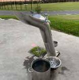
5. Facilities including; Drinking Fountain, Waste and Recycle Bins, Dog Waste Bin
6. Seating and Picnic Facilities
7. Regional Horse Trail Network and connectivity between the reserves
“Master Plan is very impressive. Would like to see the grass arenas developed into sand arenas sooner rather than later”
“This would allow the pony club to develop, and the greater community.”
“I am a local property owner and resident. I support the general proposal provided public access to the area is preserved.”
“It looks great but there are many old growth trees and wildlife currently living in them. Will you protect these?”
“For non-members to have access like other pony clubs allow would be fabulous but otherwise great plan”
“Absolutely wonderful that the council is supporting a sport that is accessible to all in terms of age, gender and ability.”
The findings of the Gender Impact Assessment for Frankston Equestrian Master plan are:
1. Community consultation did not raise any concerns with regards to community safety within the reserves. This is largely because of the way these reserves are accessed and used by the community. Both reserves are used for walking, dog walking and other forms of exercise. Langwarrin Equestrian Reserve has a strong sense of passive surveillance due to its residential context. Baxter Equestrian Reserve is chosen for exercise by people who appreciate and enjoy the sense of remoteness.
2. The Equestrian Community does not have any documented recording of issues with meeting the aspirations of Gender Diversity. This is largely because of the high proportion statistically of female involvement in Equestrian at the domestic club level. The research did reveal potential conflicts in appropriate provision of facilities given the gender imbalance. It did also reveal a lack of conversation about trans and gender non-binary involvement.
3. The research into Gender Equity and other groups who may be impacted by the proposals of the Master plan, revealed an opportunity for additional inclusion for people with disabilities. Research reveals that equine therapy and engagement in equestrian pursuits offers many benefits for this part of the community, beyond those available in other organised sporting facilities.
The Frankston Equestrian Master Plan Gender Impact Assessment recommends that Council:
Implement the Frankston Equestrian Master Plan
• Engage appropriate consultant teams to ensure that worlds best practice methodologies and standards are applied to all implementation projects.
• Provide clear project briefs and outlines for the implementation of the project which detail the constraints and opportunities outlined by the Gender Impact Assessment
• Ensure that key internal stakeholders are consulted on the implementation of all works (this Assessment would recommend engagement with the Frankston Equestrian PWG core group as a minimum).
Undertake further community/stakeholder consultation for the initiatives to include specific gender groups.
• Work with Equestrian Clubs to ensure Gender Equity and community safety are embedded within their constitutions and operational practices. This should be considered a requirement of future tenancy agreements for the reserve.
• Implement non-binary / all gender Public Toilets and change facilities in accordance with the outcomes of the Public Toilet Action Plan.
1. Ensure Recreational Diversity within the Municipality
The Frankston Equestrian Reserves at Baxter Park and Langwarrin are unique and distinct public open spaces which enrich the recreational and spatial diversity of the Municipality.
2. Emrace Unique Landscape Character
The Equestrian Reserves are defined by their “rural” and “natural” characters, and this should be maintained in any future development of the sites.
3. Maintain And Improve Ecological Function
The remnant vegetation ecology and habitat corridor value and the protection of waterway function of the Equestrian sites is acknowledged by Frankston City Council, the equestrian clubs and the general public alike. As such, all future development of the sites should be considered to minimise their ecological impact.
4. Support Community Access to Equine Participation
The Frankston community are dependent on these two reserves for:
a. providing the full suite of community equestrian activities
b. for the growth and development of basic equine skills and opportunities
c. enabling clubs to provide a supportive and enjoyable environment for people of all ages to share their interests and continue to benefit from riding a horse.
5. Clearly Define Management Roles & Responsibilities
The successful long-term management of the Equestrian sites will depend upon clearly defined management roles and responsibilities for Council and the Equestrian Clubs who occupy the sites.
6. Shared Fit-for-purpose Spaces
Code compliant support facilities are needed on site to encourage use of these spaces for equestrian sport and a range of shared community recreation uses. Facilities should be designed to be inclusive of users regardless of age, ability gender and cultural backgrounds, and support changes in demand over time.
7. Safety and Security of Tenure
The successful accommodation of equine sports and recreation is reliant on providing an accessible and safe environment for horses, their riders as well as the general public, and minimising the potential conflicts between these activities and traffic, adjacent residents, and other recreation pursuits such as dog walking.
8. Embrace Opportunities for a Regional Equestrian Trail Network
Council is to consider all opportunities to include equestrian trails within the expanse of its shared trail networks. For example, a future Equestrian trail project could look at connectivity options between the reserves and other sites, such as the Langwarrin Flora and Fauna Equestrian Trail.
The Master Plan includes appropriate design responses to address site issues and opportunities.
– Strategic & master planning background
– The current site conditions (as documented in the site analysis plans)
– The aspirations of the Equestrian Clubs
– The management needs of Council
– Broader Stakeholder consultation
– Community Consultation
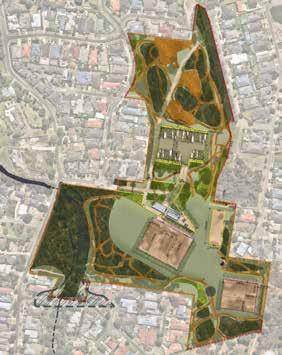
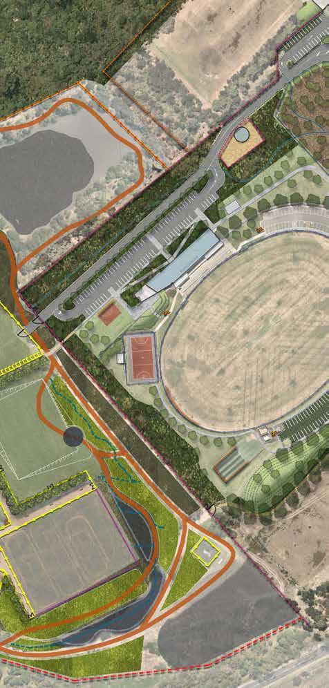
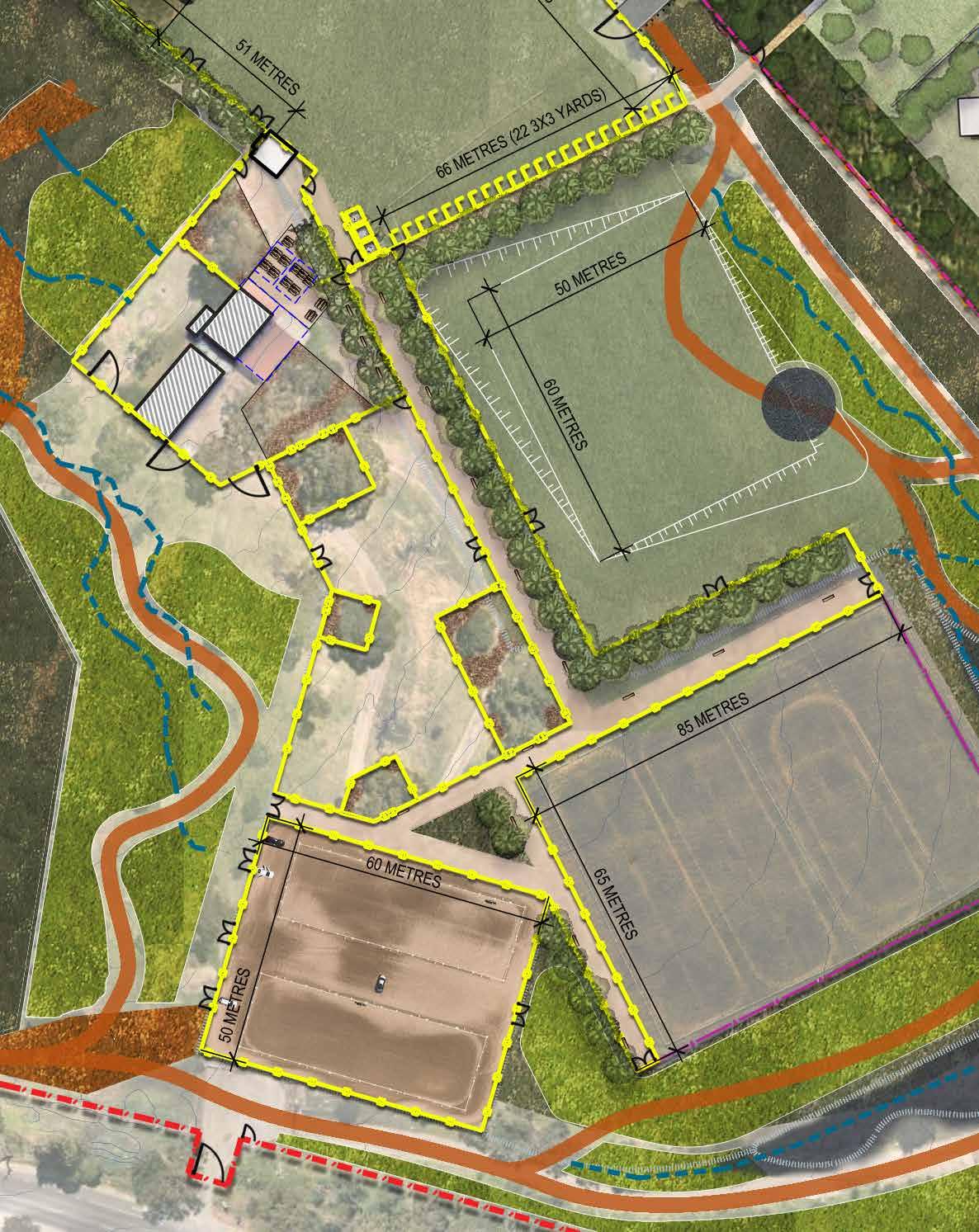
Langwarrin Equestrian Reserve Master Plan
Site Safety:
Site Safety considerations:
• Separation of the equestrian facilities from vehicle movement,
• Provision of secure fencing and lockable gates to be able to secure the site form public access during Equestrian events.
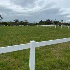
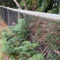
Removal of un-safe post and wire fences (especially to Southern extent of the Reserve)
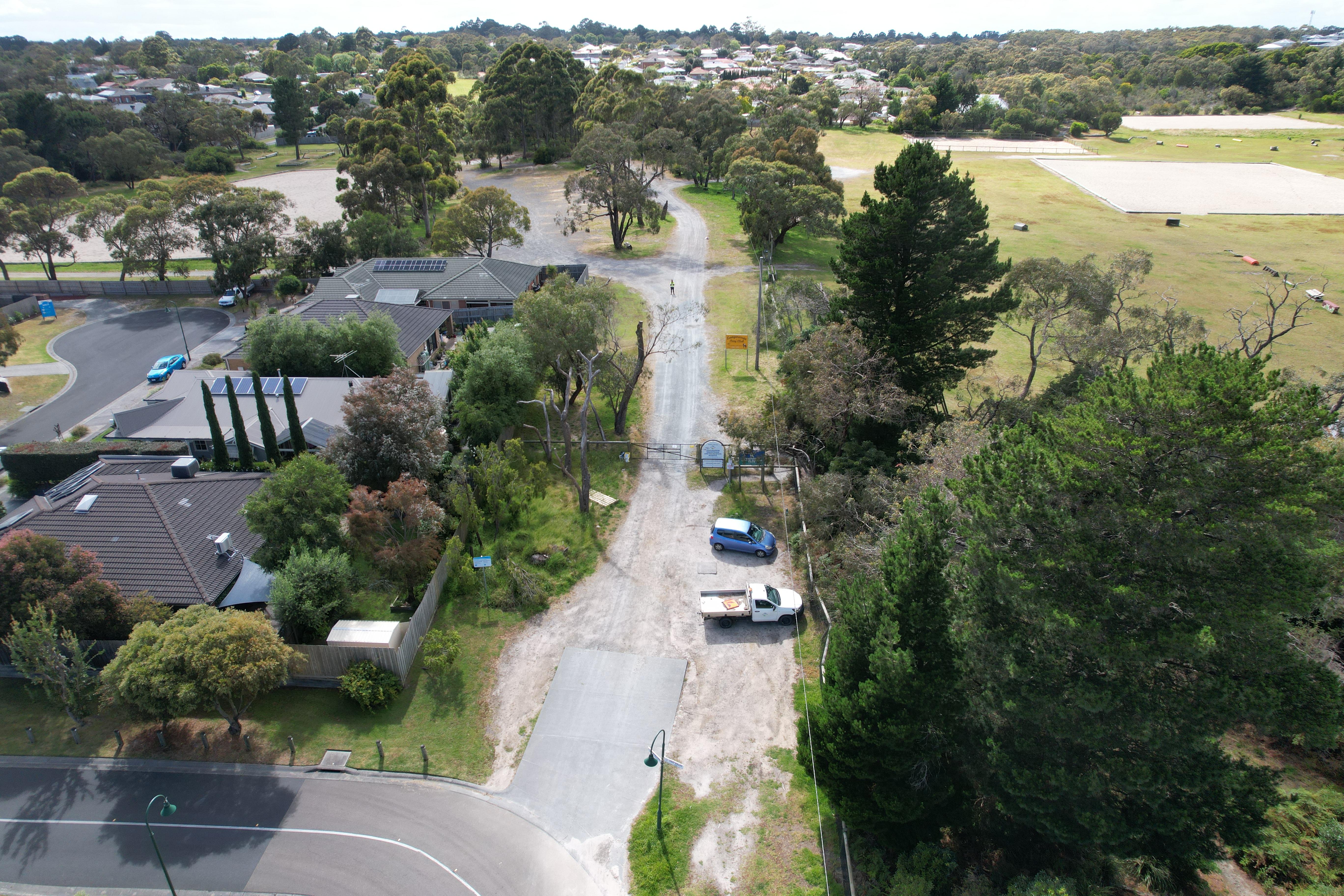
Access via Cosy Valley Drive to be retained
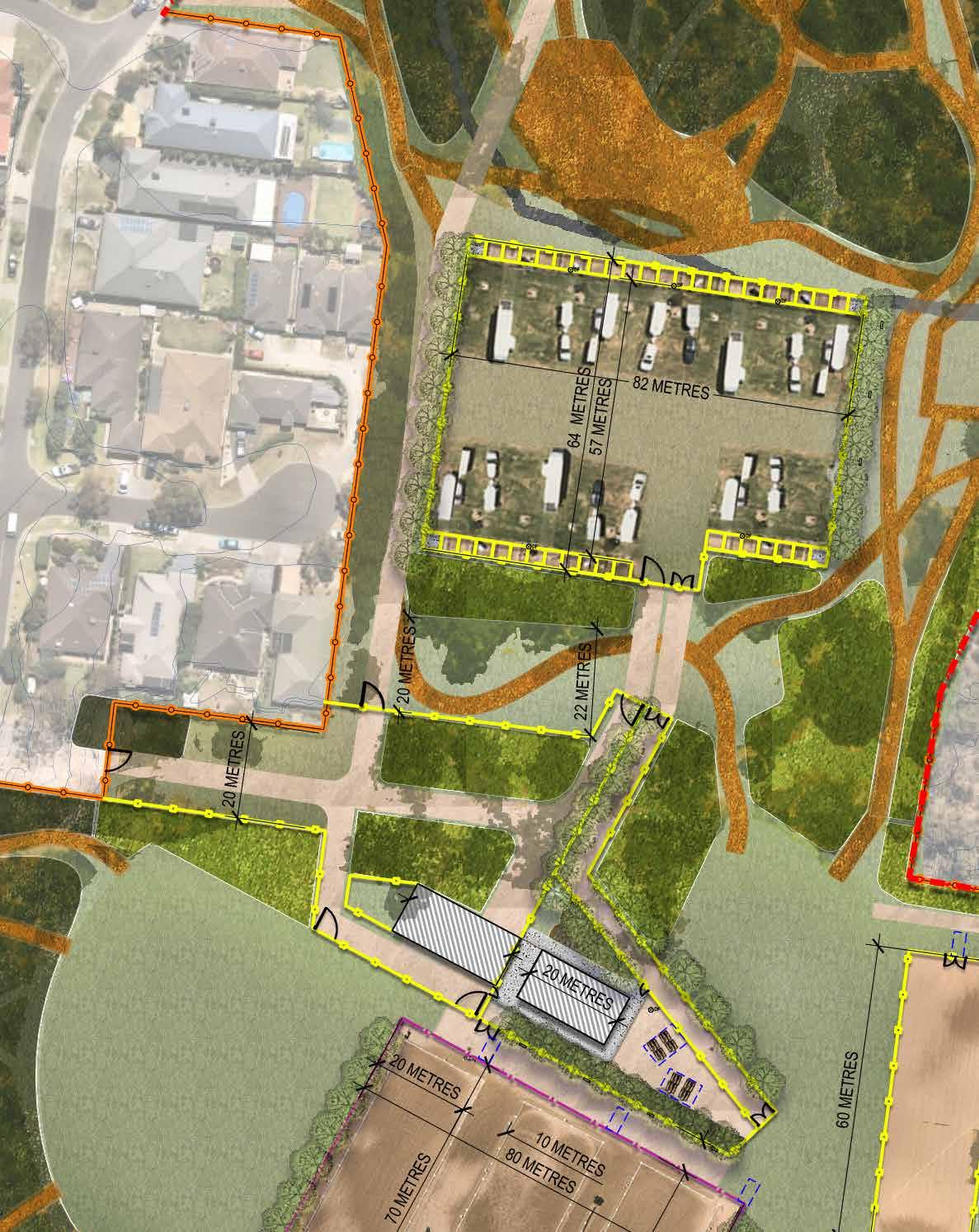
• Parking Types: The existing parking needs are mapped as 3 key types in the access analysis and then reflected by how these requirements can be met within each option. Each option has had the fixed parking configurations drawn at scale in CAD with generous requirements, based on examples provided by the clubs:
–
20-30 horse events – Club Rally Use – restricted to main parking area and adjacent to existing club rooms with open grass parking areas with fixed Yards and wash bays
––
100 horse events – Cross Country and combined training (uses the trails + the arenas)
150 horse events – Show Jumping & Dressage (no trails used for this event)
A single building/structure which accommodates both clubrooms / amenities at one end and drive through storage shed at the other. This is to reduce costs in construction.
• Proposed new locations for the building –opening up the Eastern side of the site for additional equestrian trail links and facilities, and improving opportunities for revegetation to improve the habitat corridor links.
Langwarrin Equestrian Event Facilities
Improved Cross Country Trail Links
• By separating the vehicle movement from the equestrian facility there is more scope to “soften” the landscape with planting and revegetation and run trails through.
• The provision of a considered central space for equestrian use, provides opportunities for considerable additional length in trails by providing additional trails centrally and to the West of the site, removing the current issue with having to re-use the singular trail on the Eastern boundary of the site.
• Required additional trail length for Level 1 and 2 cross country courses is estimated at between 500-750 metres.
• Langwarrin Reserve additional Trail length
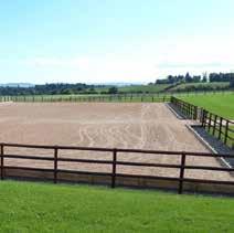
Formalised Sand Arena Configurations and Functional Design Elements
• one full-sized sand arena for Show Jumping,
• two smaller arenas which can be split for two dressage arenas, and the relocated baby arena (Learn to Ride area) has been retained and relocated into the corner North of its current location (grading and levels dependent .
Internal Equestrian facility fences – simple single rail fences around arenas and public gathering areas to prevent horse break out, especially when running events concurrently on the site.
• Improved Boundary Fencing to be able to manage site closure for events.
Removal of un-safe post and wire boundary fencing.
• Vehicular isolation from the Equestrian Facilities and open space network has provided more opportunities to define the type of revegetation works which can be achieved in the interstitial spaces of the site
• The following revegetation opportunities have been identified:
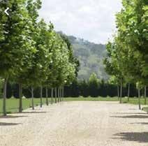
1. Avenue or row planting to define key points of access across the site
2. Selective Remnant and Indigenous Tree species planting in grass areas (species selected for their tolerance of horse trails running nearby.
3. Full Remnant Revegetation with understory
Baxter Park Equestrian Reserve Master Plan
Site Safety:
Site Safety considerations include:
Separation of the equestrian facilities from vehicle movement,
• Provision of secure fencing and lockable gates to be able to secure the site form public access during Equestrian events.
Driveway & Access
• Removal of Sages Road as main access gate to the site
• Separation of Emergency access from general access,
Sufficient fixe parking for Rallies in either option, with some overflow to show jumping areas if required. In summary, monthly event parking requirements are easily contained within the site.
• Carparking Overflow capacity is not shown, as we propose that this is managed through adjacent sites; however, there is overflow capacity in the show jumping arenas in either option for Cross Country events.
• Option 1 Design Notes
– Circuit access utilizing current drive within adjacent Recreation Reserve provides Entry (South) and Exit (East) Circulation system.
– If integrated as part of the Equestrian site (see fencing proposal) the driveway could have an easement for overflow parking beside it in the newly extended Equestrian reserve (Southern area).
– Ideally this access configuration would be from a new drive to the South of the Main Oval
SOUTHERN: Drawn at a 16.5 metres offset from the site Title Boundary in accordance with existing offset from Sages Road, (as per extent of offset noted in survey for Melbourne Water site).
• EASTERN: Drawn Parallel to existing drive from junction of fence line to DELWP dam project site.
Site Drainage
• Due to the grade across the site and well recognised inundation and drainage issues, integrated swale networks (adjacent to fences, driveways, or pathways) are indicated.
Equestrian Facilities Proposals
• New Trail extent through existing carpark zone brings events closer to spectators, and provides improved opportunities for improved understory vegetation under remnant tree species.
• Trail links (where provided in fenced corridors –Eastern boundary expansion zone) are provided at a minimum 15 m width to provide ample space for trail safety.
• Approximate existing trail length through broader Baxter park Recreation reserve for levels 1 & 2 trails is 1500metres
• Baxter Reserve additional Trail length Baxter Trail design provides sufficient space to allow re-design of level 1 and 2 trails within the Equestrian Reserve. Options should be considered for expansion of trails through Melbourne Water retention basin to ensure viability of these facilities.
• Capacity for two competition sized sand dressage arenas with 10m corridor between for marshalling and safety.
• Retains an open lawn area for grassed Show jumping which would also require some leveling work, but not as significant as what is required to maintain a full-sized sand arena.
• Option 1 Design notes:
– This option requires approx. 2metres of cut and fill to provide the level arena in this part of the site.
– Capacity for two competition sized dressage arenas with 10m corridor between for marshalling and safety
• Option 2 Design Notes:
– Minimal cut and fill required due to relatively open level ground.
– Capacity for two competition sized dressage arenas with 10m corridor between for marshalling and safety
– Provides additional space for considerable sized grass arena for Show jumping (some grading required)
• These facilities have been well considered and coordinated for both options.
• The true marshalling zones will be developed concurrently with the renewed trail design options for the site, dependent upon the preferred option.
HIGH PRIORITY PROJECTS
1. CLUBHOUSE (INCLUDES DEMOLITION OF EXISTING)
New single story clubhouse facility 275 sqm. Facility to include:DDA compliant bathrooms, first aid room and commercial grade kitchen and servery.
2. FENCING & GATE WORK
B. Pedestrian access gate & connection with formal pedestrian crossing at existing speed hump access to reserve.
C. Provide new pedestrian access gate and link to eastern side of creek line from More Croft way to allow access to broader reserve from the southwestern side once the bridge has been removed.
D. Provide new pedestrian chicane gates at all entrances
E. Vermin proof fencing to perimeter to protect habitat and reduce impact of dirt bikes in reserve.
3. IMPROVED EXISTING TRAILS
A. Reduce extent of open drain in this area for improved access & parking overflow during major events.
B. Reshape to reduce erosion & provide emergency vehicle access.
C. Trail consolidation and reduction. Council and Equestrian Clubs to work together to determine viable paths for retention and removal to reduce erosion and improve understorey re-vegetation opportunities.
4. RE-VEGETATION WORKS
A. Northern site expansion to Hunting tower Crescent to allow course expansion and additional revegetation works.
B. Remove existing “non-compliant” bridge crossing & perform bank remediation and re-vegetation work in conjunction with Melbourne Water creek-line management.
MEDIUM TERM PROJECTS
5. STORAGE SHED
A. Existing storage sheds decommissioned and removed from site upon completion of new storage shed.
B. New drive through equipment storage shed 220 sqm.
6. DRIVEWAY, YARDS & TREE PLANTING
Access trail drainage works to improve vehicular access.
7. WASH BAYS
Float parking and yards with 4 x Wash Bays in corners of zone. Water taps to be located every 6-8 bays.
8. SAND ARENA
Sand arena #01 main show jumping arena.
9. JUMP WORKS
A. Spectator area for water jump & cross-country course.
B. Redesigned water jump – competition style 360 degree “pond”.
10. NEW REVEGETATION ZONE WORKS
Re-vegetation opportunities.
LONG TERM PROJECTS
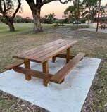
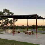
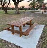
11. PICNIC AREAS SHELTERS & FURNITURE
New club social space & spectator zone comprising picnic settings, shade shelters and a drinking fountain with dog water tap.
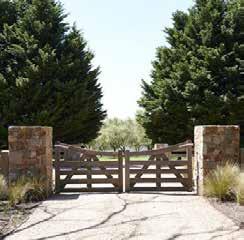
12. FEATURE ENTRY GATE
New equestrian reserve access gate & driveway
13. GRASS JUMPS/ARENAS
Grass jumps & warm up zones
14. SAND ARENA 2
Sand arena #02 (2 x dressage arenas)
15. SAND ARENA & LEARN TO RIDE
Sand arena #03 / learn2ride paddock (1 x dressage arena)
16. EQUESTRIAN SPINE
Equestrian spine – fenced & gated access for riders and pedestrians during events.
17. SITE BOUNDARY FENCING & GATE WORKS
A. Existing gate at corner of site removed.
B. Realign external access path through adjacent reserve to central gate.
ACCESS AND MOVEMENT
PEDESTRIAN ACCESS POINT
VEHICULAR ACCESS POINT

CROSS COUNTRY TRAIL
EQUESTRIAN SPINE (PEDESTRIAN + HORSE ACCESS ONLY)
VEHICULAR ACCESS ZONE
FENCING AND GATES


EXISTING FENCE TO BE RETAINED
PROPOSED VERMIN PROOF FENCE
PROPOSED DOUBLE RAIL FIXED FENCES
PROPOSED SINGLE RAIL
SEMI-TEMPORARY FENCES
SINGLE VEHICLE ACCESS GATE – 6 GATES
DUAL TIMBER PEDESTRIAN & EQUESTRIAN ACCESS
YARDS
PROPOSED STRUCTURES AND BUILT ELEMENTS


SHELTERS & FURNITURE
NEW CLUBROOMS & STORAGE SHED
WASH BAYS
REVEGETATION & DRAINAGE WORK


UNDERSTORY RE-VEGETATION TO EXISTING REMNANT VEGETATION
NEW RE-VEGETATION AREA
PROPOSED TREES
OPEN LAWN
CREEK AND DRAINAGE LINES
1:100 FLOOD ZONE
FLOAT PARKING, YARDS, WASH BAYS & DRIVE WAY
EQUESTRIAN SPINE AND CLUBHOUSE, DRIVE THROUGH STORAGE SHED & FACILITIES
SAND ARENAS 1,2 & 3 (LEARN TO RIDE)
REVEGETATION TO ENTRY AREA
HORSE YARDS X 48
3.6 x 3.6 METERS
FLOAT PARKING AND YARDS
Minimum Equestrian Victoria yard size is 3 x 3 metres. Yards to have chain gates to contain horses. Clubs to advise preferred size and configuration of Yards and parking to suit management of vehicle sizes.
WATER TAPS
Taps to yard areas as shown
4 IN TOTAL 3.6 x 3.6 metre concrete based wash bays. Drainage to underground drainage network associated with clubhouse works.
NEW OPEN GRASS TRAIL & JUMPS ZONE
Existing carpark area to be converted to open grass area with habitat re-vegetation to understorey areas. This will support the protection of existing remnant trees and allow for infill canopy planting to be undertaken.
NEW EQUESTRIAN RESERVE ACCESS GATE & DRIVEWAY
New access gate to the Reserve to be provided.
Access gate to be automated and Keypad or fob operated for ease of management, and to reduce waiting times when entering the site. Automated system to have ability to be disabled/locked during events to prevent vehicle/ horse conflict.
Public parking outside of gate to be formalised for event spectators and day-to-day reserve users.
LANGWARRIN EQUESTRIAN RESERVE – Equestrian Spine/Path and Trees, Clubhouse and Facilities
NEW DRIVE THROUGH STORAGE SHED & STORAGE YARD
Clubs to advise requirements for fit-out of storage shed and new storage yard for management of portable jumps and mulch. Clubs to advise whether on-site horse poo composting system (possibly just for use during events) would be viable.
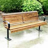
5 metre wide Granitic gravel path network connecting different Equestrian Facilities and providing contained movement zone for horses. Path to have open grass swale and avenue tree planting for shade and shelter. Park bench seats to be provided for spectators.
NEW CLUB-HOUSE & FACILITIES
New Clubhouse with changerooms and toilets inclusive of DDA compliant facilities, first aid room and commercial kitchen & servery.
FIXED BENCH SEATS
Seating along equestrian spine and at key locations for spectator use and informal “parkland seating”.
FEATURE TREES
Trees to be local Indigenous species to support Habitat corridors.
DRESSAGE ARENA OFFICIAL/JUDGING ZONES
Equestrian spine to be wide enough and have appropriate access for official judging vehicles to be parked on site during events.
NEW CLUB SOCIAL SPACE & SPECTATOR ZONE
Enclosed “horse-free” landscape zone surrounding Clubhouse and storage yard. Long term implementation of additional picnic tables and shelters for gathering and events. Provision of fixed bins and drinking fountain in this zone for public use.
EQUESTRIAN RESERVE – Sand Arena 1, 2 and 3, Warm-up Areas and Water Jump
Maintain existing open grass area with jumps for training and warm up area during cross country events and small dressage and show jumping events on Arena 1.
Open lawn area used for overflow parking during large events. In this instance, the central open grass area becomes the shared warm up zone for all sand arenas.
Maintain existing open grass areas for warm up area for all sand arenas. This area to be used as warm up area for Arena 1 when the Western area is required for overflow parking.
SAND ARENA #03 / LEARN2RIDE PADDOCK
Dedicated secure fenced arena for development of the Learn2Ride Program. This zone provides an opportunity to facilitate the future possible development of an RDA (Riding for the Disabled Association) program on site.
SAND ARENA #01 MAIN SHOW JUMPING AND 3 X DRESSAGE ARENA
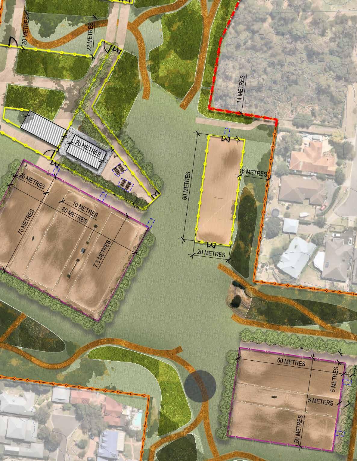
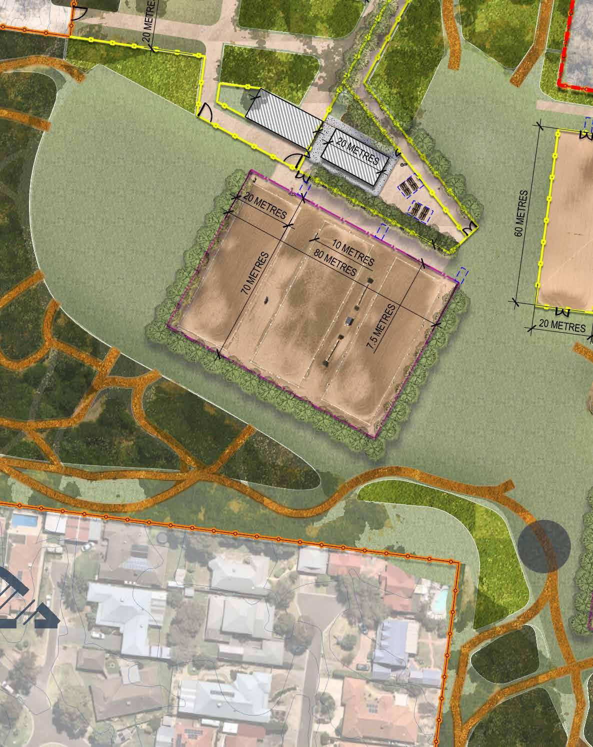
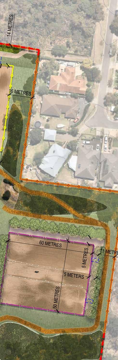
Realign and extend existing central sand arena to create new large arena (80 x 70 metres, comprising three 60 x 20 arenas with 10 metre central easements). Sand Arena to have fixed double rail timber fencing with gates to provide opportunity for use of arena for marshalling and cut through by cross country competition courses.
BANKS EVENT RE-DEVELOPMENT
Existing banks to be replaced with new engineered bank feature with reduced size. Revegetation to occur to steep slope to East of banks.
SAND ARENA #02
Realign and extend existing sand arena to create new double sand arena (60 x 50 metres, comprising two 60 x 20 arenas with 10 metre central easement) on level ground at Southern extent of site. Arenas 2 & 3 to have Double rail fixed fencing and gates as indicated.
NORTHERN SITE EXPANSION
Provide new boundary fence to Western edge of underutilised open space. Extend trail and revegetation works in this zone as part of the Equestrian facility.
PEDESTRIAN ACCESS GATES & CONNECTIONS
Provide lockable access gates to boundary fences, to secure site during equestrian events for both rider and pedestrian safety.
ACCESS AND MOVEMENT
PEDESTRIAN ACCESS POINT
VEHICLE ACCESS POINT
FEATURE GATEWAY
DRIVEWAY
EQUESTRIAN SPINE
NEW FOLD DOWN “ EQUESTRIAN EVENT IN PROGRESS – NO PUBLIC ACCESS ” SIGNS
EXISTING FENCELINES RETAINED
PROPOSED VERMIN PROOF FENCE
SINGLE RAIL SEMI-TEMPORARY FENCING
DOUBLE RAIL FIXED WOODEN FENCE


NEW CULVERT AND ACCESS DRIVE WORKS TO IMPROVE DRAINAGE
DRAINAGE
EPHEMERAL AND CREEKLINE VEGETATION

1:100 YEAR FLOOD
REVEGETATION TYPES

SWAMPY RIPARIAN WOODLAND


HEATHY WOODLAND
TRAIL WORKS
Partial trail removal to be co-ordinated by Council in consultation with clubs and cross country course designer to ensure that viable 3 metre competition trail options are maintained.

OPEN GRASS TRAIL & JUMPS ZONES
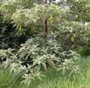
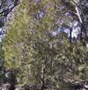
– Ecological Vegetation Classes Plant Selection
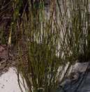
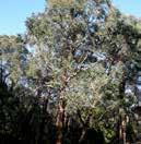
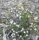
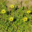
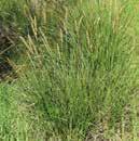
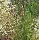
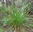
Spans a variety of geologies but is generally associated with nutrient-poor soils including deep uniform sands (aeolian or outwash) and tertiary sand/clay which has been altered to form quartzite gravel. Eucalypt-dominated low woodland to 10m tall lacking a secondary tree layer and generally supporting a diverse array of narrow or ericoid-leaved shrubs except where frequent fire has reduced this to a dense cover of bracken. Geophytes and annuals can be quite common, but the ground cover is normally fairly sparse.
TREES
Banksia marginata SILVER BANKSIA
SHRUBS
Ampera xiphoclada var. xiphoclada BROOM SPURGE
Eucalyptus obliqua MESSMATE STRINGYBARK
Dillwynia glaberrima SMOOTH PARROT-PEA
GRAMINOIDS (GRASSES AND GRASS LIKE PLANTS)
Leucopogon virgatus COMMON BEARD-HEATH
Monotoca scoparia PRICKLY BROOM-HEATH

radiata NARROW-LEAF PEPPERMINT

Gahnia sieberiana RED-FRUIT SAW-EDGE
PRIORITY WEEDS
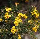
Priority weeds include Sweet Pittosporum, Capeweed and Coast & Sallow Wattle (evenly spread), Wandering Trad, Blackberry and Cocksfoot (along waterways), Kikuyu (encroaching in the southeast from mown lawns).
Acacia longifolia subsp. sophorae COAST WATTLE
Arctotheca calendula CAPEWEED
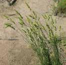
Dactylis glomerata COCKSFOOT
Pennisetum clandestinum KIKUYU
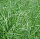
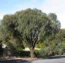
Woodland to 15m tall generally occupying low energy streams of the foothills and plains. The lower strata are variously locally dominated by a range of large and medium shrub species on the stream levees in combination with large tussock grasses and sedges in the ground layer.
TREES
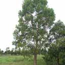
SHRUBS & HERBS


CROSS COUNTRY COURSE
INDICATIVE CROSS COUNTRY COURSE ALIGNMENT
LENGTH – 2120 METRES
SPECTATOR OPPORTUNITY
EVENT MARSHALLALING AREA
GRASS JUMPS & EVENT WARM UP ZONES
Maintain existing open grass area with jumps for training. Southern extent of this open area used as warm up zone for Arena #01; the main show jumping and 3 x dressage arena.
VET CHECK
FOLD DOWN EVENT SIGN
JUMPS IN ACCORDANCE WITH LANGWARRIN PONY CLUB JUMPS PLAN

CROSS COUNTRY EVENT PARKING
TOTAL FLOAT PARKS – 55 PARKS

1 STORAGE SHED (INCLUDES DEMO OF EXISTING)
2 DRIVEWAY, YARDS & TREE PLANTING
3 FENCING TO PARKING AREA 4 WASH BAYS 5 NEW TRAIL ALIGNMENTS 6 SAND ARENA 1
WATER JUMP
REMNANT VEGETATION ZONE WORKS 9 NEW REVEGETATION ZONE WORKS

1 PICNIC AREA , SHELTERS & FURNITURE 2 FEATURE ENTRY GATE 3 JUMP MARKERS & DIRECTIONAL SIGNAGE
SAND ARENA 2 5 GRASS ARENA / JUMPS AREA
BABY ARENA / LEARN TO RIDE
HIGH PRIORITY PROJECTS
1. CLUBHOUSE, KITCHEN & FENCING
New club social space & spectator zone
2. FLOAT PARKING & YARDS
3. WASH BAYS
4. TRAIL IMPROVEMENTS
A. EQUESTRIAN TRAIL NETWORK
3 metre wide (minimum) soil and mown grass trails, also used for walking, running and bird watching. Trails to be rejuvenated to reduce impact on adjacent tree roots and improve drainage for long term maintenance reductions.
B. OPEN GRASS TRAIL & JUMPS ZONES
Expanses of open grass between trail for flexibility in cross country course design and variable training conditions.
5. NEW SAND ARENA
6. NEW EMERGENCY VEHICLE ONLY & MAINTENANCE ACCESS
7. WATER JUMP
8. REMNANT REVEGETATION
REMNANT REVEGETATION WORKS ZONE
Priority weed eradication and understorey revegetation areas.
MEDIUM TERM PROJECTS
9. PUBLIC TOILET (FCC T.A.P.)
New toilet as per “FCC Public Toilet Action Plan (draft)” type 1 standard small facility.
10. LEARN TO RIDE
11. EQUESTRIAN SPINE
12. REMNANT REVEGETATION
REMNANT REVEGETATION WORKS ZONE Priority weed eradication and understorey revegetation areas.
LONG TERM PROJECTS
13. GRASS SHOW JUMPING AREA
14. UPGRADE GRASS ARENAS TO SAND
EXISTING GRASS ARENA
Existing grass Arena retained, with semi-permanent fencing managed by MPPC. Long-term potential for development into additional 4 x dressage sand arena Council to extend Baxter Park recycled water irrigation system to arenas for maintenance.
15. REMNANT REVEGETATION
LONG TERM REVEGETATION ZONES
Zones for potential revegetation to extent habitat connections and support remnant trees.
FUTURE DEVELOPMENT PROJECTS
16. OVERFLOW PARKING IN ACCORDANCE WITH BAXTER PARK MASTER PLAN
17. ARCHERY OVERSHOOT ZONE
18. (PENDING DELWP SAFETY PROJECT) AQUATIC RECREATION ZONE
Extent of DELWP wetland site reduced to reflect Archery Overshoot Zone.
Retain & reduce size of dam for recreation/wetlands/ biodiversity purpose. Investigate opportunities for new waterbody to improve drainage to north of site. Investigate opportunity for equestrian water crossing at eastern extent of site which does not impact biodiversity. Safety and access to be carefully assessed.
• Explore revegetation opportunities to support improved biodiversity.
• Ensure appropriate signage and fencing to support shared equestrian and pedestrian use.
• OPPORTUNITY FOR ADDITIONAL WATER CROSSING / JUMP – DELWP project to consider opportunity to include additional “water jump” on trail, separated from Aquatic zone by berm to reduce impact on Aquatic vegetation.
ACCESS AND MOVEMENT
PEDESTRIAN ACCESS POINT
VEHICULAR/MAINTANENCE ACCESS POINT
CROSS COUNTRY TRAIL
EQUESTRIAN SPINE
FENCING AND GATE
EXISTING FENCE TO BE RETAINED
PROPOSED VERMIN PROOF FENCE
PROPOSED DOUBLE RAIL FIXED FENCES
PROPOSED SINGLE RAIL SEMI-TEMPORARY FENCES
SINGLE VEHICLE ACCESS GATES
DUAL TIMBER PEDESTRIAN & EQUESTRIAN ACCESS GATES
YARDS
WASH BAYS
PROPOSED STRUCTURES AND BUILT ELEMENTS

SHELTERS & FURNITURE
REVEGETATION & DRAINAGE WORK


UNDERSTORY RE-VEGETATION ZONES
NEW RE-VEGETATION ZONES
MULCH UNDER EISITNG TREES
PROPOSED TREES
OPEN LAWN
CREEK AND DRAINAGE LINES
TRAIL DRAINAGE WORK
DETAILED DESIGN ZONES
FLOAT PARKING, YARDS, DRIVEWAY, WASH BAYS AND CLUBHOUSE, STORAGE YARDS & FACILITIES
GRASS SHOW JUMPING ARENA,WATER JUMP AND LEARN TO RIDE
EQUESTRIAN SPINE, SAND ARENA AND EXISTING GRASS ARENA
Extent of project to be developed pending review as part of DELWP dam safety project
REFER TO DETAIL PLAN – MP-BP 801
REFER TO DETAIL PLAN – MP-BP 802
REFER TO DETAIL PLAN – MP-BP 803
PARK EQUESTRIAN RESERVE – Reserve Entry, Driveway, Float Parking, Yards, Wash Bays, Clubhouse and Facilities
PUBLIC TOILET ACTION PLAN (DRAFT)
TYPE 1 STANDARD SMALL FACILITY
NEW STORAGE YARD Yard for management of Portable jumps and mulch. Clubs to advise whether on-site horse manure composting system (possibly just for use during events) would be viable.
Current schematic layout allows for 52 Yards at 3 x 3 metres. Yards to have chicane gates to contain horses. Clubs to advise preferred size and configuration of Yards and parking to suit management of vehicle sizes.
Council to provide a new access gate to the reserve. Access gate to be automated and Keypad or fob operated for ease of management, and to reduce waiting times when entering the site. Automated system to have ability to be disabled/locked during events to prevent vehicle/horse conflict.
WASH BAYS
Enclosed “horse-free” landscape zone surrounding Clubhouse and storage yard. Long term implementation of additional picnic tables and shelters for gathering and events. Provision of fixed bins and drinking fountain in this zone for public use.
Upgrades to clubhouses to include new commercial catering kitchen and vermin proofing.
3 IN TOTAL 5 x 5 metre concrete based wash bays. Drainage to underground drainage line to Eastern side of Equestrian spine path network.
PROPOSED SHELTER, PICNIC SEATING & DRINKING FOUNTAIN (TO MATCH BAXTER PARK)
– Grass SHow Jumping Arena, Water Jump and Learn to Ride
Proposed levelling of central open grassed area to provide clear 60x50metre show jumping arena. This area is not fenced on the Eastern side to allow for its inclusion in Cross Country Courses.
Proposed new water jump to edge of show jumping arena for use in general jumping events, training facilitation and as part of Cross Country courses. Jump to be designed and funded by MPPC with structural landform and drainage engineering support by Council.
Dedicated secure paddock for development of the Learn2Ride Program. Existing trees fenced for safety of beginner riders, and mulched to protect trees and reduce weed growth and likelihood of snakes in this space. This zone provides an opportunity to facilitate the development of an RDA (Riding for the Disabled Association) program on site also.
– Equestrian Spine, Sand Arena and Existing Grass Arena

5 metre wide Granitic gravel path network connecting different Equestrian Facilities and providing contained movement zone for horses. Path to have open grass swale and avenue tree planting for shade and shelter. Park bench seats to be provided for spectators.
Seating along equestrian spine and at key locations for spectator use and informal “parkland seating”.
ACCESS GATES
Clubs to be consulted on the most convenient alignments for access gates to Equestrian Spine.
FEATURE TREES
Trees to be local Indigenous species to support Habitat corridors.
Continue management of open grass arena with semi-permanent single rail fencing to allow for flexibility in event management. Consider options for long term renovation of grass arena into 4 x dressage arenas, ensuring that site complies with EV (Equestrian Victoria) minimum event facility requirements.
SAND ARENA
Provision of a new double sand arena (60 x 50 metres, comprising two 60 x 20 arenas with 10 metre central easement) on level ground at Southern extent of site.
ACCESS AND MOVEMENT

CROSS COUNTRY TRAIL
PEDESTRIAN ACCESS POINT
VEHICLE/MAINTENANCE ACCESS POINT
FEATURE GATEWAY
DRIVEWAY
EQUESTRIAN SPINE
NEW FOLD DOWN “EQUESTRIAN EVENT IN PROGRESS – NO PUBLIC ACCESS” SIGNS.
FENCING TYPES
VERMIN PROOF FENCE & AIRLOCK GATES
PROPOSED 2M CHAINWIRE FENCE
SINGLE RAIL SEMI-TEMPORARY FENCING
DOUBLE RAIL WOODEN FENCE
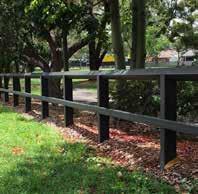
DOUBLE RAIL FENCE
‘FEATURE GATEWAY’ ENTRANCE
VERMIN PROOF BLACK CHAINWIRE BOUNDARY FENCING AND GATES TO COUNCIL STANDARDS
EMERGENCY AND MAINTENANCE ACCESS GATE
The Sages Road access gate is to be moved closer to the road allowing an easement for maintenance and emergency vehicle access only.’ Development of the trail link over the existing internal drive link to Baxter reserve to be retained for emergency vehicle access and Left-hand turn “exit only” use during large events to reduce traffic impacts in Baxter Park. BAXTER PARK EQUESTRIAN RESERVE – Fencing, Access and Signage
Extent of project to be developed pending review as part of DELWP dam safety project
DRAINAGE
TRIAL RECONSTRUCTION INCLUDING DRAINAGE WORK
REVEGETATION TYPES

HEATHY WOODLAND


GRASSY WOODLAND
OPEN GRASS TRAIL & JUMPS ZONES
EPHEMERAL AND CREEKLINE REVEGETATION
EPHEMERAL AND CREEKLINE REVEGETATION OPPORTUNITIES
OPEN GRASS SWALES
MELBOURNE WATER RETARDING BASIN ZONE
Council to ensure that the MW retarding basin proposal considers the provision of access for a walking trail in line with maintenance access requirements for the basin. This trail could be used for major EV events within the reserve on an annual basis.
Spans a variety of geologies but is generally associated with nutrient-poor soils including deep uniform sands (aeolian or outwash) and Tertiary sand/clay which has been altered to form quartzite gravel. Eucalypt-dominated low woodland to 10m tall lacking a secondary tree layer and generally supporting a diverse array of narrow or ericoid-leaved shrubs except where frequent fire has reduced this to a dense cover of bracken. Geophytes and annuals can be quite common but the ground cover is normally fairly sparse.
TREES
Eucalyptus
MESSMATE TRINGYBARK
SHRUBS & HERBS
Leptospermum
Sweet Pittosporum and Coast & Sallow Wattle (evenly spread and very dominant) and Wild Tobacco Tree (evenly spread though only scattered occurrences), numerous garden escapees/planted exotic trees (especially in the south).
Pittosporum undulatum
A variable open eucalypt woodland to 15 m tall or occasionally Sheoak woodland to 10m tall over a diverse ground layer of grasses and herbs. The shrub component is usually sparse. It occurs on sites with moderate fertility on gentle slopes or undulating hills on a range of geologies.
SHRUBS & HERBS TREES
GRAMINOIDS (GRASSES AND GRASS LIKE PLANTS)
INDICATIVE CROSS COUNTRY COURSE ALIGNMENT
ESTIMATE LENGTH – 2200M
SPECTATOR OPPORTUNITY
EVENT MARSHALL
WARM UP
VET CHECK
EQUESTRIAN TRAIL – Cross Country Course Typical Section (with Drainage)
Key recommendations resulting from the development of the Equestrian Master plan are:
General Equestrian Reserve Implementation Recommendations (both sites):
1. SECURE TENURE. Council is to provide an updated lease agreement to ensure clear parameters with regards to the maintenance of the Equestrian reserves. Final Masterplan to be inclusive of zones of management mapping and trail design and implementation guidelines. The tenure should also include communication protocols between clubs and Council.
2. HABITAT PROTECTION: Prioritise zones of remnant vegetation for protection and rehabilitation.
3. PARKING & YARDS: Provide clear vehicle access parameters for during club rallies as the main priority. This is via the implementation of float parking and yard zones, which are to be fenced so that there is reduced risk of conflict between cars and riders on the site.
4. FIT FOR PURPOSE EQUESTRIAN FACILITIES: Support the clubs to develop “fit for purpose” facilities to extend their capacity and viability within the sites. For Langwarrin this is the provision of a new clubhouse and extended trail length and for Baxter, this includes the upgrade of their kitchen facilities and the development of a Sand Arena and redevelopment of their water jump to ensure they meet Equestrian Victoria facility guidelines and are enabled to host major competitions.
5. SUPPORT & FACILITATE EVENTS. The main revenue for Pony Clubs is through the running of major events. Council is to provide support to the Pony clubs in the setting up of these events to ensure they are safely run and well supported by the surrounding community.
6. VIABLE TRAILS: Both sites require immediate work to consolidate and improve their crosscountry trails. The trails are to be assessed and a program set up for their renovation, and realignment as needed. In Baxter Park the priority is the improvement of trail drainage as the site is un-usable during periods of wet weather.
7. SITE EQUESTRIAN ASSETS. Course jump site numbers to be added to Council’s GIS network to enable clear communication between clubs and Council about issues on site.
Langwarrin Equestrian Reserve Implementation Recommendations:
8. CLUBHOUSE REDEVELOPMENT: The Langwarrin site is in immediate need for the development of a new clubhouse with amenities to bring it in line with other recreational clubs within the Municipality. The priority in this instance is the delivery of a “fit for purpose” clubhouse building with integrated amenities for both equestrian and public use, and be accessible and secure.
9. REMNANT VEGETAITON PROTECTION: Key Flora and Fauna Habitat zones to be identified and secured. South Western Remnant Vegetation Zone closure. The existing bridge over the creek-line is to be safely removed and new access provided via the proposed pedestrian easement on the Eastern side of the creek.
Baxter Park Equestrian Reserve Implementation Recommendations:
1. PROVIDE SAFE ACCESS: The Baxter Site requires the urgent redevelopment of safe access the site, (via Baxter Park Reserve proper). This will enable a major reconfiguration of the site to enable the development of a new double sand arena, grass show jumping area and new water jump.
The diverse and unique nature of these sites, and their use both offer the potential for a diverse range of shared funding opportunities which should be embraced by Council. Some of the considerations for funding are:
• Unique recreational type (opportunities to support and develop Equestrian by improving access for children in urban and suburban environments)
• Facilitation of recreational pursuit with dominated interest by girls and women (Female participation in sport funding)
• Regional funding for Habitat corridor linkages (impact of the remnant vegetation on corridors of local, regional and even state significance)
Ecology and Habitat restoration funding (general)
• Melbourne Water corridor / infrastructural development opportunities
• DEECA connections/opportunities
The below lists, detail the estimate of cost and proposed priority project implementation program over the next 20 years for the Equestrian Sites.
Langwarrin Equestrian Reserve Project Prioritisation
HIGH PRIORITY PROJECTS
1 CLUBHOUSE (includes demo of existing)
2 Fencing
3 CCTV & Security Upgrade
4 Improve Existing Trails
5 Portable Jumps
6 Remnant Vegetation Zone Works
1 STORAGE SHED (includes demo of existing)
2 Driveway, Yards & Tree Planting
3 Fencing to Parking area
4 Wash Bays
5 New Trail alignments
6 Sand Arena 1
7 Water Jump
8 Remnant Vegetation Zone Works
9 New Revegetation Zone Works
LONG TERM PROJECTS
1 Picnic Area, Shelters & Furniture
2 Feature Entry Gate
3 Jump markers & Directional signage
4 Sand Arena 2
5 Grass Arena / Jumps area
6 Baby Arena / Learn to ride
7 Equestrian Spine & Furniture
8 Remnant Vegetation Zone Works
9 New Revegetation Zone Works
10 Site Boundary works, fencing and gates
Baxter Park Reserve Project Prioritisation & Cost Estimates
HIGH PRIORITY PROJECTS
1 CLUBHOUSE KITCHEN & FENCING
2 PARKING, YARDS & DRIVEWAY
3 FLOAT PARK FENCING & ENTRY GATE
4 WASH BAYS
5 TRAIL IMPROVEMENTS
6 SAND ARENA ***
7 NEW EMERGENCY VEHICLE ACCESS
8 GRASS WARM UP TO SAND ARENA 9 WATER JUMP *** 10 REMNANT REVEGETATION
MEDIUM TERM PROJECTS
1 CLUBHOUSE LANDSCAPE 2 PUBLIC TOILET (FCC T.A.P) 3 SEWERAGE & CCTV 4 LEARN TO RIDE 5 EQUESTRIAN SPINE
6 REVEGETATION WORKS
LONG TERM PROJECTS
1 NEW TRAIL ALIGNMENTS
2 SAND ARENA FENCING
3 GRASS SHOW JUMPING ARENA
4 UPGRADE GRASS ARENA TO SAND
5 REVEGETATION WORKS
6 JUMP MARKERS /SIGNAGE
7 REVEGETATION WORKS
8 BOUNDARY FENCING