30 Davey Street, Frankston PO Box 490 Frankston Vic 3199
Phone: 1300 322 322
Email: info@frankston.vic.gov.au
Web: Frankston.vic.gov.au
Acknowledgments
TCL acknowledges the collaborative process undertaken with Frankston City Council.
We also thank the involvement with Bunurong Land Council consultants Adam MacGennis, Glenn Pellegrin and Ane Van Der Walt
Department of Transport
Genderworks
The Taylor Cullity Lethlean staff, Perry Lethlean, Kate Grant, Michelle Lam & Greg Afflick.
BOULEVARD MASTERPLAN
Project Team
Frankston City Council acknowledges the Bunurong people of the Kulin Nation as the Traditional Custodians of the lands and waters in and around Frankston City, and value and recognise local Aboriginal and Torres Strait Islander cultures, heritage and connection to land as a proud part of a shared identity for Frankston City.
Council pays respect to Elders past and present and recognises their importance in maintaining knowledge, traditions and culture in our community.
Council also respectfully acknowledges the Bunurong Land Council as the Registered Aboriginal Party responsible for managing the Aboriginal cultural heritage of the land and waters where Frankston City Council is situated.
Glossary Of Terms
Abbreviations
BBV Better Boating Victoria
BLCAC Bunurong Land Council Aboriginal Corporation
DEECA Department of Energy, Environment and Climate Action (formerly DELWP)
DTP Department of Transport and Planning (formerly Department of Transport)
FMAC Frankston Metropolitan Activity Centre
GIA Gender Impact Assessment
M&P Movement and Place
PTV Public Transport Victoria
SUP Shared Use Path
RAP Registered Aboriginal Party
TPZ Tree Protection Zone
VAHC Victorian Aboriginal Heritage Council
Project Terminology
Accessibility - Relates to (the legal requirement for) persons with disabilities having equal opportunity to access places used by the public.
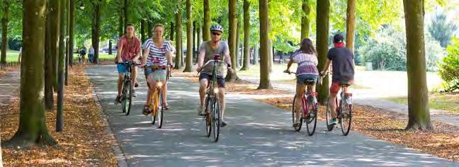
Active transport - Active transport is defined as physical activity undertaken as a means of transport and not purely as a form of recreation.
Activity centres - An area that provides for shopping, services, employment, housing, transport and social interaction. Activity Centres are commonly know as town centres.
Biodiversity - Biodiversity is the variety of all living things - the different plants, animals and micro-organisms and the ecosystems of which they are a part.
Canopy Tree – Is usually a single trunked tree with a spreading canopy providing shade to the ground below.
Carbon sequestration The process of the removal and storage of carbon dioxide from the atmosphere in carbon sinks (such as forests, woody plants, or soils).
Gender Impact Assessment - provides an assessment and understanding of the gendered impacts of a project or policy
Integrated public art – Is artwork that is incorporated into the design of public spaces such as a streetscape or landscape design and may include technology including lighting and sound as well as traditional object-based art forms or murals.
Passive Irrigation - Involves the diverting stormwater to deliver water to urban trees, open space and vegetation through water sensitive urban design. This process supports tree & plant growth and can filter pollutants improving water quality discharging into waterways and the Bay.
Principal Bicycle Network (PBN) - A network of proposed and existing cycle routes that help people cycle for transport and provide access to major destinations in Victoria. Cycling for transport includes riding bicycles to work, to school, shopping, visiting friends etc.
Strategic Cycling Corridors (SCC) - Strategic Cycling Corridors (SCC) are important transport routes for cycling and are a subset of the Principal Bicycle Network (PBN). The SCC network supports the needs of commuter trips (to work or education). Which includes important trips, such as stations, shops or schools.
Principal Pedestrian Network (PPN) - was developed by the Victorian Government to facilitate network planning for walking. It aims to support and encourage walking by identifying routes that have the potential to carry more pedestrians walking to key destinations.
Public realm - The public realm comprises spaces and places that are open and freely accessible to everyone, regardless of their economic or social conditions. These spaces can include streets, laneways and roads, parks, public plazas, waterways and foreshores. Public realm structure delivers the location of and connection to destinations and activities. It includes layout and detailed design to support the function and amenity of streets, public spaces, public transport access and the interface between the public realm and private property.
Public Space - A public space is a place that is open and accessible to the general public.
Swale - Swales are a linear, depressed channels that collect and transfer storm water.
Streetscape - The visual elements of a street, including the road, adjoining buildings, street furniture, trees and open spaces, etc, that combine to form the street's character.
Urban heat island - Urban Heat Island is an urban area that’s warmer than its surroundings due to the amount of hard surfaces and inadequate green infrastructure (such as tree canopy and vegetation). These hard surfaces absorb and store heat resulting in higher temperatures.
Water sensitive urban design (WSUD) - Water Sensitive Urban Design (WSUD) is the integration of water cycle management into urban planning and design. The key principles of WSUD are to:
• protect and enhance natural waterways
• treat and improve stormwater quality
• integrate stormwater into the landscape
• reduce rainfall runoff and peak flows (flood minimisation)
Wayfinding - The term wayfinding encompasses the way we navigate and spatially orient ourselves within spaces and from place-to-place. Wayfinding can include physical elements such as signage designed specifically to assist in the process of orientation and navigation through the use of map, directional and location information.¬¬
Granitic path - A path made from fine, crushed rock, usually compacted for improved accessibility and to reduce displacement of material. This treatment offers an informal and often more permeable solution to concrete or asphalt paths.
Trafficable turf cells - A plastic structural grid system that creates a strong base hidden beneath the surface of the turf. This treatment allows vehicles to travel along the surface without damaging the ground or turf.
Nodes - Points of intersection, interest or destinations within a landscape where users can rest, engage with the space and access amenities that make their experience more enjoyable. They are typically finished to a high quality compared to other areas in the design, as these are areas where people will dwell for longer. Hardstand
A surface treatment, typically non-permeable, such as asphalt, concrete, or pavers.
ESD Environmentally Sustainable Design - The purpose of Environmentally Sustainable Design is to reduce impacts in the construction and use of buildings on the natural environment, whilst improving the comfort of the inhabitants
20-Minute Neighbourhood - The 20-minute neighbourhood is all about ‘living locally’— giving people the ability to meet most of their daily needs within a 20-minute return walk from home, with access to safe cycling and local transport options.
Sharrows - Derived from “share” and “arrow,” sharrows are road markings that indicate how a road or path should be used by bike riders when the roadway is shared with motor vehicles
Night Time Economy (NTE) - Refers to retail and hospitality activity occurring after the conclusion of ‘normal’ business hours (around 5 or 6pm). Broadly, most NTE activities occur in the hours before midnight, though in some centres there may be a role for activities beyond midnight, extending to 6am.
Climate-resilient - Relates to the ability to recover from, or to mitigate vulnerability to, climate-related changes. In the context of this project, climate resilience refers to infrastructure and plants more likely to tolerate longer-term climate changes relating to global warming (e.g., increasing temperatures).
Usable open space - Public land or waters that provide for one of the following purposes: outdoor recreation, leisure, environmental and cultural benefits or visual amenity and offroad active transport. Usable open spaces are publicly available areas that can be used for passive or active recreation. Planning usable open space which caters for current and future community needs is critical as our cities become increasingly dense in population and infrastructure
Executive Summary
Frankston City Council is planning for the transformation of Nepean Highway into a safe, connected and vibrant Boulevard as an integral part of the revitalisation of Frankston’s city centre. We have clearly heard the feedback from our community, that Nepean Boulevard needs to be a focus for improvement to promote and support a liveable city centre.
Connecting City, Creek and Coast, the Nepean Boulevard Masterplan is an extension of strategic direction developed through overarching Council policy and plans, including the Frankston City Council Plan builds on recent Victorian Government changes to create a safe road environment for everyone.
The Nepean Highway is a State Government arterial road with parts of the street verges and medians managed by Council. The Masterplan supports Council stewardship and advocacy across all levels of government to meet our community’s needs both now and into the future. Without coordination, we risk adopting competing strategies, or none at all, failing to meet community expectations. This is an emerging issue given the changing land use and uplift anticipated through the Frankston MAC. With anticipated transformational
development, the population of the Nepean Boulevard corridor is set to grow and it is important to plan for the needs of new and existing residents.
The Nepean Boulevard Masterplan provides a framework and holistic approach to traffic, active transport, urban design and public realm improvements. It identifies the role the Nepean Boulevard can play in creating a vibrant, connected and liveable city, which in turn supports the community to participate in social, active transport, recreational and commercial activities.
The Masterplan also recognises the importance of investment opportunities at the Victorian and Federal Government level which will ensure there is better alignment between funding streams, major projects and local priorities.
For Frankston to become a more attractive destination to live, work and visit, it is vital we create sustainable, active and integrated transport opportunities. Walking and cycling must be a safe, accessible, equitable and an attractive part of our City. Through the Nepean Boulevard Masterplan, Frankston City is advocating and innovating to improve the liveability of our city centre.
Project Overview
Extent of the Masterplan
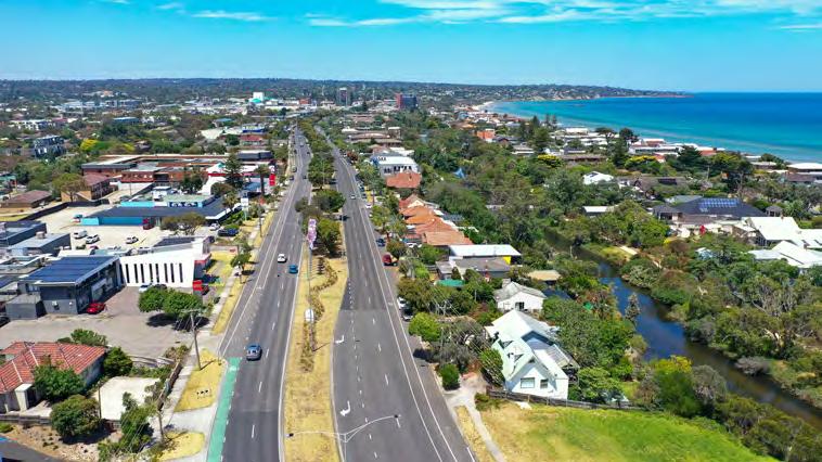
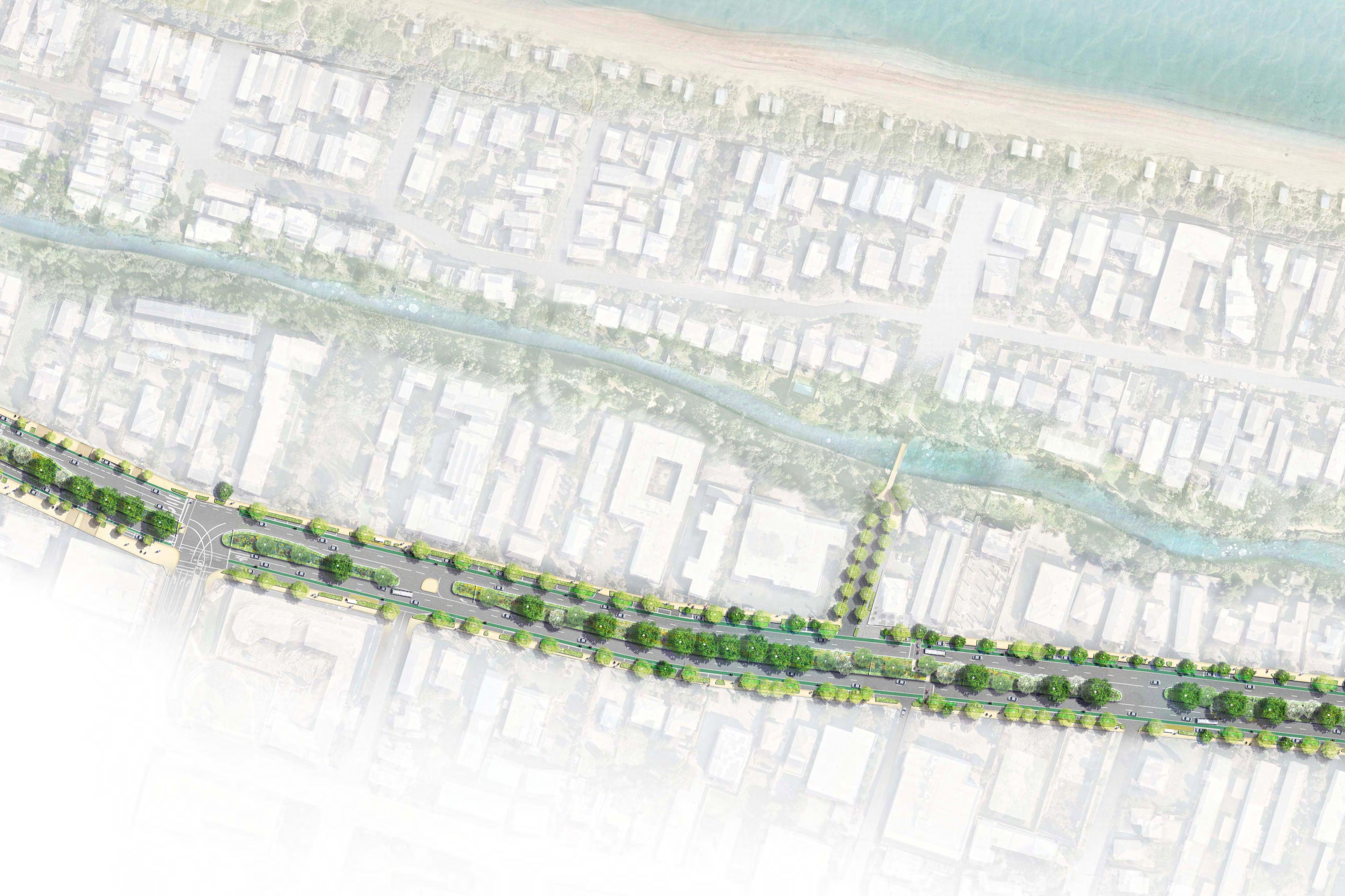
The Masterplan guides the transformation of the Nepean Highway from a car dominated experience to a memorable people focussed Boulevard. It will facilitate connections between the City, Kananook Creek and Coast provide a generous public realm to foster new street life, support new residential and commercial opportunities and reinforce its green credentials with new avenue plantings along its length.
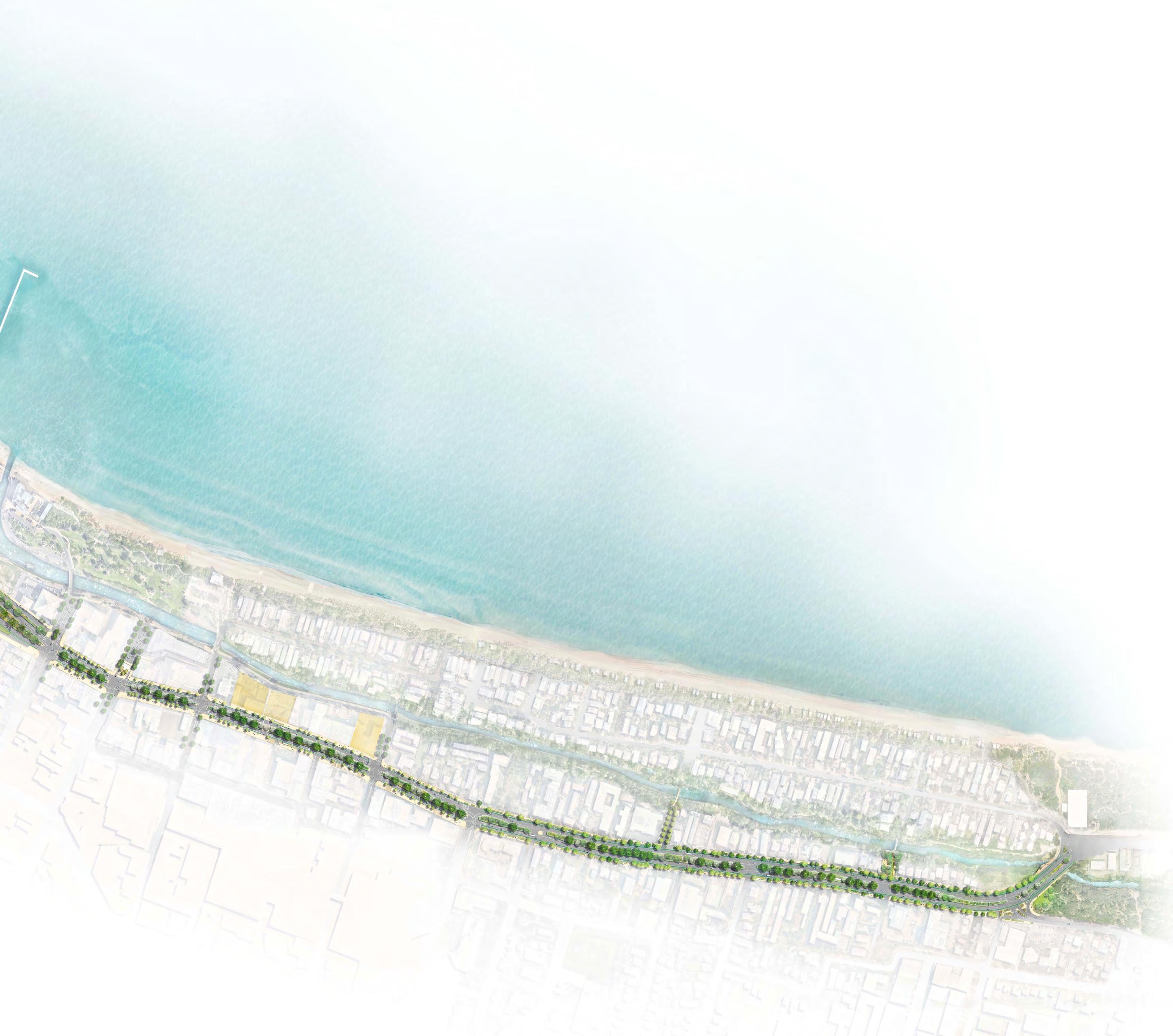
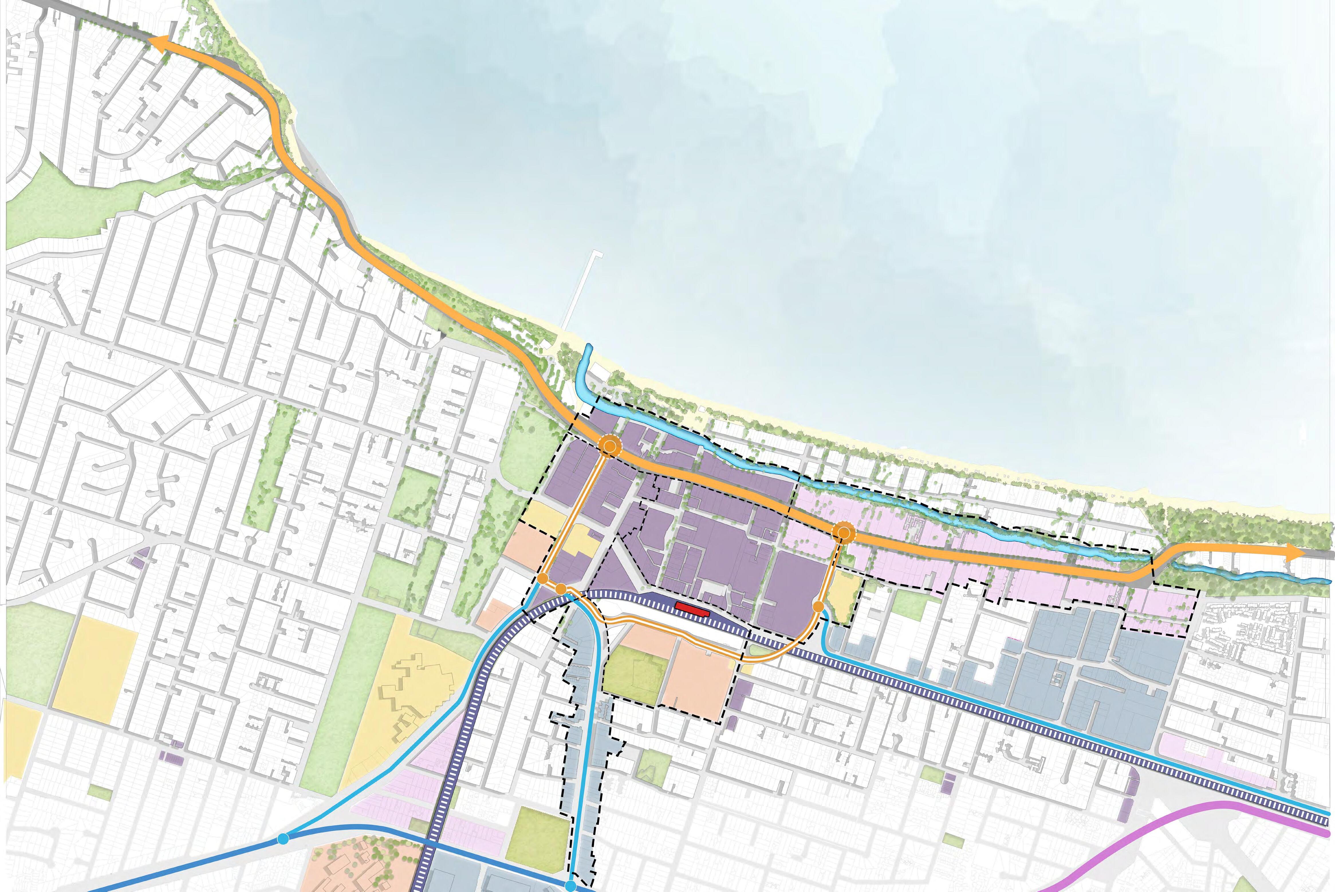
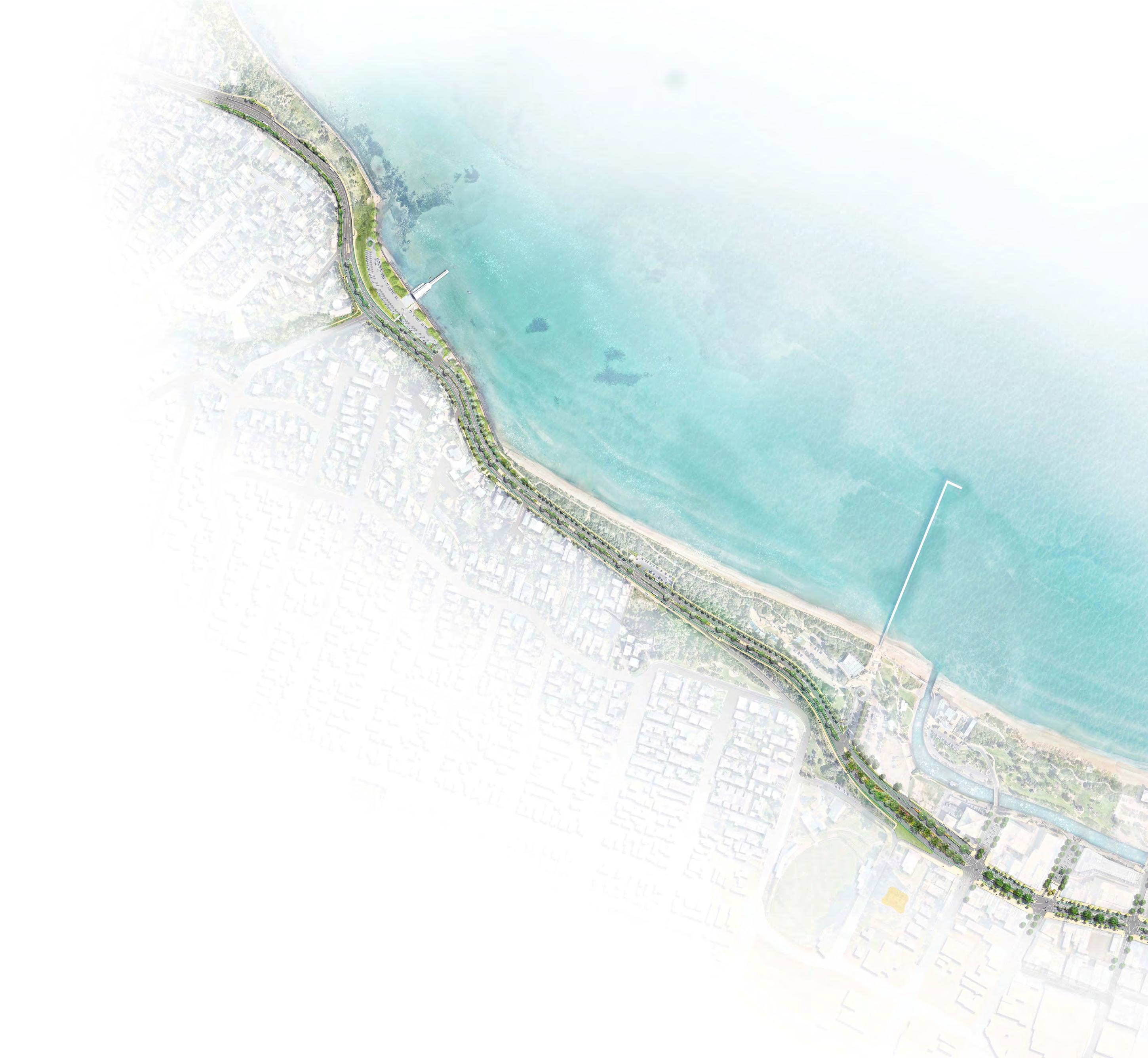
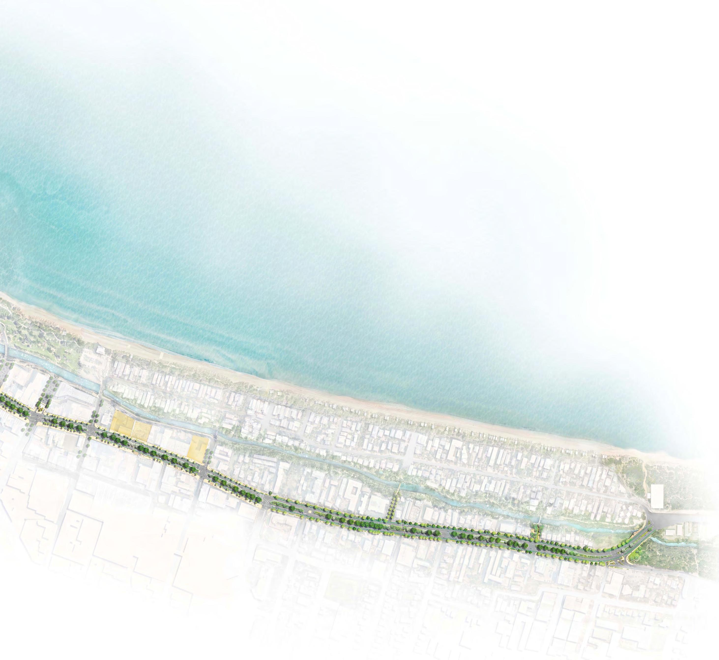
The Masterplan study area comprises 3.7km of Nepean Highway, beginning at Mile Bridge, Kananook Creek in the North, traversing through Frankston Metropolitan Activity Centre (MAC) and terminating at Oliver's Hill lookout in the South. The focus of the Masterplan includes the road corridor, landscape and public realm spaces and connecting streets.
Purpose of the Masterplan
Connecting City, Creeks and Coast: A Masterplan for the Nepean Boulevard is intended as a guiding document to support engagement with our community and key stakeholders about their priorities for Nepean Boulevard as a place, a destination and a movement corridor.
The Masterplan:
• Outlines a design framework and identifies key themes for the new Nepean Boulevard.
• Identifies projects and key areas for advocacy, coordination and staged implementation.
• Outlines a comprehensive overarching planting strategy to improve the identity, arrival and experience of the Boulevard.
• Guides public realm outcomes for future development along the Nepean Boulevard.
• Provides transport improvement ambitions for ongoing collaboration with Department of Transportation and Planning (DTP)
Developing the Masterplan
The masterplan is an extension of the Frankston City Council Plan 2024-2028 and the Frankston MAC Structure Plan (2023), which identifies the need for a Masterplan of the Nepean Highway to support a thriving economy and revitalisation of the City. A Nepean Boulevard vision document was subsequently prepared to develop an overarching strategy for the road corridor. Other informing documents include the Frankston Integrated Transport Strategy 2022, Frankston Riding Strategy 2024, Safer Communities Strategy 2023 and Frankston Coastal Marine Management Plan, 2024.
The Masterplan has been developed through extensive analysis, various site visits, consultation with stakeholders and the broader community and coordination with a specialist multi-disciplinary consultant team including Council officers. It has included a thorough analysis of the road corridor and its context which considered traffic, landscape, built form and engineering matters. This analysis was supported by stakeholder consultation and workshops.
A vision and key themes for the Boulevard was developed that encompassed, cultural, environmental, social and transport topics. These provided the foundation for the identification of design orientated masterplan opportunities represented in the report, which are organised via three defined precincts along the Boulevards length.
The report concludes with planting, material, art and furnishing opportunities to guide a consistent quality of public amenity. As well as the identification of early works and quick win opportunities.
1.0 Introduction
Introduction
The Masterplan outlines key strategies to ensure Nepean Boulevard becomes an attractive, active, people focussed destination, that captures the beauty of its setting alongside Kananook Creek and the Bay.
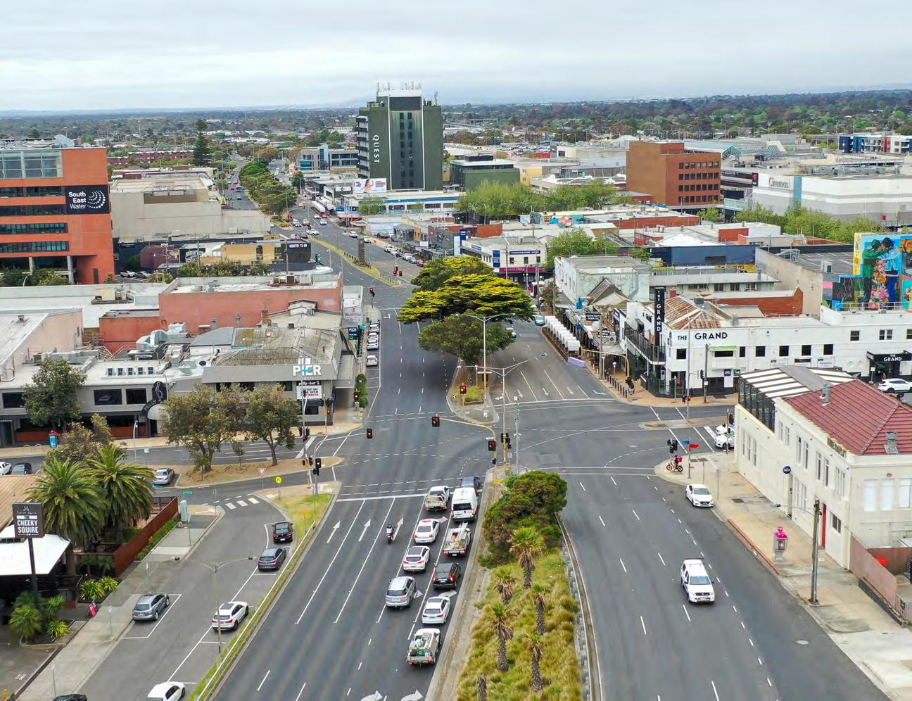
Historically, Nepean Highway was a popular link between the City and Peninsula as well as an important civic and retail address for Frankston. While recent development has shifted commercial vitality towards the rail station, the Nepean remains a vital piece of Frankston’s urban fabric, strategically situated between the foreshore and the City.
The Masterplan provides a holistic approach for its evolution from Highway to Boulevard and identifies key initiatives and improvements to ensure it becomes a cherished part of the City and community. With its generous scale, iconic trees and ideal location, the Nepean is well placed to be transformed into a beautiful Boulevard experience and revitalised heart of Frankston. The Boulevard will facilitate connections between the City and the Foreshore, provide a generous public realm to foster new street life, support new residential and commercial opportunities and reinforce its green credentials with new avenue plantings along its length.
The Masterplan builds upon the Nepean Boulevard Vision developed in 2022 and is informed by the community engagement and stakeholder workshops undertaken during this time.
The Masterplan process began with an in-depth site appraisal of the 3.7km stretch of road from Mile Bridge, Kananook Creek though to Olivers Hill, including landscape, lighting, traffic and engineering analysis. Key transport initiatives were developed collaboration with Council stakeholders as well as liaison with the Department of Transport and Planning (DTP) to ensure the delivery of a safe and connected Boulevard was part of a broader transport perspective. These were also informed by a Movement and Place Analysis as well as preliminary transport modelling.
Subsequent stages to the Masterplan will continue with consultation processes, liaison with key authorities, and necessary traffic modelling to inform ongoing refinement of the identified initiatives and key implementation projects.
The Masterplan ultimately outlines a plan to meet community aspirations for a Boulevard that is safe, connected and a vibrant part of Frankston’s city centre.
Strategic Context
Informing Documents
The transformation of Nepean Highway into a Boulevard has been a long identified opportunity and action in numerous endorsed Council strategies and plans. In addition to community and key stakeholder feedback, the master plan is informed by relevant endorsed strategies and plans.
The Frankston Metropolitan Activity Centre (FMAC) Structure Plan 2023 is a foundational document in the background and development of the Nepean Boulevard Masterplan.
It sets out a framework to guide development within the FMAC providing direction on land uses, housing, built form, employment, streetscapes and open space, and movement and transport. It identified the Nepean Boulevard as an important strategic initiative for the future of Frankston and articulated the need for a detailed masterplan to guide its transformation.
Six Precincts were identified within the FMAC which are broadly defined by their location within or adjacent to land uses, road, and rail infrastructure.
While the Structure Plan influences the Nepean Boulevard Masterplan holistically, it also specifically cites the Nepean Boulevard Masterplan as a key action for Project Area 6 (Nepean Boulevard Central Precinct) and recommends the following:
• Increased footpath space to support outdoor dining enable retail uses to spill out into the street space.
• A distinctive sense of place, with high quality pavements, furnishings, lighting and signage
• Additional tree planting within the median and along the retail edge to reinforce the iconic Fig trees.
• WSUD treatments to improve environmental performance of the highway.
• Bike lanes in each direction.
These initiatives aimed to improve arrival experiences, provide a green outlook, improve pedestrian connectivity and create a beautiful setting for people living, working or visiting the precinct.
The Nepean Boulevard Masterplan builds upon these recommendations and includes additional strategies to ensure the overall objectives of the Structure Plan are achieved.
Safer Communities Strategy
Connecting City, Creek & Coast Draft Nepean Boulevard Master Plan
Coastal Marine Management Plan
Nepean Boulevard Early Works Implementation
Frankston Integrated Transport Strategy Nepean Boulevard Master Plan Implementation
Nepean Boulevard Vision
Structure Plan
Nepean Boulevard Project
Project Scope
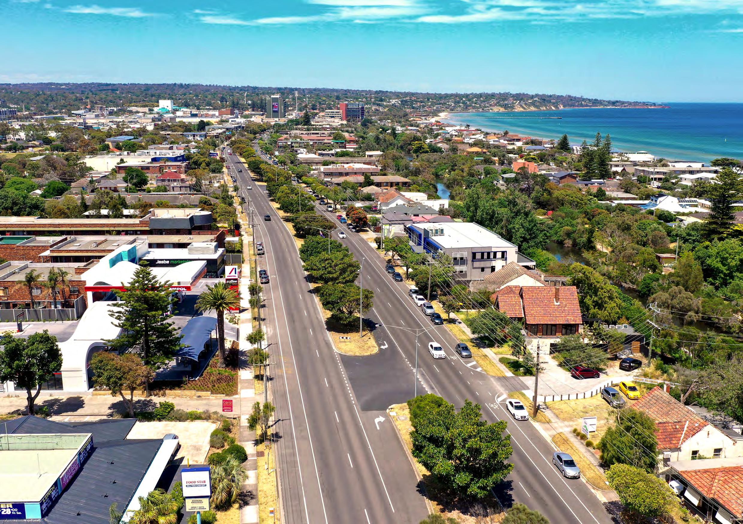
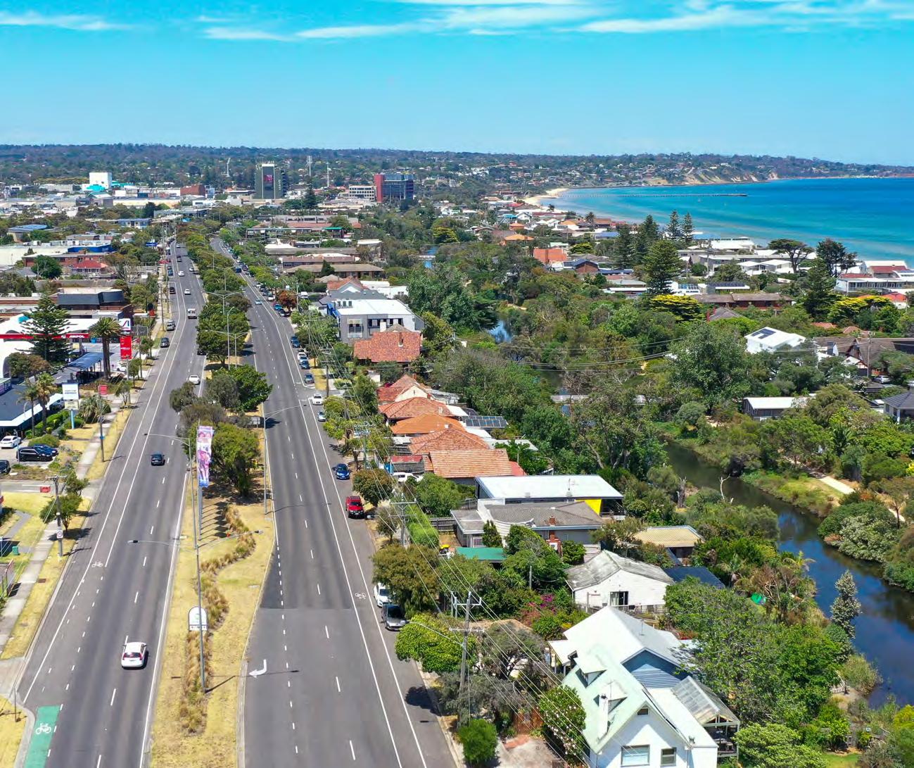
The site comprises 3.7km of Nepean Highway from Mile Bridge, Kananook Creek in the north to Olivers Hill in the south. The primary focus of the Masterplan is the streetscape and public space interfaces of the Nepean Highway.
To inform the Masterplan, a thorough analysis and understanding of its broader landscape and urban context has been undertaken.
Anticipated adjacent future land-uses and development has also been considered in the design response, however the future built form and land-use development outcomes are controlled through the FMAC Structure Plan.
The Nepean Highway is a key arterial road that connects to the FMAC from both the north and south. It acts as a gateway to the FMAC and the Mornington Peninsula and links the Frankston Foreshore and the Frankston retail and entertainment precincts.
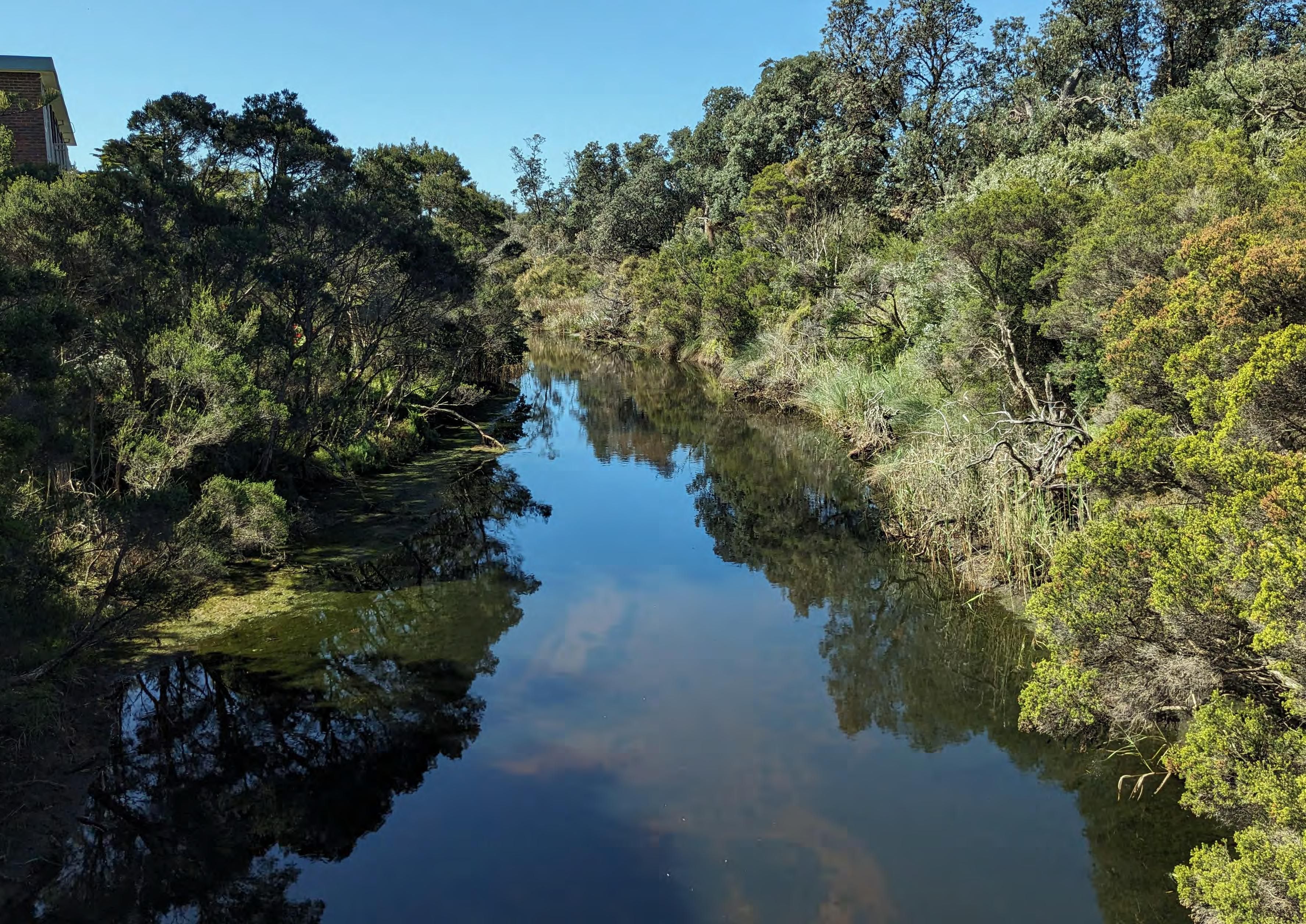
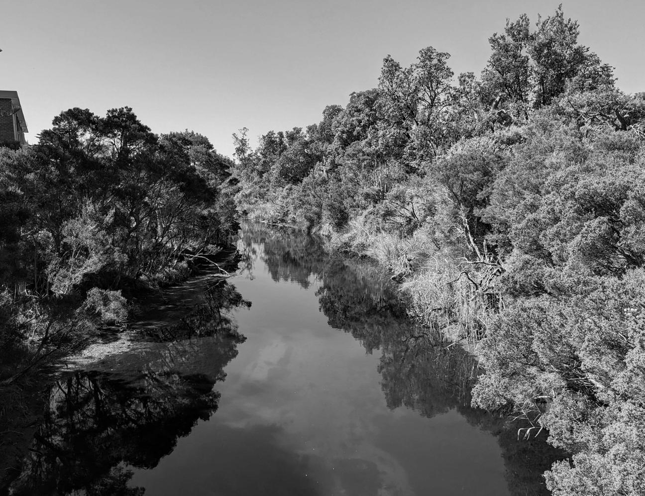
Key landscape adjacencies along the Nepean Boulevard include Kananook Creek, Frankston Waterfront, Olivers Hill Waterfront, Sweetwater Creek Reserve and walking track to the south-east as well as Olivers Hill lookouts.
Regional Context
The Nepean Highway is a key metropolitan route, that connects the City to the Mornington Peninsula. It begins at St Kilda Junction, extends along the coastline, servicing Melbourne’s eastern suburbs, terminating at Portsea.
Frankston is located 40km south of Melbourne. The Nepean Highway provides an important threshold to the Frankston City Centre arriving from the north at Mile Bridge, Kananook Creek and from the South at Olivers Hill.
Frankston is emerging as a key economic and social hub, transforming itself into the new ‘Capital of the South East’. It is recognised as a regional public transport node and provides rail and bus access to the Melbourne CBD and surrounding employment areas. The planned Suburban Rail Loop and potential electrification of the railway line to Baxter will further increase accessibility.
Coast: Nepean Boulevard South 2.1km
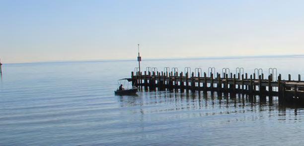
Frankston Waterfront
Frankston Pier
Frankston Foreshore
Olivers Hill Beach
Olivers Hill Boat Ramp
Sweetwater Creek
Olivers Hill
City:
Nepean Boulevard Central 0.9km
Port Phillip Bay
Frankston Beach
Long Island Beach
Kananook Creek
Nepean Vision & What We Heard
The Nepean Boulevard Vision (2023) provided a strategic overview of the transformative potential of the Nepean Boulevard. It identified future projects, precincts, and a planning pathway to achieving this.
Projects identified in developing the vision included:
• Landmark gateway at Kananook Creek to the North
• A transformed Olivers Hill lookout in the south
• A northern entry boulevard
• A redeveloped City centre
• A new southern entry experience
Objectives identified through this project included:
• A climate resilient and cool City
• Reinforcing of Frankston’s unique identity
• Fostering new visitation and community pride
• A revitalised City centre and a catalyst for investment
• The creation of a people’s heart to the City
• New sustainable transport initiatives and
• Improved ecological and biodiversity values
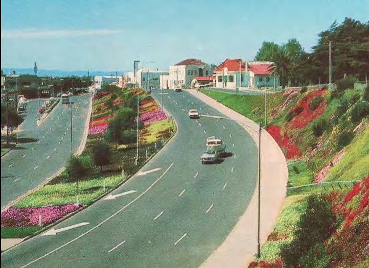
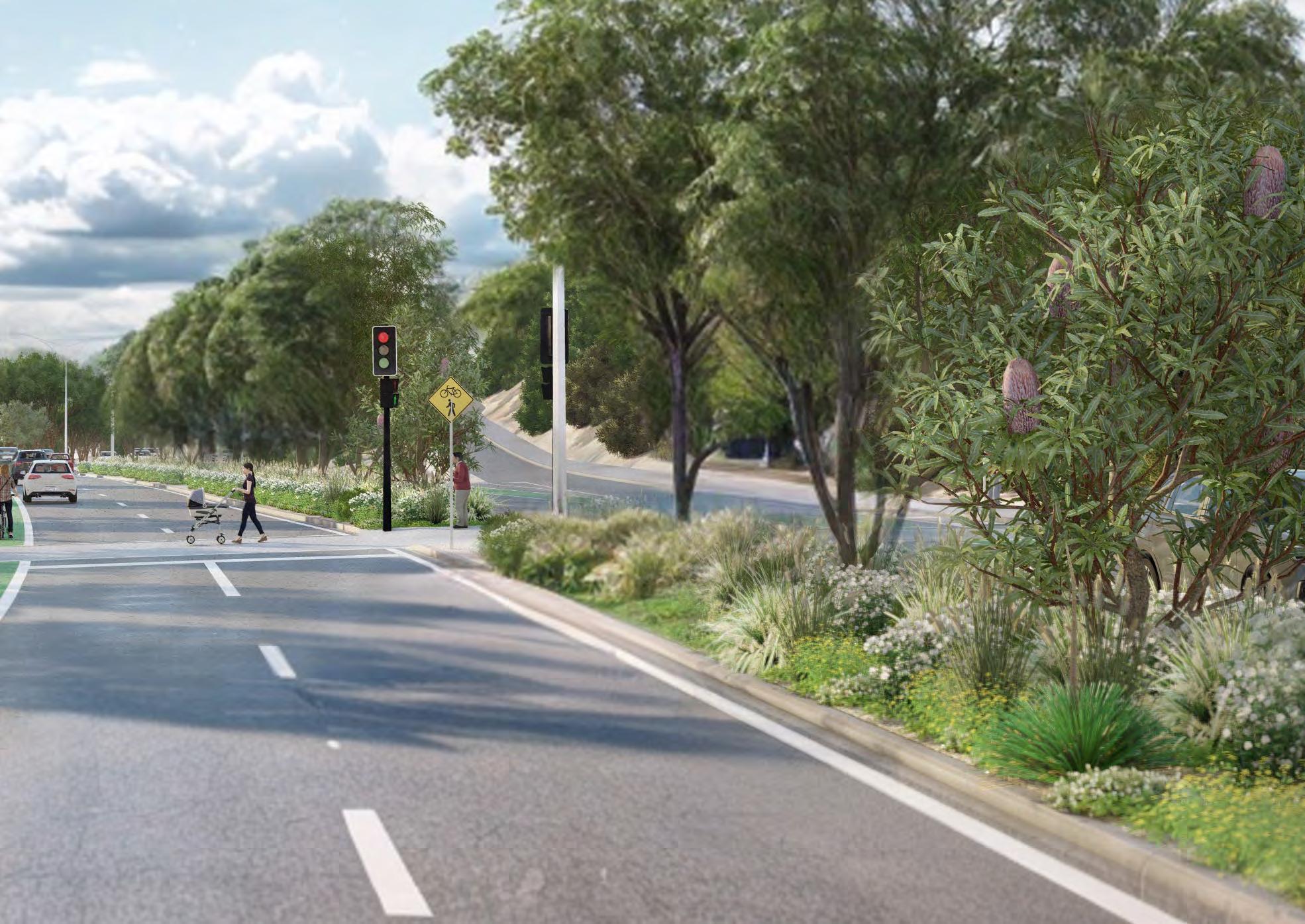
Rendered images are from the Nepean Boulevard Vision, developed in 2022 and presented to the Frankston community online.
What We Heard From The Community
Community Engagement Phase 1
The response to the Nepean Boulevard Vision was mixed. While most agreed that improvements were necessary, opinions varied on the specific changes proposed. Key themes included:
Activation and Revitalisation
General support to improve the presentation and street activation through the central area, activating empty shop fronts and a desire to deliver a destination, rather than a thoroughfare.
• Some concern over future development and building heights.
Landscape Improvements
Support for landscape improvements to improve the appearance and enhanced canopy coverage with strong support to connect to the local environmental character context and include indigenous/native vegetation.
Pedestrian and Active Transport Connectivity
Support to improve road safety for all road users, improve the connection to the foreshore and some support for the implementation of separated bicycle lanes.
Traffic and Car Parking
General support for the lane reduction to deliver cycling infrastructure and improve pedestrian amenity, although some concern over traffic network impacts, speed reduction, reduction of car parking and provision of DDA accessible car parking.
The outcomes of this engagement has informed the development of this Masterplan for Nepean Boulevard and priority early works implementation.
In developing the Masterplan, community feedback relating to Nepean Highway received through recent community engagements, particularly comments received through the 2024 Community Vision Refresh. From March to May 2024, Council engaged with its community to commence development of a new Council Plan and Community Vision. From the 793 comments received:
• 31% of respondents would like Council to either focus more on or the same on planning connections between walking, riding and driving.
• 30% of respondents would like the Council to either focus more on or the same on providing a safe, connected and accessible transport network.
• Notably, 27 respondants commented specifically on Nepean Highway with concerns ranging from safety concerns to disappointment with current presentation and activation of the highway.
Of the Top 10 individual services participants wanted Council to focus more on:
• 81.1% - Planting and protecting trees to create cooler, greener streets and open spaces
• 75.5% - City safety: initiatives to ensure community safety
• 71.4% - Creating vibrant public spaces
• 70.2% - Provide a safe, connected and accessible transport network
• 69.3% - Plan connections between walking, riding and driving
“Connection and community, I love the vision statement. I live and work in Frankston. However, the entrance into Frankston via Nepean highway REALLY lets the place down. It gives the impression that Frankston is poorly resourced and underfunded.”quote from 2024 Community Vision survey
Community and Stakeholder Engagement Phase 2
Council’s next steps in the Masterplan process are to:
• Further consult with relevant Authorities. In particular, as Nepean Boulevard is a state arterial road and managed by the Department of Transport and Planning (DTP), Council is working with DTP through the Masterplan development.
• Share the Draft Masterplan for community feedback through further engagement in early 2025.
• Commence Early works in 2024, subject to authority approvals including:
» Feature and levels survey investigation
» Greening the Boulevard plantings
» Public lighting improvements
» Public sculpture and artwork
» Wayfinding signs
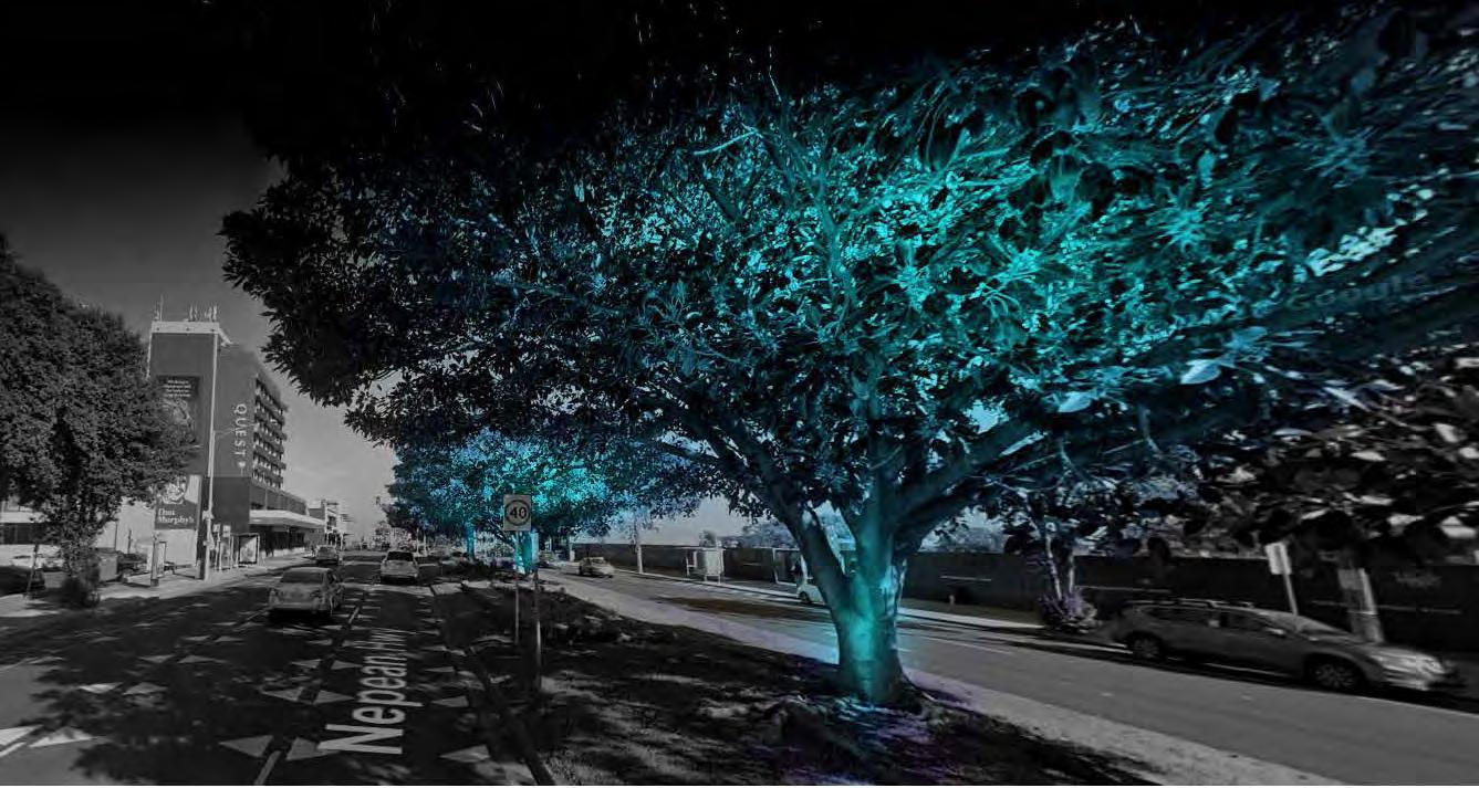
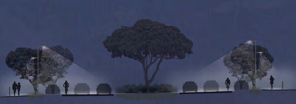
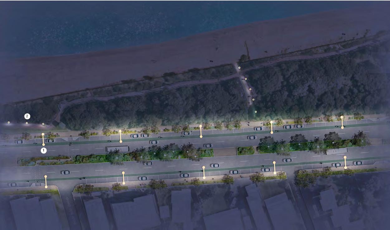
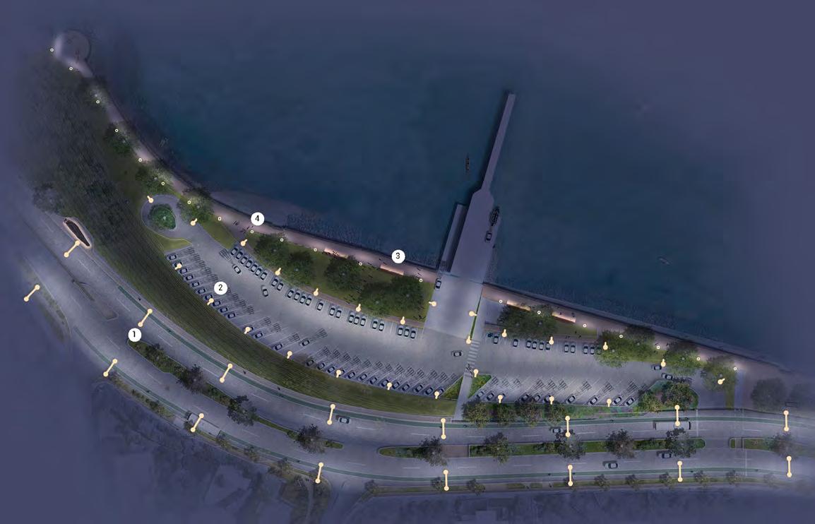
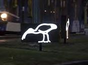
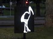
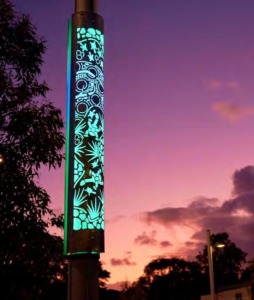
Boulevard Lighting Early Works
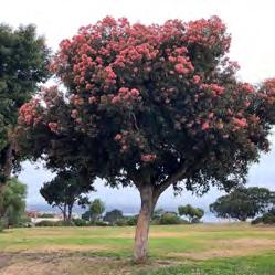
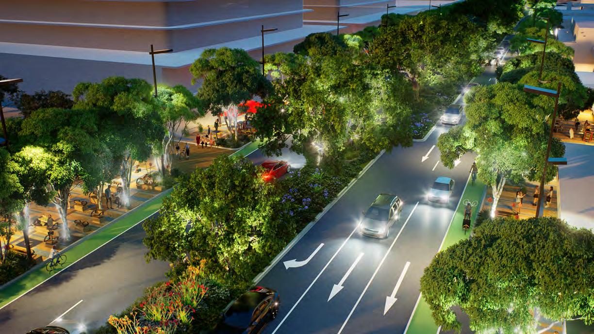
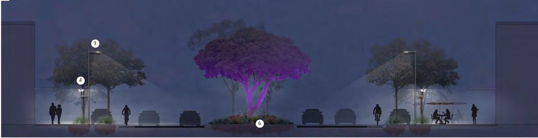
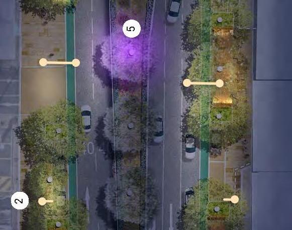
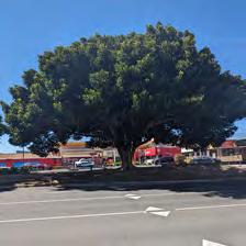
Proposed lighting early works involves illuminating the iconic Moreton Bay Figs located in the central median through the City centre. This will add to the nighttime experience, provide a sense of gateway and celebrate a significant landscape feature of Frankston.
Greening the Boulevard Early Works
The Nepean Boulevard will be enriched with an early re-vegetation project to the Northern Nepean Boulevard. This project anticipates planting a substantial number of coastal and Australian native trees, shrubs and ground covers to the central median. This will assist in reinforcing a memorable entry experience, improve biodiversity and increase overall canopy cover, contributing to urban cooling.
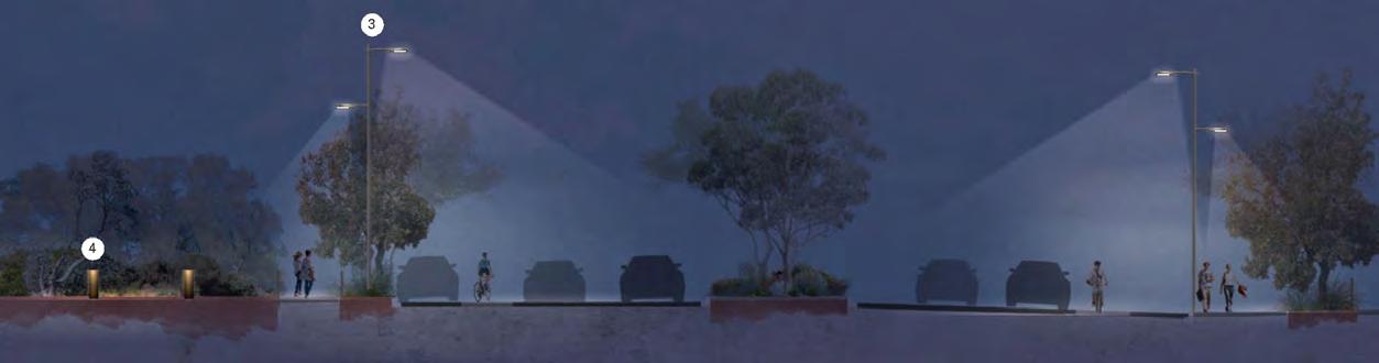
Above image depicts a lighting concept developed by Electrolight for Nepean Central.
Value Creation
Future Frankston
A Cost Benefit Analysis undertaken on the Draft Master Plan identifies the initiatives long term benefits to the community.
The Nepean Boulevard Masterplan project aims to establish an urban setting of significance, with a focus on delivering an attractive, active, people focussed destination, that captures the beauty of its setting alongside Kananook Creek and Future Frankston.
It will deliver greater walkability, improved environmental conditions and economic outcomes.
Key Benefits
Improved recreation utility and wellbeing from open space
Health benefits
Improved public realm/Increasing realisable development
Mode shift: Reduced VKT (Vehicle kilometres travelled) and emissions
of trees
Art and cultural value
Savings from reduced crash rates
Method/Main Driver
Improved visitation & access to recreation and quality public spaces
Improved health of residents with greater walkability & cycling connections with greater ongoing physical activity per person
Increase in value due to uplift to amenity and perceived safety.
Greater engagement in active transport which reduces vehicle use and green house gas emissions.
Benefit of tree associated with environment, such as carbon sequestration, air pollution reduction, energy saving and stormwater runoff. Productivity differential of tree value, quantified using urban greening benefit
Benefit of public art/cultural storytelling, education benefit of school outdoor activity. Average time spent on arts and cultural venue or event
A positive housing premium as homebuyers are willing to pay more live at a safer neighbourhood with less traffic. Reduction in accident/deaths saving of fatality and injuries.
Brand value
Quantified through the redistribution of funding/ investment into lower socio- economic district as compared to one with lower disadvantage Multiplier effect difference Key research showing outside impacts from investing in disadvantaged areas.
Value
Greening The Boulevard
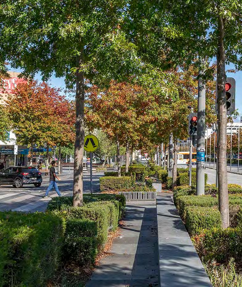
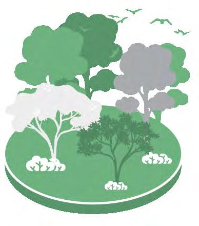
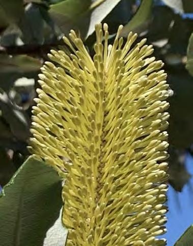
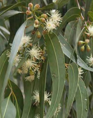
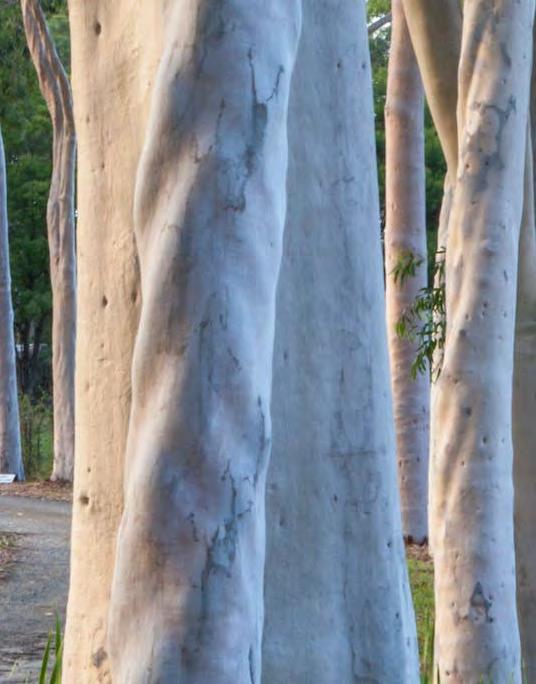
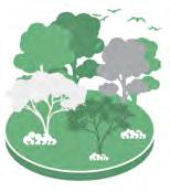
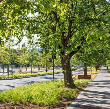
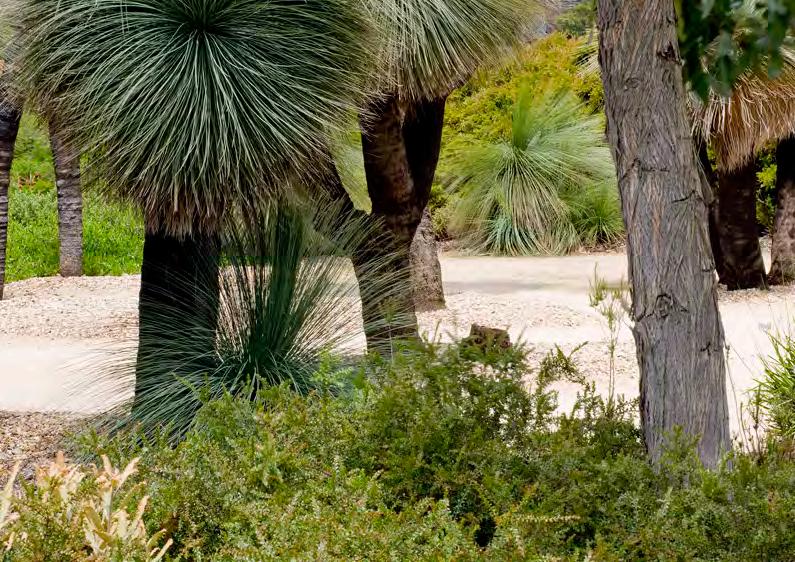
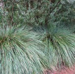
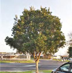
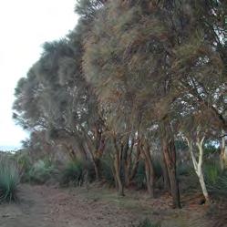
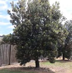
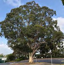
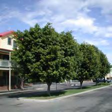
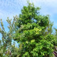
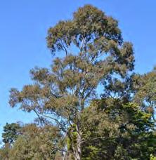
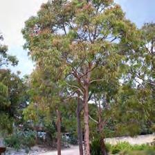
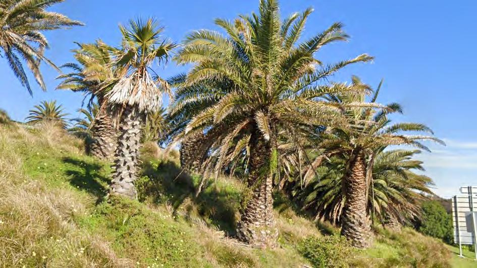
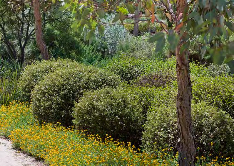
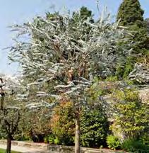
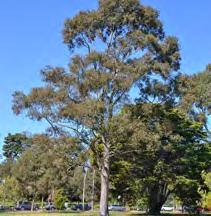
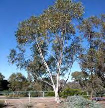
Nepean Boulevard will become a significant tree lined boulevard that will enhance biodiversity values, cool the local environment, and create a distinct gateway experience and sense of place. Nepean Boulevard is already defined by its significant trees, along its central median and particularly in the City Centre precinct. This masterplan proposes to build upon that positive experience and contribution.
The Masterplan recognises that trees are one of the greatest urban design tools to connect Frankston communities, green its City and tackle climate change. An integrated tree strategy for Nepean Boulevard will assist in naturally cooling the City, clean its air and water, create homes for native fauna and foster sociable walkable communities.
The Nepean Boulevard Masterplan builds upon the Frankston City Council's Urban Forest Strategy which recognises the merits of trees not only for their amenity value, but for their important role in cooling our cities, through the establishment of canopy coverage targets among other objectives identified in the Urban Forest Strategy.
Nepean Boulevard identifies the importance of the trees under four primary themes:
Environmental
Identifying how trees will improve the local ecology for the Boulevard and Frankston.
Social
Recognising that greater trees and green spaces will bring a range of social benefits, including improving social cohesion and community connection as well as establishing a local identity.
Economic
Noting how trees will bring a range of economic benefits to the Boulevards neighbourhoods and commercial enterprises.
Health
Outlining the many benefits trees provide for the health and wellbeing of the Frankston communities.
The Greening the Boulevard strategy identifies the potential to build upon the defined experiences and established qualities of the north, central and southern project areas of the Boulevard and is informed by four overarching themes influencing species selection and arrangement.
The Masterplan proposes to deliver:
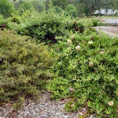
• Approximately 500 new trees to the Nepean Boulevard, significantly increasing overall canopy cover to Frankston.
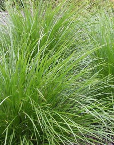
• Species diversity with up to 20 native trees as well as significant areas of garden bed and understorey planting, improving overall biodiversity and linking eco corridors.
• Improved overall permeability with porous surfaces, slowing water runoff and mitigating urban heat island effects while improving pedestrian comfort levels.
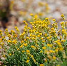
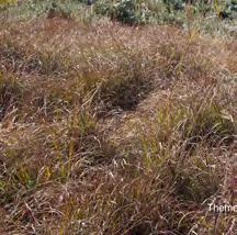
Streets that support native vegetation have a greater richness and abundance of native bird and aerial species
Data
City
Data
An Equitable Public Realm
Gender Impact Assessment
Under the Gender Equality Act 2020, Council is required to undertake a Gender Impact Assessment (GIA) to ensure that Council makes lasting and genuine progress towards gender equality across our community by identifying issues and limiting potential barriers.
The GIA focused on understanding the demographics within Frankston and visitors to the region and explore best practice examples of gender equity in urban design, specifically for the features proposed for the Nepean Boulevard.
Key components that the GIA considered include:
• Access and amenity
• Cultural considerations
• Safety concerns and perceptions of safety
• Aesthetic appeal
• Shared transport
The Nepean Boulevard GIA report recommended strategies which can be embedded into the Masterplan design theming of Ecology, Public Realm, Culture and Movement.
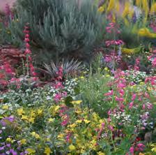
Green and Leafy
Urban Greening
• Incorporate greenery by planting native and Indigenous species and flowering varieties that increase aesthetic appeal and sense of ownership. Consider the sensory appeal of greenery.
• Seek opportunities to plant more trees. Consider their location, spacing, and planting method to ensure their longterm health.
• Ensure plantings don’t obstruct visibility along paths. Tall trees with clear understorey are preferred to improve passive surveillance.
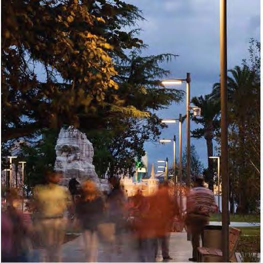
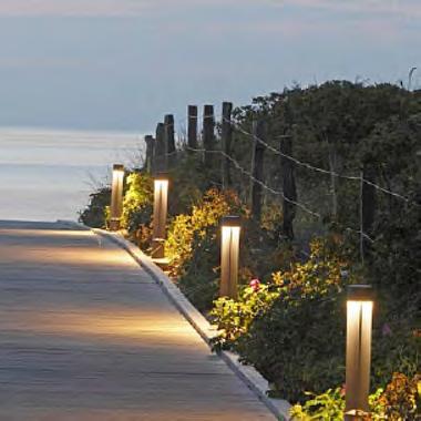
Public Life and Activity Lighting
• Avoid extreme contrasts between dark and light, and consider placement, colour, intensity, and impact on wildlife to ensure everyone feels safe and supported to participate after dark.
• Eliminate dark patches without lighting
• Provide continuous lighting along main pedestrian paths that connect key areas (such as the entry into shops) with public transport stops/hubs and carparks.
• Illumination levels should be sufficient to light the edges of streets and other public spaces, reveal changes in level and other potential hazards, allow a person’s features to be recognised at a distance of 10 to 15 metres and facilitate video surveillance for public safety.
Play Opportunities
• Provide child-friendly facilities such as play elements for both formal and informal play.
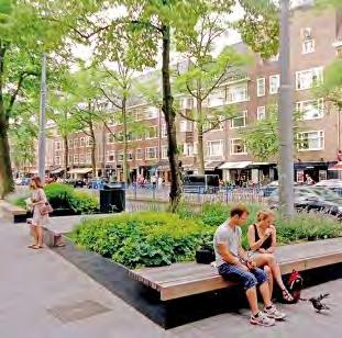
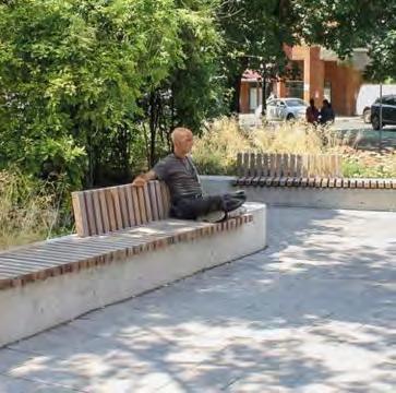
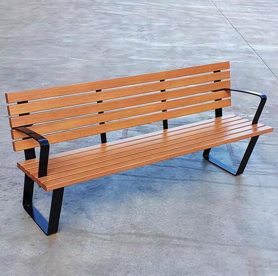
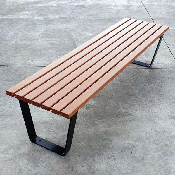
Urban Furniture
• Provide a choice of more flexible seating options, including:
• Picnic settings or loose furniture to serve as a meeting spot for socialising.
• Benches and seating areas to
accommodate diverse preferences and needs including a consideration of accessibility, privacy, safety, gender, age, and disability.
• Consider location, quality, material and placement to support a diversity of users including the older people, those with limited mobility, and adults with small children.
Place Management
• Prioritise regular maintenance and upkeep of all features and amenities. Ensure that maintenance schedules are responsive to community feedback and address safety and accessibility concerns promptly.
Security and CCTV
• Following consultation with women and gender diverse people in community regarding perceptions of safety:
• Ensure strategic placement of security measures and CCTV.
• Prioritise sightlines, visibility, and passive surveillance on paths and areas that are likely to be frequented by women, gender diverse people, children, and priority groups known to experience greater risk of harm
Uniquely Frankston
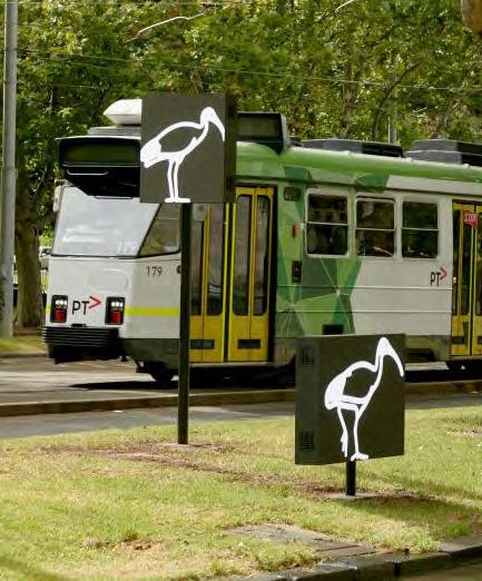
• Incorporate art work that depicts women and gender diverse people. Consider how people with disability, people of different ages, and culturally diverse people can be represented through art work and/or through the tender/grant process.
• Enrich the visibility of First Nations Peoples connection to Country through Indigenous public art and collaboration with the Bunurong Land Council.
• Activate the street to increase community connectedness and perceptions of safety. This includes: local events and initiatives, a consideration of noise levels, increased occupancy of businesses in the area
Movement and Connections
Pathways
• Provide wider paths that can accommodate a pram and two people walking side by side, cyclists, and pedestrian traffic in the opposite direction.
• Design paths with suitable surface treatments and maintenance services to facilitate equitable access. Locate pram/ mobility aid ramps logically in the line of travel.
• Encourage active transport through ensuring adequate paths, wayfinding, and placement of amenities, and features (e.g., public art)
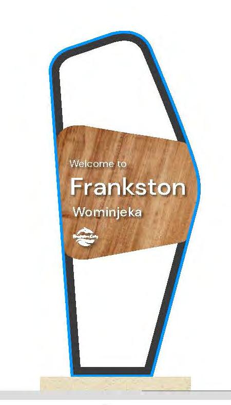
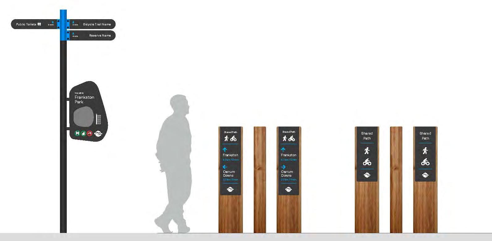
Signage and wayfinding
• Signage and wayfinding should:
• Use clear, simple language in a simple large font
• Be accessible
• Include imagery/iconography
• Use a second language if/when deemed appropriate in order to cater to the local community and/or key tourist groups
• Be at a height visible for those in wheelchairs
• Include reference to the Bunurong people.
Hierarchy of Transport
• Ensure all modes of transport are considered and safely catered to including pedestrian tracks without cyclist and allocated bikes lines without cars.
• Consider measures that make streets more comfortable and safer for pedestrians and cyclists including increased crossing opportunities, lower traffic speeds and space for pedestrian and cyclist amenity.
• Include ample priority parking for people with disabilities, older people, and carers
• Prioritise forms of active transport when considering travel mode hierarchies.
Transport
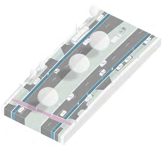
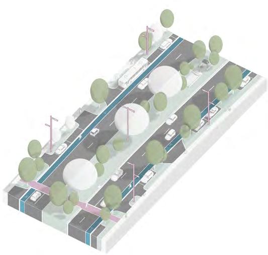
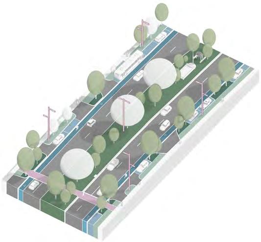
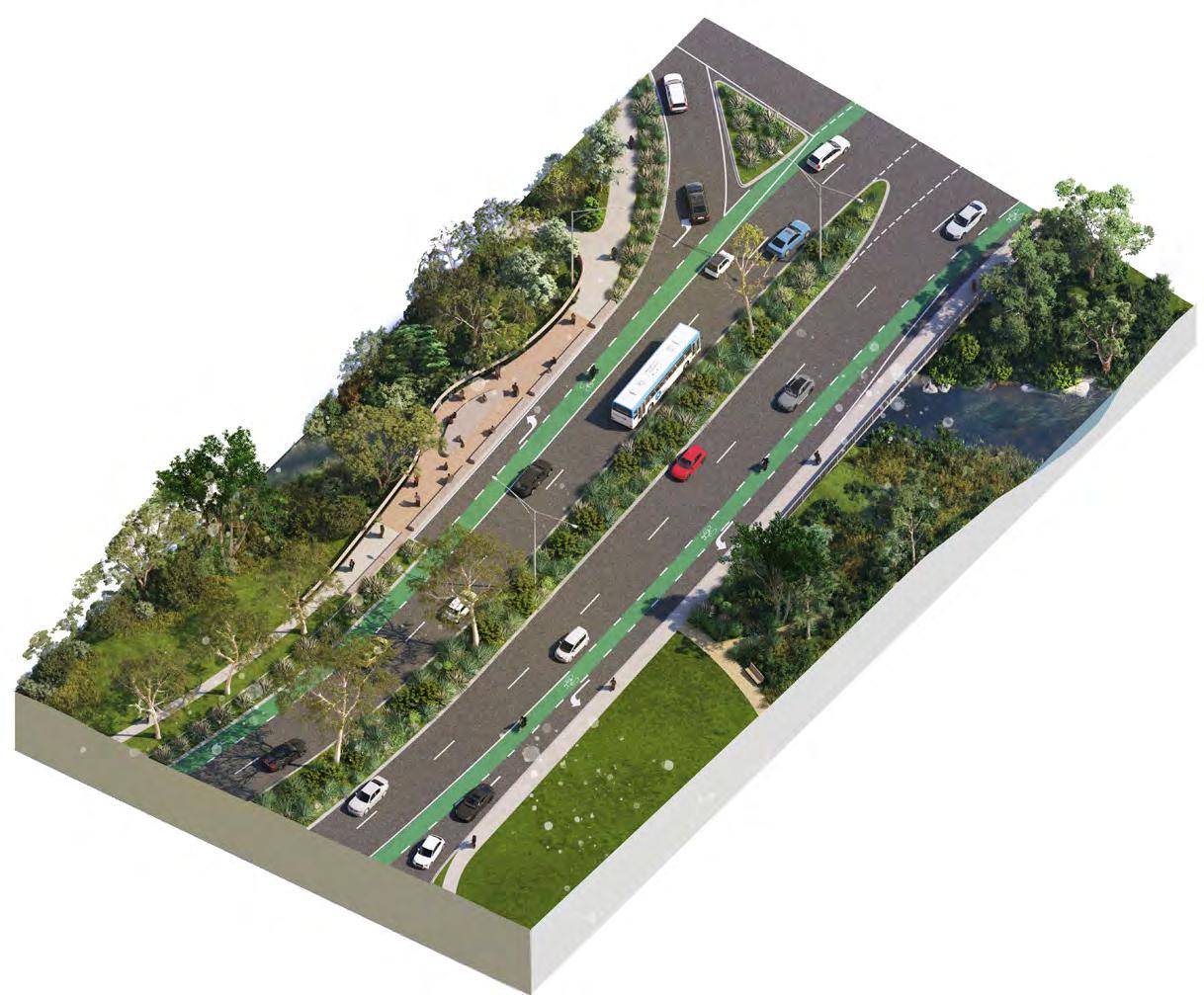
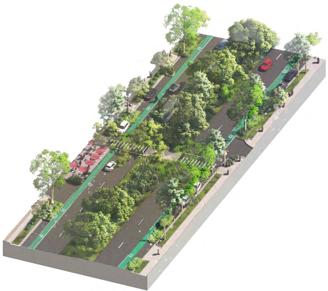
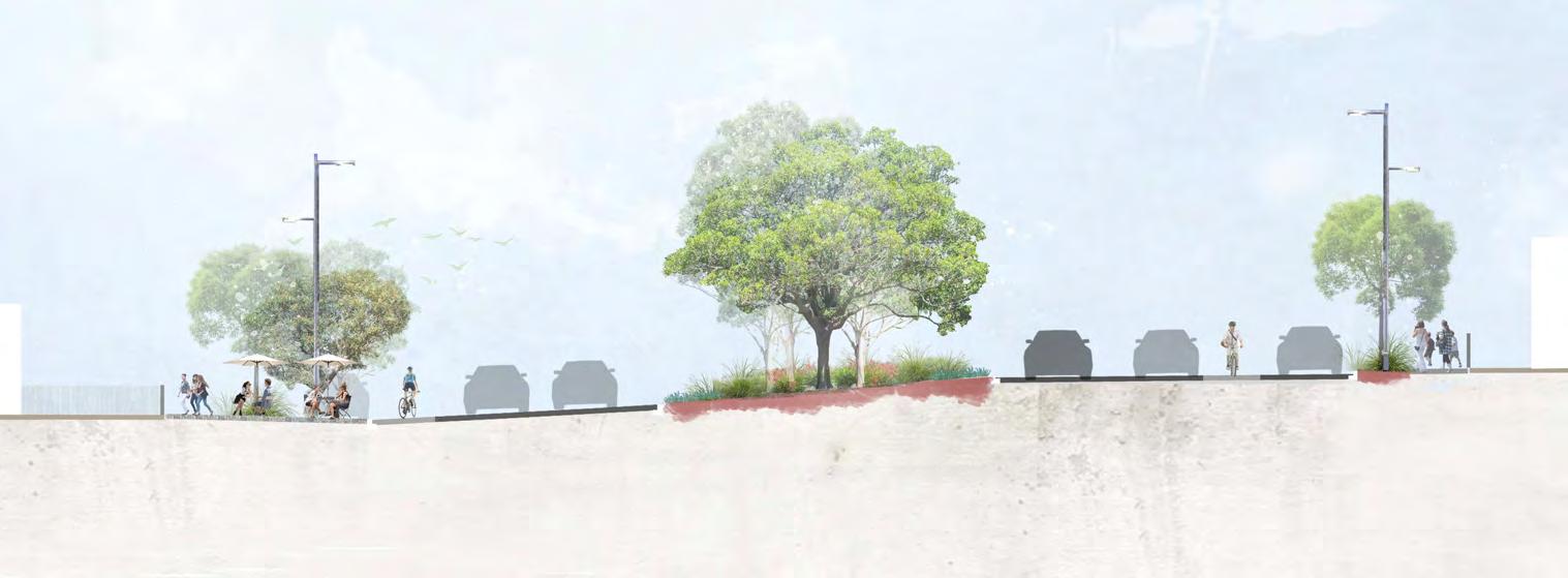
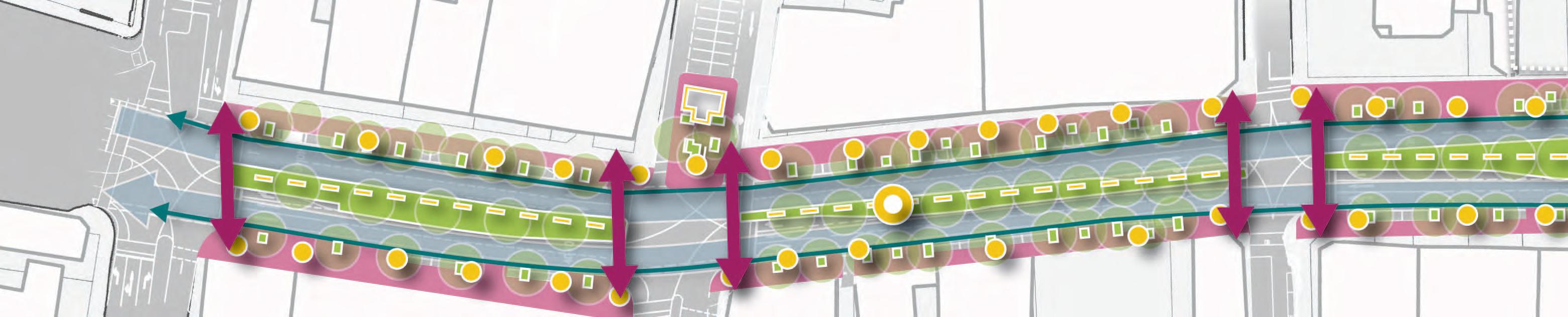
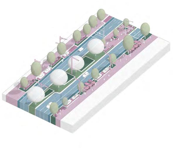
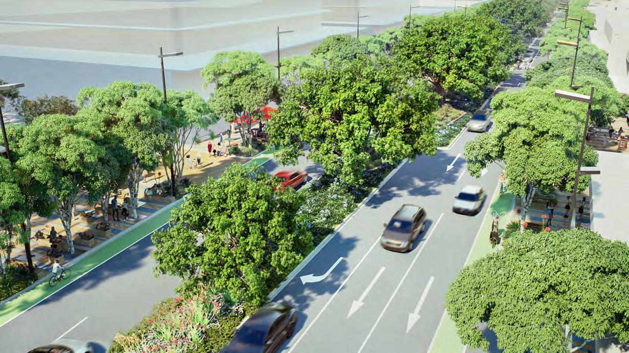
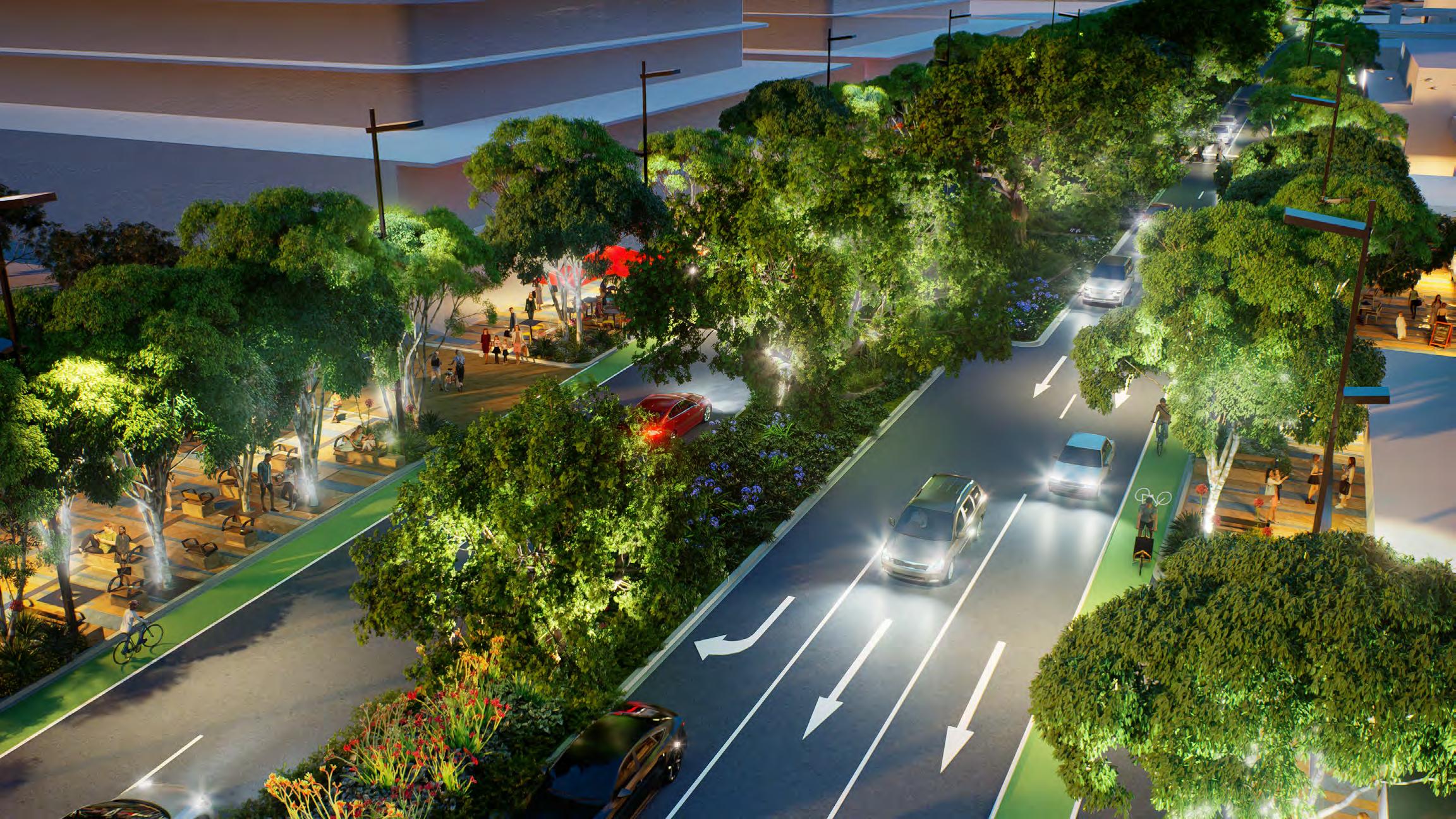
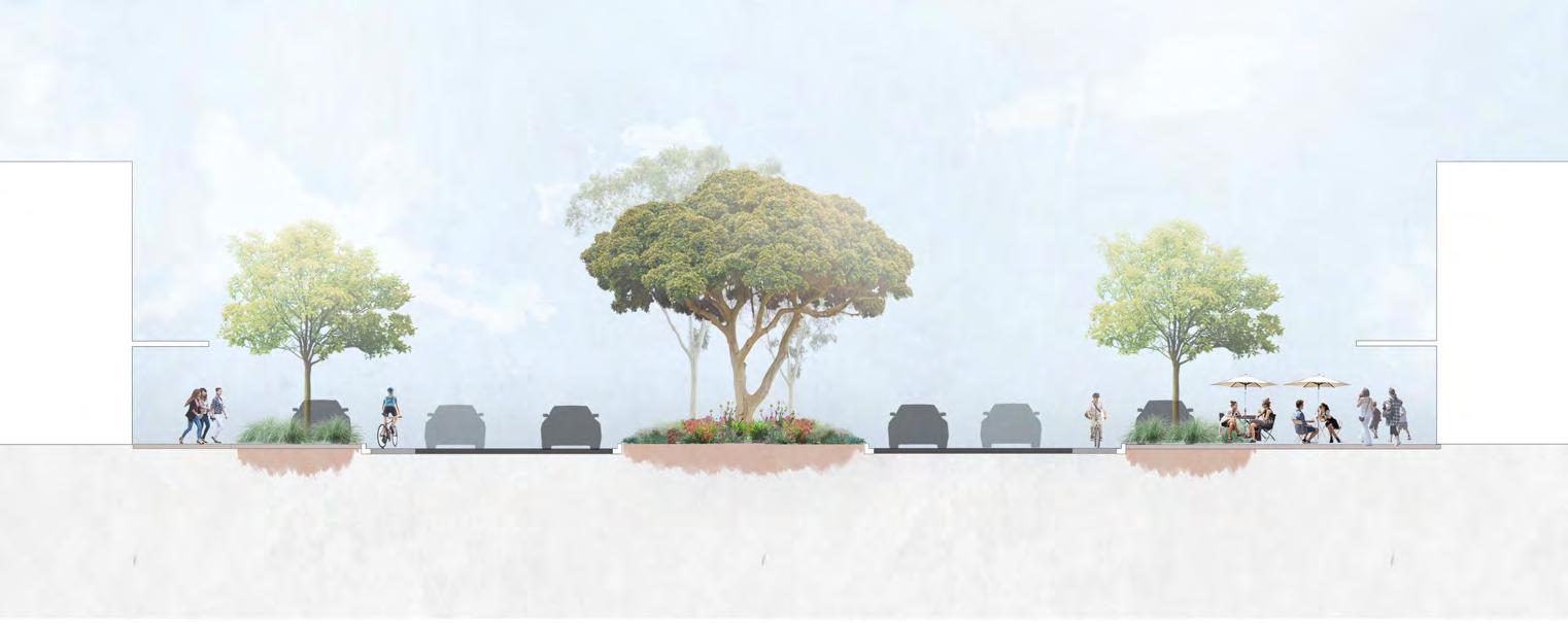
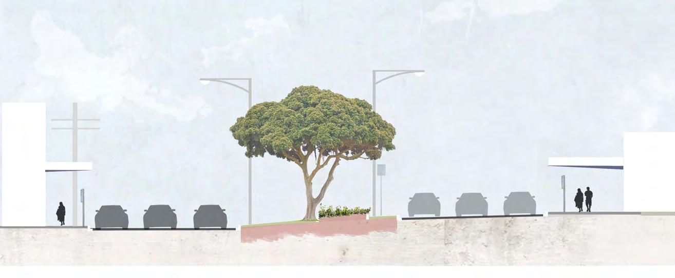
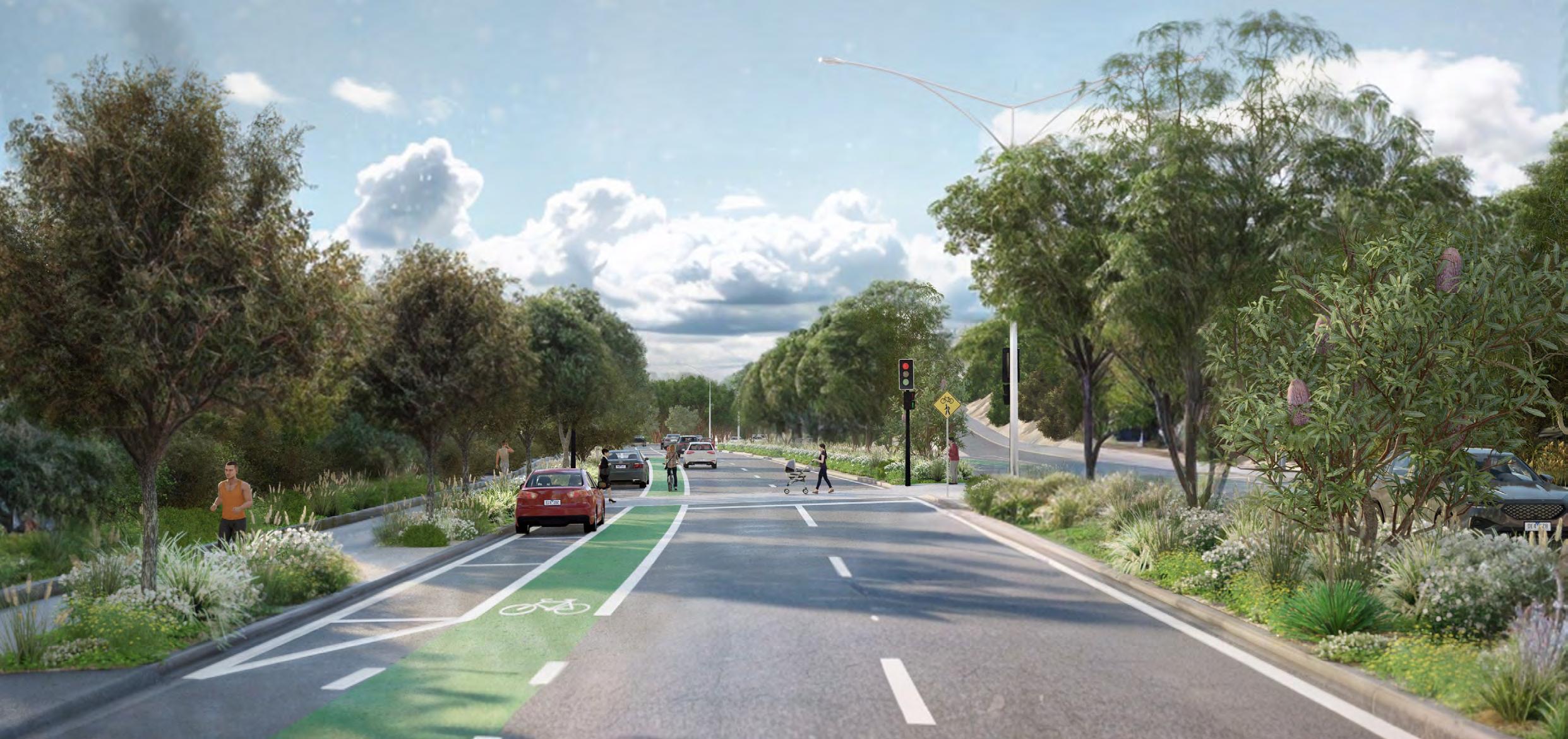
The aspiration is to transform Nepean Highway into a tree-lined, pedestrianfocussed boulevard and destination. There will be a new emphasis on place whilst maintaining a traffic function.
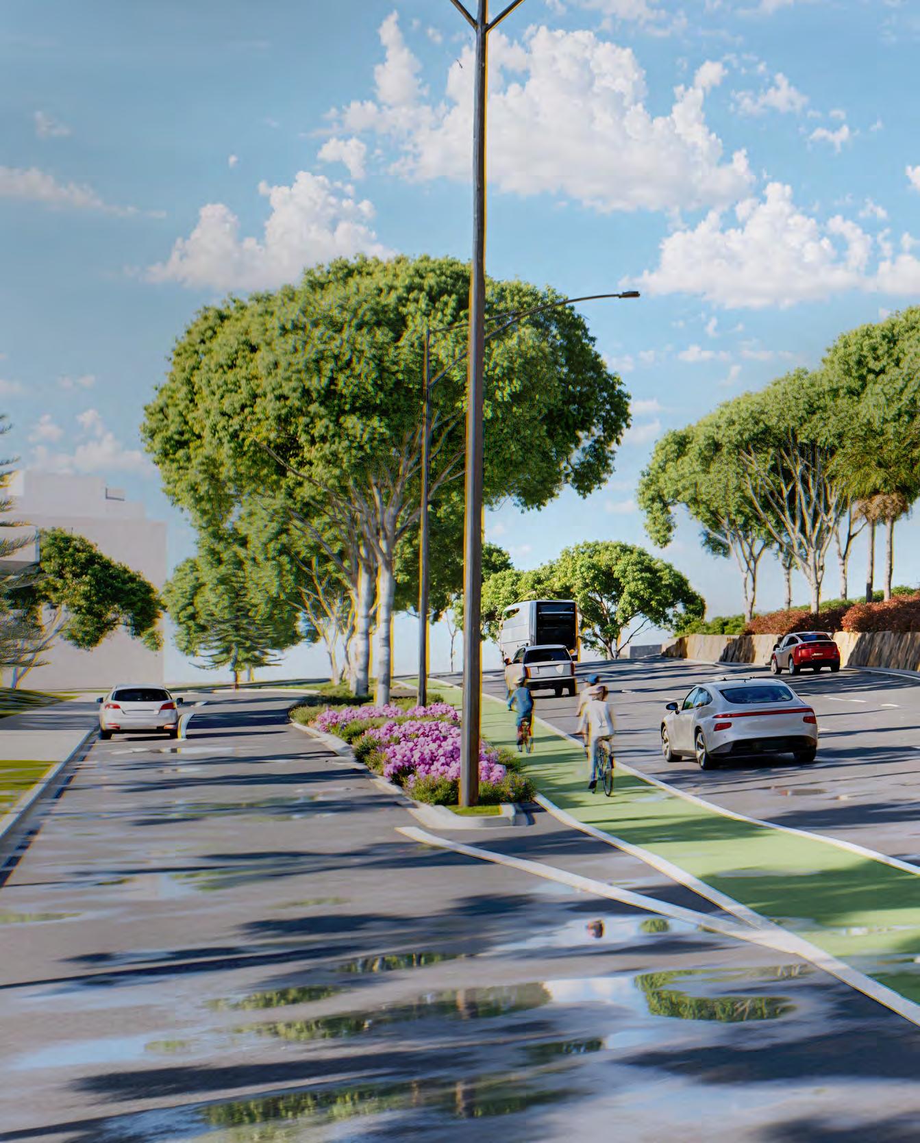
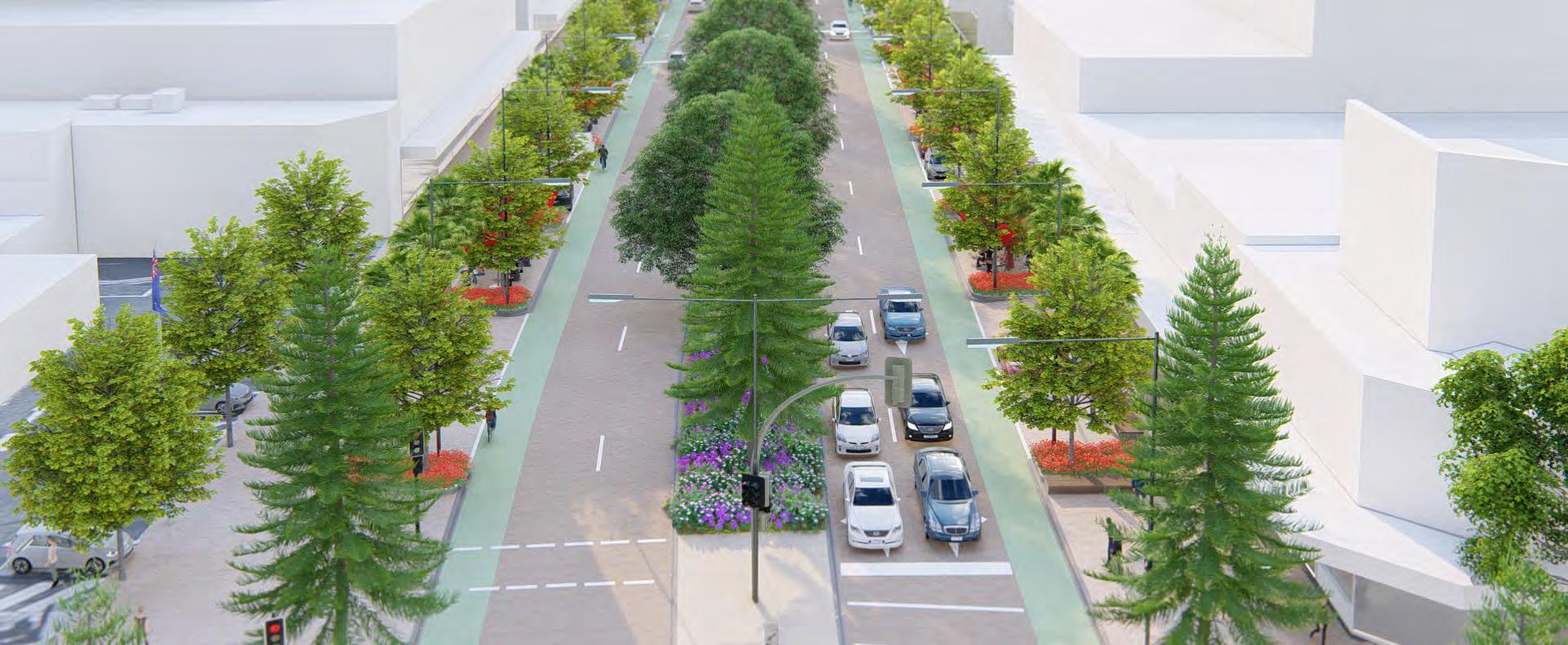
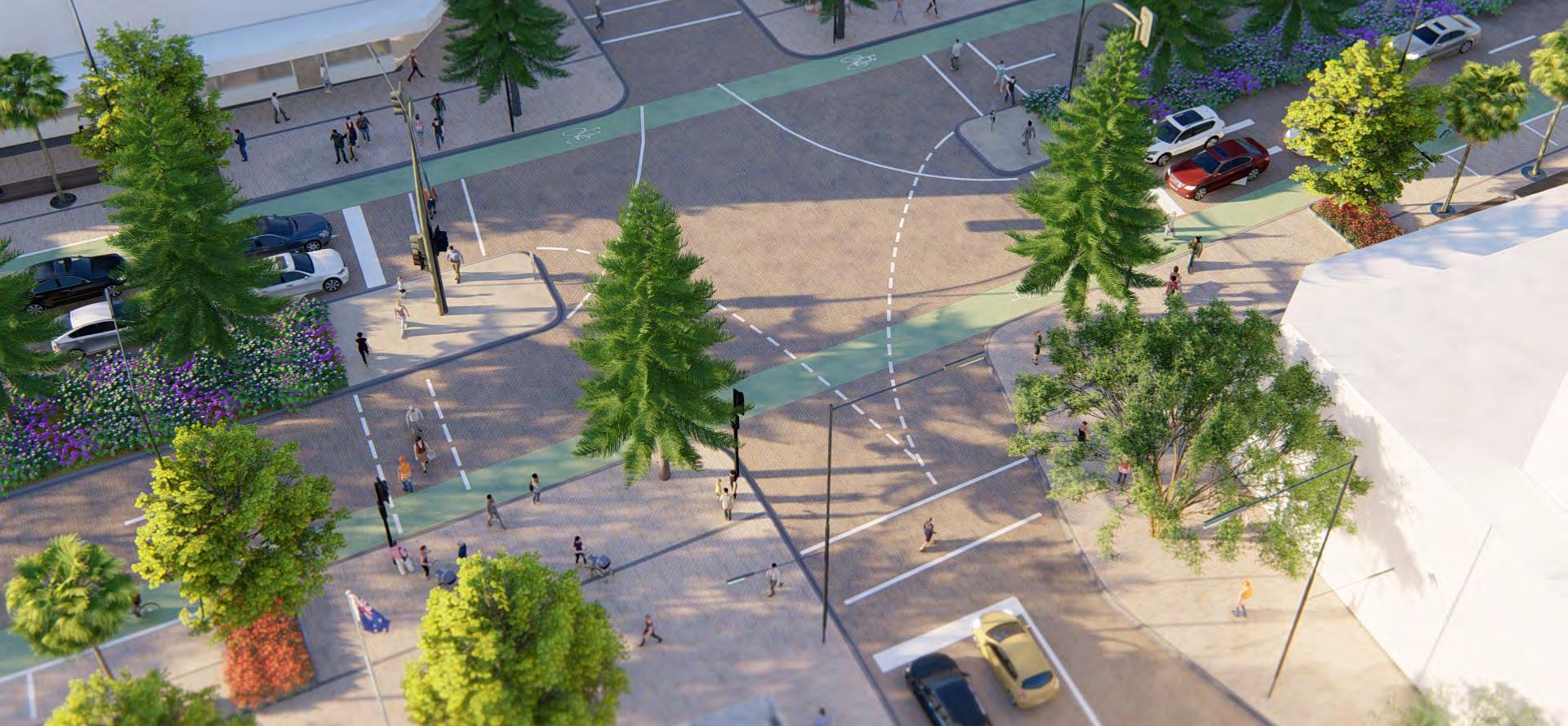
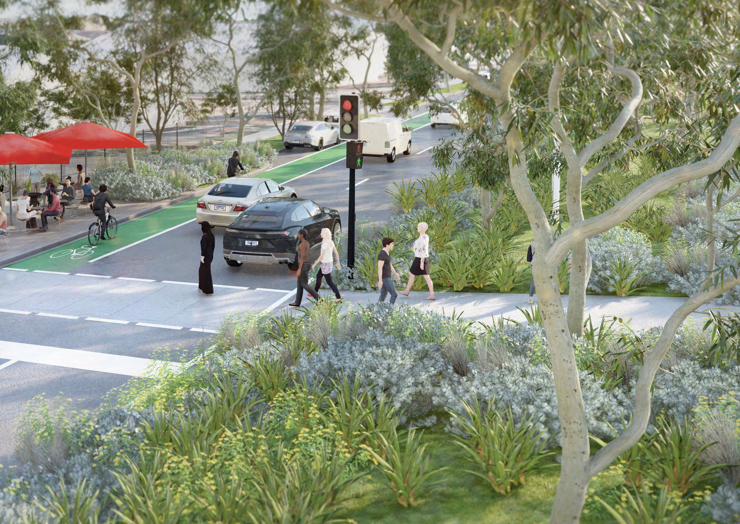
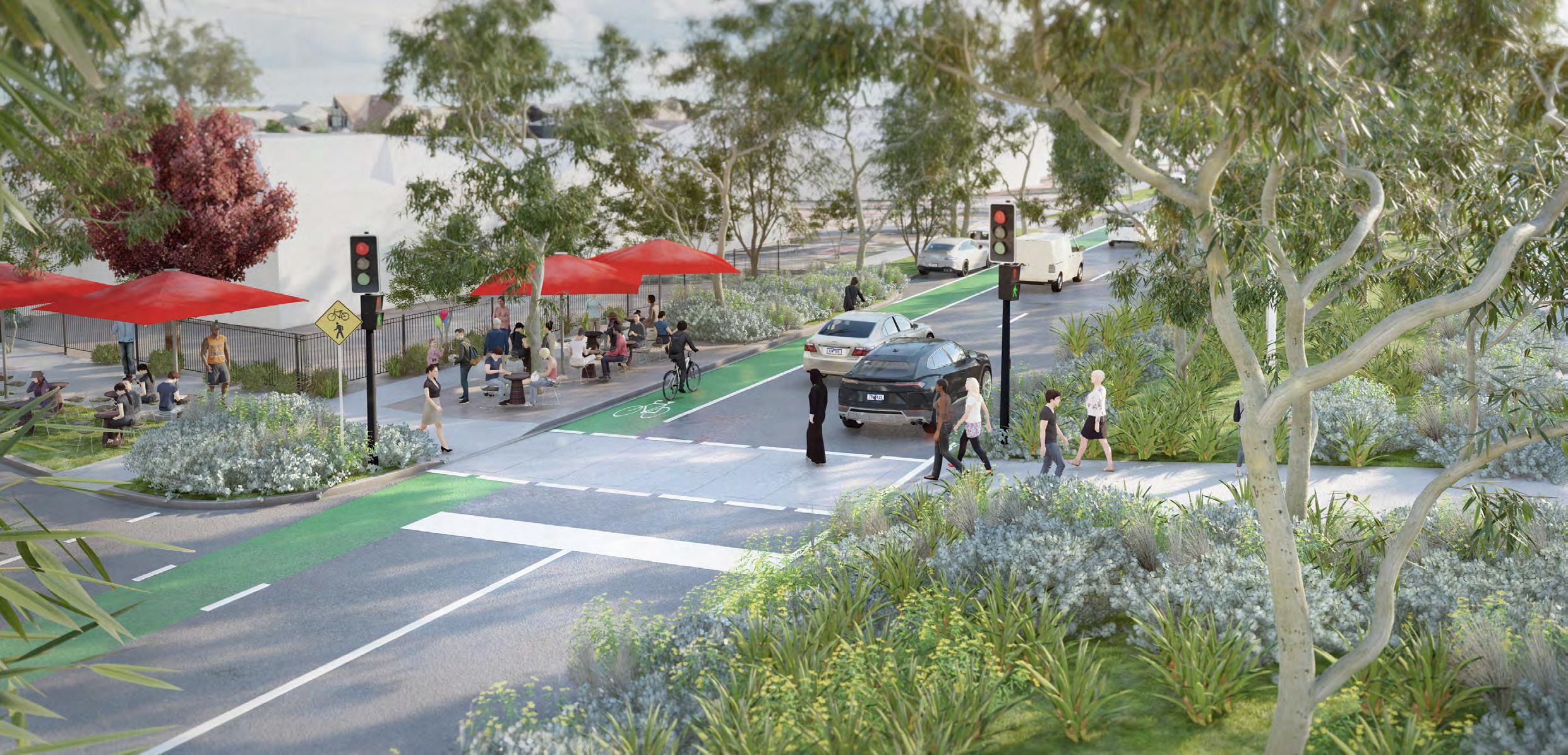
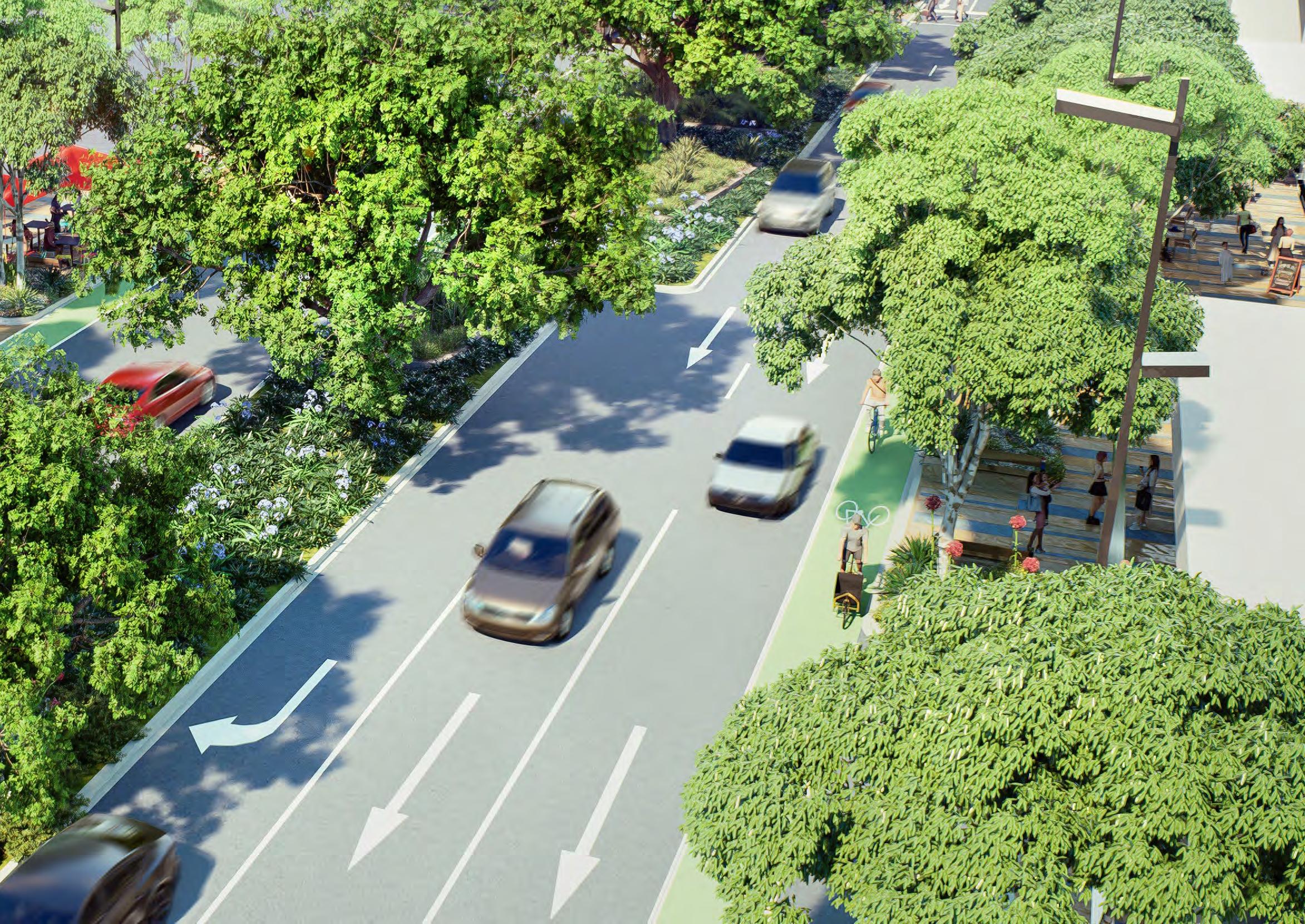
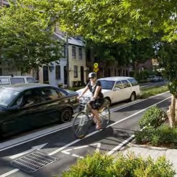
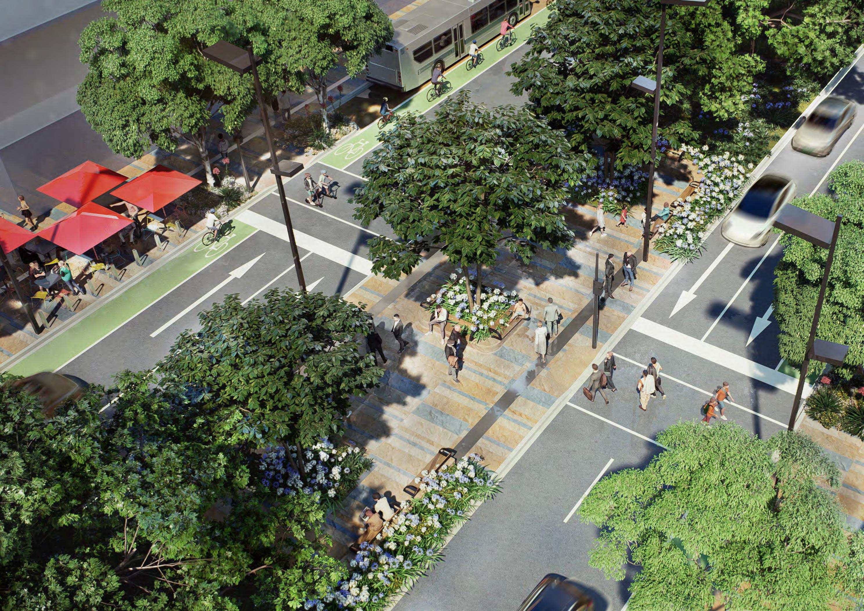
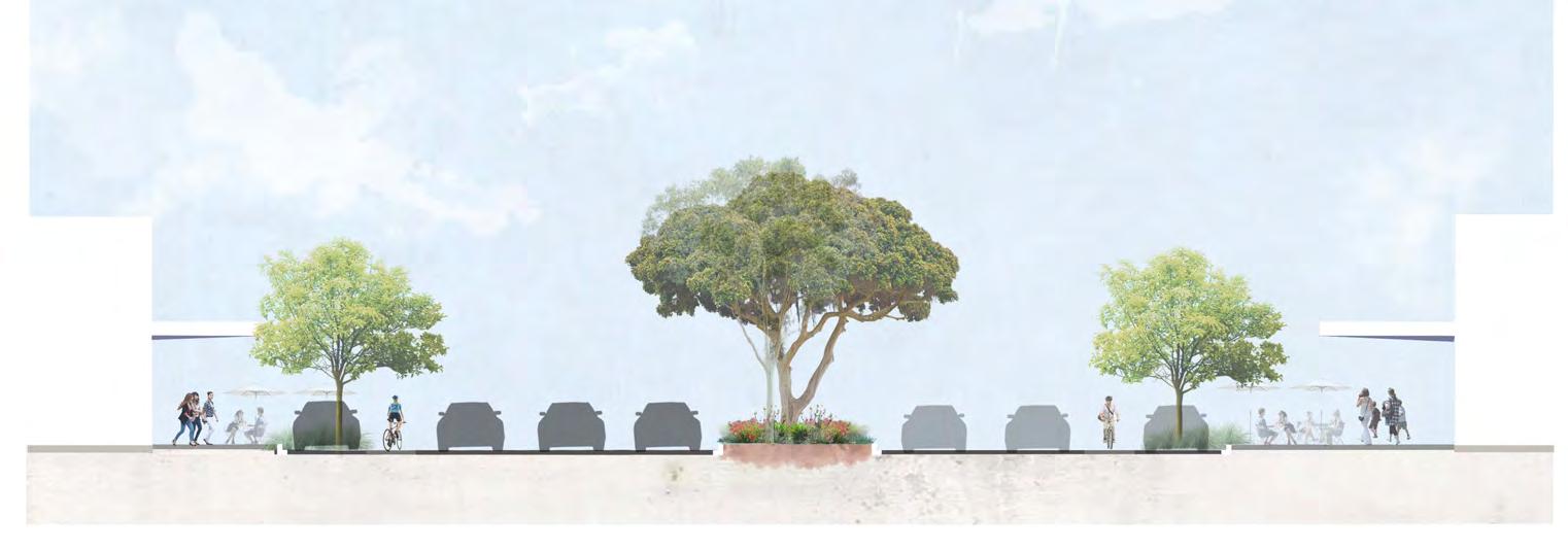
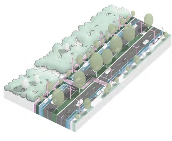
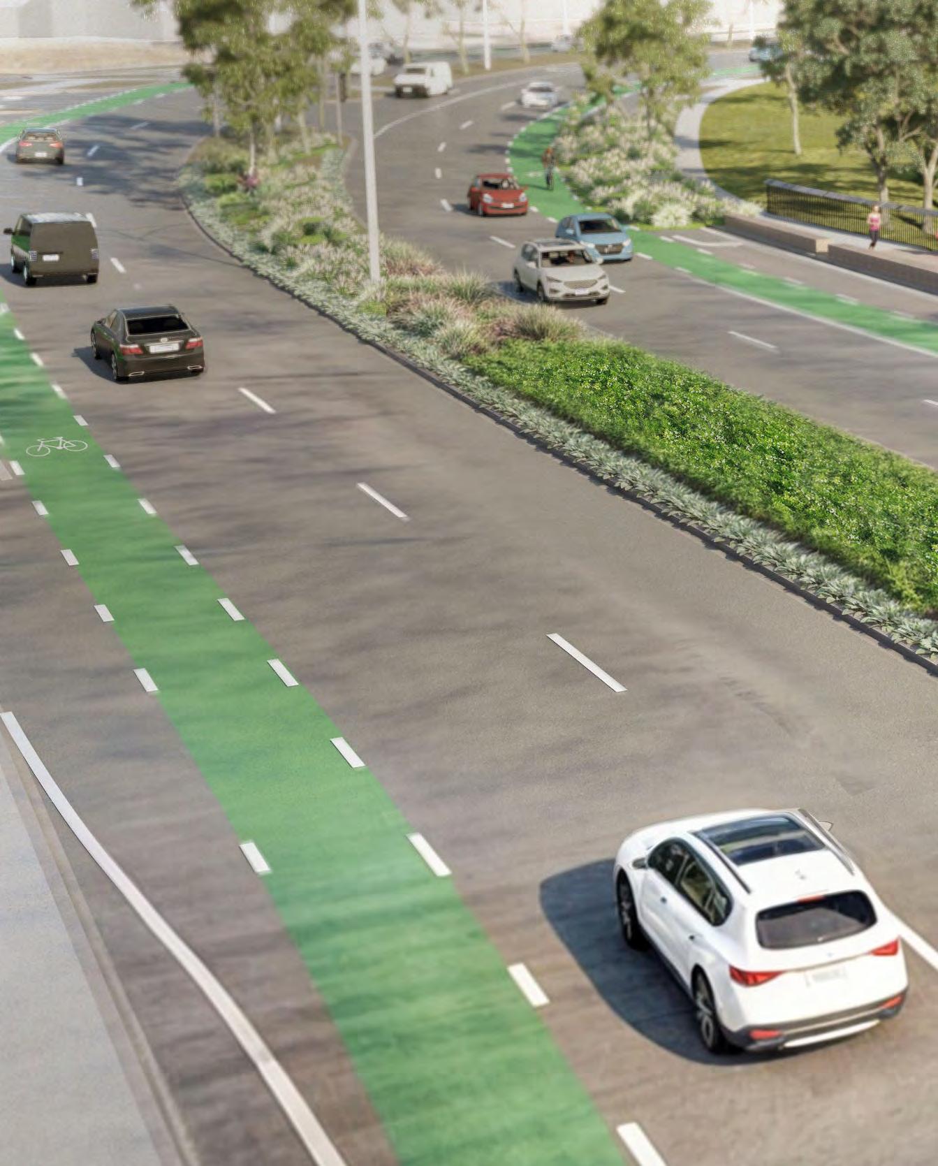
It will gradually transition overtime from a car focussed highway to a balanced urban setting, where transport needs are complimented with additional civic functions, including widened footpaths supporting outdoor dining, additional street tree planting, water sensitive urban design treatments, enhanced public transport and new cycle lanes connected to the existing network.
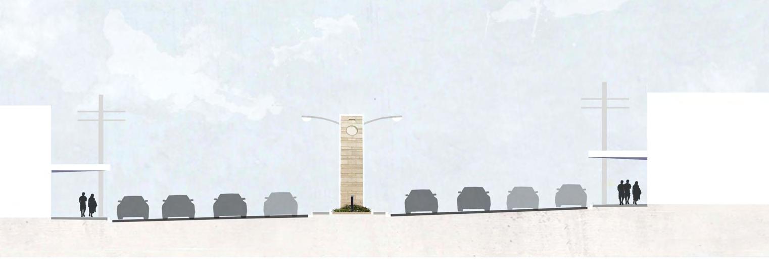
The proposed Boulevard comprises two lanes in each direction, dedicated bike lanes, parallel parking and widened pavements and kerb outstands to enhance pedestrian amenities. In conjunction, the broader Frankston MAC transport network will need to support the distribution of traffic and uplift.
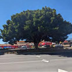
The proposed improvements will establish the Boulevard as a destination, building on the existing avenue of Moreton Bay Figs, improve pedestrian connectivity and street life, establishing the Boulevard as a new destination to support and enhance business activity.
Strategic Documents
The traffic strategy is informed by key aspects of the following strategic Council documents related to transport:
• FMAC Draft Structure Plan
• Frankston Integrated Transport Strategy
• Nepean Boulevard Vision
Movement & Place
The Department of Transport and Planning’s new approach, the Movement and Place framework, recognises that streets not only keep people and goods moving, they’re also places for people to live, work and enjoy. This means when we plan and develop the transport network, we need to balance the needs of both transport users and place users and design a mix of transport modes that are appropriate to how the road and places are used by communities.
A Movement and Place (M&P) assessment was undertaken by Ratio Consultants as part of developing the Nepean Boulevard Masterplan. The key steps in Movement and Place assessments are to understand the aspirational classification of Nepean Highway and how this relates to existing classifications. It then considers the gap between existing performance and the aspirational performance, to identify how the proposed masterplan initiatives will align with the aspirational classifications and performance.
The critical finding for the Nepean Boulevard Movement and Place assessment suggests that there is an opportunity to improve other modal performances (walking, cycling, public transport) at, while remaining in line with the target score for vehicle traffic. This key finding is the fundamental core of the Nepean Boulevard project, which seeks to improve the pedestrian, cyclist and placemaking environment as a priority alongside vehicle movement and performance.
Transport Assessment
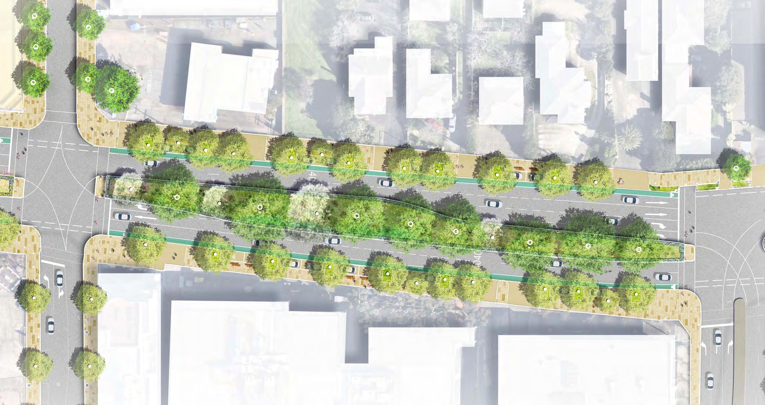
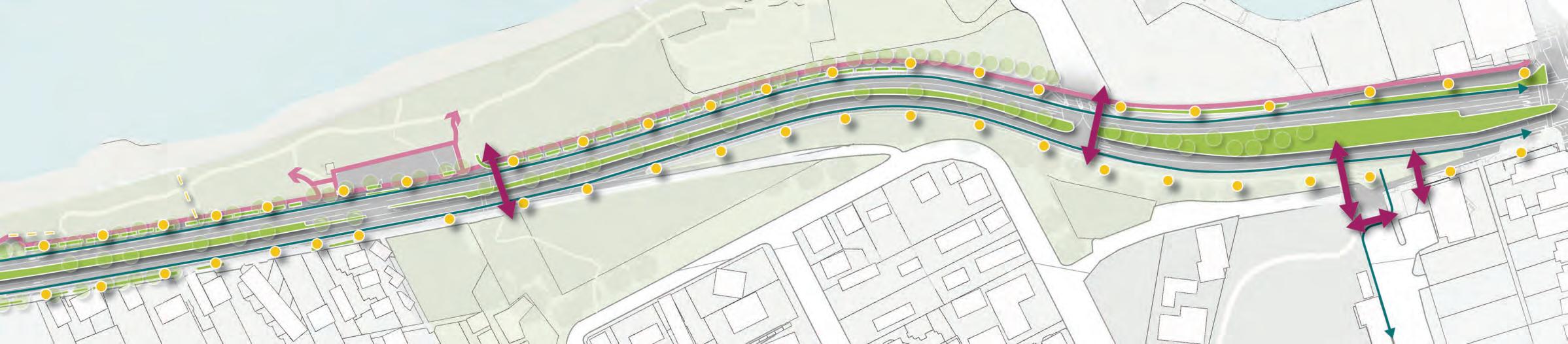
Traffic modelling for the Nepean Boulevard Masterplan focused specifically on the impacts of removing a continuous traffic lane in both directions through the FMAC precinct.
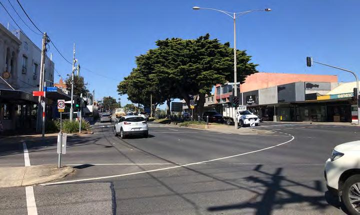
The Nepean carriageway is currently four (4) continuous lanes to the north and south of the FMAC, increasing to six (6) lanes through the FMAC. Therefore the proposed lane reduction will result in a return to a continuous four-lane carriageway that is commensurate with the north and south precincts of the Nepean Boulevard.
The mesoscopic traffic modelling completed to date, that anticipates potential future developments within the FMAC, indicates that the proposed lane reduction can be implemented with relatively acceptable impacts compared to the reference case. While the PM peak hour does have some more notable drops in performance compared with the reference case, these impacts are considered to be acceptable given the other significant benefits that the lane reduction allows for, including the
additional bicycle lanes, increased verge widths and footpaths, which will all greatly improve the placemaking performance of the FMAC.
Next Steps
The mesoscopic modelling inputs and final results will undergo an ongoing process of refinement in collaboration between Council and DTP. This will inform the development of a joint strategic transport network improvement plan to identify broader infrastructure needs to support the changes for Nepean Boulevard and the broader FMAC. This will assess the key intersection operations along Nepean Highway in the same modelling scenarios, including optimisation of phase sequencing and timing. This next stage of modelling and testing will continue whilst engagement is underway on the Masterplan.
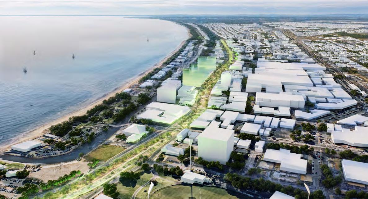
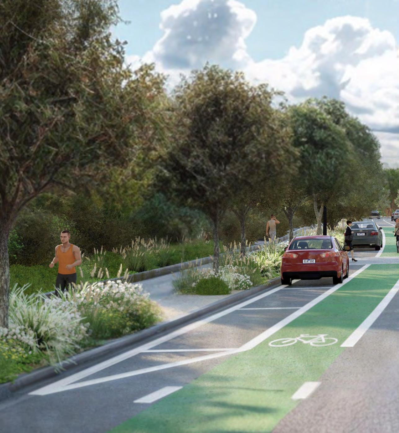
Above: Digital rendering of Connecting City, Creek and Coast - a future green boulevard for Frankston
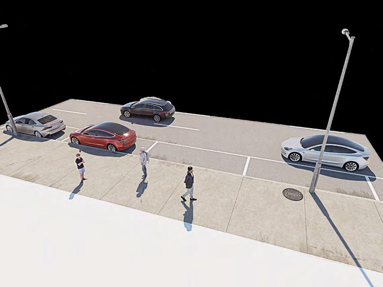
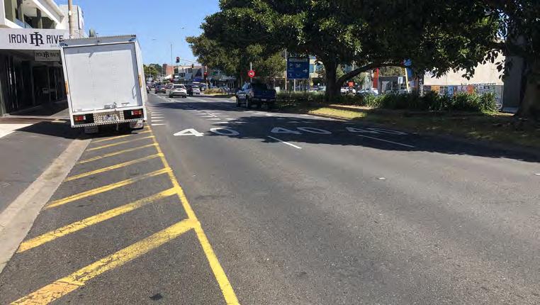
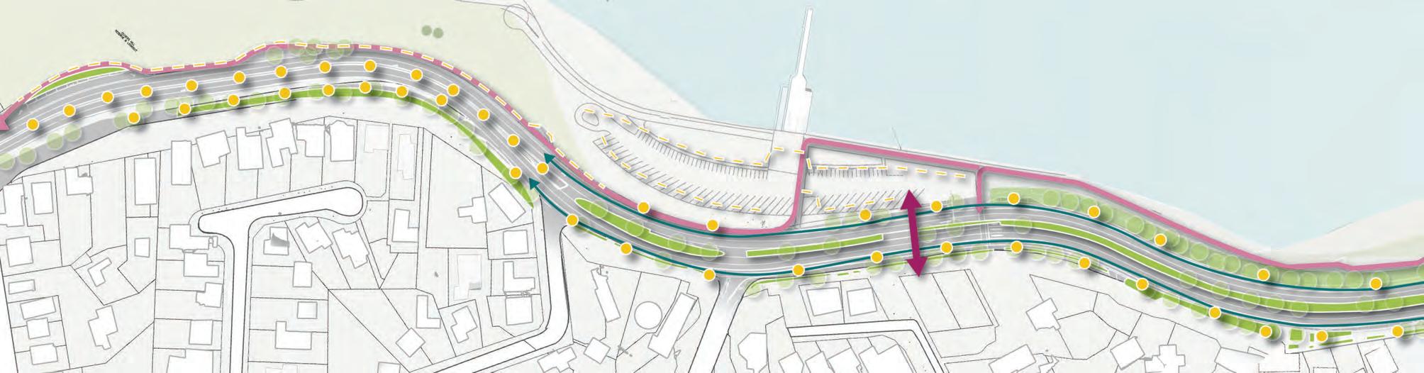
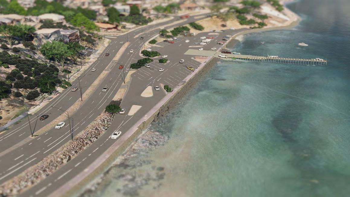
Carparking
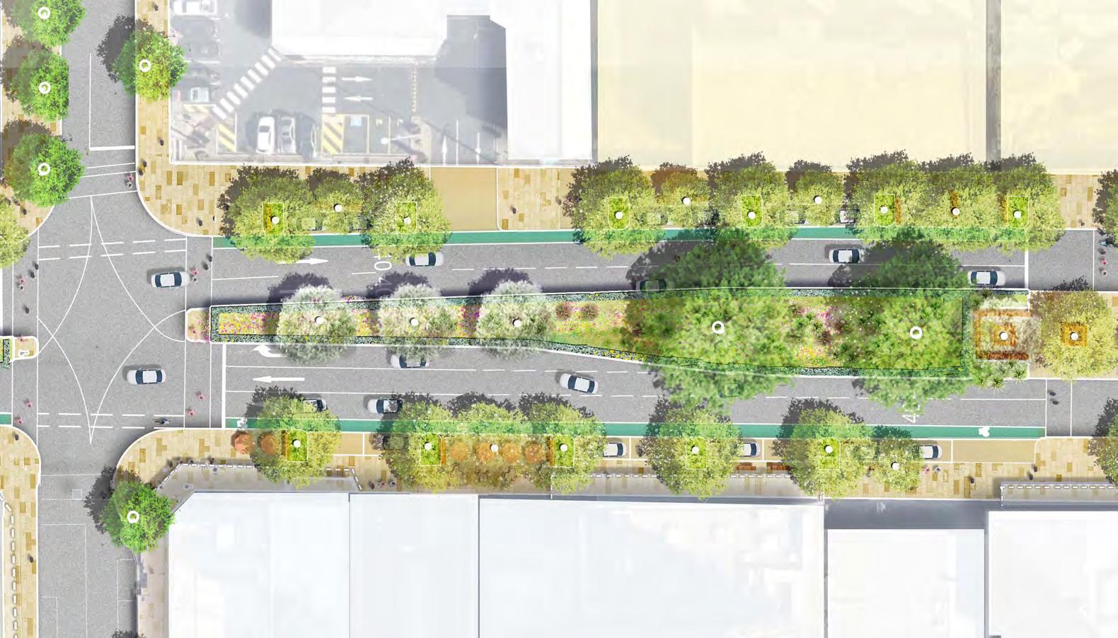
In order to increase pedestrian amenity, significant tree planting, and street life opportunities and due to existing streetscape spatial constraints, within Nepean Boulevard Central it is necessary to reallocate some of the existing space currently used for car parking to facilitate the proposed improvements including new indented on-street car parking. This will result in a level of reduced onstreet car parking compared to existing conditions. Loading bays will remain consistent with existing conditions along
Nepean Boulevard, whilst DDA car parking provisions will be improved. The Masterplan conceptually demonstrates this design intent, however the finalised balance between landscape design and supply of indented car parking for each street block through the FMAC will be confirmed at the Functional Layout Plan stage of design.
Previous parking studies in Frankston have observed that whilst on-street parking in Frankston is subject to high demands, there is a relative abundance of off-street parking available. For instance, in a 2020 study by
Movement and Place Consulting, it was found that on-street parking within the study area bounded by Nepean Highway, Davey Street, Fletcher Road and the Frankston Railway, reached a peak occupancy of 95%. In contrast, the 4,570 off-street parking spaces in the same study area had a peak occupancy of only 71%, leaving more than 1,300 off-street spaces vacant. Therefore, any reduction to the on-street parking supply can be readily accommodated by the offstreet carparking in the area.
The proposed Nepean Boulevard design is consistent with the FMAC structure plan which outlines how carparking will be provided at the edge of the FMAC that is easily accessed via the Ring Road in conjunction with real time signage for car parking that direct people to available parking bays.
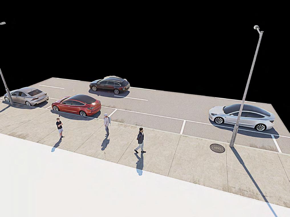
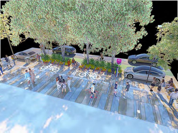
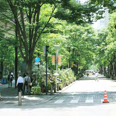
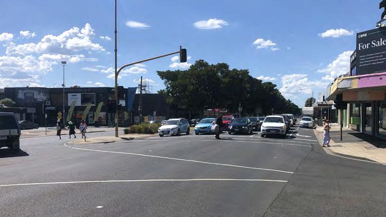
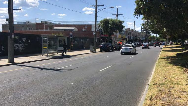
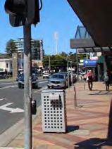
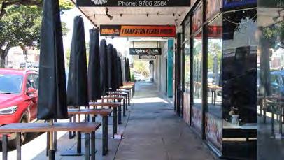
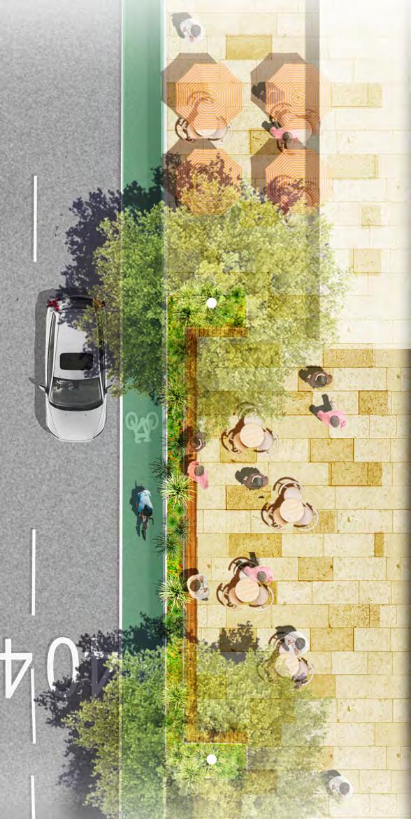
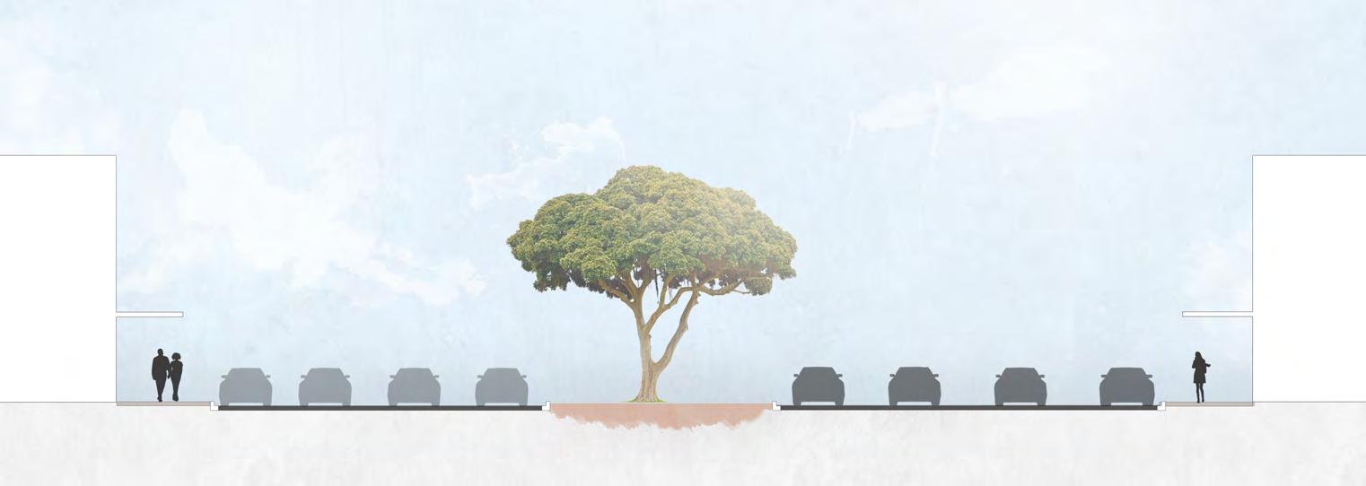
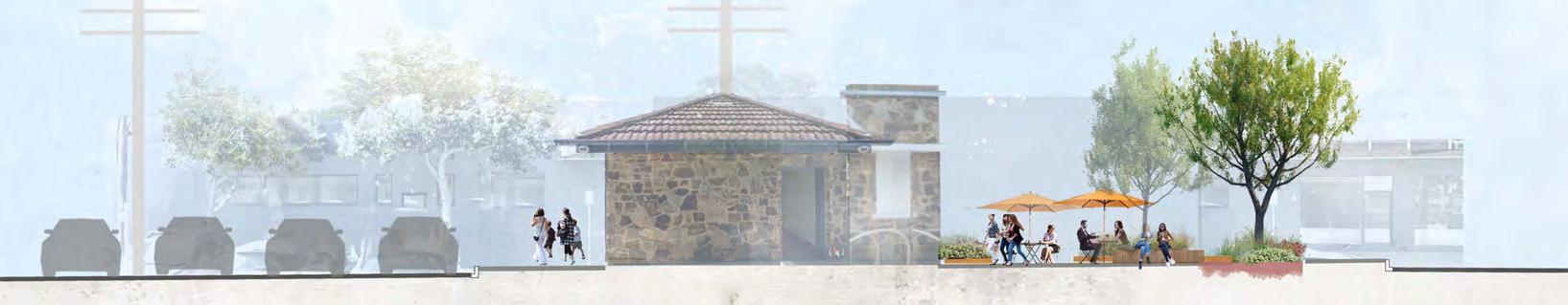
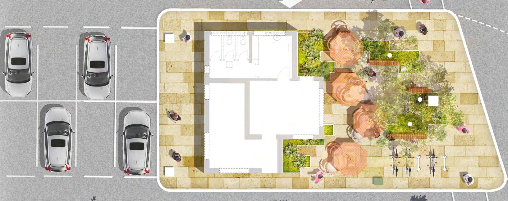
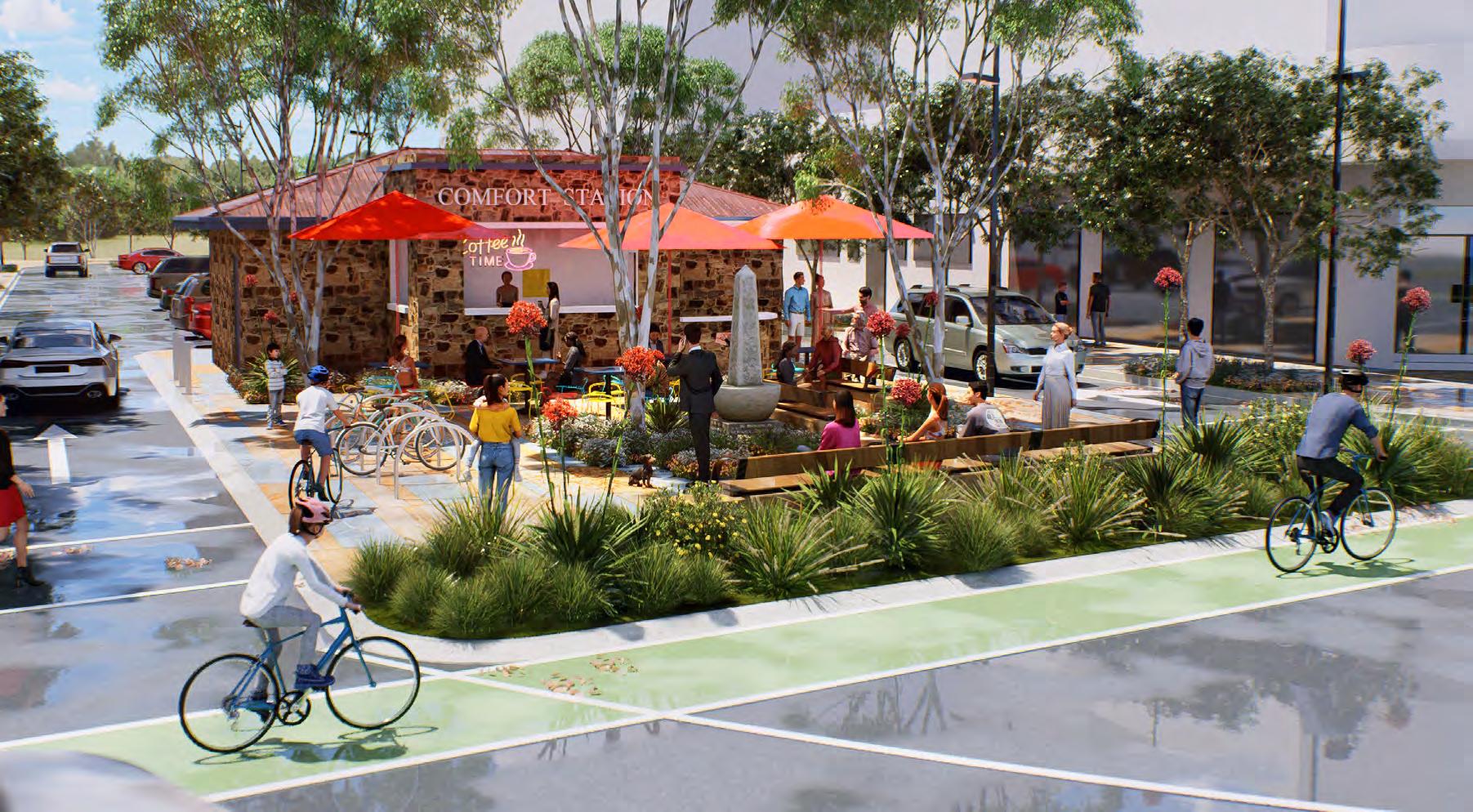
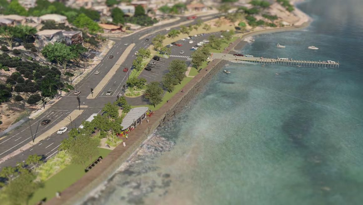
Far left: Image depicts the typical carpark and footpath arrangement in the FMAC Nepean Highway.
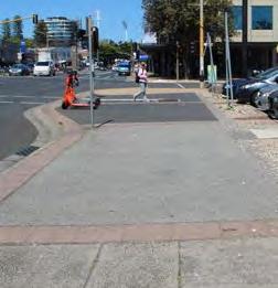
Left: Rendered image illustrates indented carparking through the FMAC with additional space for planted outstands, public seating and generous canopy trees.
Project Context
Land Use and City Context
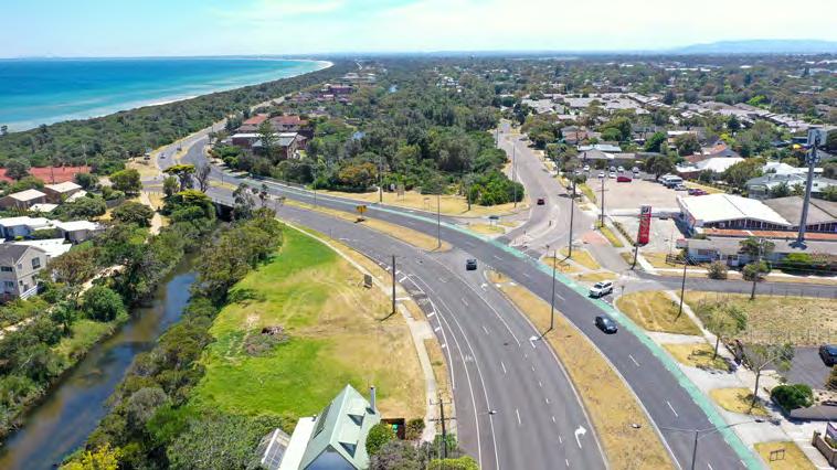
Nepean Highway is located to the western edge of the FMAC, running parallel to Port Phillip Bay and Kananook Creek. The Masterplan for Nepean Boulevard extends 3.7 kilometres, beginning at Mile Bridge, Kananook Creek in the North and to Olivers Hill in the South.
To the north, the proposed Boulevard is situated in a predominately low rise residential context with the FMAC structure plan identifying the potential for this project area to contain a mix of commercial residential and accommodation uses.
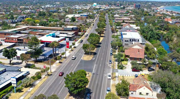
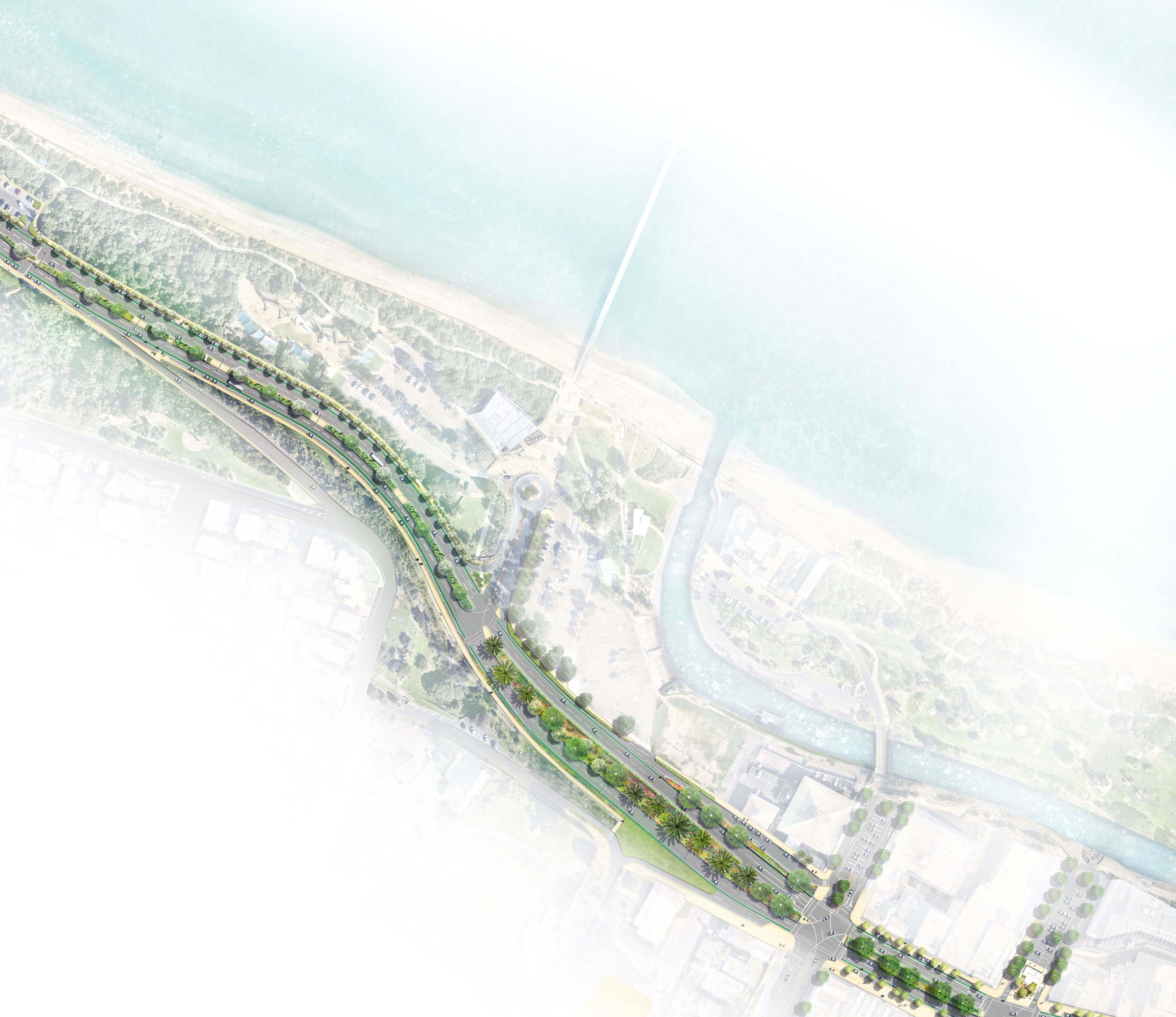
Nepean Boulevard central, running from Fletcher Road to Davey Street, is located adjacent to the commercial heart of the FMAC and is supported by a range of retail, cultural and transport functions. The FMAC structure plan identifies
opportunities to consolidate these functions to support a destination for business, shopping, living, dining and entertainment. The Boulevard will provide an important civic setting for a revitalised FMAC and facilitate connections between the retail and commercial heart to Kananook Creek and foreshore.
Importantly, the vision for Nepean Boulevard as a people focussed destination is supported by the location of the existing ring road, which will continue to serve as a traffic route and located to connect the city, from Fletcher Road, the Railway Station to Davey Street.
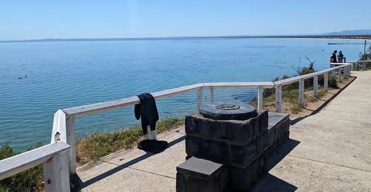
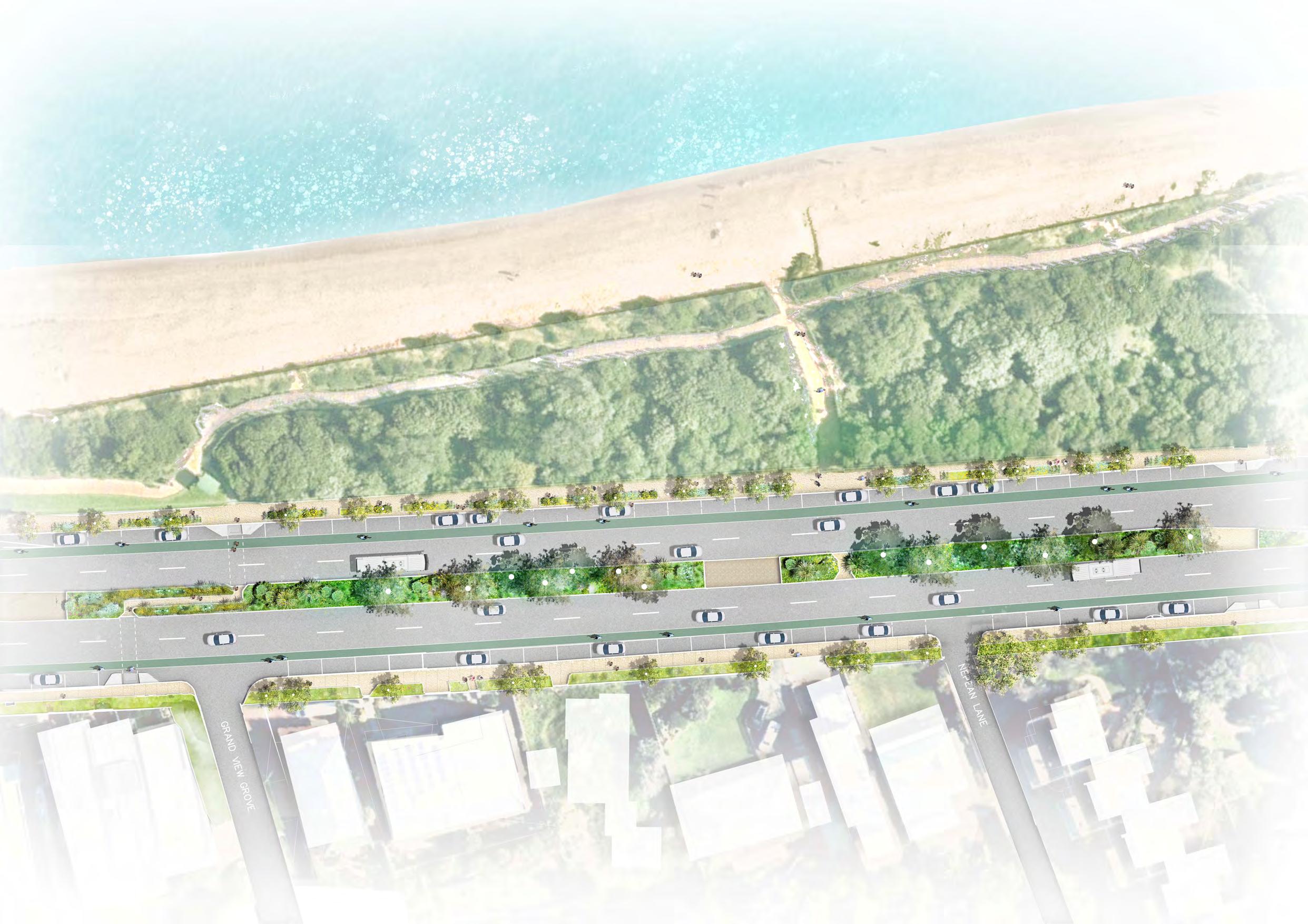
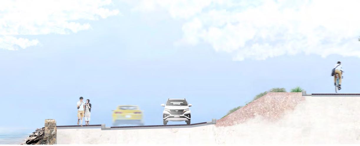
Nepean Boulevard south, extending from Davey Street to the Olivers Hill top lookout, is situated alongside residential uses on its eastern edge with valued coastal reserves on its western edge, including the Frankston Foreshore Reserve, Olivers Hill foreshore and carpark and Olivers Hill lookouts.
Connection To Country
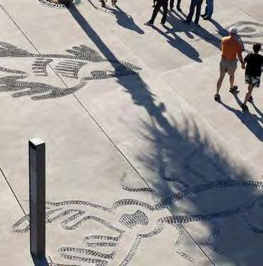
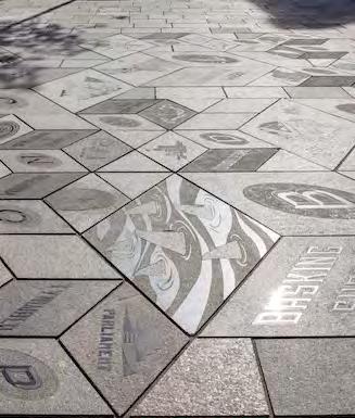
This place is Bunurong country, with spiritual, historical and cultural significance.
The Bunurong Land Council have been engaged in initial consultation for the Nepean Boulevard Vision project and subsequently produced the ‘Cultural Values of Frankston: Nepean Highway Boulevard Vision’ report. This has provided valuable information that will inform the ongoing design and development of the Nepean Boulevard. Walks on country with Bunurong representatives, and particularly more recently with Adam Magennis have provided valuable insights into a variety of cultural themes connected with the Frankston area, The Bay and Kananook Creek in and around the Nepean Boulevard.
Historical Context
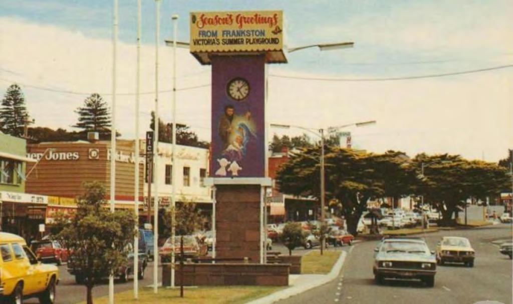
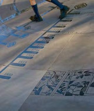
Frankston was historically a seaside fishing village and later a resort town. Established at a similar time to Melbourne, Frankston was connected to Melbourne with the rail line in 1882 and subsequently became a popular holiday destination. Its lure as a holiday destination increased particularly after the electrification of the railway service on 27 August 1922. People were drawn to Frankston for its natural beauty and it was the location for holiday homes of experimental design.
The Nepean Highway was originally established in the 1850’s as an informal sandy track called Arthurs Seat Road and subsequently named Point Nepean Road before being widened and declared a State Highway in 1947. The highway was a vision of civic pride for the Frankston community with a sense of destination and display. In 2008, the Eastlink tollway opened and now acts as the primary arterial connector between the city of Frankston suburbs, Dandenong and Melbourne
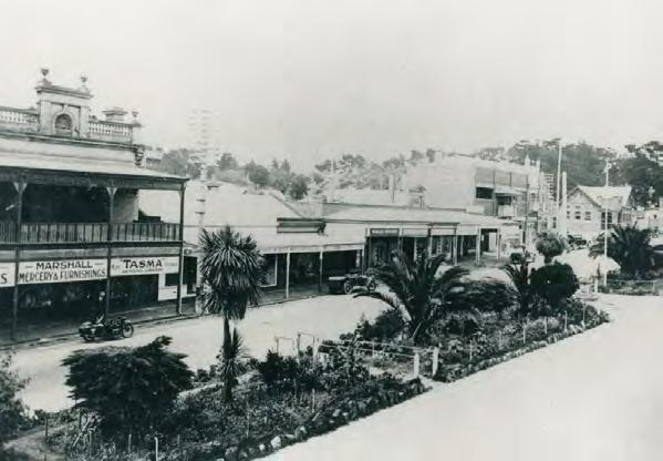
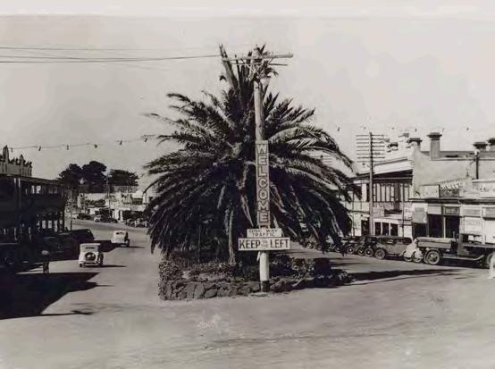
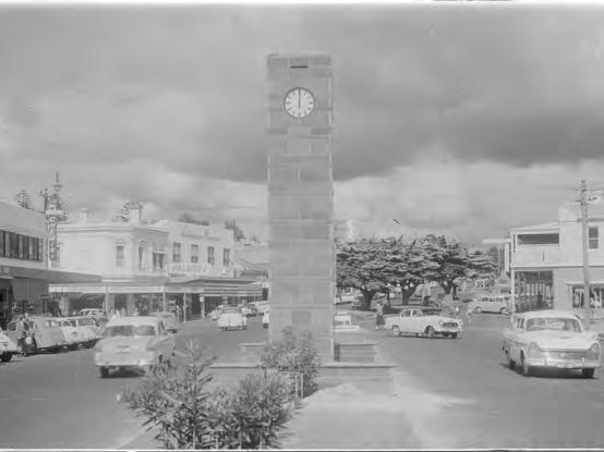
Bay Street, Frankston (now Nepean Highway). From Mr Norman Whittingham, donated 1987. Sourced from Frankston City Libraries
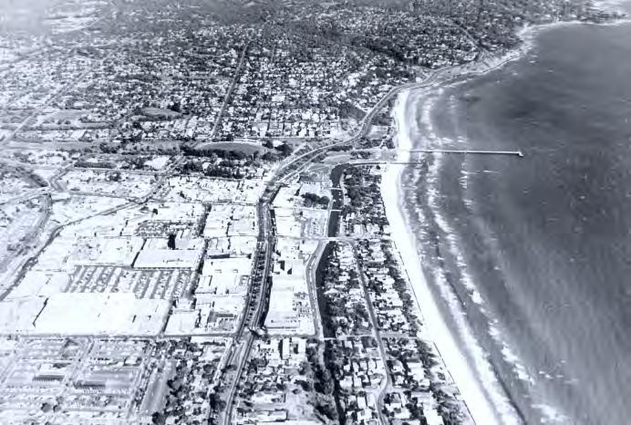
An aerial view of Frankston.Sourced from Frankston City Libraries Oliver’s Hill 1920. Boy’s Home on top on the left, Gracehill over rise on right. Photo by W. Minton. Sourced from Frankston City Libraries
The main street.Year unknown.Sourced from Frankston City Council. The main street.Year unknown.Sourced from Frankston City Council.
South Embankment. Year unknown. Sourced from Frankston City Council
Cultural Themes
A Connected & Unique Experience
Bunurong Country encompasses a large the south east of Victoria extending from the Werribee River to Wilsons Promontory. It encompasses a extensive region of sacred lands and waterways, comprising important cultural landscapes places, traditional cultural practices, and stories.
Through walks on country with Bunurong representatives and particular Adam Magennis, it is apparent that Nepean Boulevard traverses a distinct and valued cultural landscape. Adam has kindly provided the following themes to help inform the development of the Nepean Boulevard masterplan project and ensure Bunurong narratives and values of this place are embedded into its ongoing development and implementation.
The ongoing use and inclusion of cultural knowledge in the project will be subject to the approval of Bunurong Land Council and other relevant knowledge holders and follow Aboriginal Cultural Intellectual Property (ICIP) protocols.
These themes provide an important foundation to ensure the ongoing design and expression of the Nepean Boulevard transformation can be informed by a sensitive understanding of designing with country to ensure an authentic place specific outcome.
Sandstone Country
Use of a colour palette of Bunurong
Sea Country including soft blues, greens, pinks and purples.
Health of Country
Regenerative landscape, biodiversity and local ecologies.
High Grounds
Cultural perspectives - views and connections to other Kulin Nation landscapes, looking out over sea country, weather patterns, tidal patterns, mountains and communities.
Salt Water Themes
To influence design processes and creative opportunities in the arts, interpretation, materials and furnishings.
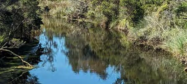
Kananook Connections
Recognising the creek as an important Bunurong bio-cultural resource and biodiversity corridor.
Social Landscape
How humans interact and connect with space and be educated though interpretation.
Cultural Forest Dedicated Bunurong Cultural Forest Garden within project areas plan.
Creative Arts
Creative arts integration and dedicated spot to annually celebrate social and cultural themes.
Nepean Boulevard Key Themes & Outcomes
Extraordinary Experiences
The Masterplan will transform an ordinary arterial highway experience to a memorable people focussed Boulevard. It will facilitate connections between the City, Creeks and Bay, provide a generous public realm to foster new street life, support new residential and commercial opportunities and reinforce its green credentials with new avenue plantings along its length.
These initiatives will deliver an iconic civic address to the City and provide a range of social, economic and environmental benefits to the Frankston community.
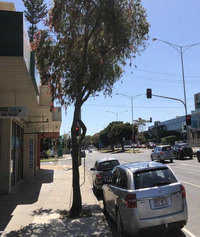
Today the Highway is a heavily engineered corridor with a really varied level of amenity due to a lack of investment. The road corridor however is characterised by a largely continuous central median that hosts significant mature
trees and their associated broad canopy. The Masterplan builds upon this valued character with new avenue tree planting and in association with traffic lane reduction in the City centre, new cycle lanes, indented car parking, generous footpaths and landscaping, will significantly enhance the image and experience of the City and its connections.
The vision of a transformed highway to a people focussed Boulevard destination is underpinned by four key themes. These themes frame design responses, key projects and actions for each of the three (3) Nepean Boulevard sections.
Movement and Connections
A Boulevard that Connects:
Facilitating new connections between the City and the Bay and fostering a new place for people and an active heart of the City.
Where success will be measured, in part, by enhanced transport choice and safety for all road users with new and improved connections. Creating a people-orientated public realm, with linking streets and activated edges, to compliment the overall FMAC experience. Connecting strategies will balance the need for efficient traffic flow and parking, whilst encouraging active transport, public transport and generous pedestrian provisions.
Outcomes:
• Rebalance the road corridor from a Highway to a Boulevard, to create an inviting pedestrian place, encourage active transport and support public transport options.
• Work with Victorian Government to consider potential traffic flow impacts when planning for change and network improvements.
• Transform Nepean Boulevard as a thriving destination with linking streets and activated edges, to complement the overall FMAC experience.
• Support Nepean Highway’s role as an important part of the broader bus network and connection to the Frankston Station interchange.
• Support existing and future businesses with access to on street car parking and loading zones including strategies for off street parking to minimise the impact of potential car park reductions.
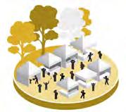
Uniquely Frankston
A Boulevard where everyone’s welcome: Creating contemporary experiences that relate stories of place: past, present and future. A Boulevard that is unique to Frankston, embracing its rich heritage and promoting well-being. Creating settings for Frankston’s community and cultural expression, with opportunities for art, lighting, wayfinding and Interpretative elements as well as community events and initiatives.
Outcomes:
• Embed the rich seaside culture and diversity of the communities of Frankston.
• Create a local identity that provides a safe and positive experience both day and night.
• Support a thriving street culture with additional space for outdoor dining and activation.
• Develop a material and furniture palette that is distinctly Frankston and supports an enhanced identity and experience.
• Increase First Nations Peoples storytelling and cultural knowledge systems.
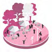
Public Life and Activity
A Boulevard for People:
The Boulevard will be a place for everyone, inviting and inclusive, allowing locals, friends and visitors to enjoy a revitalised Frankston. It will link to a range of contrasting experiences from spectacular views at Olivers Hill, to ecologically focussed foreshore connections, to the vibrancy of the city core. Generous pedestrian spaces, will offer places to meet, dine play and revel in a calendar of cultural events. A cohesive suite of distinct furnishings, materials, lighting and signage will create a distinctive image and foster a range of ways the public can enjoy the Boulevard experience.
Outcomes:
• Establish Nepean Boulevard as a dynamic and delightful urban destination.
• Deliver a Boulevard that is safe and more inclusive to meet the needs of all genders, abilities and backgrounds.
• Improve safety for people walking, cycling, driving and using public transport.
• Provide generous and comfortable pedestrian spaces to support a new layer of public activity for people visiting, shopping, socialising, playing, working or just passing through.
• Introduce functional and amenity lighting to improve safe night-time experiences.
• Develop a cohesive suite of furnishings, materials, lighting and signage to create a distinctive urban coastal identity and foster a range of ways the public can enjoy the Boulevard experience.
Green and Leafy
A Boulevard of New Ecologies:
Sustainable and resilient, this will be a cool green Boulevard of the future. The introduction of a substantial new green and leafy boulevard responsive to its coastal setting will reinforce sense of place, and create a place to linger with local biodiversity, enriched by water sensitive design and urban cooling strategies.
Outcomes:
• Achieve urban forest targets for urban heat island mitigation and overall community health and wellbeing.
• Integrate new and enhanced landscapes to provide cool and comfortable settings for people.
• Provision of new avenue plantings along the Nepean corridor to improve biodiversity, amenity and identity.
• Integrate Water Sensitive Urban Design for passive irrigation to support tree planting and improved environmental outcomes for the Port Phillip Bay and Kananook Creek.
• Link to local heritage and ecology fostering public education, experience and participation.
Extraordinary Experiences
Character & Identity
The Nepean Boulevard will connect people to the beauty of its setting, to its wider context and locally to the unique cultural stories of place. It will be civic in scale, and transformative in intentions, yet grounded in the patina and materiality of place.
The Nepean is situated on sandstone country following the line of the former fresh water Kananook Creek line and the salt water Bay country.
A celebratory material language that responds to the setting will unify the public experience, reinforce a sense of place and ensure the Nepean is unique to Frankston and its community.
Sandstone colours, patterns and textures, will be complimented with coastal vegetation, new ecologies and cooling canopy trees. Public life will be enriched with lighting that subtly enhances the boulevard and its location with new furnishings and art opportunities, connecting people to each other and a unique visual language for the City.
Nepean will be embedded in the natural systems of its place. The Boulevard respond to the underlying and adjacent pathways of water, from sandstone ridge to tidal edge. Plants, sunlight, textures and colours will remind visitors of where they are, grounded in Bunurong Country
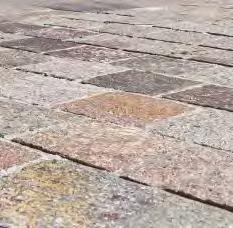
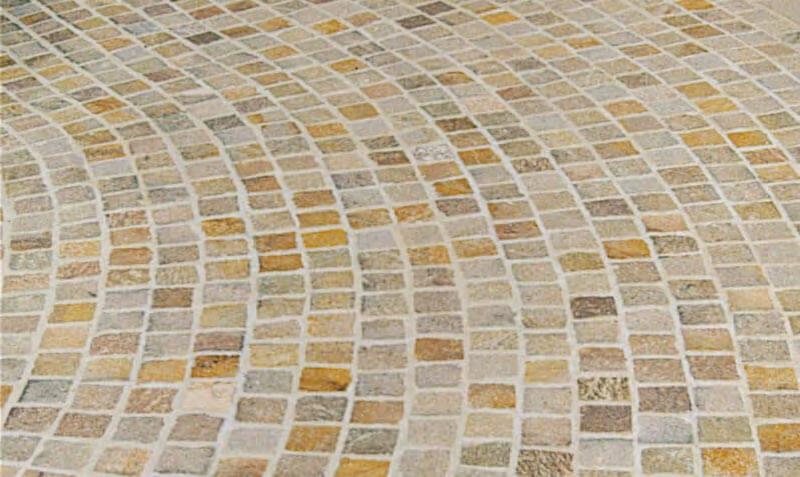
Frankston's colour palette is derived from it's unique landscape context including it's stunning Bay, creeks, soils and geology. These colours can be woven into Frankston's public realm, connecting the community and visitors to Frankston's inherent landscape identity. Frankston's colour palette will be revealed through finishes and materials, planting, art, lighting and wayfinding.
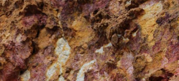
Local geology, textures and colours
Colours and Finishes Connected to Place
Geology
Soils
Bay Creek
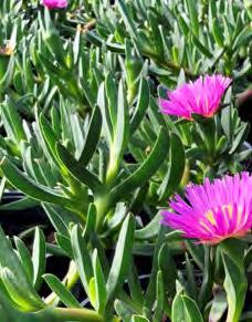
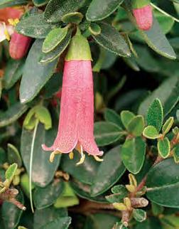
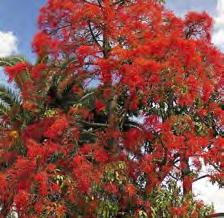
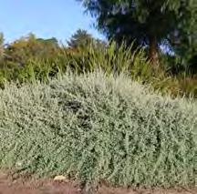
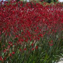
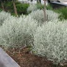
Frankston's native plants form an inspiring palette of colours and textures which ground users in a unique sense of place. These textures will be revealed throughout the Nepean Boulevard in a variety of forms and sequences.
Frankston's Plant Textures
A Diversity Of Experiences
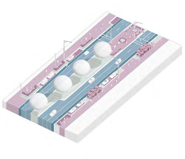
Streetscape Design Options
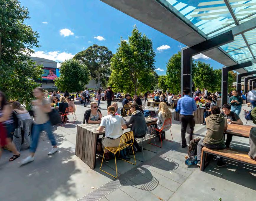
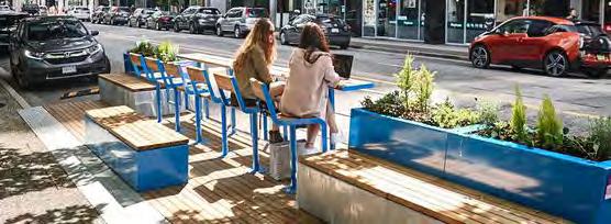
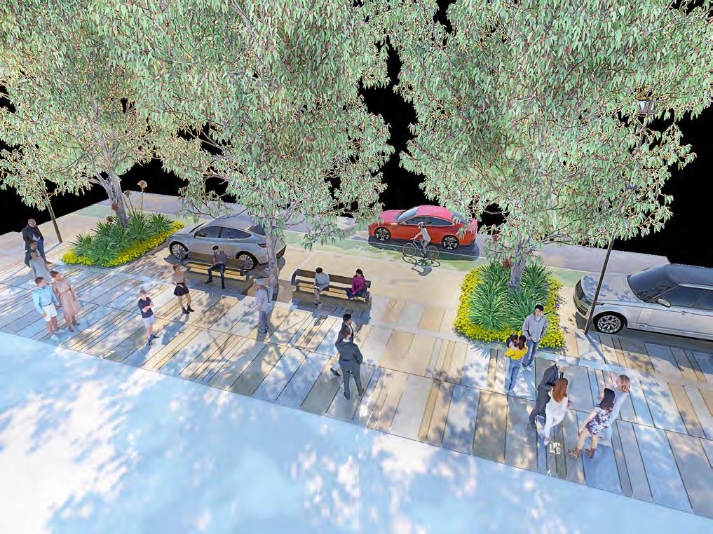
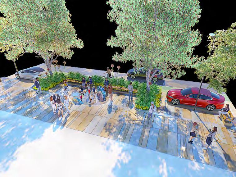
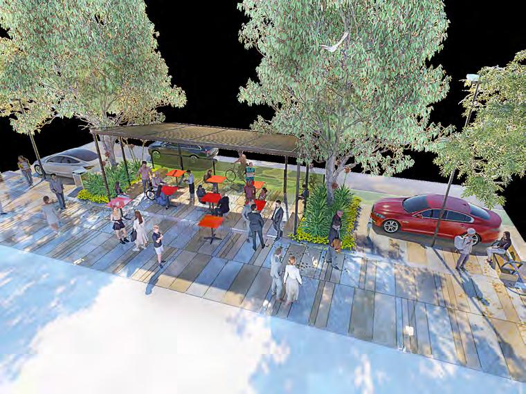
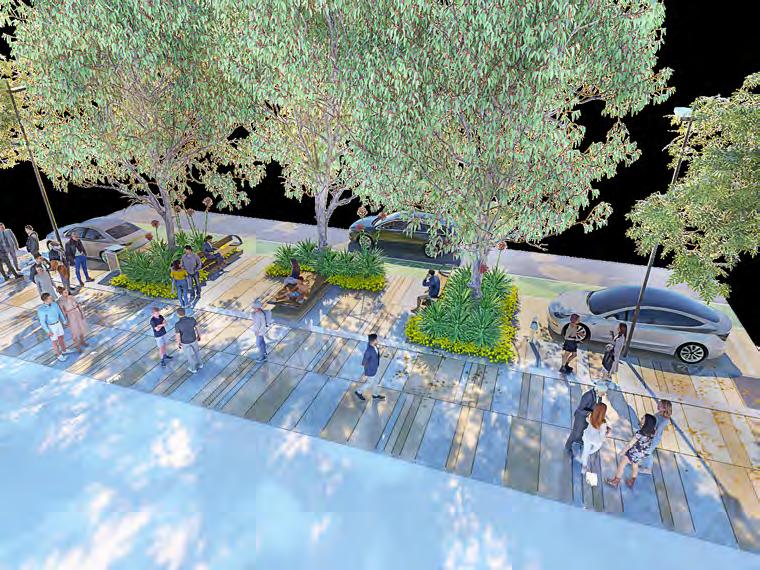
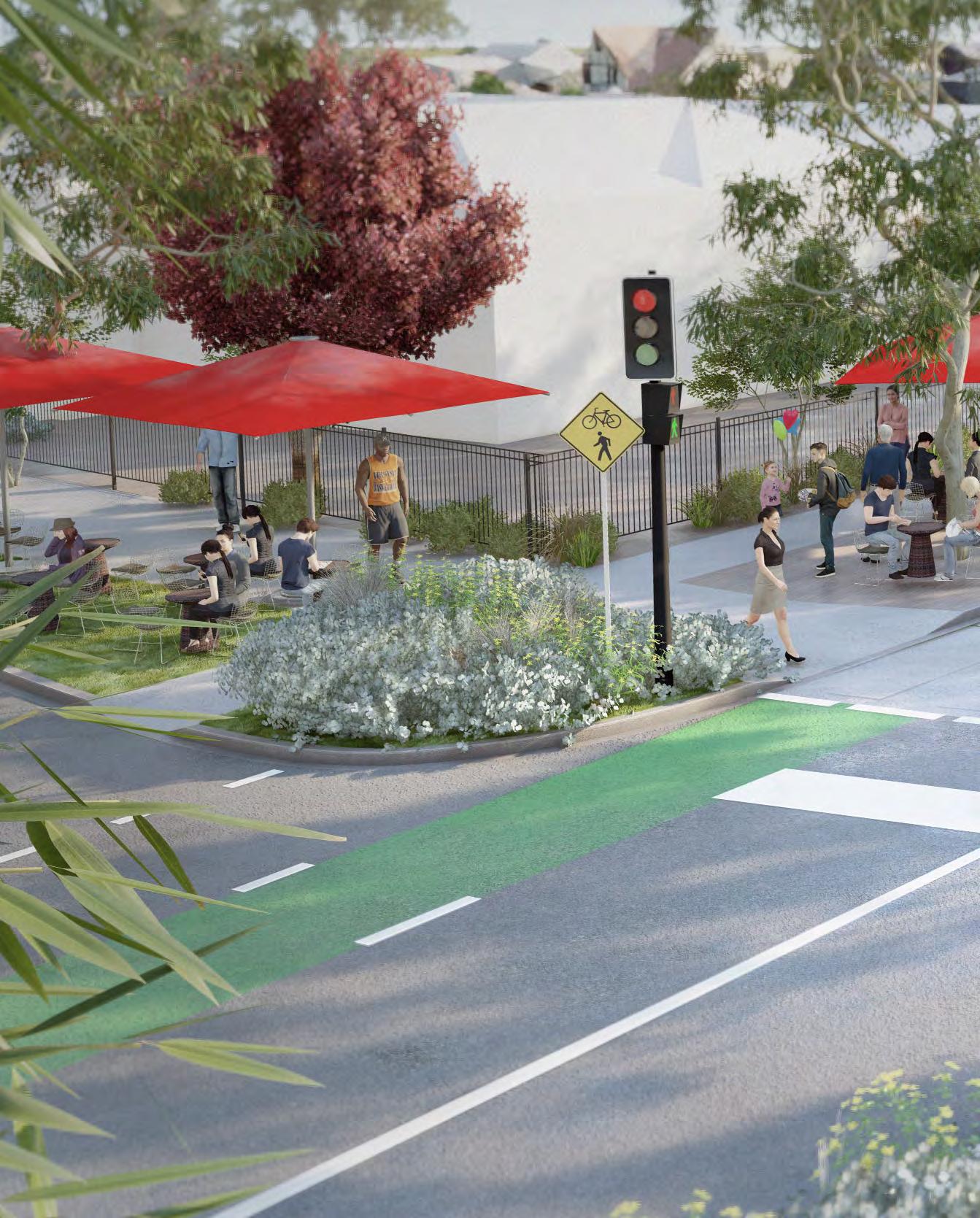
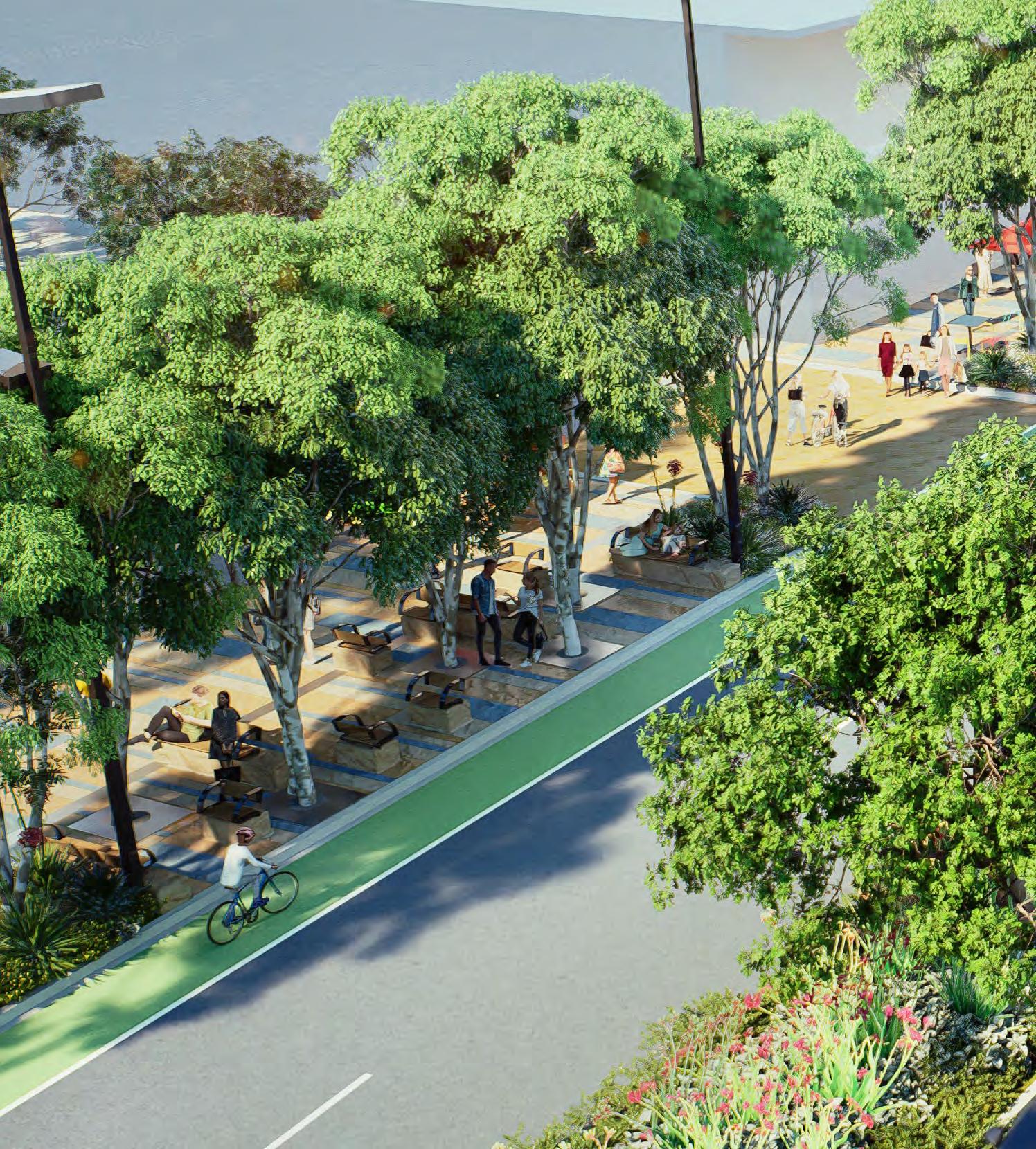
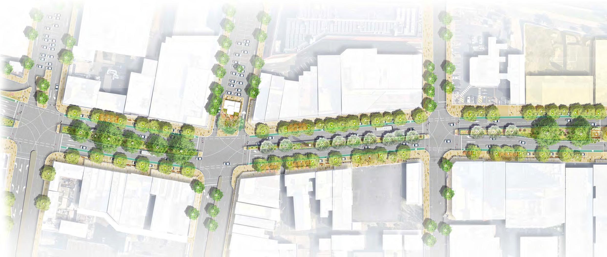
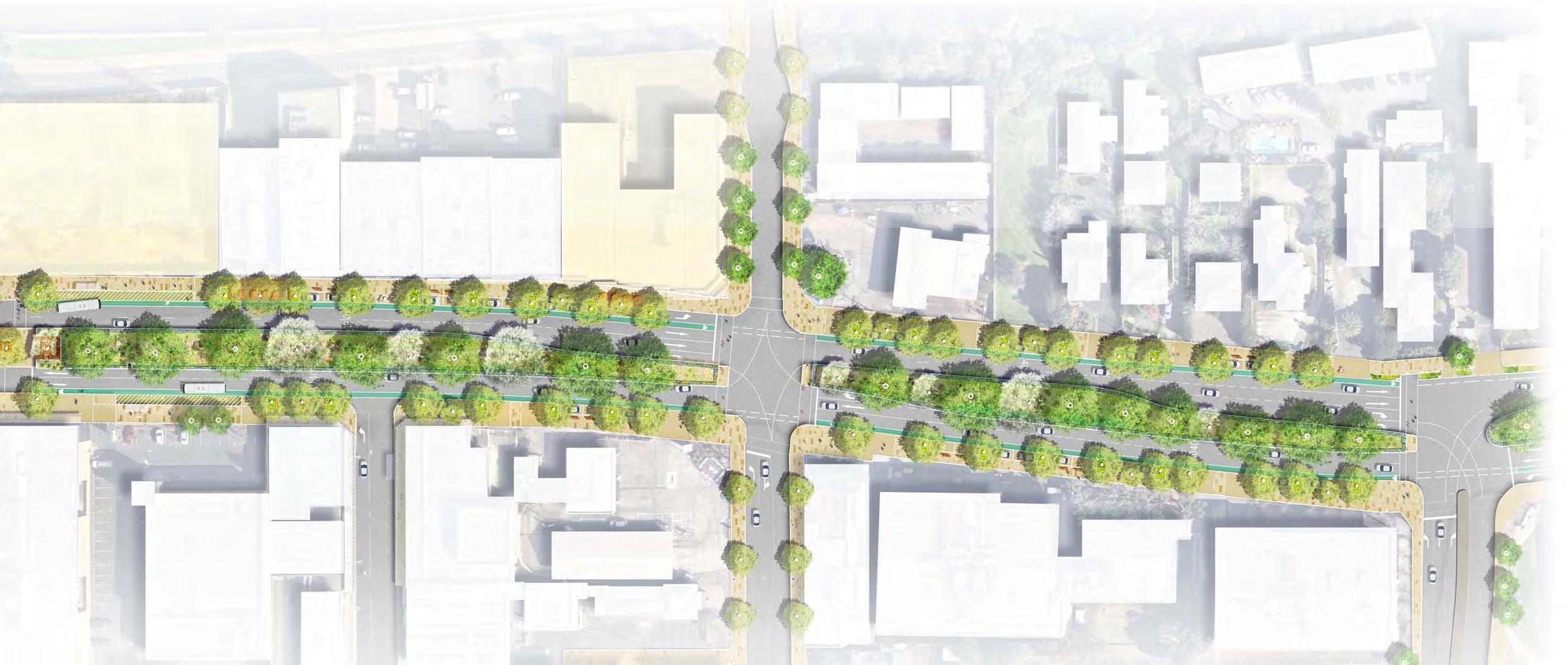
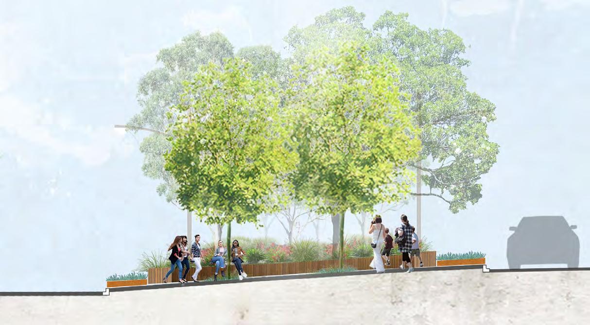
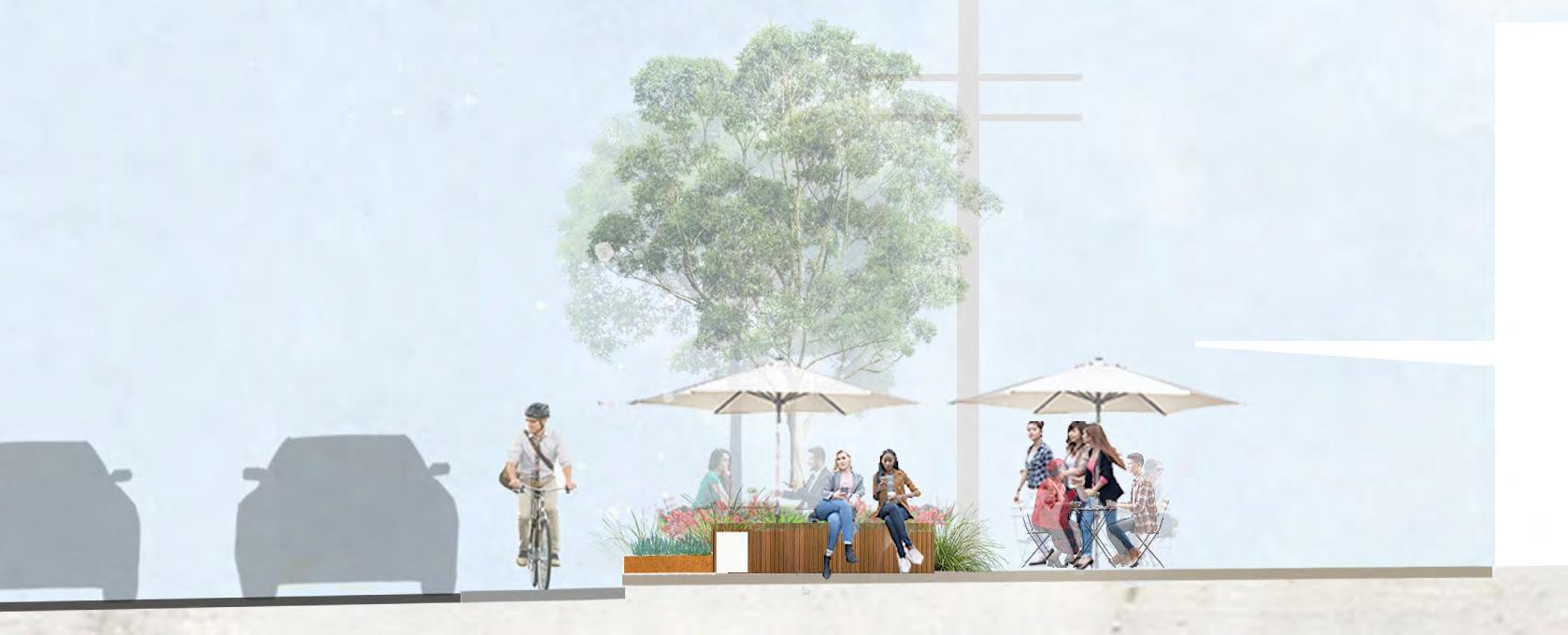
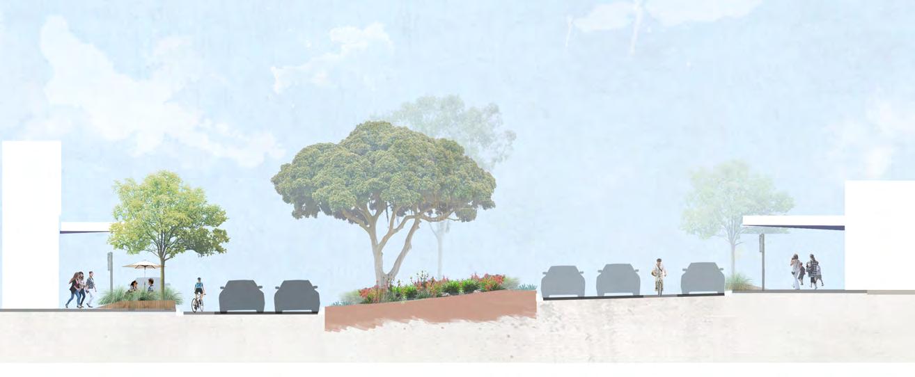
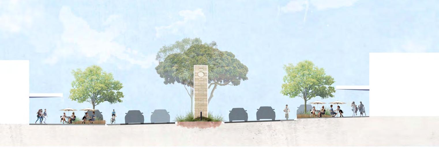
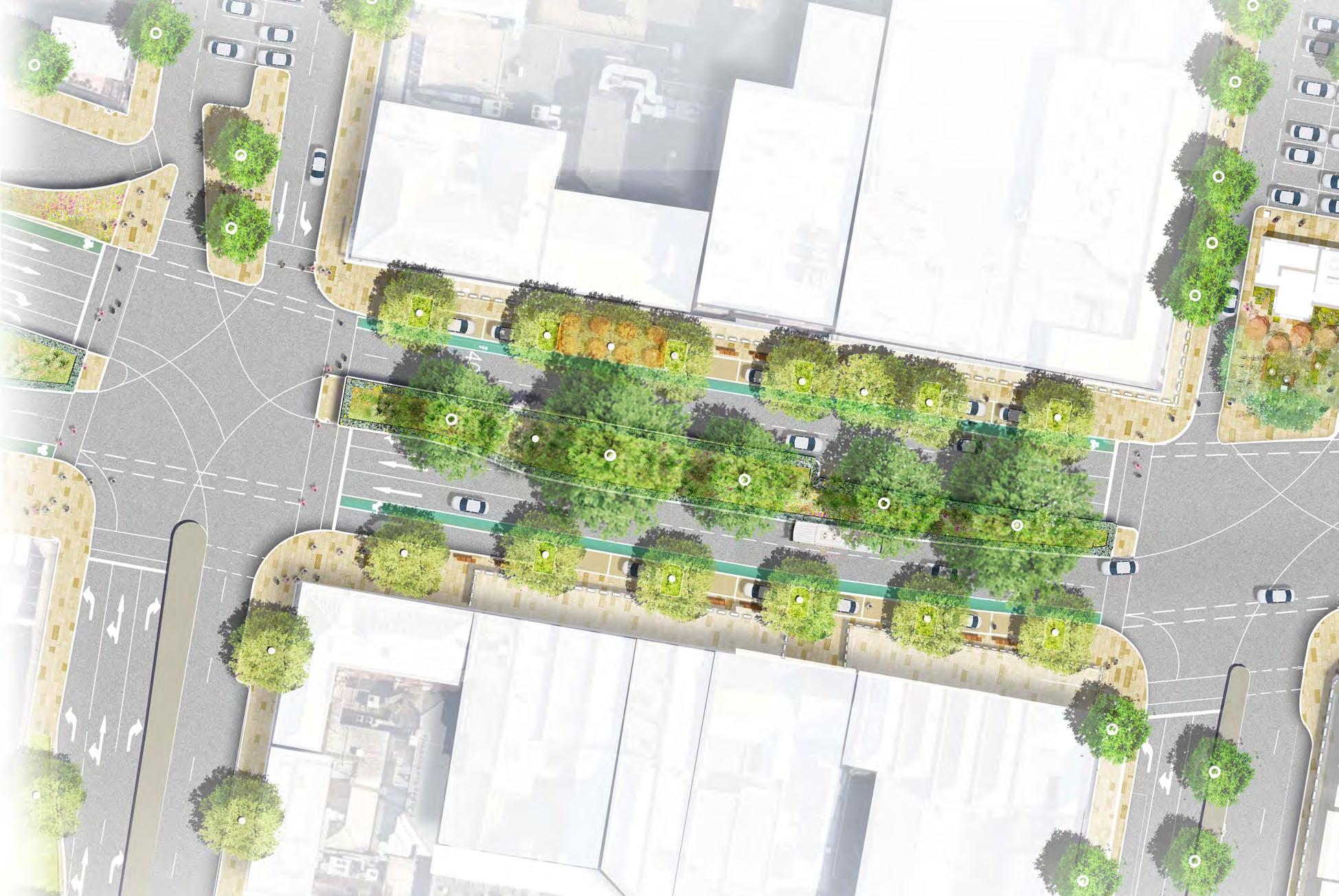
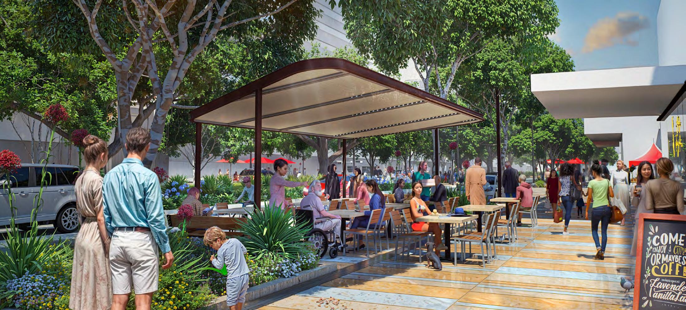
Nepean Boulevard is the civic centrepiece of the FMAC. It is anticipated as an important public setting, that facilitates a range of ways people can meet, promenade, socialize, be nourished and entertained. It will be characterized by widened footpaths, improved tree plantings, pavements, lighting and furnishings. This improved amenity will encourage residents, workers and visitors to use the Boulevard in a variety of ways, increase visitation and benefit social and economic rejuvenation.
The Boulevard will be characterized by an improved public realm typically located between building edges and the road carriageways.
To foster a range of ways the street can be used, a range of typologies have been developed to illustrate how parking, meeting places, alfresco spaces and playful areas can be arranged. These diverse arrangements, that will contribute to the enjoyment of the street, will be unified via an overall consistency of image and identity, tree species, pavements and furnishings.
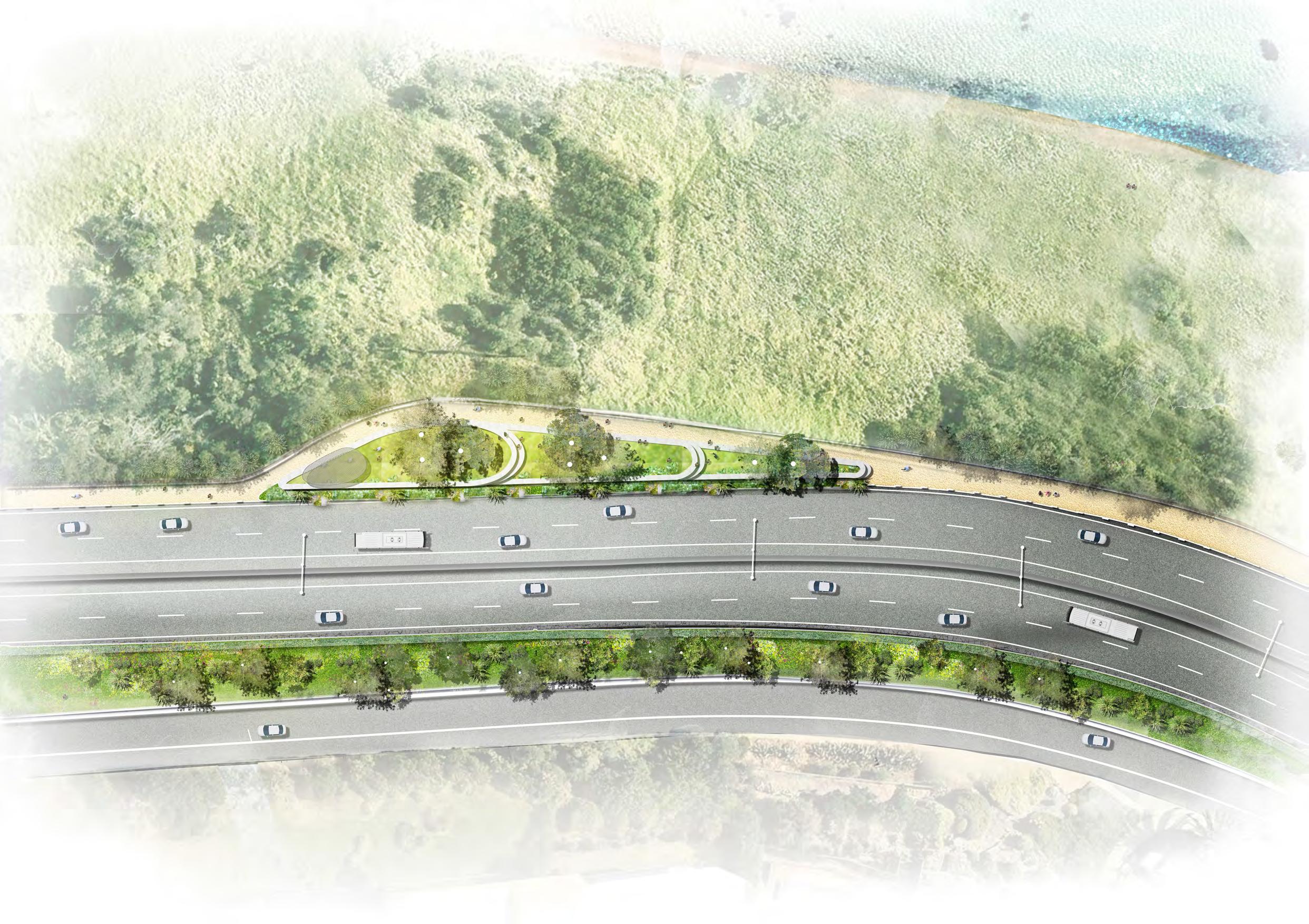
Streetscape Options
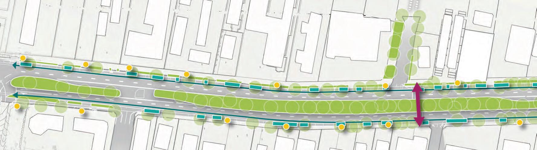
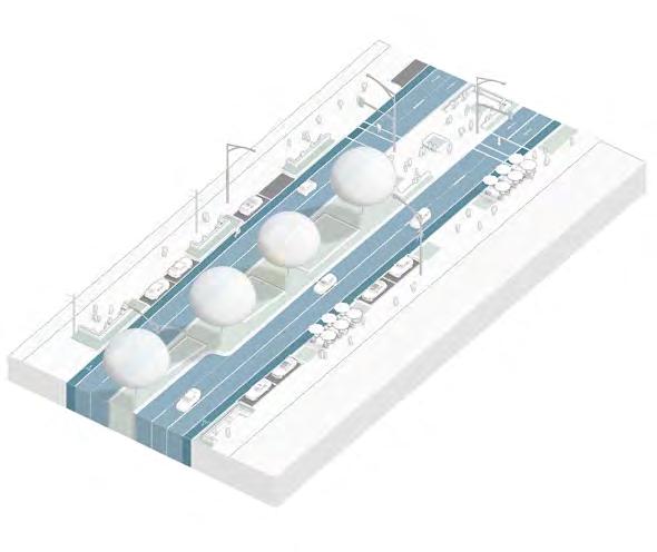
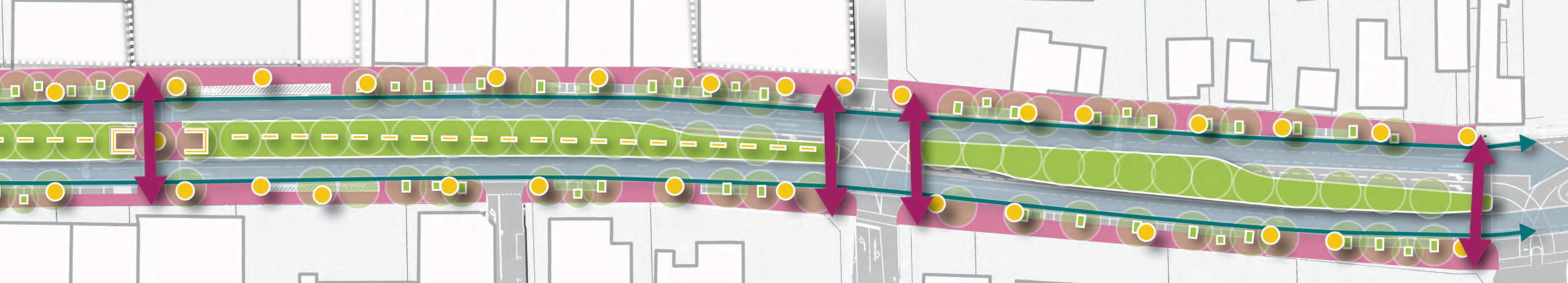
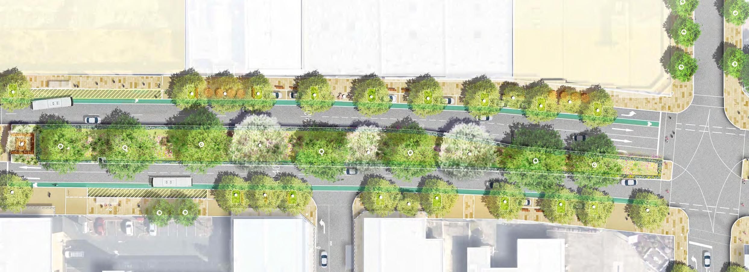
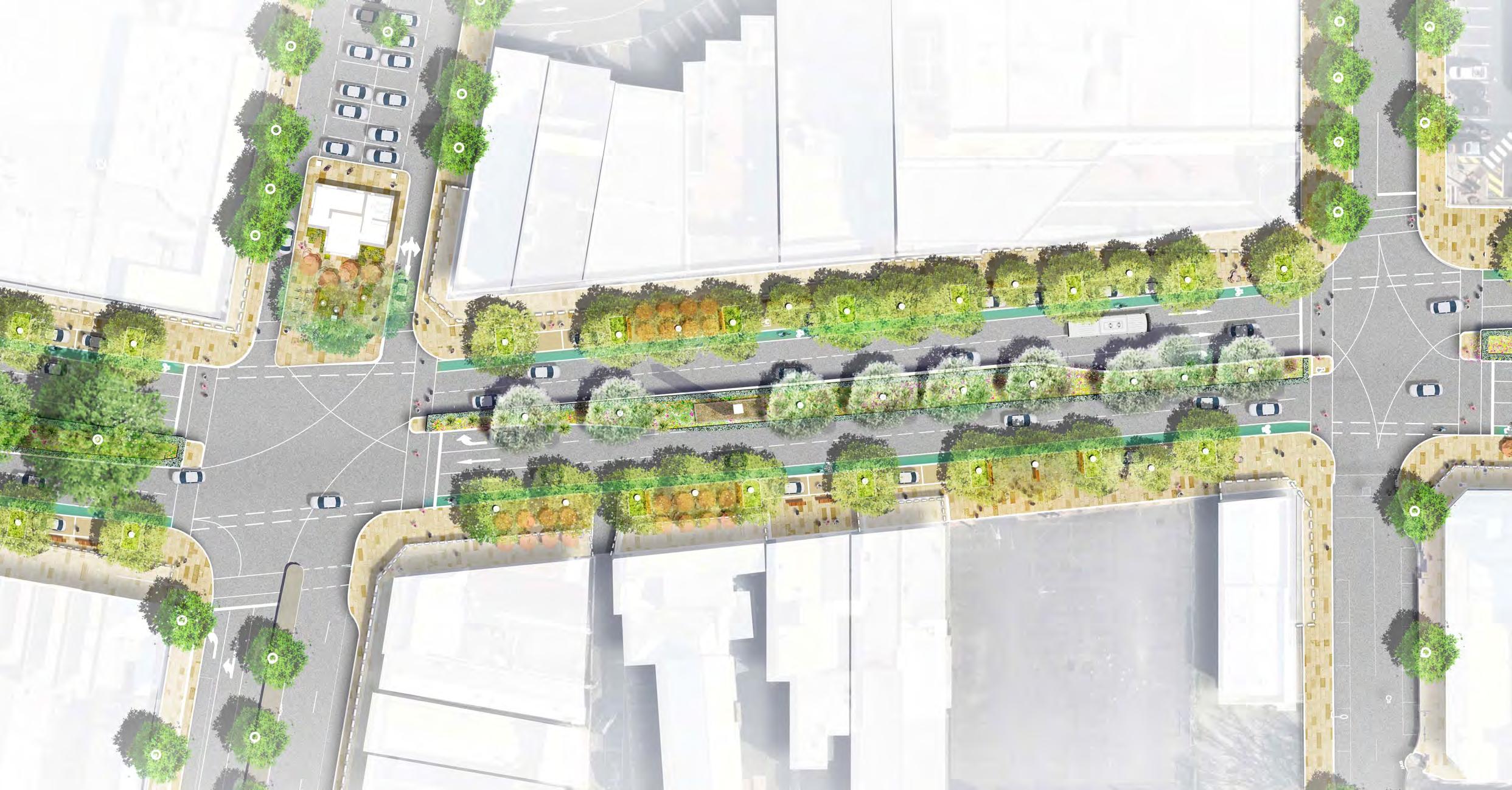
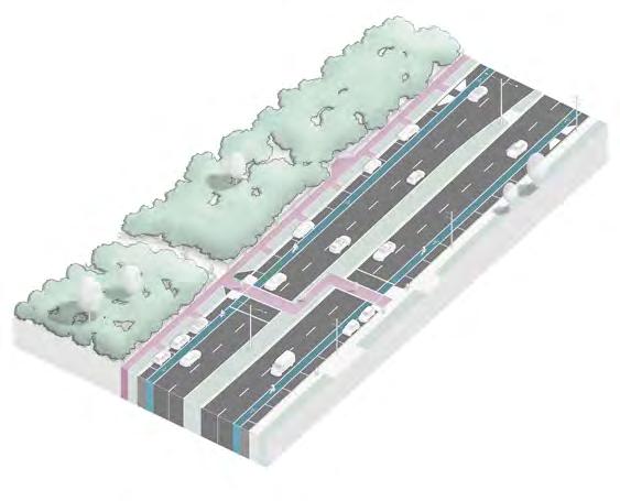
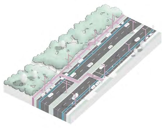
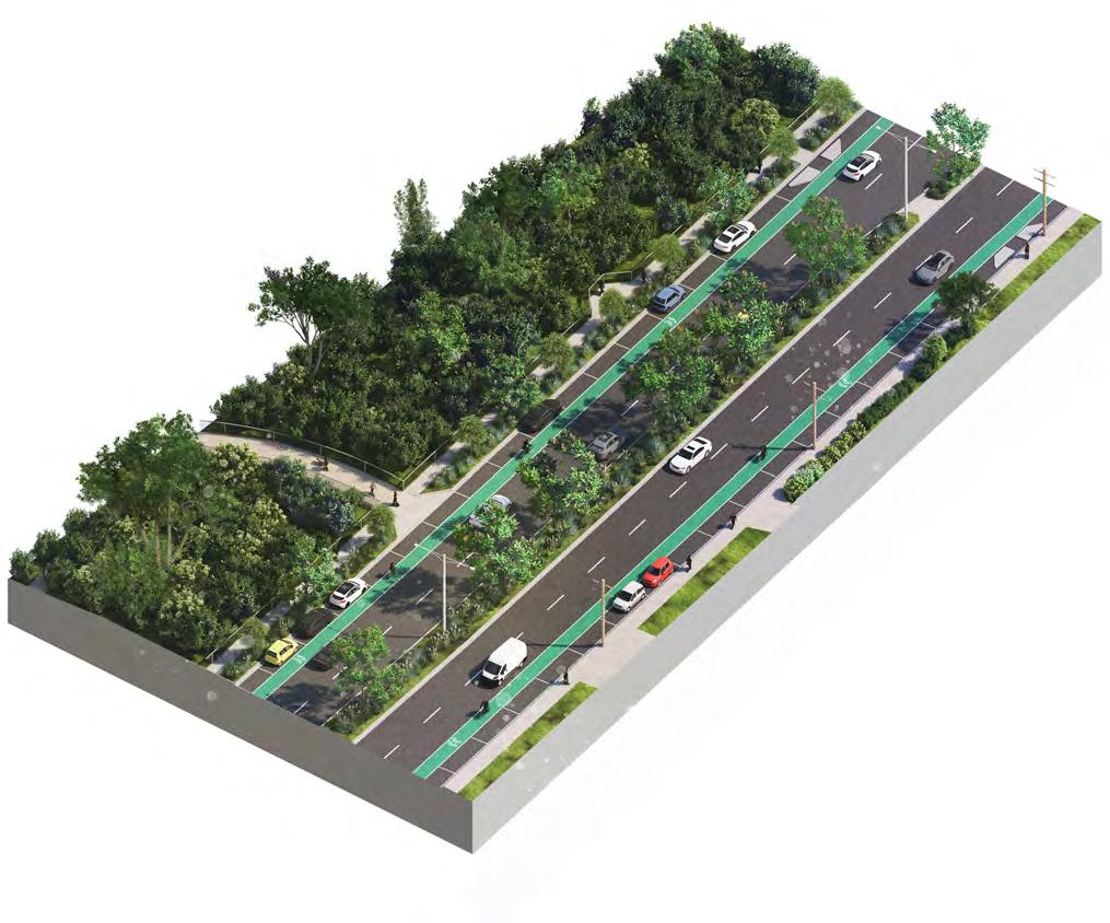
Through the Nepean Boulevard Central zone, the design anticipates a reduction in one north and south bound traffic lane allowing for new cycle lanes to connect with the existing network. With this brings the opportunity for new indented car parking and footpaths to be extended to host a range of functions, including tree planting, social spaces. Importantly this design strategy retains drainage infrastructure, with minimal impacts to road profile and services.
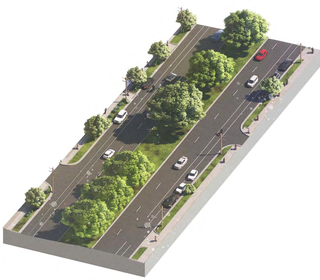
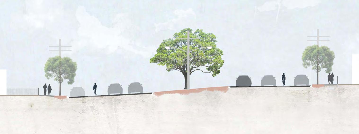
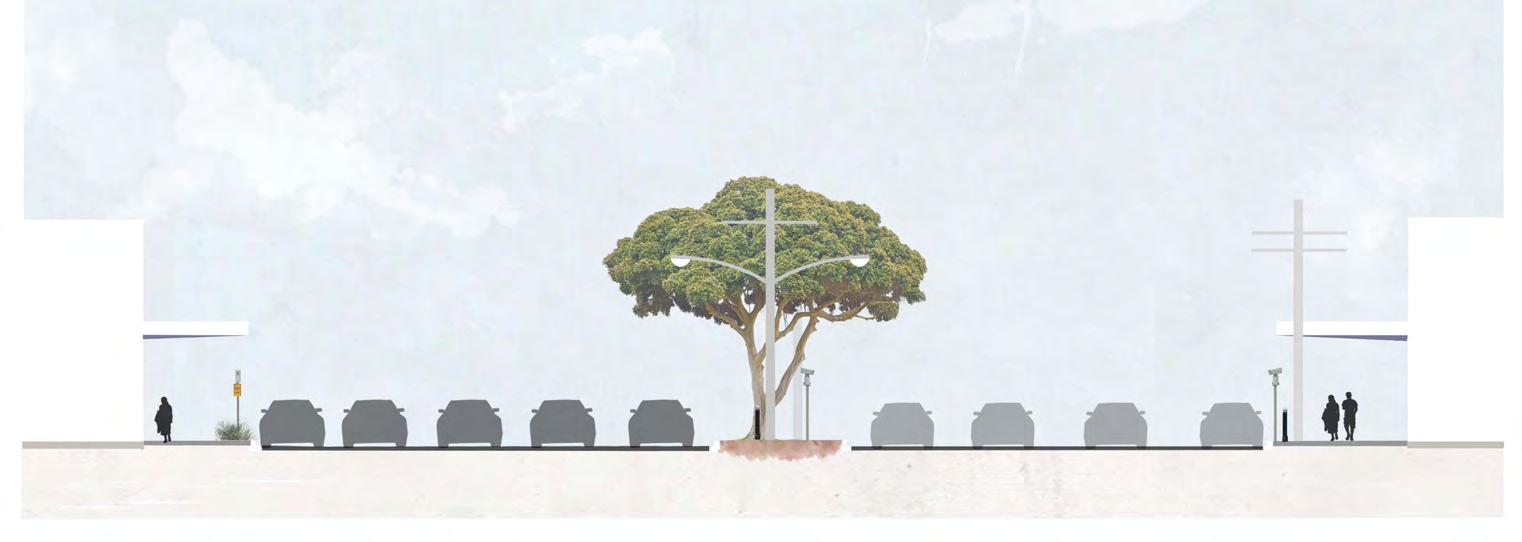
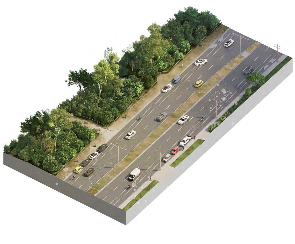
Existing Condition
The existing streetscapes in the FMAC comprises, adhoc concrete pavement finishes, low quality furnishings, and parallel car parking. Drainage and major services is situated at the back of kerb.
Active Transport Hubs
Areas identified for specific functions such as a bike hub, secure bike parking, hire, and repair.
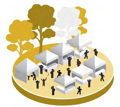
Playful Spaces
Areas will allow for protected seating with small scale playful elements and /sculptures integrated public art to provide social connection for all ages through fun and play.
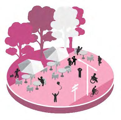
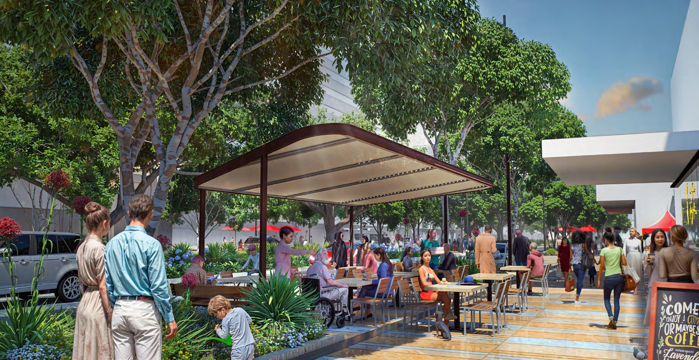
Alfresco Dining & Weather Protection
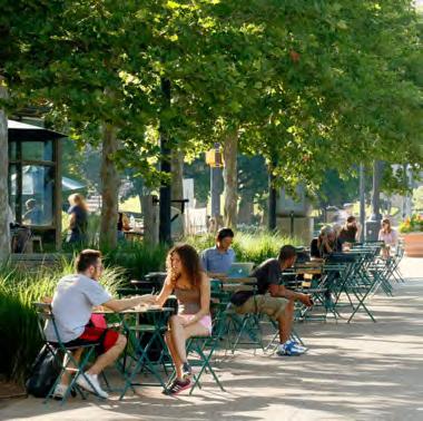
Spaces can be defined for potential alfresco dining with extended footpaths and located between avenue tree plantings. Additional opportunity to introduce a unique Frankston weather protection structure, to host alfresco dining as well as public seating spaces.
Social spaces
Provision will be made for areas that encourage meeting, resting and social connection and engagement. These areas can include landscaping, grassed areas, seating and tables for broader public amenity.
2.0 Project Areas
Nepean Boulevard Project Areas
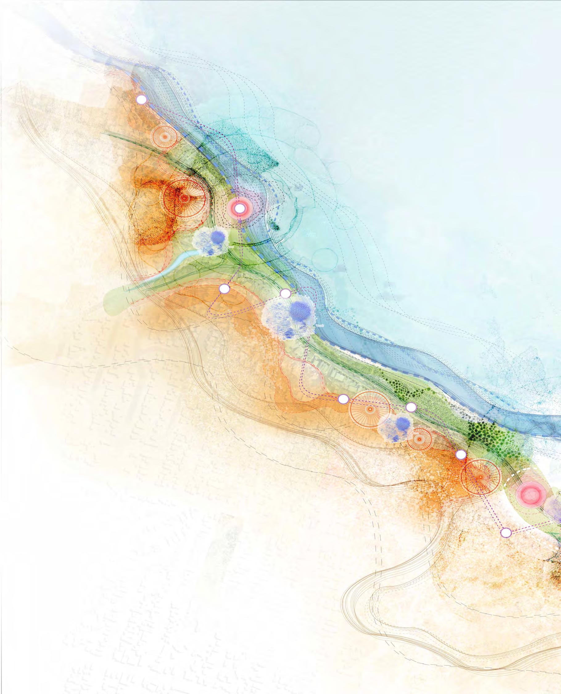
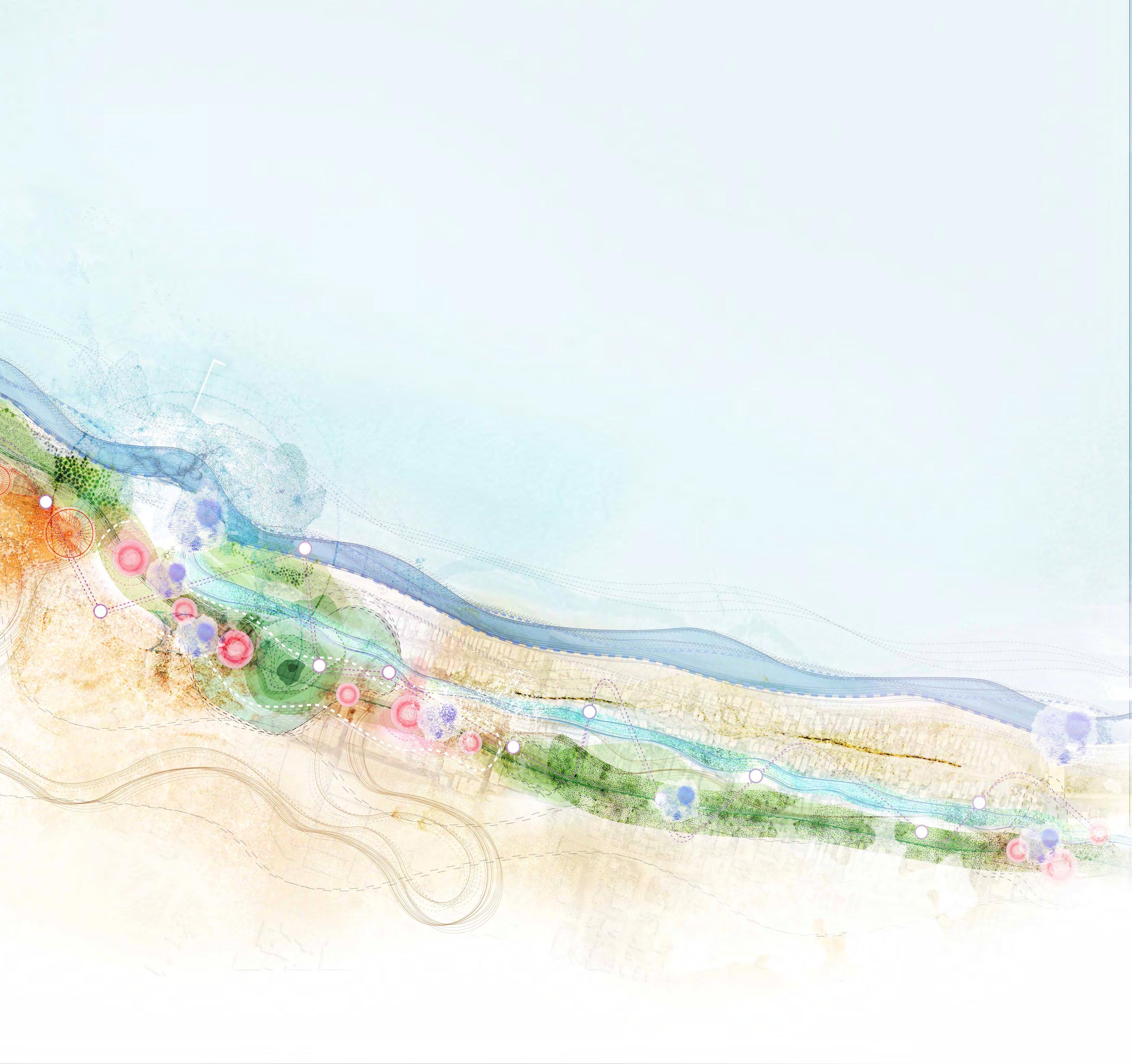
The 3.7km road corridor is intended to become a uniting and memorable boulevard. However it is characterised by three distinct precincts, with specific urban and landscape forms. These precincts have been arranged for clarity throughout the report with their own specific design response.
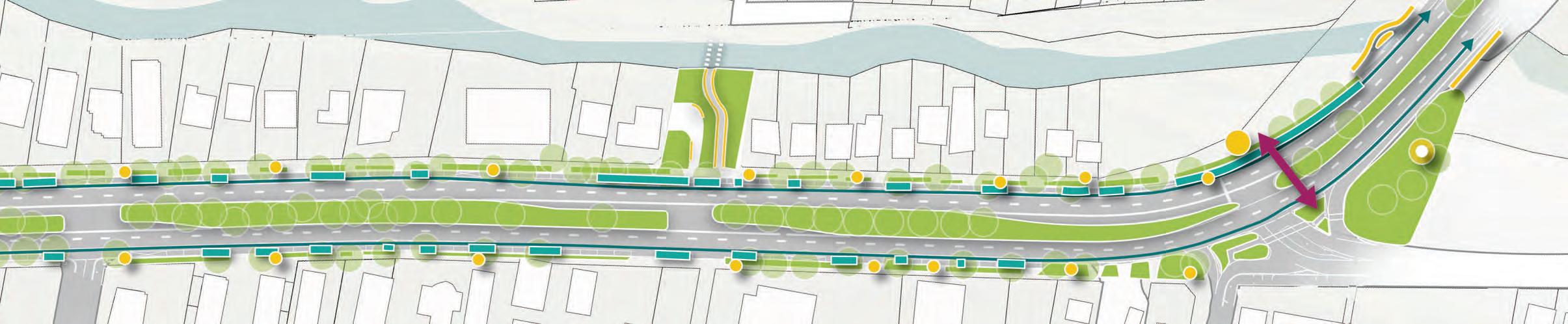
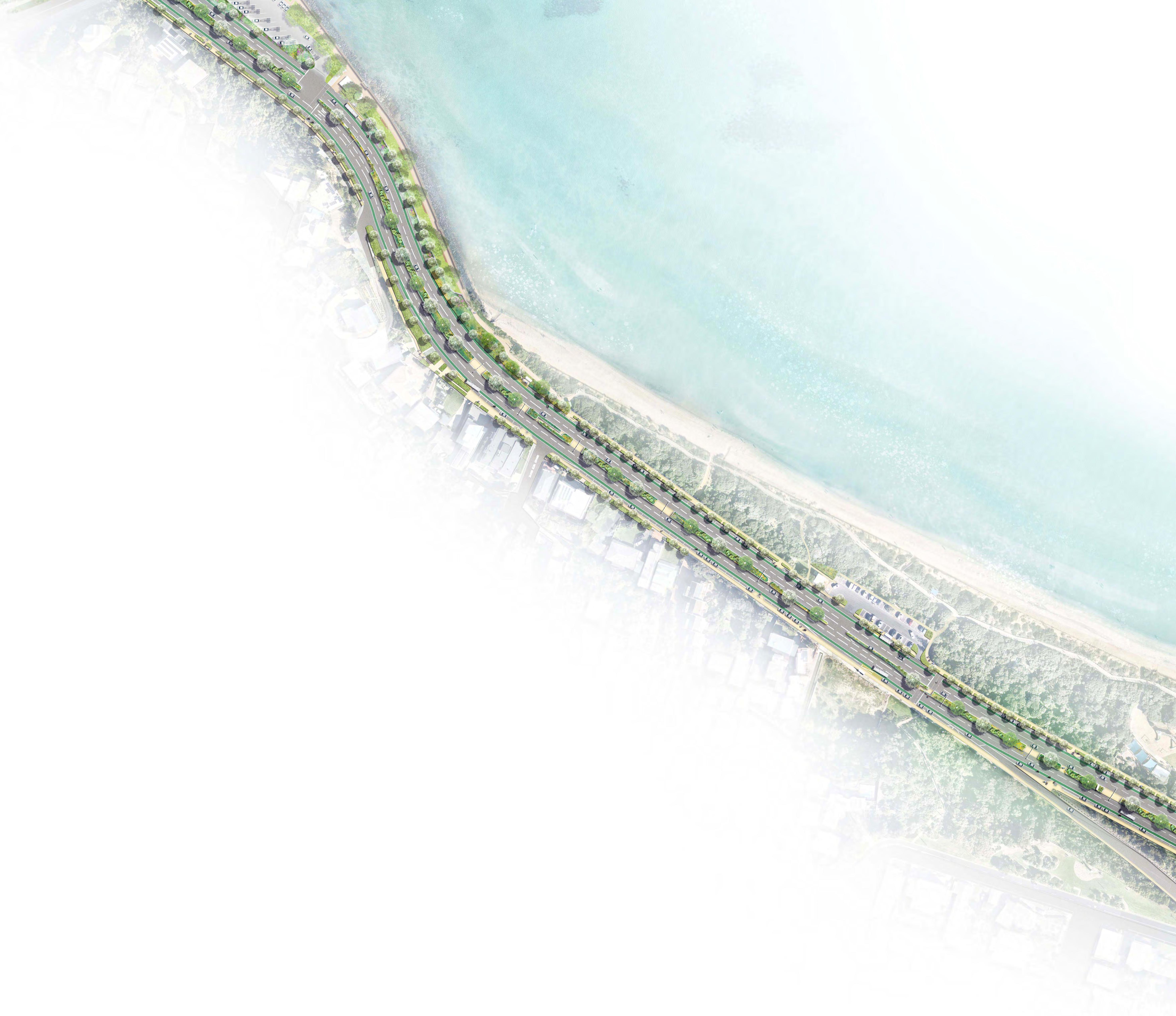
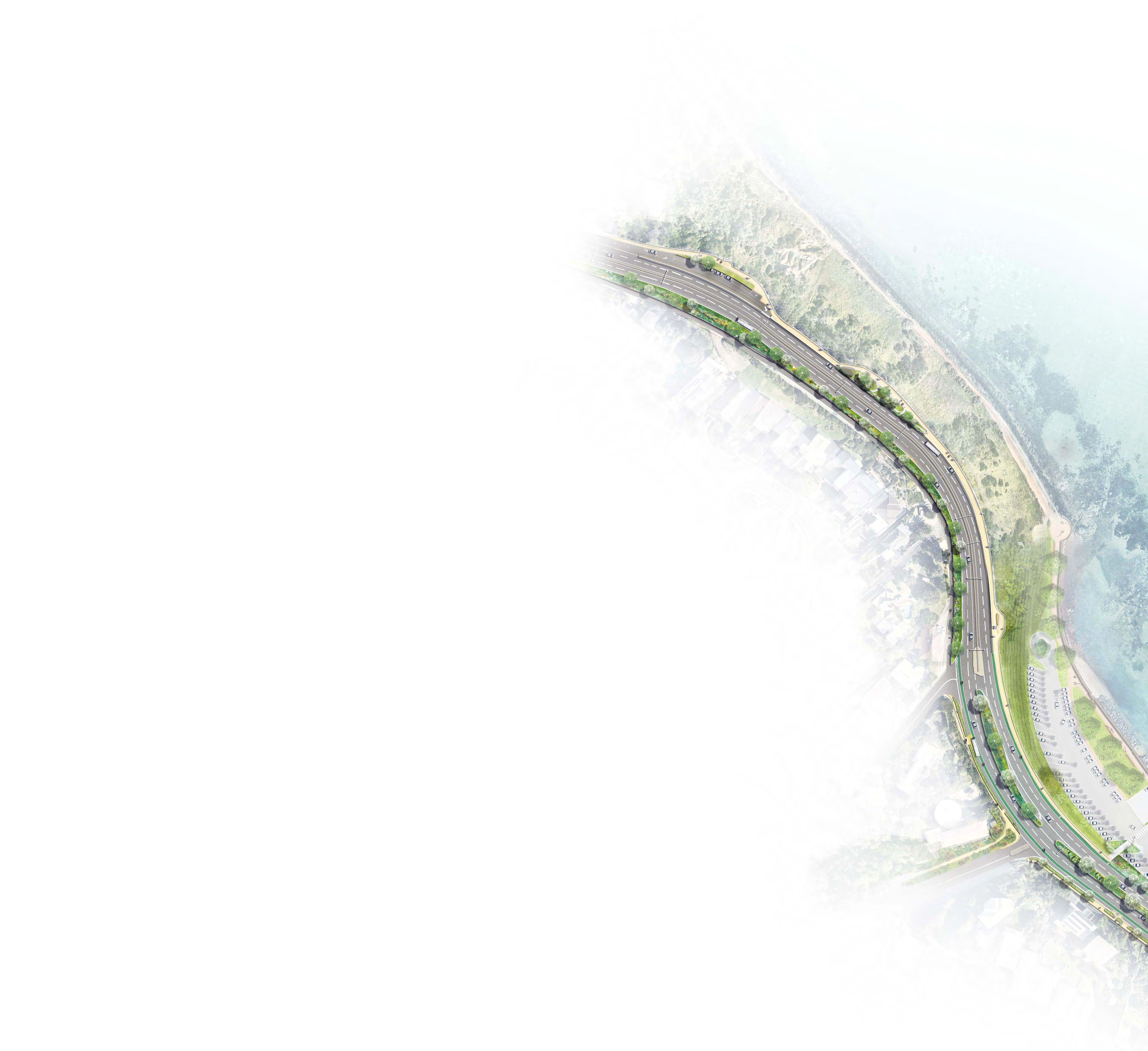
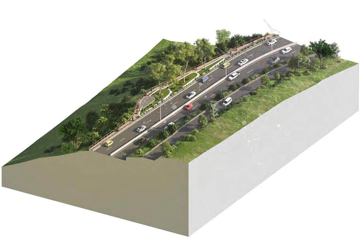
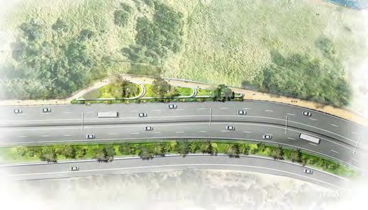
Creek: Nepean Boulevard North
The Nepean Boulevard North encompasses a 0.9 kilometre road corridor beginning at Mile Bridge and terminating at Fletcher Road.
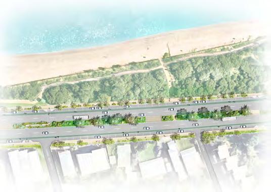
City: Nepean Boulevard Central
The Nepean Boulevard Central runs through Frankston’s FMAC, beginning at Fletcher Road and continuing 0.8 kilometres, terminating at Davey Street to the south.
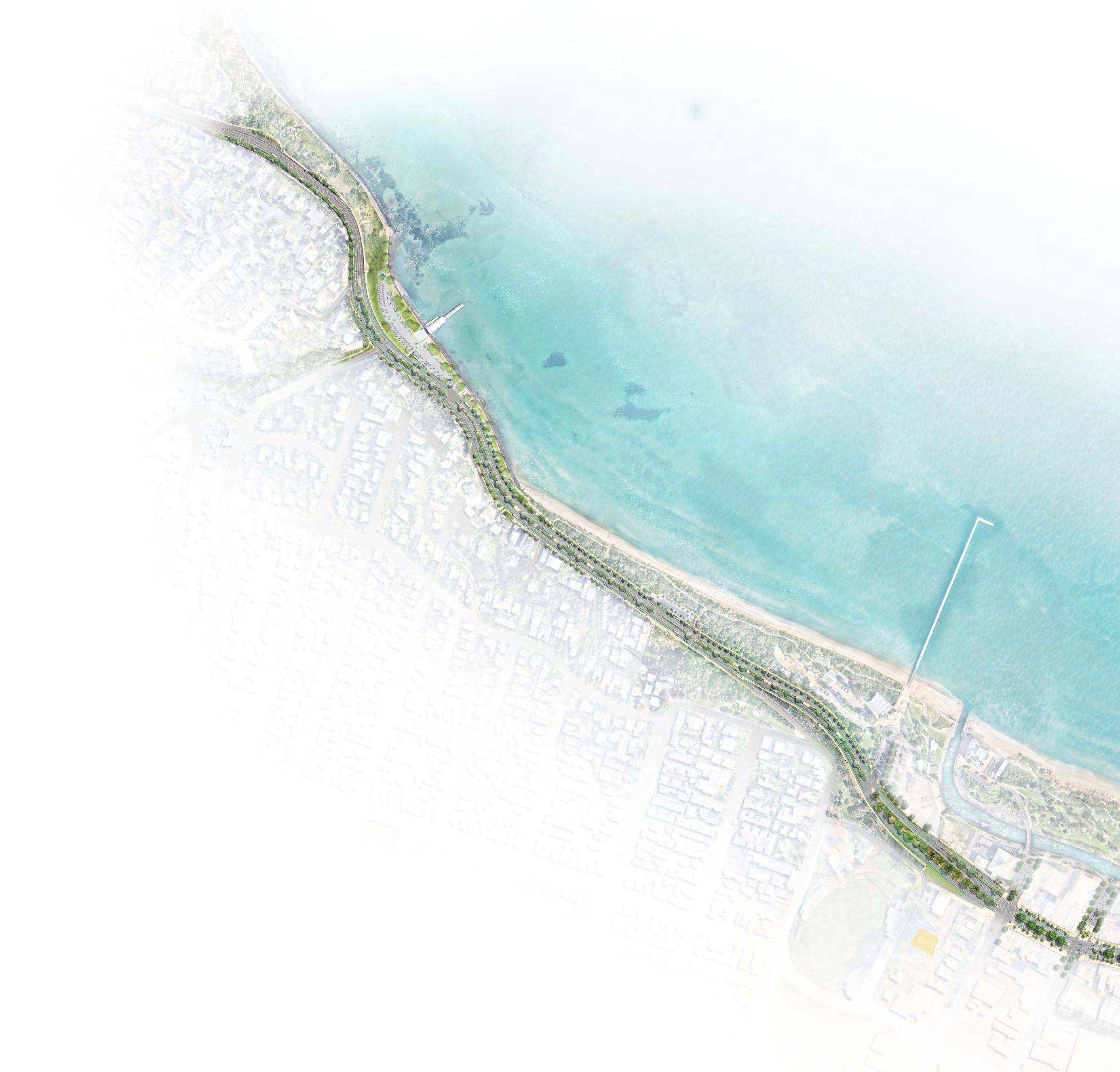
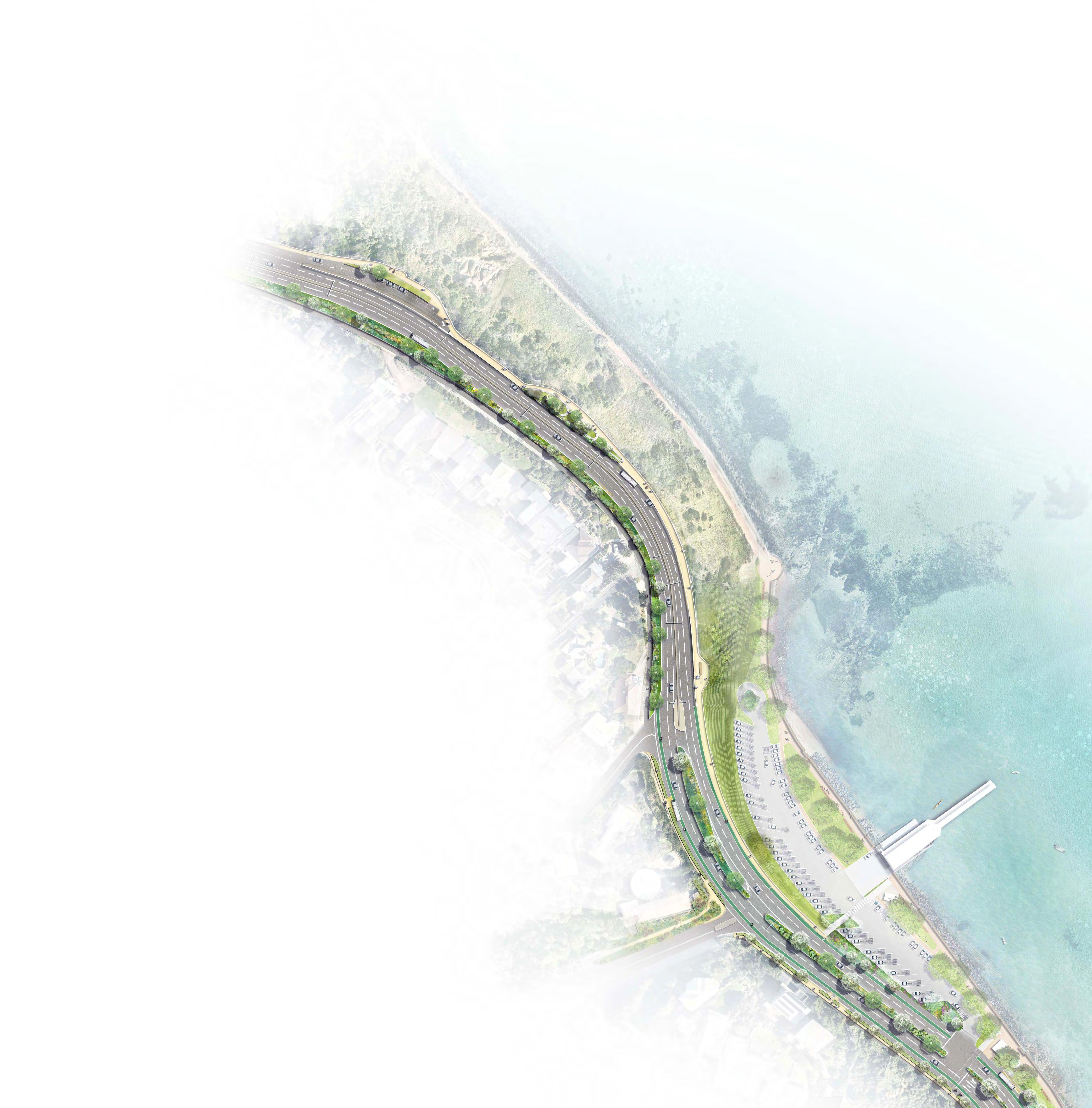
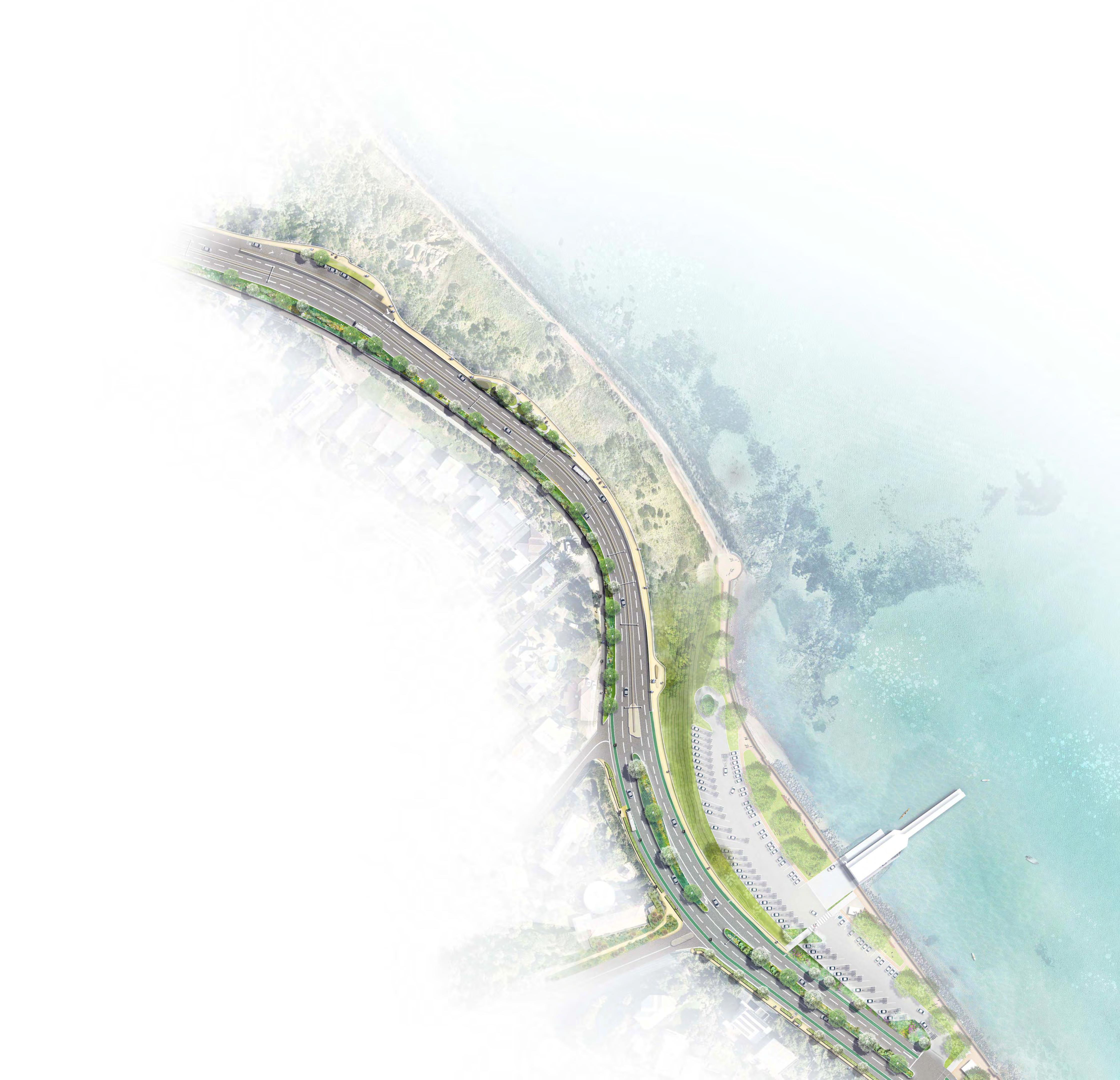
Bay: Nepean Boulevard South
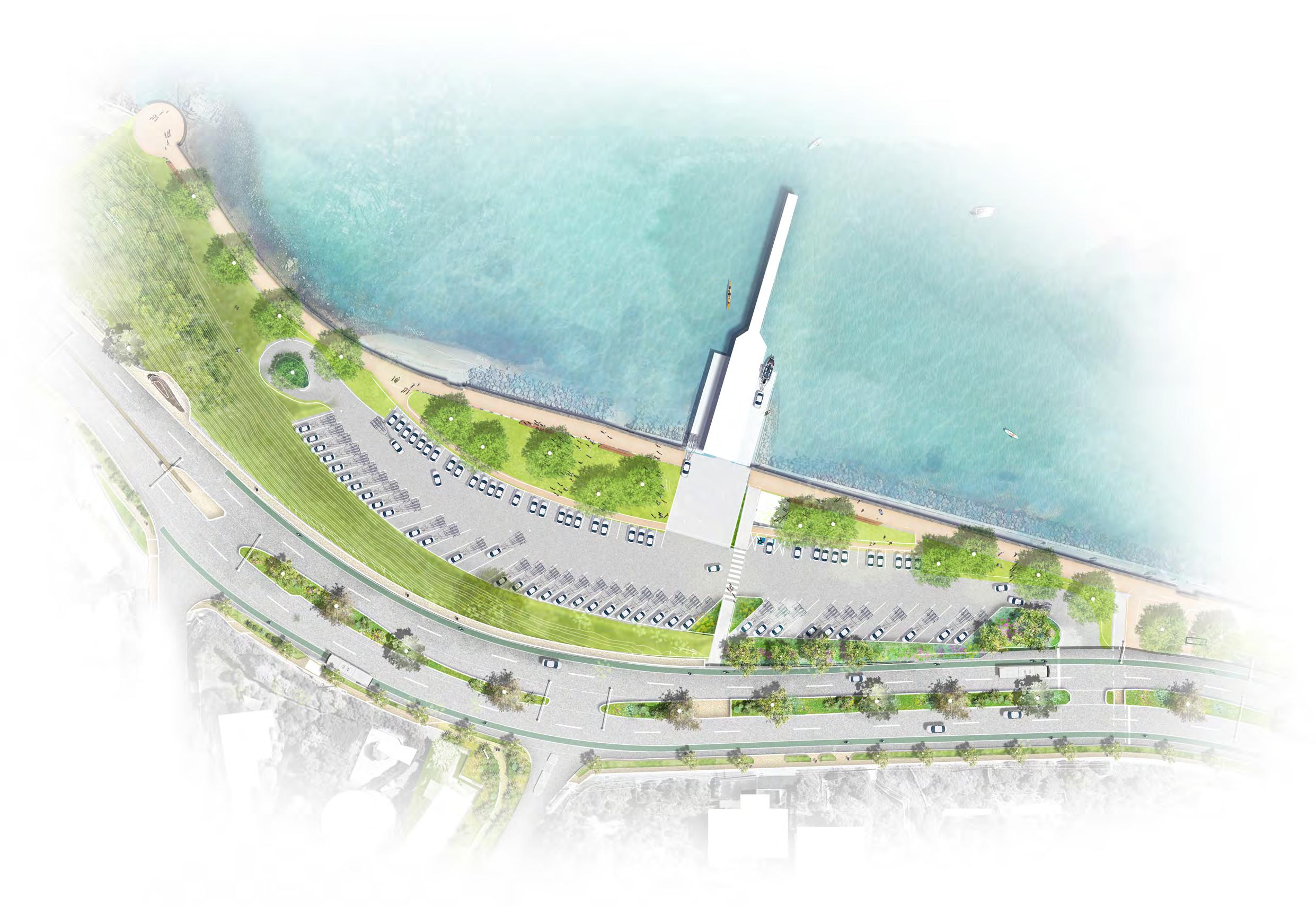
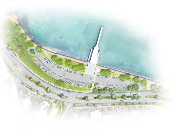
The Nepean Boulevard South is the longest section of the project area scope and runs over 2 kilometres beginning at Davey Street and terminating at Olivers Hill lookout at the crest of Olivers Hill to the south.
Frankston Waterfront
Frankston Pier
Frankston Foreshore
Olivers Hill Beach
Olivers Hill Boat Ramp
Sweetwater Creek
Olivers Hill
Port Phillip Bay
Frankston Beach
Long Island Beach
Kananook Creek
Gould St
Kitson Ln
Creek:
Nepean Boulevard North 0.9km
City:
Nepean Boulevard Central 0.9km
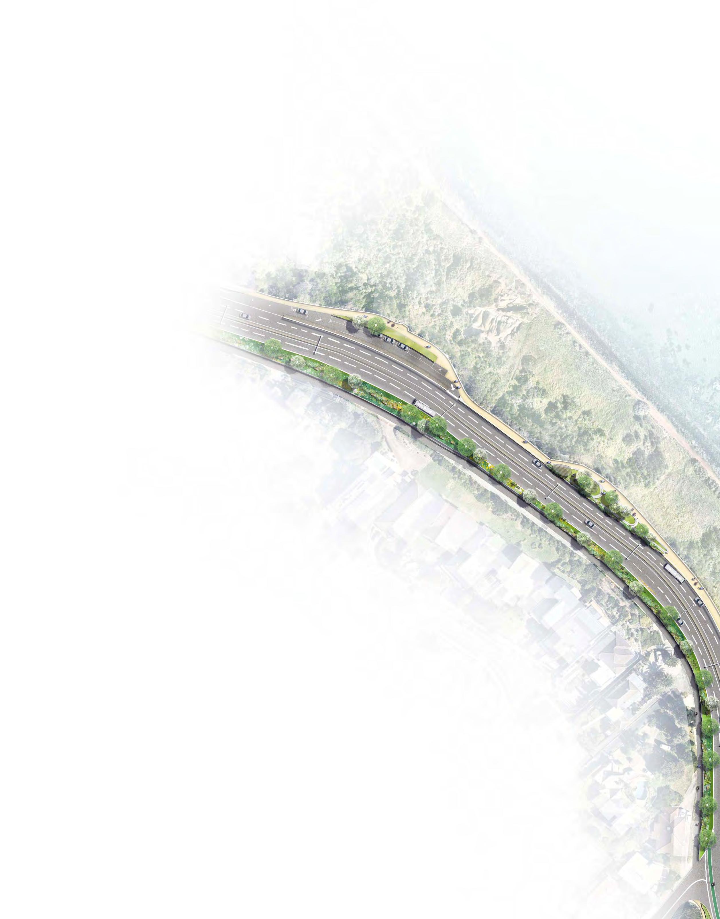
2.1 Creek: Nepean Boulevard North
Creek: Nepean Boulevard North
Project Area Vision
Nepean Boulevard North will provide a welcoming arrival experience to Frankston supported by a green boulevard backdrop.
Mile Bridge will act as a signature urban gateway and landscape threshold, celebrating Kananook Creek’s unique ecology and biocultural significance. Site responsive gateway signage, artwork, lighting and wayfinding will provide a sense of arrival and address. Key views to the creek line will be experienced upon arrival, supported by safe connected footpaths and crossing points.
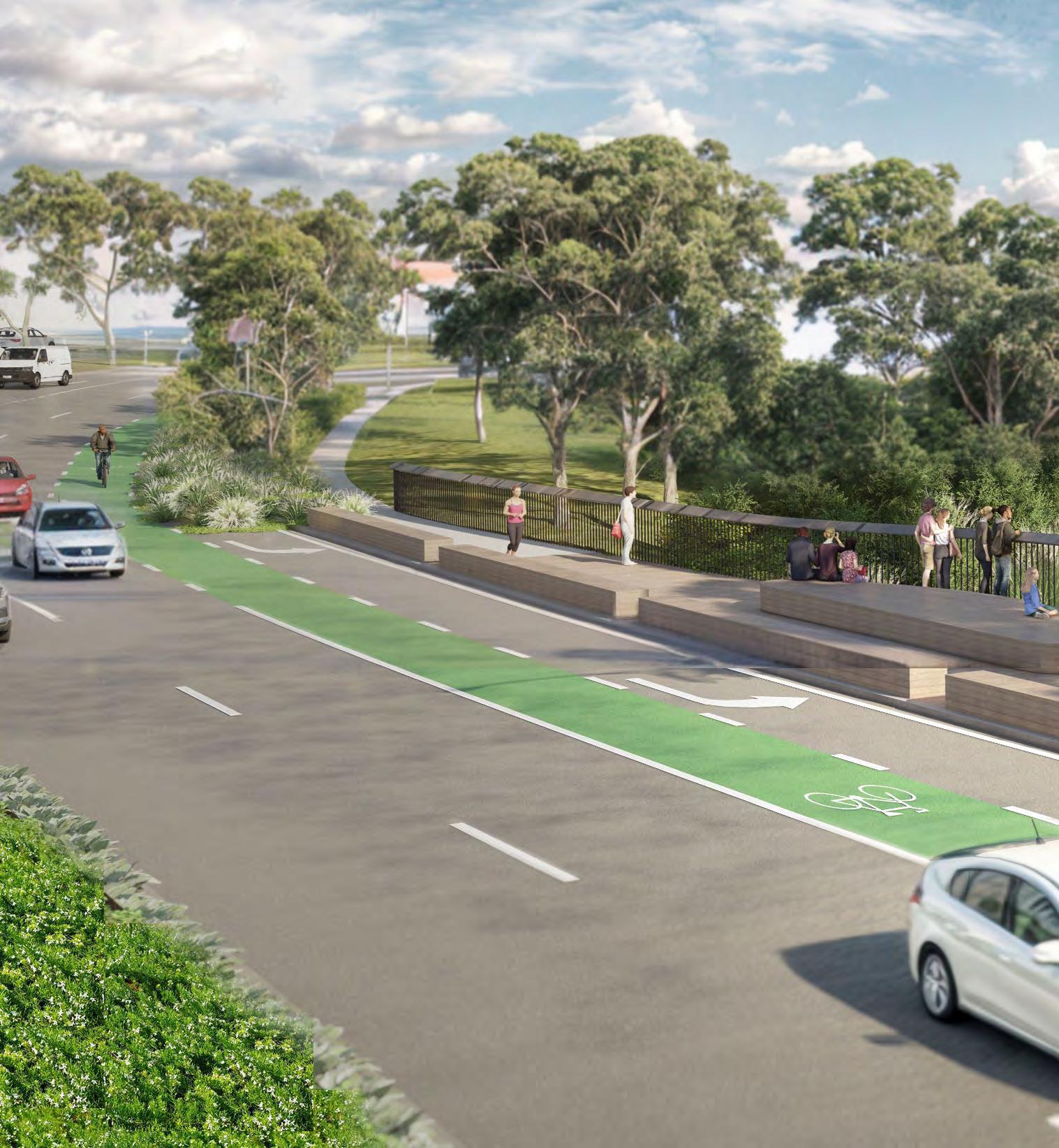
The Nepean Boulevard North will become a green boulevard experience with a generous native canopy and understorey supporting a biodiverse and climate responsive precinct. The Boulevard will facilitate cross connections for the Frankston North community to the creekline and foreshore through safe and accessible crossing points at key locations as well as provide a safer and more enjoyable walking and cycling experience with upgraded bike lanes, wider footpaths, plantings, generous canopy cover and amenities throughout.
Nepean Boulevard North
Existing Condition
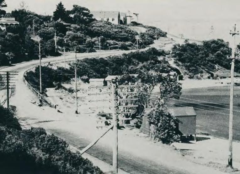
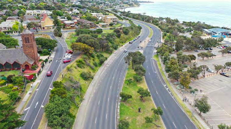
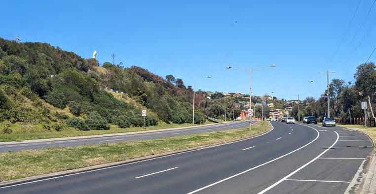
The Northern Boulevard spans 1.0km from Mile Bridge to Fletcher Road and is the entry to the Metropolitan Activity Centre from the north along Nepean Highway.
The entry to Frankston and experience at Mile Bridge is currently underwhelming due to historical development patterns. Existing infrastructure has been developed primarily with a focus for vehicular movement along the corridor as a key arterial road and limited consideration to the public amenity and the adjacent significant landscapes.
The street condition is generally consistent through most of this corridor, existing development mainly provides a range of commercial services with some free standing and multi-storey residential housing.
The implementation of Peninsula Link and diversion of traffic from this route provides a unique opportunity to improve the overall amenity and presentation of Mile Bridge and reveal the landscape qualities and cultural narrative of the Kananook Creek.
Road Network
• There is a non-signalised intersection at Overton Road which provides a broader connection to Wells/Dandenong Road, Frankston Dandenong Road, Frankston Freeway and Skye Road.
• From Mile Bridge to Ogrady Avenue, Nepean Highway is a 60km/h dual carriageway with two (2) vehicular lanes north and south bound.
• From Ogrady Avenue to Fletcher Road the speed transitions from 60km/h to 40km/h and the carriageway expands from 2 to 3 lanes in each direction.
• Nepean intersects with Fletcher Road which forms part of the Ring Road that provides east-west movement around and into the City and connecting the broader road network including Cranbourne Road and Fletcher Road.
• Three (3) additional turning lanes from Nepean are provided at this intersection, two (2) northbound and one (1) southbound with the Highway widening up to eight (8) lanes in both directions.
Car Parking, DDA & Loading
• Existing on street car parking is not formally marked with no time restrictions
• There is no formal provision of on street DDA car parking or Loading Zones.
Public Transport
• Existing Bus Routes are the 780 and 779 which provide a broader connection to Seaford to the north and connect to the Young Street Transit Interchange.
Active Transport Cycling
• Nepean Highway is used by experienced/confident bike riders for longer training rides.
• Existing on road bike lanes connect from Mile Bridge to Ogrady Avenue terminating before Fletcher Road
• Pedestrian
• Nepean Highway is a dual carriageway and a major barrier for pedestrians. The existing vehicular focus of the Highway provides an unappealing pedestrian experience.
• There is one pedestrian crossing provided through the Northern corridor at Overton Road with pram ramps that connect to a central island refuge across median.
• There are no signalised pedestrian crossings in the northern corridor.
• There is an existing signalised pedestrian crossing on the southern side of Fletcher Road approx 900m from Overton Road.
• North of Mile Bridge Nepean Highway transitions from a dual carriageway to a single carriageway with pedestrians required to navigate crossing all traffic lanes with no central refuge to access the foreshore.
• There is an existing signalised pedestrian crossing at McCulloch Avenue approximately 1km north of Mile Bridge.
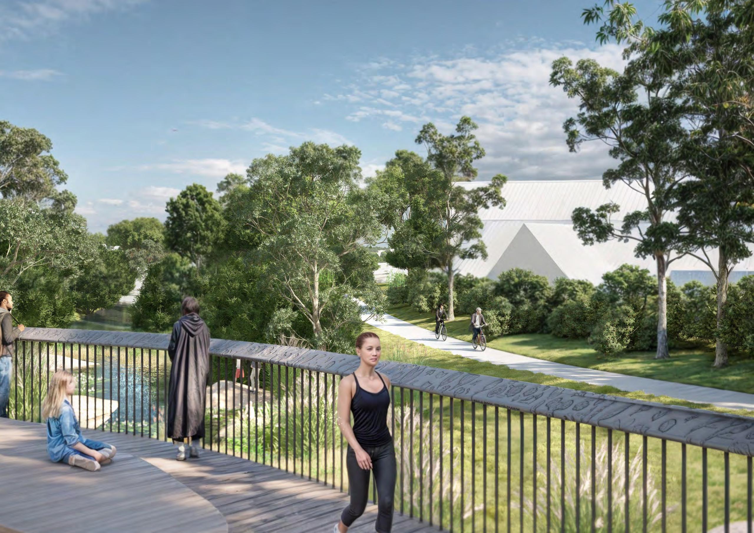
• Existing recreational trails along the Seaford Foreshore and Kananook Creek terminate at Mile Bridge with poor connectivity between the northern and southern trail that continues along the Kananook Creek to Beach Street.
• Overton Road provides a connection to the existing shared use path that runs parallel to the rail corridor to the north and south.
• Allawah and Fioccho Avenues connect to existing bridges crossing Kananook Creek, providing key east/west connections to the Bay.
Streetscape
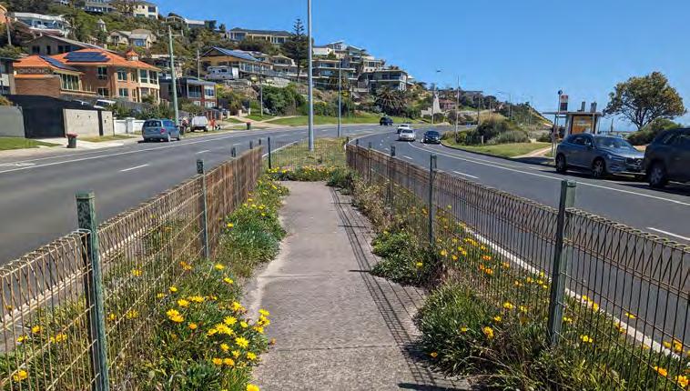
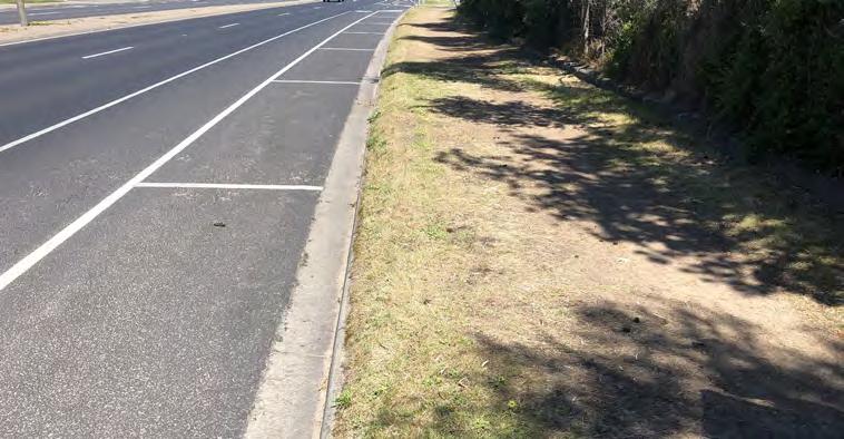
• The existing wide median (up to approx. 10m) supports the existing established median tree planting and is a significant feature in the landscape
• Existing footpaths on either side of Nepean provide basic pedestrian amenity and support existing bus stops
• Street lighting provides vehicular functionality with little consideration for the pedestrian experience.
Vegetation
• Existing median tree species is varied with some figs installed as part of the broader existing avenue.
• Tree planting along the footpaths is compromised due to existing overhead power limiting the opportunity for tree planting for pedestrian shade and amenity.
Activation/Street Life
• Street activation is limited due to the existing residential and commercial premises along the corridor
• There are a range of services offered along this corridor including:
» Cafe
» Medical/Personal services
» Business services
» Restaurant
Key Features
• Mile Bridge
• Avenue of Honour
• Proximity to Kananook Creek
Future Change
• This section is within Precinct 5 of the FMAC Structure Plan which is identified as “A mixed use entry to the FMAC providing for residential, office, accommodation and commercial uses with local retail and hospitality opportunities”.
• With future development “Building heights will increase closer to the FMAC and on the eastern side of the Nepean Highway. On the west side of the highway, development will be of a lower scale and set back from Kananook Creek to respond to this sensitive interface”.
Nepean Boulevard North
Design Framework
The proposed Nepean Boulevard North masterplan provides a vision for a memorable gateway and boulevard experience. It incorporates key themes and responds to unique site features to present an integrated design with key projects for future Boulevard improvements and advocacy.
Nepean Boulevard North will:
• Provide a welcoming arrival experience to the Frankston MAC.
• Establish significant avenue tree planting along its length.
• Improve road safety for all users.
• Support active transport choices providing a safer and more enjoyable walking and cycling experience.
• Enhance the visitor experience and recreation opportunities with enhanced public amenities.
• Improve environmental outcomes to meet urban forest targets and reduce impacts on adjacent landscapes.
Key Projects
• Mile Bridge
• Allawah Ave Pocket Park
• Cycle lane upgrades
• WSUD Outstands & carparking
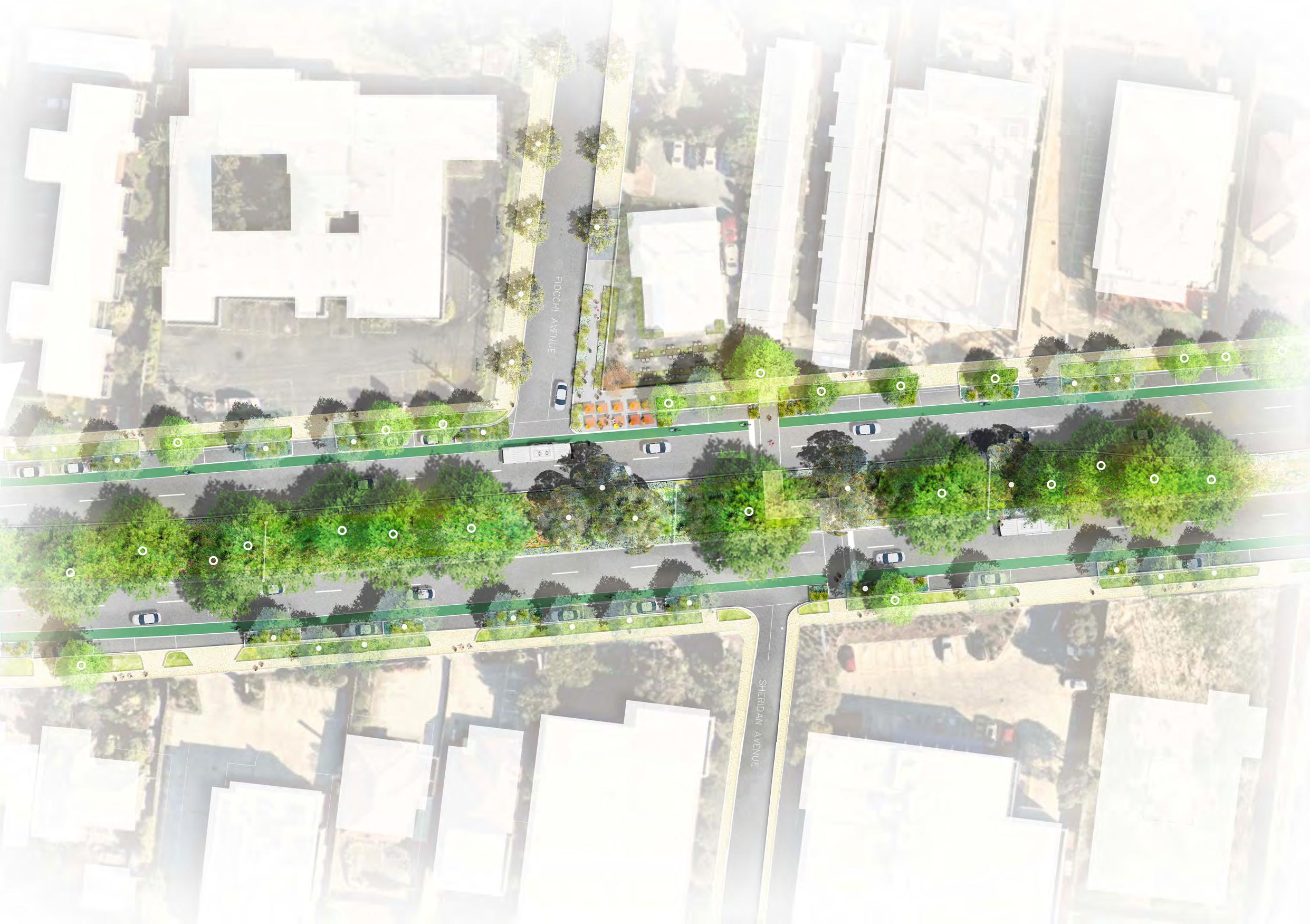
• Fiocchi Avenue crossing
• Central Median Landscaping
• Tree planting
LEGEND
Key Opportunities
Green & Leafy
• Planted outstands and water sensitive urban design initiatives.
• New median tree and feature planting
• New boulevard trees to verge
• Landscape improvements to new pocket parks
Public Life & Amenity
• New pocket parks at Allawah Avenue and Mile Bridge with enhanced public amenity.
• Footpath and furniture upgrades
• Undergrounding of powerlines for pedestrian oriented lighting
• Commercial activation and outdoor dining opportunities
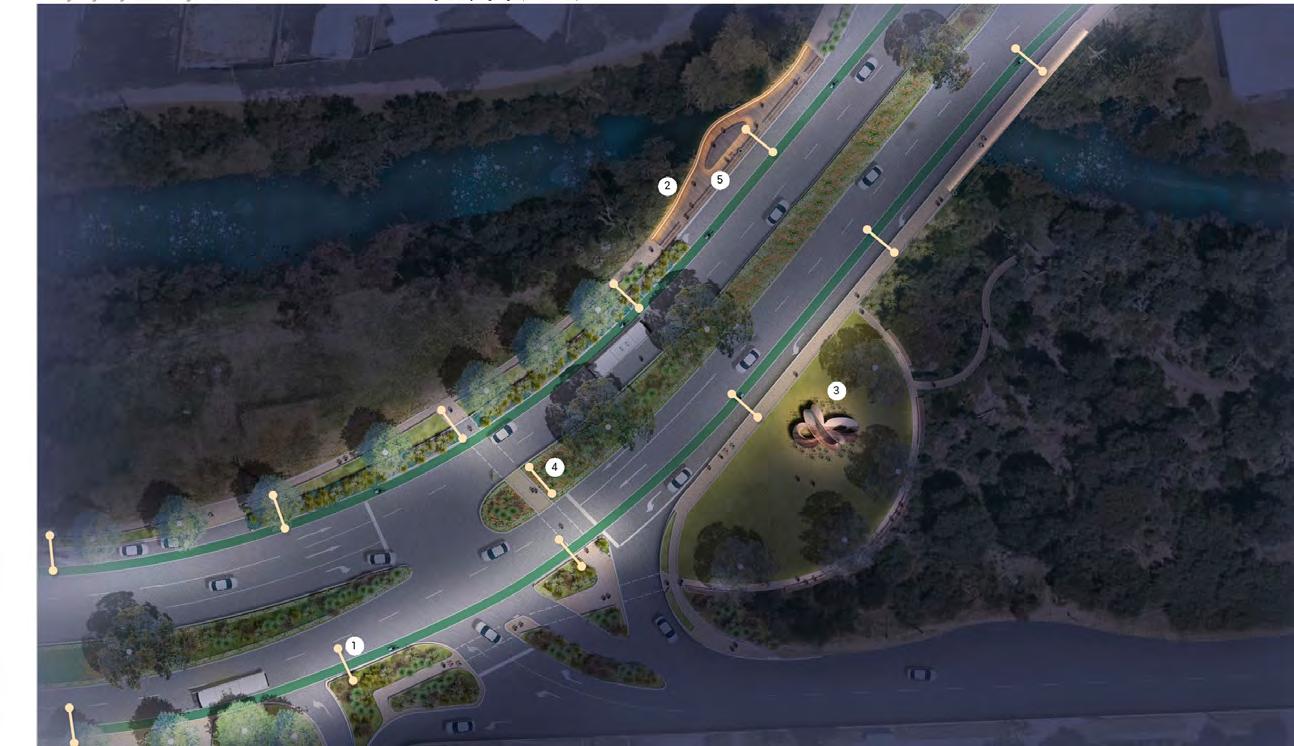
Below number codes correlate to initiative descriptions outlined on page 50.
Uniquely Frankston
• New Mile Bridge/ Kananook Creek viewing platform with wayfinding and interpretative elements.
• Embed cultural heritage and connection to Country through integrated public art and lighting.
• Reimagining of the existing Avenue of Honour.
Movement & Connections
Work with DTP to deliver the following:
• Implementation of a new signalised intersection at Overton Road to improve road safety.
• Implement new pedestrian connections and wayfinding signage to enhance the existing trail network.
• Improve the cycling experience with upgrades to the existing cycle lanes and provision of connections to broader cycling trails.
Upgrade cycle lanes & provide east-west connections
Upgraded cycling infrastructure New pedestrian connections
Underground power & upgrade lighting
Increase canopy cover & median planting New pedestrian focused boulevard lighting Planted
Nepean Boulevard North
Key Projects
• Planted outstands for Water Sensitive Urban Design initiatives.
• New median tree and understorey planting and existing tree protection to deliver an enhanced boulevard.
Potential undergrounding of existing overhead power to enable new canopy avenue tree planting.
Pedestrian Crossing & Activation
Refer page 44
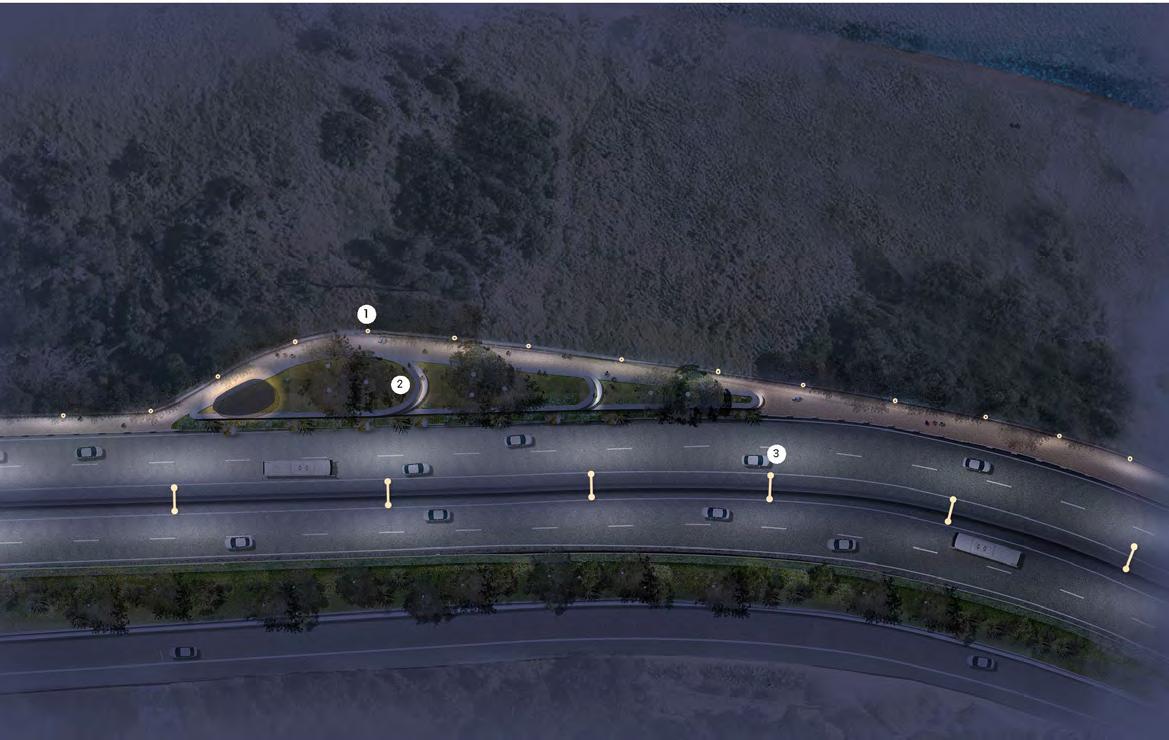
Prepare a detailed design for the upgrade of public open space (South East of Mile Bridge) to provide public amenity and complement the new public sculpture to include feature landscaping, connected pathways, wayfinding, seating and lighting.
Investigate the opportunity for a new pocket park at Allawah Avenue, facilitating pedestrian connection across Kananook Creek.
Advocate for the undergrounding of existing overhead power and develop a new public lighting scheme with a focus on new pedestrian orientated public lighting while maintaining road category lighting standards.
Work with nearby landowners and businesses to investigate opportunities for extended outdoor dining and commercial activation.
Upgrade pedestrian footpaths and connections with improved amenity for a more enjoyable walking experience.
Nepean
Boulevard & Pocket Park
Refer page 40 Mile Bridge Gateway
Refer page 36
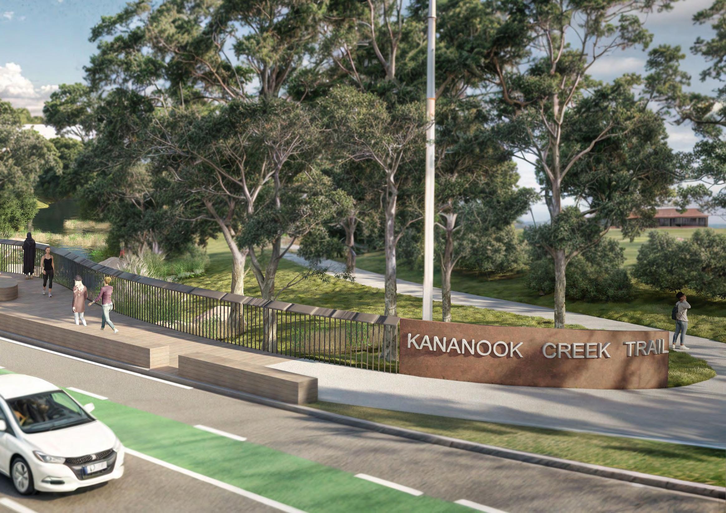
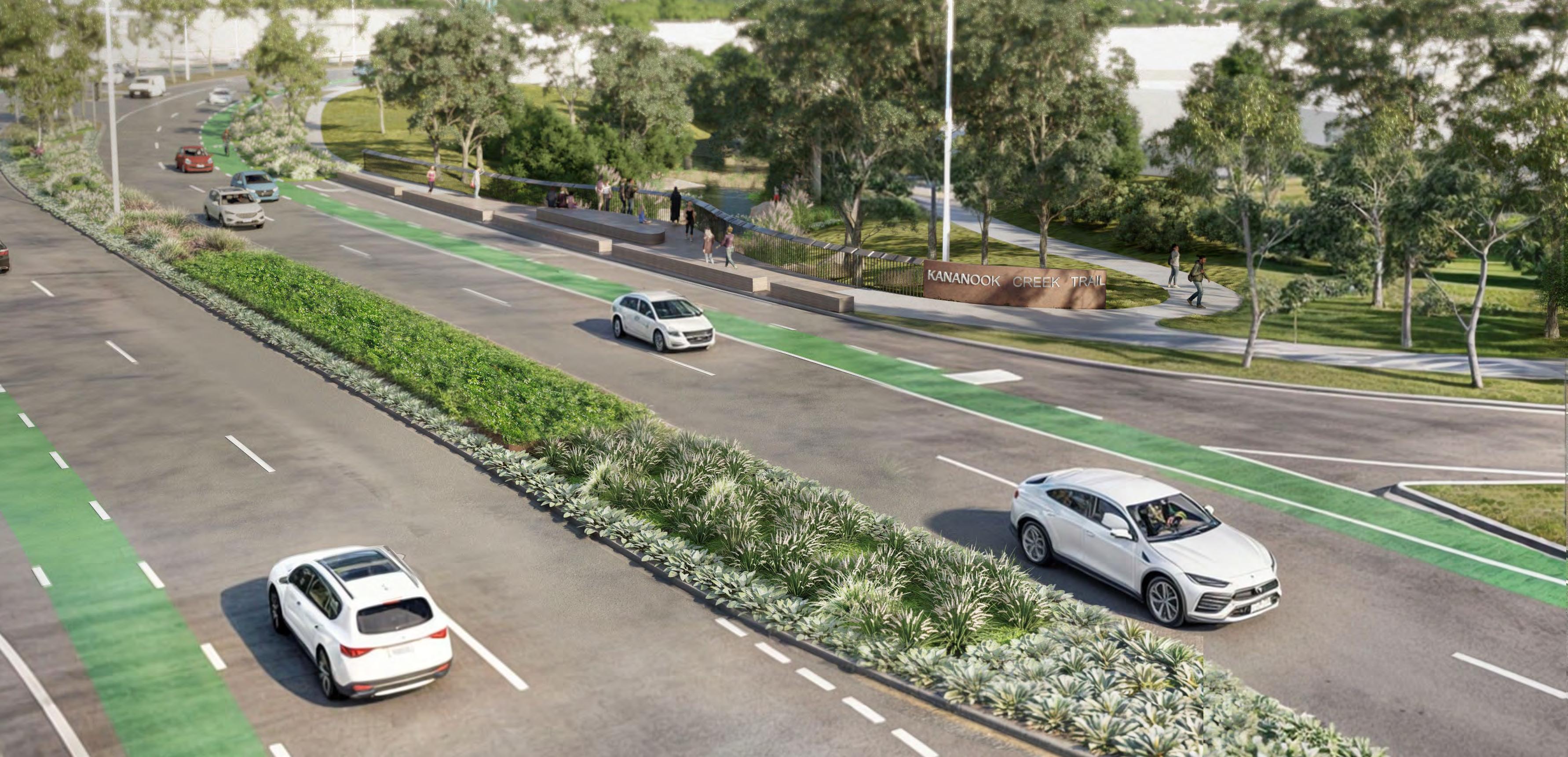
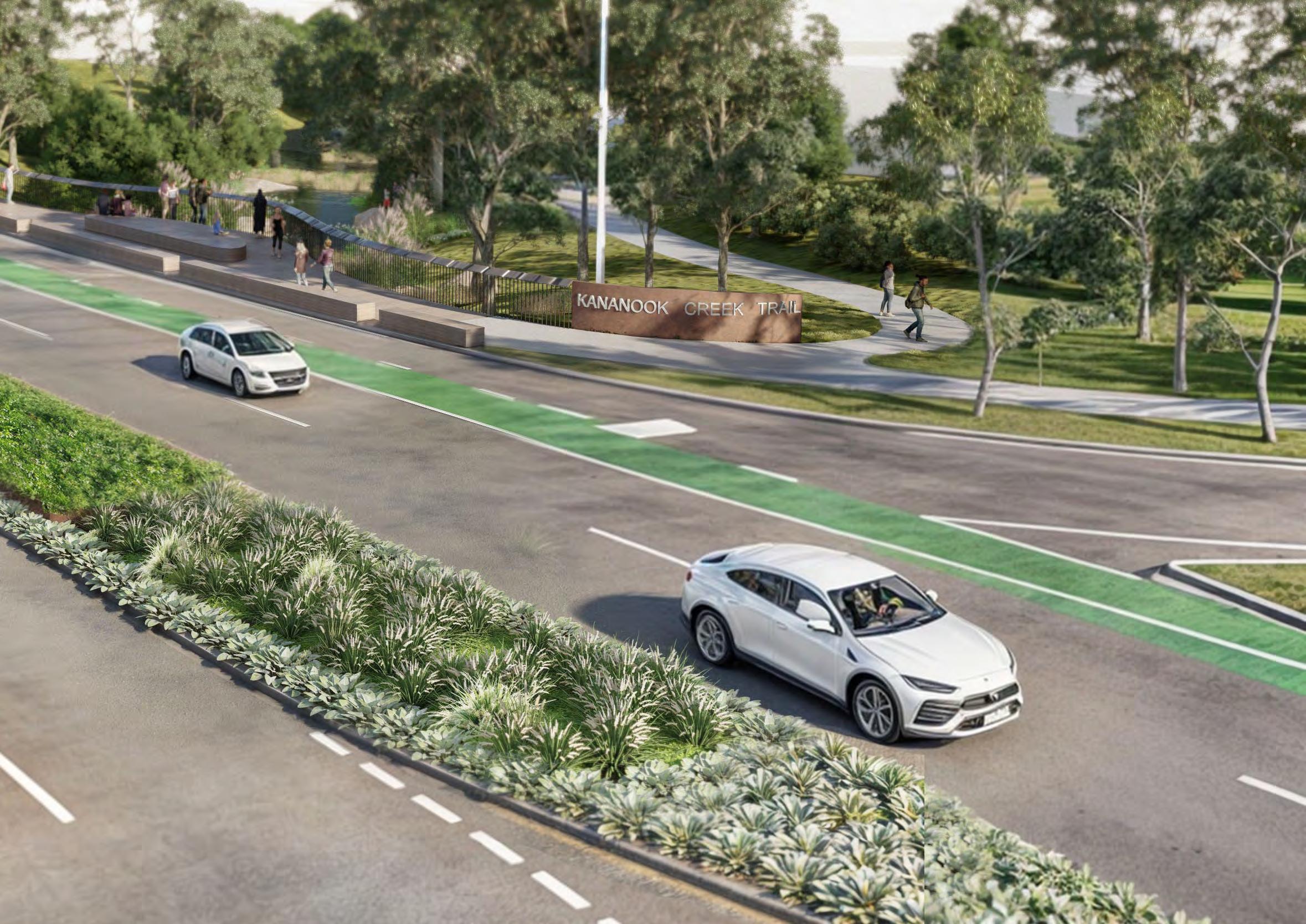
• Design a new Kananook Creek viewing platform with improved connectivity to the existing Kananook Creek Trail and inclusion of integrated lighting, wayfinding and interpretive elements that celebrate Kananook Creek and Frankston's unique landscape context.
Existing Council public art project currently under commission. Location shown indicatively and subject to further design and coordination.
• In collaboration with the RSL, prepare design concepts to reimagine the existing Avenue of Honour Memorials with new landscape elements to mark the start and end of the Avenue of Honour. Existing memorial plaques and information to be reinterpreted in the proposed Allawah Avenue pocket park.
Proposed trees
Existing trees
• Collaborate with the Victoria Government to advocate for a signalised intersection at Overton Road to improve road safety for vehicle movements, safer pedestrian and cycle crossing and better connection to existing trails.
• Work with the Victorian Government for new signalised pedestrian crossing opportunity at Sheridan Avenue to improve east-west connections across Nepean Highway to the Kananook Creek and Bay.
• Work with the Victorian Government for new safety upgrades to existing cycling lanes and connect missing links to the broader cycle network.
Rosella St
Kitson
Overton Rd Allawah
Scale 1:1500
Movement & Connections
Uniquely Frankston
Nepean Boulevard North
Key Project Areas
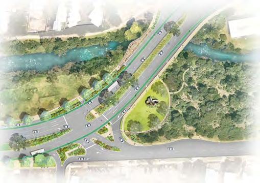
Mile Bridge Gateway
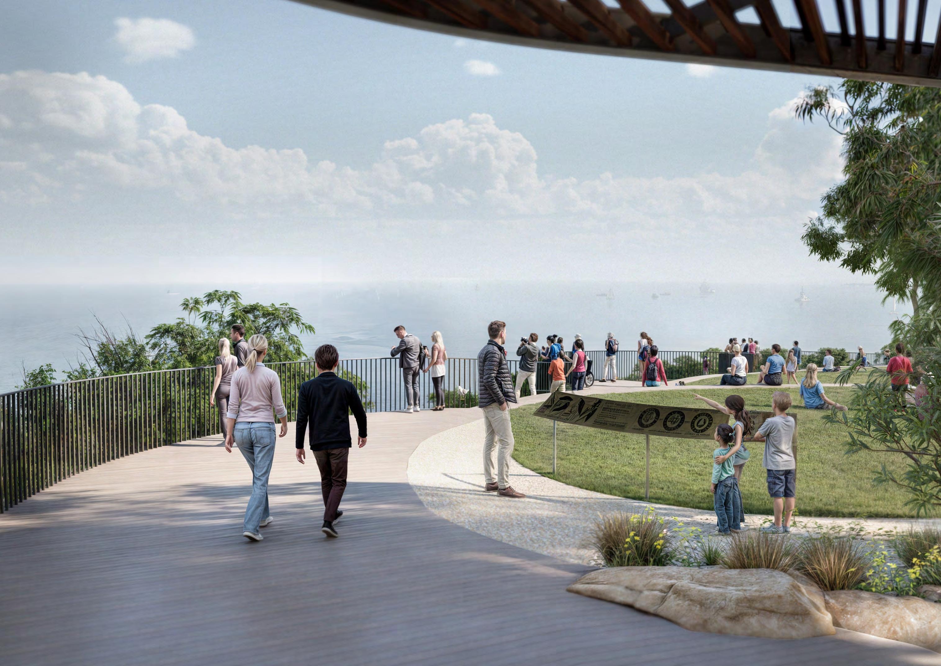
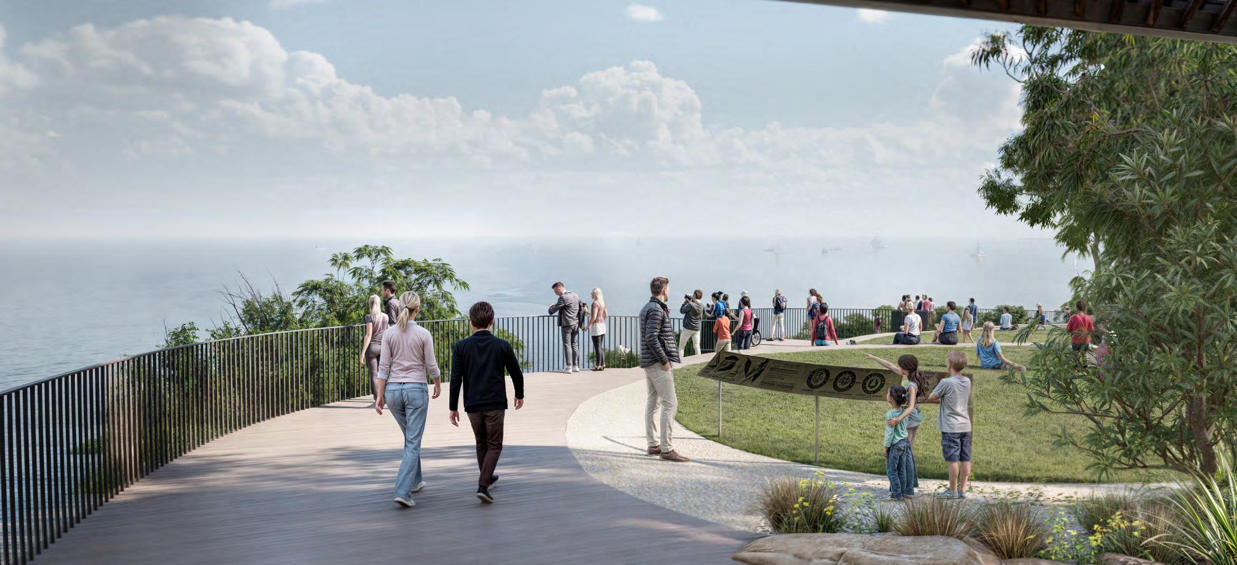
The crossing of Mile Bridge and the Kananook Creek is a key landmark and entry experience from the north into the Frankston MAC.
To enhance the gateway experience for users arriving from the north, a new lookout structure on the existing bridge is proposed. This will provide opportunity for users to experience creekline views, complemented with seating and
interpretation opportunities, feature lighting and wayfinding signage.
A new public open spaces located south East of Mile Bridge will provide public amenity and complement the new gateway sculpture including:
• New path connections, wayfinding and amenity to connect to the Kananook Creek Trail and broader trail network
• New seating, landscaping and potential cultural garden in partnership with the BLCAC
Project opportunities
• WSUD planted outstands
•
• New tree and understorey planting.
• Kananook Creek viewing platform with integrated lighting and wayfinding.
• New gateway sculpture
• Upgrade to landscape reserve including improved wayfinding, lighting and path connections.
• Signalised intersection to provide safe pedestrian connection and vehicle turning into Overton Road.
• Cycle lane upgrades and broader connections.
Nepean Boulevard North
Key Project Areas
Overton
Kananook Creek
NepeanBoulevard
Nepean Boulevard North
Key Project Areas
• Viewing platform opportunity with integrated lighting and wayfinding elements that celebrate the Bunurong cultural values
Existing Proposed
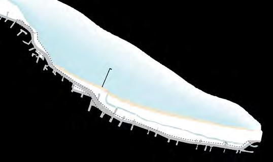
Axonometric depicts the existing Mile Bridge treatment, reflecting an unremarkable entry into Frankston where the Kananook Creek threshold is barely discernable while the area is dominated by infrastructure.
• Landscaping, feature lighting and new path connections to Kananook Creek Reserve.
Feature median planting with seasonal display as a landscape threshold.
Proposed axonometric depicts the future treatment of Mile Bridge Gateway, which highlights Kananook Creek as a significant landscape threshold, revealing Bunurong cultural and ecological layers specific to the creekline through viewing opportunities, wayfinding and art.
F1
P1
G2
F2 Gateway sculpture
Nepean Boulevard North
Key Project Areas
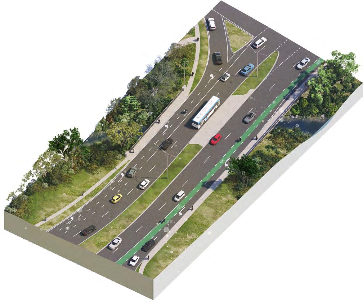
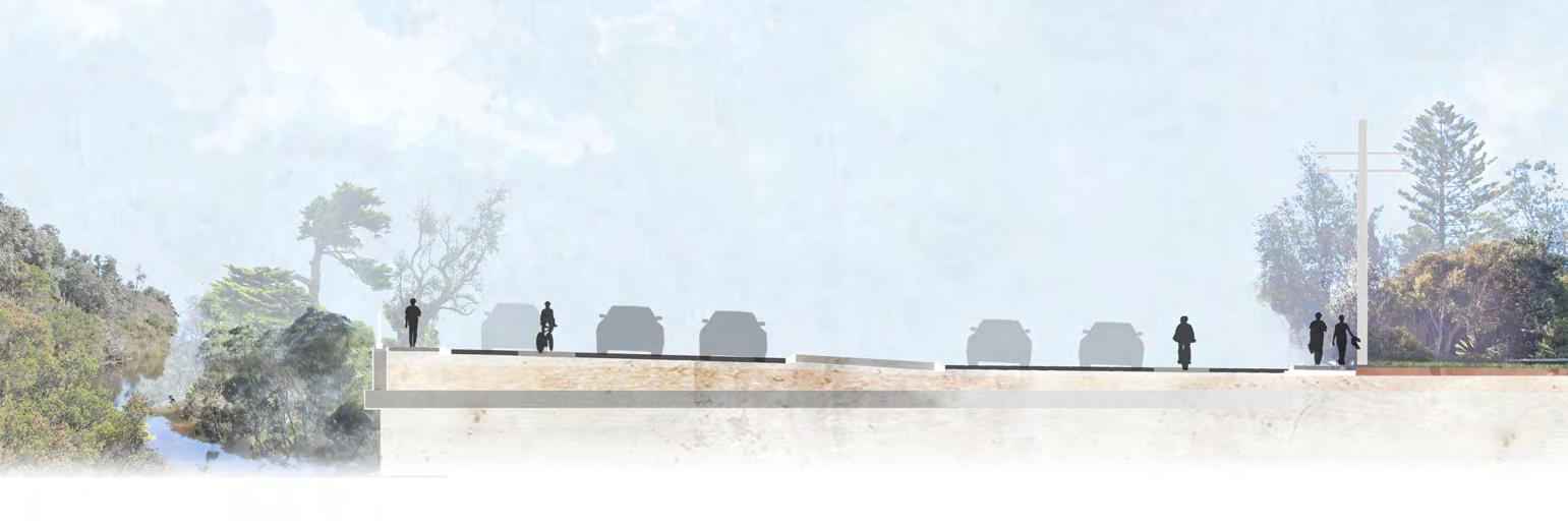
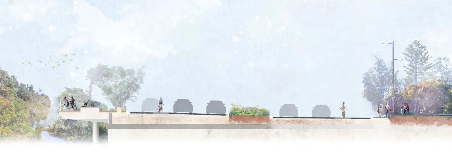
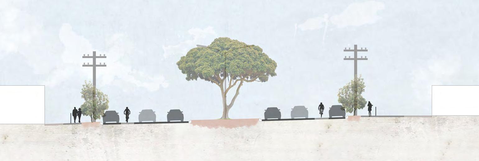
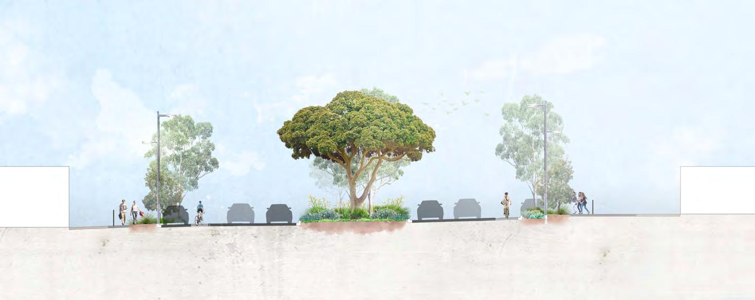
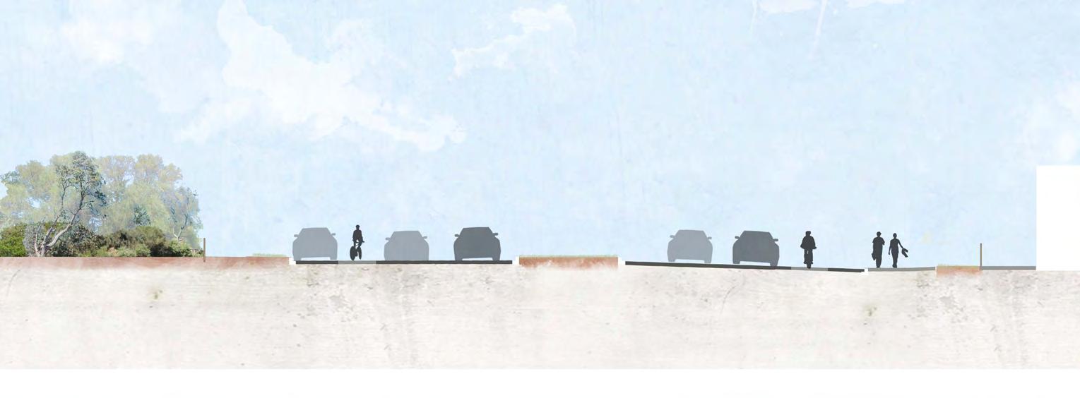
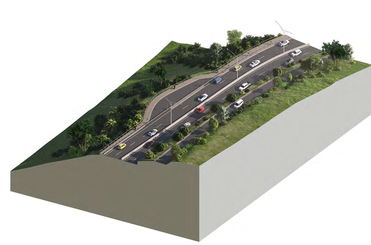
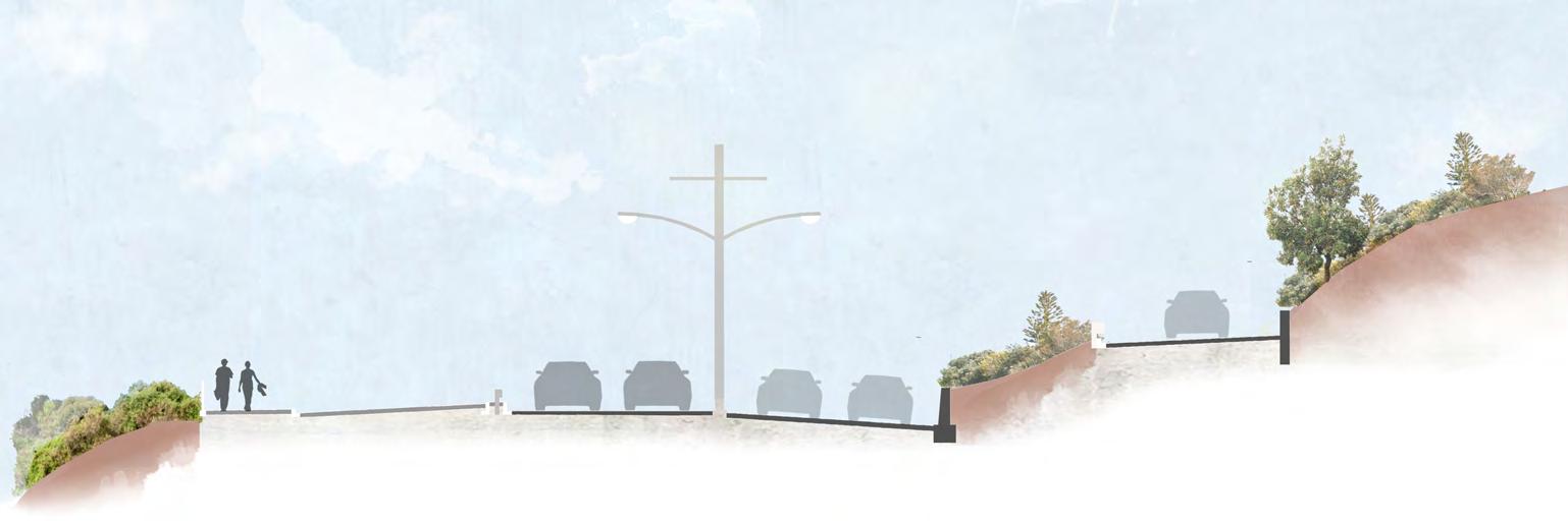
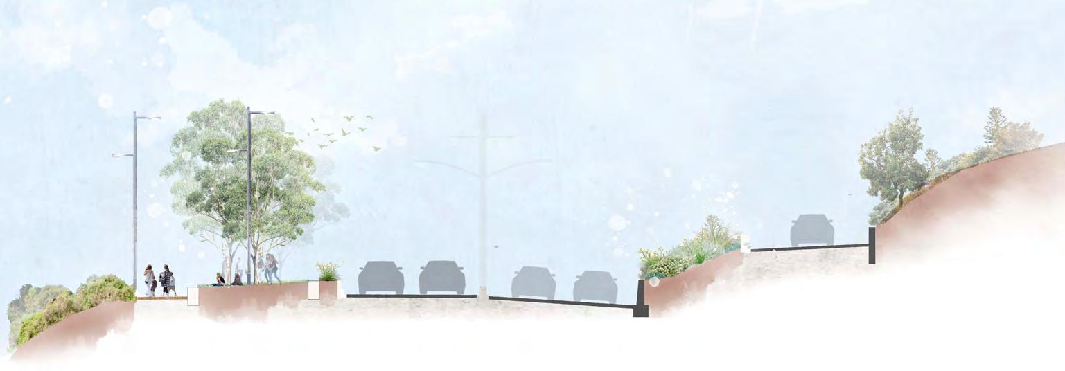
Existing cross section through Mile Bridge shows a four lane arrangement with turning lanes, bikes lanes and a concrete median treatment. Footpaths along the bridge are narrow with a typical balustrade treatment.
Landscaping and lighting Sculpture
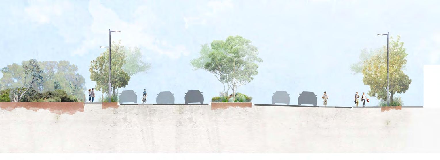
Section shows a potential cantilevered viewing deck over the Kananook Creek as well as low planting within the median as part of the overall gateway experience. Traffic lane dimensions remain unchanged on Mile Bridge as part of the proposed treatment.
Nepean Boulevard North
Key Project Areas
The Northern Boulevard proposes a striking entry into Frankston with new avenue tree planting, upgraded lighting and improved pedestrian amenity.
New tree planting to meet Urban Forest objectives will be facilitated with the undergrounding of existing overhead power to allow trees to reach their full potential supported with new kerb outstands with integrated WSUD for passive irrigation where feasible. This
planting will be supported with median infill planting as well as understorey planting to provide a memorable experience.
A proposed lighting upgrade will introduce additional pedestrian orientated lighting to improve the pedestrian experience and safety for all users.
There is an opportunity for a “pocket
crossing and access point to the Kananook Creek and the Bay which will provide new public amenity, wayfinding signage and rest stop for pedestrians. This opportunity could facilitate the reinterpretation of the existing Avenue of Honour in a location that is accessible to the general public, deliver a new memorial with integrated interpretive signage and reimagine the existing Avenue of Honour memorials within the median
• WSUD planted tree outstands with understorey planting.
• Infill tree planting and understorey to the central median.
• Undergrounding existing overhead power for new canopy tree planting
• Pocket park opportunity at Allawah Avenue and improved pedestrian connections.
• Opportunity for a new memorial to recognise the historic Avenue of Honour.
• Cycle lane upgrades with clearly marked connections to broader cycle networks.
park” at Allawah Avenue as a key
Project opportunities
Above precedent image depicts a public open space with native planting and seating for the community to enjoy.
Image: Monash University Eastern Precinct by TCL
Photo by Will Slater
Northern Boulevard
Nepean Boulevard North
Key Project Areas
Nepean Boulevard
Allawah Ave
Kananook Creek
Existing trees
Proposed
Nepean Boulevard North
Key Project Areas
• Infill tree planting and understorey to the central median.
Existing Proposed
Typical existing median treatment and road verges characterised by medium scaled trees to central median and limited road verge amenity with continuous parallel parking and trees impacted by dominant powerlines.
• Pedestrian oriented lighting
Depicts enhanced median tree and understorey planting with improved roadside amenity with tree outstands, improved furnishings and long term removal of powerlines.
• Footpath upgrades throughout the precinct.
• Opportunity for planted tree outstands with understorey planting.
• Cycle lane upgrades
Nepean Boulevard North
Key Project Areas
Existing cross sections illustrates a wide central median with existing Moreton Bay Figs, two lane carriageway northbound and southbound, existing bikes lanes and informal parallel parking throughout. Existing power poles dominate the verge and median and currently inhibit significant tree canopy.
Proposed cross section depicts a planted verge with infill tree planting, additional tree planting and understorey in planted outstands, pedestrian oriented lighting as well as bike lane and footpath upgrades. Existing lane dimensions remain along the carriageway.
Nepean Boulevard North
Key Project Areas
Connecting To The Creek & Bay
Proposed signalised pedestrian crossings at Fiocchi Avenue will provide safe eastwest connections for pedestrians across Nepean Boulevard to access the Creek and the Bay. These crossing will improve the broader trail network, connect to existing bridges on the Kananook Creek and support activation of local businesses with the opportunity to explore options for extended outdoor dining.
Project opportunities
• Planted tree outstands with understorey planting.
• Infill tree planting and understorey to the central median.
• Activation opportunity at existing cafe with potential outdoor dining and amenity
• Footpath upgrades throughout the precinct.
• Signalised pedestrian crossing opportunity at Sheridan Avenue
• Cycle lane upgrades with clearly marked connections to broader cycle networks.
Existing trees
Proposed trees
Key Project Areas
Nepean Boulevard North
Key Project Areas
Typical existing median treatment and road verges characterised by medium scaled trees to central median and limited road verge amenity with continuous parallel parking and trees impacted by dominant powerlines.
Signalised pedestrian crossing opportunity at Sheridan Avenue
Pedestrian oriented lighting to the public realm and footpaths Activation opportunity at existing cafe with potential outdoor dining and amenity P4
• Infill tree planting and understorey to the central median.
Proposed
Depicts initiatives such as improved median tree and understorey planting, signalised pedestrian crossing and potential cafe alfresco dining integration top extended footpaths.
• Footpath upgrades throughout the area.
• Opportunity for planted tree outstands with understorey planting.
• Cycle lane upgrades
Nepean Boulevard North
Key Project Areas
Existing Section
Proposed Section
Existing cross sections illustrates the wide central median with a western crossfall to Kananook Creek as well as a consistent two lane carriageway throughout the precinct. Existing cafe at Fiocchi Avenue
Footpath upgrades
Proposed cross section depicts a public realm activation opportunity for outdoor dining, verge planting and pedestrian friendly lighting as well as a signalised crossing opportunity. Existing carparking continues throughout the project area with the addition of planted outstands to replace car bays where practicable.
Nepean
Boulevard North
Planting Character: Coastal & Contemporary Australian
Nepean Boulevard North
Planting Character
The Nepean Boulevard North will be enhanced through an integrated planting strategy that builds upon the successful qualities of the existing median. Plantings will respond to the adjacent Kananook Creek and coastal context and species selected themed under coastal and contemporary Australian.
Key Applications:
• Gateway plantings at Mile bridge comprising visually striking native ground covers and tree plantings
• Enhanced median tree plantings and understorey plantings
• Integrated verge side tree planting, in association with existing parallel parking. Plantings to comprise integrated water sensitive urban design for water cleansing and passive irrigation.
• Enhanced entry plantings to Kananook Creek walking trails to reinforce indigenous planting character and biodiversity values.
• Benefits and Outcomes:
• Improved biodiversity through use of native species
• Increased canopy cover and associated mitigation of urban heat island effects.
• Improved amenity, identity and gateway experience.
• Integrated water sensitive urban design.
Underplanting
Verge Planting
Central Median
Water Gum (Tristaniopsis Laurina)
Snow Gum (Eucalyptus Pauciflora)
She-oak (Casuarina)
Moreton Bay Fig (Ficus macrophylla)
Banksia (Banksia Intergrifolia)
Flowering Gum (Corymbia Ficifolia Dwarf)
Spotted Gum (Corymbia maculata)
Lemon Scented Gum (Corymbia Citriodora Dwarf)
Grass Tree (Xanthorrhoea Glauca)
Grass Tree (Xanthorrhoea Minor)
Perennial Herb (Lomandra Confertifolia)
Spotted Gum (Corymbia maculata)
Nepean Boulevard North
Lighting Strategy
The Lighting Strategy proposes a layered lighting approach to improve functionality, safety and amenity to the Nepean Boulevard which is responsive to the different conditions and functional requirements. The Lighting Strategy considers the following –
• Australian Standards for Lighting –Road, Cycling, Pedestrian and Car Parking
• DTP Requirements and Technical Guidelines (Existing asset owner)
• Crime Prevention Through Environmental Design (CPTED)
• The proposal for the Northern Precinct is to create an inviting avenue and entry into the City, support vehicular movement and an active community. The lighting proposal identifies the following opportunities:
• Existing overhead power to be undergrounded to support proposed tree planting initiatives.
• New lighting scheme to upgrade the existing vehicular lighting with new complimentary pedestrian orientated
lighting to improve safety.
• Opportunity to incorporate lighting within feature seating elements.
• Pedestrian and public lighting for pocket park and creek linkages.
• Feature lighting for new artwork.
• Incorporated lighting with the new gateway signage.
Mile Bridge / Kananook Creek
• To enhance the gateway experience for users arriving from the north, a new lookout structure on the existing bridge is proposed. This will provide improved creek views, seating and interpretation opportunities and complemented with new lighting and signage.
Mile Bridge lighting proposal
Proposed lighting scheme with new vehicular and complimentary pedestrian lighitng to improve functionality and safety.
Kananook Creek
Overton Rd
Nepean Boulevard North
Lighting Strategy
Boulevard and pocket park lighting proposal
Pedestrian crossing and cafe lighting proposal
Kitson Lane
Nepean Boulevard
Fiocchi Avenue
Sheridan Avenue
Nepean Boulevard
2.2 City: Nepean Boulevard Central
City: Nepean Boulevard Central
Project Area Vision
Nepean Boulevard Central will become a destination full of public life and activity. It will facilitate new journeys, connect the City to the Foreshore and create a safe and welcoming public realm.
Nepean Boulevard Central will become a new destination for the City, creating new pedestrian experiences for the community to meet, play and connect.
The Boulevard will provide a platform for outdoor dining and public life, place to meet and playful moments, celebrating local histories through integrated public art and landscaping. The Boulevard will connect with adjacent foreshore destinations through safe crossings and legible pedestrian pathways. Boulevard planting will reinforce the existing tree canopy and understorey and create a buffer to the road through high quality garden beds and WSUD opportunities. Integrated seating and upgraded furnishings will offer a shaded and enjoyable streetscape and meeting places that are inclusive and accessible.
New cycle lanes will provide a safe and consistent journey, connecting with the North and South Nepean Boulevard cycle infrastructure and the broader active transport network. A reconfigured road offers a safe and legible journey through central Frankston, transforming the Nepean to a place-based destinational boulevard.
Nepean Boulevard Central
Existing Condition
Nepean Boulevard Central spans 0.8km from Fletcher Road to Davey Street through the heart of the Metropolitan Activity Centre. While the width of Nepean Highway is generally consistent, the street profile varies across the different blocks impacting the streetscape condition and amenity.
Beach Street to Wells Street
• Wide central median which supports the existing avenue of established Fig trees;
• Narrower footpaths impacting the available public realm and limited street tree provision.
Wells Street to Playne Street
• Narrow median with the existing Grimwade clock proving the main feature element.
• Lack of street trees.
• Limited footpath width to support activation.
Playne Street to Davey Street
• Existing fine grain building development and dining/ entertainment precinct.
• Established and significant trees in central median.
• Limited tree planting along footpaths.
Road Network
• Nepean Highway is a 40km/h road with three (3) through vehicle lanes north and south bound with additional intersection turning lanes expanding the carriageway up to eight (8) lanes.
• Fletcher Road and Davey Street are part of the broader Primary Arterial Road Network and form part of the Ring Road that providing east-west movement into the MAC and connecting the broader road network including Cranbourne Road and Fletcher Road.
Public Transport
• Existing Bus movements focus on the connections from Frankston Station along Playne Street to both the north and the south.
• There is an existing SkyBus stop outside Quest Frankston (435 Nepean Highway).
Car Parking, DDA & Loading
• Existing car parking is generally 2 hour parking 9am – 6pm.
• Provision of DDA car parking on Nepean Highway is variable and supported by additional parking on intersecting streets.
• Loading Zones to support businesses are distributed along the corridor.
Active Transport
• Existing on road bike lanes terminate to the north and south of the Central Boulevard. Nepean Highway is used by experienced/confident bike riders for longer training rides.
• Existing Shared Use Path runs parallel to Nepean Highway along Kananook Creek.
• Nepean Highway is a major barrier for pedestrians between key destinations in the retail. core (including Frankston Train Station) and Kananook Creek and the foreshore.
• Current vehicular focus of the road provides a poor pedestrian experience.
Streetscape
• Existing streetscape character is inconsistent and of poor quality with a range of different materials and finishes.
• Car dominated pedestrian experience with limited amenity to support businesses and for the community.
• Existing lighting has a focus for road lighting with little consideration to the pedestrian experience.
Vegetation
• Tree planting is inconsistent and varies with the street profile.
• Limited tree planting along footpaths for pedestrian shade.
• Wide central median supporting the existing avenue of established Figs.
• Existing significant trees in the central median between Playne Street and Davey Street.
Activation/Street Life
• Street activation varies, responding to the different development uses along the length of the corridor.
• Higher level of activation with dining/entertainment precinct at Playne Street.
Future Change
• This section intersects with 4 precincts identified in the FMAC Structure Plan (1, 3, 4 and 5)
• Future development is proposed to increase to 12 storeys¬¬ with an increase in retail, commercial and residential activity.
• In the short term, it’s anticipated that development will be focused within Precinct 4 (Wells to Beach – northbound) with a number of planning applications either approved or pending approval.
Key Features
• Comfort Station
• Avenue of Honour
• Grimwade Clock
Nepean Boulevard Central
Design Framework
The Masterplan for Nepean Boulevard Central incorporates the key design themes and responds to unique site conditions to deliver a re imagined Boulevard with identified key projects and directions for future improvements and advocacy.
Nepean Boulevard Central aims to:
• Transform the Nepean to a place-based Boulevard, as an active and vibrant address for the Frankston MAC to support businesses.
• Provide a platform for community life and activity as a place to meet, play and connect, through new widened footpaths, furnishings, improved lighting, plantings, generous tree canopy and amenities.
• Facilitate safer and better connections between the City and the Bay.
• Harmonise the vehicular carriageway to deliver a safe and legible journey through central Frankston for all transport modes.
• Support active transport choices providing a safer and more enjoyable walking and cycling experience.
Key Projects:
Street blocks
• Beach Street to Wells Street
• Wells Street to Playne Street
• Playne Street to Davey Street
• Comfort Station Revitalisation
• Central median landscaping
Key Opportunities
Green & Leafy
• Protect and supplement the iconic central median trees
• New canopy tree planting to create a cool, climate resilient city.
• WSUD opportunities to improve water quality running into Kananook Creek and Port Phillip Bay.
• Feature planting to create a distinct and memorable Boulevard experience.
Public Life & Activity
• Underground existing overhead power for new boulevard trees and public lighting.
• New pedestrian orientated lighting and updated vehicular lighting.
• Update materials, finishes and furniture for the Nepean Boulevard and Frankston MAC.
• Expand the public realm with meeting places, play spaces and outdoor dining.
• Activate Playne Street Comfort Station.
• Design guidelines for integration with new developments.
Below number codes correlate to initiative descriptions outlined on page 76.
Uniquely Frankston
• New and integrated public art.
• Embed local culture and Bunurong narratives within the public realm.
• Improved wayfinding to existing trail networks and key destinations.
• Illuminate the iconic Fig Trees within the central median.
Movement & Connections
• Work with the Victorian Government to:
• Reduce vehicle lane configuration, encourage modal shift and support active transport outcomes.
• Rationalise carparking with improvements to DDA, loading and bus stop accessibility.
• Introduce safe and connected cycle lanes.
• Improve pedestrian crossings with shorter distances and shorter signalled timings.
• Integrate safe vehicle access requirements for future developments,
• Develop FMAC Urban Design Guidelines for better streetscape outcomes
Introduce cycle lanes & slow traffic
Reduce one vehicle lane north and south bound.
Expand the public realm
New cycle lanes to connect to the north and the south
Expand the pavement for outdoor dining and meeting places
Indented carparking
Upgrade furnishings and materials
Increase canopy cover & feature planting
New median tree & understorey planting
Upgrade lighting
New avenue tree planting Feature planting to the public realm
Nepean Boulevard Central
Key Projects
Playne Street To Davey Street- Refer to page 92
Retain and protect the existing central median Moreton Bay Fig trees and add to the existing avenue where required.
Facilitate new canopy tree planting to the public realm and streetscape to meet urban forest targets and deliver an iconic green boulevard.
Investigate opportunities to deliver localised WSUD to improve water quality running into the Kananook Creek and Port Phillip Bay.
Encourage a diverse and striking botanical display to the median and public realm to reinforce a sense of place and improve climate resilience.
Wells Street to Playne Street- Refer to page 88
Connect with the Frankston Arts Trail and contribute to a public arts offering along the Nepean corridor. This could include small scale public art or lighting installations at a pedestrian scale.
Integration of local culture and story sharing embedded into the public realm such as public art, cultural gardens, play elements, paving artwork and lighting.
Implement new wayfinding to support the visitor experience and recreation opportunities, enhancing existing trail networks and connections to Creek and Bay.
Deliver illumination to the existing central median trees to support place identity.
Advocate for the undergrounding of existing overhead power along the Boulevard to enable significant new canopy tree planting and public lighting.
Celebrate the night-time experience through new functional and feature lighting with a focus on new pedestrian orientated lighting and an upgrade to vehicular lighting.
Encourage a robust, accessible and attractive public realm through development of new FMAC Design Standards, incorporating the Nepean Boulevard palette, to provide guidance for consistent streetscape materials, finishes and furniture.
Signalised Pedestrian Crossing
Beach Street To Wells Street- Refer to page 77
Work with key stakeholders and community to investigate incorporation of new, expanded public realm spaces that support public life and activity such as meeting places, play spaces and outdoor dining.
Activation of the Playne Street Comfort Station as a cafe and bike hub, celebrating its heritage architecture.
Develop FMAC Urban Design Guidelines to support the development application process, encourage better street level integration, pedestrian connectivity and good design outcomes.
Fletcher Street To Beach Street- Refer to page 84
Work with the Victorian Government to undertake further FMAC transport network modelling to inform a strategic transport implementation plan for lane reduction. Support a balanced “Movement and Place” outcome for Nepean and broader FMAC.
Work with the Victorian Government, adjacent land owners, businesses and key stakeholders to review car parking, ‘kiss and go’, vehicle loading, DDA parking and bus stops with better accessibility for the safety of all users.
Work with the Victorian Government to deliver the introduction of on-road cycle lanes connecting to the existing cycle lanes to the north and south
Advocate for improved pedestrian crossing arrangements with reduced crossing distances and intersection reconfiguration.
Investigate opportunities to support active transport at the Playne Street Comfort Station and with new cycle repair station, electric bike charging, bike hoops and drinking fountain as part of a future upgrade.
Work with the Victorian Government and adjacent landowners to integrate safe vehicle access requirements for future developments.
Nepean North
Nepean Boulevard Central
A Revitalised & Vibrant Boulevard
The Masterplan identifies the Boulevard as a vibrant place both day and night for residents and visitors alike. It will support future residential population and commercial enterprises, embracing the rich local heritage and its historical role as a destination for business, entertainment and recreation.
Frankston MAC is uniquely located adjacent to the Bay, Kananook Creek and other nearby environmental destinations. Nepean Boulevard central aims to create contemporary experiences that embeds stories of place: past, present and future and continue the transformation of Frankston as a local and regional destination.
During the day, the Boulevard will support future residents, workers, shoppers and visitors with new avenue tree planting, an extended public realm, rejuvenated amenity planting, improved pedestrian experience and new spaces for sitting and gathering to support local businesses.
New lighting will support Frankston’s existing nighttime offering with improved amenity, providing an inviting address, encouraging an activated public realm and support the further development of the nighttime dining and entertainment economy.
Top Right: Artists ImpressionBoulevard by Day
Bottom Right: Artists ImpressionBoulevard by Night
Artists Impression - Boulevard daytime activation
Nepean Boulevard Central
A Revitalised Public Realm
The proposed lane reduction allows for the implementation of new bike lanes to connect to the North and South as well as extending the public realm to facilitate new avenue tree planting for, generous outdoor dining and new places for the public to sit and gather. These new spaces will benefit people moving through the city, providing shady places to sit and be more inclusive supporting people who may need to rest along their journey.
The existing street character is varied, although pavements are functional the finishes are varied and of poor quality. There is a limited provision of street furniture and general amenity for people moving through the City with limited locations for people to rest, meet or gather. The Masterplan provides the foundation to significantly improve the amenity and quality of the Boulevard’s public realm, with improved pavements, furnishings and diversity of spaces for social, dining or playful experiences.
Nepean Boulevard Central
Lighting Strategy
The evening and nighttime experience of the Boulevard will become an important part of its transformation. It will reinforce a distinct identity, reinforce a sense of arrival, complement existing trees, improve safety and encourage and support the spill out of business activities. Existing lighting primarily supports the vehicular functionality of the State Arterial Road with no real consideration for safety and CPTED enhancements for pedestrians, cyclists or nighttime activation. The lighting strategy considers both the functional lighting requirements to meet Australian Standards as well as pedestrian scaled and decorative lighting opportunities to enrich the Boulevard character and experience.
The Draft Masterplan proposes:
• Underground existing overhead power to support greening and public realm improvements.
• New lighting scheme for both functional vehicular and pedestrian scaled lighting to improve the pedestrian experience, safety and encourage nighttime activation -
• Provide pedestrian centric functional lighting that illuminates roadways and footpaths to meet a higher P Category with new light poles within an upgraded footpath.
• Lighting to consider existing and future building canopies to provide an even light and minimise shadows.
• Feature lighting is proposed to be
implemented through the Nepean Early Works Project to highlight the existing median trees from Beach Street to Davey with new uplighting to create a vibrant lighting layer and memorable night time experience for visitors and vehicles travelling through the MAC.
• There is the opportunity to investigate additional feature lighting for key buildings such as the Comfort Station and landscape elements such as new public seating or retaining walls.
• Limiting to consider dark lighting principles to reduce light pollution to night sky.
• Lighting guidelines for existing and future built form to consider the impact to the public realm and aim to achieve a consistent lighting outcome.
• There is opportunity for lighting to support public art interventions and be incorporated as creative elements/ installations in their own right, with electronic light installations or elements such as projections or Gobo’s.
Central Boulevard Lighting Strategy - Typical Cross Sections- NTS
Central Boulevard Lighting Strategy - Typical Plan - NTS
Nepean Boulevard Central
Fletcher Road - Beach Street
Project Opportunities
• Retain and protect the existing Moreton Bay Fig trees.
• New tree planting to the public realm
• Establish new streetscape and public realm plantings
• New functional and feature lighting through the undergrounding of powerlines.
• Significantly improve public realm experiences with new pavements, furnishings and art opportunities.
• Undertake transport network modelling at Fletcher Road intersection to inform a strategic transport implementation plan.
• Maintain and rationalise on street carparking
• Implement a lane reduction to support the introduction of on road cycle lanes and connect to Nepean Boulevard North cycle network.
Existing Typical FMAC Section
Proposed Typical FMAC Section
and outstands
and parking reconfiguration
Nepean Boulevard
Nepean Boulevard Central
Beach Street - Wells Street
Project Opportunities
• Retain and protect the existing Moreton Bay Fig trees.
• New tree planting to the public realm
• Establish new streetscape and public realm plantings
• Embed local culture and Bunurong narratives within the public realm.
• Illuminate the Fig trees to the central median
• Significantly improve public realm experiences with new pavements, furnishings and art opportunities.
• Urban Design Guidelines to facilitate a safe and consistent public realm around new developments
• Maintain and rationalise on street carparking
• Introduction of on road cycle lanes
• Encourage safe and integrated vehicular access to potential new developments
Future Development
Signalised Pedestrian Crossing
Nepean Boulevard Central
Wells Street - Playne Street
• Expand the central median to support a new avenue of Moreton Bay Fig trees to connect the existing central avenue.
• New feature planting to the public realm
• Embed local culture and Bunurong narratives within lighting opportunity.
• Illuminate the Fig trees to the central median
• Significantly improve public realm experiences with new pavements, furnishings and art opportunities.
• Playne Street Comfort Station activation opportunity
• Maintain and rationalise on street carparking
• Introduction of on road cycle lanes
•
Existing Section
Proposed Section
Wells St
Playne St
Comfort station
Grimwade Clocktower
Nepean Boulevard Central
Key Improvement Opportunities
The Comfort Station is a local landmark thought to have been constructed in the early 1950’s and is sited on a prominent corner on the Nepean Highway. Historically, the comfort station was a popular stopping point for motorists travelling to and from holiday towns further down the Mornington Peninsula. It currently provides public shower and toilet facilities but provides little street activation.
It is ideally located as part of an east-west connection from Playne Street to the Kananook Creek Boulevard and the Frankston waterfront. This connection will be further strengthened with the future upgrade of Playne Street in the FMAC Structure Plan which proposes an upgraded tree lined street and new bike lanes to improve the connection to Frankston Station as well as provide a new active transport connection between the Baxter Trail and the waterfront.
There is an opportunity to reimagine and reinterpret the historical usage of the Comfort Station to allow it to again be a popular stopping point and destination within Frankston.
The concept proposes the following key moves:
• Retain 2 existing public toilets for public amenity.
• Investigate options to relocate the existing shower facilities to a new suitable location.
• Undertake a feasibility study for future commercial activation opportunities – e.g. café, bike hub, retail.
• Enhanced public realm with extended pavements, new tree planting and public amenity including new seating and public drinking fountain.
• A key cultural opportunity identified is a biocultural garden, showcasing Bunurong landscape and horticultural practices for community education. Opportunity for bike repair Station
• Retain DDA car parking at the rear of the comfort Station.
• Investigate the feasibility to implement public electric vehicle EV charging facilities to support the local dining and café offering as well as recreation destinations of the Kananook Creek and Frankston Waterfront.
Upgraded public realm with new tree planting, seating & drinking fountain
Comfort station Investigate the opportunity for new public EV charging station in existing car parks
Investigate options for commercial activation of part of the Comfort Station Commercial activation opportunity
Retain existing 2 DDA car park
Opportunity for a cultural garden in collaboration with the Bunurong
Bike repair station and bike parking
Comfort station
The Comfort Station could be re-imagined as a community destination with an integrated cafe function, bike hub and public seating area.
Nepean Boulevard Central
Playne Street - Davey Street
• Retain and protect the existing canopy of
• New avenue trees to the public realm
• Implement new wayfinding to support the visitor experience and connections to Creek and Bay.
• Illuminate the trees to the central median
• Significantly improve public realm experiences with new pavements, furnishings and art opportunities.
• Playne Street Comfort Station activation opportunity
• Maintain and rationalise on street carparking to support commercial activity.
• Introduction of on road cycle lanes with connectivity to Nepean Boulevard South on road cycle lanes, Bay Trail and shared user path.
•
Playne
Davey
Nepean Boulevard Central
Planting Character: Botanic Experience
Nepean Boulevard Central
Planting Character: Botanic
The Central FMAC precinct of the Nepean Boulevard is characterized by striking mature Fig trees and Pines. These plantings define a sense of identity and contribute to localised shading and cooling. The adjacent pedestrian footpath and public realm is largely lacking in any contributing trees or ground cover plantings.
The Boulevard will be enhanced through an integrated planting strategy that builds upon the successful qualities of the existing median. The public realm footpaths will be significantly improved with an arrangement of large canopy trees, that will be located between parking bays. These trees will frame the proposed suite of public activities and contribute to an enhanced and cool public realm experience. The trees will provide a striking identity for the City that reinforces the successful central median trees. Species selected will be suitable for their context, anticipate climate change and provide a green cool canopy for the City Centre. A range of Australian trees are selected to enable a rich botanical display and contribute to biodiversity outcomes.
Key Applications:
• Enhanced median tree plantings and understorey plantings.
• Integrated Canopy trees to northern and southern footpaths in association with improved, public realm materials and furnishings. Plantings where possible to comprise. Integrated water sensitive urban design for water cleansing and passive irrigation.
• Tree plantings and public realm to be further enhanced with amenity plantings of coastal species to provide localised amenity and reinforce a sense of identity.
• Special enhancements are proposed at key locations, for example at the existing comfort stations where indigenous trees, shrubs and ground covers are proposed.
Benefits and Outcomes:
• Improved biodiversity through use of native species.
• Improved public realm experiences with trees contributing to shade, colour, textures and shade.
• Increased canopy cover and associated mitigation of urban heat island effects.
• Improved amenity, identity and gateway experiences.
• Integrated water sensitive urban design.
• Improved amenity plantings to existing medians.
Landmark / Gateway
Central Median
Display Planting
Streetscape
Special Areas (Native)
Weeping Fig (Ficus hillii)
Moreton Bay Fig (Ficus macrophylla)
Lemon Scented Gum (Corymbia citriodora)
Norfolk Island Pine (Araucaria heterophylla)
Spotted Gum (Corymbia maculata)
Flame Tree (Brachychiton acerifolius)
Weeping Lilly Pilly (Waterhousea floribunda)
Smooth Barked Apple (Angophora costata)
Tuckeroo (Cupaniopsis anacardioides)
Banksia (Banksia intergrifolia)
She-oak (Casuarina)
Snow Gum (Eucalyptus pauciflora)
Native Plant Display
2.3 Coast: Nepean Boulevard South
Coast: Nepean Boulevard South
Project Area Vision
Nepean Boulevard South will provide an inviting and memorable entry experience from the south and enhance the existing landscape and destinations. It aims to improve environmental and human connections to the coastal landscape, providing iconic lookouts across the Bay and provide the opportunity for a new waterfront parkland and promenade at Olivers Hill Waterfront.
The Southern arrival experience into Frankston will feature coastal boulevard tree plantings, lighting and gateway signage, bookending the Boulevard experience. Olivers Hill will be transformed with world class lookouts and public gathering areas that celebrate majestic views across the Bay, linked by a memorable promenade journey from the waterfront.
Olivers Hill Waterfront has the potential to become a destinational waterfront parkland that retain the existing boat launch functionality, whilst improving safety, accessibility and community amenities for all users.
New and improved pedestrian connections across and along the Boulevard will connect to the City centre, improve safety, wayfinding and all abilities accessibility, supporting locals and visitors to make the most of the numerous foreshore attractions as well as Olivers Hill and Sweetwater Creek.
Nepean Boulevard South
Existing Condition
Nepean Boulevard South spans 2 km from Davey Street to Olivers Hill lookout and provides a key connection to from the City centre to the Frankston and Olivers Hill Waterfronts.
The Boulevard contains important public foreshore parkland and waterfront activities along the western edge. Dramatic landform is a feature of the southern area which transitions from sea level to provide significant elevation and views across the Bay. The landscape transitions from the foreshore environment to the residential area to the east.
The Boulevard is a popular destination for recreation and tourism all year, but is subject to large seasonal fluctuations with higher use over summer and warmer seasons.
Key Features
• Frankston Waterfront, playspace & boat ramp
• Olivers Hill Waterfront and Boat Ramp
• Olivers Hill Lookout
• McCoomb’s Reserve
Road Network
• Nepean Highway is a State Arterial Road providing a broader connection to and from Frankston South and the Mornington Peninsula.
• Nepean Highway is a mostly a 60km/h dual carriageway with 2 through vehicle lanes north and south bound with additional intersection turning lanes.
• From Pier Promenade to Davey Street the speed transitions from 60km/h to 40km/h and the carriageway expands to 3 lanes north and southbound to connect into the City centre.
• Nepean Highway provides vehicular access to:
» Olivers Hill Lookout.
» Olivers Hill Waterfront and Boat Ramp.
» Fernery Lane Car Park.
» Pier Promenade and the Frankston Waterfront.
» Residential properties with access between Nepean Highway and Cliff Road.
Car Parking & DDA
• Existing on street car parking supports access to the Frankston Foreshore which is a key destination.
» On the eastern side, existing car parking is generally unrestricted.
» On the western side existing car parking is ticketed (4P ticket 8am – 8pm) with exemptions for Foreshore Permit Holders.
• There is existing off street car parking at:
» Olivers Hill Lookout
» Olivers Hill Waterfront
» Fernery Lane
» Frankston Waterfront/Pier Promenade
• There is no existing on street DDA car parking with accessible car parking provided off street at:
» Olivers Hill Waterfront - 1
» Fernery Lane Car Park – 1
» Frankston Waterfront/Pier Promenade
Public Transport
• Existing Bus movements focus on the connections from Frankston Station to Frankston South and the Mornington Peninsula with existing stops at
» Olivers Hill Waterfront
» Grand View Grove
» Fernery Lane
» Pier Promenade
Active Transport
• Existing on road bike lanes connect from Pier Promenade to the base of Olivers Hill.
• Nepean Highway used by experienced/confident bike riders for longer training rides.
• Existing Bay Trail (off road Shared Use Path) terminates at the Mechanics Institute at Plowman Place.
• Nepean Highway is a major barrier for pedestrians accessing the foreshore from the east, either from existing car parking or the residential area to the east. The dual carriageway provides median refuges for pedestrians.
• There are a number of pedestrian access points from Cliff Road down to the Boulevard with a varied condition.
• The existing dune boardwalk provides an off street and key recreational connection from Olivers Hill Waterfront to the Frankston Waterfront.
Streetscape
• The existing streetscape and pedestrian experience doesn’t align with this key destination, there is no formal path on the western side of Nepean with pedestrian desire lines evident.
• The eastern footpath is inconsistent with varied with a range of different materials and finishes.
• There is an opportunity to improve safety and accessibility and create a generous, consistent, and enjoyable pedestrian experience and connection to key destinations.
• Existing lighting has a focus for road lighting with little consideration to the pedestrian experience.
• Existing lookout experience is underwhelming with limited capacity for people to sit and enjoy the spectacular views.
Activation/Street Life
• There is limited specific street activation with this space acting as a key access point to key destinations on the Foreshore which support the more intensive recreation activities.
Future Change
• The Boulevard South is outside of the FMAC and is not anticipated to undergo any major development.
Vegetation
• Tree planting within the road reserve is limited in the south with limited shade provided for pedestrians.
• Significant existing vegetation in the Foreshore reserve.
• Existing central median is not planted for most of the Boulevard, with existing Palm trees within the wider median south of Davey Street.
Nepean Boulevard South
Design Framework
The proposed Nepean Boulevard South masterplan provides a vision for a memorable gateway and boulevard experience. It incorporates key themes and responds to unique site features to present an integrated design with key projects for future Boulevard improvements and advocacy.
Nepean Boulevard South aims to:
• Provide a welcoming arrival experience to the Frankston MAC from the south.
• Deliver destination lookouts.
• Improve road safety for all users.
• Support active transport choices providing a safer and more enjoyable walking and cycling experience.
• Enhance the visitor experience and recreation opportunities with enhanced public amenities.
• Improve environmental outcomes to meet urban forest targets and enhance the existing coastal landscape character.
Key Opportunities
Green & Leafy
• Underground existing overhead power to support new boulevard trees and new public lighting.
• Coastal tree and understorey planting to the median and verge
• Water sensitive urban design initiatives.
Uniquely Frankston
• Southern arrival experience with feature embankment planting
• Embed local culture through interpretative elements at Olivers Hill Lookout
• Integrated public art at Olivers Hill Waterfront and Sweetwater Creek
• Activation of McCombs Reserve for public events
• Biocultural garden at key sites.
Public Life & Activity
• Footpath & furniture upgrades to improve all abilities access and pedestrian connectivity.
• Incorporate wayfinding signage at key trails and destinations.
• Public realm upgrade to Olivers Hill Waterfront
• Create world class lookouts at Olivers Hill
• Improve accessibility between lookout points supported by visitor and DDA carparking.
Movement & Connections
Work with the Victorian Government to deliver:
• Upgrades to the existing cycle lanes, connecting to the Central Boulevard.
• Connect and upgrade cycle infrastructure along shared user path and Bay Trail.
• New signalised intersection at Olivers Hill Waterfront and Fernery Lane
• New footpath to the northbound verge and connection to foreshore amenity.
• Reconfigure Fernery Lane carpark access
Key Projects
Street blocks:
• Fletcher to Beach St
• Beach to Wells St
• Wells to Playne St
• Playne to Davey St
• Comfort Station
Revitilation
• Central Median
Landscaping
Below number codes correlate to initiative descriptions outlined on page 104.
Connect people to the Foreshore & Bay
Underground power for pedestrian focused lighting
Increase canopy cover & coastal planting
and footpaths New pedestrian focused and marine sensitive public lighting
Frankston Foreshore Reserve
Nepean Boulevard South
Key Opportunities
Boulevard & Foreshore Access
Refer page 90
• Advocate and investigate opportunities for the undergrounding of existing overhead power along the Sourthern Nepean Boulevard to support new canopy avenue trees
• Deliver new coastal themed tree and landscaping to the central median and verge, to reinforce coastal ecology and identity.
• WSUD initiatives where appropriate to improve water run off quality before discharge into the Bay.
• Enhance the visitor & recreation experience with path & furniture upgrades to improve all abilities access and pedestrian connectivity.
• Incorporate wayfinding signage at key trails and destinations such as the Frankston Regional Arts Trail, Sweetwater Creek and Frankston Park.
• Lighting upgrade including pedestrian oriented lighting, improved vehicular lighting and discreet lighting at marine locations.
• Create a memorable southern arrival experience into Frankston, with new boulevard tree plantings, embankment planting and integrated gateway signage
• Investigate and scope infrastructure requirements to support activation of McCombs Reserve for public events and outdoor amenity.
Fernery Lane Carpark
• Work with Victorian Government for new safety upgrades to existing cycling lanes and complete missing cycle lane links.
• Improve the pedestrian amenity and safety with upgrades to the existing path network, improved new wayfinding and pedestrian orientated lighting.
• Introduce a walking path to the northbound verge, including coastal verge planting and access points to Frankston Foreshore, carparking bays and proposed crossing points.
Port Phillip Bay
• Deliver the missing SUP connection from the Bay Trail at Plowman Place to Pier Promenade at Frankston Waterfront.
• Reconfigure Fernery Lane carpark access and provide safe entry and exit points with new pedestrian connection
Kananook Creek
Esplanade
Promenade
Frankston Beach
Frankston Pier
Frankston Foreshore Reserve
Nepean Boulevard South
Key Projects
Develop an ongoing ‘greening the boulevard’ program to deliver the greening objectives for the Southern Boulevard.
Ensure that new coastal Indigenous trees and landscaping are incorporated in the potential future design and implementation of the Olivers Hill Waterfront and Lookout projects.
• Further investigate, scope and design for the transformation of existing asphalt areas to create world class lookout at Olivers Hill that celebrates majestic views to the Bay.
• Further investigate, scope and design for safety, accessibility and amenity improvements to the Olivers Hill Top Lookout. Reconfigure to provide safe vehicle access with a potential for eight (8) car parks and one (1) DDA car park, new landscaping, shelter, seating and accessible path connections.
• Work with Victorian Government departments (DTP, DEECA and BBV) to investigate the opportunity at Olivers Hill Waterfront to create a destinational waterfront parkland that improves overall community safety, amenity and access including the upgrade of public facilities to maximize use and efficiency.
Olivers Hill Lookout
Refer page 44
• Opportunities to embed local stories, natural history and cultural heritage through interpretation and integrated public art at Olivers Hill Waterfront and Olivers Hill Lookouts.
• Investigate opportunity for a biocultural garden at key sites through the Southern Precinct with interpretative signage.
• Opportunity for potential integrated public art at Olivers Hill Waterfront and Sweetwater Creek to build on the Coastal Arts Trail.
• Work with Victorian Government departments (DTP, DEECA and BBV) to investigate a new signalised intersection at Olivers Hill Waterfront to improve safety for all users and provide a safe connection across Nepean Highway to the Olivers Hill waterfront
• Prepare designs for upgrades to the existing pedestrian footpath, including rest and viewpoints, to improve pedestrian amenity and accessibility.
• Further investigate and prepare designs to improve accessibility between the Olivers Hill lookouts.
Nepean Boulevard
Connections
Olivers Hill Waterfront Refer page 44
G3
Port Phillip Bay
Olivers Hill Beach
Olivers Hill Boat Ramp
Nepean Boulevard South
Key Project Areas
Boulevard & Pedestrian Access
The Southern Boulevard aims to support the existing visitor and recreational focus, improving the connectivity, access and amenity to the existing foreshore destinations. It proposes new footpaths and signalised crossing points at key locations, providing safe and legible connections for residents and visitors accessing foreshore facilities and
parklands from the east. New planting will support the existing coastal landscape character and aim to improve the biodiversity and landscape connections along the Boulevard.
Key Opportunities
• New coastal planting to the median and verge to support urban forest outcomes, improve amenity for visitors and strengthen the Boulevard experience.
• WSUD gardens at key drainage points along the Southern Precinct to capture and filter surface runoff into the Bay.
• Upgrade existing bike lanes throughout the southern precinct. Provide safe and legible connections to existing trails
• Implement a new generous footpath to the northbound verge, including coastal verge planting and access points to Frankston Foreshore.
Existing trees
Proposed trees
Key Project Areas
Frankston Foreshore Reserve
Grand View Grove
Nepean Ln
Nepean Boulevard
Beach Access
Frankston Beach
M1
G2
Nepean Boulevard South
Key Project Areas
Footpath to the northbound verge.
Existing
The existing Boulevard shows a two lane carriageway northbound and southbound with an underwhelming central median and informal on-road carparking. There is currently no footpath along the foreshore side or safe crossing point.
Proposed
Boulevard plan depicts a typical corridor layout featuring footpath upgrades and connections to the Foreshore, coastal tree and understorey median and verge planting and consistent cycle lanes throughout the Southern Precinct.
G2
M1
Coastal native planting to verge and median
Upgrade cycle lanes
Nepean Boulevard South
Key Project Areas
Section 1 depicts a wide, two lane carriageway in each direction with bikes lanes and informal on-road car parking. Key observations in the area are the lack of footpaths along the western edge and poor pedestrian connectivity throughout.
Sections 2 shows a proposed generous pedestrian footpath with border verge planting on the western path, pedestrian scale lighting, allocated on-road carparking, upgraded bike lanes as well as coastal verge and median tree planting and low understorey.
Existing Section
Proposed Section
Nepean Boulevard South
Key Project Areas
Olivers Hill Waterfront
The Olivers Hill Waterfront and Boat Ramp is a key public destination and boating facility that is accessible from Nepean Highway. The Plan identifies an opportunity to work with State Government stakeholders and land mangers (DTP/DEECA/BBV) to deliver a new waterfront parkland, promenade and facilities as well as improve vehicle access and safety with a new signalised intersection.
Existing vehicular entry to the car park is provided by the left turn entry at the base of Olivers Hill as well as the left and right turn entry to the linear access road further north. The consolidation of these vehicular movements (subject to further design and stakeholder engagement and approval) in a new signalised intersection will aim to improve safety and create the opportunity to revitalise this popular destination.
Key Opportunities
• Signalised intersection for improved vehicular access, safe pedestrian connections to the Waterfront and Sweetwater Creek.
• Opportunity to include integrated and discreet lighting solutions sensitive to the surrounding marine environment at Olivers Hill Waterfront
• New and upgraded public amenity and facilities.
• New coastal planting.
• WSUD gardens at key drainage points to capture and filter surface runoff.
• Opportunity for public art at Olivers Hill Waterfront and Sweetwater Creek.
Nepean Boulevard South
Key Project Areas
Liddesdale Avenue
Port Phillip Bay
Olivers Hill Boat Ramp
PlowmanPl NepeanBoulevard
Nepean Boulevard South
Key Project Areas
Provide a signalised intersection to Olivers Hill Waterfront . M6
Existing
The existing Olivers Hill Waterfront carpark displays a lack of accessible pedestrian connections and amenities, a site dominated by asphalt and an overall prioritisation of vehicular use. The existing entry road occupies a significant amount of space along the water's edge.
• Wayfinding signage and sculpture at Sweetwater Creek.
• A new waterfront parkland at Olivers Hill carpark with widened promenade.
• discreet waterfront lighting P3 P5
G2 Coastal native planting
Proposed
A proposed relocated signalised intersection provides a safe crossing for pedestrians across the Nepean Highway, connecting residents to the south and walkers from Sweetwater Creek to the foreshore. The intersection also provides a safe and legible vehicular entry and exit to the carpark.
A new amenities and kiosk building is proposed along the promenade with DDA access to the relocated bus stop, shelter and new intersection.
Olivers Hill Waterfront - New signalised intersection & parkland concept - Artists Impression
Olivers Hill Waterfront - Existing conditions
Nepean Boulevard South
Key Project Areas
Existing Section
cycle lane upgrade
Section depicts the two way entry road adjacent to the waterfront and existing asphalt footpath and seawall. The entry road runs along the Nepean and is bordered by a narrow embankment with sparse planting.
Proposed Section
Waterfront parkland with widened promenade
native planting
The proposed treatment shows a linear parkland and planted embankment with coastal tree species as well as a widened pedestrian waterfront promenade.
Nepean Boulevard South
Olivers Hill Lookout
Olivers Hill is a geographic feature and iconic destination in Frankston with several lookouts providing spectacular views across the Port Phillip Bay. The Master Plan proposes upgrades to improve the visitor amenity and experience, providing places for people to pause and enjoy the view and with opportunities to improve access for everyone. The key projects include:
Nepean Boulevard
Plummer
Pedestrian promenade with rest stops
Proposed terraced open space
Approximately 8 carparks and 1 DDA carpark
Proposed carpark entry
Boulevard
Boulevard
Enhanced promenade and walkway
Opportunity to improve the pedestrian amenity and quality of the existing path with potential to widen and improve the accessibility and support this with environmentally sensitive supplementary lighting.
Olivers Hill Rest Stop
A rest stop and small lookout is proposed at the lower section of Olivers Hill providing a new viewing experience close to Olivers Hill Waterfront.
proposed shelter location
Pedestrian promenade with rest stops
Transform this former car park to provide a destination for people to enjoy the spectacular views, with new seating, lawn spaces, interpretive signage and shelter.
Investigate opportunity for accessible footpath
The existing top lookout provides vehicular access from Nepean Highway with existing informal car parking and limited public amenity for pedestrians.
Olivers Hill Lower Lookout
Olivers Hill Top Lookout
Nepean Boulevard
Nepean
Nepean
Nepean Boulevard South
Key Project Areas
Olivers Hill Lookout
The Master Plan proposes to investigate safety improvements for vehicular access and formalise the existing car parking with the opportunity identified to implement a dedicated DDA car park. The proposed parallel car parking will facilitate an extension of the existing public realm with more space for pedestrians and the opportunity for new information and interpretive signage.
LEGEND
• Coastal themed tree and feature planting
• Opportunity for a pedestrian lookout and public gathering space at Olivers Hill
• Embed cultural themes and narratives through interpretative elements at Olivers Hill Lookout.
• Upgrade the existing pedestrian pathway to a generous public promenade with multiple rest stops and viewpoints.
• Investigate opportunities for accessible pedestrian connections between access and rest points.
Existing trees
Proposed trees
Nepean Boulevard South
Key Project Areas
Olivers Hill
Nepean Boulevard
Nepean Boulevard South
Key Project Areas
Existing
Existing Olivers Hill lower carpark, currently closed to traffic with dominant asphalt and lack of public amenity.
DDA accessible pathways to Olivers Hill Lookout from southern carpark
• Coastal native tree and feature planting
• Olivers Hill lookout and public space
• Upgrade to public promenade
Proposed
Former lower carpark is transformed to a memorable lookout and destination with improved pathways, seating, lawn, shelter and indigenous plantings. Lookout linked via DDA access to upper carpark.
Nepean Boulevard South
Key Project Areas
Section 1 depicts a narrow two lane carriageway in each direction bordered by a central barrier wall. Significant topographic changes both longitudinally and latitudinally create a tight spatial arrangement. The existing lookout consists of a bitumen zone closed off to cars and a narrow concrete footpath to the edge. The proposed lookout shows a widened pedestrian footpath and grassed area for the public to gather and enjoy views across the Bay.
Existing Section
Proposed
Nepean Boulevard South
Planting Character: Coastal Ecology
Nepean Boulevard South
Planting Palette
The Nepean Boulevard South is located alongside Port Phillip Bay and adjacent to valued existing indigenous foreshore vegetation. Plantings will reinforce and enhance this valued setting by utilizing a suite of coastal indigenous plantings suitable to the area.
Key Applications:
• New median tree plantings and understorey plantings to enhance the entry into Frankston
• Selected trees and coastal plantings associated with proposed Olivers Hill lookout.
• Proposed plantings at Olivers Hill carpark precinct as part of suggested concept improvements.
• Integrated verge side tree planting, in association with existing parallel parking. Plantings to comprise integrated water sensitive urban design for water cleansing and passive irrigation.
• Gateway plantings proposed for the existing embankment with striking white trunked Eucalyptus maculata and ground cover plantings.
Benefits and Outcomes:
• Improved biodiversity through use of native species.
• Increased canopy cover and associated mitigation of urban heat island effects.
• Improved amenity, identity and gateway experience.
Flowering Common Everlasting (Chrysocephalum Apiculatum) Paper Daisy (Bacteatum Xerochrysum)
Central Median
Coast Cyprus Pine (Callitris Columellaris)
Snow Gum (Eucalyptus Pauciflora)
Banksia (Banksia Intergrifolia)
She-oak (Casuarina)
Nepean Boulevard South
Lighting Strategy
The lighting Master Plan proposes a layered lighting approach to the Nepean Boulevard South precinct that responds to the local foreshore and environmental context while supporting this space as a year round destination for the community. The strategy proposes to value the night sky and protect the foreshore’s ecology, only illuminating what is needed for safe car and pedestrian circulation and retain darkness along the waterfront where possible.
Olivers Hill Waterfront
• Functional pole lighting strategy along Nepean Blvd and carpark areas to meet required standards
• Low level lighting typical proposed for pedestrian areas to reduce spill light.
Olivers Hill Lookout
• The Olivers Hill lookout will include an integrated and discreet lighting solution that maximises views, while being sensitive to the surrounding environment.
• Lighting will be mounted low in height to reduce glare and spill light.
• Opportunity to consider discrete shelter lighting.
Nepean South lighting proposal
Nepean South lighting proposal
Olivers Hill Waterfront lighting proposal
Olivers Hill Lookout lighting proposal
2.4 Furnishings & Materials
Nepean Boulevard
Materials & Colours of Frankston
Colours, materials and finishes have been selected for the public realm which reference the broader Frankston landscape, including Olivers Hill, Kananook Creek and the Bay. These materials are inherently rooted in Frankston’s heritage and cultural values.
Bunurong themeing identified and developed during site walks with Adam Magennis from the Bunurong Land Council includes colours and materials reflective of biocultural landscapes integral to the region.
The BLC has also previously provided a cultural values report recommending ways of revealing Bunurong culture throughout the Nepean. This includes art and sculpture, interactive and interpretative elements, the use of local materials, plants and processes which aim to celebrate the Traditional Owners of the Frankston region, both past and present.
Nepean Boulevard
Surface
Materials
The surfaces palette proposed for the Nepean Boulevard seeks to improve the amenity, identity and comfort for users of the Boulevard.
The masterplan surfaces and materials palette reflect Frankston’s regional identity while responding to each precinct’s context and provision of use. The palette brings a civic and contemporary finer grain to the urban fabric while being selected based on durability, affordability, ease of maintenance and pedestrian accessibility.
The paving palette follows a hierarchy of surfaces, identifying the following:
City Connections
A civic palette for Nepean Boulevard Central which provides a high-quality ground plane and detailed paving layout for an expansive public realm.
Specialised zones
Specially designed areas along the Nepean Boulevard requiring a distinct palette separate to the standard paving.
Nepean North and South
A standard secondary paving palette spanning the North and South Precincts, providing a seamless connection to the City centre.
and
format pavers ( porphyry stone and precast concrete)
Civic Connections
Small
Civic Connections
Large format pavers (stone
precast concrete)
Nepean North & South Exposed aggregate concrete pavement
Civic Connections Bluestone or slate (highlights only)
The Nepean Boulevard’s furnishings and fixtures palette identifies key public amenity elements to complement a cohesive and destinational series of public spaces along the 3.7 kilometre road corridor.
The palette consists of a hierarchy of street furniture and fixtures that are robust and attractive, and which respond to the spatial and contextual requirement of each precinct. This includes:
Civic Bespoke Elements
Furnishings within Nepean Boulevard Central will offer high quality, comfortable and attractive pedestrian amenities within the city centre:
• High quality furniture with consideration to accessibility (back & arm rests)
• Bike Hoops
• Bins
• Drinking Fountain
• Water Refill
• Lighting
• Café screens
• Shelter
• Timber decking/boardwalk
• Cafe screens
• Shelters
Standard Boulevard Furnishings
This suite of furnishings is a consistent, durable set of proprietary furnishings and fixtures including bike racks, bins, seating and safety elements:
• Seats & Benches – High quality furniture with consideration to accessibility (back & arm rests)
• Bike Hoops
• Bins
• Drinking Fountain
• Shelter
Civic Bespoke
Standard Furnishings
Standard Furnishings
Public Art
Nepean Boulevard as in important civic and cultural spine and its proximity to significant landscapes is a prime setting for the inclusion of integrated public art.
Frankston Public Art Strategy identifies that “Public art is a vital element in the life and landscape of Frankston. It has and continues to define integral and meaningful parts of our community, urban and natural landscapes, along with being a strong elemental role in the overall image of our City”.
Frankston Arts Strategy Strategic Priorities:
• Enhancing our Spaces, Built form and Infrastructure.
• Connecting our valued Places and Landscapes.
• Enriching the visibility of First Nation peoples’ Connection to Country.
• Nurturing our vibrant creative community.
The four identified Strategic Priorities in the Strategy have a strong synergy with the objectives of the Master Plan and provide an opportunity to deliver a range of integrated art opportunities through future projects.
Success will rely on public art opportunities being included in future project briefs and considered at the commencement of new projects. Procurement of art will be guided by the art strategy to ensure appropriate funding, resources, integration and implementation.
Integrated art opportunities include:
• Highlighting gateway experiences to reinforce Frankston’s identity
• Integrated art opportunities that communicate Bunurong cultural values
• Finer grain art expressions that enrich the experience of the public realm
• Extraordinary artful lighting to enrich the evening experience
• Public Art that helps navigate through the city at key locations.
• Environmental based opportunities that reinforce Frankston’s enviable location on the Bay and Creek.
• Public art that forms part of the Art Trail that provides a linear art journey from Frankston to Langwarrin.
‘Australian Birds’
‘Phase of Nothingness—Cut Stone’
‘Luk bagurrk gunga’
‘Puerto Vallarata Seafront’
Wayfinding
The Master Plan provides the opportunity for the implementation of new signage from Council’s Wayfinding Strategy and Style Guide. The new signage will enhance the sense of arrival to Frankston from the north and the south and improve the visitor experience with new wayfinding signage to connect existing trails as well as Frankston’s key recreation and tourism destinations.
There is also the opportunity to include new interpretive signage with interactive art and lighting elements which reveal cultural narratives and celebrations. This includes interpretative ground plane elements, playful sculptures, and lighting and projections which celebrate cultural and community events.
3.0 Implementation & Next Steps
Implementation & Next Steps
Developing the Masterplan is just the beginning of the conversation. Council will continue to work with the Community and Victorian Government to investigate, assess, design and approve future change and projects put forward by the Masterplan.
Three key work areas will progress during Phase 2 community engagement.
Early Works Implementation
The outcomes of Phase 1 community engagement informed the Masterplan development and a priority early works package already underway including:
Central median landscaping and upgraded entry signs in two locations to the north and south of the Nepean Boulevard corridor;
Lighting to central median trees between Davey Street and Beach Street; and
Public art sculpture at Mile Bridge.
Masterplan Development
Council will continue to work with the Department of Planning and Transport to develop a joint strategic transport improvement plan to identify broader FMAC transport network changes required to support the Nepean Boulevard outcomes. Together the strategic transport network improvements, Masterplan and Action Plan will provide a shared vision for Nepean Boulevard in delivering improvements where possible, and in advocating to the Victorian Government to deliver improvements including future road functionality upgrades.
Action Plan
An Action Plan will be developed following Phase 2 community engagement and further transport assessments. This will involve strategically identifying and aligning project initiatives with consideration to funding, technical constraints, cost benefit, safety, risk and coordination with other improvements. Together with the Masterplan, this will provide an advocacy tool to build awareness and seek support to secure essential funding to deliver. Consultation and engagement with community and stakeholders will be undertaken to inform subsequent planning, detail design, construction projects. An outline of preliminary key projects identified in the masterplan are summarised in the following table.
Action Plan
Project Section
Project Title
Northern Boulevard Greening
Description
Establish a greening program for the central median and verge tree planting to enhance the amenity of the northern entry to the FMAC and deliver recommendations from the Urban Forest Strategy to meet Urban forest Canopy targets.
Kananook Creek Park and Gateway Site
Improve existing path connections, seating and landscaping & implement precinct wayfinding signage to integrate with new public artwork, improve the visitor experience to connect the existing destinations & pedestrian trails.
Mile Bridge and Kananook Creek Gateway
Work with the Victorian Government to further investigate Mile Bridge enhancements to pedestrian experience with a new lookout and seating over the Kananook Creek.
Project Section Project Title Description
Central Precinct Median Greening & Public Realm Improvements
City (Central)
Playne Street/ Comfort Station Redevelopment
Central Boulevard Connectivity, Amenity & Safety Upgrades
Establish a greening program for the central median and verge tree planting to enhance the amenity of the northern entry to the FMAC and deliver recommendations from the Urban Forest Strategy to meet Urban forest Canopy targets.
Further investigate activation of the Playne Street Comfort Station respecting and protecting its heritage architecture and public amenity function.
Work with the Victorian Government and advocate for Central Boulevard upgrades including lane reduction to enable new cycle lane connections, intersection improvements and extended streetscape upgrades (paving, furnishings, tree planting, landscaping & lighting) including preferred staging plan for: • Fletcher to Beach • Beach to Wells St
• Wells St to Playne St
Playne to Davey St
Creek (North)
Northern Boulevard Pocket Parks
Implement open space and landscaping improvements at Allawah Avenue & Fiocchi Avenue with new public seating
In collaboration with the RSL, prepare design conceptsto reimagine the existing Avenue of Honour Memorials with new landscape elements to mark the start and end of the Avenue of Honour. Existing memorial plaques and information to be reinterpreted in the proposed Allawah Avenue pocket park.
Advocate for and investigate opportunities for the Undergrounding of existing overhead power provides to enable new canopy avenue tree planting and future public lighting scheme
Work with the Victorian Government and advocate for new pedestrian crossings to improve safety and connections across Nepean Boulevard to Kananook Creek and Port Phillip Bay. Proposed locations -
● Fiocchi Avenue (& Sheridan Avenue)
● Overton Road & Gould Street
Work with the Victorian Government and advocate for a new signalised intersection at the intersection of Overton Road & Nepean Boulevard to improve safety for all road users
Project Section Project Title Description
Southern Boulevard Greening
Establish a greening program for the central median and verge tree planting to enhance the amenity of the southern entry to the FMAC and deliver recommendations from the Urban Forest Strategy to meet Urban forest Canopy targets.
Median tree & understorey planting
Verge tree & understorey planting
Embankment tree & understorey planting
Work with Victorian Government departments (DTP, DEECA and BBV) to further investigate:
Coast
(South)
Olivers Hill Waterfront
- a new signalised intersection at Olivers Hill Waterfront to improve safety for all users and provide a safe connection across Nepean Highway to the Olivers Hill waterfront.
- a destinational waterfront parkland that improves overall community safety, amenity and access including the upgrade of public facilities to maximize use and efficiency.
Olivers Hill Lookouts
Southern Boulevard Power
Undergrounding
Southern Boulevard
Work with Victorian Government departments (DTP, DEECA and BBV) to further investigate, scope and design for the transformation of existing asphalt areas to create world class lookouts at Olivers Hill that celebrates majestic views to the Bay including safety, accessibility and amenity improvements to the Olivers Hill Top Lookout.
Advocate for and investigate opportunities for the Undergrounding of existing overhead power provides to enable new canopy avenue tree planting and future public lighting scheme
Implement footpath and furniture upgrades to improve connectivity and accessbility to key destinations including:
New back of kerb footpath (2.5m) on the western side of Nepean Boulevard
Northern Cycling Upgrades
Work with the Victorian Government and advocate for connected bike lanes into the FMAC between Ogrady Avenue & Fletcher Road. Implement bike lane surface treatments from Gould Street to Fletcher Road.
Connectivity, Amenity & Safety
Upgrades
Pedestrian Crossing Nepean Foreshore from Pier Promenade to opposite Grand View Grove
Footpath improvements to the eastern side of Nepean Boulevard from Plowman Place to Pier Promenade
Upgrade existing pedestrian crossing at Grand View Grove