
In early 2022 , Frankston City Council’s Urban Design team engaged Site Image Landscape Architects to lead and collaborate with a multidisciplinary team of sub-consultants and Council officers to develop the Baxter Park Open Space Master Plan.
Subconsultants included;
• Simon Leisure, recreation consultants
• Practical Ecology, ecological consultants
• Cardno (now Stantec) traffic engineering
• Westbay Partnership, Quantity Surveyors
• Studio Binocular
The internal Council stakeholder group included;
• Urban Design
• Environment
• Engineering Services
• Capital Works Delivery
• Operations
• Recreation
• Events


Frankston City Council acknowledges the Bunurong people of the Kulin Nation as the Traditional Custodians of the lands and waters in and around Frankston City, and value and recognise local Aboriginal and Torres Strait Islander cultures, heritage and connection to land as a proud part of a shared identity for Frankston City.
Council pays respect to Elders past and present and recognises their importance in maintaining knowledge, traditions and culture in our community.
Council also respectfully acknowledges the Bunurong Land Council as the Registered Aboriginal Party responsible for managing the Aboriginal cultural heritage of the land and waters where Frankston City Council is situated.
The Baxter Park Open Space Master Plan reflects Frankston City Council’s aspirations to re-envisage and diversify the municipalities network of open space assets. The current landscape of Baxter Park reflects that since the completion of the previous Baxter Park Master Plan (2004) Frankston City Council capital works projects have focused predominantly on the provision of organised sport facilities within the reserve. The Master Plan recognises that the open space of the reserve is appreciated widely for its many other characteristics and its potential as a jewel in a chain of open spaces stretching from Frankston through to the Peninsula.
Council’s position on the future of the reserve aligns strongly with the Department of Energy, Environment and Climate Action’s (DEECA) recently completed “Frankston to Mornington Parklands Future Direction Plan” which recognises Baxter Park as a diverse and important Open Space for the broader Region and states:
Baxter Park provides a diverse range of activities, including walking trails in the nature reserve in the North, organised sports, horse riding, a dog off leash area and is heavily used by the community.
Building on this recognition of the reserve by DEECA; the background research and consultation outcomes summarised by this report, reflects a significant shift in focus, across all levels of Government, away from a purely sport focused facility.
The current shift in open space values seeks the implementation of projects which ensure the preservation of natural and cultural heritage and embrace the importance of providing diverse recreational opportunities.
This move towards more diverse open space values is also reflected in the consultation outcomes which recognised the importance of unique sporting facilities such as Equestrian and Archery to Baxter Park in tandem with its unique ecological setting.
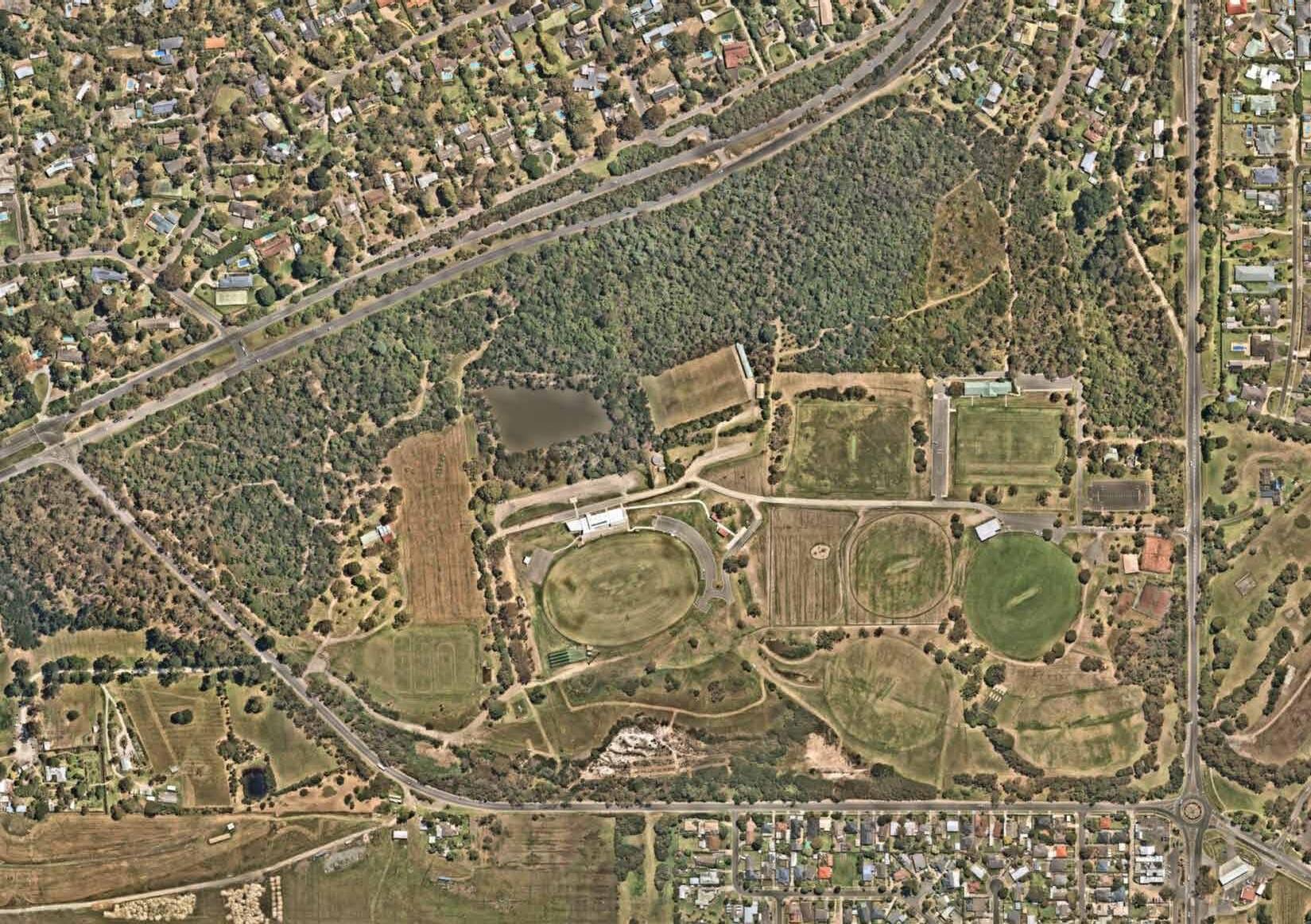
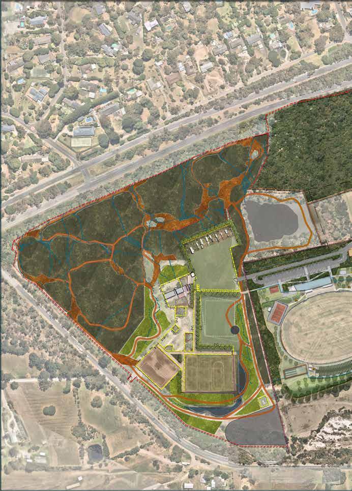
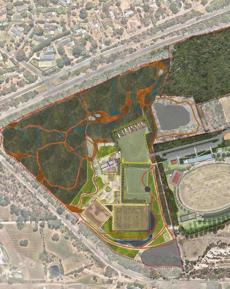
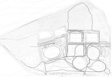
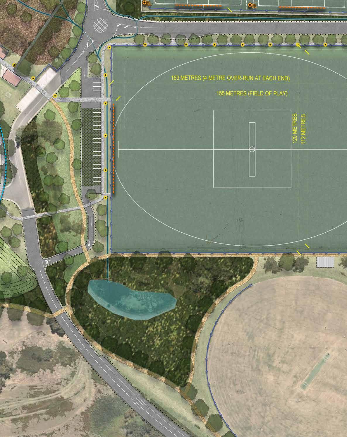
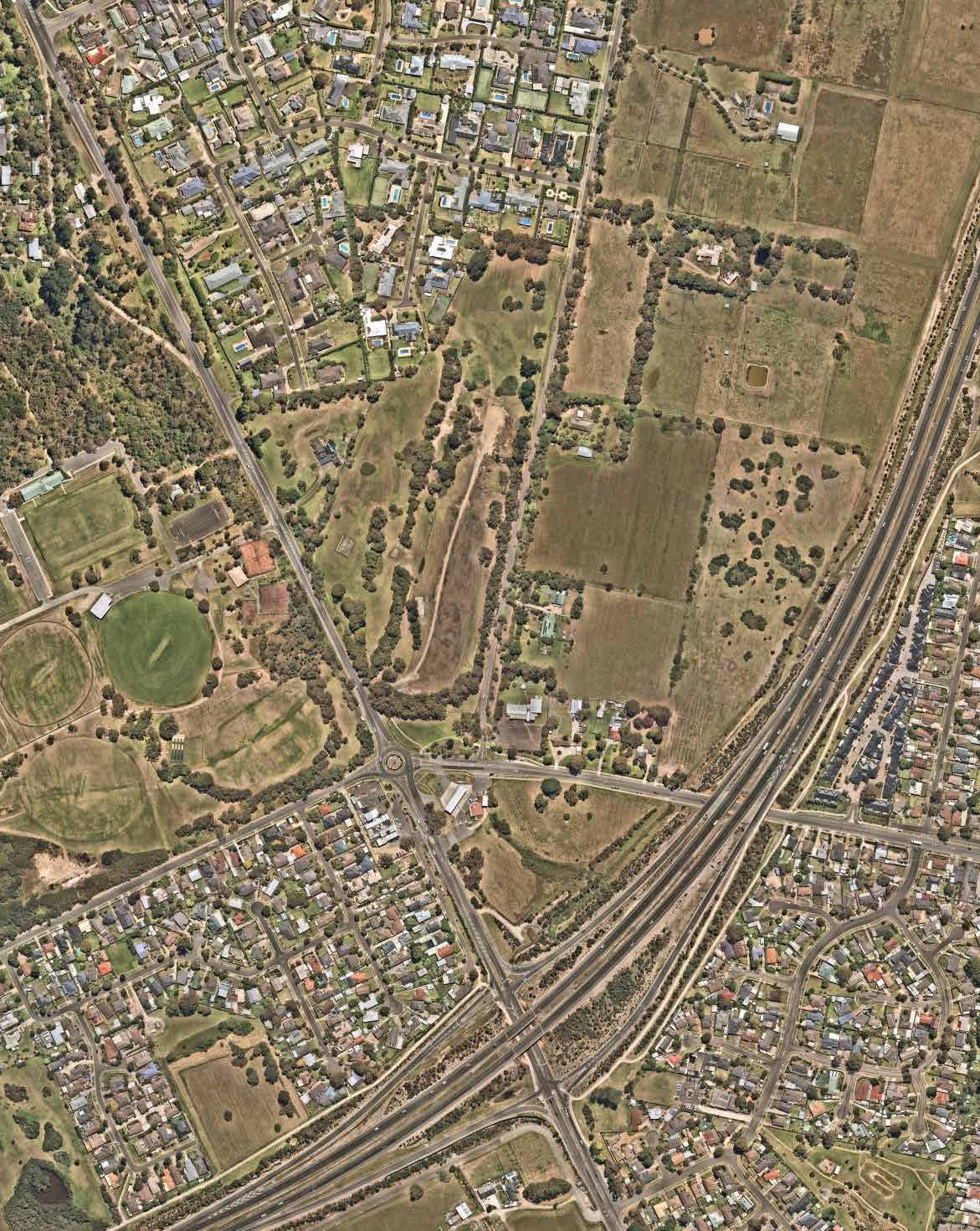
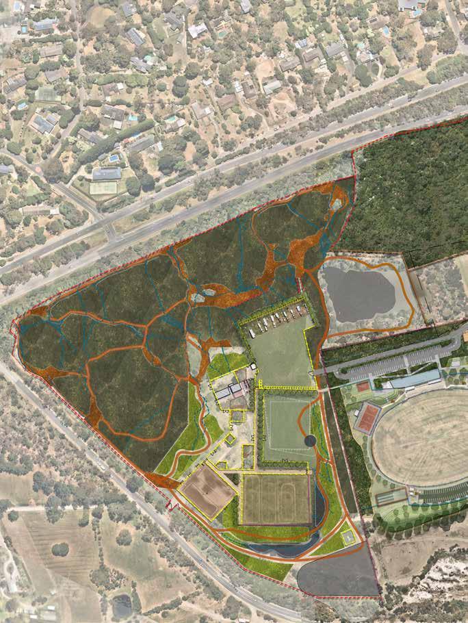
Baxter Park is a 60-hectare crown land reserve, one of the largest Council managed open spaces, on the southern boundary of Frankston City. As an open space it is significant at a local and regional scale and provides for flora and fauna, public recreation and enjoyment.
This master plan aims to provide clear strategic direction for sustainable improvements and investment to ensure Baxter Park’s natural and cultural values are protected through integrated outcomes that meet the changing community, socio economic and environmental needs.
The preparation of the master plan commenced in February 2022 with a thorough review of previous plans and related strategic documents. This process also involved review of the Victorian Governments ‘Frankston to Mornington Parklands Future Directions Plan’ and was complemented by extensive site analysis and key stakeholder and community engagement to provide an informed basis for the master plan.
The Master Plan considers existing sporting activities, public recreation (passive), environmental and cultural value, and allows for future provision of the open space for the broader community. It provides guidance on future recreation and event facilitation and a framework for the integration of all new projects within the park.
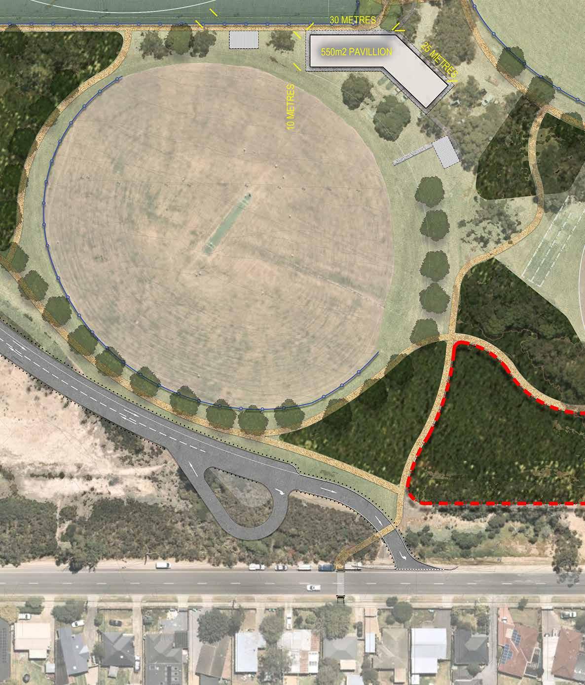
Importantly the Baxter Park Open Space Master Plan has been developed to align with the Frankston Equestrian Master Plan; of which the Western third of the Baxter Park landscape plays a critical role. Importantly the viability of new facilities proposed to ensure the longevity of Mornington Peninsula Pony Clubs’ tenure on the site is reliant on provision of new access through the Baxter Park via the “vehicular spine” which is proposed as part of the priority works for the site.
The Master Plan considers the following key opportunities:
Identify Park improvements to deliver a “District Level” destination open space, enhance the user experience and provide diversity in Open Space and recreation opportunities.
• Develop recommendations to protect and enhance conservation and biodiversity values in the reserve and improve the broader biodiversity linkages identified in Frankston’s Biodiversity Policy and supported by the Frankston to Mornington Parklands Project (DEECA).
• Review existing and forecast sporting demand for the reserve and develop recommendations to deliver for demand into the future.
• Accessible and connected open space –Review existing access and movement to and within the reserve, identifying opportunities to improve internal paths and trails, circulation and connections for pedestrian and bicycles. Improve wayfinding & signage, connections to external shared use paths and trails, safe crossing points, and investigate alternative traffic routes within and to the reserve.
Improve recreation and play opportunities to support a District Level Play Space in accordance with the Frankston Play Strategy 2021 and to encourage interaction with the natural environment, education, and adventure play.
• Enhance the natural parkland character and achieve Urban Forest priorities Develop planting recommendations to improve landscape visual amenity, shade, urban heat island effects and biodiversity values in the open space and surrounds.
Further considerations include:
• Develop recommendations with consideration to bushfire, environmental and water management programs.
• Integrate Frankston Equestrian Master Plan 2023 recommendations.
• Review Property Strategy recommendations for lease/license agreements.
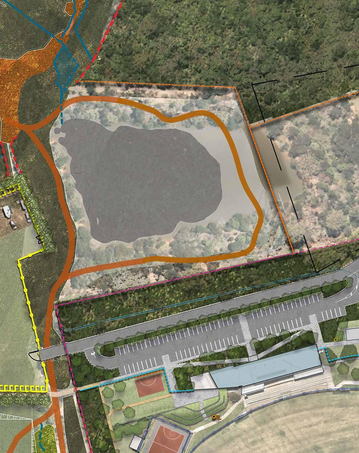
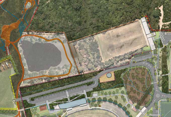
• Integration of decommissioned dam for safe recreation and drainage opportunities, as per DEECA dam safety works.
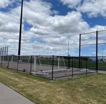
• Strategically review tennis infrastructure and feasibility of tennis in accordance with the Frankston City Tennis Action Plan 2021
• Review drainage infrastructure and consider Melbourne Water upgrades.
• Review opportunities to reduce conflict and improve safe off leash dog walking areas.
The master plan provides a strategic framework for potential improvement programs, projects and partnerships aimed at preserving and improving park natural and cultural values and providing new and improved sporting and visitor experiences.
This is complemented by an implementation and action plan that enables staged implementation over time. The implementation of this open space plan will mark a significant shift in the future of open space reserves of this nature for the municipality.
In reflecting on the history of the site’s evolution into its current landscape; this Master plan ensures that the Baxter Park Open Space will, in its next re-generation become a flexible open space with the capacity to respond to demographic shifts and importantly to absorb the increasing pressures of population growth and climate change.
The previous Baxter Park Master Plan was developed in 2004. Since then, the Municipality has experienced a high level of growth and development, resulting in shifting priorities in the use, function and management of its public open spaces. To understand how the site can best service the shifting aspirations of the Frankston and Mornington communities and guide the development of a renewed vision for the Baxter Park Reserve, an extensive review of background documentation was undertaken.
Baxter Park is identified in the State Governments “Metropolitan Open Space Strategy – Open Space for Everyone” as part of the Frankston to Mornington Parklands Project. The purpose of the Parklands Project is to create a connected and accessible network of open space between existing parks and reserves within the northern Peninsula. The Plan identifies opportunities to optimise and grow the network of parks and reserves, trails and waterway corridors to improve connections, protect biodiversity, and enable people to enjoy a more expansive and richer open space experience.
Further to the Metropolitan Open Space Strategy, the State Government have developed the “Frankston to Mornington Parklands – Future Directions Plan” (2023) which has been developed “to create a connected and accessible network of open spaces encompassing existing parks and reserves within the Mornington Peninsula Shire and Frankston City Council local government areas”. The Parklands project focuses on the connectivity of a series of open spaces from Frankston to Mornington; one of which is Baxter Park.
Baxter Park is relatively unique in the Core Parks covered by the project in that it includes Sports Facilities as one of its many open space roles.
The Future Directions Paper, carried out detailed investigations on visitation of the core parks it studied, and determined that Baxter Park had the highest total visitation of 91,267 to its 59 Hectares. This is significant given that during the time of the visitation study (August 2021 to May 2022) Victoria was subject to Covid Lockdowns and many organised sporting events were cancelled. It is also important given that Baxter Park is relatively difficult to access via foot or cycle, due to poor connections from Peninsula link trail.
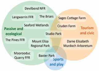
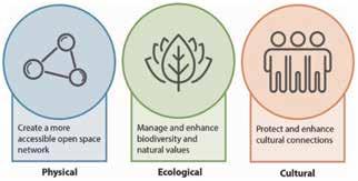
Baxter Park is well positioned to be developed to embrace all three connective elements outlined as part of the Parklands Project; Physical, Ecological and Cultural.
The three connective elements considered in the plan. (Source: Frankston to Mornington Parklands Future Directions Plan 2022)
The core principles of the Parklands Future Directions Paper reflect the approach to parkland planning and feedback from the community:
• The recommendations and values identified in the BLCAC Cultural Mapping study are central to the Parklands.
• Sites with high biodiversity value will be protected and maintained.
• Recreational experiences in the parklands will be delivered in harmony with cultural and ecological values.
Long-term changes in demographics, community needs, and cultural and ecological values will be monitored and used to influence future development of the plan.
• Safe and equitable access for all will remain a priority.
2004 Master Plan (not endorsed)
The 2004 Master plan recommendations which remain relevant for the 2022 master plan are:
• The removal of Sages Road access because of safety issues, and relocate the Sages Road entrance east to improve visibility of vehicles entering and existing Baxter Park
• Establish a walking trail network within the park, connecting to existing on road and off-road paths outside of the park.
• Extend Equestrian pavilion to allow for toilet facilities, incorporating a unisex/disabled facility (partially completed – more facilities needed for higher use and events).
• Introduce an Equestrian cross-country course for at the southern end of the park (part of the broader negotiations with Melbourne Water).
• Manage native vegetation (open forests) primarily for conservation purposes, allowing appropriate recreation uses in the equestrian area.
• Promote the re-creation of vegetation types identified as pre 1770’s EVC’s in the area (Grassy Woodland and Swamp Scrub)
Manage the area of Snow Gum open forest as a high-quality remnant of a rare and threatened community
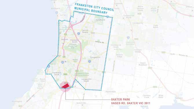
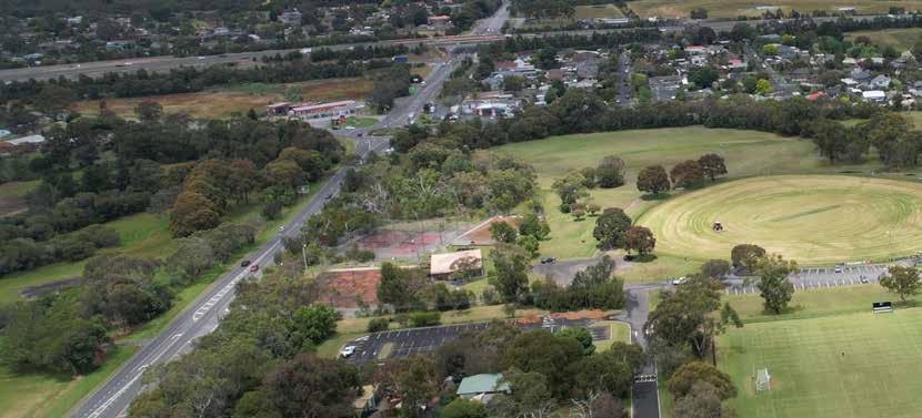
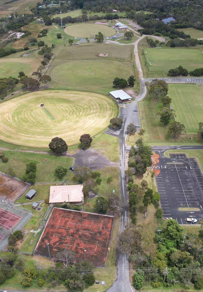
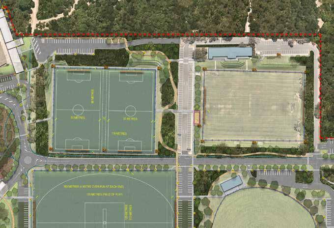
Baxter Park is located at 294N FrankstonFlinders Road in Frankston South 3199. It is located outside the Municipality’s urban growth area, between the Moorooduc Highway and the Peninsula Link Freeway.
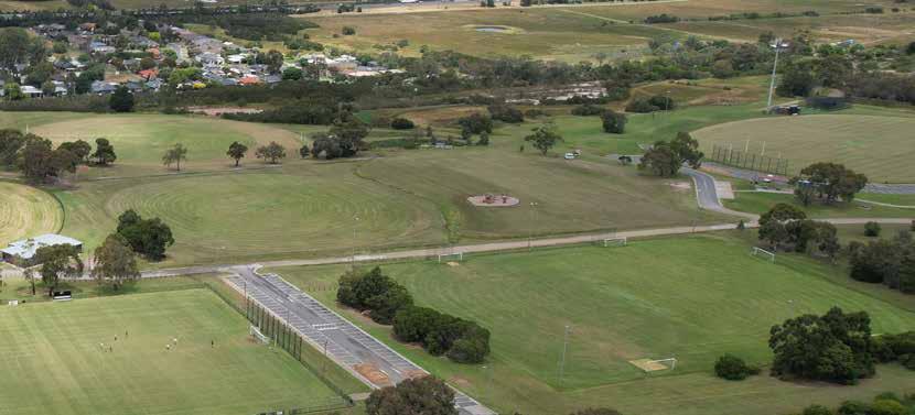
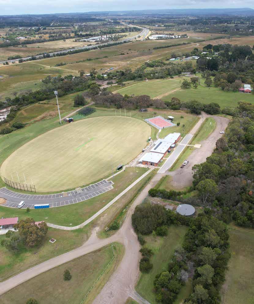
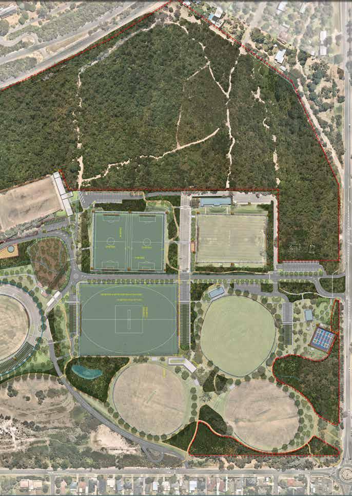
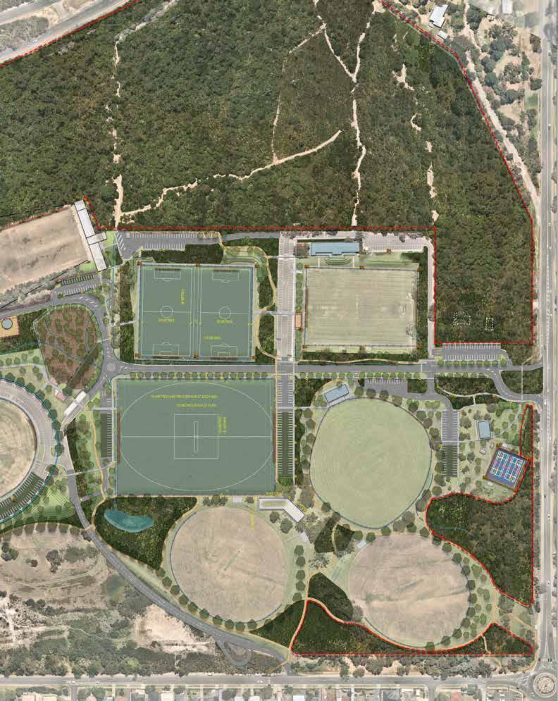
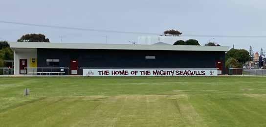
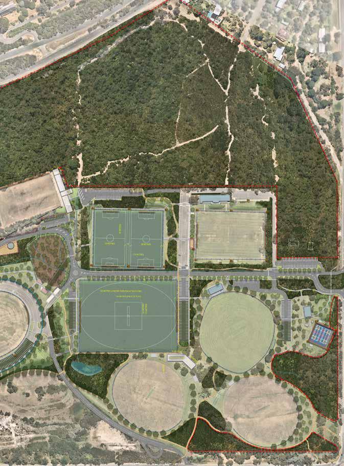
Baxter Park is one of the largest Council managed reserves in the municipality. The Baxter Park Reserve is crown land. This is a significant local and regional open space with a focus on the provision of sport facilities for soccer, football (AFL), netball, cricket, archery, equestrian facilities and in the past, tennis. In addition to these active sporting facilities, recreationally the site contains a small poorly equipped children’s playground and dog off-lead area, which is largely undefined meaning that many dog walkers do not restrain their dogs within the reserve.
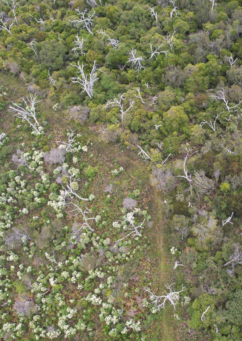
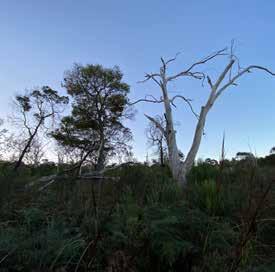
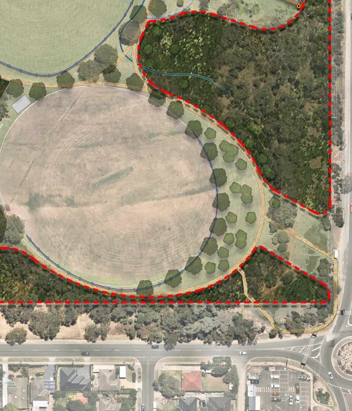
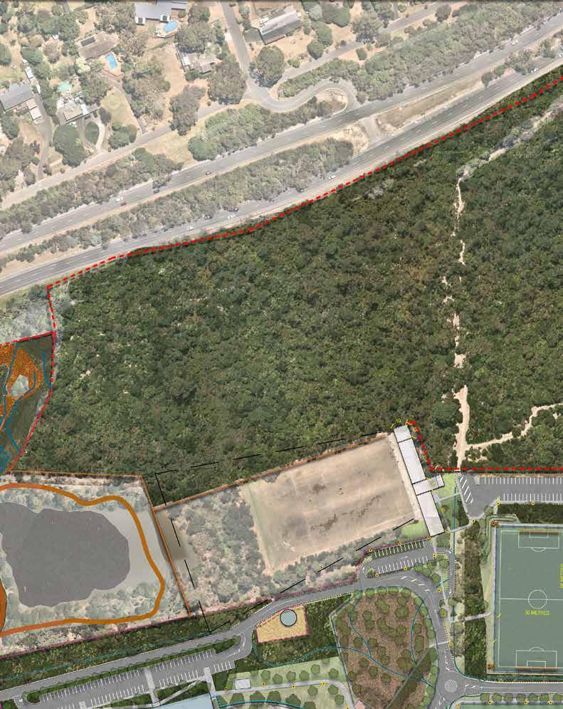
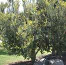
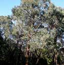
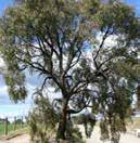
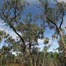
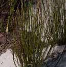
The property is some 60 hectares and is in two parcels. Whilst most of the park provides a sporting function, a small triangle in the northern corner is zoned as a conservation and resource zone. The northern and western area of the reserve is forested and in significant contrast to other open space in Baxter, which largely comprise open grassed areas, of relatively low ecological value. The bushland in the reserve is home to native small mammals, wallaby’s and birds, along with good quality remnant vegetation, which is in the process of being restored through a control burn program to assist in weed eradication and regenerate remnant Indigenous species.
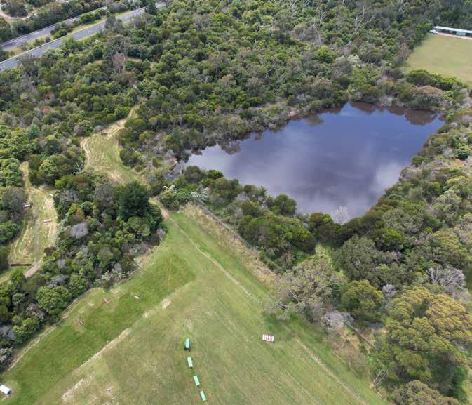
The site receives water from four residential sub catchments, surface water is carried through the site in a series of open drainage swales and sub-surface pipe systems to the location of existing retarding basin. There are issues arising from ad-hoc drainage infrastructure and drainage problems throughout the reserve. There is a dam in the bushland area, northeast of the equestrian area.
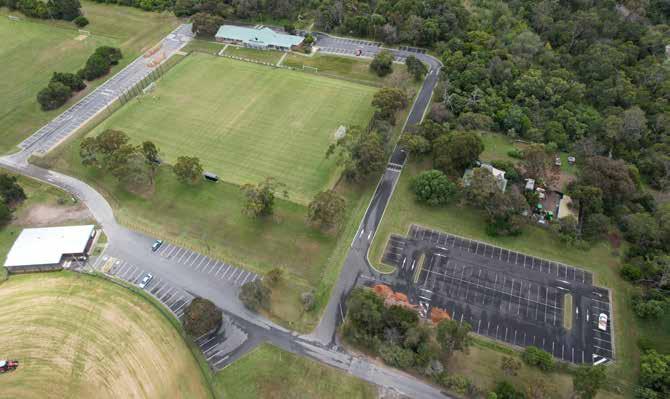
There are four leases to Council currently at the site: Optus Telecommunications, Caretakers cottage, Mornington Peninsula Pony Club and Frankston Archery, while the sporting clubs have seasonal tenancies with Council.
School’s from across South-East Melbourne use Baxter Park for their school sports and cross-country events. These bookings are made through an application form sent to Council’s Recreation team.
There is recognised potential for the site to be developed as a major outdoor event or festival site, given its proximity to Peninsula link and the availability of large open interconnected spaces.
Additionally, the site currently accommodates storage of high-quality clean fill, which results from Council’s City wide drainage maintenance; whereby open drains and swales within recreation reserves are scraped clean and the resulting debris is transferred into a large pile south of the Equestrian reserve, near the Sages Rd exit.
The majority of the reserve is subject to a Bush Fire Management Overlay.
A cultural heritage assessment was undertaken for the site that found:
There is a registered Aboriginal place (a single stone artefact) adjacent to the activity area.
• According to the AV sensitivity mapping, the activity area is not an area of Aboriginal cultural heritage sensitivity.
• The activity area has low potential for significant Aboriginal cultural heritage; however, it is possible that such heritage could occur, in the form of isolated or low density stone artefact occurrences.
• All of the activity area has not been subject to significant ground disturbance.
• A Cultural Heritage Management Plan is not required in the event that high impact activities that are identified in the Aboriginal Heritage Regulations are carried out.
• A Voluntary Cultural Heritage Management Plan may be undertaken at the discretion of Council.
Whilst surrounded by roads, the reserve does not have good vehicle, pedestrian, cycle (or equestrian) accessibility. The verges are mostly screened by vegetation and fenced. There are no pedestrian road crossings to the site, and adjacent to the residential area to the south, entries are relatively informal.
Vehicle access to the reserve is from one entry and exit on Frankston-Flinders Rd. There is access to the Equestrian club and a small carpark from Sages Rd, along with maintenance vehicle access into Baxter Park. Cycle and pedestrian access
is limited with poor access, there is fractured connectivity to the Peninsula Trail, and there is no safe crossing from Sages Rd to Sages Cottage. There is public transport to the site however the one bus stop on Frankston-Flinders Road has an incomplete and unsafe path into reserve.
There us a disused railway line to the south however this is separated from the Reserve by the freeway. There are also several open spaces that adjoin Sages Road with corridors that connect to the Peninsula Link Trail. Connection to the reserve via these was investigated as part of the Master Plan process.
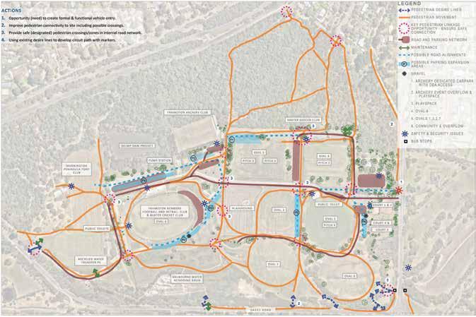
• Consultation processes identified that the Sages Road entry to the reserve is a safety concern specifically to Horse & Pony and Football visitors. The entrance from Sages Road is recognised as a poor entrance to the park.
• Nearly all users drive to access Baxter Park.
In addition to the sporting reserves, Baxter Park has a rich network of remnant ecology and conservation opportunities, complex drainage systems, recycled water program and other projects being managed by multiple departments across the breadth of the Council.
The Master Plan considers vegetation quality and key drainage lines on the site in relation to recreation facilities and other projects such as the DEECA Dam site and the future Melbourne Water retarding Basin.
A detailed assessment of the current and future position of hockey in the south metro zone is currently under review through the Southern Metro Hockey Feasibility Report. This report is being prepared by Hockey Victoria in partnership with Mornington Peninsula Shire and Frankston City Council with Council’s Recreation team providing input.
The siting of hockey, including associated issues and opportunities, has been considered as a potential option within the Baxter Park Master Plan however it requires more detailed assessment and consultation. It is recommended that the analysis and background information prepared through the Master Plan be further considered in detail and in consultation with all stakeholders as part of Hockey Victoria’s Feasibility Report. The Feasibility Report should also adequately consider broader community interests, environmental impacts, master plan objectives, existing stakeholders, existing land use and planning controls.
There are several projects underway on the Park that have been considered as part of the Master Plan:
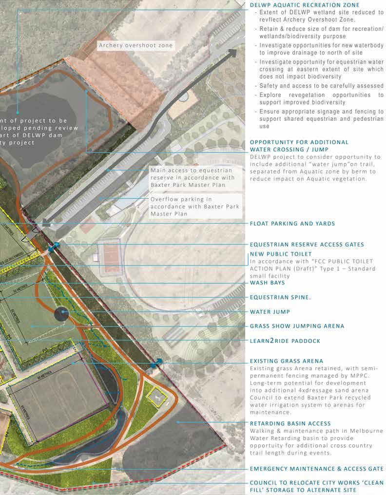
The Frankston Equestrian Master Plan (run concurrently to this project). Items identified by the Equestrian Master Plan which impact the broader Baxter Park site include:
• Need for an extended 2-3km cross country course for events (currently this operates within the Melbourne Water retarding basin during events)
• An opportunity for access around the soon-tobe-decommissioned dam is being proposed.
• A new vehicle entrance through Baxter Park to the equestrian site and the subsequent closure of the Sages Rd carpark for public is also proposed to improve flow of traffic and rubbish dumping.
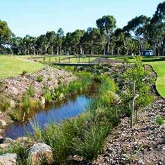
Dam Safety Project (underway). DEECA is funding this project to investigate options to decommission the dam from water storage irrigation source to be redesigned for recreation and drainage opportunities, with safe public and potentially equestrian access around the perimeter. It is proposed that the dam will be made smaller and shallower with the potential of wetlands incorporated. A consultant brief is currently being managed by Council’s engineering team, along with a risk and safety analysis of the proposed opportunities.
Tennis Action Plan determined the proposed decommission of some existing tennis facilities. It is recommended that the Baxter Park Master Plan determine future needs and opportunities of the clubhouse and resurface some/all of the courts for multipurpose use to diversify the recreation facilities within the reserve.
Melbourne Water retarding basin upgrade (on hold) A project by Melbourne Water is underway to upgrade the existing Sages Road retarding basin (constructed 1976) to improve the efficiency of the existing retarding basin in this park to improve the flooding and drainage issue of downstream area. The project is currently on hold pending a review of the flood modelling and the project functional requirements.
The 2004 Baxter Park Master Plan identified a number of management issues & goals for the future of the site; which remain current in 2022 The below list summarises 2004 objectives which have been addressed or reframed by the new Master Plan.
Baxter Park is largely used and managed as an active and passive recreational space for various sporting activities. However, the Park also supports various fauna species from the presence of moderate to high quality vegetation and habitat components within the biodiversity corridor (along the east and south boundaries) as well as the larger habitat area to the north of the park. The habitat present within the park is critical in supporting biodiversity within the area that is otherwise largely developed for urban living and farming practices. Future development within Baxter Park should take into consideration the fauna and fauna habitat present and strive to protect and enhance the habitat components present for the purpose of maintaining biodiversity throughout the municipality as well as providing the much-needed green spaces for the public.
The operation of proposed and existing facilities needs to consider the impacts of lighting on fauna. The National Light Pollution Guidelines for Wildlife (Commonwealth of Australia 2020) gives general principles for minimising light pollution impacts. These include:
• Use adaptive light controls to manage light timing, intensity, and colour.
• Light only the object or area intended –keep lights close to the ground, directed, and shielded to avoid spill, especially to sensitive areas
• Use the lowest intensity lighting to achieve the desired effect
• Use lights with reduced or filtered blue, violet, and ultra-violet wavelengths.
The Master Plan avoids and minimises tree and understorey vegetation removal where possible, with emphasis on the eastern and southern boundary, as this section of Baxter Park provides high quality fauna habitat and an important habitat connectivity for fauna species throughout the park and surrounding landscape.
Under the Gender Equality Act, a Gender Impact Assessment was undertaken to ensure the master plan will meet the different needs of women, men and gender diverse people. The key findings are outlined below.
1. Managing and improving the perceptions of safety, universal accessibility, and diversifying opportunities for recreation and exercise are critical to ensure that Baxter Park is a facility that meets the more diverse needs of gender, culturally and age diverse groups.
2. The key the initiatives within the Master Plan need to be considered in terms of how they will impact the community based on the GIA research. These initiatives, specific recommendations and their outcomes are summarised below.
Fitness, Active Play and Well Being The provision of alternative fitness and well-being opportunities, outside of organised sporting groups.
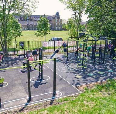
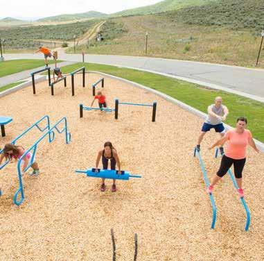
• Outdoor Fitness Station: Provision of fitness equipment adjacent to the play space, provides opportunities for parents and carers to exercise with more ease.
• Circuit Paths for Walking, Running and Dog Walking. The below initiatives will increase the use of paths by female, gender diverse and other groups of the community who feel unsafe in open public spaces.
– Consider alignment options which have open visibility for people who feel unsafe in secluded areas
– Ensure there are no dead ends or hidden divergent paths
– Do not locate large bins or infrastructure which create hiding places adjacent to paths.
– Provide appropriately lit paths for walking at night (not required for all paths). Provide paths which are wide enough for pairs to walk safely.
• District Playspace Providing open space diversity to activate the open space and improve perceptions of safety
– Ensure provision for semi-privacy for breastfeeding comfort
– Ensure accessibility for prams, and secure storage of prams within the play space.
All Abilities Access Initiatives: Due to the complexity of the topography and pre-existing issues with accessibility, the project provides the following initiatives.
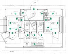
• New Public Toilet Facilities – In accordance with Public Toilet Action Plan
• Appropriate DDA car parking facilities and connecting paths: Ensure diverse abilities of users are catered for.
• Pedestrian and Vehicular Separation Ensure safe and comfortable paths of travel away from roads. Especially important for perceptions of safety for females and gender diverse groups.
• New Vehicular Spine and Associated Path, Lighting and Wayfinding Projects: Ensure safe and comfortable paths of travel away from roads. Especially important for perceptions of safety for females and gender diverse groups.
• New Community Landscape and Park Entrance:
– Create a vibrant, open, active and inviting Park entrance and community landscape to provide comfort to diverse user groups.
– Use public art and colour in the landscape to create an exciting backdrop for a new and vibrant reserve.
Sporting Facility Initiatives The below initiatives will all ensure the diversification and expansion of sporting clubs to be able to include female and gender diverse teams.
• Oval 6 Expansions
• Oval 2 Renovation: Competition sized oval with lighting
• Soccer Club Training Pitch Expansion
New Archery Facility
The Baxter Park Open Space Plan Gender Impact Assessment recommends that Council:
• Implement the Baxter Park Open Space Master Plan as budget is
• Ensure that CPTED Principles and key Gender Diverse Design Principles are embedded within all future project implementation briefs.
• Engage appropriate consultant teams to ensure that worlds best practice methodologies and standards are applied to all implementation projects.
• Provide clear project briefs and outlines for the implementation of the project which detail the constraints and opportunities outlined by this GIA
• Ensure that key Council stakeholders are consulted on the implementation of all works (this Assessment would recommend engagement with the Baxter Park PWG core group as a minimum)
• Undertake further community/stakeholder consultation for the initiatives outlines in section C.1 (above). Include specific gender groups.
• Council to work with Sporting Clubs to ensure Gender Equity and community safety are embedded within their constitutions and operational practices. This could be considered a requirement of future tenancy agreements for the reserve.
Implement Public Toilets in accordance with the outcomes of the Public Toilet Action Plan.
Through development of the Master Plan, it became evident that Baxter Park holds strong potential for use as an events space. A potential events opportunity plan was developed, based on both current proposals for events (equestrian and archery) and potential other large scale events for the municipality.
Event Opportunities which have been considered in the development of the Baxter Park Master Plan:
• Local, Regional, State and National Equestrian Events
Local, Regional, State and National Archery Events
• Large scale Environment, Arts and Cultural Events:
– Valuable Remnant vegetation zone as potential sculpture competition walk
– Shared use of adjacent Soccer/Archery club for exhibition/launch/awards space.
Large Scale music events
– Major road access
– No immediate Residential neighbours –ability to mitigate sound and light pollution through event engineering and design.
– Potential for Shuttle buses to train stations via Peninsula Link and Maroondah Highway
– Significant parking and overflow parking capacity
– Back of house capacity
• Sporting Club community fun days Sporting Club competition programs
The Baxter Park Open Space Master Plan 2023 has been developed through 5 key phases involving Council, community, key stakeholders and an external consultant team.
Phase 1
• Background review and site analysis plans
• Preliminary Key Stakeholder Engagement
• Issues and Opportunities Identification
Phase 3
• Final Draft Baxter Park Open Space Master Plan
• Key Stakeholder Engagement – review and comment on Final Draft Master Plan
Phase 2
• Draft Baxter Park Open Space Master Plan
• Stakeholder and Community Engagement – review and comment on Draft Master Plan
• Final Baxter Park Open Space Master Plan 1 2 3 4
Phase 4
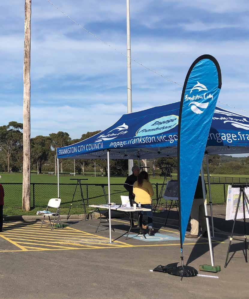
A variety of stakeholder consultation and community engagement activities were undertaken to gather information and seek feedback for development of the Master Plan.
Frankston City Council thanks all local residents, park visitors, sports players, clubs and groups who contributed their ideas and views to the Master Plan development process.
Sports clubs and tenants in Baxter Park generally have some form of lease or license agreement with Council and were invited to directly participate in the Master Plan development.
The following key stakeholders have been engaged on various occasions to provide feedback and input into development of the Master Plan:
• Baxter Soccer Club
Heatherhill Cricket Club and Baxter Cricket Club
• Frankston Bombers AFL and Netball club
• Frankston Archery Club
• Archery Victoria
Mornington Peninsula Pony Club
• Peninsula Women’s Hockey Association, Frankston Hockey Club and Mornington Peninsula Hockey Club
• Netball Victoria
• Bunurong Land Council Aboriginal Corporation
• Department of Energy Environment and Climate Action
Melbourne Water
• Frankston Environmental Friends Network
• Mornington Peninsula Shire
In addition to feedback received from the above key club stakeholders and groups, feedback from a total of 261 local residents has been considered. The Draft Master Plan was exhibited online for a period of 4 weeks from the 10 June 2022 to 10 July 2022 with feedback received considered in the preparation of the Final Master Plan and Action Plan. The Final Master Plan was also presented to all the Baxter Park sporting clubs in June 2023 with feedback received considered in the Final Master Plan and Action Plan.
For detail on the consultation and findings, refer to the Baxter Park Master Plan Discussion Paper located on the Council website.
We heard strong support for the key moves identified in the Master Plan from the broader community including:
1. Vehicle & pedestrian safety
2. Conservation & habitat values
3. Park fencing & pedestrian/cycle accessibility
4. Park path network with shade & lighting
5. District Play Space well supported
6. Poor Perceptions of Public Safety
7. Dogs off leash to be retained
8. Sporting Facility Priorities:
• Archery Facility well supported
Soccer – Pitch 1 Lighting & Pitch expansions
• Main Pavilion Expansion, Access & Public Safety issues
• Hockey inclusion campaign
• Concern with potential impact of hockey on Oval 1
Netball warm up area needed
• Sports lighting
• Drainage concerns
• Timing of equestrian improvements –make it happen
“Need lighting on Pitch 1 ASAP and drainage on Pitches 2+3, or risk losing junior players to better equipped clubs. Keep growing local sports.”
“There is a lovely patch of remnant vegetation where, many people, dog walkers families enjoy walking and exercising and should be retained.”
“A huge playground as so many young families in the area.”
“Expanding the entrance to the park and lights on pitch 1 are a must. Night games would look incredible at Baxter park.”
“Archery club desperately in need of a dedicated car park and better access. Range also needs surface drainage addressed.”
“DDA compliance for toilets and ramps ASAP. My son uses a wheelchair and cannot access the club safely, no accessible toilet or driveway.”
“Safe pedestrian access to park for children crossing Frankston/Flinders road and or Sages road not clearly identified.”
“Great plan, well thought out and finally some upgrades we badly need!!!”
“Sports players leave much rubbish in the park. Dog walkers use the park every single day.
Traffic down center of the park is dangerous.”
“An additional netball court will provide a safer environment for the netball teams, we are currently training in the car park.”
“Great plan, well thought out and finally some upgrades we badly need!!!”
“Perimeter bike and walking track would be amazing!”
“An additional netball court will provide a safer environment for the netball teams, we are currently training in the car park.”
“The Peninsula Woman’s Hockey Association is 60 years old and desperately needs new facilities. Baxter Park would be the perfect venue!”
“The Baxter Cricket Club is concerned about the proposal for the removal of the Wayne Landry Oval in place of a hockey pitch.”
“Lighting at the entry to the park for safety. It feels so dangerous driving in at night for a run or training.”
“Turtles koalas echidnas possums eels ducks etc. inhabit the lake and surrounding bush land it is one of the only places left they inhabit.”
“This should have been completed a long time ago, especially lighting.”


Grounded in the aspiration to embrace the recognisable shift in open space values to ensure the preservation of natural and cultural heritage and embrace the importance of providing diverse recreational opportunities, the implementation of the Baxter Park Open Space Master Plan will be driven by the following guiding principles:
All future projects within Baxter Park should be developed to recognise its location within a network of open spaces which are part of two of Melbourne’s Green Wedges; which are of regional and state significance.
2. Prioritise Safety & Accessibility
Access into the park and movement through it should be prioritised as a critical consideration for future improvements Apply a holistic multi- disciplinary approach to ensuring the connection of the park to the surrounding community by pedestrian, cycling and vehicles. Critically, all future projects and improvements should ensure safe separation between vehicular and pedestrian movement.
3. Ensure Recreational Diversity within the Municipality
Baxter Park is a unique and distinct public open space which enriches the recreational and spatial diversity of the Municipality. The implementation of the Open Space Master Plan should prioritise actions that ensure diversity in the use of the site.
4. Create a Unified & Biodiverse
The site is currently defined by a binary landscape relationship with its natural conservation zones contrasting highly maintained sporting facilities. The development of the site should work to integrate the natural environs into the open space reserve, creating bio-diverse opportunities for the improvement of regional flora and fauna, and in turn improving the experience of sporting and other recreation pursuits within the park.
5.
The remnant ecology and habitat of the site, provide an opportunity to educate the community on and offer respect to Bunurong culture. This engagement should be through the development of artwork integrated into key projects such as the park entrance, pedestrian refuge pavements and with the development of ongoing cultural educational systems on the heritage of the landscape, its habitat for endangered species and develop a richer understanding of Bunurong connection to country.
6. Inclusive and Fit-for-purpose
Open Space recreational opportunities and all existing and future sporting facilities should be designed and enhanced to be inclusive of users regardless of age, ability, gender and cultural backgrounds, and support changes in demand over time.

ROADS & PATH NETWORKS


NEW ROAD AND CARPARK ALIGNMENTS
PERMEABLE PAVED CARPARK
NEW CONCRETE PATH
NEW DROMANA TOPPINGS CIRCUIT PATH NETWORK
DESIGNATED DDA CAR PARKS
RAISED PEDESTRIAN ZONE TO ROAD NETWORK

PEDESTRIAN CONNECTIONS
PEDESTRIAN LIGHTING “WILDLIGHTS” SENSOR LIGHTING
STRUCTURES & FACILITIES


EXISTING LIGHT POLES
PROPOSED LIGHT POLES
EXISTING BUILDINGS (AND VERANDAHS/AWNINGS)
PICNIC & BARBEQUE SHELTERS
PROPOSED STRUCTURES
WASTE AND RECYCLING MANAGEMENT AREA
TICKET BOOTH
PUBLIC TOILETS
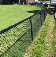
FENCES,BOUNDARIES & GATES
EXISTING FENCE
PROPOSED FENCE


LOW CHAINWIRE FENCE WITH GATES to pitches and ovals for ball retention & playspace for safety
TALL SECURITY FENCE
TALL CHAINWIRE BALL FENCES
PROPOSED VERMIN PROOF FENCE
PROPOSED TEMPORARY EVENT FENCING
BOLLARDS TO PREVENT VEHICLE ACCESS TO PITCHES & OVALS
GATES to enable Councils and clubs to maintain security of site
AIRLOCK GATES for pedestrian access through wildlife fences
MAINTENANCE VEHICLE ACCESS GATES
PLANTING, REVEGETATION & DRAINAGE


REVEGETATION ZONES
LAWN AREAS
NEW CANOPY TREES
DRAINAGE LINES
Formalise and consolidate drainage swales Improve ability to mow grass swales & revegetate others
Extent of project to be developed pending review as part of DELWP dam safety project
INTERNAL ROADWAYS, CAR-PARKING & VEHICULAR LINKS
All new roadworks to reflect existing concrete edge system, for flow of water into adjacent swales and future WSUD treatment opportunities. Line marking or raised traffic islands to be used to prioritise pedestrian movement through the site, especially for the North South links across the proposed vehicular spine.
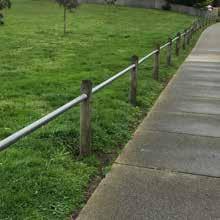
FENCING & BARRIERS
Vehicle access to be limited throughout the reserve by implementing Councils standard post and rail barriers to road edges. Low chainwire fences to be implemented at the boundaries to ovals & fields adjacent to roads, and to the proposed district playspace.
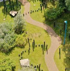
CIRCUIT TRAILS & PATH INTERACTION
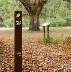
The Master Plan proposes a new circuit trail network which responds to existing lines of movement across the site, connects different destinations and provides a range of possible exercise trail options. The implementation of the trail should consider opportunities for distance and orientation markers throughout the reserve.
HABITAT & ECOLOGY EDUCATIONAL PROJECTS
The Master Plan will define opportunities for educational signage about remnant vegetation and the importance of this site in conserving it for habitat and ecological value.
LONG TERM EPHEMERAL REVEGETATION & WSUD PROJECTS
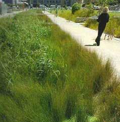
The Master Plan proposes that the drainage network be consolidated adjacent to existing & proposed vehicle and pedestrian movement systems. While this may be implemented as a series of open swales in the short-term, there should be long term aspirations for the implementation of Water Sensitive Urban Design principles enabling the expansion of ephemeral and aquatic habitat across the site.
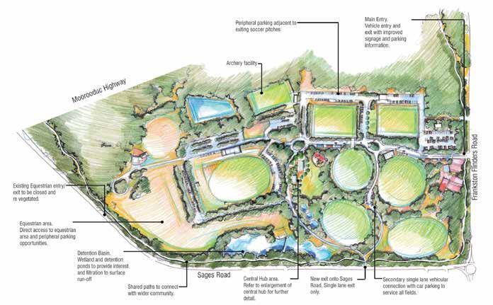
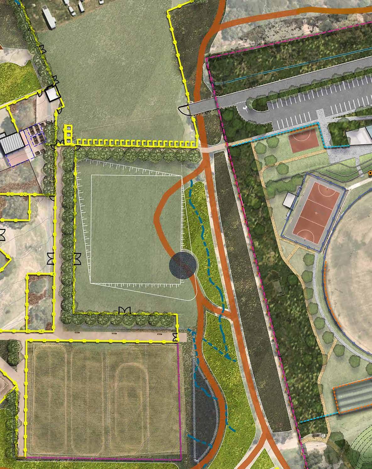
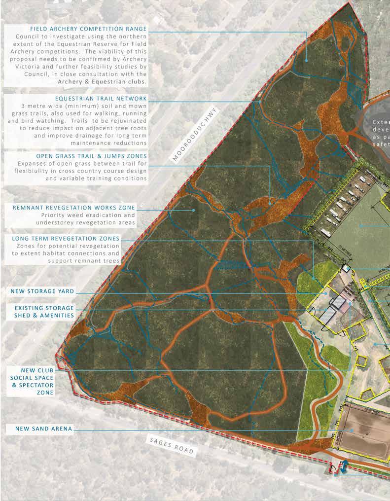
ZONE 07 –EQUESTRIAN
Extent of project to be developed pending review as part of DELWP dam safety project PUBLIC TOILET
ZONE 4 – CRICKET & AFL MAIN OVAL AND NETBALL ZONE
FRANKSTON BOMBERS FOOTBALL AND NETBALL CLUB & BAXTER CRICKET CLUB
CONSERVATION / REMNANT VEGETATION ZONE
EXISTING CLUBROOM RE-PURPOSED FOR COMMUNITY HIRE WITH PUBLIC TOILET ACCESS 16 CAR PARKS + 1 DDA PARK
COUNCIL TO INVESTIGATE OPTIONS FOR ADDING COMMUNITY ACTIVITY INCLUDING FEASIBLY FOR OUTDOOR FITNESS EQUIPMENT.
NEW DRIVEWAY ALIGNMENT AND OVERFLOW CARPARK CONFIGURATION
LEFT TURN ONLY EXIT

PARK ENTRANCE AND RIGHT HAND TURN EXIT ONLY
NEW COMMUNITY LANDSCAPE CREATING AN OPEN AND ACTIVE PARK LANDSCAPE
RE-PURPOSING COURTS 4 & 5 AS A MULTI-COURT TO INCLUDE 2 FUTSAL, 2 TENNIS AND 2 NETBALL COURTS

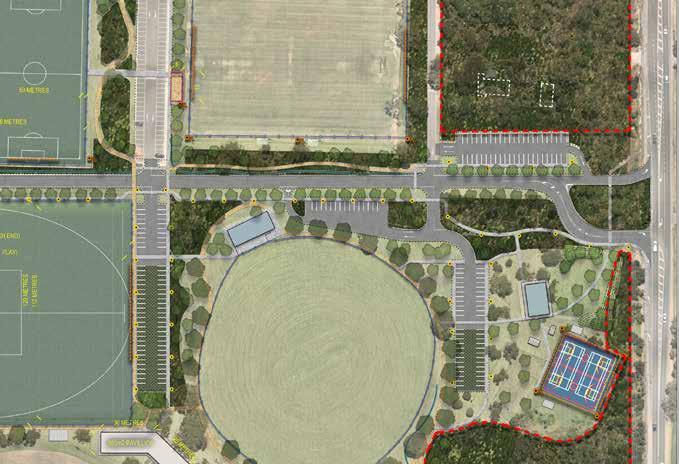
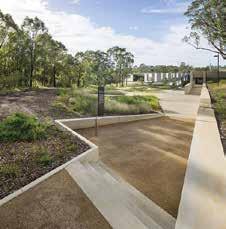
The master plan proposes a split entry/exit onto Frankston-Flinders Road, and Traffic engineers are exploring options for how this can be achieved. The new park entrance will provide open lines of sight into the reserve, and the reinvigorated community landscape will provide an active and inviting landscape frontage.

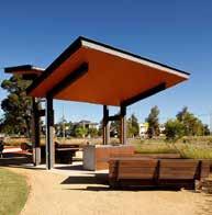
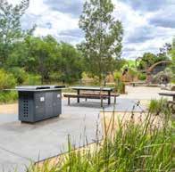
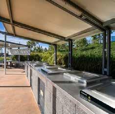
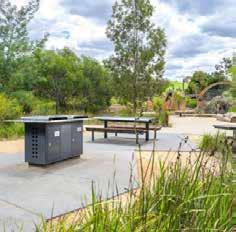
Opportunity to activate the site by expanding existing BBQ & Picnic facilities.
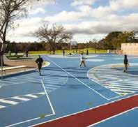
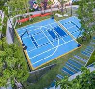
Consider possible PIN entry fenced enclosure for combined Netball/Futsal OR Options for publicly accessible multi-ball sports & rebound wall.
SPACE
Council may create a new public facility for families and youth such as an outdoor gym for all ages use.
NEW INFORMAL TIERED SPECTATOR SEATING NEW ARCHERY DESIGNATED CARPARK & ACCESS PITCH 2 &
NEW FENCING TO EXTENDED PITCHES
RETAINING WALL TO SOUTHERN EXTENT OF SOCCER PITCHES
REMNANT VEGETATION & CONSERVATION ZONE
CLUB BARBEQUE AREA NEW PATH TO CONSERVATION ZONE GOAL STORAGE
80 CAR PARKS AND 8 X DDA PARKS
BAXTER SOCCER CLUB
IMPROVEMENT TO SECURITY LIGHTING
44 CAR PARKS AND 2 X DDA PARKS
SPECTATOR FACILITATION & PLAYER RACE RE-DESIGN
WASTE AND RECYCLING MANAGEMENT AREA
PITCH 1
NEW LIGHTING TO PITCH 1
IMPROVEMENT TO SECURITY LIGHTING
NEW INFORMAL TIERED SPECTATOR SEATING
FORMALISE & CONSOLIDATE DRAINAGE NETWORK
TREE LINED PATH NETWORKS
BAXTER PARK VEHICULAR SPINE
Create new goal store to southern extent of path on western side of pitch 1. Opportunity at existing speed hump in carpark, to provide new pedestrian link to pictures two and three provided across car park to safely transfer goals from store.
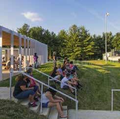
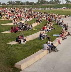
Create a combination of formal tiered and grass terraced, shaded seating to Pitch 1, and long term to pitches 2 & 3
CLUB BBQ SPACE
With goals stored away from building –opportunity to create BBQ space to Western end of Clubrooms, capitalising on Shade and shelter of Building and Trees.
Create new path connections in locations shown to improve safe access and connectivity across the site. These may comprise raised pavement with different materiality, line marking or even public art opportunities.
FIELD ARCHERY COMPETITION
RANGE TO BE DEVELOPED IN CONSULTATION WITH PONY CLUB
Extent of project to be developed pending review as part of DELWP dam safety project
INVESTIGATE FIELD ARCHERY TRAINING RANGES
NEW ARCHERY FACILITY – 86 SQM NEW PUBLIC TOILET FACILITIES IN ACCORDANCE WITH “FCC PUBLIC TOILET ACTION PLAN (DRAFT)” TYPE 2 – STANDARD MEDIUM FACILITY
RANGE EXTENSION/ RELOCATION AND IRRIGATION INVESTIGATION
RECYCLED WATER STORAGE & PUMP STATION
– Recreational Zone 3 – Archery and District Playspace Design Precedents
Extent of project to be developed pending review as part of DELWP dam safety project
REFERENCE PLAN | NOT TO SCALE
New building to include indoor archery range and central social space with kitchen and toilet/change facilities.
Building to include new locked storage space at Northern end of outdoor range.
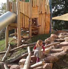
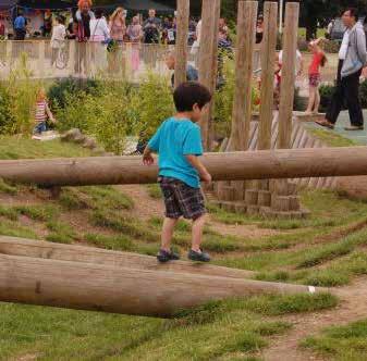
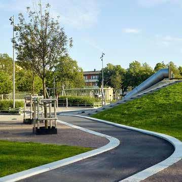
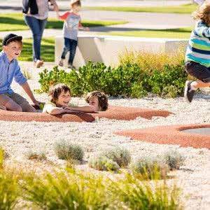
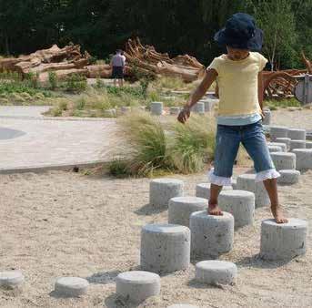
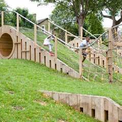
New District Playspace to be designed to embrace and amplify existing topography and provide a landscape to “explore and navigate” across a range of skill levels so that it is exciting for both young and older children.
NEW NETBALL SPACE WITH RING
PAVILION EXPANSION 150SQM
FOOD TRUCK ZONE
FOOTBALL/NETBALL SPECTATOR FACILITATION
NETBALL FACILITY UPGRADE
Provision of player benches to main competition court standards. Expansion to allow for three separate shelters or one singular one comprising: 2 x shelters for players 4.5x1.5m Scorers bench/shelter 2x1.5m long. CRICKET PRACTICE NETS STORAGE AT SCOREBOARD
PUBLIC TOILETS to be removed
NEW NORTHERN CARPARK
NEW TOILET IN ACCORDANCE WITH “FCC PUBLIC TOILET ACTION PLAN (DRAFT)” TYPE 2 – STANDARD MEDIUM FACILITY
DELIVERY ACCESS PATH/DRIVE
74 CAR PARKS + 2DDA
PAVILION STANDS REDEVELOPMENT
PAVILION ENTRY THRESHOLD LANDSCAPE
FRANKSTON BOMBERS FOOTBALL AND NETBALL CLUB & BAXTER CRICKET CLUB
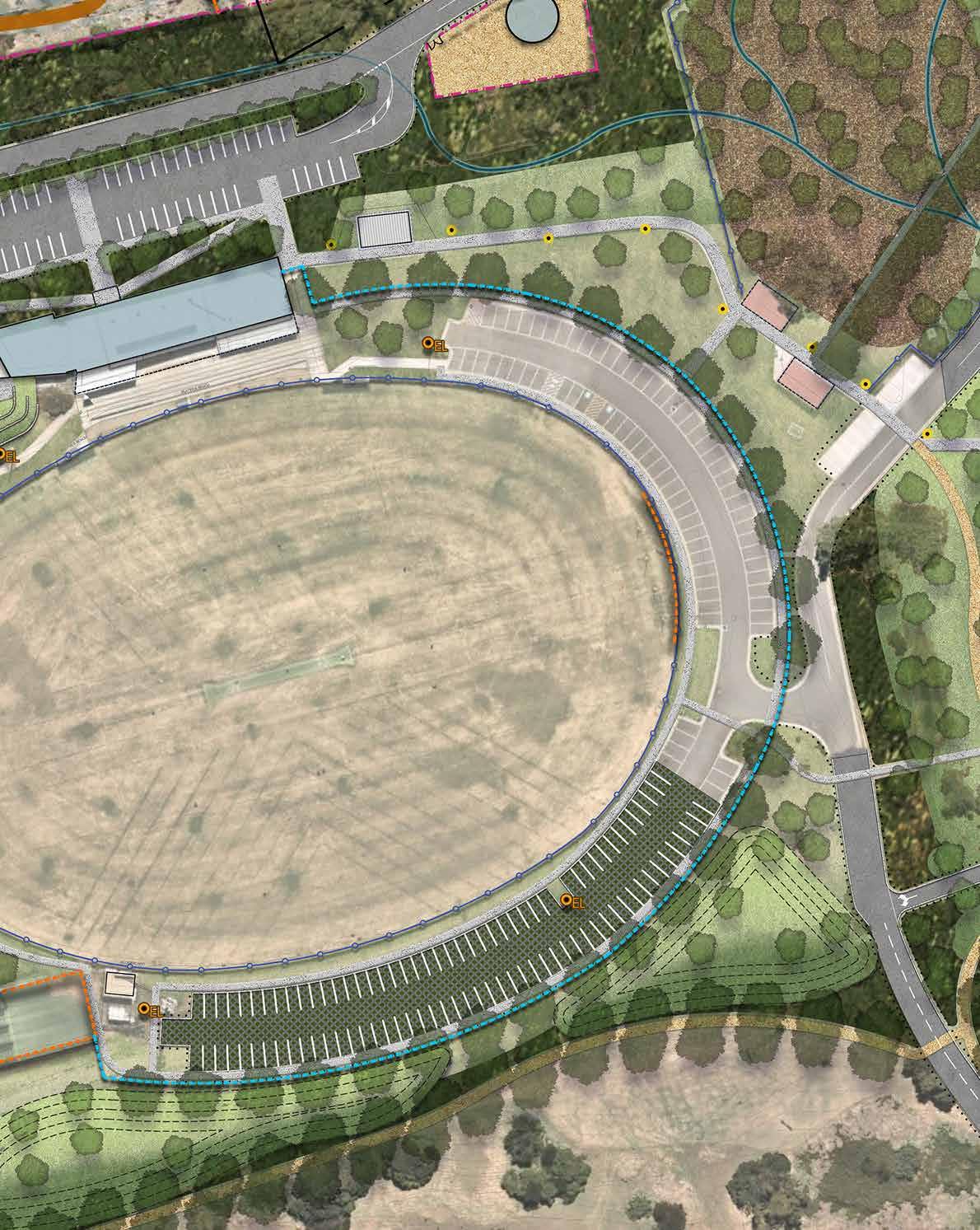
OVAL 6
OVAL 6 LIGHTING UPGRADE STUDY TO BE COMPLETED & BALL NET REQUIREMENTS S TO SOUTHERN SIDE OF OVAL ASSESSED
SOUTHERN CARPARK EXTENSION
Provision of sheltered player benches to main competition court and new warm area.
Provide spectator spaces adjacent to netball court, and in particular tiered seating to the main competition court.
Re-grade mounding South of oval 6 to provide parkland buffer to MW Retarding Basin.
PAVILION STANDS REDEVELOPMENT
Re-design and develop a compliant and functional interface between the pavilion and the oval to alleviate a number of accessibility and compliance issues. Explore options for extending concrete tiers to create seating heights or building timber structure over existing concrete. Stand renovation to include the removal of gravel area between stands and oval.
TICKETING GATES
There are a number of options for possible gating of carparks for events.
NORTHERN CARPARK & PAVILION ENTRY
Formalise Northern carpark area with setback from pavilion to enable appropriate drainage to North face of building and to rationalise compliant access to the building and across this extent of the site.
SOUTHERN CARPARK
Extend southern carpark around to cricket nets to provide significant additional carpark numbers, and formalise carparking for training at the cricket nets.

DEDICATED CARPARKING
NEW SECONDARY PAVILION
LONG-TERM CONSIDERATION OF OPEN PARKLAND & FUTURE SOCCER FACILITY EXPANSION & JUNIOR AFL PROGRAMS
TOILET
IMPROVED PEDESTRIAN CONNECTIVITY
IMPROVEMENT TO SECURITY LIGHTING
COMMUNITY PICNIC AREA AND BARBEQUE FACILITIES OVAL 1 RENOVATION
COUNCILS RECREATION TEAM TO CARRY OUT FEASIBILITY STUDY INTO VIABILITY OF HOCKEY PROPOSAL
The removal of the playspace provides the opportunity to develop a new full-sized oval with the capacity to be flexible for 2 x small soccer pitches.
REFERENCE PLAN | NOT TO SCALE

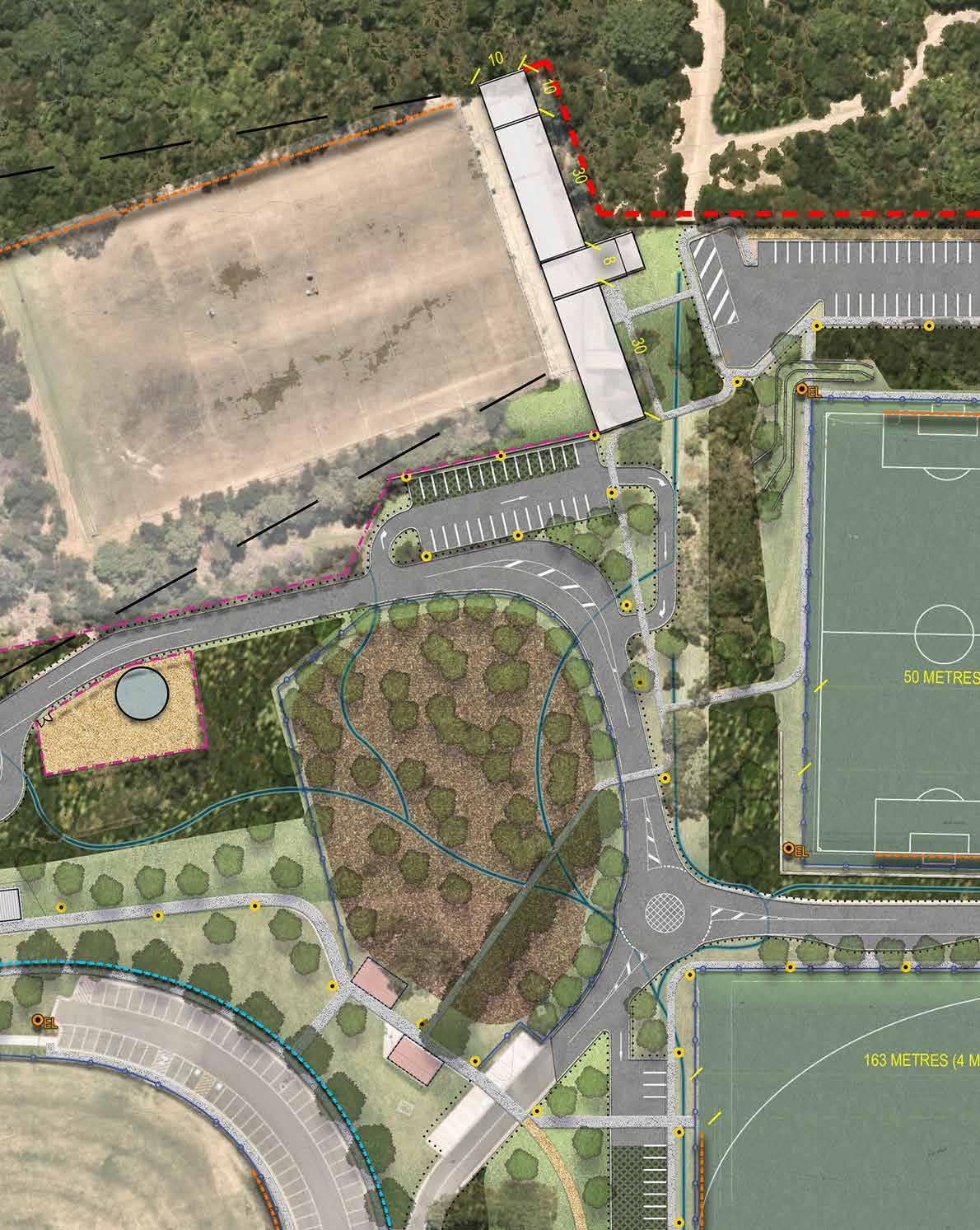
Circuit path provided throughout reserve to provide diverse exercise opportunities in terms of length of trails and access to park experiences. Circuit trail connects through reserve to Conservation landscape at the north of the site, and has been designed to reflect cross country circuit requirements for local school user groups.


Opportunity to embrace expanse of shade trees as community picnic landscape. Potential to integrate public BBQ facilities in extension of new pavilion to cater for Picnic and BBQ area.
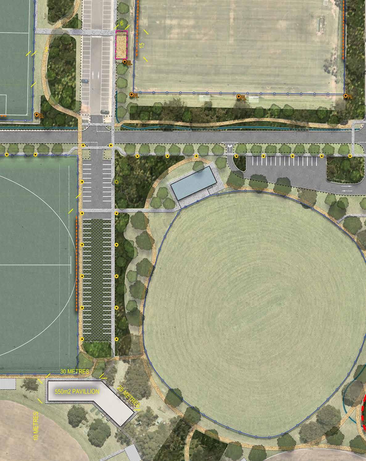
With the provision of additional parking, increased recreational capacity of oval 1 and 2 , and existing needs at oval 3 & 7 for facilities there is rich opportunity for the development of a new central pavilion.
MELBOURNE WATER RETARDING BASIN
U-TURN TO RETURN TO RESERVE
PARKING LEFT TURN ONLY EXIT DRIVEWAY
PICNIC & SCORERS SHELTER
CRICKET NETS TO BE DECOMMISSIONED AT “END OF LIFE”
OVAL 3
OVAL 3 REALIGNMENT & FENCING WORKS
RE-ORIENTATE WICKET NORTH-SOUTH AS PART OF PROGRAMMED DRAINAGE WORKS
SOUTHERN REVEGETATION ZONE
COUNCIL TO WORK WITH VIC ROADS TO IMPROVE PEDESTRIAN & CYCLE CONNECTIVITY TO BAXTER PARK FROM PENINSULA LINK TRAIL& SURROUNDING RESIDENTIAL AREAS
PEDESTRIAN CONNECTIONS
REMNANT VEGETATION & CONSERVATION ZONE WORKS
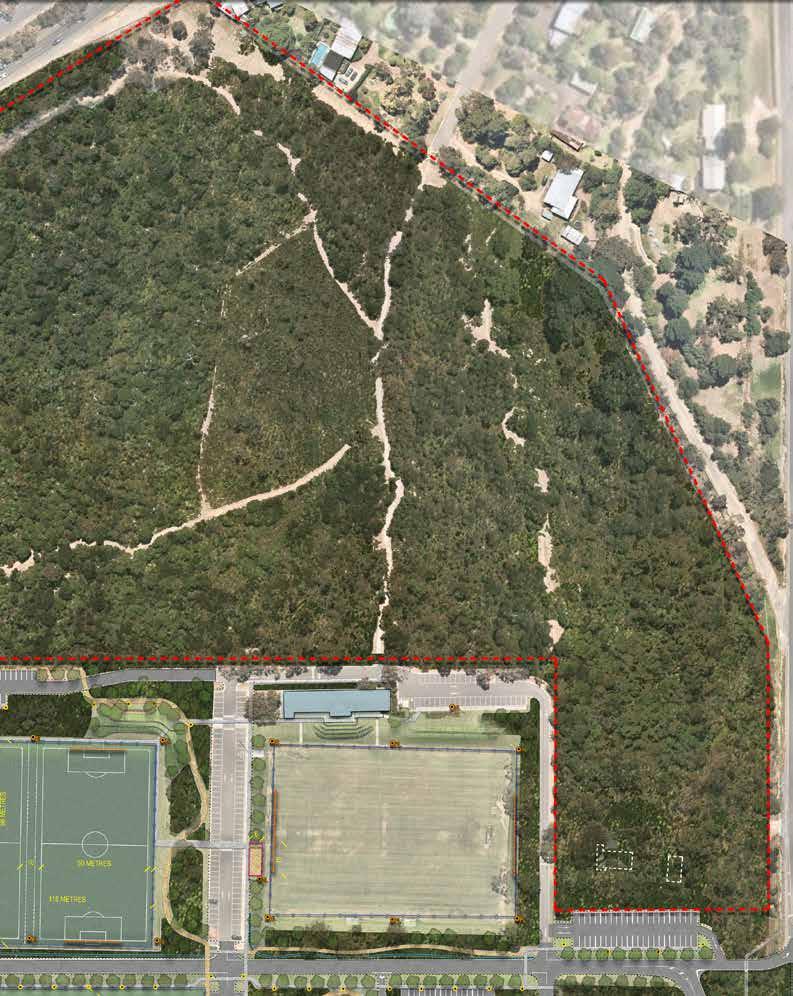
1. PROVIDE NEW PEDESTRIAN CONNECTION IN NORTHERN CORNER OF CONSERVATION ZONE
Improve pedestrian connectivity for residents North of the site by formalising access from the service lane to the Moorooduc Highway.
2. CANOPY REGENERATION WORKS
Council to continue program to ensure regeneration of Eucalypt Canopy through planned burning, weed control and promoting conditions for natural recruitment.
3. WILDLIFE MANAGEMENT PROGRAM
Council to develop dedicated program to ensure site facilitates wildlife movement for larger fauna such as wallabies is maintained to water sources.
4. CONTROLLED ACCESS
Controlled entry point fences/gates to allow for separation of conservation areas from off leash areas and facilitate future fox control program.
5. CARETAKERS & PINE FOREST REHABILITATION WORK
Council to develop succession planning program to ensure appropriate rehabilitation works are undertaken in the pine forest and with the longterm demolition and removal of the caretaker’s residence.
6. TRAIL MAINTENANCE PROGRAM
Council to develop program for maintenance of trails.
7. WAYFINDING & INTERPRETIVE /EDUCATIONAL SIGNAGE OPPORTUNITIES.
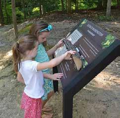
Develop Wayfinding plan for the conservation zone. Council to facilitate a program for the implementation of educational and interpretive signage for local remnant vegetations communities, wildlife and the management work being completed within the reserve to protect them (i.e. recent regenerative burn site works in central area).
8. VERMIN PROOF FENCING.
Provide Vermin Proof Fencing and gates access to perimeter of conservation areas (throughout reserve).
9. NOTE: SOUTHERN REVEGETATION ZONE
In consideration of the VicRoads Easement to the southern boundary of the site, the Master Plan proposes a rich Revegetation buffer to the southern Boundary of the site to ensure that appropriate habitat corridors are maintained.
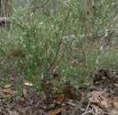
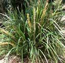
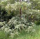
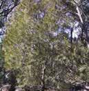
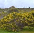
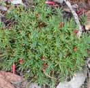
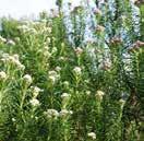
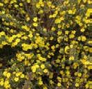
Spans a variety of geologies but is generally associated with nutrient-poor soils including deep uniform sands (aeolian or outwash) and Tertiary sand/clay which has been altered to form quartzite gravel. Eucalypt-dominated low woodland to 10m tall lacking a secondary tree layer and generally supporting a diverse array of narrow or ericoid-leaved shrubs except where frequent fire has reduced this to a dense cover of bracken. Geophytes and annuals can be quite common but the ground cover is normally fairly sparse.
TREES
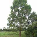
Eucalyptus obliqua MESSMATE STRINGYBARK
SHRUBS & HERBS

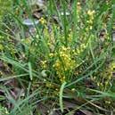
Ampera xiphoclada var. xiphoclada BROOM SPURGE
GRAMINOIDS (GRASSES AND GRASS LIKE PLANTS)
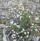
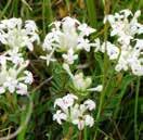
Leucopogon virgatus COMMON BEARD-HEATH
Monotoca scoparia PRICKLY BROOM-HEATH
Eucalyptus
NARROW-LEAF PEPPERMINT

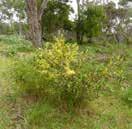
Epacris impressa COMMON HEATH

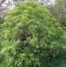
Eucalyptus viminalis sub spp pryoriana MANNA GUM
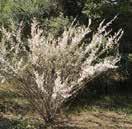
Leptospermum continentale PRICKLY TEA-TREE

Leptospermum myrsinoides HEATH TEA-TREE
Sweet Pittosporum and Coast & Sallow Wattle (evenly spread and very dominant) and Wild Tobacco Tree (evenly spread though only scattered occurrences), numerous garden escapees/planted exotic trees (especially in the south).
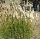
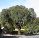
A variable open eucalypt woodland to 15m tall or occasionally Sheoak woodland to 10m tall over a diverse ground layer of grasses and herbs. The shrub component is usually sparse. It occurs on sites with moderate fertility on gentle slopes or undulating hills on a range of geologies.
TREES
SHRUBS & HERBS

TEA-TREE
GRAMINOIDS (GRASSES AND GRASS LIKE PLANTS)
NEW PEDESTRIAN AND CYCLE CONNECTIONS
NEW VEHICLE ACCESS PROJECTS
FURTHER ROAD CROSSING INVESTIGATION PROJECTS
REMOVED PUBLIC VEHICLE ACCESS
ONSITE PARKING FOR 646 CARS + 36DDA + EQUESTRIAN OVERFLOW
BUS DROP OFF & PICK UP LANE
BUS PARKING
SPECTATOR PARKING
SPECTATOR VEHICLE ACCESS
BUS ACCESS ONLY
PUBLIC ACCESS TO RESERVE CLOSED AT THIS POINT (BUS ONLY)
CROSS COUNTRY
EVENT MARSHALLING AREA
START LINE
FINISH LINE
3KM TRAIL
5KM TRAIL
SAGES COTTAGE FARM
ARCHERY COMPETITIONS (INCLUDES FIELD ARCHERY)
EQUESTRIAN EVENTS SITE USE
PEGLESS CAMPING
FLOAT OVERFLOW & CAMPING
POTENTIAL MARKET SITE
MUSIC FESTIVAL SITE (TEMPORARY FENCING)
MUSIC FESTIVAL BACKSTAGE ZONE
NOTE : TOTAL CARPARKS = 582 CARS + 32 DDA
ONSITE PARKING FOR 646 CARS + 36DDA + EQUESTRIAN OVERFLOW
SHUTTLE BUS OPPORTUNITY
The Action Plan outlines the indicative phasing that is recommended to implement the Master Plan. The priorities have been developed with consideration of funding, technical constraints and coordination with other improvements.
It is proposed that implementation be considered as part of Council’s Long Term Infrastructure Plan. A fixed timeframe for completion has not been provided due to the scale and natured of the projects and the need to seek shared funding from State Government partners.
The Master plan provides an advocacy tool for Council and stakeholders to build awareness, seek support and secure essential funding to deliver the improvements to benefit stakeholders and the broader Frankston community.
As the Master Plan has a large number of directions, the works for Baxter Park have been divided into High, Medium, Long-Term and Ongoing Priorities to indicate the proposed roll out of stages from the Master Plan.
S=STRATEGIC
OS=OPEN SPACE
E=EQUESTRIAN
SF=SPORTING FACILITY
O=ONGOING IN ACCORDANCE WITH MASTER PLAN
S01 EVENT MANAGEMENT PLAN
S02
PUBLIC ART PLAN
S03 HOCKEY FEASIBILITY STUDY
S05 TENNIS FACILITY CHANGE OF USE
SUPPORT VISITOR EXPERIENCE – BAXTER PARK AS A MAJOR COMMUNITY EVENT VENUE
Further investigate major event opportunities in accordance with BPOSMP Events Opportunity Plan whilst also respecting the importance of passive and organised recreation. Establish a clear position to balance the use of the park for events through a sustainable approach to park and event management.
Investigate a potential Baxter Park Event program to further investigate coordination of events across an annual calendar.
Council to identify opportunities within the Master Plan and develop a public art brief for the site to ensure that the identified public art projects are integrated with key phases of implementation.
Work with Hockey Victoria and Mornington Peninsula Shire to complete the Southern Metro Hockey Feasibility Report to investigate opportunities for hockey in the southern metro region.
Undertake a feasibility study to consider options for repurposing the former tennis club building as a community facility or public toilet facilities.
SHORT TERM
S06 FITNESS STATION INVESTIGATION
SHORT TERM
SHORT TERM
As part of this project, Council is to investigate the re-use of the Tennis Club building as a community “room for hire”. Site revenue opportunity MEDIUM TERM
Community Activation and Health Project. Investigate opportunity for all ages “outdoor gym” or circuit training equipment as part of proposed District Play space upgrade.
MEDIUM TERM
S=STRATEGIC
OS=OPEN SPACE
E=EQUESTRIAN
SF=SPORTING FACILITY
O=ONGOING IN ACCORDANCE WITH MASTER PLAN
OS01
OS01 (PART A) FRANKSTON FLINDERS ROAD
PARK ENTRY/EXIT + OVERFLOW CARPARK IMPROVEMENTS
OS01 (PART B) SAGES ROAD EXIT
PARK ENTRY/EXIT IMPROVEMENTS
Progress design and staged implementation plan for the new Frankston – Flinders Road park entry / exit and overflow carpark. Further progress the proposed left-out exit and retain existing left-in, right-in and right-out. Widen inbound lane and provide possible stand-up exit lane.
Remove Left hand turn exit at existing access and provide separate left-out exit to north of current driveway. Widen inbound lane and provide possible stand-up exit lane.
OVERFLOW CARPARK CONFIGURATION.
Review the extent of the existing overflow carpark, and provide a gate to the carpark, to remove after-hours access and reduce anti-social behaviour. The southern extent of the carpark to be repurposed as part of the new park internal access road”, allowing the existing access road to be realigned to protect existing significant trees.
LEFT TURN ONLY EXIT DRIVEWAY & TRAFFIC RETURN
The exit only driveway, has been proposed to improve traffic flow after major events and reduce congestion at the Frankston-Flinders Road entrance and exit. Left-out only intersection design will need to consider parking restrictions to the west side to provide adequate sightlines
SAGES ROAD PEDESTRIAN CROSSING
Whilst scoped in conjunction with the crossings project, the Sages road pedestrian crossing could be implemented concurrently to the Sages road vehicular exit to minimise traffic disruption and costs associated with construction site establishment etc.
SHARED PATH PEDESTRIAN LINK (TO OVAL 1)
As part of these works provide integrated drainage solutions and clear path of travel to connect to future oval 1 circuit path works
SHORT TERM
SHORT TERM
S=STRATEGIC
OS=OPEN SPACE
E=EQUESTRIAN
SF=SPORTING FACILITY
O=ONGOING IN ACCORDANCE WITH MASTER PLAN
OS02
PEDESTRIAN & CYCLE CONNECTIONS
OS03 PARK ACCESS SPINE & PUBLIC LIGHTING SAFETY (+ SERVICES ROUGH IN)
3 X PEDESTRIAN CROSSING PROJECTS
Advocate for pedestrian and cycle connectivity improvements to Baxter Park from Peninsula Link shared use path and surrounding residential areas
NEW PEDESTRIAN PARK ENTRY / EXIT
Create open lines of site into reserve from Frankston-Flinders Road and a new pedestrian connection and park access point linking to the Peninsula link shared path network, and adjacent residential areas. Fence site boundaries to remove unsafe “cut through paths” and reduce impact on revegetation zones.
BAXTER PARK ACCESS SPINE
Extend and formalise the existing internal access road alignment centrally through the reserve, separating the main vehicular driveway from existing and proposed carparking to reduce traffic congestion in times of high use.
WATER STORAGE TANK & PUMP STATION
Demolish existing recycled Water tank for irrigation purposes and provide new tank (Increased capacity TBC but likely) to new location to allow for new vehicular spine alignment.
SITE SERVICES AND INFRASTRUCTURE “FUTURE-PROOFING” WORKS
Concurrent with development of the access spine the following utilities and services are to be provided to update current facilities and facilitate future development:
1. MAINS SEWERAGE CONNECTION (REQUIRED FOR ARCHERY, NEW SOUTHER PAVILION AND EQUESTRIAN)
2 UNDERGROUNDING OF ELECTRICAL SUPPLY (CURRENT OVERHEAD POWER LINE REMOVED AND SUPPLY CONSOLIDATED TO ALL CURRENT AND FUTURE FACILITIES)
3 DRAINAGE WORK (Allow for substantial open mown grass swales adjacent to the Vehicular Spine as much as possible) Hard to cost piped drainage without drainage assessment.
SHORT TERM & ON-GOING
S=STRATEGIC
OS=OPEN SPACE
E=EQUESTRIAN
SF=SPORTING FACILITY
O=ONGOING IN ACCORDANCE WITH MASTER PLAN
“WILDLIGHTS” PEDESTRIAN PATH LINK AND LIGHTING
Development of path network associated with vehicular spine extent to include the incorporation of wildlife friendly sensor pole mounted lighting. Priority lighting links are from Oval 6 to the Frankston Flinders Gateway (East West spine link, extending along existing path south of proposed playspace).
RAISED PEDESTRIAN ZONES
Create new path connections in locations shown to improve safe access and connectivity across the site. These may comprise raised pavement with different materiality, line marking or even public art opportunities. Provide raised or line-marked pedestrian zones at key intersections along the Vehicular Spine, to ensure safe pedestrian access across the site.
TREE LINED PATH NETWORKS
Driveway to be lined with canopy trees separating vehicular movement from and providing shade to the connecting east-west path across the site.
FORMALISE & CONSOLIDATE DRAINAGE NETWORK
Use the development of road networks to rationalise and improve site drainage infrastructure (underground, WSUD revegetated or open grass swales).
FUTURE CARPARKS – CARPARKING GROUND WORKS
Contractors to prepare the future carpark sites for development and provide temporary road base finish to designed subgrade levels. This will enable the temporary activation of new carpark zones prior to their full development (and allow for staged implementation of the carparks to suit available budgets).
REVEGETATION ZONES ASSOCIATED WITH VEHICULAR SPINE
Native revegetation zones to be implemented adjacent to new road works to assist in management of overland flow of water in key areas:
1 South of the main soccer Pitch (includes gravel shared path link)
EQUESTRIAN RESERVE ENTRY CONNECTION. Allow for high level drainage works and crossing to existing drainage line on Eastern Boundary of Equestrian Reserve.
S=STRATEGIC
OS=OPEN SPACE
E=EQUESTRIAN
SF=SPORTING FACILITY
O=ONGOING IN ACCORDANCE WITH MASTER PLAN
OS04 PARK ENTRY COMMUNITY LANDSCAPE & MULTIPURPOSE COURT
NEW PARK ENTRY LANDSCAPE
As the entrance to the site, there is an opportunity to immediately change the perception of safety within the site by creating an open line of sight into the reserve, embracing the beauty of the existing Eucalypts, by removing road infrastructure and installing mulched areas around their base. Improve the open grassland within the area, by reducing the fencing and opening up the landscape to public access.
Remove of existing courts 1 and 2 and improve park entry landscape with open lawns, Mounding and shade trees with connecting path.
COMMUNITY BBQ & PICNIC AREA
Project proposed to support the reallocation of the former tennis club as a community facility/ room for hire. updating and expanding the existing BBQ & Picnic facilities as community meeting place.
COURTS 4+5 RE-PURPOSING – COMMUNITY
MULTI-SPORT COURT
Existing tennis courts in good condition to be repurposed as a fenced multi-ball-court space for community use, and upgraded to include lighting for evening use and activation of the space.
Consider possible PIN entry fenced enclosure for combined Netball / Futsal OR Options for publicly accessible multi-ball sports & rebound wall.
SHORT TERM
S=STRATEGIC
OS=OPEN SPACE
E=EQUESTRIAN
SF=SPORTING FACILITY
O=ONGOING IN ACCORDANCE WITH MASTER PLAN
OS05
IMPROVED ACCESS –CARPARKING –PHASE 1
OS06 DESTINATION PLAY SPACE
HIGH PRIORITY CARPARK PROJECTS
NOTE: SOME CARPARK PROJECTS ARE BEING CAPTURED AS PART OF KEY PROJECT WORKS BASED ON THEM NOT BEING REQUIRED UNTIL THOSE PROJECTS ARE IMPLEMENTED – Below projects are associated directly with the Vehicular Spine works FOR EXISTING FACILITIES as high priority carpark developments.
OVAL 6 – NORTHERN CARPARK
Formalise carpark to the north of the site with separate entry and exit driveways to isolate vehicular movement from the Access Spine through to the Equestrian Reserve and reduce traffic congestion. This carpark should be secured by Gate to limit anti-social behaviour at nighttime. This can also be separately managed for ticketing during large events as needed.
ARCHERY OVERFLOW AND NEW DISTRICT PLAY SPACE CARPARK
The development of this carpark and new access path to the Archery site is critical to enable DDA access to the current facility, and future proof access for the future facility.
NEW WILDLIFE FRIENDLY CARPARK LIGHTING
Allow for “Wild lights” style sensor lighting to all new carpark works.
IMPROVEMENT TO SECURITY LIGHTING TO CARPARKS
Council to carry out security lighting assessment and improve / provide additional lighting to carpark areas.
DISTRICT PLAYSPACE
New District Play space to be designed to embrace and amplify existing topography and provide a landscape to “explore and navigate” across a range of skill levels so that it is exciting for both young and older children.
DISTRICT PLAYSPACE OPPORTUNITY
Reconfiguring the carpark and access to Archery provides the opportunity to expand the landscape to the north of the existing Picnic and BBQ facilities for a District Level Playspace. The playspace should be developed in line with site recommendations from the Frankston Play Strategy 2021
S=STRATEGIC
OS=OPEN SPACE
E=EQUESTRIAN
SF=SPORTING FACILITY
O=ONGOING IN ACCORDANCE WITH MASTER PLAN
OS07 VISITOR EXPERIENCE –PUBLIC TOILETS
OS08 IMPROVED ACCESS –CARPARKING –PHASE 2
OS09 OVAL 6 PAVILION ENTRY LANDSCAPE
PUBLIC TOILET RENEWAL
Demolish Existing Bluestone Toilet to Western extent of the zone and provide new Public Amenities Block to East of Oval 6 Pavilion, with proximity to District Playspace and BBQ area.
NEW STAND ALONE PUBLIC TOILET
To east if Oval 6 Pavilion with accessible connections to the proposed District Play space and BBQ area. Determine the optimum size and location for the new public toilet in accordance with Council’s Public Toilet Action Plan.
Identify the best location and provide a ‘changing places’ facility to support people with disability.
SOUTHERN CARPARK
Extend Southern carpark around to cricket nets to provide significant additional carpark numbers and formalise carparking for training at the cricket nets.
PAVILION ENTRY THRESHOLD LANDSCAPE
The relocation of the carpark and removal of the existing roadway will enable better management of site drainage and safe pedestrian access into the building. This will also improve the entry threshold landscape to cater for the arrival of large groups and safely manage building entry during events. This increased entry landscape will also provide the opportunity for seating to act as a meeting place and facilitate gentler ramp and staircase options.
OS10 PARK CONNECTIONS & CIRCUIT PATH
BROADER PARK CONNECTIVITY & CIRCUIT PATH
Circuit path provided throughout reserve to provide diverse exercise opportunities in terms of length of trails and access to park experiences. Circuit trail connects through reserve to Conservation landscape at the north of the site and has been designed to reflect cross country circuit requirements for local school user groups.
OS11 PARK AMENITY IMPROVEMENTS OVALS 1, 2, 3 & 7
Provide picnic settings and seating under existing shade trees around ovals for spectator use, and informal gatherings.
S=STRATEGIC
OS=OPEN SPACE
E=EQUESTRIAN
SF=SPORTING FACILITY
O=ONGOING IN ACCORDANCE WITH MASTER PLAN
OS12
ORGANISED ACTIVITY – OVAL FACILITIES & LANDSCAPE INTEGRATION
SECONDARY PAVILION
With the provision of additional parking, increased recreational capacity of oval 1 and 2 , and existing needs at oval 3 & 7 for facilities there is rich opportunity for the development of a new central pavilion.
COMMUNITY PICNIC & BBQ AREA
Potential to integrate public BBQ facilities in extension of new pavilion to cater for Picnic and BBQ area.
Utilise existing canopy trees to provide an informal “picnic landscape with picnic settings and mulched areas under trees to protect them from compaction.
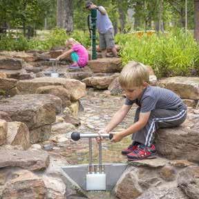
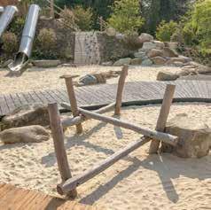
INFORMAL “NATURE PLAY” ELEMENTS IN PAVILION LANDSCAPE
Consider opportunities for the long-term implementation of “nature play” elements such as rings of stone and timber steppers and climbing logs for informal play between ovals 3 & 7 associated with the new pavilion works.
IMPROVED PEDESTRIAN CONNECTIVITY. Finalise the remaining pedestrian links between ovals 1, 2 , 3 and 7 and the broader landscape
OS13
OVAL 1 PAVILION DECOMMISSIONING & OPEN SPACE EXPANSION
OVAL 1 LONG TERM OPEN PARKLAND & FUTURE SOCCER & JUNIOR AFL SHARED FACILITY EXPANSION
With the long-term decommissioning of the existing toilet block and pavilion, there is an opportunity to improve the “open parklands” environs in this zone, and to look at opportunities for future expansion of an additional soccer pitch within the oval site and increasing the multipurpose use of the sports field.
S=STRATEGIC
OS=OPEN SPACE
E=EQUESTRIAN
SF=SPORTING FACILITY
O=ONGOING IN ACCORDANCE WITH MASTER PLAN
SF01
ARCHERY CLUB REDEVELOPMENT
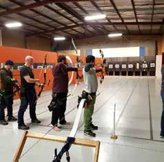
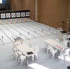
NEW ARCHERY FACILITY
New building to include indoor archery range and central social space with kitchen and toilet/ change facilities. New building to have appropriate underground electrical supply, and mains sewerage connection.
The proposed Archery Facility Footprint includes the following key spaces:
EXTERNAL STORAGE 95m2 (accessed from the northern extent of the Archery range)
• INTERNAL RANGES 580m2 (Split range due to site constraints). The building footprint for each range is 10m wide x 29m long (comprising 25m range, 3m waiting line + 1m for butts at the end of the range)
• SOCIAL SPACE 80m2 (8m frontage to external range and 10m each side to internal ranges). Additional External spectator and social space to have fixed or retractable shade structure.
• ENTRY AREA & AMENITIES 80m2 (This is provided as an extension the social space away from the outdoor range towards the carpark zone, with capacity for a formal venue entry zone, change facilities, amenities and catering kitchen).
NEW CARPARKING AND FACILITY ENTRANCE. The master plan has designated space for up to 54 carparks and 2DDA carparks immediately to the East of the archery facility. This new parking proposal provides improved access into the Archery facility at grade for DDA compliance.
ARCHERY OVERFLOW / DISTRICT PLAYSPACE CARPARK. Opportunity to reconfigure the existing main carpark as an overflow carpark for events. The carpark would be secured from the Archery facility by a retaining wall and security fencing, with a secondary access path provided to the east of the site to the main entrance.
• FIELD ARCHERY TRAINING RANGES. Consider opportunities for a field archery facility to keep active recreation separate from the conservation zone, and endangered fauna species. The viability of this proposal needs to be confirmed by Archery Victoria and further feasibility studies by Council, in close consultation with the club.
S=STRATEGIC
OS=OPEN SPACE
E=EQUESTRIAN
SF=SPORTING FACILITY
O=ONGOING IN ACCORDANCE WITH MASTER PLAN
SF02 OVAL 2 REDEVELOPMENT
NEW ARCHERY DESIGNATED CARPARK & ACCESS
As soccer carpark is sufficient at current capacity, with room for expansion, Council to re-develop the site North of Pitch 3 to provide a designated carpark with on-grade DDA compliant access to the Archery facility. This development should consider requirements for bus access and drop off zones.
FULL SIZE OVAL & SOCCER PITCH
The removal of the existing play space provides the opportunity to develop a new full-sized oval with the capacity to be flexible for 2 x small training soccer pitches.
Oval 2 to include new competition grade lighting and fencing in accordance with master plan.
DEDICATED OVAL 2 CARPARKING
Works to include the extension of parking by mirroring the soccer carpark to the Southern side of the vehicular spine. This may be a permeable carpark short term, to manage run off and drainage issues.
PLAYSPACE SHARED PARKING
Oval redevelopment is to include the expansion of carparking to cater for the playspace in addition to Oval 2 overflow parking.
SHORT TERM
SF03
SOCCER CLUB LIGHTING
SF04 NETBALL FACILITY UPGRADE – TO COMPETITION STANDARD & SPECTATOR SPACE UPGRADE
PITCH 1 LIGHTING
New lighting to be installed to support evening training and night matches.
NETBALL FACILITY UPGRADE
Provision of player benches to main competition court standards. Expansion to allow for three separate shelters or one singular one comprising: 2 x shelters for players 4.5x1.5m Scorers bench/ shelter 2x1.5m long.
Provide spectator spaces adjacent to netball court, and in particular tiered seating to the main competition court.
Develop Food Truck Hard stand zone to this area as events space for AFL, Cricket & Netball events
SHORT TERM
SHORT TERM
S=STRATEGIC
OS=OPEN SPACE
E=EQUESTRIAN
SF=SPORTING FACILITY
O=ONGOING IN ACCORDANCE WITH MASTER PLAN
SF05
SPORTS FACILITY LIGHTING REVIEW
SF06
SOCCER CLUB PITCH 2&3 EXPANSION & SPECTATOR LANDSCAPE
Council’s Recreation team to review and finalise the outcomes from commissioned Sporting Facility Lighting Review and develop Lighting renewal and upgrade program.
All lighting works within the reserve to consider the findings of the Baxter Park Habitat Study and consider options to minimise impacts of habitat.
Extend existing pitches 2 & 3 south (retaining walls required) to create compliant pitches for junior games. The extent of landscape between the pitch and park spine would remain non-accessible and be vegetated as a major drainage infrastructure line through the site.
NEW FENCING TO EXTENDED PITCHES
Extension of pitches 2 & 3 to include new low fencing to perimeter of pitches to prevent vehicle access and tall ball retention fences behind goal areas. Double gates, with vehicle access to be included on Eastern access path from external storage area for maintenance and emergency vehicle access.
SPECTATOR LANDSCAPE
Create a combination of formal tiered and grass terraced, shaded seating to Pitch 1, and long term to pitches 2 & 3
Create new path (with boot friendly surface) connections in locations shown to improve safe access and connectivity across the site. Key links to be created are:
to the North of the Pavilion to meet the conservation trail
SHORT TERM
Across the Northern speed hump, connecting to pitches 2 & 3. Path to be extended through terraced spectator area with stairs down to the pitch level. MEDIUM TERM
S=STRATEGIC
OS=OPEN SPACE
E=EQUESTRIAN
SF=SPORTING FACILITY
O=ONGOING IN ACCORDANCE WITH MASTER PLAN
SF07
SOCCER GOAL STORAGE YARD
SF08 OVAL 6 PAVILION EXPANSION
GOAL STORAGE
Create new goal store to southern extent of path on western side of pitch 1. Opportunity at existing speed hump in carpark, to provide new pedestrian link to pitches two and three provided across car park to safely transfer goals from store.
Additional pedestrian crossing over southern speed hump to provide safe access from new Goal Storage enclosure to pitches 2 & 3 for set up. This path will also enable the goals to be carried onto the pitches at grade, without having to traverse stairs or step embankments. MEDIUM TERM
PAVILION EXPANSION 105m2 – Opportunity to expand the building to cater for designated female change rooms and more appropriate umpire facilities. Building expansion is to include:
NETBALL 2 X CHANGEROOMS + AMENITIES + STORAGE 80m2
UMPIRE 2 X CHANGEROOM SEPARATED BY ROLLER DOORS 25m2
Existing septic tank in area to be assessed decommissioning and for removal by Council operations team.
PAVILION STANDS REDEVELOPMENT
Redesign and develop a compliant and functional interface between the pavilion and the oval to alleviate a number of accessibility and compliance issues. Explore options for extending concrete tiers to create seating heights or building timber structure over existing concrete. Stand renovation to include the removal of gravel area between stands and oval.
FOOD TRUCK ZONE
Carry out feasibility study to determine need and capacity of club proposed food truck zone to Western end of Pavilion. Adjacent landscape area between pavilion, netball courts and oval to be upgraded to grassed tiered seating for spectators and event.
PARKLAND MOUNDING
Re-grade mounding South of oval 6 to provide parkland buffer to MW Retarding Basin.
MEDIUM TERM
S=STRATEGIC
OS=OPEN SPACE
E=EQUESTRIAN
SF=SPORTING FACILITY
O=ONGOING IN ACCORDANCE WITH MASTER PLAN
SF09
SOCCER CLUB SPECTATOR TIERS & TEAM RUN (MAIN PAVILION
SF10 OVAL 6 PAVILION – SPECTATOR UPGRADE
Create formal tiered, shaded seating to Pitch 1, and long term to pitches 2 & 3 as shown. Tiered seating to comprise a combination of terraced grass (eastern extent of Pitch 1 spectator landscape) and more formalised concrete and timber topped seating in front of the Soccer Pavilion. Existing Races to be re-designed to add non-slip, stepped access and second away team race and gate from away team change-room to West side of spectator terraces.
WASTE & RECYLCING MANAGEMENT AREA
Council to investigate options or provision of secure fenced waste management area for skip bin and recycling. DDA compliant parking to be relocated or redesigned to allow for new waste management area.
FOOTBALL/NETBALL SPECTATOR FACILITATION
Provide a formal grass and concrete terraced spectator area in the embankment to the north of the main competition court, similar to the tiered spectator proposals for the soccer facility.
PAVILION STANDS REDEVELOPMENT
The existing stands and building access points (including the Eastern stair link to the oval) require re-design to provide compliant and functional interface between the clubrooms and the oval to alleviate a number of accessibility and compliance issues. The stands can be retrofitted by either additional concrete infrastructure with fixed seating or framing timber decking and seating over the existing structure for a softer built outcome. The existing gravel zone between the stands and the oval could be replaced by soft landscaping or grass, or additional seating opportunities at the edge of the oval.
DELIVERY ACCESS PATH/DRIVE
Provide access drive to Eastern end of Pavilion for deliveries, and visiting team equipment deliveries. Ensure area has bollards to prevent vehicle access to upper landscape zone and pedestrian path to district playspace.
LONG TERM
S=STRATEGIC
OS=OPEN SPACE
E=EQUESTRIAN
SF=SPORTING FACILITY
O=ONGOING IN ACCORDANCE WITH MASTER PLAN
SF11
OVAL 6 CRICKET NETS /DRAINAGE RENOVATION & MELBOURNE WATER DETENTION BASIN INTERFACE DESIGN
Cricket Training nets to be extended, upgraded and secured to reduce damage.
Adjacent landscape west of oval 6 to be reviewed as part of drainage program and new circuit path development to ensure safe access and reduce flooding of nets.
PARKLAND MOUNDING
Re-grade mounding South of oval 6 to provide parkland buffer to MW Retarding Basin and provide informal spectator seating to oval 6 LONG TERM
SF12
ARCHERY RANGE EXTENSION & SOCIAL SPACE
RANGE EXTENSION/RELOCATION AND IRRIGATION INVESTIGATION
Council to undertake feasibility study for possible range relocation to expand social/spectator space and improve over-shoot barrier to DELWP dam site and aquatic recreation zone beyond.
RANGE IRRIGATION
Council to investigate the feasibility of adding the Archery range surface to the site recycled water irrigation system.
FIELD ARCHERY COMPETITION RANGE
Council to investigate using the northern extent of the Equestrian Reserve for Field Archery competitions. The viability of this proposal needs to be confirmed by Archery Victoria and further feasibility studies by Council, in close consultation with the Archery & Equestrian clubs.
LONG TERM
SF13
SOCCER BBQ AREA
SF14 OVAL 1 UPGRADES
CLUB BBQ SPACE
With goals stored away from building –opportunity to create BBQ space to Western end of Clubrooms, capitalizing on Shade and shelter of Building and Trees.
OVAL 1 RENOVATION
Oval 1 to be resurfaced and wicket realigned, to suit competition standard facility.
LONG TERM
LONG TERM
S=STRATEGIC
OS=OPEN SPACE
E=EQUESTRIAN
SF=SPORTING FACILITY
O=ONGOING IN ACCORDANCE WITH MASTER PLAN
SF15
OVALS 3+7 FACILITY UPGRADES
Oval 3&7 CRICKET TRAINING NET DE-COMMISSIONING
Long Term decommissioning and removal of Cricket Nets at end of useable life
OVAL 3 REALIGNMENT
The reduction of the cricket nets, and removal of vehicular access into the Southern extent of the reserve will enable the realignment of Oval 3 further West, closer to the cricket nets. This will in turn, create larger easement for revegetation and pedestrian access in South-Eastern corner of reserve from the existing bus stop on FrankstonFlinders Road. As part of works to realign oval, Drainage work to be completed and wicket realigned North-South OVALS 3&7 SCORERS SHELTERS
The Master Plan proposes the installation of large shade shelters with picnic settings for use during cricket matches by scorers. These shelters also provide additional general picnic amenities with good proximity to the new amenities proposed as part of the pavilion development for park users when not being used for cricket matches.
LONG TERM
S=STRATEGIC
OS=OPEN SPACE
E=EQUESTRIAN
SF=SPORTING FACILITY
O=ONGOING IN ACCORDANCE WITH MASTER PLAN
SF16
OVAL 6 FACILITY
UPGRADE PROJECTS
SOUTHERN CARPARK EXTENSION
Extend the parking around the grounds to increase carparking capacity and provide further opportunities to “park and watch” matches. This will also provide designated parking access to the cricket practice nets during training.
TICKETING BOOTHS & CARPARK GATES D
There are a number of options for possible gating of carparks for events. Access to parking for the regional playspace, and thoroughfare to the Equestrian zone, need to be considered when finalising the location of the ticketing gate.
CRICKET PRACTICE NETS
Resolve stormwater drainage to net threshold. And provide drainage to synthetic surface. Provide additional ball fencing to perimeter of zone for improved safety.
LIGHTING UPGRADE
Upgrade lighting to suite night-time competition standards for AFL and cricket.
STORAGE AT SCOREBOARD
Council to investigate potential use of scoreboard shed for storage of training equipment close to nets
LONG TERM

S=STRATEGIC
OS=OPEN SPACE
E=EQUESTRIAN
SF=SPORTING FACILITY
O=ONGOING IN ACCORDANCE WITH MASTER PLAN
E09
BAXTER PARK MASTER PLAN
PROPOSALS FOR EQUESTRIAN RESERVE
E10
BAXTER PARK MASTER PLAN
PROPOSALS FOR EQUESTRIAN RESERVE
O01
CULTURAL & ENVIRONMENTAL VALUES
FIELD ARCHERY COMPETITION RANGE
Council to investigate using the northern extent of the Equestrian Reserve for Field Archery competitions. The viability of this proposal needs to be confirmed by Archery Victoria and further feasibility studies by Council, in close consultation with the Archery & Equestrian clubs.
DELWP DAM SITE
The DELWP project is being developed by Council to respond to the aspirations of the Equestrian Master Plan and provide broader opportunities for aquatic recreational pursuits such as fishing, birdwatching and a walking path. Extent of site has been reduced to reflect Archery “Overshoot zone”.
CULTURAL & ENVIRONMENTAL INTERPRETATION PLAN
Develop a cultural and environmental interpretation plan for the park. Council to facilitate a program for the implementation of educational and interpretive signage for local remnant vegetations communities, wildlife and the management work being completed within the reserve to protect them (i.e., recent regenerative burn site works in central area).
Council has information available for content for interpretive signage. Signage to be in accordance with Council’s wayfinding strategy.
SHORT TERM
SHORT TERM
SHORT TERM
O02
INTEGRATED WATER SYSTEMS
OS14
003
VERMIN PROOF FENCING & ACCESS CONTROL PROGRAM
SOUTHERN HABITAT ZONE DEVELOPMENT
Continue to work towards innovative approaches to integrated water management across the park. Further progress and investigate the identified integrated water management initiatives and partnerships to improve stormwater management across Baxter Park.
VERMIN PROOF FENCING
Provide Vermin Proof Fencing and gates access to perimeter of conservation areas (throughout reserve)
SOUTHERN REVEGETATION ZONE
In consideration of the VicRoads Easement to the southern boundary of the site, the Master Plan proposes a rich Revegetation buffer to the southern Boundary of the site to ensure that appropriate habitat corridors are maintained.
SHORT TERM & ON-GOING
SHORT TERM & ON-GOING
SHORT TERM & ON-GOING
S=STRATEGIC
OS=OPEN SPACE
E=EQUESTRIAN
SF=SPORTING FACILITY
O=ONGOING IN ACCORDANCE WITH MASTER PLAN
004
WAYFINDING IMPLEMENTATION
O05 TREE & REVEGETATION PROGRAM
Implement the Frankston Wayfinding Strategy and Style Guide for Baxter Park. Develop a staged approach to the removal and installation of new wayfinding signage as per the proposed wayfinding plan.
CANOPY REGENERATION WORKS
Council to continue program to ensure regeneration of Eucalypt Canopy through planned burning, weed control and promoting conditions for natural recruitment.
CARETAKERS & PINE FOREST REHABILITATION WORK
Council to develop succession planning program to ensure appropriate rehabilitation works are undertaken in the pine forest and with the long-term demolition and removal of the caretaker’s residence.
SHORT TERM & ON-GOING
ON-GOING
O06 WILDLIFE MANAGEMENT PROGRAM
007
TRAIL ACCESS & MAINTENANCE PROGRAM
WILDLIFE MANAGEMENT PROGRAM
Council to develop dedicated program to ensure site facilitates wildlife movement for larger fauna such as wallabies is maintained to water sources.
CONTROLLED ACCESS
Controlled entry point fences/gates to allow for separation of conservation areas from off leash areas and facilitate future fox control program.
TRAIL MAINTENANCE PROGRAM
Council to develop program for maintenance of trails.
PROVIDE NEW PEDESTRIAN CONNECTION IN NORTHERN CORNER OF CONSERVATION ZONE
Improve pedestrian connectivity for residents North of the site by formalising access from the service lane to the Moorooduc Highway.
ON-GOING
ON-GOING
BAXTER PARK – Open Space Project Implementation Summary List
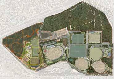
1. OPEN SPACE IMPLEMENTATION PROJECT #1 – BAXTER PARK ACCESS & COMMUNITY SAFETY PROJECT
2. PEDESTRIAN & CYCLE CONNECTIONS
3. PARK ACCESS SPINE & PUBLIC LIGHTING SAFETY
4. PARK ENTRY COMMUNITY LANDSCAPE & MULTIPURPOSE COURT
5. IMPROVED ACCESS – CARPARKING –PHASE 1
6. DESTINATION PLAY SPACE
7. VISITOR EXPERIENCE – PUBLIC TOILETS
8. IMPROVED ACCESS – CARPARKING –PHASE 2
9. OVAL 6 PAVILION ENTRY LANDSCAPE
10. PARK CONNECTIONS & CIRCUIT PATH
11. PARK AMENITY IMPROVEMENTS
12. ORGANISED ACTIVITY – OVAL FACILITIES & LANDSCAPE INTEGRATION
13. OVAL 1 PAVILION
DE-COMMISSIONING & OPEN SPACE EXPANSION
EQUESTRIAN PROJECTS
(INCLUDED IN EQUESTRIAN MASTER PLAN ACTION PLAN)
1. EQUESTRIAN CARPARK REDEVELOPMENT
2. EQUESTRIAN SAND ARENA
3. EQUESTRIAN TRAIL DRAINAGE WORKS
1. ARCHERY CLUB REDEVELOPMENT
2. OVAL 2 RE-DEVELOPMENT
3. SOCCER CLUB LIGHTING
4. NETBALL FACILITY UPGRADE –TO COMPETITION STANDARD & SPECTATOR
SPACE UPGRADE
5. SPORTS FACILITY LIGHTING REVIEW STRATEGIC
STRATEGIC DIRECTIONS (ST+O)
S01 EVENT MANAGEMENT PLAN
S02 PUBLIC ART PLAN
S02 HOCKEY FEASIBILITY STUDY
EQUESTRIAN PROJECTS (INCLUDED IN EQUESTRIAN MASTER PLAN ACTION PLAN)
4. EQUESTRIAN GRASS SHOW JUMPING ARENA
5. EQUESTRIAN WATER JUMP
6. BAXTER PARK MASTER PLAN PROPOSALS FOR EQUESTRIAN RESERVE – ADDITIONAL TOILETS & SHOWER FACILITIES.
6. SOCCER PITCH 2+3 EXPANSION & SPECTATOR LANDSCAPE
7. SOCCER GOAL STORAGE YARD
8. OVAL 6 PAVILION EXPANSION
9. SOCCER CLUB SPECTATOR TIERS & TEAM RUN (MAIN PAVILION)
STRATEGIC DIRECTIONS (ST+O)
S01 TENNIS FACILITY CHANGE OF USE
S02 FITNESS STATION INVESTIGATION
EQUESTRIAN PROJECTS (INCLUDED IN EQUESTRIAN MASTER PLAN ACTION PLAN)
7. EQUESTRIAN SOCIAL SPACE
8. EQUESTRIAN TREE PLANTING
9. BAXTER PARK MASTER PLAN PROPOSALS FOR EQUESTRIAN RESERVE – FIELD ARCHERY COMPETITION RANGE
10. BAXTER PARK MASTER PLAN PROPOSALS FOR EQUESTRIAN RESERVE – DELWP DAM SITE
ON-GOING OPERATIONAL & LONG TERM PROJECTS
• CULTURAL & ENVIRONMENTAL VALUES
• INTEGRATED WATER SYSTEMS
• VERMIN PROOF FENCING & ACCESS CONTROL PROGRAM
• SOUTHERN HABITAT ZONE DEVELOPMENT
• WAYFINDING IMPLEMENTATION
• TREE & REVEGETATION PROGRAM
• WILDLIFE MANAGEMENT PROGRAM
• TRAIL ACCESS & MAINTENANCE PROGRAM