THE HIGH WATER MARK
THE NEWSLETTER OF THE FLOODPLAIN MANAGEMENT ASSOCIATION


The Newsletter of the Floodplain Management Association May 2025 - Volume 35, Issue 2
Mission: To promote the common interest in reducing flood losses and to encourage the protection and enhancement of natural floodplain values.
Chair Brent Siemer City of Simi Valley 805.583.6805
Vice Chair Vince Geronimo Geronimo Engineering (916) 993-4606
Treasurer David Smith WEST Consulting (760)500-4145
Secretary Millicent Cowley-Crawford Woodard & Curran 415-321-3421
Past Chair Michael C. Nowlan Wood Rodgers, Inc. 916.326.5277
Director
Brittney Duncan Clark County RFCD 702-685-0000
Director John Moynier 626-440-2389
Director Debbie Neddenriep Carson Water Subconservancy District debbie@cwsd.org
Director Darren Suen San Joaquin Area Flood Control Agency darren.suen@sjafca.org
Director Mary Keller Placer County mkeller@placer.ca.gov
Director Rohini Mustafa Riverside County Flood Control and Water Conservation District romustaf@rivco.org

Director Remi Candaele Q3 Consulting rcandaele@q3consulting.net
Director Satish Kumar Wood Rodgers skumar@woodrodgers.com
Director Kayla Kelly-Slatten KSS Strategies, LLC.
Director Roger Leventhal Marin County DPW roger.leventhal@marincounty.gov
Director Clark Barlow AtkinsRealis clark.barlow@atkinsrealis.com

Brent Siemer
In times of political volatility, partisan gridlock, and shifting administrative priorities, floodplain management faces unique challenges: maintaining long-term vision and action in the face of short-term chaos. The primary directive --- stay on target --- is more than a slogan. It is a crucial compass point for professionals and communities working to safeguard people, infrastructure, and ecosystems from the increasing risks of floods.
Floodplain management, by its nature, demands stability, foresight, and consistency. Yet the current governmental landscape is anything but stable. Funding streams fluctuate. Regulatory frameworks are debated, undermined, or changed with each new administration. Climate policy, which underpins much of flood risk management, has become a political battleground. Amid this turbulence, it is tempting for agencies, officials, or even citizens to become reactive --- to pause, to wait for clearer direction, or even to retreat from proactive planning. But weather doesn’t wait. Storms continue to intensify. Floodplains can expand as precipitation patterns shift. The cost of inaction is measured in lost lives, economic damage, and irreversible environmental degradation.
That is why staying on target is essential. Regardless of what happens at higher levels of government, local and regional actors must remain focused on core principles: protecting public safety, preserving floodplain function, and reducing future risk through smart land use. This means using the best available science and data to guide decision making, even when political support maya be lacking. This may mean enforcing existing zoning laws and building codes that limit development in highrisk areas, despite pressure from short-term economic interests. It may mean protecting the underrepresented within our communities. It may mean continuing to push for green infrastructure such as wetlands restoration, riparian buffers, and permeable surfaces; solutions that can absorb and mitigate floodwaters, often at lower long-term costs than hard infrastructure.
One of the key responsibilities of floodplain managers is to translate complex risk into actionable plans. During times of governmental chaos, this task to stay on target becomes even more critical. Public trust erodes when leadership appears fragmented or contradictory, but communities need clarity and guidance. Floodplain professionals must become trusted messengers, helping residents understand both the immediate risks and the long-term solutions. This involves not only technical
expertise but also strong communication skills and community engagement strategies. Transparency, education, and local empowerment are critical tools in maintaining forward momentum.
Partnerships across sectors between local government, NGOs, academics, and the private sector can fill some of the gaps left by federal inconsistency. Collaborative floodplain management can create resilience even when national policy falters. Public-private partnerships and regional agreements can allow work to proceed regardless of the national political climate.
Ultimately, floodplain management must operate with a dual mindset, to be responsive to the present, but also loyal to the future. Even as government priorities shift, the mission remains unchanged. The impacts of climate change, poor land use decisions, and infrastructure decay will not disappear with the next election cycle. Staying on target means resisting distraction, holding firm to professional standards, and remembering that flood risk reduction is a long game. Success is measured not in political wins, but in the lives protected, the disasters averted, and the watersheds preserved.
In this chaotic era, staying focused is an act of resilience in itself. Floodplain managers are stewards of both safety and science; and that role demands constancy. No matter how unpredictable the political winds may be, the directive remains clear: stay on target.
Brent Siemer
Chairman, Floodplain Management Association Deputy Public Works Director (Development Services) Department of Public Works City of Simi Valley bsiemer@simivalley.org
Tel: 805.583.6805
California Extreme Precipitation Symposium
July 17, 2025
UC Davis Campus, Davis, CA
Theme: “From Science to Solutions: Preparing for Extreme Weather Events in California”
Floodplain Management Association Annual Conference
September 2-5, 2025
Hyatt Regency, Sacramento, CA
Visit – www.floodplain.org

As the Floodplain Management Association (FMA) approaches its 40th anniversary, we are embarking on an exciting journey to rebrand and modernize our association. This endeavor is more than just a new logo (introduced here for the first time) and upcoming improved website it—represents a bold step forward to align with our updated Strategic Plan, Mission, and Vision while fostering transparency, inclusivity, and growth for our members.
We’ve created an Ad-Hoc Rebranding and 40th Anniversary Committee to work with the FMA Board and Committees to lead the charge on several key initiatives:
• Strategic Plan & Governance Updates – We are refining our mission and values to better reflect our commitment to flood safety, sustainability, collaboration, and professional excellence across California, Nevada, and Hawai’i. Additionally, we are exploring governance improvements to ensure efficiency, transparency, and responsiveness to member needs.
• New Branding & Digital Transformation – A fresh logo and website will better reflect FMA’s modern identity and vision while enhancing communication, accessibility, and engagement for our members.

• Diversity, Equity, Inclusion, Social & Environmental Justice (DEISJ) – As part of our commitment to the ASFPM Social Justice Policy, we are taking meaningful steps to enhance our organizational culture, ensure our by-laws reflect our values, and foster a more inclusive, respectful, and equitable professional community that fully supports all members.
• Member Survey & Input – We want to hear from you! We will soon launch a member survey to gather feedback on how we can enhance FMA, provide more benefits, and create a stronger, more connected association.
• Cloud-Based Transparency – We are implementing a new cloud storage system that will allow members to access key documents, policies, and guidance materials, ensuring greater transparency and accountability.
** VOLUNTEERS NEEDED! **
We are looking for passionate members to help prepare for the rollout of our new brand and initiatives at this year’s Annual Conference. If you are interested, we’d love your support!
AHEAD: JOIN US IN THIS EXCITING
This rebranding effort is not just about aesthetics—it is about strengthening FMA’s foundation for the future. We are committed to listening, evolving, and ensuring FMA remains the leading voice in floodplain management.
Stay tuned for more updates and be sure to participate in our upcoming survey! Let’s build a stronger, more inclusive, and forward-thinking FMA—together!
Interested in volunteering to work with the Ad-Hoc Rebranding and 40th Anniversary Committee? Have feedback? Email Vince Geronimo at vince@geronimoengineering.com
For an Update of the latest disaster declarations visit: www.fema.gov/disasters
Information on Flood Insurance Reform – Rates and Refunds: www.fema.gov/flood-insurance-reform-rates-and-refunds
Due to changes in federal priorities, FEMA will indefinitely be unable to provide tailored updates to the FMA Board or newsletter. If you have a unique FEMA issue, feel free to reach out to FMA and we will advise to the best of our abilities.


Statewide Snowpack Near Average as California Wet Season Ends
The Department of Water Resources (DWR) today conducted the April snow survey at Phillips Station. The manual survey recorded 39.5 inches of snow depth and a snow water equivalent of 17 inches, which is 70 percent of average for this location. The snow water equivalent measures the amount of water contained in the snowpack and is a key component of DWR’s water supply forecast. Statewide, the snowpack is 90 percent of average for this date.
While the snowpack has caught up to near normal, broad swaths of Southern California remain exceptionally dry and below average for rainfall. This includes the Los Angeles region, which as of today has only received 45 percent of its average rainfall so far this water year.
The April measurement is a critical marker for water managers across the state, as it is typically the time when the snowpack reaches its maximum volume and begins to melt. DWR’s water supply forecasts use data from the April 1 snowpack to calculate how much snowmelt runoff will eventually make its way into California’s rivers and reservoirs.
• More information: water.ca.gov/News/NewsReleases/2025/Mar-25/March-DeliversSnowpack-Near-Average-As-California-ApproachesEnd-of-Wet-Season
Implementation of ForecastInformed Reservoir Operations at Lake Oroville and New Bullards Bar Can Increase Region’s Resilience to Floods
A new report shows that changes to reservoir operations at Lake Oroville (DWR) and New Bullards Bar Reservoir (Yuba Water Agency) can further reduce flood risk for communities along the Yuba and Feather rivers during extreme atmospheric river storm events and potentially benefit water supply during drier periods. The approach, known as Forecast-Informed Reservoir Operations, or FIRO, uses improved monitoring, weather, and runoff projections to build more flexibility and efficiency into reservoir operations.
In the largest FIRO assessment to date, the Department of Water Resources (DWR), Yuba Water Agency (Yuba Water), and partners evaluated if FIRO could be
implemented at both reservoirs to reduce downstream flood risk without negatively impacting water supplies. Using historical forecasts, reservoir storage and river flow data, scientists found that FIRO, combined with a planned second spillway at New Bullards Bar, could provide additional flood storage capacity in the Yuba-Feather system and reduce downstream peak flows during prolonged storms like the 1986 and 1997 floods that devastated Yuba County.
• More information: water.ca.gov/News/NewsReleases/2025/Mar-25/Report-Shows-ForecastInformed-Reservoir-Operations-Can-Increase-RegionResilience
Community Rating System Users Group Meetings
DWR hosts quarterly State CRS Users Group meetings that provide support and educational resources for communities that participate in the CRS, are interested in joining, or want to learn more about the program. During the meetings, attendees can share ideas, best practices, and hear from guest speakers about CRS-related topics. If you or your community are interested in attending a future meeting, please e-mail the State CRS Coordinator at Robert.Lampa@water.ca.gov. Program information is available on the Community Rating System webpage Upcoming Meetings:
• Wednesday, July 16: 10:00 a.m. - 12:00 p.m.
• Wednesday, October 15: 10:00 a.m. - 12:00 p.m.
Interested in news about DWR’s programs, grants, and partnerships? DWR has fifteen mailing lists that provide updates on the work we do. Subscription page: public. govdelivery.com/accounts/CNRA/signup/31790
Nikki Blomquist, Northern California Advisor
California Department of Water Resources
Nikki.Blomquist@water.ca.gov | (916) 820-7749
Salomon Miranda, Southern California Advisor
California Department of Water Resources
Salomon.Miranda@water.ca.gov | (818) 549-2347
Continued on next page
See the latest news stories relating to Hawai’i’s floodplain management issues. For the transformed flood information platform from Hawai’i visit their exciting weekly blog at www.waihalana.hawaii.gov/
Some of the latest articles relate to the new FEMA tools and information pertinent to the people of Hawai’i in the aftermath of the April 2024 flooding and other natural disaster, and much more, provided by the DLNR Engineering Division, including a new face in their Dam Safety program.

In March, Nevada hosted Elevation Certificate and Substantial Improvement/Substantial Damage trainings for local floodplain administrators. The attendance was good and the feedback positive. Additionally, Nevada has a new “After the Flood” quick guide with guidance on how to prepare for, and recover from, a flood event. The trainings and quick guide are available to everyone at NevadaFloods.org
The Nevada Flood Program recently hired two new staff members after a year and a half of staffing challenges. We are happy to welcome Caitlan McCartin as the new Water Planning & Drought Resiliency (& Floodplain Management) Section Chief and Andy Pavlu as the new Floodplain Mapping Coordinator.
Monthly Flood Awareness Week meetings will kick off in May building to Nevada’s 12th annual campaign this November.
Outreach will pick back up this spring and summer with flood-risk presentations happening in classrooms and at community events. We look forward to partnering with local entities to spread messaging across the state.


For this water year to date (October 1, 2024, to present), precipitation has generally followed outlook forecasts attributed to La Niña conditions. Typically, La Niña brings normal to above-normal precipitation to the Pacific Northwest, including Northern California, and below-normal precipitation to the southern tier of the United States, including Southern California (Figure 1).


For California, water supply storage continues to be above the historical average for nearly all major reservoirs (Figure 3).
February and March helped to build snowpack in the Sierra following a dry January. The northern Sierra has above average snowpack for this time of year while the Central and Southern Sierra are below normal (Figure 2).

CA Department of Water Resources


Following is the seasonal precipitation outlook for April, May, and June 2025 (Figure 5).
Figure 5: Current seasonal precipitation outlook valid for AprMay-Jun 2025. Source: Climate Prediction Center
Aisling Sullivan
After Hurricanes Helene and Milton hit the Gulf Coast in September and October, Forerunner worked alongside floodplain managers and emergency responders facing critical recovery challenges. Through this work, we uncovered key lessons in storm preparedness and practical strategies to help you strengthen your response and resilience before the next hurricane or weather event.
1.
Every community faces different obstacles during disaster recovery. Thinking through potential roadblocks ahead of time can help you respond more effectively when an event occurs.
• Consider how mobile home parks or multi-unit addresses will impact your damage assessments. Many mobile home parks have a single listed address, but you’ll need accurate data for each unit to manage recovery effectively.
• Work with appraisers and data providers to verify property values and update records before disaster strikes.
• Understand the specific reporting requirements for state and federal disaster assistance in advance.
2.
Clear data management and role assignments streamline response efforts and reduce confusion in high-pressure situations.
• Identify the tools your team will use for inspections, communication, and data tracking.
• Assign clear responsibilities to internal staff and external contractors, ensuring any necessary paperwork is finalized ahead of time.
• Store crucial property data in a centralized system so it’s accessible even if key personnel are unavailable.
Your team needs hands-on experience with the tools and processes they’ll rely on when a storm hits.
• Conduct training sessions on your damage assessment tools before hurricane season begins.
• Plan for low- or no-service areas by preparing backup solutions like dry-erase boards, printed damage estimate sheets, or preloaded apps.
• Ensure all relevant data—property addresses, mailing addresses, and disaster zone maps—is stored in an easily accessible format.
• Ask your team these key questions:
о How will you collect Substantial Damage Estimates (SDEs)?
о Can you generate FEMA-compliant reports quickly?
о What reports will be most meaningful for securing state and federal funding?
Substantial Improvement (SI) and Substantial Damage (SD) tracking is critical for compliance and rebuilding efforts.
• Set up systems for tracking damages and property

After a storm, residents need clear, timely information. Having ready-to-go templates allows you to respond quickly and consistently.
• Create pre-approved templates for letters, notices, and forms to send to residents post-disaster. Adjustments may be needed based on the situation, but having a structured template in place will save time and reduce stress.
• Be proactive: Once a storm hits, the volume of inquiries skyrockets, so preparing materials now will help your team manage the influx of requests efficiently.
By taking steps now to prepare for the next hurricane— like organizing data, training teams, strengthening SI/SD processes, and building communication plans—communities can reduce response time and support a smoother recovery. The lessons from Hurricanes Helene and Milton show that readiness is more than a checklist; it’s a necessary mindset. With the right tools and a proactive approach, communities can move through recovery with greater confidence and resilience.


.COM AND SOMETIMES THEY’RE EXACTLY THE SAME THING.

• Floodplain Studies
• Hydrology
• Hydraulics
• Dam Safety
• Sediment & Scour


• Flood Forecasting/ Warning

Khalida Fazel
The procession of atmospheric rivers that made landfall along the West Coast in Water Year 2022-23 brought with it relentless flooding and devastation in California. The impacts on the Cosumnes River basin were severe when, among other consequences of flooding, sections of Highway 99 flooded, causing the tragic deaths of three people. The State-Federal Flood Operations Center (FOC) was activated in response to this flooding, as well as other high-water events statewide.
Several levee breaks along the Cosumnes River and its tributaries posed a significant threat to lives and property. In response, a team of hydraulic modeling experts comprised of Gary Brunner, the original author and developer of HEC-RAS (now with HDR Consultants), and the FOC’s Advanced Planning Unit (APU) assembled a two-dimensional HEC-RAS model of the Cosumnes River Basin. The model was used to provide information about potential impacts in January 2023 and used in real-time to model and map impacts during the March 2023 storms.
The 2D Cosumnes River model extends from the Michigan Bar stream gage on the upstream end down to I-5 at its downstream boundary. The model includes Deer Creek, a tributary of the Cosumnes River, which is a short distance upstream of Highway 16. See Figure 1 for overall model extents.
Assembling a 2D HEC-RAS model of this size in a matter of days during a flood emergency was an extraordinary accomplishment that required a large data collection effort and extensive hydraulic modeling talent.
Cosumnes River HEC-RAS Model History, Data Sources, and Refinement
Gary Brunner added a tremendous amount of detail to the mesh development to ensure all major impediments to flow and the general movement of floodwaters were accurately modeled. The major streams were represented by refinement regions and breaklines, while levees, roads, and high berms were represented by breaklines and hydraulic structures for the levee breaches. Bridges and culverts were also modeled at the major road and railroad crossings. Data needed for modeling these features in the

and accurate computational mesh was an iterative and meticulously time-intensive process.
Terrain data was gathered from several sources, including USGS LiDAR data flown in 2018, along with older LiDAR provided by Sacramento County and a North Delta modeling study. A major limitation of the model was its lack of bathymetric data for the major streams. To address this need, the DWR Hydrology and Flood Operations Branch funded the acquisition of a Green LiDAR flight to collect topobathymetric data in November 2023. This dataset includes bathymetric data in the Cosumnes River and Deer Creek, as well as terrestrial LiDAR for the levees and the adjacent floodplain areas.
The Cosumnes River HEC-RAS model receives inflows from the Michigan Bar gage, a California Nevada River Forecasting Center (CNRFC) river forecast point. At its downstream boundary, the model uses the Benson’s Ferry stage gage, also a CNRFC river forecast point. The McConnell station stage data is used only for comparison to modeled stages for calibration, since it does not report flow due to the unreliability of its rating curve. Because reliable flow gage data is not available to supply boundary conditions at Deer Creek and the other smaller tributaries included in the model—such as the Dry Creek and Laguna Creek—the DWR River Forecasting Unit acquired and furthered the development of a HEC-HMS model of the Cosumnes River basin.
The Cosumnes River HEC-HMS model was originally developed by the USACE Hydrologic Engineering Center. DWR hydrologic modelers further refined the subbasin boundaries and calibrated the model to recent high-water events such as the January and March 2023 events, along with the January 2017 event. The HECHMS model supplies inflows into Deer Creek and the other ungaged tributaries modeled in the HEC-RAS model, as well as local runoff within the model domain. DWR’s River Forecasting Unit staff are currently working on integrating the HEC-HMS and HEC-RAS models into a HEC-RTS framework so that both models can run together within a single operational framework. The integration of both models, along with a comprehensive real-time and forecast data acquisition system through HEC-RTS, will allow the HEC-HMS and HEC-RAS models to run together in real-time. This setup will enable them to operate synchronously and seamlessly during future
flood events in the Cosumnes River basin and inform flood response in the watershed.
Observed data for the January 2023, March 2023, and January 2017 floods were also needed for model verification and calibration. These data consisted of gage measurements, high water marks, photographs, and video footage taken from drones and helicopters. In March 2023, the HEC-RAS modeling team visited several sites within the Cosumnes River basin during the peak flow event. Though not calibrated at the time of the field visit, the model performed remarkably well in capturing the magnitude and timing of the flood wave, and in accurately modeling out-of-bank flooding at all locations visited.
Once the topobathymetric data was integrated into the terrain, Gary Brunner performed a meticulous calibration and verification of the model. Manning’s roughness coefficients and other parameters were adjusted throughout the model to achieve a good fit between observed and simulated flows and water surface elevations, as well as to match the timing and magnitude of flooding in the floodplain areas, as depicted by observations provided by photos, videos, high water marks, etc. Gary performed an incredibly detailed calibration, with resulting in-channel flows and flooding in the floodplain areas matching remarkably well with aerial footage of flooding for each of the historical events modeled.
Additional studies, as well as subsequent phases of work on this model, are planned by DWR and partner agencies. Within DWR’s Division of Flood Operations, a second phase of the HEC-RAS modeling work is planned that will add the 1997 event (the flood of record within the Cosumnes River basin) as a calibration event. DWR and HDR Consultants are also working collaboratively with the CNRFC and Sacramento County to use the modeled historical events to develop a correlation between Michigan Bar flows and overtopping at Highway 99. Such a relationship would allow local agencies to plan for road closures along Highway 99 when Michigan Bar flows are predicted to exceed a certain threshold. Additionally, the “Flood Impacts” section of the CNRFC’s website can be augmented with modeled inundation maps to provide a visual of potential impacts at various stages in the river.
George Booth, Executive Director FMA
Last year the professional development committee considered putting together a workshop on the subject of post-wildfire watershed hydrology, geomorphology and floodplain management issues. Local public works, drainage engineering, flood control and flood risk management professionals may have quite a mess on their hands after a wildfire burns a watershed. This is a broad and complicated subject.
Quickly, a committee gathered to discuss this workshop idea. Then, the Park Fire happened, north of Chico, California. We contacted California State University, Chico, who were very willing to accommodate us. The dates, April 22-23, 2025, were set, and the committee invited amazing speakers to fill what turned out to be a packed and very interesting program.
The symposium started with a presentation by CalFire, sharing how quickly the fire spread and the resulting tragedy. After the fire, CalFire was a partner in the postfire work. Local floodplain managers should develop a relationship with the local CalFire and include them in pre-disaster exercises.
Next up were four speakers describing the details of what the City and County dealt with and will be continuing to deal with for several years—debris flow and sediment transport due to the burned environment. In the afternoon of the first day, we took a field trip to see a hydraulic feature that protects the City of Chico, which was a technical and practical discussion.
Lectures and panels on the second day considered postfire issues in various parts of California. The emergency manager from Sonoma County helped us to understand how battle weary the public works staff was after the fire fight just to realize that more work was about to begin with debris removal, burned storm drain systems, slope stability, geomorphologic issues, changes in runoff characteristics. The storm season is immediately after fire season, so there is so much more to think about, and it must be done quickly.
Preparedness, communication, exercises, and understanding and managing the post-fire risk are so important. Attendees found this to be a very worthwhile event, and it was such a great honor and pleasure to work on this symposium with these professionals.


Michael Nowlan
“What’s in a name? That which we call a rose, by any other word would smell as sweet.”
– William Shakespeare
What does this have to do with Floodplain Management? Let me attempt to explain. Of course, in order to explain I will need to use words (names), some of which may not smell as sweet as a rose. Yes, words can “smell,” metaphorically. Buckle up everyone, the next four years are going to be an interesting roller coaster ride.
This article may be outdated by the time it goes to publication, but I will risk talking about the “reality” we all face with what words are appropriate or inappropriate to use in our little backwater part of society we call “Floodplain Management.” We are connected to the rest of the world, so we are affected by its conditions. Our language is no longer flowing as it used to, and the friction losses are exacerbated by new obstructions. Unless you have been living life as a hermit, you should be aware that the federal government is purging all of the “bad” words from its vocabulary, and apparently ours as well. And because the federal government controls the funding of many things, including addressing flooding issues, many are struggling to come to terms with this new edited language being required in dealing with the federal government. For associations that rely on the federal government to survive, this is going to be challenging and potentially humiliating.
We all dance the dance on occasion, but the dance is getting more and more complicated. Did you know that there are now lists of “trigger” words that various folks are compiling and editing as they try and navigate the hallways of this administration? Apparently “trigger” is not a trigger word, which I find amusing. The use of these words will trigger an adverse reaction from the government. Of course, cutting the funding of the programs that their employees run will have the same effect, without saying a word. Hopefully people will not need to sell their souls as they are defunded. Who am I kidding, there has always been a “go along to get along” aspect to business and life. We must recognize that each side of the coin believes that the other side
of the coin has already sold its soul to the incorrect ideology. Vilifying your opponent is a political tactic, but we keep flipping the same coin.
Every administration has its own “lingo.” Certainly, this new edict means that the federal government itself, including its employees, will not be using certain words, and will “ask” that we do the same. Apparently, these trigger words may or may not factor into whether the federal government will choose to allow its employees to attend conferences or other functions and events of various organizations, including our beloved FMA. Its employees can no longer congregate with those that continue to use such words. “Guilt by association” or “tacit approval” and that sort of thing. Whether we like it or not, our fellow floodplain managers in the federal government are being restricted from interacting with us, like it wasn’t hard enough getting their attention already. You’d think that educating the “general population” on how to speak correctly would be imperative for such an auspicious endeavor. Rather than leading by example, it appears that withdrawal is the answer. When the focus is on what shouldn’t be done, less and less seems to get done, including programs that may still be legitimate. Or perhaps we are being punished and put in timeout until we say we are sorry and promise never to use those words again. Yeah, we all know that works, if that is how we are being treated. It used to be about using all the right words to get people’s attention, but now it is as important to not use the wrong words. The carrot has turned into a stick. Technically, I guess, it was a stick all along. It’s ironic that these words must be used to explain to us which words should not be used in the future. By making them taboo, it may now be fueling the fire. Bringing negative attention to something is still giving it attention, which is Media 101. Go figure.
It may seem like I am being facetious, but I realize words have meaning, and it is the meaning that is being censored. The ideas and programs that these words represent are what are being targeted. If you continue to use these words, then you are promoting certain ideas, which are always dangerous in politics.
Within our little organization I cannot speak for FMA, and neither can you. We do not speak with one voice,
but with many voices, with many differing opinions. The political climate has changed (can I say that?) but our forum that we call FMA is still open to people sharing ideas that affect floodplain management, with decorum of course. There are still bad words out there, but there should be more of a consensus on those types of words than the lack of consensus brewing nowadays. Each person is expected to self-edit themselves, as it has always been. If stupid ideas are given a forum, they will eventually be seen as stupid ideas and run their course. I don’t know if the delusion can be broken soon, but I for one trust that reality wins in the end.
Perhaps I am making a mountain out of a mole hill, but those moles can be pesky and destructive. For those of you who have read my previous article on writing an article for the newsletter, yes, I see the irony as the “editor” of the newsletter. If you can believe it, I have been carefully censoring my language throughout this whole article. If you think that writing this article was “fun” for me, then you and I need to share a beer together and have a few choice words.
Oh, and by the way, if you are interested in knowing what words are considered federal trigger words within floodplain management, search online. I’m sure it has changed a few times since you started reading this article. If you rearrange all the letters in this article, all of the words are hidden (in code). But just to be sure….. The quick brown fox jumps over the lazy dog. I prefer laughter over tears!
This article in no way represents the official positions of FMA! In response to all of the clamor surrounding this issue, the FMA board of directors, in its wisdom, has voted that everyone is free to use whatever words suit them for their floodplain management discussions, in all of its proceedings. It will be business as usual, until we are no longer in business. It is up to each of us to use wise discretion, recognizing the political atmosphere.

Deborah Neddenriep
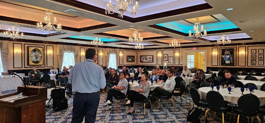
It has been great to reconnect with “floodies” in Northern Nevada. At last year’s conference, I realized how disconnected I had become when I unknowingly began to chat with one of Reno’s floodplain managers. As the conversation progressed, we quickly realized we had been in many of the same Zoom meetings, first with masks and then as names on a screen. One of the goals of these luncheons is to be able to recognize and support our fellow Northern Nevada floodplain managers in Sacramento at the next Floodplain Management Association’s Conference!

Quarterly FMA luncheons kicked off in January 2025 at the Washoe County Emergency Operations Center. Dr. George Robison of Truckee River Flood Management Authority (TRFMA) spoke at Part One of A Tale of Two Watersheds. Dr. Robison explained how TRFMA contracted HDR to create hydraulic models for a FEMA physical map revision (PMR) of the Truckee River and key tributary backwaters from West Reno to Wadsworth Nevada. He explained how the floodplain modelling effort progressed from a combined 1D-2D HEC-RAS model to a full 2D solution for the Truckee Meadows section of the model (West Reno to East Sparks). The presentation contained many project maps that demonstrated changes to flood extents and highlighted areas of similarities and differences from previous flood insurance rate maps. Dr. Robison shared how this model is utilized differently than FIRMS: it has become a working model not only used for PMR, but also overall floodplain planning and for design near river structures. This presentation by our area’s Doctor of Water sparked many questions and wonderful networking discussions between the 35+ attendees.
In April 2025, the second part of A Tale of Two Watersheds discussed the Carson River Physical Map Revision (PMR) in Carson Valley. About 40 people registered to hear the presentation at the spring luncheon in Carson City at the Governor’s Mansion Conference Room. Edwin James, Mitch Blum, and Tom D’allaire shared their perspectives of the long and sinuous journey of the Carson Valley PMR. This project began as a HECRAS 2D Alpha and Beta tester and was one of first 2D models in the country. When this project was submitted to FEMA, standards for reviewing 2D flood models had not been developed. Other technical challenges which had to be overcome included having to develop an administrative floodplain, modeling drainage inputs, and solving the problem of mapping a 1D floodway into

since this PMR was submitted to FEMA, there were also administrative challenges with county staff turnover, grant management changes, and new data submittal requirements in FEMA’s Mapping Information Platform. After many years, this PMR will become effective June 2025, and it is time to update the map!
We are trying to motivate attendance with a door prize and a raffle prize. The raffle raises money for the FMA Scholarship Fund. For the first two luncheons, approximately $250.00 was raised. Mary Horvath won the beautiful charcuterie board. Thank you to HDR for donating the first 2 door prizes – Yeti cups. We appreciate the donation of the charcuterie board by Joyce’s Jewelry and Antiques along with the C&D Nedd foundation.
It has been wonderful to network, share successes, compare challenges, and troubleshoot solutions at these luncheons. Please join us for the next FMA luncheon at Minden’s CVIC Hall July 10th from 11:30 a.m. – 1 p.m. Tom D’Allaire and Courtney Walker from Douglas County have agreed to continue the conversation about next steps for the Carson Valley PMR since the scheduled FEMA speaker was grounded. Look for the FMA invitation in late June or email debbie@cwsd.org for more information. Let’s keep the momentum going!
DID YOU KNOW FMA PROVIDES A $5,000 SCHOLARSHIP ANNUALLY? PLEASE CONSIDER DONATING A DOOR OR RAFFLE PRIZE FOR THE FMA SCHOLARSHIP FUND.
geiconsultants.com


floodplain.org
The Newsletter of the Floodplain Management Association
