District Vision and Major Corridors Vision Plan
November2024




November2024


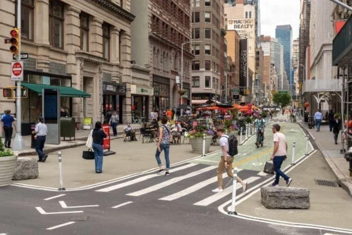
Since 2007, NewYorkCity’s DOT, with the Flatiron NoMad Partnership’s support, has created over 75,000 square feet of usable public spaces!


How can the Partnership move beyond Broadway and continue to lead NYC in creating world class human scale streets?




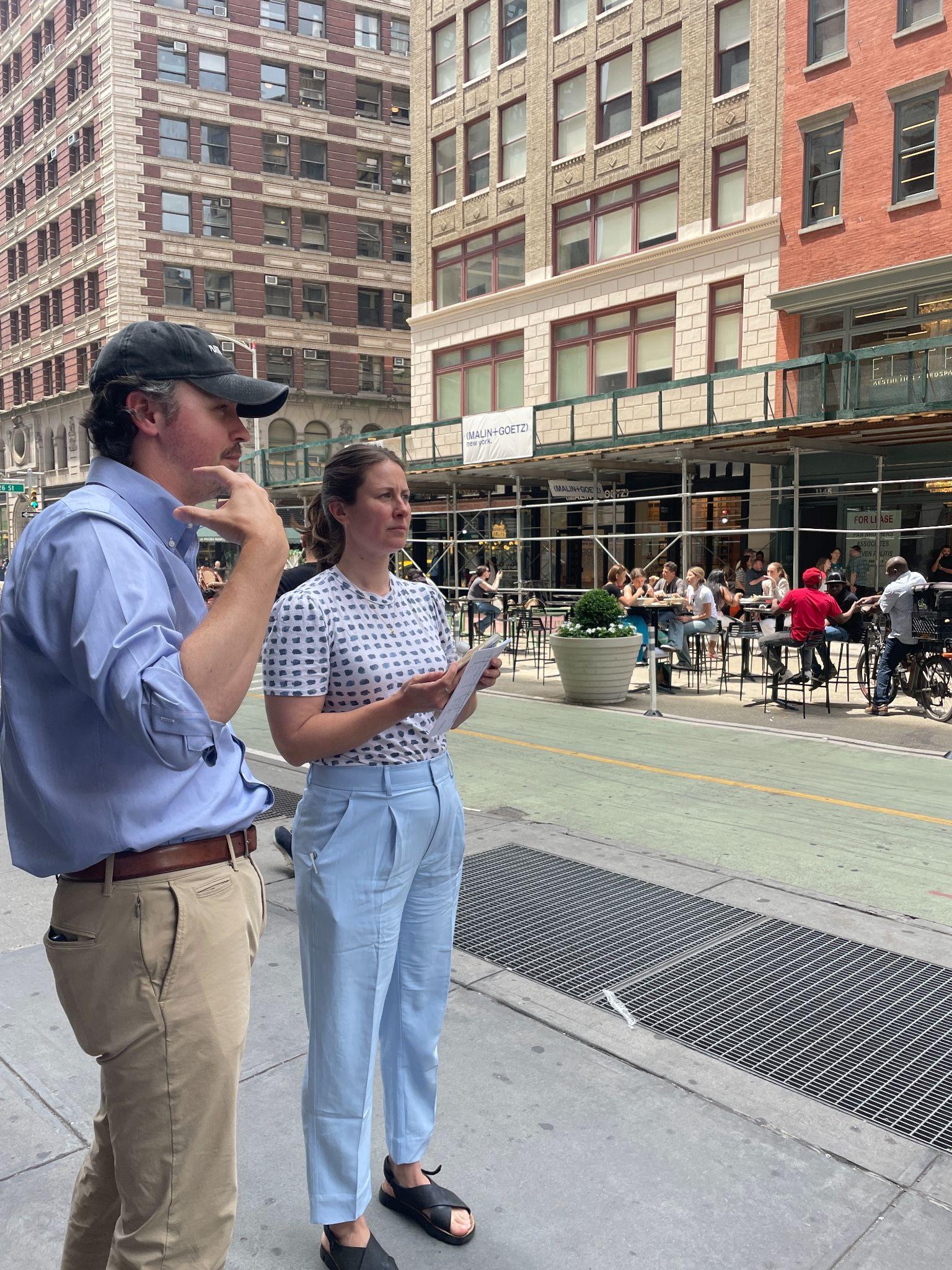
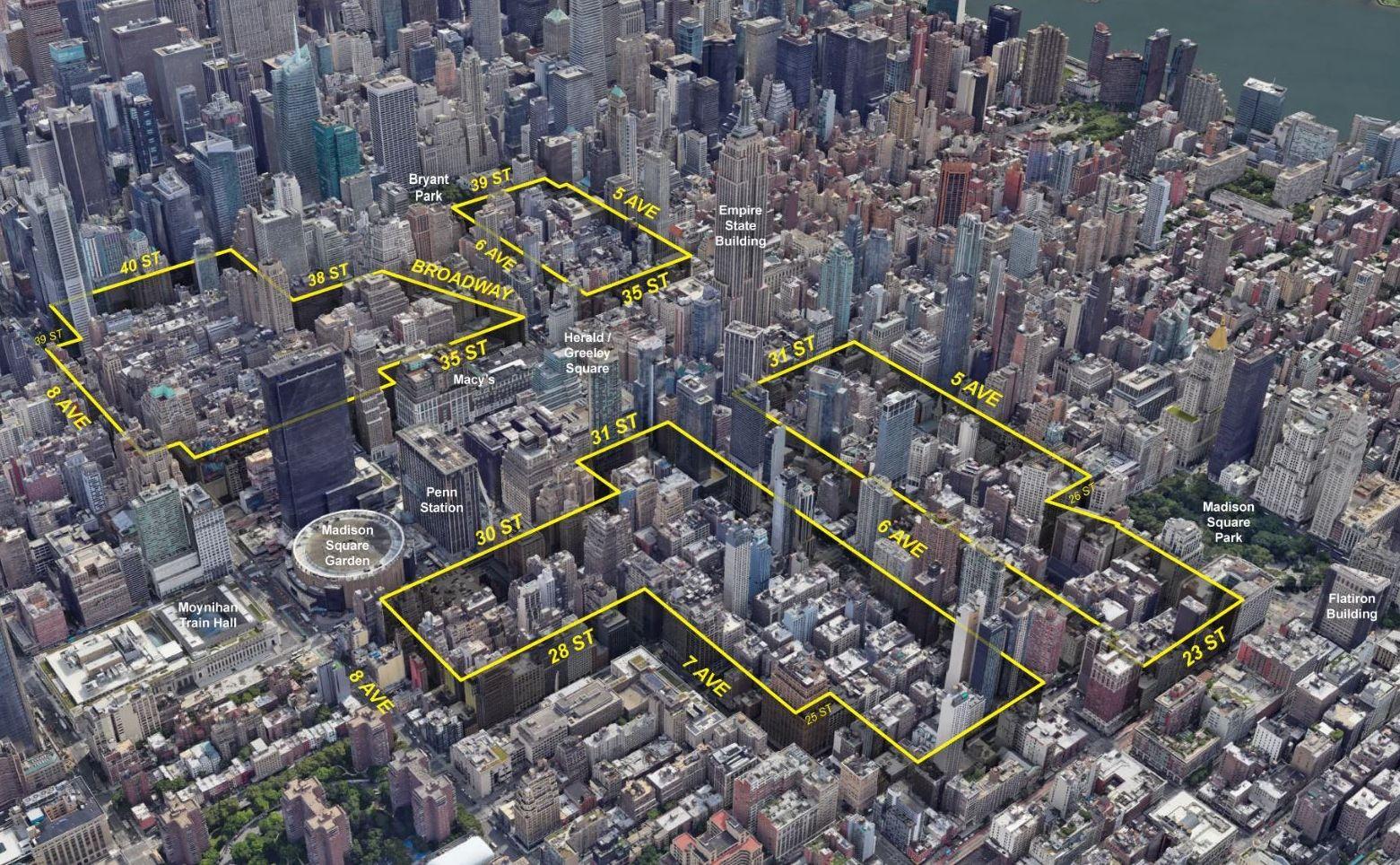
Increasing residential density demands a more mixed-use, 24/7 character.
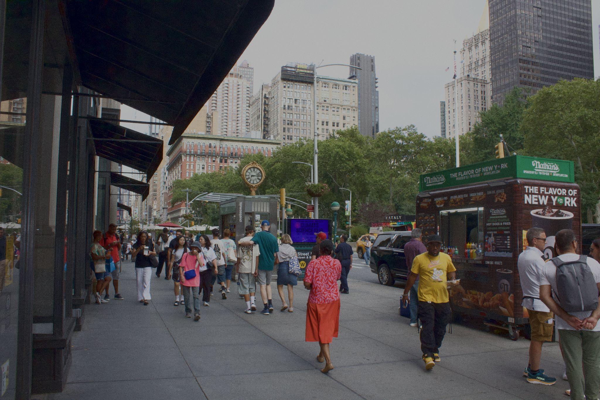
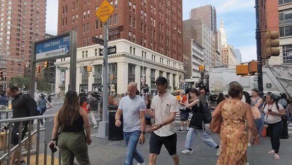
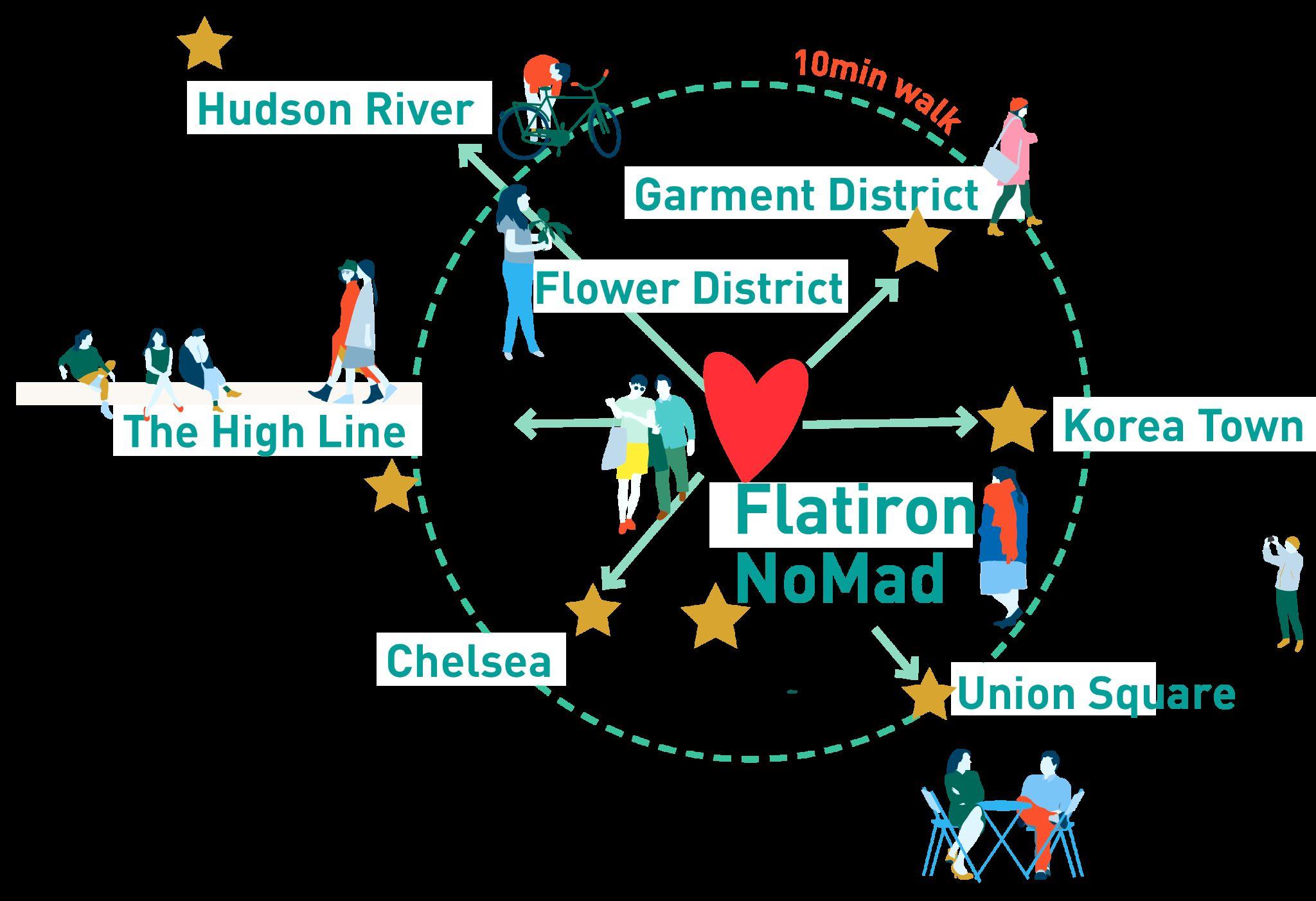
Flatiron NoMad is a transit crossroads for many arriving to and moving through NYC.
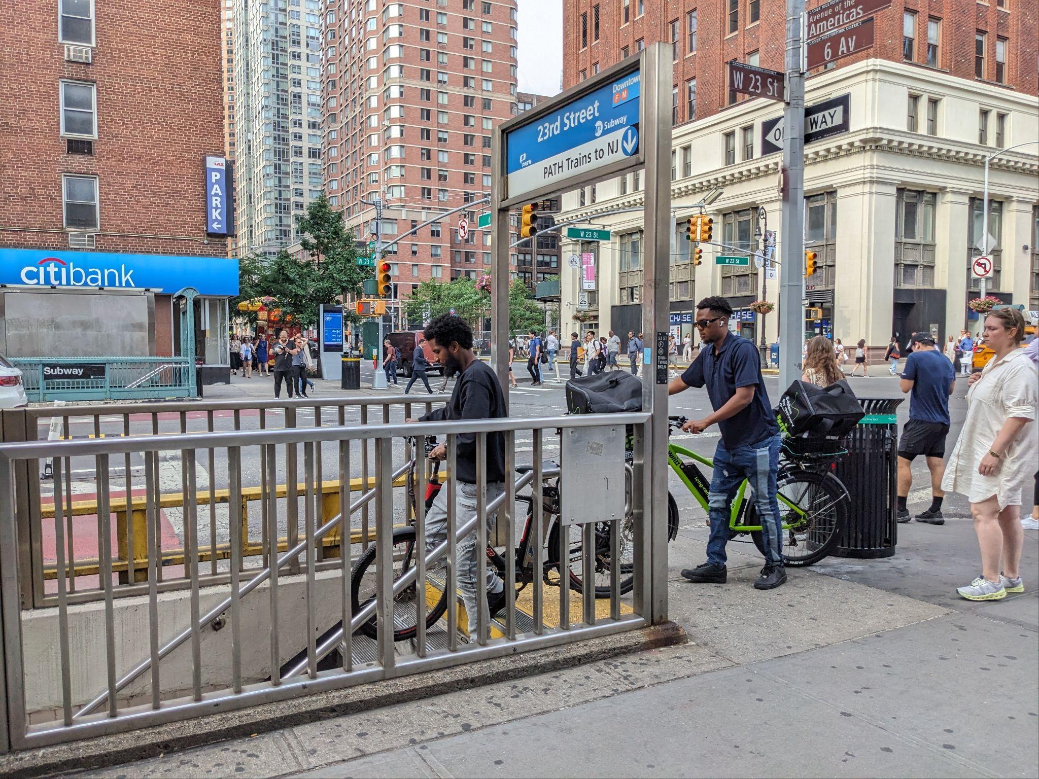

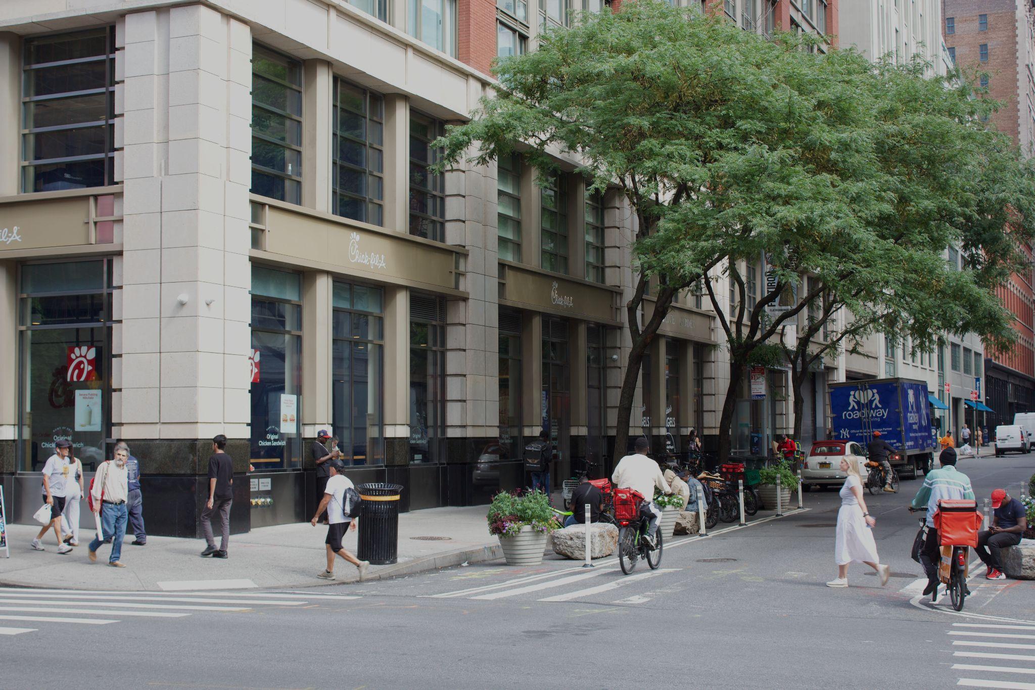
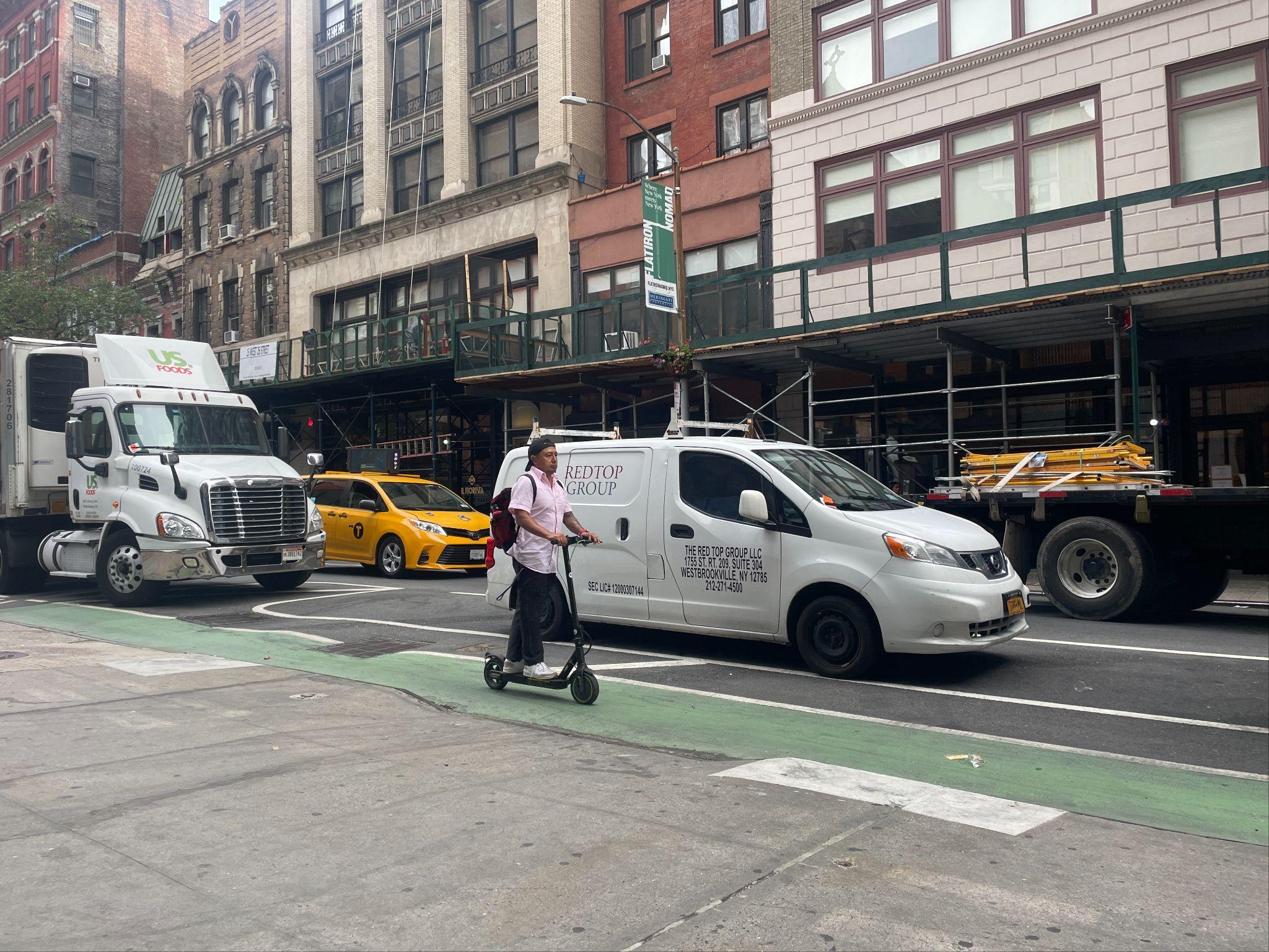
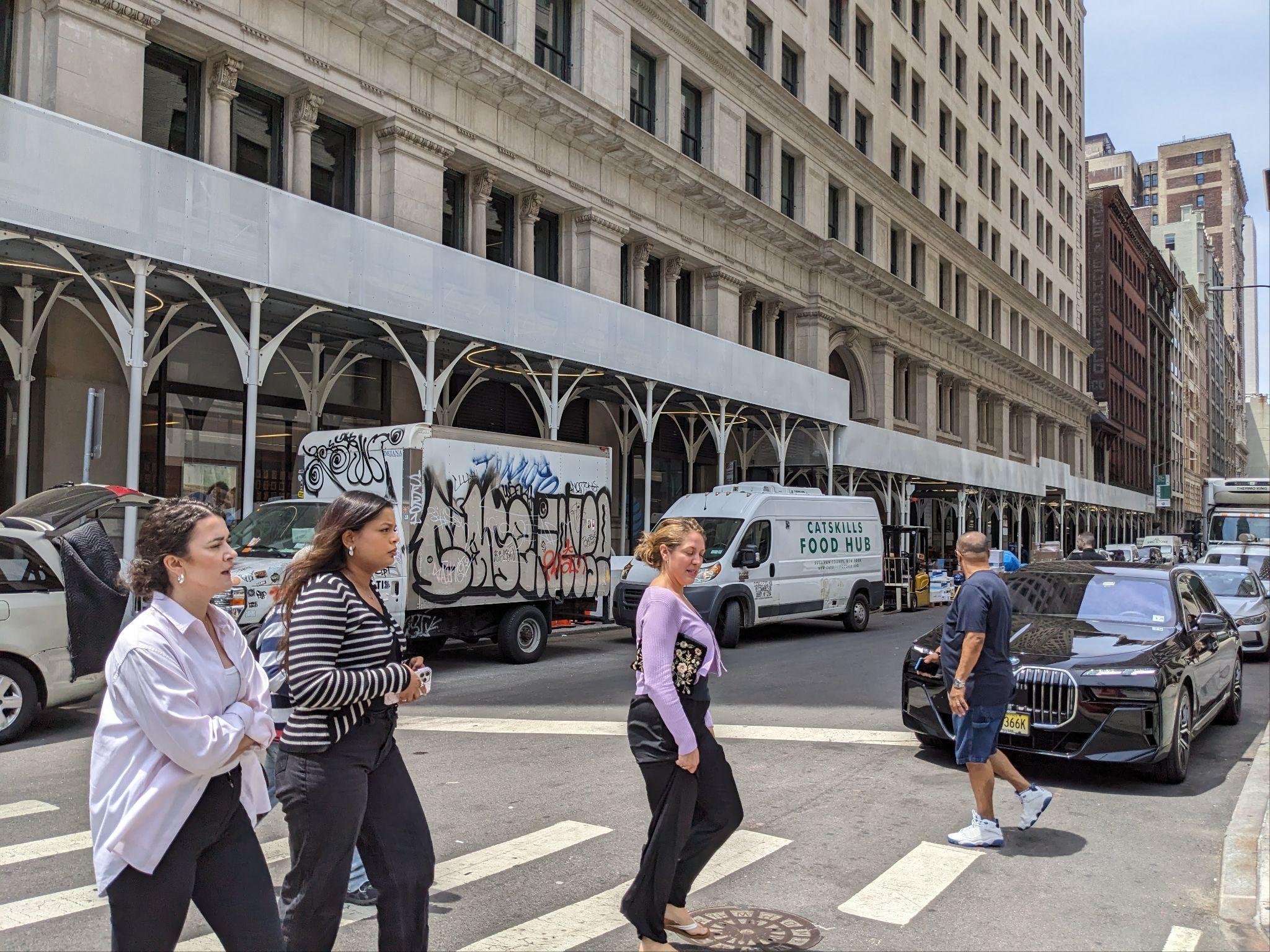
Still, many of the district corridors prioritize vehicles and lack quality space for people walking, rolling, or working.
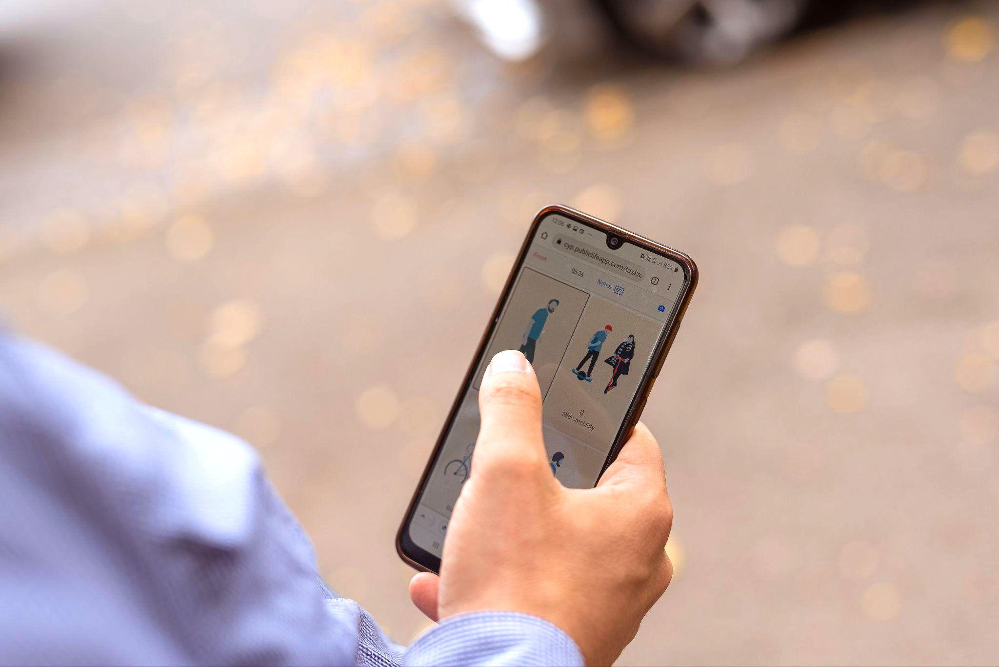
Flatiron NoMad is a micromobility hub, with a wide range of rider types — from commuters, delivery workers, and other everyday NewYorkers — riding bikes through the district each day.

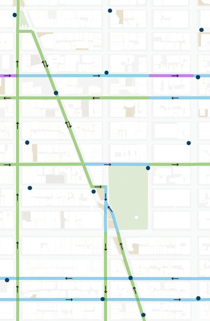
30th Street has a mixed conventional and shared bike lane
29th Street and 26th Street have parkingprotected bike lanes
20th Street and 21st Street have conventional painted lanes
Citi Bike Dock
BID Service Area
Protected Bike Lanes
Conventional Bike Lanes
Shared Bike Lanes

Yet formal rolling infrastructure lags behind demand — of the major corridors in the district, only Sixth Avenue has a dedicated bike lane while cross-town routes are narrow and have high rates of car encroachment.

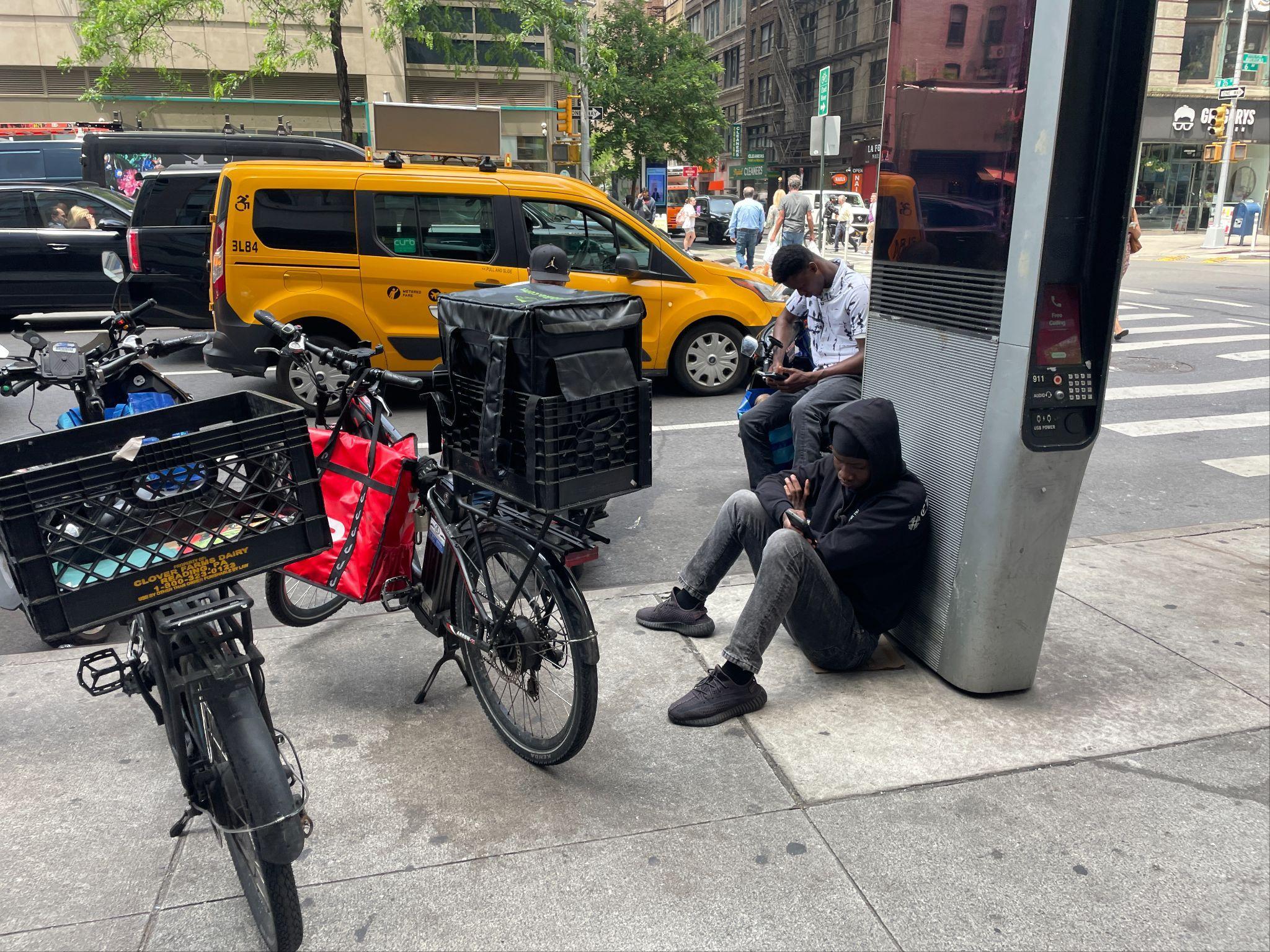
But it's still not enough as uneven enforcement of curb regulations and abuse of curb space by private vehicles force people to vie for space.
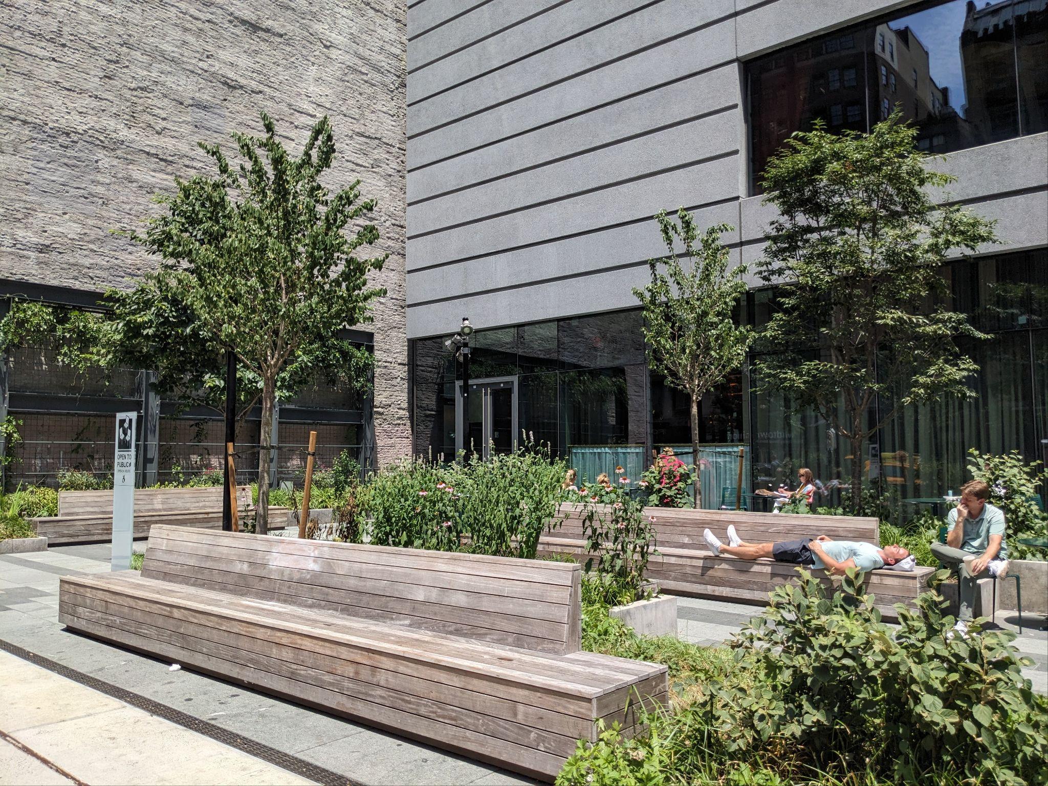
The Flatiron NoMad Partnership has had great success curating people-oriented public spaces that sparkvibrant public life year-round.
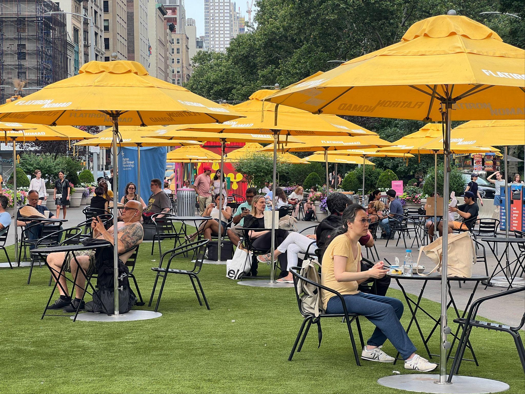

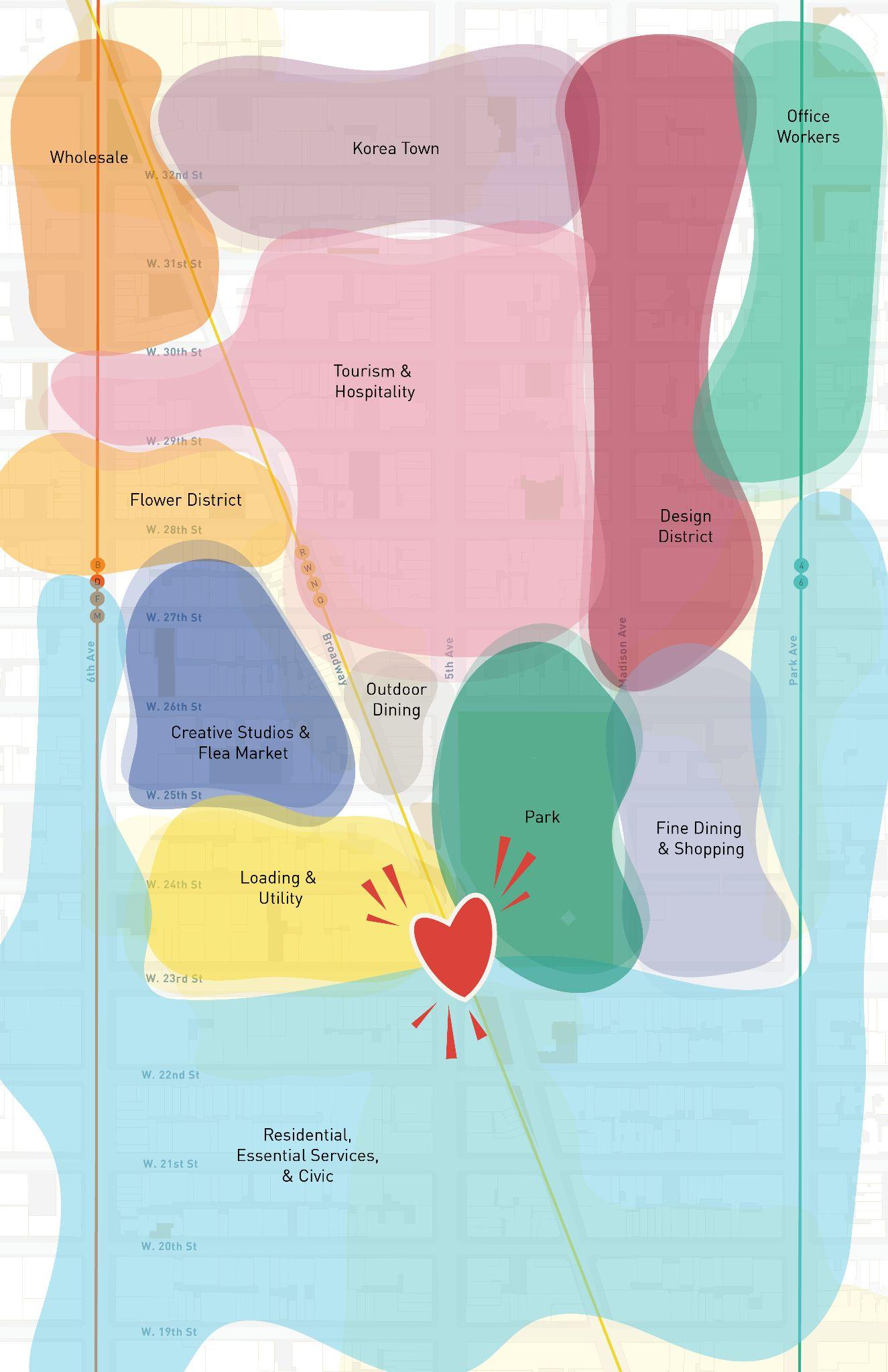
However, much of the public life pulse is confined to Madison Square Parkand the adjacent plazas and doesn't extend opportunities across the district.
Flatiron NoMad is an urban oasis in the heart of midtown — where the lush respite of Madison Square Parkand dynamism of Broadway flows across the district.
The public realm blends nature and city life, offering peaceful spots for families, innovators, and visitors amidst vibrant public life. With safe, walkable streets and easy transit access, the area is buzzing with NYC’s best culture, food, and everyday amenities.


Foster seamless mobility for all modes
Close gaps in existing infrastructure and pilot concepts that boost safe, connected experiences for people walking, rolling, and using transit.
02


Celebrate Flatiron
NoMad’s unique identity
Bring Flatiron NoMad's history and culture backto the street by piloting concepts that boost identity and wayfinding.

03
Spread the love and invite people to spend time on side streets
Draw energy and lessons learned from activity hubs like Broadway to quieter pockets and corridors.


04
Position operations as a tool to support everyday maintenance and innovate public space design
Ensure pilots’ success by implementing supportive operational systems.

The Vision Frameworkwill set a clear direction for the evolution of the district’s public realm beyond Madison Square Park and Broadway. This will take place via a series of pilots that ensure safermoving experiences and meet people where they are to provide moments of both intrigue and respite.

Lay the groundworkto rewrite how people experience the street today, steadily shifting behaviors and mindsets

The Safety & Operations Toolkit identifies opportunities forthe Partnership to advocate for priority safety and traffic calming initiatives across the district. It outlines opportunity types and locations the Partnership can suggest to NYC DOT to deploy their quick-build toolkit — for their delivery and subsequent operational and hardscape improvements.
The toolkit is a complement to the pilot projects identified in the larger Flatiron NoMad Major Corridors Vision plan by outlining and spatializing supportive safety and traffic calming initiatives.


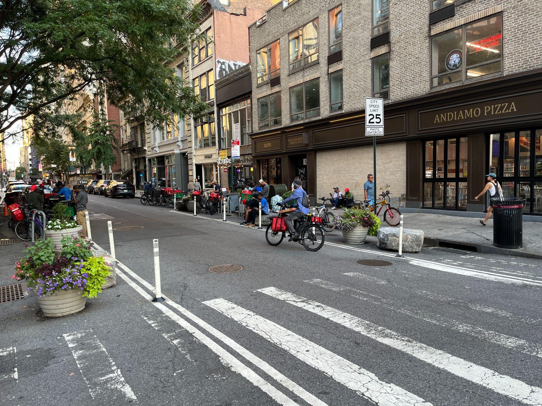


Each intervention typology includes a series of recommended locations within the Partnership's service area where NYC DOT could implement nearterm safety and traffic calming elements. Locations were identified based on the project team’s analysis of existing conditions. While additional locations for safety improvements are feasible, recommended locations have been chosen to prioritize sites with the most demonstrated need.
LEGEND
Plazas Intervention Typology
Parks
Curb Extensions
Curb Extensions & Mid-blockTraffic Calming
Expanded Protected Bike Lane & Flex Space
Turn Restrictions
Traffic Signal Modifications

Building upon existing conditions and traffic/mobility analysis, and layered atop the Safety & Operations Toolkit, seven pilot concepts were developed for near-term demonstration projects with stakeholders prioritizing three fordetailed development.
The Gateway A welcome mat and landing pad into a 24/7 neighborhood and district beyond

Beyond the Margin Using public art and greenery to bring the ‘park’ to Park Avenue South Broadway Bloom A vibrant linkthat strings the pearls of Flatiron NoMad together

Broadway Bloom
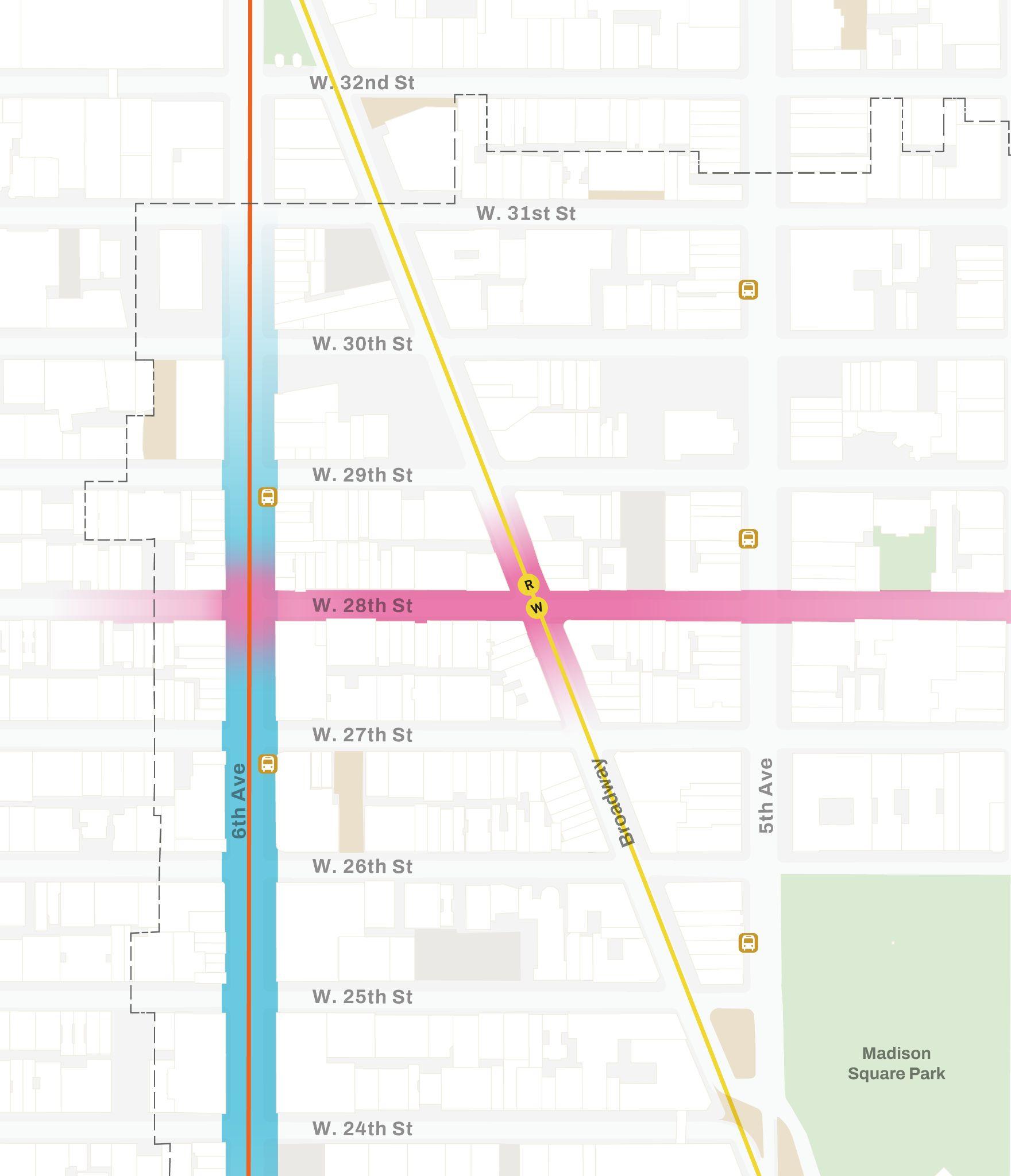
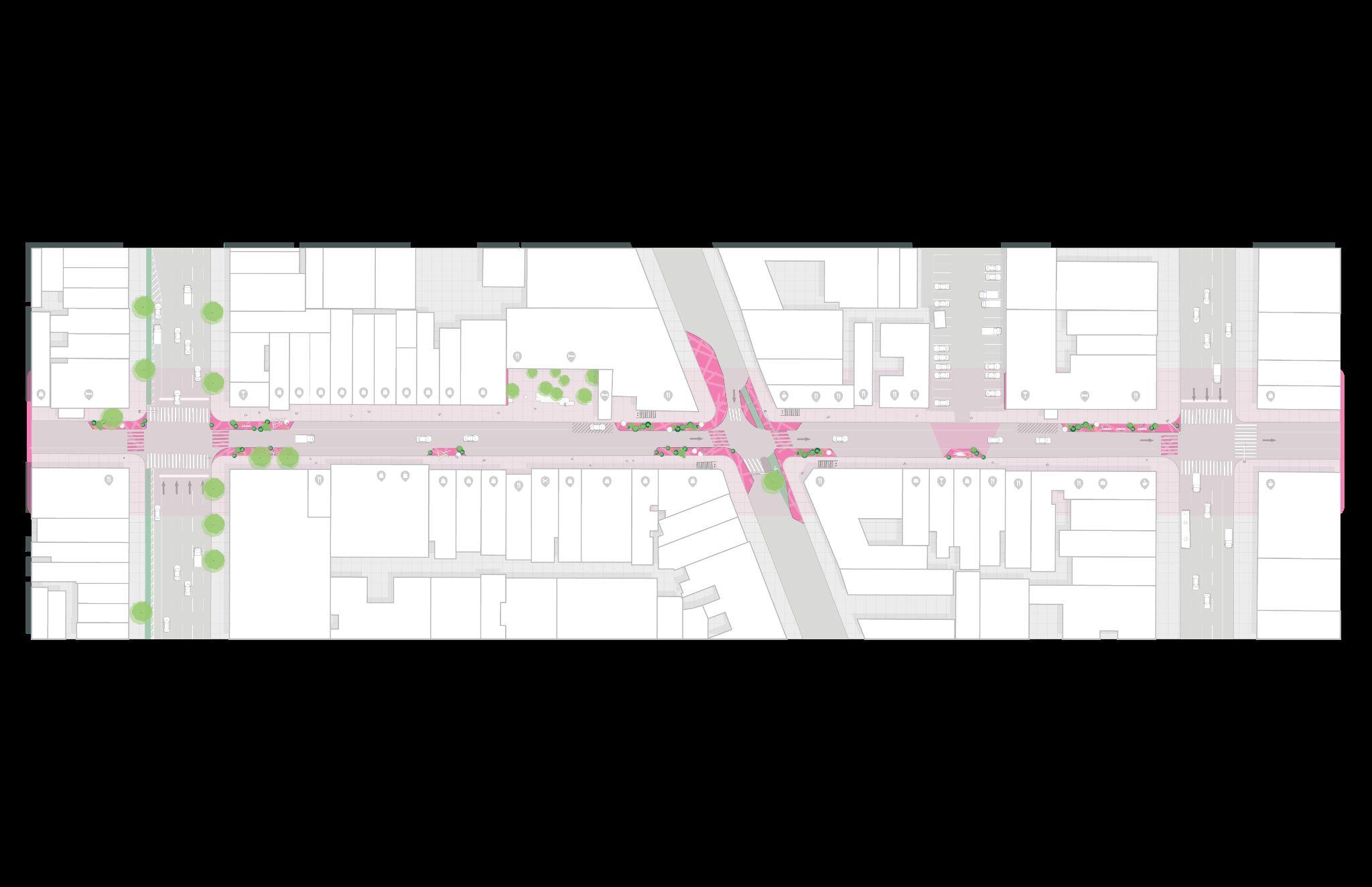
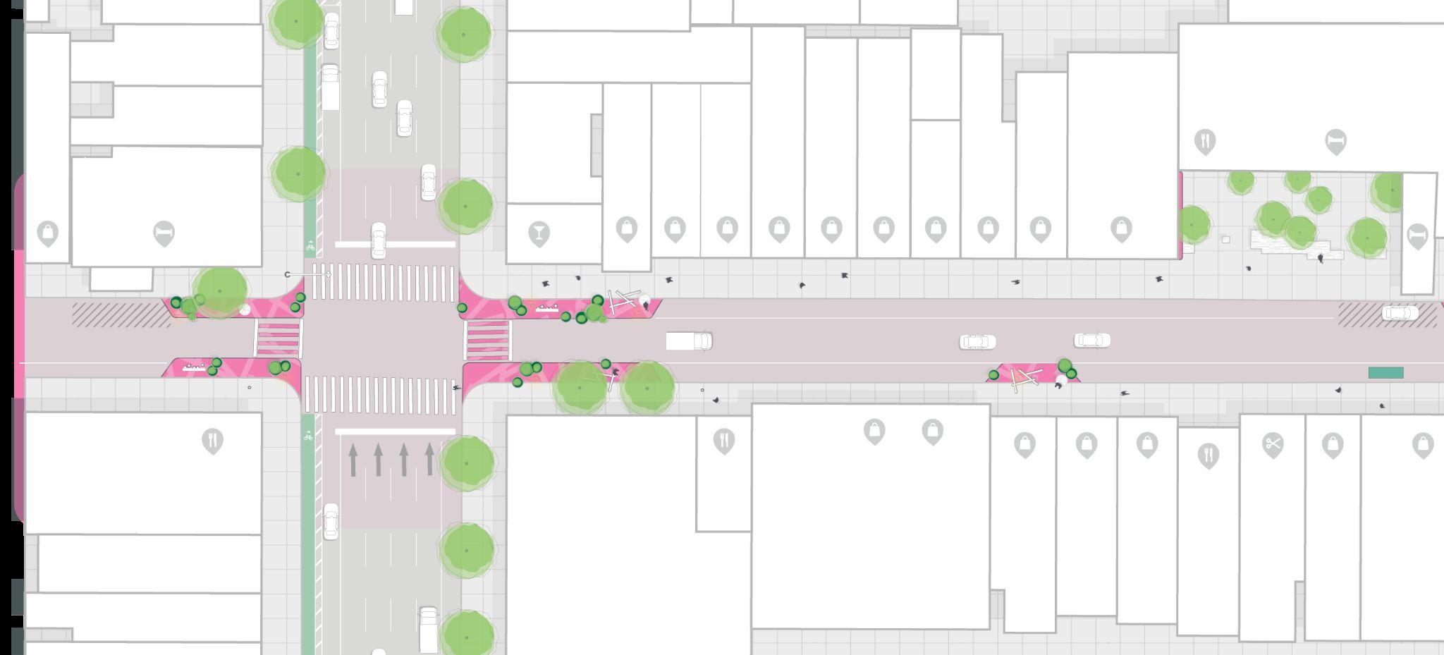
28th Street between Fifth Avenue & Sixth Avenue
● Activating the short blocks on 28th Street is an opportunity to test ways to enhance side street activity and spread the love from Broadway
● These blocks benefit from transit access, proximity to public spaces like POPS, landmarkvistas, and the Flower District

28th Street is one of the busiest side streets, with an hourly average of over 1,000 pedestrians perhour.1
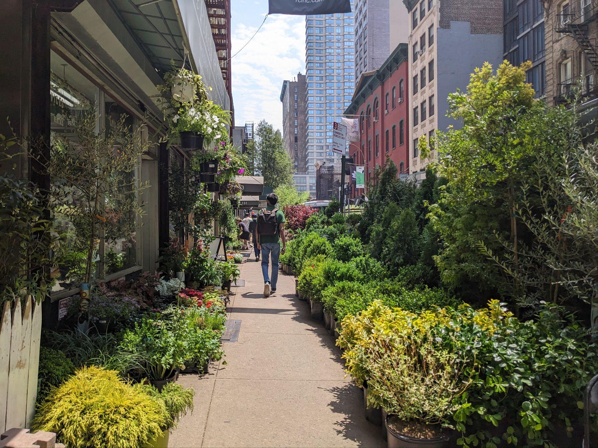
From here, it’s a 2 min walk down 28th Street to the heart of the Flower District.
The 28th Street corridor is a transit hub, with access on both the east and west sides of the district.

Broadway Bloom
28th Street between Fifth Avenue & Sixth Avenue
What if this stretch of 28th Street transformed from a side street people opt to pass by… …to a vibrant green spine that links some of NewYork’s most iconic destinations.


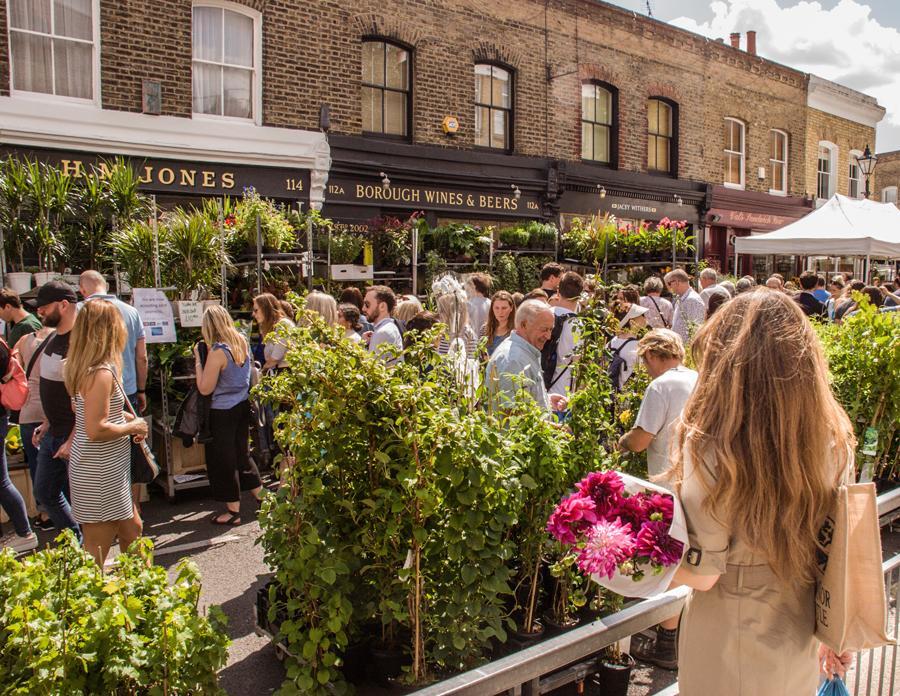
Blooming out from Broadway, position 28th Street as a public life magnet that melds the magic of the FlowerDistrict with the buzzing energy of Broadway.
A busy pedestrian thoroughfare and transit hub, an improved public realm activated by events or programming can reinforce all that is special about 28th Street. The reimagined streetscape can imbue the landscape of legacy retail offerings — from the Flower District destination to small-scale wholesalers — and hospitality anchors with the pulsing energy from Broadway.
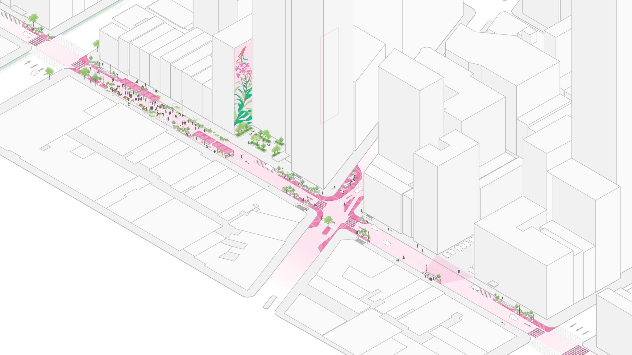
Bold mural draws people in while reinforcing corridor identity

Curb extensions and artistic crosswalk treatments announce arrival to corridor
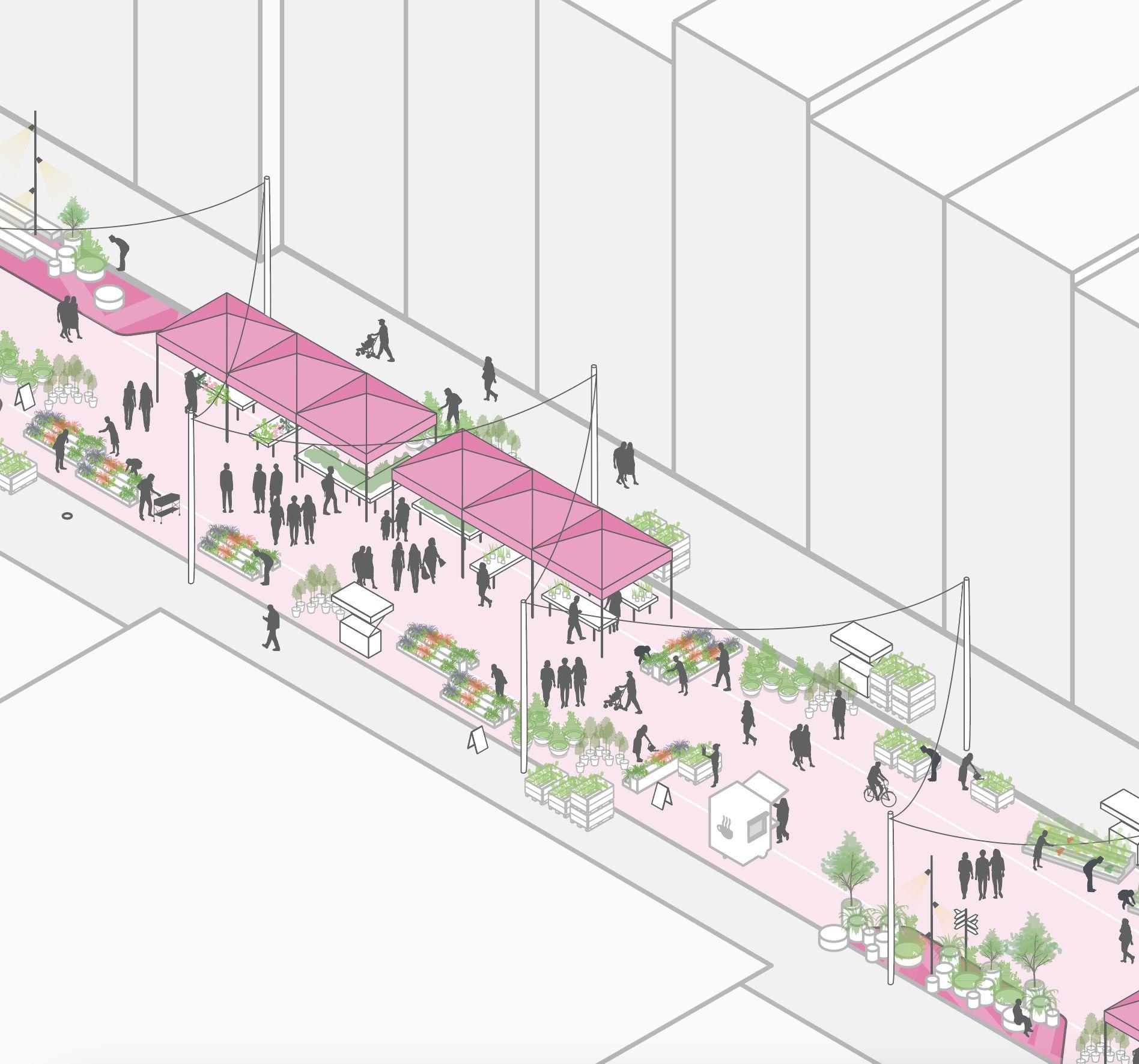
Design accommodates street closure for markets and neighborhood events
Elevate the character and identity of side streets through signature public events that create an off-Broadway invitation.
A vibrant linkthat strings the pearls of Flatiron NoMad together

Prioritize pedestrians through tactical interventions and operational changes that regulate critical curb space.
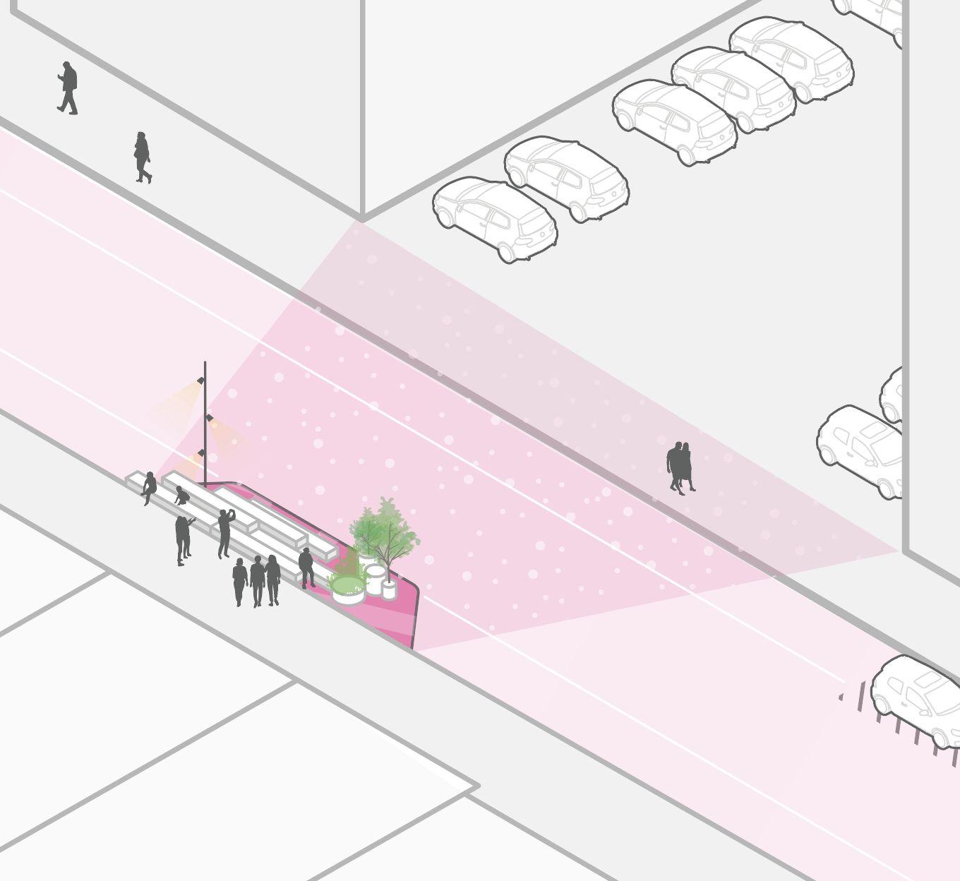
Mid-blockcurb extension with raised planters and public seating
Create focal draws that spread the love from Broadway out along short blocks to the east and west.
See “The Gateway” on page 49
28th Street between Sixth Avenue & Broadway
Strengthen westward connection to the FlowerDistrict by signaling the character down the street with elements such as a bold mural and lush green edge.
See page 28 for zoom-in

28th Street between Broadway & Fifth Avenue

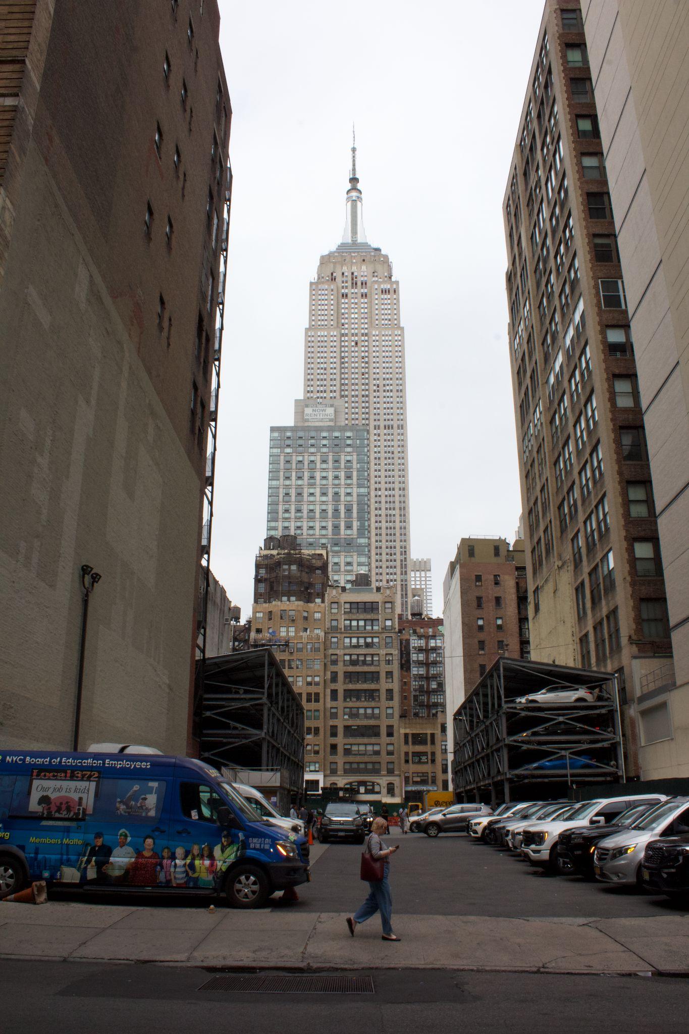
Strengthen eastern connection to Fifth Avenue by turning a hidden view of the Empire State Building into a mid-block attraction.
See page 29 for zoom-in

Cafe seating and planters provided in curb extensions in coordination with adjacent businesses
Artistic crosswalk treatment acts as gateway and calms traffic
Curb extensions* with roadway mural and raised planters that highlight Flower District identity
Mid-blockcurb extension with raised planters and public seating

Surface treatment that highlights Empire State sightlines
Bold mural facing Broadway to complement view backdrop
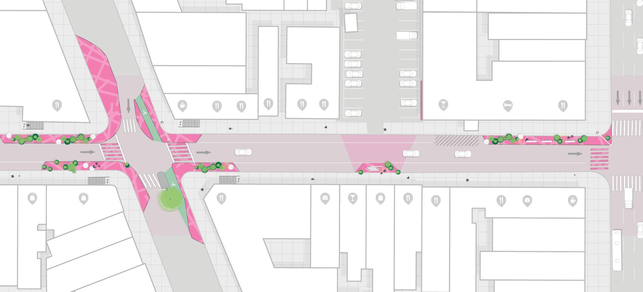
Curb extensions with roadway mural and raised planters that highlight Flower District identity and provide wayfinding by design at subway connections
*All curb extensions shown are proposed except NW curb of Broadway & 28th Street as marked on plan.
Artistic crosswalk treatment acts as gateway and calms traffic
Cafe-style seating and planters provided in curb extensions in coordination with adjacent businesses
Mid-blockcurb extension with viewing platform towards unobstructed view of Empire State Building that doubles as social seating
Artistic crosswalk treatment acts as gateway and calms traffic

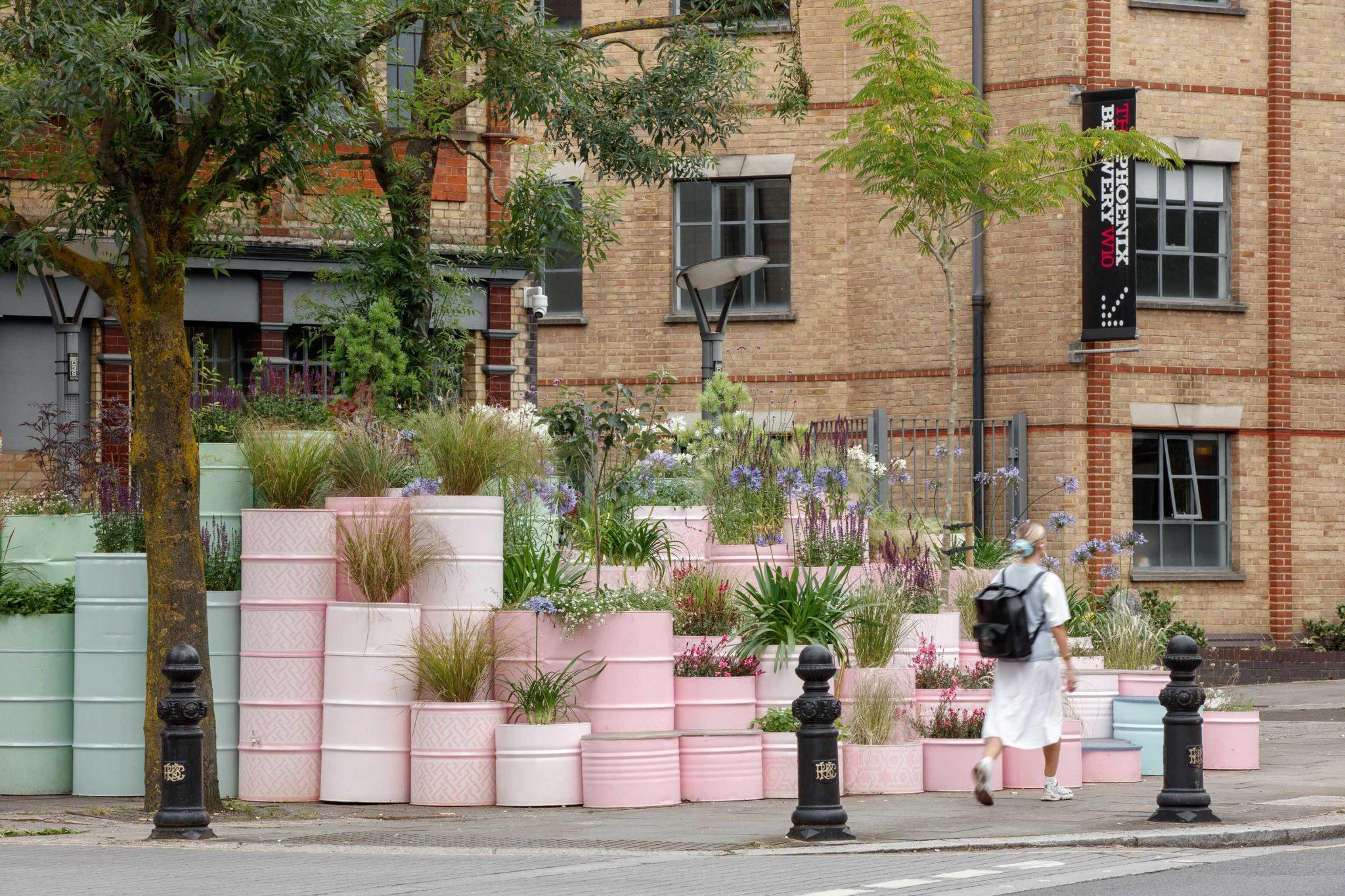
Crosswalkmurals reinforce the corridor’s identity and pedestrian priority


Cities with Successfully Implemented
CrosswalkMural Projects —
Long Beach, CA (pilot project, 2017)
Sacramento, CA (reference guide)
San Francisco, CA (pilot project, 2024)

● Because these are interim designs with many custom features (as opposed to standard capital project work), this estimate uses a number of cost references to best estimate unit costs. For elements where the Flatiron NoMad Partnership has existing material unit costs, these prices are reflected in the estimate.
● The unit costs are likely conservative, high-end estimates and the ultimate figures will largely depend on material sourcing.
● Unit costs and construction elements reflect 2024 pricing.

→ Commercial Tenants and Property Owners
→ NYC Dept. of Transportation (NYC DOT)
→ NYC Open Culture Program
→ NYC Dept. of Design and Construction (NYC DDC)
→ NYC Dept. of Sanitation
→ Mayor’s Office of Sustainability
→ Center for Zero Waste Design
→ Local organizations (e.g., NYC Historic Floral District, Tin Pan Alley American Music Project, etc.)
NOW First Moves NEXT Mid- to long-term
1. Create focal draws that spread the love from Broadway out along short blocks to the east and west.
2. Elevate the characterand identity of side streets through signature public events that create an off-Broadway invitation.
3. Prioritize pedestrians through tactical interventions and operational changes that regulate critical curb space.
1. Develop a long-term programming plan for blocks adjacent to Broadway (and beyond) that includes a regular cadence of both daytime and nighttime activities.
2. Curate an engaging historic exhibit that tells the story of Tin Pan Alley, and a partnership with supportive groups, such as the Tin Pan Alley American Music Project.
3. Facilitate mobility study to explore big ideas such as implementing raised intersections or establishing a shared pedestrian-priority street along all blocks 28th Street between Sixth Avenue and ParkAvenue South.

Create focal draws that spread the love from Broadway out along short blocks to the east and west.
1A. Strengthen westward connection to the FlowerDistrict by signaling the character down the street with elements such as a bold mural and lush green edge.
→ Install artistic crosswalktreatment or curb extension roadway mural at Broadway intersection to calm traffic and mural on blankfacade between Broadway and Fifth Avenue to highlight the identity of the Flower District.
→ Install planters at expended curb extensions at intersections.
→ Create an incentive program for the Floral District businesses and other commercial tenants to adopt and maintain curbside planters.
1B.Strengthen eastward connection to Fifth Avenue by turning a hidden view of the Empire State Building into an mid-blockattraction.
→ Install artistic crosswalktreatment at Broadway intersection.
→ Explore opportunity to install mid-blockbulb-out that calls attention to sightlights to the Empire State Building from the pedestrian-perspective.
Regulatory partner
May be responsible for approving this work
NYC DOT, Art Program
Implementation support
May be supporting this workas an advocate or champion
Local references
Places in NYC where similar ideas have been implemented
Note: Flatiron NoMad Partnership is intended to act as prime implementer for all ‘first moves’; * some references included here are from national best practice
NYC DOT, Art Program
Local artists, designers, and fabricators; NYC Historic Floral
District (potential partner for planting strategy and placemaking that highlights connection to the district)
Curb extension roadway mural— 34th Avenue, between 89th Street and 90th Streets, Queens
Thematic sidewalkextension mural — 14th Street Busway
Asphalt Art Safety Study* — making the case for the safety benefits of ground-plane treatments
Local artists, designers, and fabricators; Empire State Realty
Trust (potential partner for creation of interactive placemaking that highlights connection to the Empire State Building)
Mid-blocktraffic calming bulb-out — West 22nd Street, between Eighth Avenue & Seventh Avenue, Manhattan
Manual on Uniform Traffic Control
Devices Reference Guide* — allows asphalt art projects on USA roadways, including curb extensions, midblock, intersections, and crosswalks

Elevate the characterand identity of side streets through signature public events that create an off-Broadway invitation.
2A. Establish a festival, blockparty, orflowermarket event to enliven the street while supporting local businesses, showcasing local retailers, and celebrating lesser known histories.
→ During events, explore opportunities to close 28th Street between Sixth and Fifth Avenues to vehicular traffic during events and to install temporary market stalls and flexible seating.
→ Develop a market stall tenanting strategy with an equity lens that centers local entrepreneurship and uplifts existing retailers.
→ Explore opportunities to highlight ‘tin pan alley’ history with curated musical activations.
2B.Partnerwith local businesses to establish a DOT ‘Street Seats’ program along the pilot corridor.
→ Explore opportunities to install different seat types, from fixed benches to movable and modular chairs and tables for grab-and-go outdoor dining within contextually-responsive curb extensions.
Regulatory partner
May be responsible for approving this work
Implementation support May be supporting this workas an advocate or champion
NYC Open Culture Program Local businesses (floral businesses and otherretailers), SBS; Tin Pan Alley American Music Project (TPAAPMP); The Metropolitan Chapterof the Victorian Society in America
Local references
Places in NYC where similar ideas have been implemented
NYC DOT, Street Seats Program NYC DDC; Local businesses
Broadway Bites Market brought a unified market stall design approach to Greeley Square— 33rd Street between Broadway & Sixth Avenue
Uptown Night Market showcases the talents of locals in the community — 133rd and 12th Avenue in West Harlem, Manhattan
Street Seats with contextually-responsive, movable dining furniture — New School, E 13th Street and Fifth Avenue, Manhattan

Prioritize pedestrians through tactical interventions and operational changes that regulate critical curb space.
3A. Rethinkcurbside management strategy to improve pedestrian experience and maximize operational efficiency for businesses along the corridor.
→ Incentivize off-street parking through improved wayfinding and expanded ‘commercial vehicle only’ hours.
→ Convert select existing ‘commercial vehicle only’ metered parking to ‘truckloading zone’ spaces and dedicated for-hire vehicle pick.
Regulatory partner
May be responsible for approving this work
Note: Flatiron NoMad Partnership is intended to act as prime implementer for all ‘first moves’
Implementation support
May be supporting this workas an advocate or champion
Local references
Places in NYC where similar ideas have been implemented
Streamlined curbside management strategy to improve pedestrian experience — Meatpacking

Elevate the character and identity of the Flower District
Declutter the public realm to create more space for people
Position the street as a flexible platform for hosting events
● Metrics: Improved interested in and sense of connection to nearby points of interest
● Methods: Increase in positive sentiments via stakeholder intercept /online surveys
● Metrics: Improved perception of pedestrian satisfaction; Increase in number of people moving and staying along the corridor
● Methods: Increase in positive sentiments via stakeholder intercept /online surveys; Increase in pedestrian stationary activity and movement count volumes
● Metrics: Increase in events and activations that spill into or directly interact with the street
● Methods: Increase in number of event requests and/or event permits granted

and NoMad
Only 4% of CB5 has coverage - the least of Manhattan's 12 community districts.1
● There is momentum on ParkAvenue South to redesign the street and bring backthe greenspace that used to define the corridor, but it doesn’t cover the full extent of the avenue.
● How might ParkAvenue South bridge the gap between people and greenery in the district?
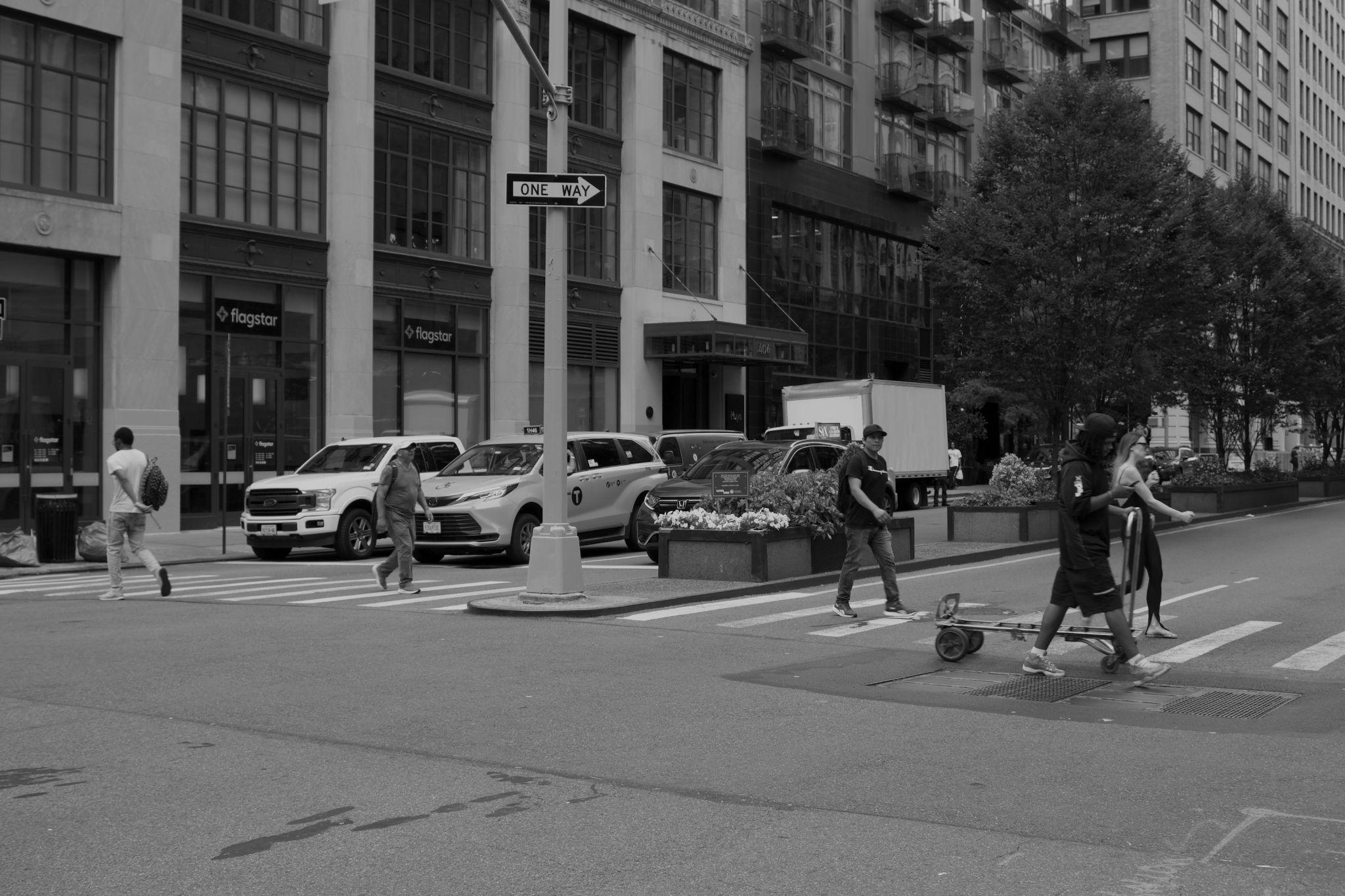
While the medians have well-kept trees and greenery, people can’t access this space or spend time in the shade.
Some medians along the Avenue have raised curbs that pose an accessibility challenge.
Looking north up ParkAvenue South from 28th Street

Reimagine ParkAvenue South as a green spine forpeopleto experience, ratherthan a chain of green islands they can only view from afar While the medians along ParkAvenue South bring some much needed canopy coverage to the district, they position the greenery amidst a roadway where pedestrians can’t access or enjoy it. A reimaged public realm will not only making moving along this busy corridor more comfortable and human-scale, but invite passersbys to both reflect on a past landscape and envision a future one.


Planters integrated with introspective signage, visually interesting native palette, artful human- scale light features and seating

Enhance the edges of the sidewalk with art, planters and greenery to call attention and tell the story of Park Avenue as a complete corridor. 1

Using public art and greenery to bring the ‘park’ to ParkAvenue South

27thStreet
Existing light posts act as canvas for signature vertical identity marker at eye-level

Temporary curb ramps to address accessibility concerns at medians


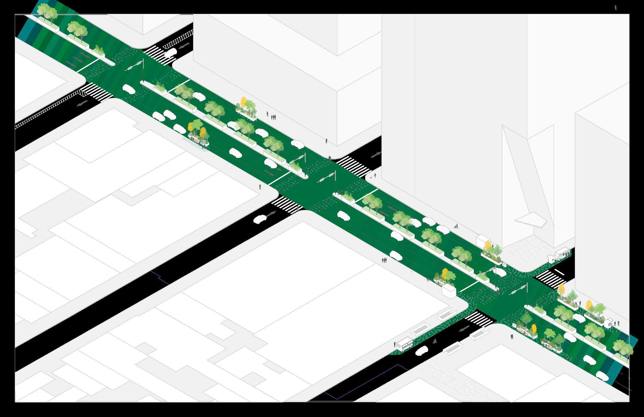
Ease safety challenges for pedestrians at intersections – especially those with raised medians – to slow vehicle speeds and allow more time to cross.


28thStreet


Transposing the ‘park’ from the median to the sidewalk— using expanded pedestrian space to immerse people in the natural history and ecology of the corridor
See page 41 for zoom-in
A demonstration blockthat reimagines curb-space as people-space — creating a generous sidewalkextension enhanced by lush greenery and interpretive public art
See page 42 for zoom-in


Cafe seating and planters provided in curb extensions in coordination with adjacent businesses
Le Cafe Coffee
Signature vertical identity marker element attached to existing light post
*All curb extensions shown are proposed except SE curb of Park Avenue South & 28th Street as marked on plan.
Curb extensions with roadway mural and raised planters that bring ‘park’ experience to the sidewalkand provide wayfinding by design at subway connections
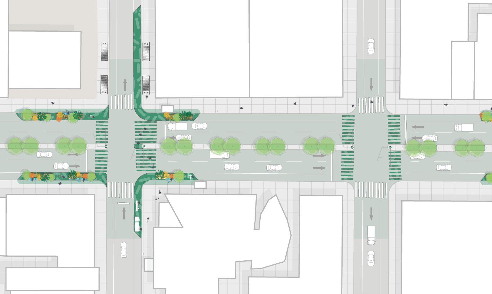
Concentrated greenery at key intersections reinforces gateway condition and human scale at high-traffic blocks with visually interesting, native plant material, introspective signage and artful light features
Artistic crosswalktreatments act as gateway and calms traffic
Midblockbulb out fills gap in tree canopy coverage along sidewalkedge 50 ft

Introspective signage overviews the history of the site and approach to planting and greening
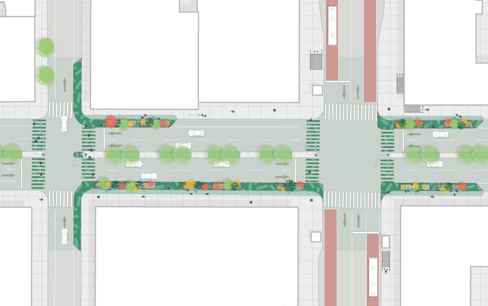
Midblockbulb out fills gap in tree canopy coverage along sidewalkedge
Demonstration blockreclaims parking lane for expanded pedestrian zone with roadway mural furnished with concentrated visually interesting native planters integrated with interpretive signage, artful light features, and seating
Expanded pedestrian space provides amenities like bike parking and seating near subway entry

Inviting for nearness to nature

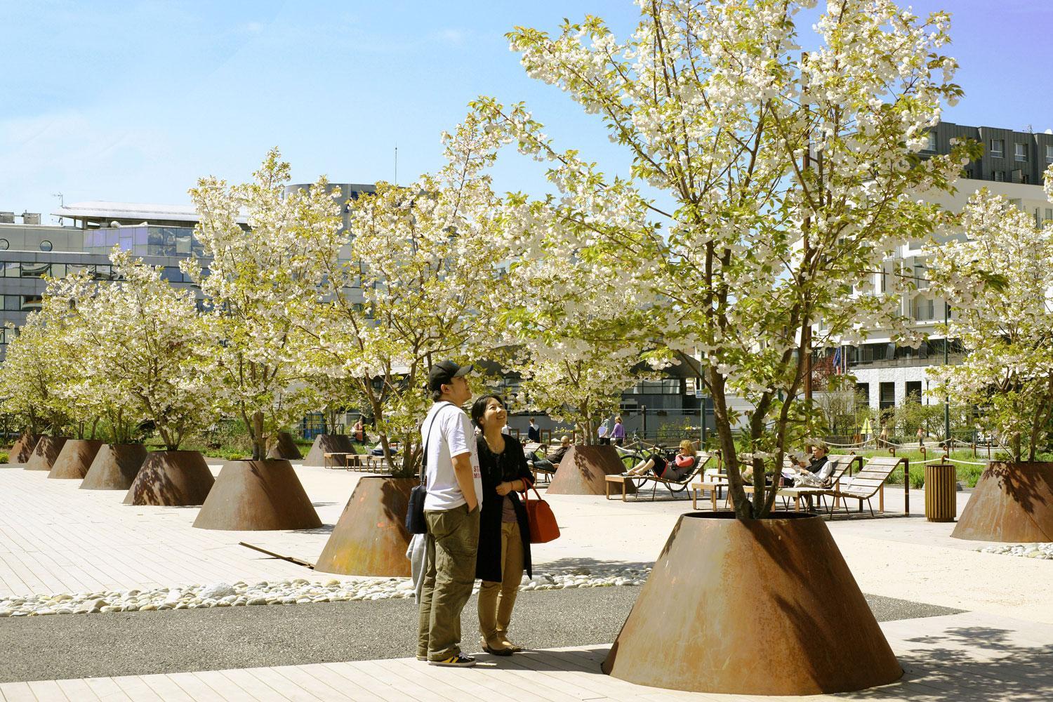
Exhibiting native flora amidst a bustling urban backdrop


● Because these are interim designs with many custom features (as opposed to standard capital project work), this estimate uses a number of cost references to best estimate unit costs. For elements where the Flatiron NoMad Partnership has existing material unit costs, these prices are reflected in the estimate.
● The unit costs are likely conservative, high-end estimates and the ultimate figures will largely depend on material sourcing.
● Unit costs and construction elements reflect 2024 pricing.

→ NYC Dept. of Transportation (NYC DOT)
→ NYC Dept. of Cultural Affairs
→ NYC Dept. of Design and Construction (NYC DDC)
→ Trees NY
→ The Nature Conservancy
→ NewYorkRestoration Project
→ Tenants and Property Owners
→ Local artists, designers, and fabricators
NOW First Moves NEXT Mid- to long-term
1. Enhance the edges of the sidewalk with art, planters and greenery to call attention and tell the story of ParkAvenue north of 34th Street and ParkAvenue South as a unified corridor.
2. Ease safety challenges forpedestrians at intersections– especially those with raised medians – to slow vehicle speeds and allow more time to cross.
1. Initiate a feasibility study for long-term improvements of ParkAvenue South to claim more space for people, similar to effort to upgrade historic medians north of 34th Street.
2. Develop and carry out a plan for long term landscape sustainability that seeks to replant median with native species that provide pollinator habitat and increases canopy coverage along the corridor and across the district.
3. Initiate a mobility study to explore opportunities to provide dedicated rolling infrastructure along ParkAvenue South.

Enhance the edges of the sidewalkwith a green borderof art, planters and greenery.
1A. Deploy curb extensions that concentrate, native greenery at the sidewalkalong intersections and midblock locations to establish gateways and continuous pedestrian experience.
→ Establish demonstration blockat vision zero priority intersection, on west side of avenue between 23rd and 24th Streets, by reclaiming parking lane for expanded pedestrian zone.
→ Convert parking to curb extensions at select intersection and mid-blocklocations.
→ Design and implement native plant palette for planters that showcases species with seasonal interest and ecological benefits.
→ Create an incentive program for businesses and commercial tenants to adopt and maintain curbside planters.
1B. Explore artistic ground-plane and surface treatments and signage that tells the history of the corridor and provides subtle traffic-calming at intersections.
→ Install artistic surface treatment along curbside pedestrian extension.
→ Provide introspective signage that helps with storytelling.
→ Add vertical identity markers to existing light posts at eye-level.
→ Explore opportunities to add paint to medians to reinforce placemaking applied to pedestrian extensions.
Note: Flatiron NoMad Partnership is intended to act as prime implementer for all ‘first moves’
Regulatory partner
May be responsible for approving this work
Implementation support
May be supporting this workas an advocate or champion
Local references
Places in NYC where similar ideas have been implemented

Ease safety challenges forpedestrians at intersections – to slow vehicle speeds and allow more time to cross.
2A. Adjust traffic signal timing to prioritize pedestrian and cyclist safety by incorporating Leading Pedestrian Intervals (see “traffic signal modifications” in Safety & Operations toolkit) at intersections where it is not yet included along ParkAvenue South.
Regulatory partner
May be responsible for approving this work
NYC DOT, Signals Unit
2B. Continue efforts to address accessibility constraints at raised medians by implementing temporary curb ramps or overseeing curb reconstruction. NYC DOT, Pedestrian Ramp Program
Implementation support May be supporting this workas an advocate or champion
Local references
Places in NYC where similar ideas have been implemented
Leading pedestrian intervals are widely deployed citywide— common at most intersections in Manhattan
Note: Flatiron NoMad Partnership is intended to act as prime implementer for all ‘first moves’

01 02 03
Provide expanded tree canopy
● Metrics: Increased canopy coverage; decreased sidewalk surface temperature
● Methods: Tree canopy survey; Temperature survey
Reinforce pedestrian priority Integrate public art within the public realm
● Metrics: Improved perception of safety and/or accessibility
● Methods: Decrease in reported crashed and pedestrian injuries
● Metrics: Improved satisfaction with arts and culture offerings
● Methods: Increase in positive sentiments via stakeholder intercept /online surveys

At peakhours, 23rd Street + Sixth Avenue is more densely populated than Madison Square Park— with 2x as many pedestrians as drivers moving along Sixth Avenue1

During off-peakhours, Sixth Avenue is quiet with a large dip in the number of people moving on foot and bike.

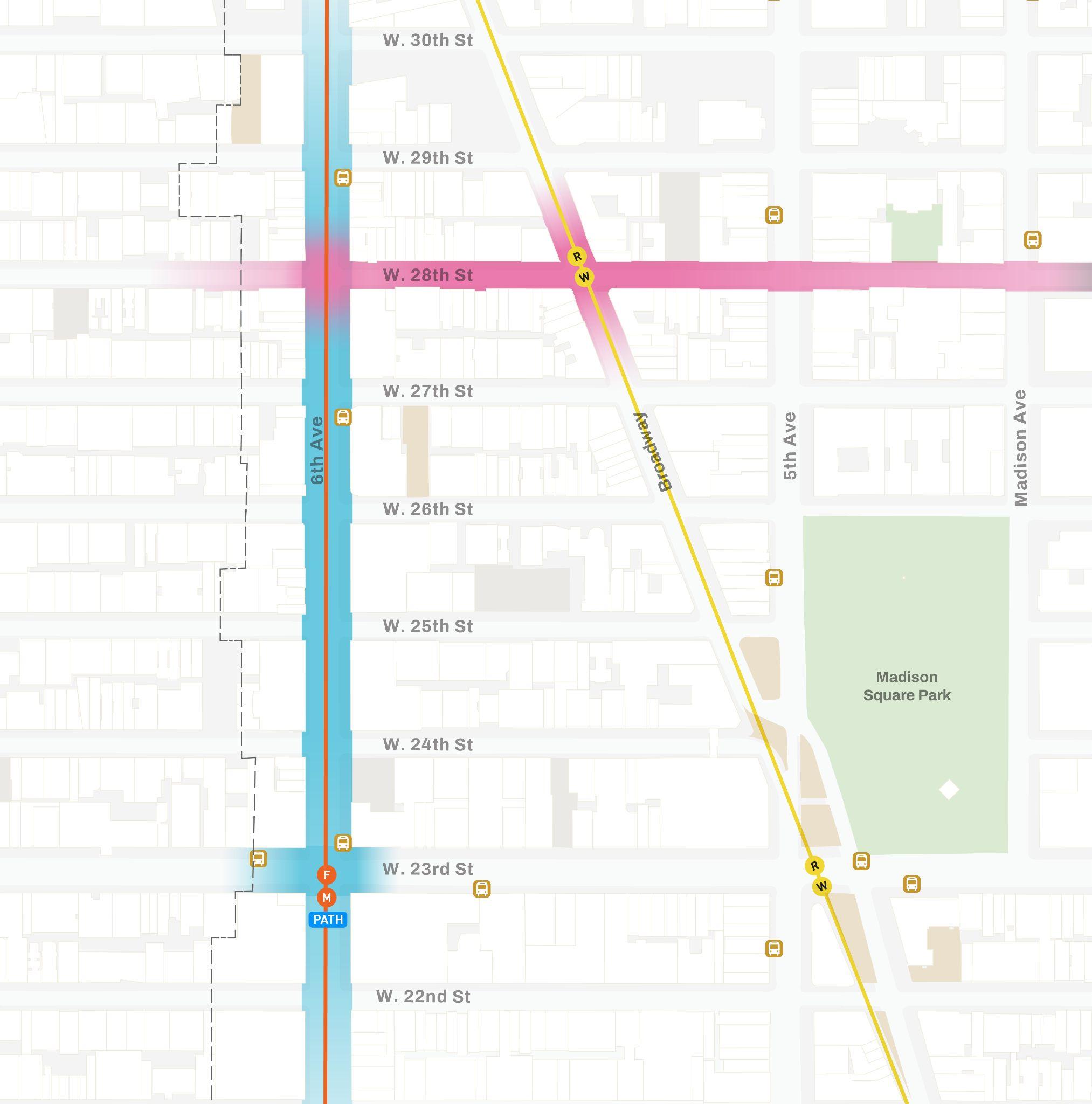
Sixth Avenue & 28th Street
Establish a welcoming gateway into the district Sixth Avenue is a welcome mat and landing pad for many arriving to Flatiron NoMad — but crowding and clutter make it feel less inviting and comfortable than other corridors across the district. A thoughtful approach to placemaking can streamline circulation and help people moving along the corridor enjoy and appreciate the many gems (both hidden and beloved!) that Flatiron NoMad offer.

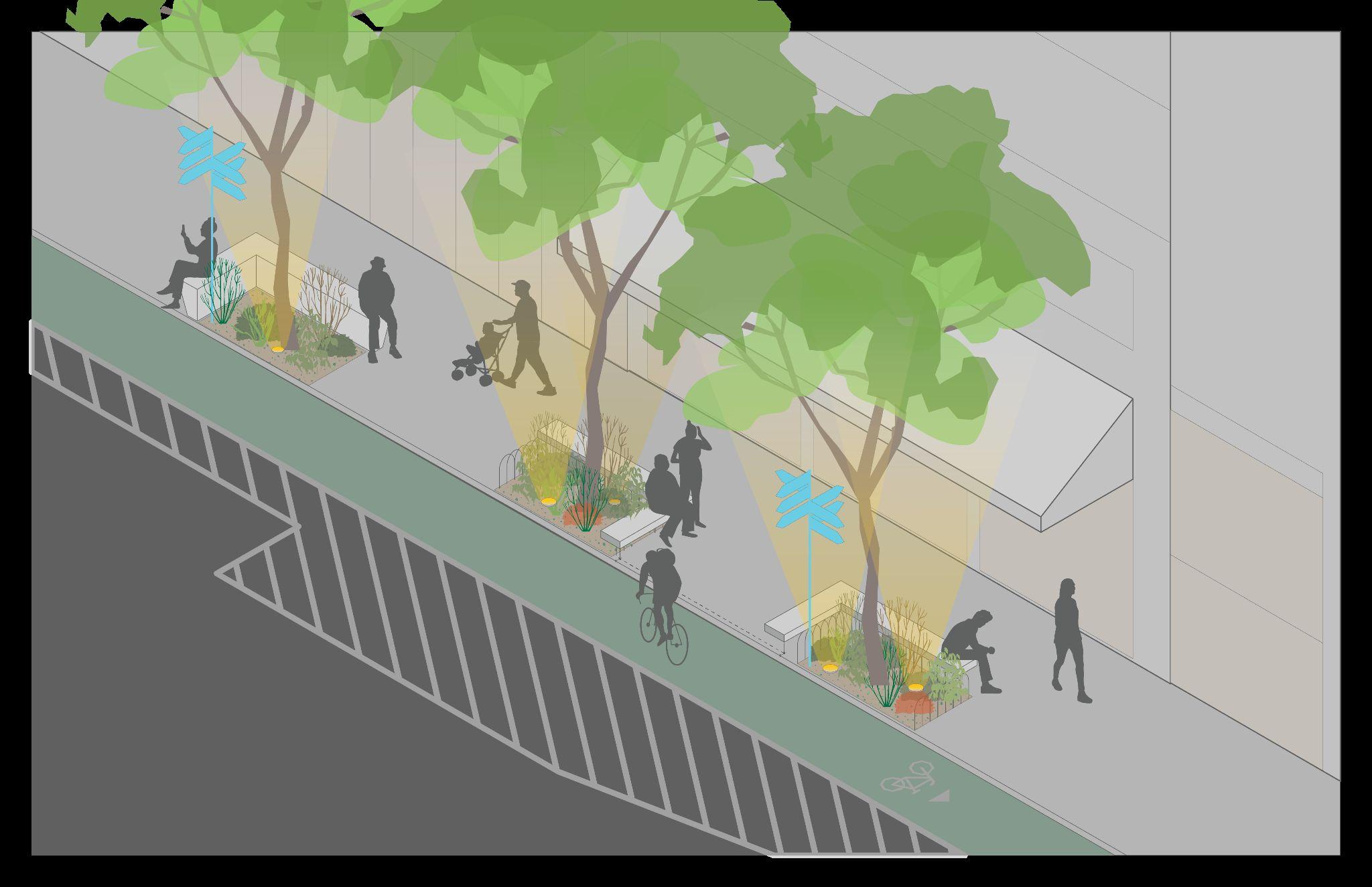
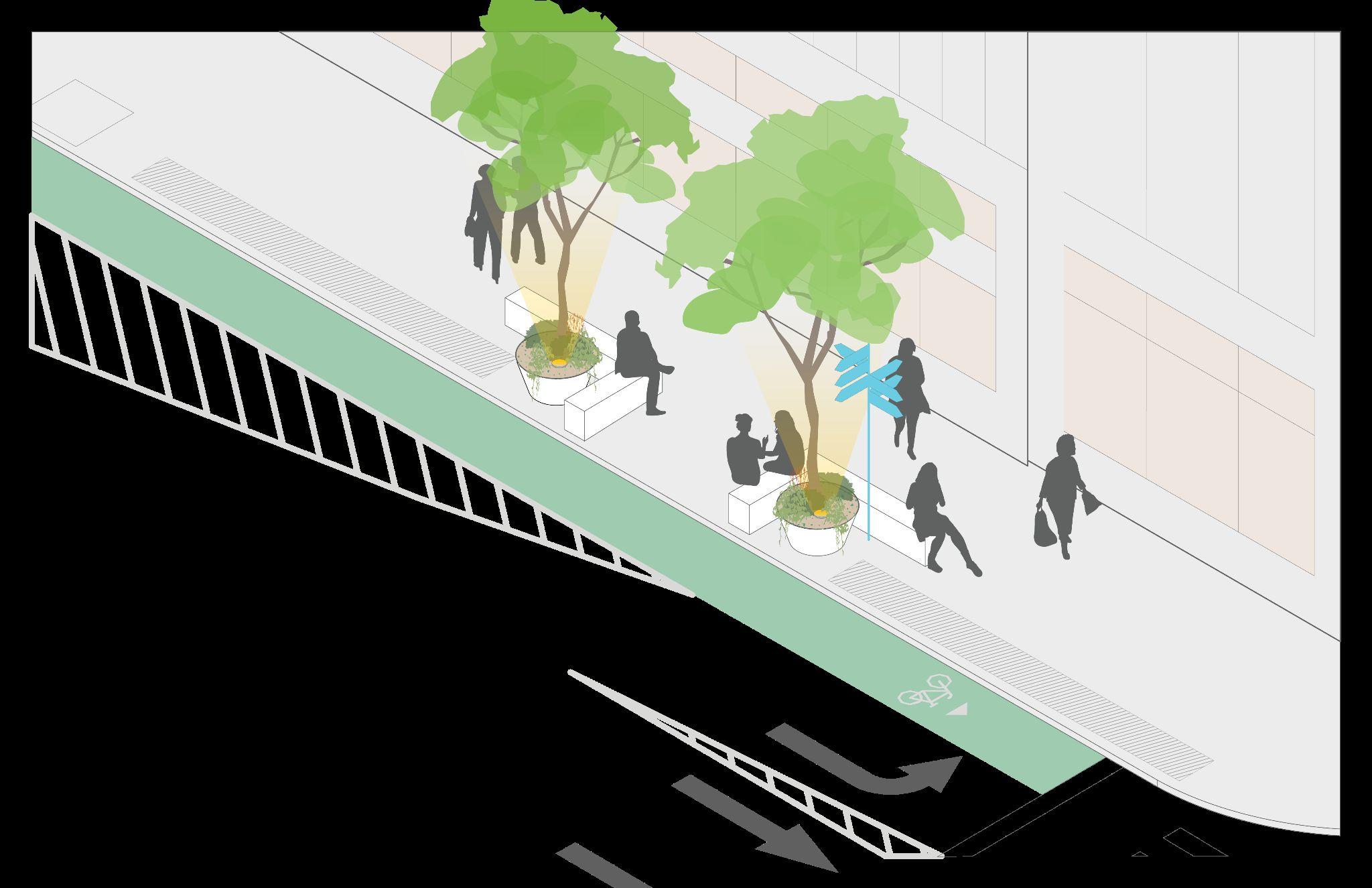
Seating and uplighting integrated with existing planting pits

A welcome mat and landing pad into a 24/7 neighborhood and district beyond
Reinforce pedestrian-priority and the human-scale to improve pedestrian safety and experience.
Provide furnishing elements that are contextually responsive to make moving along the corridor more comfortable and enjoyable.

See “Broadway Bloom” on page 23

Urban acupuncture— using urban acupuncture to fill gaps in human-scale comforts, from lighting to seating
See page 53 for zoom-in


Reclaiming underutilized space in a congested public realm— testing new uses for micromobility amenities and furnishings that make the corridor more enjoyable
See page 54 for zoom-in

*All curb extensions shown are proposed.

DOT planned bike lane expansion
Existing trees with integrated seating and uplighting — benches to be sited >18” from face of curb and maintain ADA access between them
Curb extensions* with roadway mural
New trees
Planters with street trees fill the gap in canopy coverage; lighting and fixed seating provided between planters reinforce human scale
Planting pit with integrated seating and uplighting
Cafe seating provided in furnishing zone in coordination with adjacent businesses

*All
Opportunity to use fence as canvas for temporary art
Lean bar at bus stop
Tree pit with integrated seating and uplighting
Tree pit with integrated seating and uplighting
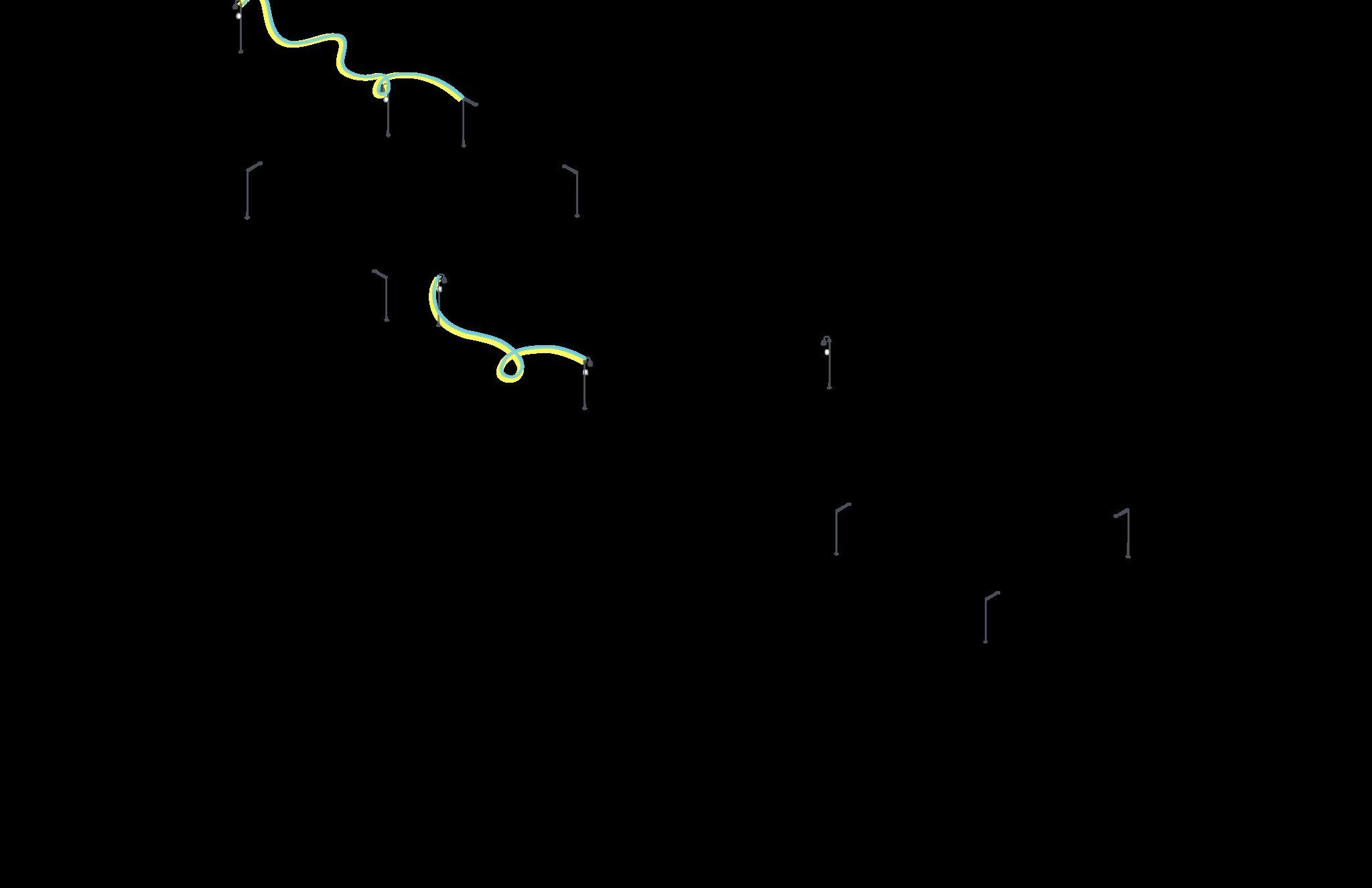
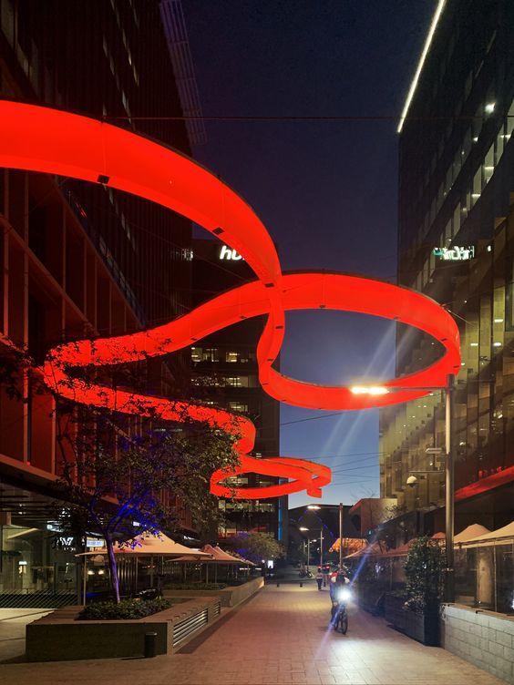
Overhead light fixture establishes gateway experience
Use underutilized space between subway portals as opportunity to test providing urban amenities and seating
Reposition former left turn lane as expanded pedestrian space* furnished with roadway mural and cyclist amenities (e.g. bike parking, Citi Bike dock, bike repair stand)


Artistic, overhead light fixture establishes gateway experience
Making it happen —
Across NYC, temporary lighting fixture permits for seasonal installations have helped streamline the approval of non-standard lighting affixed to existing DOT light poles.


forspreadsheet assumptionsoverviewof
● Because these are interim designs with many custom features (as opposed to standard capital project work), this estimate uses a number of cost references to best estimate unit costs. For elements where the Flatiron NoMad Partnership has existing material unit costs, these prices are reflected in the estimate.
● The unit costs are likely conservative, high-end estimates and the ultimate figures will largely depend on material sourcing.
● Unit costs and construction elements reflect 2024 pricing.

→ NYC Dept. of Transportation (NYC DOT)
→ NYC Dept. of Cultural Affairs
→ NYC Dept. of Design and Construction (NYC DDC)
→ Tenants and Property Owners
→ Local artists, designers, and fabricators
NOW First Moves
NEXT Mid- to long-term
1. Reinforce pedestrian-priority and the human-scale to improve pedestrian safety and experience.
2. Provide furnishing elements that are contextually responsive — considering microclimate and spatial constraints — to make moving along the corridor more comfortable and enjoyable.
1. Initiate a feasibility study to reclaim expanded pedestrian space by converting continuous blocks (4-6) of parking, proposed between 22nd and 26th Streets, to permanent sidewalk extensions.
2. Initiate a mobility study to identify priority corridor-wide improvements such as: expanded cyclist amenities to complement the added space provided as part of DOT’s proposed expanded bike lane project and pedestrian amenities, such as raised crosswalks for intersections.

Reinforce pedestrian-priority and the human-scale to improve pedestrian safety and experience.
1A. Install an artistic, overhead light fixture along the avenue’s pedestrian zone in key moments to visually define the avenue and improve ambiance and perception of nighttime safety while also accenting the character of the district.
→ Launch a competition/call for design and fabrication of a signature fixture unique to Sixth Avenue.
→ Start by installing fixture at 23rd Street Vision Zero priority intersection
1B. Boost pedestrian safety and visibility using functional, operational interventions that are quickand easy to implement.
→ Install red-light cameras for automated enforcement of signals and speed limits at the intersection of Sixth Avenue and 23rd Street.
→ Given the relatively low volume of left-turning vehicles, ban left turns from Sixth Avenue to 23rd Street and open up an expanded pedestrian zone at this lane approaching the intersection to reduce vehicular conflict with large volumes of pedestrians crossing.
→ Consider banning left turns from Sixth Avenue to 29th Street to bookend the pilot concept while also eliminating the conflict between bicyclists and turning vehicles.
→ Install Accessible Pedestrian signal (APS) at intersection (Selis Manor / Visions housing for the blind is located nearby)
Note: Flatiron NoMad Partnership is intended to act as prime implementer for all ‘first moves’
Regulatory partner
May be responsible for approving this work
NYC DOT, Art Program
Implementation support
May be supporting this workas an advocate or champion
NYC DOT, Signals Unit
NYC DDC; NYC Dept. of Cultural Affairs, Local artists, designers, and fabricators
Local references
Places in NYC where similar ideas have been implemented
Non-standard lighting affixed to existing DOT light poles with temporary lighting fixture permit for seasonal installations — Bed-Stuy BID; Chinatown BID; Meatpacking District BID
A similar approach to banning turns has been successfully implemented at Fifth Avenue and 42nd Street and Seventh Avenue at Times Square.
Recently expanded red-light camera program — marking the largest expansion of the red light camera program in NewYorkCity’s history
Accessible Pedestrian Signals—
Requests for replacement/additions via DOT here

Provide furnishing elements that are contextually responsive to make moving along the corridormore comfortable and enjoyable.
2A. Provide thoughtful furnishings where people need them most, inviting them to take a beat where needed while reducing sidewalkclutter.
→ Add seating in the form of benches or leaning bars at key moments (e.g. outside busy storefronts or in areas with comfortable microclimates from street trees) within the sidewalk’s existing furniture zone, sited to leverage comfortable microclimates.
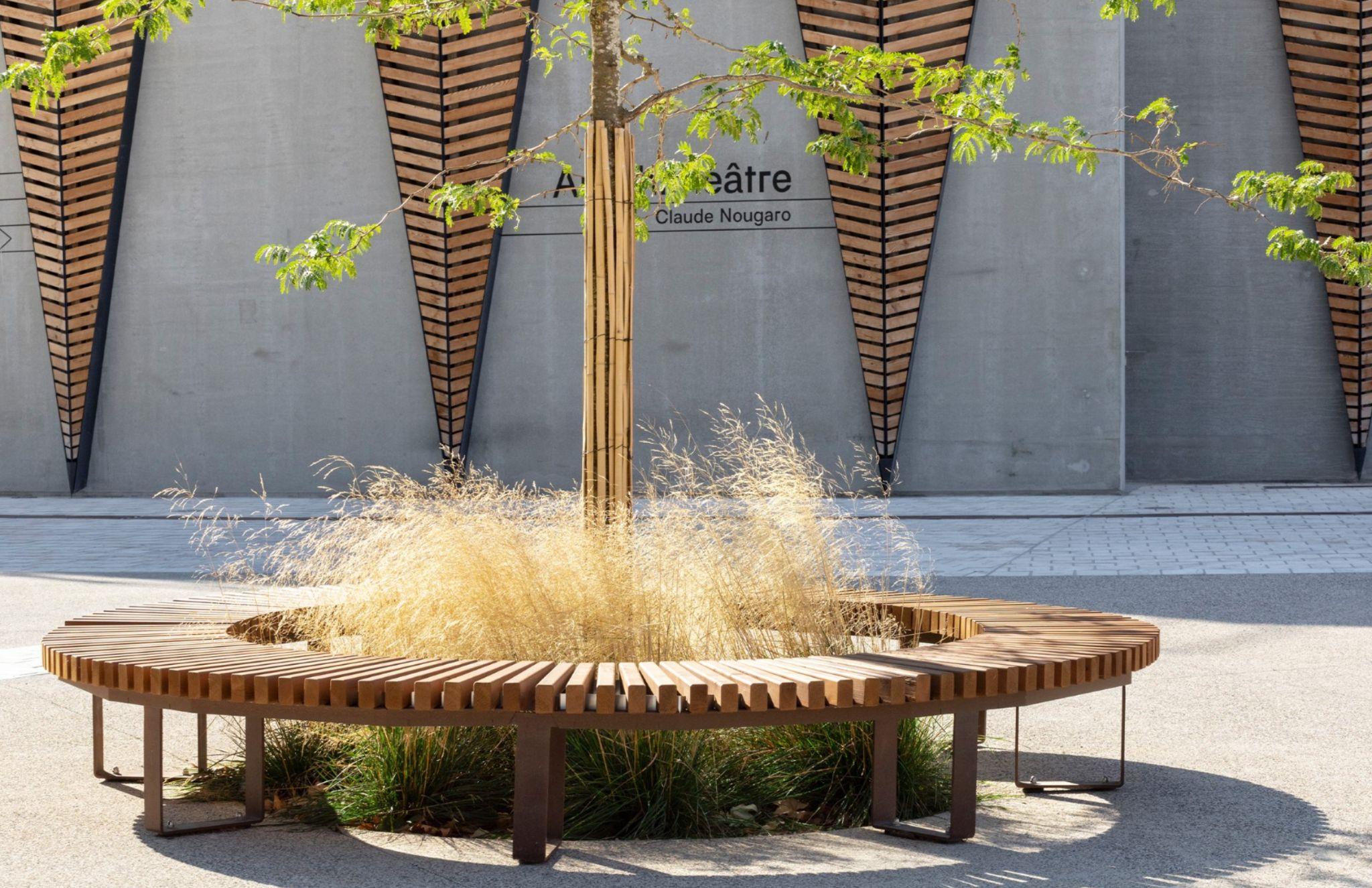
→ In areas where fixed seating cannot be installed, provide seating around tree pits. In areas where no tree is provided, add canopy via raised tree planters that are integrated with seating.
→ Ensure existing street furnishings do not impede clear pedestrian path, by:
○ Relocating trash bins to the area between the subway stairs,so not in the way of people crossing and not the first thing people see when exiting the subway.
Regulatory partner
May be responsible for approving this work
○ Relocating newspaper kiosks more in-blockalong 23rd Street and closer to East- and West-bound bus stops. NYC OT
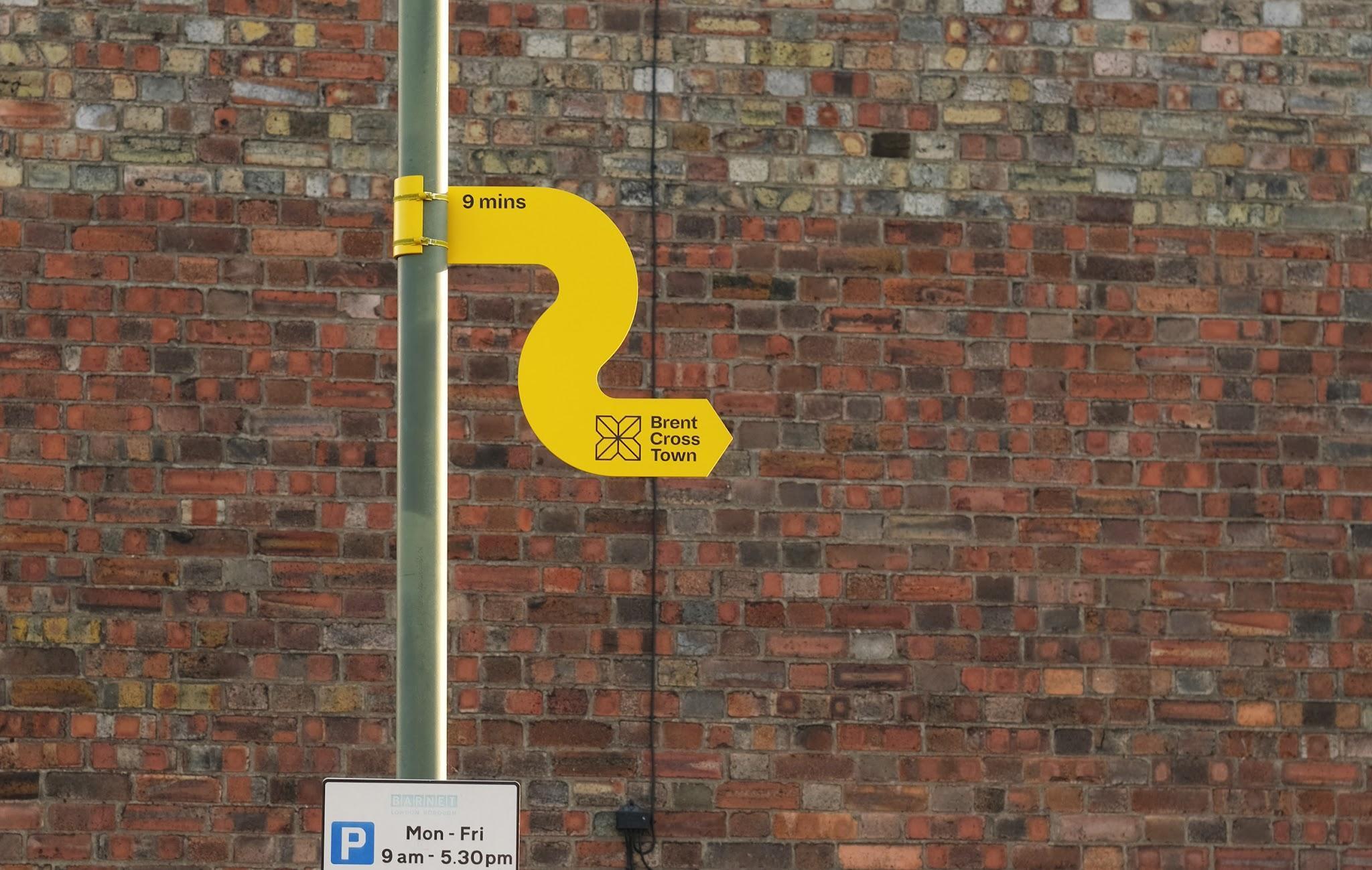
2B.Incorporate seamless, intuitive wayfinding along the length of the corridor to guide people to nearby destinations — from within the district to beyond — provided within their path of travel.
Note: Flatiron NoMad Partnership is intended to act as prime implementer for all ‘first moves’
Implementation support
May be supporting this workas an advocate or champion
NYC DDC; Local businesses
Local references
Places in NYC where similar ideas have been implemented
Leaning barat bus stop — 34th Street, Manhattan
Raised planterwith bench integrated along edge — Myrtle Avenue Plaza, Myrtle Avenue between Hall Street and Emerson Place, Brooklyn
NYC DOT Coordinated Street Furniture Siting Guidelines— provides helpful reference for local design and siting guidelines for street furniture
NYC DOT, WalkNYC Wayfinding Fingerpost makes it easy to orient to nearby destinations— Second Avenue and E 102nd Street, Manhattan

Provide a safe, seamless movement experience for all
Establish a clear mobility hierarchy
Provide comprehensive and intuitive wayfinding
Make people feel comfortable spending time on Sixth Avenue
● Metrics: Improved sense of safety
● Methods: Decrease in reported crashed and pedestrian injuries
● Metrics: Improved perception of pedestrian satisfaction
● Methods: Increase in positive sentiments via stakeholder intercept /online surveys
● Metrics: Reduced perception of distance to nearby destinations
● Methods: Increase in positive sentiments via stakeholder intercept /online surveys
● Metrics: Improved pedestrian satisfaction; increase in number and diversity of people spending time
● Methods: Increase in positive sentiments via stakeholder intercept /online surveys; Increase in pedestrian stationary activity

a series of pilots focused on what the Partnership can do starting immediately — using pilots to accelerate broaderchange.
Guided by a strong vision, the intent of the Menu of Projects is to focus on more tactical wins the Partnership can kickstart in support of a larger-scale Action Plan to be implemented in the long term. These interventions aim to optimize implementability in the near term, focusing on opportunities to experiment within the boundaries of the public realm.
The ultimate intent of these pilots is to build support from the chorus of public and private actors who govern major corridors, paving the way to capital improvement. By involving community members and seeing how projects are used in real time, pilot projects give people a voice in the planning process and can start to build consensus and excitement around potential improvements, building the case for longer-term interventions.

Concepts:
● Respond to challenges and opportunities identified by Partnership priorities, stakeholder engagement, Vision Zero, transit and mobility analysis, and public life observations
● Explore placemaking opportunities across the public realm off of Broadway
● Distribute pilots spatially across the district
Concepts fall within three buckets, based on how they may be implemented:
1. Implementation as part of a district-wide demonstration project streetscape palette
2. Implementation led by partners
3. Implementation led by the Partnership


These concepts will be a part of a cohesive design palette forthe entire Flatiron NoMad Partnership. Making each pilot project conform to a thoughtful material and furnishing palette can ensure that the projects elevate and reinforce district identity — translating the visions, goals, and interventions for the district into a tangible and cohesive eye-level experience.


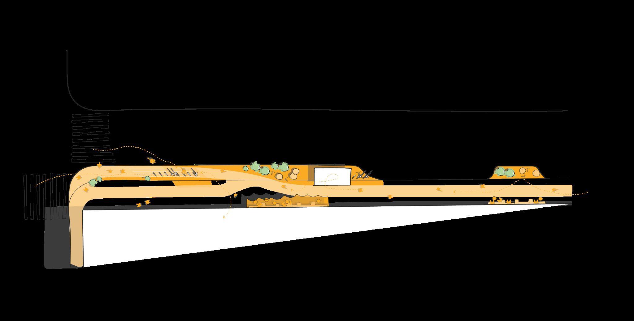
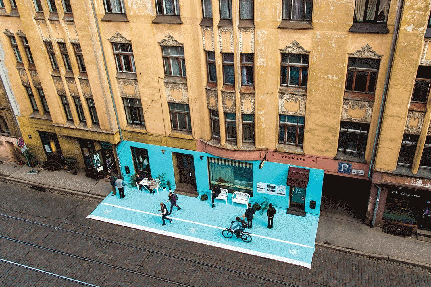
What if the district’s commercial corners were designed forpublic life in motion — compromising on neithervending norcirculation?
Concentration of fast casual restaurants, existing expanded pedestrian zones and bike parking make the southeast corner the intersection of 22nd Street and Sixth Avenue, test out methods for better facilitating commercial activity in the public realm

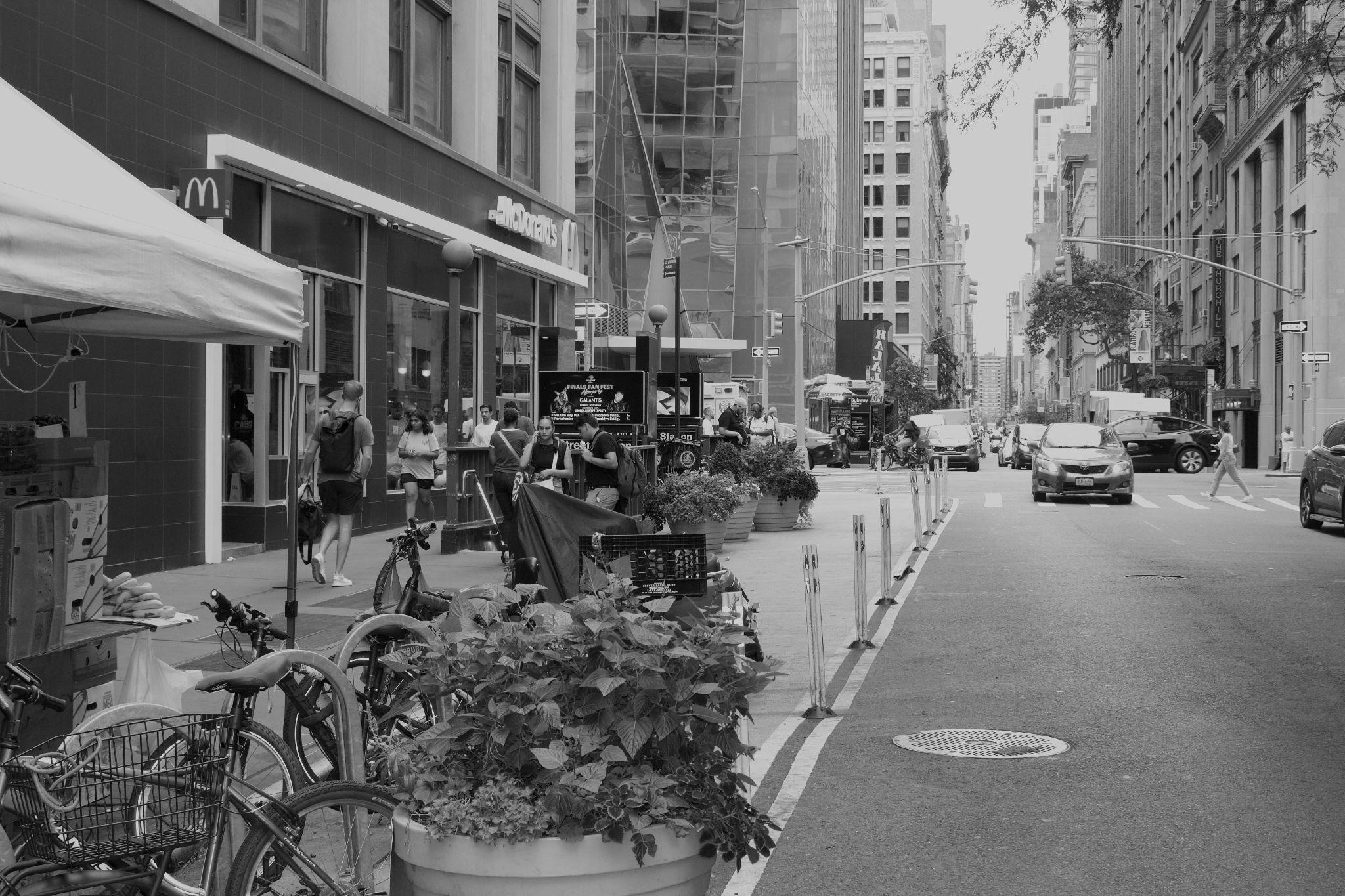
People walking, queuing, and pausing easily overwhelm a narrow sidewalk… …while an adjacent expanded ped. zone offers little more than a buffer.
Buying or selling goods was the most common activity observed at this intersection.1


choreographed for, waiting, passing through orstopping fora quickbite.
Strategies to get there:
1. Soften the building edge by providing a “layover” space with invites to stop and stay.
2. Building on existing reclaimed road space, explore opportunities to relieve a demand for space along the sidewalk by concentrating functional amenities off sidewalk, such as short-term bike parking and planters.
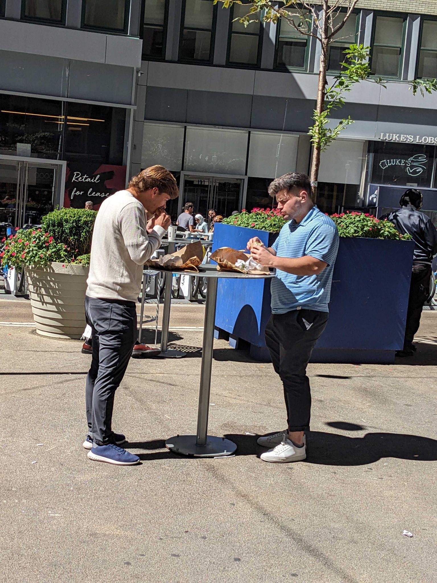
Food cart “storefront” and queuing space with standing bar tables

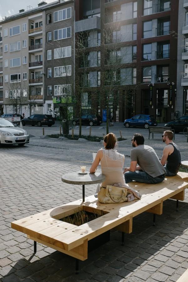
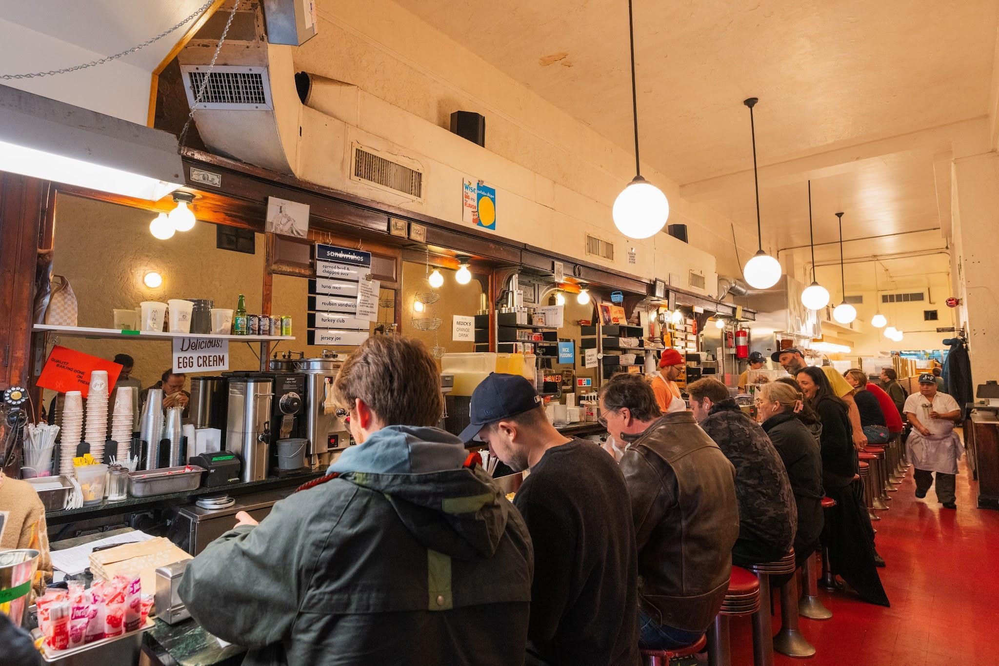
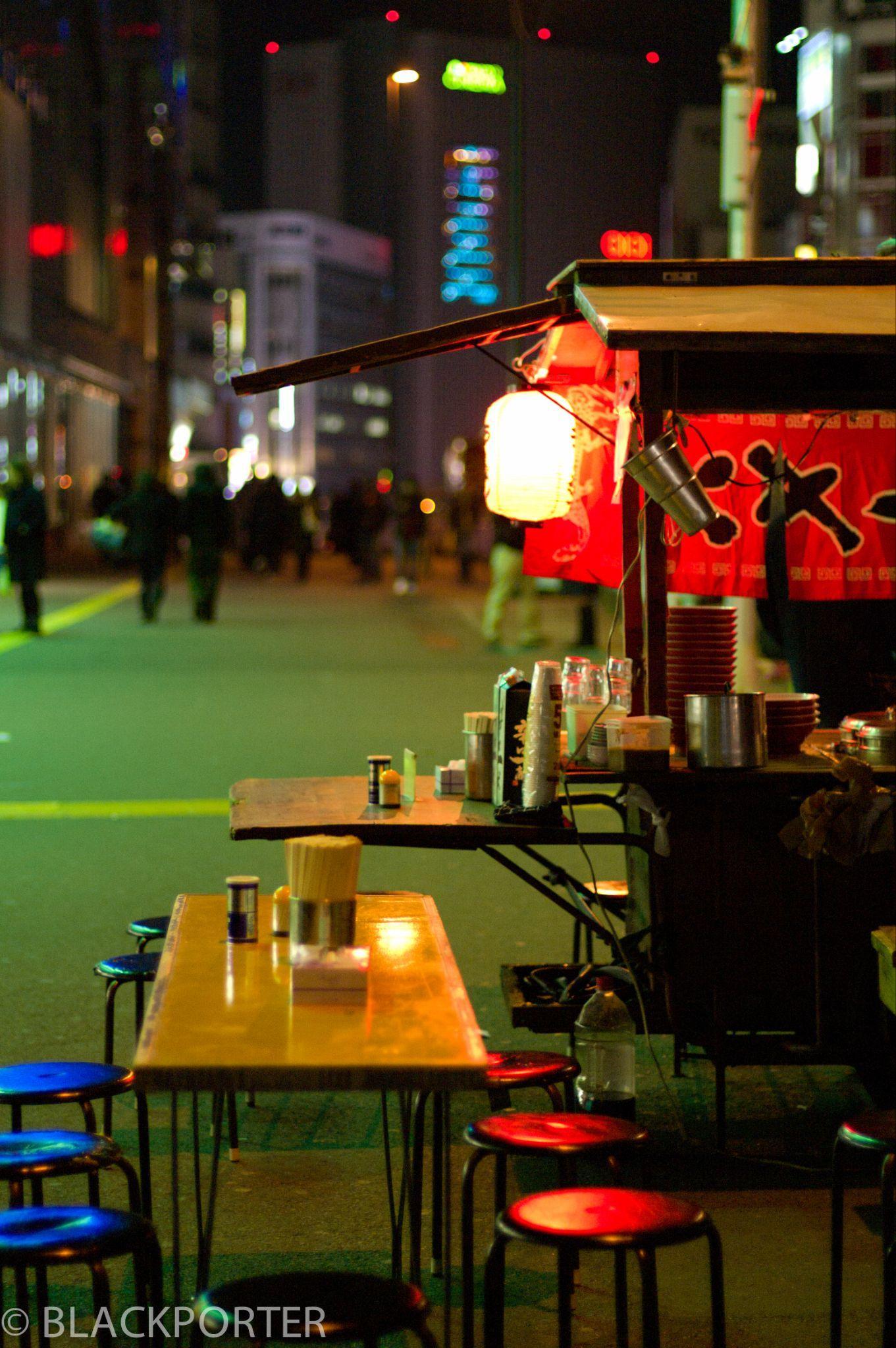
The concepts may be implemented by, or in close collaboration with, partners such as NYC DOT or local retailers in support of their ongoing initiatives and programs.


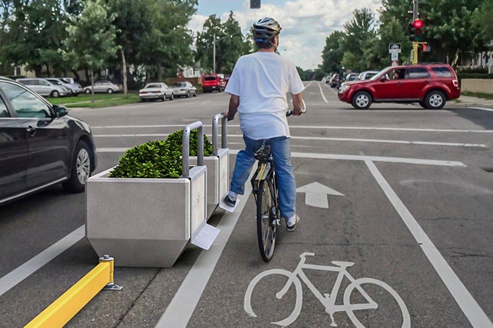
What if Flatiron NoMad’s streets offered the safest and most comfortable route to traverse Manhattan by bike?
● The bike network is incomplete
● While inconsistent, 29th and 26th Streets have the most protected lane portions and already almost fully connect the West side waterfront greenway to 1st Avenue to the east1.

Conventional: Without a buffer space, car doors are a danger to the safety of people biking
● How might we make these connections more seamless across the district for all ages and all abilities?
Protected: Without bike lane barriers, people biking must often navigate around cars in the bike lane.

Shared: The least protected biking experience, riding alongside vehicles

Strategies to get there:
1. Protect existing bike lanes where possible to strengthen experience getting across Manhattan safely and discourage use for delivery unloading and distribution.
2. Install trip amenities that can make choosing these lanes attractive, such as leaning bars and trash cans, concentrated near intersections.



What if the district created a curbside solution of the future for NewYorkers on the move today?
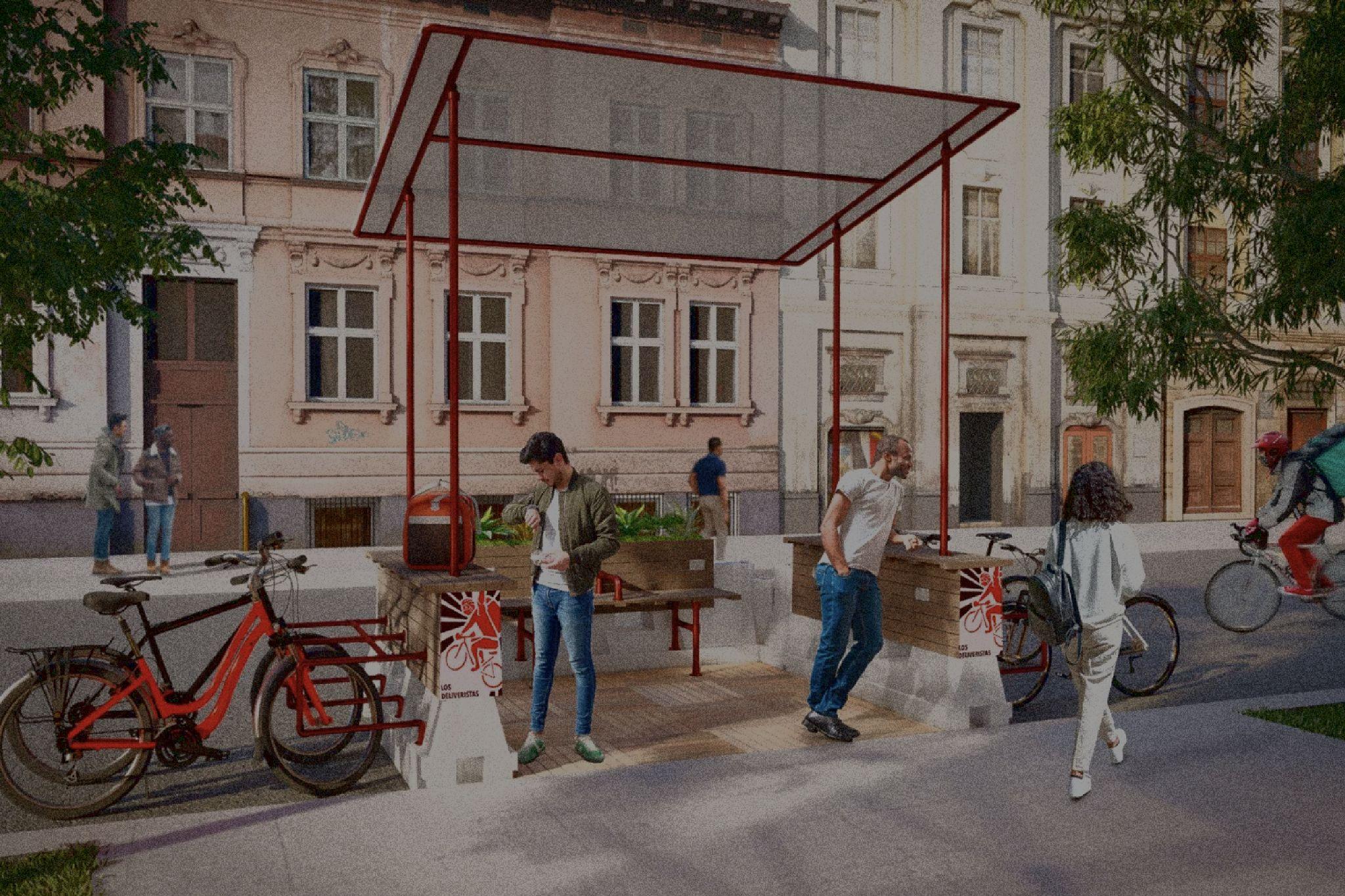
● The number of deliveristas spending time in public space has steadily risen with demand for fast food
● Presents an opportunity to expand upon the existing last mile cargo bike delivery area on 28th Street and explore innovative approaches to curb space management in collaboration with Whole Foods.


Informal parking along scaffolding structures next to areas to take a beat


Length of bikes extend into roadway in existing “last mile” area
Looking east towards Madison Avenue from 28th Street

Many delivery workers are congregating around LinkNYC hubs on the avenues to recharge their smartphones and wait for the next pickup, with nowhere to sit.
3. West 28th Street
to designated and dignified curb space forall NewYorkers, including those using electric micromobility.
Strategies to get there:
1. Build on the last mile area to test an expanded curb management pilot that co-locates necessary public life infrastructure.
2. Engage with deliveristas, retailers and food and beverage outposts serving the district to gain deeper insights into their needs, from how delivery workers navigate their daily routines, including where they choose to rest, gather, and connect with one another during breaks, and how operations could be streamlined from the perspective of business operators.
These concepts are designed to be action-oriented and easily implementable by the Flatiron NoMad Partnership.


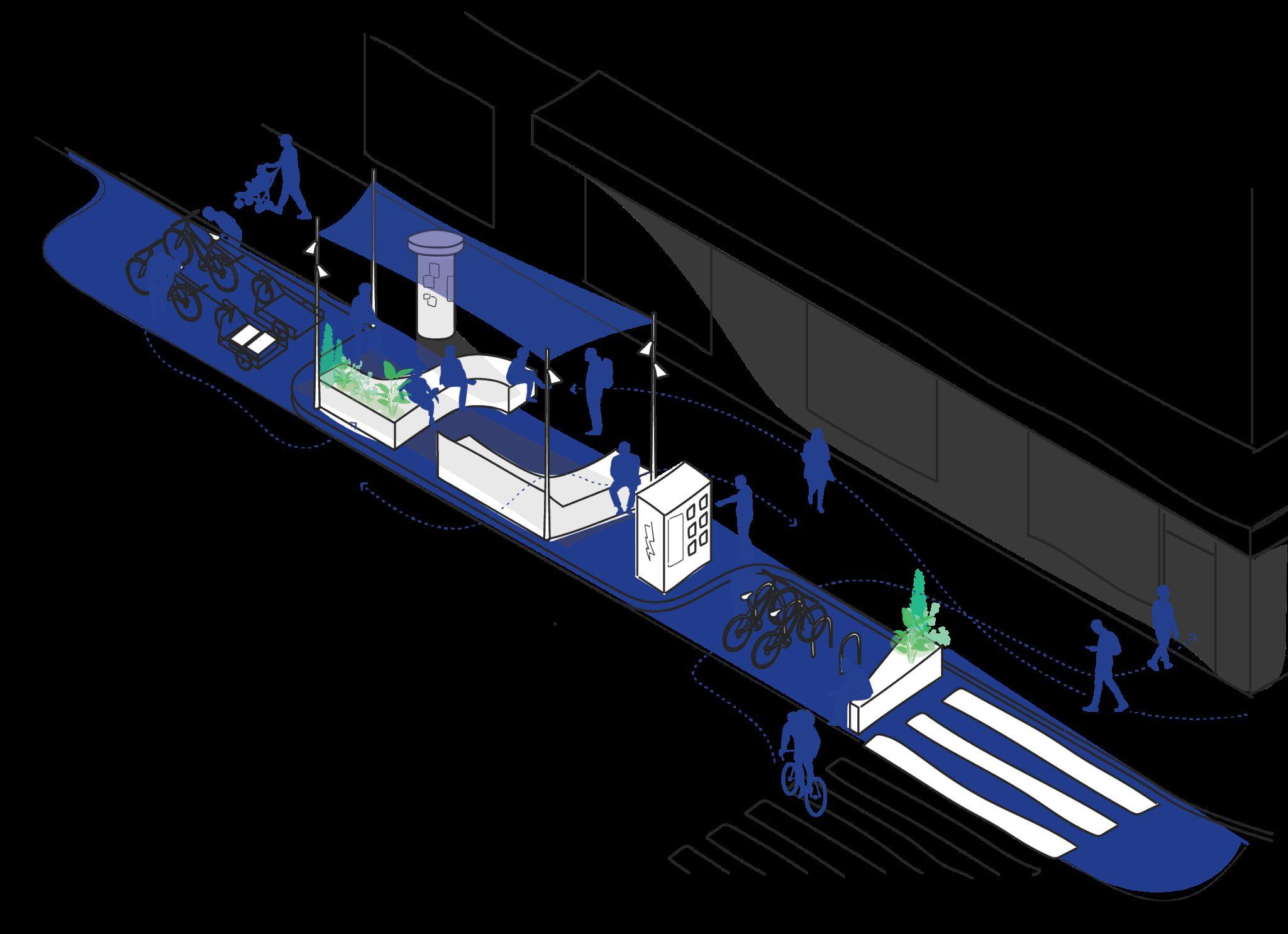
What if Flatiron NoMad had a comfortable place to welcome visitors into the district at key gateway locations?
● Fifth Avenue is rich with history and a mix of dynamic retail, wide sidewalks, historic landmarks
● Even so, some sections of Fifth Avenue lacks human-scale comfort and doesn’t fully capitalize on the corridor’s iconic sense of place

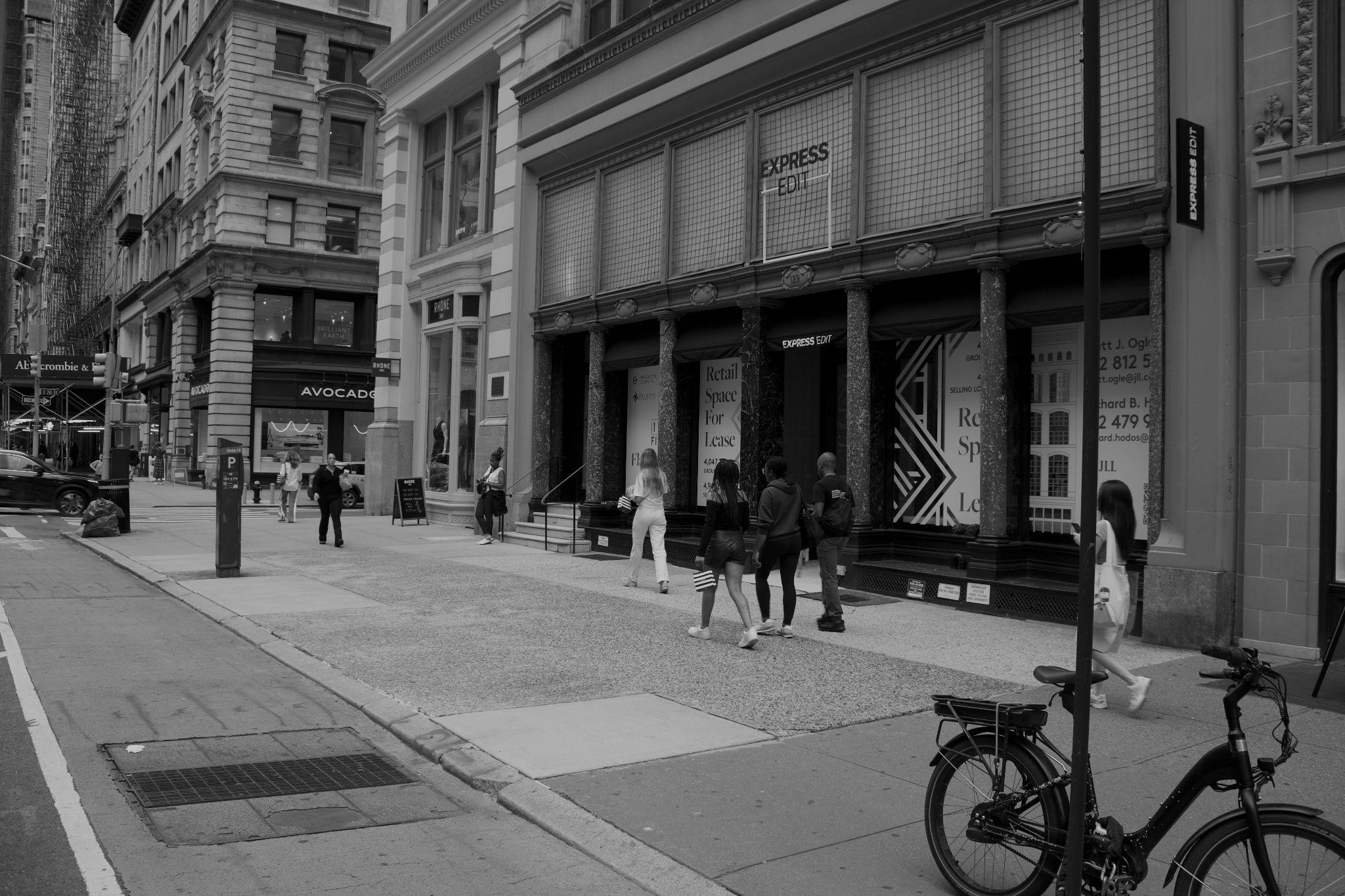
Iconic architecture, but less than iconic walking experience
Retail vacancies dot the avenue, especially north of the park
With nowhere to sit, people take a beat leaning or sitting at the building edge


5th Avenue has broad 20’ sidewalks — compared to 12’ on Madison Avenue and ParkAvenue South.
Looking north up Fifth Avenue from 20th
Strategies to get there:
1. Offerinviting spaces forshoppers and otherwalkers to pause and take a breakon their way between stores in a way that brings down street scale while avoiding impacting too much sidewalkspace.
2. Use a series of context-based “introspections” that stitch lilypads together and create a processions through the corridor.
3. As a common destination for tourists, optimize circulation by implementing curb regulation changes that make getting to and from shopping or the parka smooth experience.


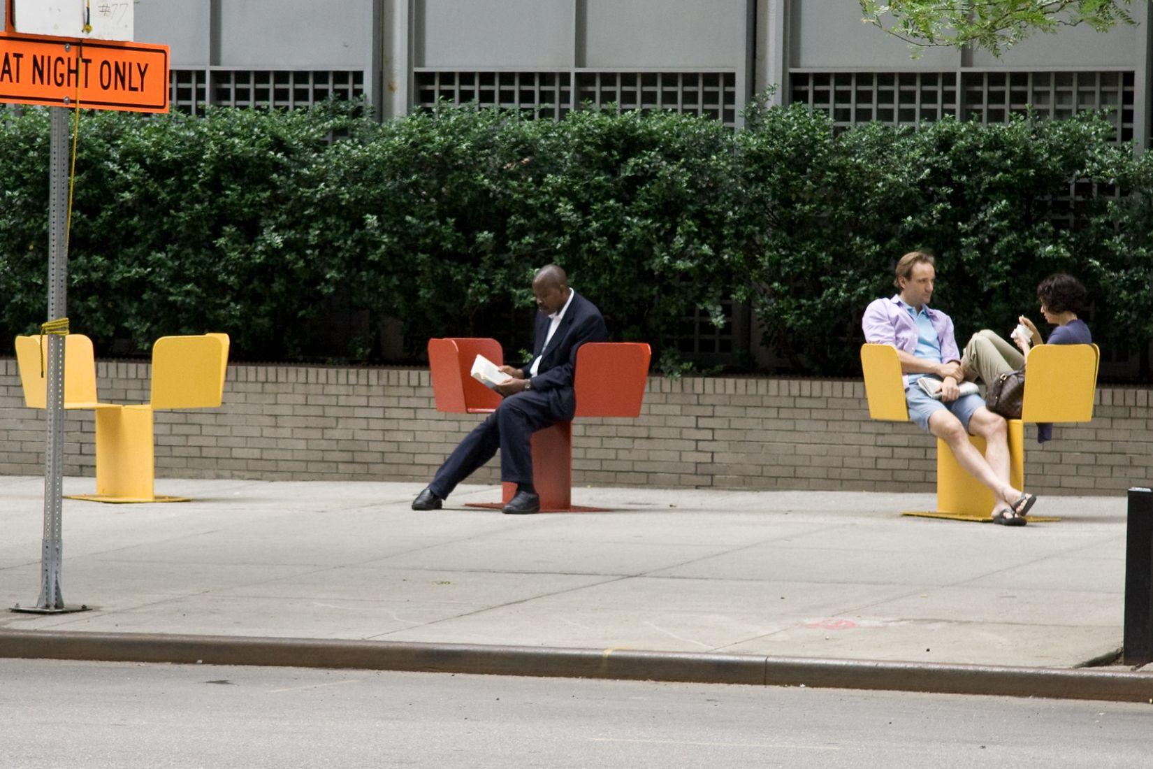
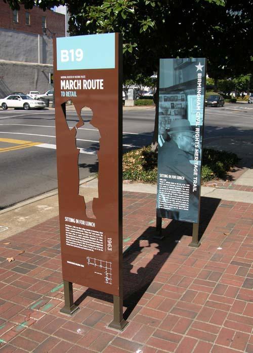
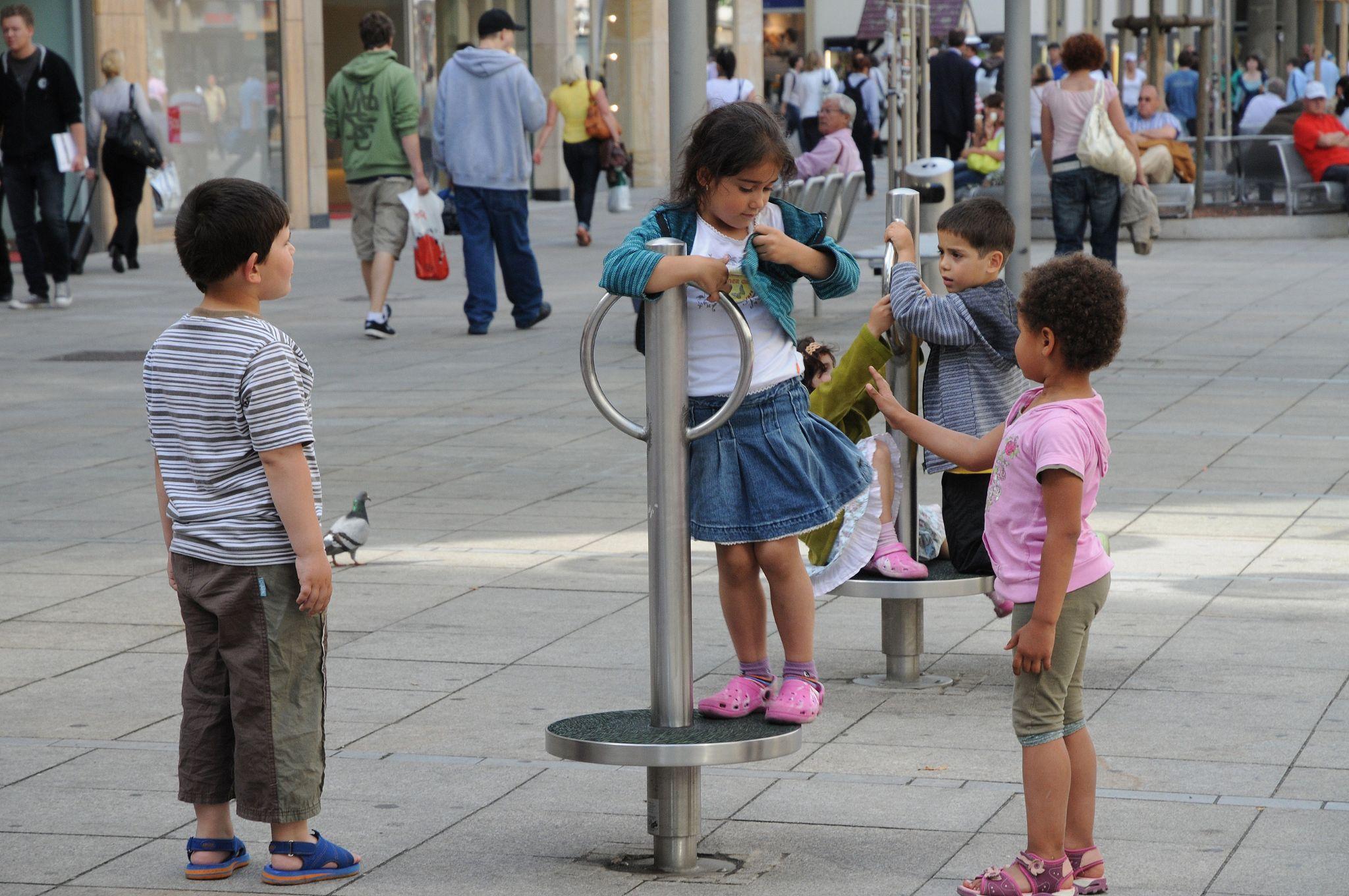
Point of interest interpretive signage & place-keeping Play along the way elements
Insights from an inventory and assessment of the district’s pilot and permanent streetscape furnishing material palette
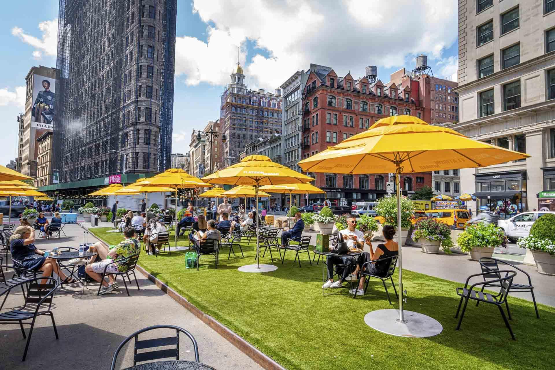

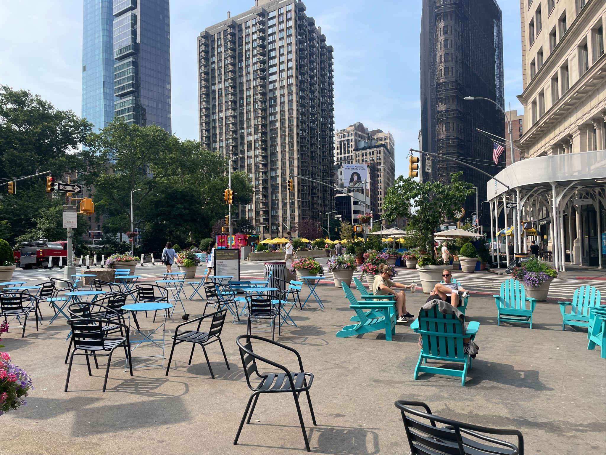
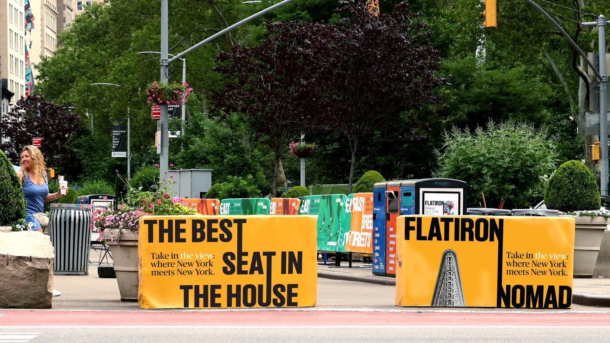
Visitors enjoy a wide variety of seating types — from sociable space to gather to quiet moments of respite

The Partnership’s branding is visually compelling and easily recognizable across the district

The Partnership is keen at recognizing and responding to the ways people want to use the public realm
vehicular spaces as places for people


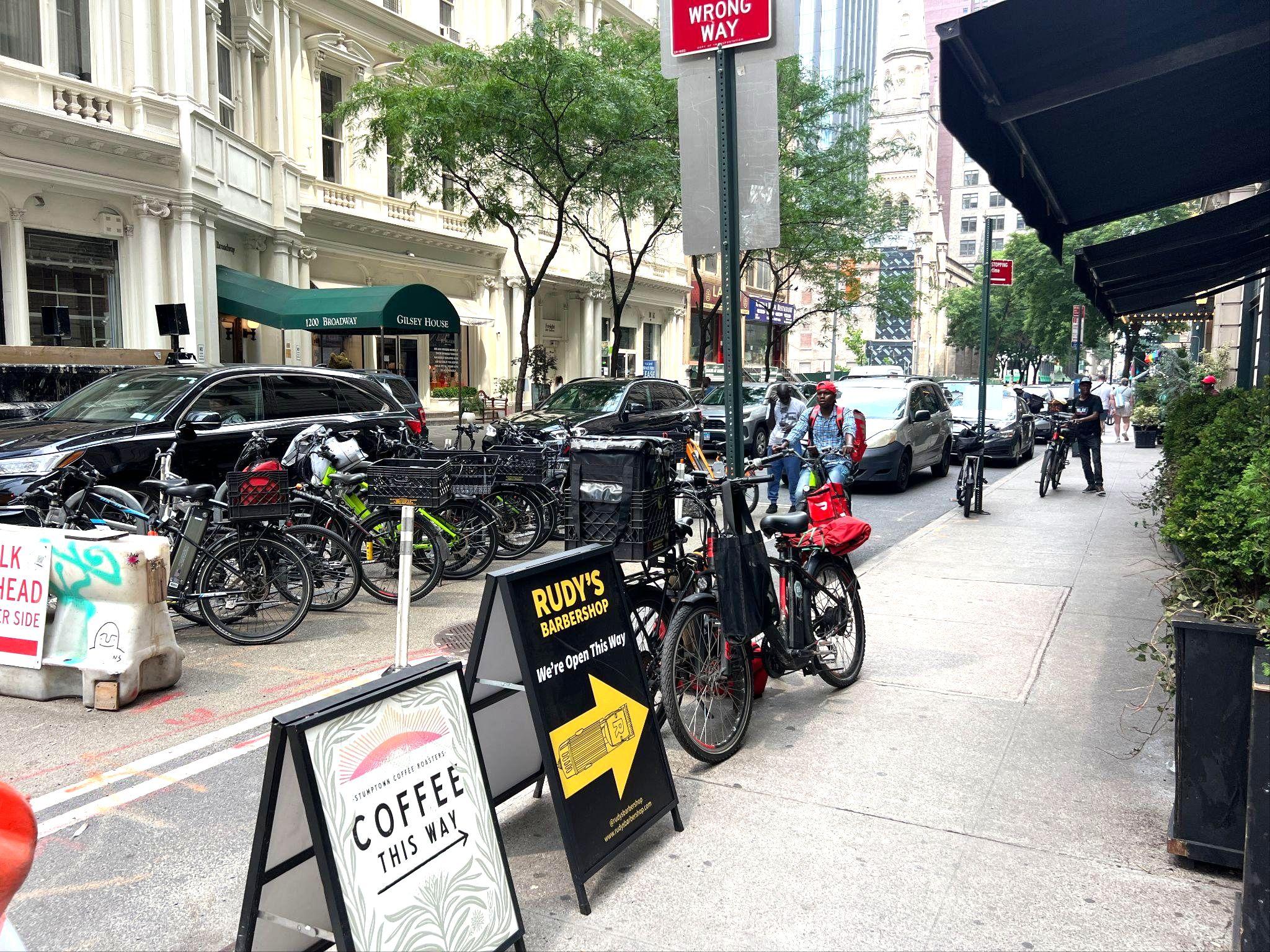

There is a latent demand for more micromoblity amenities — from deliveristas and everyday NewYorkers
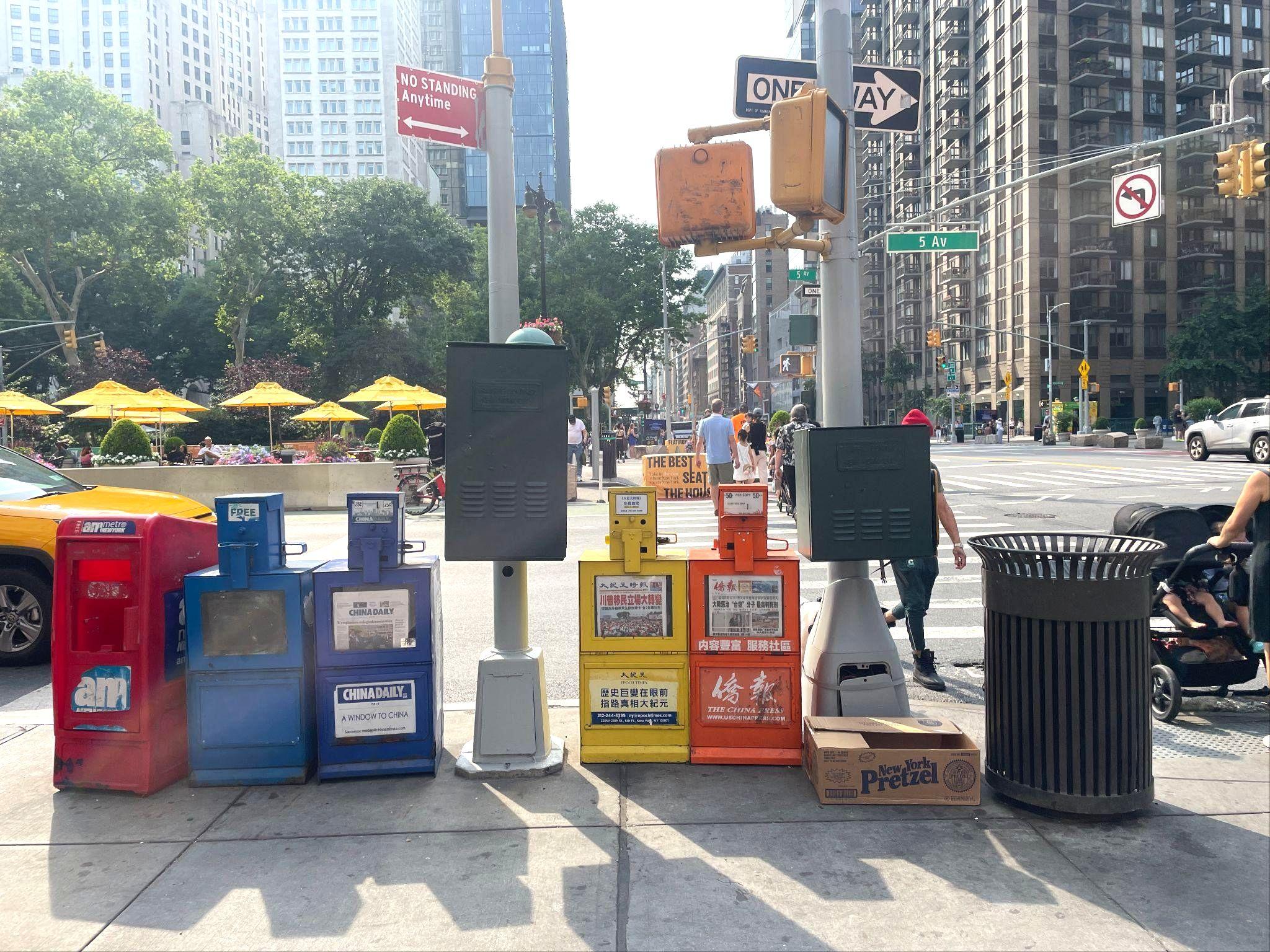
An uneven of furniture styles and availability drives a lackof cohesion across the district
and informal — clutter high-demand curbside space

Additions and supplements to the Partnership’s current pilot project palette




Reinforce pedestrian priority and the human-scale




Respond to latent demands by filling gaps in offerings
Reduce unnecessary visual and physical clutter
Prioritize providing elements at eye-level and oriented to the scale and speed at which pedestrians move.
Use pilot furnishings to test new ideas and see how people respond and ensure a flexible approach to adapting to changes in the ways people want to use space over time.
Pilot furnishings that are low maintenance, durable, minimal footprint and sited out of pedestrian path of travel.
Make district more dynamic with features that spotlight its character and identity
Prioritize addition of elements that sparkinterest and intrigue, drawing attention to the natural and cultural history of the district.

● Roadway murals within curb extensions
● Crosswalkart
● Murals
● Epoxy for expanded pedestrian areas ● Temporary curb ramps
● Speciality corridor gateway lighting ● Tree ‘spotlighting’ ● Dynamic projections ● Lighting installations on inactive facades
● Movable StreetSeats
● LeaningBars
● Fixed seating integrated with planters and tree pits
● Low-profile and minimal footprint seating ● E-bike battery charging ● Trash containerization and waste receptacles ● Bike parking
● Native and ecologicallyminded approaches to species selection
● Planters with integrated trellis to create more vertical green
● Raised planters
● Hanging baskets
Intersection foot rests
Waste bins oriented to bike
Mechanisms for open street closure
Bike lane bollards
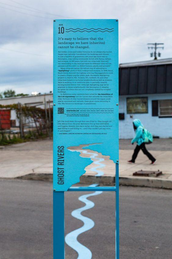
Interpretive signage

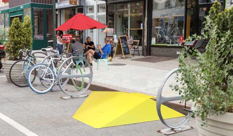
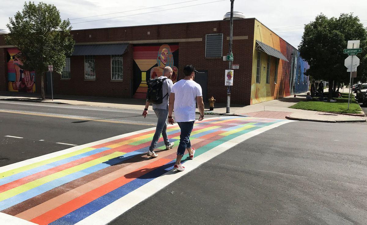
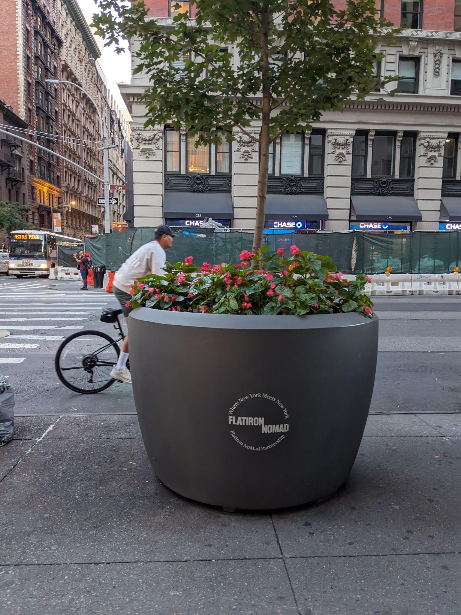
Beige and green surface treatments highlight areas designated for lingering and movement throughout the district. While functional, they could benefit from enhanced visibility to not only reinforce pedestrian zones but also contribute to traffic calming and boost district identity.
Expanding and unifying surface treatments across the district would establish a cohesive sense of place and promote a pedestrian-first mindset. By emphasizing pedestrian space and inviting a slower pace, these treatments can signal a new traffic paradigm that prioritizes both safety and social interaction.





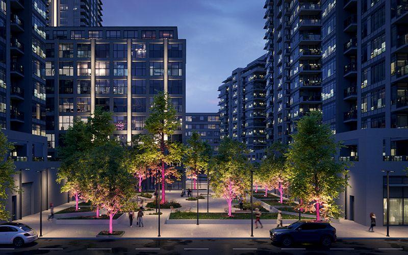
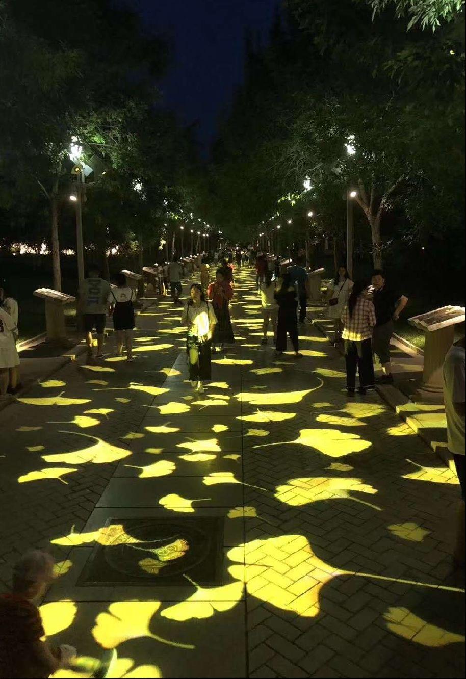
The district has implemented successful and innovative lighting pilots in the past but permanent lighting is mostly provided at the vehicular scale.
Introducing interactive, human-scale lighting will enhance safety and comfort, especially after dark, while setting a balanced ambiance that complements district activities and extends its appeal year-round. This lighting can foster a safer, more inviting environment supports both aesthetic and functional needs, amplifying the district’s character and accessibility.



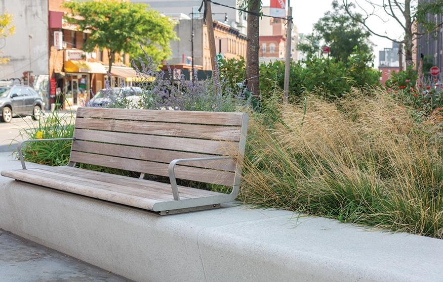
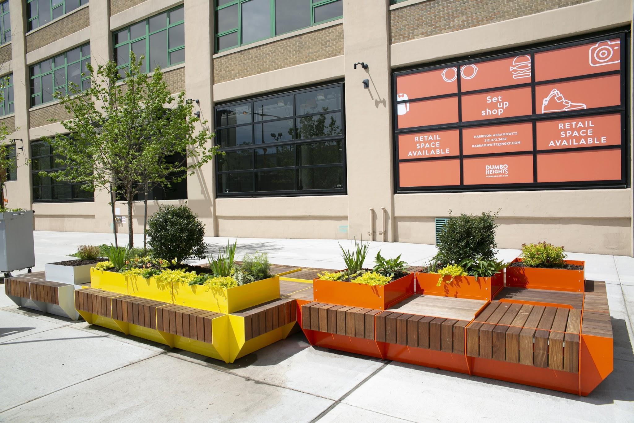
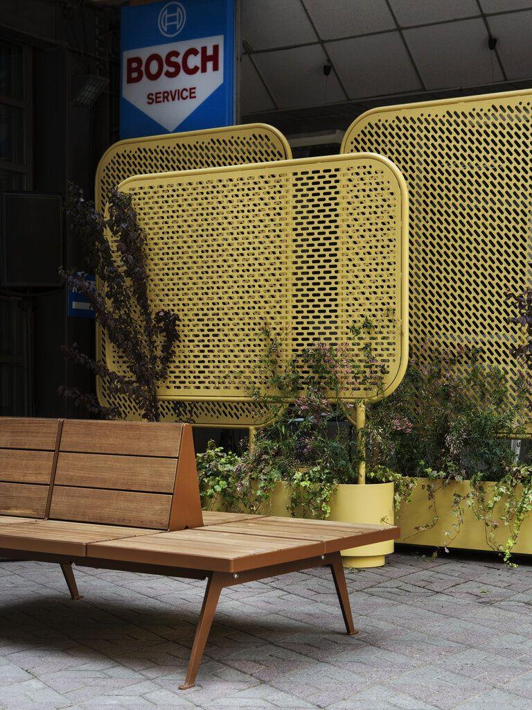
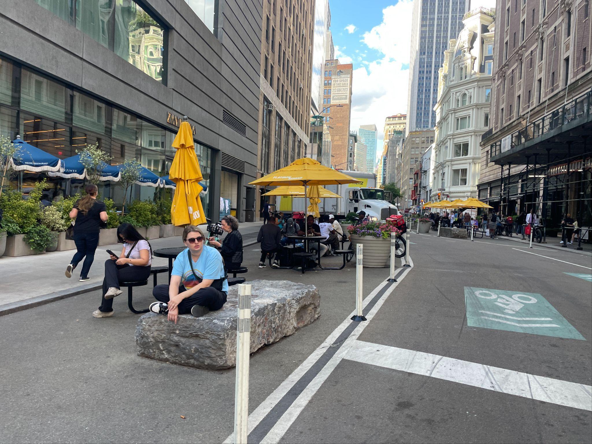
The district features high quality seating within parks and plazas, but corridors are underserved, leading people to seekan array of informal, undignified seating types (e.g., using scaffolding or curbs as makeshift seating).
Expanding public seating options beyond parks and plazas will enable people to sit, linger, and socialize comfortably throughout the district. By providing diverse seating types in more locations, the district can ensure a dignified experience for all, creating more gathering spaces and fostering social interaction.




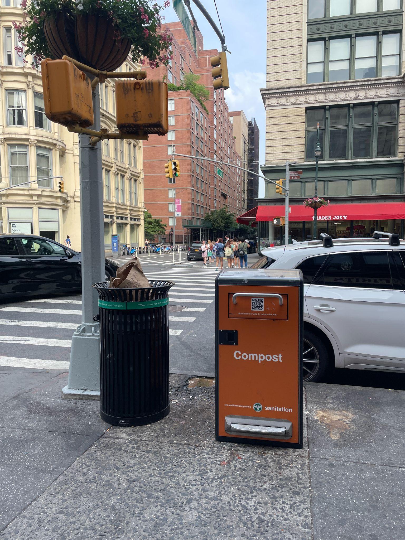
Furnishing zones, particularly near intersections, are often crowded with a mix of necessary elements (e.g., light poles, waste bins) and informal items (e.g., newspaper dispensers, sandwich boards), making circulation less intuitive.
Streamlining these zones by thoughtfully placing amenities can promote smoother circulation, minimize clutter, and create a legible rhythm for public amenities. A more organized, streamlined layout can further enhance the pedestrian experience to support a more cohesive and accessible public realm.


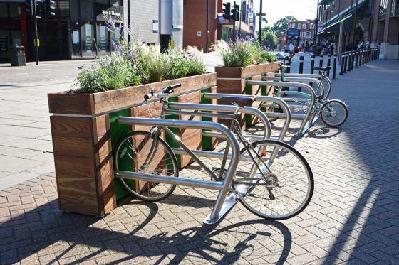


The district’s hanging baskets and planters provide visual interest and color across the district. Even so, plant species are largely ornamental and maintenance-heavy — not yet maximizing ecological benefits and an opportunity to immerse people in greenery.
A pilot palette focusing on native species could reduce maintenance needs while boosting ecological value by supporting local wildlife and pollinator habitat and enhancing seasonal interest. This approach would allow for a greener, more immersive experience that draws people in and tells the story of local ecologies.



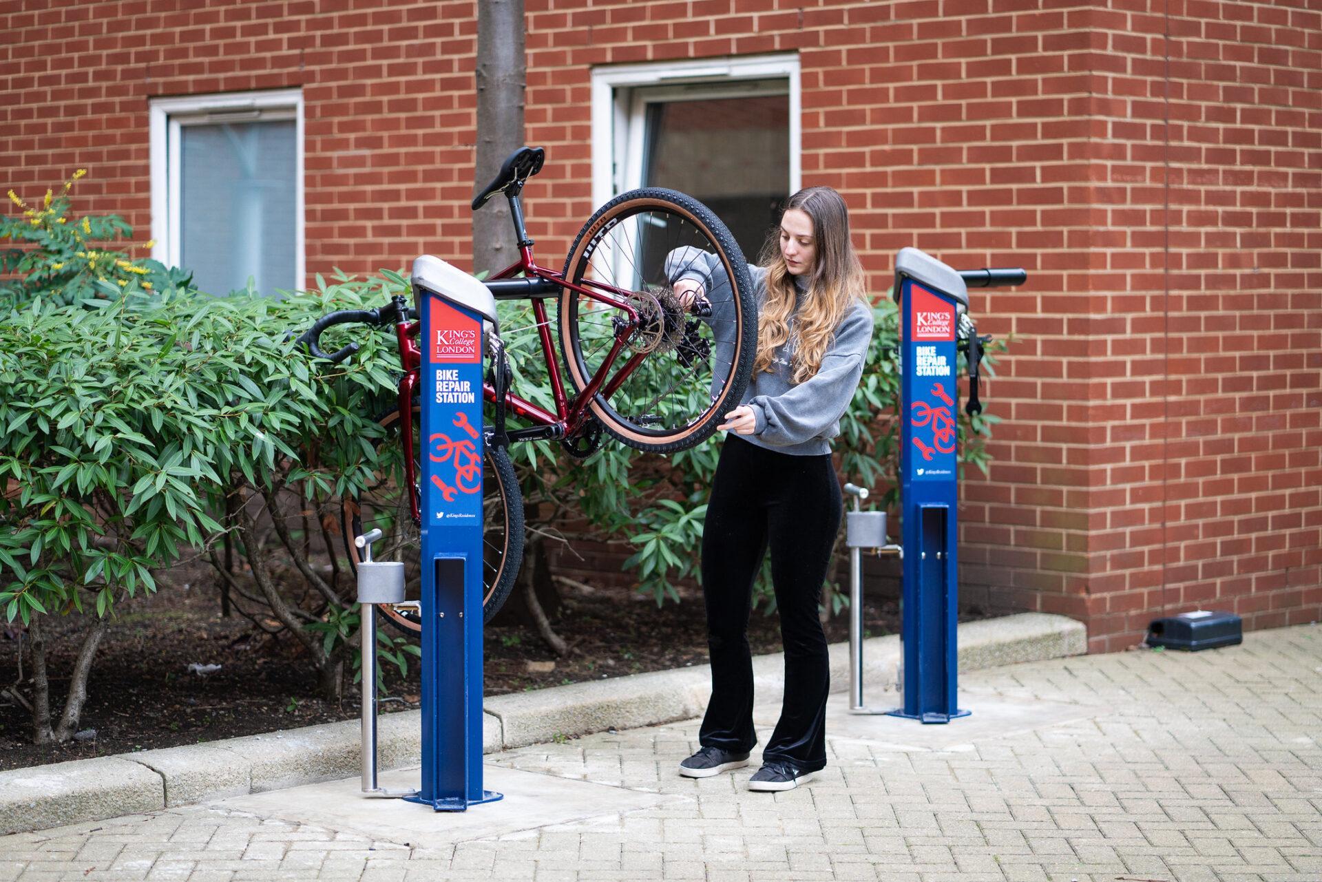
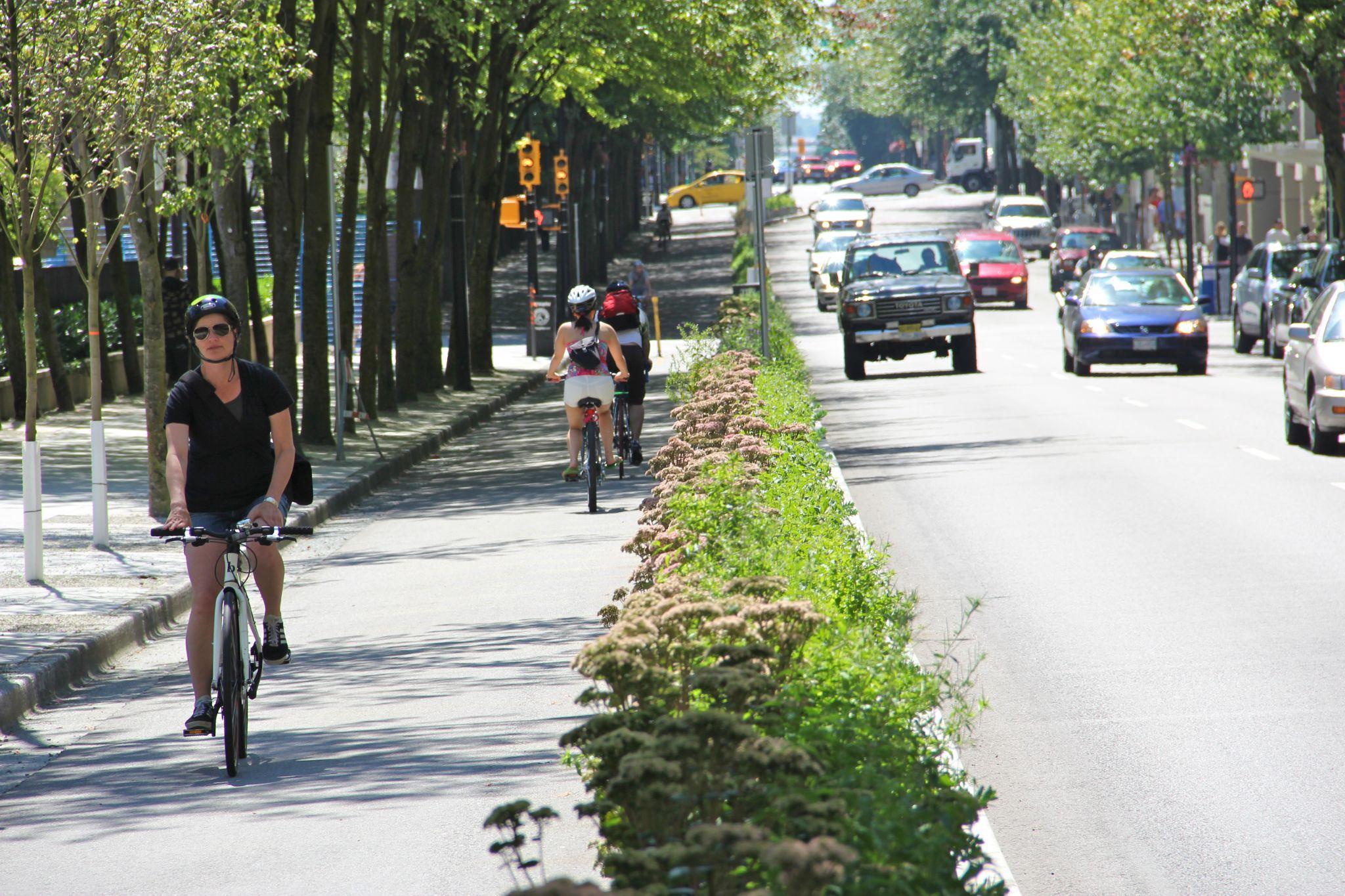
Some corridors provide an exemplary biking experience, showcasing NYC’s best-in-class cycling infrastructure. However, other areas lackconsistent maintenance and thoughtful design that would make all cyclists, regardless of experience, feel safe and invited ride.
Adding amenities that support various rider types, from professional to recreational, can enhance safety and comfort across the district. Introducing small yet thoughtful features like wayfinding and waste bins can support a more holistic experience that makes people feel supported along their journey.




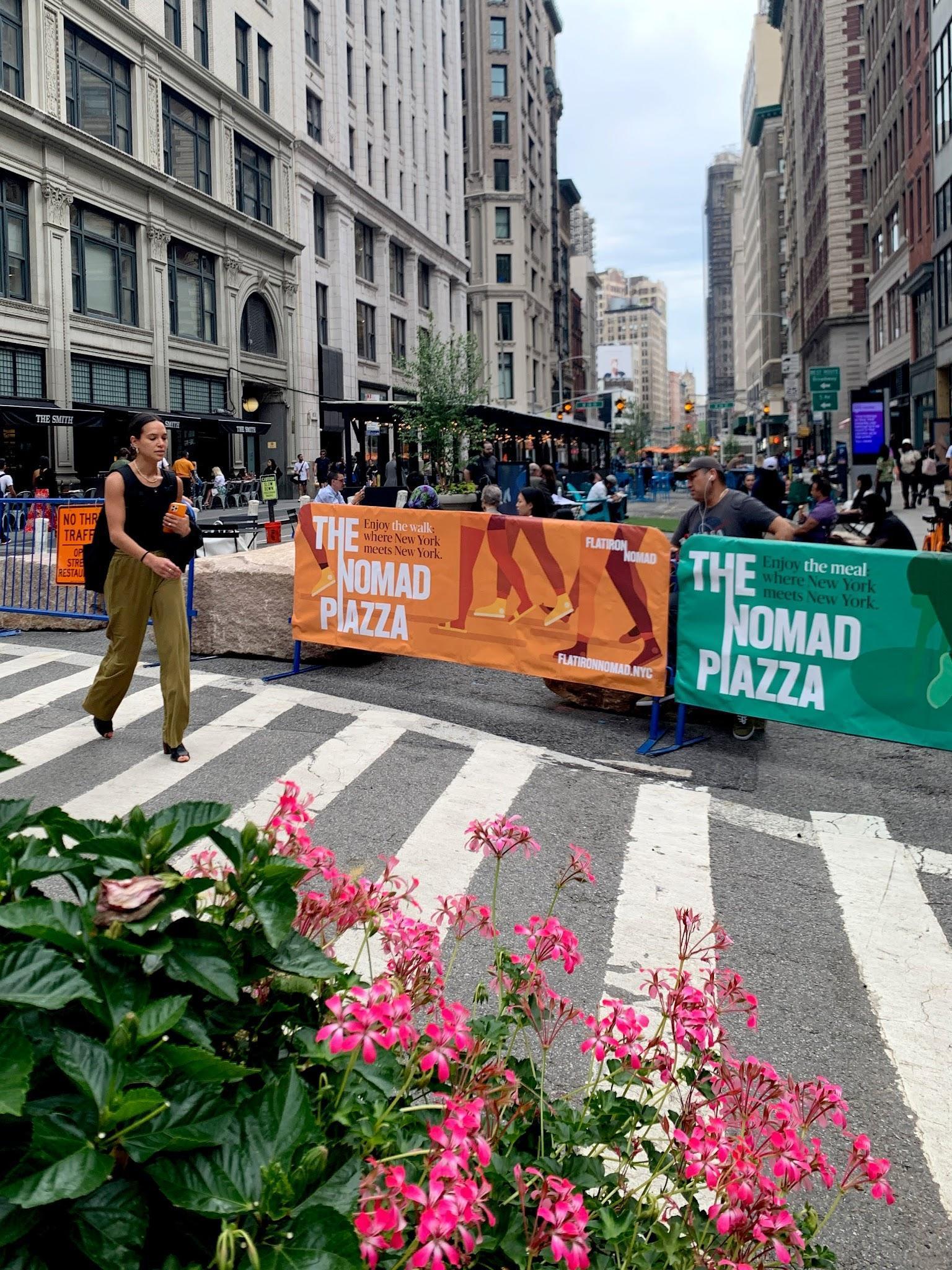
A range of bollards and barriers are used in the district, both fixed and temporary, supporting the area’s active public life by organizing space and adding security.
A broader variety of barriers can enhance pedestrian priority and foster a more human-scale environment. Thoughtfully designed barriers can support event spaces, pedestrian zones, and outdoor dining, establishing a balance between accessibility and protection.


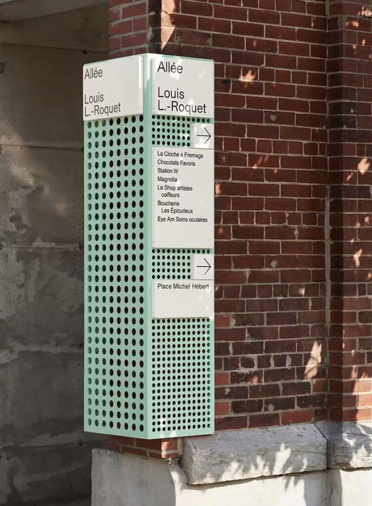
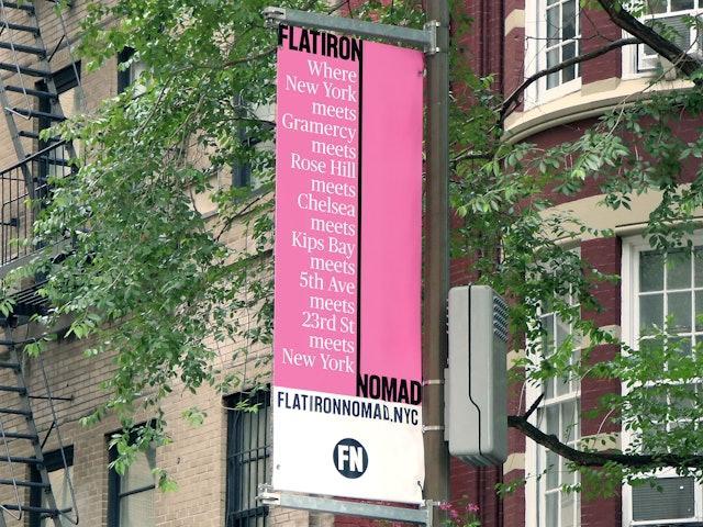
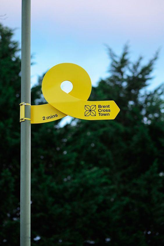
The district’s branding is distinctive and effective at establishing a sense of place, yet much of it is mounted above eye level or oriented towards vehicular traffic rather than pedestrians.
Signage can be placed at pedestrian eye level, helping people intuitively navigate the area while supporting a sense of discovery. Incorporating district branding and informational guides into paths of travel can make wayfinding more seamless. Creative use of existing structures and surfaces offers the chance to integrate engaging, human-scale information and directions without adding clutter to the public realm.


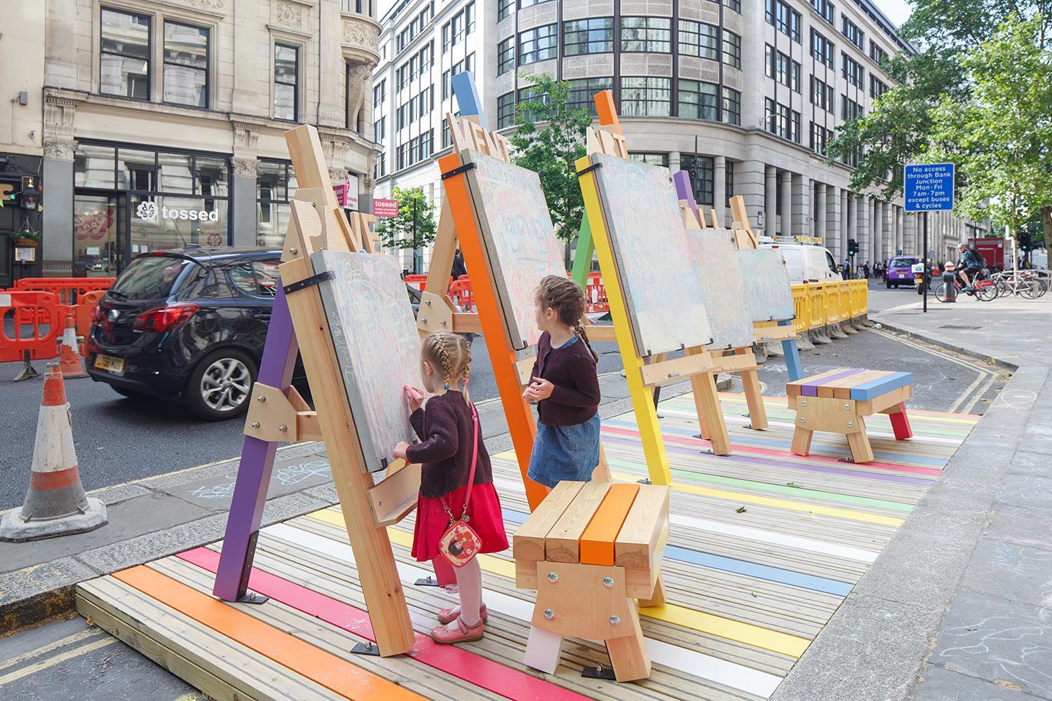
Many corridors lackamenities that reinforce a residential, neighborhood character. Given the uptickof new residential developments on the horizon, the demand for amenities that support these kinds of experiences will continue to increase.
A dynamic mix of residential amenities, from playable features to market stalls, will make it more fun and delightful to spend time along district corridors — drawing energy from Madison Square Park’s beautiful playgrounds and gardens to distribute similar quality experiences more evenly across the district.



Existing Conditions Report
Transportation and Mobility Analysis
Safety and Operations Toolkit
Pilot Concept Cost Estimates
StakeholderWorkshop Presentations
+ Stakeholder Workshop #1
+ Stakeholder Workshop #2

