Denise Brookins Director, Planning and Zoning David Rast Director, Community Development
Mollie Bogle Atlanta Regional Commission
CoreTeam
Ray Gibson | City Manager
Brian Wismer Director, Economic Development
Carl Martin | Local Property Owner
Rev. Thomas Martin| Fayetteville First United Methodist
Walter Rodriguez | Town Square Jewelers
Sam Burch Historian/Local Resident/Lanier
Rick Seaman | Twisted Taco/Business Owner
Jim Thomas | Fayetteville First Baptist Church
Vickie Turner Historian/Local Artist/Mainstreet
David Burnett | Local Business Owner
Matt Teague Local Developer /Walton
Sarah Murphy | Local Resident/Planning Commission Chair
Bonita Askew Berry | Local Property/Sugar Hill
Hazel Askew| Historian/Local Resident/Sugar Hill
Sonja Gibson | Local Resident/Villages/Business Owner
Alfred Lee Dingler | Local Resident/Jeff Davis/ Business Owner
Rev. Velma Grant Pastor/Sugar Hill
Rev. Allyson Lawrence Fayetteville First United Methodist
Katie Pace Southern Conservation Trust
Sheba Ross | Project Director
Shelby Morris | Project Manager
Doug Childers Urban Planning Leader
Marwah Garib | Urban Designer
ProjectConsultants
Hayley Todd | Existing Conditions and Zoning
Doug McClure Landscape Architecture
Russell Harrington | Landscape Architecture
Danny England | Existing Conditions and Character Analysis
Darrell Howard | Mobility
Neil Desai | Zoning
David Laube Economic Development and Market Study
Jordan Rowe Economic Development and Market Study
Caroline Evans | Community Engagement
Amanda Hutton | Community Engagement
September 2021
Livable
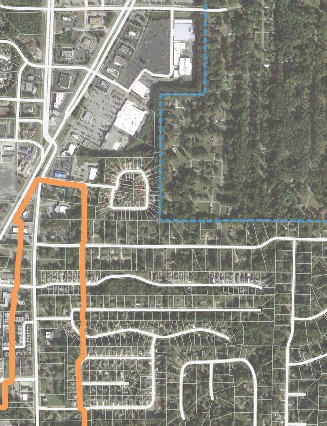
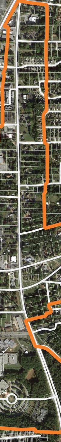
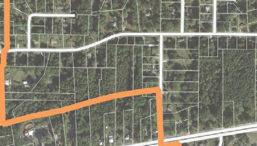
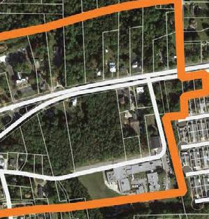
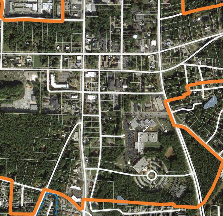
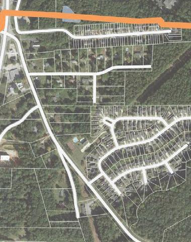
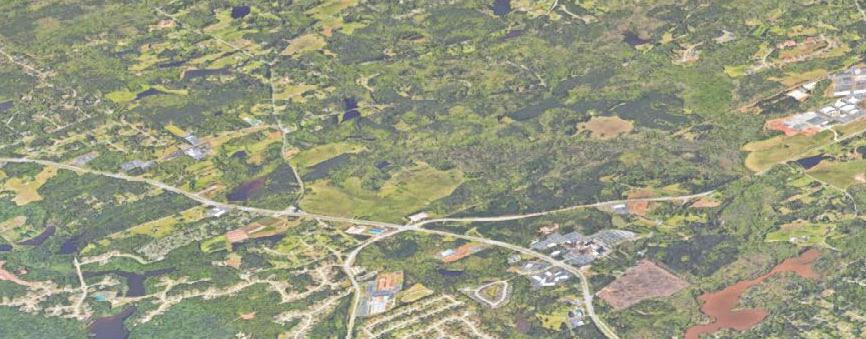
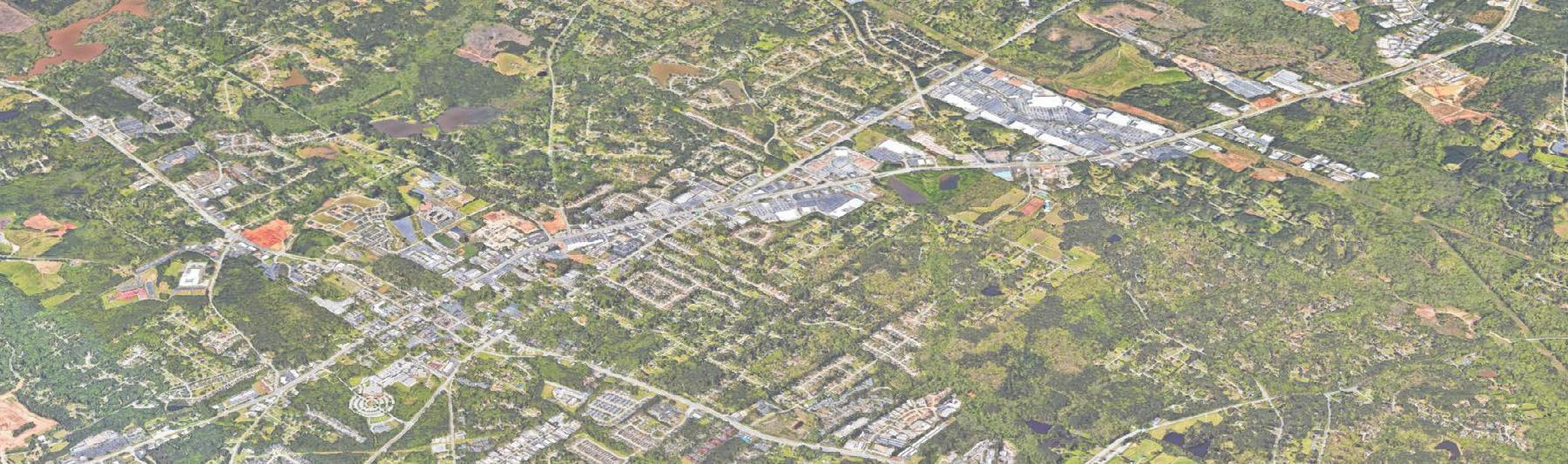
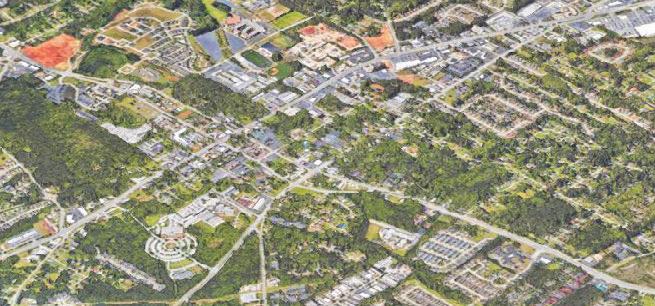
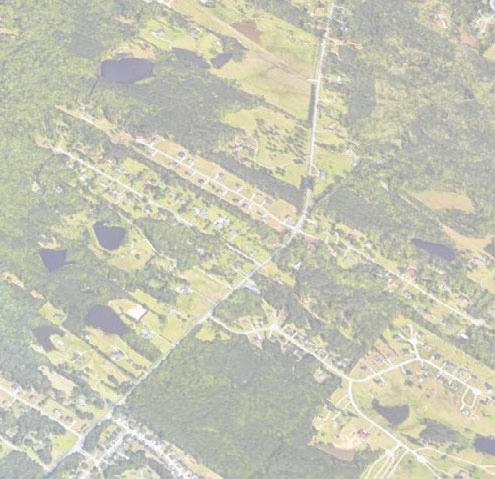
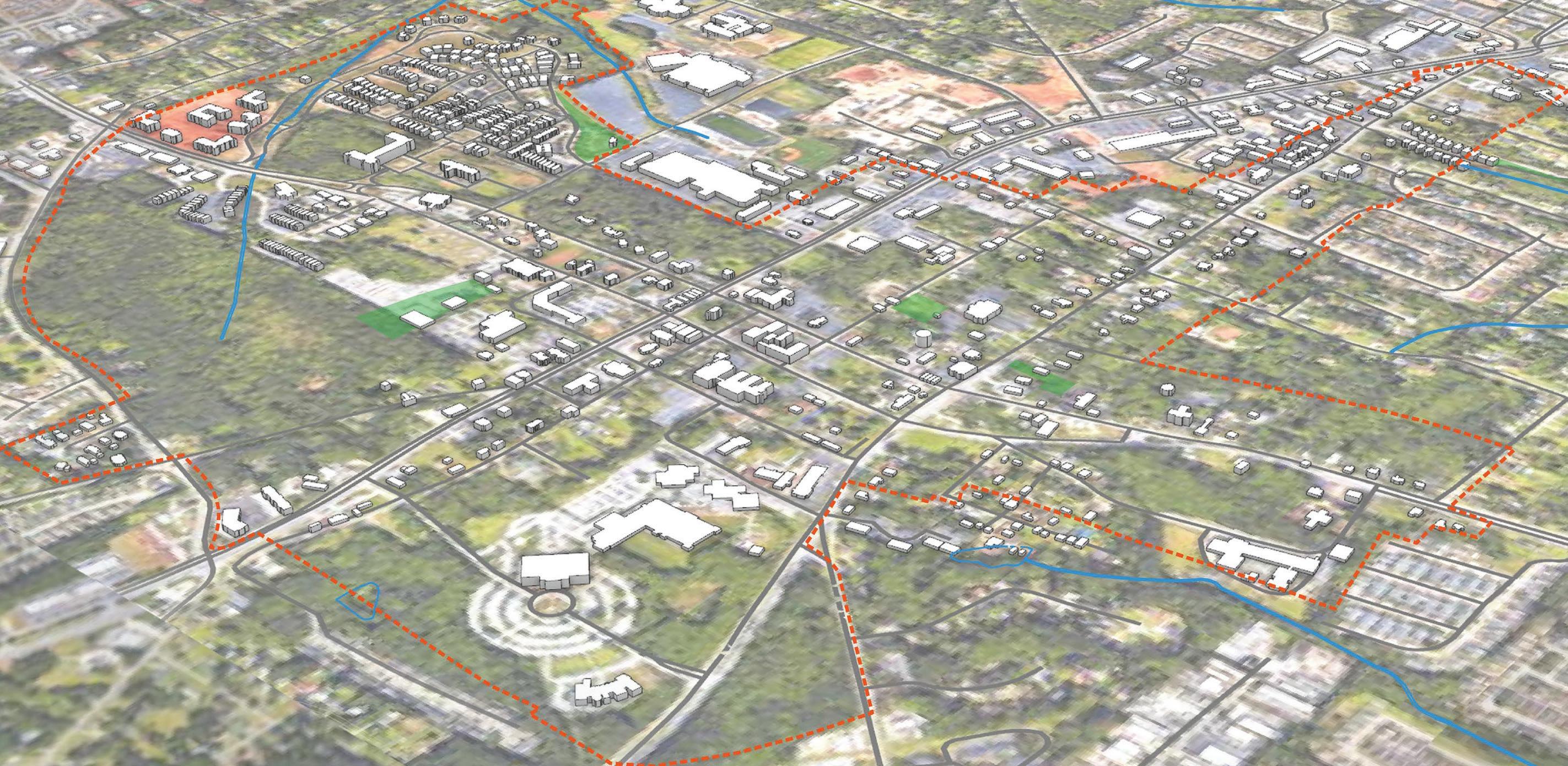
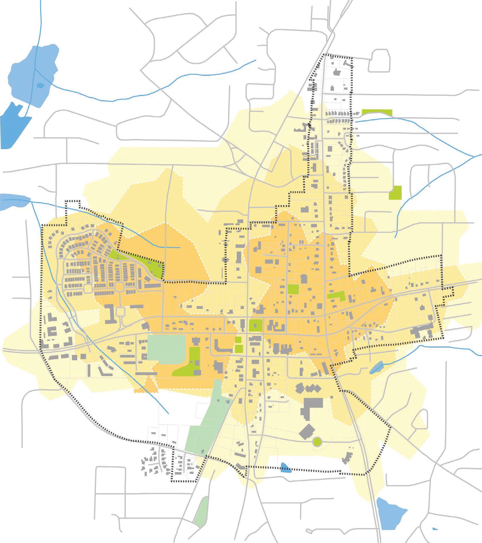
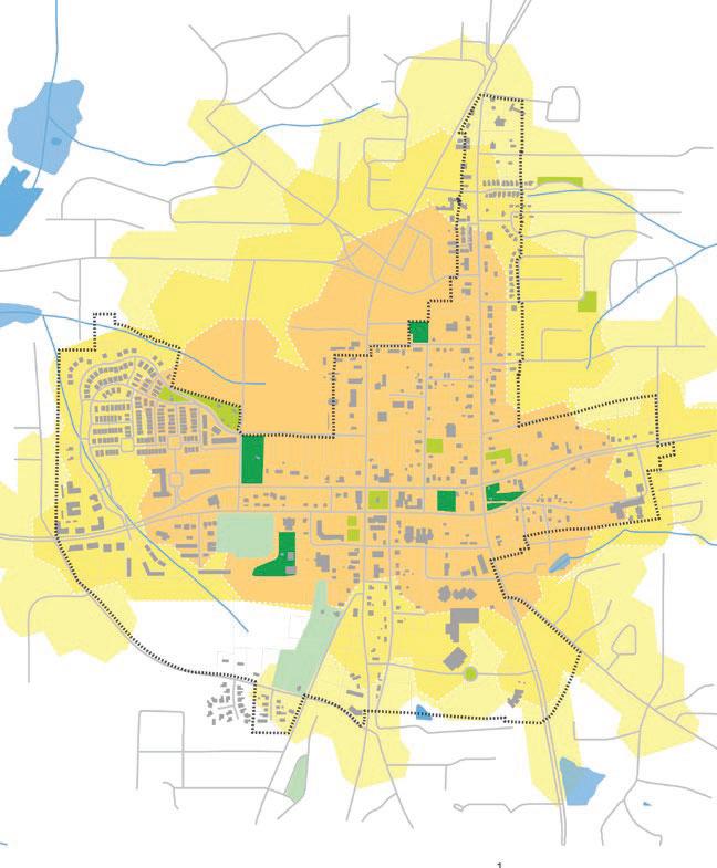
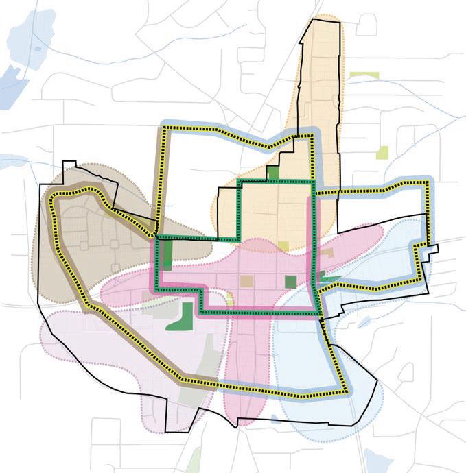
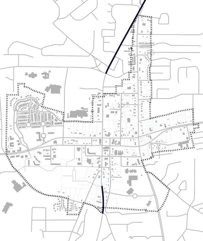
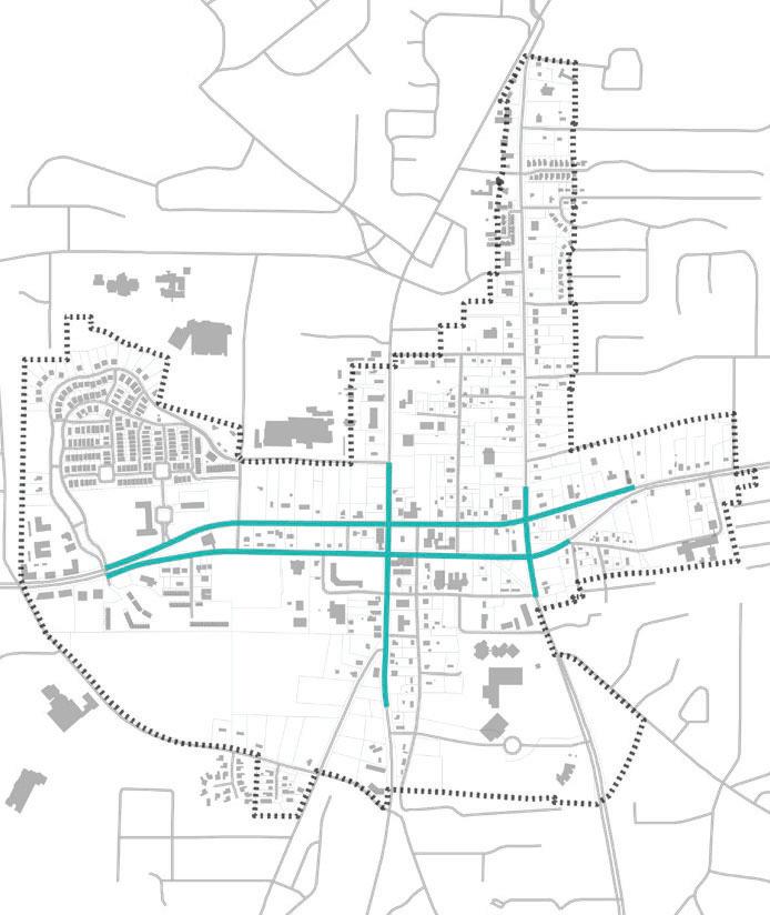
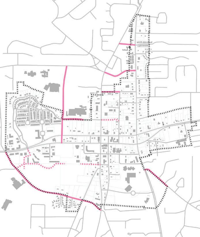
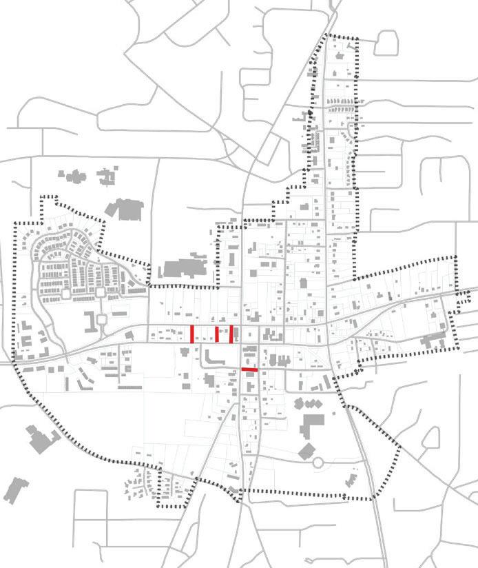
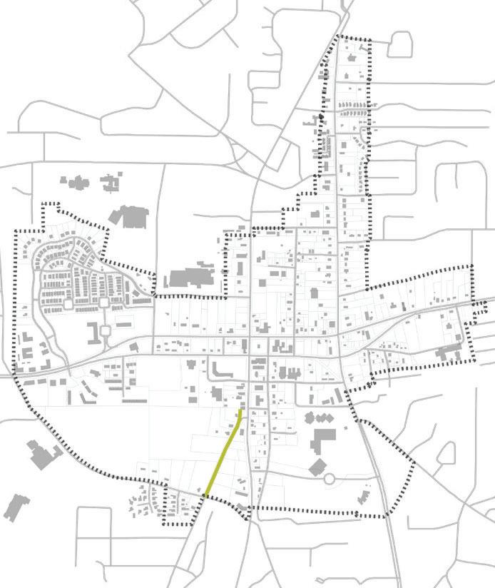
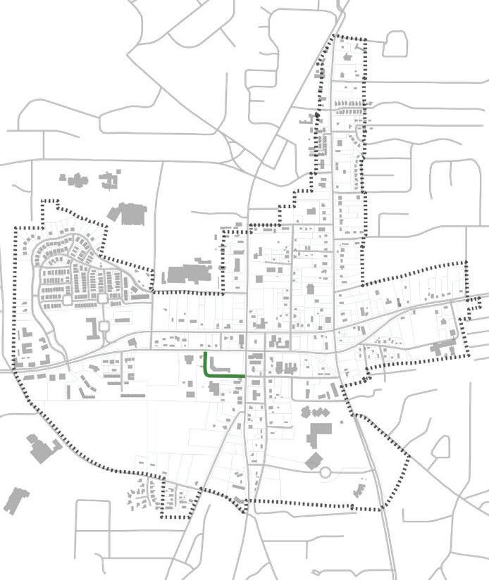
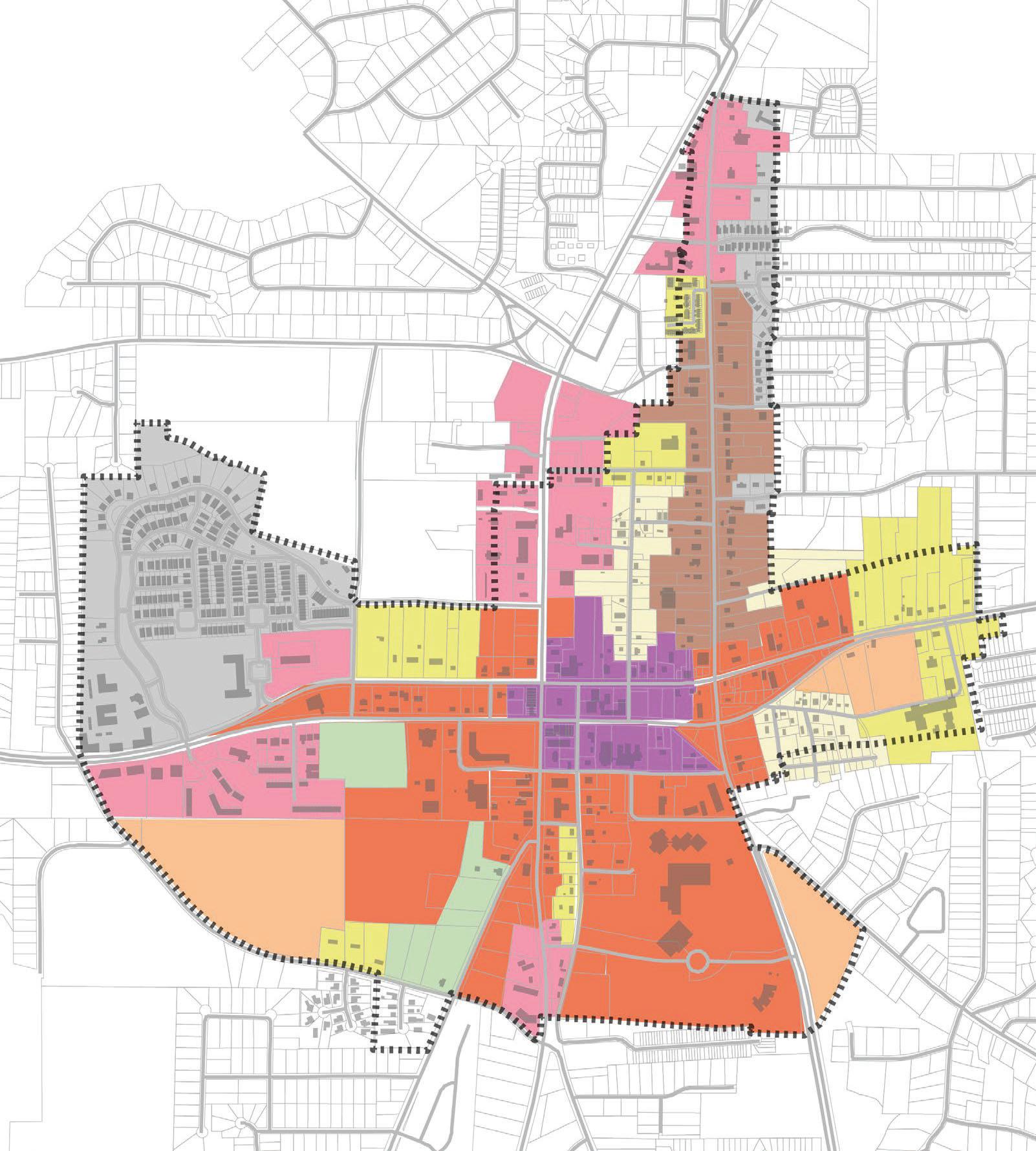
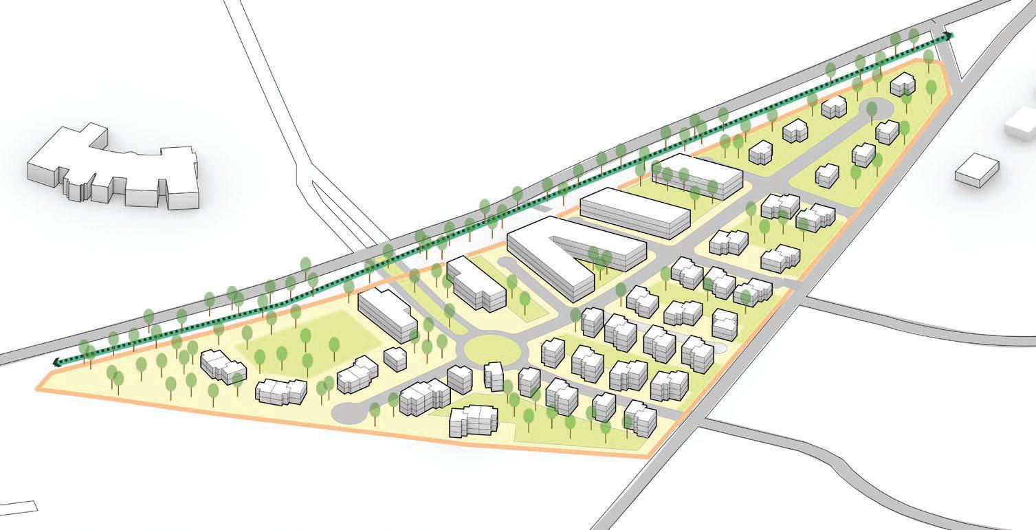
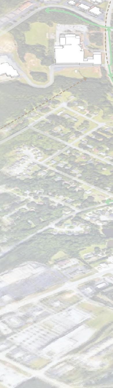
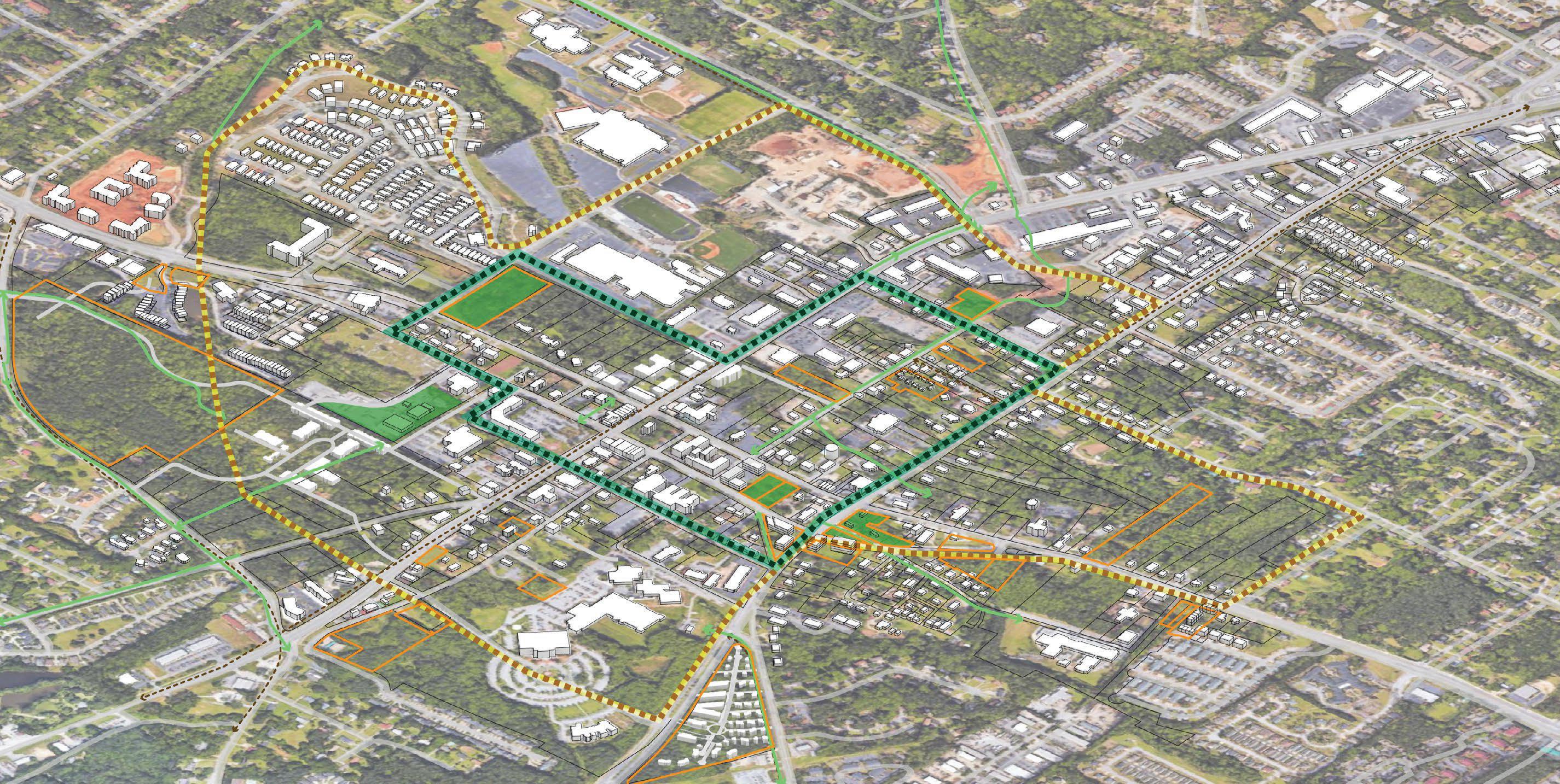
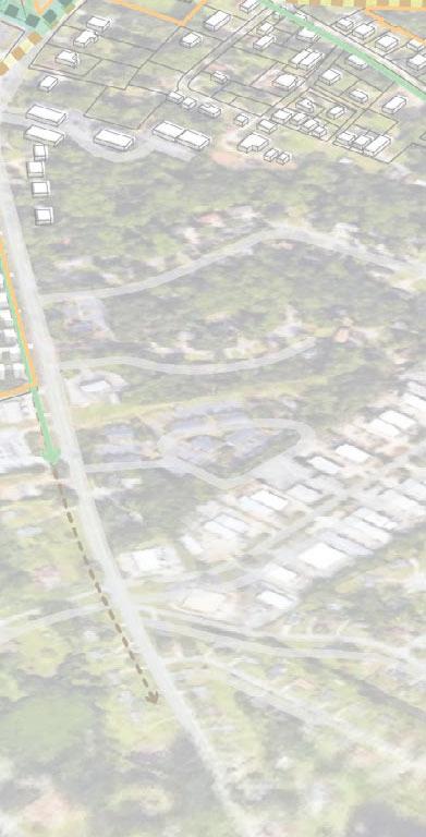
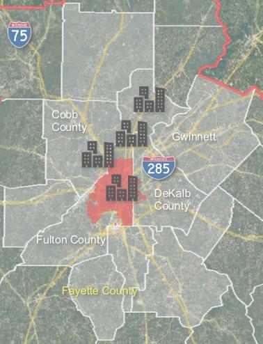
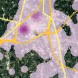
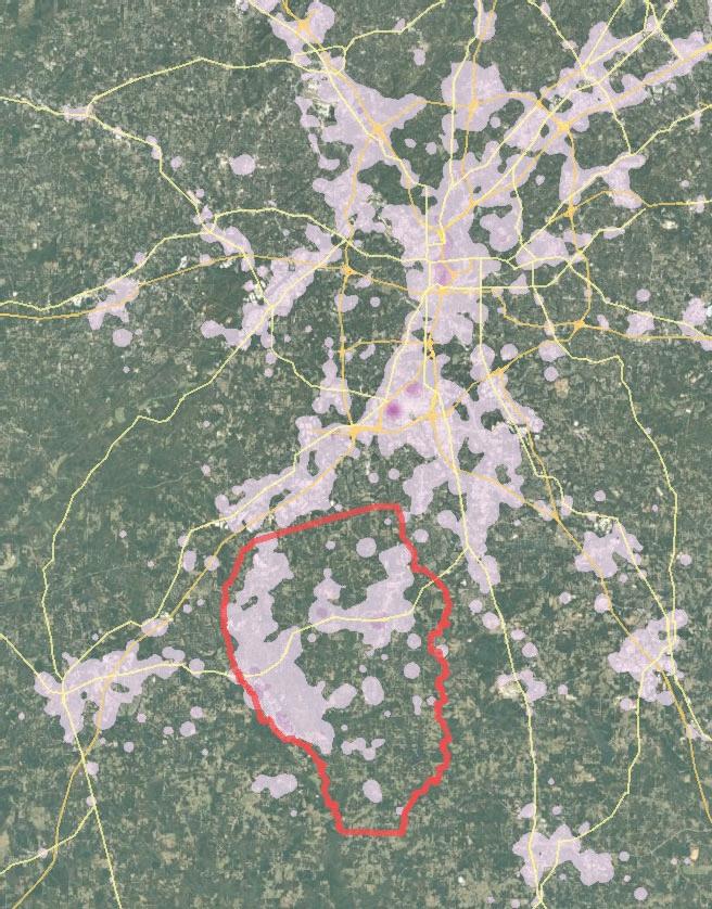
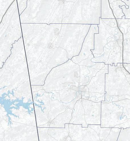
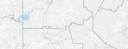
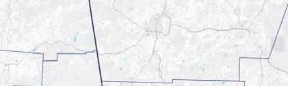
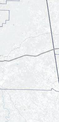
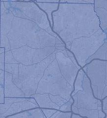
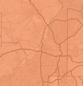
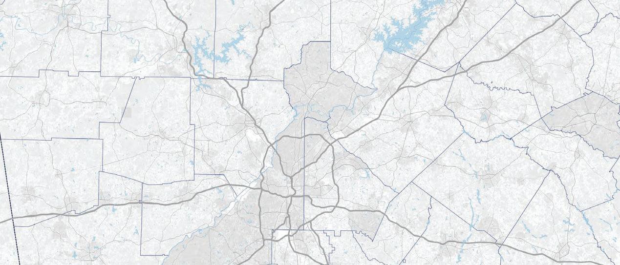
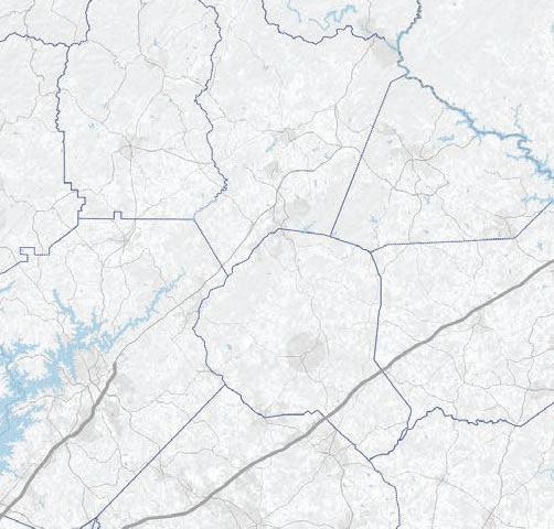
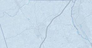
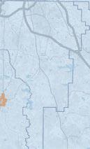
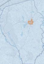
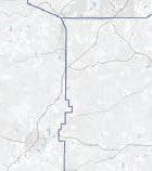
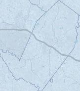
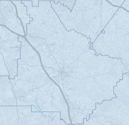
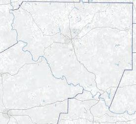
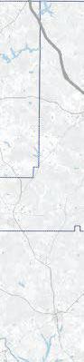
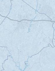
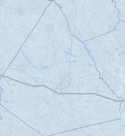
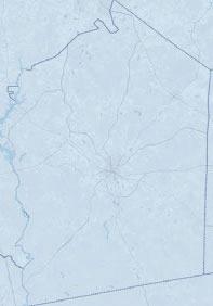
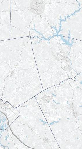
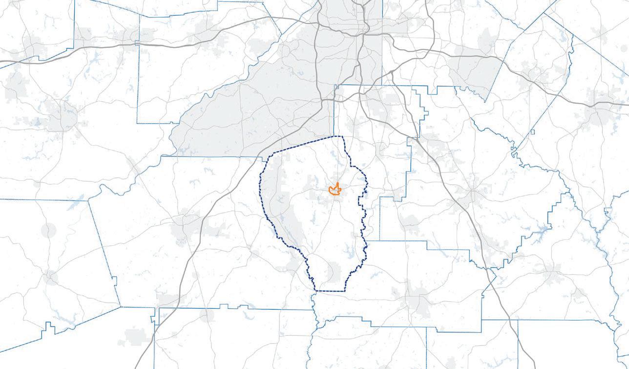
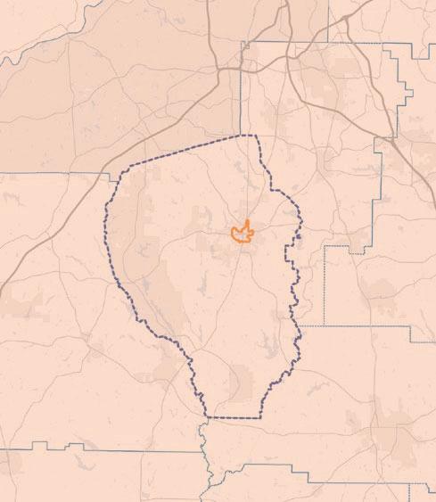
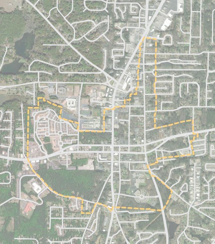
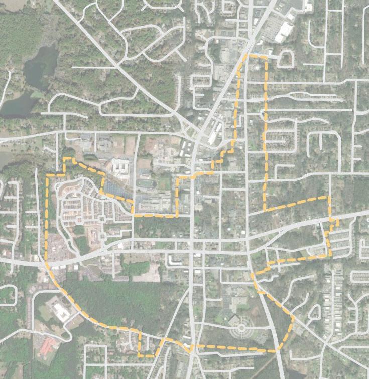
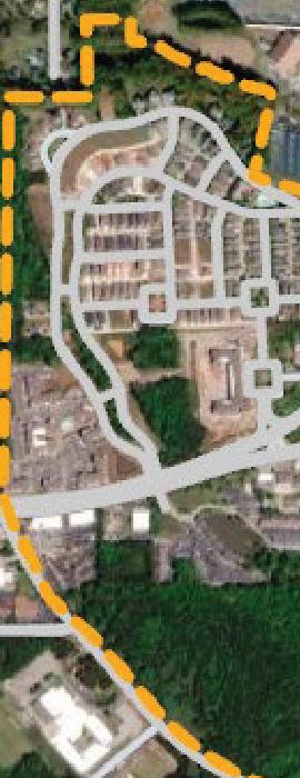
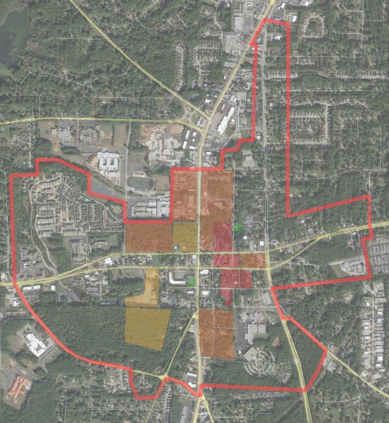
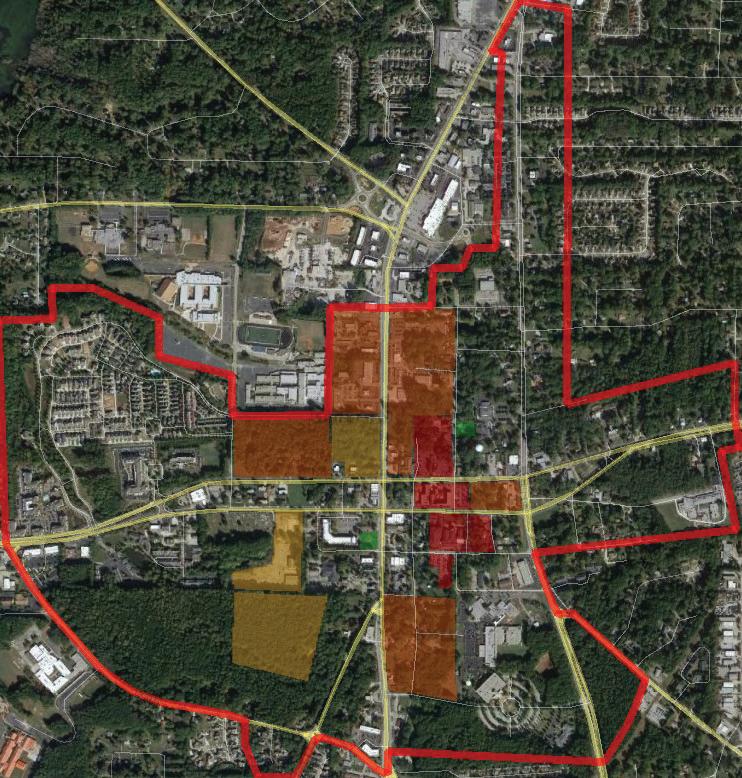
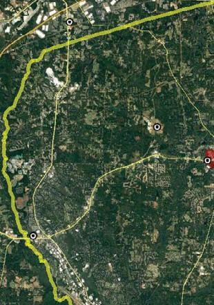
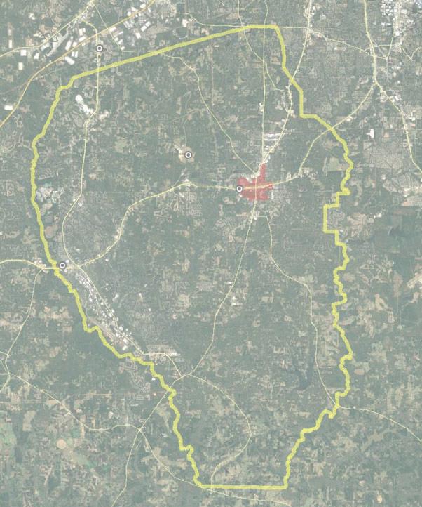
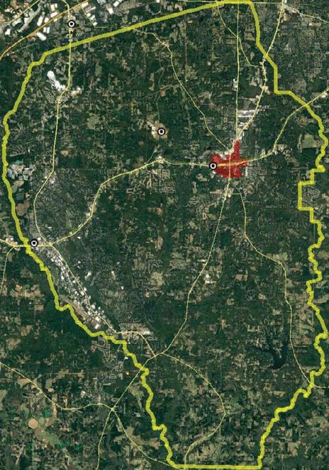
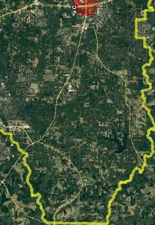
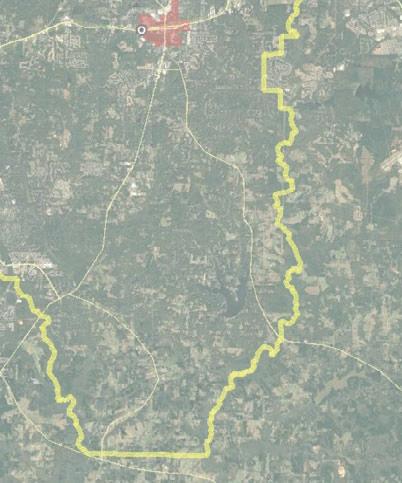
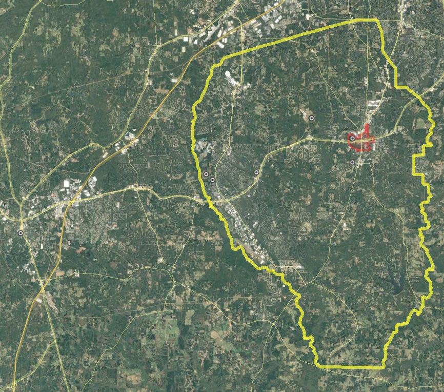
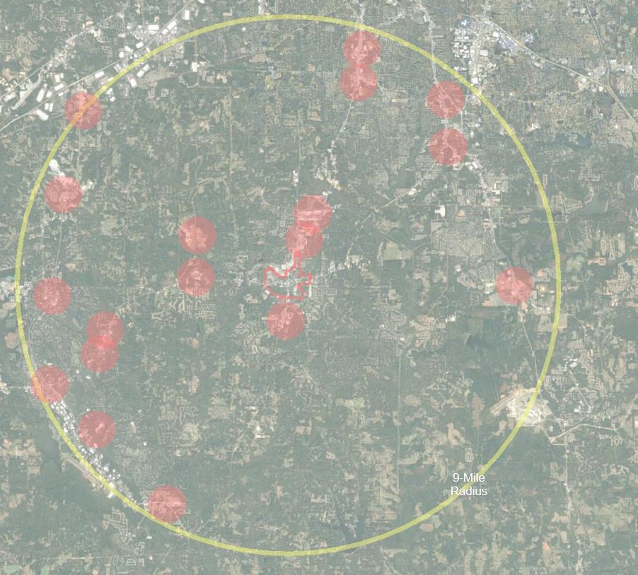
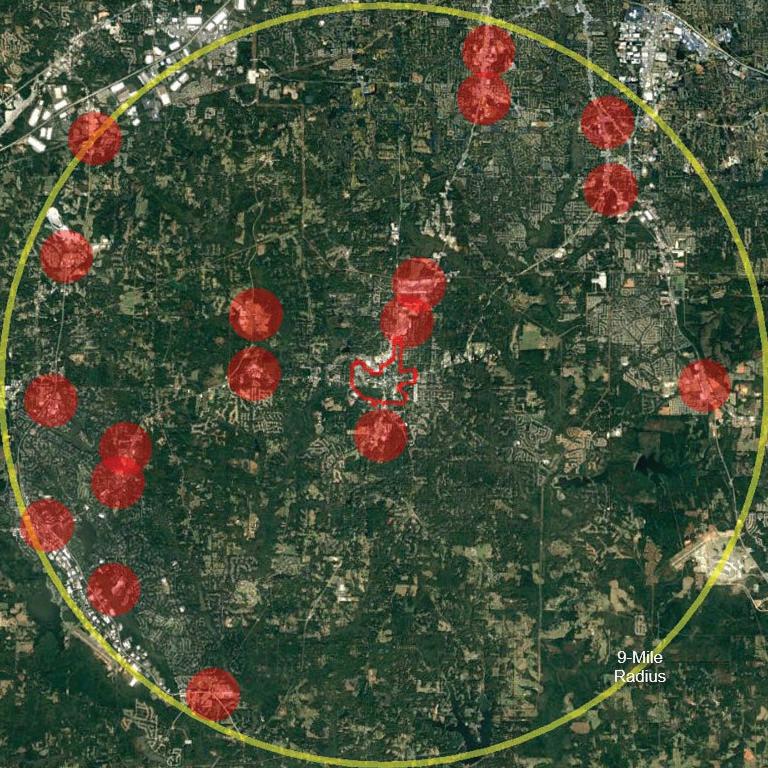
The Atlanta Regional Commission’s Livable Centers Initiative (LCI) is a grant program that incentivizes local jurisdictions to re-envision their communities as vibrant, walkable places that offer increased mobility options, encourage healthy lifestyles and provide improved access to jobs and services. The study area encompasses about 900 acres and addresses the Main Street area (sometimes referred to as the historic district) and includes downtown, and areas to Lafayette Avenue to the west, Gwinnett Street to the east, Georgia Avenue and North Jeff Davis Drive to the north and Grady Avenue and just north of Williamsburg Way to the south.
A work done through previous efforts and to ground the project by learning from precedents, prioritizing goals, developing actionable recommendations and documenting with clarity for an achievable outcome. The process hinged on community engagement with the goal to achieve sustainable outcomes using equitable decision-making methods, and deepen relationships and trust between government organizations, design teams and communities.
Processforthestudy:
InvestigateExploreRecommendDocument
The LCI study is implementation-focused and hence features a multi-disciplinary team that will integrate urban planning & design, existing conditions, community engagement, market analysis, transportation, and zoning, in a collective vision for the Downtown Fayetteville study area. Key questions were asked from the perspective of these disciplines to kick-off the project and were accounted for in the final implementation matrix.
» Permit variety of housing types in proximity to downtown core
» Codify historic inspiration as a guide for new buildings
• Emphasis on placemaking/Downtown as a destination
• Specific marketing campaign for Downtown
ImproveAesthetics
• Parks, landscaping, trees
• Emphasis on historic character
• 2002 LCI Downtown Planning Study
• 2010 LCI Supplemental Study
• 2016 Market Study
• 2019 Paths Master Plan
Recurring themes and goals amongst previous plans:
PrioritizeWalkability
• Comprehensive sidewalk network
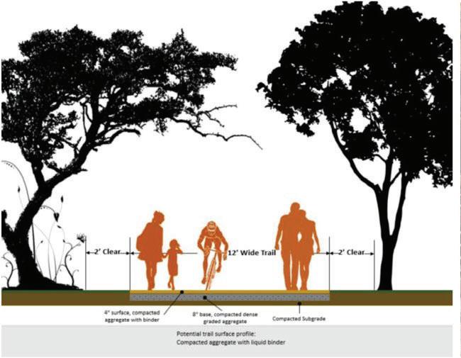
• Multi-use trails -- for improved connectivity with Fayetteville and Fayette County
• A seat at the table for the Fayette County Plan
• Enhance safety
RevitalizeDowntown
• Emphasize walkability in street grid and pedestrian scale
• Improve zoning ordinance to permit a mixture of uses
• Unified signage standards referencing historic character
Acquire/IdentifyParcelsforRedevelopment
• Identify ownership
• Focus on those located in proximity of Downtown core to create unified streetscape
ContinuingNeedsandOpportunitiesMoving Forward:
• Identify infill parcels and ownership for redevelopment opportunities
• Create distinct character areas
• Emphasis on parks and recreation
• Facilitate better communication between public and city officials
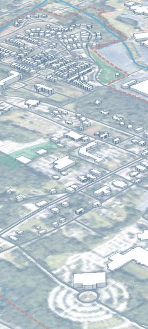
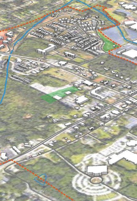
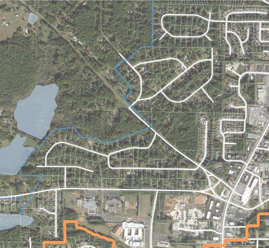
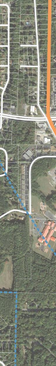
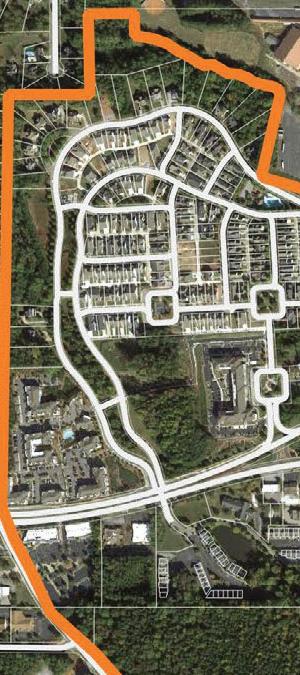
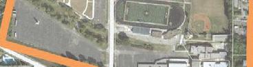
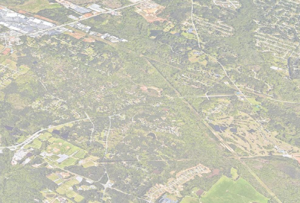
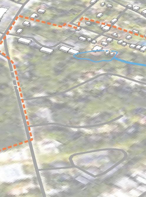
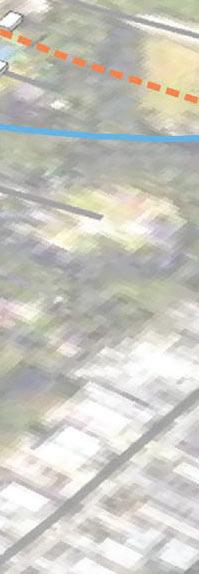
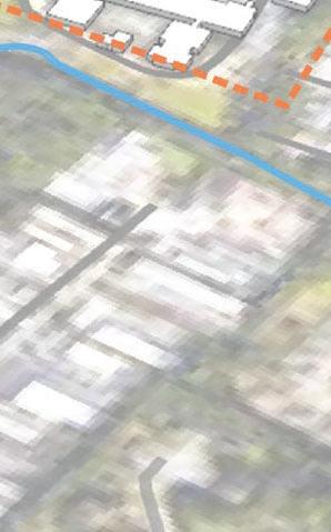
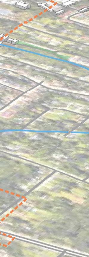
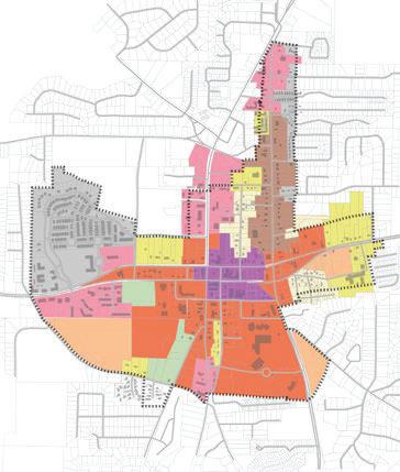
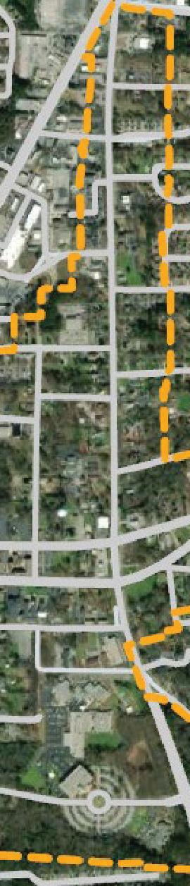
Context
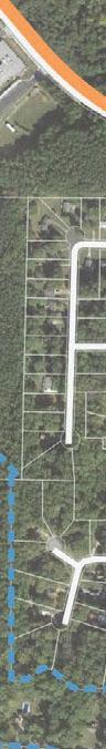
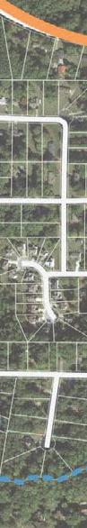
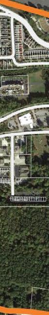
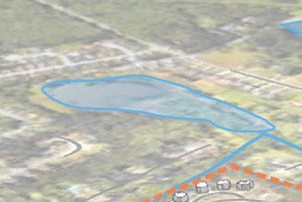
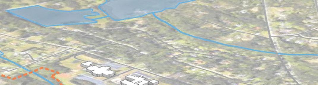
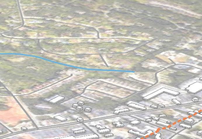
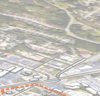
LandmarksParksWater BodySchools
Community Assets
Parks and Open Space Analysis
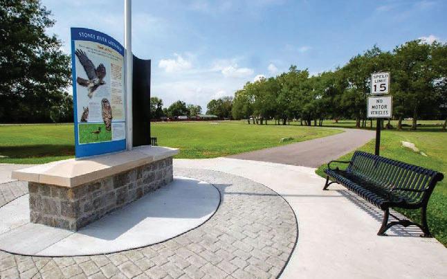
Parks and open spaces serve all residents of the community, and provide opportunities for community members of various backgrounds to come together for a variety of purposes
Introduction
Parks and open spaces have been a critical aspect of successful community planning since the beginning of the 20th Century. Ever since the birth of community planning and city design, parks and open space have served as the “glue” that holds the city together by providing pedestrian and vehicle friendly linkages between important nodes in the city, promoting physical health and mental well being for the residents of the community, and providing space for public community events to take place which improves the quality of life for the community residents. Parks and open spaces serve all residents of the community, and provide opportunities for community members of various backgrounds to come together for a variety of purposes.
The City of Fayetteville, GA has made many efforts over the previous years to improve their parks and open spaces, and intentionally plan how these parks and open spaces can compliment the surrounding built environment. This section will address the efforts that have been made in the past to improve parks and open spaces in the city, and what issues and opportunities still exist today.
The 2002 LCI study identified opportunities for public space, new development, and traffic calming mobility interventions that would be conducive to pedestrian connectivity, community events, and preservation of green space.
2002LCIStudy
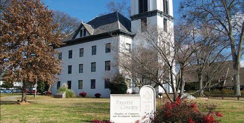
In 2002, the City of Fayetteville conducted an LCI Study, and as part of this study the community was engaged as to what issues and opportunities they saw the city facing. During this engagement, the community identified certain issues such as a need for a useful open space in Downtown Fayetteville, and the desire to provide a more pedestrian friendly environment downtown. Some of the opportunities the community identified include reduced traffic congestion, and increased facilities for pedestrians and bicyclists, as well as added public open spaces and green spaces able to host cultural events. At the time of this study, only 3% of the total city acreage was dedicated to parks and open spaces. Some of these areas include a park downtown, a pocket park north of Lanier Avenue on Church St., a cemetery, and an amphitheater constructed in conjunction with The Villages development. This discussion led to the identification of certain future projects that could help add more park space and open space to Downtown Fayetteville including a new Fayetteville Village Green to be surrounded by mixed use development and pedestrian amenities which can be used to host community events, the development of a central open space on Church St. as part of a green way in the Main Street Residential District, preservation of existing green space along Beauregard Blvd., redevelopment of the city park by the county office building, develop a greenway system connecting major city landmarks and residential clusters, and construct landscaped entry gateways at major intersections and nodes into the downtown area.
2010LCIStudy
In 2010, an LCI supplemental study was conducted that identified three different development areas within the city. One of these developments, called Market Place at Lafayette, proposed the development of an attractive storm water management area which separates it from the accessing road that also provides a usable green space for the users of the development. In 2016, a Downtown Market Study was conducted to identify the issues and opportunities for downtown development. As part of this study, it was identified there is a need for a downtown square to serve as a starting point for development. This square was proposed to be located by the existing green space surrounding the Old Fayetteville County Courthouse. This study also identified a need for greenway that links the downtown area to the surrounding residential areas of the city. In 2017 the City of Fayetteville conducted a downtown re-development plan identifying three separate parcels for redevelopment potential near Lanier Avenue and Stonewall Avenue. This study included a network of proposed streets to lay the foundation for the future development parcels improving efficiency of pedestrian transportation throughout the area. The proposed layout and design 2 added 6.56 acres of green space to the downtown area connected with pedestrian friendly amenities including street and parking lot trees, rooftop gardens, a village green, a storm water park, a pedestrian tree ally with string lights, open art plazas, bioswales, amphitheater lawn with fountains, tree bosques,rain gardens, and playgrounds.
Within the same year, Fayette County voted to approve Special Local Option Sales Tax (SPLOST) which was meant to fund a variety of improvement projects throughout the city. Some of the projects related to parks and open spaces include the construction of a bridge crossing to connect the Fayette Piedmont Hospital to the existing path system, a master plan design for the expansion of the multi-use path systems, and landscaping medians on Hwy 85.
2017LCIStudy
A comprehensive plan for the City of Fayetteville was also produced in 2017, which identified a total of 279.42 acres of land (3.71%) dedicated to parks and open space. Although there have been many planning and design efforts since the 2002 LCI Study, the amount of land still dedicated to parks and open space in 2017 had not increased much since 2002. The Comprehensive Plan identified issues related to parks and open space including the need for more sidewalks and multi-use paths to improve connectivity for improved walk-ability, the need for pedestrian oriented development that creates a safe distinction between the pedestrian and vehicular environments, the need to improve aesthetics around the gateways leading into the downtown area, and the need to increase the amount of parks and green space in the downtown area. It also identified that as an opportunity the city had SPLOST funding available for land acquisition of park space, and expressed the community’s desire to improve parks and green space within the city in the community driven goals and objectives. The Comprehensive Plan also identified several projects that would increase the amount of parks and open space in the city including the construction of a new downtown park, a feasibility study for park water features, park improvements at the existing gazebo, park improvements at The Ridge, development of a city trails plan for connectivity, and the continued installation of street trees and landscaped medians. Some of the record of accomplishments identified in the Comprehensive Plan related to parks and open space include the implementation of the Open Space Plan for the development and preservation of parks and green spaces throughout the city, the identification of opportunities to provide green space connectivity, and the development of local and regional partnerships to preserve existing green spaces and develop a regional multi-use trail system.
The 2017 LCI study produced a comprehensive plan for the city of Fayetteville and identified issues related to walkability and pedestrian access.
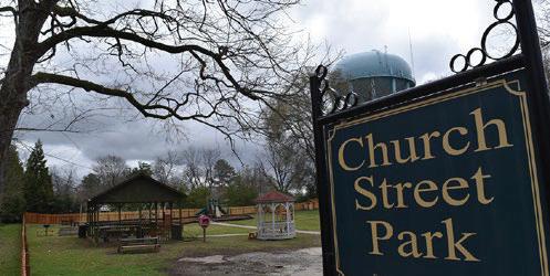
2018CapitalImprovement
The 2018 Capital Improvements Element further expands on how the city intends to provide future land for parks and open spaces with the use of impact fees for future development. It identifies the current parks located within the city as Jack Day Park, Burch Park, Jeff Davis Park, Patriot Park, and Church Street Park. It also identifies The Ridge as a large 308 acre conservation area. The trails located within the city include the Redwine Multiuse Path, the Patriot Park walking trail, and the Lester Road Multi-use Path. This study also identifies future growth projections for parks and open space to increase by approximately 22 acres by 2040 and conservation acres to increase by 234 acres, and identifies the funding methodology to accomplish this goal. One of the projects that this study identifies that will increase park space within the city is the addition of an 8 acre city park to be included within the design of a new City Hall building. The City of Fayetteville 2019 State of the City Address reinforced this desire by announcing the project for a new city center complex that includes amenities for the community to the public. The City of Fayetteville has completed many studies identifying the community’s desire for an increase in parks and open space, and these desires are now starting to be developed as the city plans to continue to grow and prosper.
The 2018 Capital Improvement Study builds off of previous LCI studies through thoughtful research while also asking new, relevant questions to provoke innovative solutions for public park space.
The City of Fayetteville has completed many studies identifying the community’s desire for an increase in parks and open space, and these desires are now starting to be developed as the city plans to continue to grow and prosper.
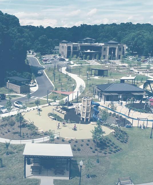
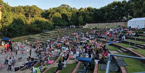
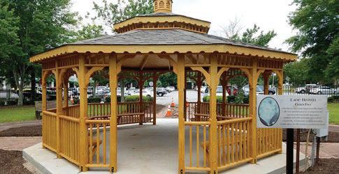
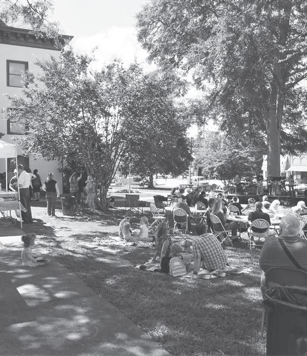
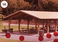
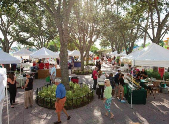
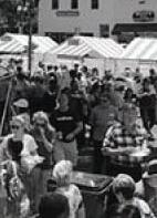
Lunch on the Lawn Source: City of Fayetteville
2018MasterPathPlanAnalysis
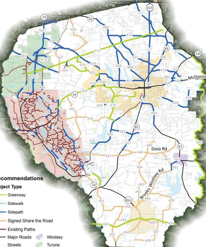
In March of 2018, a community stakeholder meeting was conducted that focused on the Master Path Plan and the development of a county-wide network of sidewalks, side paths (bi-directionally multi-use path along side of roadways), greenway trails, and bicycle routes. This meeting brought a variety of community members from various backgrounds together in an effort to identify common community interests. Community desires for various locations for bicycle routes, pedestrian walkways, and golf cart facilities including sidepaths, greenway trails, shoulder bikeways, signed shared roadway, and sidewalks were discussed and cataloged. The meeting generated a significant amount of feedback for desired pathway connections. Common desired connection locations included a sidepath connections between Peachtree City and Fayetteville along Redwine Road, a sidepath on SR 54, and bicycle facilities on Bernhard Road and Brooks Woolsey Road. Common desired connection destinations include a regional trail connection in southern Peachtree City as well as connections to the Starr’s Mill school cluster as a starting point for the development of the Master Path Plan. The Master Path Plan includes design guidelines that cover the specifics of the path designs and how they should be constructed in relation to the existing environment. The Master Path Plan discusses a City Hall project that will update land-use, pedestrian transportation networks and traffic patterns within the downtown area, while at the same time being integrated with expansion efforts of paths and sidewalks throughout the city, including enhancing the network of streets connecting SR 54, SR 85, Beauregard Blvd, and Grady Avenue. The City of Fayetteville used SPLOST funding in 2018 to purchase approximately eight acres of land from the Fayette County Board of Education for the development of a city park adjacent to the Fayette County Public Library and new City Hall building providing many opportunities for pedestrian and bicycle connectivity.
“The MPP will connect population centers, schools, parks, commercial land use, and other recreational opportunities. The MPP will accommodate pedestrians, bicyclists, and golf cart users.”
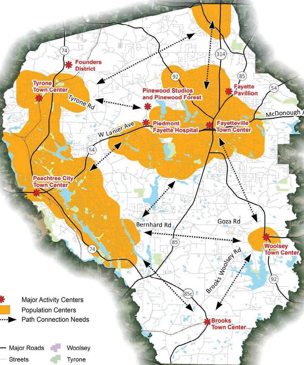
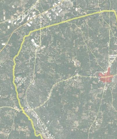
PathConnectivityNeeds
Population Centers
• Peachtree City/Tyrone
• Fayetteville
• Woolsey
• NE Fayette County
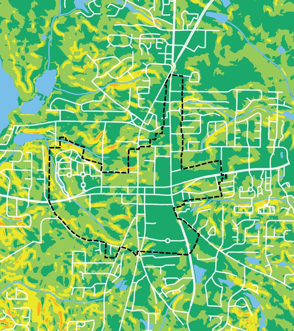
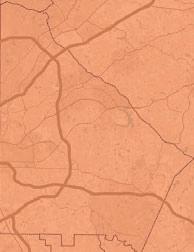
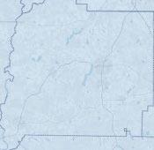
Slope Analysis Map
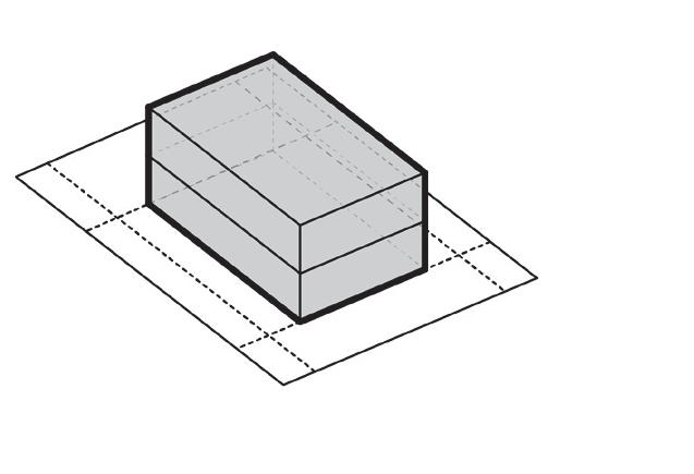
Slope analysis illustrates feasibility of future building sites.
Mobility
MobilitySystemAnalysis
Purpose
• To better understand the mobility systems of the LCI study area and the places that they serve within Downtown.
• To understand the operational characteristics of the mobility network.
• To serve as a basis for a discussion about changes and improvements to the mobility network.
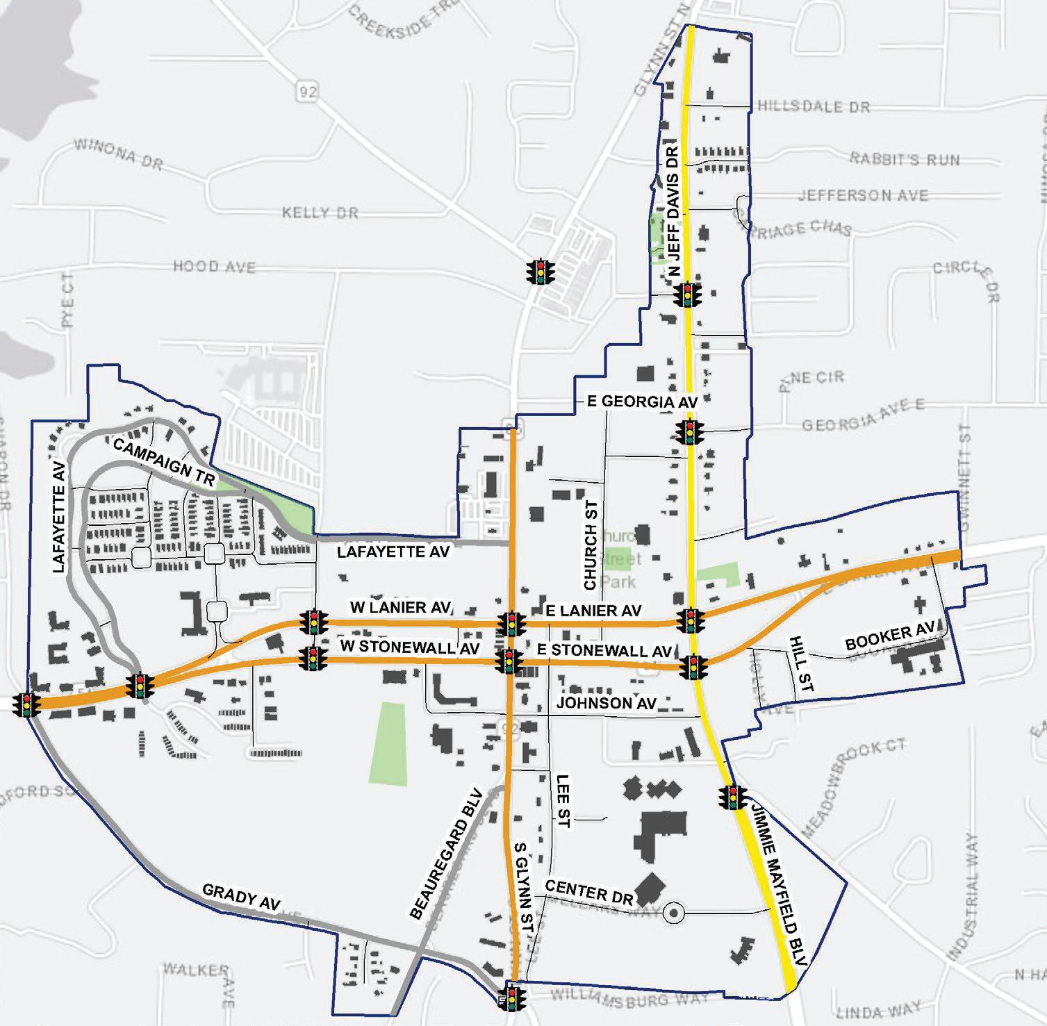
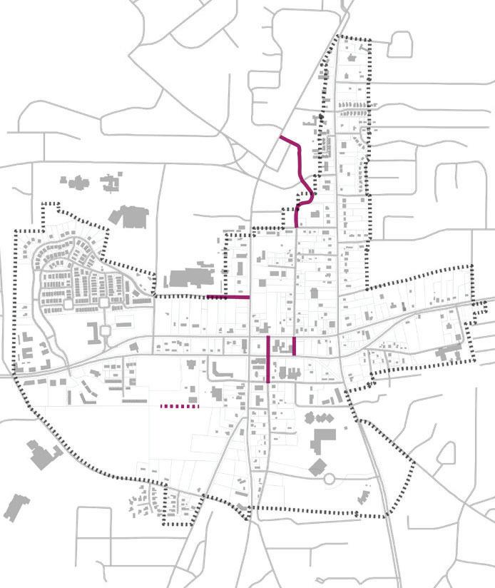
RoadwayFacilitiesMap
• Depicts roadway functional classification within the study area
• Illustrates signalized intersections within the study area
TrafficVolumesandLevelofServiceMap
• Illustrates roadway traffic volumes as identified by GDOT count stations.
• Illustrates roadway level of service based on traffic volumes and roadway characteristics
ActiveTransportationFacilitiesMap
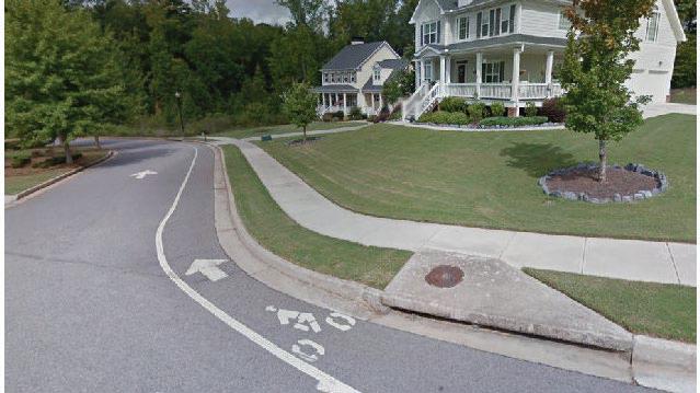
• Illustrates bike lanes, multi-use paths, and sidewalks
QuestionstoConsider
• What gaps exist within the transportation system?
• What information is missing from the existing conditions analysis?
• Where can traveler safety be improved?
• Where are the opportunities to improve bicycle and pedestrian mobility?
• Where are the opportunities to improve access and connections?
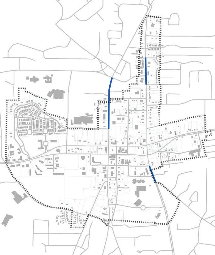
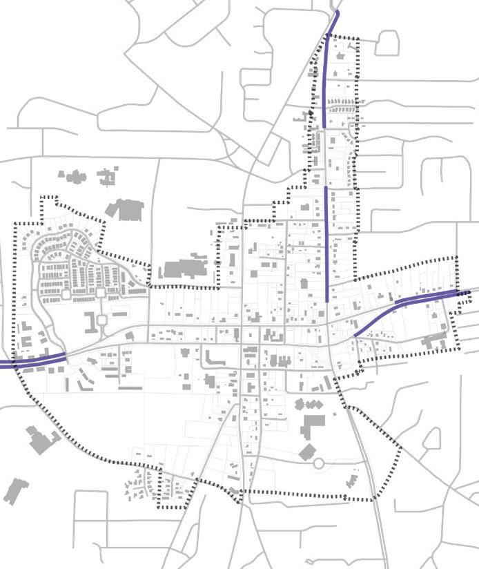
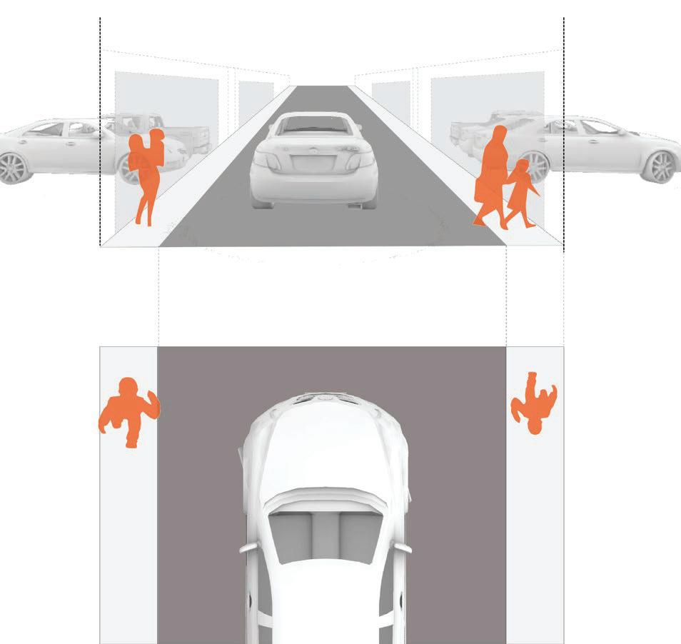
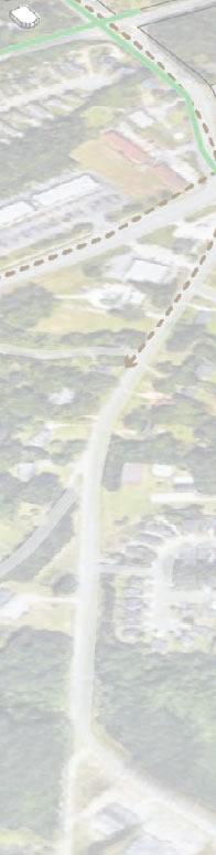
NORTH JEFF DAVIS DRIVE
RecurringThemesAndGoals
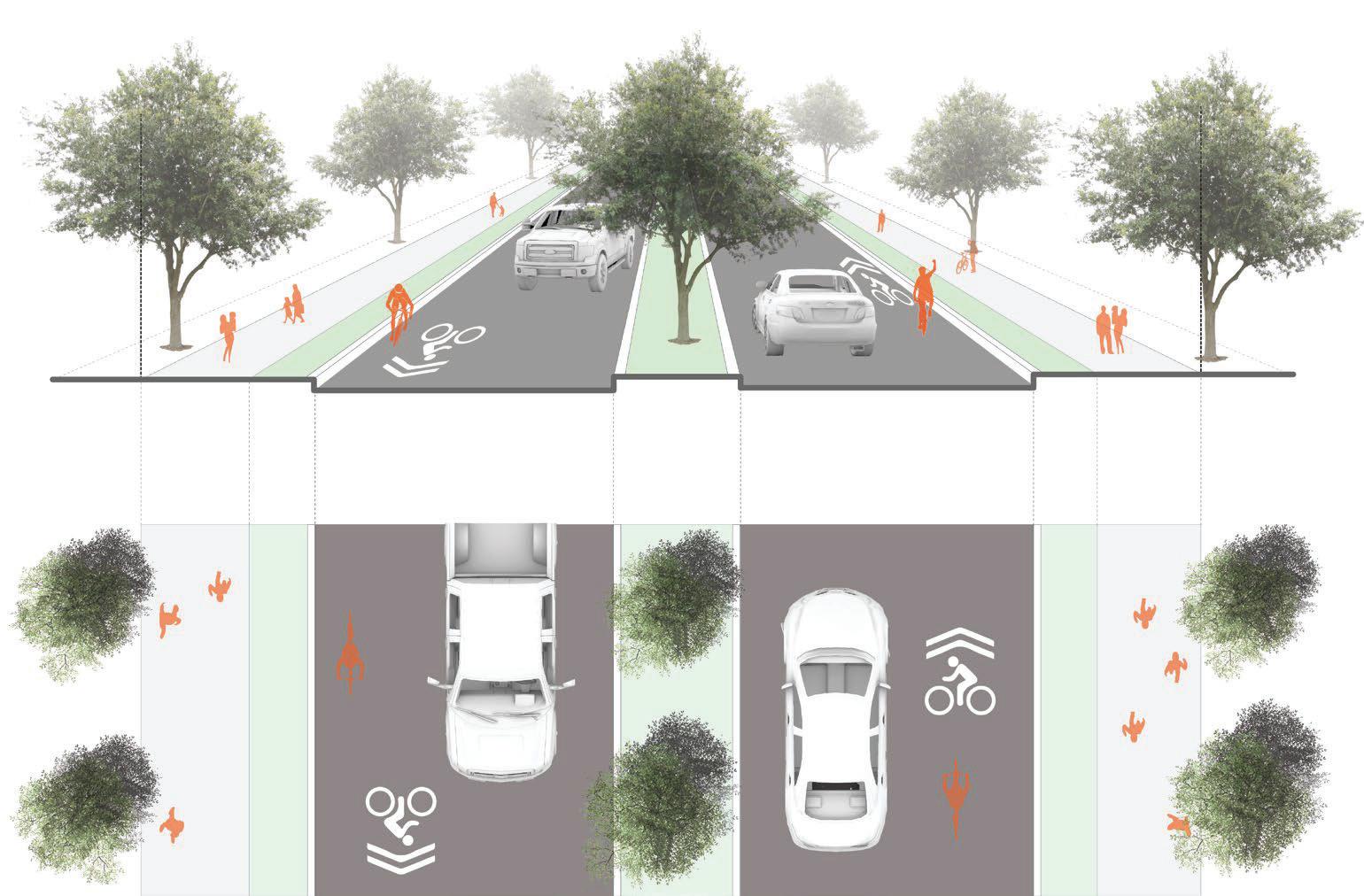
1. Aesthetics
» Improve downtown street-scape
» Unify street-scape along travel corridors into Downtown
2. Prioritize connectivity and walk-ability
» Use redevelopment to create smaller blocks
» Use redevelopment to develop downtown street grid
» Between SR 54/Stonewall Avenue and Grady Avenue
» Develop comprehensive sidewalk network
» Connect with Fayette County multi-use trail system
» Inter-parcel connectivity
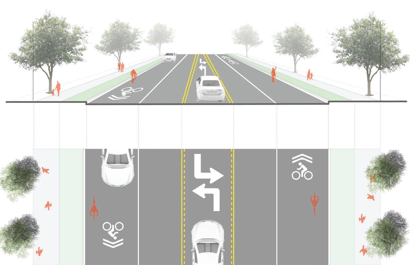
3. Incorporate bicycle infrastructure
» Widen existing bike lanes from 4 to 6 feet
» Extend existing Class II bike facility to Jeff Davis
» Connect existing bike facilities with the larger mobility network
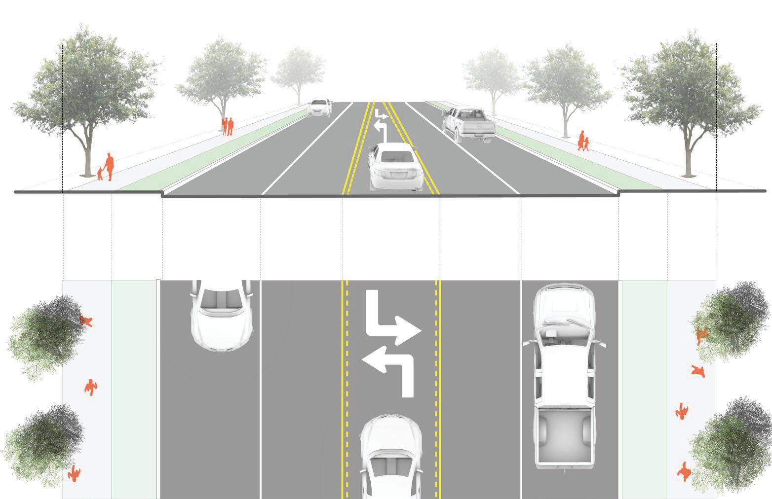
» Extend landscaped median on SR 85/Glynn Street South
» Improve Beauregard Boulevard and SR 85/Glynn Street South intersection
5. Parking
» Increased need/demand for parking downtown
» Explore the potential for shared-use parking
» Parking placement for new development
ContinuingNeedsandOpportunities
• Continue operational improvements
• Continue to enhance traveler safety
• Develop a connected street network
• Support redevelopment and place-making activities
• Develop local bicycle network and infrastructure
• Enhance pedestrian mobility
2002LCIStudy
The City of Fayetteville undertook an LCI Study in 2002. The study identified a series of transportation improvements intended to improve connectivity and circulation within Fayetteville’s downtown area. The LCI recommendations mainly focused on congestion relief strategies, safety improvements, and non-motorized travel alternatives. Specifically, the study recommended implementing intersection and traffic signal improvements along SR 85/Glynn Street between LaFayette Avenue and SR 54/Stonewall Avenue. The study also recommended safety improvements for SR 85/Glynn Street, namely the installation of medians.
2010LCISupplementalStudy
The 2010 LCI Supplemental Study is an update to the 2002 LCI Study. Like the 2002 study, the 2010 LCI Supplemental addressed connectivity and circulation within Downtown Fayetteville. The LCI Supplemental placed an increased focused on walk-ability and access management. It also presented concept plans for:
• Extending Hillsdale Drive to SR 85/Glynn Street
• Extending Church Street to Kathi Avenue
• Intersection improvements at SR 92/Forrest Avenue at SR 85/Glynn Street
• Church Street at Kathi Avenue
• Hood Avenue at SR 92/Forrest Avenue Roundabout
2019FayetteTransportationPlan
The Fayette Transportation Plan is Fayette County’s Comprehensive Transportation Plan (CTP) and identifies a set of short-term, intermediate, and long-range transportation system development opportunities. As it relates to the City of Fayetteville, specifically the LCI study area, the Fayette Transportation Plan primarily identifies opportunities to develop the County’s Master Path Plan. It envisions a network of multi-use side paths and trails that run through the Downtown, connecting to provide cross-county and regional movement. Additionally, the Fayette Transportation Plan lends support for the City of Fayetteville’s use of Special Purpose Local Option Sales Tax (SPLOST) program funding, and the development of the Fayetteville City Center.
2019TrafficEngineeringStudy
The 2019 Traffic Engineering Study is an operational analysis of several roadway intersections within the Fayetteville LCI area, focusing on the major roadways entering and exiting Downtown Fayetteville from the north. The Traffic Engineering Study is periodically updated and has been used to identify, prioritize, and program low-cost, easy to implement intersection and signal modifications. Referenced in the 2010 LCI Supplemental Study, the Traffic Engineering Study has been credited with improving vehicular flow through Downtown Fayetteville, reducing delay-based congestion, and improving roadway safety.
RoadwayNetworkInventory
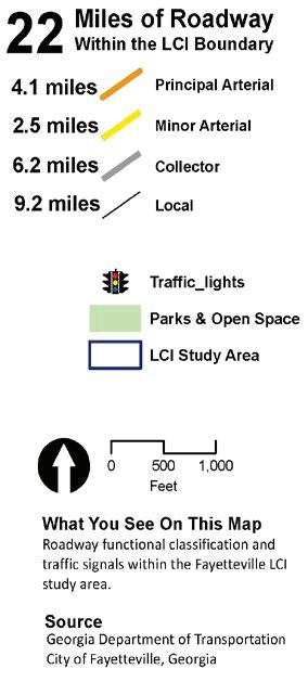
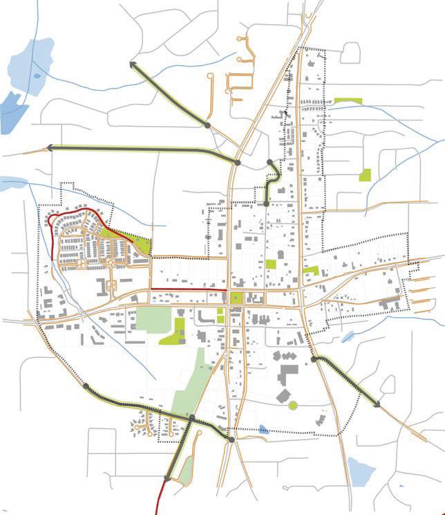
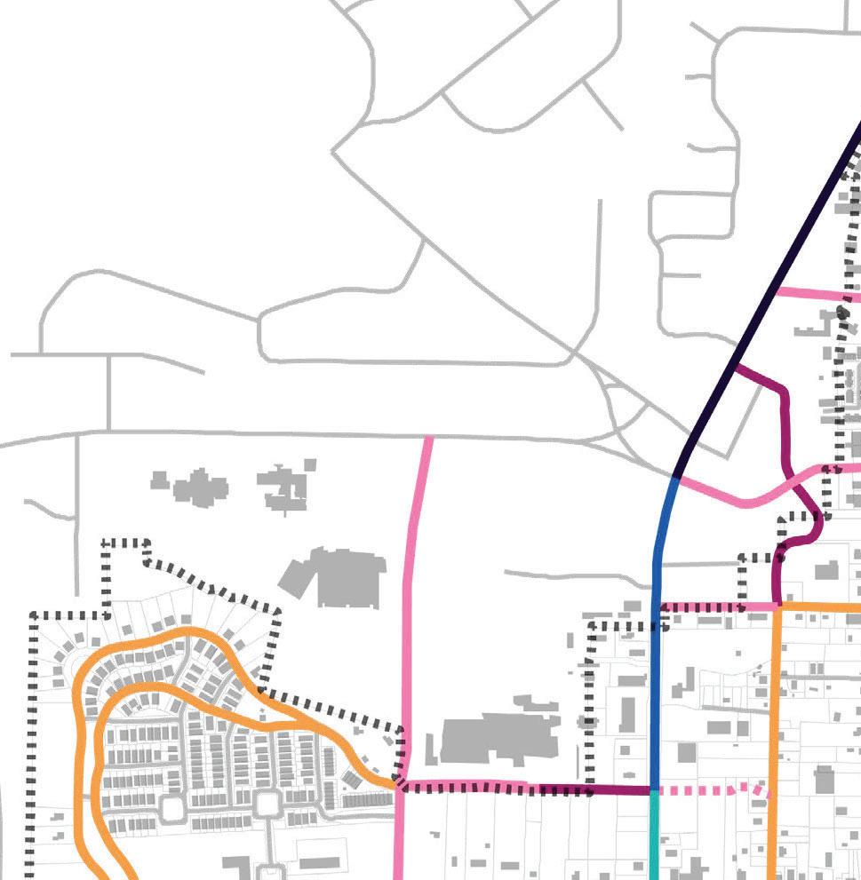
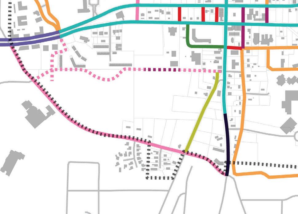
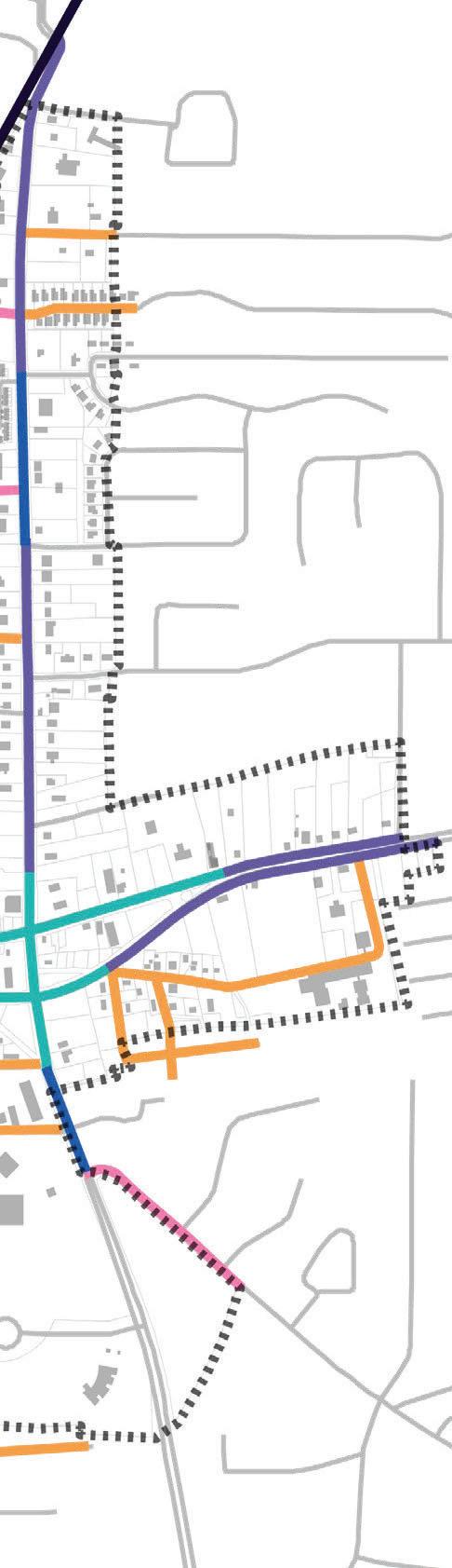
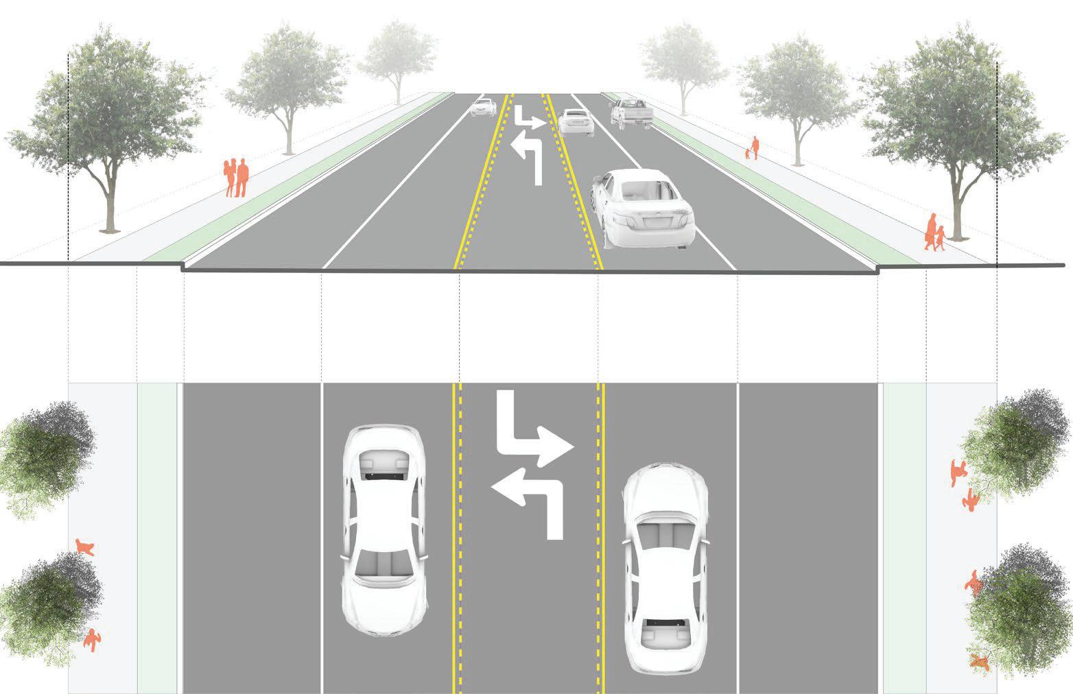
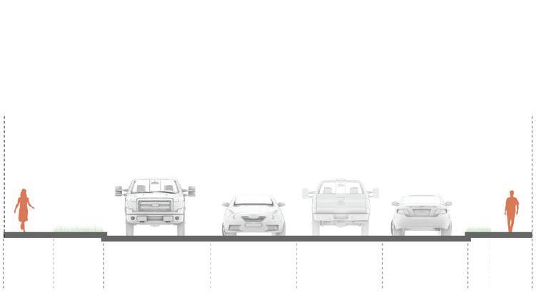
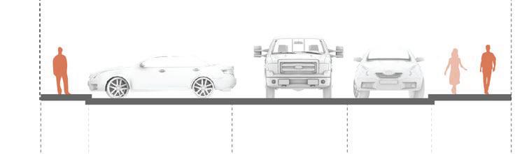
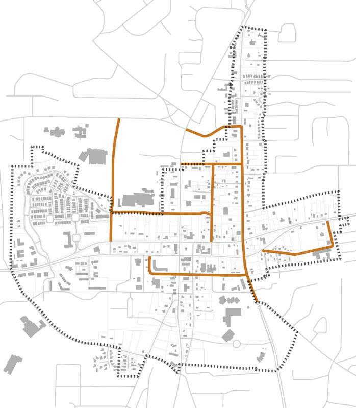
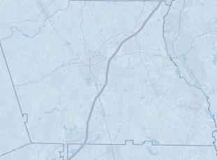
Downtown Fayetteville’s roadway network is not comprised of the traditional grid pattern of streets. Instead, the LCI study area’s roadways are organized in loose hierarchical street classification system. These classifications - principal arterials, minor arterials, collectors, and local streets - define a roadway’s desired functional and operational characteristics. The Fayetteville LCI study area contains approximately 22 miles of total roadway. Principal and minor arterials, 4.1 miles and 2.5 miles respectively, serve as the primary access routes to Fayetteville’s downtown area, and are the principal vehicular travel routes into, out of, and through the LCI study area. Approximately 6.2 miles of collector roads and 9.2 miles of local streets provide for the study area’s internal circulation.
Functionally classified roadways include:
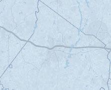
StateRoute54/LanierAvenue
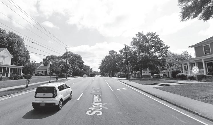
State Route (SR) 54/Lanier Avenue is functionally classified as a principal arterial. For the entirety of its length across the middle of the LCI study area, SR 54 is a median divided facility. For approximately 1.15 miles through Downtown Fayetteville, SR 54 is split into a one-way pair of eastwest streets identified as Lanier Avenue (westbound) and Stonewall Avenue (eastbound). In addition to providing access and thru travel to Downtown, SR 54 connects to residential neighborhoods and commercial development at either end of the study area. West of SR 85/Glynn Road, SR 54/Lanier Avenue hosts a Class II bikeway.
StateRoute85/GlynnStreet
SR 85/Glynn Avenue traverses Fayetteville from north to south and is a five-lane (four-travel lanes and a two-way left-turn lane) roadway. It is functionally classified by the Georgia Department of Transportation (GDOT) as a principal arterial north of SR 54/Lanier Avenue. South of SR 54/Lanier Avenue, SR 85/Glynn Road is functionally classified as a minor arterial. Along the entirety of its length through the City of Fayetteville, SR 85 primarily serves various commercial land uses.
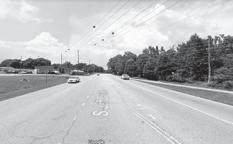
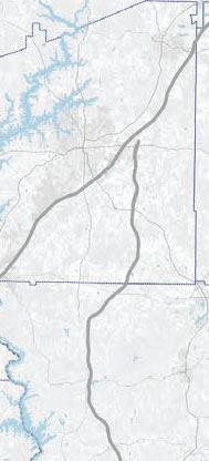
JeffDavisDrive
Jeff Davis Drive is a four-lane roadway facility that is functionally classified as a minor arterial roadway. Traversing the city from north to south, Jeff Davis Drive changes design cross-sections and development character several times within the LCI study area.
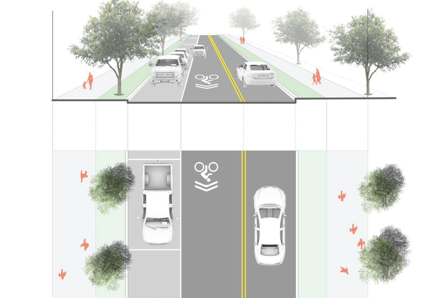
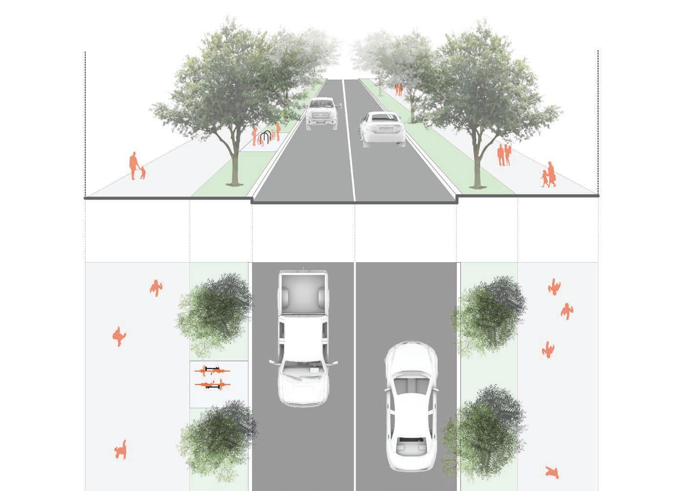
Through rethinking the role of existing roads, solutions are proposed that provide pedestrian connectivity, traffic-calming, and vehicle access where it is most necessary.
GradyAvenue
Grady Avenue is a two-lane major collector roadway that connects SR 54/Lanier Avenue with Beauregard Boulevard and SR 85/Glynn Street. Grady Avenue’s development character is variable over its length, with commercial and office developments located at its nodes with SR 54/ Lanier Avenue and SR 85/Glynn Street. Grady Avenue is characterized by residential development and large undeveloped parcels between its two major intersections.
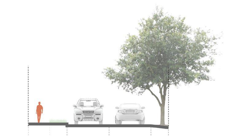
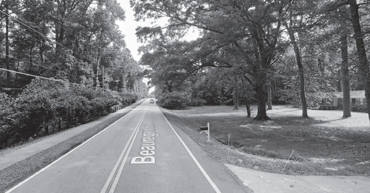
BeauregardBoulevard
Beauregard Boulevard is a two-lane minor arterial roadway with nodes within the LCI study area at SR 85/Glynn Street and Grady Avenue. Beauregard Boulevard is characterized by large lot residential development and undeveloped land parcels within the study area.
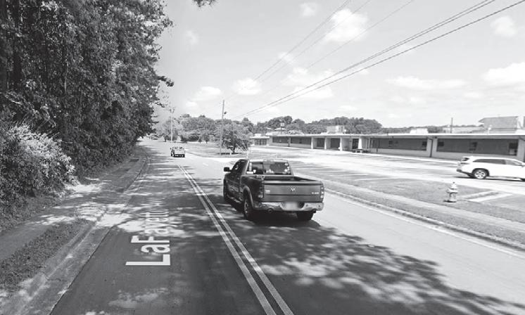
LaFayetteAvenue
LaFayette Avenue is an east-west roadway that connects SR 85/Glynn Street and SR 54/Lanier Avenue. Although classified as a local roadway by GDOT, the City of Fayetteville has identified LaFayette Avenue as a collector roadway. The facility is the primary access to the Villages at LaFayette, a planned community. Between SR 85/Glynn Street and Tiger Trail, LaFayette Avenue is a three-lane (two lanes westbound, one lane eastbound) roadway. It serves traffic related to the Fayette County Public Schools as both administrative functions, and the Fayette County High School are located along the street. West of Tiger Trail, LaFayette Avenue becomes a two-lane median divided roadway that primarily serves residential land uses within the Villages at LaFayette planned community. At Campaign Trail, LaFayette Avenue becomes a one-way roadway going westbound toward SR 54/Lanier Avenue. Eastbound oneway traffic travels along Campaign Trail through the Villages at LaFayette. On-street bike lanes are present on both LaFayette Avenue and Campaign Trail.
The LCI study area’s roadways are controlled by a variety of traffic control devices. Most intersections internal to residential neighborhoods within the study area are stop controlled by all-way signs. This is consistent with the low-speed and walkable nature of the study area’s neighborhoods. The LCI study area, however, does not have a consistent street grid, and the street network is reflective a suburban community whose development follows a linear path along major travel corridors. Traffic signals are present along arterial roadway that traverse the study area and bisect the downtown area. These signals help to facilitate higher volumes of traffic flow at major intersections.
Grady Ave.
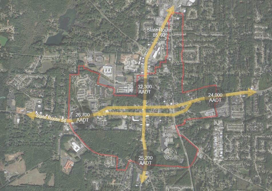
RoadwayOperations
Since the early 2000s, traffic volumes on SR 54/Lanier Avenue and SR 85/Glynn Street have declined, and appear to have plateaued. 2019 Average Annual Daily Traffic (AADT) taken from GDOT’s Traffic Analysis and Data Application (TADA) system shows that AADT along SR 54/Lanier Avenue west of Downtown was 26,700 vehicles per day. West of SR 85/Glynn Street, the SR 54 one-way pair comprised of W. Lanier Avenue (eastbound) and Stonewall Avenue (westbound) has an AADT of 11,500 vehicles per day and 13,100 vehicles per day, respectively. East of SR 85/Glynn Street, Lanier Avenue has an AADT of 11,500 vehicles per day; Stonewall Avenue has an AADT of 10,300 vehicles per day. East of Downtown, SR 54/Lanier Avenue has an AADT of 24,000.
SR 85/Glynn Street, between LaFayette Avenue and SR 54/ Lanier Avenue, has an AADT of 32,200 vehicles per day. SR 85, between Stonewall Avenue and Beauregard Boulevard, has an AADT of 25,200 vehicles per day. Between Beauregard Boulevard and Grady Avenue, SR 85 has an AADT of 22,200 vehicles per day.
Jeff Davis Drive near Rabbit Run has an AADT of 17,700 vehicles per day. Grady Avenue near Bradford Square has an AADT of 13,000 vehicles per day. Grady Avenue near Beauregard Boulevard has an AADT of 10,900 vehicles per day.
AADT data were evaluated using the Florida Department
of Transportation’s General Annual Average Daily Volumes table. This tool is specific to signalized arterials in urbanized areas and considers roadway design characteristics such as thru travel lanes, medians, and exclusive turn lanes. It also considers speed characteristics, directionality, and roadway ownership.
The table below illustrates the AADT versus the available capacity per the volume General Annual Average Daily Volumes.
Data shows that traffic volume has plateaued on major streets. Fayetteville moves forward by considering how streets are not only efficient, but also safe.
The 2019 Traffic Engineering Study went further to analyze roadway operations and evaluated several intersections within the LCI area. Because this evaluation process is ongoing and past improvements recommendations have been implemented, most of the intersections analyzed operate sufficiently under existing conditions. The SR 54/Lanier Avenue at Grady Avenue intersection and the SR 85/Glynn Street South at Beauregard Boulevard intersections were the two exceptions. Both intersections operate at a level of Service D, which is not bad but also not good. They are expected to experience significant delays under future conditions without any new development being added to them. The 2019 Traffic Engineering Study is included in the Appendix.
ActiveTransportationFacilities
PedestrianAccommodations
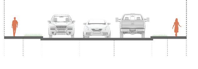
Sidewalks or shared-use paths are generally present along all streets within the LCI study area, with a few exceptions. The pedestrian experience when traveling on these facilities varies greatly and is dependent on factors such as:
• Traffic volume
• Sidewalk width and physical condition
• Quality of the sidewalk surface
• Obstructions
• The presence of landscaping and street furniture
• Public art (g) building frontages, and
• Neighboring use
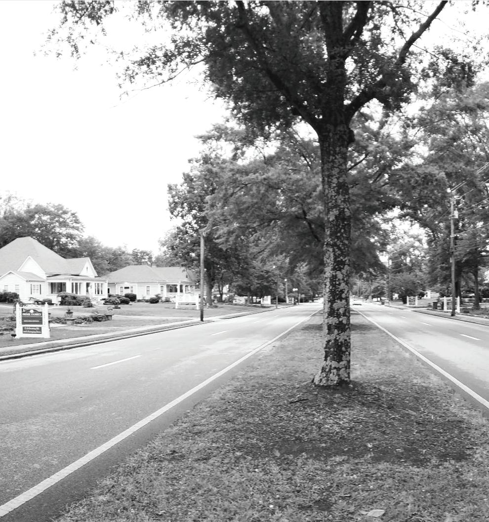
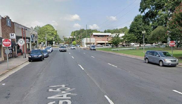
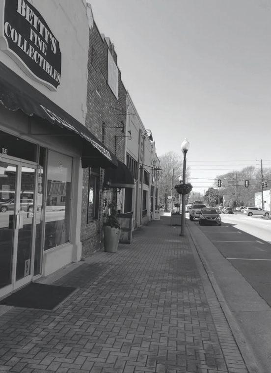
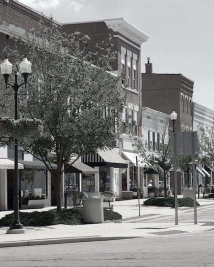
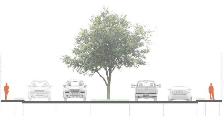
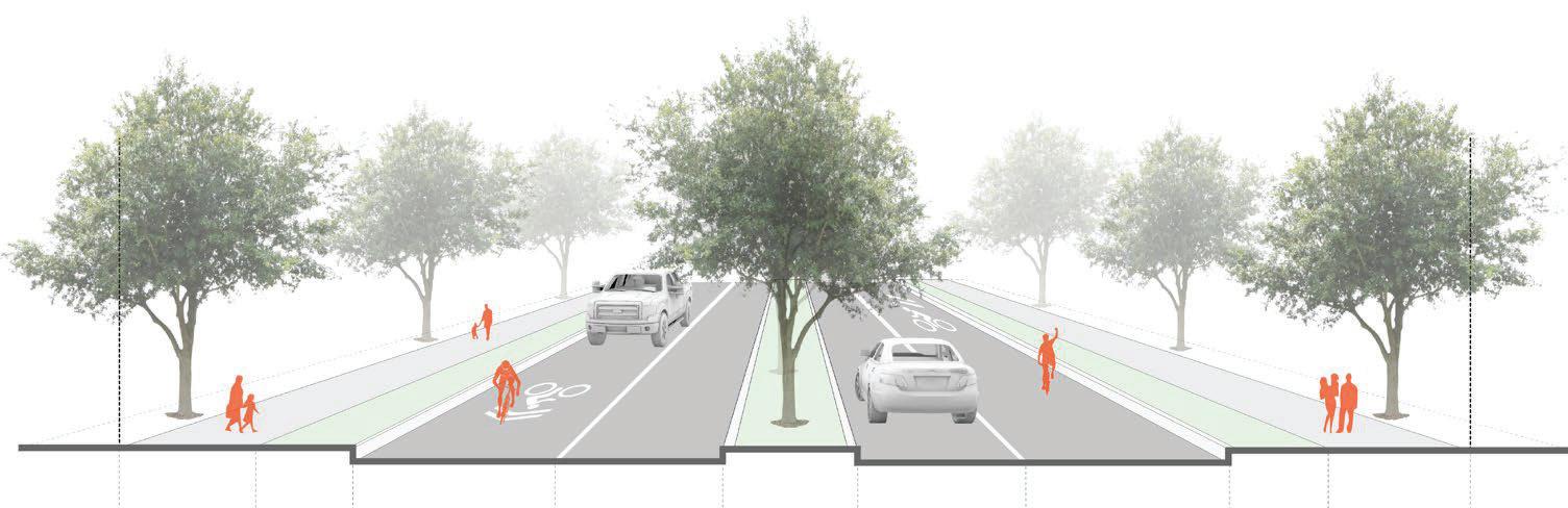
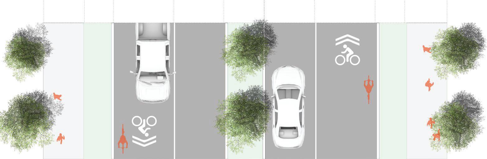
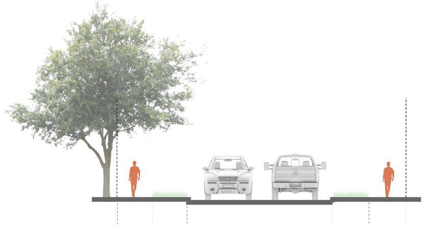
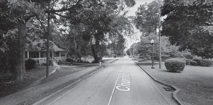
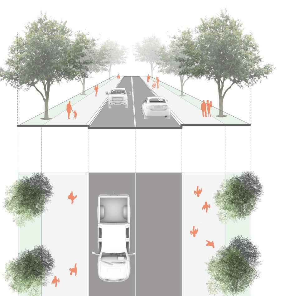
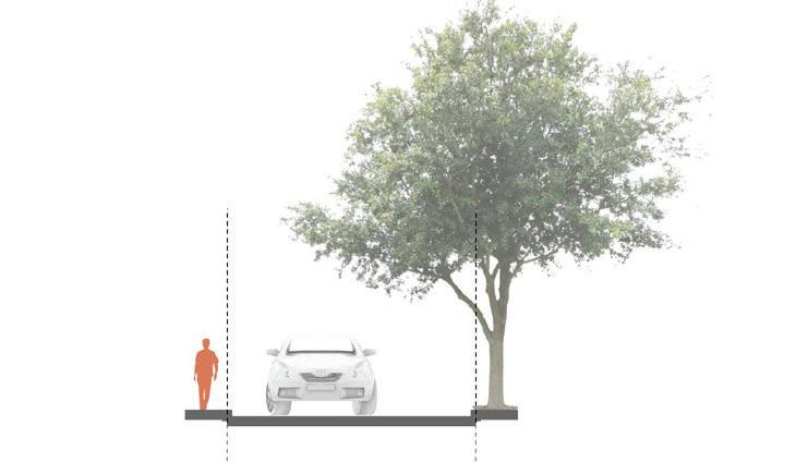
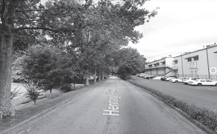
W. Lanier Avenue and Stonewall Avenue, between SR 85/ Glynn Avenue N. and Tiger Trail, features a pedestrian realm that accommodates employees and visitors to the area. Street furniture, e.g., sitting benches and landscaping, provide a comfortable pedestrian environment where people are encouraged to stroll, linger, and sit along W. Lanier Avenue and Stonewall Avenue. Sidewalks along the LCI area's other arterial and collector roadways and local streets also facilitate pedestrian travel.
Marked crosswalks facilitate pedestrian crossings at intersections through downtown Fayetteville along the primary travel corridors. Generally, marked crosswalks are present on all legs of signalized or all-way stopcontrolled intersections. Some side-street stop-controlled intersections – LaFayette Avenue at SR 85/Glynn Street N. and Beauregard Boulevard/Redwine Road – are missing crosswalks to facilitate movements between sidewalk endings/beginnings.
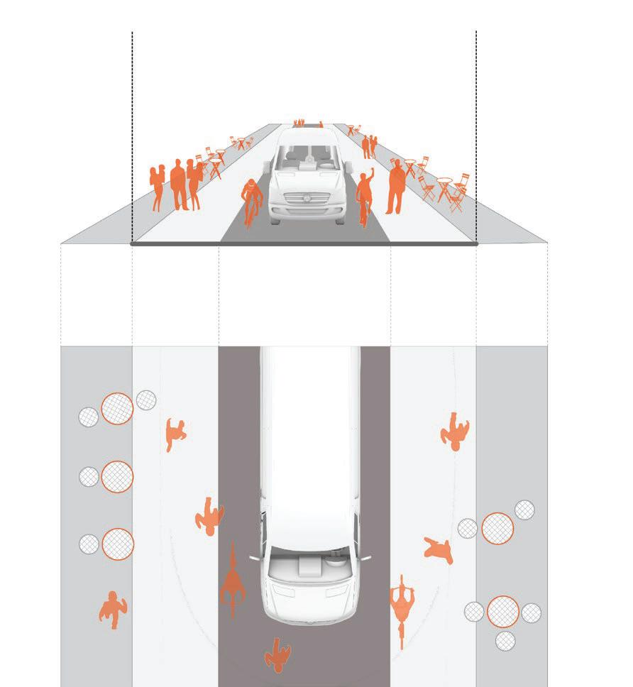
Some of the pedestrian network challenges include gaps in the network, especially between facilities located on functionally classified roadways and local streets, and between regional facilities entering the study area from different directions. Identified challenges include the brick sidewalk pavers along both Lanier Avenue and Stonewall Avenue. While attractive and adding to the downtown area's historic charm, this decorative surface material could potentially pose risks to mobility challenged individuals, particularly to those who are unsteady on their feet or use mobility assistance devices such as walkers, canes, or wheelchairs. This is especially true if the pavers are not well maintained. Risks to travelers come from loose, tilted, or cracked pavers or large gaps between them. Another identified challenges to travelers using sidewalks and side paths, especially on local streets, is adequate maintenance (or lack thereof) of vegetation adjacent to the facilities. Overgrown bushes, low hanging tree branches, and grass growing onto the path can push travelers off the sidewalk/ sidepath and street.
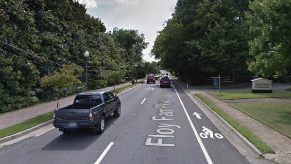
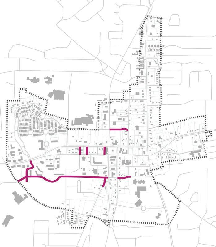
BicycleFacilities
There are two Class II bicycle facilities within the LCI study area. Class II facilities, commonly referred to as bike lanes, are dedicated facilities for bicyclists immediately adjacent to automobile traffic. Class II facilities are identified with striping, pavement markings, and signage. The West Lanier Avenue bike lane extends approximately 1,500 feet from SR 85/Glynn Street North to Tiger Trail. The LaFayette Avenue bike lane extends from Tiger Trail to SR 54/W. Lanier Avenue, through the Villages at LaFayette community.
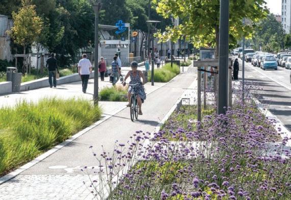
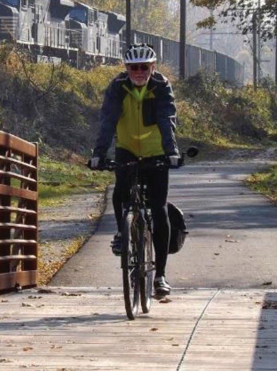
The LCI study area ensures that the pedestrian experience is safe, comfortable, and continuous. Giving people the ability to walk or bike lowers traffic volume and enables them to be healthier through physical activity.
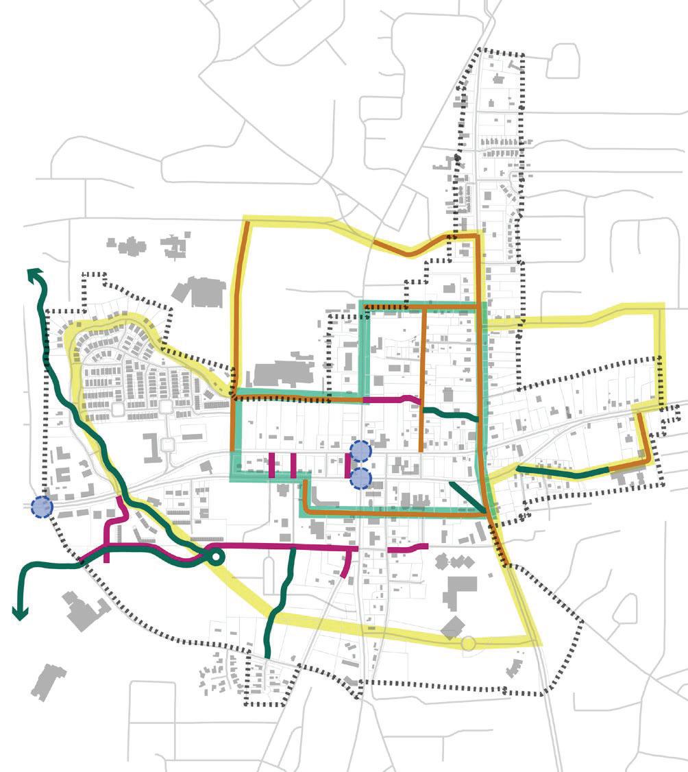
Pedestrian and Bike Network in the LCI Study Area
LaFayette Ave. Bike Lane Photo Credit: Google Streetview
W. Lanier Ave. Bike Lane & Side Path Photo Credit: Google Streetview
Bicyclists traveling within the LCI area can utilize the onstreet bicycle infrastructure, off-street infrastructure such as shared-use trail facilities, and bicycle-friendly street, i.e., roads that are low-volume and low-speed, to access and move around the study area. At present, there are no public bicycle parking or storage facilities, especially within the downtown area.
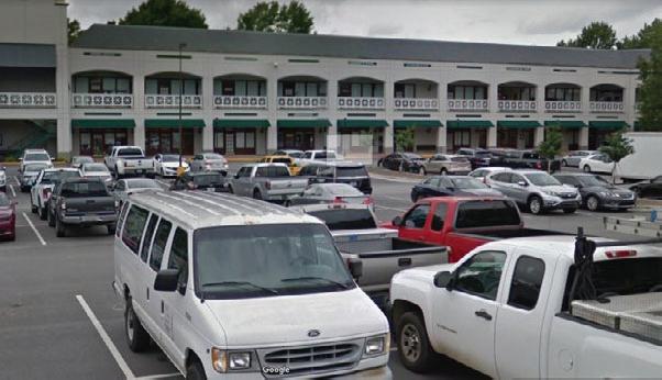
Parking
The 2002 LCI Study discussed the need for additional public parking to support commercial and mixed-use land uses. As noted in that study, the existing parking supply for existing commercial and mixed-use parking was underutilized during peak demand periods by an estimated 40-50%. The subsequent 2010 LCI Supplemental Study recommended incorporating shared use parking for new development when feasible, reducing parking requirements as an incentive for redevelopment, and adding bicycle parking. Additionally, the 2010 study recommended making public parking more easily accessible. This sentiment was echoed by City of Fayetteville staff during the project kickoff meeting, particularly during discussions about creating and utilizing civic spaces. City staff shared plans for the new City Hall development pointed out that public parking will be available as a part of this project, renovations to the Fayetteville Library, and the development of the proposed City Center Parkway.
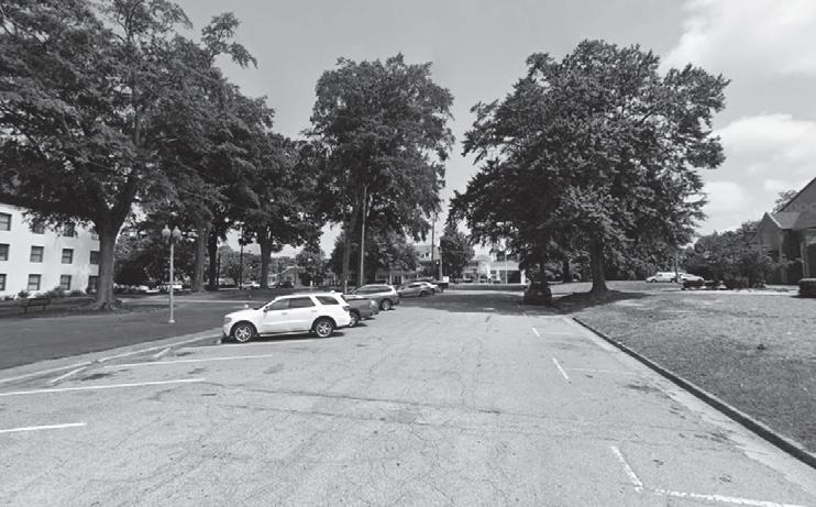
A high-level windshield survey was performed of parking using Google maps and information obtained from the City of Fayetteville’s website. The survey was intended to identify existing on-street and public parking supply within Downtown and inform a census of public surface parking.
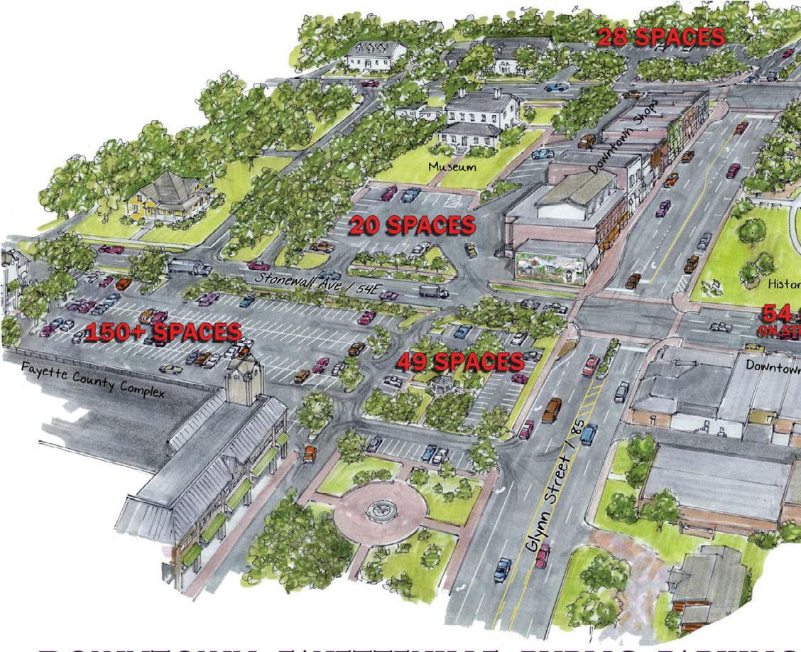
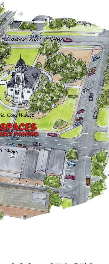
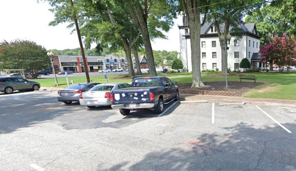
Between SR 85/Glynn Street between Lanier Avenue and Stonewall Avenue and along Stonewall Avenue between SR
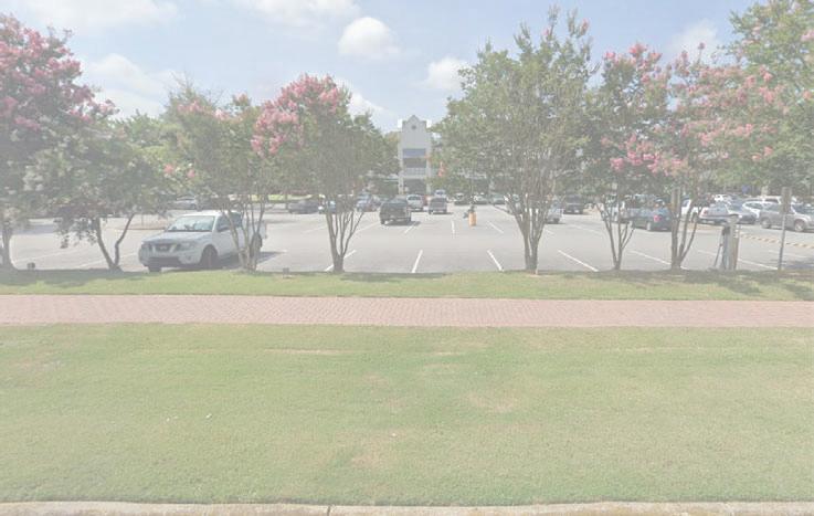
85/Glynn Street and Less Street, a total of twenty (20) onstreet parking spaces are available to the store front shops. Forty-eight (48) on-street parking spaces also are available around the Historic Courthouse. An estimated 340 parking spaces are available in public surface parking lots within downtown. This includes 224 parking spaces at the Fayette County Annex Complex, 20 spaces at the Holiday Dorsey Five Museum, and 28 spaces at 145 Lanier Avenue. Each of these is within walking distance to downtown attractions and restaurants.
An estimated 340 parking spaces are available in public surface parking lots within downtown... Each of these is within walking distance to downtown attractions and restaurants.
Downtown Shops - Stonewall Parking Fayette County Annex Parking
Public Parking in Downtown Fayetteville
In addition to the existing on-street and surface parking, the City of Fayetteville will expand its parking inventory in 2021 with the opening of its new City Hall complex. 218 parking spaces are included as a part of this facility’s development. The parking will be situated along two parallel driveways located on either side of the new complex. These driveways will enable entry and egress onto Stonewall Avenue and entry and egress onto a new east-west roadway, City Center Parkway, located south of the development. Parking along the driveways will be configured like head-in onstreet parking spaces and protected by curb-extensions that frame the driveways’ travel lanes. Eighttwo (82) parking along the new City Center Parkway also will be head-in parking protected from the travel way by curb extensions. In total, 300 new parking spaces will be created with the new City Hall development and the City Center Parkway’s first phase.
FutureDowntownParking
An additional 300 parking spaces will be added to Fayetteville’s downtown parking inventory with the opening of the new Fayetteville City Hall complex. 218 surface parking spaces are included on the City Hall campus. 82 on-street spaces are include in the first phase of the new City Center Parkway.
Historic Courthouse Parking
Built Environment and Zoning
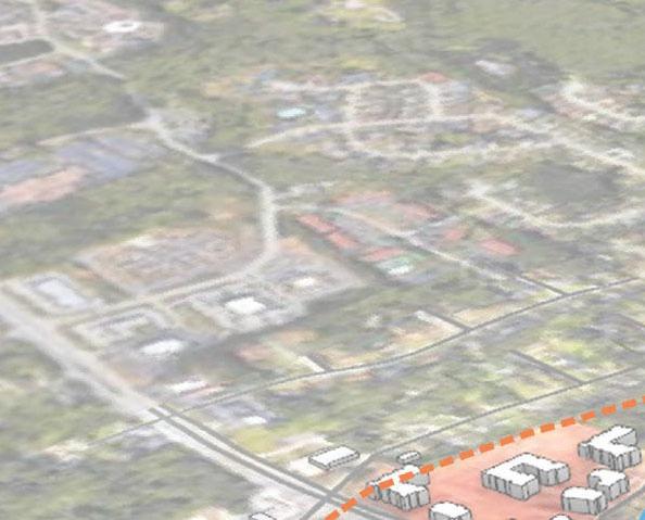
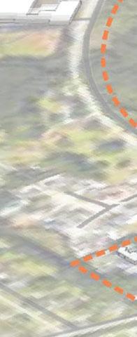
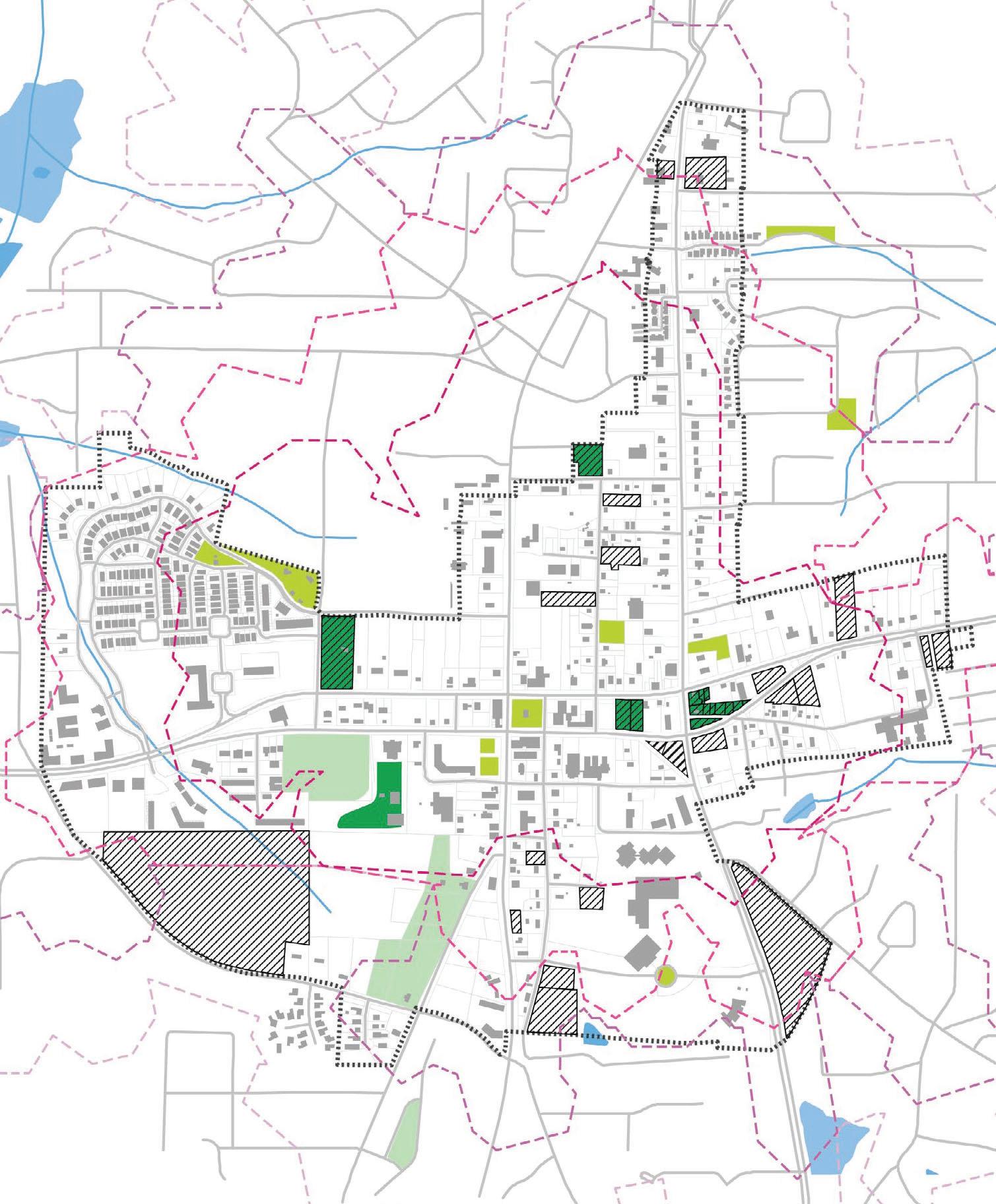
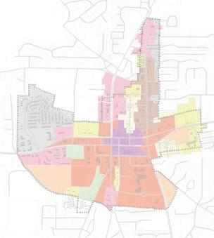
ExistingCharacterAnalysis
Purpose
• To gain a better understanding of the built and natural characteristics of the Downtown study area and the various places that they create within Downtown.
• To observe how recent and new developments impact or will impact the prevailing character of their surroundings.
• To serve as a basis for a discussion with the City about the prevailing character areas and their future treatment through zoning.
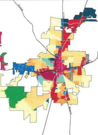
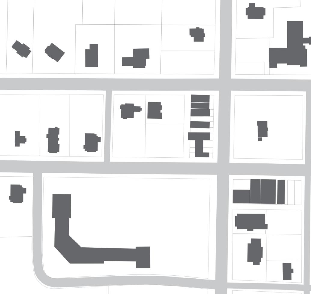
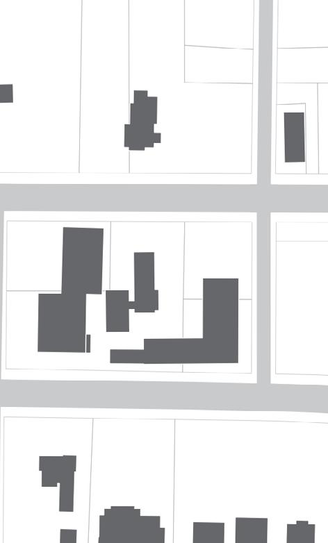
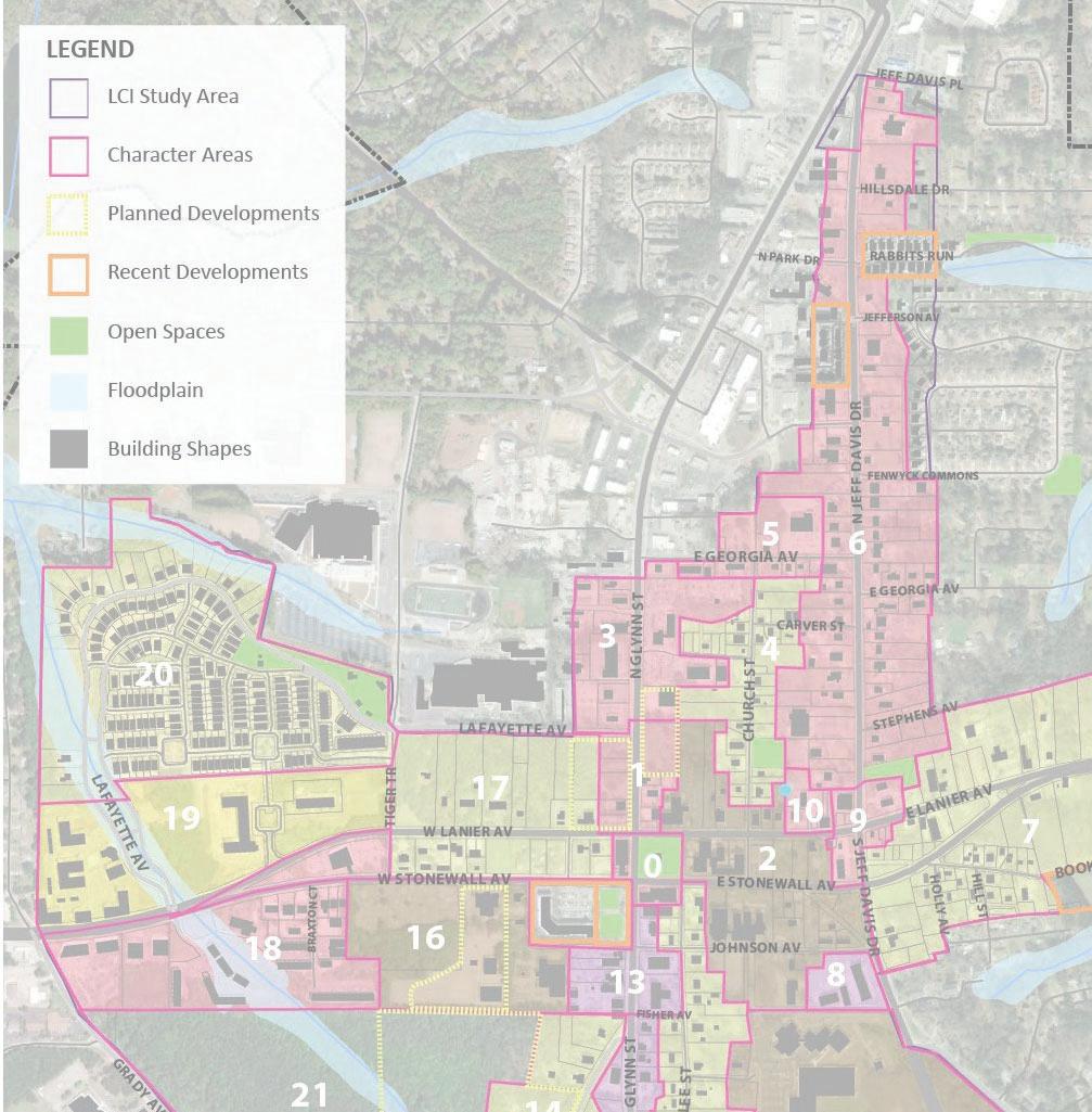
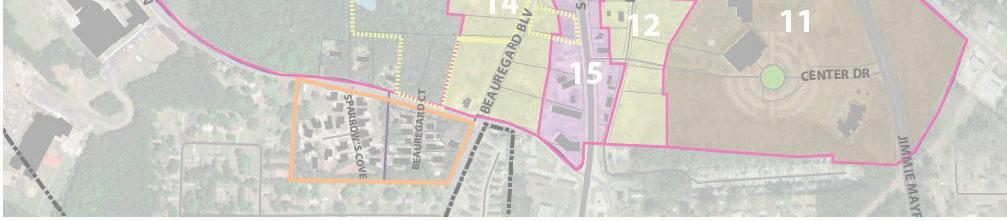
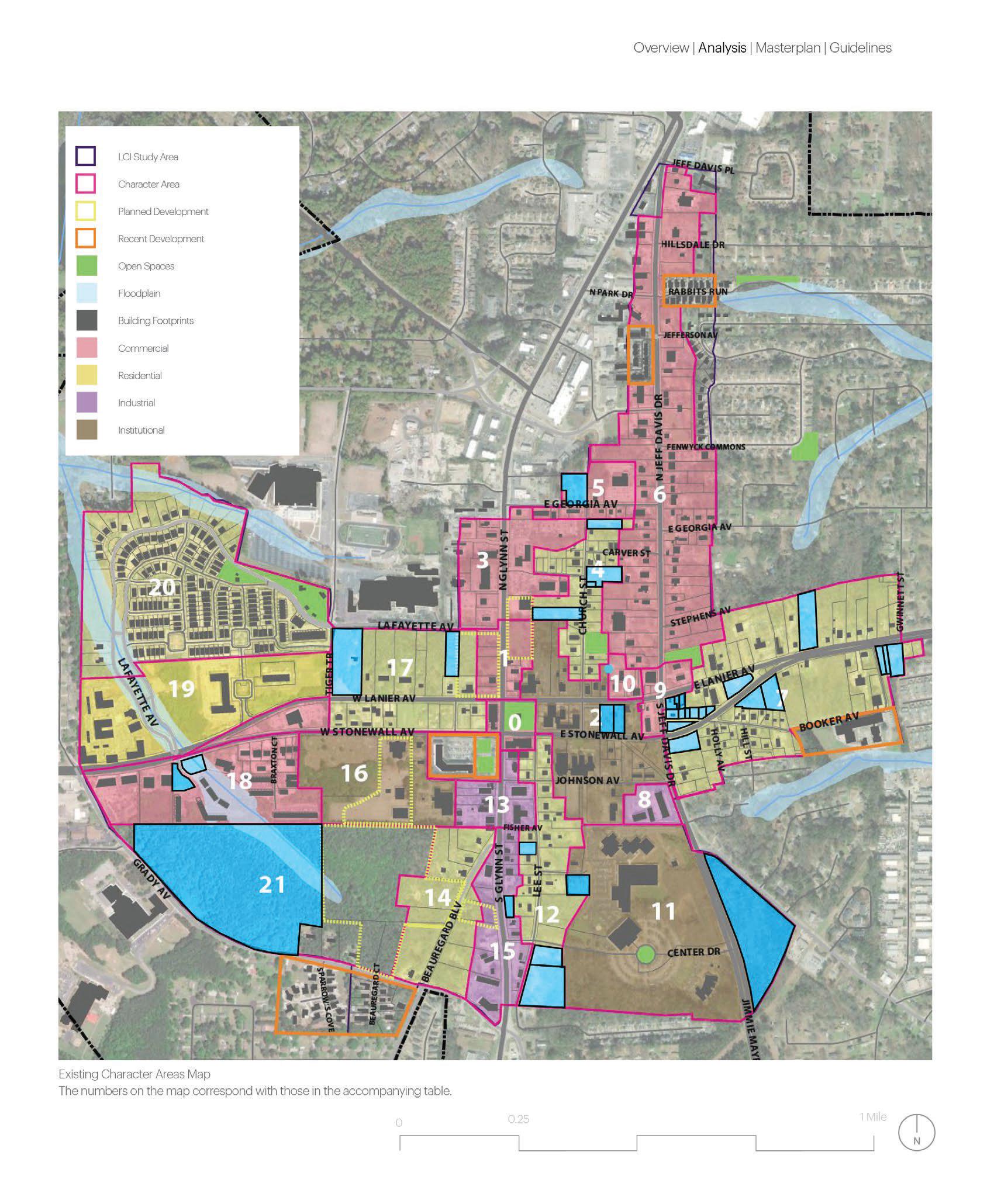
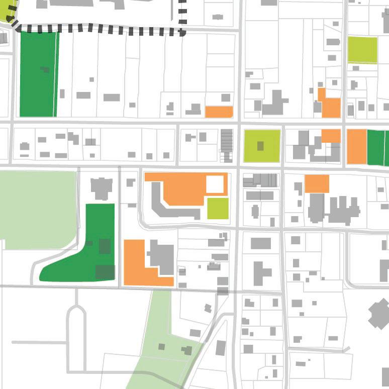
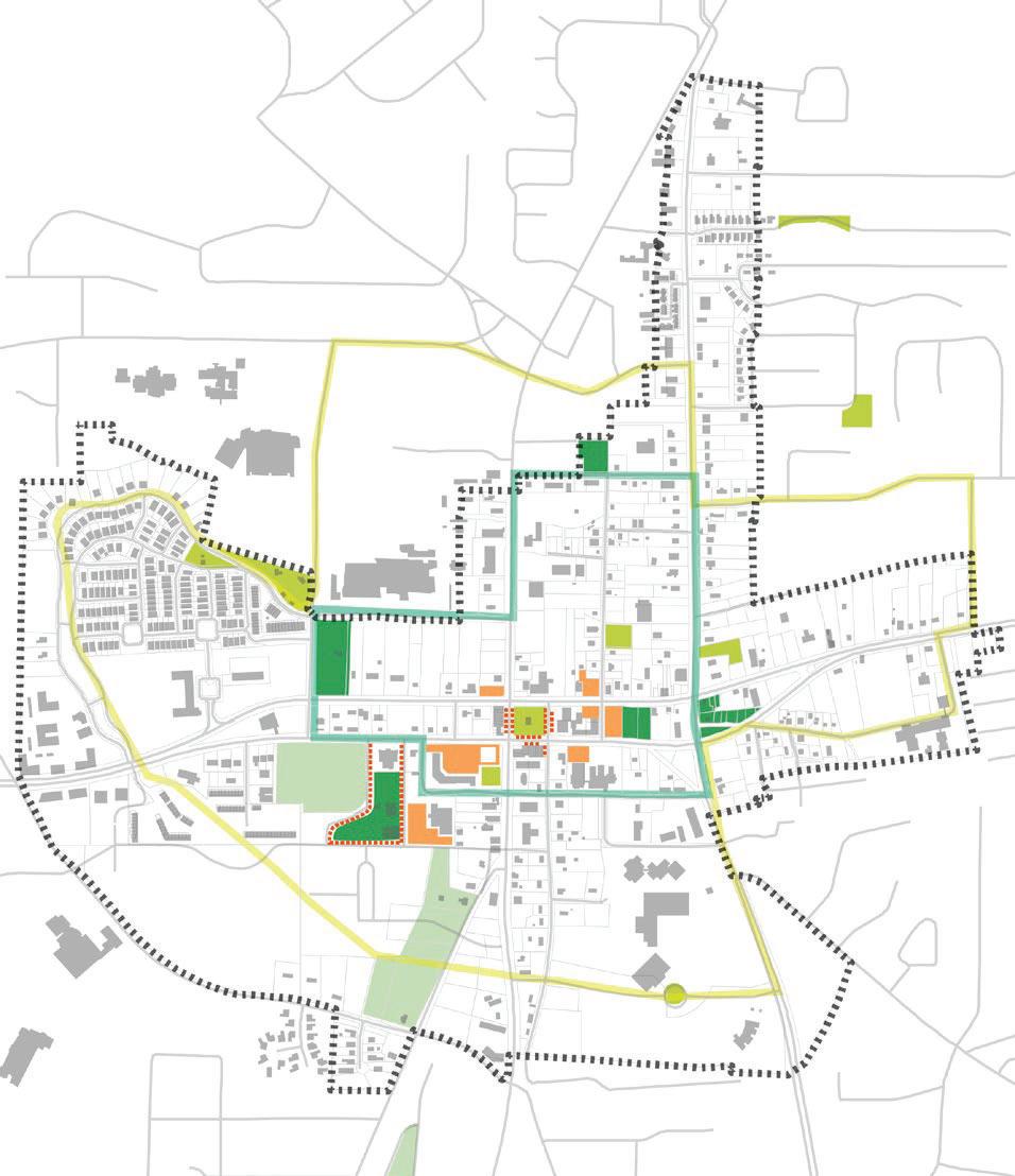
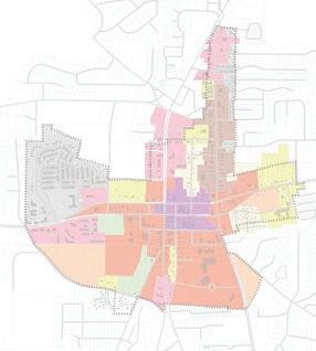
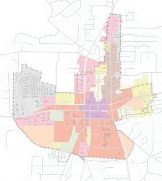
ExistingMap&Table
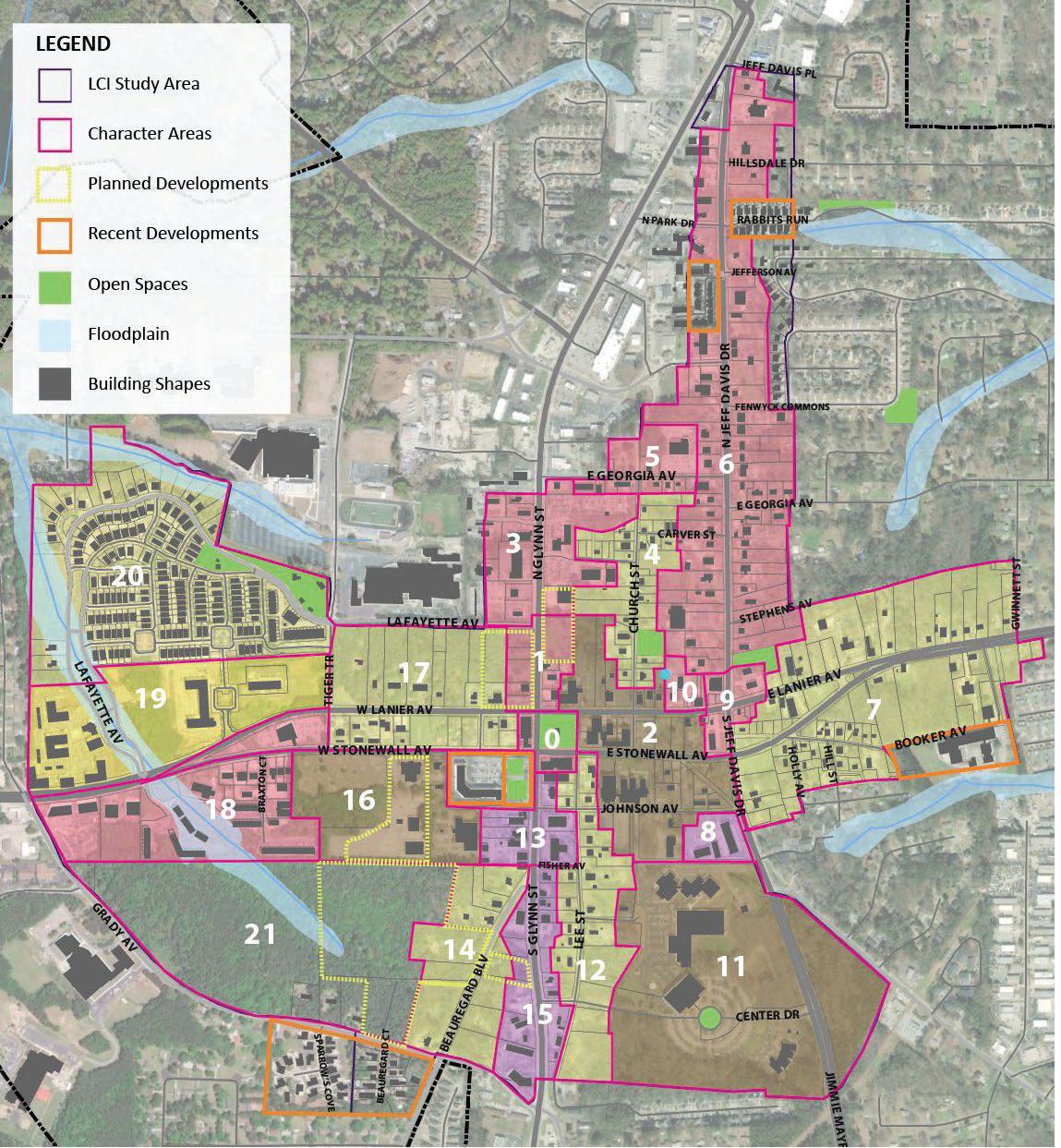
• Depict “character areas” based on common: building forms, orientation of buildings toward streets, setbacks, front yard treatment, street characteristics, property lines, and land uses.
• The table assigns a number and descriptive name for each character area, along with identifying the type of place it is (a District, Corridor, Node, or Neighborhood), The numbers on the map correspond with those in the accompanying table.
• The colors of the character areas correspond with the predominant land use (red for commercial, yellow for residential, purple for industrial, and brown for institutional) the predominant building type present, the zoning districts that currently apply, along with many character attributes.
The Villages at Lafayette Park
Existing Character Areas Map
The numbers on the map correspond with those in the accompanying table.
HIGHWAY92NORTH
The following district designations are from the City’s zoning regulations (Sec. 94-31) and are meant to be referenced with the Existing Zoning column in the Existing Character Areas Table.
ZoningDistrictsLocatedWithinDowntown
RP Residential Professional
This district is created to provide an area in which residential, business, professional, educational, and institutional uses can be compatibly mixed while maintaining a healthful living environment for residents of the district.
OI Office-Institutional
This district is created to provide areas in which business, professional, educational, and institutional uses can be compatibly mixed in close proximity to residential land uses. Intensive commercial land uses are restricted or prohibited so as to maintain a healthful living environment for residents of adjacent residential districts.
MO Medical/Office
This district is created to provide a campus like setting that allows for the establishment of local and regional medical centers. The medical/office zoning district also provides the opportunity for allied health services, as well as necessary support businesses, to locate within the MO district.
C-1 Downtown Historic Mixed-Use District
This district is created to enhance and protect the central business district of the city by providing for those commercial uses requiring a central location.
The existing LCI study area has many zoning districts which makes it harder to create a unified vision of Downtown Fayetteville.
Consolidating zoning districts is essential to implement the UDO plan.
C-2 Community, Commercial
This district is created to provide and protect areas for community shopping and service facilities convenient to residential neighborhoods.
C-3 Highway Commercial
This district is created to provide retail trade and service establishments compatible with surrounding residential and office-institutional areas, and for business activities which primarily cater to the traveling public. The C-3 district requires larger yard areas, greater setbacks, and lower building densities than are permitted in the downtown commercial district.
C-4 High Intensity Commercial
This district is created to provide a location for intense retail commercial land uses, requiring large tracts of land and a location away from residential land uses. The C-4 district allows for retail business with a gross floor area greater than 75,000 square feet; however, centers which have these large retail stores must conform to a higher level of development standards. Properties zoned C-4 must entirely abut a minimum of two, four-lane state highways. The four-lane section of the highway shall be at least five miles in length.
M-1 Light Manufacturing
This district is created to provide a location for those light industrial uses which are able to meet comparatively rigid specifications for nuisance-free operation and which do not create excessive noise, odor, smoke, or dust or possess other objectionable characteristics which might be detrimental to surrounding neighborhoods, or to the other uses permitted in the district.
MS Main Street Architectural Overlay
This district is created to promote the beautification of the city, preserve the historic and distinctive architecture and design qualities of the downtown area of the city, and to recognize and protect the unique character and integrity of the downtown area while also allowing for productive land use. This district may overlay any zoning district.
OS Open Space
This district is created to limit development on certain water bodies, watercourses, floodplains, wetlands, groundwater recharge areas, and lands which serve important environmental functions and provide recreational opportunities and open areas for residents. The district is also created to protect lands of natural beauty, tracts of forests, and areas of archaeological and historical significance; and to prevent commercial, residential, and
industrial development from encroaching into flood zones, lands with severe grades of 15 degrees and more, naturally dangerous areas, and to protect the undeveloped nature of lands within the district from the adverse impacts of development. No property shall be zoned OS when said property contains man-made water bodies individually in excess of 500 acres in size.
R-30 Medium Density Single Family Residential
This district is created to provide single-family residential areas with minimum lot sizes of 30,000 square feet protected from the depreciating effects of small lot development and high density and from the encroachment of those uses which are incompatible with a desirable residential environment.
DR-15 Two-Family Residential
This district is created to provide areas for high density oneand two-family residential uses with minimum lot sizes of 15,000 square feet for single-family residences and 18,000 square feet for duplexes.
ZoningDistrictsNotLocatedWithinDowntown
R-70 Low Density Single-Family Residential
This district is created to provide single-family residential areas with a lot size of no less than 87,120 square feet protected from the depreciating effects of small lot development and high density and from the encroachment of those uses which are incompatible to desirable residential environment.
R-40 Low Density Single-Family Residential
This district is created to provide single-family residential areas with a minimum lot size of 43,560 square feet, protected from the depreciating effects of small lot development and high density and from the encroachment of those uses which are incompatible to desirable residential environment.
R-22 Medium Density Single-Family Residential
This district is created to provide single-family residential areas with minimum lot sizes of 22,500 square feet where a central system for the collection of sewage and distribution of water is provided. Said areas being protected from the depreciating effects of small lot development and high density and from the encroachment of those uses which are incompatible with a desirable residential environment.
R-15 High Density Single-Family Residential
This district is created to provide for site-built housing, or industrialized building which complies with all requirements of the zoning ordinance. With this district, the city seeks to provide for single-family residential areas with higher population densities and lot sizes of 15,000 square feet.
RMF-15 Multifamily Residential
This district is created to provide orderly development of high-density residential areas for one-family, two-family, and multifamily dwellings with minimum lot sizes of 15,000 square feet for single-family detached dwellings and 8,000 square feet for first unit, 5,000 square feet for each additional unit for multifamily development, but in no event shall the number of bedrooms exceed 16 per acre.
R-THC Residential Townhouse-Condominium
This district is created to provide for high density, singlefamily, attached fee simple residential development. The minimum size of a R-THC development is five acres and the density of residential development shall be limited to a maximum of six dwelling units per acre.
MHP Mobile Home Park
The mobile home district provides for the establishment of mobile home parks located on unsubdivided land which has single ownership and control, and for mobile home subdivisions where private lots are available for sale to individual mobile homeowners.
M-2 Heavy Manufacturing.
This district is created to provide and protect areas for those industrial uses which cannot comply with the more restrictive requirements of the M-1 district.
BP Business Park
The business park zoning district is created to provide planned, mixed use development along major thoroughfare or expressway corridors, so that accesses onto these corridors are kept to a minimum in order to protect these corridors as expressways and so that persons entering the city along those corridors will receive a good first impression, and to maintain a quality appearance which will stabilize or increase property values.
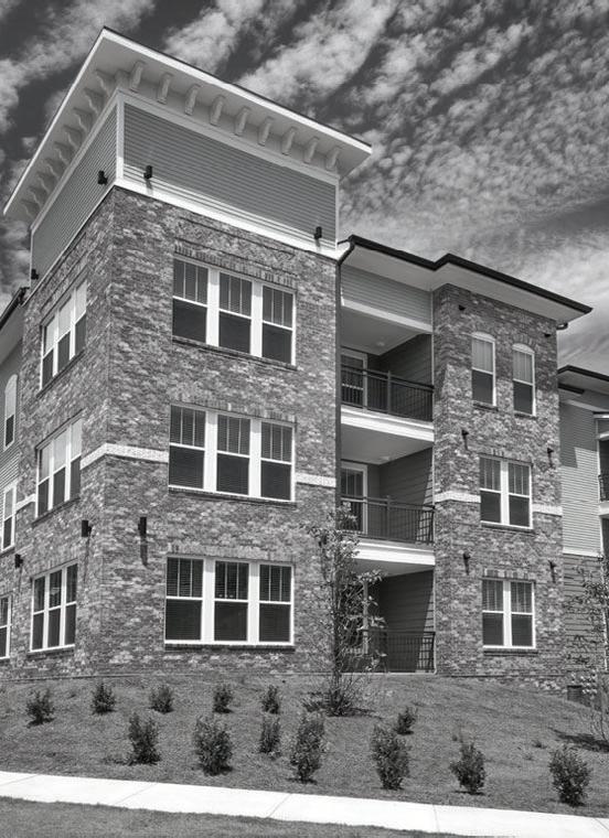
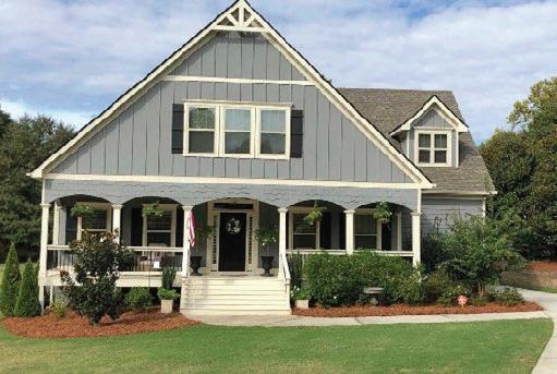
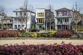
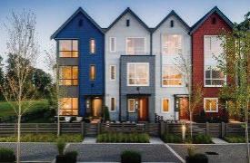
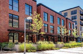
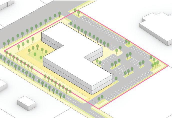
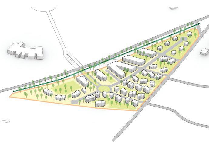
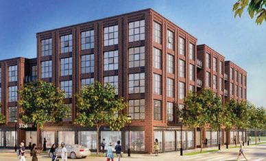
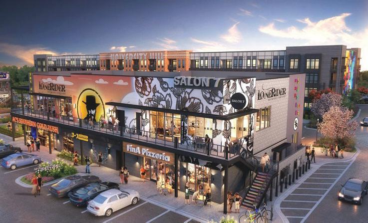
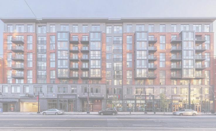
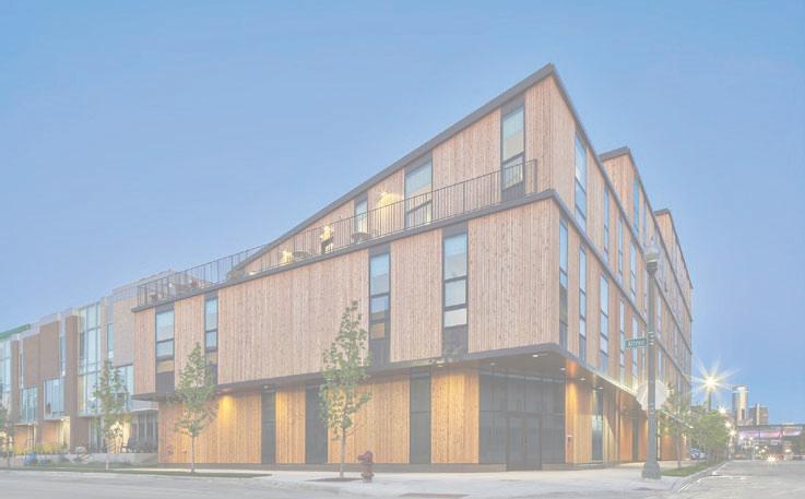
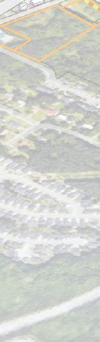
The Meridian Apartments located in the Planned Community Development zoning district (PCD)
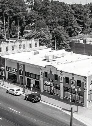
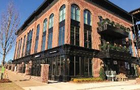
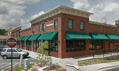
Retail at Stonewall Avenue and Glynn Street located in the Downtown Commercial zoning district (C-1)
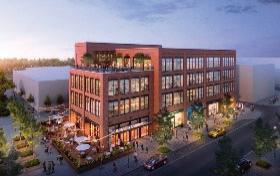
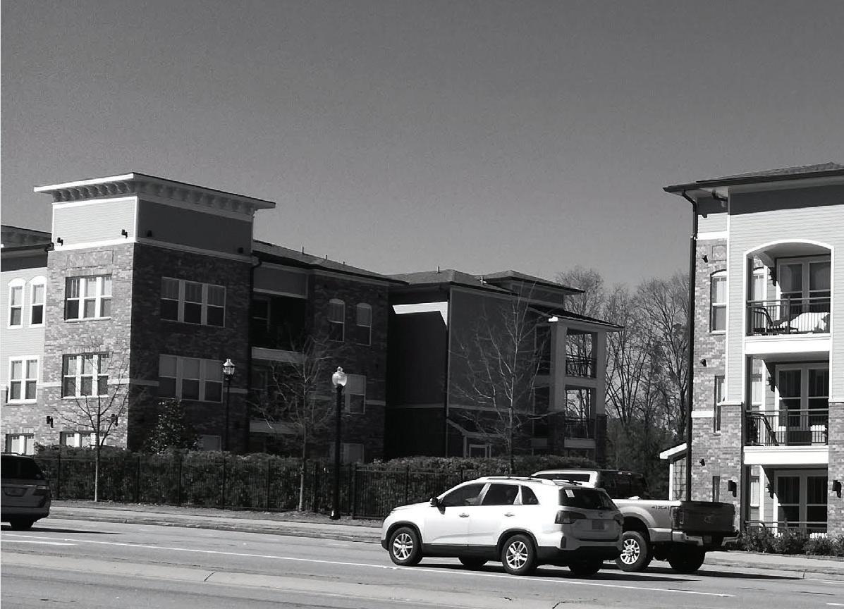
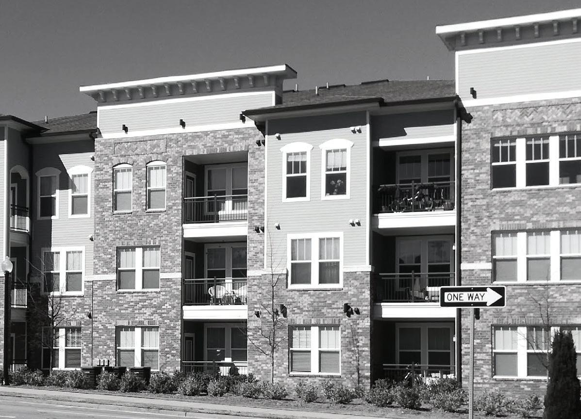
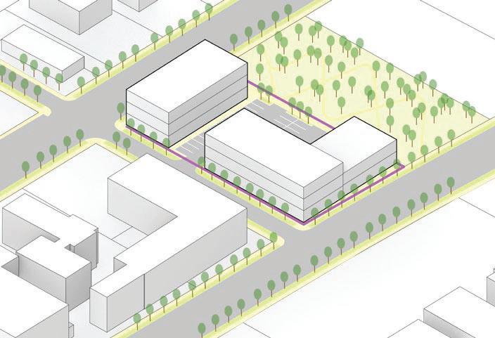
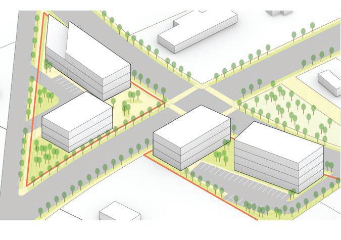
RecentDevelopmentsinStudyArea
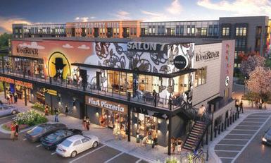
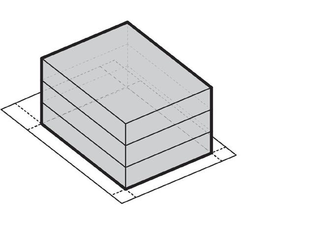
The following images depict representative building types of the “Recent Developments” as highlighted in the Existing Character Areas Map. The new developments that are currently under construction or planned may add new building types, architectural styles, and open spaces to Downtown. Furthermore, new developments outside of Downtown, such as Trilith, also will add new building types, architectural styles, and open spaces to the City.
Rabbit’s RunThe Village at Lafayette Park
Fayette County AdministrationThe Meridian Apartments
Jefferson Intown PlaceSparrow’s Cove
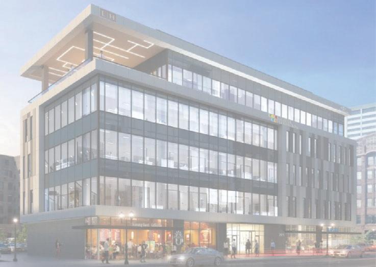
MERIDIAN ON THE SQUARE NEW CITY HALL AND PARK
SPARROW’S COVE
FAYETTE COUNTY ADMINISTRATION
MERIDIAN APARTMENTS
THE VILLAGES AT LAFAYETTE PARK
JEFFERSON INTOWN PLACE
RABBIT’S RUN
WALTON
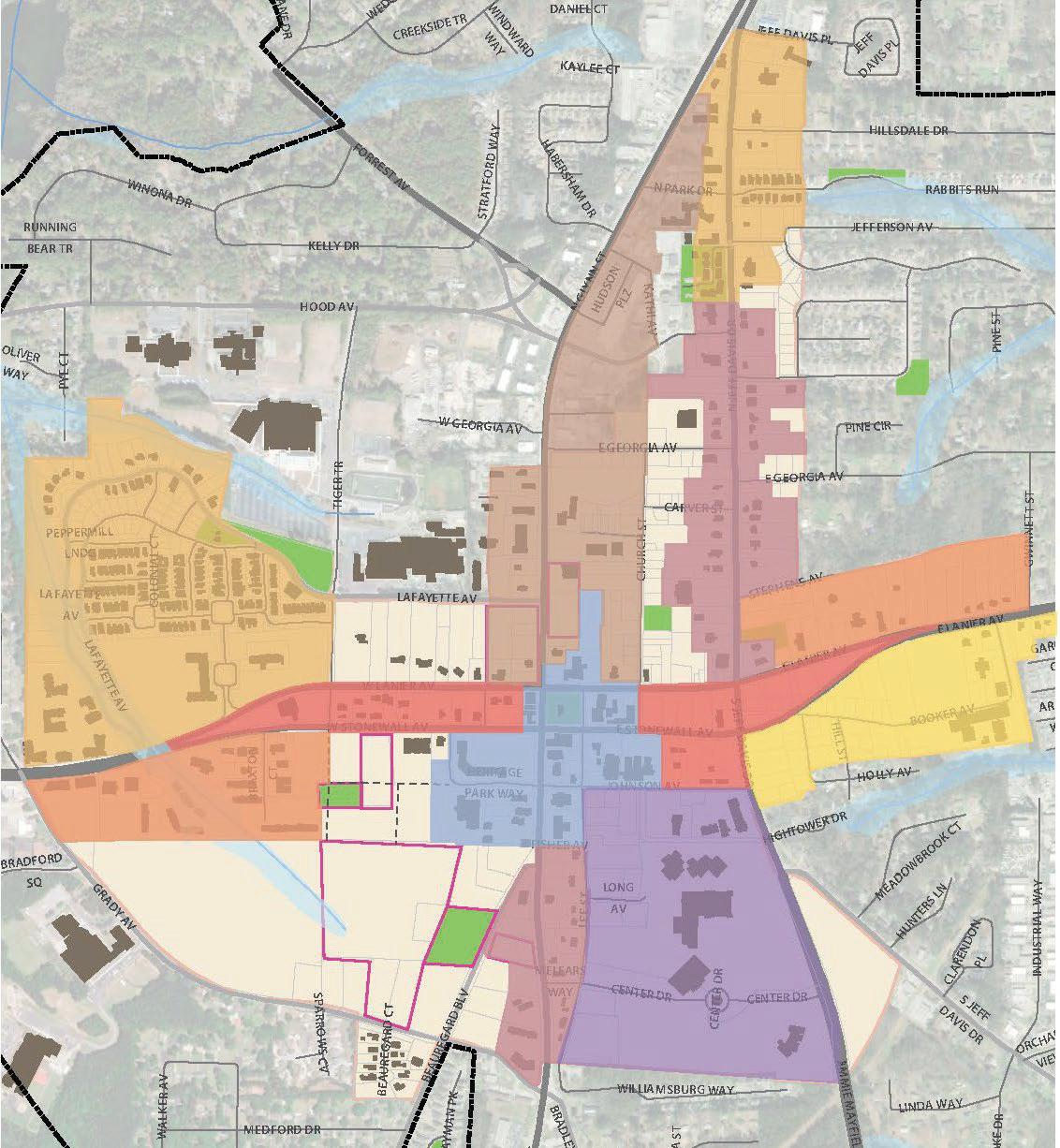
StudyofCharacterbasedonProgram
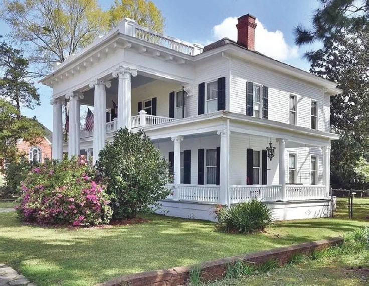
The existing land uses and character of the study area has been extensively documented and described across a number of documents over the last 20 years: The 2003 Downtown LCI Planning study, the 2016 Conceptual Downtown Master Plan, and the 2017 Fayetteville Comprehensive Plan. While some new structures have been built in the study area during this time, the outdated zoning resolution from the 1990s still guides development and building form standards today. Thus, the existing character and land uses have not changed substantially since these studies were conducted.
This hybrid map groups existing land uses according to geographical proximity and existing zoning. This map was created subjectively through a combination of on-theground observations of the study area, known patterns of existing zoning in the study area, and geographic proximity between similar uses and building forms. While not a perfect or scientific means of classification, breaking down the study area into thematic sections will help to identify specific goals and organize priorities in later phases of the study. Below is a description of the rationale behind each of the existing ‘character areas’ as defined by the existing character/existing land use hybrid map:
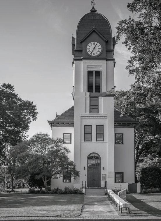
HistoricCore
This area is defined by the historic character of the structures, including the Old Fayette county courthouse. Land uses in this area include County and City government buildings, the library, and churches.
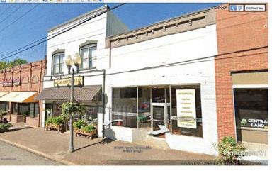
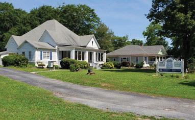
SmallScaleCommercialandOffice
These areas are roughly bounded by Lanier Avenue and Stonewall Avenue on either side of the Historic Core district. Land uses in these areas consist of smaller commercial or office uses, which are often in repurposed single-family home structures.
MediumScaleCommercialandOffice
These areas are located further from the downtown core on the far eastern and western sides of the study area. Land uses in these areas consist of dedicated professional office parks and buildings that were constructed for commercial uses.
High-IntensityCommercial
This area is located due north of the Historic Core district on either side of N Glynn Street. This area is characterized by the higher-intensity commercial uses such as drive-thrus, shopping centers, car-dealerships and other auto-oriented uses that require significant amounts of impervious coverage. The land use and character of the North Glynn corridor is in stark contrast with the Historic Core it abuts at the south end.
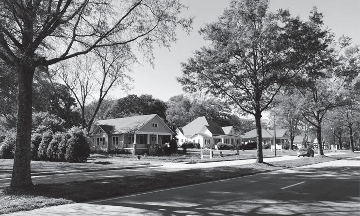
EstablishedNeighborhoods
This area is bounded by the edges of the study area on the south and east, by E Lanier Avenue to the north, and S Jeff Davis Drive to the west. Land uses in this area consist of smaller, single-family residential structures or compatible uses, such as schools.
Breaking down the study area into thematic sections helps to identify project goals and organize priorities in later phases of the LCI study.
DowntownGateway
The downtown gateway character areas are located along N Jeff Davis drive to the north and S Glynn Street to the south of the Historic Core character area. The northern extent of this character area is characterized by smaller businesses in detached or historic structures. The southern extent of this character area is characterized by older commercial uses on an auto-oriented scale. Both of these areas exist as geographical gateways to the Historic Core, and are grouped together under the assumption that the same type of redevelopment and emphasis on streetscaping, traffic calming, and walkability could be of benefit here.
PCD/MixedResidential
These are broad character areas located in the northwestern corner and northern extent of the study area. These areas are currently comprised of primarily residential uses with residential zoning districts, however, there are other uses mixed sporadically throughout. This district allow for a more specific, distinct planning vision to guide future development.
Support/Services/SeniorUses
This character area is less categorically defined than others and is better defined in geographical terms. This character consists of the southeastern extent of the study area, roughly bounded by Lee Street on the west and Johnson Avenue to the north. Existing, larger-scale structures also help to define this character area, including the senior center, the Court building, and the sheriff’s department. south and east, by E Lanier Avenue to the north, and S Jeff Davis Drive to the west. Land uses in this area consist of smaller, single-family residential structures or compatible uses, such as schools.
Historic Core
Olf Fayette County Courthouse | Source: Shutterstock
Source: Atlanta Home Trends
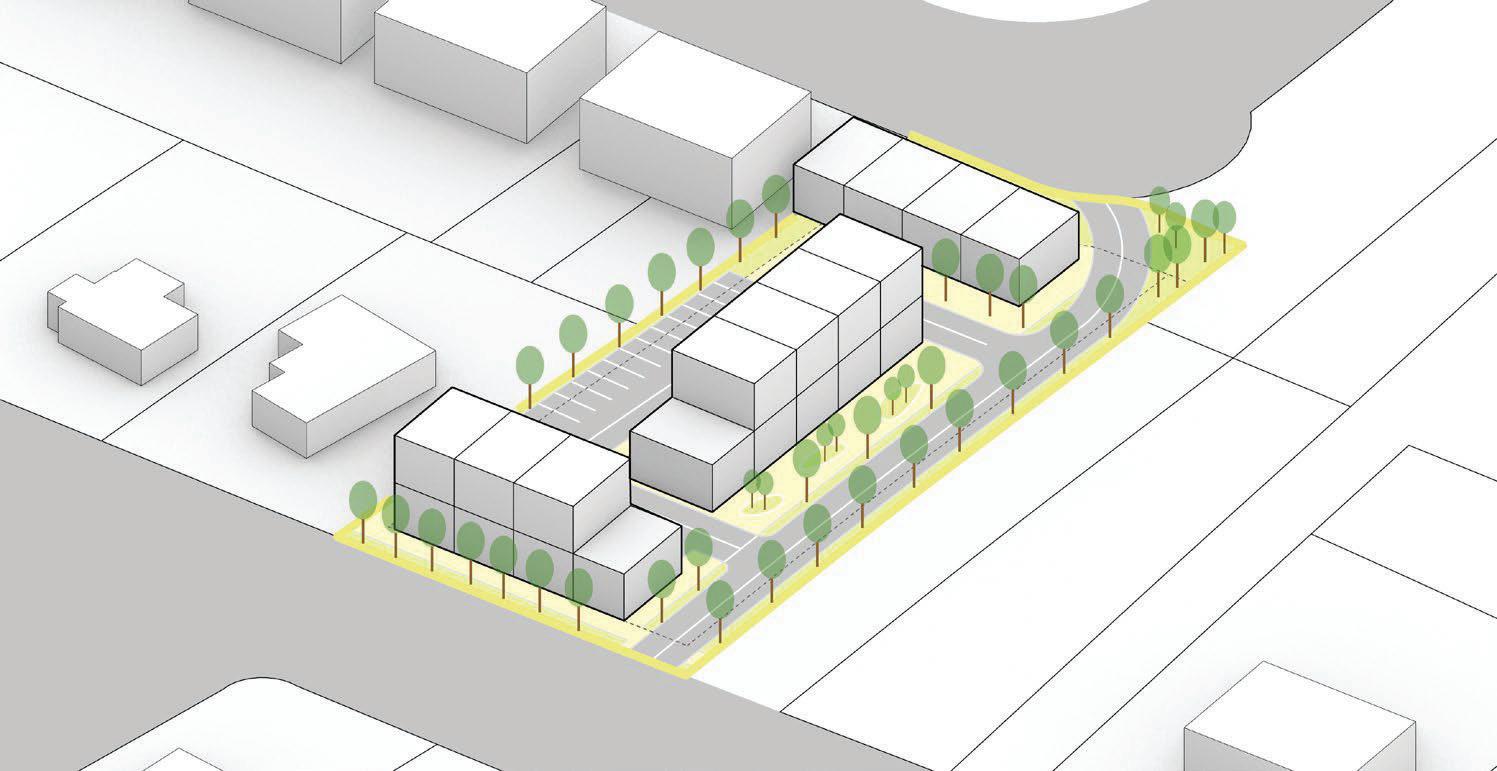
Identification of sites where new development can occur indicates opportunities for immediate application of the LCI recommendations.
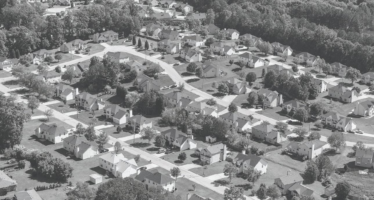
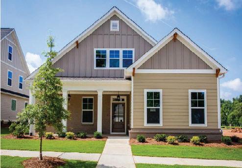
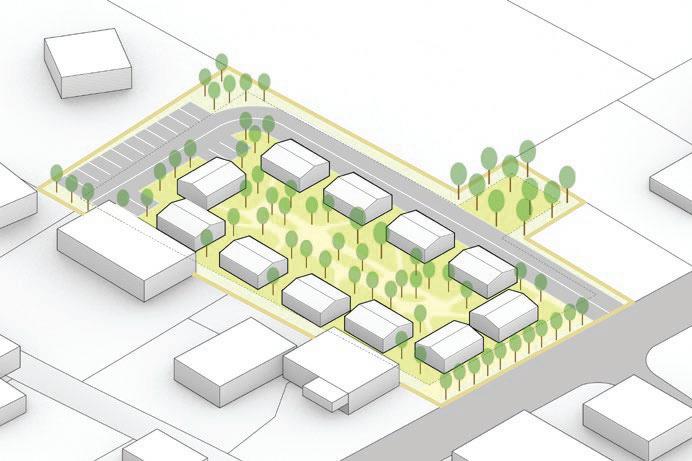
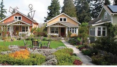
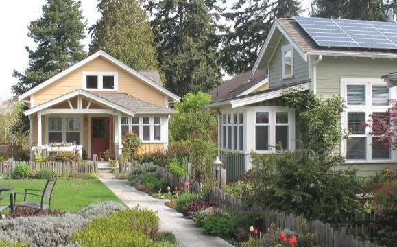
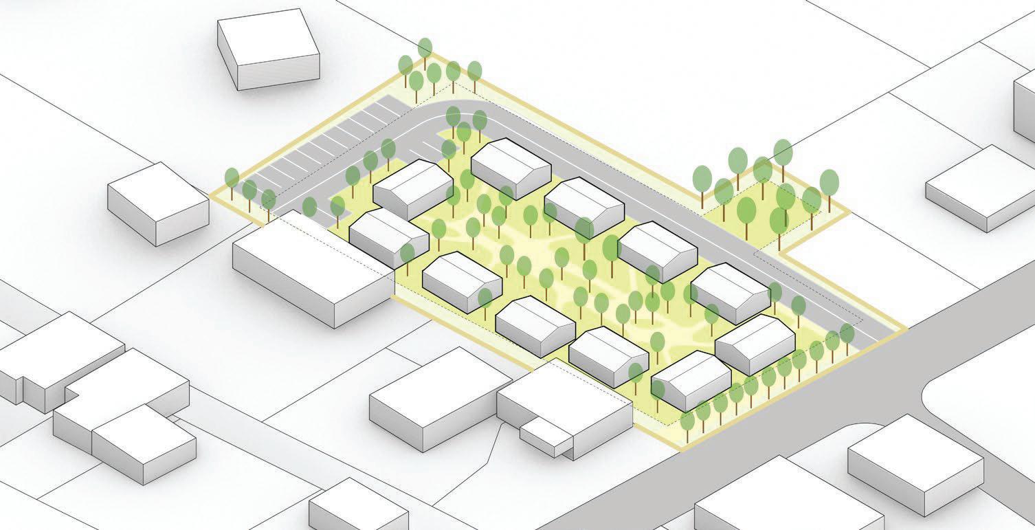
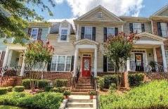
SmallLotSingleFamilyDetached
Demand in 2021-25: 100 units/year
Estimated Pricing: $400,000 - $600,000
Estimated Density: 4-6 units/acre
Parking: 2-car front/rear entry garages
Notes: Strong land value, good transitional use, great for all household types. Likely to run into land limitations.
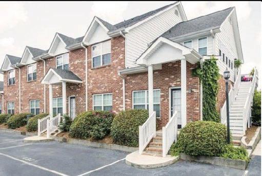
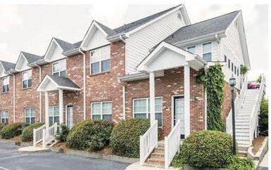
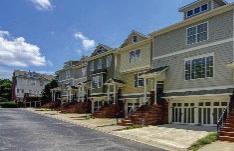
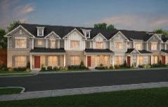
Townhomes
Demand in 2021-25: 15 units/year
Estimated Pricing: $300,000 - $375,000
$425,000 - $475,000
Estimated Density: 8-14 units/acre
Parking: 2-car front/rear entry garages
Notes: Mix of conventional and luxury townhomes. High land value, limited depth. Good transitional use, great for ENs & starter families.
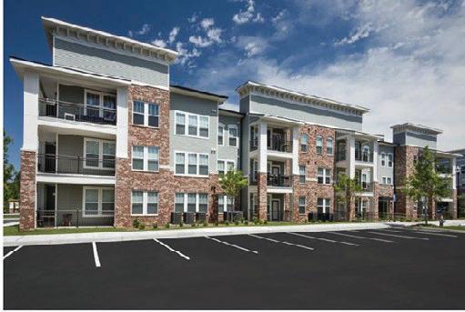
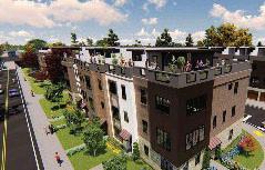
RentalApartments
Demand in 2021-25: 250-300 units above pipeline.
Estimated Pricing: $1.45/SF | THs $2.15/SF | 55+
$1.75/SF Conv.
Estimated Density: 25-45 units/acre
Parking: 1.5/unit OR 1/bed
Notes: Opportunity to leverage existing downtown environment & provide for “missing middle” housing options & grow workforce housing.
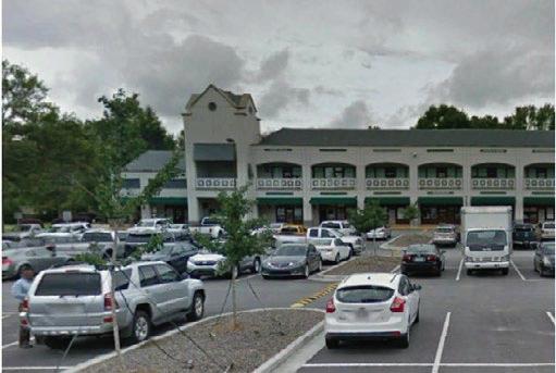
Office
Demand in 2021-25: + / - 25,000 SF
Estimated Pricing: $20-$25/SF Full Service
Estimated Density: 10,000 SF/acre
Parking: 4/1,000 SF
Notes: Population servicing office uses including medical and smaller private firms.
Retail/Service
Demand in 2021-25: 90,000 - 140,000 SF
Estimated Pricing: $20-25/SF NNN
Estimated Density: 8,000 SF/acre
Parking: 5/1,000 SF
Notes: Potential for small-format grocer / hardware store, majority is F&B & service-oriented w/ pharmacy / drug store.
COVID-19Impact
• The Atlanta metro lost over 100,000 jobs due to the pandemic
• Much of these in retail, hospitality, and population servicing industries
• Most jobs projected to recover starting in late 2021 and back to pre-pandemic levels by year end 2022
• The for-sale residential market has remained strong particularly at higher sales prices result of historic low supply delivered since the Great Recession
• The rental market metro-wide has remained strong with highest level of absorption in its history, however, rental rate growth has slowed and absorption has been strongest in the suburbs as well as value-oriented properties
• Mixed-use environments both urban and suburban continue to be in high demand, with the lack of these environments in the suburbs pushing demand even further for suburban town centers
• Rising home prices and a lack of supply coupled with changing tenure preferences has created new rental product types including professionally managed rental townhomes and rental single-family developments
• The pandemic has exacerbated retail trends of the shift away from big box stores to more online shopping and less need for brick & mortar locations.
• While many stores still desire a brick & mortar location to engage customers, these spaces need to be “right-sized” as there is less inventory need and a desire to keep absolute rents low
• A result is an increasing mix of food & beverage as “anchors” to any retail development along with support from population servicing retail
• Experiential / destination retail has become extremely important in creating successful retail environments
• Similar to retail, the pandemic has exacerbated office trends that were already in place which were a shift to more remote / flexible work environments
• While this might lead to less office space needed per employee this could be offset by a shift away from dense office settings
• While more remote work scenarios could reduce demand for office space, this trend is very sector
• Hospitality has been hit hardest by the pandemic and will take years to recover with many companies currently limiting business travel and large gatherings.
02.3 Lessons from Analysis
ParksandOpenSpace
• The City of Fayetteville has completed many studies identifying the community’s desire for an increase in parks and open space.
• Open space aesthetics, identity, gateways, and streetscapes are a priority given previous studies. Next steps are to identify specific opportunities for existing open space improvements and locations for new proposed spaces.
Mobility
MarketAnalysis
• The analysis indicates significant demand for single family and attached townhouses. The identification, prioritization, and policy incentives that encourage the desired scale and character of development should be evaluated to align with the overall vision of the Downtown Fayetteville LCI Study.
• Demand for office space is limited as only 19% of residents work in Fayetteville in comparison to 35% of residents that commute over 25 miles to work. Future studies should identify work and lifestyle changes as a result of the COVID-19 pandemic.
• Past analyses emphasize the need for infrastructure to optimize walking and biking. This LCI study should reinforce the Master Path Plan while considering a bold vision of a highly networked open space that is independent of the road system.
• Community feedback for parking is pivotal for a deeper study and consideration.
OtherQuestions/Comments
• Fayetteville leadership should determine whether to prioritize attracting major employers or improving quality of life and local amenities to benefit local residents and attract others.
• The LCI study should focus on engaging marginalized and underserved residents to be benefited by the plan without displacement.
03.1 Engagement Timeline
Overview
The project process was divided into four phases as outlined below. Starting with outreach and communications activities to build study awareness and excitement within the community, laying the groundwork for meaningful input and community engagement during the next phases, and initiating a strong following by community members.
Investigate
The study process began with a soft kick-off of the project via the City’s multiple communications channels. This work was carried out through the release of a study flyer in late December 2020 that communicated the project goals and process and informed the community of input opportunities that would debut in early 2021.
Explore
In this phase, a virtual community charrette was conducted to craft a collective vision for the LCI study area.
Recommend
The teams recommendations were presented to the community via a hybrid setting.
Document
This phase was to document and finalize the recommendations including the community engagement process and input.
03.2 Investigate
Overview
The first few months of the LCI study process included a flurry of outreach and communications activities to help position the project for success. These activities focused on building study awareness and excitement within the community, laying the groundwork for meaningful input and community engagement during the next phase, and initiating a strong following by community members.
SoftProjectKick-off
The study process began with a soft kick-off of the project via the City’s multiple communications channels. This work was carried out through the release of a study flyer in late December 2020 that communicated the project goals and process and informed the community of input opportunities that would debut in early 2021.
StudyWebsiteLaunch
Early January 2021 saw the launch of the study website: www.fayettevillelcistudy.com
This site will serve as the information hub for study information as well as a centralized location for all outreach activities. The City’s Planning and Zoning page links directly to the site: https://fayetteville-ga.gov/city-departments/ community-development/planning-and-zoning/livablecenters-initiative-lci/, furthering ease of access to project information.
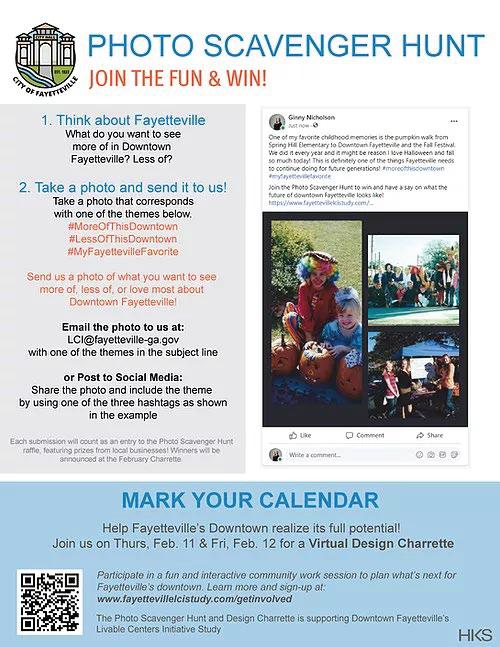
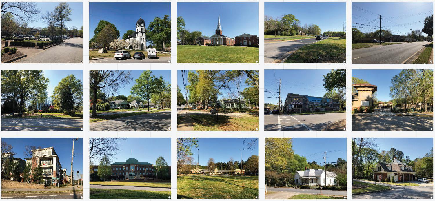
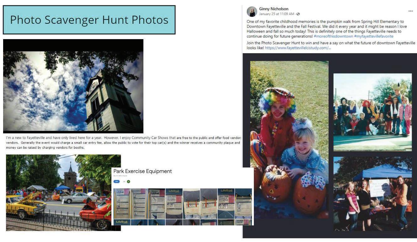
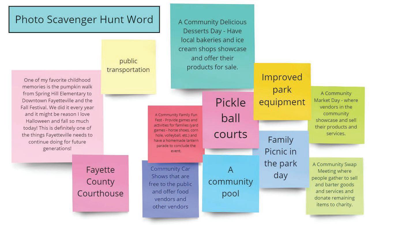
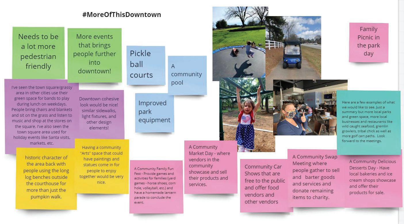
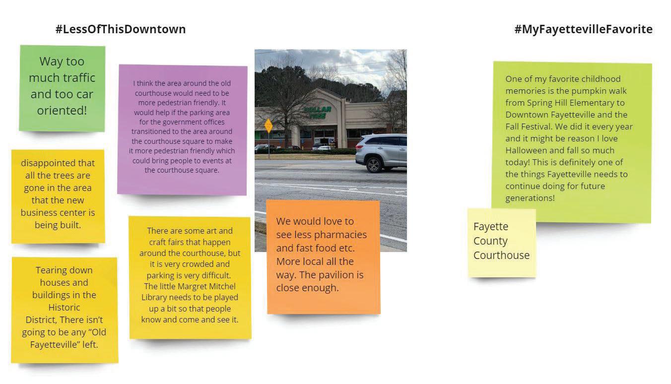
PhotoScavengerHuntInitiation
Early January 2021 also marked the start of a fun, webbased photo scavenger hunt. Community members can take photos from anywhere in the Downtown study area, capturing characteristics they feel best fits with their response to the hashtags of:
#MoreOfThisDowntown
– a photo to display something they like to see more of in Downtown
#LessOfThisDowntown
– a photo to display something they would like to see less of in Downtown
#MyFayettevilleFavorite
– a photo that shows their favorite place/thing in Fayetteville
Participants submit responses via email or social media and are entered for a raffle prize from local businesses. Photos and raffle winners will be featured at the February Design Charette, creating a bridge between the project kick-off and the February community meetings.
CharretteSavetheDate&Promotions
The Community Design Charrette – a community work session where community members are asked to roll up their sleeves and help plan for Downtown’s next phase – was scheduled for February 11th and 12th. An online registration tool was established on the project website –giving community members the option to participate in one or both 1.5-hour sessions (to be held on Thursday evening and Friday mid-day).
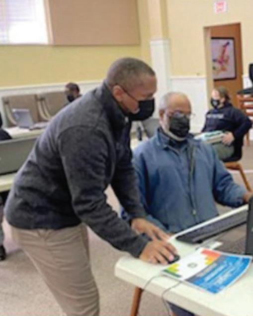
CoreTeamEstablishment&Welcome
The City established, confirmed, and welcomed a 17-member “Core Team” to serve as champions of the study process and help guide the plan’s outcomes. The project team delivered a formal welcome via email the first week of February, encouraging members to participate in the charrette and scavenger hunt while helping get the word out about the process.
AdvertisingandCommunicationsActivities
During the Investigate stage, the study, its goals, and current/upcoming activities were promoted in multiple ways, including via the City’s Facebook and Instagram accounts, Next Door, weekly eblasts, and monthly City News publication. The team also established a project updates email sign-up on the study website and sent out its first update to the group.
QuestionsfromAnalysisandSiteVisits
Questions
What are the community acceptable levels of density?
How do you interpret density –by height or other?
How does the community feel about rental product versus ownership product?
Does this vary by product type? (Rental townhomes / cottages vs conventional apartments)
Are there demographics and/or household types / housing types missing in the community?
Young professionals? Opportunity for households to downsize?
Would the community support a shared centralized parking deck?
A centralized shared parking deck would unlock the development potential of many sites given the costs of parking and current rent levels of many uses
What types of retail and/or services do you have to leave the community for? And where do you go for this retail and / or services?
What is Fayetteville missing?
In 5 years from now what other Atlanta regional community do you envision Fayetteville looking like?
What character areas should be preserved?
How should the character areas be treated where there has been recent new development or where there is development planned?
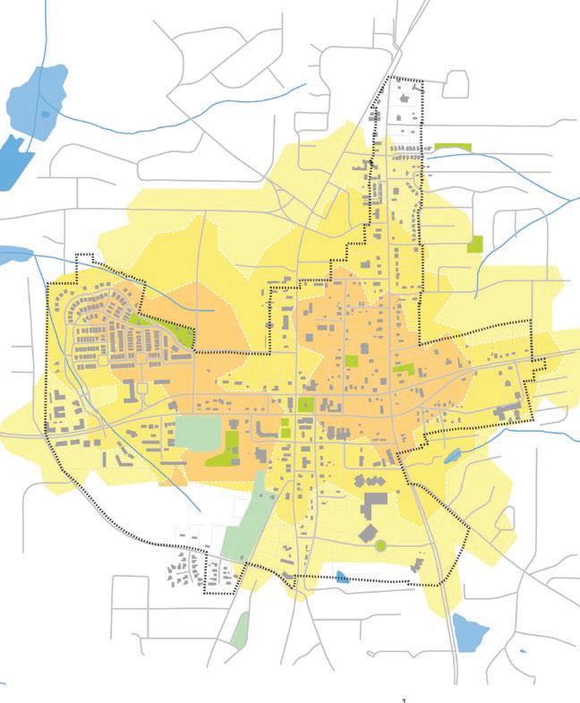
The 2018 Future Land Use Map shows much of the Downtown study area as “Walkable MixedUse.” Is this desirable and feasible given the Existing Character Map and Table? Should the Downtown study area be more variable in character?
What parts of the downtown area should be preserved into the future?
What parts of the downtown area do you want to see change or improve in the future?
What is your opinion of the new residential development that’s taken place in downtown Fayetteville? (i.e., The Village, The Meridian, scattered new housing subdivisions). Could you see yourself moving there soon or in the future? If you already live in downtown, what made you choose to live there?
What are some of your favorite downtowns in Georgia or in other states and why?
What are the positive and negative characteristics of the existing parks and open spaces? What is desirable, what is undesirable?
What activities do you want to take place within future and existing parks and open space (recreation, community gathering, event planning, physical health, economic development, nature appreciation, etc.)?
How should the character areas be treated where there has been recent new development or where there is development planned?
What types of amenities and nodes are desired for greenspace connections (pocket parks, bike paths, walking trails, multi-use pathways, seating areas, water features, plazas, community gathering spaces with commercial partnership, dog parks, etc.)?
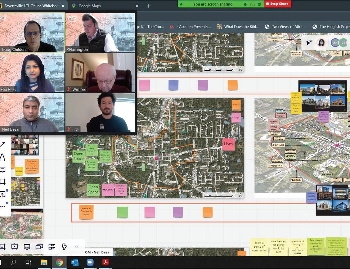
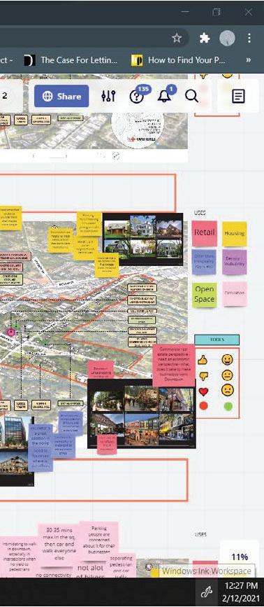
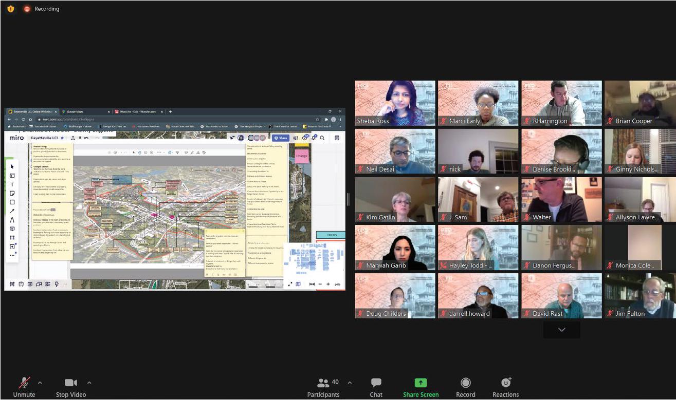
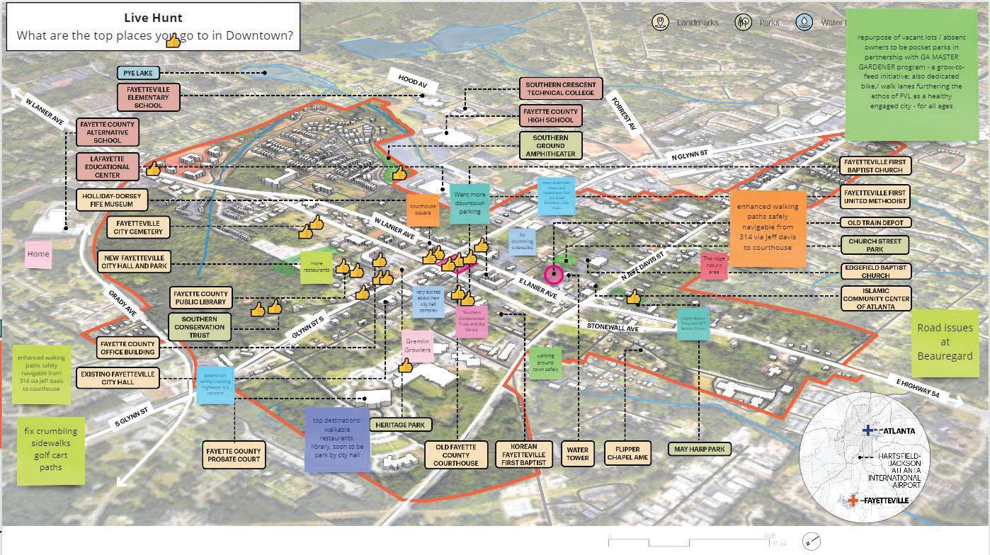
A virtual community charrette was conducted on February 11th and 12th, 2021 to craft a collective vision for the downtown study area of Fayetteville by taking the lessons learned from history and past efforts and reimagine a future that engages all the stakeholders and is healthy for the environment and the community. Participants shared input on areas to preserve and change as well as perspectives on future land uses, Downtown access and mobility, and open space. Both meetings were conducted virtually via zoom.
Re-engage
The first day was to re-engage the community..
Focus
The second day was built on discussion and input provided and collected from the first day.
PhotoScavengerHunt
PRESERVE
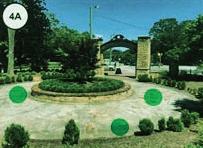
• Existing parks, open and green spaces such as courthouse square and the amphitheater.
• Current community events and activities.
CHANGE
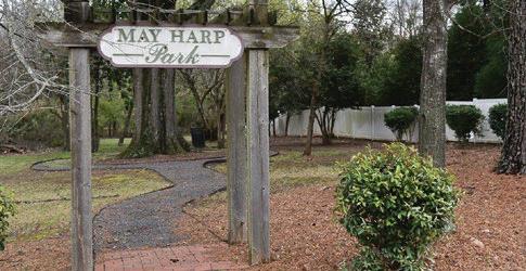
• Heritage Park and May Hart parks need updates and improvements.
• Current park network lacks connectivity.
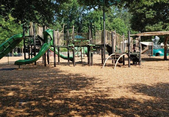
IMAGINE
• More parks and open spaces with programming and memorial spaces (sports courts, equipment, roller skating, arts, veteran and African American memorial space).
• More community events such as fests, community swaps, car shows, movie nights.
• Dedicated multi-use paths connecting to activity nodes and green network to enhance connectivity and pedestrian and bike safety.
PRESERVE
• Senior services have good programs, but could be built up and improved.
CHANGE
• Less auto-centric; more pedestrian and bike friendly by improving safety and infrastructure.
• Less traffic congestion and high speeds in downtown.
• Parking in downtown is limited, need clear signing to make it less confusing.
IMAGINE
• More parking in downtown.
• Relieving traffic through road diets.
OPEN SPACES
PRESERVE
• Existing local businesses and restaurants and shops. CHANGE
• Less chains and big businesses.
• Less car dealerships.
IMAGINE
• More local small businesses, shopping and restaurants in downtown.
USES BUILDINGS
• Mixed income housing for different demographics (affordable, middle income, young and older families).
• Mixed-use developments and diversity in uses and amenities (commercial, office + housing).
• New uses such as meeting space, art gallery, outdoor dining in downtown.
• Attract residents and businesses to downtown.
PRESERVE
• Preserve historic character and old buildings.
CHANGE
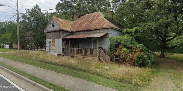
• Old houses are deteriorated, lack of maintenance,
• Downtown shops are vacant and need activity.
IMAGINE
• Infill developments to provide density and walkable to downtown.
• Re-purpose unused buildings re-purpose and improve existing buildings.
• New developments to be compatible with historic character
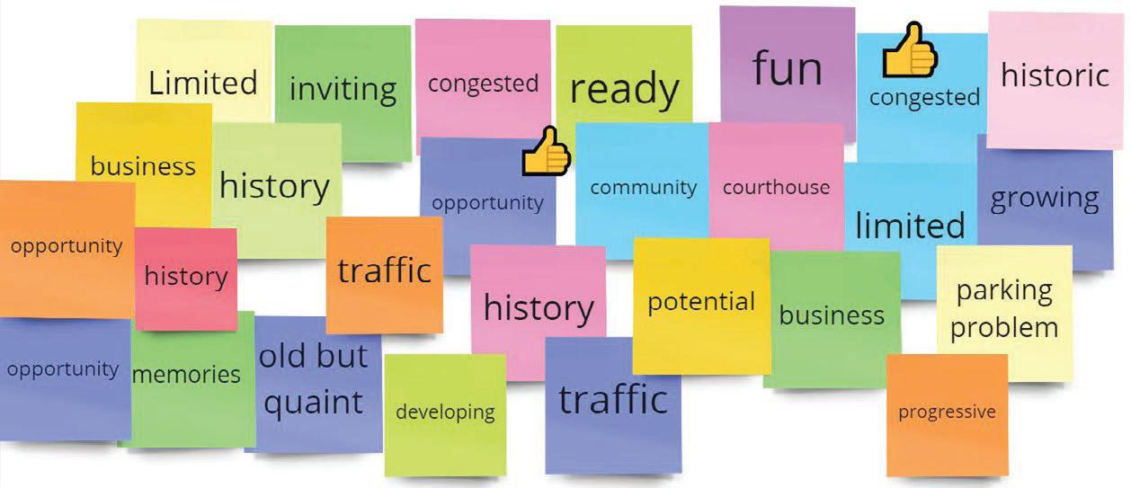
What is your vision for Fayetteville?
“Preserve neighborhood and small town feel.” “No jobs for young professionals; current commute time is very long.”
“Fayetteville should be the heart not an artery.”
“Fayetteville as an inviting, affordable and authentic town with a sense of pride.” “Providing growth opportunities.”
“Pinterest Worthy.”
“Need sustainability element to be incorporated into plan!”
“Infill Development.” “Repurpose unused property and buildings.”
TheSurveyResults
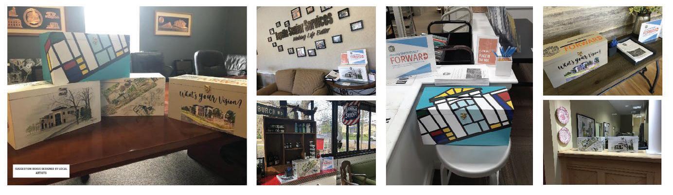
SuggestionBoxesDesignedbyLocalArtists
04.3 Recommend and Document
HybridCommunityMeeting
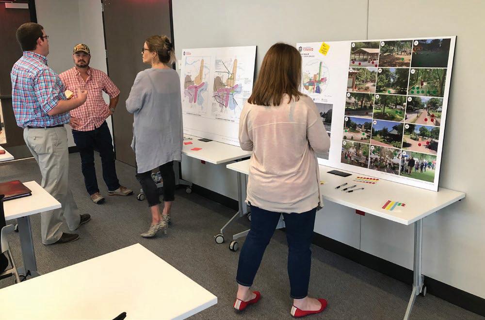
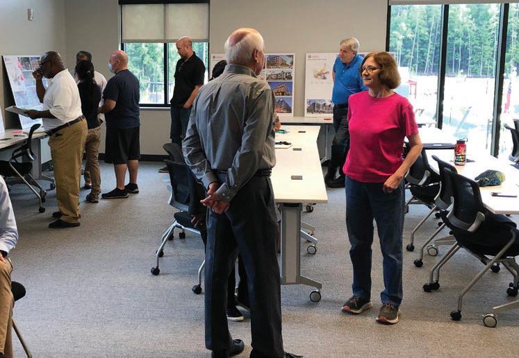
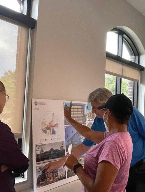
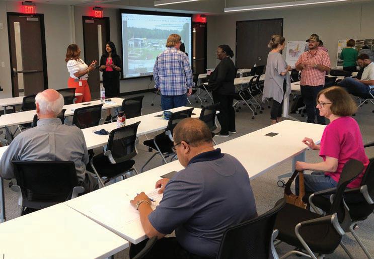
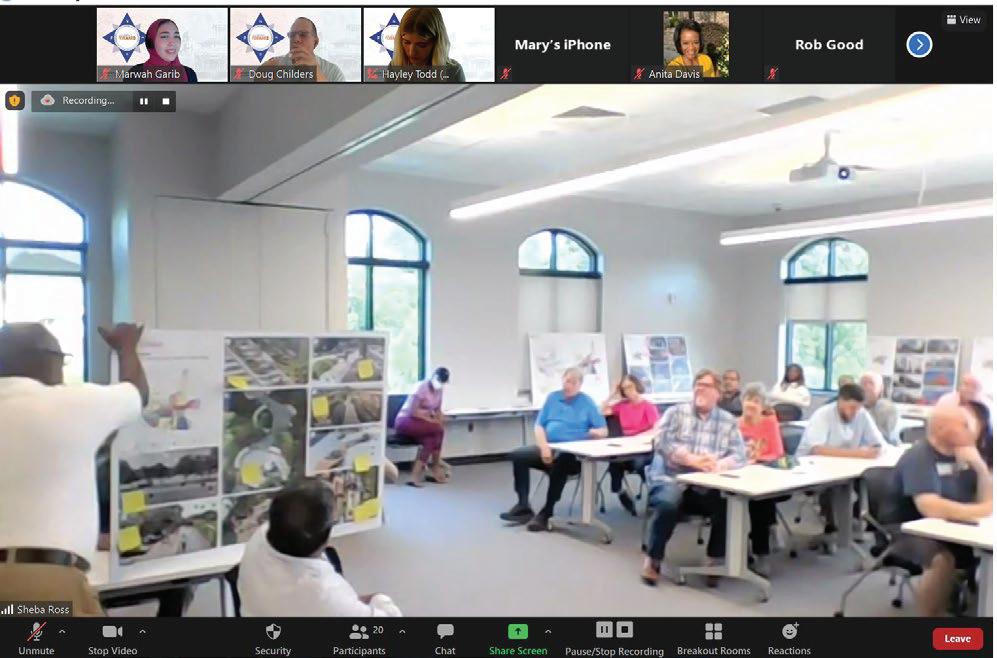
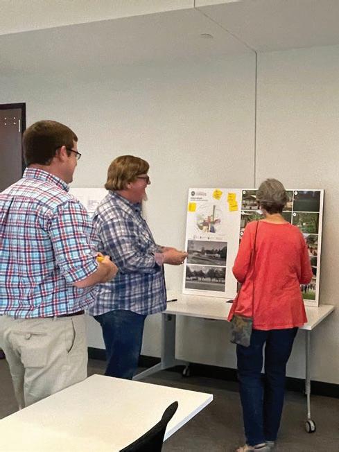
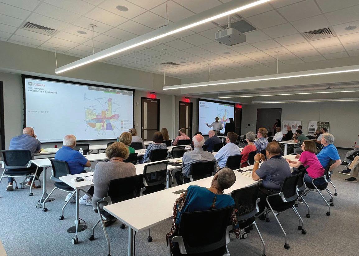
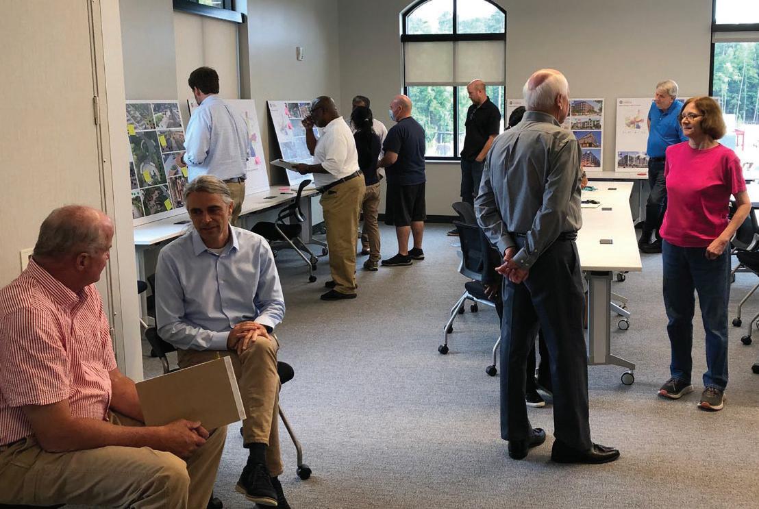
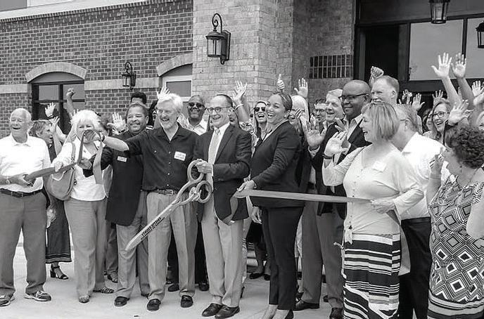
A Community Town Hall meeting was attended by elected officials and several local residents in June 2021. Presenters reported on months of research and community feedback and gave recommendations to the City regarding many quality-of-life infrastructure improvements Participants engaged in-person and online.
Part 1 of the meeting focused on the Presentation of Project Overview and Progress including Connections and Nodes, Mobility , Codifying the place and the impact of feedback and preferences. Part 2 engaged the audience online through break-out rooms and in-person through large printed boards to garner feedback and preferences.
This section highlights the main takeaways from the Explore and Recommend Community Meeting.
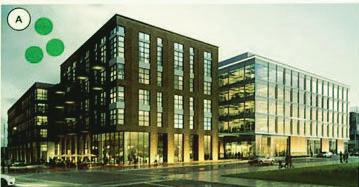
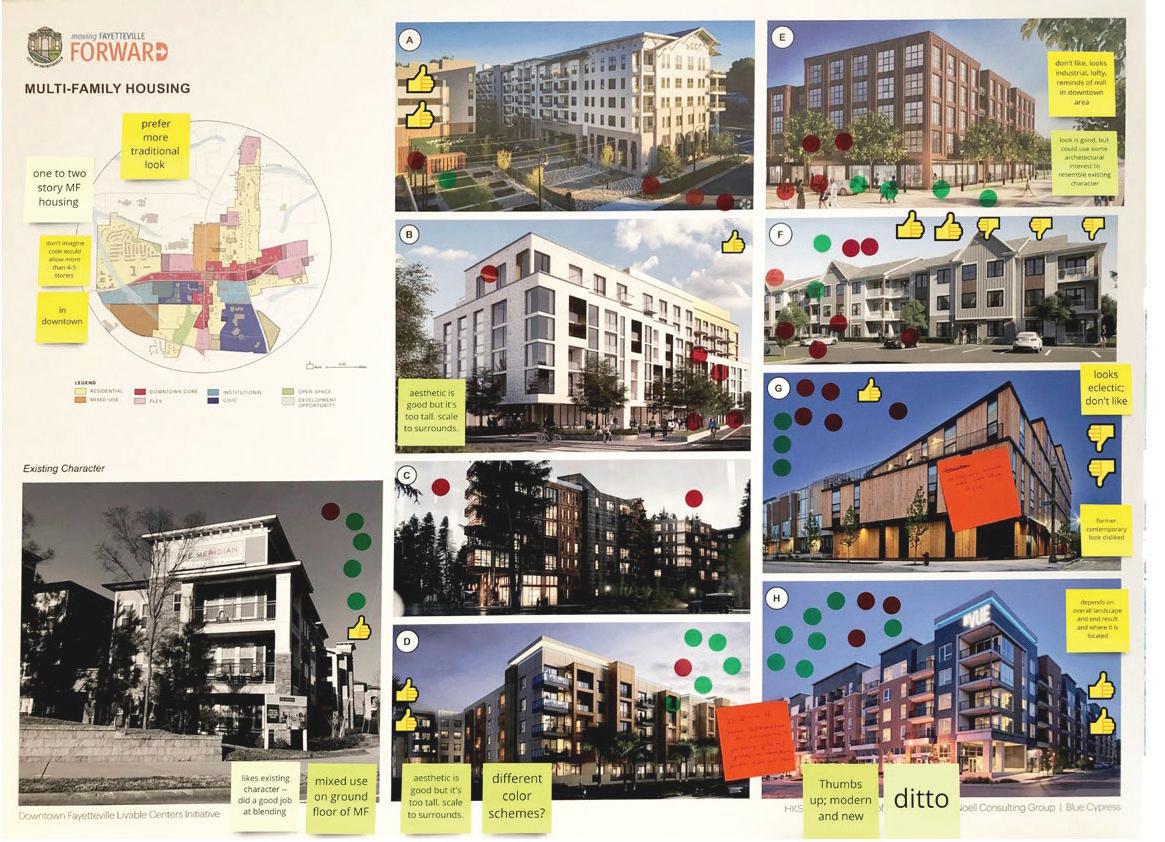
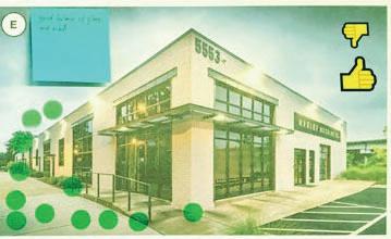
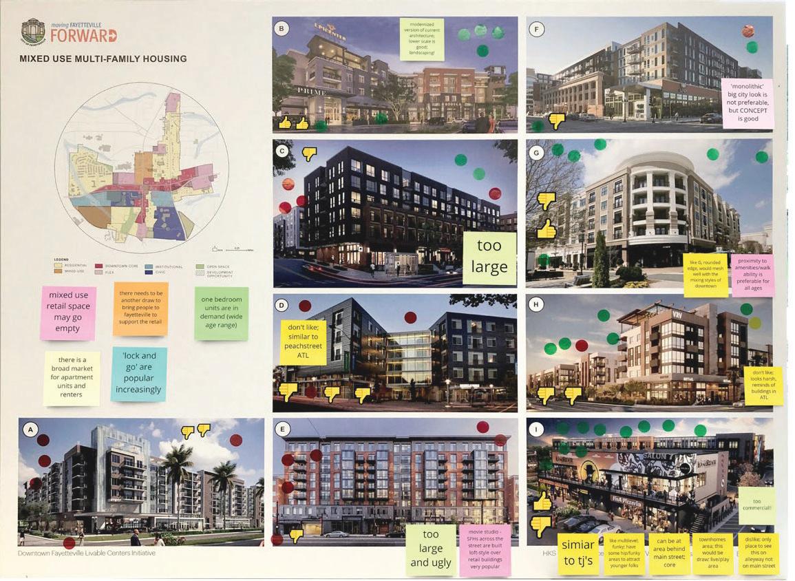
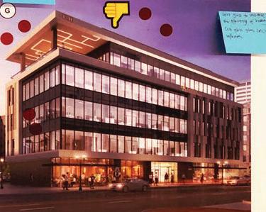
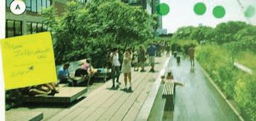
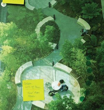
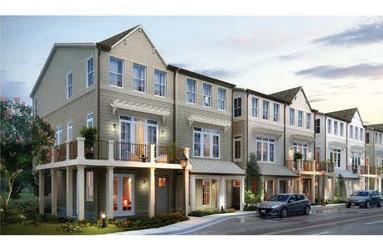
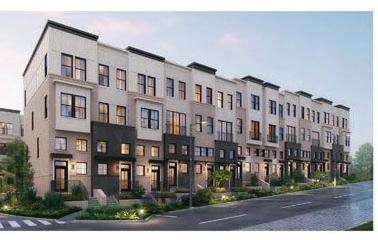
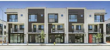
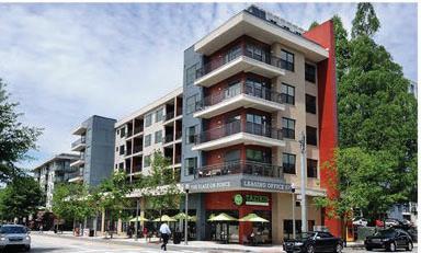
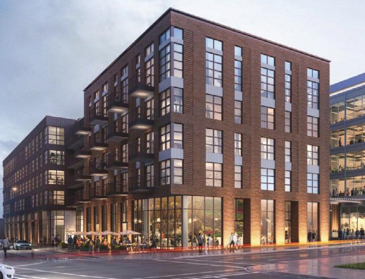
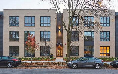
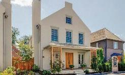
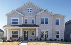
MULTIFAMILY HOUUSING
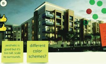
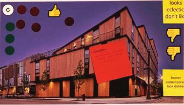
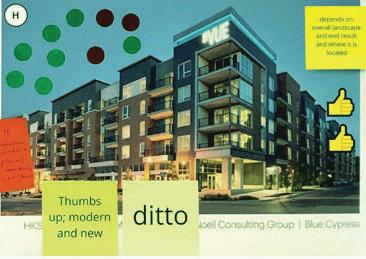
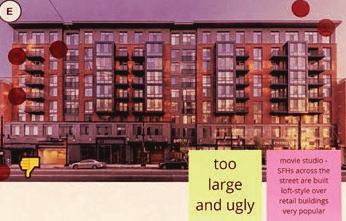
General push back reggarding tall and big buildings. Modern aesthetic desired, howwever, not too eclectic as in imaage G.
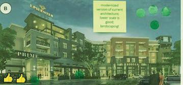
MIXED-USE MULTIFFAMILY HOUSING
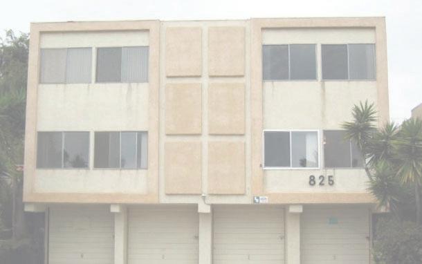
Lower scale and aesthetic similar to image (B) are most preferreed especially with restaurants and active rooooftop spaces. nts are not Large monolithic developmmeen ). Glass and desired (as in images A and E E) erials are contemporary styles / mate ge D). not preferred (as in immag
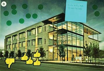
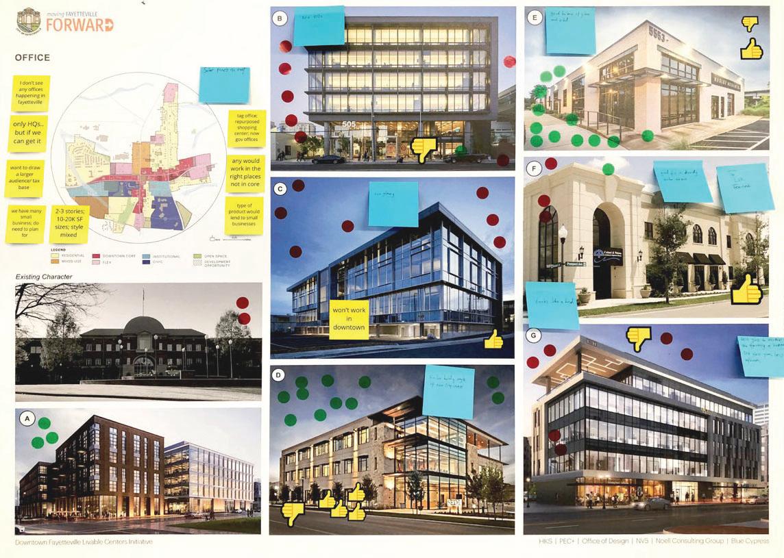
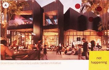
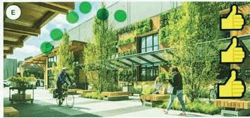
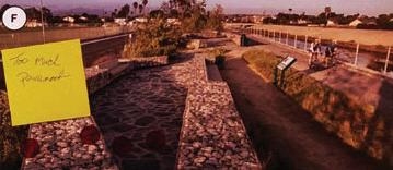
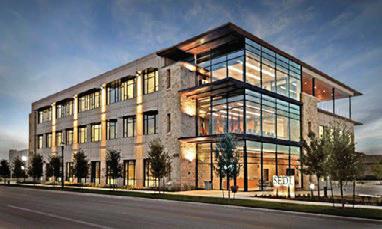
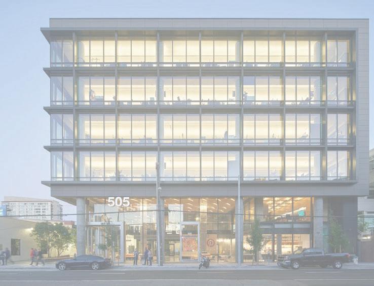
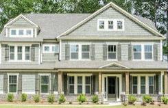
OFFICE
Small scale office buildings with 1-3 stories serving small usinesses are mostly prefered, b milar to image E). Unlike images (sim s (B),(C) and (G), contemporary ades with less glass and modern cafa fac brick patterns are preferred (Similar to images A and D). General support for adaptive reuse.
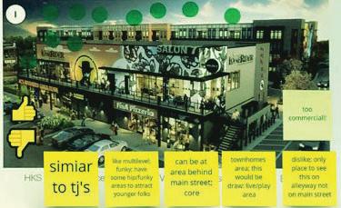
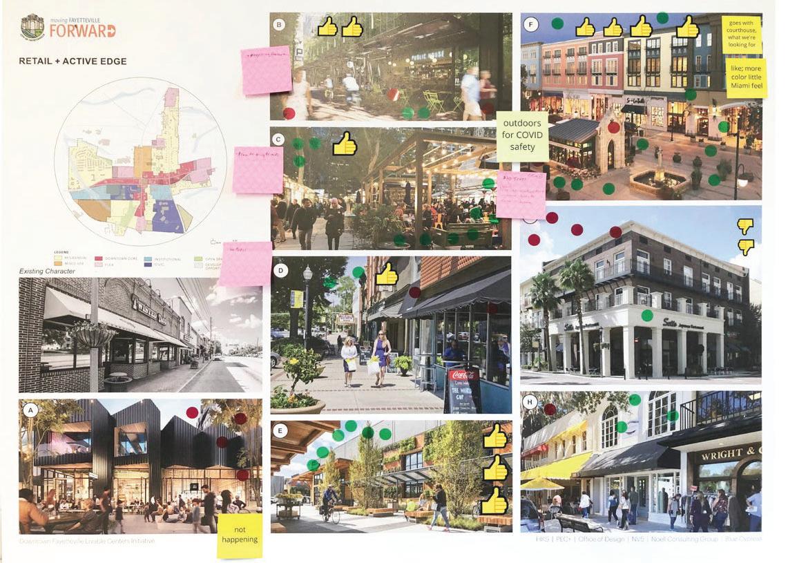
RETAIL + ACTIVE EDGE
de sidewalks, overhangs Wid d outdoor dining spaces and desired. The group liked are d re colorful facades, such mor in image (F). Collonade as tructures are generally st not preferred.
There is a general apprehension towards large paved areas. Sidewwalks and buffers with more e trees and landscape were preferred
“Future materiality should complement and bllend with current charactter and heritage of Fayetteville.”
GeneralComments
“More uralnatu ngs.”settin
NO
Too much concrete, gardenstyle apartment buildings, large mpervious surfaces, im overpowering buildings.
“Active rooftop spaaces and usabble parklets will be wonde
st participants indicated a Mos ire to have a more active des n feel as well as separating urban cyclists and pedestrians with cycl wide planting buffers
YES
Quaint architectural style, diverse flexible spaces, contextsensitive wayfinding, Brick facades.
“Build upon current small town feel, yet modernize!” modernize!
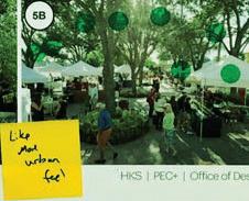
idea of “Love the i space for planning a s ch as food activities suc open air trucks or o ts.”marke
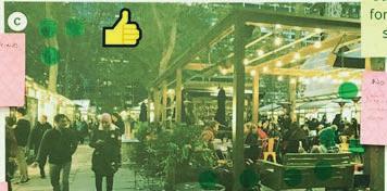
PUBLIC REALLM: PARKS + OPEEN SPACES
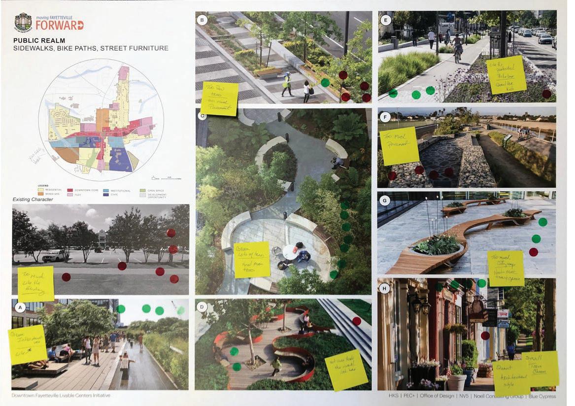
PUBLIC REALM: EWALKS, BIKE PATHS + SID STREET FURNITURE
The Big Idea
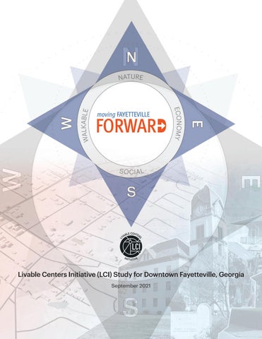
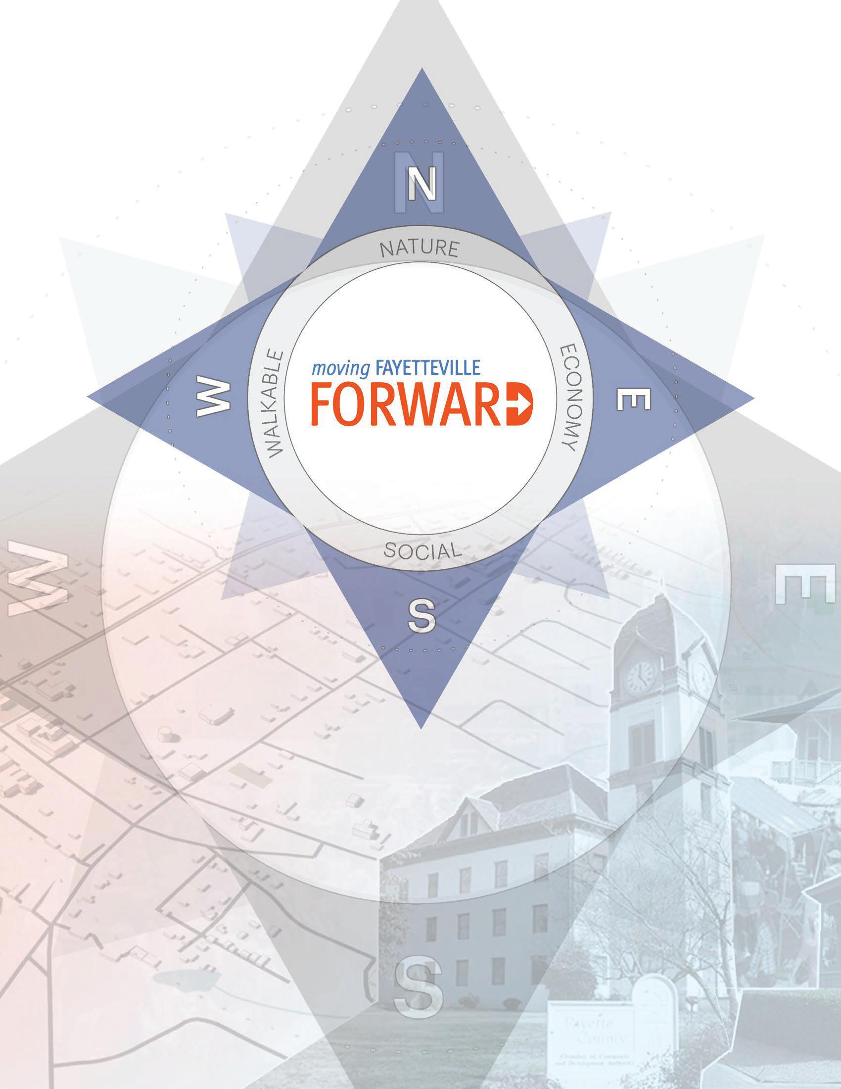
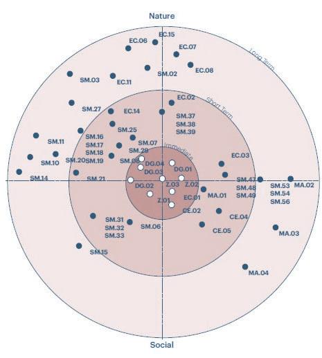
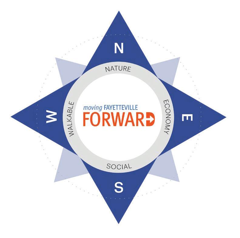
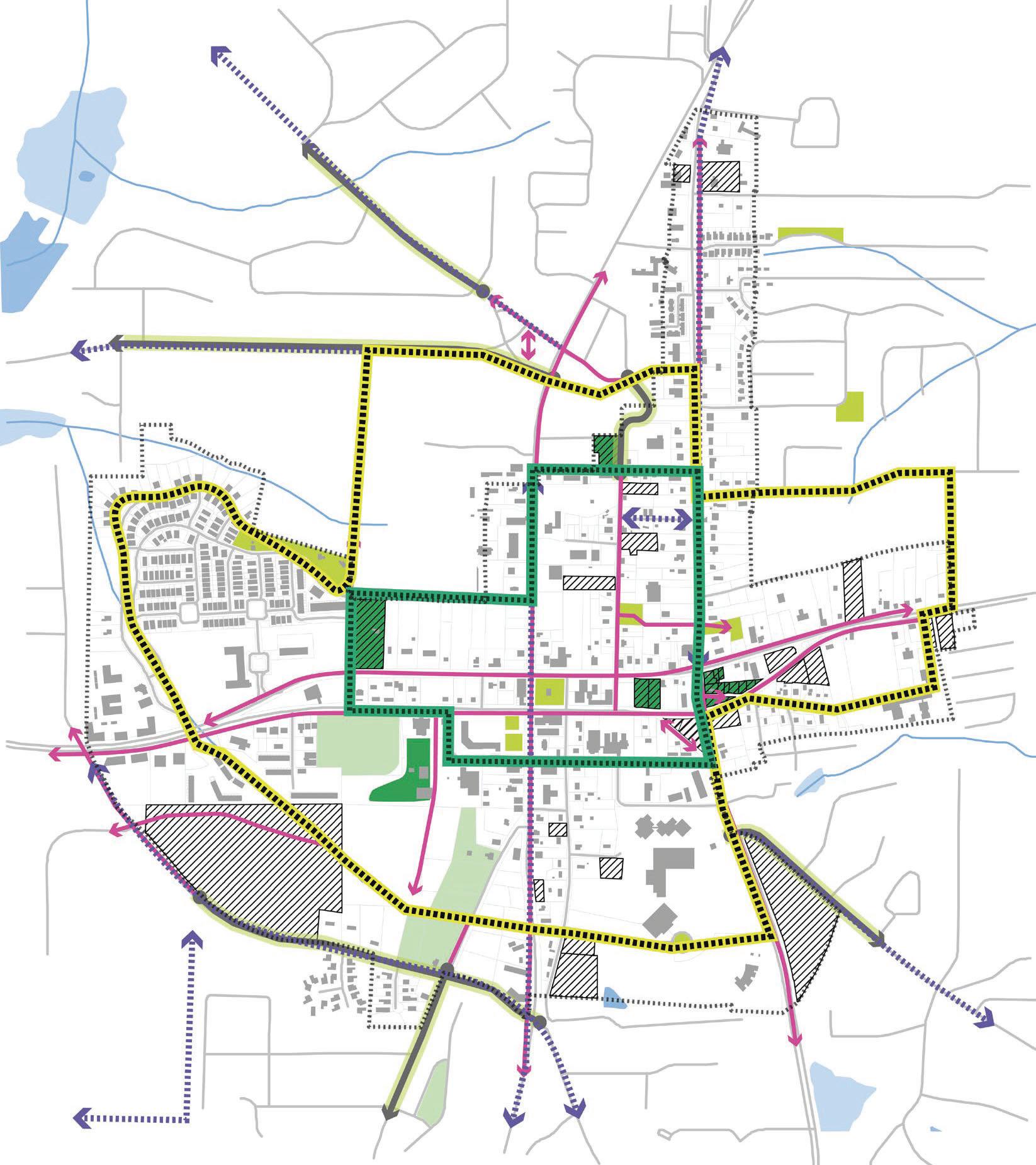
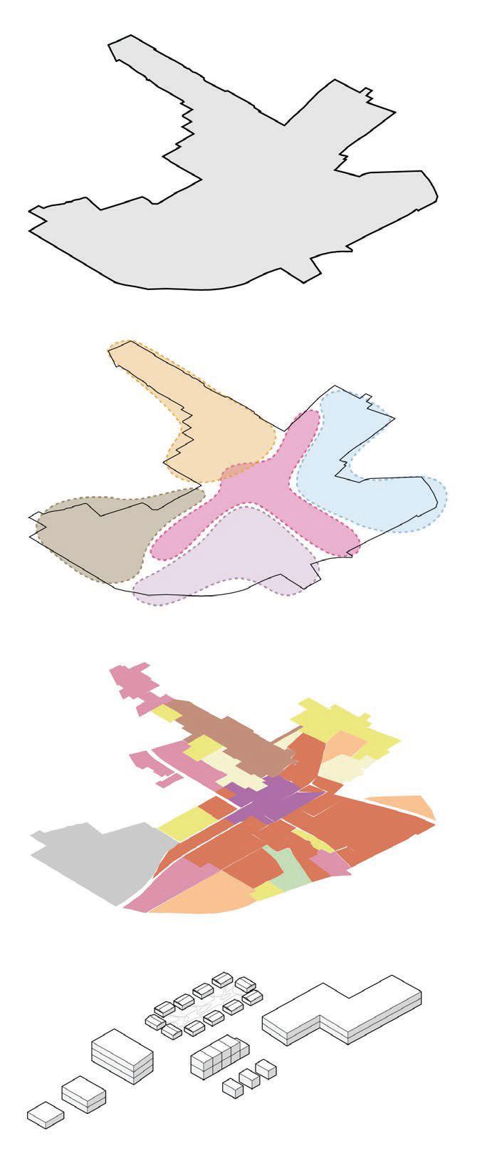
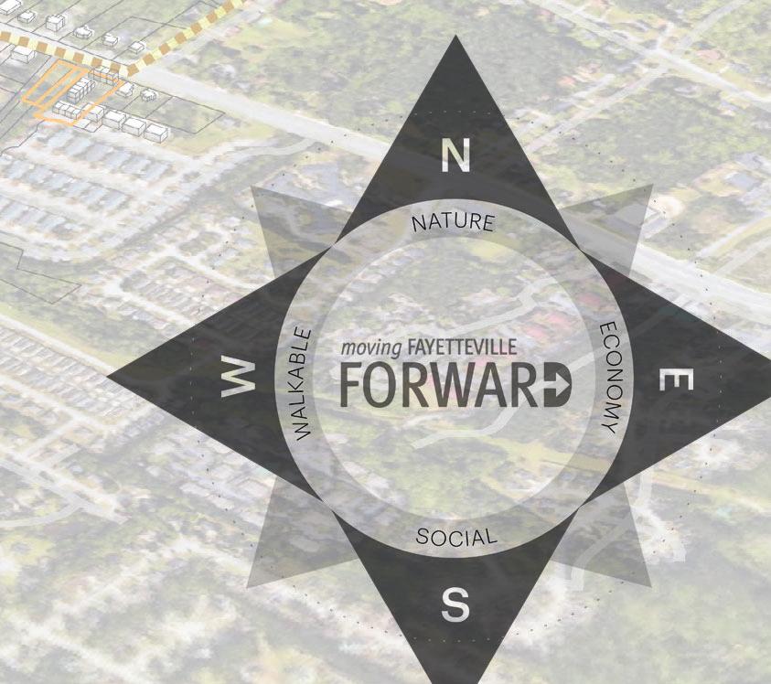
Through deep community engagement, this project was named: moving Fayetteville Forward In doing a vested exploration of what the opportunities are for Downtown Fayetteville, it was determined that the movement that was desired needed to be multidirectional. To demonstrate this aspiration , the team tapped into the visual of a compass to create the guiding principles that will illustrate the priorities of the study and identify the performance metrics that will help maintain the accountability of the process for the Livable Centers Initiative.
The Vision for moving Fayetteville Forward is to reimagine the possibilities in Downtown through catalytic equitable placemaking, enhanced legibility of the built environment, and creative guidelines for healthy, sustainable developments that will empower its diverse communities.
GuidingPrinciples
The guiding principles for a project are tenets that will be a tool for decision making and accountability. The cardinal directions of North, South, East and West of a compass have been adapted to indicate the priorities of the study:
Nature, Social, Economy and Walkability
This aligns with the goals that the Atlanta Regional Commission has while investing in such initiatives for the cities. The guiding principles inform an actionable framework on which the recommendations are built. Character themes portray the individual identity of different zones in the area where key nodes are inserted for the community to meaningfully gather. The places and spaces are intentionally connected through a network of links that offer the legibility and access indicated in the over-arching vision.
Improve walk scores
Integrate sidewalks with public realm
Incorporate Multi-use trails and improve connectivity with Fayetteville and Fayette County
Focus on Downtown core accessibility to create unified streetscape
RESPECT NATURE
Maintain the authenticity of Fayetteville
Preserve natural assets
Leverage Parks, landscaping, trees
Elevate access for improved mental health and emotional well-being
Emphasize historic character
Unify signage standards referencing historic character
ENHANCE
SOCIAL
Emphasize spaces for community interaction
Enhance safety
Empower Community - led action
Celebrate Social, racial and intergenerational diversity
Promote shared, flexible spaces
Diversify economy
Imagine new developments creatively to revitalize the economy
Strengthen economic impact by mixing uses
Plan feasible developments aligned with market study
Promote small businesses and art+culture organizations
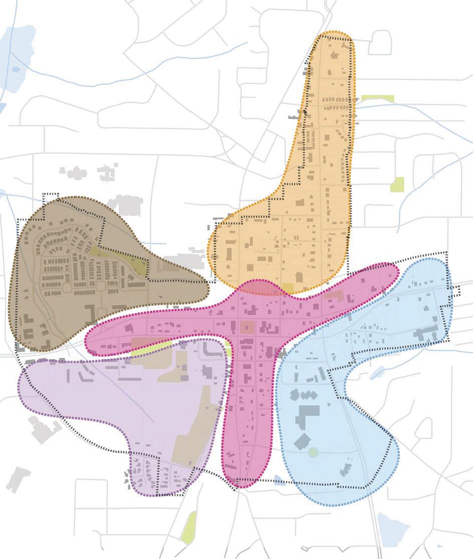
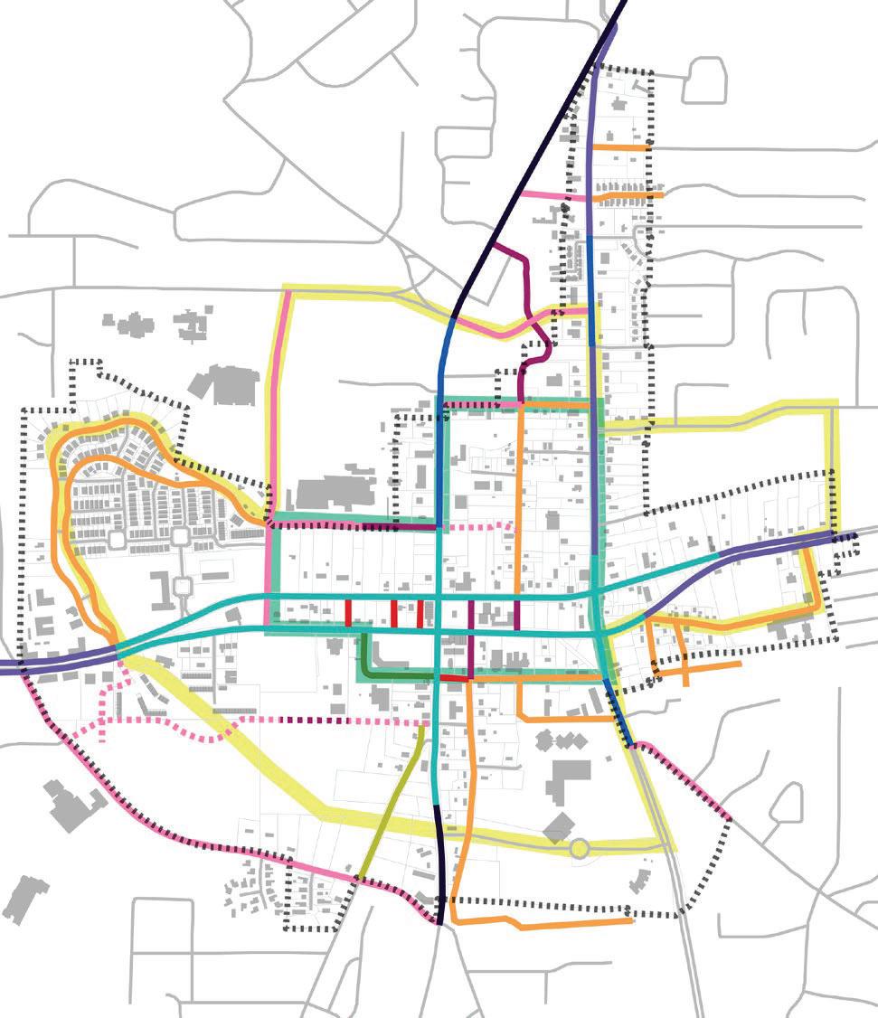
TheFramework
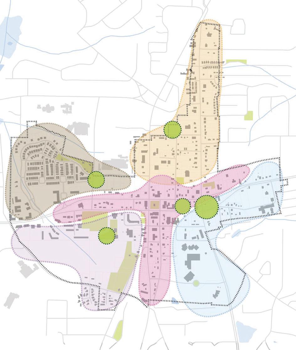
Preserving the character set by the Villages at LaFayette, this area echoes the homely features of walkable urbanism with connections to nature
A Threshold is the entrance or start of something and this area serves as a portal to the new downtown district with its mix of uses that are just right for communities to thrive
The Edge mirrors the historical aspect of the root by being a play of the phrase - at the Leading edge. This western portion of the study area is closer in proximity to both natural assets and new developments like Trilith. It lends itself to be characterized by innovation as it becomes the nexxus where creative mixed use developments can be featured.
The Core pays homage to the history of Fayetteville with the preservation of many notable places of interest. It is also home to the new government buildings that together with the local businesses shape the main street.
The Root speaks to the rich foundation set in this area by the Sugar Hill community, the religious institutions and the civic organizations. It indicates growth that speaks to the dichotomy of the present and the future that is deeply rooted in the heritage of Fayetteville’s 200 years of existence.
Areas distinguished by common characteristics based on physical environment analysis and community perception
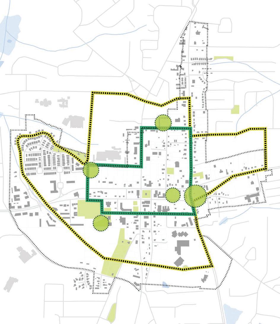
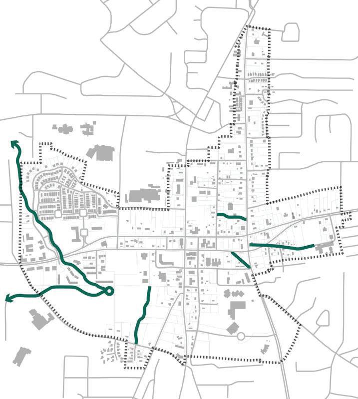
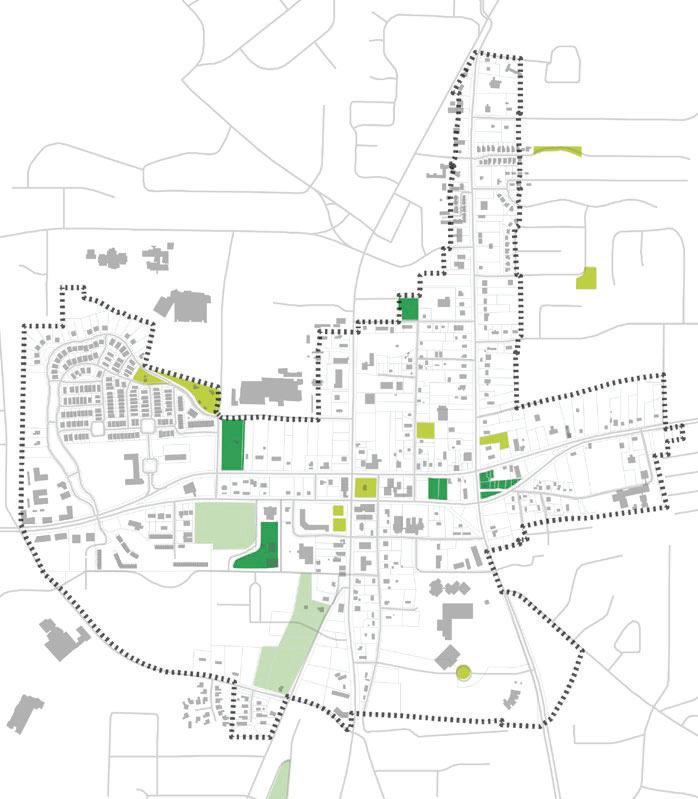
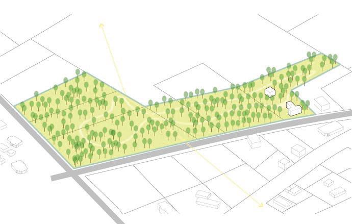
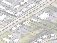
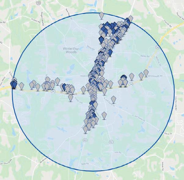
As stated earlier in this document, Fayetteville needs more programmed open spaces. In addition to preserving the existing parks and open spaces, there are four proposed new parks as shown on the map on the opposite page.
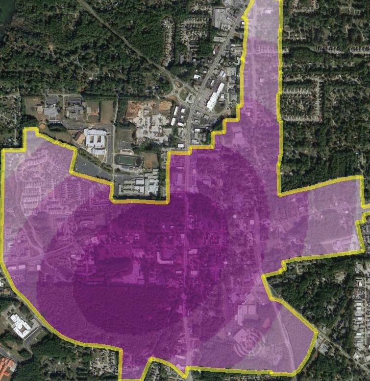
The analysis below shows how the proposed parks close the walkshed gaps with the LCI study area. This ensures all of the residents of the LCI study area are within at least 15 minute walk to a park or programmed open space. The next spread details the proposed parks and public spaces as well as streetscape enhancements.
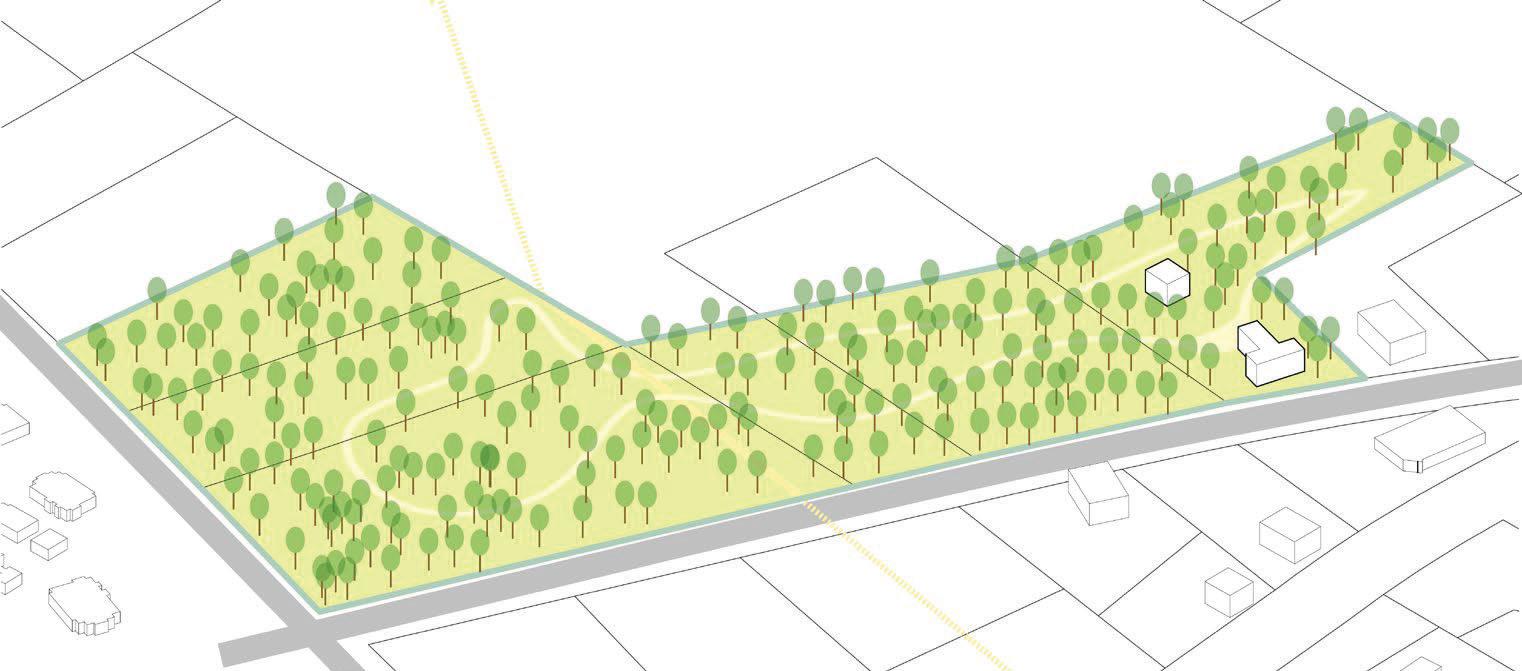
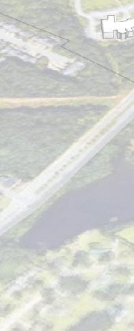
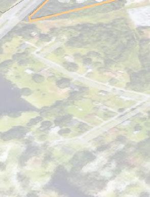
SouthernConservationTrustPreserve
Continue Preservation of forest land next to the Southern Conservation Trust. The vacant parcel west of the Southern Conservation Trust could be developed in a way where conditions exist requiring the developer to connect trail systems in the development by the stream to the Southern Conservation Trust as well as the planned community green space on the Fisher Avenue extension.
• Outdoor education opportunities
• Natural walking trails that take advantage of the stream.
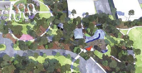
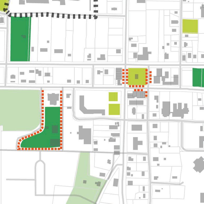
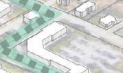
The vacant lot adjacent to the existing amphitheater provides a great opportunity to create linkage between the amphitheater and the residential area leading to downtown. This could be done with a combination of park space that is more of a natural feel than a developed feel with the following programming:
• Walking trails
• Community event space
• Playground for children
• Dog park
• Mixed use of small scale commercial (dining and or shopping) on the edges facing the street.
• A place for people to enjoy the city before or after going to an event at the amphitheater.
• Pedestrian connection through the residential area linking this vacant area to the downtown.
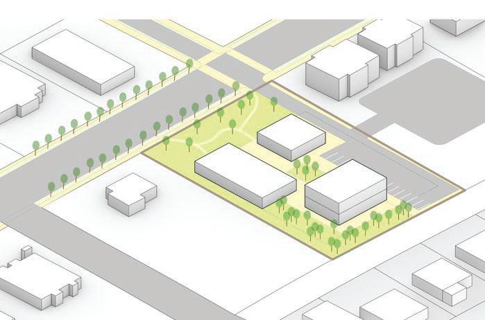
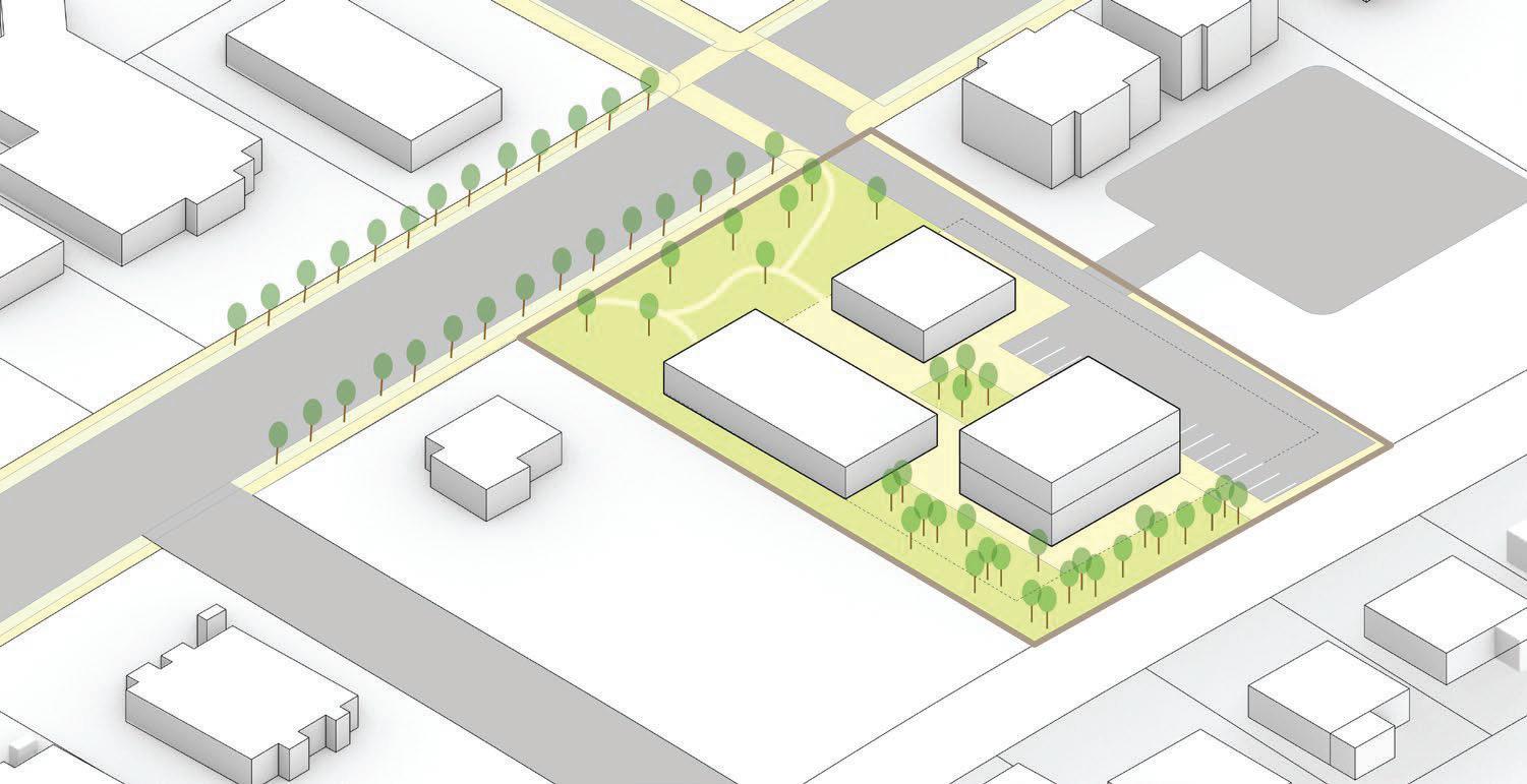
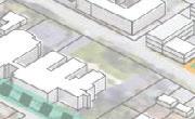
PotentialPublicGatheringspace/smallpark
The vacant spaces between E Lanier Avenue and E Stonewall Ave provide a great opportunity for a mixed-use development that provides an open park space linkage between the two streets.
• Open green spaces provide opportunities for community events close to the downtown area.
• Adding mixed use options makes the place more easily inhabitable which creates public interest.
• Potential to be used as a public park when not being used for community events.
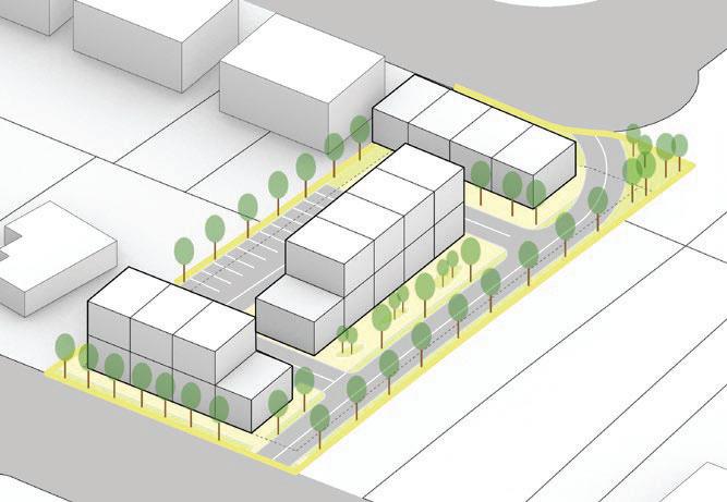
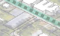
TransitionalPark
The vacant space along E Lanier Avenue and S Jeff Davis Drive, and also along Booker Avenue, provide an excellent opportunity to provide transition space between the residential community in this area to the downtown commercial area.
This could be accomplished in a variety of ways, but adding public park space in this area that provides a variety of functions would work well.
• Playgrounds for children
• Dog Park
• Open spaces for community events
• Physical and mental health
• This would also potentially serve as a node of connection between the enhanced pedestrian gateway along N Jeff Davis Drive and the residential community.
• Small scale commercial development for the use of restaurants or shopping could also be incorporated into the park space.
• Abernathy Greenway along Abernathy Road in Roswell is a good example of a liner park alongside of a vehicular roadway.
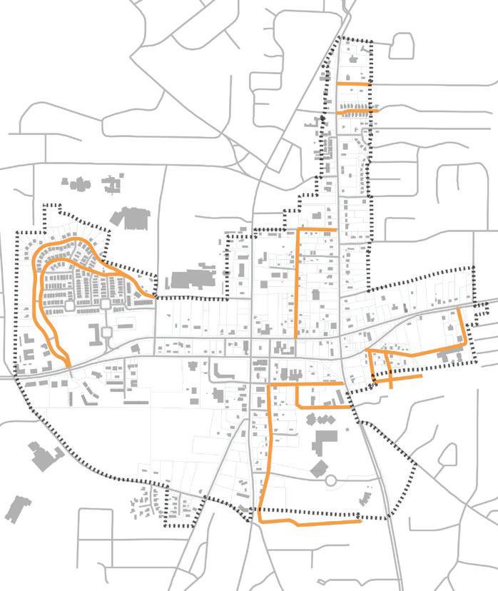
PocketPark
• Public space node
• Gateway to north 85 corridor
• Possible location for a community garden, playground for children or other neighborhood initiatives.
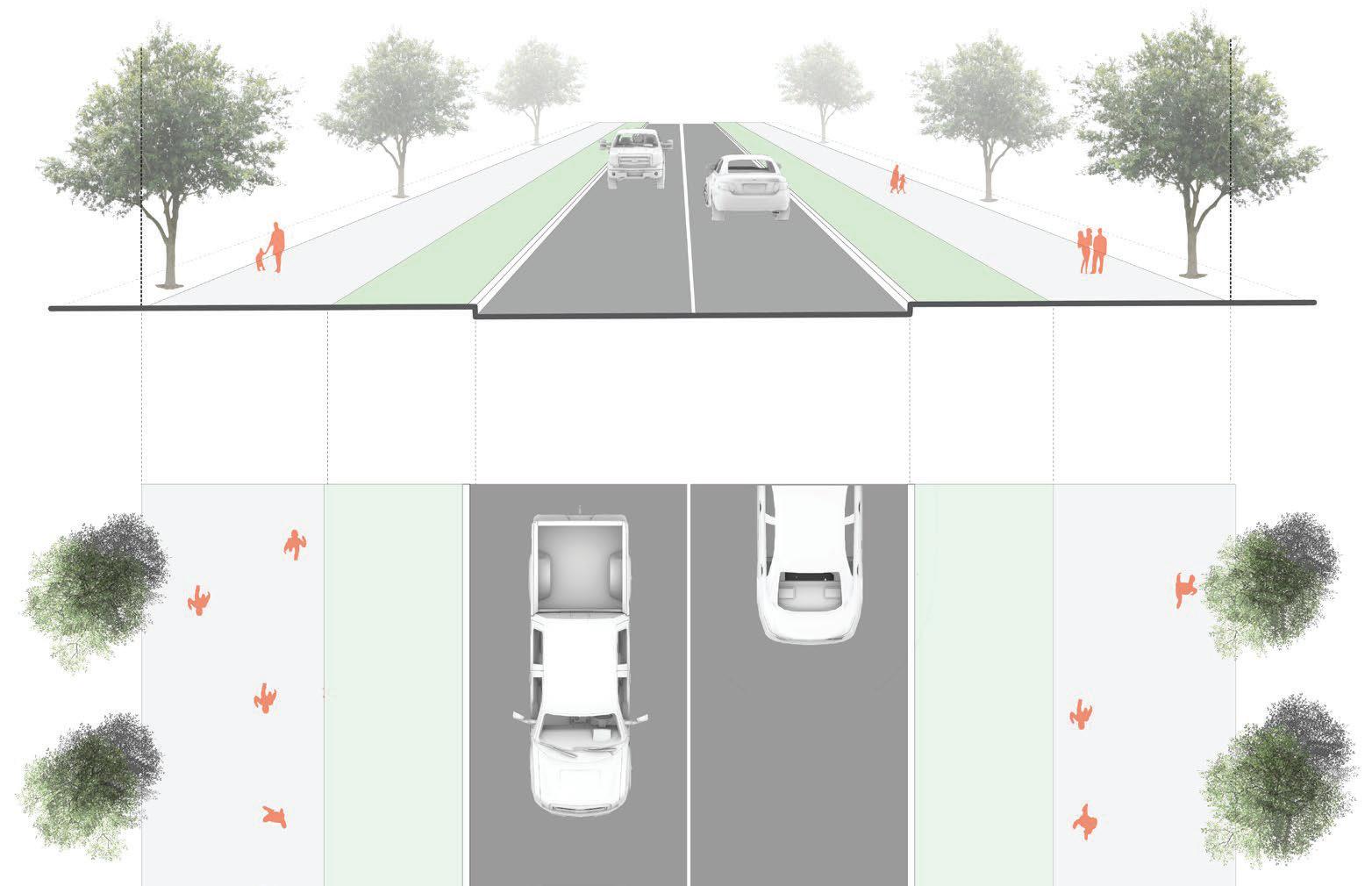
Streetscape
The historic homes purposed for commercial use along N Jeff Davis Drive provide a good opportunity to begin a gateway into the downtown area.
Pedestrian activity could be enhanced with more of a separation between the sidewalk and the road with enhanced low maintenance landscaping within the landscape strip.
• Seating nodes within the enhanced pedestrian pathways should be designed appropriately to connect to the local businesses. Perhaps there is an incentive for business owners to provide enhanced seating nodes along the sidewalk that lead into their place of business and also provide a nice feature for the users of the sidewalk. Pocket parks with private partnership
• There was strong desire for more local outdoor dining options. The large front yards of these old historic homes facing N Jeff Davis provide a great opportunity to meet this desire.
• Historic Roswell, GA on Canton Street is good example of this.
05.2Mobility
Introduction
More tourists and locals are expected to visit and live in the city’s downtown area with this influx in population, creating a need for better and safer downtown amenities to support its residents and visitors. There is a need for public spaces where people can interact and define the community’s aesthetic quality, economic activity, health, and sustainability. New design strategies should therefore be implemented to develop a strong framework for the infrastructure amenities needed to get people out of their cars to socialize, interact with their environment, and discover other mobility options.
A Mobility Framework, detailed below, was formulated by NV5 to guide the future development and growth of Downtown Fayetteville. The overarching goal of this framework is to implement the desired public infrastructure investments within the city’s existing specifications for streets and roadways. These investments are needed to support more private developments in the downtown area and ensure all users of transportation networks leading to or from these developments can travel safely, reliably, and independently between them in adequate and accessible ways. The proposed framework should be used to rethink how existing street networks and public rights-of-way can be re-purposed or better utilized to move Fayetteville Forward into a future and prosperous community.
The proposed Mobility Framework for Fayetteville:
1. Recognizes the physical constraints, context, and character of the surrounding built and natural environment. It recommends policies and projects that strengthen the pedestrian, bicycle, and vehicle transportation network within the LCI study area.
2. Defines ideal standards for Complete Streets in local areas. “Complete Streets” refer to the concept that roadways should be designed with all users in mind, not just motorists. These standards apply context-sensitive design approaches to roadway redesign that enable safe, convenient, and comfortable travel or access for users of all ages and abilities regardless of their mode of transportation. This effort will support walking and bicycling within Fayetteville.
3. Advocates for (re)developing Fayetteville’s core transportation network to work for the city’s residents, businesses, and visitors. This requires flexibility in its design application and implementation so that mobility priorities and guidance for transportation investments are identified to improve resident’s quality of life and access to goods or services.
GRADYAVE
These three Mobility Framework guidelines will assist city staff with identifying a street design hierarchy so that mobility investments and place-making strategies are prioritized and applied within the LCI study area. Doing so will create unique pedestrian and storefront opportunities in targeted redevelopment locations as well as present several project recommendations that can enhance local mobility. This includes improved pedestrian and bicycle capacities through downtown, connecting residential and commercial areas with parks and open space, and creating stronger linkages to neighboring communities. Applying these approaches to Downtown Fayetteville will position the city for any future public transit investments and advance the city’s livability goals.
PurposeAndApplication
The recommendations within the Mobility Framework are intended to provide a broad vision for streets within downtown Fayetteville and the LCI study area. It is intended to supplement and provide a baseline for decision-making on a case-by-case basis using the professional judgment of the designer. The recommendations provided herein offer directions for incorporating Complete Street principles and practices, especially as the city looks to finalize its Unified Development Ordinance (UDO) and update its Public Works Design Manual, other standards, and practices. Although these street typologies are focused on the LCI study area, they also may have wider application.
The built up character of the Fayetteville’s downtown area present unique challenges for implementing changes to its streets. However, new development on vacant parcels and redevelopment of existing land offer opportunities few cities will experience to remake their street system. It should be noted that implementation of the Mobility Framework’s recommendations is not one size fits all, and the recommendations provide a range of feasible, cost-effective approaches to achieving mobility facility design objectives. The street typologies presented are intended to illustrate how different travel modes can be balanced within an existing right-of-way while minimizing modification of the curb and drainage system, thereby minimizing cost of implementation. At the same time the street typologies offer preferred dimensions and treatments that may only be applicable when a roadway is being rebuilt. In practice, a specific design may more strongly emphasize some street design objectives while providing baseline treatments for others.
Project decisions will continue to be made through the combination of expert and community input, City Council direction, available resources, site conditions and other factors. Opportunities to reduce environmental impacts should be routinely considered, along with other project objectives. Broadly speaking, the city will seek to cost-effectively maximize the benefits to the public, to distribute street improvements equitably and to serve all members of the community.
SouthernConservationTrustTrail
Trailhead’s are an important introduction to a facility. Their design can either support an overall theme for a trail or convey a story for a trail segment. Trailheads often include amenities such as trail maps, benches, trash receptacles, portalets bike repair stations, etc. They also can be designed so that they provide parking for hikers who might arrive by car.
InnerandOuterLoopSegments
The Inner and Outer Loops are an assemblage of existing sidewalks and trails that enable travelers to walk, run, or bike around downtown Fayetteville’s inner core, connecting with the city’s cultural and historic assets. The loop system aims to connect the different sections of the downtown mixed use district through a cohesive pedestrian and cyclist paths that connect to the existing and proposed open spaces. As both loops path through the various character theme areas (see Section 04: Vision) the trails would have a similar character in the respective areas as detailed below.
This inner loop is envisioned to be identified by a unique wayfinding signage system, emphasized by markers and signage of historic properties, landmark and events.
This section would have opportunities to highlight local art, artists and community members and groups including veterans and civil rights activists.
This section connects Fayette Elementary School and the Fayette County High school to the Southern Conservation Trust passing along the Pye Lake Watershed. This section of the outer loop would have synergy with the schools, including students using it for commute, opportunities for student work exhibitions. Also, there is an opportunity to connect with Southern Conservation Trust educational mission by providing educational markers and signage of natural landscapes such as flood plains and wetlands, as well as habitats and ecosystems.
Inner Loop: Historic Core Trail Segment (The Core)
Outer Loop: Ecology Trail Segment (The Edge + The Village)
Outer Loop: Community Trail Segment (The Root)
Trail Loops Character Map
Photo Courtsey of Pannier Graphics.com
The Outer Loop is envisioned to be identified by a unique wayfinding signage system and divided into two (2) distinctive segments: the Community Trail and the Ecology Trail.
Framework Roadway Network Policy Recommendations
PolicyRecommendations
Adopt a Complete Street Policy
“Complete streets” refers to the concept that roadways should be designed with all users in mind, not just motorists. The policy should include language that addresses all users and travel modes, applies to all types of transportation projects, recognizes the importance of a complete street network, directs designers to use the latest design guidance, identifies specific implementation steps, and creates measurable performance standards to evaluate whether the policy is meeting its goals.
Establish a Street Typology
The traditional functional classifications of streets provide a hierarchy that correlates traffic flow to land access. Traffic volume, speed, and level of service provide the basis for roadway design criteria. However, this classification system falls short in considering non-vehicular users of the public right-of-way (pedestrians, bicyclists, and transit) and is void of context for how the street impacts adjacent land uses and vice versa.
StreetTypologies
A Street Typology can augment the traditional roadway functional classification method by providing a user-oriented classification system that goes beyond considering the street system as a mere conveyor of automobiles. The typology classification system focuses on contextual approaches to roadways that consider nearby land uses and multiple user groups that create a sense of place rather than solely focusing on traffic volumes and speeds as functional roadway design parameters.
UDO Streets
The City of Fayetteville, through their Unified Development Ordinance (UDO), prepared a simplified three (3) tiered street hierarchy, classifying all streets, roads, and highways as:
» Major Streets. Major Streets are intended to provide swift and safe movement of traffic through the community.
» Collector Streets. Collector Streets channel local traffic into the major/minor collector and arterial system. Collectors provide circulation within residential subdivisions or commercial and industrial areas.
» Minor Streets. Minor Streets are used for local circulation in residential areas providing access to abutting property.
1Unified Development Ordinance (Draft), City of Fayetteville, GA. Chapter 300 - Land Development. Article 1. Street, Sidewalks, and Public Paces. Section 301.1-301.4. pp. 103-112. City of Fayetteville, GA, January 2021.
The UDO street hierarchy establishes prerequisite minimums for roadway and street design to include dimensional requirements for right-of-way (ROW), surface pavement, and sidewalks. The UDO street hierarchy also establishes access requirements. It is within the boundaries of the UDO street hierarchy and typologies that the Fayetteville LCI’s proposed Mobility Framework sits.
In addition to establishing a street hierarchy, the UDO also establishes five (5) street typologies. They include:
1. Major Streets. A street that provides swift and safe movements of traffic through the community.
2. Industrial Streets. A street serving primarily industrial developments.
3. Commercial Streets. A street serving primarily commercial development.
4. Residential Streets. A street primarily function to provide access to residential uses.
5. Alleys. A public thoroughfare or way that provides a secondary means of access to abutting property.
Mobility Framework Streets.
The Mobility Framework’s proposes eleven (11) street design typologies for four (4) of the five (5) UDO street typologies (Industrial Streets were not included). The design variations have been matched to their principal UDO street typology to provide continuity between the UDO right-of-way and minimum pavement width requirements, and the Framework’s street design concepts. Each of the street typology variations is intended to provide design flexibility and to inform the reimagining and overall (re)design of streets, specifically within the LCI study area. Table 1 illustrates how the street design variations align with the City of Fayetteville’s existing UDO street classification hierarchy and street typology.
UDOStreetTypesDescriptionTransportationFunction
Streets Major Streets
Major Type 1: Major Thoroughfare
Major Type 2A: Major Commercial
Major Type 2B: Major Boulevard
Auto-oriented street characterized by moderate to high amounts of traffic, and emphasis on throughput.
Emphasizes throughput
Auto-oriented street characterized by large scale commercial land uses and moderate to high amounts of traffic that emphasizes throughput. Emphasizes throughput
Auto-oriented street characterized by a mix of smaller scaled commercial land uses and housing, moderate to high amounts of traffic, and that seeks to balance throughput and access. Balances access and throughput Major Type 3:
Street characterized by a diverse mix of retail, housing, office and/or institutional land uses serving people using several transportation modes to circulate, but with increased motor vehicle demand.
Commercial Street
Type 1: Connector
access and throughput
Street
Commercial Street
Type 2: Main Street
Commercial Street
Type 3: Commercial Alley
Streets
A secondary street network characterized by moderate traffic emphasizing moving people through and between neighborhood and access to property.
Streets characterized by a diverse mix of retail and office fronting the street, heavy foot traffic, and people using several types of transportation to circulate.
Small scale pedestrian-oriented streets characterized by low traffic and low speeds, a diverse mix of retail and office fronting the street, heavy foot traffic, bikes, and both nonmotorized and micro-mobility travel modes
Emphasizes throughput
Balances access and throughput; pedestrians are priority
Emphasizes access
Street
Emphasizes access; pedestrians are priority Residential Boulevard
Street
Streets primarily serving residential areas characterized by relatively low traffic and low speeds, housing, separated walkways, and sometimes on-street parking
Streets
Streets primarily serving residential areas characterized by relatively low traffic and low speeds, housing, separated walkways, and sometimes on-street parking
Alley
A small-scale street or alley with no curbs primarily used for vehicular access to adjacent residential properties either through individual garages, shared surface parking, or sharedmulti vehicle parking facilities.
Emphasizes access
Emphasizes access Shared Public Way
A small-scale pedestrian-oriented street or alley with no curbs or separate areas for various types of transportation characterized by delivery vehicles, heavy foot traffic, bikes, and both and non-motorized and micro-mobility travel modes.
Emphasizes non-motorized access; pedestrians are priority
1. UDO/Mobility Framework Street Typology Matrix
PlaceTypes
Place types represent the context of the surrounding area and are simplified categories that combine land use, development patterns, and density. Identifying the most appropriate place type—considering the existing and future context of an area—is the first step in selecting an appropriate street type. Individual projects may pass through several place types, which may require transitioning between multiple street types along the corridor.
The Fayetteville LCI area includes a variety of development patterns and land uses. A highly-simplified set of place types has been assembled in an attempt to capture and summarize development characteristics and describe their mobility attributes. The proposed zoning districts and place types are presented in Table 2 below along with descriptions of the idealized mobility characteristics.
StreetTypeSelection&Design
The conventional approach to street design is based primarily on a roadway’s functional classification (arterial, collector, local, etc.). Functional classification is a surrogate for motor vehicle traffic volume and speed. Higher classifications (e.g., arterial streets) tend to carry higher volumes of traffic at higher speeds. Lower classifications (e.g., local streets) tend to carry lower volumes of traffic at lower speeds. However, there are several limitations to this approach, primarily:
Lack of Context Sensitivity
Step 1 - Place Type
Historic Core
Mixed-Use Core Activity CenterAreas with high amounts of circulation across and along streets, with a high proportion of people accessing buildings by walking or on bike
Mixed-Use Areas or corridors with a mix of uses, with people accessing buildings using multiple modes of transportation
Transitional Residential
Mixed Use Neighborhood
Neighborhood Residential Residential Neighborhood Areas with single and multi-family homes, oftentimes with adjacent schools and parks
Gateway Commercial Boulevard Commercial Commercial Center/Corridor Areas oriented toward automobile traffic, with parking lots placed between streets and buildings
The current approach lacks a consistent method for making street designs respond appropriately to the surrounding context. Take for example SR 54/Lanier Avenue West and North Jeff Davis Drive. Both roadways are classified as major streets, but exist in vastly different development contexts and should thus be designed differently. Under the current approach, it can be challenging to design major streets that support walkable, vibrant places.
Access versus Throughput
The current approach assumes a constant relationship between the amount of car traffic and the function of the street. However, two streets can carry the same amount of traffic but serve different functions. Streets through activity centers located near Fayetteville’s downtown core might emphasize access and lower speeds, while streets along the LCI study area’s periphery might emphasize throughput (the quick and efficient movement of people) at higher speeds.
Preparing for the Future
As Fayetteville continues to grow, it is important that streets are designed to be compatible with new development types (ex. walkable mixed use). The current street design approach is less conducive to designing streets that respond to and support such development patterns.
Note: The Mobility Framework’s street typologies do not replace the traditional functional classification system which should still be used for federal funding and design purposes or where the city code requires it be utilized. All design parameters are subject to engineering review to ensure the safety and functionality of each system.
StreetTypeSelectionApproach
The recommended approach to street design will first take into consideration (1) the existing hierarchical street classification; (2) the context of the surrounding area (in the case of a greenfield or redevelopment project – the expected context of the surrounding area), and; (3) the intended function of the street. Ideally, this approach will result in streets designed to serve all anticipated users. The street type selection approach is comprised of three steps.
Place types represent the context of the surrounding area and are simplified categories that reflect land use, development patterns, and density. The first step in selecting the appropriate street type is identifying the most appropriate place type. Planners and/or designers should take into consideration both the existing and future context of an area. Keep in mind that individual street projects may pass through multiple place types. This means that it may be necessary to transition between multiple street types along the corridor.
The City of Fayetteville anticipates adopting new character-based zoning districts within the LCI study area as a part of this work effort. The zoning districts encompass several place types and potential future land uses. Note, however, that place types relate to, but do not replace, the city’s zoning districts.
Step 2 - Transportation Function
The transportation function of a street is determined first by identifying place type and secondly by conventional factors (e.g., traffic demand). Transportation function exists on a spectrum with one end emphasizing throughput and the other end emphasizing local access and small-scale, localized circulation. Throughput describes the efficient movement of people at greater distances, often at higher speeds. Safely maximizing throughput typically requires physically separating modes and limiting the number of intersections and driveways along a corridor. Access describes peoples’ ability to reach destinations and individual properties along a street by any mode. Access-oriented streets are typically lower-speed with higher levels of foot traffic.
Transportation function may be determined by answering the following questions:
» Are there several destinations along the street?
» How much foot or bike traffic (currently or potentially) is present?
» Is the street an important cross-town travel link?
Step 3 - Street Types
Street types, as applied herein, represent common combinations of place types and transportation functions. The street types presented within the Mobility Framework provide, offering a shortcut to address common street design situations with flexibility so that the LCI’s objectives might be implemented as envisioned. The street cross-section layouts included herein serve as starting points for the design of individual streets and include a range of parameters and set of priorities for the inclusion of various street elements (e.g., bike lanes versus on-street parking).
1 Street Types Selection and Design Parameters. Complete Street Ames. June 15, 2018.
Table 2. Place Types
StreetTypeApplication
The relationship between these place type, street function, and street type is shown in Figure 1. Street types are selected by first identifying the appropriate place type for the context, choosing the appropriate transportation function, and then selecting the resulting street type produced by the matrix. In some situations, multiple street type options are appropriate. Selecting between the multiple options requires considering the fine-grained context and constraints within the corridor.
TransportationFunction
Case-by-case design flexibility is built into the Mobility Framework and can be applied to any of the included street typologies by shifting street elements within the UDO right-of-way standards. The design parameters established by the UDO for each street type include minimum values which in most cases can accommodate the desired street design. In cases where values outside of the parameters are necessary or desirable to accommodate elements such as bicycles, paths, and on-street parking, the design engineer should consider and balance the needs of all modes, emphasizing safety above all else, and especially pedestrians and bicyclists.
As mentioned in Step 1, land use contexts (and therefore place types) can change across the length of a corridor, and multiple street types may be applied to different segments of a single roadway. For example, a corridor may be primarily categorized as an Arterial Street, however a commercial node along it may result in a segment being classified as a Mixed Use Street. The street design elements will change accordingly, reflecting the designated street type and its economic and mobility objectives.
In the absence of a Fayetteville street-specific design manual, the Mobility Framework recommends the Georgia Department of Transportation’s (GDOT) Pedestrian and Streetscape Guide be used to provide direction with best design practices for streets and roadways intended to support multi-modal travel. Further, the GDOT Plan Development Process1 and Plan Presentation Guide2 should also be consulted to ensure consistency across federal-aid, state and locally-funded transportation and streetscape projects.
The recommendations that follow are based on existing transportation conditions analyzed and input gathered by the LCI project’s core team from public in-person and virtual meetings with the local community.
Implement the following Capital Improvement Projects:
1. New Roadway Connections
2. Complete Street Enhancements
3. Paths & Trails
4. Pedestrian Safety Projects
5. Inner and Outer Pedestrian Loops for Circulation Flow
Descriptions for potential projects associated with each improvement project type, mentioned above, are illustrated in the image to the right and also detailed in the following pages.
State of Georgia Department of Transportation (2021). Plan Development Process Rev 3.3. Available from: http://www.dot. ga.gov/PartnerSmart/DesignManuals/PDP/PDP.pdf
2 State of Georgia Department of Transportation (2017). Plan Presentation Guide Rev 2.8. Available from: http://www.dot.ga.gov/ PartnerSmart/DesignManuals/Plan/Plan_Presentation_Guide.pdf
No.Project NameFromToDescription
1City Center ParkwayFisher Ave at SR 85/Glynn St SGrady AveNew roadway serving the Fayetteville City Hall complex, Walton Fayetteville Development and undeveloped land parcel
2Beauregard Blvd RealignmentBeauregard Blvd City Center ParkwayRealignment of Beauregard Boulevard from SR 85/Glynn Street to City Center Parkway
3Fisher Avenue ExtensionLee StJohnson AveExtend existing Fisher Avenue from Lee Street termini to Johnson Avenue
4LaFayette Avenue South ExtensionSR 54/Lanier Ave WCity Center PkwyNew roadway connecting existing LaFayette Avenue Magnolia Office Park to City Center Parkway
5LaFayette Avenue East ExtensionSR 85/Glynn StChurch AveExtend existing LaFayette Avenue from SR 85/Glynn Street to Church Street
6City Hall Drive ExtensionSR 54/Lanier Ave WSR 54/Stonewall AveNew roadway connecting SR 54 /Lanier Avenue westbound to existing City Hall Driveway
7Fayetteville Alleyway ProjectSR 54/Lanier Ave WSR 54/Stonewall AveNew Alleyway between SR 54/Lanier Avenue and SR 54/ Stonewall Avenue, behind retail buildings.
CompleteStreetsEnhancements
No.Project NameFromToDescription
1Hood Avenue/Kathi AvenueSR 85/Glynn St NJeff Davis DrBike lane / sharrow
2West Georgia AvenueSR 85/Glynn St NJeff Davis DrClose sidewalk gaps; sharrow
3LaFayette AvenueCampaign TrChurch StBike lane / sharrow
4Johnson AvenueSR 85/Glynn St SJeff Davis DrClose sidewalk gaps; add sharrow
5Tiger TrailHood AveSR 54 / Stonewall Ave WClose sidewalk gap between Lanier Ave and Stonewall Ave; add sharrow
7Jeff Davis DriveKathi AveJimmie Mayfield BlvdUpgrade sidewalk to sidepath; widen planting strip buffer; sharrow; formalize median with raised curb
8Booker AvenueSR 54 / Lanier Ave WEast Fayette ElementarySidewalk repair / improvement; pedestrian crossing at SR 54/ Stonewall Ave E
9Heritage Parkway Shared StreetSR 54 / Stonewall Ave ESR 85 / Glynn St SFormalize as Commercial Shared Public Way
No.Project NameFromToDescription
1Church Street Park PathChurch Street ParkJeff Davis DrMulti-use pathway
2Pye Lake TrailCity Center PkwyPye LakeGreenway trail, multi-use trail; side path
3Bradford - Manassas TrailCity Center PkwyThe Ridge Nature PreserveExtend existing Fisher Avenue from Lee Street termini to Johnson Avenue
4Southern Conservation TrustCity Center PkwyGrady AveMulti-use trail
5City Center TrailheadPye Lake Trail at City Center PkwyBradford-Manassas Trail at City Center PkwyTrailhead with parking
6Booker Avenue PathSR 54/Stonewall Ave EJeff Davis Dr / Booker AveMulti-use pathway
7Fayetteville First Baptist PathSR 54/Stonewall Ave EJeff Davis DrMulti-use pathway
8Inner and Outer Loop Project
Assemblage of existing and proposed sidewalks and trails that enable travelers to walk, run, or bike around downtown Fayetteville’s inner core. For description of the project, see page 111.
2Ped Crossing ImprovementSR 54 / Lanier Ave WSR 85 / Glynn St SHigh-visibility crosswalk; signal improvement
3Ped Crossing ImprovementSR 54 / Stonewall Ave WSR 85 / Glynn St SHigh-visibility crosswalk; signal improvement
OtherProjectRecommendations
Establish Street Frontage Typologies, Improve Public Space Domains
Street Frontage Typologies are inherent to identifying the function and purpose of streets in their area. Frontage Types are integral in creating the appropriate nexus between public and private realms within streets and blocks. Frontages types regulate how the private realm relates to the public domain, ensuring harmony between the two. Frontage type regulations determine what building types, public realm elements, and building elements are permitted or required based on the street’s development character. Frontage typologies include standards for sidewalks, street furniture, landscaping, outdoor retail displays, cafe areas, utilities, etc. Such standards allow the vision and goals articulated herein to be realized over time through incrementa development practices and changing architectural styles and materials. The Built Environment and Zoning recommendations describe the frontage typologies and their locational application in more detail.
Pursue Shared Parking Ordinances
The City of Fayetteville should pursue shared parking agreements with the Fayette County Annex, the Fayetteville First Baptist Church, First United Methodist Church, and the Fayetteville First United Methodist Church as a cost-effective alternative to the construction of a new structured parking facility. Additional analysis of Downtown Fayetteville’s parking inventory and parking demands is needed to determine existing parking demand peak hours, surplus and deficits in available spaces, and optimal time frames for public or private events.
ImprovementProjects:StreetParking
No.Street Parking Locations and SpacesExistingProposed
1 City Hall, Entrance Drive0112
2 City Hall, Exit Drive067
3 City Center Parkway0123
4 Glynn Street, southbound direction59
5 Glynn Street, northbound direction77
6 Stonewall Street, facing courthouse99
7 Stonewall Street, facing storefronts57
8 Lee Street, facing courthouse1418
9 Lee Street, facing UMC77
10 Lee Street, facing storefronts77
Total Available Parking Spaces54366
ImprovementProjects:SharedParking
1 Library Lot157157
2 Fayette County Facility Lot0206
3 Lanier Avenue Lot2832
4 Fayetteville FBC Lot051
5 Fayetteville UMC Lot 1021
6 Fayetteville UMC Lot 2071
7 Fayetteville UMC Lot 3042
Total
Parking Spaces185580
Built Environment
ZoningUpdateOverview
Introduction
Purpose
The Downtown Mixed Use Zoning Code is intended to implement the overall aims of the Downtown Mixed Use District as set forth n the Unified Development Ordinance (cite), which is based on the City’s 2017 Comprehensive Plan vision for walkable, mixed use Downtown. The subdistricts that comprise the Downtown Mixed Use Zoning Code have their roots in the analyses depicted in the Moving Fayetteville Forward Living Cities Initiative Plan.
Structure&Organization
The Downtown Mixed Use Zoning Code is not a conventional zoning code like the zoning in other parts of the City. The subdistricts within Downtown Mixed Use Zoning Code are based on the existing and/or future character and built form of sections of Downtown rather than on the predominant type of land use permitted in that area. The Downtown Mixed Use Zoning Code regulates more aspects of the built environment than a conventional zoning code typically regulates.
Each subdistrict has an intent statement that describes the general vision for the future of that subdistrict with respect to development, scale, open spaces, and other attributes.
The opposite page show the proposed zoning map. The next pages describe the intents of each zoning district and the permitted building types within each district as well as outline the regulations within each zoning sub-district and provide architectural character references.
HowToApplyTheDevelopmentGuidelines?
The LCI Zoning encompasses four layers: the overall Downtown Mixed Use District, the character themes outlined in Section 04: Vision the Downtown Sub-Districts, and the Regulations for each Permitted Building Type within a Sub-District. For each zoning district , development guidelines are detailed pertaining to the following:
ZoningDistrictIntent- The intent of the zoning regulations with respect to the form and character of development.
CharacterReferenceArea- The character(s) of the zoning district
Adjacent Street Typologies - Which street typologies outlined in the mobility section are proposed within the said zoning district to understand the synergies between the street typologies, permitted building types and uses.
CharacterReference- This section outlines the desired building character in the district including architectural design guidelines.
PermittedBuildingTypes - This is a list of building typologies permitted
BuildingPlacement- Location of the building on the lot, including setbacks.
BuildingForm- Recommended height and massing of a building
SiteandParkingAccess- Pedestrian and vehicular access to the building including parking and entrance location
SupplementalStandardsfromUnifiedDevelopmentOrdinance(UDO)- Other relevant standards that should be followed in accordance to the UDO.
Downtown Mixed Use District (DMU)
The study area scope for the Livable Centers Initiative
Character Themes
Themes for 5 sectors that reflect the past, the present and the future of the study area
Downtown Sub-districts (DMU- )
Classification of districts within the DMU that will codify the development pattern
Building Types + Regulations
Guidelines for the various aspects of site, buildings, open spaces and detail design
The four layers of Fayetteville LCI zoning
The following sub-districts are established for development within downtown areas and are collectively called the Downtown Mixed Use Zoning Code. These sub-districts achieve the purpose of consolidation while also maintaining the characteristic features of the different areas.
1. Historic Core (DMU-HC)
2. Mixed Use Core (DMU-MUC)
3. Gateway Commercial (DMU-GC)
4. Mixed Use Neighborhood (DMU-MUN)
5. Boulevard Commercial (DMU-BC)
6. Transition Residential (DMU-TR)
7. Neighborhood Residential (DMU-NR)
8. Open Space Conservation
The existing and new zoning maps have been illustrated for comparison so that the changes can be tracked as the ordinance gets enforced. The following pages are a comprehensive guide to both public officials and private developers to ensure that all new development is cohesive and represents the vision of the livable centers initiative both in the built environment and the public realm.
Historic Core (DMU-HC)
Mixed Use Core (DMU-MUC)
Gateway Commercial (DMU-GC)
Mixed Use Neighborhood (DMU-MUN)
Boulevard Commercial (DMU-BC)
Transition Residential (DMU-TR)
Neighborhood Residential (DMU-NR)
Open Space District (DMU-OS)
Retain Existing Zoning
OR-10SINGLEFAMILYRESIDENTIAL
R-15SINGLEFAMILYRESIDENTIAL
R-22SINGLEFAMILYRESIDENTIAL
R-30SINGLEFAMILYRESIDENTIAL
R-40SINGLEFAMILYRESIDENTIAL
R-70SINGLEFAMILYRESIDENTIAL
DR-15ONEANDTWOFAMILYRESIDENTIAL
RMF-15MULTI-FAMILYRESIDENTIAL
R-THCRESIDENTIALTOWNHOUSECONDOMINIUM
RPRESIDENTIALPROFESSIONAL
MOMEDICALOFFICE
OIOFFICEANDINSTITUTIONAL
C-1DOWNTOWNCOMMERCIAL
C-2COMMUNITYCOMMERCIAL
C-3HIGHWAYCOMMERCIAL
CC-3CONDITIONALC-3
C-4HIGHINTENSITYCOMMERCIAL
BPBUSINESSPARK
M-1LIGHTMANUFACTURING
M-2HEAVYMANUFACTURING
PDPPLANNEDDEVELOPMENTPROJECT
PCDPLANNEDCOMMUNITYDEVELOPMENT
RDREDEVELOPMENTDISTRICT
OSOPENSPACE
The intent of this subdistrict is to preserve the historic character and scale of this area as expressed through the form and architecture of the existing historic building stock. New development in this area will be scaled and designed to complement the buildings located around the Old Fayette County Courthouse.
The intent of this subdistrict is to continue the evolution of this part of Downtown, in combination with the Historic Core, as the center of civic, commercial, social, cultural, and spiritual life in the City, where people can undertake a wide variety of activities, enjoy public open spaces, and walk safely and comfortably. New development in this district may be scaled slightly larger than the traditional mixed use buildings in the Historic Core and include a mix of uses with commercial activity on the ground level and residential units on upper levels.
These subdistricts are located at or near the edges of Downtown along one of the major corridors. The intent of this subdistrict is to encourage the development of prominent buildings with attractive facades and appealing commercial uses that would create a lively ambiance as people arrive into Downtown.
The intent of this subdistrict is to create pocket neighborhoods where a sufficient amount of land is available. Pocket neighborhoods are primarily residential in nature, consisting of a variety of residential building types along with some mixed use buildings with community-serving amenities, all of which are situated within a network of shared open spaces.
The intent of this subdistrict is to preserve the existing character and form of the buildings and landscapes of the section of the N. Jeff Davis Drive corridor that is characterized by converted or purpose-built buildings with residential architectural styles containing commercial uses.
The intent of this subdistrict is to serve as a transition between a mixed use or commercial district and a low-intensity residential area through the development of multi-unit residential buildings.
The intent of this subdistrict is to preserve the character and scale of longstanding residential neighborhoods of detached houses while allowing for new residential building types including cottage houses, cottage courts, and duplexes
This district is intended to protect and preserve valued environmental, scenic, and historic resources within the city, as well as to accommodate agricultural and horticultural uses that require areas of open land on which to operate in order to minimize potential impacts upon neighboring uses.
BuildingMatrix
An
BuildingMatrix
A structure on a lot consisting of two residential units attached vertically or stacked horizontally.
MULTIPLEX (FOURPLEX)
A detached structure on a lot containing four dwelling units, two on the ground floor and two on the second floor, with shared or individual entrances from the street.
MULTIPLEX (FIVE TO TWELVE)
A detached structure on a lot containing from five to twelve dwelling units, two on the ground floor and two on the second floor, with shared or individual entrances from the street.
Image Credit: Platt Builders
BuildingMatrix
TOWNHOUSES (ATTACHED)
Three or more residential units that are attached vertically and that each have separate entrances.
TOWNHOUSES (STACKED)
Three or more residential units that arestacked horizontally.
COURTYARD BUILDING
Multiple attached or stacked residential units with access from a shared courtyard.
BuildingMatrix
MAIN STREET BUILDING
An attached 2- to 3-story building with ground floor commercial space and residential or commercial space on upper floors.
LIVE/WORK BUILDING
An attached or detached structure consisting of one residential unit above or behind a fire-separated, flexible ground floor with a nonresidential use.
MIXED USE BUILDING
A building with ground floor commercial use and residential units on upper floors.
Type
BuildingMatrix
COMMERICAL HOUSE
A converted house or purpose-built building designed like a house that contains a commercial use.
COMMERCIAL BUILDING (PROMINENT)
A stately commercial building, typically a bank, designed with traditional architectural features.
COMMERCIAL BUILDING (SMALL)
A single-story building containing a commercial use.
MIXED COMMERCIAL BUILDING
A two-story building consisting of the same or multiple commercial uses.
Commercial Building Types
BuildingMatrix
FLEX COMMERCIAL BUILDING
A building with taller ceilings than a typical commercial building that can accommodate a variety of commercial and light industrial activities.
CIVIC BUILDING (SMALL)
A minor government or institutional building.
CIVIC BUILDING (PROMINENT)
A distinctive government or institutional building.
Public Building Types
Note: Building Type Guidelines should be checked along with zoning districts. (insert link)
BuildingDesignPrinciples
Buildings design should take into account the following design principles as per the UDO:
a. Size - the relationship of the project to its site.
b. Scale - the relationship of the building to those around it.
c. Massing - the relationship of the building’s various parts to each other.
d. Fenestration - the placement of windows and doors.
e. Rhythm - the relationship of fenestration, recesses and projection.
f. Setback - the relation to setback of immediate surroundings.
g. Materials - their compatibility with the surrounding developments.
h. Context - the overall relationship of the project to its surroundings.
GeneralDesignGuidelines
The following guidelines apply to all districts
• A building’s massing should relate to its site location, use, and architectural context. The massing of a building can be defined as the overall geometry (length, width and height) of its perceived form. Massing is a significant factor that contributes to establishing the character of a specific building. Of particular importance in defining the massing of a building is the overall height of the form, both actual and perceived, as well as the geometry of the roof.
• Continuous, street-facing facades shall have additional design elements such as variations in the width, height, and rhythm at the street level to add interest, enhance the building appearance, establish greater depth in the facade, and enliven the pedestrian realm. Blank walls that can be seen from any street (public or private) are prohibited.
• Façade composition and color should be mindful of the existing context with no sharp contrast.
• Roofs shall be expressed in a visually interesting manner that complements the existing buildings. With the exception of singlefamily residences, the use of awnings on buildings is encouraged to provide protection from sun, wind, and rain, and to improve aesthetics of the building exterior.
• Franchise architecture for single or multiple buildings within a development should be avoided in order to create buildings that complement one another. Franchises or national chains should follow the guidelines to be compatible with the development in which it is located, utilizing similar architectural design, building materials or color selections to blend with the surrounding development.
• Monotnous repetition of the same architecture expression is discouraged, especially any wall surface over 30 feet in length should include at least one change in plane. Larger buildings shall be divided into bays of 25 to 40 foot widths that are articulated by pilasters, piers, differentiation in material, texture, or color, or by variations in the wall plane.
• Styles that are not recommended include faux colonial reproductions employing the use of false columns and accent pieces along storefronts.
• Materials should be selected based on their visual characteristics, quality, and durability. Carbon sequestering (the process of capturing and storing atmospheric carbon dioxide to reduce the amount of carbon dioxide in the atmosphere with the goal of reducing global climate change), urban heat island reducing, and locally sourced/ ethically made materials are ideal like lighter colored pavements/ white sealed asphalt where applicable. For examples of preferred materials, visit the mindful materials resource. The mindful materials Library aggregates product sustainability information while minimizing redundant effort on the part of both manufacturers and designers. Building Materials: Primary Materials: Not less than 80 percent of each street-facing Facade shall be constructed of one or more primary materials comprised of tested and proven, high quality, durable, and natural products. For Facades over 100 square feet, more than one Primary Material shall be used. Changes between Primary Materials must occur only at inside corners. The following are considered acceptable Primary Materials: Brick masonry; Native stone; Glass curtain wall. Accent Materials: The following Accent Materials may make up no more than 20% of the surface area on each Façade. Accent Materials are limited to: Pre-cast masonry (for trim and cornice elements only); Gypsum Reinforced Fiber Concrete (GFRC—for trim elements only); Recycled Metal (for beams, lintels, trim elements and ornamentation, and exterior architectural metal panels and cladding only); Glass block.
• These materials should not be used without prior approval: Metal building without a masonry base course or other architectural features; Prefabricated steel panels; Highly reflective, shiny, or mirrorlike materials; Mill-finish (non-colored) aluminum metal windows or doorframes; Aluminum, vinyl or fiberglass siding or roofing materials; Un-faced or painted concrete block; Pre-cast concrete panels or exposed, unfinished foundation walls; or Exposed plywood or particle board.
• The architecture and landscape design should represent cues from local climate, topography, history, and character, and incorporate modern, climate-sensitive, and environmentally-conscious design considerations to create healthier, more productive, and more sustainable places to live, work, play and rest.
The Vision for moving Fayetteville Forward is to reimagine the possibilities in Downtown through catalytic equitable placemaking, enhanced legibility of the built environment, and creative guidelines for healthy, sustainable developments that will empower its diverse communities.
The Zoning ordinance and Design guidelines for each district have been graphically respresented in response to this vision. This provides a toolkit not only for developers and investors targeting specific development opportunities, but also for the Planning & Facilities Department of the City Of Fayetteville in terms of the permiting and approval process. The sheets are intended to be read in conjunction with the Unified Development Ordinance as they mutually inform each other.
The intent of this subdistrict is to preserve the historic character and scale of this area as expressed through the form and architecture of the existing historic building stock. New development in this area will be scaled and designed to complement the buildings located around the Old Fayette County Courthouse.
Reference:
RecommendedDiscouraged
DesignGuidelines:
Massing & Scale
• The preservation of existing historical building massing should be prioritized where possible.
• When applicable, adaptive reuse should be considered after the structural integrity can be assessed.
• Buildings need to conform to a three-part – base, middle, top –configuration.
• Buildings shall feature an architecturally distinct base to address and enhance the meeting of the building and ground.
• The massing of new construction in this district must be in the interest of walkability; ex. no large set backs from the sidewalk Active Frontage
• Storefront windows shall utilize a bulkhead or other design feature to transition the building to the ground and establish depth and interest in the façade.
• Building entrances shall be easily identifiable. When appropriate, buildings should incorporate changes in mass, surface, lighting, or finish to emphasize entranceways.
• Buildings should incorporate alcoves, arcade, awnings, covered walkways, porticoes, or roofs that protect pedestrians from the rain and sun.
Facade Composition
• Fenestration rhythm should not be extreme in difference to the existing vernacular of adjacent buildings.
• Trim materials, glass, and details should appropriately match the character and quality of existing historic facades.
• High transparency at the ground level with visual connection to activity is strongly recommended in this district.
Roof Lines
• Roof forms of new buildings should be kept consistent with existing buildings. Gabled and hipped roofs are not appropriate for new structures in this district.
• Gutters and downspouts of new construction should be kept consistent in appearance with historic gutters and downspouts. They should not obstruct windows or architectural details.
Style & Materiality
• New construction shall utilize materials common on surrounding historic buildings where possible.
• Innovative use of regular materials such as brick and stone is encouraged but not required. For example, An expressive pattern can be created in the front façade by offsetting the bricks used to create the typical bond, so they project from the surface or different color combinations can be used.
1. Historic Core (DMU-HC)
1.10SupplementalStandards
A. See Article 6. of UDO (Conditional Uses) for Conditional Uses.
B. See Section 401.23. of UDO (Projections into Required Yards.) for Structural and Architectural Projections.
C. See Section 401.29. of UDO (Accessory Buildings.) for Accessory Building Regulations.
D. See Section 401.35. of UDO (Fences and Walls) for Fencing and Wall Regulations.
E. See Section 401.36. of UDO (Height Exceptions.) for Height Limitation Exceptions.
F. See Section 402.8 of UDO (Off-street automobile parking) for Off-Street Parking Requirements
G. See Section 402.43 of UDO (Loading area requirements) for Loading Requirements
H. See Section 403.19 of UDO (Site Design.) for Landscaping Requirements
I. See Section 404.13. of UDO (Screening of Utilities and Trash Enclosures - Design Standards) for Screening Standards.
J. See Chapter 400, Article 5. of UDO (Building and Site Lighting) of for Lighting and Fixture Requirements, Illumination Levels, and Fixture Mounting Height.
H. See Section 406.18. of UDO (Signange - Downtown Mixed Use District) for Signage Regulations and Requirements
2. Mixed Use Core (DMU-MUC)
MajorType3:Mixed-Use
The intent of this subdistrict is to continue the evolution of this part of Downtown, in combination with the Historic Core, as the center of civic, commercial, social, cultural, and spiritual life in the City, where people can undertake a wide variety of activities, enjoy public open spaces, and walk safely and comfortably. New development in this district may be scaled slightly larger than the traditional mixed use buildings in the Historic Core and include a mix of uses with commercial activity on the ground level and residential units on upper levels.
Reference: RecommendedDiscouraged
DesignGuidelines:
Massing & Scale
• Buildings shall be located, designed, and programmed to activate open spaces, promote pedestrian activities, provide visual interest, and create an enjoyable, vibrant, and mixed- use environment
• Development located at signalized intersections of major streets shall include pedestrian-oriented, community serving commercial uses such as a bookstore, coffee shop, or local market.
• Buildings shall be designed to accommodate a minimum first floor finished ceiling height of twelve feet (12’) to allow for retail commercial uses at the ground floor. The minimum interior depth of these commercial spaces shall be 25 feet.
• Upper floors of mixed-use buildings shall be stepped back when adjacent to single-family residences to ensure and protect privacy.
• In order to integrate new buildings with the existing urban fabric, new buildings are encouraged to incorporate pocket parks and attractive plaza areas between buildings that allow light to reach adjacent buildings.
Active Frontage
• Storefront windows shall utilize a bulkhead or other design feature to transition the building to the ground and establish depth and interest in the facade. Entrances have to be definied.
• Provide a transitional design feature(s) such as an opaque wooden barrier between public spaces and residential spaces at the ground floor to distinguish between the public and private realms.
X
• The fenestration at the first floor of Mixed Use Core buildings should be composed of a 70% of window area in order to promote pedestrian-oriented uses with a high degree of transparency along the street. Uses shall be readily discernible to passers-by. Visually extend interior spaces outside through paving and glazing to create the concept of an indoor/ outdoor room
• Upper stories, which are less likely to be occupied by retail tenants may have a smaller percentage of window opening area with window proportions different from ground level.
Facade Composition
• Variations in the width, height, and rhythm of street-facing facades are encouraged along any block face.
• Street-facing facades shall have additional design elements at the street level to add interest, enhance the building appearance, establish greater depth in the facade and enliven the pedestrian realm.
Roof Lines
• Green roofs and gardens are highly encouraged.
• Activate any podium upper level with open stairwells and lively programs (Ex. Restaurants, entertainment, retail, etc.) Style & Materiality
• This district can include a mix of architecture styles ranging from contemporary to traditional.
• The monotonous repetition of details on the building facade is not recommended.
and Walls) for Fencing and Wall Regulations.
E. See Section 401.36. of UDO (Height Exceptions.) for Height Limitation Exceptions. F. See Section 402.8 of UDO (Off-street automobile parking) for OffStreet Parking Requirements
G. See Section 402.43 of UDO (Loading area requirements) for Loading Requirements
H. See Section 403.19 of UDO (Site Design.) for Landscaping Requirements
I. See Section 404.13. of UDO (Screening of Utilities and Trash Enclosures - Design Standards) for Screening Standards.
J. See Chapter 400, Article 5. of UDO (Building and Site Lighting) of for Lighting and Fixture Requirements, Illumination Levels, and Fixture Mounting Height.
H. See Section 406.18. of UDO (Signange - Downtown Mixed Use District) for Signage Regulations and Requirements
MajorType2:CommercialBoulevard
These subdistricts are located at or near the edges of Downtown along one of the major corridors. The intent of this subdistrict is to encourage the development of prominent buildings with attractive facades and appealing commercial uses that would create a lively ambiance as people arrive into Downtown.
Reference:
RecommendedDiscouraged
DesignGuidelines:
Massing & Scale
• Building widths have to be broken into multiples of 50’ along major street and 100’ along secondary street to respond to pedestrian scale. For maximum width, refer zoning table. Activate Frontage
• For buildings on a parcel abutting a primary street, the primary building entrance must face either: a.The primary street sidewalk; or b. A pedestrian-oriented outdoor space such as a public square, plaza, or courtyard
• The ground-floor building walls facing a primary street shall provide transparent windows or doors with views into the building for a minimum of 60% of the building frontage between 2½ and 7 feet above the sidewalk and 90% of the transparent windows or doors area shall remain clear to allow views into the building unless the proposed use has unique operational characteristics which preclude building openings.
• Buildings shall feature an architecturally distinct base to address and enhance the meeting of the building and ground.
• Building entrances shall be easily identifiable. When appropriate, buildings should incorporate changes in mass, surface, lighting, or finish to emphasize entranceways.
Facade Composition
• Storefront windows shall utilize a bulkhead or other design feature to transition the building to the ground and establish depth and interest in the façade.
• Provide human scaled architectural features is particularly important in areas where pedestrian activity is occurring or encouraged. The highest level of detail shall occur close to pedestrian areas, near streets and entries and around the ground floor.
Roof Lines
• Green roofs and use of solar panels are highly encouraged in these low scale buildings.
• Activate any podium upper level with open stairwells and lively programs (Ex. Restaurants, entertainment, retail, etc.)
• Roof forms may be flat or sloped. All flat roofs shall employ trim, variation in brick coursing, a projecting cornice or projecting parapet to visually “cap” the building.
Style & Materiality
• This district should have a predominant architecture style that is contemporary and less traditional
• The monotonous repetition of details on the building facade is not recommended and visual interest with mix of two primary materials is encouraged.
3. Gateway Commercial (DMU-GC)
3.10SupplementalStandards
A. See Article 6. of UDO (Conditional Uses) for Conditional Uses.
B. See Section 401.23. of UDO (Projections into Required Yards.) for Structural and Architectural Projections.
C. See Section 401.29. of UDO (Accessory Buildings.) for Accessory Building Regulations.
D. See Section 401.35. of UDO (Fences and Walls) for Fencing and Wall Regulations.
E. See Section 401.36. of UDO (Height Exceptions.) for Height Limitation Exceptions.
F. See Section 402.8 of UDO (Off-street automobile parking) for OffStreet Parking Requirements
G. See Section 402.43 of UDO (Loading area requirements) for Loading Requirements
H. See Section 403-19 of UDO (Site Design.) for Landscaping Requirements
I. See Section 404.13. of UDO (Screening of Utilities and Trash Enclosures - Design Standards) for Screening Standards.
J. See Chapter 400, Article 5. of UDO (Building and Site Lighting) of for Lighting and Fixture Requirements, Illumination Levels, and Fixture Mounting Height.
H. See Section 406.17. of UDO (Signange - Downtown Mixed Use District) for Signage Regulations and Requirements
4. Mixed Use Neighborhood (DMU-MUN)
4.01Intent
The intent of this subdistrict is to create pocket neighborhoods where a sufficient amount of land is available. Pocket neighborhoods are primarily residential in nature, consisting of a variety of residential building types along with some mixed use buildings with community-serving amenities, all of which are situated within a network of shared open spaces.
4.03OpenSpace
Open space that is commonly owned and managed by all residents of a pocket neighborhood is a key feature in fostering community. It is intended that it be adequately sized and centrally located with individual dwelling entrances oriented towards the open space.
At least 75 percent of the dwelling units of a pocket neighborhood shall abut a common open space; and all of the dwelling units shall be within 60 feet walking distance measured from the nearest entrance of the dwelling along the shortest safe walking route to the nearest point of the common open space. The common open space shall have dwellings abutting at least two sides.
Major Type 1.2B: Major Boulevard
Commercial Street Type 2.1: Connector
Residential Street Type 3.1: Residential Street
Alley Type 4.1: Residential Alley Alley Type 4.2: Shared Public Way
4.05CharacterReference
Reference:
DesignGuidelines:
Massing & Scale
• Each cluster shall contain a minimum of four and a maximum of twelve dwellings to encourage a sense of community.
• It is recommended to raise cottages off the ground. When cottages are clustered close together, a few steps up to a porch allows for a visual separation between community space and private space.
Activate Frontage
• From each residential unit, clear access to any existing/future trail and sidewalk network is strongly recommended.
• Every dwelling shall have a covered entry porch oriented toward the common open space or street. This porch shall be open on at least two sides, and shall not be enclosed. An exception is in mixed-use buildings that may have covered entry porches located off of an access alley lane
• High transparency at the ground level with visual connection to activity is strongly recommended in this district for mixed use buildings
• For residential units on the ground level, direct access to the sidewalk is recommended but not required.
Facade Composition
• Nested Houses configuration is encouraged to increase privacy in a cluster. Layout of homes should be with an open side and a closed side so that neighboring homes ‘nest’ together - with no window peering into a neighbor’s living space.
• Fenestration rhythm should not be extreme in difference to the adjacent development. For example mixed use buildings should follow the windows and opening style of adjacent residential buildings.
• Trim materials, glass, and details should complement the character and quality of the residential vernacular.
Roof Lines
• Gabled and hipped roofs are permitted. A mix of flat and sloped roofs are encouraged for diversity.
• Gutters and downspouts of new construction should be kept consistent in appearance with other residential buildings in this district.
Style & Materiality
• New construction following a specific architectural vernacular is not required but should respect the existing buildings in the area.
• Use of transparent material including but not limited to glass should be limited in this district for residential uses.
Image Credit: rosschapin.com
4. Mixed Use Neighborhood (DMU-MUN)
Note: No more than 20% of lots in this district may be developed as duplexes to promote diverse housing
A. See Article 6. of UDO (Conditional Uses) for Conditional Uses.
B. See Section 401.23. of UDO (Projections into Required Yards.) for
C. See Section 401.29. of UDO (Accessory Buildings.) for Accessory Building Regulations. D. See Section 401.35. of UDO (Fences and Walls) for Fencing and Wall Regulations.
E. See Section 401.36. of UDO (Height Exceptions.) for Height Limitation Exceptions.
F. See Section 402.8 of UDO (Off-street automobile parking) for OffStreet Parking Requirements
G. See Section 402.43 of UDO (Loading area requirements) for Loading Requirements
H. See Section 403-19 of UDO (Site Design.) for Landscaping Requirements
I. See Section 404.13. of UDO (Screening of Utilities and Trash Enclosures - Design Standards) for Screening Standards.
J. See Chapter 400, Article 5. of UDO (Building and Site Lighting) of for Lighting and Fixture Requirements, Illumination Levels, and Fixture Mounting Height.
H. See Section 406.17. of UDO (Signange - Downtown Mixed Use District) for Signage Regulations and Requirements
MajorType2:CommercialBoulevard
5.01Intent
The intent of this subdistrict is to preserve the existing character and form of the buildings and landscapes of the section of the N. Jeff Davis Drive corridor that is characterized by converted or purposebuilt buildings with residential architectural styles containing commercial uses.
5.05CharacterReference
Reference: RecommendedDiscouraged
DesignGuidelines:
Massing & Scale
• The massing of new construction in this district must be in the interest of walkability. Existing sidewalk networks should be well connected to new construction.
Activate Frontage
• From each parcel, clear access to any existing/future trail and sidewalk network is strongly recommended.
• Porches and outdoor areas within the commercial parcels that are within sight lines of the existing sidewalk network should be mindful of the pedestrian experience.
• If applicable, landscaping and native planting for larger front-yards is recommended with indication of type of business with clear signage.
Facade Composition
• Façade composition and color should be mindful of existing buildings on Jeff Davis Drive and respond to traditional facade elements as seen in current conditions.
• Fenestration rhythm should not be extreme in difference to the existing vernacular.
• Trim materials, glass, and details should attempt to best match the character and quality of the commercial vernacular
Roof Lines
• A variety of pitched roofs are permitted to respect the residential character.
• Gutters and downspouts of new construction should be kept consistent in appearance with other commercial buildings in this district.
Style & Materiality
• The predominantly white and grey combination of colors and materials to be complemented with new development.
• Innovative use of common materials such as brick, stone, and metal is encouraged.
• The use of transparent material (glass) should be limited in this district.
5. Boulevard Commercial (DMU-BC)
House (See UDO Sec. 206.63 Accessory Dwelling Unit)
5.10SupplementalStandards
A. See Article 6. of UDO (Conditional Uses) for Conditional Uses. B. See Section 401.23. of UDO (Projections into Required Yards.) for Structural and Architectural Projections. C. See Section 401.29. of UDO (Accessory Buildings.) for Accessory Building Regulations.
See Section 401.35. of UDO (Fences and Walls) for Fencing and Wall Regulations.
E. See Section 401.36. of UDO (Height Exceptions.) for Height Limitation Exceptions.
F. See Section 402.8 of UDO (Off-street automobile parking) for OffStreet Parking Requirements
G. See Section 402.43 of UDO (Loading area requirements) for Loading Requirements
H. See Section 403.19 of UDO (Site Design.) for Landscaping Requirements
I. See Section 404.13. of UDO (Screening of Utilities and Trash Enclosures - Design Standards) for Screening Standards.
J. See Chapter 400, Article 5. of UDO (Building and Site Lighting) of for Lighting and Fixture Requirements, Illumination Levels, and Fixture Mounting Height.
H. See Section 406.17. of UDO (Signange - Downtown Mixed Use District) for Signage Regulations and Requirements
MajorType2:CommercialBoulevard
DesignGuidelines:
The intent of this subdistrict is to serve as a transition between a mixed use or commercial district and a low-intensity residential area through the development of multi-unit residential buildings.
* Except with Duplex and Townhouses (Attached), open space is to be
Massing & Scale
• Break up long, monotonous, uninterrupted walls if the buildings front the public realm, through at least one of the following methods
• Locate multiple buildings along any given block face.
• Utilize a segmented facade treatment on larger buildings.
• Vary the articulation of the massing.
• Differentiate between the base of the building and the top of the building to enhance the pedestrian realm. Base treatments shall be cohesive across facades and integrated with the architectural character of the building.
Activate Frontage
• Provide a transitional design feature(s) between common spaces (lobbies, corridors, etc.) and residential spaces at the ground floor to distinguish between the public and private realms.
• Porches, outdoor areas, and active frontages facing pedestrian areas are encouraged.
• Front doors or common vestibules shall face a street or a courtyard that provides a publicly accessible and direct walkway to a street. Such courtyards shall be landscaped, shall generally exclude
vehicles, and shall be visible from a street where feasible.
Facade Composition
• Changes in wall planes, layering, horizontal datums, vertical datums, building materials, color, or fenestration shall be incorporated to create simple and visually interesting buildings in attached settings.. Roof lines:
• Roof features, such as solar collectors, shall be designed and placed in a manner that is compatible and harmonious with the roof slope and overall architectural character of the building.
Style & Materiality
• The predominant building material may be complimented with other secondary materials used in limited areas of the facade to highlight architectural features.
• Accent materials, which would generally not be acceptable on large areas of the facade, may be used in limited areas of the facade to highlight architectural features.
6. Transitional Residential (DMU-TR)
Note: On parcels with an area of 2 acres or more, at least 30 percent of the lots shall be developed as a Multiplex building type.
A. See Article 6. of UDO (Conditional Uses) for Conditional Uses.
B. See Section 401.23. of UDO (Projections into Required Yards.) for Structural and Architectural Projections.
C. See Section 401.29. of UDO (Accessory Buildings.) for Accessory Building Regulations.
D. See Section 401.35. of UDO (Fences and Walls) for Fencing and Wall Regulations.
E. See Section 401.36. of UDO (Height Exceptions.) for Height Limitation Exceptions.
F. See Section 402.8 of UDO (Off-street automobile parking) for OffStreet Parking Requirements
G. See Section 402.43 of UDO (Loading area requirements) for Loading Requirements
H. See Section 403.30 - 403.31 of UDO (Street Tree and Internal Landscaping Requirements for New Subdivisions.) for Tree Placement and Landscaping Requirements.
I. See Section 404.13. of UDO (Screening of Utilities and Trash Enclosures - Design Standards) for Screening Standards.
J. See Chapter 400, Article 5. of UDO (Building and Site Lighting) of for Lighting and Fixture Requirements, Illumination Levels, and Fixture Mounting Height.
H. See Section 406.17. of UDO (Signange - Downtown Mixed Use District) for Signage Regulations and Requirements
7.01Intent
The intent of this subdistrict is to preserve the character and scale of longstanding residential neighborhoods of detached houses while allowing for new residential building types including cottage houses, cottage courts, and duplexes
7.05CharacterReference
Reference:
Massing & Scale
• Avoid and modulate long, monotonous, uninterrupted walls if the buildings front the public realm.
• Differentiate between the base of the building and the top of the building to enhance the pedestrian realm. Base treatments shall be cohesive across facades and integrated with the architectural character of the building.
Activate Frontage
• Provide a transitional design feature(s) between public spaces and residential spaces at the ground floor to distinguish between the public and private realms.
• Porches, outdoor areas, and active frontages facing pedestrian areas are encouraged.
Facade Composition
• Changes in wall planes, layering, horizontal datums, vertical datums, building materials, color, or fenestration shall be incorporated to create simple and visually interesting buildings.
• Blank, windowless walls in excess of 750 square feet are prohibited when facing a public street unless required by the Building Code.
• In instances where a blank wall exceeds 750 square feet, it shall be articulated or intensive landscaping shall be provided.
Roof Lines
• Gabled and hipped roofs are encouraged. If applicable, research on the desired vernacular is highly recommended.
Style & Materiality
• The architecture of new buildings should complement the vernacular architecture
• The use of metal panel is discouraged.
• Homogenous and monotonous architectural expressions not recommended.
• Styles that are not recommended include faux colonial reproductions employing the use of false columns and accent pieces along storefronts
Note: On parcels with an area of 2 acres or more, at least 30 percent of the lots shall be developed as a permitted building type other than House.
7.10SupplementalStandards
C. See Section 401.29. of UDO (Accessory Buildings.) for Accessory Building Regulations.
D. See Section 401.35. of UDO (Fences and Walls) for Fencing and Wall Regulations.
E. See Section 401.36. of UDO (Height Exceptions.) for Height Limitation Exceptions.
F. See Section 402.8 of UDO (Off-street automobile parking) for OffStreet Parking Requirements.
G. See Section 402.43 of UDO (Loading area requirements) for Loading Requirements.
H. See Section 403.30 - 403.31 of UDO (Street Tree and Internal Landscaping Requirements for New Subdivisions.) for Tree Placement and Landscaping Requirements.
I. See Section 404.13. of UDO (Screening of Utilities and Trash Enclosures - Design Standards) for Screening Standards.
J. See Chapter 400, Article 5. of UDO (Building and Site Lighting) of for Lighting and Fixture Requirements, Illumination Levels, and Fixture Mounting Height.
H. See Section 406.17. of UDO (Signange - Downtown Mixed Use District) for Signage Regulations and Requirements.
I. See Section 206.63. of UDO (Accessory Dwelling Unit (ADU)) for Residential Accessory Dwelling Unit Regulations and Requirements.
J. See Section 206.64. of UDO (Cottage Court for Tiny Homes) for Regulations and Requirements of Cottage Courts.
8. Open Space District (DMU-OS)
CommercialStreetType1:Connector
This district is intended to protect and preserve valued environmental, scenic, and historic resources within the city, as well as to accommodate agricultural and horticultural uses that require areas of open land on which to operate in order to minimize potential impacts upon neighboring uses.
A. See Section 205.6. of UDO (Open Space District) for Open Space District Regulations, including Permitted Uses, Land Distrubance and Landscaping.
B. See Chapter 200, Article 6. of UDO (Conditional Uses) for Conditional Uses.
C. See Chapter 300, Article 2 (Watershed Management) Of Udo For Watershed Development Standards And Additional Design Requirements.
D. See Section 401.23. of UDO (Projections into Required Yards.) for Structural and Architectural Projections.
E. See Section 401.35. of UDO (Fences and Walls) for Fencing and Wall Regulations.
F. See Section 401.36. of UDO (Height Exceptions.) for Height Limitation Exceptions.
G. See Section 402.8 of UDO (Off-street automobile parking) for OffStreet Parking Requirements.
DesignGuidelines:
• Preservation of natural landscapes and maintenance of areas for public interaction for health, wellness and recreational benefits
• Impervious Surface Area limited to 10% beyond which no alteration of natural landscape is permitted
• Plant species native to the Piedmont Region of Georgia only.
• Singlular non-native species such as grass lawns are not permitted.
• Potential compatible Programs: Nature Preservation, Education, Horticulture, Play Areas
• Environmental and geotechnical assessment have to be completed before any programmatic intervention.
H. See Section 402.43 of UDO (Loading area requirements) for Loading Requirements.
I. See Section 403.8 - 403.14 of UDO (Tree Protection Standards.) for Tree Protection and Preservation Standards.
J. See Section 404.13. of UDO (Screening of Utilities and Trash Enclosures - Design Standards) for Screening Standards.
K. See Chapter 400, Article 5. of UDO (Building and Site Lighting) of for Lighting and Fixture Requirements, Illumination Levels, and Fixture Mounting Height.
L. See Section 406.18. of UDO (Signange - Downtown Mixed Use District) for Signage Regulations and Requirements.
Introduction
The implementation matrix is created to be accountable to the initial questions put forth at the kick-off of the LCI Study. While each may be categorized in terms of priority, the overarching goal of implementation is to be intentional and calculated with each action item such that each builds off a previous action. Ultimately, the moving Forward Fayetteville Vision will be fulfilled through consistently acting on the tasks. Stakeholders and funding possibilities are listed as a starting point to initiate decisions by the City. Continuous community engagement will be key to keep the momentum.
Potential catalytic site for mixed use development
When faced with implementation, it is often viewed as a direct relationship between money and impact. However, in the collective vision for Fayetteville, it is possible to flip that script: whathappensif actionableitemsbecomeprioritizedbythecenterofthevisioncompass?
As each action item in the previous tables was evaluated, it was determined that some were addressing a specific direction of the vision compass, while others were located toward the center, able to address every direction. The radial priority matrix seeks to address that the actionable items in the center need the most immediate attention and can happen much faster than the other items: many of these items are policy-based recommendations that other action items might play off of.
Within the matrix, each high priority item falls within a zone: "Long Term”, "Short Term", and "Immediate." Immediate items are listed at the bottom as they are the most important first steps toward implementation. Other items that are important but might take more time/planning, such as many items that fall under mobility, are located on the outer rings.
The matrix allows the city, as well as stakeholders, to visualize each action item's place on the matrix while seeing how each is able to be tied directly back to the original vision. While it is ideal that each project is able to be implemented eventually, the radial priority matrix takes the highest priority items from the table and shows that each may take a different amount of time.
To keep the momentum initiated by the moving Fayetteville Forward implementation matrix, it is critical to consider both the importance and timeframe of the tasks.
[Note: only "high" priority classified projects represented below]
Appendix : Market Study
Metro Atlanta
The Atlanta metro consists of 29 counties surrounding the city of Atlanta, the economic and cultural hub of the region, and is the 9th largest metro in the country at 6 million people. There are tend central “core” counties that belong to the Atlanta Regional Commission (ARC), the regional planning and intergovernmental coordination agency for the metro, which harbor most of the metro’s population and jobs. The metro’s economy is the 9th largest in the country with a GDP of $397.3 billion and home to 30 Fortune 1000 companies.
MetroAtlantaDemographicOverview
The ten-county core (ARC) accounted for 75% of all population growth from 2010-2019, up from 66% the previous decade. More urban counties such as Fulton and DeKalb were the main beneficiaries of this growth as younger & older households have increasingly sought vibrant, walkable communities in both urban & suburban areas w/ proximity to jobs & lifestyle amenities
Despite consisting of 1.9% of the metro population, Fayette County saw its share of growth decrease from 1.6% (2000-2010) to 1.1% since. Overall, the trend in the south metro, including Fayette County and Fayetteville, has been decreasing growth rates and a decreasing share of the metro’s population growth.
Overall, the trend in the south metro, including Fayette County and Fayetteville, has been decreasing growth rates and a decreasing share of the metro’s population growth
GrowthVisualized
County Share of Population Growth & Educated Population Growth
AtlantaMetroPopulationDensity
Overall, Fayette County has a relatively low population density when put into a regional context, with most of the metro population concentrated to the north. Population density plays an important role:
• Many regional retailers seek a central location with regional access and high population counts within 10-20 miles when focusing on site selections.
• Most office users seek proximity to diverse population centers with access to a variety of housing types in order to attract employees.
Fulton, Dekalb, & Cobb Counties have seen a disproportionate share of growth among educated people compared to overall population growth. This key demographic attracts office-using employers, retailers, and is often an indicator of households with high income potential.
Sources: NCG, U.S. Census Bureau
LocalPopulationGrowthComparison
*Population estimates and projections for 2021 & 2026 are provided by Claritas w/ 2000, 2010, & 2019 U.S. Census Bureau Data
**The Atlanta Metro is defined as the Atlanta-Sandy Springs-Alpharetta, GA Core-Based Statistical Area (CBSA)
20-MILE RADIUS
ProximitytoHighIncomeHouseholds
While all regions in the metro have relatively affluent areas, the northern suburbs of Atlanta tend to have the greatest concentration of affluence with notable concentrations in the eastern and northern portions of the city of Atlanta. Concentrations of affluent households attract employers seeking highly educated workers and retailers seeking proximity to high spending households. Fayette County, particularly in Peachtree City, has the highest concentration of affluent households in the south Atlanta metro.
MedianIncome
• Local median incomes have a wide range from $52,000 to $111,500.
• Median income in Fayetteville is $73,526, a 25.8% increase since 2010, and 7.6% higher than metro median incomes.
• Median income in Fayette County tends to be highest in and around Peachtree City due to quality schools and a predominately large single-family product type.
• Median incomes in Fayette County are 32% higher than the metro.
• Fayette County median income growth has significantly lagged behind regional growth.
Sources: NCG, U.S. Census Bureau Median incomes in Fayette County are 32% higher than the metro.
ProximitytoEducatedHouseholds
Concentrations of highly educated households are attractive to both office-using employers and retailers. Many office users desire proximity to a highly educated workforce and retailers often use educational attainment levels as a key metric when determining site locations. Additionally, households with high educational attainment levels have high income potential and are strong indicators of neighborhood stability.
The northern & eastern portions of the city of Atlanta and the north metro suburbs have the highest concentrations of high educational attainment households. In the south, Fayette County stands out, but a lack of high concentrations of educated households has limited major office growth and relocation locally and on the south side of Atlanta.
EducationalAttainment
• Fayette County has a higher percentage of population w/ college degrees than the metro as a whole.
• The highest concentrations of people w/ college degrees in Fayette County are found in and around Peachtree City.
• In Fayetteville 28% - 45% of people have college degrees, with the city’s overall percentage of 38.7% in-line w/ the metro.
• Growth among college educated population in Fayetteville has lagged behind the region.
As a percentage, Fayette County has half as many renter households compared to the region and nation While Fayetteville has nearly 29% renter households, this is still significantly less than the metro, state, and national percentage of 36-37%.
Nearly 50% of rental product in Fayetteville consists of older single-family homes and duplexes / quadplexes. Roughly 20% of rental product is newer Class A product that is most attractive to the younger, affluent, educated population ~500 units of Class A product will deliver in Downtown Fayetteville along w/ ~300 units in Trilith, bringing more desirable product to market that will attract affluent renter audiences.
Most high paying jobs ($40,000+) are in Downtown / Midtown Atlanta, edge cities such as Perimeter & Cumberland, and northern suburbs. Outside of the airport area, most jobs are 30+ miles away. 45% of $40,000+ jobs located within 30-miles. 25% of high-paying jobs within 30-miles are in transportation, manufacturing, and wholesale trade sectors. These industries are concentrated heavily south of the city of Atlanta due to the major interstates which links Atlanta and the airport to Port of Savannah.
RegionTotal
35% of Fayette County residents commuteover25miles to work.
WorkDestinationofFayetteCountyResidents
Roughly 50% of Fayette County residents work in and around the airport or south. The greatest concentrations of employment are at the airport, in Peachtree City / Fayette County, and then Downtown / Midtown with the rest of employment scattered through out the metro. With the airport and adjacent areas being a significant draw for Fayette County workers, future growth at and around the airport will serve as a significant demand driver for Fayette County and the subject area. Roughly 35% of Fayette County residents commute over 25 miles to work, which is significantly higher than the metro average of 22%. Only 22% commute less than 10 miles, compared to metro average of 35%. These figures indicate county serves primarily as a bedroom community.
TopWorkDestinations
(Private Jobs Only)
Top10IndustrySectorsinStudyAreas
SectorShare
PublicAdministration
EducationalServices
HealthcareandSocialAssistance
AccommodationandFoodServices
RetailTrade
FinanceandInsurance
OtherServices(ExcludingPublicAdministration)
Professional,Scientific,andTechnicalServices
TransportationandWarehousing
AdministrationandSupport
TotalJobsbyAnnualEarnings
AnnualEarningsEmployment
$40,000+
$15,001-$39,999
<$15,000
LocalSchools
County Public Schools Ranked #6 Best School District in Georgia by Niche
Fayette County Public Schools Ranked #8 Best School District in Georgia by School Digger
Fayette
Fayette County GreatSchool.org Elementary School Rankings
Demographic Overview
The local area is fairly affluent, with median incomes well above the state and metro average, however, significantly below that of the county. The area has seen limited growth among households / population, primarily due to limited new development in the area. Nearly 24% of the households are renter households, well above the county’s average, however below that of the metro and national averages.
LCI
Population
2021Estimate1,588
2010Census1,474
Growth2010-20217.73%
Growth2010-2021,Annualized0.70%
AverageAge45.7
Households
2021Estimate544
2010Census481
Growth2010-202113.10%
Growth2010-2021,Annualized1.19%
OwnerOccupied414
RenterOccupied130
PercentRenterOccupied23.9%
2021AverageHouseholdIncome$104,004
2021MedianHouseholdIncome$77,748
Housing
MedianHomeValue$234,761
MedianYearBuilt1990
AverageHouseholdSize2.24
HouseholdsByIncome(2020)Share
<$24,9995610%
$25,000-$34,999356%
$35,000-$49,9997414%
$50,000-$74,9999818%
$75,000-$99,9997213%
$100,000-$124,9995811%
$125,000-$149,999458%
$150,000-$199,999509%
$200,000-$249,999275%
$250,00+295%
YouthandSeniorCitizens
A strong community is one where all people, regardless of age, gender, race or socio-economic status, play a role. In such a community, everyone has something to offer and something to receive from each other. This interdependence is possible by leveraging the unique strengths of different social groups. This map recognizes the mix of generations.
A strong community is one where all people, regardless of age, gender, race or socioeconomic status, play a role.
Source: The Citizen
HealthAnalysis
TopHealthRisks
Leading causes of age-adjusted death:
1. Ischemic Heart and Vascular Disease
2. Cancer
3. Cerebrovascular Disease
4. All Other Mental and Behavioral Disorders
5. Alzheimer’s Disease
Leading causes of premature death:
1. Ischemic Heart and Vascular Disease
2. Motor Vehicle Crashes
3. Suicide
4. Cancer of the Trachea, Broncus, and Lung
5. Accidental Poisoning
Data in Fayette County. Source: Piedmont Fayette Hospital Community Needs Assessment
AirQuality
Particulate Matter (PM2.5) level in 2018 was 8.69. This is about average. Closest monitor was 11.7 miles away from the city center. http://pics4.city-data.com/sgraphs/city/air-pollution-pm2-5-Fayetteville-GA.png
Strengths,Challenges,AndOpportunities
Strengths
The subject area is in a moderately affluent, established suburban county with a quality school district and several local employment anchors (primarily government), and an established square with historic courthouse offering a walk-able, urban grid not found locally. There exist numerous underutilized parcels near the downtown square prime for redevelopment or infill.
Challenges
Trilith (formerly Pinewood Forest) and Peachtree City soak up a significant amount of local demand for residential and new retail with Trilith offering quality housing in an urban, walk-able format with significant park and recreational space. Downtown has limited park space, which should be addressed, and much of the eastern portion of the historic square is occupied by surface parking and churches who limit vibrancy. Overall limited amount of undeveloped land, and many existing uses still economically viable and not yet ripe for redevelopment.
Opportunities
Downtown Fayetteville can leverage the city’s established grid to provide unique to market for-sale and rental product in a walk-able format at a price discount to competing areas such as Trilith. Due to entitlement challenges elsewhere in the county, much of this demand can be captured by Downtown Fayetteville. Smaller lots can be utilized as residential infill in the form of town homes with larger mixed-use developments focused on providing ground floor commercial space for local serving retail and office where appropriate.
Downtown Fayetteville can leverage the city’s established grid to provide unique to market for-sale and rental product in a walk-able format at a price discount to competing areas such as Trilith.
AGING RETAIL
AGING RETAIL AND INDUSTRIAL USES
PROPOSED / EXISTING DEVELOPMENT
MultifamilyRentalResidential
Demand
Comparables
In order to assess the opportunity for multifamily rental product within the study area, NCG examined the newest and best performing comps in the local area.
1. The Dylan at Fairburn (formerly Crofthouse)
2. Premiere Lofts at Trilith (formerly Pinewood)
3. The Meridian at Lafayette
4. Camden Peachtree City
In order to assess the opportunity for multifamily rental product within the study area, NCG examined the newest and best performing comps in the local area. Premiere Lofts at Trilith is the newest delivery and located in a mixed-use environment. Product currently commands $1.77 / SF, an ~18% premium to the market. New multifamily product within the study area most likely would command around $1.70 - $1.80 / SF with premiums primarily generated by the walkable environment of Downtown Fayetteville.
Coweta and Fayette County have seen an increase share of Class A multifamily absorption since 2011. Absorption in Fayette County has largely been limited by lack of new supply. Increasing lifestyle environments in Newnan, Trilith, and potential Downtown Fayetteville will increase the market’s capture moving forward. NCG’s forecasted demand of 243 units annually from 2021-2025 allows for absorption of the planned deals in the pipeline and up to an additional 250-300 units within the study area. Sources:
FayetteCounty39units72units243units
Sources: CoStar, NCG
5. Newnan Vines
Trilith
Villages at Lafayette Park
Oakleigh Manor
Everton Creekside
Trilith
Villages at Lafayette Park
Trilith
DetachedFor-SaleDemandInPrimaryMarketArea
This data shows the historic and future demand potential for single-family detached product for the Primary Market Area (PMA) which consists of the ZIP Codes 30214 & 30215.
AttachedFor-SaleDemandInPrimaryMarketArea
AtlantaMetro17,87116,21216,678
FayetteCountyShare
FayetteCounty314361500
Given Downtown Fayetteville’s unique lifestyle offering within the market NCG estimates the LCI study area could potentially capture up to 50% of the PMA demand, although this number may be limited based on the availability of sites and land costs. Source: City Of Fayetteville
This data shows the historic and future demand potential for single-family attached product for the Primary Market Area (PMA) which consists of the ZIP Codes 30214 & 30215. Given Downtown Fayetteville’s unique lifestyle offering within the market NCG estimates the study area could potentially capture up to 50% of the PMA demand.
The local market has been stagnant in recent years with 3 years showing negative absorption since 2016. However, there has been limited new product added to attract prospective users to the market.
Region2002-2011Avg.
Absorption330,915SF218,385SF150,462SF
LocalShare13.9%6.6%9.1%
LocalAbsorption46,086SF14,380SF13,683SF
RetailDemandLocalTradeArea
4.8
4.8 million of retail space exists within 3-miles of the subject area, primarily located along Glynn St N (Route 85) with Fayette Pavilion being a major regional retail center.
Since the recession, the local retail sector has seen significant retail compression due to limited new deliveries and consistent absorption.
Major recent leases include Ashley HomeStore (30,000 SF), DSW (23,370 SF), Shoppers World (30,000 SF), and Burlington (49,000 SF).
For the purpose of retail supply and demand analysis NCG utilized a 9-mil trade area radius. Additionally, competing retail centers / cores were considered (highlighted in red) when determining potential capture rates of current unmet demand.
Retail demand exists for a building material & supply store. Lowe’s and Home Depot are both located north of the subject area, so a candidate would most likely be an Ace Hardware / neighborhood serving type store. Demand exists within the trade area for a smaller grocery, with most of this demand coming from south and east of the subject area where households are under served. Given the nearby grocers a full-service large-scale national brand grocer is unlikely, but a smaller grocer such as a Lidl.
There are small amounts of demand across various store types. While not enough for a standalone store, these uses could potentially fill stalls or portions of boutique lifestyle brand stores. Food service is the major driver of retail today and there appears to be significant demand for full-service restaurants as well as some demand for limited-service restaurants, a bar, and snack / drink shops such as a smoothie store or coffee shop. While not shown, NCG estimates an additional 10,00015,000 SF of currently under-served population servicing businesses such as hair salon, banks, and child day care facilities.
Q3 Which of the following would encourage you to come to Downtown more often? Select all that apply.
43 Retail more retail - wider sidewalks - mask mandate2/25/2021 8:38 AM
44 Dog Park Dog park 2/24/2021 7:47 PM
45 Pool and splashpad Splash pad!!!2/24/2021 6:59 PM
46 Traffic Better traffic flow, less traffic.2/24/2021 4:52 PM
47 Wheelchair Accessibility If it was more wheelchair accessible2/24/2021 1:39 PM
48 Culture and Events Turn Old Courthouse into Arts Center, for classes and exhibits2/24/2021 1:31 PM
49 Dog Park Dog parks. Look at2/24/2021 11:44 AM
50 Paths and exercise More pedestrian friendly areas--like in Europe with their walkplatz center squares 2/24/2021 11:37 AM
51 Paths and exercise Golf cart paths2/24/2021 11:06 AM
52 Dog Park Dog park 2/24/2021 10:48 AM
53 Paths and exercise Pedestrian only areas2/24/2021 9:53 AM
54 Family Events Outdoor community space for concerts in park, community festivals, family fun events 2/24/2021 8:59 AM
55 Paths and exercise Cart path connection down redwine2/24/2021 8:04 AM
56 Traffic Removing the 2 highways that run through.2/24/2021 7:12 AM
57 Paths and exercise Downtown needs to make visitors safe and welcome; moms with strollers don’t even feel comfortable walking around downtown with their kids right now as things are! 2/24/2021 6:32 AM
61 Paths and exercise Golf cart paths2/23/2021 10:34 PM
62 Culture and Events A theater2/23/2021 9:49 PM
63 Paths and exercise Bike lanes2/23/2021 8:45 PM
64 Pool and splashpad Splash park2/23/2021 3:26 PM
65 Culture and Events Art Fine wine and food ,and music events. Modern look2/23/2021 3:20 PM
66 Playgrounds Parks and playgrounds, picnic area2/23/2021 12:58 PM
67 Restaurants and bars A brewery!! Or two2/23/2021 12:24 PM
68Shipping Container Shops for Small Businesses2/23/2021 11:52 AM
69 Traffic Less traffic. It’s aweful2/23/2021 11:16 AM
70 Traffic Less traffic. 2/23/2021 10:22 AM
71 Family Events More family friendly events2/23/2021 10:17 AM
72 Paths and exercise side walks that would connect. There are sidewalks that just end. I would walk to downtown if I would not have to walk on the side of the road with no sidewalks! 2/23/2021 9:57 AM
73 Pool and splashpad Splash pad or other outdoor gathering spaces2/23/2021 9:53 AM
74 Traffic Better traffic control. The traffic at 54/85 just keeps getting worse and worse. Also, better accessibility for the disabled. 2/23/2021 9:30 AM
75 Pool and splashpad Splash pad- we have 3 small kids2/23/2021 9:24 AM
76 Restaurants and bars Less "chain" restaurants; must stress more variety of activities2/23/2021 9:17 AM
77 Restaurants and bars Need more restaurants and know people like food trucks2/23/2021 9:10 AM
78 Family Events More family friendly businesses. More night life options for date nights.2/23/2021 9:01 AM
79 Restaurants and bars More restaurants2/23/2021 7:34 AM
80 Restaurants and bars Good restaurants not fast food chains2/23/2021 7:29 AM
81 Restaurants and bars Non-chain shops and restaurants2/23/2021 7:01 AM
82 Paths and exercise Golf cart patas , gated playgrounds2/23/2021 1:56 AM
83 Culture and Events Evening food trucks2/23/2021 1:10 AM
84 Dog Park Dog park 2/22/2021
ANSWERCHOICESRESPONSES
None of the above
Young professionals (recent high school and college graduates)
Families with children ages 18 and younger
Empty-nesters (families where children have grown up and moved out)
Retirees 75+
Families with live-in elderly family members
People with disabilities
Other (please specify)
Total Respondents: 1,021
#OTHER(PLEASESPECIFY)DATE
1Mid age professionals
3/17/2021 8:15 PM
2 Low Income Low income 3/5/2021 8:43 AM
3 No More Housing Prefer limited additional housing in downtown3/5/2021 8:31 AM
4 No More Housing No more housing downtown, crowded enough3/3/2021 3:17 PM
5Depends on job type and locations3/2/2021 12:57 PM
6 Retirees Retirees especially need community within easy access3/2/2021 12:04 PM
7 Couples Double Income No Kid couples3/2/2021 7:49 AM
8 Low Income The individuals who are less fortunate in Fayetteville. As of now, all the places are hidden away where no one goes. Just a bit of a push of support for them to become more stable.
3/1/2021 11:33 PM
9We need everyone.,.,.,.,to comment an be heard3/1/2021 8:17 PM
10Diversity of ethnicity 3/1/2021 8:03 PM
adults with dogs.3/1/2021 5:13
13 No More Housing Do you believe we need more housing options in Downtown? We wouldn't like to have a nightmare downtown, but a balance between a city and an urban community.
14Hi
15No opinion
3/1/2021 4:21 PM
2/28/2021 9:17 PM
2/27/2021 11:19 AM
16 Disabled Retirees Affordable Housing for Elderly and Disabled2/26/2021 1:02 PM
17 Singles (any age) Single individuals that work for Fayette County2/26/2021 6:43 AM
18 Low Income Facilities for people in need, homeless, abused2/25/2021 5:35 PM
19empty lot between DD and Ford would be great location for a smaller housing unit for people without children who would enjoy walking to downtown. I am not sure we should be adding housing on a larger scale than that.
20Housing 100k-150k
2/25/2021 8:38 AM
2/24/2021
24 Low Income Poor people, like me, who have college degrees and jobs and still can’t afford more than $800/mth apartments
25Politicians and developers
11:44 AM
2/23/2021 7:00 PM
2/23/2021 6:28 PM
26a mix of all of the above 2/23/2021 4:01 PM
No More Housing
housing and walkable neighborhood design should be encouraged in general. All the above groups of people should be accommodated for. Fayette County is losing young people at an alarming rate, so a concentrated focus on them is important.
Q5 Taking into account your answer to question 4, which of the following housing types and/or programs would you support seeing more of (or
Answered: 974 Skipped: 67
42 No More Housing Why destroy the town square? We moved to this town for what it was.. Not what you are doing to it.
2/26/2021 9:43 AM
43 No More Housing None of the above2/26/2021 8:46 AM
44 Affordable Housing Affordable housing for singles2/26/2021 6:43 AM
45 Affordable Housing Airedale housing in general for current Fayetteville residents2/26/2021 6:03 AM
46 No More Housing none
47 No More Housing would prefer to see more businesses, not housing downtown. while I understand the need to bring in the work/play/live aspect - I feel like more retail/restaurants, greenspace would benefit this town.
48 No More Housing None
2/26/2021 5:55 AM
2/25/2021 11:10 PM
2/25/2021 9:16 PM
49 No More Housing Too crowded now - don't need any more housing in downtown area.2/25/2021 6:01 PM
50See answer above
2/25/2021 5:35 PM
51 No More Housing do not support, traffic too bad already2/25/2021 3:01 PM
52 Affordable Housing Tiny Homes An affordable tiny house development for young adults2/25/2021 2:53 PM
53 No More Housing None. I think there is plenty of housing around Fayetteville City, there is just nothing to do in the city.
2/25/2021 12:43 PM
54 No More Housing I don't think we need any more housing2/25/2021 10:51 AM
55if we add apartments it should be on a smaller scale2/25/2021 8:38 AM
56 Affordable Housing Affordable Housing for Teachers and Families2/24/2021 7:58 PM
57 No More Housing Non of the above, too crowded already. Plenty of spaces to live outside of the downtown area. 2/24/2021 4:52 PM
58 No More Housing None of the above2/24/2021 3:17 PM
59 No More Housing More residential density always leads to more traffic, so less quality of downtown business enjoyment -- Downtown Fayetteville was never meant to be an urban center. 2/24/2021 1:31 PM
60 Single Family Homes Single family homes2/24/2021 8:41 AM
61 No More Housing None....too much congestion2/24/2021 8:41 AM
62 No More Housing None 2/24/2021 7:12 AM
63 No More Housing None. Build up downtown with no living spaces. Would add traffic and extra cars to the area. 2/24/2021 7:10 AM
64 Mixed Use Housing would love to see multi use buildings with retails shops on the ground level and apartments above 2/24/2021 6:32 AM
65 No More Housing The square does not need anymore housing2/24/2021 4:53 AM
66Anything that interest the young people2/24/2021 1:16 AM
67 No More Housing No housing2/23/2021 10:19 PM
68Live/work spaces 2/23/2021 10:07 PM
69 No More Housing Do not add any2/23/2021 8:46 PM
70 No More Housing None 2/23/2021 8:31 PM
71 Affordable Housing Make it AFFORDABLE2/23/2021 7:00 PM
72 No More Housing No new high density development2/23/2021 6:28 PM
73 No More Housing None of the above.2/23/2021 2:49 PM
74 No More Housing There is no place for additional housing. To crowed now2/23/2021 2:44 PM
75 No More Housing NO to housing!2/23/2021 2:38 PM
76 No More Housing Full size homes.2/23/2021 1:30 PM
77 No More Housing None 2/23/2021 12:43 PM
78 Single Family Homes Single family homes with garages2/23/2021 12:24
79
119
120 Single Family Homes Larger acreage lots and single family homes2/22/2021 8:07 PM
121This has to do with question 4, not 3. Same answer, stop building dense housing2/22/2021 8:00 PM
122 Mixed Use Housing Mixed use live above retail/restaurant2/22/2021 7:56 PM
123
124 No More Housing No housing please. This area can't support the additional traffic.2/22/2021 7:31 PM
125 No More Housing NA would like shopping and restaurants but not housing2/22/2021 7:28 PM
126
128
129
132 No More Housing Not interested in housing being placed Downtown2/22/2021 5:50 PM
133 Lofts Apple orchard style, Alexandria VA or Pinewood Forest, possibly single story Loft on top of storefronts - - not cookie cutter mass produced housing or multi-story that will detract from charm of Town Square)
134 Mixed Use Housing would LOVE to see multi-use buildings on the square/downtown grid (shops on bottom and apartments on top). I also think more of the higher density condos (like the spencer square subdivision by ihop) would thrive in Fayetteville.
135 Single Family Homes It is easy to do one of the extremes of providing high density apartments or large single family homes. Where most people want to be is in the “missing middle” of housing options. support all varieties of housing downtown, but a concentrated effort on ADU’s duplexes, triplexes, quadplexes, and six-plexes should be sought.
2/21/2021 12:16 AM
2/20/2021 9:45 PM
2/20/2021 9:45 PM
136 Lofts Loft style above businesses; no large apartment or condo complexes2/20/2021 12:58 PM
Q6 On a scale of 1 to 5 (with 1 being not supportive and 5 being very supportive), how supportive are you of furthering the development of the following housing types downtown.
Answered: 1,034 Skipped: 7
Duplex/triplex/ quadplex
0%10%20%30%40%50%60%70%80%90%100%
Townhomes (attached single family homes)
Apartment or condo buildings (2-3 stories)
Apartment or condo buildings (4-6 stories)
Apartment or condo buildings (6-8 stories)
Duplex/triplex/quadplex
Answered: 1,027 Skipped: 14 Total Respondents: 1,027 #OTHER(PLEASESPECIFY)DATE
1
2
49 Arts & Culture Art classes2/24/2021 12:00 AM
50 Restaurants Microbrewery2/23/2021 10:40 PM
51 Liquor Store Liquor store 2/23/2021 9:33 PM
52 Stores Container store 2/23/2021 9:01 PM
53 NA-Downtown has it all Fayetteville has everything2/23/2021 8:46 PM
54 Arts & Culture Nightlife Nightlife2/23/2021 8:46 PM
55 Stores Cycling shops 2/23/2021 8:45 PM
56Work 2/23/2021 5:21 PM
57 Outdoor Activities Green spaces.2/23/2021 4:51 PM
58 NA-Downtown has it all None. More development is inviting Riverdale/Clayton county residents into fayette. 2/23/2021 12:43 PM
59 Arts & Culture More of a Ponce City Market and Little Five Points feel2/23/2021 11:52 AM
60 Stores None. I shop online.2/23/2021 10:18 AM
61 Dog Park Playground!!! We often drive all the way to Newnan, Senioa or Peachtree City to get to a really good park. 2/23/2021 9:24 AM
62 Arts & Culture Nightlife Night life. Date nights with live music. Live music2/23/2021 9:01 AM
63 NA-Downtown has it all would prefer no expan soon or increase in downtown fayetteville. I moved here because it was a bedroom community. 2/23/2021 8:59 AM
64 Grocery store Small grocer with affordable pricing2/23/2021 8:15 AM
65 Breweries Locally owned and operated drinking/dining/brewery2/23/2021 8:11 AM
66 Liquor Store Plant store, home decor, antiques2/23/2021 7:09 AM
67Stop letting churches in and hospice centers2/23/2021 6:33 AM
68 Stores Spa/massage and Art/photography/music/sewing/computing classes2/23/2021 1:10 AM
69 NA-Downtown has it all don't want to do any of these in Fayetteville.2/23/2021 12:07 AM
70Privite owned, no "chains" 2/22/2021 11:55 PM
71 Dog Park Dog park 2/22/2021 11:04 PM
72 NA-Downtown has it all None really...2/22/2021 10:56 PM
75 Liquor Store Liquor!!! Good lord let us have a liquor store2/22/2021 8:54 PM
76 Dog Park Dog Park 2/22/2021 8:53 PM
77 Organic food stores Outdoor Activities the biking (golf cart) trails in PTC. Quiet walking trails at lake horton. Really nice playground in Senoia. Farmers market in PTC. 2/22/2021 8:41 PM
78 Arts & Culture Bookstore Stores Bookstores, more small businesses, a theatre with live shows 2/22/2021 8:32 PM
79 Liquor Store Package Store2/22/2021 8:03 PM
80 Arts & Culture Breweries Entertainment. Brewery’s, restaurants with live music2/22/2021 7:56 PM
81 Dog Park Parks and playgrounds2/22/2021 7:02 PM
82 Stores Big box shopping 2/22/2021 6:04 PM
83 Liquor Store Book store like Books A Million. And a Gym with a pool2/22/2021 8:41 AM
84 Liquor Store Stores upscale grocery, shoe store, tennis, healthy eating place, Italian restaurant, vinyl records, art places like pottery & wood painting, wine shop 2/21/2021 12:16 AM
85 Stores Boutique shops; community theater and/or graphic arts venues; NOT large strip mall shopping or large cinema complexes 2/20/2021 12:58 PM
86 Pool accessible pool, splash pad2/19/2021 6:59 PM
Q8 Prioritize ways to improve walkability in Downtown by ordering the below options from 1 to 7, putting the highest priority first and lowest priority last. You can order the options by either using the drop down menu next to each option or by dragging each option into your preferred order using your mouse.
Answered: 1,018 Skipped: 23
Q9
Prioritize ways to support the local biking community in Downtown by ordering the below options from 1 to 6, putting the highest priority first and lowest priority last. You can order the options by either using the drop down menu next to each option or by dragging each option into your preferred order using your mouse.
Q10 On a scale of 1 to 5 (with 1 being not supportive and 5 being very supportive), how would the following solutions improve your experience driving in Downtown?
Directional signage on where to park Expand Downtown wayfinding signage
#OTHER(PLEASESPECIFY)DATE
1 Dog-friendly Dog Friendly Designated Areas3/12/2021 9:02 PM
2 Signage & Lighting Moving store signage a little closer to street.3/12/2021 7:49 AM
3 Traffic flow diversion To improve the experience of driving downtown .. do something about the congestion between Stonewall, Lanier and Glynn 3/3/2021 12:17 PM
4 Other It depends on what it is; if it is self sustainable, sure. Otherwise it is a budget drain.3/3/2021 11:40 AM
5 Traffic flow diversion have the lights where they allows traffic to flow better3/3/2021 11:16 AM
6 Mutli-use path Pedestrian bridge over Glynn Street!3/3/2021 9:28 AM
7 Other No parking decks downtown but the hospital area needs to be able to build parking decks. 3/3/2021 9:12 AM
8 Traffic flow diversion Traffic lights suck3/3/2021 2:16 AM
9 Eco-friendly ideas trees for shaded spots in the parking lots. solar panel shades are a better choice. 3/2/2021 6:32 PM
10
12 Traffic flow diversion It’s not fixable due to traffic squeeze from road design. You shouldn’t be adding more people into this close ended congested area. 3/2/2021 1:04 AM
13 Traffic flow diversion Reroute GA 85. bigger turn lane from 85 south to west 543/1/2021 10:49 PM
14 Land uses More outdoor dining options!3/1/2021 10:06 PM
16 Mutli-use path We should encourage people to ride bikes2/25/2021 8:41 PM
17 Land uses Picnic tables 2/25/2021 8:29 PM
18 Other Expand downtown. We need to support our local economy. The more area shops and restaurants that open near down town the better. 2/25/2021 8:28 PM
19 Other too much central planning & rules can eliminate entrepreneurial small shop/restaurant2/25/2021 7:02 PM
20
25 Traffic flow diversion two-way streets; radar signs showing your speed; narrowing lane widths2/24/2021 2:16 PM
At the moment, additional parking is not needed because there are not enough cool businesses and green spaces to draw in people.
Other Downtown is currently NOT pedestrian friendly and does NOT encourage me to walk around and patronize local businesses. I go to other city’s downtowns and feel safe walking around their squares. Our downtown sidewalks are small, uneven, and constantly have poles/manholes/objects blocking ADA ramps. The cars are so close to the sidewalks that I feel unsafe walking along the stretch of shops. I thi nk the parallel parking in front of the shops should be turned into wider sidewalk for bistro tables/seating and added buffer from cars. Slowing the cars would be beneficial as well.
Parking Off-street parking should not occupy prime street-frontage that could otherwise be the site of new development downtown; a deck, would allow parking to go vertical and occupy less real estate. On-street parking is great, but the priority in streetscape design needs to be on PEOPLE, not cars. I know a major component is getting GDOT to recognize this, but the latest on-street parking improvemen project along Stonewall Avenue was definitely still an auto-centric design. People-oriented design was not the preeminent issue for that project. Pedestrians actually are now forced to share storm water infrastructure as part of the design. . Just food for thought. 2/20/2021 9:45 PM
Q11
Prioritize the activities you would like to see future and existing parks and open space in Downtown used for by ordering the below options from 1 to 6, putting the highest priority first and lowest priority last. You can order the options by either using the drop down menu next to each option or by dragging each option into your preferred order using your mouse.
Q12 On a scale of 1 to 5 (with 1 being low priority and 5 being high
how much would you like to see the following amenities incorporated within Downtown’s greenspace and other public spaces?
10 Outdoor recreation Extend sidewalks out just a little further into the community do we can access the paths into downtown. There is little to no parking on the outskirts to provide access to entry into the sidewalk system.
11
Again, besides the old courthouse, where is there greenspace? And to call May Harp Park a "park" is laughable.
17 Other Make it look like savanaha- nice infrastructure, parks, walking, biking - you have to give folks a reason to want to be there - shopping, eating, entertainment
2/23/2021 9:10 AM
18 Dog Park No dog parks! Breeding ground for germs; liability for the city/ county. People don't monitor their dogs. This is a BAD idea! 2/23/2021 7:26 AM
19
20 Pool / Splash pad Can we PLEASE GET A POOL . I've been waiting for 20+ years. Global warming is getting here!! 2/23/2021 1:10 AM
21 Pool / Splash pad splash pad2/22/2021 11:04 PM
22 Pool / Splash pad Public pool2/22/2021 10:34 PM
26 Outdoor recreation We need child friendly activities. It's sad that we have to leave our town and support another town to play, swim, watch fireworks and parades 2/22/2021 8:47 PM
27 Other Downtown feels like concrete and cars right now. Landscaping is badly needed to hide the cars from spaces and make downtown more pleasant and beautiful. 2/22/2021 8:41 PM
28 Dog Park A dog park is a MUST. I also encourage descision making members to actually walk around downtown (not drive) and experience what it is like for a walker/biker in our city. 2/20/2021 9:45 PM
Q13 Prioritize the features you would like to see more of in Downtown by ordering the below options from 1 to 7, putting the highest priority first and lowest priority last. You can order the options by either using the drop down menu next to each option or by dragging each option into your preferred order using your mouse.
Q14 Prioritize the following actions/investments for Downtown by ordering the below options from 1 to 10, putting the highest priority first and lowest priority last. You can order the options by either using the drop down menu next to each option or by dragging each option into your preferred order using your mouse.
Attracting major employers to Downtown
Improving quality of life and local amenities to benefit current residents and attract more residents
Improving pedestrian safety
Repurposing unused properties and buildings
Keeping Downtown authentic
Expanding greenspace
Improving walkability and pedestrian connections
Increasing nonmotorized access to Downtown
Facilitating infill development
Encouraging diversification of housing ty pes
ANSWERCHOICESRESPONSES
I live in Downtown Fay etteville.
I work in Downtown Fayetteville. I live elsewhere in Fayetteville.
The Vision for moving Fayetteville Forward is to reimagine the possibilities in Downtown through catalytic equitable placemaking, enhanced legibility of the built environment, and creative guidelines for healthy, sustainable developments that will empower its diverse communities.