
North Central Conservation District


Greater Hartford Flood Commission
Special Meeting
September 18, 2024

North Central Conservation District
Greater Hartford Flood Commission
Special Meeting
September 18, 2024
• Introductions: Project Team and Partners
• Project Background, Goals, and Scope
• Watershed Plan Update
• Green Infrastructure Design Development
• Next Steps
• Questions and Discussion
• North Central Conservation District
− Joanna Shapiro, Fiscal Agent/Project Oversight
• Fuss & O’Neill
− Erik Mas, PE, Technical Lead/Project Manager
− Akta Patel, PE, Design Engineer
− Andrew Bohne, RLA, Landscape & Ecological Design
• Meri with Park Watershed
− Mary Rickel Pelletier, Project Coordinator
• Trust for Public Land
− Brian Martin, Community Organizer
− Cally Guasti-O’Donoghue, Community Engagement


Funding Source
Long Island Sound Futures Fund

Matt Hart* CRCOG
Caitlin Palmer* CRCOG
Denise Savageau CT Conservation Districts
Alicea Charamut Rivers Alliance of CT
David Mann Bloomfield Conservation Comm.
David MacDonald Asylum Hill Neighborhood Assoc.
President West End Civic Association
Marion Griffin Hartford NEXT
Evelyn Green Resident Blue Hills
Bongi Magubane Resident West End
Janice Castle City of Hartford, Community
Randal Davis* City of Hartford, Planning
Owen Deutsch* City of Hartford, Planning
Nick Casparino* City of Hartford, DPW
Frank Dellaripa* City of Hartford, DPW
Mike McGarry Hartford Flood Commission
Greg Sommer Town of West Hartford
Duane Martin Town of West Hartford
Yaw Darko CT Land Conservation Council
Amy Patterson CT Land Conservation Council
Grady Brockway Aide to House Speaker Ritter
Kellie Guilbert Aide to Senator McCrory
Marilyn Bantz CT DAS Property Manager
Ashley Stewart CT Green Bank
Marlene Krajewski* CT DEEP
Erik Bedan* CT DEEP
Christopher Bellucci* CT DEEP
Jason Waterbury* MDC
Jeremy Galeota* MDC
Zbigniew Grabowski UConn CLEAR

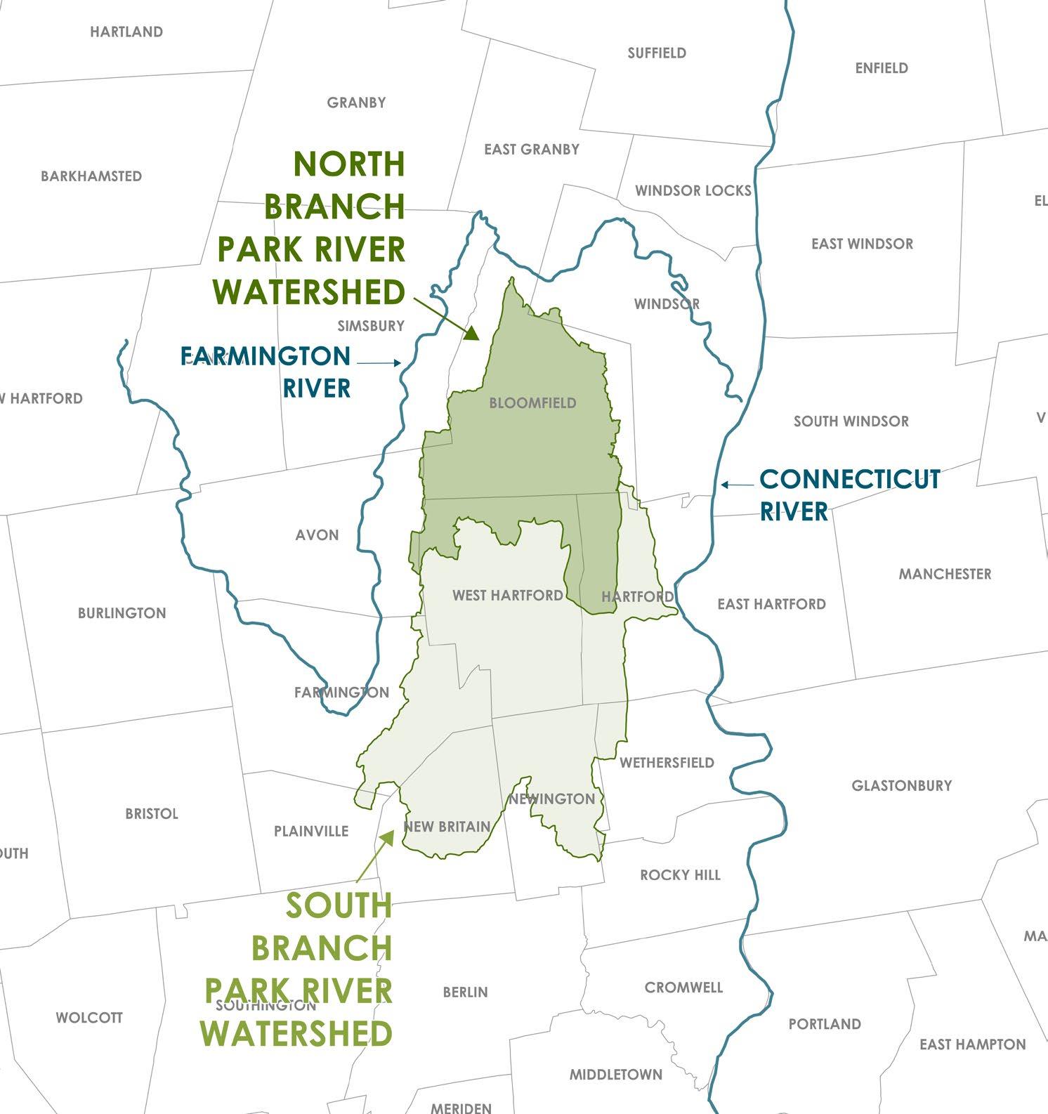
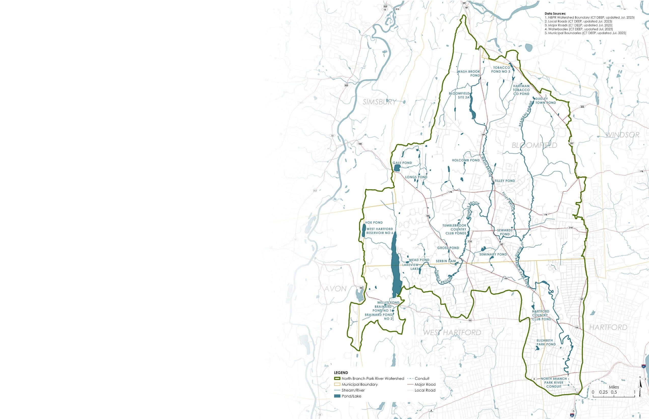
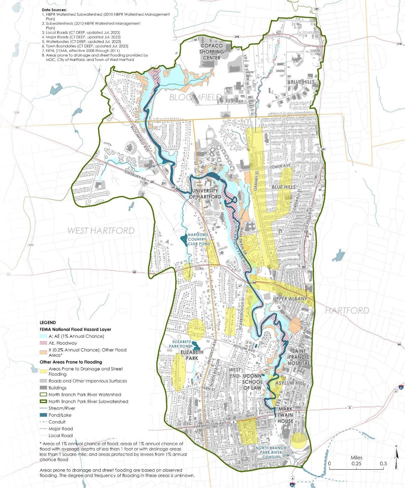
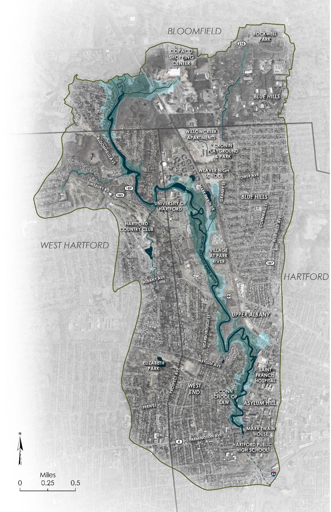
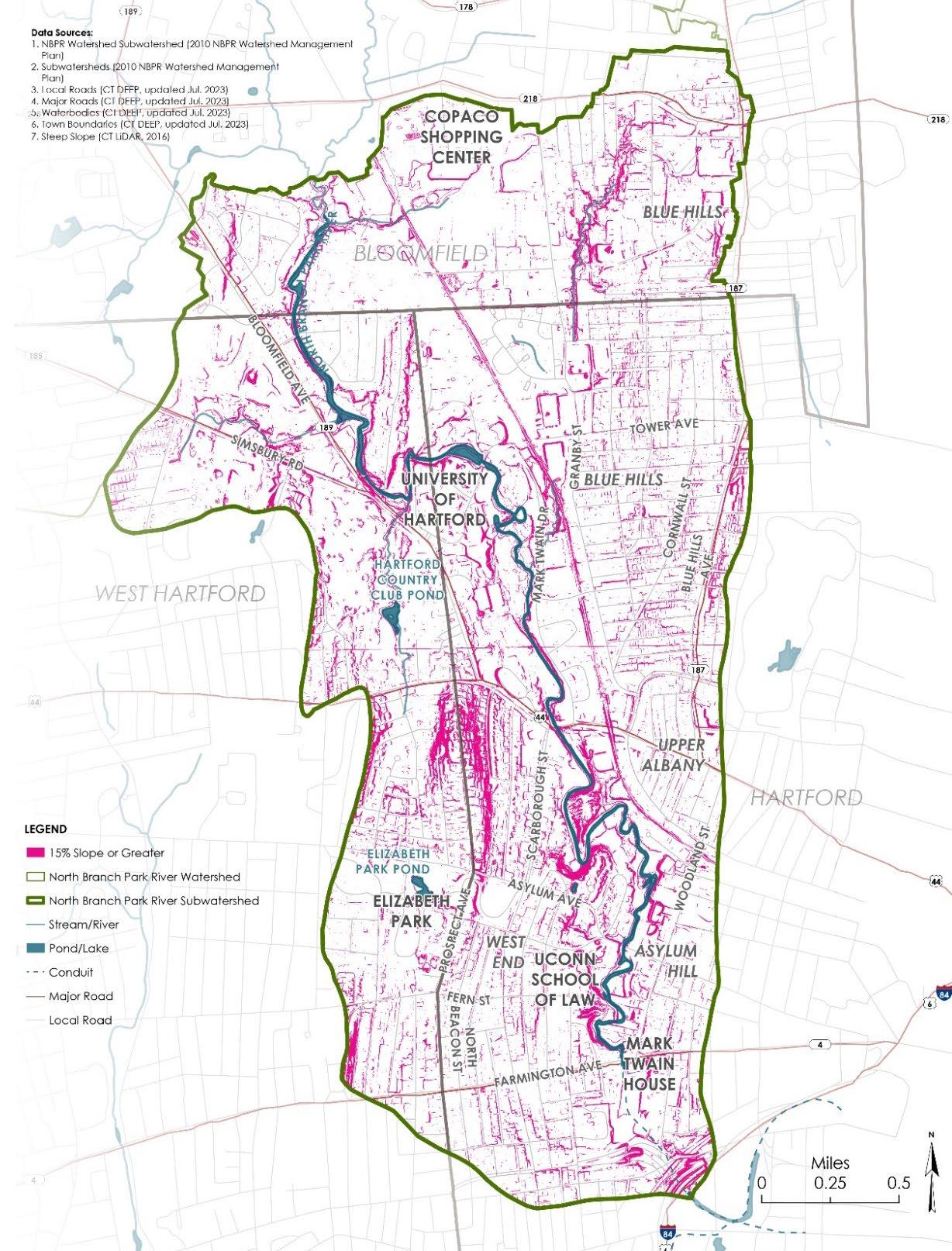
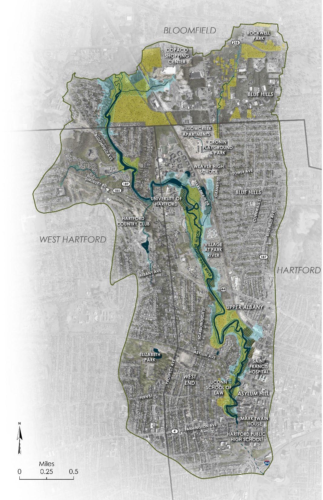
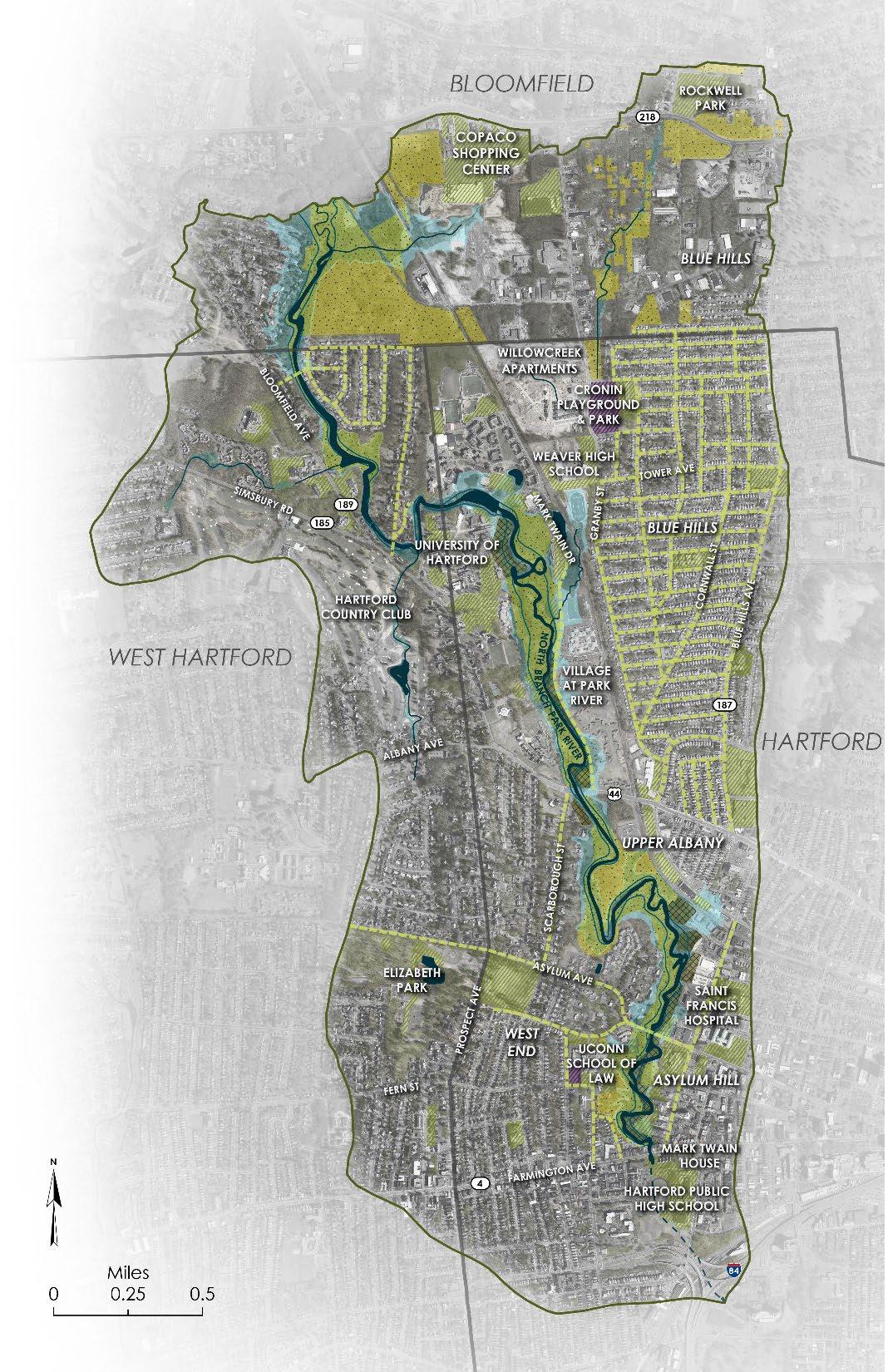
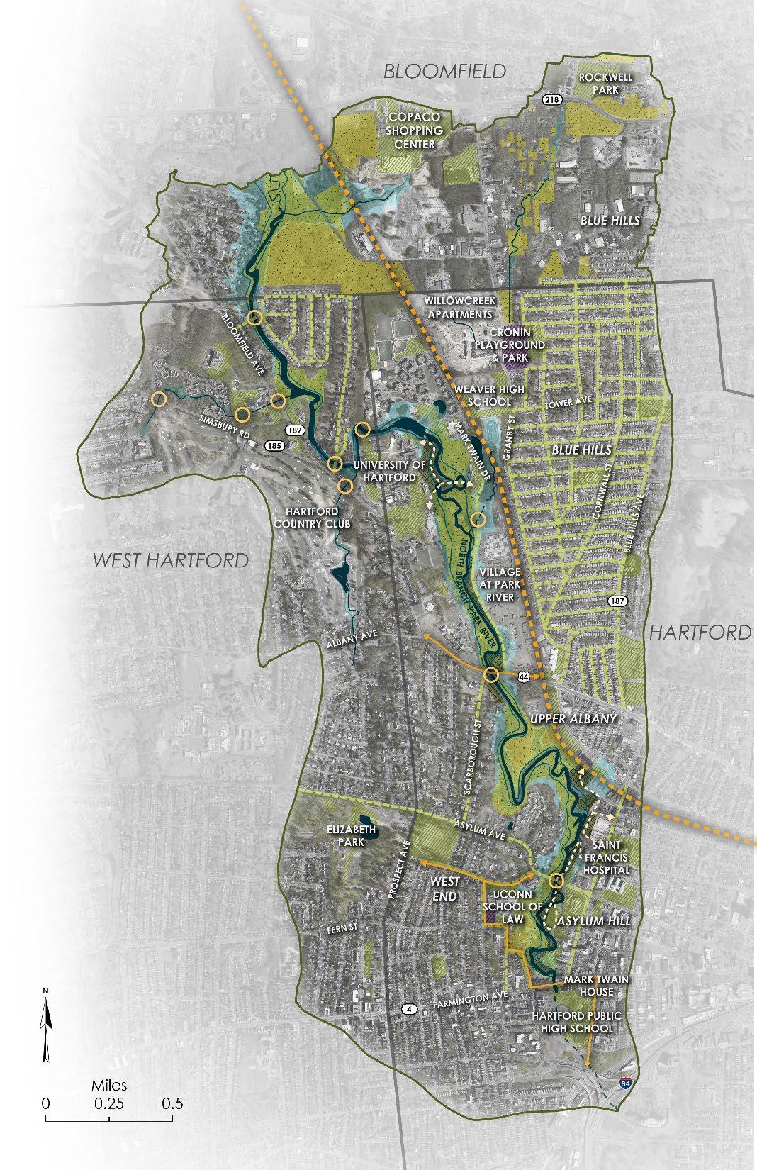
48,000 WATERSHED POPULATION
HOW MUCH OF THE WATERSHED DOES EACH MUNICIPALITY COMPRISE?
WHAT PERCENTAGE OF EACH MUNICIPALITY IS WITHIN THE NBPR WATERSHED?
28.6 SQUARE MILES
TOTAL WATERSHED AREA
14 SUBWATERSHEDS
4 MAJOR TRIBUTARIES
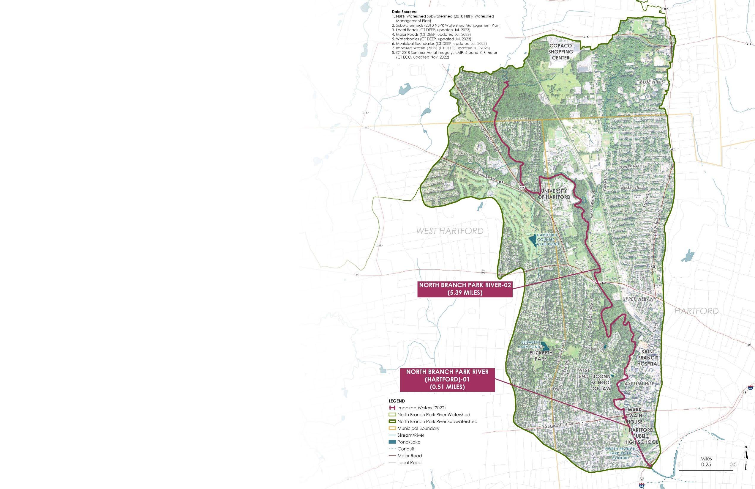
5.4 MILES NORTH BRANCH MAINSTEM (ABOVE GROUND)
0.5 MILES NORTH BRANCH MAINSTEM (BURIED)
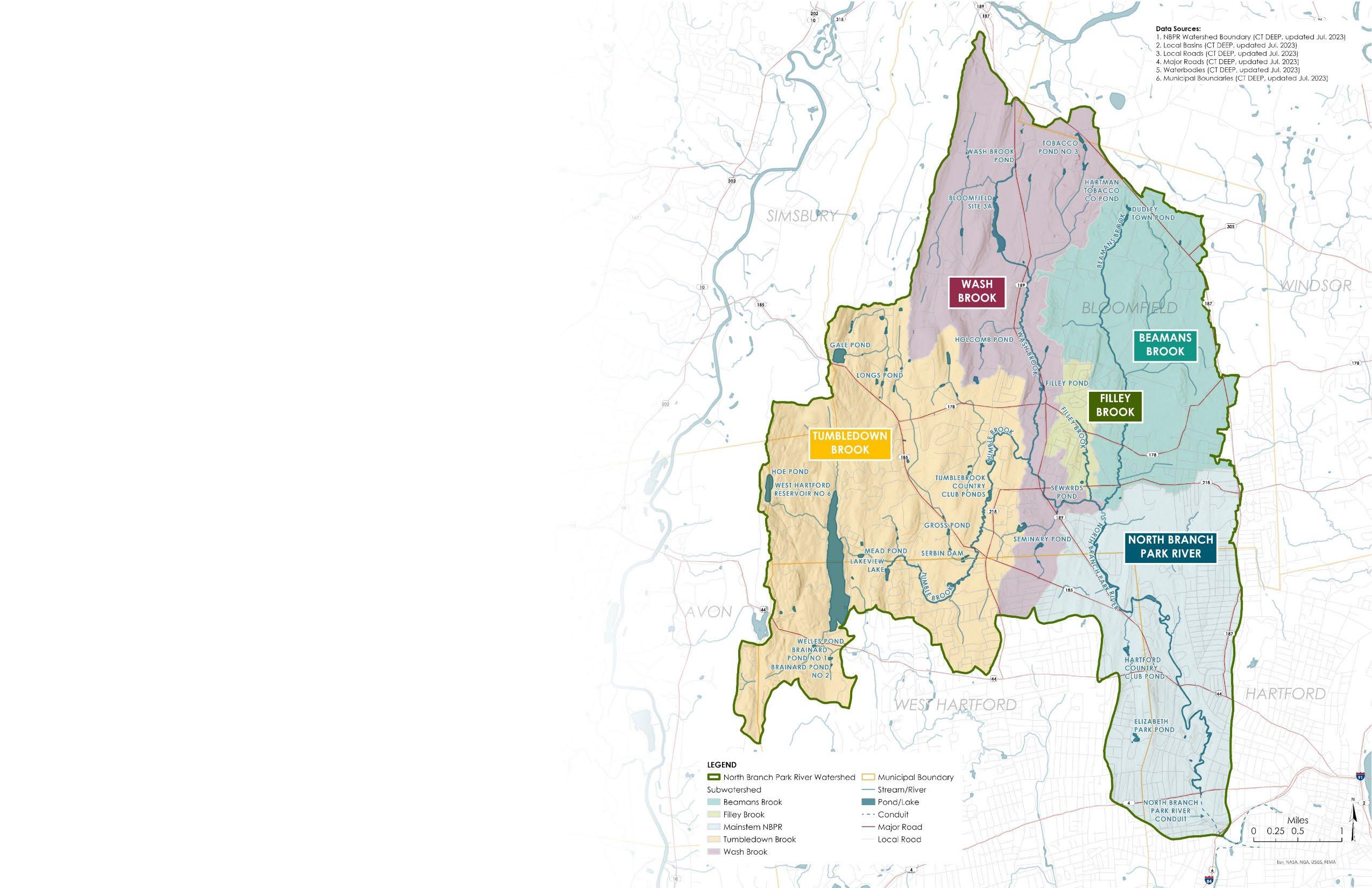
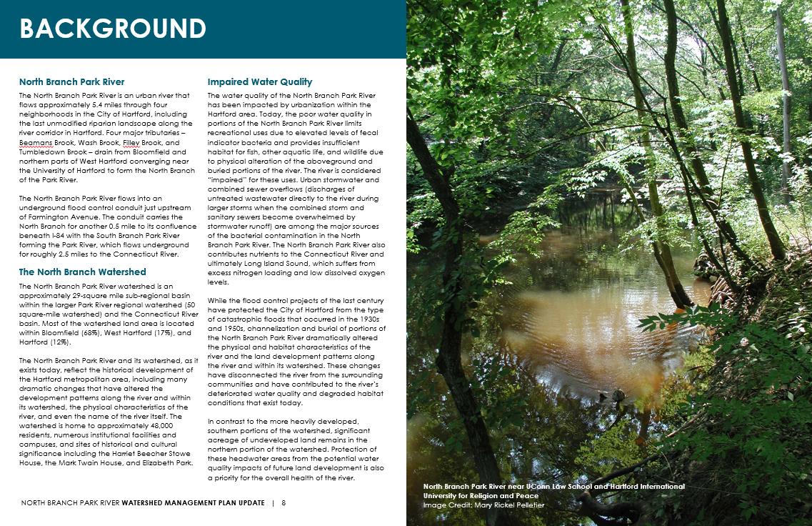
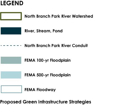
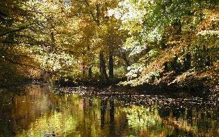
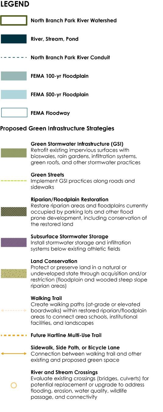
North Branch Park River Watershed
Water Quality – Impaired Urban River
• Recreation, Habitat for Fish, Other Aquatic Life and Wildlife
• Elevated Fecal Indicator Bacteria
− Stormwater runoff
− Combined sewer overflows
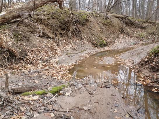
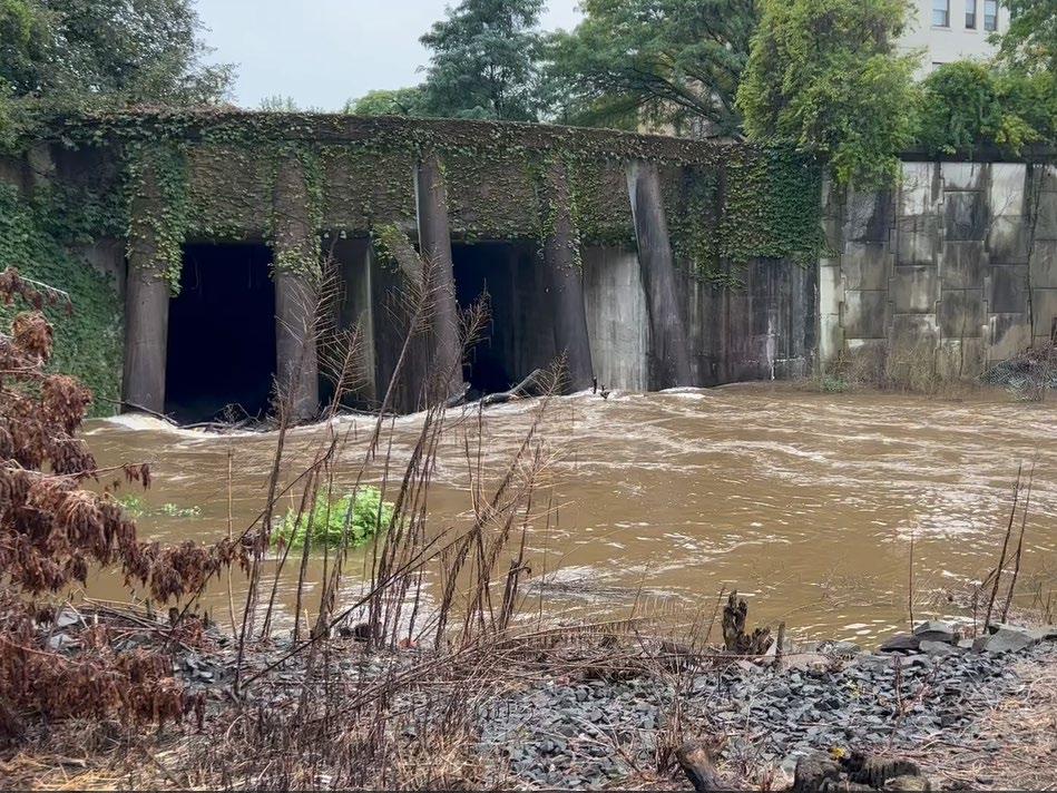
• Channelization, streambank erosion & sediment deposition
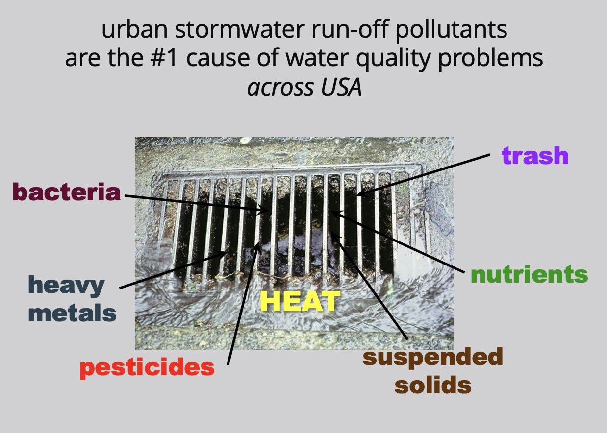
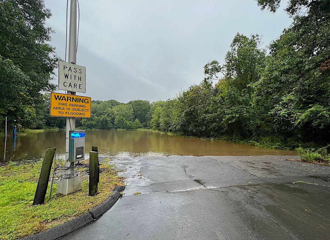
• Areas of frequent flooding
• Development in the floodplain and riparian zone
• Unstable streambanks, downed trees, and tree dams
• Under-sized culverts and inadequate or lack of storm drain system
• Development potential in upper watershed
• Climate change impacts
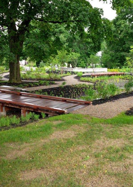
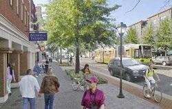
Healthy Urban/Suburban Riparian Corridor
• Landscape scale green infrastructure that improves water quality
• Scenic riparian landscape offering healthy neighborhood amenities
• Increased ecosystem connectivity benefiting migratory and recreational paths
• Shared regional natural resource, a focus of urban/suburban collaboration
floodplain parkland vs parking lots
• 1857 Central Park
778 acres
New York City
• 1880 Emerald Necklace
1,100 acres
Boston
• 1871 recommendation letter to Charles Pond North Branch, Hartford
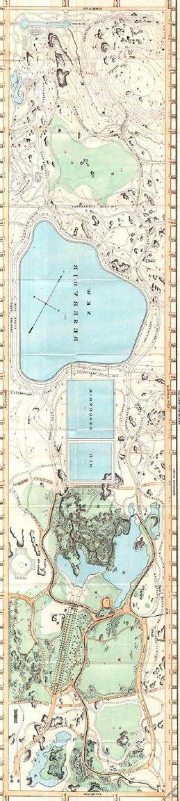
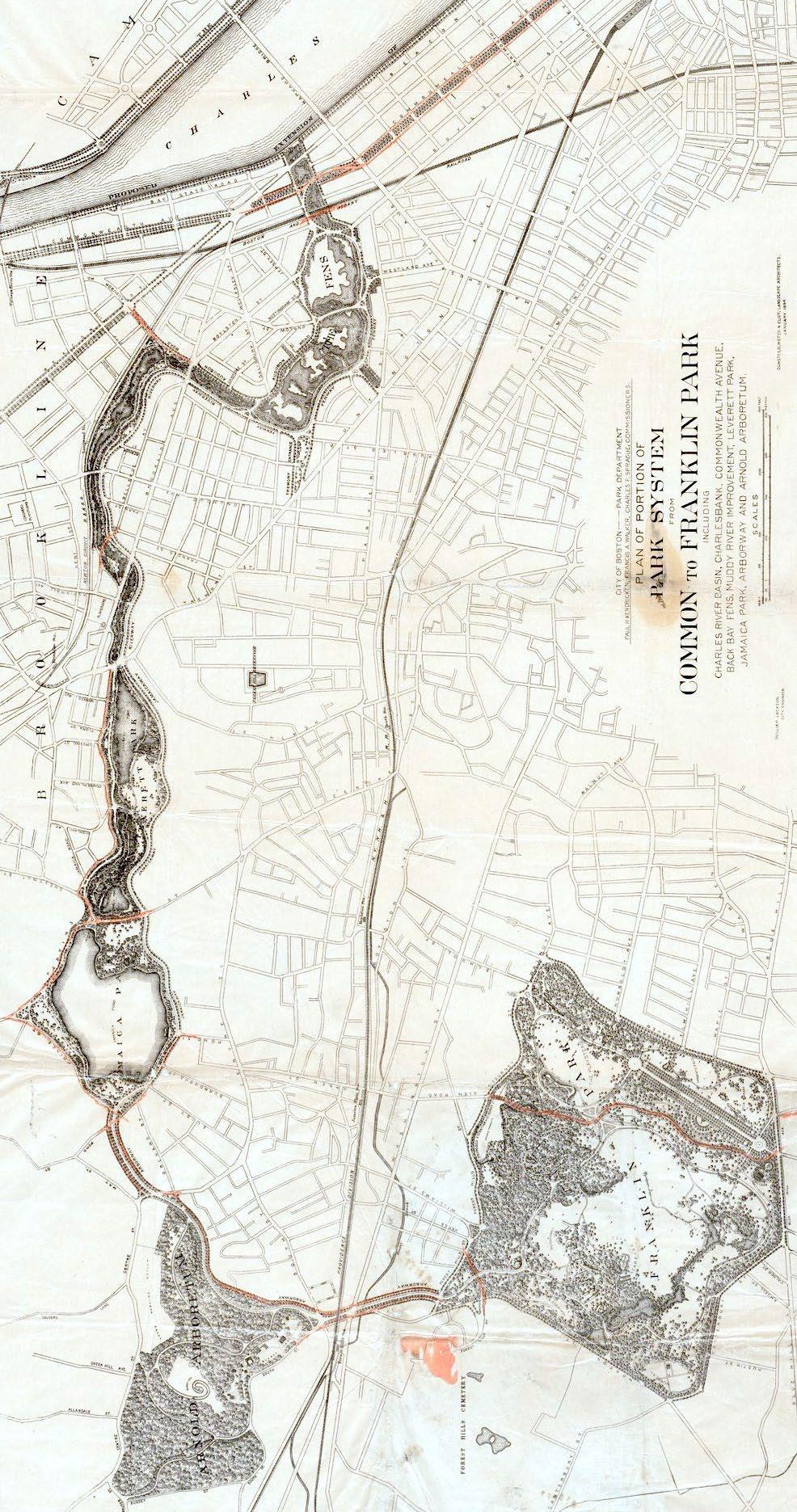
Central Park Emerald Necklace
North Branch
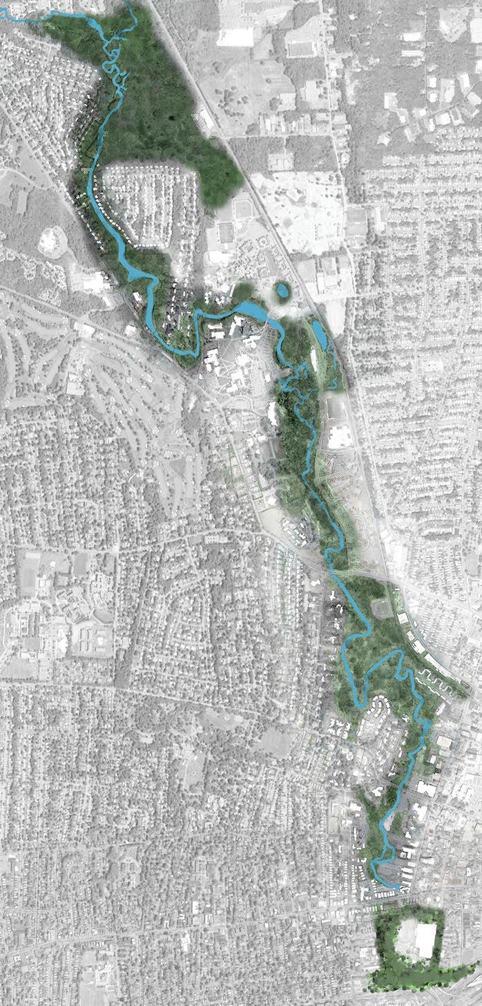
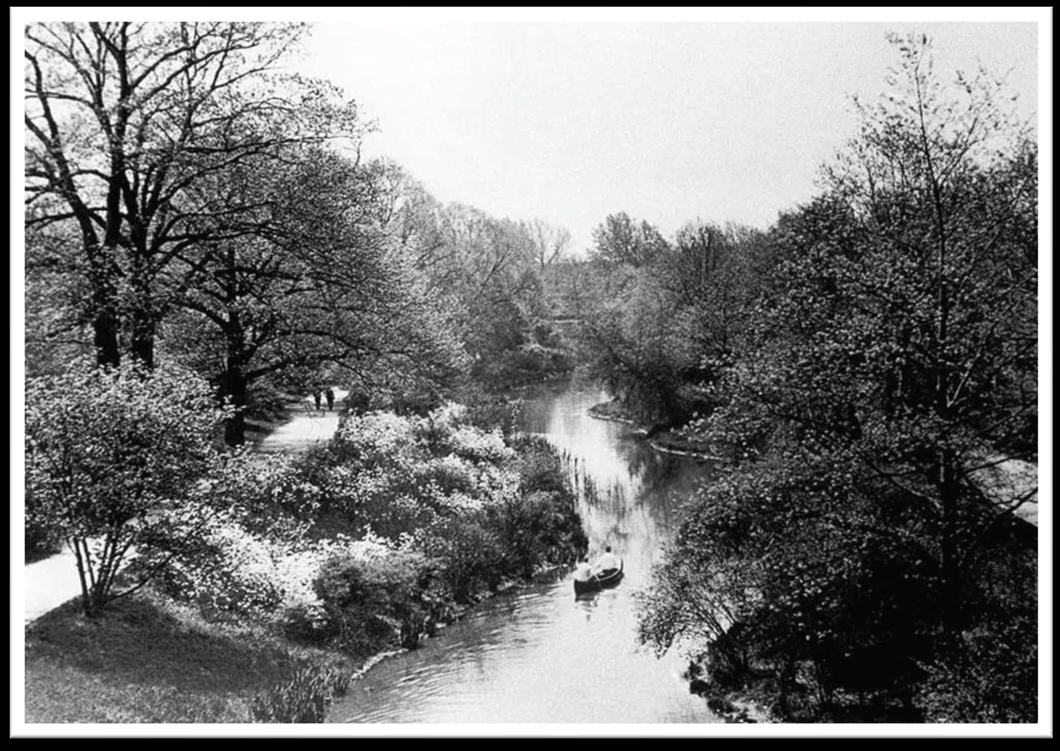
Muddy River – Emerald Necklace, Boston
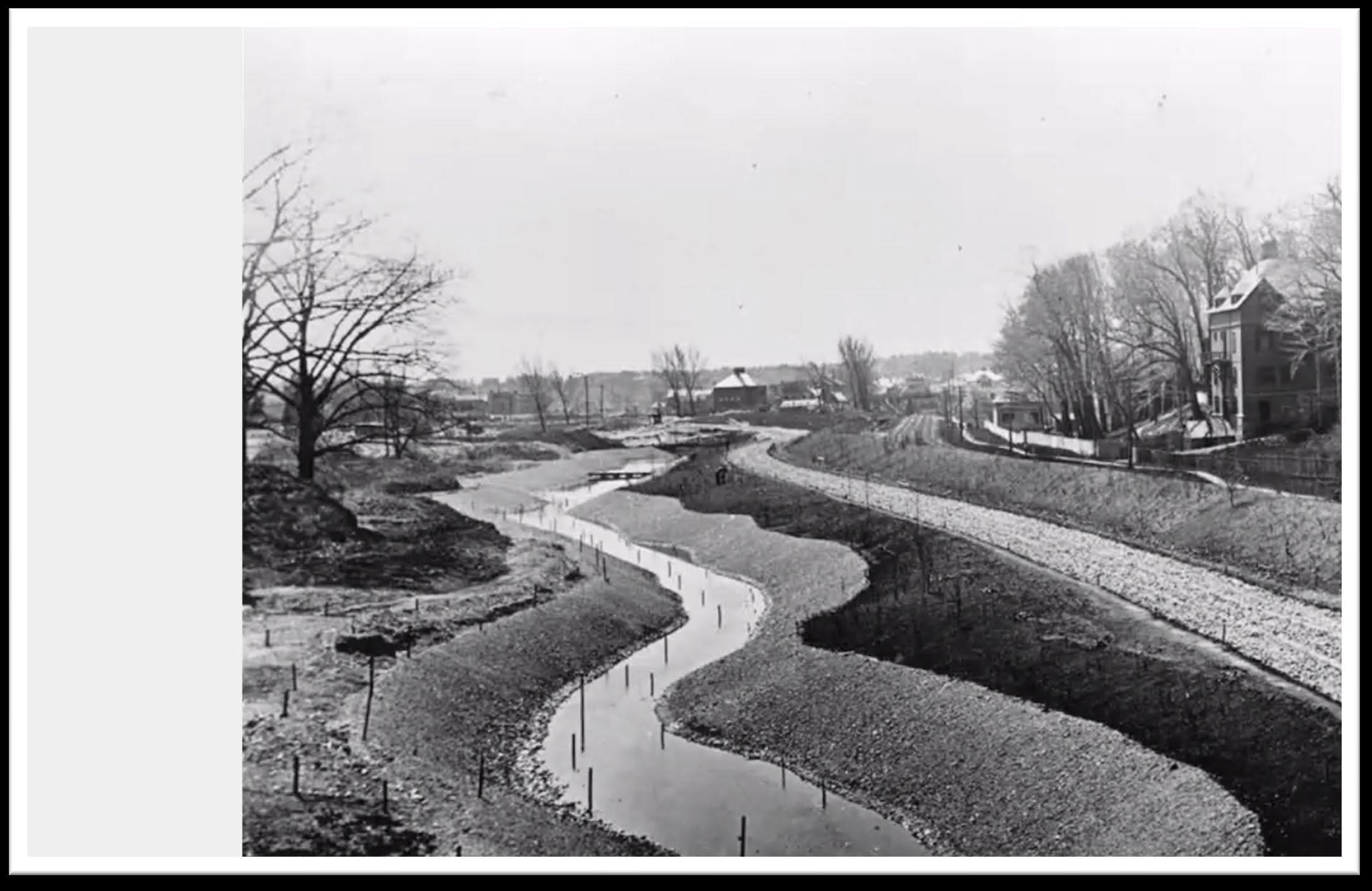
During construction
Muddy River 1892
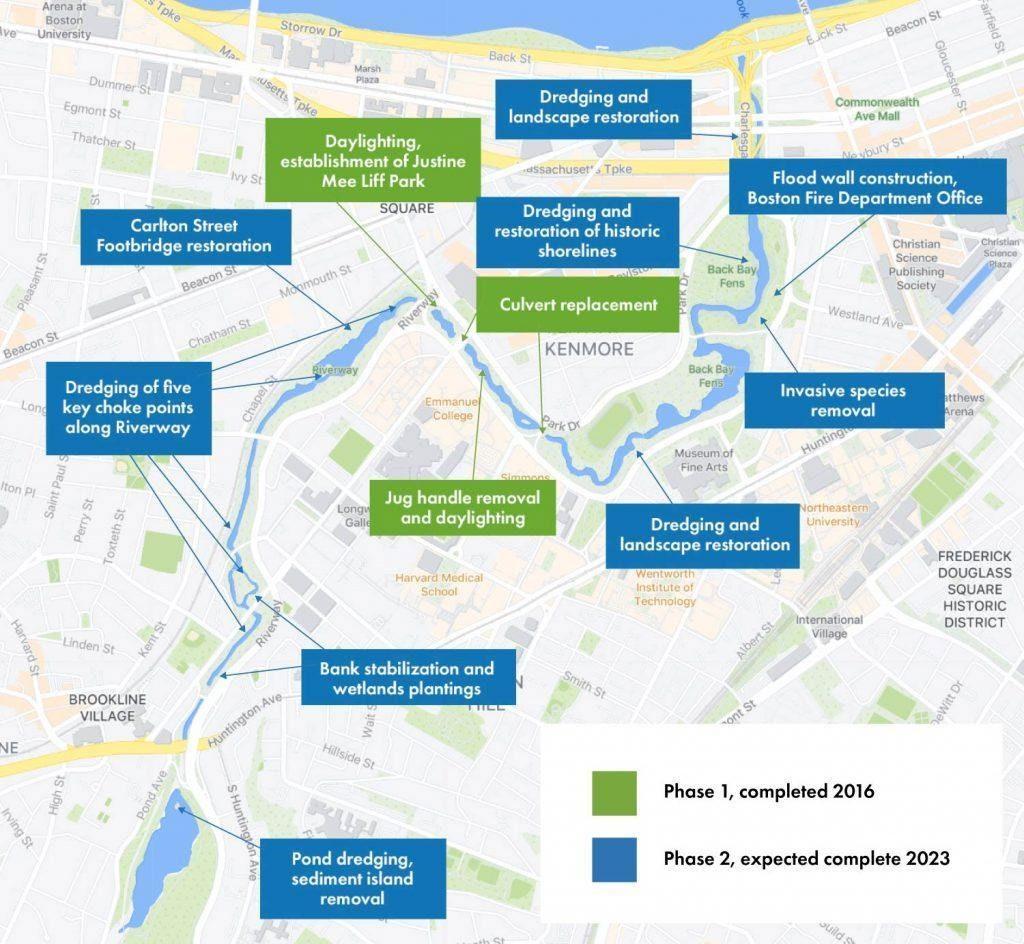
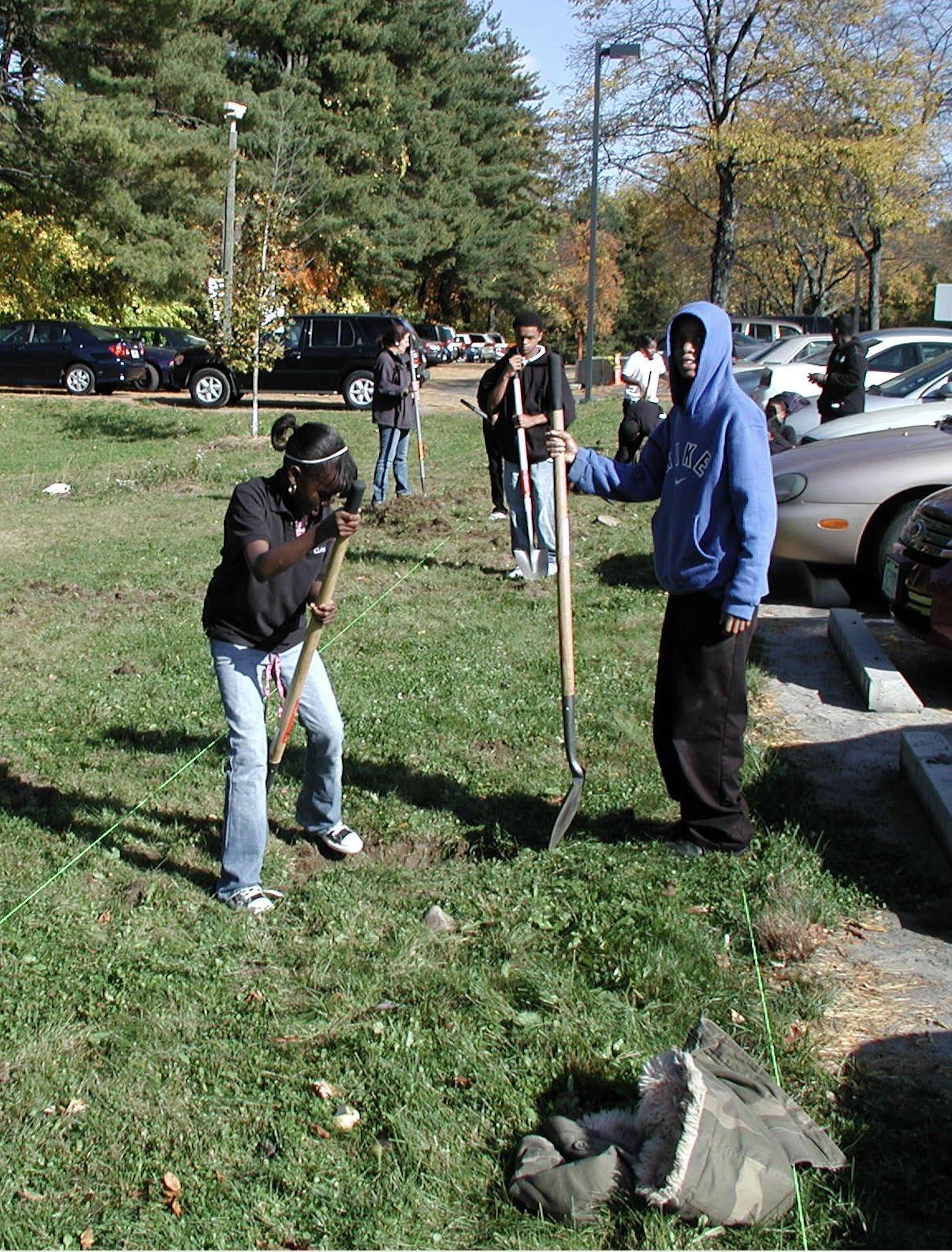
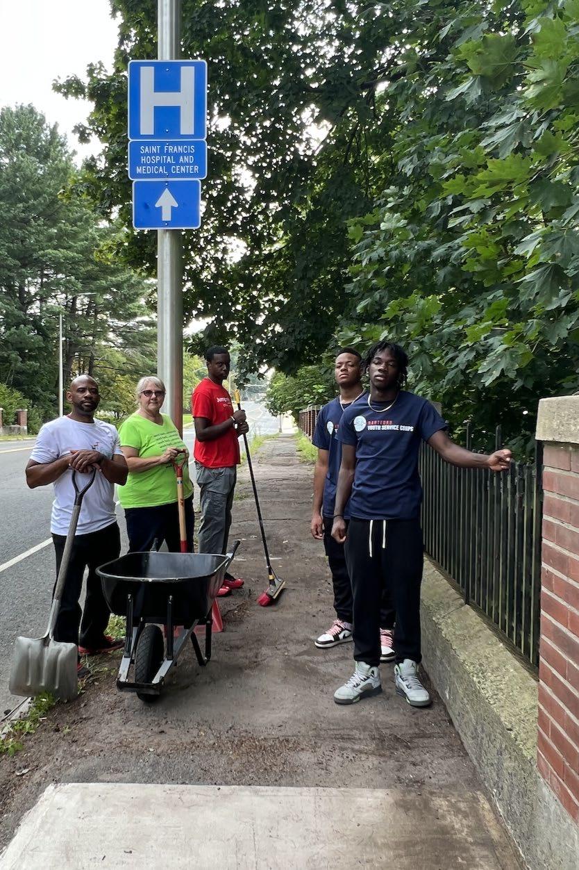
River Restoration
• Targeted sediment removal (flooding)
• Bank stabilization and plantings
• Habitat improvements
• Historic landscape rehabilitation
• Stream daylighting
• Stormwater improvements & GSI
• Tree stewardship
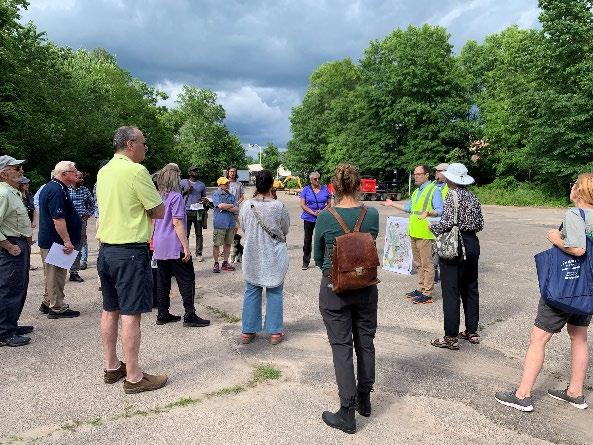
• CTDEEP Funded Planning Project
• Steering Committee, Field Assessments, Land Use Regulatory Review, Project Concepts, Public Outreach, Project Website
• Lower Watershed – Restoration Focus
• Upper Watershed – Protection Focus
https://portal.ct.gov/-
/media/DEEP/water/watershed_management/wm_plans/nbparkr/ nbprwbppdf.pdf


• MDC
− North Branch Park River Drainage Study & Sewer Separation Design (Granby Street and Blue Hills)
− New North Branch Interceptor Replacement along lower NBPR
• City of Hartford
− Granby Street Green Infrastructure Demonstration Project (with EPA)
• Capital Region Council of Governments
− Regional Stormwater Authority Feasibility Assessment (CT DEEP Grant)
− Natural Hazard Mitigation & Climate Adaptation Plan
− Climate Pollution Reduction Plan
• CTDEEP
− Creating new Office of Planning & Resilience (October 2024)
− Climate Resilience Fund Grant Program
• Focused update of 2010 plan
• Updated watershed conditions
• Green infrastructure designs focused in lower watershed

• Watershed-wide policy & nonstructural recommendations
• Consideration of climate resilience
• Roadmap for next 10+ years

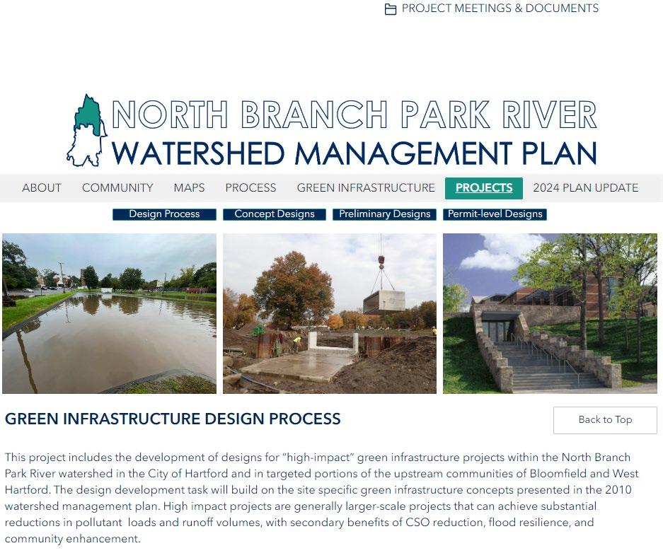
• Develop designs for impactful green infrastructure projects
• Build on 2010 concepts and other ongoing/planned projects
• Reduce pollutant loads and runoff volumes
− Bacteria, nutrients, sediment
• Secondary benefits
− Flood resilience, CSO reduction, community amenities
“Scale green infrastructure. Providing an alternative to separating the combined sewer system will preserve property values, protect agriculture and landscape, and ensure cleaner water.”
“Implement the North Branch Watershed Management Plan. Implementing this plan will improve riparian health of the North Branch and Gully Brook sub-basin in an area adjacent to the North Hartford Promise Zone.”
Hartford City Plan 2035
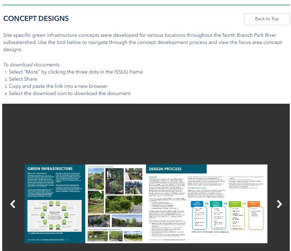
Project Selection and Concept Phases
1. Data Gathering & Review
• Compile GIS mapping
• Inventory public and institutional properties
• Identify existing GI
• Identify planned capital improvements
2. Project Screening & Selection
• Desktop screening
• Property owner interviews
• Field inventories (20 to 40 sites)
• Green infrastructure concepts (up to 15)
• Technical Memo
3. Preliminary Design
• 5 projects
• Preliminary layout
• Opinion of cost
• Technical Memo
3. Permit Level Design
• 3 projects
• Field survey
• Test pits & infiltration testing
• Wetland delineation
• Level of detail to support local/state permitting
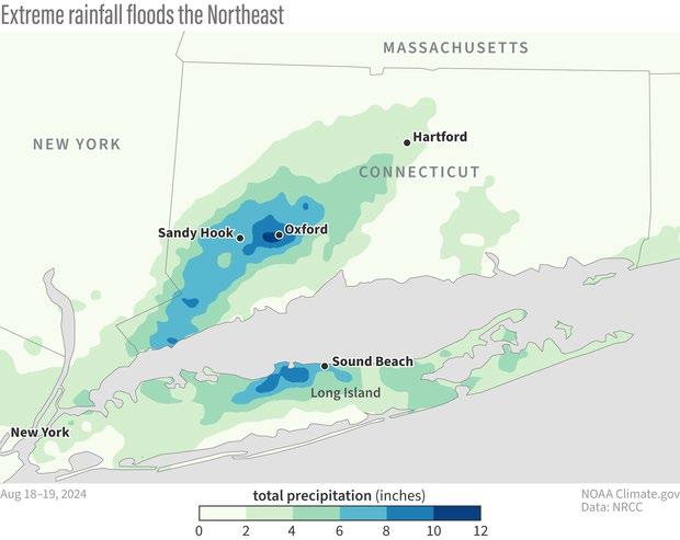
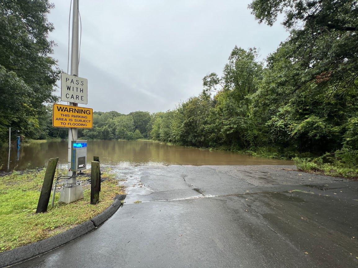
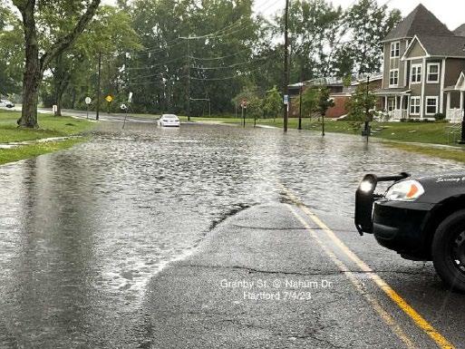
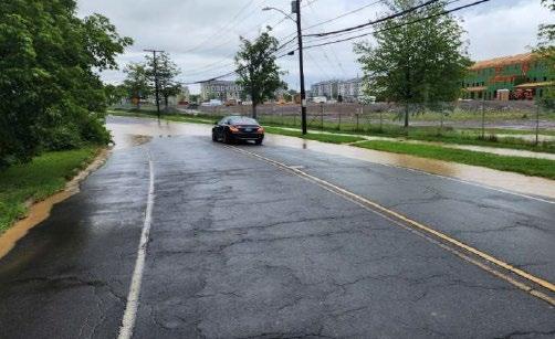
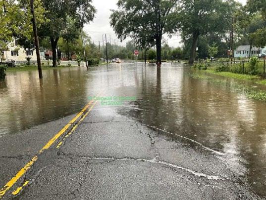
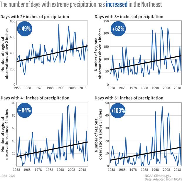
Source: NOAA, https://www.climate.gov/newsfeatures/event-tracker/extreme-rainfall-brings-
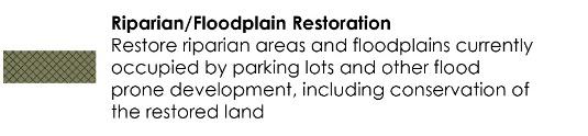
• Riparian & floodplain restoration
• Increase vegetative buffers
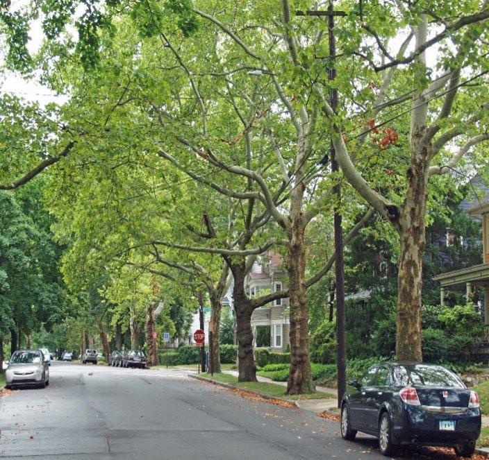
• Urban tree canopy
• Urban rewilding
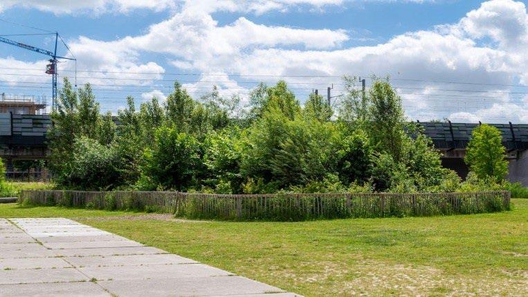

• Conserve last remaining landscapes within the river corridor/riparian zone
• Conservation is cost-effective
• Numerous benefits
− Keeps development out of harms way and preserves floodplain
− Protects water quality
− Reduces urban heat island
− Supports biodiversity
− Supports healthy avian, aquatic, and wildlife migration pathways
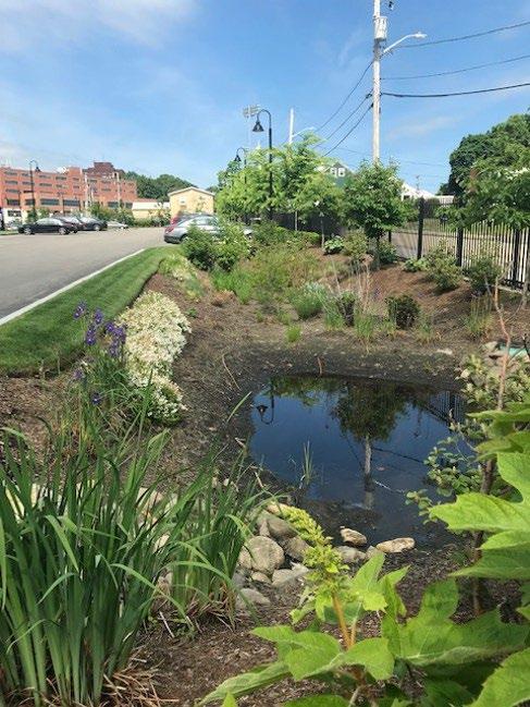
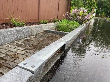
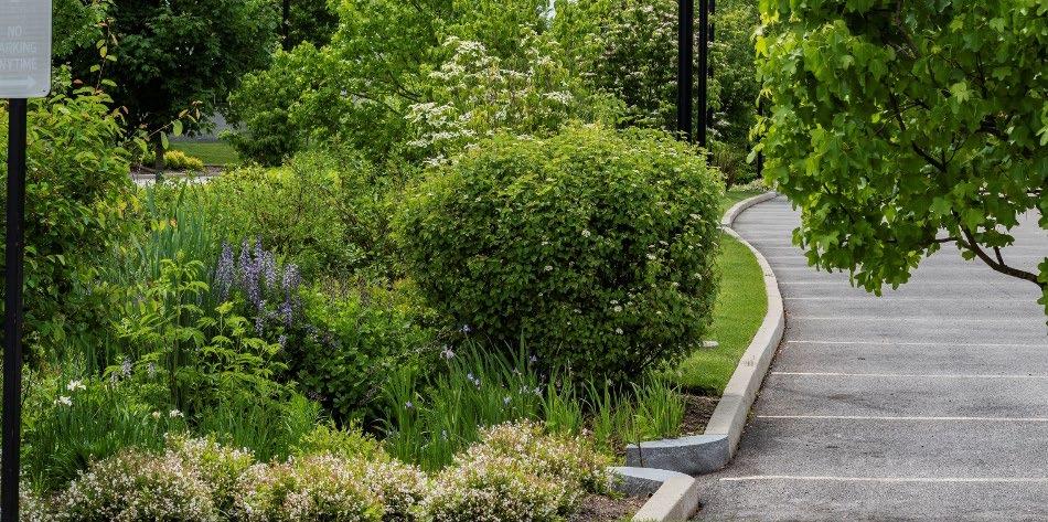
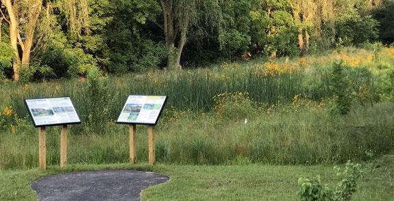
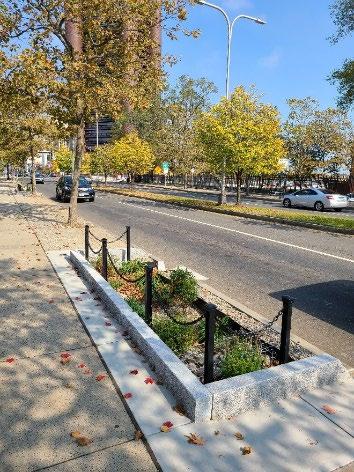
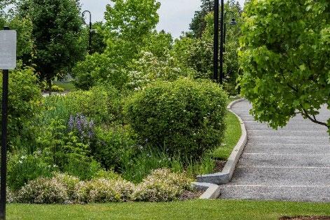
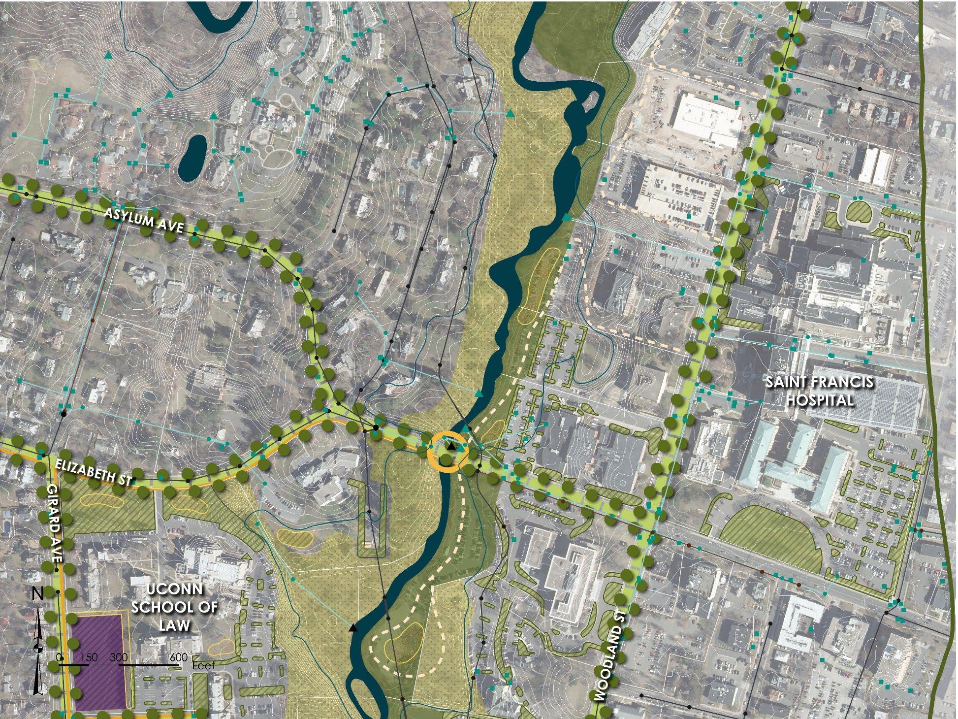
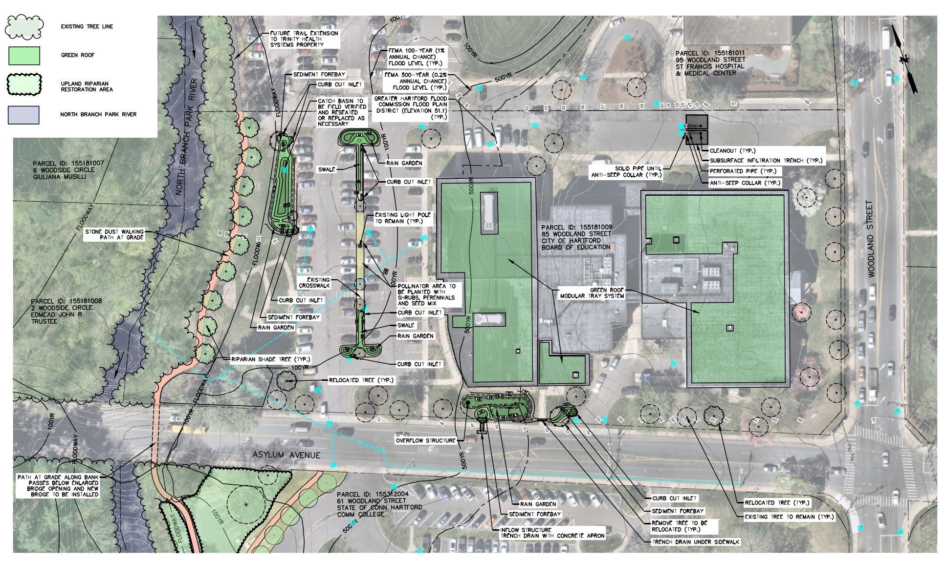
Green Stormwater Infrastructure (GSI)
• Public/institutional properties
• Within municipal right-of-way
• At existing outfalls such as stormwater wetlands and ponds (stormwater parks)
• Site, neighborhood, landscape scale
• Public & institutional properties, 98 potential parcels identified
• Green Stormwater Infrastructure (GSI)
− 0.5 acre or more of impervious area
− All soil types considered
• Riparian Corridor Green Infrastructure
− Parcels within 300-foot riparian corridor
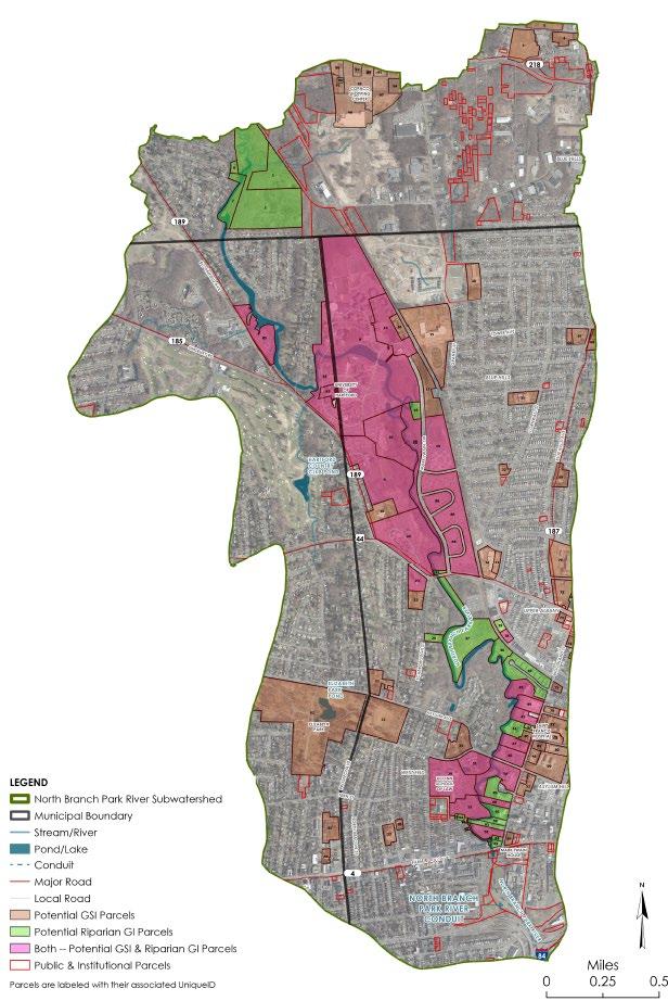
• Field inventories in December 2023
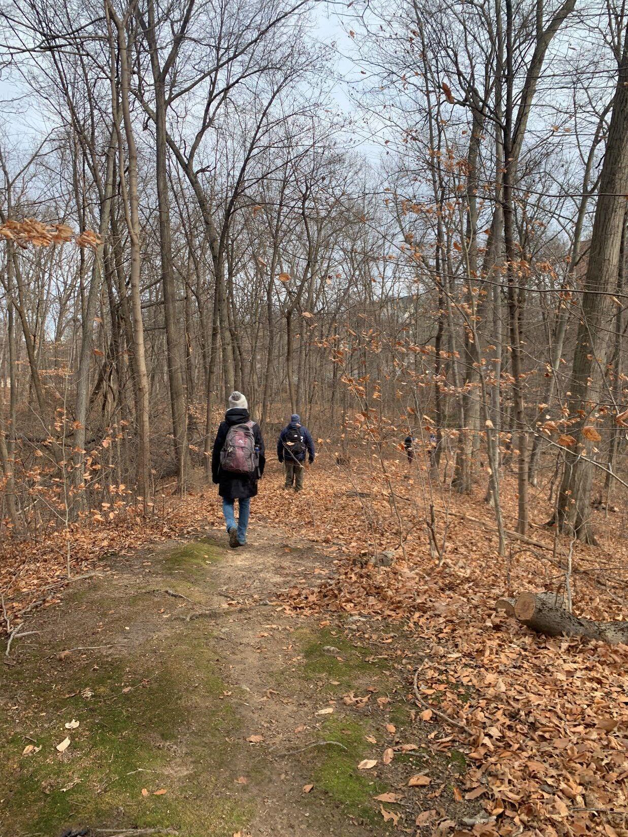
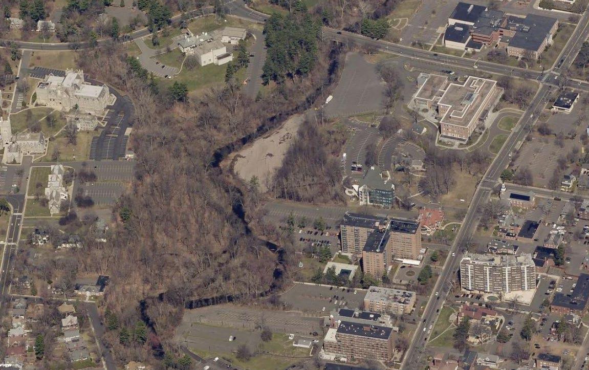
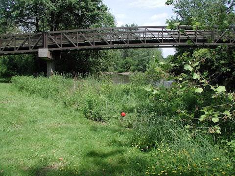
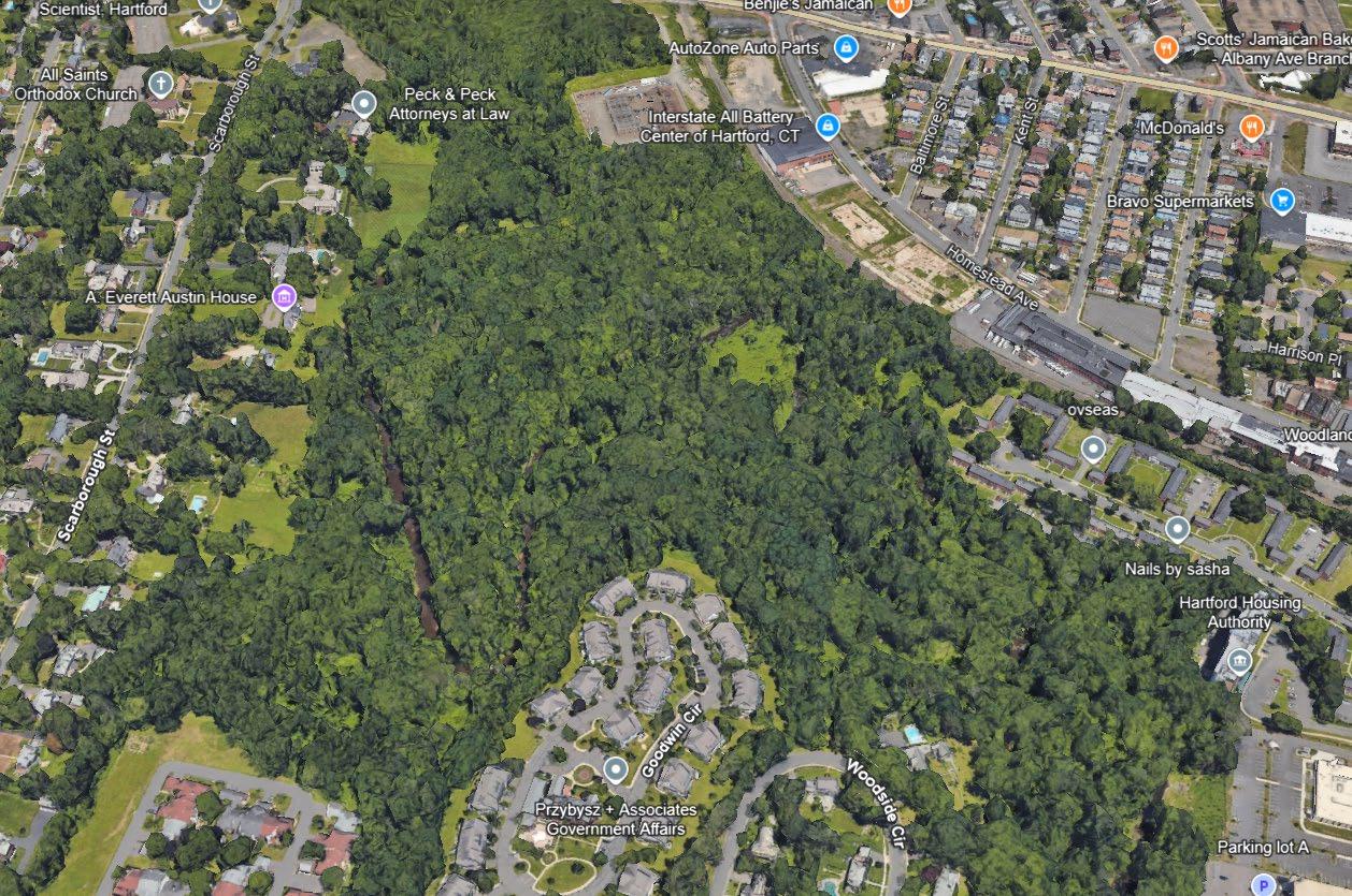
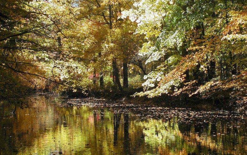
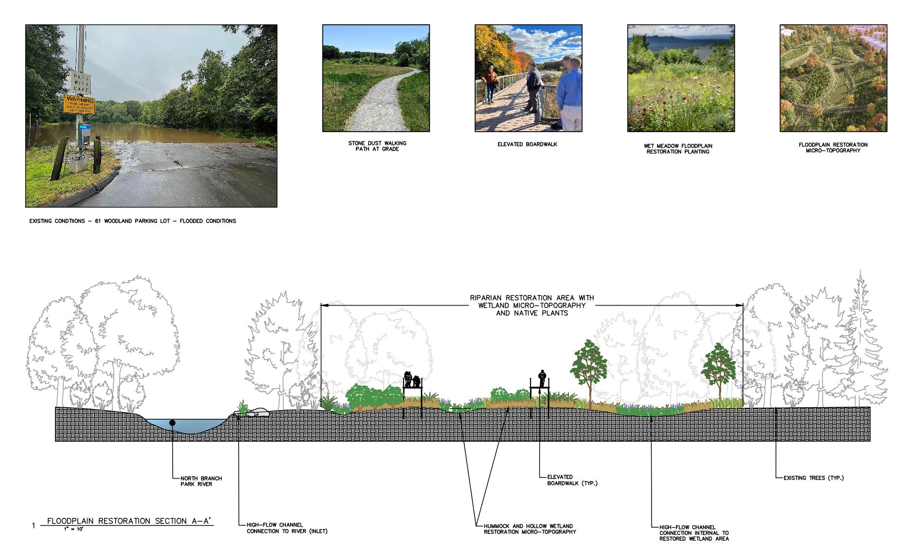
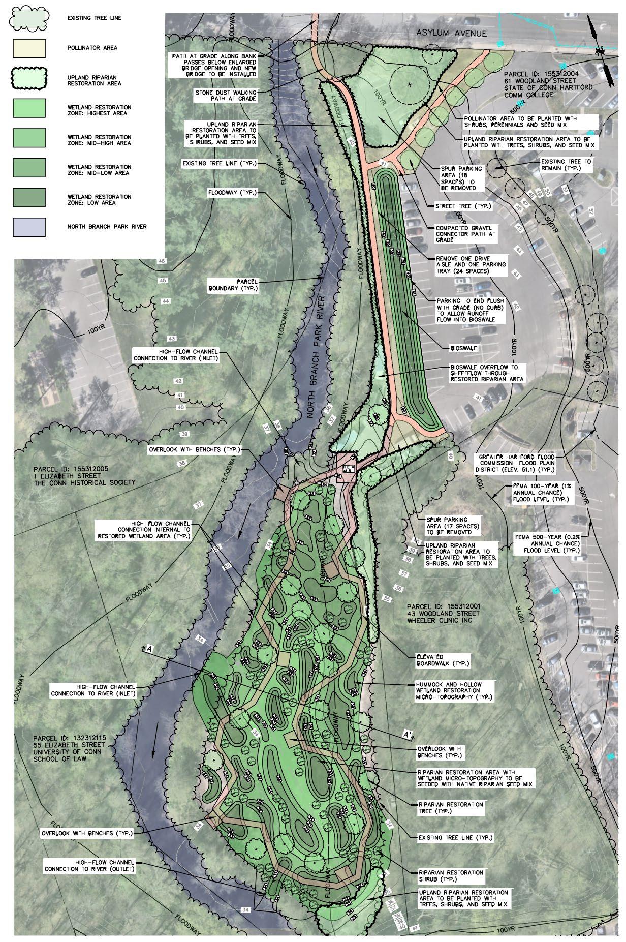
WOODED FLOODPLAIN AND RIPARIAN AREA
WOODED FLOODPLAIN AND RIPARIAN AREA
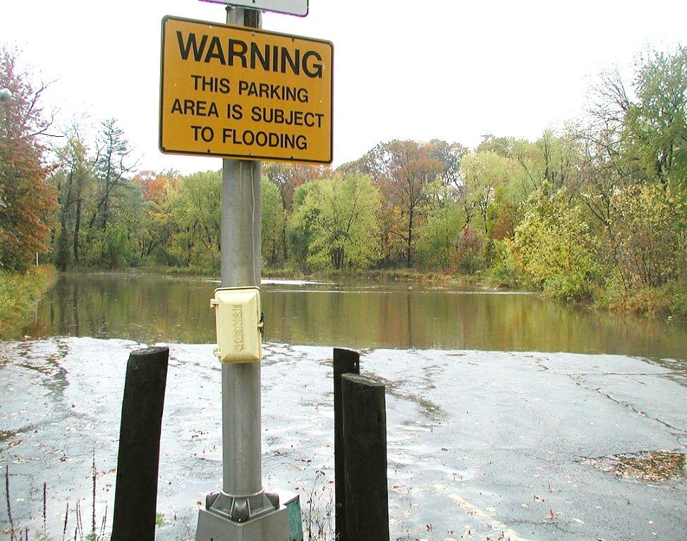
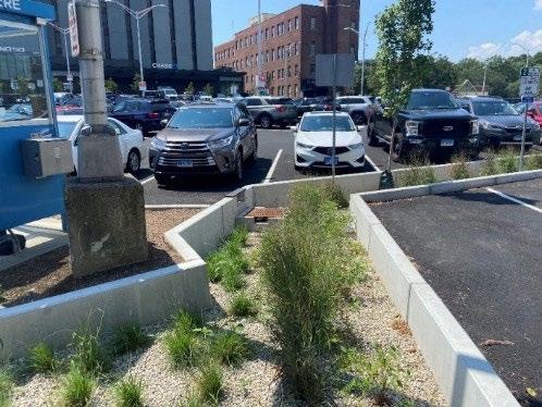
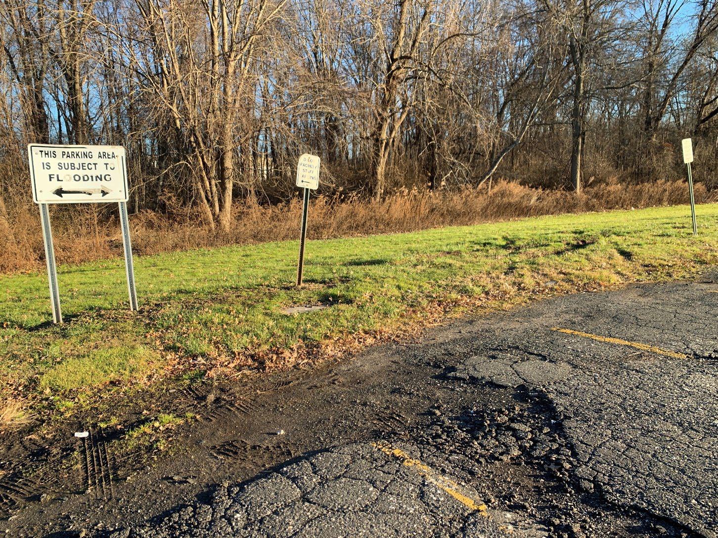
PARKING LOTS IN FLOODPLAIN
PARKING LOTS IN FLOODPLAIN
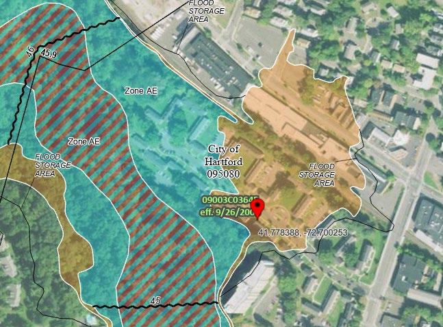
PARKING IN
FEMA 100-YEAR FLOODPLAIN
FEMA 500-YEAR FLOODPLAIN
• Riparian & Floodplain Restoration
− Flood prone parking lots and development
− Wetland/meadow creation
• Land Conservation
− Riparian corridor, floodplain & wooded steep slopes
− Formal permanent protection
• Challenges
− Loss of parking, future development
− Need property owner cooperation
− Incentives to reduce impervious cover
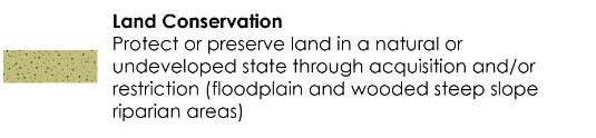
LAND CONSERVATION OF FLOODPLAIN, RIPARIAN CORRIDOR, AND WOODED STEEP SLOPES
FLOODPLAIN
RIPARIAN/FLOODPLAIN
RESTORATION OF EXISTING PARKING LOTS
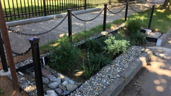
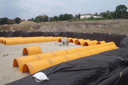
• Green Stormwater Infrastructure (GSI)
− Retrofit parking lots, roads (green streets), schoolyards
− Treat new separated storm drain discharges
− Subsurface stormwater storage and infiltration systems
• Challenges
− Need property owner cooperation
− Combined sewers
− Subsurface and soil conditions
− Incentives to reduce impervious cover
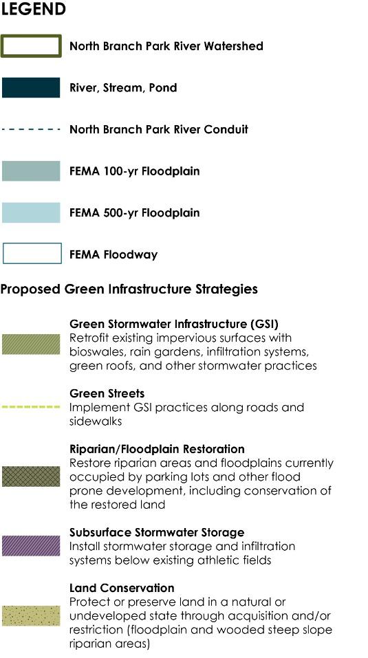
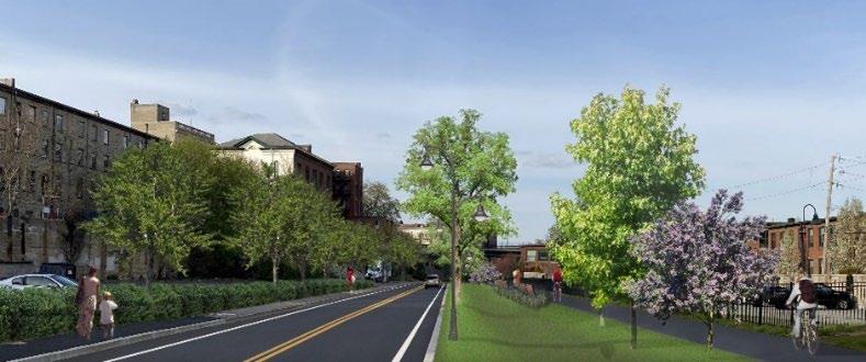
• Paths and Trails
− Walking paths within restored riparian/floodplain areas
− Connections to schools, institutions, and landscapes
− Connections to future Hartline MultiUse Trail
• River & Stream Crossings
− Potential replacement of undersized or restrictive culverts
− Flooding, erosion, water quality, recreational and wildlife passage
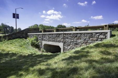
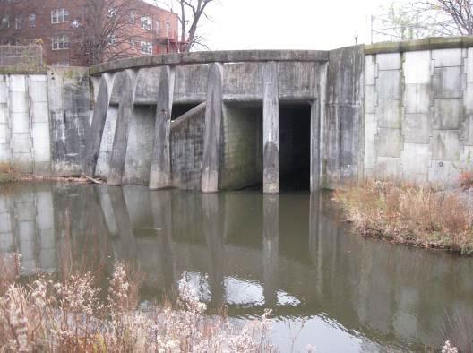
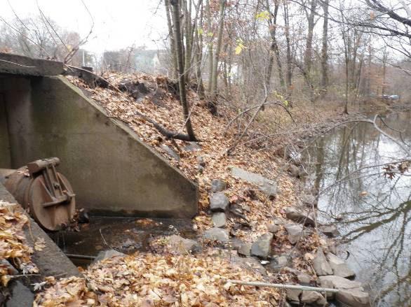
EVALUATE RIVER CROSSING FOR REPLACEMENT
WALKING PATHS IN RESTORATION AREAS
SUBSURFACE
STORMWATER STORAGE
FLOODPLAIN RESTORATION WITHIN EXISTING PARKING LOTS

WOODSIDE CIRCLE GOODWIN CIRCLE


WALKING TRAILS / LOOP
POLLINATOR GARDEN
LAND CONSERVATION


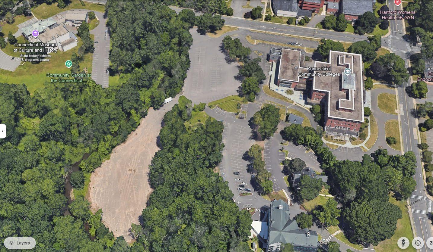
CONNECTICUT MUSEUM OF CULTURE AND HISTORY

EVALUATE EXISTING STREAM CROSSING (TYP)
CSO N-10

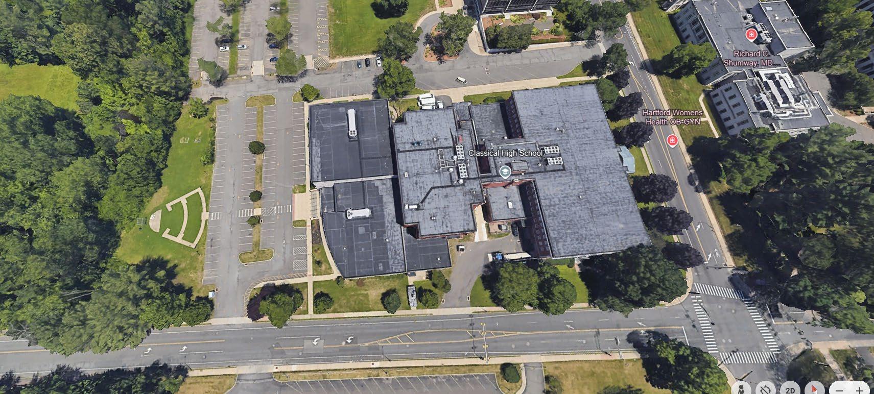
CLASSICAL MAGNET SCHOOL

CONNECTICUT COMMUNITY COLLEGES


Concept Design Packet:
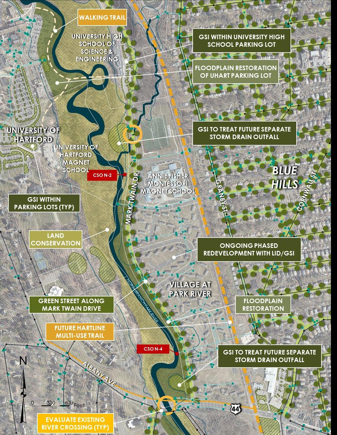
• 61 Woodland Street Floodplain Restoration
• Classical Magnet School Green Stormwater Infrastructure
• 3 other possible locations north of Albany Avenue (to be selected)
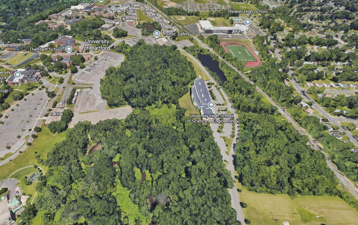
• University High School of Science and Engineering / UHART / Mark Twain Drive
− UHSSE parking lot GSI
− Mark Twain Drive GSI (green street)
− Remove UHART parking lots and convert to forested floodplain
− Trail connections
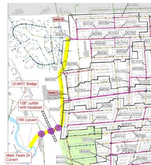
1. 84” outfall near Tower Ave / Weaver HS
2. 72” outfall between 227 and 233 Granby St (previously designed and permitted “Granby 1”)
3. 72” to 84” outfall from 45 Granby St: Westbrook Village easement or pumping station with force main
• Off-line stormwater wetland/ponds at outfalls (“stormwater parks”)
• GSI within upgradient neighborhoods
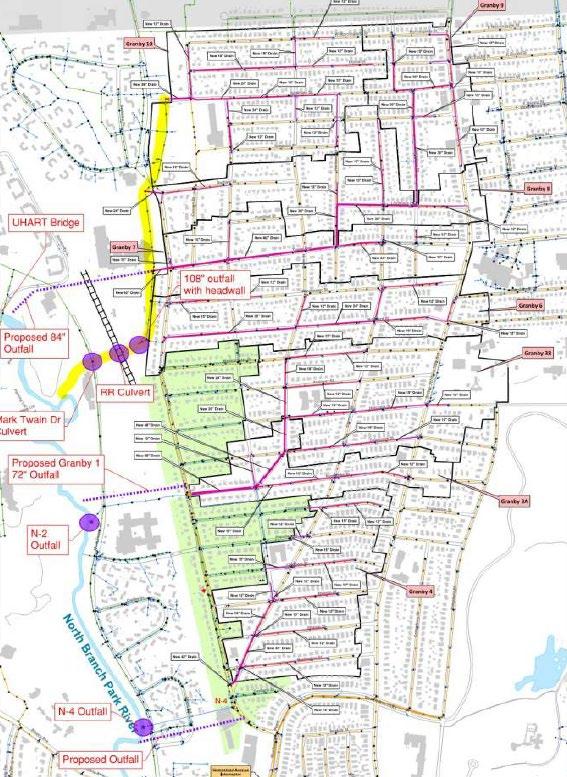
Source: CDM Smith, Hartford MDC Blue Hills/Granby Area Drainage Study Presentation, July 18, 2024
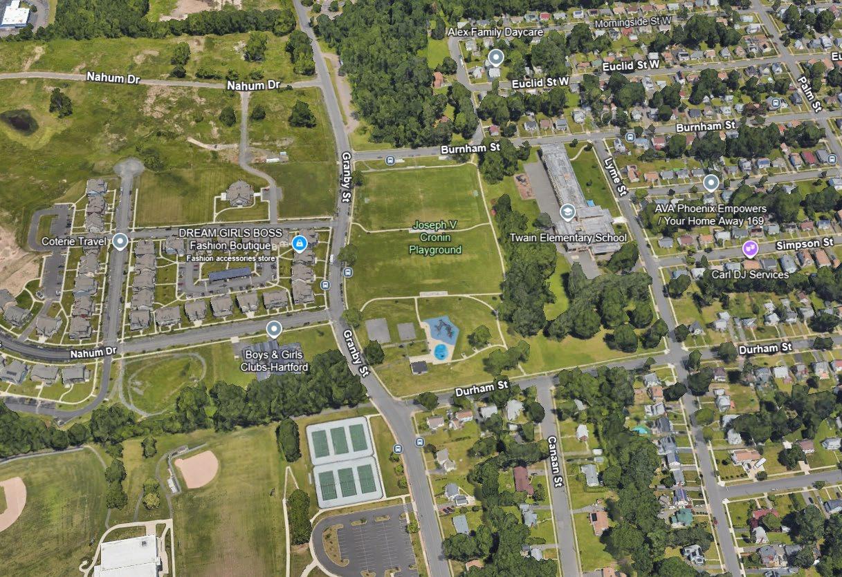
• Cronin Park & Unnamed Stream / 108” Granby Street Conduit
− Subsurface storage/infiltration below Cronin Park
− Connection to Granby St Conduit (runs below Cronin Park) or new 84” pipe and outfall
− GSI in Cronin Park, along Granby Street, and in upgradient neighborhoods
• Green Infrastructure Design Development
− Complete 5 preliminary designs
− Develop 3 permit-level designs
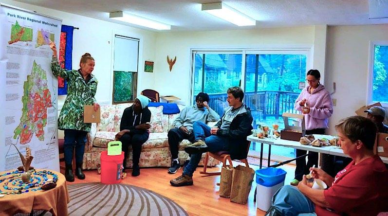
• Complete Watershed Plan Update

− Today’s presentation
− Community Meeting (University High School of Science and Engineering)
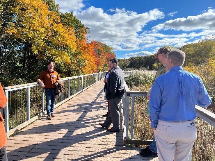
− Walkshops
− Project Partner (2) & Advisory Committee (1) Meetings
North Central Conservation District
Contacts: Joanna Shapiro jshapiro@conservect.org
Erik Mas, PE erik.mas@fando.com
Akta Patel, PE akta.patel@fando.com
Andrew Bohne, RLA andrew.bohne@fando.com
Mary Rickel Pelletier maryp@parkwatershed.org
Brian Martin Brian.Martin@tpl.org
Cally Guasti-O’Donoghue cally.guasti@tpl.org