1o
COASTAL RESILIENCE PLAN BOUNDARY
Welcome to the
Stamford Coastal Resilience Plan Open House!
CUMMINGS POND SUBAREA
TWO PROJECTS, ONE PROCESS
HOW DOES THIS PROCESS UNFOLD AND WHAT’S THE TIMELINE?
TODAY’S OPEN HOUSE
The Coastal Resilience Plan is a strategy designed to help communities in Stamford prepare for and adapt to the impacts of climate change, particularly coastal hazards like sea level rise, storm surge, and flooding. The project area includes neighborhoods mostly south of the I-95 and in the “Coastal Area Management” boundary.
Over the next 10 months, the Project Team is working to analyze coastal flood risk, evaluate impact on critical infrastructure and community assets, generate concept level design alternatives, and develop a final plan to help Stamford reduce risk and take action.
Learn about the coastal resilience planning process, investigate areas and neighborhoods at risk of coastal flooding, and share your vision for a more resilient Stamford.
WE ARE HERE
Your participation will guide the plan’s vision, inform design concepts, and provide the planning team with valuable feedback about your lived experience with flooding in the city.
The Cummings Pond area, like other coastal regions in Stamford, is at risk from both current and future flooding, including the combined impact of coastal and rainfall-driven flooding. Stamford’s Coastal Flood Resilience Plan address coastal flood risks across the entire coastal area, while a detailed assessment of stormwater flooding will also be included in the Cummings Pond sub-area.
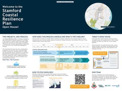
Here’s a map to guide you through the event space! ENTER/EXIT
WHAT WILL THE PLAN DO? Understand Your Flood Risk
Project Background
Establish an updated understanding of current and future coastal flood risk
Develop a road map to resilience that includes site-specific recommendations
We’d like to hear from you throughout the process. We will be hosting community workshops throughout the project, and updates will be shared on the project’s website.
Public Survey
REGISTRATION
CENTRAL MAP Ideas Station
OUR TEAM
HOW TO STAY INVOLVED? Prioritize nature-based & hybrid solutions and other strategies to reduce coastal flood risk and support local ecology and quality of life
PRESENTATION
The City of Stamford and a Technical Advisory Committee is working with Fuss & O’Neill, SCAPE Landscape Architecture, and Woods Hole Group over the next year to reduce risk & take action against growing coastal flood risks.
Public Comment Map
Use this QR code to learn more about the plan and share your thoughts!
1641