
North Central Conservation District

December 5, 2024


North Central Conservation District
December 5, 2024
• Meeting will be recorded and available for review
• Use Zoom chat for questions and comments
− Add name and affiliation to chat
• Project Team and Partners
• Project Background, Goals, and Scope
• Watershed Plan Update
• Environmental Justice (CTDEEP)
• Green Infrastructure Design
• Remaining Work
• Questions and Discussion
• North Central Conservation District
− Joanna Shapiro, Fiscal Agent/Project Oversight
• Fuss & O’Neill
− Erik Mas, PE, Technical Lead/Project Manager
− Akta Patel, PE, Design Engineer
− Andrew Bohne, RLA, Landscape & Ecological Design
• Meri with Park Watershed
− Mary Rickel Pelletier, Project Coordinator
• Trust for Public Land
− Brian Martin, Community Organizer
− Cally Guasti-O’Donoghue, Community Engagement


Funding Source
Long Island Sound Futures Fund

Matt Hart* CRCOG
Caitlin Palmer* CRCOG
Denise Savageau CT Conservation Districts
Alicea Charamut Rivers Alliance of CT
David Mann Bloomfield Conservation Comm.
David MacDonald Asylum Hill Neighborhood Assoc.
President West End Civic Association
Marion Griffin Hartford NEXT
Evelyn Green Resident Blue Hills
Bongi Magubane Resident West End
Janice Castle City of Hartford, Community
Randal Davis* City of Hartford, Planning
Owen Deutsch* City of Hartford, Planning
Nick Casparino* City of Hartford, DPW
Frank Dellaripa* City of Hartford, DPW
Mike McGarry Hartford Flood Commission
Greg Sommer Town of West Hartford
Duane Martin Town of West Hartford
Yaw Darko CT Land Conservation Council
Amy Patterson CT Land Conservation Council
Grady Brockway Aide to House Speaker Ritter
Kellie Guilbert Aide to Senator McCrory
Marilyn Bantz CT DAS Property Manager
Ashley Stewart CT Green Bank
Marlene Krajewski* CT DEEP
Erik Bedan* CT DEEP
Christopher Bellucci* CT DEEP
Jason Waterbury* MDC
Jeremy Galeota* MDC
Zbigniew Grabowski UConn CLEAR
We want your feedback!


48,000 WATERSHED POPULATION
HOW MUCH OF THE WATERSHED DOES EACH MUNICIPALITY COMPRISE?
WHAT PERCENTAGE OF EACH MUNICIPALITY IS WITHIN THE NBPR WATERSHED?
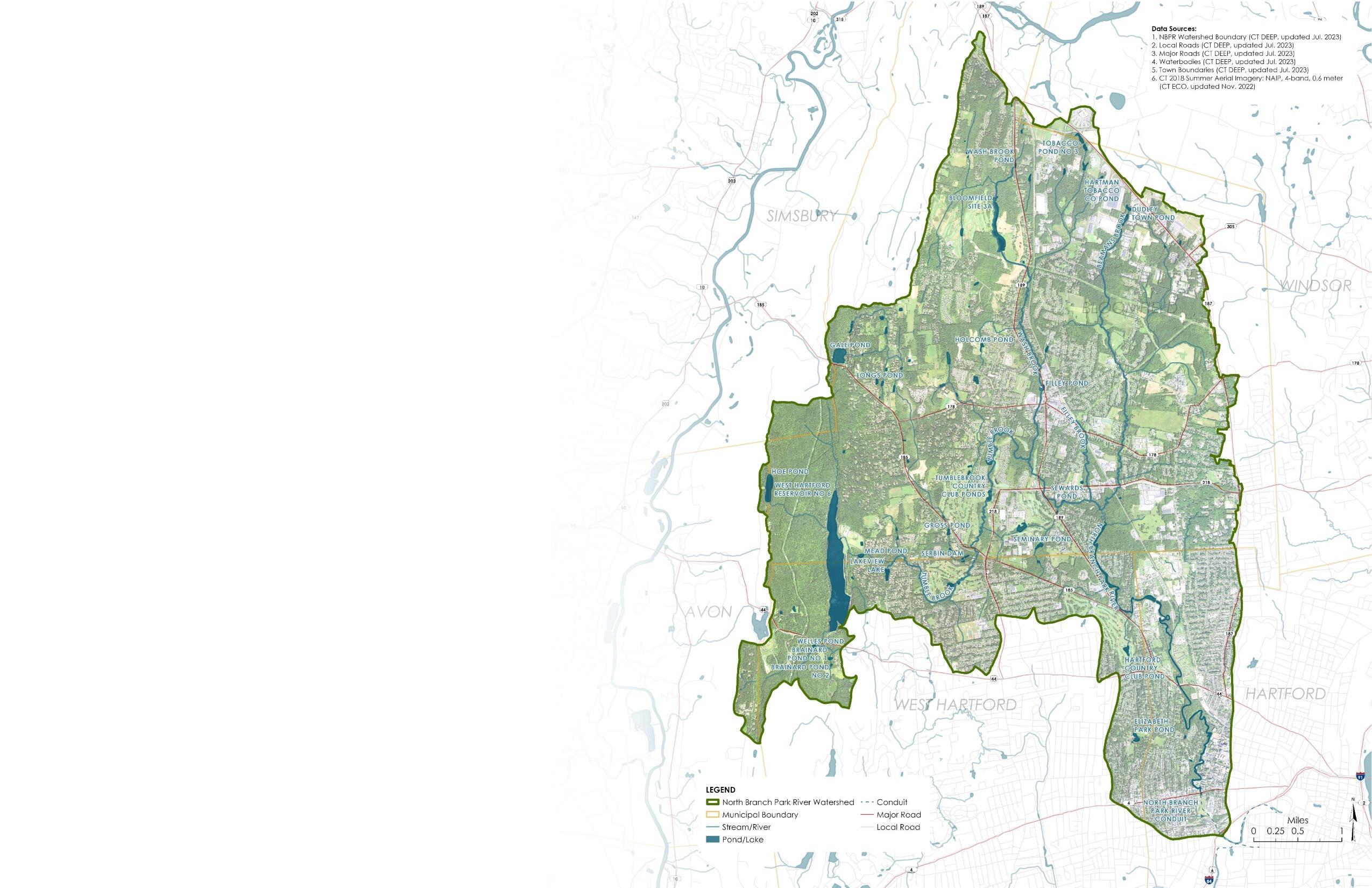
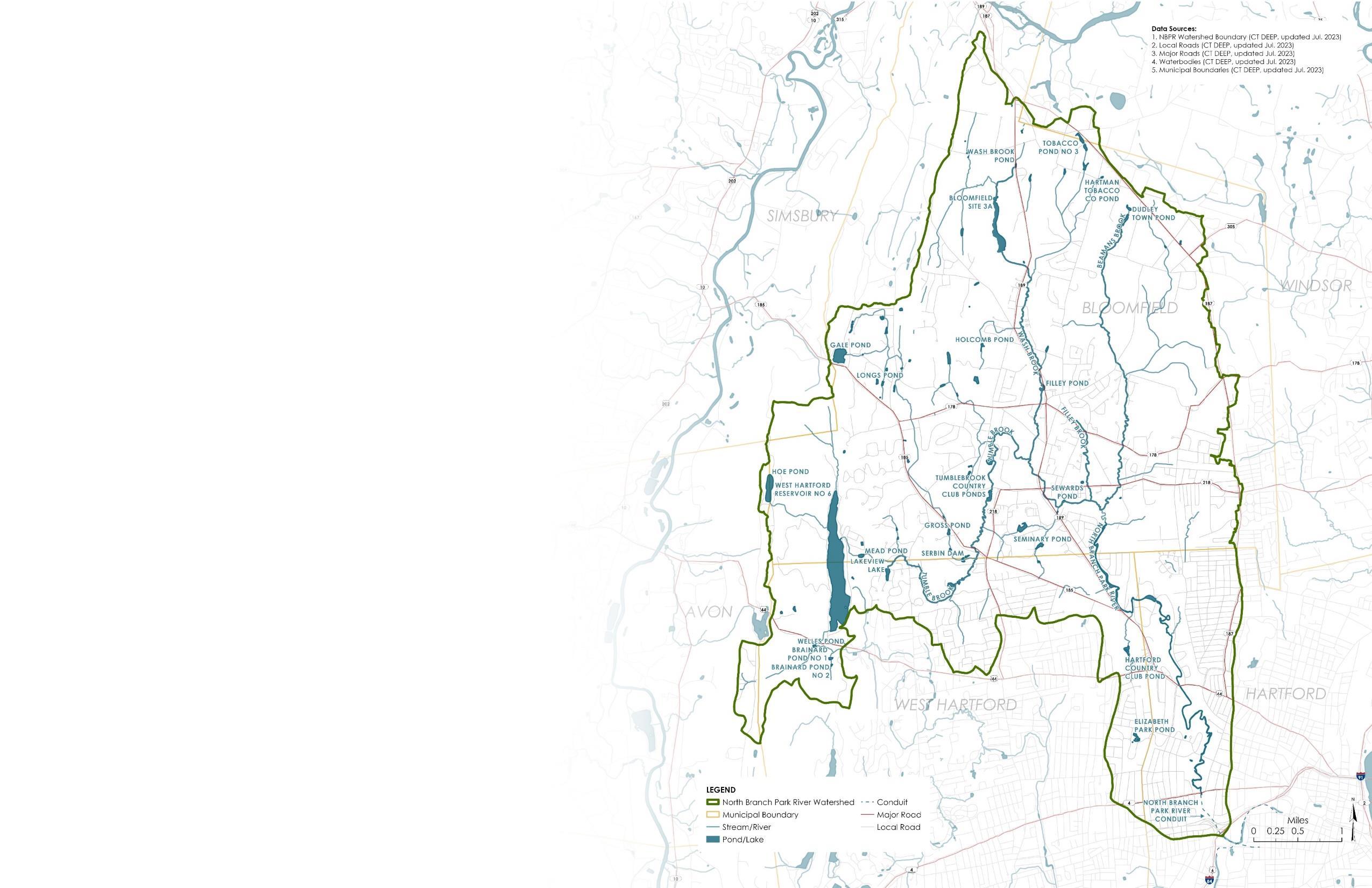
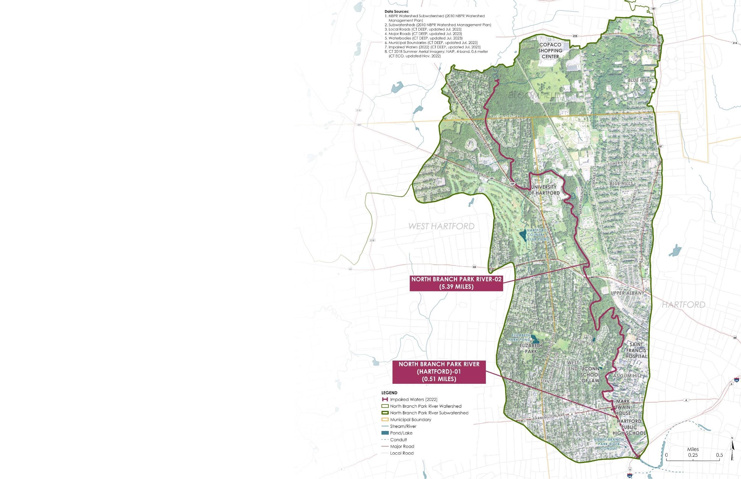
28.6 SQUARE MILES
TOTAL WATERSHED AREA
14 SUBWATERSHEDS
4 MAJOR TRIBUTARIES
5.4 MILES NORTH BRANCH MAINSTEM (ABOVE GROUND)
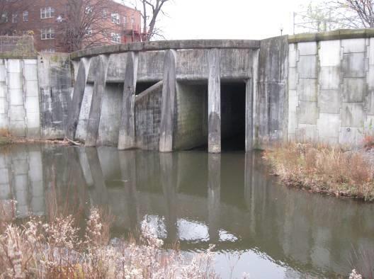
0.5 MILES NORTH BRANCH MAINSTEM (BURIED)
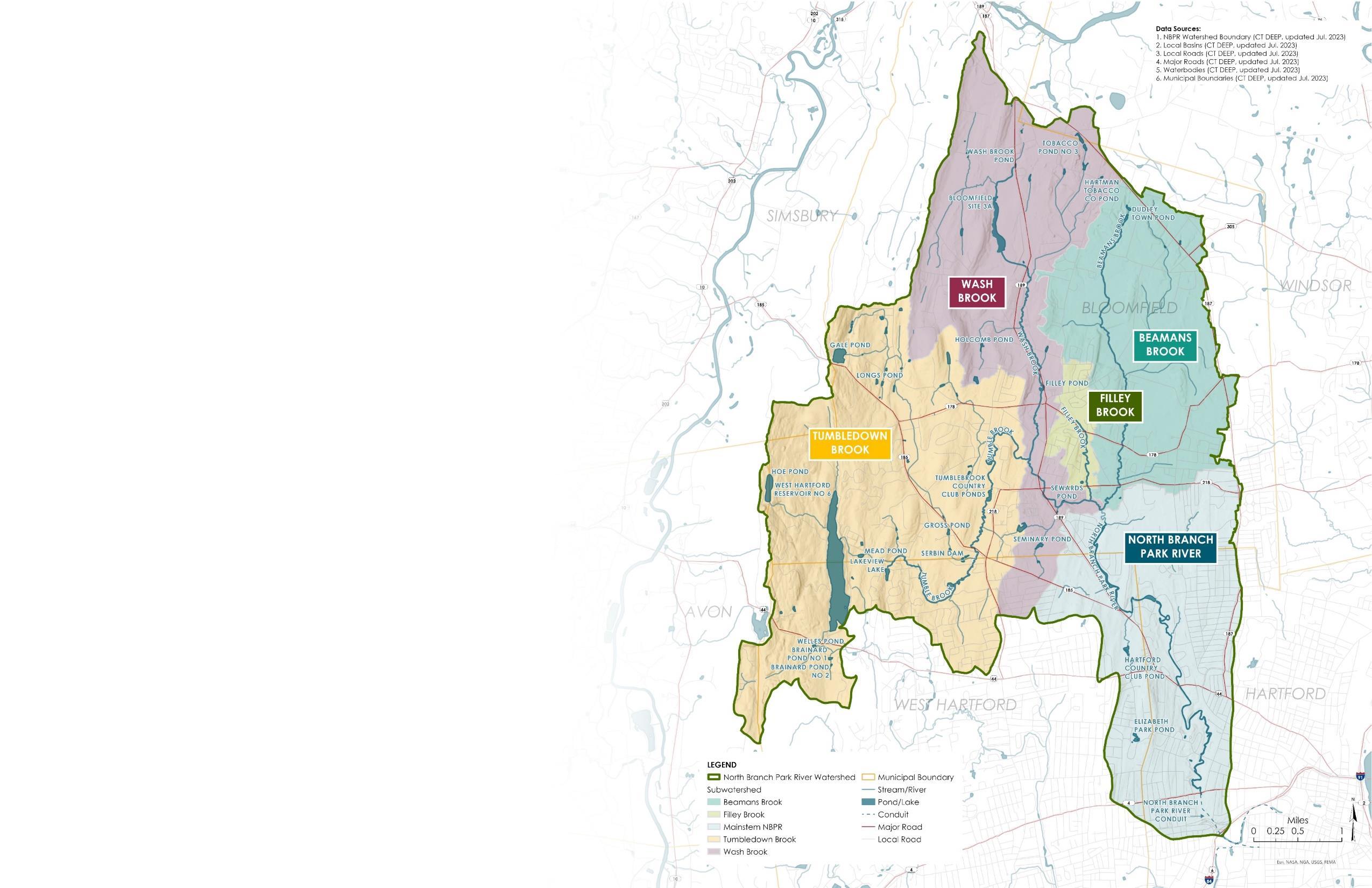
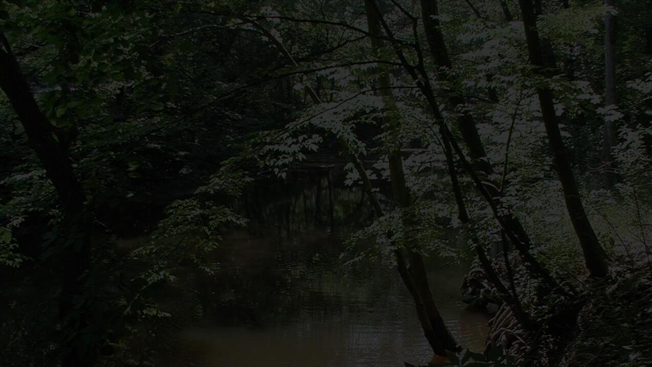
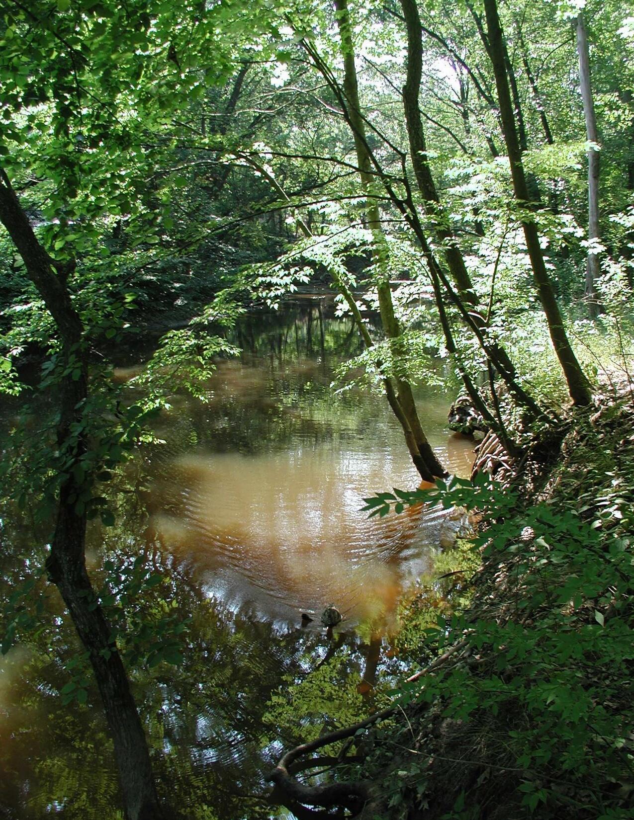
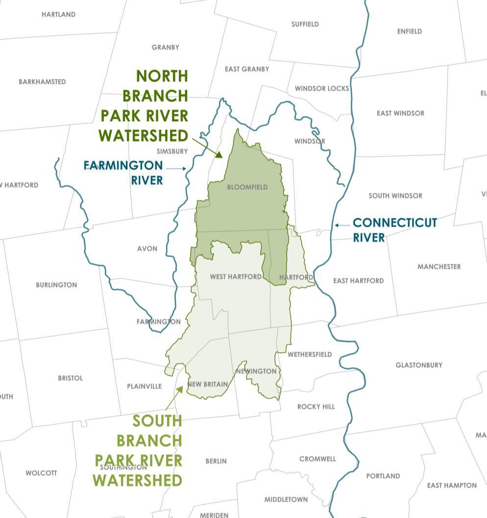
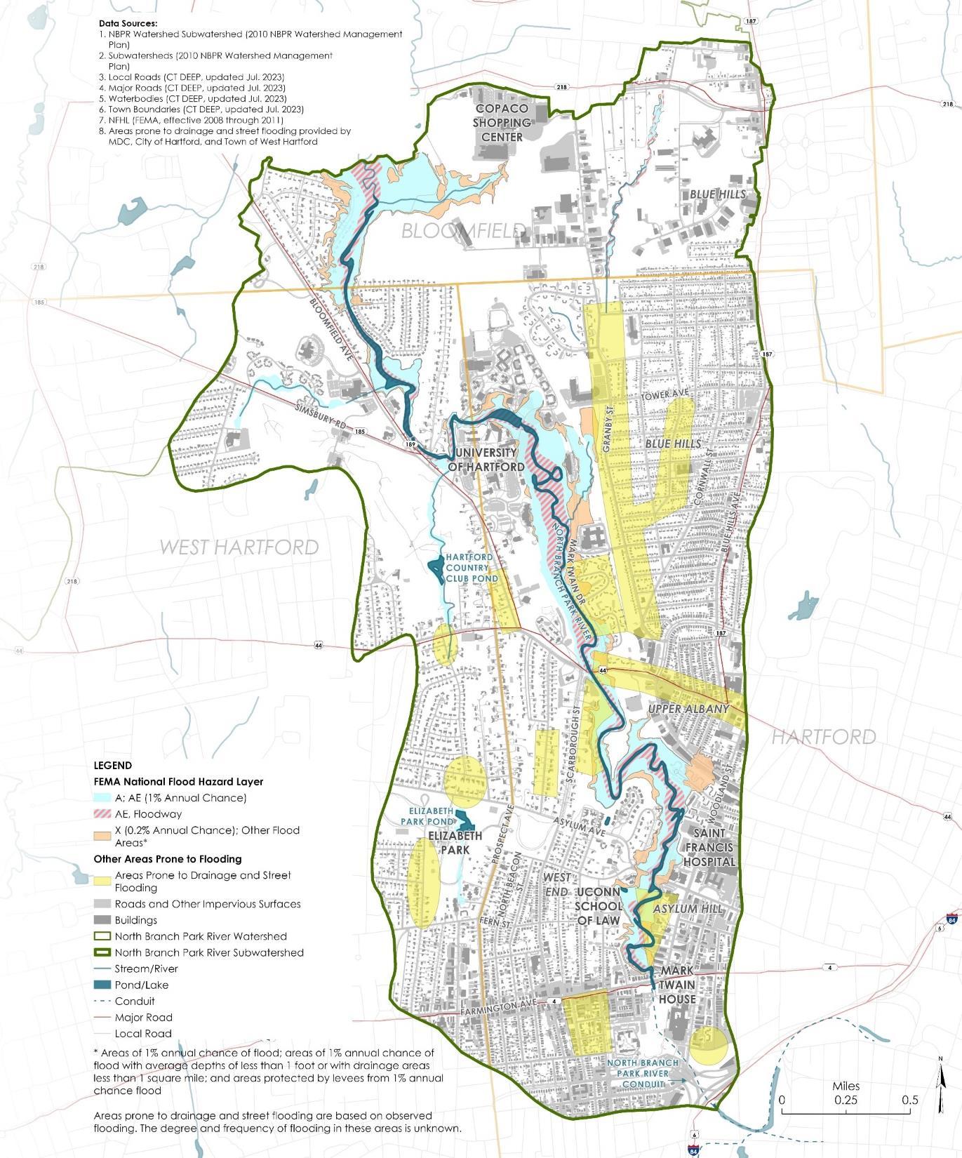
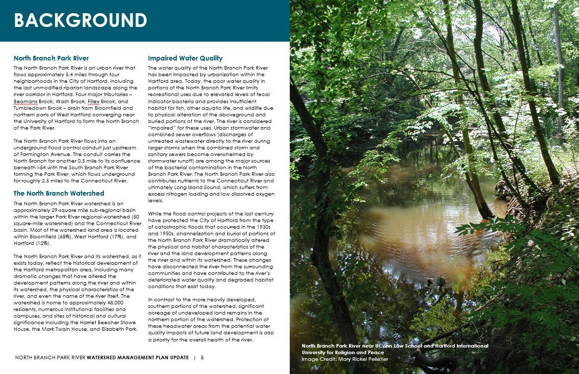
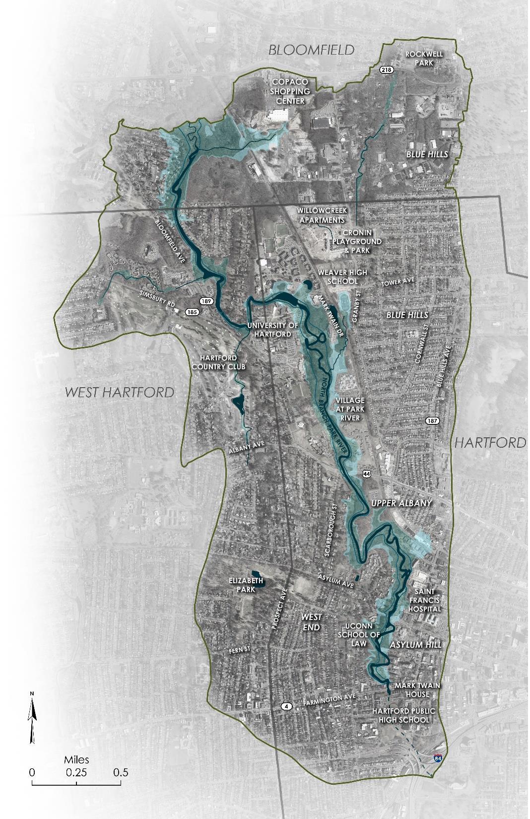
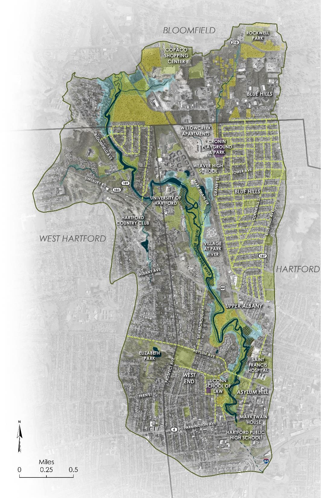
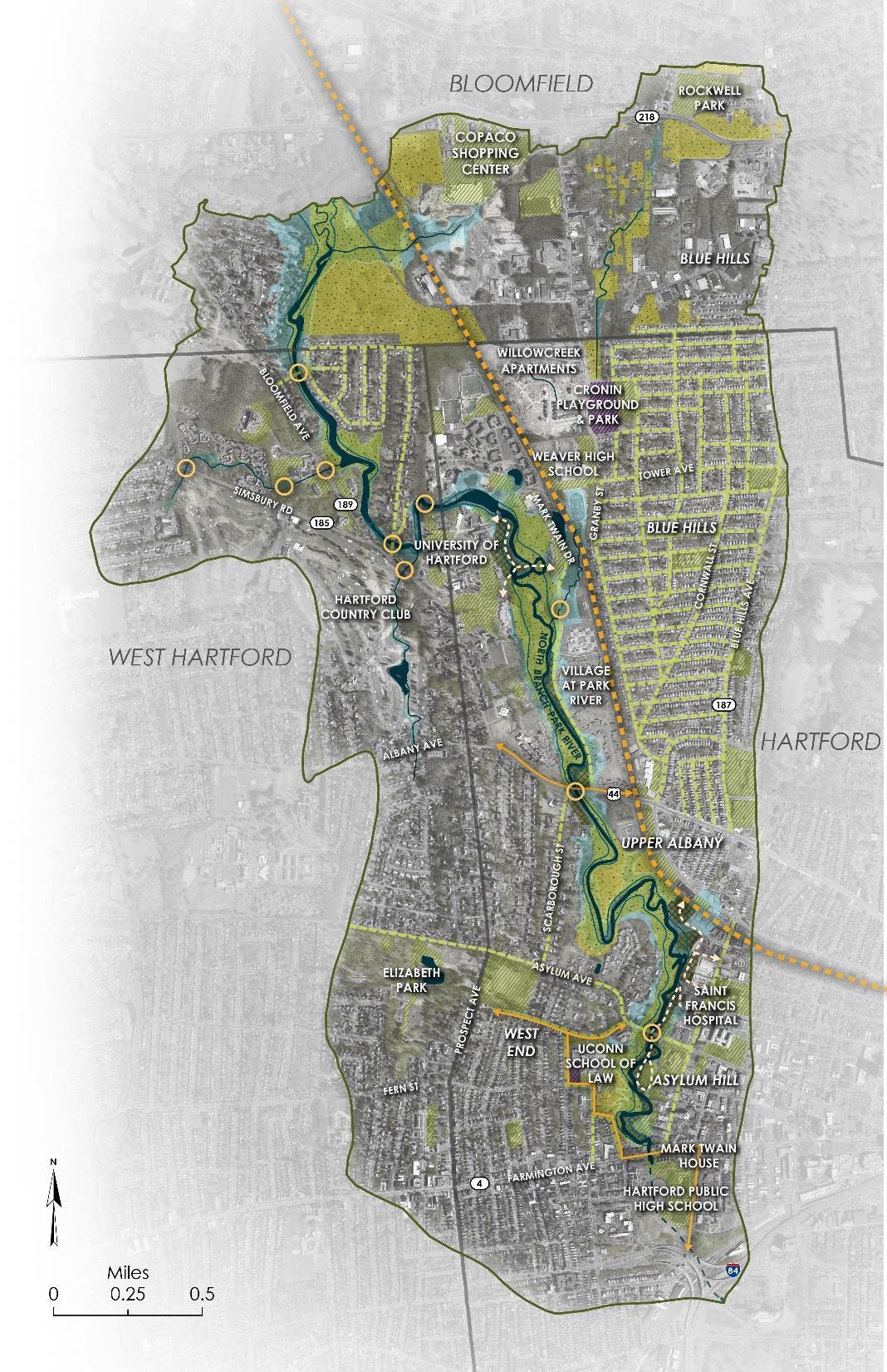
North Branch Park River Watershed
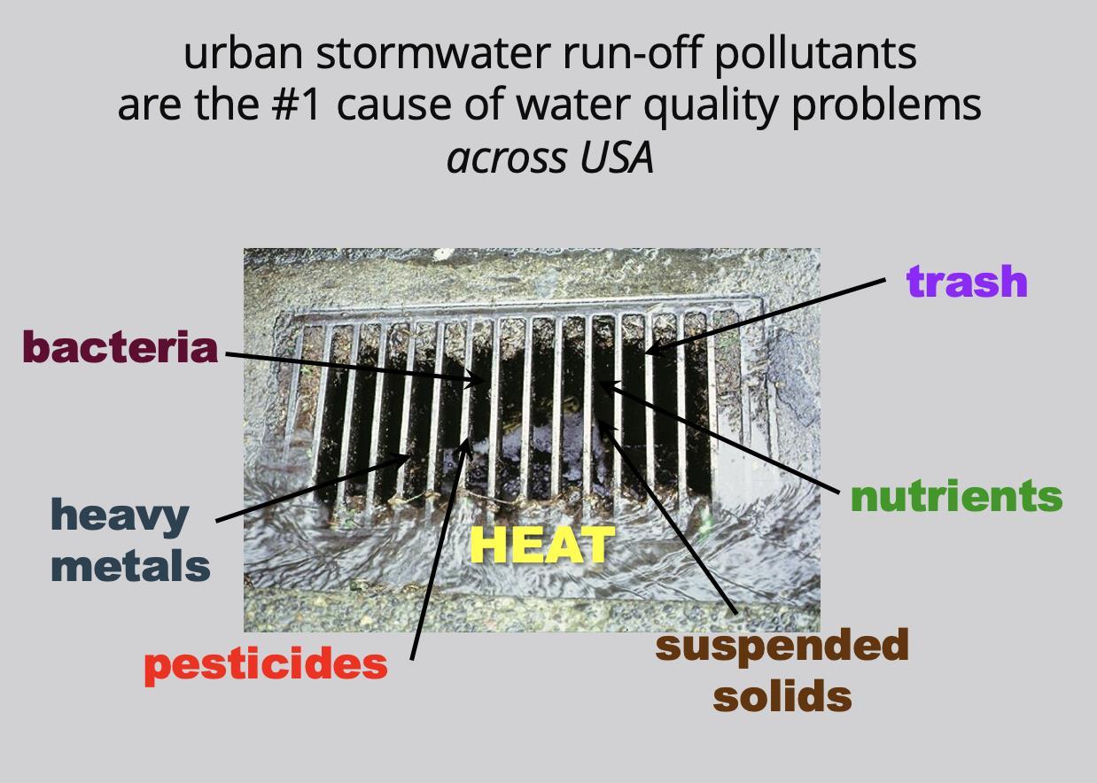
Water Quality – Impaired Urban River
• Recreation, Habitat for Fish, Other Aquatic Life and Wildlife
• Elevated Fecal Indicator Bacteria
− Stormwater runoff
− Combined sewer overflows
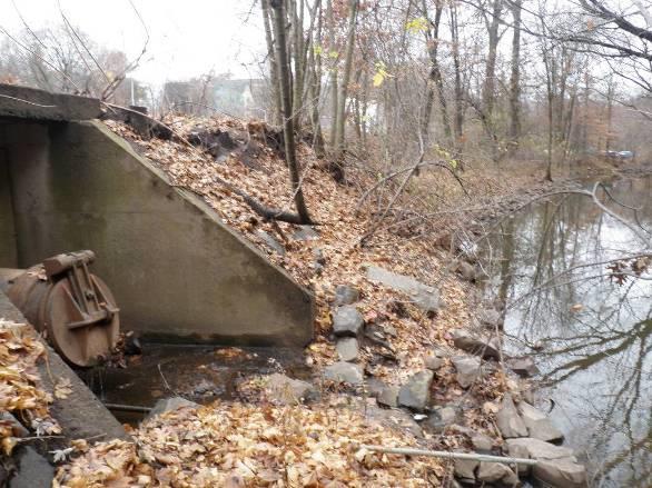
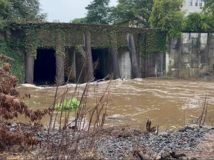
• Channelization, streambank erosion & sediment deposition
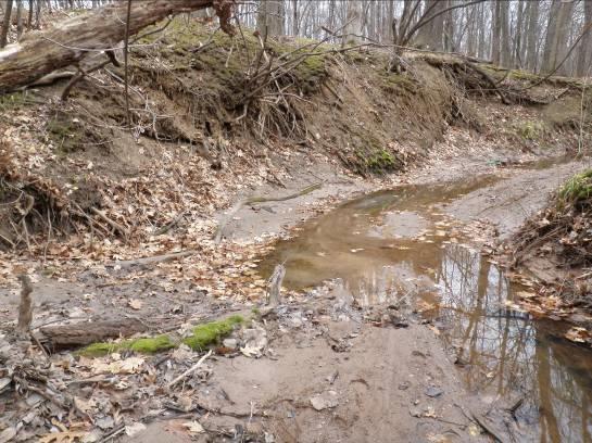
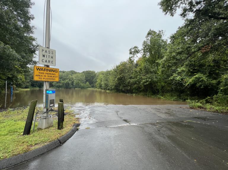
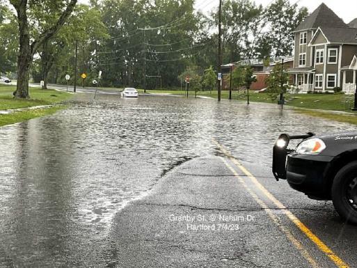
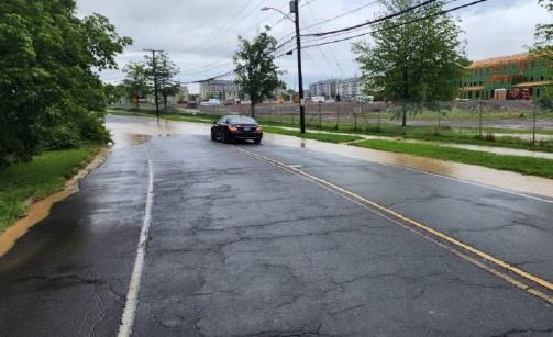
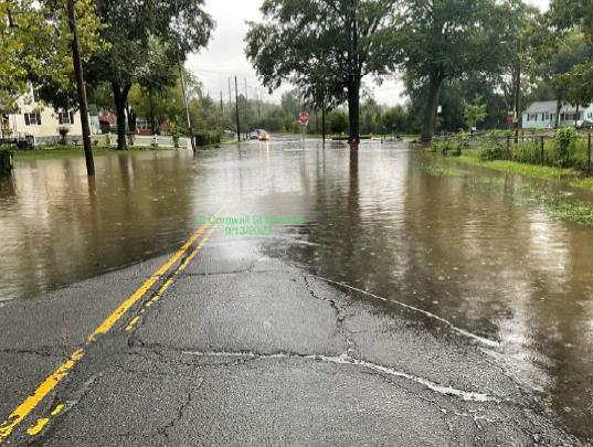
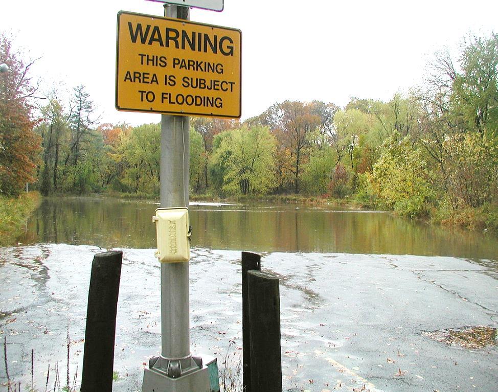
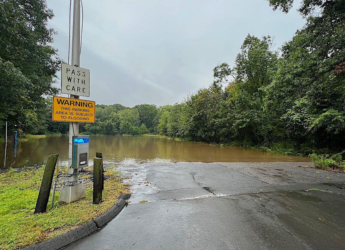
• Areas of frequent flooding
• Development in the floodplain and riparian zone
• Unstable streambanks, downed trees, and tree dams
• Under-sized culverts and inadequate or lack of storm drain system
• Development potential in upper watershed
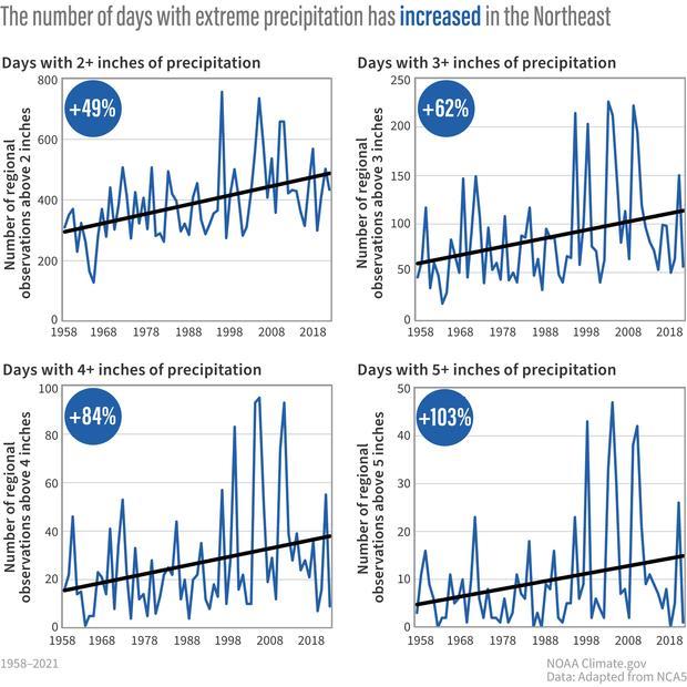
• Climate change impacts
• Landscape scale green infrastructure that improves water quality
• Scenic riparian landscape offering healthy neighborhood amenities
• Increased ecosystem connectivity benefiting migratory and recreational paths
• Shared regional natural resource, a focus of urban/suburban collaboration
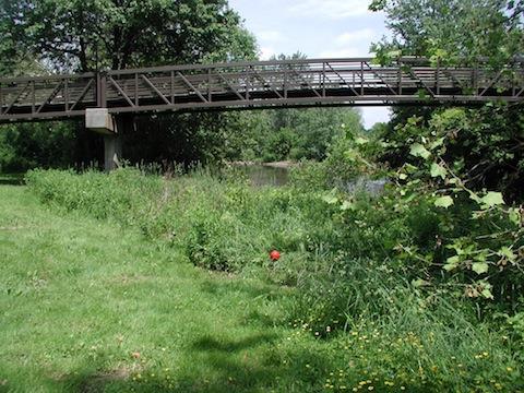
floodplain parkland vs parking lots
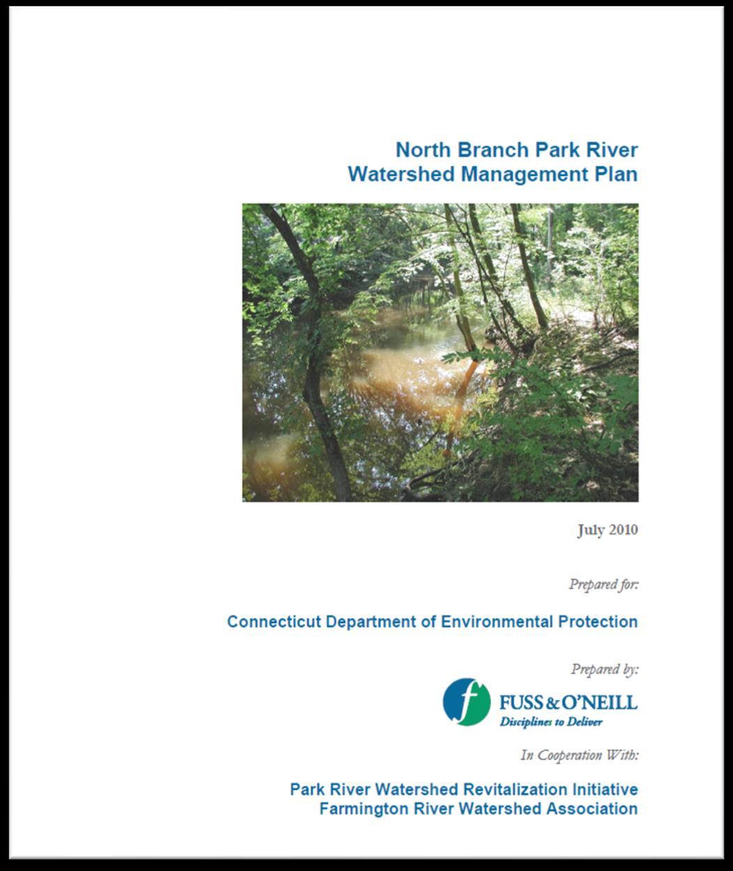
• CTDEEP Funded Planning Project
• Steering Committee, Field Assessments, Land Use Regulatory Review, Project Concepts, Public Outreach, Project Website
• Lower Watershed – Restoration Focus
• Upper Watershed – Protection Focus
https://portal.ct.gov/-
/media/DEEP/water/watershed_management/wm_plans/nbparkr/ nbprwbppdf.pdf


• MDC & City of Hartford
− North Branch Park River Drainage Study & Sewer Separation Design (Granby Street and Blue Hills Neighborhood)
− Granby Street Green Infrastructure Demonstration Project (with EPA)
• Capital Region Council of Governments
− Regional Stormwater Authority Feasibility Assessment (CT DEEP Grant)
− Natural Hazard Mitigation & Climate Adaptation Plan
− Climate Pollution Reduction Plan
• CTDEEP
− New Office of Planning and Resilience
− Proposed changes to Climate Resilience Fund Grant Program
• Blue Hills Civic Association and Connecticut Green Bank
− Partnership to promote green infrastructure and community resilience
• Focused update of 2010 plan
• Updated watershed conditions
• Green infrastructure designs focused in lower watershed
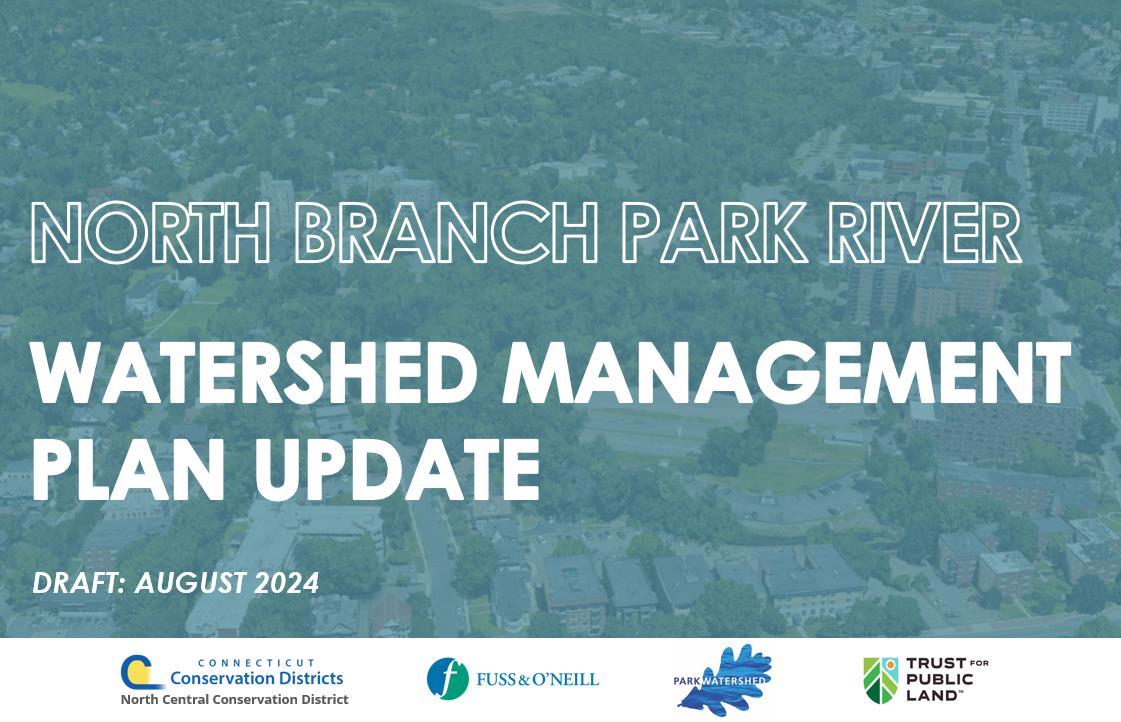

• Watershed-wide policy & nonstructural recommendations
• Consideration of climate resilience
• Roadmap for next 10+ years

1. Capacity and Plan Implementation
A. Watershed Organization
B. Collaboration
C. Funding
2. Water Quality
A. Combined Sewer Overflows
B. Green Infrastructure and Low Impact Development
C. Illicit Discharges
D. Monitoring
E. Field Assessments
3. Climate and Community Resilience
A. Riverine Flooding and Flood Management
B. Stormwater Flooding and Impervious Surface Mitigation
4. Habitat Protection and Restoration
A. Riparian Restoration
B. Urban Forests and Tree Canopy
C. Invasive Species Control
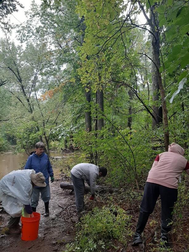
D. Stream Cleanups
5. Sustainable Growth and Land Use
A. Smart Growth
B. Open Space Protection & Land Acquisition and Conservation
C. Public Access
D. Urban Landscape Design
6. Public Education and Stewardship
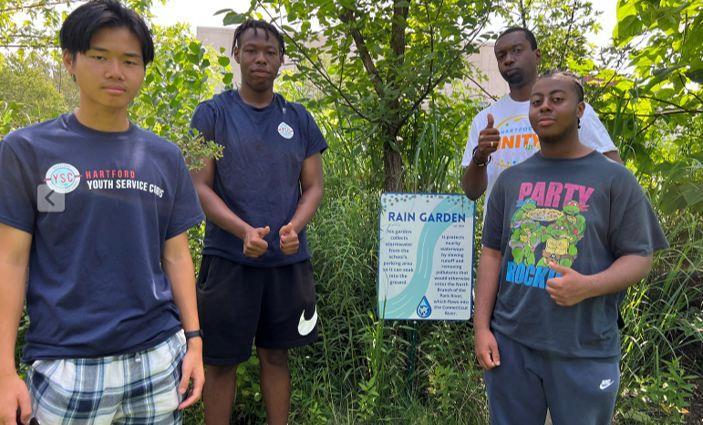
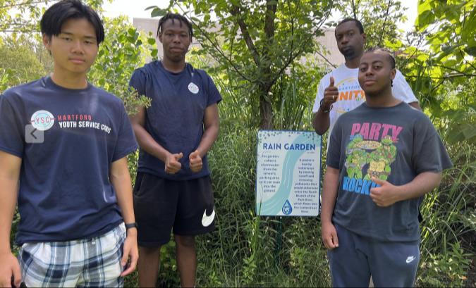
A. Youth and Students
B. Campuses and Institutional Property Owners
C. Residents and Homeowners
D. Municipal Staff and Volunteer Commissions
E. Businesses and Commercial Landowners
Substantially modified actions/recommendations
• Develop designs for impactful green infrastructure projects
• Build on 2010 concepts and other ongoing/planned projects
• Reduce pollutant loads and runoff volumes
− Bacteria, nutrients, sediment
• Secondary benefits
− Flood resilience, CSO reduction, community amenities
“Scale green infrastructure. Providing an alternative to separating the combined sewer system will preserve property values, protect agriculture and landscape, and ensure cleaner water.”
“Implement the North Branch Watershed Management Plan. Implementing this plan will improve riparian health of the North Branch and Gully Brook sub-basin in an area adjacent to the North Hartford Promise Zone.”
Hartford City Plan 2035
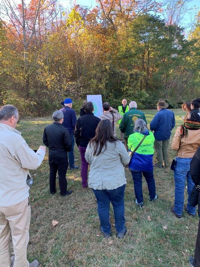
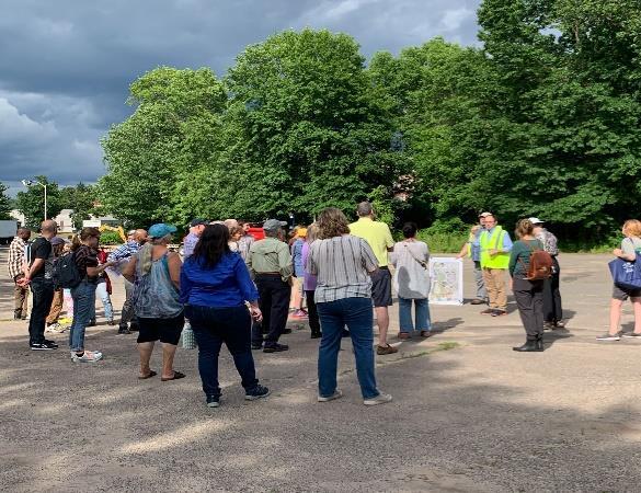
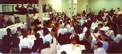
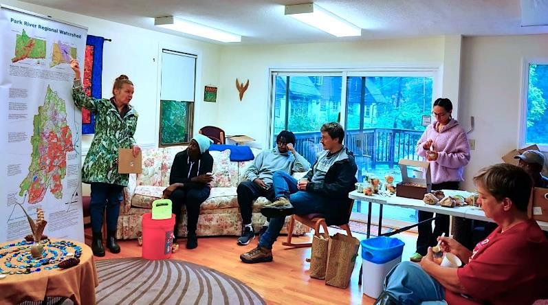
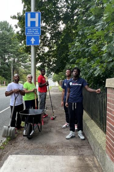
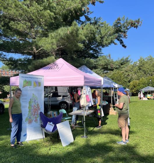
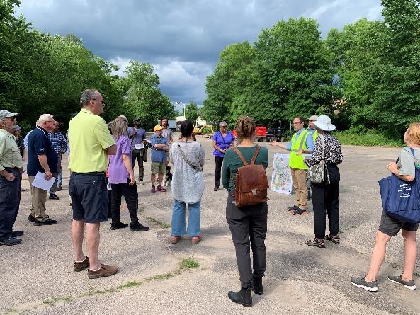
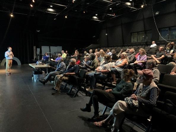
Community Engagement
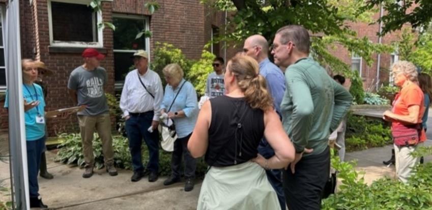
• Advisory Committee Meetings
• Community Meetings
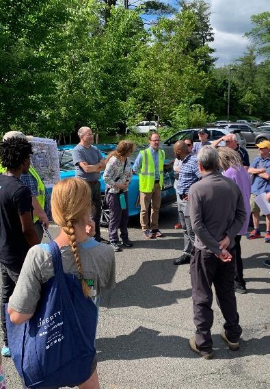
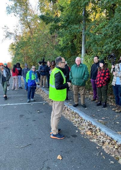
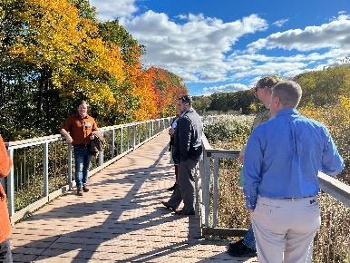
• Walkshops
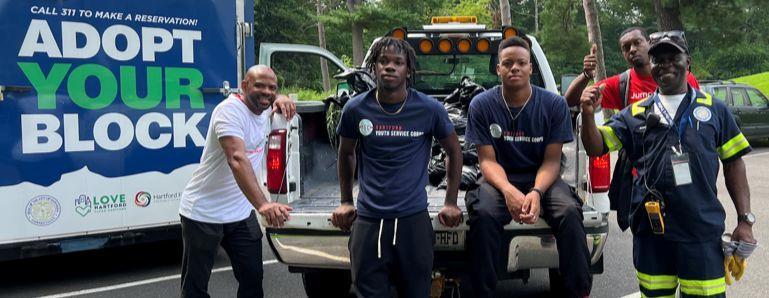
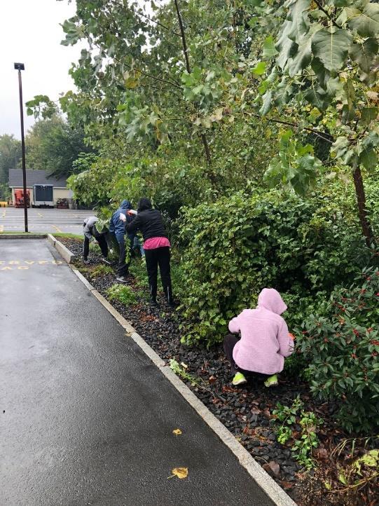
• Cleanups and Invasive Species Removal
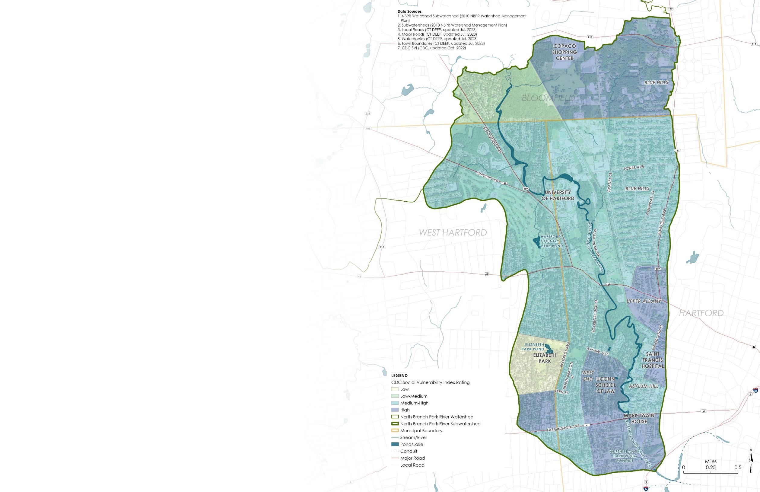
• Outreach to Environmental Justice Communities
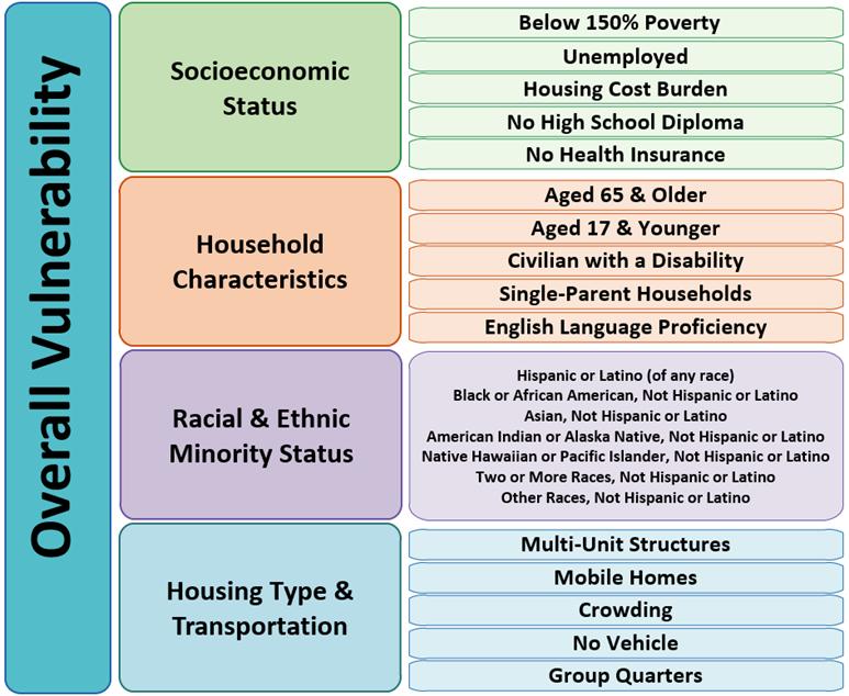
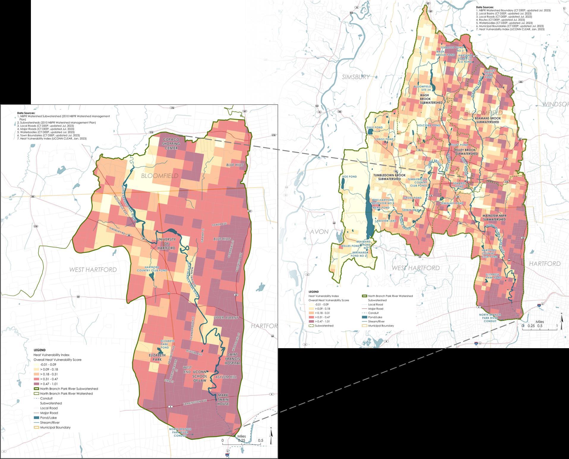
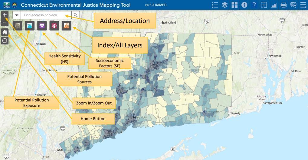
• Heat Climate Change Vulnerability Index (CCVI) (CIRCA)
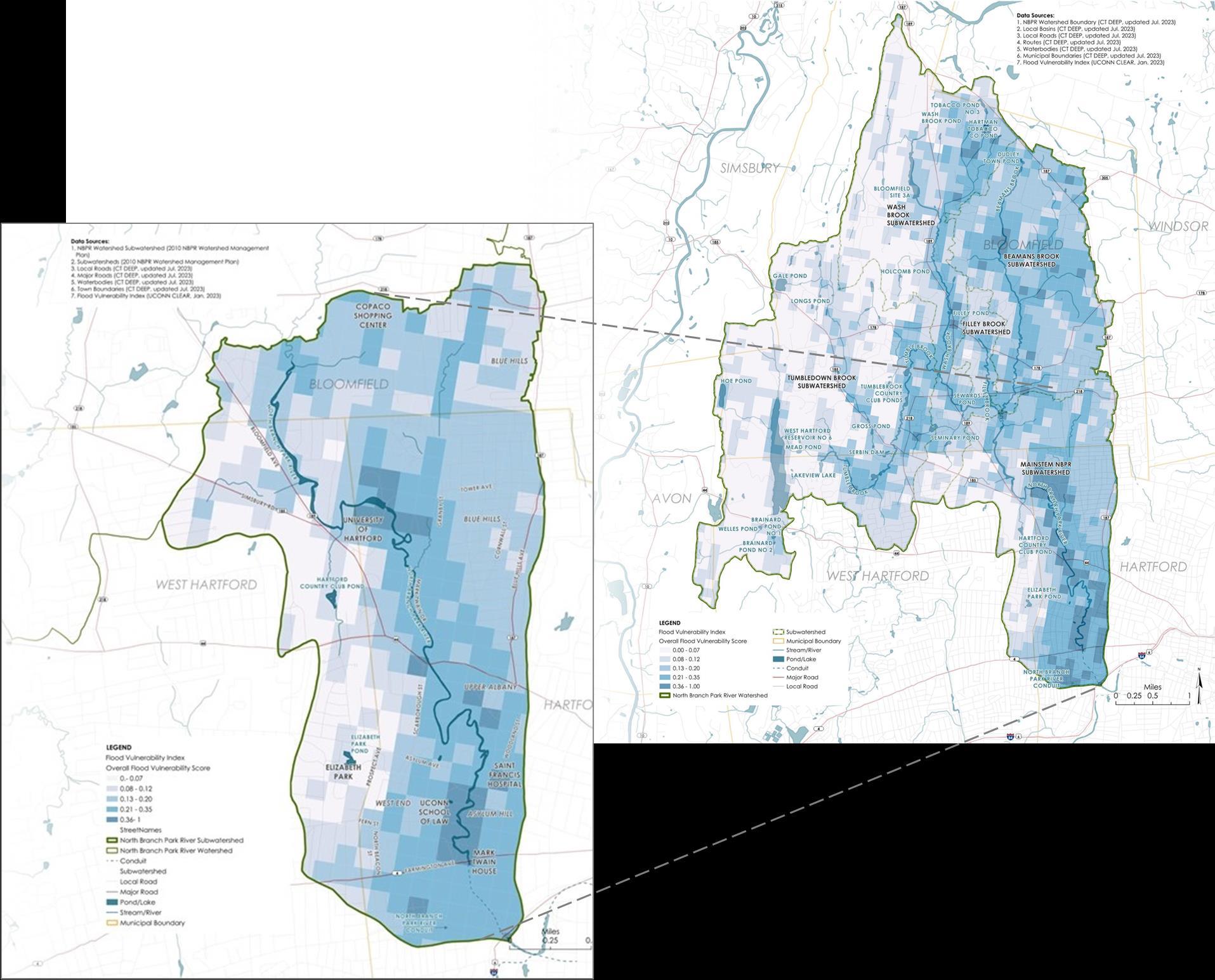
• Flood Climate Change Vulnerability Index (CCVI) (CIRCA)
Sarah Huang
Office Director for Environmental Justice Connecticut Department of Energy and Environmental Protection (CTDEEP)
Sarah Huang, Director of Equity & Environmental Justice
CT
DEEP

The Connecticut Department of Energy and Environmental Protection (DEEP) is charged with conserving, improving and protecting the natural resources and the environment of the state of Connecticut as well as making cheaper, cleaner and more reliable energy available for the people and businesses of the state. The agency is also committed to playing a positive role in rebuilding Connecticut’s economy and creating jobs – and to fostering a sustainable and prosperous economic future for the state.
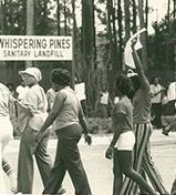
1968 - Memphis Sanitation Strike
1979 – Bean v. Southwestern Waste Management Corp.
1982 – Sit-in Against Warren County, NC PCB Landfill
1983 – U.S. GAO finds that 3 out of 4 off-site hazardous waste sites in Region 4 located near minority communities
1987 – Race is identified as most significant factor in siting of hazardous waste facilities.
1988 – 1990 - Many EJ groups created such as WE ACT, IEN, and SNEEJ.
1991- First National People of Color Environmental Leadership Summit
1995- First National Interagency Environmental Public Meeting
2001- Warren County PCB Landfill is Remediated
The fair treatment and meaningful involvement of all people regardless of race, color, national origin, or income, with respect to the development, implementation, and enforcement of environmental laws, regulations, and policies. This goal will be achieved when everyone enjoys:
➢ The same degree of protection from environmental and health hazards, and
➢ Equal access to the decision-making process to have a healthy environment in which to live, learn, and work.

These communities suffer from disproportionate and cumulative impacts from interactions of four categories of stress:
Communities of color, tribal and indigenous communities and/or lowincome communities may be disproportionately impacted by environmental harms or risks due to:
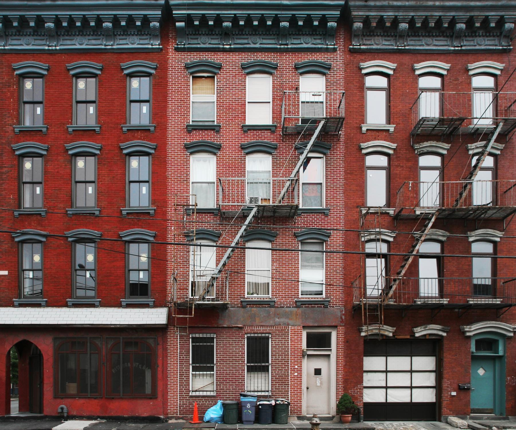
▪ Proximity and exposure to environmental hazards
▪ Vulnerable or susceptible populations
▪ Multiple and cumulative effects
▪ Ability/Inability to participate in the decisionmaking process
▪ Vulnerable physical infrastructure
Lack of access to information
Lack of representation (e.g., legal, arbitration, trade)
Linguistic and/or cultural barriers
The inability to participate in decisions that impact an individual’s life can contribute to chronic stress, which may exacerbate health challenges
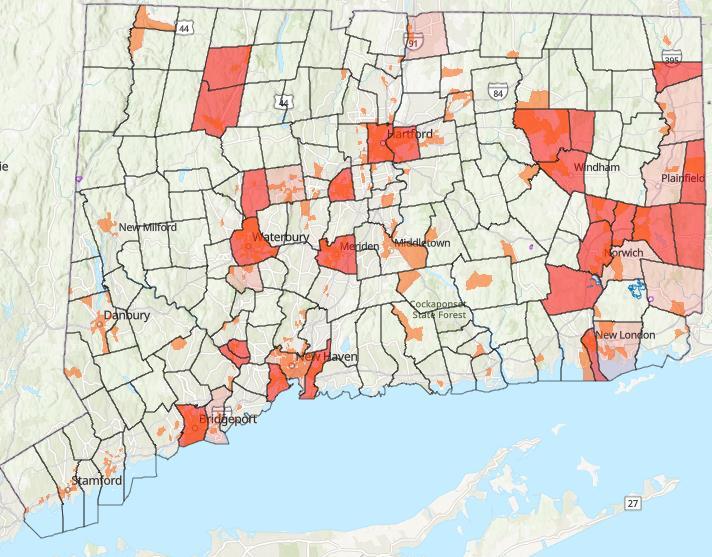
1. census block groups, for which 30% or more of the population consists of low-income persons who are not institutionalized and have an income below 200% of the federal poverty level
2. distressed municipalities
Distressed Municipalities (ct.gov)
Connecticut General Statutes § 22a-20a
Defined Environmental Justice communities
Defined facilities covered under law (“Affecting Facilities”)
Required public participation as part of the permitting process


Provided for a community benefit agreement if the town and EJ community agreed


• Connecticut Equity and Environmental Justice Advisory Council (CEEJAC)
• Tribal Affairs
• Education Programs
• Justice40 Initiatives
Permitting & Public Participation Plans Diversity, Equity, and Inclusion
• EJ Law
• Public Participation Plans
• Community Environmental Benefits Agreement (CEBA)
• Equity initiatives (external)
• Limited English Proficiency
• Accessibility
• Inclusion initiatives (internal)
• Employee Resource Groups

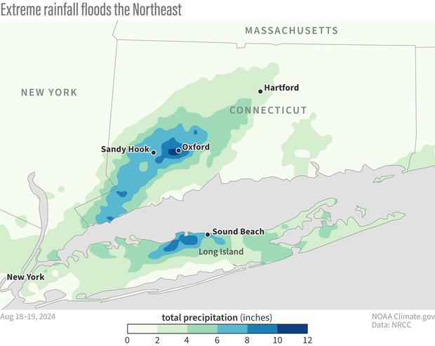
Source: NOAA, https://www.climate.gov/newsfeatures/event-tracker/extreme-rainfall-brings-
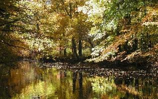
• Conserve last remaining landscapes within the river corridor/riparian zone
• Conservation is cost-effective
• Numerous benefits
− Keeps development out of harms way and preserves floodplain
− Protects water quality
− Reduces urban heat island
− Supports biodiversity
− Supports healthy avian, aquatic, and wildlife migration pathways
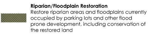
• Riparian & floodplain restoration
• Increase vegetative buffers
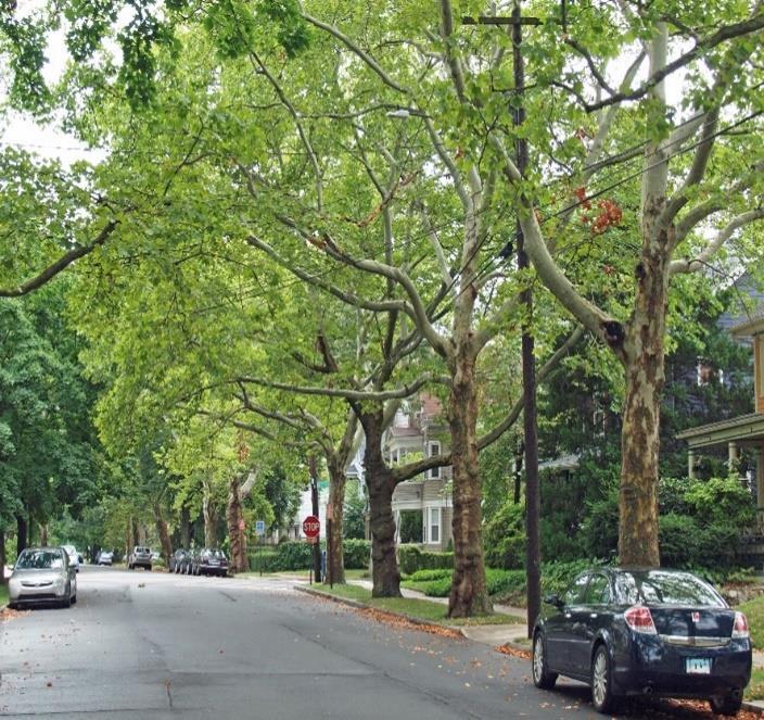
• Urban tree canopy
• Urban rewilding

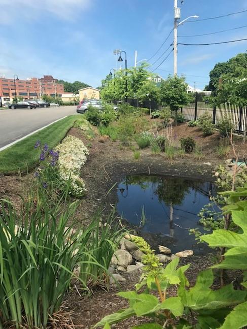
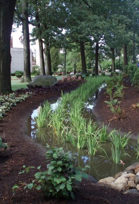
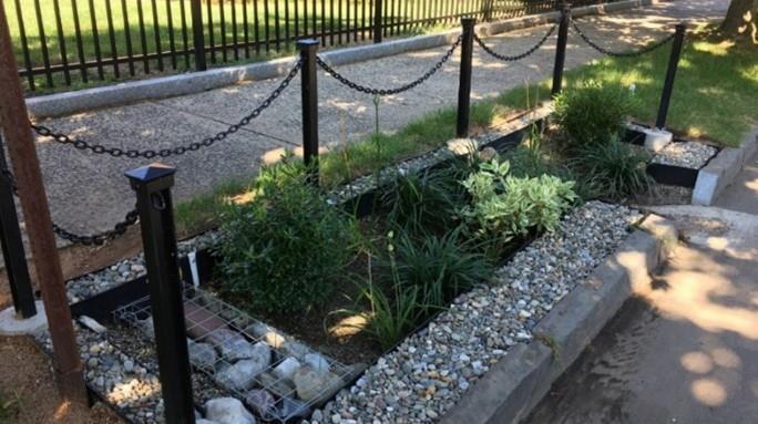
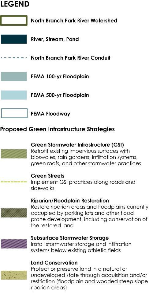
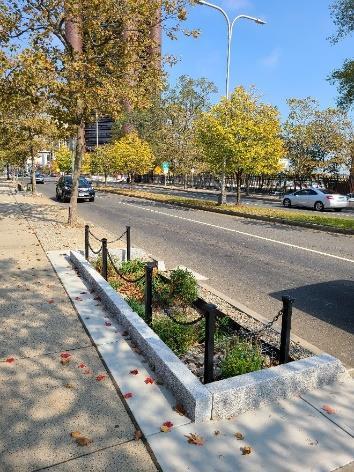
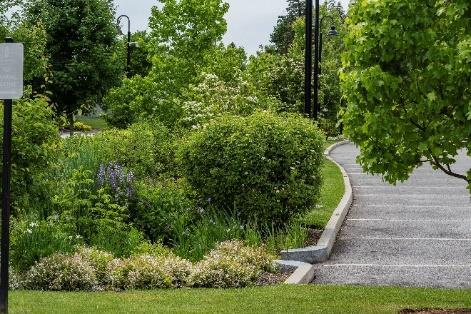
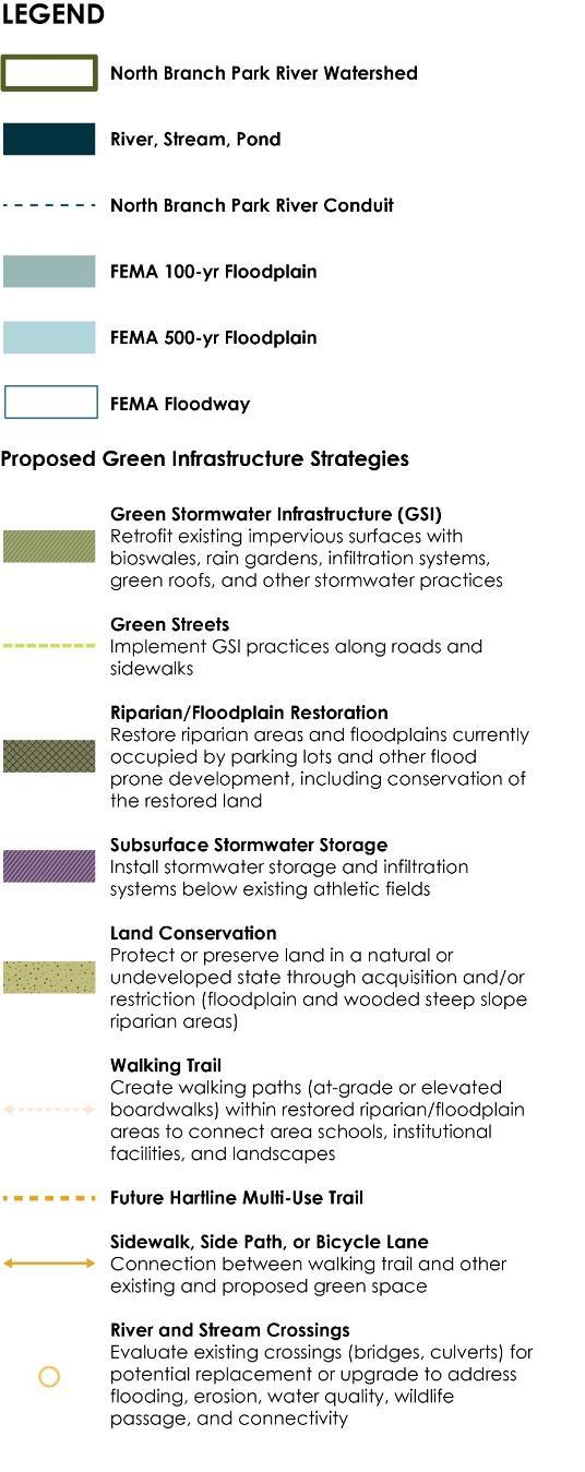
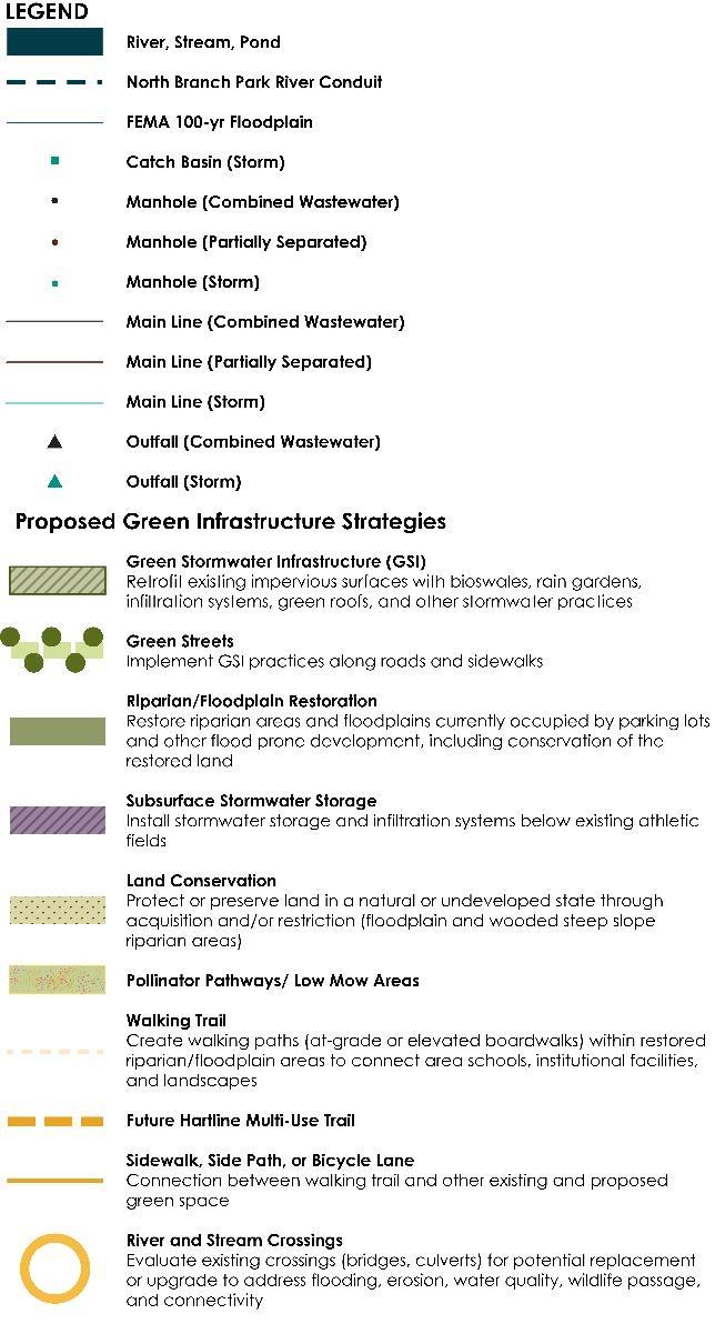
Green Stormwater Infrastructure (GSI)
• Public/institutional properties
• Within municipal right-of-way
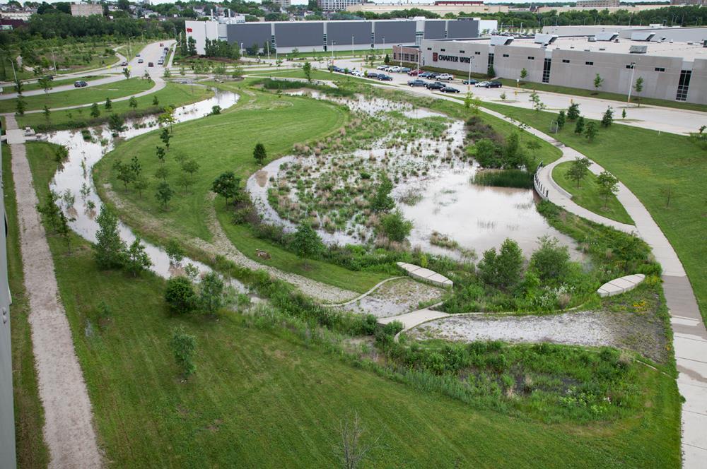
• At existing outfalls such as stormwater wetlands and ponds (stormwater parks)
• Site, neighborhood, landscape scale
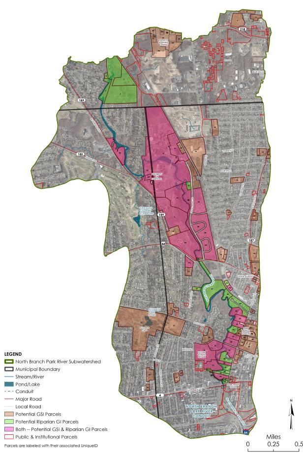
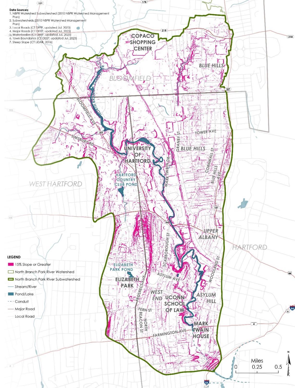
Green Infrastructure Screening
• Public & institutional properties, 98 potential parcels identified
• Green Stormwater Infrastructure (GSI)
− 0.5 acre or more of impervious area
− All soil types considered
• Riparian Corridor Green Infrastructure
− Parcels within 300-foot riparian corridor
• Field Inventories
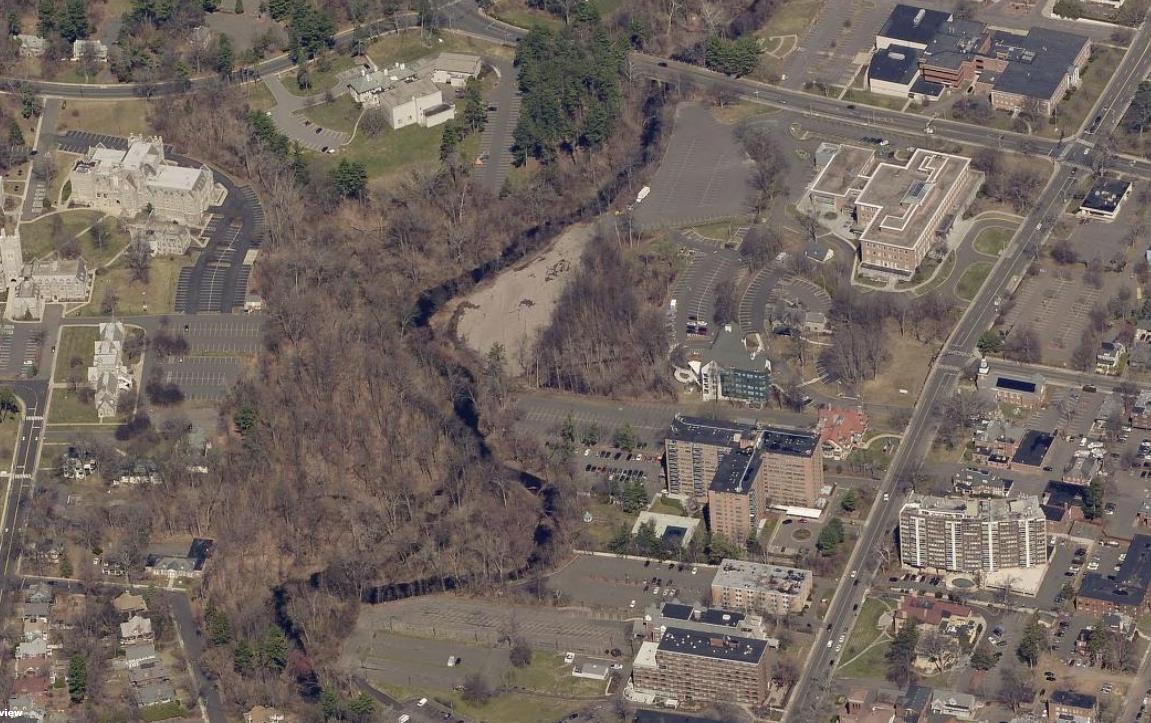
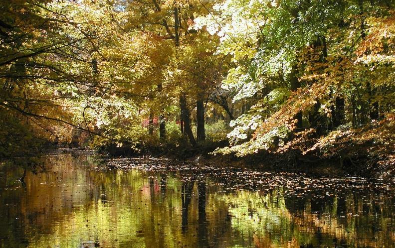
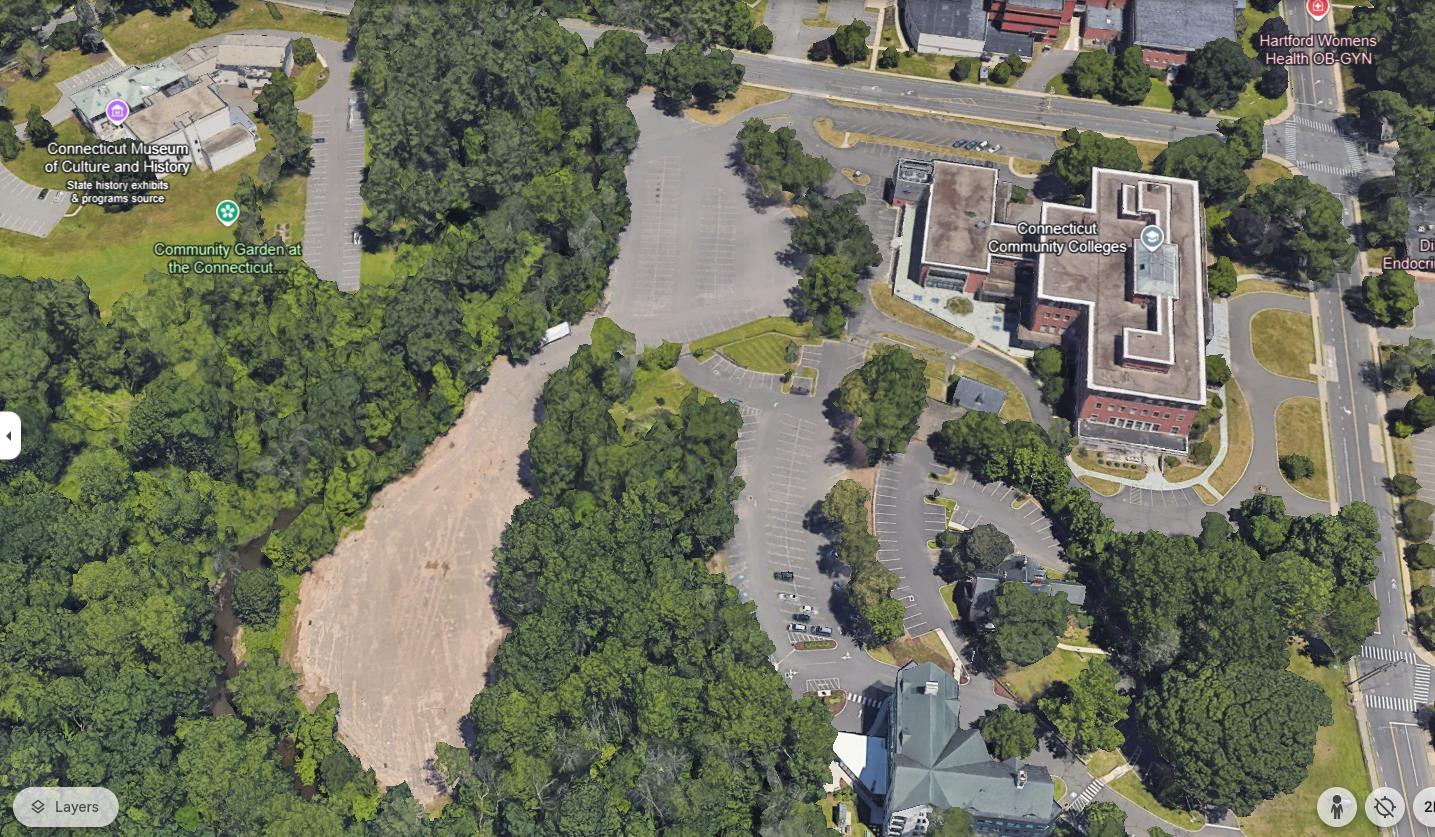
WOODED FLOODPLAIN AND RIPARIAN AREA WOODED FLOODPLAIN AND RIPARIAN AREA
PARKING LOTS IN FLOODPLAIN PARKING IN FLOODPLAIN FLOODPLAIN
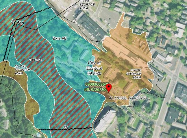
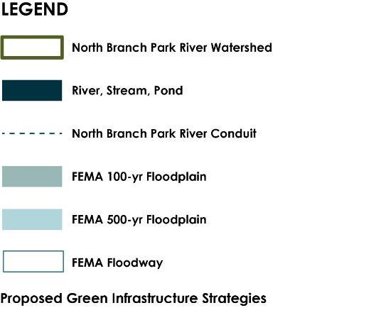
FEMA 100-YEAR FLOODPLAIN
FEMA 500-YEAR FLOODPLAIN
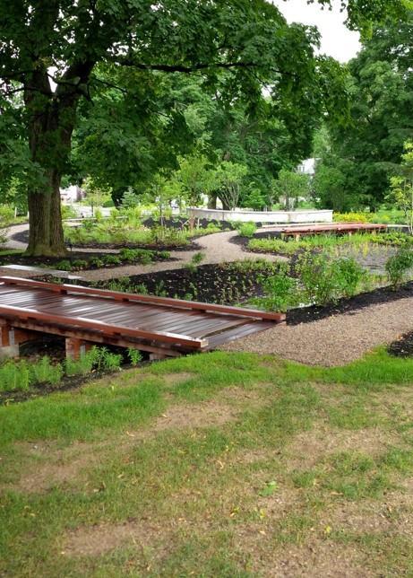
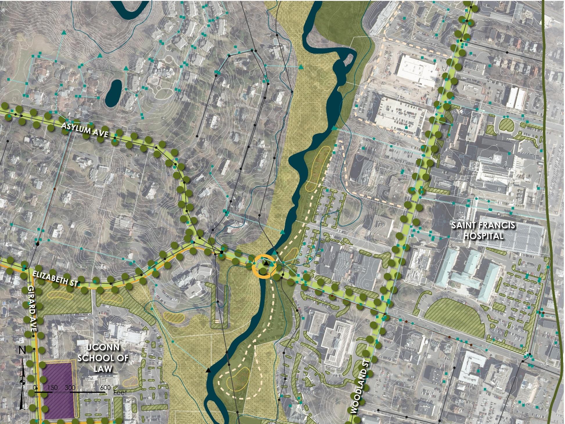
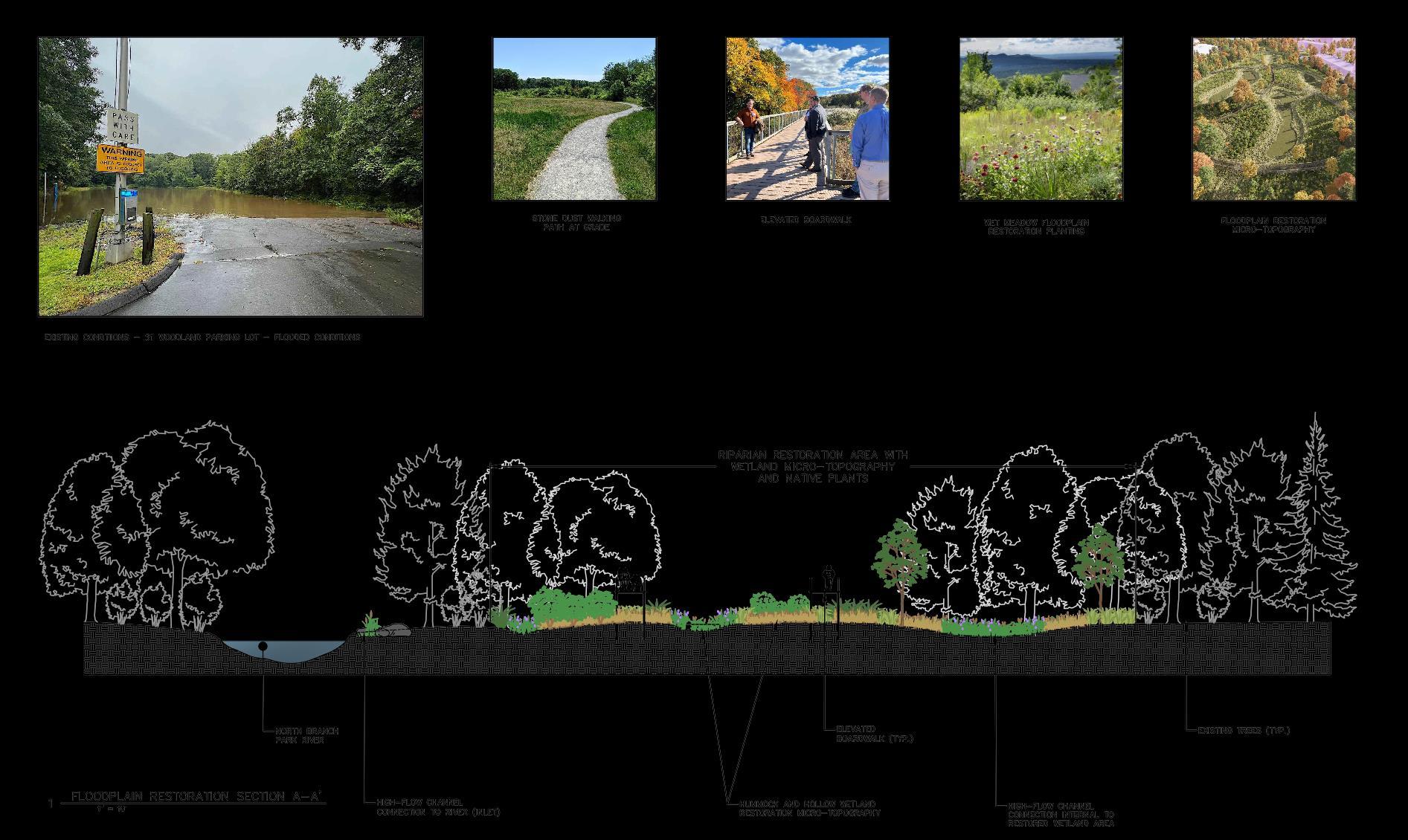
• Riparian & Floodplain Restoration
− Flood prone parking lots and development
− Wetland/meadow creation
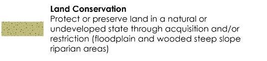
• Land Conservation
− Riparian corridor, floodplain & wooded steep slopes
− Formal permanent protection
• Challenges
− Loss of parking, future development
− Need property owner cooperation
− Incentives to reduce impervious cover
LAND CONSERVATION OF FLOODPLAIN, RIPARIAN CORRIDOR, AND WOODED STEEP SLOPES
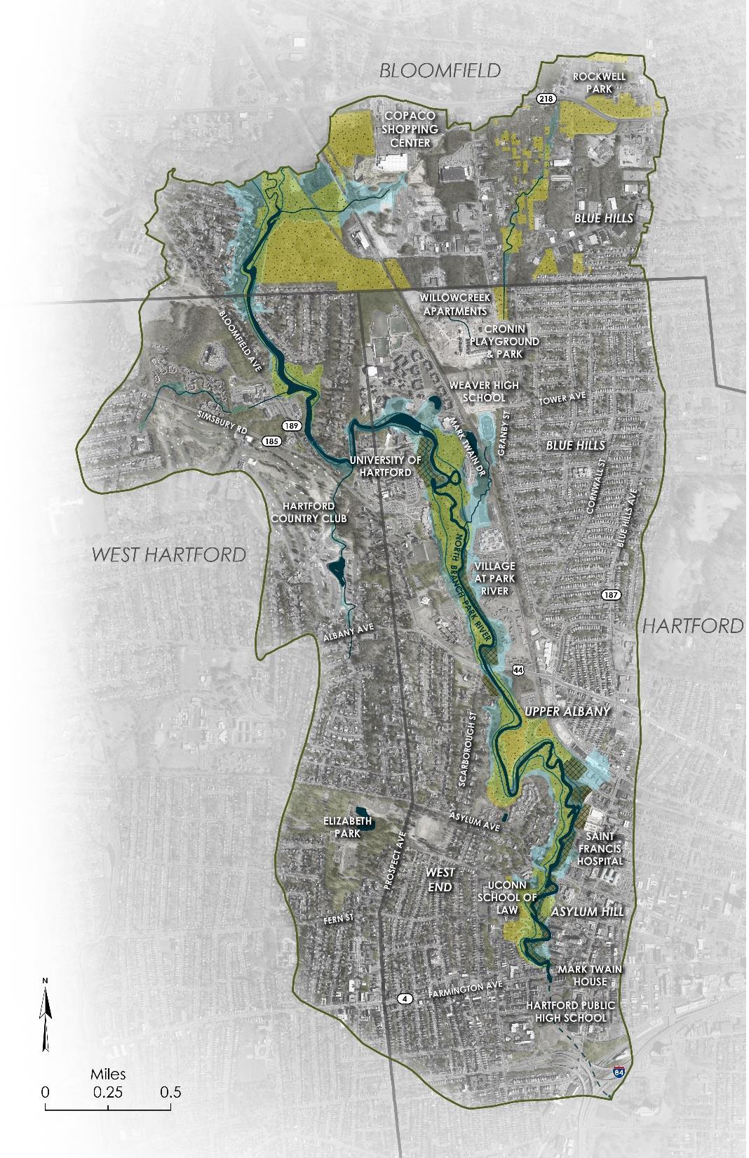
FLOODPLAIN
RIPARIAN/FLOODPLAIN
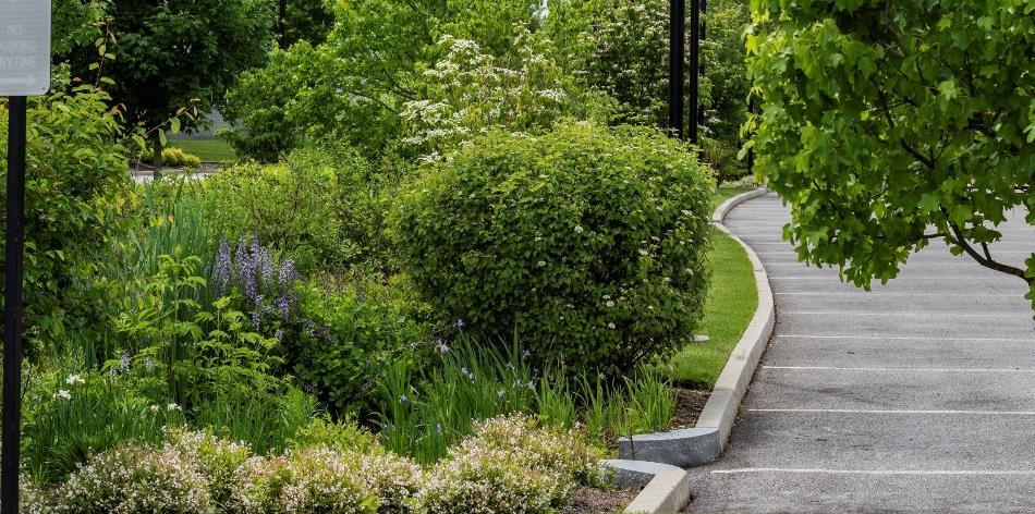
RESTORATION OF EXISTING PARKING LOTS
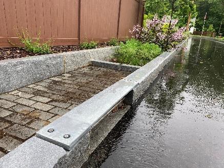
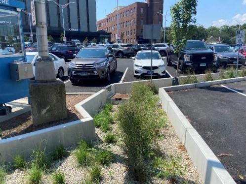
• Green Stormwater Infrastructure (GSI)
− Retrofit parking lots, roads (green streets), schoolyards
− Treat new separated storm drain discharges
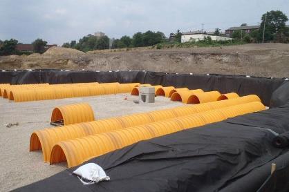
− Subsurface stormwater storage and infiltration systems
• Challenges
− Need property owner cooperation
− Combined sewers
− Subsurface and soil conditions
− Incentives to reduce impervious cover
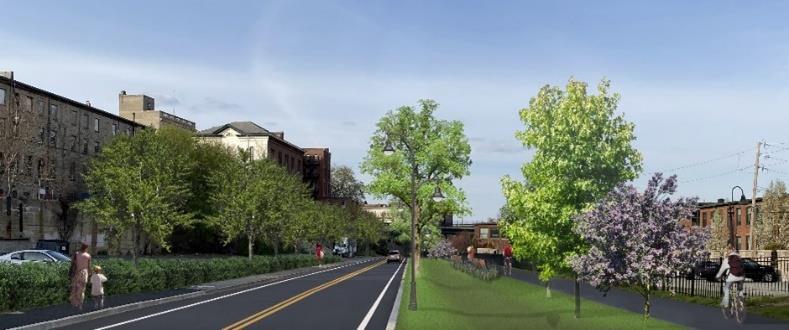
• Paths and Trails
− Walking paths within restored riparian/floodplain areas
− Connections to schools, institutions, and landscapes
− Connections to future Hartline MultiUse Trail
• River & Stream Crossings
− Potential replacement of undersized or restrictive culverts
− Flooding, erosion, water quality, recreational and wildlife passage
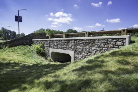
EVALUATE RIVER CROSSING FOR REPLACEMENT
TRAIL CONNECTIONS
WALKING PATHS IN RESTORATION AREAS
SUBSURFACE
STORMWATER STORAGE
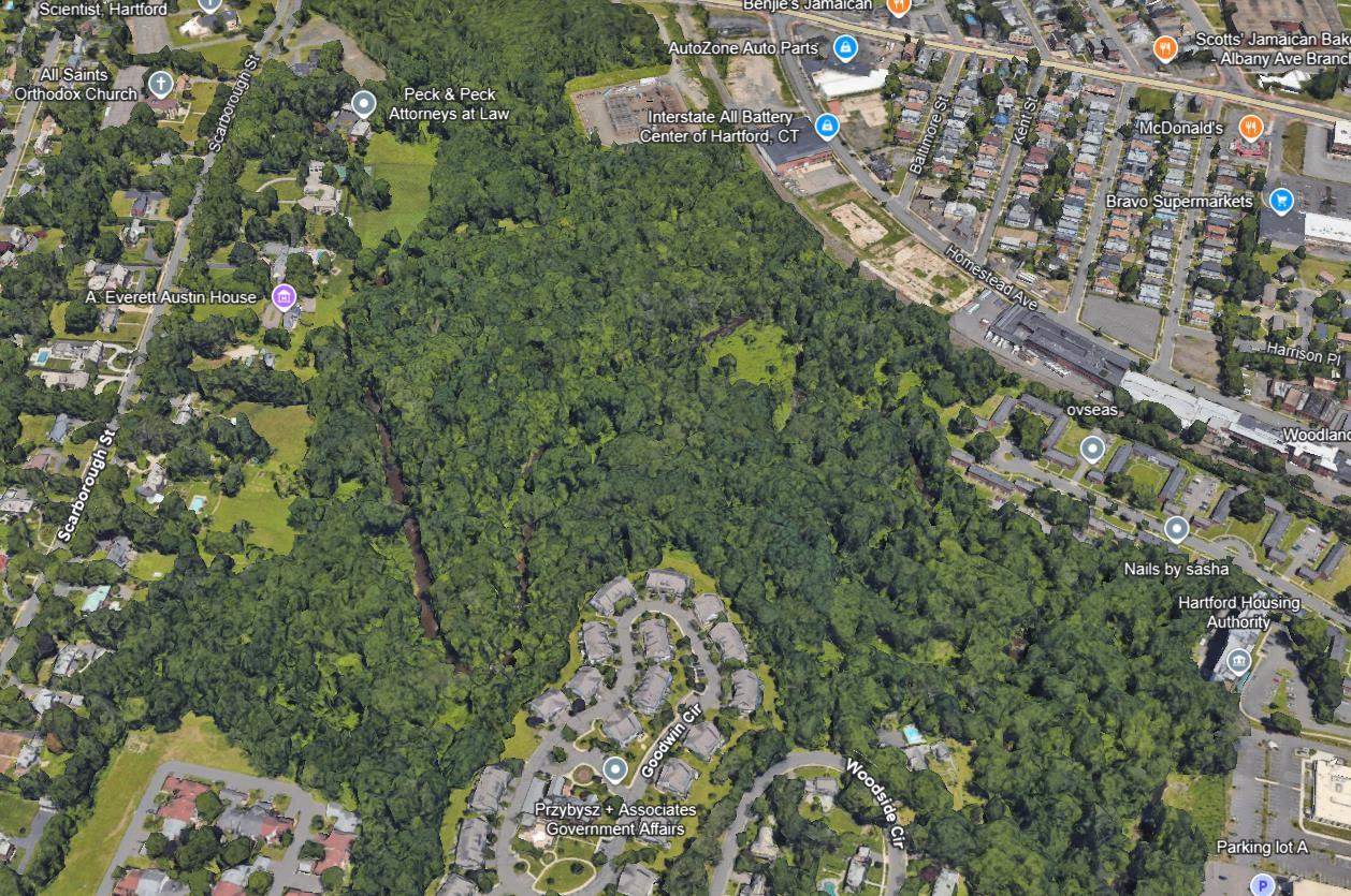
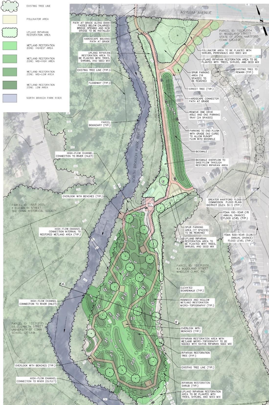
FLOODPLAIN RESTORATION WITHIN EXISTING PARKING LOTS

WOODSIDE CIRCLE GOODWIN CIRCLE


WALKING TRAILS / LOOP
POLLINATOR GARDEN
LAND CONSERVATION


CONNECTICUT MUSEUM OF CULTURE AND HISTORY

EVALUATE EXISTING STREAM CROSSING (TYP)
CSO N-10

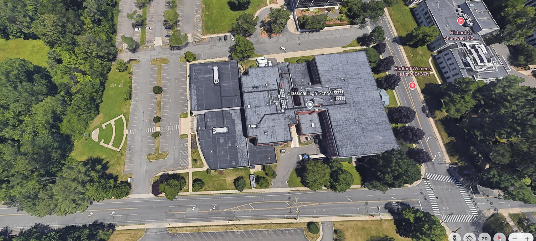
CLASSICAL MAGNET SCHOOL

CONNECTICUT COMMUNITY COLLEGES


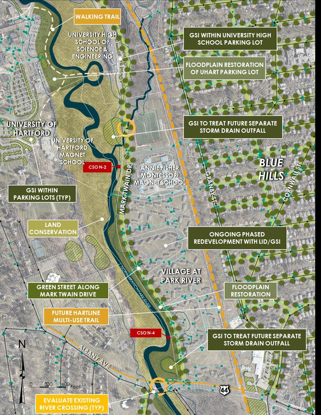


Concept Design Packet:
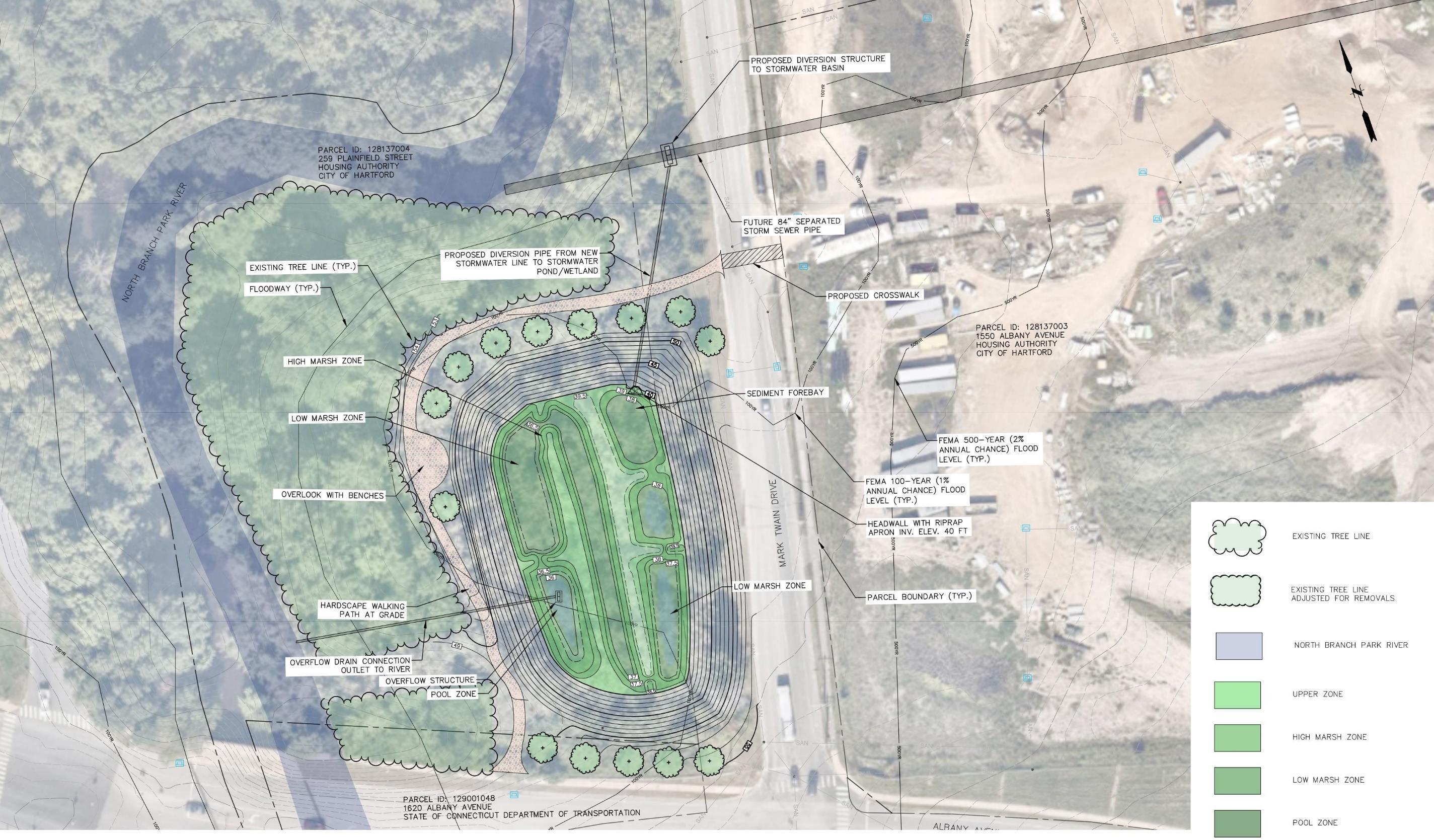
• Stormwater Parks (sewer separation)
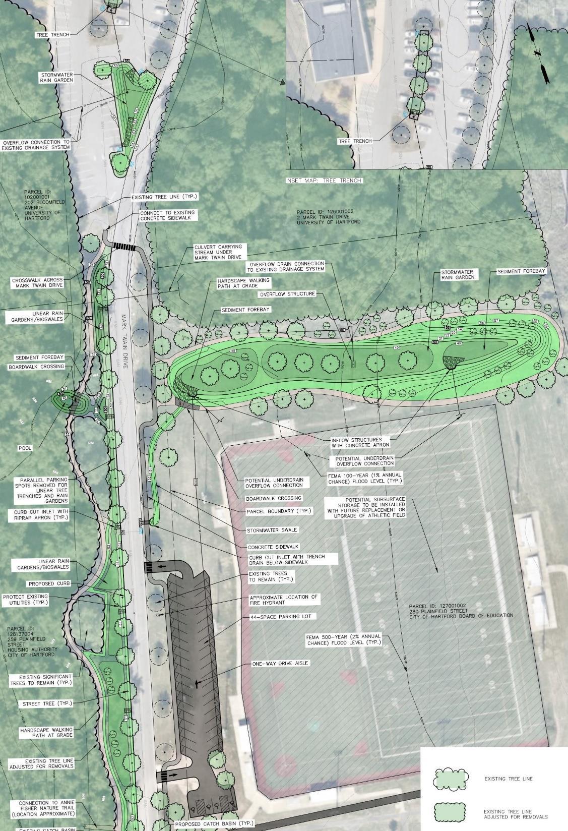
• Mark Twain Drive GSI (Green Street)
• Trail Connections
• UHART Parking Lots
Floodplain Restoration
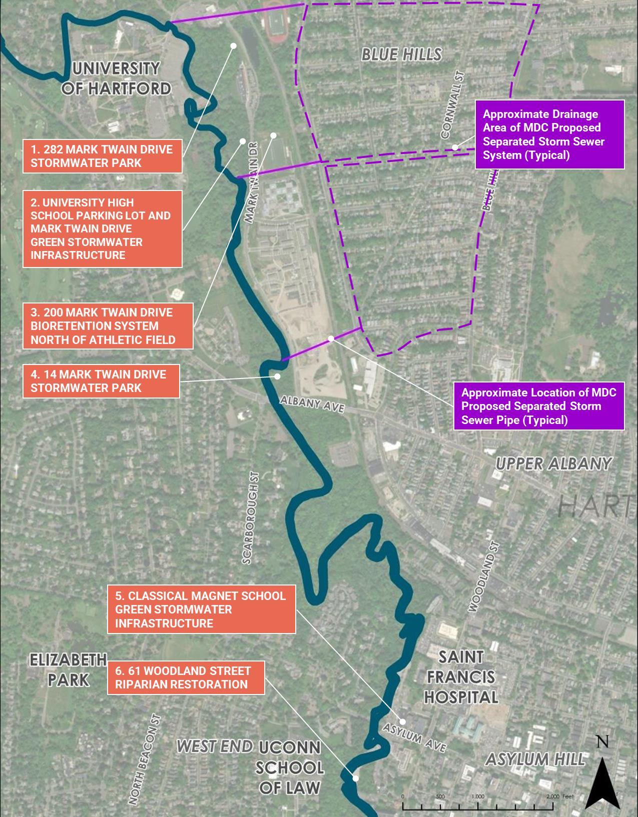
• Future Separated Stormwater Outfalls
1. 84” outfall near Tower Ave / Weaver HS
2. 72” outfall between 227 and 233 Granby St (previously designed and permitted “Granby 1”)
3. 72” to 84” outfall from 45 Granby St: Westbrook Village easement or pumping station with force main
• Off-line stormwater ponds/wetlands at outfalls (“stormwater parks”)
• GSI within upgradient neighborhoods
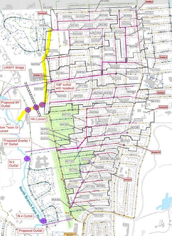
• Manage stormwater for a large area
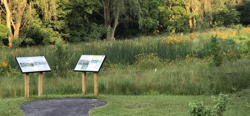
• Recreational and learning opportunities for the community
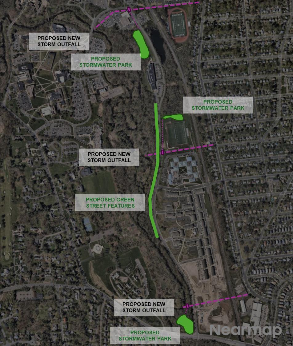
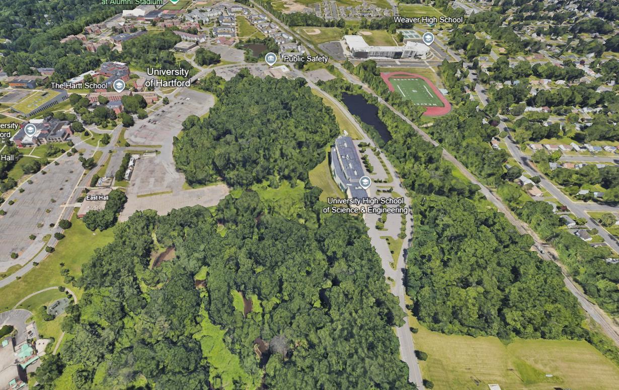
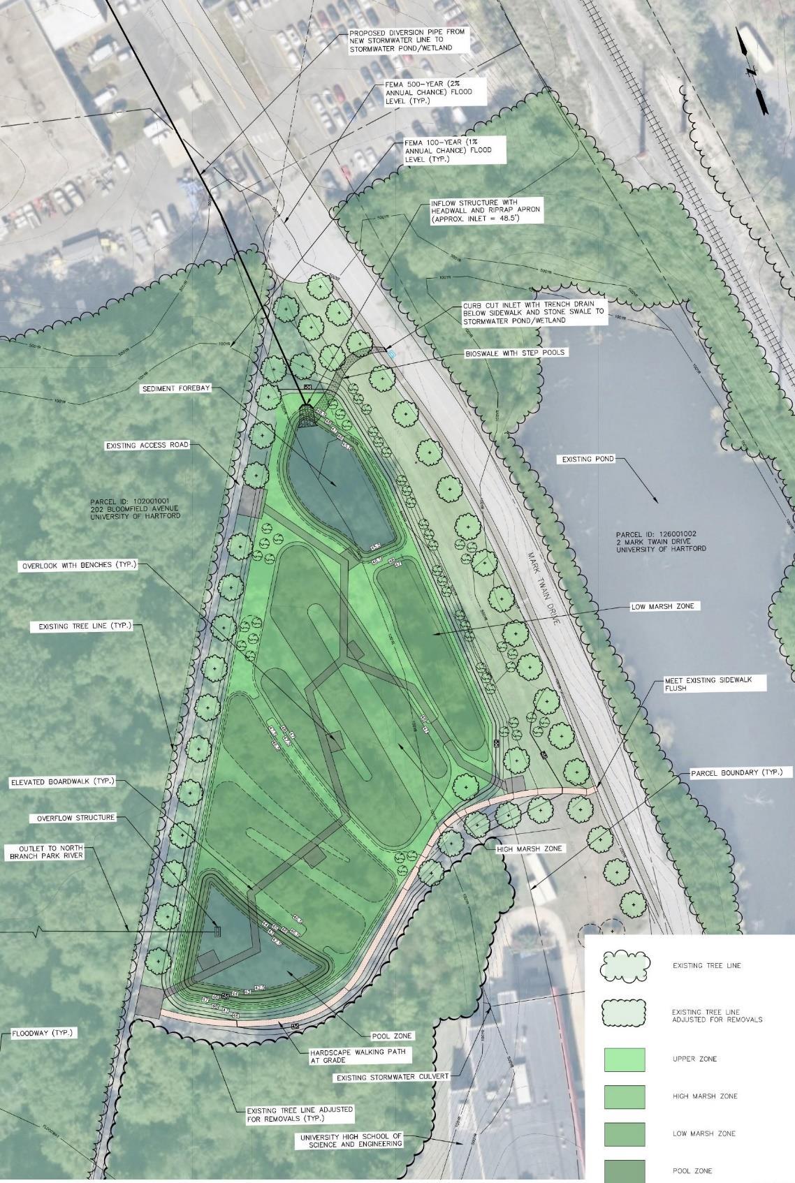
• North of University High School of Science and Engineering
• Divert portion of runoff from potential new 84” stormwater outfall
• Stormwater pond/wetland system designed for water quality
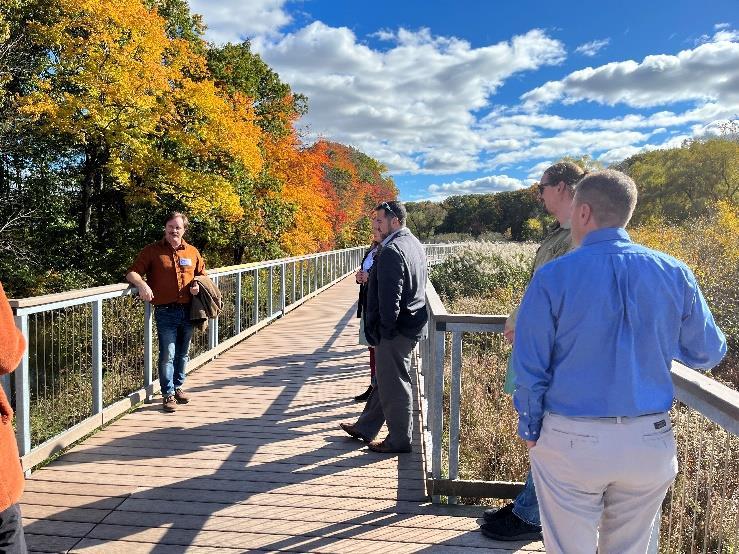
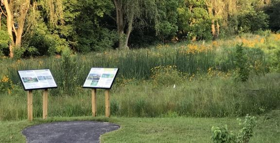
• Raised boardwalk, walking paths, overlooks, learning opportunities
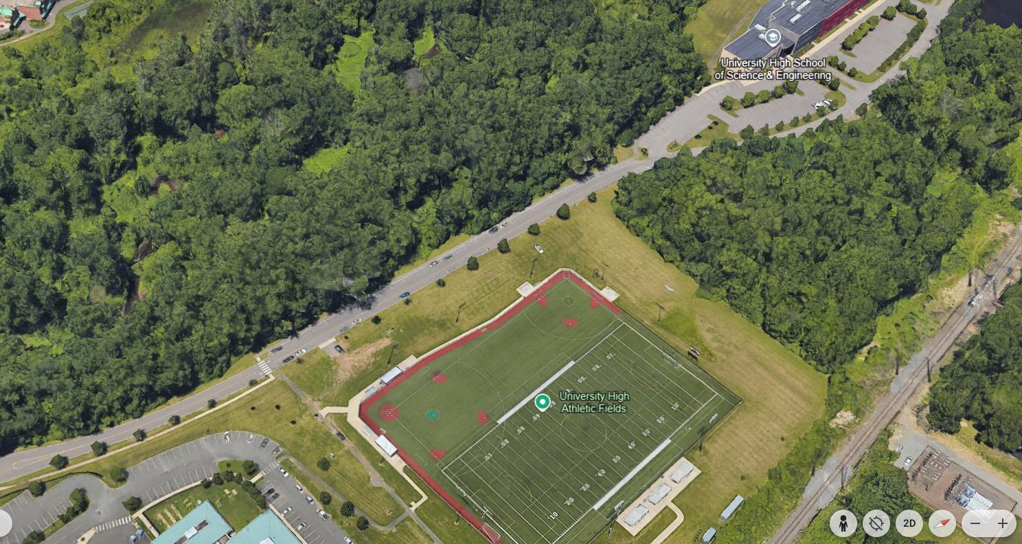
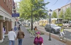
Mark Twain Drive Green Street
• Tree trenches and rain gardens
• Annie Fisher Nature Trail connection
• Relocate on-street parking for UHSSE athletic fields
• GSI at University High School Athletic Fields site
• GSI in University High School parking lot islands
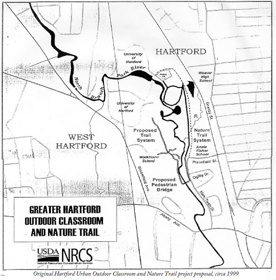
• Annie Fisher Nature Trail
• Built in 2000 as an urban outdoor classroom and nature trail
• Re-establish trail with connections to Mark Twain GSI, stormwater parks, and UHART main campus across the river

• 1857 Central Park
778 acres
New York City
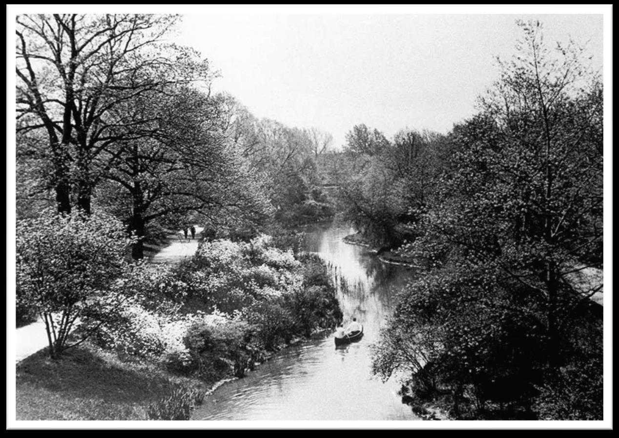
• 1880 Emerald Necklace
1,100 acres
Boston
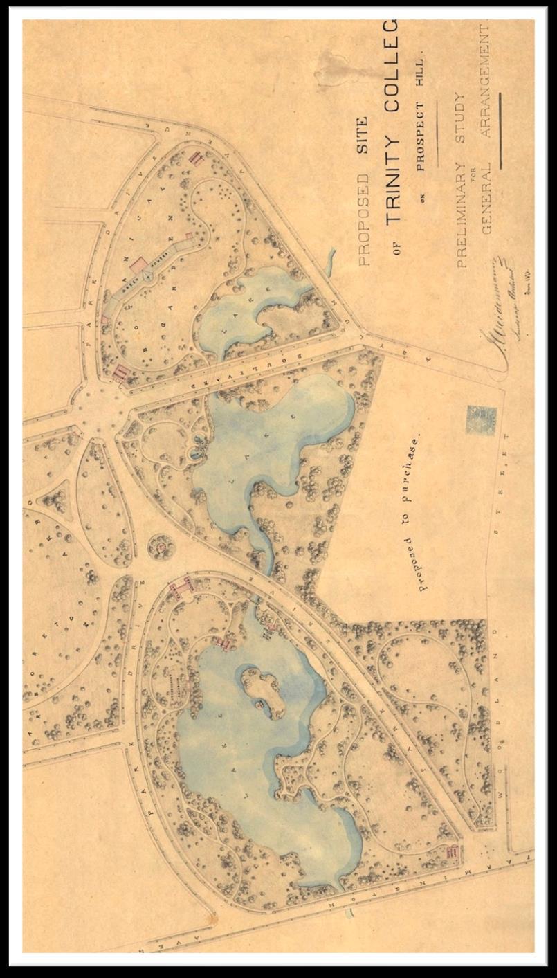
• 1871 recommendation letter to Charles Pond North Branch, Hartford
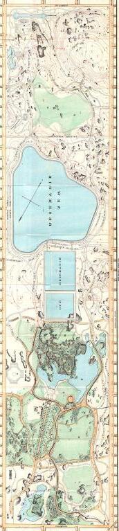
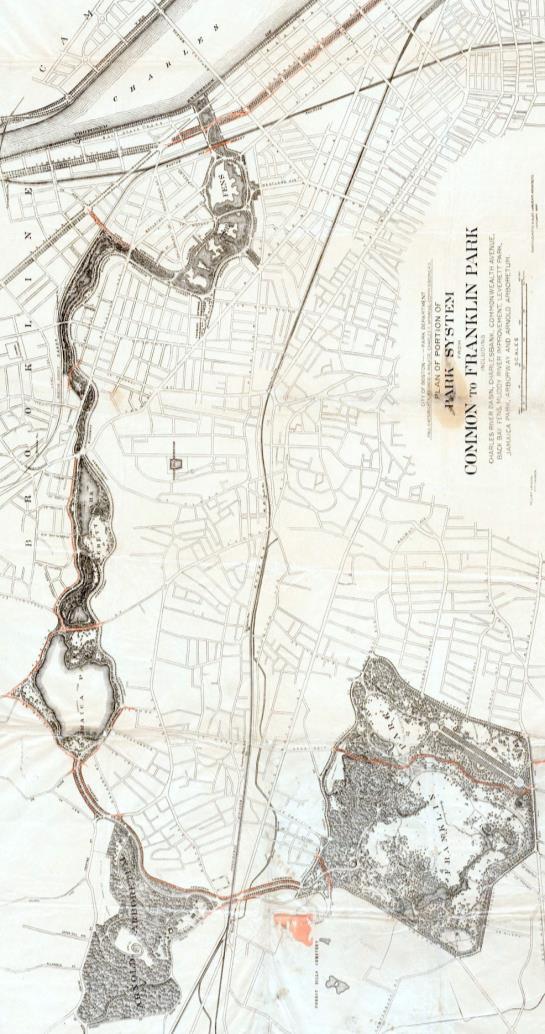
Central Park Emerald Necklace
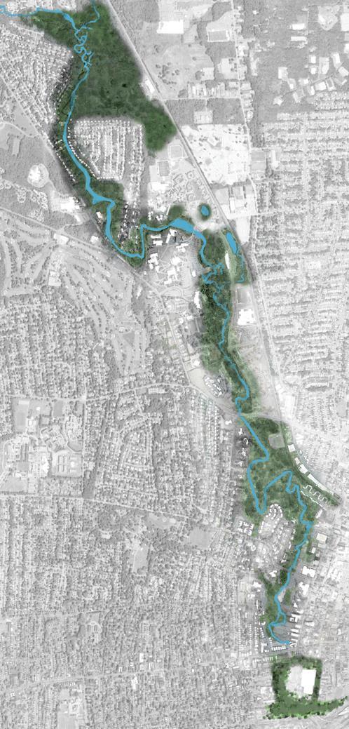
North Branch
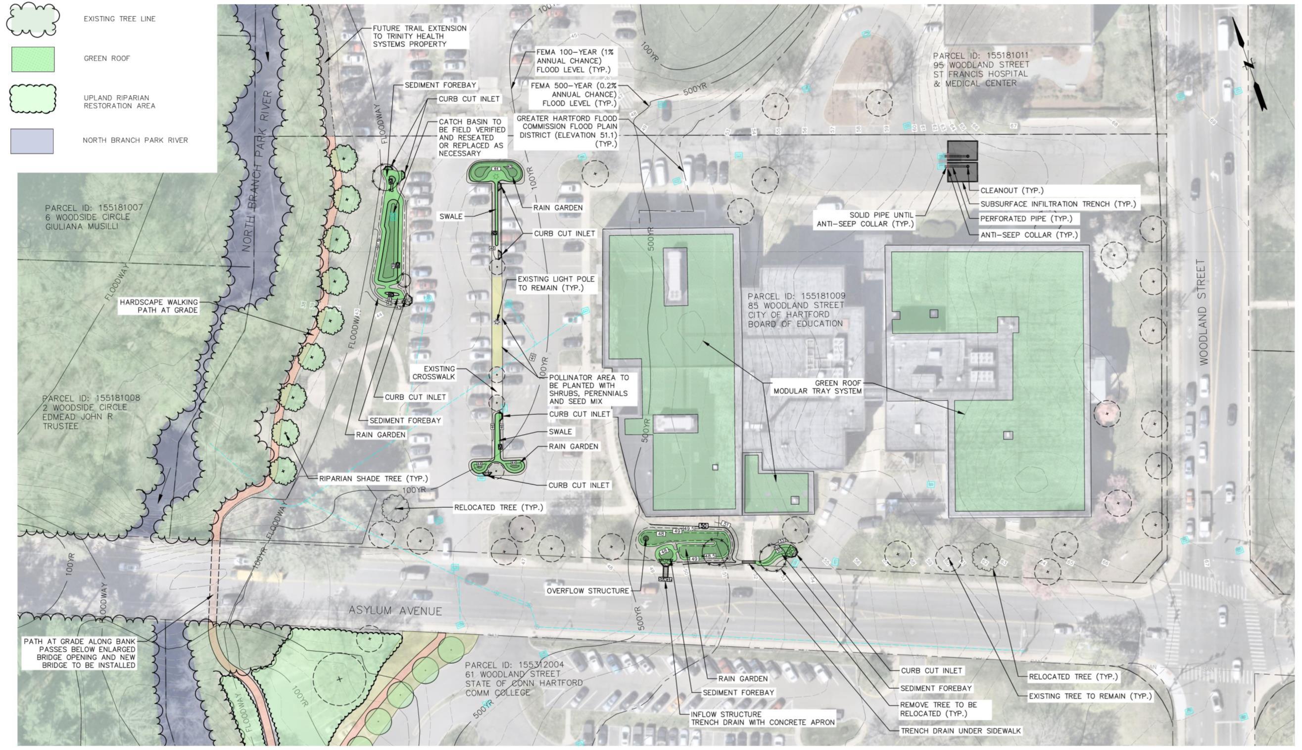
• Green Infrastructure Design Development
− Permit-level design (61 Woodland Street Riparian Restoration)
• Complete Watershed Plan Update
− Draft available by end of December

− Today’s community meeting (12/4)
− Project Partners & Advisory Committee Meeting (12/13)
− Watershed survey (open until 12/8)
North Central Conservation District
Contacts: Joanna Shapiro jshapiro@conservect.org
Erik Mas, PE erik.mas@fando.com
Akta Patel, PE akta.patel@fando.com
Andrew Bohne, RLA andrew.bohne@fando.com
Mary Rickel Pelletier maryp@parkwatershed.org
Brian Martin Brian.Martin@tpl.org
Cally Guasti-O’Donoghue cally.guasti@tpl.org