Theme: Vulnerability and need

(Reviving communities: Sustainable Urban Regeneration)
2487121 ARPL3034
COURSE FACILITATORS: AMANDA WILLIAMSON, JEAN PIENEER, AJIBOLA OLUFEMI
MAPPING STUDIO : NTUTHUKO MZIMELA
‘South African’ cities and regions face massive spatial challenges that reflect on the complex legacy of inequality of urban amenities , spatial fragmentation and economic exclusion. Vulnerable communities often have cases of finding themslves marginalized , lacking the required access to basic services , infrastructure, and opportunities for for upliftment. According to (Rakode(2002 ), Households or individuals are considered poor when the resources they command are much insufficient to enable them to consume goods and services to receive adequate level of welfare. Livelihood assets such as land, water, and transport are only reiliable when the mechanisms put in place to protect from shocks that disrupt the flow of these capitals . The issues and challenges faced by not having these mechamisms are compounded by the rapid increase in urbanization, and ineffcient spatial planning. The Lefelo Spatial Development framework is not just a statutory document but argues that settlements are vulnerable because they do not utilize existing land-uses for security in livehoods, therefore such neglects give rise to unemployment and that in turn people to various forms crime across the different settlements to feed themselves.’
The Lefelo Spatial Development Framework will aim to address and provide a long-term spatial narrative and vision that will foster development to acheive the required growth regarding the project area. Lefelo SDF will build on significant spatial justice components and provide new solutions.
It outlines how land and resources should be used to support sustainable development, economic growth, social equity, and environmental protection. The SDF aligns with national and regional policies and serves as a key tool to guide decision-making on land use, infrastructure development, and investment priorities.
Key objectives of an SDF include:
Spatial Transformation: Addressing historical spatial imbalances, such as segregated or inefficient urban forms, and promoting more inclusive, integrated, and equitable cities.
Sustainable Development: Balancing urban growth with environmental protection and resource management, including minimizing sprawl and protecting natural ecosystems.
Economic Growth: Identifying areas for economic development, investment, and infrastructure that will support job creation and economic opportunities for residents.
Infrastructure Planning: Guiding the provision of infrastructure such as transport, water, energy, and waste management in a coordinated and cost-effective manner.
Improved Livability: Ensuring the creation of welldesigned, connected, and accessible neighborhoods that offer a high quality of life for residents, with access to social services, public amenities, and public transport.
PROJECT AREA CONSISTS OF THESE NUMBER OF WARDS :
CoJ( City of Johannesburg): 32, 80, 81, 105, 109, 110 .
CoE( City of Ekurhuleni): 12, 13, 17, 18, 19, 104.
H a l f w a y H o u s e
n d a e P a k
K a a o n t e n R a b i e R d g e
I v o r y P a r k

K i p f o n t e n V e w A u s t o n V i e w
F e n d s h p T o w n E s t a e
S e r e n g e E s a e s
L a k e s d e
M o d d e r f o n t e n


A s h w o o d B o u e v a r d E s t a e
L a S a e E s a e s
K e m p t o n P a r k
DEFINITION: The theme is in the project area in urban planning focuses on identifying and addressing the specific challenges faced by vulnerable populations. It involves analyzing how social, economic, and environmental factors disproportionately affect certain groups and working towards solutions that reduce inequalities and promote inclusive, resilient communities in Gauteng.
Identifying Vulnerable Groups/Environment :
Vulnerable individuals, groups and most especially marginalized groups such as low, middle, high income households, elders, discriminated women, children, and other communities that disadvantaged from across South Africa. It can be noted that the mentioned group has less access to resources, services, and opportunities, and are more exposed to risks like crime, unemployment, lack of urban ameinities uch as ( school, housing, hospitals etc), and hazards that are environemntal degrading.
Basic Service Access:
Ensuring that vulnerable populations have equitable access to essential services such as healthcare, education, water, sanitation, and energy. Many vulnerable groups live in underserved areas where basic services are either inadequate or completely absent.
Adequate housing and shelter:
Poor-quality housing, informal settlements, and homelessness are often central to the vulnerabilities of certain urban populations. Addressing housing needs through affordable, adequate, and secure housing is critical to reducing vulnerability.
Livelihoods and employment opportunities:
Many vulnerable groups face barriers to employment, making it essential to create pathways to economic opportunities. This includes job creation, skills development, and access to social safety nets for those in precarious employment.
Safety and Crime:
Vulnerable groups often live in areas with poor public health infrastructure, limited healthcare access, and higher exposure to environmental hazards (e.g., pollution, flooding). Addressing these concerns requires targeted public health initiatives, improved healthcare access, and disaster risk reduction strategies.
GOAL: The goal to addresss vulnerability and need in Urban Planning is identifying area that more in need to reduce in that social, economic, enviornmental and political inequalities , improve resilience, and ensure that the most disadvantaged populations have access to resources and opportunities.


The sustaining of grassland requires careful cosideration in planning to not continue expand vulnerability and need (Ndude, 2024).

Informal Housing that spreeds across various settlements in the proejct area( Ndude,2024) .
METHODOLOGY: The theoritical framework that was used to guide the reaserch and compiling this reporting was:
Vulnerability and Risk Mapping : This report uses Geographical Information System (GIS) to identify areas which identified areas that are prone to risks of floods, social exlusion and safety fo communities in regards to adequate housing and shelter. This framework uses spatial data such as Riverlines, Demographical data amd hard infrastructure networks.
Another framwork that was used was Sustainable Livelihoods Framework(SLF) which focuses on how various factors affect individuals by evaluating how drought impacts farming communities and their adaptive capacities through interviews , focus groups and households surveys to understand how the study area works.
METHODES:
Census(2011, 2022):
The systematic collection of the demographic, social and economic data for the population in South Africa every interval of 10 years has provided information regarding population size, households, emplyment levels, income and basic service access. I used the data to understand socio-ecnomic vulnerability by analyzing poverty rates , hosuing needs and identfying areas of need.
Legislature/Policy/Guidelines /Policy Assessment:
The usage of these various documents has allowed the report to meet local standards fo what is require dof the study area and as well not to breach the demands of local municpalities seeking to address the notion of vilnerability and need of comminties. This allows the report to analyse the gap and conflicts in legislation that will affect the planning process.
Spatial Analysis: The usage of GEOGRAPHICAL INFORMATION SYSTEM (GIS):
This tool was significant in using technology to collect , visualize and analyze spatial data. This helps graphically showing whre these various data sets are located on the ground and understand the scale of the study area.
Fieldwork/ Site Visits:
The diirect observation and data collection on-site to further undertsand various local conditions or the lived experiences of various demographics in area.s The project was conducted at Malboro Station, Austin View, Rabie Ridge, OR Tambo Airport and Kempton Park.
Literature:
The academic and professional writings, books speak relevant to the topic of the study area. It also draws years of reaserch such environemntal impacts, and socio-economic vulnerability

A graphical collage of the instruments used to reaserch for the development of the Spatial Development Framework( Census(2011, 2022) , Legislature/Policy/Guidelines /Policy Assessment, Fieldwork/ Site Visits and Literature. ( Ndude, 2024)
Breaking New Ground (BNG) (2004)
Addressing Housing Backlogs:
Accelerate the provision of affordable housing to meet the demand of low-income and vulnerable populations, reducing homelessness and housing insecurity. This mandate is essential to know about so that study area to ensure adequate housing is allocated near ancillary land-uses( ).
Gauteng Spatial Development Framework (GSDF) (2011, 2030 version)
Sustainable Urban System:
Develop green spaces, promote energy-efficient buildings, and implement sustainable waste management practices to enhance urban sustainability( ).
Gauteng City Region Strategy (GCRS) (2011)
Polycentric Development:
Develop multiple urban centers within the Gauteng region to distribute economic activities and reduce pressure on a single city, enhancing accessibility for all communities( ).
Johannesburg IDP
The city focuses heavily driven by high unemployment rates ( with youth unemployment sowhere at 53.%) and over 50% of residents live below the poverty line. The city aims to foster more inclusive and sustainable urban spaces by prioritizing infrastructur investments and job creation. Key interventions are public Safety , addressing crime and water reliability( ).
Ekurhuleni IDP
The approach to vulnerability in the metro focuses on adressing the needs of infromal settlements through equitable access to services , housing. Overall Ekurhuleni priotizes infrastrcuture maintenance better health and to withstand enviromental issues such rivers polluted ( ).
Municipalities
City of Johannesburg
The study area makes up portion of both City of Johannesburg and City of Ekurhuleni
The Framework will be of significant importance for addressing key issues and to guide sustanbale development in our project area. The framework seeks to balance environemntal conservation with urban development by allocating various control zones to guide devlopment while considering the ecological sensitivity and developmental pontential.
There are only three key zones withi the study area:
1. High Control Zone ( Within Urban Areas) . The zone in this study area limits most development actvities to proec sensitive ecosystems, areas such as ( Frankenwald site, Modderfontein and OR Tambo Airport). The requirement of development will allow only conservation -related actvities and sustaiable tourism
2. Urban Development Zone: This is often siutuated in urban areas, It encourages densification and urban infill to create to develop regions that are compact and thus reducing the spread of urban sprawl in rural areas. Majority of the study area consists of this zone and thus allows us to upgrade existing informal settlements and provide urban amenities such as Schools, hospitals and clinics.
3. Industrial and Large- Scale Commercial Zone: Although there is a notion that industries are produce amounts of pollution, howver it promotes non-polluting industries and commercial actvitiies that reduce pressure on undeveoped spaces. Examples The Cradle of Humankind , Dinokeng Tourism region.
When viewing the different zones in regards to the study area:
The balance between economic development and enviornmental conservation is vital for protecting natural ecosystems while accomodating growth in existing or non-existing settlements. Areas that designated within zones that overlap with conservation or ecological importance( Enviornmental Impact Assessments will be required to esnure non-sustainable development is prohibited or limited with density measures.


Current housing backlog : 20185
Space required for development: 377460

There is a signficant number of people who are not schooling and therefore adressing this issue is critical.

When comparing the primary sectors and secondary sectors, the tertiary sector distributes most employment in Ekurhuleni in a larger margin. Starting from the year 2015 up until 2019, there has been an enormous increase in employment from this sector. This is a result from population growth, which has increase the demand for tierary sector services such as schools, hospitals. The tertiary sectors which are Finance, insurance, real estate and business services receive the most employment out of all sectors in Ekurhuleni.The lowest incubator in tertiary sector far exceeds the all other sectors in primary and tertiary sector. The reasoning being is that the city is transforing to a first class city, this indicates that municipal offcials are promoting tertiary sectors through investments in education, tourism and IT) due to the mass development of such economics. Therefore priority in this sector is essetial to liberate people from poverty and mitigation of crime. The expansion of people moving to cities, the demand for these services due to people’s con
sumption of tertiary goods and services over raw materials.
INFORMANT MAP: IDENTIFYING KEY ISSUES

Population growth rate: 1.6%
The population in 2024: 479274, 2025: 486942
2045: 658351

Number of Households in 2024: 180042 2025: 182742
2045: 246127
Household size: 3

The same comparisons in the City of Ekurhuleni applies to the primary sectors and secondary sectors, the tertiary sector distributes most employment in Ekurhuleni. Starting from the year 2015 up until 2019, there has been an enormous increase in employment from this sector. This is a result from population growth, which has increase the demand for tierary sector services such as schools, hospitals. The tertiary sectors whic are Finance, insurance, real estate and business services receive the most employment out of all sectors in Johannesburg. One of the lowest incubator for unemployment is the primary sector, particulary Agriculture, Forestry and fishing. The reasoning being is that the city is focusing on the economic aspects of development, prioritizing economic margins to ensure smooth running and managing built infrastructure. Our study area is occupied by industrial developments and this casues people to not get jobs and be vulnerable. Having limited access to economics essentially allows locals to not afford urban amenities such as shops, hospitals, clinics, schools and so forth. This site presents an opportunity to address the existing primary land/ seconday land-uses that do not fully absorb people to get jobs.
When the study area experiences various crime reports across locations of varying income levels, housing backlog and degradation of the enviornment , all these challenges are deeply interconnected. When addressing these issues, it requires a nuanced urban planning approach. The crime reports are often linked to means behind the poverty line , increased levels of unemployment and historical segregation fo settlements. The various crimes include common assualt , gang activity , robbery reflecting unmet socioeconomic needs( education, schools, hospitals. Another issues with settlements such as Alexandra, Edenvale, Croydon and Tembisa is the poor urban design features ( lack of street lights or public spaces. Crimes such as housebreakings are typically targeted towards resdents in wealther communities with a mix of shops, schools ,clinics).This showcases the deep-rooted spatial injustices casued by the Group Area Act of 1950.
The housing backlog is forcing individuals to migrate in infromal settlements( The place-holding taking place in Austin View case). The overcrowding of urban amenities exacerbate social tenstions which will lead to higher crime rates. The illegal dumping often worsen living conditions, especially settlements such as Swetja. Johannesburg is a dry global city and therefore perservation of biodiversity of


Different layers of the key issues highlighted


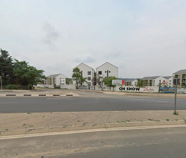
After viewing the current and future trends of the project in regards to population growth, number of households and size, it can noted that it is crucial to propose a vision that addresses this gradual growth of these factors. The 2024 spatial vision for Alexandra prioritizes on reviving communities through sustainable urban regeneration focusing on creating a spatially inclusive and economically viable future for all its residents. By addressing the key issues of informal housing, service delivery, economic opportunity, and public space creation, Alexandra is envisioned as a model of post-apartheid urban renewal, with improved living conditions, enhanced social cohesion, and expanded opportunities for economic participation. Through state-driven infrastructure investment and community-led initiatives, Alexandra, Austin View, Kempton Park, Germiston and other areas will become a beacon of transformation within Johannesburg’s urban landscape.
In 2024, a core component of the spatial vision is the systematic upgrading of informal settlements. The regeneration program focuses on providing formal housing for current residents, reducing overcrowding, and improving the living conditions in line with government policies such as the Breaking New Ground (BNG) housing program. The key interventions include the provision of affordable, high-density housing: The development of medium-rise apartment blocks replaces the informal shacks, ensuring proper sanitation, electricity, and water connections for every household.
After much consideration and looking at all relevant policies, guidelines, frameworks, site analysis and generation of scenarios, the vision on the development will be guided through ‘Reviving communities: sustainable urban regeneration’. After much careful consideration, to achieve such a vision requires the following principles to guide its intent and provide a technical range of means within the study area and these principles inform what is desired to occur in the project area.

1. Compact Development (Promote higher density development with a mix of land uses, including residential, commercial, recreational, and institutional activities in proximity to one another. The usage of zoning regulations and land-use policies to incentivize development that includes diverse uses in both central and peripheral areas.)
2. Transit Oriented Development: It is essential for the focus of development to be in close proximity to public transportation stations and routes to create transit-oriented communities that prioritize accessibility to public transport over car use.The intensification of existing routes, with mixed-use zoning to create vibrant, active areas that encourage public transport use. Provide affordable housing options near transit hubs to ensure that all socioeconomic groups benefit from public transport access.
3. Green infrastructure: It is essentially a strategically planned network of natural areas which are designed to manage to deliver various ecosystems services such water purification, provide space for recreation and enhancing biodiveristy . Protect natural ecosystems conserve biodiversity by incorporating green belts, urban parks, wetlands, and rivers into the city’s spatial layout. The upgrading of informal settlement upgrading and recognize the rights of informal traders in planning decision and incorporate affordable housing within welllocated areas to prevent segregation and urban inequality. Ensure equitable access to public spaces, healthcare, education, and employment opportunities in all parts of the city.
The hybrid urban model will be used for the Lefelo SDF of our project area is combining all the models together 1. Polycentri city, 2. Lefelo model, and 3. multiple nuclei—produces a multi-centered city with linear connectivity. It is designed to accommodate efficient transportation, functional specialization, and decentralized growth while maintaining economic diversity and equitable access to services. It works particularly well for large, growing cities with strong infrastructure systems


Current housing backlog : 20185
Space required for development: 377460 sqm
Number of Households in 2024: 180042
2025: 182742
2045: 246127
Household size: 3
Population growth rate: 1.6%
The population in 2024: 479274, 2025: 486942
2045: 658351

upgrading of informal settlement
BACKGROUND:
Cata is located in the former Ciskei bantustan of the Eastern Cape Province. The province is one of the poorest in South Africa with up to 68.4% living in poverty in 2002, an increase of appoximatly 14% since the year 1996. The former homeland areas constitute the greatest single development challenge facing South Africa. They are dysfunctional spaces that have been excluded and marginalized from functional South Africa. Their exclusion from the franchise was addressed in 1994 but in all 1 other ways (politically, economically, socially and environmentally) they remain on the margins (Livelihoods Connect 2008).
Key acheivements in the implementation of the rehabilitation of Cata:
The area produced about 250 new local jobs have been created through development projects since 2003/4. In the process, (apart from the multi-purpose community centre and school classrooms) the following projects have been successfully implemented:
• Conversion of a seventy-five hectare wattle jungle into a managed plantation;
• Introduction of new homestead agricultural techniques to promote food security;
• Rehabilitation of a defunct flood irrigation system;
• Opening of museum and heritage trail.
These projects have been implemented using different institutional models (eg community teams aided by outside experts, external service providers utilising community labour, etc), but 3 all these models have been characterized by an explicit commitment to maximize local job creation and skills enhancement and to build institutional capacity at local level.

Figure : ( https://www.nda.org.za/, 2024)
A study was done by () and the findings show that the Modderfontein has a mix of planted and natural grasslands. This case showcases that their is a pontential to manage floods risks through soil abosrption and supports cooloing effects of nearby areas such as Asutin View, Buccleah and other settlements.
The key success of the study was identifying the importance of enhancing the biodiversity of the area. The area consists of exotic and herbaceous plants which do not benefit the overall area.
These measures and strategy include ecological network s that can mitigate urban heat islands , water flow regulation and store carbon effciency.


BACKGROUND:
According to the study done by Atcheson,( ), Modderfontein benefited from early remediation efforts before redevelopment. Modderfontein is considered as a brownfiled site which was previously underutilized or non-environemtal friendly.


Legend study area
Roads outside Site Boundary type of roads motorway motorway_link primary primary_link railways NFEPA RiversLine natural
Types of natural features forest park water
Existing land- zones
Gautrain_Stations_Proposed Slimes dams
Semi industrial zone
BUFFER RADIUS
Light Industry ( Agro processing, OR tambo, Existing development
Captitalization of existing road networks mainly M85, N3, M9 , R101,R561 for Medium/High Density Housing.
Rehabilitation of existing open space for agricultural activity.
Usage of Innovation Hub to ensure skills development
Introduction of Commercial facility such as a theme park to provide employment and entertainment, mainly M11,M60.
OR. Tambo International Airport
MINIMUM - 500m SLIMES DAMS OR_Thambo_Airport Rail_Stations
BRT Randburg OR Thambo Stations Stops
Improved land actvities
Rehabilitated Public Open Space
Wetland Regenaration
Artificial wetlands
Proposed land actvities
Convert abandoned wetlands in nearby parks into tourism attraction to increase property value
Medium Density Housing: Apartemnt complexes , Townhouses, Duplexs and Clusterhomes (397460 (sqm) space
Innovation hub ( T-Vet, Innovation academics, Public art Instillations
To promote compact development in these area particular area:
Ivory Park , Alexandra, Rabie Ridge, Wendywood, Marlboro Gardens, Far East Bank Ext(s), Sejwetla, Klipfontein View, Bramley View, Kew.
The promotion of existing infrastructure networks ( roads, water, and as well as sanitation by upgrading to accomodate new housing, retails, agricultural. The density should occur approximatly 500-1200 m or 10-20 minutes from local hubs . The push of a compact city requires the increase in density and should contiuing maintaining the natural environments.
Using Woodmead, Midrand, Greenstone and Balfour as existing commericial anchors, the new proposed hosuing will benefit which will decrease travelling costs and reduce time
Rehabilitated Public Open Space
In these areas, this proposal will benefit all areas, particulary : Chloorkop, Kempton Park CBD, Spartan, Isando, JetPark Rietfontein, Jansen Park, Edenvale CBD, Sebenza
The proposal of urban parks, green roofs and community within dense neighborhoods and promotion of community gardens and gardens that are vertical on buildings ( this reduces heat islands and to manage minor or major rainwater.
Priotization of community gardens contribute to the production of local food security and these imporve access to fresh produce and increase employment. The requirement of green roofs on these settlements will capture rainwater, improve the insulation and the reduction of runoff.
Industrial settlements like Longmeadow, Commercia, Southern Modderfontein, Wynberg, OR Tambo
TOD ( Hotels, restaurants)
Infill Development( BNG, primary and high school, clinic, retail, agricultural gardens
The need to update local zoning ordinances to permit commercial, residential and spaces that are public within the same district or local precinct scale.
The speciffic Area Ratio to encourage higher density developments around transit hubs.( minimum 2:1).
The usage of the inclusionary housing policy for CoJ will be equitable for the study area. The threshold of developments with 20 or more residential units must allow for 30% of the total units must be allocated to inclusionary housing.
1. Private bathroom
2. Must have minimum of square meter of habitable space per person and minimum of 18 square meter per unit
3. It must have the same outward appearance as the market units in the development.
4. The inclusionary housing units subject to half of the parking requirements
The requirement for this proposal will be predominatly in Kempton Park, Klipfontein View, Rapie Ridge


The inclusionary housing policy is vital for the intergration the transit orientated development for the Lefelo Development Framework (Coj,2024)


Legend study area
Roads outside Site Boundary type of roads motorway motorway_link primary primary_link railways NFEPA RiversLine natural
Mixed Housing Models
27000 dwelling units per hectare ( 100 sqm per dwelling)

Types of natural features forest
Existing land- zones
Gautrain_Stations_Proposed Slimes dams
Semi industrial zone
BUFFER RADIUS

Light Industry ( Agro processing, OR tambo, Existing development
Apartment complexes , Townhouses, Duplexs and Clusterhomes for social housing : 397460 (sqm) space (City Of Johannesburg, 2024)
MINIMUM - 500m SLIMES DAMS
OR_Thambo_Airport
Rail_Stations
OR. Tambo International Airport

BRT Randburg OR Thambo Stations Stops
Improved land actvities
Rehabilitated Public Open Space
Wetlands attraction Artificial wetlands
Commercial Zone

( T-Vet, Innovation academics, Public art Instillations (Google, 2024)
Research and development spaces for technology incubators, entrepreneurial accelerators, and mentorship programs. (200000 square meter)


Atcheson, N. R. (n.d). Success factors for urban brownfield developments in Johannesburg, South Africa
Atcheson, N. R. (2021) . Ecological corridors and ecosystem services: Potential for climate change adaptation in Johannesburg, Gauteng.
Atcheson, N. R. (2021). The social vale of small wetlands: Lessons from Modderfonteinspruit in Ekurhuleni, South Africa ( Masters dissertation ). University of the Witwatersrand, Johannesburg.
Ballard, R, et al. ( 2017). Megaprojects and urban visions: Johannesburg’s Corridors of Freedom and Modderfontein
Livelihoods Connect. (2008). Sustainable livelihoods highlights 2008. Institute of Development Studies (IDS). Retrieved from Livelihoods Connect.
GAUTENG PROVINCIAL ENVIRONMENTAL MANAGEMENT FRAMEWORK (GPEMF) ,Gazette 41473: Notice 164 of 2 March 2018: Publication of the GPEMF Standard for Implementation
Mokhele, M.( 2017). Spatial economic evolution of the airport-centric developments of Cape Town and OR Tambo international airports in South Africa


typology

City of Johannesburg per sector