

VISION PLAN CALIFORNIA CABLE CAR TURN-AROUND A Comprehensive Vision & Strategy Plan SEPTEMBER 21ST, 2021

This is a comprehensive vision and future strategy plan for the Polk Corridor Neighborhood to re-imagine and transform the California Cable Car’s Western-most terminus into a new and envigorated pedestrian precinct that celebrates the arrival of the California Cable Car line at Van Ness. This document organizes the present community’s ideas and aspirations for the future of this important gateway to the historic “Polk Gulch” commercial corridor and San Francisco’s Downtown.
This plan is supported by the Polk Corridor Neighbors: Lower Polk Neighbors, Discover Polk, the Lower Polk Community Benefit District, the City of San Francisco, and the people responsible for future changes to this important infrastructural enhancement
The Vision Plan would like to thank the many individuals and organizations that helped make this process and document possible, including the following:
THE RESIDENTS, BUSINESS OWNERS, AND COMMUNITY ORGANIZATIONS OF THE LOWER POLK NEIGHBORHOOD
LOWER POLK COMMUNITY BENEFIT DISTRICT:
Chris Schulman, Executive Director
LOWER POLK NEIGHBORS 2020-2021 BOARD OF DIRECTORS:
Andrew Dunbar, Chair
Drew McDaniel, Vice Chair
April Lacey, Secretary
Daniel Carfora-Hale, Treasurer
Erica Waltemade, CBD Liaison
CITY AGENCIES:
SF Department of Public Works
SF Municipal Transportation Agency
VISION PLAN DESIGN CONSULTANT:
INTERSTICE Architects, Inc.
COVER PHOTO CREDIT:
© Alan Hilditch
2 CALIFORNIA CABLE CAR TURN AROUND VISION PLAN
The Vision Plan that you are holding, is the result of a year-long process of discussions and meetings with neighbors, merchants, with business owners and community stakeholders, involving workshops and community meetings, recording and integrating comments and suggestions - all distilled into a vision that reflects the input and priorities of the Lower Polk neighbors themselves.
This vision document synthesizes ideas derived from a grass roots design collaboration to highlight possible improvements to the California Cable Car TurnAround. It serves as a recommendation and road map for new Amenities that will re-establish a sense of pedestrian place, while emphasizing the importance of this historical Cable Car line.
“…Neighborhood groups want to ‘reimagine’ the Cable Car stop at Van Ness and California...The western most terminus should celebrate its history and be more pedestrian-friendly...”
-Kevin N. Hume, S.F. Examiner
The Lower Polk Neighbors (LPN) has had a long history of activism in promoting a positive pedestrian environment. It is always looking for ways to enhance the public realm of its neighborhood for all its members, residents, and diverse businesses to enjoy and share. Over the course of the past two decades, the LPN has frequently turned its attention to safety and quality of life concerns around its streets and unique alleyways. Within these many discussions, attention had been spent wondering how public infrastructure and investments in ‘place making’ could be harnessed on a larger scale towards personalizing the identity of the neighborhood. These developments will recognize the economic vitality of this unique local mix of heritage merchants, burgeoning new businesses, and an unusually diverse set of institutions that characterize this part of the city – a roughly six-by-two block area that we fondly refer to as the Polk Corridor Alleyways District.
During these discussions, our northern border on California Street repeatedly came up as a sadly underwhelming gateway to our district. There is a Cable Car terminus there, but it is not like any of the others in the city. Unlike its five sister stations in SF, the California Cable Car’s Western terminus (which is the Westernmost in the city) is forlorn and pitifully absent of amenities.
During the past four years, our membership watched as major public transportation infrastructure projects got underway on Van Ness, and major enhancements were made to our Polk Street bikeway and pedestrian realm. Despite these changes, we realized that the Cable Car terminus was not going to get any of the attention it deserved, so we mobilized to initiate an effort to improve it ourselves. As one of our most important public infrastructural assets, the iconic Cable Cars of San Francisco stop is right at our “front” door. We share this portal with another neighborhood association to our north, Discover Polk. At our meetings we discussed, how
we might imagine a better, more pedestrian friendly place for visitors to the Polk Corridor to arrive and explore our neighborhood. Suggestions were made to have a competition or sponsor a design challenge – but we recognized there had to be a better way to turn around this heritage urban transport hub from a drab pseudo bus stop to something the neighborhood would be proud of.
In the same way that the LPN wanted to plan ahead for better Alleyways, we now talked about how we might gather the community to explore what they would like to see at this shared “classic SF landing pad.” Creating a vision for the Cable Car turnaround, together, with the community, became our goal.
The Lower Polk Community Benefit District (LP-CBD) joined the LPN in our efforts to sponsor a visioning effort, as we had in creating our LPN Alleyways Vision Plan. We tasked ourselves with imagining a better place and starting a movement towards seeing this Cable Car turnaround change and grow with the city. The Cable Car terminus has the potential to become an enduring legacy within our ever-changing Polk Corridor. The LP-CBD, with the LPN and the help of our sponsored Alleyways Placemaking Manager staff position, applied for and won a grant from The Mayor’s Office of Housing and Development to sponsor a grass-roots design study. This study would challenge the underused Cable Car terminus and propose a different future for this “end-of-the-line,” to make it safer, more gracious, attractive, and greener. In creating a more conducive environment for people gathering, waiting, learning, and exploring - we envision a place that would celebrate this potentially magical space where the east and western parts of the city meet, here, at one of the oldest and westernmost extending Cable Car lines in the city.
- Andrew Dunbar, LPN Board Chair
“...We have been discussing this end station condition for years. There has to be a better way to celebrate the end of this Cable car line. Should we hold a design competition or can we create a local interest-group, like they did for the High-Line In New York, to make this a Real Place?”
-Past LPN Board Chair
The California Cable Car Terminus is recognized as a distinct transportation element in the neighborhood. It is a much beloved urban connector, used by a wide variety of citizens, financial sector workers, tourists, and many other SF residents, - all of whom are brought to this unique city fabric of Alleyways that extend outward from the spine of the Polk Commercial Corridor. This area extending south from California Street , locally referred to as the Polk Gulch, or Polk Corridor Alleyways District, has recently benefited from a series of enhanced transit serving efforts. From the Rapid Transit bus lines installed on Van Ness Corridor (our Western Border), to the new protected bike paths along Polk Street, with Van Ness to our West, Larkin street to our East, and California street to our North, the Polk Street Neighborhood borders are now framed by significantly busier thoroughfares. This has led to a rich transit-served place to live and work, It is here on our northern border, with the Discover Polk Neighborhood association, that we now come together to recognize the important informality and slower pace of the charming Cable Cars. The arrival of the California Cable Car line should be celebrated and embraced by our community - it connects commuters, tourists, neighbors, seniors, families and youths directly to each other, as well as our businesses to Downtown San Francisco.
From the initial discussions of this collaborative effort with our combined memberships, we learned that apart from our leadership, many other local residents, business owners, and visitors to the neighborhood have long recognized the need to improve the terminus. This is the Vision that they have helped craft towards imagining the next hundred years of the famous San Francisco Cable Car’s point of embarkment in our growing neighborhood. This document is part of leading this effort to renew this neglected terminus - towards seeing it become a focal point for future public funded initiatives. It is a magnet for potential improvements and enhancements guided by the continued stewardship of Lower Polk Community Benefit District (LPCBD) in partnership with Lower Polk Neighbors and Discover Polk, and the City of San Francisco.
In order to understand the problem, one must first be able to recognize and measure it. So, along with a comparison study of similar transit line terminuses around the city, our vision plan process started by recording what is going on at the terminus block of California Street as it exists today. Careful drawings and photographic surveys were done, first to identify the current experience and to interview users and people in the community, and secondly, to highlight the pedestrian safety hazards and design constraints. These initial studies pinpointed opportunities to improve problematic areas such as inadequate space for waiting, as well as the difficulties of access created by the current under-designed terminus island located at the center of the fast moving, and generally unsympathetic high traffic flow circulation of California Street as it crosses Van Ness Avenue.
Our first efforts were to define the Cable Car experience and compare it to other Cable Car turn-arounds in the city. From these initial studies and presentations to the community, we were able to imagine an alternative place, begin to articulate what was needed, and what was feasible to make that possible. City agencies involved in these urban infrastructural elements were invited to all of our workshops. With their feedback to the many ideas and suggestions, we were able to generate components, land use strategies, greening and interpretive tools. These were then merged with creative ideas about traffic flow, improved safety and Cable Car track infrastructure and better functioning of the overall system. There were a lot of ideas, many of which could then be tested graphically against the existing conditions drawings to layout some alternatives that we could bring to the city agencies for further comments and constructive advice – Allowing us to arrive at a more focused and realistic set of intervention possibilities.
The California Cable Car Terminus Vision Plan process narrowed the many ideas from the first workshop into three major improvement concentrations. These were expressed as a set of guidelines and drawn conceptual plans that were then able to be discussed in the context of larger planning goals for improvements to what is now a vehicular-dominated area. In order to approach testing these proposed changes against the reality of Municipal policy and fiscal responsibility, we recognized the need to speak early on to the city agencies that best understand the many constraints surrounding public infrastructure improvements. For the guidelines and proposals to be meaningful, they must acknowledge and grow from lessons learned on
other terminuses, while also responding to how this terminus in particular is unique to the other five in the City.
Only from a firm base in the possible can these guidelines be useful. In the pages that follow, we describe the process and explorations that we undertook with our community in collaboration with the SF Municipal Transit Agency (SFMTA) and The Department of Public Works towards making an informed vision that is implementable and transformative. Our goal was to effectively turn around the California Cable Car turn-around by charting a path towards it becoming an achievable reality with further funding and future coordinated efforts. It is our intention that these guidelines can be used to create a pedestrian-prioritized experience with high-quality, people-focused amenities.
• Celebrate this Western most station point of the Historic SF Cable Car infrastructure.
• Create an appropriately beautiful amenity where people can gather, linger, learn, and enjoy.
• Create a gateway to the Neighborhood while showcasing the rich neighborhood’s history.
• Focus on the pedestrian experience- including safety, beauty, healthfulness, and inclusivity.
• Prioritize pedestrian safety through traffic calming design.
• Promote sustainability and greener streets through incorporation of planted areas.
• Accommodate a diverse set of users with a variety of amenities.
• Creates a more livable and enjoyable experience.
• Increase the storytelling aspects of the Terminus by establishing possible locations for Interpretive Signage.
• Establish a distinctive design direction that recognizes the unusual informality of the Cable Car passenger on-boarding and of- boarding experience.
• Recognize this unique Turn-Around typology even within San Francisco and differentiate it from a bus stop.
“How can a Cable Car terminus better serve a community?”
The Lower Polk Community Benefit District, working with the Lower Polk Neighbors, brought together neighbors, city agencies, and business owners to harness the power of collective interest. We worked to find the confluence of hopes and aspirations for a better, safer and more invitingly pleasant Cable Car Turn-Around, and to focus those interests on making their collective vision a reality. By mobilizing the various local and City coalitions, we expect to optimize the LP-CBD’s ability to tap into future funding sources to actualize over time these street improvements and pedestrian enhancements. This is what we set out to do when The California Cable Car Vision Plan (C3VP), was commissioned by the Lower Polk Community Benefit District (LP•CBD) on October 2019 to embark on a neighborhood-led collaborative design process that would result in a new vision for the California Cable Car Terminus.
At the start of this process, the LP-CBD contracted INTERSTICE Architects to Guide and Facilitate this process. It started with recording and documenting the existing terminus, interviewing members of the community, and then facilitating the multi-step community-driven design development process. The goal was to help illustrate and synthesize the many aspirations into a comprehensive design approach and document these findings. INTERSTICE Architects began with creating existing conditions documents and then brought together precedents and comparative information on the other SF Terminals. All five of the other terminuses are typically far more pedestrianoriented Cable Car line endpoints. This Existing Conditions survey work and precedent analysis recordings were used to lead two neighborhood workshops, the first of which was followed by meetings with city officials, and supervisors, along with various Municipal Departments for their insight and reactions. The workshops and collaborative sessions resulted in a clear directive of a community-driven focus, priorities and a future vision framework, that set of guidelines for the future of the Cable Car Terminus.
• Neighborhood groups including Discover Polk
• LP- Community Benefit District (LP-CBD)
• Lower Polk Neighbors (LPN)
• Developers – working or building within or along the Polk Corridor
• Local Merchants
• Local Non-Profits
• City of San Francisco Agencies
• SFMTA
• Local institutions (religious, secular, health, educational)
• Chamber of Commerce
• Mayor’s Office of Housing & Community Development
Spring 2020 Presentation of public Process and facilitation collaboration workflow to LP -CBD and LPN Board
June 2020 Existing Conditions Documentation, Site Analysis / Comparative studies
December 2020 Workshops 1: History overview, Existing conditions, Design possibilities. Public forum Ideation and collaborative work session with Community
December-January 2021 Preliminary Design Concepts, Initial synthesis of public design input into three conceptual scope frameworks for discussion with the city, Preliminary documentation outline of collected comments. City Agency Meetings SFMTA, DPW
January 2020 City agency input synthesized and coordinated into conceptual approach schemes studying Polk Terminal and Van Ness Terminal Improvement Scenarios.
February 2021 Workshop 2: Development of Design Guidelines, Reporting of city agency input and identification of opportunities and challenges. Public Forum design collaboration towards refinement of direction; introduction of tool box for achieving preferred results.
Spring- Summer 2021 Creation of Vision plan document and preliminary Review by Stakeholders
Fall 2021 Document Adoption and Distribution to the City of San Francisco
“...the Cable Car is back!!! So sweet to hear the rumble and ding-dings outside my window every day for 27 years. Then, suddenly, a year and a half of silence!
I just rode it for two blocks… just because :)”
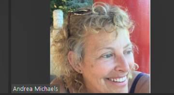
- Andrea Carla Michaels (neighbor)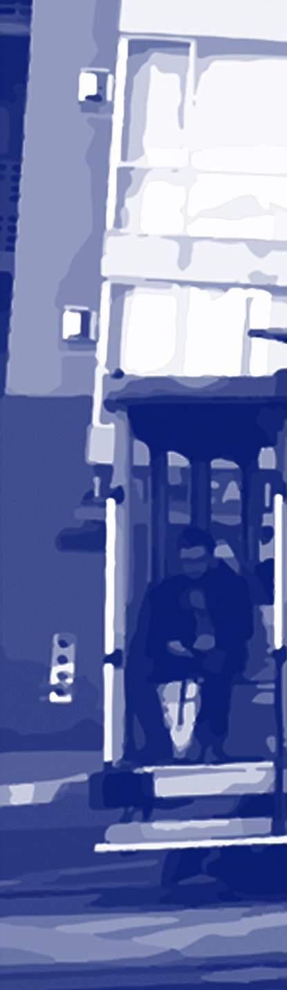
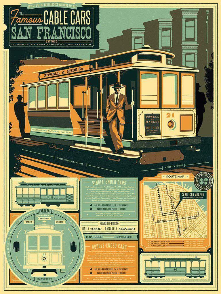
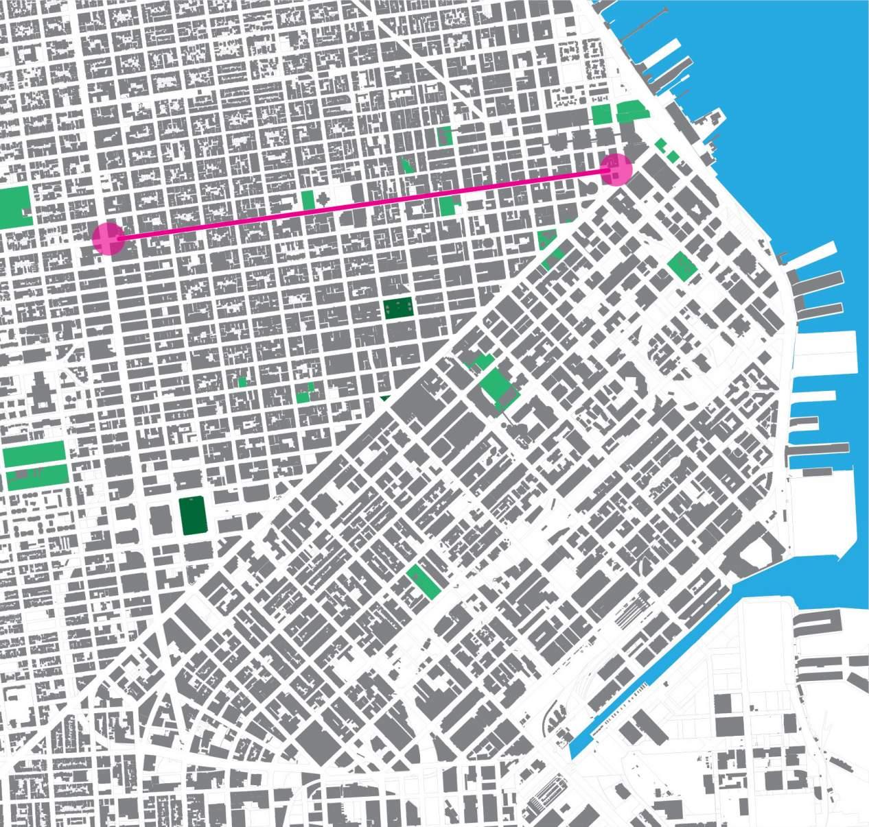
The California Cable Car Line has operated since 1878 and it remains a National Historic Landmark since its induction in 1964 to the National register. Originally, the Cable Car Line had extended west past Van Ness Avenue and had been planned to go all the way to Filmore Street where it was planned to have had a more gracious “turn-around”, more appropriate to its stature as a major urban transportation connection. Unfortunately, the plan was never realized to its completion and the creation of the US Route 101’s transect of the city curtailed any further plans for the lines more western extension. Excavations on Van Ness unearthed old tracks and cable infrastructure under the paved surfaces and medians of Route 101. And so, to this day, the California Cable Car Line connects the Bay-side Financial District to the Polk Street Neighborhood. But the line was simply terminated in a line convergence at a rather meager pad of concrete along which the Cable Car pulls into its Eastbound, – or “In-Bound” track – and simply changes grips to return to where it came. Along this corridor and around this outpost grew the Polk Gulch neighborhood, brimming with rich diversity – and sharing a middle point between the civic center and the military base to the north at Fort Mason.
It was here at Van Ness & California Street – now stopped by the imposing freeway’s traffic, and daily congestion – that this Cable Car turnaround became the impromptu terminus and embarkation collector, linking the developing historic merchants corridor that is Polk Gulch, to the emerging financial services at the heart of the city. It was after 1882 that the former Mining Exchange became the Bond and Stock Exchange on the other side of Nob Hill - which once later merged with the LA exchange, quickly become the now thriving Pacific Stock Exchange over the last century. With the rejuvenation of Van Ness and the completion of the Van Ness Rapid Transit Bus lines, which transect the city north/south connecting peninsula with bridges, this Westernmost Turnaround is now poised to evolve into a critical pivot point between the city’s four cardinal points, and suggests a bright future for the Polk Corridor business community. In this spirit, our separate neighborhood organizations acknowledge the importance of creating a place here which is not just another bus stop – but rather a node on an emerging and better integrated civic transit system.
“…The history of Polk and the surrounding neighborhood is rich and worth embracing; we should start telling the story...”
-Workshop Participant
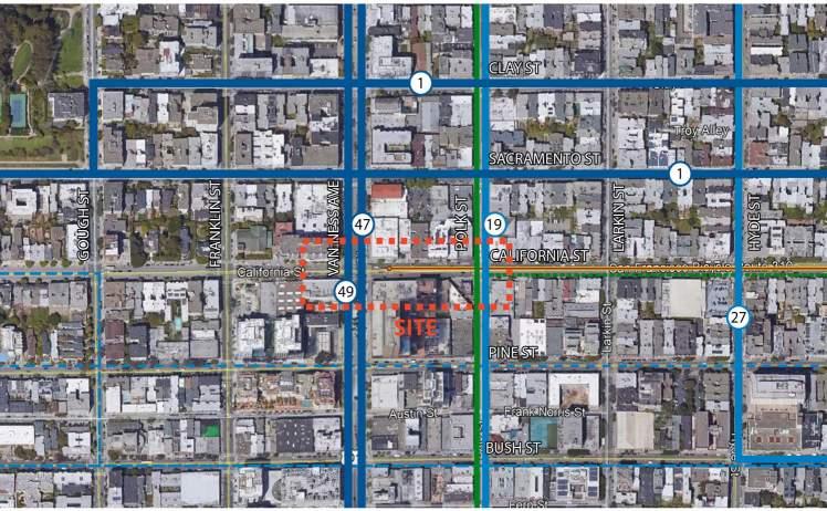
The California Cable Car Terminus is the Westernmost stop in San Francisco; It is by default our frontier station, not to mention the westernmost Cable Car station on the continent. This “frontier” is thus established squarely within the larger Polk Street Corridor Neighborhood where it serves the overlap of the Polk Corridor Alleyways District with the Lower Polk Community Benefit District (CBD) along this east/west border with the “ Discover Polk” Neighborhood to the north. It is also the eastern gateway to the Cathedral Hill Neighborhood, just to the west across Van Ness Avenue. Unfortunately, it feels more a frontier to an unfinished railway, than the forecourt of an exciting convergence of historic and growing residential mixed-use neighborhoods characterized by thriving restaurants, bars and nightclubs, a diverse group of religious institutions, and a wide range of services from health care to professional and personal.
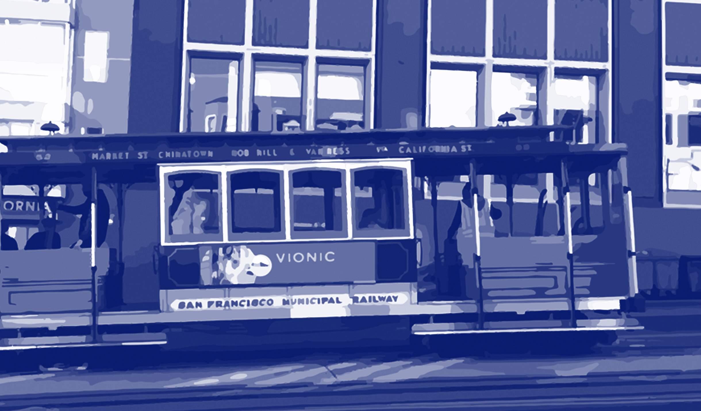
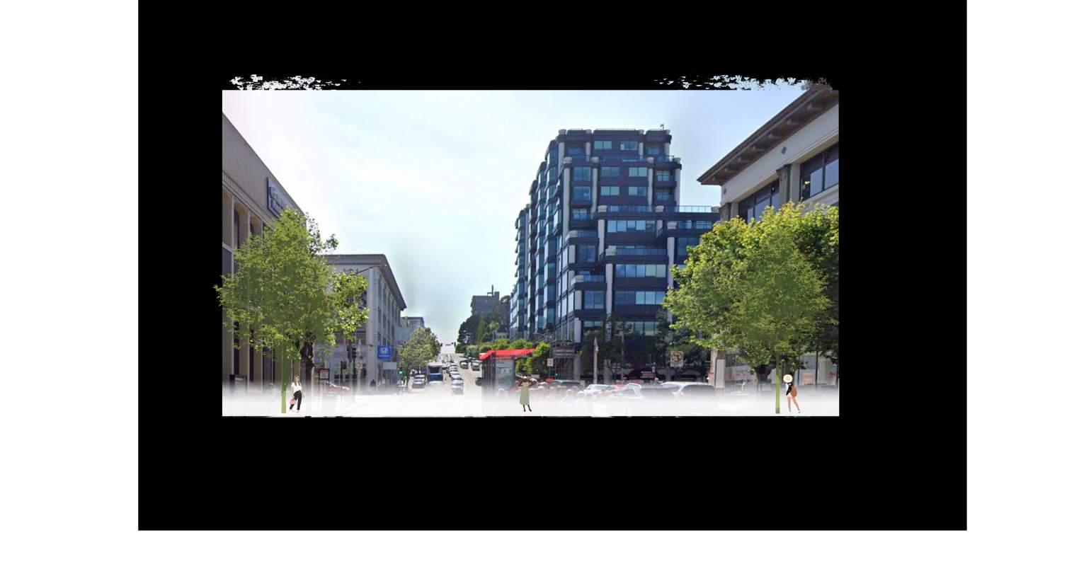
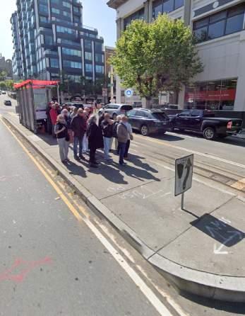
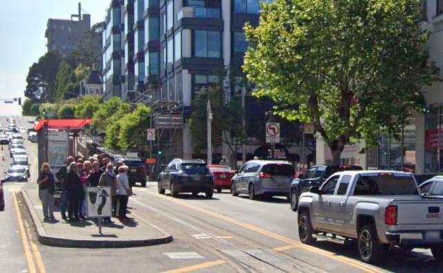
The current terminus itself is located at the precarious center of California Street and as such, is harried on either side by a heavy flow of traffic, which courses along this block of California as it feeds US 101. Here traffic can be heavy at certain times of the day, and it is not uncommon to see large groups of tourists recently descended from hotels in the area – or dropped off unceremoniously from buses that typically double park to further frustrate traffic flow. With a handful of commuters and SF natives alike, they gather here on a thin strip of raised concrete pressed in by fast moving cars. Some passengers wait on the adjacent sidewalks until the Cable Car arrives before braving the two lanes to get close to the Cable Car or its platform – for much of the space is taken up by a typical bus shelter which offers the only protection and seems large compared to its meagre traffic island. The situation is not safe – and neither is getting to the island itself. Even the ramped connection to the pedestrian crosswalk at Van Ness is blocked by a traffic sign for the on-rushing vehicles to warn them to swerve right to avoid this unfortunate sliver of a refuge. The Cable Car terminus is practically invisible, and most vehicles only realize it is there after they have passed. There is no vertical presence, beyond the standard Muni bus shelter, to suggest anything special happens here, and many are surprised to see the Cable Car when it does arrive in such circumstances.
Traffic here is often moving downhill, across Van Ness Boulevard from the west, sloping towards Polk Street at the eastern end of the block. Uphill traffic is moving west with some crossing Van Ness and another portion merging into the Van Ness traffic corridor. This can be particularly dense at rush hour.
From a transit perspective, the California Cable Car terminus connects to the 1, 19, 47, and 49 bus lines at this stop and is now in close connection to the less frequent stops along the new central Van Ness Rapid Transit Line. In this way, it also serves north/south neighborhood connections including Nob Hill and Russian Hill (to the northeast), the Tenderloin (to the south and east), and the Civic Cultural Center and by extension the Downtown Market Street connections to the South. As the Westernmost Cable Car Line it is also potentially a tourist’s most romantic stop to walk on foot down the Polk Merchants Corridor into the established cultural and artistic heart of San Francisco’s performing arts center. It is within this context that the impetus to transform this transit hub came about. The need to take it from a sad little platform to one designed for place-making was quickly agreed upon by all the stakeholders. The current state is not adequate, and where we want to be in five years form now will depend on a confluence of vision, funding, and municipal will.

The California Cable Car is part of the iconic Creation Narrative of the City of Seven Hills. With its invention, the city changed its development direction almost over-night. The great boulevards planned to expand south down Folsom Street, (where gracious Chinese Elms still adorn the way to Bernal Heights to this day), and on along South Van Ness where great magestic homes were built on flatter grounds, became suddenly less attractive as compared to the now accessible mountains and hillsides. Once inaccessible and remote, these agrarian hills were suddenly just a comfortable and modern trolly car ride away. Those that could afford it began to look towards the sweeping views and open air of the San Francisco hilltop developments - money, and hotels soon followed. Once over the top of Nob Hill from downtown, the west was open and relatively flattened. With a western planned Cable Car to take you there, the sleepy Polk Gulch valley and watershed creek was the lowest point on the way to areas west of the city. Originally planned to extend all the way to Filmore Street, the Cable Car gateway to “city west” now stops here at Van Ness Avenue. This historical Cable Car route now creates a gateway to Polk Street and a great opportunity for this diverse and very livable and walkable neighborhood that has developed here.
It is still the most iconically San Francisco way to travel the city – and as the westernmost Cable Car stop, it is also potentially a tourist’s most romantic over-hill journey - Past the great cathedrals and fancy hotels they arrive at the Polk Corridor Alleyways - and from there able to walk on foot down this heritage merchants’ corridor into the cultural and artistic heart of San Francisco’s Performing Arts Center just to the South.


“NO EXPERIENCE IS MORE SAN FRANCISCAN THAN THE RIDING OF A CABLE CAR.”
Due in part to the informality of Cable Car ridership, and its ticketing control Passenger Data, it is much harder to collect usage information on this unique passenger system than on others within the City. Muni buses, Bart, and light rail vehicles are equipped with automated passenger counters that allow the SFMTA to continuously gather updated ridership data, - but activity on the Cable Cars must be recorded manually. This is a laborintensive effort, and only done every few years by on-rail observers and so we have much less information than we might expect. From this sparse data, SFMTA confirms that the Cable Car is used by commuters primarily on the weekdays in the mornings and evenings as would be expected. Tourists tend to fill-in the gaps between the weekday afternoons (between commuter peak uses) and on weekends – where tourist ridership is more predominant.
Currently there is no strong connection between the Cable Car and Van Ness rapid transit. The data has yet to be accumulated, but these very different riderships may yet compliment one another. The most common connections are to the Number 1 California bus route, and the #19 Polk Street bus routes. Van Ness lines are also easily accessed from the corner and across the avenue. There is a desire for SFMTA to connect the Cable Car to rapid transit, and it was noted that the future rapid transit stop is currently planned about one block away from the Cable Car Terminus. Terminology surrounding the line refers to the Market street eastern terminus as the “home station” such that “In-bound” refers to east-bound, and “outbound” refers to west-bound, which finds its turn-around point here.
SFMTA reported that unplanned for Tour Bus Loading and unloading of tourists is common at the station. Tour buses service this area either to collect tourists who have taken the Cable Car line outbound over Nob Hill to be picked up at the western turn-around – or, to drop off their clients here to take the adventure ride “in-bound” towards the Market street stop and then on to the SF Ferry Building at the end of Market. One problem that needs addressing is that these buses don’t have a designated area to park. They tend to park wherever they want, and this contributes to clogging traffic. It is clear that the future layout of the street should accommodate this condition.
“…I cross California street about 18 times per day...I see this as a chance to be a cornerstone of all the revitalization linking the lower and middle part of Nob Hill...”
-Workshop Participant
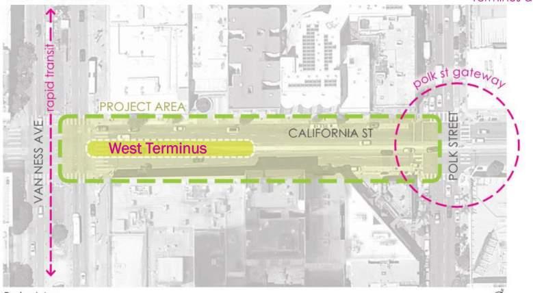
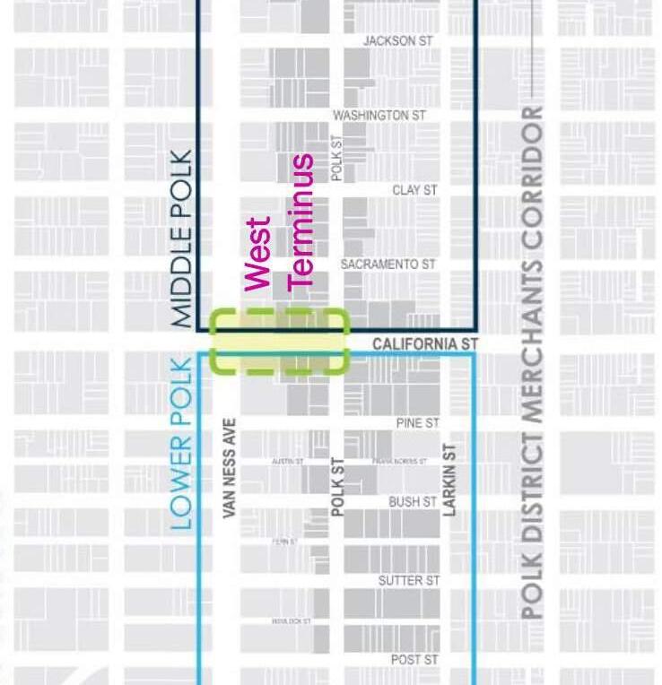
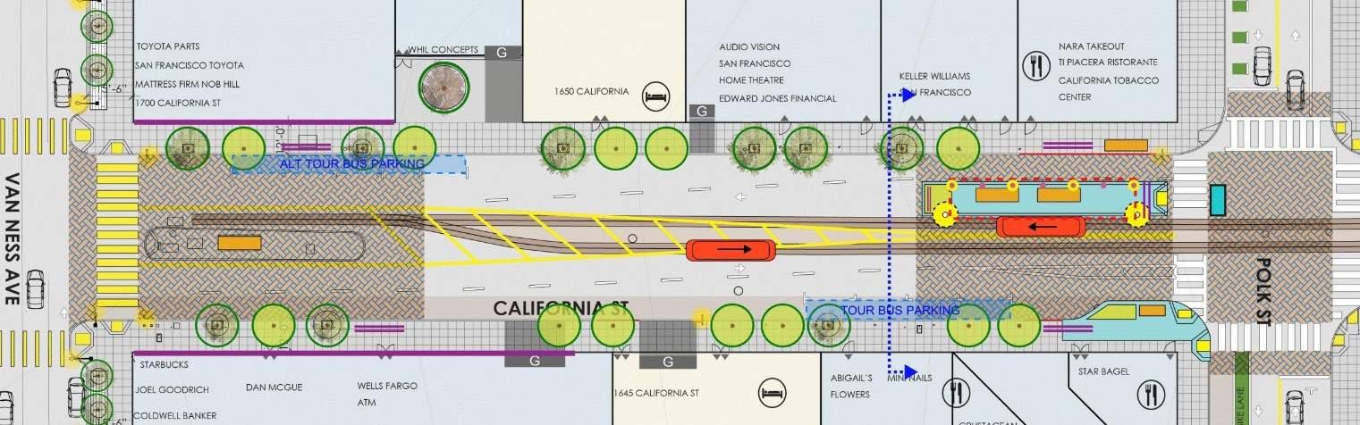
CALIFORNIA STREET CABLE CAR LINE
EXISTING CALIFORNIA STREET CABLE CAR TERMINUS - PLAN
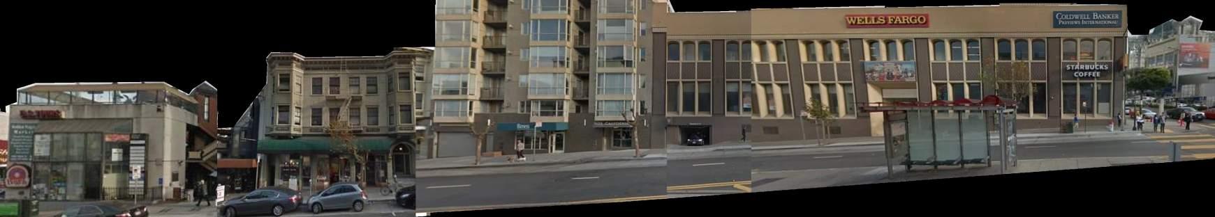
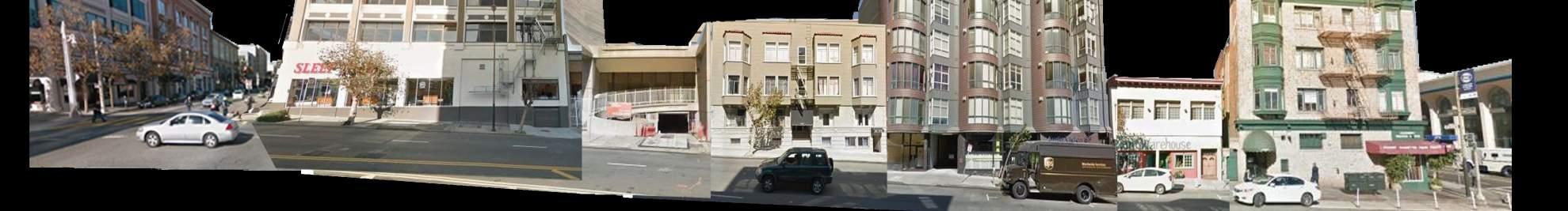


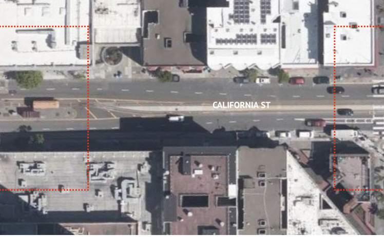
In order to understand the problem, one must first measure it and understand it and thus Exisitng Conditions plans, elevations and sections were created initially to start the vision plan process. We started by recording what was going on at the terminus block of California Street as it exists today. Careful drawings and photographic surveys were done, to represent and identify the current features and formal qualities of the street-scape and surrounding building heights that structure and frame the Terminus arrival, boarding and waiting experience. These initial studies pinpointed entries, garage ramps and curb cuts, urban infrastructures, street lights seating, trees and other structures that constrained or imposed upon the current space.
We were also looking out for opportunities to identify problematic areas for improvements, such as inadequate space for waiting, as well as the difficulties of access created by the current under designed terminus island located at the center of the fast moving and generally unsympathetic high traffic flow circulation of California Street as it crosses Van Ness Avenue.
These drawings formed the basis of our discussions with the community and gave them a way of interacting with the existing turnaround remotely in both elevational, sectional and plan-metric views - as well as photographic views from many locations along the boarding experience.
 EXISTING CALIFORNIA STREET SECTION @ POLK ST. AVE LOOKING EAST
EXISTING CALIFORNIA STREET SECTION @ VAN NESS AVE LOOKING WEST
EXISTING CALIFORNIA STREET SECTION @ POLK ST. AVE LOOKING EAST
EXISTING CALIFORNIA STREET SECTION @ VAN NESS AVE LOOKING WEST
CALIFORNIA STREET CABLE CAR LINE
EXISTING PHOTOGRAPHS: CONSTRAINTS AND OPPORTUNITY DIAGRAMS
 A. NARROW BOARDING PLATFORM
C. CLOSE TO STREET & LITTLE OR NO BUFFER SPACE
D. SIGNAGE AND SAND BOX BLOCKS ACCESS RAMP
B. BUS SHELTER DOESN’T PROVIDE ADEQUATE COVERAGE.
E. CROSSWALK COULD BE MORE PROMINENT AND SPECIAL
F. BUS SHELTER IS INDICATIVE OF STANDARD BUS STOP
LOOKING WEST TOWARD VAN NESS AVE LOOKING WEST TOWARD VAN NESS AVE LOOKING EAST TOWARD POLK ST. LOOKING EAST FROM VAN NESS AVE
LOOKING SOUTH FROM VAN NESS AVE LOOKING NORTH FROM VAN NESS AVE 16 CALIFORNIA CABLE CAR TURN AROUND VISION PLAN
A. NARROW BOARDING PLATFORM
C. CLOSE TO STREET & LITTLE OR NO BUFFER SPACE
D. SIGNAGE AND SAND BOX BLOCKS ACCESS RAMP
B. BUS SHELTER DOESN’T PROVIDE ADEQUATE COVERAGE.
E. CROSSWALK COULD BE MORE PROMINENT AND SPECIAL
F. BUS SHELTER IS INDICATIVE OF STANDARD BUS STOP
LOOKING WEST TOWARD VAN NESS AVE LOOKING WEST TOWARD VAN NESS AVE LOOKING EAST TOWARD POLK ST. LOOKING EAST FROM VAN NESS AVE
LOOKING SOUTH FROM VAN NESS AVE LOOKING NORTH FROM VAN NESS AVE 16 CALIFORNIA CABLE CAR TURN AROUND VISION PLAN
Site Observations:
• Recording walks on foot, of the entire site from Polk intersection to Van Ness and west to observe exisiting conditions and approaches.
• Multiple comparative visits to measure activity: weekends, weekdays, cloudy and cold vs sunny and warm days.
• Observed user interaction on street frontage and around Cable Car stop. (various times of day, weekends vs weekdays)
• Traced vehicular entries, curb-cuts, and documented sidewalk and curb conditions.
• Noted garages and open areas of underused sidewalks – or narrow congested conditions / impediments.
• Creation of site plans and site sections conveying this information at scale coordinated with city base information and aerial photography.
Photography:
• Site photos of the existing bus shelter and surrounding pedestrian pathway conditions and access points.
• Surrounding buildings and continuous façade compilation along both sides of California block.
• Tree coverage and frequency registration, preliminary survey – for health and constancy of canopy.
• Site intersections at Polk Crossing and Van Ness crossing recorded for illustrations and group discussions.
Research:
• Reviewed historical information about the surrounding area and Cable Car history.
• Gathered user data about our terminus from SFMTA records and past surveys.
• Interviewed users at workshops and recorded stories and verbal narratives from users and residents.
• Interpreted Vision Zero High Injury Network Map data.
• Summarized vehicle safety and cycling data for the two closest intersections to understand pedestrian safety.
• Spoke with Walk SF and recorded feedback on ideas and safety best practices where absent or aspired to.
• Presented to SFMTA and DPW, and BSM, and BUF on separate ideas and workshop feedback or suggestions.
Recording/ Mapping:
• Recording of business typologies, by type and extent of block on both sides of California Street.
• Measured with Google Earth survey information approximate building heights and relative positions.
• Drawings of streetscapes and sidewalks – drafted layouts from USGS and city records.
Aerial Photography Data:
• Overlaid aerial photography, topography information and DPW Polk Street improvement plan diagrams to create a complete existing conditions background: As complete elevations, plans and sections of Roadway and street scape infrastructure as possible.
Future Improvements:
• Noted changes from the Van Ness Improvement Plan to the surrounding area
• Noted new changes affecting bike lanes and transit routes where possible or planned.
• Incorporated stops and future Rapid Transit information as predicted where possible or known.
New Developments:
• Assessed new construction in the area noting how the increase of density may affect the Vision Plan proposal.
• Brought attention to major projects currently in the entitlements process(before or anticipating city planning review) particularly on California at Polk and along Van Ness Corridor within three block of the site.
 POLK STREET INTERSECTION LOOKING WEST POLK STREET INTERSECTION LOOKING NORTH
POLK STREET INTERSECTION LOOKING NORTH POLK STREET INTERSECTION LOOKING EAST POLK STREET INTERSECTION LOOKING SOUTH
POLK STREET INTERSECTION LOOKING NORTH
G. IMPROVE SIGNAGE AND WAY FINDING
H. ALERT PEDESTRIANS AND CYCLISTS OF VEHICLES
I. MORE LIGHTING DOWN THE FRONTAGES (FEW LIGHTS IN AREA)
K. IMPROVE TREE CANOPY & GREENERY ON ALL FRONTAGES
J. SPECIAL STREET PAVING TREATMENT FOR EACH BLOCK
L. CROSSWALK EXTENSIONS (DAY LIGHTING)
POLK STREET INTERSECTION LOOKING WEST POLK STREET INTERSECTION LOOKING NORTH
POLK STREET INTERSECTION LOOKING NORTH POLK STREET INTERSECTION LOOKING EAST POLK STREET INTERSECTION LOOKING SOUTH
POLK STREET INTERSECTION LOOKING NORTH
G. IMPROVE SIGNAGE AND WAY FINDING
H. ALERT PEDESTRIANS AND CYCLISTS OF VEHICLES
I. MORE LIGHTING DOWN THE FRONTAGES (FEW LIGHTS IN AREA)
K. IMPROVE TREE CANOPY & GREENERY ON ALL FRONTAGES
J. SPECIAL STREET PAVING TREATMENT FOR EACH BLOCK
L. CROSSWALK EXTENSIONS (DAY LIGHTING)
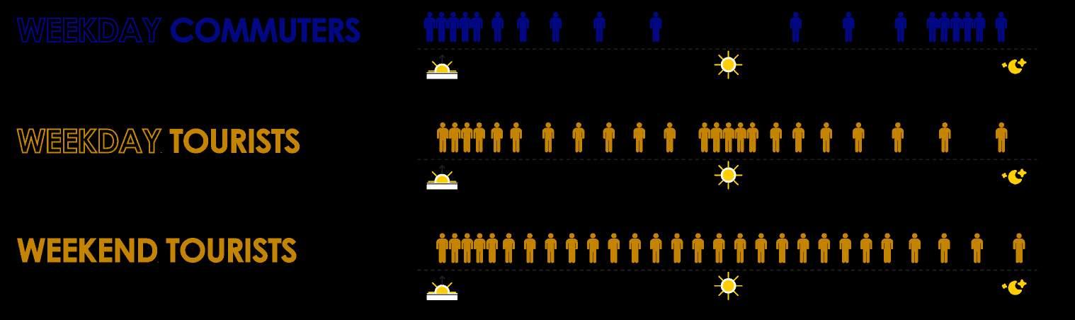
The chart above is a graphic depiction of the inbound and outbound passenger loading data by density of use, organized by time of day. This data was collected between August 2017 to April 2018, with the exception of evening data which was gathered in 2007. The blue “Inbound,” refers to passengers heading downtown, and the yellow “Outbound,” represents passengers heading towards the West Terminus at Van Ness.
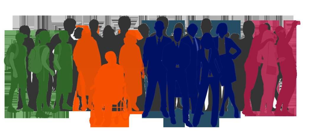
The Cable Car Turnaround is for everyone.
As one of the oldest forms of public transit in the city, apart from the municipal light rail, the Cable Car is used by a wide array of people. To locals, it may not be the first choice of travel. Though it is somewhat difficult to mount and dismount while also being more exposed to the elements than the bus, Muni Trains, or Bart, it is still hard to compare the open air carriage ride experience on a pleasant day with its romantic connections to bygone days. With the informality of its mid-street stops and the clanging bells and expected deference of vehicles, the Cable Car occupies a unique place in our cultural imagination of “gettingaround” the city. Locals may use it every day if it fits the line in their route, or just when visitors are in town: when together, they can share the thrill of conquering a mountain clinging on the side of the brightly-colored trolleys. The users of the Cable Car are many and varied. They include: seniors, residents, youth, children and parents, merchants and business owners, commuters and visitors. Cable Car lines are admittedly significant tourist attractions, but the California Street line is used by commuters as well. The intensity of which we can see by the data graphed here.
What came as a surprise to this study, was how little the Cable Car is currently acknowledged by the residents and businesses. This may be in part to how understated the current stop is. It was reported that it was not a great place to wait: either to leave from, or to arrive at. It seemed to be a “no-place” where tourists were hoping to leave from in order to get somewhere else. - Or, if they got off, did not have much to indicate they had arrived “some-place”. The community as a whole thought this was an unfortunate result of it not providing any sense of place making – which became the focus of the workshops that followed our initial discussions.
“… Muni buses and light rail vehicles are equipped with automated passenger counters that allow us to continuously gather updated ridership data, but activity on the Cable Cars is recorded manually, which is a labor-intensive effort only done every few years.”
 Dustin White, SFMTA
TOURISTS WAITING ON THE BOARDING PLATFORM
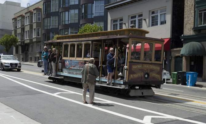
BOARDING THE CABLE CAR AT POLK IN THE STREET
Dustin White, SFMTA
TOURISTS WAITING ON THE BOARDING PLATFORM
BOARDING THE CABLE CAR AT POLK IN THE STREET
“...Why not start by asking the community what they want? If we could get the surrounding neighborhoods involved and other organizations as well, I am sure there would be a lot of ideas about what people would like to see happen at this intersection to make it feel more like a destination...”
 -Wendy, (LPN member)
The Cable Car Terminus visioning process was focused on the community and their desire to see the Cable Car turn-around in a different way. It became a way for the stakeholders to connect with each other and focus on imagining a new and different place that could be provided along the block of California that connects Polk to Van ness. The workshops found a captive audience in people who were forced to shelter in place during the global pandemic and, through digital meetings and shared graphics, our attendance was surprisingly good.
The two workshops were structured to allow everyone a front seat at the table through ZOOM Meetings. Break-out groups were coordinated so that smaller focus groups could discuss different scenarios together before rejoining the main discussion. Captains were assigned to each break-out group that focused on issues both negative (that need changing or mitigating) to positive (that need supporting, implementing or supplementing). Groups were able to select subjects that interested them; from greening and interpretive signage, to geographic placement preferences at separate ends of the block, to safety and traffic calming examples of all the possible improvements that could be imagined. The interactions resulted in a lot of information that we used to inform possible proposals. We have included this information in the Appendix sections of this document.
In the next sections, we will review the process and summarize the findings that came from our outreach process and the collaborative activities that allowed us to discern the needs and desires of the community. A series of virtual community meetings were organized for members of the community to safely participate in the design process. Though COVID-19 restricted the typical in-person community workshops, there was a sustained effort at the technological level to keep the interactive “workshop feel” alive.
Prior to the workshops, the Lower Polk Community Benefit District (CBD), INTERSTICE, and LPN Board engaged at the first kick-off meeting, where the Cable Car Vision Process goals and project expectations were established. Following this, the existing Cable Car terminus was studied by INTERSTICE Architects. Detailed physical information was gathered and recorded, documenting the current site and existing conditions. These maps and drawings were then used throughout the process for diagramming comments, priorities, and future ideas for change. The existing conditions maps included plans, elevations and sections of the California Street intersections at Van Ness and Polk Street. Detailed photo documentation overlays of facades and adjacencies were completed. Also included in these diagrams was key information pertaining to existing land use and business activities in the area. All products were created for quick references to facilitate the remote collaborative design process.
Existing Conditions: Documenting the physical existing conditions of the California Cable Car Terminus.
Listening & Understanding: the needs of the community related to their Cable Car experience by brainstorming ideas and aspirations, sharing frustrations and challenges.
Announcement of the California Cable Car process and goals.
Community Outreach: Design & distribution of graphics, posters, flyers, stickers, and online promotion for Workshops 1 & 2.
What we heard: Noting important feedback from the community to inform further design studies. synthesizing ideas towards generating three scenarios to assist public agency discussions.
City Agency Meeting: Present diagrammed top three synthesis scenarios to SFMTA in order to gain informative transportation data and understand city challenges & limitations.
Distill three diagramed scenarios into two design vision diagrams integrating the focused feedback from city agencies.
Recording comments and integrating community priorities into preferred Cable Car scheme(s). Collected proposed solutions and distilled schemes down to a best case scenario to satisfy identified constraints.
Review the document with the Lower Polk Neighbors Community Benefit District, Board of Directors, Community Stake Holders and City Officials.
City Agency Meeting 2: Gather information provided by SFMTA and further integrate our findings into a second presentation of the 3 diagrammed scenarios.
Public collaboration: to measure reactions to diagramed senarios and establish priorities and to gain further understanding of the needs of the community with respect to feedback from City Agencies regarding improvements and reviewing challenges and constraints identified along the way.
Production of a vision plan document focusing on both priority areas: to guide possible improvements in the future to this location. This document outlines and illustrates the proposed improvements to the current configuration of the California Cable Car terminus.
The document is an inclusive vision of the many future possible safety improvements and additional amenities that the Cable Car terminus could offer the community.
Further research conducted by INTERSTICE included studying successful urban design features at the surrounding Cable Car turn-around stations. Stations studied were: Powell/ Market St. Turnaround, Embarcadero St., Hyde and Beach St. Turnaround, and Powell /Mason Turnaround - noting essential features and common amenities at each location that contributed to their successful user experience. These documents and findings served as essential tools during the first two Virtual Community Workshops.
In order to ensure a greater participation in the digital format and remote interface made necessary by the pandemic, the LPN asked INTERSTICE Architects to create a range of digital and printed materials to announce the process more widely, and gather involvement and encourage momentum around the planned workshops. In order to best reach people both at home and at take-out venues and institutions, - printed street posters, mail and business flyers, and door hanging cards with stickers were designed and distributed throughout the area to neighbors along the Polk
Some of the products of these efforts are included here which involved digital e-mail campaigns, blogs, and social media posts that further extended our virtual invites to any and all willing participants hoping to be a voice of change. These outreach efforts extended deeply into the neighborhood and encouraged Lower Polk Residents to be more involved in the LPN, as well as encourage interest in the opportunity to design the future of the California Cable Car Terminus. After each of the workshops, residents were encouraged to post additional input on the LPN website or directly e-mail the LPN board and LP CBD.
Given the unique circumstances during the pandemic, a shared digital approach to community outreach and gathering was adopted which leveraged online platforms and social media more heavily than in previous outreach efforts. By using both digital promotion and printed materials, we were able to get the word out and excite people about the upcoming opportunity for input. The community workshops were then attended by both agencies and neighbors alike on very equal footing which made the exchange surprisingly fluid and easy to record and incorporate into subsequent collaborations.
Fliers, Posters, LPN door-hangers & QRcode stickers were distributed throughout the neighborhood to both residents and merchants by hand and by e-mail.
Nobody shares the same experience, and each person has a unique lens from which they view the world. This is why community workshops are so valuable. Offering stimulating visuals paired with a narrative, each participant has the opportunity to inform their ideal future sense of place. Workshops are designed to evoke new ways of thinking, express new opportunities and have fun collectively and collaboratively.
In the midst of a pandemic, the idea of a workshop seemed at first quite challenging, but thankfully many online platforms such as Miro, GoToMeeting, and Zoom assisted the development of the virtual workshops. The digital presentation was organized in Miro in a very spatial board-like method. All drawings were organized such that they could be commented on in real time with digital post-its as the conversations unfolded with digital notations directly on the interactive “boards”mimicking presentation boards and physical facilitation techniques commonly exploited in more conventional settings.
Slides were developed outlining the process of investigating and examining the Cable Car terminus as it exists. Observations and comments could be added to the plans and sections where opportunities and existing challenges were to be found. Many trial runs in sharing screens, adopting new live annotation tools and mock workshops assisted in preparing for the workshops that follow. Here are some of the examples of the interface and more can be viewed in the individual Workshop Sections below (of this document) and in the Appendix on these individual sessions of the many important comments and observations and occasionally visionary imaginings of the participants.
Hosted online, community participants experienced a digital workshop unlike any other. Held remotely by ZOOM and presented on Miro boards through shared screens, participants virtually engaged in the workshop by typing in the chat box, speaking during break-out groups or in the general discussions, asking questions and sending follow up e-mail after the meeting.
After the general presentation and initial questions and comments, this all together town hall style virtual forum format shifted to more individual areas of focus. Each participant was pre-assigned to one of three breakout groups, where a handful of focus questions were explored. After about 30 minutes of open conversation here, the entire group then reunited to talk broadly about what had been the drivers of the discussion and group leaders were asked to report back on the individual chat room experiences. These major talking points were recorded and discussed all together as a group and were added to post-its in real time onto the digital Miro board for future transcription and synthesis into the developing design direction for the next meetings and or workshop.
In order to better understand the California St. Terminus, a study focusing on urban design principles was conducted. The study was presented that identified what contributes to a successful urban transit experience. The surrounding Cable Car turnarounds were examined and compared. The features outlined and discussed among the participants that most contribute to a positive user experience were:
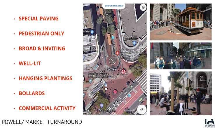
Continuous Broad sidewalks: Wherever possible to allow freer movement and waiting.
Bulb-outs and Refuge Precincts: Allowing safer crossings and places for pedestrian activities , music or sidewalk performers to be.
Safe Crossing: Crossing Ladder and other brightly-marked pattern language and graphics obvious to oncoming traffic.
Zone Definition: Deployment of pattern or texture of a “Safe Zone” for pedestrians.
Buffers from Traffic: Physical barriers or height separations for vehicles and bicycles or motorized scooters.
Places to Stop and Rest: Seats or “perches” and leaning posts to encourage and allow for active lingering
Visual Interest: Color, pattern and materials, plantings & interpretive signage or murals.
Unique Sense of Place: Definition from the common street or typical transportation infrastructure.
Variable Street Edges: Concentration on boundary and ground transitions.
Special Pavement: Scoring and pattern / special finishes and texture to distinguish from sidewalk continuity.
Signage-Scale and Coherence: A sense of non-vehicular - pedestrian level signage and lighting.
Street Furnishing and Amenities: Newspaper stands, bollards, and seating/ benches.
Shade & Green Infrastructure: Shelter from wind and rain – objects and trees create a horizon and canopy .
Unique Lighting: Distinct lighting in spread, temperature and color from overhead vehicular scale “street lights.”
Integrated Art: Creative work of local artists, potentially thematic to the location or educational in message.
“As someone who does, from time to time, use the Cable Car as a method of transportation, the Van Ness Terminus is an underwhelming experience.”
- Anonymous Neighbor
Workshop 1 introduced the California Cable Car Terminus to local participants. The evening began with a curated slide presentation consisting of existing conditions, plans, sections, and elevations of the Cable Car Terminus. Precedent imagery accompanied the presentation to evoke a sense of what could and does exist within the pallet of implemented amenities on other sites. After the group presentation, participants were divided into smaller break-out groups where a series of questions structured the conversation.
Hosts encouraged conversations, and note-takers annotated every comment on digital post-its in real time on the MIRO boards that were interactive and live. Each post-it was placed directly on the workshop board in the location it related to, and these were later summarized at the end of the workshop. Leaders from the individual groups represented the post-its and recorded ideas and discussion points to the whole group for further comments and questions.
Long term goals, desires, and improvements mentioned by Workshop 1 participants helped inform the next series of graphic products. The next step was to take the many ideas and design directions forward into a synthesized version that could be translated into graphic form, to discuss with city officials and agencies who would have direct input on challenges and opportunities these represented for the possible future. Since the ideas focused sometimes on divergent paths, it required three preliminary Design schemes to completely describe the range of different ideas that had been formulated in the original charrette of the Workshop 1. From this first collaboration, 3 proposed plans emerged: one which enhanced and elevated the Van Ness turn-around where it currently exists; a second which proposed a new embarkment point on Polk Street to work in concert with the existing Turn-around which would remain as is; and a third which was more expansive in creating a pedestrian precinct of the entire California Street Block between Van Ness and Polk Street. This entire block would become the “ West Terminus Area” with street scale patterns and potentially a greatly reduced and controlled presence of cars along this stretch of California. Preliminary elevations and section diagrams would be created to outline these ideas for further discussion and development.
The outcome and success of Workshop 1 was for all to have a better understanding of the Cable Car terminus usage, its daily activities and challenges. There was also a general airing of the communities desires, aspirations and frustrations with what was currently the situation as well as a collective consensus on exploring what could be there in its stead.
“…People drive really fast down California St.. Which makes it unsafe for people to board the Cable Car platform in confidence...”
Participant
COMMENTS FROM WORKSHOPS
In the course of the workshops and the ongoing comment periods, over one hundred comments and suggestions were received, some of which are displayed here as primary examples. More detail can be read in the appendix on Workshop 1 where all the comments are included as recorded during the various break-out groups and collective discussions and gathered e-mails and chat comments.
Bus shelters should establish the sense of place.
The area is severely lacking tree canopy.
I’ve been to this stop and it is not that special, but it should be.
PERFORMANCE SPACE
GATEWAY | ARCHWAY
DROP OFF ZONES PUBLIC ART
PLAZA | PARK
CELEBRATE CULTURE
SUSTAINABLE DIVERSE USERS
MURALS
WIDER SIDEWALKS
REDUCE TRAFFIC LANES
TOURIST-SERVING
MORE LIGHTING
SPECIAL PAVING
CALM TRAFFIC RICH HISTORY
BEAUTIFICATION
MERCHANT-SERVING
SAFE DESIGN
STREET FURNITURE
ACTIVATE STREET FRONTAGES
BARRIERS FOR SAFETY
TREES
WAYFINDING | SIGNAGE
SHELTER
CABLE CAR MUSEUM RESIDENT SERVING
STORYTELLING
Everything about the intersection says go fast; we need to say slow down.
Let’s re-imagine the whole block as a park?
FIRST COMES SAFETY:
• Prioritize safety on Van Ness Intersection and create clear user boundaries.
• Ample room has to be afforded to people waiting; the island is too small for a bus load.
• There is a sign blocking the ramp up to the platform.
• The traffic passes by fast here and reaching the stop from the sidewalk is treacherous.
• Two lanes is a long way to cross – cars can’t see pedestrians.
• A shelter or structure would be obvious to vehicles and they would slow down through a narrow feeling passage – like at the Chinatown gate on Grant.
• Can we protect transit riders from rain and wind?
COMPLIMENTARY ART:
• Visible pedestrian zones that are both functional and beautiful.
• Can we incorporate a giant text or image on the entire road?
• Can the pavement be colored or have an image at the areas where the traffic should be slower?
• Why not have a mural on the unwindowed facades?
HISTORY SHOULD BE HIGHLIGHTED:
• Historical narrative is important to the community and this should be expressed through art & signage.
• The terminus is unlike any other terminus, it should read as a Cable Car line, not a standard bus stop.
• Just as there are many different types of users, there should be many types of amenities.
• The little historical sign is nice, but there seems to be a lot more that could be described about the area and how it changed over the last century and a half.
MAKE IT GREEN:
• Why not make a park where the building steps back on California – old planter or fountain circle?
• Why are there not more trees on this block? The ones there
so scrawny.
• Can the platform
• It is really windy here? Can we put some renewable energy turbines here or solar panels on a larger shelter?
 are
have plantings?
Cars as secondary users while pedestrians should be primary users.
Better lighting in the area is necessary.
Incorporate a mural in the area by a local artist.
Bus shelters should establish the sense of place.
The Area is severely lacking tree canopy
How do we make a space in the middle of the street?
Not enough light causes safety issues at night.
Add visible historical signage to area.
Cable Car shelters should have a distinct appearance from Muni.
Bring more greenery to the neighborhood.
Push the median back to Polk for a safer boarding.
Create a separation between cars and people.
Add street paint for indication of pedestrian zone.
The incorporation of planting on the boarding platform.
In desperate need of sun/rain shelter and seating.
are
have plantings?
Cars as secondary users while pedestrians should be primary users.
Better lighting in the area is necessary.
Incorporate a mural in the area by a local artist.
Bus shelters should establish the sense of place.
The Area is severely lacking tree canopy
How do we make a space in the middle of the street?
Not enough light causes safety issues at night.
Add visible historical signage to area.
Cable Car shelters should have a distinct appearance from Muni.
Bring more greenery to the neighborhood.
Push the median back to Polk for a safer boarding.
Create a separation between cars and people.
Add street paint for indication of pedestrian zone.
The incorporation of planting on the boarding platform.
In desperate need of sun/rain shelter and seating.
“…The terminus is going to be right where the bus rapid transit improvements are taking place and being equipped with new shelters and vegetation... It would be nice if the Cable Car terminus could aspire to that!”
- Workshop Participant
The next step was to synthesize the many ideas and suggestions collected during the Workshop into something graphic that could be discussed with the city agencies most closely involved with transit and the streetscape infrastructure. While many of the ideas were complimentary and often transferable, there arose during the first workshop a debate about where the actual concentration of those amenities ought to be. While some in the community wanted to focus improvements at the current Van Ness turn-around, another group was strongly in favor of having resources spent closer to the Polk Street intersection where the Cable Car now stops (lightly) at the middle of the street, to pick up and drop off, before reaching the Van Ness terminus where the city sand storage box, and the bus stop currently are*. These two schemes where both plausible and not necessarily mutually exclusive of the other. A third idea was to completely limit all vehicular traffic between the terminus and Polk Street stop – and although this would mean some serious traffic control and engineering of current flow volumes, the idea was popular and so all three schemes were graphically represented for the city agency discussions.
SFMTA was the first agency to provide valuable feedback regarding the feasibility of the three Cable Car proposal diagrams. The first scheme involved the whole block as a pedestrian zone where cars were perceived as a tolerated guest. This would require this relatively busy intersection to change dramatically, and it seemed difficult to imagine from a traffic logistics point of view. Despite this, there was generally a feeling that if the traffic flow could be reduced. This would make sense to start the control at least one or two blocks before; on the downhill slope of California, west of Van Ness, and similarly on the blocks before Polk Street to the East.
There was a general consensus that it would be easier to reduce traffic beyond Van Ness eastbound, than to remove the feeder traffic from the east onto Van Ness. This suggested that the scheme focused on Van Ness might make better economic sense.
The Polk boarding scheme created a new platform between the tracks at the current Polk Street boarding area. This platform would also have bulb-outs on both sides to claim more of the adjacent street space to increase pedestrian safety and create closer crossings to this enhanced loading area – while still leaving the Cable Car free to proceed to its end terminus to change tracks and return for pick-up on the inbound route. It was imagined that on these expanded sidewalks people could enjoy busking musicians, expanded seating, and plantings. A greater sense of Polk Street “arrival” could be generated at this calmer more business and pedestrian focused intersection, away from the traffic and congestion of the Van Ness (US route 101) intersection.
The constraint here was to limit and calm traffic while creating a better place for the Cable Car to slow and unload. The central platform would not be larger than that on Van Ness but the energy could be better controlled and the proximity to local merchants and the Polk Corridor street-life was seen as a great advantage.
DPW participated in providing feedback at a separate meeting. They were helpful in relaying the potential of certain possibilities and community suggestions, while pointing out the obvious drawbacks to some of the proposed ideas where they might involve disproportionate infrastructure changes, or near to impossible alterations in the traffic engineering and lighting controls in the short term. The meeting was very informative and new ideas and suggestions emerged that were able to be part of the next round of workshop documents brought back to the community. The advice and feedback is summarized here and more detail can be found in the appendix at the end of this document regarding the transcribed notes and the feedback which was then incorporated into the next round of diagrams for Workshop #2.
* these two structures are actually part of the space problem on the very constrained platform island.
The Van Ness scheme and intersection-focused proposal looks at enhancements to the existing infrastructure. The proposal includes platform enlargements on Van Ness through the removal of one lane of eastbound traffic while creating areas for tour buses to park, adding shelter, signage, trees, other plantings and greening enhancements. These modifications are consistent with the comments and suggestions from the first community workshop, allowing the city agencies to get a full picture of what ideas and scope of interventions had been imagined by the larger community and gathered stakeholders.
“...Prioritize the improvements that can double perform in terms of safety and accessibility while, also using those improvements to help create a sense of place...”
- DPW
“...T he proposed changes could help accommodate the volume of tourists and parking needed by tour buses, which bring visitors to the cable car daily...”
- SFMTA
SCENARIO A
Block Change: Limits vehicular access for the block, incorporates street furnishings, and expands the shelter located on the median.
• Pedestrian precinct that limits vehicular access block wide.
• Street repaving/graphics to clearly delineate a pedestrian prioritized zone.
• Provides a larger shelter at Van Ness to create a true terminus space.
• Special lighting and clearly differentiated, enlarged pedestrian-only waiting platform.
• Incorporation of improved furnishings and bollards for traffic and vehicular control.
• No-parking and tour-bus white zones for special access vehicles and off-cycle maintenance.
• Tree planting and greening throughout transformed urban space.
• The creation of a pedestrian transit and bicycle dominated domain; similar to Market street where the car is a tolerated but less than a welcome “guest.”
SCENARIO B
Polk Boarding: Relocates the main dis-embarkment/passenger loading terminus to the Polk Street intersection (to the east).
• Relocate main boarding and off-boarding to the east at Polk St.
• Creates a gateway to Polk with a new platform and shelter.
• Creates bulb-outs on both sides of street to make close connections and wider entertainment focused sidewalks.
• Generally limits traffic flow past the pedestrian centered Polk Plaza station.
• Concentrates on offering amenities near the Polk intersection as a place for people to gather off Polk Corridor.
• Maintains current turn-around track change terminus but does not focus attention here.
• Van Ness is still a Muni connector and Rapid Transit commuter connection only.
Van Ness Intersection Focus: Creates a traffic slow zone around the Van Ness median, emphasizes the crosswalks, and expands/widens the boarding platform at the existing island with a shelter.
• Van Ness “Gateway” with two pedestrian precincts.
• Reduces vehicular flow going East and West bound at both intersections.
• Proposes only one lane through California from across Van Ness.
• Expands boarding islands and creates major shelter at Van Ness in keeping with Transit connections.

• Strategic Amenities along block with concentration at loading places.
• Patterned crosswalks at intersections.
• Interpretive signage and greening along both sides of street without changing the center block traffic patterns.
• Focused on vehicular control and slowing without much impact on flow accept at the Van Ness end.
SCENARIO A: BLOCK CHANGE
- Pedestrian Precinct (limit vehicles)
- Street repave/graphics
- Furnishings / Bollards
- No parking
- Tree Plantings / Greening
SCENARIO B: POLK BOARDING
- Relocate Boarding to East
- Create Gateway to Polk
- Concentrate Amenities to Polk Intersec
- Gateway Pedestrian Precincts
- Reduced vehicular flow (East & West Bou
- Expanded boarding island
- Strategic Amenities
- Patterned Crosswalks
SCENARIO C:
Afternoons and weekends are tourists.
Interests in rain protection structures, low rails to help protect pedestrians...
Signage improvements are welcomed in future improvements.
Weekday mornings are primarily commuters.
Red box on the meridian is for sand storage for grip on wheels and brakes. Similar accommodations must be in place
Improvements should address the sense of place!
Some sidewalk basements extend past the curb line.
General comments from city agencies are presented in brief here in response to the three schemes. For more elaborate detail see the appendix in this document. The meetings were hosted remotely by INTERSTICE and attended by multiple members from each agency along with representation form the CBD. Opportunities and limitations were discussed.
SFMTA
• Agreement that safety needs to be improved at both intersections and at Van Ness in particular.
• Creating a pedestrian precinct (limited vehicles) is challenging due to traffic volume.
• Lane re-configuration is possible with challenges.
• Best to control traffic west of Van Ness to anticipate lane reduction.
• Accommodating tourist buses is an opportunity to mitigate current double parking problem.
• Potential partnering for narrative/historical signage.
• Distinction of this as the only non-dead end station condition.
• Acknowledgment of the challenges this station faces and a desire to see place making goal succeed.
• Supported the priority of safety and accessibility.
• Recognition of the importance and needs for upgrades.
• Support for many of the proposed ideas but for financial and budgetary priorities elsewhere.
• Project is more viable if kept above grade (reduce impact to potential basements and avoiding existing subgrade utilities).
• No city project planned for upgrades in area at present.
• Encouraged paving patterns instead of images for drive over street paving as images can be confusing to drivers.
• Bulb outs at Polk is a positive addition – already have one south side, east of Polk.
The next step was to take the information and feedback from the city agencies and incorporate it into our Workshop 2 preamble and workshop graphics. The three schemes would be presented back to the community along with how they were responded to by the separate agencies. After transcribing and synthesizing feedback from the local community members (Workshop 1) and city agencies, the design team now had a clear road map that could be used to inform early design concepts for the California Street Cable Car Terminus. This could then be brought before the community for further elaboration and design consideration by the larger stakeholder body.
Two schemes were developed from the initial three. The design team highlighted the major differences between the two schemes, while acknowledging their parallel aspirations. We referred to this next step as a “Hybridizing” process from which two major schemes emerged for the community to collaborate towards refining and testing. The first scheme focused improvements at the Van Ness intersection, and the second highlighted amenities that could be implemented at the Polk Street intersection. Both schemes incorporated streetscape elements that improved pedestrian safety and enhanced user experience.

Combining comments: Workshop 1 & City Agency Meetings.
The two hybridized schemes were created to allow the next workshop to focus on the two intersections separately. They focused on where the community stood in relation to the two poles of the Block: 1. The Van Ness terminal expansion, or 2. The generation of a new platform in the Polk Plaza Concept. It was natural to allow the community a second chance to see the synthesis so far and to drill down deeper into what the two separate locations offered, what were challenges, constraints or advantages & opportunities of these two program directions established at the first workshop.
1. Exploit beautification techniques that can double perform as accessibility and safety improvements.
2. Sub-sidewalk basements may interfere with tree plantings and could complicate above ground work.
3. 1200 cars per hour pass through this area, and it may be difficult to remove traffic completely.
4. Alert cars approaching that something is ahead.
5. Make access to the platform and boarding areas more pedestrian friendly.
6. Make cars feel like a guest in the area – but not the priority is preferred to eliminating cars.
7. This is the only terminus that doesn’t feel like a dedicated space. How can we make it feel more like that?
8. Tour bus loading zones should be incorporated if possible.
9. Could lighting be sponsored by adjacent buildings?
10. How can we incorporate way finding that leads people into the neighborhood?
11. Where paving and cross-walk markings are proposed, patterns, rather than images, are preferred.
12. Keep all graphic designs in the public realm. Something that is resilient and easily maintained.
13. Murals are very economical, and more art is good. The SF Arts commission might help commission and maintain.
14. Bulb outs could be coordinated (it helps to understand of underground utilities).
Workshop 2 began with presenting the three synthesized schemes, which incorporated and organized all the comments collected from Workshop 1, that were shown to the city agencies. We then went over the feedback received from the city agencies, and offered up for discussion the two diagrammatically focused schemes that had emerged from the research, and agency and community input acquired over that past many months. The Workshop was set up as a collaboration session with the community. We focused on discussing the merits, differences and perceived advantages/ disadvantages of the two Cable Car focused pedestrian loading schemes named “Van Ness Focused” and “Polk Focused” in order to understand which the community felt offered a better scenario.
The Alleyways District Vision Plan was briefly reviewed to introduce the various “tools” and vocabulary of urban design components that are often deployed to enhance and transform civic spaces. The team reviewed examples of this common “kit of parts” so that they could, in turn, imagine how these might be employed in this project. IA walked the neighborhood participants through the Polk focused and Van Ness focused schemes, while highlighting the individual street improvements possible and which elements might be utilized from the kit of parts.
General questions and comments were exchanged on the content of the presentation and the Workshop 1 developments so far. Break-out group discussions followed, focusing on safety and user experience. The merits of the two schemes were debated and each break-out group’s lively discussion emerged; often favoring both or strongly advocating for an obvious preference. When the break-out groups came back together as a larger group, there were strong advocates for both.
There was a real desire to have the Polk intersection brought up to a more obvious position of importance. This place seemed the natural location for the Polk Corridor Plaza that would be the embarkment and main disembarkment place for the California line. The Polk intersection is the more pedestrian friendly, slower and calmer place. It was obvious that this plaza should be given a greater presence, but it was arguably hard to easily imagine a larger platform here, as this is a mid-block two track crossing, and the platform would have be quite thin and no wider than what is already at Van Ness.
For this reason, many felt the greater good would be achieved at the Van Ness station for safety and traffic calming, especially if this area could be successfully enlarged and given a real vertical presence to alert traffic. It was argued that this location would be historically consistent, while dramatically introducing the traffic calming earlier, acting as a true “West Gate” to the Polk Gulch and the more protected center at Polk Street. The Van Ness scheme was surprisingly also supported by Walk SF and other organizations for similar reasons, as it would be impactful at a dangerous
crossing. A stop at Van Ness allows a greater, more consistent connection to the other western neighborhoods (Cathedral Hill) and the new Rapid Transit lines, which in turn could draw more people from this vehicular connector into the more animated people connector: the Polk Street heritage merchant corridor.
“One of the top priorities is pedestrian safety… we must demand, DEMAND, traffic calming through design... and the incorporation of unique surfaces, structures trees and planting...
-Workshop Participant
Paving to alert drivers pedestrian zone.
What is possible?
ESTABLISH SENSE OF PLACE
Living walls?
Living walls? Living walls?
What is possible? Living walls?
Have an interesting bus shelter to identify
Have an interesting bus shelter to identify
ESTABLISH SENSE OF PLACE
How could street trees do better?
ESTABLISH SENSE OF PLACE
How could street trees do better?
Have an interesting bus shelter to identify VAN NESS OR POLK FOCUS? COMMENTS & CONVERSATIONS
Have an interesting bus shelter to identify
Have an interesting bus shelter to identify
After the groups spent time in break-out focus groups to discuss the merits of the two scenarios and possible improvements, the groups reconvened in a central discussion. Group facilitators summarized the input and each community member had an opportunity to weigh in on the priorities and preferences for each of the two schemes presented. Some comments are sampled on this page, and more detailed, in-depth notes are recorded for Workshop 2 in the appendix to this document.
Greenery to the streets!
“…This area has so much potential, room for merchants to expand and grow. The Cable Car could be an opportunity to bring more people in the neighborhood to stay longer.
Less traffic on Polk
Could Van Ness have bulb outs?
-Workshop ParticipantPaving to alert drivers pedestrian zone.
SCHEME 1: VAN NESS FOCUS
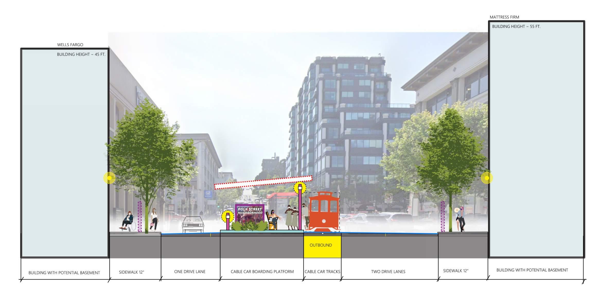
The Van Ness focus improvement plan incorporates street furnishings and tree plantings. This scheme widens the boarding platform by removing a lane of oncoming eastbound traffic to create a larger, sheltered pedestrian refuge with amenities enhancing the Van Ness terminus location.
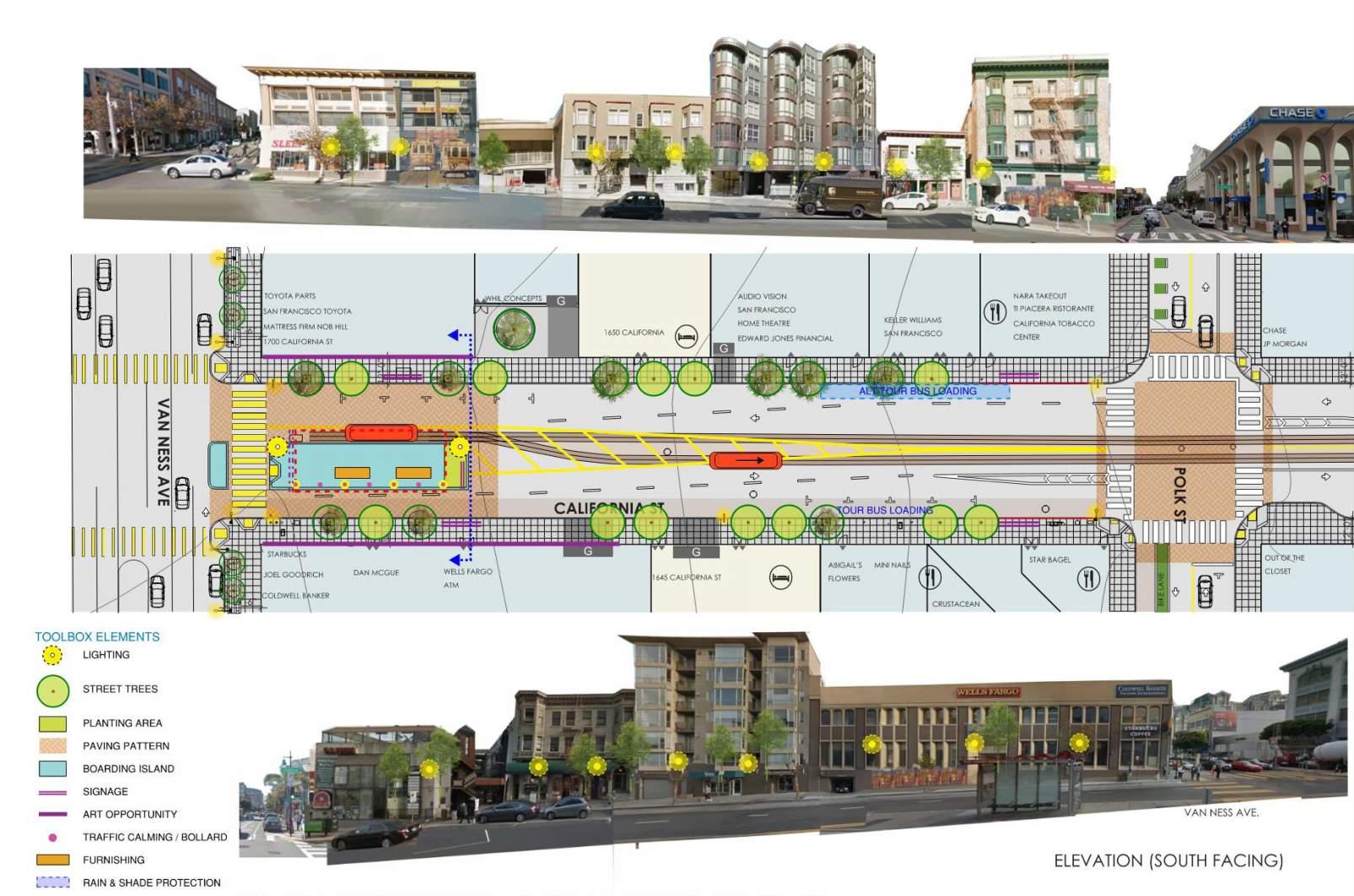
• WIDER BOARDING PLATFORM
• PEDESTRIAN REFUGE AT CROSSING
• DIFFERENTIATED PAVING ZONE AT ISLAND
• DIFFERENTIATED PAVING AT POLK
• GENEROUS SHADE SHELTER
• BOLLARDS
• LIGHTING
• FURNISHINGS
• PLANTING ON ISLAND AND STREET TREES
• MURALS AND INTERPRETIVE SIGNAGE
• ONE LESS LANE EAST BOUND – (From two to one)
• TOUR BUS LOADING ZONE
• GATEWAY TO THE WEST
• WAYFINDING TO THE POLK CORRIDOR AND HISTORIC SITES
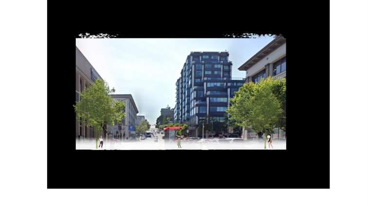
SCHEME 1: VAN NESS FOCUS - CONCEPT PLAN & STREET ELEVATIONS
SCHEME 1: VAN NESS FOCUS - CONCEPT STREET SECTION / ELEVATION LOOKING WEST
SCHEME 2: POLK STREET FOCUS
The Polk focus improvement plan relocates the main disembarkment (outbound) and passenger loading (inbound) platform to the Polk Street intersection. This allows the Cable Car to proceed to the Van Ness terminus to change direction (Cable Grip Line) before returning to the Polk Street Platform for loading on its inbound return (to the East). This scheme creates a true Polk Plaza Terminus with bulb-outs and new midtrack platform with shelter.
• ADDITIONAL BOARDING PLATFORM AT POLK
• BULB OUT AT SOUTHWEST OF INTERSECTION
• DIFFERENTIATED PAVING ZONE AT ISLAND
• DIFFERENTIATED PAVING AT POLK
• SHADE SHELTER
• BOLLARDS
• LIGHTING
• FURNISHINGS
• PLANTING ON ISLAND AND STREET TREES
• MURALS AND INTERPRETIVE SIGNAGE
• ONE LANE EAST BOUND
• TOUR BUS LOADING ZONE
• POLK PLAZA – PEDESTRIANIZED ZONE.
• WAYFINDING SIGNAGE AND HERITAGE BUISNESS INFORMATION
SCHEME 2: POLK STREET FOCUS - CONCEPT PLAN & STREET ELEVATIONS
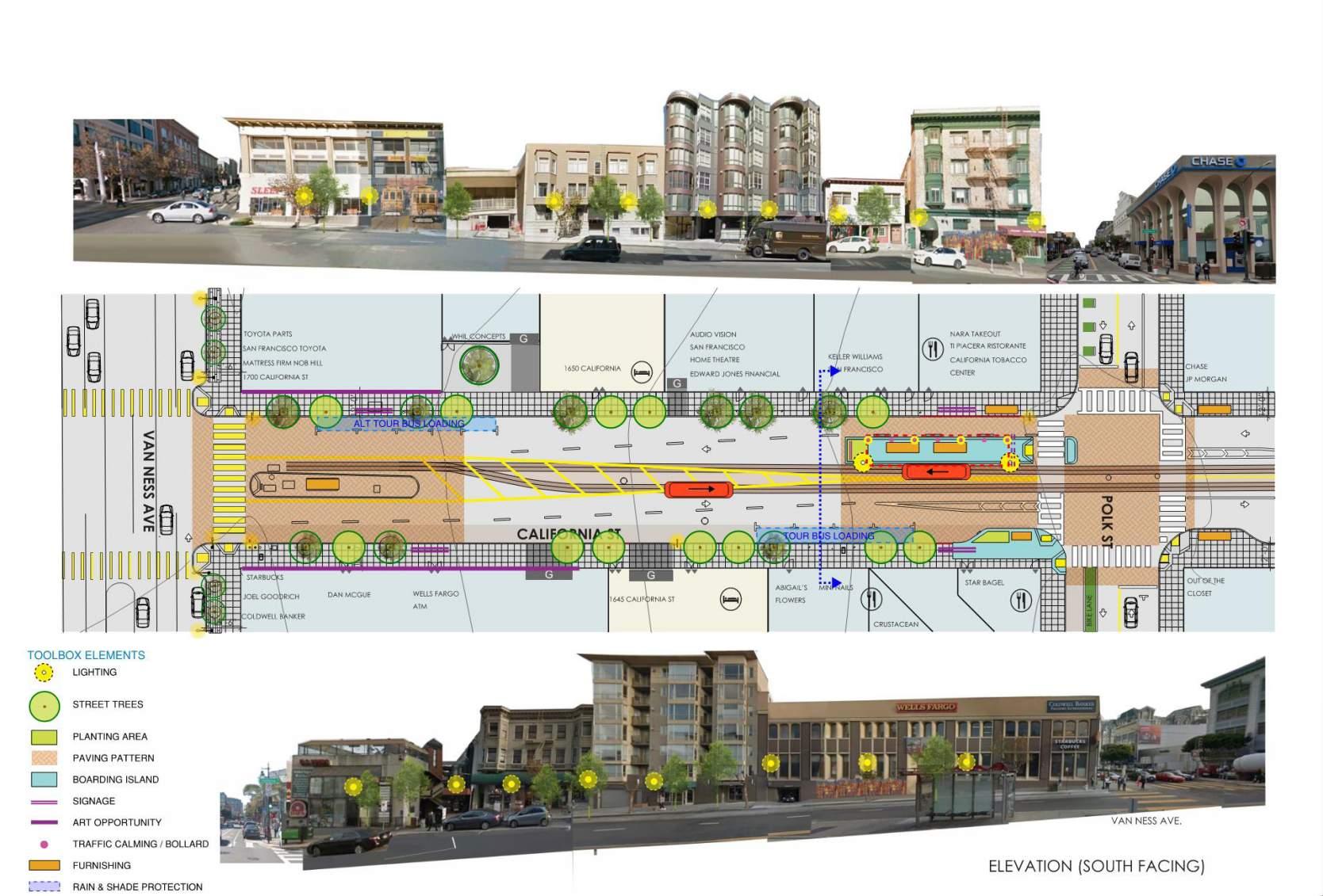
SCHEME 2: POLK STREET FOCUS - CONCEPT STREET SECTION / ELEVATION LOOKING EAST
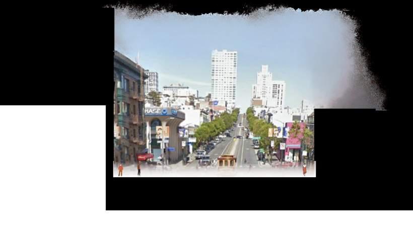
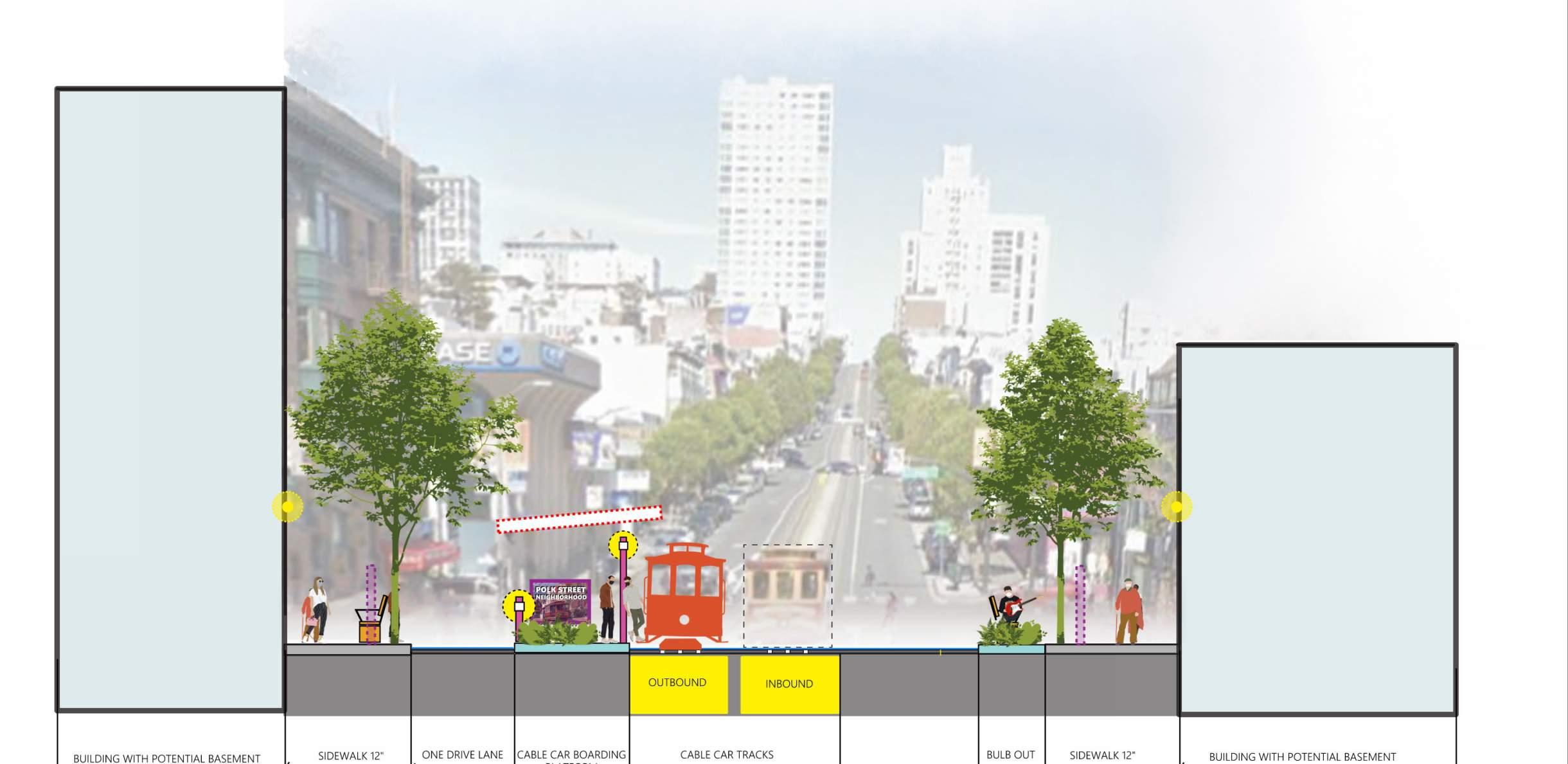
“…Let’s create an environment on Van Ness that is more pleasant and hospitable ... imagine bringing forth the robust history of the area mixed with the bright potential of its future, it will be remarkable!”
-Workshop Participant
This vision scheme enlarges the platform and creates a “place” at the existing turn-around point at Van Ness. It also provides improvements to the Polk Street intersection, creating a central node and plaza that complements the block and creates a safer, more pedestrian and cyclist relay point at the opposite end of the greener, more narratively rich block. The scheme that best describes and illustrates the driving vision of the six month long collaborative process, was a hybridization of the two competing schemes. The vision scheme, described here, proposes a concentration of resources at the Van Ness location in recognition of its greater potential to transform the rest of the block to the east, solving some of the greatest safety challenges currently facing this intersection.
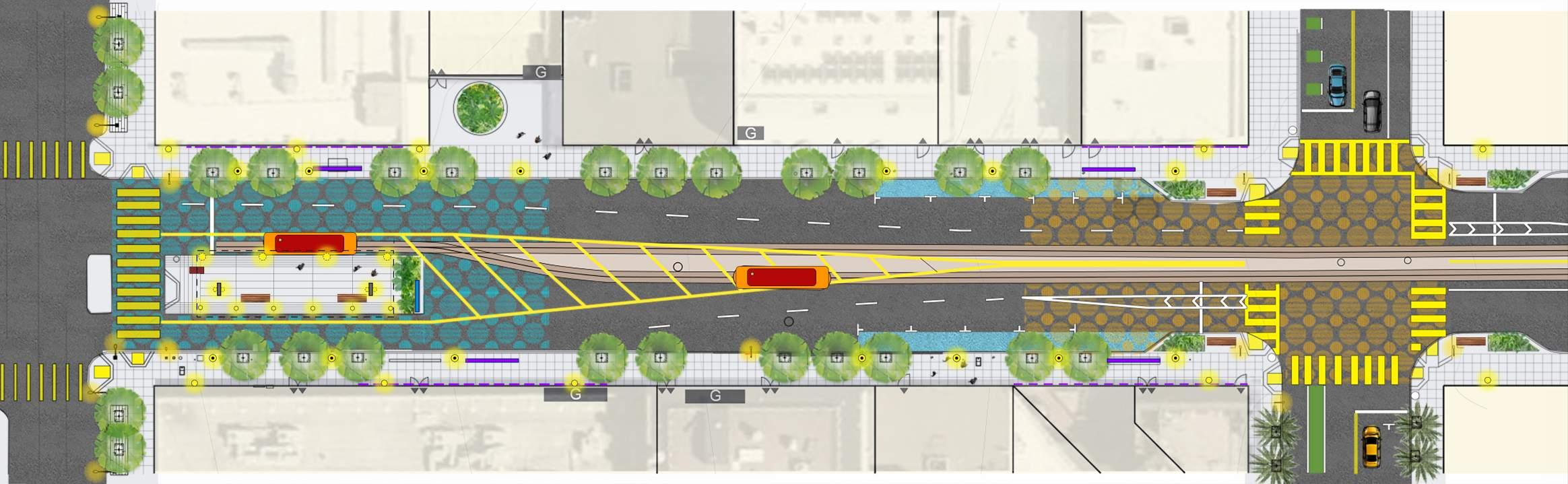
Because of the lane reduction, the platform here can be wider. Additional space to the south is provided by the removal of parking and the re-routing of traffic in preparation for the new lane configuration one block earlier at Franklin.
The tree canopy, signage and larger shelter at Van Ness would help ensure traffic would be slowed and controlled as it moved down the slope into the new “calming” transit block before the Polk Plaza. With patterned pavements, improved orientation, wind and rain protection, and special lighting, this scheme describes a pedestrian oriented place that would allow greater, more comfortable waiting. Additionally, the mural program could enhances the surfaces of the surrounding buildings, greatly increasing the narrative potential of the surrounding area.
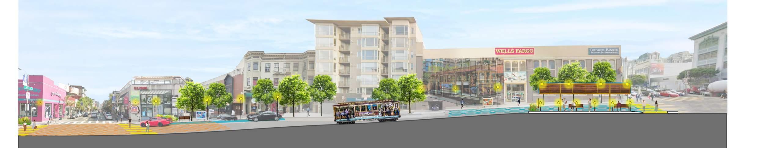
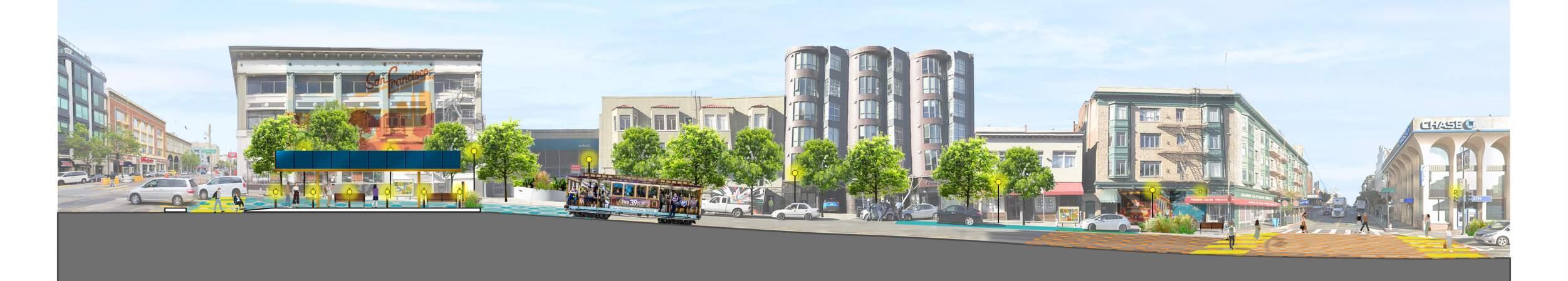
This vision scheme at the Van Ness Station point enlarges the platform and creates a true “place” for people at the existing turn-around point that welcomes people, provides shelter from wind, rain and sun, and orients visitors through integrated signage.
Here, the south lanes are reduced to one lane passing the platform in the east bound direction, allowing the platform to be 12 ft wider (±25’ in total). Additional space to the south is provided by the removal of parking and the re-routing of traffic in preparation for the new lane configuration one block earlier at Franklin.
Below is a list of features diagrammed in plan and section. The platform itself is highlighted on the following page.
STREETSCAPE IMPROVEMENTS:
• BOARDING PLATFORM EXPANSION AT VAN NESS INTERSECTION
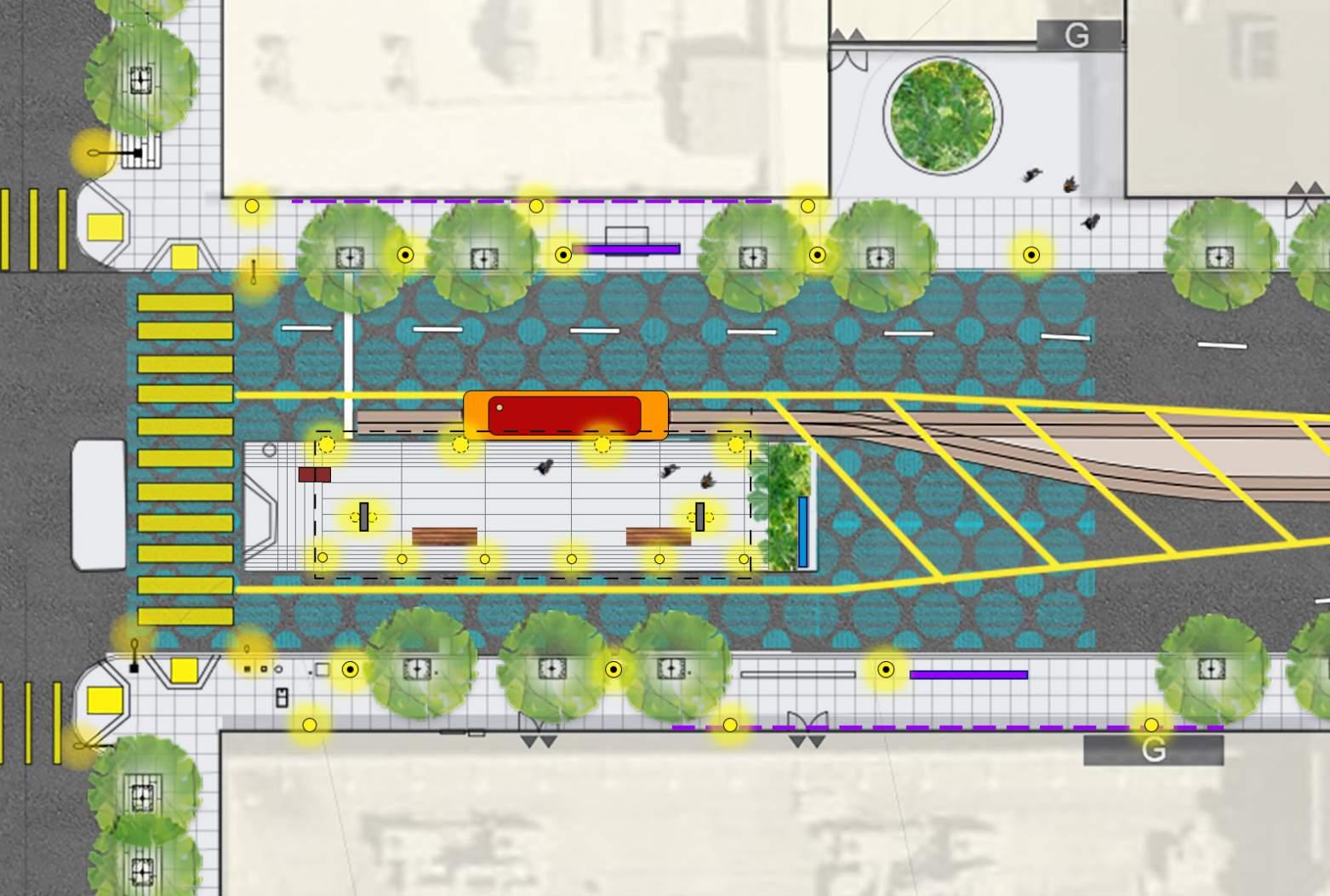
• DIFFERENTIATED PAVING ZONE AT ISLAND
• DIFFERENTIATED PAVING AT POLK
• SHADE SHELTER
• NEW PEDESTRIAN POLE LIGHTS
• BOLLARD LIGHTS TO PROTECT BOARDING AND ADD LIGHTING
• LIGHTING (BUILDING MOUNTED WHERE POSSIBLE)
• FURNISHINGS
• PLANTINGS: ON ISLAND, IN SIDEWALKS, AND MORE STREET TREES
• MURALS AND SIGNAGE (INTERPRETIVE AND WAY-FINDING)
• ONE LANE EAST BOUND
• TOUR BUS LOADING ZONE
• GATEWAY TO THE WEST (SPECIAL ILLUMINATED SIGNAGE/ART)
• CANOPY LIGHTING AT PLATFORM AND COLUMNS
• REPLANT GREEN AT NORTH PLAZA POCKET PARK (IN FRONT OF BUILDING


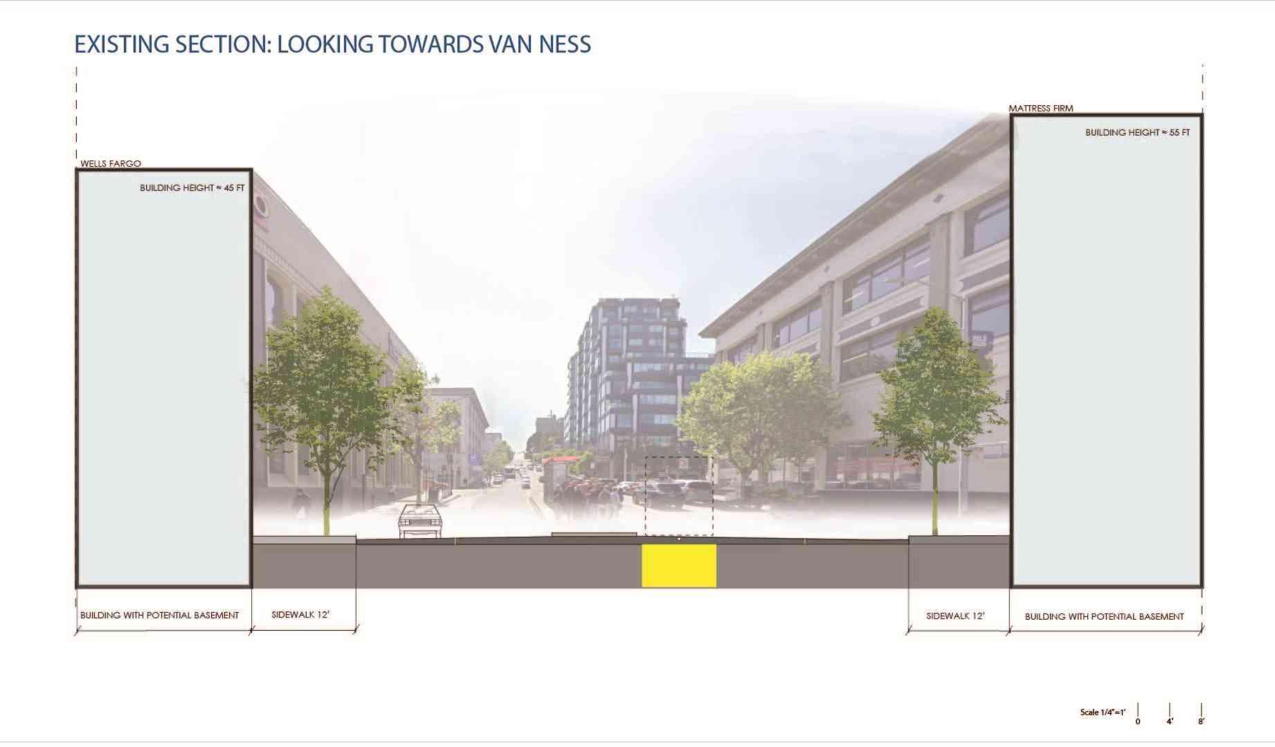
Looking more closely at the boarding platform itself as an enhanced waiting and learning “place” for tourists and commuters alike, we offer a vignette as to what the station might feel like on a typical SF afternoon.
The platform has an increased connection to the crosswalk, and while the sand storage unit remains, in an improved form, it does not impose on the ramp or new refuge protected entry way from the Van Ness crosswalk. Here, there is envisioned as an almost residential scale to the tree canopy plantings.
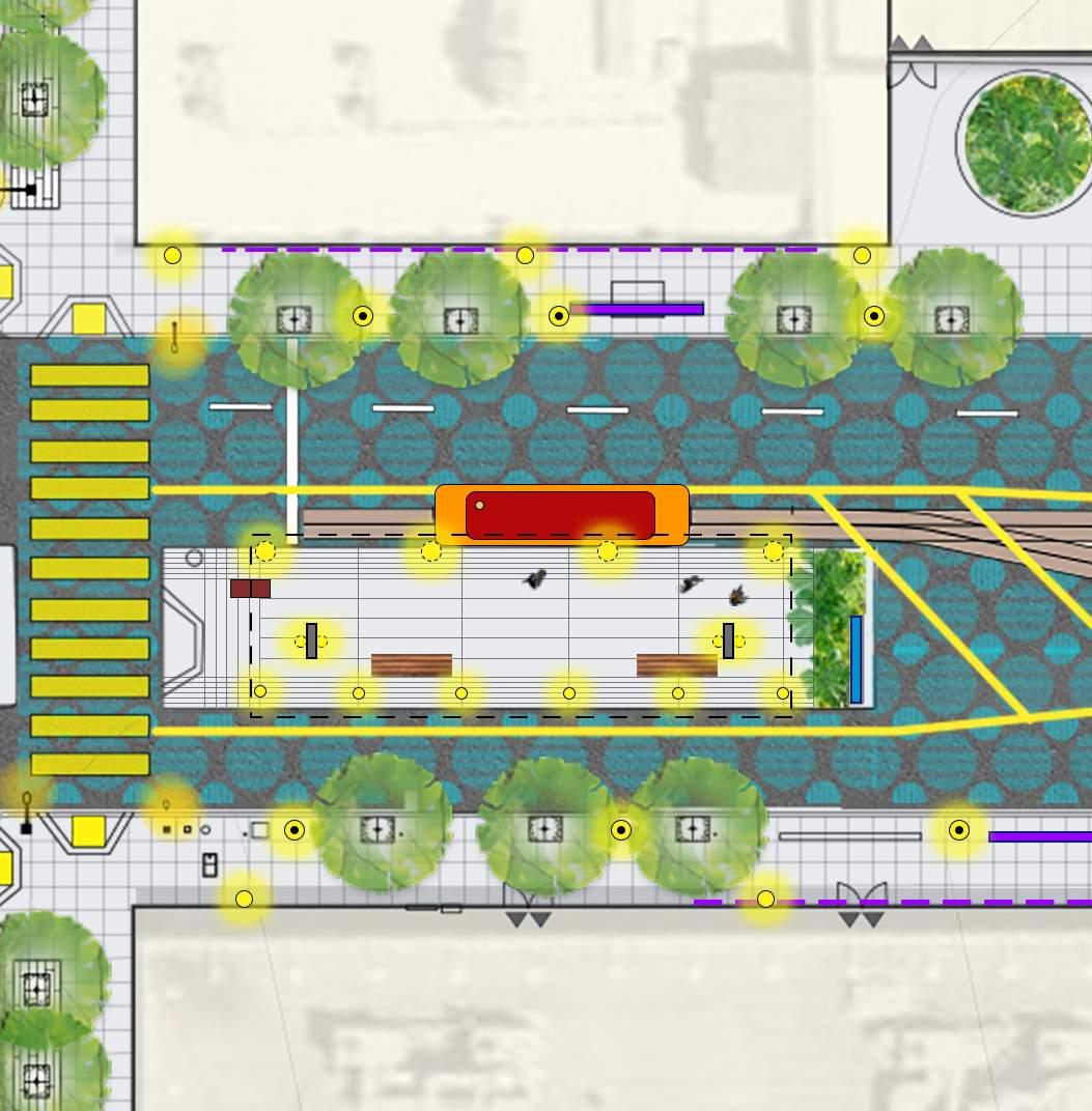
In addition to restricting the flow of east bound traffic near the platform, the printed paving pattern extends throughout and to the end of the track merger zone. Here, combined with the new Cable Car focused murals, street interpretive signage, and furnishings for tired travelers, there is a much larger overhead shelter structure that is lit and provides a clear demarcation of the boarding area that is lit at night. All these features help ensure traffic calming and slowing. This control is key to signaling to the vehicle that they are entering into a protected pedestrian oriented precinct, as illustrated in the drawing on the right facing page.
It is important that this slow zone can be seen long before crossing downhill across Van Ness, or as one approaches uphill from the Polk Street intersection. This strategy relies on the “calming” to begin on the approaching blocks before the station, and in an eastward direction, long before Polk Plaza.
With the patterned pavement, improved orientation, wind and rain protection, special lighting, and bollard protected platform - this scheme describes a pedestrian oriented place that would promote impromptu baskers & a greater more comfortable waiting experience. Additionally, the mural program could enhance the surfaces of the surrounding buildings, greatly increasing the narrative potential of the surrounding area, in concert with ground mounted wayfinding and historic information at the platform itself.
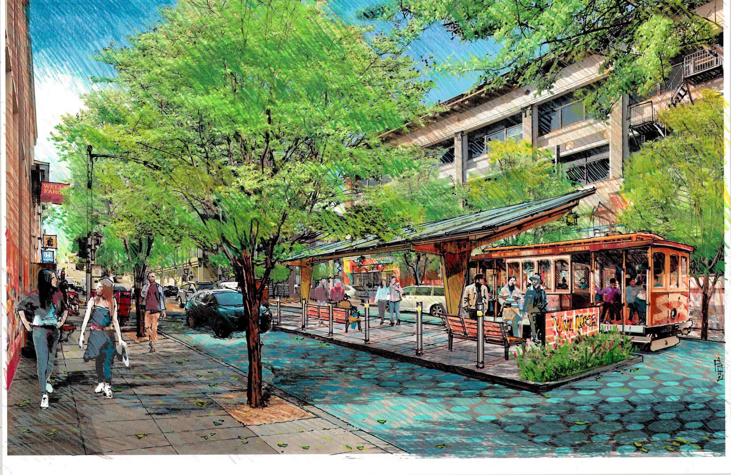
Another important design driver is a new focus on the intersection at Polk Street: The Polk Plaza. The Plaza would now be about the actual intersection of Polk and its four cornered enclosure. At this first stop (In Bound) or penultimate West bound (out bound) stop, a distinct pattern and color would differentiate it form the Van Ness Platform area. The plaza’s signage and graphics would be about the cultural life and unique mercantile mix of this community and distinct neighborhood that extends south to Civic center and North towards Fort Mason and the Bay.
Here, bulb outs would allow and encourage street performers and a more gracious lingering and hub for those entering the Polk Corridor. At the Plaza, protected from the noise and traffic of the busier Van Ness Gateway, street musicians and sidewalk food stands might make better use of the slower more leisurely paced Polk corridor foot traffic.
To this end, the plan and guidelines provide an integrated tool kit of strategies and graphics to communicate a visual and material link between the Cable Car line and the Polk Street Corridor. The existing stop at the Polk intersection is envisioned to be the pedestrian privileged extension of the larger Transit Hub to the west at Van Ness.

This location would be the logical place to disembark for those not continuing on to transit points north or south or West. We propose a Polk -centered Plaza that would allow tour buses to park and unload or reload their camera classed cargos. Here, the bike paths and enhanced cross walks would clearly signal a place for people, where cars are guests to be tolerated and accommodated, but not prioritized.
This would be a place to begin exploring the Neighborhood and its restaurants and famous bars, or, a starting point to walking down to the Civic Arts Center along Polk. All without compromising the main thoroughfare of commuters as they might proceed on to the Rapid Transit Options further west at the main turn-around on the same block.
• DIFFERENTIATED PAVING PATTERN
• FURNISHINGS
• PLANTING, RAIN GARDENS AND STREET TREES
• MURALS AND SIGNAGE
• TOUR BUS LOADING ZONE
• SIDEWALK BULB OUTS AT INTERSECTION CORNERS
• NEW PEDESTRIAN POLE LIGHTS & BUILDING MOUNTED LIGHTING
“...Transforming the cable car turnaround would create
gateway that solidifies the Lower Polk Corridor neighborhood as a true place...a place for people to work, live, explore, and continue to enhance. Establishing this new gateway is a result of the pride people have for this neighborhood and the ambition we have to see this area continue to grow and thrive...”
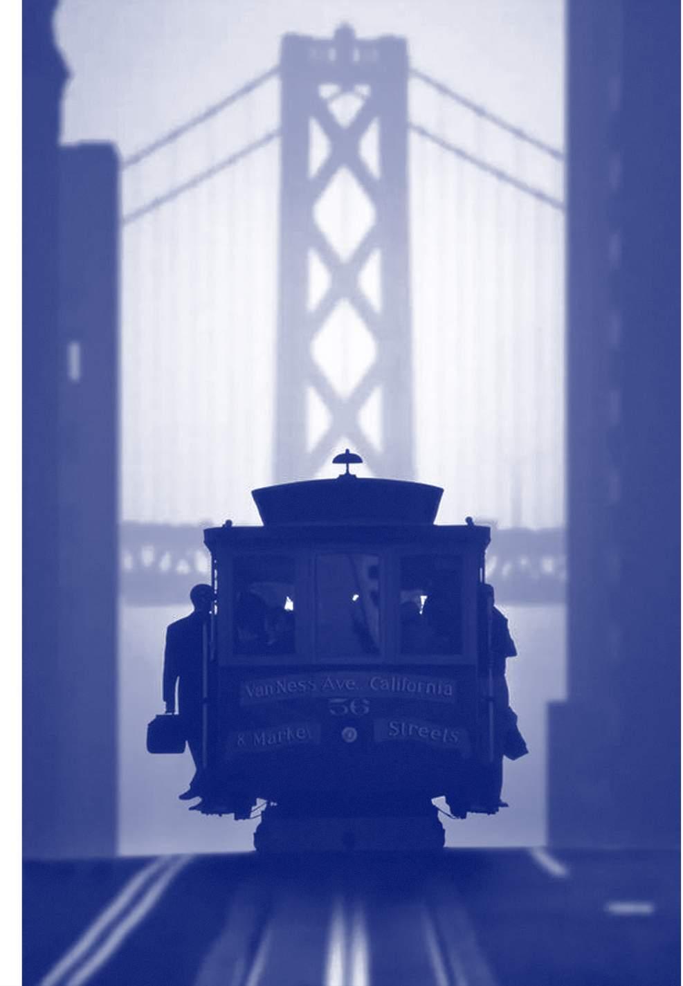
a recognizable, defining
- Local Business Employee
Understand the issues, assessment and priorities of the community in relation to the Cable Car terminus.
Understand the goals and values of the Polk Coridor District and its focus on this city infrastructure as a link to its economic health and future welfare.
Guide coordinated infrastructure improvements that are planned by various city agencies towards rejuvenating this currently under considered transit stop.
Form partnerships and seek funding and grants for the future improvement of the California Cable Car Turn-Around - and perhaps spur into action a coordinated citizen led private public partnership.
Guide the work of developers towards positively contributing to shared infrastructures that enhance their projects, and benefit the users of their planned developments.
Encourage and empower local businesses to create an enhanced “Gateway” to this thriving business corridor through a safer more enjoyable arrival experience for their future patrons, employees and clients to the mutual benefit of all.
Promote and create momentum for community activism and catalyze coordinated participation of diverse groups towards a common public benefit.
Catalyze and coordinate institutions and non-profits towards empowering their constituencies and communities to imagine positive change in often overlooked civic infrastructure.
The California Cable Car Vision Plan describes a project that would, if implemented, transform the current terminus for this westernmost line that is in keeping with the other five terminus stations of the Cable Car Transit system throughout the City of San Francisco. The Vision Plan represents the ideas and illustrated aspirations of the community to see changes, implemented within the next five years, that allow this vision to become a reality.
The plans are purposefully diagrammatic as they are conceptual and should allow for interpretation and development as they are informed by more detailed information and a deeper understanding of the constraints of site and budget. This document proposes an achievable goal that the community has agreed to strive for. Perhaps a more organized non profit might be established around this new goal. A small group of dedicated activists, interested in seeing the goal realized, might use this document as a road map towards realizing this vision.
The improvements illustrated here, with the help of funding, and the cooperation of developers, civic minded individuals, and city governance, would radically change the conditions on the ground and provide the much needed “Spirit of Place” that is so conspicuously absent in the current turn-around location. The Vision Plan proposes discrete changes that might be achieved incrementally or all at once.
These changes to traffic flow, platform size, shelter upgrades, buffers, as well as integrated art, lighting, greening, super graphics, site furnishings, and story telling, would together project the image of a truly neighborhood-oriented transit node. The combined intersections would announce a clear, block-wide pedestrian “campus” environment that could connect the Polk Street Corridor to the larger narrative of the Cable Car, the city fabric, and its unique place in the larger transit system of the city it serves.
The new Terminus must serve all people from seniors and youth, both commuters and tourists, as a place to land in comfort, or as a place from which to embark.
The Terminus must be safe, secure and welcoming to those that happen upon it, or with purpose to discover it, and are able to learn more about the city and the history of the area.
The Turn-around will integrate itself into the neighborhood as a catalyst for traffic calming and enhancing public safety.
The Terminus must improve the Van Ness/Polk Connectivity to create a neighborhood “Slower Street,” block-long condition.
The Terminus “block” will alert Vehicles to behave with deference to the pedestrians and acknowledge the increased bicycle and tourist on/off boarding from buses that takes place along this block.
The intent of this vision plan, and the illustrations included within, is to describe a possible future. It recognizes that this change will take coordinated efforts of multiple agencies and a large capital investment that is beyond the capacity of any one of the many community voices that have helped create and propel its direction. The total vision described here concentrates on the Van Ness Station point, but has implications for change that extend to blocks west and east that will enable that infrastructural change. Traffic will need to be organized through striping and right turn lane only signs, or directive signaling for trucks and other special vehicles, one block west of Van Ness for those traveling east to allow for the enlargements of the terminus platform proposed here.
At this Polk Street Gateway, bulb-outs and traffic calming intersection upgrades and super graphics are used in conjunction with furnishings, lighting, bollards and other described amenities to create a very different and exceptional intersection. The intent, as illustrated here, is to ensure that the other circulation systems, be they vehicular, bicycle, or pedestrian, will all arrive on this block to understand it clearly as a pedestrian oriented “Precinct.”
This pedestrian precinct would be a block long “Slow Street,” with transit hubs at each end located squarely between US route 101 and the Polk Street Corridor and the Alleyways District. The new precinct, centers the Polk experience while gracefully connecting it to points north and south and to communities west and east all the way to the financial downtown core and the Ferry building with the Greater Bay Area.
The transformation of this single block with its high density of transit, coincides with a great upsurge in recent housing development, and as the area grows responsibly, so will these benefits extend to hotels, restaurants and the entire flourishing business community. The higher density in the area will be able to rely on the enhanced transit to eliminate the need for private vehicles and services, and increased availability of walkable markets, shops and entertainment venues. Investing in our transit infrastructure and localized intensive place-making, is a fundamental step towards better communities, sustainable ways of accommodating our urban populations, and guaranteeing the diversity and equitable accessibility of the city to all its constituents.
The public realm is the place where we need to be making these major investments on behalf of the people. It is the goal of this Vision Plan process to allow the people to speak in one voice towards actualizing change in those areas of the public realm that most directly affect them and have the greatest chance of doing the most widely distributed good. These are expensive things to realize and expensive places change, but first we must know how to ask for what we want and need. It is the hope of this Vision Document that that voice is clear and the goal is well defined - such that it might next be actualized.
PLACEHOLDER FOR LETTER OF SUPPORT:
The following list is source of potential partnerships and future grant opportunities:
FRIENDS OF THE CALIFORNIA Cable Car
COMMUNITY BUILDING
• Lower Polk Art Walk
• Invest in Neighborhoods San Francisco
• Polk Gulch Oral Histories Project
• The San Francisco Foundation
SAFETY
• Walk SF (http://walksf.org)
• SF Bike Coalition (http://walksf.org)
“- ... the ultimate goal is to improve the public space along the California Street Cable Car Terminus between Polk and Van Ness, making ... [Polk Plaza] a gateway to the Polk Street Corridor, and a destination for tourists and locals alike..”
 -Polk Plaza Committee Chair
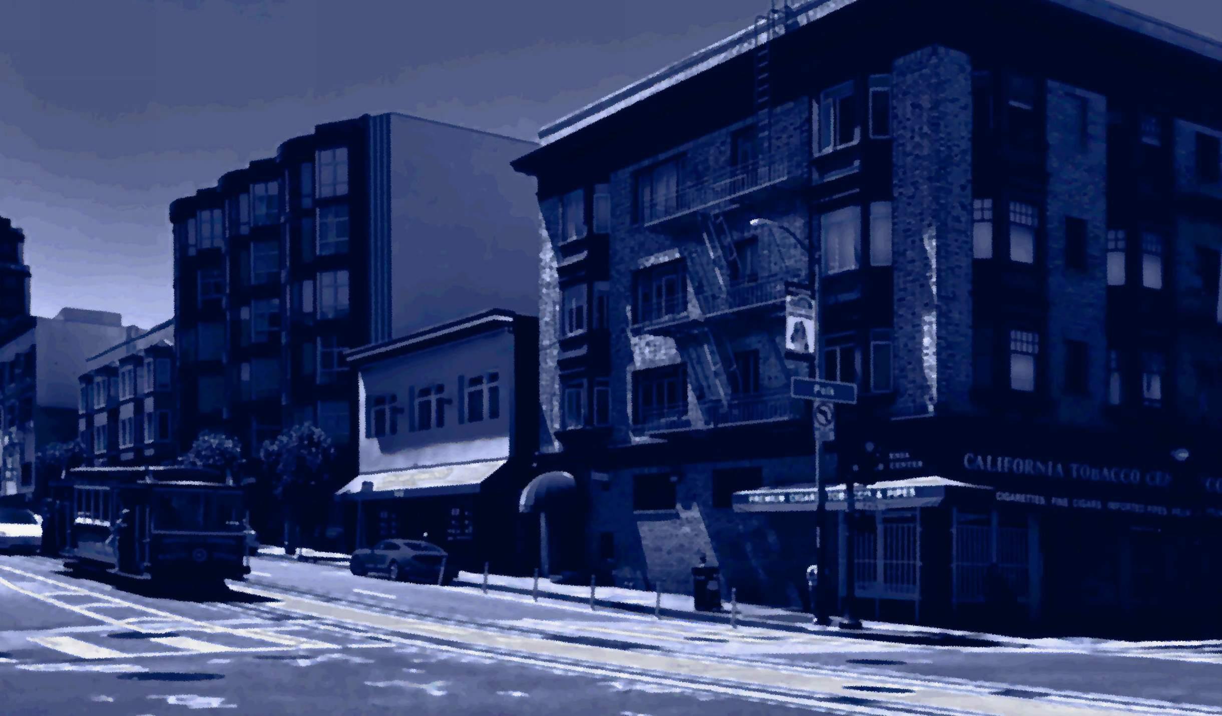
After the original circulation of the California Cable Car Vision plan in September of 2021 there was a renewed interest in the projects eastern potential station point. It was recognized that although the turn around would remain on Van Ness - where connections were already well established with rapid transit, and the existing infrastructure was already in place, there was a feeling that the Van Ness terminus belonged more to the larger metropolitan transport infrastructure, but less to the neighborhood that most sought its improvement.
There emerged from the follow-up meetings, a desire to have the Polk Street intersection of California Street line be better celebrated as the penultimate stop of the California Cable Car’s Western-most line. It was unanimously agreed that an improvement to this part of the block would better recognize the cultural and commercial center of the area and instead of a terminus - it was perhaps a clearer “Gateway” to the Polk Street Merchants Corridor. By being separate and distinct this gateway could represent the true heart of the pedestrian-oriented place providing a prominent focal point for the combined investment of discover Polk to the north, the Polk Corridor Community of neighbors, merchants, institutions and diverse religious and community services to the south, all of whom are increasingly interested in having the thriving meeting point between these convergent neighborhoods - Polk Gulch, Nobb Hill, Russian Hill, Cathedral Hill, Civic Center, and the Tenderloin which all border this Polk Corridor Region, be better served by this growing transit spine.
The Polk Street Corridor is rapidly evolving into a paradigmatic example of a well-planned and integrated transit modality hubcombining pedestrian foot traffic, with dedicated bike lanes, twoway traffic, engaged with rail and Muni bus routes, both on local and rapid county wide corridors. It all happens at the intersection of Polk & California giving rise to the formation of a Polk Plaza Committee that spearheaded the effort to create a forward looking plan that aspires to “complete” and frame the identity of a neighborhood center at this well served intersection.
Taking its inspiration form the many discussions and ideas that were generated in the year long outreach, workshops and subsequent information sessions hosted by the Lower Polk Nieghbors CBD, and
the Polk Corridor Community; the “Polk Plaza” initiative is one which would focus funding on completing bulb-outs and traffic calming strategies already started, in order to formalize a true sense of pedestrian oriented Plaza at the intersection of Polk and California. Here people could gather, arrive, board and debark from the Cable Car, provide interpretation and information along with programming and space for small eventsstreet-side bosking (as impromptu performances). At the same time this new plaza will provide way-finding and directions to support the many amenities and heritage merchants, great restaurants, and shopping venues that are gradually recovering to serve the growing amount of new housing and increased density of development over the past ten years in the surrounding area.
• TALLER PLANTING - INCREASED TREE CANOPY
• DISTANT DISTRICT VISABILITY
• COLORFUL PATTERNED PAVING ZONE PLAZA & CROSSWALKS
• DISTINCT FORM OF SHADE SHELTER: CABLE CAR EMPHASIS
• TRAFFIC CONTROL - SLOWING VISUAL WARNING BOLLARDS
• LIGHTING PEDESTRIAN HEIGHT AND CANOPY MOUNTED
• FURNISHINGS DENSITY | BENCH SEATING
• GREENER PLANTED ZONE
• WAY-FINDING & INTERPRETIVE SIGNAGE AT EMBARK POINTS
• TRAFFIC REDUCTION & SLOW SPEED SIGNAGE
• OFF CYCLE PARKING AREAS FOR TOUR BUS LOADING ZONE
• BULB-OUTS ON ALL CORNERS TO NECK DOWN THRESHOLD
“- ...We want to create a unique place at the intersections of California and Polk Street - a place where they can explore our vibrant merchants, celebrate our neighborhood’s unique history, and where they can safely walk and access transit...”
- Drew McDaniel (Polk Corridor Community Board)
The design vision for the Polk Plaza is to create a local campus like setting characterized by a focus on pedestrian safety by the marking of this intersection as territory to create a remarked change in the patterns of movement both by vehicles and by other personal transport modalities. The creation of a figural “living room” for the Polk Corridor is central to the mission of Polk Plaza. By slowing traffic and creating a heightened awareness of passage, it is designed as a place that prioritizes people arriving, gathering for departure, or just passing through on foot as they explore the corridor’s diverse activities both north and south along Polk Street.
The main thrust is to carry forward and take advantage of the single lane of East bound traffic created by the Van Ness turn around station to create a gateway transit exchange point at this more centrally & neighborhood focused Polk Street Intersection. Here a thinner middle platform with a smaller more cable car inspired canopy takes the unused vehicle lane beside the East flowing track, while bulb outs on the opposite side of the street complete the narrowing of the street, helping slow traffic and shorten crossings while still allowing the two lanes of vehicular traffic to move in the Westerly direction.
Sidewalks would be widened into the intersection to match the south east corner to allow more space for seating, plantings, signage or bosking areas. The widened sidewalks would be programed locally for street performances and musicians to occupy. and the entire intersection extending in all directions would have identifying features that can be perceived from people arriving from the three uphill directions as well as fro the south on Polk. Conceptually the new Polk Plaza is identified at three scales - the neighborhood, the intersection, and the Cable Car station point itself, with graphics and information distributed to be perceived at these different time frames each with its own particular scale of interaction information, and activation.
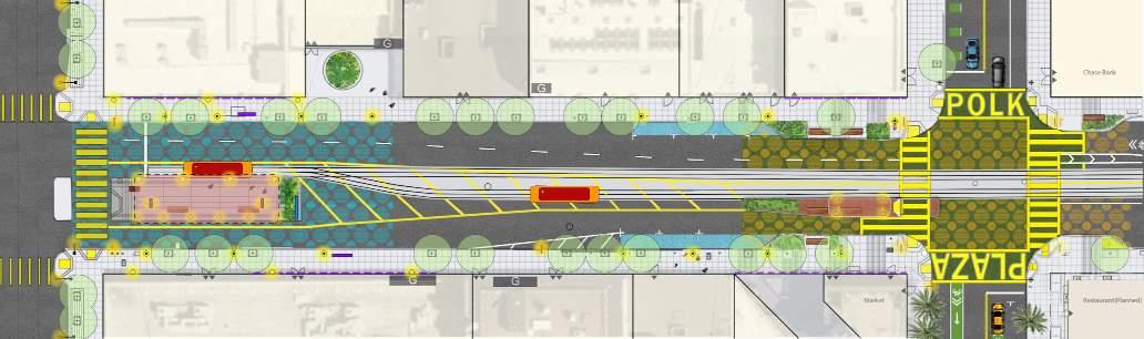
At the urban scale the concept is to create a clear sense of arrival and place at the intersection that can be perceived not only when at this new Gateway to the Polk Corridor but also in approaching it from the transit path ways (particularly up hill) that will be instrumental to bringing people from the rest of the city to this new nodal locus. Coming down Polk Street, down from Van Ness, or more dramatically from Nob Hill heights - the Plaza Design should be clearly recognizable as differentiated in speed and density of circulation. The idea is to allow the time for a recognition of arrival and an awareness or threshold.
Polk Plaza will not only increase the identity of Polk Street Cable Car Stop, and the ground surface around it, - but will also create places for waiting, music performance, gathering and resting. The importance of color and strong contrast is used to create a strong impression of this threshold or Gate-Way condition, thus allowing faster moving transports, personal modal or vehicular modalities to be dramatically slowed and awakened to the presence of the “Crossing” as an intersection of community-oriented activities and a pedestrian prioritized environment.
Bulb outs are added to three more corners to complete the four corner quadrangle of shorter wider crosswalks. These wider sidewalks will allow for planting and benches and improved directional and commercial, district specific signage.
• LANE WIDE BOARDING PLATFORM (East-Bound) WITH SHADE SHELTER
• PEDESTRIAN REFUGE AT CROSSING TO BULB OUTS ON WEST SIDE
• DIFFERENTIATED PAVING ZONE PLAZA AND CROSSWALKS
• LIGHTED BOLLARDS @ EDGES
• NEW PEDESTRIAN POLE LIGHTS AND CANOPY MOUNTED FIXTURES
• FURNISHINGS - SPECIAL STREET BENCHES
• PLANTING, RAIN GARDENS ON BULB-OUTS AND NEW STREET TREES
• MURALS AND INTERPRETIVE SIGNAGE AT EMBARK POINTS
• ONE LESS LANE EAST BOUND – (FROM 2 TO 1 AT VAN NESS)
• TOUR BUS LOADING ZONE / OFF-CYCLE MARKINGS
• GATEWAY TO POLK CORRIDOR NEIGHBORHOODS
• WAY-FINDING SIGNAGE TO THE POLK CORRIDOR AND HISTORIC SITES
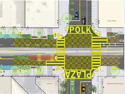
VIEW 1 - FROM CABLE CAR ON CALIFORNIA ST. (LOOKING WEST): VIEW OF POLK PLAZA
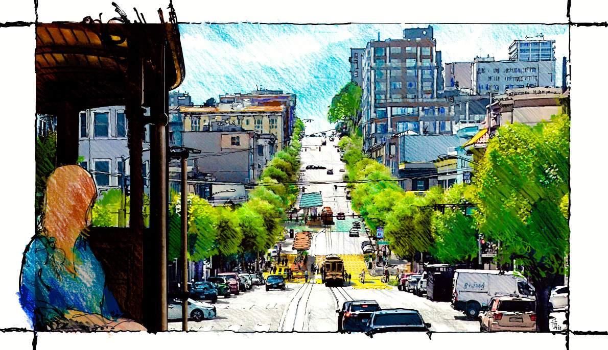
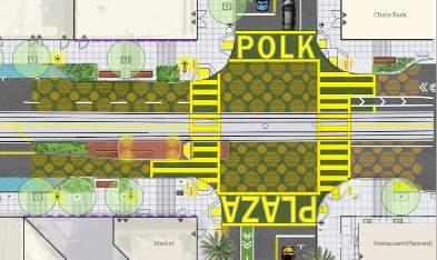
Polk Plaza will not only increase the identity of Polk Street Cable Car Stop, but also create places for waiting, music performance, gathering and resting. The importance of color and strong contrast is used to create a strong impression of threshold and to allow faster moving transports, personal modal or vehicular to be dramatically slowed and awakened to the presence of the “Crossing as an intersection and community oriented pedestrian prioritized environment.
The Plaza is the border between Polk Corridor South extending to Civic Center and City Hall and Northwards to The historic Aquatic Cove. Color and an increased density of activity and transit crossings define this new arrival point from the downtown core at the western most stop of the California line before its terminus at Van Ness Boulevard.
Bulb outs are added to three more corners to complete the four corner quadrangle of shorter wider crosswalks. These wider sidewalks can be actively programmed with provide respite with lush plantings and non sleep-able benches.
Traffic Calming is prioritized with the shelter creating a single lane to east bound traffic decreasing speed and allowing bike and other modal transport to cross safely along Polk Street north south directions - Left turns will not be allowed and the forced right at Van Ness will allow flows to be controlled before this intersection while west bound traffic will be early warned of the change in pace as they approach the outlet onto the higher volume collectors to the West.
Here the pedestrian is the welcome participant encouraged to linger and get their bearings, while the Car is the “guest” allowed to pass through slowly and with textured paving to enhance speed awareness and help define this calm 15 MPH zone.
PEDESTRIAN IMPROVEMENTS:
• IMPROVED WIDER CROSSWALK LADDERS AND IDENTITY
• BENCH STREET FURNISHINGS ON BULB-OUTS AND BESIDE PLANTINGS
• LANE WIDE CABLE CAR STOP SHELTER RESTRICTS FLOW TO EAST
• PATTERN AT ENTIRE INTERSECTION DIFFERENTIATED FROM VAN NESS
• MURALS ON BUILDINGS WHERE POSSIBLE WITH HISTORIC NARRATIVES
• CLOSE PROXIMITY TO TOUR BUS LOADING ZONE
• SHORTER CROSSINGS AT BOTH WEST AND EAST BOARDING AREAS
• CENTER STREET REFUGE AT WEST LANDING
• TREE CANOPY MAXIMIZED FOR SHADE AND TRAFFIC CALMING
KEY PLAN
“There needs to be a central orientation point for visitors to the Polk Corridor to get their bearings ... to feel a sense of arrival.
... every day, I see tourist from hotels in the area looking for the boarding platform for the cable car ... they wander around with nothing to take a picture of - there is nothing that recognizes : they are already here ... ”
- Workshop Participant (Cable Car Vision Plan)
VIEW
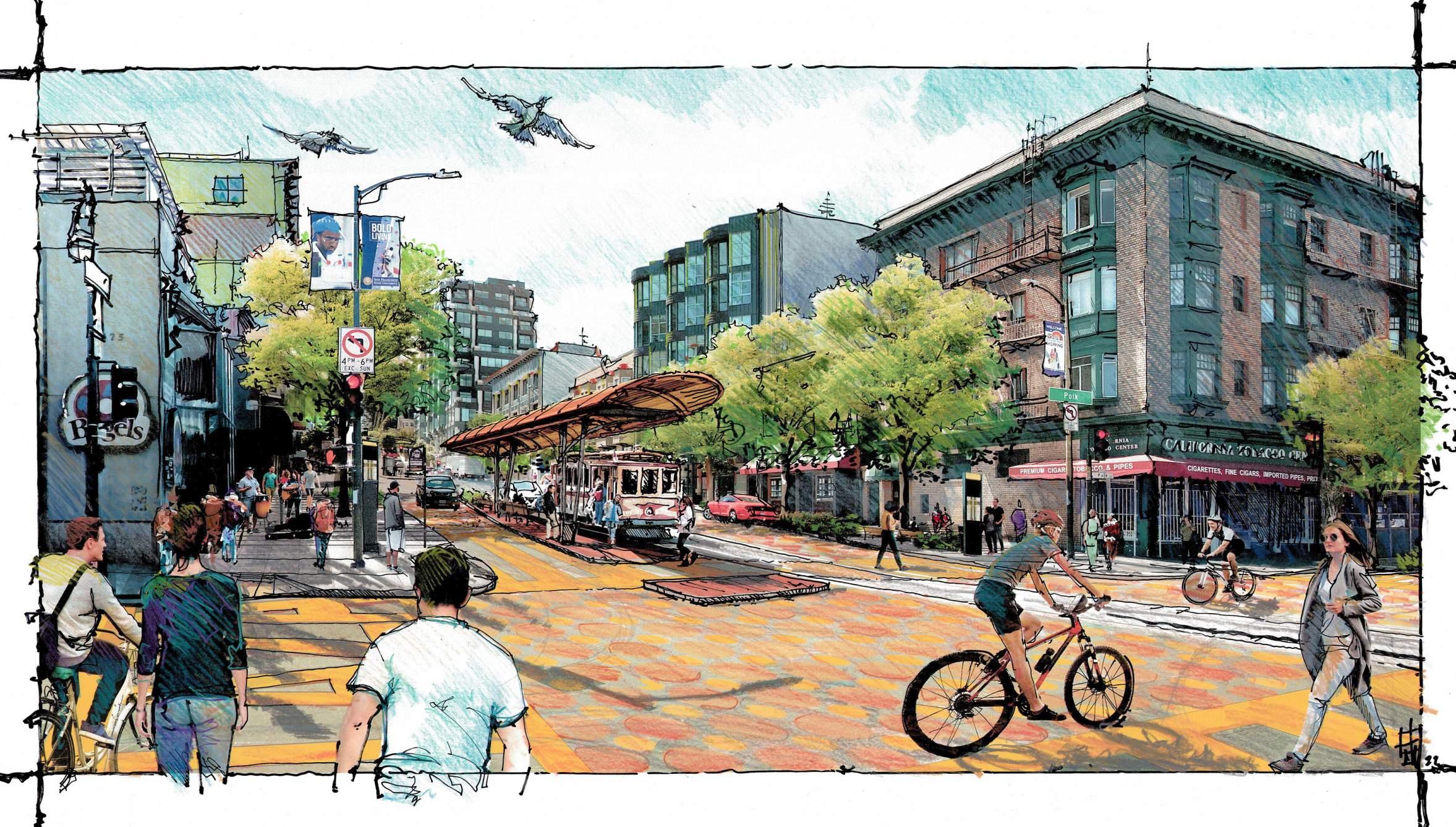
Polk Street’s proximity to the larger Van Ness Rapid Transit corridor is a great asset to this well transit-served north/south pedestrian scale street. California Street makes a well defined border between South Polk and North Polk extending from the bay to downtown civic center. Unlike the larger shelter at Van Ness - The Cable Car shelter at this smaller “community connector” - is not as large. At Polk Plaza it would be more of a Gateway station focused towards arrivals and departures from the Polk Corridor as opposed to a stop along a larger and more commuter focused system that connects at the Cable Car line’s actual end at Van Ness Boulevard, where these connections draw larger flow at peak transit hours.
At Polk Plaza Station the predominantly pedestrian, slower scaled travel, favors local buses, bikes and electrified personal modalities. Here the larger rush hour transit traffic and surge ridership of the Van Ness corridor steps down - from vehicular, to a more quiet and pedestrian friendly traffic pattern where bars, restaurants and small heritage merchants dominate the street scape and daily rhythm of street life.
Here at this East/West threshold, The California Cable Car is the dominant transportation infrastructure, and its presence is, at the Polk intersection, enhanced by a smaller shelter to allow tourist busses to discharge passengers into the area for shopping and for the return journey to the downtown core, China Town neighborhoods, and to the city’s periphery along the Cable car line where they will be picked up again at days end. - Or the reverse may be true, as folks arrive here from the cable car down over the hill from the East Embarcadero start, to arrive in the historic Polk Corridor nexus of shopping and dining to be then picked up and returned to hotels or points north of this neighborhood - or from Civic center to which they walk along the pedestrian orientated Polk Street.
The signage at the transit stop and bulbed sidewalks support this new orientation allowing a shorter transect of the decreased street while allowing ample space for interpretive signs to tell the story of the historic neighborhood while introducing visitors to the Polk corridor street Medallion program, and other way finding and narrative signage, all of which further connect the adjoining neighborhoods, that are easily reached from this central arrival point.
The vision for Polk Plaza is to promote this new place as the “Slow Transit“ center for the surrounding neighborhoods: Particularly on a local levelThat is efficient and experience based, not fast, or high speed. A system still connected to the busy more vehicularized Van Ness transit corridor, but more locally scaled, and at the more intimate scale of the Classic Cable Car experience. The focus here is on pedestrian familiarity and rates of travel to slow movement. Here personal modality transit on foot, scooters, bicycles, electric scooters, or assisted bicycles & skateboards are the main density of passing wheeled traffic. Cars are here only as they are moving from Van Ness into the quieter streets, or leaving these community scaled roads towards the collecting streets like Van Ness or Franklin to leave the neighborhood character of this area behind.
• DISTINCTLY LOCAL TRANSIT STOP.
• MORE INTIMATE SHELTER - IN THE “CALIFORNIA CABLE-CAR” FAMILY.
• WOOD & HISTORIC CABLE CAR REFERENCE
• PLANTED PEDESTRIAN PLATFORM ISLAND ON “IN-BOUND” ROUTE
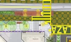
• DIFFERENTIATED PAVING ON PLATFORM
• LIGHTED BOLLARDS WITH WARM NIGHT PRESENCE
• LIGHTING PEDESTRIAN HEIGHT AND CANOPY MOUNTED FIXTURES
• ON PLATFORM WOOD FURNISHINGS / CABLE CAR DETAILS
• PLANTING ON PLATFORM TOWARDS WEDGE TRAFFIC EDGE
• HISTORIC INTERPRETIVE SIGNAGE TELLING CABLE CAR WEST LINE STORY
• DAY USE - (COMMUTE OFF-CYCLE) TOUR BUS LOADING ZONE
• GATEWAY IDENTITY TO POLK CORRIDOR NEIGHBORHOODS
• WAY-FINDING TO THE POLK CORRIDOR MERCHANTS AND HISTORIC SITES
VIEW 2 - INTERSECTION VIEW OF POLK PLAZA
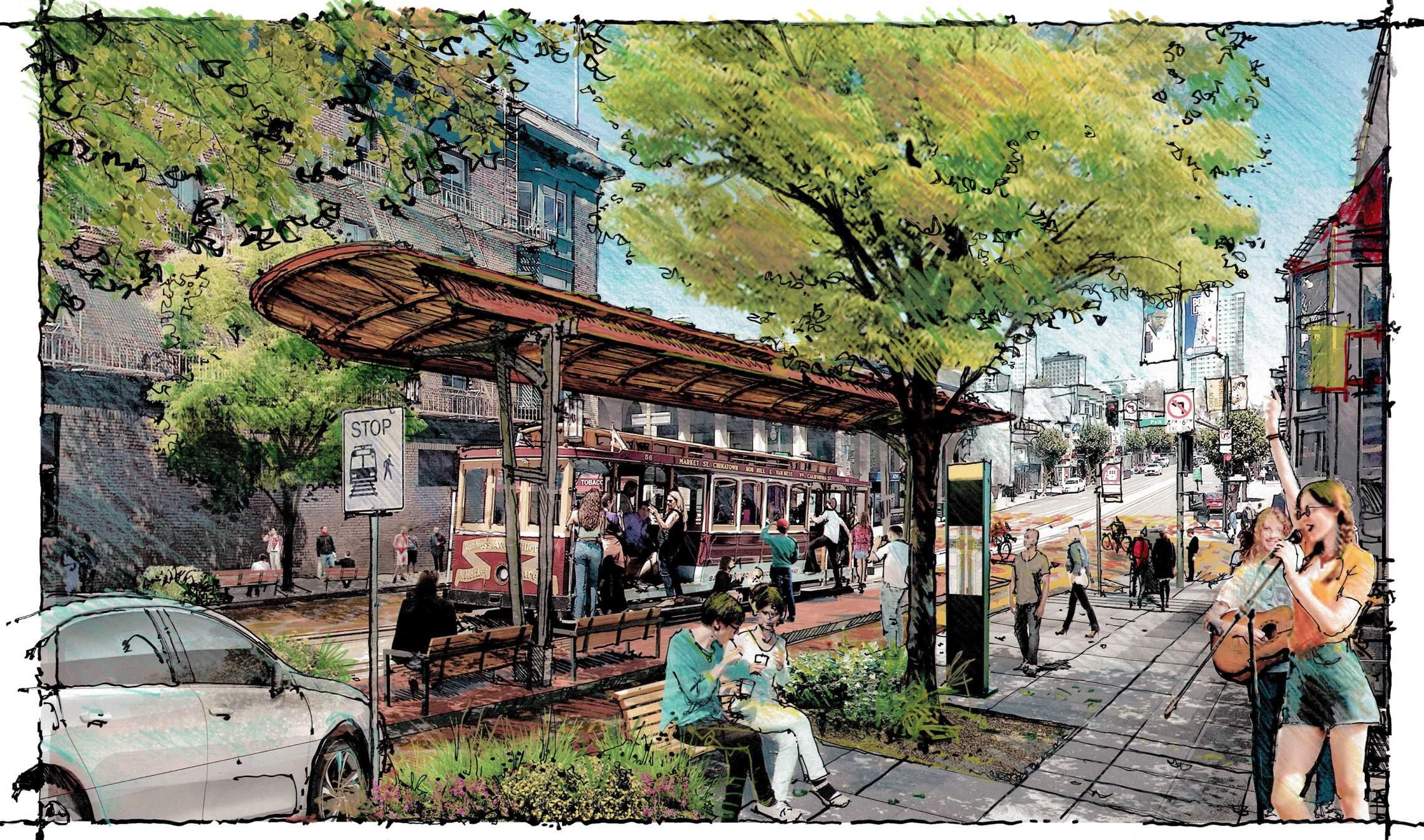
BETTER STREETS PLAN
(https://www.sfbetterstreets.org/)
POLK STREETSCAPE PROJECT .
(https://sfpublicworks.org/project/Polkstreetscape-project)
VAN NESS IMPROVEMENT PLAN
(https://www.sfmta.com/projects/van-nessimprovement-project)
Vision Zero SF
(https://www.visionzerosf.org/maps-data/)
FERN ALLEY PLAN
(http://www.intersticearchitects.com/project/fernalley-west-alleycat-bench/)
SAN FRANCISCO CABLE CAR MUSEUM
(http://www.cablecarmuseum.org/)
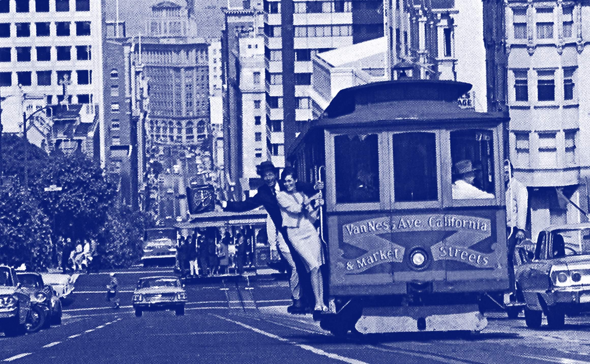
DATE: WEDNESDAY, DECEMBER 9TH 2020
SAFETY:
• How many car’s do we need on the road?
• Can we make the traffic one way?
• Can there be no cars? Commercial and transit circulation only?
• One lane road with more safety for pedestrians. (Buffers and traffic calming)
• Entry and waiting on the bus median doesn’t feel safe, can we make it safer and easy to access?
• Could we make this more like the mission, only certain vehicles, cyclists and buses?
• Dangerous, median is not safe for waiting, traffic is moving quickly!
• Concerns about the aging population as well as people with disabilities, many of them use walkers, etc. Ideally it will be easy to maneuver around.
• Could it be a table top for most of the block around the Cable Car stop - curbless and bollards better lighting and markings.
• Parking in the north of California going west is a problem because many people double park or park illegally, cutting and narrowing the lane causing more traffic.
• We need physical barriers that tell people to slow down. Improving this would add to the pedestrian experience, whereas now, it is incredibly dangerous EVERYTHING about this intersection says “Go Fast!” We need to find a way to slow cars down.
• Push the median itself away from Van Ness
• Lessen the number of lanes, particularly heading east.
• Make this a pedestrian focused space. Traffic needs to slow down. There need to be design indications that tell cars to go slow.
• Would textured paving be a way to slow traffic by making noise and jostle cars at speeds higher than 10 to 15 mph?
• Cable Car replica as bus shelter.
• Need more green spaces near and open spaces
• Add a park near in any open lot.
• Adding a foundation to replace planter in front of Whil Concepts.
• Incorporation of a pocket park.
• Cars as secondary users, pedestrians as primary users of the space.
• Make all of California a park
• Design “Sandbox”, on Cable Car median, to look different.
• How do we make a space in the middle of the street?
• Alternative energy opportunity-- wind turbines.
• Add a banner “TERMINUS CABLE CAR LINE”
• Add more trees.
• Incorporate a mural into the ground plane.
• Let’s add glamour back to the area.
• Integrate a mural in the ground like a mosaic?
• Try to make it more tourist friendly.
• Potential for beautification - The space feels like a waste land. There are so many businesses and residences along Polk and across California bringing many people around.
• Possibility of widening the streetscape and having one lane for vehicles?
• One lane going West could work but going East might be more challenging.
• This terminus is the least appealing of the Cable Car locations
• Use different colors (ex brick) surface at the cross walk all the way to shelter
• Raise the crosswalk itself so it is like a speed hump. Raised Tabletop paving pattern to signify pedestrian area to Cars.
• Bollards “Gateway” like maiden lane.
• Shelter is barely a shelter. Leaks when rain. Signifies a BUS not the Cable Car.
• Could the drop-off point be moved to Polk St.. Intersection instead and this be the pedestrian main loading disembarking “threshold”. Let the celebration be at the Polk Street stop - and let the car continue to the end point to swap cables and return (empty)/(like Bart or Muni often does)-this would let Polk- the safer quieter intersection, be the focus of the terminus or pedestrian oriented “Station”.
• Incorporation of vegetation + plant as a buffer to traffic.
• Redesign the front of Whil Concepts planter making it more fluent with Cable Car experience. (POPO)
• Gateway + lighting
• Musicians, artists, performers to activate street frontages.
• New York has a gateway for the neighborhood upon entering, can we do something similar to mark the space?
• This is the only “terminus” that ends in the middle of the street, this makes it challenging.
• Can this place be more attractive by adding more trees and art?
• Optimism of how the area could look by adding public art in the ground as a way of bringing this space to life.
• Neighborhood identity-concern to recognize the original nomenclature. This is Nob Hill and Polk Gulch.
• More historical signage needed for Nob Hill.
• Many movements started in SF and the Cable Car is passing through those historical spots, let’s show it!
• Regarding the new Van Ness rapid transit project, it would be great if the proposal could interact somehow along with the rapid transit project.
• Add historical context by having historic old photos related to the site adding a meaningful storytelling to bring more tourist attraction
• This could be a great resource in the neighborhood.
• The Cable Car has national status, and the terminus isn’t currently living up to that. California line used to be longer - all the way to Fillmore.
• Look at the history of this terminus. Was it ever a turnaround?
• Can local businesses contribute funding?
• Possible collaboration with SF Historical Society ?
• SF Public library - huge historical section with photos.
• Check in with the Cable Car Museum on historical data.
• Collaborate on establishing calming measures with BRT?
• Van Ness BRT opportunity for connection
• Looking at this from the lens of safety = more funding opportunities.
• Prioritize with DPW what the political and legal parameters are with traffic calming. We must demand traffic calming.
• Design Examples and City Input
• MTA noted - This is a unique terminal as it is not a traffic dead endothers are..
• Other major improvements have changed streets dramatically and this is possible
• Jefferson, Castro , Mission, Market have all undergone major circulation changes and initiatives around limiting cars or eliminating non commercial, transit traffic.
• Safety data and accident reports for this area and these intersection would be good to understand
• What funding sources are available parallel to the city, are major banks or businesses interested in helping tell the story and celebrate the Cable Car and this gateway to the Polk Street Neighborhood?
• Connect with the Cable Car museum as an asset: www. cablecarmuseum.org/cocaliforniast.html
DATE: WEDNESDAY, JANUARY 13TH 2021
Dustin White, Transportation Planner
Nehama Rogozen, Public Relations Officer
Matthew Lee, CC Transit Planner Wes Valaris, CC Operations Manager1. IA relayed the feedback that was provided by members of the Neighborhood during the community zoom meeting. Many sentiments Expressed by the community surrounded safety issues, traffic calming, Celebrating Cable Car history, and making the terminus feel like a place and gateway to the neighborhood that is connected to Polk Street.
1. IA presented three scenarios that corresponded to the community Feedback gathered. Each scenario varied in the magnitude of the scope & Intervention of streetscape change:
A. Scenario A: Limits vehicular access for the block, incorporates street Furnishings, and expands the shelter located on the median.
b. Scenario B: Relocates the main dis-embarkment/passenger loading Terminus to the Polk Street intersection (to the East).
c. Scenario C: Creates a traffic slow zone around the median, Emphasizes the crosswalk, and expands/widens the boarding platform at The island.
1. SFMTA confirmed that the Cable Car is used by commuters on the weekdays in the mornings and evenings. On the weekday afternoons and weekends, users are mostly tourists. There is no strong connection between the Cable Car and Van Ness rapid transit. The most common connections are to the number 1 bus route and the Polk Street bus routes. There is a desire to connect the Cable Car to rapid transit, though it was noted that the future rapid transit stop is about one block away from the current Cable Car Terminus. In-bound refers to east bound and outbound refers to west bound.
1. Limit Cars on Block: IA inquired first off as to the status of cars on this block looking forward – Specifically, if this street could possibly be a car-free zone - or at least evolve to slowing traffic to create less through vehicular activity. SFMTA replied that California Street is a thoroughfare with approximately 1200 vehicles per hour that go through this intersection. Therefore, it would be very difficult to accommodate a re-route for a car-free scenario.
2. Traffic Calming w/ Raised Roadway: The team explored the idea of creating a raised table top/raised crossing (to level of loading platform) to calm traffic around the median. SFMTA stated that maybe very expensive, and that table topping (raising) a roadway with such volume would not be an appropriate traffic calming measure in this location at a signaled intersection. Also, SFMTA noted that vertical adjustment to the cables would be prohibitively expensive.
3. Median Loading Expansion: SFMTA believed the most feasible option is to expand the central boarding area and narrow down the adjacent lanes from two to one. SFMTA noted that the turning clearance required for trucks from Van Ness onto California (fire trucks) would need to be preserved and the transition from two lanes to one should perhaps begin a block earlier (West of Van Ness).
5. 24/7 Use: IA noted that many suggestions centered on visibility and night presence – such as adding lighting, would add to the pedestrian precinct as well serve safety - so as to help warn oncoming cars that there are pedestrians and loading ahead.
6. Other Items: The team also shared with MTA that there were additional items that came from community interest including shade and rain protection structures, low rails to help protect peds and provide leaning space while waiting, murals and signage to provide more historical context, street murals to define the pedestrian zones, and eliminating curbs to improve accessibility. MTA generally supported the integration of these items and confirmed that the existing signage (historical) on the sidewalk was installed by MTA’s marketing department, and that signage improvement and Integration into the area would be welcomed in future improvements.
7. Next steps:
A. LPCBD/IA to circulate notes from this meeting
b. LPCBD/IA to meet with DPW to review Scenarios to get feedback
c. IA to develop concept scenarios based on input from MTA/DPW to bring to Workshop 2 with the Community to get input and comments to further develop and refine ideas for Streetscape Improvement Concept Document.
DATE: WEDNESDAY, FEBRUARY 5TH 2020
DPW ATTENDEES:
Michelle Woo, Senior Engineer & Project Manager Jennifer Cooper, Landscape Architecture Bureau Manager Deanna Calleros, Civil Engineer• Street Improvements: DPW vocalized to prioritize the improvements that can double perform in terms of safety and accessibility while also using those improvements to help create a sense of place. What can you do in terms of traffic calming to alert cars that there is something coming up ahead? DPW stated that decorative pavement (pictograms, symbols, etc.) Needs to be vetted by SFMTA adding, patterns are more acceptable than images. The intention is for the pavement to be easy to maintain.
• Limiting Vehicle Access: IA relayed SFMTA was reluctant do to something that affected the entire street and restricted traffic too much. SFMTA is in favor of making the area feel like cars are a guest in this area, but not the priority, and that traffic calming techniques should be applied to this area. SFMTA also noted that this is the only terminus that doesn’t feel like a dedicated space.
• Furthermore, SFMTA noted that the whole block was likely unable to be converted into a pedestrian precinct, but that there should be more pedestrian friendly access to the boarding area.
• Utility Interference: DPW suggested that if we are considering bulb outs, that we should understand the utility locations that might inhibit the development. IA is to get in touch with DPW about any resources and maps that show the utility layout. DPW highlighted that the sewer lines and sub-sidewalk basements are very expensive to relocate. Some sidewalk basements extends past the curb line and some of these elements are not on record.
• Tour Bus Loading: Tour buses service this area but don’t have a designated area to park, they tend to park wherever they want, and contributed to clogging traffic. The future layout of the street should accommodate this condition.
LIGHTING:
• IA brought up lighting noting it would be beneficial if some of the lighting could be sponsored by the surrounding buildings.
OTHER:
• Chris stated that IA will need to look at the City’s palette for roadway improvements. He also stated that we have the main terminus on Polk, that we need to have a lot of consideration about the tour bus parking locations. LPCBD & Discover Polk CBD. Ask Erica about what CBD is north of here. Is Andrew referring to the Tenderloin CBD. Chris stated that safety and economic development improvements are a priority to the neighborhood. How do we introduce way finding that lead people into the neighborhood?
• Upcoming City projects: DPW is to relay to IA what the street renewal schedule for this area is. DPW will inform IA about the upcoming projects in this zone and forward the utility layout information.
• Maintenance: IA mentions that the improvements could potentially be taken care of by two CBD’s to be seen as an overlap of responsibility. (Lower Polk CBD).
FUNDING:
• DPW brought up that we might need to go to the SF Arts Commission to get approval for any additional art in the area. They may potentially help fund and maintain the art as well as assist with picking the artist.
• DPW inquired as to whether this was grant funded. Grant: MOHCD. Planning study.
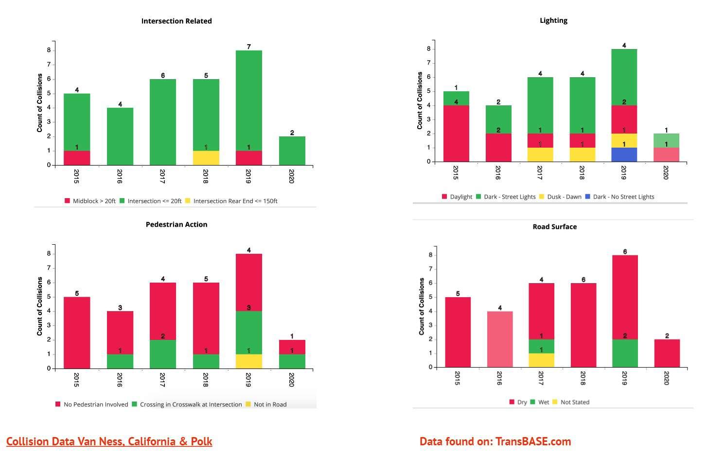
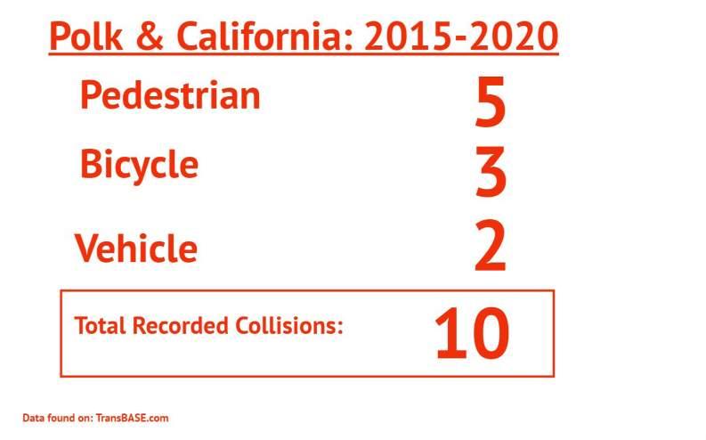
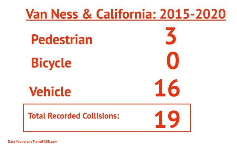
DATE: FEBRUARY 25TH, 2021
• Bulb outs: it was agreed do improve safety for boarding the Cable Car and
• Should be considered whenever possible - (this might be easier at the Polk location)
• Polk St. Is desirable in terms of location for boarding because it is more pedestrian friendly. (Safer and slower - already calmer)
• Safety and activation of the street for pedestrians should be prioritized.
• Community support was expressed for lane reduction and for measures that slow down traffic in the area. Traffic slowing was always encouraged.
• A potential issue was raised around double parked vehicles on Polk–how could this be prevented?
• Tourist Buses that double park for unloading want to find a place assigned for this purpose if possible as this frustrates current traffic.
• Cable Car shelters should have a distinct appearance that differs from the Muni shelters. More in character with the historic Cable Car charm and legacy.
• The bus shelters should establish a unique sense of place, something safe and warm.
• There was a question expressed as to what bus shelters are possible.
• Preferred tree locations on the sidewalks rather than on the platform, to allow for a spacious waiting zone. Ideally, would like a larger shelter over a planted area.
• Cautious placement of trees on the street frontages in order to maintain building visibility.
• The trees near Van Ness Intersection are suffering from excessive vehicle exhaust, be mindful about tree health. In ground conditions and Soil Volume.
• There is a possibility of a park being located adjacent to Out of The Closet in the future, which could allow for a relationship between the park and the Polk Street Boarding Area. It would be nice to create a one or two lane park near the Polk St.. Intersection.
• Generally the community would like to bring more greenery into the
• Neighborhood since it is currently lacking. Previously removed trees should be replanted (e.g. The ones near Chase Bank).
• Trees should be planted such that they do not block murals if possible or be limbed up as they mature.
• There used to be very beautiful trees all along California Street, this historical condition should be restored.
• Moving the boarding location to Polk St.. Seems like a bit of a retreat from the West, (Was the Cable Car planned to go much further west originally or did it?).
• The Hotel at Van Ness (Holiday Inn), will have many tourists that will ride the Cable Car. Maybe this is the better place to keep it and build on what we have.
• Even if the focus is Polk, there still needs to be safety improvements at Van Ness as well. So ... why not concentrate them here where we would have a greater impact on safety.
• The environment at Van Ness is going to become more pleasant after the improvement plan has been implemented. Don’t avoid this area because it is not great now.
• Given the large volume of people waiting for the car, the wider island is preferable. This can not be achieved at Polk where there are two tracks.
• Wind turbine location is optimal on this side of the street. (Speculative energy production aspirations are easier to achieve here because of wind concentration.)
• Relocating the terminus to Polk street seems like an ideal location because you can visually see the Cable Car approaching in the distance. This would allow you to shop or browse stores , get nearby coffee if you had the time...
• An advantage of Polk st. Focus is the view, which is stunning - up both streets away from the pedestrian friendly heart of the Polk Corridor.
• Polk St. Is a better boarding experience with more pedestrian centered activities, biking, slower traffic,etc.
• Polk is more appealing of the two options as to its connection to place and
• Neighborhood, smaller scale businesses - more characteristic of area. Van Ness is more impersonal - big city urban.
• Community sees this location as a positive push to attract more visitors into the
• Polk Street neighborhood to interact with businesses.
• Less windy and more sunlight on Polk. Less exposed and warmer.
• Even if the island is going to be smaller, the location is better for its inherent advantages..
• Historically, there were more Cable Cars moving down the line. At present today,
• There are only about 4 cars. The Cable Car pick up rate is extremely slow as a result.
• The history of Polk is rich and worth embracing. We should tell this story.
• The waiting time for the Cable Car line is long, the area is currently barren, the current configuration feels like the lesser of the Cable Car lines.
• Murals are a great idea! Buildings on block should all participate if possible in the West Cable Car block at Polk to Van Ness.
• Display historical photos, possibly from the exact same locations that they were. Taking ideas for photo narration and time line illustration.
• Example of historical figures in the neighborhood that could be commemorated:
• Chet Helms
• Frank Norris
Local farmers markets in the area are excited for the Cable Car improvements.
• Locating the Cable Car closer to Polk allows for people to explore local businesses
• And streets. Local Merchants support this project and want it sooner than later.
• The long waiting time could be offset by dining experiences (e.g. Cafes, ice cream shops, etc..) Performance street side, bosking musicians, and window shopping opportunities.
• If design elements are highly unique/customized, and they get damaged, it is more difficult for the City to restore them to their original quality.
• Which design focus has more funding, momentum or capacity for expansion might be a consideration in effort and resource concentration.
• How much infrastructure needs to be updated should be a consideration - Is there a huge difference in cost for one solution over another?
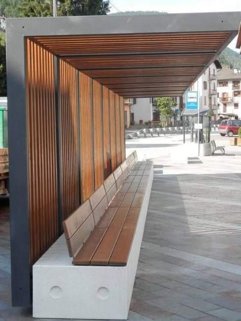
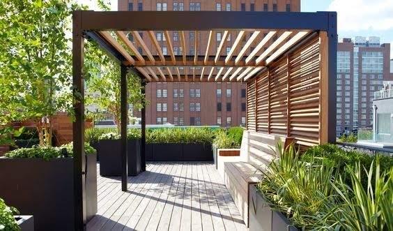

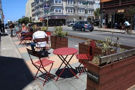
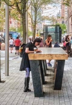
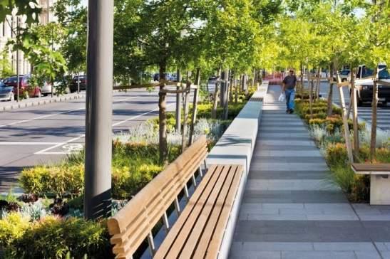
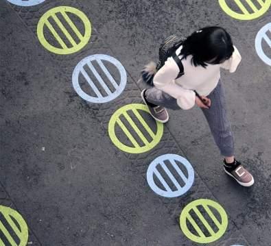
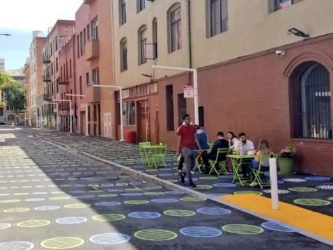
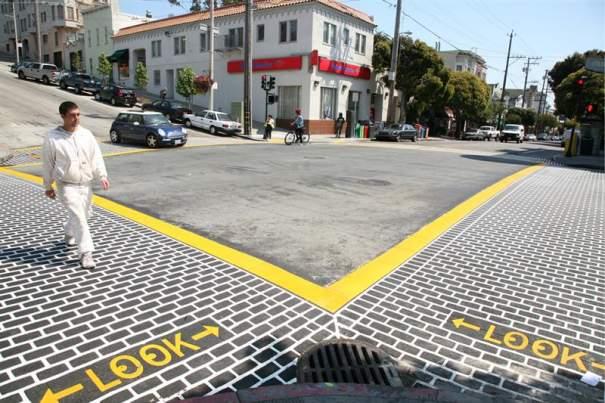
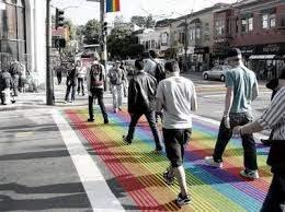
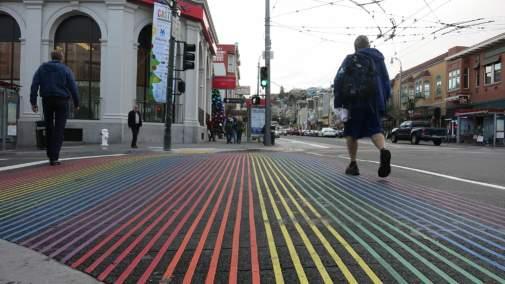
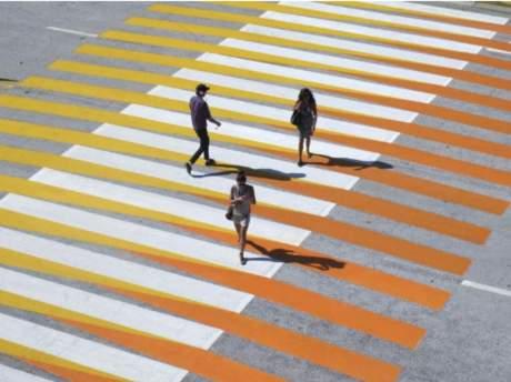
IMAGES PRESENTED DURING WORKSHOPS TO DESCRIBE “TOOL-BOX” OF SITE FEATURES
SEATING, PERCHING, WAITING PRECEDENTS
SHELTER PRECEDENTS
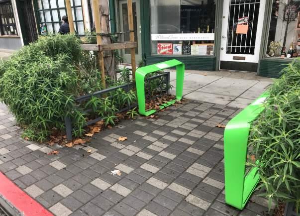

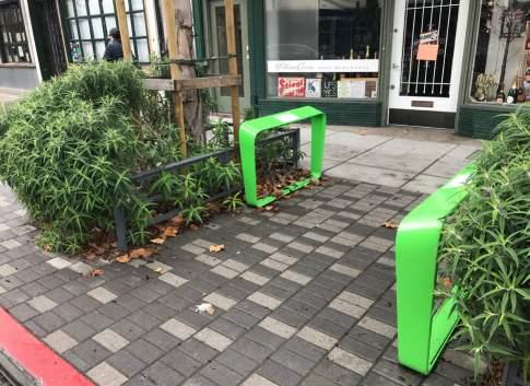

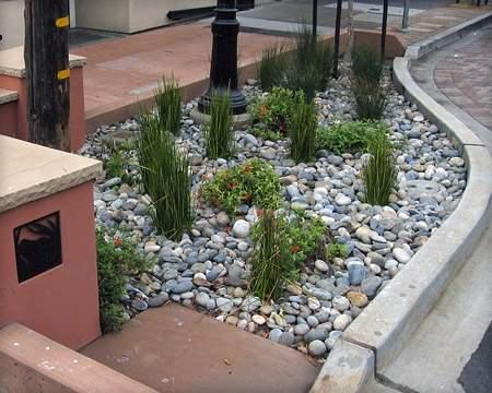
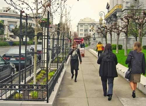
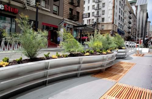
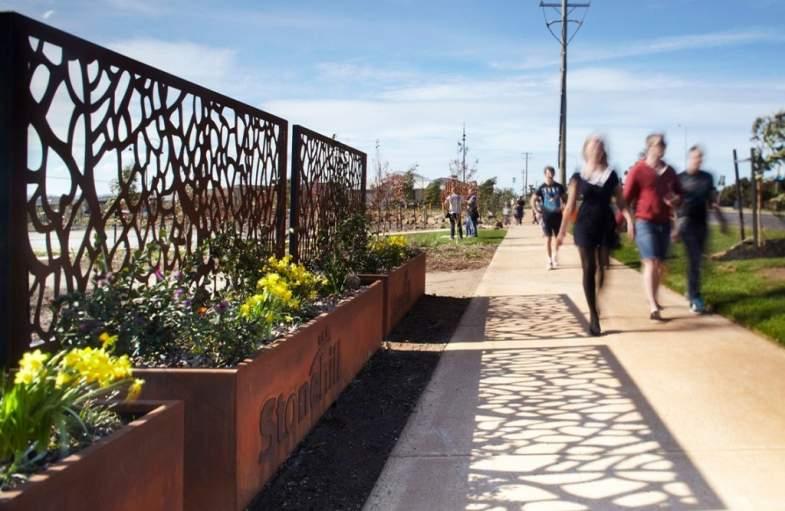
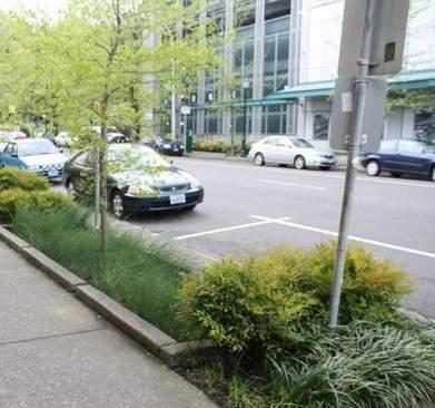
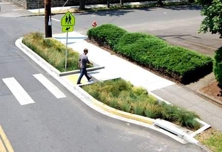

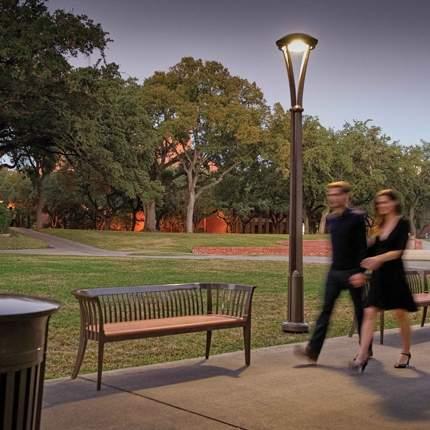

IMAGES PRESENTED DURING WORKSHOPS TO DESCRIBE “TOOL-BOX” OF SITE FEATURES

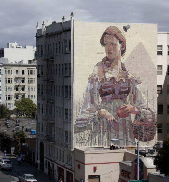
IMAGES PRESENTED DURING WORKSHOPS TO DESCRIBE “TOOL-BOX” OF SITE FEATURES
PUBLIC ART OPPORTUNITY - PRECED

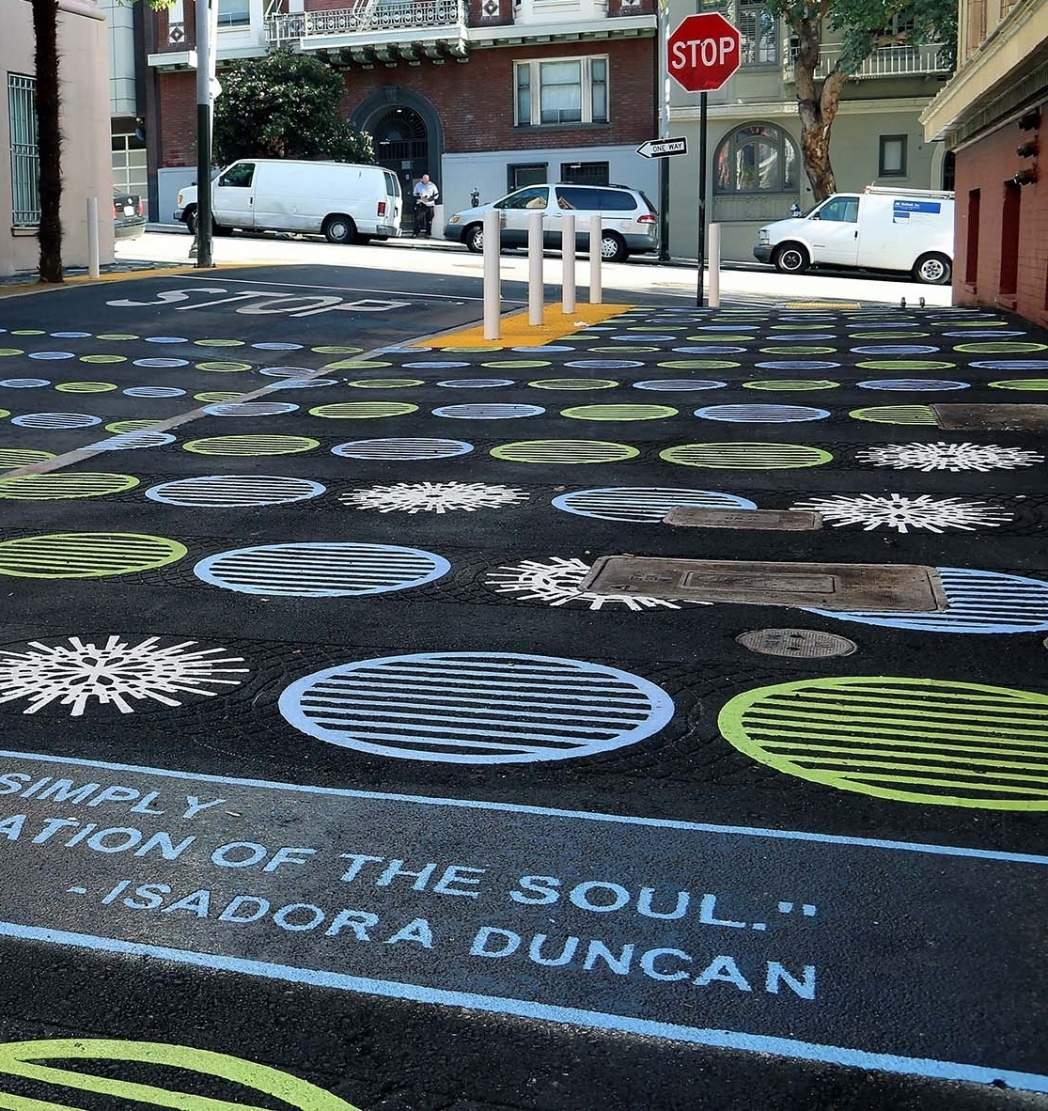
HISTORICAL SIGNAGE - PRECEDENTS
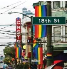
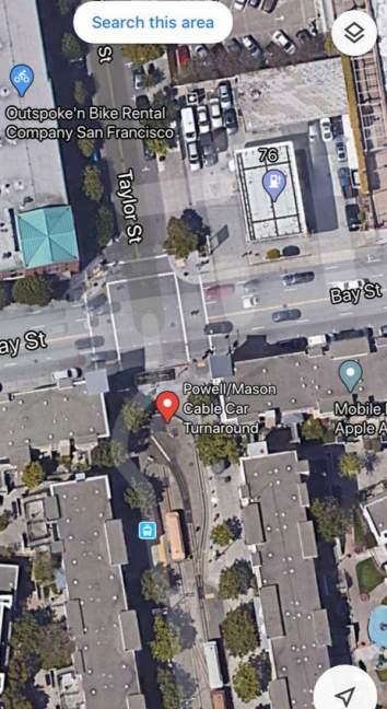
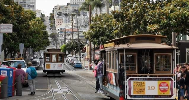
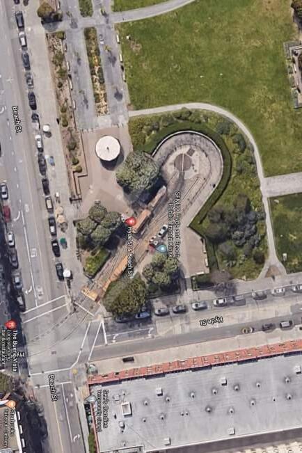
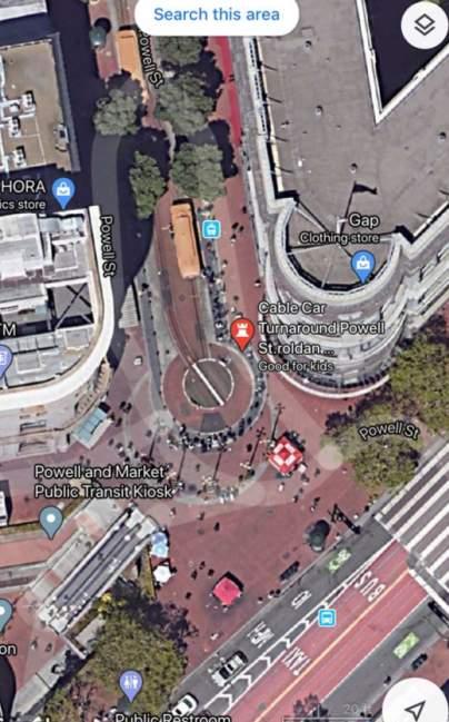
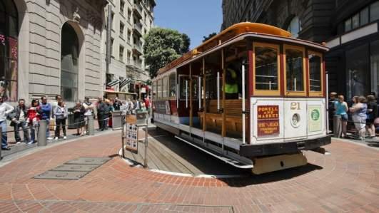
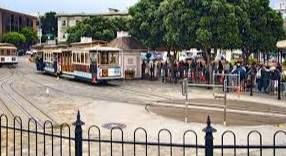
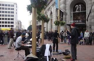
IMAGES PRESENTED DURING WORKSHOPS TO DESCRIBE LOCAL TURN AROUNDS
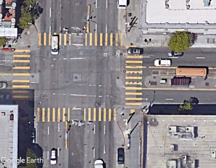
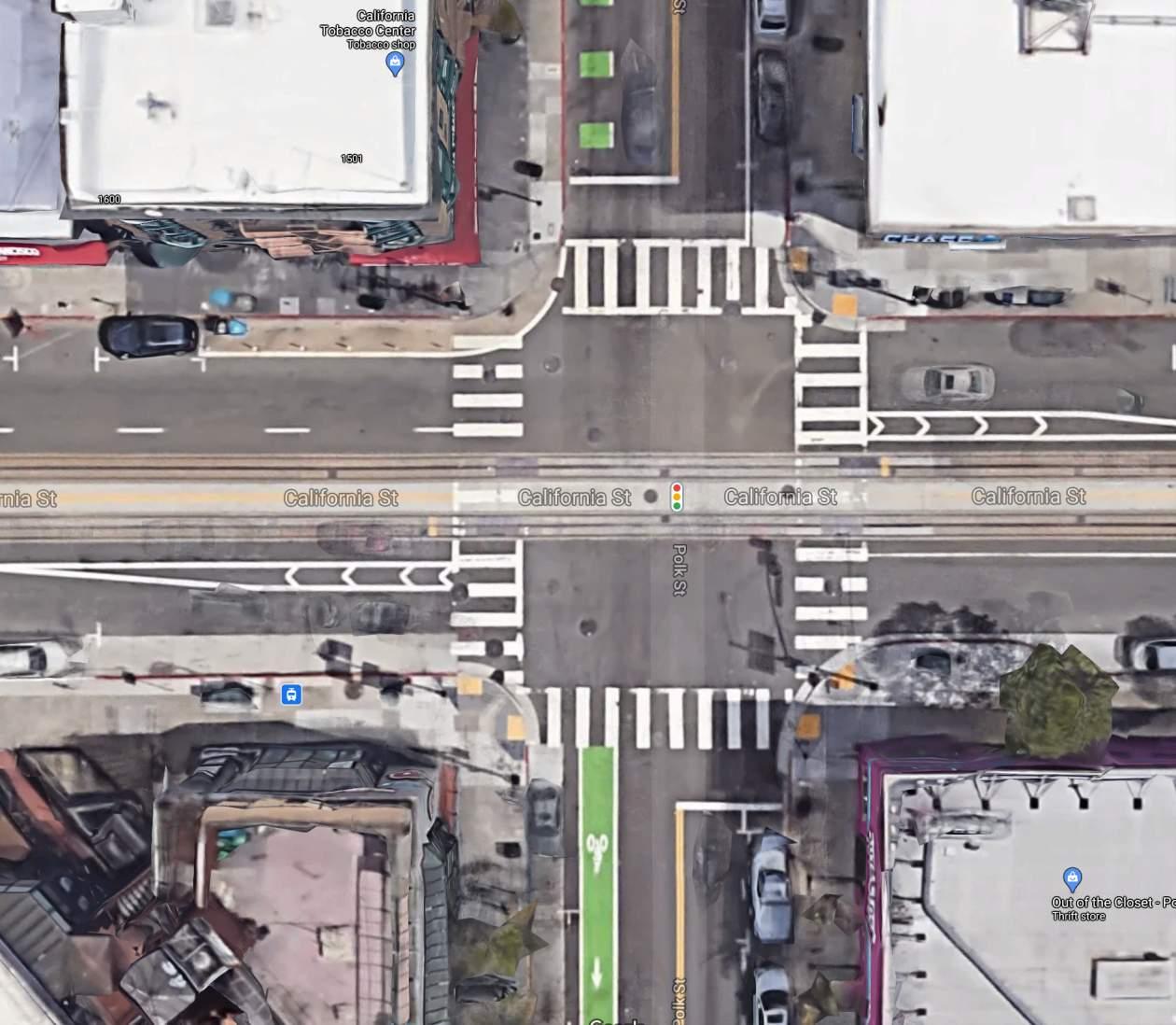
CALIFORNIA CABLE CAR TURN-AROUND