
ACKNOWLEDGMENTS
This plan was generously funded through the Broward County Mobility Advancement Program.

MAYOR & CITY COMMISSION
Mayor Michelle J. Gomez
District 1 - Commissioner Marlon D. Bolton
District 2 - Vice Mayor Morey Wright
District 3 - Commissioner Elvin Villalobos
District 4 - Commissioner Kicia Daniel
CITY STAFF TEAM
Maxine A. Calloway, Esq. AICP. Assistant City Manager & Director, Community Development Department
Maher Mansour, AICP, LEED AP ND, Assistant Director, Community Development Department
Mustafa Albassam, City Engineer
Rose Cure, Social Services Supervisor
Ann Johnson-Shaw , AICP. Senior Planner
Dania Maldonado, Community Services Manager
City Manager Office Staff
CONSULTANT TEAM
ALTA PLANNING & DESIGN
Alia Awwad, PE, Principal- in-Charge
Stephanie Garcia, Project Manager
Lucy Laird, Planner II
Elizabeth Burke, Planner I
Audrey Cabay, Planner I
Chelsea Cole, Graphic Designer
Richard Virgo, PE, RSP, Engineer
DDEC
Uyen Dang, PE, Principal
Kathleen Walter, Senior Associate
Orlando Toro - Visual Designer

When the City of Tamarac was established in 1963, it was a quiet retirement location, home to only 5,000 residents, with some of the major roadways still unpaved. In 2024, it has grown to be a multigenerational City with 74,000 residents, nearly 35,000 housing units, over 2000 businesses, and 13 (soon to be 14)parks, covering approximately 12 square miles. And we’re still growing! Tamarac is ready to transition into a more interconnected City – modern, efficient, and easily accessible. A place where we can walk, bike, bus, or drive to work, shopping, dining, school, and recreation, and then back home safely. To do this effectively, we needed to create a roadmap that reflects the understanding that one size does not fit all in our City. We know that our City wants to keep its suburban charm and quietude, while still having the perks of living in a city-like environment.
As we set off towards our seventh decade, we now have tools in our toolbox to create beautiful pathways and safe roadways to where we want to traverse in Tamarac. We thank you for your participation in the development of our Multimodal Transportation Connectivity Master Plan, and for keeping our City moving forward.
Michelle J. Gómez, Mayor
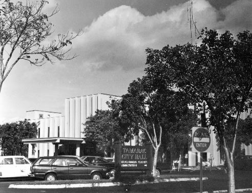
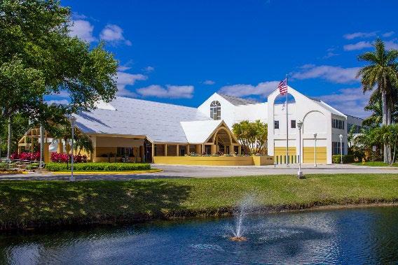
Tamarac’s City Hall: Then and Now
01 THE VISION
CHAPTER 1: THE VISION
OVERVIEW
The Tamarac Multimodal Transportation Connectivity Masterplan, succinctly and aptly named MOVE TAMARAC, is the culmination of over a year of study, public outreach, and analysis. It provides a roadmap of infrastructure, policy, and program recommendations to improve transportation for all modes. The Masterplan process began in March 2023. The team worked with elected officials, residents, and other stakeholders to answer the following questions:
• Which areas and streets need attention?
• What are your safety concerns?
• How can your district be better connected?
• What are residents’ key priorities?
• What would make this plan a success?
The Masterplan establishes a future vision and goals for Tamarac ’s multimodal transportation system, and recommends policies, programs, and transportation improvements to achieve them. The Masterplan is organized around the following planning components: data collection, data analysis, interviews, public involvement, recommendations, funding opportunities, and implementation. While MOVE TAMARAC focuses on the City of Tamarac, some of the recommendations will require collaborations with neighboring jurisdictions, including North Lauderdale, Coral Springs, Sunrise, Margate, and Lauderhill.
VISION STATEMENT
The Masterplan’s vision reflects the voices of the community, business owners, elected officials, City staff, and agency partners engaged throughout the planning process.

VISION


Tamarac is a city that is connected and accessible through different modes of transportation where people of all ages, abilities, and backgrounds can safely and conveniently get to their everyday destinations by foot, public transit, rolling, or biking. The City of Tamarac transportation network encourages physical activity and a healthy lifestyle, creating a more environmentally sustainable and livable city.
CONCURRENT PLANNING EFFORTS
The development of MOVE TAMARAC is timely for the City. During the Plan’s development process, Tamarac’s 2040 Comprehensive Plan and Broward County’s Multimodal Mobility Masterplan were also under development. Additionally, the Broward Metropolitan Planning Organization (MPO) and Broward County are currently working on the Countywide Vision Zero Action Plan. Aligning recommendations with these plans will provide opportunities for collaborative implementation of projects. The timeliness of these concurrent efforts presents an opportunity for the City of Tamarac to have a seat at the table to leverage recommendations in MOVE TAMARAC and create feasible, coordinated projects.
GOALS OF THIS PLAN
The Multimodal Transportation Connectivity Masterplan ’s overarching goal is to create a blueprint for a safe, comfortable, and convenient transportation network for all road users in Tamarac. The Masterplan will guide Tamarac through the following goals:
Connected
Improve connections to parks, schools, shopping plazas, and city amenities.
Safe Plan and implement better and safer infrastructure for all users of the road, following the Safe System Approach.
Accessible Provide accessible and equitable multimodal transportation options for those without cars to improve their access to jobs, services, and recreation.
Reliable Provide a complete and continuous network of bicycle and pedestrian facilities, enhance connections to the transit network , and offer reliable transit service.
Sustainable and resilient
Integrate transportation infrastructure with climate change resilience practices.
Healthy Create a secure and safe environment for active transportation and exercise to enhance public health and increase walkability.
Economic development Contribute to Tamarac’s economic vitality through access to jobs and services.
Innovative
Integrate new transportation technologies.
Welcoming Design streets and public spaces that are welcoming; with captivating landscaping, placemaking, and public art.
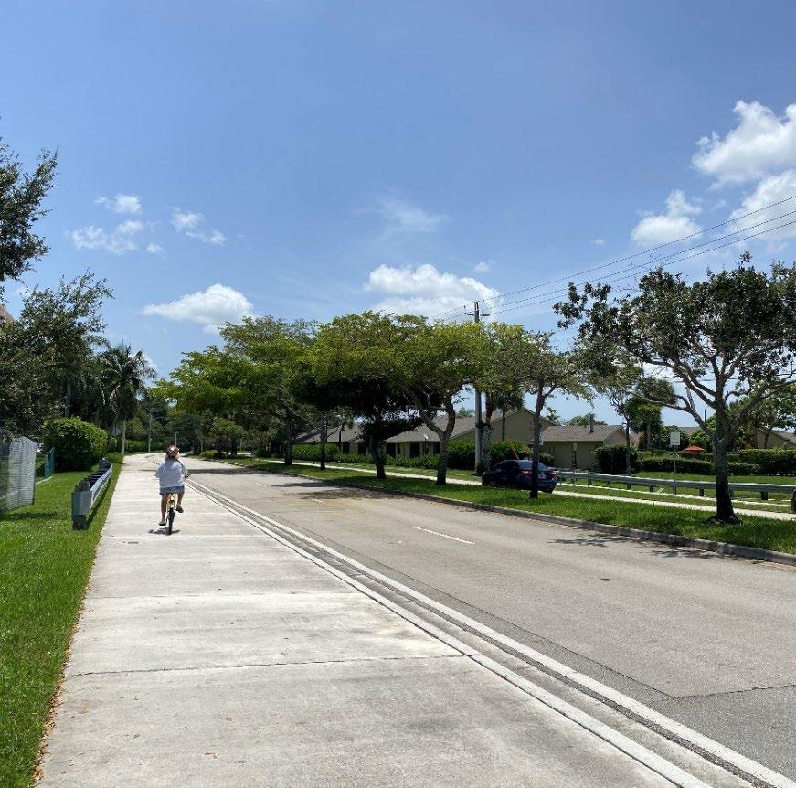
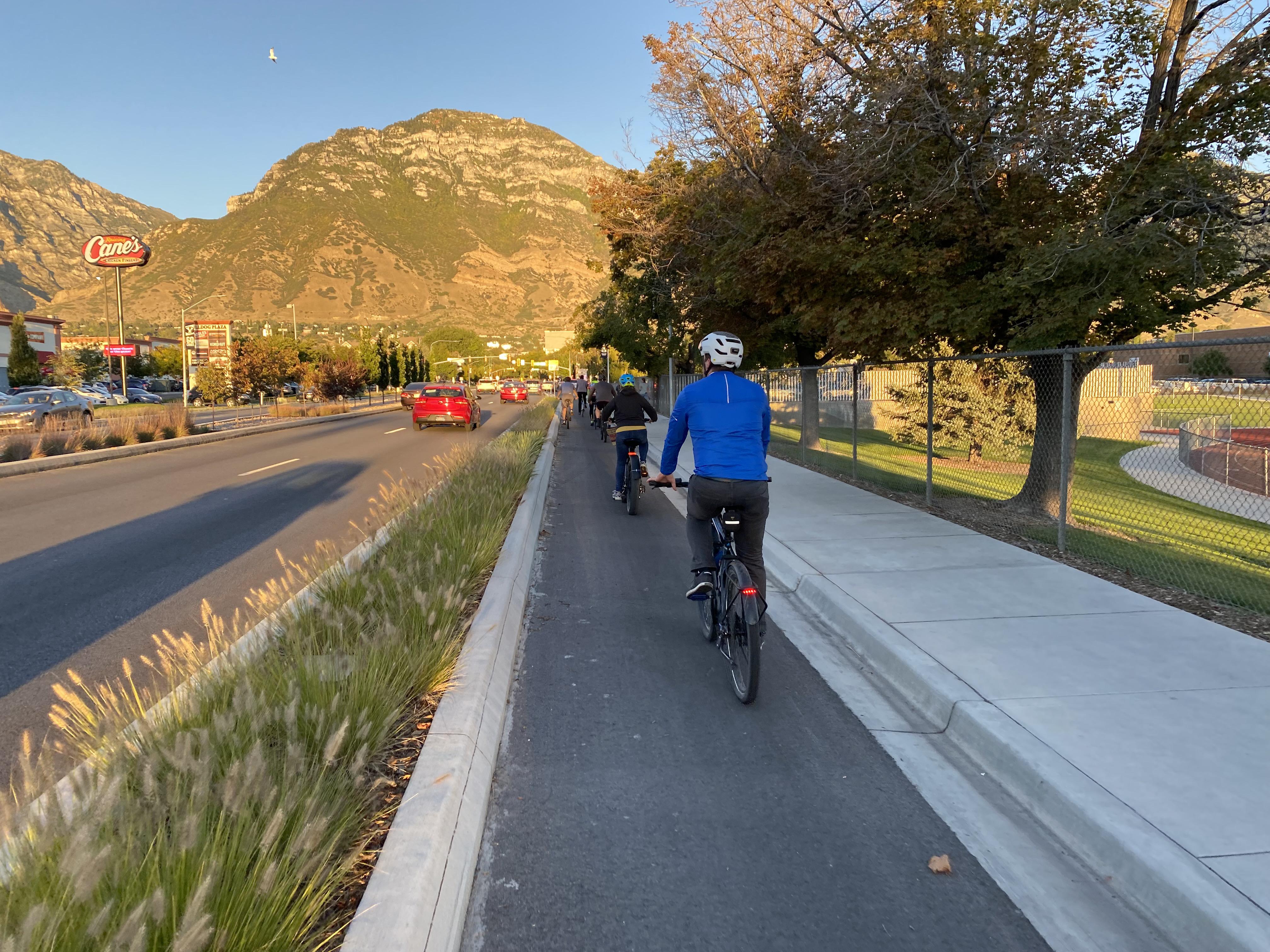
The Tamarac Sports Complex ’ multipurpose pathway.
02 TAMARAC TODAY
CHAPTER 2: TRANSPORTATION IN TAMARAC TODAY
INTRODUCTION
The development of the Multimodal Transportation Connectivity Masterplan (MOVE TAMARAC) is an important piece of the City’s 2019 Strategic Plan, which aims to “establish and foster transportation plans and partnerships to provide convenient and accessible means of transportation.”
Multimodal transportation is the collective term used to describe the many ways people get around on our streets. It is a way to think of the street as a public asset available to people who walk and bike, take transit, roll, or drive; therefore, this public asset should be safe and accessible for all these street users.
The Masterplan will create a blueprint for Tamarac residents that will accomplish the following:
• Identify key issues and opportunities within Tamarac’s transportation network.
• Develop a set of policy, programmatic, and design improvements that will make Tamarac’s streets safer and more connected.
• Identify partnership and funding opportunities that the City can leverage to get the improvements implemented.
MOVE TAMARAC is a tool to guide the City and other Broward County agencies in the development of a multimodal transportation network.
STUDY AREA
Tamarac is located in western Broward County, FL . The city’s major eastwest corridors are West Commercial Boulevard and McNab Road, and the major north-south corridors are University Drive and Pine Island Road. The city is bounded by the Sawgrass Expressway to the west.
Demographics
Approximately 71,522 people live in the City, making it the 12th most populous city in Broward County. The population of Tamarac is approximately 46% male and 54% female, showing a larger female population proportion than Broward County. 1 The median age in Tamarac is 44, which is slightly higher than the State median of 42 and 41 for the County. About 40% of the population is under 35 years of age. This again shows a slightly older population than in Broward County. In Tamarac, whose motto is “The City For Your Life”, one in five residents is over the age of 65, and moving at all stages of life is a promise to residents.

Broward County has outpaced forecasted growth and is expected to reach 2.2
million residents by 2045, up from 1.96 million residents in 2023.
1 U.S. Census Bureau. American Community Survey 1- Year Estimates Subject Tables. (2021).


Population Growth
The 2020 US Census revealed that population growth outpaced predictions from 2019 Tamarac’s Comprehensive Plan. Broward County is expected to grow by 20% between 2015 and 2045, reaching 2.2 million residents. As population increases, so will demand for transportation infrastructure. By reducing the need for cars in Tamarac, the City can reduce traffic volumes on its roadways, while providing a pleasant, human-scaled city experience.
Between 2019 and 2022, the employment population in Tamarac grew by 2.9%. 2 The projected 2045 employment population for Broward County is 1,241,845. 3 The highest job growth is expected to be in professional business services, with a projected 33% increase. 4 This will likely increase the employment population within Tamarac, as more than 25% of employees in the city work in office and administrative support occupations or management occupations. 5
Vehicle Ownership
In Tamarac, 6.5% of occupied housing units do not have access to vehicles 6 This is compared to the 6.8% of occupied housing units in Broward County with no access to vehicles (2021). Additionally, the youth and senior populations, who are less likely or unable to drive, make up about 38.5% of the population.
According to the American Community Survey in 2021, 78% of workers 16 years and over commuted to work by driving alone, and about 11% carpooled. Approximately 1.7% commuted used public transportation, 0.3% walked, and 1.7% used other means. Those working from home made up 7.3% of the city’s working age population. The percentage of workers commuting by public transportation, walking, and biking is lower in Tamarac than in Broward County.
Most Tamarac residents have significant commute times. Only 3% of workers commuted fewer than 10 minutes, 25% commuted between 10
2 Greater Fort Lauderdale Alliance. Tamarac. 2023. https://www.gflalliance.org/informationcenter/tamarac/
3 Broward MPO. Commitment 2045 Metropolitan Transportation Plan. 2019.
4 Broward MPO. Commitment 2045 Metropolitan Transportation Plan. 2019.
and 19 minutes, 33% commuted between 20 and 29 minutes, and 19% commuted over 40 minutes. This highlights an opportunity for improved transit to avoid and reduce rush hour traffic congestion.
Land Use
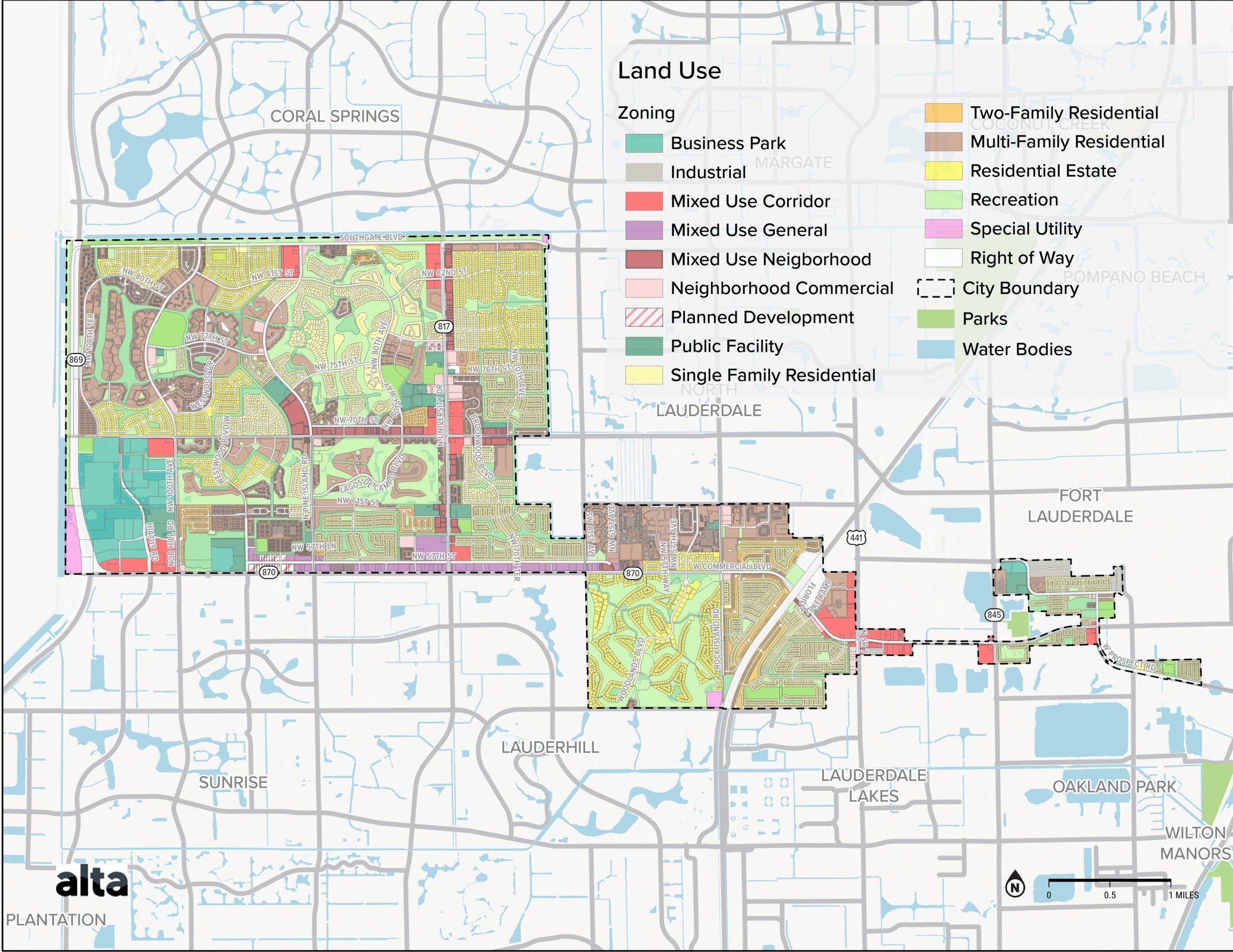
Mixed-use developments surround the major corridors in Tamarac, including along W Commercial Blvd, N University Dr, N Pine Island Rd, and W McNab Rd. Shopping plazas that are important community destinations along these roads include Tamarac Town Square, University Commons, Midway Plaza, The Shoppes on University, and Sunshine Plaza. Many of the senior housing facilities in the city are located near or along these mixeduse corridors, especially Commercial Blvd and N University Blvd.
Additionally, there are areas within Tamarac designated as Opportunity Zones. These areas, located near Commercial Boulevard and the Four Corners Shopping District Redevelopment Area, are eligible for funding incentives to spur equitable business growth and commercial development. Lastly, areas of planned development identified by the C ity’s zoning map are also located on NW 57th St.
As seen in Map 1, the City has many mixed-use districts and corridors, encouraging flexible and dense development near Commercial Blvd, N University Dr, and W McNab Rd.
5 Data USA. Tamarac, FL. 2023. https://datausa.io/profile/geo/tamarac-fl
6 U.S. Census Bureau. American Community Survey 1- Year Estimates Subject Tables. (2021). https://data.census.gov/table?q=Tamarac+city;+Florida+vehicles+available&g=050XX00US12 011&tid=ACSST1Y2021.S2504&moe=false
EXISTING CONDITIONS: INFRASTRUCTURE
With increasing development in a city with relatively low density, it is important to create convenient connections for those traveling throughout Tamarac. Investing in improving multimodal transportation options can help increase the number of people shifting to other modes of transportation besides driving. As Tamarac works to create a transportation system that meets the needs of the community, improving connectivity is one strategy that can help reach the City’s goals. Providing convenient and connected facilities that reach key destinations can improve the ability of residents to move throughout Tamarac, especially those with limited transportation options.
Equity
Multiple areas in Tamarac have been identified by local and federal sources as areas of equity concern. According to the USDOT Transportation Disadvantaged Census Tracts tool, there are several areas in Tamarac that are considered Disadvantaged Census Tracts, a designation that is based on an analysis of historic, health, economic, resilience, and environmental disadvantages within each tract. 7
Similarly, the Broward MPO’s Transportation Planning Equity Tool provides an analysis of equity within each block group based on certain demographic indicators, such as race, ethnicity, age, income, English proficiency, and disabilities. 8, 9 This tool compares the concentration of equity indicators to the countywide average and identifies two block groups within Tamarac as very high in equity needs.
Transit Infrastructure
In Tamarac, workers with shorter commute times are likely to travel shorter distances when getting to work. Over one - third of workers have a commute time that is under 20 minutes. This group of commuters
represents the greatest opportunity for mode shift to walking, bicycling, and transit use.

Transit ridership was highest in southern Tamarac, along Commercial Blvd.
7 USDOT. https://www.arcgis.com/apps/dashboards/d6f90dfcc8b44525b04c7ce748a3674a
8 Broward MPO. Transportation Planning Equity Assessment Maps. 2022. https://storymaps.arcgis.com/stories/7b81b04ead3b4d5c9aae8735e3b48434

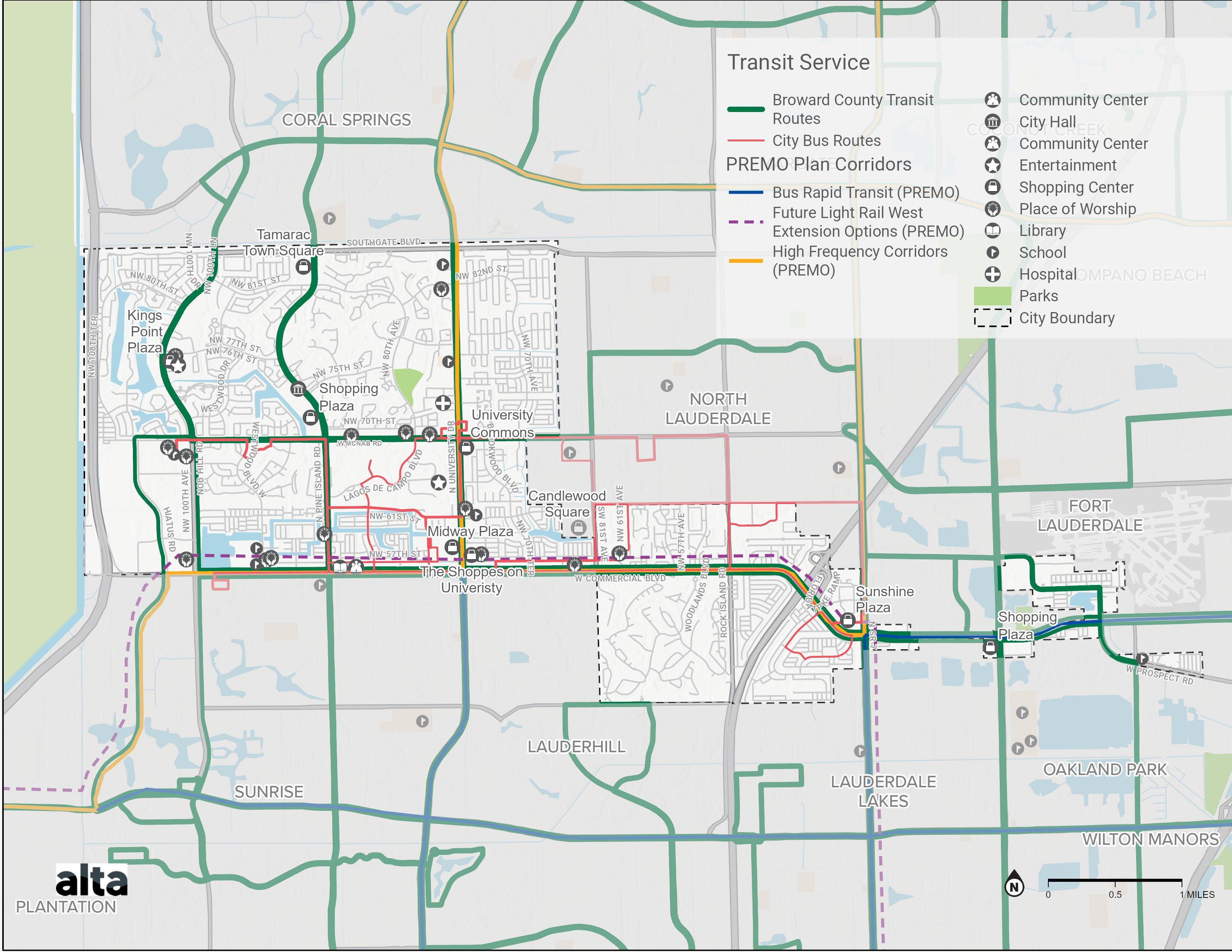
Existing transit offerings in Tamarac are shared between the County and City (see Map 2) The City is currently served by Broward County Transit (BCT) bus routes, Paratransit service, and the Community Shuttle Route. The Community Shuttle Red Route, which is run by the City, is focused in the central part of Tamarac, traveling mainly between W McNab Rd and Commercial Blvd.

Existing transit service exhibits strong ridership and is frequently cited as a core service for people with limited mobility and seniors. Transit stations with the highest ridership rates are located at shopping centers , including Midway Plaza, Sunshine Plaza , Bermuda Club near Candlewood Square, Tamarac Community Center, and Walmart Shopping Center. Shuttle stops with lower ridership are at stops on smaller neighborhood roads and along McNab Rd. Broward County Transit routes throughout Tamarac run along major roadways such as Nob Hill Rd, N Pine Island Rd, N University Dr, W McNab Rd, Commercial Blvd, US 441, Prospect Rd, and Hiatus Rd. These routes provide connections to major locations along these roadways, however, users traveling to destinations on smaller roadways or within neighborhoods may have to complete their trip on foot or bike.
The high ridership bus stops correspond with Broward County’s Premium Mobility Plan’s planned High Frequency and Light Rail West Extension Corridor.
9 Broward MPO. Title VI Transportation Planning Equity Assessment. https://browardmpo.org/data/title-vi -transportation-planning- equity-assessment
Active Transportation Infrastructure
While there are some existing active transportation facilities in Tamarac, they are currently disconnected and not all present comfortable conditions for all users regardless of age or ability. The following is a summary of the review and assessment of current active transportation facilities in Tamarac.
Bicycle Facilities
The existing bicycle network in Tamarac includes 26.8 miles of facilities. Most of these facilities are marked bike lanes, some of which are buffered bike lanes. Undesignated lane facilities exist as well, with limited options for continuous travel between facilities and community destinations. Most facilities are in Central Tamarac along high speed and heavily trafficked roadways that make connections throughout the city. Additionally, there are 5.0 miles of programmed bike facilities across the city.
While there are some existing bike facilities along arterials such as Commercial Blvd, they currently do not provide the levels of comfort needed for residents to utilize them. Opportunities to provide low stress bikeway connections along and across these large roadways will be critical for a connected, usable bike network.
Sidewalk Facilities
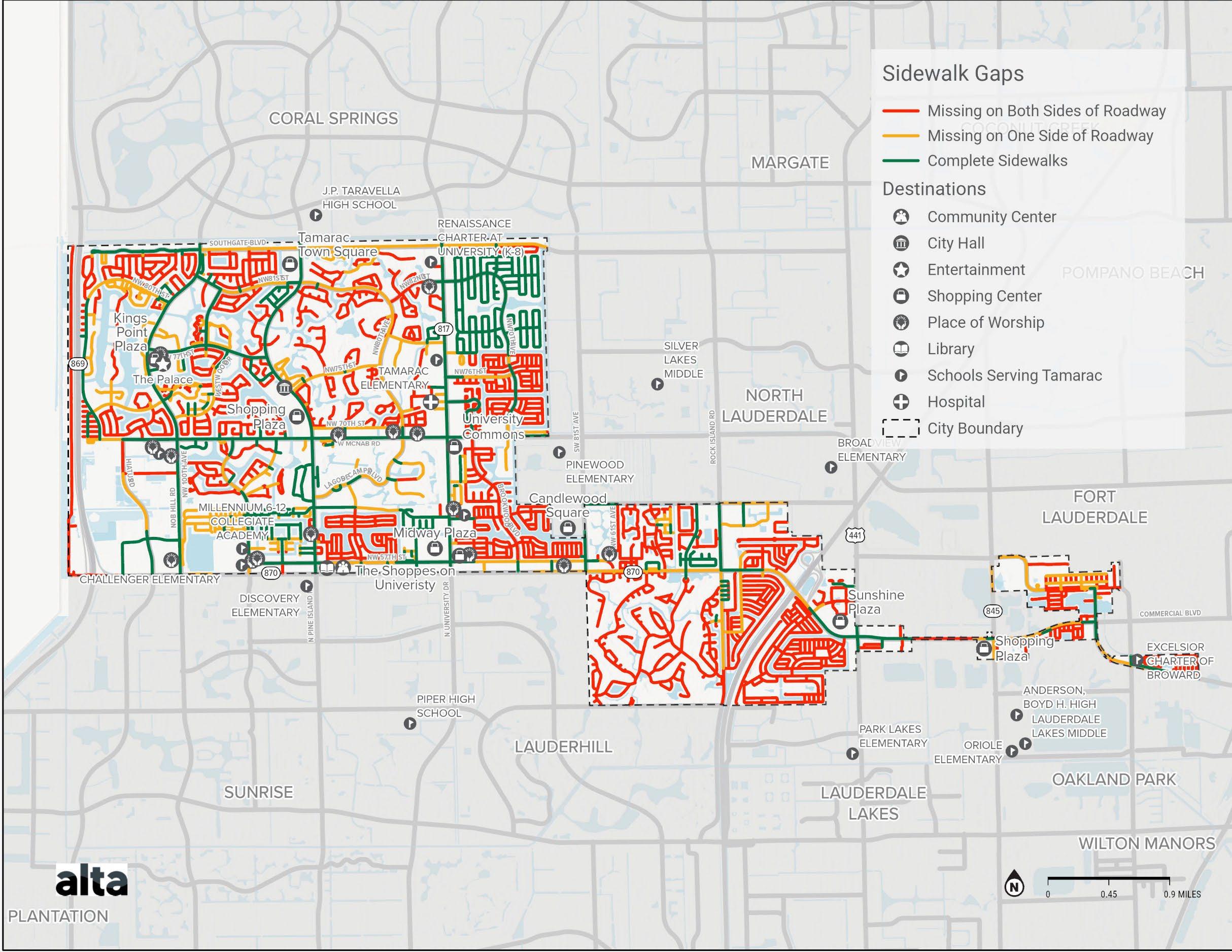
Tamarac has nearly 60 miles of roadways with complete sidewalks on both sides of the street, primarily along major roads like NW 100th Ave, Pine Island Rd, McNab Rd, and University Dr. Citywide, 45 miles of roadway have complete sidewalk on one side of the street. Notable major roads with complete sidewalks on only one side are Southgate Blvd, NW 80th Ave, and Commercial Blvd. The majority of roadways, over 120 miles in total, have incomplete sidewalks on both sides of the street. Generally, there are no sidewalks along residential streets, with the exception of the Sunflower/Heathgate neighborhood surrounding NW 70th Ave in the northeast corner of Tamarac. This can force pedestrians to walk within the roadway when traveling through their neighborhood and can discourage residents from walking as a means of transportation.
Many redevelopment communities also lack sidewalks, creating larger gaps in the network. Smaller gaps are often seen where driveways are lacking adequate connections for pedestrians. This is especially important across larger driveways located in commercial areas that require pedestrians to navigate varying sidewalk slopes and turning vehicle traffic. Many of the existing sidewalks in the City are located along larger roads, creating a potential for connection, but inconsistent facilities prevent users from having safe access to destinations.
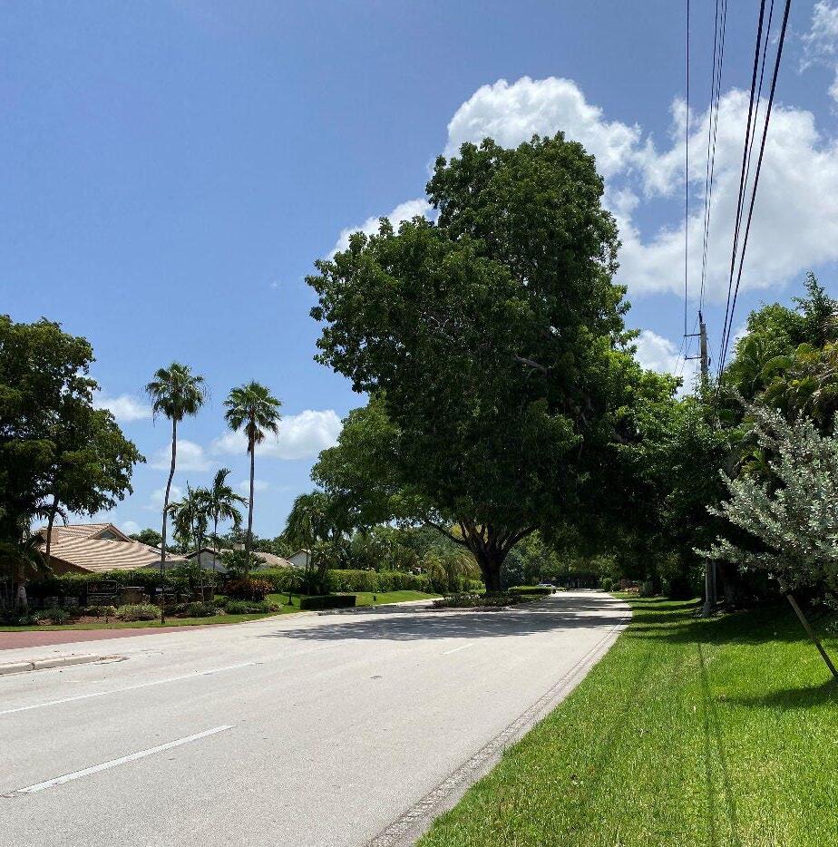
Sidewalk gap along NW 75th Street
Network Connectivity
The predominant form of transportation in Tamarac is vehicle travel, specifically single -occupancy vehicles. There is a total of 214,000 daily vehicle trips in the City of Tamarac. The central region of the City exhibits a relatively high trip density, with the highest trip density occurring near destinations such as the Sunshine Plaza, Midway Plaza, the Shoppes on University, and the University Hospital & Medical Center 10 .
There are about 238 miles of roadway in the City of Tamarac. This includes interstates and major state roads , as well as local neighborhood streets. Major state-owned roads in the City are N University Dr, Sawgrass Expressway, and portions of Commercial Blvd. In Tamarac, the road with the highest volume of traffic is Commercial Blvd, especially the section between Florida’s Turnpike and Rock Island Rd. This specific area of Commercial Blvd sees over 50,000 cars on an average day. In addition, other primary highways show an annual average daily traffic (AADT) greater than 10,000 cars per day, as well as a few secondary and tertiary highways. This includes N University Dr, Rock Island Rd, Nob Hill Rd, N Pine Island Rd, US 441, and portions of McNab Rd, Southgate Blvd, Hiatus Rd, SW 81st Ave, and Prospect Rd. Many of Tamarac’s local roads see volumes between 1,000-5,000 cars per day.
Major roadways are typically wide, with multiple travel lanes in each direction and center medians. While this type of roadway network is effective for car travel, it can hinder other forms of travel, such as active transportation. Separated facilities may be necessary to encourage use by residents of all ages and abilities.
Accessibility
Access to destinations may be less accessible from the active transportation network on local streets, as existing facilities are focused on larger roadways. For residents walking from nearby neighborhoods, sidewalk facilities may not begin until a larger arterial roadway is reached. This greatly affects the access that is provided by the current system, as
Trip data was obtained from Replica Places and is based on a representative Thursday during the Fall of 2022. Data was filtered to include only trips starting from the City of Tamarac.
some gaps may feel too dangerous for some. A lack of facilities can also affect the directness of routes that users would want to take. In terms of bikeways, most roads in Tamarac are lacking bike facilities, and current facilities are primarily present on larger roadways. This forces bike users to travel from their starting point to existing facilities or to their destination on roadways or sidewalks that may be unsafe.
With the number of large roadways throughout the City, pedestrian and bicycle crossings are important for a safe and comprehensive transportation network. Crosswalks on major roadways such as Commercial Blvd exist at many of the signalized intersections, although with long block sizes throughout the City these crossing can be as much as one mile apart.
Transit Frequency
The City’s Shuttle service currently operates on weekdays; the Red Route runs Monday through Friday, and the Extension runs on Tuesdays and Thursdays. This schedule limits access to transit on the weekends, as users can only use Broward County Transit services, which only stop along major roadways and provide fewer local connections. Additionally, for some residents, the travel required to reach transit stops along these larger roads may deter the use of the Broward County Transit (BCT) fixed route. Expanding shuttle services during the weekends can improve the accessibility of the transportation system that some residents may rely on for their daily trips around the City. In 2016, out of the 161 Broward County Transit stops within Tamarac, only 126 bus stops were ADA accessible, meaning that some users may not be able to safely access the facilities to reach available transit services. Inaccessible facilities are primarily located along Commercial Blvd, W McNab Rd, Prospect Rd, and N Pine Island Rd. In 2022, the City developed the ADA Transit Access & Sidewalk Gap Analysis Plan were 31 stops, comprised of 21 Community Shuttle Bus stops and 10 BCT stops, were evaluated. Since then, the city in partnership with Broward County have invested in improving existing bus stops through the County Surtax.
10
Safety Analysis
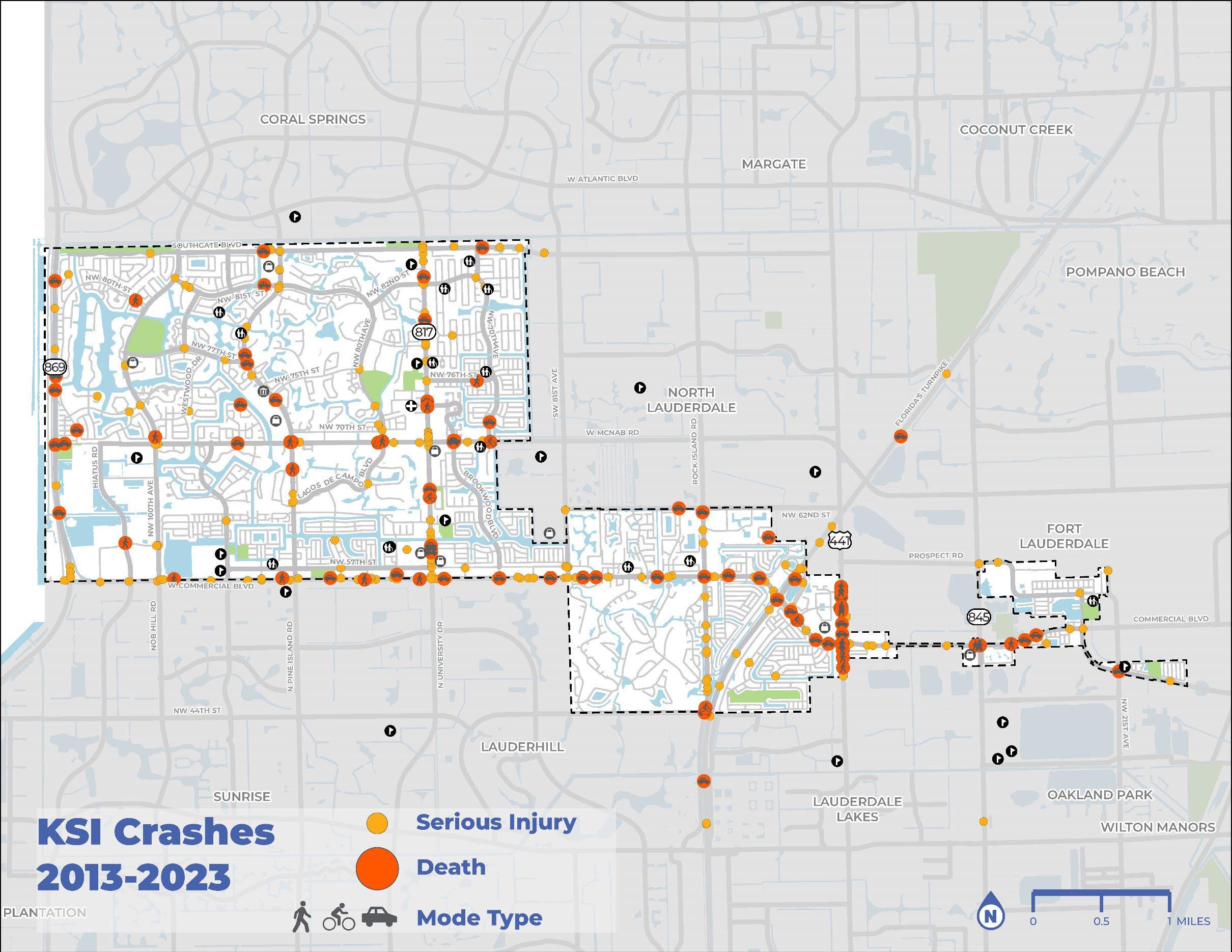
Crash severity is understood by analyzing Killed or Seriously Injured (KSI) crashes, which are crashes that resulted in a fatality or serious injury. Using data provided by S ignal4Analytics, the following analysis evaluates reported crashes that have occurred between 2012 and 2023. The review of crashes will not only help identify locations for new or improved facilities but will also inform priority projects for implementation.
In total, there were 25,367 crashes recorded in Tamarac from 2012 to 2023. Of these crashes, 19,518 resulted in no injury, 5,476 resulted in minor injury, 280 resulted in a serious injury, and 93 resulted in one or more fatalities.
Vulnerable Road Users
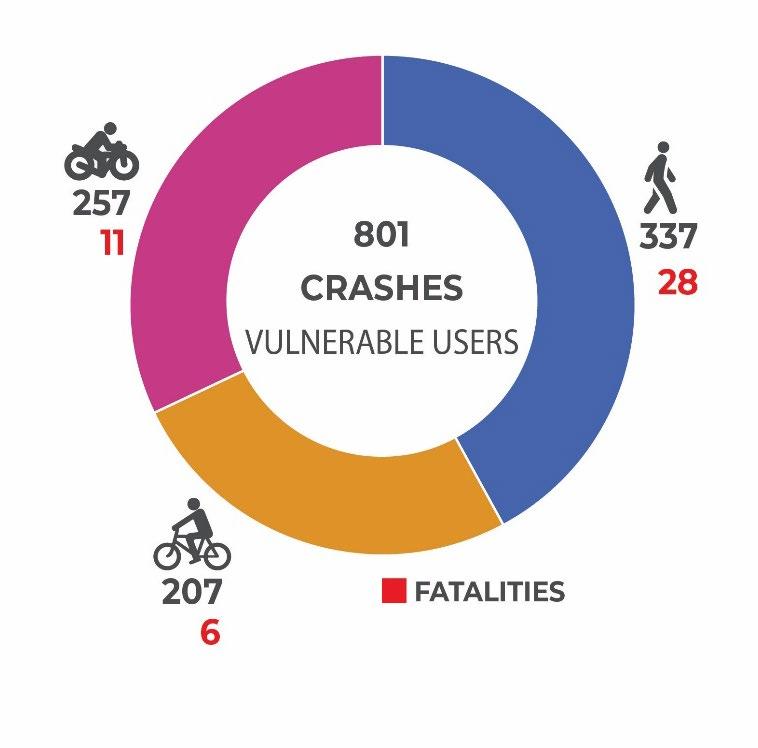
The impact of crashes is not equal among all road users. Vulnerable road users, including pedestrians, bicyclists, and motorcyclists, often sustain the most serious injuries upon impact due to their vulnerability compared to vehicles. Approximately 337 crashes during this time period involved a pedestrian and 207 crashes involved a bicyclist. Out of these crashes, 28 pedestrians and six bicyclists lost their lives, and 51 pedestrians and 16 bicyclists suffered life -threatening injuries. Additionally, out of the 257 crashes that involved motorcyclists, 11 motorcyclists died and 46 more were seriously injured.
Transit
As many of the Broward County and City transit stops are located along major roadways throughout Tamarac, many of these are within areas of high concentrations of crashes. High crash frequency roadways with a large number of transit stops include W Commercial Blvd, W McNab Rd, and NW 76th Ave.
Intersections with Highest Crash Frequency and Severity
• US-441 and Commercial Blvd,
• N University Blvd and Commercial Blvd,
• Rock Island Rd and Commercial Blvd,
• W McNab Rd and N University Blvd, and
• Florida’s Turnpike and Commercial Blvd.
Corridors with Highest Crash Frequency and Severity
N University Dr,
Commercial Blvd,
US-441,
NW 76th Ave, and
Sawgrass Expy
These high crash corridors are often state- or county-owned and maintained roads. Therefore, it is important to craft strategies that foster collaboration and align goals, leading to implementing safety improvements along these major corridors.
Existing Conditions: Plans and Policies
The following studies were reviewed to determine their impact on this Masterplan and capitalize on previous lessons learned:
Previous Planning efforts – Citywide
• Comprehensive Masterplan , 2019
o Existing policy guidance -Transportation.
• City of Tamarac Impact Fee Study, 2019
• City of Tamarac Strategic Plan, 2019
• Economic Development Strategic Plan, 2018-2022
• Parks, Recreation, and Social Services Masterplan, 2014
• Go-Forward Roadway Landscape Masterplan, 2020
• Commercial Arterial Redevelopment Study, 2014
• Americans With Disabilities Act (ADA) Transit Access & Sidewalk Gap Analysis Plan, 2021
• Traffic Calming Policy, 2017
• Tamarac, Florida Land Development Code, 2018
• Vehicular Wayfinding study, 2023
• Resolutions, ordinances, and amendments
o Vision Zero Resolution R-2021-026
Regional Plans & Studies
• Broward County Transit Premium Mobility Plan PREMO, 2023
• Broward Metropolitan Planning Organization (MPO) Transportation Improvement Projects (TIP) projects
• Broward MPO Metropolitan Transportation Plan (MTP) 2045
• Broward MPO Complete Streets Guidelines 2.0, 2019
• Broward Complete Streets Masterplan, 2019
• Broward Mobility Advancement Program (MAP) surtax projects
• FDOT District 4 Road Safety Audit (RSA) Report SR -870 (COMMERCIAL BLVD), 2022
• Neighboring Cities’ Plans & Projects
Opportunities
Based on the review of current plans and policies, the following are opportunities for improved multimodal mobility in Tamarac:
• Key policies include the development of an Integrated Bikeway/Walkway System, the requirement that developers be required to dedicate, construct, and/or resurface adjacent bikeways/walkways in accordance with the land development code.
• There is an emphasis on the need to improve access to parks and open spaces in Tamarac to meet ADA standards.
• Land uses should be directly accessible within a quarter mile walk and/or transit corridor, and fully connected to well- defined pedestrian paths, bike routes, greenways, and transit shelters.
• The impact fee study provides important information for City policymakers regarding the efficacy of using impact fees to meet the transportation needs of new residents in Tamarac.
• The development of MOVE TAMARAC is identified as an initiative related to Goal 1 Tamarac is Home as a strategic action item.
• “Better public transportation to improve access and equity” emerged as a key priority for the parks system. Recommendations that are relevant to the Masterplan effort include: Continue to Develop an Interconnected Network of Sidewalks, Bike Lanes, Multipurpose Paths, and Shared Roads.
• The “Typical Conceptual Landscape Corridor” section from the Landscape Masterplan shows conceptual cross-sections for each roadway classification. This plan shows how landscaping is a key part of making the roadway network inviting.
• Tamarac’s goal of re-activating underutilized commercial areas as part of a comprehensive redevelopment strategy includes transit-oriented development goals that are directly relevant to the MOVE TAMARAC process.
• One of the main goals of the Transportation section of the Land Development Code is the provision of alternative transportation options that will encourage the use of walking, biking, or riding transit instead of driving All new development is also required to construct onsite portions of trails and multi-use paths that are recommended for implementation in adopted plans.
• The Vehicular Wayfinding Study provides suggested locations for signage related to parks, recreation centers, and sports complexes, which are likely to also be key nodes of the multimodal network.

In 2021, the City adopted a goal of eliminating traffic deaths and serious injuries by 2040 and endorsing Vision Zero principles.
How Can MOVE TAMARAC Inform Current Policies & Plans?
The following items outline the linkages of the reviewed plans and policies to the Masterplan for improved multimodal mobility in Tamarac:
• An important part of MOVE TAMARAC will be establishing what policies can be implemented in Tamarac as part of the adoption of the Comprehensive Plan update in 2024.
• The development of MOVE TAMARAC is an important piece of the City’s Strategic Plan.


• The BCT Premium Mobility Plan (PREMO) recommended network in and around Tamarac includes high frequency bus corridors on N University Dr, W Atlantic Blvd, and Commercial Blvd, with an option for future extension of the planned light rail west to Commercial Blvd. With improvements in transit service will come opportunities to enhance the first- and last-mile connections to transit, particularly for pedestrians and cyclists.
• The City of Tamarac should engage with the Broward MPO and Broward County to ensure that future regional transit and mobility investments are aligned with the City’s local investments in priority redevelopment focus areas.
• Since it has been nearly 10 years since the adoption of the Parks, Recreation, and Social Services Masterplan, it is crucial to involve the Parks and Recreation Department in the MOVE TAMARAC implementation process
• Implementation of the concepts contained in the Landscape Masterplan will help Tamarac create an environment where walking and biking are pleasant, and more people are more likely to choose these forms of transportation.
• With the adoption of the Comprehensive Plan, the regulatory framework for further transit-oriented development (TOD) can be enhanced. The City can further advance the implementation of TOD through the Multimodal Transportation Masterplan
• The ADA Transit Access & Sidewalk Gap Analysis Plan identifies several key intersections where a relatively high number of pedestrian- and cyclist-involved crashes have occurred; one of these is Commercial Blvd and State Road 7. The Masterplan integrated effective interventions that improve the safety of these intersections.
• One potential challenge for the Masterplan is to recommend that traffic calming be the first step in the mitigation process, rather than the last though this would require an amendment to the current policy.
• The impact fee study methodology for assessing the impact (or increased demand produced as a result of development) of pedestrian and bicycle facilities can often underestimate the impacts or needs for active transportation facilities. This could lead to a lack of trails and multi -use paths being constructed by developers.
• While the Vehicular Wayfinding Study is focused on making wayfinding in Tamarac easy for people in vehicles to navigate to important destinations within the City, the overall design and the principles behind the placement of the signs can also be applicable to multimodal wayfinding geared toward pedestrians, cyclists, and transit riders. The sign locations shown in the study are presumed to not be on FDOT property.
• Through the adoption of the Vision Zero resolution in 2021, the Commission directs the City Manager or another designee to create a Vision Zero Action Plan based on a comprehensive analysis of traffic deaths and injuries in the City.
• The City of Tamarac should be actively involved with the implementation of BCT PREMO recommendations, to ensure that new development and any recommendations coming out of MOVE TAMARAC are aligned with PREMO outcomes.
• The City submitted a list of projects to the Broward MPO as part of the 2045 MTP call for projects, including: State Road 7 Flyover/Interchange, Rock Island Road widening, Tamarac Community Center Mobility Hub. The Masterplan integrated recommendations at these locations. The City should coordinate with the Broward MPO to incorporate the Masterplan project recommendations in the future MTP and TIP.
• Broward Complete Streets Guidelines 2.0 was created by the Broward MPO in order to provide guidance to municipalities who choose to incorporate Complete Streets principles in their planning, and design process. Through the Masterplan the City will adopt a Complete Streets Policy to further develop and implement Complete Streets.
• The 2019 Broward Complete Streets Masterplan identified Complete Streets projects countywide, and it did not include any projects in the City of Tamarac. After adoption of MOVE TAMARAC, the City should coordinate and share the list of top 25 projects with the Broward MPO.
• The City should coordinate with Broward County to submit the Masterplan’s top 25 projects to be funded by the Penny for Transportation Broward Mobility Advancement Program Surtax Program.
• The City of Sunrise 2022 Bicycle & Pedestrian Masterplan proposes to achieve 46.2 miles of bikeways. As part of this plan, Sunrise proposed bike lane/multipurpose path on Commercial Blvd, and on Sawgrass Expy. MOVE TAMARAC identified the need for shared used path/ raised bike lanes along Commercial Blvd. Both cities will need to coordinate and joint efforts to develop and implement a successful project.
• The FDOT District 4 Road Safety Audit conducted on Commercial Boulevard from Sr-817 (University Dr) to Rock Island Rd showed that 84% of crashes occurred within the influence area of signalized intersections with a higher frequency at the intersections of Rock Island Road and SR-817 (University Drive) with 30% of crashes. The Masterplan is recommending a streetscape project with intersection improvements on Commercial Boulevard. It is important to continue conversations with FDOT to implement RSA recommendations and incorporate the Masterplan’s considerations.
03 COMMUNITY VOICE
CHAPTER 3: COMMUNITY
VOICE
SUMMARY OF ENGAGEMENT ACTIVITIES
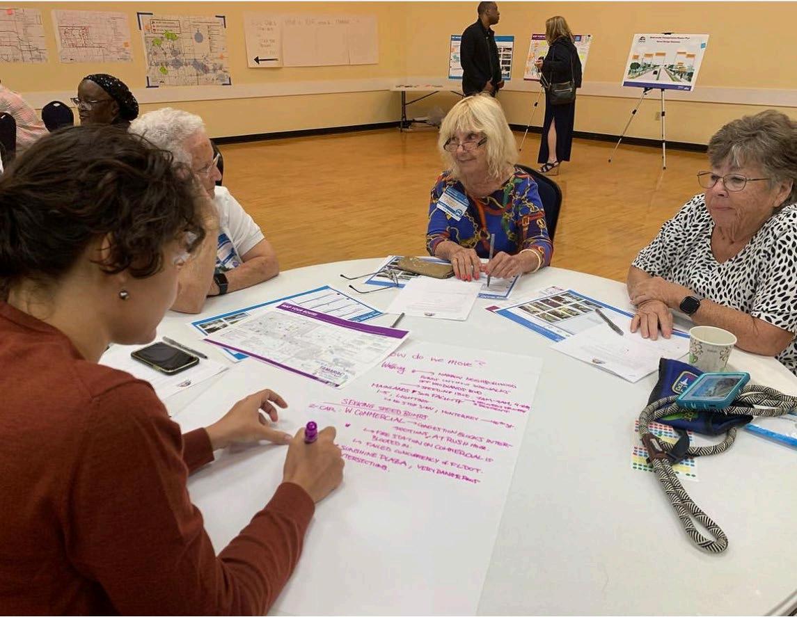
MOVE TAMARAC used a variety of outreach strategies to engage with the community. The outreach methods combined opportunities to engage the public digitally and at in- person events. MOVE TAMARAC relied on community input to inform the project vision, goals, recommendations, and priorities for Tamarac. The public outreach process included a project website, online survey, two public meetings, and meetings with elected officials from all four City districts.
Interviews
• Broward County Transit PREMO Plan: The project team met with Broward County representatives so they could learn about the plan and discuss further collaboration.
• Focus meetings with elected officials: The project team met with City commissioners of Districts 1, 2, 3, and 4 and the Mayor to provide an overview of the plan and collect their feedback about specific needs and opportunities to improve the transportation network in Tamarac.
In-Person Engagement
Mobile Outreach
• Comprehensive Plan engagement activities: Two in-person meetings were held through the course of the Plan. The meetings presented an opportunity to introduce and further engage community members in the Masterplan and solicit input.
• The City’s 60-year anniversary celebration event: The project team participated to bring awareness about the project website and online survey.
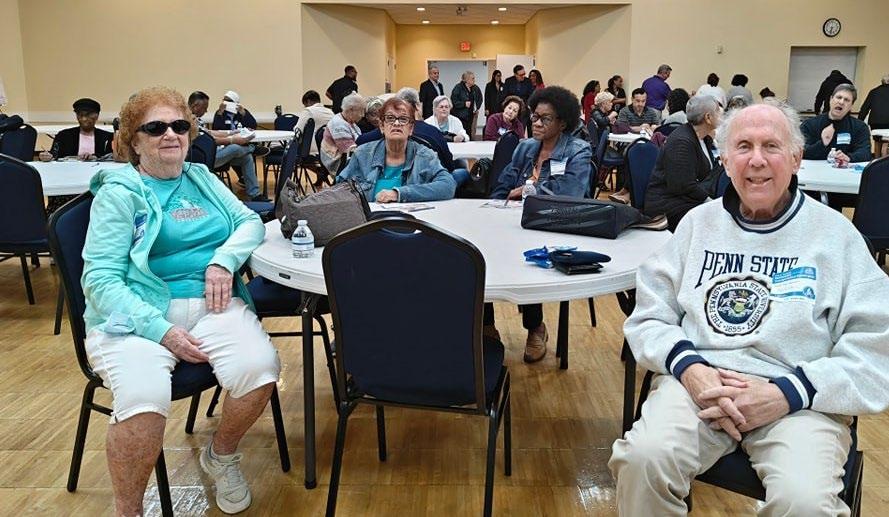
February 8, 2024, community meeting. Over 70 people participated.
Public Meetings
The team organized and conducted two in -person public meetings to collect feedback from the community.
Kick Off – Community Meeting (September/October 2023)
The City held a community meeting during the existing conditions’ evaluation phase of the plan’s development on September 21 and October 18, 2023, at the Tamarac Community Center. The City offered a free ride to participants via the Tamarac community shuttle A total of 19 community members attended.
The team presented the project approach, Masterplan process, schedule, and transportation components. Members of the community had the opportunity to provide feedback on where they would like to see improvements, existing barriers and challenges, the vision, potential goals, and safety, connectivity, and accessibility concerns in the transportation network.
The project team displayed five boards to present an overview and schedule of the Masterplan , potential street design elements, and an interactive board to request feedback on Tamarac’s bicycle, transit, and walking routes. The boards included key questions and interactive opportunities to map and identify gaps, barriers, needs and challenges within the city’s network and surrounding areas.
Presentation of Recommendations (February 2024)
On February 8, the project team presented the recommendations to the public and City staff. Over 70 community members attended the meeting. The meeting focused on presenting specific improvement opportunities and recommendations, including the recommended multimodal transportation network, as well as a toolbox of infrastructure treatments that the City can utilize to improve multimodal mobility and safety. The recommendations were well received, and the discussion included common themes of emphasizing the need to maintain and improve ondemand transit service, improve walkability, and make Commercial Blvd and other major arterial roadways easier to cross.
Project Website
The project website was used to promote outreach events, share plan documents, and host the public survey throughout the lifetime of the project. The site (https://MOVETAMARAC.com) has received more than 600 visits since its launch in June 2023.
Community Survey
The community survey solicited feedback on the public’s vision and their preferences for a more connected multimodal transportation network in Tamarac. Between June and October 2023, participants provided over 227 comments about the transportation system in Tamarac, including about their needs, barriers, challenges, and vision of the future of transportation. The City shared the survey through its e-blast, newsletters, Tam-A-Gram magazine, social media , and in window clings on the buses of the local community shuttle. The survey comprised 20 questions, divided into two sections:
• Demographic questions to understand characteristics of the community, age, ethnicity, residents or visitors, district, etc.
• Experience walking, biking, rolling, driving, or riding in Tamarac: to get feedback regarding the preferred mode of transportation, existing conditions of the roadway network, sidewalks, bike lanes, and transit service.

“When I’m no longer able to drive or walk, I’m wondering how I’ll get around.”
Community Member, Online survey


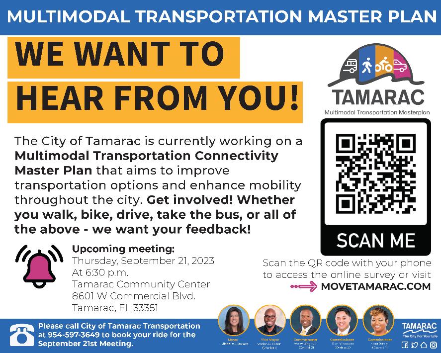
Media collateral used to promote the community meeting in September.
PUBLIC INVOLVEMENT
SURVEY HIGHLIGHTS
50% of survey respondents are between 51 to 70 years old.
84% of survey respondents have access to a car, 11% do not have access and 5% sometimes do.
•62% are located in the zip code 33321, 20% in 33319, 12% responded that they don’t live in Tamarac, 4% are in 33309, and 1.3% in 33351.
•80% are residents, 16% work in the City of Tamarac, and 3% are visitors.
Walking is the second most frequently used mode, with 36% of respondents reporting walking on a daily basis. While 15% reported to bike, 12% use a rideshare service such as Lyft or Uber, 6.5% take the bus.
•83% of survey respondents report driving on a daily basis. This is the most used mode of transportation.
When asked about the primary motivation to walk or bike, 73% of survey respondents selected exercise, 23% walk or bike to get to a leisure destination (Parks, shopping, etc.) and 10% to travel to/from public transit.
•53% of respondents think the sidewalk network in Tamarac is fair; where they can walk some places. 31% of respondents report the sidewalks are in good condition, and 16% reported it as in poor condition.
•Regarding bike facilities, 50% reported fair condition, 31% reported either poor condition, no, or only a few bike facilities.
Pedestrian facilities (53%), tra c calming (43%) and reduce congestion (37%) are in the top 3 of needs of the community.
‘Not enough designated crosswalks for pedestrians’ was selected by 29% of respondents.
High vehicle speeds (68%) are considered the most pressing tra c safety concern in Tamarac. Concerns related to aggressive driving, drivers not stopping for pedestrians, and narrow, broken or missing sidewalks were the second, third, and 4th most pressing concerns.

Survey respondents had the opportunity to provide information about their favorite places and destinations in Tamarac. Among their favorite places are:
The Library, the Tamarac Community Center, the Aquatics Fitness Center, Midway Plaza, Kings point plaza, Parks, Publix, ALDI, Cypress creek trail, Walmart neighborhood market, Walgreens, Kings Point Clubhouse, Dollar Tree, City Hall, Tamarac Sports Complex, Tamarac Town Square, Woodmont Country Club, Caporella Fitness Center, Colony West Golf Club, Ross, The shops on University Drive, Sunshine Plaza and CVS.
In summary, overall, Tamarac residents are interested in:
•Improving connections to parks, schools, shopping plazas and city amenities
•Greater protection at signalized intersections
•Increased access to local shuttle
•Enhanced way nding
•Pedestrian friendly streets
•Improved lighting
•Continuous sidewalk network
•Better and protected bike facilities
•Safer streets for all users of the road
•Welcoming city facilities and neighborhoods
•A reliable transportation system
•A greener, beautiful and resilient Tamarac
PUBLIC INPUT
Key themes heard at and through written comments include:
Lighting: Community members expressed concern about the sidewalks, pedestrian crossings and neighborhood pathways being too dark at night. These conditions make the walking experience uncomfortable (or stressful), and discourage people from walking activities. Participants discussed low visibility at speci c locations (e.g., Commercial Blvd, especially east of 100th Ave; Woodmont, NW 80th Ave and the Mainlands).
Landscape Enhancements: Participants wanted to see more vegetation along sidewalks for comfort and shade (e.g., NW 61st street).
Pedestrian-Vehicle Con icts: Community members shared concerns about distracted and aggressive drivers. When vehicles are turning left at intersections, they are not paying attention to the pedestrian crossing the street; drivers do not yield to pedestrians; in neighborhood roads, trucks block the sidewalks at speci c locations (e.g., NW 61st street and NW 84th terrace).
Pedestrian Improvements: Participants voiced the need for pedestrian amenities like pedestrian refuge, wider sidewalks, landscape bu er, adding and xing crosswalks, adding and xing sidewalks and intersection improvements. Some areas identi ed are: Commercial Blvd, Pine Island, 61st street, Nob Hill south of McNab, north of 81st St East of Pine Island, NW 84th terrace, NW 81st, Woodlands, the Mainlands and University Dr).
Biking Improvements: Residents shared concerns about biking on the street next to cars without any bu er or physical barriers for protection. Participants highlighted that people bike on the sidewalks instead of the bike lanes because the streets are designed for vehicles to go up to 45 miles per hour and bike facilities are not design to o er protection under these conditions. Participants mentioned concerns along Nob Hill Rd, University Drive, NW 80th Ave and Pine Island.
Maintenance and Improving Trail Connections: Participants expressed their appreciation for the Cypress Creek Greenway, as they consider it a great asset of the city of Tamarac. They recommended adding more amenities (benches, trash cans, shade) along the greenway to make it more comfortable and safer for users and visitors; community members also mentioned that safety improvements need to be done at the intersections to consider for pedestrian and bicyclist’s continuous access. Community members also wanted to link trails with surrounding cities (e.g., Connect Hiatus Greenway to Cypress Creek Greenway).
Tra c Calming and Speed Control: Participants voiced concern about the speeding vehicles on main collectors and neighborhood streets (e.g., Commercial Blvd, Macnab, Pine Island, Nob Hill Rd., NW 70th Ave). suggested considering tra c calming measures such as speed bumps in local roads, (e.g., SW 20th Ave/82nd Street; 78th Street; 83rd Street; North of McNab Rd between 108th Terrace and 100th Ave; north of 57th Between University and 64th).
School Zones: Participants discussed existing con icts along Commercial Blvd where two school zones are located.
Parking: Participants discussed existing con icts regarding vehicles parked on sidewalks and blocking the sidewalks to pedestrians.
Unmarked Crossing: Community destinations like parks, schools, and community centers were mentioned to have a pedestrian crossing without a crosswalk.
Better Way nding and Branding to Access Transit: Community members voiced their interest about accessing the local shuttle o ered by the city but expressed not knowing anything about this service. Recommended better marketing for the service, way nding at bus stops with speci c information about schedules, cost and routes.
Community Shuttle Service Area Expansion and Hours Extension: Currently the Red line and red extension routes o er service to limited areas in Tamarac, and end service at 6:55 p.m. and 4:55 p.m. respectively. Community members are interested in accessing the service in their communities as well, and a reliable service that take them to the locations they need to go. Some suggestions received are S Colony Circle, the Mainlands and Woodlands.
Beauti cation: parks, activities, placemaking, protect the green. Integration with lakes and increased green spaces.Visible sight triangle at intersections, reduce blind spots.
Improve Access to Parks and its Surroundings: (e.g., Tamarac Commons Park, Water’s Edge Park, Tamarac Veterans’ Park, Sunset Point Park
East and West Connectivity: Participants expressed interest about creating better connections between the east side of Tamarac and the west side.
Welcoming City: Community members are interested in making the city more welcoming to visitors. There were discussions about the creation of a Downtown in Tamarac to concentrate all activities, events and gathering space for the community. Way nding and signage that indicates the entrance into the city and welcome the community.
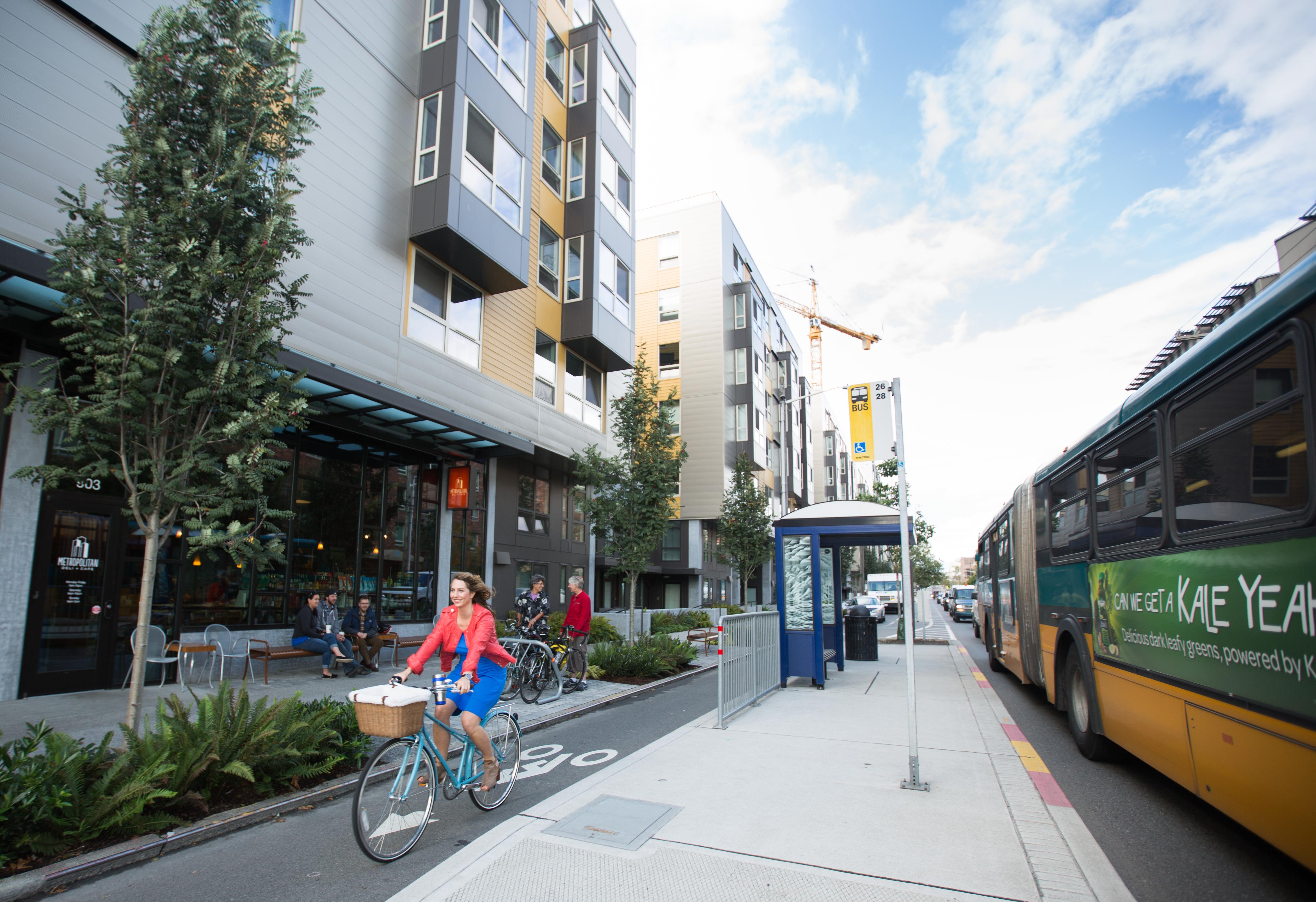
possible. Reliable, frequent public transportation bus/rapid transit and/or train options. East-west rapid transit connecting to ocean.
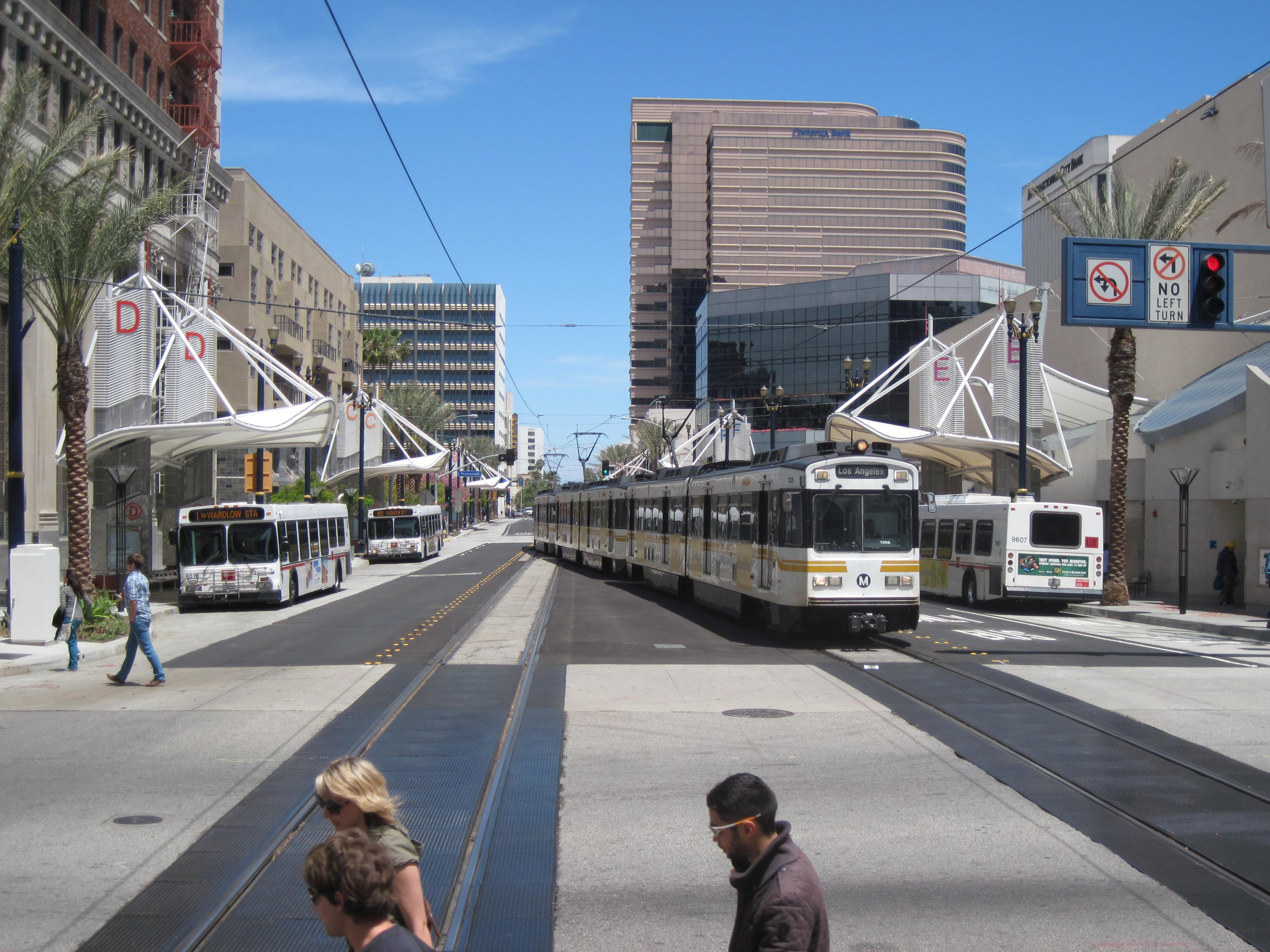
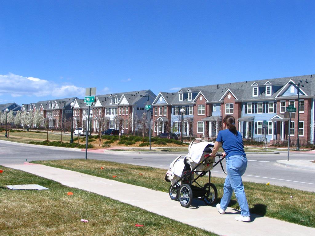
Better bus waiting areas for elderly with sun and rain protection.

•All neighborhoods having sidewalks that connect to the overall city sidewalk infrastructure. I live o NW 82 St and there are only sidewalks on one side of the street with no dedicated crosswalks to reach the sidewalk. Cars come through at 55 instead of 35 and I am often forced to walk in the bike lanes which is dangerous as the cars don’t often respect the markings on the pavement. The street can also be very unevenly lit at night.
•My vision is that Tamarac has a complete sidewalk network.

•Easy to get around without a car. Better public transportation.
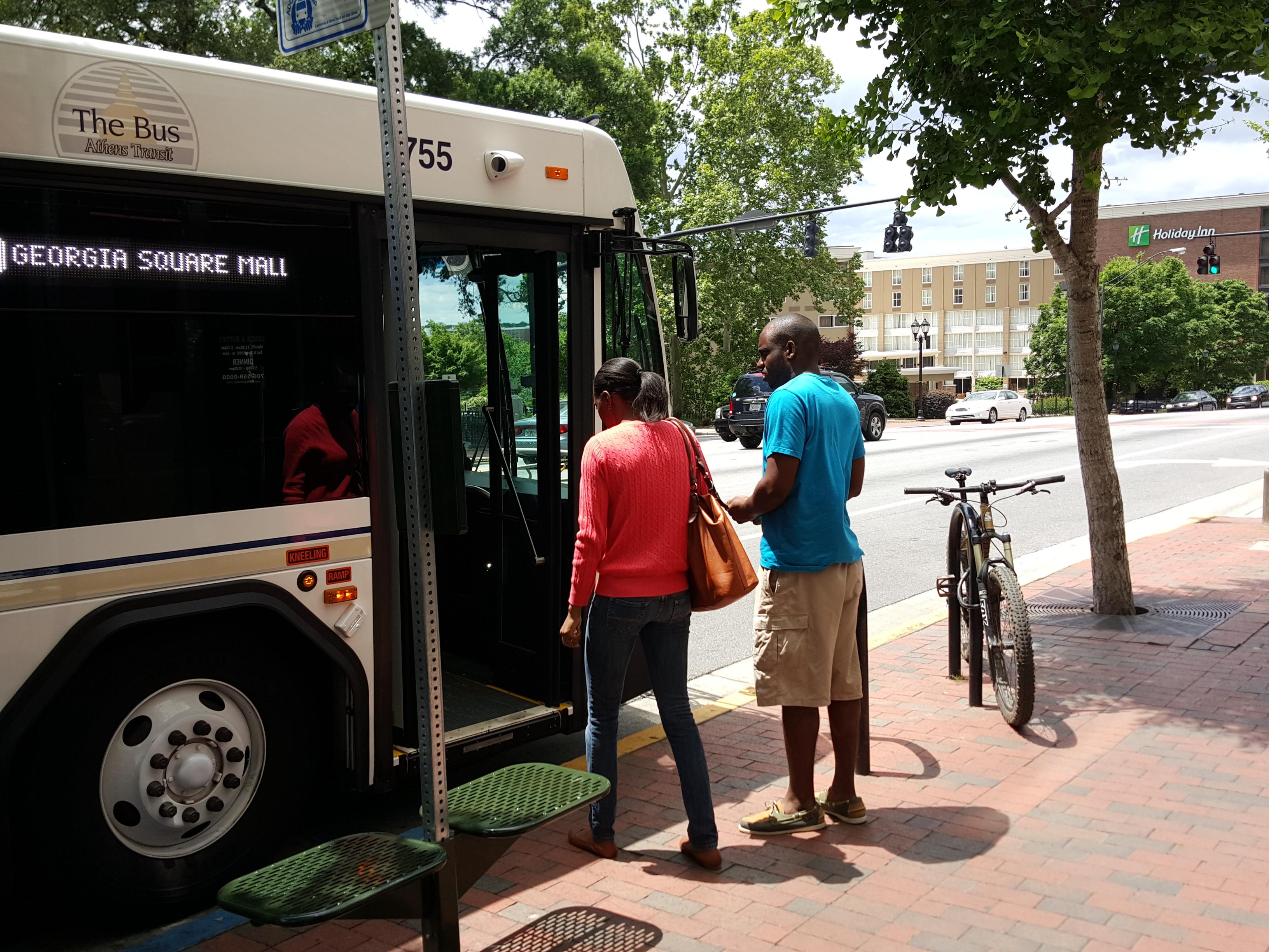
•As I age, I think about when I will no longer be able to drive, which is still 20 years away for me. But how will I be able to use buses when the time comes. It's too long a walk from housing neighborhood to main street I live near which is Pine Island. A route along
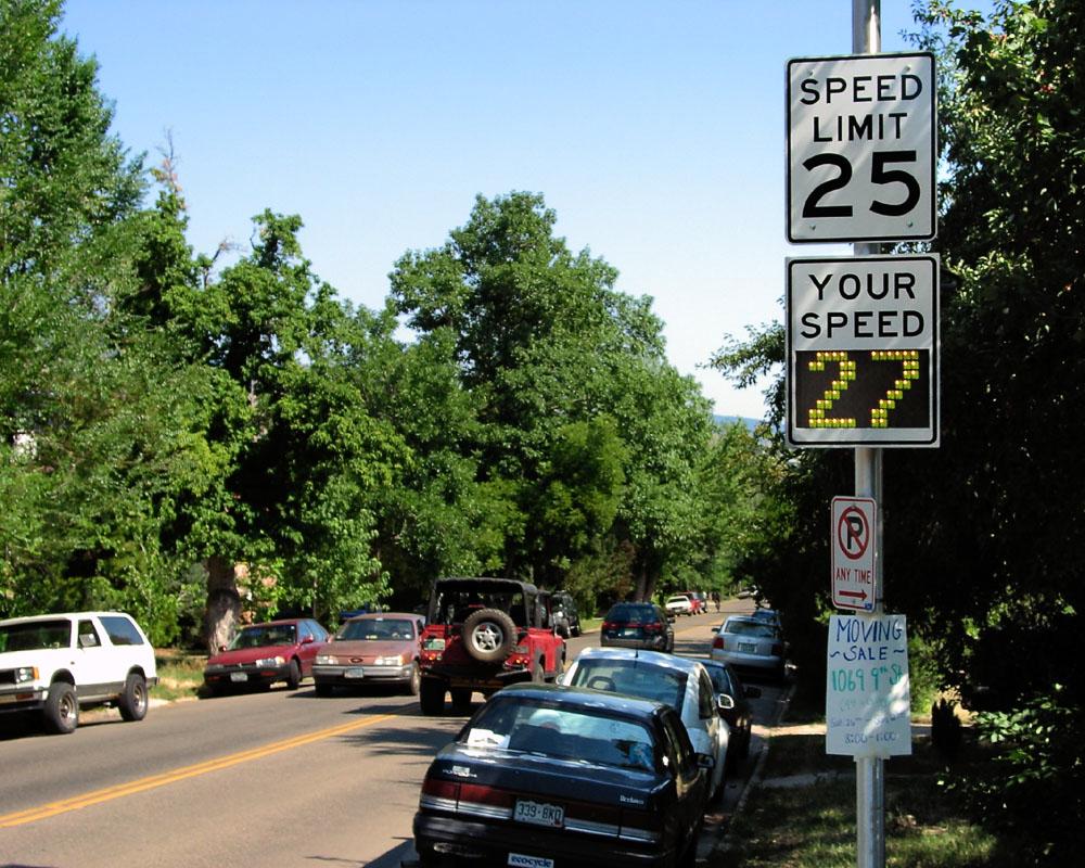

More people drive than rely on public transportation, so focusing on speed detection devices and speed limits is critical.
04 INFRASTRUCTURE RECOMMENDATIONS
CHAPTER 4 : INFRASTRUCTURE RECOMMENDATIONS
OVERVIEW
MOVE TAMARAC was initiated to prioritize multimodal options for the community as the City’s population continues to grow. The P lan’s goals guided the development of recommendations for transportation infrastructure improvements, policy, and programming.
The project team identified 25 priority projects that could be funded through different City, regional, state, and federal grants. Recommendations were developed using input from the following sources:
• Public engagement (in person and online)
• Existing Conditions and Needs Analysis
• Previously adopted and concurrent plans
• Site visits and desktop review
• National best practices and engineering judgment
The top 25 projects were evaluated through the lens of connectivity at a network level, while also distributing projects across the city. A project prioritization process with defined criteria was applied to objectively develop the top 25 projects. Following this process, five out of the 25 projects were selected for additional evaluation based on discussions with the City, identification of “low hanging fruit” implementation opportunities, and the City’s top priorities. The evaluation resulted in providing a summary, or “cut sheet”, of each of the five projects that includes a high-level visualization of conditions, as well as planning-level cost estimates. These cut sheets are intended to serve as project information summaries for future grant funding applications.
RECOMMENDATIONS DEVELOPMENT
This section describes in further detail the prioritization process applied to select the Plan’s top 25 projects. It is important to note that the projects put forward in this Plan are based on both quantitative and qualitative elements that together helped identify the areas that the City can focus improvements to maximize multimodal and connectivity benefits and investments. As the City moves forward with the implementation of these projects. It is recommended that a periodical assessment (no longer than 5 years) is applied to the Masterplan to prioritize a new set of projects and improvements as goals and objectives are achieved.
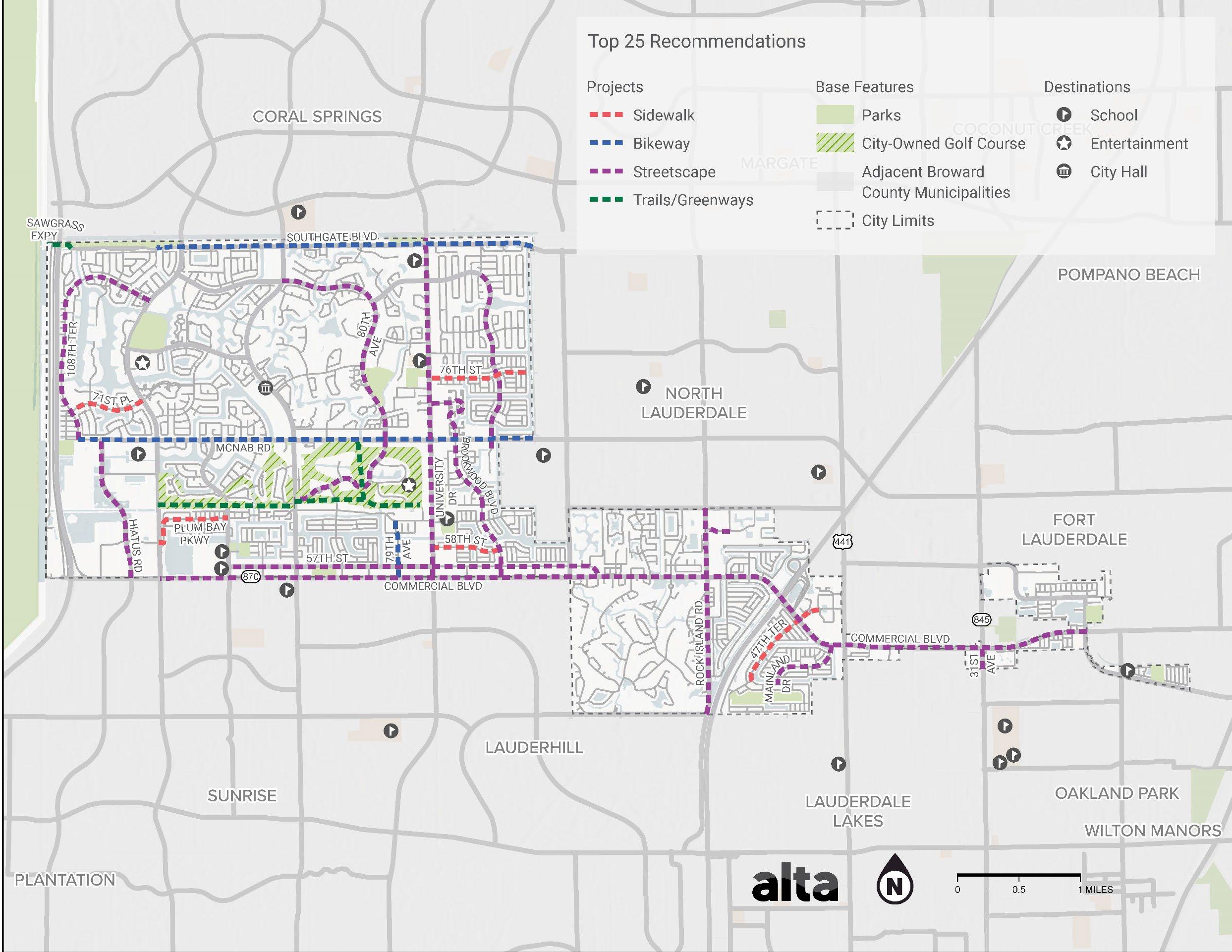
The top 25 projects are demonstrated in Map 5 As shown, critical active transportation connections were identified across the City to create a connected, convenient network. Additionally, major corridors that could benefit from streetscape improvements that improve access and mobility for everyone were identified. Collectively, the identified projects would facilitate mobility by however means residents and visitors choose to move, and connect users to critical destinations across the City, including to the City’s many amenities and Parks.
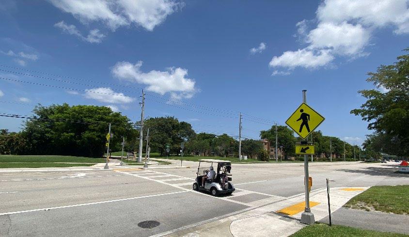
MOVE TAMARAC aims to make it safer and more convenient for all road users to move around the City, regardless of how they choose to move.
PRIORITIZATION CRITERIA
The criteria used to determine priority projects were connectivity, safety, equity, economic development, and accessibility.
The connectivity criterion analyzed existing conditions data from the City, such as existing sidewalk and bike facility data. Projects that were along a roadway that has a gap in existing sidewalk or bike facilities were given a point for connectivity, as the project will fill gaps and improve connectivity along the roadway.
The safety criterion analyzed crash data between 2012 and 2023, including crashes that involved motorists, pedestrians, or bicyclists. Projects along roadways with a fatal or severe crash between 2012 and 2023 were given a point for safety.
The equity criterion identified areas of need throughout Tamarac using three pieces of data. First, the USDOT Equitable Transportation Community Explorer 11 was used to identify areas of the City that are considered disadvantaged based on a number of characteristics. The equity criteria also analyzed US Census data from 2021 showing average household access to a vehicle and median household income for each census tract. For the prioritization process, projects that fell within a transportation disadvantaged area or a census tract with greater than 21% of households with no access to a vehicle or a median household income less than $35,000 were given a point for equity.
The economic development criterion used data from the City to identify areas with high potential for economic development. The data used includes future land use designations focused on commercial land uses, which helped to identify commercial corridors such as McNab R oad and Commercial Boulevard that are targets for enhanced development. The analysis also used the City’s Target Development Areas and the City’s Opportunity Zones. These areas include places such as the Medical Mile District, the Nouveau Quarter, and the Four Corners Shopping District,
11https://experience.arcgis.com/experience/0920984aa80a4362b8778d779b090723/page/E
TC-Explorer National -Results/
which are opportunities for new businesses, mixed-use buildings, and transit-oriented development. Projects within a distance (500 feet) from these economic development areas were given a point for economic development.
The accessibility criterion identified key destinations across the c ity, such as parks, community centers, hospital, libraries, retail areas, senior housing, and transit stops. Projects within a half mile of any of these destinations were given a point for accessibility, as they will improve access to the destination.
The project team used data to map critical areas in Tamarac that related to the prioritization criteria. Based on the goals of the plan (see Chapter 1), each roadway segment with improvement recommendations received a score ranging from 0 to 5 using the criteria presented in Table 1. The prioritization process assigned a number value to all recommendations between 0 and 1 based on the criteria outlined above, giving each project an overall score between 0 and 5. From this score, projects were sorted into high-, medium-, and lower-priority project categories. Projects that scored 3 or greater were considered to be a high priority.
Table 1. Criteria for Recommendation Prioritization
Criteria Description Points
Connectivity Identified as a gap in the transportation network analysis.
Safety Crashes were evaluated to identify where fatalities or severe injuries are occurring at a relatively high frequency. Project is on a roadway with a motorist, pedestrian, or bicyclist-involved crash between 2012 and 2023.
Equity Project improves equity. Within identified areas of need (USDOT 12 Transportation disadvantaged area, census tract with greater than 21% of households with no access to a vehicle, or census tract with median household income less than $35,000).
Economic development Service to high Development Areas and Future Land Use. Within 500 feet of an economic redevelopment or commercial area (City’s target redevelopment area, City’s opportunity zone, or commercial future land use).
Accessibility Within ½ mile of a park, school, library, hospital, community center,
1 (Yes); 0 (No)
1 (Yes); 0 (No)
1 (Yes); 0 (No)
1 (Yes); 0 (No)
Criteria Description Points
neighborhood retail, transit stop, or senior housing.
Projects were sorted based on score, and then ranked to create a top 25 list of projects based on the following criteria:
1) Projects with a score of 4.5 or 5 were included.
2) Projects with a score of 3.5 or 4 and a safety score of 1 were also included.
3) A critical regional greenway connection using public land to enhance connectivity was also included.
Note on Feasibility
The Plan determined feasibility by assessing the level of complexity in design, construction, project type, available public right-of-way and road ownership.
Following the development of the top 25 projects (See Map 5), the list was provided to the City, with the aim to ensure that the project list is acceptable and accurately represents the City’s strategic goals. City staff and the City Engineer were invited to review the initial list of projects including those designated as the top five. Based on their institutional knowledge of the street network and project delivery timeline, they recommended changes to better reflect on-the-ground conditions. From this process, the list of 5 projects were finalized.
1 (Yes); 0 (No)
12 The US DOT Equitable Transportation Community (ETC) Explorer is an interactive web application that uses 2020 census tracts and data to explore the cumulative burden
communities experience in the following five components: transportation insecurity, climate and disaster risk burden, environmental burden, health vulnerability, and social vulnerability.
MULTIMODAL STREET DESIGN TOOLBOX
MOVE TAMARAC recommends the implementation of Complete Streets 13 through streetscape improvements, transit, bicycle, pedestrian, intersection, traffic calming and green infrastructure design elements, signal operation improvements and best practices. Broward County and the Broward MPO adopted the Broward Complete Streets Guidelines in 2012 and then updated the guidelines in 2019, encouraging municipalities to adopt complete streets principles and standards. In 2023, FHWA releases the Manual on Uniform Traffic Control Devices for Streets and Highways (MUTCD) 11th Edition with updates to improve safety for all road users.
The intended result for a community utilizing The Broward Complete Streets Guidelines 2.0 (Adopted on November 14, 2019) include:
• Healthier people (Complete Streets’ benefits include healthier hearts, minds, and bodies)
• Increased social capital (more regular interactions with neighbors, visitors, and business patrons) and
• Increased active transportation (due to increased and improved facilities for walking, bicycling, and accessing public transportation)
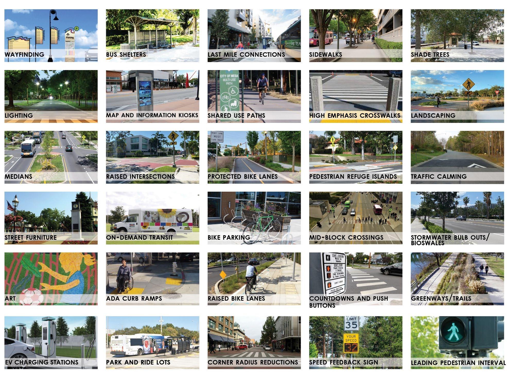
The elements of a Complete Street vary based on community context and the role that a particular street needs to serve in the multimodal network. 14 The following section describes facilities that are mentioned throughout the Tamarac Multimodal Connectivity Master Plan and how they may be used. Note that there are other facilities beyond this list that may be relevant as new guidance and facility types are developed.
Streetscape Elements
Streets are public spaces; the design of the streets will influence how the space is used and how people behave. Streetscape elements improve safety, community identity, economic activity, sustainability, and quality of life. Streetscape elements include the following:
Wayfinding is an approach that assists travelers in orienting themselves as they make their way around the community and use the transportation system. A wayfinding system may encompass elements such as signage, maps, symbols, and other visual cues designed to guide users through urban environments.
Lighting in urban environments may include streetlights, pathway lights, and other decorative lighting fixtures. These facilities are especially important to improve visibility and navigability during evening and nighttime hours.
Medians are areas located between opposing lanes of traffic on roads. These facilities can be landscaped or paved and can vary in width and the amount of hardening. Medians may be repurposed to provide refuge for crossing pedestrians if they are wide enough and if other enhancements are made.
Street furniture describes the practice of incorporating an assortment of amenities such as tables, benches, bicycle racks, light fixtures, trash receptacles, electric vehicles charging stations and public art installations in the public right of way for public use. These features may enhance the livability and aesthetics of urban environments.
To expand Electric Vehicle (EV) adoption, EV charging stations in streetscapes is implemented to allow curbside charging and integrate new mobility options such as e-bikes, e-scooters, carsharing, etc.
13 Complete Streets are streets for everyone. Complete Streets is an approach to planning, designing, building, operating, and maintaining streets that enables safe access for all people who need to use them, including pedestrians, bicyclists, motorists and transit riders of all ages and abilities. Smart Growth America. https://smartgrowthamerica.org/what-are-completestreets/
14 FHWA. Complete Streets Transformations Six Scenarios to Transform Arterials using a Complete Streets Implementation Strategy. 2022. https://highways.dot.gov/sites/fhwa.dot.gov/files/202202/2022_CS_Transformations_Doc_508.pdf
Art in the public right of way may include creative expressions such as sculptures, murals, or performance art. Public art can improve the aesthetic appeal of urban environments.
Transit Elements
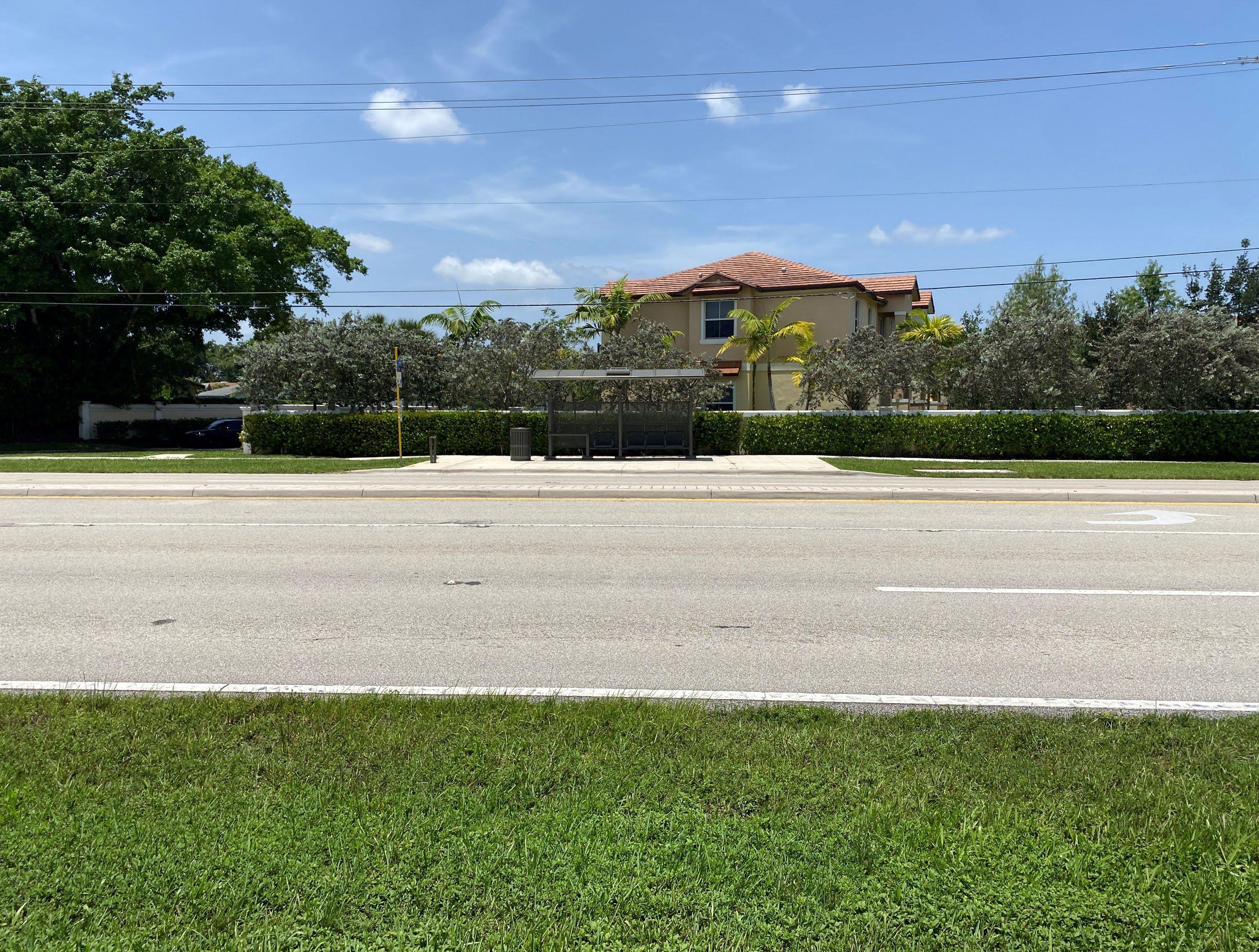
A bus shelter is a facility located near a bus stop where bus riders can wait while the bus is on the way. The facility can include an enclosure that provides shelter from the elements, travel information, or other amenities for riders.
Map and information kiosks are physical structures that are often located in public spaces to provide wayfinding, event information, and other relevant information to travelers. They may serve additional purposes such as tourist information or bus arrival information.
On-demand or dial-a- ride transit refers to transit services that operate based passenger requests the service, often through a mobile app or by calling a number. These services often complement fixed-route transit services and may be designated for a certain demographic group.
Curb ramps provide accessibility for wheelchairs, strollers, and people with mobility impairments in the transition zone between sidewalks and the street. There are more specific requirements and guidelines on these facilities as part of the Americans with Disabilities Act (ADA).
First and Last mile connections are the first and final legs of a person's journey to their ultimate destination. These legs of the journey are often not supported by transit and should include short- distance transportation modes such as bicycles, e-scooters, or walking.
Park and Ride Lots are specialized parking lots that are in strategically placed areas away from heavy congestion 15 . Offering a safe and convenient location to transition from a single passenger vehicle or bicycle to a carpool, vanpool, or transit can help simplify the commute.
15 South Florida Commuter Services. PARK AND RIDE. https://www.1800234ride.com/parkand-ride/
Bicycle Facilities
Bike parking includes designated locations or facilities where travelers can securely lock and store their bicycles. These facilities can range from simple staple bicycle racks to more sophisticated enclosures with lockers or other amenities. Bike parking often complements the built environment when placed in or near commercial areas, workplaces, or at transportation hubs.
Given potential conflicts between travelers in and around intersections, bicycle protection elements can help enhance safety by providing clear, dedicated routes through the intersection. Bicycle protected intersections may include the following elements:
• Corner islands
• Dedicated bicycle signals
• Physical barriers
• Wayfinding
Protected bike lanes are dedicated bicycle roadway facilities that include some form of physical hardening between the bicycle lane and adjacent vehicular traffic. This barrier may be constituted of bollards, curbs, or planters. Protected bike lanes can increase safety and comfort for people traveling in the lane.
Raised bike lanes are bicycle roadway facilities that are separated from the roadway by an elevated curb. The curb height can vary but should be high enough to create a visual distinction between the vehicle lane and the raised bike lane. Elevated bike lanes can improve bicycle safety and visibility.
Shared use paths are transportation facilities that are dedicated to nonmotorized transportation modes such as walking, biking, or other forms of rolling. These paths may serve as recreational facilities or a utilitarian transportation function.
Greenways and trails are transportation facilities that offer non-motorized travelers a travel or recreation corridor separated from vehicular traffic. A greenway may follow a natural feature such as a river, a ridgeline, or an abandoned railroad.
Pedestrian Facilities
Sidewalk improvements are any sort of enhancement that improves the safety, accessibility, or comfort of sidewalks. Such improvements may include:
• Repairing cracks or bumps in the sidewalk
• Adding curb ramps
• Widening sidewalks
• Installing tactile paving for the visually impaired
• Installing drainage facilities
High-visibility (Emphasis) crosswalks are marked crosswalks that use bright, often reflective materials and patters to increase visibility to drivers. High-visibility crosswalks may be oriented in the "continental configuration," which provides additional visibility to drivers.
Pedestrian refuge islands are marked or raised pedestrian waiting areas located in the middle of crosswalks between traffic going in different directions. Pedestrian refuge islands break up crossing a street into two stages, making it easier and safer for pedestrians to get to the other side.
Mid-block crossings are pedestrian crossing locations that are not located at intersections as most pedestrian crossings are. These facilities may become desired or necessary to enhance pedestrian safety and accessibility on roads where intersections are spaced far apart.
Sight Lines
At unsignalized intersections a substantially clear line of sight should be maintained between the driver of a vehicle, bicyclist or pedestrian waiting at the crossroad and the driver of an approaching vehicle. Improving sight lines at corners eliminate blind spots for vehicles at intersections.
Intersection Improvements
Corner radius reductions involve decreasing the radius of turns at intersections to slow down turning vehicles as well as shorten crossing distances for pedestrians. These enhancements may include elements such as a truck apron to allow larger vehicles to pass.
Raised intersections are part of a toolkit of traffic calming measures that can be used to slow traffic and make walking and biking safer. The treatment involves raising the entire intersection above the surrounding roadway, creating a platform that makes pedestrians and cyclists more visible and also alerts drivers to the importance of the upcoming intersection.
Crossings Elements
A pedestrian hybrid beacon (PHB) is a traffic control device that aids pedestrians that are crossing busy or high-speed roads by informing drivers of their presence. Once they are activated by a pedestrian wanting to cross, a sequence of yellow and red lights flash that alert drivers, potentially resulting in those drivers stopping to allow the pedestrian to cross. These devices may also include an auditory warning that warns pedestrians that drivers may not stop and to cross with caution.
A Rapid Rectangular Flashing Beacon (RRFB) is a pedestrian-activated traffic control device that is typically located at unsignalized crossings on both sides of the roadway. These devices include high-intensity LED lights that flash to alert drivers to the presence of pedestrians.
Traffic Calming
Traffic calming refers to a suite a measures and infrastructure improvements that seek to reduce vehicle speeds and improve roadway safety, especially for people walking or traveling by bicycle. These measures may include:
• Speed humps
• Median
• Raised crosswalks
• Pinchpoint
• Chicanes
• Curb extensions
• Traffic circles
• Enhanced pavement markings and signage
• Street trees
• On-street parking
Signal Operation Improvements
Urban areas often experience traffic congestion, which can lead to environmental damage and unsafe driving behavior. Traffic signals have the potential to enhance safety and traffic flow. Adaptive signal control can adjust traffic signals to changing traffic patterns and reduce congestion
Coordinated signal timing is an approach that can synchronize traffic movements and manage the progression speed of specific modes where uninterrupted flow is desired along a corridor. These changes may improve safety, reduce waiting times, and enhance intersection efficiency.
A Vehicle Speed Feedback sign displays to approaching drivers the speed at which they are traveling. A radar speed sign may be considered at sites exhibiting a correctable speed- related crash history.
The efficiency of the current transportation infrastructure can be improved by intelligent transportation system (ITS) infrastructure to adjust signals, reduce traffic congestion, and react to traffic issues.

LPIs have been shown to reduce pedestrian-vehicle collisions as much as 60% at treated intersections. NACTO


Leading Pedestrian Interval (LPI) enhance the visibility of pedestrians in the intersection and give them priority within the intersection, especially in locations with a history of crashes.
Green Infrastructure
Storm water bulb outs, also known as bioswales, are landscaping elements that can be used to capture rainwater runoff which is then filtered before going into the ground. These facilities can help prevent flooding and enhance the urban environment.
Landscaping can include the design, installation, and upkeep of vegetation and hardscape features in the built environment. Landscaping can enhance the functionality and visual appeal of public spaces, including parks, plazas, and streets.
Shade trees are trees planted along streets, sidewalks, and in public spaces that improve urban aesthetics and increase shade. These trees provide respite from sun exposure and can decrease urban temperatures, which have become increasingly more of an issue in recent years.
POLICY AND PROGRAM RECOMMENDATIONS
CHAPTER 5: POLICY AND PROGRAM RECOMMENDATIONS
OVERVIEW
Infrastructure investments are only one way to address transportation challenges and improve mobility. Also important are the policies that the City has and the programs it implements. Policies represent guidance for decisions that are made in the City. Programs come in many forms and typically educate people about their transportation options, furnish assistance for daily transportation decisions, and encourage choices that align with local goals.
This chapter includes policies and programs that the City can implement to strengthen the infrastructure recommendations, expand on existing programs and activities, and further emphasize and advance the City’s Masterplan vision and goals for using multimodal transportation options to navigate the city.
RECOMMENDATIONS PROCESS
The universe of mobility- related transportation policies and programs is large, and many would be applicable to the City. To develop an implementable list of recommendations, the project team considered opportunities identified in existing plans and policies, available transportation services and infrastructure, results from the safety analysis, community demographics, and feedback received from public engagement. Program and policy best practices were reviewed and the
project team, in coordination with City staff, developed a list of programs and policies applicable to the City.
The programs and policies are summarized below and then scored and prioritized based on their ability to achieve identified community goals.
PROGRAM AND POLICY RECOMMENDATIONS
Become an AARP Age-Friendly Community
Tamarac, The City For Your Life, can become a great place for all ages by adopting features such as safe, walkable streets; better housing and transportation options; access to key services; and opportunities for residents to participate in community activities. AARP Age-Friendly Community members make the commitment to actively work toward making their town, city, county, or state a great place to live for people of all ages. Membership fosters partnerships among community groups and local stakeholders, provides resources for identifying and assessing community needs, enables community improvements through grants, and provides access to expert- led webinars and technical assistance, among other benefits. In Broward County, cities such as Coconut Creek, Coral Springs, Fort Lauderdale, Hallandale Beach, and Wilton Manors have already made the commitment.
The Membership Application is available at: https://www.aarp.org/livablecommunities/network-age-friendly-communities/online-application/
Establish a Complete Streets Policy
According to Smart Growth America, Complete Streets is an approach to planning, designing, building, operating, and maintaining streets that enables safe access for all people, including pedestrians, bicyclists, motorists, and transit riders of all ages and abilities 16 . Adopting a Complete Streets policy is the first step to implementation. Complete Streets can help cities transform their street network through best practices for street design. Following and adopting Federal Highway
16 Smart Growth America advocates for people who want to live and work in great neighborhoods. https://smartgrowthamerica.org/what-are-complete-streets/
Administration (FHWA) recognized and approved street design guidelines such as National Association of City Transportation Officials (NACTO) Urban Street Design Guide and Urban Bikeway Design Guide can support the design of complete streets. Tamarac can adopt the NACTO design guides via departmental memo or City commission ordinance.
The City of Tamarac can start by including a Complete Streets checklist into the decision-making projects of capital projects. The Masterplan proposes a list of 25 projects that can be implemented through this approach. The Masterplan also includes Complete Streets Policy language for City consideration to adopt in the near future as part of the Masterplan implementation strategy.
Create a Vision Zero Action Plan
Vision Zero is a strategy to eliminate all traffic fatalities and severe injuries, while increasing safe, healthy, and equitable mobility for all 17 . The City of Tamarac first adopted Vision Zero in 2021, and as part of its strategies, the City committed to developing a Vision Zero Action Plan to achieve the goal of zero traffic fatalities and serious injuries by 2040.
Multiple resources exist to help the City develop a Vision Zero Action Plan. MOVE TAMARAC includes a citywide safety analysis and identifies specific areas where the City can implement safety improvements prioritizing equity, from policies to programs, to project implementation. In addition, in 2022 FDOT District 4 conducted a Road Safety Audit (RSA) on Commercial Boulevard from SR-817 (University Dr) to Rock Island Rd , the RSA was conducted following safety concerns expressed by the cities of Lauderhill and Tamarac.
Broward County and the Broward MPO are currently working on the regional safety action plan, and the Broward MPO has a grant to coordinate with cities to create integrated action plans.
The City should take advantage of the recommendations in this plan and the other identified opportunities to develop its Vision Zero Action Plan.
Implement a Safe Route to School (SRTS) Program
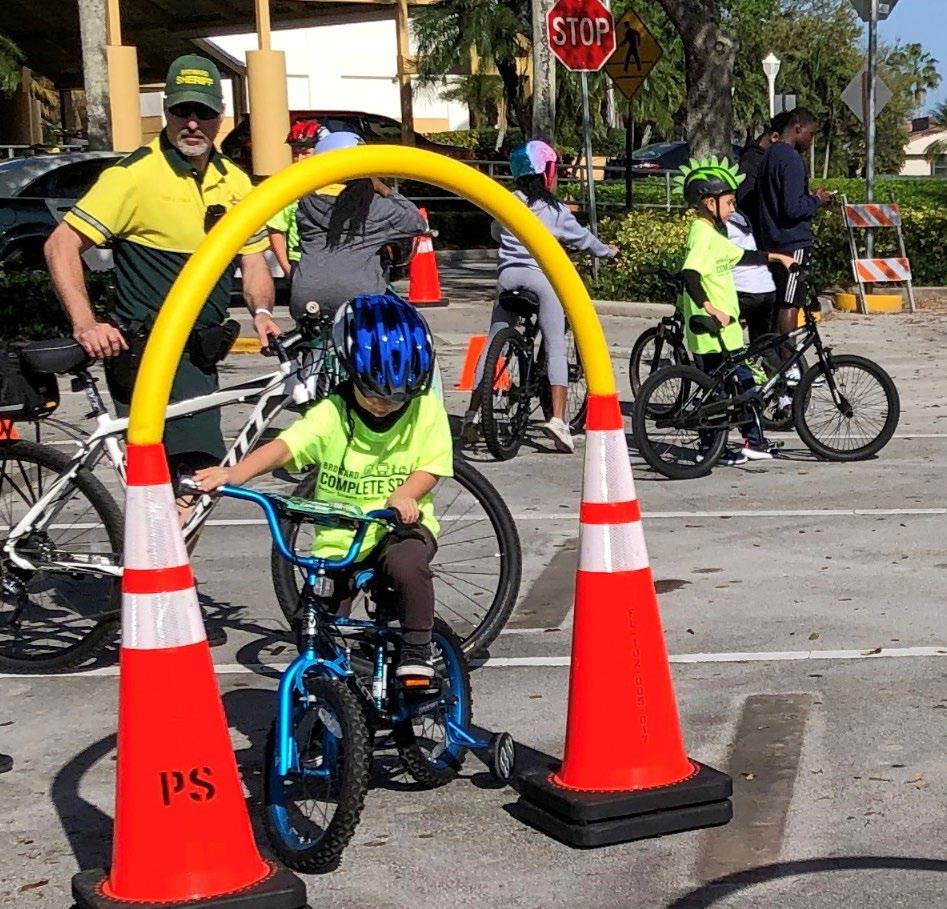
Safe Routes to School initiatives provide education and a wide range of activities, events, and local street improvements to school communities seeking to increase safety and the use of multimodal transportation. The City should implement the following:
• Educational programs that promote walking and bicycling may include teaching students about bicycle and pedestrian safety in the Curriculum; route maps of safe routes; bicycle rodeos; walking school bus; special events such as walk or bike to school days; and school assemblies.
• Infrastructure improvements may include enhanced crossings, new or expanded sidewalks, bike lanes, and bike amenities at and around schools, among others.
Florida’s Safe Routes to School program is sponsored by the Florida Department of Transportation (FDOT). FDOT provides technical support and funding support to select communities. Partnerships should also include Broward County Public Schools, Broward Health Regional Planning Council, and the Broward MPO. Each will be key to establishing and further developing a SRTS program in partnership with local schools.
For more information please visit: https://www.fdot.gov/Safety/programs/safe-routes.shtm
17 https://visionzeronetwork.org/about/what-is-vision-zero/
Implement a Safe Route to Parks Program
Safe Routes to Parks is an initiative of the National Recreation and Park Association to increase access to local parks. Developed in collaboration with the Safe Routes Partnership , the Safe Routes to Parks Activating Communities program builds on the Safe Routes to Parks Action Framework and Safe Routes to Parks Pilot Site program 18 . Safe Routes to Parks aims to improve accessibility for people walking, bicycling, and taking public transportation, creating routes that are safe from traffic and personal danger, ensuring that well-maintained and well-programmed parks are conveniently located within a 10-minute walk. 19
The City of Tamarac is committed to improving the safety and security of active travel to parks. As part of the 2014 Parks, Recreation, and Social Services Masterplan, the City highlighted the need for developing an interconnected network of sidewalks, bike lanes, multipurpose paths, and shared roads. The City should create a multidisciplinary committee to coordinate efforts with the City’s Parks and Recreation Department to implement safety improvements and projects identified as part of this plan and to explore partnerships and funding opportunities to implement Safe Routes to Parks.

18 https://www.saferoutespartnership.org/healthy-communities/saferoutestoparks


19 https://www.saferoutespartnership.org/resources/fact-sheet/safe-routes-parksinfographic
Bike Rodeo in Tamarac with the Broward Sheriff’s office. Source: Tamarac Talk
Become a Blue Zone Community
Blue Zones are a community-wide approach to well- being, creating sustainable, systems-level solutions that improve population health and economic vitality. This approach to improving community health involves making permanent and semi-permanent changes on multiple levels, including transportation improvements (e.g., streets, sidewalks, bike lanes, trails), transforming and creating public spaces, collaborating with organizations and stakeholders such as schools, restaurants, grocery stores, and employers, and community involvement. Blue Zone projects are publicly supported, privately funded, and run for 3 to 10 years.
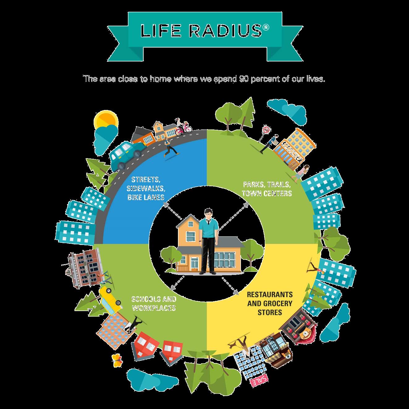
Ensure that Planned Wayfinding Supports All Travel Modes
The City of Tamarac developed a Vehicular Wayfinding Study in 2021 which lays out a detailed approach for the installation of vehicular wayfinding signage in Tamarac. It provides guidance on color bands indicating major corridors and the destinations that should be included on each sign placed at major intersections. The signs include directions to City facilities and parks located within a two-mile radius of the sign. While the study is focused on making navigation in Tamarac easy for people in vehicles, the overall design and principles behind the placement of the signs can also be applicable to multimodal wayfinding geared toward pedestrians, cyclists, and transit riders
As part of MOVE TAMARAC, the team recommends better integrating wayfinding and signage systems to guide residents and visitors through Tamarac's expanding multimodal transportation network. Standardizing the design of pedestrian, vehicular, and transit- related signage across the City ensures consistency and ease of navigation. Strategically placed Interactive Digital Kiosks can be placed in community centers, parks, plazas, centralized commercial areas, EV charging stations, and transit stops that yield high ridership. Furthermore, multi -language support in these kiosks will ensure inclusivity, catering to Tamarac's diverse community and enhancing accessibility for all users. Digital wayfinding features exemplify innovative urban solutions that enhance mobility and accessibility.
This Plan does not recommend specific areas for wayfinding. The City should evaluate the entire network for opportunities to install wayfinding signage.
Implement a Transportation Demand Management (TDM) Ordinance/Plan
Transportation demand management initiatives help cities implement strategies in collaboration with schools, workplaces, and developers to mitigate traffic congestion; encourage and accommodate multimodal modes of transportation through carpooling, telecommuting, shuttle services, and transit education; and generate increased commuter ridesharing, reduced trip generation rates, reduced parking needs, reduced peak period traffic, and reduced single- occupancy vehicle trips. Developing a TDM program for the City of Tamarac as part of the Master Plan
implementation strategy will be key to maximizing traveler choices and complementary efforts towards multimodal transportation.
The City’s first step towards developing a TDM program is to adopt an ordinance that requires new developments to develop and implement TDM plans and strategies, such as secure bicycle storage facilities, carpool and transit incentives, improvements to adjacent transit stops, and parking pricing and management policies. For more ideas, please read: Integrating Demand Management into the Transportation Planning Process: A Desk Reference by FHWA.
Make Additional Investments in Transit
Analysis of transit ridership can provide an understanding of areas with high demand for transit. These areas can be good places for investment and improvements to amenities, as services are used by a larger number of people. Overall, a large demand for transit service is found in the southern portion of the City, especially along Commercial Blvd.
Under the 2023-32 Broward County Transit Development Plan (TDP), significant investments are allocated for bus replacements and stop improvements countywide, totaling $38.9 million. Moreover, $44 million over the next decade is earmarked to enhance county community shuttle services. The Broward PREMO Plan includes several enhancements. An extension of the light rail network along Commercial Blvd is proposed to improve connectivity between neighborhoods and downtown areas, with projections indicating connectivity to the Fort Lauderdale Airport (FLL) by 2028 and downtown Fort Lauderdale by 2031. Additionally, rapid bus routes will cover a broader area, complementing the light rail service. High-frequency bus routes on University Drive and Commercial Boulevard are expected to integrate with existing community shuttle lines, enhancing local transit options.
This investment represents an opportunity for the City of Tamarac to improve existing transit facilities and improve current transit service. From the existing conditions analysis, the team was able to identify key priority projects to focus transit recommendations:
• ADA improvements: Inaccessible facilities are primarily located along Commercial Blvd, W McNab Rd, Prospect Rd, and N Pine Island Rd.
• Community Shuttle expansion: The City’s community shuttle service currently operates on weekdays. the shuttle has served as a significant mode of transportation, accommodating approximately 24,744 riders in fiscal year 2022, with 3,817 monthly riders in June 2023 alone. The current schedule limits accessibility to transit on the weekends, as riders can only use Broward County Transit services, which only stop along major roadways and provide fewer local connections. Expanding and extending the hours of the local shuttle service during the weekends and weekdays can improve the accessibility of the transportation system that some residents may rely on for their daily trips around the City. To achieve this, MOVE TAMARAC recommends the development of an Origin-Destination Study to further evaluate Ridership and potential service area.
• Solar-Powered Transit Shelters: These shelters can be installed at key transit stops across Tamarac along Commercial Blvd and University Dr to enhance passenger comfort and convenience. The shelters incorporate energy-efficient, solar-powered lighting to increase visibility and safety during nighttime. The also feature real-time digital displays that offer up -to-date transit schedules and route details.
Pilot On-Demand Microtransit
Unlike conventional fixed -route systems, on-demand microtransit allows passengers to request rides tailored precisely to their individual needs and schedules. The introduction of this new microtransit system will complement the existing transit services such as the Premium Mobility Plan (PREMO), Broward County Transit (BCT), and the Community Shuttle.
Offering diverse options, Broward County and the City of Tamarac can achieve the following goals:
• Reduce single- occupancy vehicle usage on roadways
• Reduce Vehicles Miles Traveled (VMT)
• Build equity by establishing a comprehensive system that promotes mode shift.
The City has proposed an on-demand microtransit pilot program to optimize ridership and usage through a phased approach.
Phase 1 of the Microtransit Pilot Program focuses on the Commercial Blvd and University Dr corridor (Central Business Corridor). This phase operates within specific boundaries, including Commercial Blvd, NW 64th Ave, McNab Rd, 72nd St, and Nob Hill Rd, covering approximately three-square miles. The primary objective is to enhance connectivity within this designated area, prioritizing access to essential destinations in Tamarac districts such as the Local Activity Center, Crossings, and Light Rail corridor, as defined by the 2024 Comprehensive Plan Update (See Map 6).
Phase 2 of the Microtransit Pilot Program is structured into two distinct areas: University North and Commercial East. In the University North section, the focus is on establishing connectivity to high -quality transit access points, particularly in the Lifestyle Mile and Main Street districts outlined in the 2024 Comprehensive Plan Update. Pooled rides are encouraged throughout all phases of the pilot program to reduce traditional peak hour demands at major intersections and enhance parking capacity. The second area is located along Commercial Blvd east of the Central Business Corridor. The area is bounded by the Florida Turnpike, 62nd St, 64th Ave, and Commercial Blvd. This geographical area forms an essential link between different transit phases, ensuring seamless connectivity and accessibility for residents throughout the City.
The final phase of the Microtransit Pilot Program involves citywide expansion of on-demand microtransit services, marking a significant milestone in transit accessibility for Tamarac residents. Integrating ondemand microtransit into the Broward County Transit (BCT) network, this phase will facilitate seamless transfers and enhance overall transit connectivity.
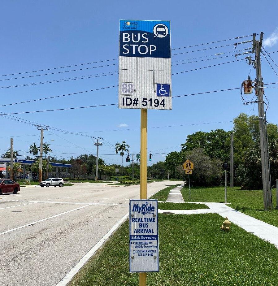
The Pilot program should focus on technology -enabled services that blend on-demand and fixed-route capabilities.
Broward County Transit service. Bus stop along N Pine Island Rd.
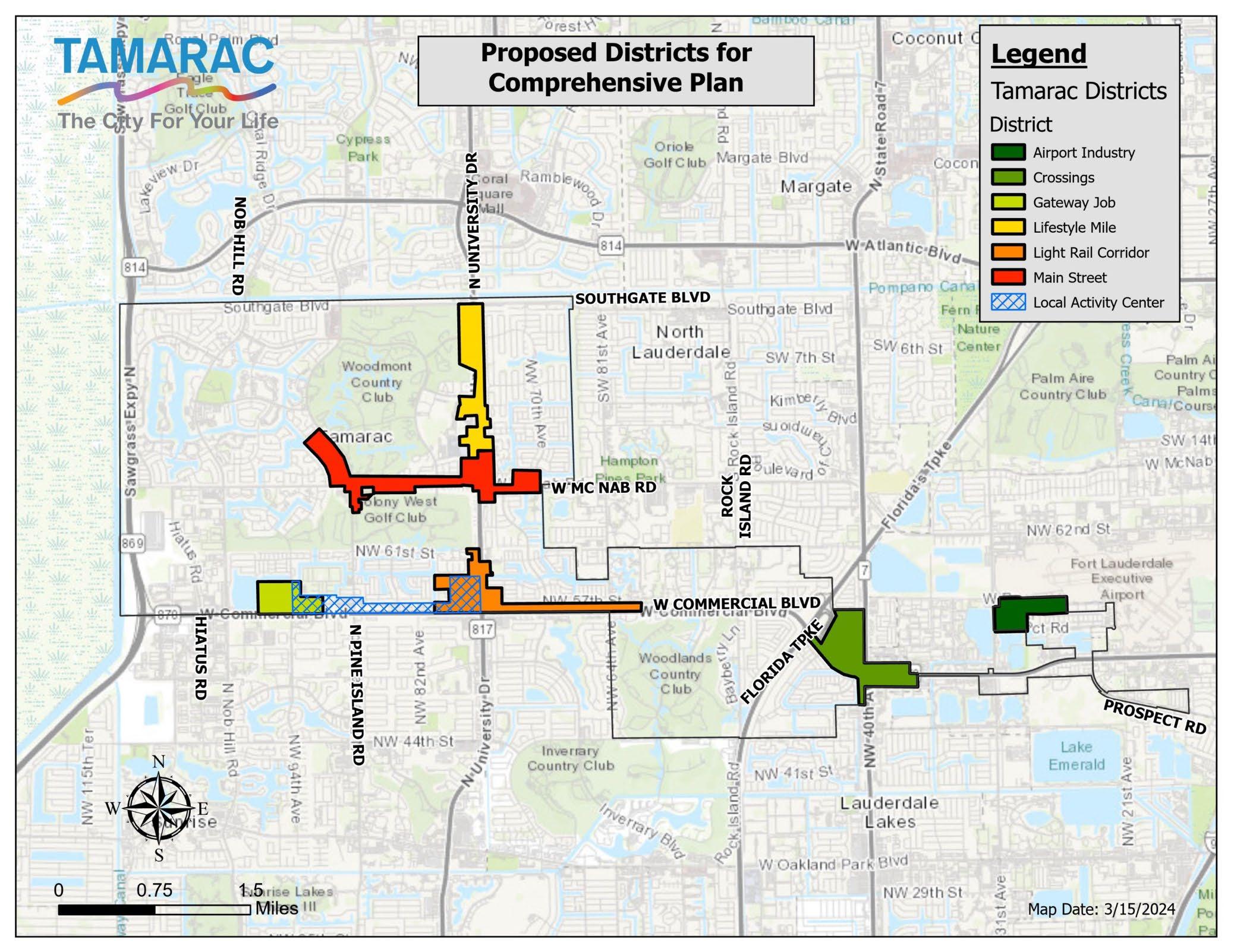
Establish a Mobility Hub on Commercial Boulevard
New transportation technology trends are influencing urban transportation systems, and mobility hubs offer a comprehensive set of mobility services. To accommodate the diverse transit needs of Tamarac's residents and regional connectivity with surrounding cities, a Neighborhood Mobility HUB should be considered. The city submitted a project to the Broward MPO for the 2050 MTP Call to Projects for a mobility hub on Commercial Boulevard, where a large demand for transit service is found; the highest number of transit boardings occur at stops near Sunshine Plaza at the intersection of Commercial Blvd and SR -7 Commercial Boulevard is also identified in the Broward County PREMO plan for a potential L ight Rail project.
This hub will centralize various modes of transportation, including bicycles, microtransit, and micro-mobility options, creating a seamless transition point for localized commuters who are interested in connecting to major entertainment districts. The hub will be the heart of Tamarac and will be designed with user comfort in mind, featuring well-appointed waiting areas, secure bike storage, and electric vehicle charging facilities. Incorporating elements such as public art and green spaces, the hub will not only serve as a functional transit center but also as a community gathering space.
Implement Smart Technology and Traffic Signal Optimization in collaboration with Broward County.
The installation of fiber optic communications improves the active management, operations and functioning of traffic signals. Through this technology, government agencies can deploy and use infrastructure to collect and report data to evaluate performance, optimize signal timing, reduce congestion, traffic flow, improve transportation mode detection (pedestrians, vehicles, etc.) and integrate other technologies such as sensors (speed, weather information, air pollution, etc.). As part of the Mobility Advancement Program (MAP Broward), t he Broward County Highway Construction and Engineering Division upgraded traffic signal
20 United States Environmental Protection Agency (EPA). 2024. Fast Facts on Transportation
communications to a high-speed fiber-optic network in North Lauderdale and Tamarac in 2023, on McNab Road from Pine Island Road to State Road 7. MOVE TAMARAC recommends continuing partnering with the County to deploy technology that allows collecting data on major arterials in the city to find solutions that can complement the implementation of the Master Plan projects.
Electric Vehicle Infrastructure Program
According to the Inventory of U.S. Greenhouse Gas Emissions and Sinks 1990– 2022 transportation accounted for the largest portion (28%) of total U.S. GHG emissions in 2022. The largest category within the sector was light-duty vehicles (including passenger cars and light-duty trucks), accounting for 57% of greenhouse gas emissions 20 . Through the National Electric Vehicle Infrastructure Deployment (NEVI), states deploy EV charging infrastructure to build a network along approved Alternative Fuels Corridors (AFC). An estimated $198 million is directed to Florida over five years to address EV charging needs for passenger vehicles and light duty trucks 21 . The City of Tamarac is committed to provide multimodal transportation options that are innovative, sustainable, resilient, reliable, and accessible for all, for this reason MOVE TAMARAC is aligned with FDOT’S goal to expand the EV charging infrastructure network in Florida. In 2024, the city started transitioning its municipal fleet of vehicles to electric vehicles to set a precedent to move towards a greener and cleaner future.

“This is a critical step toward supporting sustainable practices in our city and preserving the environment for future generations.”
Mayor, Michelle J. Gomez


21 Florida Department of Transportation. Electric Vehicle Charging Infrastructure. https://www.fdot.gov/emergingtechnologies/home/evprogram/funding
Greenhouse Gas Emissions.
The City plans to continue converting its fleet with the use of electric vehicles in the future, as well as installing EV charging stations at key locations throughout the City. Increasing accessibility and availability of EV charging stations for the public use is an important component to implement a sustainable transportation Network. The City should apply for Federal, State, and local funding to assist with the implementation of the City's Electric Vehicles Infrastructure program.
Explore Opportunities Around Drone Operations
The City of Tamarac may have opportunities to partner with FDOT, Broward County, Broward MPO, or local businesses, civic institutions, or commercial carriers and suppliers interested in drone 22 operations. The following considerations are an important starting point in exploring opportunities:
• Identify valuable use-cases: Identify use-cases for drone operations that directly benefit residents and address community needs. Learn from past pilot programs of drone operations, such as those conducted in partnership with the Federal Aviation Administration (FAA). Additionally, the City can also lead conversations and collaborate with community partners, stakeholders, and commercial participants to identify use-cases that could only result from input shared across sectors and industries.
• Pass a drone ordinance: The city can work with peer cities to better understand the operation, restrictions, and regulations around drones.
22 The Florida legislature has enacted several supplemental rules applicable to drone operations in the state, including: HB1027, SB 766, SB 92, Florida Administrative Code 5I4.003, and Florida Administrative Code 40C-9.320.
• Connect with existing systems and operations: Look for opportunities to integrate new drone uses with existing systems and operations, such as those for transportation (e.g., last-mile delivery or micro-distribution hubs) or existing requirements for surveying or observation (e.g., site plans or park and trail maintenance).
• Monitor and evaluate: Given the emerging nature of drone operations within a community environment, the City should ensure there is a process for, and funding and staff time committed to monitoring and evaluating the outcomes and lessons learned of any new drone program. This can also include leveraging drone’s ability to collect and share data related to all aspects of operations.
Policy, Strategies, and performance measures
Adoption of policies have a significant impact on incentivizing best practices and innovative street design implementation, stakeholder collaborations, and programs which are fair and beneficial to all road users. Appendix A outlines the policy framework that the City of Tamarac can implement to advance multimodal transportation improvements and programs throughout the City and in partnership with Broward County, the Broward MPO, the Florida Department of Transportation, surrounding cities, and other stakeholders.
PRIORITIZATION OF RECOMMENDATIONS
The eleven program and policy recommendations discussed above were scored based on their ability to achieve goals identified in this plan, which are shown below.
• Improve connections to parks, schools, shopping plazas, and City amenities.
• Plan and implement better and safer infrastructure for all users of the road following the Safe System Approach.
• Provide accessible and equitable multimodal transportation options for those without cars to improve their access to jobs, services, and recreation.
• Provide a complete and continuous network of bicycle and pedestrian facilities, enhancing connections to the transit network and offer a reliable transit service.
• Integrate transportation infrastructure with climate change resilience practices.
• Create a secure and safe environment for active transportation and exercise to enhance public health and increase walkability.
• Contribute to Tamarac’s economic vitality through access to jobs and services.
• Integrate new transportation technologies.
• Design streets and public spaces that are welcoming with captivating landscaping, placemaking, and public art.
Recommendations were also scored based on whether there are potential synergies with planned or existing efforts by the City or partner agencies. Recommendations received 1 point for each goal it helps achieve and 2 points for potential synergies. The maximum score was 10 points. Table 2 summarizes the analysis and presents the recommendations in a prioritized order. All the recommendations have value, but the prioritization assists the City in deciding which should be pursued first or allocated greater resources.
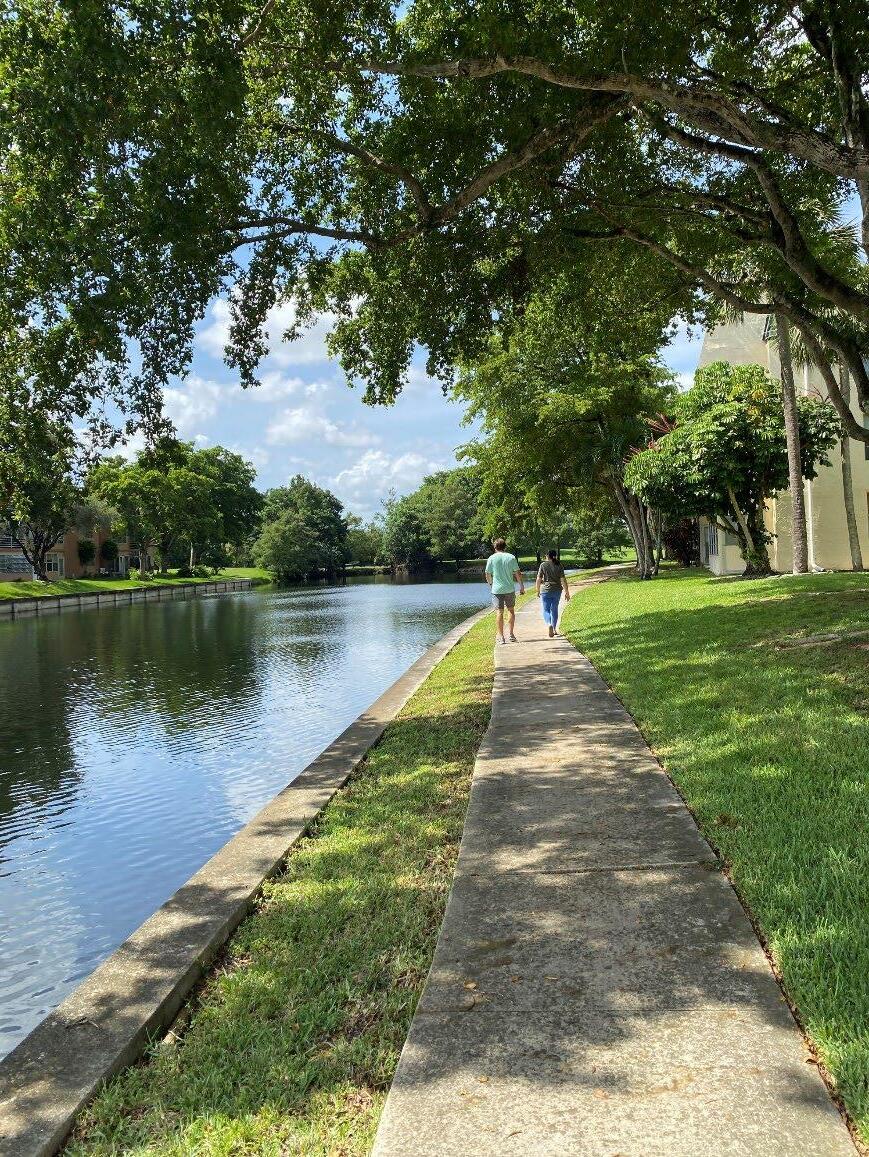
06 ACTION PLAN
CHAPTER 6: IMPLEMENTATION
OVERVIEW
Connecting and enhancing multimodal facilities is the main goal of MOVE TAMARAC. With the recommendations from the prior chapters in mind, it is important to determine steps for the City to successfully implement this plan. To do that, this chapter presents a comprehensive implementation framework that serves as a roadmap for the City to move towards implementing the Plan’s recommendations. This Chapter also describes the list of the 25 projects prioritized for implementation by 2045, along with potential f unding sources for those projects. Details of needed improvements are provided. In addition to developing projects and funding sources, several internal steps should be taken so that the City can maximize funding opportunities and receive the most benefit quickly.
Implementation Framework
The following implementation framework highlights and prioritizes tasks based on community discussions and technical analyses. These are tasks that are crucial for the success of the Masterplan and achieving the multimodal goals. To take advantage of the funding sources available, a list of actions categorized according by the type of action (Policy, Program and Projects) are provided in Table 3. Actions that should be undertaken over the next one to three years are highlighted in green. Many of these actions consist of leveraging current funding and partner agency programming opportunities that the City could submit on. Actions that can be achieved within the next three to five years are highlighted in orange. A number of these action items are programmatic in nature and are meant to work together with the infrastructure recommendations to promote and implement multimodal infrastructure. The longer- term action items are important but require a longer lead time to institute, such as updating standards and guidelines.
In addition to the categorized short- , mid-, and long-term implementation strategies, the City should continue with the following ongoing activities:
• The City should continue to apply for federal, state, MPO, and county grants to fund priority projects.
• The City should identify opportunities through its Capital Improvement Program and other sources, including bonds or special assessment districts, to fund projects.
• The City should require developers to install elements of this Plan when feasible, in addition to sidewalk and shared use paths where already required
Table 3. Actions for Implementation of Multimodal Master Plan, MOVE TAMARAC.
TIMELINE
Short Term
(1 – 3 years)
Short Term
(1 – 3 years)
Short Term
(1 – 3 years)
Short Term (1 – 3 years)
Short Term
(1 – 3 years)
Mid-to-Long (3 – 10 years)
Short Term
(1 – 3 years)
Mid-Term (3 – 5 years)
ACTION
POLICY
Create an implementation Committee that meets on a quarterly basis to review opportunities and progress in implementing the plan.
Adopt a Complete Streets Policy/ Resolution or Ordinance through the City commission and include language in the City Comprehensive Plan update– see draft policy document in the appendices section.
Become an AARP Age-Friendly Community. Coordinate with elected officials and staff a Community's Letter of Commitment and plan to submit Membership Application.
Adopt a Vision Zero action plan, which identifies strategies to eliminate all traffic fatalities and severe injuries; and coordinate with the Broward MPO, FDOT and Broward County on implementation.
Adopt the NACTO Urban Street Design Guide and Urban Bikeway Design Guide via departmental memo and or city commission ordinance.
*NACTO standards are compliant with, but not a substitute for, the Manual on Uniform Traffic Control Devices 23 .
Update planning documents (Such as the Traffic calming policy) and building code to require development projects to construct or contribute to the construction of multimodal transportation projects as conditions of approval through the development review process. - Include language in the City Comprehensive Plan update.
PROGRAMS
Coordinate with BCT on existing pilot programs (LateShift Connect & Community Micro transit) to complement the proposed on -demand micro transit pilot program.
Develop a Citywide Safe Routes to School plan that includes both programmatic and infrastructure strategies and recommendations for all K- 12 public schools within the City.
RESPONSIBLE PARTY(IES)
City Manager
Public Services- City Engineer
Community Development
City Commission
City Manager
Public Services- City Engineer
Community Development
City Commission
City Manager
City Commission
City Manager
City Commission
City Manager
Public Services- City Engineer
City Manager
Community Development
City Manager Parks & Recreation
City Manager
Public Services- City Engineer
Community Development
23 Federal law now explicitly allows cities to apply NACTO street design guidance to federally-funded projects on city streets even if a state requires different standards, more info visit: https://nacto.org/wp-content/uploads/2022/03/NACTO-Design-Authority-for- Cities.pdf
TIMELINE ACTION
Seek internal and external funding to collaborate with the Broward Schools District, The Broward MPO, Broward Health Planning Council, other jurisdictions, and local community organizations to improve safety in school zones by implementing physical improvements, educational programs, and promotional events, such as the following:
RESPONSIBLE PARTY(IES)
City Manager
Community Development
Public Services- City Engineer
Mid-Term
(3 – 5 years)
Mid-Term
(3 – 5 years)
Mid-Term
(3 – 5 years)
Short Term (1 – 3 years)
Short Term (1 – 3 years)
Short Term (1 – 3 years)
• FDOT - Safe Routes to School grant applications for all schools in the City:
o Tamarac Elementary School
o Challenger Elementary School
o Discovery Elementary School
o Pinewood Elementary School
o J.P. Taravella High School
Coordinate with schools to integrate Safe Routes to School educational programs.
Seek internal and external funding to collaborate with The Broward MPO, Broward Health Planning Council, AARP and local community organizations to implement Safe Routes for the Senior Community, by establishing a specific program dedicated to improving the physical environment, transit educational programs and community events, such as walking audits.
Apply to the AARP Community Challenge Grant 2025.
Develop a wayfinding program to provide signage and educational devices for people walking, biking, driving, and taking transit to connect to community-oriented destinations, transit service, parks, schools, healthcare, and mobility hubs located within Tamarac.
PROJECTS
Submit a prioritized list of projects to the Broward MPO TIP call for projects, including the NW 57th St streetscape, Sawgrass Greenway Connector, and Commercial Blvd streetscape.
*The MPO is currently updating its MTP for the 2050 plan. In addition, the MPO solicits calls for projects each fall.
Submit a Highway Safety Improvement Program (HSIP) application for improvements along University Drive, Commercial Blvd. and McNab Rd.
Submit projects to the Broward MPO for CSLIP and TA funds, including at a minimum the NW 57th St streetscape, NW 58th St and NW 70th Ave/Brookwood Blvd streetscape projects.
City Manager
Community Development
Parks & Recreation
City Manager
Community Development
Parks & Recreation
Community Development
Public Services- City Engineer
Community Development
Public Services- City Engineer
Community Development
Public Services- City Engineer
TIMELINE
Short Term (1 – 3 years)
Short Term (1 – 3 years)
Short Term (1 – 3 years)
Short Term (1 – 3 years)
Short Term (1 – 3 years)
Mid-Term
(3 – 5 years)
Mid-Term (3 – 5 years)
Mid-Term (3 – 5 years)
Mid-to-Long (3 – 10 years)
Submit projects for the Broward County MAP funding (surtax), including the NW 57th St streetscape.
Coordinate funding opportunities & improvements identified in the MOVE TAMARAC Master Plan for the Broward County/Broward MPO Safe Streets for All (SS4A) effort, as the Broward County Low Stress Mobility Masterplan identified several corridors (McNab Rd, Rock Island).
Coordinate with Broward County’s Public Works Department/ Traffic & Engineering Division for smart technology opportunities on projects: Commercial Blvd (Nob Hill Rd to Prospect Rd) ; NW 31st Ave (NW 46th St to Commercial Blvd); McNab Rd (NW 108th Ter to NW 67th Ave); Rock Island Rd (NW 44th St to Bailey Rd).
Submit the Sawgrass Greenway Connector to the Recreational Trails Program (RTP); and the Colony West Greenway project.
Submit the Commercial Blvd Road Safety Audit recommendations to FDOT for inclusion in the Highway Safety Improvement Program (HSIP) and Work Program.
Coordinate with Broward County Transit (BCT) to ensure that multimodal improvements along Commercial Blvd as envisioned in this Plan are incorporated into the Commercial Blvd LRT and High Frequency Corridor project along University Drive.
Collaborate with local jurisdictions and other agencies to submit grant applications to regional, state and federal funding sources to implement top 25 projects and programs identified in this Masterplan. See funding opportunities
Include Sawgrass Greenway Connector in Capital Improvement Program if not funded by other sources.
Update design standards and streets cross-sections for different street typologies to guide construction of new streets and retrofitting of existing streets following local context, the Complete Streets design principles and policy.
Long Term (5 -10 years) As the City implements the recommendations set forth by this Plan, the plan should be updated on a regular basis to reflect the new list of priorities.
RESPONSIBLE PARTY(IES)
Public Services- City Engineer Community Development
City Manager
Community Development
Public Services- City Engineer
City Manager
Community Development
Public Services- City Engineer
Community Development
Public Services- City Engineer
Parks & Recreation
Community Development
Public Services- City Engineer
City Manager
Public Services- City Engineer
Community Development
City Manager
Community Development
City Manager
Public Services- City Engineer
Parks & Recreation
City Manager
Public Services- City Engineer
City Manager
Community Development
Prioritized Projects
The prioritized list of 25 projects was selected through a tiered approach that evaluated various criteria as well as the City’s priorities and available resources. The projects fit into six overarching categories:
Streetscapes Complete street projects that include more than one street design element, including sidewalks, bikeways, street furniture, landscape, traffic calming, or lighting.
Sidewalks Filling the gaps in the sidewalk network in high pedestrian demand areas and documented safety issues within the sidewalk network.
Bikeways Routes that connect important communityidentified destinations.
Transit connections First-/last-mile connection improvements to bus stops, transit corridors (BCT, Future Broward PREMO Plan , and local shuttle).
Intersection improvements Safety and accessibility improvements at intersections, such as lighting, signalization, crossings, curb extensions, bike crossings, and roundabouts.
Trails and Greenways Off-road facilities that are physically separated from, and are independent from, the roadway and that connect important communityidentified destinations.
Project were categorized according to the program readiness:
• Short term projects are feasible and easy to be implemented, these projects are on local roads and do not require coordination with other government agencies. These projects can also be incorporated in the City’s Capital Improvement Program.
• Medium term projects are feasible and require coordination with other government agencies. Additional studies are needed.
• Long term projects are challenging due to the complexity of the scope and coordination with different stakeholders (FDOT, County and MPO). Additional studies are needed.
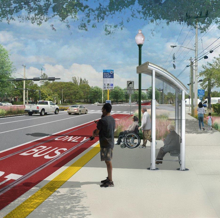
Photo simulation of proposed project along Commercial Boulevard.
The list of 25 projects was further categorized by timeline into short-term ( Table 4), mid- term (Table 5), and long-term (Table 6). Projects highlighted in blue are included in the top 5 project list, for which planning-level cost estimates were developed.
Table 4. Tamarac Multimodal Transportation Connectivity Masterplan Prioritized Projects – Short-Term Projects.
Replace existing on -road bike lanes with shared use path (SUP). Add lighting; extend SUP to Commercial Blvd. Add shared use paths or sidewalks to both sides (Btw NW 63rd Street and NW 57th). Consider traffic calming treatments.
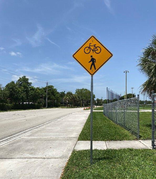
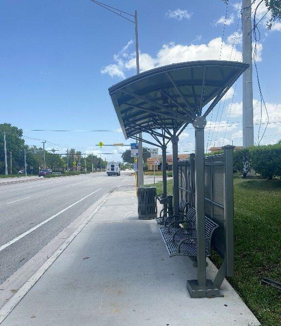
Building upon current multimodal infrastructure facilities in Tamarac, the City can continue to prioritize and connect infrastructure, with the ultimate goal of creating a “complete” infrastructure system that removes mobility barriers.
1 4.5
NW 70th Ave (Commercial Blvd to NW 63rd St)
Streetscape Short term 0.57
2 4.5
NW 58th St (University Dr to NW 70th Ave)
Sidewalk Short term 0.51 Add sidewalks to both sides.
3 4.5
47th Ter (Monterey Dr to Island Club Dr)
4 4.5 Mainland Dr (NW 46th St to Commercial Blvd)
5 4 Brookwood Blvd & NW 72nd St (NW 63rd St to University Dr)
6 4 NW 57th St (NW 94th Ave to NW 62nd Ave)
*Note. City approved CIP project on NW 57th St from NW 94th Avenue to University Drive.
Add sidewalk in 2-lane section; add shared use paths in 4-lane section. Reduce corner radii.
Lane repurposing; add shared use path or sidewalk and curb/gutter. Include transit enhancements to local shuttle route (wayfinding). Consider traffic calming treatments.
Replace existing on -road bike lanes with shared use path or wider sidewalks to both sides; add lighting; add crosswalks to all-way stop intersections; add signalized crossing at McNab Rd (Further study is needed).
Complete Street Project. Create high- quality shared use facility parallel to Commercial Blvd. Improved streetscape: narrow lanes and add curb and gutter, angle parking, and shared use paths to both sides. Upgrade signalized intersections to protected intersections; add crosswalks at all signals/all way stop controlled intersections; add protected bike/ped crossings at NW 94th Ave, Pine Island, University; investigate connecting improvements at east end to Commercial Blvd (see rec 10). Include transit enhancements to local shuttle route (wayfinding, bus stops, etc.). Integrate signal operation improvements and green infrastructure.
Add delineators or median at Rock Island Rd intersection. Add midblock crossings. Coordination with Broward County to add midblock crossings, raised crosswalks and or crosswalks at intersections.
Sidewalk gap. Remove or narrows lanes to add shared use path or sidewalk , curb, and gutter. Add midblock crossings and lighting. Further studies are needed.
Add shared use paths to both sides. Add pedestrian lighting, crosswalks, and midblock crossings that can accommodate golf carts; add pedestrian crossings and crosswalks at all unsignalized intersections; add signalized pedestrian crossing at Pine Island Rd (or between Lagos de Campo and NW 62nd). Include transit enhancements to local shuttle route (wayfinding, bus stops, etc.)
4
73rd Ave (Commercial Blvd to NW 57th St)
Add sidewalk to west side. Create signalized crossing across Commercial Blvd and enhanced crossing across NW 57th St. Consider other traffic calming treatments such as raised crosswalks.
Add shared use path (possible neighborhood bikeway north of NW 57th St). Intersection improvements at NW 57th St, consider a roundabout or protected intersection treatments; improve intersection at Commercial Blvd - add crosswalks. Include transit enhancements to local shuttle route (wayfinding, bus stops, etc.) 12 4
79th Ave (Commercial Blvd to NW 61st St)
70th Ave (McNab Rd to NW 71st Ave/ NW 82 St)
Add crosswalks and curb ramps. Add mini roundabout at NW 71st Ave, and traffic calming north of NW 77th St. 13 3.5
Bay Pkwy (Nob Hill Rd to NW 94th Ave)
14 3.5
76th St (University Dr to NW 66th Ter)
Add sidewalk to west/north side ; add signalized crossing across Nob Hill (and evaluate for full signal or roundabout); provide striped crosswalks at Nob Hill Rd/State St intersection; provide pedestrian crossing across NW 94th Ave and add striped crosswalks.
Add sidewalk to north side from NW 74th Ter to NW 70th St, and both sides east of NW 70th St. Add striped crosswalks and ramps at unsignalized intersections. 15 4.0
Add sidewalk on the south side of road, add curb ramps and crosswalks at all intersections. Add shared lane markings to demarcate bicycle boulevard and evaluate traffic calming.
Complete Street project. Convert existing on-street striped bike lane to raised bike lane (sidewalk- level bikeways) or shared use path; Add signalized midblock crossings and vulnerable road user-focused intersection improvements at Prospect Rd, SR 7, NW 31 Ave, Turnpike; add special emphasis crosswalks at all signals; provide separation between sidewalk and curb and add shade trees; consider pedestrian scale lighting. Include transit enhancements to local shuttle route (wayfinding, bus stops, etc.). Integrate signal operation improvements and green infrastructure. Coordinate improvements
Table 6. Tamarac Multimodal Transportation Connectivity Masterplan
that require ROW with proposed Light Rail along ( PREMO Plan) Commercial Blvd and smart technology opportunities with Broward County Transit , Public Works Department and Traffic & Engineering Division
Add lighting and striped crosswalks across stop-controlled driveways; partner with City of Oakland Park to add sidewalk on east side of road and midblock crossing near bus stop south of NW 46th St.
Complete Street Project. Add shared use paths or raised bike lanes (repurposing space from on -road bike lane). Add signalized midblock crossings; Intersection improvements at McNab Rd, Commercial Blvd; gateway intersection treatment with enhanced greenway crossing (Cypress Creek Greenway) at Southgate Blvd). Integrate signal operation improvements and green infrastructure.
Complete Street Project. Add sidewalk-level bike lanes or shared use paths. Add signalized midblock crossings. Improve lighting. Include transit enhancements to local shuttle route (wayfinding, bus stops, etc.). Integrate signal operation improvements and green infrastructure. Coordinate with Broward County. 20 3.5
Rock Island Rd (NW 44th St to Bailey Rd)
*Identified for proposed base low stress Broward Mobility Masterplan network.
Add shared use paths or wider sidewalks. Upgrade on-street bike lanes to higher protection facility. Add midblock crossings. Improve lighting. Coordination with Broward County on existing ROW and streetscape improvements.
Add shared use paths to both sides or widen sidewalk. Add midblock crossings at bus stops. Bus stop improvements. Evaluate signalized crossing or roundabout at State St. Enhance lighting at intersections.
Lane repurposing. Remove one lane and add shared use path, curb, and gutter. Add midblock crossings and pedestrian crossings at Trent Dr and Sanibel Dr; add lighting; enhance intersections at McNab Rd, NW 71 Pl, NW 103 Ave, Nob Hill Rd.
Add sidewalk- level bike lanes or a shared use path (between University and the Power station). Intersection improvements at Nob Hill, Pine Island, University. Add pedestrian lighting.
Tephford Park and the Cypress Creek Greenway to Conservation Levee Greenway by adding shared use path and bridge over Sawgrass Expressway.
25 - Colony West Greenway Greenways Long Term TBD
Connect rectangle bounded by Pine Island Rd, McNab Rd, NW 61st St, and University Dr with greenway using existing City-owned golf course land.
Cost Estimates
Once the top 5 projects were selected, planning-level costs were developed to facilitate their implementation. Table 7 outlines the unit costs and assumptions used in developing the cost estimates for the projects. The five projects for which estimates were developed are (Project numbering corresponds to project number from Tables 5, 6, and 7):
• Project 1 – 58th Street sidewalk improvement
• Project 2 + 5 – 70th Avenue and Brookwood Bou levard/NW 72nd Street streetscape improvements
• Project 6 – NW 57th Street streetscape improvements
• Project 15 – Commercial Boulevard streetscape improvements
• Project 24 – Sawgrass Greenway Connector
The costs associated with these factors are reflected in the general baseline estimates. The percentages allocated for design and construction engineering and inspection (CEI) are based on industry standards and past project analytics. These allocations are as follows:
• Planning & Engineering: 10% to 15% of the project cost, accommodating for the initial design and engineering services.
• Construction, Engineering, Inspection: 12%, covering on-site management and quality assurance.
• Utility Relocation: 10% to 15%, reflecting the complexities and potential contingencies in moving existing services.
• Landscape: 10%, which will fund the greening efforts alongside the infrastructure improvements.
• Hardscape/Streetscape: 10%, dedicated to the non-vegetative aspects of the public realms such as sidewalks, benches, and decorative pavers.
It should be noted that the estimates include only construction costs with contingencies for planning and design, construction, engineering, and inspection, utility relocation, landscaping, and hardscaping. Right-of-way acquisition is not included as part of these estimates. Construction costs will vary based on final project scope and economic conditions at the time of construction. The estimate results are presented in Table 8.
PROJECT TYPE UNIT COST/UNIT
TRAFFIC CALMING MEASURES
Mini Roundabout (Intersection Improvements, ADA Upgrades, Curbing, utilities relocation)
Chicane (Demolition, MOT, Concrete, Curbing, Testing, etc.)
Raised Crosswalk (Drainage Relocation, ADA Curb Ramp Reconstruction, MOT)
Traffic Diverter (Demolition, MOT, Concrete, Curbing, Testing, etc.)
INTERSECTION TREATMENTS
Marked Crosswalk (Thermoplastic, Minimum Charge, MOT)
Midblock Crossing (Demolition, MOT, Concrete, Curbing, Refuge Island)
Rectangular Rapid Flashing Beacons (RRFBs) (Foundation, 2 sides)
Pedestrian Hybrid Beacon (PHB, aka HAWK signal) (Foundation, drill shaft, utilities relocation, sidewalks reconstruction, etc.)
Traffic Signal (strain pole removal, foundation, drill shaft, utilities relocation, sidewalks reconstruction.)
Curb Extensions (Drainage Relocation, ADA Curb Ramp Reconstruction, MOT)
$355,026.58
$12,500.00
$40,000.00
$25,000.00 ADA Curb Ramps
TRANSPORTATION INFRASTRUCTURE
Curb-Separated Bike Lanes (6' wide with a 2' wide median, drainage relocation, paving)
Shared Use Paths (Trails) (12’ wide concrete)
Sidewalks (5’)
Bike Boulevard (signage, pavement markings)
Raised and Curb-Separated Bike Lane (6' wide with a 2' wide median, drainage relocation, paving)
Shared Lane Markings (Sharrows)
$854,235.07
$100,000.00
$1,110,505.59
$500.00
Table 7. Planning-Level Unit Costs.
structures (single sign post mounted)
(foundation and restoration)
Street Lighting (decorative, pole, foundation, pull box, does not include conduits or #6 wiring)
to Neighborhoods
Table 8. Cost Estimates for Priority Projects
The cost estimates were created in 2024 and are solely for planning purposes. These costs need to be reviewed and updated by the City of Tamarac before proceeding with implementation.


Drainage improvements, curb and gutter, driveway reconstruction, and lighting relocation.
Drainage improvements, curb and gutter, driveway reconstruction, and decorative lighting. Convert existing bike lane to shared use path and add sidewalks or SUP where there are sidewalk gaps. Consider coordination with BCT to relocate bus stop closer to nearest intersection.
Drainage improvements, curb and gutter, driveway reconstruction, and decorative lighting. Convert existing bike lane to shared use path on both sides. Coordination with required with Broward County Traffic Engineering Division (BCTED) and Highway Construction and Engineering (BCHCED) for Brookwood Blvd at W. McNab Rd. NW 57th St
94th Ave to NW 62nd Ave
Shared use paths, resurfacing. Coordination with BCTED and BCHCED required. Commercial Blvd Nob Hill Rd to Prospect Rd
Sawgrass Greenway Connector
Tephford Park to Atlantic Blvd Long Term
,000
Curb and gutter relocation, three midblock crossings with pedestrian hybrid beacon, raised bike lane (shared use path) both sides. Coordination required with City of Sunrise, BCTED and BCHCED for Commercial Blvd at Pine Island Intersection, and Between Pine Island Road and University Dr.
$15,000,000 Shared use path, boardwalk (bridge).
Funding Opportunities
The recommendations proposed in this Plan include ones that the City can program and implement, while others present an opportunity to work with neighboring jurisdictions, Broward County, the Broward MPO, FDOT, and other stakeholders such as community-based organizations, school districts, and transit providers.
A variety of potential funding sources are available at the federal, state, regional, and local levels for the City of Tamarac to explore for implementation of the recommended projects included in this Plan. Most funding sources are competitive in nature and will require applications. For multi-agency projects, applications will likely be more successful if prepared as a joint effort with other local and regional agencies. Additionally, the City could explore the creation of a dedicated local funding source for transportation and safety improvements through a general fund allocation. This will lead to creating sustainable funding that can be used for the development of projects, as well as serve as a local match to other potential funding sources. Funding sources can be federal, typically through the Federal Highway Administration (FHWA); state-level, typically through the Florida Department of Transportation (FDOT); or from Broward County, the Broward MPO, the City of Tamarac, or private sources.
Funding sources are summarized in Table 9. The list of funding opportunities is not exhaustive, and there may be opportunities for funding from other sources. It is advised that the City’s Transportation and Community Departments work with the City’s Grant Writer to continue to explore new funding opportunities.
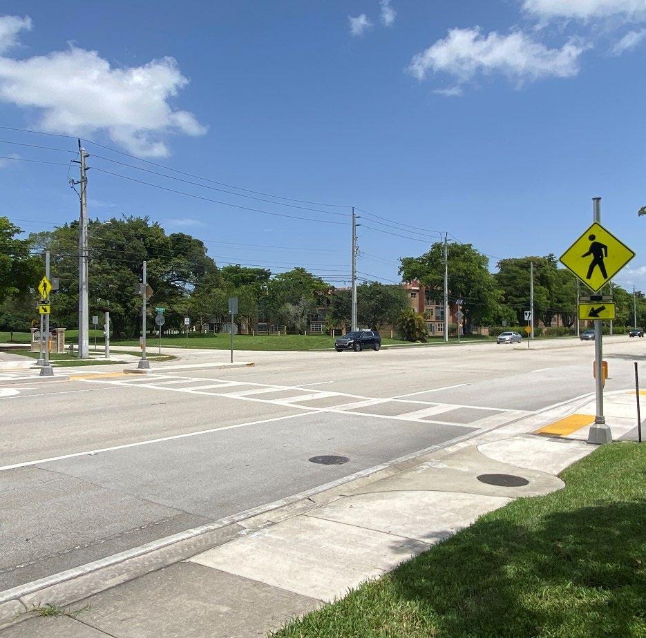
Pedestrian crossing at Colony West Golf Club on N Pine Island Road.
Table 9. List of Potential Funding Sources.
NAME
Transportation Alternatives (TA)
Safe Streets and Roads for All (SS4A) Grant Program
Congestion Management and Air Quality (CMAQ) Improvement Program
Reconnecting Communities Pilot Program (RCP)
Active Transportation Infrastructure Investment Program (ATIIP)
Federal Transit Administration (FTA) Grants
Rebuilding American Infrastructure with Sustainability and Equity (RAISE) Grants
DESCRIPTION
FEDERAL FUNDING SOURCES
Transportation Alternatives (TA) is a funding source under the FAST Act that consolidates three formerly separate programs under SAFETEA-LU: Transportation Enhancements (TE), Safe Routes to School (SRTS), and the Recreational Trails Program (RTP). Funds are available through a competitive process. These funds may be used for a variety of pedestrian, bicycle, and streetscape projects.
The SS4A Grant Program funds the development or update of a comprehensive safety action plan (Action Plan), conducting planning, design, and development activities in support of an Action Plan, and/or carrying out projects and strategies identified in an Action Plan.
The FAST Act continued the CMAQ program to provide a flexible funding source to state and local governments for transportation projects and programs to help meet the requirements of the Clean Air Act. Funding is available to reduce congestion and improve air quality for areas that do not meet the National Ambient Air Quality Standards for ozone, carbon monoxide, or particulate matter (nonattainment areas) and for former nonattainment areas that are now in compliance (maintenance areas).
RCP is a federal program that aims to reconnect communities that were previously cut off from economic opportunities by transportation infrastructure. Funding from this program supports planning grants, capital construction grants, and technical assistance to restore community connectivity through the removal, retrofit, mitigation, or replacement of eligible transportation infrastructure facilities. Highways (including a road, street, or parkway) or other transportation facilities (such as rail lines), that have formed a barrier to community connectivity, including barriers to mobility, access, and economic development, due to high speeds, grade separations, or other design factors, are eligible for this program.
$44.5 million in funding for projects that will strengthen safety and improve bicycling, walking and access to public transit in communities across the country. As part of the program, FHWA will award competitive grants to help communities plan, design, or construct safe and connected active transportation networks such as sidewalks, bikeways, and trails that connect destinations such as schools, workplaces, residences, businesses, recreation areas and medical facilities within a community or metropolitan region.
The FTA has several grant programs available to local and state governments to enhance active transportation connections to public transportation facilities.
RAISE grants, which were originally created under the American Recovery and Reinvestment Act as TIGER grants, can be used for a wide variety of projects, including road, rail, and transit projects. These grants provide capital funding to any public entity, including municipalities and counties.
https://www.fhwa.dot.gov/environment /transportation_alternatives/
https://www.transportation.gov/SS4A
https://www.fhwa.dot.gov/bipartisaninfrastructure-law/cmaq.cfm
https://www.transportation.gov/grants/r econnecting-communities
https://www.fhwa.dot.gov/environment/ bicycle_pedestrian/atiip/
https://www.transit.dot.gov/funding/gra nts/grant-programs
https://www.transportation.gov/RAISEgr ants
NAME DESCRIPTION MORE INFO Promoting Resilient Operations for Transformative, Efficient, and Cost-Saving Transportation Program (PROTECT)
Strengthening Mobility and Revolutionizing Transportation (SMART) Program
Highway Safety Improvement Program (HSIP)
Safe Routes to School (SRTS)
Provides funding to ensure surface transportation resilience to natural hazards including climate change, sea level rise, flooding, extreme weather events, and other natural disasters through support of planning activities, resilience improvements, community resilience and evacuation routes, and at-risk coastal infrastructure.
The SMART program was established to provide grants to eligible public sector agencies to conduct demonstration projects focused on advanced smart community technologies and systems to improve transportation efficiency and safety. The anticipated minimum award size is $250,000 for Stage 1.
STATE-LEVEL FUNDING SOURCES – FDOT
HSIP funds are available for projects aimed at improving safety on all public roads to reduce traffic fatalities and serious injuries. Bike lanes, roadway shoulders, crosswalks, intersection improvements, underpasses, and improved signage are examples of eligible projects.
Florida Safe Routes to School (SRTS) is a statewide program, funded by FDOT, whose goal is to make it safer for more children to walk and bicycle to school. Eligible projects are s idewalks, bike paths, trails, traffic calming, signage and hardscaping, traffic control devices. Projects must follow appropriate design criteria.
STATE-LEVEL FUNDING SOURCES – NON-FDOT
Community Development Block Grant (CDBG)
Recreational Trails Program (RTP)
Broward MPO:
• Transportation Improvement Program (TIP)
• Metropolitan Transportation Plan (MTP)
• Multimodal Priorities List (MMPL)
The CDBG Program provides annual grants on a formula basis to states, cities, and counties to develop viable urban communities by providing decent housing and a suitable living environment, and by expanding economic opportunities, principally for low- and moderateincome persons.
In Florida, this program is administered by the Department of Commerce.
The program is dedicated to the construction, restoration, and maintenance of nonmotorized and motorized recreational trails (paved and unpaved) and trail-related facilities.
In Florida, this program is administered by the Department of Environmental Protection.
REGIONAL FUNDING SOURCES – MPO AND COUNTY
The Broward MPO’s Transportation Improvement Program (TIP) is a comprehensive list of federal, state, and locally funded transportation projects. The Multimodal Priorities List is used to set funding priorities for federal and state funds within Broward region. The Broward MPO Board adopts the Multimodal Priorities List annually, typically in the second or third quarter of the calendar year, which FDOT then uses to guide development of their funding work program.
The Broward MPO adopts its TIP by July 15 each year.
https://www.transportation.gov/rural/gr ant-toolkit/promoting-resilientoperations-transformative-efficient-andcost-saving
https://www.transportation.gov/grants/S MART
https://highways.dot.gov/safety/hsip
https://www.fdot.gov/Safety/programs/s afe-routes-contacts.shtm
https://www.floridajobs.org/communityplanning-and-development/assistancefor-governments-andorganizations/community-developmentblock-grant-program
https://floridadep.gov/lands/land-andrecreation-grants/content/recreationaltrails-program
https://www.browardmpo.org/coreproducts
NAME
Complete Streets and other Localized Initiatives Program (CSLIP)
Broward MPO Mobility Hubs Program
Broward County Mobility Advancement Program (MAP)
DESCRIPTION
The MPO’s CSLIP provides funding for small local transportation projects that will improve the safety and mobility for all transportation users. This competitive grant program can fund projects such as (but not limited to): complete streets projects, traffic calming and intersection improvements, ADA upgrades, mobility hubs, bus shelters, bike racks and technology advancements such as transit signal priority and traffic control devices. CSLIP projects are delivered using the federally mandated Local Agency Program (LAP) process.
Applications are accepted on an annual basis. The deadline for FY 2025 is September 4, 2024
The Mobility Hubs Program emphasizes pedestrian accessibility, supports mixed-use development, and improves multimodal transportation connections that reduce traffic congestion and decrease dependence on private automobiles. Applicants can apply for a variety of mobility hub funding for mobility hubs Masterplans, or design and final construction.
The proposed projects should align with the surtax goals and address the needs of the public. Goals: Create Connectivity, Traffic System Management, Improve Transit Service, Enhance Multimodal Options, Economic Developments and Benefits. Municipalities can submit municipal capital project applications for planning, design, and construction phases; and/or rehabilitation and maintenance projects for construction only.
CITY FUNDING SOURCES
Bond Financing Bonds can be approved by voters to fund a range of projects.
Special Assessment or Taxing Districts
Parking Fees
Development Impact Fees
Capital Improvement Program
Local municipalities can establish special assessment districts for infrastructure improvements, like sidewalks, which are missing or in need of improvement in certain areas.
Some cities have instituted parking fees that are then used to pay for infrastructure improvements.
Development impact fees are one-time charges collected from developers for financing new infrastructure construction and operations and can help fund bicycle and pedestrian improvements. Impact fees are assessed through a city’s impact fee program.
Road widening and construction projects are methods of providing improved bike and pedestrian infrastructure, in addition to retrofits of existing facilities For the City of Tamarac, these are typically funded through the City’s Capital Improvement Program. To ensure that roadway construction projects provide these improvements, it is important that the review process includes a review of any relevant active transportation related plans
PRIVATE FUNDING SOURCES
MORE INFO
https://www.browardmpo.org/fundingprograms/complete-streets-localizedinitiatives-program
https://www.browardmpo.org/fundingprograms/mobility-hubs
https://www.broward.org/PennyForTran sportation/Pages/default.aspx
AARP Community Challenge Grant
The AARP Community Challenge provides small grants to fund quick-action projects that can help communities become more livable for people of all ages. Organizations are eligible to
https://www.aarp.org/livablecommunities/community-challenge/
NAME
The Bloomberg Initiative for Cycling Infrastructure (BICI)
Asphalt Art Initiative
Community Placemaking Grants
PeopleForBikes Community Grant Program
Community Connectors Program
Healing Our Highways grant program
Private Developers
DESCRIPTION
apply for more than one grant opportunity and can submit multiple applications. Eligible projects should improve public places; transportation; housing; digital connections; diversity, equity, and inclusion; and more, with an emphasis on the needs of adults aged 50 and older.
The BICI Program is focused on accelerating the implementation of cycling infrastructure. Streetscape improvement projects, facilities that put cyclists first, complete networks, cycle parking, cycle path lighting, cycle-hire equipment, and equipment used for metrics collection.
The Asphalt Art Initiative grant program funds visual art interventions on roadways, pedestrian spaces, and public infrastructure.
Project for Public Spaces’ Community Placemaking Grants enable US-based nonprofits and government agencies to address inequality of access by working directly with local stakeholders to transform public spaces or co-create new ones by providing direct funding, technical assistance, and capacity building.
The PeopleForBikes Community Grant Program supports bicycle infrastructure projects and targeted advocacy initiatives that make biking safer for people of all ages and abilities. PeopleForBikes accepts requests for funding up to $10,000.
The Community Connectors program helps advance locally driven projects that will reconnect communities separated or harmed by transportation infrastructure. Projects will receive grants of up to $130,000 to build local capacity to co-design projects alongside impacted communities to advance new transportation infrastructure projects that repair damage from divisive infrastructure.
Smart Growth America grant’s program aims to generate creative ideas and activities that build knowledge, connections, and power within disadvantaged communities most harmed by transportation systems and climate change. Projects must take place along or call attention to state-owned or -managed streets with the characteristics described in Smart Growth America’s Dangerous By Design report.
Developers should consider constructing local streets with bike- and pedestrian-oriented facilities within subdivisions, including dedicating right-of-way to trails and parks. Cities can encourage developers to include active transportation amenities during development review and should require developers to show how the proposed development will accommodate or enhance active transportation connections.
MORE INFO
https://globaldesigningcities.org/bici/
https://asphaltart.bloomberg.org/
https://www.pps.org/communityplacemaking-grants
https://www.peopleforbikes.org/grantguidelines
https://smartgrowthamerica.org/progra m/community-connectors-grants/
https://smartgrowthamerica.org/healing -our-highways-grant-application-faq/
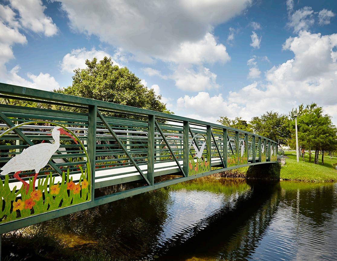
PROJECT CUT SHEETS
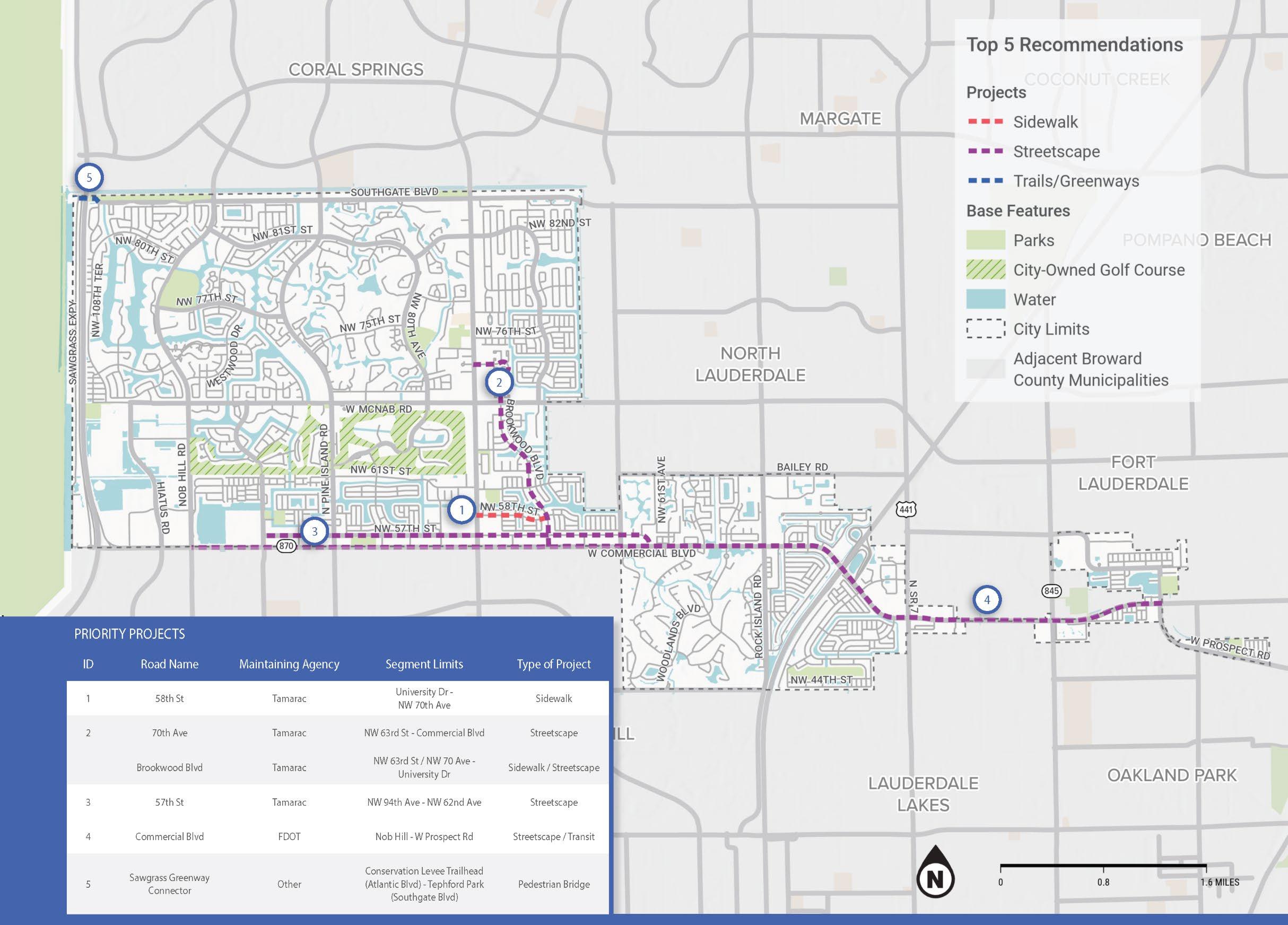
NW 58TH ST SIDEWALK
University Dr (SR 817) to NW 70th Ave
City Commission District 2
EXISTING CONDITIONS
• Two-lane road, 12- foot-wide lanes, no sidewalk
• 25 mph speed limit
• AADT of 1,000 vehicles per day
• 40-foot-wide City right- of-way
• Within USDOT Disadvantaged Community
• Severe crashes at University Dr intersection.
• Connects to transit stops (BCT Route 2) at University Dr
RECOMMENDATIONS
• Add sidewalk to both sides of NW 58th St
• Add traffic calming features
• Improve drainage by adding curb and gutter.
• Improve lighting
Contraints:
Right-of- Way: limited (40 feet)
Project timeline
2024 Masterplan Adoption by City
2025 Apply for Broward MAP Surtax funding/ MPO CSLIP funding.
2026 Design
2027 Construction
Partners:
FDOT (crossing at University Dr/SR 817)
Context
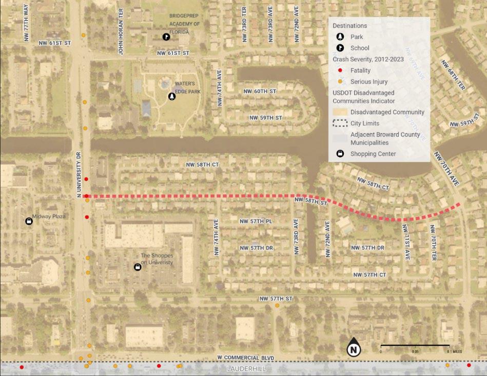
Cross section
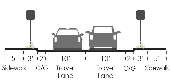
Cost Estimate: $1,557,284
NW 70TH AVE & BROOKWOOD BLVD STREETSCAPE
Commercial Blvd (SR 870) to University Dr (SR 817)
City Commission District 2 & District 4
EXISTING CONDITIONS
• Two-lane road, 11-foot-wide lanes
• Buffered bike lanes, raised median, no sidewalks from Commercial Blvd to McNab Rd
• Standard bike lanes, no median, sidewalks on both sides from McNab Rd to University Dr
• 25 mph posted speed limit.
• AADT between 2,100 and 3,000 vehicles per day
• 60-foot-wide City right-of-way; 50-foot-wide north of McNab Rd
• Within USDOT Disadvantaged Community from Commercial Blvd to McNab Rd
• Severe crashes, bicycle, and pedestrian crashes (especially at major intersections)
• Connects to BCT routes at Commercial Blvd (Route 55), McNab Rd (Route 62), and University Dr (Route 2)
RECOMMENDATIONS
• Convert existing bike lanes to shared use path
• Improve drainage by adding curb and gutter
• Improve lighting
Constraints:
Canal causeway between NW 58th St and NW 61st St
Project timeline
2024 Masterplan Adoption by City; request MPO to amend TIP
2025 Apply for Broward MAP Surtax funding, TA, CSLIP funding.
2027 Design
2028 Construction
Partners: Coordination with Broward County (crossing at McNab). Context
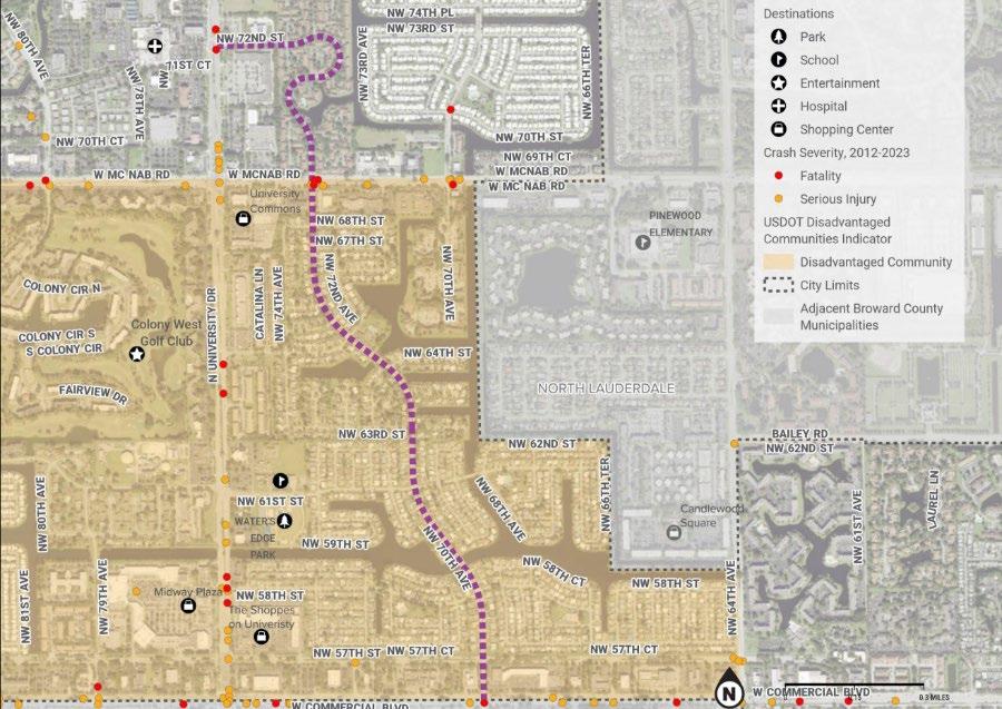
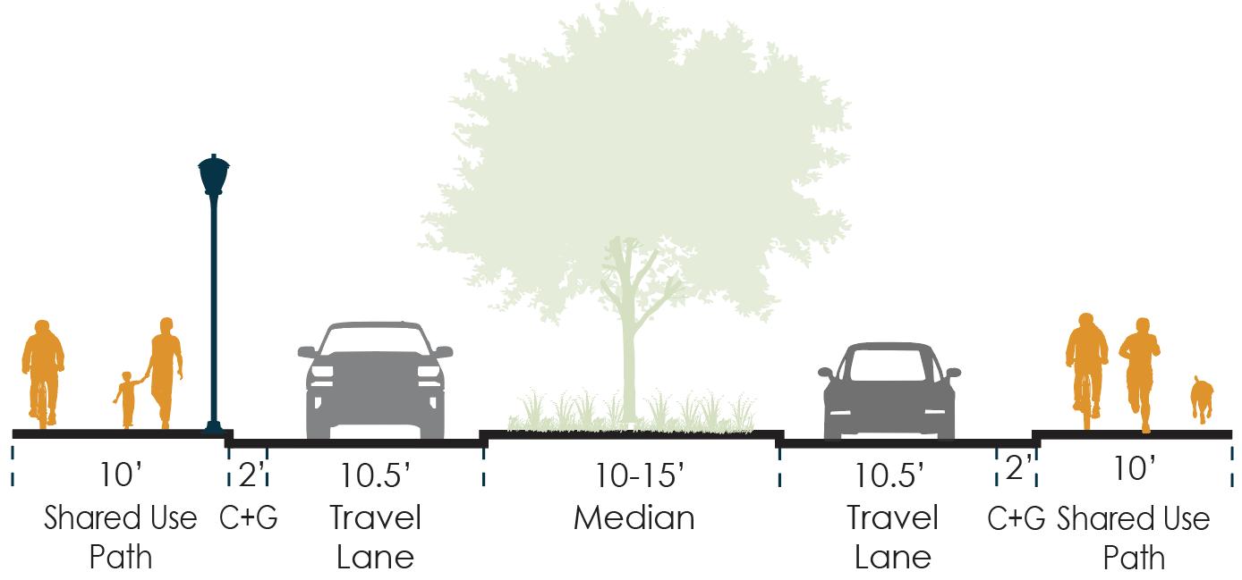
Note 1: for 50 ft ROW section, remove median and include 2.5 ft buffer between curb and path
Note 2: Lighting should be placed outside the path where possible; if not possible, place at edge of path and narrow path to min. 8 ft wide.
Cost Estimate: $15,528,161 (whole corridor)
Cross section (60 FT ROW)
NW 57TH ST STREETSCAPE
NW 94th Ave to NW 62nd Ave
City Commission District 2
EXISTING CONDITIONS
• Two-lane road, 15-foot-wide lanes with raised median, standard bike lanes, sidewalks on both sides (none on north side east of Shoppes on University shopping center)
• 35 mph posted speed limit east of Pine Island Rd
• AADT between 1,850 and 2,500 vehicles per day
• 106-foot-wide City right-of-way
• Within USDOT Disadvantaged Community from Commercial Blvd to McNab Rd
• Severe crashes, bicycle, and pedestrian crashes (especially at major intersections)
• Connects to numerous BCT routes (2, 55, 88)
RECOMMENDATIONS
• Narrow roadway lane and add shared use paths
• Improve drainage by adding curb and gutter
• Improve streetscape and lighting
• Make intersection improvements
Existing Projects:
City-funded NW 94th Ave improvements, including safe crossing at NW 57th St. The City has requested the segment between Pine Island Rd and University Dr as the Tamarac Community Center Mobility Hub.
Note: The City of Tamarac approved a CIP project for the envisioned "Downtown Boulevard" for NW 57th Street corridor, from NW 94th Avenue to University Drive to be consistent with the existing improvements from NW 94th Avenue to Pine Island Road.
Project timeline
2024 Masterplan Adoption by City; amend MPO TIP and MTP
2024-2025 Apply for MAP, TIP, SRTS and CSLIP funds.
2029 Design*
2030 Construction*
*Depends on MTP Schedule
Partners: Coordination with FDOT (crossing at University Dr/SR 817);Broward County
Context
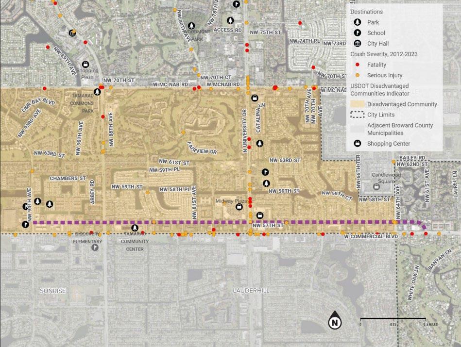
Cross section

Cost Estimate: $5,598,331
COMMERCIAL BLVD STREETSCAPE
Nob Hill Rd to Prospect Rd
City Commission District 1 & District 2
EXISTING CONDITIONS
• Six-lane Road, 11-foot-wide lanes with raised median, discontinuous standard bike lanes, sidewalks on both sides
• 45 mph posted speed limit
• AADT between. 40,500 and 72,500 vehicles per day
• 120-foot-wide State and County-owned right-of-way
• Within USDOT Disadvantaged Community
• Severe crashes, bicycle, and pedestrian crashes
• Road Safety Audit (RSA) completed in 2022
• BCT Route 55 runs along Commercial Blvd
RECOMMENDATIONS
• Add shared use paths on both sides
• Reconstruct curb and gutter
• Implement all recommendations from 2022 RSA
• Improve streetscape and lighting
• Make intersection improvements
Constraints:
ROW is extremely constrained
Bridge over Turnpike – no sidewalk on north/east side of bridge
Existing Projects:
FDOT is conducting a PD&E study at the intersection with SR 7
BCT is planning a light rail (LRT) and bus rapid transit (BRT) along Commercial Blvd as part of the PREMO plan
Project timeline
2024 Masterplan Adoption by City; amend MPO TIP and MTP
2025 Program recommendations of 2022 RSA into HSIP
2028 Design of BRT section and ROW acquisition
2031-2036 Construction of BRT and multimodal elements
Partners:
Cordination with State (FDOT, Turnpike), Broward County, and City of Sunrise.
Context
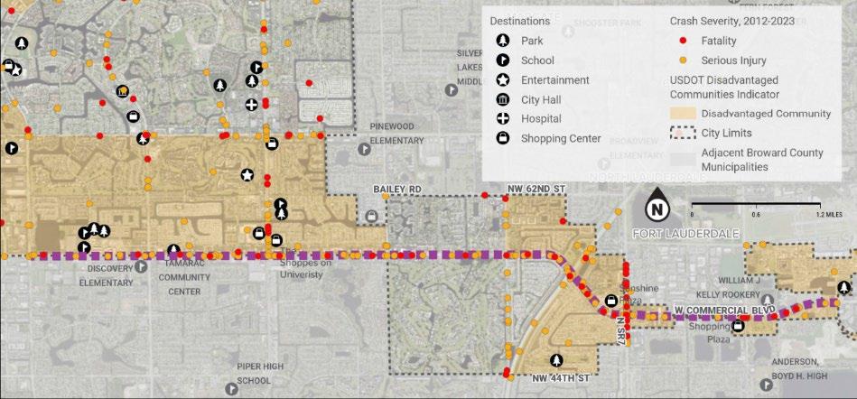
Cross section

Note 1: This section shows existing 120’ ROW. The exact cross section is uncertain in the BRT sections, for which additional ROW may need to be acquired.
Note 2: Where right turn lanes are present, there is additional ROW. If not possible to maintain a buffer, the path should be kept as close to 10 ft wide as possible.
Note 3: In the County-maintained sections, there are no existing bike lanes. The existing travel lanes should be narrowed to 11 ft wide in order to maintain a 10 ft wide path (buffer width can vary).
Cost Estimate: $54,331,295
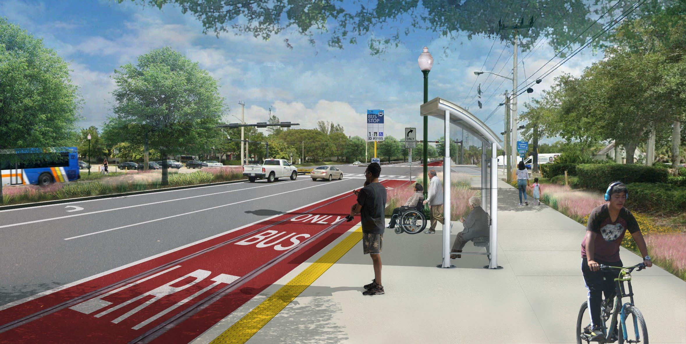
Photo simulation of proposed project along Commercial Boulevard. Source: Alta Planning and Design
SAWGRASS GREENWAY
CONNECTOR
Conservation Levee Trailhead to Tephford Park City Commission District 3
EXISTING CONDITIONS
• No Connection from City of Tamarac to Conservation Levee Greenway
• Nearest connection point at Atlantic Blvd requires at least two-mile detour through Coral Springs
• City of Tamarac owns parcel on west side of Sawgrass Expressway
• Within USDOT Disadvantaged Community
RECOMMENDATIONS
• Greenway connection from Tephford Park to Conservation Levee Greenway
• Steel and concrete, 12~14 ft wide, 16 ft high, 1600 ft long. Additional finishes for the boardwalk
• Greenway bridge over Sawgrass Expressway and Stranahan River to provide a direct connections to the Conservation Levee Greenway from the seven miles of existing Crypress Creek greenway that connects the cities of Tamarac, North Lauderdale, Margate and Coconut Creek; from Tephford Park to Fern Forest Nature Center
Constraints:
Crossing requires bridge over Stranahan River, Sawgrass Expressway Requires coordination with State of Florida and Water Management District.
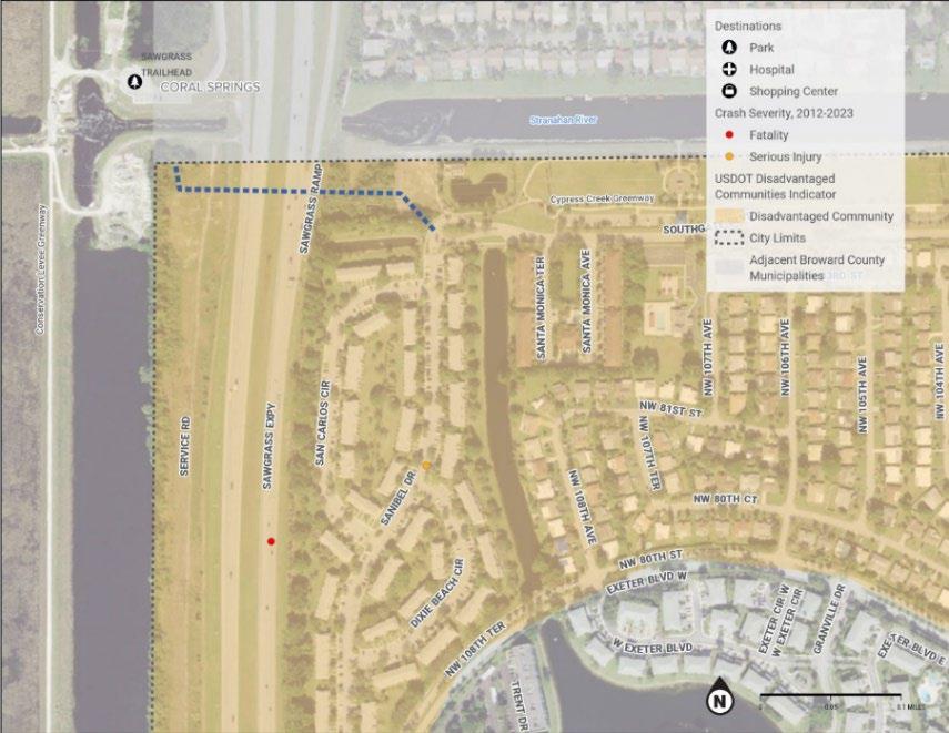
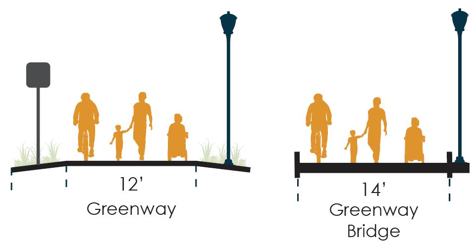
Context
Cross
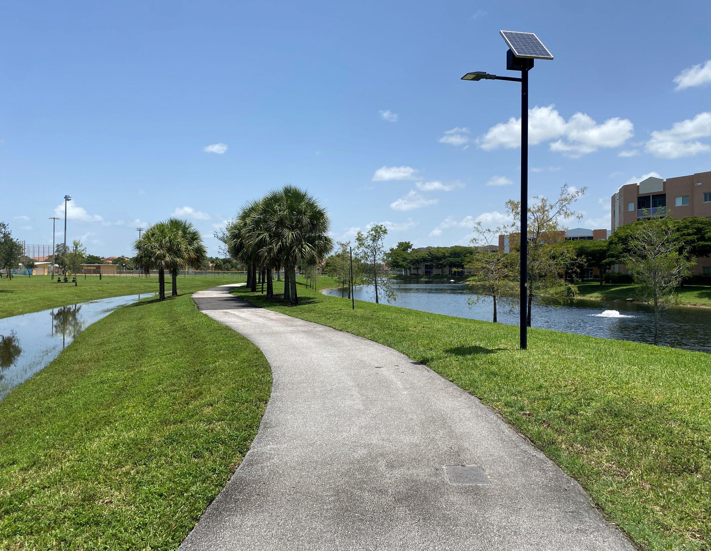
APPENDICES
A: Policy, Strategies, and performance measures
B: Needs and Assessment Report
C: Public Outreach Summary
D: Complete Streets Policy Resolution Template
APPENDIX A
Policy, Strategies, and performance measures
TAMARAC IS CONNECTED
Goal: Improve connections to parks, schools, shopping plazas and city amenities.
Objective
Develop an Integrated Multimodal Network.
Adopt best practices in transportation planning and street design.
Policy/Strategy
Prioritize implementation of pedestrian, transit and bicycle infrastructure that connects to schools, parks, healthcare, community services, employment centers, grocery stores, and other key destinations.
Provide facilities on neighborhood streets, such as sidewalks and wellconnected bikeways.
Creation of a committee, comprised of City Engineer, Community Development, Parks and recreation, City Manager office, Public Services that meet regularly to guide transportation priorities and improvements in the Capital Improvements Plan (CIP).
Adopt a Complete Streets Policy and street design guidelines to guide construction of new streets and retrofitting of existing streets.
Update City design standards and documents every 10 years to reflect current Manual on Uniform Traffic Control Devices (MUTCD) and guidance, such as National Association of City Transportation Officials (NACTO).
Annual construction of facilities, as recommended in the Master Plan.
Update impact fee Study to include bike and pedestrian facilities that are not associated with roadways on the classified road system. And accurately estimate the impacts or needs for these facilities.
Ordinance, Resolution or Departmental memo.
Regional and local connectivity
Develop Mobility Hubs; and provide adequate facilities, amenities, and wayfinding; with a sense of place.
Cooperate with Broward County Transit to build the proposed light-rail corridor on Commercial Blvd.
TAMARAC IS SAFE
Mobility Hub study.
Number of bus shelters added.
Broward County Broward MPO
FDOT D4
Neighboring municipalities
Goal: Plan and implement better and safer infrastructure for all users of the road following the Safe System Approach.
Eliminate all traffic-related fatalities and serious injuries. Adopt a Vision Zero commitment and action plan, which identifies strategies to eliminate all traffic fatalities and severe injuries.
Prioritize safety improvements at intersections and corridors with high number of crashes.
Develop an annual review process to implement safety improvements through Capital projects.
Conduct Road Safety Audits (RSA) on corridors with high number of crashes.
Review and update the current traffic calming policy to encourage the implementation of treatments as part of the mitigation process.
Make travel to school safe. Develop Safe Routes to School plan for schools in Tamarac.
Prioritize active transportation and safety improvements in school zones.
Develop a Vision Zero Action Plan.
Annual review of crash data.
% reduction in traffic serious injuries and fatalities.
% reduction in traffic crashes. Broward County
FDOT D4
Broward Sheriff's Office
Safe Routes to School plan.
# Schools involved and impacted.
% of school students walking or biking to school
Broward MPO
Broward County Public schools
FDOT D4
School representatives
Make travel to parks safe. Develop a Safe Routes to Parks Action Plan.
Create multidisciplinary committee to coordinate safety improvements and projects for park access with the City Parks and Recreation department.
Seek grant funding for park activation and connection projects.
TAMARAC IS ACCESSIBLE
Broward Sheriff's Office
# projects implemented
Action Plan Report
# projects implemented
Goal: Provide accessible and equitable multimodal transportation options for those without cars to improve their access to jobs, services, and recreation.
Follow best practices in transportation planning.
Provide access to key destinations such as employment centers, grocery stores, transit stops, parks, libraries, and other community destinations.
Clearly indicate accessible routes
The street network should meet ADA standards.
Make the 35 inaccessible bus stops in Tamarac ADA-compliant.
Expand community shuttle service hours to include weekends and weekday nights.
Miles of sidewalk, number of intersections, and number of transit facilities that are ADA compliant.
Improve wayfinding to indicate convenient and accessible routes to pedestrians and cyclists.
Number of hours of shuttle service.
Presence of wayfinding within 2 miles of key destinations. Broward County Broward MPO
TAMARAC IS RELIABLE
Goal: Provide a complete and continuous network of bicycle and pedestrian facilities, enhance connections to the transit network and offer a reliable transit service.
Objective Policy/Strategy
Expand coverage of transportation services.
Give riders information about transit services.
Expand City Community Shuttle and or add additional transit service in lowincome areas.
Implement On-demand pilot program.
The City of Tamarac should be actively involved with the implementation of the County PREMO recommendations.
Develop a Origin and Destination study for City’s Transit services targeting commuter behavior and encouraging connections with BCT and other modes of travel
Develop real time transit information system and transit schedule displays at bus shelters.
Improve communication in case of service delays or interruptions.
Partner with South Florida Commuter Services to promote and share information about existing programs with Tamarac residents, employers, and businesses such as:
• Guaranteed Ride Home
• Try Transit FREE
• Carpool
• Express Coach
% of households within a 0.25mi radius of a transit facility.
Ridership volumes.
Number of students using transit to go to school.
Origin and Destination study
Broward County Transit Broward MPO 3-10
Availability of accurate transit timings.
Pilot project – streamline transit information.
South Florida Commuter Services educational campaigns.
Broward County Transit South Florida Commuter Services 1-5 years
Increase options for the first and last mile access to transit.
• Low Emissions Vehicles (ILEVs)
Improve and provide active transportation facilities and transit amenities a quarter mile walk and/or within a quarter mile on either side of a transit corridor.
Encourage bike parking facilities in new developments and redevelopment projects.
Number of bike parking facilities.
Number of transit facilities on or near designated bike routes.
Create a Transportation Department Management (TDM) program.
Review existing TDM program requirements and adopt a TDM ordinance, as recommended by FHWA.
Prioritize transportation transition to reduce single-occupancy vehicles.
Encourage telework arrangements for local employers.
Partner with developers on multimodal improvements– offer incentives or require developers seeking extra density to provide shuttle service, vanpool and or transit discounts.
TAMARAC IS SUSTAINABLE & RESILIENT
Congestion and delays.
Percentage of workers telecommuting.
Commuter mode-split.
Number of employers and developers adopting TDM plans.
Goal: Integrate transportation infrastructure with climate change resilience practices.
Improve street drainage by reducing stormwater volumes with sustainable stormwater management.
Align project implementation with Sustainable Strategies.
Incorporate green infrastructure: Stormwater Management and Bioswales.
Incorporate into neighborhood parks, medians, and landscaping.
Make a commitment to reducing GHG emissions and develop a sustainability action plan. Set goals by 2050.
Implement solar-powered transit shelters.
Reduce overall Vehicle Miles Traveled (VMT). Encourage use of Rideshare Program, including carpooling, vanpooling, and public transportation.
Install Electric Vehicle charging stations City-wide.
TAMARAC IS HEALTHY
Commuter mode-split.
Transit ridership.
Pilot project – EV charging stations
Chamber of Commerce
Broward County
Broward MPO
FDOT D4 Ongoing
Goal: Create a secure and safe environment for active transportation and exercise to enhance public health and increase walkability.
Improve opportunities for residents to engage in healthy activities through active transportation. Provide educational materials on existing trails, greenways, parks, bikeways network, etc.
Partner with stakeholders to conduct events: bike rides and walking tours.
Educations campaigns and events. Broward County
Broward MPO
HCA Florida Woodmont
Hospital
Colony West Golf Club
Broward Regional Health
Planning Council
United Way
The YMCA
Become an AARP AgeFriendly Community member. Join AARP Community memberships.
Apply for AARP grants to implement active transportation programs.
Improve and expand sidewalk network
Improve and expand trails and greenways
Reduce the mileage of sidewalk gaps prioritizing low-income neighborhoods.
Dedicate CIP funding to sidewalk projects.
Implement recommended trail projects from the Multi-modal Master Plan.
Be a recognized AARP Age-Friendly Community.
Number of prioritized sidewalk projects completed.
Miles of sidewalk built yearly.
Miles of trail built.
Total continuous mileage of trail network
Broward County
Broward MPO
FDOT D4 3-10 years
Broward County
Broward MPO
FDOT D4 Blue Zones
TAMARAC IS ECONOMIC DEVELOPMENT
Goal: Contribute to Tamarac’s economic vitality through access to jobs and services.
Objective
Policy/Strategy
Become a Blue Zone Community Partner with Blue Zones to develop projects.
Create private-public collaborations to increase attractive public space.
Increase connected active transportation infrastructure like bicycle paths and sidewalks.
Community health improvements such as number of physically active minutes per day.
Number of visits to non-work destinations.
Revenue increases in participating commercial areas.
Number of new stores and services opening.
Improve access to employment opportunities.
Increase transit frequencies during rush hours.
Develop rapid bus routes on University Drive and Commercial Blvd. Consider enforced bus-only lanes in high-traffic areas near key destinations.
Create employer incentive programs for employees who use transit.
Promote mobility improvements through a robust online campaign.
Number of participating employers.
Commuter mode-split.
Business and resident awareness of city mobility options.
Explore opportunities for drone operations and deliveries
Adopt a drone ordinance.
Identify use-cases and potential areas to deploy drones.
Connect drones to existing city systems maintenance surveys for parks, trails, and roads.
Ordinance.
Development of pilot project zones.
Adoption and use of drone-based services by residents.
County's Resilient Environment
Increase city revenue to fund multi-modal infrastructure.
Improve local delivery system through last-mile delivery or microdistribution hubs.
Update Tamarac’s Development Impact Fees to help pay for multimodal infrastructure to respond to demand impact from new developments.
Partner with developers on mobility –offer incentives or require developers seeking extra density to provide a shuttle service in exchange for a parking waiver Updated Development Impact Fees. Peer Cities 1-3 years
TAMARAC IS INNOVATIVE
Goal: Integrate new transportation technologies.
Encourage transition to new, low-emission transportation modes. Integrate electric charging infrastructure, for public transit vehicles and/or personal.
Create a shared mobility fleet of vehicles, including cars, bikes, scooters, and electric wheelchairs.
Prioritized parking for personal or shared electric vehicles, carshare vehicles, or permitted carpools/vanpools.
Partner with private industry to participate in technologically advanced pilot programs for transit and ridesharing services i.e., robotaxis.
Number of shared mobility trips.
New electric transportation sales. Pilot programs Programs.
Broward County
Broward MPO Broward College -Broward UP University of Florida 3-5 years
Coordinate with Broward County to implement smart technology studies in fiber optic corridors with new technology (radars, sensors, counters, etc.); Consider FHWA SMART grant opportunities.
Collect high-quality data and develop data-driven mobility programs. Partner with universities for mobility studies and research opportunities.
Follow up with Origin and Destination study for City’s Transit services targeting commuter behavior and encouraging connections with BCT and other modes of travel
Before-and-after studies of demonstration projects.
Publicly available data dashboard for metrics on mode-split.
University of Fort Lauderdale
University of Florida 1-3 years
Provide high-quality information to residents and visitors.
Incorporate digital information, such as dynamic wayfinding and real-time data feeds of transportation options in an app, online, and at stations.
Incorporate multilingual support for Tamarac’s diverse community at digital kiosks.
Create a city webpage to advertise and communicate new mobility options.
Reduce uneven strain on parking supply. Apply curbside management strategies to manage parking and loading zones.
Development of a real-time transit tracking system.
New city-maintained webpage for Transportation and Mobility options.
Pilot an on-demand microtransit service
Connect current paratransit users with other modes of transportation, instead of a call-to-schedule system.
Parking utilization ratios.
Parking turnover.
Number of parking violation tickets issued.
Development of a pilot microtransit service in dense Tamarac areas.
Tamarac Police Department.
Broward County
Broward MPO 3-5 years
Broward County
Broward County Transit Broward MPO
APPENDIX B
Needs and Assessment Report
To: City of Tamarac
From: Alta Planning + Design
Date: November 17, 2023
Re: Data Collection and Needs Assessment Report
Introduction
The following report provides a summary of existing conditions for the transportation network in the City of Tamarac The assessment includes an evaluation of activity centers, safety, and equity. It also includes an evaluation of active transportation trip demand, network gaps, and needs to provide additional context for future opportunities of investment.
Mobility Vision
Tamarac is a city that is connected and accessible through different modes of transportation where people of all ages, abilities, and backgrounds can safely and conveniently get to their everyday destinations by foot, public transit, rolling or biking. The City of Tamarac transportation network encourages physical activity and a healthy lifestyle, creating a more environmentally sustainable and livable city.
Goals
The Multimodal Transportation Master Plan's goal is to create a blueprint for a safe, comfortable, and convenient transportation network for all road users in Tamarac. The Master Plan will guide Tamarac through the following goals:
Connected Improve connections to parks, schools, shopping plazas and city amenities.
Safe Plan and implement better and safer infrastructure for all users of the road following the Safe System Approach.
Accessible Provide accessible and equitable multimodal transportation options for those without cars to improve their access to jobs, services, and recreation.
Reliable Provide a complete and continuous network of bicycle and pedestrian facilities, enhance connections to the transit network and offer a reliable transit service.
Sustainable & Resilient
Integrate transportation infrastructure with climate change resilience practices.
Healthy Create a secure and safe environment for active transportation and exercise to enhance public health and increase walkability.
Innovative Integrate new transportation technologies.
Welcoming Design streets and public spaces that are welcoming with captivating landscaping, placemaking, and public art.
Performance Measures
Performance measures help evaluate progress towards meeting an agreed-upon goal, include measurable indicators of progress, and include time-sensitive targets for the City to meet. Performance measures for the proposed recommendations will be developed in the recommendations’ report.
Note. To be determined with project recommendations and in alignment with the City of Tamarac Comprehensive Plan update.
Existing Multimodal Network
Bicycle Facilities
The existing bicycle network in Tamarac includes 26.8 miles of existing facilities. Most of these facilities are marked bike lanes, with some buffered bike lanes and undesignated lane facilities as well. The majority of facilities are located in Central Tamarac along larger roads that make connections throughout the City. Additionally, there are 5.0 miles of programmed bike facilities. 84% of Tamarac’s bike facilities are complete.
The existing bikeway system is disconnected, with limited options for continuous travel between facilities and community destinations. The disconnected bikeway network is further divided by high speed and heavily trafficked roadways, which serve as barriers to active travel. Some existing bikeways may connect residential areas on smaller roads, but the connections end at larger roads, such as McNab Rd. While there are some existing bike facilities along arterials such as Commercial Blvd, they may not provide the levels of comfort needed for residents to utilize them. Opportunities to provide low stress bikeway connections along and across these large roadways will be critical for a connected network.
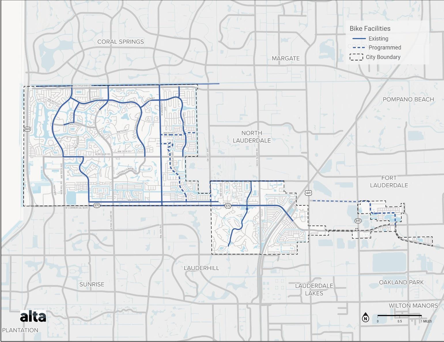
Map 1 Existing Bike Facilities
Road Name Road Ownership
NW 57 St City
Facility Type
Marked Bike Lane
NW 77 St City Unknown
Nob Hill Rd County
McNab Rd County
NW 94 Ave City
NW 81 St City
NW 96 Ave/Westwood Blvd City
Marked Bike Lane
Marked Bike Lane
Marked Bike Lane
Buffered Bike Lane
Marked Bike Lane
NW 71 Ave City Undesignated lane
NW 82 St City
NW 70 Ave City
NW 80 Ave City
Buffered Bike Lane/Marked Bike Lane
Marked Bike Lane
Marked Bike Lane
Southgate Blvd City Undesignated Lane
University Dr State Buffered Bike Lane/Undesignated Lane/Marked Bike Lane
Woodlands Blvd City
Marked Bike Lane
Bailey Rd County/City Buffered Bike Lane
Commercial Blvd County/State/City Marked Bike Lane/Undesignated Lane
Pine Island Rd County Undesignated Lane
Table 1. Existing Bicycle Facilities
Sidewalk Facilities
There are currently 133 miles of existing sidewalk facilities in Tamarac While sidewalk facilities cover a relatively large amount of the City, frequent gaps create a disjointed network that make travel difficult for pedestrians. Instances of larger gaps along a stretch of sidewalk may come from a mix of developed and undeveloped parcels. Many developments also lack sidewalks, creating larger gaps in the network. Smaller gaps are often seen where driveways are lacking adequate connections for pedestrians. This is especially important across larger driveways located in commercial areas that require pedestrians to navigate difficult slopes or turning vehicle traffic. Many of the existing sidewalks in the City are located along larger roads, creating a potential for connection, but inconsistent facilities prevent users from having safe access to destinations.
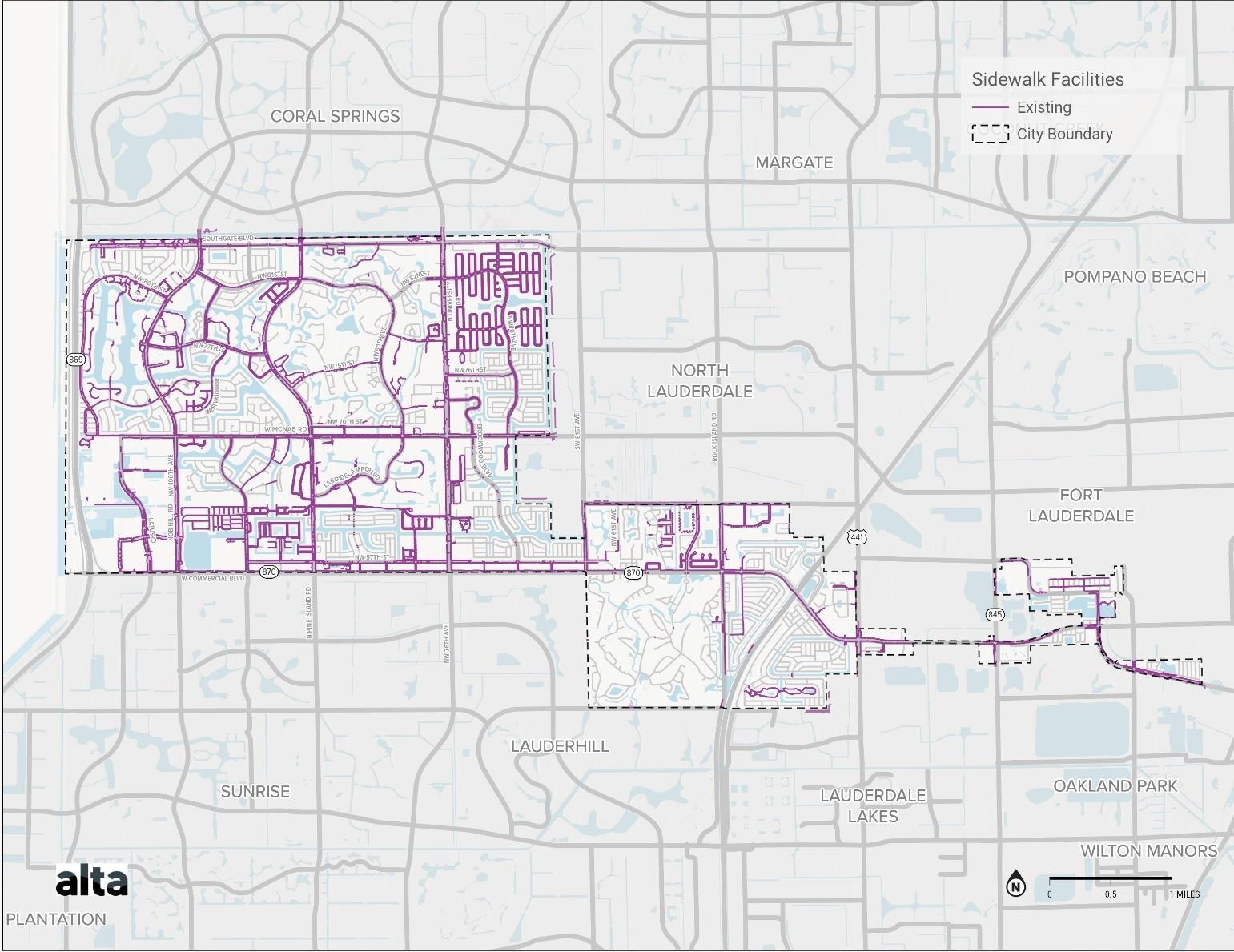
Map 2. Sidewalk Facilities
Transit Service
The City is currently served by Broward County Transit (BCT) bus routes and the Community Shuttle Red Route. The Community Shuttle Red Route, which is run by the City, is focused in the central part of Tamarac, travelling mainly between W McNab Rd and Commercial Blvd. The shuttle reaches a number of local roadways and neighborhoods where users may be beginning their trip. Ridership for the Red Route in January 2023 shows 3,532 monthly users, which is about a 33% increase in ridership from ridership in January 2022.
Broward County Transit routes throughout Tamarac run along major roadways such as, Nob Hill Rd, N Pine Island Rd, N University Dr, W McNab Rd, Commercial Blvd, US 441, Prospect Rd, and Hiatus Rd. These routes provide connections to major locations along these roadways, however, users travelling to destinations on smaller roadways or within neighborhoods may have to complete their trip on foot or bike.
The Broward County Transit Premium Mobility Plan (PREMO) has recently identified transit projects that will improve services along high-capacity corridors throughout the County within the next 15 years These projects will help to increase future transit access along major roadways like Commercial Blvd and N University Dr, although users travelling outside of these corridors may rely on walking or biking to reach their final destination.
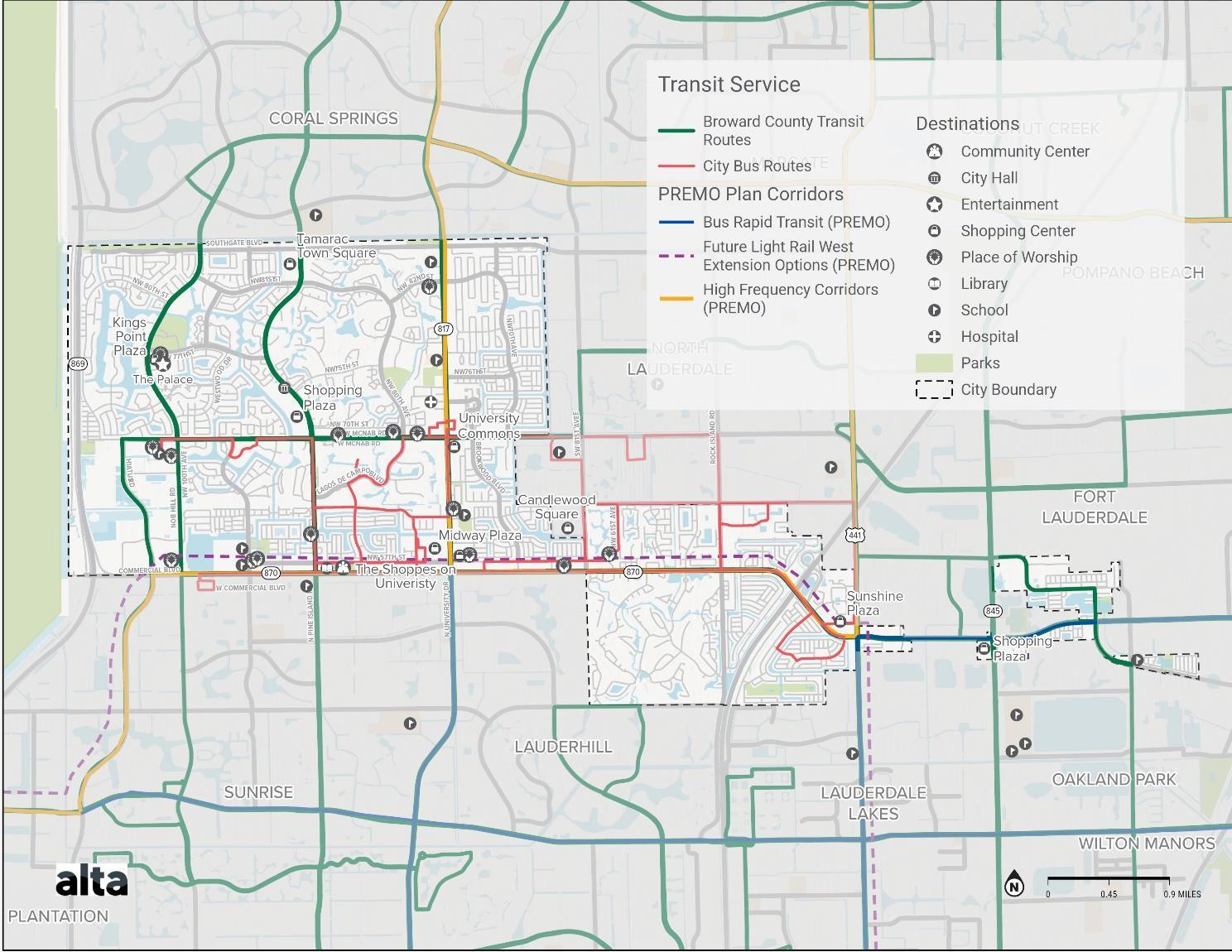
Map 3. Transit Service
Roadways
The predominant form of transportation in Tamarac is vehicle travel, specifically single-occupancy vehicles. There are about 238 miles of roadway in the City of Tamarac. These range from interstates and major state roads to local neighborhood streets. Major state-owned roads in the City are N University Dr, Sawgrass Expy, and portions of Commercial Blvd. There are also major county-owned roadways, such as Nob Hill Rd, N Pine Island Rd, Rock Island Rd, as well as portions of Commercial Blvd, Bailey Rd, and W McNab Rd. All of these roads make major connections across the City and typically carry high traffic volumes at high speeds. These major roads are typically wide, often with multiple travel lanes in each direction and center medians. While this type of roadway network is effective for car travel, it can hinder other forms of travel, such as active transportation. Local roads owned by the City are typically smaller roads, with a few collectors and arterials that carry a significant amount of traffic, as well as many small, winding neighborhood roads that carry local traffic.
Network Connectivity
While there are several existing active transportation facilities in Tamarac, it is important to understand if the network is complete enough to allow residents to access transit and other key destinations on foot or by bike. Based on public feedback, three destinations stand out as popular destinations for many residents across the City: Tamarac Sports Park in the northwest side of the City, the Community Center in central Tamarac, and Caporella Park in the southeast. This represents destinations that residents in each part of the City could reach using the active transportation network if facilities allow.
Looking at a one-mile radius, about a 20-minute walk, around each destination, we can see existing routes that those looking to walk might be able to take. As each of these destinations is located on a major road, existing facilities provide some amount of connection, although there are gaps in many areas. Access to destinations may be less accessible from the active transportation network on local streets, as existing facilities are focused on larger roadways. For residents walking from nearby neighborhoods, sidewalk facilities may not begin until a larger arterial roadway is reached. This greatly affects the access that is provided by the current system, as some gaps may be or feel too dangerous for some to travel. A lack of facilities can also affect the directness of routes that users would want to take. Similarly, the existing bike network provides routes to destinations for some, although it may not be complete or direct, or does not feel safe enough to use
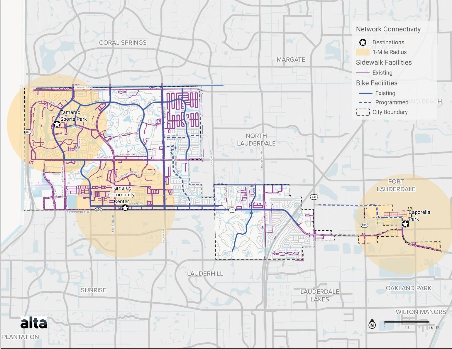
Safety Analysis
Crash Severity and Frequency
The Safety Analysis considers the locations of bicycle- and pedestrian-involved crashes throughout Tamarac, focusing on locations with a higher frequency of crashes as well as crash severity. Crash severity is understood by analyzing Killed or Seriously Injured (KSI) crashes, which are crashes that resulted in a fatality or serious inury. Using data provided by Safety4Analytics, this analysis evaluates reported crashes occurring between 2012 and 2023. The review of crashes will not only help identify locations for new or improved facilities but will also inform priority projects for implementation.
In total, there were 25,367 crashes recorded in Tamarac from 2012 to 2023. Of these crashes, 19,518 resulted in no injury, 5,476 resulted in minor injury, 280 resulted in a serious injury, and 93 resulted in one or more fatalities.
Intersections with the highest frequency of fatal or serious injury crashes include US-441 and Commercial Blvd, N University Blvd and Commercial Blvd, Rock Island Rd and Commercial Blvd, W McNab Rd and N University Blvd, and Florida’s Turnpike and Commercial Blvd.
Corridors with the highest frequency of crashes, specifically fatal or serious injury crashes, are larger corridors such as N University Dr, Commercial Blvd, US-441. These larger corridors are most often state- or county-maintained roads. Citymaintained roadways have a lower frequency of fatal and serious injury crashes.
Many of these intersections and corridors are included in the Broward MPO High Injury Network (HIN), which highlights corridors that have the highest concentrations of collisions from 2017-2021 Additional corridors identified in the HIN are NW 76th Ave and Sawgrass Expy. Additional intersections include NW 76th Ave and Commercial Blvd, NW 7th Ave and W McNab Rd, Nob Hill Rd and W McNab Rd, Hwy 845 and Commercial Blvd, and N Pine Island Rd and NW 77 th St.
As many of the Broward County and City transit stops are located along major roadways throughout Tamarac, many of these are within areas of high concentrations of crashes. High crash frequency roadways with a large number of transit stops include W Commercial Blvd, W McNab Rd, and NW 76 th Ave.
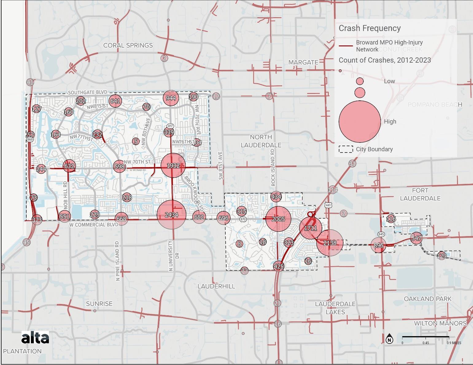
Map 5 Crash Frequency
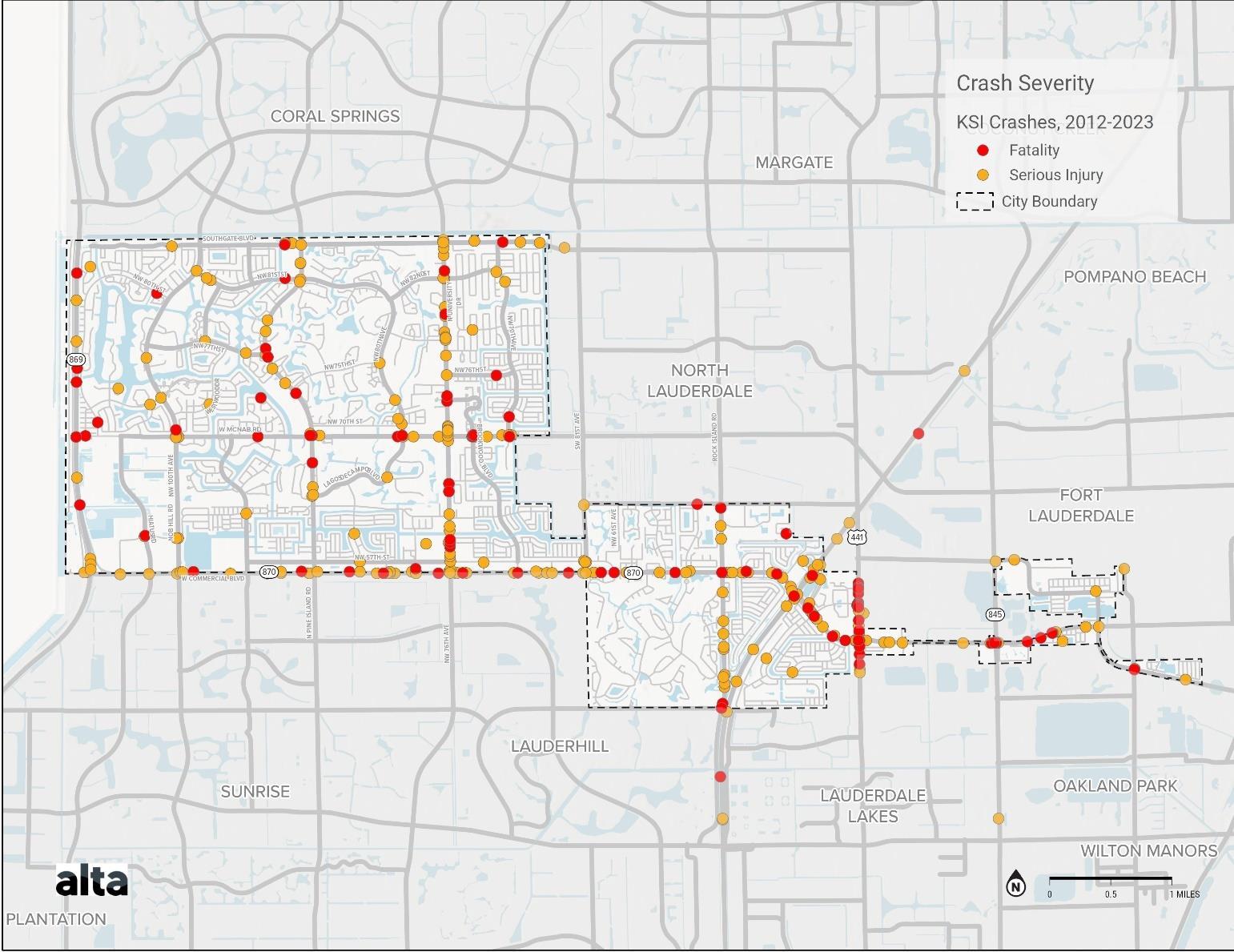
The following tables provide more detail on all crashes that took place between 2012 and 2023.
Table 2. Speeding-Related
Map 6. Crash Severity
Table 5. Aggressive Driving-Related
Table 3. Light Condition
Table 4. Type of Impact
Table 6. Location
Bicycle and Pedestrian-Involved Crashes
337 crashes during this time period involved a pedestrian and 207 crashes involved a bicyclist. Roads with a high number of pedestrian crashes include Commercial Blvd, N University Dr, US-441, and W McNab Rd. Similarly, roads with a high number of bicycle-involved crashes include Commercial Blvd, N University Dr, and W McNab Rd, as well as Pine Island Rd. Some of these roads, N University Dr and parts of Commercial Blvd, have existing bicycle facilities. While they likely see a higher amount of bicycle traffic, there are still a significant number of crashes involving those using facilities on these larger r oads.
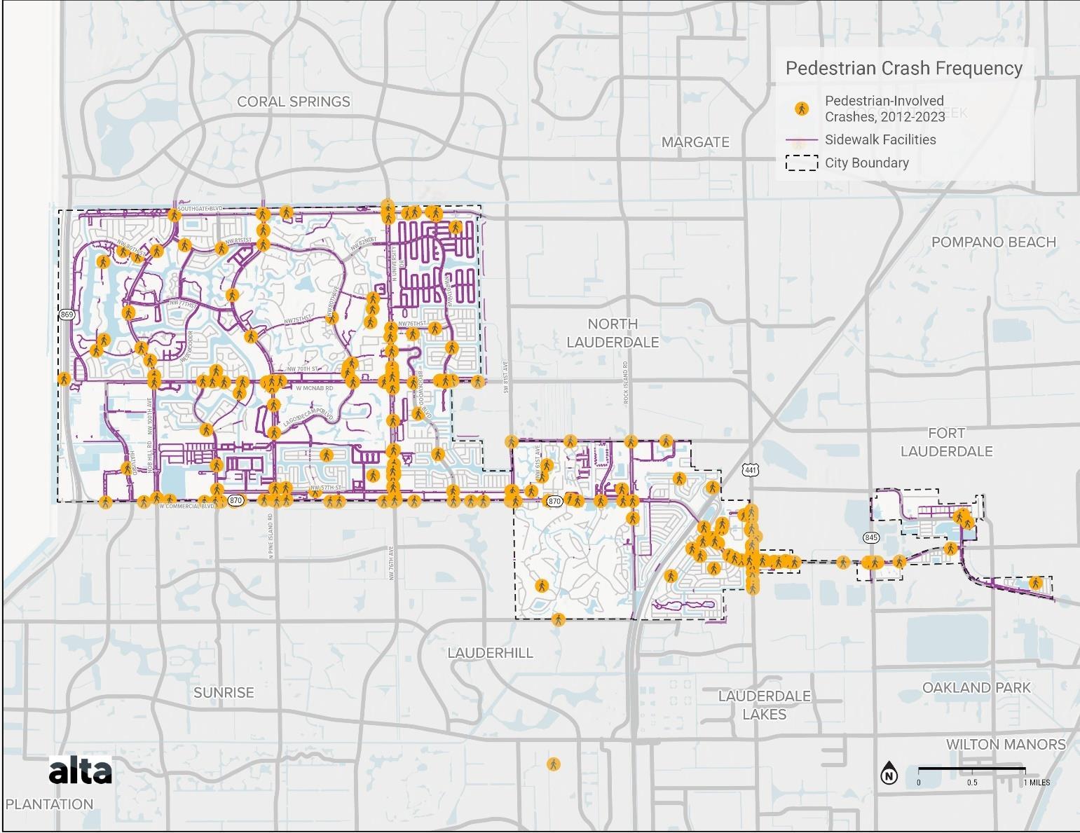
Map 7 Pedestrian Facilities and Safety
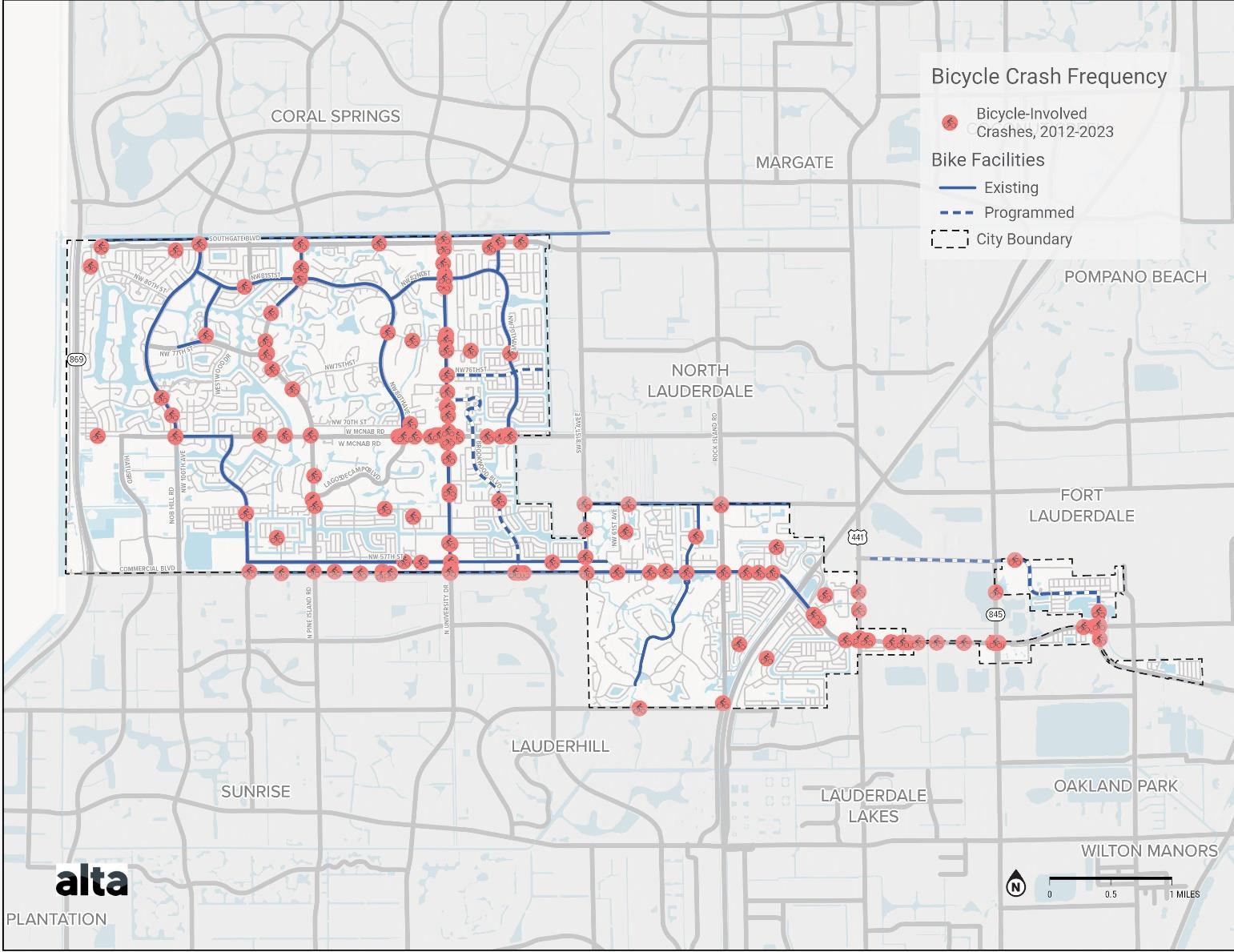
Equity Analysis
Defining equity is a context-dependent exercise and disadvantaged populations will vary from community to community. To establish a baseline, the Equity factors considered include:
• USDOT Disadvantaged areas
• Low income
• Age
• Access to a vehicle
Examining factors related to equity provides an understanding of the areas of Tamarac in which people with the highest need for transportation facilities live. By analyzing where these communities are located, improvements in these areas can be prioritized to ensure that future investments benefit all kinds of users. Equity within the transportation system can be reached by prioritizing improvements in areas with higher concentrations of disadvantaged areas
Map 8. Bicycle Facilities and Safety
Disadvantaged areas
The USDOT Equitable Transportation Community Explorer tool identifies census tracts as disadvantaged in specific areas of transportation insecurity, environmental burden, social vulnerability, health vulnerability, and climate and disaster risk burden. Factors within each of these categories are measured for each census tract and scored, and then summed to determine an overall disadvantaged component score. Census tracts with low scores are considered by USDOT to be disadvantaged communities.
Disadvantaged communities within Tamarac are found near Sawgrass Expy, south of McNab Rd and near and east of Florida’s Turnpike
(https://experience.arcgis.com/experience/0920984aa80a4362b8778d779b090723/page/Understanding-the-Data/)
Prioritizing transportation improvements in these areas can create equitable benefits by providing infrastructure and services to those that may typically see less investment.
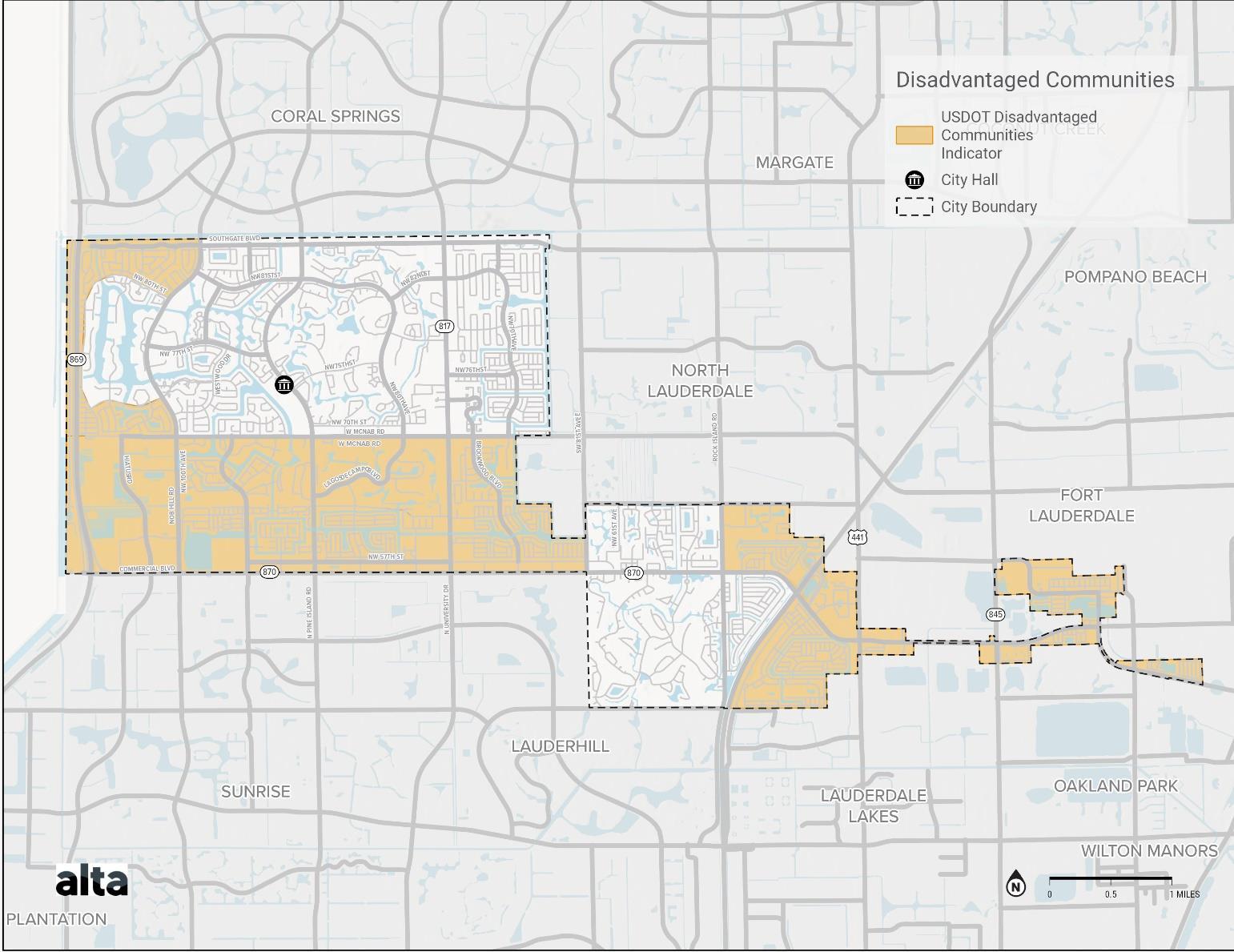
Map 9. Disadvantaged Communities
Low income Communities
Median household income for census tracts is another factor that can help to identify areas with a higher need to reach equity. The median household income for the City of Tamarac is $51,799 (2020, https://datausa.io/profile/geo/tamaracfl#economy). For comparison, the median household income for Broward County is $60,922 (2020, https://datausa.io/profile/geo/broward-county-fl) and the median household income for Florida is $57,703 (2020, https://datausa.io/profile/geo/florida).
Two census tracts within Tamarac have a median household income less than $35,000. These tracts are located along Commercial Blvd and to the east of Florida’s Turnpike. Other census tracts with a relatively low median household income are found to the east of Florida’s Turnpike, near Lagos de Campo Blvd, and west of NW 77th St. Prioritizing transportation improvements in these areas can benefit households that may rely on these services. The highest median household incomes in the City are found in north Tamarac and south of Commercial Blvd.
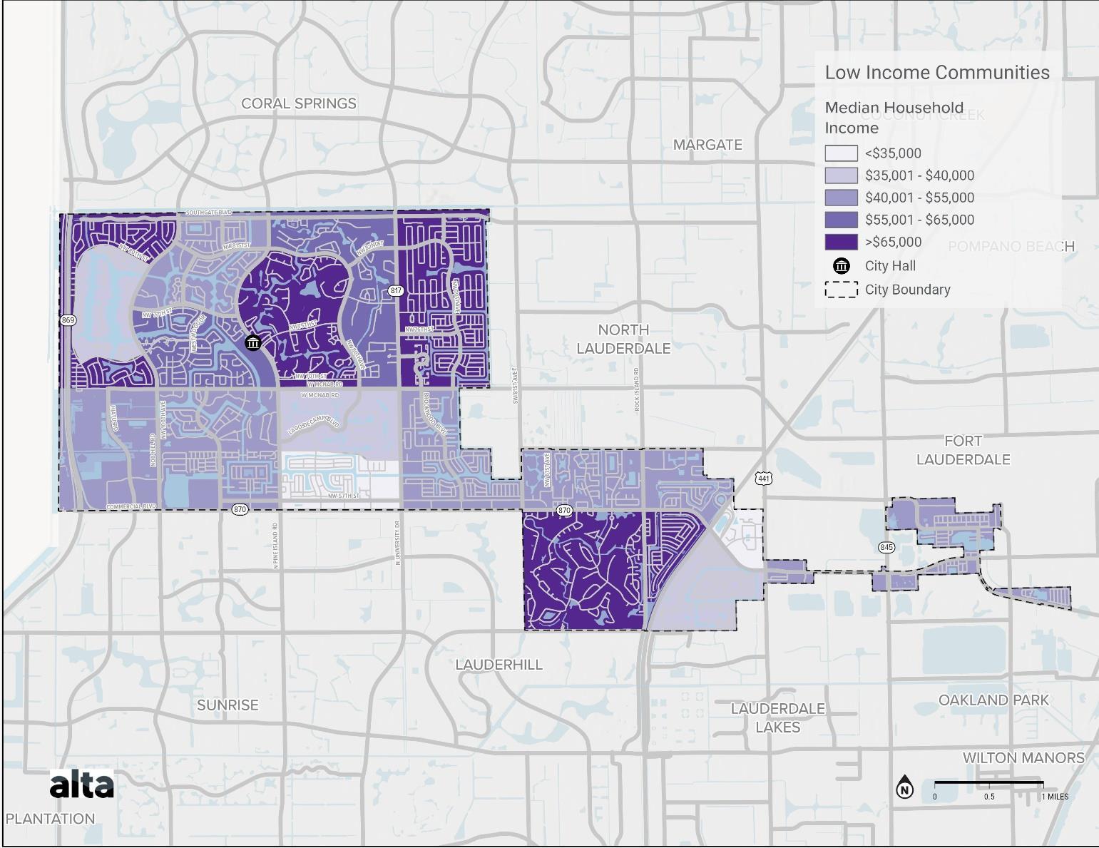
Map 10. Low Income Communities
Senior housing
Senior housing and assisted living facilities in Tamarac are found throughout the City, with many located along the commercial corridor of N University Dr and in the residential areas to the East of the corridor. Other facilities are located near NW 57th St, near Commercial Blvd and in largely residential areas near Pine Island Rd. City residents living at these locations may not have access to vehicles and may rely on active transportation or transit to travel around the City and make day-to-day trips. Ensuring that these areas have adequate facilities for residents to reach nearby destinations is important to prioritize when implementing equitable transportation network improvements.
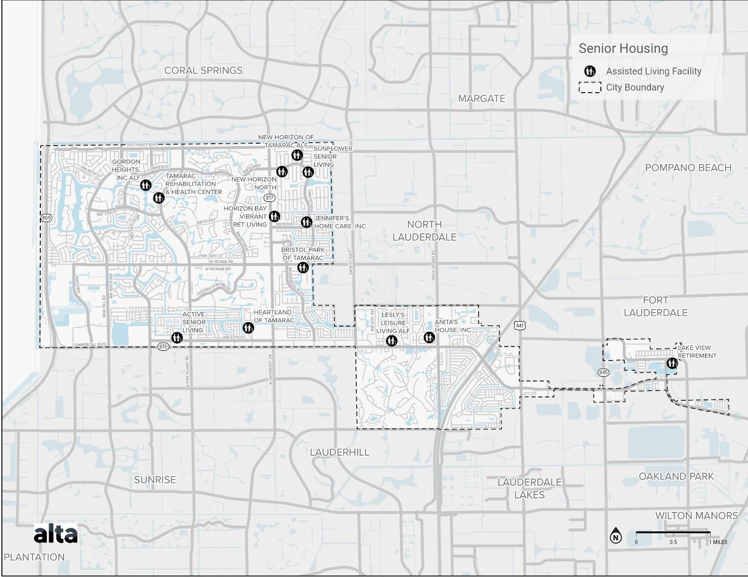
Map 11. Senior Housing Facilities
Access to a vehicle
While many rely on driving to get around the City, not all residents have regular access to a vehicle for transportation use. Census data can be used to understand the percent of households within each census tract that don’t have regular access to a vehicle. Those areas with a large number of households without this access indicate areas where residents may rely exclusively on active transportation or transit for their daily travels. Certain census tracts within the City show that 21%27% of residents do not have access to a vehicle, including areas to the east and on census tract in the northwest. Census tracts north of Commercial Blvd and directly east of Florida’s Turnpike have 5-11% of households with no access to a vehicle A number of census tracts have 0-5% of residents with no access to a vehicle, likely showing a lower reliance on active and public transportation Areas of the City with a higher percentage of these residents can be good areas for investment in the transportation network for those that frequently use it.
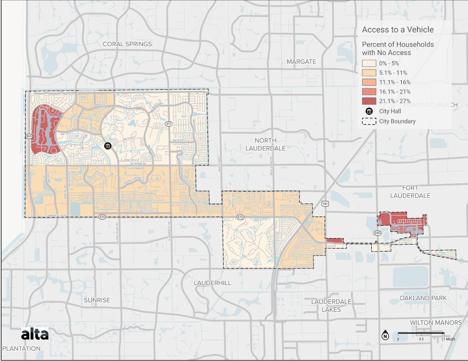
Map 12. Access to Vehicles
Demand Analysis
Modeled Bike Volumes
Modeled volumes of bike travel can be used to understand demand by bike users across the network. Making improvements to bike facilities along roadways with higher modeled volume can help to focus efforts on those facilities that are frequently used.
Streets with the highest modeled bike volumes are Commercial Blvd east of University Dr, University Dr north of McNab Rd, and SR-7 at the eastern edge of Tamarac. NW 82nd St, NW 94th Ave, NW 70th Ave, Pine Island Rd, and NW 100th Ave north of McNab Rd all have moderately high modeled bicycle volumes as well. Of these high bike volume roads, all have existing or programmed bike lanes except Pine Island Rd, SR-7 and the easternmost segment of Commercial Blvd.
Modeled bicycle volumes are provided by Replica Places and illustrate trip-making behavior for a typical weekday in Fall 2022. See the Appendix for more detail on Replica methodology.
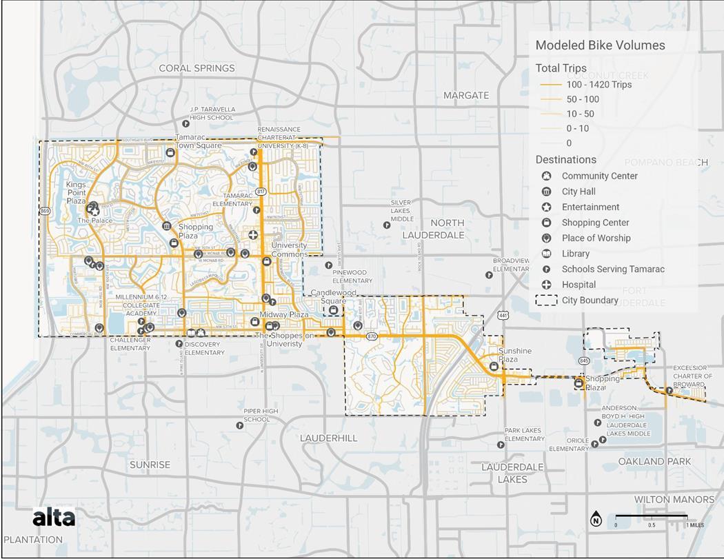
Map 13. Modeled Bike Volumes
Modeled Pedestrian Volumes
Modeled volumes of pedestrian travel can be used to understand demand by those walking across Tamarac by showing those facilities and roadways that currently see a relatively high volume of traffic. These are areas that are already used and would be good areas for investment in order to improve facilities for a large number of users.
Shopping centers like Tamarac Town Square, Sunshine Plaza, University Commons, and Midway Plaza, as well as schools like Tamarac Elementary, Challenger Elementary, and the Renaissance Charter at University are key features in areas with high modeled pedestrian volumes. Additionally, roads like NW 84th Terrace, NW 71st Pl, NW 78th St, and NW 61st St have high modeled pedestrian volumes. In general, modeled pedestrian volumes are higher in the neighborhoods south of McNab Rd and east of NW 100th Ave.
Modeled pedestrian volumes are provided by Replica Places and illustrate trip-making behavior for a typical weekday in Fall 2022. See the Appendix for more detail on Replica methodology.
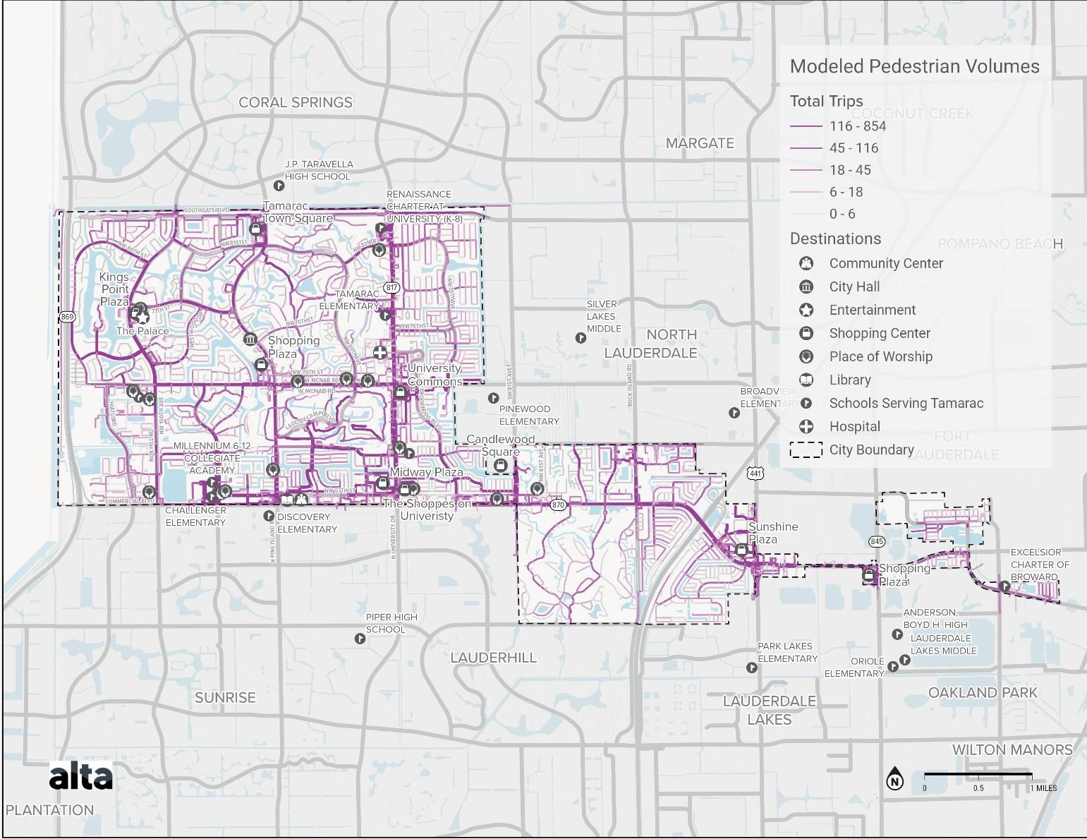
Map 14. Modeled Pedestrian Volumes
Transit Ridership
Analyzing transit ridership can provide an understanding of areas with high demand for transit services. These areas can be good places for investment and improvements to amenities, as services are used by a larger number of people. The map below shows ridership for the City Shuttle’s Red Route and Red Route Extension based on 12 months of data collected from 2021 to 2022. Stops that are the most utilized along the Red Route are often found at shopping centers. This includes Midway Plaza and Sunshine Plaza, both in the southern portion of the City near Commercial Blvd. Another popular stop along this route, located at the Bermuda Club, is situated along Commercial Blvd near Candlewood Square. Popular stops along the Red Route Extension include the Tamarac Community Center on Commercial Blvd and Walmart Shopping Center located just outside the City in North Lauderdale, and Midway Plaza. Shuttle stops with lower ridership are found among stops located on smaller neighborhood roads and along McNab Rd. Overall, a large demand for the shuttle service is found in the southern portion of the city, specifically along Commercial Blvd.
Broward County Transit ridership was modeled to understand demand for this transit service as well. In general, transit ridership is higher in the southern parts of the city The highest number of transit boardings occur at the stops near Sunshine Plaza at the intersection of Commercial Blvd and SR-7, followed by secondary hubs at Midway Plaza and the University Commons. Ridership is lower in the more residential parts of the City, such as the northern area.
Modeled transit ridership is provided by Replica Places and illustrates trip-making behavior for a typical weekday in Fall 2022.
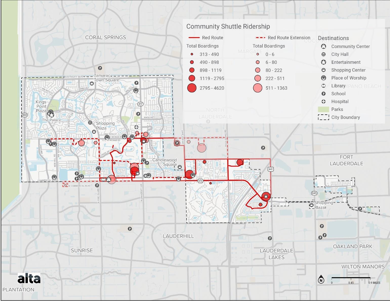
Map 15 Community Shuttle Ridership
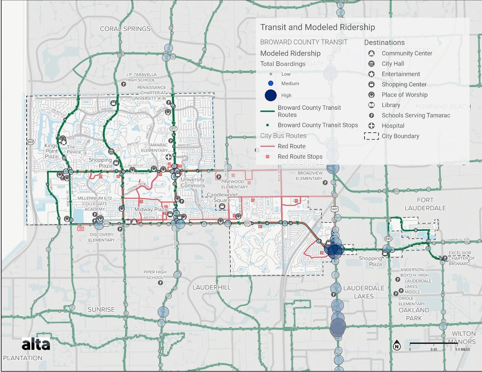
Map 16. Modeled Broward County Transit Ridership
Vehicle Trips
Demand within the roadway network can be understood through annual average daily traffic (AADT) volumes, which is a measurement of the average number of cars that travel along a roadway during a single day. In Tamarac, the road with the highest volume of traffic is Commercial Blvd, especially the section between Florida’s Turnpike and Rock Island Rd. This specific area of Commercial Blvd sees over 50,000 cars on an average day. In addition, other primary highways show an AADT greater than 10,000 cars per day, as well as a number of secondary and tertiary highways. This includes N University Dr, Rock Island Rd, Nob Hill Rd, N Pine Island Rd, US 441, and portions of McNab Rd, Southgate Blvd, Hiatus Rd, SW 81 st Ave, and Prospect Rd. The high traffic volumes on these roadways, along with the large width and high speed of many, can indicate that these roadways may not adequately serve alternative transportation users. Active transportation users are likely to face challenges, such feeling uncomfortable without separated facilities. Many of Tamarac’s local roads see volumes between 1,000-5,000 cars per day. Depending on vehicles speeds, active transportation users may be comfortable on these roadways with less physical separation from cars. Residential roads throughout the City typically have volumes less than 1,000 cars per day. Active transportation users may feel comfortable using these roads for transportation along with vehicle traffic in some cases, but separated facilities may be necessary to encourage use by residents of all ages and abilities.
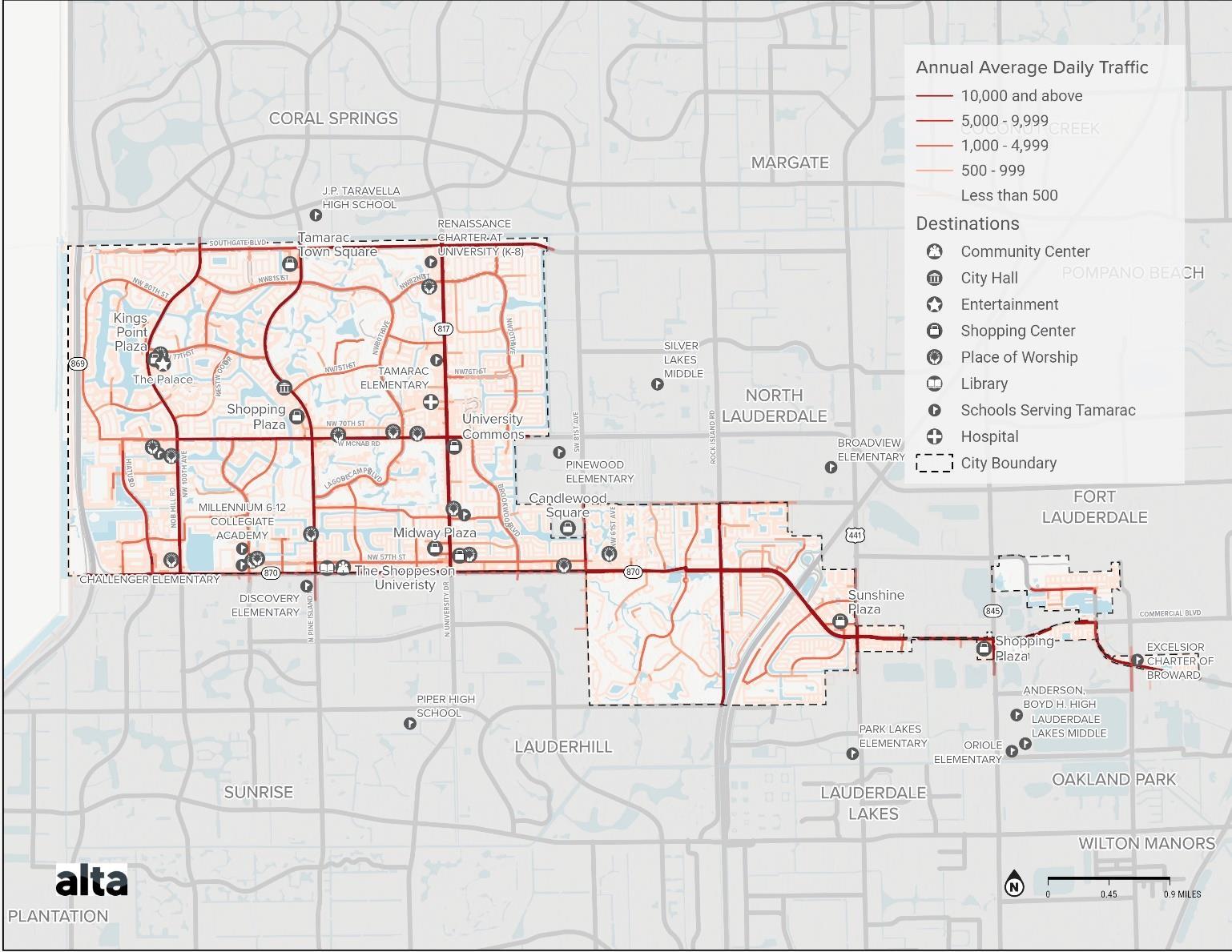
Map 17. Vehicle Volumes
Total Trips
Modeled trip density of all trips occurring throughout Tamarac can create a picture of those areas of the City that are popular origins and destinations As these areas of the City see a greater number of trips, they can be beneficial places to prioritize investment to benefit the large number of current users.
There is a total of 214,000 daily trips in the City of Tamarac. The central region of the City exhibits a relatively high trip density, with the highest trip density occurring in areas with destinations such as the Sunshine Plaza, Midway Plaza, the Shoppes on University, and the University Hospital & Medical Center. The largely residential areas at the northeastern and southern areas of the city see a lower density of trips, possibly due to a large number of single-family homes and fewer destinations in these areas. While density of trip origins is spread throughout areas of central Tamarac, the density of trip destinations is more concentrated in those parts of the City with major destinations, such as Sunshine Plaza, and high concentrations of multi-family residences
Trip data was obtained from Replica Places1 and is based on a representative Thursday during the Fall of 2022. Data was filtered to include only trips starting from the City of Tamarac.
1 Replica Places is a data product provided by Sidewalk Labs spin-off Replica. Replica Places is an activity-based model developed off a combination of mobile, land use, census, and transaction data to generate census-block level OD estimates that can be used to estimate trip distances and understand common origins-destinations. Their data also provides estimates of mode split and trip purpose based on their synthetic populations that are created as part of their estimation process.
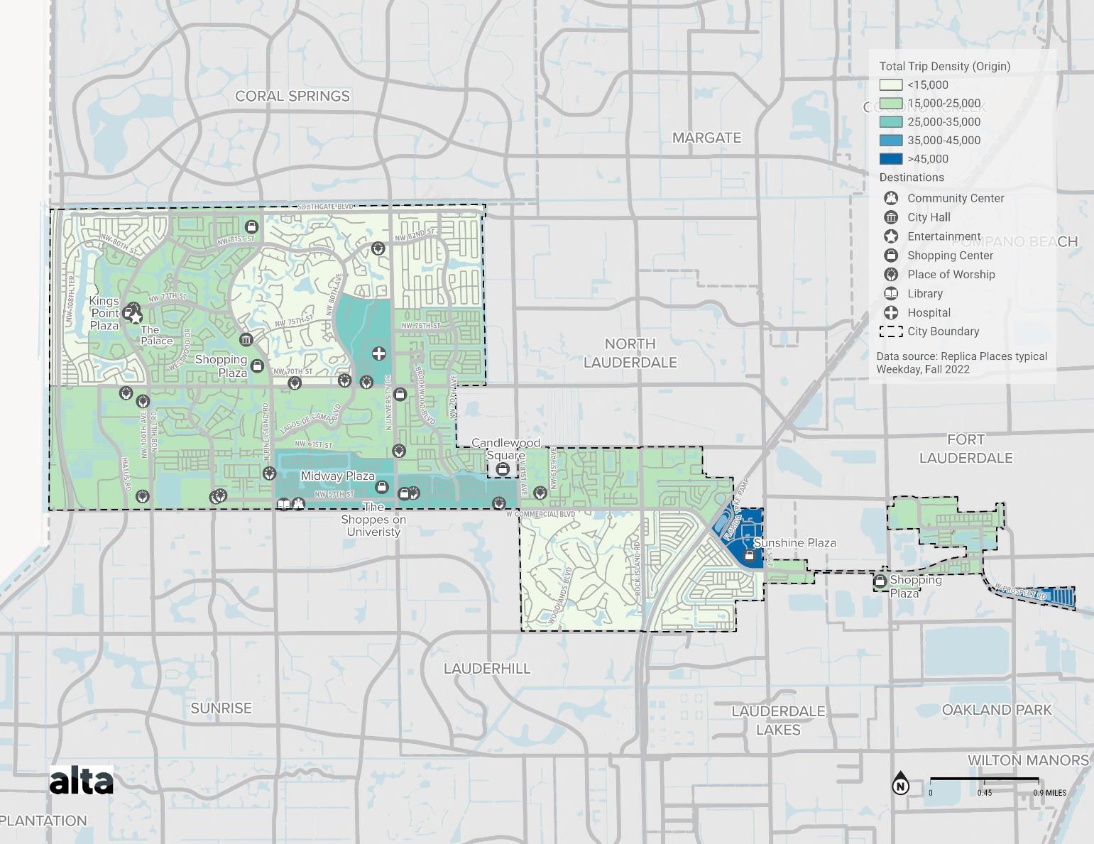
Map 18. Total Trip Density (Origin)
Map 19. Total Trip Density (Destination)
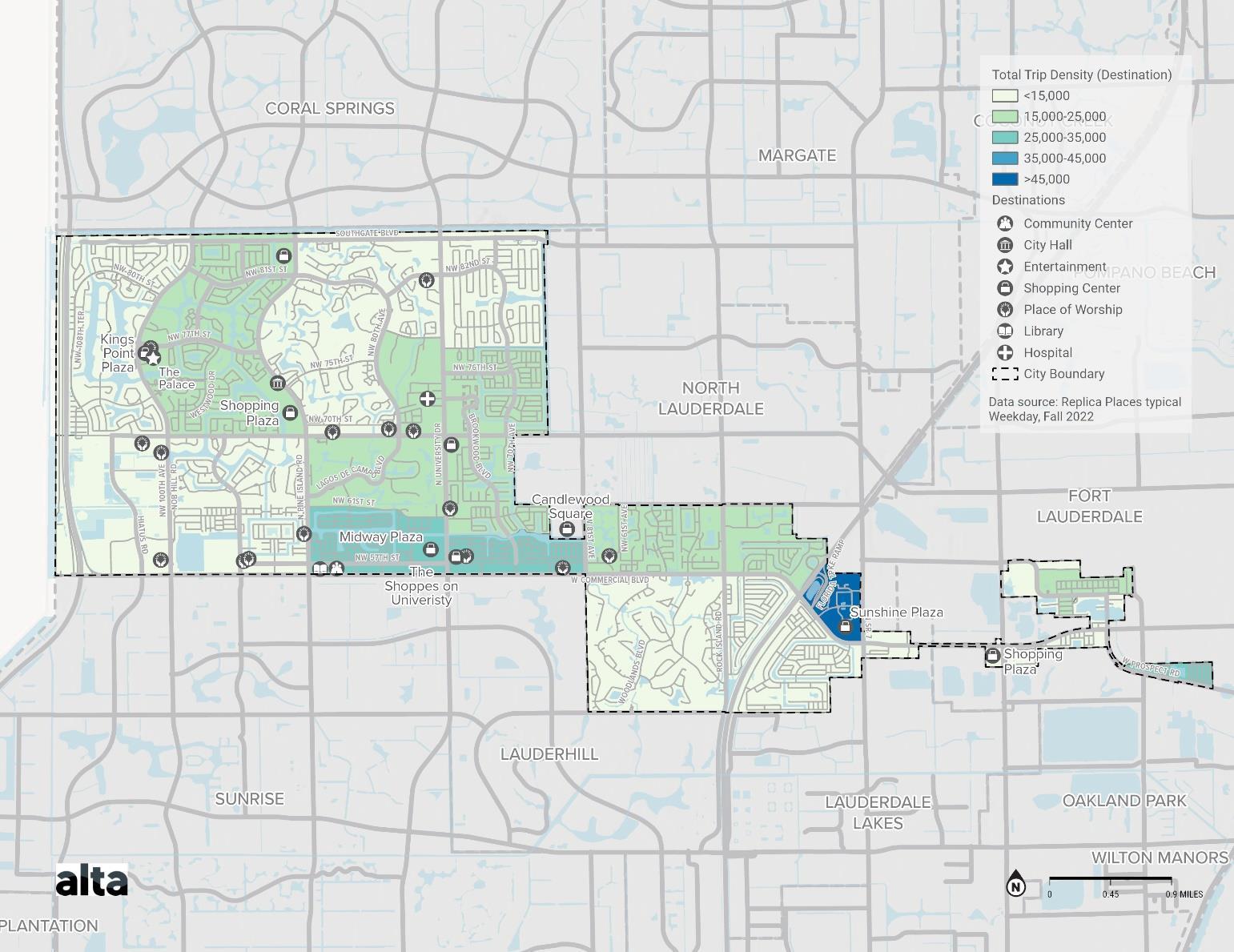
Short Vehicle Trips
Short vehicle trips taken by residents can be good candidates for replacing vehicle trips with active travel. Studies have shown that about 50% of all car trips in the United States are three miles or less,2 which is a distance that could reasonably be traveled on a bicycle. Looking at the modeled density of short trips within census tracts shows areas that cold see an
2Curry, Melanie, et al. “Bikes and Scooters Could Replace a Lot of Car Trips in U.S. Cities.” Streetsblog California, 17 Sept. 2019, https://cal.streetsblog.org/2019/09/16/bikes-and-scooters-could-replace-a-lot-of-car-trips-in-u-s-cities/. Accessed 5 July 2022.
increase in active travel with improvements to facilities.
There are 83,000 short daily trips within the City of Tamarac, which accounts for approximately 39% of the total trips. A high density of short trips is observed along NW 42nd Ave, which primarily consists of retail establishments such as Sunshine Plaza. Areas along the middle of Commercial Blvd where there are a number of retail shopping centers also see a relatively high density of short trips. The most eastern portion of Tamarac sees a slightly higher density of trips than othe r areas of the City as well, which may be due to the airport just outside of Tamarac City Limits. Largely residential areas, such as the western and northern areas of Tamarac, show a lower density of short trips.
Short person-trip density data representing a typical Thursday in Fall 2022 was downloaded from Replica Places and filtered to include only trips starting from the City of Tamarac and trips within 3 miles.
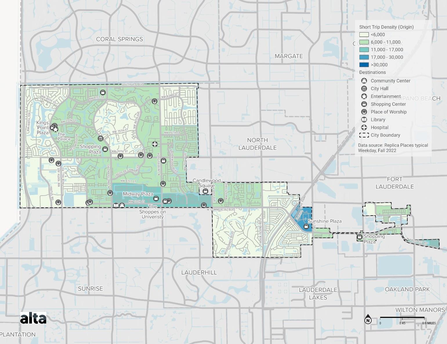
Map 20. Short Trip Density (Origin)
Gap Identification
After analyzing the existing conditions of Tamarac’s transportation network, gaps can be identified to understand where improvements can be made. Working to fill the gaps will create a complete network in which users can safely travel to destinations throughout the City.
Sidewalk Facilities
Tamarac has nearly 60 miles of roadway with complete sidewalks on both sides of the street, primarily along major roads like NW 100th Ave, Pine Island Rd, McNab Rd, and University Dr. Citywide, 45 miles of road have complete sidewalk on one side of the street. Notable major roads with complete sidewalks on only one side are Southgate Blvd, NW 80th Ave, and Commercial Blvd. The majority of roadways, over 120 miles in total, have incomplete sidewalks on both sides of the street. Generally, there are no sidewalks along residential streets, with the exception of the Sunflower/Heathgate neighborhood surrounding NW 70th Ave in the northeast corner of Tamarac. This can force pedestrians to walk within the roadway when traveling through their neighborhood and can discourage residents from walking as a means of transportation.
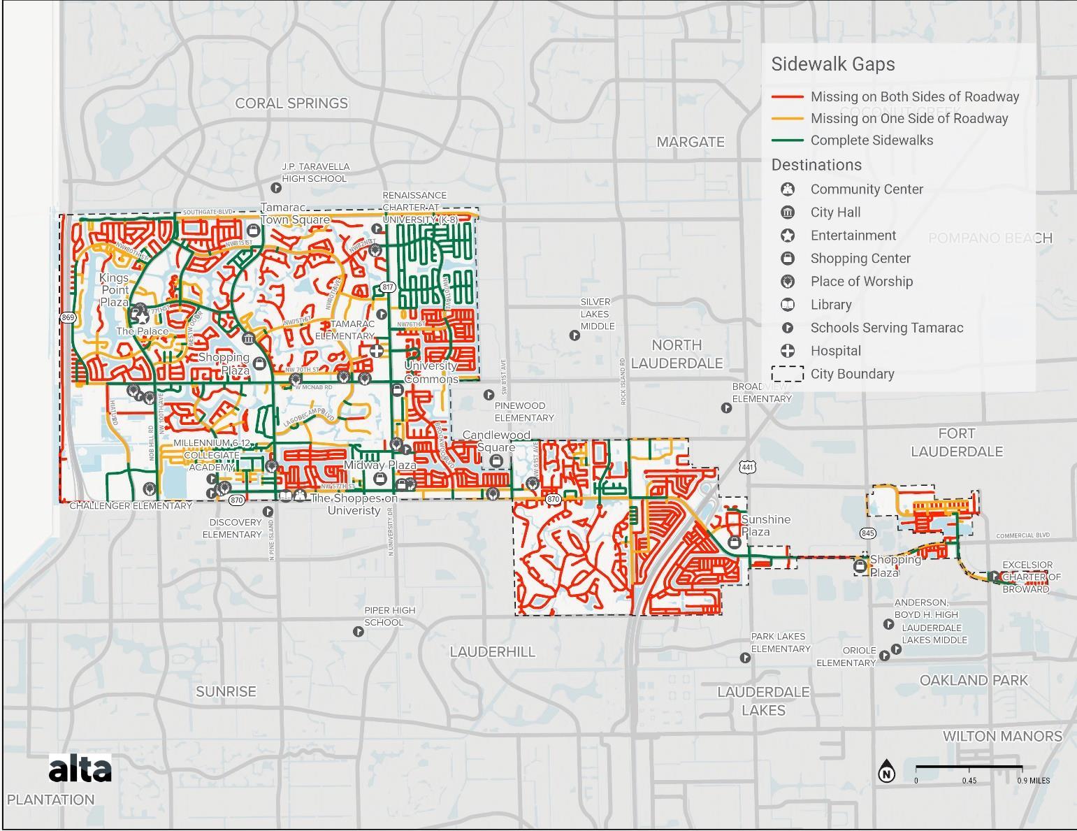
Map 21. Sidewalk Gaps
Bike Facilities
The majority of roads in Tamarac are lacking bike facilities, and current facilities are primarily present on larger roadways. This forces bike users to travel from their starting point to existing facilities or to their destination on roadways or sidewalks that may be unsafe. While many roads are missing facilities, it should be noted that the appropriate facility for each roadway should be determined by assessing specific road characteristics and context. Important factors to consider include urban context, street classification, right-of-way, traffic volumes and speed limit. Some roadways will require facilities that provide more separation from vehicle traffic, while others, like neighborhood roads, can be considered for facilities such as bike boulevards, wider sidewalks, or shared use paths.
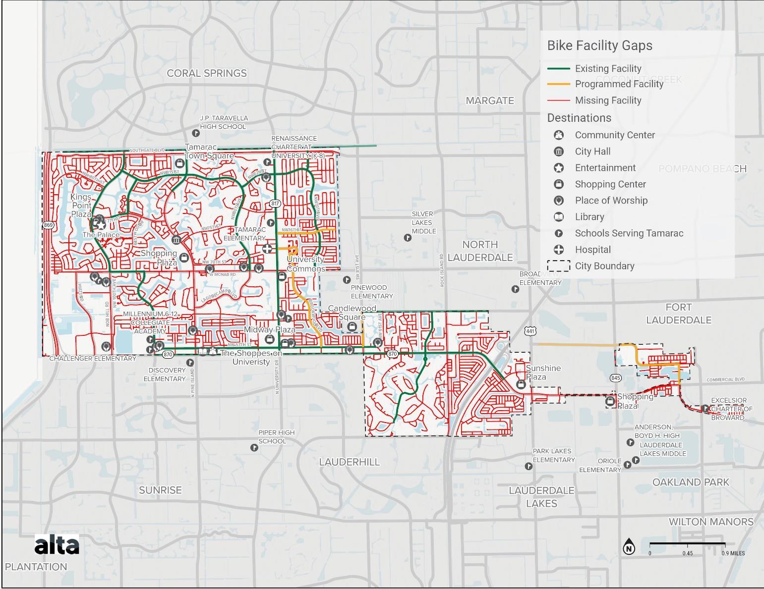
Map 22. Bike Facility Gaps
Transit
Community Shuttle Service
The City’s Shuttle service currently operates on weekdays; the Red Route runs Monday through Friday, and the Extension runs on Tuesdays and Thursdays. This schedule limits accessibility to transit on the weekends, as users can only use Broward County Transit services, which only stop along major roadways and provide fewer local connections. Additionally, for some residents, the travel required to reach transit stops along these larger roads may deter the use of the Broward County service. Expanding shuttle services during the weekends can improve the accessibility of the transportation system that some residents may rely on for their daily trips around the City.
Broward County Transit Accessibility
The Broward County Transit service includes 161 bus stops within Tamarac. Located along the major roadways of the City, safety and accessibility is important. Each transit stop should be ADA accessible to ensure users of all abilities can safely navigate them. Out of the 161 Broward County Transit stops within Tamarac, only 126 bus stops are ADA accessible, meaning that some users may not be able to safely use the facilities to reach available transit services. Inaccessible facilities are primarily located along Commercial Blvd, W McNab Rd, Prospect Rd, and N Pine Island Rd.
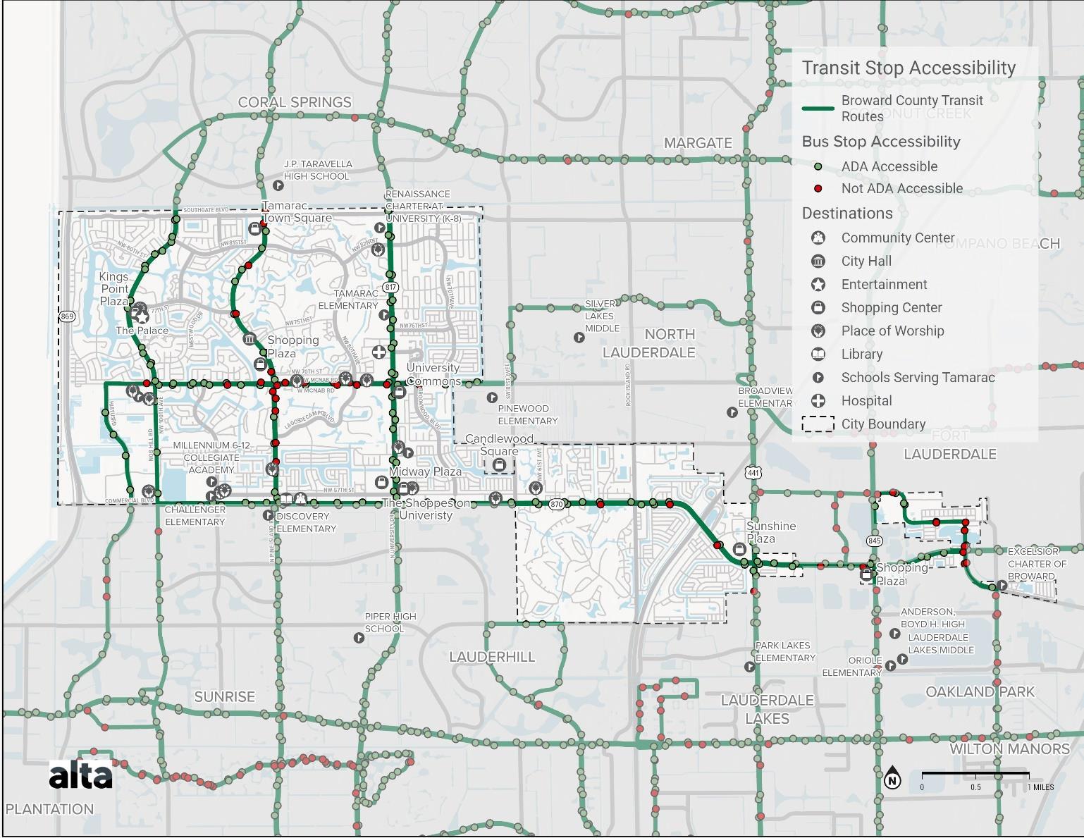
Broward County Transit Amenities
Amenities are also important as users are waiting for the bus service. Bus stops should have a bench or shelter, as well as other useful amenities like trash cans and solar lighting. 101 of the Broward County Transit stops within the City have a bench and/or shelter from those waiting for the bus. 72 stops have trash cans, and 16 stops have solar lighting. Only 15 stops have a bike rack for users to secure their bikes. This is especially important for creating a transportation network th at allows for multimodal travel. A significant number of bus stops with fewer amenities are located on Commercial Blvd, Nob Hill Rd, N Pine Island Rd, and McNab Rd The information shown on the following map comes from Broward County Transit data.
Map 23. Transit Stop Accessibility
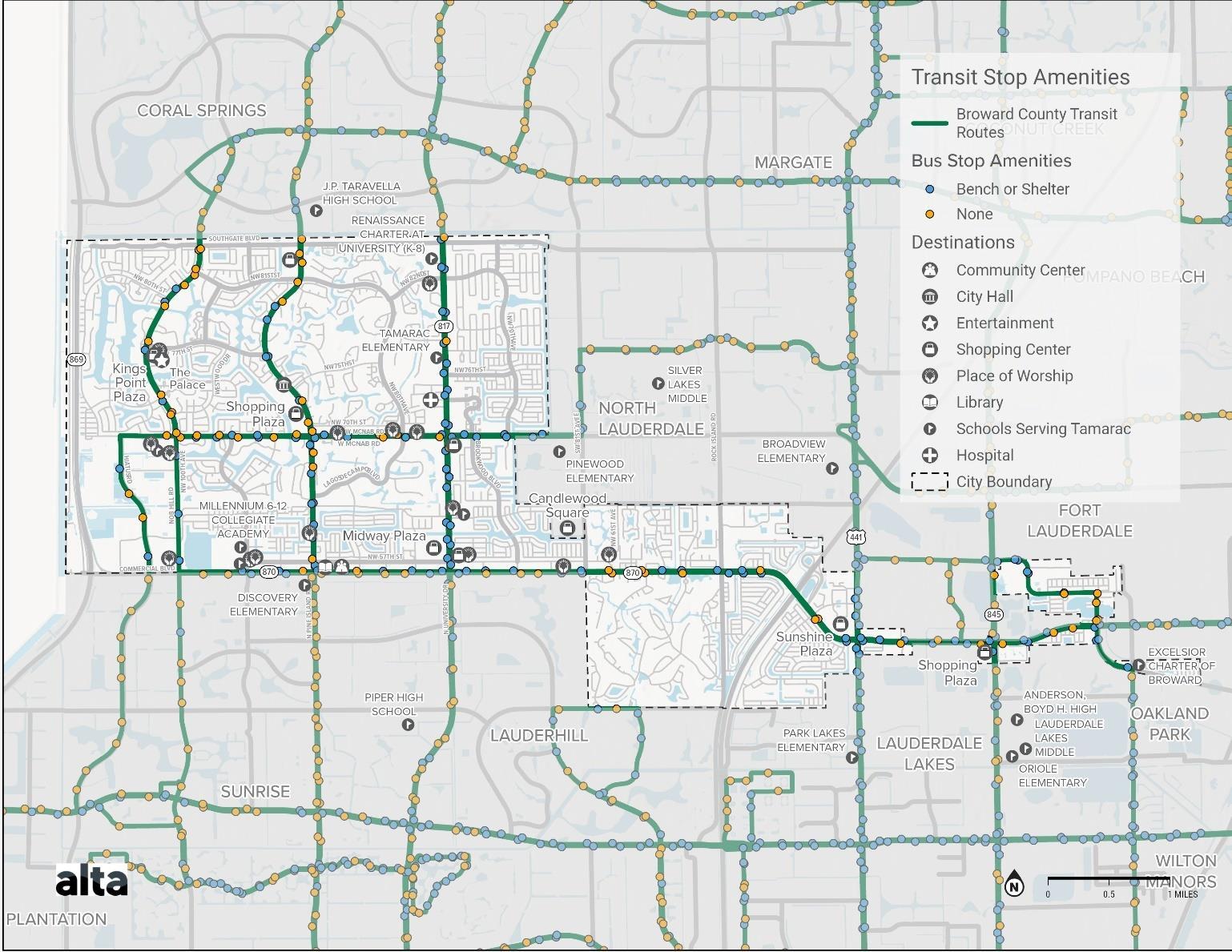
Crosswalks
With the number of large roadways throughout the City, pedestrian and bicycle crossings are important for a safe and comprehensive transportation network. Crosswalks on major roadways such as Commercial Blvd exist at many of the signalized intersections, although with long block sizes throughout the City these crossing can be as much as one miles apart This means that a walker or biker may have to travel an extra mile to reach a safe crosswalk during their trip. Introducing midblock crossings can reduce the distance that people have to travel to cross these large roadways. Smaller roadways, such as Woodland and NW 70th Ave, provide few crossing opportunities, most at intersections with larger roadways. These roads with less traffic and slower speeds can be good candidates for midblock crossings, as traffic can more easily stop to allow for pedestrians to cross.
Map 24. Transit Stop Amenities
Needs Assessment
The existing conditions and analysis above provide a picture of the current transportation network and current gaps that could use improvement. To further understand needs throughout the City, an analysis using multiple sets of data will be conducted to identify areas of priority that require improvements to the transportation network on multiple levels.
Safety and Equity
Looking at safety and equity together can provide an idea of disadvantaged communities that see a high frequency of crashes. The Map below shows Disadvantaged Communities in Tamarac and the total frequency of crashes that have occurred from 2012-2023. Investments to the transportation network where disadvantaged communities see a high frequency of crashes can improve access for residents in these communities will improving safety outcomes of active transportation users that live in the area, as well as other users traveling across the City. Areas that may be particularly important based on this map are facilities near Commercial Blvd and McNab Rd, Rock Island Rd and US-441.
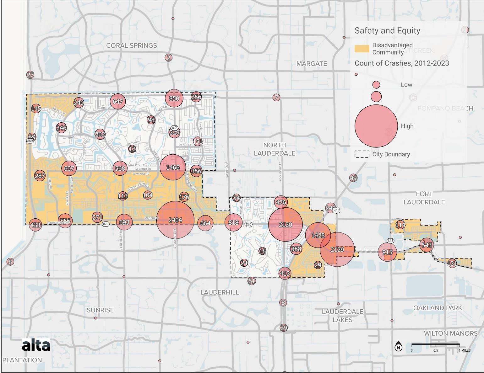
Map 25. Safety and Equity
Sidewalk Facilities, Gaps, and Volumes
Analyzing areas that are currently lacking pedestrian facilities in conjunction with modeled pedestrian volumes can help to understand specific parts of the City that are prime for investment. These are areas in which improvements can benefit a large number of people, both those that currently walk there and others that may do so with better facilities. Key roads near highly traffic areas that lack complete sidewalk facilities are NW 82nd St west of University Dr near Renaissance Charter, NW 78th St near Tamarac Elementary, NW 70th Ave connecting to University Commons, and NW 71st Pl. These areas near schools are also important areas to improve.
Bike Facilities, Gaps, and Volumes
The modeled bike volumes help in understand areas of improvement that could benefit a large number of users. High modeled volumes can also be an indicator of the adequacy of existing facilities. Other areas of improvement should also be considered, such as potentially dangerous roadways that are currently lacking facilities and where there is currently no use While the modeled volumes may show demand on certain roadways, there may also be latent demand in other areas due other factors preventing users from feeling safe while travelling on a certain roadway. One of these potential factors is traffic volume, as a high volume of vehicle traffic can cause bike users to feel unsafe while traveling without proper facilities. Existing facilities along roads with vehicle traffic but low modeled volumes may be areas where improved facilities, such as greater separation from traffic, can benefit current users and may encourage others to use with increased safety. Areas with high vehicle traffic that are currently missing bike facilities can also be improved by adding bike facilities that make them an accessible part of the active transportation network. Several roads have high vehicle traffic (AADT), but low or moderately low bike volumes. Examples of these are McNab Rd, NW 100th Ave south of McNab Rd, and Southgate Blvd which serve as key north-south or east-west connections but lack bicycle facilities.
Active Trips and Existing Facilities
The map below shows the density of active trips that are started throughout Tamarac with the existing bike and pedestrian facilities. Increasing connections between areas with a higher density of active trip origins to nearby destinations can be a good area to focus improvement to expand the active transportation network that is already in use by many. Some of the areas with a very low active trip density are those residential areas with very few or no neighborhood sidewalk facilities and very few bike facilities. Making improvements to the active transportation network in these residential areas can help to encourage residents to make more active trips with adequate facilities. Examples of these areas are those south of Commercial Blvd and Rock Island Rd, as well as neighborhoods just east of NW 80th Ave.
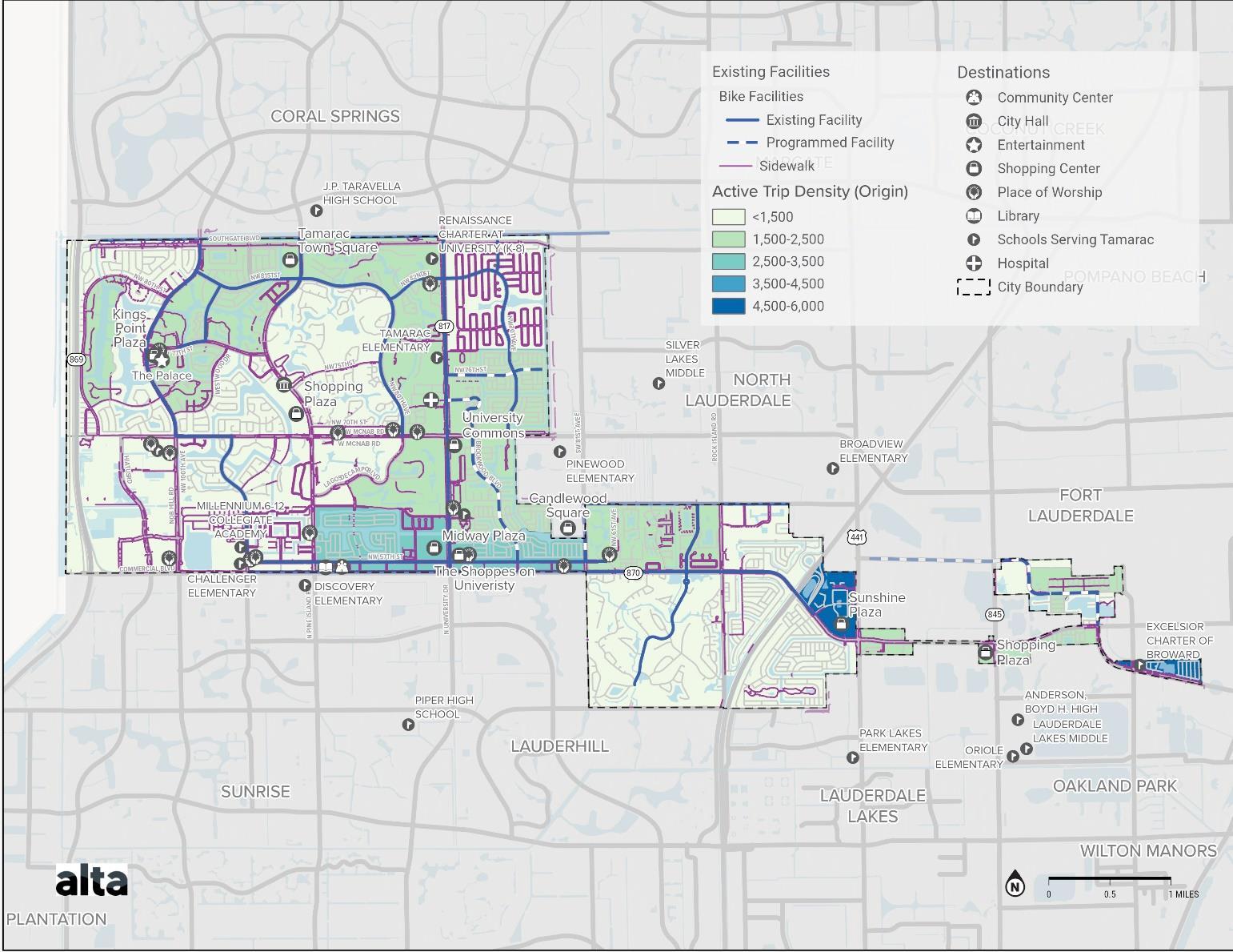
Bicycle and Pedestrian Facilities and Transit Ridership
Investing in facilities near frequently used transit stops can improve the multimodal nature of Tamarac’s transportation network for a large number of users. Adequate sidewalk and bike facilities near transit stops can help those currently accessing transit services and encourage others with improved access. Generally, sidewalk facilities are complete on the major roads surrounding bus and shuttle stops with high ridership that can act as hubs for the City, but not on the residential roads nearby that would serve riders connecting to their homes. In addition, improvements to sidewalk facilities along residential roads can help to increase multimodal connectivity and ridership on shuttle routes that stop along these streets, such as Shaker wood Village Cir and NW 43rd Ave
The Sunshine Plaza hub is not currently served by any bicycle facilities within Tamarac, with the closest facility being the bike lane on Commercial Blvd. At Midway Plaza, bike lanes are present on Commercial Blvd and NW 57th St, providing eastwest connections, and University Dr, providing north-south connection. At University Commons, several north-south bicycle connections are available, including the nearby NW 80th Ave and Brookwood Blvd which are disconnected from University Commons by the lack of bike facilities on McNab Rd.
Map 26. Active Trip Density (Origin) and Existing Facilities
Replica Places
Replica Places simulates the complete activities and movements of residents, visitors, and commercial vehicles in a region on a typical day of a given season. Places models are delivered in megaregions, most of which cover between 10 and 50 million residents and multiple states. Our customers use Places to obtain an accurate, shared baseline understanding of the world as It exists today.
Places provides granular insight into how and why people travel throughout a region without surfacing the actual movements (or compromising the privacy) of any real individual. Each completed Places model includes an associated Quality Report, which compares the outputs of the model to ground truth data, enabling users to compare model outputs to observed counts.
Data Outputs
Replica Places are high-fidelity activity-based travel models, with data outputs down to the network-link level. The output of each Replica Places model is a complete, disaggregate trip and population table for an average weekday and weekend of the subject season in the selected region. Each row of data in the simulation output reflects a single trip, with characteristics about both the trip (e.g., origin, destination, mode, purpose, routing, duration) and trip taker (e.g., age, race/ethnicity, income, home location, work).
Population Attributes
Each trip is associated with a specific person in the simulation, for whom the following characteristics are available:
● Age
● Sex
● Race and Ethnicity
● Primary Language
● Employment Status
● Industry of Employment
● Home Location
● Work Location
● School Location
● Individual and Household Income
● Work-from-Home Status
● Vehicle Ownership Status
● Resident or Visitor Status

Replica Places
Trip Attributes
Each trip is assigned the following attributes:
● Origin and destination points
● Origin and destination points by land use category
● Trip distance
● Trip duration
● Start time and end time
● Complete routing information for each trip (network links or transit routes)
Additional Datasets Available
● Nationwide, parcel-level land use data
● Nationwide on- and off-street parking
● Trip mode, including private auto driver, private auto passenger, public transit, walking, biking, freight, and transportation network companies (TNCs)
● Trip purpose, including home, work, errands, eat, social, shop, recreation, commercial, and school
● Nationwide Annual Average Daily Traffic (AADT) data
● Nationwide Turning Movement Count (TMC) data
Data Access
Replica provides a number of ways to access Places data.
User-friendly web-based interface: In the Places web-based interface, data can be filtered by characteristics of individual trips (such as mode or start time) and individual trip takers (such as age, car ownership, or household income). Data can also be viewed at a number of geographic levels including: census tracts, census block groups, zip codes, transportation analysis zones (TAZs), and custom geographies. The information is displayed in the form of maps, charts, and tables, including network link-level and transit route-level information.
Data downloads: Replica offers comprehensive data downloads through the web-based interface for easy analysis in other applications, including GIS, without any necessary post-processing.
Direct database access: Replica customers can connect directly to our hosted database to perform advanced queries to generate custom tables, and/or directly download Replica data content to third-party tools of their choice in a variety of data formats.

Data Sources
Replica leverages a diverse set of third-party source data to create our models. This composite approach (1) mitigates risk by minimizing sampling bias, creating resiliency against data quality issues, and protecting against data source disruption; and (2) enables us to deliver and holistic and integrated `view of the built environment.
Mobile Location Data
To create a representative sample of daily movement patterns within a place, Replica uses multiple types (currently five unique sources) of location data collected from personal mobile devices and in-dashboard telematics. Replica only acquires de-identified mobile location data.

Consumer/Resident Data
Demographic data from public and private sources provides the basis for determining where people live and work, and the characteristics of the population such as its age, race, income, and employment status.
Built Environment Data
Land use data (such as zoning regulations), building data (such as total square footage and use types), and transportation network data (such as road and transit networks) are used to determine where people live, work, and shop, and by what means it is possible to travel to each activity.

Credit Transaction Data
Credit transactions from financial companies are used to model consumer spending. With this input, Replica depicts the level and types of spending that occurred at a particular time and place.

Ground Truth Data
Ground truth data is used to calibrate and improve the overall accuracy of Replica outputs. The types of ground truth collected by Replica include auto and freight volumes, transit ridership, and bike and pedestrian counts

APPENDIX C
Public Outreach Summary
Tamarac Multimodal Transportation Connectivity Master Plan
The City of Tamarac is kicking off the Multimodal Transportation Connectivity Master Plan. As part of the plan, the city is conducting a brief questionnaire to collect feedback on how people utilize the current system, concerns they may have, observations, and suggestions for future possible facilities.
The survey should take about 8 minutes to finish. Remember to leave your email address at the end of the survey to stay informed about future engagement activities.
To learn more about the project, please visit: MOVETAMARAC.COM

Tamarac Multimodal Transportation Connectivity Master
Plan
Wewanttohearfromeveryoneinthecommunity!
Responding the demographic questions is optional, although they will be extremely helpful in our planning and outreach efforts This information will help ensure the City is gathering input from a representative group of residents, visitors and stakeholders
1 What is your age?
17 or younger 18-30 31-50 51-70
71 or older
Prefer not to answer
2 What is your ethnicity? (Choose all that apply)
White Hispanic/Latinx
Black/African American
Native American/Alaska Native Asian
Native Hawaiian/Pacific Islander
Prefer not to say
Not listed (write-in)
3 What is your home zip code?
33309 33319 33321 33351
I don't live in Tamarac
4 Do you live, work, visit or study in Tamarac?
I am a resident
I work here
I am a visitor
I study here
* 5 What are your favorite places or destinations in Tamarac?

Tamarac Multimodal Transportation Connectivity Master Plan
Tell us about your experience walking, biking, rolling, driving or riding around Tamarac.
* 6 Do you have access to a car?
Yes No Sometimes
* 7 What non-vehicular transportation modes do you most often use?
Bike Walk
Public Transit
Micromobility (scooter, skateboard, e-bike/e-scooter, etc.)
Other (please specify)
* 8 How do you get around in a typical week? (Check all that apply)
Walking
Driving
Biking Bus
Taxi, Uber, Lyft
Carpooling
Mobility-assistive (wheelchair, seated scooter)
Special transportation service, such as one for seniors or persons with disabilities
Other (please specify)
* 9 How would you rate walking facilities (sidewalks, crossings, paths and trails) in Tamarac today?
I can walk everywhere (Good)
I can walk some places (Fair)
There are no, or only a few places I can walk (Poor)
* 10 What about walking facilities in your immediate neighborhood?
I can walk everywhere (Good)
Fair I can walk some places (Fair)
There are no, or only a few places I can walk (Poor)
* 11 How would you rate biking facilities (bike lanes, bike paths, trails) in Tamarac today?
I can bike everywhere (Good)
I can bike to some places (Fair)
There are no, or only a few bike facilities (Poor)
* 12 What about biking in and around your neighborhood?
I can bike everywhere (Good)
I can bike to some places (Fair)
There are no, or only a few bike facilities (Poor)
* 13 In the past year, what has been your primary motivation to walk or bike? (Check all that apply)
Exercise
Relax or have fun
Travel to or from public transit
Get to a leisure destination (shopping, park, community center, etc )
Get to school
Get to work
Spend time outdoors
Save travel costs
Reduce pollution/ carbon footprint
I have not biked/walked in the past year
Other (please specify)
* 14 What needs the most improvement in your neighborhood? Check your top three (3)
Bike facilities (bike lanes, bike parking, pump stations, etc )
Pedestrian facilities (Sidewalks, high visibility crosswalks, mid-block crossing, etc )
Transit facilities (Bus shelters, benches, signs, etc )
Surrounding environment (Streetscape, street furniture, facades, etc )
Traffic calming measures (to control speeding)
Reduce congestion (too much traffic)
Pedestrian Street Lighting
Landscape, stormwater infrastructure and shade
Access to areas of interest (Wayfinding and signage)
Access to transit alternatives (local shuttle)
Other (please specify)
* 15 What are your top three (3) traffic safety concerns in Tamarac? Check top three (3)
Drivers not stopping for pedestrians
Aggressive driving
High vehicle speeds
Poorly maintained roads
Narrow, broken, or missing sidewalks
Not enough time to cross the street (too many lanes of traffic, traffic signal changes too quickly)
Not enough designated crosswalks for pedestrians
Lack of access (e g , textured ramps & activated signals) for elderly people and people with disabilities
Other (please specify)
* 16 What is your vision for a connected transportation network in Tamarac?
* 17 Share your thoughts on the following strategies: Check top three (3)
I support reducing speed limits
I support making walking safer (more sidewalks, high visibility crosswalks, mid-block crossing, etc.)
I support making biking safer (more bike lanes and separated from vehicle traffic)
I support Complete Street* elements such as lighting, street trees, public art, sidewalks, bikeways, etc.
I support funding for educational programs for driver safety and enhanced enforcement
I support funding for mobility programs and transit improvements such as community shuttles, bus stop enhancements, etc.
18 Are there any other comments, ideas, or concerns that you would like to share with us?
19 Are you involved with a community group that would be interested in this project? If so what group?
20 Thank you for your input! Please provide your email address if you want to be notified about updates of the plan, including future events.
Prefer
Q1 What is your age?
Answered: 237 Skipped: 2
Prefer not to answer
Q2 What is your ethnicity? (Choose all that apply)
Answered: 236 Skipped: 3
White
Hispanic/Latinx
Black/African American Native American/Alaska Native Asian Native Hawaiian/Pacifi c Islander
Prefer
(write-in) ANSWER CHOICES
Black/African American Native American/Alaska Native Asian Native Hawaiian/Pacific Islander
Prefer not to say
Not listed (write-in)
Q3 What is your home zip code?
Answered: 237 Skipped: 2
Q4 Do you live, work, visit or study in Tamarac?
Answered: 237 Skipped: 2
ANSWER CHOICES RESPONSES
I am a resident
I work here
I am a visitor
I study here
Midway plaza, Tamarac community center, Tamarac Park on University Dr
My home The parks The some of the restaurants such as Golden Krust, Quince Supermarket, DDs Discount, Walmart Neighborhood, nail salon, barbers Dr Offices located in the city etc
Not many things here in Tamarac I usually go to Coral Springs for my activities
New to the area but didn't realize there is not much of what I was use to having in West Miramar 1 Pollo Cojido Restaurant 2 I usually go to Sunrise or Coral Springs for stores shopping not much options in
Tamarac needs to
and add more stores other than supermarkets.
8:58 PM
ANSWER CHOICES
Q6 Do you have access to a car?
Answered: 162 Skipped: 77
non-vehicular transportation modes do you most often use?
Answered: 162 Skipped: 77
Q8 How do you get around in a typical week? (Check all that apply)
Answered: 162 Skipped: 77
Mobility-assist ive (wheelchair, Special transportation service, suc...
Other (please specify)
ANSWER CHOICES
Walking
Carpooling
Mobility-assistive (wheelchair, seated scooter)
Special transportation service, such as one for seniors or persons with disabilities
Other (please specify)
Total Respondents: 162
Q9 How would you rate walking facilities (sidewalks, crossings, paths and trails) in Tamarac today?
Answered: 162 Skipped: 77
I can walk everywhere (Good)
I can walk some places (Fair)
There are no, or only a few places I can
ANSWER CHOICES
I can walk everywhere (Good)
I can walk some places (Fair)
There are no, or only a few places I can walk (Poor)
Q10 What about walking facilities in your immediate neighborhood?
Answered: 162 Skipped: 77
I can walk everywhere (Good)
Fair I can walk some places (Fair)
There are no, or only a few places I can
ANSWER CHOICES RESPONSES
I can walk everywhere (Good)
Fair I can walk some places (Fair)
There are no, or only a few places I can walk (Poor)
Q11 How would you rate biking facilities (bike lanes, bike paths, trails) in Tamarac today?
Answered: 162 Skipped: 77
I can bike everywhere (Good)
I can bike to some places (Fair)
There are no, or only a few bike facilit
ANSWER CHOICES
I can bike everywhere (Good)
I can bike to some places (Fair)
There are no, or only a few bike facilities (Poor)
RESPONSES
Q12 What about biking in and around your neighborhood?
Answered: 162 Skipped: 77
I can bike everywhere (Good)
I can bike to some places (Fair)
There are no, or only a few bike facilit
ANSWER CHOICES
I can bike everywhere (Good)
I can bike to some places (Fair)
There are no, or only a few bike facilities (Poor)
Q13 In the past year, what has been your primary motivation to walk or bike? (Check all that apply)
Answered: 162 Skipped: 77
Exercise
Relax or have fun
Travel to or from public transit
Get to a leisure destination...
Get to school
Get to work
Spend time outdoors
Save travel costs
Reduce pollution/ carbon... I have not biked/walked in the past year
Other (please specify)
Spend
Other (please specify)
Q14 What needs the most improvement in your neighborhood? Check your top three (3)
Answered: 162 Skipped: 77
Bike facilities (bike lanes, Pedestrian facilities (Sidewalks, Transit facilities (Bus shelters,... Surrounding environment (Streetscape... Traffic calming measures (to Reduce congestion (too much traffic)
Pedestrian Street Lighting Landscape, stormwater infrastructu
Access to areas of interest... Access to transit alternatives
Other (please specify)
Bike
(bike lanes, bike parking, pump stations, etc )
Pedestrian facilities (Sidewalks, high visibility crosswalks, mid-block crossing, etc )
Transit facilities (Bus shelters, benches, signs, etc.)
Surrounding environment (Streetscape, street furniture, facades, etc )
Traffic calming
(to control speeding)
Reduce congestion (too much traffic)
Pedestrian Street Lighting
Landscape,
Access to areas of
Access to transit
Other (please specify)
(Wayfinding and signage)
(local shuttle)
Q15 What are your top three (3) traffic safety concerns in Tamarac? Check top three (3)
Answered: 162 Skipped: 77
Drivers not stopping for pedestrians
Aggressive driving
High vehicle speeds
Poorly maintained roads
Narrow, broken, or missing Not enough time to cross the street ( Not enough designated crosswalks f Lack of access (e g , textured ramps &...
Other (please specify)
ANSWER CHOICES RESPONSES
Drivers not stopping for pedestrians
Aggressive driving
High vehicle speeds
Poorly maintained roads
Narrow, broken, or missing sidewalks
Not enough time to cross the street (too many lanes of traffic, traffic signal changes too quickly)
Not enough designated crosswalks for pedestrians
Lack of access (e g , textured ramps & activated signals) for elderly people and people with disabilities
Other (please specify)
Total Respondents: 162
# OTHER (PLEASE SPECIFY)
Florida's climate is hot and getting hotter. It's not possible to walk long distance to get to transportation, and there is no shade offered for many of the stops!
When it comes to building a multi-modal network, accessibility and usability are key There needs to be shaded walking areas, bus routes that encourage the use of public transportation to reduce traffic congestion, and safety precautions for bikeped Walking along Commercial Blvd is too hot during the summer, theres no shade for any of the bus stops along the street Some of the areas lack benches. Crossing certain intersections can be dangerous due to the lack of lighting, accessible street crossing, and aggressive driving
walk and bike everywhere within the city with landscape providing shading against hot sun.
Eliminate bike lanes to add more lanes for cars - it is too far to bike anywhere Bike paths should be limited to residential neighborhoods not Commercial Blvd, University Drive, or Pine Island Add right turn lanes
2:52
3:55 PM
10/14/2023 10:33 PM
43 Need more bus service on minor roads, not just main streets 10/14/2023 6:30 PM 44 Good
45 More shuttle buses and for traffic to share the road with bikers and pedestrians Some drivers do not know when pedestrians and bikers have the right of way, like when it is time to cross the street but a driver is making a right turn 10/14/2023 2:34 PM 46
Impose a building moratorium immediatley on all commercial and residential new construction Honestly evaluate the pathetic state of the current city infrastructure and take immediate measures to rebuild and improve it. If the city continues with its unabated building expansion, we will never be able to properly address our inadequate infrastructure 10/14/2023 2:26 PM
. 10/13/2023 5:40 PM 48 Wide walkways that can also be bypass bike park XO to all and shopping and just around the neighborhood Again, bike lanes on the road are dangerous and useless 10/13/2023 10:22 AM
late night and early morning options for public transportation. Access points to get to trirail and Brightline 10/11/2023 9:11 PM
should put more bus routes in Tamarac and surrounding areas, and also put a roof on the bus stops and in the future make a subway for Tamarac Fort Lauderdale and its surroundings to Miami, the bus app should be more explicit about selling bus tickets in several stores like Walmart etc. that are not so expensive to purchase a ticket for $70 if it lasts 30 days then you lose money if I do not use the $70 it should not have an expiration date
Safer areas to use automatic toys (like the cars we control but they sit in), bike with my kids, always scared well be hit by a car Prospect is out of control with the speeding, the side walks aren't wide enough and people drive all over these new bike lanes, thinking they can use it as a 3rd lane its gotten out of control and there is no one doing anything about it 9/21/2023 7:27 AM
More mixed use zoning, more frequent bus times (I lived a mile — one street corner — away from my job but the bus route would have taken 45 minutes and only came once in a while while driving took 2 and walking took 35 minutes!), PROTECTED bike lanes (painted lines are NOT bike lanes and do nothing to protect cyclists from speeding drivers), introduction of East9/21/2023 12:32 AM
West oriented high speed rail to connect to the larger tri rail and Brightline networks, reduction of “stroads”, introduction of more effective and research-based traffic calming measures
89 I don't have one
9/20/2023 6:24 PM
90 To and from TRIRAIL-station 9/20/2023 6:11 PM
91 Neutral at this time Need to learn more 9/20/2023 5:57 PM
92
There already exists a County Public transportation system which I'm paying an excessive amount of property taxes for and do not need my city property taxes being wasted on a redundancy in public transportation 9/20/2023 5:54 PM
93 Full connection service with bike, bus and train. 9/20/2023 5:42 PM 94 Uber 9/20/2023 4:13 PM
95 Free bus service to residents on a schedule to doctors, shopping, and 9/20/2023 3:26 PM
96
Connected transportation networks is not my area of expertise I do support additional lighting, brightly painted crosswalks and traffic signals that tell you when it's safe to cross I do not support mid-block crossing at all, or additional bike lanes Both are terribly dangerous 9/20/2023 2:45 PM
97 My vision is that Tamarac has a complete sidewalk network 9/20/2023 2:26 PM
Connection to commuter trains and a commuter train that follows the Sawgrass Expressway with commuter stations in Tamarac and other cities along the way
My vision is having transportation to go the beach twice per month My friends and I are afraid to drive too far but, all want to go. 9/19/2023 10:18 PM
102 A connected thoroughfare like a the Greenbelt in Atlanta to move you from east to west in the City A nice boulevard with a share used path along the entire length of N W 57th Street 9/19/2023 12:23 PM
the lights on streets like Commercial are timed They were for a while but even on days w/o heavy traffic congestion, the lights are not timed. 9/18/2023 12:02 PM
Small, local buses similar the Kings Point's to shuttle people to local points of interest 9/18/2023 9:32 AM
my vision? I need to give this good thought 9/15/2023
expanding Brightline to other cities Adding exercise bars to existing parks and walking trails Expanding the bus service
120 Ease of moving to cities north and south connections to north Lauderdale and Lauderdale via rock island etc 9/10/2023 6:58 AM
121 Dependable shuttles to buses and/or shuttles to Tamarac parks/public places or strip malls such as Midway Plaza on University & Commercial When I can no longer drive, I worry about how I’ll get around. 9/9/2023 8:47 AM 122 A shuttle that travels to frequented places in Tamarac 9/7/2023 9:43 AM
9:08 AM
More Local transporation 9/7/2023 8:47 AM 125 We need more red route buses 9/5/2023 11:02 PM
126 no breaks from public transit to any area of the city also not breaks in sidewalks or bike paths 9/5/2023 11:51 AM
127 Sidewalks everywhere As many bike lanes as possible Reliable, frequent public transportation bus/rapid transit and/or train options East-west rapid transit connecting to ocean. 9/5/2023 10:19 AM
128 The majority of people in Tamarac are going to want to drive their own car Focusing on public transportation is not an effective use of funds or time. Parking spots at popular locations and easy flowing of traffic is the best way to go
132 Easily accessible; mainly for seniors, app operated, real time updates of daily schedule by the hour Improve poorly lit street lights in the night or/and add street lights where need be 8/31/2023
A walkway like the one over University Drive Open air over the road crosswalk from the Sports Complex to the other side of Nob Hill One from ? Sunset park to Walmart, one from University Drive to the Charter School 8/31/2023 2:41 PM
2:37 PM
live off NW 82 St and there are only sidewalks on one side of the street with no dedicated crosswalks to reach the sidewalk. Cars come through at 55 instead of 35 and I am often forced to walk in the bike lanes which is dangerous as the cars don’t often respect the markings on the pavement The street can also be very unevenly lit at night
150 Better walking and biking trails with better traffic enforcement Speeding is out of control! Reduce the speed and aggressively combat speeding NOT with cameras but with deputies Motors units 7/21/2023 6:15 PM
151 Free bus service for residents with through out Tamarac
5:54 PM
152 An on demand or microtanist system 7/21/2023 4:40 PM
153 If you use shuttle and miss it; able to catch city bus-connecting with bus routes; get rid of loud mufflers-super speeding. 7/21/2023 3:30 PM
154 Provide a micro transit option 7/19/2023 4:04 PM
155 From/To Fort Lauderdale: Train Fort Lauderdale - Tamarac Hub: Light Rail Tamarac Hub - 1/4 mile of Neighborhood: Bus + Shuttle Service for seniors and ADA 7/18/2023 10:33 AM
156 I see this program as being accessible to all areas of Tamarac 7/7/2023 9:51 AM
157 more bus shelters 7/7/2023 8:59 AM
158 Safer streets and roads- possibly consider more 1 way roads as a trial to see if it eases traffic congestion where possible 7/6/2023 7:32 PM
159 more like San Diego, San Francisco, San Antonio. 7/6/2023 7:28 PM
160 More bike paths, which are coming, and more stops for the shuttle I would ride the little bus but it is just not convenient 7/6/2023 7:13 PM
161 Better road maintenance, reduce congestion, more street lights, reduced speeders 7/6/2023 6:33 PM
162 Need redevelopment for mixed used 6/16/2023 3:27 PM
Q17 Share your thoughts on
the following strategies: Check top three (3)
Answered: 162 Skipped: 77
be beneficial for mapping current transportation conditions and locating potential improvement areas. Also, if bus stops were to be updated, I would prefer them not to utilize anti-homeless measures as it tends to reduce the accessibility of the stops Putting bars on benches could prevent everyday users who have disabilities unable to using the benches
26
27
Adding more housing without adding infrasctructure like additional roadways is unsustainable It is unrealistic to think families will use bicycles to work and school when the distances are so far Along with more roads, Tamarac needs more grocery stores, restaurants (not fast food), and large retailers Residents have to travel to Coral Springs, Sunrise, Tamarac, or Fort Lauderdale to fufill basic needs 10/14/2023 10:33 PM
As I age I think about when I will no longer be able to drive, which is still 20 years away for me But how will I be able to use buses when the time comes It's too long a walk from housing neighborhood to main street I live near which is Pine Island A route along NW 81st would be good.
10/14/2023 6:30 PM
28 No 10/14/2023 3:52 PM
29
The city must addres it's current out-of-control expansion mentality and properly address the now nearly insurrmountable traffic problems that exist in multiple locations Turning a blind eye to this is simply sacrficing long-term public safety for short tax revenue and cannot be sustained
10/14/2023 2:26 PM
30 10/13/2023 5:40 PM
31 Aggressive drivers are a problem, but not just in Tamarac 10/13/2023 10:22 AM
32 Improvement for Special needs transport services to Walmart and travel beyond the border of the city to Walmart, Coral Square Mall and other Dr office movie theatre and immigration and other places within a 5 or 10 miles outside the city limits Put a red light stop light turn signal at the intersection of University Dr and NW 78th St near Tamarac Elementary. Too many accidents and the intersection More bulk pick up dates for Condominiums instead of 4 for the year Change to once per month 10/12/2023 8:56 PM
33 I live off of Bailey rd near Rock Island , the traffic is horrendous especially between 5 and 6:30 pm This area down to commercial needs to be improved 10/12/2023 2:40 PM
35 People use out neighborhood as a drag strip especially in the early morning hours and late at night Weekends are crazy on 70th Ave between Commercial and McNab road Even the cops and school buses speed down our street daily!
36 I have to say other then their being many people moving here making everything crowded. I love how Tamarac is run
Fix pot holes and bumpy roads as
You should put more bus routes in Tamarac and surrounding areas, and also put a roof on the bus stops and in the future make a subway for Tamarac Fort Lauderdale and its surroundings to Miami, the bus app should be more explicit about selling bus tickets in several stores like Walmart etc that are not so expensive to purchase a ticket for $70 if it lasts 30 days then you lose money if I do not use the $70 it should not have an expiration date
It was refreshing to see something positive about Tamarac Good luck!
49
Landscaping has been improving with the new projects, but seems at some areas like southgate and parts of nobhill/pine island as they were done but not being kept up as best as other nearby cities ex Coral Springs
57 Clean the dirty sidewalks It would be good to consider commuters and have bus shelters again so people don't get completely soaked by rain 9/21/2023 5:34 AM
58
Connecting to Tri Rail and bright line HSR systems is going to be the biggest win if we can implement it because that will encourage people who commute to Fort Lauderdale, boca ratón, West palm beach, and miami to take the rail system rather than driving, which will have the greatest impact on daily traffic patterns 9/21/2023 12:32 AM 59 The lack of traffic enforcement in residential neighborhoods and too many cars parked on the street causing unsafe traffic conditions
62 There already exists a County Public transportation system which I'm paying an excessive amount of property taxes for and do not need my city property taxes being wasted on a redundancy in public transportation More money should be spent supporting our Law Enforcement and Firefighters who are seen driving junk and poorly maintained vehicles, not for another useless program
9/20/2023 5:54 PM
63 I would like to enjoy safe bike routes to go to the beach and go shopping with enough bicycle parking space 9/20/2023 5:42 PM
64 Uber 9/20/2023 4:13 PM
66 I’m very concerned about Commercial Blvd condition between 92th Ave and Nob Hill. The road is in bad shape with big holes It and has been like that for a long time I think It’s dangerous and it does a negative impact on tourists 9/19/2023 10:18 PM
67 N/A 9/19/2023 12:23 PM
68 Same story from everyone I am sure Tamarac is overbuilding w/o thinking You are overloading the main thoroughfares and bottlenecks...even in front of Fire Station at 441 and Commercial that's crazy there 9/18/2023 12:02 PM
69 Make people use directional signals when driving. This goes for turning and changing lanes. 9/18/2023 9:32 AM
70 No 9/14/2023 8:53 AM
71 No 9/13/2023 1:10 PM
72 No 9/13/2023 8:52 AM
73 I’m not sure if we have but i would like to know about programs for cleaning up the streets and intercostal waters 9/12/2023 2:19 AM
74 How do we make these connections and improvements without increasing taxes, especially on the elderly? 9/10/2023 12:03 PM
75 Street people.... commercial Blvd west of 70th...man thinks he owns bus stop. No he doesn't. Plus others 9/10/2023 6:58 AM
76 When I’m no longer able to drive or walk, I’m wondering how I’ll get around 9/9/2023 8:47 AM
77 N/A 9/7/2023 9:43 AM
78 n/a 9/7/2023 9:08 AM
79 No 9/5/2023 11:02 PM
80 Public transportation for rapid east-west connections is important, as is rapid/reliable/frequent public transportation throughout the county so people don't have to rely on cars. 9/5/2023 10:19 AM
81 Busses should not have to stop in flowing lanes of traffic to pick up or drop off passengers
The school zone for Renaissance Charter on University where they shut down a lane backs traffic up an unbelievable amount and should be considered completely unacceptable Commercial Blvd between the intersections of 441 and Rock Island is an absolute nightmare, I would recommend eliminating the traffic lights at 47th Ter, 49th Ave, and possibly 50th Ave You would then create an additional automatic Right turning lane coming out of these neighborhoods so that outflowing traffic would not have to stop, as well as an additional right turning lane into the neighborhoods so that right turns coming off of Commercial would not slow down an entire lane of traffic The roundabouts installed along 70th ave North of Mcnab are way to small and should not be duplicated, quite possibly demolished and start from scratch to make them twice the size I like the roundabout at Mcnab at Hiatus, it helps tremendously with the flow of traffic after the community learns how to navigate a roundabout. The goal should not be to reduce speed limits The goal should be to make roads be able to handle the amount of traffic that will use them so that traffic can flow efficiently 9/2/2023 10:30 AM
82 More Bus stops for community 9/2/2023 7:54 AM
83 n/a 8/31/2023 3:25 PM 84 No
85 Too many cars stopped and parked in the bike lane, too much jay walking 8/31/2023 2:41 PM
86 no 8/31/2023 2:37 PM
87 I do not like buses. I think we should have more advance transportation such as an elevated shuttle Also, I only have one asnswer for 17: "I support funding for mobility programs and transit improvements such as community shuttles, bus stop enhancements, etc ' , but the system required 3 checked boxes
8/31/2023 2:36 PM 88 Please Please Please do something about NW 77th Street, it's so dangerous
2:32 PM 89 more interesting plazas and building facades, shorter walking distances without any features 8/25/2023 9:17 AM
11:12 AM
Biking & walking is limited because bike lanes & sidewalks have NO SHADE!! Plant more trees! 8/2/2023 8:25 PM
92 All neighborhoods having sidewalks that connect to the overall city sidewalk infrastructure I live off NW 82 St and there are only sidewalks on one side of the street with no dedicated crosswalks to reach the sidewalk. Cars come through at 55 instead of 35 and I am often forced to walk in the bike lanes which is dangerous as the cars don’t often respect the markings on the pavement The street can also be very unevenly lit at night
8/1/2023 10:38 AM
93 Do not contract out transportation Keep it with city services 7/21/2023 4:40 PM
94 We need more BSO out on our side streets AT NIGHT; crosswalks NOT JUST FOR SCHOOLS-but for ALL pedestrians since drivers DO NOT GIVE PEDESTRIANS RIGHT OF WAY FINES FINES FOR HONKING - it’s ridiculous
95 Broward County needs a comprehensive public transportation network that includes at least 3 train hubs with east/west light rail on major arterial roads: Atlantic, Commercial, Oakland Park, Sunrise, Broward
7/21/2023 3:30 PM
7/18/2023 10:33 AM
96 no 7/7/2023 8:59 AM
97 add speed bumps in high speed/high crash areas. protect bike lanes with guard rails, add more shade (this is important) it is very hot 7/6/2023 7:28 PM
98 Anything helps that supports walkers, bikers, and transit improvements Many people in my community would rather not or can't drive anymore
7/6/2023 7:13 PM
99 See previous comments 7/6/2023 6:33 PM
bwell2041@gmail com 9/10/2023 11:57 PM
pdparkins@hotmaol com 9/10/2023 6:58 AM
N/A 9/7/2023 9:43 AM
8/31/2023 3:19 PM
jonesjosepht@gmail.com 8/3/2023 8:04 AM
pattilynn7177@gmail com 8/2/2023 8:25 PM
Twaren08@yahoo com 8/1/2023 10:38 AM
com
3:30 PM
70 melmary@bellsouth net 7/7/2023 8:59 AM
71 Pinesatwoodmont@gmail com 7/6/2023 7:32 PM
72 954pets@gmail com 7/6/2023 7:13 PM
73 faces387@gmail.com 7/6/2023 6:33 PM
APPENDIX D
Complete Streets Policy Resolution
Template
CITY OF TAMARAC, FLORIDA
A RESOLUTION OF THE CITY COMMISSION OF THE CITY OF TAMARAC, FLORIDA, ADOPTING A COMPLETE STREETS POLICY AND ENDORSING THE NATIONAL ASSOCIATION OF CITY TRANSPORTATION OFFICIALS (NACTO) DESIGN GUIDANCE AS THE CITY’S OFFICIAL STREET DESIGN STANDARDS; PROVIDING FOR CONFLICTS; PROVIDING FOR SEVERABILITY; AND PROVIDING FOR AN EFFECTIVE DATE.
WHEREAS, Smart Growth America, defines ‘Complete Streets’ as an approach to planning, designing, building, operating, and maintaining streets that enables safe access for all people, including pedestrians, bicyclists, motorists, and transit riders of all ages and abilities; and
WHEREAS, Complete Streets aligns with the City of Tamarac' s Transportation Multimodal Connectivity Master Plan "MOVE TAMARAC" aimed at delivering the goal of creating a blueprint for a safe, comfortable, and convenient transportation network for all road users in Tamarac; and
WHEREAS, Complete Streets are supported by the Florida Department of Transportation, Broward County, the Broward Metropolitan Planning Organization, and many other transportation, planning, and public health officials; and,
WHEREAS, Complete Streets is essential in creating a transportation network of connected facilities to serve all roadway users using different modes of travel; and
WHEREAS, Complete Streets reduce congestion by providing safe travel choices that encourage multimodal transportation options, increasing the capacity of the transportation system, as well as decreasing transportation costs on consumers; and
WHEREAS, Complete Streets can reduce the incidence of crashes, injuries, and fatalities on the City's transportation network, saving lives; and
WHEREAS, Complete Streets can support community prosperity and growth by providing accessible and efficient connections between home, school, work, places of recreation, and retail destinations by improving the pedestrian and vehicular environments throughout the community; and
WHEREAS, the design and construction of new roads and facilities should anticipate future demand for biking, walking, and other alternative transportation facilities and not preclude the provision of future improvements; and,
WHEREAS, The Federal Highway Administration supports the use of NACTO Urban Bikeway Design Guide and NACTO Urban Street Design Guide as a resource to further develop street transportation networks; and,
NOW, THEREFORE, BE IT RESOLVED BY THE CITY COMMISSION OF THE CITY OF TAMARAC, FLORIDA THAT:
SECTION 1 All public street projects, both new construction and reconstruction (excluding maintenance) undertaken by the City of Tamarac shall be designed and constructed as ‘Complete Streets’ whenever feasible to do so in order to safely accommodate travel by pedestrians, bicyclists, public transit, and motorized vehicles and their passengers.
SECTION 2 That in order to develop and maintain a safe, efficient, balanced, and environmentally sound City transportation system, the City will adopt National Association of City Transportation Officials (NACTO) Design Guidance, the NACTO Urban Bikeway Design Guide and NACTO Urban Street Design Guide as standards for newly constructed or improved City streets.
SECTION 3. The City Commission directs the City to incorporate to the extent possible and practical the adopted Complete Streets Policy in the planning, design, development, construction, operations, and implementation of transportation projects within the city limits.
SECTION 4. All resolutions or parts of resolutions in conflict herewith are hereby repealed to the extent of such conflict.
SECTION 5. If any clause, section, other part or application of this resolution is held by any court of competent jurisdiction to be unconstitutional or invalid, in part or application, it shall not affect the validity of the remaining portions or applications of this Resolution.
SECTION 6. This resolution shall become effective immediately upon adoption.
PASSED, ADOPTED AND APPROVED
