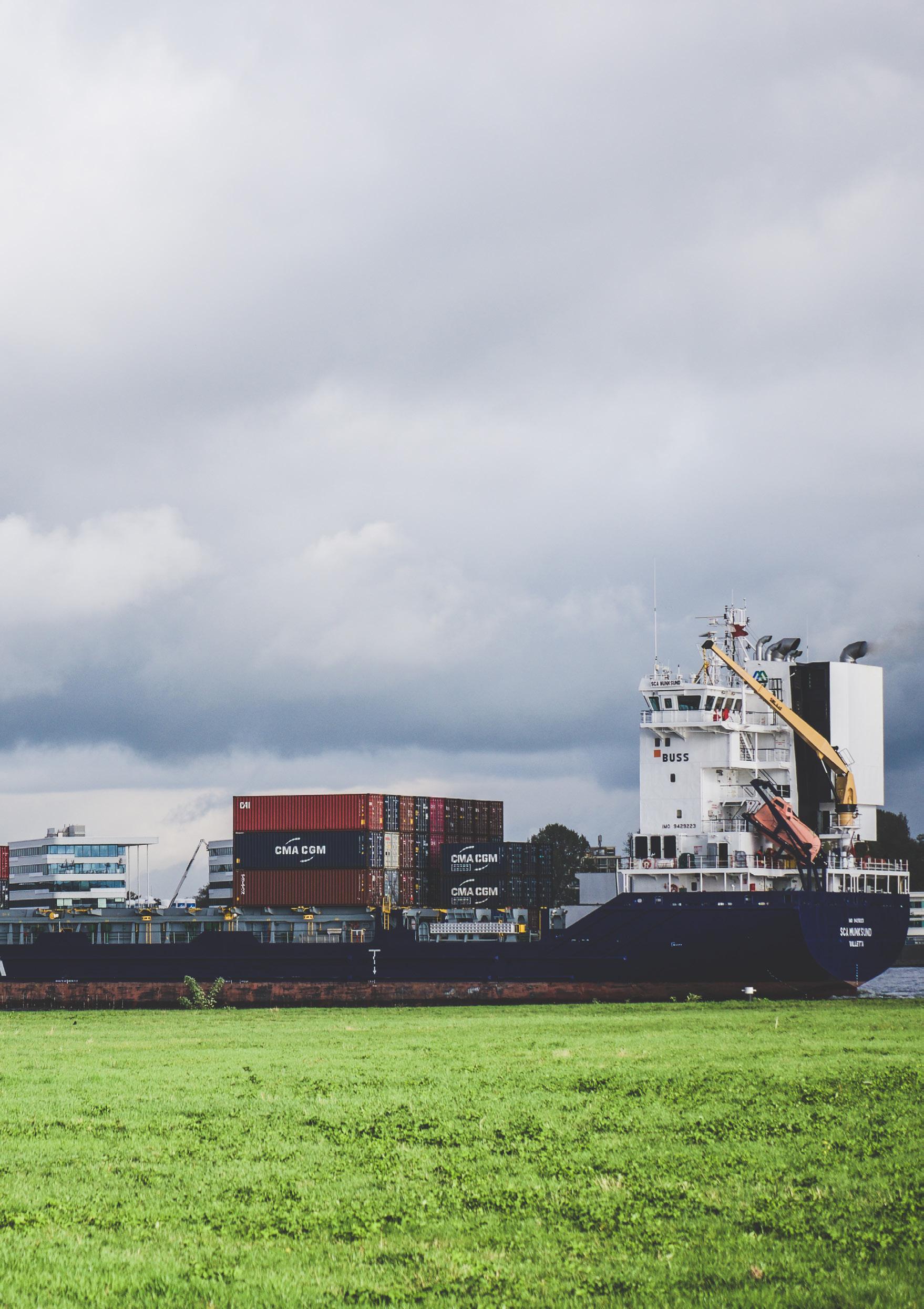
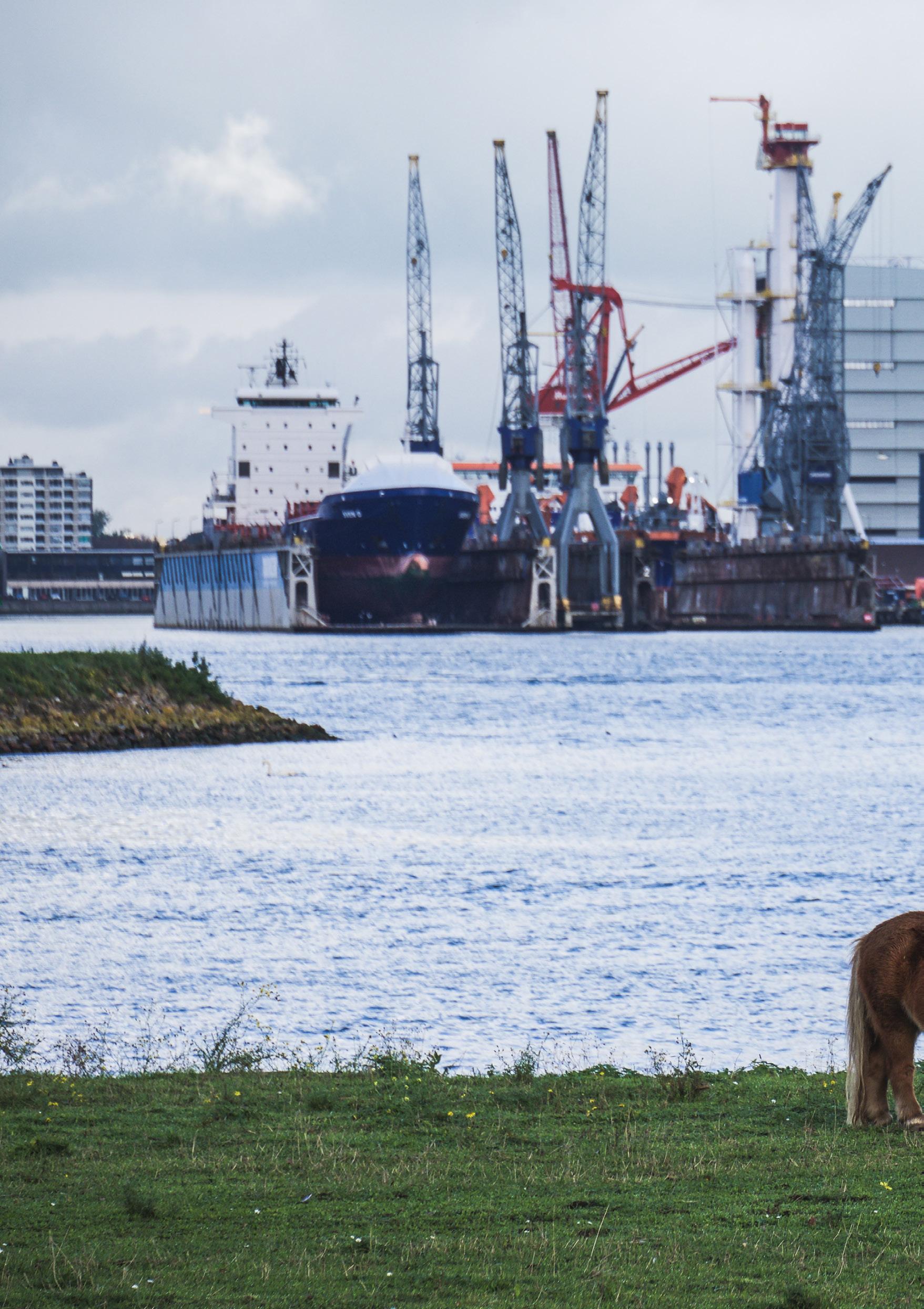
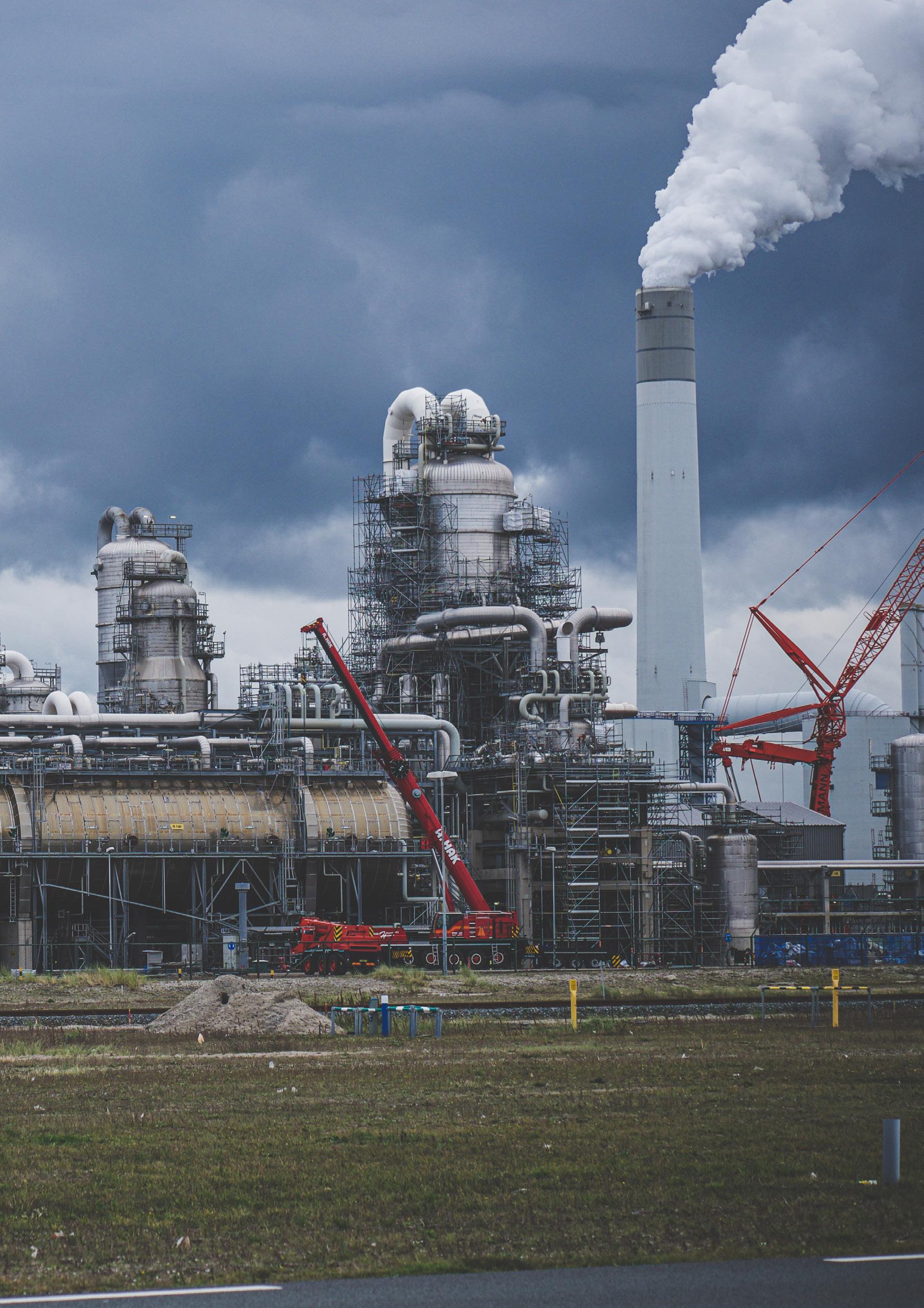
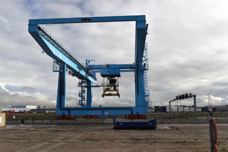
Dutch Waterways, Europoort, Rotterdam. October 2019, Mohammad Talha Malik.
This catalogue is part of a collection published by the Edinburgh School of Architecture and Landscape Architecture (ESALA), Edinburgh College of Art, University of Edinburgh. It documents student design work produced in the Master of Architecture (MArch) programme in 2019-20. Each catalogue describes one of the following five design studios in the MArch programme. The full collection is available to view online at issuu.com/eca.march.
Catalogues 2019-20: City Fragments: Neapolitan Porosities. Ecstatic Objects: Santiago de Compostela. Fire-Space: London.
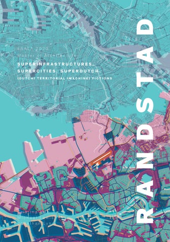
island territories vi: MANHATTAN scapeland Superinfrastructures.Supercities.SuperDutch:[Dutch] Territorial[Machine]Fictions.
COVID-19
During the final weeks of the academic year, the work of the MArch programme was interrupted by the Covid-19 pandemic. University buildings were closed, and staff and students were required to work remotely, maintaining contact and sharing work via digital means. The work presented through the 2019-20 MArch catalogues is therefore testament to the continued invention and resilience of the student body and commitment of the MArch programme staff.
First published in 2020, eBook published in 2024. Published by The University of Edinburgh, under the Creative Commons
Attribution Non-Commercial Non-Derivative 4.0 International License (CC BY-NC-ND 4.0). .
Nan, Cristina. Superinfrastructures.Supercities.SuperDutch: [Dutch]Territorial[Machine]Fictions. Edinburgh: University of Edinburgh, 2020.
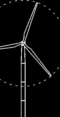
Wind Farm, Europoort, Rotterdam. October 2019, Mohammad Talha Malik
SUPERINFRASTRUCTURES. SUPERCITIES. SUPERDUTCH.
[RANDSTAD/ NETHERLANDS]
“The essence of technology is by no means anything technological.”
— Martin Heidegger
Hyper-consumerism and hyper-connectivity, both of which serve as framework for this studio, are two defying traits and pillars of today’s global society, all fuelled by rapid technological advancement. Constant technological ‘update’, intrinsically linked to the cloud, facilitates the progressive digitalisation of the everyday — from living, working and mobility to production and consumption. Here automation, the strategic removal of human support, and as Young points out, is one of the key forces currently shaping our material environment and immaterial ecologies. For technology and the digital to operate, function and perform as a massive globally coordinated network, a vast physical infrastructure is required, often neglected by architects and the public alike.
Initially positioned in remote locations or the countryside, more recently these super-infrastructures are migrating closer to urban centres, yet only exist at the periphery of our perception and awareness. This studio focuses on the ignored super-infrastructures that underly hyper-consumerism and hyper-digitalisation: data centres, server farms and tech enclaves, super-warehouses and super-factories, drone hubs, ports and distribution centres, and any other typologies related to digital, ICT and logistical infrastructures. We and our students explore these infrastructures, ‘the
functioning and derelict ‘backstage’ machinery of globalised urban life’1, within the boundaries of Randstad, in the context of the Netherlands. Randstad, defined as megapolis, mega-region or supercity, comprises a number of cities, amongst which Amsterdam, Rotterdam, Den Haag, Utrecht, Delft and Haarlem, all arranged around Groene Hart, an area designed as a green buffer zone between the above listed, expanding urban nodes, dedicated mostly to agriculture and leisure.
ANATOMY OF INFRASTRUCTURE
“Contemporary infrastructure is not typically understood as being multifaceted or narrative based, characteristics we have come to ascribe to architecture. Rather, today’s infrastructural space is utilitarian and driven by data, designed and built by engineers. It is not scaled to the human body per se, but exists instead at the scale of landscape, machines, global supply chains and logistics. It has no aesthetic or epistemological agenda - at least not intentionally. It just works.”2
The strict delimitation between infrastructure and architecture may need to be re-evaluated and updated. In the face of global warming, population growth, declining natural resources, housing shortage, deteriorating urban spaces, and an advancing energy crisis, it is pertinent to look at infrastructure also as architecture. The studio is interested in exploring transformed understanding of super-infrastructures within an urban context, as Patrik Schumacher states: ‘All engineering design is process and machine design judged by criteria of technical functionality, whereas all architectural design is communication design judged by criteria of social functionality.’
Due to its vast territorial footprint and thus the large encapsulated spaces, the consumed and released energy and its logistical relevance, today’s infrastructure has decisive impact on the landscape, the neighbouring urban, the local and global energy landscapes as well as urban climate. The Netherlands, and in particular Randstad, can be read as an agglomeration of infrastructural nodes, machine landscapes, transition zones between the urban and the modern countryside, the contemporary rural, all dispersed
1 Graham, Stephen. Vertical: The City from Satellites to Bunkers. London; Brooklyn, NY: Verso, 2016, p. 362.
2 Young, Liam, Cathryn Dwyre, Chris Perry, David Salomon, and Kathy Velikov. “Ambiguous Territory Design for a World Estranged.” Architectural Design 89, no. 1 (2019): 136-141.
on an artificial landscape, recuperated from the sea, undergoing continuous transformation, through excavators and market forces alike.
In order to formulate adequate strategic and architectural proposals which can address these challenges, the first semester of the studio focuses on a set of investigations across different scales, magnitudes and contexts: global— national—regional—local and dimensions: terrestrial—subterranean— marine—arial. Operating within the context of hyper-consumerism and hyper-digitalisation, this investigative phase concentrates on three themes of logistical infrastructures, mobility —of humans, goods and data, and energy landscapes.
Through various methods, we analyse the relationship between urban, operational and infrastructural landscapes, historic development of Dutch territory, landscape —logistical and infrastructural— and associated socioeconomic dynamics and the global relevance of Randstad as tech centre and infrastructural node. Interdependencies between technology, informationcommunication technology, operational landscapes, urban clustering and logistical infrastructures are studied, uncovering specific flows, connections and tensions. Existing and emerging architectural typologies —such as ports and container terminals, airports and drone hubs, data centres, superfactories or super-warehouses, distribution centres etc.— are analysed and subjected to comparative studies within a local but also global context: LAX and Schipol, Ashburn, AEX and NoordVliet Complex etc. Most probably some of these acronyms and names will not resonate with the reader, an indication of a symptomatically generalised lack of knowledge and awareness, amongst any type of public, in terms of global key infrastructures. In this investigative phase students work in groups to develop, through quantitative and qualitative analysis, typological investigations and 4D cartographies. The outputs construct an ‘alter-urbanisation strategy’ —a term used by Neil Brenner to describe urbanisation strategies which are not dictated alone by political and economical considerations— with speculative elements about urban mobility and energy landscapes.
Rotterdam Streetscape, Rotterdam. October 2019, Mohammad Talha Malik
SCRIPTING ARCHITECTURE
“Form follows fiction.“
— Bernard Tschumi
Whereas the first semester results in a small spatial intervention, the second semester focuses on the advancement of this spatial intervention to the development of an independent programmatic formulation for new hybridised architectural typologies, capable of offering an answer to the challenges of the densified, expanding megacity, on the verge of collision with also expanding operational landscapes. The scenario from the previous semester serves as a framework, the narrative is further refined and the script extended. The exploration of dynamic systems of infrastructure from the previous semester leads to reconsiderations of the relationship between urban and countryside.
“I am arguing here as an architect who regards not the logistical organisation of infrastructures, but the spatial, phenomenological and semiological ordering of social processes via architecture’s communicative capacity as our primary societal task in the current specialisation of disciplinary competencies.”3
Following Schumacher’s statement, the second semester focuses on the reflection of the scenario and script through the architectural proposal, its spatial articulation and spatial intelligence. Concepts of mobility and energy are formulated on an urban level and form an integrated aspect of redefined architectural typologies. Through their projects, our students challenge prevailing typologies, speculate and construct new spatial agglomerations and architectural articulation, reconciling the tension between built infrastructure, operational landscapes and the city or in this case the megacity, maximising human activity zones.
The futuristic, speculative component is crucial in all design proposals. The interest does not lie in the near, immediate future, but rather in a future, projected temporal context, challenging and transforming notions of space, functionality and programme.
3 Schumacher, Patrik. “Don’t Waste Your Time in the Countryside.” Architectural Design 86, no. 4 (2016): 128-33.
FLUID GROUNDNETHERLANDS AS A WATERSCAPE
“The great twentieth-century Dutch masters are not painters or poets but hydraulic engineers and landscape architects.”4
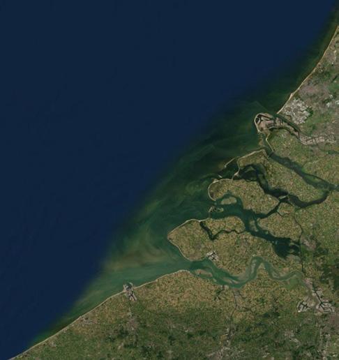
The Netherlands can be considered the land of the water(s). Besides the coastline along the North Sea, its geography is profoundly shaped by the confluence of three main European rivers, the Rhine, the Meuse and the Scheldt, forming the Rhine-Meuse-Scheldt Delta with two of its main ports, Rotterdam and Amsterdam. The Dutch territory represents a unique challenge in term of planning due to its relationship with water, as ‘sixty per cent of the country is vulnerable to flooding and nearly a third of the Netherlands is below sea level’.5 Due to this, the Netherlands have a distinct relationship with water, having a prolonged influence on history, culture and economic development. ‘The polders, lakes, rivers, canals, ditches, dikes, miles, locks, dams, pumping stations and barriers not only determine the identity of the landscapes and cities but also shape the Dutch national identity.’6
The interaction with water and waterscapes, surrounding issues of mobility and overall infrastructural challenges, has profoundly shaped and is still shaping urban and rural development.
Land most often has been conquered from water as a triumph of centuries of hydraulic engineering. An impressive example of this are the Kinderdijk from the 15th century, the Nieuwe Hollandse Waterline defence line as well the modern day Deltawerken and Zuiderzeewerken, hydraulic engineering projects, representing an interlinked series of dams, barriers and other interventions, meant to offer flood protection and for land reuse and reclamation. Other governmental planning strategies include the Maaswerken and the Room for the River planning project. The Netherlands have a world leading role in combining engineering efforts embedding considerations of spatial planning, ecosystems and landscape. Water is
4 Steenhuis, Marinke, and Paul Meurs. Beyond the Dikes : How the Dutch Work with Water. Rotterdam: Nai010 Publishers, 2017, p.14
5 Steenhuis, Marinke, and Paul Meurs. Beyond the Dikes : How the Dutch Work with Water. Rotterdam: Nai010 Publishers, 2017, p.14
6 Steenhuis, Marinke, and Paul Meurs. Beyond the Dikes : How the Dutch Work with Water. Rotterdam: Nai010 Publishers, 2017, p.14
here closely linked to agriculture, transport, trade, the overall economy, recreation and tourism, all on a national scale, yet of international relevance. Thus the exploration of waterways is critical for all studio projects, as a territorial and urban analysis and speculation cannot be undertaken without developing an understanding of manipulation and alteration of water, land, coast and rivers.
CLIMATE CHANGE AND WATER MANAGEMENT
Along the centuries the Netherlands have been affected by a series of catastrophic events such as St. Lucia’s flood in 1287, with more than 50.000 causalities, St. Elizabeth flood in 1421, close to 10.000 casualties, St. Felix’s flood in 1530, Christmas Flood in 1717 and in more recent years the North Sea flood in 1953, extreme rise of water levels in 1993 and 1995. The ’93 and ’95 events lead to the evacuation of 250.000 people.7
The impact of climate change on the Netherlands is immediate and it is self-explanatory that in the age of rapidly rising sea levels and global rising temperatures, the Netherlands and in particular the Randstad region, are particularly sensitive and exposed to climate change impact. Its implications for the super-region are taken into consideration for the development of speculative scenarios, treating it as an imminent design parameter.
Randstad as a supercity is characterised by a variety of different clusters and territorial articulations, so that developed strategies to tackle the challenges of climate change will have to take into account the macro-scale but should be highly differentiated on the micro-scale:
“Climate change is causing more heat stress and heavy downpours in in urban areas; where it is difficult to contain the water and temperatures may be as much as 7 degrees higher than in the surrounding rural area.”8
7 Steenhuis, Marinke, and Paul Meurs. Beyond the Dikes : How the Dutch Work with Water. Rotterdam: Nai010 Publishers, 2017, p.48
8 Steenhuis, Marinke, and Paul Meurs. Beyond the Dikes : How the Dutch Work with Water. Rotterdam: Nai010 Publishers, 2017, p.34-35
NDSM, Amsterdam. October 2019, Cristina Nan
As climate change is accelerating also technology is changing at a fast pace. One should not fall into the trap of technofetischism, following the simplistic logic of slogans such as ‘technology will eventually fix it, therefor we can continue to abuse environment’, but take into consideration the emergence of new technologies, in particular focussing on energy use optimisation and water management, and incorporate these in design proposals. The change and advancement in technology reflects also in the way the Dutch have made use of it to react to rising water levels, flooding and storms. With today’s rapid change in technology, we can only anticipate significant alterations in the way we work with nature and landscape to react to climate change and its correlated challenges.
BETWEEN INFRASTRUCTURE AND ARCHITECTURE
“All engineering design is process and machine design judged by criteria of technical functionality, whereas all architectural design is communication design judged by criteria of social functionality.”9
“I am arguing here as an architect who regards not the logistical organisation of infrastructures, but the spatial, phenomenological and semiological ordering of social processes via architecture’s communicative capacity as our primary societal task in the current specialisation of disciplinary competencies.”10
Infrastructure just works. It has to work and this is its primary evaluation criteria. When infrastructure fails to works the ramifications can be devastating at a far greater level than the failing of architecture or structure. Infrastructure accommodates primarily machines and machine processes. Architecture accommodates primarily humans and human activities. These are fundamentally different starting points in which architecture is first and foremost a mechanism of communication. Engineers deal with infrastructure and architects — traditionally in collaboration with many specialists— with buildings and spatial strategies. Obviously these statements are intentionally simplified, but they do expose the genetic
9 Schumacher, Patrik. “Don’t Waste Your Time in the Countryside.” Architectural Design 86, no. 4 (2016): 128-33.
10 Schumacher, Patrik. “Don’t Waste Your Time in the Countryside.” Architectural Design 86, no. 4 (2016): 128-33.
difference between the two.
Infrastructure has always operated at a different scale compared to the building; today in the light of a globalised world, it operates on a far bigger scale than architecture ever could; its operational mode is national, trans-national and global, occasionally even stellar — think of the on the ground infrastructure necessary to operate satellites, space stations and to guarantee the efficient functioning of our mobile phones with all their correlated apps. The footprint of infrastructure is continuously growing, as the magnitude of the tackled forces also grows.
“It also helps to expose both the functioning and derelict ‘backstage’ machinery of globalised urban life — the dank conduits and caves established over centuries for moving data, water, people, energy and waste — that tend to remain hidden in the interstices and backgrounds of the city.”11
The studio pushes students to explore this ‘backstage machinery of globalised urban life’ within the framework of Randstad. They are encouraged to form an argument which tackles the differentiation between infrastructure and architecture through a self-developed spatial vocabulary as well as spatial strategy.
Despite infrastructure predominantly not being designed to accommodate an architectural narrative, one can still distinguish a specific aesthetic of the morphology, as Andrew Blum notices in relationship to Amsterdam’s Internet Exchange point:
“Architecture expresses ideas, even when architects aren’t involved. What was the physical infrastructure of Amsterdam’s internet saying?”12
Depending on the individually selected infrastructure, students ask the same question to then be able to define their specific spatial communication through the addition of individually developed interventions.
The identified superinfrastructures, which operate under the paradigm of efficiency, optimisation and hyper-functionality and follow rigid spatial
11 Graham, Stephen. Vertical: The City from Satellites to Bunkers. London; Brooklyn, NY: Verso, 2016, p. 362.
12 Blum, Andrew. Tubes: Behind the Scenes at the Internet. London: Viking, 2012, p. 150.
laws, undergo a transformative process through the individual spatial addition, developed throughout this one year research. In relationship to the student’s speculative scenario and their script, these spatial hacks differentiate themselves clearly from the selected superinfrastructure, by demonstrating well curated protocols of action and function, a distinct spatial strategy as well as a communicative capacity, as Schumacher formulates it.
Technology has a direct impact on how we perceive spaces, urban or otherwise. Your smartphone is as much part of the urban and the way you experience the built environment as are buildings. By changing the conventional, physical map for Google Maps or by making use of Uber instead of chasing a cab directly in the street, the way you perceive and interact with urban space and at a larger level, urbanity itself, changes radically. Behavioural protocols change due to and through technology. The script of how we interact with the city is rewritten with the appeareance of new apps and ‘radical technologies’. Sitting in a driverless car is altogether a different spatial experience than driving yourself. Technology not only impacts space, but can inherently define your spatial pereception.
Onboard with Lidar Scanner and 360 camera, Europoort, Rotterdam. October 2019, Cristina Nan
“With the Internet and mobile phones, we can continue our work and the conflicts in our relationships even at the beach, dragging our entire everyday existence along with us wherever we go. Space shrinks, distances no longer have the same meaning that they had 20 years ago, and different life worlds begin to merge. It is thus an essential part of the urban experience that is made evident in this scene.”13
While developing their scripts and spatial narratives, students are inviting you to include in their considerations the ‘space-making’ ability of [radical] technologies and to challenge existing paradigms and conventions.
13 Schmid, Christian. Traveling Warrior and Complete Urbanization in Switzerland: Landscape as Lived Space. In: Brenner, Neil. Implosions/explosions : Towards a Study of Planetary Urbanization. Berlin: Jovis, 2014, p. 98.
Cristina Nan
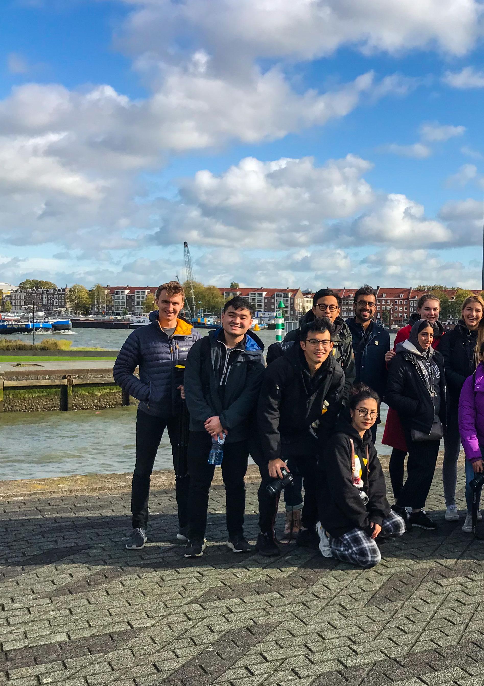
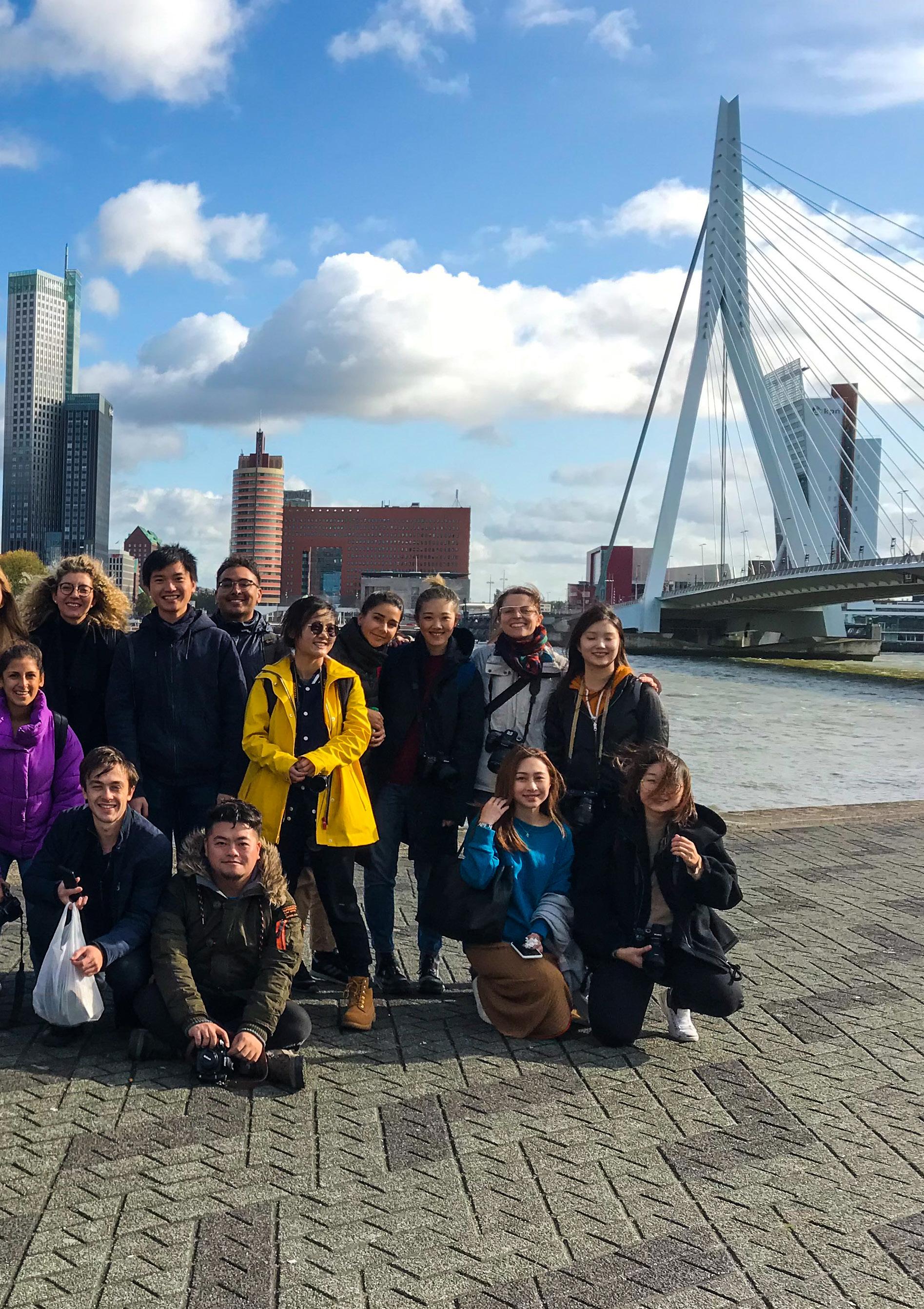
Erasmus Bridge Group Shot [MIA Hersch Reddy], Rotterdam. October 2019, Cristina Nan
AMSTERDAM CENTRAAL
CYCLED WESTPORT 01 a
CRYSTAL JIN
Electrical and electronic products are defined as any item with circuitry, or electrical components with power or battery supply. This includes products from basic kitchen appliances to computers to mobile phones. Electronic waste (e-waste) is a term used for all types of electrical products, that have been discarded as waste without the intention of reuse. The exponentially growing amount of e-waste generated per year has become a significant problem across the world.
Since the studio brief is based in the Netherlands, one of the most sustainable countries in the world, my research focuses on its waste management system, typically e-waste, investigating logistics and industrial processing of the waste across the country, in particular, its capital, Amsterdam.
Having insight into the future, I propose a new mindset for the citizens— incorporating the decommissioning and recycling of e-components as part of their daily routine. On a basis of this foreseen scenario, my architecture aims on designing an interactive e-waste processing site, that celebrates the circular economy of e-waste, by introducing commercial entertainment programs— robot fighting arena and electronic exchanging market, as well as a research facility— robotic lab, into an existing industrial site at the outskirts of Amsterdam.
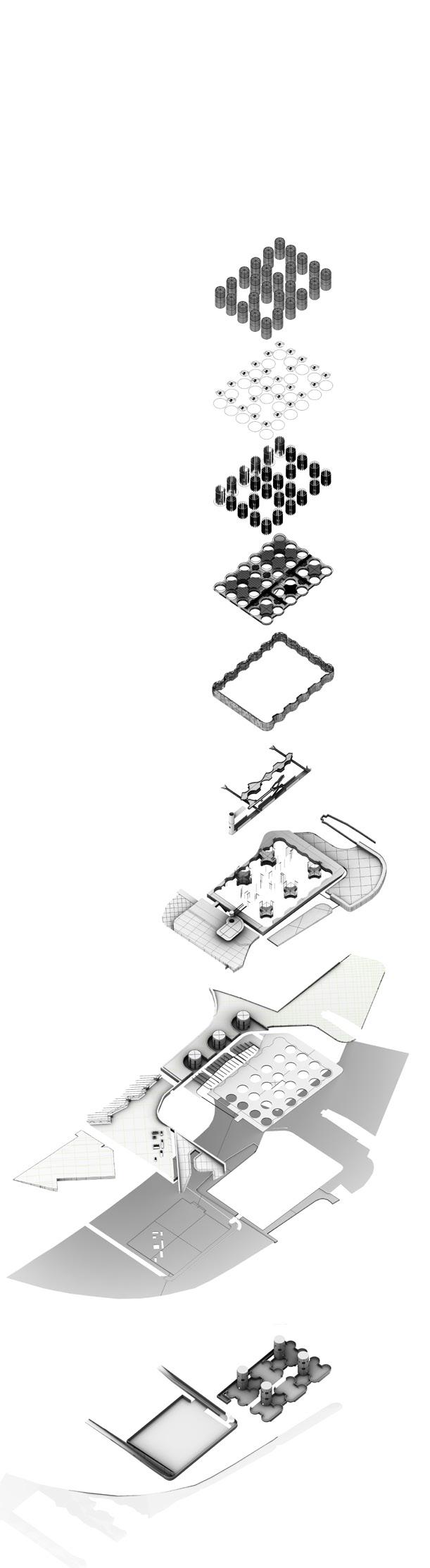
CRYSTAL
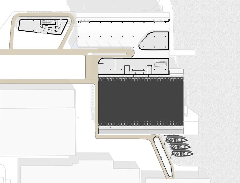
Site Plan (adjacent top)
Internal Circulatory Pathway (adjacent)
Inhabited Sections (above)
ON THE LAST MILE HOME:
GROCERY TRANSIT STATION [JORDAAN]
KELLY LAI
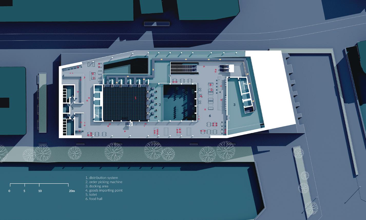
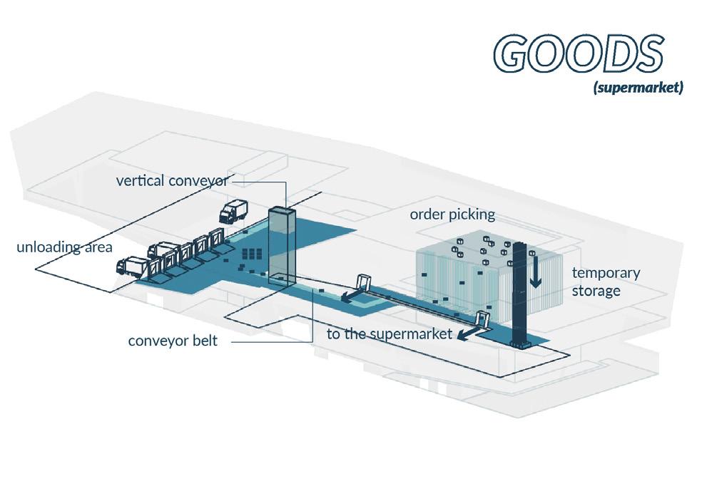
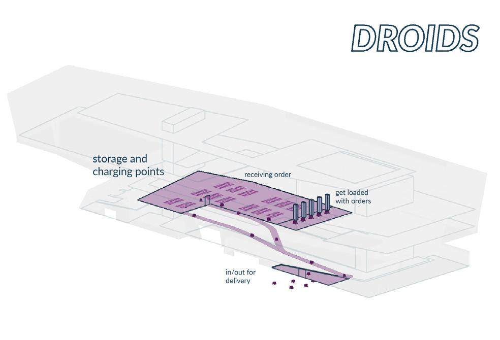
Intentding to increase quality of life in the urban area, Amsterdam city centre will undergo full pedestrianisation, with the only exception of public transport routes. No-cars zones are set up to stop vehicles from getting into the neighbourhoods. Under the framework of park-and-ride systems, transit stations will become a critical infrastructure which ensures efficient and convenient transportation, especially for food deliveries, such as groceries. The process of centralising and (re-)distributing goods will happen here. It is facilitated by an automatized distribution system using autonomous delivery droids which relieve the ‘last mile burden’ of the grocery supply chain.
With the increase of online shopping and the change in freight transportation, physical markets are going to be significantly reduced in their number and size. Considering though their social and commercial values for communities, markets will be retained through the incorporation into the transit station. The design intends to combine activities of both autonomous machines and humans. Human activity patterns are brought to the heart of this industrial landscape. The building typology of the transit station would become an essential infrastructure contributing to our daily life, community and sustainability of urban districts.
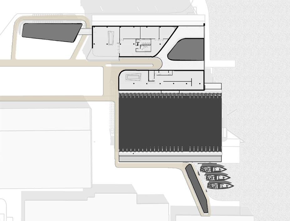
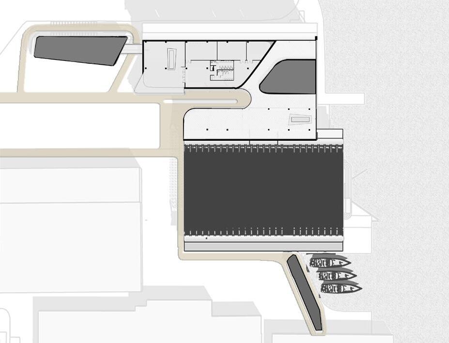
Rendering Showing the Hybrid Function (adjacent, top)
Section Drawing (adjacent, middle)
Second Floor Plan (adjacent, bottom)
Circulation Systems for the Three Characters (above)
KELLY
01 C
URBAN AERIAL TERRITORIES
AMSTERDAM CENTRAAL
ARNOLD POON
This project is looking at emerging urban mobility concepts. The developed transporttation strategy aims to provide a faster alternative to go across the IJ river and eases off the high traffic volume during peak hours. The IJ river separates Amsterdam Noord from the rest of the city. The existing means of transportation to travel across the water is the IJ Ferry service. However, the ferry service will soon reach its max capacity and may no longer handle the high volume of travellers and is also limited in its flexibility.
While the development of air travel, such as VTOL and jetpack, is getting mature, this project uses the waterscape of Amsterdam and turning it into a highway for Jetpack flyers. The jetpack is seen here as a normalised transport and mobility device of our urban futures.
Amsterdam Centraal is a transportation hub with a major train station, a bus terminal, and a few ferry hop-ons. I propose to build a jetpack station at the waterfront outside Amsterdam Centraal to circulate and divert the traffic away from Centraal. The council has proposed a waterfront square for recreational purpose, hence, a leisure area/ green space, was added into the design.
d
UNKNOWN TERRITORIES
AMSTERDAM
HARRY EDDOLLS
Water in the Netherlands is of historical and cultural importance, it is a space that has progressed the Netherlands to become the nation which it is today, a nation that can control both land and water. Waterways perform in their function of transporting goods and supplies across the country and deeper inland, but this comes at a cost, one that is hidden. The canals and bodies of water cut and divide the nation and the people, creating a disjoint in their society, they both rely on the waterways, which are physical barriers splicing the communities.
With modern technological advances there is opportunity to remove these barriers, once again taking over the water connecting the nation. Autonomy allows for a mass of autonomous watercraft that can act in ways that allow people onto the waterways and navigate the ships that transport the goods. Production of these crafts gives rise to the architecture that enables progression. Centred in one of the most water divided cities, Amsterdam, is a production, testing and exhibition space. One that exemplifies the Dutch mastery of water and the continued development of this. A space that creates the watercraft that can unify the nation.
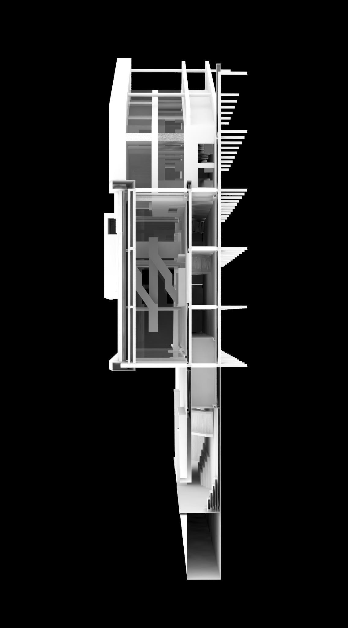
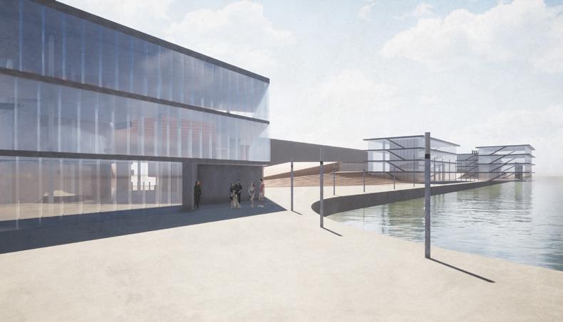
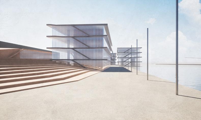
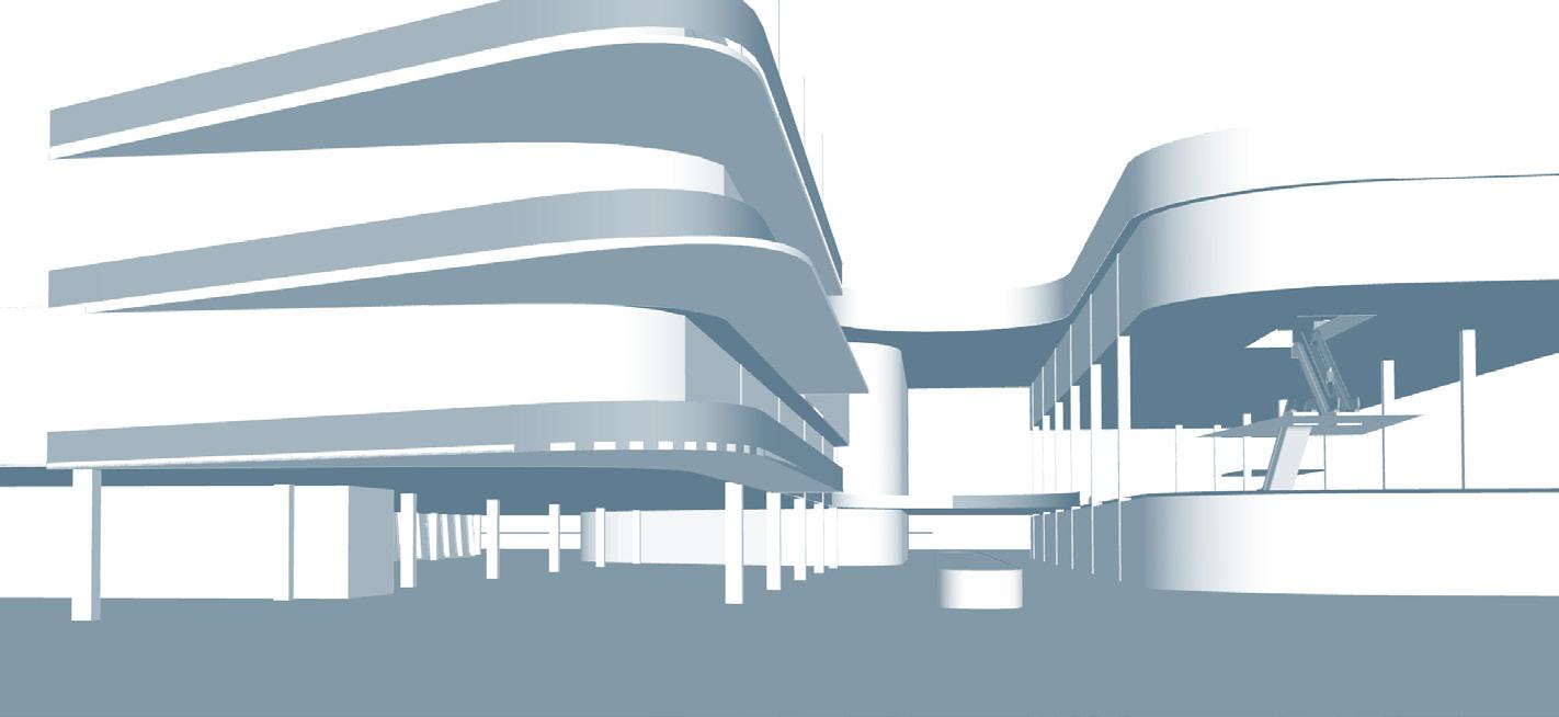
Exterior Approach (top) Full Axonometric (above)
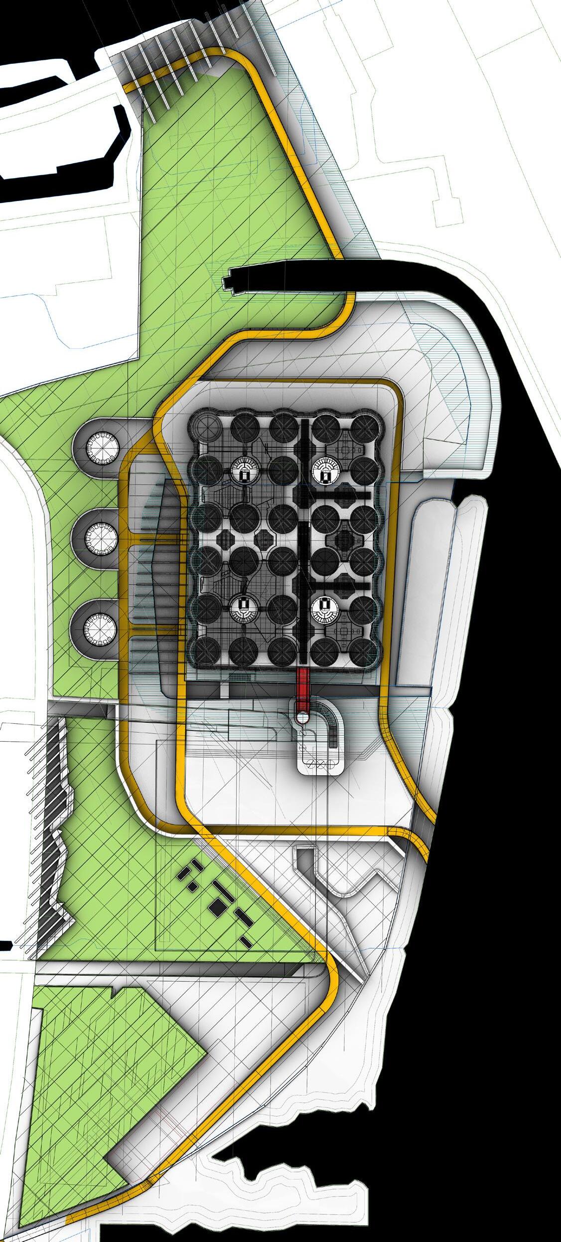
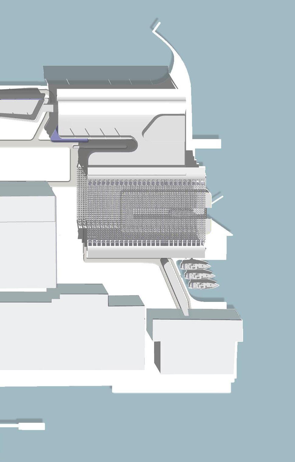
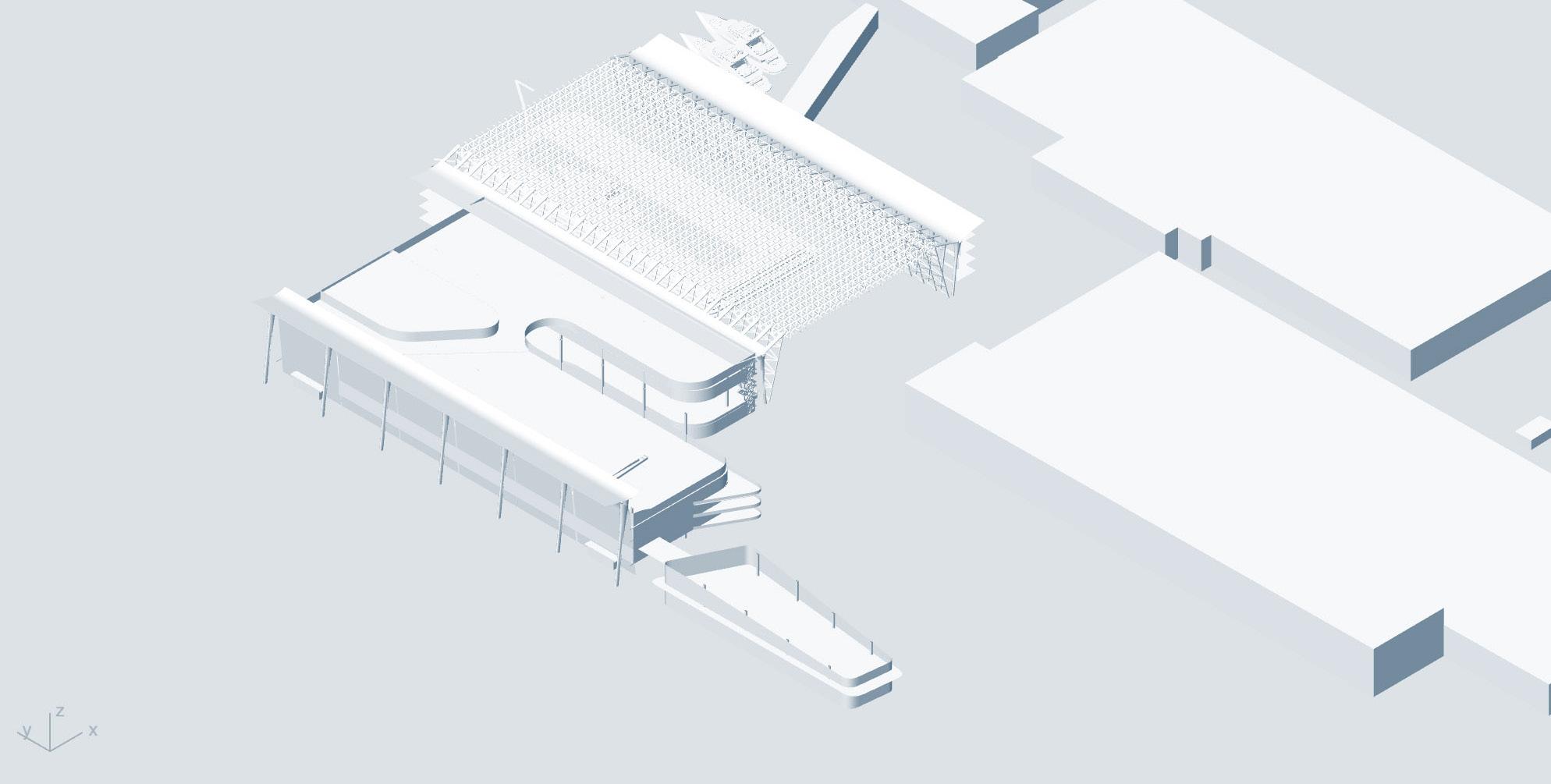
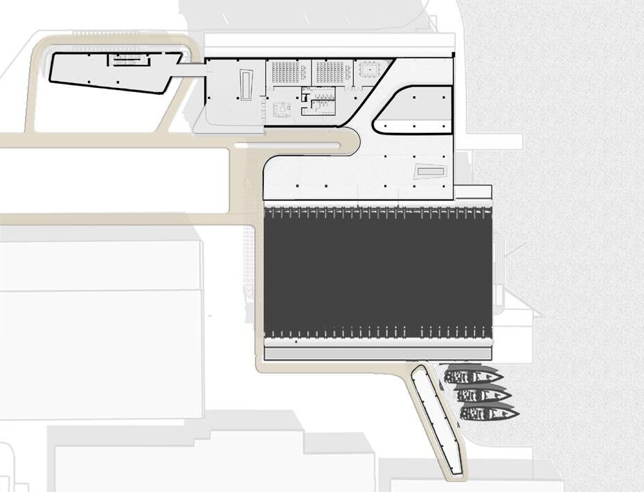
Port of Rotterdam with Plan (adjacent) Plans (above, top) Perspective Views (above, bottom)
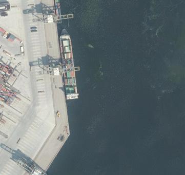
Cargo Ship, Europoort, Rotterdam. October 2019, Fritz Holtgrewe.
02 a
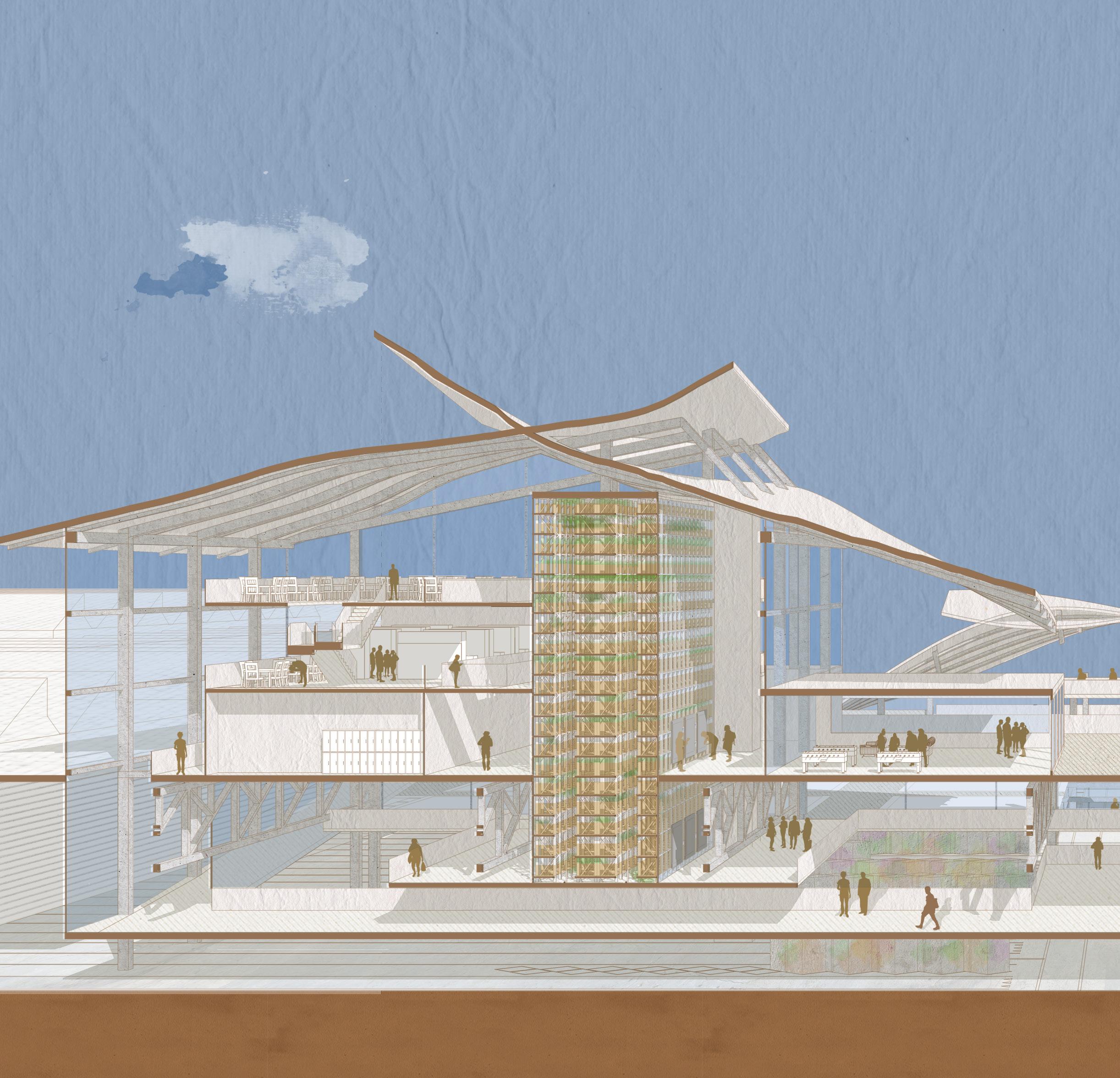
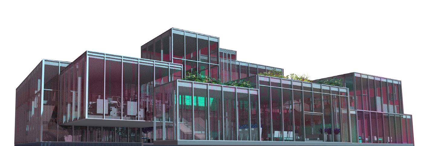
THE SPONGE HABITAT
AMSTERDAM SCIENCE PARK
VLAD BUCSOIU
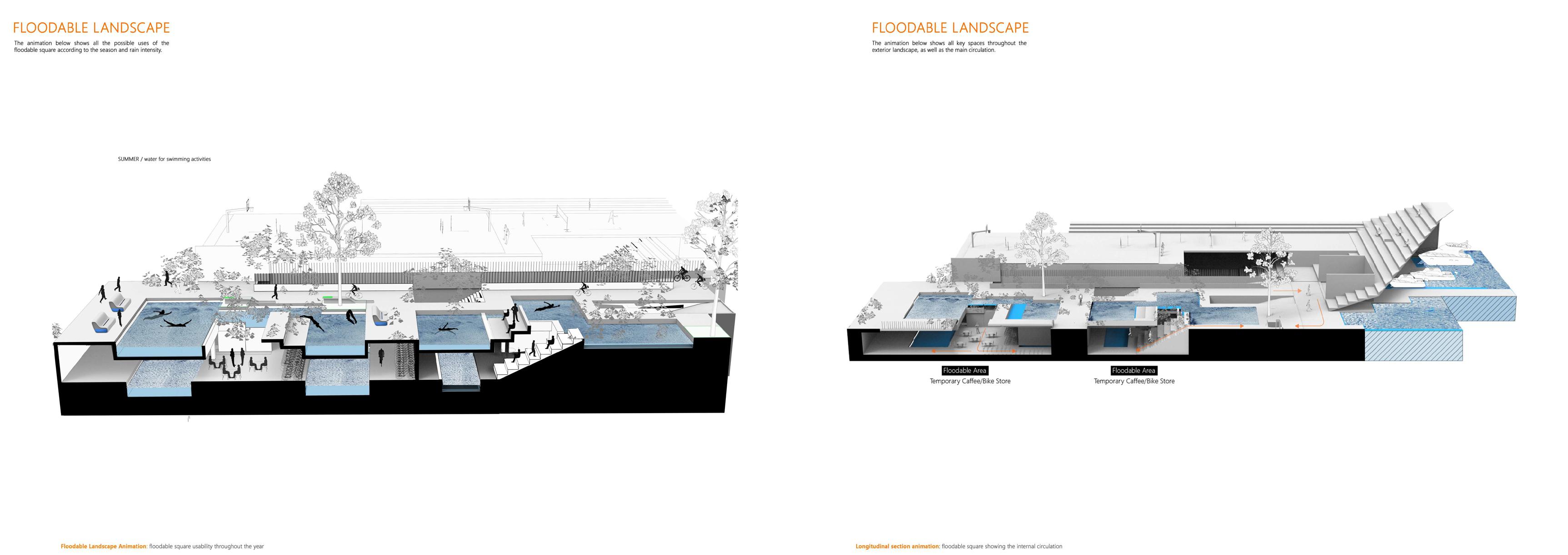
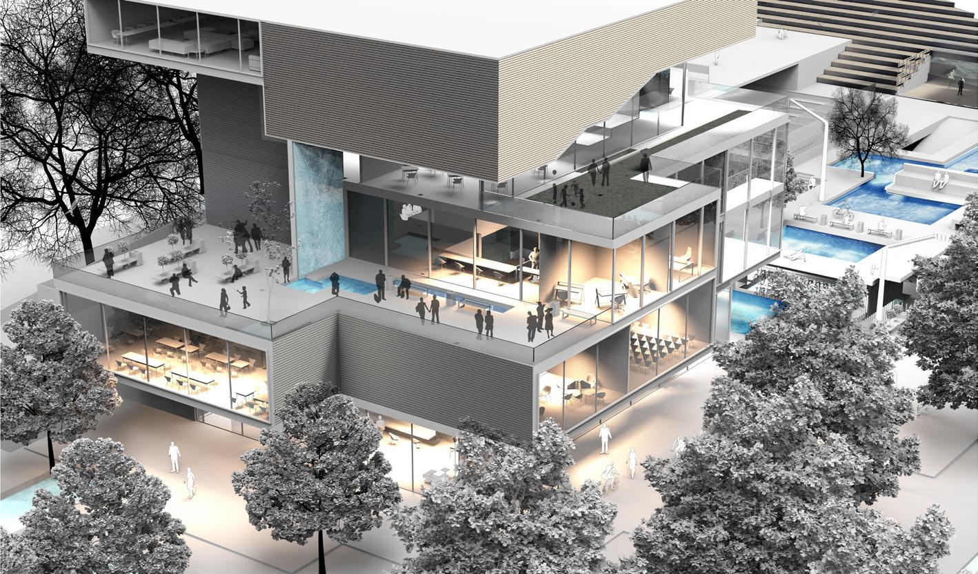
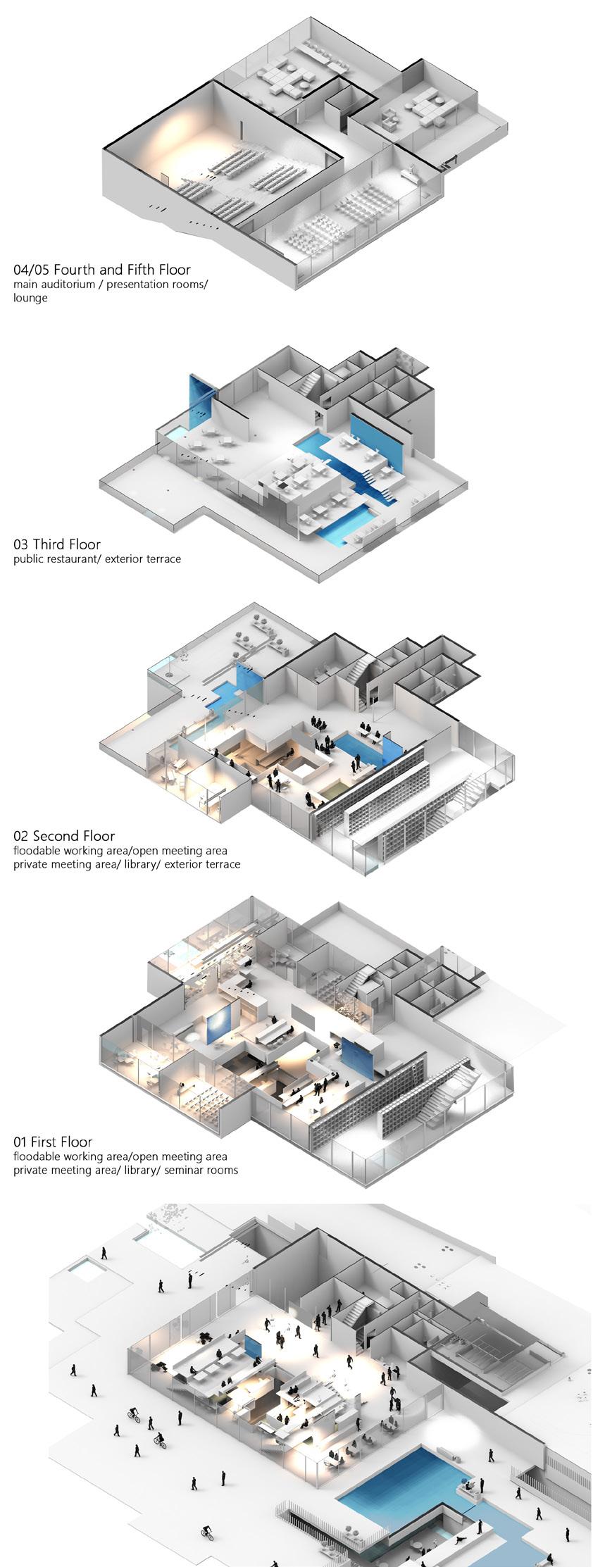
‘When rain falls in most of our concrete-lined cities, at best, we are left with a soggy urban landscape, dotted with flooded patches and the occasional impromptu stream. Yet, what if we could design rainfall into our public spaces?’ (Perry, 2016). What if sport pitches, public areas, or even study spaces could be transformed into picturesque water ponds when it rains?
As rain intensities are expected to increase between two and four times by 2040, the scheme predicts the future scenario in which the combination of urban flooding and digital infrastructure will become an alternative source of heating for the city of Amsterdam, which includes many areas predictable to flooding and a high number of datacentres. The proposed hybrid includes activities such as: education and research, public spaces, catering, offices, leisure and sports, while creating a new cultural hub of the city. At the same time, all the spaces mentioned above include floodable basins which accumulate rainwater and combine it with the heat received from the adjacent datacentre. This becomes a sponge habitat which accumulates rainwater, mitigate urban flooding and creates a link between infrastructure and community.
Overall, the proposal creates a vibrant collaborative working environment, but it is also dedicated to increase the ‘sponge effect’ of the area. It is a part of the city-wide plan to create ‘climate-resilient neighbourhoods’ in anticipation of more rainfall.
Aerial Perspective (adjacent, top)
Boat Terminal Perspective (adjacent, middle)
South East Section (adjacent, bottom)
Exploded Axonometric of Interiors (above)
02 b
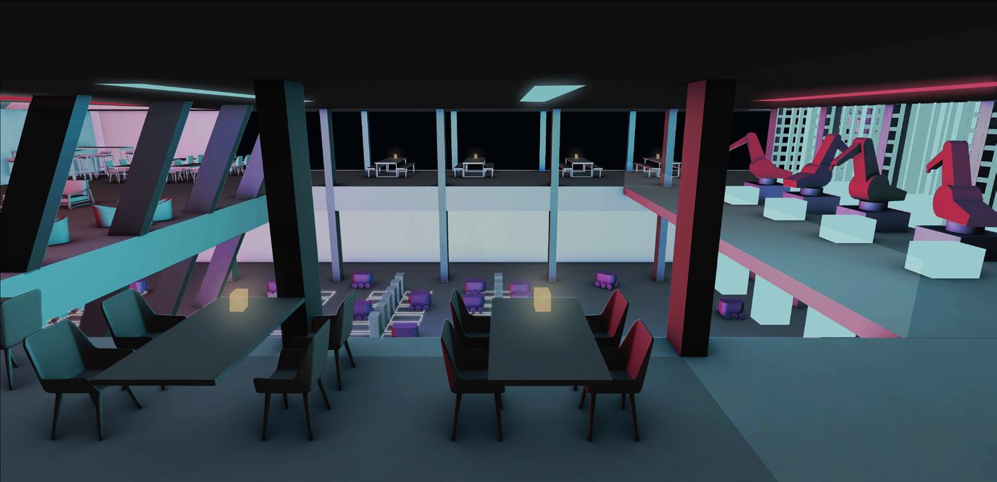
DATA-CARTELS
AMSTERDAM SCIENCE PARK
HERSCH REDDY
In an increasingly data hungry world, the demand for data centres is at an all time high. Data centres get larger, consume more power and become more and more efficient to keep up with demand. Companies need to deploy data centres closer to urban areas to reduce latency, in-turn enabling more complex mobile communications for AI and IOT which drives companies to build data centres around the periphery of urban areas. Amsterdam is a very data centres dense city for many reasons with clusters of data centres around the outer edges of the city. These vast industrial buildings are human exclusion zones.
Simultaneously there exists are in the sale of cannabis in the Netherlands, it is not legal to grow it but it is to sell it. Amsterdam is a hotspot for what are called ‘coffee shops’, where people can consume cannabis. There are around 550 in the city, all of whom resort to criminal supply chains for cannabis - which is dangerous for a lot of different reasons. The government is now looking to companies to grow and sell cannabis so they have control over quality and quantity of cannabis produced and sold - which will completely legalise it, allowing for safer consumption and reduces dependency on ‘cannabis cartels’ in the country.
My proposal seeks to combine the functions of a data centre, cannabis farm and the existing program of the site. The waste heat produced by the data centre allows for a greenhouse like environment to grow cannabis. It creates a place for people to witness production of cannabis and the processing of data as well as a place to consume cannabis, to bring people into the extra-urban.
Hybrid cannabis + server rack (above, left)
Rack Hub (above, right)
Site Isometric (adjacent, top)
Short section (below)
02 C
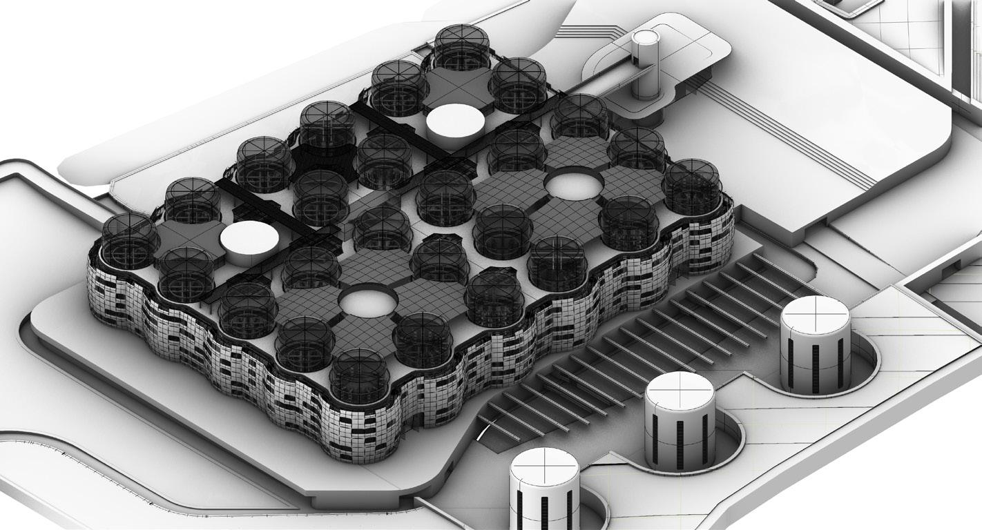
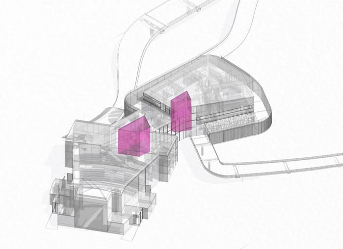
SUPERZUIDAS
AMSTERDAM ZUID
AZMINA GULAMHUSEIN
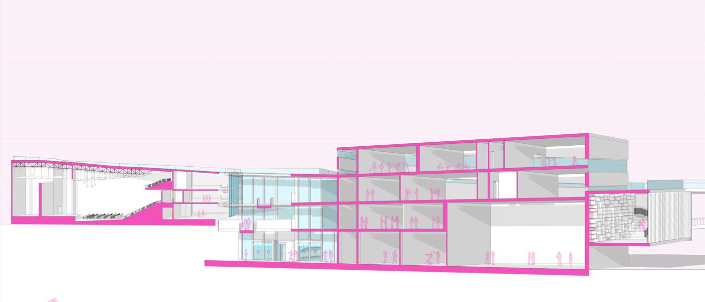
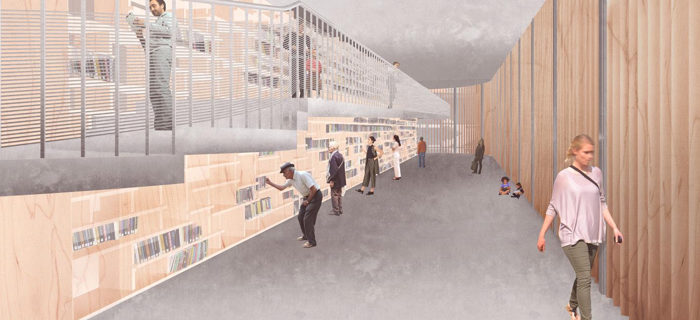
Within Amsterdam, the area of Zuidas, is considered to be the city’s financial district and business centre which has undergone a rapid growth during the last decade.
From an architectural point of view, it can be seen as a conglomerate of medium sized, office towers, all arranged around the metro station and A10 highway, two key nodes of the mobility and transport system of Amsterdam.
This project analyses the specific spatial characteristics of this district, the financial economic parameters, with local, regional and global contexts, focusing on a strategy of implementing non-standard functions and architectural typologies, within this district.
Due to an almost exclusively business related occupancy, Zuidas presents itself after work hours as a ‘dead’ city area. Strategies of mobility are also at the core of this research, trying to determine a large-scale urban strategy of spatially weaving together business, finance, start-ups, leisure and arts, in order to obtain a balance across the accommodated functions. A pedestrian bridge links together the divided district, extending from Beatrix Park in the North-east, to my chosen site in the South-west. On this site sits the developed architecture, a hybridisation of theatre, arts school and library spaces.
Series of Diagramatic Isometrics (above)
Perspective Section (adjacent, top)
Perspective: Library | Entry (adjacent, middle and bottom)
02 d
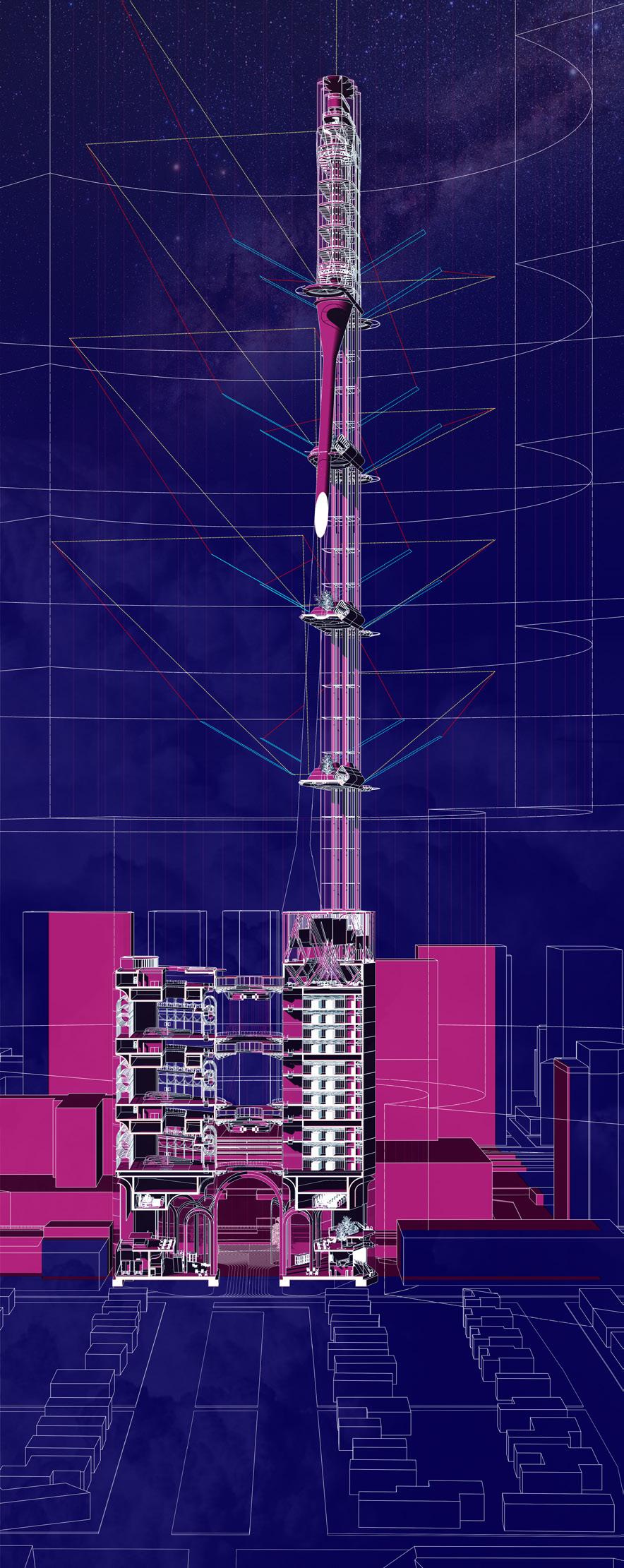
SUPER VERTICAL
AMSTERDAM ZUID
MOHAMMAD TALHA MALIK
The democratisation of the Airspace as an operational landscape is something that is already occurring, with companies like Amazon and Uber heavily investing in speculative technologies to help access this free “real estate” of the ‘air-scape’. This airspace is already an operational landscape that is controlled, especially in the Netherlands.
This project explores how these radical technologies will be integrated into the existing matrix of society as a platform for intercity transportation as an addition to established methods, not to replace but to supplement the existing transportation infrastructure.
The vertical as a landscape has not been explored as much as the horizontal therefore this project looks to explore the vertical infrastructure of the airspace and how the urban can influence the airspace around it.
How can a tower exude an infrastructural space around it in a human way to include humans and not create human exclusion zones like airports?
How can we explore the SUPER VERTICAL to create a vertical transportation node in the urban development of a city and how does this transportation infrastructure look in the future?
Urban Hierarchies, Europoort, Rotterdam. October 2019, Fritz Holtgrewe.
A[ALSMEE]R: AUGMENTED CURIOSITIES
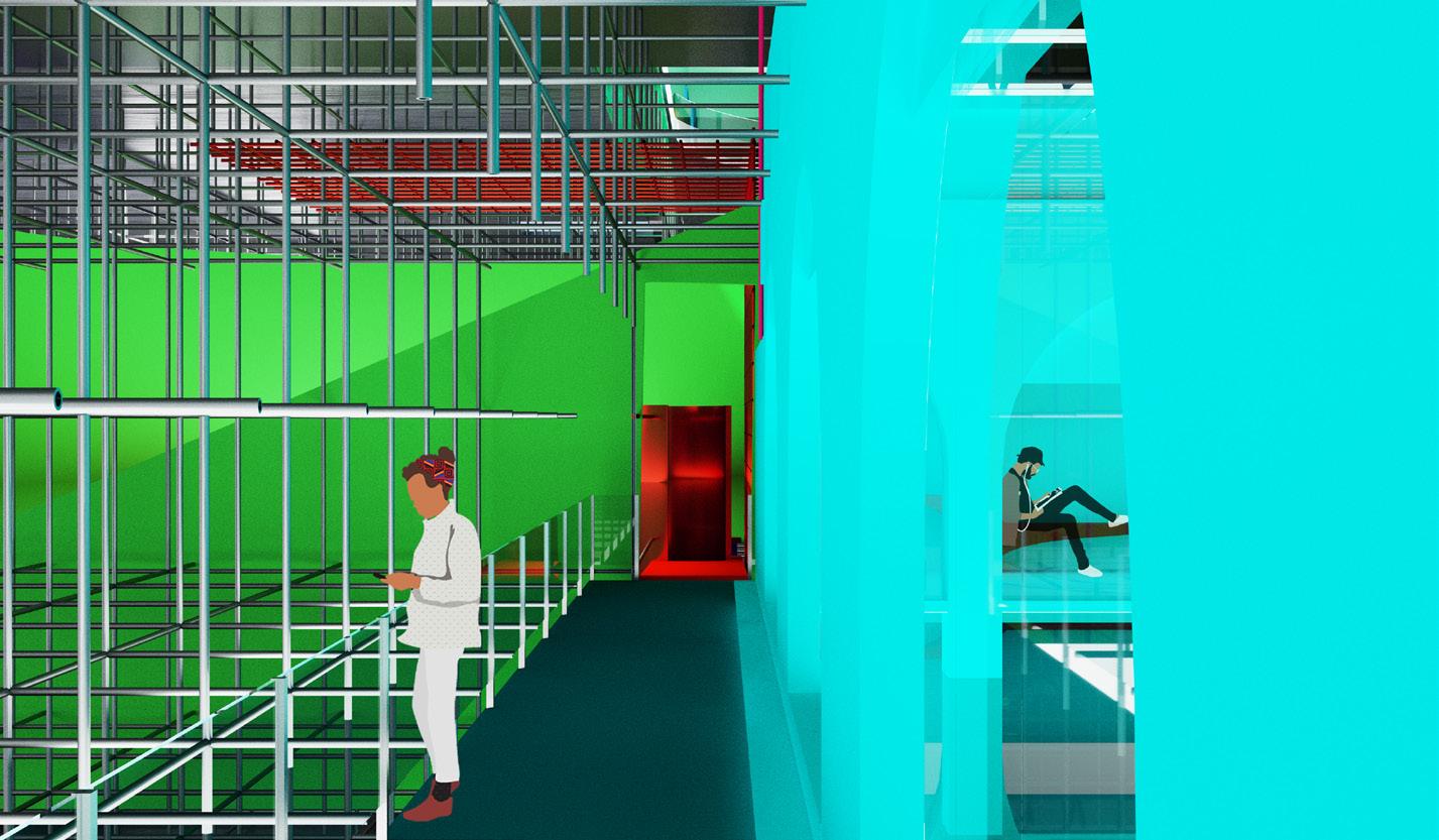
The year is 2060, Aalsmeer Flower Auction rapidly became a distribution hub for mainland European flowers after the introduction of augmented reality (AR) and virtual reality (VR) which bolstered the decentralisation of the workplace. Fewer shipments arrive via air travel, more so via rail (with the development of high-speed cargo trains with inner city connections). The company still trades internationally, but there is no physical product thoroughfare at the site. Thus, the 518,000m2 Aalsmeer Flower Auction building requires only 40% of its original floor area for hyper-efficient, robotic distribution, leaving the rest as a shell for intervention.
Radical Technology: AUGMENTED REALITY
Inhabiting the north western corner of the shell is a research facility collecting data through visitor usage of AR and VR technologies. A pastiche of space and user typologies, a user specific experience is achieved through calibration.
At the epicentre of it all is the observation of the moment of transition between reality to virtual: flowers arrive at Aalsmeer and are 3D scanned into the auction matrix, for corporate buyers to trade from home.
Circulation viewed through the Scaffold. (adjacent, bottom)
03 b
AALSMEER:
URBAN FARMING
HEXUAN [JERRY] LUO
Aalsmeer Flower Auction is the largest flower trading center and transfer station in the world. Additionally, it is the fourth largest building by footprint in the world, covering 518000 sqm and around 20 million flowers are sold daily. The territorial footprint of the building is immense and in immediate veccinity to Amsterdam.
With the development of remote technology especially VR/AR, flowers can be bought and sold at home or in the office. Auction process at the center is no longer necessary, and the shipping, distribution of flowers will be more direct and efficient from point to point. As a result, the ratio of occupied floor space at the Aalsmeer Flower Auction will be greatly reduced in the future.
Rather than demolishing this XXL building, what we want to do is to transform this human exckusion zone into a human inclune zone, including the local community and make it closely connect with its future urban context. This project is trying to accomplish the democratization of healthy and organic food production for small units (families, individuals) in a peri-urban context. It does not only bring urban farming to Aalsmeer local life and includes local communities, but creates various urban spaces also accessible to visitors.
Aalsmeer Flower Auction Highway, Aalsmeer. October 2019, Mohammad Talha Malik
RANDSTAD EXTREMITIES
VIRTUAL ESCAPE
NEELTE JANS
RONALD NG
Technologies are changing our life style and behavioural patterns.
Since the revolutionary introduction of smartphone and the triggered transformation of the veryday ever after, till the latest contribution of VR/ AR, human behaviour and daily routines would be inevitably dependent on the gadget, to gain easy and rapid access in this digital-information booming era. However, as a machine for people to live in and accommodate activities within, architecture is not as influential as the tiny gadget in shaping people’s living. Virtual Escape is a testing ground for architecture as a counter pull from virtual reality, to connect people back to nature and essence of living.
The site, Neeltje Jans, used to be the construction ground for the Eastern Scheldt storm surge barrier, one of the Delta Works project at the southwest of the Netherlands. It became part of the National Park Oosterschelde since then. In line with the Green Heart and Blue Delta Development in Randstad 2040, Neeltje Jans serves as a leisure and recreation area in the vicinity of major cities, a nature backyard of urban dwellers and tourists.
Virtual Escape consists of a series of architectural interventions, creating pulse within nature, suggesting pause in the hustle and technological leading life.
Cell-metery (above, top)
Structural Assemblage (above, bottom)
Assembled Axonometric (adjacent, top)
Unearthed Axonometric (adjacent, bottom)
STRUCTURAL FOLIO
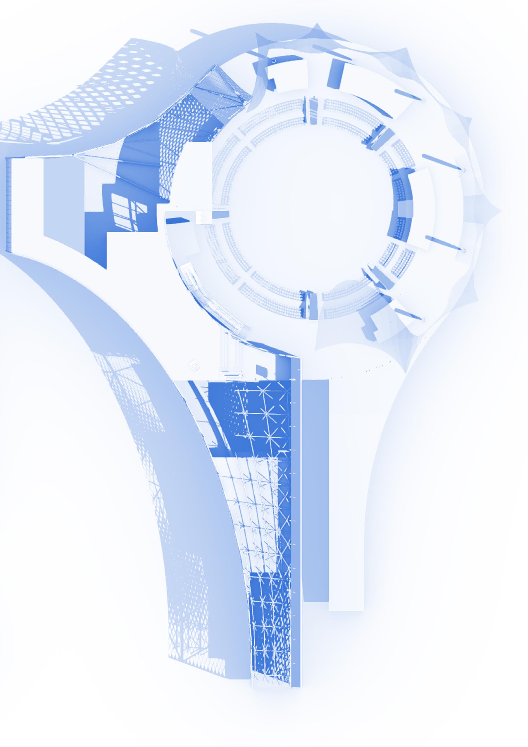
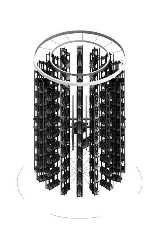
AXONOMETRIC - STRUCTURAL FRAME
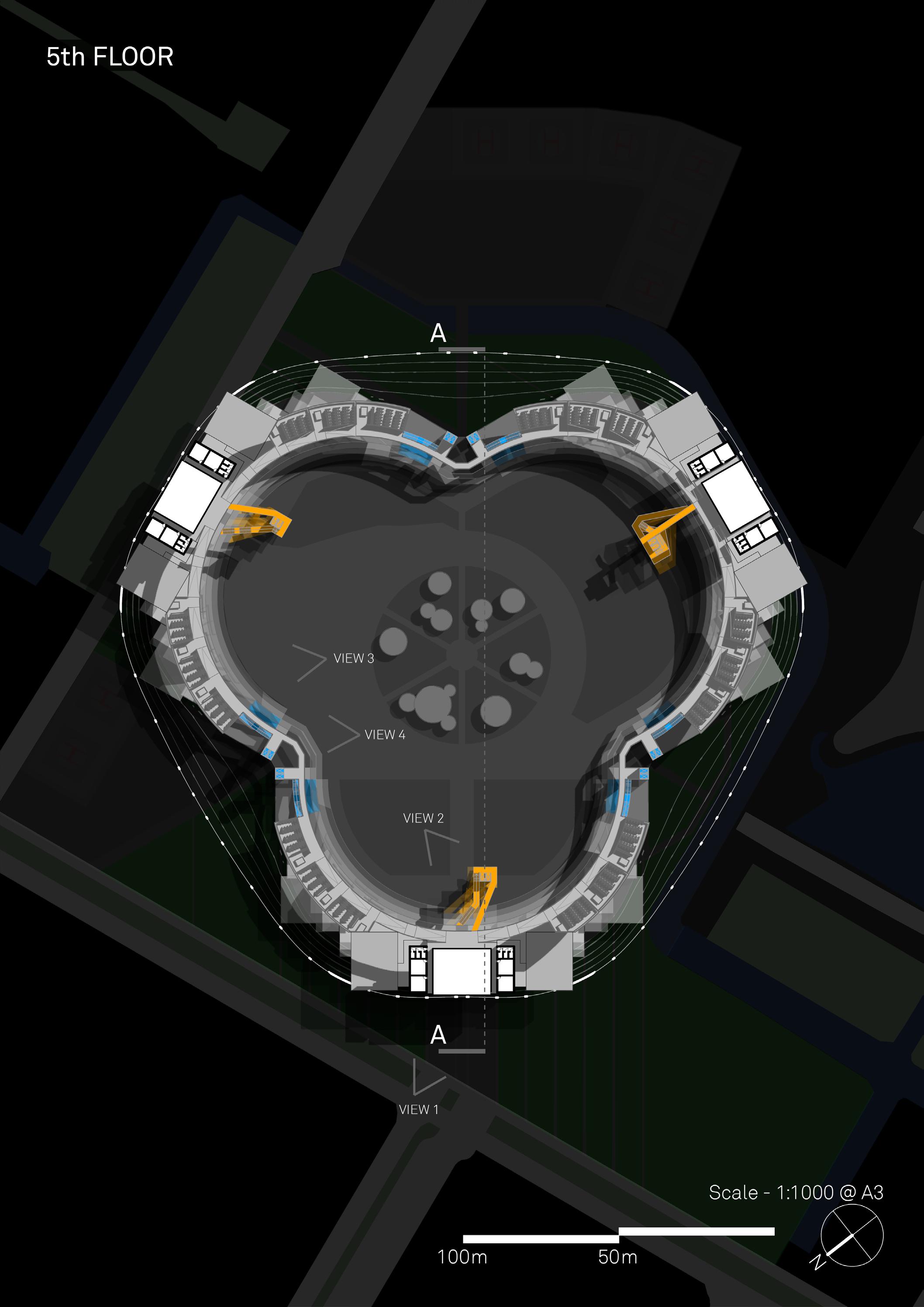
TU DELFT SPACE CENTRE
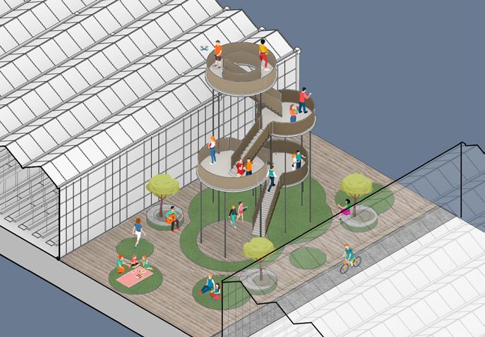
SHANKAR PATEL MALL
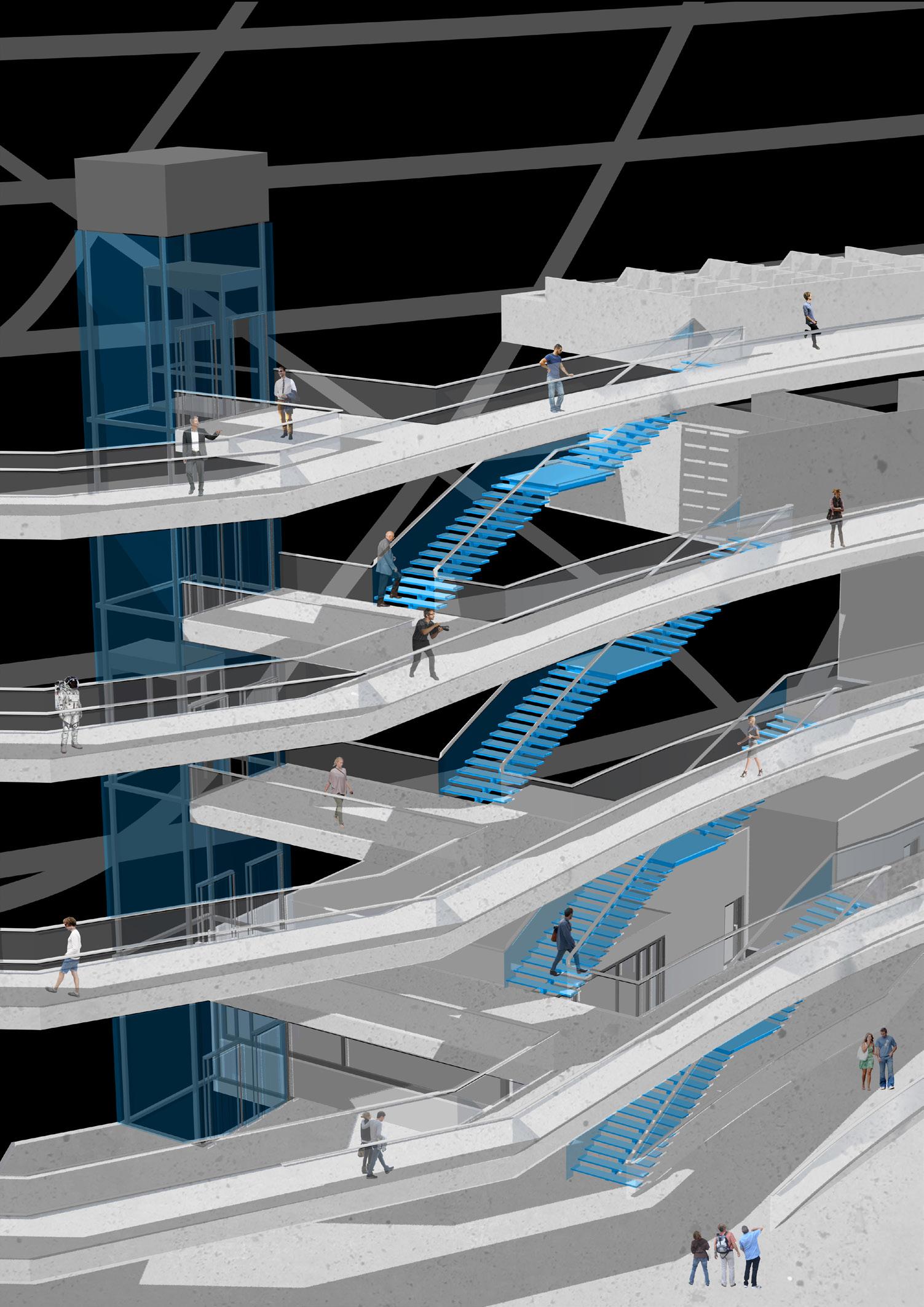
The TU Delft Space Centre is the nexus for all subjects related to space. As space comes to influence and dominate our everyday lives, this new set of faculties for TU Delft will provide the perfect springboard to launch the next generation into the cutting edge of their field.
With the growth and evolution of the space industry, the need to study it in all its aspects will become much more necessary. Law students, in a similar vein to Maritime Lawyers, will be needed to unravel territorial disputes, Architects will be needed to design the habitats we may live in and medics will be needed to treat the plethora of ailments stemming from low G environments. Thus, the Space Centre is split into 6 main faculties – Applied Science, Engineering, Theoretical Science, Medicine, Arts and Humanities.
To encourage interdisciplinary communication, the functional spaces required for each faculty are spread evenly across the Space Centre. Laboratories exist adjacent to the seminar room that Humanities students may inhabit, and all lecture halls are shared. The spaces are linked by wide concrete walkways. The circulation spaces will therefore be the catalyst to many chance meetings between students, and space has been set aside for these meetings to be consolidated. The ground floor consists of open plan Testing and Studio Halls, where concepts can be tested in a way accessible to all. By being encased in a transparent structure, the entire scheme will be visible to the public, to encourage openness and democratic study in a high-tech environment.
VIEW 2 - MAIN STAIRCASE
VIEW 4 - ALTERNATE STAIRCASE
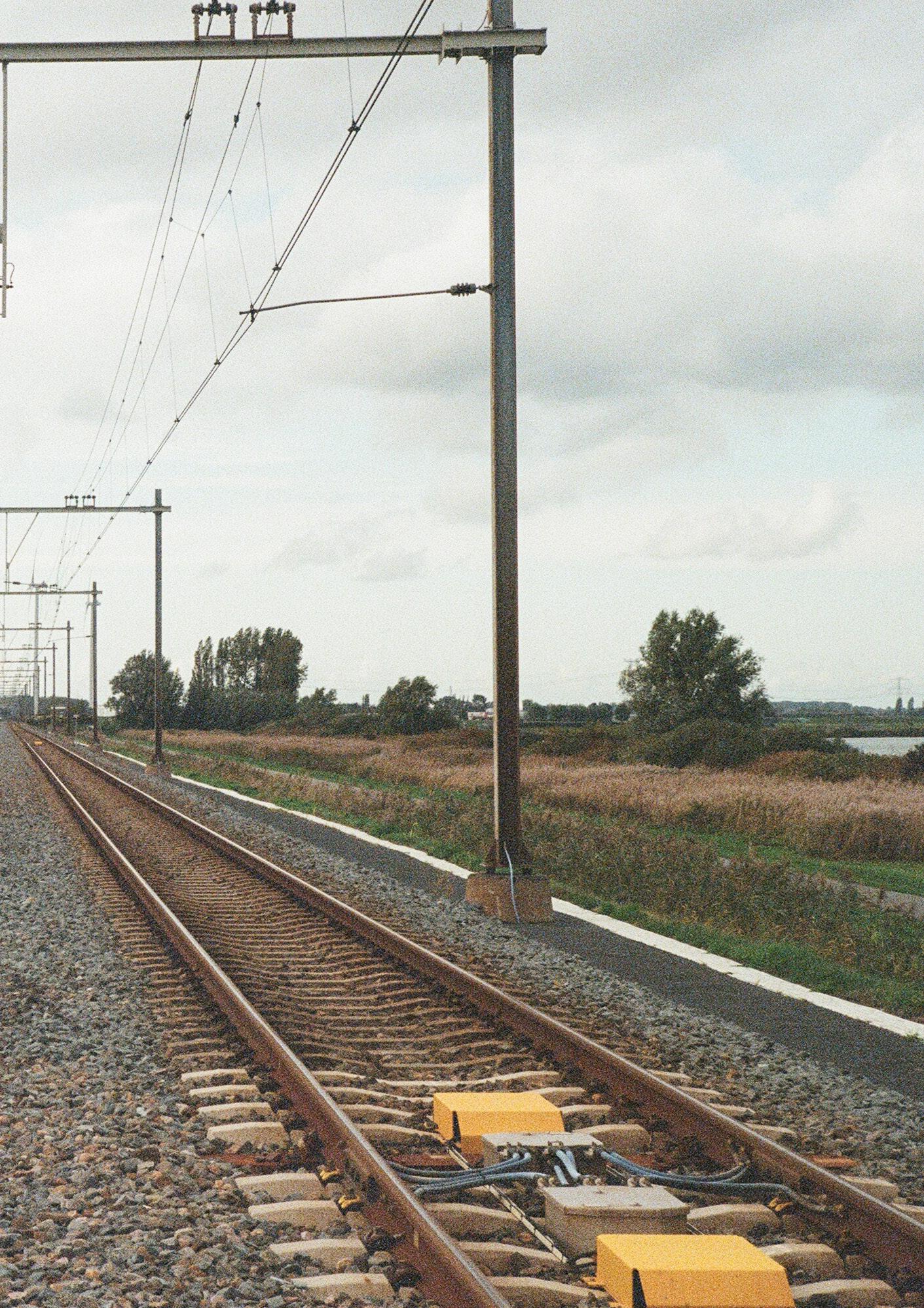
Trainspotting, Rotterdam. October 2019, Mohammad Talha Malik
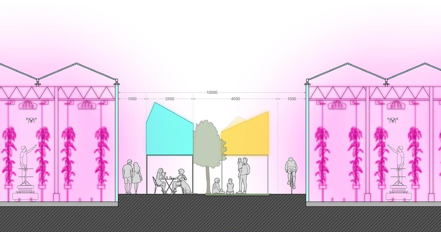
WESTLAND
05 a
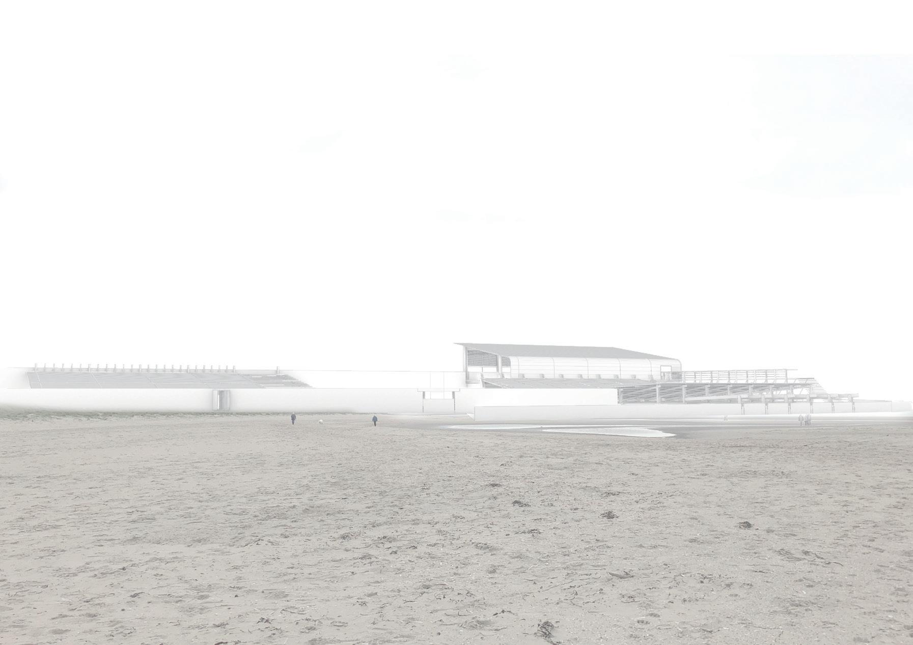
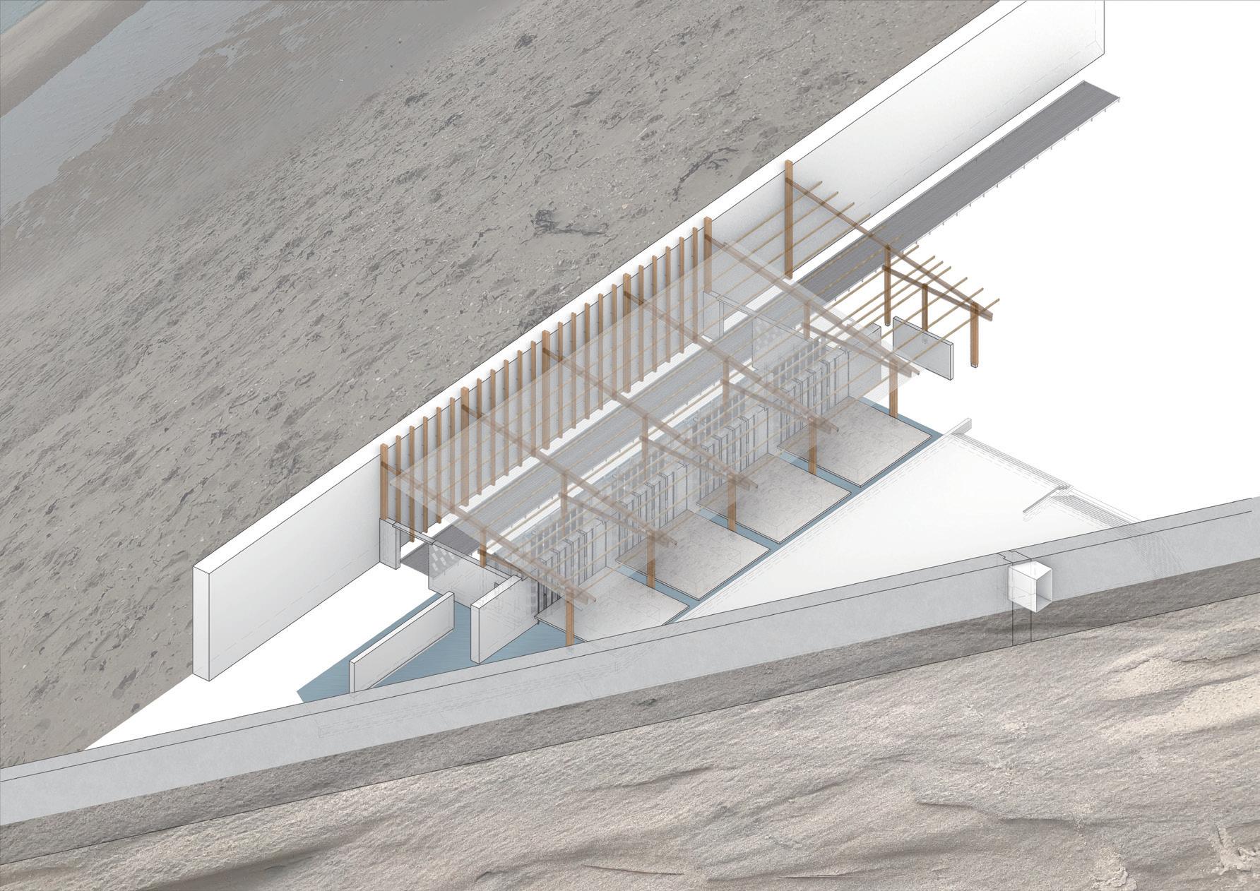
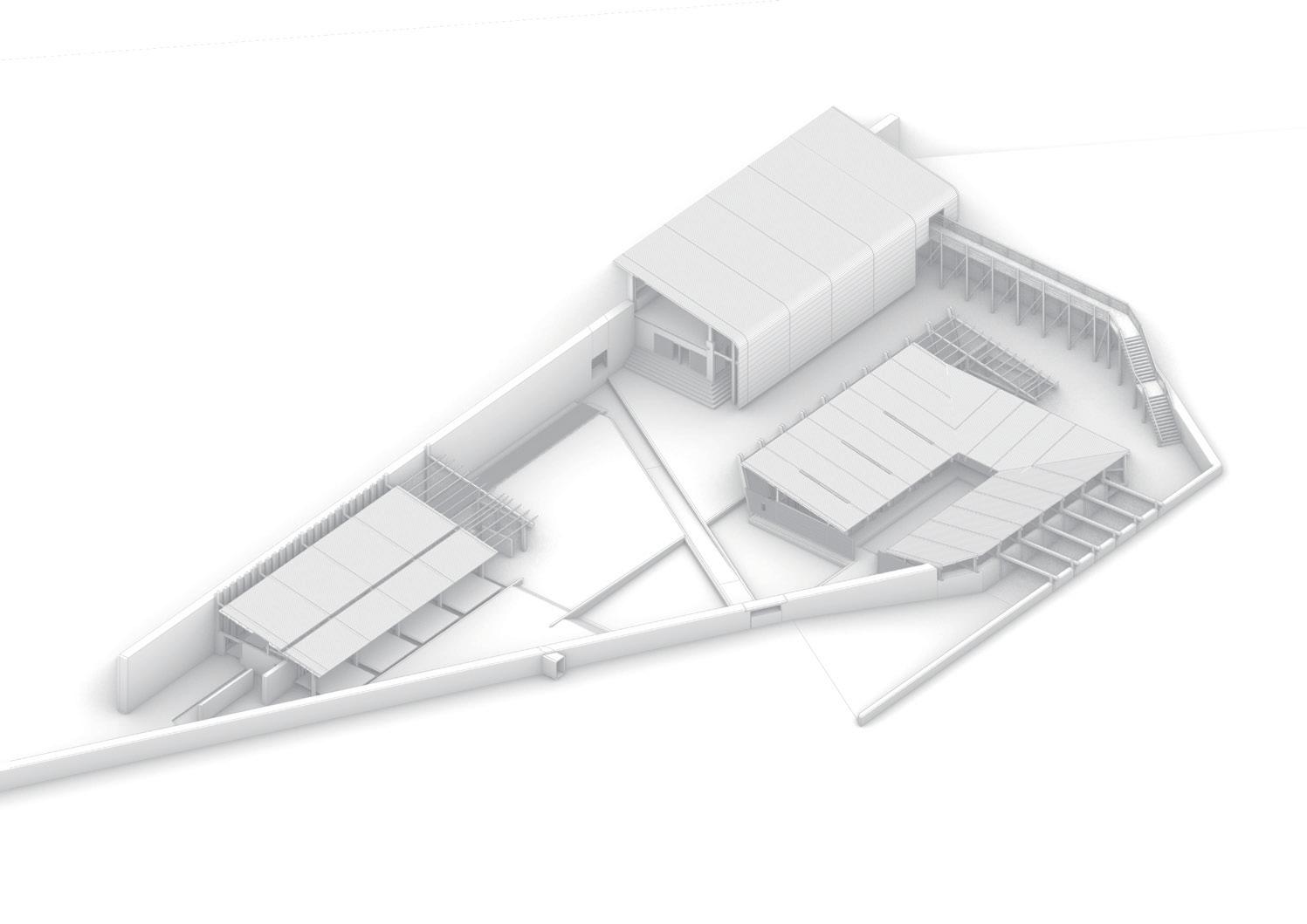
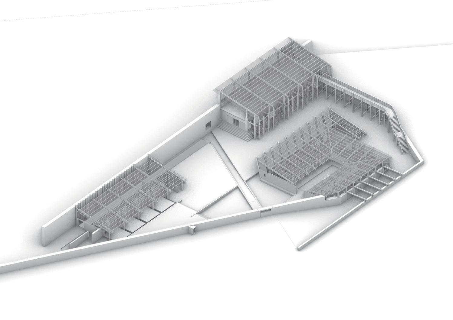
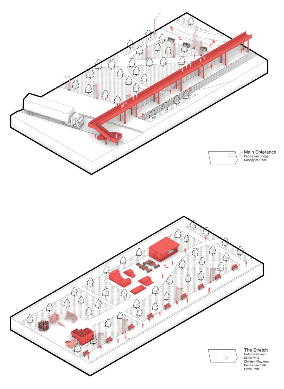
THE NODE
‘S-GRAVENZANDE
DAMON LEE
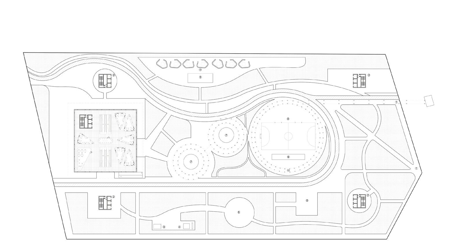
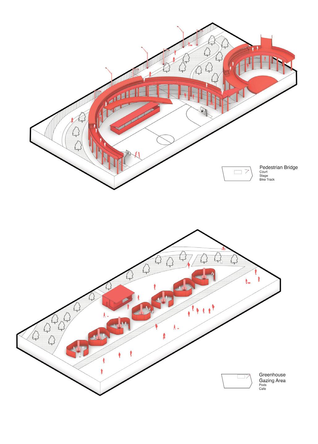
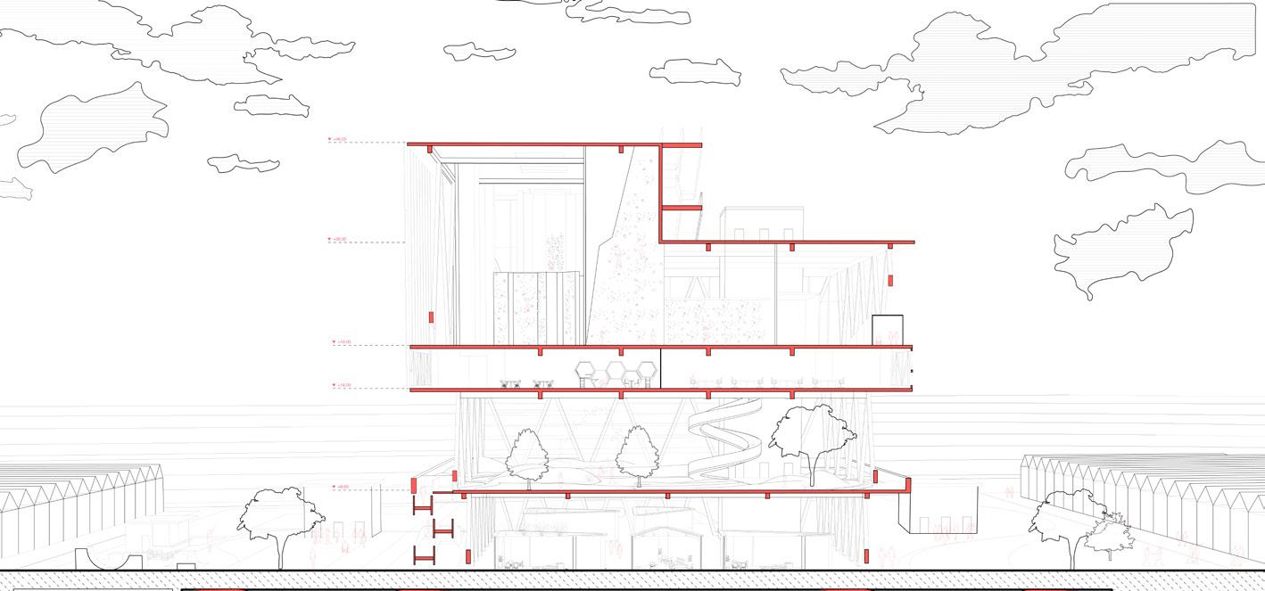
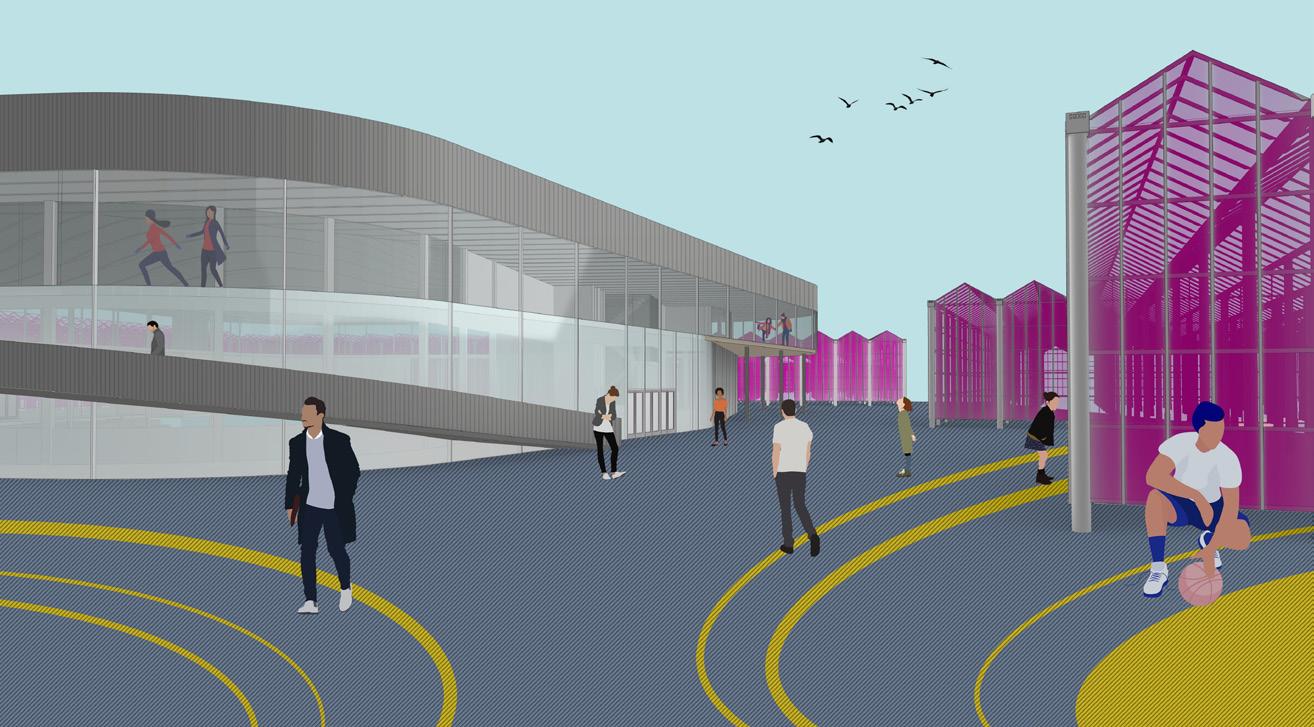
The Node – a new transport and mobilty cluster that aims to enhance social and cultural solidarity. An observation of development in civilization has enabled the projection of near-future scenarios for the Westland area, Netherlands.
The Westland is a key agriculatural Dutch zone, dominated by [automated] greenhouses and irrigation systems. The site is surrounded by a blanket of greenhouses, thus creating a deficiency of mobility for the area. The proposal’s intent is to increase the offer of activities for the area as well as to strengthen through this mobility hub the connection between the cities of Westland, Den Haag and Rotterdam and adjoining an existing infrastructure.
Harnessing the site’s potential of utilising the existing greenhouses and a point of connection to the coastline, this project’s strategy is about proposing a strategy for a hybrid urban landscape - where hyperloop, sports facilities and urban plaza meet, creating a complex integration for the municipality developing state.
Pedestrian Bridge and Greenhouse Gazing Area Axonometrics (above, top)
Sectional Perspective (above, bottom)
Main Entrance and ‘The Stretch’ Sectional Axonometrics (adjacent, top)
The Node Expansion (adjacent, bottom)
b
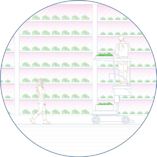
GLASS FOODSCAPE
‘S-GRAVENZANDE
CHARLOTTA CHAN
The Netherlands is the world’s number two food exporter measured by value. Second only to the United States, with a 280 bigger times landmass.
The Dutch horticulture relies heavily on greenhouse cultivation, which gives farmers full control over growing conditions and crop monitoring around the clock. The Westland region of the Netherlands, also known as the Glass City, has the highest concentration of greenhouse horticulture in the world, resulting in a blanket of glass that covers 80% of cultivated land. When seen from above at night, the industrial landscape is a sea of neon yellow and magenta light.
By 2040, all greenhouses will become automated and hyper-optimised.
In order to satisfy the growing population and demand for food, the control and monitoring of crops have been replaced by AI, robots and drones. There will no longer be a need for a team of farmers to run the greenhouse. Yet these vast human exclusion zones which the greenhouses will become, are situated only a street apart from residential areas and are a stark contrast to the human inclusive town centres.
By restructuring the greenhouse blanket and creating a labyrinth through the industrial landscape, this project aims to paint a future where greenhouses and humans co-exists in harmony with one another.
Current versus Future Greenhouse Technologies (above)
Extremeties of the Site (below)
Sectional Moments Along the Journey Through the Greenhouses (adjacent, top)
Section through Greenhouses (adjacent, bottom)
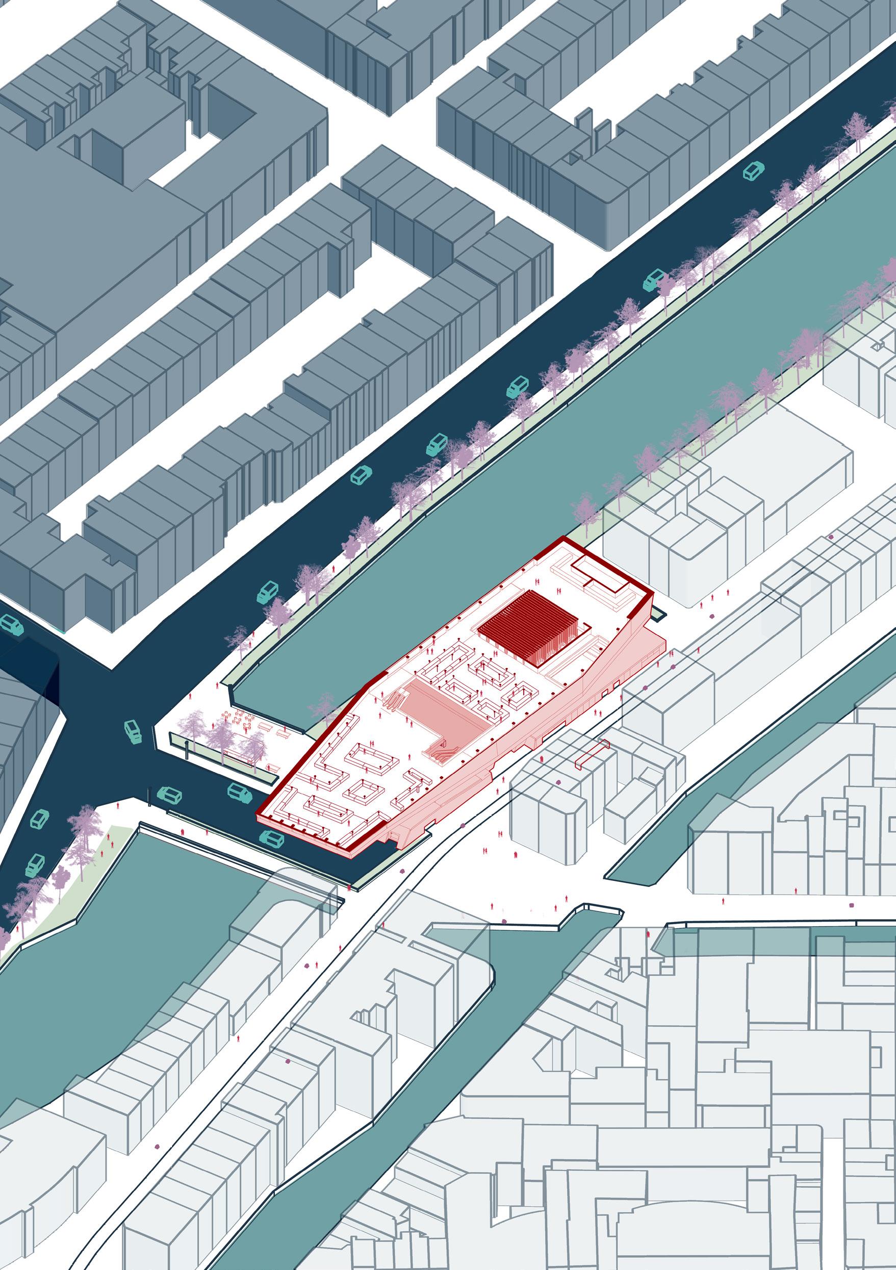
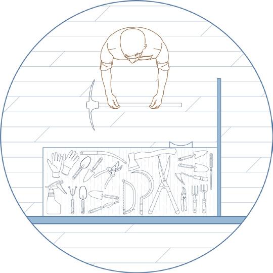
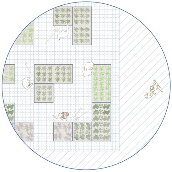
THE WASTE RESCUE CENTRE
EUROPA
CHRISTINA TANTCHEVA
The greenhouses in Westland make up a part of the Dutch Food Cluster renowned for its leading position in the world for food export and optimal use of energy and water. A progressively popular movement in the innovation of this sector is the shift to a circular bio-based economy that closes gaps in the production and waste cycle by tapping into agricultural residue. In the ripe climate of globally and locally raised awareness of ecological issues, sustainability and creative reuse of waste have the potential to bring people together and build communities.
As cities and operational landscapes blend into each other, adaptive reuse of resources becomes crucial.
From tomatoes to energy, plant stems to cardboard, fibres to composites, restaurant fruit and vegetable waste to new textiles, the possibilities are yet to be explored. Opening up the doors to the public for such methods can encourage them to cultivate and advance the no-waste mindset.
The Waste Rescue Centre thus integrates open-access upcycling workshops and a composite material research centre into an agricultural residue recycling facility.
marketing potential: imported bio-waste
85,000,000 kg tomato plants / y
processing and commercialising vegetable materials
marketing potential: hemp
Eccentricities Map (above)
Site Map (adjacent, top)
Interior View (adjacent, bottom)
Europort
plant stems and leaves collected for compost 1 ha
100,000 tomato boxes
textile and clothing composite materials
agricultural education
Green Horti Campus
Circular Beauties Exhibition
Energy Translation, Europoort, Rotterdam. October 2019, Fritz Holtgrewe.
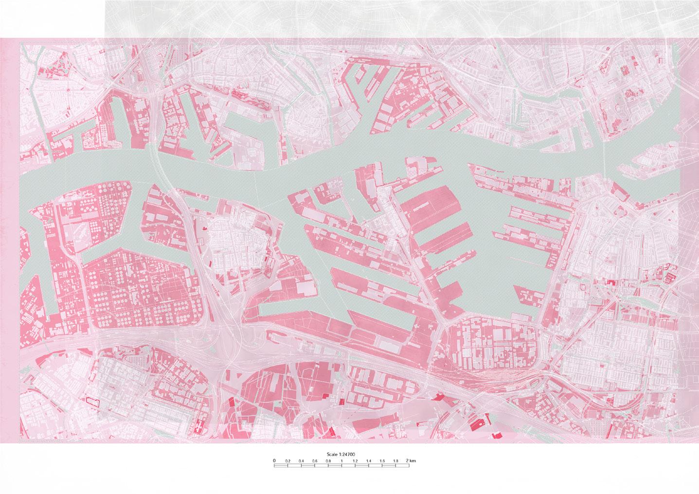
TERRITORIAL & MATERIAL FOOTPRINTS
MAASVLATKE & EUROPOORT ROTTERDAM
JOSH BLACK | VALENTINA MIHAYLOVA
This research investigates the global, territorial and logistical interdependencies related to the Port of Rotterdam. Exploring and understanding territory as an operational landscape is key to this studio and also this research.
The distinction between operational landscapes, hinterland and ‘simply’ landscape serves as a foundational driver for most developed studio projects, scenarios and scripts. Understanding the material dimensions of globalisation and commerce is key in order to understand the physical magnitudes we are addressing as architects and planners. Infrastructure is always part of a larger system, an expanded network; it is never singular and is embedded within an operational landscape, of a global, national or regional scale.
Through this extensive research and analysis, the relationship between hyper-consumerism and hyper-digitalisation and expanding operational landscapes are being explored, through quantitative and qualitative means.
TOP EUROPEAN CONTAINER
2.5
CONTAINER SIZES
Container sizes vary in height and length. Diagrammed are the 1 TEU and 2 TEU variations - the most common in shipping. They are designed in such a way that fixings align; i.e. two 20FT containers equate to one 40FT container.
1TEU
2TEU
HALF-HEIGHT
HEIGHT: 1.29M (4.2FT)
WIDTH: 2.44M (8FT)
REGULAR
LENGTH: 6.06M (20FT) // 12.12M (40FT)
HEIGHT: 2.94M (9.6FT)
WIDTH: 2.44M (8FT)
LENGTH: 6.06M (20FT) / / 12.12M (40FT)
HEIGHT: 2.59M (8.5FT)
WIDTH: 2.44M (8FT)
LENGTH: 6.06M (20FT) // 12.12M (40FT)
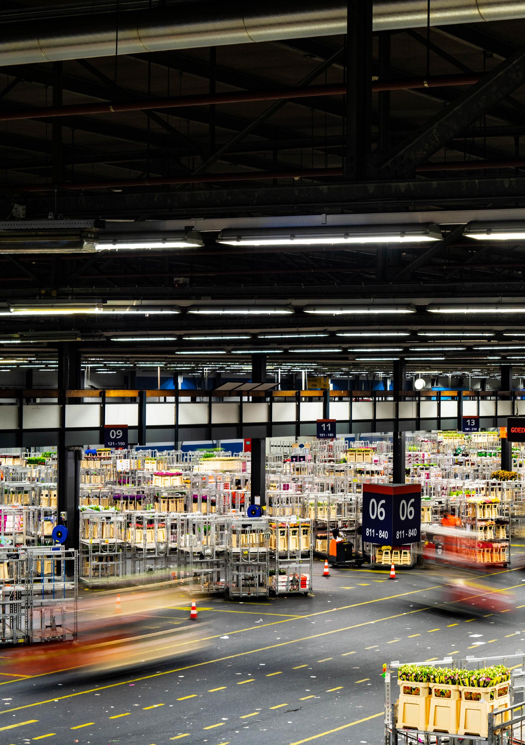
SEA-GOING VS HINTERLAND SHIPS
29,476
Sea-going Ships
Almost 4 times as many small inland (or hinterland) vessels are required to accomodate the throughput of goods from the super-size container ships the port welcomes every day. Hyperconsumerism will cause further increase.
107,000 Hinterland Ships
HINTERLAND FREIGHT NETWORK
The Port of Rotterdam is not only the most container shipping intensive on a wider country scale, but is also the most prominent intermodal transportation nexus, which offers a well-developed road infrastructural network as well as direct rail connection from every terminal site to the trainlines, carrying containerized goods to Belgium, France and the Ruhr region, leading to central Europe.
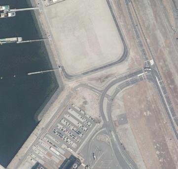
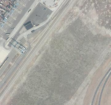
From our previous catalogues the idea of the Port of Rotterdam as an area of human exclusion has be proven, but some efforts to change this have been put in place. In the very heart of Maasvlakte lies FutureLand, a public information centre on the port.. It is situated between the APM Container Terminal and Uniper’s Maasvlakte Power Plant 3.
However, the challenge is actually getting there. The Port of Rotterdam is 42km long - so this journey takes time. Obviously driving is a solution (Option A), but what is the alternative for someone without access to a car? (Option B)
Here we map the options.
In spite of having such a compotent infrastructural system, the public transport option enhances the notion of human exclusion as opposed to helping to solve it. * these journey times are only one-way.
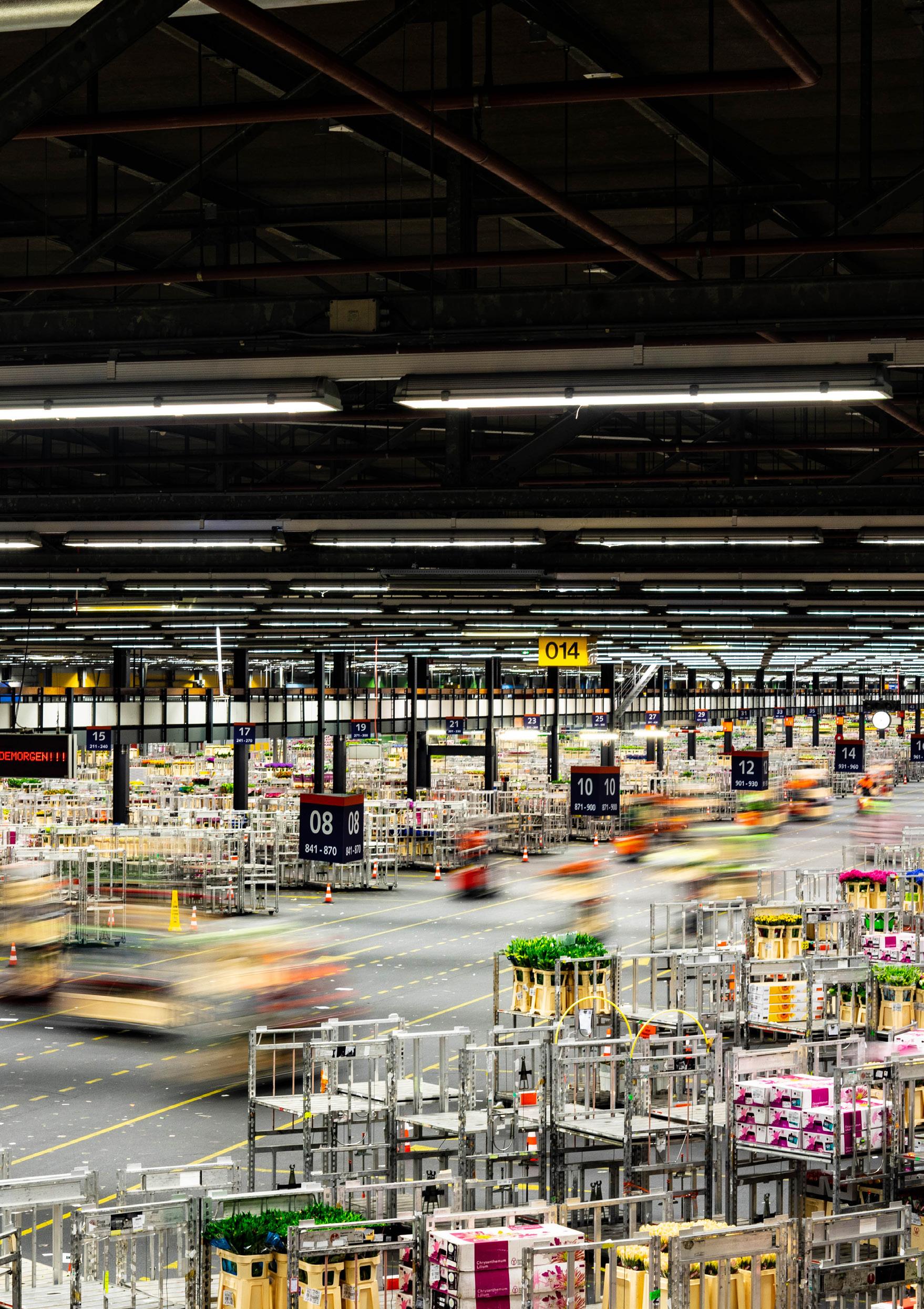
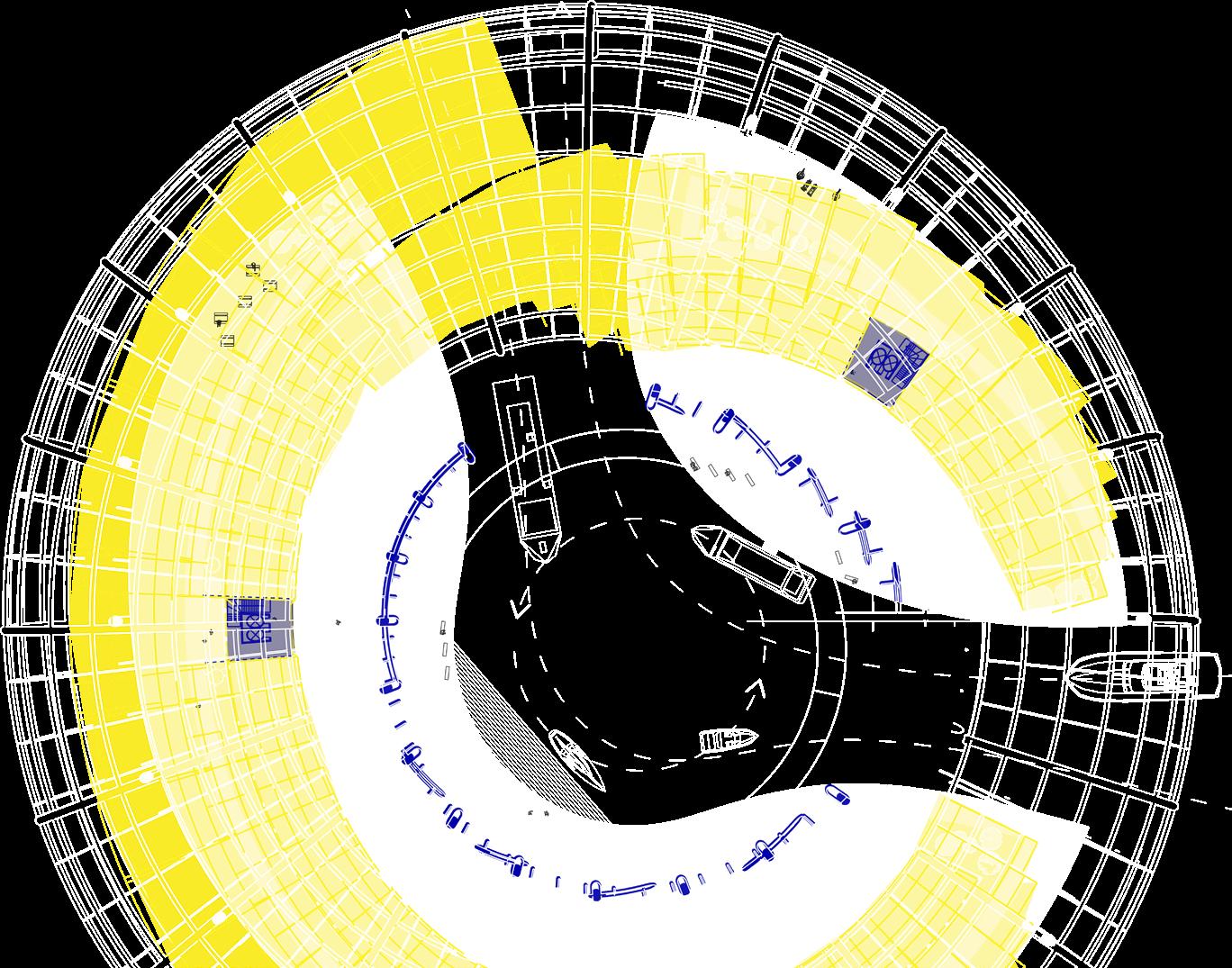
MAASVLAKTE MASTERPLAN 2050
@1:25
The automated infrastructure of the APM contaier terminal can be thought of as Cartesian in the sense that each crane moves containers orthogonally in the X,Y and Z axis. These machine giants work almost autonomously together to allow container shipping to be efficient and fast. Each crane has a specific location based on its capabilities and role. By comparison, the AGV has freedom.
Each of the crane typologies is confined to tracks allowing movement along 1 axis. However, sliders on the crane arms provide movement in the other horizontal axis as well as the Z-axis allowing containers to move in 3-dimensions. The AGVs are not as restricted and can move almost anywhere in the orange-striped area of the plan.
Both Rail Gantry Cranes are mounted over the 4 railway tracks that run along the periphery of the terminal, servicing 1 half of the length eachabout 400m each!
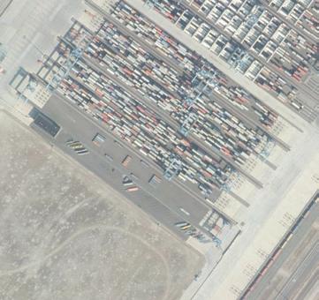
APM CONTAINER TERMINAL
CONTAINER HANDLING: MOVEMENT & SPEED // RAIL GANTRY CRANE FOCUS
The Rail Gantry Crane are manually operated, and can move a container from a rail car to an AGV in 2 minutes on average. APM has two of these cranes, which each service 4 tracks of 400ms length. This 400m limit is due to the fact that their power supply wiring restricts further movement.
2:00 MINUTES PER CONTAINER
CONTAINER MOVEMENT
CRANE MOVEMENT
A large gear box mounted on sliding rails, allows for rotations by 90 degrees. This serves for moving containers from AGVs to railcars and vice-versa. An operator controls this crane fully. The crane cantilevers over the AGV area by approximately 15m
SLIDER MOVEMENT
TRAIN LINES
The Rail Gantry Cranes have been built to accommodate up to train 8 lines within their span; currently only 4 have been built.
APM CONTAINER TERMINAL
CONTAINER HANDLING: MOVEMENT & SPEED // STACKER GANTRY CRANE FOCUS
At APM Container Terminal, Maasvlakte 2, the Stacker Gantry Cranes can transport a container from one end to the other in approximately 2-3 minutes. This is the time taken to lift the container from an AGV, carry it through the 270m stack and place it on the back of a waiting truck.
CRANE MOVEMENT
CONTAINER MOVEMENT
There are 54 of this crane type at APM, 2 working on each of the 27 stacks.
SLIDER MOVEMENT
The Stacker Gantry cranes are mounted on rail tracks that lie on either side of the container stacks. The stacks measure 270m long, 22m across and 13m tall when full - but this is never the case as the stacks are always in motion.
CRANE MOVEMENT
The crane itself is restricted to movement in 1 axis - along the stack; but it able to move the containers in 3 axis, due to a slider on its top.
OPERATOR’S CABIN
HUMAN SCALE
2/3 MINUTES PER CONTAINER
This value is a paper figure though - the algorithm which the crane operates according to would rarely, if ever at all, allow one container to move through the whole stack without having to stop and move another - in the name of efficiency.
Each stack has space for 4 trucks to park and wait at a single time; - 108 for the whole container at any given time.
CONTAINER DROP-OFF/ PICK-UP POINT
HUMAN SCALE
MAASVLAKTE POWER PLANT 3 VS WIND ENERGY IN THE PORT OF ROTTERDAM
Maasvlakte has been home to 4 coal-fired power plants over its lifespan; - Uniper Power Plant 1, 2 & 3; and Engie Power Plant. Uniper Power Plants 1 & 2 shut in June 2017, and Power Plant 3 will shut by 1st January 2030. Engie will likely be converted to biomass-firing. This will leave a 1.07GW void in the local energy landscape;hypothetically, how could wind turbines countercact this...
MAASVLAKTE POWER PLANT 3
Coal-fired power plants genergate approximately 4GW of energy in the Netherlands. Government legislation will cause the 4 remaining plants to shut by 2030 in order to reduce the Netherland’s CO2 emissions to 49% of their 1990 level.
Maasvlakte Power Plant 3 equates to 26.5% of the Netherlands energy from coal.
x 83
193.6 MW totalling 177 MW totalling 699.4 MW x 59 x 234
CURRENT ENERGY LANDSCAPE
CO2 captured from power plants and refineries is used in the large greenhouse industry in the adjacent Westlands area, to enhance plant growth.
The majority of energy generated for the Rotterdam region comes from fossil fuels - some 1.87 GW, compared to just 215.6 MW from renewables. As the Netherlands move towards sustainability a drastic transition will be required. This is currently underway with two coal-fired power plants, equating to 1GW, already decomissioned. The Dutch government plan to shut down all coal-fired power plants by 2030, to meet goals for reduced Carbon emissions.
b
MAASVLAKTE NINETYNINE
FLOATING EDITION
ELSA KONKKA
In MAASVLAKTE NINETYNINE, CITY on water, a cluster of artificial islands connect and relate to each other to form an urban metabolism.
To go from one to another you have always the choice between air and water: whether it be navigating a passenger drone or cruising on a ferry. And so, a network of invisible roads and paths weave in and out of the buoyant pieces of man-made land.
It is an ever-changing city, modular in its nature, with the ability to expand and contract. For now, the city is made up of seven floating sectors, each devoted to a function which feeds into the life of the inhabitants. Nearest to the shore, and the first to be erected of its sibling islands: the agriculture and food production sector. In close proximity floats the dwelling district, then the island of education, then work, entertainment…
To the arriving traveller, the city glistens like a future vision. Not quite a fleet of ships, nor pieces of land out at sea: this was like nothing I had ever seen. As the wind blew into the sail, gently pulling us closer to the docks of Maasvlakte Ninetynine, the Dutch helmsman let a smile curl over his face, “home,” he said.
Vignette written in a style inspired by Italo Calvino’s voice, in ‘Invisible Cities.’
Residential Sector roof plan & section. Below: Port of Rotterdam & indication of site (adjacent)
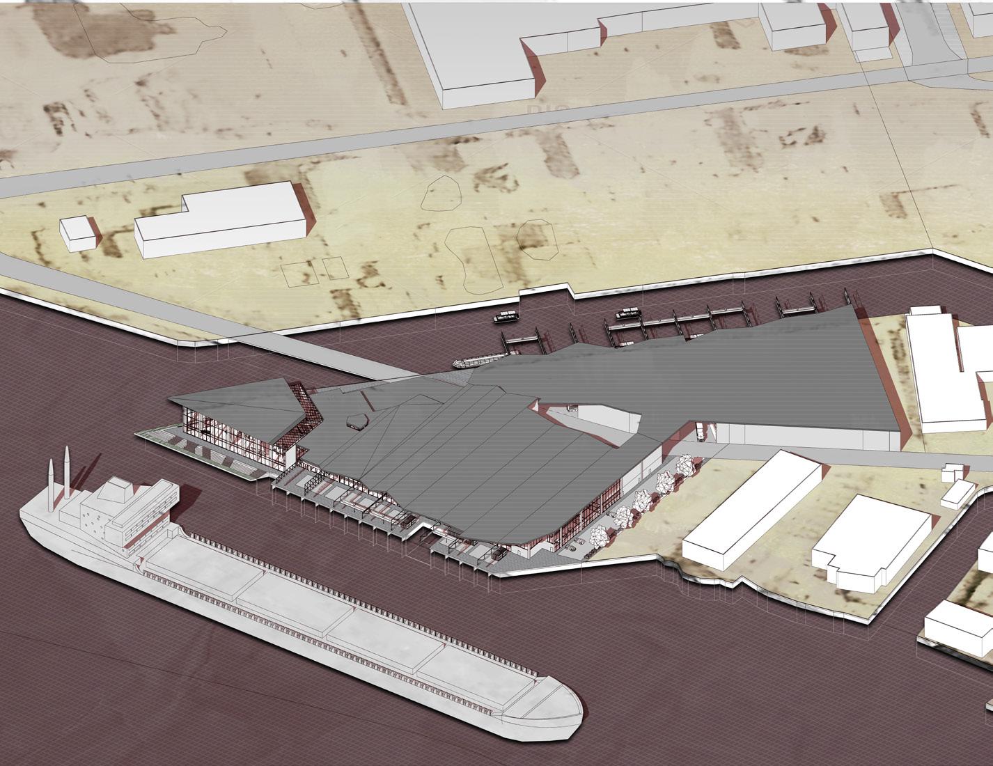
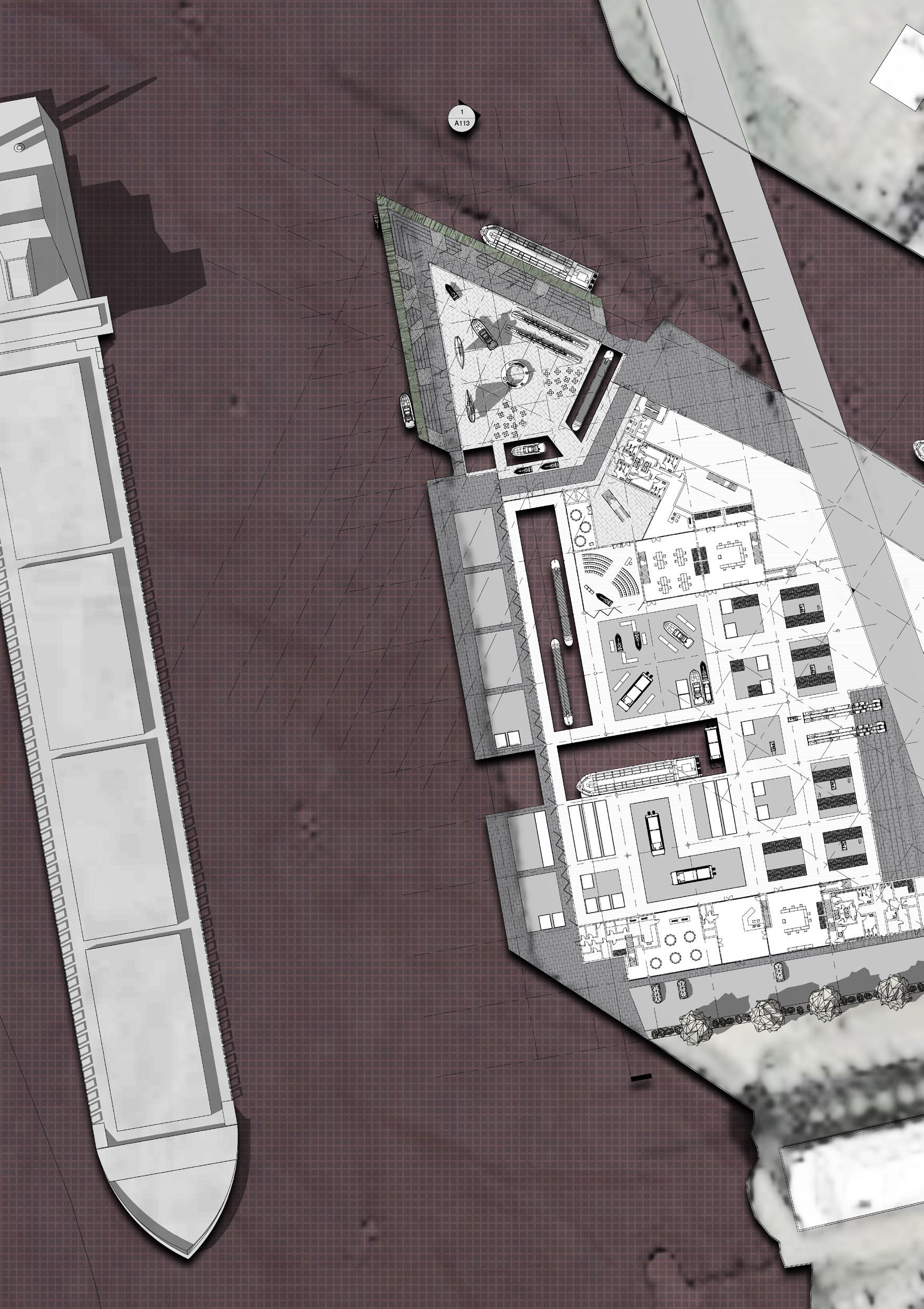
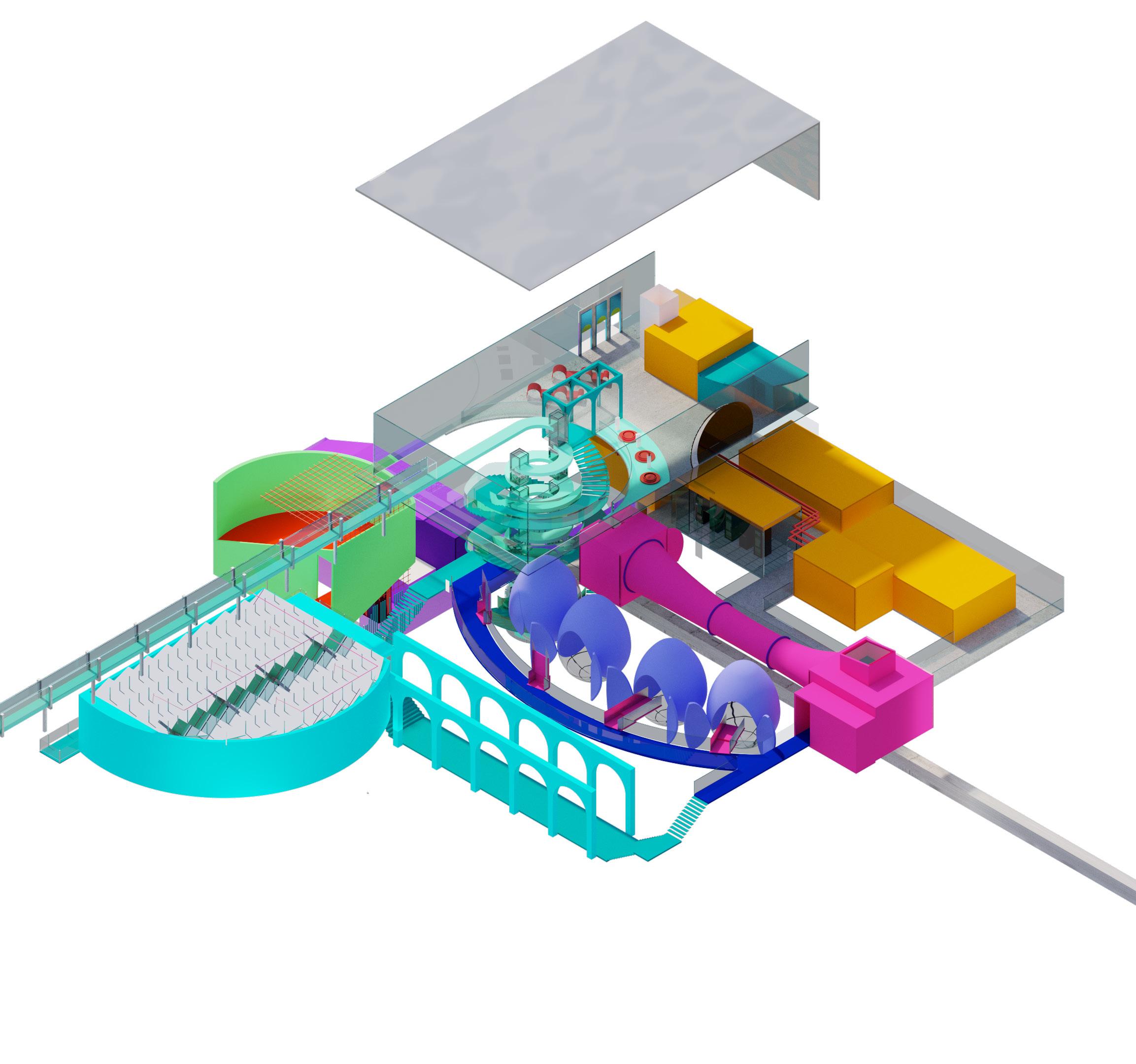
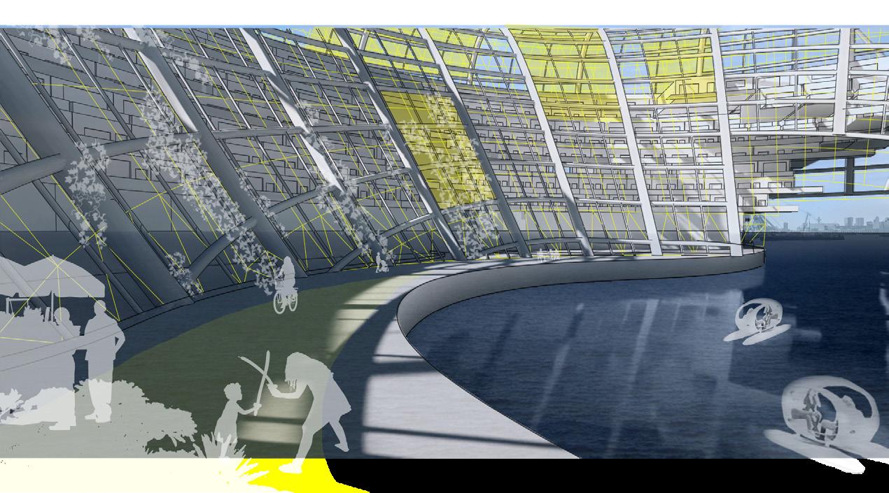
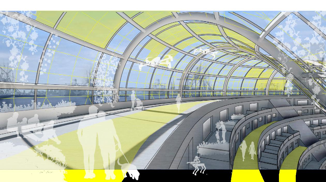
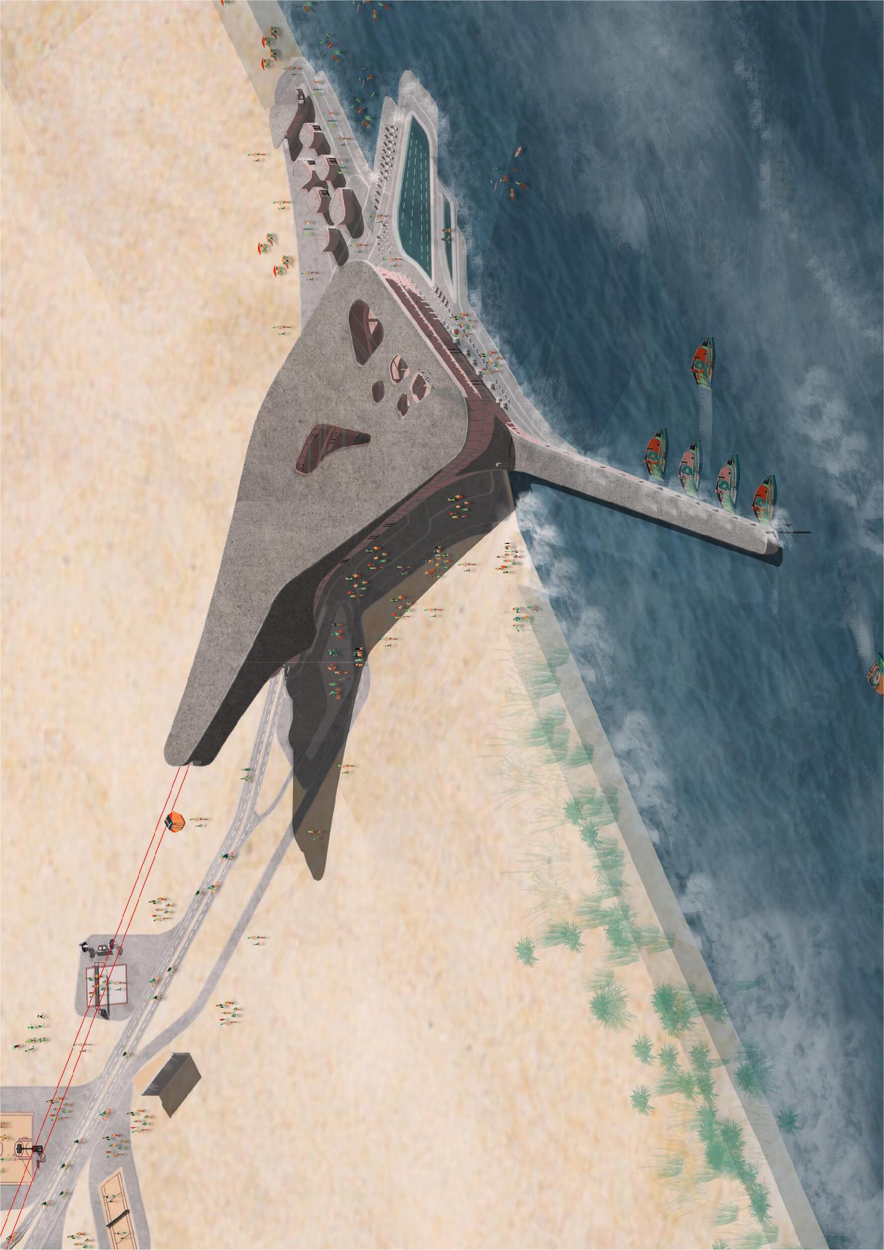
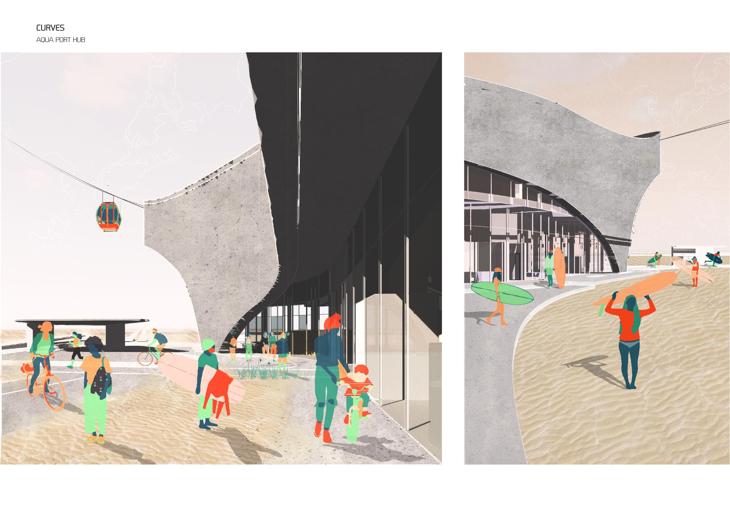
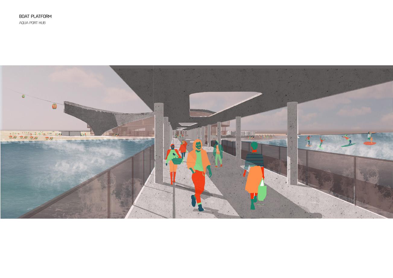
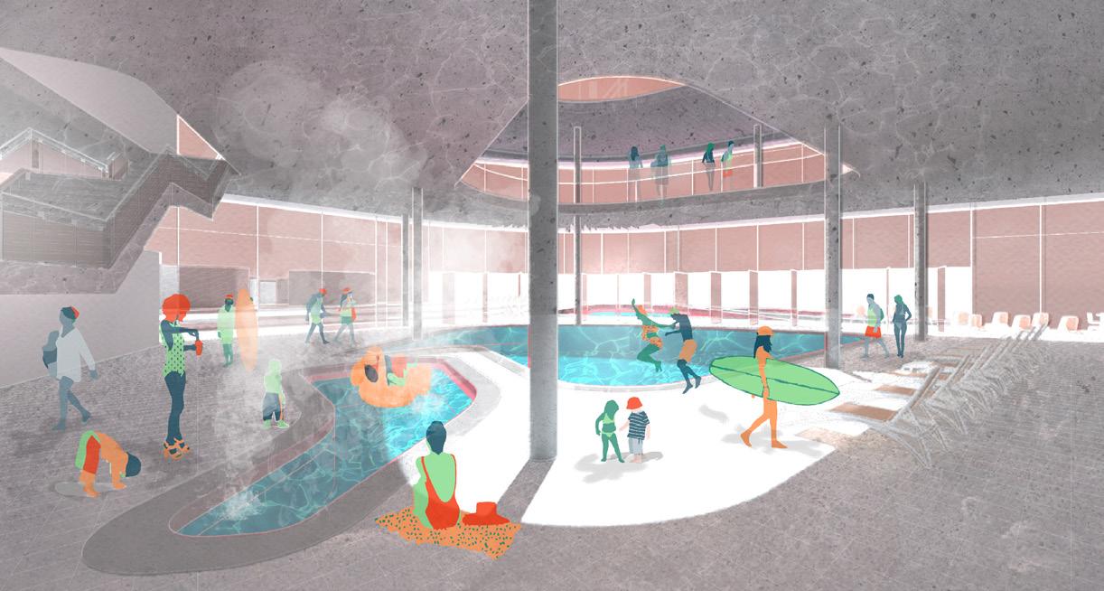
AQUA PORT HUB
MAASVLAKTE
VALERIA ONCEAN
The project is located in the Port of Rotterdam. Built on artificial land, the Port’s extension removed it from the city and brought it closer to the sea. In 2020, Rotterdam is a unique City-Port, which has the Port completely separated by distance and function from the city. By 2050, this industrial human exclusion zone will become an innovative and ecologically clean Port included in the City activities and people’s lives.
The concept consists in recreating the link between the Port and the City and transforming an infrastructure into an unique environment for a new building typology. By creating new means of transportation, the journey using such radical technologies as a smart boat or fast city cable car, becomes an experience in itself in an almost surreal world full of buildings and objects that are not suitable for human scale or use.
The building is a manifestation of a topographical analysis of the growing artificial island Maasvlakte and a tidal study based on the water’s motion, already making the site a Surfing point. The proposal combines two main functions: transportation Hub and Water Sport Center. The form, influenced by a maritime design language, sits on the shore like a sea creature, serving as a medium between water, air and land means of transportation. Therefore, it becomes a link between the City and the Port by becoming a public space in a surreal industrial context. The sculptural nature of the building contributes to the monumental atmosphere. The fluidity of the form connects three branches: a harbour platform extended in the sea, a sea pool and a vertical branch serving as a tunnel for the cable cars.
Pier Walkway (above, top)
Building Approach (above, middle)
Swimming Pool (above, bottom)
Exterior Functionality with Cable Car Arrival (adjacent)
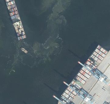
Container Ship, Rotterdam. October 2019, Mohammad Talha Malik
07 a
URBAN IOT X ENERGY
HEIJPLAAT
HAYA AL BULUSHI
The Urban IoT x Energy project is a strategy consisting of a first step to re-constructing urbanism to produce green energy. The primary goal is to produce this energy for buildings to depend on, stepping out of the standardised centralised infrastructural energy system.
The project is planned around people, community and connectivity. The methodology used was to select an area where this decentralisation offers the public support and advantage, therefore was placed in a low-income housing neighbourhood in Heijplaat, the south of Rotterdam to show how this proposal can effectively be put in place.
The community centre’s architectural and material language creates a blur between the surroundings and the building itself, with varying roofscape, greenery and glass effects, merging it with the surroundings. Alongside a series of energy-making urban components to be deployed into the fabric of the neighbourhood through a plaza, using architecture as an environmental device.
Contextual Location Plans (top, left & top, right_
Perspectival Elevation (centre, left)
Perspectival Section (bottom)
SITE PLAN
ROTTERDAM DIGITAL FABLAB
ROTTERDAM STADSHAVEN
The Industrial Infrastructure of the past and present is continuing to be treated like an unworthy necessity of modern existence. Both vacant and hidden, Rotterdam, like many places, divides typologies into defined districts causing segregation and lack of multi disciplinary integration.
With most of the traditional port industry moving out of the Stadshavens towards the Maasvlakte until 2050, these port areas close to the city centre become highly valuable for a social and economical renaissance. Rotterdam Stadshavens has the potential to grow into a part of the city as the center of development and innovation, directly linked to daily activities and the urban labor market.
We must seek to find alternative methods to integrate industry with its community, exposing the fascinating artistry and production lines within industrial spaces to engage and excite people about the hidden processes happening in their close environment. Changing our current perceptions of industrial architecture as purely utilitarian boxes but as shed of curiosity and hidden wonderlands.
Recently closed Damen shiprepair site offers an opportunity to create a link between the villages of Heijplaat and Pernis, as-well as making a first connection between residential areas and former industry, creating a hybrid structure that will allow further redevelopment of the Stadshaven area.
FRITZ HOLTGREWE
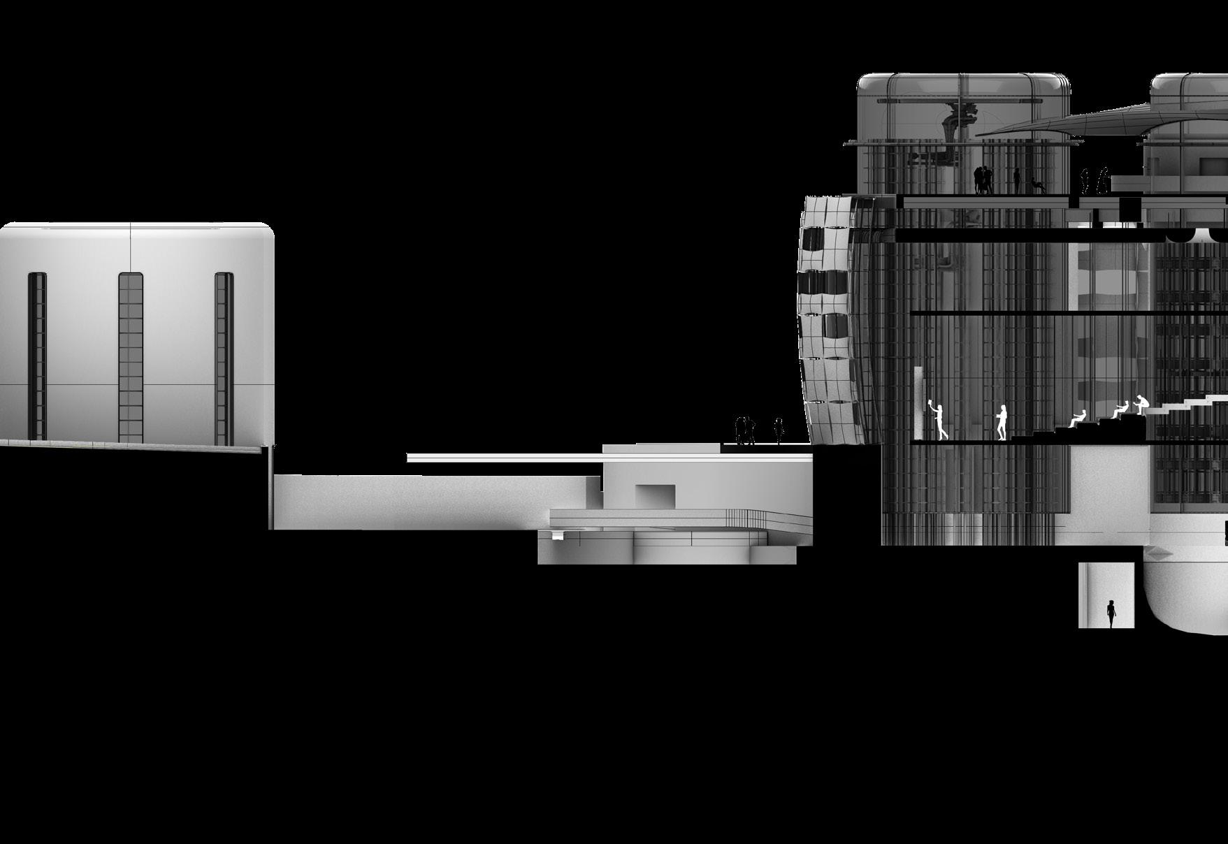
Project Progression (top)
Technological Section (above, left)
Views of the Aproach (above, right)
First Floor Plan with Space Diagrams (adjacent)
The Quarantine District will continue to work as a green lung within the port and offer a unique experience between the artist village and innovative greenhouse hemp production facilities. A new pier is placed at the quarantine beach allowing good access from the waterfront and quarantine bridge.
RDFL and RDM offer a unique studying, working and living experience on the former industrial site. The project tries to radically change the given situation of a human exclusion zone through a new mobility concept. Reinventing the abandoned waterfront and transforming the place into a new neighbourhood
Shiprepair
Quarantine District Semester
RDFL & RDM CAMPUS
07 c
LINK AND MIX
SPIJKENISSE 2040
ZHU YANLUN [ALAN]
As the most critical economic structure pillar of Randstad, the port development has been influencing the urban strategy and expansion of the city in Randstad. The machinic landscape created by the hyper-rational infrastructures along the water is incessantly organized and operated by the strong cyber management network. As the most natural as well as the cheapest “infrastructure” and media, water has become the focus of exploring the future mobility method.
Spijkenisse is the residential area founded from an agricultural and fishing community for facilitating the westward expansion of the port of Rotterdam and responding to the pressing housing crisis of Rotterdam. With the change of the economic structure of the port and industrial automation resulting in a decreasing demand for employees, the city is not only eager to develop to adapt the green and safe harbour but also explore a new urban strategy and transformation of socio-economic structure to confront the future hyper-connectivity and hyperdigitalization. By understanding the processes of port authority management, this project attempts to create a systematic and experimental water-borne transport network by introducing the radical technology of the driver-less vessel in the Rotterdam region to prompt the urban metabolism and transformation of Spijkenisse, attaining balanced and sustainable suburbanization. The mixed-used architecture in the project connected with the radical technology is going to explore a new housing-working typology to promote engagement and collaboration within the local, new immigrants and visitors, achieving the urban integration.
Inhabited Axonometric (adjacent)
Sectional Perspectives (above, top)
Space Diagrams (above, bottom)
CITYLONGUE
POST-AUTOMATION PRODUCTIVITY
DE HAAS
LI WING YIU [RACHEL]
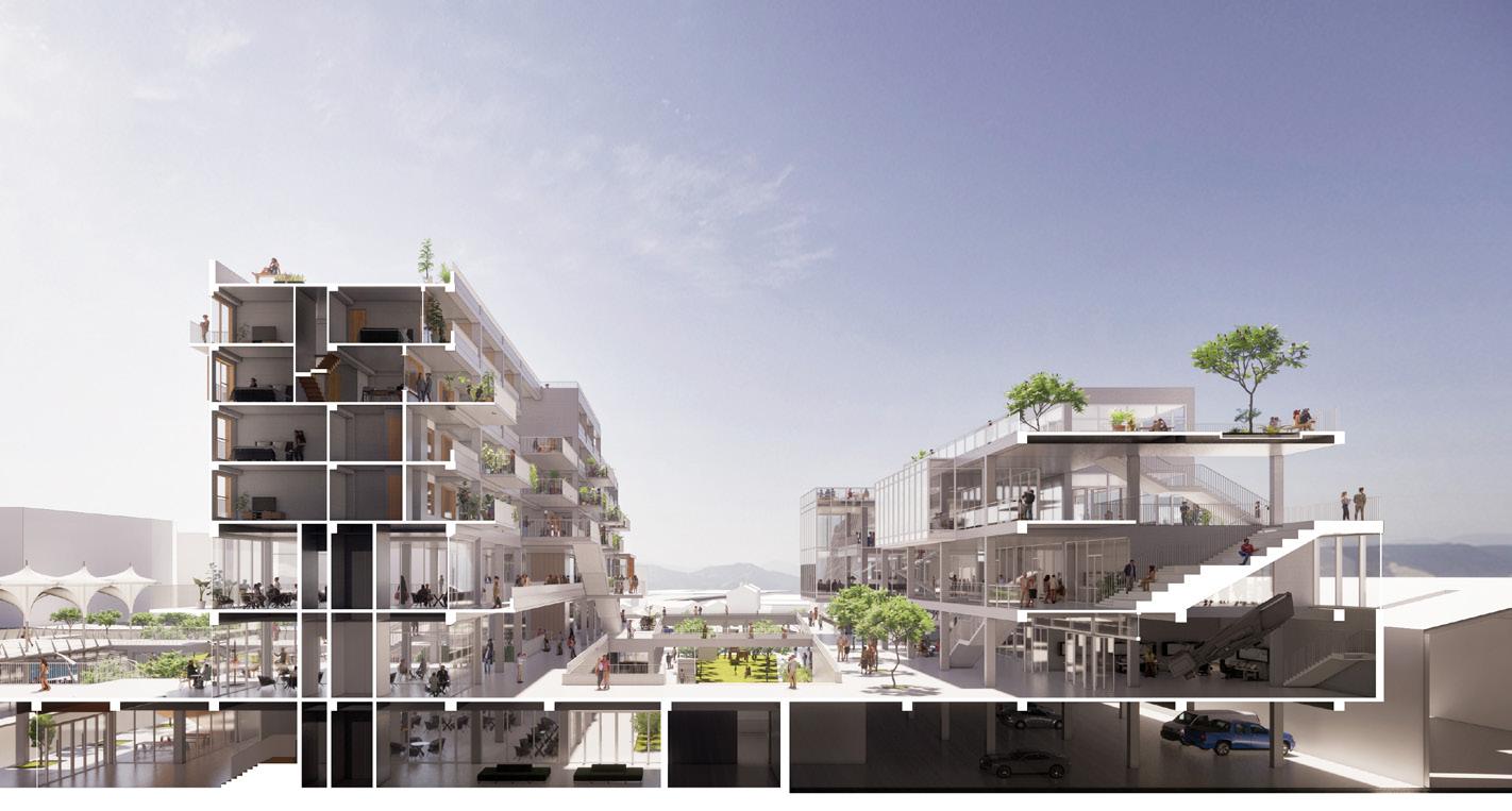
In the year 2050, automation not only changes the way the city of Rotterdam works, but also completely transforms its means of production and labor components of the society, especially jobs that are not heavily knowledge-driven. Workers who previously were active in the port are now faced with the problem of joblessness as the city is being automated. This building therefore proposes a new re-training institute and production space, to preserve the skills and human craftsmanship that can never be replaced by robots, such in the crafting of yachts and boats. Productivity thus supply for the institute, making the building completely selffunded and sufficient.
Situated at the heart of Rotterdam, in the area of Rotterdam Stadshaven, and making use of the original dry dock as main production studios, the facility houses two key programs: a campus volume and a production volume, where communal spaces are interwoven between the two voids. The plan shows the gradient of privacy between the academia sphere, the shared area, and the public retail and production house. The project expands from the existing dry dock located on the site as a means of developing organization rules, forming the building layout into a production nucleus into the outer peripheral layout of public spaces that connects the other end of the facility: the institution. Inner canals are also proposed within the buildings, stimulating the sense of flow and community among the studentworkers.
The multifunctional building also reveals potentials for a clubhouse facility for retail and recreational usage as well as the turbines for the cultivation of hydro and tidal power draws both from the site and the europort that will support electricity demands for the institute and production house.
MANUFACTURING/
Semi-Submersible Crane Vessel, Europoort, Rotterdam. October 2019, Mohammad Talha Malik
BIBLIOGRAPHY
Bélanger, Pierre, Gareth Doherty, and Charles Waldheim. “Is Landscape Infrastructure?” in IsLandscape...?: EssaysontheIdentityofLandscape, 190-227. London: Routledge, 2016.
Blum, Andrew. Tubes: Behind the Scenes at the Internet. London: Viking, 2012.
Corner, J. “Landscape City: Infrastructure, Natural Systems and City-Making.” ArchitecturalDesign 90 (2020): 88-93.
Greenfield, Adam. RadicalTechnologies:TheDesignofEverydayLife. London: Verso, 2018.
Hajer, Maarten A., and Ton Dassen. SmartaboutCities:VisualisingtheChallengefor21st CenturyUrbanism. Rotterdam: PBL Publishers, 2014.
Moneo, Rafael. “On Typology.” in K.MichaelHays,OppositionsReader:SelectedReadingsfromaJournalfor IdeasandCriticisminArchitecture,1973-1984. New York: Princeton Architectural Press, 1998.
Moussavi, Farshid, Marco Ciancarella, Jonathan A. Scelsa, Crettier Mary, and Kate Kilalea. The Function of Style. Barcelona; New York: Actar; Harvard University, Graduate School of Design, 2014.
Schmid, Christian. “Traveling Warrior and Complete Urbanization in Switzerland: Landscape as Lived Space” in NeilBrenner,Implosions/Explosions:TowardsaStudyofPlanetaryUrbanization, 90-102. Berlin: Jovis, 2014.
Schumacher, Patrik. “Don’t Waste Your Time in the Countryside.” ArchitecturalDesign 86, no. 4 (2016): 128-133.
Steenhuis, Marinke, and Paul Meurs. BeyondtheDikes:HowtheDutchWorkwithWater. Rotterdam: Nai010 Publishers, 2017.
Young, Liam, Cathryn Dwyre, Chris Perry, David Salomon, and Kathy Velikov. “Ambiguous Territory Design for a World Estranged.” ArchitecturalDesign 89, no. 1 (2019): 136-142.
IMAGE REFERENCES
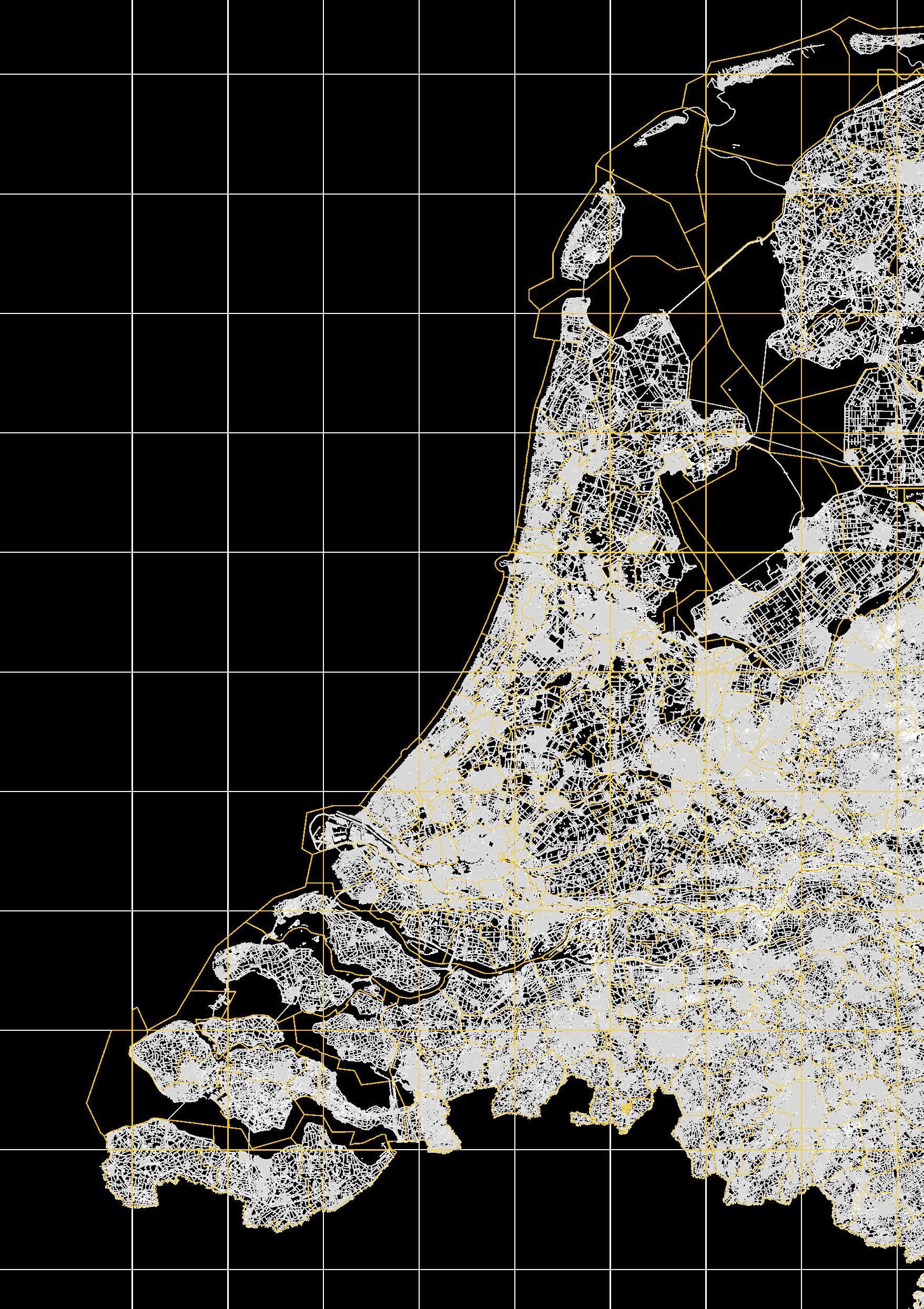
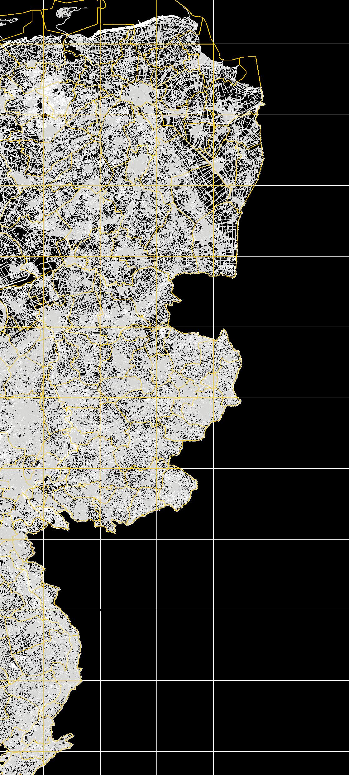
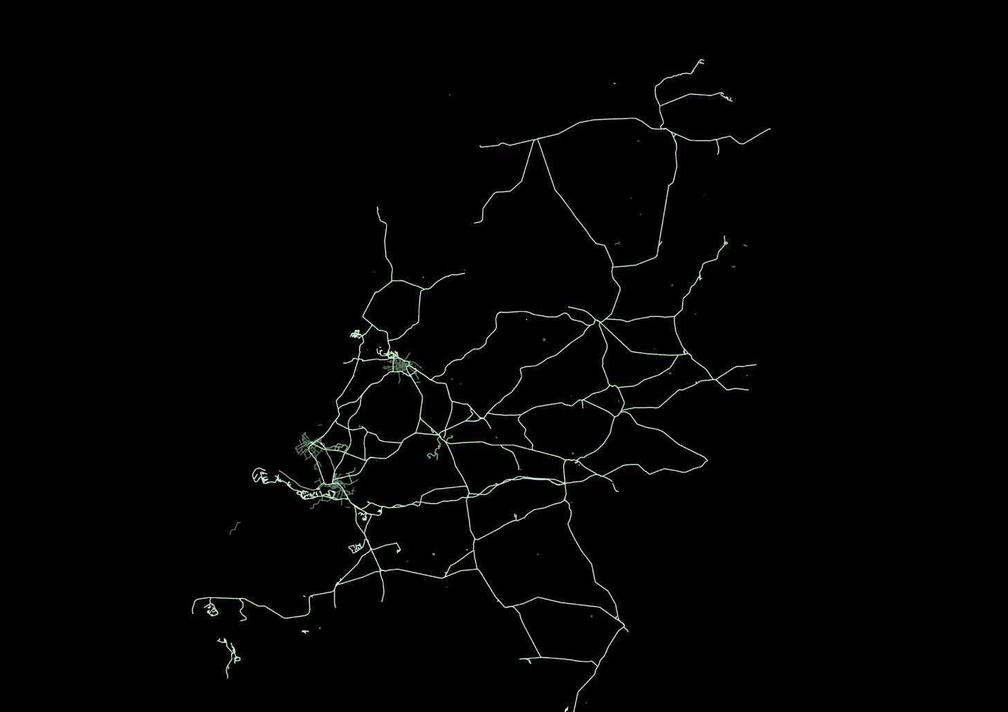
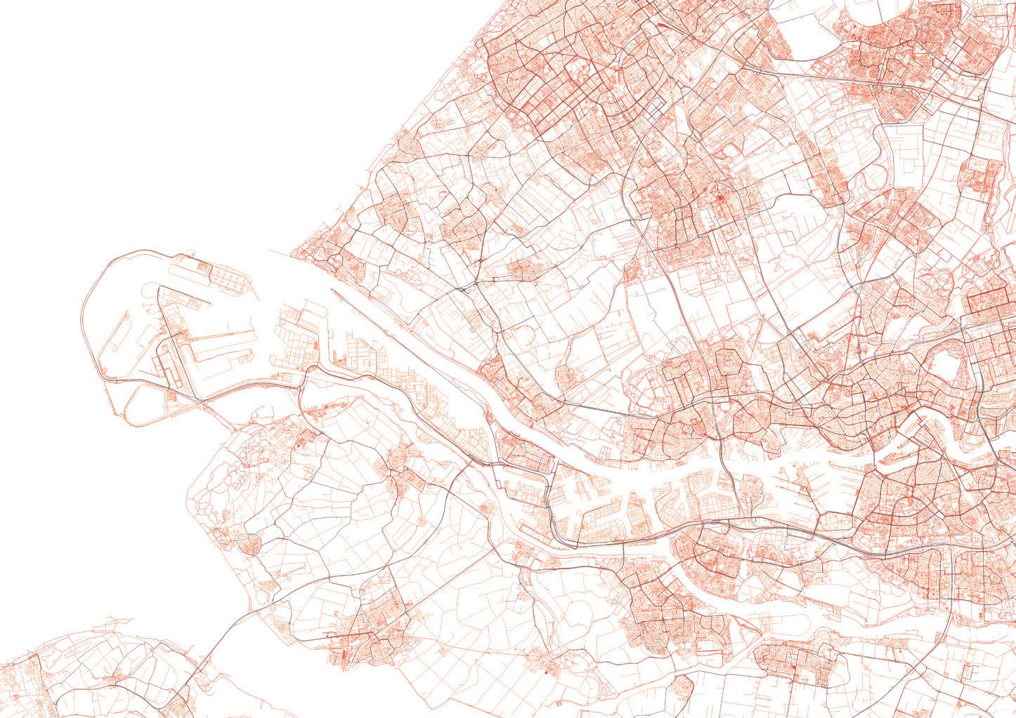
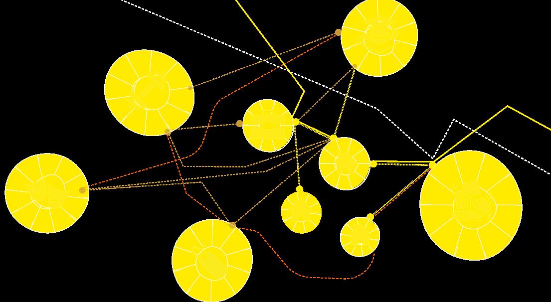
Randstad: Urban Territories, March 2020, Katherine Black & Elsa Konkka
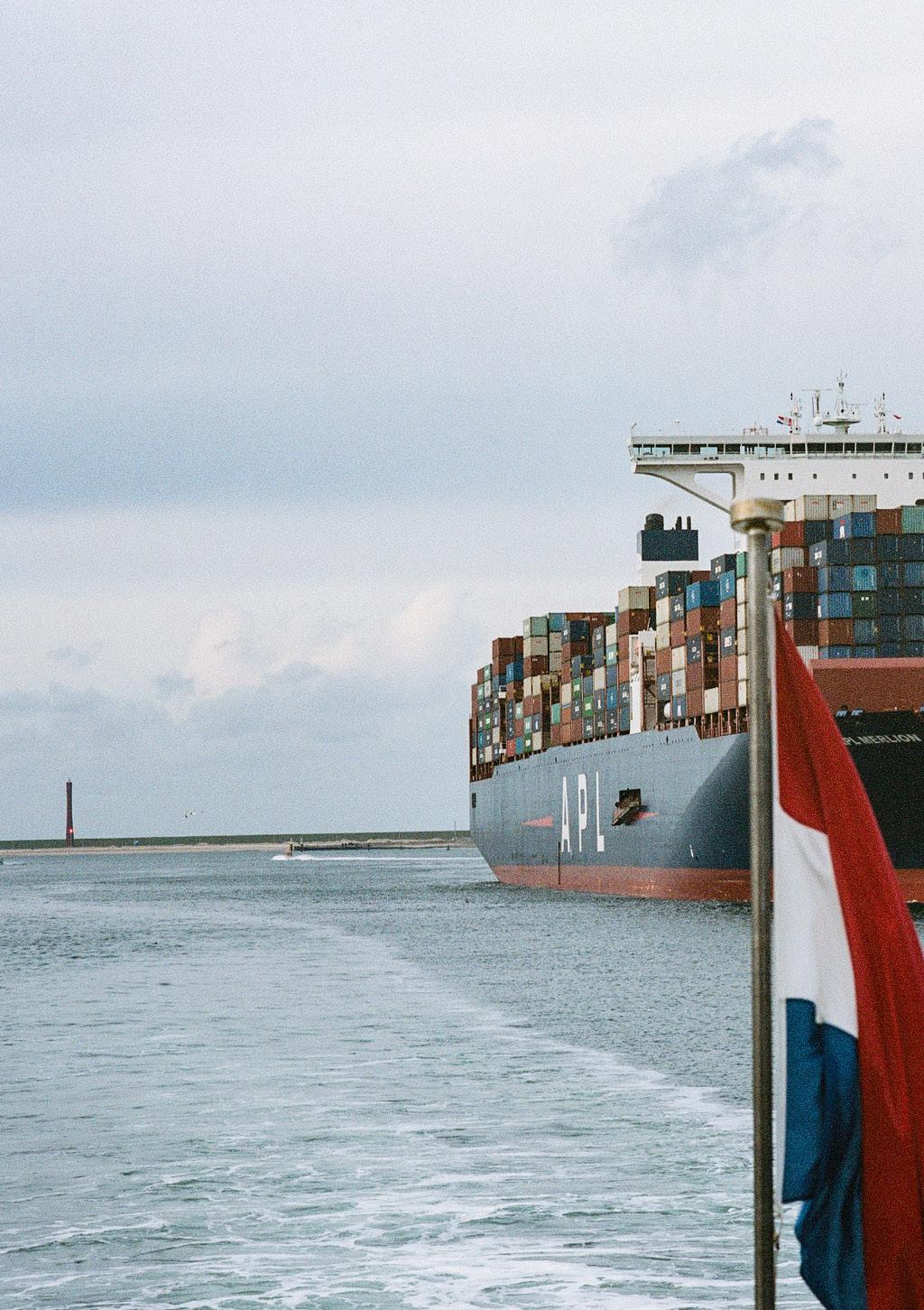
Dutch Waterways, Europoort, Rotterdam, October 2019, Mohammad Talha Malik
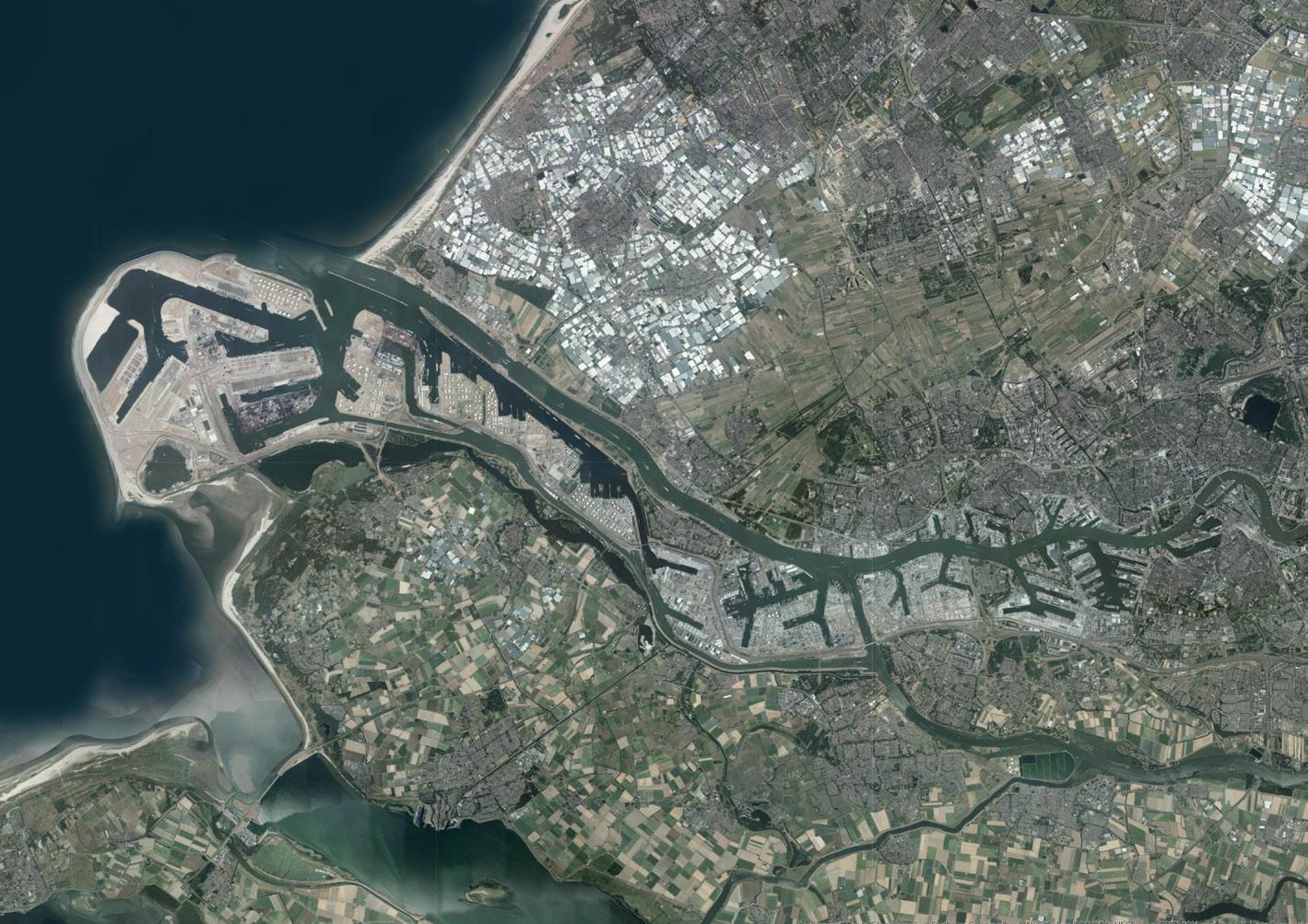
MappingtheNetherlands, April 2020, Elsa Konkka [additions by Katherine Black, May 2020]
Wind Farm, Europoort, Rotterdam. October 2019, Mohammad Talha Malik. Rotterdam Streetscape, Rotterdam. October 2019, Mohammad Talha Malik.
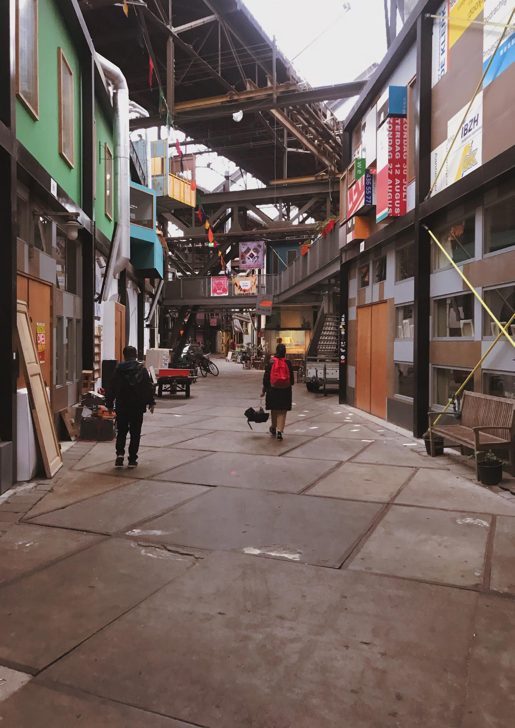
NDSM, Amsterdam. October 2019, Cristina Nan.
Onboard with Lidar Scanner and 360 camera, Europoort, Rotterdam. October 2019, Cristina Nan. Erasmus Bridge Group Shot [MIA Hersch Reddy]. Rotterdam, October 2019, Cristina Nan.
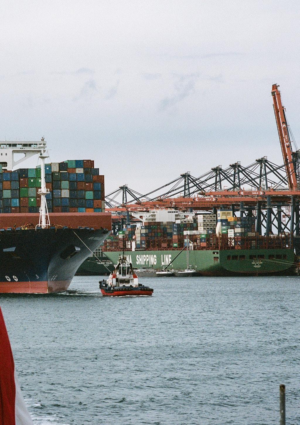
Cargo Ship, Europoort, Rotterdam. October 2019, Fritz Holtgrewe.
Urban Hierarchies, Europoort, Rotterdam. October 2019, Fritz Holtgrewe. Aalsmeer Flower Auction Highway, Aalsmeer. October 2019, Mohammad Talha Malik. Trainspotting, Rotterdam. October 2019, Mohammad Talha Malik.
Energy Translation, Europoort, Rotterdam. October 2019, Fritz Holtgrewe. Container Ship, Rotterdam. October 2019, Mohammad Talha Malik.
Semi-Submersible Crane Vessel, Europoort, Rotterdam. October 2019, Mohammad Talha Malik. Fisherman, Europoort, Rotterdam. October 2019, Mohammad Talha Malik.
Trekking to Europoort, Rotterdam, October 2019, Mohammad Talha Malik
Fisherman, Europoort, Rotterdam. October 2019, Mohammad Talha Malik
ACKNOWLEDGEMENTS
Tutors
Dr.-Ing. Cristina Nan
Michael Lewis
Jonathan Lynn Visitors
Fraser Morrison
Sebastian Aedo Jury
Special Thanks
Michalis Hadjistyllis, OMA
Konstantinos Chrysos, UN Studio
Raoul Volmer, Wouter de Boer, Luc Dam, Equinix AM4
Sevket Uludag, Faculty of Aerospace Engineering, Delft University of Technology
Mike Boyd, uCreate
Technicians
Malcolm Cruickshank
Catriona Gilbert
Lauren Puckett
Paul Charlton
Rachel Collie
SuperInfrastructures. SuperCities. SuperDutch. Edition edited by Katherine Black & Hersch Reddy
Catalogue designed and co-edited by Eireann Iannetta-Mackay & Joe Coulter
The format of this catalogue has developed annually, evolving from the inaugural catalogue series produced for the ESALA MArch studios 2017-18, designed by Emma Bennett and Rachel Braude.
Printed by J Thomson Colour Printers Ltd., Glasgow
Trekking to Europoort, Rotterdam. October 2019. Mohammad Talha Malik.