


facebook.com/MyEagleNews Instagram/@myeaglenews EMAIL


facebook.com/MyEagleNews Instagram/@myeaglenews EMAIL


explore grant county

Here you’ll find a place where the beauty of four distinct seasons meets the thrill of outdoor adventure. Whether you’re a fan of serene landscapes, exciting activities or exploring unique historical landmarks, you’ll find something to love here in every season.

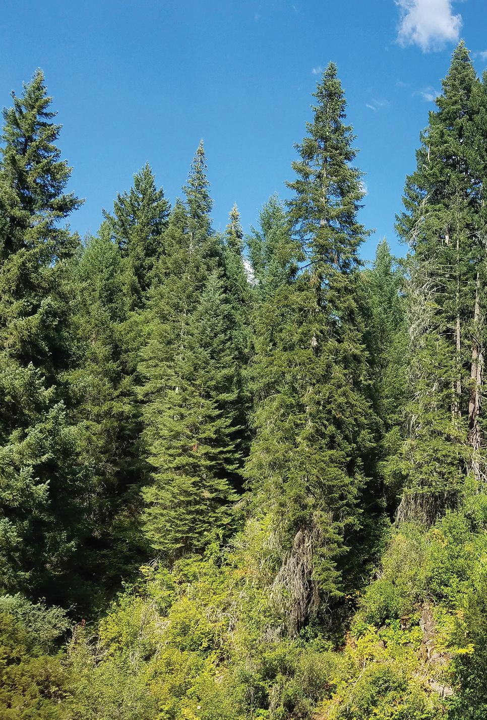
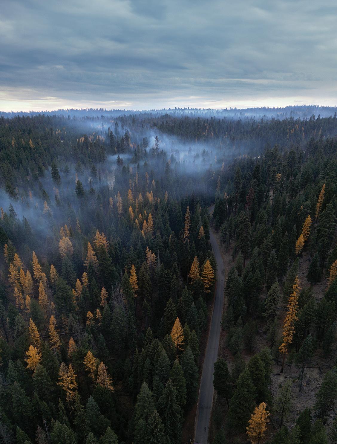
Our county is a haven for those who appreciate the great outdoors. From the crisp air of spring to the golden hues of autumn, Grant County offers endless opportunities for adventure. Picture yourself riding through the scenic byways on your motorcycle or bicycle, enjoying the wide-open roads and breathtaking views. Our forests, filled with majestic ponderosa pine, fir and tamarack trees, offer the perfect backdrop for hiking and camping.
Fishing and hunting enthusiasts will find themselves in paradise with the many rivers, lakes and vast wilderness areas waiting to be explored. For those who seek relaxation by the water, swimming and rafting in the area’s rivers are ideal ways to cool off on warm summer days.
For history buffs, don’t miss a visit to the Kam Wah Chung Museum, where you can learn about the area’s fascinating Chinese heritage and its impact on the local community. Another must-see is the John Day Fossil Beds Sheep Rock Unit, where you can step back in time and marvel at some of the most significant fossil discoveries in the world.
Grant County is filled with unique attractions and activities to make your stay unforgettable. Whether you’re visiting for the outdoor thrills, the spectacular landscapes or the rich history, you’ll quickly realize why our county is one of Oregon’s hidden gems.
We hope you enjoy all that Grant County has to offer and make memories that will last a lifetime. We look forward to welcoming you again soon!

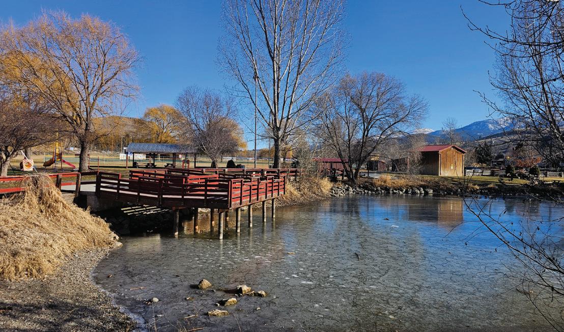
A few blocks off Main Street in John Day, this 23-acre multi-use complex has something for everyone, including a mile-long paved trail that wraps around a grassy tree-lined field, baseball and softball fields, basketball and tennis courts, a stocked fishing pond, two playgrounds, nine-hole disc golf course, skatepark, splash pad, mountain bike trails and sheltered picnic areas with restrooms and a shower facility. | JUSTIN DAVIS PHOTO
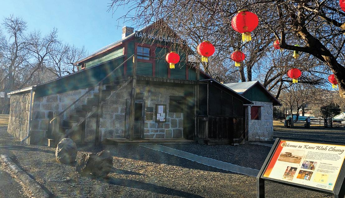
Originally a Chinese medical clinic, general store, community center and residence run by two Chinese immigrants, Ing “Doc” Hay and Lung On, the building was donated to the city of John Day following Doc Hay’s passing and now serves as a tool in the interpretation of local Chinese history. Kam Wah Chung sat undisturbed for almost 20 years before it was restored and reopened as a museum. The building has largely been kept exactly as it was found by historians. | JUSTIN DAVIS PHOTO
East of Dayville within the Phillip W. Schneider Wildlife Management Area, the scenic ponds offer a unique and rugged fishing and hiking experience.
Located off Highway 26, 10 miles east of Prairie City within the Dixie Mountain Sno-Park. The tow is 1,100 feet of 1-inch nylon rope braided into a continuous loop that pulls skiers, sledders, snowboarders and tubers to the top of a snow-covered hill so they can race to the bottom and do it all over again. Those seeking relief from the cold can take a break in the warming hut.
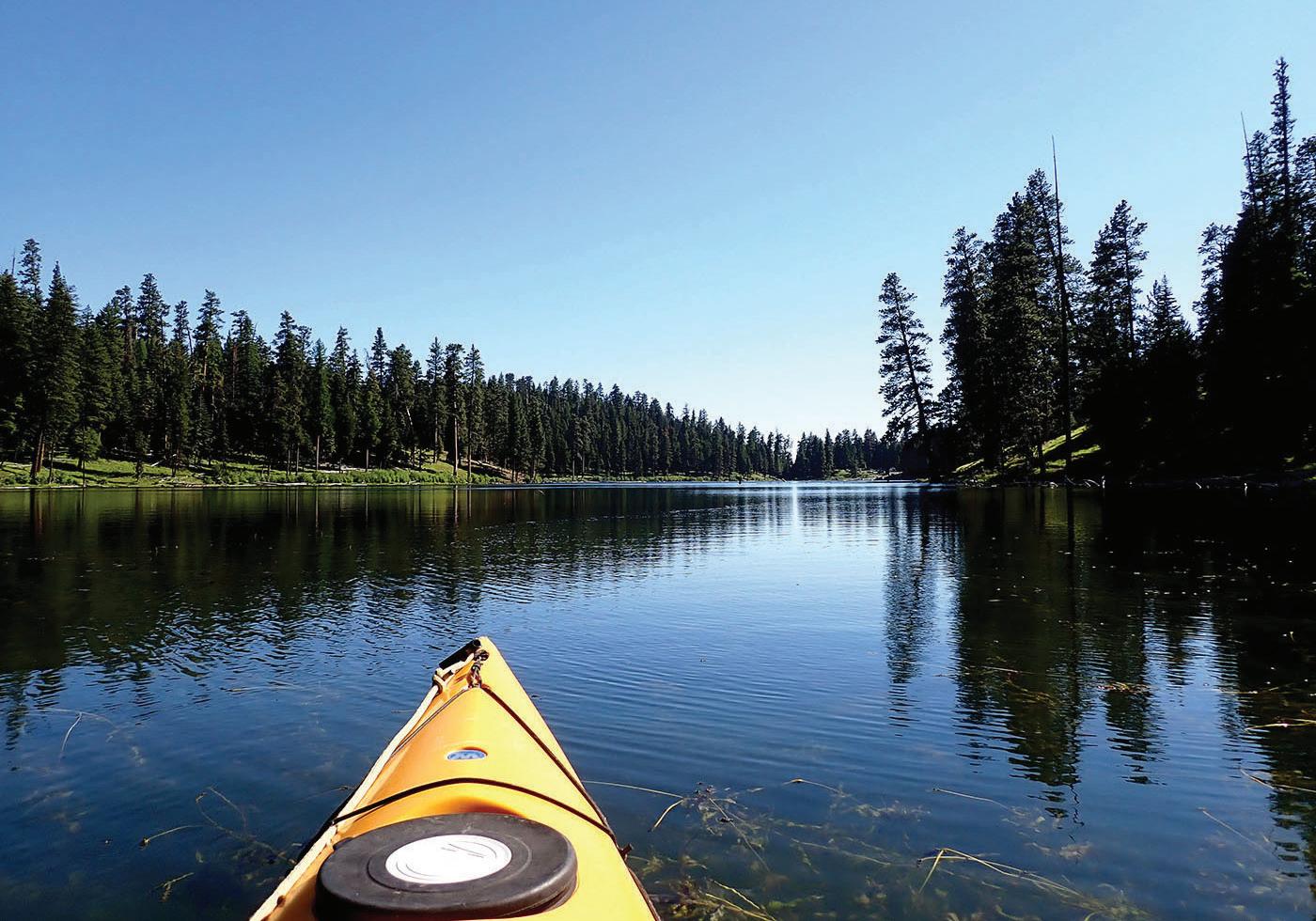
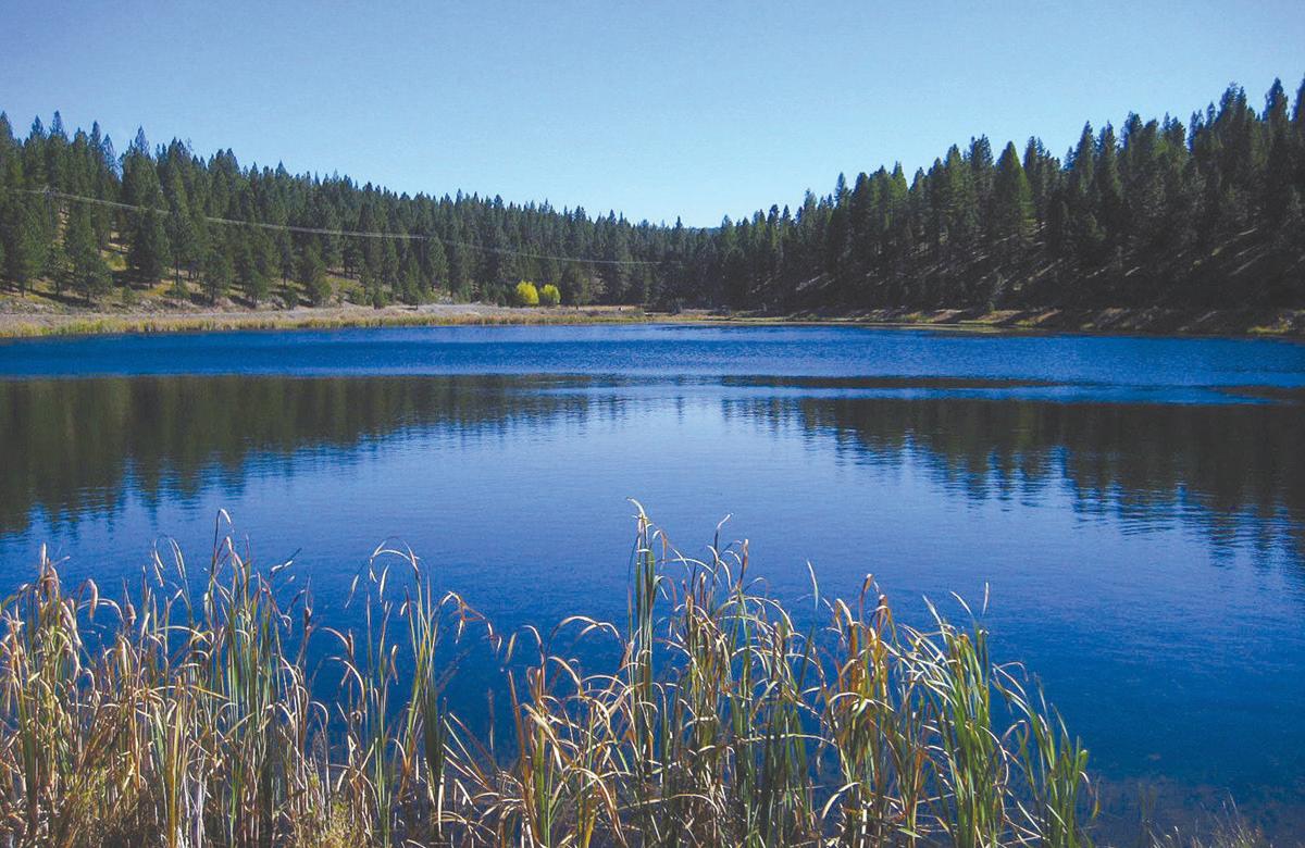
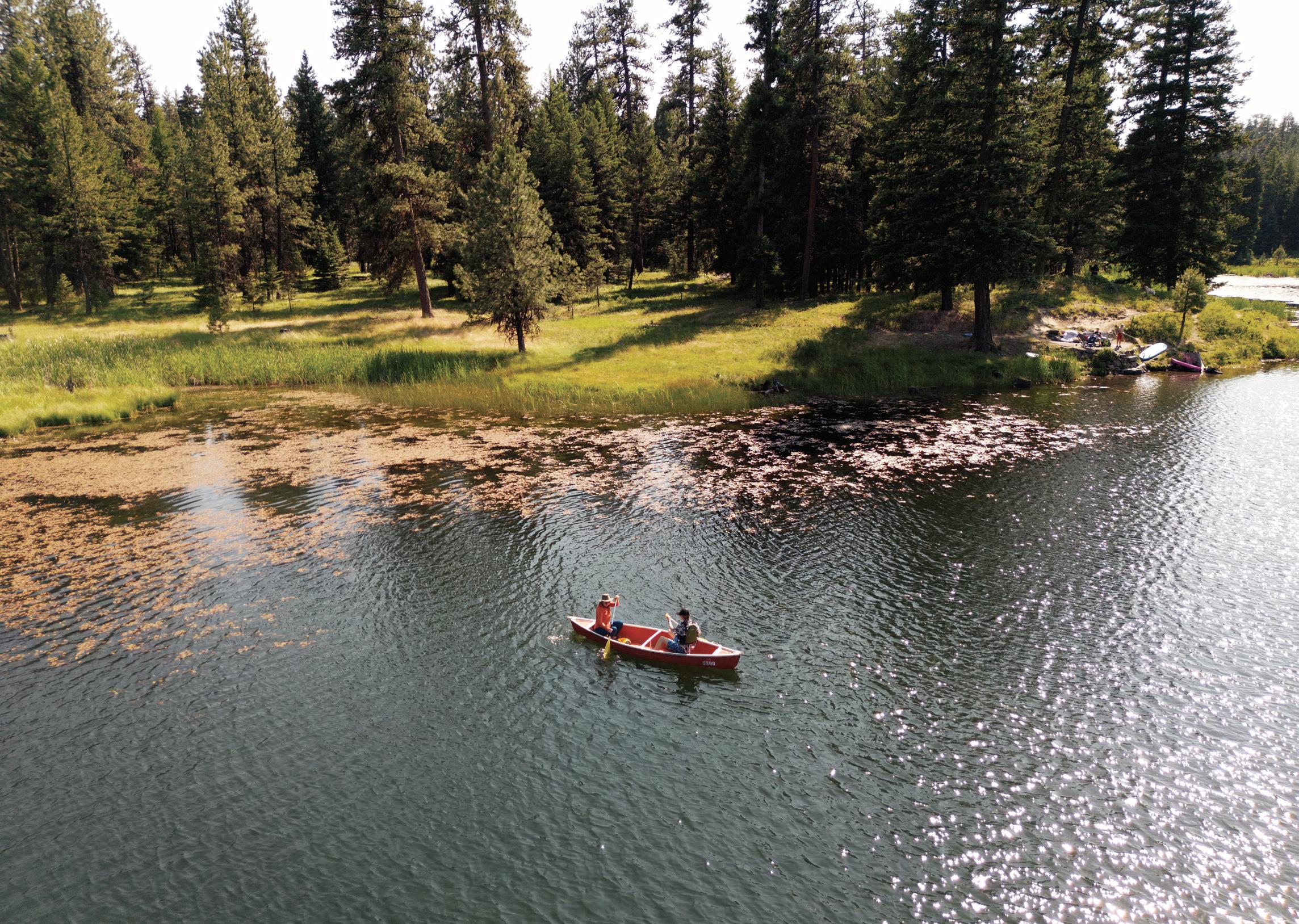
One of Grant County’s most popular destinations to cool off on scorching summer days. Magone Lake (pronounced “muh-GOON”) offers day-use areas as well as a campground set among white fir and ponderosa pine, with a picnic shelter and group campsite that can accommodate up to 75 people. The lake is the ideal spot for fishing, swimming or paddling, and a 1.5-mile trail hugs the shoreline. | BENNETT HALL PHOTO
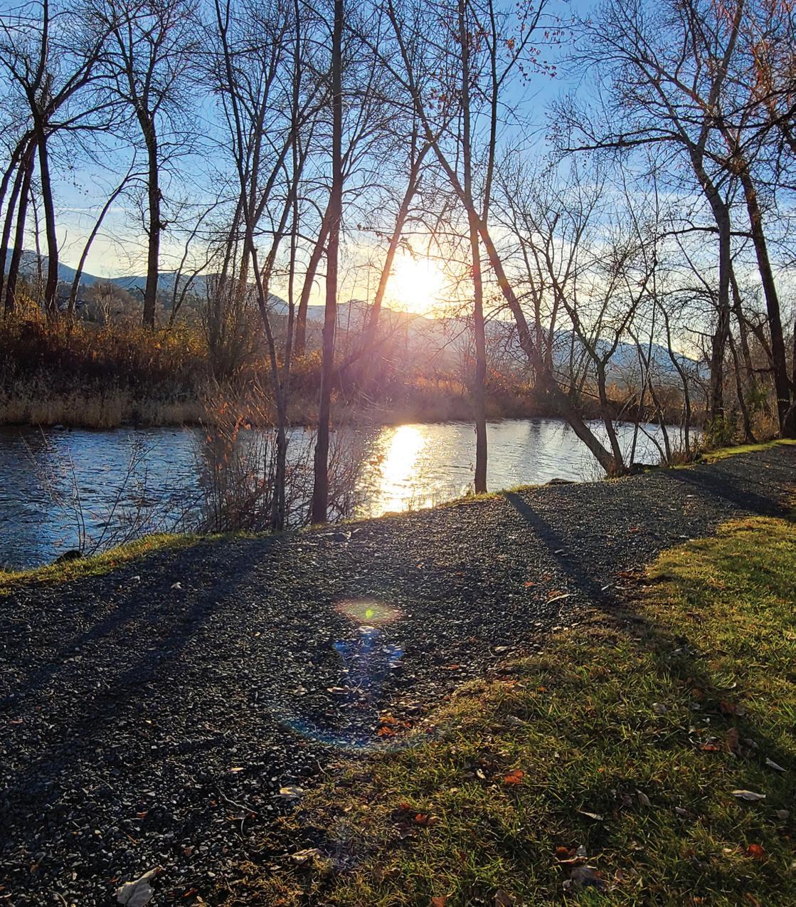
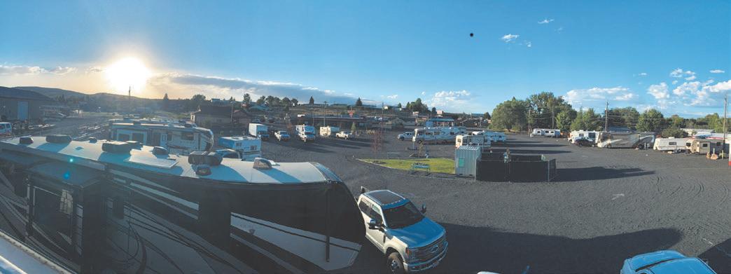
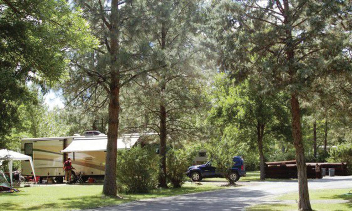
Situated next to the John Day River, Clyde Holliday State Park offers camping beneath towering cottonwood trees. Visitors may spot elk and mule deer grazing nearby or catch steelhead coming upriver to spawn at the 43-acre state park. Camping facilities feature 31 RV sites with electrical hookups, two tepees, a hiker/biker camp, hot showers and flush toilets, firewood and ice available for purchase, an RV dump station, horseshoe pits and an outdoor amphitheater complex with summer interpretive programs. The park is located on Highway 26, 1 mile east of Mount Vernon and 8 miles west of John Day. | JESSICA FRENIERE PHOTO

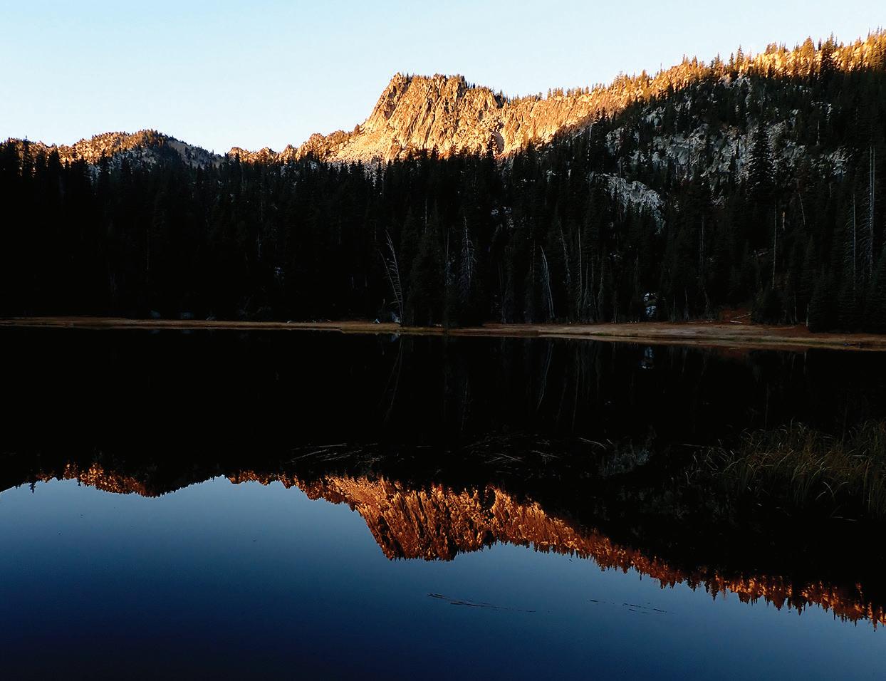
Unreachable by motor vehicle, this pristine mountain lake offers stunning scenery and peaceful solitude. County Road 60 leads south from Prairie City about 11 miles to the Strawberry Campground. Visitors will need to make the 1.5-mile hike from the campground to reach the lake, and adventurous spirits can keep going for another mile to reach Strawberry Falls. | ROBERT G. BROWN PHOTO
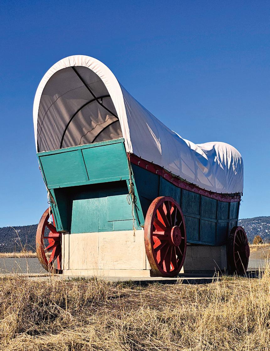
With its larger-than-life replica of a prairie schooner, the overlook on Highway 26 just east of Prairie City commemorates the journey made by pioneers on the Oregon Trail and provides breathtaking views of the Strawberry Mountains. | JUSTIN DAVIS PHOTO

Complete with picnic areas, hiking trails and a fascinating visitor center, John Day Fossil Beds National Monument provides a short course on the 40 million years between the extinction of the dinosaurs and the start of the Ice Age. The monument comprises three units — Sheep Rock, Painted Hills and Clarno. Together the three sites span over 14,000 acres of land. | TANNI WENGER PHOTO
With thousands of acres of public land, there’s no better place to spend time in the great outdoors than Grant County. And if you’re looking for a place to camp, you’ll find plenty of places to choose from, with amenities ranging from RV hookups to no-frills dry camping. Turn the page for a complete listing of campgrounds in Grant County. But first, keep reading for some other options.
Sitting next to the John Day River under towering cottonwood trees, the 43-acre Clyde Holliday State Park is getting a facelift in 2025 and will be closed through the end of August.
Campground facilities include 31 reservable electrical sites with water and two reservable tepees for rent (most years) from March 1-Nov. 30, a hiker/biker camp, hot showers and flush toilets, firewood and ice for sale, an RV dump station, horseshoe pits and an outdoor amphitheater with summer interpretive programs. Reservations can be made online up to six months in advance at https://tinyurl.com/ kw3xsanz.
Clyde Holliday State Park is located on Highway 26 a mile east of Mount Vernon and 8 miles west of John Day.
Once the site of a thriving lumber mill and company town that operated from 1917 to 1975, the 131-acre Bates State Park lies along the Middle Fork John Day River and Bridge and Clear creeks. The park features 4 miles of hiking trails and an old mill pond where visitors often spot beavers and otters.
Campground facilities include 28 primitive sites for rent for tent camping or self-contained RVs, vault toilets, potable water, and a hiker/ biker camp with six sites and electric plug-ins. Three campsites are accessible to campers with disabilities. Camping is first-come, first-served from May 1 to Nov. 1. A day-use area contains facilities for picnicking.
Bates State Park is located about 17 miles east of Prairie City on County Road 20 about a mile from the junction of Highway 26 and Highway 7.
For more information, visit oregonstateparks.org.
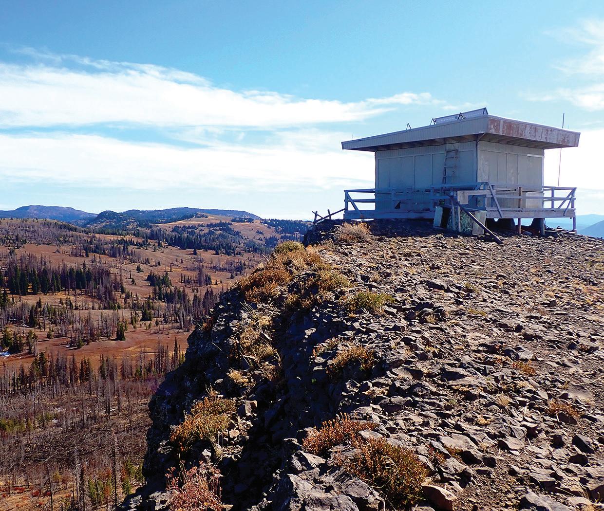
On the Malheur National Forest about 20 miles from John Day, Fall Mountain Lookout allows visitors to spend the night in a former fire lookout atop an 18-foot tower. A catwalk encircles the structure, providing 360-degree views of the surrounding areas, including the Strawberry Mountain Wilderness, Seneca and Mount Vernon. The lookout can only accommodate two people and provides few amenities.
The Sunshine, Short Creek, Deer Creek and Murderers Creek guard stations — former outposts for firefighters — can also be rented.
Although most of the national forest campgrounds are first-come, first-served, the tower and guard stations can be reserved online. For reservations and more information, visit recreation.gov.
1.Magone Lake — USFS
26 miles N. of John Day on Forest Road 3620
2.Dixie — USFS
8 miles N.E. of Prairie City on U.S. Hwy. 26
3.Middle Fork — USFS
9 miles N.W. of Austin Junction on Co. Road 20
4.Deerhorn — USFS
4 miles N.W. of Austin Junction on Co. Road 20
5.Little Crane — USFS
30 miles S.E. of Prairie City on Forest Road 16
6.Parish Cabin — USFS
11 miles E. of Seneca on Forest Road 1520
7.Wickiup — USFS
18 miles S.E. of John Day on Forest Road 15
8.Starr — USFS
16 miles S. of John Day on Hwy. 395
9.Trout Farm —
15 miles S.E. of Prairie City on Co. Road 62
10a. Slide Creek (east side of road) — USFS
9 miles S. of Prairie City on Forest Road 6001
10b. Slide Horse Camp (west side of road) — USFS
9 miles S. of Prairie City on Forest Road 6001 11.Strawberry — USFS
11 miles S. of Prairie City on Forest Road 6001
12. Murray —
21 miles E. of Seneca on Forest Road 924
Creek
miles E. of Seneca on Forest Road 815
14. Elk Creek — USFS
miles S.E. of Prairie City on Co. Road 62
17.Lake Creek Youth Camp — Nonprofit Call for availability and
miles E. of Seneca on Forest Road 924 541-575-2153 18. Billy Fields
miles S.W. of John Day on Forest Road 21 19. Oregon Mine
miles S.W. of John Day on Forest Road 2170
miles S.E. of Dale on Forest Road 10




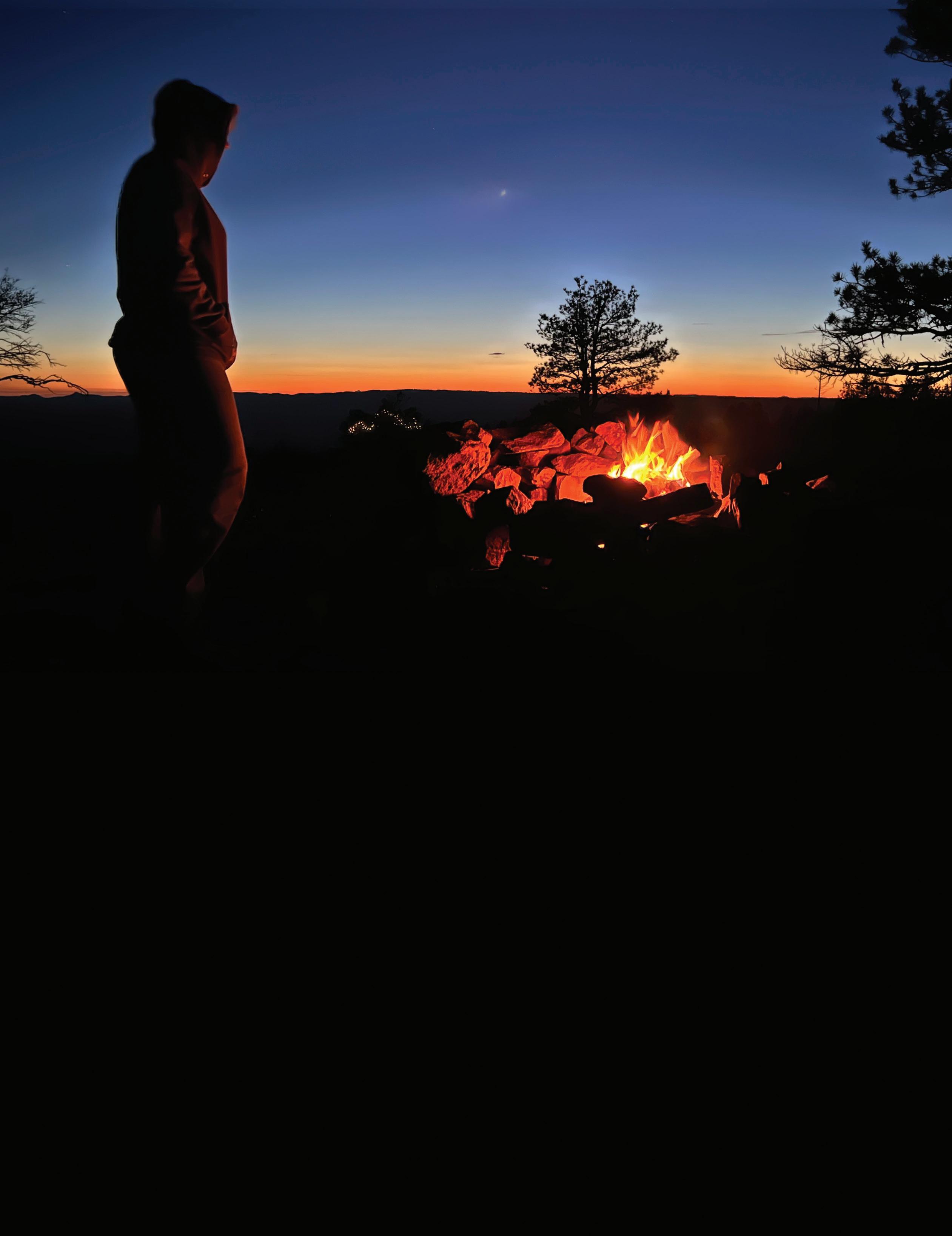
With plenty of wide-open spaces and few city lights to clutter up the view, Grant County has some of the darkest night skies in the Lower 48 and is a great place to practice the growing hobby of astral photography.
Pack up your telescope, binoculars, cameras and other stargazing gear and head to a high point, or just find a secluded spot to kick back and stare up at the sky. You will be richly rewarded with celestial sights.
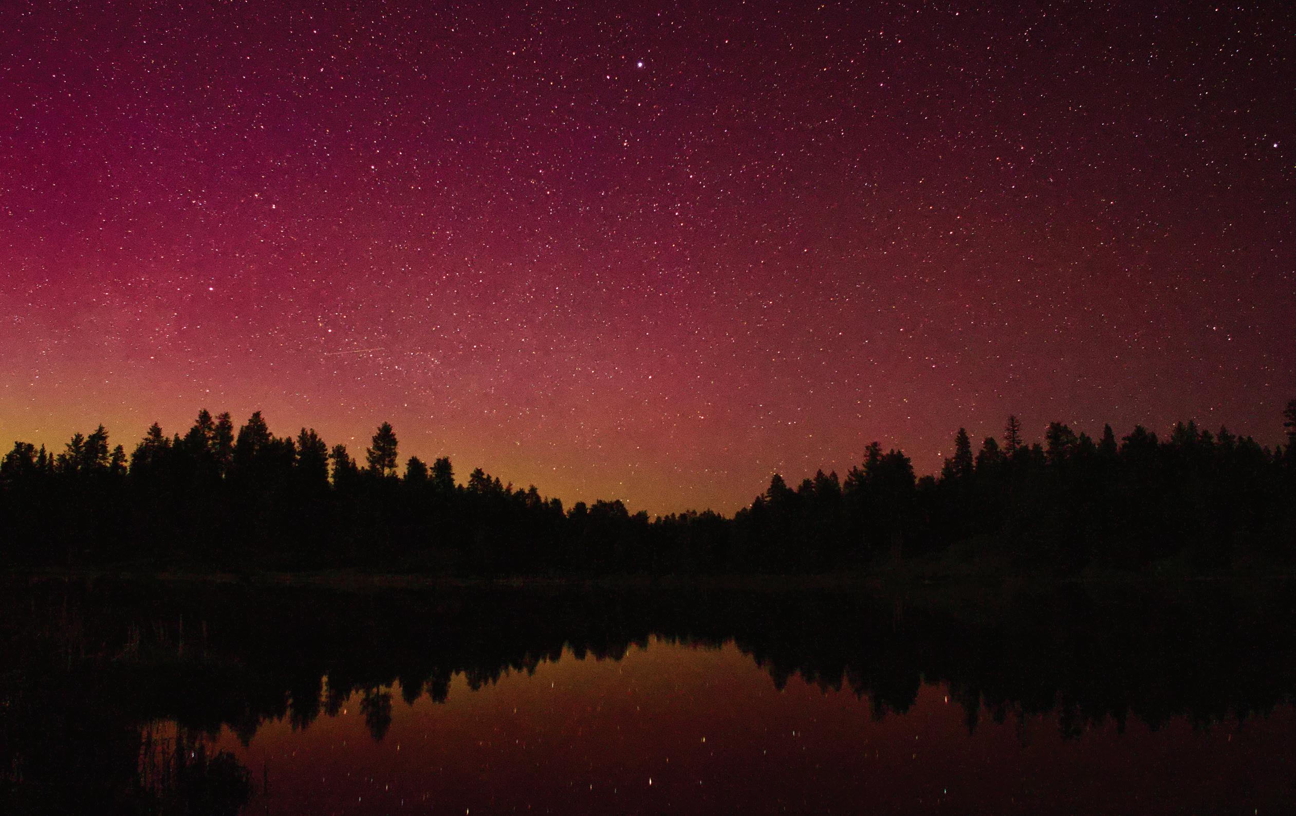
Once you’ve been out in the darkness for about 15 minutes, you’ll be surprised at how well your eyes adjust and how much you can see.
With a little bit of internet searching you can find plenty of information about celestial objects, and online charts, updated by the month, will show you where to look for planets, stars and galaxies. There are also several meteor showers each year that provide a spectacular sky show.


you Grant County for another successful year!
We are now celebrating 47-plus years as Grant County’s oldest locally owned Real Estate Company. We are proud to be able to live and raise our families in Grant County. We are your neighbors and work alongside of you every day in an effort to make Grant County a better place to live.
Like you, we pay local and county taxes, support our schools, the hospital, and serve on various boards and committees, and contribute our time and money to many worthwhile causes such as:
Special Olympics - CASA - American Legion - Senior Meals - G.C. Ministerial Association - Grant County Fair - Chamber of Commerce - Timber Truckers Light Parade - Boy Scouts - FFA - Little League - Volleyball - Grad Night - BowHunters - John Day Golf Course - Carrie Young Memorial - Kam Wah Chung MuseumSeneca PTA - Awana - local churches - charities - special events, and the list goes on.
In today’s ever changing times of sophisticated financing and continuing change of legal procedures, it is very difficult for the average property or business owners to buy, sell or trade his or her own property, and be assured that no problems will emerge at a later date. Trained professional real estate assistance will insure that all current laws and procedures are followed and that a happy and satisfied seller and buyer relationship exists.
If you are thinking of buying or selling real estate, give us a call. We hope that you will support a local realtor who lives in the area, understands our market and is available on short notice to assist with unscheduled visitors.
We appreciate your business!
Your friends at Eastern Oregon Realty Jerry, Traci, Rene’ & Morganne




Story & photos by Ellen Morris Bishop
Strawberry Lake and the Strawberry Wilderness are among hikers’ favorite destinations in Grant County. The rocks are a soothing gray. The lakes and waterfalls provide a placid retreat. But 16 million years ago, the east end of the Strawberry Mountains was a raging volcanic wonderland, powered by the same volcanic dynamo that today underlies Yellowstone National Park.
Until just a few years ago, the origin of the Strawberry Mountains’ volcanic rocks was a geologic conundrum. The Strawberry Mountains are composed mostly of silica-rich rocks (andesites and rhyolites) that resemble those of Mount Hood and other Cascade volcanoes. But there was no known mechanism here to generate Cascade-like lavas.
In 2019, Martin Streck and Arron Steiner, geologists at Portland State University, used cutting-edge technology to solve the mystery. First, they applied highly precise argon isotopes to date the rocks. Then they analyzed for lead, strontium, and neodymium, niobium, zirconium and other trace elements to find geochemical fingerprints. The results pointed unequivocally to the Yellowstone hotspot as the source of the Strawberries’ lavas.
Yellowstone is a hotspot: a stationary location where very hot basalt magma rises from the mantle to erupt at the Earth’s surface. The hotspot doesn’t change its location. It stays in one place for tens of millions of years. But the continent above it moves. Thus, the hotspot’s eruptions leave a record of the continent’s motions through time.

Twenty years ago geologists thought that Yellowstone first surfaced at McDermitt Caldera, a flat-lying 25-mile-wide explosive volcano on the Oregon-Nevada border that first erupted 17 million years ago. But as technology and mapping improved, it became obvious that the Yellowstone story was much longer and more complicated.
About 55 million years ago the Yellowstone hotspot was happily producing seamounts just west of North America’s Pacific coast. North America was moving westward, as it still does. About 50 million years ago, the continent collided with the seamounts, producing Oregon’s Coast Range and the Olympic Mountains. Then it overran the hotspot and, for a time, shut off the Yellowstone hotspot’s eruptions.
A few Yellowstone volcanic dribbles appeared between 45 million and 28 million years ago. They include today’s Cascade Head and Cape Perpetua 45 million years ago and, as North America moved farther west over the hotspot, Smith Rock (the Crooked River Caldera) at about 29 million years ago.
An ambitious hotspot with plans to be a National Park can’t be stifled forever. By 17 million years ago, Yellowstone had shouldered its way to the surface near downtown Monument. This was the earliest known eruption of the Columbia River basalts — lavas that eventually smothered 81,000 square miles of the Pacific Northwest in basalt flows between 17 million and 6 million years ago. They are the Yellowstone hotspot’s masterpiece.
Erupting this much lava required a place to store and accumulate it between eruptions. Huge magma chambers developed beneath the surface. One of these extends from Ironside Mountain to Castle Rock south of Unity. It may have extended west to the vicinity of today’s Strawberry Mountains and east almost to Ontario.
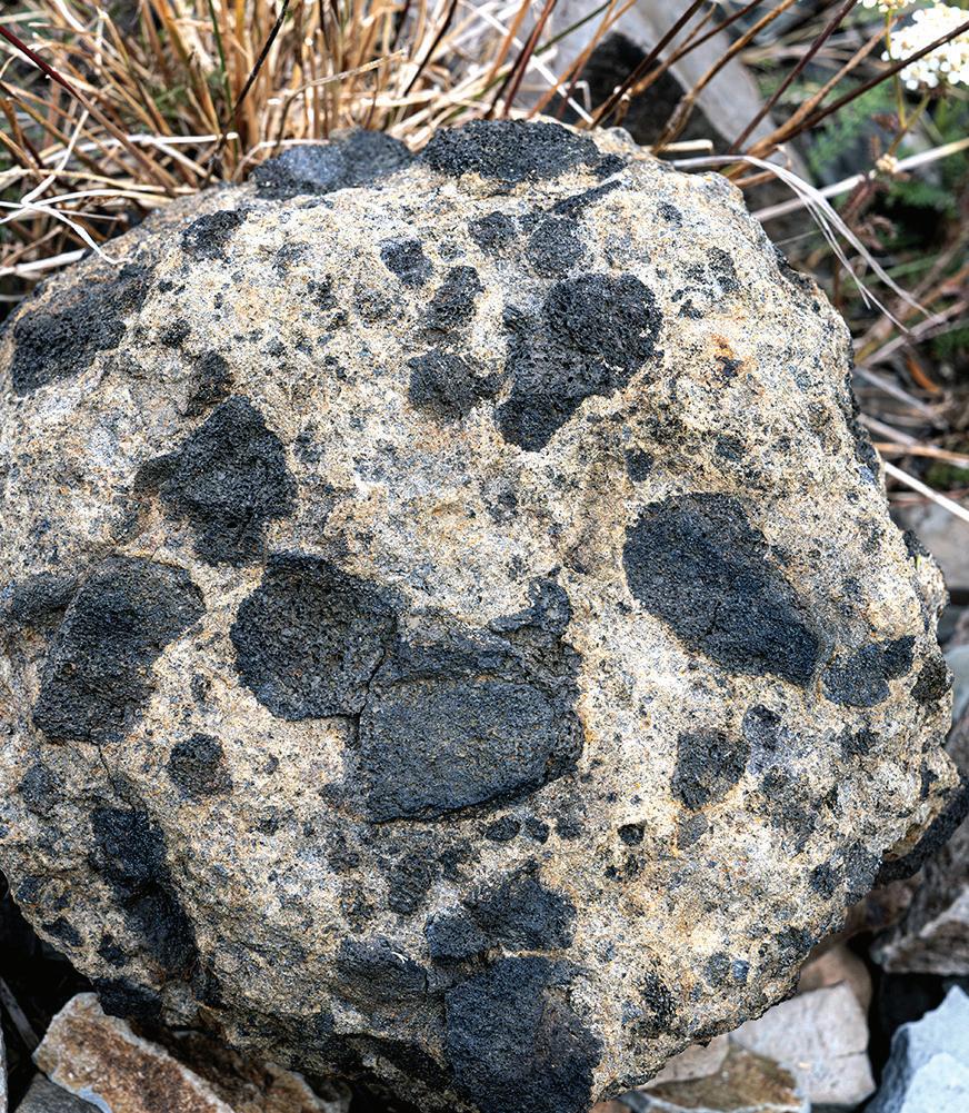
The very hot (2,500 degrees F) basalt in this magma chamber melted and mixed with silica-rich crustal rocks that composed the roof of this huge magma chamber. (Think of mixing a marshmallow into a cup of very, very warm hot chocolate.)
The results include andesites and rhyolites that form much of the Strawberry Mountains. They are a blend of dark basalt magma and lighter crustal rock that melted and mixed with the basalt, and then erupted.
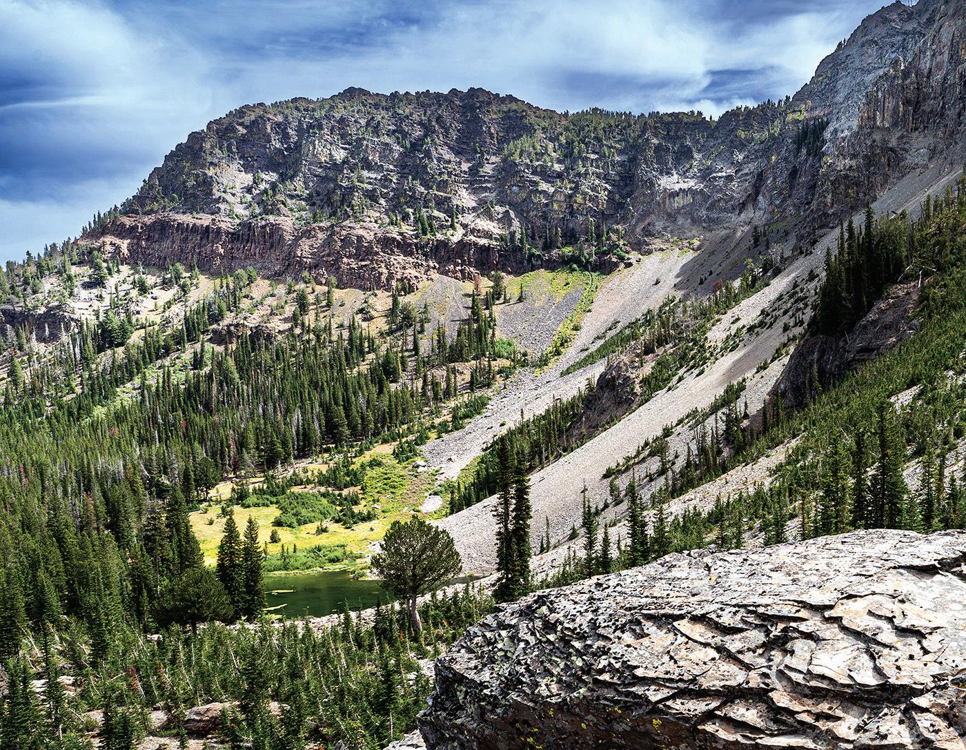
The 2019 study showed that the Strawberry volcanics are 16.2 million to about 12.5 million years old — the same age as the Columbia River basalts. Although previous studies suggested that a very large, Mount Hood-sized volcano once stood where Strawberry Mountain is today, the new work found multiple small volcanic vents throughout the Strawberries and adjacent areas. Rather than building a single high peak, the Strawberry eruptions produced widespread lavas that built a 3,000-foot-thick, relatively level carapace of andesite and other lavas across today’s southern Grant County.
In places, the volcanic rocks here may look a bit like shale. They have very thin horizontal joints that resemble sedimentary bedding. This structure, called “platy jointing” is produced partly by the way the viscous andesite lava moves (very slowly, and in compositionally segregated layers.)
Today, we can thank big faults and alpine glaciers for revealing the Strawberry Mountains’ geology. A hike to Little Strawberry Lake showcases the andesites. A more strenuous hike to the Rabbit Ears reveals one of many vents.
North America continued west. The Yellowstone hotspot diligently added to its volcanic resume. Its products include the basalt flows of Picture Gorge, the light-colored rhyolites of Dooley Mountain near Baker City, the tawny rocks of the Owyhees and the lithium-rich McDermitt Caldera. It etched the path of the overlying, moving continent into Idaho’s landscape as the Snake River Plain. Today, millions of visitors pay homage to Yellowstone’s modern volcanic prowess, but few know its legacy. Now you are among those who do, and you can visit Yellowstone right here at home.
Hike Strawberry Mountain
See page 23 for details
From a relaxing stroll through old-growth ponderosas to an exhilarating trek to a mountain summit, hikers of all abilities will find something to love in Grant County. A wide range of hiking adventures await you here, from short loops to multiday backpacking trips. Here are a few of our favorite rambles.
This is more of a drive than a hike — the walk from the road’s end turnaround to the lookout is a short, steep tenth of a mile — but you’ll be well-rewarded for the effort. The Forest Service established a fire lookout atop 7,353-foot Indian Rock in 1929; the original cupola-style perch was replaced with a flat-topped structure in 1957. The lookout, which is still staffed during fire season, offers expansive views in all directions. On a clear day you’ll spy such landmarks as Desolation Butte, the Elkhorn Mountains, Vinegar Hill, Dixie Butte and the Strawberry Mountains.
Directions: Follow the Middle Fork Road (County Road 20) to milepost 14, either by going east from Ritter Junction on Highway 395 or heading west from Highway 7 just north of Austin Junction. From there, go north on Forest Road 45 approximately 10 miles to the junction with Forest Road 573 and follow that road to the lookout.
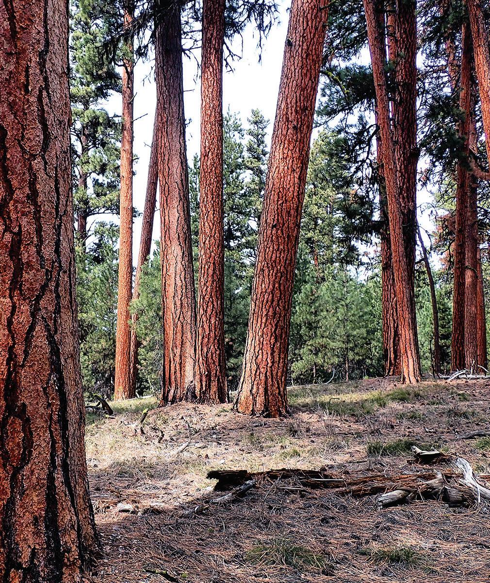
Located just off Highway 395 at the top of the grade between Canyon City and Seneca, the site offers an easy walk through a parklike pine forest. A gently graded, ¾-mile asphalt loop, suitable for wheelchair use, winds among towering orangebarked ponderosas, some of which are around 200 years old. Interpretive signs along the trail educate visitors about the ecosystem, with panels providing nuggets of information about native plants, bird species and fire ecology. Benches spaced at intervals invite hikers to rest and enjoy the view, and there are plenty of downed logs that serve the same purpose. A pair of picnic tables near the parking lot offer a comfortable spot to enjoy a leisurely meal.
Directions: From downtown John Day, drive south on Highway 395 for 17.5 miles. Turn left onto an unpaved road at a sign for Swick Old Growth (directly across from County Road 63, the Izee-Paulina Highway) and find a parking lot after 0.1 mile.
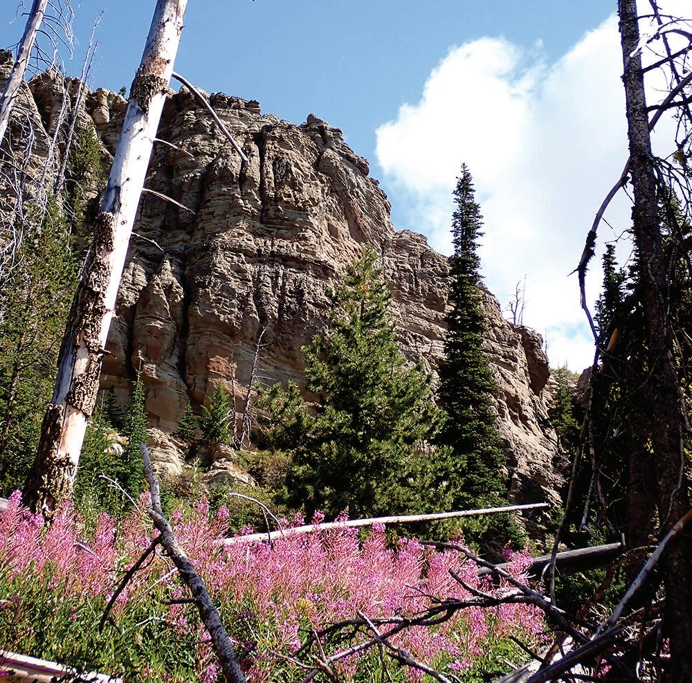
Some of the most dramatic landscapes in Grant County are to be found in Blue Basin, part of the Sheep Rock Unit of the John Day Fossil Beds National Monument. Two hikes here range from easy to moderate. The Island in Time Trail is a 1.2-mile out-and-back that follows a gentle grade through a heavily eroded canyon to a baroque amphitheater of bluegreen volcanic ash. Along the way you’ll see replicas of some of the ancient mammal fossils found in the area. For a more strenuous outing with some truly eye-popping views, take the Blue Basin Overlook Trail, a 3.2-mile loop with around 1,100 feet of elevation gain. The route climbs through bunchgrass and juniper to a ridgetop vantage with stunning vistas of the basin, Saddle Butte and the John Day River valley. For a deep dive into the region’s fascinating geological history, stop off at the monument visitor center, which is packed with educational exhibits.
Directions: Head north on Highway 19 from its junction with Highway 26 in the spectacular Picture Gorge. Follow 19 for 5.4 miles, passing the monument visitor center on the left, to find the Blue Basin parking lot on the right.
This 6.9-mile lollipop loop on the southwest flank of the Strawberry range defies the usual trail logic — it starts out high, then drops nearly 1,000 feet before bringing you back to your starting point. The first 1.2 miles follows a gently graded two-track at an elevation of just under 8,000 feet through open country studded with whitebark pines to a junction. Continuing straight will take you to Strawberry Mountain’s 9,038-foot summit, but save that for another day. Instead, drop down to the left for 0.3 mile to another junction, then go left again to begin a clockwise loop that traverses vivid wildflower patches and leads you through mixed-conifer forest past dramatic pinnacles of heavily eroded volcanic ash. The trail stops descending at the 7,000-foot mark at Wildcat Spring, which makes a pleasant spot for a lunch break, before looping to the northwest and beginning an arduous 800-foot climb back to the top. Wildfires some years back opened up sweeping views of the Bear Valley country and the Aldrich Mountains to the west, but a heavy regrowth of buckbrush has severely obscured the trail in places. You’ll need a good map and solid route-finding skills to keep from wandering off-course, but Wildcat Basin makes a fine day trip for the experienced hiker.
Directions: From John Day, head south on Highway 395 for 9.7 miles, then go left on Forest Service Road 15. After 13.6 miles, turn left on Forest Road 16 and continue 2.5 miles, then go left again on Forest Road 1640. Follow this gravel road for 9.6 miles to a sharp right-hand switchback and park at the pullout with a Roads End Trail sign. After your hike, treat yourself to spectacular views of the Logan Valley by driving another half-mile to the actual road’s end, which serves as the jumping-off point for the trail to High Lake.
Strawberry Mountain
Strawberry Mountain is the centerpiece of the 19,620-acre Strawberry Mountain Wilderness, a rugged landscape draped in conifer forest and dotted with scenic lakes and tumbling streams. At 9,038 feet, Strawberry Mountain is also the highest peak in the wilderness, offering far-flung vistas from its rocky, pyramid-shaped summit — and a challenging day’s walk for fit, experienced hikers, with 3,300 feet of elevation gain and a roundtrip distance of 12.8 miles. Along the way you’ll pass scenic Strawberry Lake and Strawberry Falls, either of which makes a fine destination for a shorter hike. Watch for mountain goats as you climb into the high country, where sweeping views of the John Day Valley open up before you.
Directions: From downtown Prairie City, turn south on Bridge Street at a sign for Depot Park and Strawberry Lake. From the stop sign at a T intersection, go left for two blocks, then turn right at the Strawberry Campground sign onto Bridge Street, which soon becomes County Road 60 and then Forest Road 6001. The road ends after 10.7 miles (including about 7.5 miles of gravel) at Strawberry Campground, where you’ll find a parking area and the trailhead just beyond the vault toilets.
Hugging the Grant-Baker County line, the Elkhorn Mountains rise to a height of 9,106 feet and offer spectacular hiking. Dutch Flat lake makes a good introduction to the charms of this range, which resembles a compact version of the Wallowa Mountains with its rugged granitic geology and dense conifer forests. Starting near the Anthony Lakes Ski Area, the Elkhorn Crest Trail meanders through the lake basin for half a mile before beginning a steady 1,400-foot climb to the rocky spine of the range. Ambitious adventurers can traverse the full 22.8-mile Elkhorn Crest Trail to its terminus at Marble Pass, but Dutch Flat Lake can be reached by a short spur trail from the crest. With a roundtrip distance of 8.6 miles and 1,900 feet of elevation gain, this charming mountain lake makes a beguiling destination for a dayhike or overnight backpacking trip.
Directions: From John Day, drive east on Highway 26 to Austin Junction, then go left on Highway 7 for 19 miles to the Sumpter turnoff. Turn left onto the Elkhorn Drive National Scenic Byway, passing through the old mining towns of Sumpter and Granite and continuing to Anthony Lakes Ski Area. Just beyond the Anthony Lake Campground, turn right into the Elkhorn Crest Trailhead parking lot.







Looking for a place to rest and relax after a long car ride? Pull over and check out one of Grant County’s many municipal parks.
This 23-acre multi-use park features baseball and softball fields, a pond with fishing docks, walking and running paths, two tennis courts, a basketball court, a large covered picnic area, restrooms, a splash pad, play equipment and a skatepark. The main parking area can be accessed from Northeast Seventh Avenue, just east of Bridge Street.
Adjacent to the Kam Wah Chung State Heritage Site, this quiet park at Northwest Canton Street and Ing Hay Way features a gravel path around a grass field and along Canyon Creek.
The city’s newest park, at the north end of Northwest Canton Street, is situated at the confluence of Canyon Creek and the John Day River. A footbridge crosses the river to connect with a multiuse path on the north bank.
Davis Creek Park
Four short trails meander among the pines and junipers of this park at 100 Valley View Drive. Some paths lead to elevated viewpoints or connect with the city trail system along the John Day River.
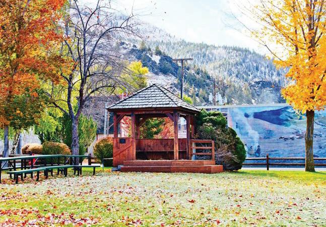
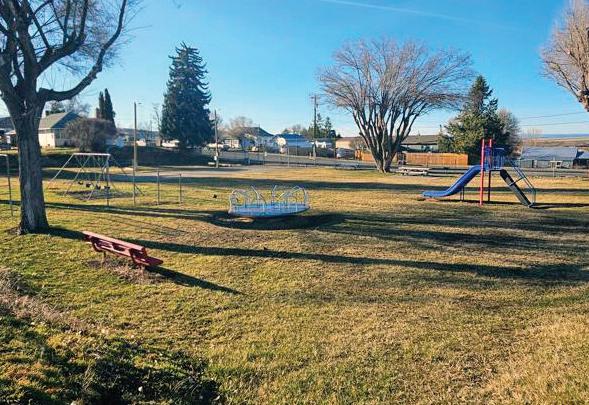
This cozy park, at Washington and Park streets, features a gazebo, restrooms, a playground and picnic area.
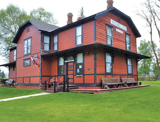
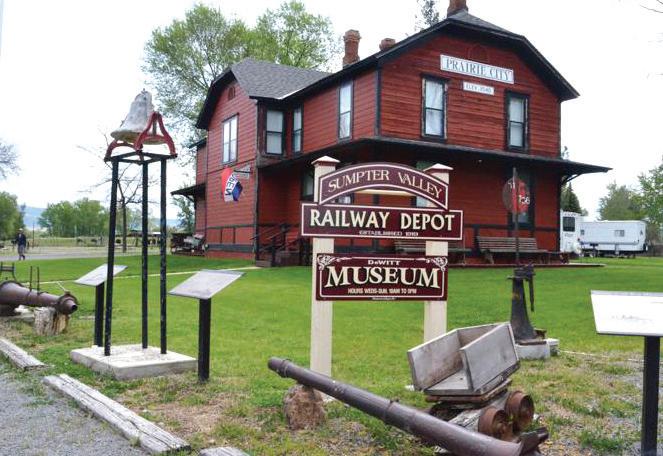
This park at South Main Street and Southwest Bridge Street features a large covered picnic area, a playground and restrooms. The DeWitt Museum and an RV park are onsite.
This cozy park, at Washington and Park streets, features a gazebo, restrooms, a playground and picnic area.
Just south of the highway in the center of town on Southeast Council Drive is Phil Boyd Park, with tennis courts, restrooms and a covered group picnic area.
Community Park
Along Highway 395 in the middle of town you’ll find a baseball field, horseshoe pits, a playground, a large covered picnic area, a cook shack and restrooms.
This shady park, at First and North streets, features a basketball and tennis court, horseshoe pits, barbecue grills with tables, a playground and restrooms.
Just off the highway at Main and Allen streets, this park features a basketball court, a picnic area, horseshoe pits and a playground.
City Park
Located just off Highway 26 at the east end of town, this park offers restrooms, a basketball/tennis court, picnic tables, horseshoe pits and a playground.








•

April 2025
5 - Lake Creek Youth Camp Gala 541-620-8505 | 541-249-3946 lakecreekcamp.org | lakecreekcamp@yahoo.com
May 2025
2-5 - Silvies Cinco de Mayo Opening Golf Tournament 541-573-5150 | www.silvies.us
3 - Club Memorial Scramble 541-575-0170 | johndaygolfclub.com johndaygolfclub@gmail.com
16 - Grant County Chamber Grape & Grain
541-575-1900 | grantcountyoregon.net/217/ Fairgrounds | winegarm@grantcounty-or.gov
17-18 - Jackson’s Razzle Dazzle 541-575-0170 | johndaygolfclub.com johndaygolfclub@gmail.com
22-24 - Ty Evans Mule Clinic
541-575-1900 | grantcountyoregon.net/217/ Fairgrounds | winegarm@grantcounty-or.gov
June 2025
1 - Grant Union Booster Club Scramble 541-575-0170 | johndaygolfclub.com johndaygolfclub@gmail.com
7 - Blessing of the Bikes 541-620-2848 | themapman@comeridewithus.net
21 - Summer Movie Kickoff 541-575-0110 | jdccparksandrec.org jdccparks.rec.ad@gmail.com
Farmers Market Spring Festival johndayfarmersmarket.com
13-14 - ‘62 Days Celebration 541-602-0874 | facebook.com/whiskeygulchgang whiskeygulchgang@gmail.com
14 - Silvies Grant vs. Harney Golf Battle 541-573-5150 | https://www.silvies.us
14-15 - Jack and Jenny Couples Tournament 541-575-0170 | johndaygolfclub.com johndaygolfclub@gmail.com
19-22 - BMW Riders of Oregon Chief Joseph Rally 541-575-1900 | grantcountyoregon.net/217/ Fairgrounds | winegarm@grantcounty-or.gov
20-23 - Annual John Day River Poker Run 541-792-7151 | themapman@comeridewithus.net
28 - Tylor and the Train Robbers at Sels Brewery 541-602-0874 | facebook.com/whiskeygulchgang whiskeygulchgang@gmail.com
28 - Thadd’s Place Golf & Gala 541-575-0170 | johndaygolfclub.com johndaygolfclub@gmail.com

July 2025
Cinnabar Mountain Play Days 541-575-1900 | grantcountyoregon.net/217/ Fairgrounds | winegarm@grantcounty-or.gov
4 - Dayville Fourth of July Celebration 541-987-2188 | gcoregonlive.com/cities/dayville dville@ortelco.net
4 - Monument Fourth of July Fun Festival 541-934-2025 | cityofmonument.com cityofmonument@centurytel.net
4 - Prairie City Fourth of July Celebration 541-820-3605 | prairiecityoregon.net pchall@ortelco.net
4 - Firecracker Scramble 541-575-0170 | johndaygolfclub.com johndaygolfclub@gmail.com
12 - Blue Mountain Healthcare Foundation Benefit Scramble 541-575-0170 | johndaygolfclub.com johndaygolfclub@gmail.com
12-13 - Indian Motorcycle Riders NW Chapters Tour nwchapterstour.com | imrg1958.web@gmail.com
19-20 - Wapiti Golf Tournament 541-575-0170 | johndaygolfclub.com johndaygolfclub@gmail.com
26-27 - Prairie City Fiber Fest 541-820-3605 | prairiecityoregon.net pchall@ortelco.net
1-2 - Grant County Fair Rodeo 541-575-1900 | grantcountyoregon.net/217/ Fairgrounds | winegarm@grantcounty-or.gov
3 - Grant County Junior Rodeo 541-575-1900 | grantcountyoregon.net/217/ Fairgrounds | winegarm@grantcounty-or.gov
13 - Two-Man Best Ball Golf Tournament 541-575-0170 | johndaygolfclub.com johndaygolfclub@gmail.com
13-16 - 116th Grant County Fair 541-575-1900 | grantcountyoregon.net/217/ Fairgrounds | winegarm@grantcounty-or.gov
15 - Clint Black Concert at the Grant County Fairgrounds 541-575-1900 | grantcountyoregon.net/217/ Fairgrounds | winegarm@grantcounty-or.gov
23 - Paper Flowers Remembering Fleetwood Mac at Sels Brewery 541-602-0874 | facebook.com/whiskeygulchgang whiskeygulchgang@gmail.com
23-24 - Club Championship 541-575-0170 | johndaygolfclub.com johndaygolfclub@gmail.com
September 2025
Grant County Fly-In
541-575-1151 | grantcountyoregon.net/150/Airport walkerh@grantcounty-or.gov
6 - Cross Country Golf Scramble
541-575-0170 | johndaygolfclub.com johndaygolfclub@gmail.com
6-8 - Claire Owens Couples Tournament 541-573-5150 | https://www.silvies.us
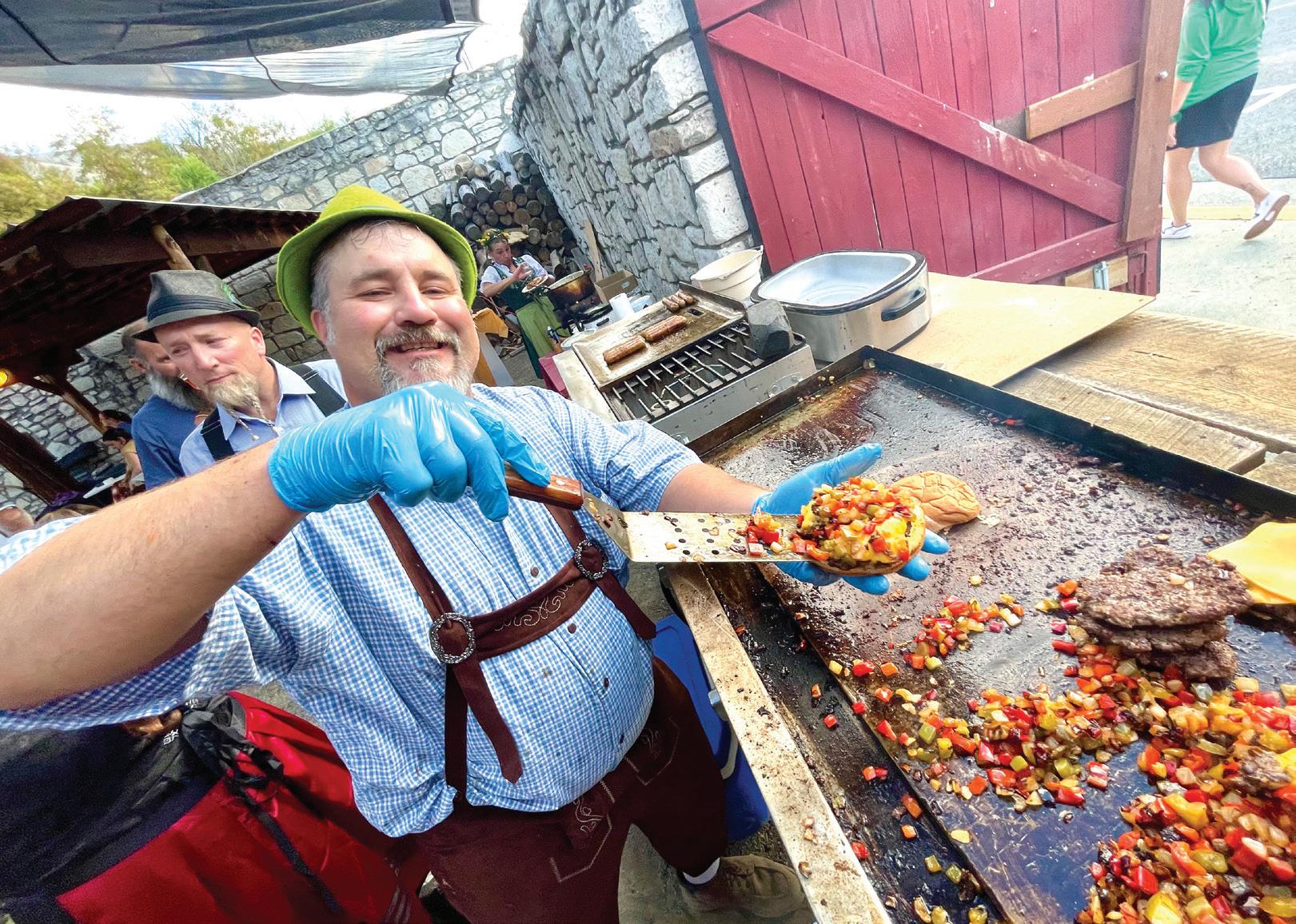
13 - Oktoberfest at Sels Brewery 541-602-0874 | facebook.com/whiskeygulchgang whiskeygulchgang@gmail.com
20 - Buckaroo Festival & Harvest Auction
541-934-2025 | www.facebook.com/groups/ 1492031037511938/ | cityofmonument.com cityofmonument@centurytel.net
20-21 - Last Chance Golf Scramble
541-575-0170 | johndaygolfclub.com johndaygolfclub@gmail.com
October 2025
Dayville Scarecrow Contest
541-987-2188 | gcoregonlive.com/cities/dayville dville@ortelco.net
Farmers Market Harvest Festival
541-620-3152 | www.facebook.com/p/GrantCounty-Farmers-Market-100080170875135 grantcofarmersmarket@gmail.com
4-5 - Rally for the Cure Golf Scramble 541-575-0170 | johndaygolfclub.com johndaygolfclub@gmail.com
Autumn Movie Mania
541-575-0110 | jdccparksandrec.org jdccparks.rec.ad@gmail.com
November 2025
Christmas on the Prairie 541-820-3605 | prairiecityoregon.net pchall@ortelco.net
December 2025
5 - Carrie Young Memorial Dinner & Auction
541-620-2098 | carrieyoungmemorial.weebly.com www.facebook.com/CarrieYoungMemorial

December 2025 continued
6 - Blue Mountain Hospital Auxiliary Bazaar 541-575-1900 | grantcountyoregon.net/217/ Fairgrounds | winegarm@grantcounty-or.gov
13 - Timber Truckers Light Parade Leslie Traylor | 541-620-4032
Dayville Christmas Lighting Contest 541-987-2188 | gcoregonlive.com/cities/dayville dville@ortelco.net
Dayville Community Christmas Celebration 541-987-2188 | gcoregonlive.com/cities/dayville dville@ortelco.net
February 2026
Daddy Daughter Dance 541-575-0110 | jdccparksandrec.org jdccparks.rec.ad@gmail.com
Family Fun Night
541-575-0110 | jdccparksandrec.org jdccparks.rec.ad@gmail.com
March 2026
Rodeo Court Coronation Dinner
541-575-1900 | grantcountyoregon.net/217/ Fairgrounds | winegarm@grantcounty-or.gov
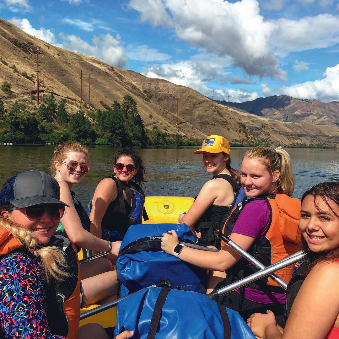
Grant County has no shortage of aquatic activities to enjoy, with a wealth of rivers, streams and lakes. Whether it’s fishing, floating, swimming or just relaxing on the water, there is something for everyone.
The John Day River, the fourth-longest undammed river in the U.S., flows through Grant County.
The three separate forks, North, Middle and South, offer Class 1 and Class 2 rapids. With no dams to control water flow, water levels can fluctuate and rapids should be scouted ahead of time.
For current rules and flow-level forecasts, contact the Bureau of Land Management’s Prineville office at 541-416-6700.
Magone Lake, a Grant County gem, offers abundant opportunities for fishing, paddling and swimming in the lake’s shallow edges or areas in the middle where the water can be as deep as 100 feet. The lake features a 1.5-mile trail along the water’s edge that is accessible for all fitness levels.
For a more remote getaway, try 160-acre Olive Lake, which sits at about 6,000 feet in the Blue Mountains, roughly 12 miles west of the historic mining town of Granite. A boat ramp and two docks make it easy to get on and off the water. Both gas and trolling motors are allowed, but take it slow on this no-wake lake.
Bull Prairie Lake is small, at just 28 acres, but sits in a lovely forested setting. Nonmotorized boating is permitted, you can wet a line from four accessible fishing docks, and a 1.2-mile wheelchair-accessible path circles the lake.
See pages 37, 38 & 39 for details and fishing spots




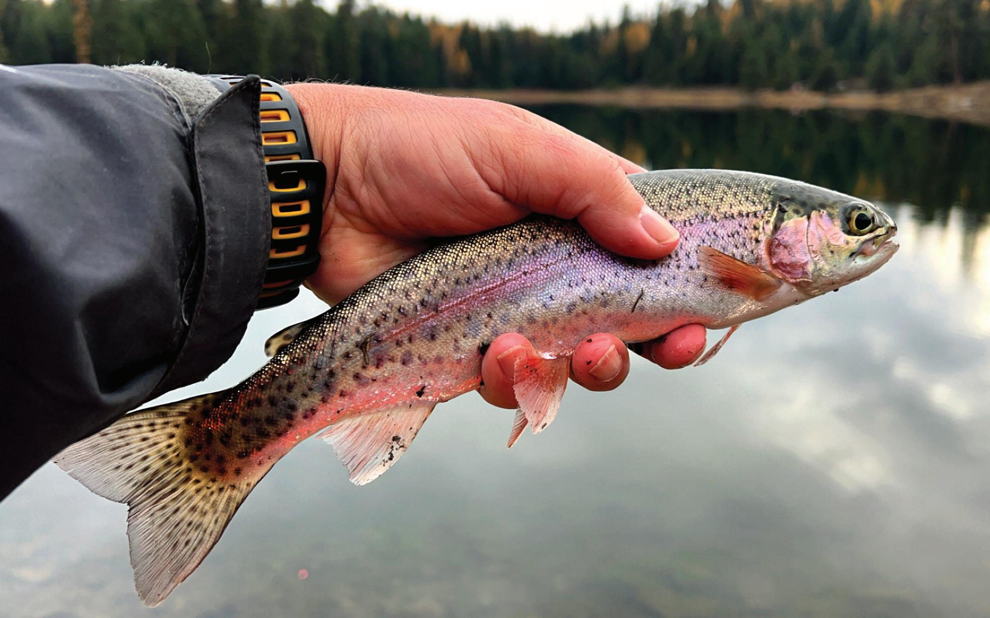
What could be more relaxing than casting your line into a serene lake or tumbling mountain stream and waiting for the fish to bite? Come to Grant County and try your luck.
If fishing is your thing, you’ll find plenty of ponds, lakes, rivers and streams to tempt you here. Try your luck fishing for steelhead, trout, kokanee, bass and other species with locations ranging from remote — with a good hike required to access some sites — to right in town.
A big highlight in the county is Magone Lake, which offers an abundance of recreational opportunities, including fishing, swimming or just relaxing on the water. The 50-acre lake is stocked by the Oregon Department of Fish and Wildlife with 8- to 15-inch eastern brook and rainbow trout. There’s a campground, picnic areas, walking path, boat dock and a sandy beach with great terrain for building sandcastles.
For fishing information, check the Oregon Sport Fishing Regulations booklet, available where sporting licenses are sold and online at www. dfw.state.or.us, or call 800-720-6339. Special fishing regulations apply in some waterways, as the John Day Basin is home to protected and recovering fish species.
Grant County locations
See pages 38 & 39 for a map of fishing spots
103852 - Schwab - Page 1 - Composite

1. Bull Prairie Reservoir
28 acres, boat ramp; motors prohibited. From Spray, go 4 miles east on Hwy 19 to Hwy 207. Take 207 north 18 miles to FR 2039 and go 4 miles to lake. Rainbow, brook trout.
2. Cavender Pond
15 acres on private land. From Monument go half-mile west on Hwy 402; right on pond access road. Rainbow trout, largemouth bass.
3. Long Creek Pond
2 acres, located 6 miles west of Long Creek just off Hwy 402. Rainbow trout.
4. Jump Off Joe Lake
5 acres in Umatilla National Forest. From Granite, take FR 10 west, then FR 45 south 4 miles to a pullout near trailhead. Hike 0.25 miles to the lake. Triploid brook trout.
5. Lost Lake
15 acres in Umatilla Forest. From Granite, take FR 10 west to FR 45. Go south about 0.5 miles, turn left on FR 020 to gate. Hike 2 miles to lake. Rainbow trout.
6. Olive Lake
160 acres in Umatilla Forest. From Granite, go west on FR 10 for 11 miles. Boat ramp, docks, camping available. Rainbow trout, kokanee.
7. Wildcat Pond
2 acres in Malheur National Forest. From Hwy 395, take Co. Road 88 west 8 miles, go left on 741 for 3.5 miles to FR 3955, then right 4 miles to FR 250. Rainbow trout.
8. Hog Creek Pond
1 acre in Malheur Forest. From Hwy 395 at Ennis Creek, take FR 3940 east 5 miles to FR 432, go left for 3.5 miles to 794 and 0.5 miles to pond. Rainbow trout.
9. Magone Lake
50 acres in Malheur Forest. From John Day, travel 9 miles east on Hwy 26 to Keeney Fork Road. Go north 18 miles to FR 3620, then south 3 miles. Rainbow, brook trout.
0.5 acres on BLM land. Strenuous hike-in access only, 14 miles south of Dayville, then 0.5 miles east up Aldrich Gulch. No designated trail. Rainbow trout.
11. Wyllie Gulch Pond
0.5 acre in Phillip Schneider Wildlife Area, 17 miles south of Dayville, then 3.5 miles up Murderers Creek to Wyllie Gulch. Hike-in access only, 3 miles up Wyllie Gulch, no designated trail, closed Feb. 1-Apr. 14. Rainbow trout.
12. Aldrich Ponds
Two ponds, 5 and 8 acres, in Phillip Schneider Wildlife Area, 5 miles east of Dayville. From Hwy 26 go south on Phillip Schneider Wildlife Area access road 6 miles to lot. Hike-in access only, 2 miles south on trail. Closed Dec. 1-Apr. 14. Rainbow trout.
13. Holliday Park Pond
3 acres near Holliday State Park, 0.75 mile east of Mount Vernon on Hwy 26, turn south on access road, 200 yards to pond. Rainbow trout.
14. Brandon’s Pond
2 acres near ODFW’s screen shop facility on Patterson Bridge Road, John Day. Open 6:30 a.m. to 4 p.m. weekdays. Rainbow trout, largemouth bass.
15. Seventh Street Pond
1 acre at Seventh Street Complex in John Day. Rainbow trout.
16. McHaley Pond
1 acre on Confederated Tribes of Warm Springs land. Take Hwy 26 east from Prairie City 0.5 miles, turn south on ranch access road past tree nursery. Rainbow trout.
17. Strawberry Lake
31 acres in the Strawberry Mt. Wilderness. Take Co. Road 60 south from Prairie City into Malheur Forest, continue on FR 6001 to trailhead. Hike 1.5 miles to lake. Rainbow, brook trout.
18. High Lake
10 acres in the Strawberry Mt. Wilderness. From Seneca, head east on FR 16 for 13 miles to FR 1640. Go north on 1640 to end and trailhead. Hike 1.5 miles to lake. Brook trout.
19. Slide Lake
13 acres in the Strawberry Mt. Wilderness. Take Co. Road 60 south from Prairie City into Malheur Forest. Continue on FR 6001 to the trailhead. Strenuous hike of more than 4 miles to lake. Brook trout.
20. Trout Farm Pond
2 acres in Malheur Forest. From Prairie City, go south 15 miles on Co. Road 62. Look for Trout Farm sign, then turn west 100 yards. Rainbow, brook trout.
27 acres on BLM land. 17 miles south of Seneca on Hwy 395, take FR 17 east for 0.5 miles, turn north into reservoir. Rainbow trout, limit 2 trout per day.
926 acres, about 50 miles east of John Day on Hwy 245 near Unity. Campsites, cabins, hiker/biker camp, ADA-accessible, RV dump station. Trout, bass and crappie.
1,500 acres, along Hwy 7 near Sumpter. Three campgrounds and two boat launches. Perch, bass and rainbow trout. Tiger trout and hybrid muskie, stocked to help control perch, must be released if caught.
14-mile section from Camp Creek to Caribou Creek. Bank fishing access at Deerhorn, Middle Fork campgrounds. Trout fishing good MayOctober. Chinook salmon closed to fishing.
11-mile section from the first bridge to the mouth of Murderers Creek. Trout fishing good May through October.
26-mile section from Kimberly downstream to Service Creek. Steelhead from January through March, smallmouth from May through November. Channel catfish during summer months. Bank access and boat launches at Shady Rest, Spray City and Muleshoe parks.


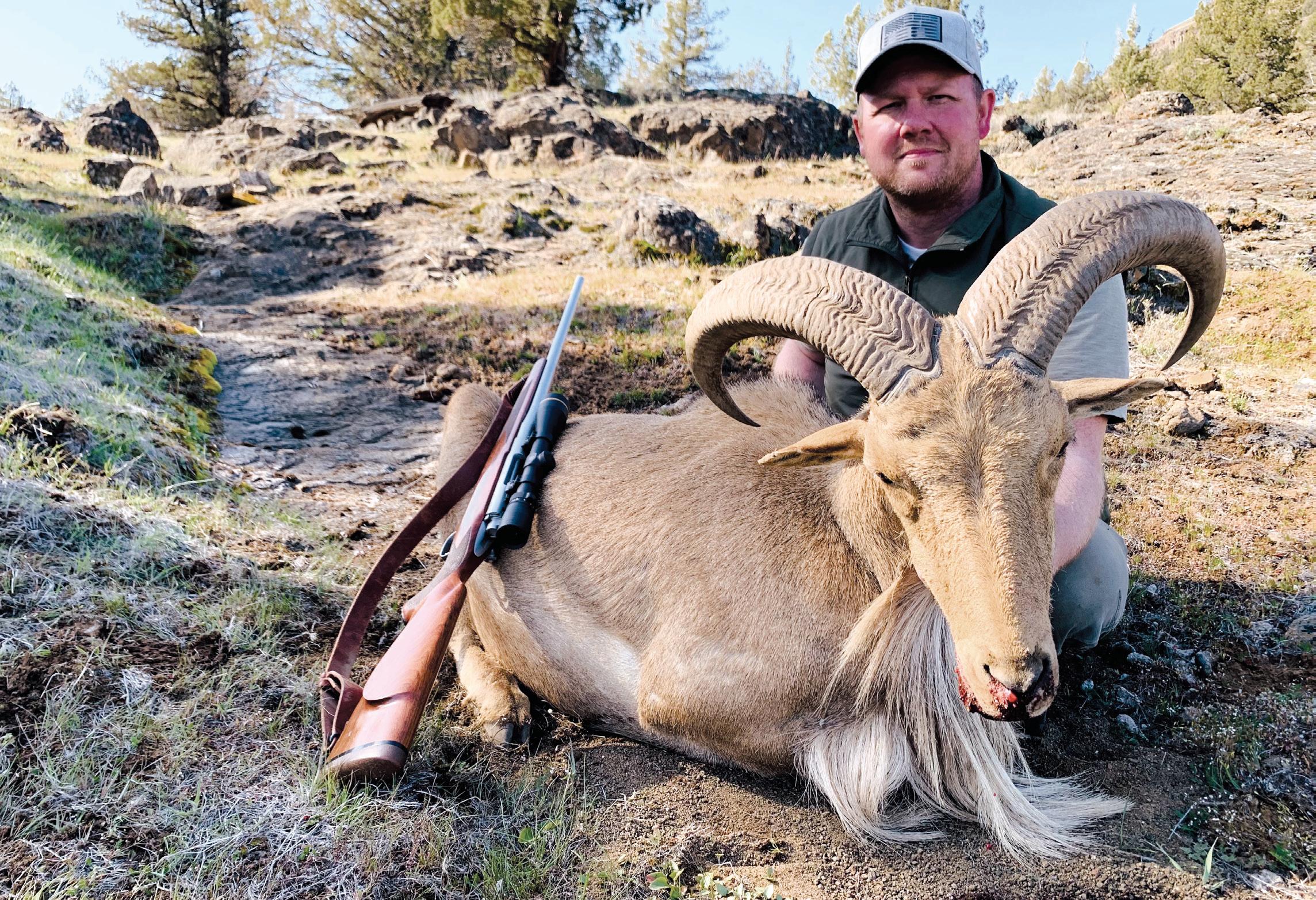
With five wildlife management units of its own and several more in bordering counties, Grant County is a hotspot for hunting. You’ll find plenty of campgrounds and two major wilderness areas, Strawberry Mountain and Monument Rock, within easy reach of John Day and surrounding communities.
Located 13 miles east of John Day along the John Day River, Prairie City is near the Beulah, Northside, Malheur, Desolation and East Murderers Creek wildlife management units.
Dayville is on Highway 26 about 32 miles west of John Day. The Northside, Murderers Creek and Ochoco hunting units intersect at Dayville, and the area is popular for deer, sheep and elk hunting, as well as upland game birds.
Situated 8 miles west of John Day on Highway 26, Mount Vernon makes a good jumping-off point for hunters after mule deer and Rocky Mountain elk.
Monument is located on the North Fork John Day River, approximately 60 miles northwest of John Day. Surrounded by the Northside, Desolation and Heppner wildlife management units, the area abounds with pronghorn, elk, deer and other game.
This community 26 miles south of John Day is a popular jumpoff for the Murderers Creek, Malheur and Silvies units. The area is great for pronghorn, Rocky Mountain elk and mule deer.
About 45 miles north of John Day, the Long Creek area is known for trophy mule deer and whitetail deer along with Rocky Mountain elk.
For more information, stop by the Grant County Chamber of Commerce, 301 W. Main St. in John Day, call 800-769-5664 or 541-575-0547, or visit gcoregonlive.com.

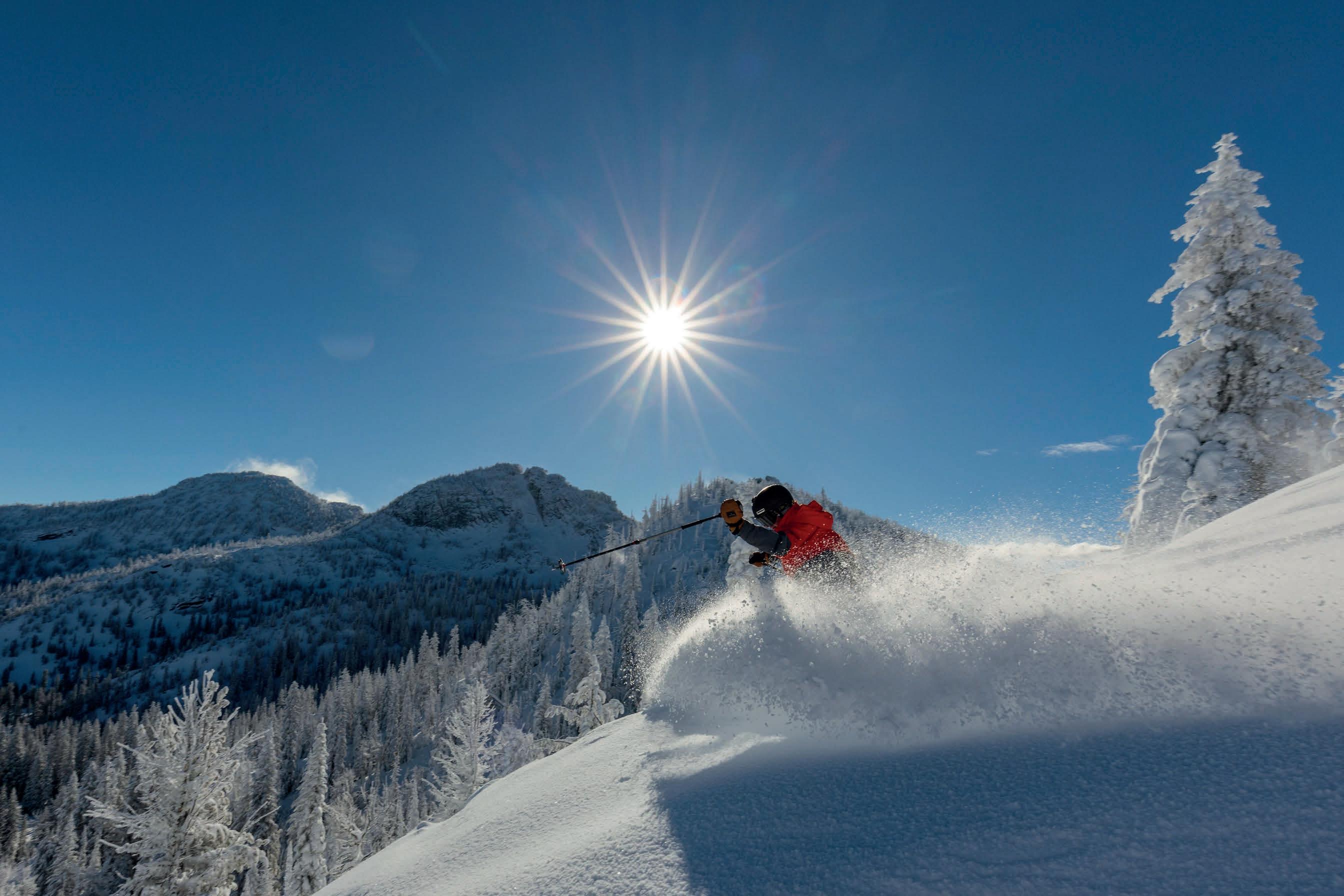
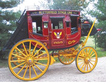

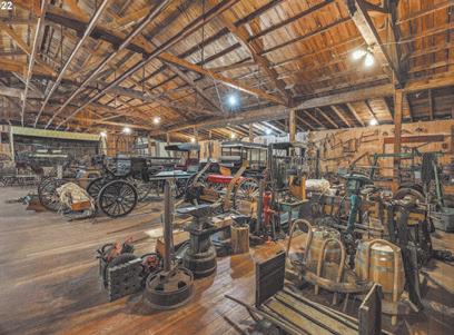


Snowmobiling is big in Grant County, with 500 miles of groomed trails along with four snow parks in the area. Snowmobile trails are groomed by volunteers from local snowmobile clubs. Cross-country skiing and snowshoeing are also popular, along with sledding and innertubing.
A state Sno-Park permit is required for parking at all snow parks. The permits cost $25 and are available from the DMV and some local stores. They can also be purchased online at https://tinyurl.com/24c9y3jm. For more information about winter recreation, visit grantcountysnowballers.com.
The popular snow park at Starr Ridge features ample parking and primitive outhouse facilities. Across the highway is Starr Bowl, a popular sledding and tubing area for families, with a warming hut. Cross-country skiers typically use the groomed snowmobile trails, while backcountry skiers and snowshoers can head east toward the wilderness area. Starr Ridge is on Highway 395 about 16 miles south of John Day.
Snowmobilers can access hundreds of miles of groomed trails at the Huddleston Snow Park, which features a warming hut with a fireplace, restrooms and a large parking lot. The Skyline access is located about 1 mile before Huddleston. Snowshoers and cross-country skiers can access miles of groomed and ungroomed trails at Huddleston, which is located on County Road 62 about 22 miles south of Prairie City.
Snowmobile trails groomed by three different clubs converge near this snow park, which is located on Highway 26 about 10 miles east of the Highway 7 junction.
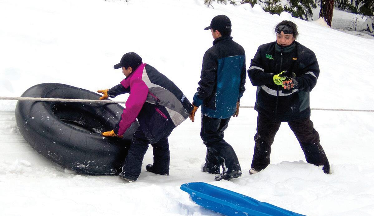
The old rope tow is back in commission after a long hiatus. For a few bucks, you can use the tow like a low-tech ski lift, letting it haul you to the top of the hill for sledding, innertubing, skiing and snowboarding. In between runs, take a break in the warming hut. There are also opportunities for snowmobiling, cross-country skiing and snowshoeing on ungroomed trails. Located just off Highway 26 at Dixie Summit, about 9 miles east of Prairie City.
Dixie Rope Tow
See pages 44 & 45 for more information


Story & photos by Bennett Hall
A cherished Grant County tradition has made a comeback after a lengthy hiatus.
The Dixie Rope Tow, which brought local families together to play in the snow for generations, had been out of action for seven years and was only open sporadically for several years before that.
But it was up and running once again for the winter of 2024-25, thanks to some generous early-season snowfall and the dedication of third-generation operator Kevin Rapp of Prairie City.
“My grandfather (Alton Rapp) opened this in 1956,” Rapp said. “He ran it till he passed away. My dad, Gary Rapp, ran it since then.
“I’ve been coming here since I was a little tiny tot,” he added. “Now I guess it’s my turn.”
On Dec. 29, 2024, Rapp was running the rope tow mainly for the benefit of his partner, Kayla Ortiz, and her children, Jose, Emilio and Manuel Galan, who were having a ball sledding and inner tubing down the snowcovered hill served by the rope tow.
Ortiz and her mother, Veronica Griffin, who was visiting from Payette, Idaho, also took a few runs down the slope, chased happily by Rosco the dog.
Before moving to Prairie City two years ago, Ortiz and her family lived in Ontario. The boys loved playing in the snow there, too, she said, “but we didn’t have the little tow rope.”
And that makes all the difference. Let the rope do the work
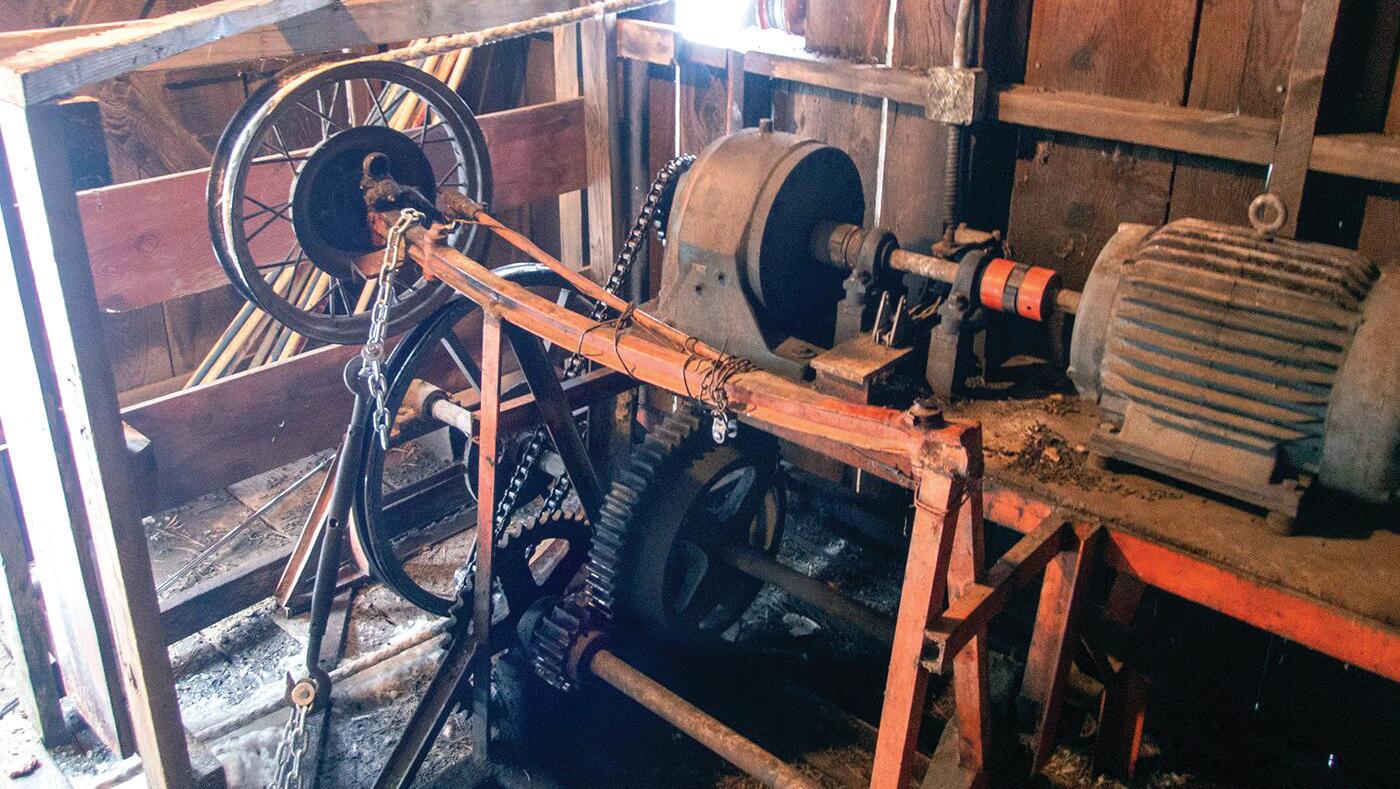
Powered by a burly electric motor housed inside a wooden shed, the tow is 1,100 feet of 1-inch nylon rope braided into a continuous loop. When Rapp flips the switch, the motor whirs to life and the rope starts running through pulleys at the top and bottom of the hill, plus another mounted on a big fir tree at the midway point.
It serves the same purpose as a ski lift, but there are no chairs. Instead, you just take a firm grip on the rope and let it pull you to the top of the hill on your sled, inner tube, snowboard or skis, then turn around and let gravity whisk you back down to the bottom.
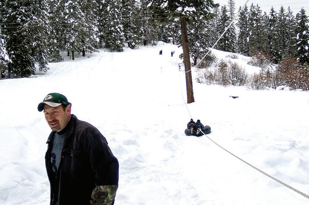
And with the motorized rope tow doing all the hard work of hauling you uphill, you can play in the snow all day long.
When you’re ready for a break, you can relax inside the warming hut, where a woodstove keeps the temps toasty and parents can keep an eye on their youngsters through a picture window.
The rope tow and warming hut are technically owned by the nonprofit Starr Ridge Winter Sports Club but are operated and maintained by the Rapp family, which relies on revenue from day-use fees and season passes to cover their costs.
“We’re hoping to make enough to cover electric and taxes,” Rapp said, although he added the family usually winds up paying some of those costs out of pocket.
He could also use some volunteers to help operate the rope tow and keep an eye on things so he can take a weekend off from time to time.
“It’s just me right now,” Rapp said. “I’m trying to recruit some help.”
It took a lot of time and effort to get the rope tow back in working condition, according to Rapp.
“When you leave something sit for that long, there’s a lot of kinks you’ve got to work out,” he said.
But now that it’s up and running again, Rapp wants to keep the momentum going.
“We’re hoping to run it every weekend, from 11 to 5 Saturday and Sunday — that’s the goal,” he said. “If someone wants to come on a different day, we can accommodate that, too.”
There are even lights for nighttime use.
With the 2024-25 season’s early snowfall, Rapp was able to start up the rope tow just before Thanksgiving, hoping to keep it running at least through March and possibly into April.
“As long as there’s snow, we’ll run,” he promised.
Where: Dixie Mountain Sno-Park, just off Highway 26 10 miles east of Prairie City
When: Generally open 11 a.m.-5 p.m. Saturdays and Sundays, and other times by appointment, as long as there’s enough snow (usually through the end of March or early April)
Parking: A Sno-Park Permit is required
Etc.: For current hours and daily rates, or to book the rope tow for a private event, call Kevin Rapp at 541-620-8414

the








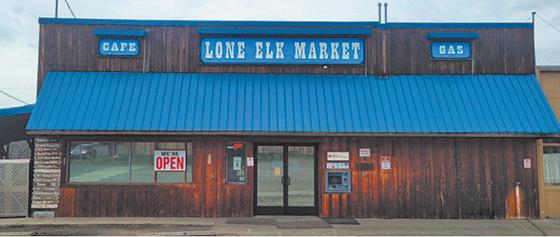
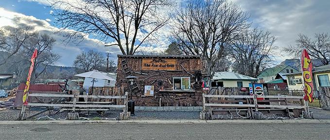


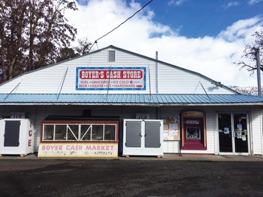



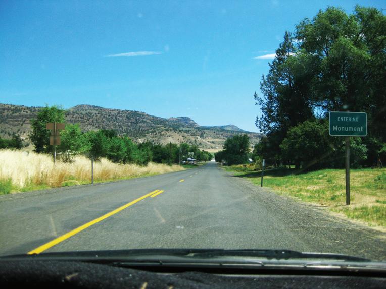


Story & photos by Bennett Hall
Peter Hayes swings a leg over the Savoy-blue gas tank of his father’s 1968 Moto Guzzi Falcone NT, an Italian motorcycle originally built for police use, and settles into the saddle with a big grin on his face.
“It’s my first time riding it,” he says.
After some words of warning from his dad, Pat, about the brakes, Peter twists the throttle and takes the vintage bike for a spin around the Grant County Fairgrounds.
“He might as well get used to it,” Pat Hayes says. “He’s going to inherit it.”
The two men were among more than 300 aficionados who descended on John Day Thursday-Sunday, June 27-30, 2024, for the 50th annual national rally of the Moto Guzzi National Owners Club, or MGNOC for short. Participants came from all across the United States and several foreign countries, including Canada, Australia, New Zealand, England and Italy.
The national rally is held in a different location every year, but this was the third time the event has been held in John Day — first in 2010, and most recently in 2016.
Paul Nagy of Portland, a member of the club’s Oregon chapter, said hosting the national rally was a point of honor for the state.
“For us, this is like being Paris,” he said. “This is like winning the opportunity to host the Olympics.”
Gary Jenkins of Silverton, a member of the steering committee that put together the rally, said the location has proven popular with club members for a number of reasons.
He cited the facilities at the fairgrounds, including a grassy field for tent camping, an RV park, showers and a pavilion for communal meals and events.
It’s also a short walk (or ride) from downtown John Day, which offers restaurants, taverns, a brewpub, pharmacy, grocery store and other amenities.
But above all, he said, Grant County offers wonderful riding for motorcyclists, with spectacular scenery and uncrowded roads perfect for what riders like to call “canyon carving.”
“That’s an expression for motorcyclists when they’re doing the windies and the twisties,” Jenkins explained.
Rally attendees got to experience some of that with a guided ride on Saturday morning, a 120-mile loop that took them from the fairgrounds northeast on Highway 26 to Austin Junction, then west along the Middle Fork John Day River to Long Creek, south on Highway 395 to Mount Vernon and back on 26 to John Day.
Other highlights of the four-day rally included screenings of classic motorcycle movies, seminars by Moto Guzzi experts, nightly campfires at the fairgrounds, field games and a bike show.


2024.
So what’s so special about Moto Guzzis? Different riders at the 2024 national rally offered different answers to that question, but some common themes emerged.
“It’s the engine configuration,” Jenkins offered.
“It’s an opposed twin — like a BMW, except the cylinders are at a slant instead of straight across.”
Others sang the praises of Moto Guzzi’s shaft drive technology, stable ride and iconic style.
Brent Carnes of Portland brought his 1,400cc Audaci to the rally. He used to ride Triumphs exclusively, but about six years ago he picked up the 2016 Moto Guzzi.
“It’s the best bike I’ve ever owned,” he said.
“It’s unique-looking,” he added. “You don’t see a lot of them. I have to laugh sometimes at how often I get asked, “‘What is that?’”
Maury Mossman of Oakland, California, has been riding Moto Guzzis for close to 40 years now. His current bike is a “handmade special” built around an 1,100cc Moto Guzzi engine. It’s set up for adventure riding, with heavy-duty tires and shocks, and on Saturday it had a fresh spatter of mud and cow manure from tooling around on some of Grant County’s gravel backroads.
Pat Hayes, the man with the 1968 Falcone, said he appreciates the Moto Guzzi’s simple design, which makes it easier to tinker with than a lot of other bikes.
“It takes a lot of work to maintain but no special tools,” he said. “They go a long time and a long way.”
Hayes, of Fremont, California, has been riding Moto Guzzis for nearly half a century now, and he’s passed along his passion for the Italian motorcycle brand to his son, Peter, who lives on Whidbey Island, Washington.
It was probably inevitable that he, too, would become a Moto Guzzi rider.
The elder Hayes attended his first national rally in 1981 — and he and his wife brought Peter, then just 10 months old, with them.
“The guy who runs the national owners club held him 43 years ago,” Pat said. “And now we’ve come full circle.”
From two-lane highways to lonesome backroads, Grant County’s sparse traffic and spectacular scenery combine to produce some of the finest motorcycling in the West. Here are a few of our favorite rides:
From John Day, head east on Highway 26 through Mount Vernon and Dayville. About 7 miles beyond Dayville at Picture Gorge, turn north on Highway 19 and ride past the Thomas Condon Paleontology Center. Turn right at the Kimberly store to go through Monument and into Long Creek. In Long Creek, turn right on Highway 395 and continue south to Mount Vernon. Turn left on Highway 26 and continue east back into John Day.
Leave John Day and head east on Highway 26 through Prairie City. Turn left at Austin Junction and continue on Highway 7 for about 25 miles. After you’ve crossed the railroad tracks, look for the sign for the town of Sumpter. Turn left and head 2-3 miles into Sumpter. From Sumpter, continue north on the same road for another 19 miles into Granite. Continue west on Highway 244 until you reach Highway 395. Turn left and take Highway 395 south to Mount Vernon and Highway 26. Turn left on Highway 26 and continue 8 miles into John Day.
This short and easy trip provides riders with breathtaking views of Canyon Mountain and the John Day Valley. Leave John Day headed east on Highway 26 for 3 miles and take a right onto Dog Creek Road. The paved road takes a 90-degree turn onto Marysville Road (County Road 52) after a little over a mile. Riders will then descend into Canyon City and turn right, heading north on Highway 395 back into John Day.
Leave John Day and head west on Highway 26 into Mount Vernon. Turn right at the intersection and head north to Long Creek along Highway 395. A few miles north of town, turn right on County Road 20 and ride about 34 miles along the Middle Fork of the John Day River to Highway 7. Turn right onto Highway 7 and head 1.5 miles to the intersection with Highway 26 at Austin Junction. Turn right on Highway 26 and head over Dixie Summit and into Prairie City. Continue traveling on Highway 26 for 13 miles back into John Day.
Depart John Day and head east on Highway 26 into Prairie City. Turn right on Main Street and continue to the junction with Bridge Street. Turn left onto Bridge Street and continue past the cemetery, where the street becomes County Road 62. Travel along County Road 62 for about 19 miles to the junction with Forest Road 16. Turn right onto Forest Road 16 and continue east for about 36 miles until you reach Seneca. Turn right onto Highway 395 and travel north 26 miles back into John Day.
541-575-3515
HWY 395 S • Canyon City, OR berrycreekranch1@gmail.com berrycreekranch.com
@theberrycreekranch





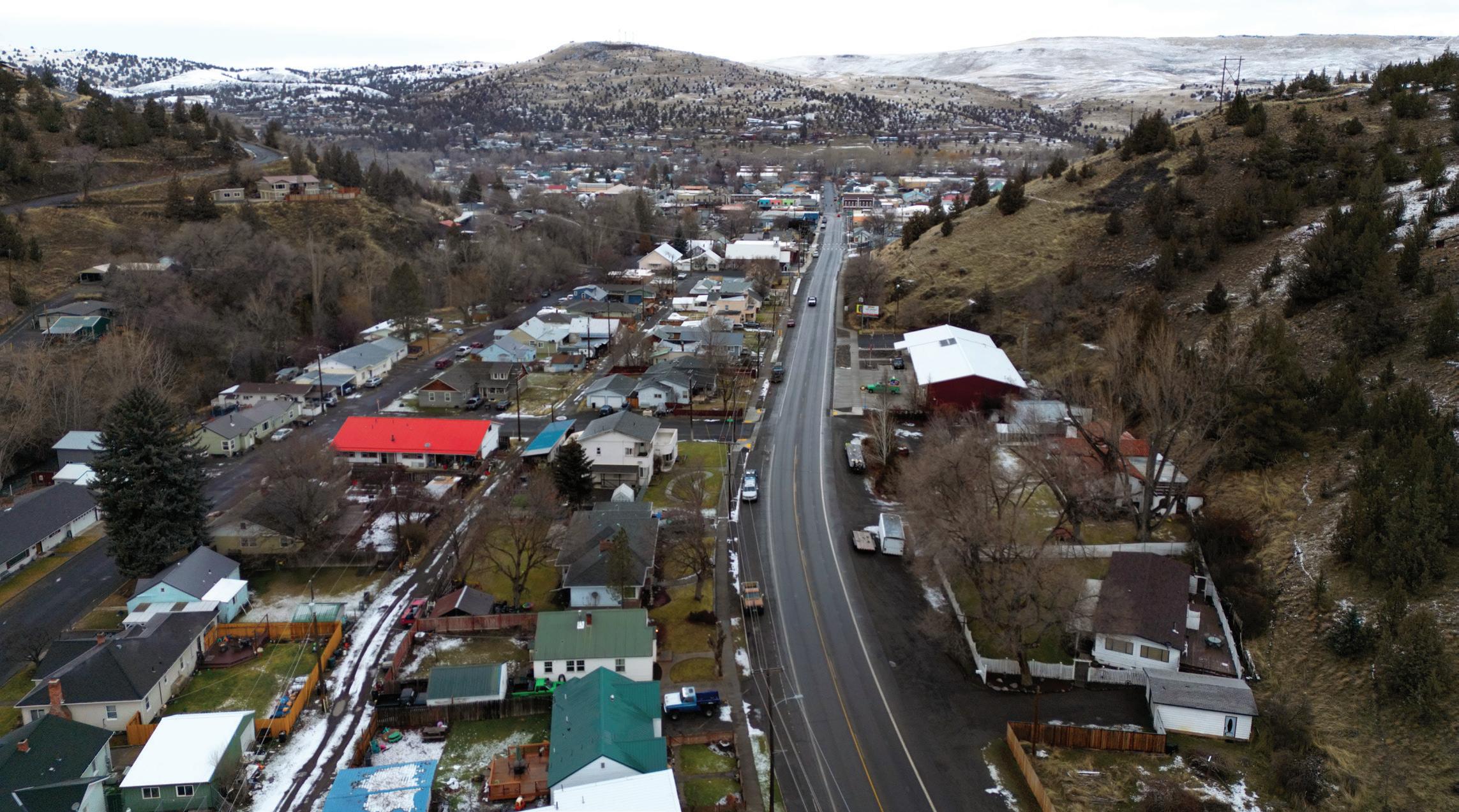
Elevation: 3,087 ft. Population: 1,704
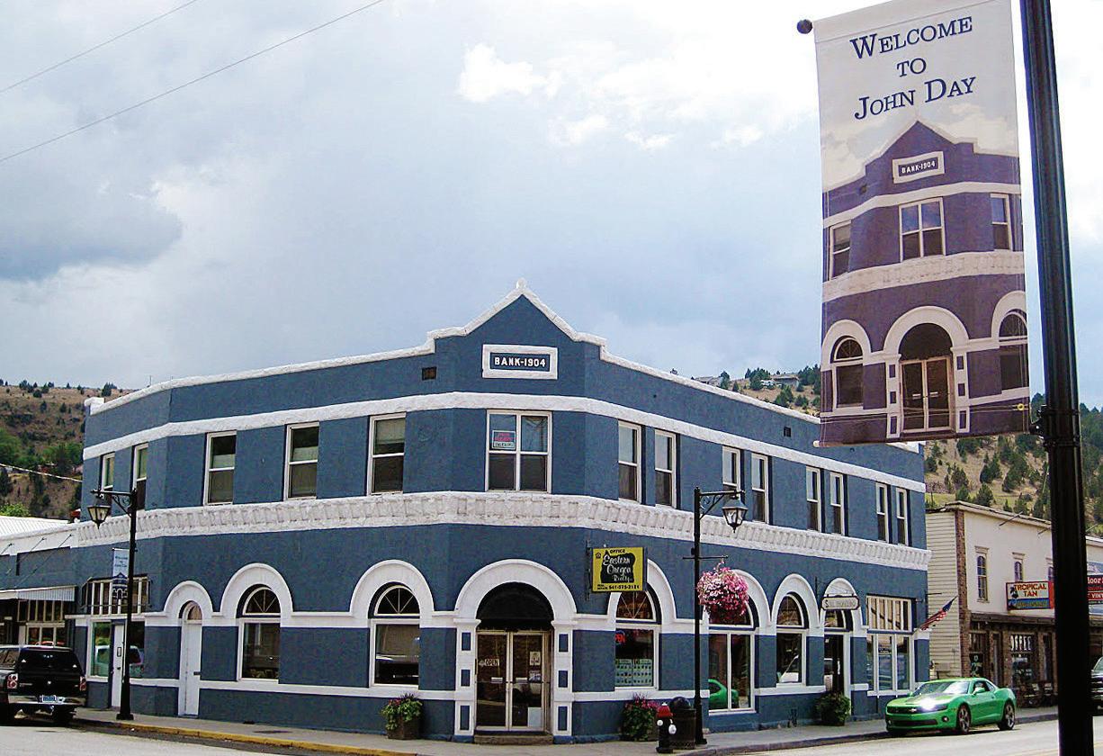
With the only stoplight in Grant County, John Day is the “big city.” Centrally located at the intersection of highways 26 and 395, the town has facilities serving the surrounding areas, including a hospital, county fairgrounds, airport, industrial park, Chamber of Commerce and library, as well as a grocery store, pharmacy, restaurants, pubs and other businesses. John Day is home to the Kam Wah Chung State Heritage Site, a carefully preserved relic of the area’s 19th century mining boom. Built in 1865, the building housed a Chinese apothecary and general store and now serves as a museum. A few blocks away on Main Street, you’ll find the Ranch and Rodeo Museum, which celebrates the cowboy way of life in Grant County. Just west of town, the John Day Golf Club invites guests to play nine holes and enjoy the stunning views overlooking the course from a large banquet room in the clubhouse. Davis Creek Park offers scenic overlooks and hiking trails that connect to a network of pedestrian and bicycle paths along the John Day River in the heart of town.
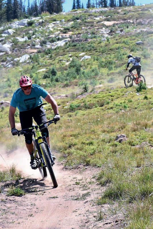
The Seventh Street Sports Complex features baseball and softball fields, tennis and basketball courts, a skate park, a fishing pond, picnic areas, a playground and a paved mile-long trail that circles the property. It features a kiddie park with two playground areas for different ages, as well as an 87-by-37-foot splash pad with a variety of water features. The John Day Bike Park has single-track trails winding back and forth across the hill overlooking the complex, as well as slope-style jumps and a skills course with its own pump track. To visit the complex, take Bridge Street north from Highway 26 (Main Street) and turn right on Seventh Street.
Elevation: 3,173 ft. Population: 687
When gold was discovered here in 1862, Canyon City quickly sprang up as a booming mining town with about 10,000 residents — at the time, it had more inhabitants than Portland, Oregon’s current largest city. After the rush, the population dwindled, but the community remembers its origins in an annual ’62 Days Celebration in June. Canyon City is the county seat, with government offices and a variety of businesses. The Grant County Historical Museum houses artifacts, documents and photographs that bring the county’s history to life. In the heart of town, Sproul Park features a playground, picnic area, restrooms and a covered stage that is the site of summer concerts.
Canyon Mountain Trail is a hidden gem that provides incredible views of the John Day Valley. The 28-mile trail takes hikers in and out of the burn area from a 2015 wildfire, crossing several creeks and streams fed by snowmelt. To reach the trailhead, travel east 2 miles on County Road 52 from Canyon City and take a right on County Road 77 for about a quarter-mile. Then take another right on Forest Road 7700333 to the trailhead.
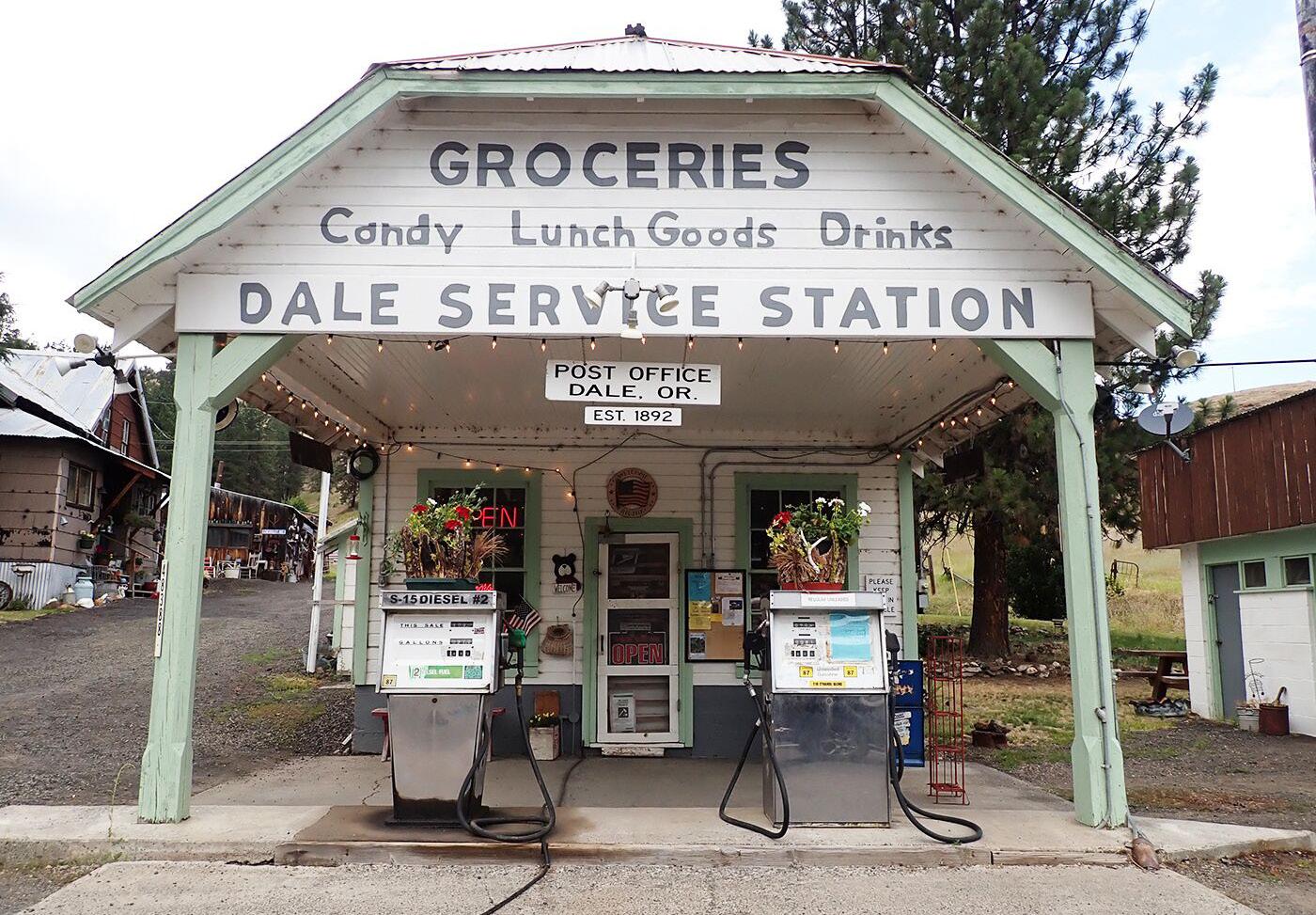
Elevation: 2,917 ft. Population: 4
In northern Grant County, the small community of Dale lies just south of the 45th parallel on Highway 395 near the border with Umatilla County. A store provides fuel and groceries as well as shuttles for people floating the North Fork of the John Day River. Nearby is the Bridge Creek Wildlife Area, where mountain bluebirds, larks, hawks and bald eagles can be seen and where 1,000 Rocky Mountain elk migrate in the winter.
South of Dale, a mineral hot springs is about all that remains in the ghost town of Ritter. Named after a minister who gave land for the post office, Ritter was once the site of a popular resort, where weary travelers could unwind in the pool or mineral baths surrounded by the scenic beauty of the Middle Fork of the John Day River. Eventually, however, as the town’s population shrank, the resort closed its doors. To find Ritter, head west from Highway 395 on Ritter Road, which turns off Highway 395 near milepost 77B about 13 miles south of Dale.
Elevation: 4,695 ft. Population: 33
In the northeastern corner of Grant County, Granite provides a break from civilization in the great outdoors. Travelers are more likely to encounter the resident wildlife than the human inhabitants, though many nonresidents visit for hunting, ATV riding, prospecting and snowmobiling in the Blue Mountains. The Historic Fremont Powerhouse was built in 1908 and piped water from Olive Lake to generate electric power. The plant shut down in 1967 and was donated to the Forest Service. Visitors today can still view the historic structure and can even stay in rental cabins on the grounds.
Nearby, visitors can trek into the North Fork John Day Wilderness. Olive Lake is a peaceful retreat a short drive to the west that offers opportunities for fishing, boating, swimming, hiking and camping.
Population estimate: 7,215 (July 2022)
Under 5: 4.9%
Under 18: 18.1%
Over 64: 31.8%
Female: 49.5%
Veterans: 747
Housing
Housing units: 4,168 (July 2022)
Owner-occupied housing unit rate: 77.9%
Median value of owner-occupied housing units: $185,500
Median selected monthly owner costs with mortgage: $1,082
Median selected monthly owner costs without mortgage: $470
Median gross rent: $803
Households (2017-2021): 3,368
Persons per household: 2.09
Living in same house one year ago: 88.8%
High school graduate or higher for people over 24: 89.1% (2017-2021)
Bachelor’s degree or higher for people over 24: 19.3%
Income
Median household income (in 2022 dollars): $56,045
Per capita income in past 12 months: $33,409
Total employer establishments (2020): 220
All firms (2019): 733
Land: 4,527.79 sq. mi.
Population per square mile: 1.6
Mean travel time to work: 18.0 minutes
Elevation: 3,535 ft. Population: 861
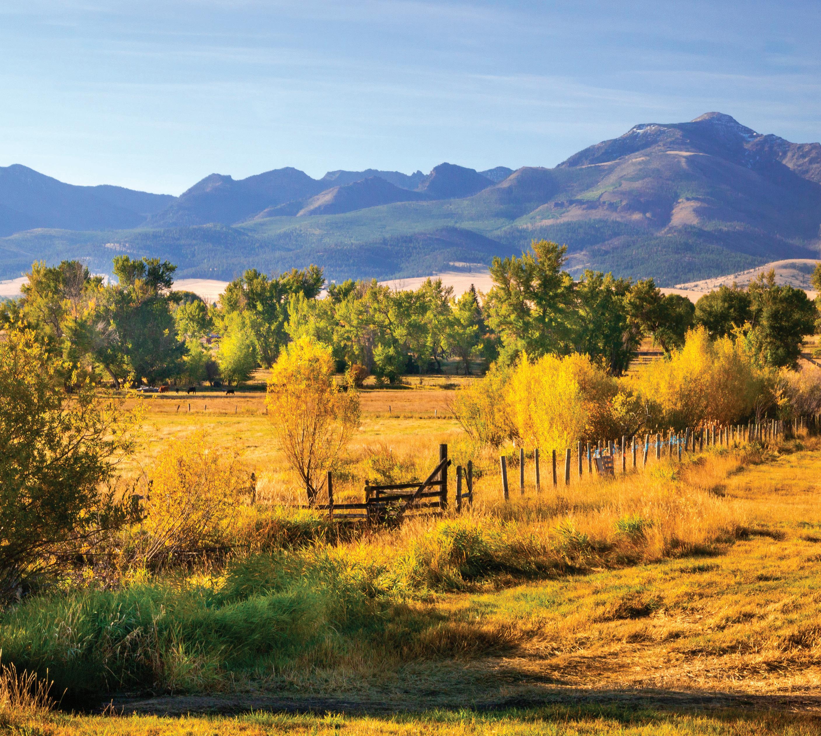
With spectacular views of Strawberry Mountain, Prairie City provides easy access to year-round outdoor recreation. From the Blue Mountains to the Strawberry Mountain Wilderness, the area is surrounded by opportunities for fishing, hiking, biking, hunting, skiing, snowmobiling and camping. Businesses provide a small town “Main Street” atmosphere downtown, and the Prairie City Community Center provides a place to gather. The town has two parks: The city park in the center of town features a playground and picnic area near City Hall, and Depot Park at Bridge and Main streets is home to Depot RV Park and the DeWitt Museum, which houses a collection of local railroad memorabilia as well as other items in the historic Sumpter Valley Railway Depot.
Strawberry Lake is a pristine mountain oasis in the Strawberry Mountain Wilderness. Strawberry Campground is as far as vehicles can travel, and the rest of the trek is on foot. The moderately difficult trail travels about a mile and a half from the campground uphill to the lake. Strawberry Falls is another mile or so up the trail, which is connected to a trail system that traverses the entire wilderness. The campground is about 11 miles south of Prairie City on County Road 60.



Every Saturday, June 21st through October 11th October 17th and 18th Harvest Festival Winter Fest December 12th and13th We offer locally grown produce, baked goods, canned items and lots more. We want to support our local food producers and the entrepreneurs in our community. We envision being a community gathering place on Saturdays.


Elevation: 2,369 ft. Population: 142
On the west end of the John Day Valley, Dayville is rich in Old West atmosphere and small town charm. The town has a variety of amenities, including food and fuel, and the recently renovated Dayville Community Hall provides a wonderful venue for indoor events. The city park along the South Fork John Day River features a large grassy area, horseshoe pits, tennis courts, picnic areas, a playground and a well-kept restroom. Moreover, the area is surrounded by stunning scenery. The Mascall Overlook, about 4.5 miles west of Dayville, offers 360-degree views of the colorful hillsides and is wheelchair-accessible. Farther west is Picture Gorge, named for the Native American pictographs that adorn the steep canyon walls. Beyond is the John Day Fossil Beds National Monument.
South Fork Road follows the South Fork John Day River from Highway 26 to the South Fork Falls. The road turns to gravel, but the well-graded route offers a variety of scenic vistas of the river and rock formations in the canyon. Past the Black Canyon Trailhead, which leads into the Black Canyon Wilderness, South Fork Road meets Forest Road 24 near a bridge across the river. The falls are upstream from the bridge but may not be visible from the road. If you’re in the area in October, you won’t want to miss the Dayville Scarecrow Contest.
For a small community, Mount Vernon is home to a variety of amenities. Phil Boyd Park features basketball and tennis courts, restrooms and a covered picnic area, and the city has installed new playground equipment. A spacious community center and the Mount Vernon Grange host annual events and functions, and Clyde Holliday State Park is only a short drive away. Mount Vernon was named after a resident’s treasured racehorse, said to have lost only one race in his life, and a small stone fort used to protect the steed from being stolen still stands about 2 miles east of town.
Just a mile east of Mount Vernon, Clyde Holliday State Park features a peaceful walking trail along the scenic John Day River. The free day-use area is a popular wayside for motorists, with spacious grassy areas, picnic tables and benches near the river. For a fee, the campground offers overnight accommodations for tents and trailers, and travelers can even stay in one of the two teepees at the park, pending availability. An ADA-accessible pond stocked with trout at the west end of the site provides further recreational opportunities.
103865 Schwab - Page 1 - Composite

Elevation: 4,666 ft. Population:
At an elevation of 4,666 feet, Seneca set the record for the coldest temperature ever recorded in Oregon — negative 54 degrees on Feb. 10, 1933 — earning the nickname “Oregon’s Icebox.” Homesteaders began moving into Bear Valley in the mountains of southern Grant County in the 1880s, but the arrival of the Edward Hines Lumber Co. established Seneca as a thriving logging town in the 1920s. Close to 200 people still call Seneca home, with local businesses offering food and fuel, and a new CyberMill with high-speed internet access. A community park features a baseball field, horseshoe pits, playground, picnic area and restrooms. Seneca is surrounded by abundant outdoor recreational opportunities in the Malheur National Forest. About 10 miles north of town is the Starr Ridge winter sports area, and about 15 miles east is the lovely Logan Valley.
East of Seneca on Forest Road 16, the Malheur National Forest provides hiking, fishing, hunting, camping and sightseeing opportunities. Areas along Forest Roads 1619 and 15 are obsidian sources. Farther east in Logan Valley on the south side of the Strawberry Mountain Wilderness, vivid wildflowers paint the landscape in springtime, and wildlife is abundant year-round. To make a scenic loop around the wilderness, follow Forest Road 16 east from Seneca and turn north on County Road 62 to Prairie City, then take Highway 26 west to John Day.
Elevation: 3,754 ft. Population: 179
Nestled in a high valley of the Blue Mountains in northern Grant County, Long Creek has a small-town aesthetic but enough amenities to make travelers feel comfortable. Businesses offer food, fuel and other necessaries, and the area is near a variety of recreational opportunities, including camping, hiking, biking and water activities. The Long Creek Historical Society is an active group dedicated to preserving and promoting the history of the area, including the neighboring communities of Fox, Hamilton and Monument. The society re-erected Fort Townsend, the Army post built in Long Creek in 1878, and is working to build a museum and interpretive center there to house historical photographs and artifacts. A “Fort Townsend” sign on West Main Street leads to the future site. The fort was originally erected east of town during the 1878 Bannock and Paiute Indian War, and William “Billy” Townsend, a Civil War veteran, defended the installation from the approaching tribes. For more information about the historical society, call 541-421-3621 or visit cityoflongcreek.com/history.
Social Security Pond, about 4 miles west of town, is a tranquil spot for fishing or picnicking. The city park at Main and Allen streets features a basketball court, horseshoe pits, picnic area and playground.
At the western edge of Grant County, far from the frigid peaks of the Blue Mountains, the town of Kimberly was established at the confluence of the John Day River and its North Fork. Kimberly’s low elevation provides a temperate Mediterranean climate with rich growing opportunities. A commercial orchard was established in the 1930s, and people can still buy fruit or pick their own at Thomas Orchards.
The Sheep Rock Unit of the John Day Fossil Beds National Monument to the south provides beautiful views of geological formations, a variety of trails and historical artifacts, as well as a fascinating visitor center. Bull Prairie Lake is about 24 miles from Kimberly, and a bit farther north is the Morrow & Grant County OHV Park, with more than 200 miles of trails for jeeps, quads, side-by-sides and dirt bikes.
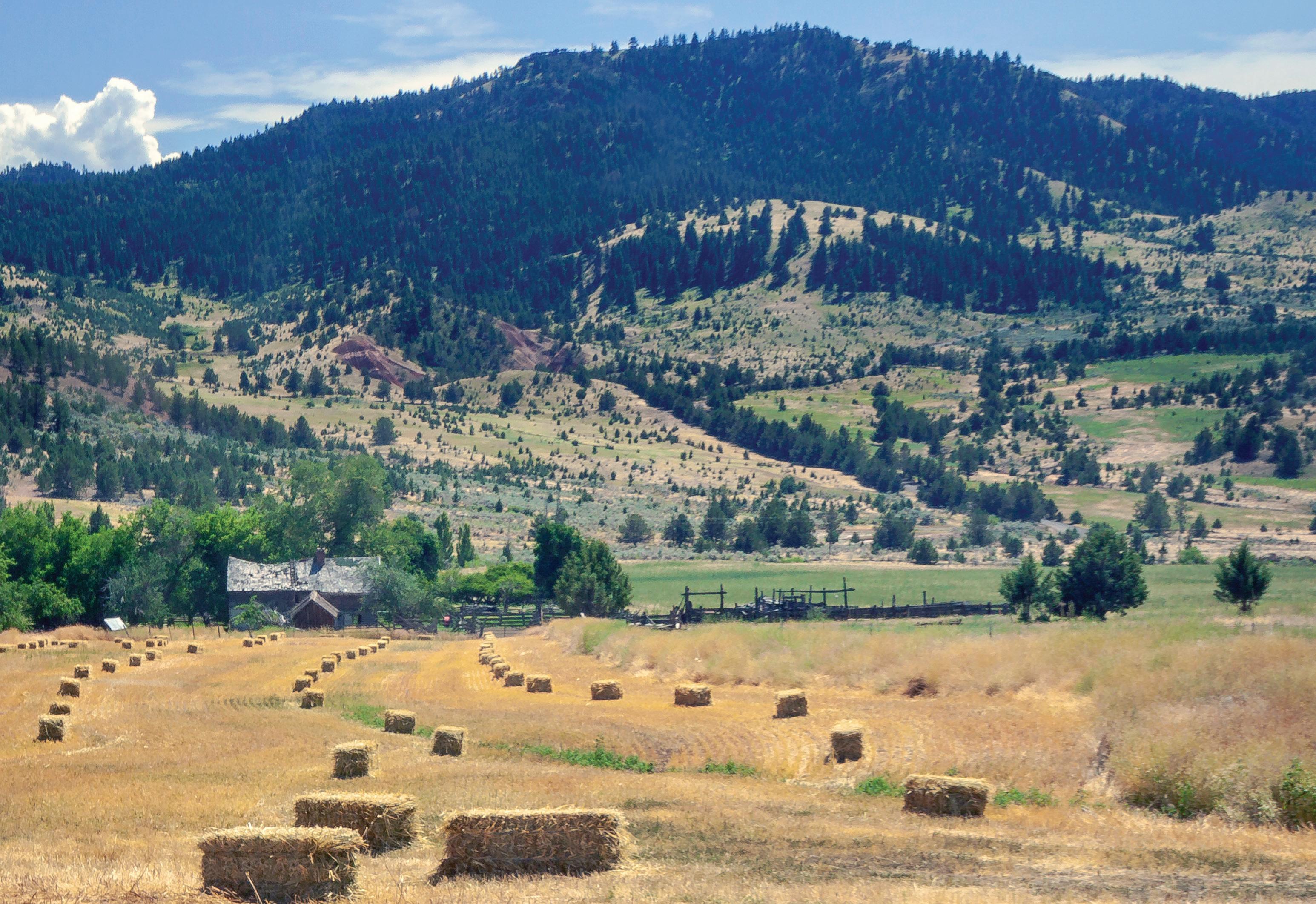
Tucked away in the northwest corner of Grant County, Monument is surrounded by beautiful scenery. Established along the North Fork of the John Day River, the area is rich in fertile ground and offers a variety of activities, including fishing, hunting, hiking, rafting and photography. Red, rocky outcroppings and Sunken Mountain are southeast of town, while Thomas Cavender Reservoir just west of town and Monument River Park to the south provide opportunities for water-based recreation. Meals are served weekly at the senior center, which also hosts community events, and businesses offer food and fuel. A large, shaded park features a playground, basketball and tennis courts, horseshoe pits and covered picnic areas. The town is known for its annual Fourth of July Fun Festival, including a small parade, activities throughout the day and a large fireworks display over the John Day River at dusk.
When the water levels are right in late spring and early summer, after the initial spring flooding has subsided, the North Fork John Day River provides a scenic rafting and fishing experience. Designated as a National Wild and Scenic River, the North Fork features an abundance of wildlife, and interesting rock formations jut out along the river. Rafters can put in near Dale and take out at Monument River Park for a several-day trip or take a shorter float from Monument to Kimberly or Spray. And check out the Buckaroo Festival & Harvest Auction in September.

Story by Bennett Hall | Photos
Riley Gill
Riley Gill was cold, wet — and a little bit worried.
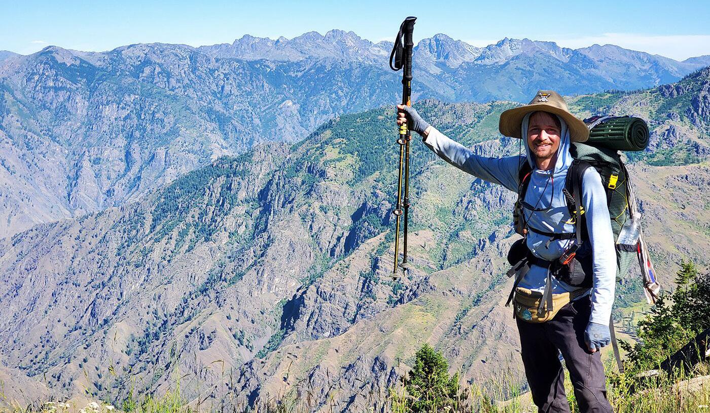
High up in the Strawberry Mountains, the young man from Springfield was a couple of days into an attempt to become just the seventh known hiker to complete the Blue Mountains Trail, a challenging route that connects all the major mountain ranges in Northeast Oregon in a 530mile spiral, resembling a giant question mark, that starts in Joseph and ends in John Day.
Gill was hoping to become the first to complete the route in reverse, starting from the John Day end and hiking south to north. He was also tackling the trail earlier in the year than most might deem wise, starting in late June to take advantage of cooler temperatures rather than waiting until August or September.
His first challenge was the Strawberries, which still had significant amounts of snow in the upper elevations, especially on north-facing slopes. And after an unusually wet spring, storm systems continued to roll through the area.
On Day 2, he had to navigate a 10-to-15-foot snow cornice in the pass below Strawberry Mountain. On Day 3, a torrential hailstorm soaked him to the skin and chilled him to the bone. But Gill, an experienced long-distance hiker, was confident that if he could just make it through the Strawberries, the rest of the trip would be manageable.
“The whole Strawberry Wilderness there was awesome,” he said in a post-hike interview. “It was beautiful — but I was making sure I got out of there safe.”
The idea of a long-distance hiking trail showcasing Northeast Oregon’s most spectacular landscapes has been around since the 1960s, according to the Greater Hells Canyon Council, the nonprofit conservation group that spearheaded the trail’s creation. Planning began in earnest in the ’70s, but it would take another half-century of work by dedicated volunteers to complete the route.
The Blue Mountains Trail officially opened in 2021. No new trail was built in the process. Instead, the organizers stitched together existing trail systems with segments of road and a few sections of hiker-tested cross-country travel into a single route that looks like a giant backwards question mark with a few extra curves and wiggles thrown in.
The scope of the trail is breathtaking.
The route links all four of the region’s major mountain ranges — the Strawberries, Greenhorns, Elkhorns and Wallowas — as well as vast stretches of canyon country along the Washington and Idaho borders, including a dive into Hells Canyon, the deepest gorge in North America.
It traverses seven wilderness areas — Strawberry Mountain, Monument Rock, North Fork John Day, North Fork Umatilla, Wenaha-Tucannon, Hells Canyon and Eagle Cap, the state’s largest.
It rambles through ancestral lands of the Nez Perce, the Confederated Tribes of the Umatilla and the Confederated Tribes of Warm Springs, and it takes travelers through a crucial wildlife corridor that connects ecoregions of the Cascades, the Rockies, the Great Basin and the Blue Mountains.
The trail remains a work in progress. The Greater Hells Canyon Council has put out an online survey (www.hellscanyon.org/blue-mountainstrail) asking for feedback from trail users as well as business owners, community members and public officials in the towns it passes through in an effort to make the Blue Mountains Trail experience better for everyone.
And while there are no plans to build any new miles of trail (roughly 45% of the route uses remote two-track forest roads), organizers hope to make the route easier to follow by signing it with the Blue Mountains Trail’s rounded-triangle logo, which depicts a bighorn sheep against a mountain-and-canyon backdrop. Meanwhile, the U.S. Forest Service and groups such as the Blue Mountain Land Trust’s Blues Crew and the Wallowa Mountain-Hells Canyon Trails Association are working with the Greater Hells Canyon Council to schedule regular trail maintenance work parties.
“It was designed as something that would bridge the gap between recreation and conservation,” Megan Keating, the council’s development director, said of the trail.
“By putting our region on the map and highlighting this amazingly diverse ecoregion, (the hope is) it would inspire people to love it and want to protect it.”
Born in Colorado, Gill got his first exposure to Eastern Oregon during a memorable car trip when he was 13. The area’s majestic scenery made a lasting impression.
“It was such a magical landscape,” Gill recalled. “I remember thinking, ‘I’ll be back someday.’”
True to his word, Gill moved to Oregon in his 20s, landing in Springfield and finding work with Yogi Tea, a Eugene company that makes a line of green, black and herbal “wellness” teas.
By that time, Gill (aka “Rabbit,” his trail name) was already an accomplished hiker of long trails, and his feet were itching to do some more.
He had previously tackled the 486-mile Colorado Trail and had his eye on the Continental Divide Trail, which follows the crooked spine of the Rocky Mountains for 3,000 miles from Mexico to Canada, before the COVID-19 pandemic scuttled that plan.
Since arriving in Oregon, he had completed the 40-mile Timberline Trail loop around Mount Hood and the 60-mile Corvallis to the Sea Trail.
And last year, he and a friend traversed 500 miles of the 750-mile Oregon Desert Trail before cutting their adventure short in the face of a major heat wave.
“It was getting life-threatening at that point,” Gill said.
But that trip set the stage for his Blue Mountains Trail hike. Renee Patrick, the Oregon Desert Trail coordinator and a long-distance hiker who goes by the trail name “She-ra,” had a hand in designing the Blue Mountains Trail and became the first person to do the whole route solo in 2020, a year before its official opening. < Story continues on page 62 >

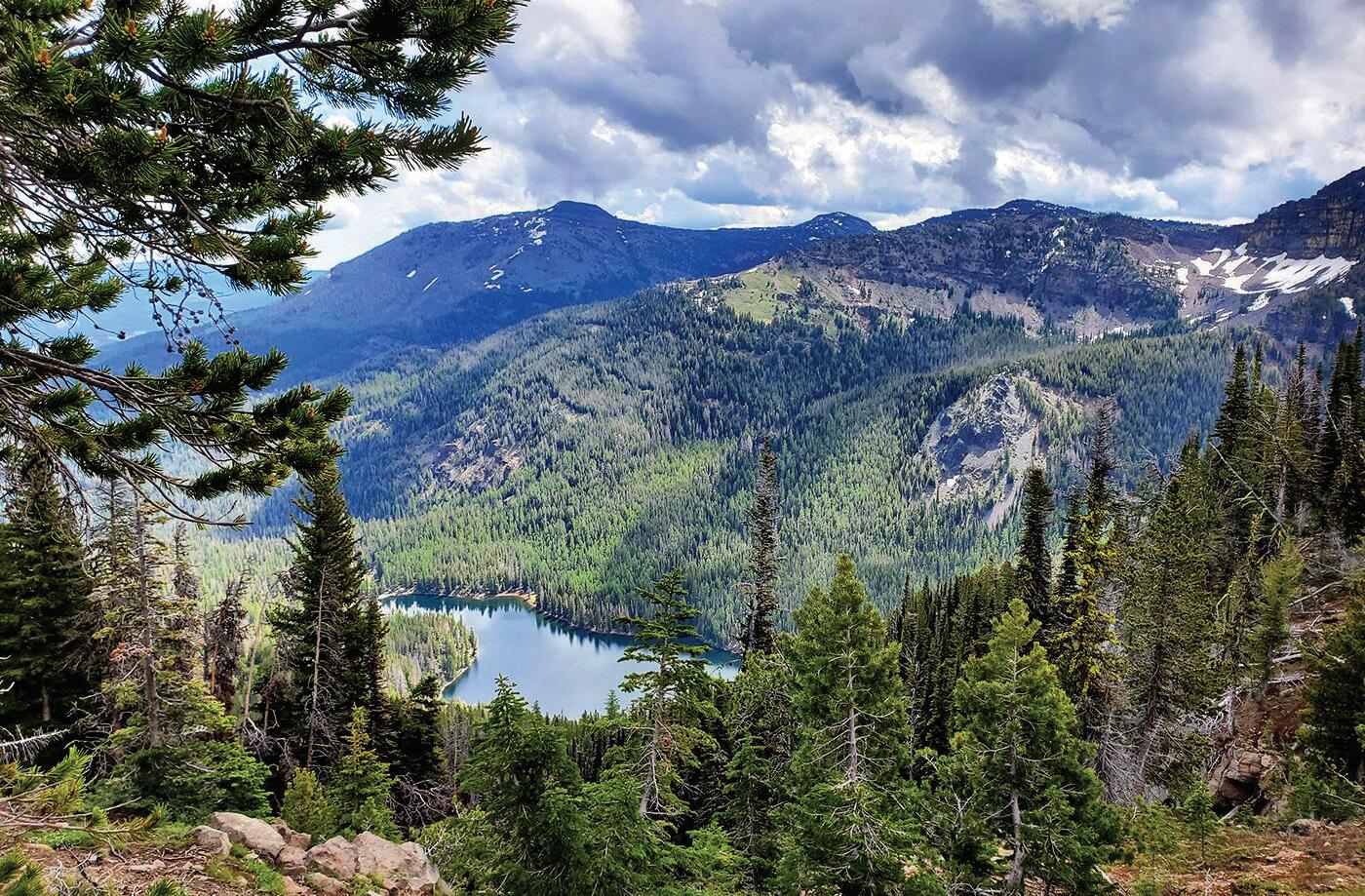
Early in his trek, Gill was challenged by lingering snow and torrential hailstorms as he traversed the Strawberry Mountain Wilderness in June 2023. This photo shows a view of Strawberry Lake from just below Strawberry Mountain.
Gill credits Patrick with providing him much of the background information and firsthand trail intel he needed to plan his Blue Mountains Trail adventure.
“She helped me a lot with logistics, maps and stuff,” he said.
As with most long-distance hikes, the logistics of trekking the Blue Mountains Trail can be daunting. There is a limited number of places along the 530-mile route where stocking up on supplies is practical, meaning hikers have to carry everything they need on their backs between those points.
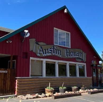
Gill chose four resupply points, starting with Austin House, roughly 100 miles into the trek, where he mailed his first box of supplies. Other resupply points were at Sumpter, La Grande and Troy. After Troy, though, there’s really no practical place to restock along the route until the terminus in Joseph — a distance of 182 trail miles.
“That last section is huge,” he said. “That’s an eight-day carry.”
Gill started the journey on June 23 and finished on July 23, taking a couple of “zero days” (when he stayed in town and slept in a hotel bed) along the way and averaging around 19 miles a day.
Like many long-distance hikers, Gill has adopted a “fast and light” strategy, keeping the weight of his gear to a minimum in order to be able to cover long stretches of ground each day. He carries an ultralight
backpack from ULA Equipment, keeps the rest of his gear as light as possible and doesn’t carry anything he doesn’t really need.
His base weight — the weight of his pack and its contents, not counting food and water — is 13½ pounds.
“That last section, from Troy to Joseph, with eight days of food, was the heaviest my pack’s ever been,” Gill said. “I’d say it was 27 to 30 pounds after resupply.”
For Gill, the toughest part of his Blue Mountains Trail adventure was pushing through the challenges of those first few days.
The initial climb from John Day to the crest of the Strawberry Mountains — about 6,000 vertical feet — was one of the biggest of the entire trip. Then came that tricky snow cornice on the second day, followed by a series of thunderstorms that dogged his steps for the better part of a week.
“I knew if I got past the Strawberries,” he said, “I should be able to get through the whole trail.”
And he was right.
Some of the other challenges he had expected to encounter by starting so early in the season — dangerous crossings of snowmelt-swollen streams or high-elevation trails blocked by snow in the Wallowas — failed to materialize.
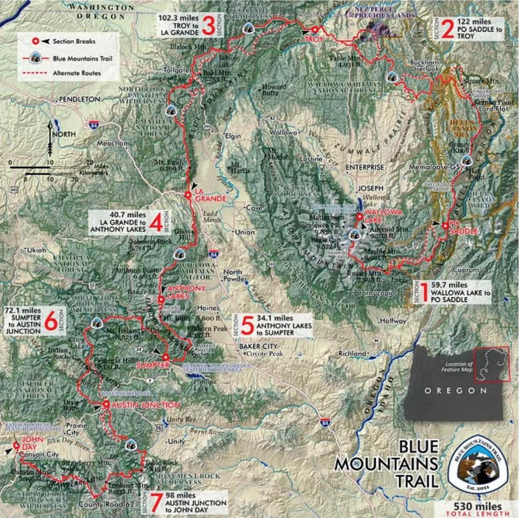

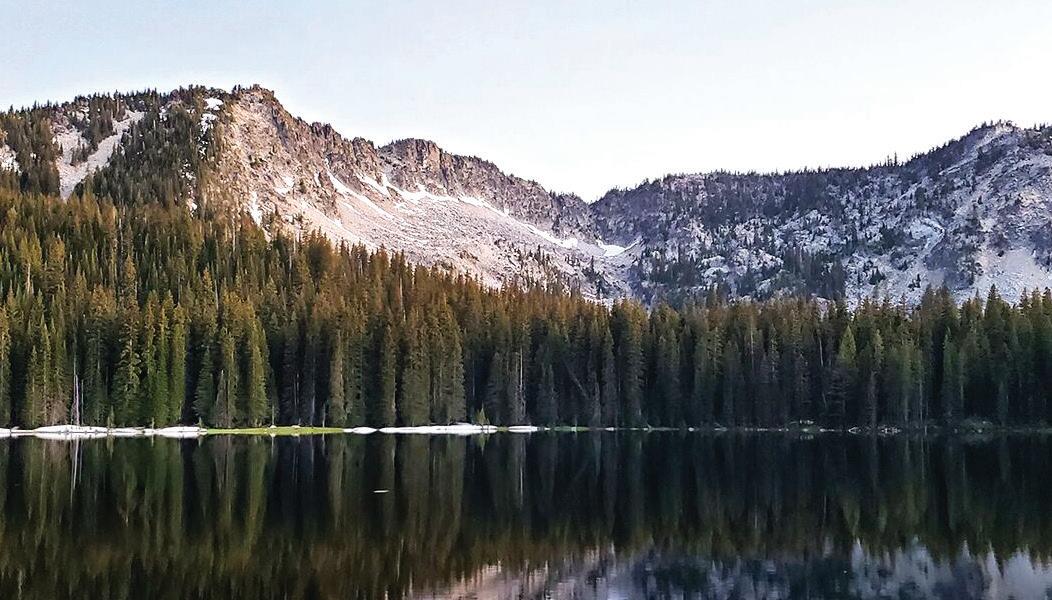
Other difficulties he met and surmounted as they came up.
“The trail’s really new, so a lot of it’s not as well-maintained as I would have liked,” he said. “There were lots of blowdowns. Going that early in the season, a lot of trail crews hadn’t gotten out yet.”
There was more road-walking than he was used to, including one exceptionally long stretch between Tollgate and Troy, but that turned out not to be a problem.
“It’s kind of hard to complain when the road is, like, 60 miles overlooking a valley and you meet one person the whole time,” he said.
The trail has a few short sections that require hikers to do some cross-country navigation, but his route-finding skills were up to the task.
He had a few days where the mercury climbed above 100 degrees, but he dealt with that by finding a shady place to rest during the hottest hours of the afternoon. Even the mosquitoes cut him a break.
And there were some truly magical moments along the way, Gill said.
He turned 29 a week into the journey, shortly after his first resupply at Austin Junction, in the vicinity of Vinegar Hill in the Greenhorn Mountains.
“I celebrated by sleeping in till 9 a.m.,” Gill said. “I also found a heart-shaped belt buckle that I carried with me as a spiritual talisman the rest of the trail. I still have it today.”
A few days later, he arrived in Sumpter just in time to catch the town’s Fourth of July celebration.
“I met some Squatchers,” Gill said. “They were playing drums and wind flutes and getting real spiritual about it. It was so cool!”
And the whole trail was a highlight reel of spectacular landscapes. Gill cited parts of the Strawberry Mountains, the Elkhorn Crest, Baldy Lake in the Greenhorns and the high Wallowa peaks as some of his personal favorites.
“(But) the best experience of the whole trip was dipping down from Buckhorn Lookout into Imnaha Canyon,” he said.
The view was so expansive, and the drop from the lookout into the canyon bottom so precipitous, that he started getting vertigo.
But while the rewards of thru-hiking the Blue Mountains Trail were many, he added, they wouldn’t have seemed so sweet without the obstacles he had to overcome.
“The Blue Mountains Trail is the most perfect trail, in my mind,” Gill said.
“It was so special — the ups and downs, from thunderstorms to beautiful days — and that’s the way an adventure should be.”
Blue Mountains Trail
For complete information on the Blue Mountains Trail, including route maps and other resources, go to hellscanyon.org/blue-mountains-trail.


The Grant County Health Department provides a wide range of public health services with a focus on public health modernization. Services including collecting and reporting of health statistics, emergency preparedness planning, environmental health services - restaurant, pools and hotel inspections, Health promotion and disease prevention, age-appropriate public health servicesimmunizations, maternal and child health services, WIC and communicable diseases testing and treatment. The Health Department also houses a Rural Health Clinic which allows us to provide primary care services.
Business Office Hours Monday-Friday 8-5 Phone 541-575-0429

Grant Union School-Based Health CenterLocated at the Grant Union Jr/Sr High School provides primary and behavioral health services onsite to all students and Faculty of Grant County Schools. The SBHC is staffed with a Family Nurse Practitioner and Mental Health Counselor. 911 S. Canyon Blvd John Day OR 541-575-0366 Tuesday-Thursday 9-2

Prairie City School-Based Community Clinic-located in the Bates Building at the Prairie City School provides primary care services including acute and chronic health care needs, sports physicals, and immunizations to student and community members 740 Overholt Ave Prairie City OR 541-844-4414 Call for an appointment